2025 was a good year for us from a travel perspective. We stayed home, so to speak, and limited our wandering to Hawaii, the Southwest, and New England. Now we have the itch to go abroad again. We’ve chosen three areas known for their beauty, culture, wild areas— and relative safety: Costa Rica, Scotland, and Bali.
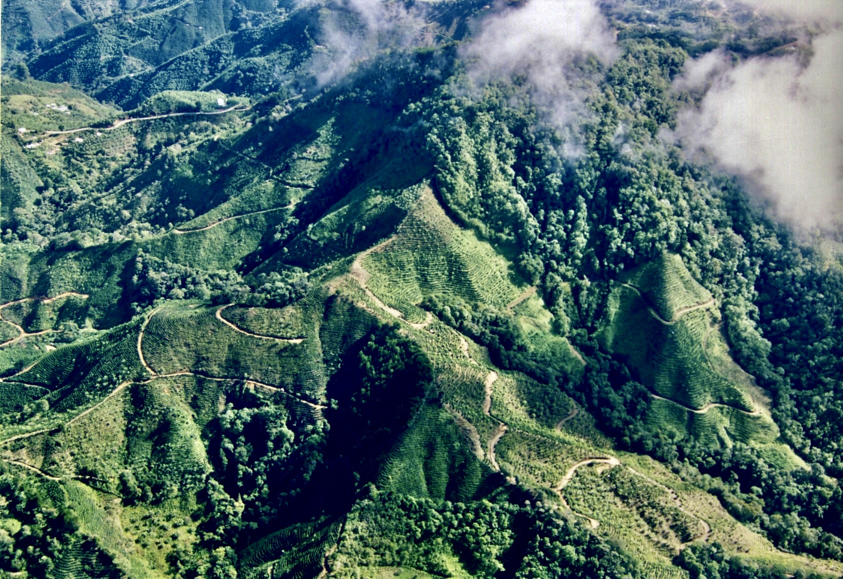
First up: Costa Rica. We took the above photo when we were in a small plane flying back and forth across the country on a tour in the 90s. This year we will be renting an SUV with high clearance and driving ourselves. The country roads can be challenging— even in the dry season! Peggy and I will be going there for the month of March. Our son Tony and his family will join us for a week in Monteverde.Next up, we will be visiting Bali. I visited in 1976 as part of a six month tour of the South Pacific. I’d lost my camera in Fiji, so I don’t have any Bali photos. I brought a painting home instead. The region is known for its colorful art. This one depicts a rice harvest. The woman on top is making an offering. It’s important to keep the gods happy. We will be there in May. Our grandson Ethan will join us for a week.We met this fellow in Scotland when we were doing family genealogical research in 2014. He had positioned himself in the middle of the narrow road we were driving on for about 10 minutes before finally moving over to the grass. Peggy and my families were Lowland Scotch so we were in the southern part of the country. This year we are visiting the highlands, coastal regions and islands of the north in late June and July. We will be checking out castles and looking for Nessie, the Loch Ness Monster. Our grandson Cody will be joining us for two weeks. We are planning to hop over to Northern Ireland after Scotland.
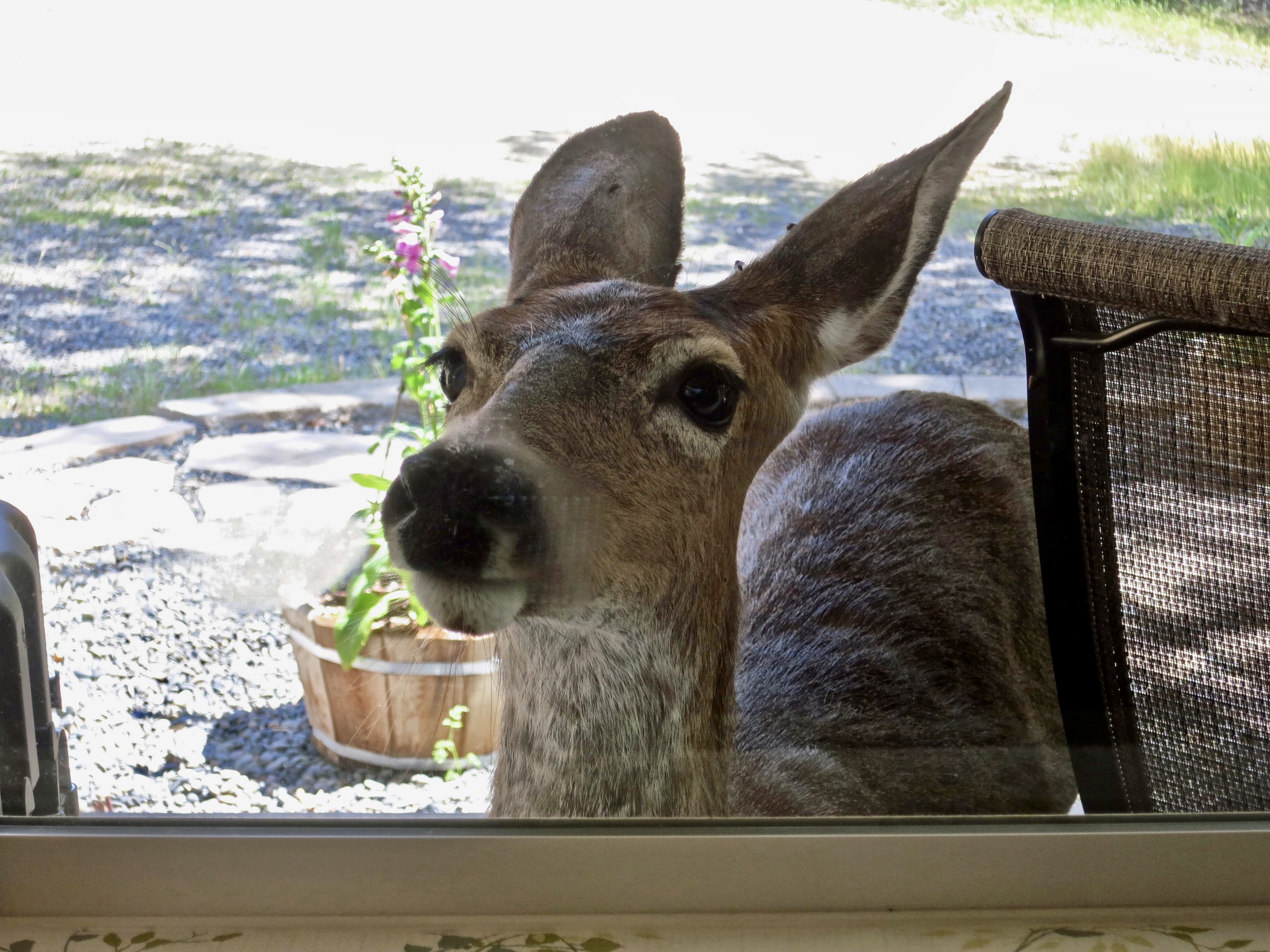
Naturally, we will be blogging about our journeys. But there is more, as they always say on late night TV ads. Or at least they used to. Peggy and I don’t stay up that late and most of our TV time is streaming without ads. I am continuing our focus series over the next two months and beyond. “Oh Deer” is my next one. I’ll be featuring the herd that lived in our backyard in Oregon and liked to stare at us through the windows.
A not unusual sight!
And finally, I’ll be offering a new series I’m calling “Ut-Oh” where I will be pulling together posts that I have included on my blog over the past 15 years plus new material featuring my more serious/humorous misadventures in my life. I’ll do an introduction to it next week.
The question here is why should such an innocent looking child be kicked out of the first grade for a year. My first post will answer the question plus relate how a caterpillar I was using to cut a road fell off a cliff— with me on it.
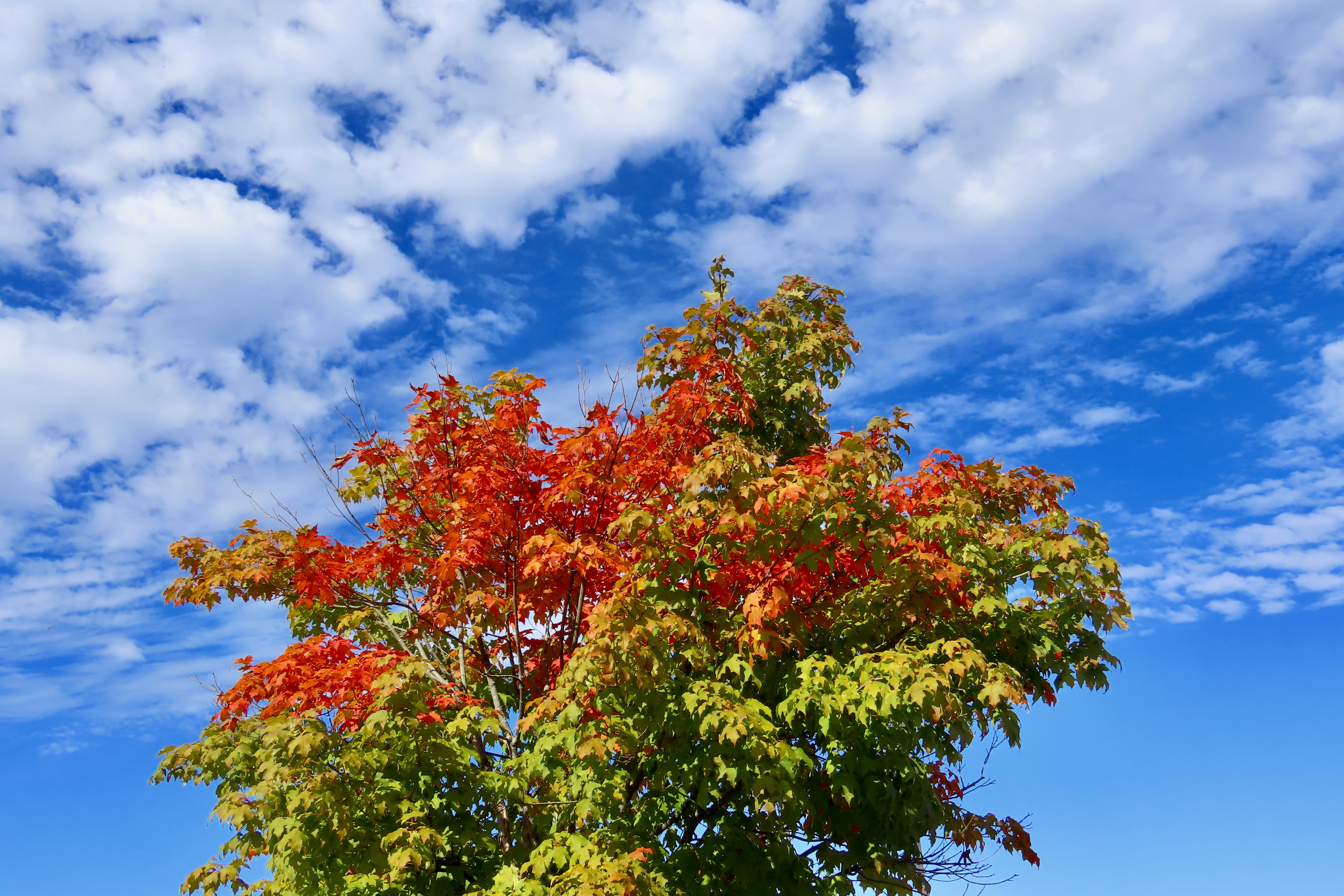
Our 2025 wrap-up is based on three trips we made during the year and blogged about. The first was Hawaii, which I posted two weeks ago. The second was our Southwest journey that I posted last week. Today we are covering our third, and final trip of the year: The leaf-peeping drive through New England in October and November.
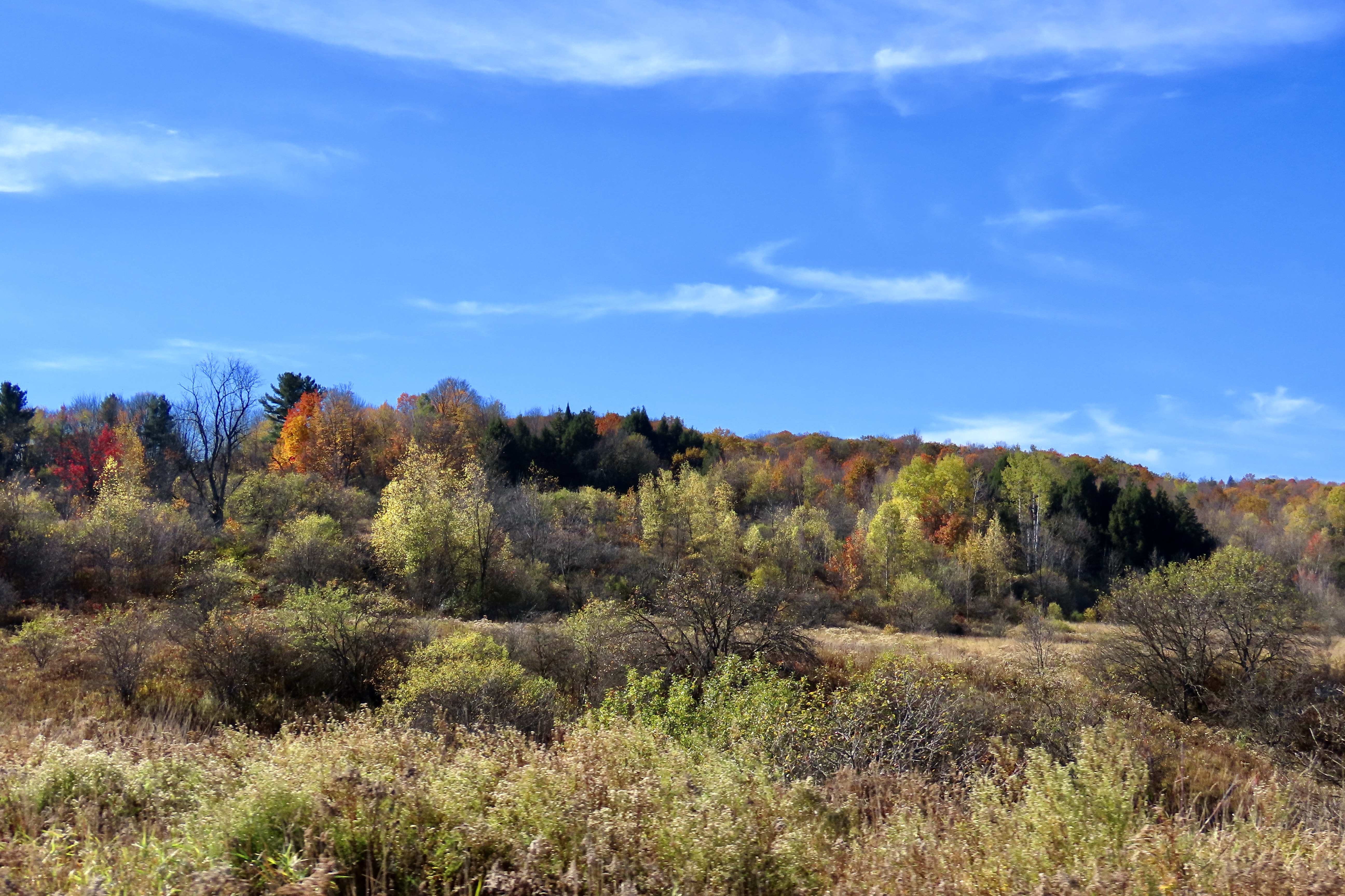
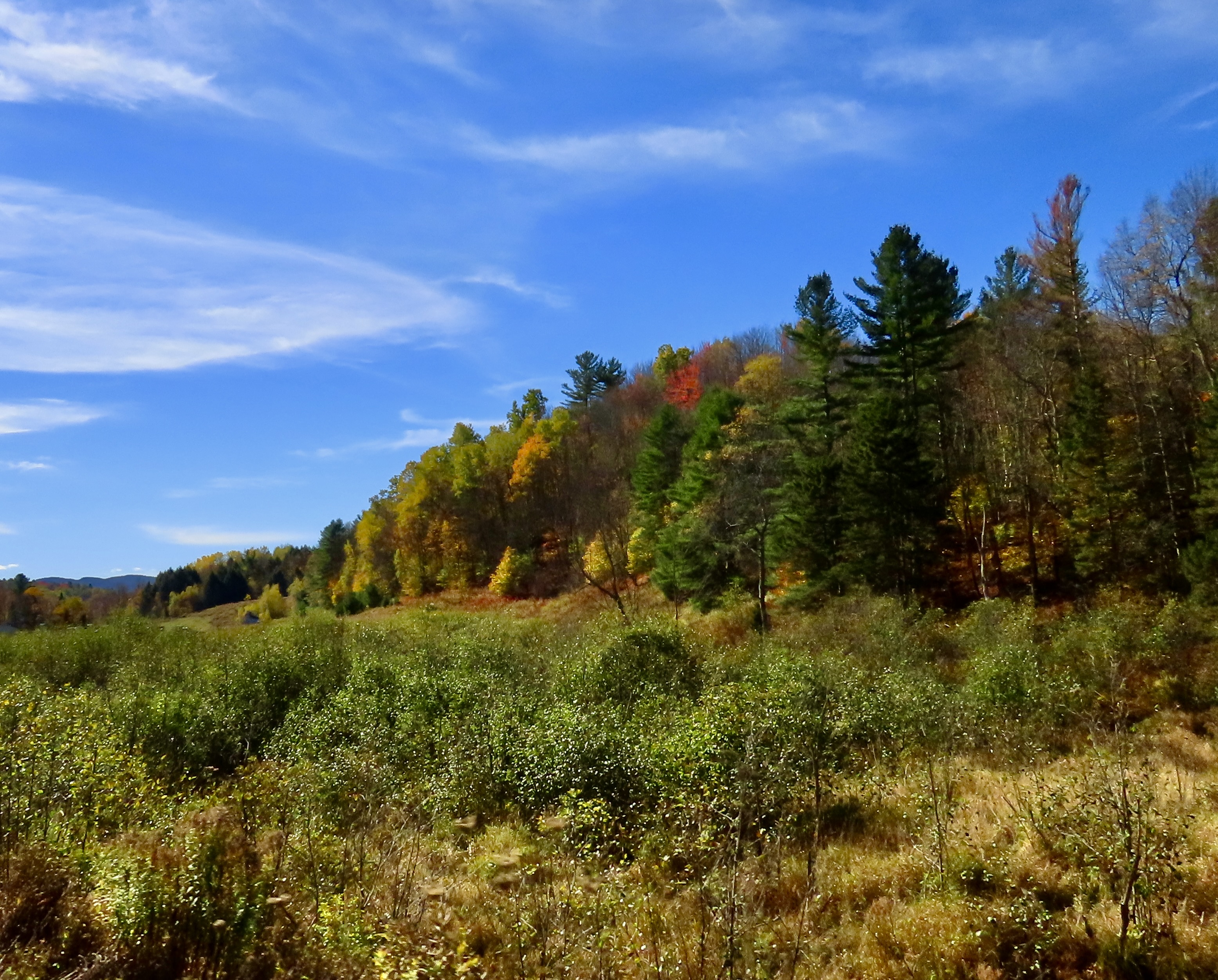
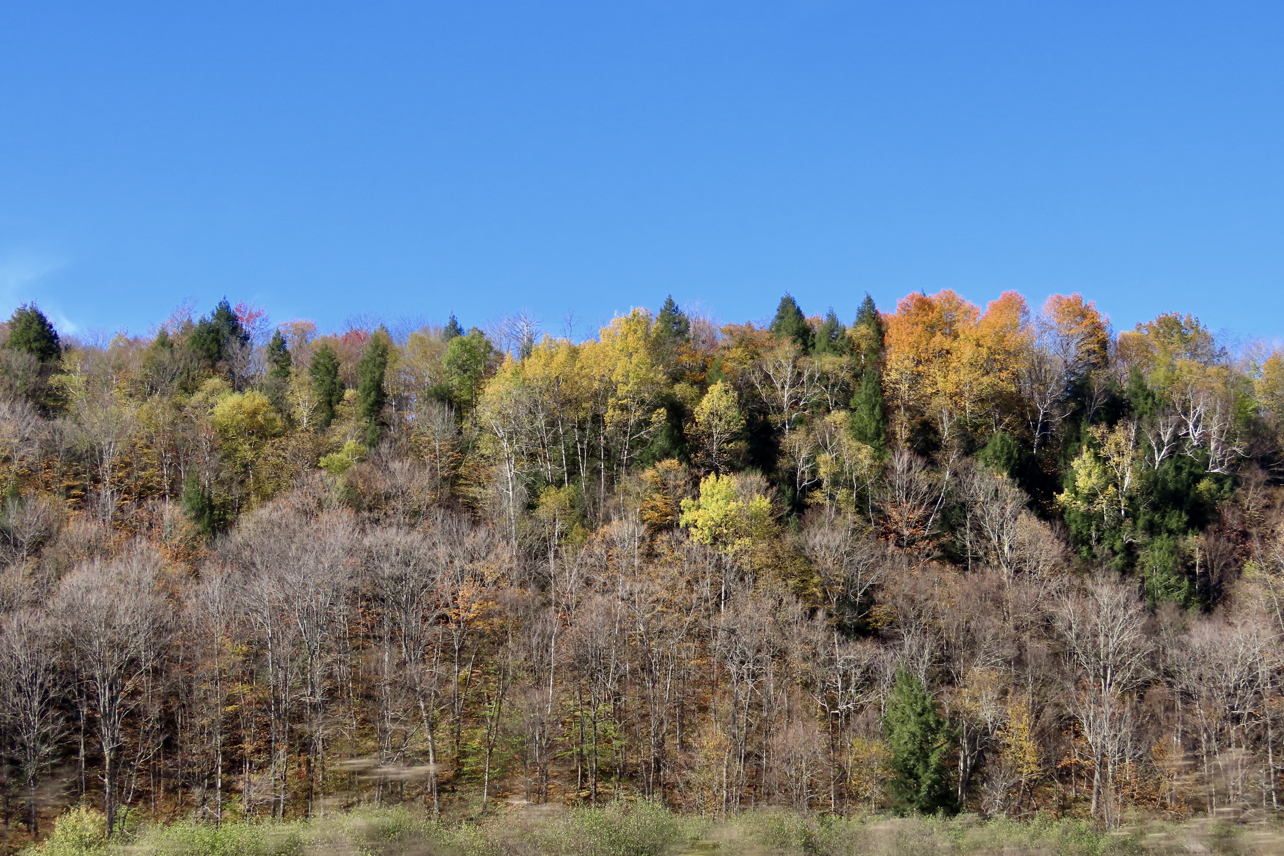
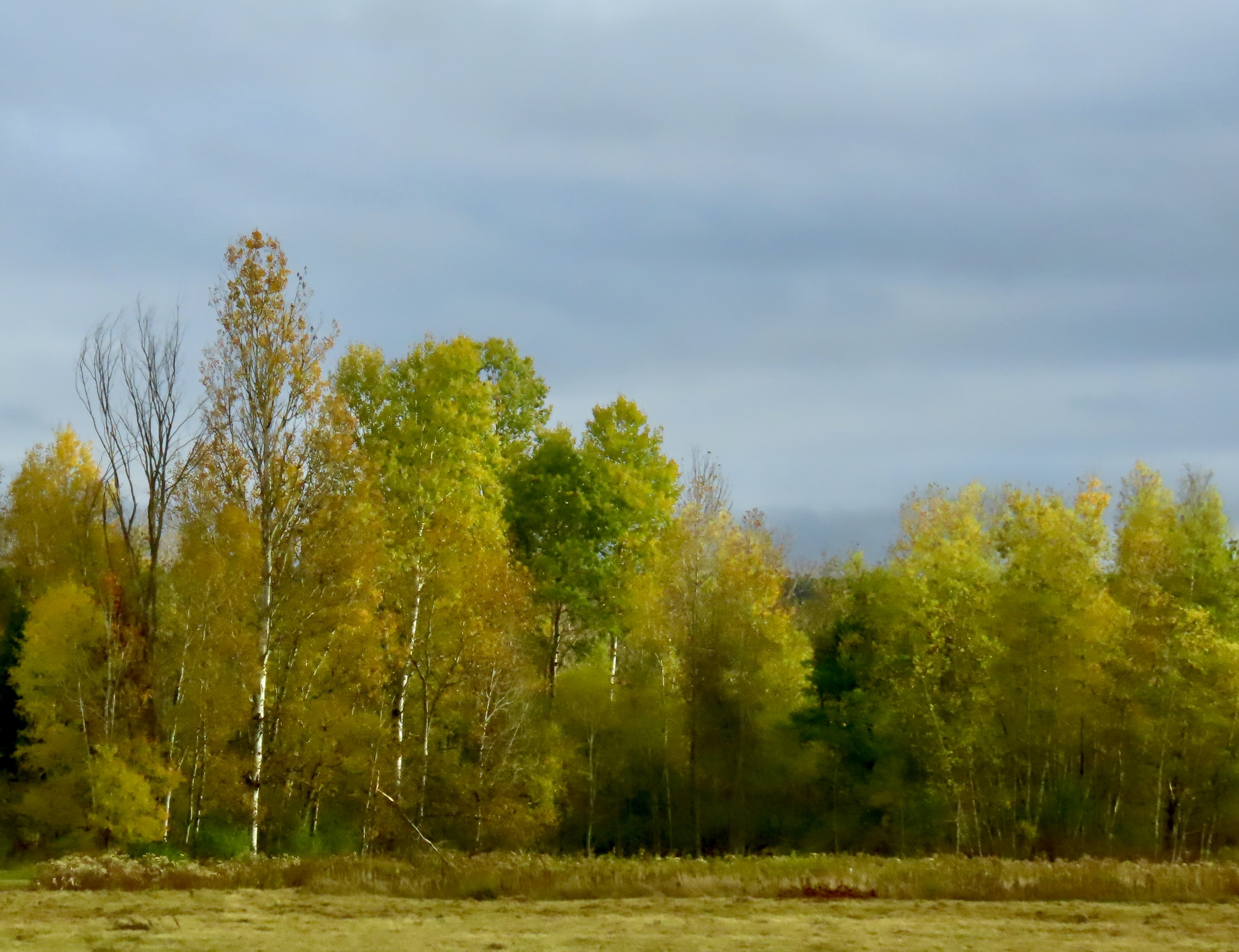
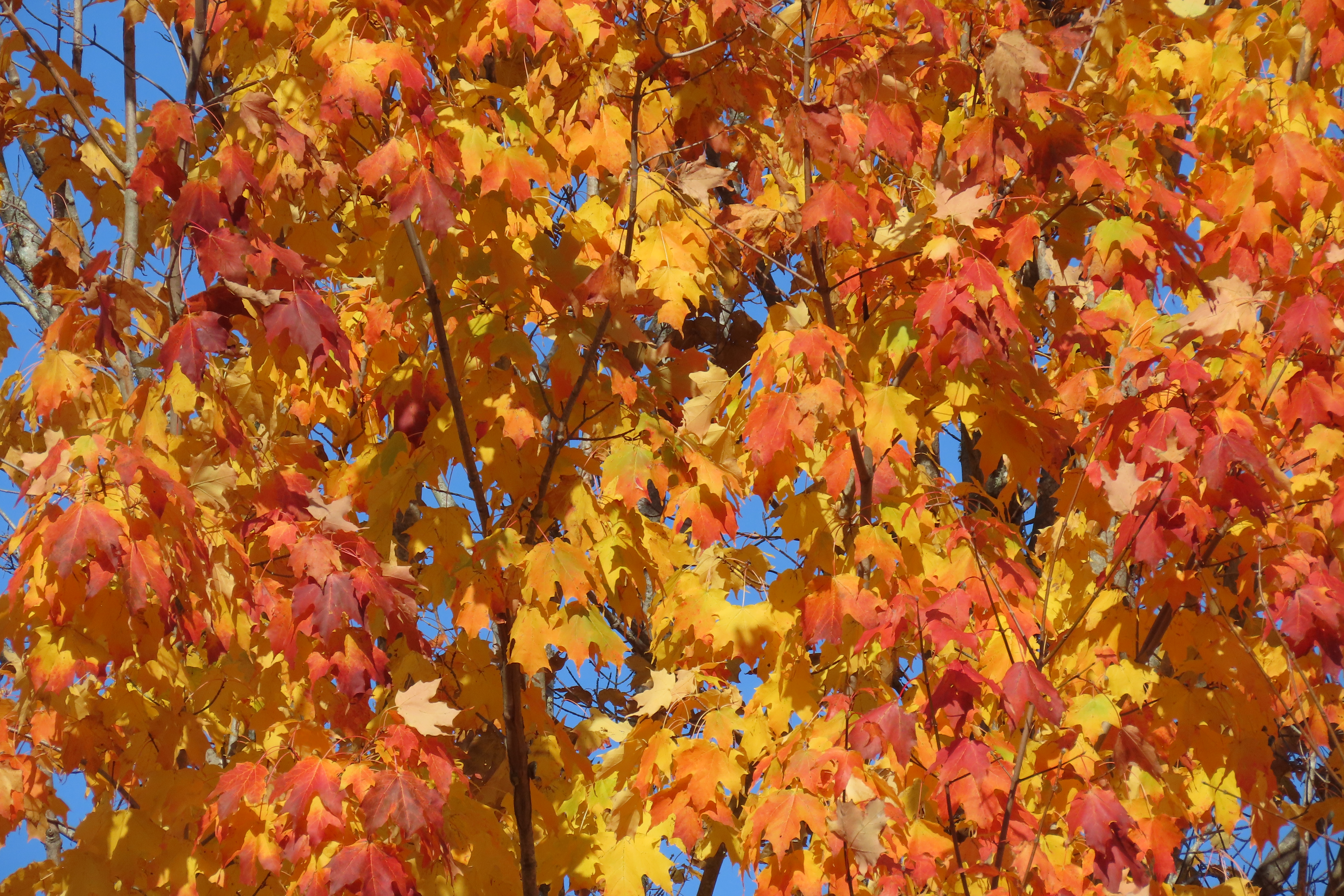
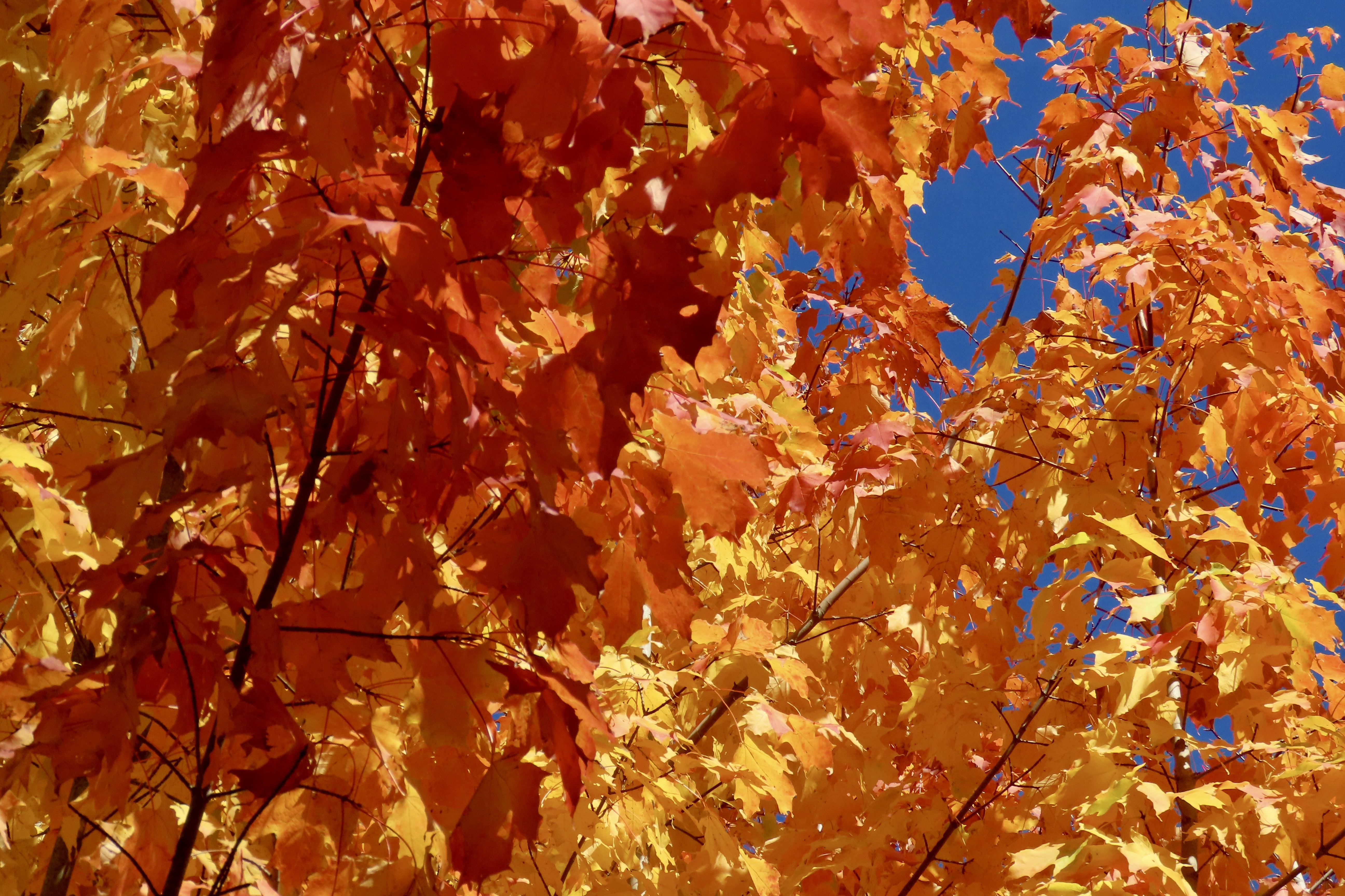
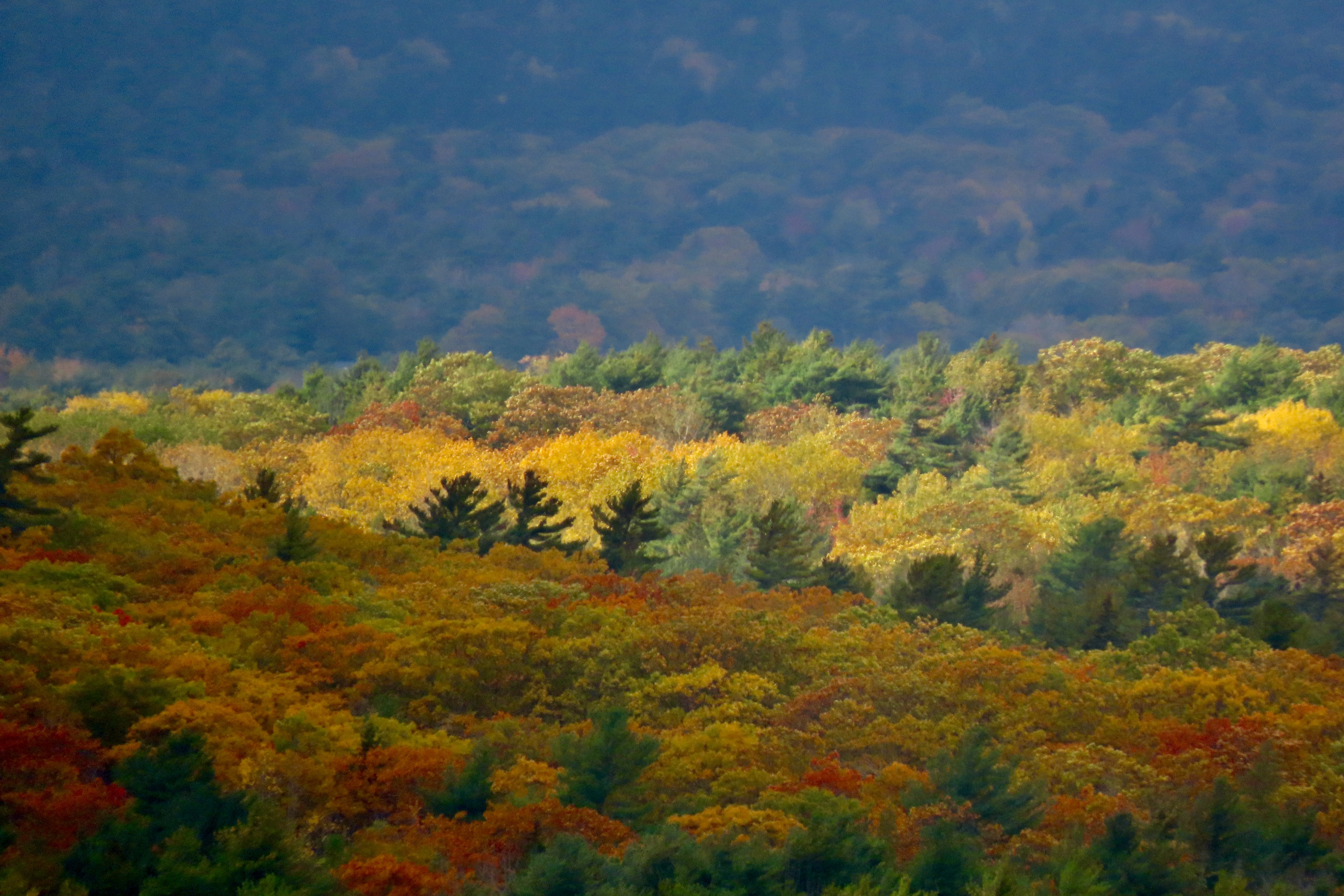
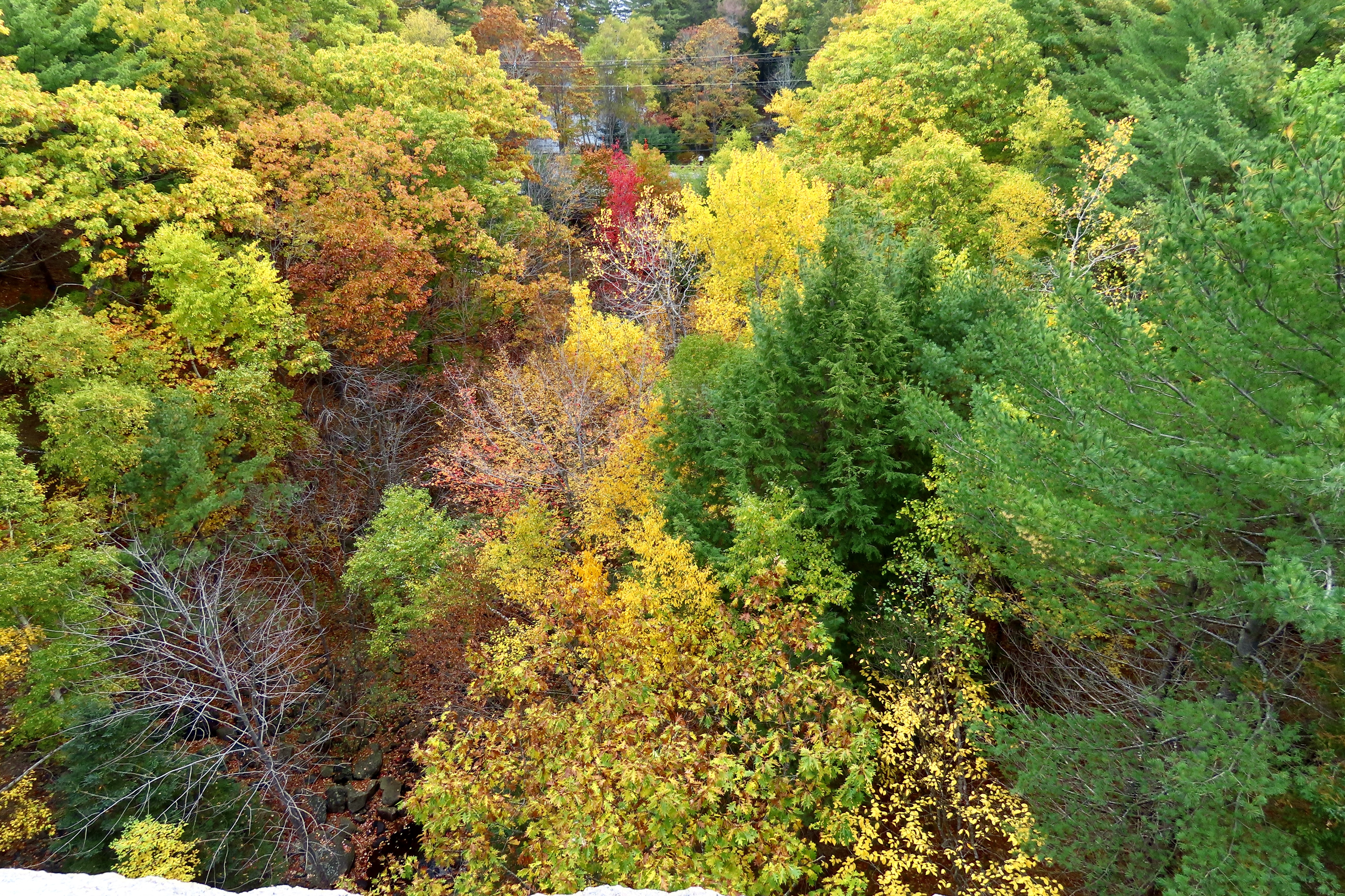
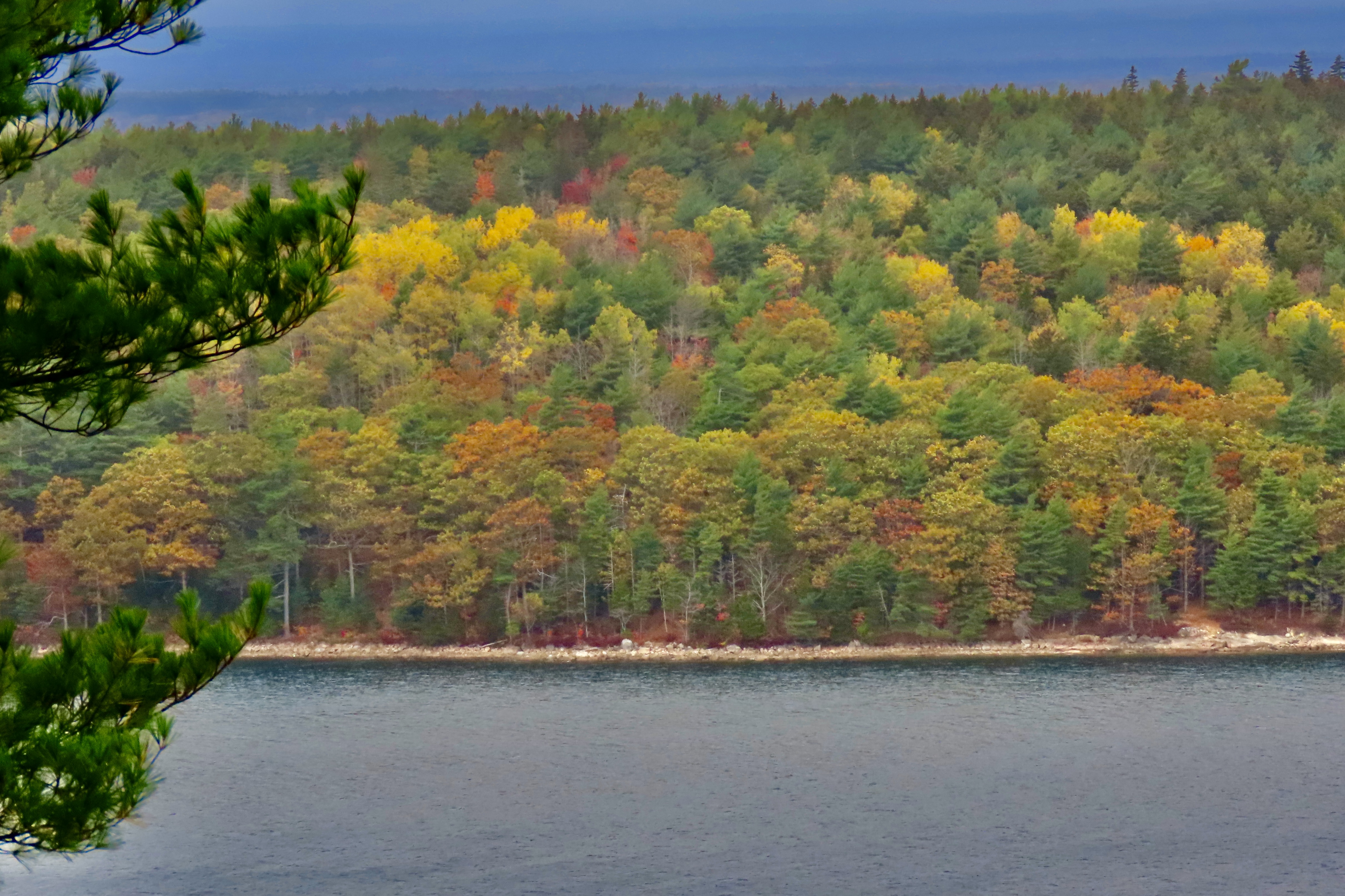
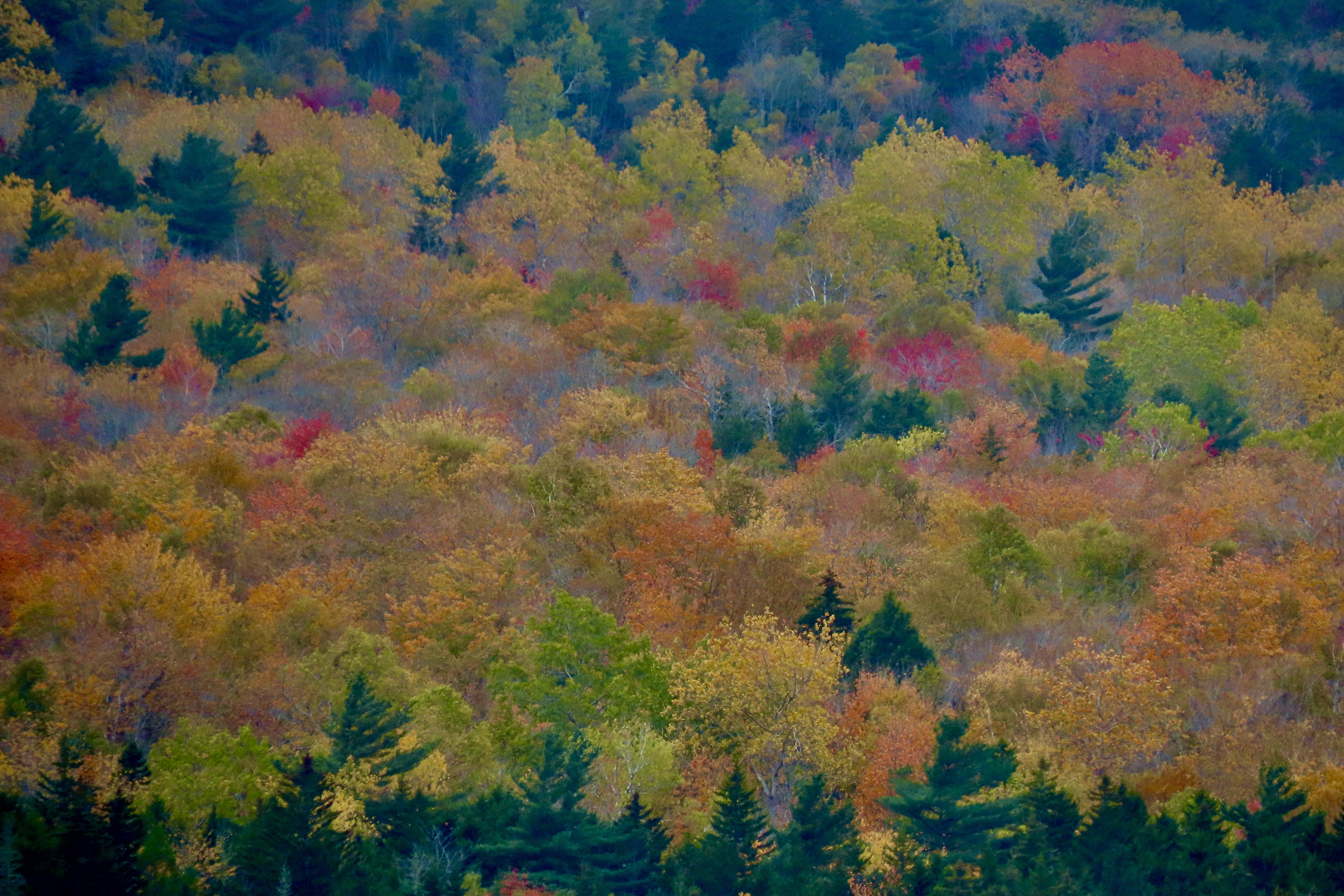
While the photos we selected for the Hawaii and Southwest were ones we chose to use in our annual family calendars, this one is different. Because our New England trip was recent, I’ve selected photos not used in the calendars. Most were also not used in our blogs—sort of a third level, so to speak. But, in New England, even ‘also-ran’ is colorful!
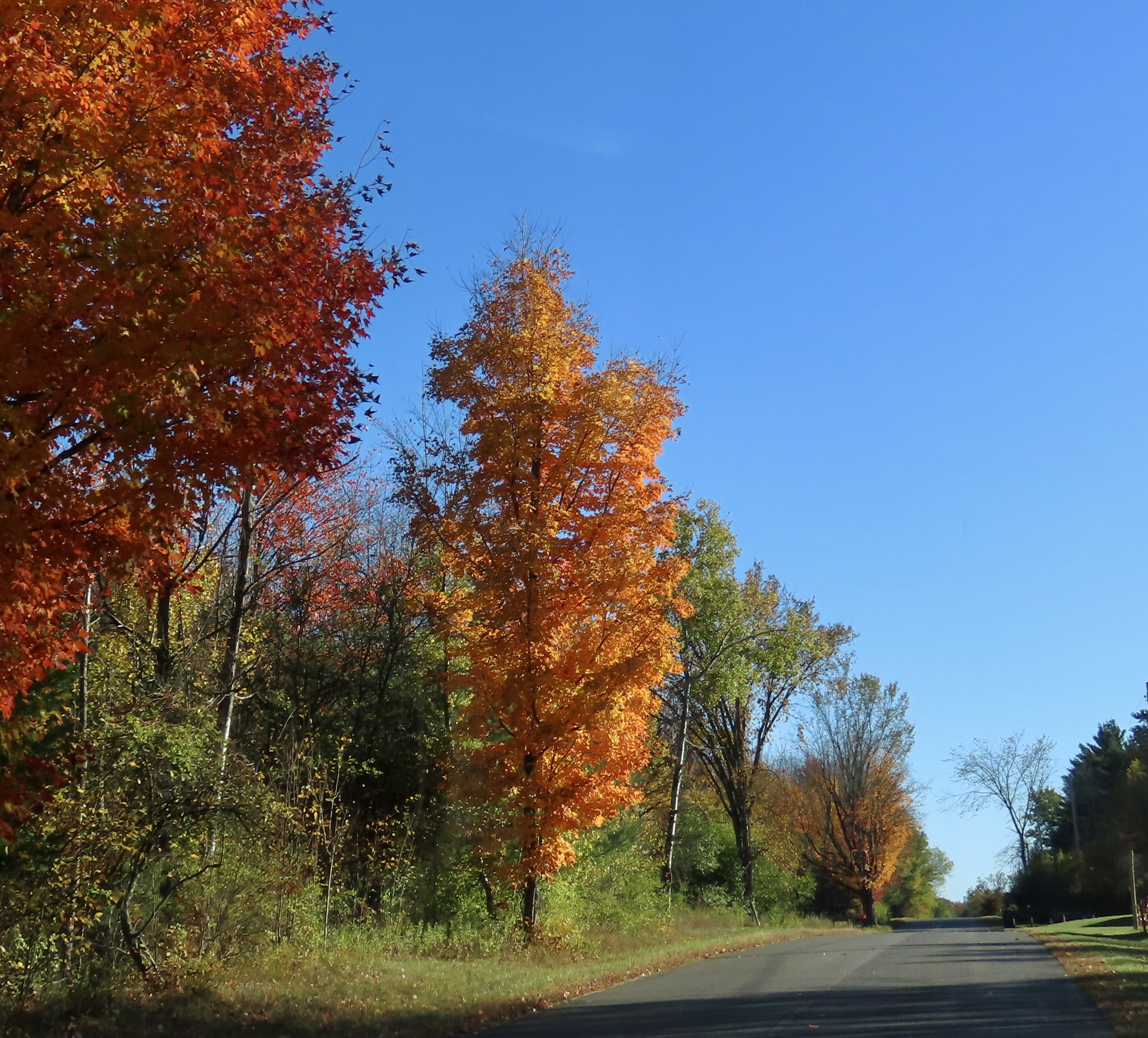
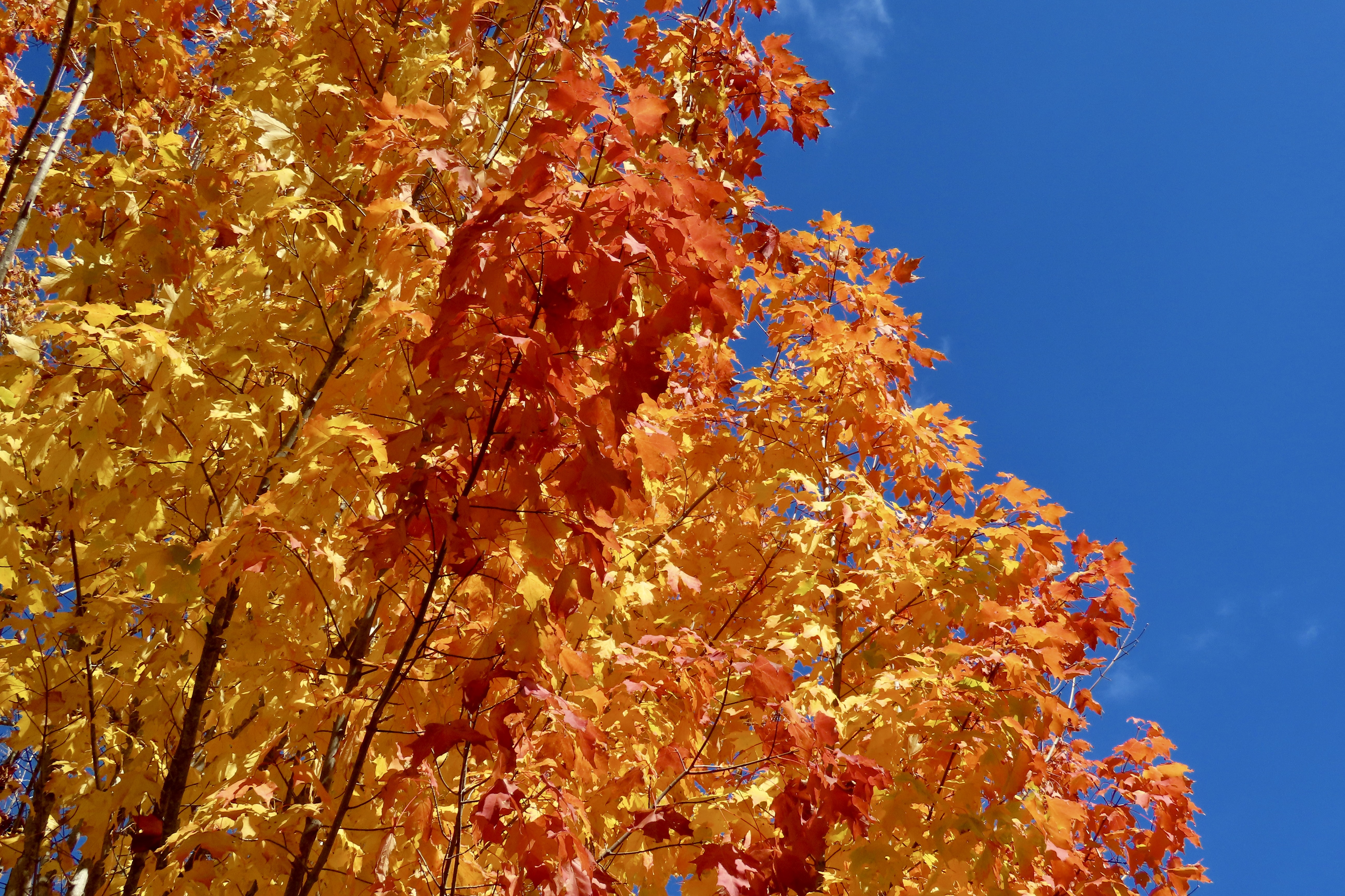
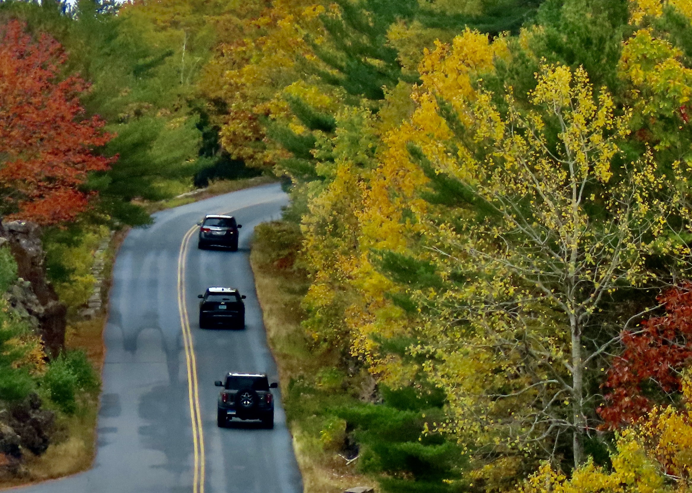
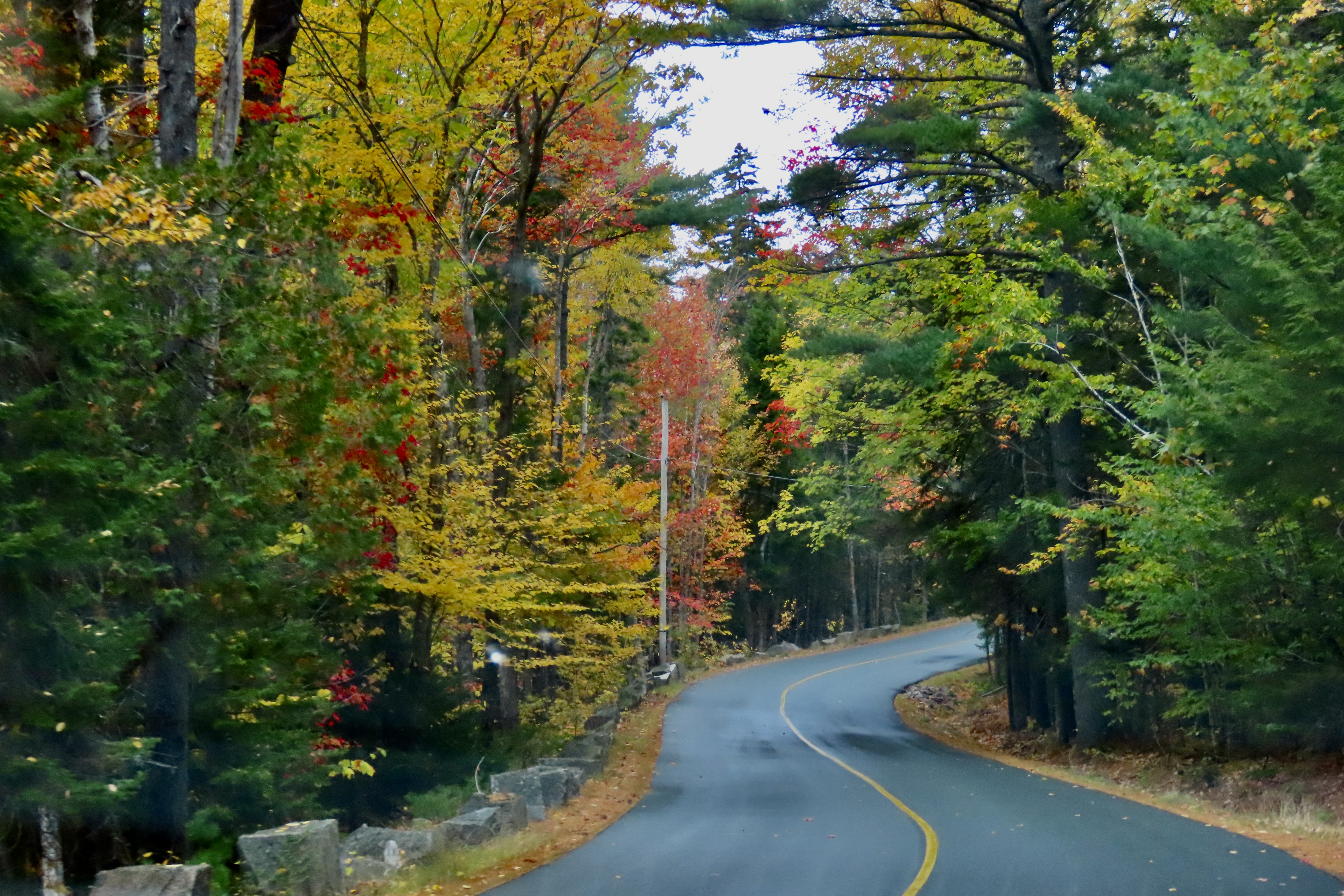
Drive down any country road in New England at the right time in the fall and you will see what leaf peeping is all about. In the photo above, the road wasn’t filled with as much color as many we drove down, but the reddish-orange tree lit up by the sun was enough for us to snap a picture out the window.
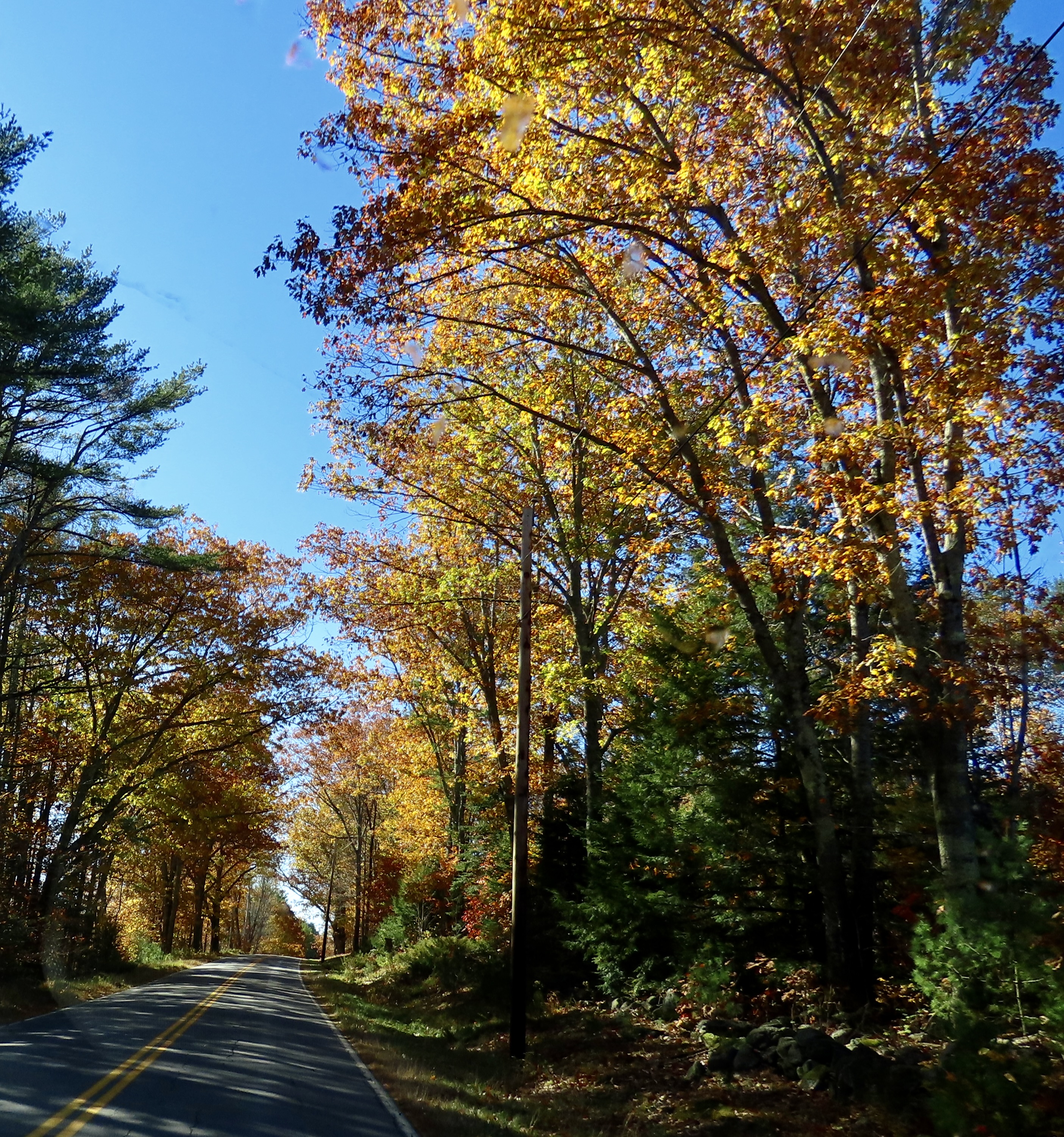
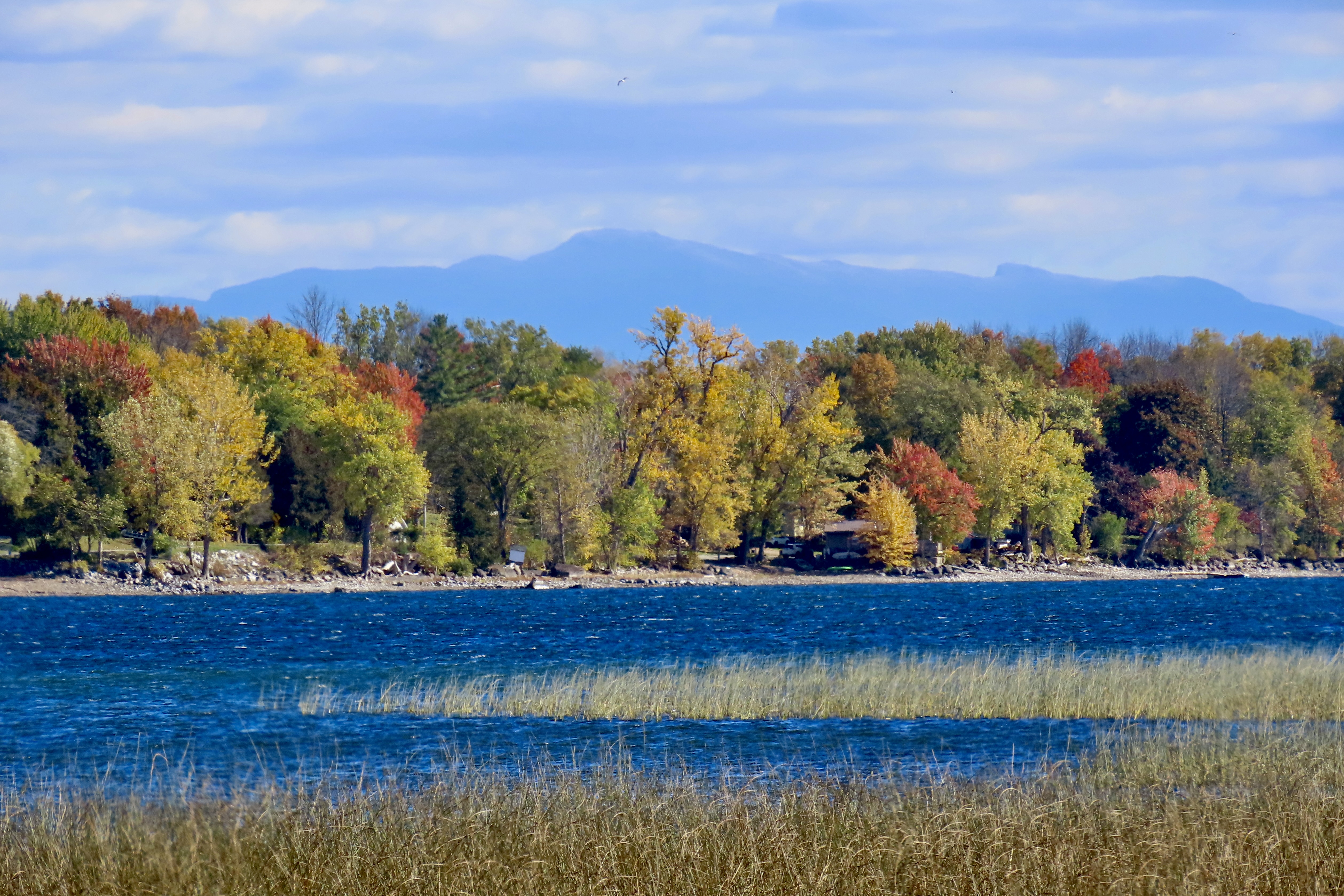
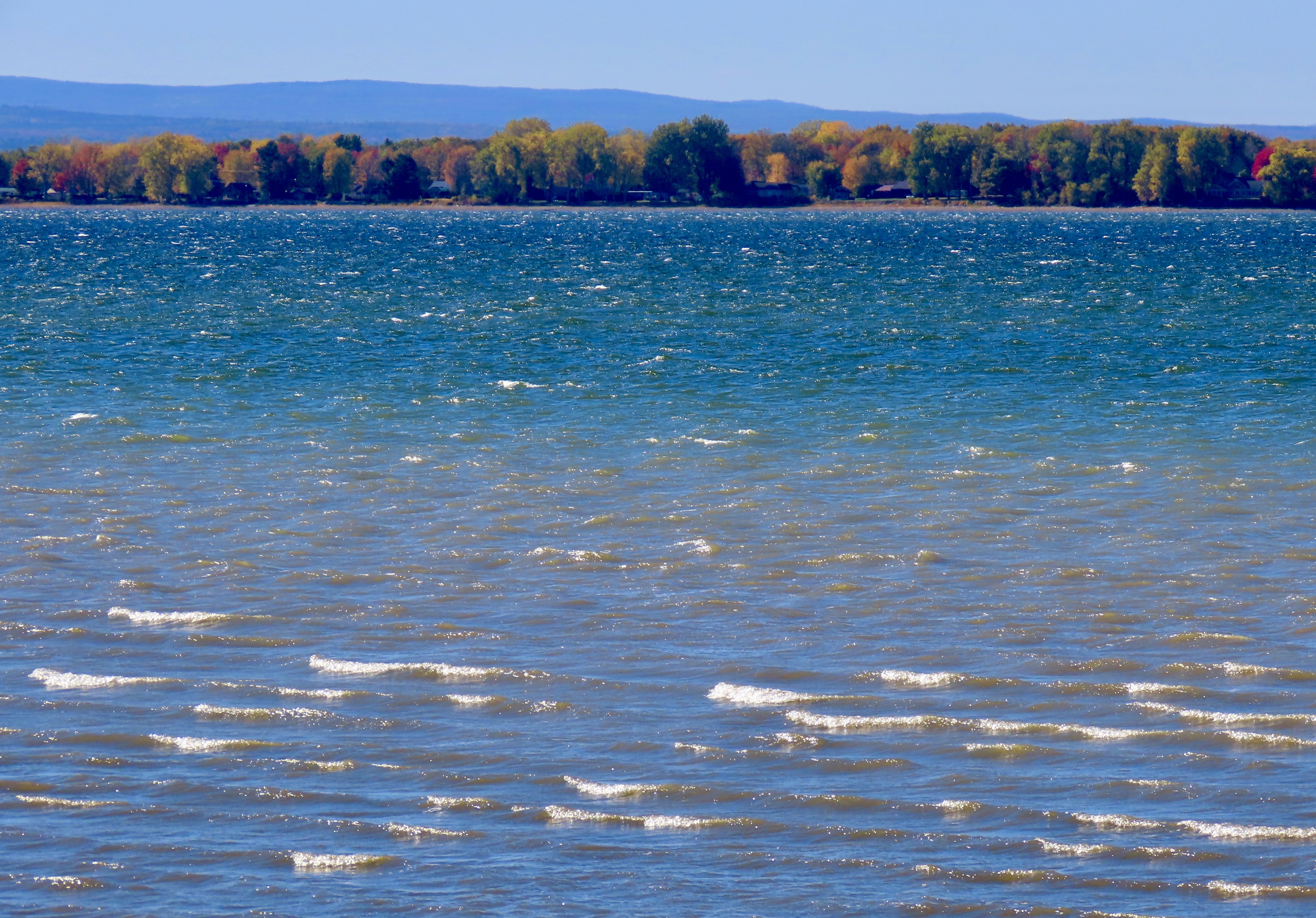
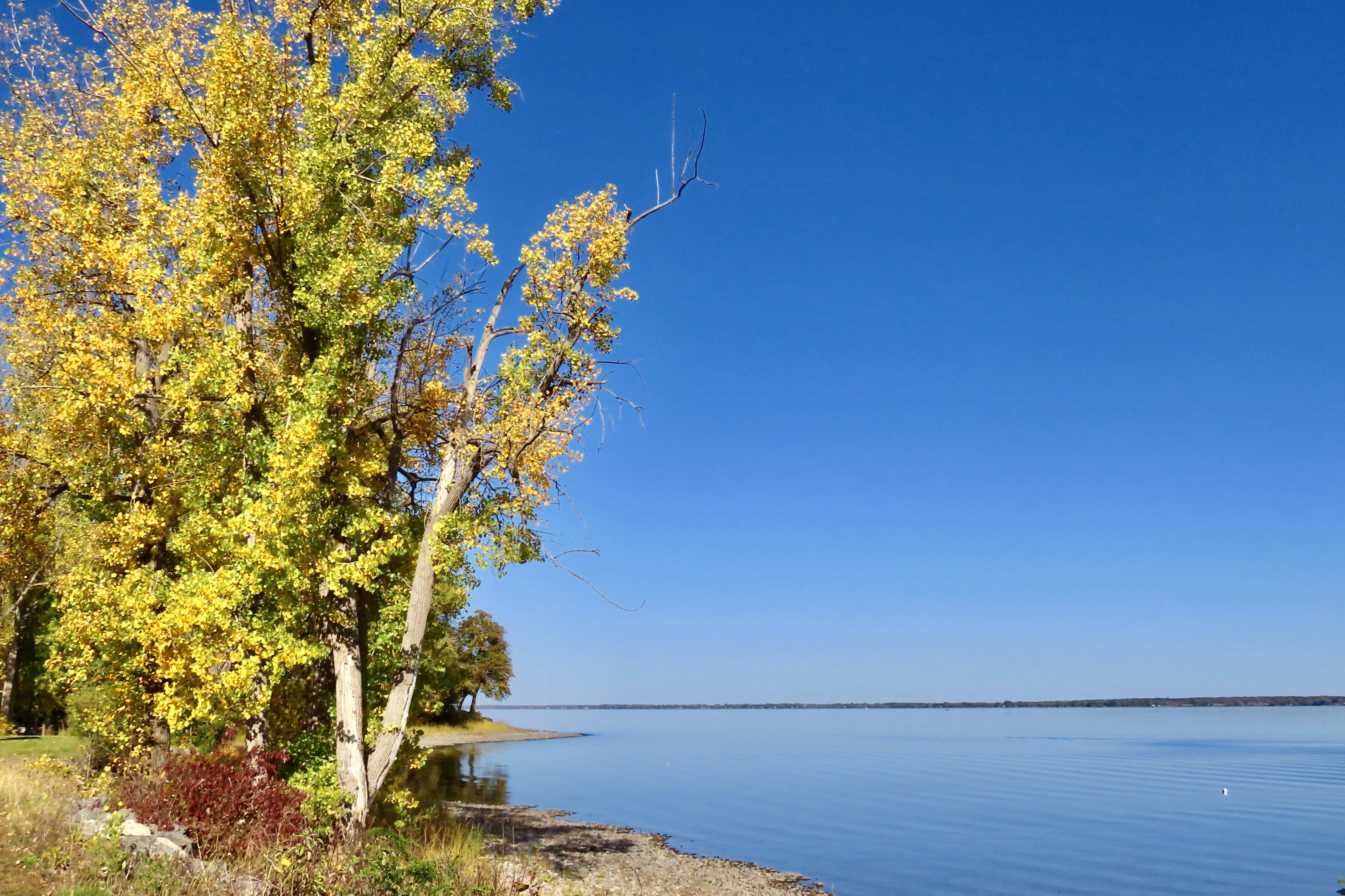
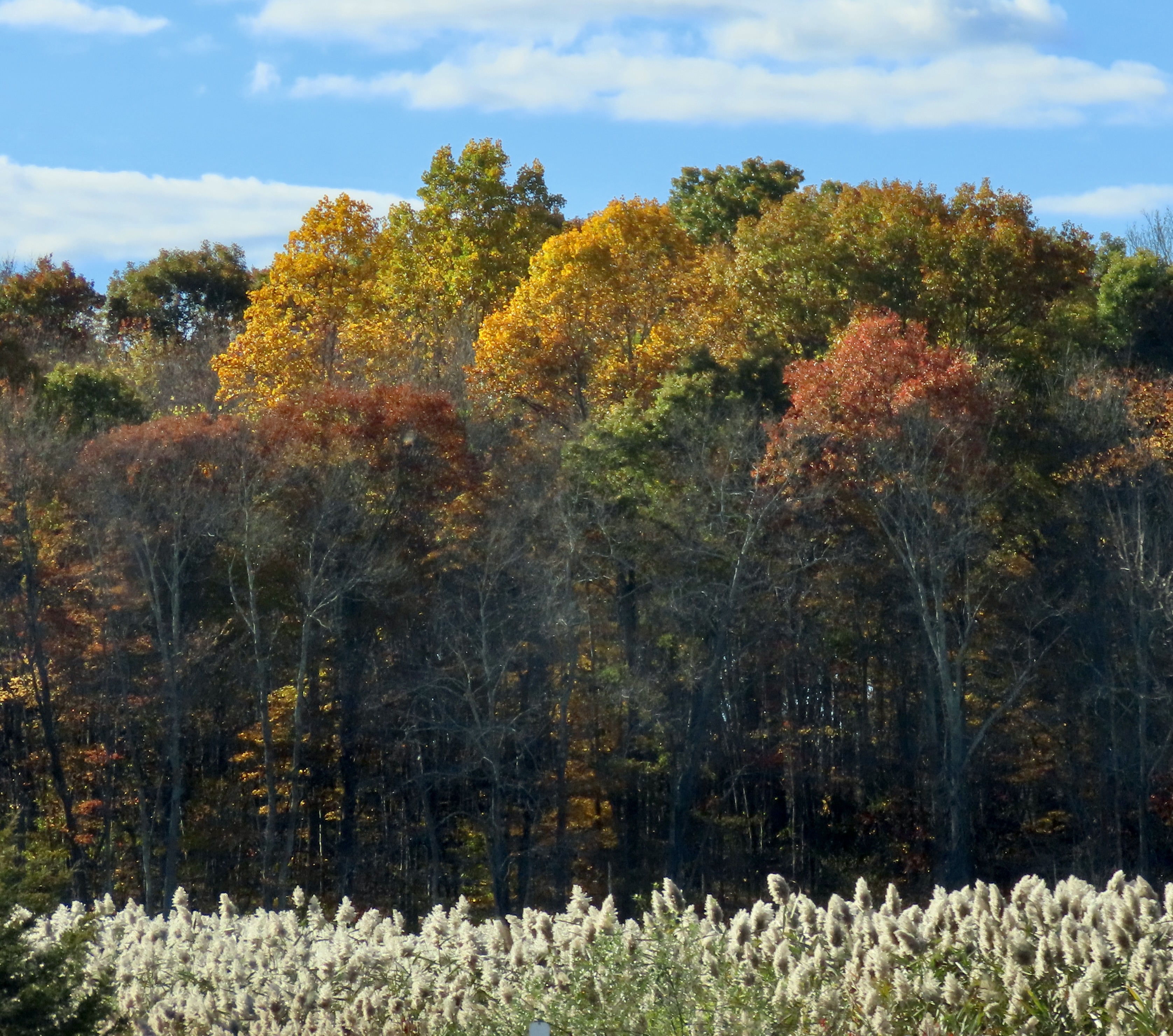
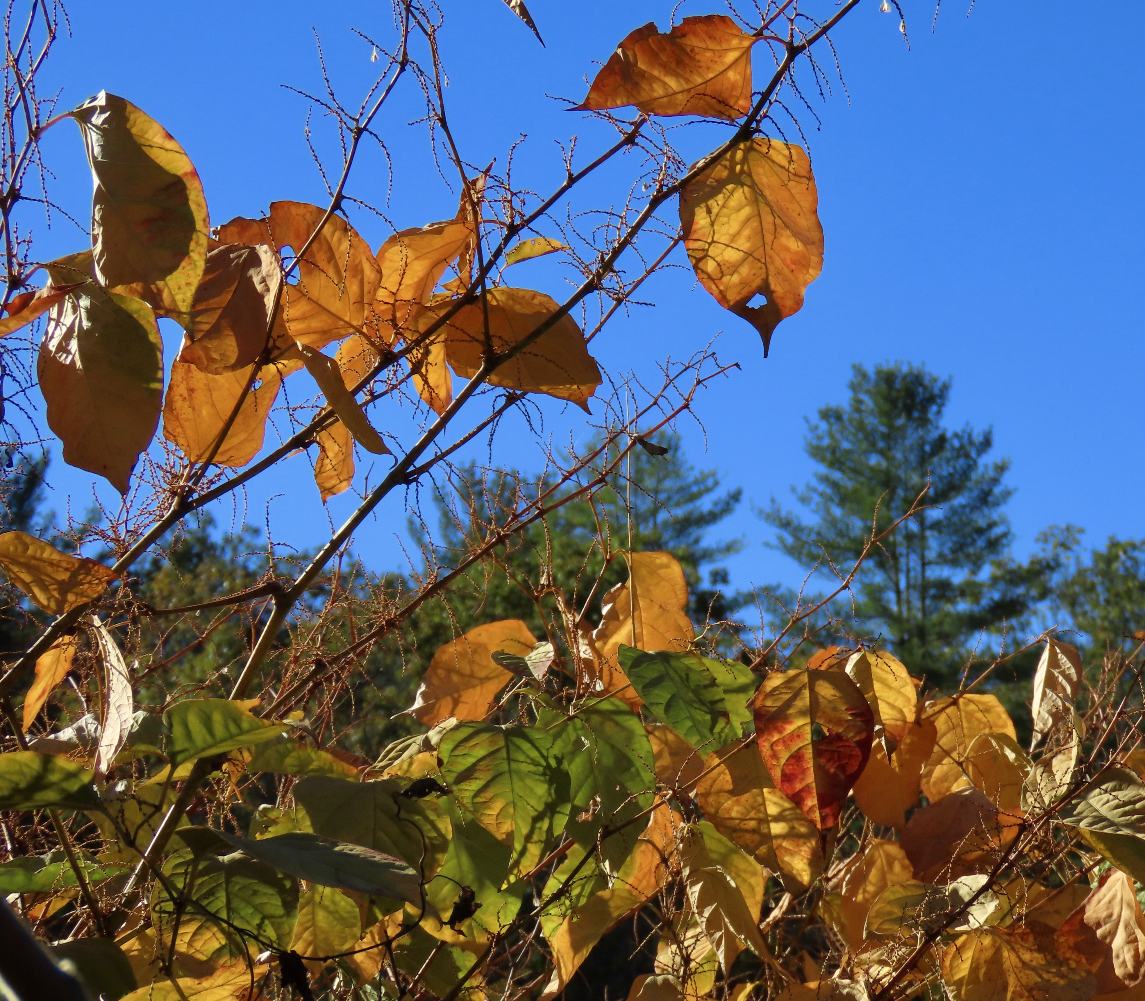
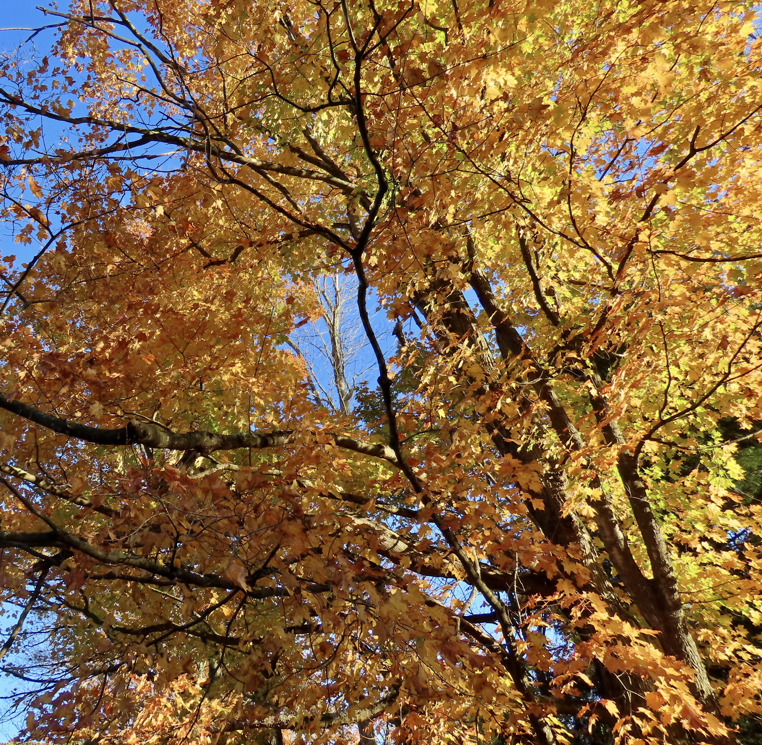
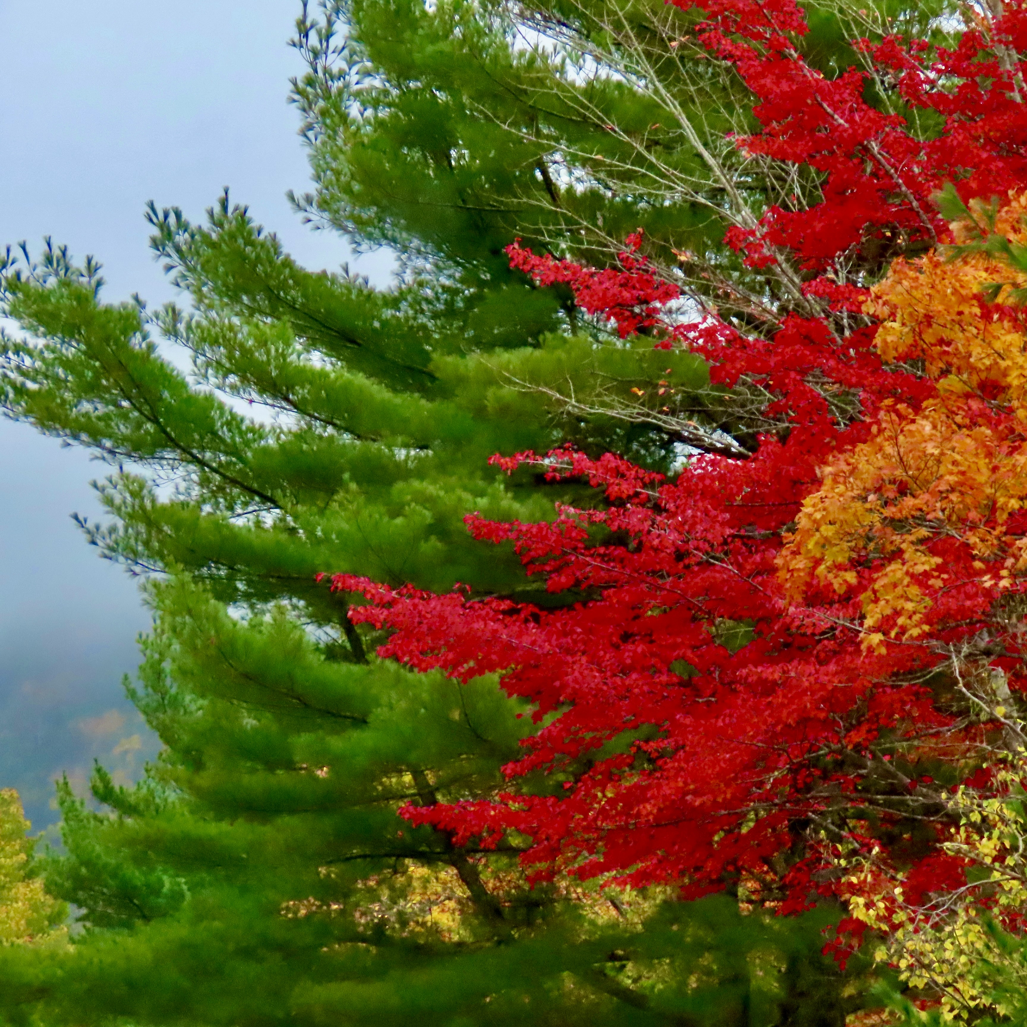
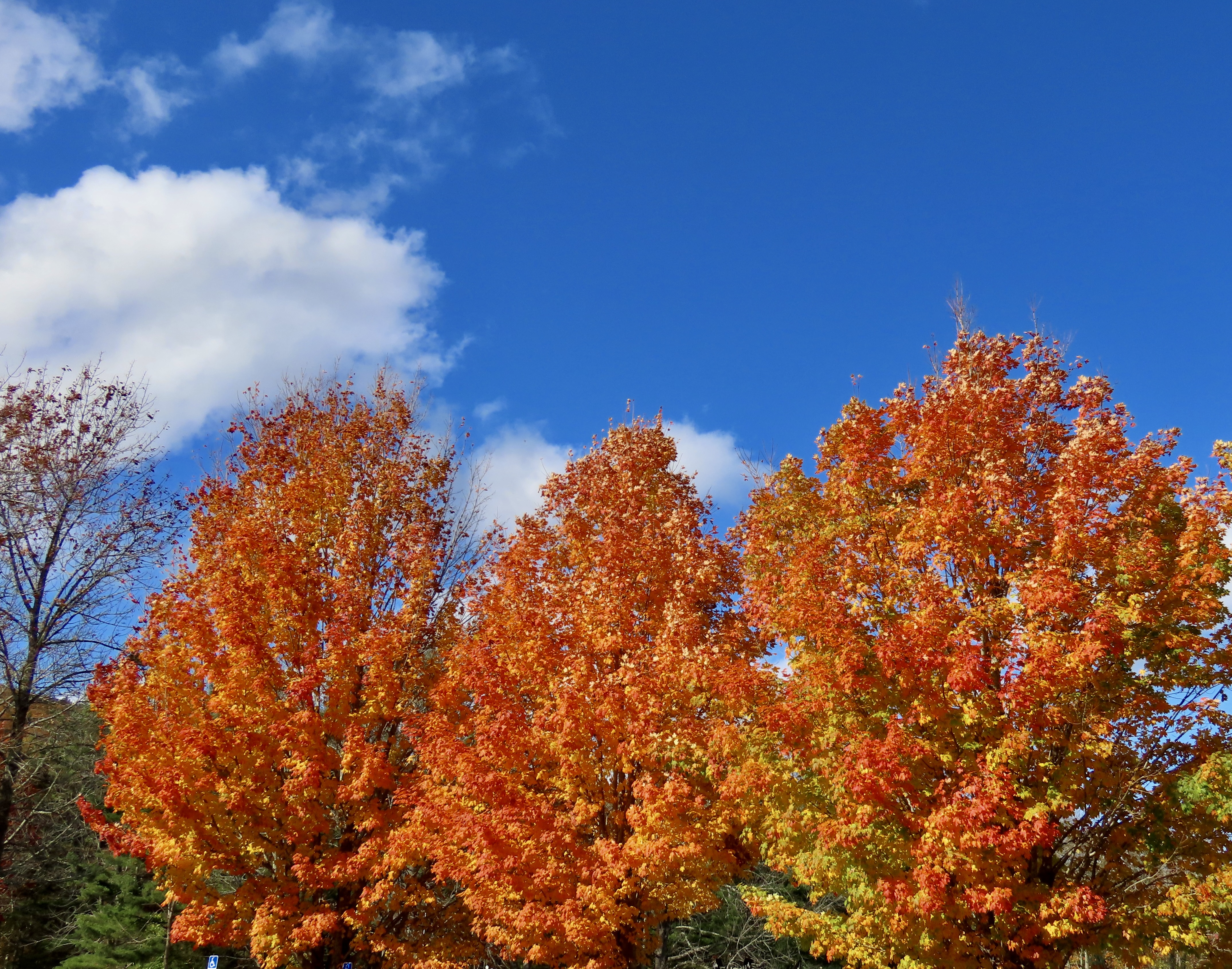
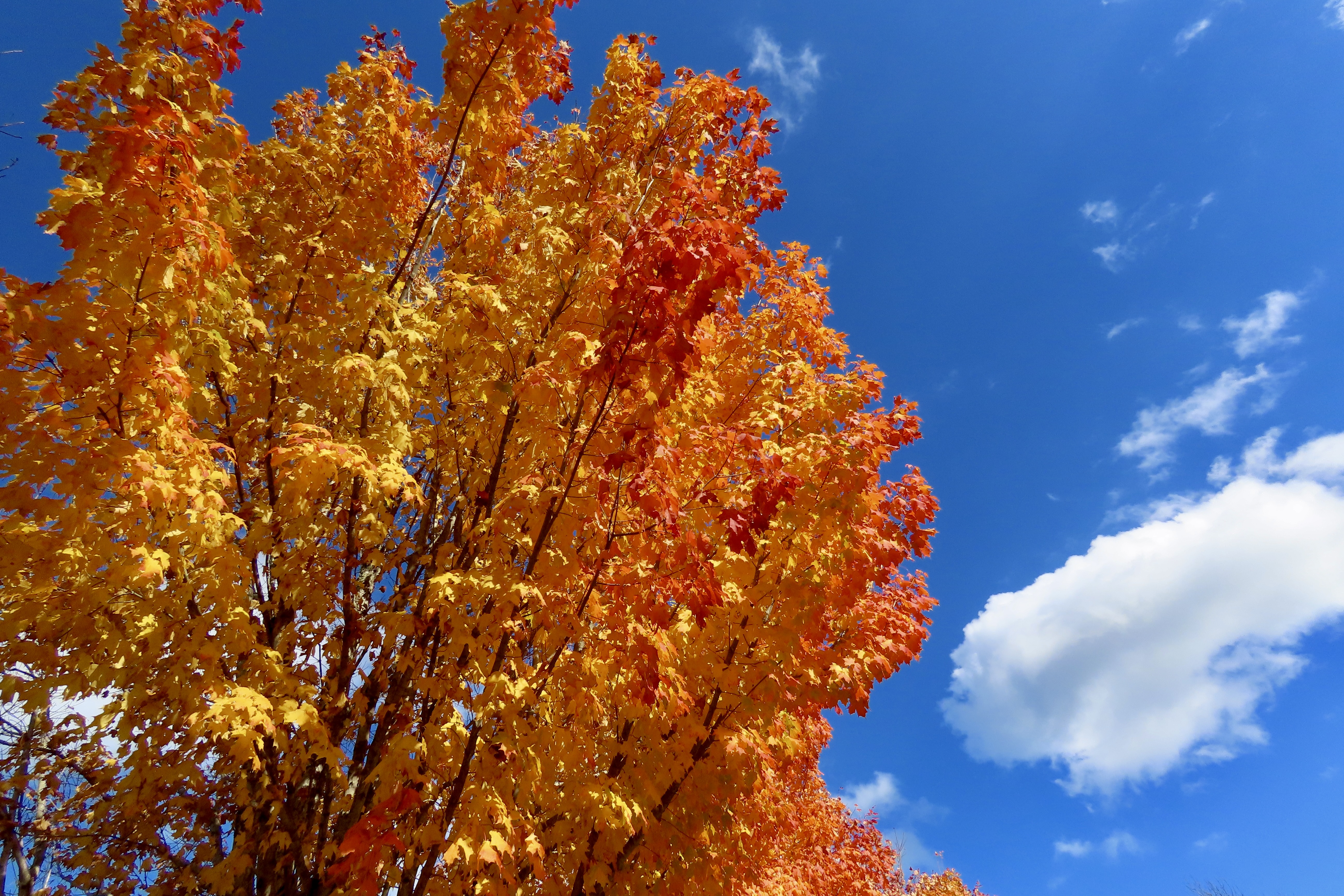
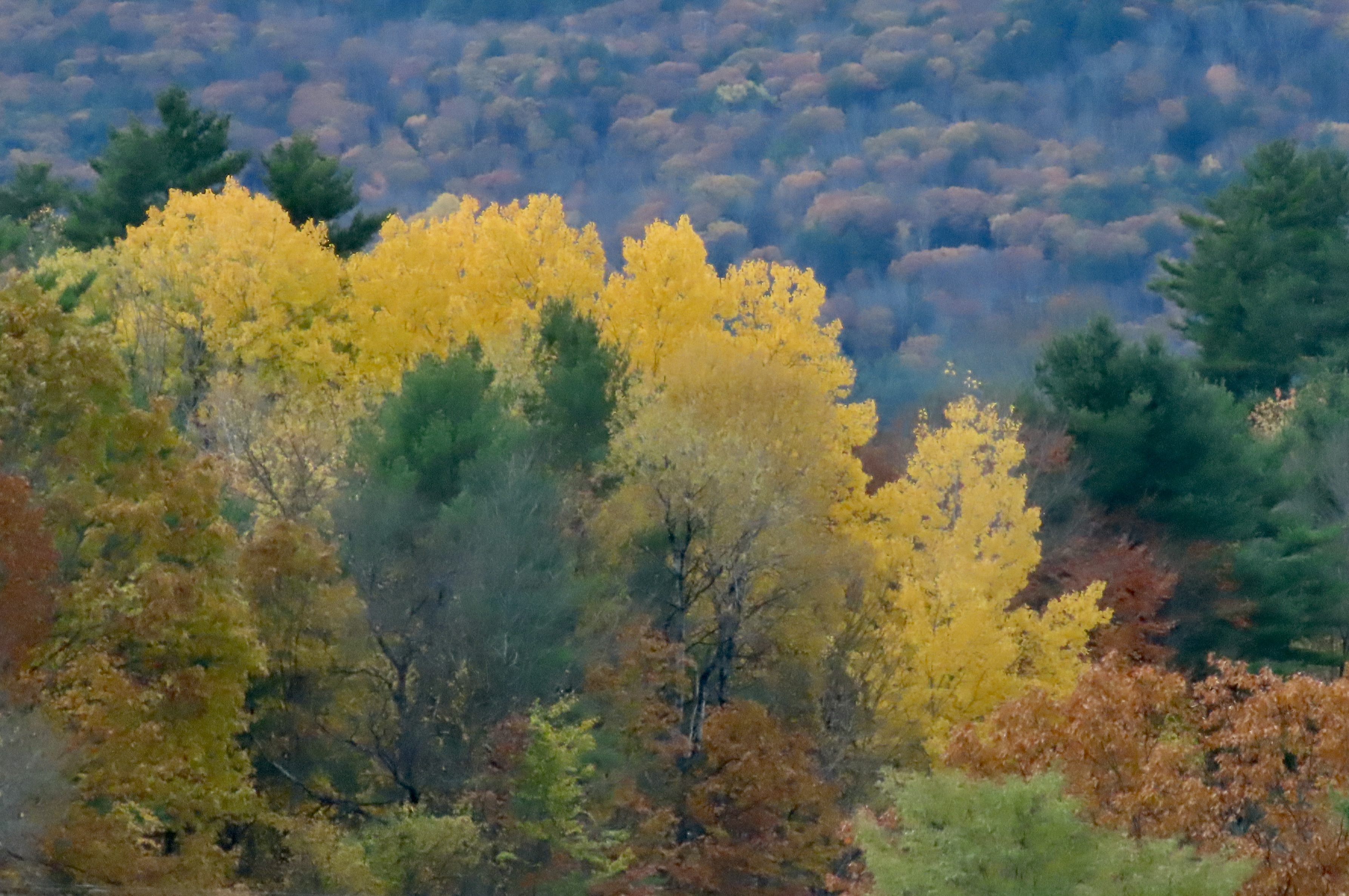
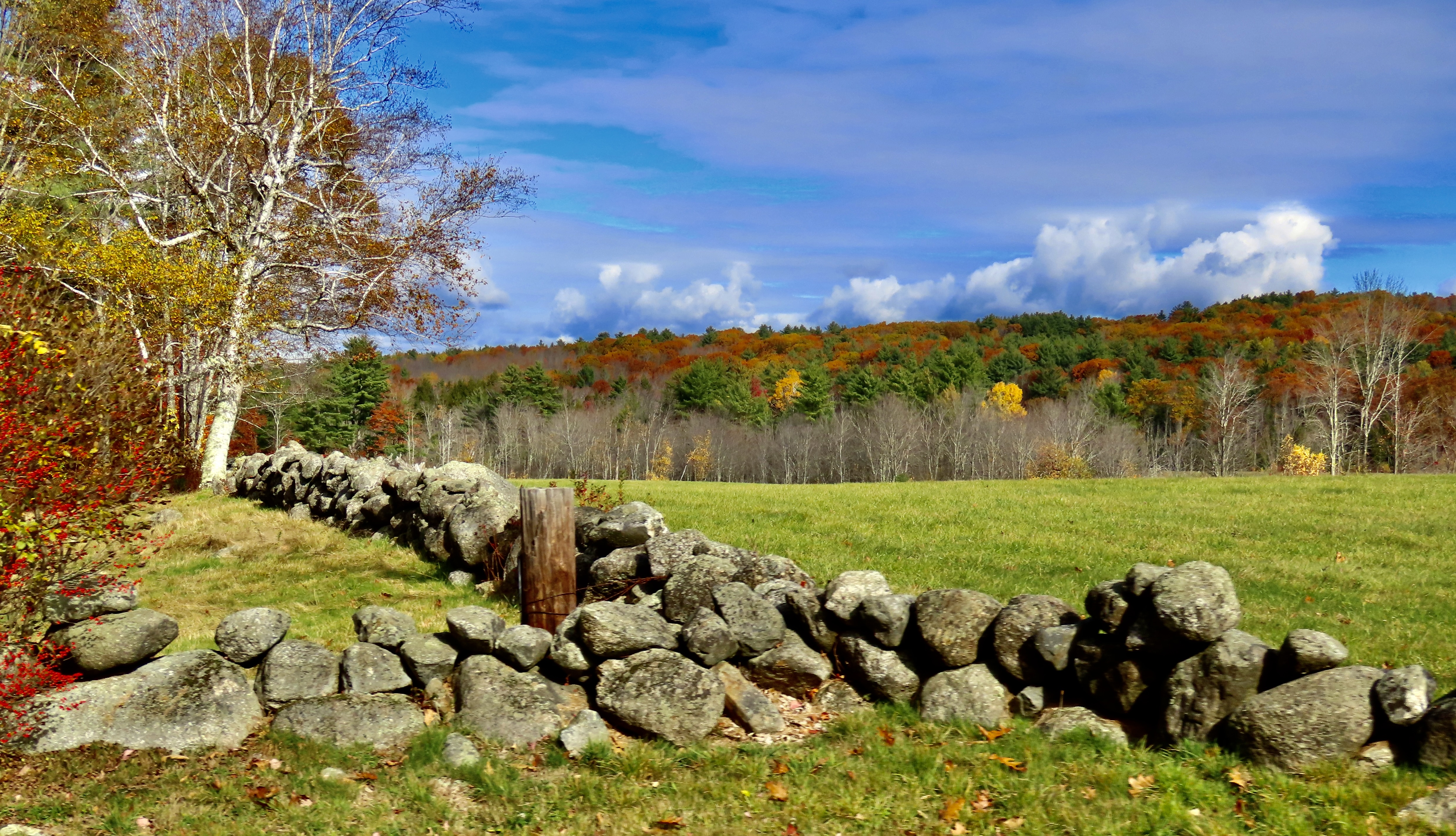
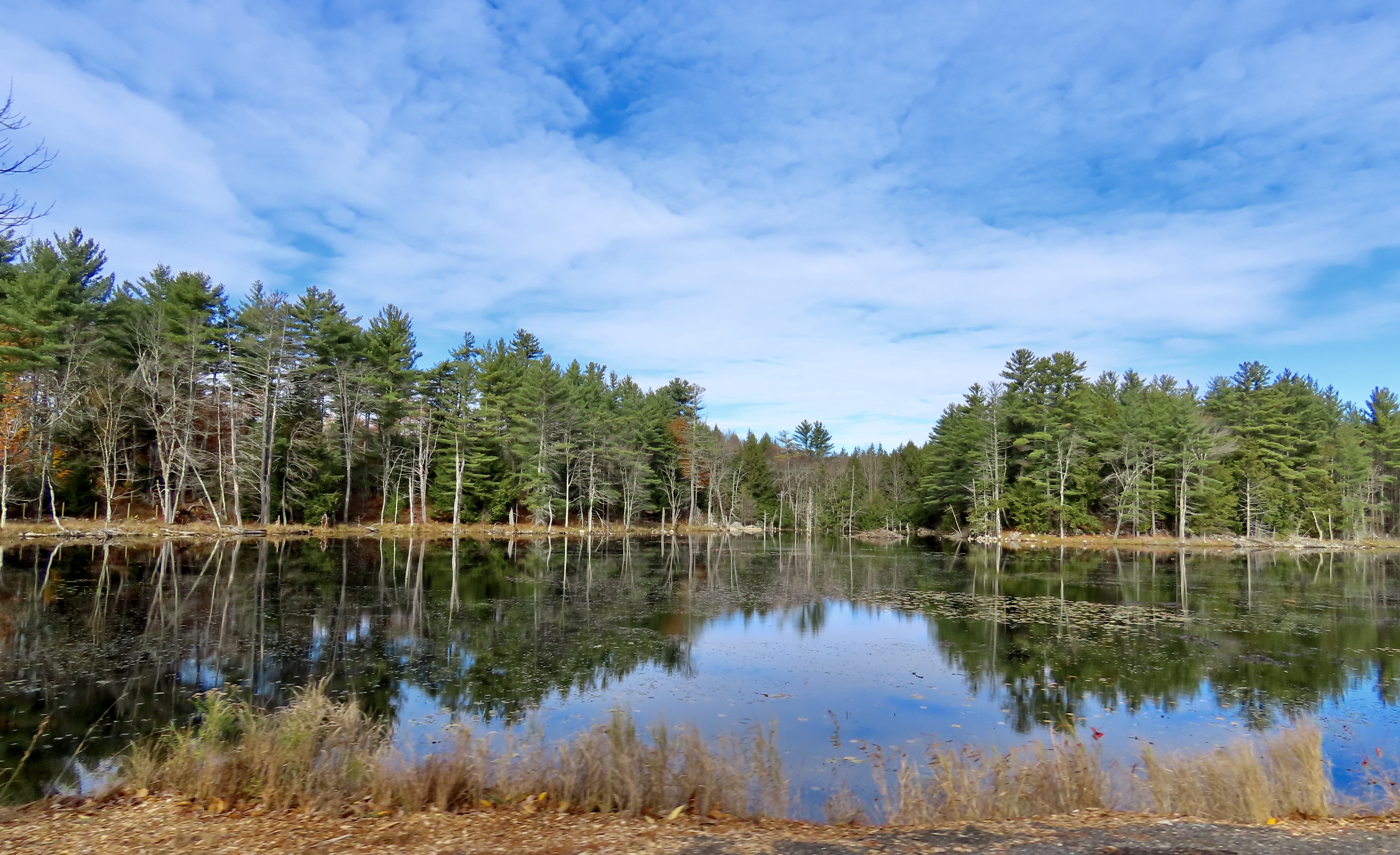
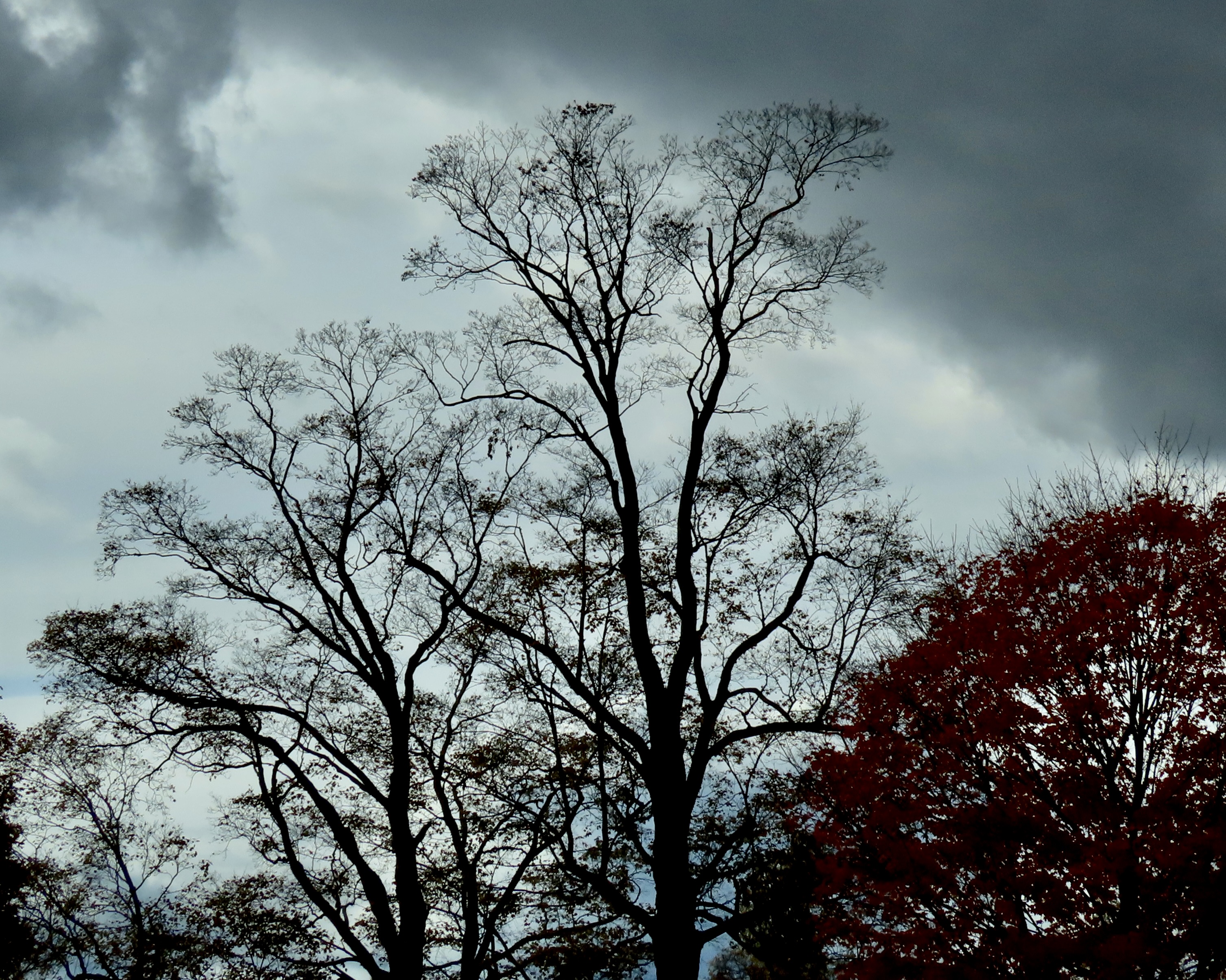
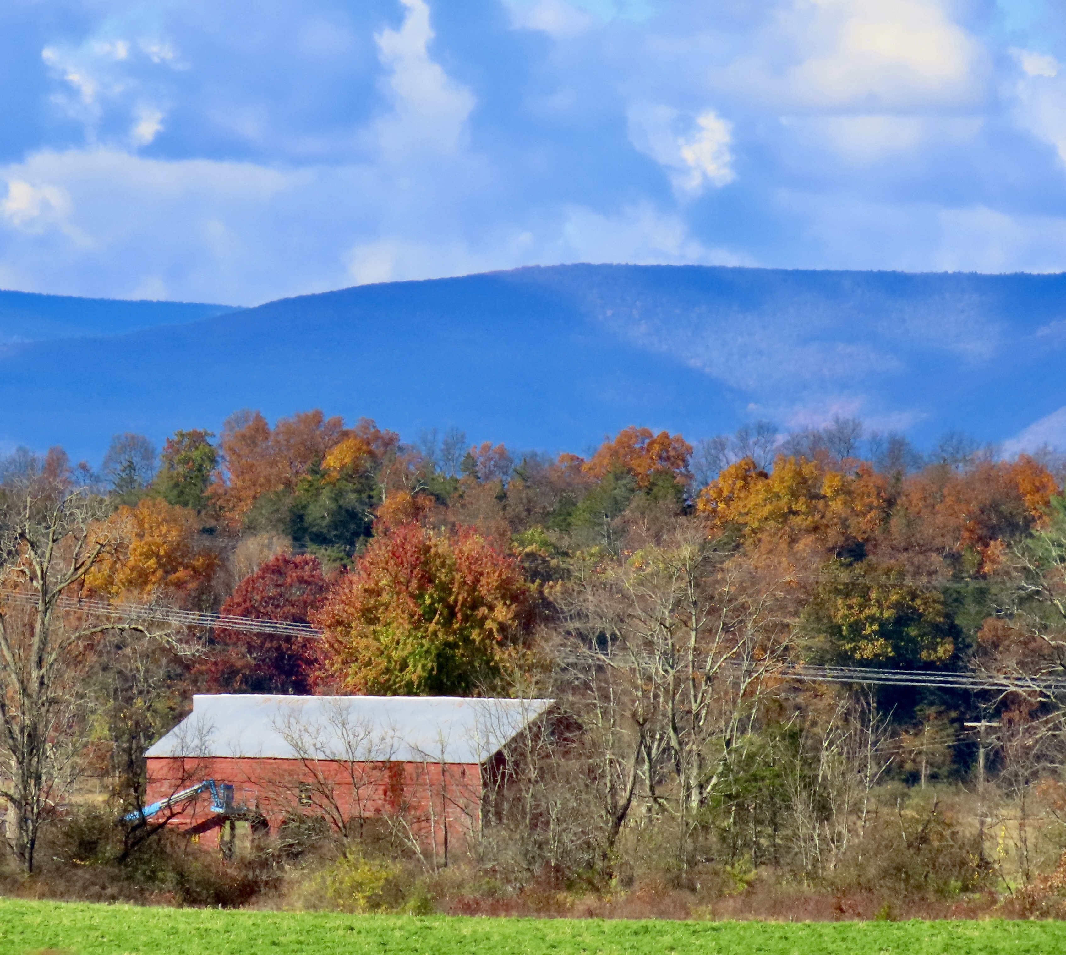
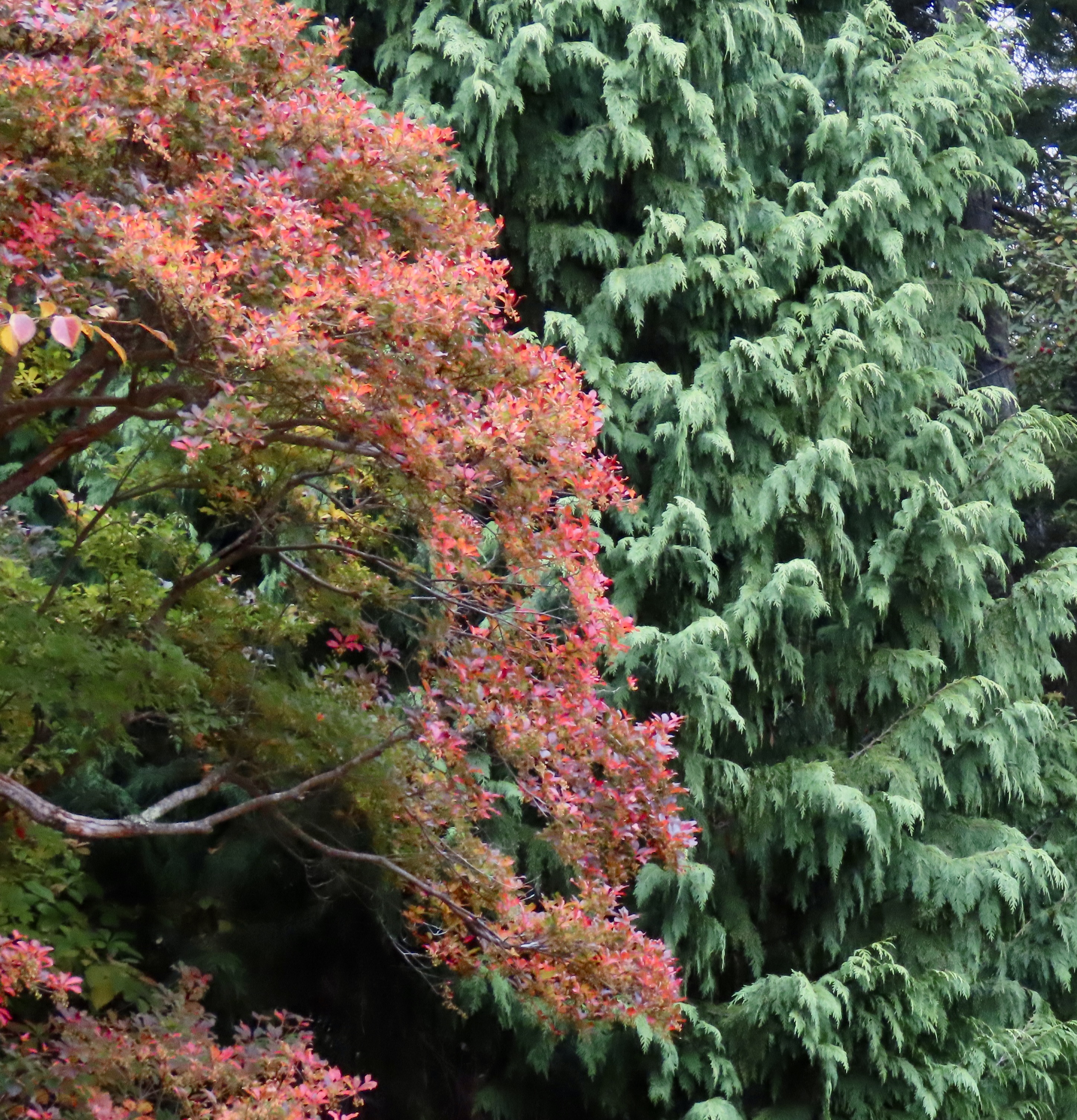
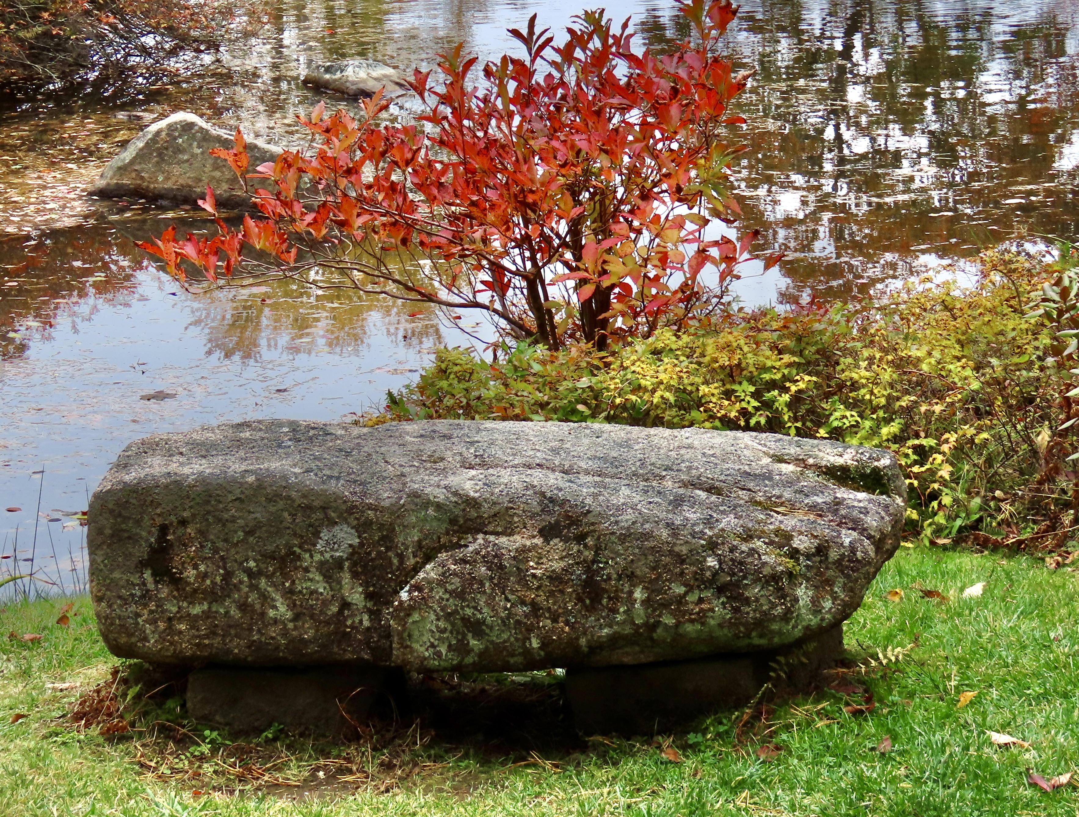
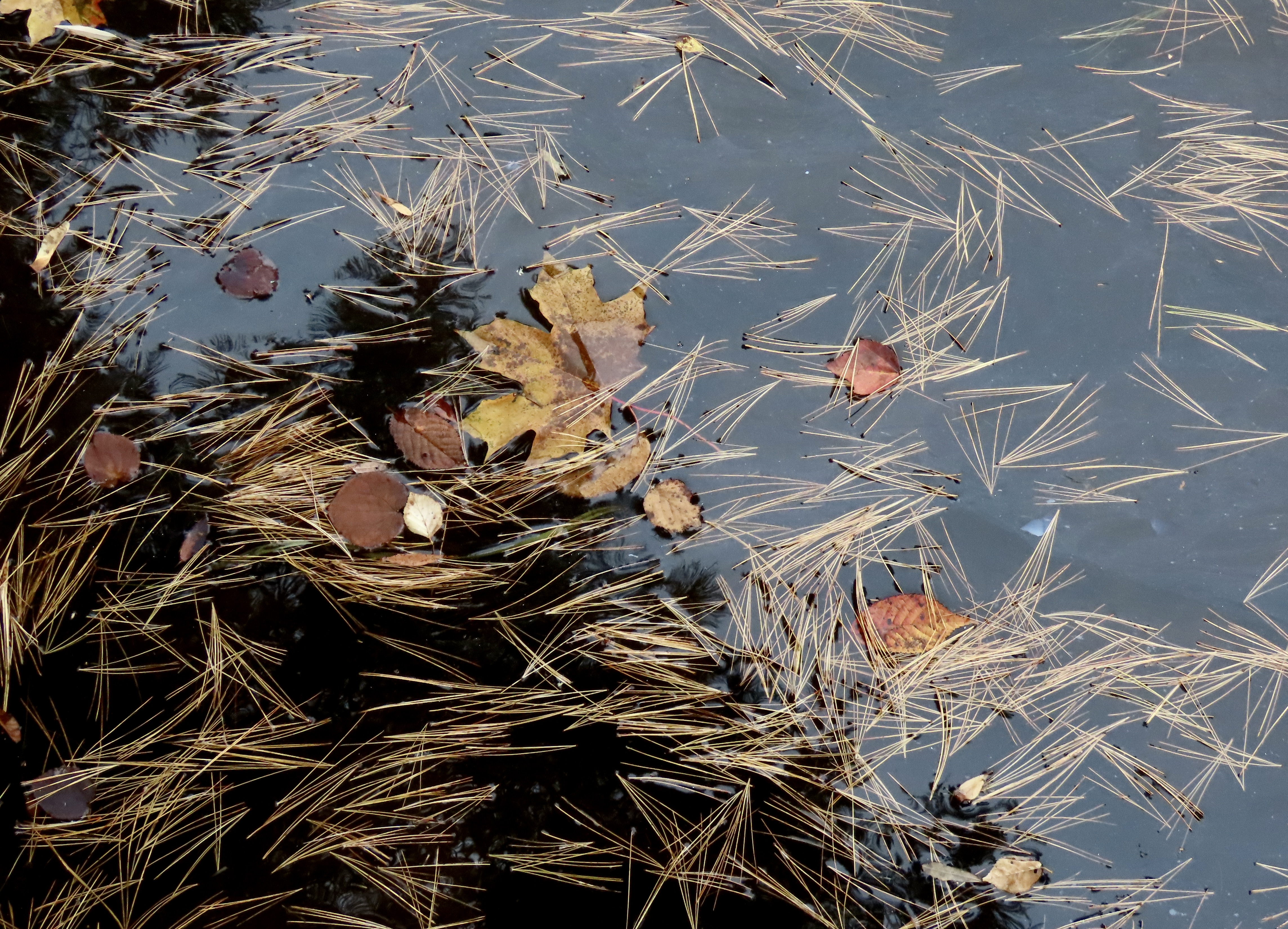
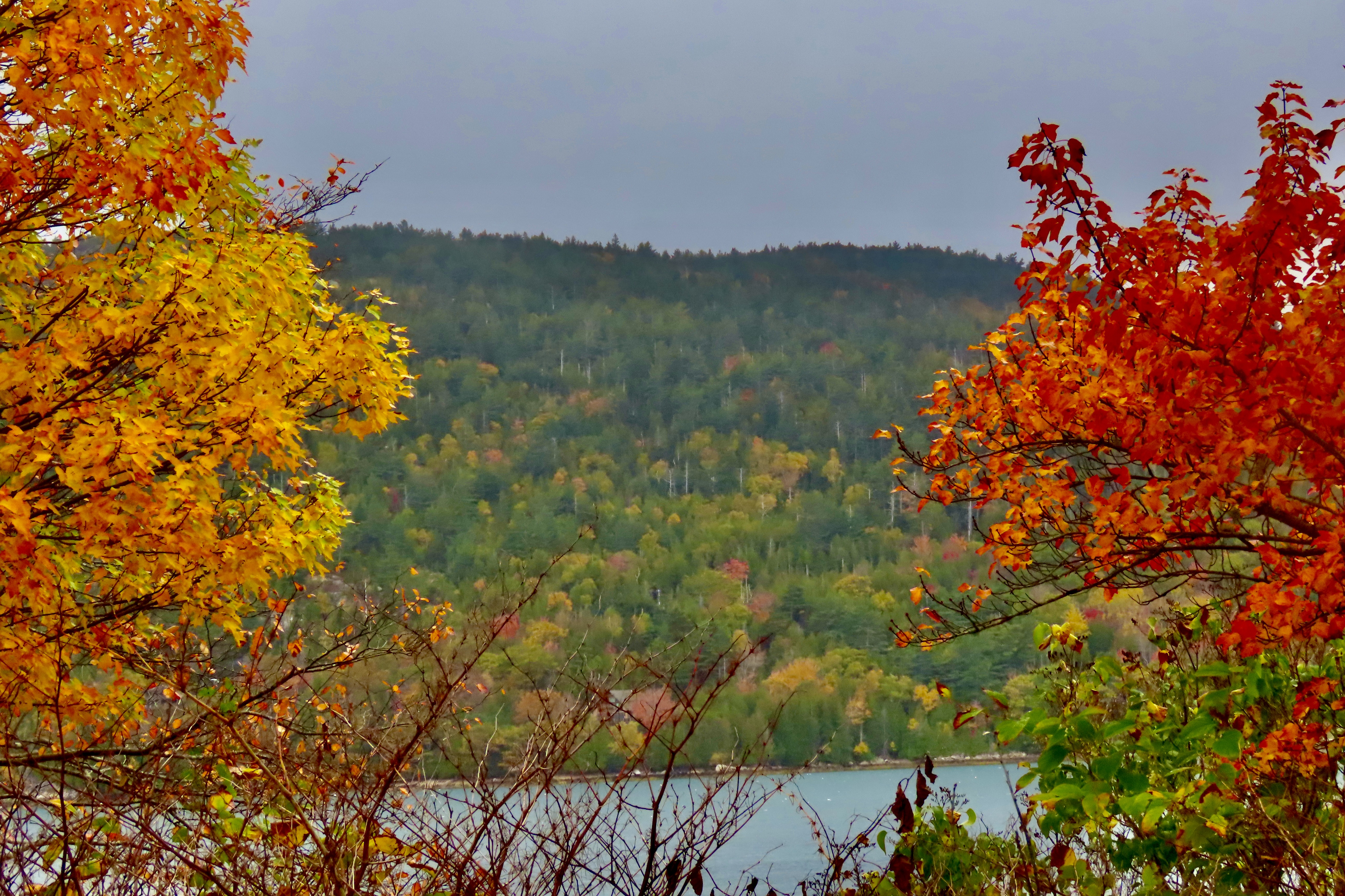
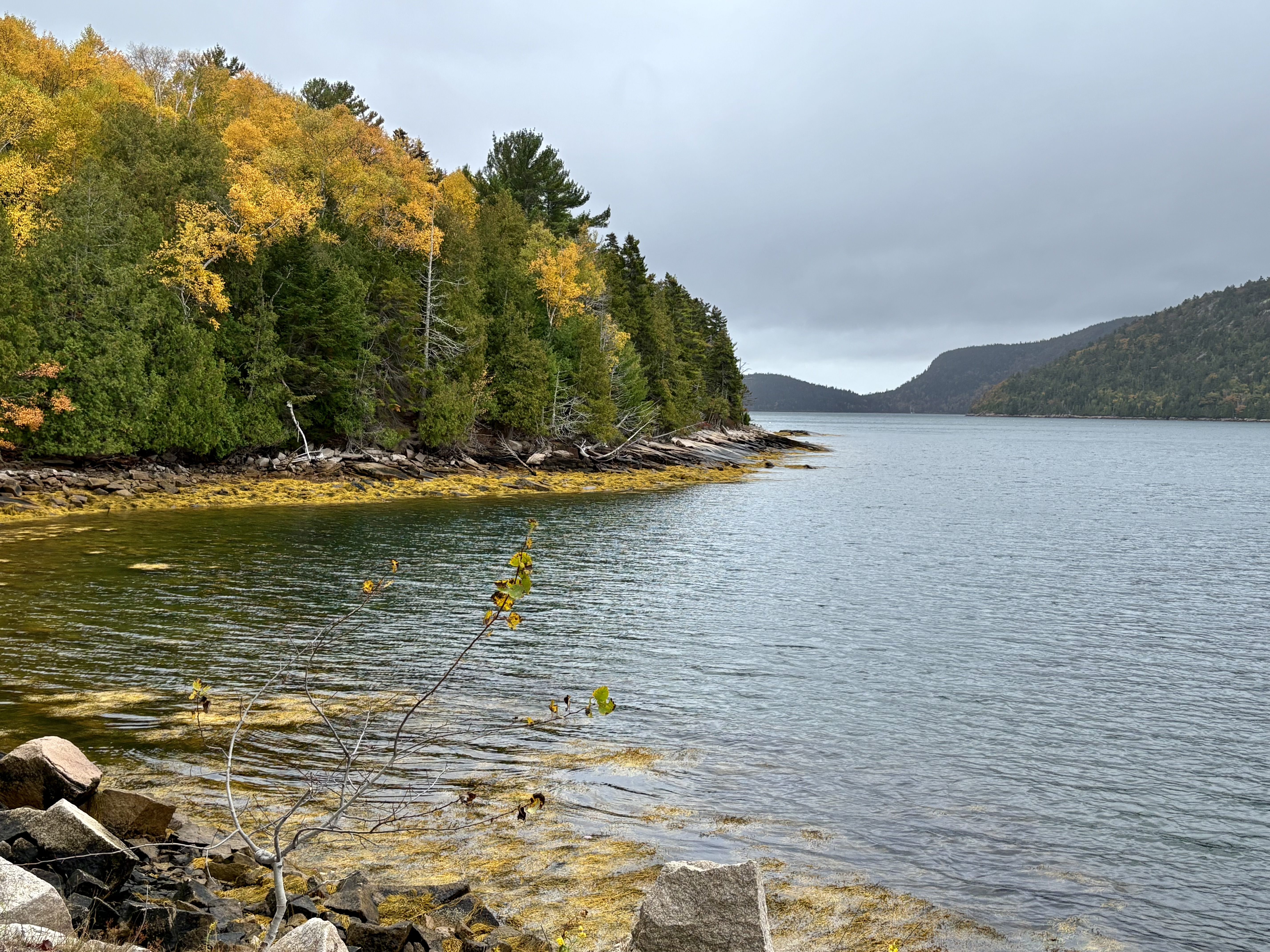
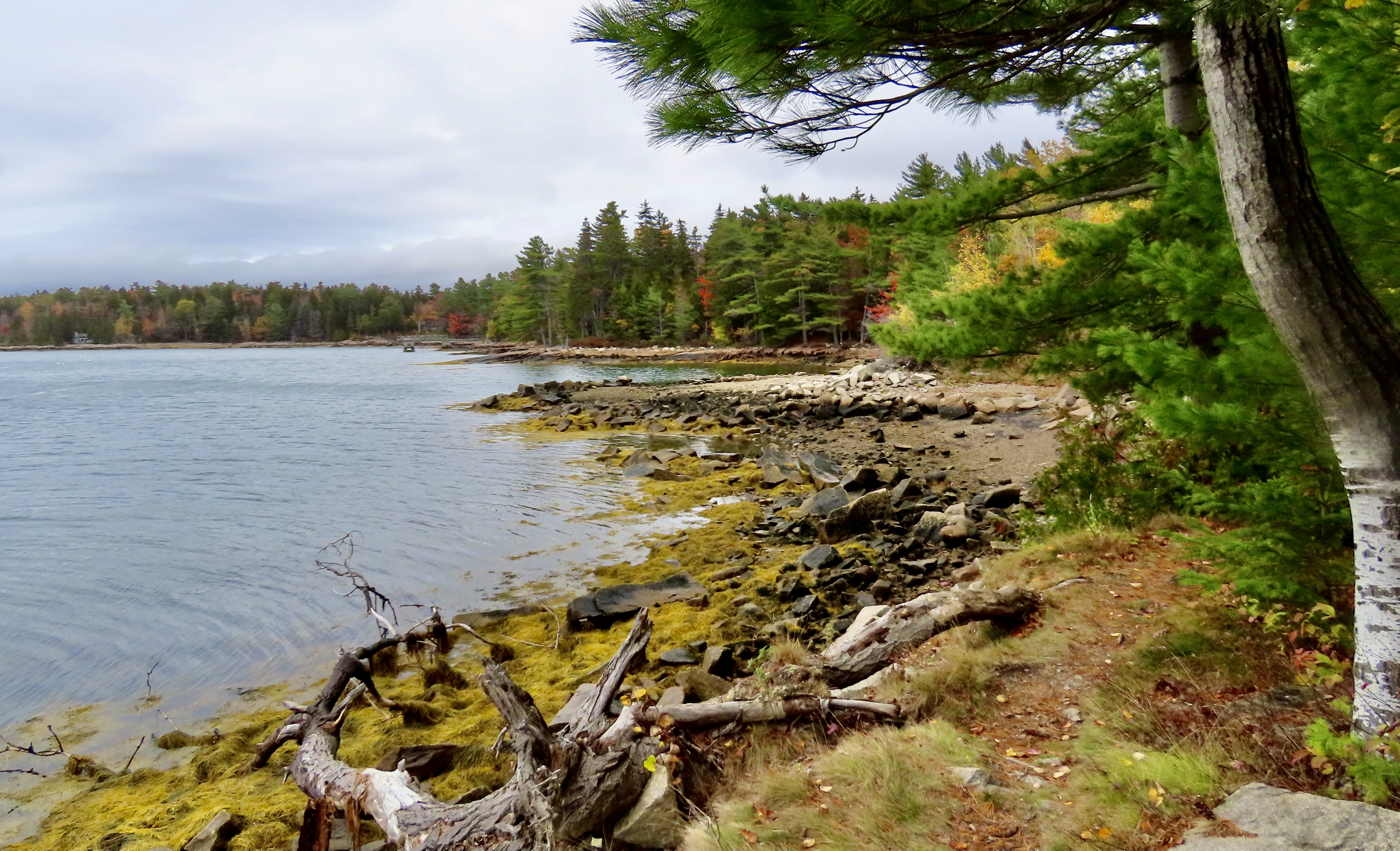
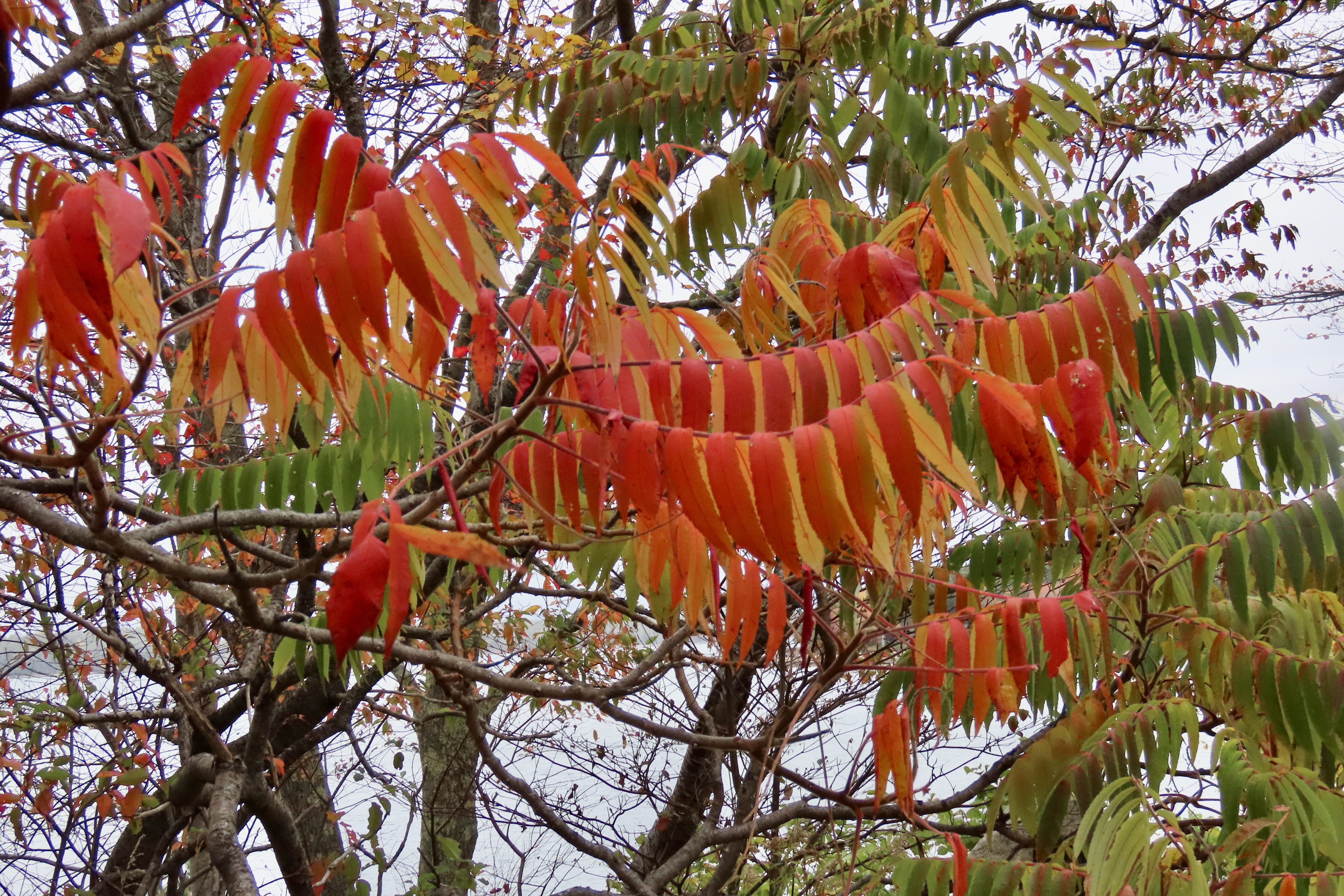
Another example. The way the trees reached across the road here made us feel like we were driving through a kaleidoscope.Lake Champlain provided us to with numerous opportunities to admire the fall colors. The mountains in the background are the Green Mountains of Vermont. We were following a road down on the northern end of the lake that connects a series of islands.A view across Lake Champlain from one of its islands.This photo was taken from the northwestern bank of Lake Champlain. The view is all the way across the lake.We felt that the foreground often added interest to our photos.Color wasn’t limited to the trees. Both grass and brush joined the palette.Another example with the grass adding a golden color. The trees in the foreground had lost their leaves, but they provided a contrast to the trees behind them.Again, one of the close to impressionistic photos of New England I included in my blogs and calendar.It seemed curious to us that the leaves on some trees could still be green while the other leaves on the tree had completely changed. The red and green made me think about Christmas.When the leaf peeping isn’t great, a few leaves can substitute.I thought this tree would be a fitting end to our 2025 travels. The limbs provided a contrast to the colorful leaves, but, in a way, they also reminded us of the many roads we had traveled over in 2025.
Next up: What we have planned for our blog in 2026!
As we noted in last week’s post, our 2025 wrap-up is based on three trips we made during the year and blogged about. The first was Hawaii, which I posted last Monday. Today’s post features our Southwest journey where we wandered through the Southwestern US for five months visiting national parks, state parks, and national monuments. Next week’s post will cover our three week leaf-peeping trip through New England in the fall.
The photos used in the three posts are all from ones we selected to include in three calendars we developed for our extended family, each focused on one of out trips. (Not all of the photos here made it into the calendars, but it was a flip-of-the-coin type decision.)
We discovered the towering rock above in Chiricahua National Monument, which is located in southeastern Arizona. The monument is named after the Chiricahua Apaches who roamed the area prior to it being occupied by pioneers from the eastern US. A couple of notes. One, the park is filled with a fascinating variety of rock structures. Two, we have discovered over the years that national monuments often include scenery, geology, history, plants and animals that easily match those found in national parks. They are definitely worth visiting and are usually far less crowded.
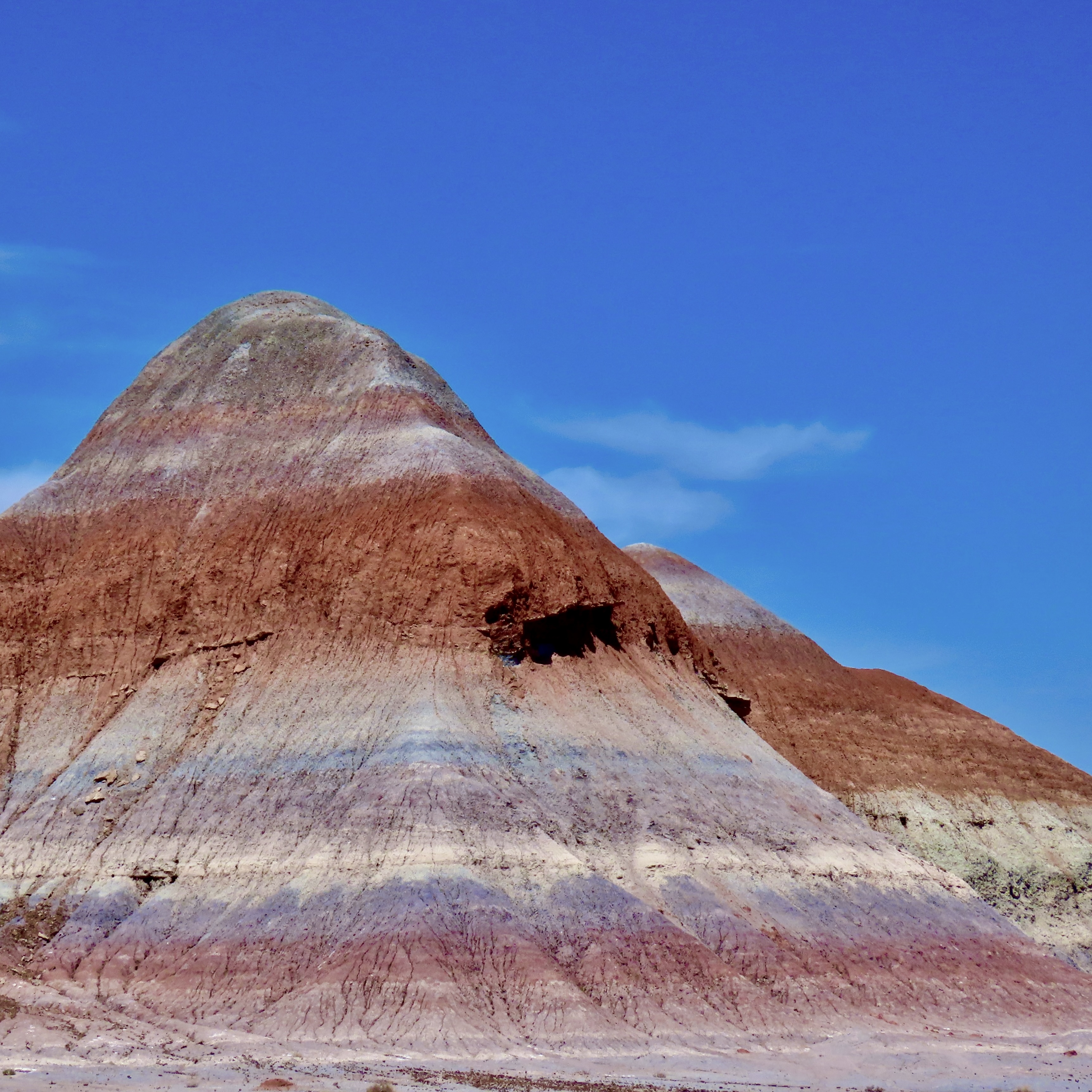
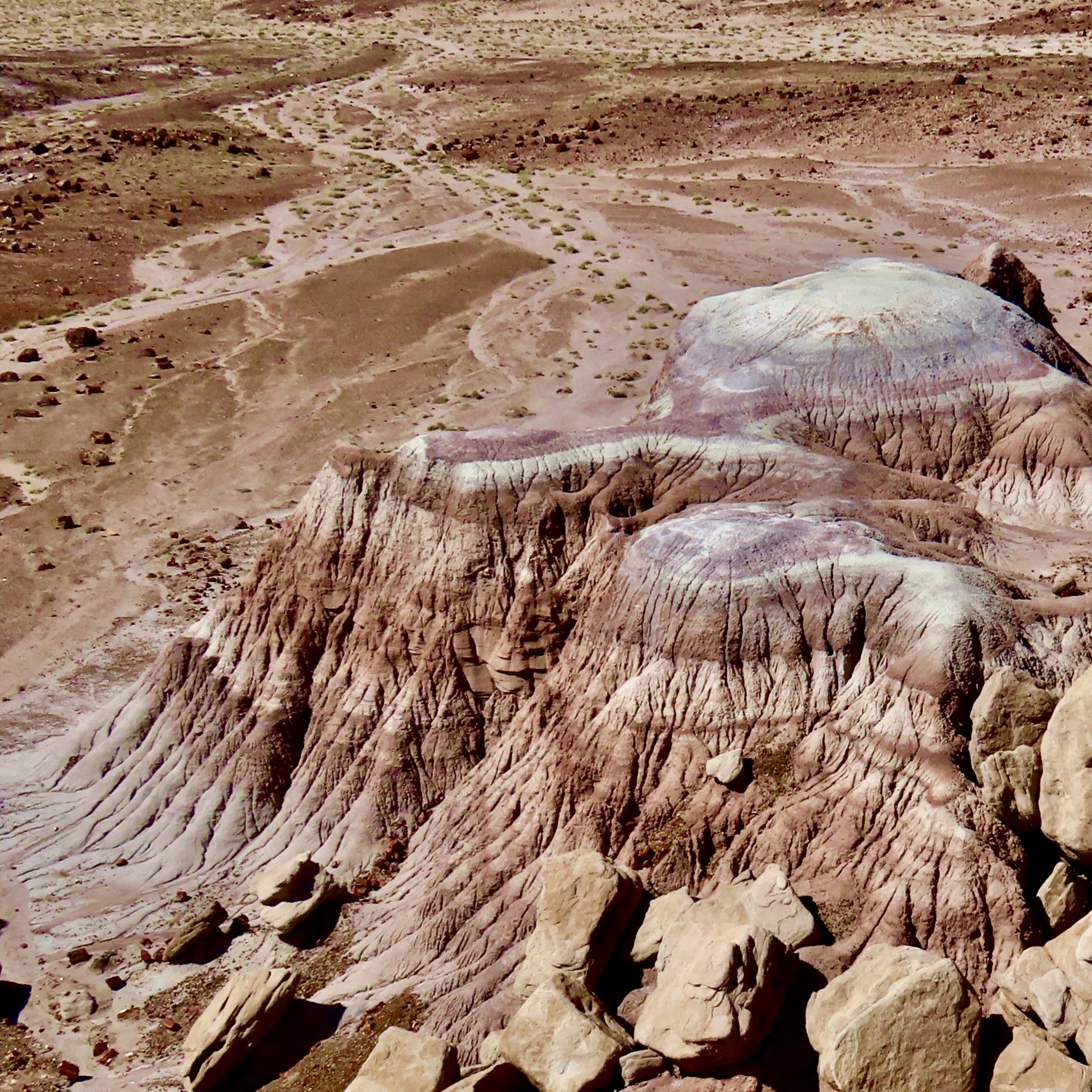
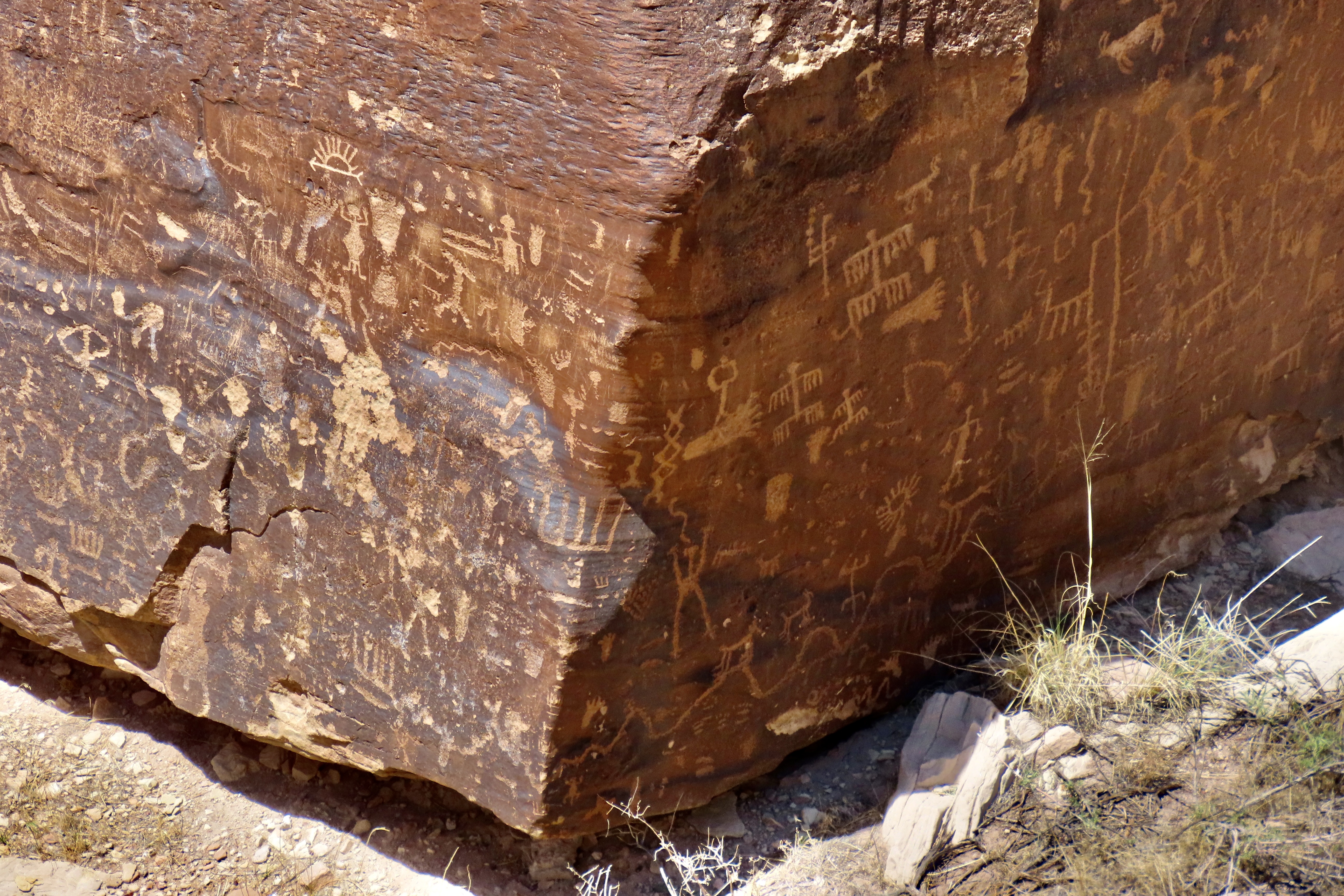
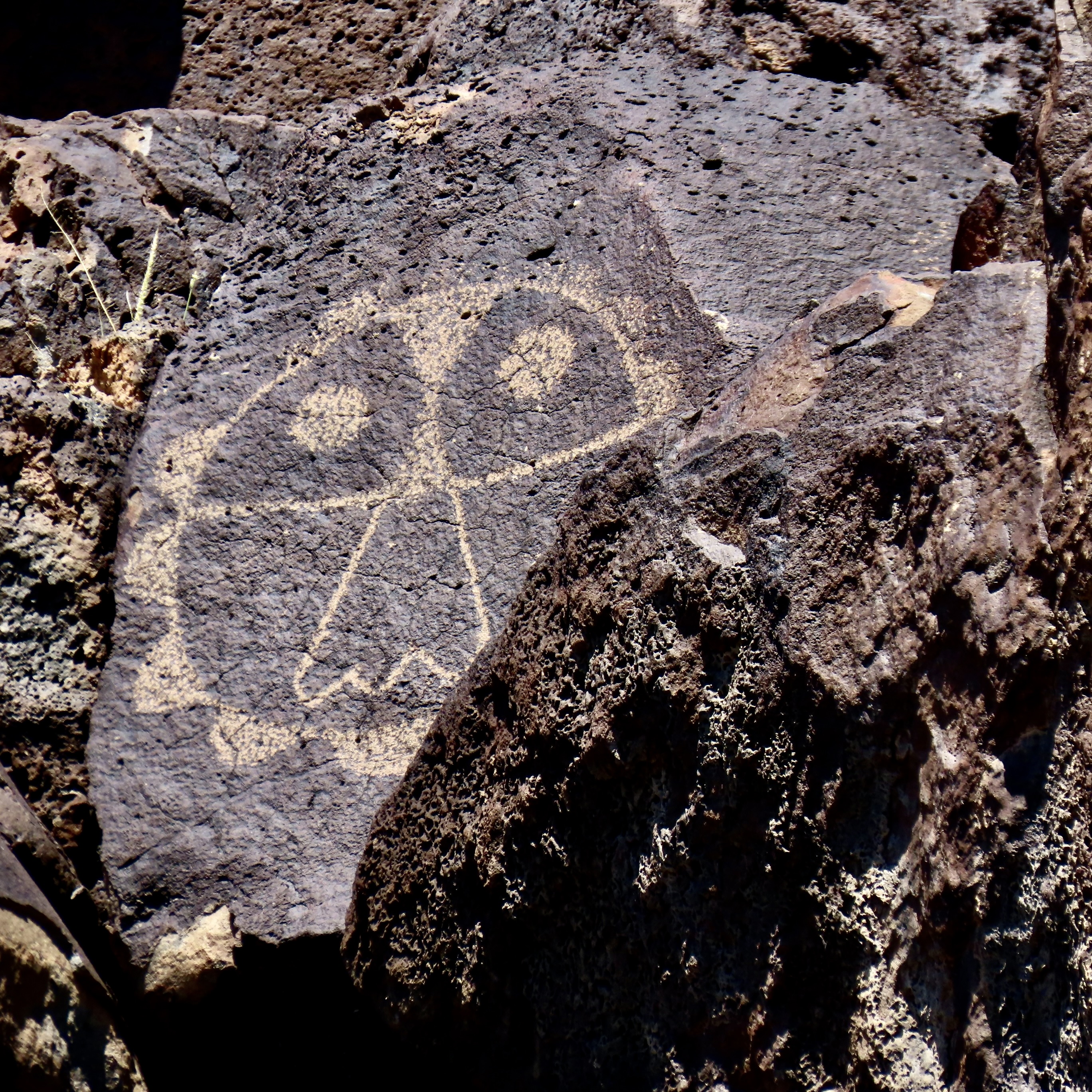
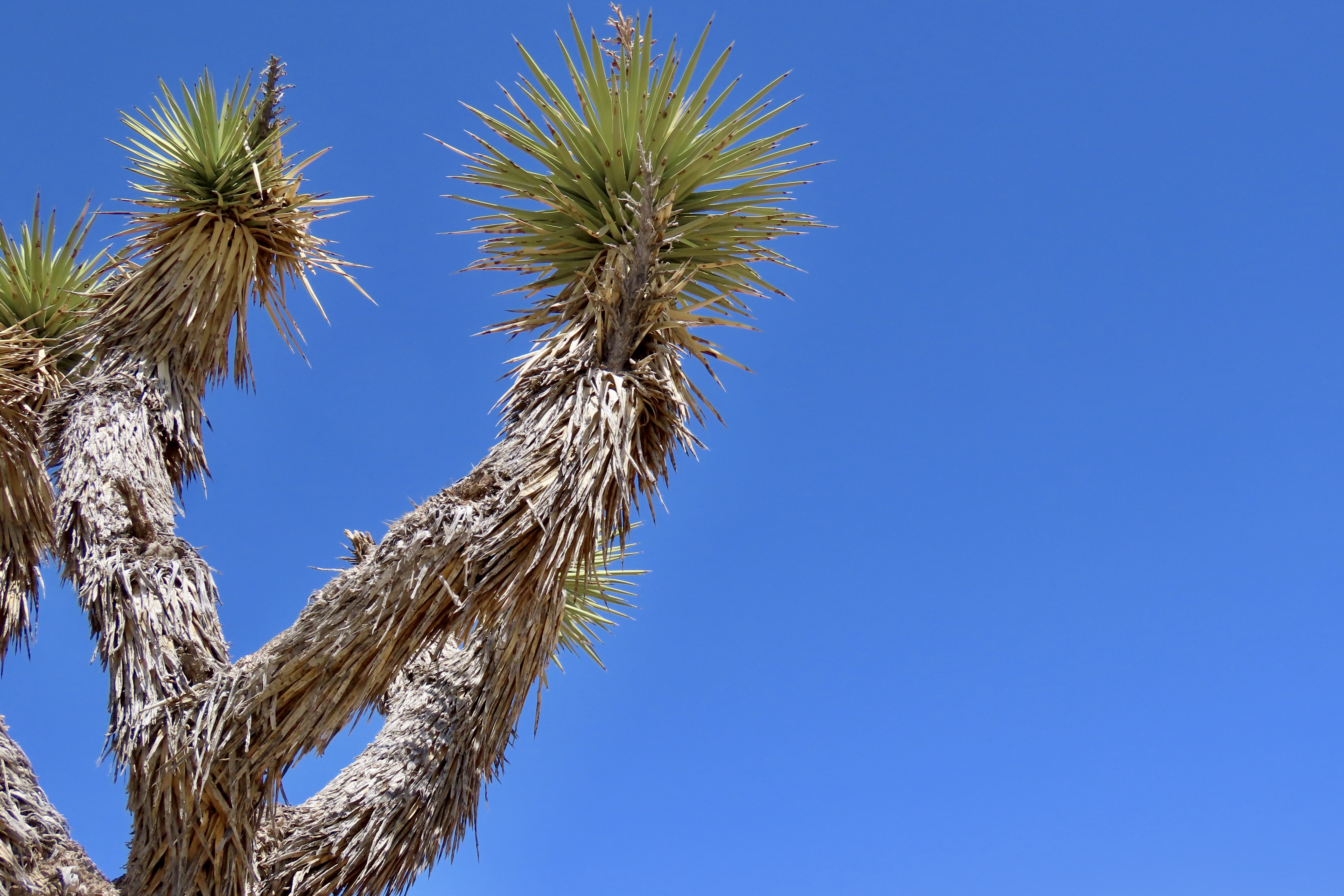
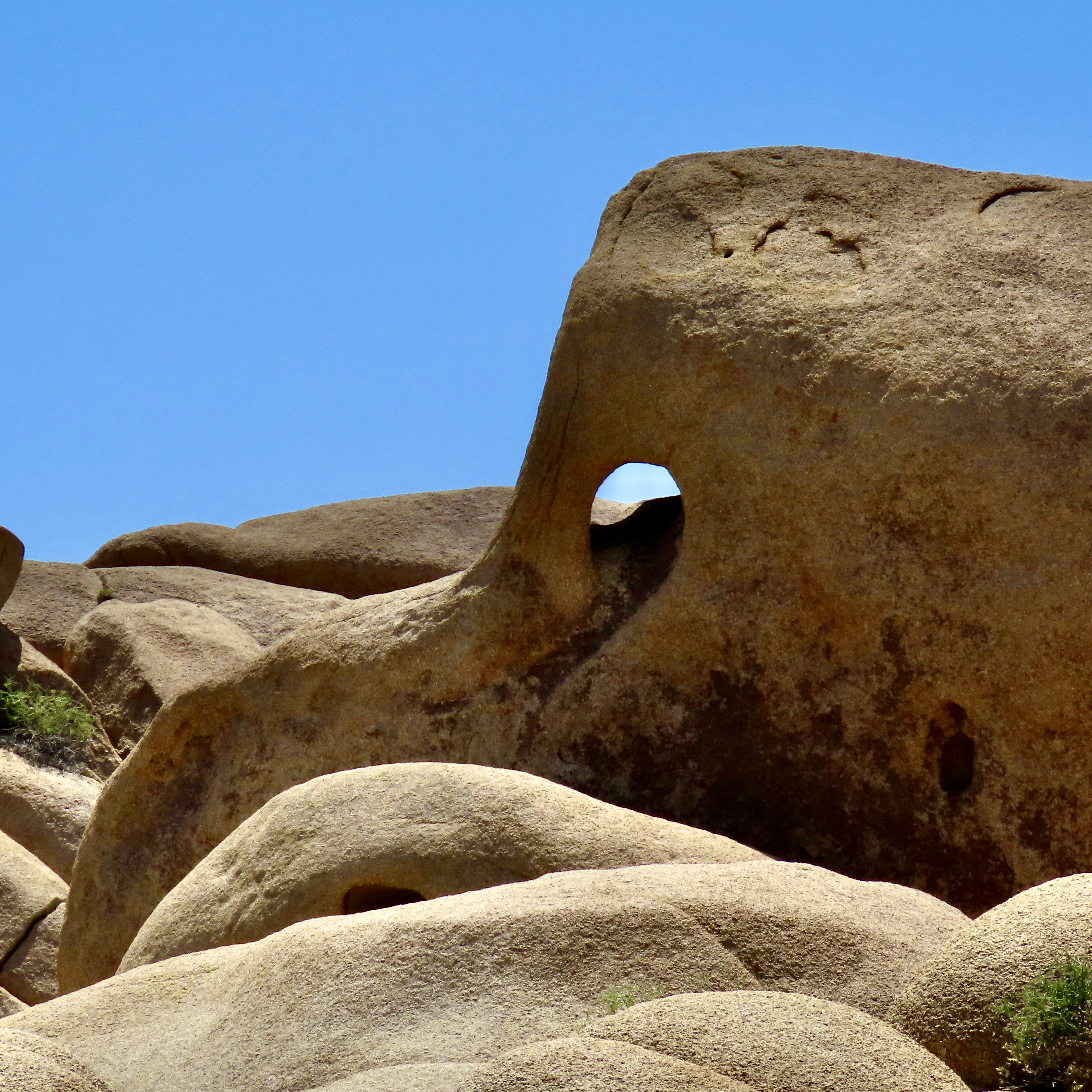
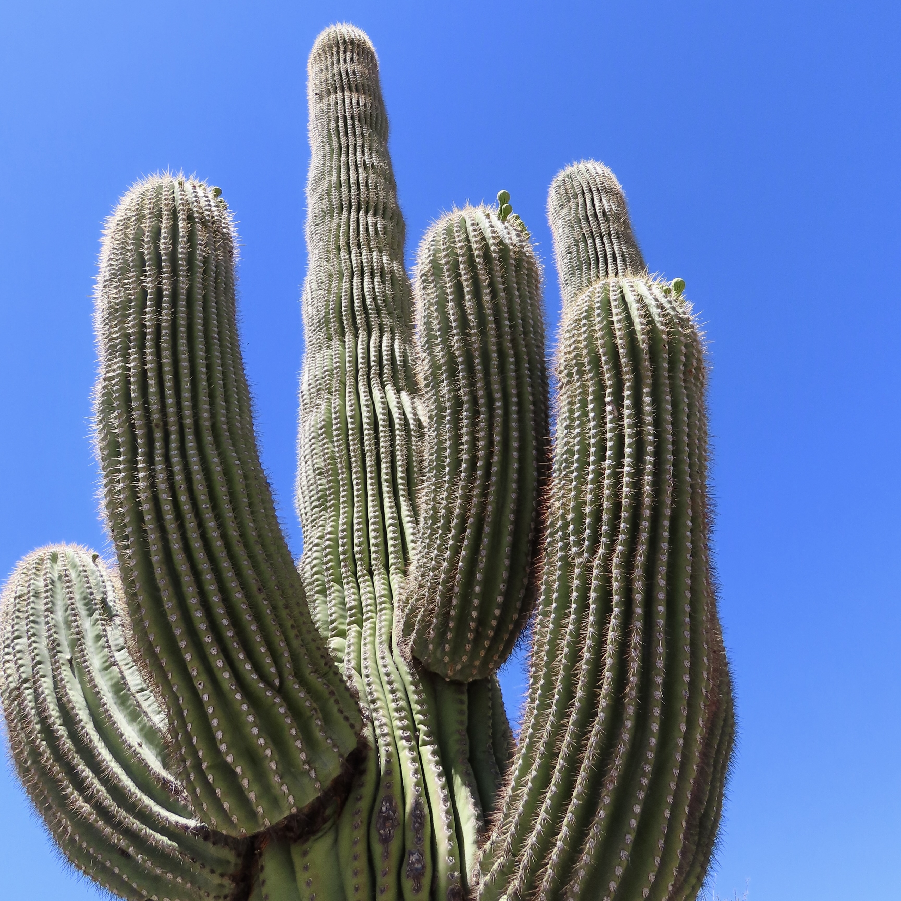
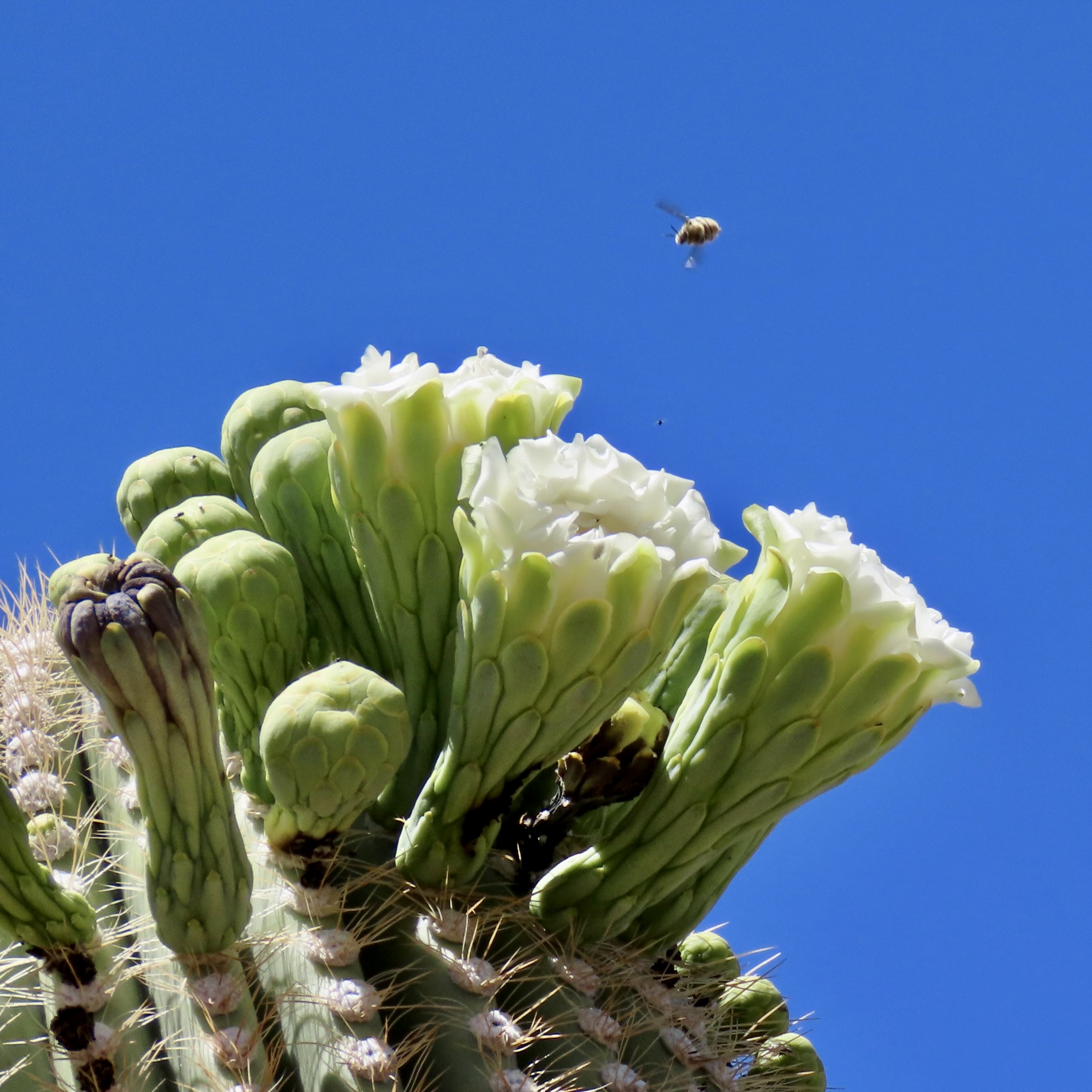
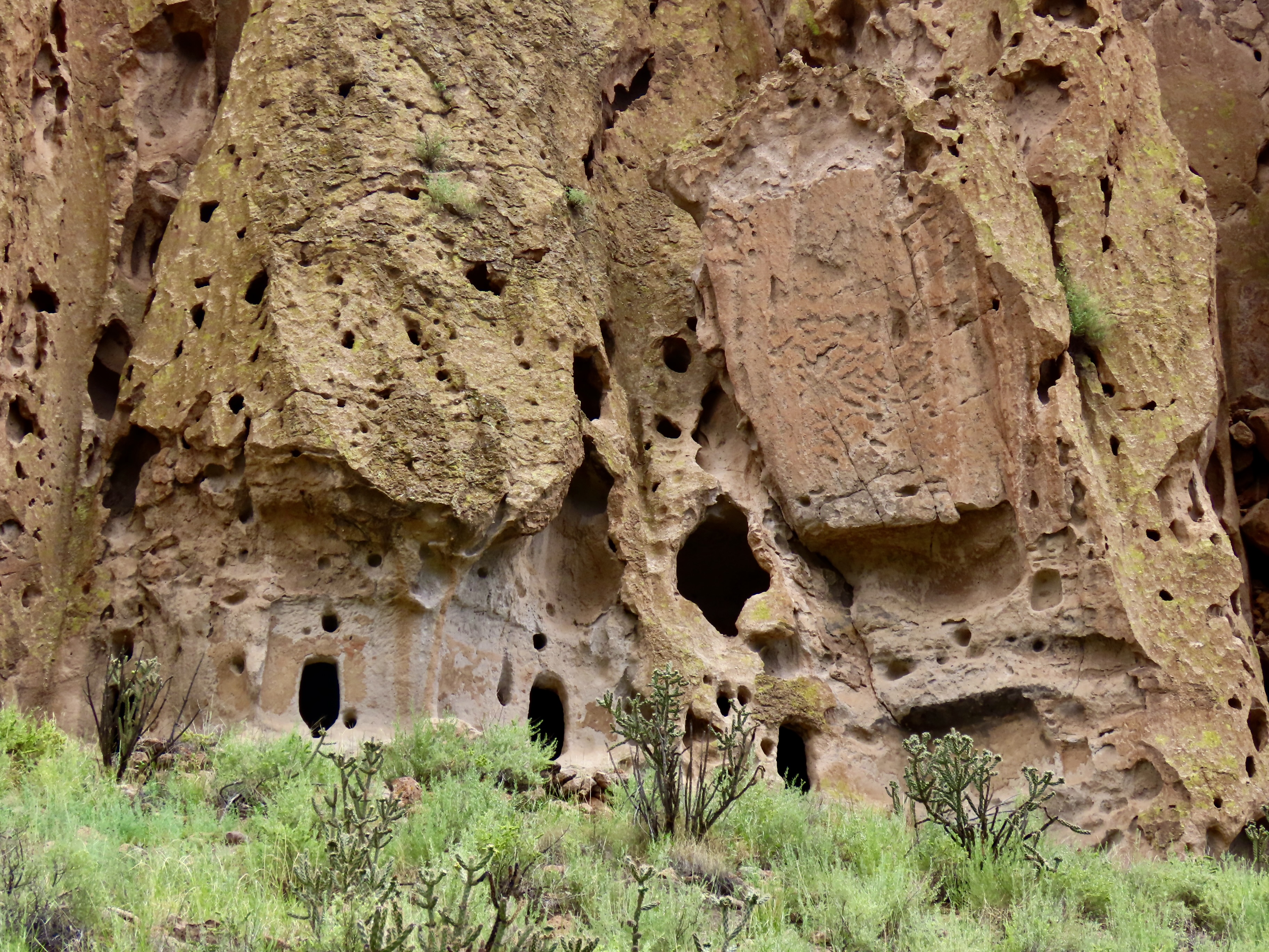
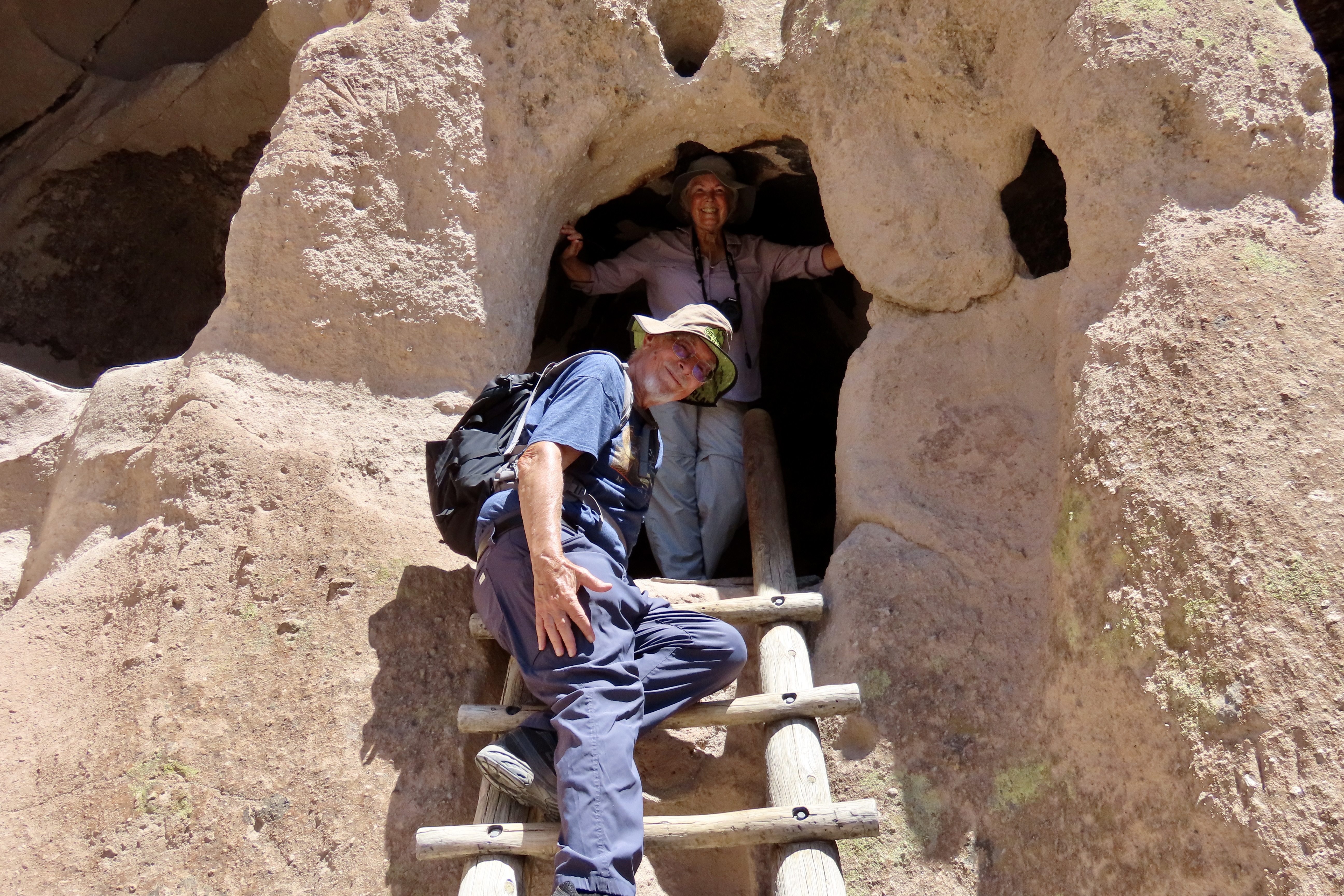
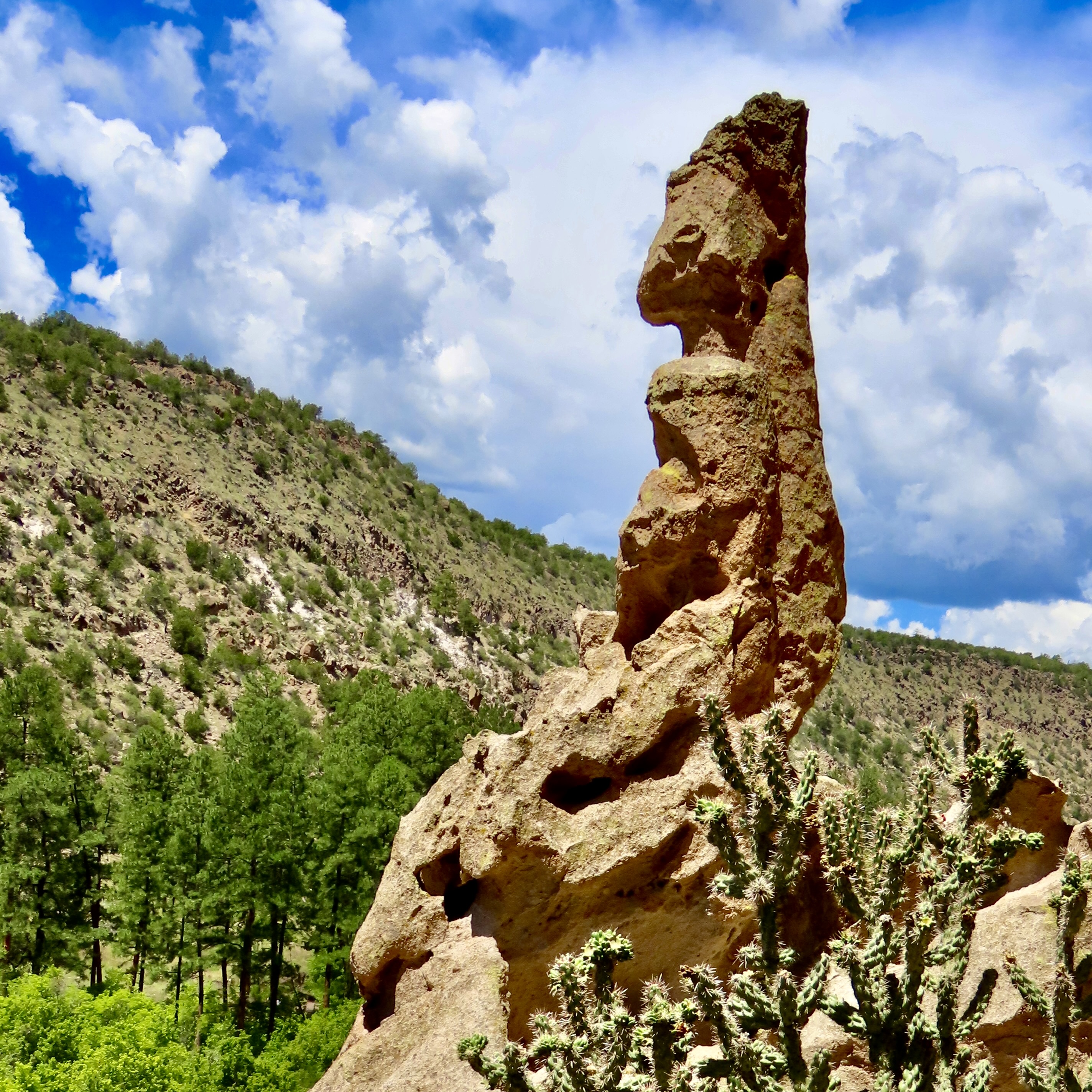
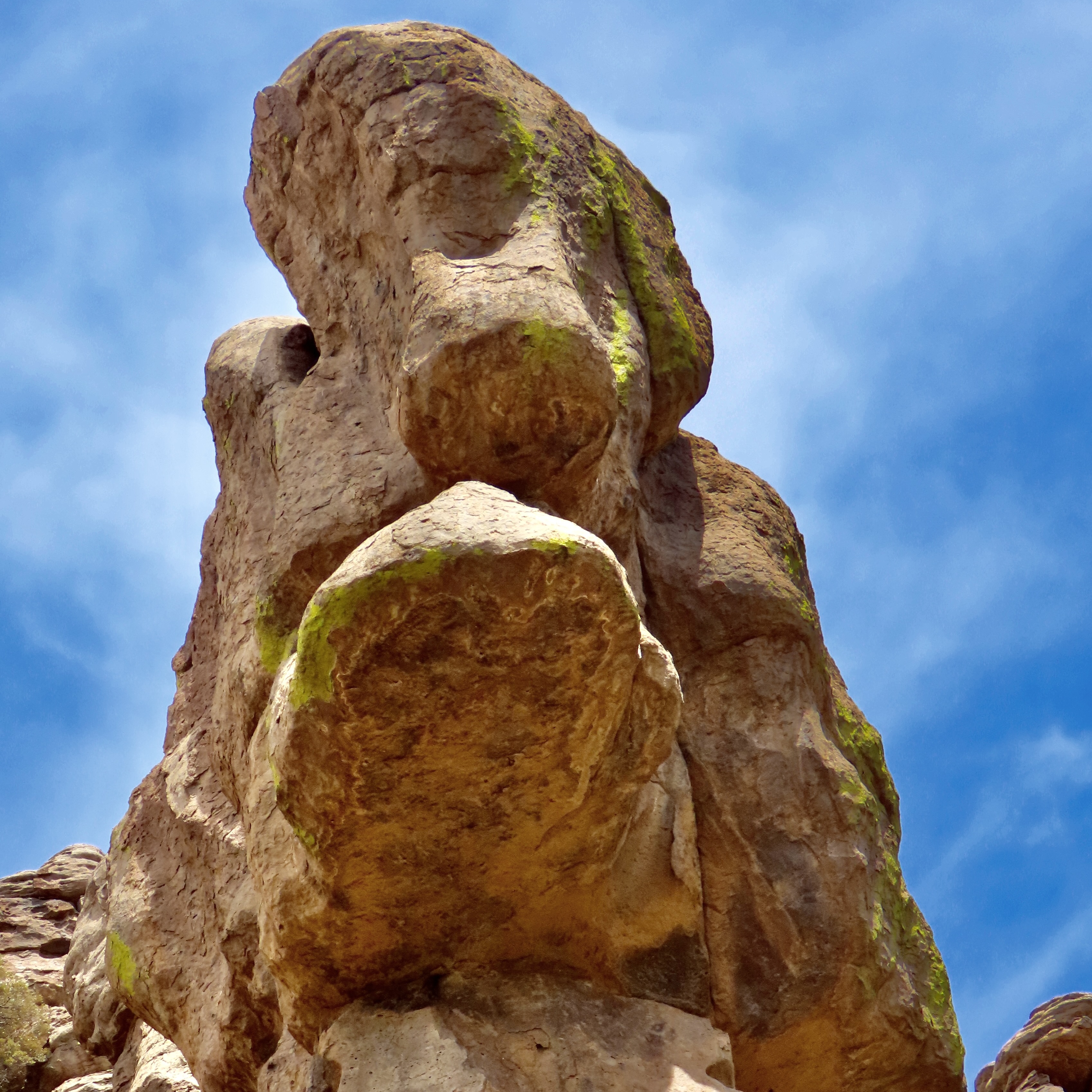
Petrified Forest National Park is found just off of I-40 in eastern Arizona. There are thousands of logs like the one above found in the park. You can still see the bark on this petrified wood that was once a tree that fell 200 million years ago.While most people come to the park to admire the petrified wood, there is also much beauty such as the colorful ‘Teepees’ found on the main road. Each color has a different story to tell representing millions of years in geological history.The Blue Mesa side road includes many other interesting and colorful land forms such as this. If you visit the park, be sure to take the short detour. A walk out in the desert on well maintained trails is definitely in order.Ancestral Puebloans and other indigenous tribes left a view of their ancient world in Petrified Forest NP in petroglyphs on Newspaper Rock. While our understanding of what they were communicating is limited, there is magic in contemplating the possibilities.While we are on the subject of petroglyphs, we found this unique one staring out at us in Petroglyph National Monument in Albuquerque, NM. Over 20,000 petroglyphs have been discovered in the monument. Peggy has plans to include this one in the revision of her word search book: Artistic Word Searches, Unique and Magical: Discovering Petroglyphs from the Southwest.Canyon De Chelly (pronounced shay) is located in northeastern Arizona. Jointly operated by the Navajo Nation that owns the property and the National Park Service, Canyon De Chelly features striking canyon views plus Ancestral Pueblo ruins and petroglyphs left behind by both the Pueblo peoples and Navajos.Our trip this past spring and summer took us into Califonia where we visited family and friends in San Diego, LA, and Sacramento. We also took time to visit Joshua Tree National Park in Southern California, known for its strange trees, after which it is named.We found the rock structures to be of equal, if not greater, interest. Some of which could be said to possess personalities.In addition to being known for its outstanding rock forms (think of the Grand Canyon, Zion, Bryce and Arches— plus what we visited this year), the Southwest is noted for its deserts and cacti, none of which is better known than the Giant Saguaro. We’ve often stopped to admire these huge plants in Saguaro National Park but have never been in Arizona when they are blooming. Things were about to change. Note the buds popping out on top of the arms.This time we were lucky. The blooms are almost other-worldly, in addition to being a source of food for numerous insects such as the bee coming in for a landing.A number of other cactus flowers also lit up the desert.Like plants, animals adjust to the deserts of the Southwest. Several birds choose to nest among the needles of various cacti including the curved bill thrasher Peggy found raising her family in a cholla cactus. The thrasher was not happy when she sneaked up to it and her hatchlings to catch a photo with her iPhone. It’s probably a good thing Peggy couldn’t understand what momma was saying.Bandelier National Monument, located mere miles away from where the first atom bomb was created at Los Alamos, New Mexico, features the ruins of homes built by Ancestral Puebloans that included natural and carved caves (cavates) with pueblo structures once built up against them.Peggy and I climbed up to one of the cavates. It was quite cozy inside. “Honey, I’m home.”Just beneath the cavate, this outcropping of rocks overlooked the large Tyuonyi Pueblo at Bandelier. A corner of the ruins can be seen here. It was built in a circle and contained contained 400 rooms.This tall rock was among the rocks in the outcropping. My first thought was wow! Nowhere in our travels though out the Southwest have we seen a statue like it carved by Ancestral Puebloans or any other indigenous tribes. We had a guide to the trail we were walking on, but there was no information on the statue. Nor was there anything in the information center. The emphasis was all on the scenery, cavates, petroglyphs and pueblos. Human or nature carved, I would think that the park’s literature would at least comment on it. That’s it for today. Next up:We wrapped up our year of travel with out trip to New England so it’s proper that we finish off 2025 with the trip.
Happy New Year to everyone and thanks for joining us on our adventures in 2025. It’s much appreciated. Costa Rica, Bali, and Scotland are coming up in 2026! Curt and Peggy
Each year, I create a Christmas Card for Peggy and me to send out to family and friends, and, I might add, share with you on Wandering Through Time and Place. Admittedly, they are designed to be a bit strange, and hopefully elicit a chuckle. After all, Santa is ‘a jolly old elf.’ This year, he has a bit of a problem, however…
Okay, let’s think about this. Rudolf only has to work one day out of the year. What in the world does he have to complain about? Well… Here’s some information I included on the back of the card:
-To start with, Santa is really old. He takes his origins back to Saint Nicholas who was born around 270 AD. That makes his age around 1700 years! No wonder he hasn’t kept up with modern production and delivery services. If he contracted with Amazon Prime, he, his elves, and the reindeer could all sit around a bonfire drinking rum infused eggnog and celebrate a job well done on Christmas Eve. Instead…
-He and the reindeer have to visit some 300 million homes. And, they have to do it in 34 hours, given changing time zones. “So what are you whining about?” Santa likes to argue. “I got you ten extra hours.” But what does that really mean…
-He has to deliver gifts to 9,127,789 houses per hour, or 2,536 per second. And what applies to Santa, also applies to his reindeer. That’s one heck of a lot of landing on roofs, taking off— and flying. How far do the reindeer have to fly, you ask…
-It’s been clocked at over 100,000,000 million miles by according to Santa’s odometer (and confirmed by scientists who have ‘worked’ it out). That means the reindeer have to fly a staggering 2,823,529 mile per hour.
No wonder Rudolph is upset about his pay. But Santa has a solution that won’t cost him an extra penny. He has recruited Rudolph’s girlfriend who is willing to work for less to get into the business of guiding flying sleds on foggy nights. Rudolph is not happy…
Dasher, Dancer, Prancer, Vixen, Comet, Cupid, Donner, and Blitzen are all for Santa’s decision. They think it will be a lot more fun to follow Rudette for 100 million miles than Rudolph. What a surprise? But wait, negotiations are under way, and…
There is good news from the North Pole! Santa and Rudolph have reached and agreement. 10 pounds of apples, 4 pounds of corn and 5 pounds of alfalfa will be added to Rudolph’s trough each day. Plus, he will have Rudette along as a partner on Christmas Eve to help light up the night and his life— at equal pay. Dasher, Dancer, Prancer, Vixen, Comet, Cupid, Donner, and Blitzen will each get 9 pounds of apples, 3 pounds of corn, and 4 pounds of alfalfa, and, they still get to follow Rudette. Everyone is a winner!
Wishing each of you a great holiday season and a healthy and happy New Year. Thanks for coming along with us on our journeys this past year!
Curt and Peggy
*A final note, I know that Ut-Oh is usually spelled Uh-Oh but Ut-Oh is how I pronounced as a kid and continue to today.
Our blogs each year, for the most part, are based on our wandering ways. We kicked off 2025 with a trip to the Big Island of Hawaii where we stayed in a VRBO 30 miles outside of Hilo for a month, rented a car, and explored the island. Spring and summer found us wandering through the Southwestern US for five months, pulling a small trailer behind our truck, and visiting national parks and monuments. In October/November, we left the trailer behind at our home base in Virginia and traveled for three weeks through New England admiring the beautiful fall colors.
Our next three posts will be devoted to doing our yearly wrap-up of our travels— based on our annual calendar. Each year we select 13 photos from among what we consider our best travel photos for use in a calendar we create for our extended family. This year we created three: one for each of the areas we visited. Family members got to choose which calendar they wanted. The photos for today’s post were selected for our Hawaii Calendar. The orchid above is one of numerous different species found at the Hawaii Tropical Botanical Garden just outside of Hilo. We highly recommend a visit if you travel to the Big Island. Over 2000 tropical plants are found in the garden.
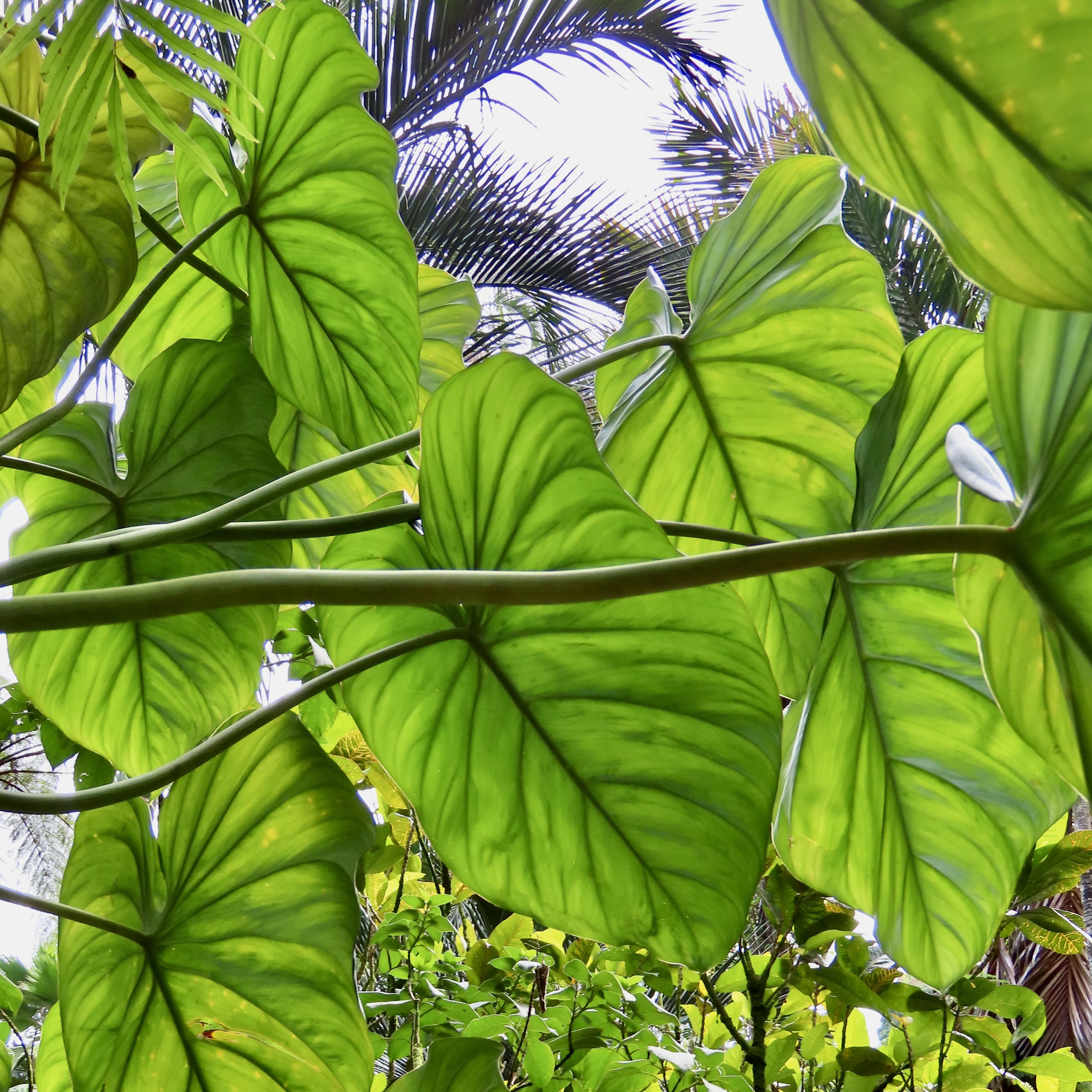
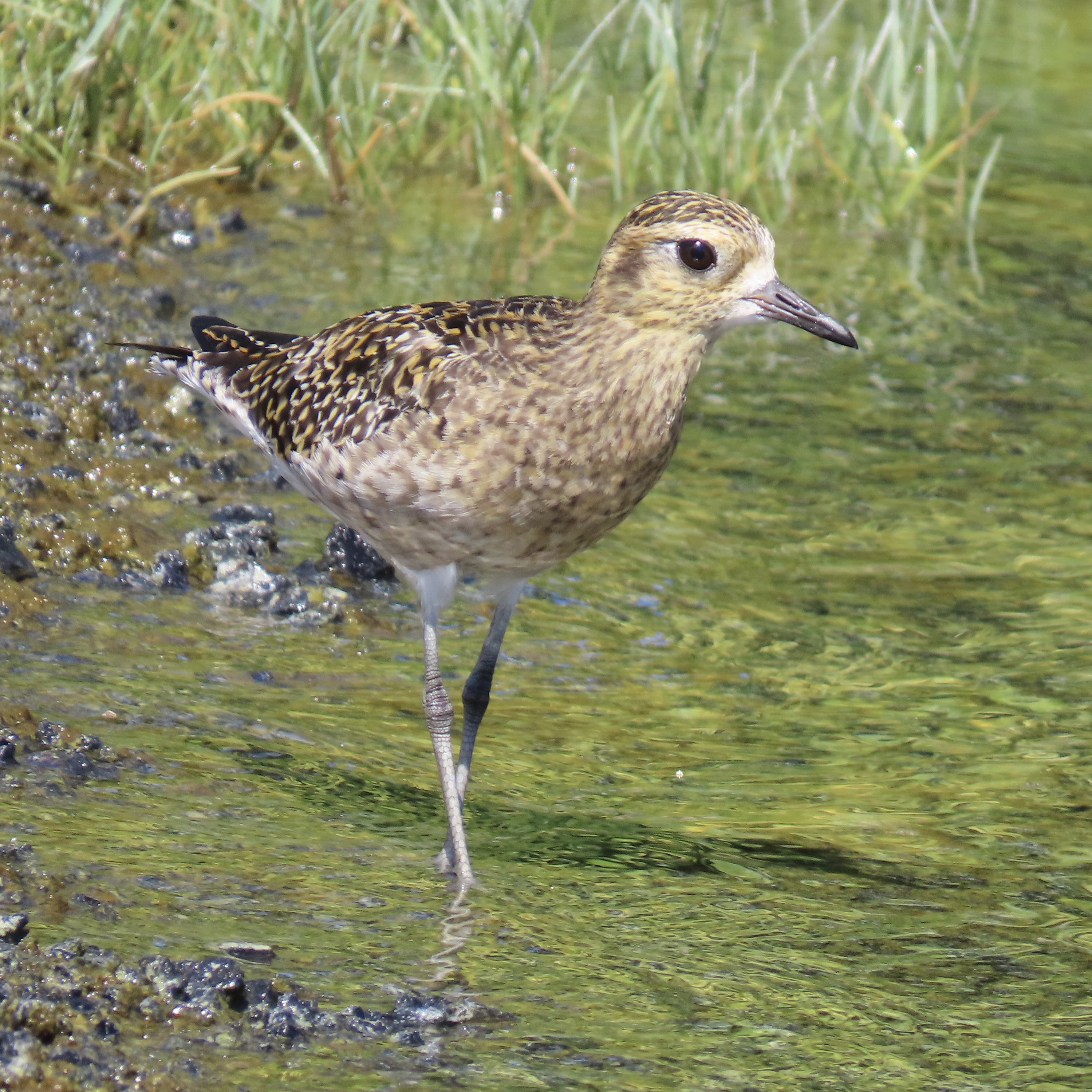
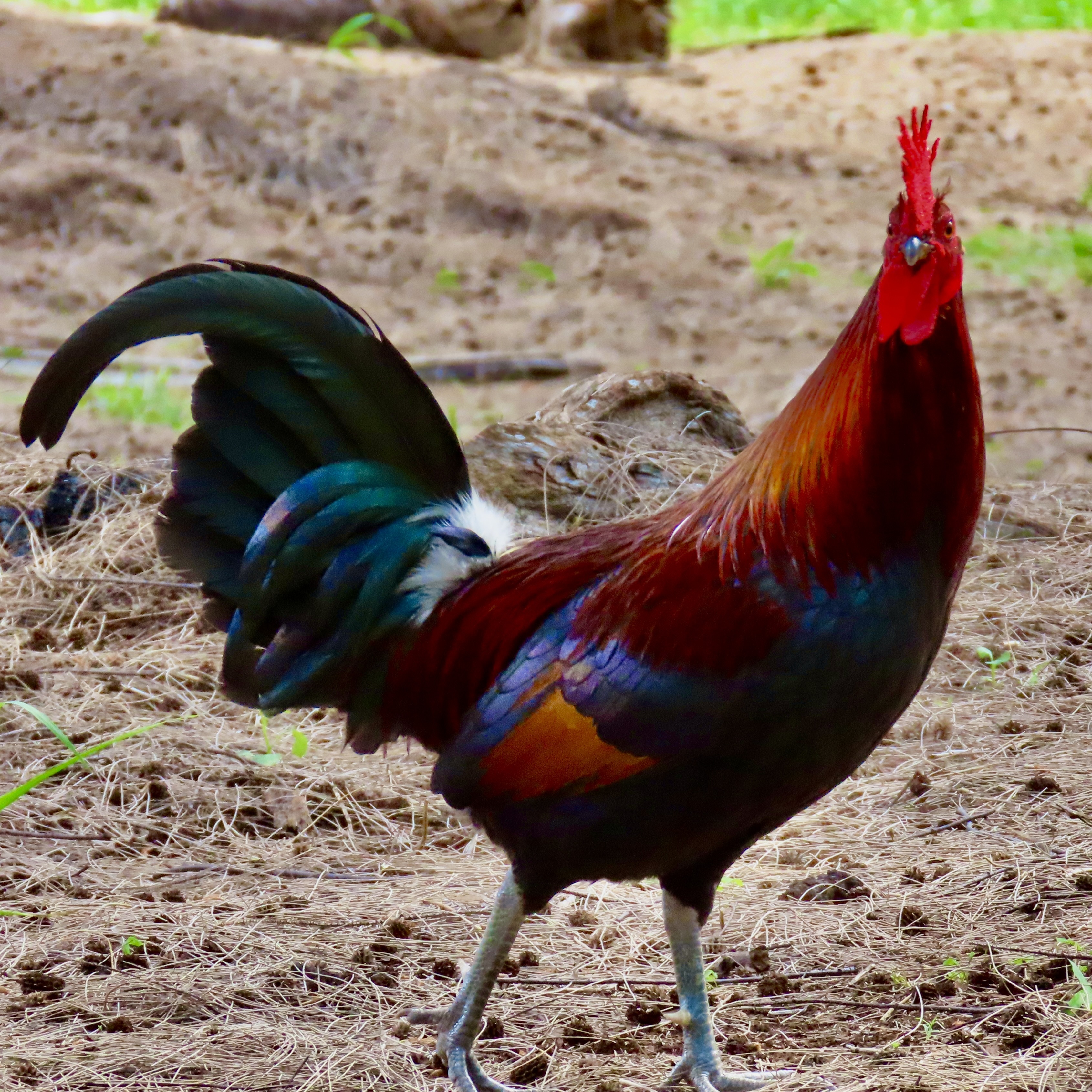
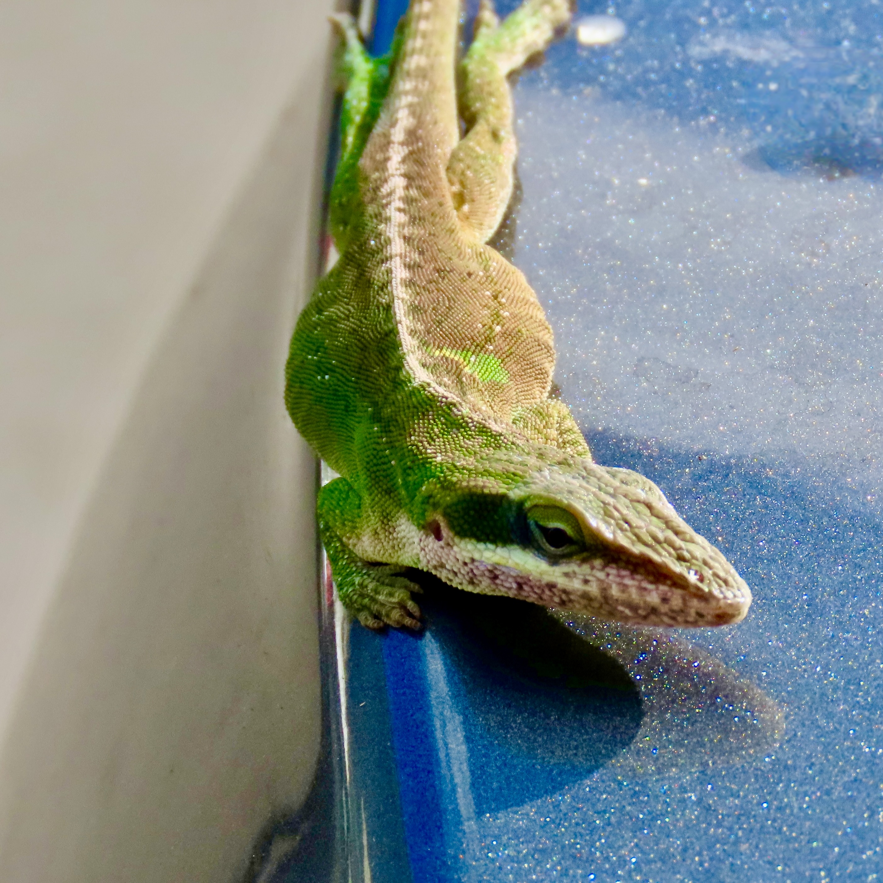
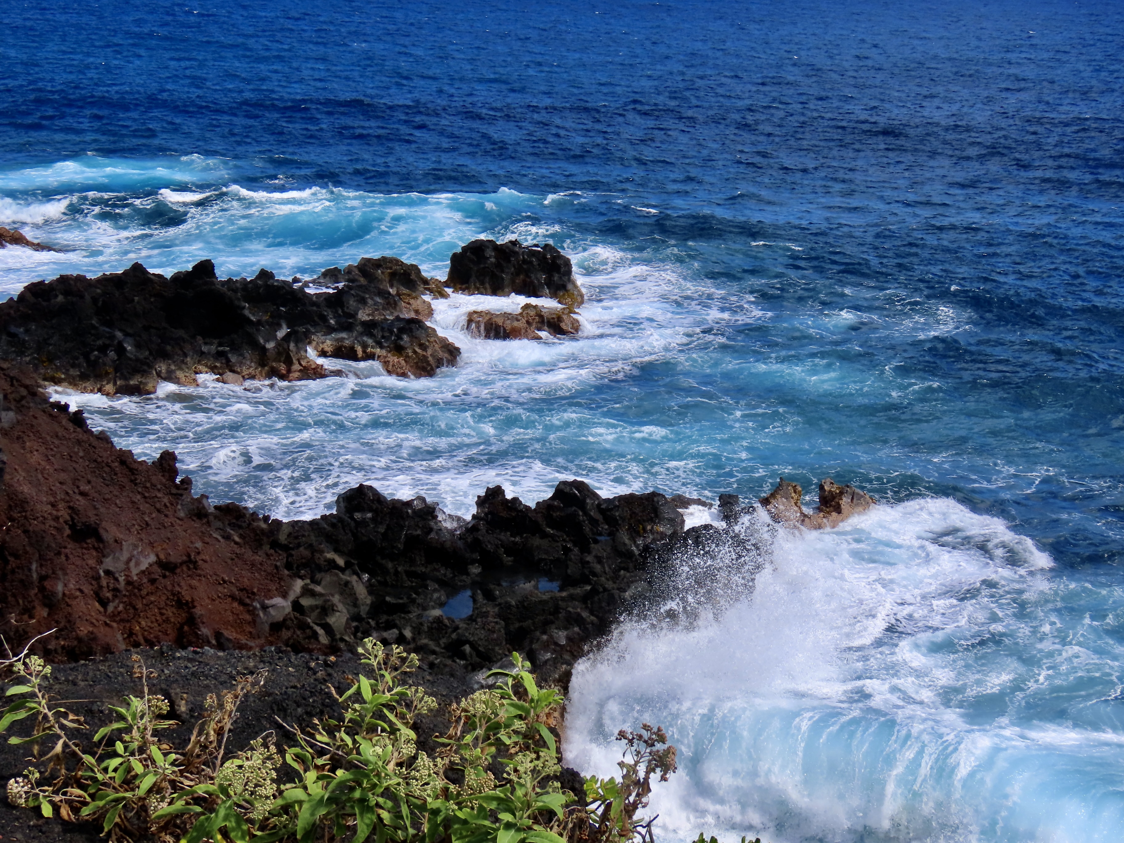
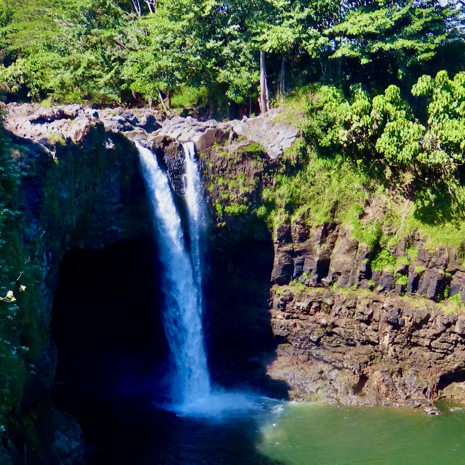
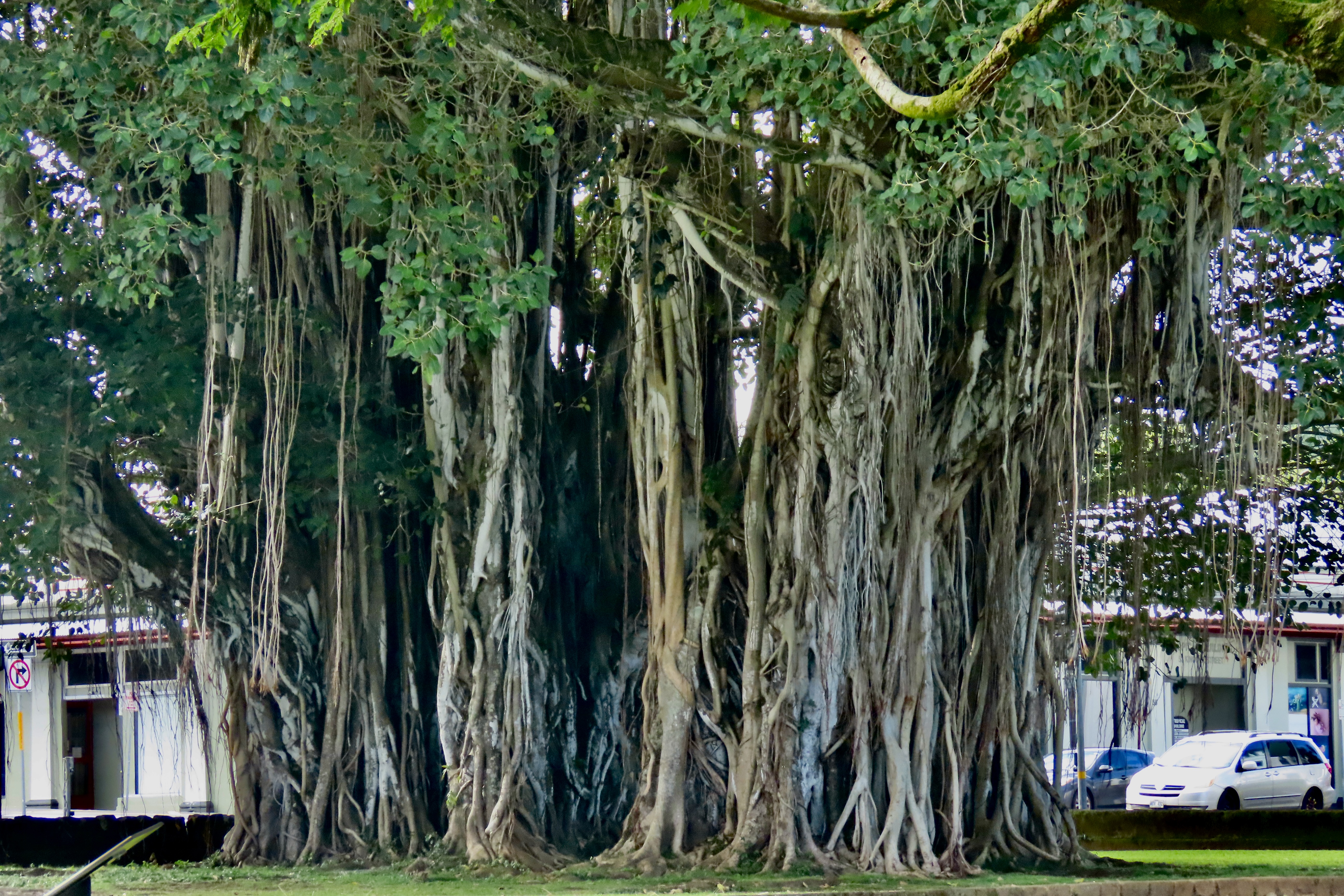
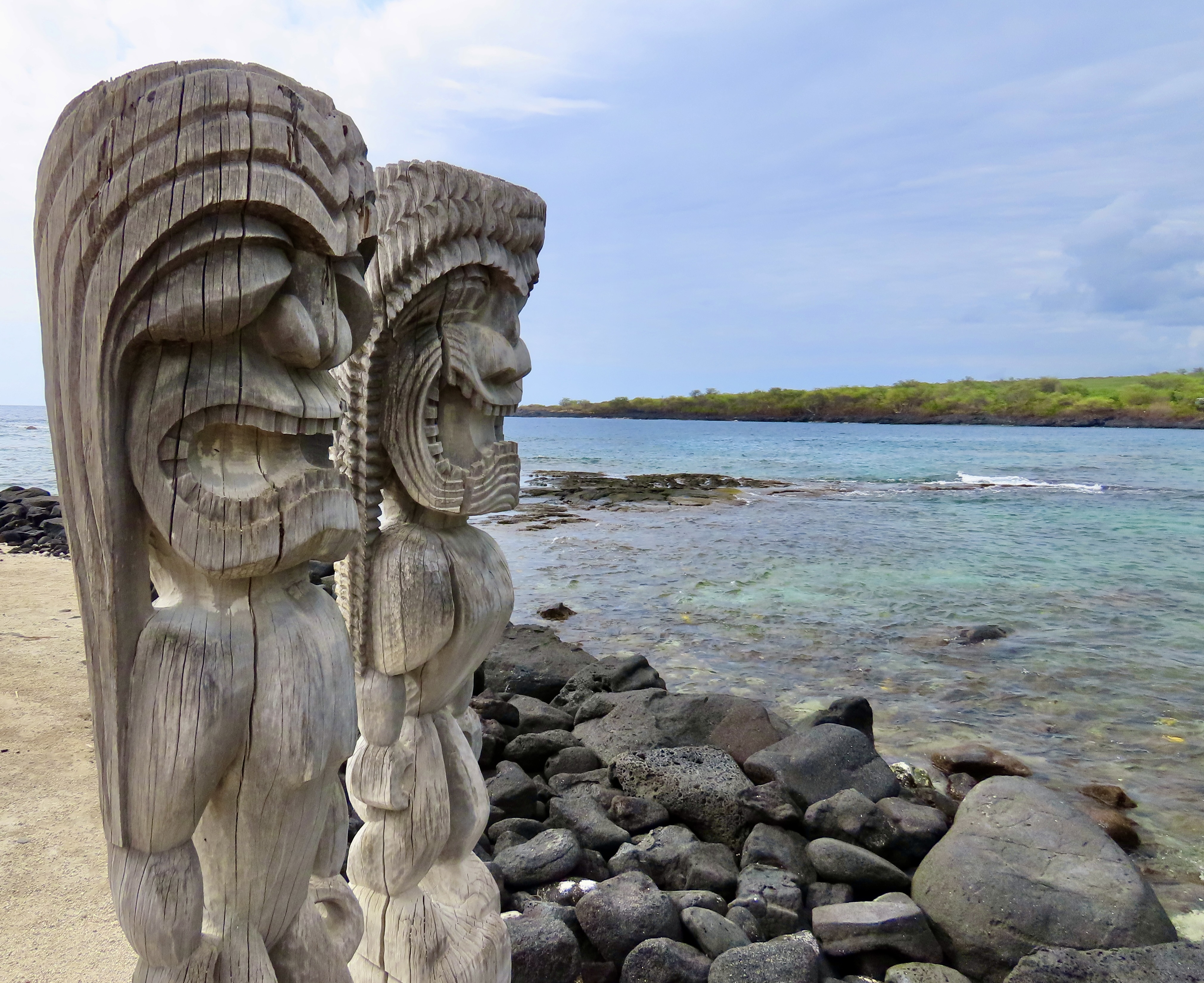
Big leaves are expected whenever one travels in tropical rainforests. Having served as a Peace Corps Volunteer in tropical Africa for two years, I can speak to this personally. Peggy and I were particularly impressed by the beauty, size, and importance of taro leaves to native Hawaiians. Served as a food staple thoughout the islands, Taro is also important in Hawaiian mythology where Taro is regarded as the ‘Elder Brother’ of humankind.If you are a crossword buff, you will know the name of this bird: Meet nene, the native goose of Hawaii.While we photographed a number of birds, as always, we found this slender golden plover particularly attractive. It hardly looks like it is up to a 3000 mile journey to get here each year, but it is. Breeding and raising its chicks in the arctic each summer, it makes the 3000 mile journey to Hawaii each August/September where it will live and feed until April/May when it will make its return journey to the far north. A couple of other facts we found interesting: It often flies non-stop and it always returns to the same location. We would likely find this same bird here if we traveled back to the Big Island this year!Any discussion of the wild birds of Hawaii almost always includes chickens which arrived in the Hawaiian Islands with the Polynesians around 1200 AD, went wild, and have since interbred with modern chickens brought over in the 19th and 20th centuries. We found this gorgeous fellow wandering around in the forest near us.The anole is another interesting member of the Hawaiian wildlife. We had been shopping at a local supermarket when we came out and found the colorful lizard on the hood of our rental car. I suggested that it might want to relocate but it refused, even when we were driving 50 miles per hour down the road. Turns out that anole lizards have specialized toe pads covered with millions of tiny, microscopic hairs that create molecular attraction with slick surfaces. They are related to the iguanas I featured three weeks ago and even come with dewlaps.We were fortunate to find the Kīlauea Volcano active during our visit in February. We watched as it spewed lava 300-400 feet into the air. By November, it was shooting lava as high as 1500 feet!Isaac Hale State Park was located 15 minutes away from where we were staying south of Hilo in the small development of Seaview on the coast. The park was the end of the road for us. No sign was required. An eruption of a side vent on the lower east rift zone of Kīlauea sent lava spreading out over 14 square miles in 2018, destroying 700 homes, blocking several several roads, and covering a portion of the state park before reaching the ocean. Residents of Seaview watched in fear at the time, hoping that the lava flowing a mile away wouldn’t reach their development. They lucked out.Having destroyed homes and blocked roads, the lava finally plunged into the ocean, sending steam high into the air and adding new land to the island. This is what it looks like today off of Isaac Hale State Park as waves from the Pacific Ocean roll in.With Hilo, Hawaii receiving over 100 inches of rain a year, it isn’t surprising that there are a number of waterfalls in the surrounding country. Rainbow Falls is actually located in the town.Coconut trees are a common sight in Hawaii.As are Banyan trees. This one was located in downtown Hilo.While we spent the majority of our time on the Hilo side of the Big Island, we did take a day to drive over to the Kona side, which is where most of the tourists hang out. We went to check out a petroglyph site we had been to before and visit the Puʻuhonua o Hōnaunau National Historical Park, or Place of Refuge. Ancient Hawaiians who broke sacred laws could flee to the site and find safety instead of death. A number of wooden carvings like these represent the Hawaiian gods that once protected the sanctuary.
That’s the overview for our trip to Hawaii. Next up is the Southwest.Our trip though the Southwest took us to three national parks and five national monuments. This photo is from Chiricahua National Monument in southeastern Arizona.
I want to give a special thanks today to Lauren Scott at baydreamerwrites.com who did a great review of my book, The Bush Devil Ate Sam. Lauren is a published poet and author of a children’s book. Her most recent works include King Copper and Cora’s Quest. King Copper is a touching collection of poems about her dog, a chocolate lab, that recently passed away. Cora’s Quest is a children’s book that follows a young fawn as she goes on a delightful journey of exploration through the woods with her parents— until she gets lost.(Don’t worry, the book has a good ending.) You can learn more about both books by visiting Lauren’s site listed above.
What I like most about Lauren is her humanity— her warm sense of caring. Here’s what she says about her writing: So, whatever genre I share with you, whether poetry, personal stories, fiction, or kid-lit, I hope you’ll discover a piece of writing that evokes a special memory or acts as a reminder that you are not alone living with your emotions. Maybe you’ll get a good laugh, after all, we know laughter is the best medicine. Or perhaps you’ll experience an ‘aha’ moment.
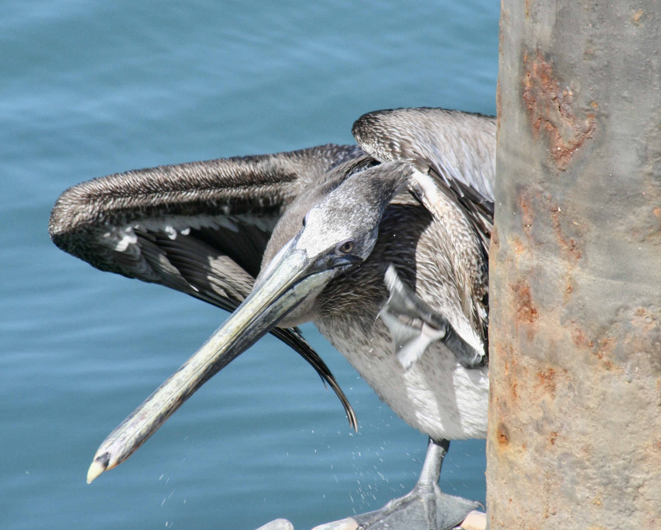
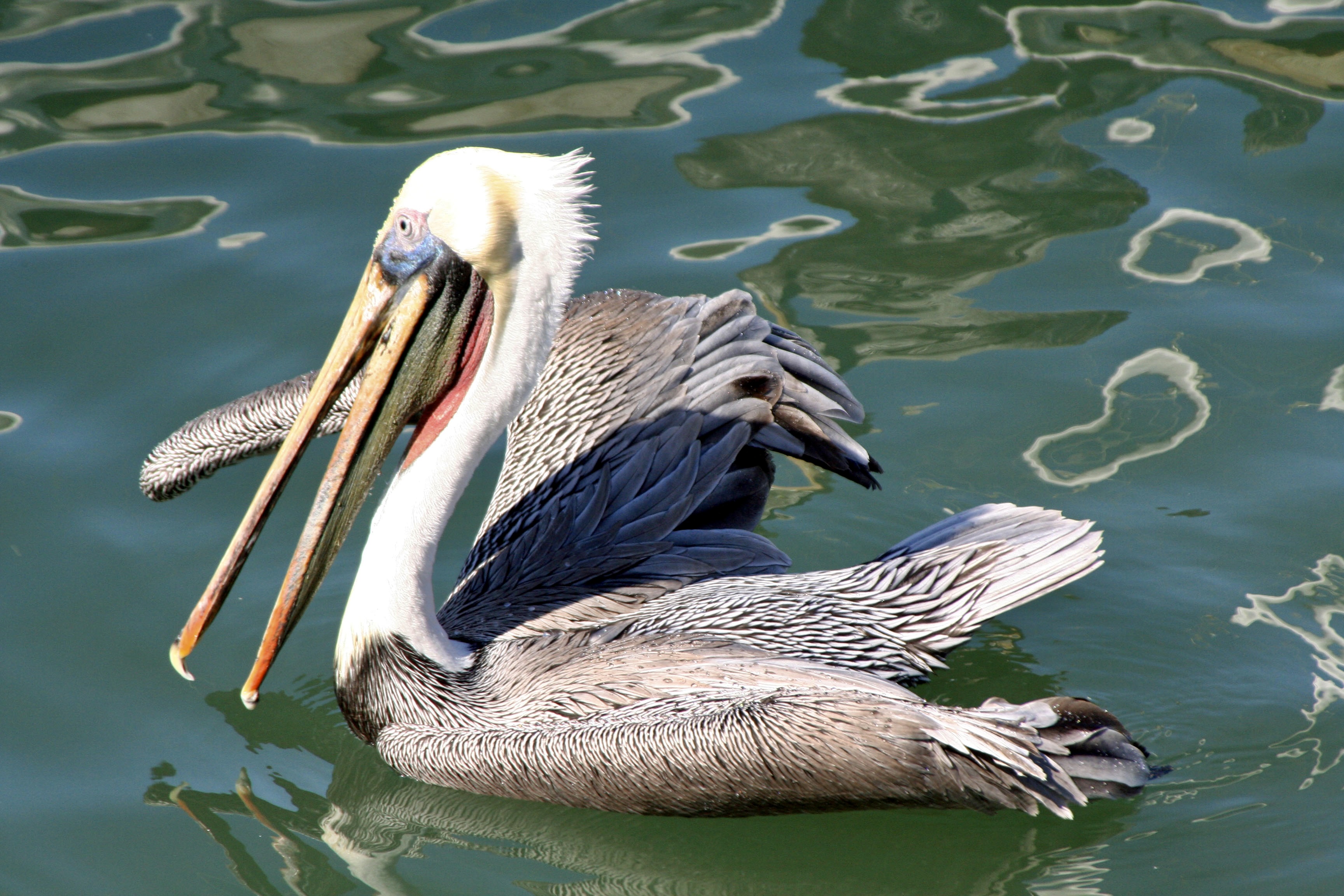
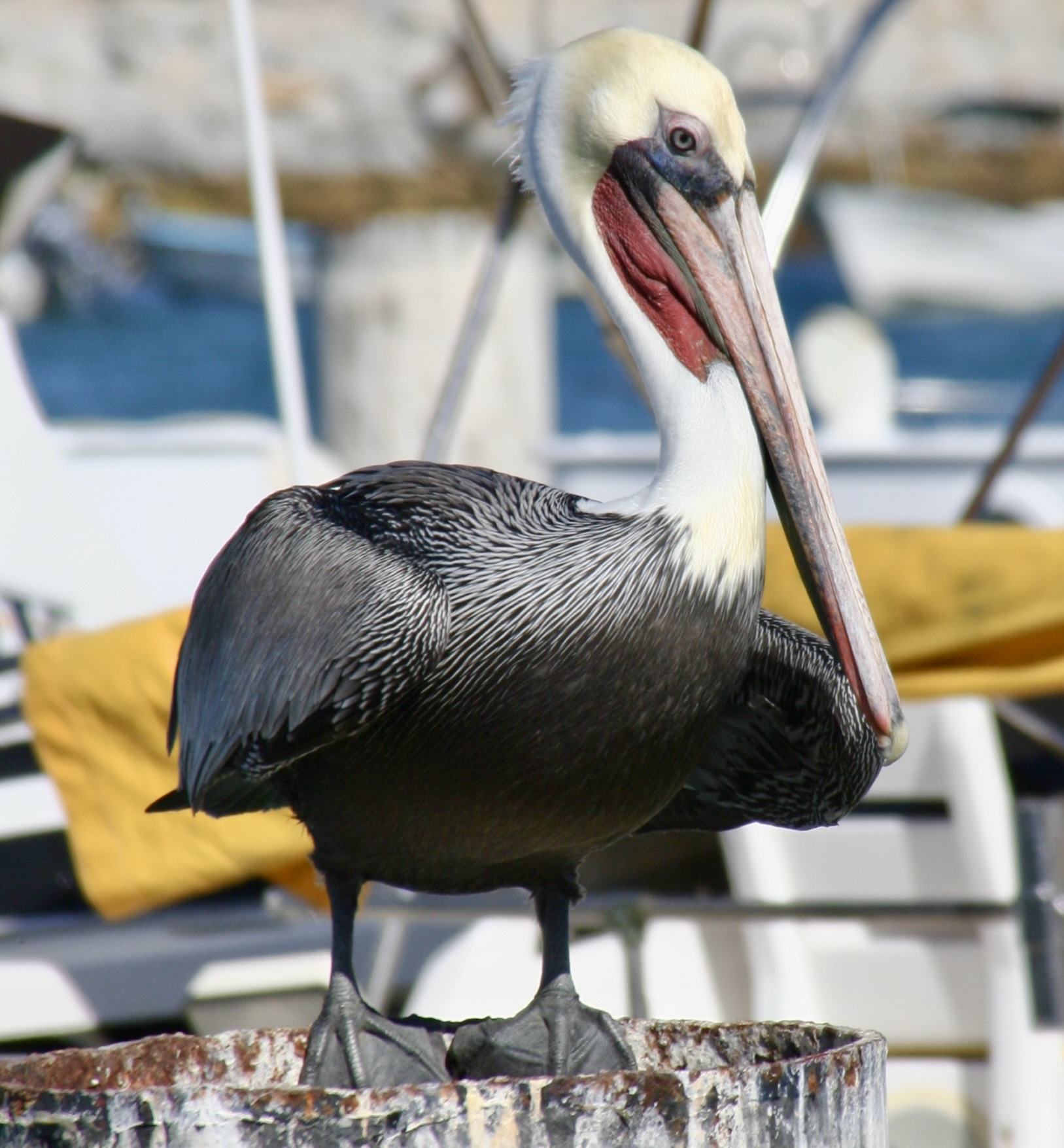
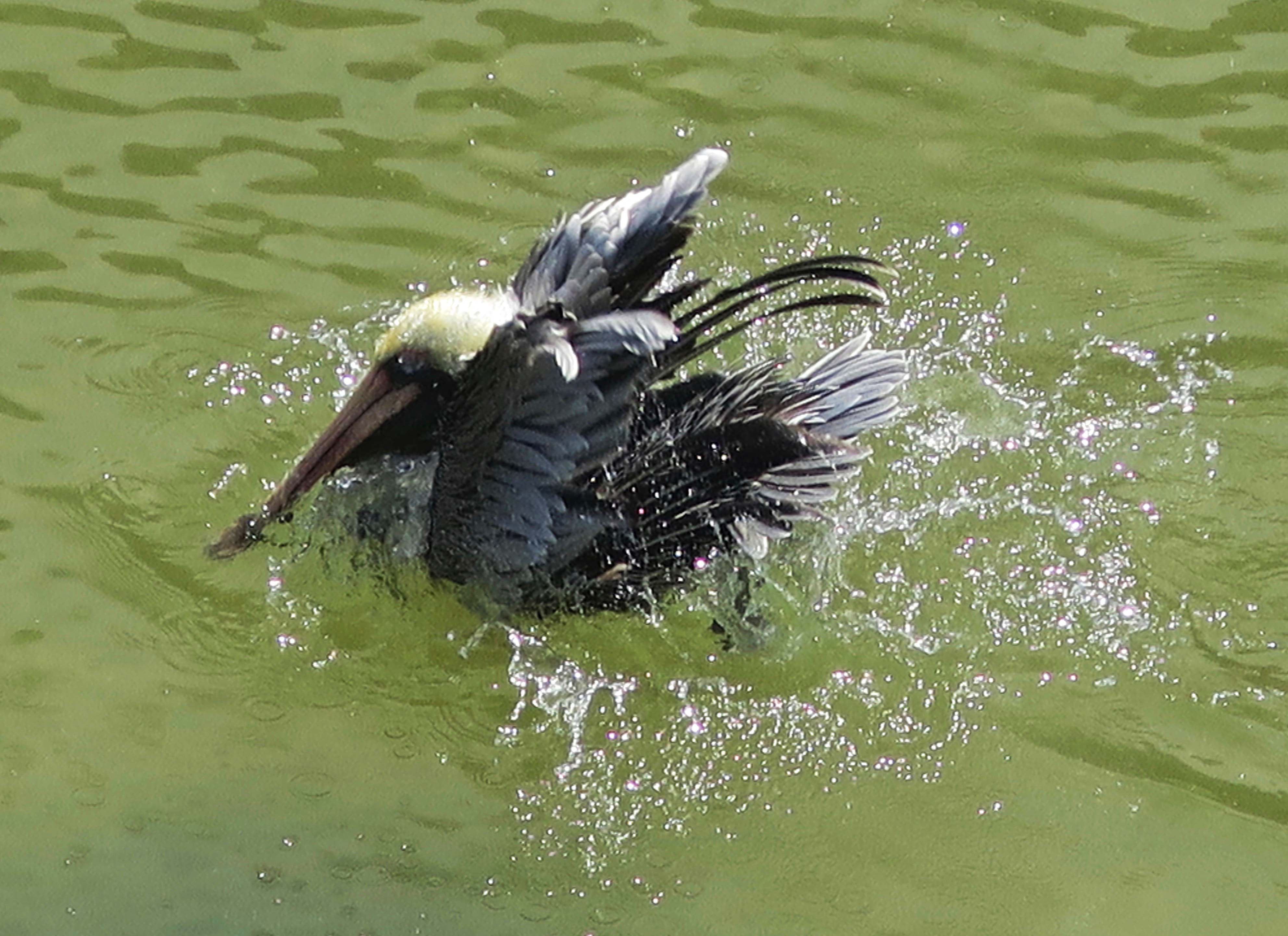
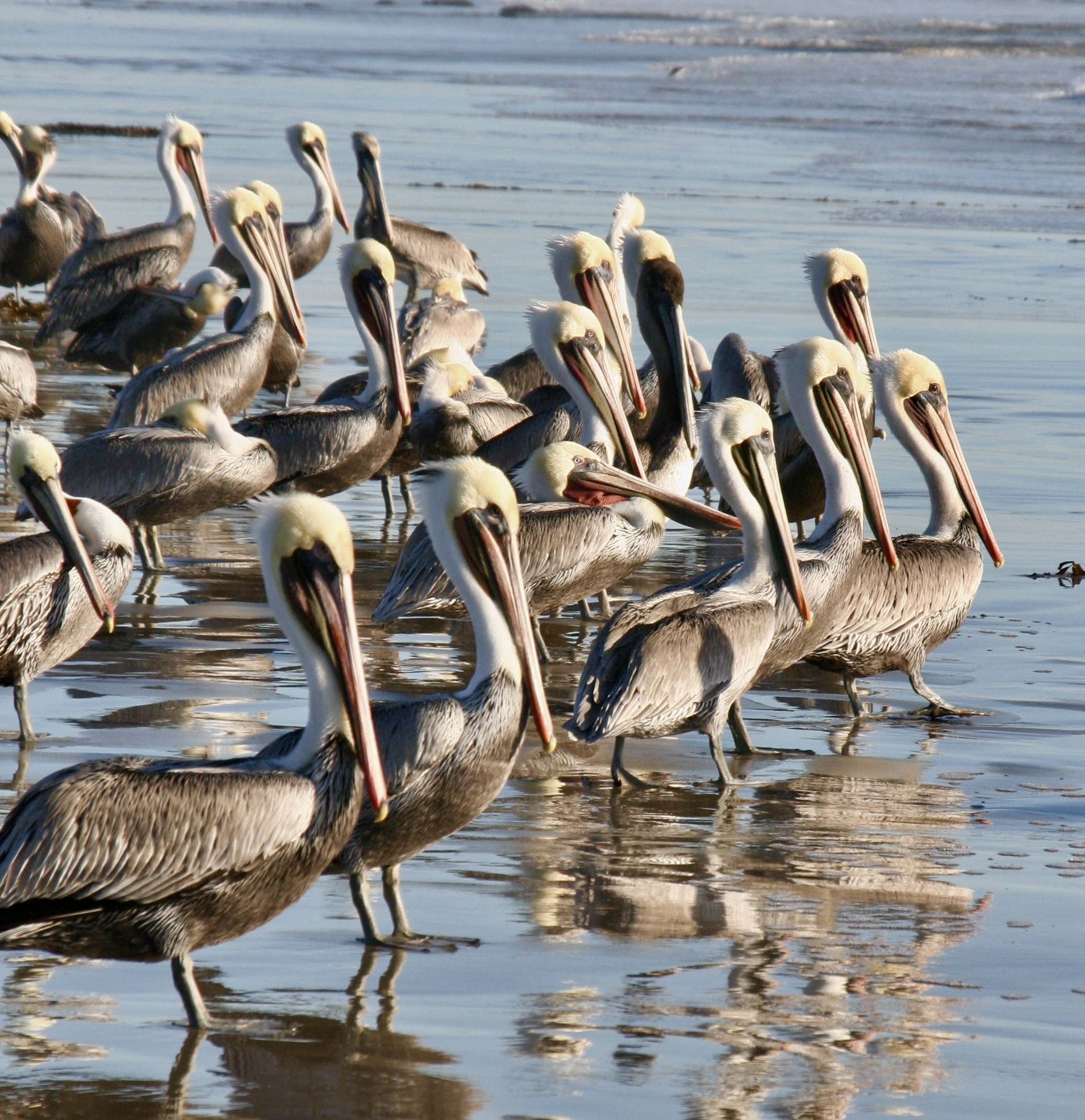
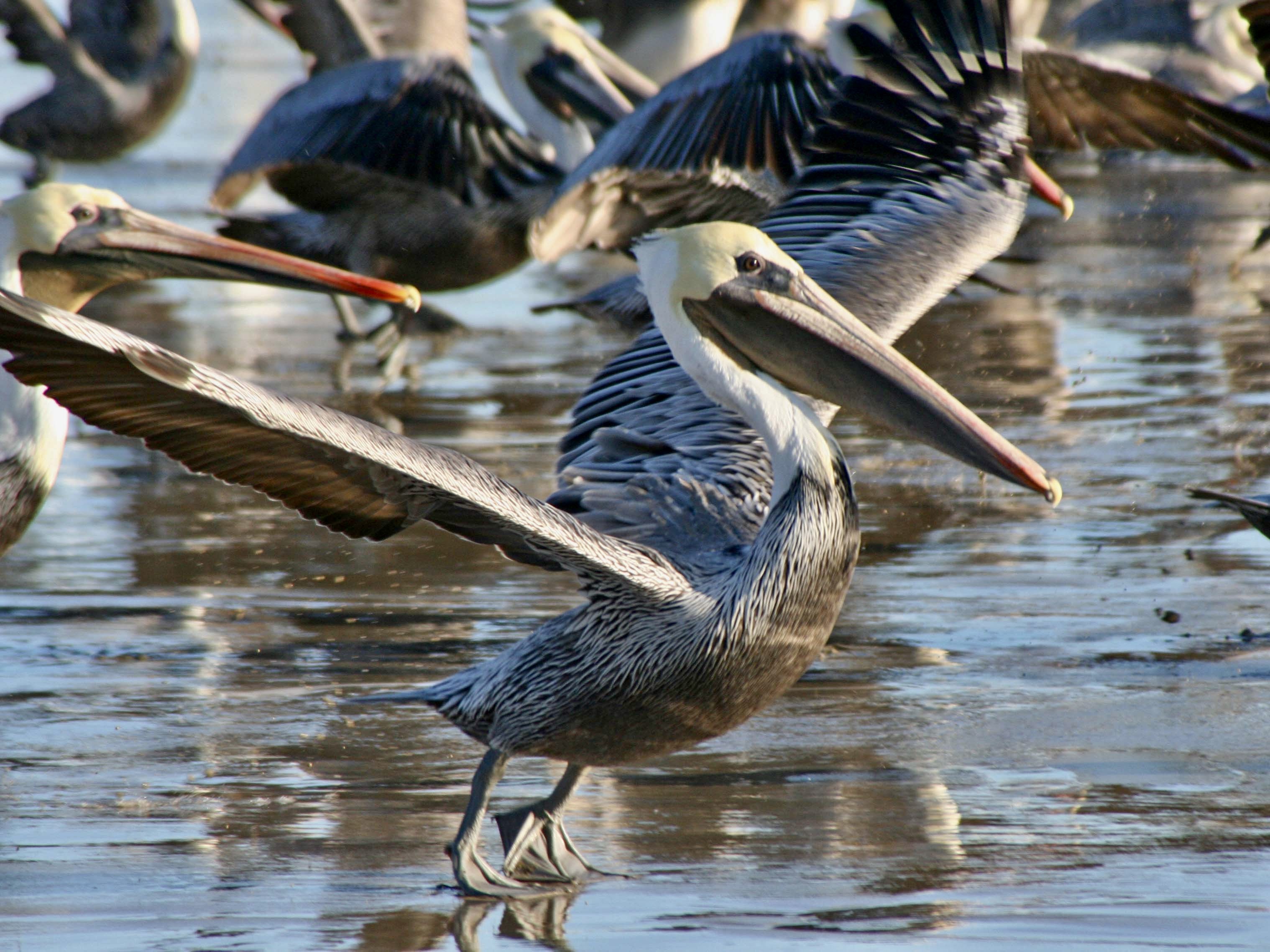
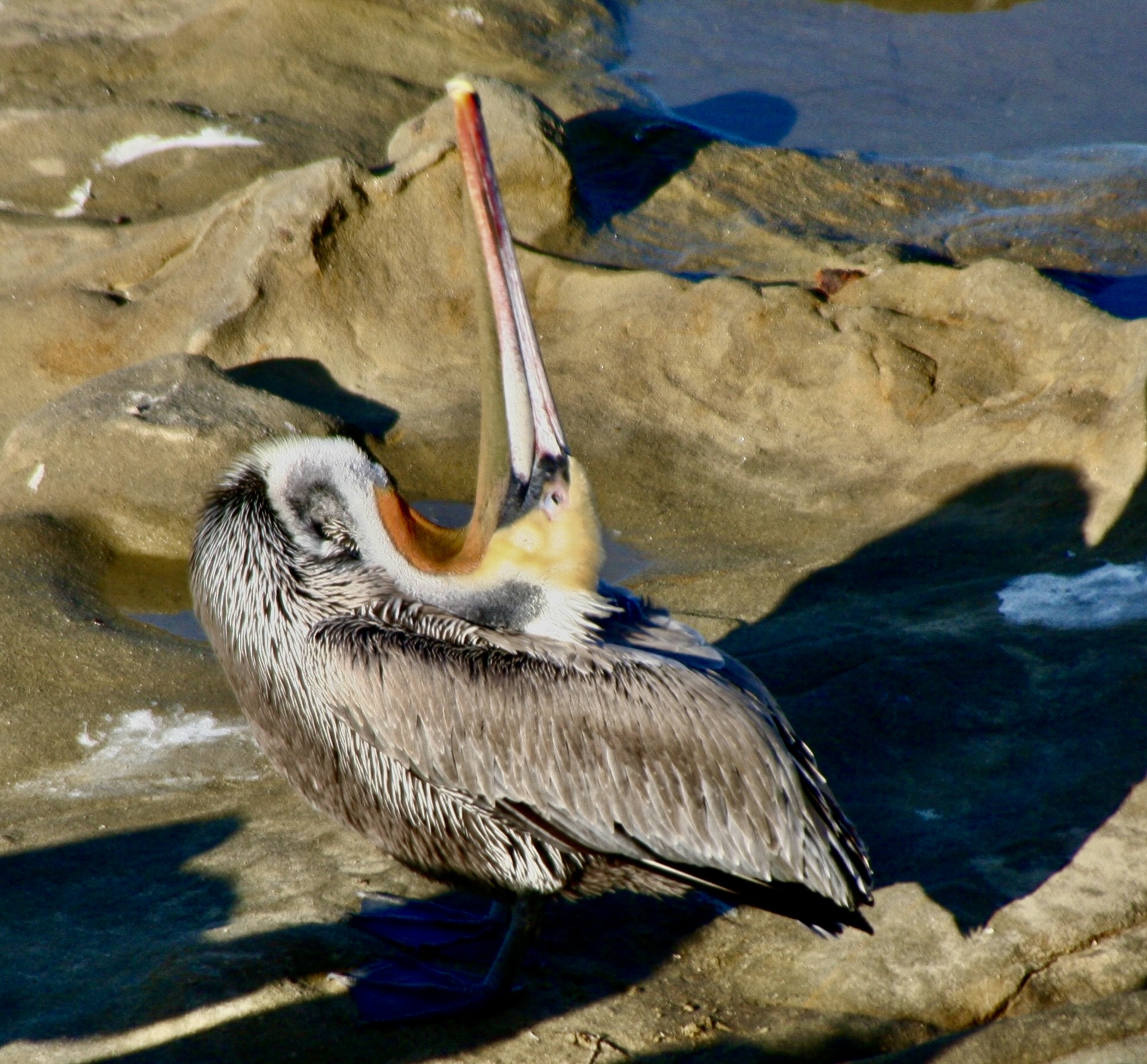
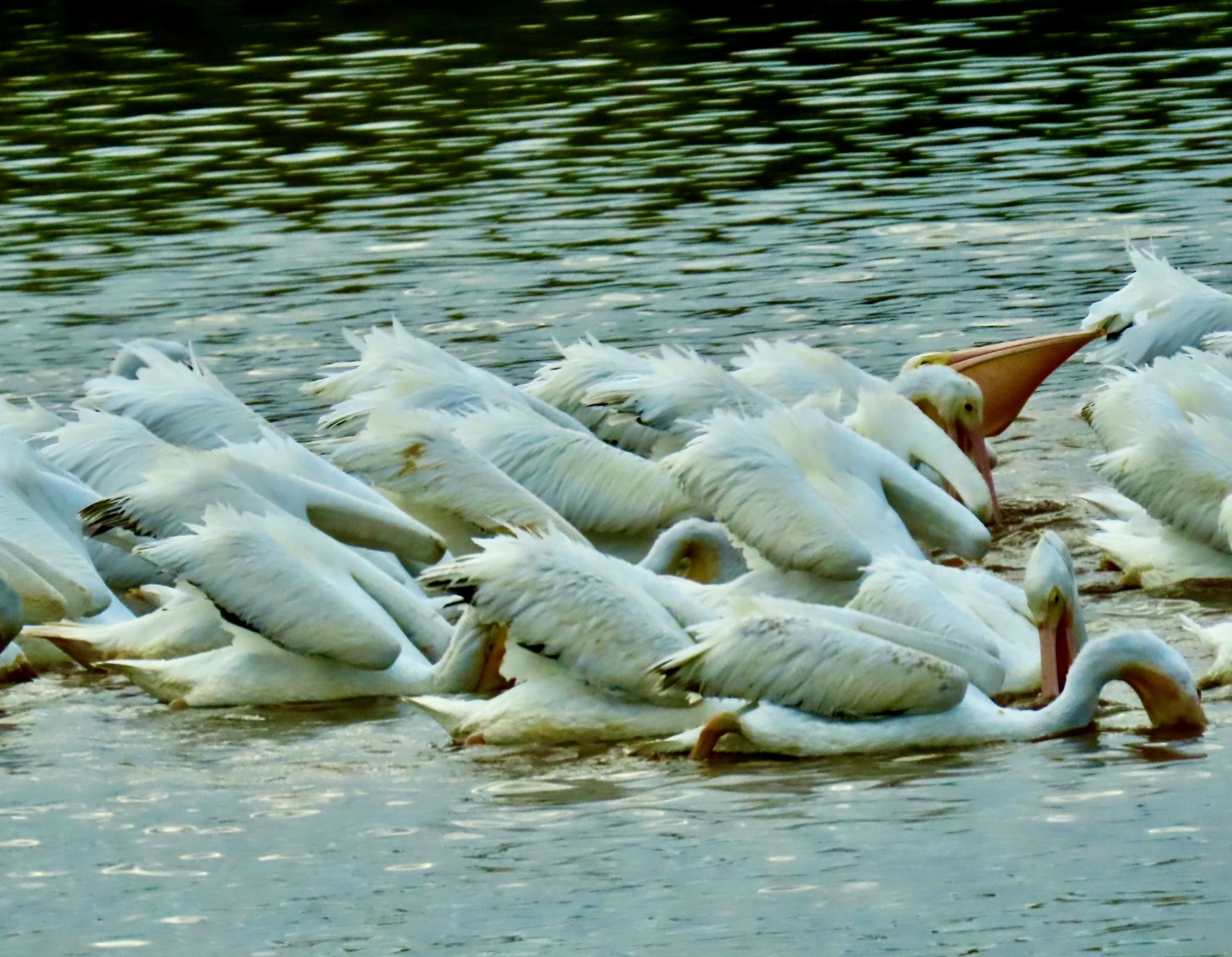
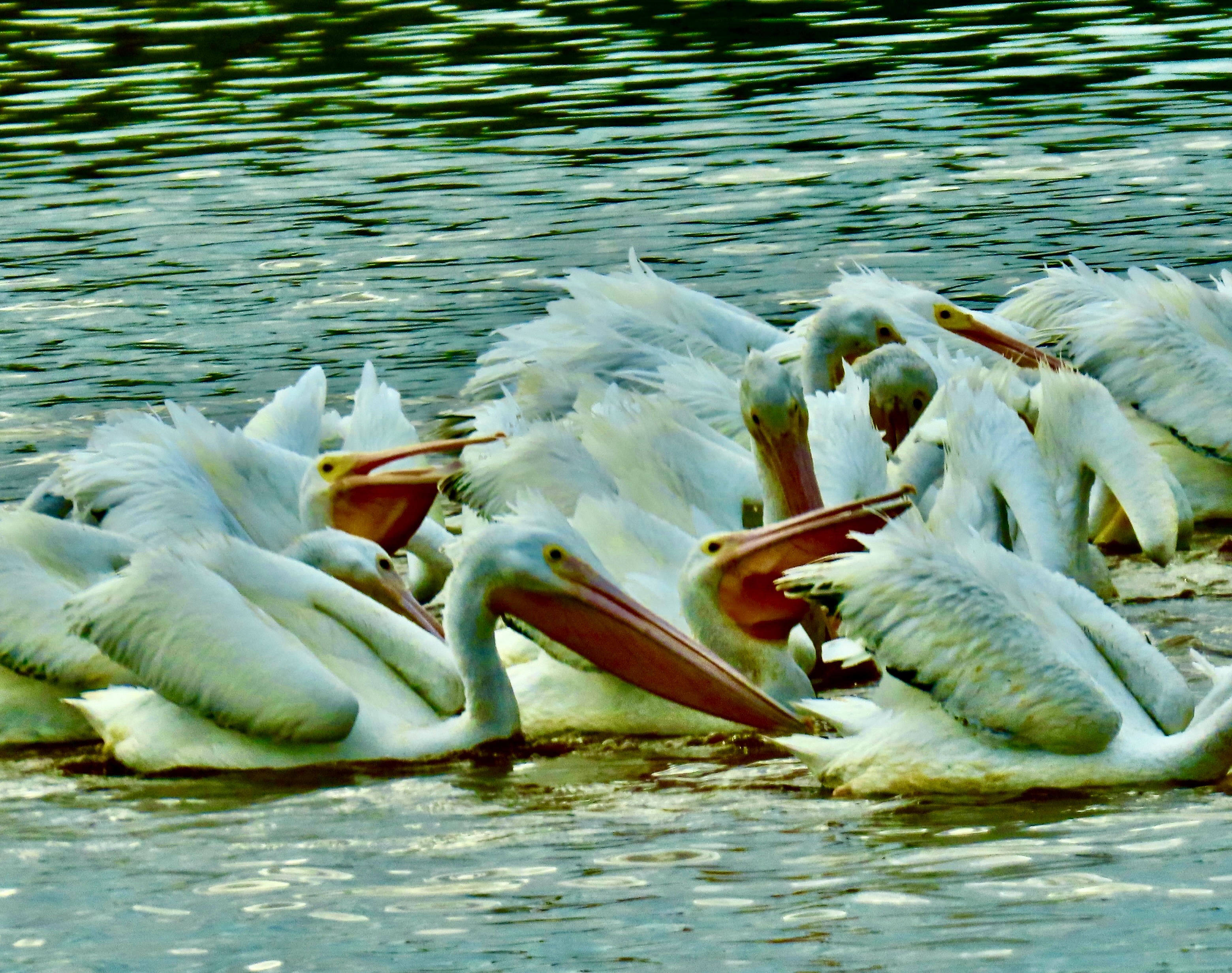
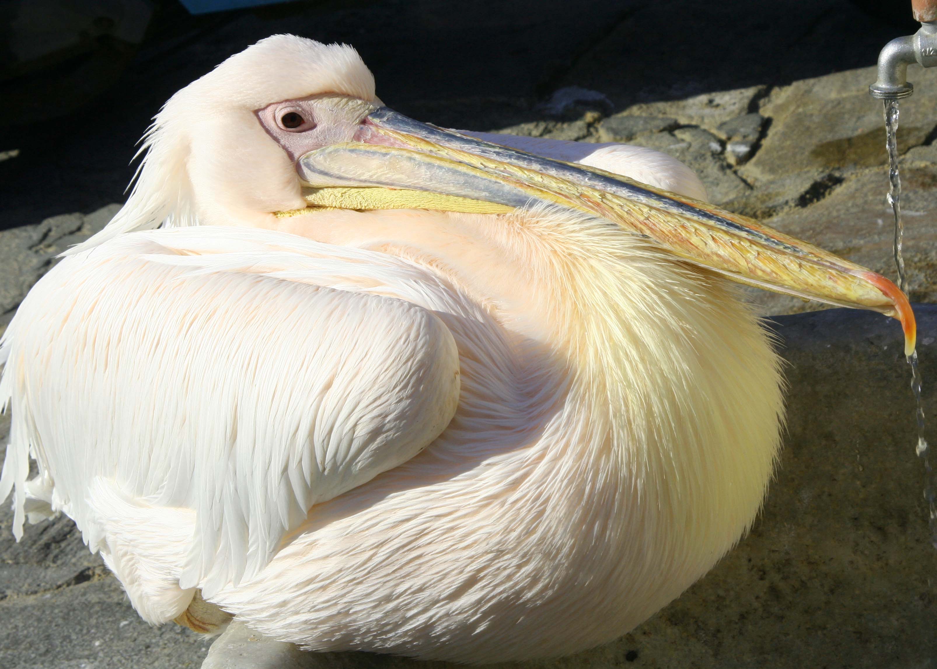
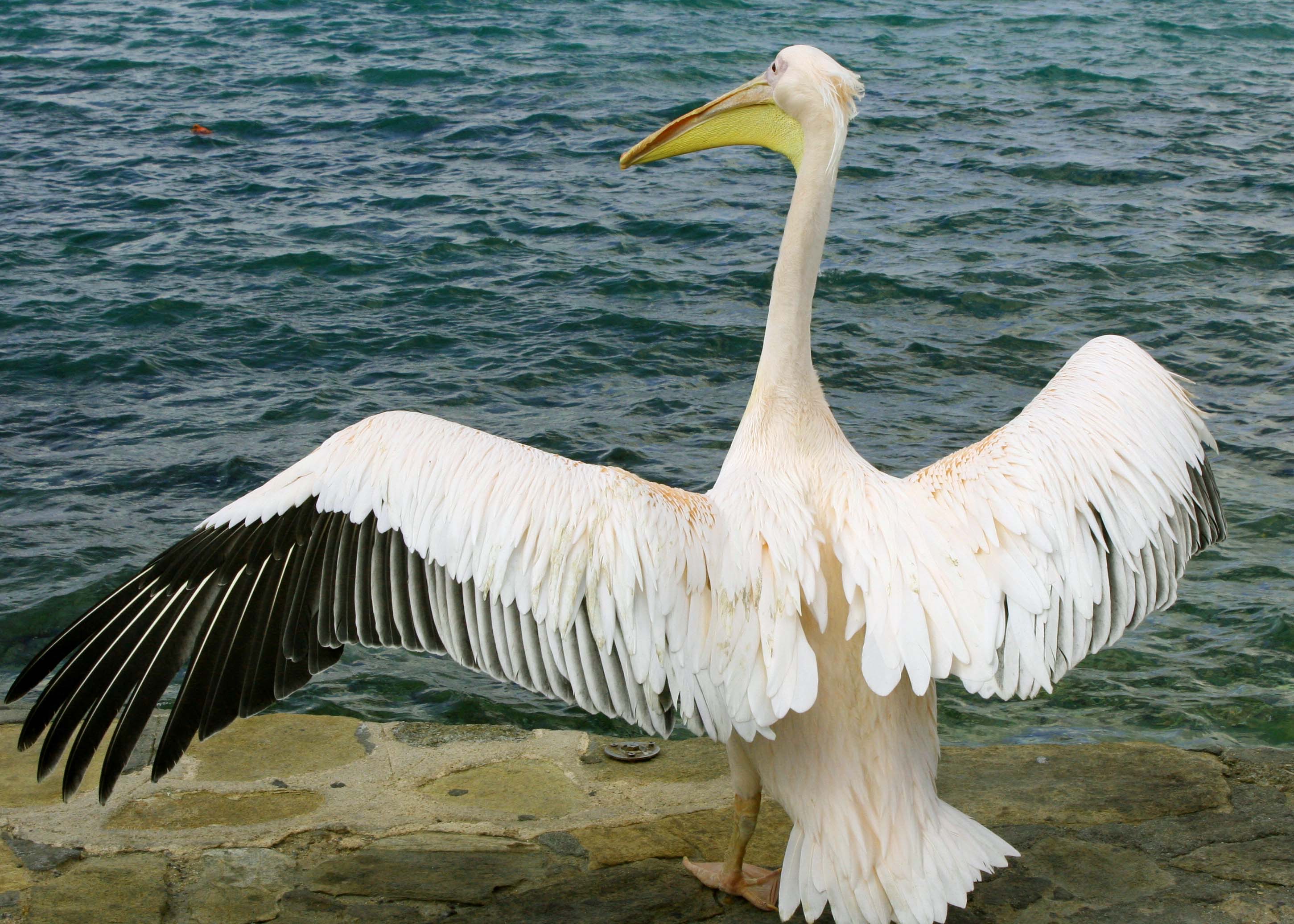
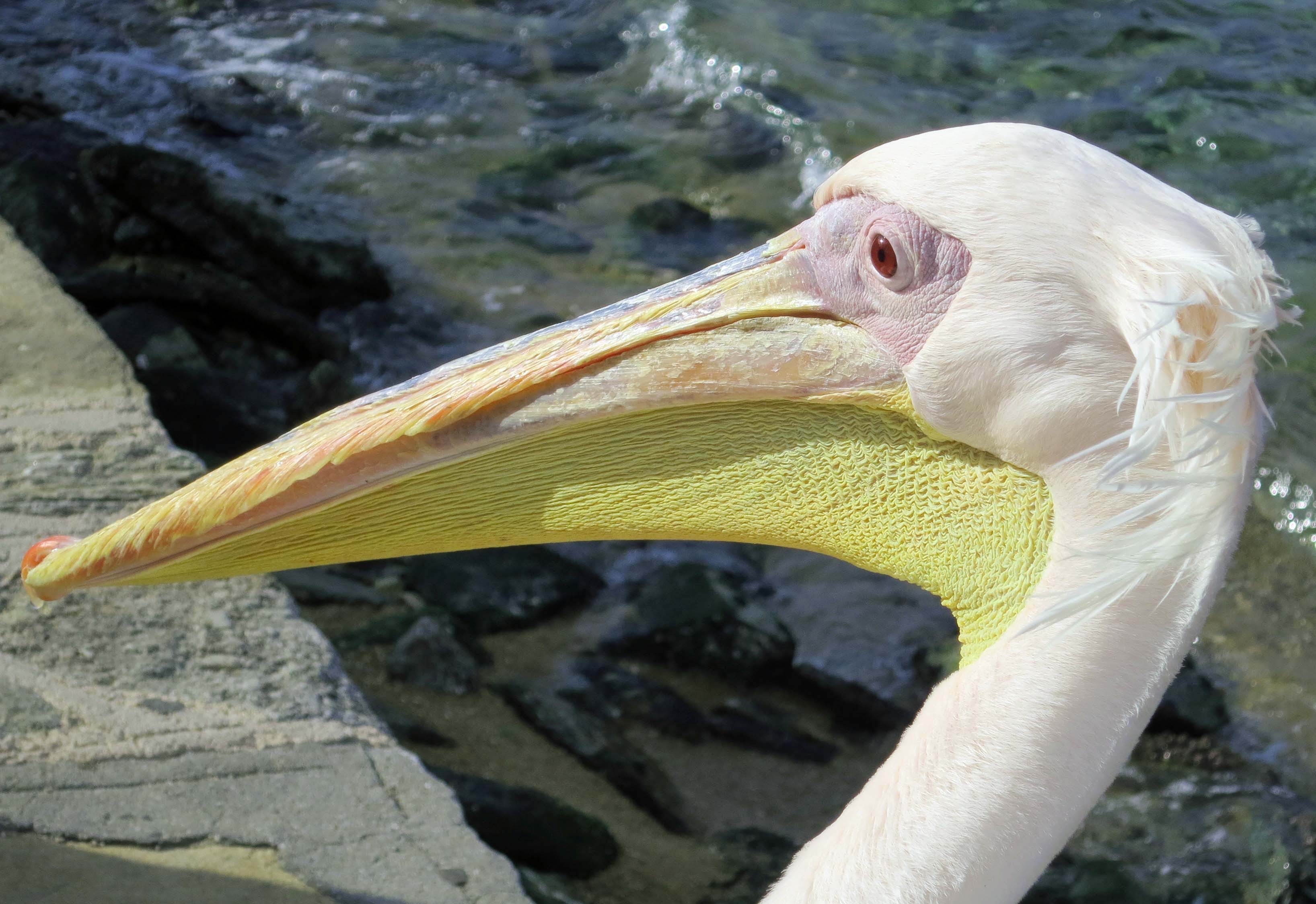
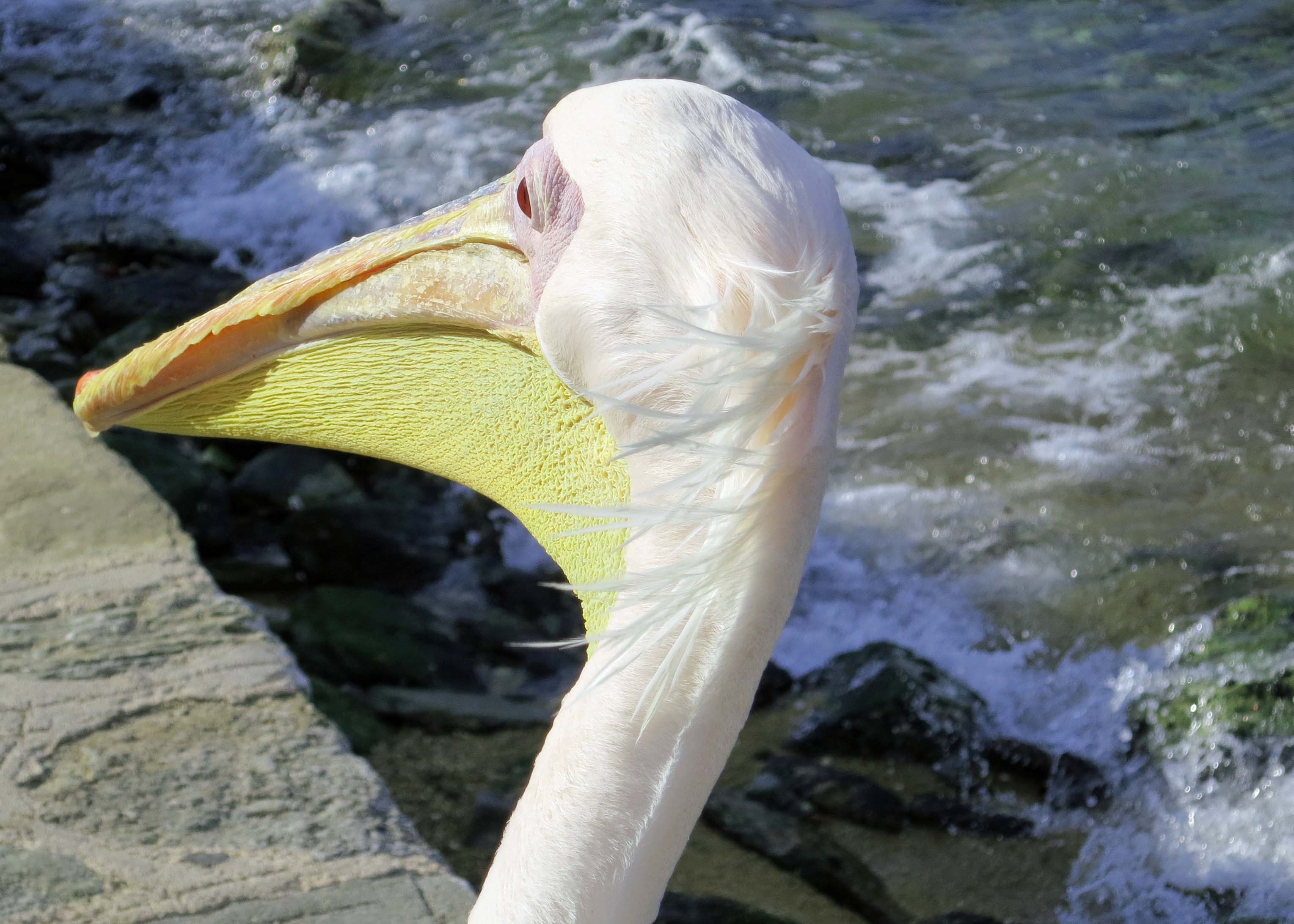
If you have been following this blog for a while, you know that Peggy and I love pelicans. They can appear and act a bit strange. It’s what makes them so attractive to us. We like weird. It wasn’t clear what this one was up to. Scratching an itch? Waving to us? Practicing a crash landing? Whatever, we were lucky to catch it in mid-acton. At the time we were visiting Cabo San Lucas on the the tip of the Baja Peninsula.This one was swimming around in the water nearby. The sharp tip on the end of its bill is called a nail, as in nailed it, to help in catching fish and assuring that they don’t escape from the pouch.A handsome fellow— in pelican terms— was watching the action. Note the big feet. Brown Pelicans use them to incubate their eggs, placing them on top of the egg instead of using their warm feathers and body heat like every other bird we can think of. Mom and Pop actually make good parents. The male brings in nesting material; the female builds the nest. Both participate in incubating the eggs, and both help in feeding the nestlings, i.e. they spew regurgitated fish into the nest. It’s a potluck.Graceful, huh. Brown pelicans dive into the water to catch dinner. Style is not required. They start their dive from as high as 60 feet up in the air and plummet straight down, turning their neck just before hitting the water to avoid injury. Peggy and I were watching a feeding frenzy of around 50 pelicans on the Bahía de Banderas, the bay off of Puerto Vallarta, Mexico when we took this photo and the next one.It was insane. The large pouch of a pelican can hold up to two gallons of water. As soon as the water drains, it swallows whatever it has caught. A two part stomach system then processes the fish to make them palatable. We couldn’t help but think that this pelican was celebrating— not only because it had caught a fish, but also because it was out of the melee. Woohoo!We watched a youngster on the Rio Cuale in Puerto Vallarta. Its body had a ways to go to catch up with the size of its bill. I think it was trying to scare up a meal. Or take a bath.The west coast of California, Oregon and Washington also provides numerous opportunities for watching brown pelicans. At one time these magnificent birds were almost extinct because of the poison DDT used widely by farmers to protect their crops from insects. With the banning of the poison, the birds are now off of the endangered species list and number over 600,000 worldwide. This, and the next three photos were taken on the Carpinteria Beach south of Santa Barbara, California.Looking dignified. A committee perhaps? Or maybe a board of directors. Note how three in front have placed their bills to the right. Takeoff on runway 1.You have probably seen brown pelicans in a neat line as they gracefully fly over waves. That wasn’t the case here. We were thinking, ‘Where’s the air traffic controller?’This is another one of those, “What the…” photos. Napping perhaps while resting its heavy head on its back? Catching a few rays on his pouch? We took this photo on a San Diego beach 17 years ago.Peggy and I were driving by a small pond in the Florida Everglades National Park last year when we spotted close to two hundred white pelicans stretched out in a long line, several pelicans deep. While brown pelicans dive for their fish dinners, white pelicans work together in a coordinated effort to herd fish into groups that makes them easier to catch. Most of these are peering into the water, watching and waiting. When a fish swims within reach, they strike using their broad pouches as a trap. It’s kind of like catching a butterfly with a butterfly net. The pelican on the top right has succeeded. Its pouch is still full of water.Success. Several pelicans are in various phases of swallowing their catch here. The roundup was apparently a success. The white pelican is one of the largest birds in North America with a wing span of up to 9 feet. While brown pelicans primarily catch their fish out of coastal waters, white pelicans can be found on lakes far inland. Shallow water where they can herd fish more easily is preferred.Our favorite pelican of all times was Petros, the well-loved white pelican of the Greek Island of Mykonos. We were wandering around the Mediterranean Sea several years ago with Peggy’s brother John, his wife Frances and friends when we met him. The original Petros passed on in 1986 but he has been replaced by at least a couple since. One was donated by Jackie Kennedy-Onassis.Petros and his successors have been living on Mykonos for 70 years, capturing the hearts of locals and visitors alike.I’ll conclude today’s post with my favorite photo of Petros. With the end of 2025 rapidly approaching, we will use our next three posts to focus on our three major trips of 2025: Hawaii, the Southwest, and New England.
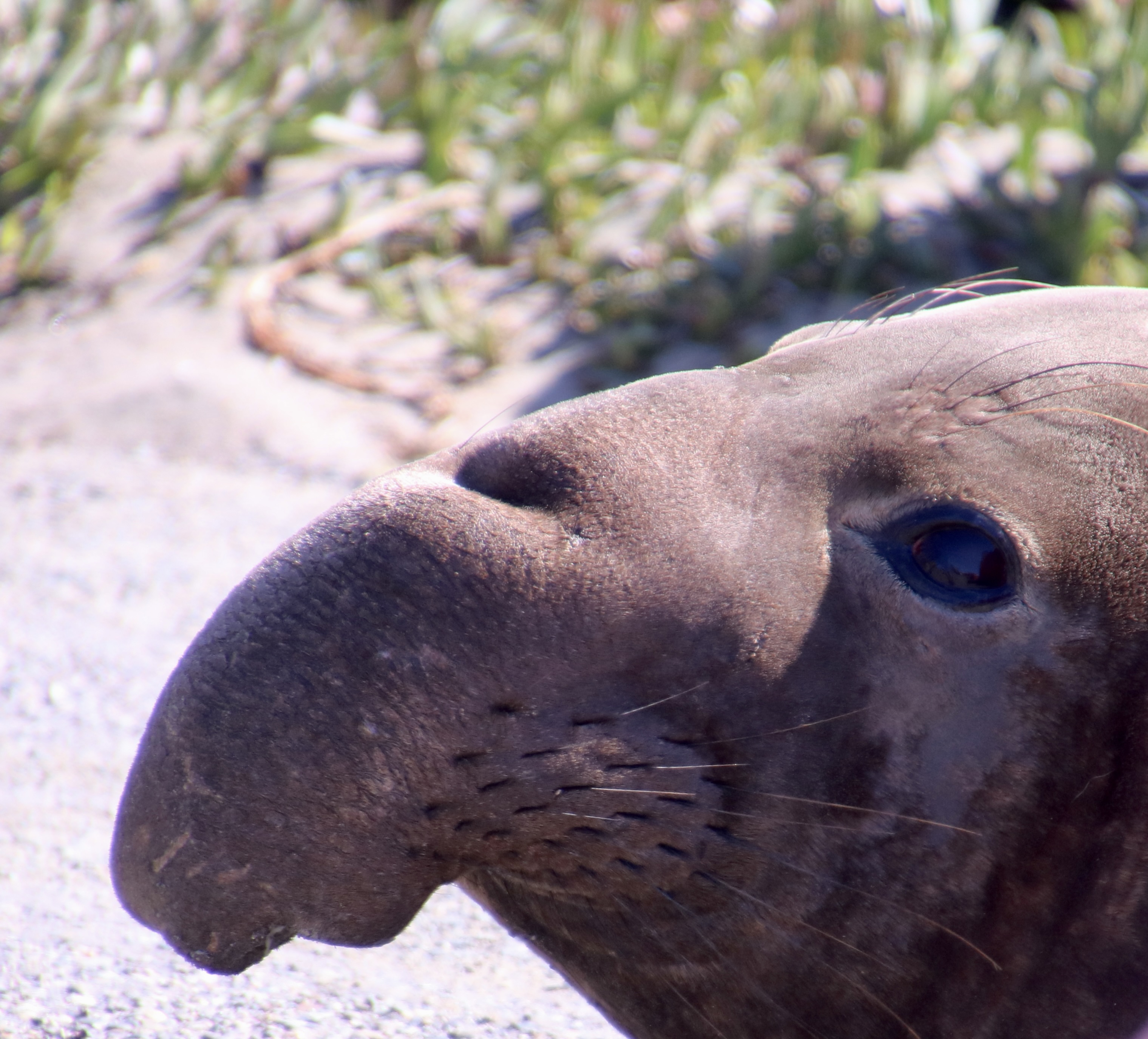
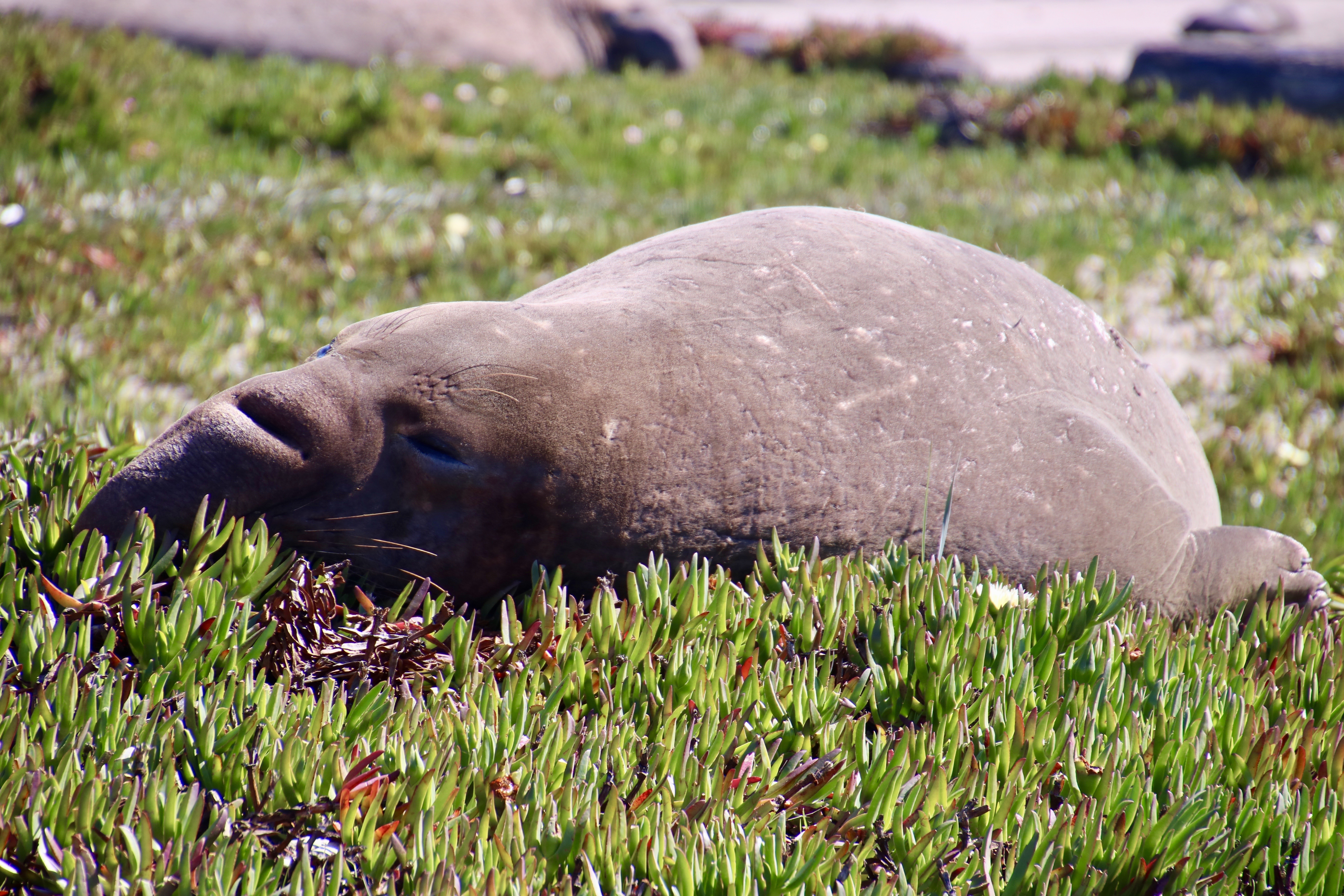
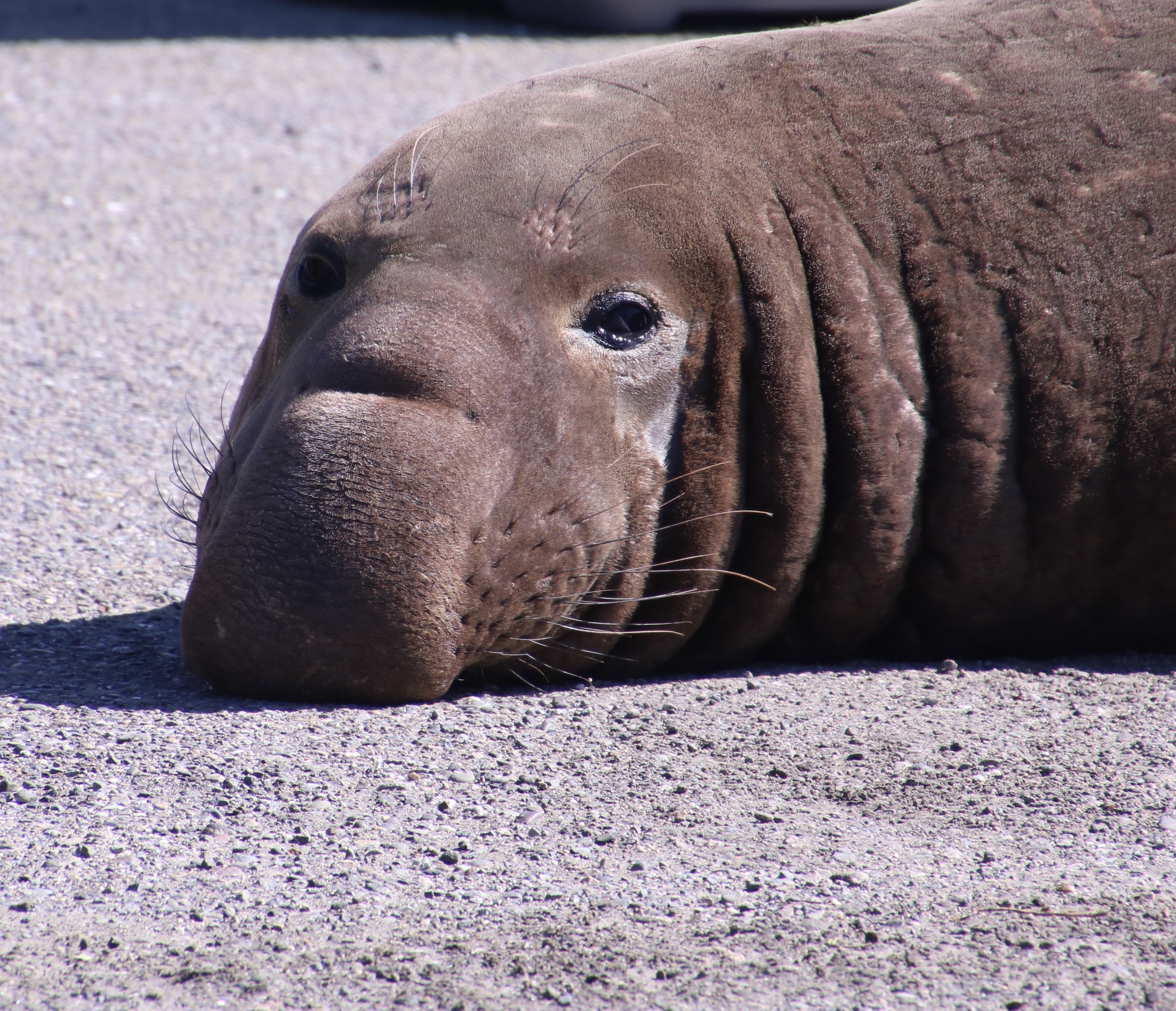
Elephant seals obtained their names because people thought their proboscises/noses resembled elephant trunks. Some imagination was required.An elephant’s trunk. Peggy took this picture while we were on a photo safari in southern Africa last year.The male elephant seal can actually inflate its nose and turn it into a resonating chamber so it acts like a megaphone for blasting out challenges in a unique vocalization that other elephant seals easily recognize. (This photo was taken at the Piedras Blancas Rookery in Southern California that Peggy and I visited 15 years ago. The top photo was taken at Point Reyes National Seashore in Northern California much more recently.)
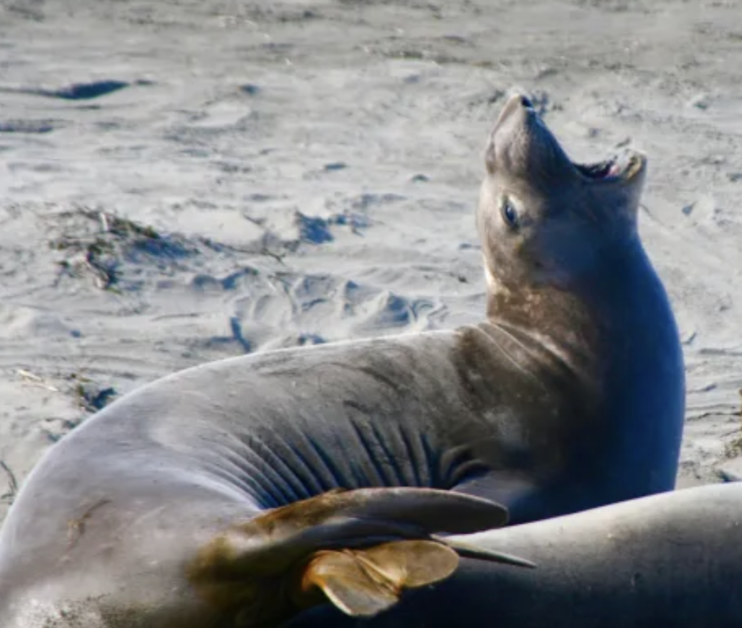
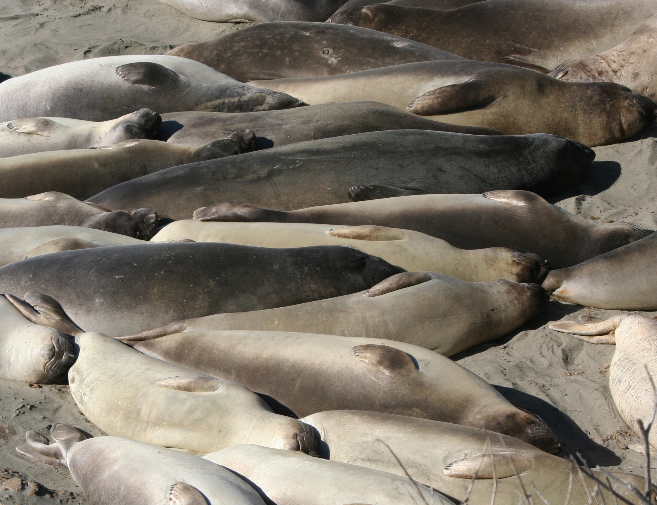
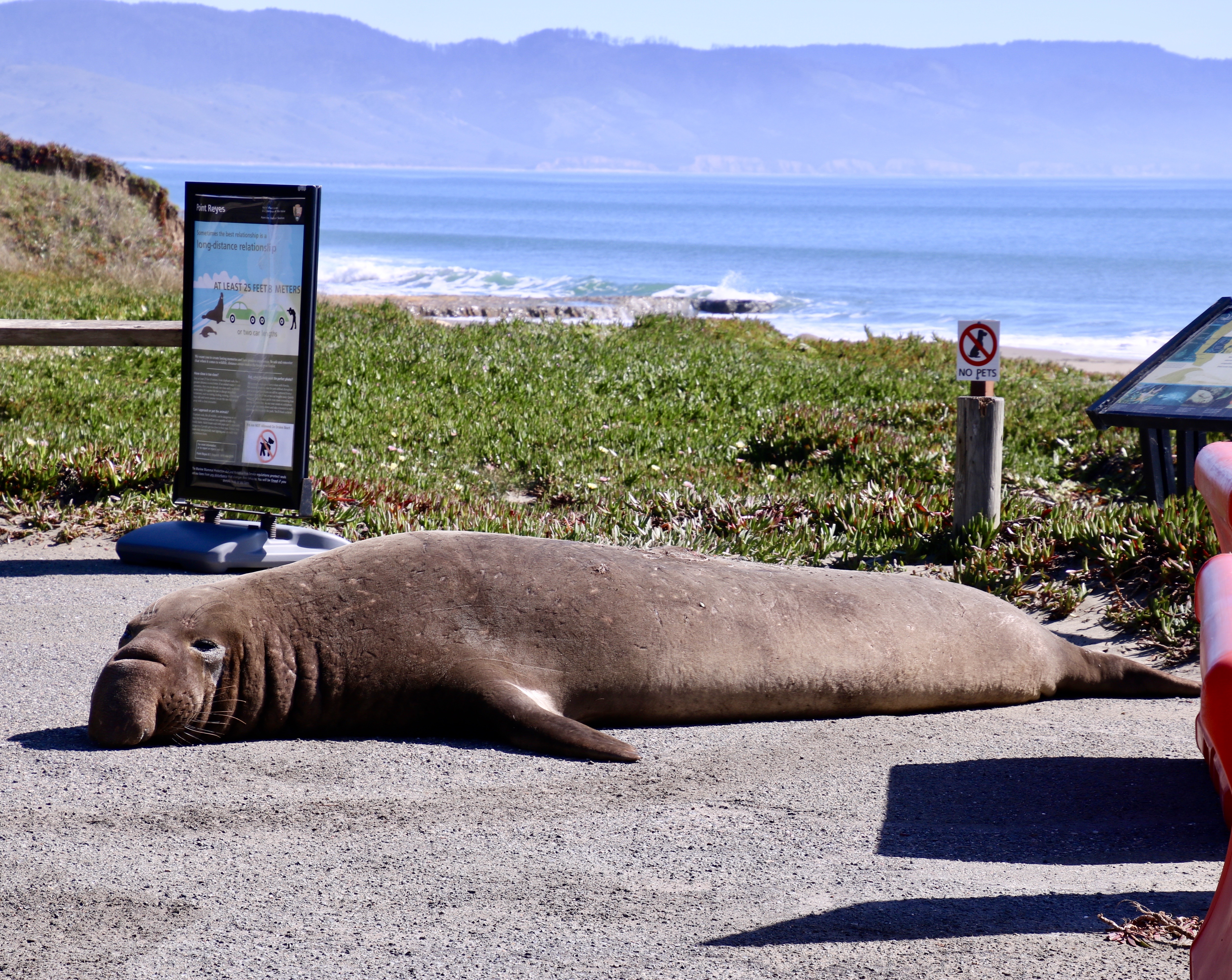
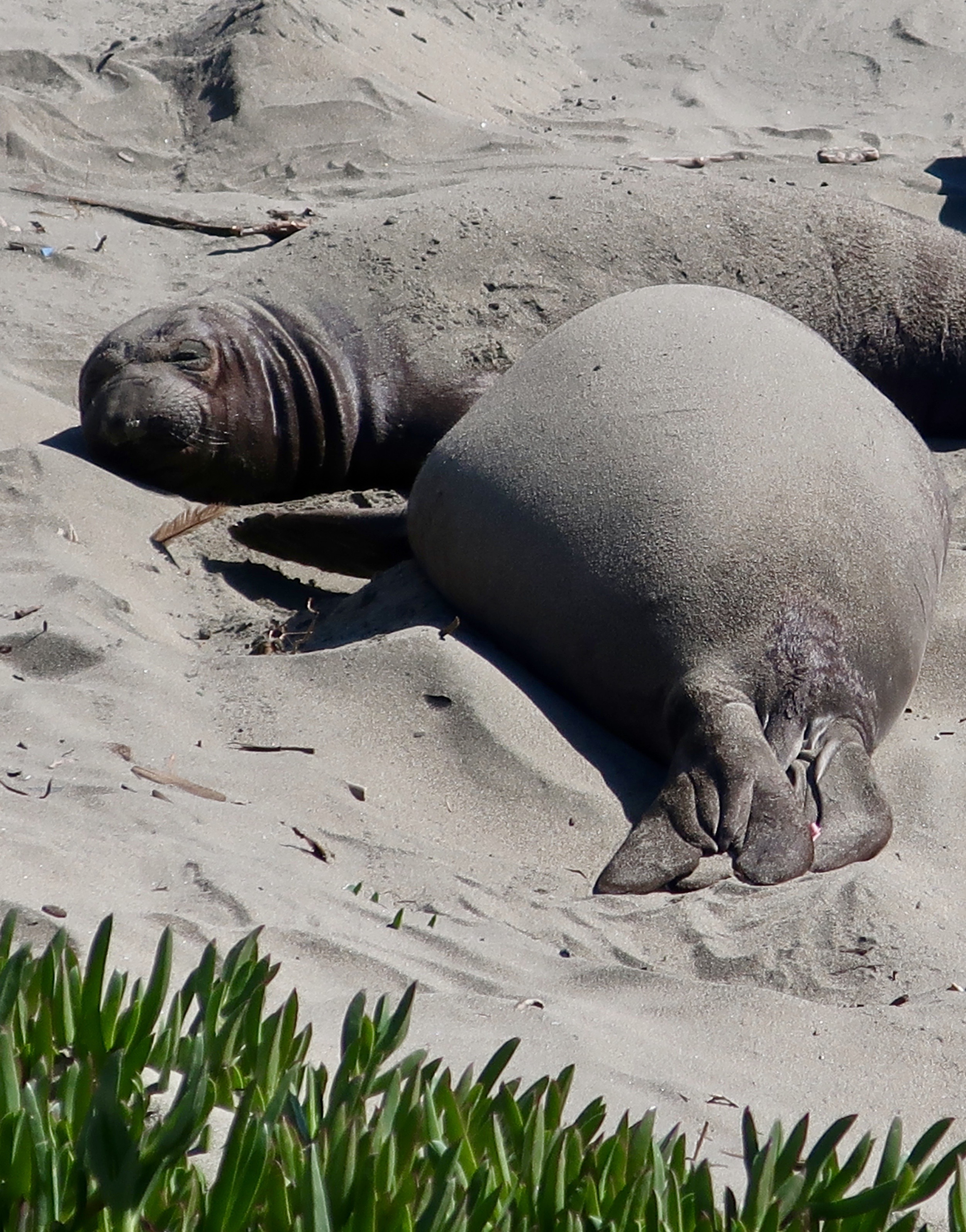
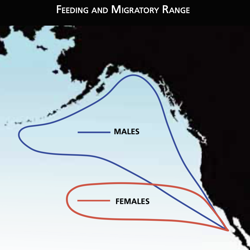
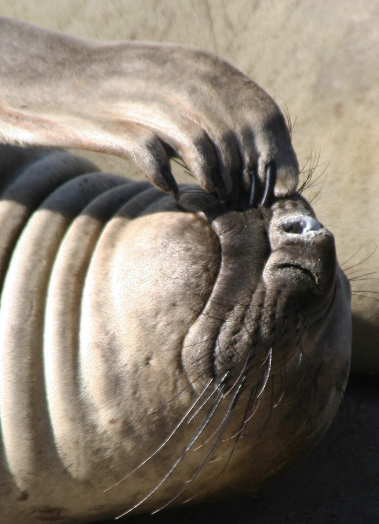
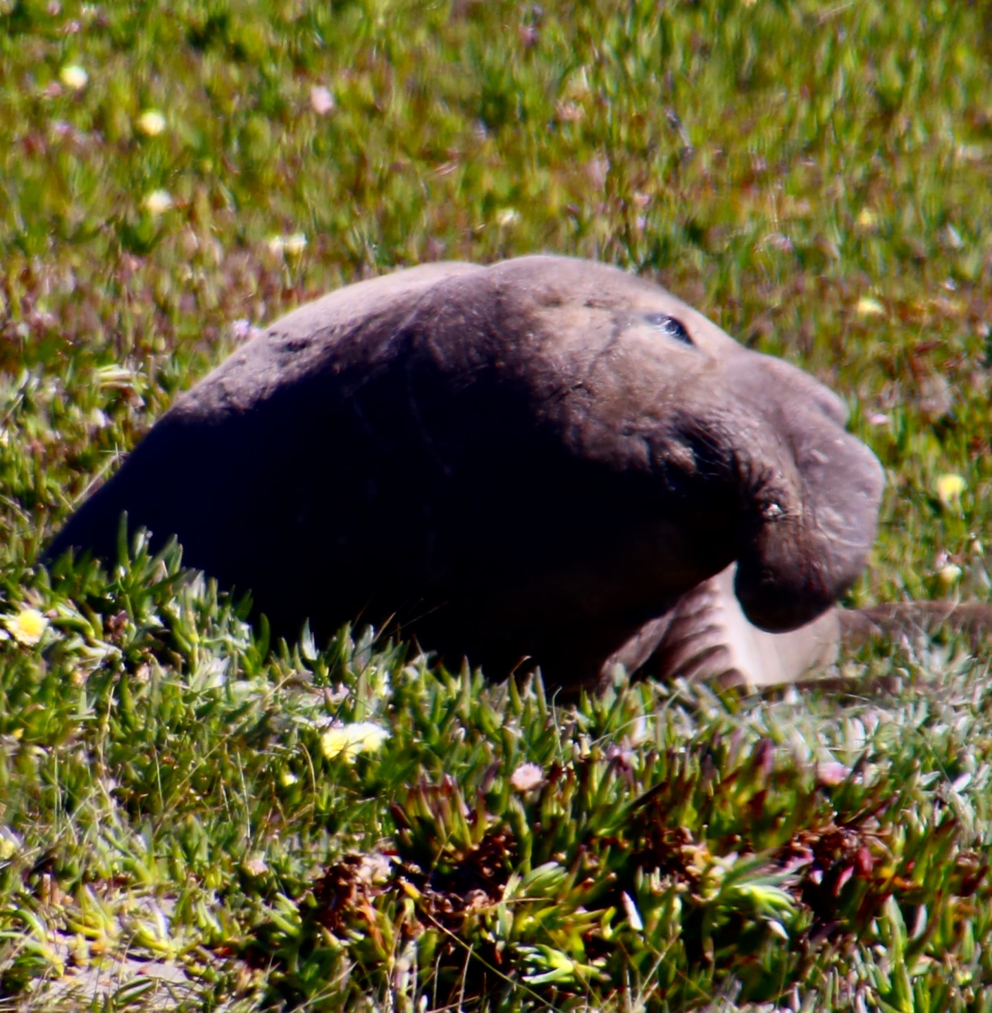
Each male’s dream is to establish a harem of females for breeding purposes. For an alpha male, this means between 20-50 females, although numbers can be as few as 10 or as many as 100. (Although how one bull could manage one hundred is hard for me to imagine. I did read that they sometimes have lieutenants…) Their size, fighting ability, and volume of vocalizations are all important in establishing the harem. The vocalizations mainly serve as a challenge, i.e. “Let’s fight and see who the biggest, baddest bull is,” or, to serve as a reminder: “You don’t want to fight with me. I kicked your butt last time.” The latter is usually enough to send past challengers scurrying. Harem status provides protection for the females, freedom from being harassed constantly by other males (a biggie), and a safe place to birth their pups.Elephant seals were once close to extinction, killed for their oil. A large male could yield over 25 gallons, which was used for lamps, lubrication, and making soap and paint. By 1900, only a few hundred remained on the coast and islands of Northern Mexico. Laws protecting their status, first by Mexico and then the US, allowed for a rapid increase in numbers. Today, Piedras Blancas alone hosts as many as 17,000 annually. As you might imagine, the beach gets a little crowded.Bull elephant seals are big. The illustration below from the National Park Service shows just how big…This is one of several reasons why the National Park Service suggests that people stay at least 100 feet away! You don’t want one deciding you are a threat to be eliminated or at least chased off.One came crawling up onto the parking lot at Drakes Beach, Point Reyes. We moved back but we were still closer than we had been. These large creatures are not built for land. Moving is more like shuffling forward like an inchworm. They can use their front flippers to help in movement and balance but not their hind flippers. Watching videos of smaller males getting away from alpha males suggests that they can move fast when sufficiently motivated! The guys at Point Reyes were relaxed: They would ‘galumph’ about 10 feet and stop to rest. Mating season was past. There was no reason for getting excited.This shot provides a view of the hind flippers dragging along behind while the front flippers are used to push and balance. While worthless on land, the hind flippers turn into powerful ‘propellers’ in water.The elephant seal moving through the ice plants was like a bulldozer creating a road.You want fat? Here it is. I think it is a youngster known as a super-weaner. Baby elephant seals normally weigh between 250-350 pounds when weaned. Super-weaners can weigh up to 600 pounds! How do they get that way? There are two approaches: One, they steal milk from nursing females and are known as ‘milk thieves,’ or two, they are adopted by an additional mother seal and are known fondly as ‘double mother-sucklers.’ It’s hard to imagine this guy even moving. Note the sand on both of the elephant seals’ backs. They use their front flippers to toss it up. It’s used like you or I use sunblock.Our parking lot friend moved its head to check us out and make sure that Peggy and I were showing proper respect. Note the eyes and whiskers. Both are helpful in locating food during the deep dives that elephant seals make. The large eyes help them see in the inky depths of one to two thousand feet where they normally search for food like squid and fish. (They can go as deep as 5000 feet.)The whiskers may be used in helping to find food along the bottom.This illustration from the National Park Service shows the feeding ranges of the male and female northern elephant seals. They spend 80% of their lives on the open sea and a surprising 90% of that time under water, much of which is spent making their deep dives.
They are uniquely qualified for the dives. For example, while you or I take a deep breath before we dive, elephant seals expel theirs to avoid having their lungs crushed by the tremendous pressure that exists at 1000 plus feet under the sea. Instead, they store extra oxygen in their blood. They have three times as much blood as we do on a per pound basis, i.e. lots, and and their blood is much richer in hemoglobin. They also reduce their heart rate when they dive and focus the majority of their blood on servicing their vital internal organs. Using these evolutionary modifications they are able to dive for 30 plus minutes per time, resurfacing for a short 3 minutes. Elephant seals continue to forage constantly during the migrations between their primary feeding ranges and where they travel to breed, have pups, and molt. It’s a good thing. When they arrive, they fast for the time they are on shore, (2-3 months), living off of the fat they have stored.
Wow, those are lots of details. It’s enough information to make you scratch your head. And— is this elephant seal winking its nose at us? (Piedras Blancas Rookery in southern California.)A final photo from Pt. Reyes that amused us. Next up pelicans. Can they match iguanas and elephant seals in character?Petros.
Today marks the beginning of a new/old series for us. It’s old in the sense that we have done a similar series in the past, but not for a long time. We are going to select a specific subject for each post. Today, for example, is on iguanas. Our next post will be on elephant seals, and the time after on pelicans. We chose these three to kick off the series because we find them wonderfully weird. They also represent reptiles, mammals and birds.
Given that we have 100,000 (plus or minus) photos in our photo library that we’ve gathered over 25 years of wandering the world, there will be no lack of subjects for future posts. We will, of course, continue to do posts on our ongoing adventures as they take place. As always, photos appearing on our blogs have been taken by either Peggy or me unless otherwise noted.
I am also going to do a new series titled Ut-Oh, which is how I pronounced uh-oh as a child. But more on that in the next few weeks.
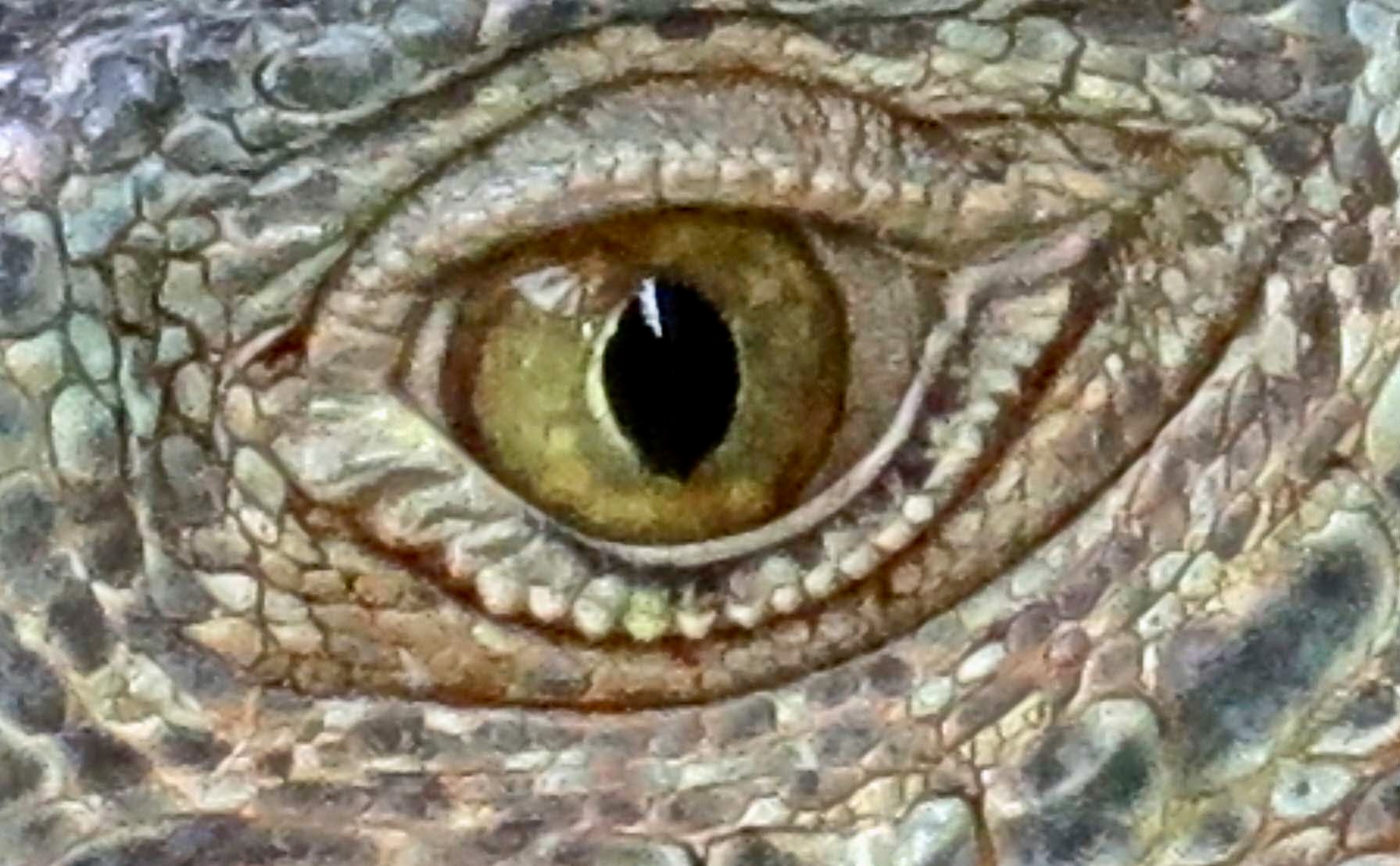
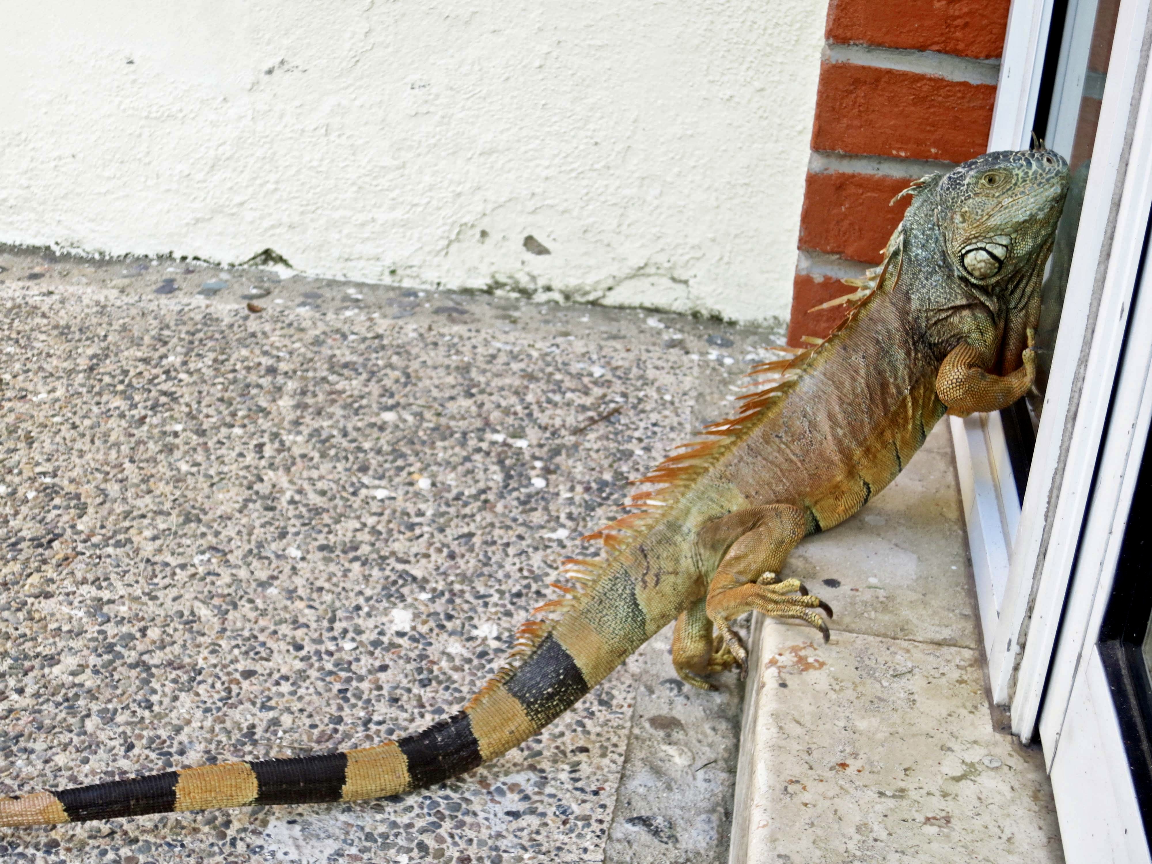
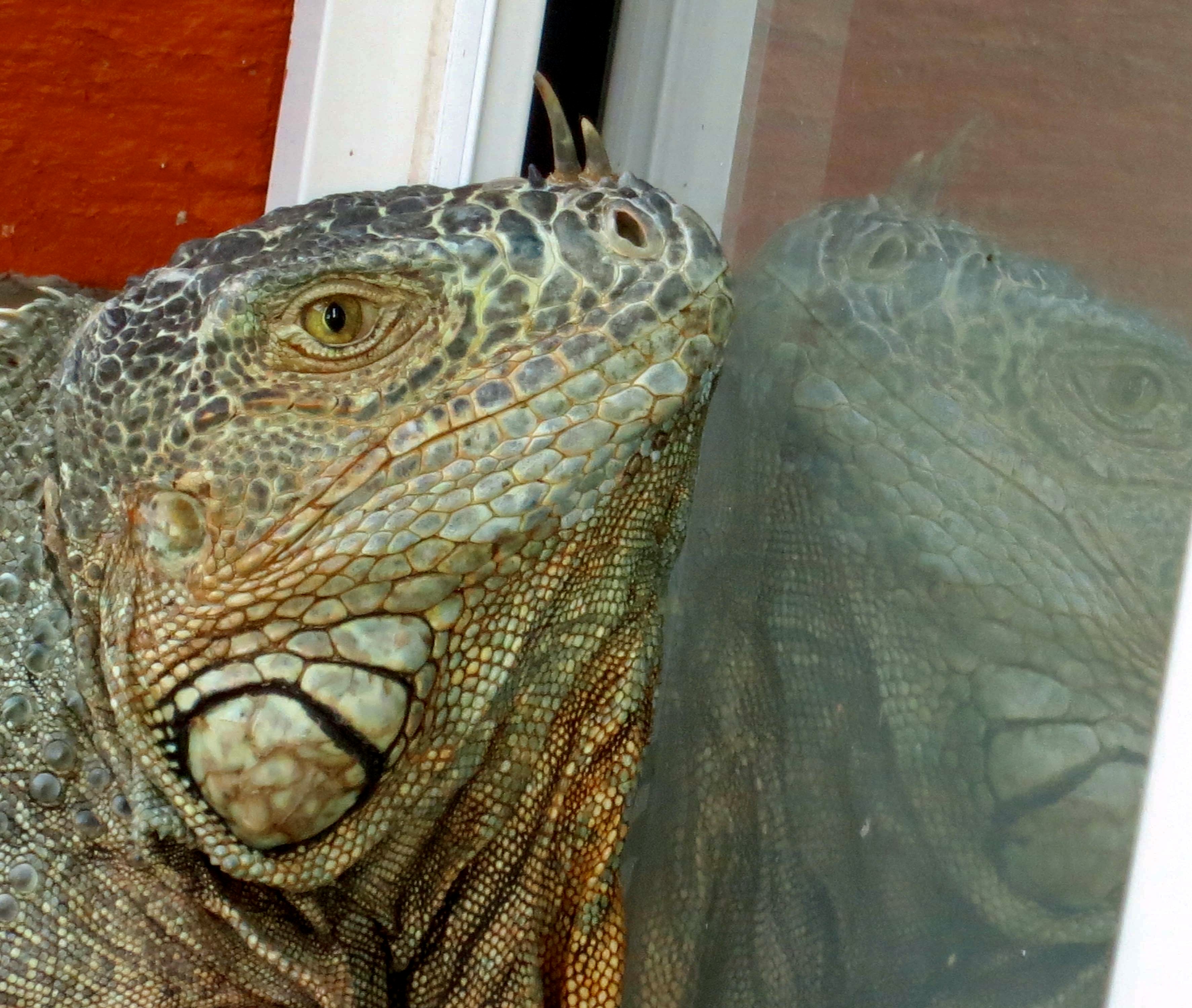
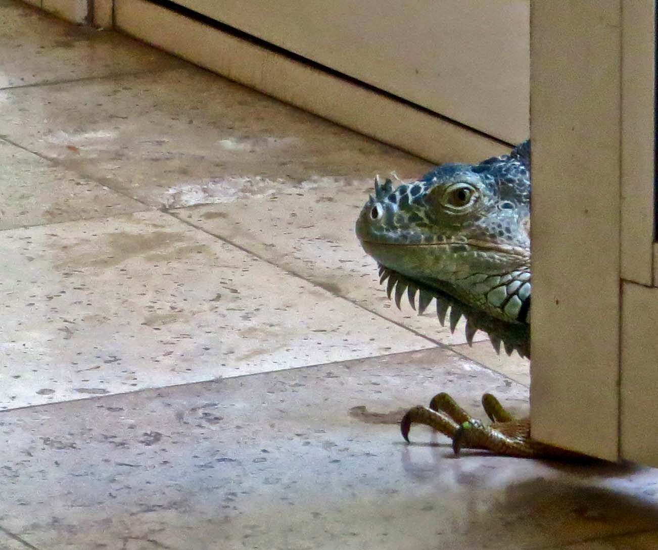
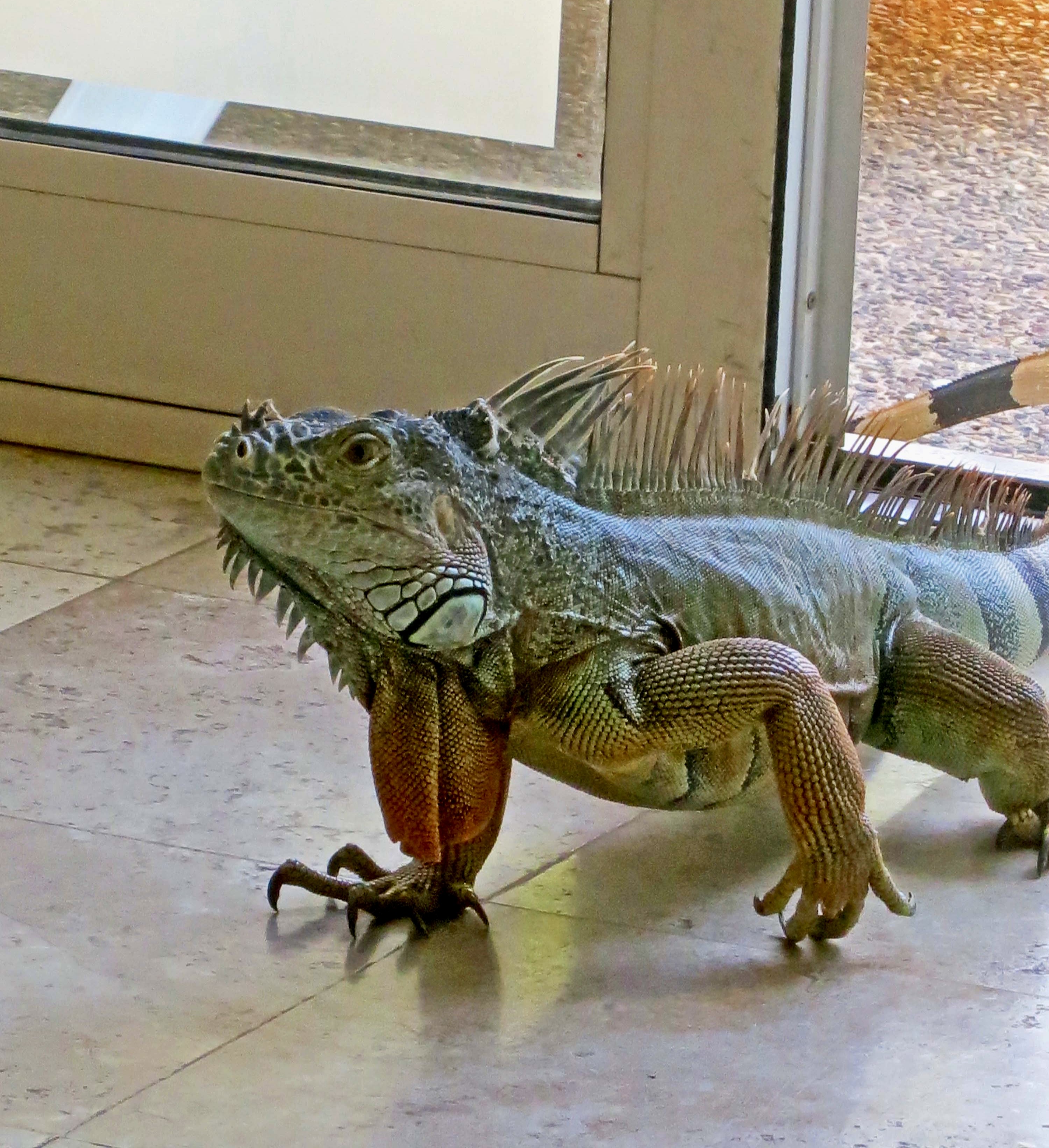
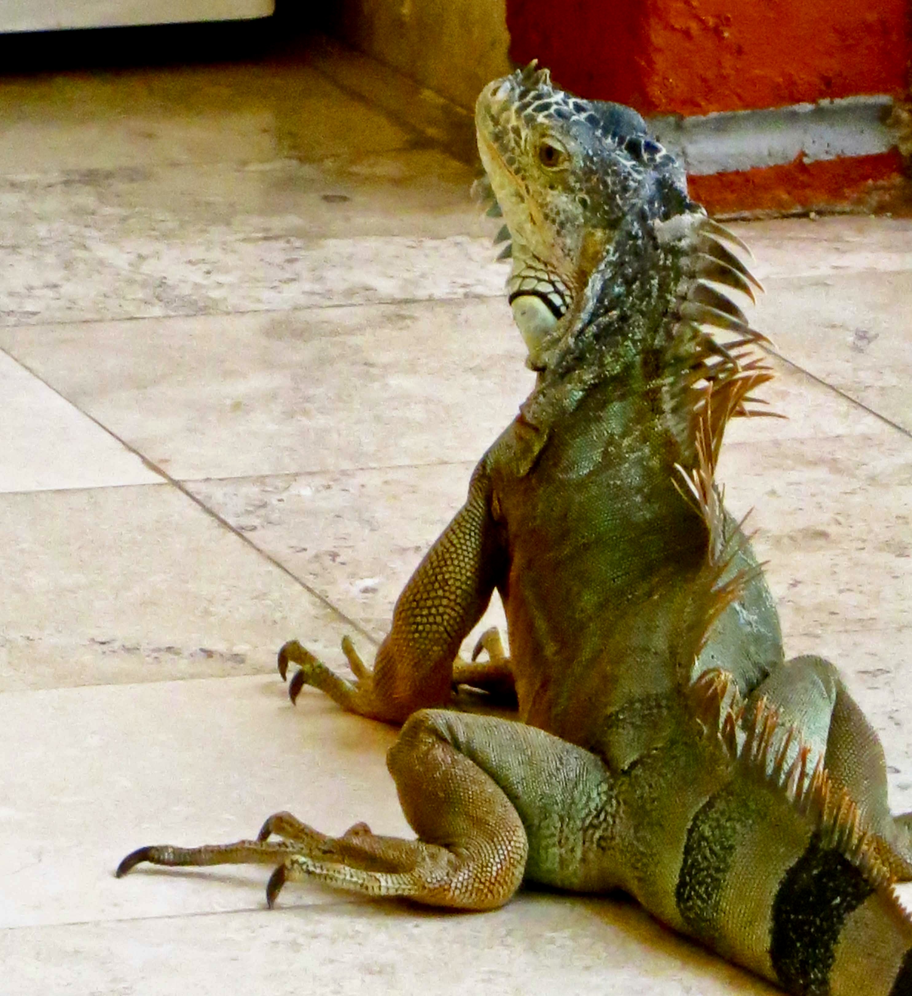
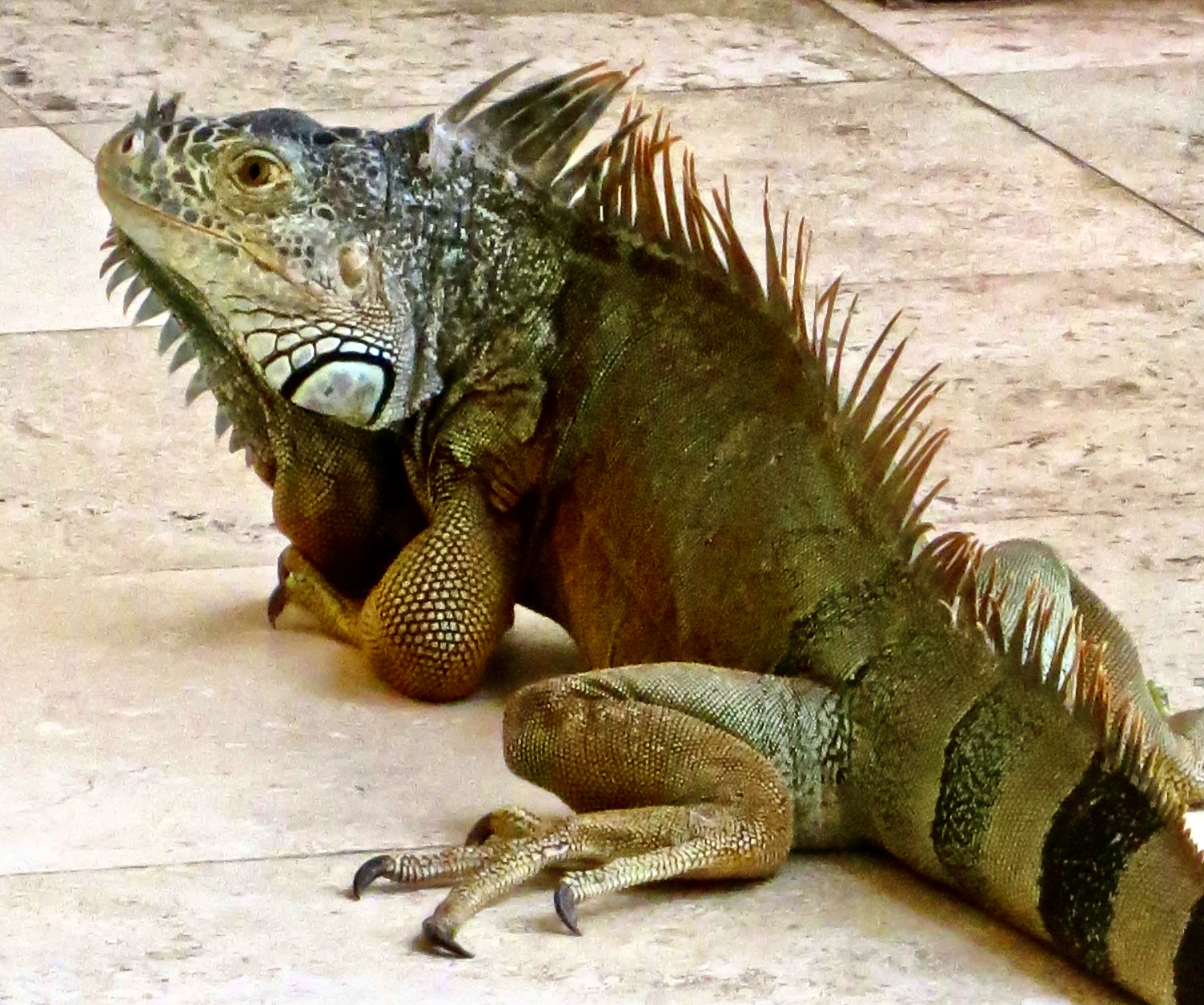
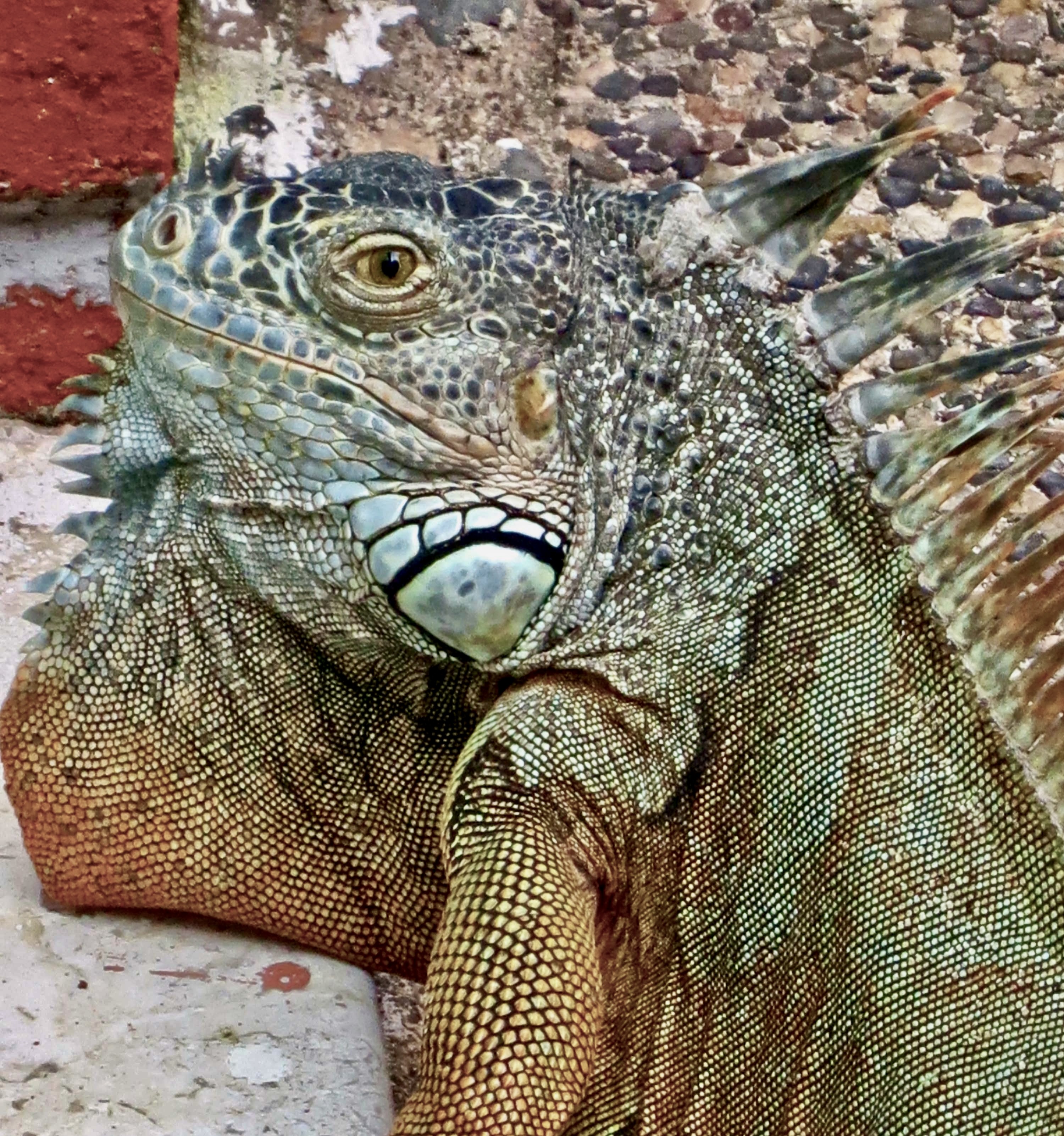
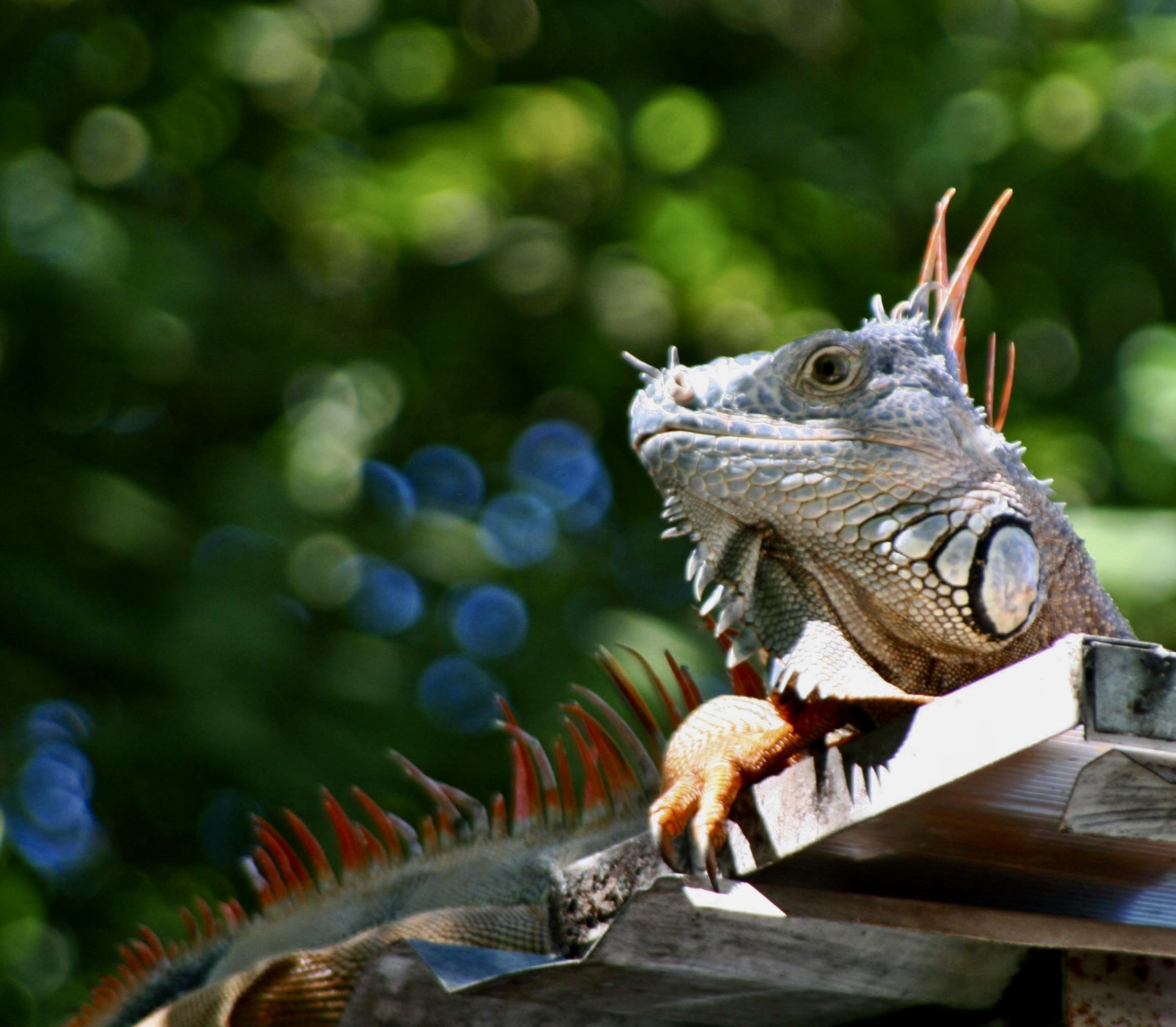
Let’s imagine for a second that you look through a peephole in your door and see this eye staring back at you. I don’t know about you, but my reaction would be to follow the bartender’s advice and “Run!” Or at least bar the door with anything available! “Oh, Peggy, could you lend a shoulder here…” I’ve named the photo The Eye of the Iguana in honor of the classic 1964 movie, The Night of the Iguana, starring Richard Burton, Ava Gardner, and Deborah Kerr. Like Burton’s iguana, ours was hanging out in Puerto Vallarta. As the peep hole scenario suggests, it wanted in. He wasn’t pounding on our door, however…It was scratching loudly on our frosted window. Other than big and possibly scary, we didn’t have a clue what it was. I opened our door just far enough so I could see out— and close it immediately necessary. Just in case, you know.Here’s what I saw: a huge male iguana. But what did it want? Had it come by demanding arugula? I took a photo from another angle and found the answer.it was staring at its image. I don’t think he was thinking, “My, what an handsome guy you are.” It was more like “Who are you and what are you doing in my territory. Get out now!” He was obviously trying to get at his competition. Peggy came out and sat on our doorstep to watch him. “Hey, Curt,” she asked, “what if we leave our door open? Do you think he will come in?” That’s Peggy, for you. Okay…“Hola, amigo. ¿Estás abrigando a un invasor?” (Hello friend. Are you harboring an invader?) I’d say it took him about three minutes to poke his head through the door and look around…..And a few seconds to invite himself in. Check out those claws! No wonder his scratching was so loud. That’s his tail coming along behind. Like his smaller cousins (normal size lizards), he can detach it if something grabs it thinking about dinner, like a very large snake or puma.He did a thorough search, pausing to look around. We kept our feet up off the floor.And then sat down, as if he wanted to chat with us about where the other iguana went. Like was there a reason we had closed our bedroom door? Grin. Actually, the answer was yes. Can you imagine this fellow sleeping under your bed? Talk about childhood nightmares!He truly was a handsome fellow. He wandered around for about 20 minutes and then, satisfied that he was still the biggest iguana in the neighborhood, went back outside.
These large representatives of the reptile class are herbivores and relatively peaceful. People even keep them as pets. It’s said that they enjoy being petted and eating arugula.
Two of their prominent characteristics are dewlaps and spines. Dewlaps are the large flap of skin hanging down from their chins. They are used for thermoregulation, communication, and courtship, i.e. gaining or losing heat, scaring off competition or predators, and attracting females— the larger the dewlap, the greater the attraction. Size matters. Females also have dewlaps, but they are smaller.
A couple of other interesting facts: One, they are great swimmers. They often jump from trees into water when a predator is after them. Two, they can jump from great heights without harm, up to 50 feet. It isn’t always a jump, however. When the temperature drops to 50° F or below, their bodies ‘freeze’ up and they come cashing down. Every once in a while when Florida suffers from a cold spell, headlines warn, “Watch out for falling iguanas.” They aren’t kidding.
A huge one fell out of a tree and landed about a foot away from our two-year-old daughter Tasha when she was sleeping outside in Panama. Needless to say, she was quickly moved.
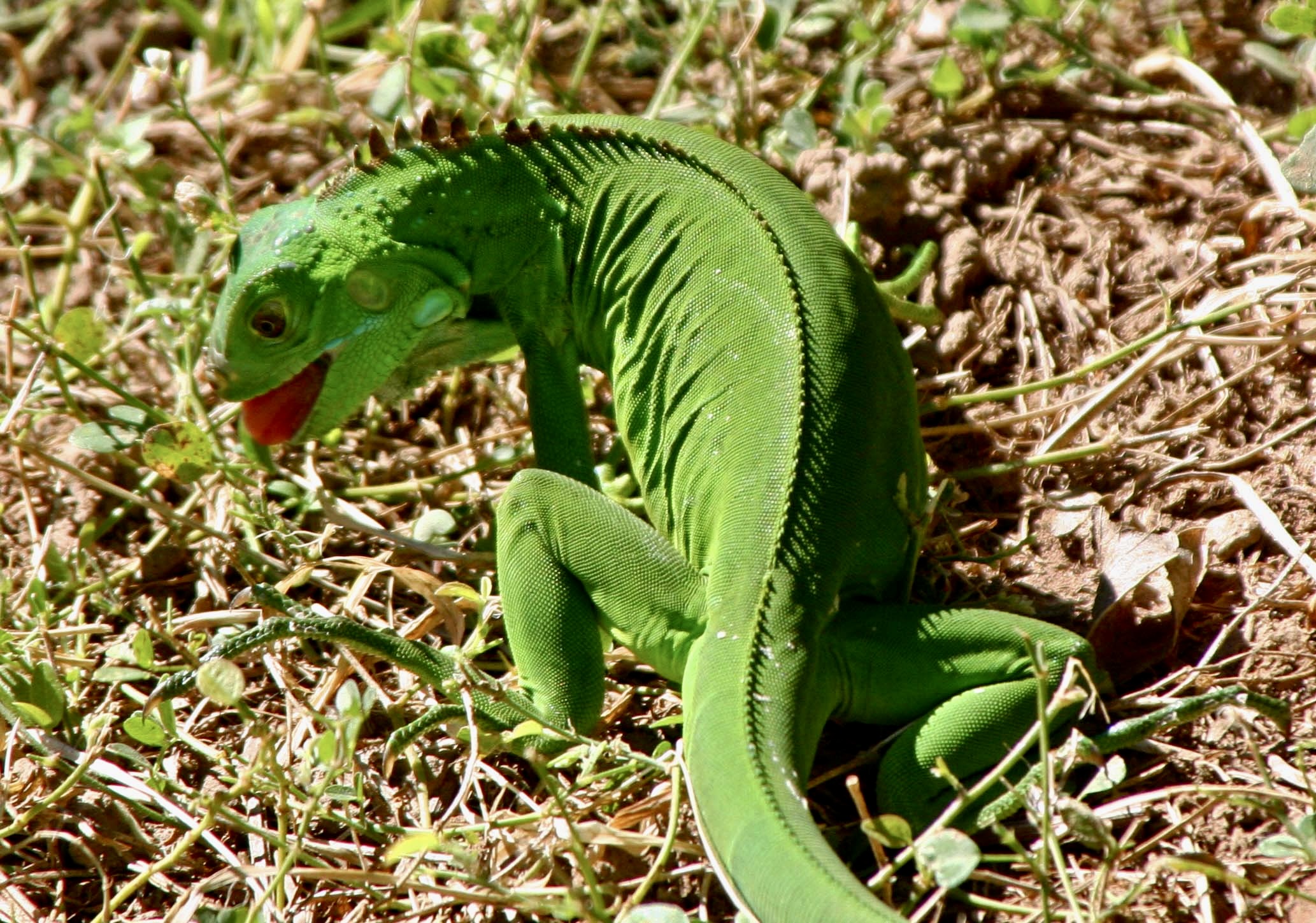
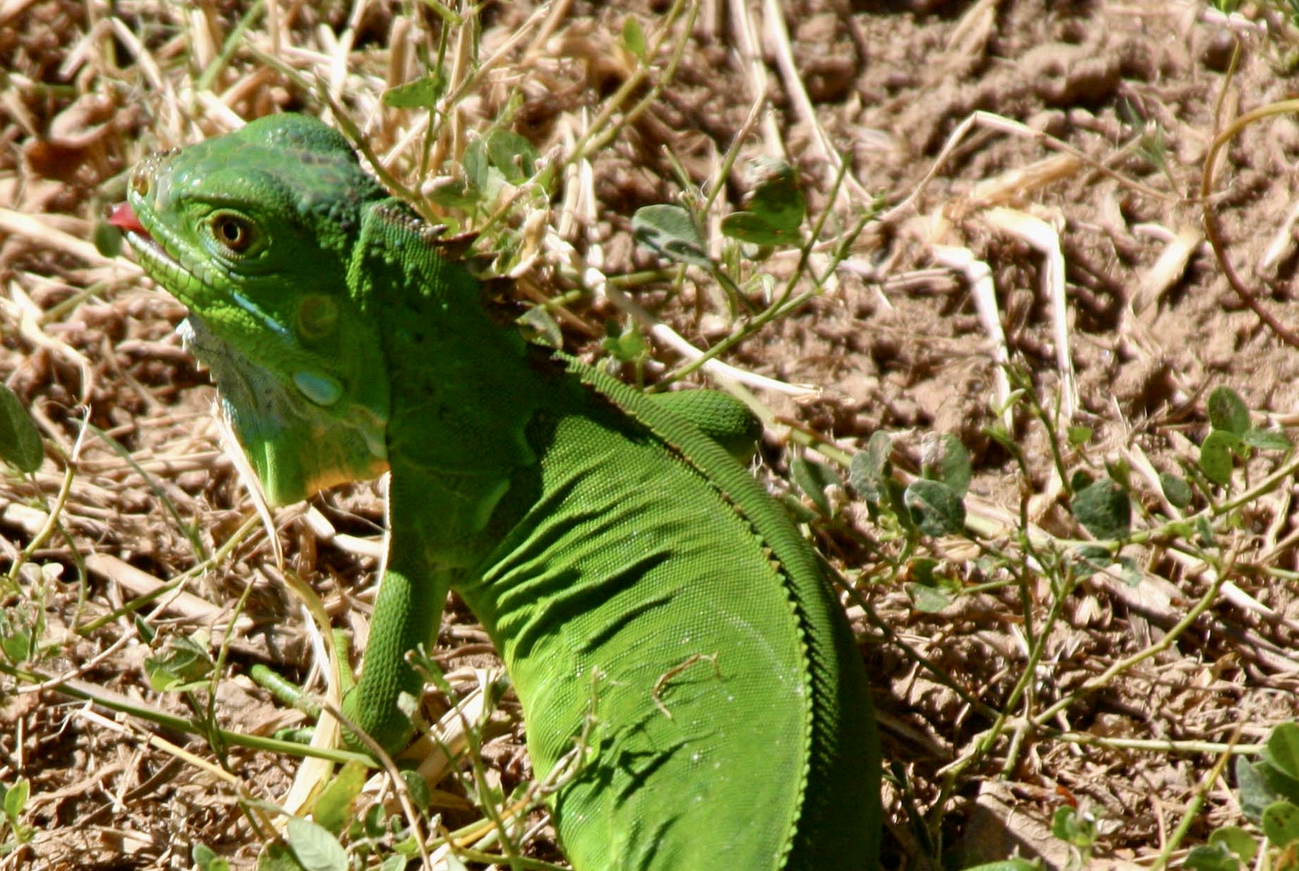
We also found this much smaller green iguana running around in our yard gobbling down plants. There are some 35 different species of iguanas. Check out the tongue.A closer look. The now missing plant is being swallowed. Is the iguana licking its chops? Yum.
There is a small, narrow island, La Isla del Rio Cuale, on the Cuale River that runs through the heart of Puerto Vallarta where iguanas like to hang out. Open air restaurants along the river provide a front row seat for watching them and the birds. Peggy and I always try to grab a seat right next to the river.
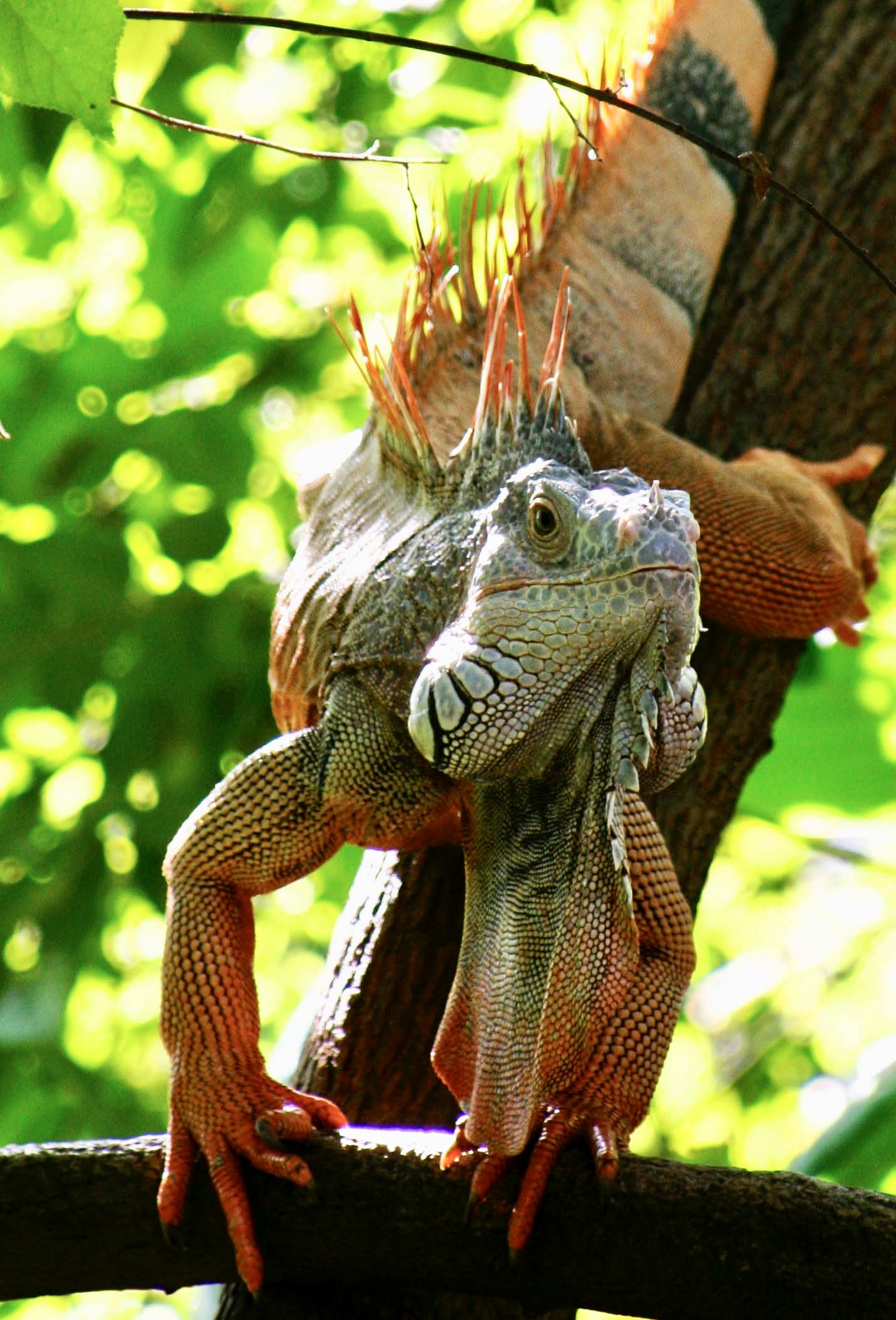
My grandson, Ethan, grabbed our camera and took this photo when he was 9. The iguana was on the ground checking us out.Our grandsons Ethan and Cody having fun with the art in Puerto Vallarta, 2013.Another iguana climbing down a tree. Their long claws are what enable them to climb. The also use them to slow their falls when jumping down, which can lead to injured toes like this guy displays on his right foot.I’ll close with this youngster who was looking down at us from the roof.Next up: Elephant seals. We found this big guy at Point Reyes National Seashore, California.
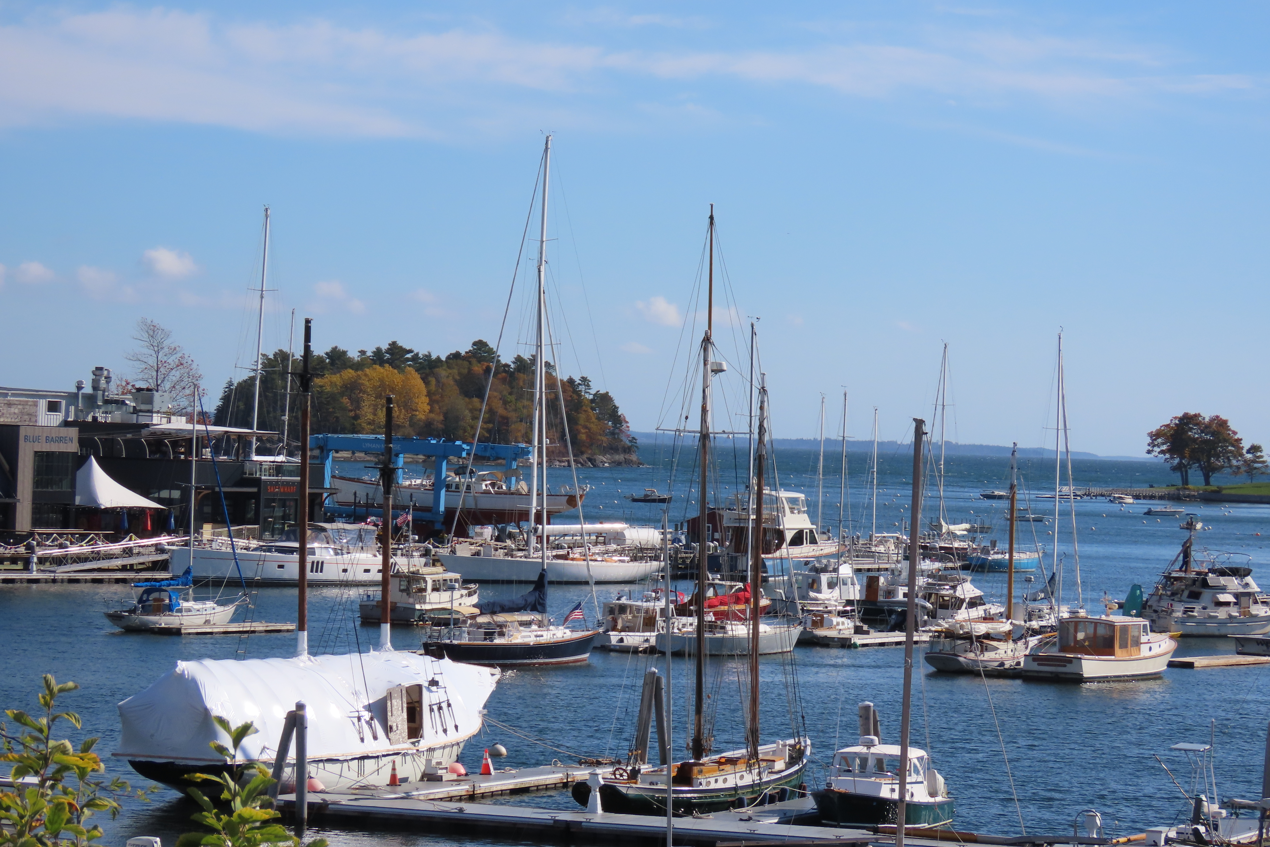
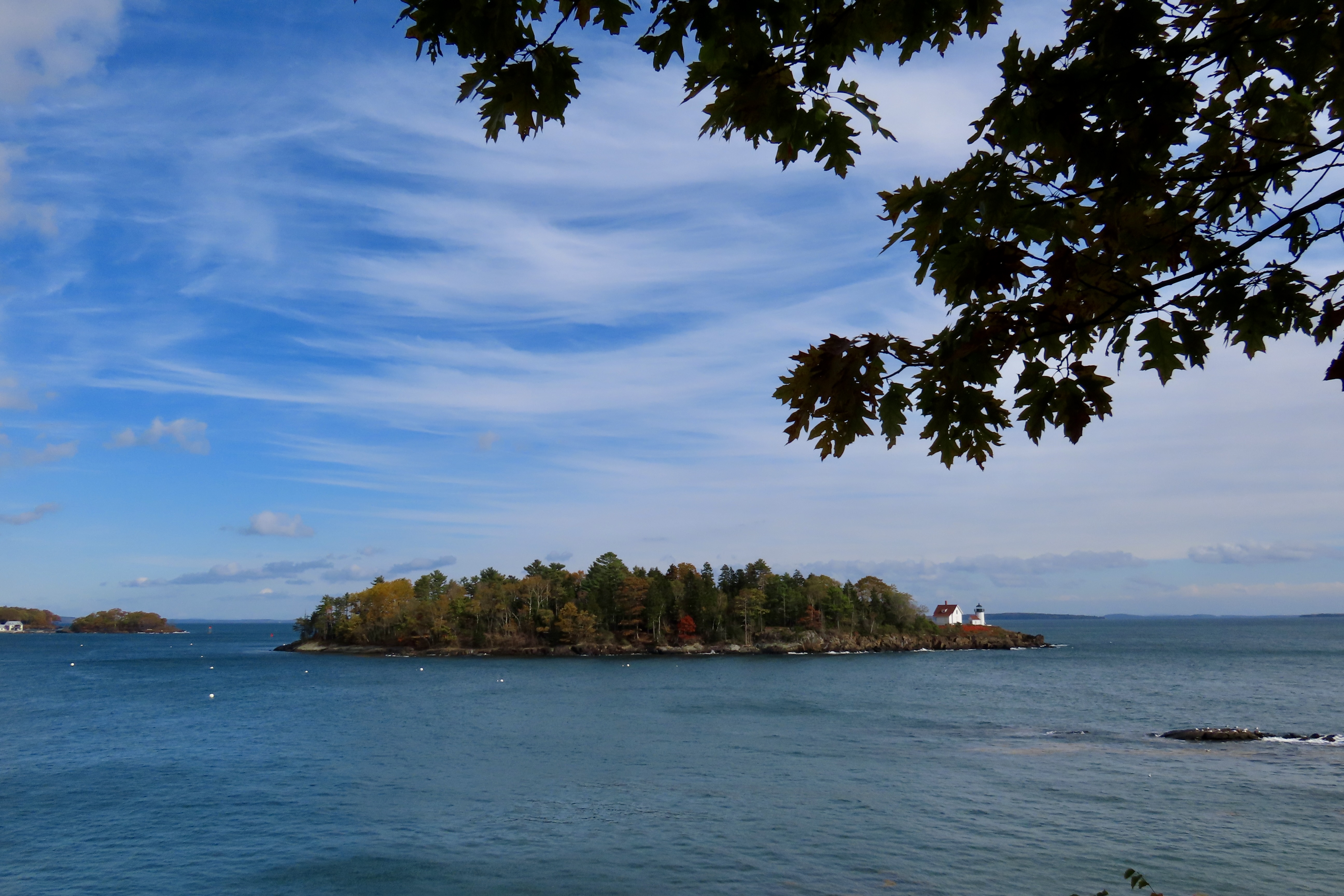
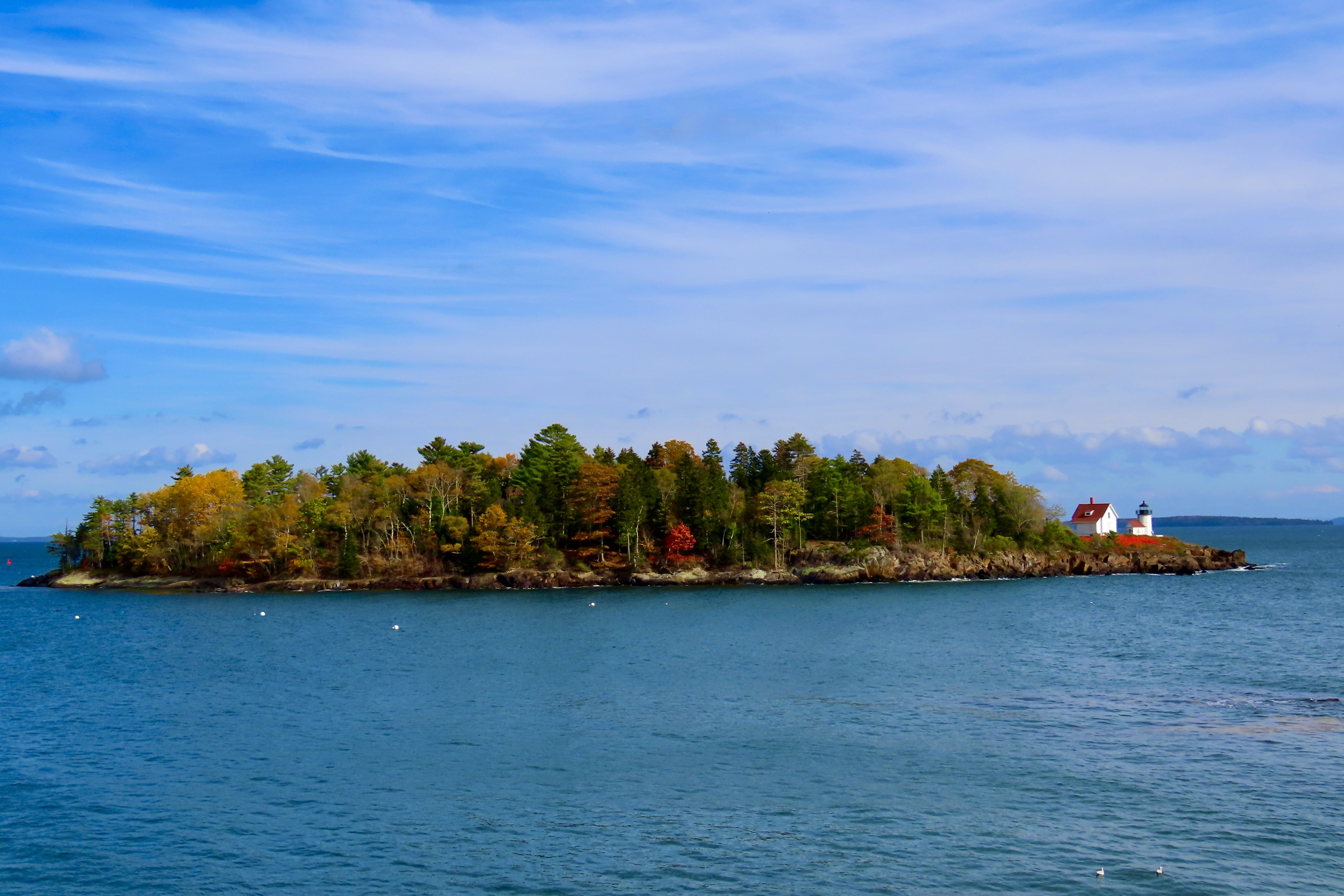
In our last post, we introduced Curtis Island. Here it is seen across the Belfast, Maine harbor. Belfast is where we ate the delicious lobster rolls I featured earlier.
We are wrapping up our leaf-peeping tour of New England tour today. I’ll close out the series with photos of the Island and three spectacular trees at Camden Hills State Park. And then add a few more as we travel back to Virginia.
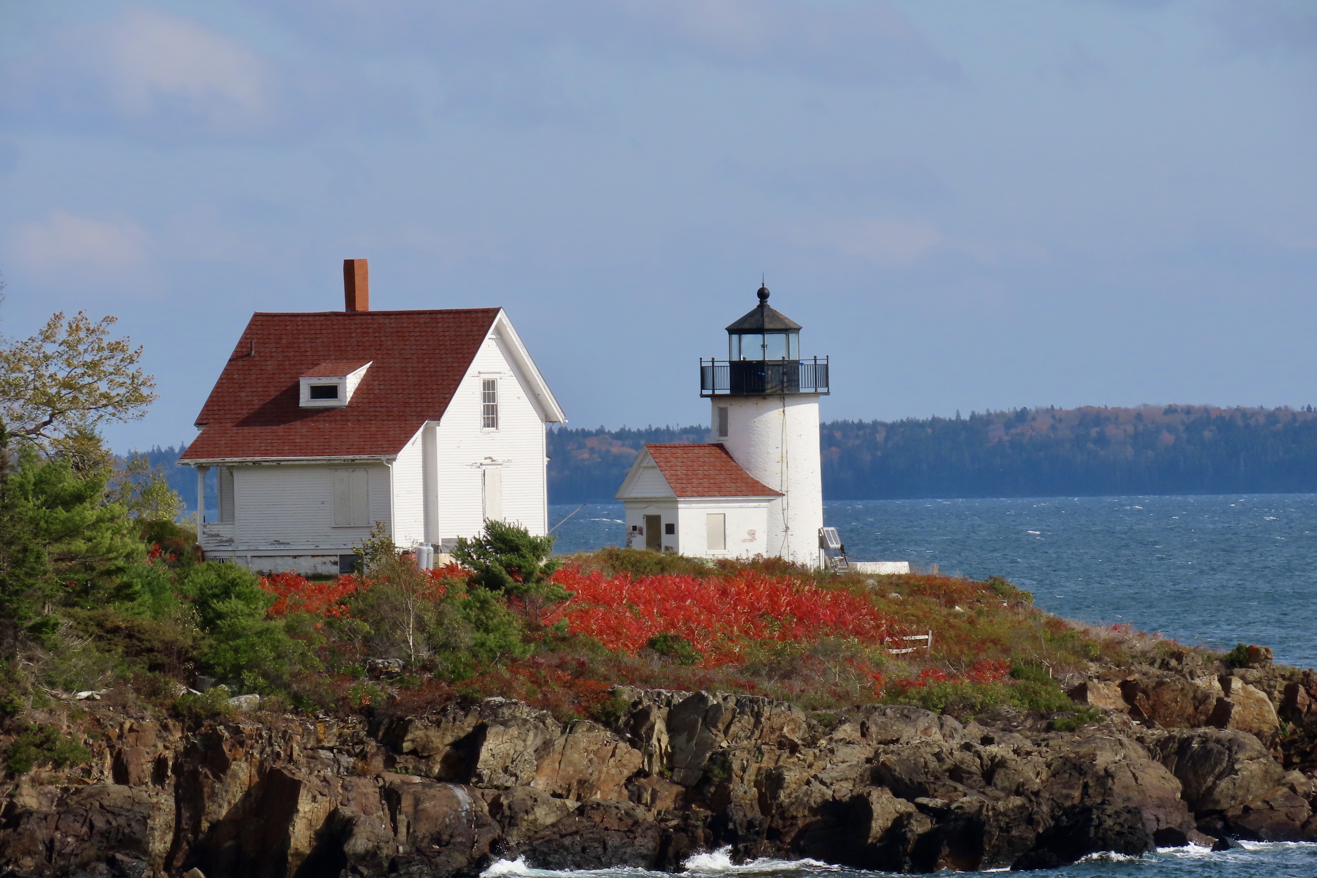
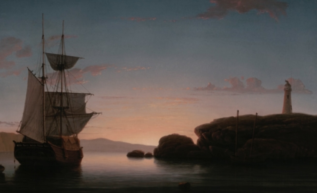
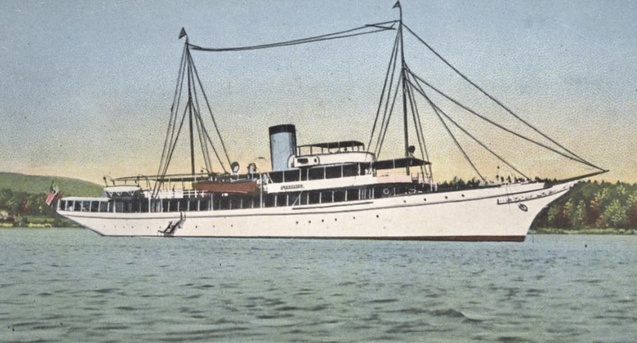
This photo of Curtis Island includes its lighthouse on the far right hand corner.Close up. I’m not sure what the red plant is. Whatever, its brilliant red matches the roofs. The lighthouse is one of 65 found along the Maine coast. There are so many Maine has become known as the Lighthouse State. In comparison there are approximately 80 along the whole Pacific coast including the states of Washington, Oregon and California.1851 painting of Curtis Island by marine painter Fitz Henry Lane.I mentioned in my last blog that Curtis Island was named after the publisher Cyrus Curtis. Did I mention he was wealthy? This is a photo of his boat, er, yacht. Curtis’s summer home was in Camden just south of Belfast where he was Commodore of the Yacht Club from 1909 to 1933. Of course when you build the club, donate it to the town, and dock your 230 foot yacht out front, you should be Commodore.
Curtis was the creator of the Ladies Home Journal and the Saturday Evening Post. Both have interesting stories. Legend has it that when Curtis first published the Ladies Home Journal he gave a copy to his wife, Louisa Knapp, for review. She more or less told him it was crap. His response was “Do you think you can do any better?” Hers, “Yes,” His, “Fine, you do it.” During its day, the Journal became the most widely circulated women’s magazine in the U.S.
The Saturday Evening Post had its beginnings some 80 years before Curtis purchased it in 1897. It traces its beginning back to 1821 when it was printed out of the same shop and using the same print type that Benjamin Franklin had used for the Pennsylvania Gazette. It achieved its highest circulation with 90,000 nationwide subscribers in the 1860s. Curtis pushed this up to the highest circulation of any magazine in the world by the 1920s. His wealth was calculated at $43 billion in today’s dollars. No wonder he could afford the yacht. He actually had three built, all with the name Lyndonia. Two of them would actually do military service. One in WW I and the other in WW II.
We pulled off at Camden Hills State Park to take advantage of its restrooms and were treated to our last view of fall color on the Maine Coast— and what a view it was!The trees were just reaching their peak.Reds, oranges, and yellows were all present.Providing opportunities for close ups of the orange, yellow and…Red maple leaves.Then it was time to begin our zip across New England and New York back to Virginia. We continued to be treated to fall colors.And a hot pink garage that was attached to a hot pink house.Stone fences reminded me of Robert Frost’s poem, Mending Walls.Small lakes provided opportunities for reflection shots.While cloudy skies served to promote silhouettes.Driving down to see our friend Betsy in New York gave us views of the Pocono Mountain Range.I’ll conclude today’s post and this series on New England leaf peeping with a photo of Peggy and me taken by Betsy at her home in Red Hook, New York. We hope you have enjoyed the tour. Thanks for coming along!Turkey Dressing for Thanksgiving Dinner.
Happy Thanksgiving from Peggy and me! (This is one of 50 cards I have created for family and friends over the years.)
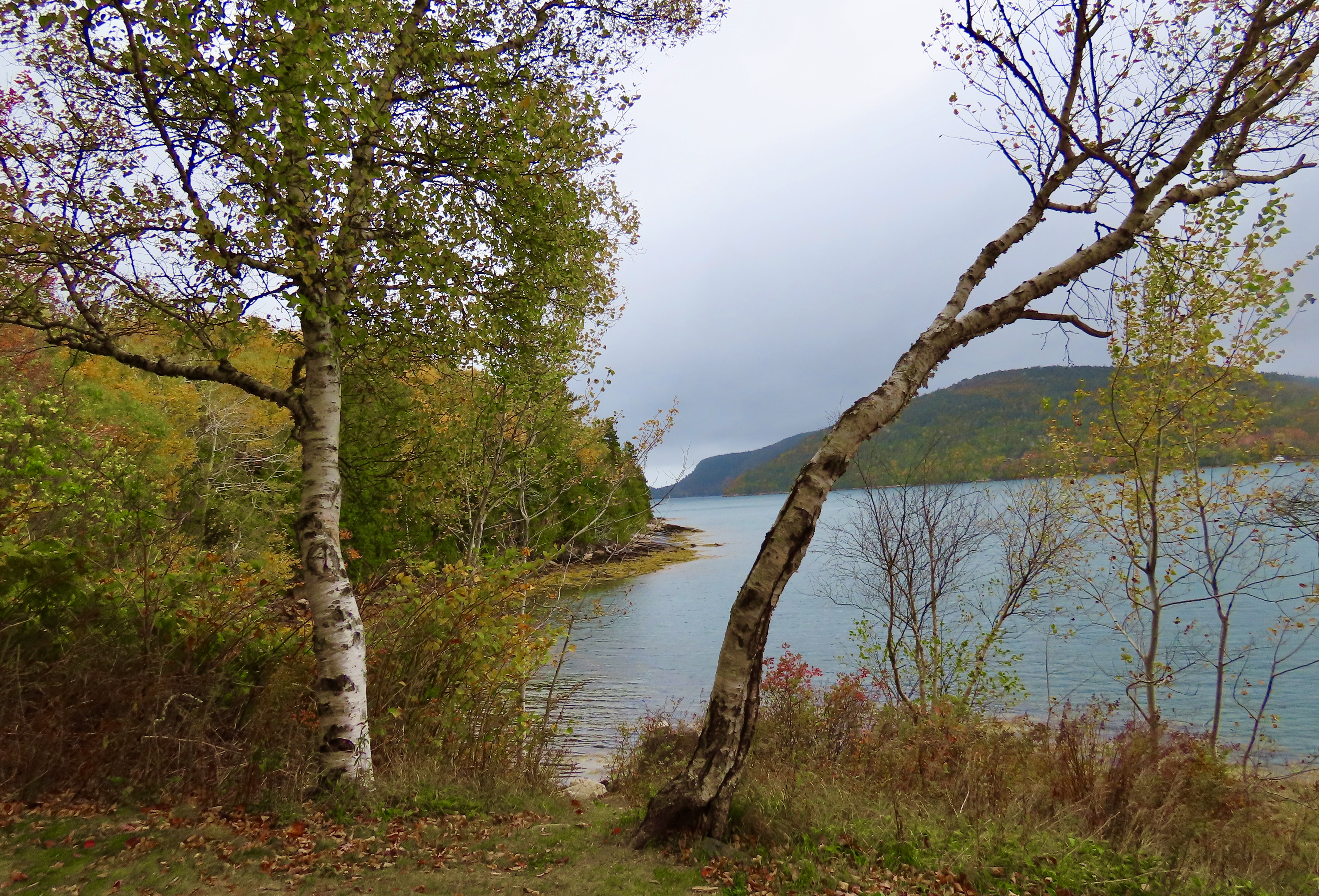
Whatever the sun was up to here, other than being the sun of course, its selective lighting created a colorful photo op that Peggy and I could not ignore— even though it involved fitting our long F-150 into a space it was clearly not designed for. “Good job!” I told Peggy. I was impressed. Had there been some park rangers around, they might have had another opinion. But given the government shutdown, none were to be found. Acadia National Park was packed with leaf-peepers and visitors were on their own. Our infraction was mild in comparison to some we saw.
This was our second time visiting Acadia during leaf peeping season. The first took place in 1999 when Peggy and I both took sabbaticals from our jobs to explore North America with a focus on National Parks. (We visited 50.) Before reaching Maine, we had already been enjoying fall colors for three months! Our adventure had started in June with a drive up the Alaska Highway to Alaska. By the time we finished exploring the state, backpacking, and kayaking, it was mid-August. The leaves were already changing. We followed the advent of fall down through western Canada and across the northern tier of midwestern states to Maine. It was color the whole way. And It continued for another 2000 miles as we traveled down the Appalachian chain of mountains into Georgia.
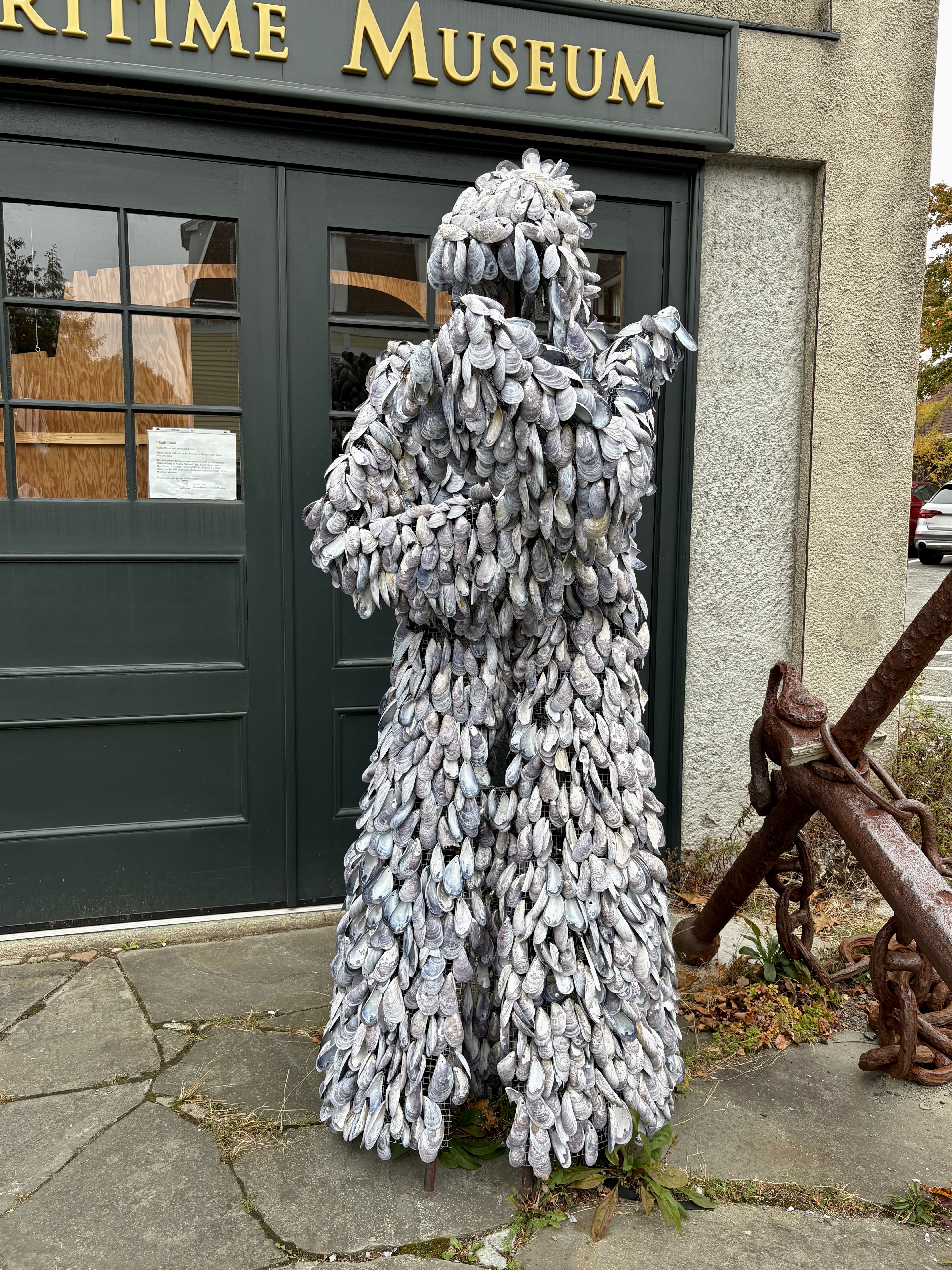
I concluded my last post with a photo of what we considered the most colorful section of the park. This was from the same area. The combination of being close to the trees and bright sunlight made the colors pop out.With distance and lack of sun, the colors faded in this view across Jordan Pond…And blended, like an impressionistic painting. Still beautiful.Roads continued to provide the opportunity to get up close and personal with the fall foliage, however— and traffic.The roads were full. Wherever there was a pulloff meant to feature the beauty of the park, it was packed. Even large parking areas were filled to the brim with people fighting to get into spaces whenever they opened up. While Peggy and I normally avoid national parks during peak season, we knew there was no option when peak-season is defined by peep-season. Still, it was a bit much for us. We headed for roads just outside of the park where the views were similar but traffic was minimal.We came on a small local park near Northeast Harbor named the Asticou Azalea Garden that demanded our attention. It was too late for the azaleas, but the fall colors made up for it…Cascading down…Providing a backdrop for a large granite boulder…And hosting an Oriental sculpture with brilliant red.The pond provided an interesting perspective on fallen leaves and pine needles floating on water while being divided between light and darkPeggy got into the act by providing an opportunity for a final photo of the garden’s colors.Having worked up an appetite, we headed into the nearby town of Northeast Harbor for lunch. It was busy shutting down for winter. Our waitress told us it was the restaurant’s last day for the year. After lunch, Peggy captured this colorful collection of pumpkins and squash on the sidewalk outside with her iPhone. Few things say ‘fall’ better.She was also attracted by a unique sculpture made out of shells in front of the Maritime Museum. It made us think of Davy Jones Locker in Pirates of the Caribbean.We found a small road (Sergeant Drive) leading out of Northeast Harbor along Somes Sound that fit our needs perfectly. It had all of the beauty of Acadia National Park with minimal traffic. Make that zero. We didn’t see any.It provided a number of views across the sound.Dark grey skies provided interesting silhouettes of the trees. I was particularly fascinated by the one on the right with its matching curves.Suminsby Park, created in memory of a beloved scoutmaster and selectman whose efforts helped preserve the area, provided us with closer views of Somes Sound and a peaceful stop.A golden, brown rockweed in the sound added to the fall colors.Looking down the sound from the park. Note the rockweed’s contribution.Looking up the sound.A wrap-up for today: Christmasy red and green leaves hovered above the memorial to Bob Suminsby. I couldn’t help but believe that the old scoutmaster and local leader would be well-pleased with the park that had been given his name. That’s it for today. Next up Peggy and I travel down the Maine coast to the town of Belfast, where we discover Curtis Island. I insisted we check it out.Curtis Island, Maine with its lighthouse. The island, btw, isn’t named after me, sigh, it’s named for Cyrus Hermann Kotzschmar Curtis, founder of the Saturday Evening Post.