The Striking Mucho Lake, Big Bison, and a Sign Forest… The Alaska Highway Series

Muncho Lake 6

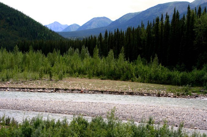
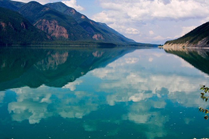
Striking hardly describes Muncho Lake in British Columbia with its striking topaz waters and reflections of the surrounding mountains. The lake reaches a depth of  732 feet (223 m).


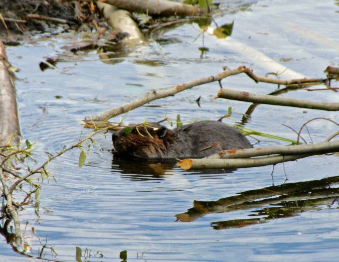
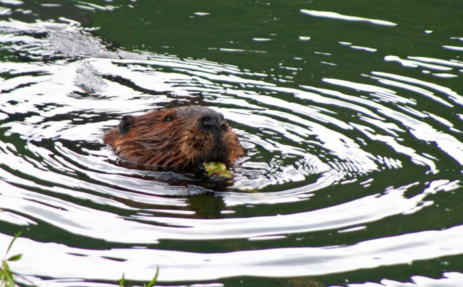
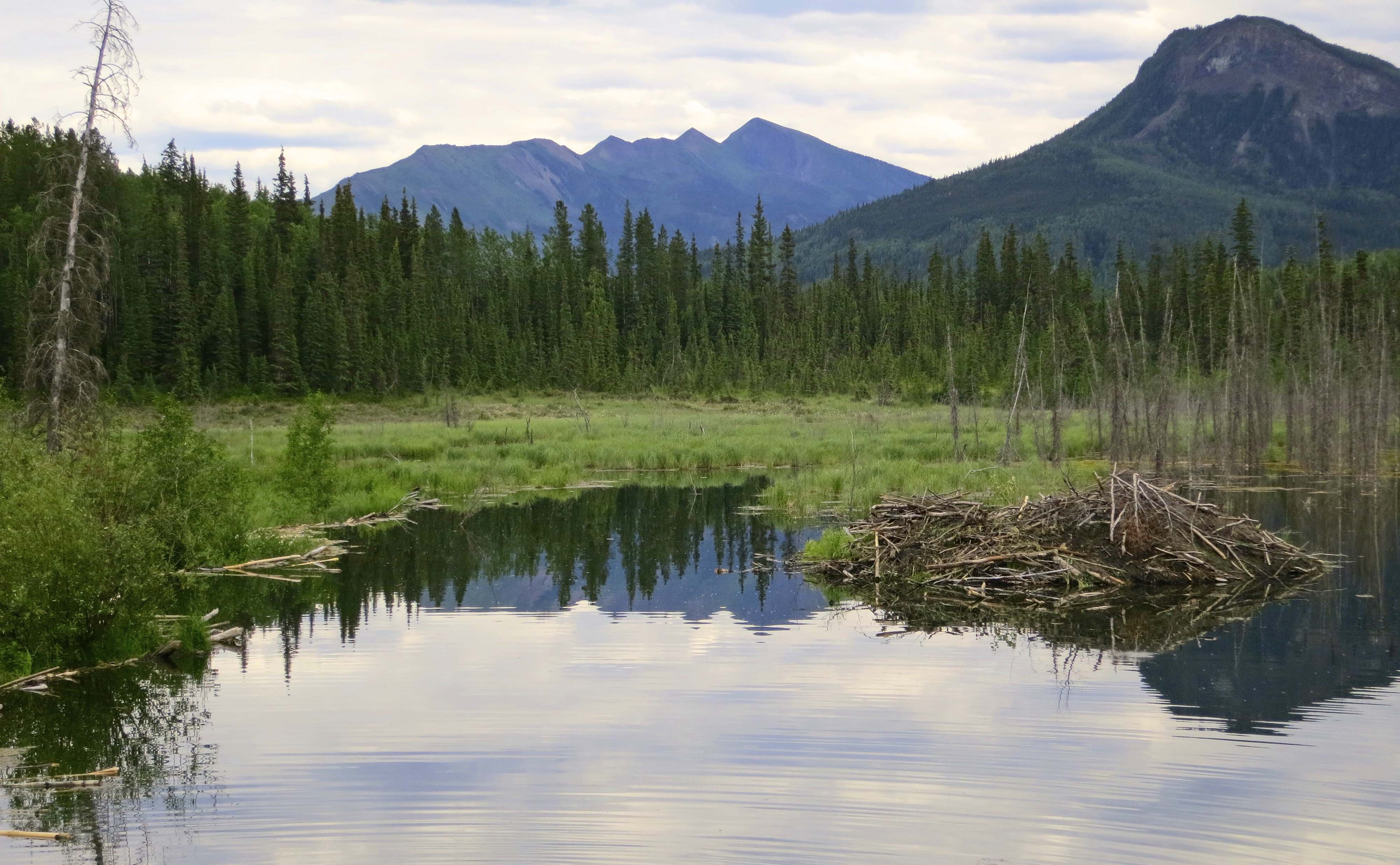
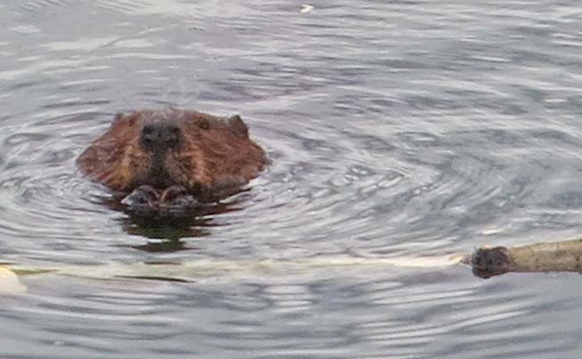
My Wednesday photographic essay will continue to take us up the fabled Alaska Highway. Last Wednesday we travelled from Dawson Creek to Toad River. I featured views along the way, the building of the highway during World War II, Stone Mountain Sheep, and some very busy beavers. Today we will travel from Toad River to Watson Lake in the Yukon Territory, a distance of 201 miles (324 K). Along the way we will visit the striking Mucho Lake, check out the large woodland bison that hang out beside the road, and view a few of the 70,000 town and city signs that have made their way to Watson Lake’s huge sign forest.

Toad River

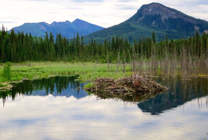
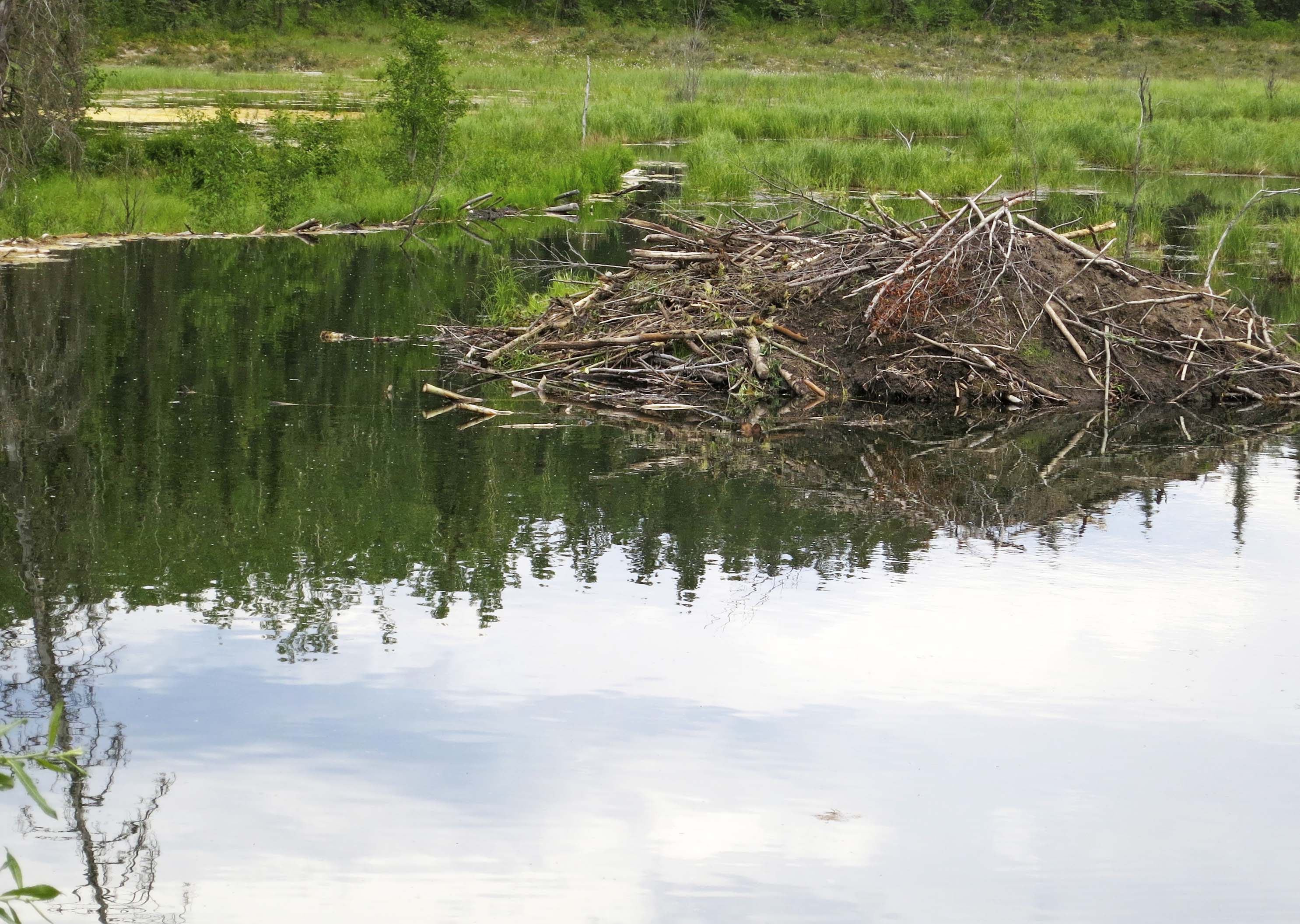
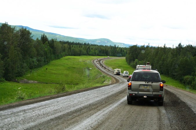
After leaving Toad River Lodge and our visit with the busy beavers, we were treated to a view of the Toad River that parallels the road.

View along Alaska Highway in BC

And this view.

Muncho Lake north

We would stop to admire Muncho Lake both on our journey north to Alaska and on our trip back south. We were heading north when we caught this photo. (Note: all photographs in this series are taken by Peggy and me.)

Muncho Lake in British Columbia

We captured this view on our return trip down the Alaska Highway.

Muncho Lake on the Alaska Highway

As well as this photo.

Road construction, Alaska Highway, BC

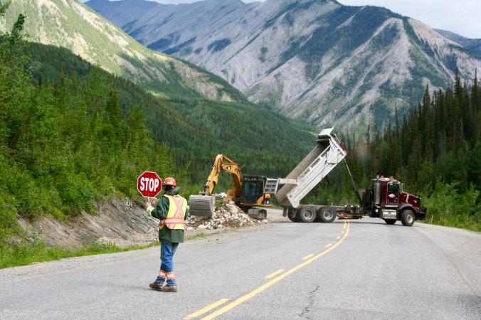
Here’s a common sight along the highway: road construction. Tough winters and permafrost pretty much guarantee employment for road workers.

Road Construction along Alaska Highway

And here we go again, making our way through yet another construction project. Chipped windshields and damaged tires are common. We experienced both. We saw a bear somewhere in here. It may be the black spot on the left (or not).

Dall sheep ram on Alaska Highway

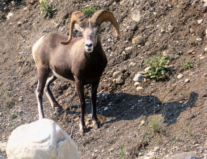
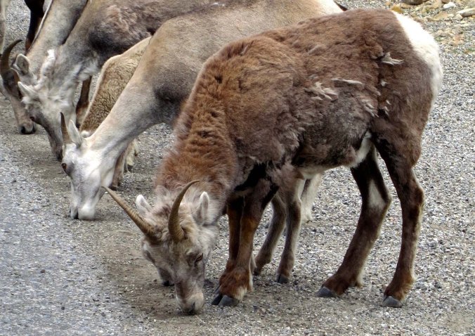
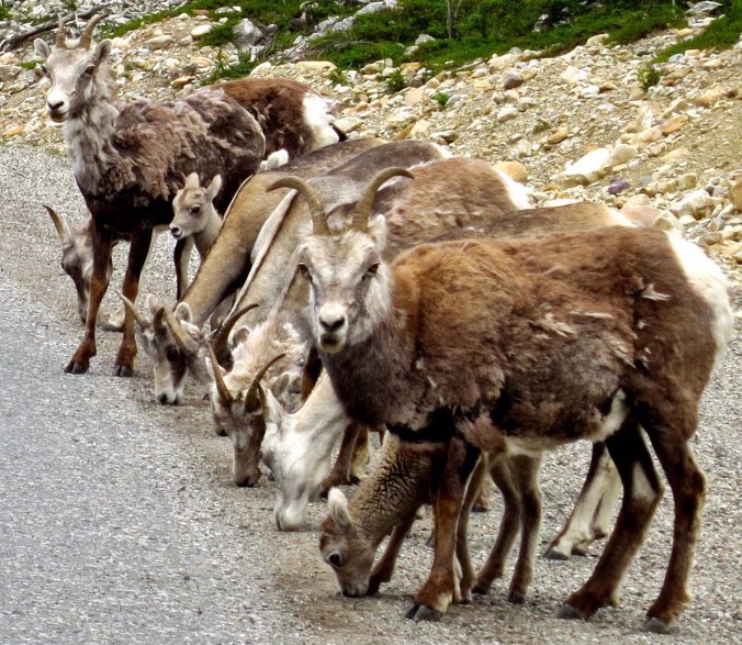
We also found this handsome fellow, another Stone Mountain sheep. What really got us excited, however…

Bison warning sign on Alaska Highway

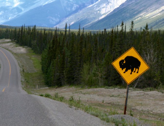
Was this sign. We had entered the territory of the wood bison, also know as wood or mountain buffalo— as opposed to their cousins, the plains buffalo.

Woodland Bison and wallow in BC

And they begin to appear shortly afterwards. This one has made himself a convenient wallow, that he will wallow around in to get rid of bugs.

Woodland bison bull

These guys are big, with massive shoulders. They can weigh up to 2000 pounds (900 kilos), which make them the biggest land mammals in North America.

Herd of wood bison along Alaska Highway

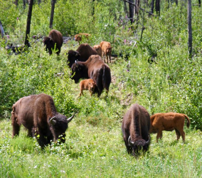
We saw them both alone and in herds. They seem to like the edge of the highway for both its grazing opportunity and ease of travel.

Woodland bison calves

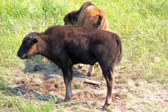
A pair of youngsters…

Welcome to the Yukon sign

Here’s a sign to thrill the heart of the most jaded of travelers. Canada’s Yukon Territory is almost synonymous with remote and wild. I grew up listening to daring tales of Sargent Preston of the Yukon and his faithful dog King. “On King! On you huskies, on!”

Watson Lake sign forest 5

Not far up the road from the Yukon border we came to Watson Lake with its Sign Forest of 77,000 signs from all over the world. If you wander around long enough, you might very well find a sign that was liberated from your hometown and placed here by someone traveling up the Alaska Highway.

Watson Lake sign forest

The tradition was started during the building of the Alaska Highway in 1942 when a soldier, Carl K. Lindley was asked by his commanding officer to erect directional signposts. While at the job, he added a sign for his own town of Danville, Illinois. The rest is history!

Watson Lake sign forest 4

The signs go on and on…

Peggy Mekemson at Watson Lake Sign Forest

I’ll close today’s post with a photo of Peggy to provide perspective on the height of the Sign Forest.

FRIDAY’S POST: A chapter from The Bush Devil Ate Sam, my book about my Peace Corps experience in the jungles of West Africa.

MONDAY’S POST: We continue our journey down the Colorado River through the Grand Canyon.

SaveSave

From Dawson Creek to Toad River… The Alaska Highway Series: Part II

British Columbia view along Alaska Highway

There is a much natural beauty along the Alaska Highway and a lot of wilderness— millions of square miles, as far as the eye can see.

The Alaska Highway, or the Alcan highway as it was known at the time, was a hurry up project, rarely if ever matched as an engineering feat. World War II was raging. The Japanese had bombed Pearl Harbor and were threatening to invade Alaska, which they did in 1942, landing on the outer most islands of the Aleutian Chain. The only way to counter the threat was to travel by ship through the North Pacific or fly in by air. The US and Canada came to a quick agreement: a 1700-mile road (2700 K) would be built between Dawson Creek BC and Delta Junction, Alaska. It was a colossal project.

Sub-zero freezing temperatures ruled during the winter and suffocating heat dominated in the summer. Along with the heat came hordes of mosquitos, black flies, no-see-ems and other biting, blood-sucking insects. Temperatures were so cold in the winter that fires would be lit under equipment to warm it up enough to operate. Muskeg sucked the same equipment down into the mud in the summer, sometimes swallowing it whole.

Team sinking in mud when building Alaska Highway

Whoa! Working conditions along the Alaska Highway were not optimal. (grin) (Museums along the Alaska Highway feature numerous photos reflecting the difficulties encountered in building the road.)

Bulldozer buried in mud while building the Alaska Highway

This is a ‘what do we do now,’ pose. (Museum photo.)

Building log bridge on the Alaska Highway

Bridges were made from logs. (Museum photo.)

Recruitment notice for workers on building the Alaska Highway

While not as clear as I would like, this recruitment notice is worth reading. They should have won a prize for ‘truth in advertising.’ (Museum photo.)

WW II army truck on Alaska Highway

Lots of old equipment is also displayed along the highway.

Tow truck used on the Alaska Highway

Steam shovel used to build the Alaska Highway

Curt Mekemson standing on bulldozer used to build Alaska Highway

Here I am standing on one of the old bulldozers.

With the threat of an imminent invasion, there was no time to consider the usual niceties of road building. Some 11,000 soldiers and engineers, 16,000 civilians, and 7000 pieces of equipment were thrown at the epic undertaking. Airplanes flew out daily to help plan routes, ‘on the fly’ so to speak, while the men struggled under almost impossible conditions. Starting on March 2nd, 1942, the project was completed on September 24th, some eight months later.

It was rough, oh yes it was rough— steep, muddy roads, log bridges, trees laid down across muskeg 15-feet deep— but it was usable. At $140 million, it was the most expensive construction project of World War II.

Original Alcan Highway

A view of the old road on its completion. (Museum photo.)

Alaska Highway in British Columbia

And how much of it looks today.

The highway can still be a bit of a challenge, but not so much that 30-40 foot RVs aren’t seen in substantial numbers travelling north on it. For the most part, the road is paved except for construction work, which can seem to go on forever. And it is shorter, by some 300 miles!

Today, I will take you over the first 400 miles from Dawson Creek to the uniquely named Toad River. The thing about the scenery along the Alaska Highway is that it is all impressive, and the farther north you go the more impressive it becomes!

Green forests along Alaska Highway

Mountains and forests rule along the highway…

Blue mountains along the Alaska Highway in British Columbia

Mountains stretching off into the distance.

Rock Face along Alaska Highway

An impressive cliff face.

View along Alaska Highway in British Columbia

Between ranges the road follows rivers, all of which had to be crossed when building the highway.

River along Alaska Highway

Sikanni Chief River

This is the Sikanni Chief River.

Sign for Sikanni Chief River

As was noted by this totem pole sign.

Stone Mountain on Alaska Highway

We were excited to see Stone Mountain, not only for its beauty but because there was a good chance we would see Stone Mountain Sheep.

Stone Mountain sheep on Alaska Highway

We were not disappointed. The sheep had come down the mountain to eat the salt that had been washed off the road from the previous winter.

Being checked out by Stone Mountain sheep on Alaska Highway

They weren’t worried when we stopped, but they did check us out. Note the kids peeking out.

Stone sheep kid

To say that they were cute…

Stone sheep kid at Stone Mountain along the Alaska Highway

Is a considerable understatement.

Toad River Lodge on Alaska Highway

Not far up the road, we came to the Toad River Lodge, which is named after the Toad River. Roadhouses were common in the early days of the Alaska Highway and even up to the time when I first drove the road in 1986. It was hard to travel over more than a hundred miles a day on rough, unpaved roads. Many lodges are closed now, no longer needed.

Baseball caps at Toad River Lodge on Alaska Highway

The lodge was quite proud of its cap collection, some 7000 from all over the world. The name, so we were told, had derived from towed, not the warty frog. Before the Canadians and Americans had completed a bridge across the river in 1942, they had to be towed across it. So they named it the Towed River. Toad is much more creative.

Toat River Lodge Toad

This fellow was staring at us when we ate at the lodge.

Beaver dam near the Toad River along the Alaska Highway

We spent the night at lodge’s RV campground. This was the view from our campsite. It was obvious that beavers had been at work on building their own lodge.

Beaver dam and beaver along Alaska Highway

And we soon saw one of the lodge’s residents. Lower left. He/she was busy building a beaver dam to assure that their lodge continued to be prime, waterfront property.

Beaver Lodges and dam next to Toad River Lodge on Alaska Highway

A view of the dam, which was literally outside our door. The builders had certainly been ‘as busy as beavers.’

Beaver working on beaver dam

Beavers often work at night, so we were excited about having these chisel-toothed mammals continue their activity as we watched from a bench next to their lake.

Beaver pushing limb to Beaver Dam near Toad River Lodge

While they worked, for the most part, bringing limbs in from across the lake…

Beaver chewing on wood chip along Toad River

This didn’t stop them from stopping for an occasional snack from their dam building material! That’s it for the day… Next Wednesday, we will continue our journey up the Alaska Highway.

FRIDAY’S POST: MisAdventures finds me playing in the woods when I was growing up, a quick ten-minute walk from my home. While it may not have been wilderness, it was wilderness to me.

MONDAY’S POST: Peggy and I continue our journey down the Colorado River through the Grand Canyon.

WEDNESDAY’S POST: We continue on our journey up the fabled Alaska Highway through Canada, reaching the Yukon Territory. A strikingly beautiful lake, big bison, and a sign forest of 70,000 signs are featured.


SaveSave

SaveSave

The Beavers of Toad River… North to Alaska

Beaver lodge on the Toad River.

The view out the back window of our van at Toad River. The beaver lodge is in the foreground.

By the time we reached Toad River in Northern British Columbia on the Alaska Highway, we were ready to call it a day. Peggy and I had stopped at the lodge on a previous trip for lunch. The restaurant claims to have the largest collection of baseball caps in the world. If you make the trip, be sure to stop by and look up at the 7,000 on the ceiling.

Toar River Lodge in northern BC

The lodge on the Toad River had an RV park and Internet. It turned out to be one of the best Internet connections we had on the Alaska Highway.

Toad River Lodge caps in northern BC.

Some 7000 caps decorate the ceiling of the restaurant at Toad River Lodge.

Kodiak Coast Guard cap at Toad River Lodge.

Since we are on our way to visit our son Tony who flies helicopters for the Coast Guard in Kodiak, I took this photo.

The Toad River Lodge had this toad for sale.

The Toad River Lodge had this toad for sale.

As to how Toad River got its name, the residents claimed it was originally Towed River dating from the days when the Alaska Highway was being built in the 1940s and heavy equipment had to be ferried across the river. Wikipedia claims the name came from big toads living next to the water. Peggy and I heard large toads croaking that night. Maybe it was our imagination.

We backed into our campground and immediately discovered a beaver lodge was built in the pond directly behind our van. Closer inspection revealed busy beavers buzzing about. You’ve undoubtedly heard the comment, “busy as a beaver.” It means really busy and there is a reason for its use. Beavers work hard. There are trees to bite down, lodges and dams to be built, food to gather, territories to protect, and children to raise.

Families are important. Mom and dad mate for life and both parents take care of the kids. Teenagers hang around for a year or two and help babysit. Everyone chips in on dam and lodge building.

Pop very carefully marks the family property. A lot of work has gone into improvements. No trespassing signs consist of small piles of debris dredged up from underwater, deposited on land, and then marked by anal gland secretions. I watched a beaver perform this task when I was backpacking in the Wind River Mountains of Wyoming. He backed up to the pile, raised his tail, and let go. Invading beavers that cross over property lines are quickly run out of town. It can get nasty.

Beavers are known for modifying the landscape by building dams across small creeks and then building their homes of lodges in the lakes that are created. No other animal, with the exception of man, has such an impact on the environment. And beavers don’t have to file EIRs, obtain building permits, or worry about zoning laws. Lodges, or homes, consist of one or two rooms with underwater entrances.

Ducks, frogs, and trout love the riparian habitats created by beavers. Farmers are less pleased with their activities and frequently tear down the dams. New ones are promptly built overnight. We watched our busy beavers for an hour or so. They were mainly busy with stuffing their tummies. Have another bite of bark. Yum.

Beaver dam on Toad River in northern British Columbia.

Looking down on the beaver dam at Toad River. A beaver can be seen on the left center of the photo.

Beaver dam on Toad River in northern BC

Looking up at the beaver dam across the pond at the beaver lodge. Still green leaves suggest that the dam is a work in progress.

Beaver lodge on the Toad River in British Columbia.

Another perspective on the beaver lodge.

Beaver eating on Toad River in northern BC

Beaver chomps down on limb. Check out the claws. (Photo by Peggy Mekemson)

Beaver on Toad River in northern BC

The beaver stopped eating to look at me. Is he grinning?

Beaver eating on the Toad River in northern British Columbia.

This guy was working on his dinner. Note the chunk of bark in his mouth. He is holding it with his paw. (Photo by Peggy Mekemson)

Beaver swimming on Toad River in northern BC

I like this shot Peggy took because you can see the beaver’s body under the water. (Photo by Peggy Mekemson)

Beaver and beaver lodge on Toad River

A final photo featuring a beaver, beaver lodge, and mountain. (Photo by Peggy Mekemson.)

Next Blog: The sign forest of Watson Lake.