I’m back! While the three months of hanging out at our home and taking care of my brother may not seem like long, it felt like an eternity. I have one more post to write on the experience but it is going to have to wait. It’s play time. While Peggy decided that she needed a kid/grandkid fix and headed east, I decided I needed a road trip. I loaded up Quivera the Van and took off down Highway 395 along the east side of the Sierra Nevada Mountain Range, one of America’s most scenic and interesting drives.
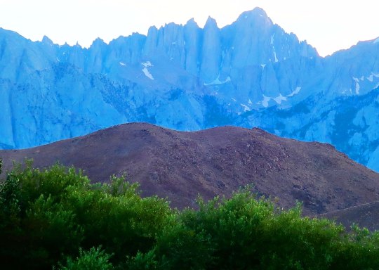
My journey started in Reno visiting the National Automobile Museum. Even if you don’t care a rat’s behind about old cars, I can pretty much guarantee Bill Harrah’s collection will awe you. (Rat’s behind? I’ve been reading Mark Twain’s “Roughing It” and have been inspired by his colorful choice of words.) From there, I headed south, enjoying the sheer grandeur of the mountains with side trips to Virginia City where Samuel Clemens assumed the name Mark Twain, the ghost town of Bodie, Mono Lake with its strange, other worldly tuff towers, a mountain of obsidian, the World War II Japanese internment camp of Manzanar, and finally the Alabama Hills next to Lone Pine and Mt. Whitney.
I stayed in summer-touristy but interesting towns, visited local museums, learned about water wars, and ate some great food. I’ll take you inside the ‘world famous’ Schat’s Bakery in Bishop where simply stepping through the door guarantees that you gain five pounds, and we will stop at the Copper Top, a hole in the wall front yard family bar-b-que in Big Pine that was named America’s best restaurant in 2014 by Yelp. Yep, its ribs and tri-tip are to die for. When the restaurant is closed, you can get the tri-tip from a vending machine.
Originally, my goal was to head farther south to where Highway 395 intersects I-15 and ends. The road had originally gone all of the way to Mexico but had been done in by bulldozers and Southern California freeways. You can still follow the highway to Canada through remote country where there are fewer people and bulldozers. My primary objective had been to visit the Roy Rogers-Dale Evans museum in Victorville near the highway’s terminus. It wasn’t that I was so interested in Roy and Dale, I wanted to see Roy’s horse, Trigger. The singing cowboy had him stuffed. Visiting the horse had been on my agenda for a long, long time. Boy, was I out of date. Googling Trigger, I discovered that the museum had closed in 2003 and the horse had been moved to Branson, Missouri. (I’ve been to Branson; there are lots of strange things there.) Trigger never achieved the stardom in Missouri that he had out West, however. It could be that most of his fans from the 40s and 50s have ridden off into the sunset. Maybe if Dale had stuffed Roy…
Along the way, I was going to make a side trip to the Maturango Museum in Ridgecrest with its focus on the petroglyphs of the Coso Range. That trip ended up on shaky ground, however. The 6.4 and 7.1 earthquakes near the town at the beginning of the month persuaded me that the museum could wait. I just read that there have been thousands of aftershocks since. That’s a whole lot of shaking going on.
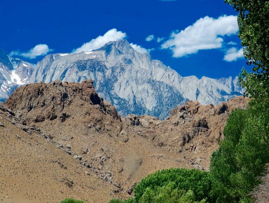
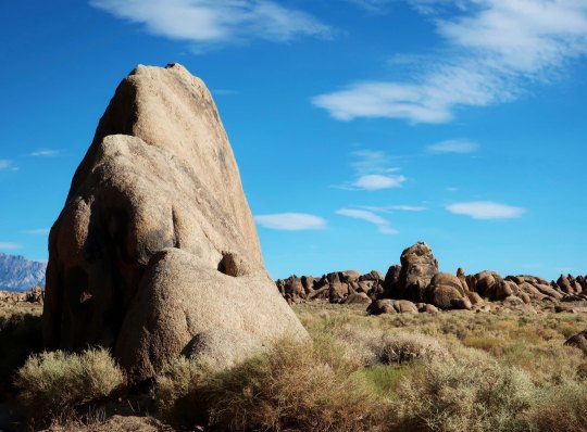
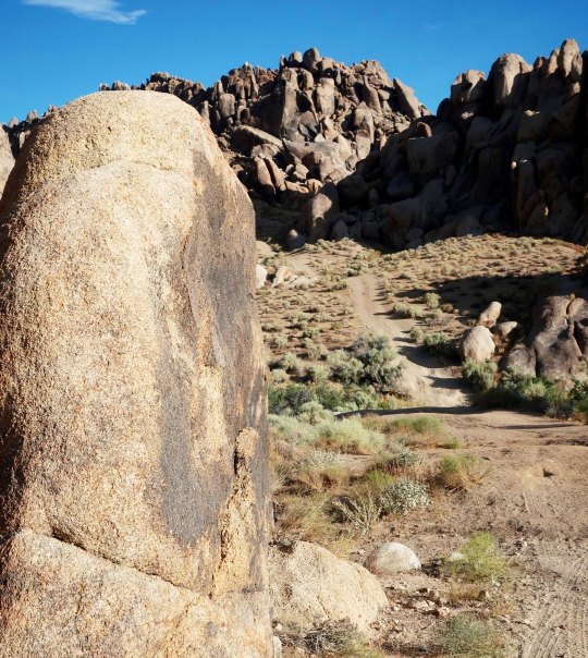
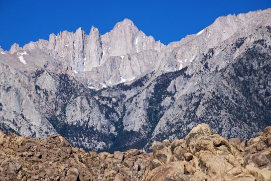
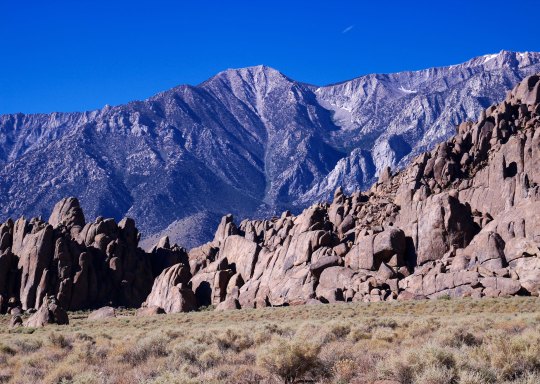
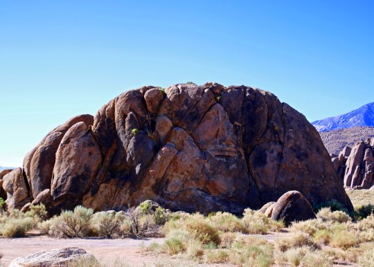
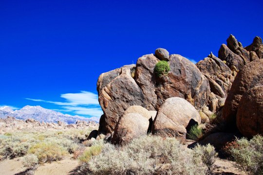
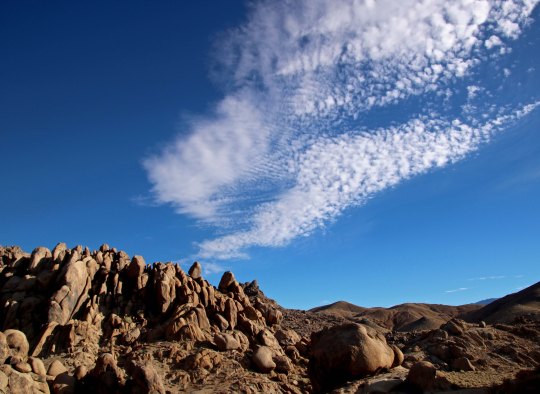
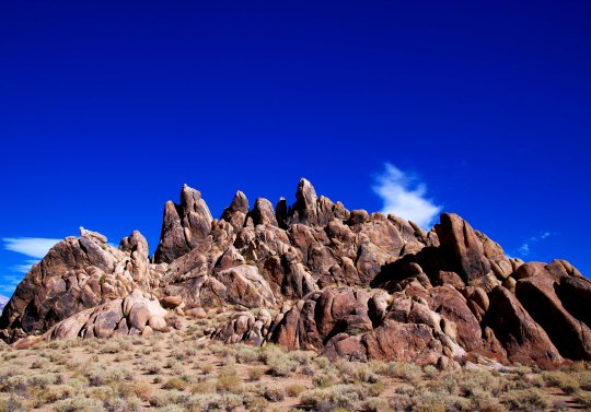
Today I will restart my blog— get back in the saddle, so to speak— with a drive through the Alabama Hills, which I think you will find unique and beautiful. I did. Having the Sierra Nevada and Inyo Mountains as backdrops doesn’t hurt. The set locators, directors, actors, script writers and film crews of the over 400 Hollywood movies made in the area starting in the 1920s obviously found the hills attractive. But I will get into the details of the movies in my next post when I will take you into the Lone Pine Film History Museum where Hopalong Cassidy and the Lone Ranger rub elbows with the likes of John Wayne, Errol Flynn, Spencer Tracy, Ann Francis and Spock, not to mention Trigger, Silver, Rin Tin Tin and Buttermilk. Buttermilk!? Hmmm. Okay, you trivia fans, who was Buttermilk?
I first thought that the Alabama Hills had been named by some homesick prospector from the East. That happened a lot in the 1850s, 60s and 70s. Heck, the lonely miners were even known to name mountain lakes after their favorite prostitutes. What I learned, however, was that Southern sympathizers named the hills after the CSS Alabama, a Confederate War ship that had caused the Union considerable strife by taking some 66 merchant ships valued at over six million dollars during its brief two-year career. Its success was finally ended when the Union sloop of war, the Kearsarge, caught up with the ship at Cherbourg, France and sank her. Other prospectors in the Lone Pine area who were sympathetic with the North, named their mine the Kearsarge. The name lives on in the Kearsarge Pass along the John Muir Trail.


But enough on background. Let’s rock!


NEXT POST: A visit to the Lone Pine Film History Museum.
