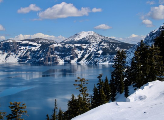
Crater Lake National Park is renowned for its beauty and the deep blue color of its water. It has an icy blue look here. Peggy took this photo from the Rim Village. Scott Mountain dominates in the distance. (Photo by Peggy Mekemson.)
The massive, 12-mile-high Mt. Mazama blew its top 7000 years ago. Local Native American legend claims that it had gone to war with Mt. Shasta, a hundred miles to the south. Mazama lost. It wasn’t that the massive explosion used up all of its bullets, aka lava. The problem was that using the magma emptied out the large chamber beneath the mountain and the weight of the Mazama brought it crashing down into the empty chamber, leaving behind a large crater or caldera to use the technical term. The caldera filled with water and voila! Crater Lake was born.
A photo I took of Mt. Shasta. Had Mt. Mazuma survived its explosion of 7,000 years ago, it may have looked something like this.
Peggy and I visited the National Park a week ago. It’s about a 2 ½ hour drive from our house. We drove up by ourselves and were careful to keep the virus-safe distance from the relatively few other people who were visiting. One individual insisted on invading our space, however…
This fellow apparently thought sniffing my shoe was more important than maintaining the 6 feet recommended to avoid coronavirus. “What are you thinking, guy?” I asked. “It’s a girl,” Peggy informed me. “She’s wearing pink.”
We had visited Crater Lake twice last summer and were eager to see it in the winter covered with snow. We were really glad we did. For one, it was as beautiful as we had expected it would be— and, two, the park closed on Tuesday because of coronavirus. The odds are that it will be closed until long after the snow melts. Here’s a map and some of the photos that Peggy and I took.
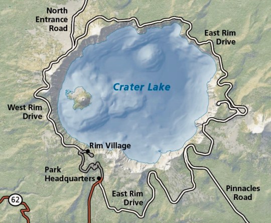
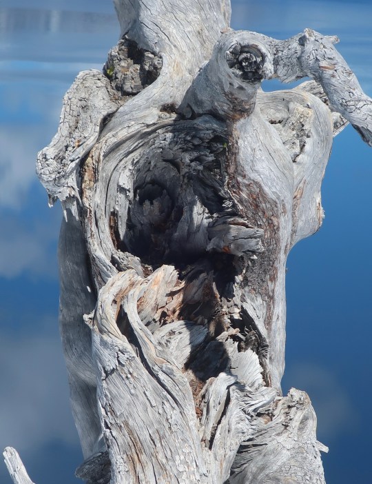
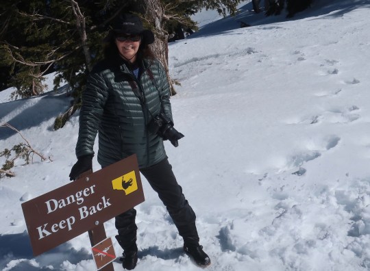
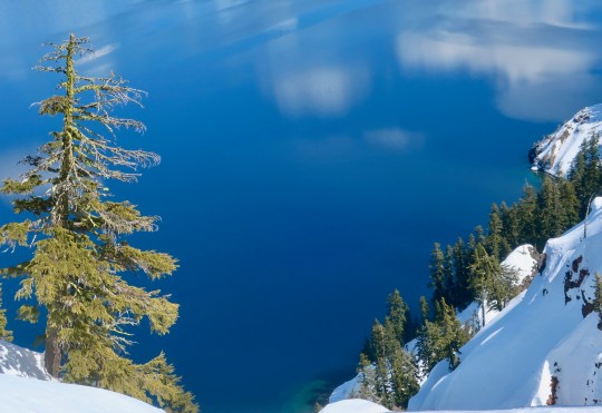
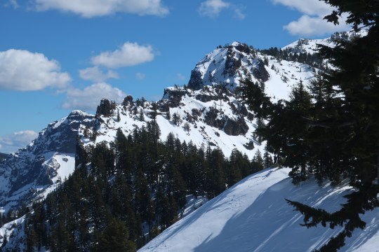
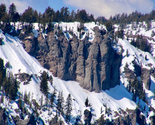
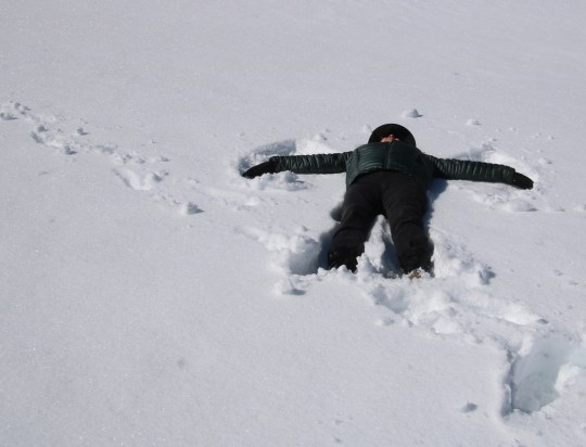
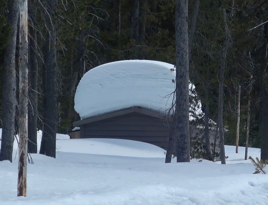
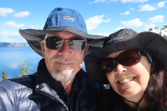
This National Park map provides an overview of the lake. Peggy and I were at Rim Village. The road around the lake is closed in winter and doesn’t open again until sometime in the summer. Wizard Mountain is on the left. The sheer cliffs around the lake are obvious. The lake is 1978 feet deep at its deepest spot. It is 6.2 by 4.5 miles across.I’ve never met a tree stump I didn’t want to photograph. Let me put this one into perspective…Wizard Island provided a backdrop. Llao Rock, named after the Klamath Indian god of the underworld rears up behind the island. The deep blue water reflects both Wizard Island and the clouds above the lake.A close up of Wizard Island. It is actually a small volcano that rose up from the lake’s floor. You can visit it by boat if you are willing to walk the thousand feet to the water. Afterwards, you get to hike the thousand feet back up. (Photo by Peggy Mekemson.)Other than the one trail, it’s a long way to fall to get to the lake and there are plenty of signs to warn you. The smaller sign forbids the use of drones.This photo gives a perspective on the steep drop.The cliffs as seen looking across the lake. I liked the impressionist-like reflection. (Photo by Peggy Mekemson.)Impressive rock formations surround Crater Lake. This one is located south of the Rim Village. I believe it is Garfield Peak.These were on the opposite side of the lake above Wizard Island. (Photo by Peggy Mekemson.)This is the trail that took us from the parking lot into the Rim Village overlook. (Photo by Peggy Mekemson.)Peggy points out the depth of the snow.This photo of two of the buildings at the Crater Lake Rim Village also provide a look at the depth of the snow. The trail leads over to the lakes rim. I rendered the photo in black and white. Peggy captured two fun photos of the roof. (Photo by Peggy Mekemson.)And the left edge of the building. (Photo by Peggy Mekemson.)All of the snow demanded a snow angel and I volunteered Peggy.It came out three dimensional! Peggy thought it was a bit spooky. Something took a big chunk out of her side. (It was from her knee getting up.)As always, we wandered around taking random photos. One of mine included this tree with its bone-colored limbs.Peggy caught these backpackers on snowshoes.Speaking of backpackers, the Pacific Crest Trail runs through the park. We didn’t see any through hikers, which wasn’t surprising. This is the restroom at the trailhead! Peggy and I will likely backpack through the park starting here this coming summer.I’ll conclude today’s post with a selfie of Peggy and me at the Lake’s edge— our last visit before lockdown. 🙂