Hundreds of millions of years of the earth’s history is recorded in the walls of the Grand Canyon, much of it in convenient layers. Each layer has a story to tell ranging from sand storms to ancient seas, from raging rivers to quiet mudflats— stories that are told in rocks progressing in age as one goes deeper into the canyon. This photo was taken from Bright Angel Point.
For example, the light rock in the foreground is made up of Coconino sandstone, which was laid down some 275 million years ago when a vast, sand-filled desert covered the area. It’s a hard rock that resists erosion and creates a distinctive layer around the canyon, as seen on the opposite wall.
The two formations below it, Hermit Shale and Supai, represent some 60 million years of geological history and are made up of softer rocks such as mudstone and siltstone formed by clay filtered out of calm water typically found in lakes, lagoons, river deltas and harbors. These rocks erode more easily and create slopes. The Supai formation is interspersed with layers of sandstone that slow the erosion and create small cliffs. It also includes generous amount of hematite, which is rich in iron. Iron oxide (rust) gives the formation its distinctive red color.
The Red Wall, located just beneath the Supai formation, is one of the most prominent features of the Grand Canyon. Created some 340 million plus years ago in a sea that covered the region, it ranges in height from 500-800 feet and is made up of limestone. Its predominant red color doesn’t come from the limestone, however. It comes from the iron oxide that is formed from the hematite in the Supai formation and leached out by water flowing down the wall, painting it red! Like the sandstone, limestone is a hard rock that doesn’t easily erode. Thus, the towering cliffs.
The oldest rocks in the canyon are appropriately found at the bottom, Vishnu Schist, a metamorphic rock of quartz and hornblende that was born in a deep ocean trench some 1.8 billion years ago. Does this mean the Grand Canyon shows 1.8 billion years of earth’s geologic history? Not quite, every so often nature wipes out a few million years through erosion. The most renown is the Great Unconformity where some 1.2 billion years of the the 1.8 billion were razed!
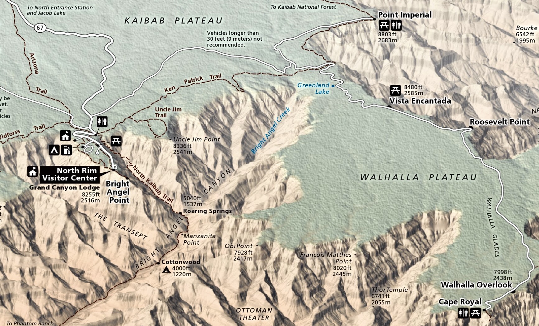
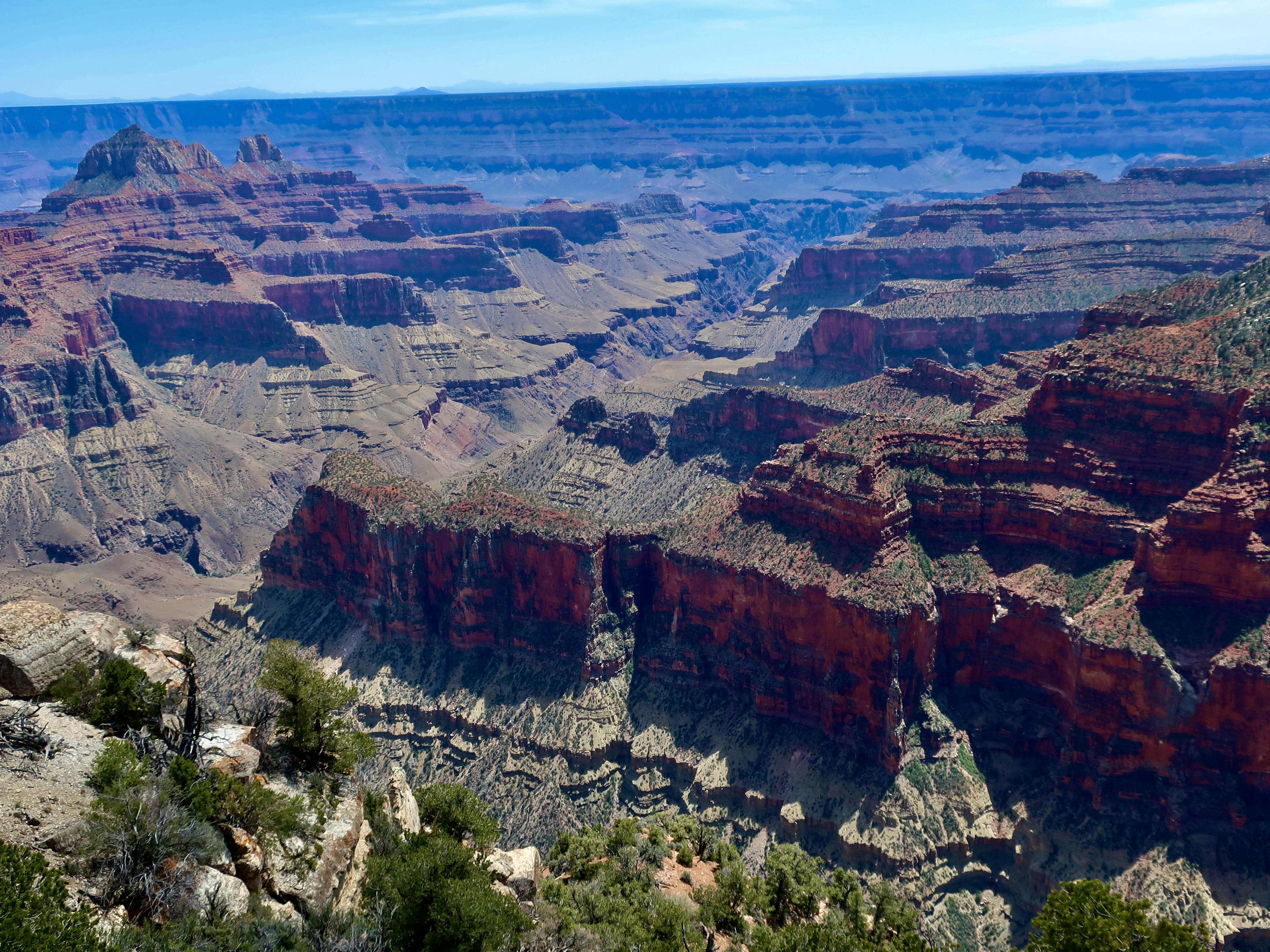
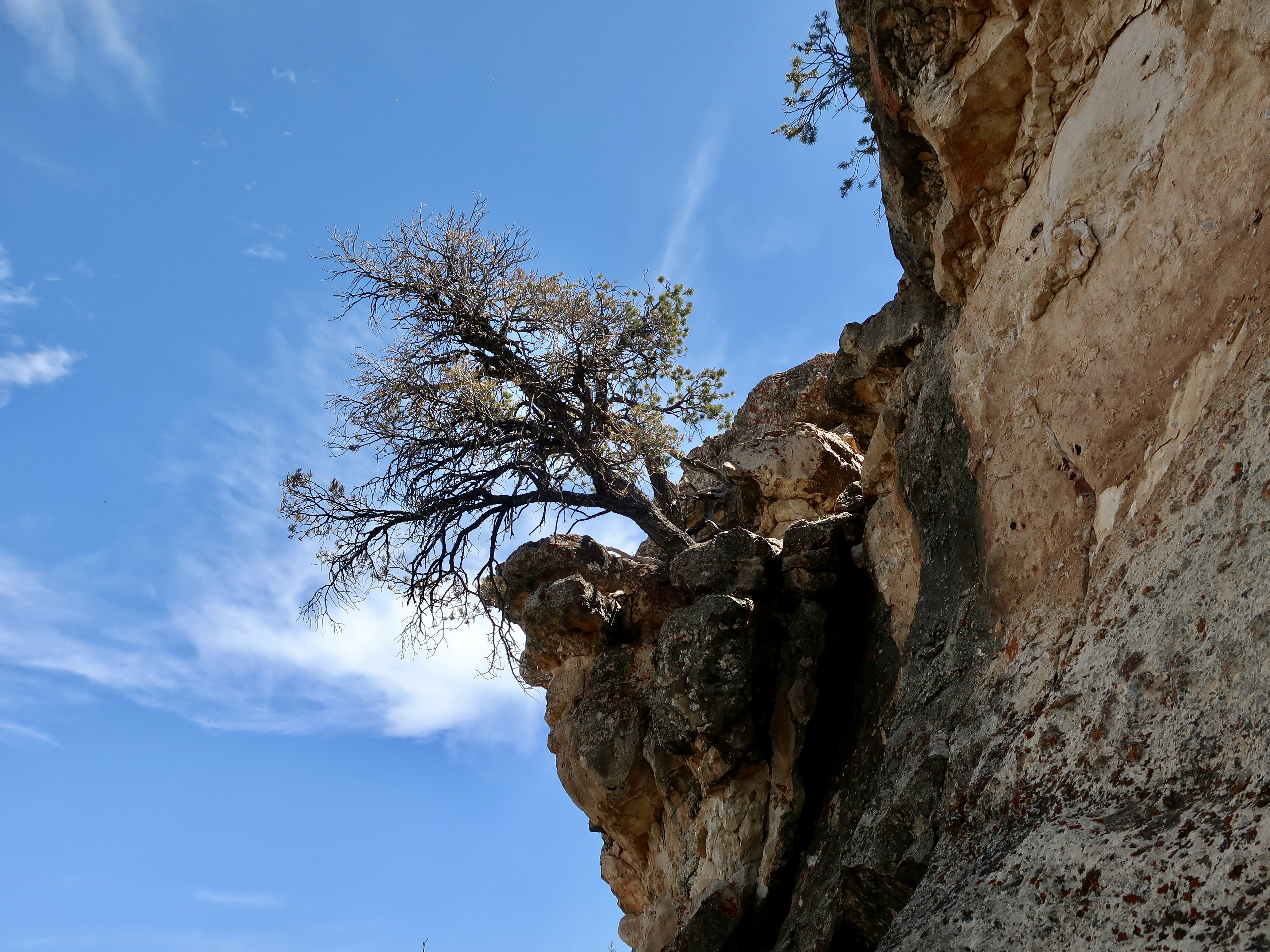
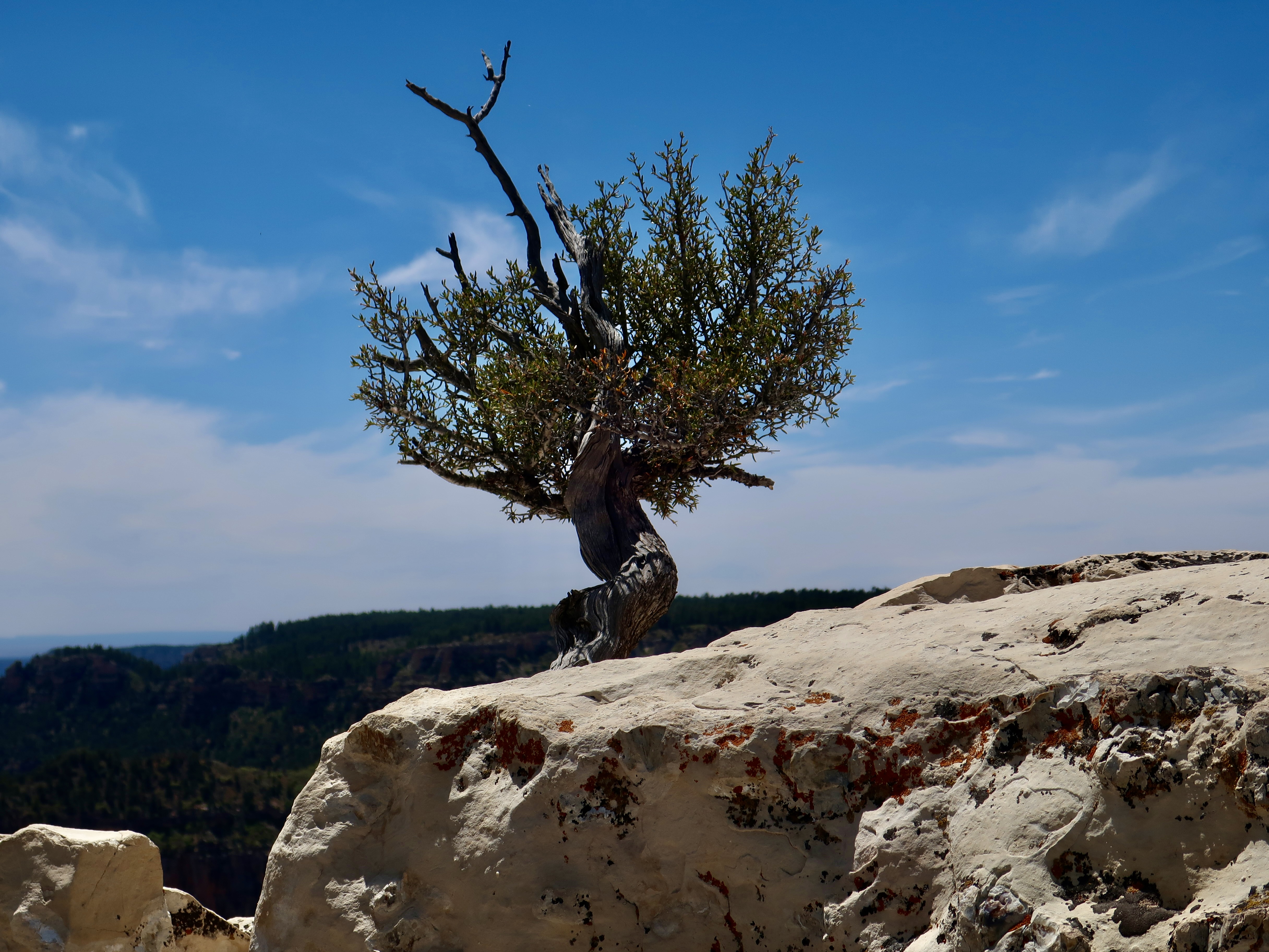
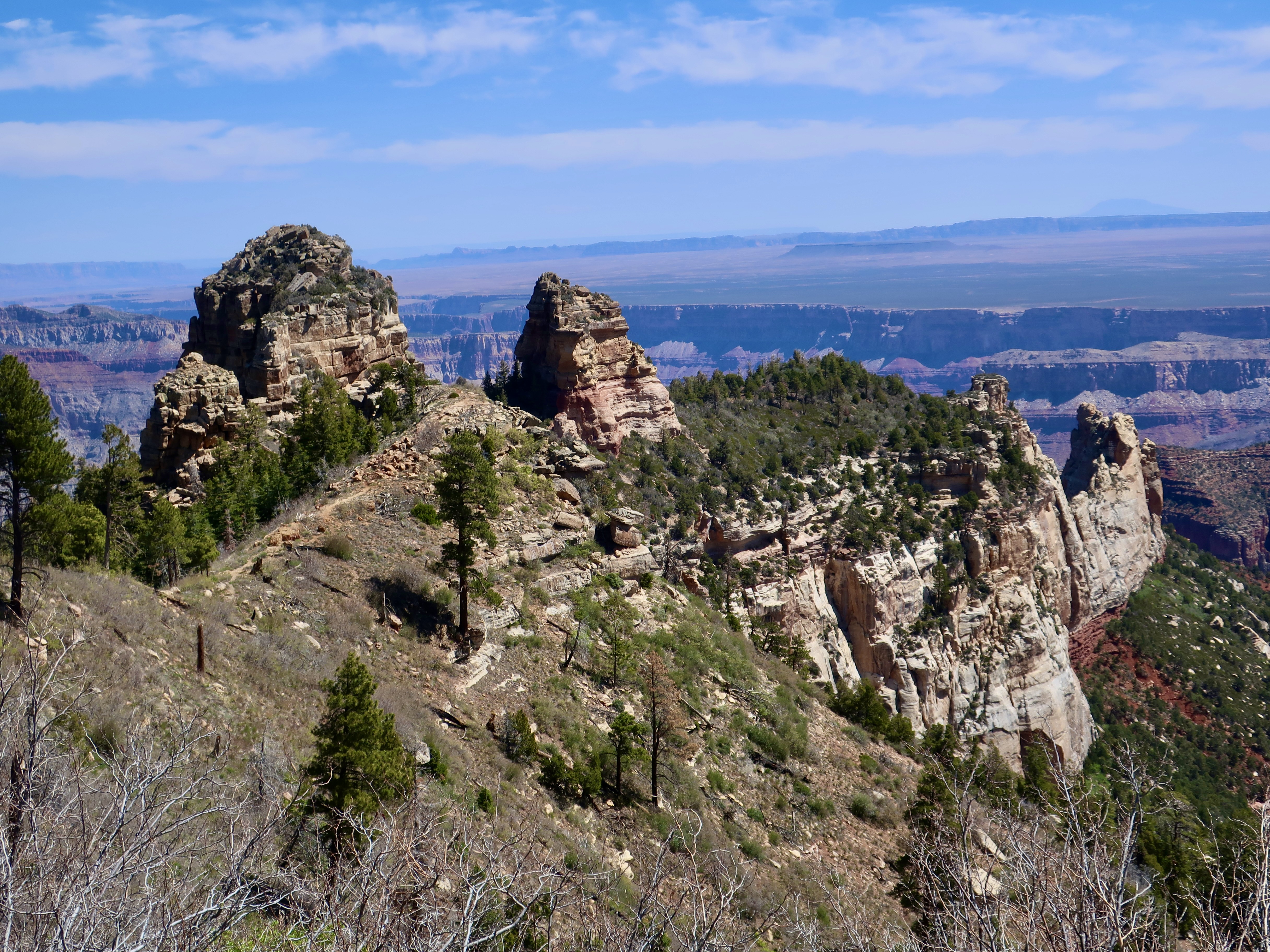
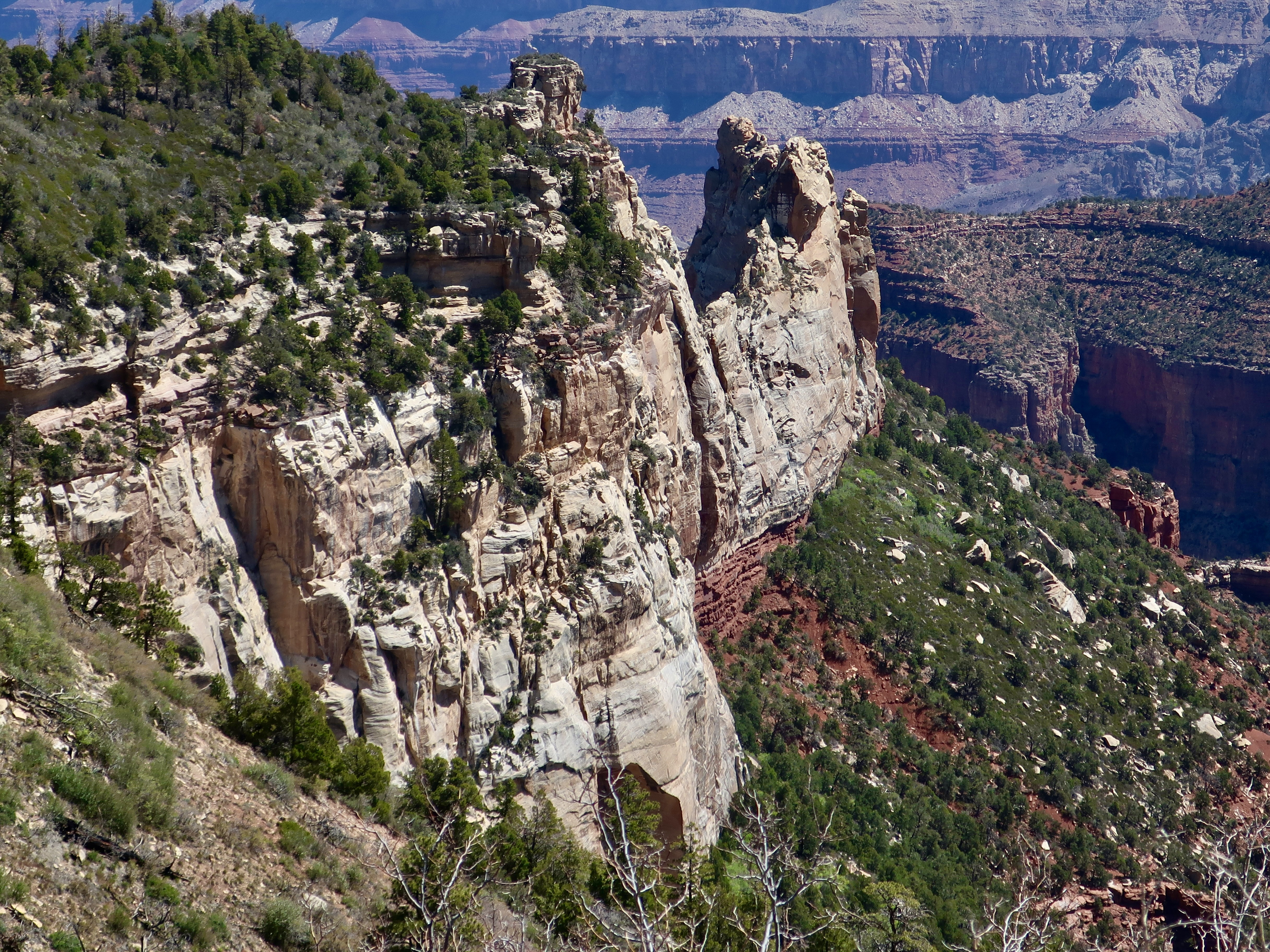
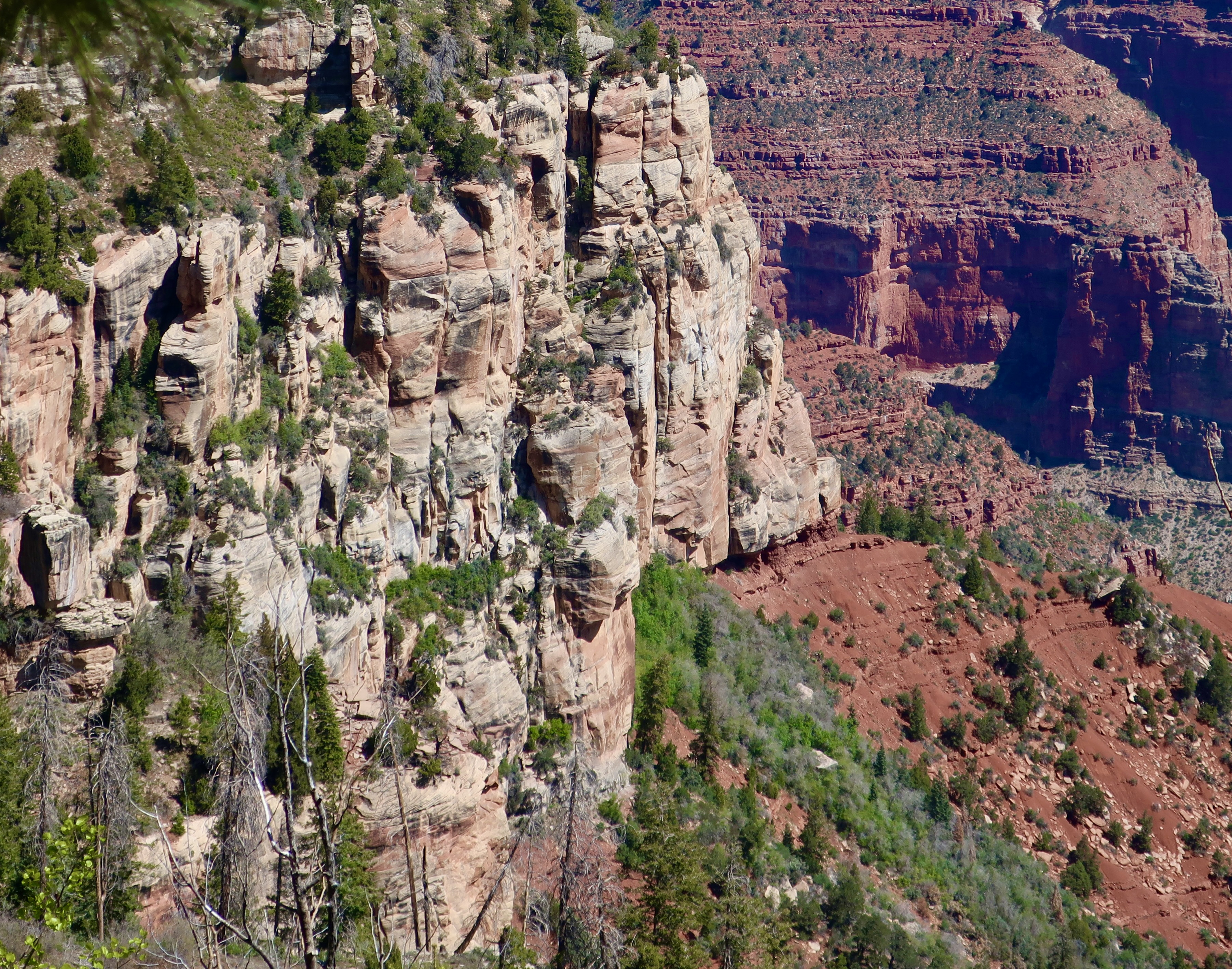
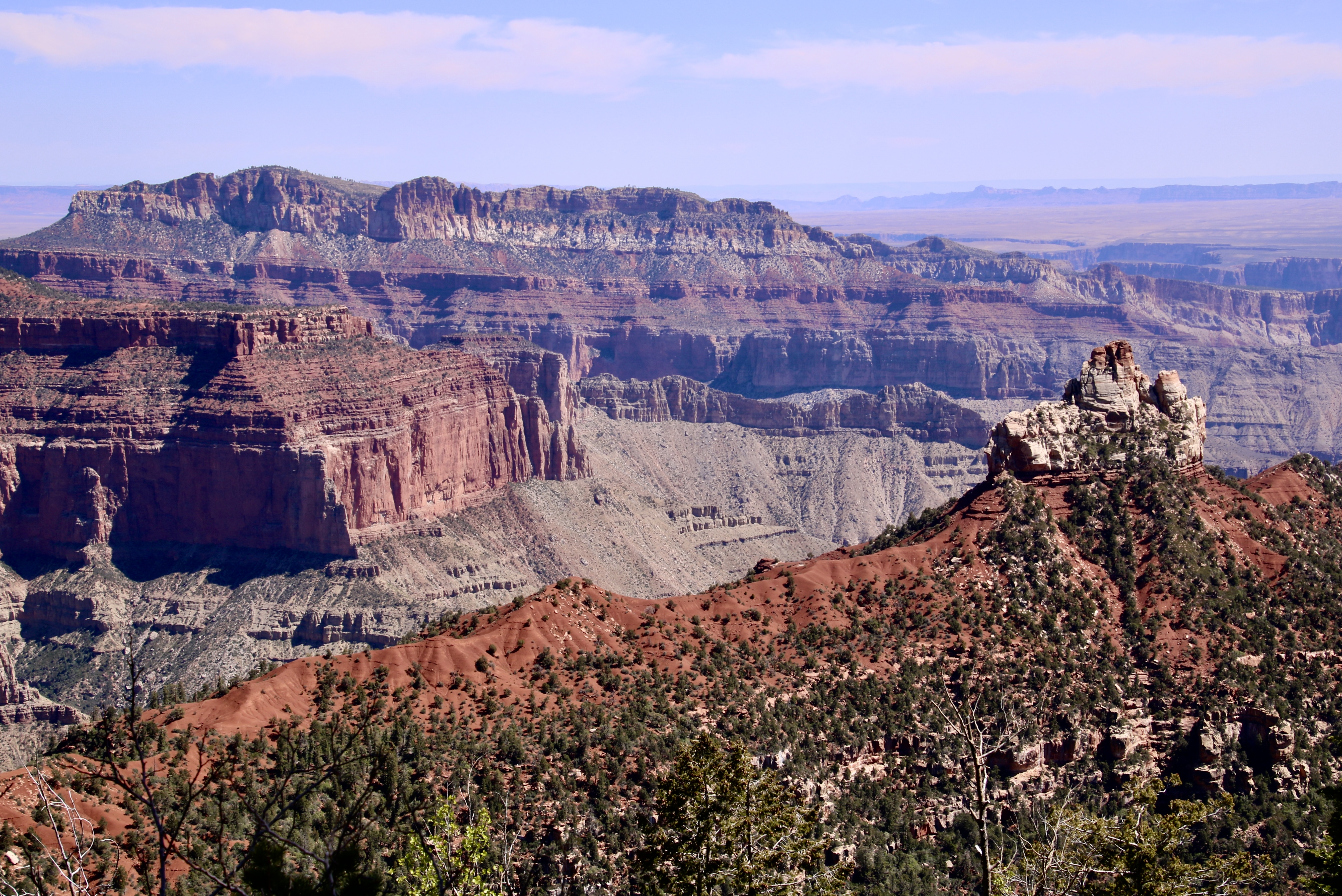
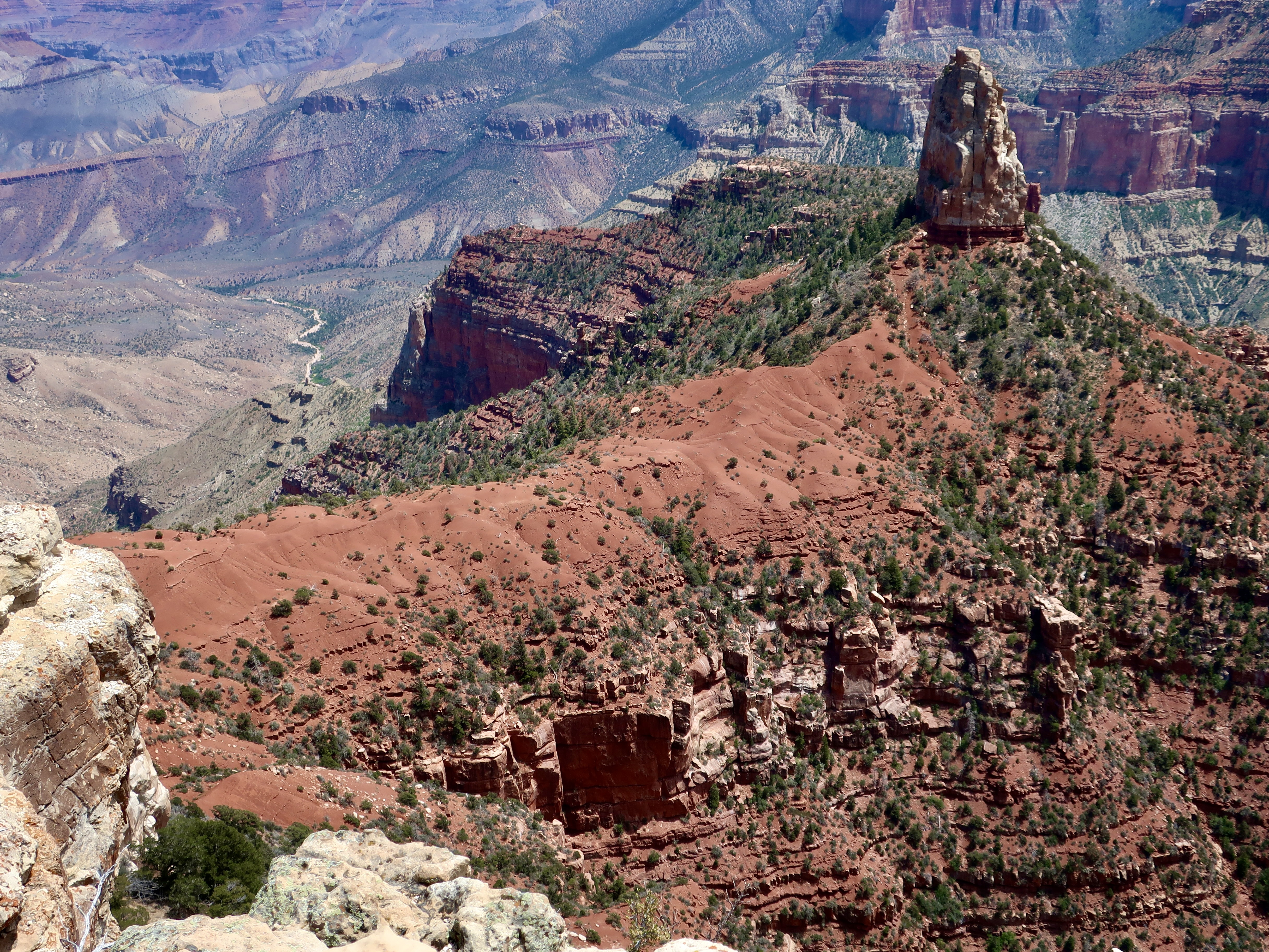
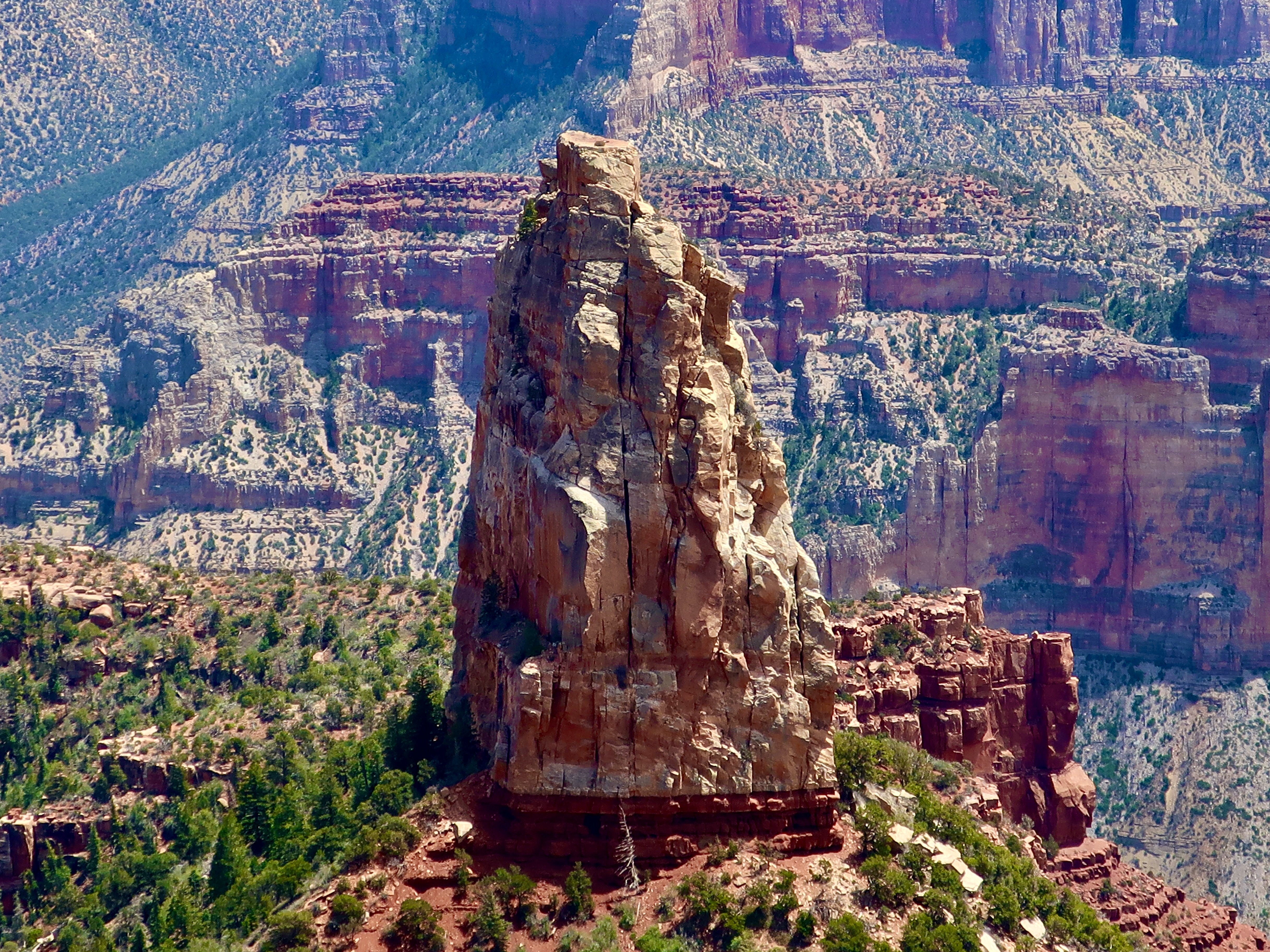
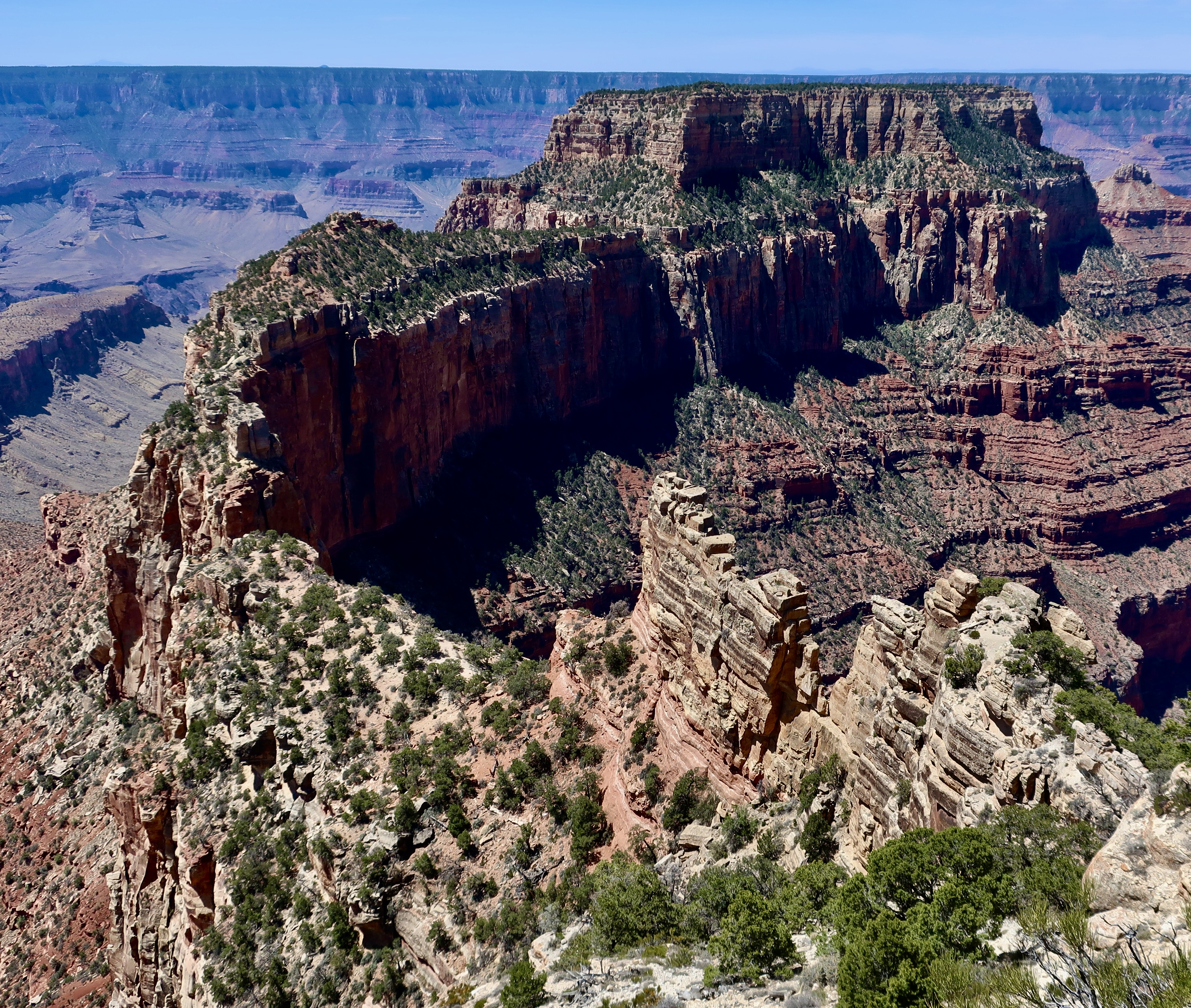
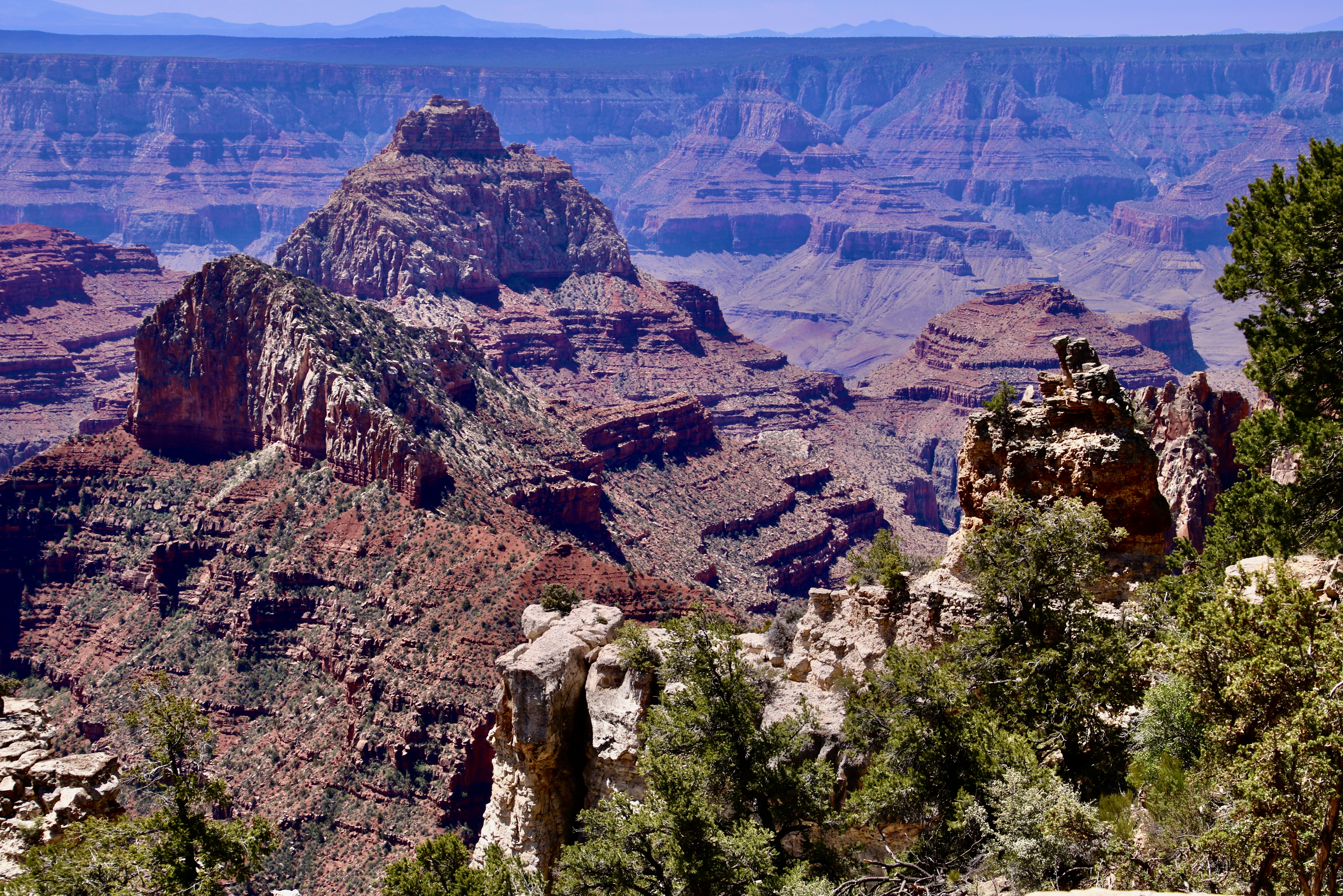
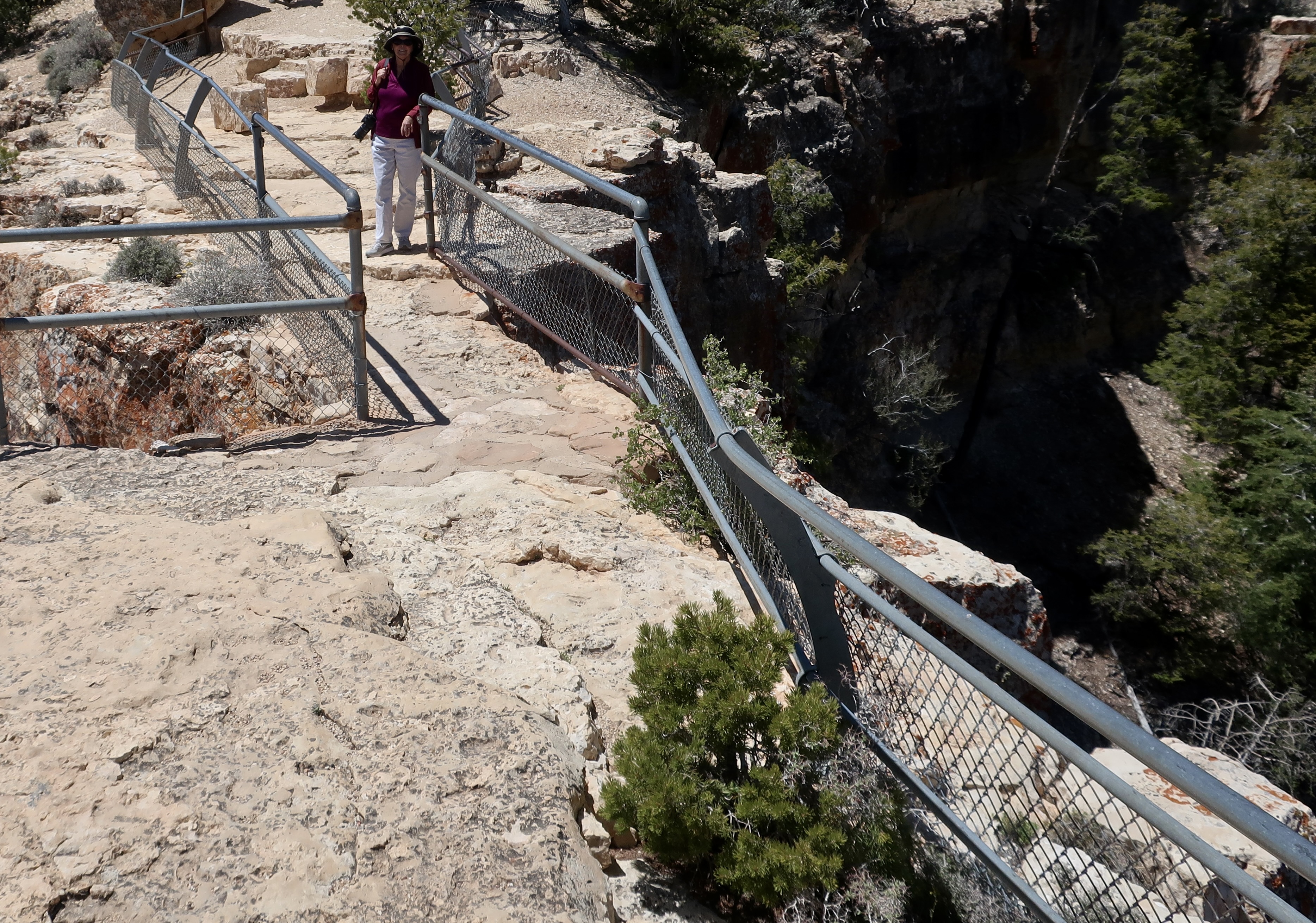
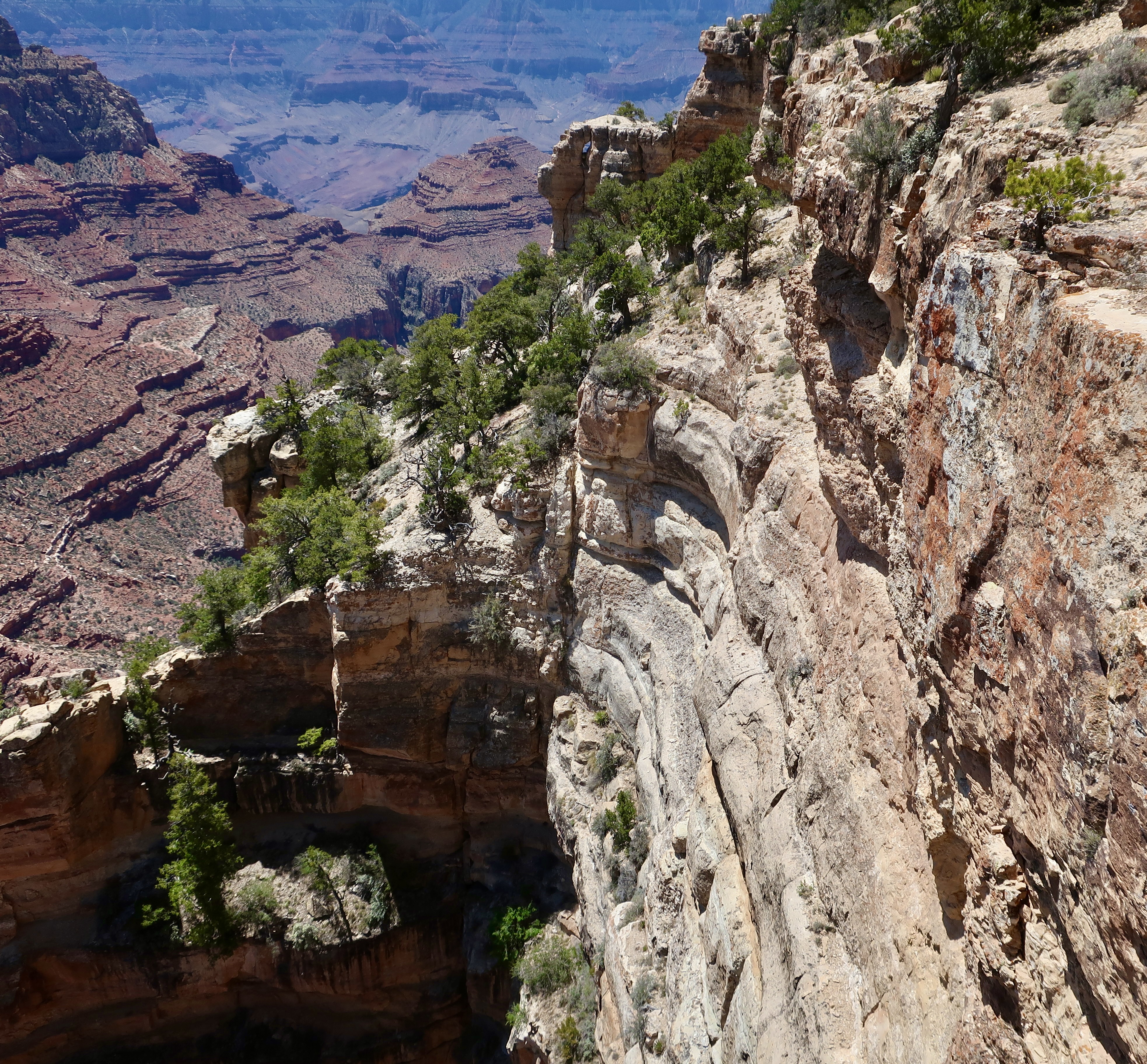
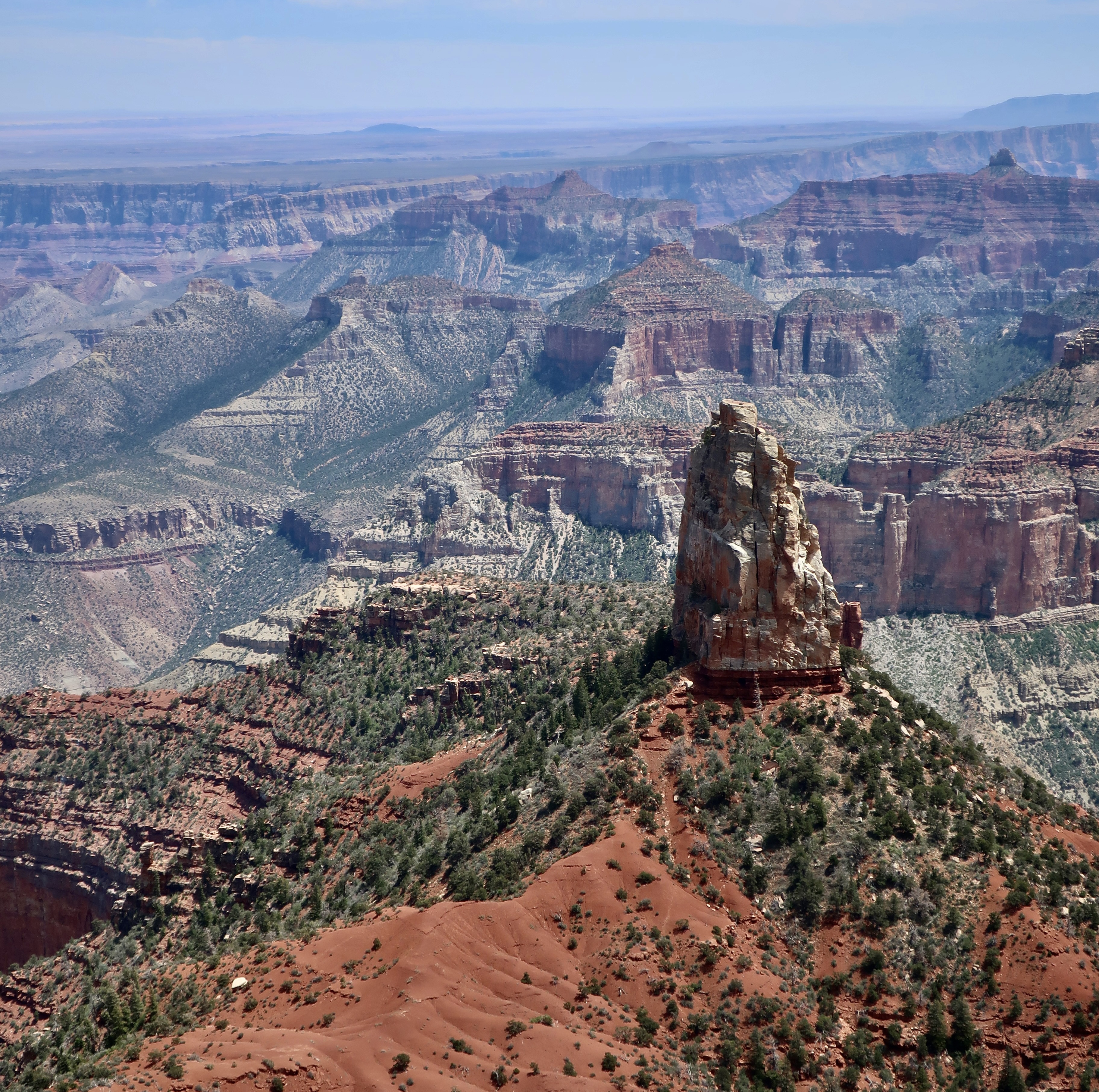
This map from the National Park Service shows the prominent overlooks of the North Rim. In the last post, we featured photos from Cape Royal and the Walhalla Overlook located in the lower right hand corner. This time, I will start with Bright Angel Point located just below the Visitor’s Center and then move on to Roosevelt Point, Vista Encantata, and Point Imperial.National Park map showing location of Grand Canyon in Arizona. A view from Bright Angel Point shows Bright Angel Canyon on the left. Bright Angel Creek makes its way down the canyon to the Colorado River. The popular North Kaibab Trail follows the creek and takes hikers down to Phantom Ranch on the river where they can stay, assuming they’ve landed a tough-to-get reservation. Or, they can continue on the South Kaibab or Bright Angel Trail up to the South Rim— if they don’t mind a 21 mile hike with an elevation change of 11,000 feet. I’ve backpacked it on two different occasions: One from the South Rim to Phantom Ranch and one from the North Rim to the Ranch. Ultra-marathon runners like to run the total path— and return— in one day.This provides a distant view of the South Rim from Bright Angel Point. You can see the village on the rim left center. Bright Angel Trail winds its way down into the canyon starting just to the right of the buildings. Both the Bright Angel Trail and Bright Angel Creek follow an active fault zone. An occasional jolt reminds hikers that even the Grand Canyon is earthquake country.A short trail starts beneath the Visitor’s Center and follows Bright Angel Point out to its end providing dramatic views of the canyon from both sidesPeggy and I also admired the trees that scratched out a living out on the Bright Angel Point.A final tree photo on Bright Angel Point. Now, on to Roosevelt Point.On his first visit to the Grand Canyon in 1903, Theodore Roosevelt exclaimed, “Leave it as it is. You cannot improve upon it. The ages have been at work on it, and man can only mar it.” More than anyone else, he was responsible for protecting the Canyon to be enjoyed by future generations. It’s only appropriate that he would have a point named in his honor. More views from the overlook:Vista Encantata translates as “enchanted view.” It’s easy to see why early visitors gave this overlook the name.When visitors arrive at Point Imperial on the North Rim, they arrive at 8,803 feet, the highest point on the North Rim. You might say it’s breath-taking. The view isn’t half-bad either. The spire, Mt. Hayden, is one of the most photographed views on the North Rim. We will close out this post with three different perspectives of it.And finally, a close up. In addition to being a favorite among photographers, Mt. Hayden is a favorite among rock climbers. This wraps up our brief tour of the North Rim of the Grand Canyon. Next, we will visit Mesa Verde National Park, famous for its ancient cliff dwellings.
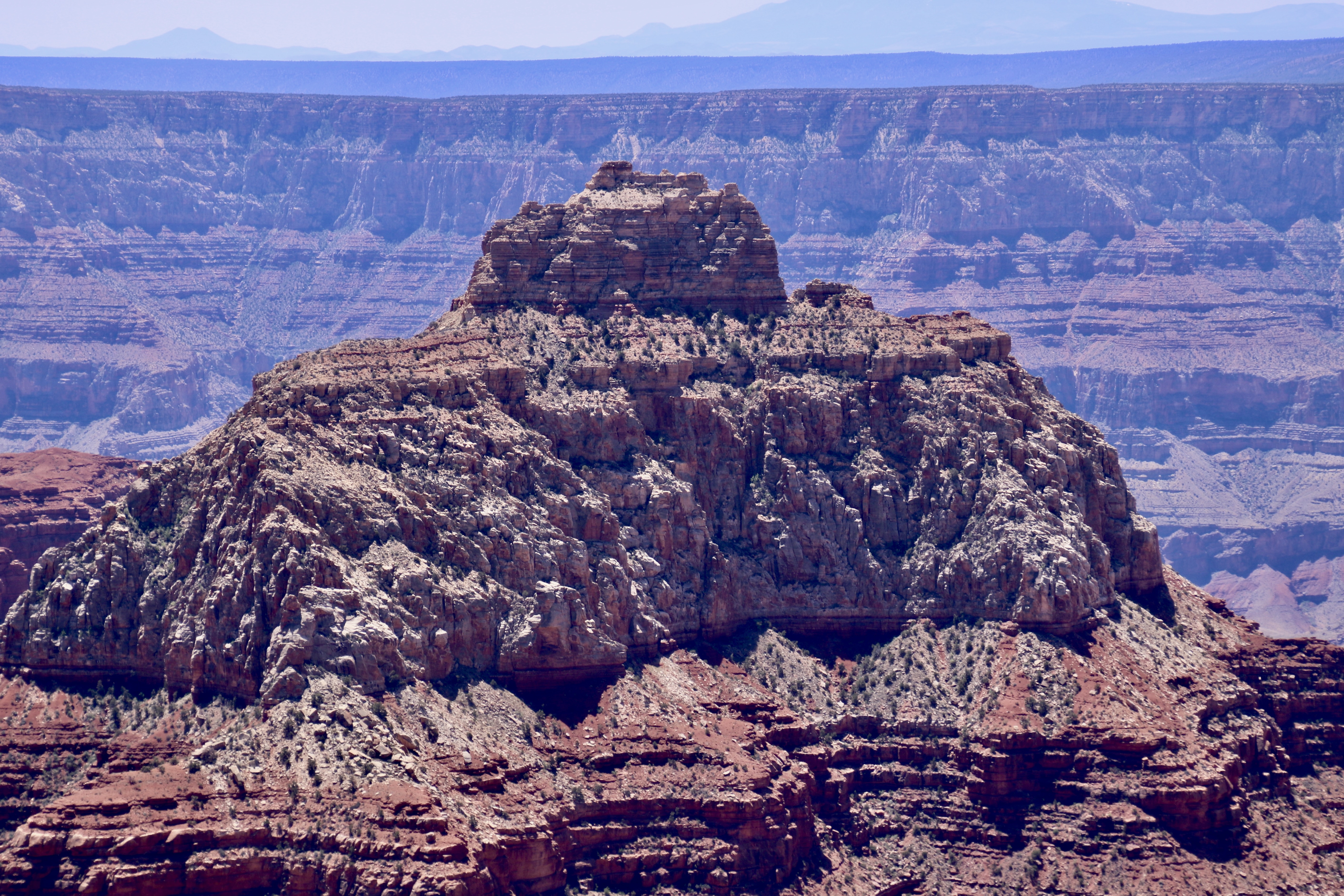
Wotan’s (Odin’s) Throne is one of five prominent landmarks visitors can see from Cape Royal on the North Rim of the Grand Canyon. If you start on the front left and follow the ridge around to the high plateaus, you will arrive at the throne.
Today, Peggy and I are going to take you on a visit to the North Rim of the Grand Canyon as part of our National Park Series. We were there in 2022 but didn’t have time to do a post on it because we were headed off for a trip up the Rhine River.
I’m no stranger to the Grand Canyon. Even before I met Peggy, I had been to the South Rim several times, backpacked into the canyon four times, and even took a mule in on my first visit ever, an experience I didn’t need to repeat. The mule recognized that I was two pounds over the weight limit and kept trying to bite me and throw me off the trail with a several hundred foot drop. The worst insult, however, was to my butt. I couldn’t sit down for two days.
Peggy and I have also been there a number of times with experiences ranging from backpacking into the Canyon to being flown into a section outside the park in a helicopter by our son. We also did an 18 day private raft trip down the Colorado River through the Canyon. Once we took our kids, Tasha and Tony, as teenagers and camped out in the snow. Not surprisingly, I have done a number of posts on the Canyon, but never on the North Rim.
Some 5 million people visit the South Rim of the Grand Canyon. Maybe 10% make it to the North Rim. There are reasons for this, primarily accessibility. The South Rim is easier to get to, has extensive guest facilities, and is open year around. The North Rim, which sits at 8000 feet (2438 M), is closed from October 15 to May 15 because of snow. Plus it is a 212 mile, four hour plus drive from the South Rim— even though the North Rim is only 10 miles from the South Rim as the crow flies! That’s the challenge when you are faced with a ditch that averages 4000 feet deep stretching out for 277 miles.
An argument can be made that the South Rim provides better views of the Canyon, overall. So if you’ve never been, you might want to start there. On the other had, who could argue that the view of Wotan’s Throne featured at the top is lacking in grandeur?
The five prominent landmarks we will visit in this post at Cape Royal will include Wotan’s Throne, Vishnu Temple, Freya Castle, Wahalla Overlook, and Angel’s Window. As you have probably noticed, all of these names are based on mythological themes. We can thank Clarence Dutton for that, an early geologist who felt Vishnu Temple resembled an Eastern pagoda and began the tradition of providing such names to the other rock monuments throughout the Canyon. Vishnu is a major Hindu deity; Wotan is the supreme Germanic deity; Freya was a renowned Norse goddess; Walhalla (Valhalla) was the hall in Norse mythology where the souls of heroes slain in battle were received. And angels are, um, angels?
Let’s get started. All of the photos were taken by either Peggy or me.
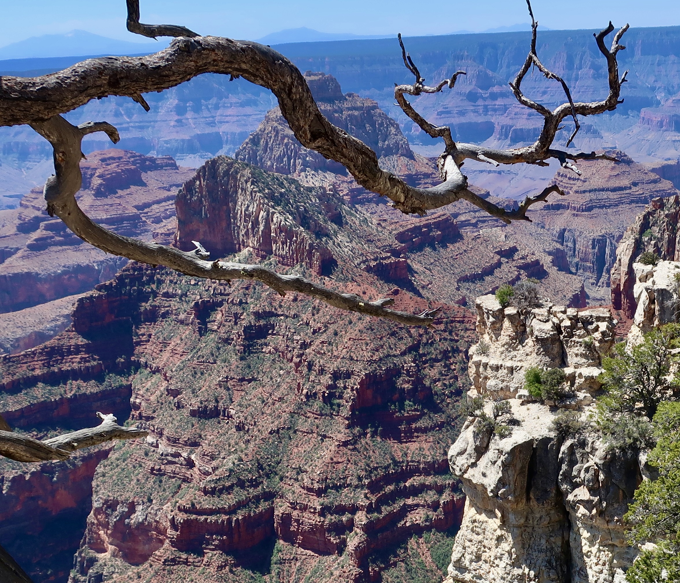
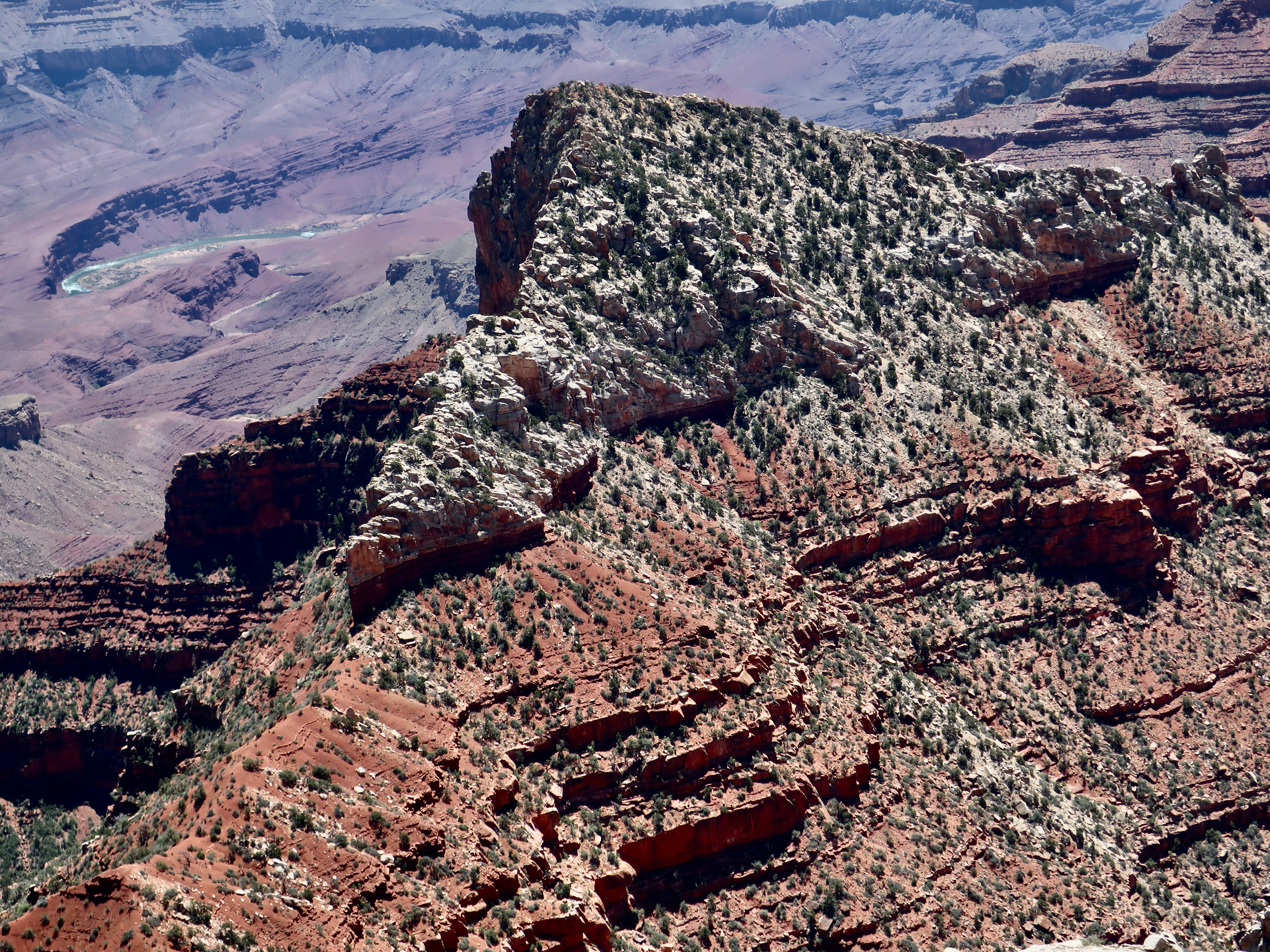
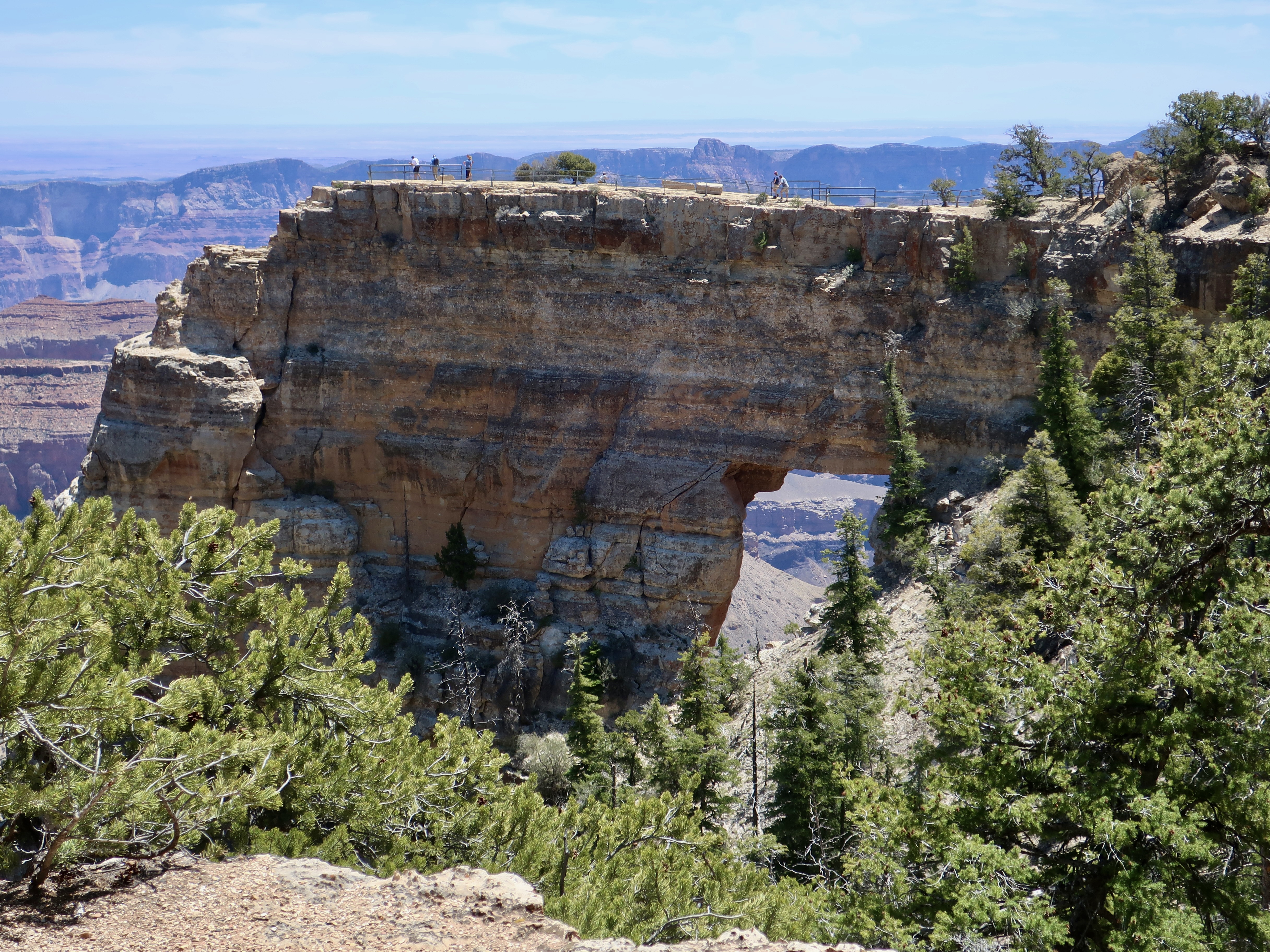
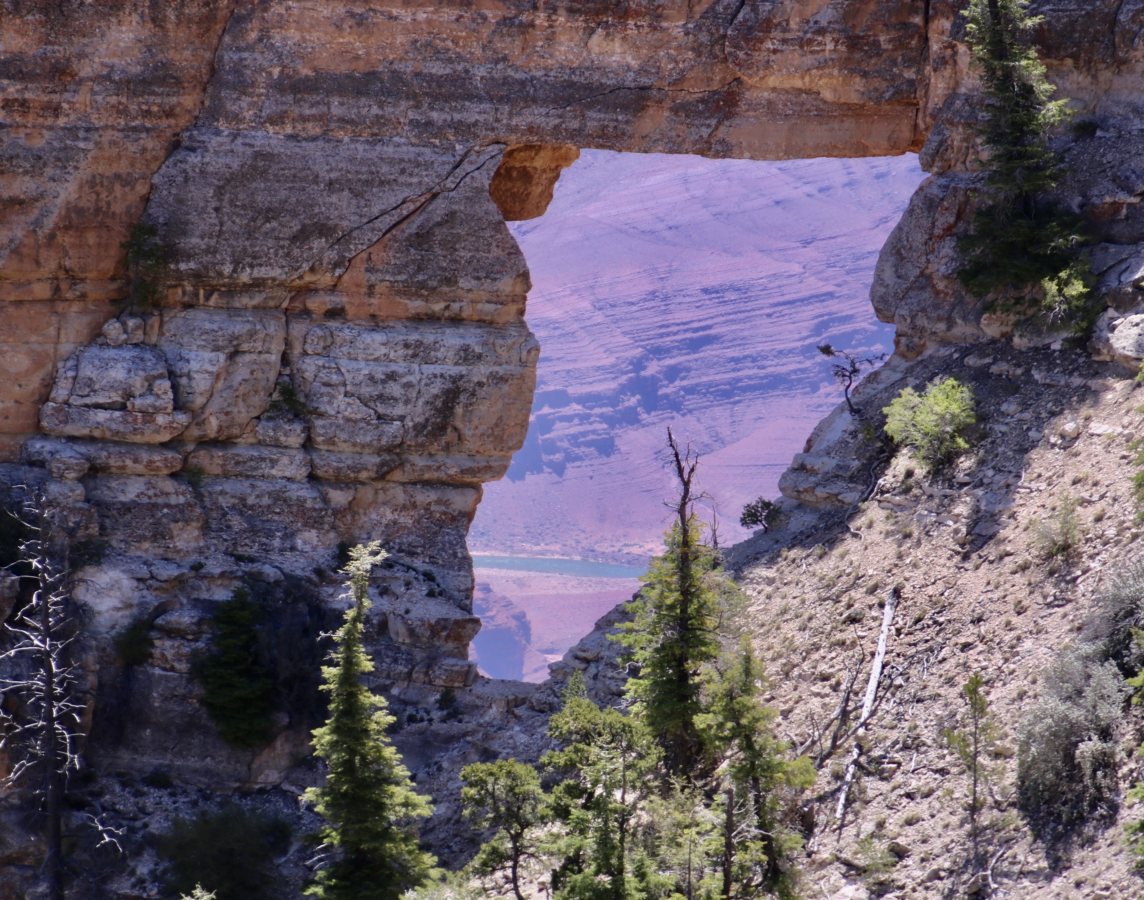
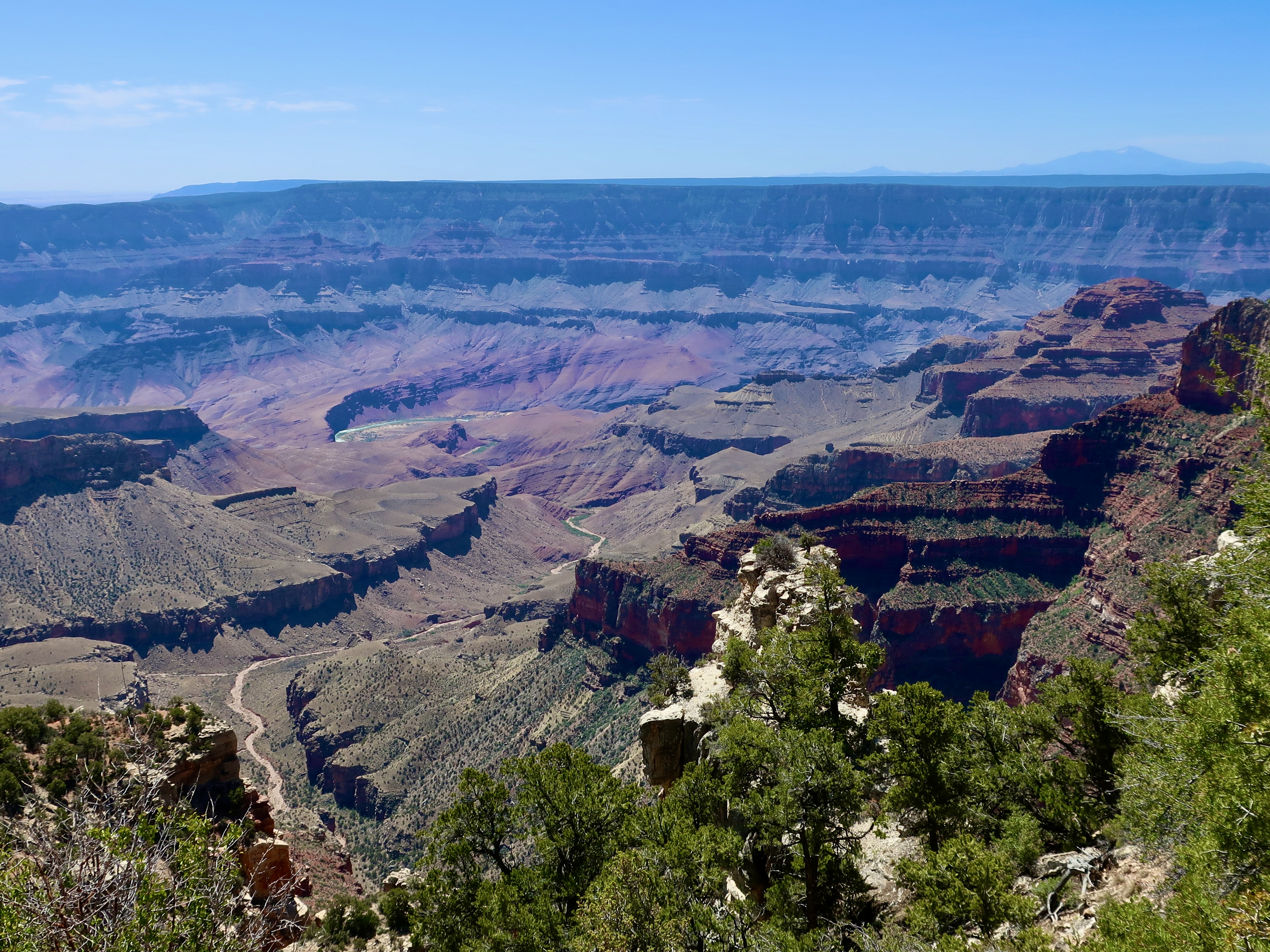
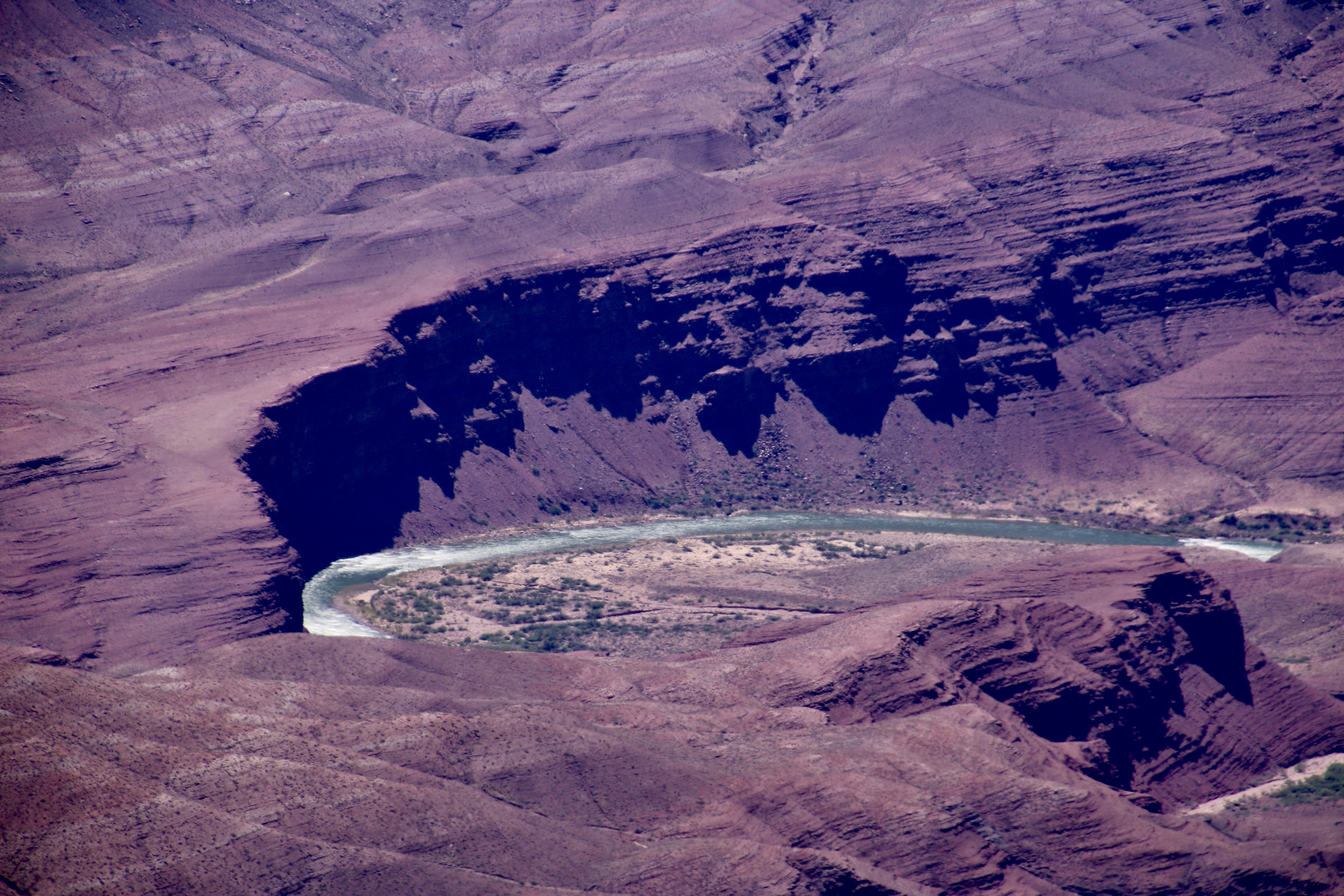
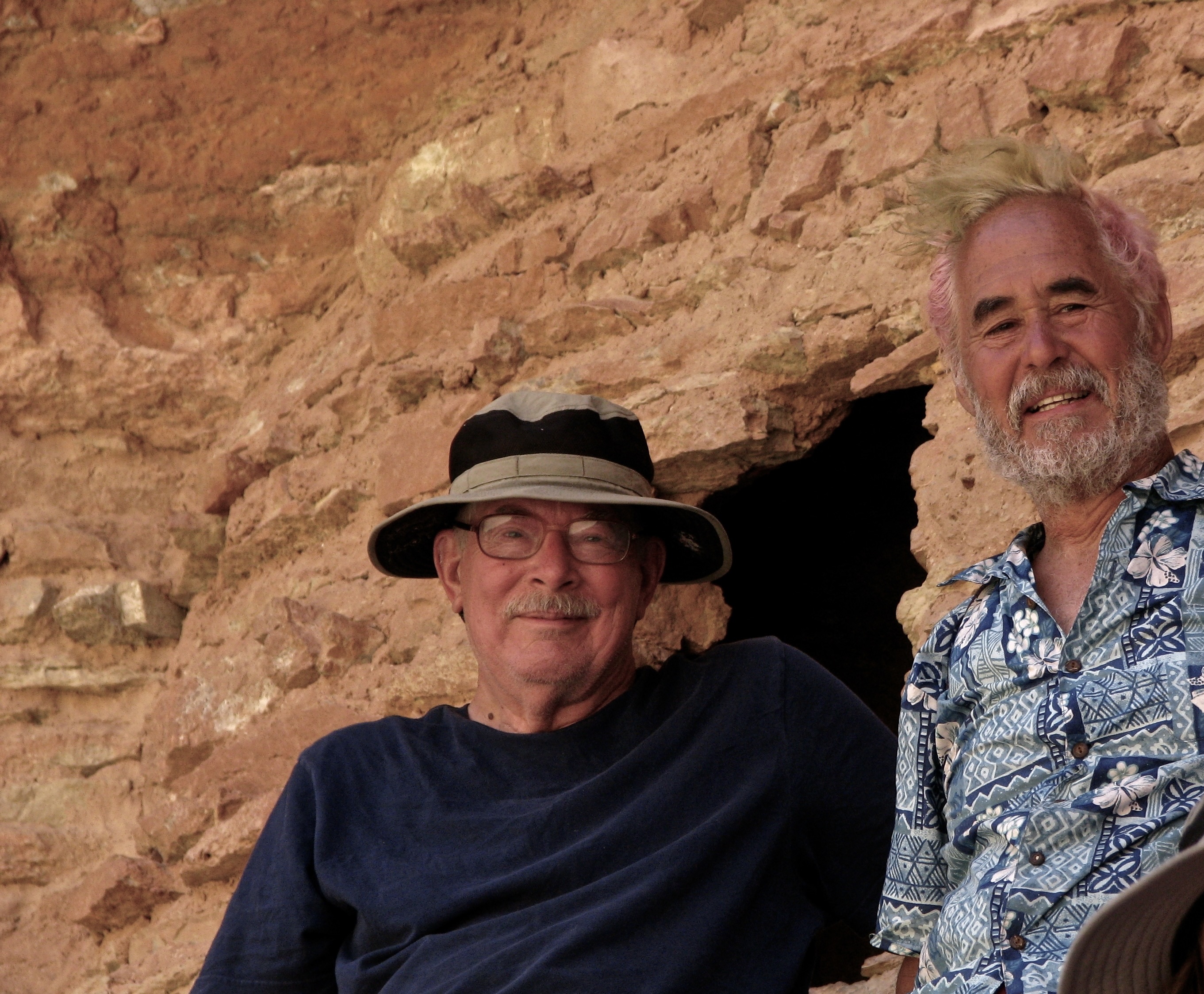
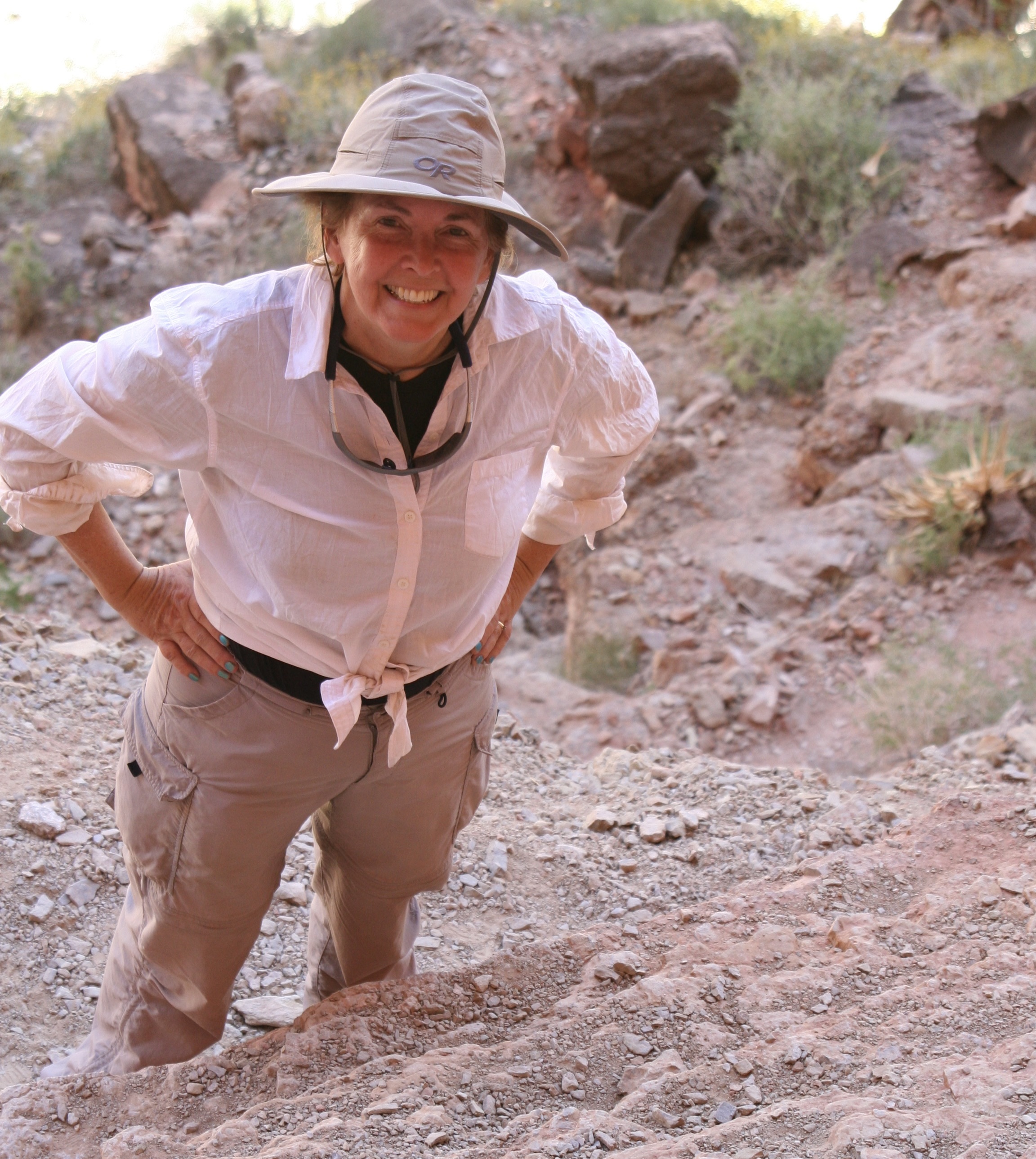
Another perspective on Wotan’s Throne.View of Vishnu’s Temple. Freya’s Castle is in front of the Temple.A close up of Vishnu’s Temple. Freya’s Castle and Vishnu’s Temple from the perspective of a tree.Close up of Freya’s Castle.Angel’s Window with people standing on top. You can actually see the Colorado River through the window.Peggy standing on top of Angel’s Window. Peggy’s view down.This is the view from the Walhalla Overlook. The Unkar Delta on the Colorado River can be seen in the far distance. An information sign at the overlook noted that “ancestral Puebloan farmers 1100 to 800 years ago made the journey from rim to river and back on a routine basis, spending summers farming on the rim and most of the rest of the year farming in the Canyon.”A closer look. Note the rapids. We worked our way through them on our trip down the Colorado River in 2010. We also stopped to check out a storage granary the Puebloans had located high up on the cliffs. Tom Lovering and I at the Puebloan granary. I had the permit for the 18 day trip, and Tom, an accomplished river runner, had led it. Tom, as you may recall, along with his friend Lita, joined us at Point Reyes National Seashore a few weeks ago. Tom colored his hair green for the trip. (Photo by Don Green.)Peggy, climbing up to join us at the granary, looking quite adventuresome. That’s it for the day. Our next post will continue our visit to the North Rim.