A Limb with Tusks, Plus More Impressive Rocks and Trees along the PCT near Ebbett’s Pass

I didn’t spot the tusks on this tree limb until I checked out my photos. There’s no doubt which is the dominant creature here! Or maybe they are just snuggling.

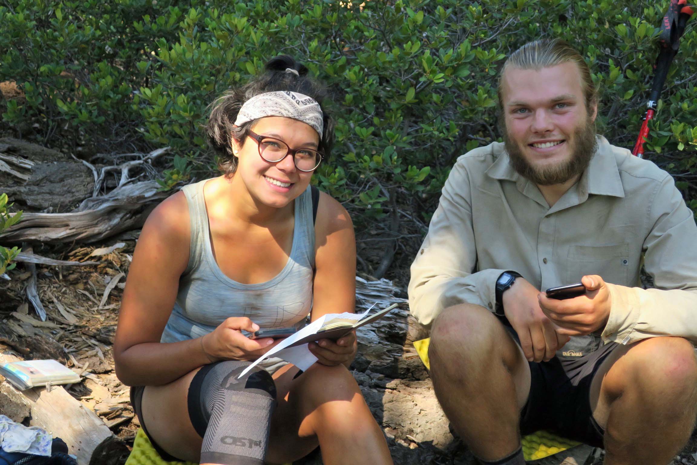
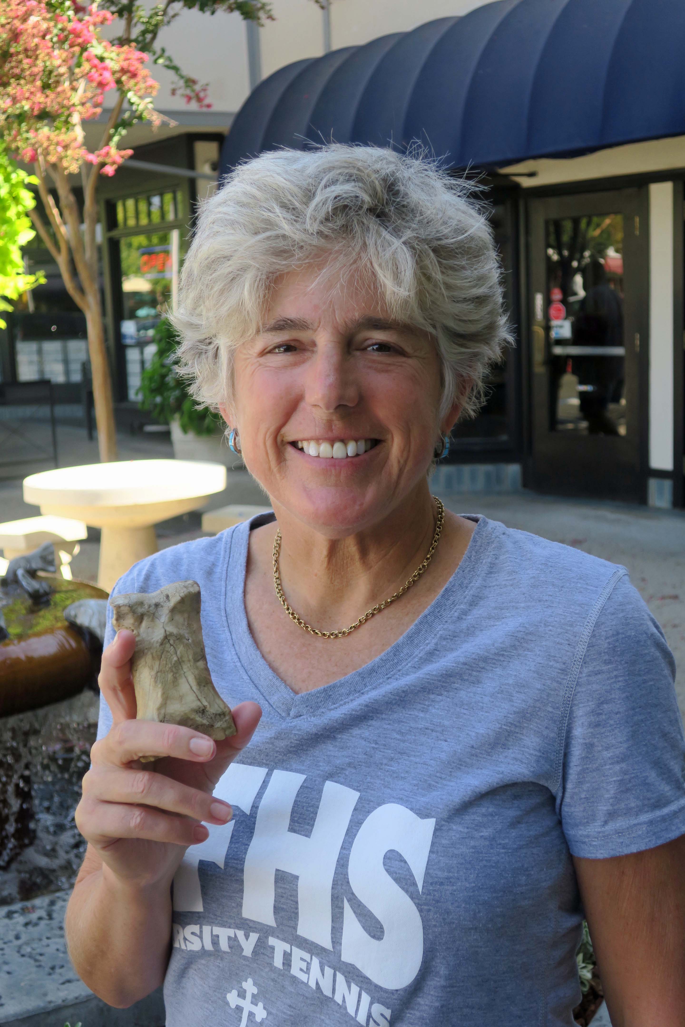
Peggy and I had lunch yesterday with Barbara and Carl, the couple that dropped us off at Mt. Ashland for the beginning of our trek south down the PCT. It was the first time I had seen them since the beginning of the adventure. There was a lot to tell.

Naturally, I talked about both the challenges and the rewards of backpacking for 700 miles over difficult terrain at 75. I also discussed how 50 years of backpacking had prepared me for the trip, and threw in a few of my more humorous adventures from those years. They will be in my book.

“Knowing what you know now, would you do the PCT hike again?” Carl asked.

“Absolutely,” I replied. This doesn’t mean I will forget just how hard it was. It’s an important part of the story. But the beauty and the nature of the adventure are what will stick in my mind. I once had a woman who had been on one of my hundred mile treks tell me it was one of the most difficult tasks she had ever undertaken. But in the end, she said, it was an incredible, life-changing experience. The pain faded; the experience remained. “The only thing I can equate it with, Curt,” she had related, “was having my first baby.” Ouch, and then ‘Oh my!’

For the first 25 years or so of my backpacking, I hadn’t carried a camera. Those were the days before you could expect to obtain quality photos from a small camera, and I didn’t want to add the extra weight to the 60 pounds I was already carrying. I was also reluctant to spend the time that good photography required. And often I was leading groups that demanded my full attention.

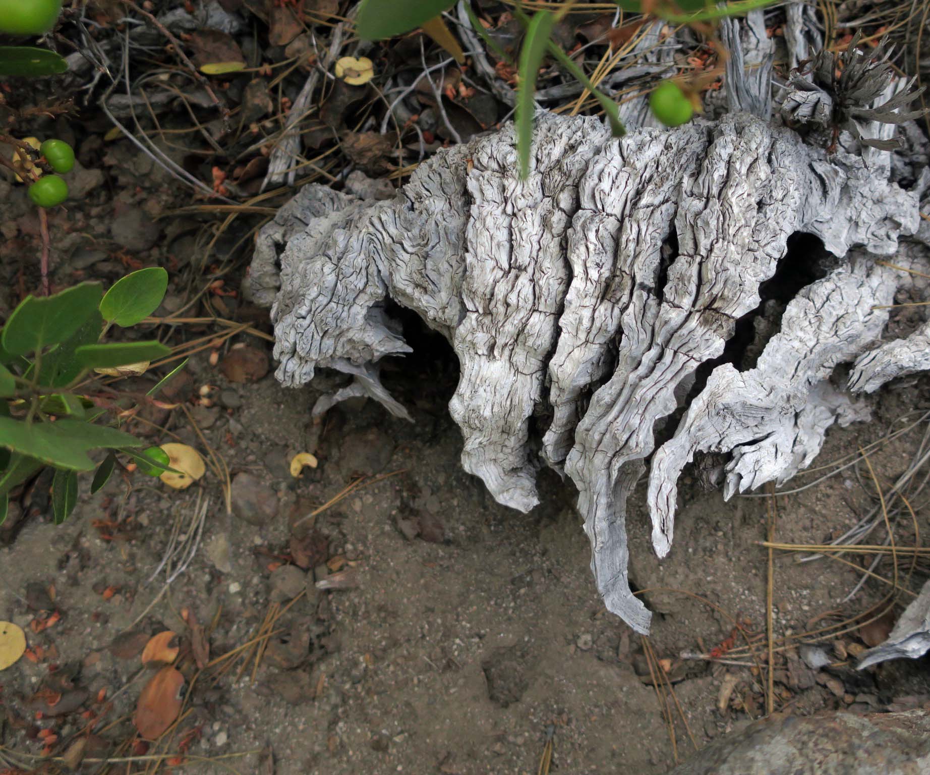
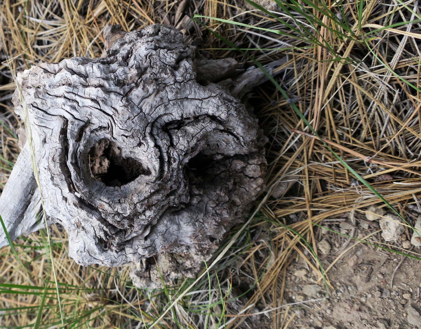
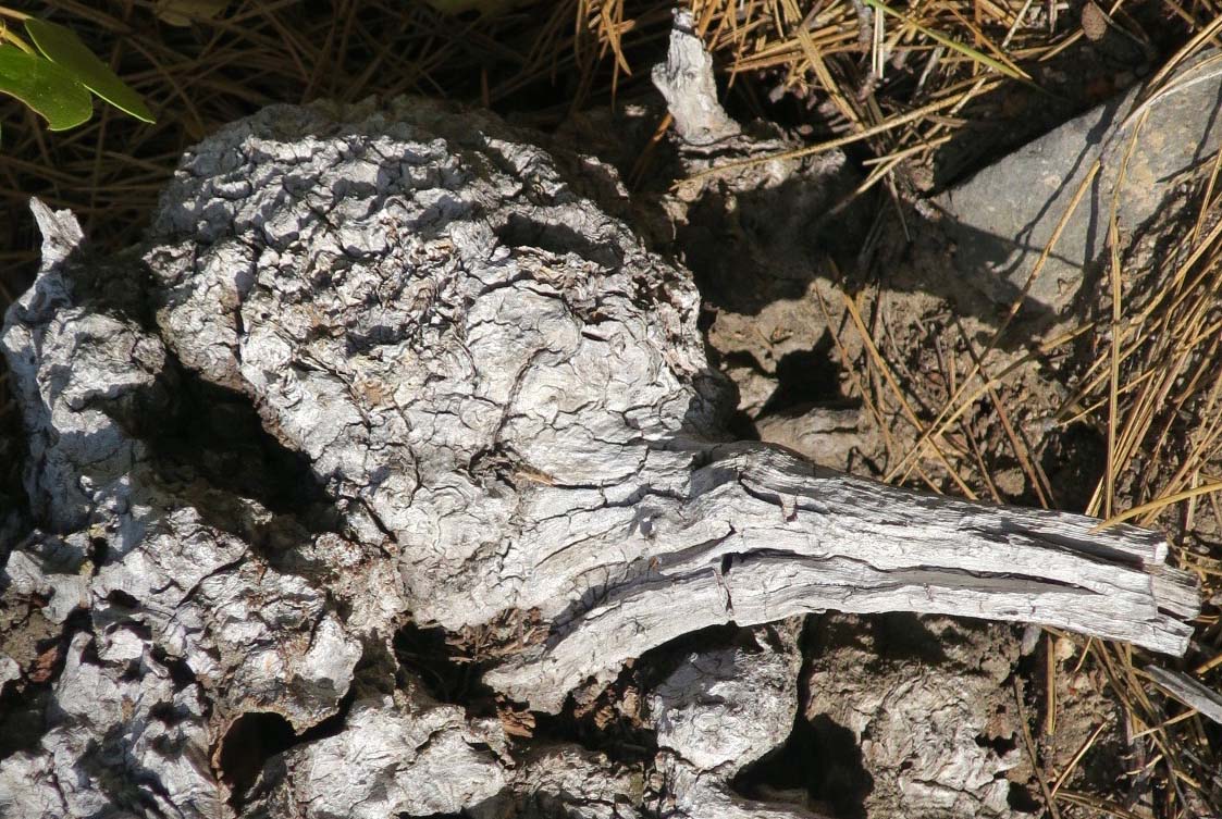
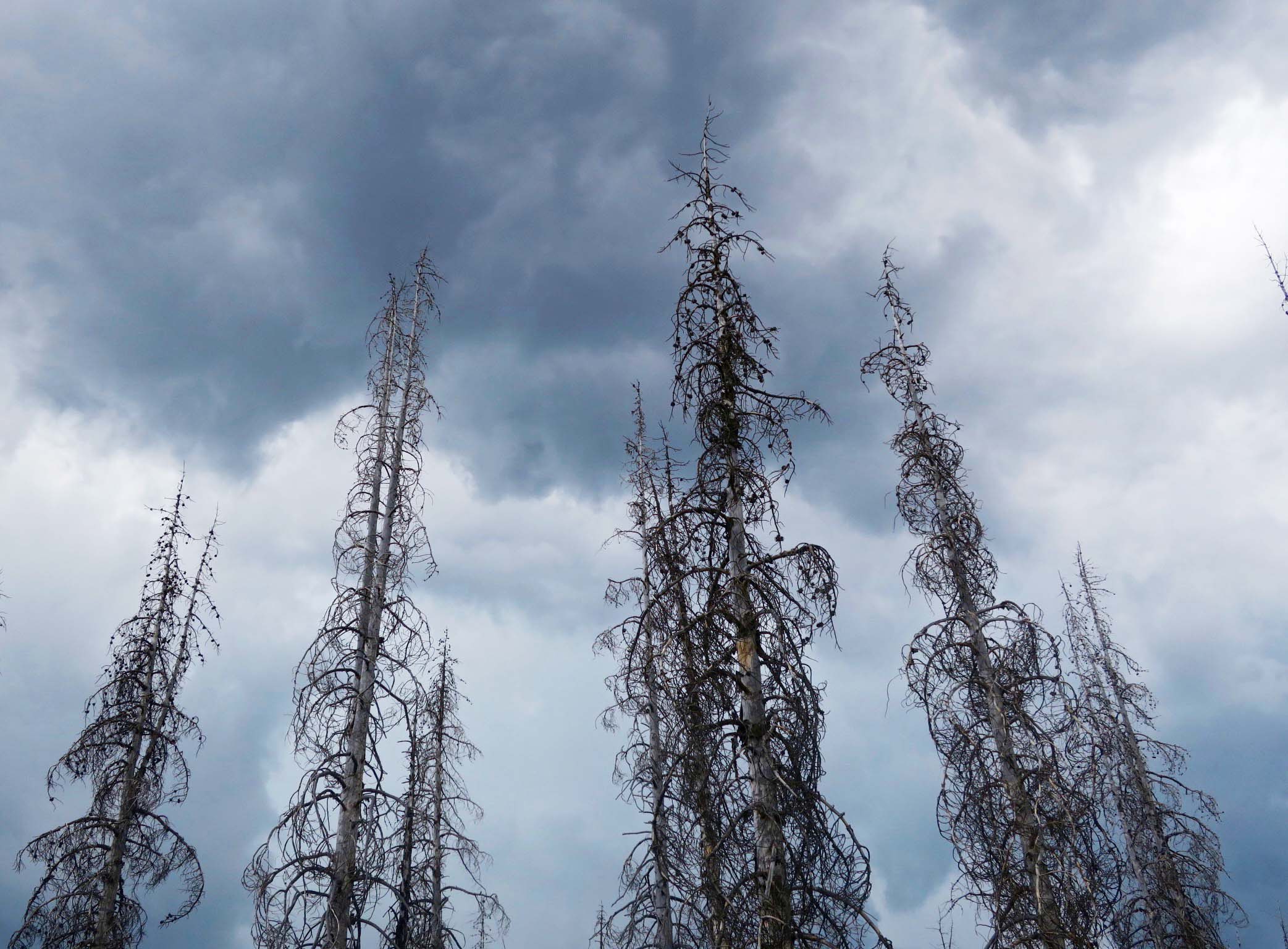
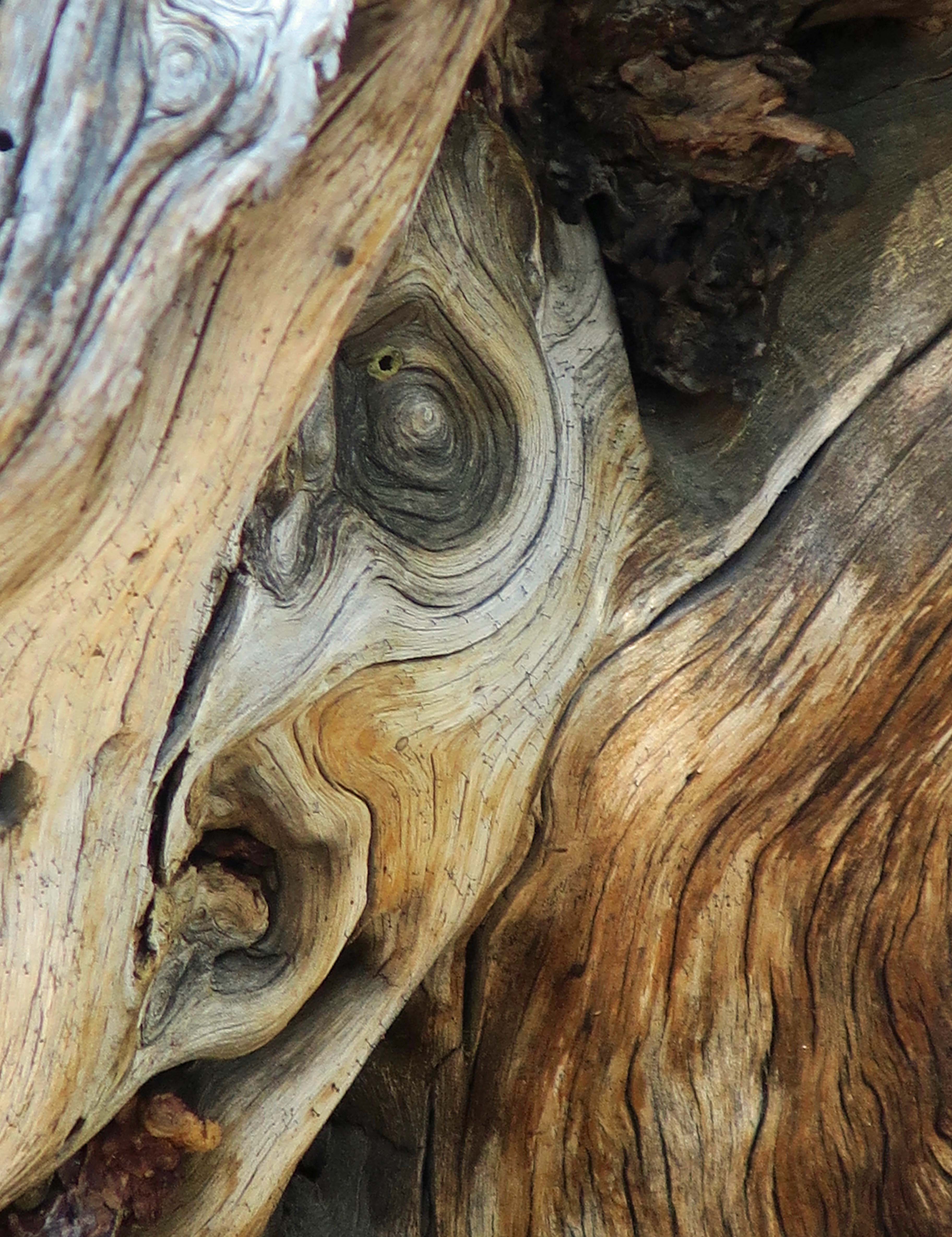
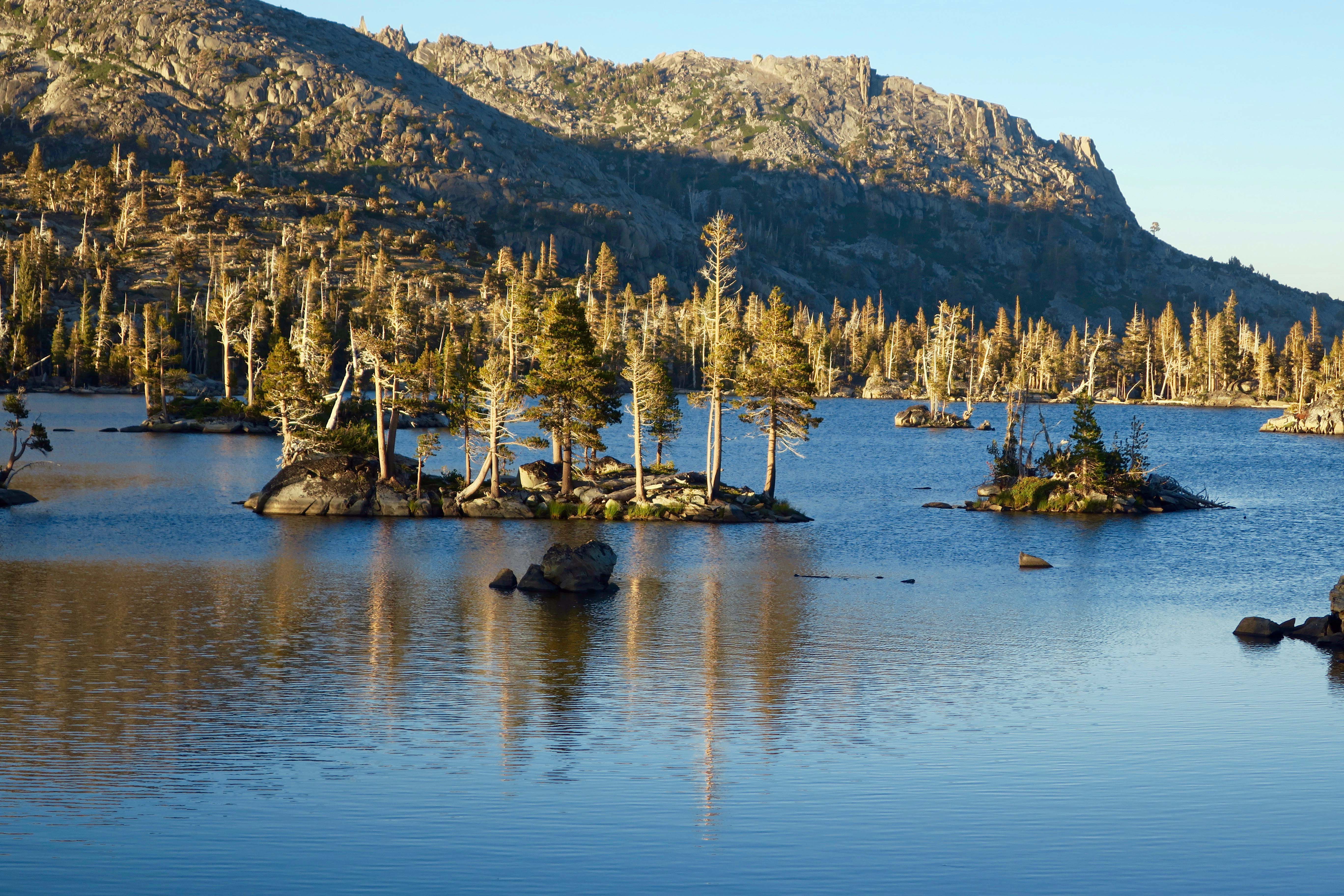
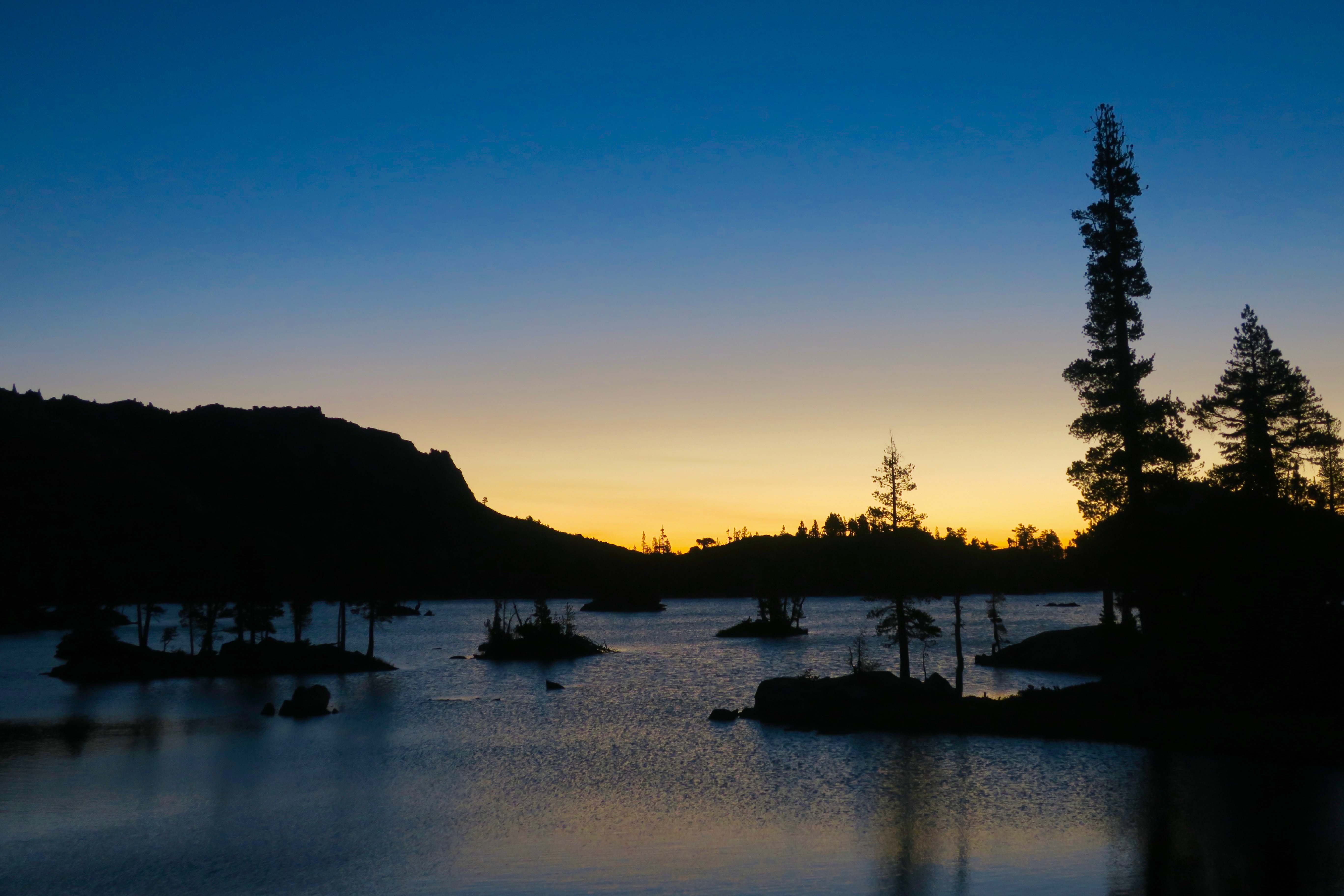
I am sorry now. “I can’t believe you go to all of these beautiful places and don’t carry a camera,” my father had told me time and time again. He was right. I wish I had those photos now to remind me of where I had been and what I had seen. But there is more. Photography helps you see the world in different ways. It encourages you to focus in on details you might miss, it helps you notice the differences that light and varying perspectives make, and it forces you to stop and look around.

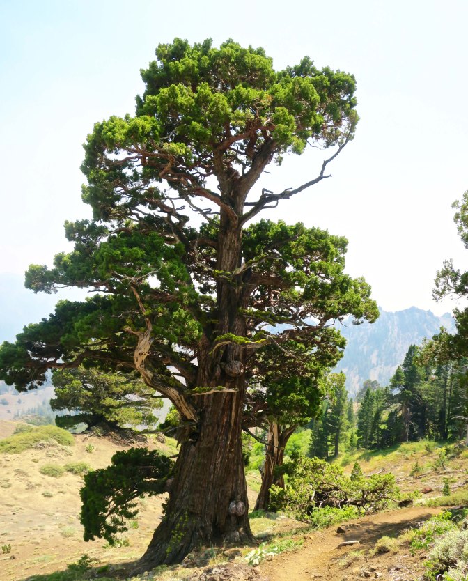
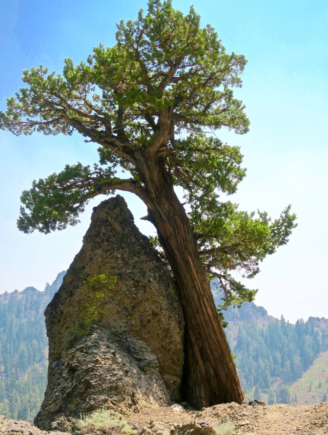
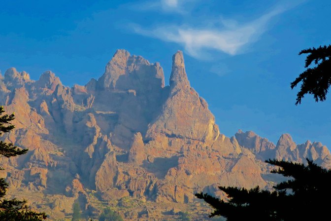
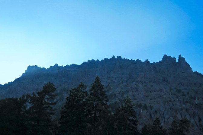
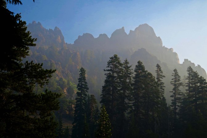
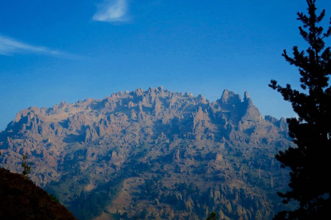
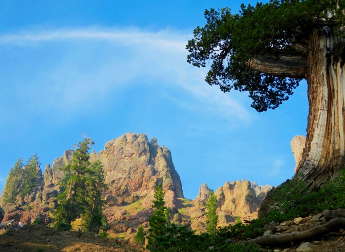
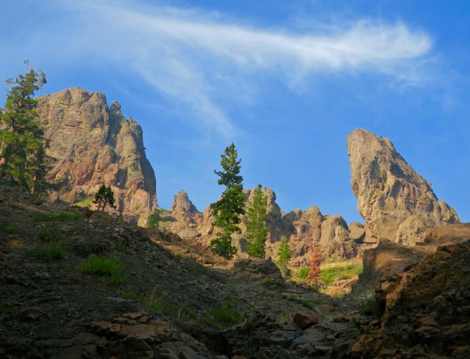
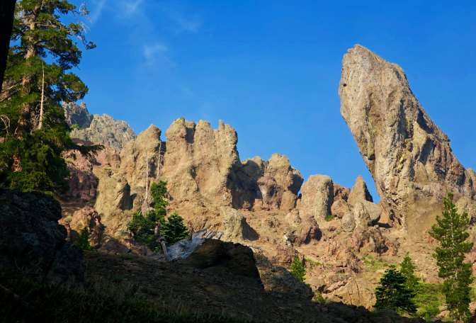
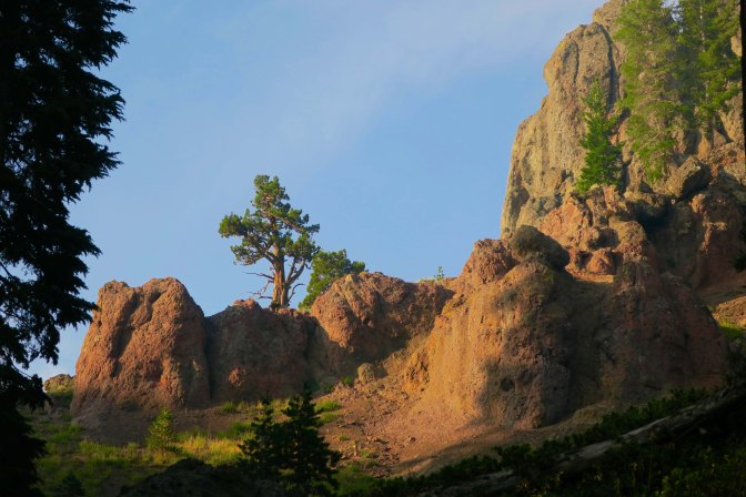
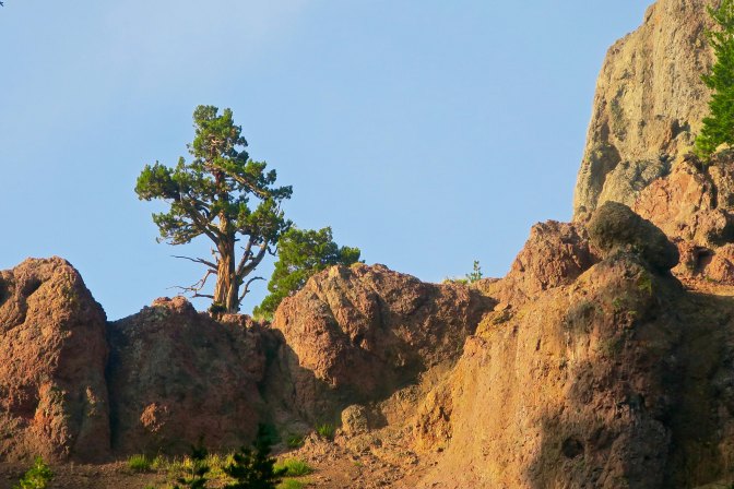
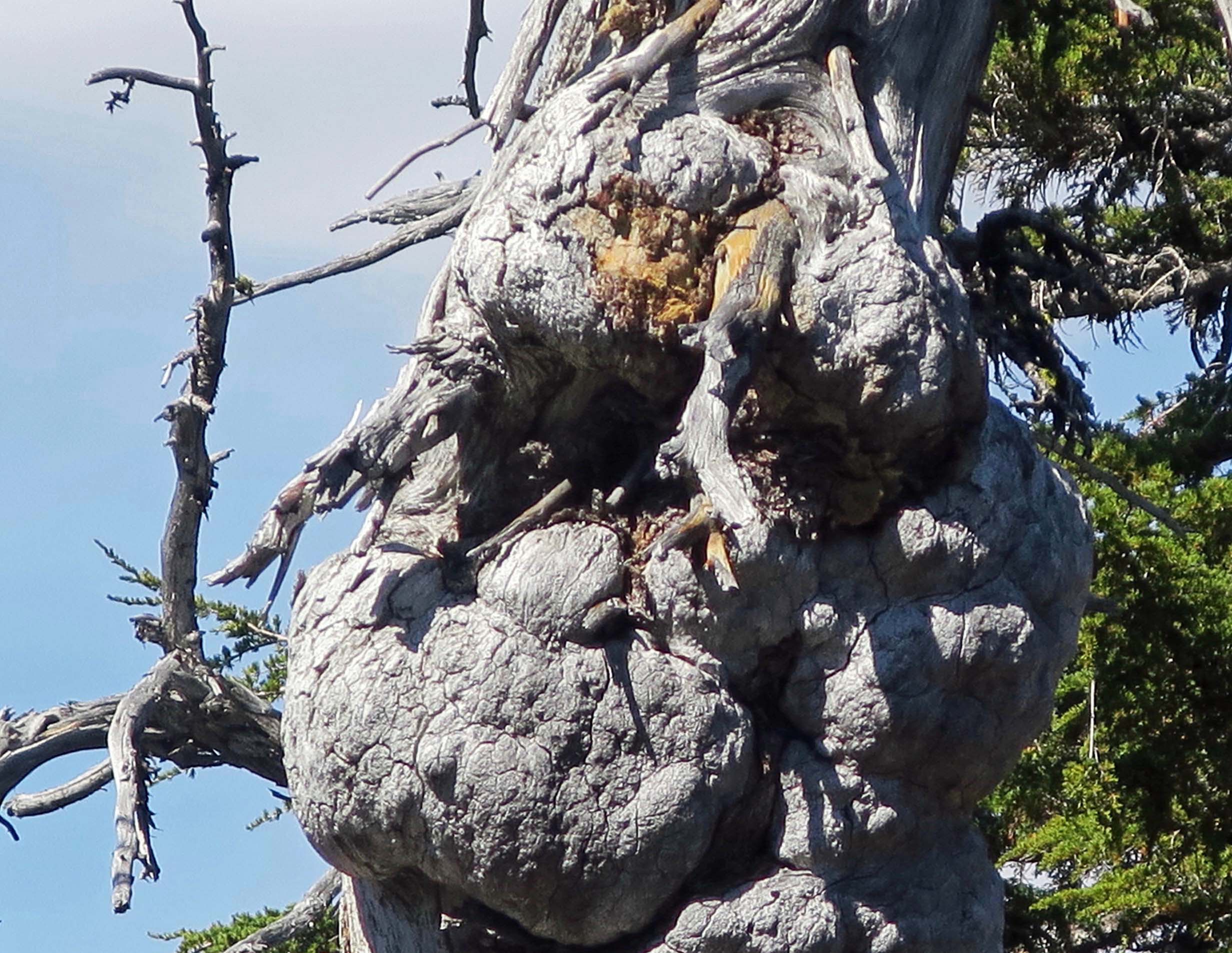
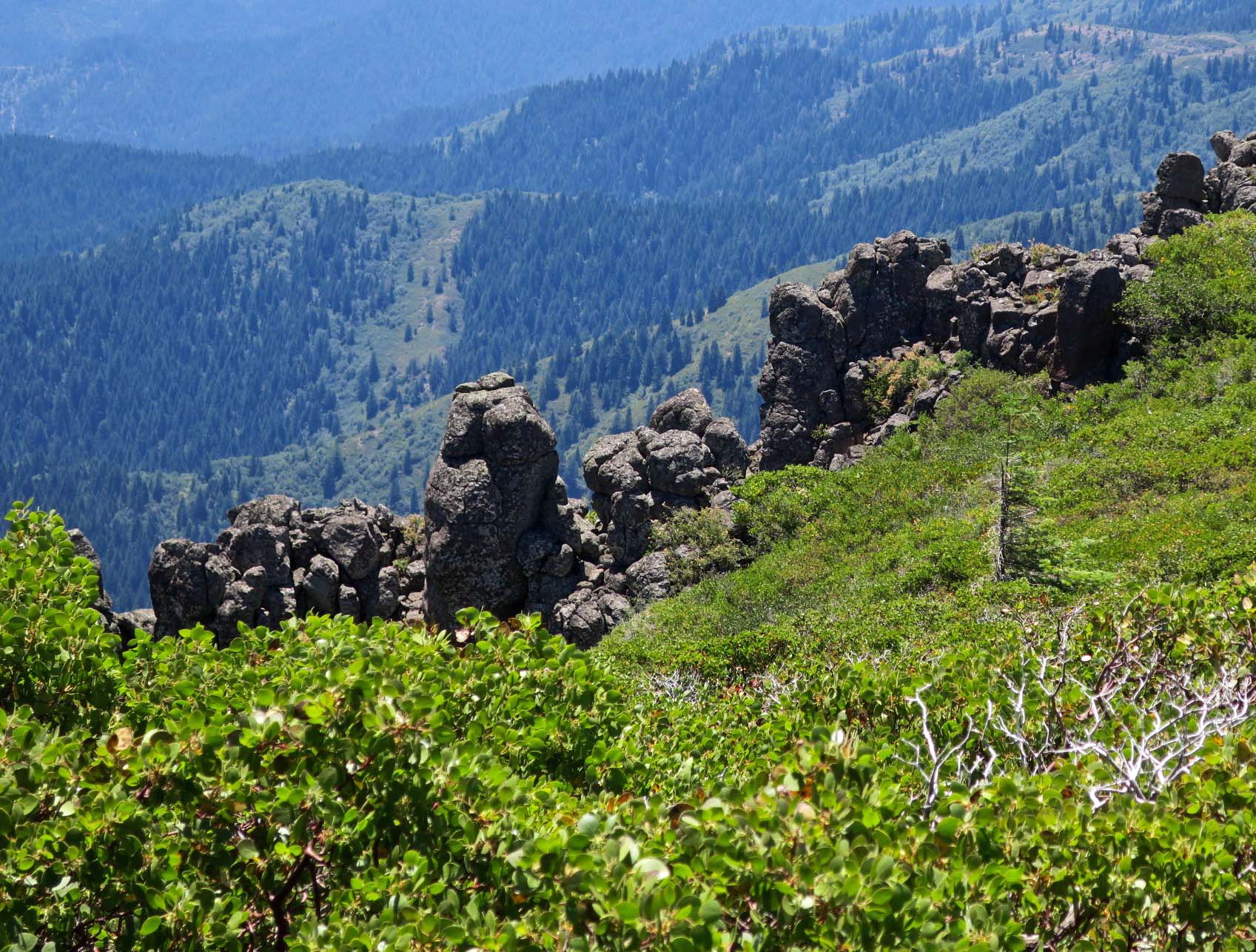
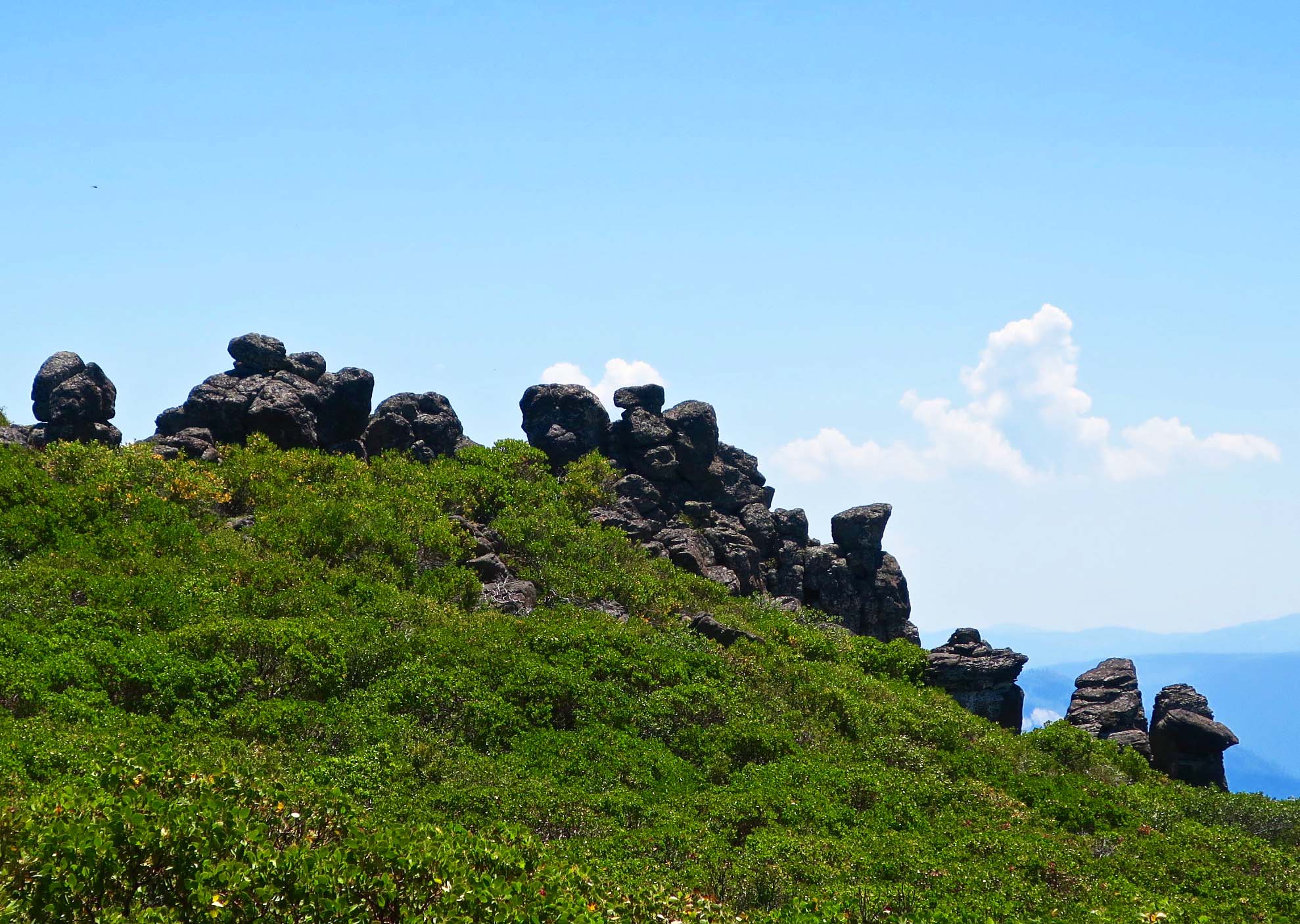
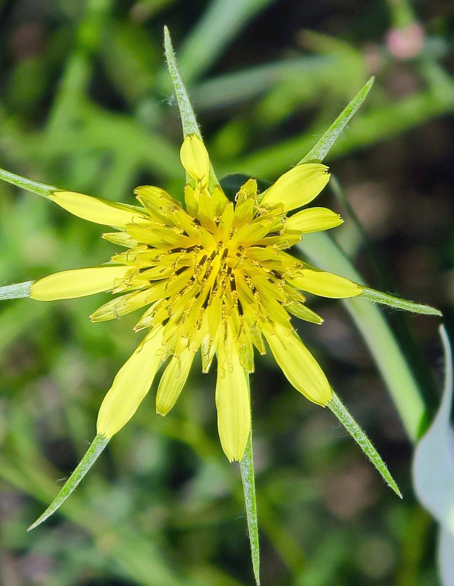
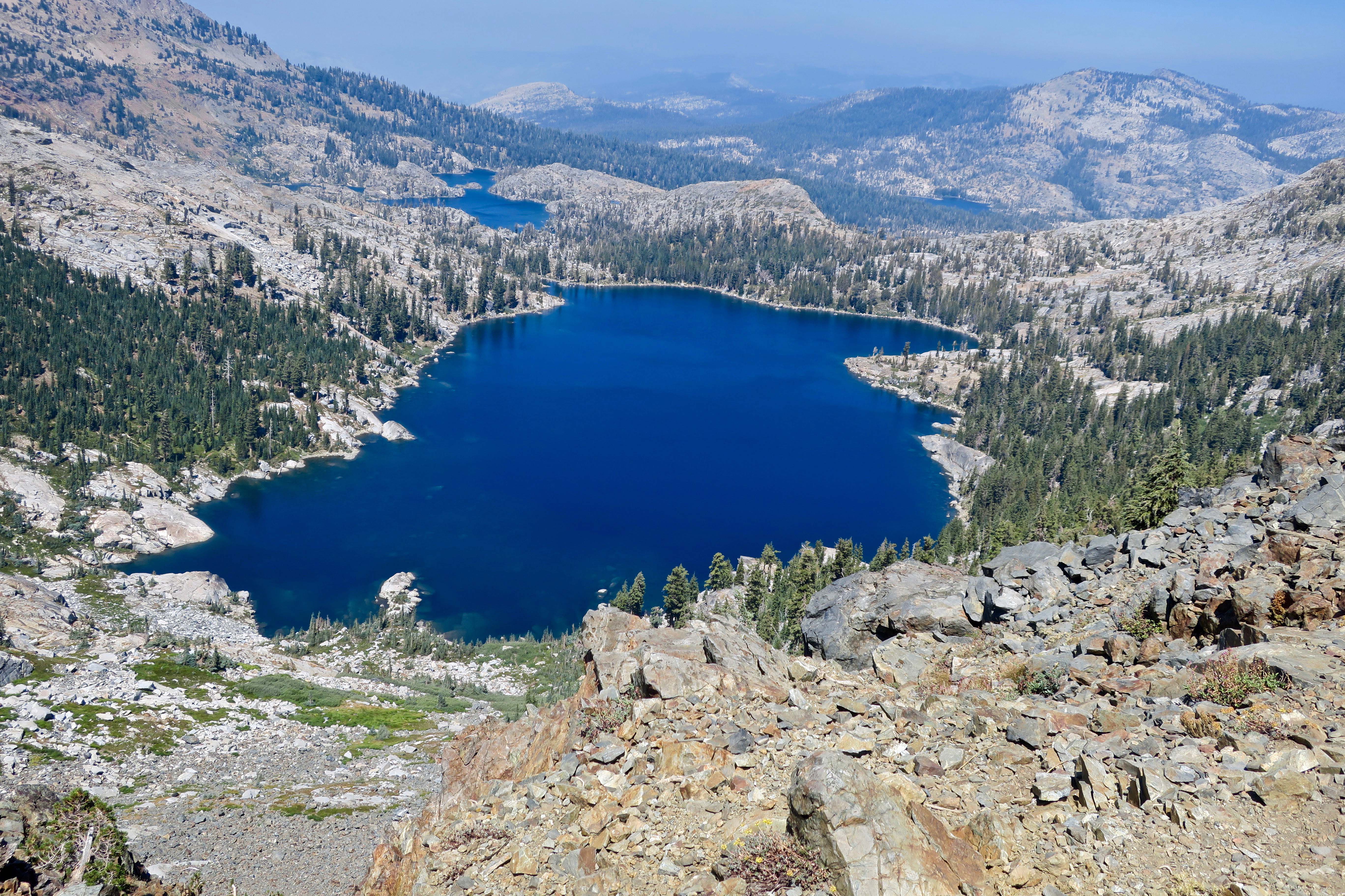
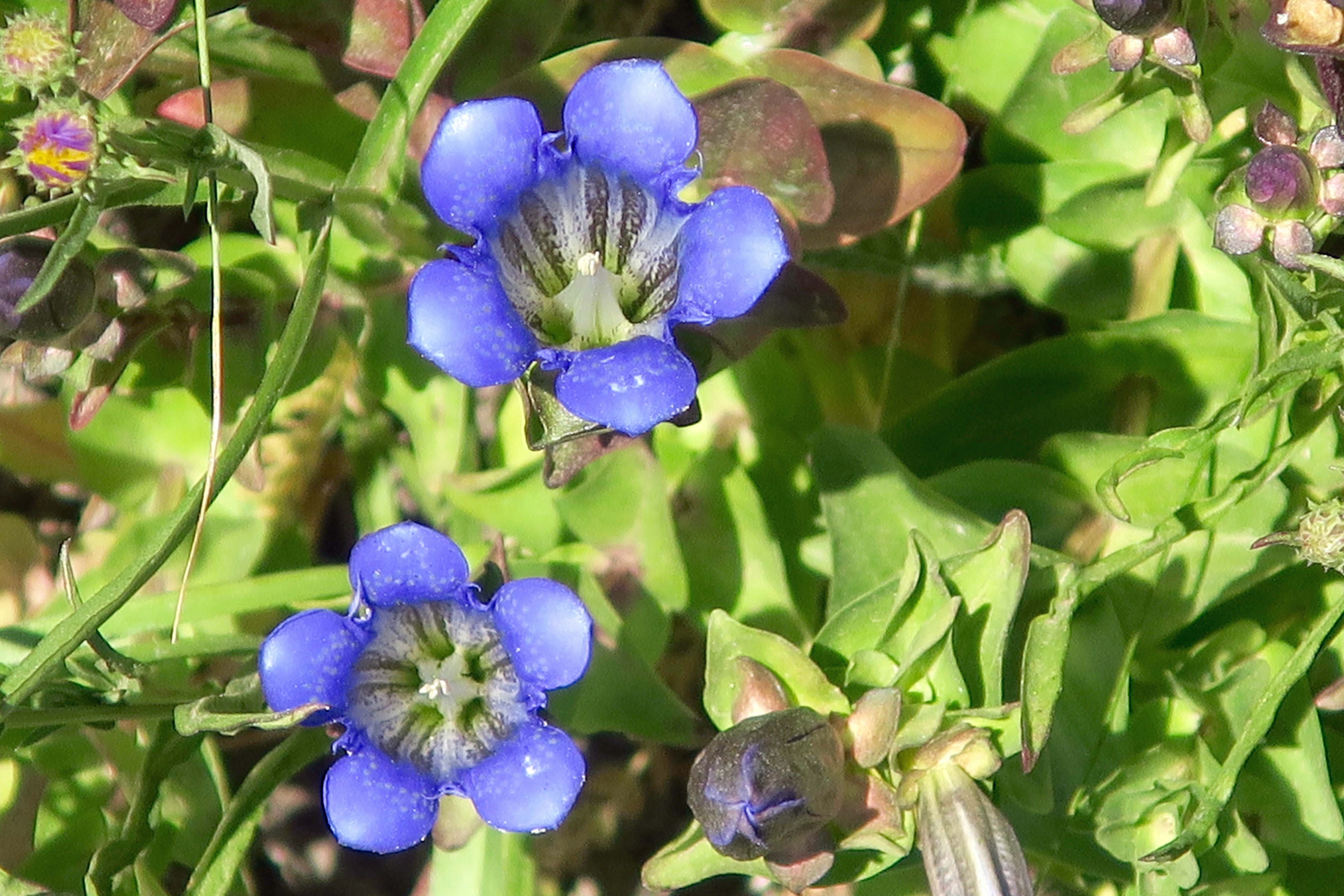
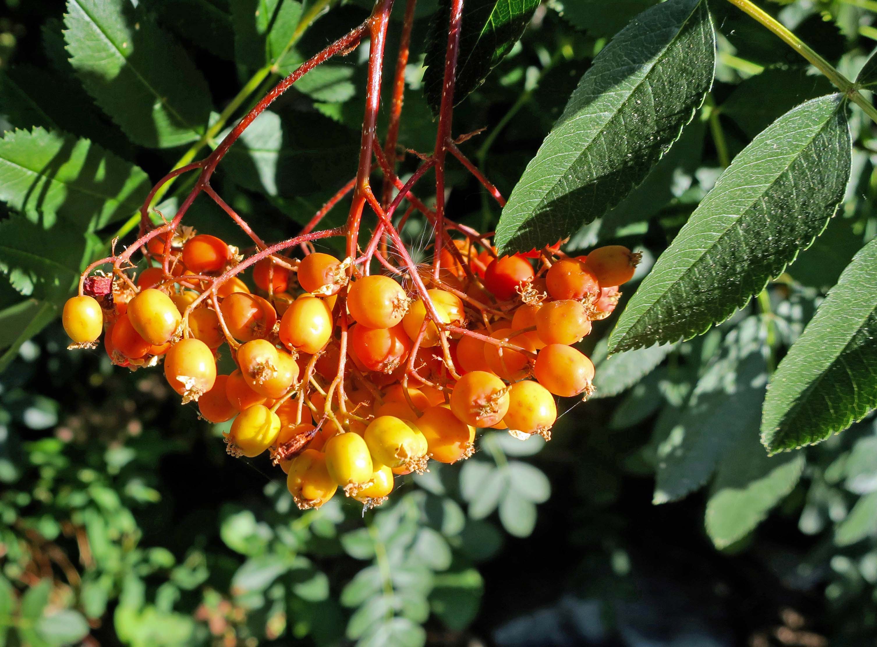
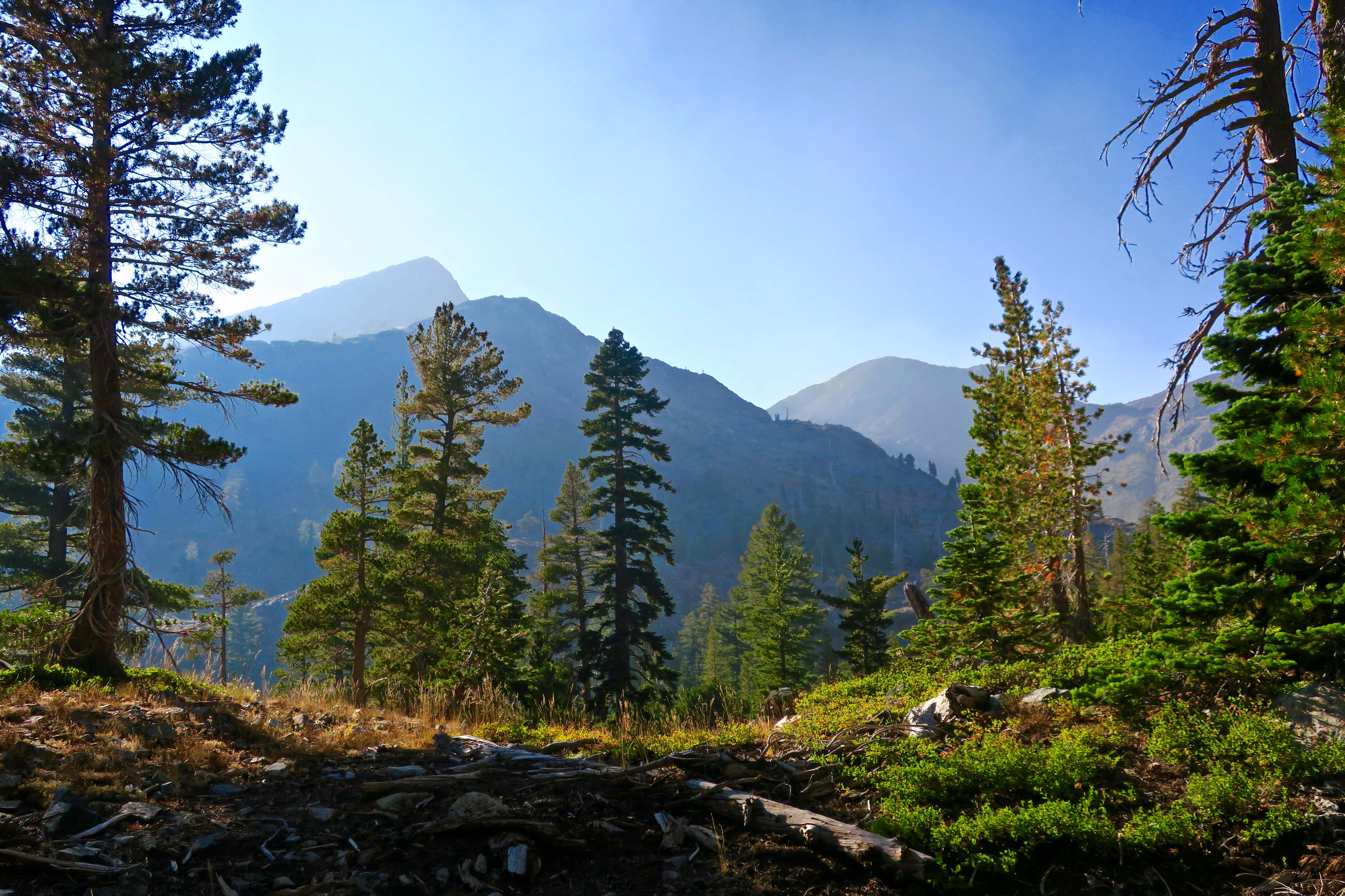
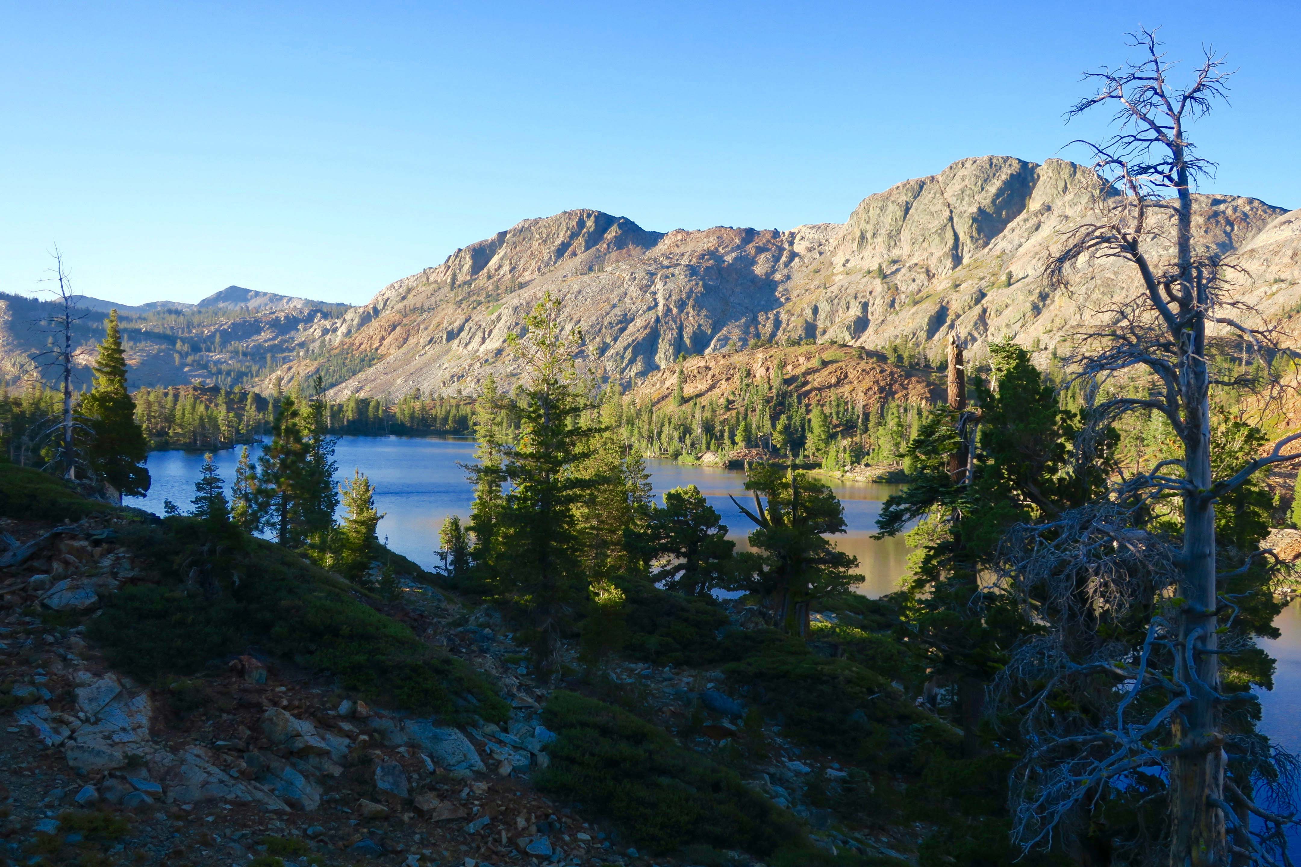
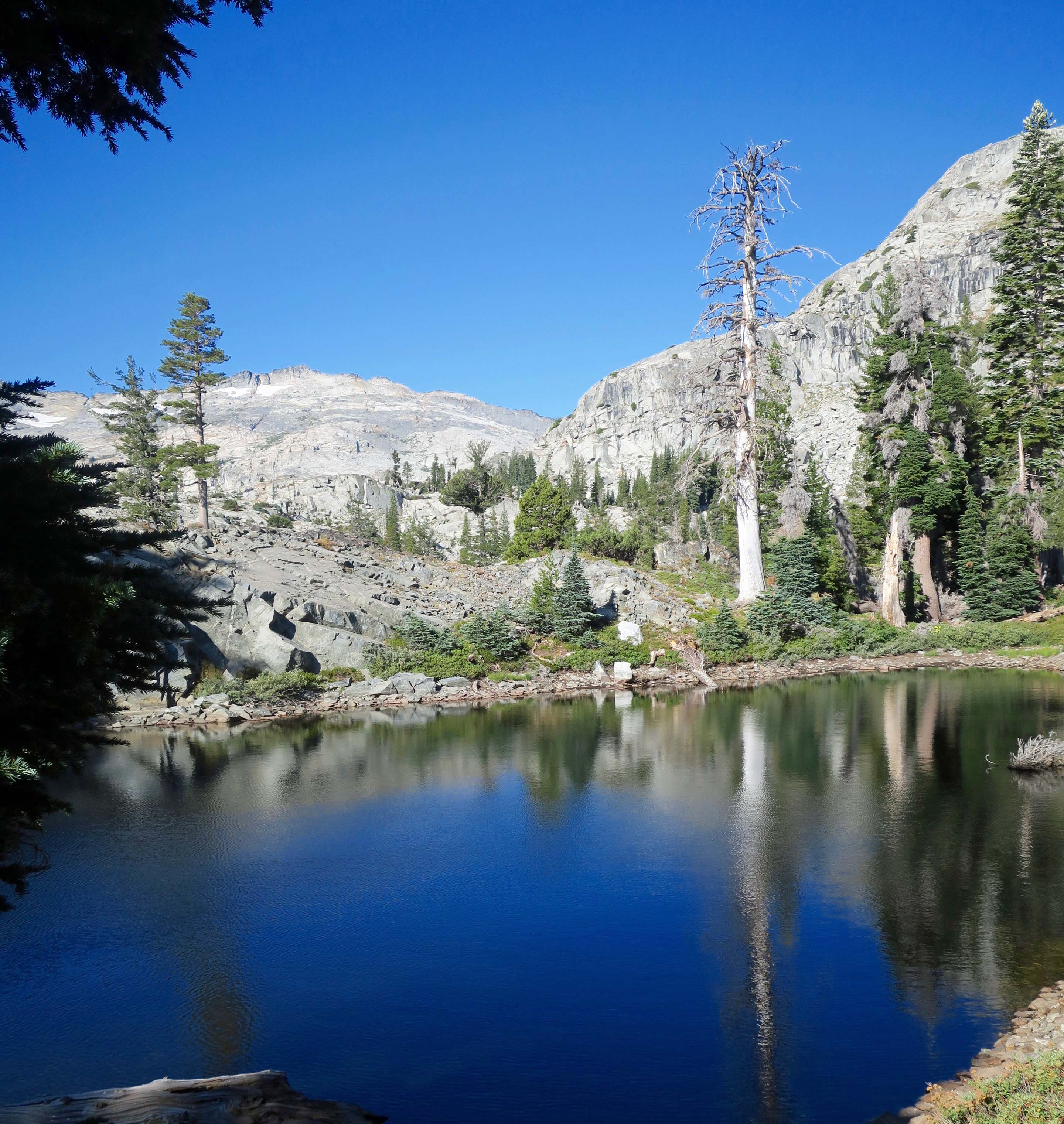
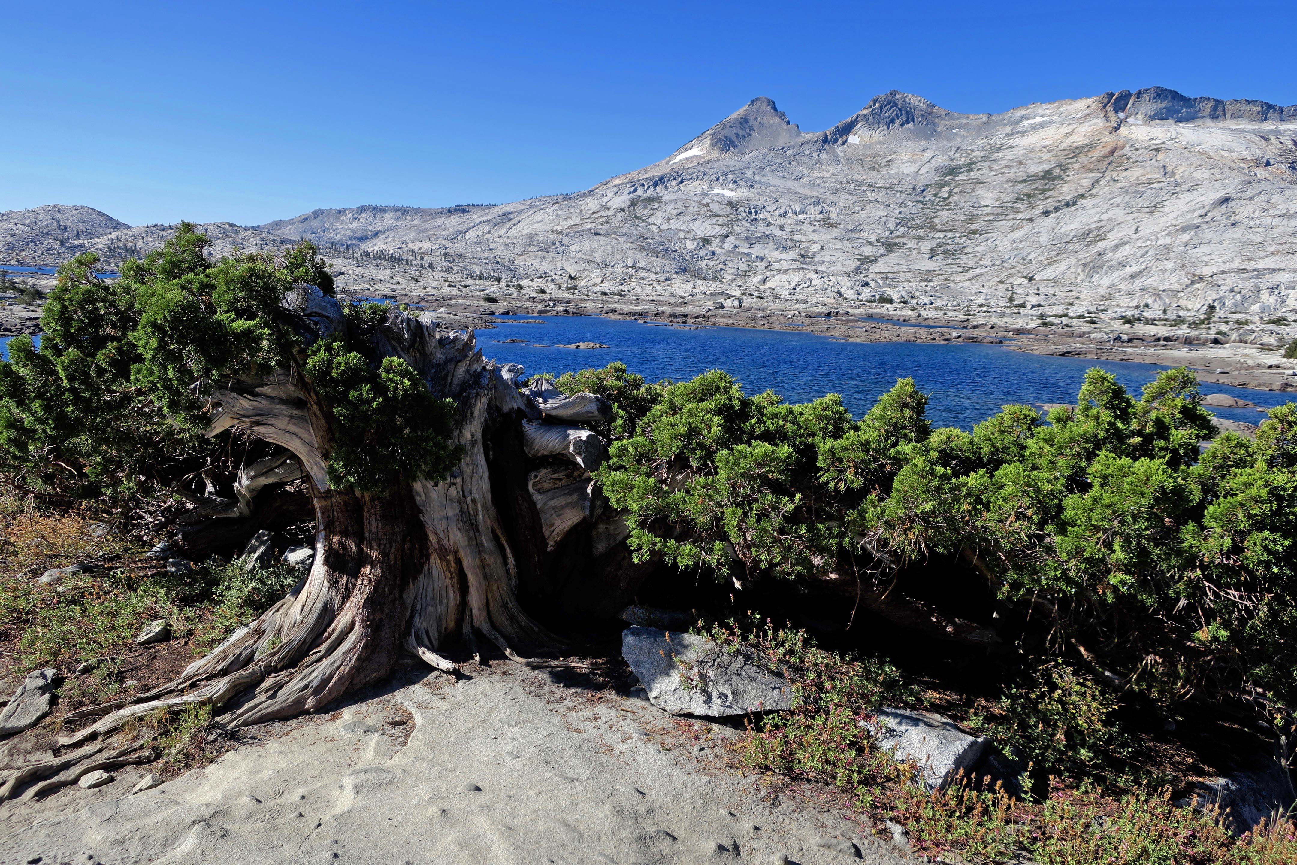
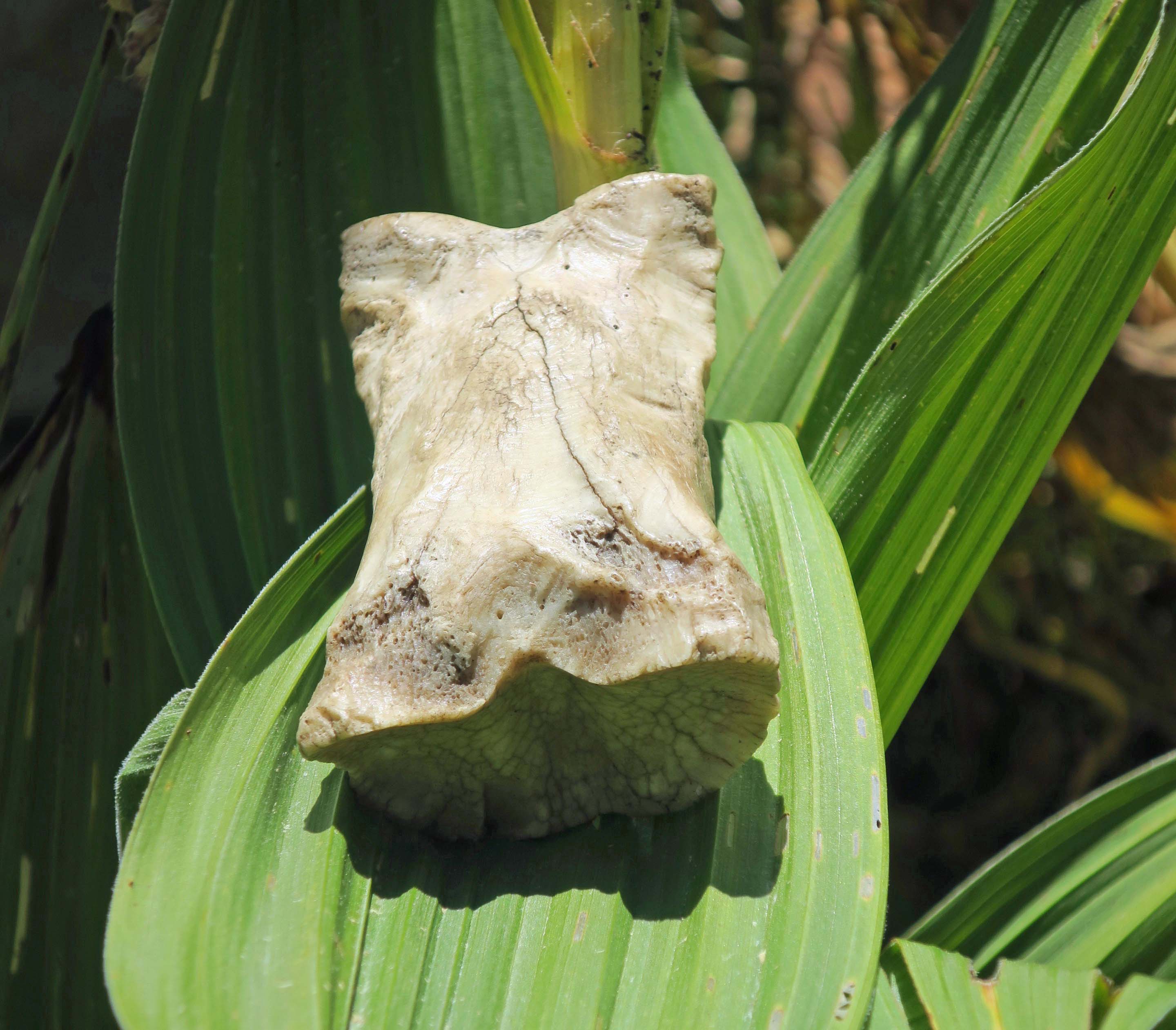
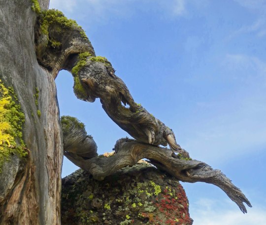
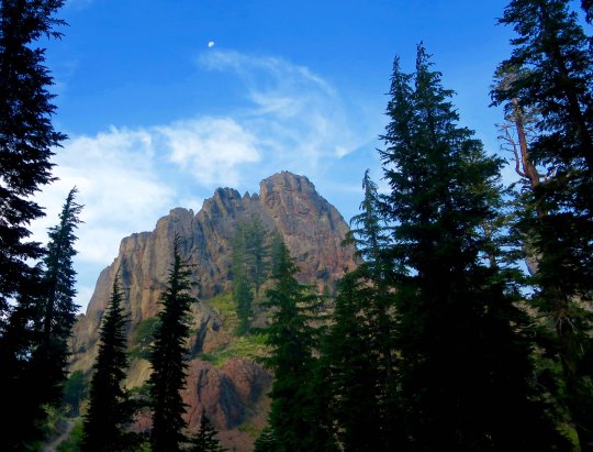
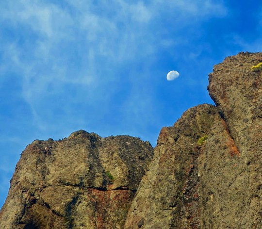
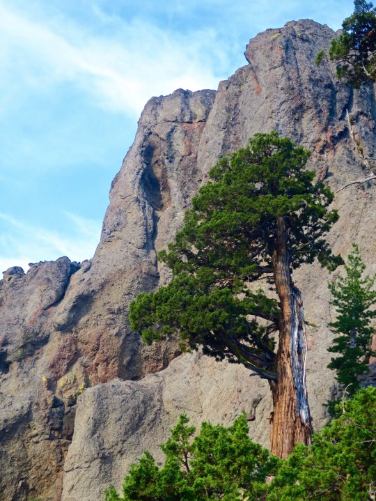
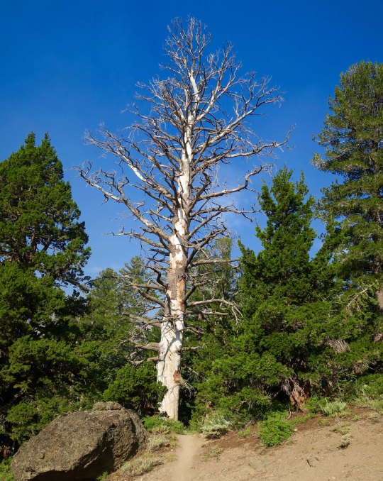
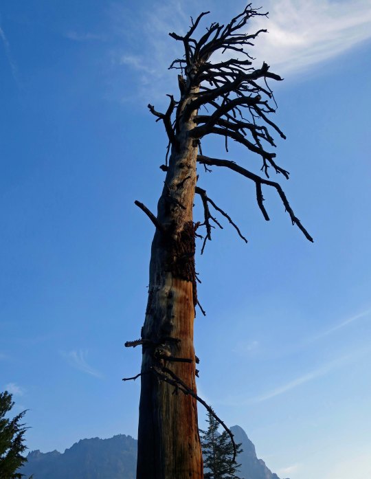
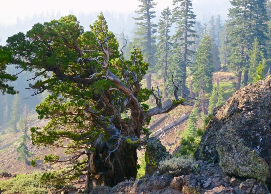
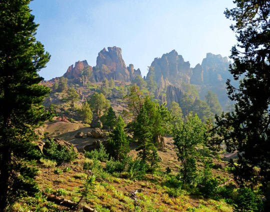
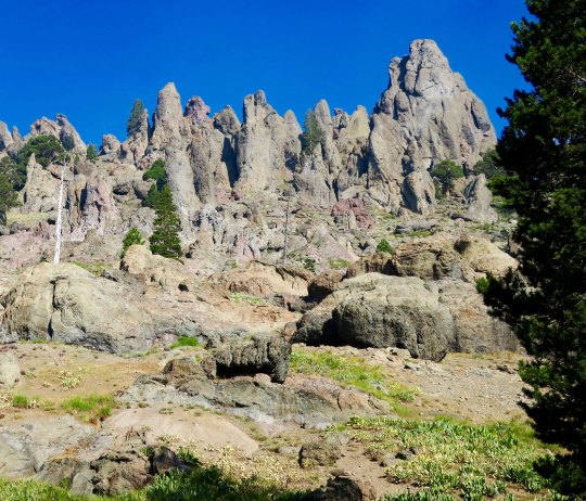
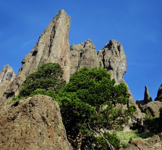
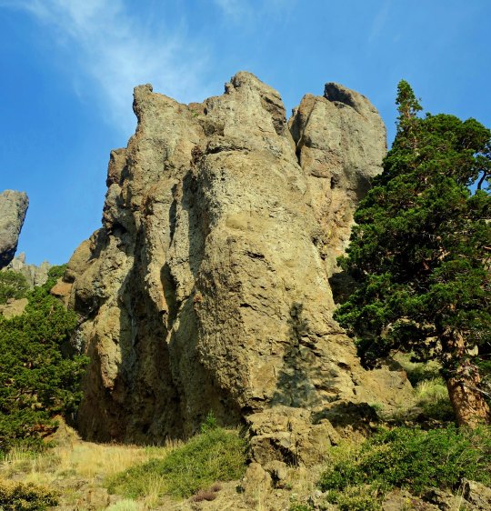
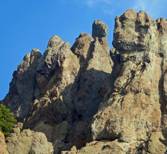
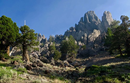
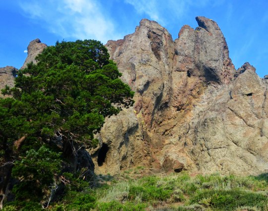
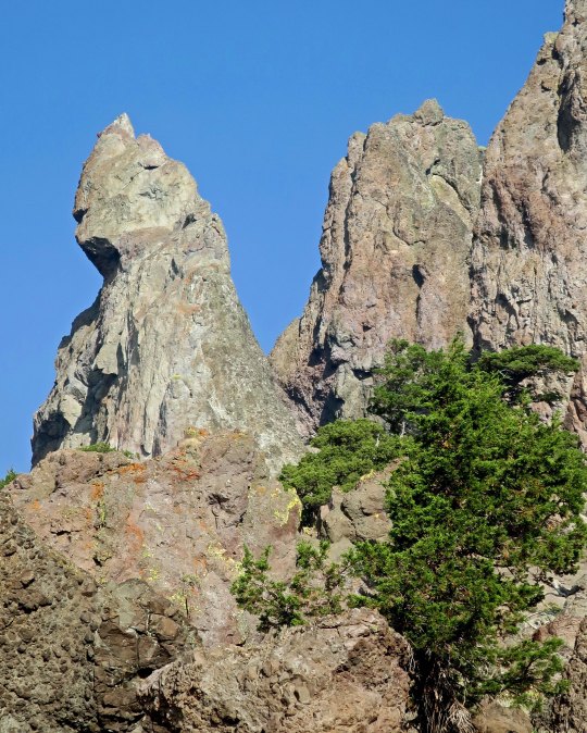
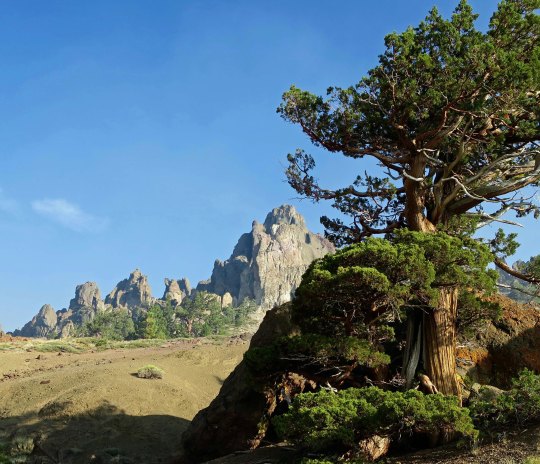
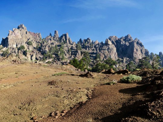
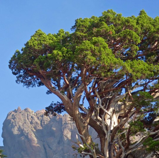
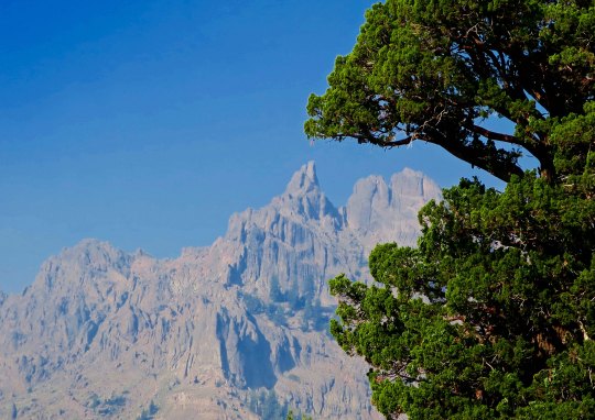
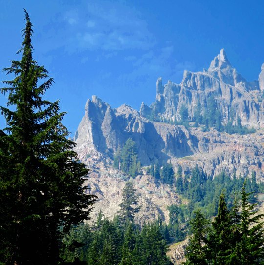
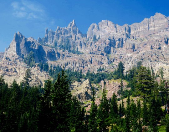
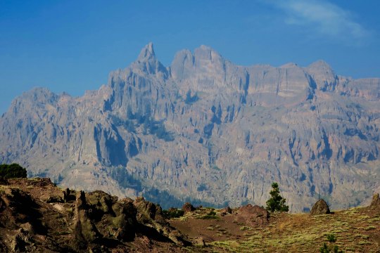
Today’s photos pick up where my last post left off, hiking down the PCT from Carson Pass on Highway 88 to Ebbetts Pass on Highway 4. The first four illustrate the value of stopping and looking around. They are all of the same scene from different perspectives.

Once again, there were towering cliffs to admire. These were framed by hemlocks.
A closer look showed junipers growing beneath the cliffs. A tiny moon appears in the upper left.
And my telephoto brought the moon into perspective with the cliffs.
While another photo featured one of the junipers standing tall against the cliff.
One of the magical things about following a trail is that you never know what you will see next. It’s a thought that forever pulls me on. The PCT made its way around a large snag here and disappeared into the woods.
I was assured that the views would just keep coming.
The smoke did more than hassle my lungs; it also provided some interesting photos as it filtered the sun. This juniper is an example.
And another smoke filtered scene.
As might be expected from my last post on the PCT through the Mokelumne Wilderness, there was no end to magnificent rocks.
Rounding a bend I came on a new view with a juniper, rock and open area leading to a distant peak.
This perspective had the intensity of surrealism. I could see Dali carefully painting the rocks in the foreground and adding a melting clock.
The contrast between a juniper and rock guaranteed that my camera came out.
And then I was treated to my first view of Mt. Reynolds.
Wow!
I’ll conclude today with this view. I loved the contrast.

NEXT POST: Variety, being the spice of life, it’s back to Mexico.

Stunning Rocks and Gorgeous Junipers… The PCT through the Mokelumne Wilderness

There is no hurrying through land like this. The combination of junipers and rock sculptures called to both me and my camera.

I was surprised by the sheer beauty along the PCT south of Carson Pass. I had hiked through the region several times over the years, but my trail had always been slightly to the west. Somehow I had missed the incredible rock sculptures. That, and the junipers. If you have ever wandered the West, you are familiar with this gnarly, photogenic tree. Most of todays photos were taken near Pennsylvania Creek in the Mokelumne Wilderness, maybe 15 miles north of State Highway 4 and Ebbetts Pass. I’ll let the photos speak for the area.

Hiking down into Pennsylvania Creek, I found this juniper.
And then this one, wedded to a rock.
That night, I camped on the south side of Pennsylvania Creek. This was the view !
Later, at sunset, the whole ridge.
The next morning, smoky skies and the sun provided a red cast to the view.
Farther along, I was treated to this view.
Near the crest of the canyon, I found the juniper tree and rocks I featured at the top pf the post.
The view included this leaning rock, which could be seen just behind the juniper.
Another perspective.
I considered this a real treat.
And photographed it several times. This is it for today. But I’ll have several more views of the rock sculptures on my next PCT post.

NEXT POST: Back to Puerto Vallarta. P.S. I will be playing with various themes over the next few weeks, so don’t be surprised by the changing looks of my blog. ALSO: For those of you who haven’t read “The Bush Devil Ate Sam,” I will be posting a chapter once a month on the top ‘pages’ to give you a feel for the book and encourage you to buy it. Many thanks! This chapter reflects our first night in our Gbarnga home, appropriately titled: Armies of the Night!

Mt. Lassen National Park— A Spooky Kind of Place along the PCT… Happy Halloween

What’s more scary than a spooky face staring at you from the ground? Imagine your flashlight picking this up at night when you are out in the woods alone? For the more scientifically inclined among you, this is a manzanita root.

I hardly imagined that backpacking through Mt. Lassen National Park on my hike down the Pacific Coast Trail this summer would provide me with inspiration for my annual Halloween post— but I had never had an up-close-and-personal encounter with manzanita roots. Trail crews, rerouting the PCT as it approached the Park from the north, had dug up the roots and left them beside the path. 

I often include photos of faces from nature in my blog. And most of these are a bit on the strange side. (“Like you,” I am sure my wife Peggy would point out.) Maybe. My imagination works overtime when I am out in the woods and I can’t resist pulling out my camera when I spot eyes staring back at me from trees, rocks and clouds. They appeal to the animist in me. Plus they are an excuse to stop on long, tough hiking days.

In addition to the roots, I’ve included a couple of other photos from Lassen with Halloween potential and a few other ‘faces’ from my three month backpack trip. Some of these I have included before. Enjoy!

Imagine, if you will, clawed fingers reaching up from the grave, ready to grab unsuspecting hikers.
Dark, vacant eyes staring at you are stock in trade for horror film flicks.
More eyes. Maybe the skull of that silent killer of the night: The owl.
Scrooge McDuck’s nemesis, the ghost duck of Halloween past.

Dead trees are also mood setters for Halloween and horror movies. Here are a couple of many I captured in Lassen.

A lone. dead tree standing on the horizon with grasping fingers is an excellent place to plant a grave.
Scary music, dark, threatening skies, and dead trees: a perfect combination for Halloween night. What monster lurks in the shadows, prepared to leap out from behind a tree, and carry you off to a world filled with zombies and blood thirsty vampires.

And to conclude today’s post for Halloween, a few photos from other faces along the trail, some of which I have included before.

A large eye and a silent scream suggests I frightened this woodland creature peering out at me while half hidden. Am I that scary?
Not so scary but somehow threatening.
And finally, this rather grotesque character with his pointed head, dark eyes, skinny nose and large jowls. Vey scary indeed!

HAPPY HALLOWEEN FROM PEGGY AND ME.

Next Post: Back to hiking through Lassen National Park on the PCT. 

Backpacking up Mountains in 100 Degree Plus Weather from Castle Crags to Burney Falls on the PCT

I thought a lot about the cool water of Burney Falls as I backpacked the second half of my trip from Castle Crags to the falls. Temperatures were in the 90s and then surpassed 100! (Photo by Peggy Mekemson.)

The Pacific Crest Trail from Castle Crags to Burney Falls is known for being hot in the summer. I was hoping to avoid such weather. No such luck. At least it waited until my last three days to break 100 F (37.7 C). Then it became a scorcher. Many through-hikers chose to hike early in the morning and late in the evening, hiding out during the hot part of the day. But I trudged on. I needed full days to make it out when I told Peggy I would. Following are a few photos from the trail. 

Having climbed 10-12 miles to get out of the McCloud River Canyon, I was treated to views of Grizzly Peak. Billowing cumulous clouds spoke of the coming heat.
Similar clouds were hanging over Mt. Shasta. This would be one of my last views of the spectacular mountain. I had been enjoying it and photographing it since I had began my trek at Mt. Ashland.
Appropriately, I found some Shasta Daisies beside the trail.
Much of my time over the next three days would be spent hiking ridges with great views into the canyons. This is Devil’s Canyon. My guess is that the person who named it tried to hike out on a 110 degree F day. Don’t let the pretty trees fool you; it’s Dante’s Inferno! (grin)
I was now hiking through the volcanic Cascade Mountain Range that runs from Northern California to the Canadian Border. I would be treated to numerous views of volcanic landscapes, such as this eroded lava.
I was intrigued by these volcanic rocks that were outlined on the ridge.
And these. They looked like a small village.
A fir tree helped set this rock off.
Flowers, such as this Indian Paint Brush, helped take my mind off the heat and long days.
As did  this striking fellow.
I also found some strange manzanita roots to entertain myself with. (There will be a lot more in my next post on Lassen National Park.)
As always, there were interesting through-hikers to stop and chat with. This couple, Smile and Hamster, had found a phone signal and were signing up for fall college courses in Germany.
I’ve already introduced Popcorn! with an exclamation point the end of her trail name. She’s the one who suggested to me that rubbing pine needles all over your clothes made a great deodorant. 
Patch was carrying a message from Peggy, letting me know that she had changed the location where she would meet me. Peggy had bribed him with food. (grin) 12 more through hikers would give me the same message. Peggy was making sure I wouldn’t miss her!
On the third day, I concluded my 15 miles by 2 PM. Peggy was waiting and had as many tales to tell as I did. That evening she shared the photos that she had taken, including this one of Burney Falls. I’ll conclude here. My next post will take us into Lassen National Park.

The Desolation Wilderness: Hiking on the PCT at 75

Lake Aloha is one of the Desolation Wilderness’s best known landmarks. It was lower this year than I have ever seen it, but still dramatic with its backdrop of the Sierra peaks. 

I ran my first Sierra Trek through the Desolation Wilderness in 1975. The year before, I had created a nine-day, hundred-mile backpack trip as a fundraiser for the American Lung Association in Sacramento. With high hopes of not losing anybody, I had chosen a route across the Sierra Nevada Mountains that was used for a popular horse-endurance race from Squaw Valley to the foothill town of Auburn. Known as the Tevis Cup Trail, it was well marked with yellow ribbons and horse poop.

While the route had been easy to follow, we had been faced with struggling up and down steep canyon trails in 100 degree plus weather (37.7 C) in the Sierra Nevada foothills.  I’d vowed to keep future trips higher in the mountains. My 1975 adventure had zigzagged through the Granite Chief and Desolation Wilderness areas, occasionally touching on what would become the finalized PCT.

When my plan to take my 13-year-old grandson into some of the more remote sections the Desolation Wilderness was cut short by his sprained ankle, I revised my plan and backpacked from Donner Pass to Echo Summit. I’ve already done posts on the Donner Summit through the Granite Chief Wilderness. Today’s photo essay will focus on Desolation.

The Desolation Wilderness is one of the most highly used wilderness areas in America. One reason is because of the numerous lakes. Middle Velma Lake, where I camped, is a popular destination.  Like Lake Aloha, it is filled with small islands.
A view of Middle Velma Lake early in the morning from near my campsite as the sun rose in the east.
Not long afterward, the sun was lighting up the trees that overlooked my campsite.
My morning hike took me to the top of Dick’s Pass which provided a view of Dick’s Lake. More distant views from the pass were limited by smoke from the summer’s fires.
My hike down from the pass took me by these flowers…
These berries…
A very knotty cedar…
And this view of distant mountains.
I found an isolated campsite on Susie Lake. Given the popularity of Desolation Wilderness and the lake’s proximity to a trailhead, it wasn’t easy.
The campsite also provided this view.
Hiking up to Lake Aloha the next morning, I passed by Heather Lake.
One of my first views of Lake Aloha. I once organized a 60 mile cross-country ski trek that included skiing across the lake. That night we had played on the mountains across the lake while skiing under a full moon. The mountain on the far left is Pyramid Peak.
This driftwood had washed up on the shore of Pyramid Lake.
A closer view of Pyramid Peak across Lake Aloha.
Coming out at Echo Lake. (Photo by Peggy Mekemson.)
Being greeted by Desolation Wilderness volunteers Maryann Frantz and Charlene Clark.

As most of you are aware, the world famous traveling Bone has been ‘hiking’ with me on this journey. (He rides comfortably in a pouch and urges me to hike faster when I am making my way up steep mountains.) After coming out at Echo Lake, Peggy joined me on a day hike to take Bone back to his origin where my friend Tom Lovering and I found him south of Highway 50 in 1977 beside what is now the PCT. He has been traveling the world ever since.

Tom and I with Bone outside of the Fox and Goose Restaurant in Sacramento. Tom once owned an outdoor/wilderness store that was located in the same building. The goose seems quite interested in Bone.
Over the years, numerous people have carried Bone including Mary Johnson who has taken Bone to the top of Mt. Kilimanjaro to the base of Mt. Everest. She also took Bone on an elephant ride.
Many others have simply befriended Bone like Linda and Bob Bray. Bob actually went to First Grade with me and continued on for another 14 years through community college.
Bone was excited to be returning to his home and posed on a PCT sign. “I am going back to my roots” he proudly proclaimed to anyone who would listen.
Including this group of backpackers from Sacramento and San Francisco.
Indisputable proof that Bone has roots.
Always up for adventure, Bone went toadstool surfing on our way to where Tom and I found him.
Snow still covered sections of the trail in 1977. I was following tree blazes when I spotted something strange in a field of young corn lilies. It turned out to be Bone. 
Forty generations of corn lilies have come and gone since and this year’s crop had already grown up. Bone figured they would be good for sunbathing.
We completed our trip to Bone’s home with him regaling Peggy with tales from his childhood.

NEXT POST: Lyla the Dog… NEXT BACKPACKING POST: The trail between Castle Crags State Park and Burney Falls.