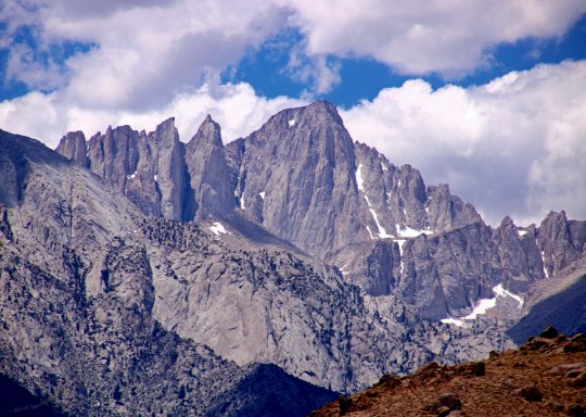
What better place to start a drive up Highway 395 with its stunning views of the Sierra Nevada Mountain Range than Mt. Whitney. I’ve already included some photos of this beauty in on my Alabama Hills’ post. Maybe even this one.
There is a lot to see along California’s Highway 395, and I am bringing much of it to you in this series. We’ve already visited the Alabama Hills with its fascinating relationship with Hollywood. In my last post, I took you to the World War II Japanese internment camp of Manzanar with its tragic history and relevance for our modern world. You have patiently made your way through lots of words! Thank you. It’s time for another photo blog, heavy on pictures and light on verbiage. (grin) What better opportunity than admiring the views of John Muir’s Range of Light: the Sierra Nevada Mountains. It’s one of my major reasons for visiting the area. These are some of my favorite photos from the trip.
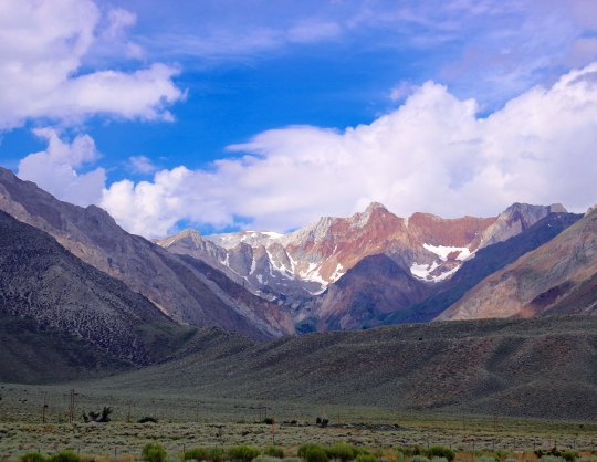
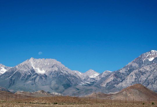
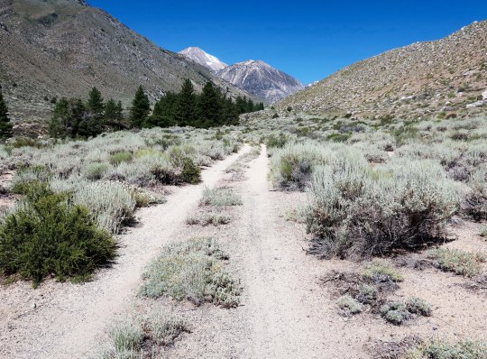
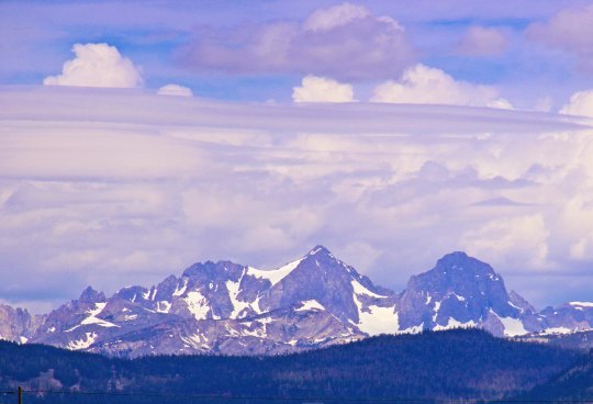
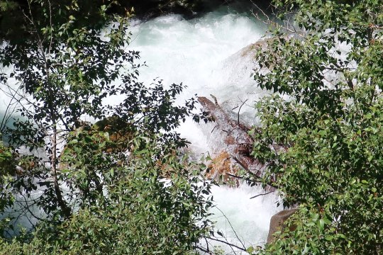
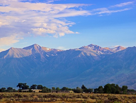
Ansel Adams added to the fame of the Sierra’s with his magnificent black and white photos. Ansel Adams I am not, but I still can’t resist rendering some of my Sierra photos in black and white, taking a step back in time. I thought that the power poles caught in the sunlight added a nice touch.This illustration provides a perspective on how the Sierras were created. The Sierras are a fault block range with the mountain rising along a fault while the valley sinks. It’s a process that continues today. Think of all the earthquakes in the area. This process also means that the mountains are steeper on the east side than they are on the west— a fact I know well having started many a backpack trip from the east! “Okay, legs, we are going to start this morning with a 3,000 foot climb.”Views like this seriously detract from paying attention to the traffic on Highway 395! Fortunately, a number of pullouts allow you to stop and enjoy the scenes.Sometimes the view is more like a glimpse. The clouds provided drama.The view called for another black and white rendition. Which photo do you prefer?The moon caught my attention here.Out came the telephoto for a closer look. Much of the Sierras’ rugged beauty is due to glaciers carving out the granite.Thunderstorms and showers are common to the High Sierras of the southern part of range. The Sierras increase in altitude as you go south, peaking out at Mt. Whitney.Here they turn dark. The thunder and lightning shows can be quite impressive when up in the center of the storms, and sometimes downright scary. I’ve hurried off more than one high pass. For the more adventuresome, a number of inviting roads lead off into the mountains. Most cars could easily travel over this road, assuming you don’t mind a few bumps and dust along the way.Other roads require a little more thought: Quivera, our small RV, said no on this one. Note how dry it is here. The western slopes of the Sierra Nevada Mountains pull most of the rain out of the clouds, so the eastern slopes are desert like.The snows were heavy in the Sierras last winter and were slow to melt off this summer. This is a lot for August. One result is that the creeks and rivers can look like this with snow melt. It isn’t something a backpacker could or would cross. Often there are downed logs across these torrents. As you can imagine, it’s a nervous crossing. The narrower the log, the more nervous!If you are a skier, especially from Southern California, this mountain might look familiar. It’s Mammoth Mountain. You can see the ski runs on the lower slopes.I close today with this final view of the Sierras from Carson Valley. At this time last year, I was backpacking down the PCT through these mountains.
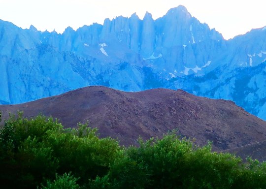
The Alabama Hills as seen from Lone Pine with Lone Pine Peak looming above.
I’m back! While the three months of hanging out at our home and taking care of my brother may not seem like long, it felt like an eternity. I have one more post to write on the experience but it is going to have to wait. It’s play time. While Peggy decided that she needed a kid/grandkid fix and headed east, I decided I needed a road trip. I loaded up Quivera the Van and took off down Highway 395 along the east side of the Sierra Nevada Mountain Range, one of America’s most scenic and interesting drives.
My journey started in Reno visiting the National Automobile Museum. Even if you don’t care a rat’s behind about old cars, I can pretty much guarantee Bill Harrah’s collection will awe you. (Rat’s behind? I’ve been reading Mark Twain’s “Roughing It” and have been inspired by his colorful choice of words.) From there, I headed south, enjoying the sheer grandeur of the mountains with side trips to Virginia City where Samuel Clemens assumed the name Mark Twain, the ghost town of Bodie, Mono Lake with its strange, other worldly tuff towers, a mountain of obsidian, the World War II Japanese internment camp of Manzanar, and finally the Alabama Hills next to Lone Pine and Mt. Whitney.
I stayed in summer-touristy but interesting towns, visited local museums, learned about water wars, and ate some great food. I’ll take you inside the ‘world famous’ Schat’s Bakery in Bishop where simply stepping through the door guarantees that you gain five pounds, and we will stop at the Copper Top, a hole in the wall front yard family bar-b-que in Big Pine that was named America’s best restaurant in 2014 by Yelp. Yep, its ribs and tri-tip are to die for. When the restaurant is closed, you can get the tri-tip from a vending machine.
Originally, my goal was to head farther south to where Highway 395 intersects I-15 and ends. The road had originally gone all of the way to Mexico but had been done in by bulldozers and Southern California freeways. You can still follow the highway to Canada through remote country where there are fewer people and bulldozers. My primary objective had been to visit the Roy Rogers-Dale Evans museum in Victorville near the highway’s terminus. It wasn’t that I was so interested in Roy and Dale, I wanted to see Roy’s horse, Trigger. The singing cowboy had him stuffed. Visiting the horse had been on my agenda for a long, long time. Boy, was I out of date. Googling Trigger, I discovered that the museum had closed in 2003 and the horse had been moved to Branson, Missouri. (I’ve been to Branson; there are lots of strange things there.) Trigger never achieved the stardom in Missouri that he had out West, however. It could be that most of his fans from the 40s and 50s have ridden off into the sunset.Maybe ifDale had stuffed Roy…
Along the way, I was going to make a side trip to the Maturango Museum in Ridgecrest with its focus on the petroglyphs of the Coso Range. That trip ended up on shaky ground, however. The 6.4 and 7.1 earthquakes near the town at the beginning of the month persuaded me that the museum could wait. I just read that there have been thousands of aftershocks since.That’s a whole lot of shaking going on.
Today I will restart my blog— get back in the saddle, so to speak— with a drive through the Alabama Hills, which I think you will find unique and beautiful. I did. Having the Sierra Nevada and Inyo Mountains as backdrops doesn’t hurt. The set locators, directors, actors, script writers and film crews of the over 400 Hollywood movies made in the area starting in the 1920s obviously found the hills attractive. But I will get into the details of the movies in my next post when I will take you into the Lone Pine Film History Museum where Hopalong Cassidy and the Lone Ranger rub elbows with the likes of John Wayne, Errol Flynn, Spencer Tracy, Ann Francis and Spock, not to mention Trigger, Silver, Rin Tin Tin and Buttermilk. Buttermilk!? Hmmm. Okay, you trivia fans, who was Buttermilk?
I first thought that the Alabama Hills had been named by some homesick prospector from the East. That happened a lot in the 1850s, 60s and 70s. Heck, the lonely miners were even known to name mountain lakes after their favorite prostitutes. What I learned, however, was that Southern sympathizers named the hills after the CSS Alabama, a Confederate War ship that had caused the Union considerable strife by taking some 66 merchant ships valued at over six million dollars during its brief two-year career. Its success was finally ended when the Union sloop of war, the Kearsarge, caught up with the ship at Cherbourg, France and sank her. Other prospectors in the Lone Pine area who were sympathetic with the North, named their mine the Kearsarge. The name lives on in the Kearsarge Pass along the John Muir Trail.
A painting of the CSS Alabama.
My nephew Jay and I on Kearsarge Pass. Even at 16, he was towering over me. You may recall that Jay, now in his 30s, backpacked a hundred miles with me last year when I was hiking down the PCT.
But enough on background. Let’s rock!
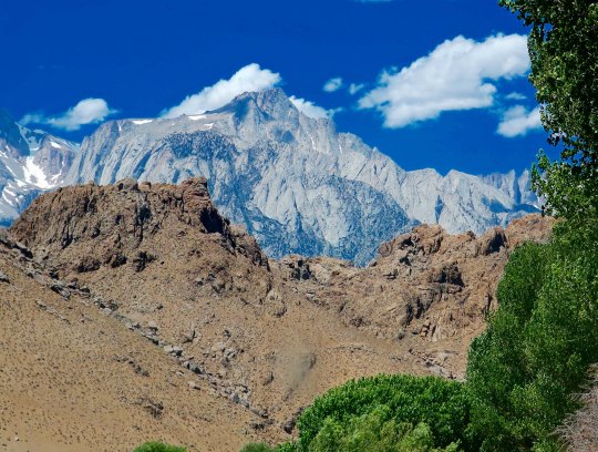
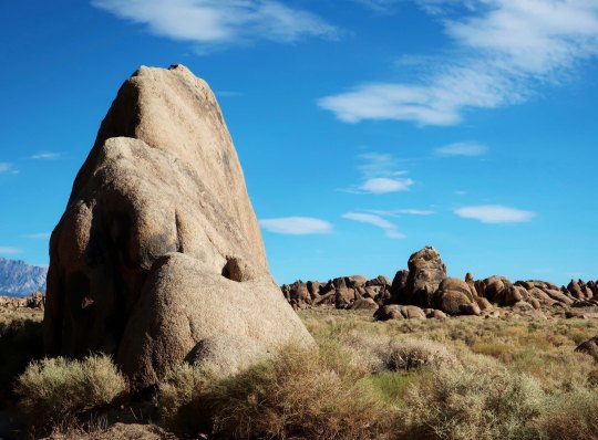
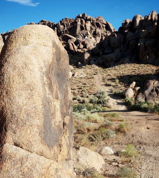
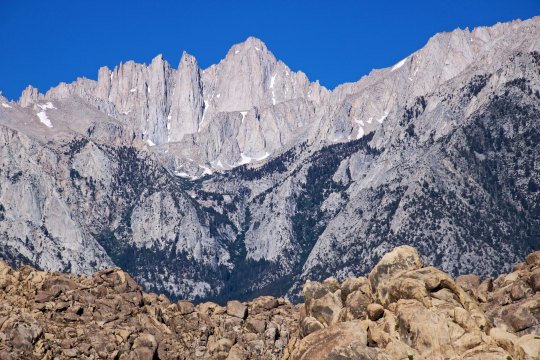
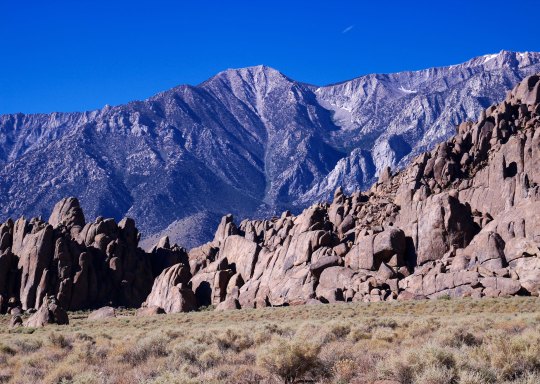
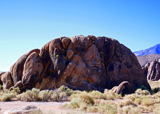
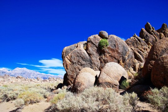
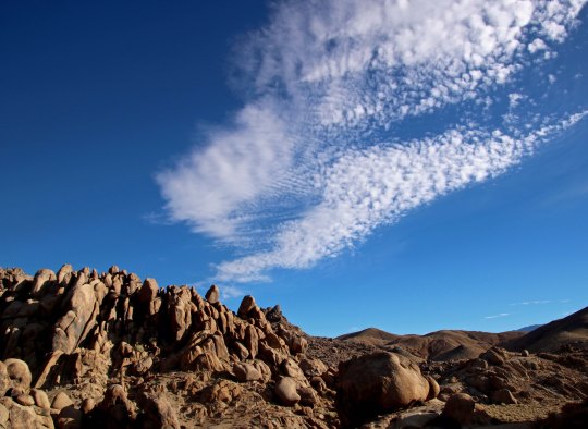
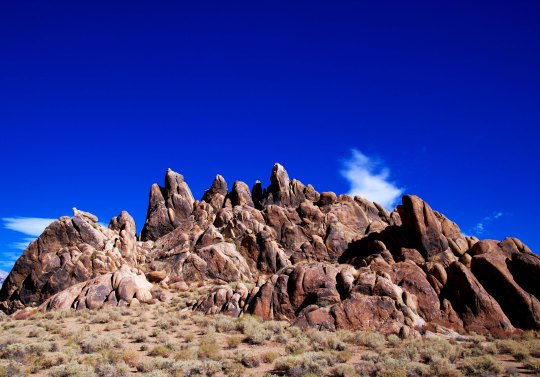
Large, colorful rocks with a dramatic backdrop provided by mountains are what make the Alabama Hills special.Another favorite of mine.Quite the jumble here. Can you spot the crow resting on the far right rock?I captured a fun shot of it taking off. I had our Canon EOS Rebel along this time as well as my Canon Power Shot. I was able to take decent telephotos!Can’t you just see a stagecoach going full speed along this road chased by a group of desperadoes? And then racing across this valley. Or maybe it was the Lone Ranger with his faithful companion Tonto chasing the band of desperadoes. Hi-yo Silver! Get-em-up Scout!This sign is located at the beginning of Movie Flats.The surrounding mountains add drama to the Alabama Hills. These are the Inyo Mountains to the east.The Sierras are to the west. This photo features Mt. Whitney, the highest peak in the contiguous United State. The dark trees in the foreground are Whitney Portal, the starting point for climbing the mountain from the east. I’ve always started from the west side of the mountain. The trail to the top runs along the ridge line. There is one place only a few feet across with a thousand foot drop on each side. Some fun on a windy day! A different perspective on the Sierras.And another on the Inyo Mountains.Getting back to individual rocks, this one was impressive.So I rendered it in black and white, just like you would see in the dozens of cowboy movies dating all the way back to the silent film era.Here are a few more interesting rocks.The white containers protect plants.I conclude as I started, with a photo of the Alabama Hills from Lone Pine. This time I took the photo in the evening and had Mt. Whitney as a backdrop.
NEXT POST: A visit to the Lone Pine Film History Museum.
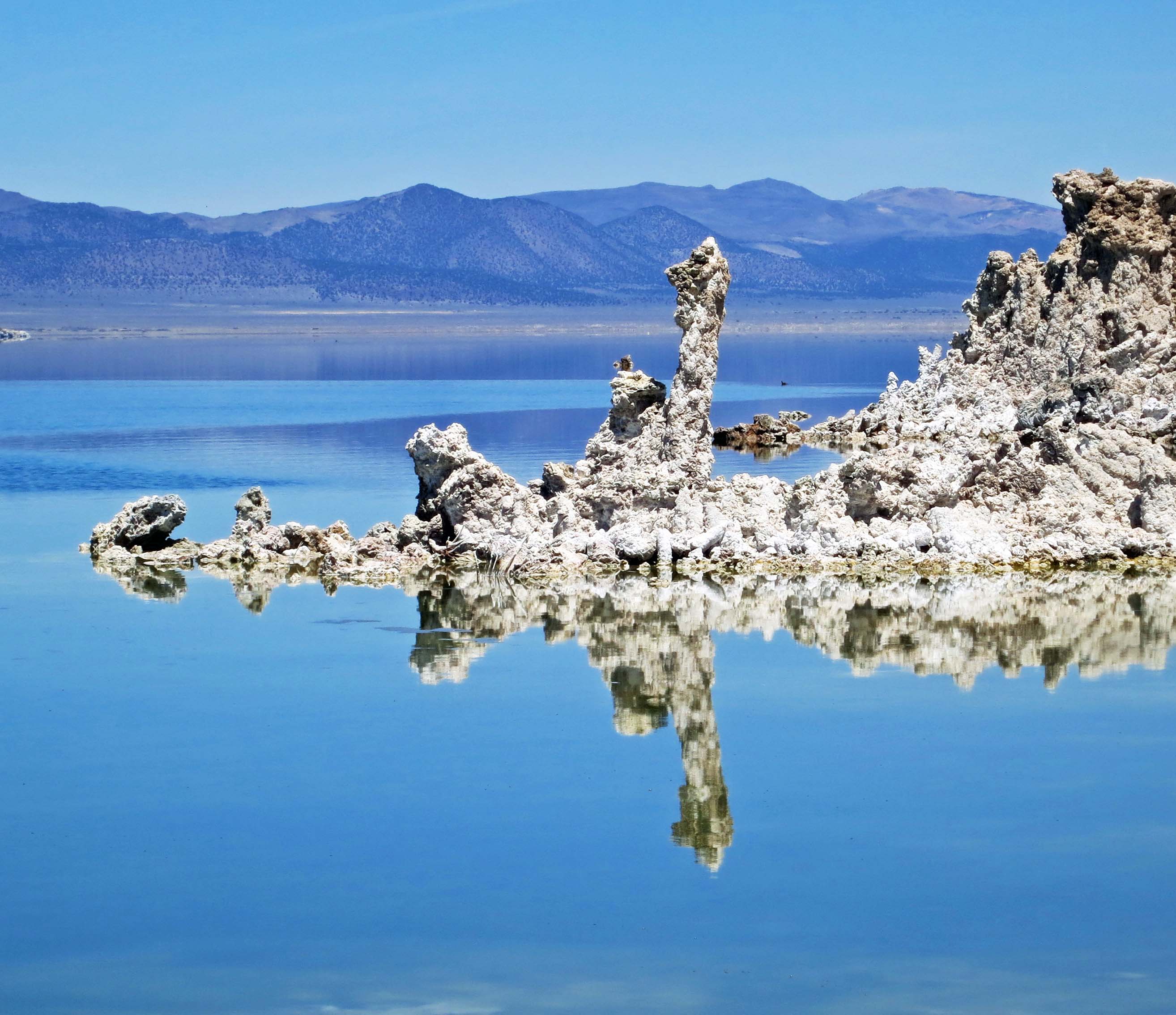
Towers made of lime known as tufa give Mono Lake its unique personality.
To say the least, Mono Lake is a strange place. Some people even call it weird. Once upon a time, back when glaciers stretched across North America, it was part of a series of large lakes that covered much of modern-day Eastern California, Nevada and Utah, a region that is now primarily desert. Left behind as a remnant by retreating glaciers, Mono Lake is at least 760,000 years old and could be as old as three million years, making it one of the oldest lakes in North America.
What flows into Mono Lake, stays. There are no outlets. As a result, the lake is 2-3 times as salty as the ocean. Swimmers don’t have to worry about sinking. In fact the lake contains some 280 million tons of dissolved salts, which makes it even too salty for fish. An effort to introduce trout left them belly up on the surface, like the proverbial dead gold-fish destined for a close encounter with the family toilet.
Algae, brine shrimp, and alkali flies thrive in the water, however. The thumbnail-sized shrimp population is estimated to be somewhere between 4 and 6 trillion in the summer. Historically, the fly pupae served as a major source of food for the Kutzadika’a Indians. In fact, the name for the tribe means fly eater.
Today, both the flies and shrimp provide food for some two million birds that migrate through the area. One visitor, Wilson’s Phalarope, a tiny, fist-sized shorebird, takes advantage of the gourmet flies to double its weight and grow a new set of feathers before journeying 3000 miles to South America— a feat that is accomplished in three days of nonstop flying at speeds of over 40 miles per hour.
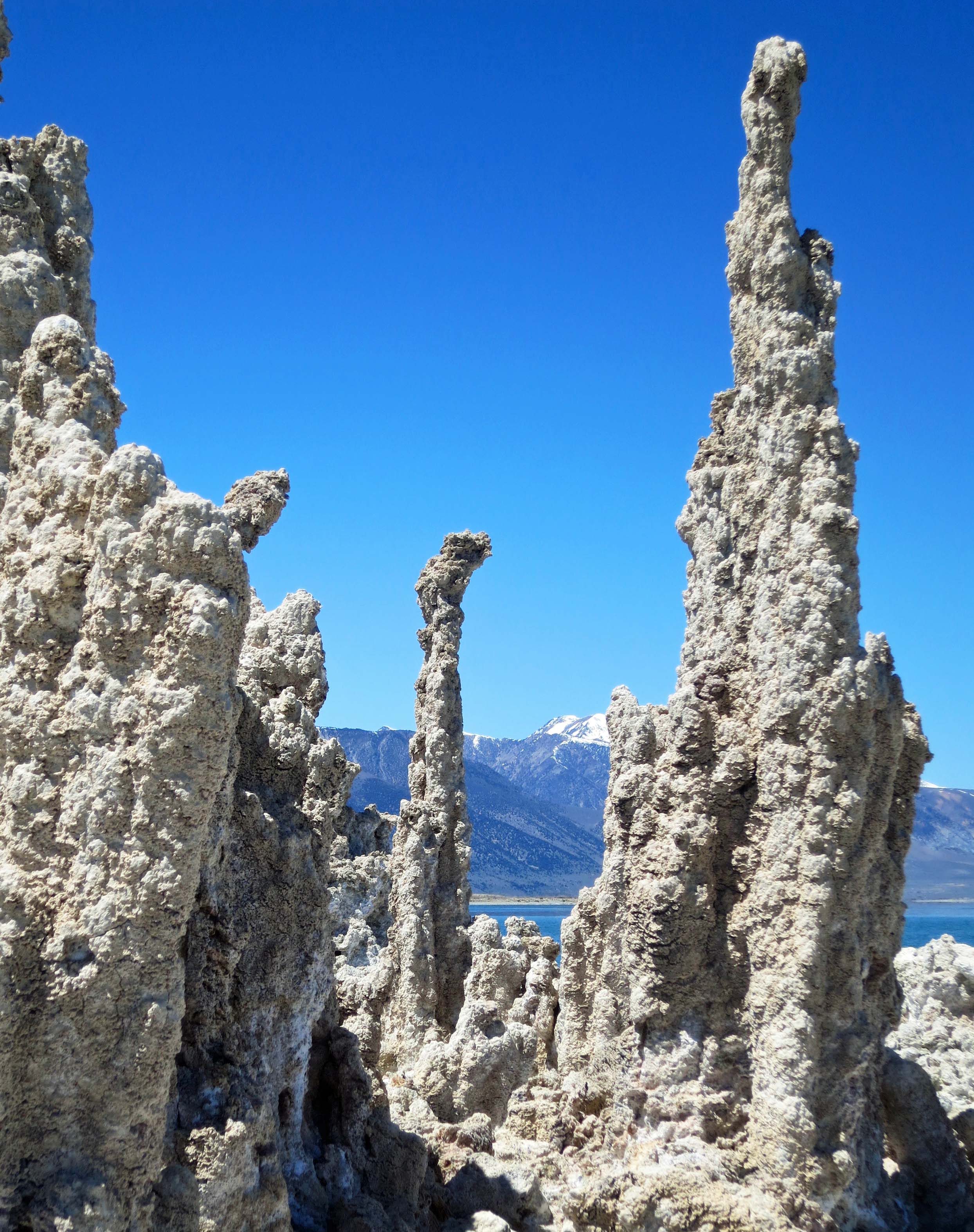
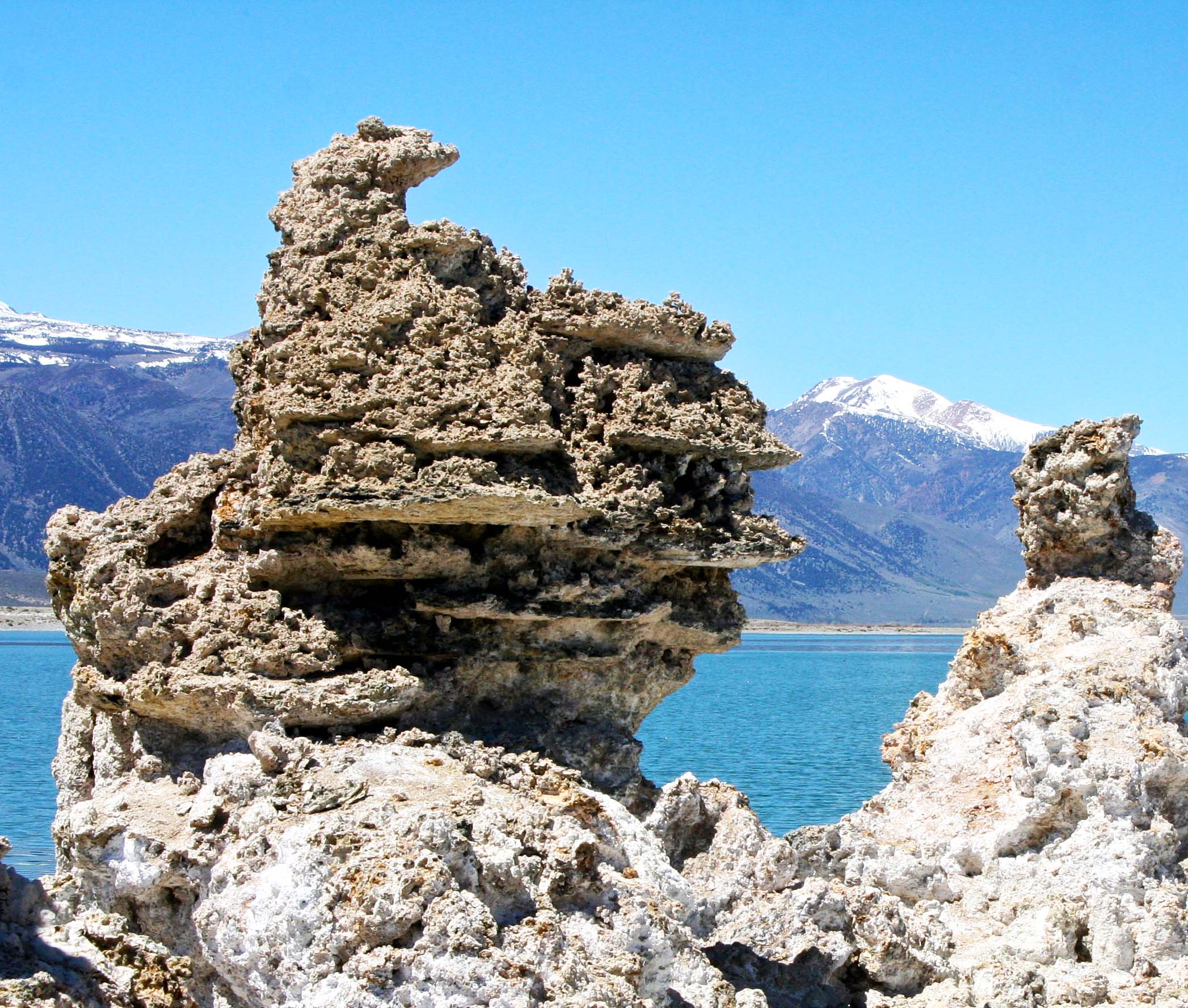
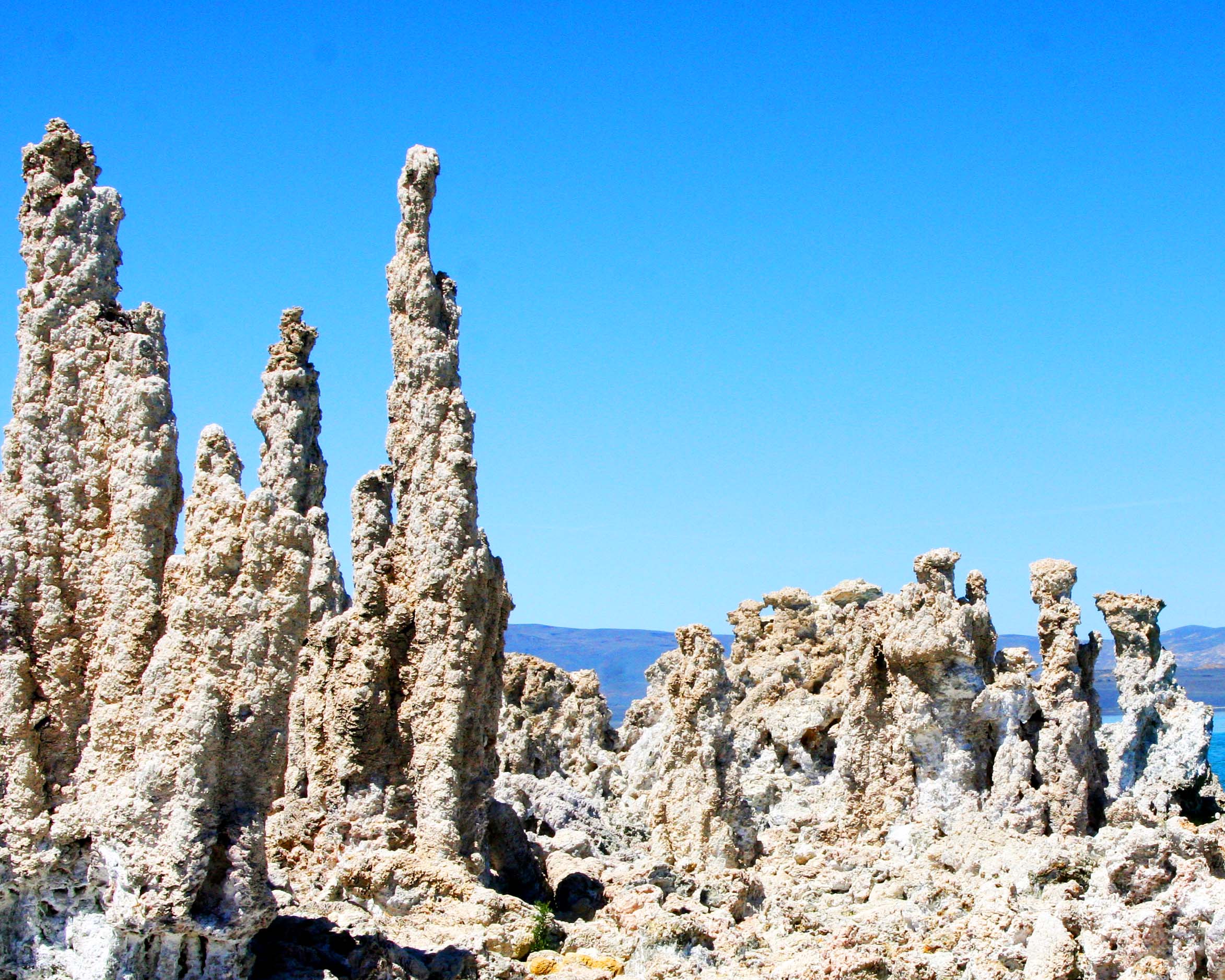
It isn’t flies, shrimp, birds, or salt water that Mono Lake is famous for, however. It’s tufa, the fantastical, fairy-like structures that grow in the lake and appeal to photographers from around the world. Calcium-rich water bubbling up from underwater springs combines with the lakes carbonate-rich waters in a chemical reaction to create the lime-based structures. Towers as high as 30 feet can be built under water through this process in a time span that may involve centuries.
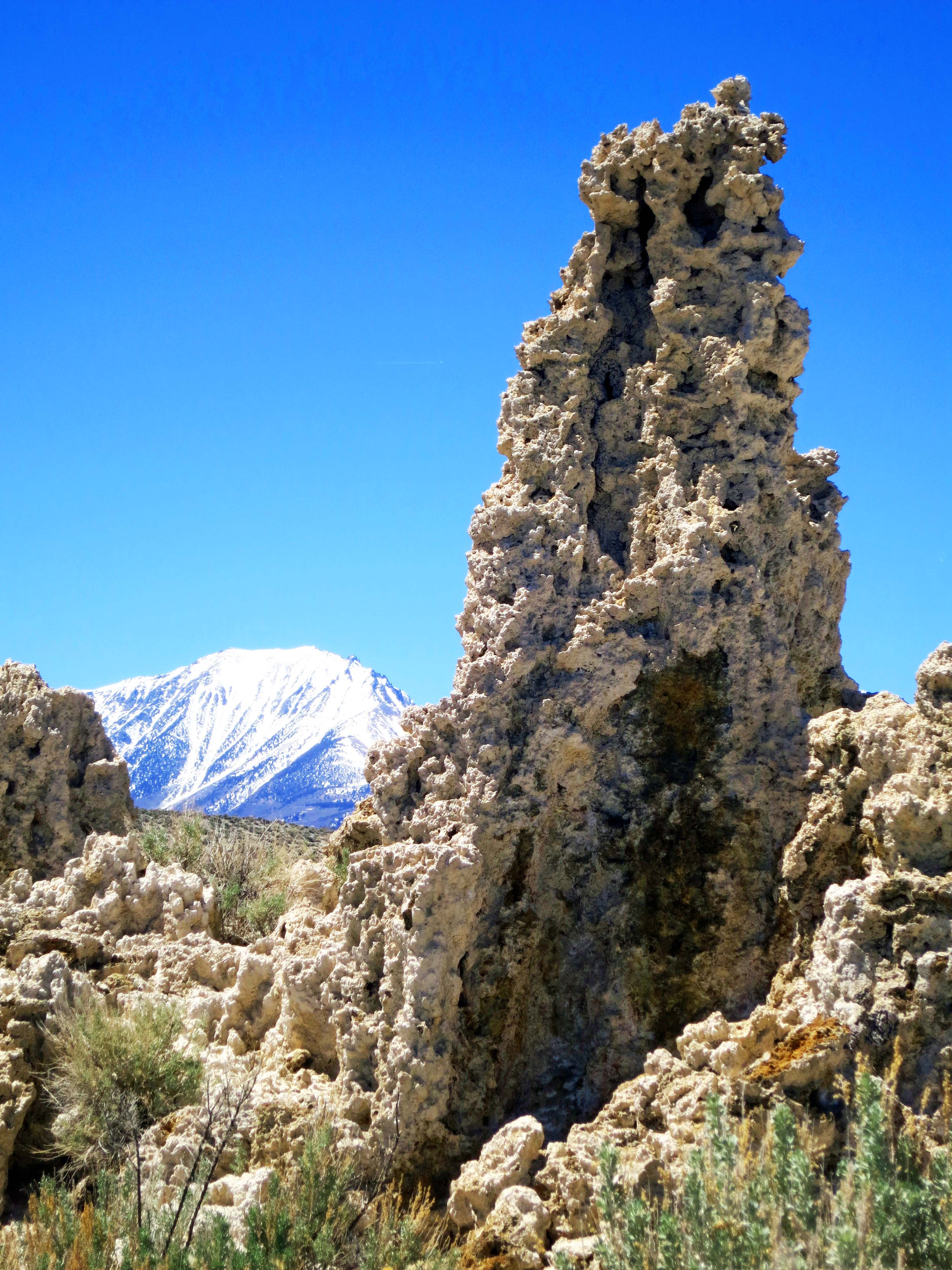
The reason these towers are visible today is due to the unquenchable thirst of millions of people in Los Angeles. This thirst came close to destroying Mono Lake, as it did the Owens River and Owens Valley south of Mono Lake. Starting in 1941 the politically formidable Los Angeles Water and Power Company tapped into the streams flowing into Mono Lake and sent the water on a one-way, 330 mile journey south, reducing water in the lake from 4.3 million acre feet in 1941 to 2.1 million acre feet in 1982.
The United States Navy also posed a threat to Mono Lake by carrying out a series of under water explosion tests during the Cold War. The plaque at the site described these explosions as top-secret seismic tests. Whether the navy was searching for a way to predict earthquakes and tsunamis or cause them is the question. Fortunately, public pressure and concerns for public safety led to the navy abandoning its activities at Mono Lake in the late 50s/early 60s.
It was the growing environmental movement of the 70s and the Mono Lake Organization that eventually forced the Los Angeles Power and Water Company to reduce the amount of water it was exporting from Mono Lake’s tributaries. Today the lake is on the way to recovering its pre 1941 water levels (assuming it isn’t wiped out by global warming and drought). Mono Lake is found just north of Lee Vining off of Highway 395. Following Highway 120 west out of Lee Vining will take travelers into Yosemite National Park.
The Sierra Nevada Mountains provide a scenic backdrop in the west for Mono Lake. Highway 395 runs along the base of the foothills. Tufa can be seen emerging from the lake.
Following Highway 120 east off of Highway 395 will bring visitors to Mono Lake’s South Tufa Trail where the photos in this blog were taken. (Photo by Peggy Mekemson.)
Prior to Los Angeles tapping into the streams that provide water to Mono Lake, this tufa tower would have been underwater. Now it sits on dry land.
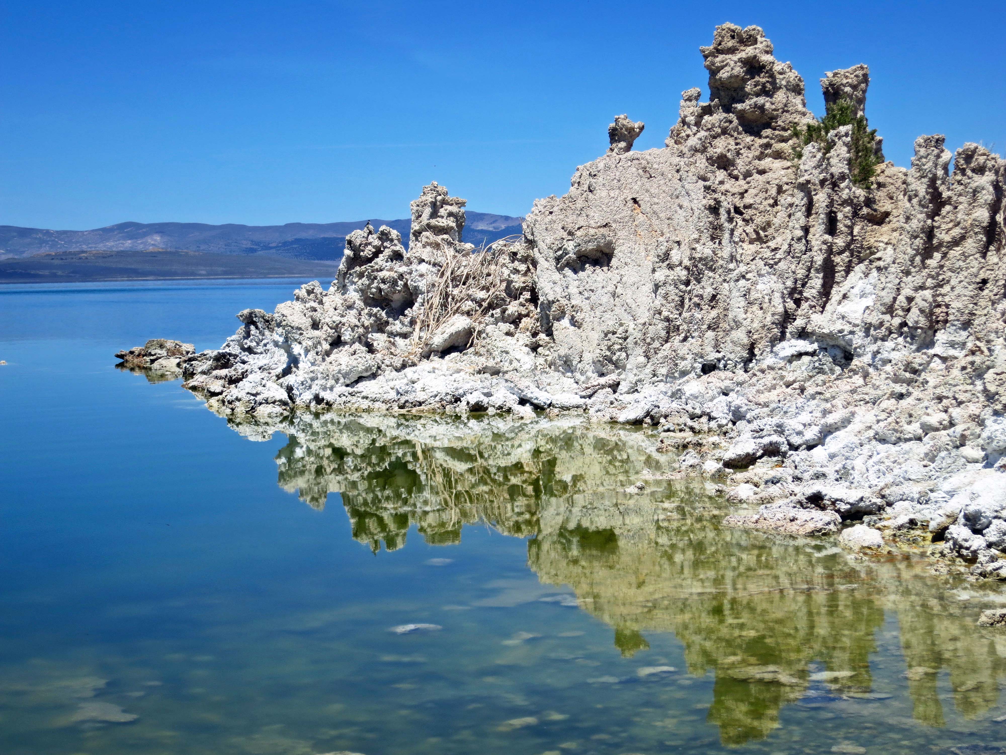
Reflections add extra character to this often photographed tufa island in Mono Lake— as they do in the next two photos. (Photo by Peggy Mekemson.)
I thought of this tufa tower as a frog face topped off by a frog hat. (Photo by Peggy Mekemson.)
A tufa family? (Photo by Peggy Mekemson.)
A final view of the Sierra Nevada Mountains framed by tufa towers at Mono Lake.
NEXT BLOG: Having finished our desert series, Peggy and I return to Oregon and visit Oregon Caves National Monument.