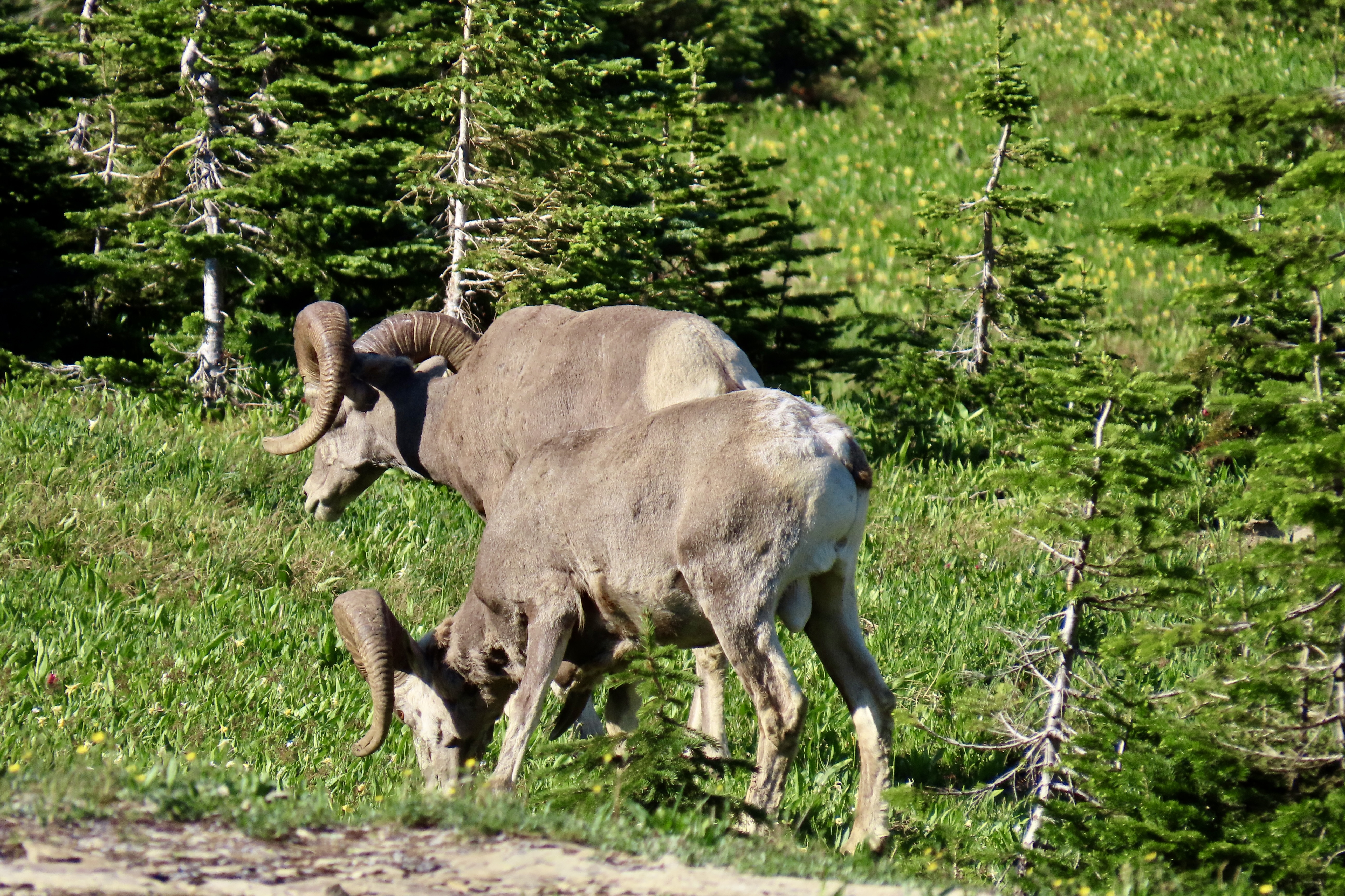
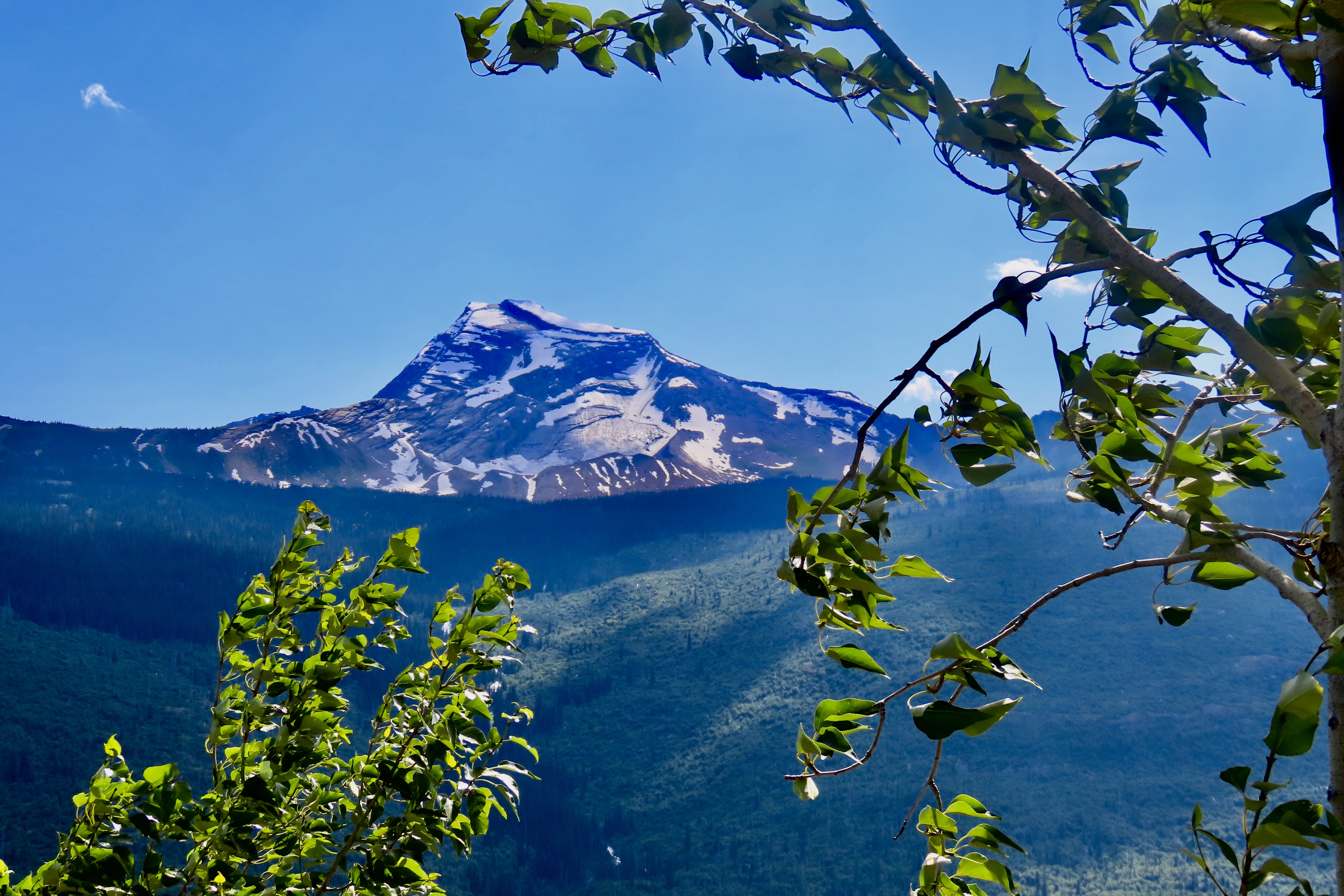
High Mountain meadows often come filled with flowers, streams, snow, distant views, and occasionally a surprise, like these two big horned sheep.
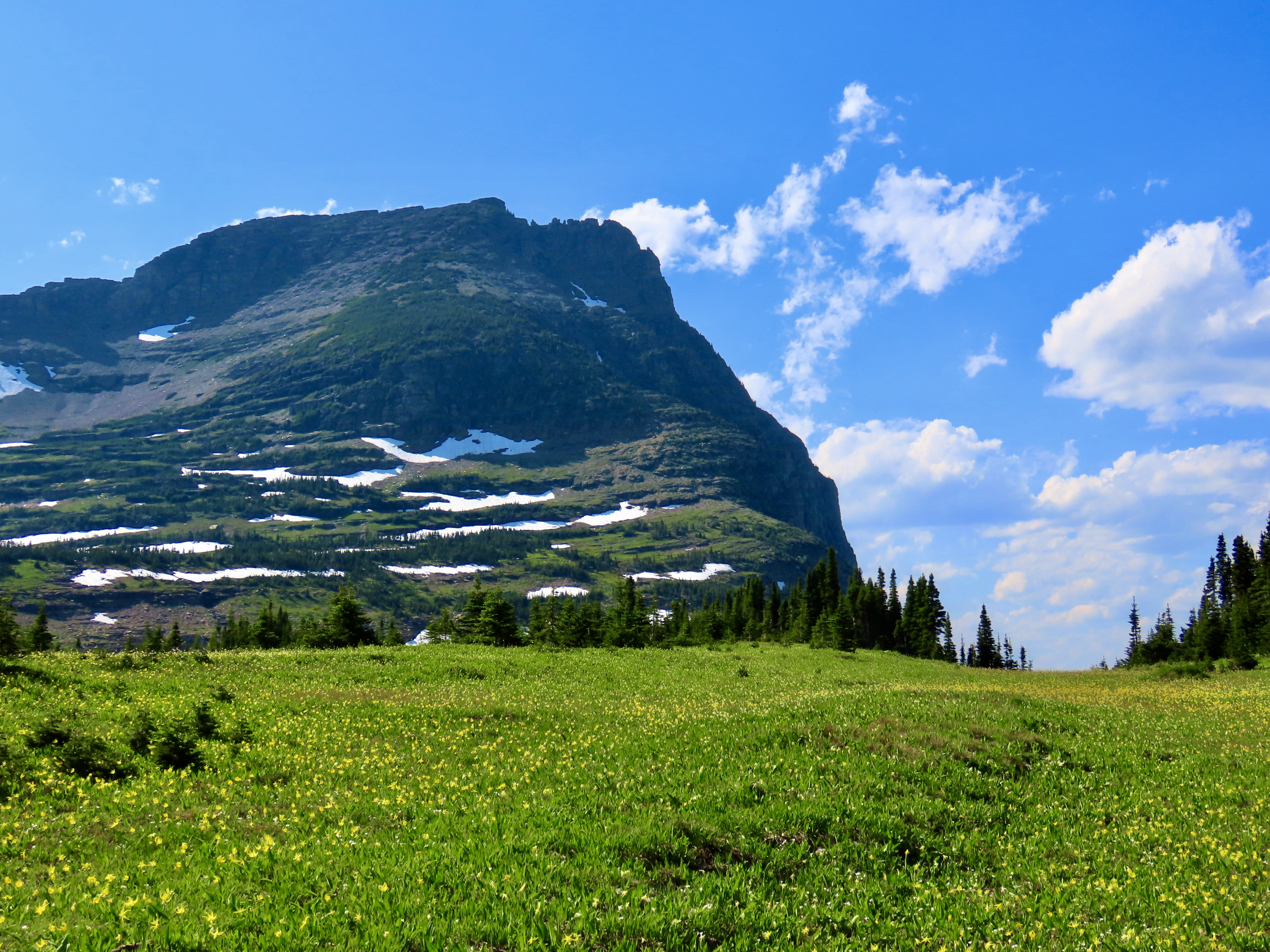
Logan Pass, at 6,646 feet (2,026 m), is the highest point on Glacier National Park’s Going to the Sun Road. It’s located on the Continental Divide. From the pass, water either flows eastward to the Atlantic or westward to the Pacific. On the park’s Triple Divide Peak, water has a third option: The Atlantic, Pacific, or Arctic Ocean! Imagine the adventure you could have following any one of these rivers to its destination.
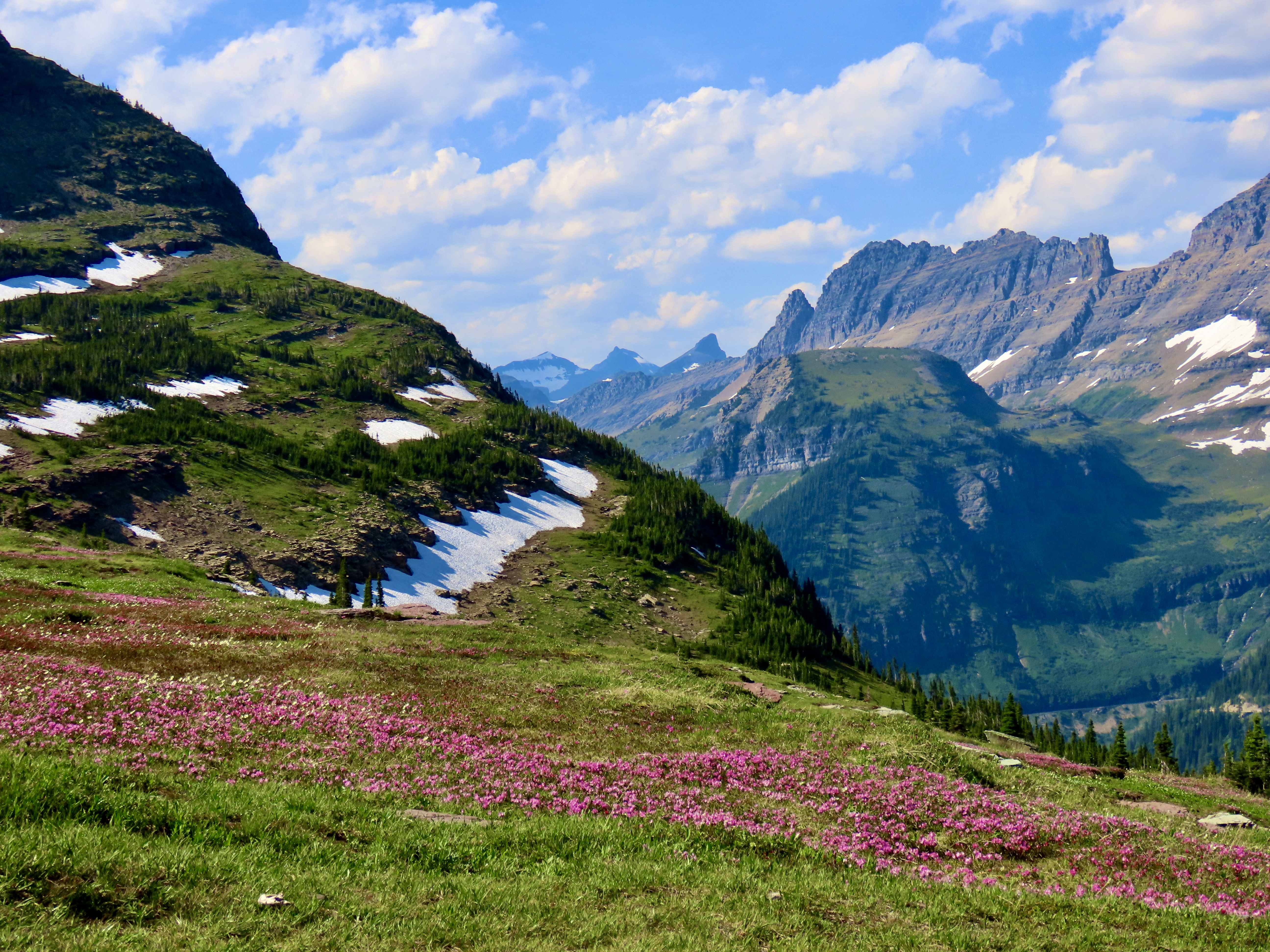
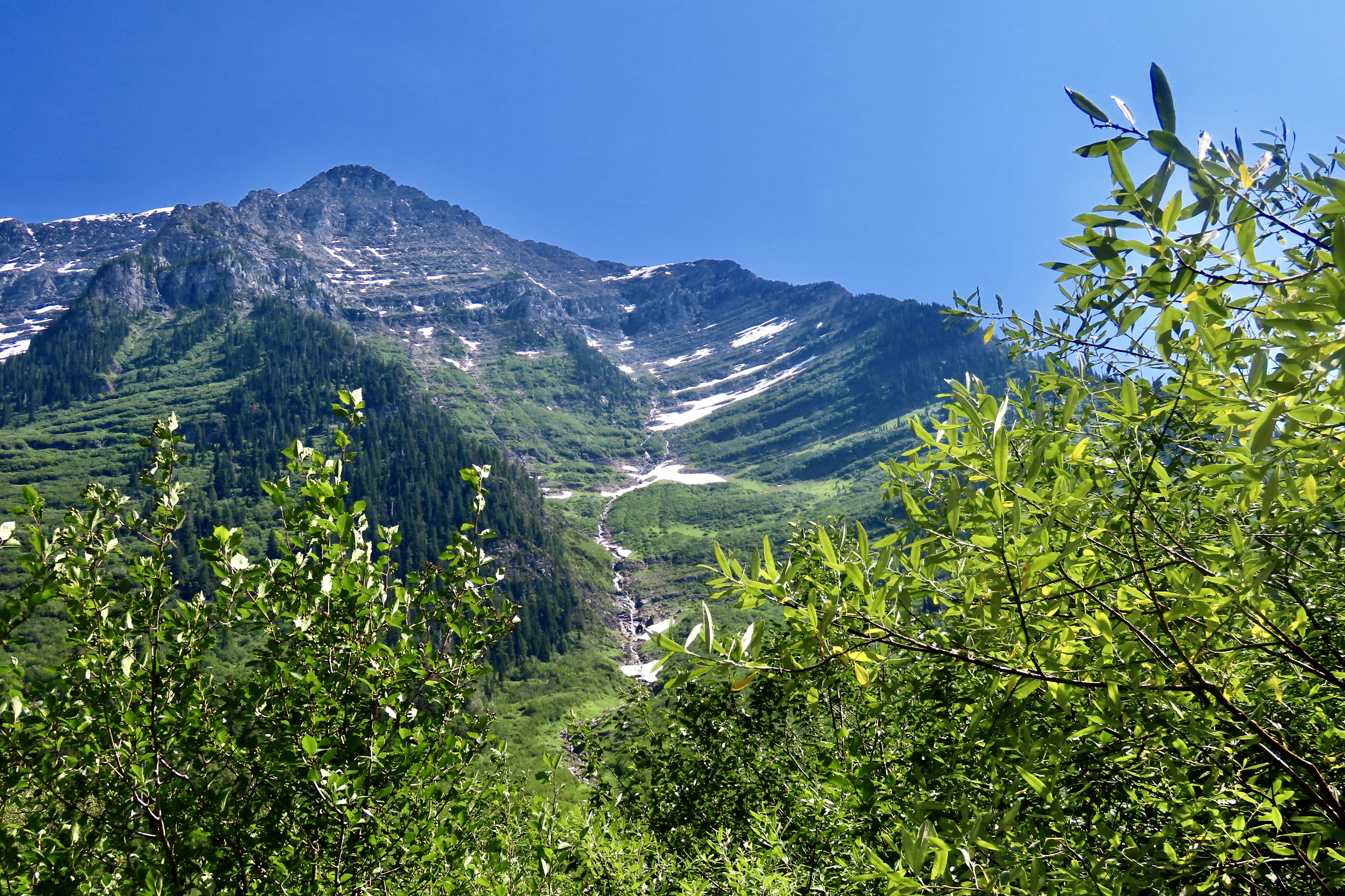
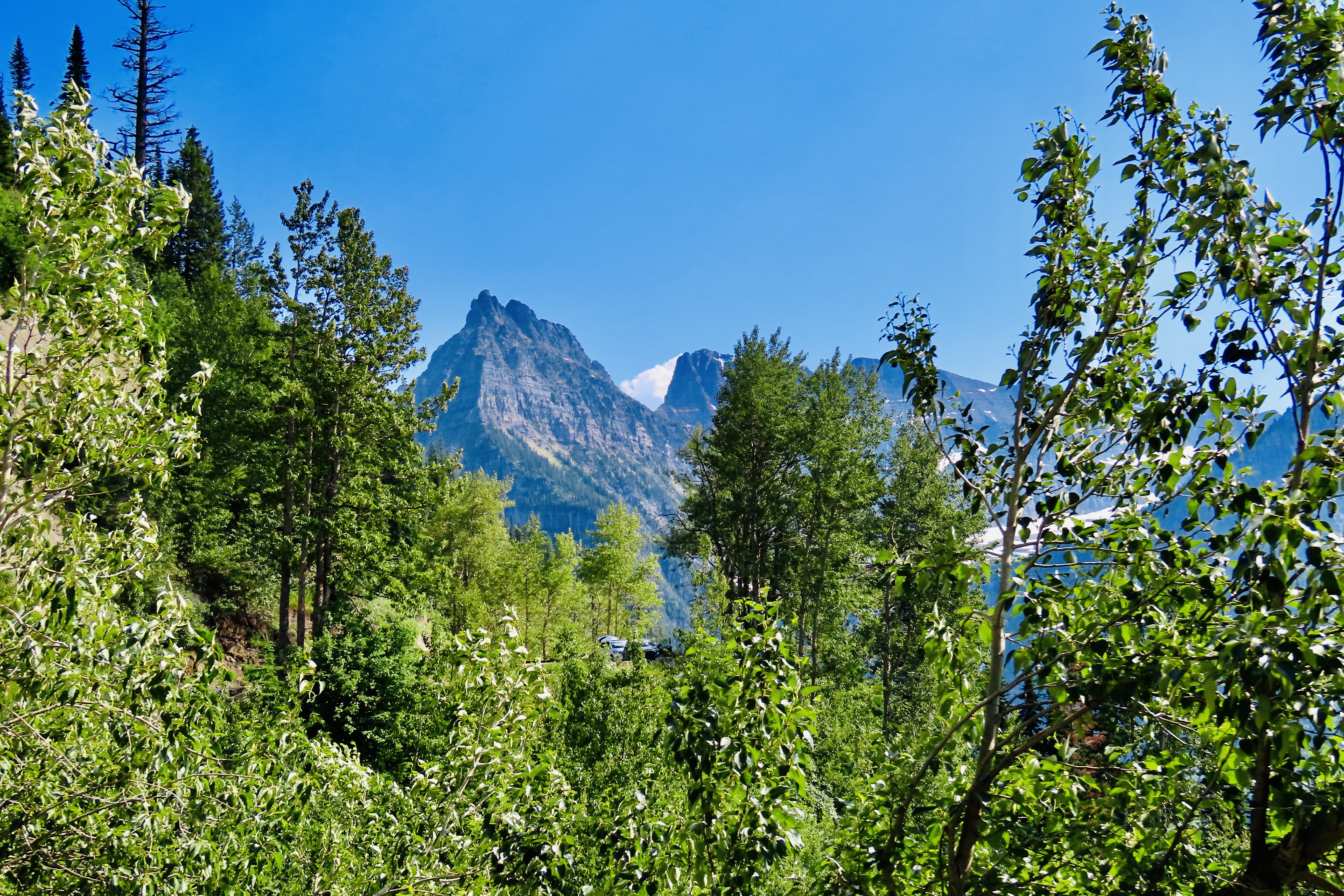
The real charm of Logan Pass for us is its meadow, however. The visitor’s center on the pass has a trail that leads out from the back of the center and makes its way to Hidden Lake for a three mile roundtrip, much of which is on a boardwalk. The views along the way of both the meadow and the surrounding mountains are spectacular. There is a chance you will see big horn sheep, Rocky Mountain goats, and even grizzly bears. The last time Peggy and I visited the park we were entertained by a grizzly… at a distance, thank you very much.
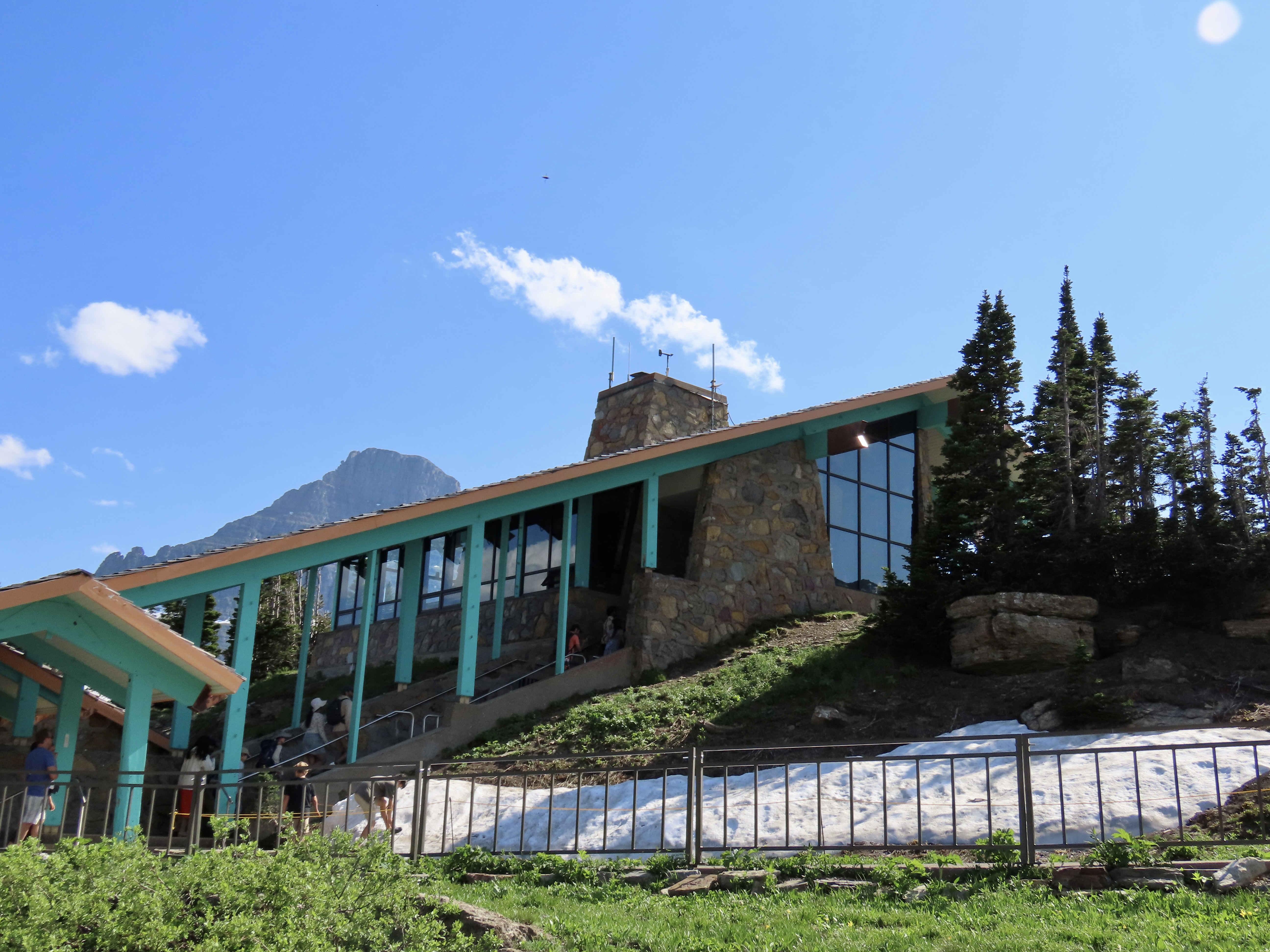
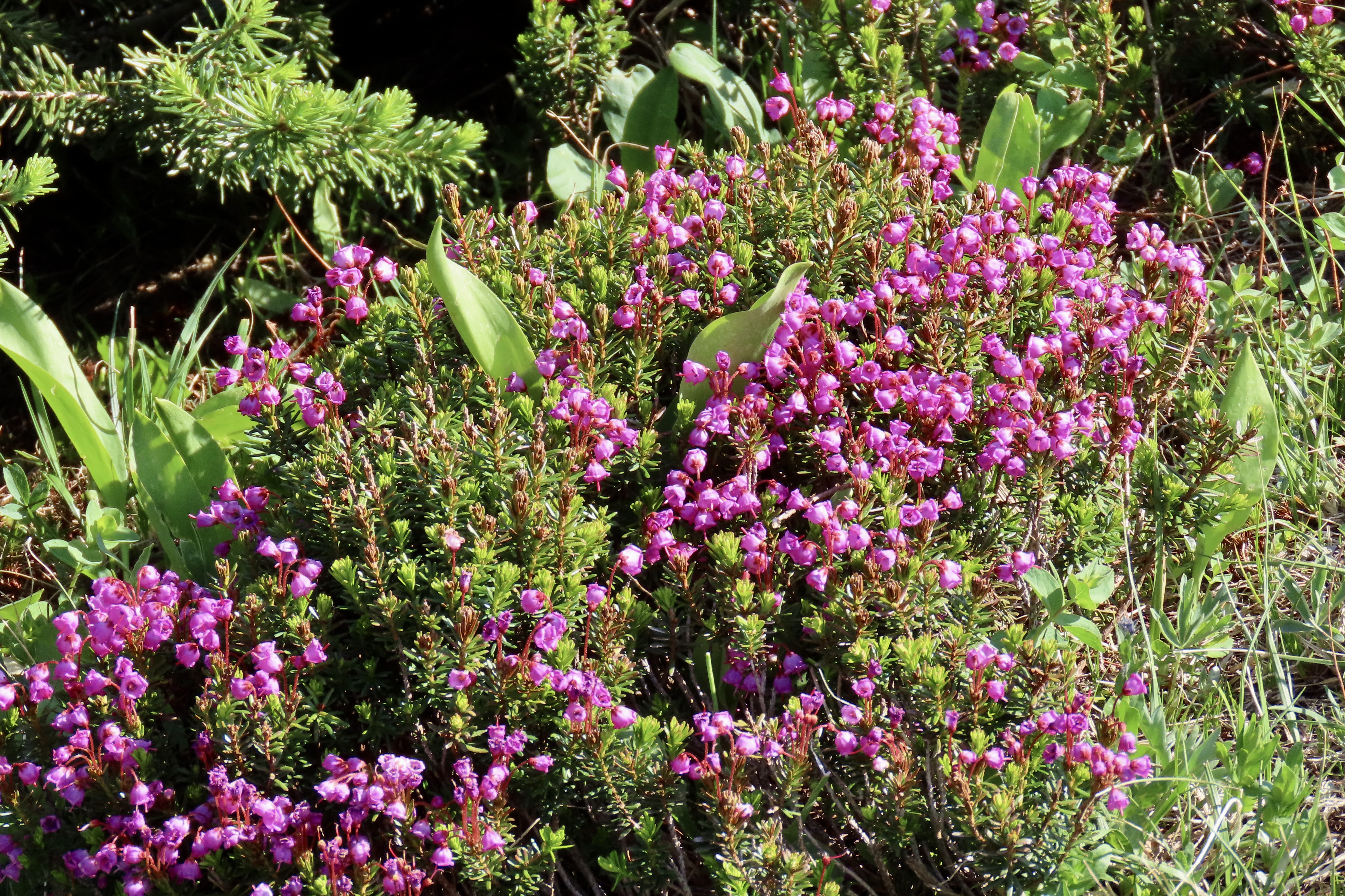
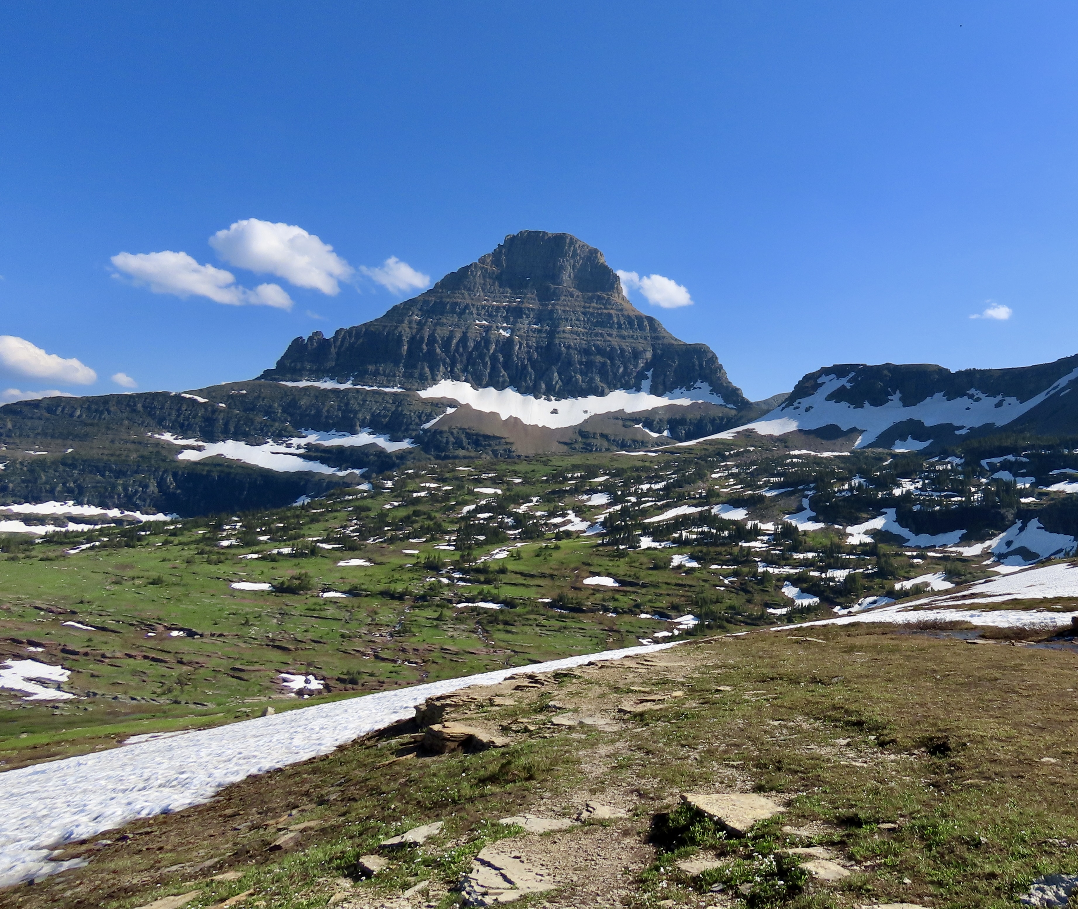
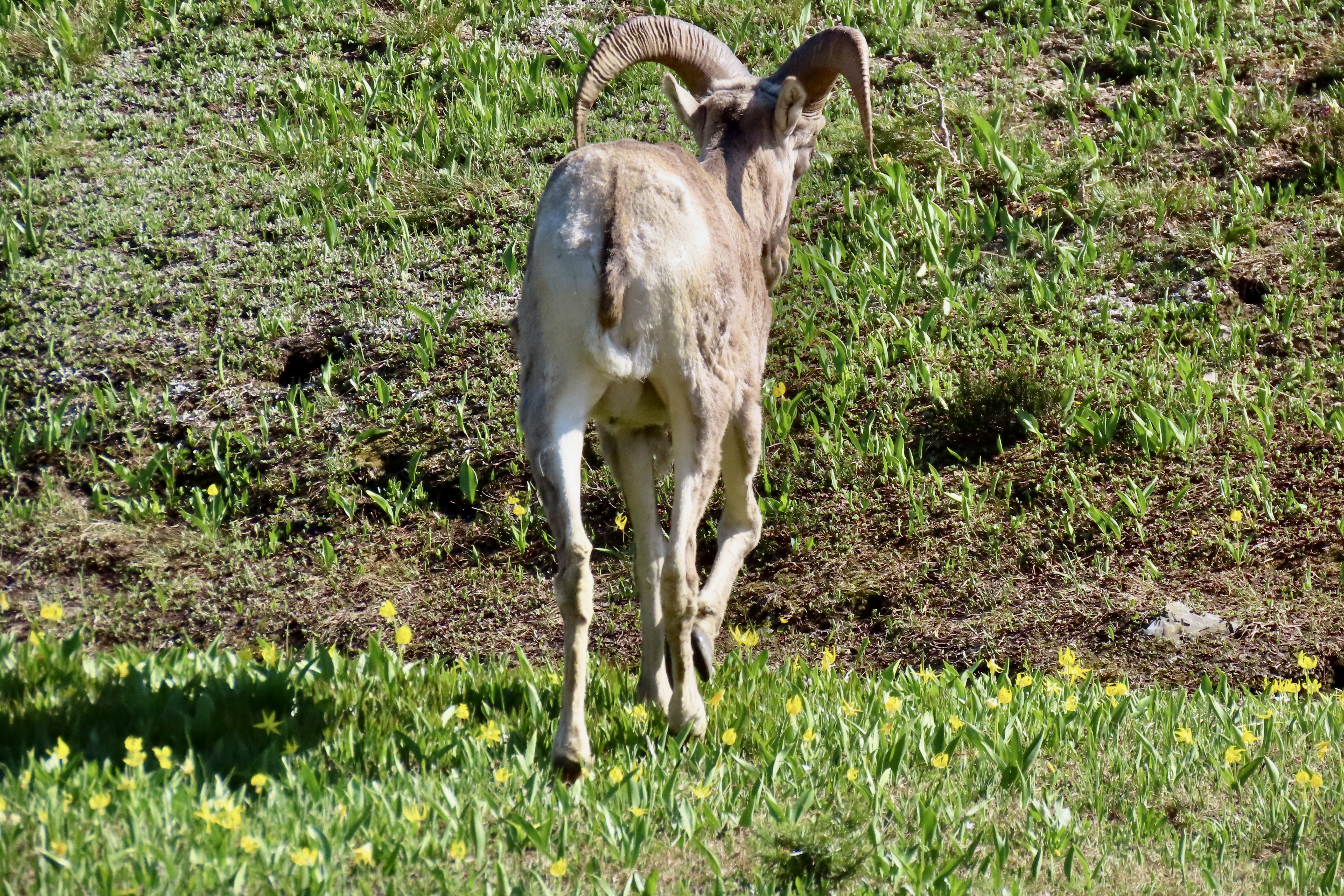
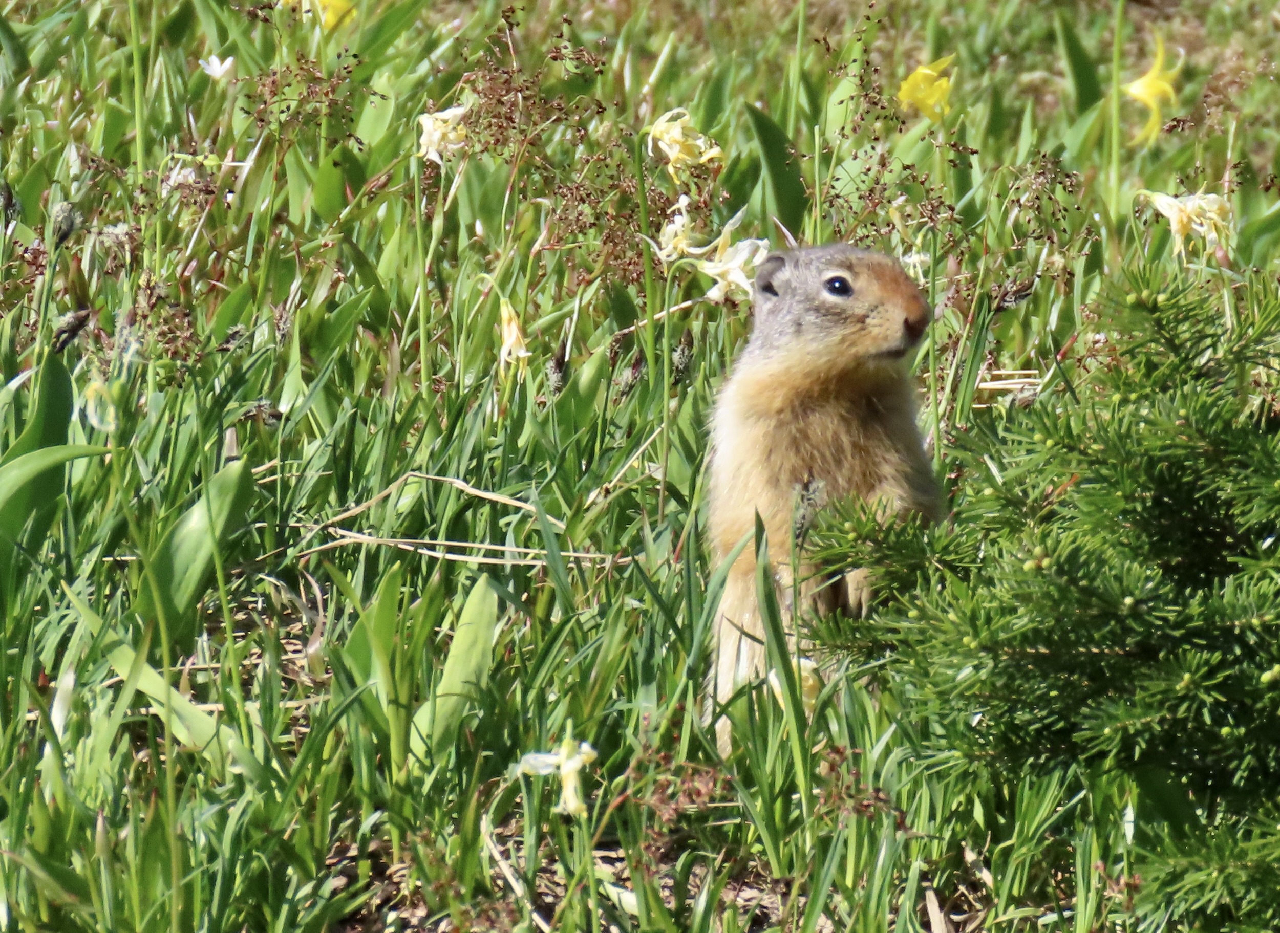
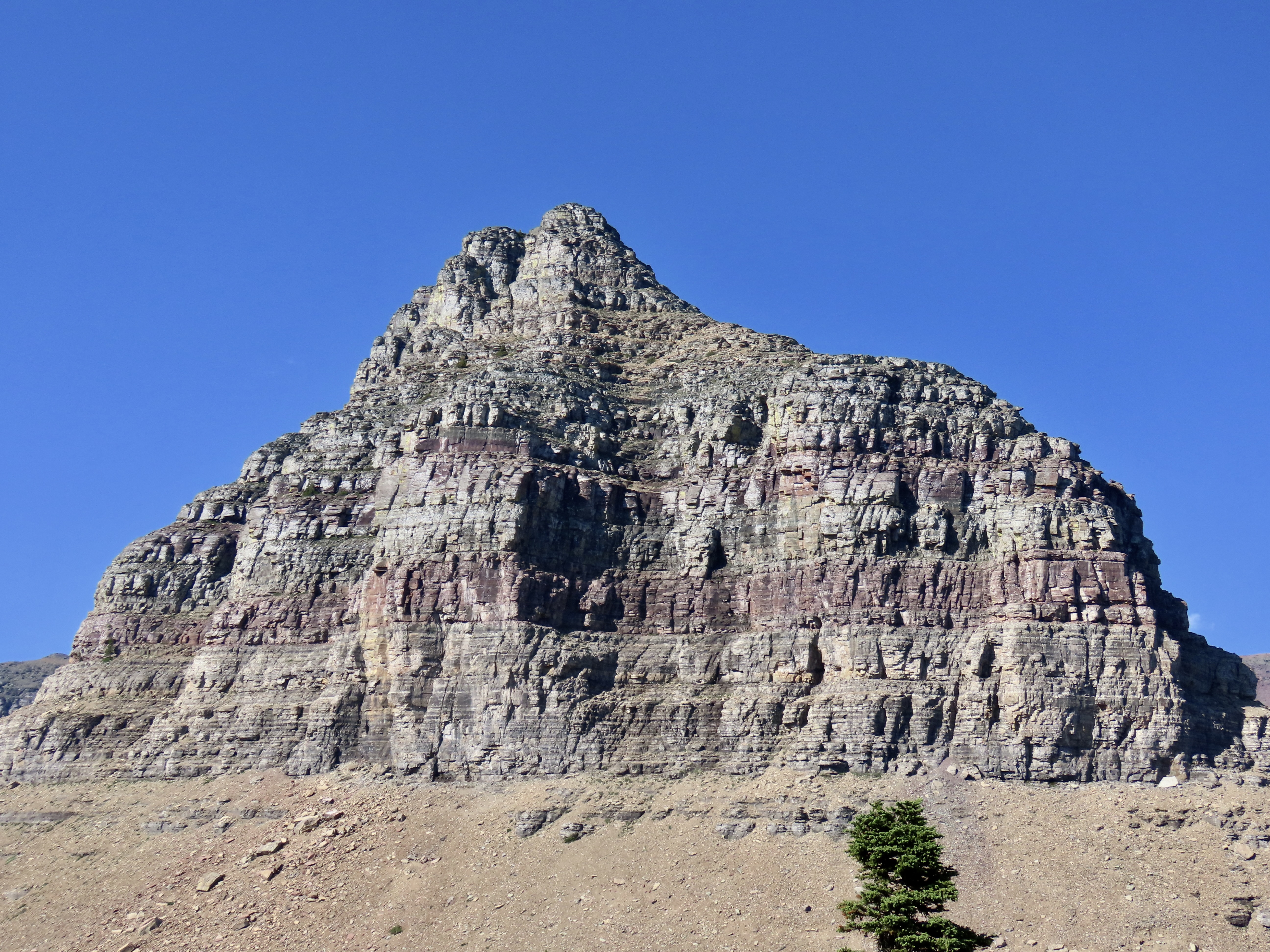
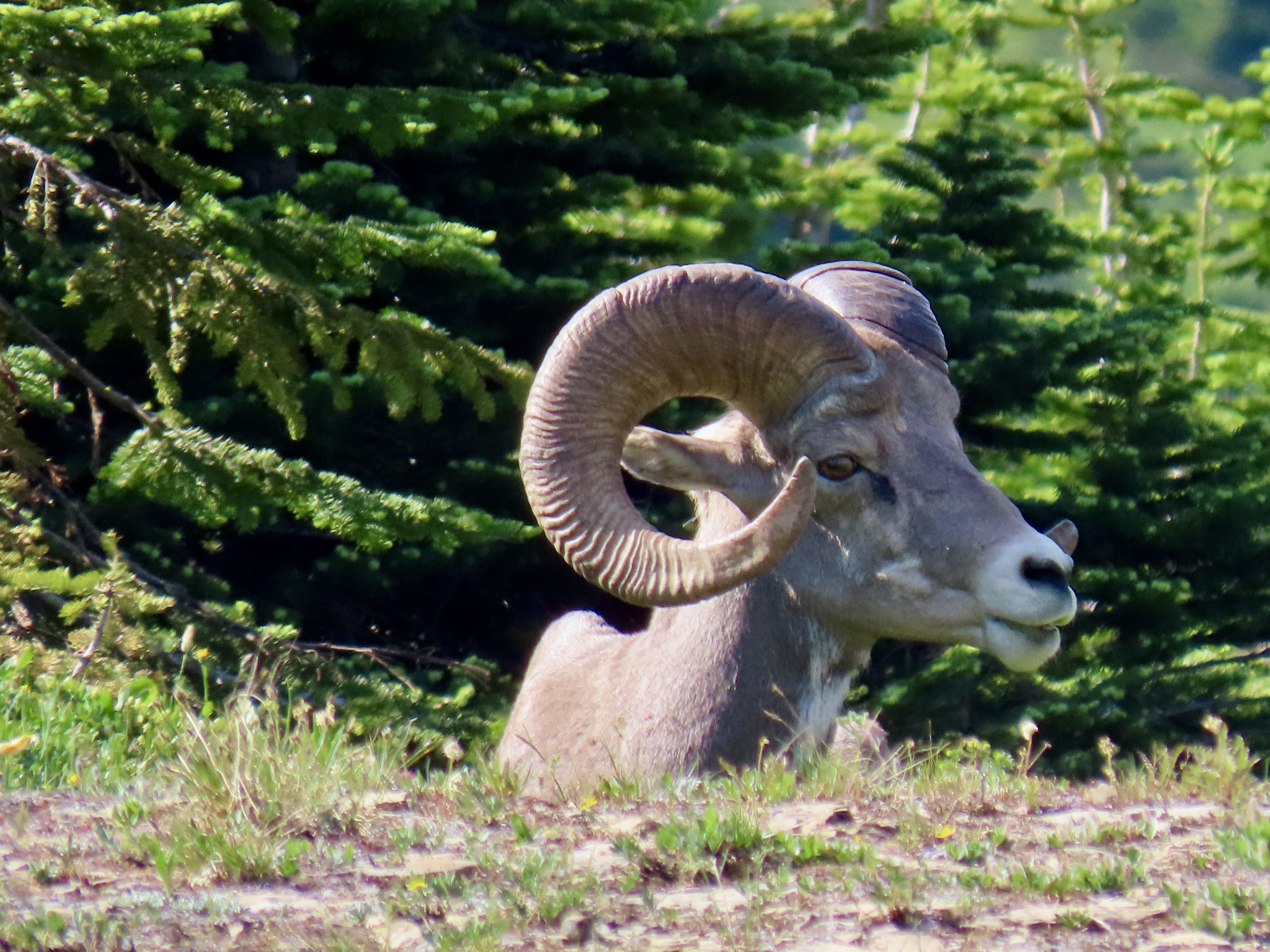
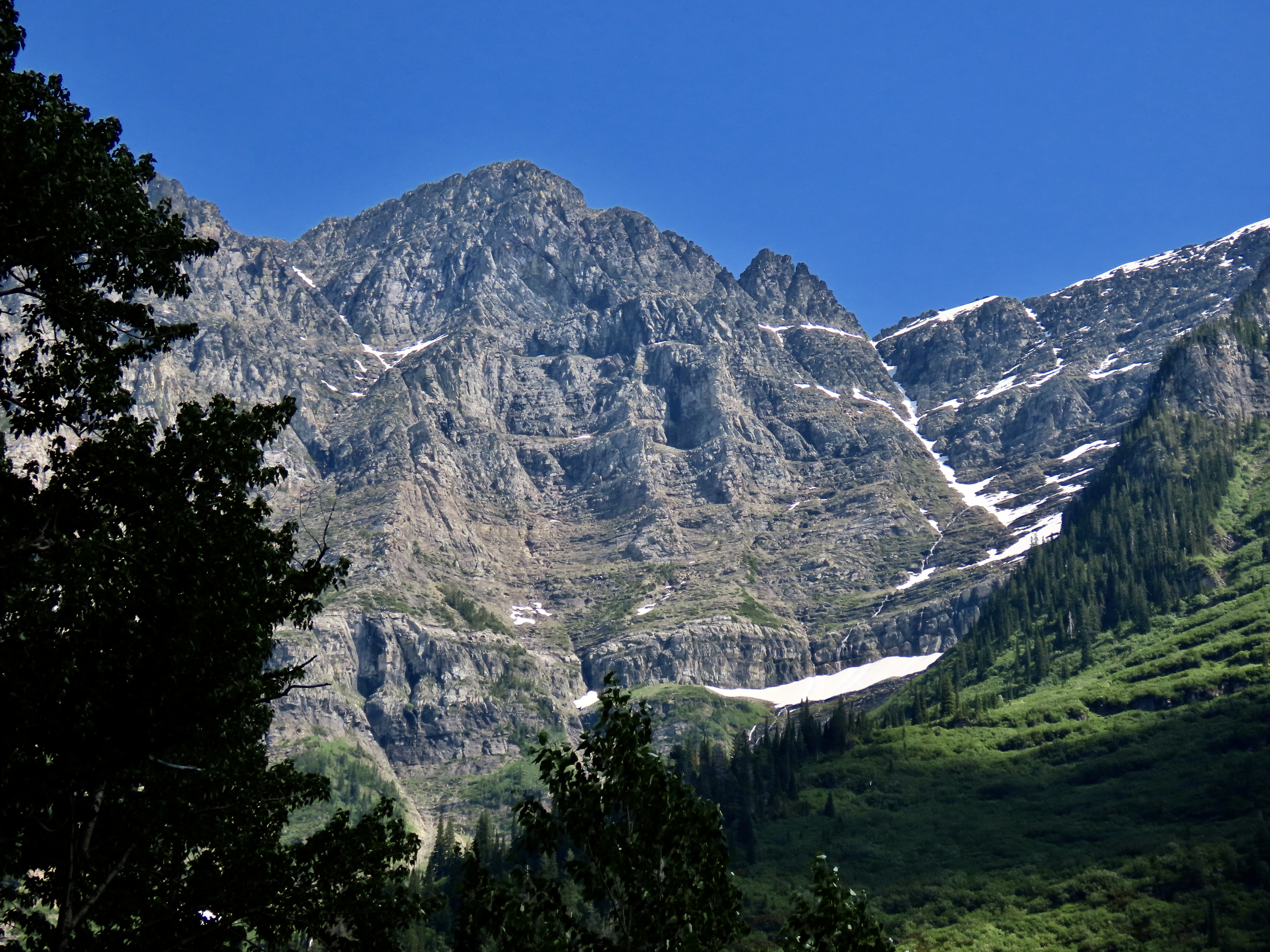
The Logan Pass Visitor Center is designed to fit into the landscape. Windows provide enticing views of the surrounding scenery. While we visited Glacier in Mid-July, the elevation of the park combined with its distance north meant it was more like late spring at the pass than mid summer. Thus the snow.The boardwalk leading out to Hidden Lake behind the Logan Pass Visitor’s Center. It’s a relatively gentle trail taken by a wide variety of people. Squishy snow along the way, this time, made the hike more difficult. It was the kind that encourages one to end up on his or her butt if not careful. At least it made for a soft landing plus served as natural air-conditioning on a warm day. Peggy decided to test the theory by sliding down one of the steeper embankments on her tail rather than walk down it. She laughed the whole way.Pink mountain heather adds a splash of color to a mountain view at Logan Pass.A close up of the mountains…A close up of the heather.Bear Hat Mountain overlooks Hidden Lake.We were hiking along the boardwalk when a young big horn sheep decided to join us, or at least cross our path. He was still shedding his winter coat.And go on his way. The yellow flowers, BTW, are glacial lilies. A ground squirrel decided to check us out.We continued to admire the mountains that surrounded us.The melting snow guaranteed that there were small streams with different personalities everywhere.While we missed seeing a grizzly or Rocky Mountain goats on the pass, big horn sheep made up for it.This pair of big males kept their distance.Fortunately, our telephotos allowed us a closer look.Since we had a late start, we didn’t hike all the way up to Hidden lake, which we had visited before. We stopped on our way back down to take another photo of the big horn sheep. They were moving on as well. A surprise awaited us at the parking lot…Bigfoot! Darn, that guy gets around. I think he squished our truck.On another day, Peggy and I did make it over to the eastern side of Glacier National Park where we kayaked on Upper Two Medicine Lake. It was a windy day. Peggy caught a photo of me admiring Sinopah Mountain.
That’s it for glacier. Our trips up the Rhine and Nile Rivers interfered with posts on our visits to the North Rim of the Grand Canyon, Mesa Verde NP, Big Bend NP, and Theodore Roosevelt NP, so we are adding them to this National Park series starting with the North Rim of the Grand Canyon next week.
Glacier National Park’s Going to the Sun Road is packed with views like this. Each corner brings a new sight. Whether it is rugged mountains, water cascading down rocks, or high mountain meadows, the road is guaranteed to create a sense of awe.
Peggy and I know a bit about scenic roads. Over past 25 years we have traveled over a quarter of a million miles exploring many of the most beautiful highways America and Canada have to offer. Some, several times. One thing that we have learned is that determining most scenic is incredibly hard. How does one compare driving through the desolate beauty of Death Valley with the rugged wilderness of the Yukon? We both agree, however, that the Going to the Sun Highway in Glacier National Park would be near the top of any list we might compose.
Note: All of the photos in this post were taken by either Peggy or me unless otherwise stated.
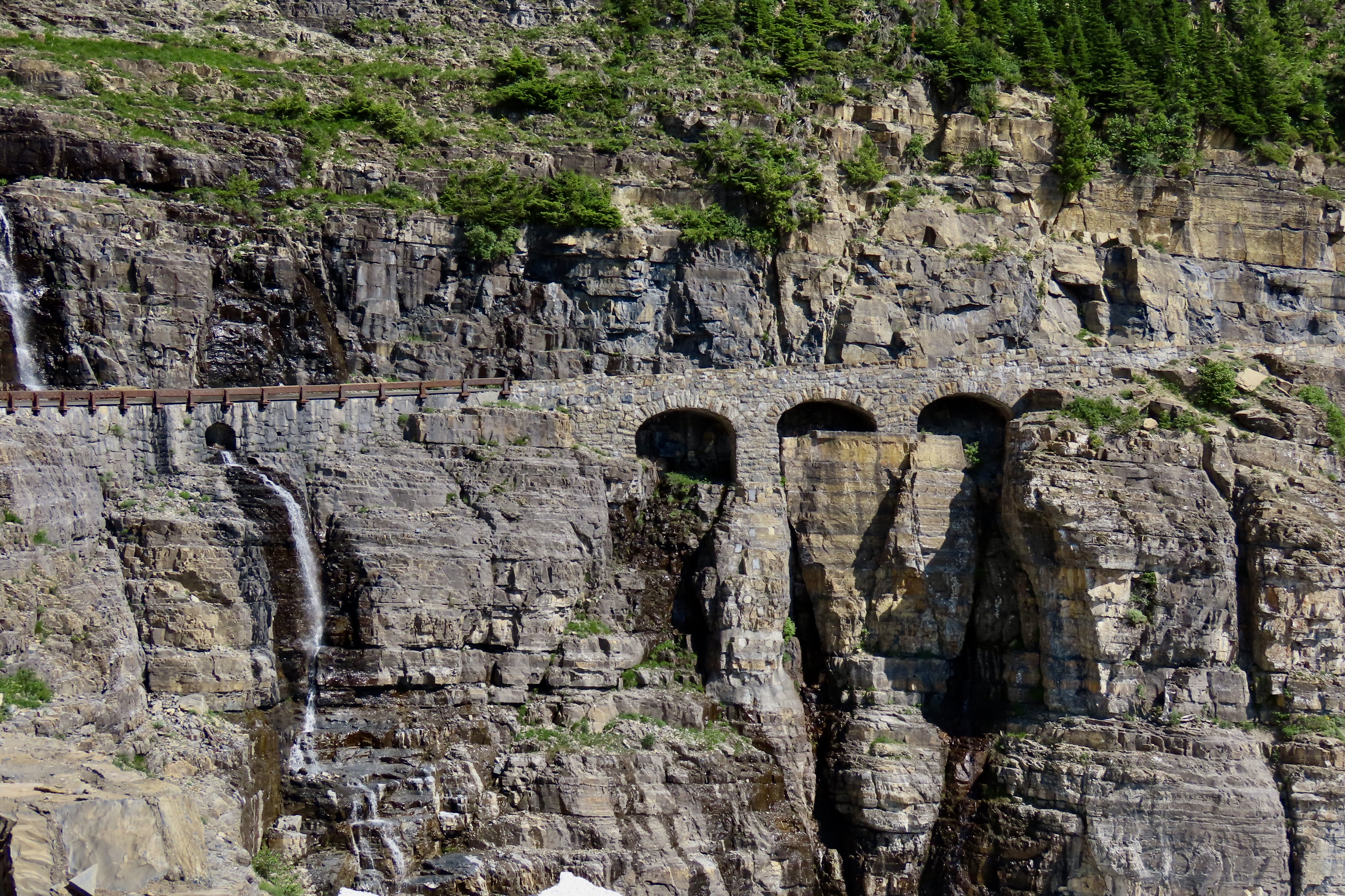
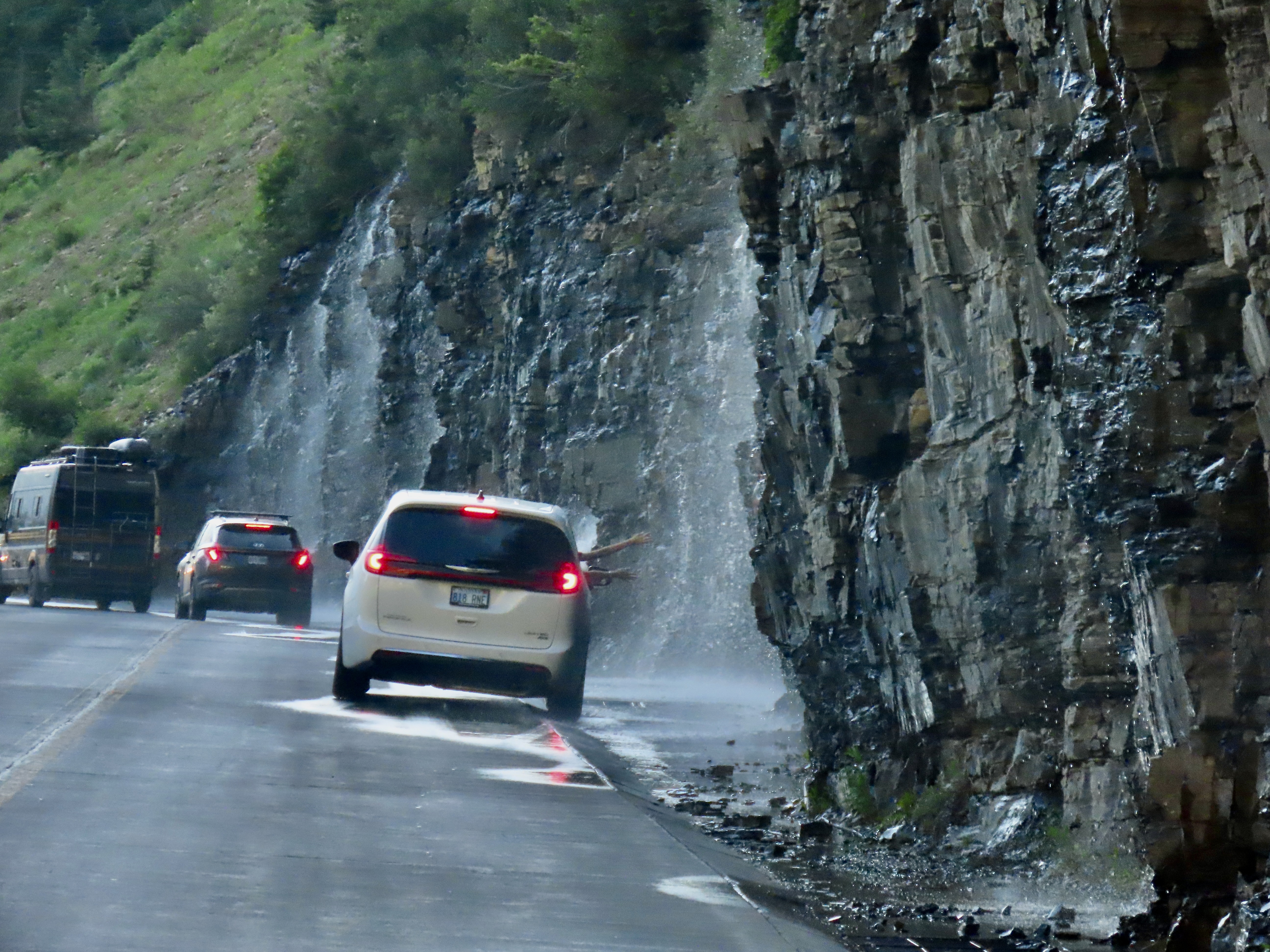
What’s not to love about water cascading over rocks…Or high mountain meadows.The narrow Going to the Sun Highway is a marvel in and of itself, working its way around steep curves and along cliffs with sheer drops, as shown in the photo above. Three Arches is on the right and Haystack Falls is on the left. Driving over it is not for the faint hearted! Neither is it for RVs.
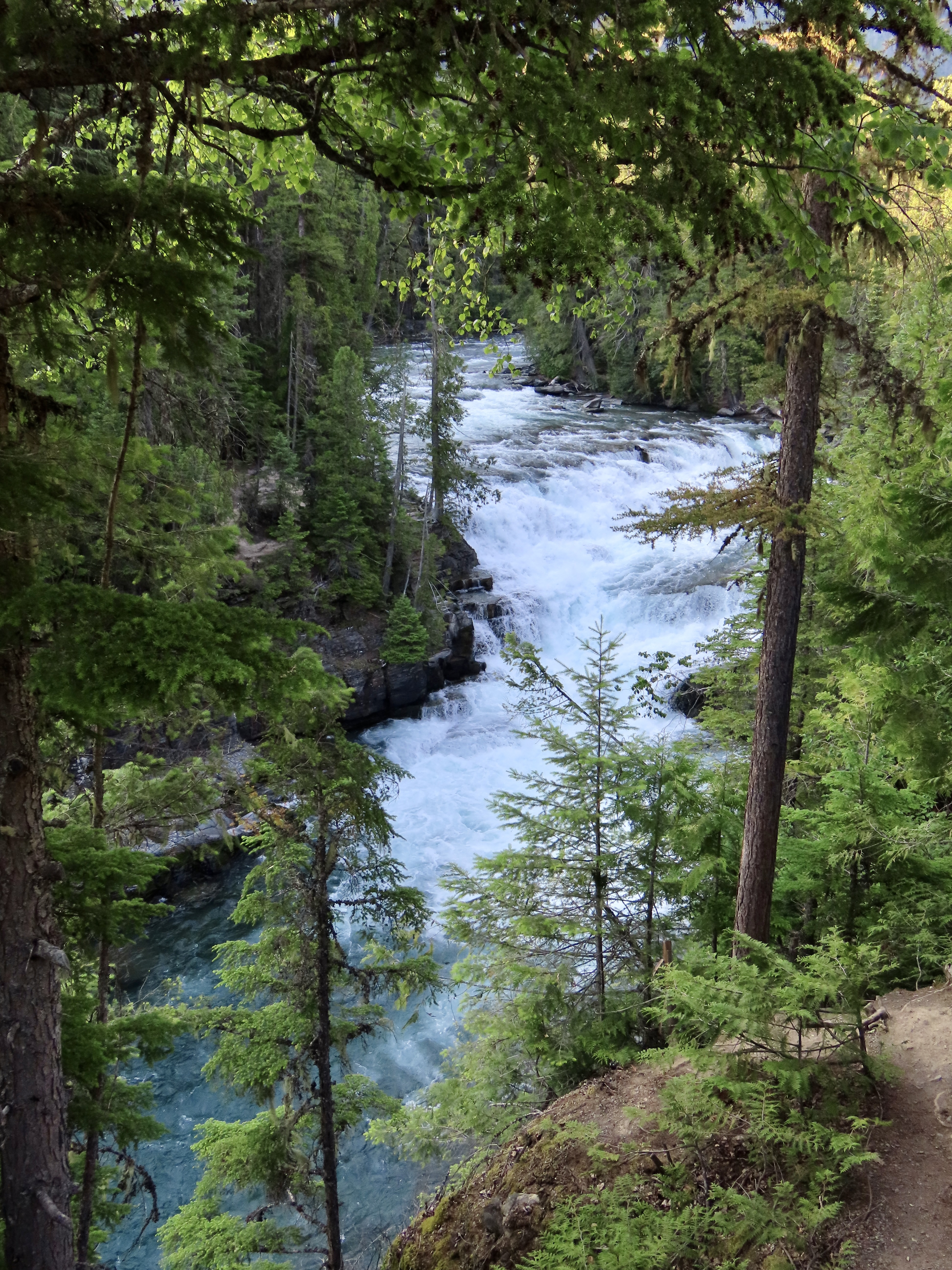
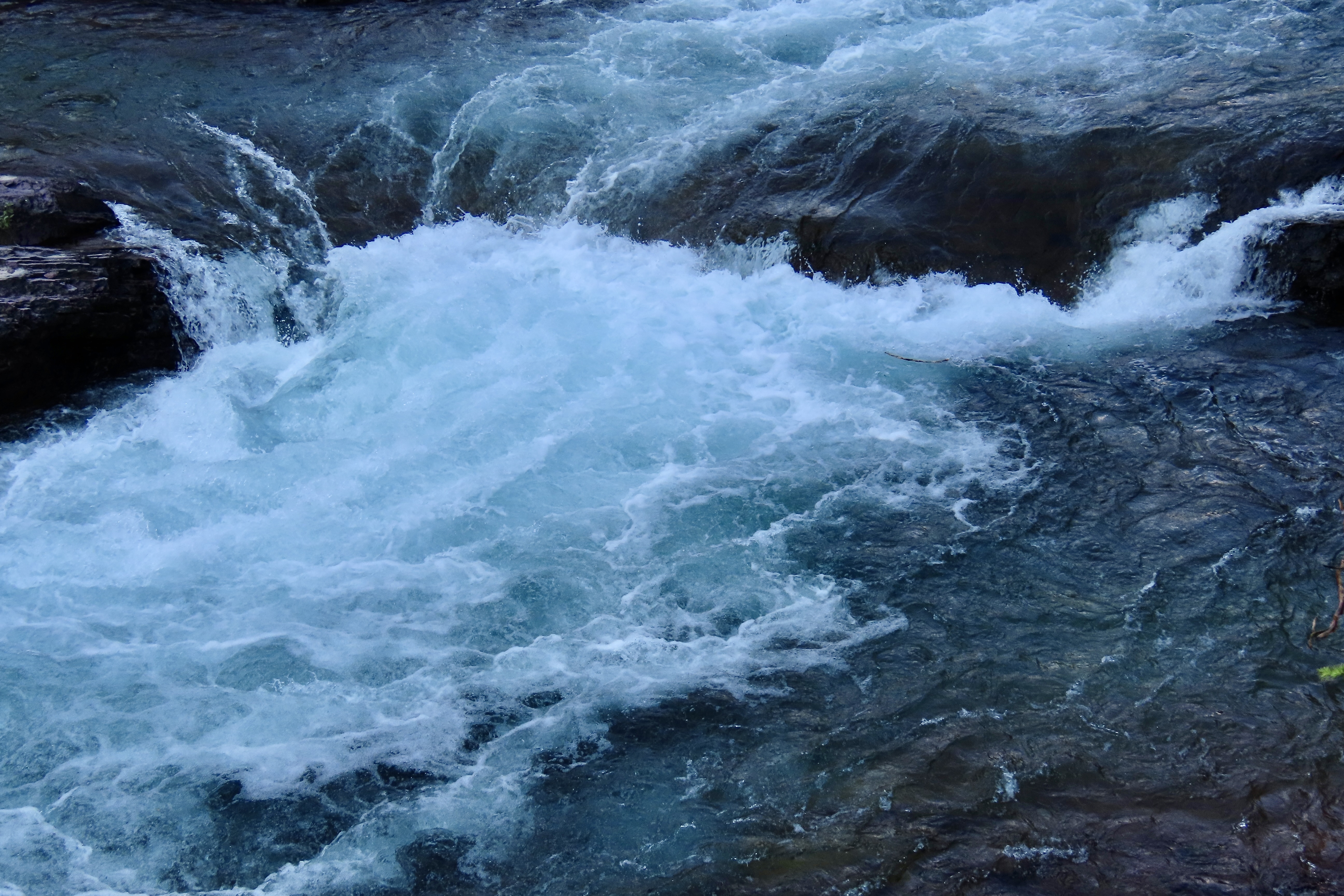
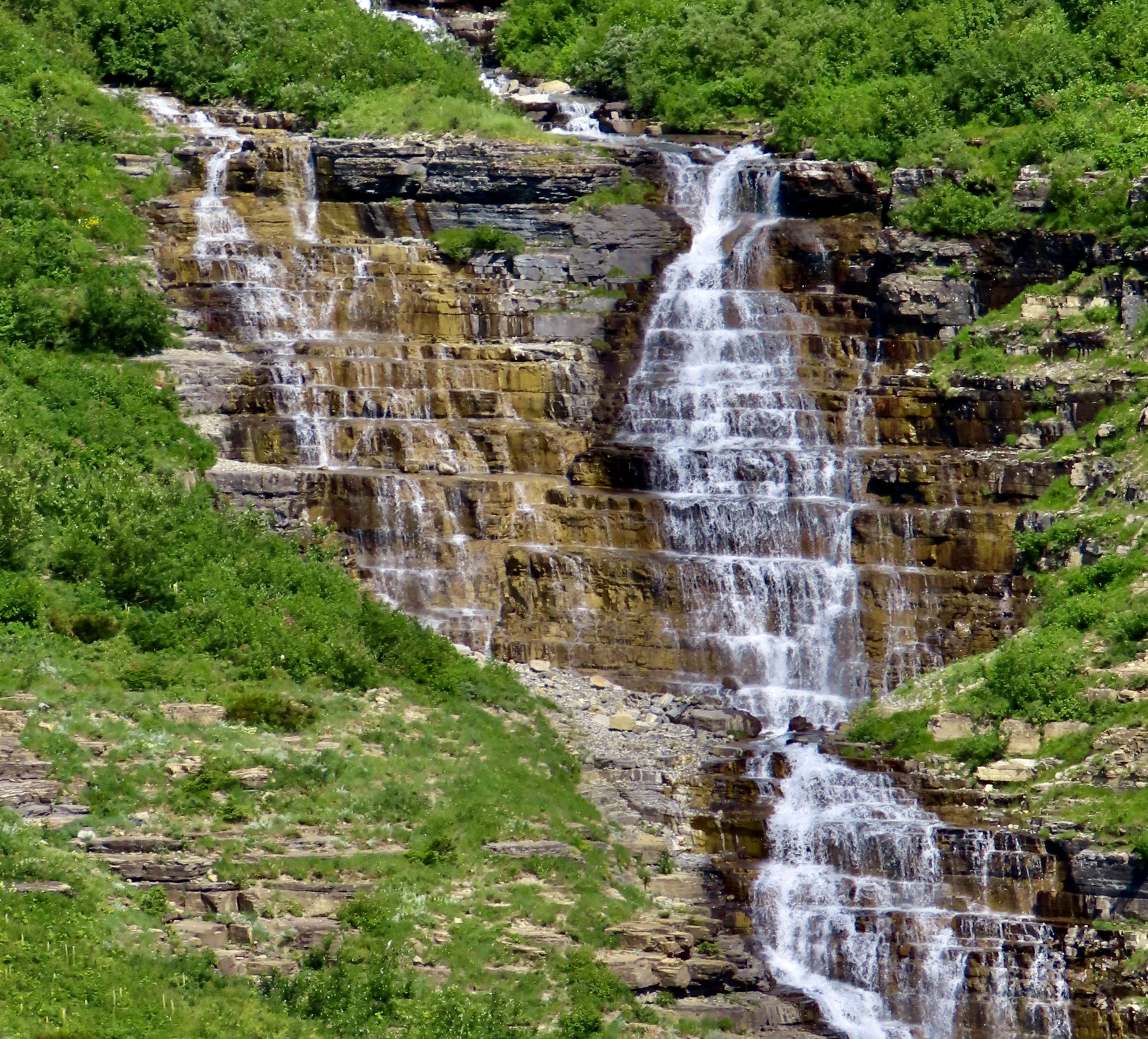
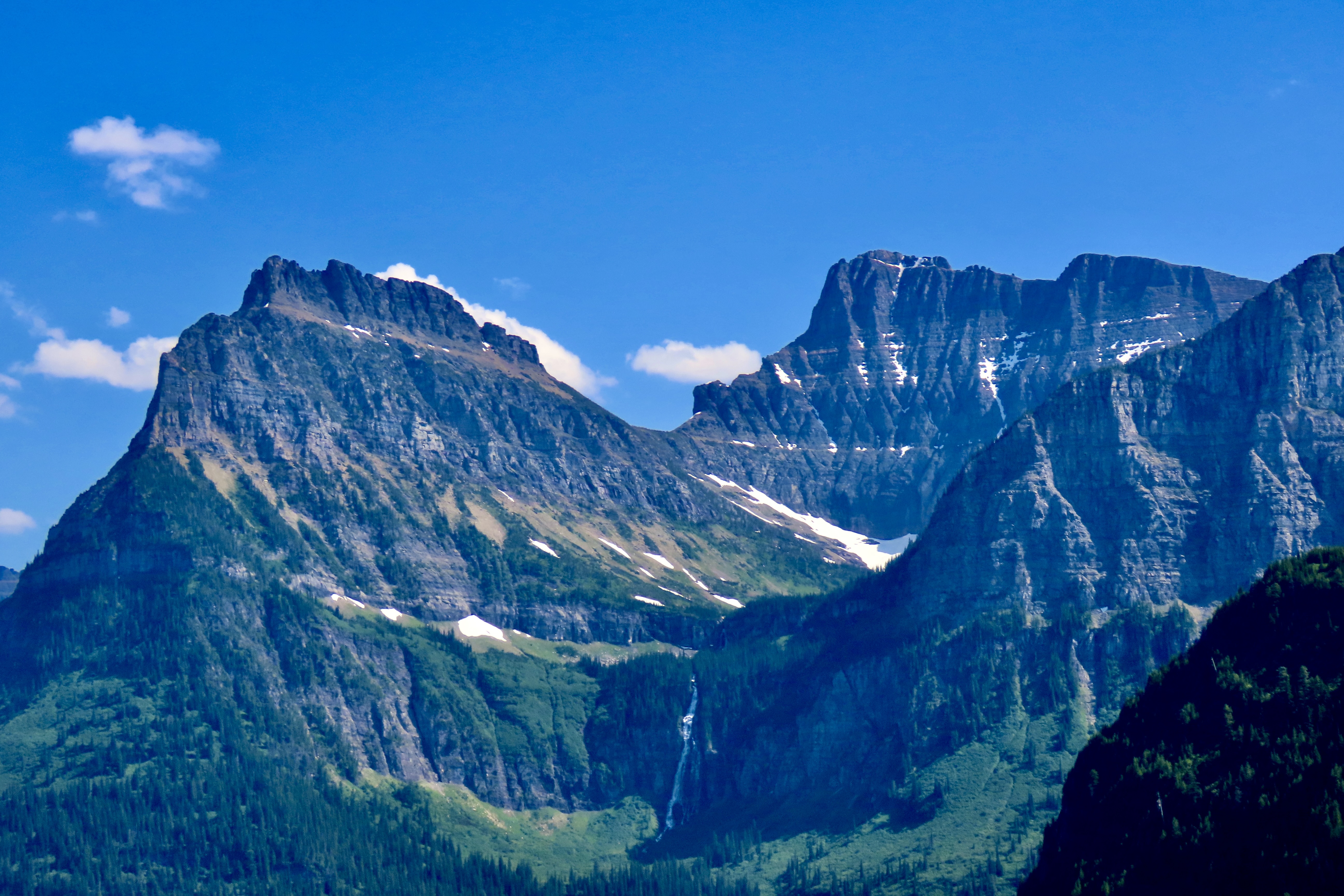
By designing the road to have minimum impact on the surrounding environment, using local materials, and building it to feature some of the park’s most scenic views, the highway became a model for building roads in future national parks.First funded in 1921 by Congress, highway construction took place throughout the 20s. Franklin Roosevelt’s New Deal Program took over in the 30s finishing the road. Here, Civil Conservation Corps members carry a telephone cable over Logan Pass in 1938. Both Peggy’s father and mine worked for the CCC during the 30s, giving them employment options they may not have had otherwise in the Great Depression. (This photo is from the National Archives.)We began our journey up the Going to the Sun Road on the western side of Glacier NP. We were camped about five miles away. The total length of the road is 48 miles. We drove up to Logan Pass, 30 miles from the entrance, and back. Entering from the west requires a permit between 6:00 AM and 3:00 PM in the summer to control numbers. It’s best to get your permits before heading to the park. They are offered 120 days in advance. Day of permits can be purchased the day before starting at 7 PM, but they go fast, often within minutes. Not having a permit, we opted for the after 3 PM entrance.The Going to the Sun Road makes a leisurely trip along the edge of Lake McDonald and McDonald Creek before beginning its climb up toward Logan Pass.We took this and the following photos along the lake and river.In our eagerness to get up the mountain we missed taking photos of McDonald Lake and Creek on our way up, but we did capture some rapids and McDonald Creek Falls on our way back to camp. It was close to sunset.Our first stop going up the road was to admire this mountain.As one might expect, glaciers are a key feature of a National Park named Glacier. Unfortunately, they are melting. Global warming has reduced their numbers from around 86 in 1850 to 26 today. The Loop, a major hairpin turn, and the narrow West Tunnel added more excitement to the already exciting drive up the western portion of Going to the Sun Highway.The Weeping Wall is one the Going to the Sun Road’s most well know features.People drive next to the Weeping Wall on their way down and stick out their hands. Peggy and I thought of driving next to it to give Iorek the pickup a well-needed bath. (But didn’t.)Pull offs above and below the Weeping Wall provided a number of scenic views including Haystack Falls.Haystack Falls above the road.And below the road.A smaller but colorful falls was a short walk away.The 490 feet tall Bird Woman Falls could be seen far across the canyon nestled in among the mountains.The mountains seen from the upper end of the Going to the Sun Road are magnificent.And finally the road (seen on the left) makes its way up to just before Logan Pass, which will be the subject of our next post.And, a final photo. We have been in St. Marys, Ohio the past few days wrapping up our trip by celebrating the 100th Birthday of Peggy’s namesake, Aunt Peggy. She is an incredible lady in the true sense of the word with a smile and a personality that light up a room. She’s shown here with water-color flowers she has painted. We attended the ceremony with Peggy’s brother John, his wife Frances plus 14 other relatives and at least 40 residents of Aunt Peggy’s Senior Living Center. The beautiful event was organized by Aunt Peggy’s daughter, Alice.