The Breath-Taking Beauty of Death Valley NP… And the Need to Preserve It

The iconic Mesquite Flat Sand Dunes of Death Valley provide a unique hiking opportunity for the adventuresome as well as a world class photo op. They also provide a great backdrop for movies. C-3PO and R2-D2 were lost here on ‘Tatooine’ in Star Wars Episode IV.

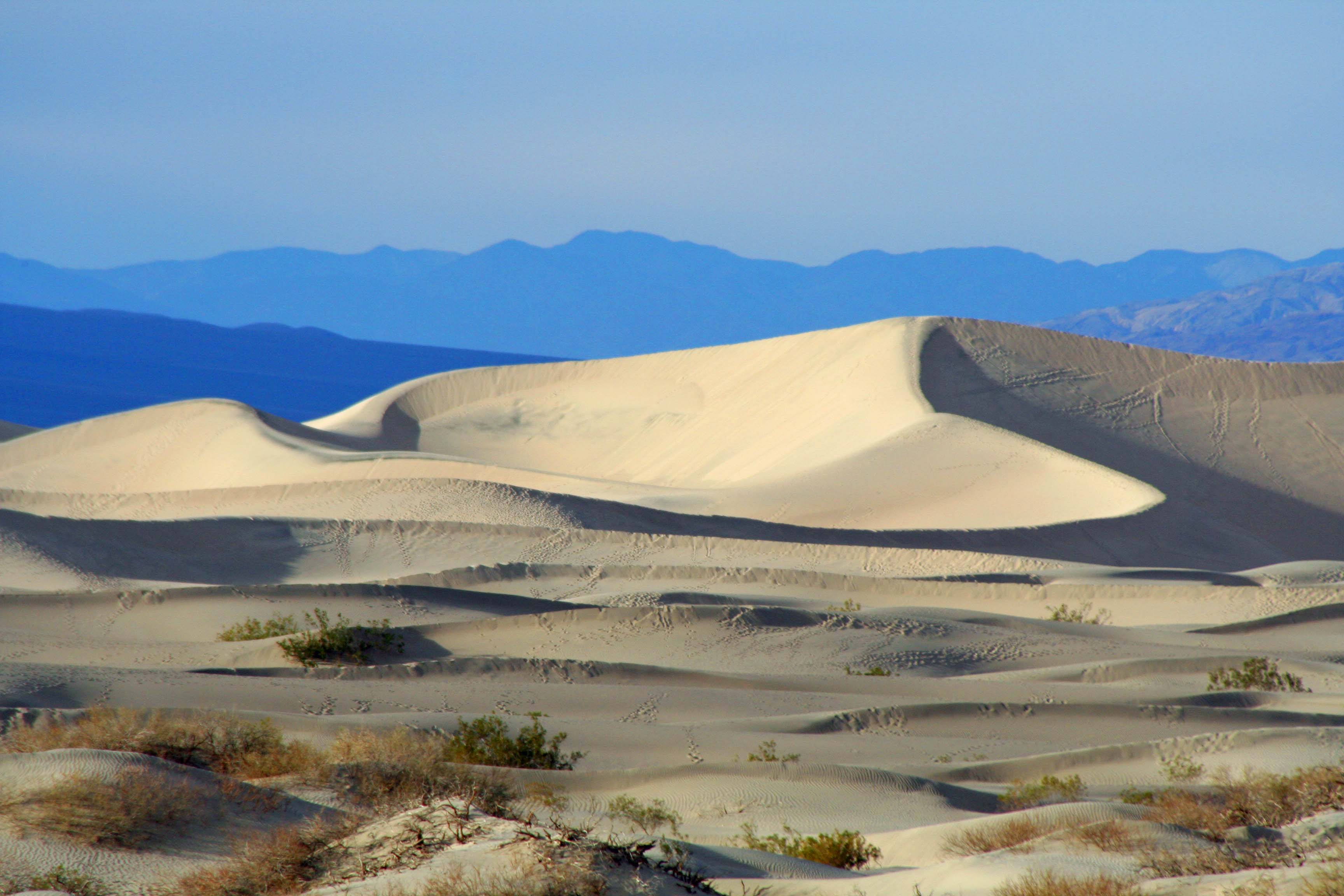
Death Valley is known as a land of extremes. At its lowest point, it drops to 282 feet below sea level. Summer temperatures can soar up to 120° F and have been recorded as high as 134° F. Rainfall averages are around 2 inches per year but can drop to zero. It’s hard to get more extreme. You don’t want to visit in the summer.

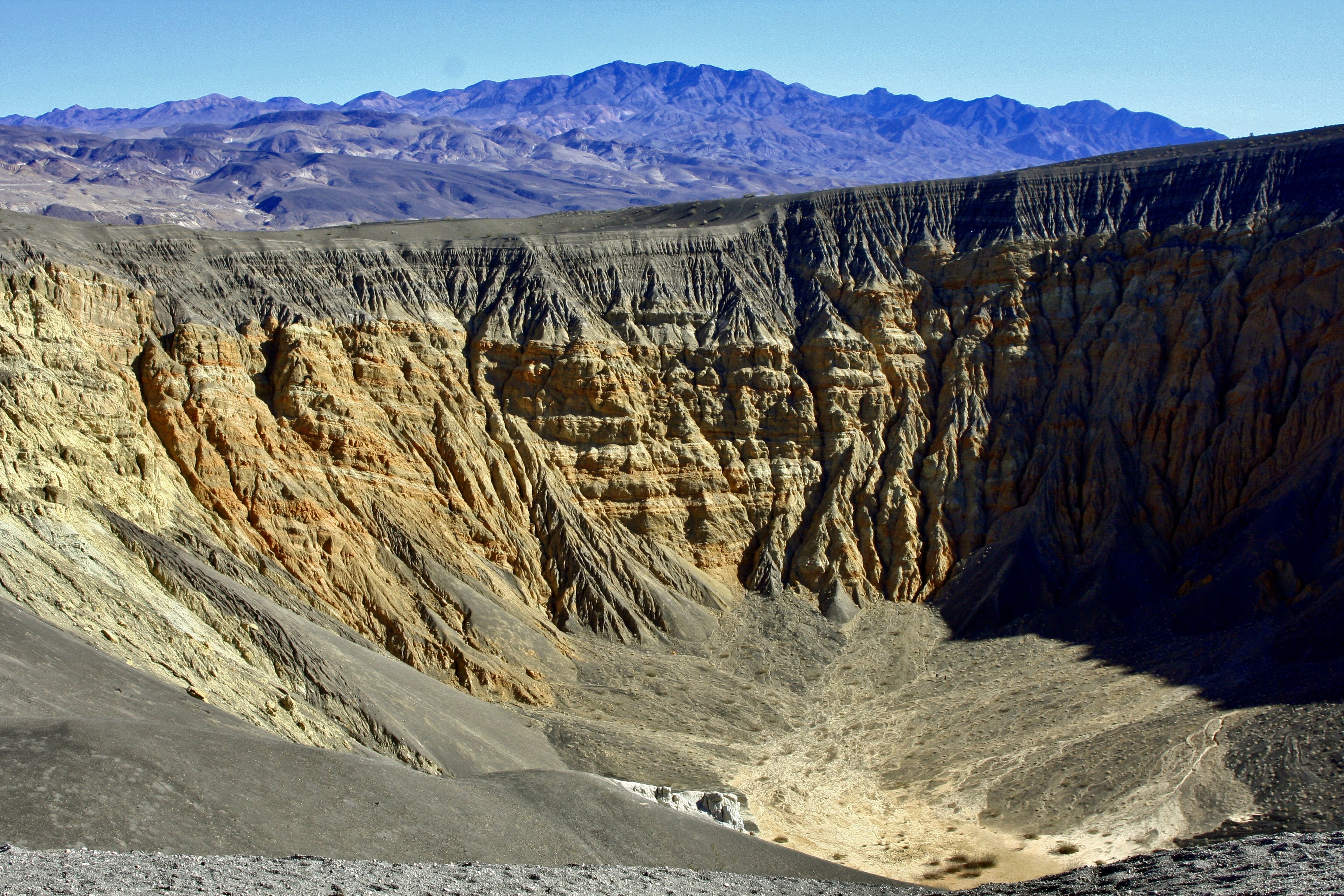
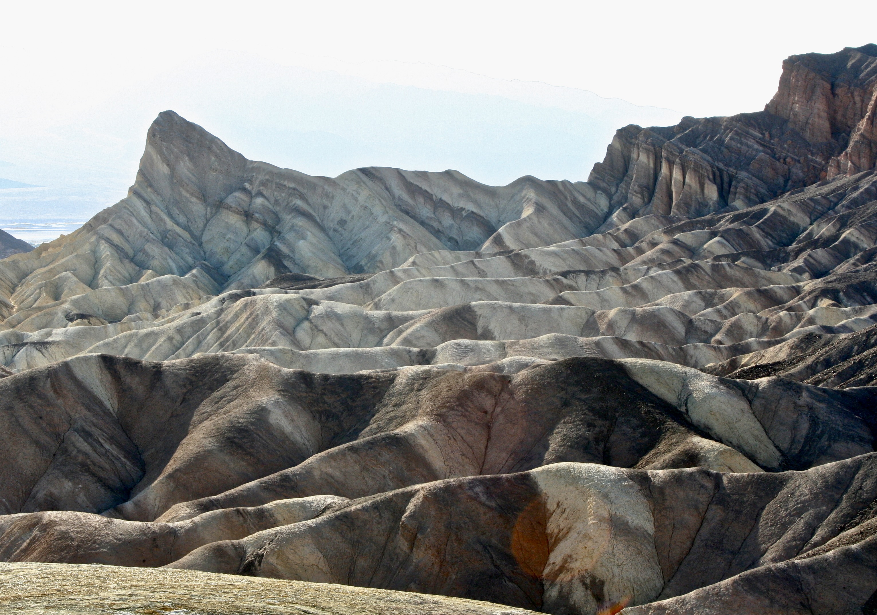
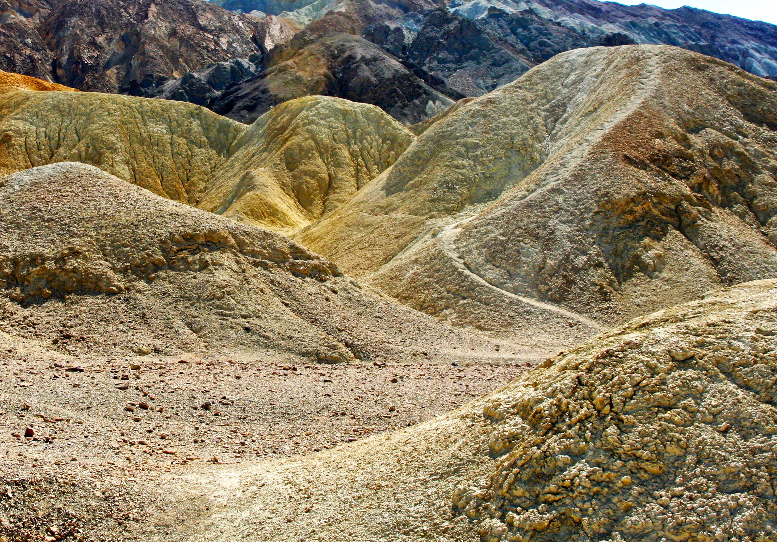
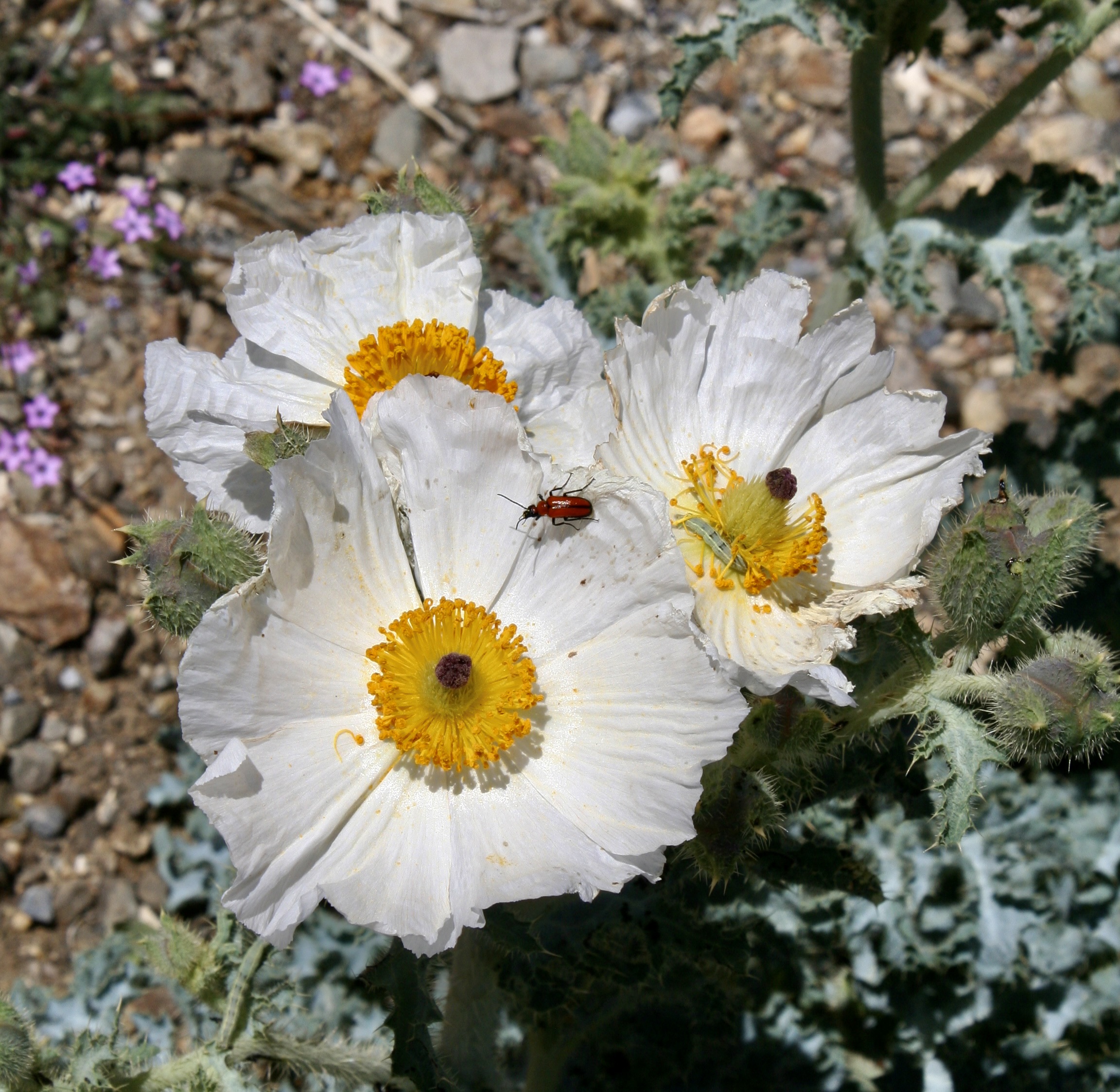
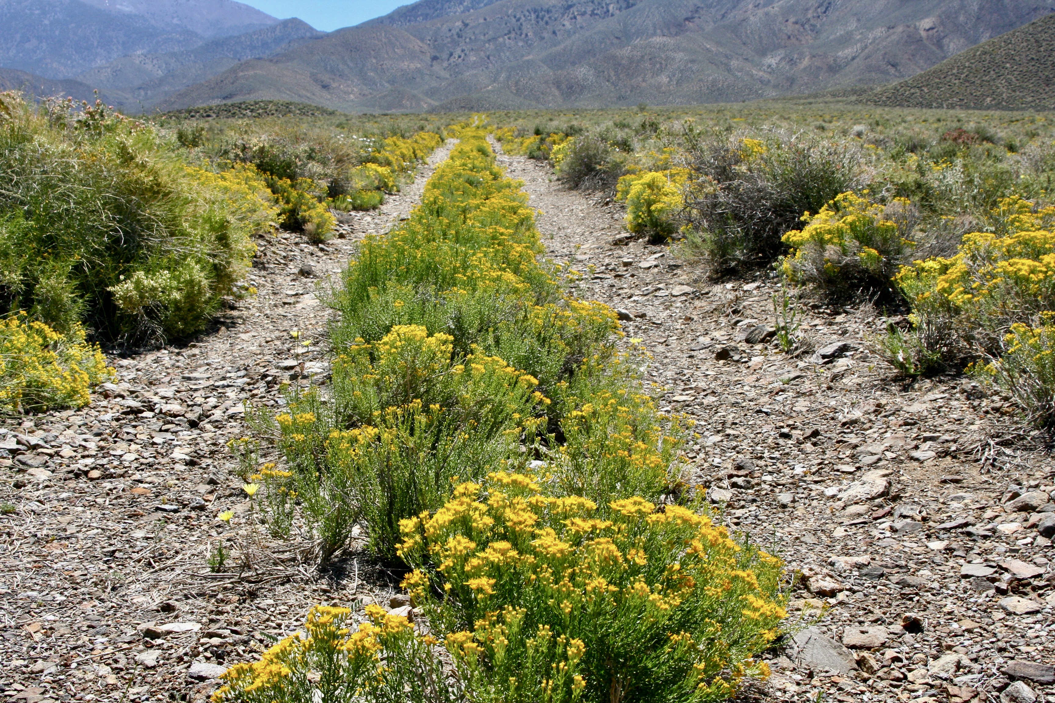
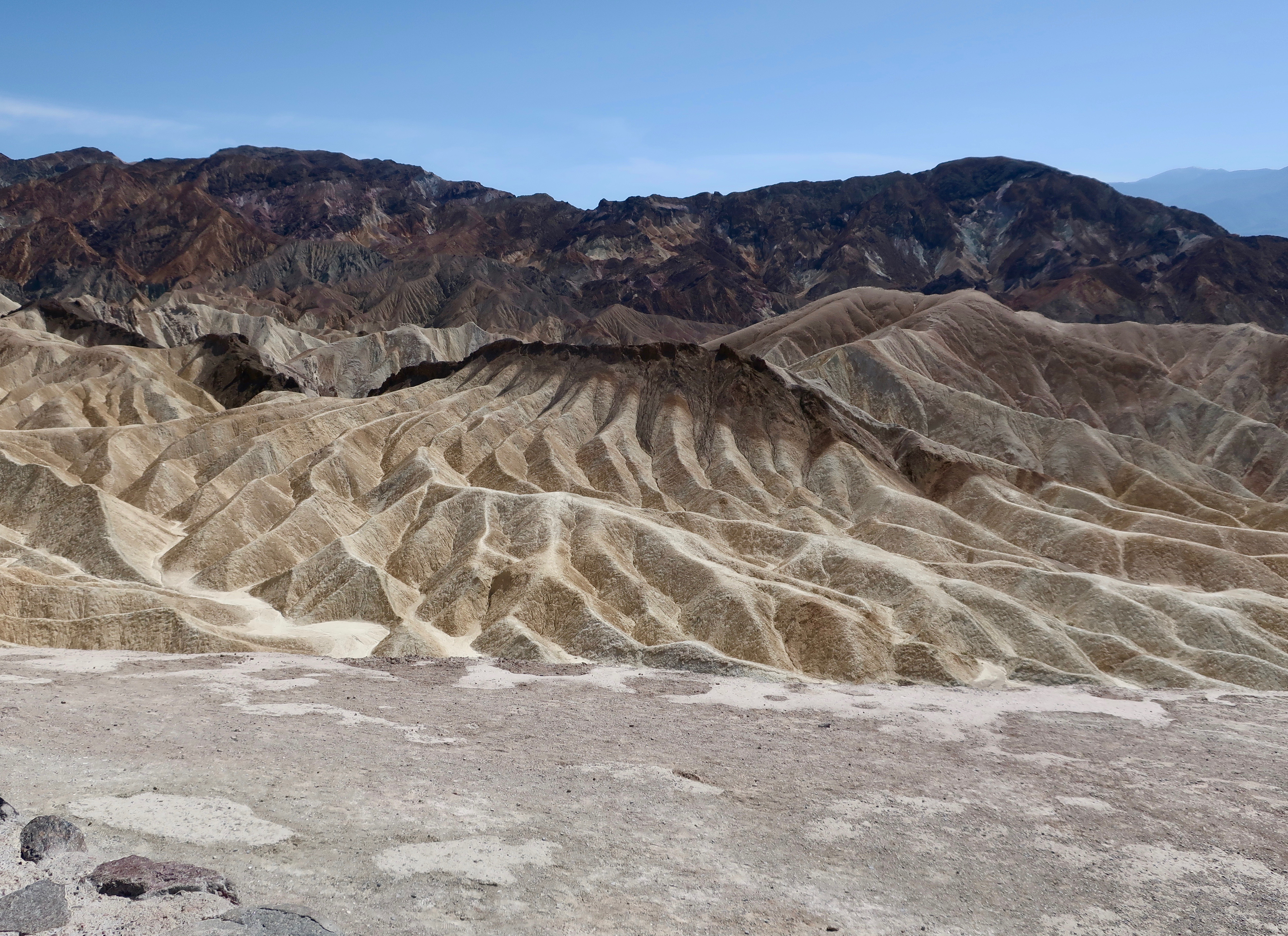
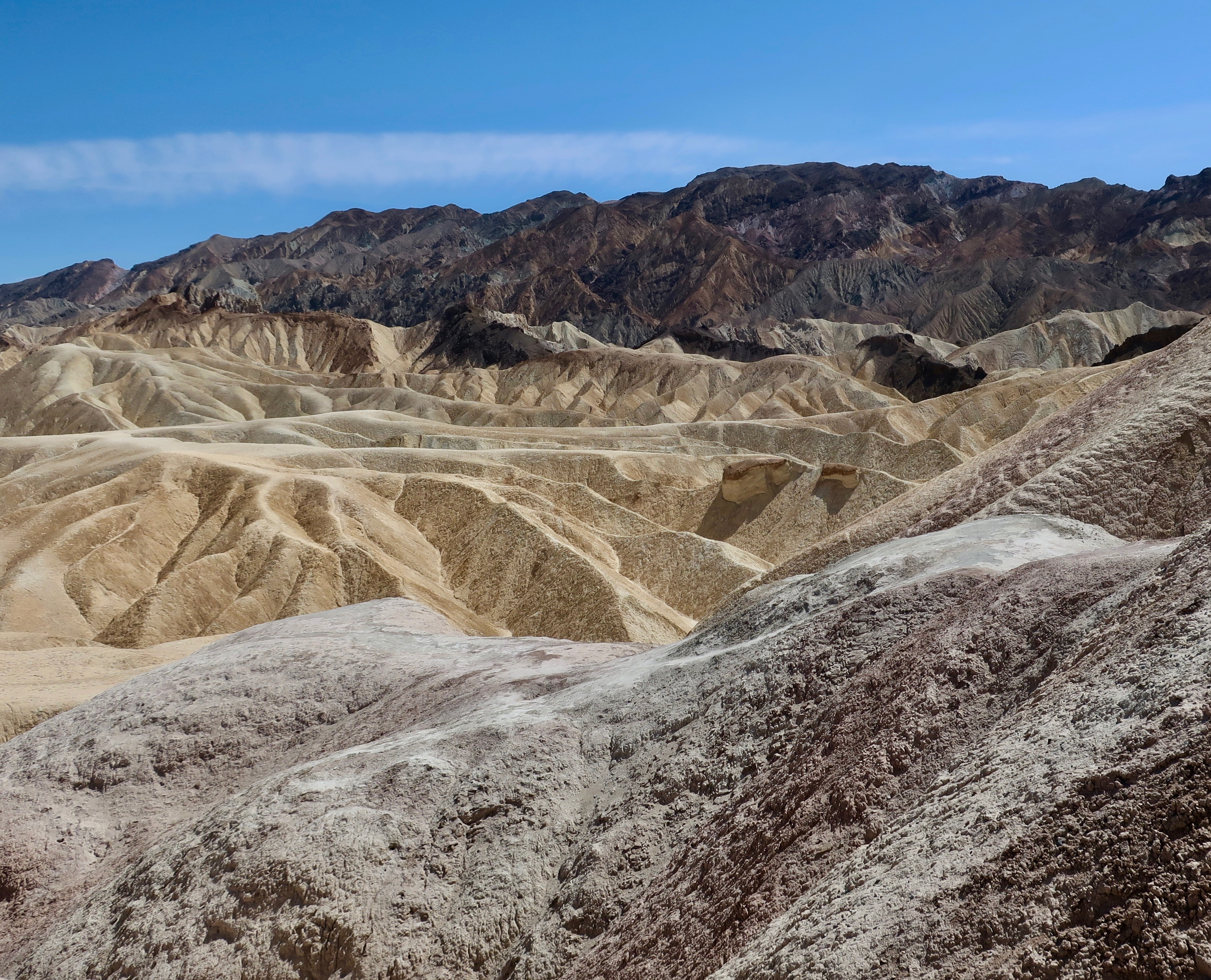
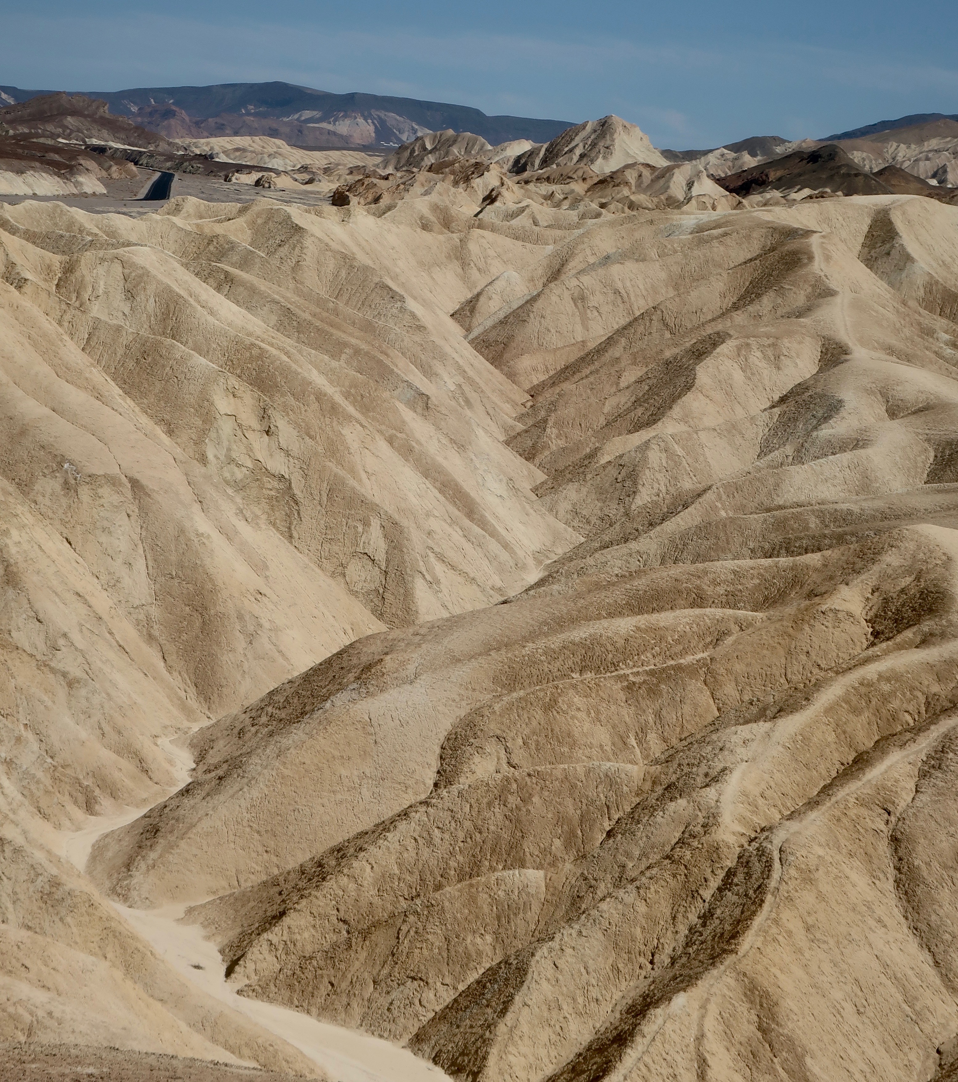
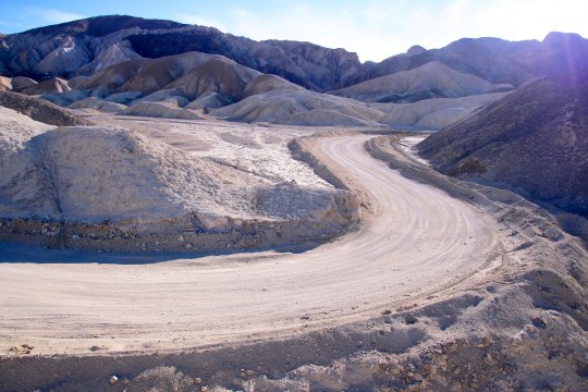
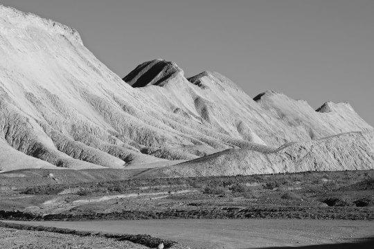
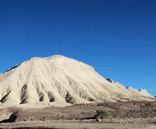
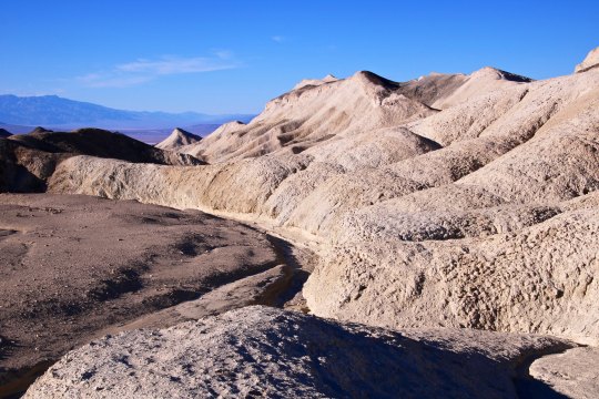
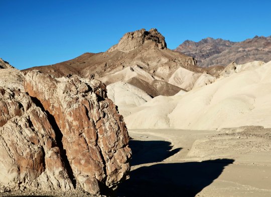
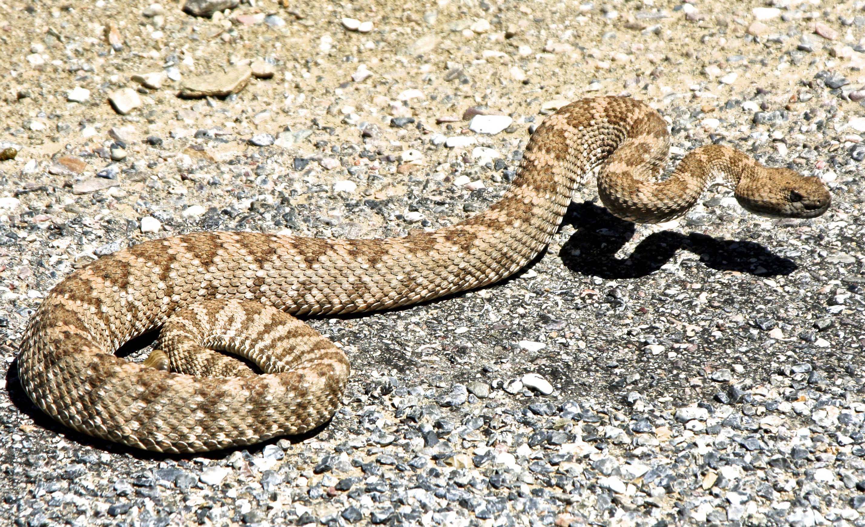
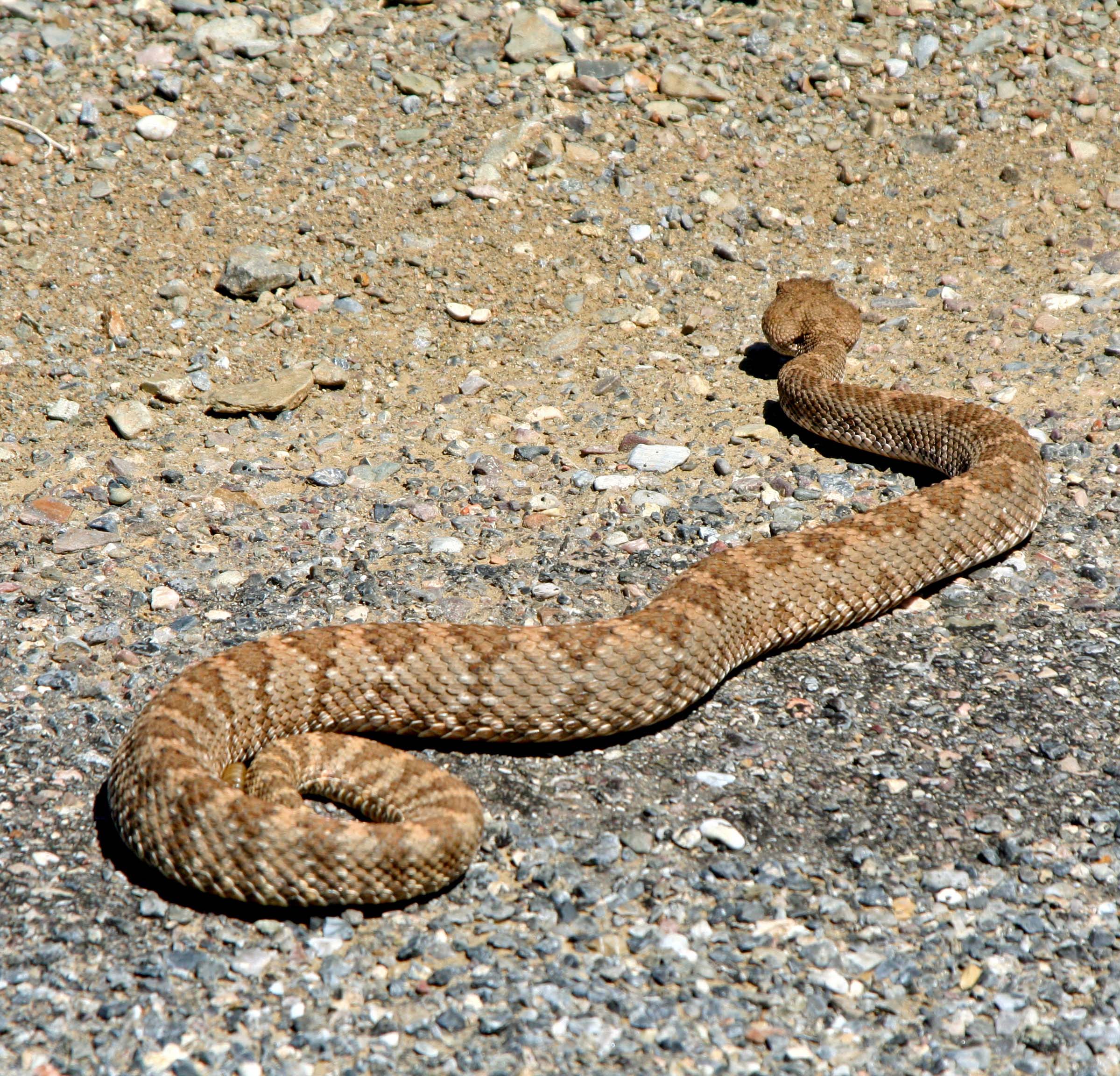
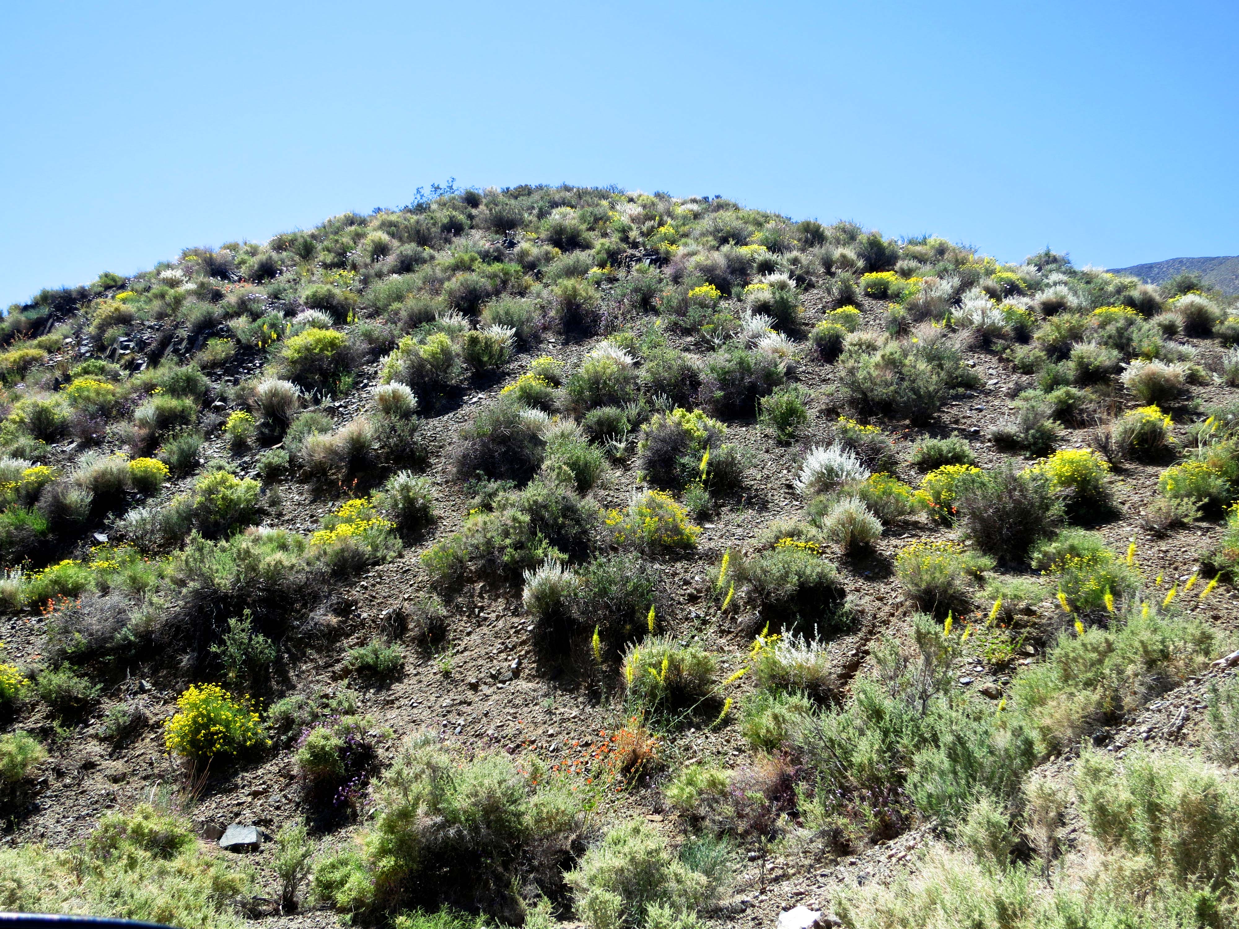
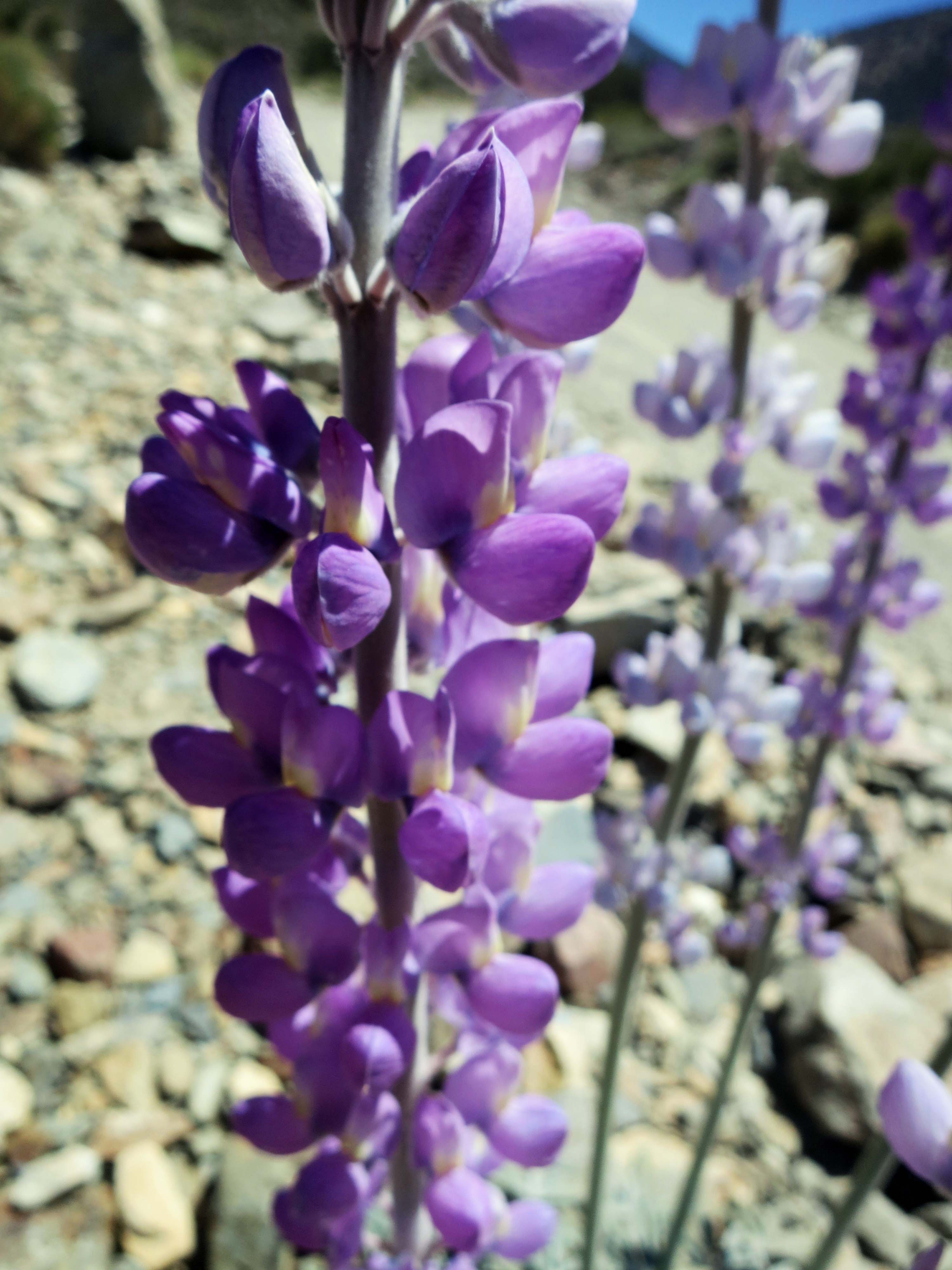
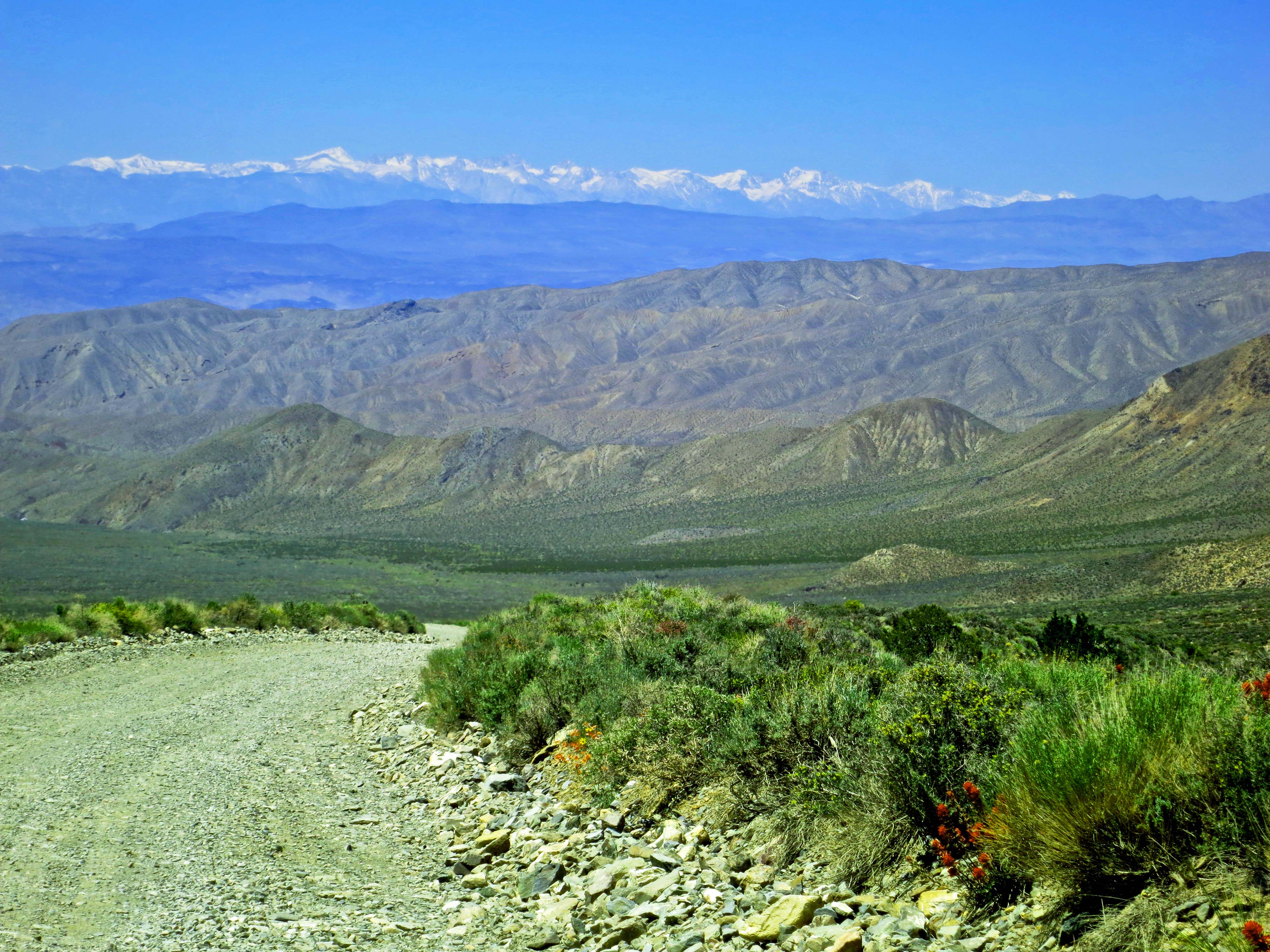
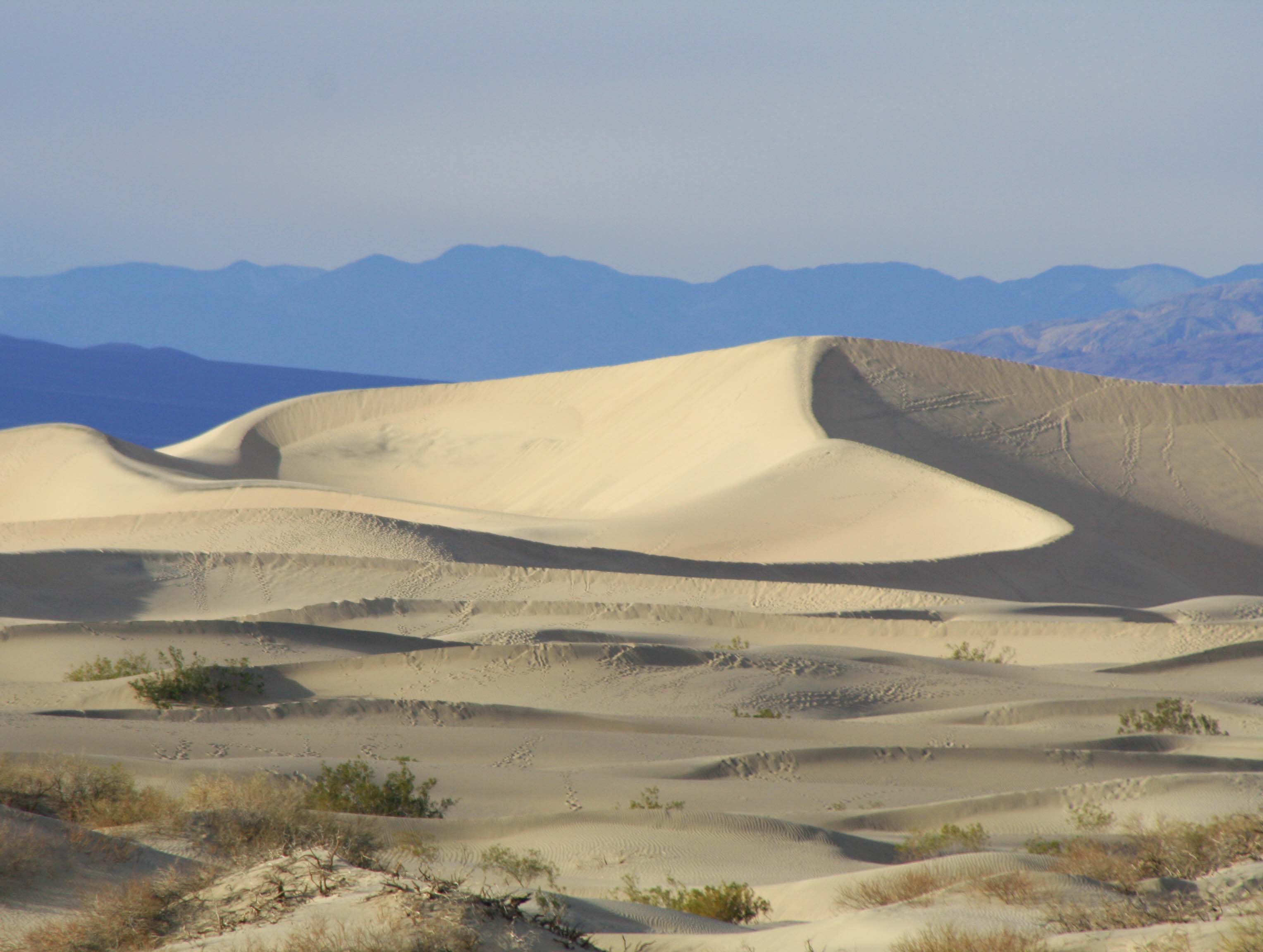
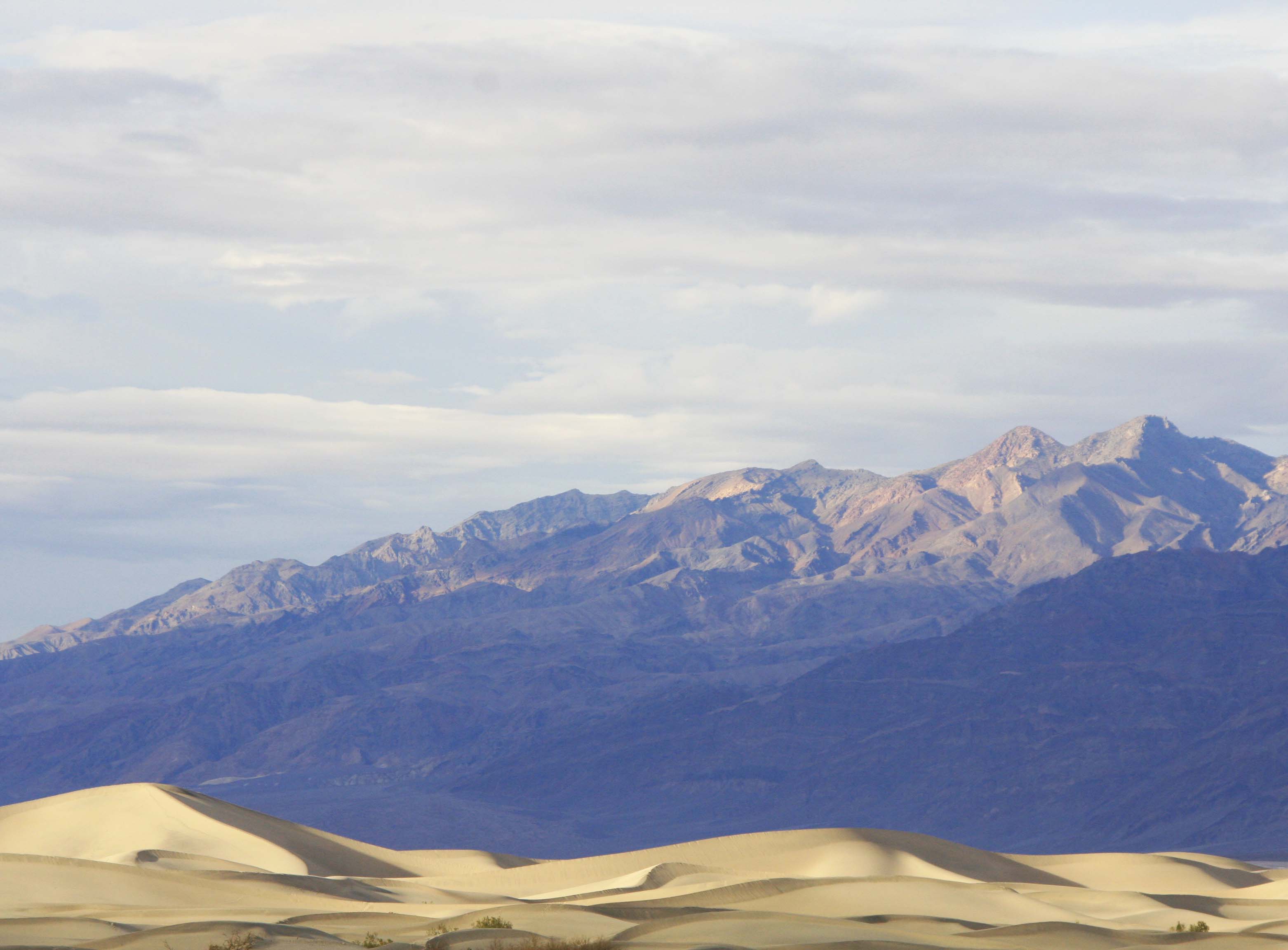
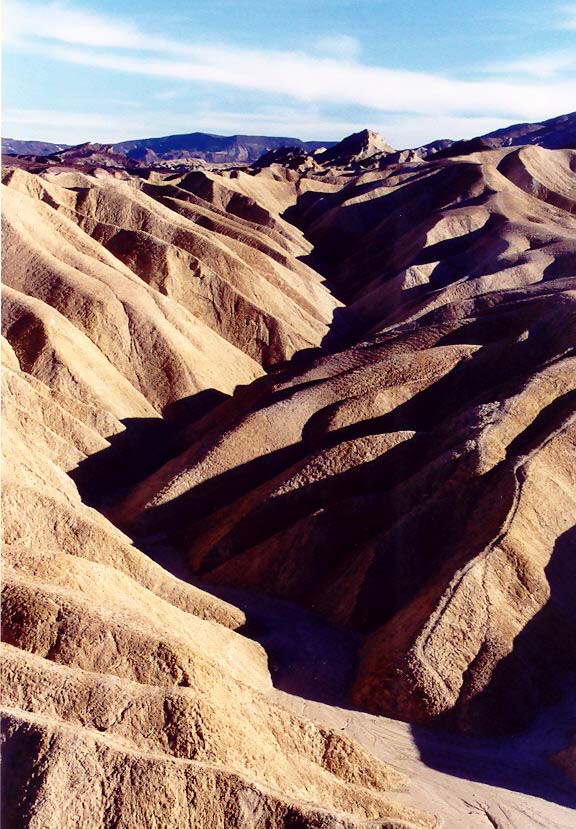
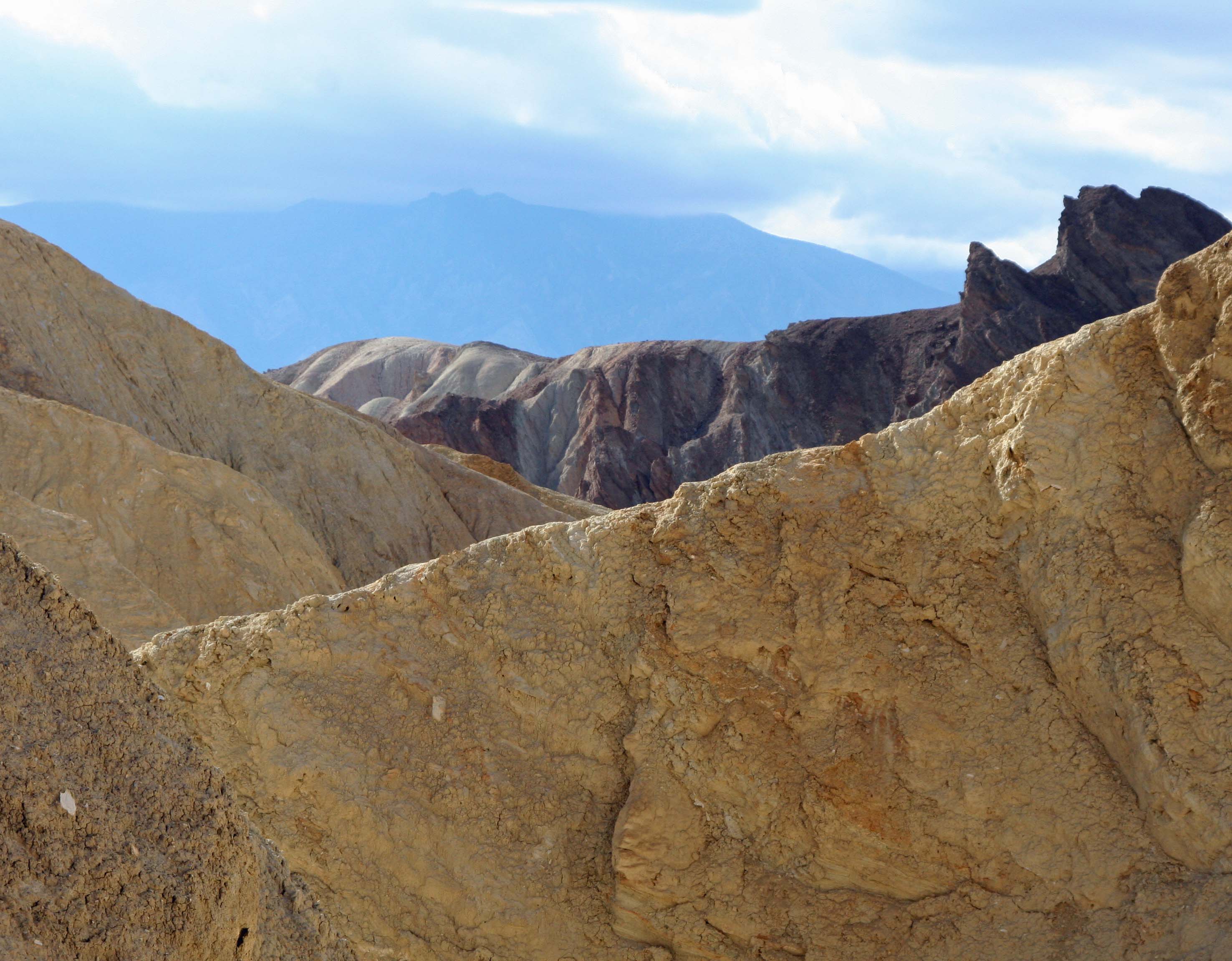
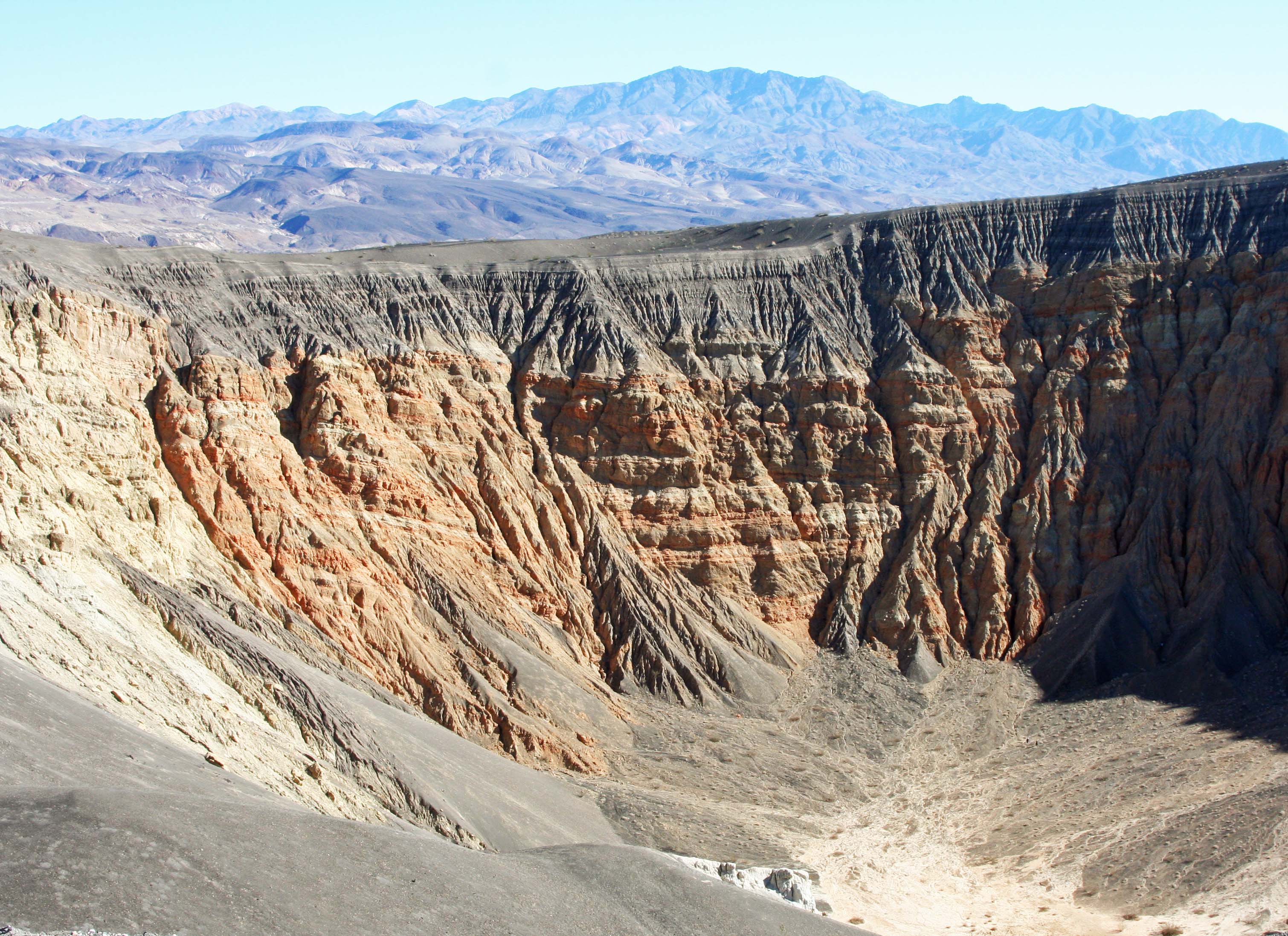
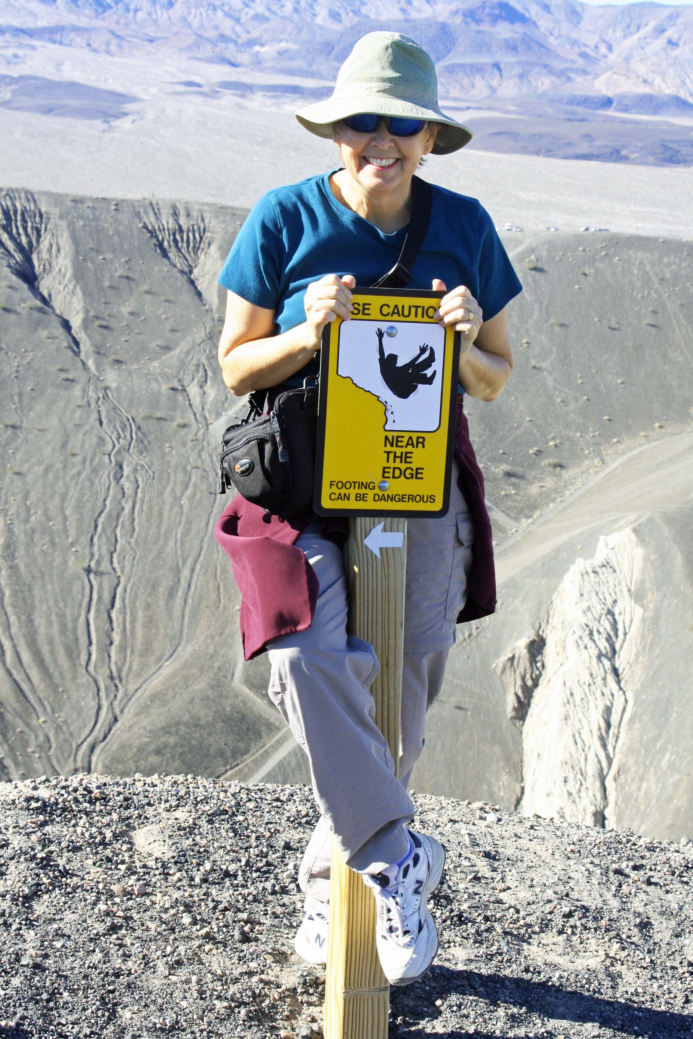
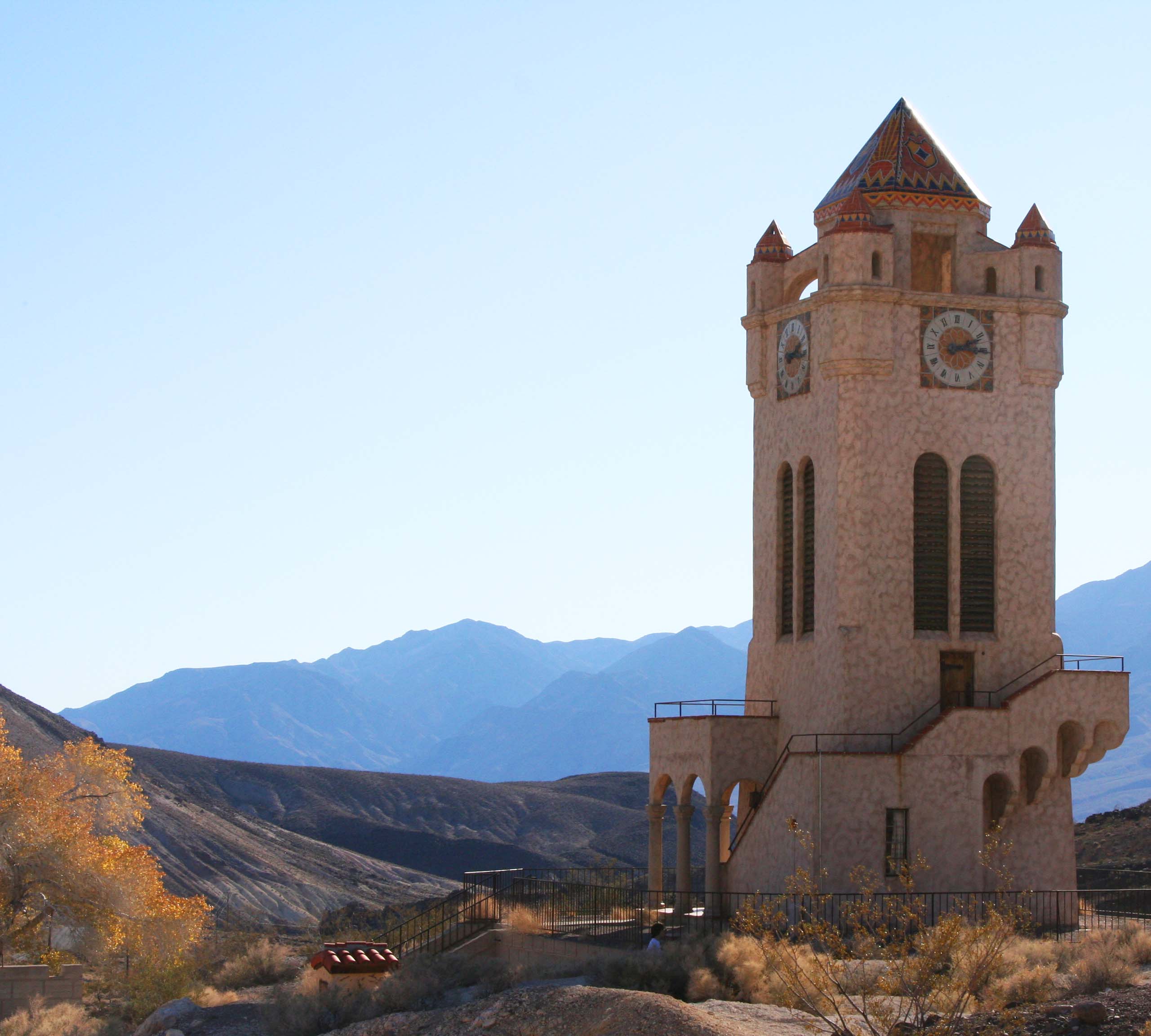
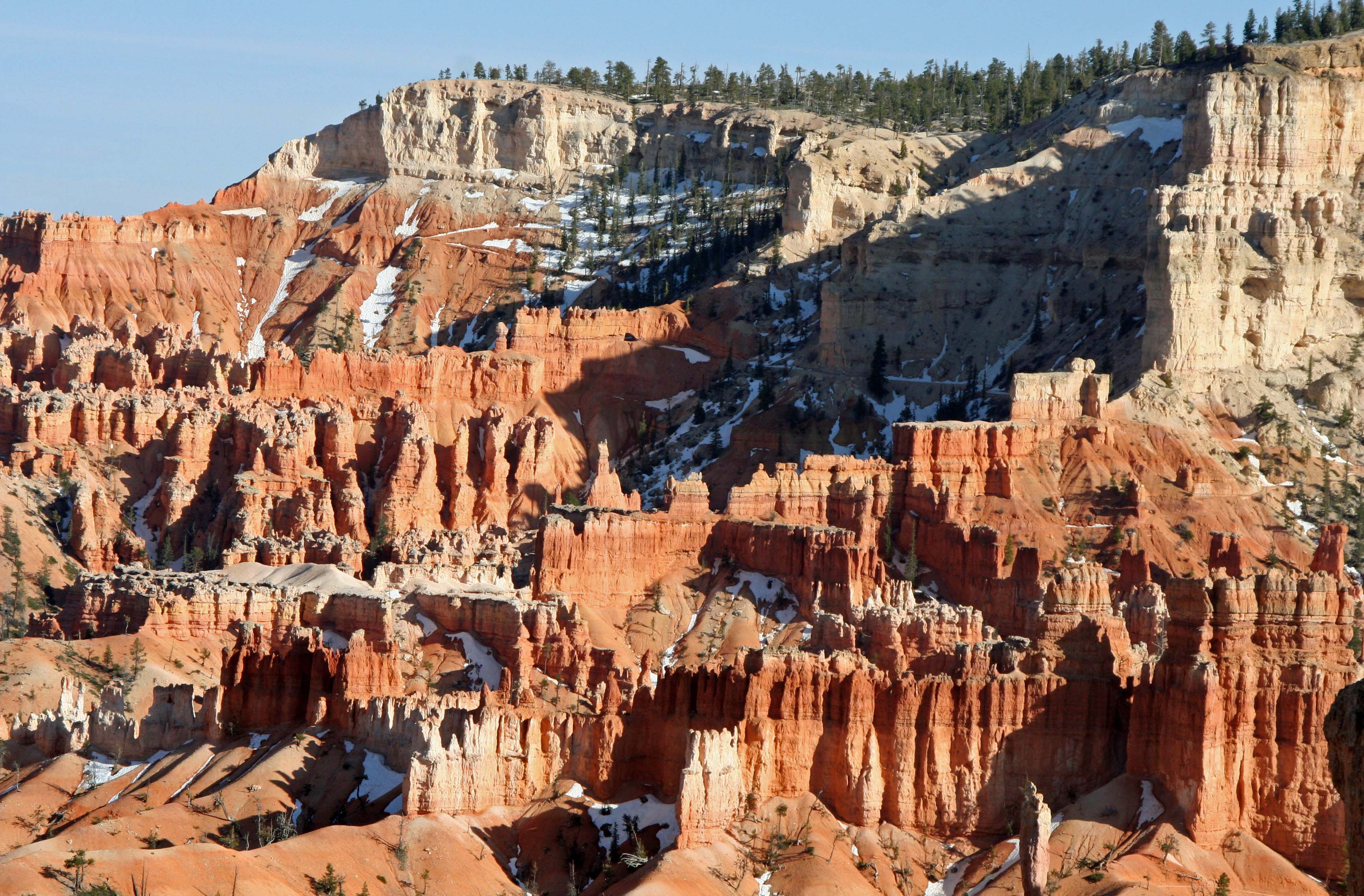
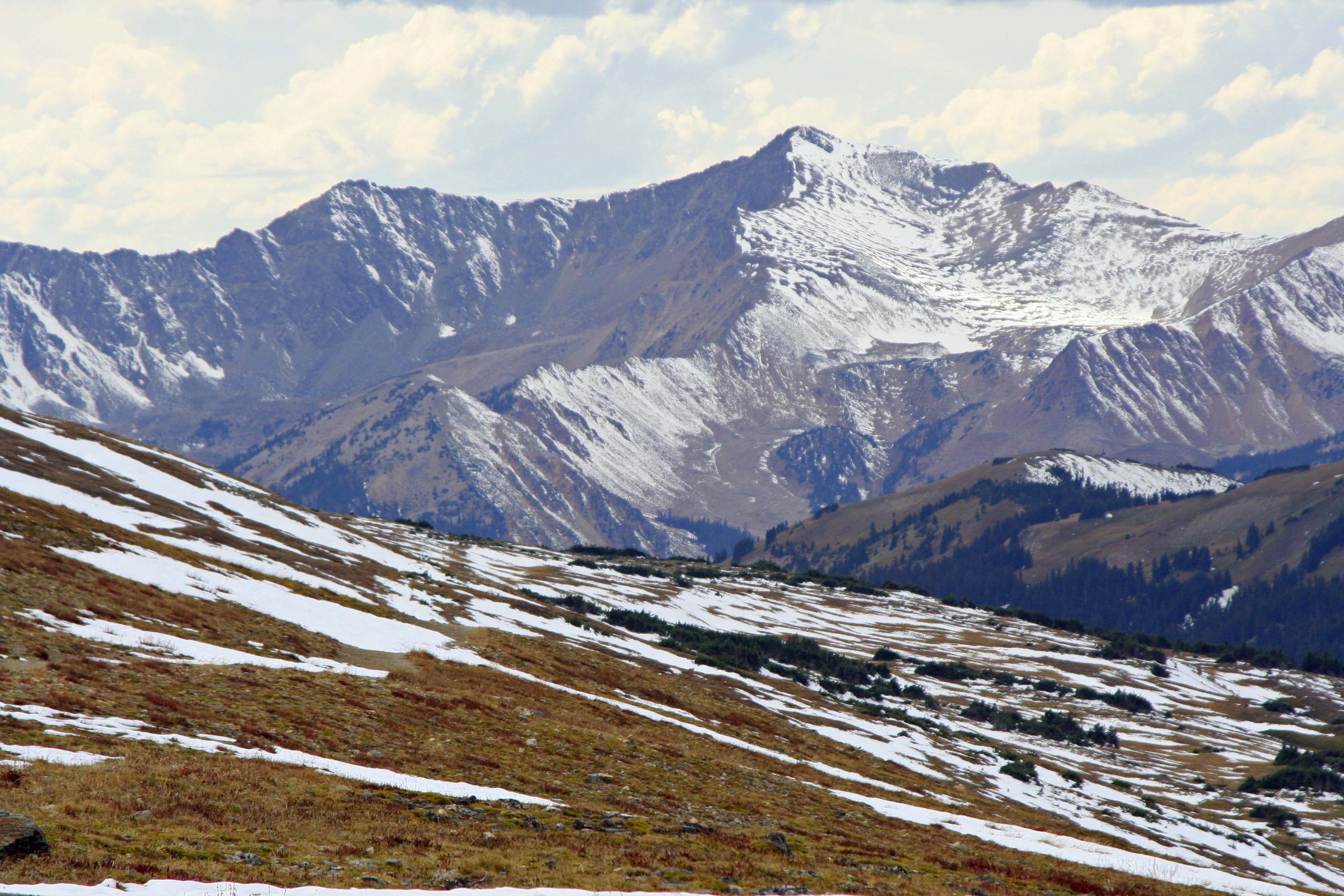
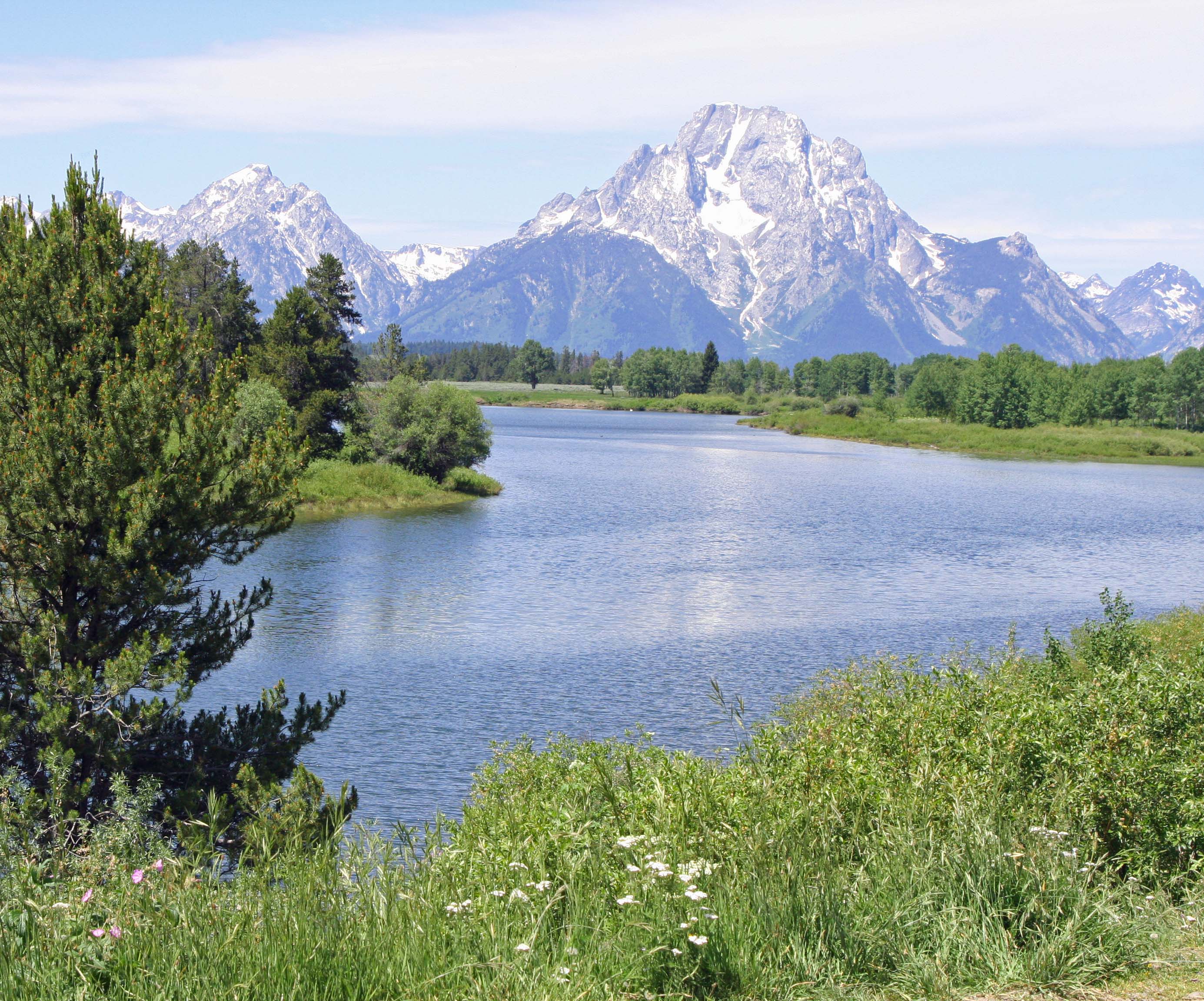
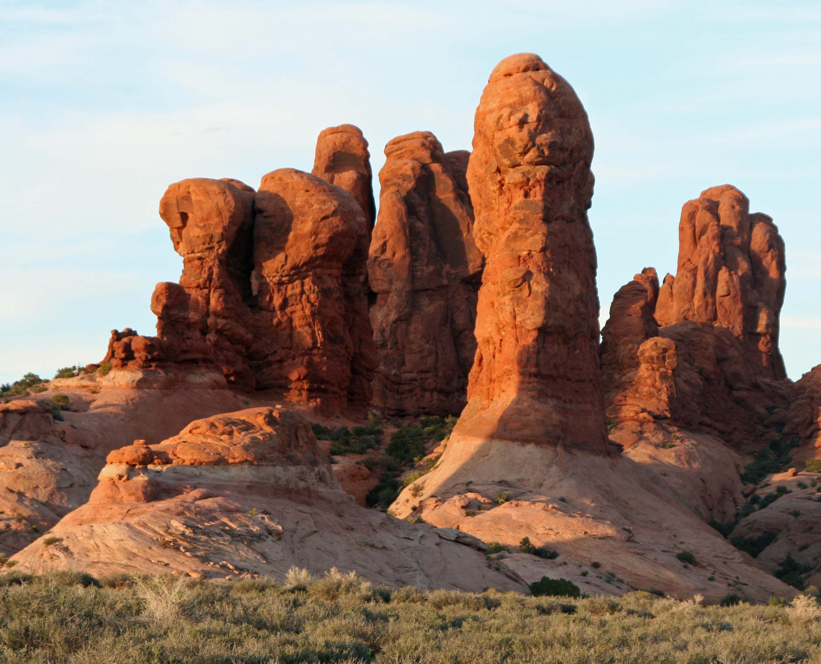
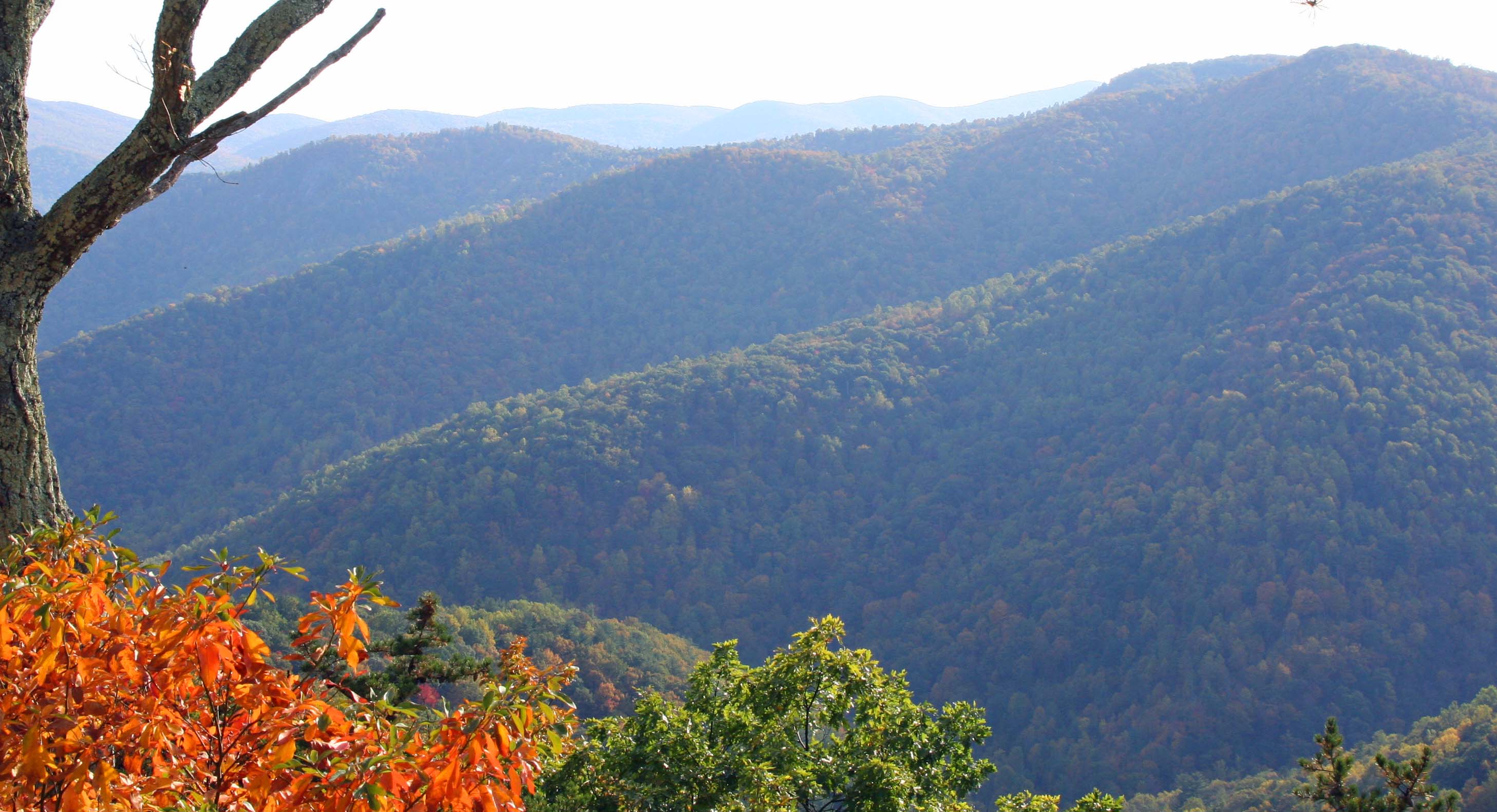
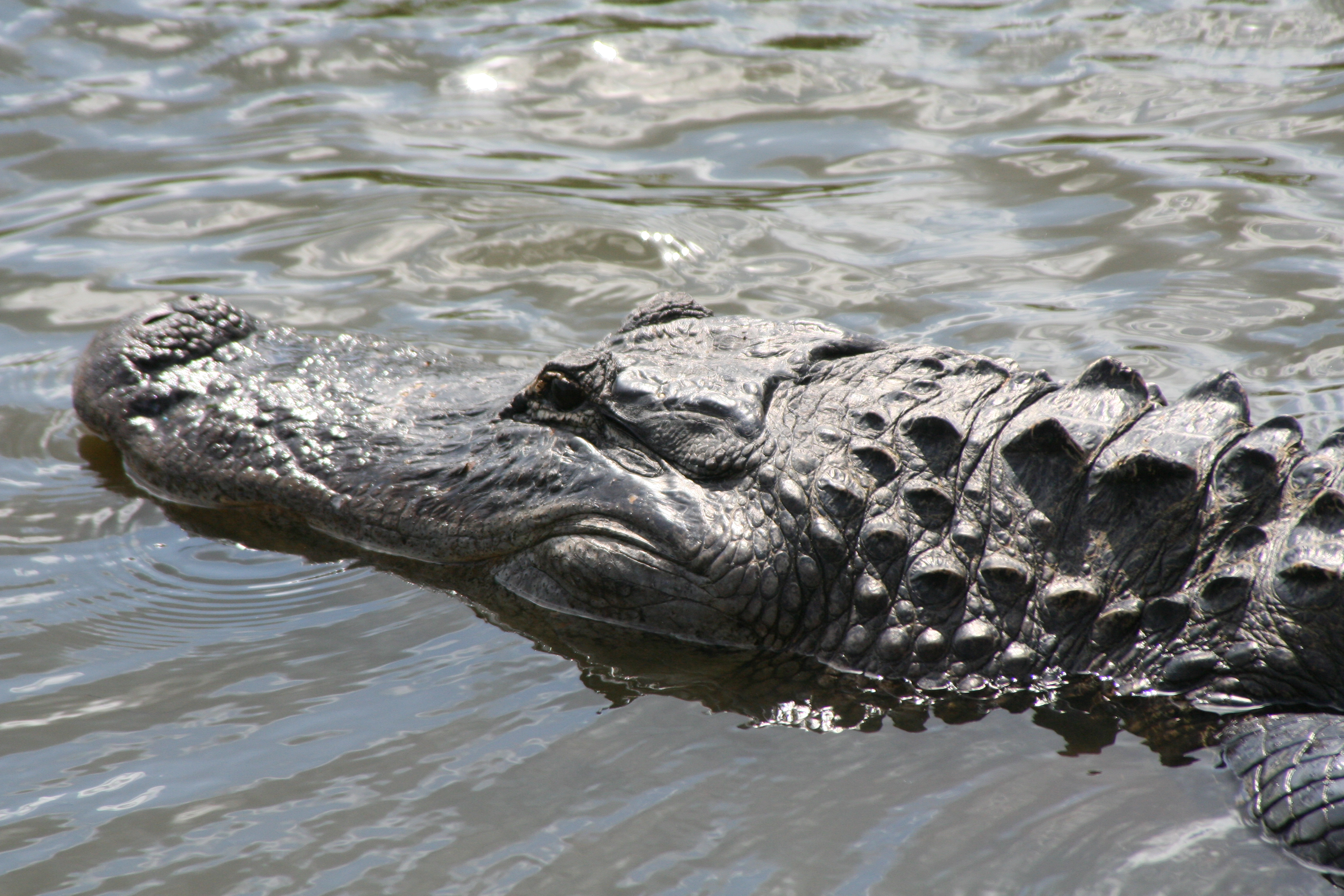
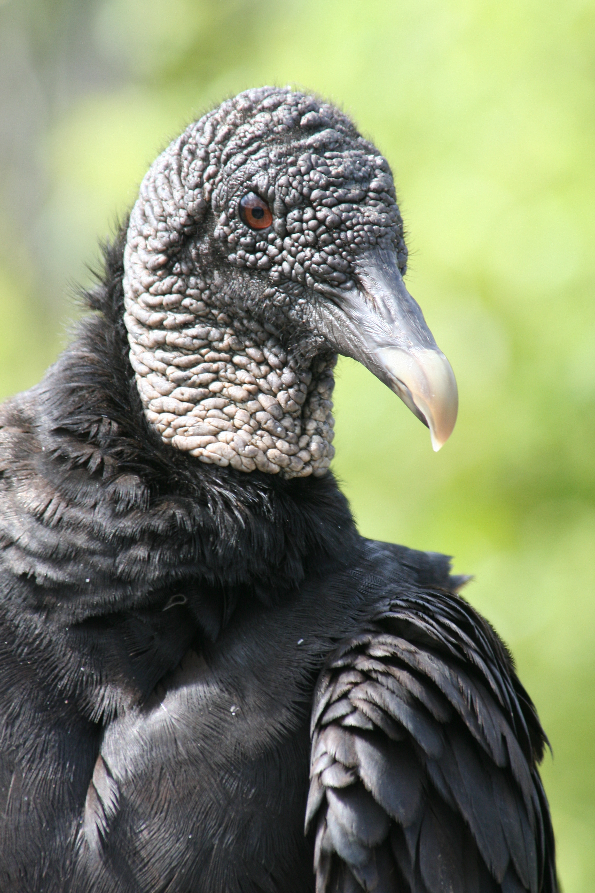
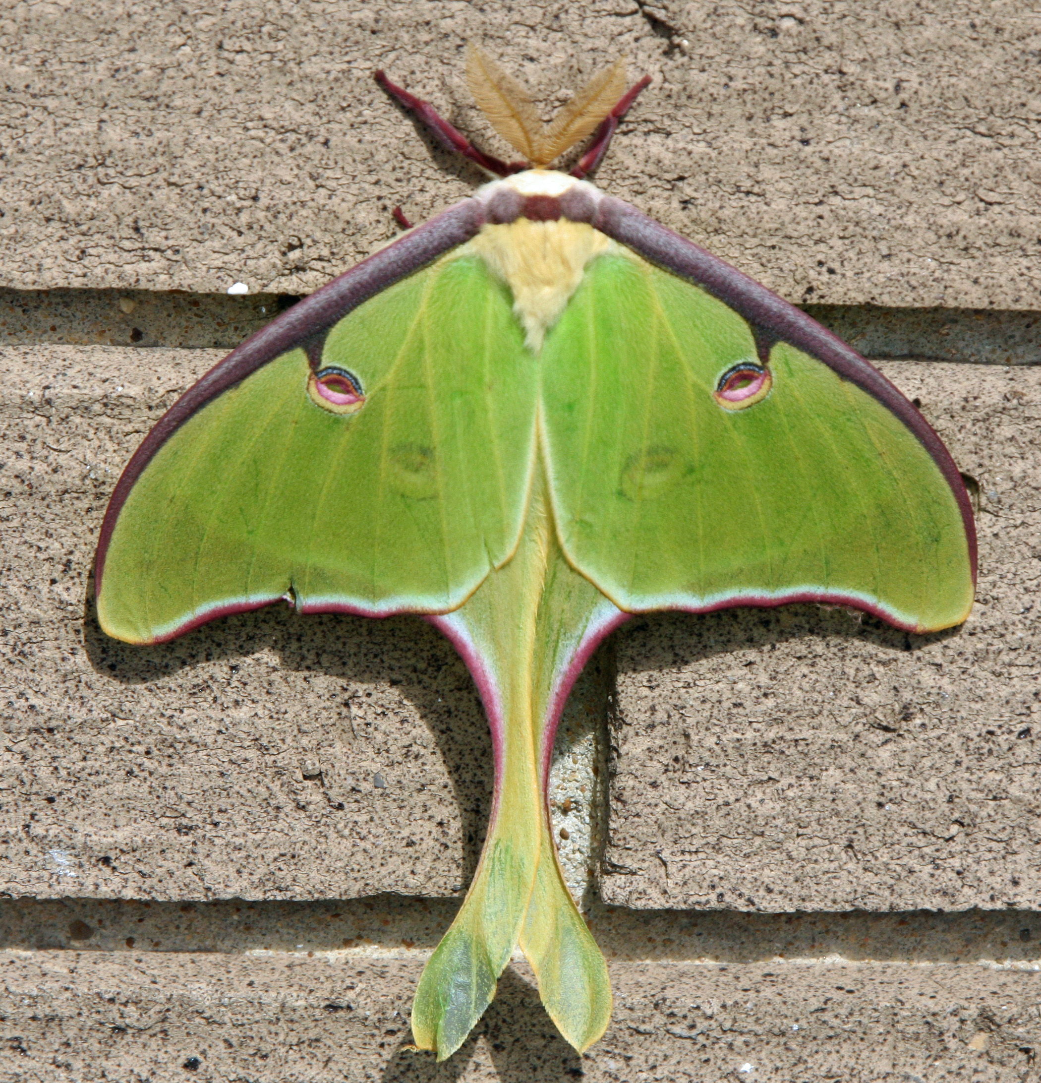
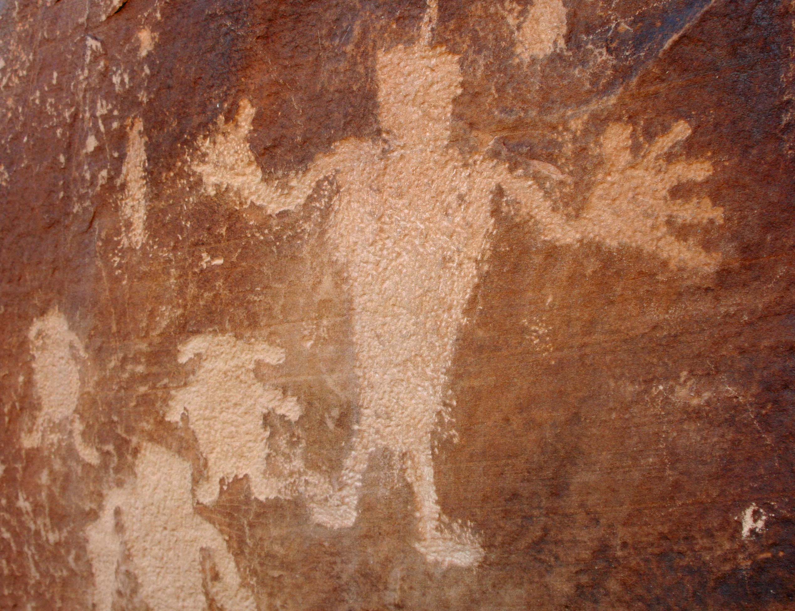
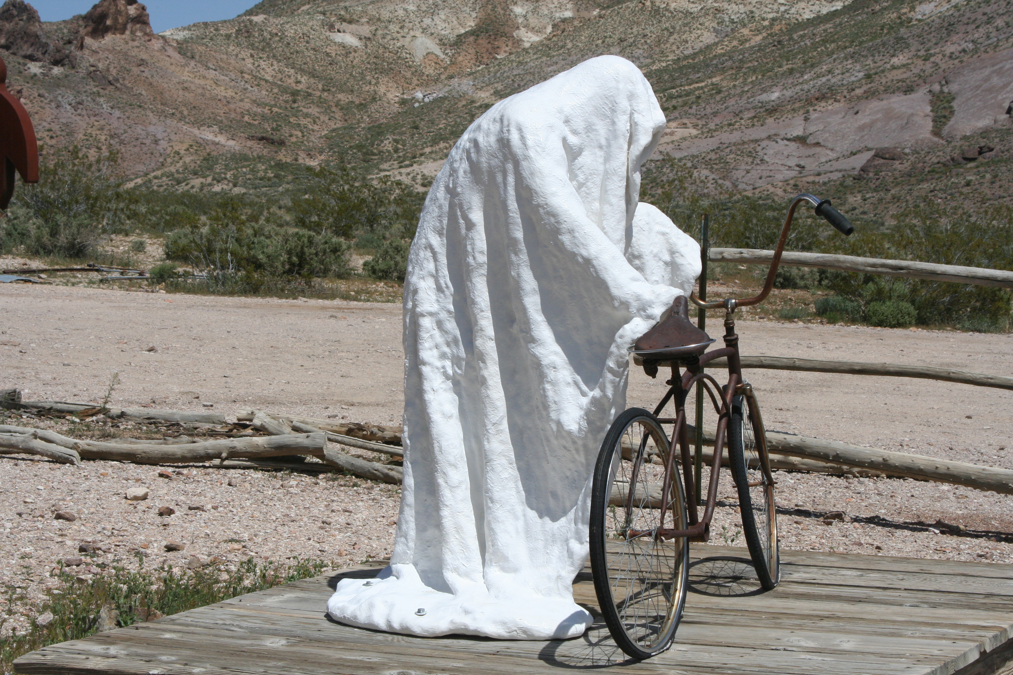
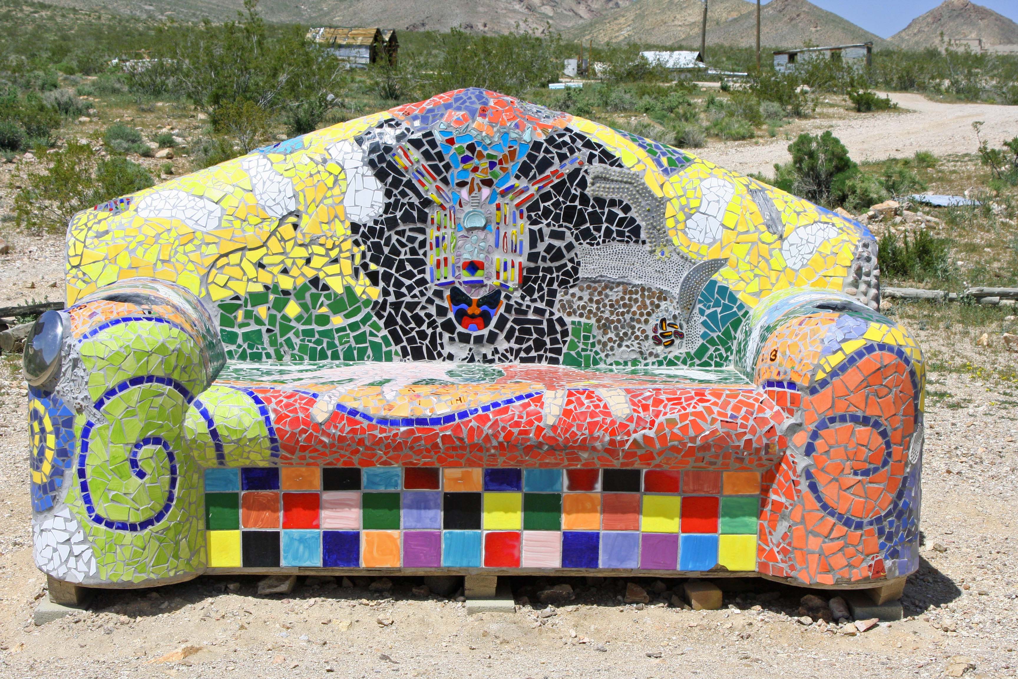
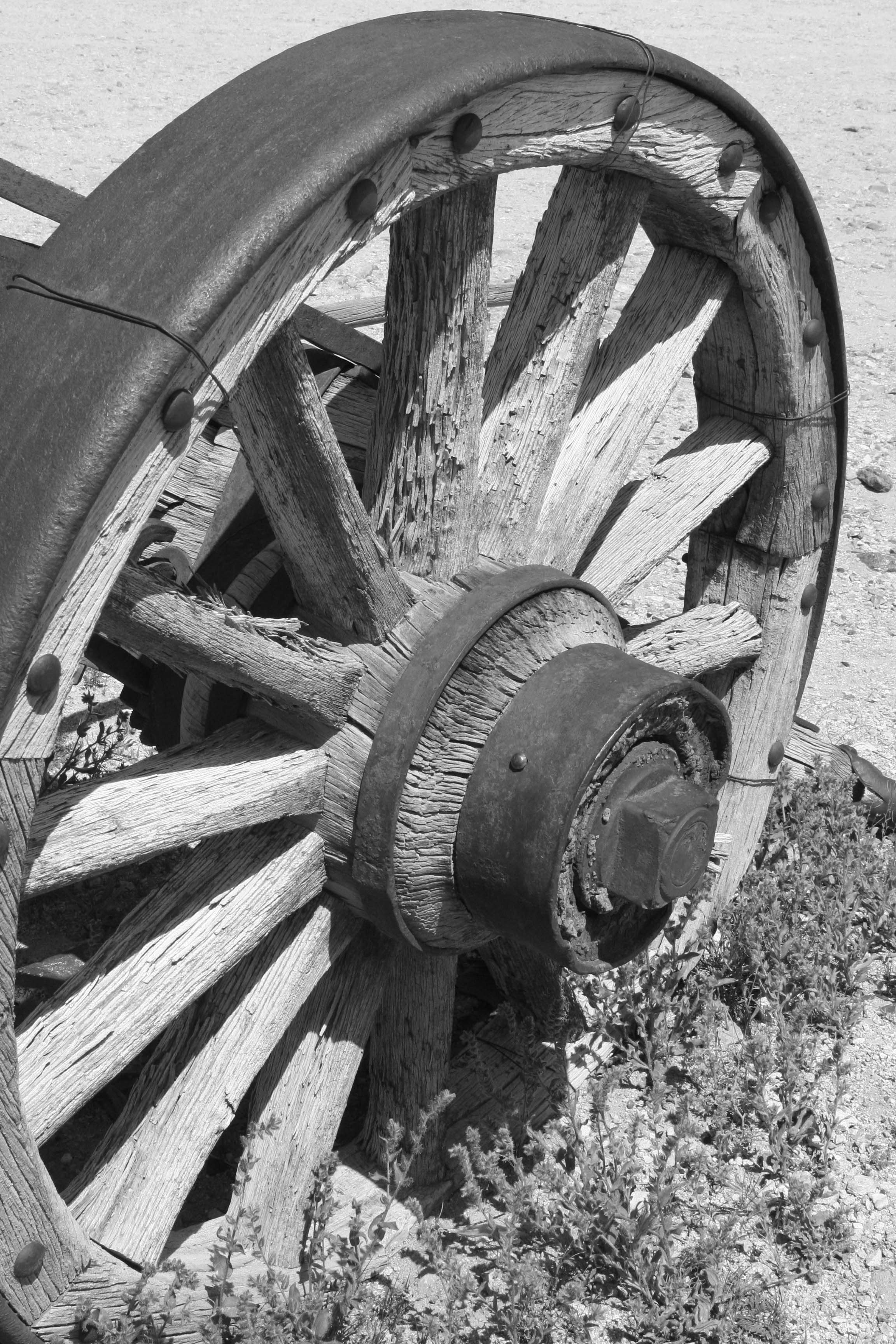
I would add, however, that Death Valley is also a land of superlatives. My title above about ‘breath-taking beauty’ is no exaggeration. We have 25 photos below to make the point. As I have stated before, all photos are taken by either Peggy or me unless otherwise noted.

Peggy and I have visited Death Valley several times over the years. It’s one of our all-time favorite go-to places. One of our visits was during the government shutdown in 2019 that President Trump had instigated during his first term. Death Valley was without staff. We had entered the Park from the south and stopped at a rest stop along the way. The restroom was closed and people were using the desert as a bathroom. Instead of carrying their trash out, many were simply dumping it next to the already overflowing trash cans. What was worse, a few miles up the road someone had decided that no supervision meant he could take his ATV for a spin on the desert floor and drive brodies (sharp circles). Large gashes in the floor had been created— gashes that would take at least 20 years, if not longer, to heal given the desert’s environment.

I’m relating this incident here because I want to make a point that National Parks need staff to function effectively. While the impacts of reduced staff aren’t as dramatic as no staff, the recent efforts by the Trump Administration to cut employees along with a number of other Trump/Musk driven initiatives related to the parks pose a serious threat. Here’s a quote that the National Parks Conservation Association —a bipartisan organization that has been promoting and protecting our parks since 1919— made after the first six weeks of the Trump Administration:

National parks as we know and love them are changing — dismantled before our very eyes under the new Trump administration in just six weeks. Fired staff, cancelled building leases, erased history. We see the writing on the wall, and it’s dark.

Dark indeed. Among the latest pronouncements from the Administration is one that suggests there is no reason to protect endangered species. Let them die. Another opens 59% of all national forests to be logged with minimal, if any, environmental protection. Old growth trees that have taken hundreds of years to develop will be cut down in minutes.

Today, Peggy and I are continuing our series showing the beauty, geology, flora and fauna of these areas to emphasize the value of protecting them. The parks belong to all of us, and, I might add, the plants and animals that call them home. We cannot afford to let them be lost to the whims of one man and his cohorts who apparently see their value primarily in terms of the money that can be made from their exploitation. Our children, grandchildren and future generations are depending on us.

And now: Death Valley.

Beauty is everywhere in Death Valley.
The extreme dryness of Death Valley allows visitors a rare opportunity to see geological forces at work. This is the Ubehebe volcanic crater in the northern part of the park. The crater, 600 feet deep and half a mile across, was created by a powerful eruption of volcanic steam. Trails lead down into the crater that visitors can hike.
We took this photo near Ubehebe Crater. It shows the work of erosion over time creating an almost surrealistic scene.
A coyote stood near the road into Ubehebe. Camping in the Valley, you can go to sleep listening to their wild calls in the distance. A moonlit night often produces a chorus.
The majority of the sites visited in Death Valley are located within a short drive of the Visitors Center at Furnace Creek. Nearby, Zabriskie Point provides a number of different views that vary over the day as the sun shifts.
In the sunlight.
Another view we found interesting at Zabriskie Point. The dark ridge at the top represents a different geological era. Over 1.7 billion years of earth’s history can be seen in the Valley according to the National Park.
20 Mule Canyon, a short drive up the road from Zabriskie Point, provides a moderately challenging but gorgeous adventure over a 2.7 mile unpaved road. It’s a section of the route that was used by the 18 mules plus two horse teams that carried borax out of Death Valley. Pull offs along the way provide for further adventures, such as following paths that lead into a world that borders on fantasy.
Another example.
The road also followed this off-white, high ridge. We saw a couple of people hiking along the top.
A final photo along the 20 Mule Canyon Road.
Another favorite of ours for its sheer beauty and impressive land forms is Golden Canyon.
A quick drive down highway 178 from Furnace Creek will take you to the parking area. From there, visitors can choose a relative easy walk that takes them into the heart of the canyon or select much more challenging hikes with lots of ups and downs! One route takes hikers up to Zabriskie Point.
Looking out from Golden Canyon toward the Valley.
Want even more color? Continue down Highway 128 to a one-way side road that takes you in to the well-named Artist’s Palate. Different minerals in the rock are responsible for the colors you see here, at Zabriskie Point and along the Twenty Mule Canyon Road.
A closer look at the palate.
Continuing on down Highway 128 will bring you to the Devil’s Golf Course, which is definitely worth the side trip to see it. If the park is ever privatized, I wonder (he said tongue in cheek) whether the president would add this to the 15 plus golf courses he owns around the world. First, however, he would have to bulldoze the salt flats that formed over thousands of years as ancient lakes evaporated. Given the million dollar membership fee he charges at Mar-A-Largo, I suspect he would charge even more here.
Two side roads, one on the east and one on the west of the Park, take visitors up into the mountains above the Valley. Dante’s Peak, on the east side, provides a dramatic view into the valley.
And flowers. We took lots of photos.
The road on the west side of the valley taking visitors up to historic charcoal kilns had even more flowers.
Including these white prickly poppies. A red beetle and a green caterpillar were visiting. The caterpillar was busy chomping down on the poppy’s stamens.
An old road leading off the main road to the kilns featured yellow rabbitbush flowers. It demanded exploration. Maybe this year…
We also found this rattlesnake along the road. Long time followers of my blog will recognize it. He was about 6 feet long and about as round as my arm. Peggy refused to let me out of our truck to take more photos, zooming off just as I was about to open the door!
The historic charcoal kilns of Death Valley were at the end of the road. They were built in 1877 to supply charcoal for the Modock Mines, located 25 miles away, and likely closed after two years of use.
We’ll conclude this post with a photo of the sun setting over the sand dunes of Death Valley. Next up we will feature the Chiricahua National Monument in Southeastern Arizona. We were there last week.
A photo from next week’s post.

The Hottest, the Driest, the Lowest… Death Valley: Featuring Zabriskie Point

Today’s post marks the beginning of Peggy’s and my journey around North America. We will be sharing our insights into what it’s like to live full time on the road plus our adventures along the way. A special focus of the blog will be visiting some of the most spectacular wildlands remaining on our continent. Death Valley is up first, starting with an overview and featuring Zabriskie Point.

Peggy and I were greeted with this sign when we stopped at Death Valley National Park Visitor at Furnace Creek on our recent visit. As noted, Death Valley is a land of superlatives. The word I use is extremes. I reserve superlatives for the scenery. It’s why we have returned to Death Valley over and over again. 

Photo by Peggy Mekemson

I doubt that the Death Valley people included the price of gas as either an extreme or superlative, but we found it amusing. And we weren’t the only people taking photos of the sign. We made sure that we filled our tank in Bodie, a small Nevada town just outside of the park. Adding serious injury to insult, the price of a six pack of beer was $20 at the Furnace Creek store! Now that’s something worth whining about. 

But let’s get back to the hottest, driest, and lowest. By hottest, they mean the hottest place on earth. It holds the world record at 134° F (57° C). Death Valley is not a place you want to visit in the summer if you can help it. Here’s the bad news. It’s getting hotter. We can thank global warming. The following chart sums it up.

The impact of global warming can be seen clearly on the National Park graph that shows average summer temperatures.

The normal definition for a desert is a place that gets under ten inches of rain a year and has an evaporation rate that exceeds its rainfall. Death Valley averages under two inches and has an evaporation rate that is 75 times its rainfall.  Sit in the shade doing nothing for a day and you can lose up to two gallons of water. The Valley holds the record for being the driest place in the United Sates. There is a reason why the Park Service always warns people to carry and drink lots of water when they are visiting. 

And finally, the lowest. At its lowest point, Death Valley is 282 feet below sea level, which just happens to be the lowest spot in North America. On an earlier trip, Bone was proud to pose on the Bad Water Basin Sign announcing the low point. 

Bone was feeling a little low that day…

I’m going to add another extreme. Wind. Death Valley doesn’t hold any records here as far as I know, but when I bicycled across the Valley on my 10,000 mile solo trip around North America, I remember being out of the saddle in low gear, and working my tail off— pedaling downhill. When I got back to camp, I discovered my tent had been blown a half mile away and was totally trashed. This time the wind was blowing so hard Peggy couldn’t get her door open on our truck! It took all my strength to force mine. Back at camp, I took a photo of “Cousin It.’

The wind gave Peggy a new hairdo. We decided to call her ‘do’ the Cousin It look. It’s the latest fashion in Death Valley.

As I noted earlier, Peggy and I have returned to Death Valley many times, always in the fall, winter or spring. Each time we try to include something we haven’t done before. This time it was going in search of the rare and endangered, but not so elusive pup fish, and hiking up Mosaic Canyon. We also returned to some of our favorites: 20 Mule Canyon, Zabriskie Point, and the Artist’s Palette. Peggy and I were busy with our cameras the whole time. I’ll let our photos speak to the beauty of the park. 

I’ll start with Zabriskie Point, a quick 15 minute drive away from Furnace Creek and the Park Visitor Center. Named after Christian Zabriskie, an early manager of the Pacific Coast Borax Company, it is probably the most photographed site in Death Valley. For good reason. It was once the site of an ancient lake where various sediments sank to the lake bed, giving the area its rich colors today. Early ancestors of both modern day horses and camels left their tracks along the shorelines. Tectonic plates moving beneath the valley lifted the mountains and dropped the valley, giving rise to the erosion which has done such an impressive job of carving out the ‘badlands’ shown in the photos below.

This photo captures the rich colors of Zabriskie Point. You are looking out on the Valley floor. The Panamint Range forms the background. (Photo by Peggy Mekemson.)
A popular photograph of the ‘badlands” at Zabriskie Point. The peak on the left is known as Manley Beacon. The cliff behind it is known as Red Castle.
This provides a close up of Manley Beacon. Manley is the person who rescued the prospectors who were crossing the desert in hope of finding gold in California in 1849. They were lucky. It was the miners who gave the valley its name, Death Valley.
I caught this picture of Red Castle at Zabriskie Point. Had we been there at sunset it would have been much more reddish.
One of many of the geological features of Death Valley are volcanoes and lava flows. The black lava here was part of a lava flow. Being a harder rock it provided a cap to the eroded rock below. (Photo by Peggy Mekemson.)
This provides a broader perspective.
This picture is particularly good at showing the various terrains, textures, and colors at Zabriskie Point. (Photo by Peggy Mekemson.)
I ‘ll conclude with one of my favorite views at Zabriskie Point.

NEXT POST: We will visit Artist’s Palette at Death Valley and then go in search of the rare pup fish at Salt Creek.

The 20 Mule Team Canyon… Death Valley Interlude

Our Toyota Tacoma pickup makes its way down a road that was once traveled by 20 mule teams hauling borax.

The red hood of our truck reflects a desert scene from the Twenty Mule Team Canyon in Death Valley. The short 2 1/2 mile side trip is one of our favorites in the National Park. Imagine, if you will, driving an 18 mule/2horse team hauling 10 tons of borax over 160 miles of desert. The total weight including wagons was 36 tons and the livestock and wagons stretched for over 180 feet! I asked my 278 horse power truck if it would like to pull such a load through Death Valley. The answer was a resounding no. Having struggled with hauling only myself and gear over the hills and mountains of the Park on my bicycle during my 10,000 mile bike trek, I heartily agreed.

This photo of the road suggests your team would be going right, then left, and then right— all at the same time. (Photo by Peggy Mekemson.)
This early, unattributed photo in the public domain, provides a view of the team with its Death Valley backdrop.

The real treat in driving over the short distance is the almost unreal beauty. Peggy and I stopped the truck several times along the road to get out and take photos. I’ve posted before on the canyon but we took all of these photos on Sunday.

The golden rock working its way up the hill from left to right caught my attention.
Peggy captured this ridge, which is one of the dominant features of the drive. Two people, not shown here, were making their way along the top. (Photo by Peggy Mekemson.)
I took a similar photo and rendered it in black and white.
This hill, which seems to stand alone, was actually the start of the ridge.
Erosion creates very interesting rock structures in the canyon and throughout Death Valley.
This photo provides another example.Various colors reflect different types of rock laid down over millions of years through times when the area was covered by oceans, lakes, sand dunes and volcanos. (Photo by Peggy Mekemson.)
I took a closer look at the sensuous landscape..
Three different types of rock are quite clear here. I should note that different rocks have different hardness and erode at different rates, which also adds to the interest of desert landscapes.(Photo by Peggy Mekemson.)
A view looking out toward Death Valley.
Almost out, I’ll conclude with this rock and a peak rising in the background.

NEXT POST: I’ll conclude our journey through Death Valley National Park.

The Panamint Range of Death Valley: A Rattlesnake, Flowers, and Very Large Kilns… The Desert Series


Panamint Rattlesnake in Death Valley.

We found this rather handsome fellow on our way up to Wildrose in Death Valley. Check out the shadow! (Photo by Peggy Mekemson.)

I crossed over the Panamint Range once on a bicycle. It wasn’t fun. Or let me put it this way, the nine-mile climb up out of Panamint Valley wasn’t fun. It was at the beginning of my 10,000-mile solo trip around the US. I only had seven days of cycling behind me so I was still getting in shape (massive understatement).  Adding to the challenge, I was carrying over 50 pounds of gear, everything I needed to survive six months on the open road.

Standing out of the saddle in my lowest gear, and exerting every bit of muscle power I could, I averaged two miles an hour. And yes, it would have been much easier to get off my bike and push. But I am a stubborn when it comes to things physical. The ride down, on the other hand, was lovely and about 20 times as fast.

Our Toyota Tacoma thought nothing of the climb out of Death Valley to the Emigrant Canyon Road and on to Wildrose Canyon. In fact the pickup loves a challenge and likes to be on the road as much as Peggy and I do. Or maybe I am anthropomorphizing a bit too much here. (And don’t you just love that word, all 18 letters of it.)

We were lollygagging along on the Wildrose road and stopping often to photograph flowers when we passed the rattlesnake. Peggy was driving. “Stop, back up,” I urged. Laughing, Peggy complied. She’s used to my fascination with rattlesnakes. I’ve had dozens of encounters over the years. One of my favorite tricks is to get down on my belly in front of them to take photos as they crawl toward me. Unfortunately, my headshots are usually blurry. Could it be that I am backing up too fast?

Panamint Rattlesnake in the Panamint Mountains, Death valley.

Having determined that we weren’t edible, the large snake went on his way. Isn’t the head magnificent? It shouts pit viper.(Photo by Peggy Mekemson.)

This guy was a beauty, a Panamint rattler (Crotalus stephensi), and I would guess almost record size. He was on the driver’s side of the truck so I handed Peggy her camera and she snapped three shots. And then, before I could get out to the truck for some close-ups, she stepped on the gas and we were out of there. Can you imagine that? I whined for an hour.

The flowers soon assuaged my disappointment, however. At our elevation of around 5,000-7,000 feet, they were everywhere. While we were too late to catch flowers blooming in the valley, our trips up to Dante’s View and Wildrose more than made up for it.

Desert flowers in the Panamint Range of Death Valley.

I was taken by this old desert road that cut off the main road and was covered with flowers as far as the eye could see.

Hill covered with flowers in the Panamint Range of Death Valley.

And how about this hillside?

Prickly poppies growing in the Panamint Range of Death Valley.

These prickly poppies were attractive. Petals were tissue paper thin. The red beetle was quite busy.

Death Valley flower.

I don’t know what this striking yellow beauty was. Maybe one of my readers can identify it. (Finally found it in one of my field guides. It’s called Desert Plume and is a member of the mustard family.)

Lupine growing in the Panamint Range of Death Valley.

This lupine, however, is an old friend. It is common throughout the west. Peggy is even growing some. What was amazing about this plant was its size. I would say around four feet tall.

Beyond the rattlesnake and the flowers, the highlight of the tour was the ten charcoal kilns built in by the Modoc Consolidated Mining Company in 1877 to prepare charcoal to be used in smelters at its lead-silver mine about 25 miles away. Local pinion pines and junipers were cut down and hauled to the kilns. It took approximately four cords of wood to fill one kiln. After 6-8 days for burning and another 5 days for cooling the charcoal was then transported by an army of jackasses.

Charcoal kilns located in Death Valley.

The kilns, which were used for about three years, have sat quietly for over a century. Navajo Indian stonemasons from Arizona restored the kilns in 1971. (Photo by Peggy Mekemson.)

An interesting aside is that George Hearst was the principal investor in the mining company. His son, William Randolph Hearst, would go on to found the Hearst media empire. And it was his great grand-daughter, Patty Hearst, who was kidnapped by the Symbionese Liberation Army in the 70s. Where this is going is that I met Patty and her abductors in the Sierra Nevada Mountains. I was up with some friends scouting out streams for trout fishing when a van roared around us and got stuck in a snow bank, which we found rather amusing. A group of folks came tumbled out of the van including a young woman who came over to talk with us while her companions tried to dig out of the snow.

“Do you have any guns in your car?” she asked. “My friends have been teaching me how to shoot automatic weapons in the Bay Area and we are up here for practice today.” That’s when the alarm bells started going off for me. We were talking to Patty Hearst and her ‘friends’ were SLA members. When Patty wandered off to check on the van’s progress, I whispered my concerns to my friends and suggested we help get the van on its way, which is what we did.

But so much for the detour (grin). I was either going to tell you stories about rattlesnakes today or the Patty Hearst. Patty won. Back to the kilns.

Charcoal kiln in Panamint Mountains in Death Valley.

Peggy provides perspective on the size of the kilns that are 25 feet tall.

Back view of charcoal kilns in Death Valley.

Back view of kilns showing window where smoke escaped. You can still smell the smoke inside.

View looking out from inside a charcoal kiln in Death Valley.

View from inside the kiln looking out at the pines.

A final view from Wildrose. What appears to be puffy white clouds on the horizons are the snow covered Sierra Nevada Mountains.

A final view from Wildrose. What appears to be puffy white clouds on the horizons are the snow-covered Sierra Nevada Mountains.

NEXT BLOG: What’s a desert without a ghost town, or two. We head off to the old mining town of Rhyolite sitting on the edge of  Death Valley.

Death Valley… A Photographic Journey through America’s National Parks

Sand dunes in Death Valley. Photo by Curtis Mekemson.

Tall sand dunes with their graceful curves loom up near Stove Pipe Wells in Death Valley National Park. It is quite an experience to walk out and climb to the top of the dunes.

I rode through Death Valley on my bicycle once. It was part of the six-month 10,000-mile solo trip I made around the US and Canada in 1989.

I had started my adventure in the small town of Diamond Springs near Sacramento, California, bicycled down the Central Valley, climbed up and over the Sierra Nevada Mountains from Bakersfield and, dropped down into Panamint Valley.  The climb from Panamint Valley to Death Valley was the toughest of my whole trip. I was out of the saddle, standing on the pedals, and travelling at 2-3 miles per hour under a relentless sun.

Halfway up there was a large water tank for cars that overheated and couldn’t make it. There was nothing for bicyclists. I was on my own. The climb was burned into my memory banks. But I made it, crossed the valley, and biked on to Maine, where I turned around and started back.

I had been to Death Valley several times before I made the bike trip and have been back several times since. The National Park’s solitude, stark beauty, history and geology have brought me back, time and time again.

Photo of sand dunes and mountains near Stove Pipe Wells in Death Valley by Curtis Mekemson.

I like this photo because of the contrast between the golden dunes and purple mountains in evening sunlight.

Devil's Golf Course, Death Valley. Photo by Curtis Mekemson.

They call this section of Death Valley the Devil’s Golf Course. It’s easy to see why. Salt deposits left behind by an evaporated lake go down several thousand feet. (Photo by Peggy Mekemson.)

Zabriskie Point, Death Valley. Photo by Curtis Mekemson.

It is difficult to imagine the variety of landscapes in Death Valley unless you have been there. This photo was taken looking down from Zabriskie Point.

Photo of Zabriskie Point, Death Valley taken by Curtis Mekemson.

Another photo taken from Zabriskie Point. This one looks out across Death Valley.

Golden Canyon, Death Valley. Photo by Curtis Mekemson.

You can hike up to Zabriskie Point following an old road that goes up through Golden Canyon. Part of the original Star Wars movie was filmed in this canyon. I kept a sharp lookout for Luke.

Here, Peggy caught a shot of me following the trail toward Zabriskie Point. The hiking was ever so much easier than my bicycling experience. (Photo by Peggy Mekemson.)

Here, Peggy caught a shot of me following the trail toward Zabriskie Point. The hiking was ever so much easier than my bicycling experience. (Photo by Peggy Mekemson.)

Golden Canyon, Death Valley. Photo by Curtis Mekemson.

Our view on the way down Golden Canyon.

Artist's Palette, Death Valley. Photo by Curtis Mekemson.

The colors here are created by different minerals in the rocks. Because of the color, this site is known as Artist’s Palette.

Traveling north, we come to Ubehebe Volcanic Crater, another of Death Valley's geological wonders. (Photo by Peggy Mekemson.)

Traveling north, we come to Ubehebe Volcanic Crater, another of Death Valley’s geological wonders. (Photo by Peggy Mekemson.)

Warning sign at Ubehebe Crater, Death Valley. Photo by Curtis Mekemson.

You are welcome to walk into the crater. Falling is not recommended, as demonstrated by Peggy.

Small crater next to Ubehebe Crater in Death Valley. Photo by Curtis Mekemson.

A smaller crater next to Ubehebe.

Erosion patterns near Ubehebe crater. Photo by Curtis Mekemson.

I think the erosion patterns near Ubehebe are fascinating.

Scotty's Castle, Death Valley. Photo by Curtis Mekemson.

Scotty’s Castle. The history of Death Valley is filled with characters and none was greater than Scotty. Born Walter Scott, Scotty was a first class con-man who persuaded Albert Johnson to build the castle and then claimed it was built with money from his own gold mine. Albert, who loved Death Valley and liked Scotty, went along with the tale.

Scotty's Castle at Death Valley. Photograph by Curtis Mekemson.

The clock tower at Scotty’s Castle.

NEXT BLOG: We will journey east to the Everglades and I will introduce you to my all-time favorite buzzard.

It’s National Park Week 2013… April 20-28

Bryce Canyon

Bryce Canyon National Park, Utah

It’s National Park Week. One of my blogging friends reminded me. Somehow I lost track of time and became so wrapped up in the minutia of life that the week had arrived before I realized it was happening. Shame on me.

The United States and many other nations around the world have done a magnificent job of setting aside national parks. We owe it to ourselves to go out and explore these treasures. And, we owe it to our great, great, great, great-grandchildren to protect these sites of rare natural beauty for future generations.

It won’t be easy. There will always be people who believe financial gain outweighs any other consideration. Why save thousand-year-old redwood trees when they can be turned into highly profitable redwood decks?

Redwood

This 1500 year old redwood is located in Redwoods National Park on the northern coast of California.

Several years ago, Peggy and I set a goal to visit all of America’s National Parks. With the exception of Kobuk Valley and Lake Clark in Alaska, we’ve succeeded. It has been an incredible journey. Our travels have taken us from Denali National Park in Alaska to the Dry Tortugas National Park off the Florida Keys.

In addition to driving through and hiking in these parks, I have also backpacked in 13, biked through five, and kayaked or rafted in three. Once I even organized a winter ski trek into Denali National Park where we slept out in minus 30-degree weather and listened to wolves howl. That was a learning experience…

Since I couldn’t escape to a national park this week, I did the next best thing; I went through photos of parks Peggy and I have taken. All I could think of was wow– what incredible beauty!

Rocky National Park in Colorado.

Rocky Mountain National Park in Colorado.

Hawaii Volcanos National Park.

An active volcano in Hawaii Volcanos National Park on the Island of Hawaii.

Grand Tetons National Park in Wyoming.

Grand Tetons National Park in Wyoming. A sign warned us to look out for an active grizzly bear.

Arches National Park, Utah

Arches National Park, Utah

Tuolumne Meadows, Yosemite National Park, California

Tuolumne Meadows, Yosemite National Park, California. I once woke up near here with a bear standing on top of me.

Fall colors of Shenandoah National Park in Virginia

Fall colors of Shenandoah National Park in Virginia.

Sand Dunes in Death Valley National Park.

Sand dunes in Death Valley National Park.

The green of Olympic National Park in Washington.

The green of Olympic National Park in Washington.

Lesser known National Parks such as Great Basin in Nevada also hold great charm and beauty. This photo features the van Peggy  and I travelled in for four years as we travelled around North America.

Lesser known national parks such as Great Basin in Nevada also hold great charm and beauty. This photo features the van Peggy and I travelled in for four years as we wandered around North America.

Spectacular scenery is only part of the national park story. Wildlife, birds, insects, reptiles, flowers and history add to the experience.

Peggy and I found this beauty swimming through the water at Everglades National Park in Florida.

Peggy and I found this beauty swimming through the water at Everglades National Park in Florida.

And this striking Black Buzzard was another Everglades resident.

And this striking Black Buzzard was another Everglades resident.

We found this Luna Moth on the Natchez National Parkway.

We found this Luna Moth on the Natchez Trace National Parkway.

Brown Pelicans are a common visitor at Pt. Reyes National Seashore.

Brown Pelicans are common visitors at Pt. Reyes National Seashore.

Peggy and I are great fans of Native America rock art, much of which is protected in National Parks and at National Monuments. This man with his big hands and fat little dogs has always been one of my favorites.

Peggy and I are great fans of Native America rock art, much of which is protected in national parks and at national monuments. We have several thousand photos from different sites. This one from Dinosaur National Monument in Colorado/Utah has always been a favorite because of the big hands and fat little dogs.

It never hurts to complete a blog with a pretty flower. We found this Foxglove growing in Olympic National Park.

It never hurts to complete a blog with a pretty flower, even if it goes on and on. (grin) We found this Foxglove growing in Olympic National Park.

NEXT BLOG: I hope you have enjoyed my two diversions over the past week because of Earth Day and National Park Week. On Monday I will return to Europe and Rome’s historic Colosseum.

Wild and Weird Nevada… On the Road

Three of the ghostly figures in Albert Szukalski’s Last Supper at the Goldwell Open Air Museum near the ghost town of Rhyolite Nevada.

Peggy and I are wandering through Nevada celebrating my birthday so I decided to re-blog an earlier story I did.  We had stopped off to check out the ghost town of Rhyolite on our way into Death Valley from the small Nevada town of Beatty.

I was looking around at abandoned mines and contemplating the lonely life of prospectors when I spotted a 30-foot tall naked blond. She caught my attention. Totally by chance, we had stumbled on the Goldwell Open Air Museum.

A 30 foot tall naked blond created by Dr. Hugo Heyrman was my introduction to the Goldwell Open Air Museum on the border of Death Valley National Park.

I couldn’t resist a close up of Blondie. Dr. Heyrman calls his pixellated woman “Lady Desert: The Venus of Nevada.”

Another view of the lady displaying her bubble butt.

Another view of the lady displaying her bubble butt.

The museum had its inception in 1984 when the Belgian artist Albert Szukalski wrapped a number of Beatty residents in wet plaster as models for a ghostly rendition of the Last Supper.

Another view of the Last Supper by Albert Szukalski at the Goldwell Open Air Museum. The dark, cloudy skies add drama.

I once bicycled through Death Valley as part of a 10,000 mile solo bike trip I made around North America. I can empathize with this guy.

I once bicycled through Death Valley as part of a 10,000 mile solo bike trip I made around North America. I can empathize with this guy.

Szukalski’s work inspired other well-known Belgian artists. Dr. Hugo Heyrman added the giant naked blond. Dre Peeter carved a female version of the Greek Icarus who flew too close to the sun with wax wings. Fred Bervoets created a metallic sculpture of a gold miner and threw in a penguin for good measure.

Dre Peeter’s carved wood female Icarus flies through the sky on the edge of Death Valley.

It’s understandable that Belgian artist Fred Verboets would create a sculpture of a prospector but what’s with his penguin companion? Verboets explains that’s what he felt like in the desert.

The Swiss/California artist Sofie Siegmann added a sumptuous ceramic couch and titled it “Sit Here.”

Sofie Siegmann’s brightly colored ceramic couch.

Another view of the couch.

Another view of the couch. Long abandoned miners’ shacks in Rhyolite are in the distance.

The Goldwell Museum is open 24 hours a day, seven days a week. Admittance is free. A large, red barn-like building provides a studio for resident artists.

What’s the wild west without an old cowboy boot. This one was affixed to a telephone pole sculpture that served as a desert lost and found. I flipped it around right side up. You can almost sense it walking.

I even found my own little work of art in an old Rhyolite dump near the Goldwell Open Air Museum. To avoid being sacrilegious I call it the Last Dinner.

Any Old West museum... art or otherwise, has to have a wagon wheel.... and indeed we found one at the Goldwell Open Air Museum.

Any Old West museum… art or otherwise, has to have a wagon wheel…. and indeed we found one at the Goldwell Open Air Museum.

NEXT BLOG: More on Nevada including ferocious bears, UFOs and ladies of the evening.

The Beauty of Death Valley… The National Park Series

Perched above Gold Canyon off of Highway 190 , Zabriskie Point provides one of many beautiful views in Death Valley National Park.

Death Valley exists in a world of superlatives. It is the hottest, driest and lowest spot in North America. Temperatures often exceed 120° F in the summer and have climbed as high as 138° F.  Ground temperatures top out at 200° F! Annual rainfall averages less than two inches (5 cm.). The lowest spot in Death Valley is 282 feet below sea level in Badwater Basin.

Hottest, driest and lowest spot in North America are three superlatives applied to Death Valley. The Peripatetic Bone, who has been wandering the world since 1977, perches on the sign locating the lowest spot in North America in Badwater Basin Death Valley.

While hottest, driest and lowest are adjectives one normally associates with Death Valley National Park, there is one more: beautiful. I have tried to convey this beauty in my last several blogs. Today’s blog will feature several other places I find beautiful or unusual in Death Valley but have not yet featured.

I would also like to emphasize that this is National Park Week (April 21 – 29, 2012). National Parks in the United States (and throughout the world) protect and highlight many of our greatest natural and historical treasures for both present and future generations. They deserve our full support and are always worth visiting.

My wife Peggy and I have had the privilege of exploring most of the National Parks in the United States and several in Canada. My intention is to share our favorites over the next year or two as part of my blogging

Another view from Zabriskie Point. Pioneers designated such areas as Badlands... i.e. they weren't good for growing crops or grazing animals. Today, we realize their intrinsic beauty is a value in itself.

The nine-mile Artist's Drive and Palate off of Badwater Road provides a profusion of colored rocks as the name suggests. These colors are created by the different sedimentary rocks and oxides of various metals. This area was once volcanically active.

A closeup of Artist's Palate.

Two to four thousand years ago the floor of Death Valley was covered with a large lake up to 30 feet in depth. Then the climate changed (sound familiar?). The lake dried up and left behind the minerals that had been dissolved in the water... mainly salt. Today this salt works its way to the surface and forms pinnacles through capillary action. The result is the Devil's Golf Course. Peggy provides perspective on the size of the pinnacles.

A final view looking across Death Valley.

Death Valley’s Golden Canyon… The National Park Series

A hike up Golden Canyon in Death Valley National Park awards hikers with this view of Cathedral Ridge.

A paved road once snaked its way into Golden Canyon in Death Valley National Park. Tourists could drive in and enjoy the view.  No effort was required. People would take out their cameras, do the ‘ah’ bit, and leave… hurrying on to the next must see sight.

Flash floods are common in desert areas, however. One roared down Golden Canyon in 1976 and took the road along with it. Ever since, access has been by foot. Consider it a blessing. I am not against driving and gawking. I do plenty. But we miss a great deal of nature as we roll along in our sleek air-conditioned vehicles.

What was once a paved road providing access to Death Valley’s Golden Canyon is now a wide, easy to follow path.

And there is much to see in Golden Canyon. The hike is easy as long the sizzling heat of Death Valley’s summer is avoided. October through April is the best time to visit. I also recommend hiking in early morning or late afternoon when colors are vibrant. Carry water. Stroll up the canyon, stop often and look around. The experience is best when savored. It’s a two-mile round trip. For a shorter version, stop at any point.

Markers along the trail provide insight into area’s rich geological history. Topsy-turvy planet altering processes caused by the movement of the earth’s tectonic plates folded and twisted ancient rocks that had been created from deposits in even more ancient seas. Erosion has exposed this work of eons and gives us a glimpse into the past. The bright colors of the different rocks and the different rate they erode provide a feast for our eyes and imagination, not to mention our cameras.

The lower rocks provide a clear view of how Golden Canyon  obtained its name. The upper rocks show sedimentary layers of rocks that were once laid down in ancient sea beds and have since been raised and folded by tectonic forces.

Golden Canyon is located two miles south of Highway 190 on Badwater Road. Trails to Zabriskie Point and Gower Gulch cut off of the Gold Canyon Trail. Ask at Park headquarters for maps and details.

Another view of the red Cathedral Ridge above Golden Canyon in Death Valley. The red color is created by iron oxide.

Views on the way out of Death Valley’s Golden Canyon are equal to views on the way in. I liked the contrasting colors in this photo.

The upward thrust of the layered rocks that were once horizontal is particularly dramatic in this Golden Canyon photo.

Looking down Golden Canyon across Death Valley provides a distant view of the Panamint Mountains wrapped in a blue haze.

Death Valley’s Ubehebe Crater… The National Park Series

Looking across Ubehebe Crater in Death Valley National Park.

Peggy is perched on the edge of Ubehebe Crater in Death Valley National Park holding on to the sign that warns her not to be there. Fortunately, the sign is several feet away from the big hole. Falling in involves a 600-foot plus tumble.

Peggy on the edge of Ubehebe Crater.

There is a safer, but slower way, to get to the bottom. Several trails snake their way down from the crater’s parking lot. If you have ever had the desire to climb into a volcano, Ubehebe makes it easy. Getting out is the challenge.

Wide paths invite adventuresome visitors to hike into Ubehebe Crater at Death Valley.

Geologists used to believe the volcano was 10-12 thousand years old. A recent study by Columbia University suggests it is much younger. The study also warns that the area is still volcanically active. Ubehebe could explode at any time, or not.

The original eruption was violent, a heck of a big bang. Rising magma came in contact with seeping water. They don’t mix well. The result was instant steam. Boom! Scientists call it a hydro-volcanic eruption.

Peggy and I opted to walk around rather than down the crater. There are a dozen or so volcanoes in the area including Little Hebe, which is easy to reach and provides a different perspective. For me, the surreal nature of the eroded landscape more than justified the 1.5-mile hike. Carry water. Oh yeah, Peggy says stay away from the edge.

If you want to visit Ubehebe Crater, and you should, you will need to drive to the north end of the Park. Scotty’s Castle is next door so you can easily include both sites.

Little Hebe Crater is one of a dozen volcanoes found near Ubehebe Crater.

While walking around Ubehebe Crater we came on this strange trail of dirt piles that shot off in one direction from a bush and then switched to head for another bush. I figured it must be a gopher. There is life in Death Valley! I was curious about how it determined where the second bush was.

Erosion of the volcanic soils surrounding Ubehebe Crater create a beautiful but almost surrealistic landscape as shown in this and the following photographs.

Another surrealistic landscape near Ubehebe Crater in Death Valley National Park.

What caught my attention about this photo looking south from Ubehebe Crater was the contrast between the green shrubs, eroded landscape and purple mountains.