
The ocean has provided sustenance to the Quinault Indians for thousands of years. This totem pole that Peggy and I found in the community of Taholah represents that bounty. But now both the community and salmon fishing are threatened by global warming.
The small town of Taholah located on the edge of the mighty Pacific has a plan. It’s going to move back from the rising ocean. Global warming is a reality for the self-governing Quinault Indian Nation encompassing some 316 square miles (819 square kilometers) on Washington’s Olympic Peninsula. Storm surges in 2014 and 2015 have inundated the lower part of the town where critical police, fire, education, and governing services for the nation are located. Moving will be a challenge, but it is one that has to be faced as ocean waters rise.
One can only wonder what cities like Los Angeles, New York and other major population centers located along the world’s oceans will do as they face similar problems.

The Quinault River empties into the Pacific Ocean at Taholah. A low seawall protects the community from the river and ocean, but it isn’t enough.
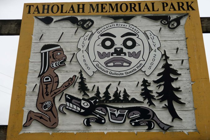
A memorial park is one of the areas threatened by the rising water.

We also found Thunderbird in the park.

Beaver, on the other hand, was hanging out at the Ocean Interpretive Center in Ocean Shores.
Peggy and I drove up to Taholah and checked out the town from where we were staying at Copalis Beach. The area is rich in natural resources from both the forests and the ocean. Taholah sits on the edge of the Quinault River, which has provided a bounty of salmon to the natives for hundreds, if not thousands, of years. (The Quinault Indians believe that they have lived in the area from the beginning when Raven upended a clam shell and found humanity lurking underneath.) But even the salmon are facing the impacts of global warming. The glaciers that provided fresh, cold water to the Quinault are melting and severely impacting the salmon population with both warmer water and extensive silt.
Since hiking is limited on tribal lands, Peggy and I returned to Copalis and headed out to Griffith-Pride State Park for a walk. It was much flatter than the area around Taholah. My thoughts turned from global warming to tsunamis. The whole area from Copalis to Ocean shores could be wiped out in a big one. I couldn’t help but be a tad nervous. It was a think-disaster kind of day.

An interesting trail leads out to the ocean over the low sand dunes at Griffith-Pride State Park.

It was wet along the way!
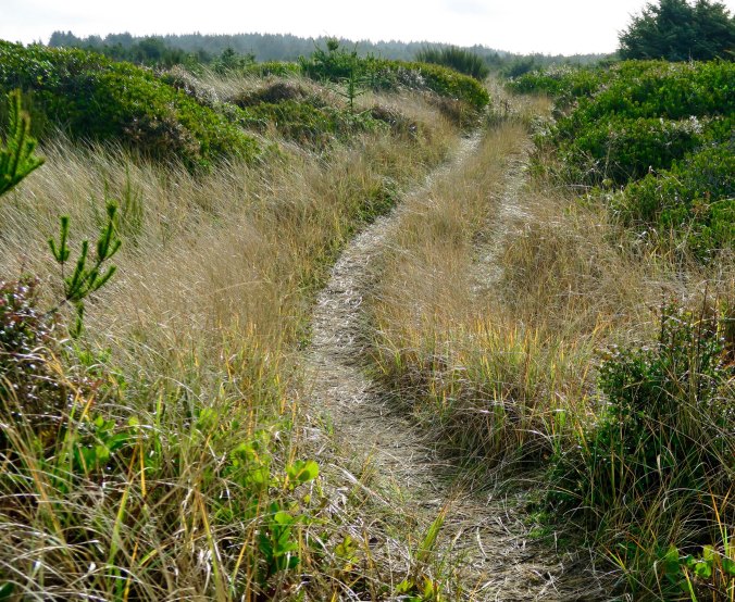
At one time, the trail had been a road.

A half rainbow caught our attention. Clearing skies promised sunny weather. (Photo by Peggy Mekemson.)

Occasionally, the trail disappeared into brush!

Eventually we came on to Connor Creek and found the other half of the rainbow.
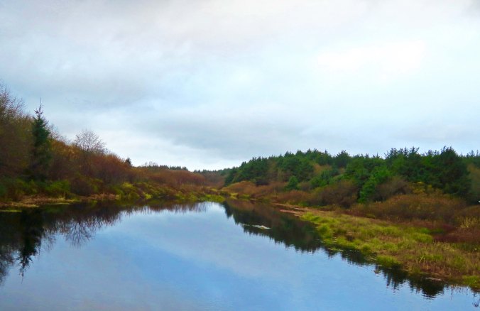
Connor Creek also flowed by where we were staying. More time would have found us kayaking it! (Photo by Peggy Mekemson.)

The creek flowing into the ocean provided a perspective on just how flat Copalis Beach is. Crashing waves can be seen in the distance. It would take a lot of running to escape a Tsunami!

We had a tender prime rib that night at the Quinault Indian Casino in Ocean City, where we were treated to this sunset. It’s a fitting end for today’s post.
WEDNESDAY’S POST: A photographic essay from Scotland
FRIDAY’S POST: Back to blogging “MisAdventures.” The animal kingdom gets banned from my bed
MONDAY’S POST: The end of my series on the Northwest Coast of northern Oregon and central Washington
