As we noted in last week’s post, our 2025 wrap-up is based on three trips we made during the year and blogged about. The first was Hawaii, which I posted last Monday. Today’s post features our Southwest journey where we wandered through the Southwestern US for five months visiting national parks, state parks, and national monuments. Next week’s post will cover our three week leaf-peeping trip through New England in the fall.
The photos used in the three posts are all from ones we selected to include in three calendars we developed for our extended family, each focused on one of out trips. (Not all of the photos here made it into the calendars, but it was a flip-of-the-coin type decision.)
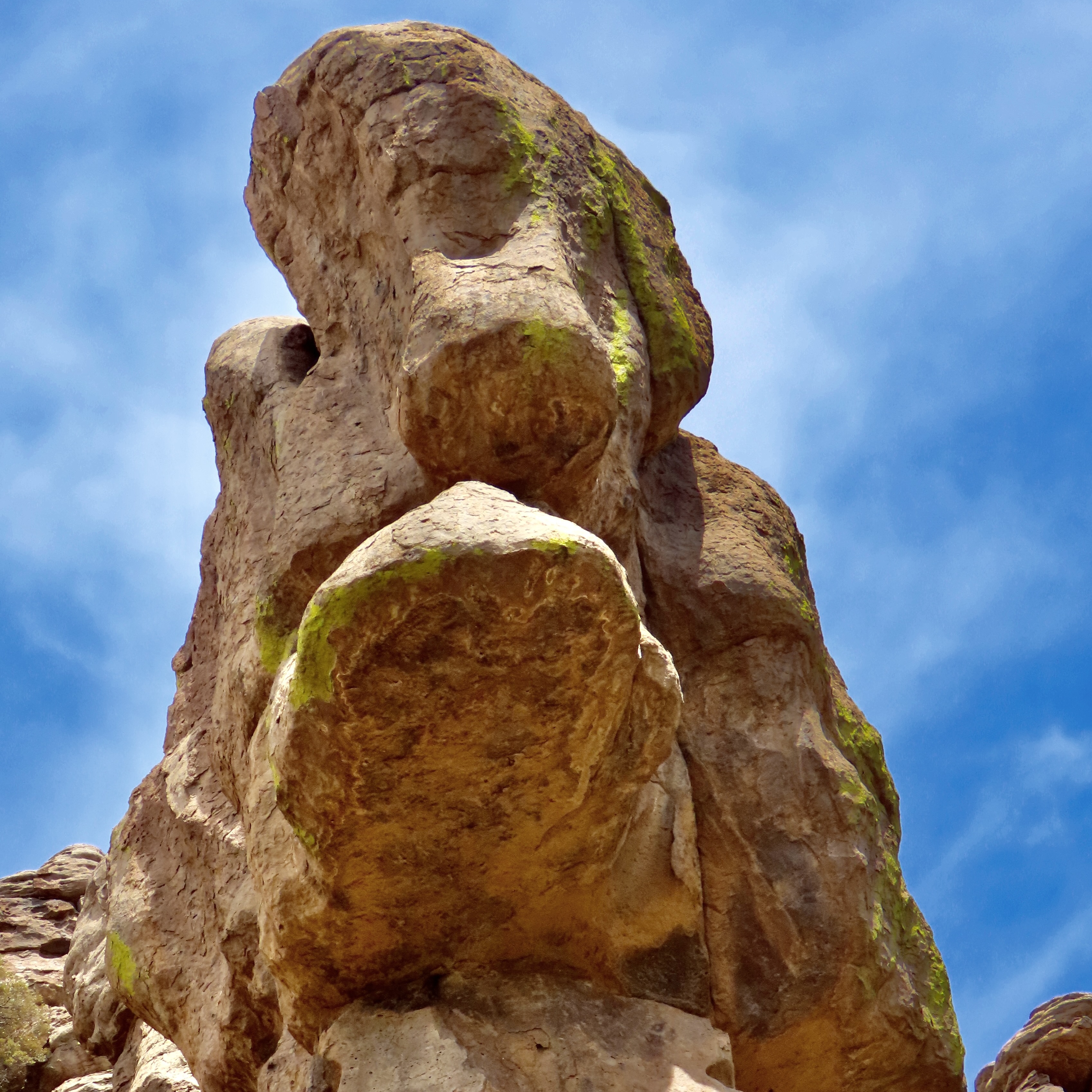
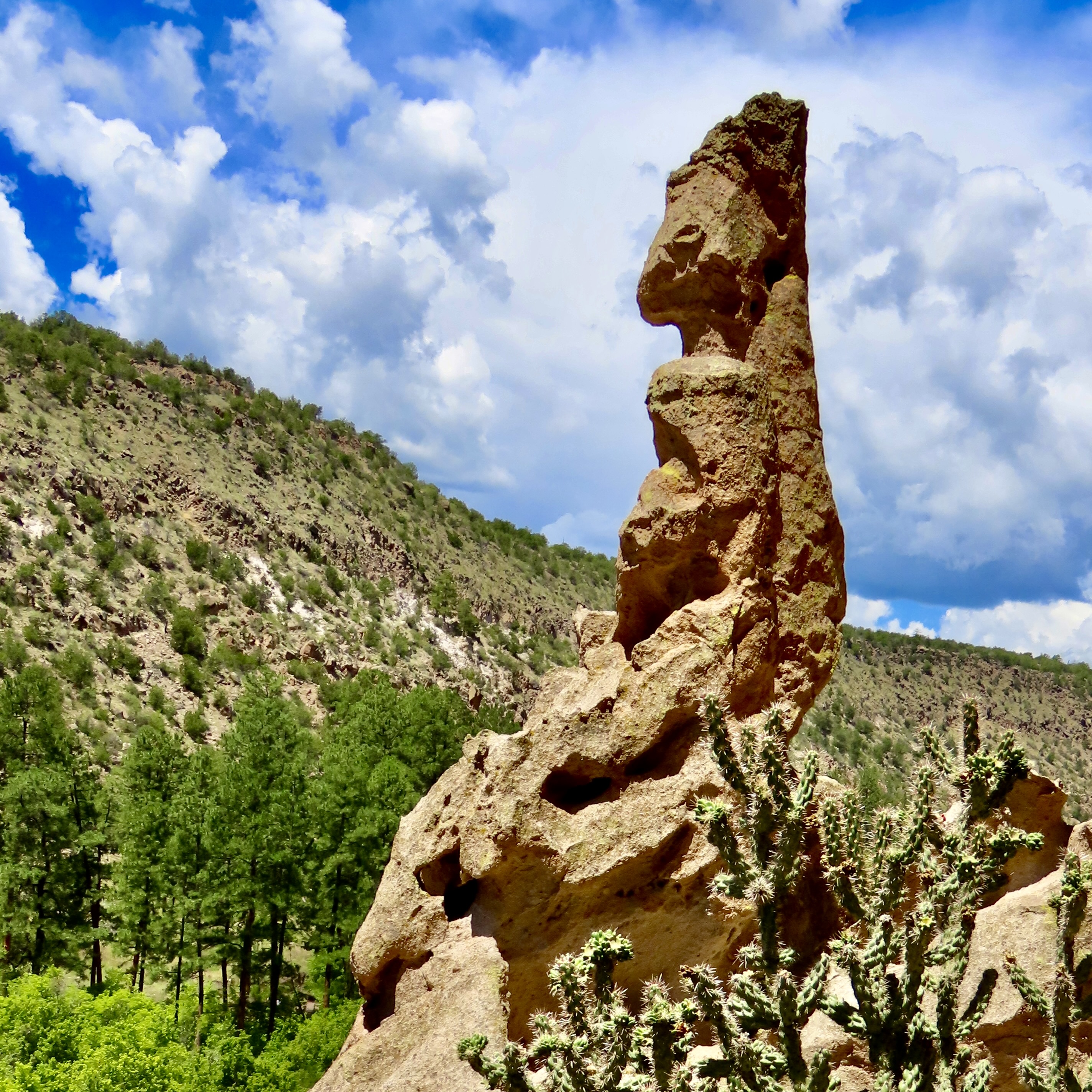
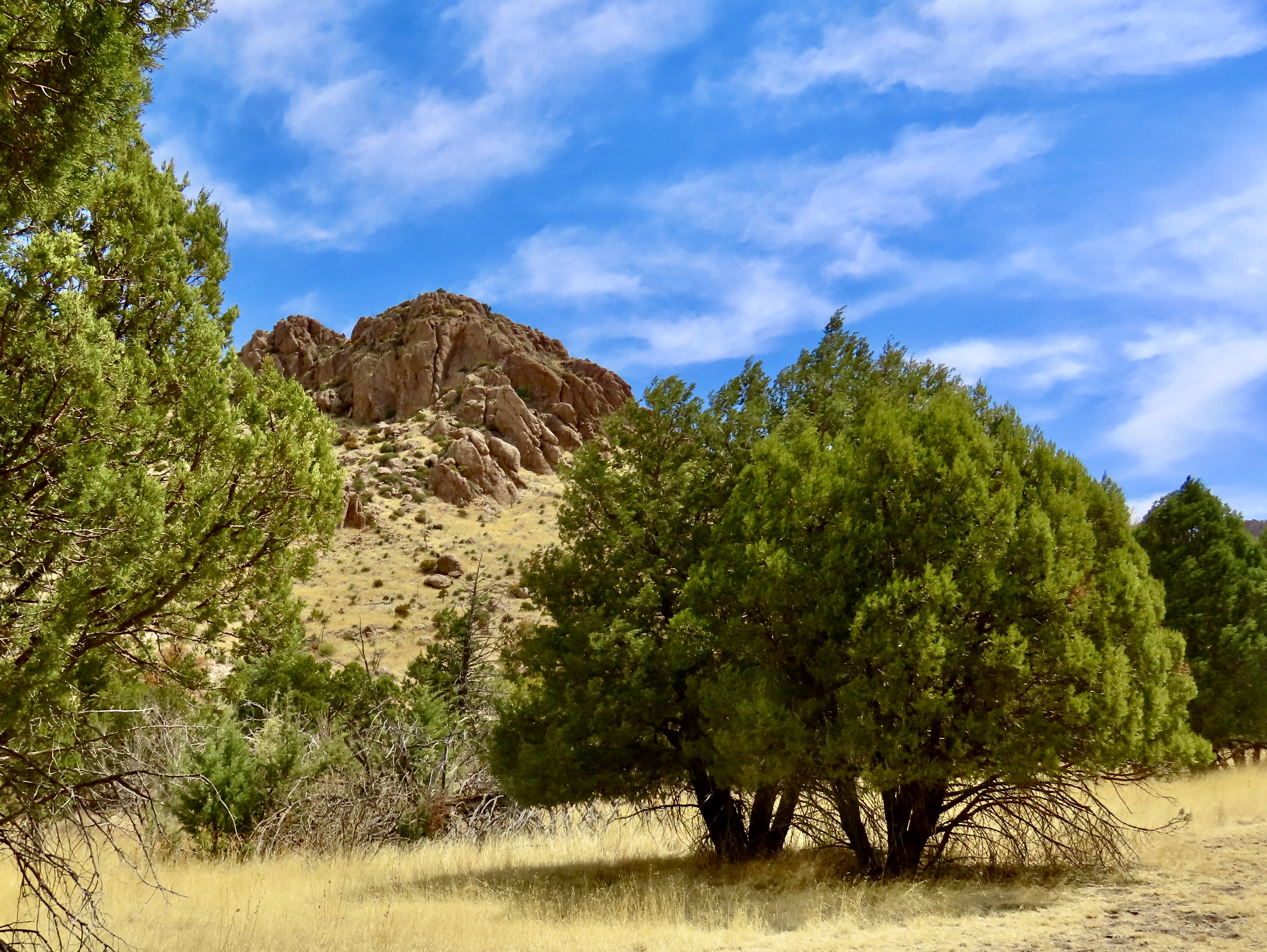
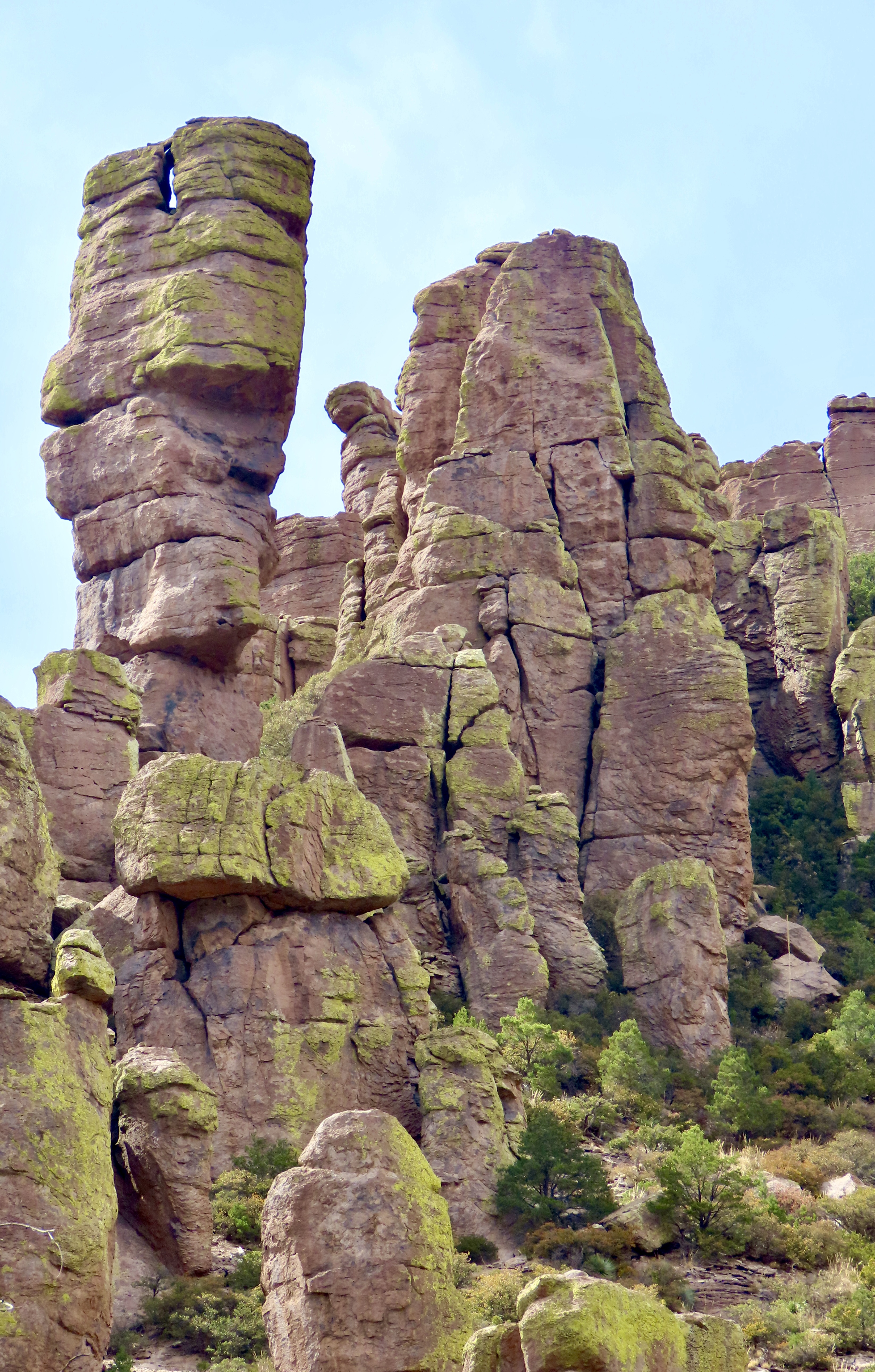
We discovered the towering rock above in Chiricahua National Monument, which is located in southeastern Arizona. The monument is named after the Chiricahua Apaches who roamed the area prior to it being occupied by pioneers from the eastern US. A couple of notes. One, the park is filled with a fascinating variety of rock structures. Two, we have discovered over the years that national monuments often include scenery, geology, history, plants and animals that easily match those found in national parks. They are definitely worth visiting and are usually far less crowded.
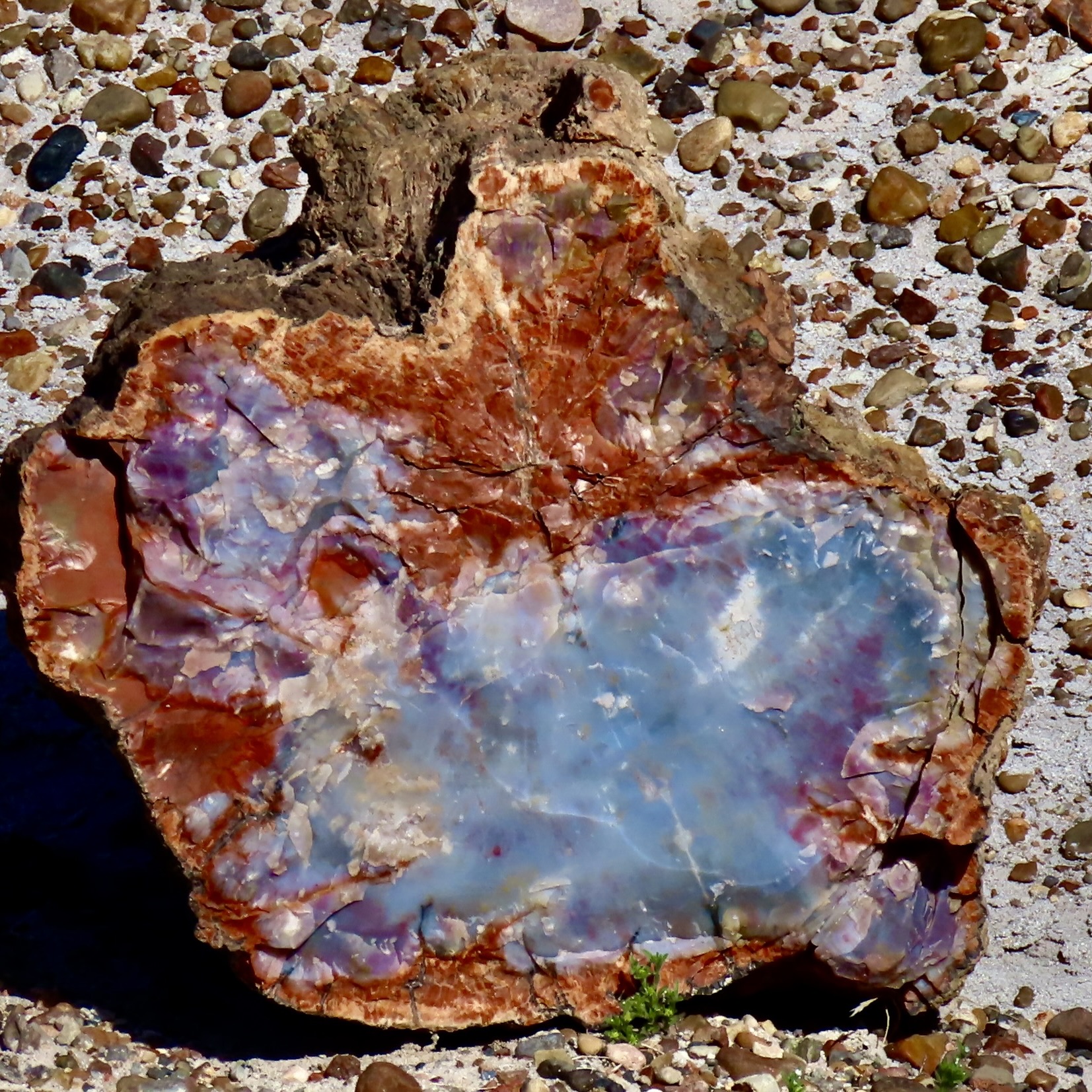
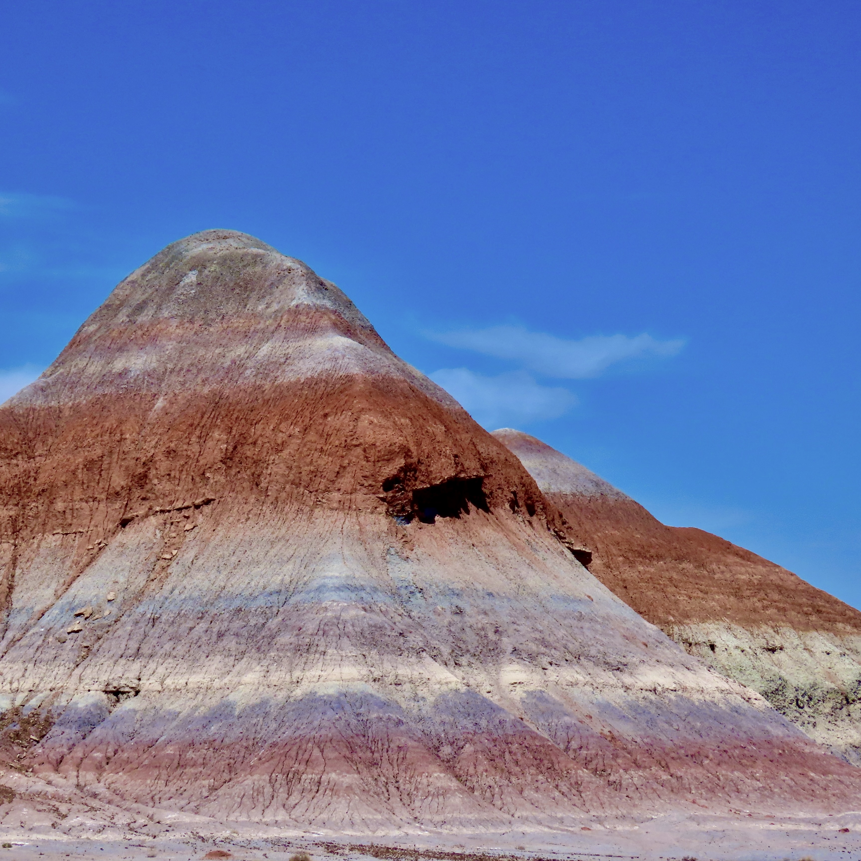
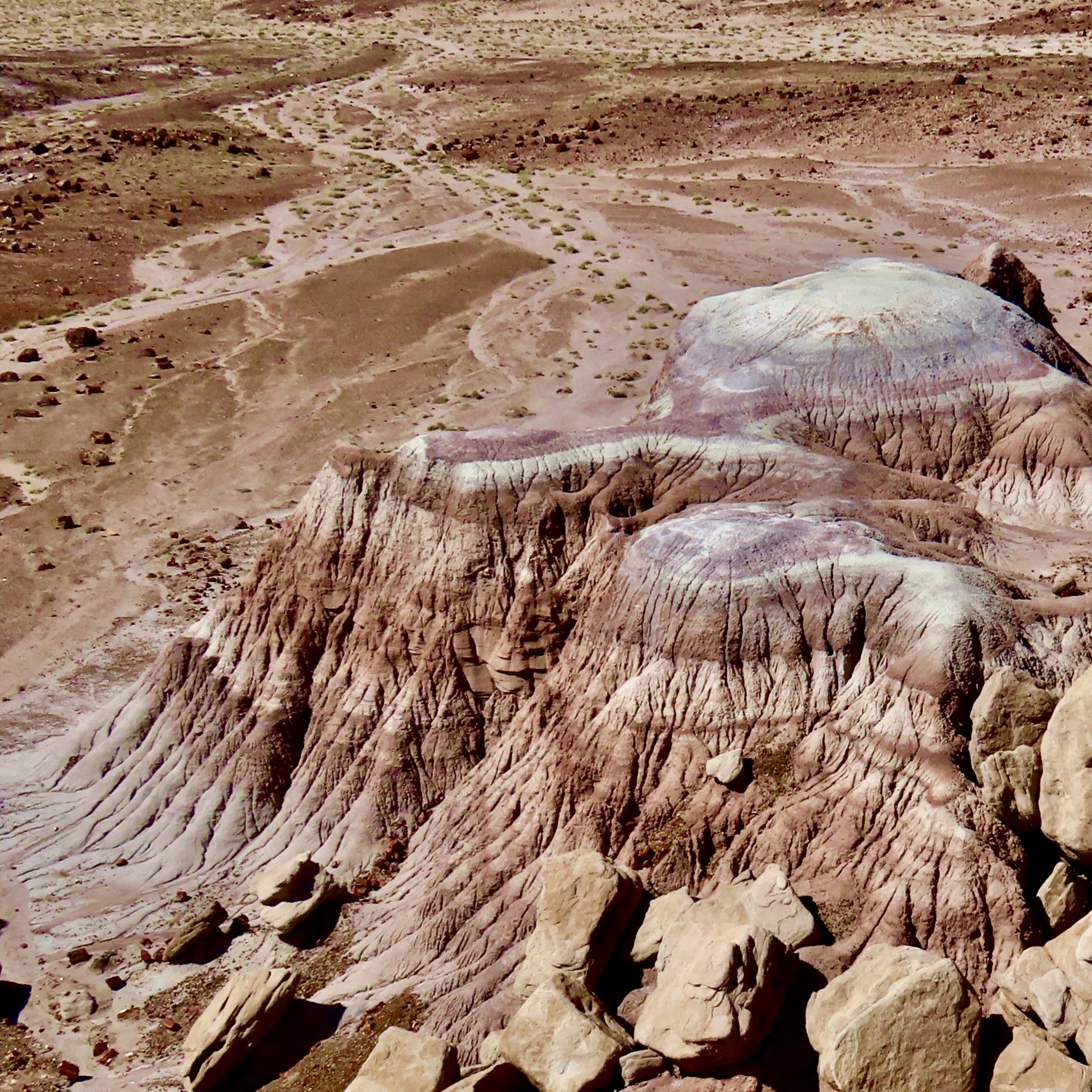
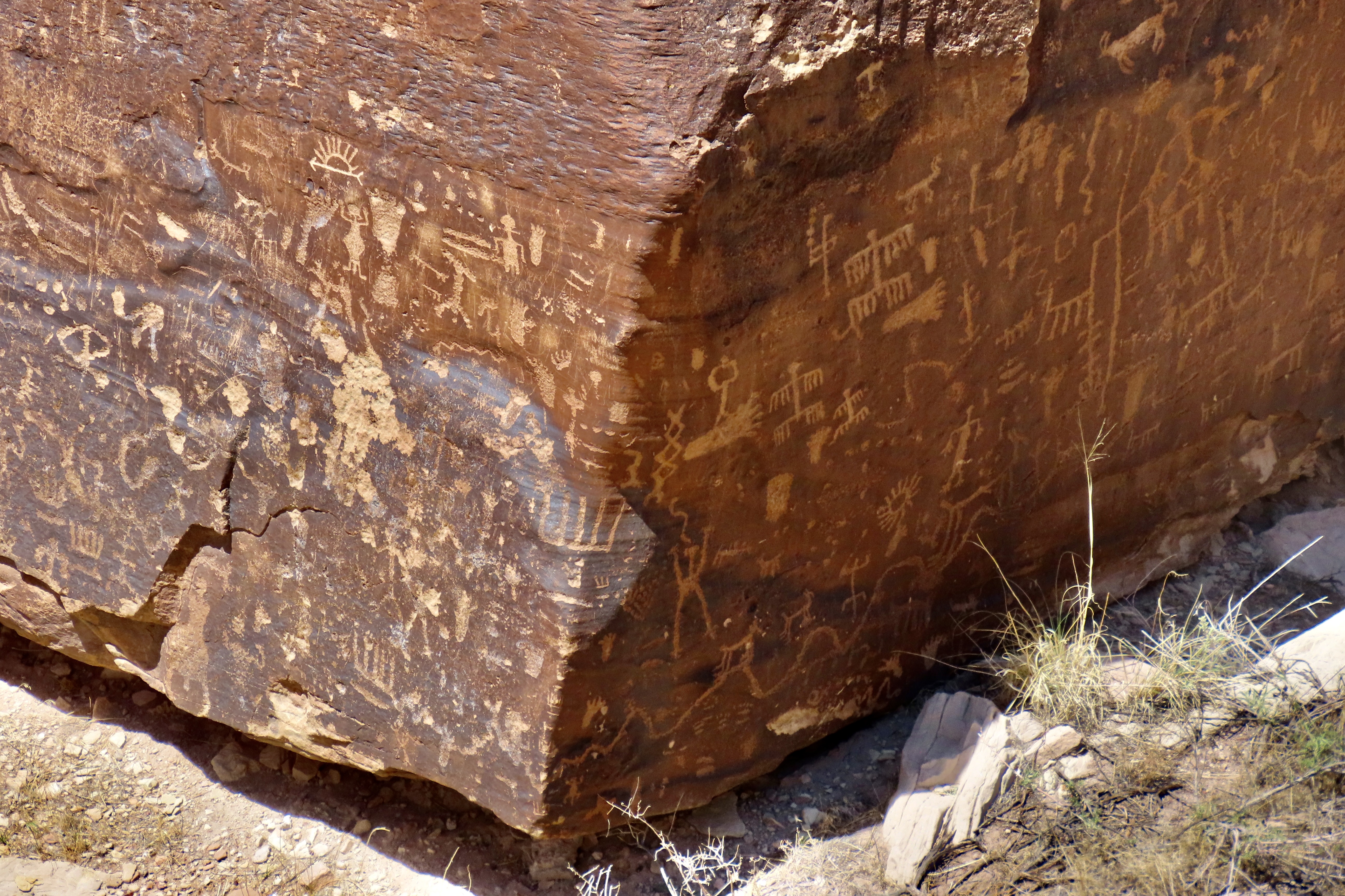
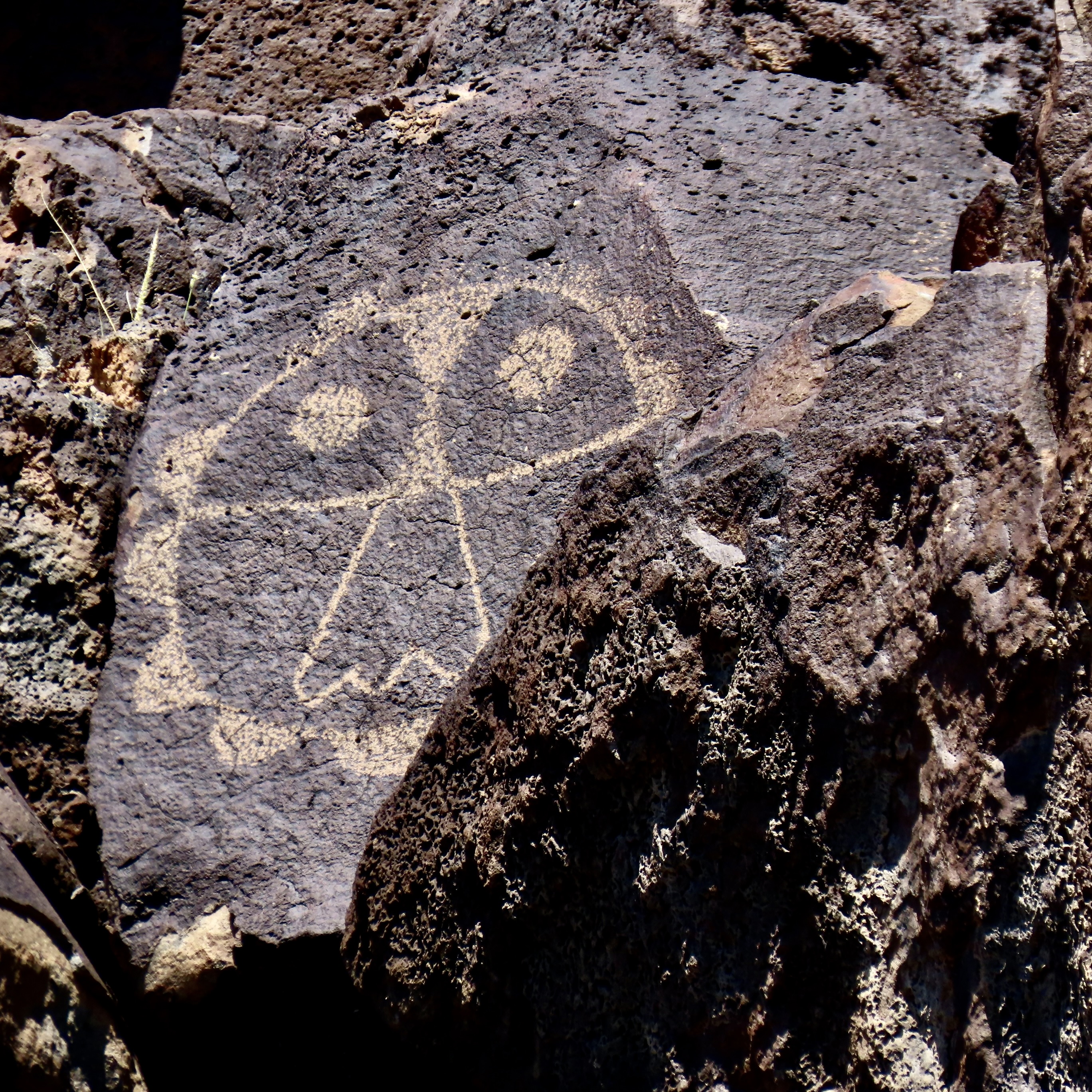
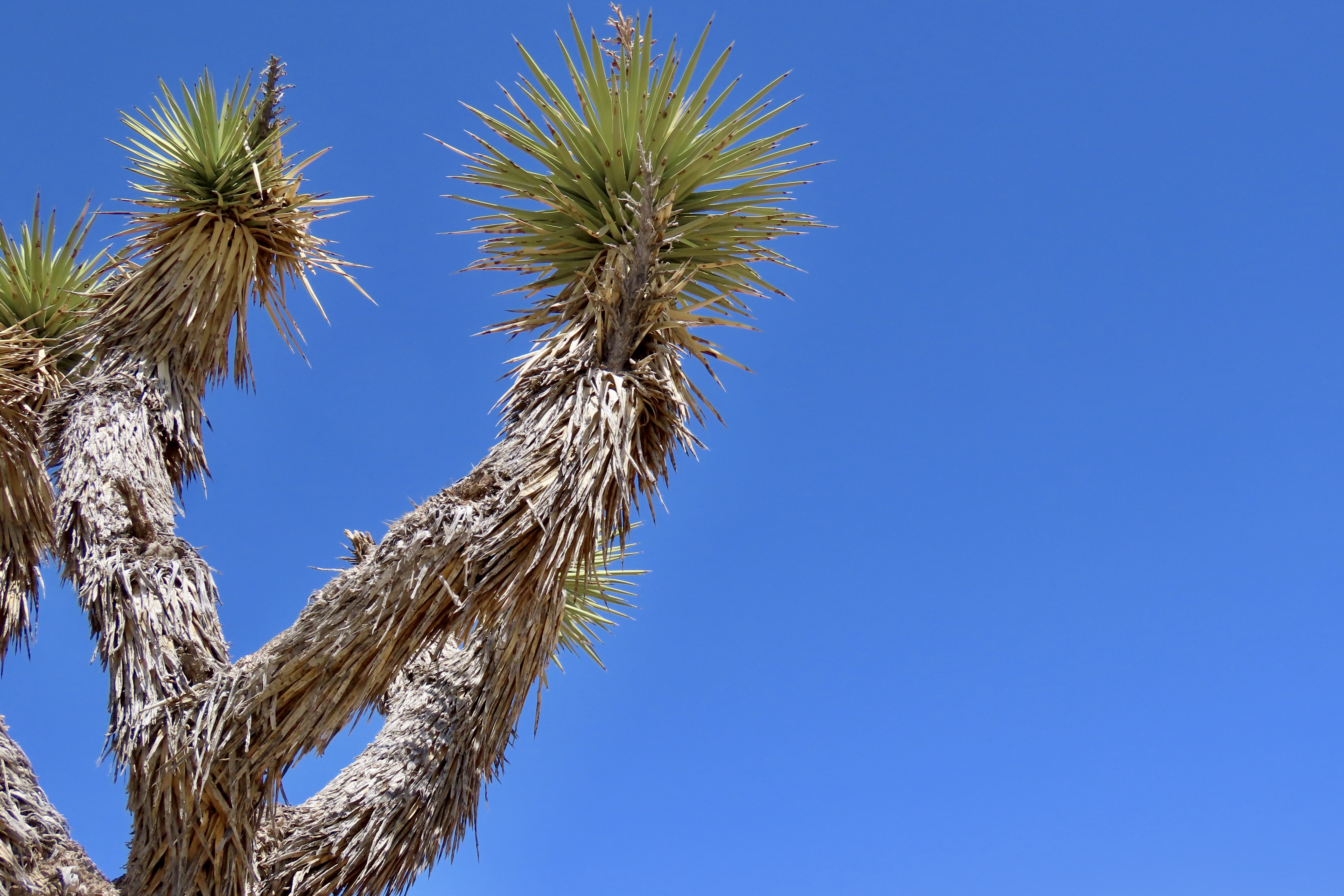
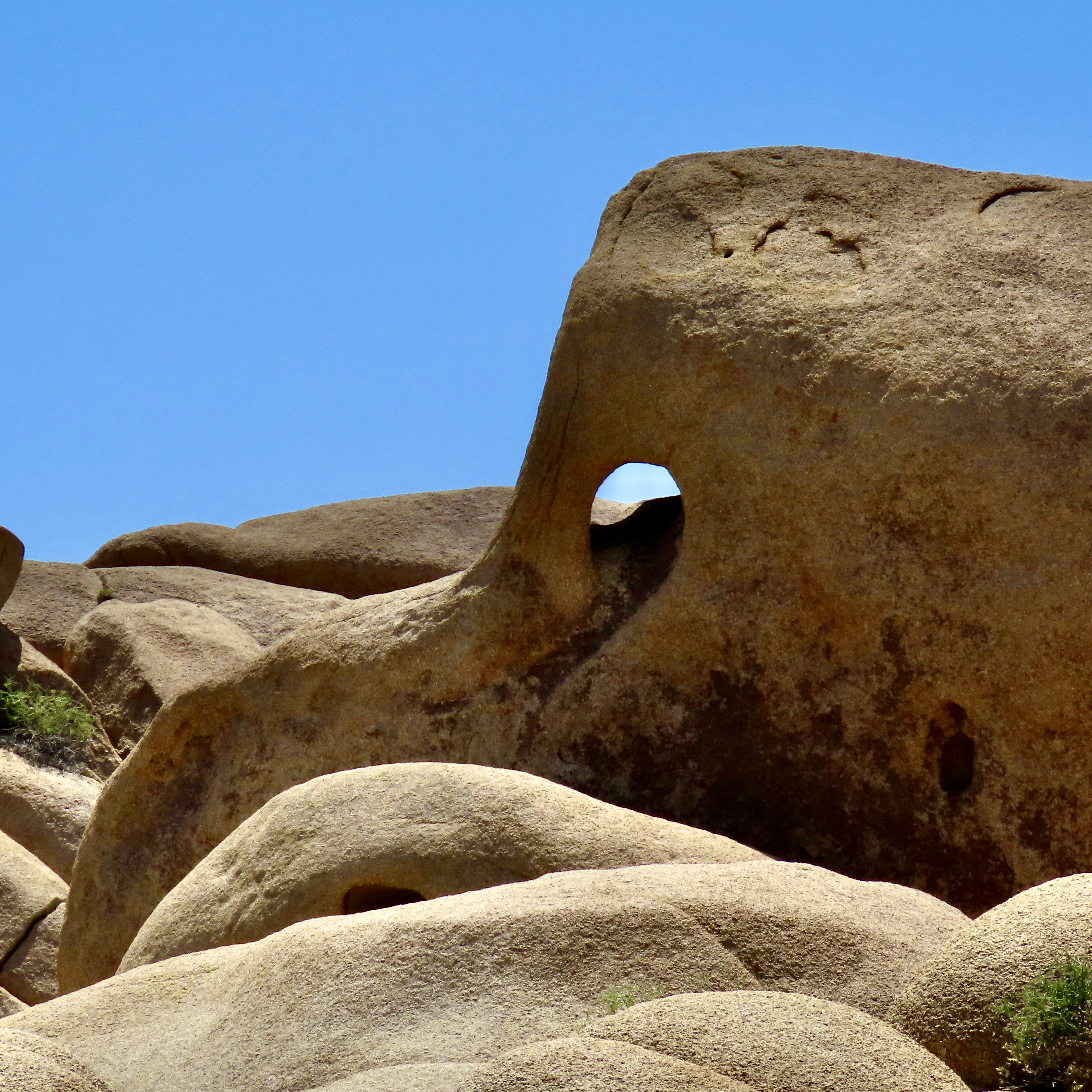
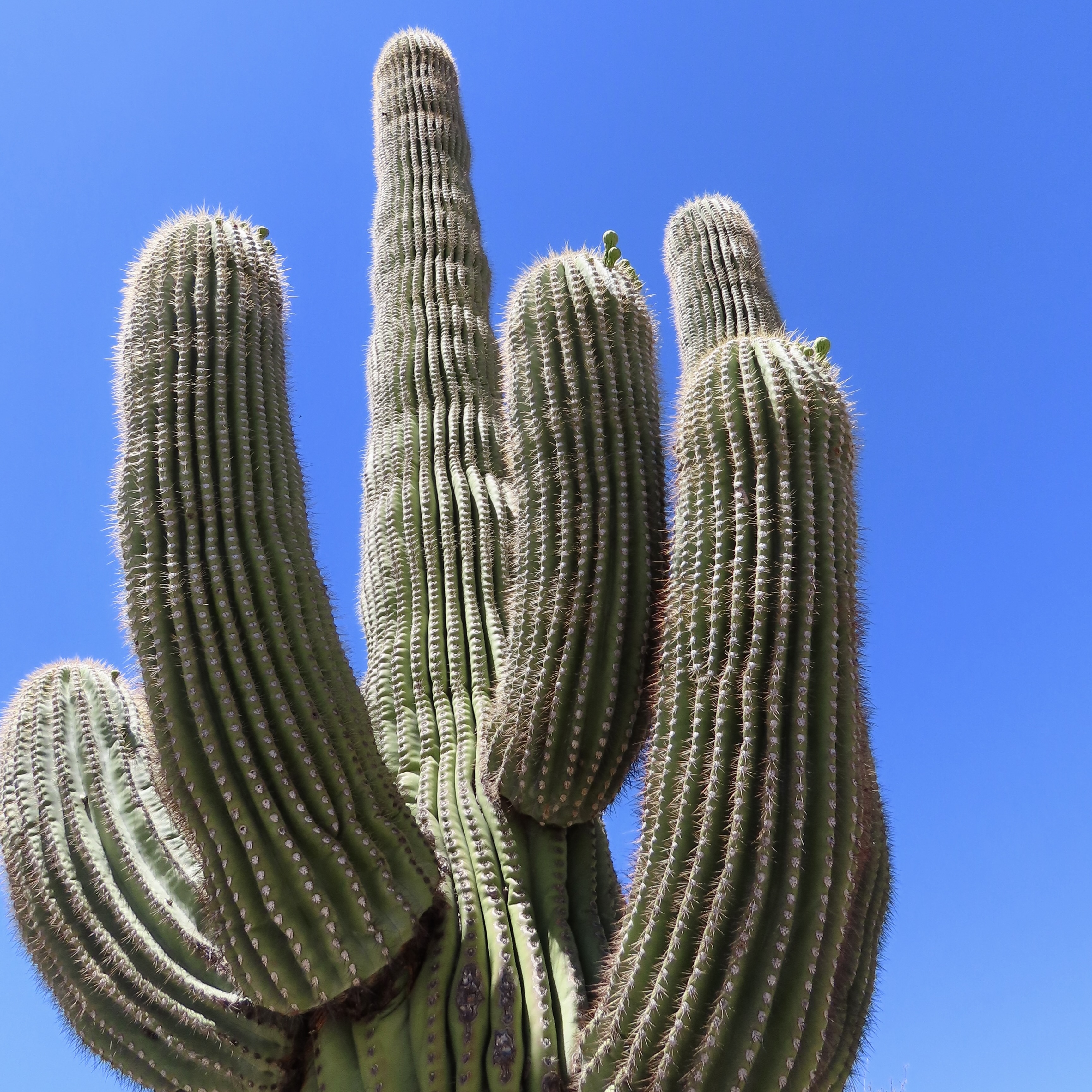
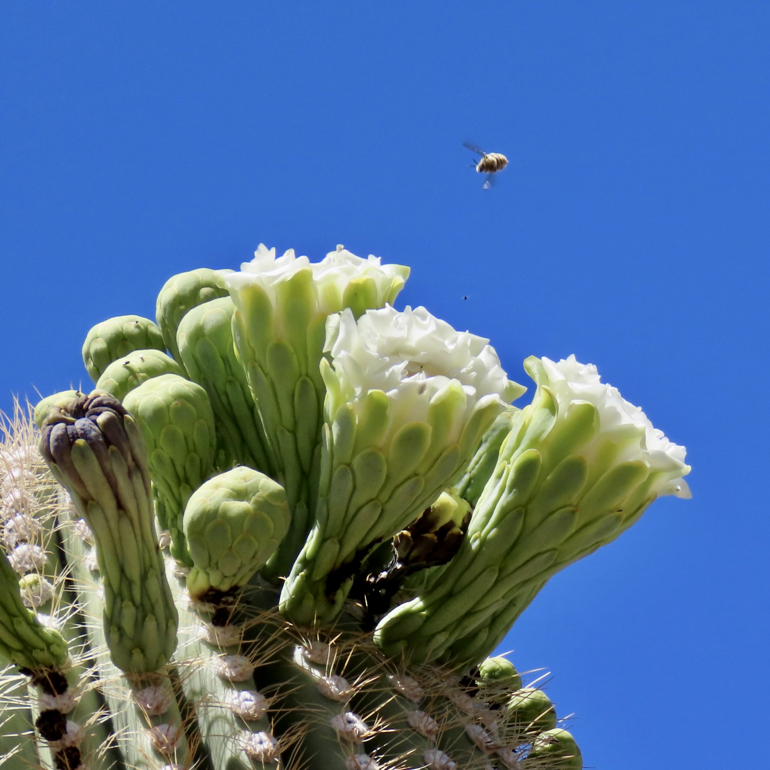
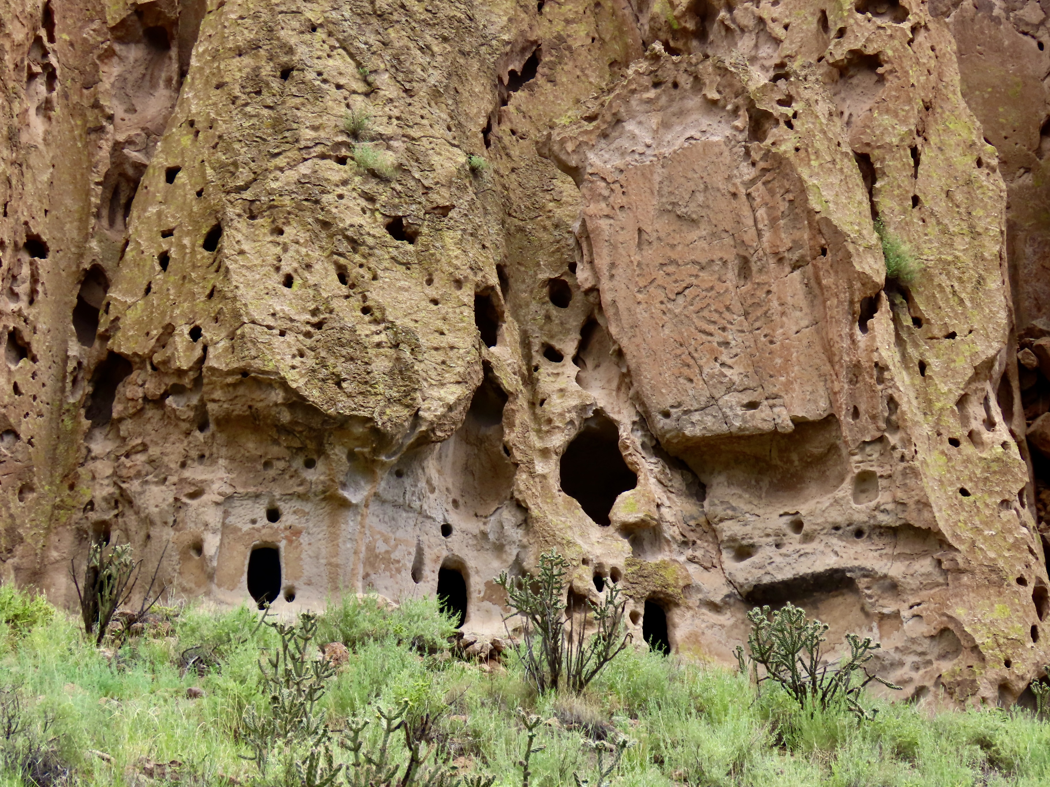
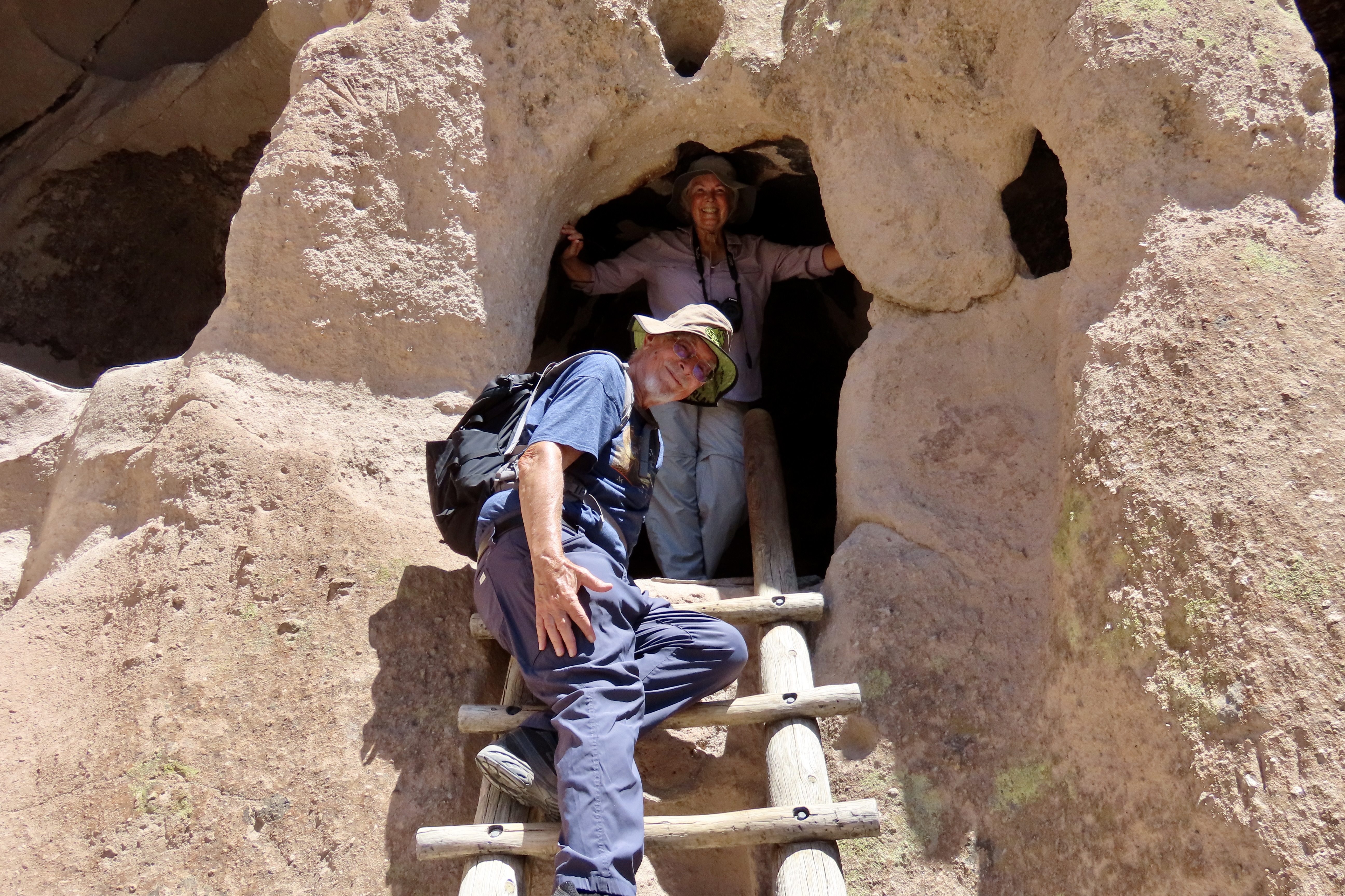
Petrified Forest National Park is found just off of I-40 in eastern Arizona. There are thousands of logs like the one above found in the park. You can still see the bark on this petrified wood that was once a tree that fell 200 million years ago.While most people come to the park to admire the petrified wood, there is also much beauty such as the colorful ‘Teepees’ found on the main road. Each color has a different story to tell representing millions of years in geological history.The Blue Mesa side road includes many other interesting and colorful land forms such as this. If you visit the park, be sure to take the short detour. A walk out in the desert on well maintained trails is definitely in order.Ancestral Puebloans and other indigenous tribes left a view of their ancient world in Petrified Forest NP in petroglyphs on Newspaper Rock. While our understanding of what they were communicating is limited, there is magic in contemplating the possibilities.While we are on the subject of petroglyphs, we found this unique one staring out at us in Petroglyph National Monument in Albuquerque, NM. Over 20,000 petroglyphs have been discovered in the monument. Peggy has plans to include this one in the revision of her word search book: Artistic Word Searches, Unique and Magical: Discovering Petroglyphs from the Southwest.Canyon De Chelly (pronounced shay) is located in northeastern Arizona. Jointly operated by the Navajo Nation that owns the property and the National Park Service, Canyon De Chelly features striking canyon views plus Ancestral Pueblo ruins and petroglyphs left behind by both the Pueblo peoples and Navajos.Our trip this past spring and summer took us into Califonia where we visited family and friends in San Diego, LA, and Sacramento. We also took time to visit Joshua Tree National Park in Southern California, known for its strange trees, after which it is named.We found the rock structures to be of equal, if not greater, interest. Some of which could be said to possess personalities.In addition to being known for its outstanding rock forms (think of the Grand Canyon, Zion, Bryce and Arches— plus what we visited this year), the Southwest is noted for its deserts and cacti, none of which is better known than the Giant Saguaro. We’ve often stopped to admire these huge plants in Saguaro National Park but have never been in Arizona when they are blooming. Things were about to change. Note the buds popping out on top of the arms.This time we were lucky. The blooms are almost other-worldly, in addition to being a source of food for numerous insects such as the bee coming in for a landing.A number of other cactus flowers also lit up the desert.Like plants, animals adjust to the deserts of the Southwest. Several birds choose to nest among the needles of various cacti including the curved bill thrasher Peggy found raising her family in a cholla cactus. The thrasher was not happy when she sneaked up to it and her hatchlings to catch a photo with her iPhone. It’s probably a good thing Peggy couldn’t understand what momma was saying.Bandelier National Monument, located mere miles away from where the first atom bomb was created at Los Alamos, New Mexico, features the ruins of homes built by Ancestral Puebloans that included natural and carved caves (cavates) with pueblo structures once built up against them.Peggy and I climbed up to one of the cavates. It was quite cozy inside. “Honey, I’m home.”Just beneath the cavate, this outcropping of rocks overlooked the large Tyuonyi Pueblo at Bandelier. A corner of the ruins can be seen here. It was built in a circle and contained contained 400 rooms.This tall rock was among the rocks in the outcropping. My first thought was wow! Nowhere in our travels though out the Southwest have we seen a statue like it carved by Ancestral Puebloans or any other indigenous tribes. We had a guide to the trail we were walking on, but there was no information on the statue. Nor was there anything in the information center. The emphasis was all on the scenery, cavates, petroglyphs and pueblos. Human or nature carved, I would think that the park’s literature would at least comment on it. That’s it for today. Next up:We wrapped up our year of travel with out trip to New England so it’s proper that we finish off 2025 with the trip.
Happy New Year to everyone and thanks for joining us on our adventures in 2025. It’s much appreciated. Costa Rica, Bali, and Scotland are coming up in 2026! Curt and Peggy
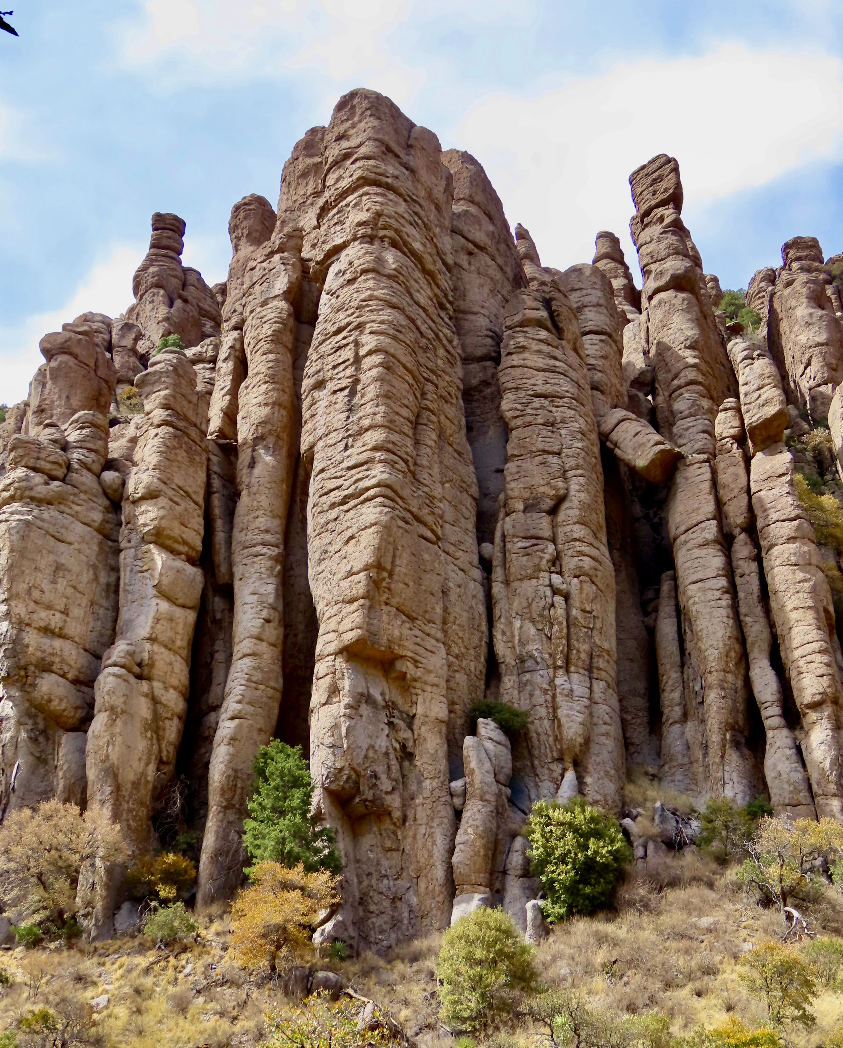
Peggy and I were immediately struck by the combination of golden grass, green trees and impressive rocks set off by the blue skies when we arrived at Chiricahua National Monument two weeks ago. There was little indication, however, of the fantasy-land of rock sculptures we were about to enter.
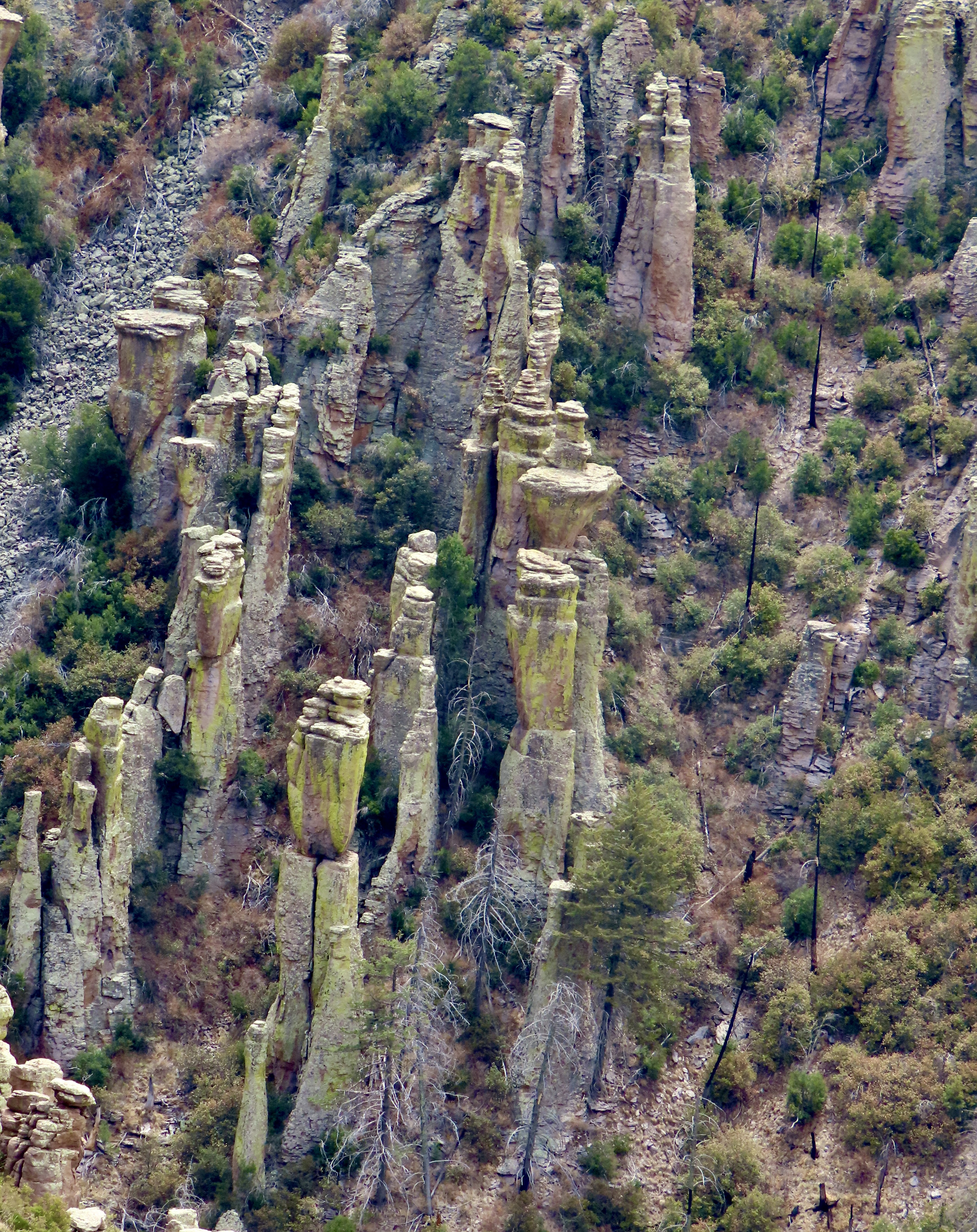
The rock formations got their start when a massive volcanic erupted 26.9 million years ago and buried the area under a combination of hot ash and pumice. Extreme heat then welded the ash and pumice into the rock known as tuff. As the tuff cooled, it contracted, creating cracks and joints. Water seeping into the cracks and then freezing, aided by wind and gravity, caused erosion, eventually creating the thousands of rock columns that Chiricahua National Monument is famous for.
The monument is located in southeast Arizona’s Chiricahua Mountains near the community of Willcox. Curious about the name, I googled it and was entertained by AI. First, it informed me that the Chiricahua Mountains were named after the Chiricahua Apaches who lived in the area. Ok. I then asked asked where did the Chiricahua Apaches get their name. They were named after the Chiricahua Mountains, AI stated. Hmmm. I tried again and was told that the name comes from an Opata word, “Chiwi Kawi” that translates to Turkey Mountain. Now you know. Or do you?
The Apaches were tough. Their Great War chiefs Geronimo and Cochise bordered on legendary and held out longer than most other Indian tribes of the West against the onslaught of Eastern settlers, miners, and cattlemen eager to take away their lands. The military was sent out to solve the problem by forcing them onto reservations. It was not an easy task. First they had to catch the Chiricahua who combined guerrilla warfare with an ability to disappear into the rugged landscape that seemed almost magical.
Today, Peggy and I are continuing our series on national parks, monuments, and wilderness areas with an emphasis on their unique beauty, geology, flora, fauna and history that makes them so important to us today— and even more so in the future as populations continue to expand. As Aldo Leopold said: “The richest values of wilderness lie not in the days of Daniel Boone, nor even in the present, but rather in the future.” A future that is now under threat.
National monuments are particularly vulnerable today as the Trump Administration explores downsizing several of them to open up new lands for drilling oil and mining minerals
As with each of our previous posts in this series, we will present 25 photos that focus on the beauty and unique characteristics of the park, monument, or wilderness we are blogging about. All photos have been taken by either Peggy or me unless otherwise noted.
Welcome to Chiricahua National Monument.
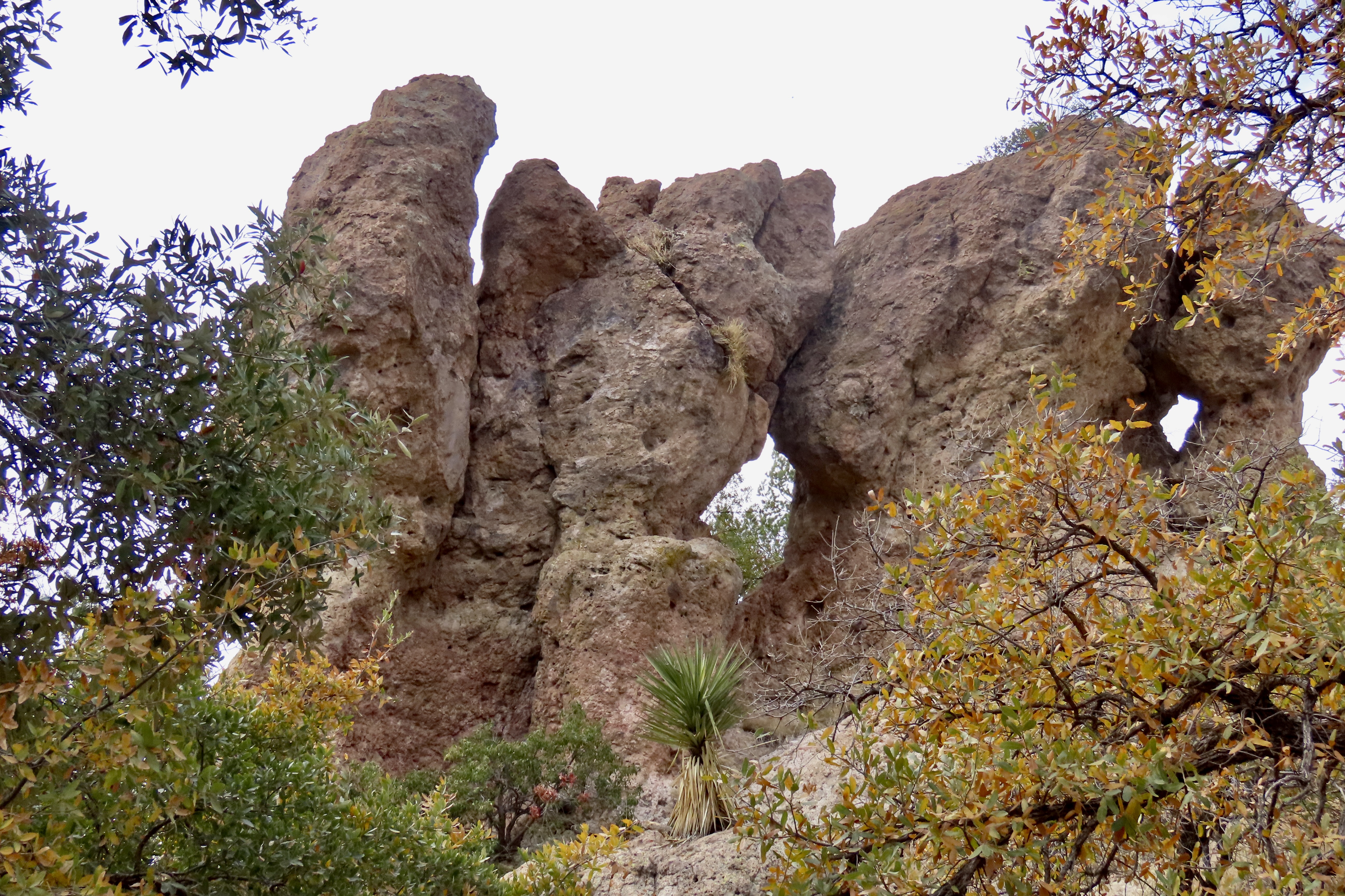
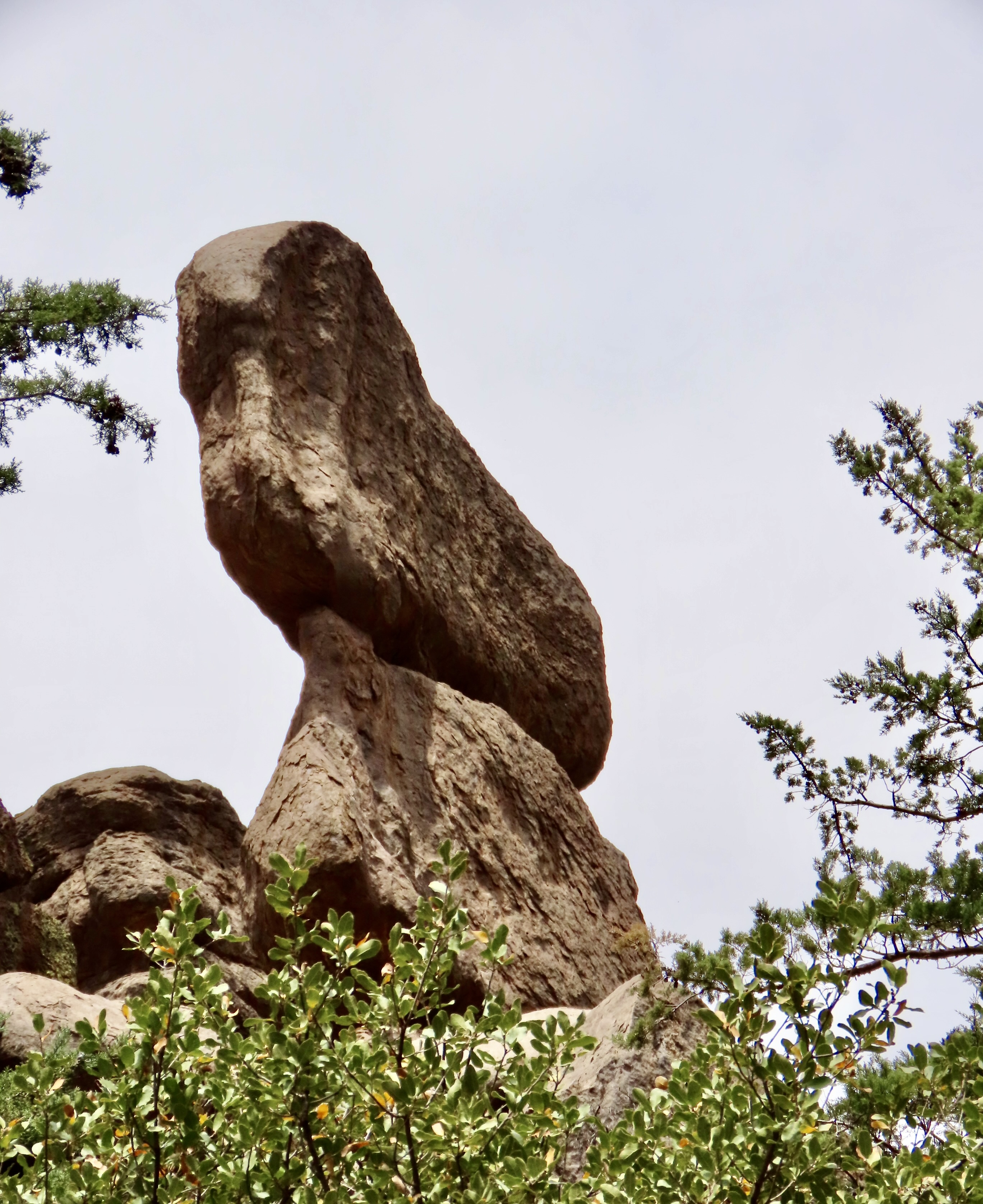
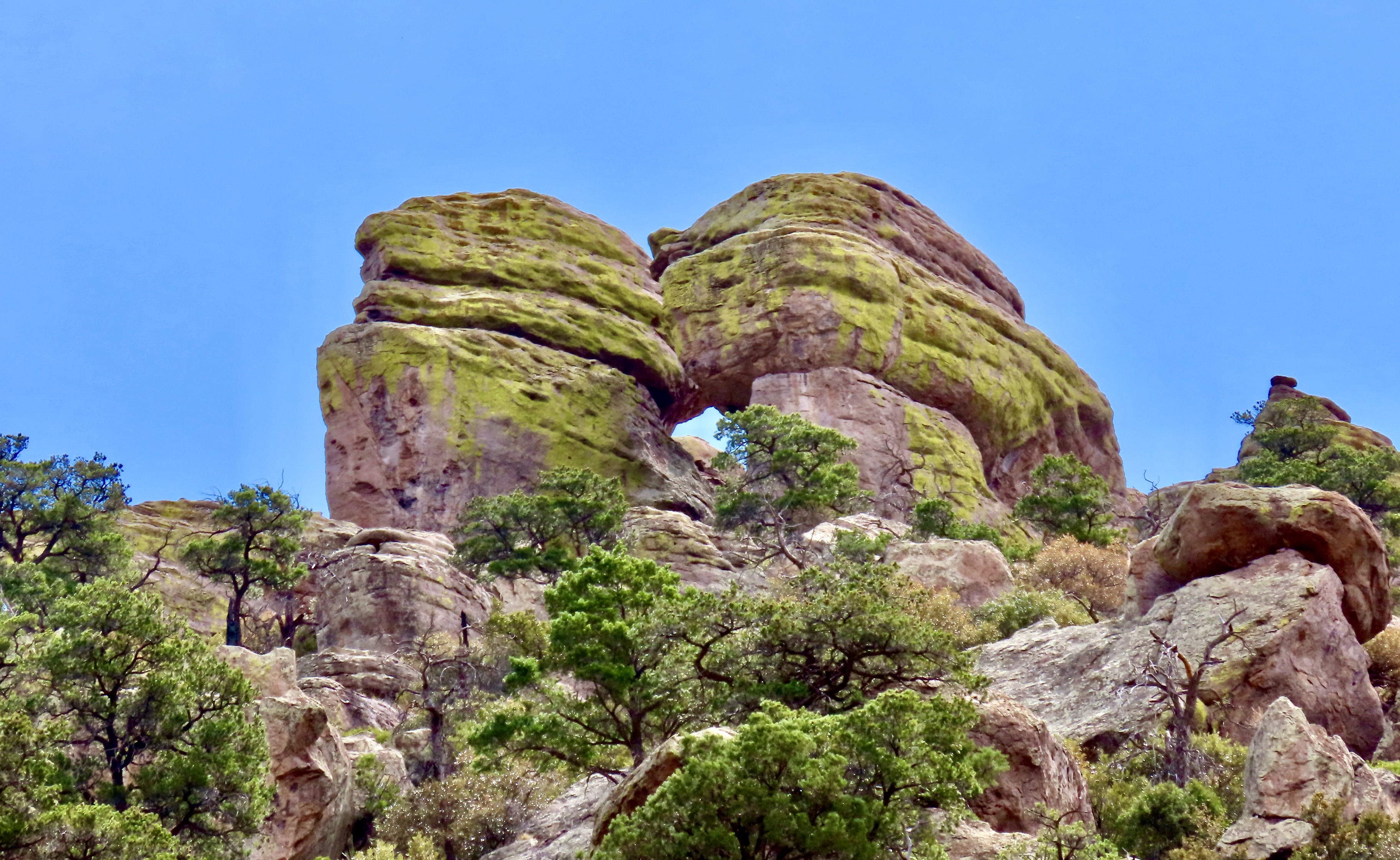
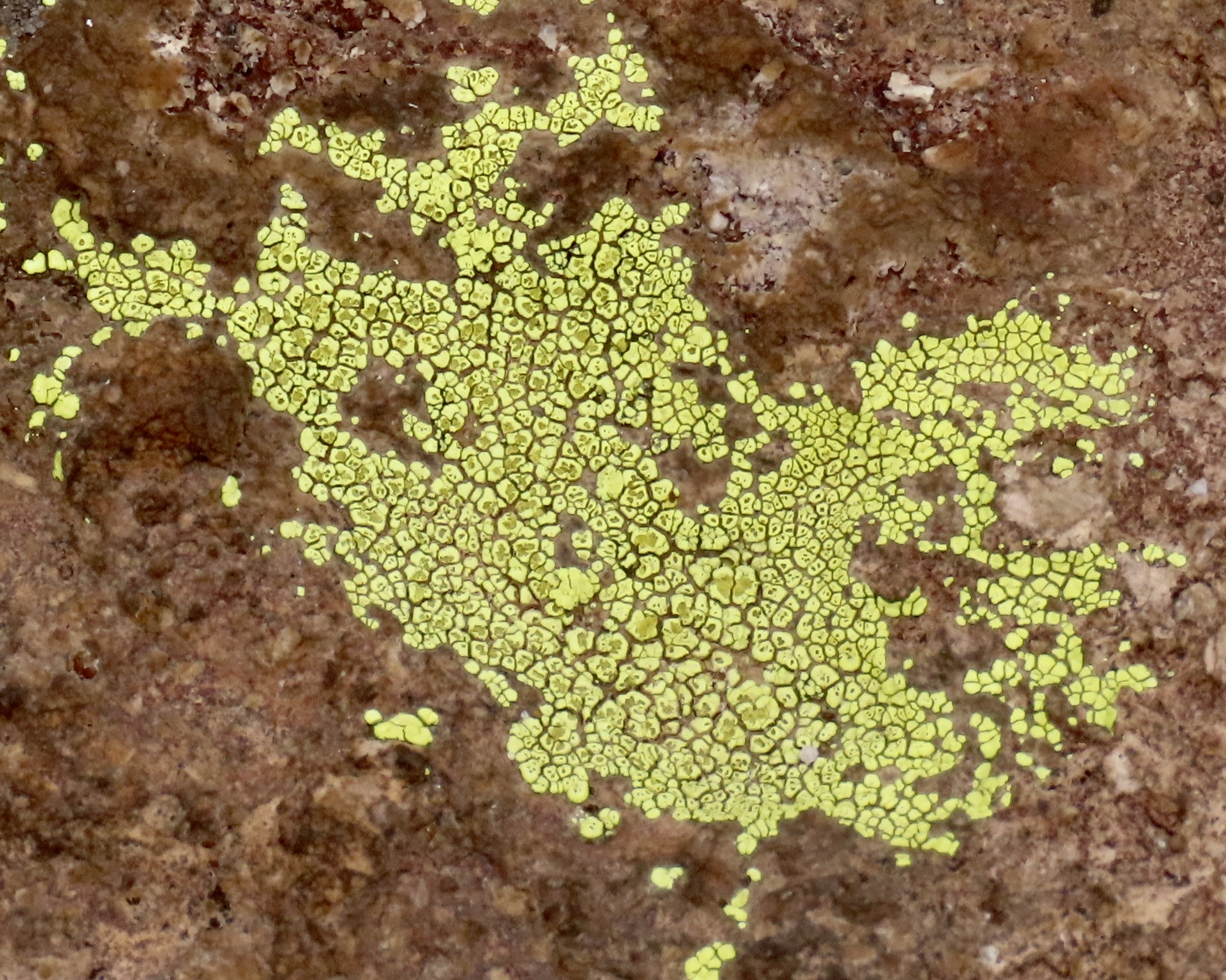
The first place that visitors usually stop at Chiricahua National Monument is the Far Away Ranch, which was built by the Swedish immigrants Emma and Neil Ericson. I think it was Emma who named the ranch Far Away because it was so darned far away from anything else. In addition to the usual challenges that settlers faced, such as irritated Chiricahua, Neil often had to work away from home for long periods to help support the family while Emma oversaw the ranch. Eventually, along with their children, they added a guest ranch to their cattle ranch. The family also became strong supporters of the creation of the National Monument. In addition to the windmill above, the ranch contains a number of buildings that tell the story of early settler life.This lizard was hanging out on the wall of one of them while scrutinizing me. (Or was it smiling?) I complimented the fellow on its camouflage.As we left the ranch and headed for the visitors center, this impressive rock monument came into view.Shortly afterwards we got our first glimpse of the columns we would soon be driving through.This attention-grabbing group of rocks was right across from the visitors center. We went in to check out the center. They are almost always a source of great information. Limited staff may make it difficult to keep them open this summer. A volunteer was busy urging visitors to contact their congressmen and women about the issue.Bonita Canyon Road was our guide into the monument. A campground was located near the entrance. The color of the trees looked like fall, but they were announcing spring.One of our first views of columns along the road was the Organ Pipe Formation towering 75 feet into the air.A closer look provides the view that is usually associated with Chiricahua National Monument. This view shows the joints (up, down and across) that allowed for the creation of the columns. We also found the crooked column interesting.Peggy was quite taken with this column because the top reminded her of a dog (eyes, ears and nose).Numerous other rocks caught our attention as we drove through the canyon including this balanced rock. Peggy thought this pair of large rocks looked like they were kissing. The green color, BTW, is created by lichen.A photo of the crustose lichen we found growing on the rocks.I was impressed with this formation along Bonita Canyon Road— and the lichen.At the end of Bonita Canyon the road made a right turn and began a steep climb up to Echo Canyon and Masai Point. We headed up to Masai Point first and were treated to the view of tall, skinny, capped-off columns.They seemed to be marching up the hill. A much different view was provided just up the trail…Short, stubby columns.Hundreds, maybe even thousands of them.They provided a view across Sulpher Springs Valley and the Distant Dragoon Mountains where Cochise had his stronghold.About a half mile down the road from Masai Point, the Echo Canyon Trail provided us with more scenic views and impressive rocks.A rock that looked bird like…A rock family.Two rocks from the same stone.And another balanced rock.We never would have guessed that Chiricahua National Monument held such treasures. But that is the story of America’s national parks, monuments and wilderness areas over and over and over. Next up, we will take you to Saguaro National Park where the giant cacti were just coming into bloom last week.