
Wispy clouds added to the spectacular sunset Peggy and I watched from the airport overlook in Sedona, Arizona.
“They told us at the Chamber of Commerce that we could see the sunset from here,” a woman complained loudly. “And it is hidden by the trees.”
“Maybe we are supposed to be looking at the rocks,” her husband suggested timidly, like he was afraid he might be yelled at.
Peggy and I shared an amused look. The ‘rocks’ were spectacular, reflecting a sun still one hour away from sinking beyond the eastern horizon. The show would only get better; nature was having one of its grand moments. The overlook beneath Sedona’s airport was the place to be at sunset.
Sedona sits beneath the edge of the Colorado Plateau, and the rocks we were looking at reflected over 300 million years of the earth’s geological history. They told a story of ancient oceans, and lakes, and rivers, and sand dunes. Laid down in layers over the eons, most of the rocks were the same ones we had admired so often in the Grand Canyon.
The erosive forces of nature— wind, water and gravity, were chipping away at the Colorado Plateau, leaving us with the spectacular views we were admiring. Capped by volcanic rocks, the different layers of sedimentary rocks eroded at different speeds, adding formations that people couldn’t resist naming. The Coffee Pot, Chimney, Capitol Butte, and Sugar Loaf loomed directly in front of us.
While knowing a bit about the geology of the area enhanced the experience, the only requirement for admiring the beauty was to sit back and enjoy.
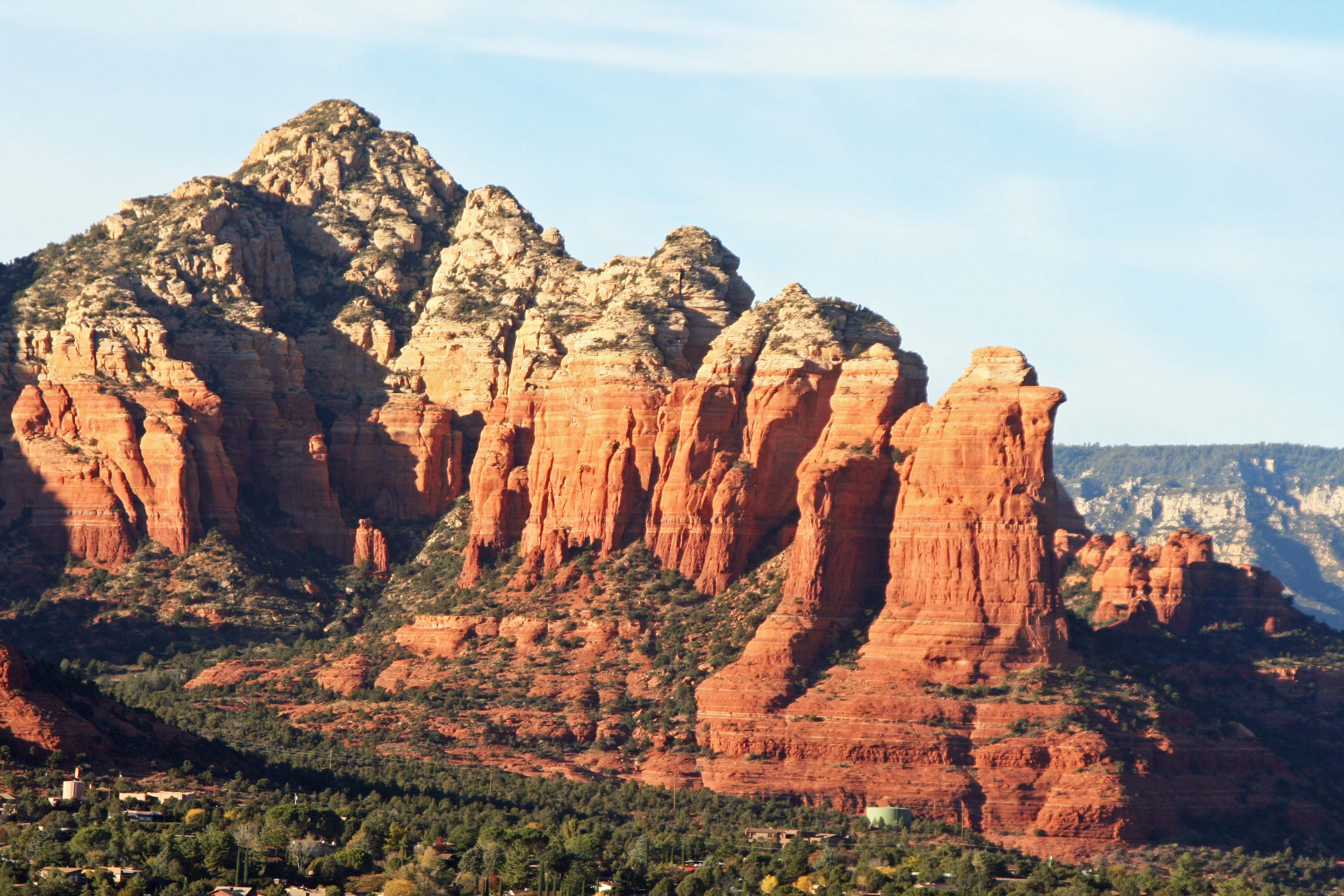
These rocks, known as the Coffee Pot, provide an excellent example of layering and various rates of erosion. The top, lighter layer is Coconino Sandstone and was once part of a huge desert filled with sand dunes like the Sahara Desert today. The red rocks are known as Schnebly Hill Sandstone and were once laid down in an ocean. The red is caused by iron oxides captured by the sea. The rocks are ‘rusting,’ so to speak. (Photo by Peggy Mekemson.)

A close up. Note the different impacts of erosion. The Coconino Sandstone erodes much more quickly than the Schnebly Sandstone. (Photo by Peggy Mekemson.)
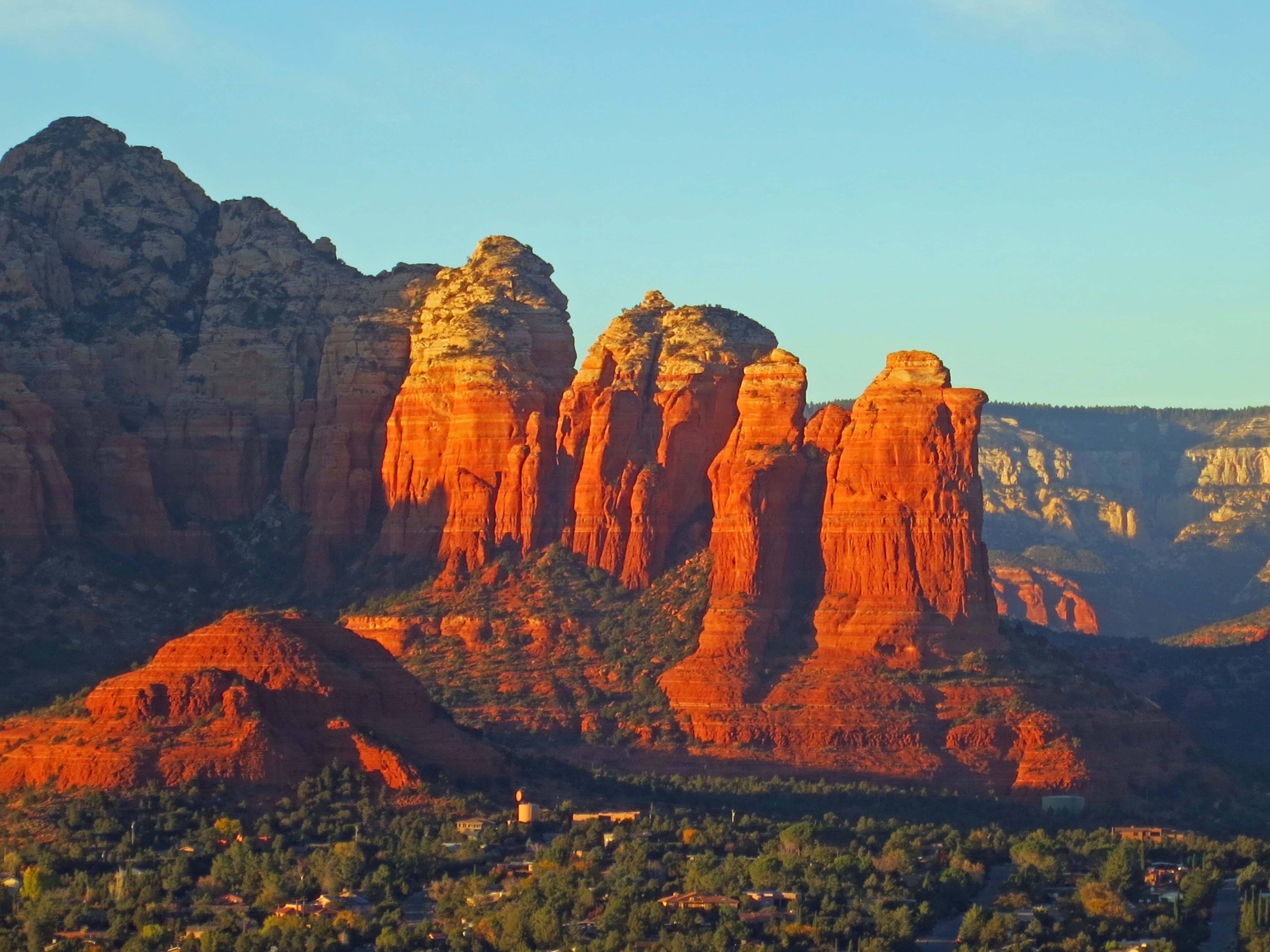
As the sun sank, the reds took on a deeper color. The Sugar Loaf formation is in the front.

Capitol Butte is just to the left of Coffee Pot. Chimney rock is further to the left. Sedona stretches out from the Butte.

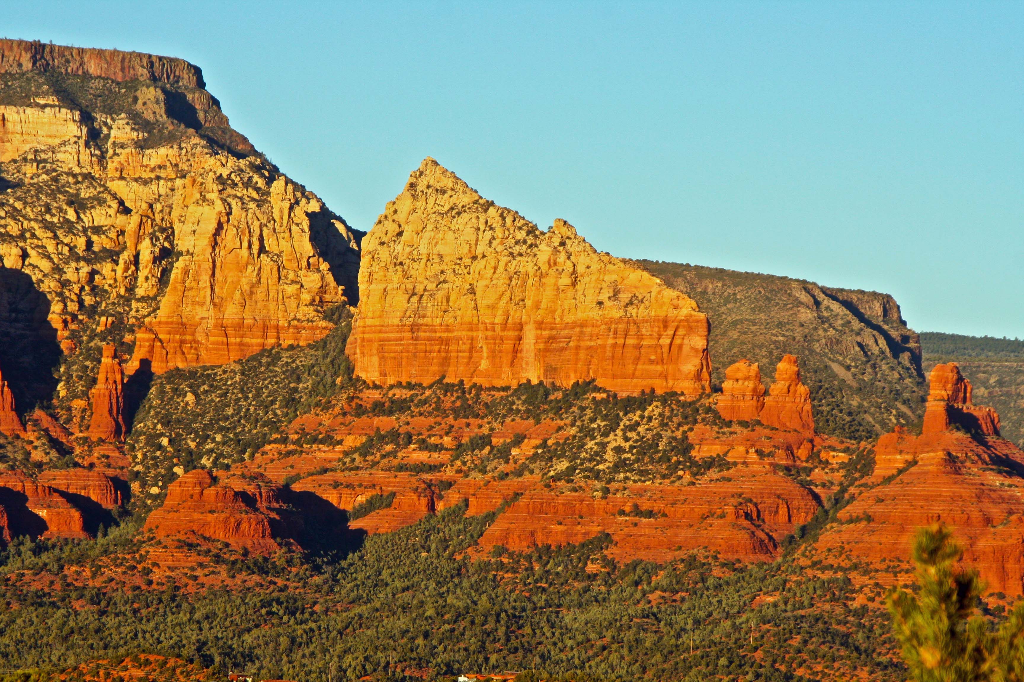
A close up of Chimney Rock. (Photo by Peggy Mekemson.)

As the sun set, the shadow in the center of the photo grew. Here it almost looks like a hand. The Mogollon Rim (in the background) runs east to west through central Arizona and divides the Colorado Plateau to the north from the Basin and Ranges to the south.
Off to the right we could see the rock formation known as Steamboat. (Photo by Peggy Mekemson.)

While off to the east, we could see the sunset hiding behind the trees that the woman I quoted in the beginning was apparently looking for. Still, not shabby.
NEXT BLOG: A hike up Boynton canyon and a visit to one of the world’s most unique churches.
