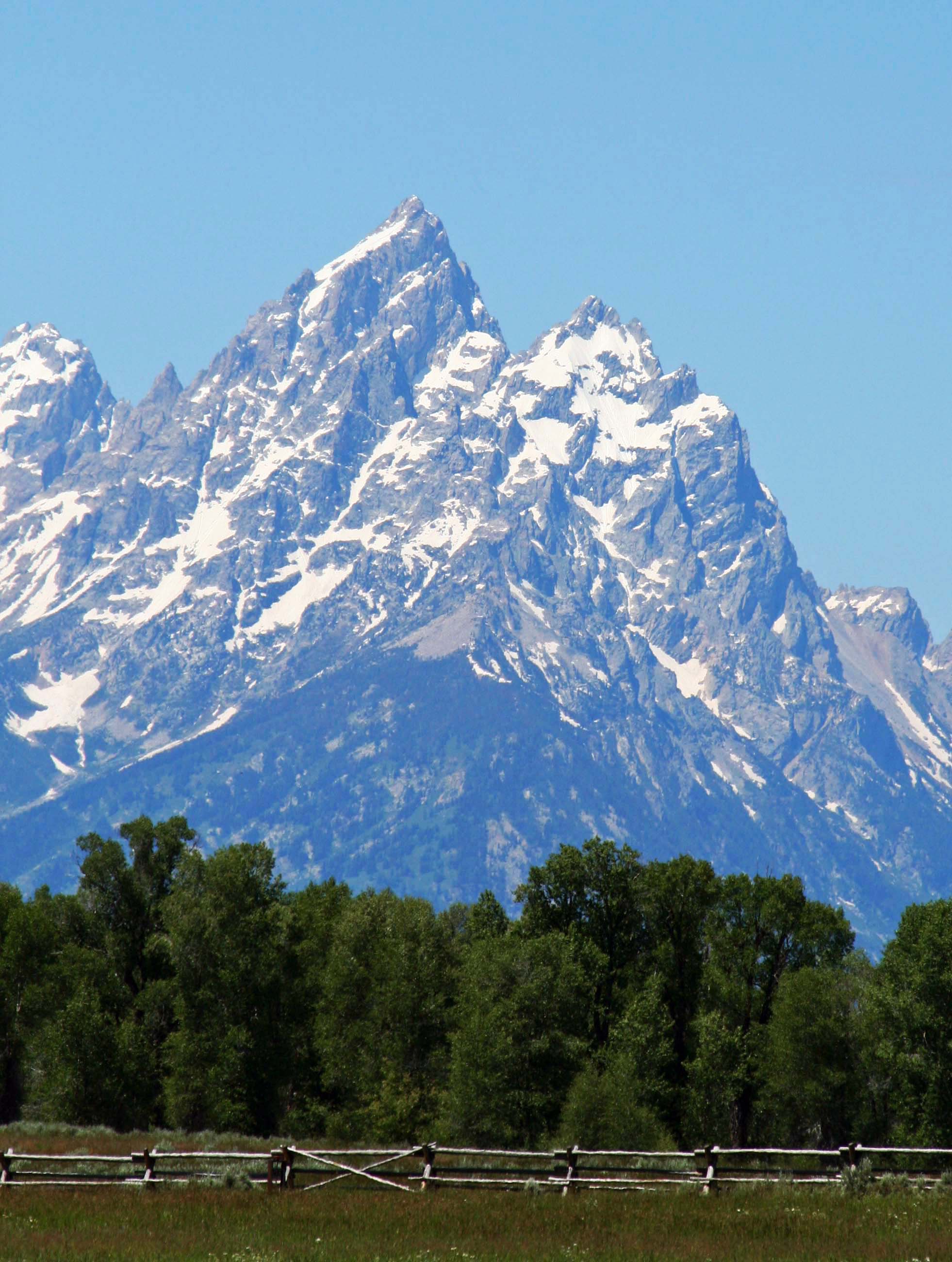
National Parks in the United States and throughout the world protect and preserve many of our most scenic natural areas. This photo is of the Grand Teton Mountains in Wyoming.
Peggy and I decided to take a year off from work in 1999 and travel around North America. I worked as a consultant/citizen advocate on health and environmental issues when I was behaving like a serious adult, and led wilderness treks when I wasn’t. Peggy was fully adult and served as an assistant principal at a middle school.
People were more or less resigned to the fact that I came and went. You might say I was self-employed and self-unemployed. The only person I really had to check with was myself. Peggy’s situation was different, but the school district really wanted to keep her. They offered her an unpaid sabbatical. We bought a travel van and off we went.
We left on July 1. Planning was close to zero. Our only obligations were to meet up with friends for backpacking and kayaking in Alaska and to join Peggy’s parents in Florida for Thanksgiving. Beyond that we could be wherever we wanted to be and do whatever we wanted to do.
Early on, we decided to visit National Parks, Seashores, Monuments and Historical sites whenever we had the opportunity. It was a goal we continued when Peggy retired from being an elementary school principal in 2007 and we wandered in our van for another three years. As a result, we have visited the majority of America’s National Parks as well as many in Canada.
Over the past three weeks I have blogged about a few of the parks we visited. I hope you have enjoyed the journey. Today, I will wrap up this series with photos from several more. I will return to the National Park theme from time to time in the future.

A view of Volcano National Park on the island of Hawaii. The white steam in the background is coming from an active volcano.

A view of the Rio Grande River as it winds through Big Bend National Park in Texas. Peggy and I spent Christmas at the park.

Exit Glacier at Kenai Fjords National Park. I ended backpack treks I led across the Kenai Peninsula near here.
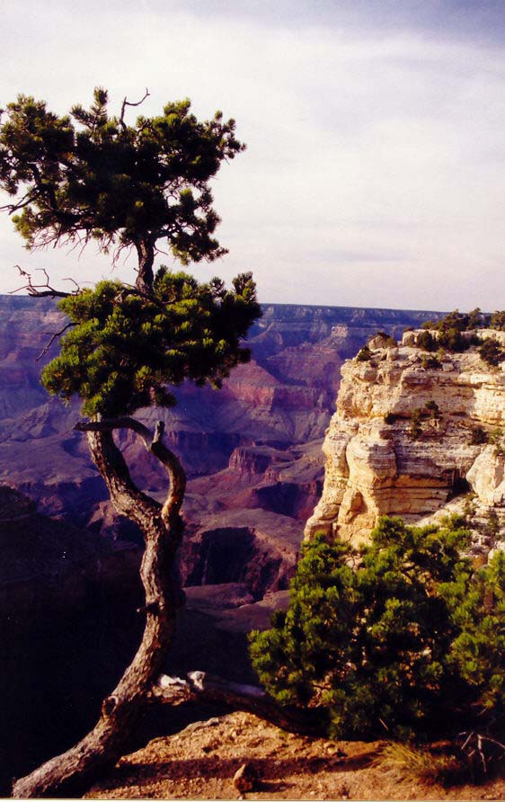
Sunset at Grand Canyon National Park in Arizona. (Photo by Peggy Mekemson.)
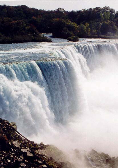
Niagara Falls is not a National Park but it is a National Heritage Site.

We found this colorful Luna Moth on the Natchez Trace, a National Historic Highway that winds through Mississippi and Tennessee. No commercial traffic is allowed on the road, which makes it great for bicycling. (Photo by Peggy Mekemson.)

This brick outhouse found on the Natchez Trace is included because it is my favorite brick outhouse in the world. I hid out in it with my bicycle as a tornado tore up the countryside nearby.

Rocky Mountains National Park in Colorado.

A view from inside of Mammoth Cave National Park in Kentucky.
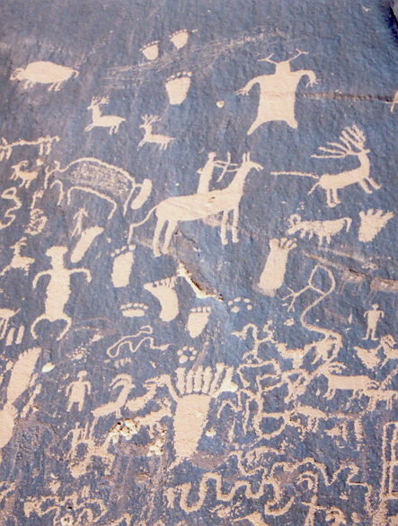
A small section of Newspaper Rock National Historic Site in Utah. Native Americans have been leaving messages on this rock for over a thousand years. Note the guy shooting the elk in the butt with an arrow.

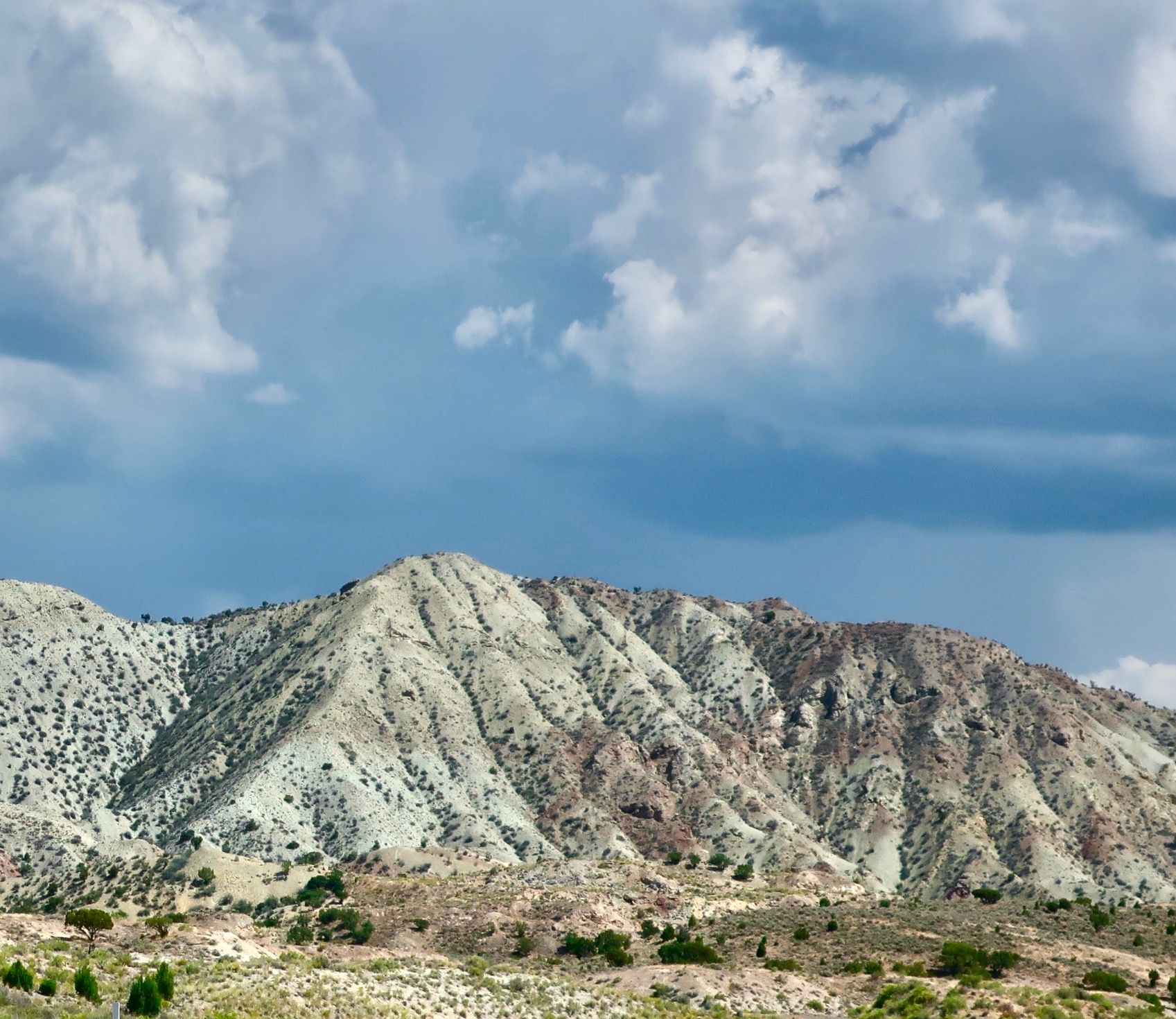
Painted Desert National Park in Arizona.

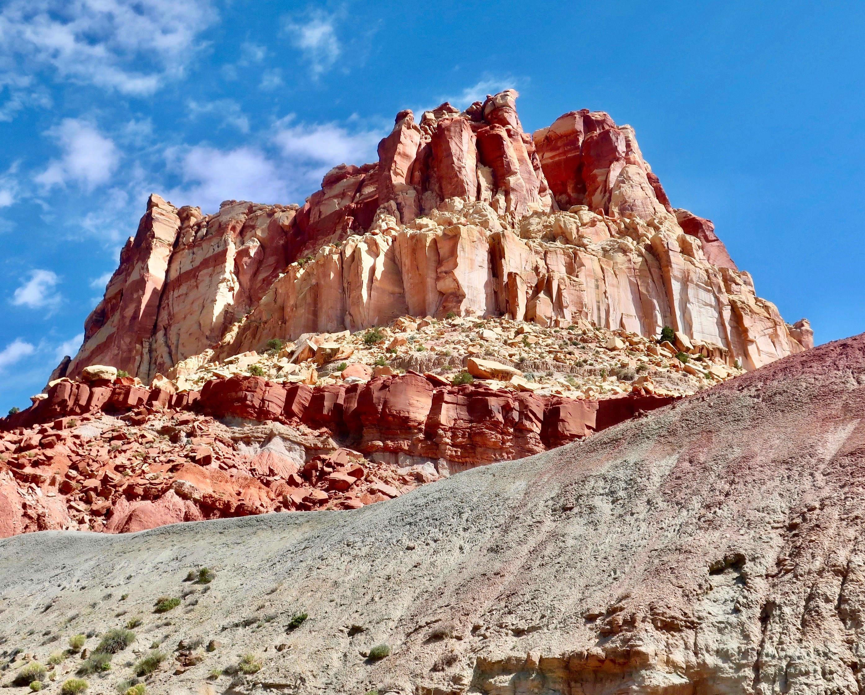
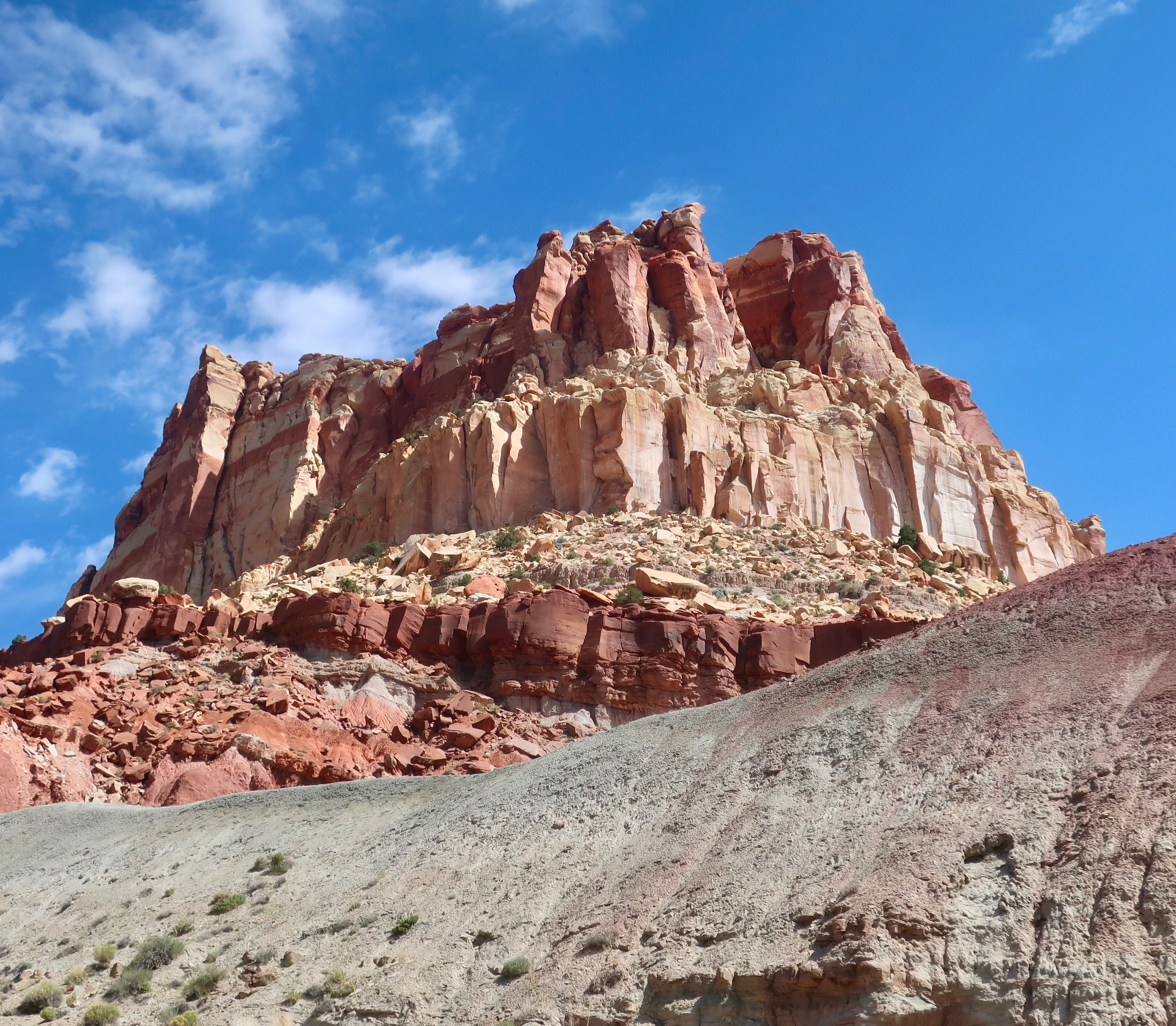
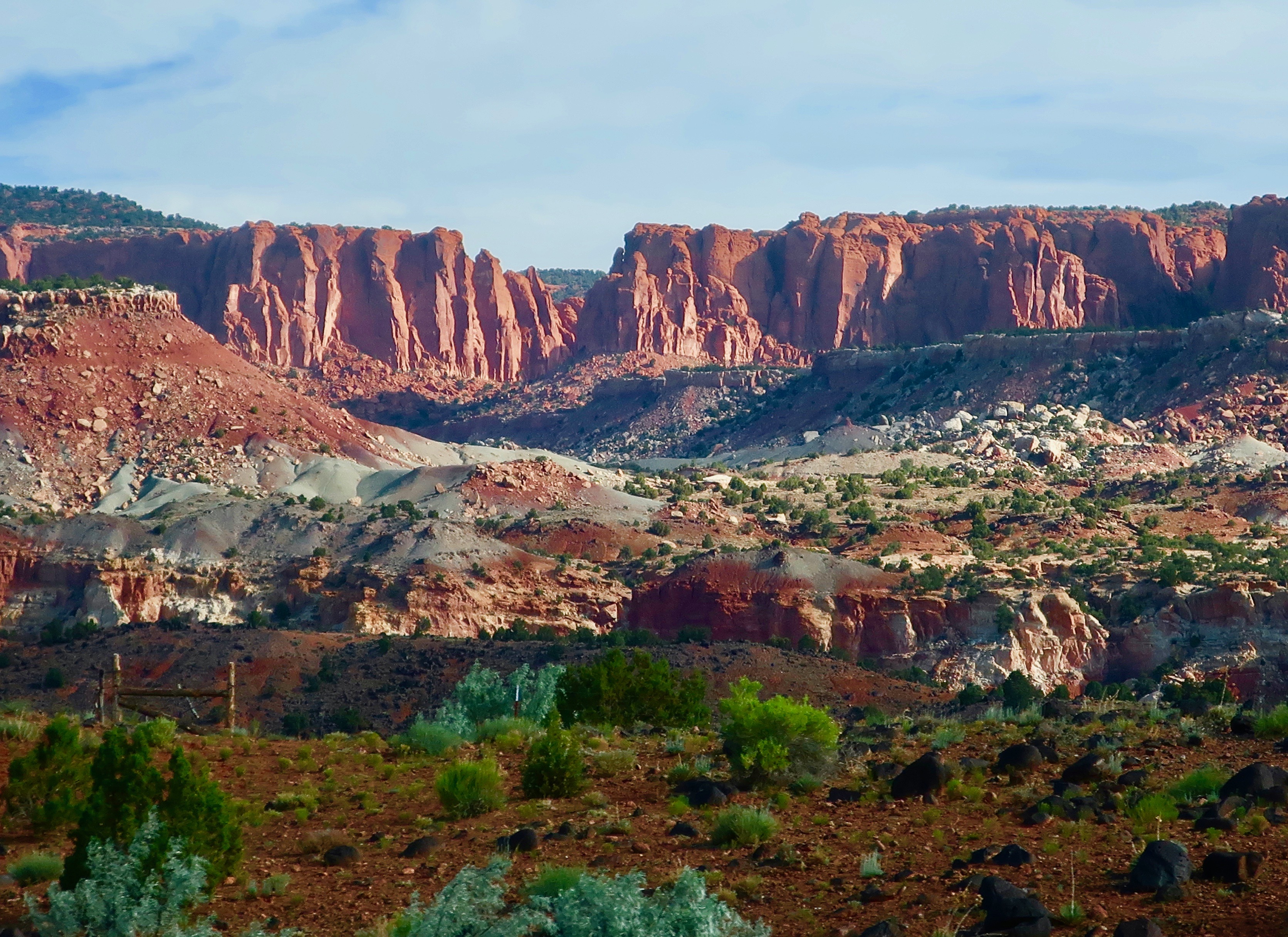
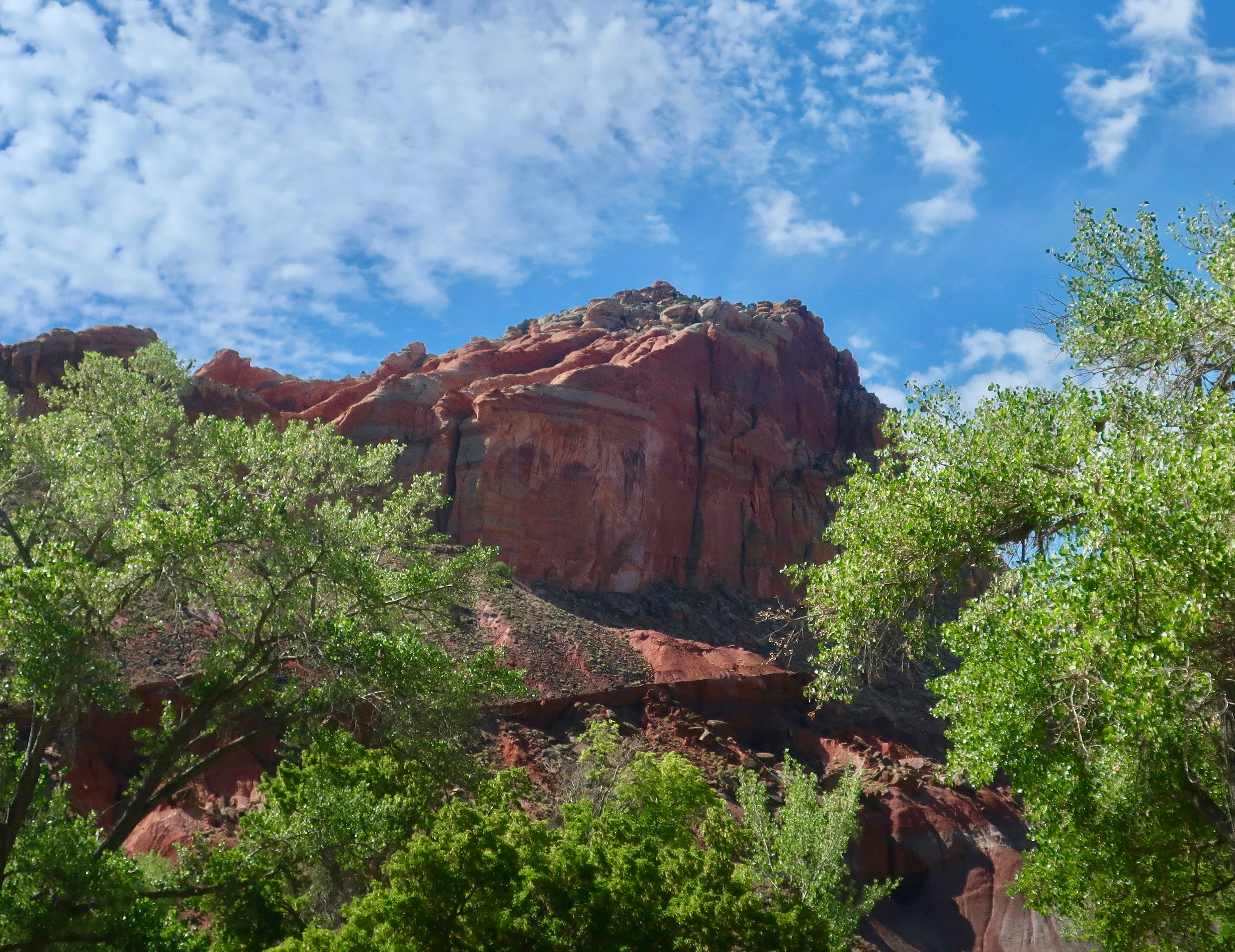
I’ll conclude for today with this photo Peggy took of Capitol Reef National Park in Utah. (Photo by Peggy Mekemson.)
NEXT BLOG: We are off to Puerto Vallarta, Mexico and the beginning of a new series. First up will feature photographs of Pelicans diving for fish in Banderas Bay. We were fortunate to be close to the action and caught some great shots. You won’t want to miss this blog.