Most people, especially if they are on a tight schedule, focus on the first 4 miles of Bryce Canyon’s 18 mile drive. It’s where all the services are. It is where the tourist buses go. It is where the Park busses run. And those four miles are spectacular— no doubt about it. There are reasons for the all of the hype. But today, Peggy and I are going to take you out the road from mile 4 to mile 18 and provide a perspective on why visitors should include it as part of their itinerary.
What’s not to love about the National Parks of America’s Southwest? Well, maybe not the extreme heat of summer and the flash floods of the monsoonal season. Beyond that, there is incredible beauty, geology, and interesting history. Peggy and I have worked to give you a sense of this beauty over the past several Friday posts if you have never visited the region, and some special memories if you have. Today, we are covering miles 4-18 of Bryce Canyon’s 18 mile road. Next Friday we will wrap up our visit to the Bryce area by covering the first four miles. Both were a treat for us, and hopefully, will be for you as well.
Then, we are going to take a break from the Southwest for a few weeks. First, I want to give you a look at our basecamp in Virginia where we will be hanging our hat, so to speak, between journeys. Second, we want to share our trip to Amsterdam and up the Rhine River this past summer, a trip that was postponed for two years because of covid. After that, we will finish off our Southwest exploration with the North Rim of the Grand Canyon and Mesa Verde, plus.
In the meantime, Peggy and I will be starting our next four month adventure in two weeks, working our way across the northern tier of states with more visits to National Parks and a possible jaunt into Canada until the weather drives us south into the Northwest and California, followed by a drive across the southern tier of states. This coming spring, we have booked a tour down the Nile River, after which we will spend a couple of months in Europe, starting with a month in the Greek Isles. At least, those are the plans…
And now: Miles 4-18.
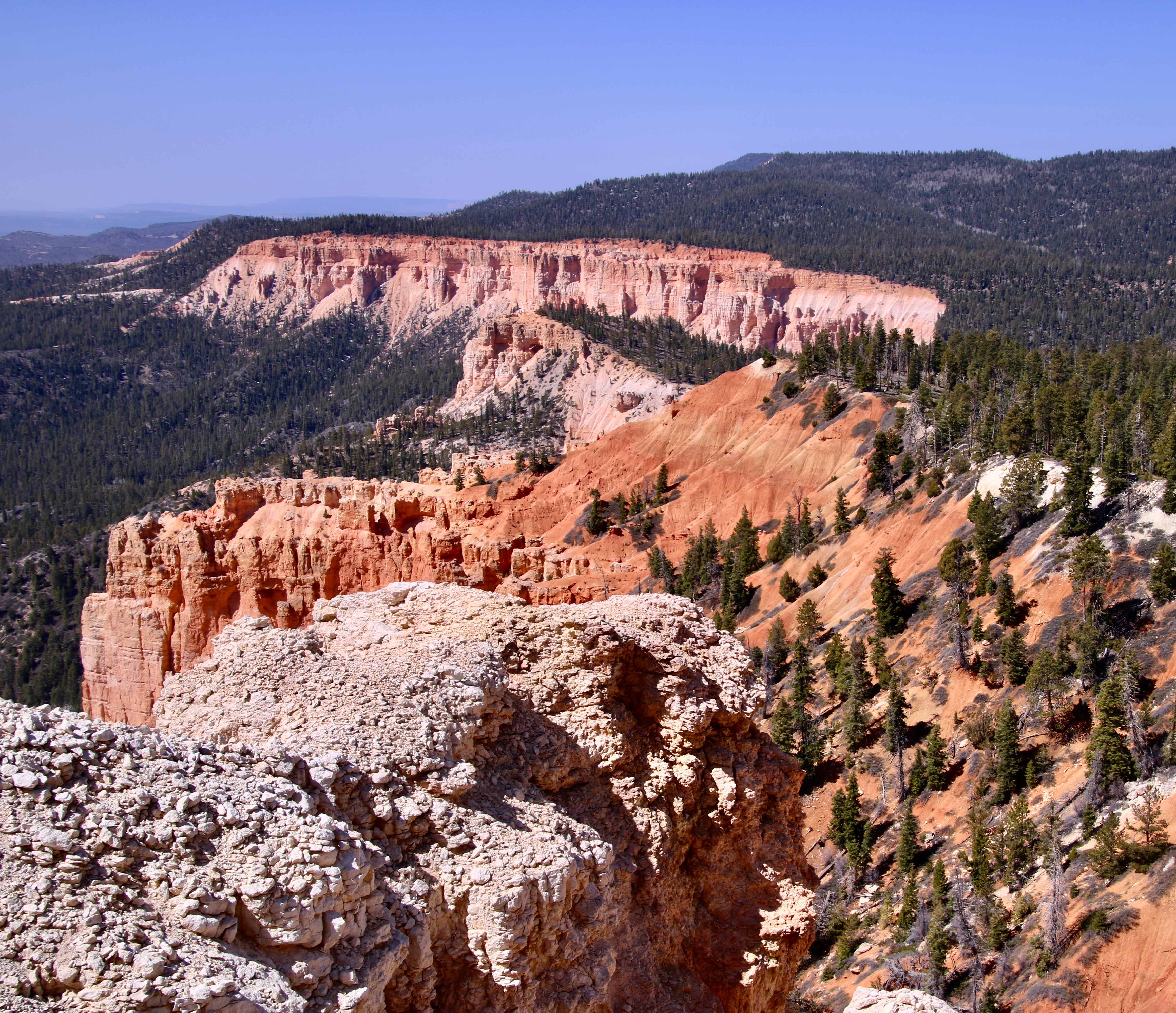
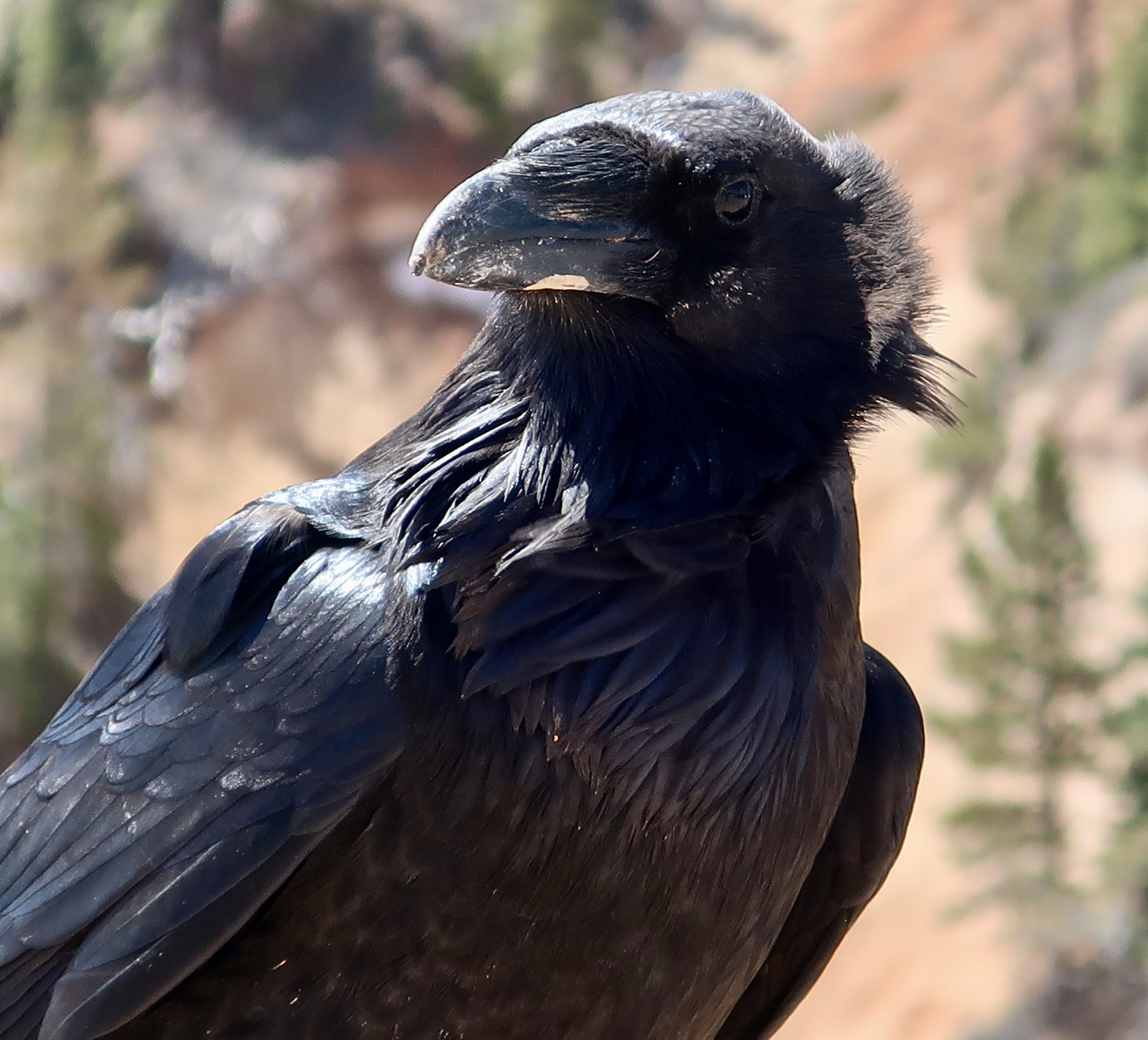
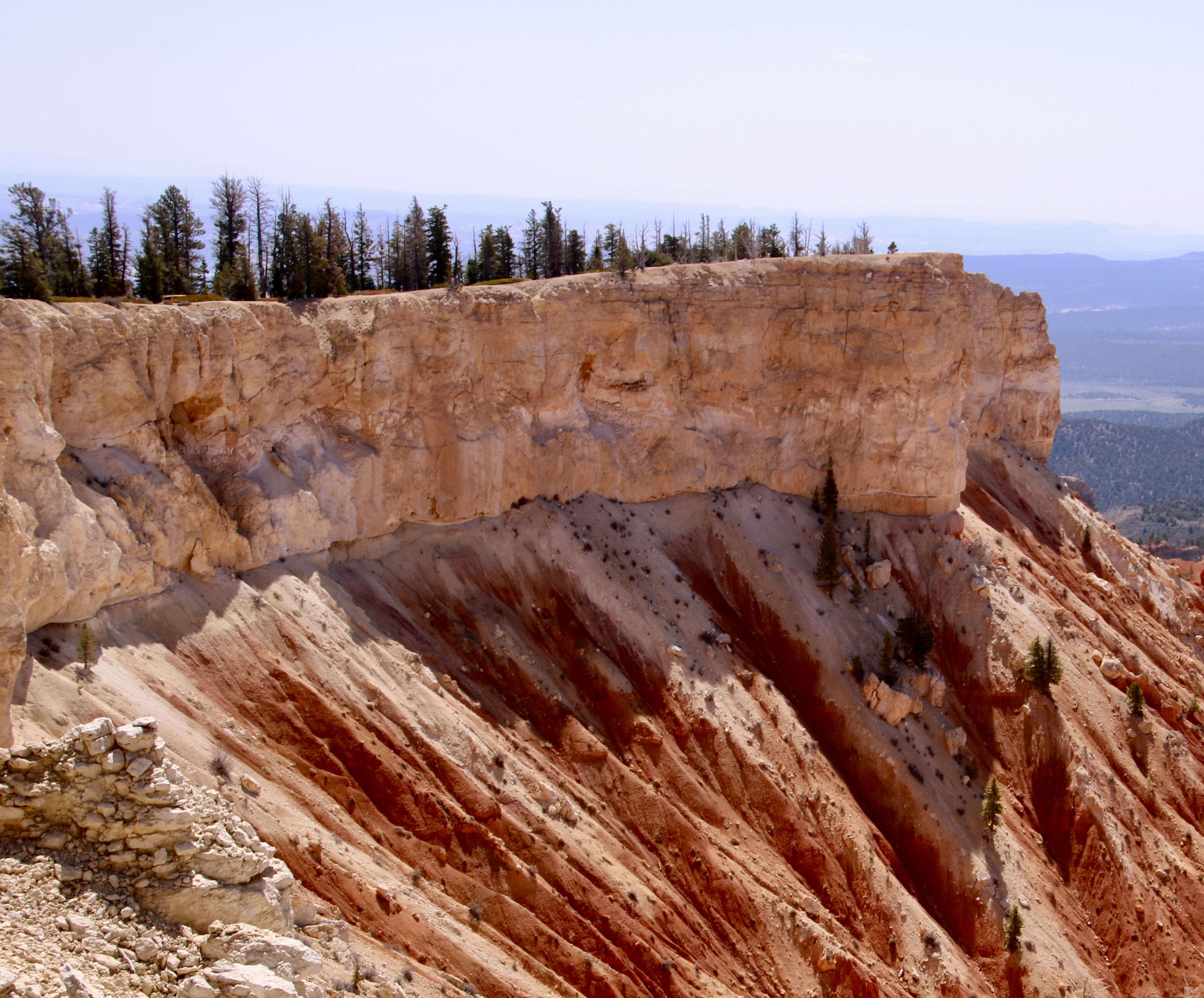
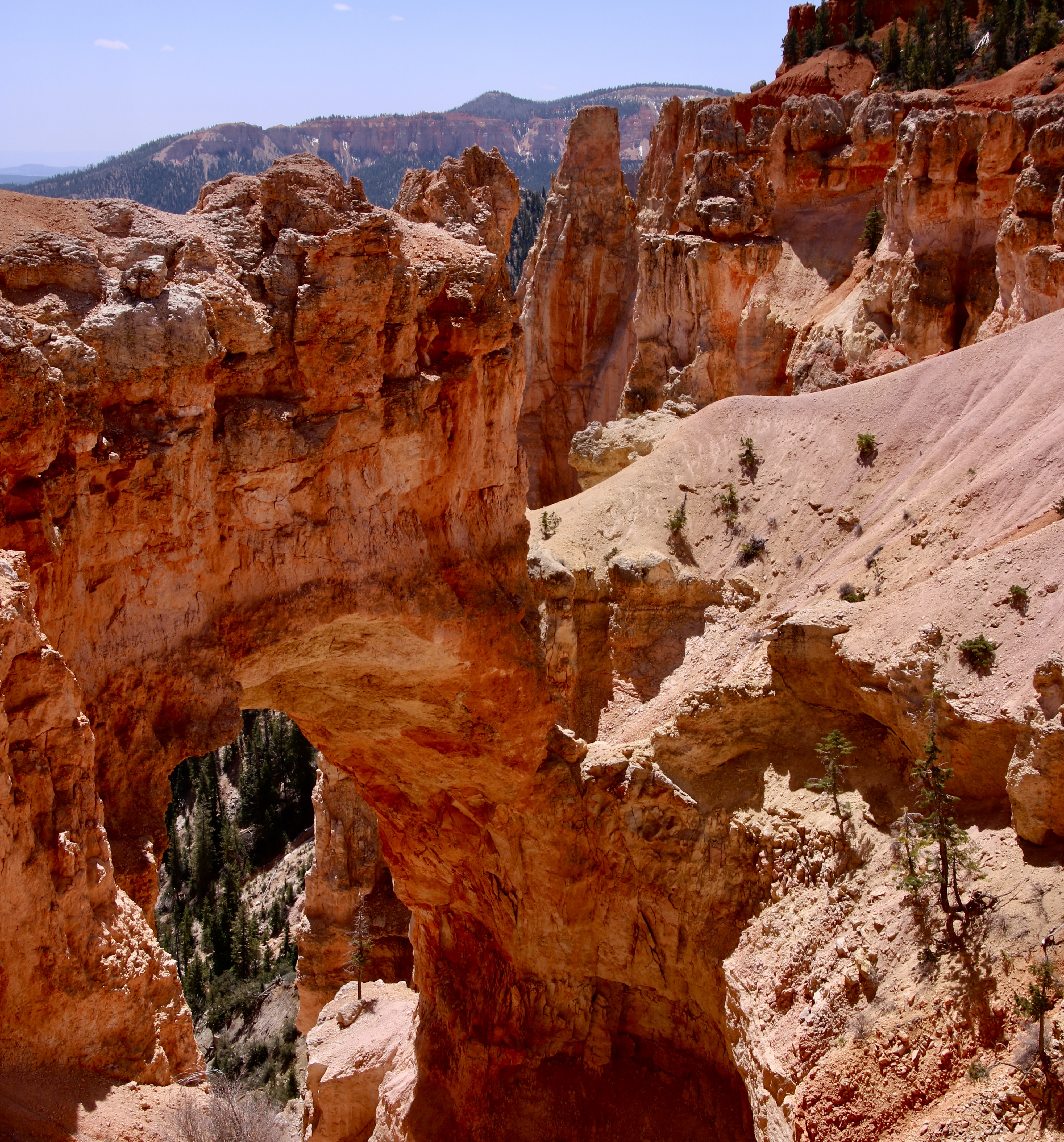
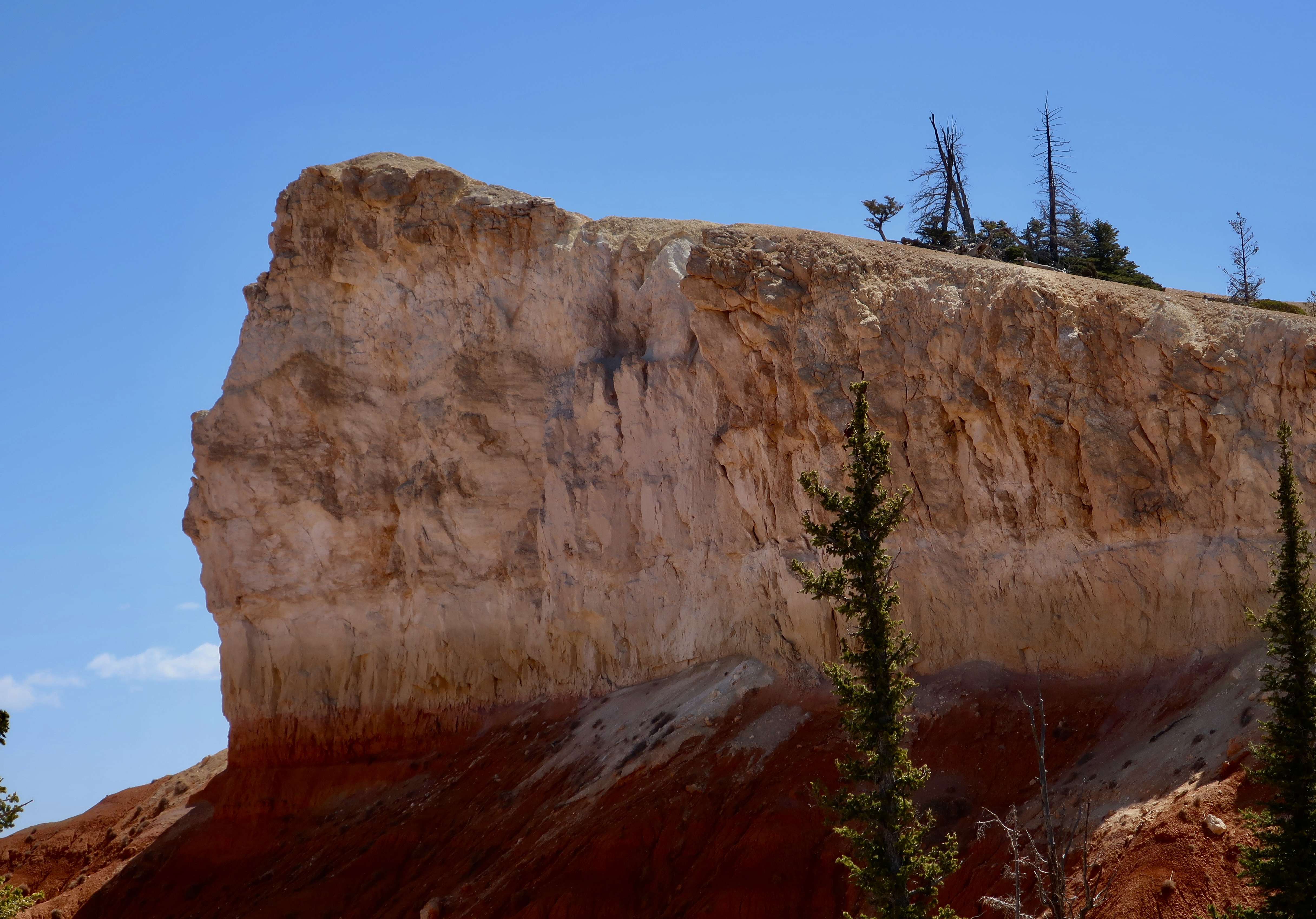
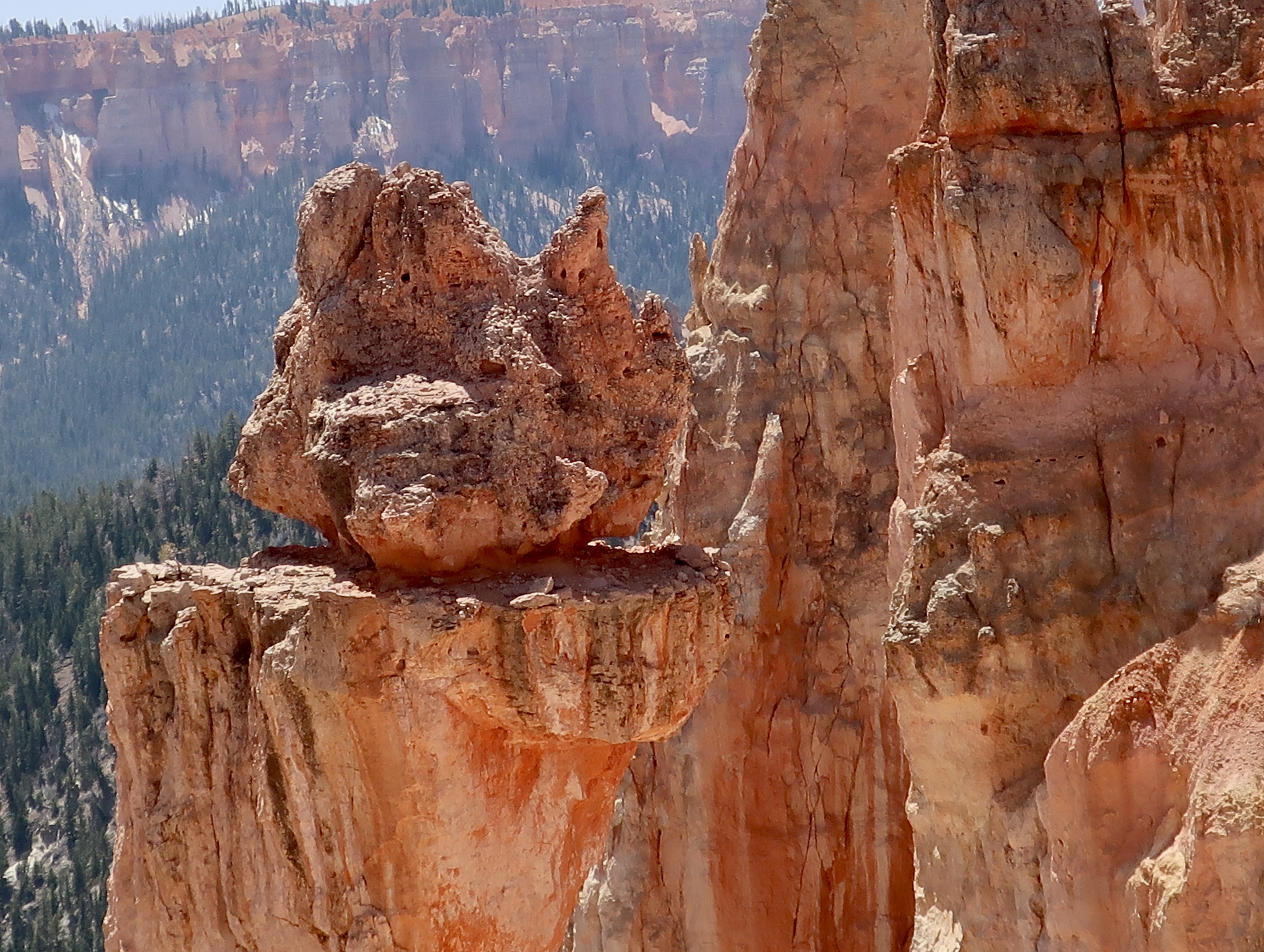
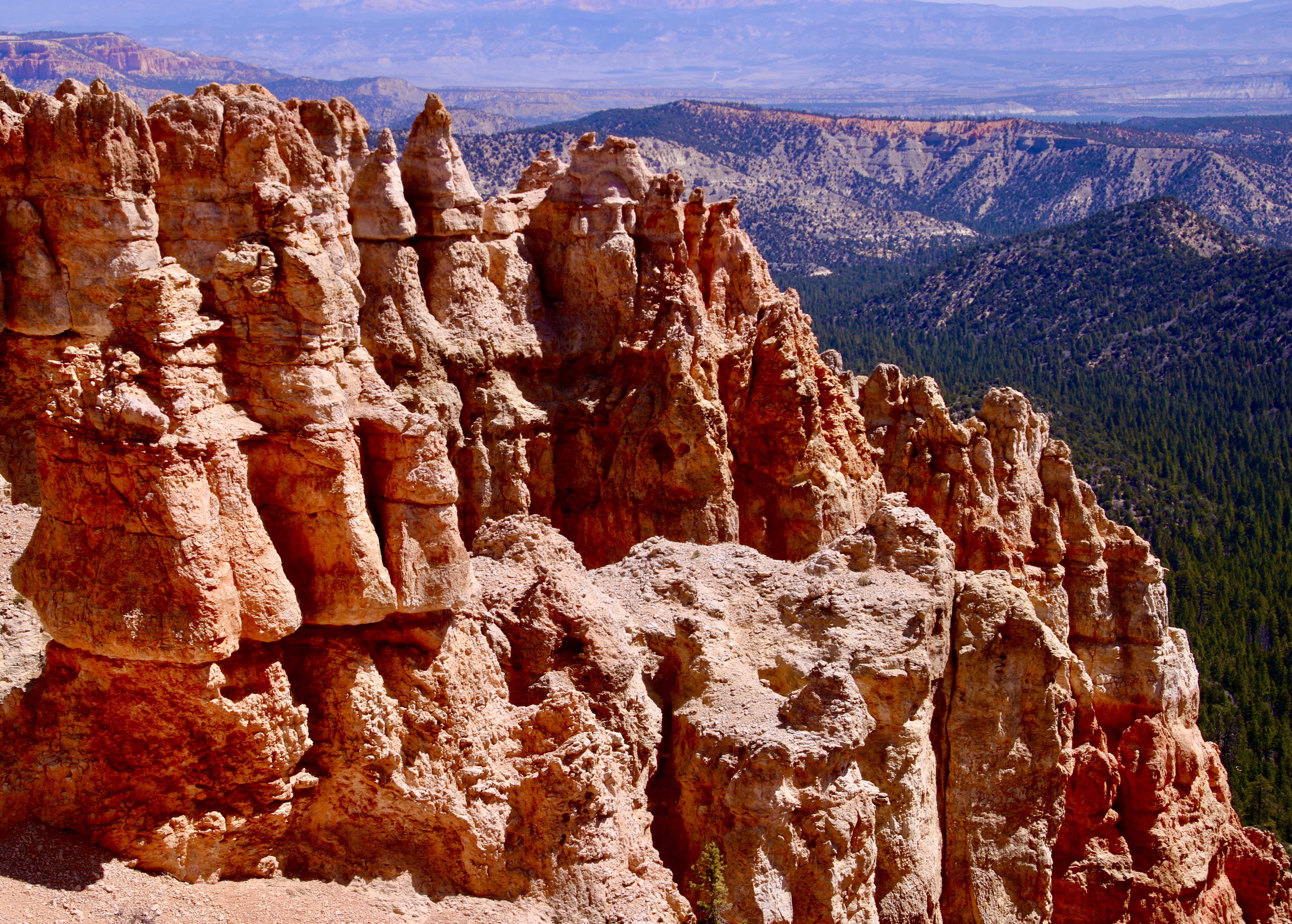
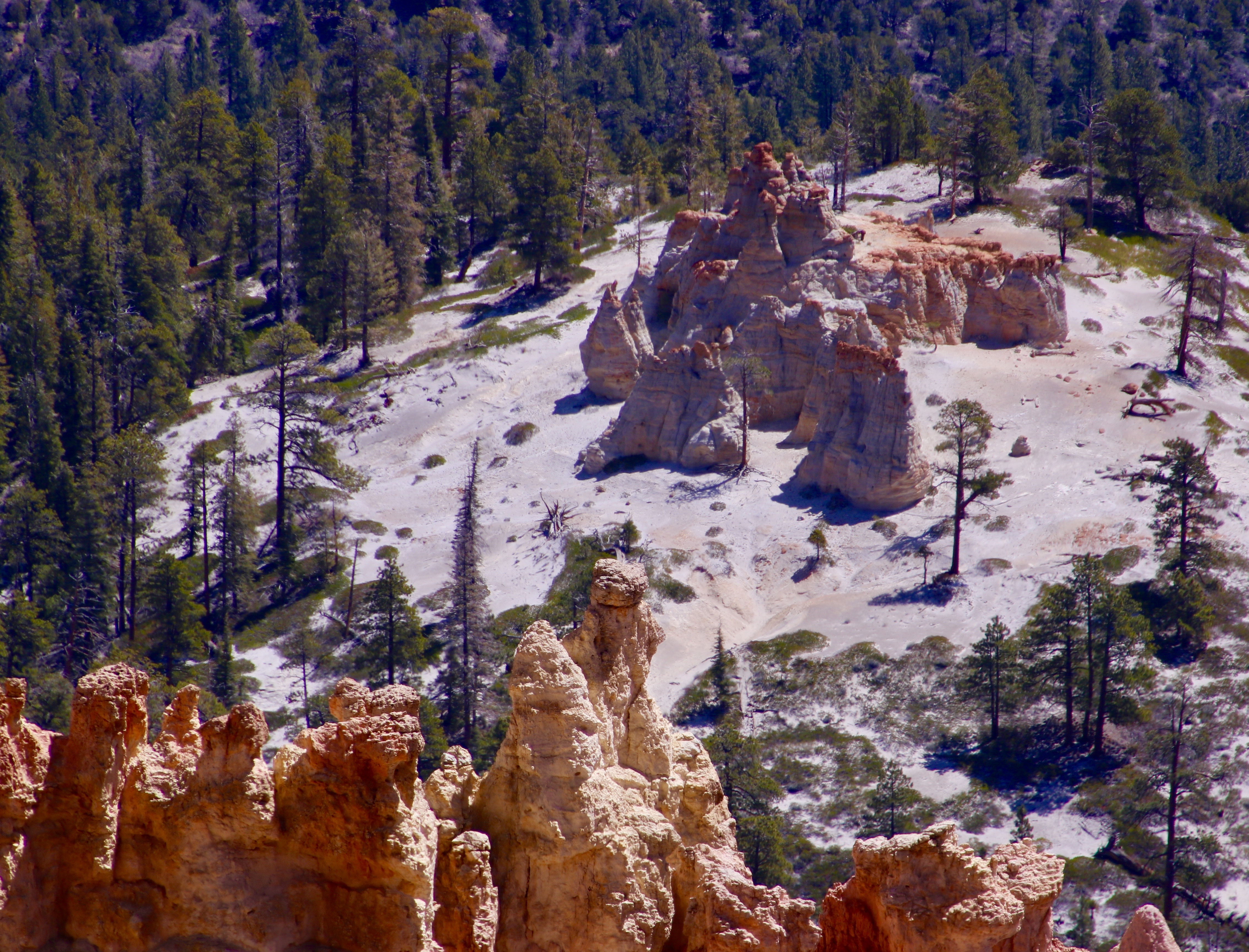
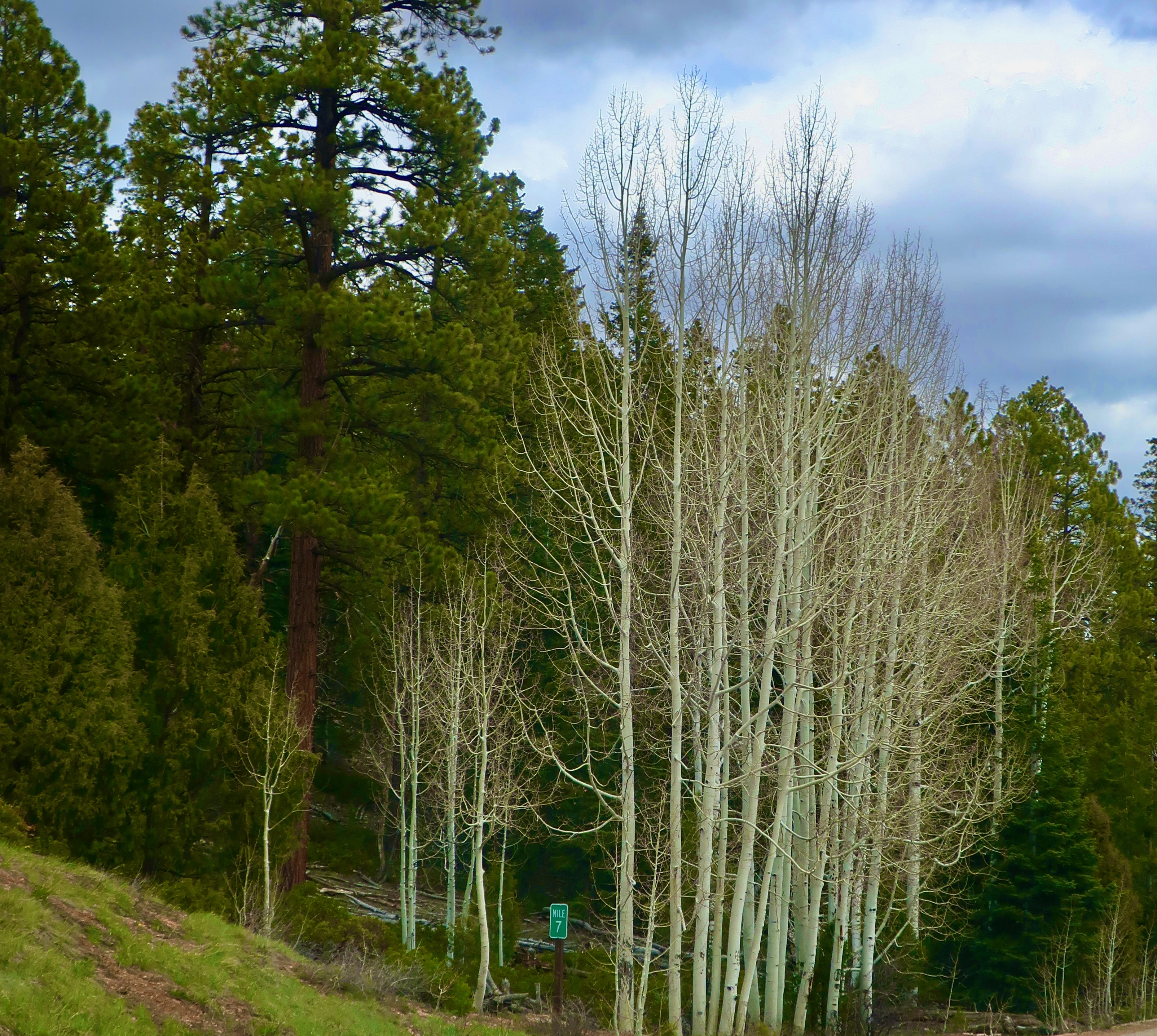
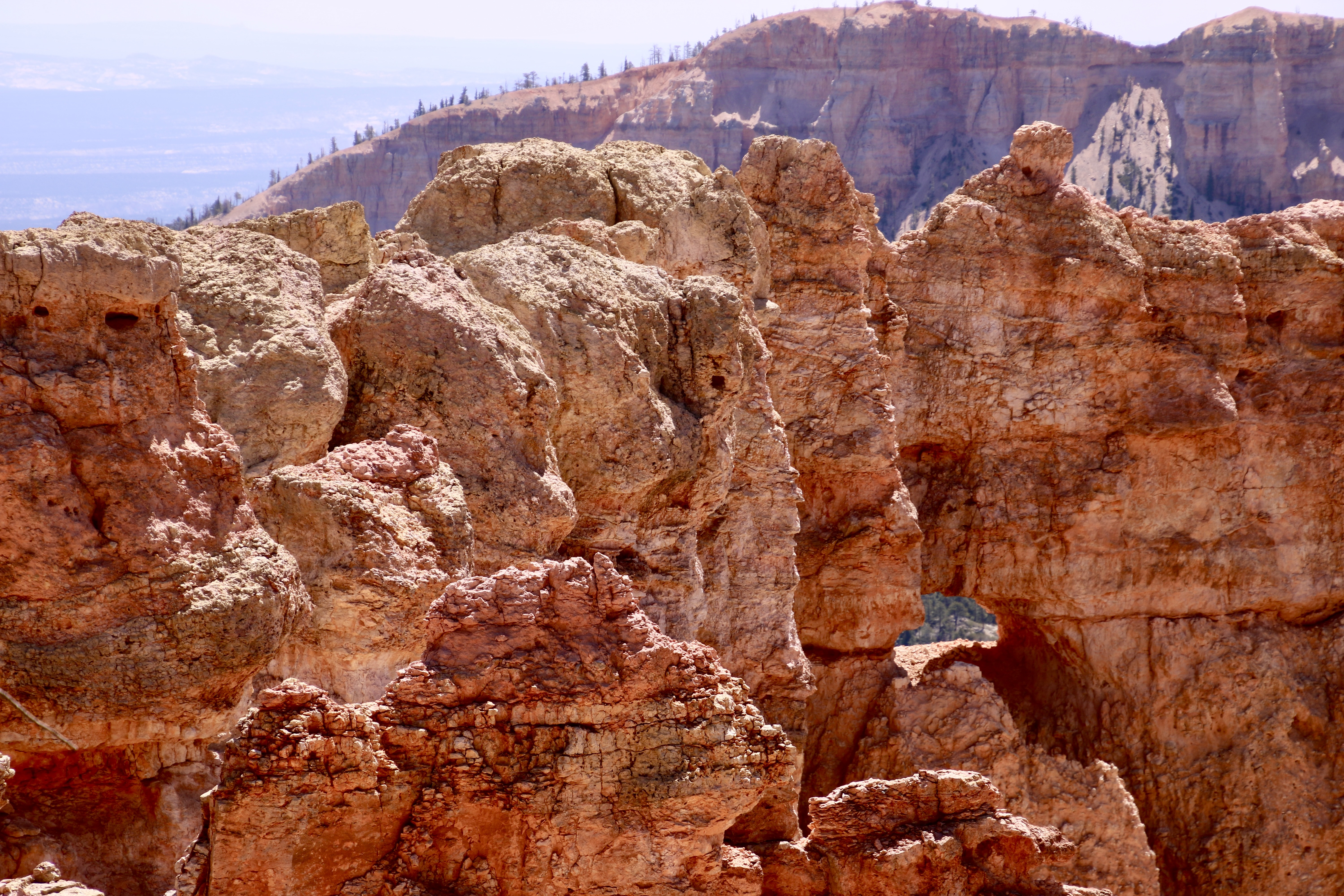
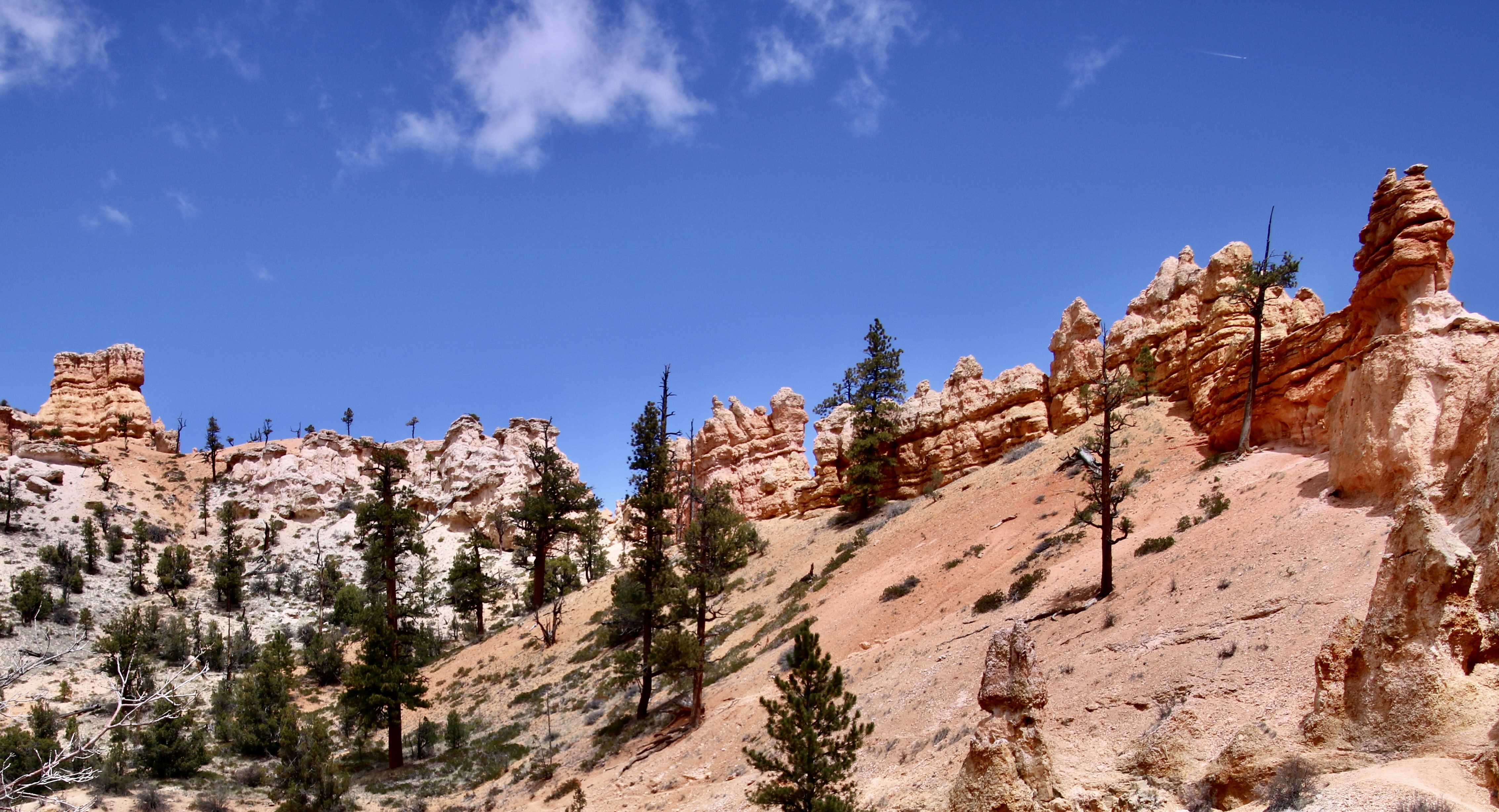
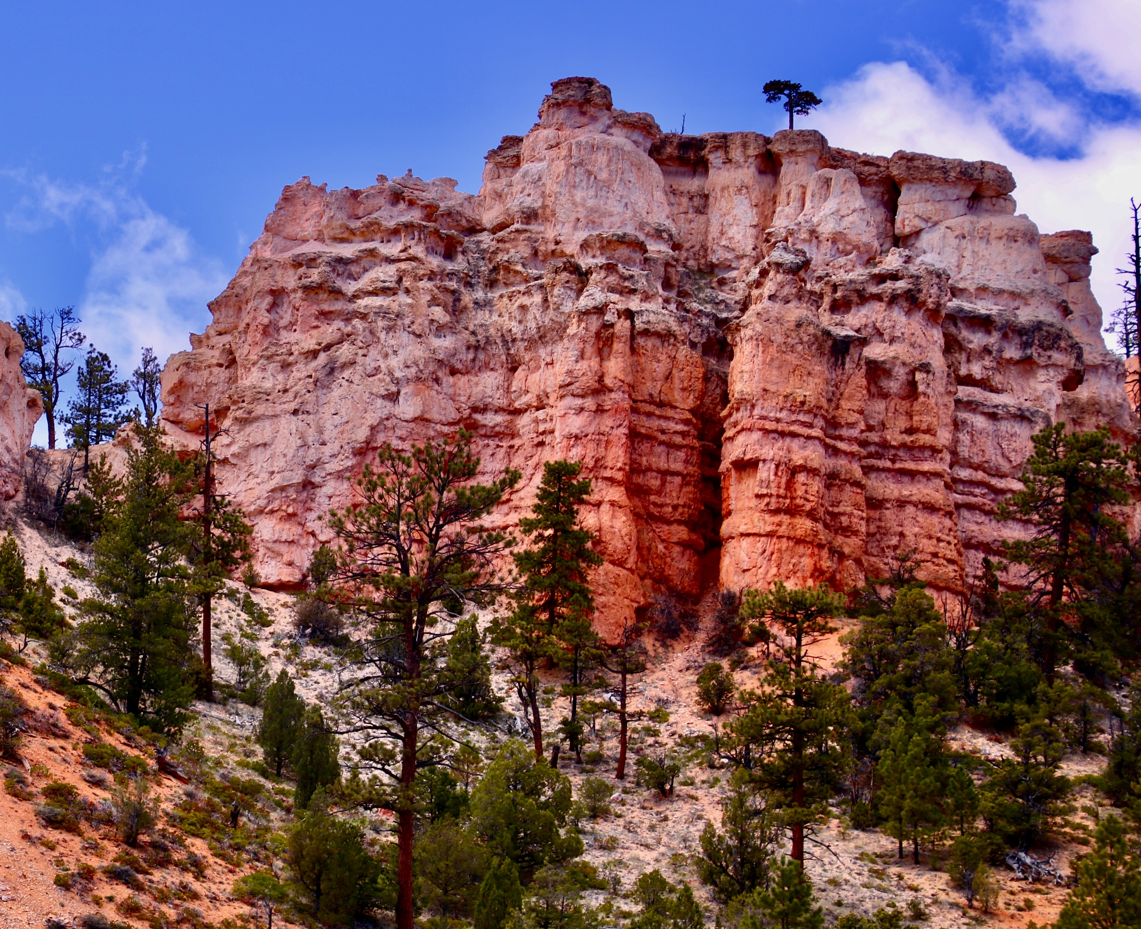
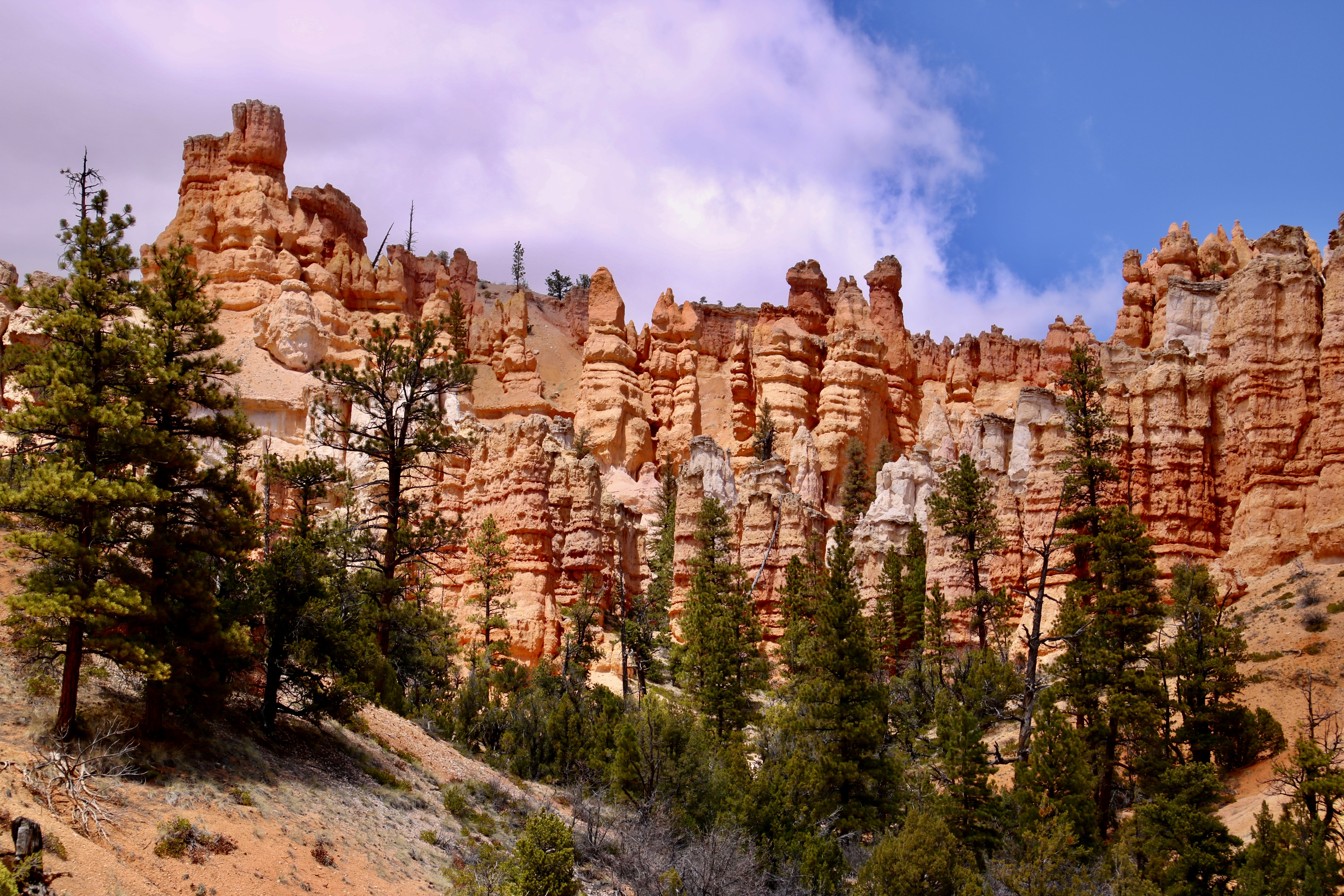
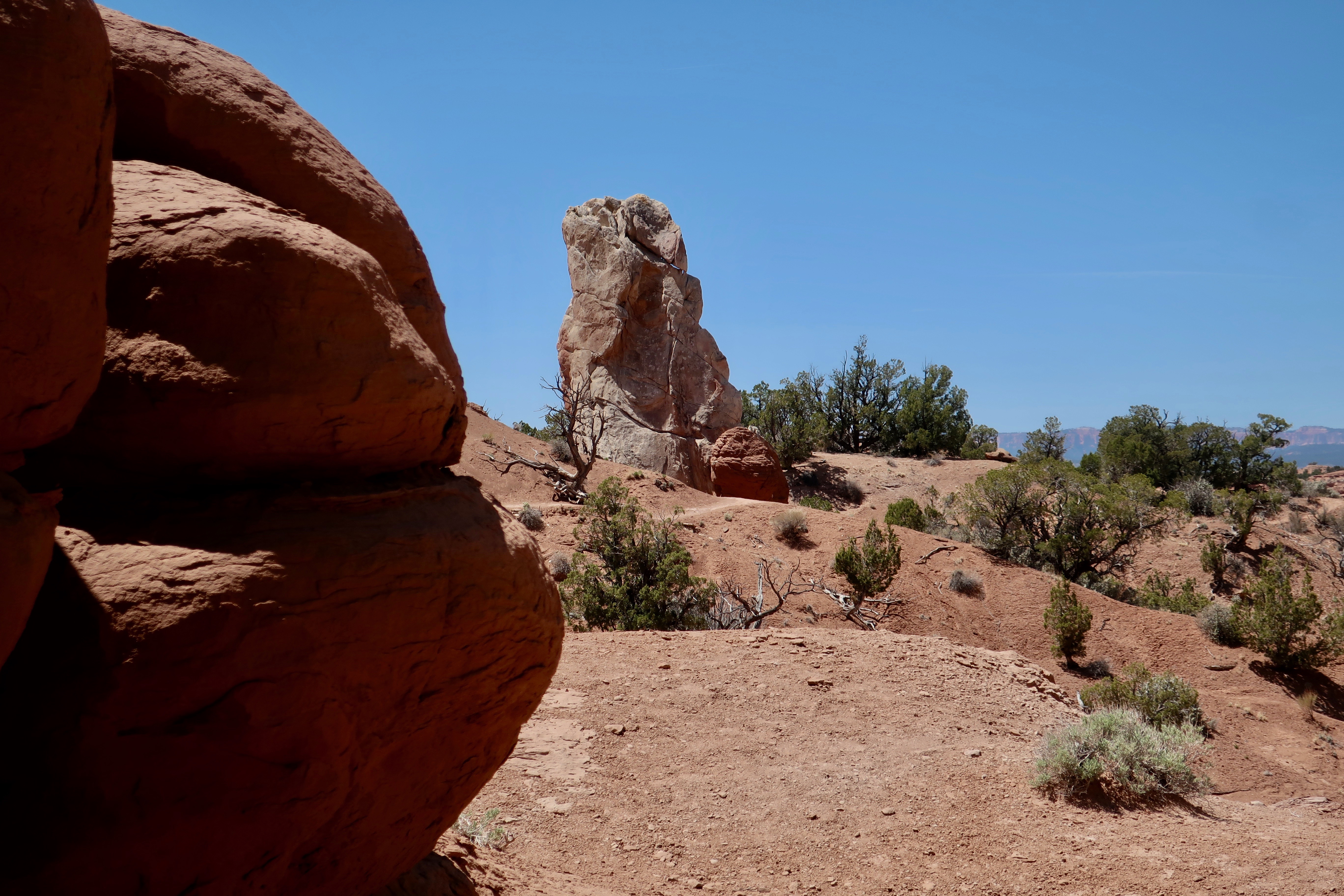
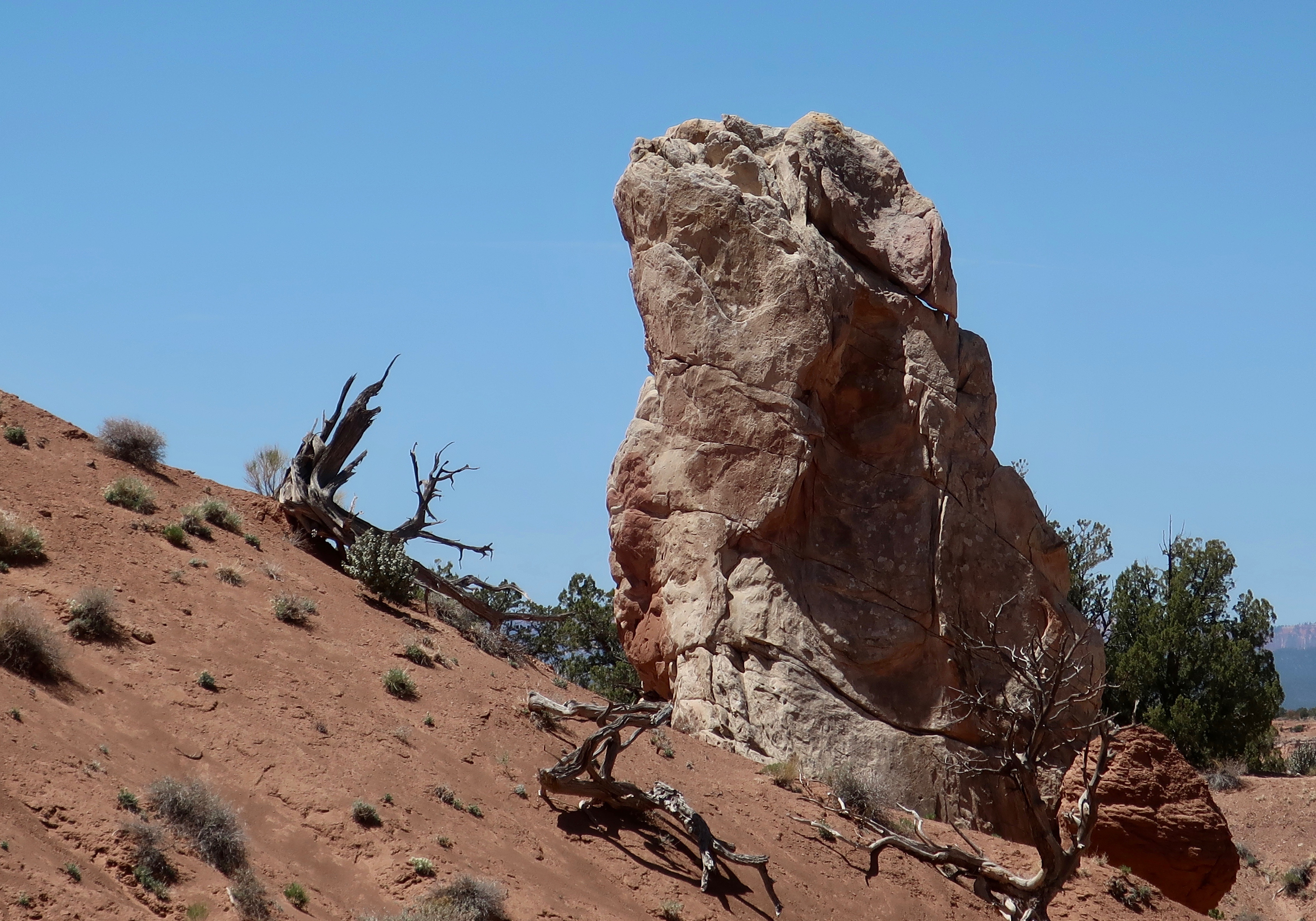
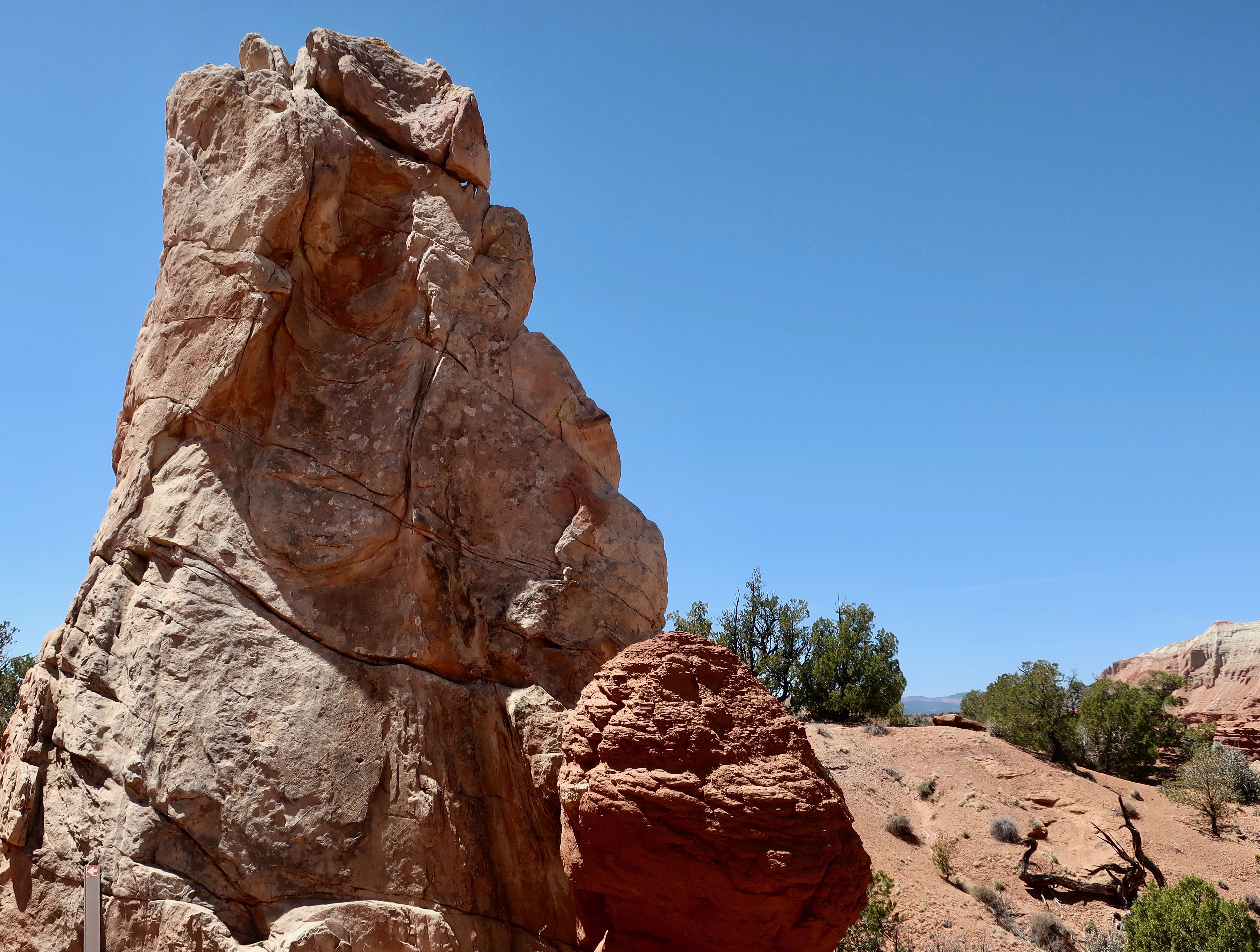
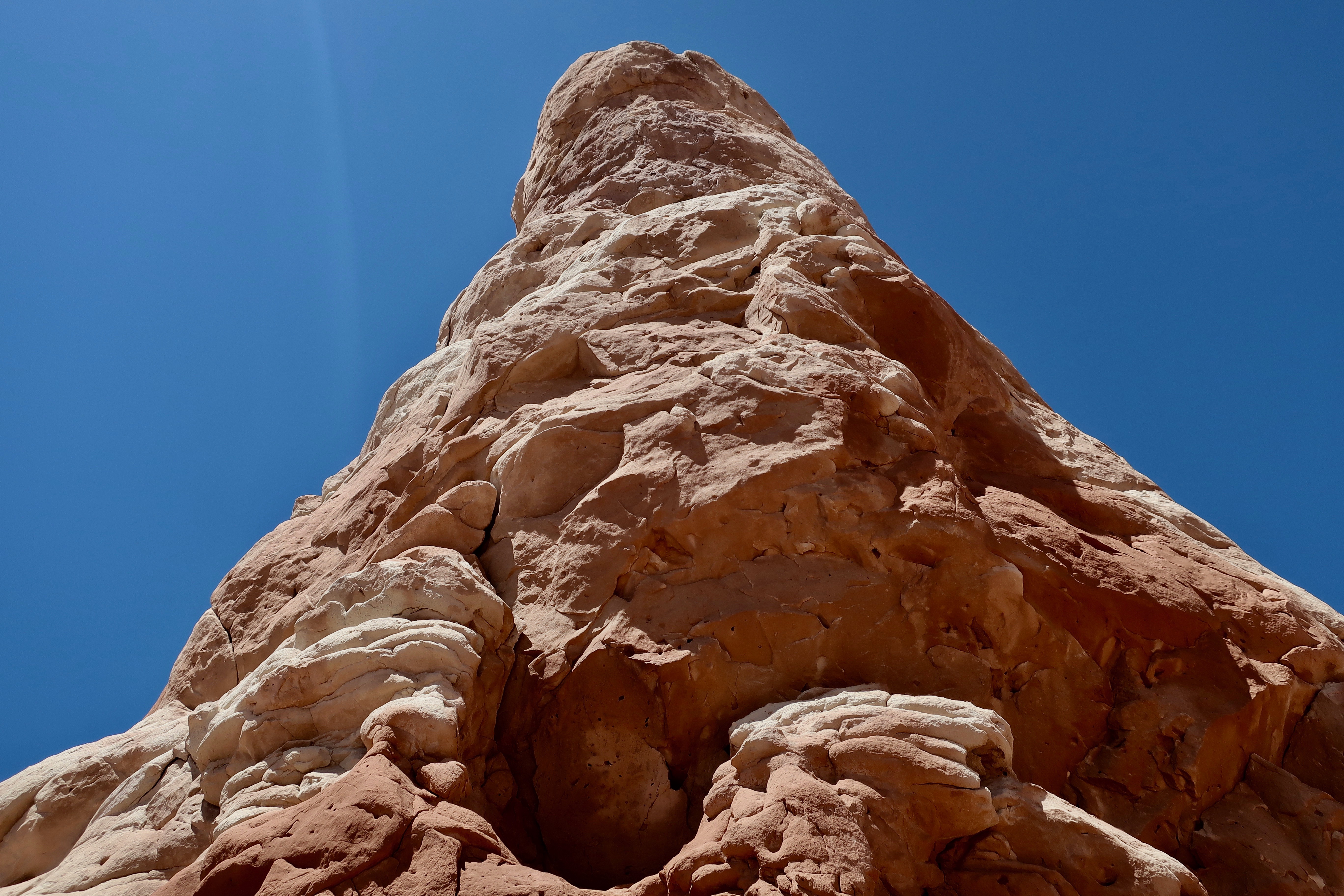
This is where the road stops at mile 18 and 9,115 feet. We will be working our way back toward mile 4, more or less, visiting overlooks along the way. There were two stops here, Rainbow Point and Yovimpa Point. Gee, I wonder where they came up with the name, Rainbow Point? (Photo by Peggy Mekemson.)We were not alone. A raven envisioned us feeding him. I told him it was against the rules.He gave me the look. A stiff breeze was ruffling the feathers on his head.Another ‘rainbow-type’ shot by Peggy.It really doesn’t matter where you are along the road, there is beauty.All of the views can be captured from different perspectives. This is a closeup of the photo I took above. (Photo by Peggy Mekemson on our iPhone.)Bryce Canyon has its own renditions of arches. This is where I met up with the raven.A different perspective of the Bryce Canyon Arch by Peggy.I felt like I was looking at the prow of an ocean liner cresting a stormy wave. (Yes, as you know, I have a vivid imagination.) This is one of those sights, like the Arch, that one doesn’t expect to find in Bryce Canyon.This, on the other hand, is expected: A hoodoo.There are hundreds, if not thousands. (Photo by Peggy Mekemson.)I caught a squat one poised on a pedestal. And Peggy caught a bunch. Lots and lots of hoodoos standing at attention and staring off into space.I love the ridges that head off into the Canyon. There will be knife-edged ones in my post next Friday.Peggy caught this magical view looking down into Bryce Canyon. It’s my favorite of the several hundred photos we took in the Park.The aspen along the road had yet to leaf out at 9000 feet when we were at Bryce Canyon in late May. Their stark white trunks and limbs made a dramatic contrast to the dark green conifers. Peggy took this photo at one of the pull-offs.A hole in the rock played peek-a-boo with us. (Photo by Peggy Mekemson.)A final view along the Bryce Canyon road between miles 4 and 18 shows the layering effect caused by different types of rock. Next Friday we’ll be featuring the most popular section of the Park between miles 1 and 4.
Here’s a secret. Don’t do Mossy Cave Trail to see the cave. Do it to check the scenery along the way. It’s like hiking the trails down inside of Bryce Canyon without the challenging climb in and out. (Photo by Peggy Mekemson.)
Finally, we have made it to Bryce Canyon, but we still aren’t in the park proper. The trail to Mossy Cave is located on the northern edge of the Park off of Highway 12. Information on the trail said its growing popularity meant that there was limited parking space. We had noted the problem when we drove by earlier. Fortunately, when we arrived, there were only a couple of cars and we shared the trail with only a handful of people. Mossy Cave was nothing to write home about, or do a post on. Possibly in the winter when it is filled with ice cycles would be different.
Looking into Mossy Cave with its last remaining chunks of ice from the previous winter. I did find the contrast with the roof interesting.
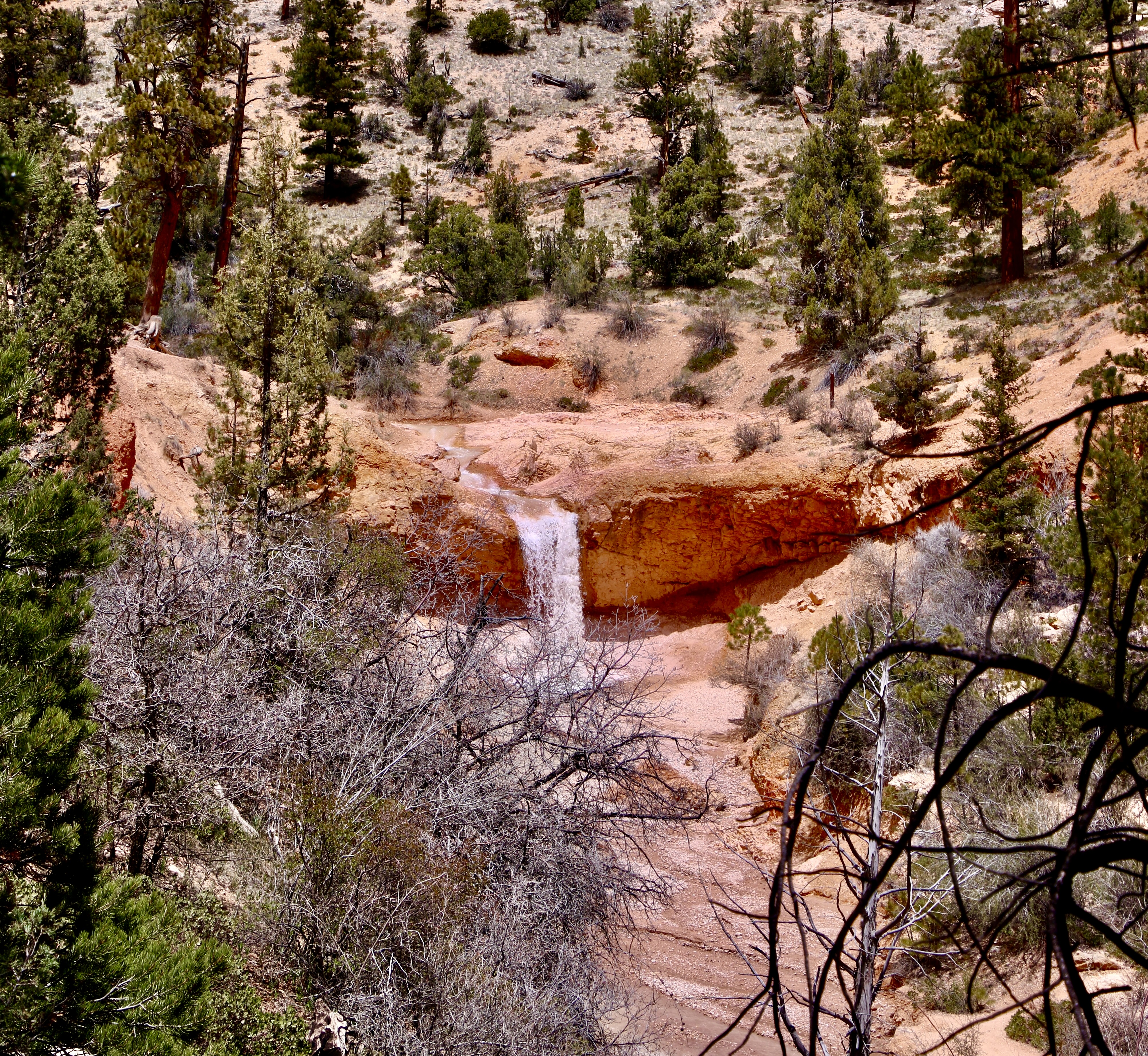
The easy to follow trail into Mossy Cave is well worth the trip however, as the following photos will show. A small creek runs along the bottom of the canyon has its own story. It was dug by Mormon farmers with picks and shovels in the late 1800s to provide water to the small town of Tropic and its surrounding farms and ranches.
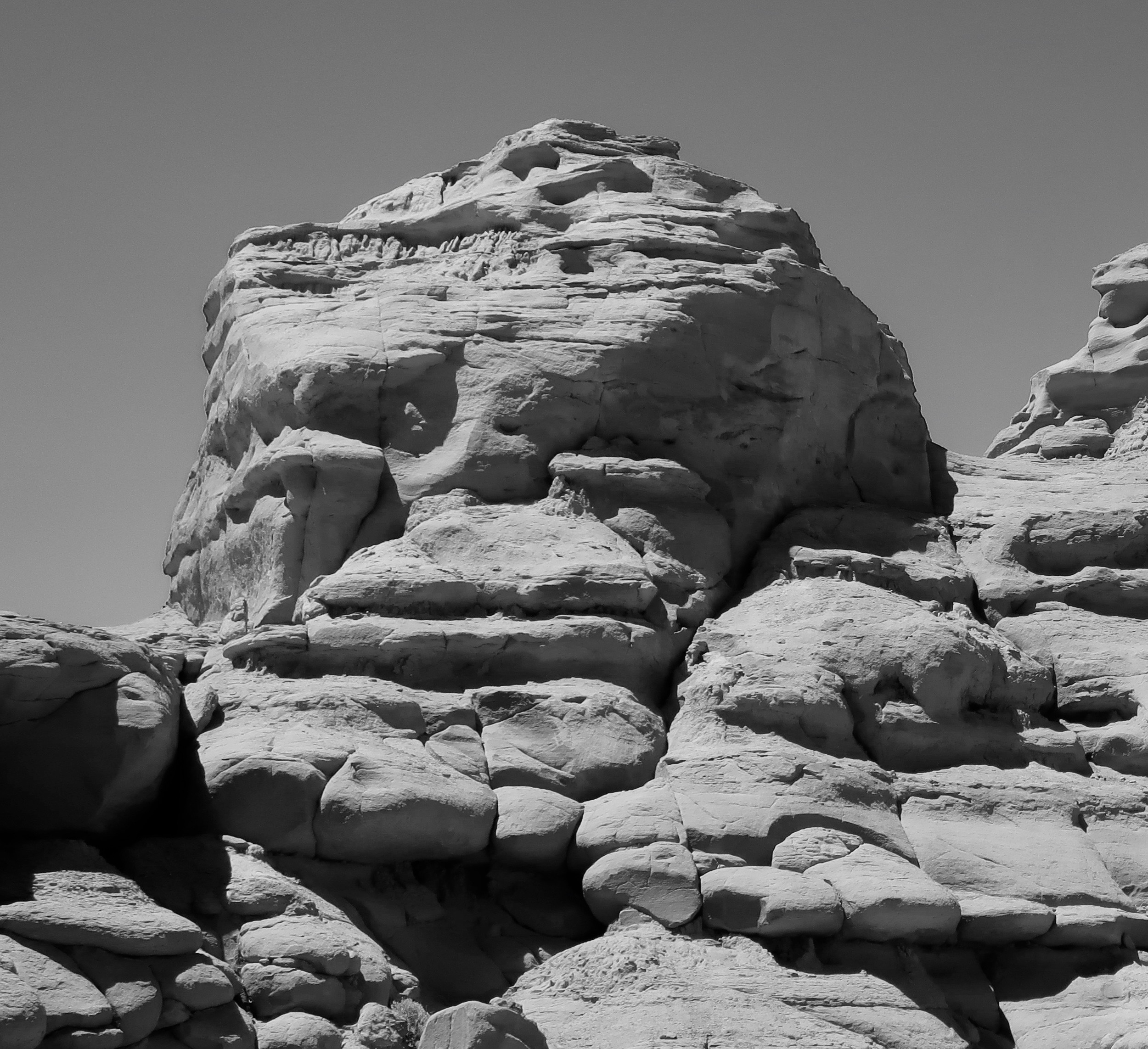
The trail to Mossy Cave cuts up the hill to the left just before this pretty little waterfall and makes a brief but steep climb. Peggy loves waterfalls and took several photos of it.A close up. (Photo by Peggy Mekemson.)The falls and the creek. (Photo by Peggy Mekemson.)Its when you look up from the creek that you begin to get the feel that you are in Bryce Canyon National Park.Rock sculptures, small arches and hoodoos abound.Photo by Peggy Mekemson.I was thinking blue eyes when I took this photo.There were a number of impressive rock formations. (Photo by Peggy Mekemson.)This rock formation was quite colorful. And I liked the lone tree up on top. (Photo by Peggy Mekemson.)I felt that this hoodoo with its background made a dramatic combination.The rocks lined up for Peggy. They were good at holding their pose. (Photo by Peggy Mekemson.)Mine were a bit more unruly. That’s hardly news.I also liked this sheer rock wall with its many-limbed dead tree.I conclude today’s post on Mossy Cave Trail in Bryce with a photo I thought would go well in black and white. (You will find the mouthy guy about half way up on the right in Peggy’s photo at the beginning of the blog. ) Next Friday’s post will focus on miles 4-18 along the road into Bryce Canyon National Park.
I start our Bryce Canyon National Park series today. Like we did with Zion National Park, Peggy and I explored other parts of the Park and the surrounding area as well as the four miles of Bryce Canyon that most tourists visit. I am starting today with Kodachrome Basin State Park. From here, I will move on to Red Canyon, Mossy Cave, Highway 12, and Escalante National Monument. I’ll finish with two posts on Bryce Canyon. The message is the same as it was with Zion: There are several other areas outside of the main tourist area that are equally beautiful and worthy of a visit while being far less crowded.
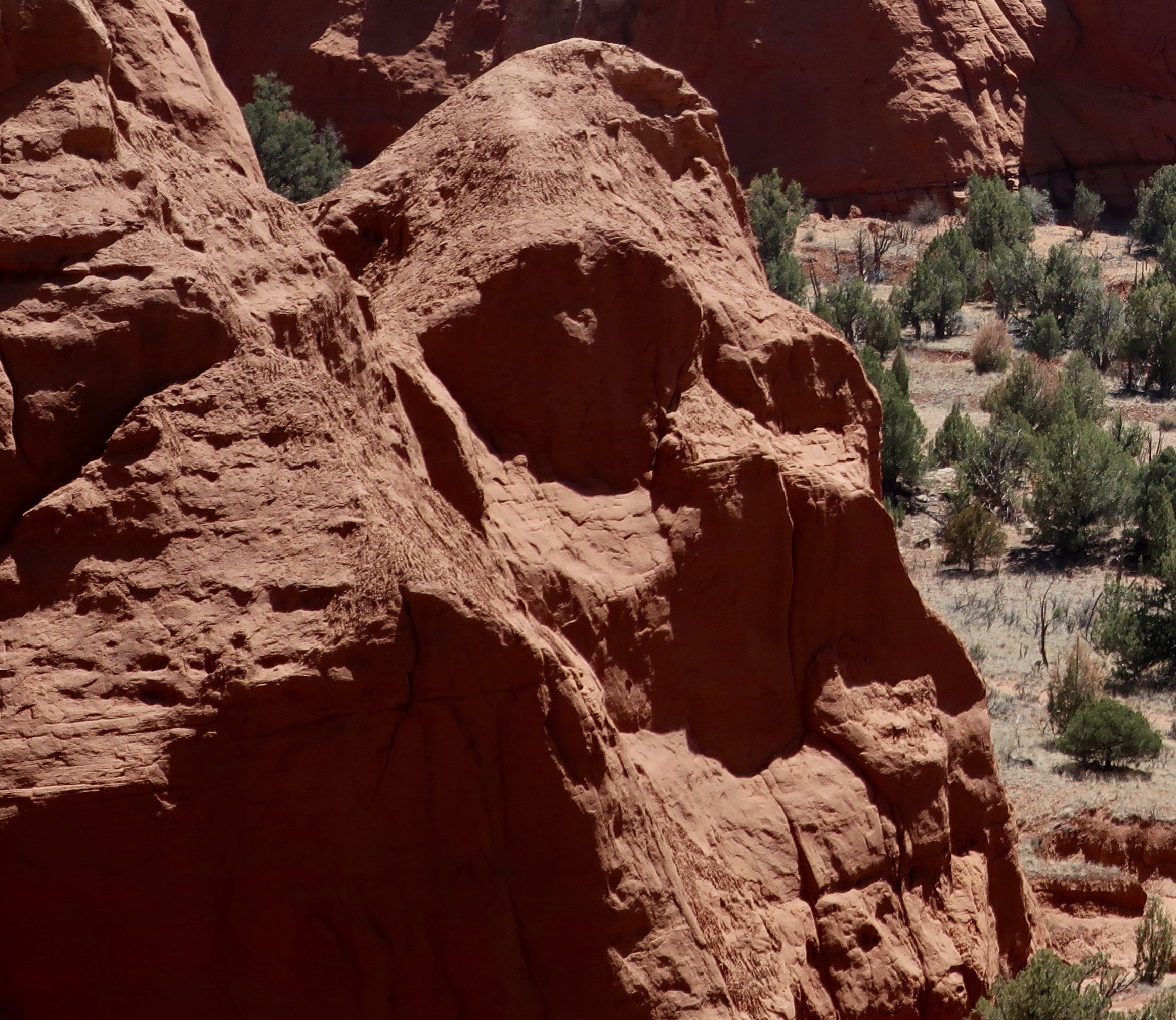
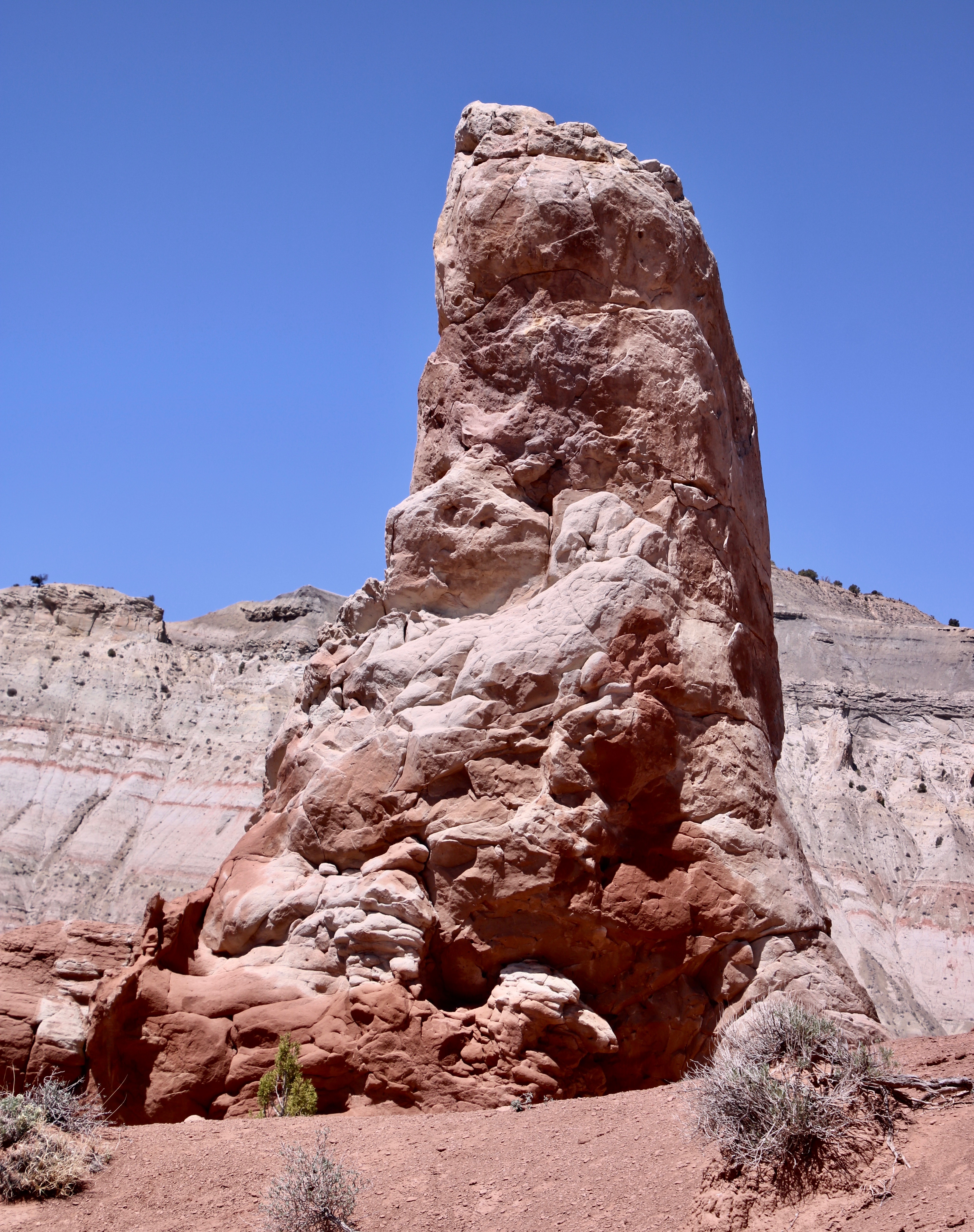
Kodachrome Basin State Park has lots of red rocks. And some interesting characters. What famous movie star does this remind you of? He is a bit hairy, has a thing for blondes, and likes to climb tall buildings.
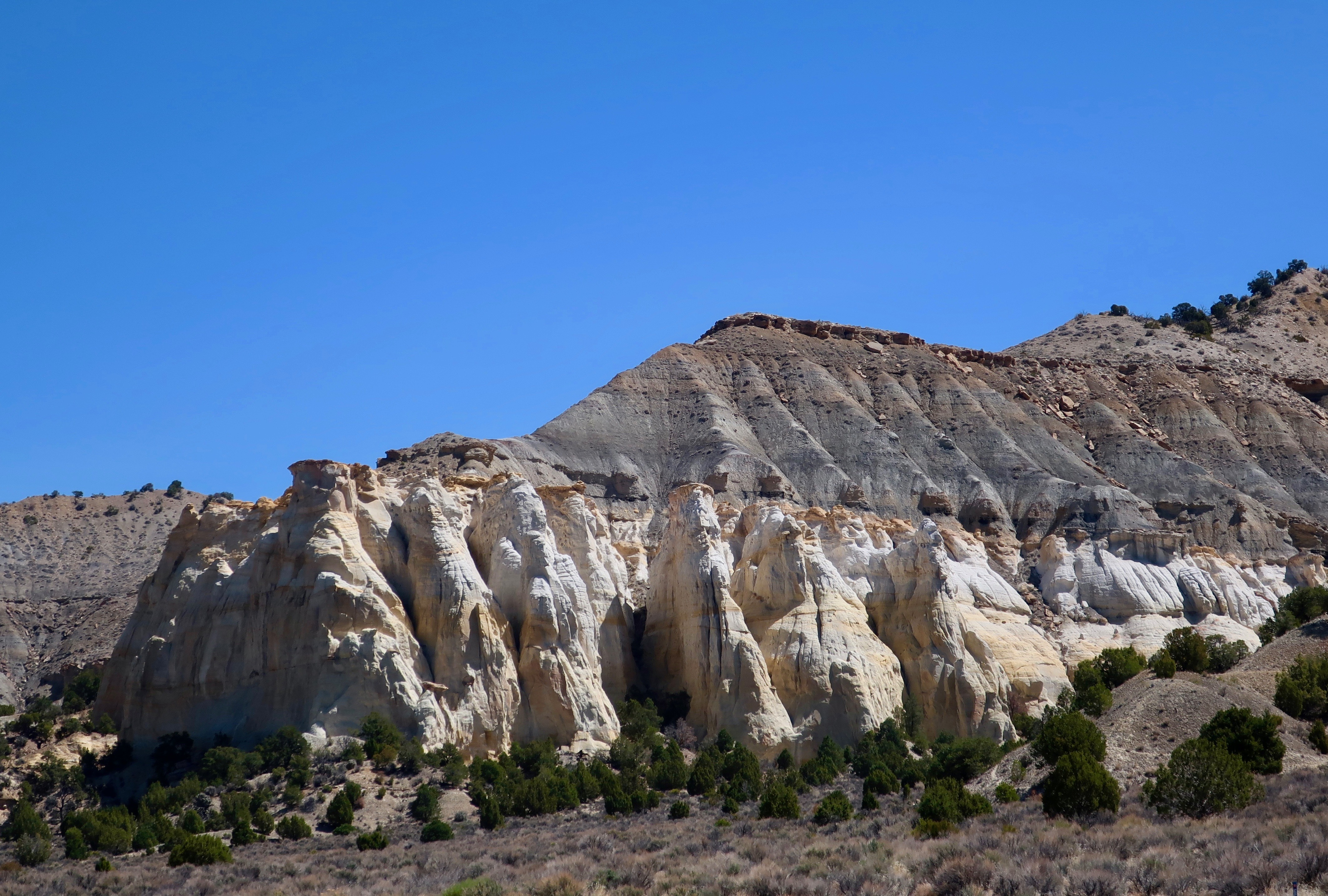
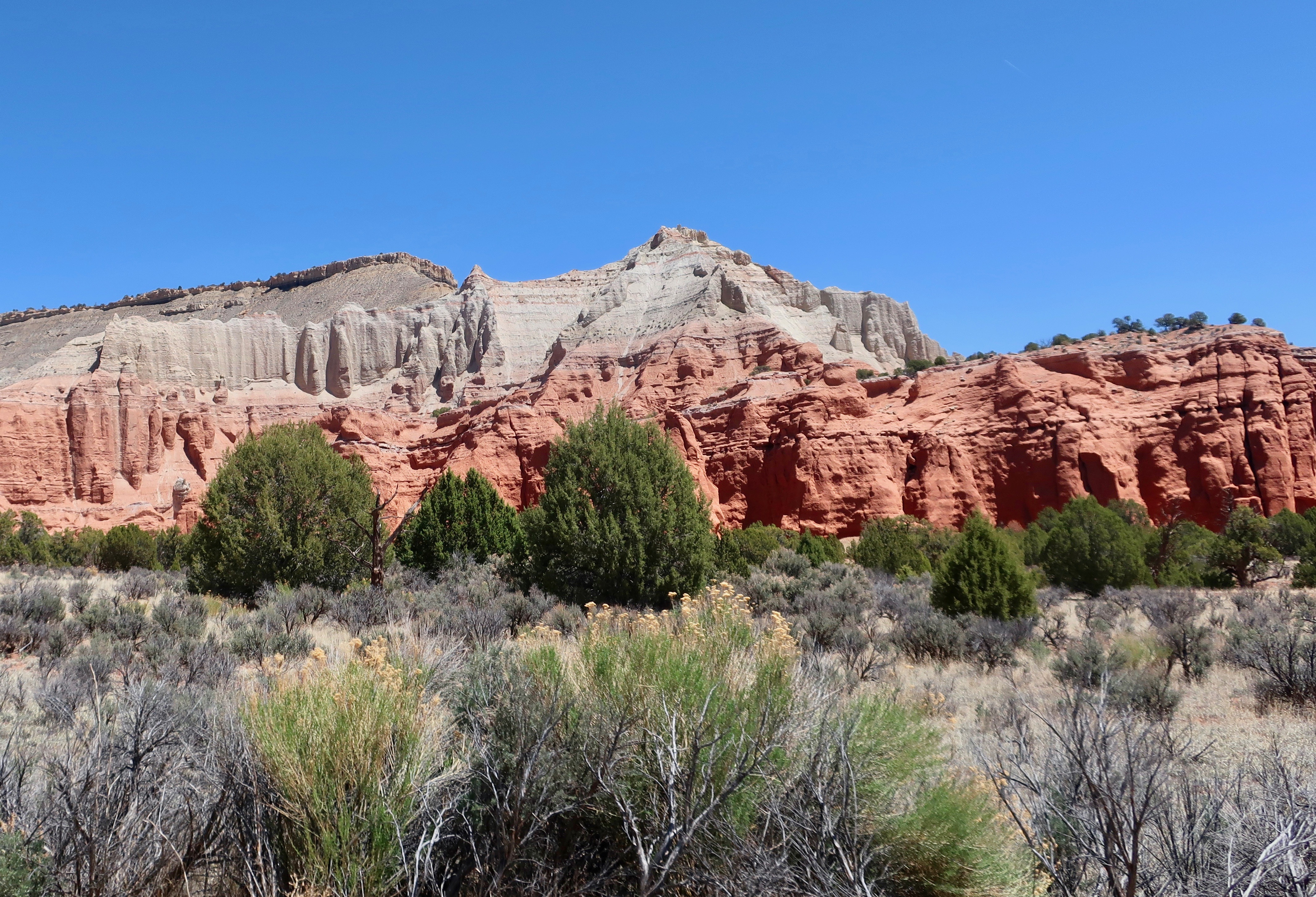
Peggy and I stayed at a campground in the small town of Cannonville, Utah on Highway 12 for our exploration of the Bryce Canyon area— miles away from the crowds of the National Park. Kodachrome Basin State Park was just down the road from us. It received its name in 1948 when a National Geographic team explored the area and decided the basin reminded them of Kodachrome film. If you are old enough to remember when photography meant film instead of digital images, you may remember that Kodachrome was a special film designed by Kodak to bring out the red in photos. There are a lot of red rocks in the area— thus the name.
I decided that black and white might be a better way to render the look-alike movie star above. In my mind, it is definitely King Kong. Peggy agrees.We decided this might be the skull of King Kong’s cousin.
Actually, we saw much more than red rocks and giant apes in the Park.
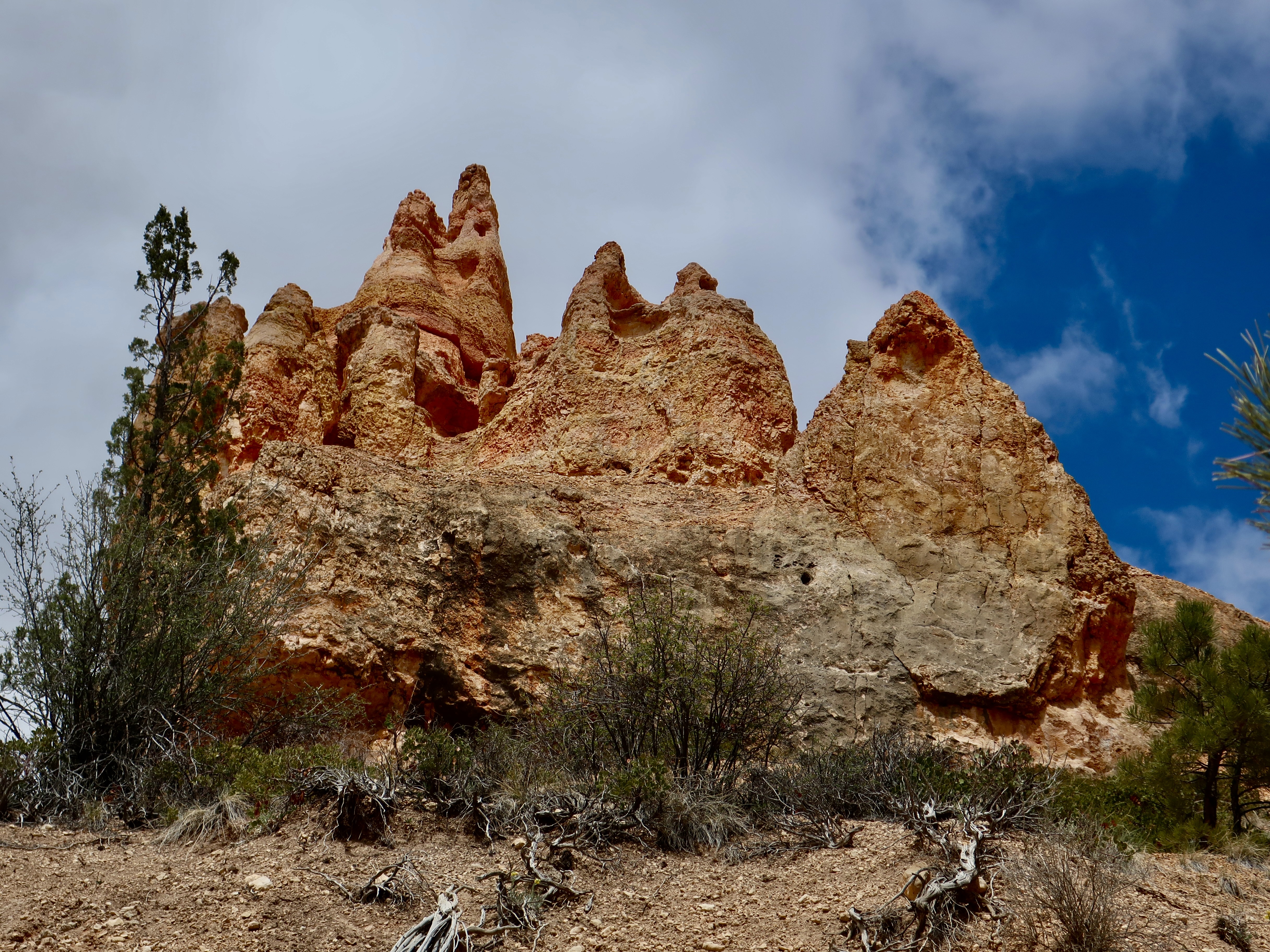
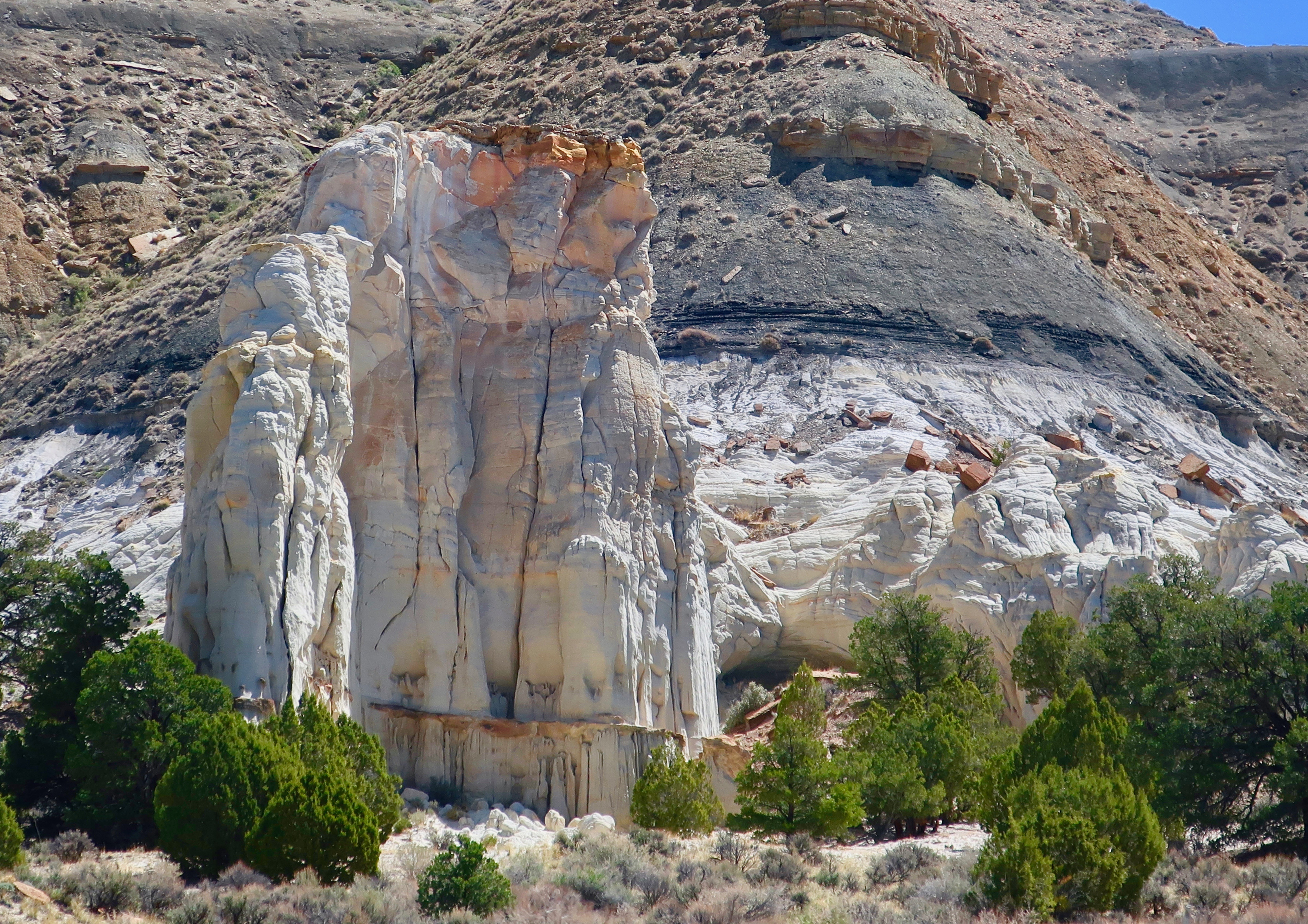
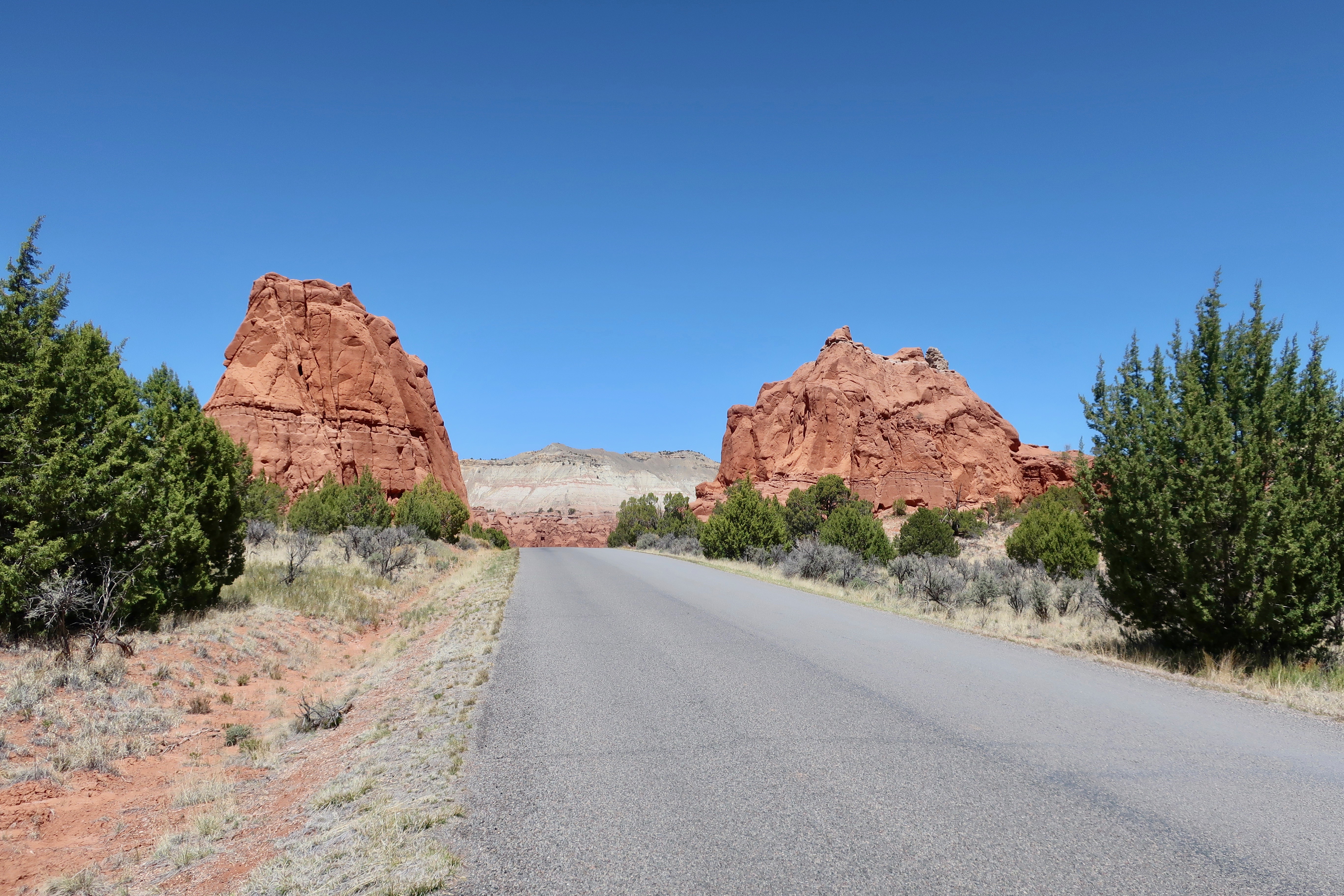
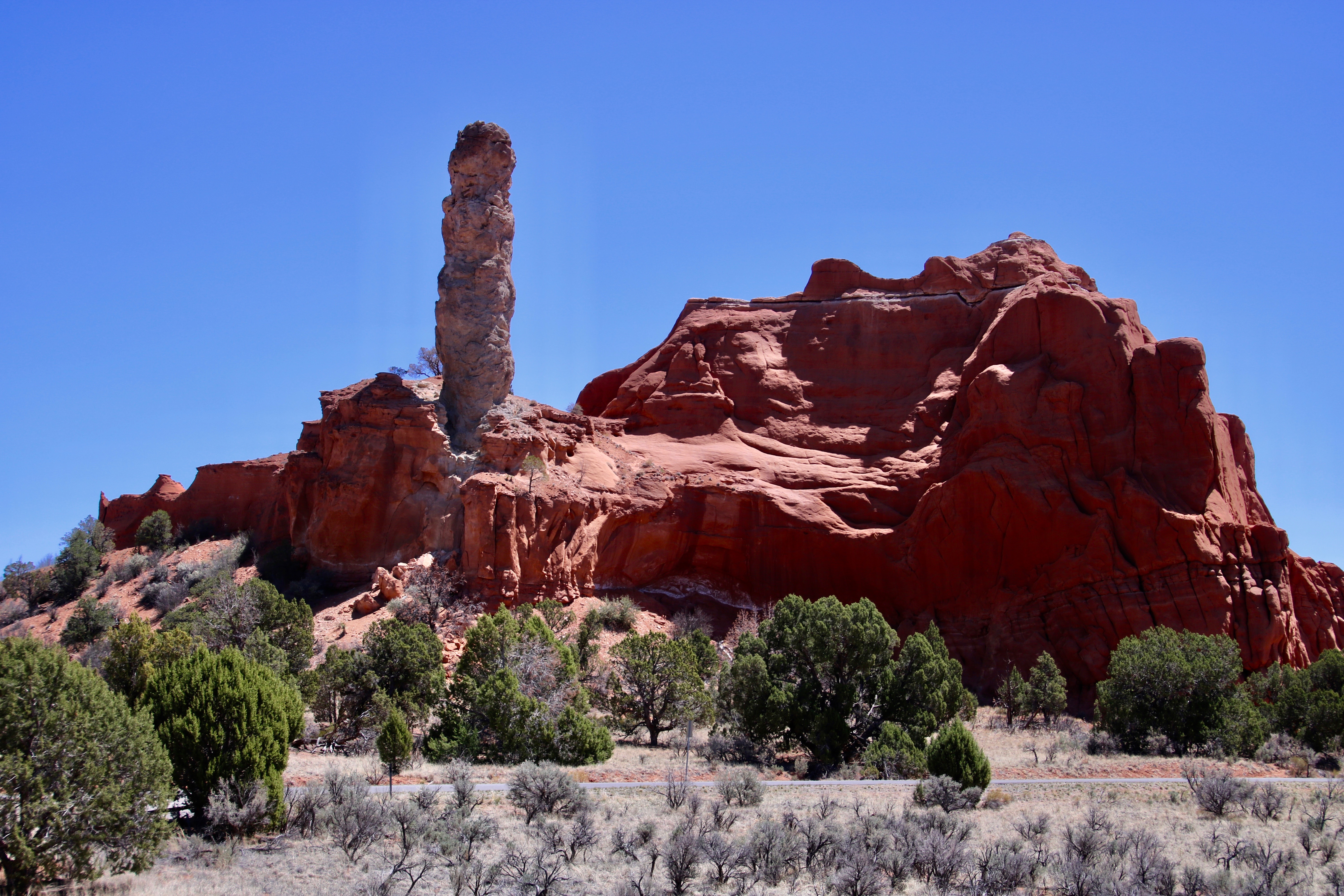
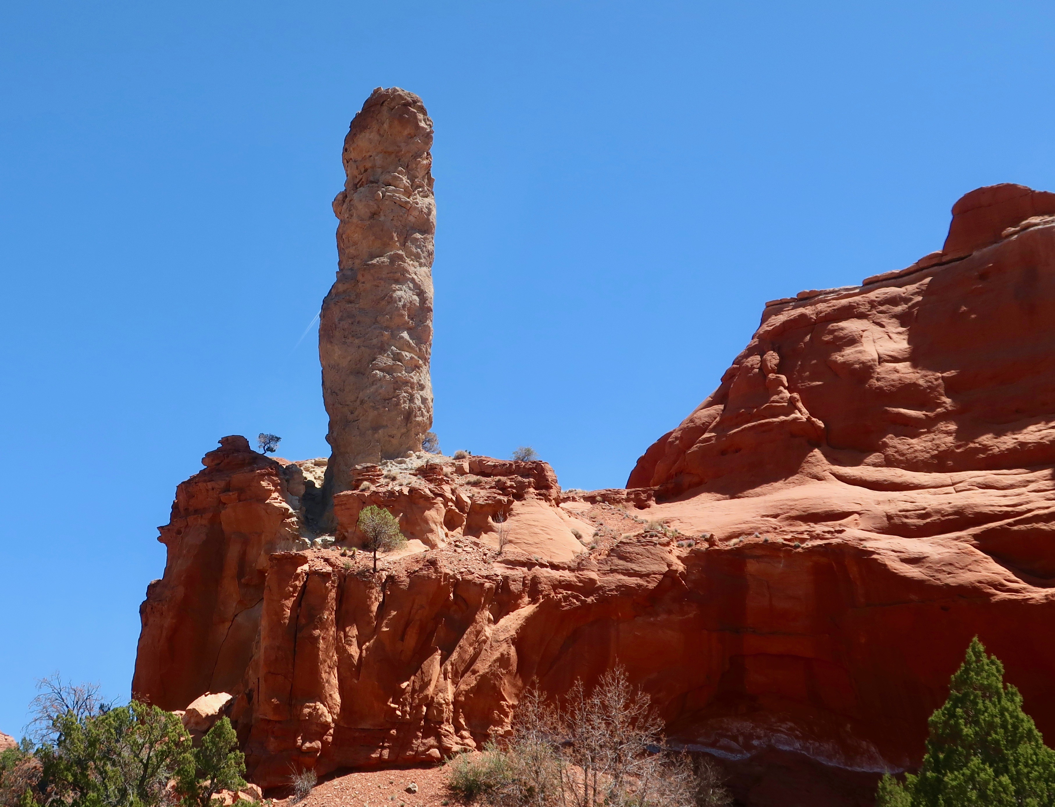
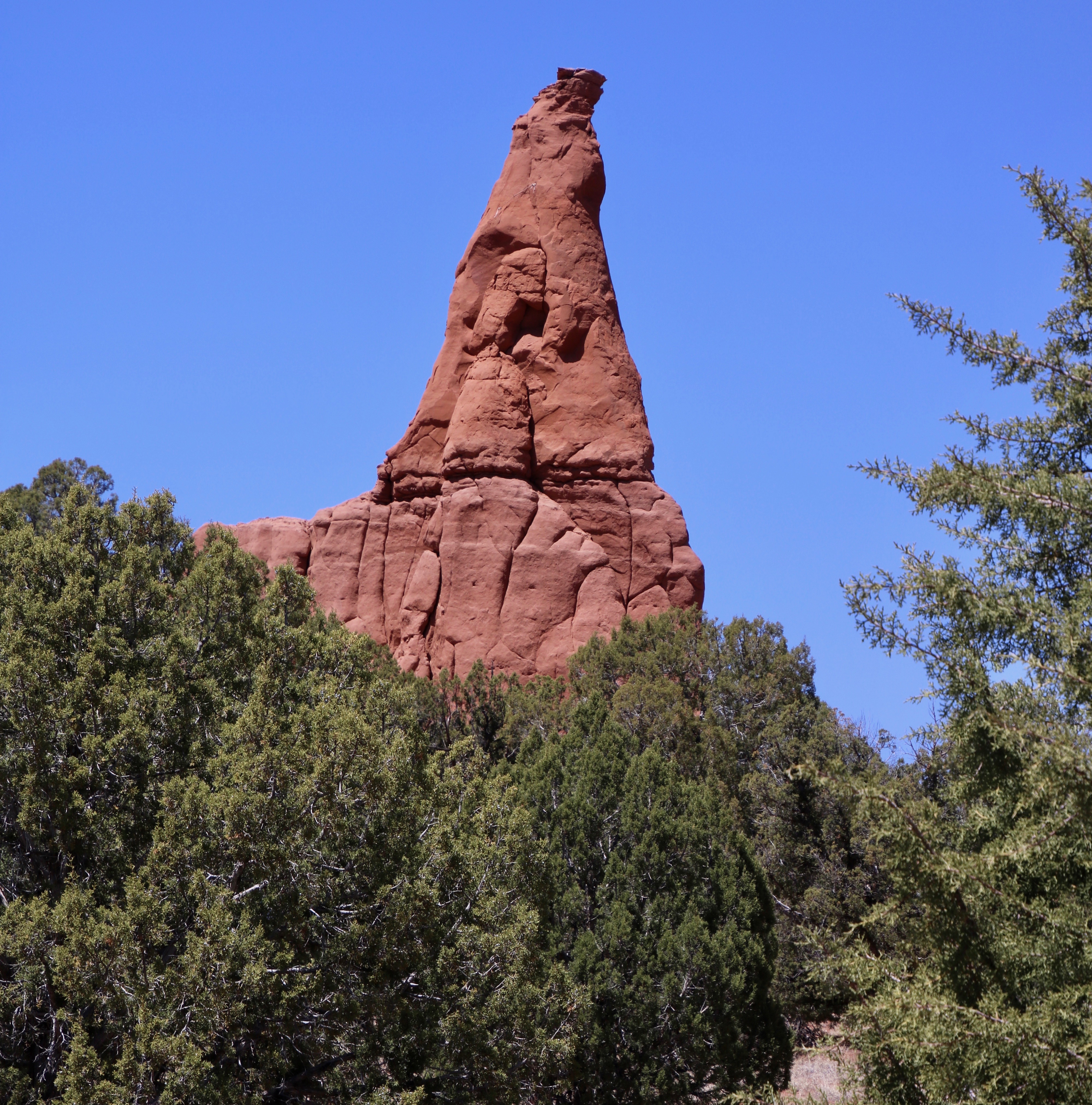
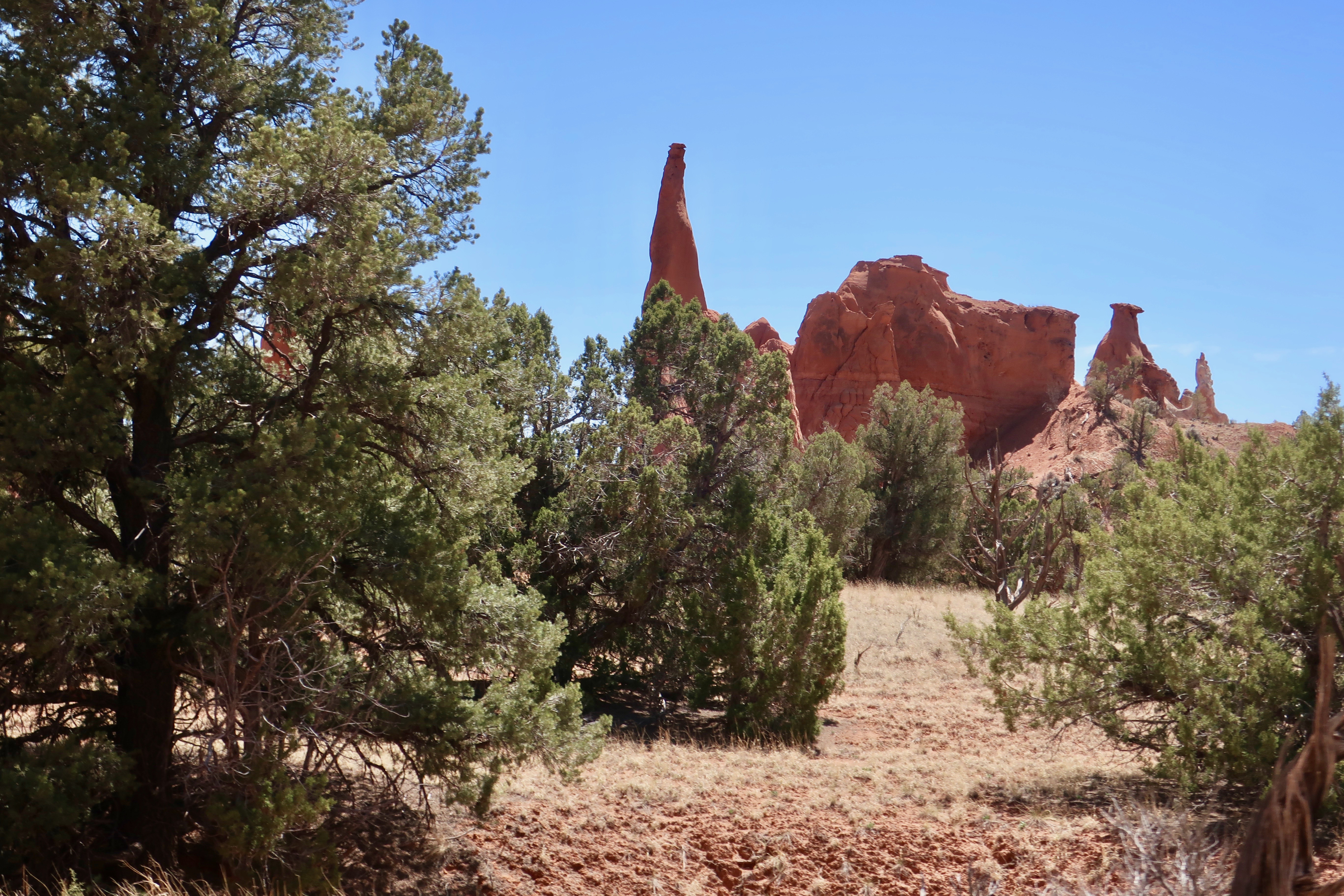
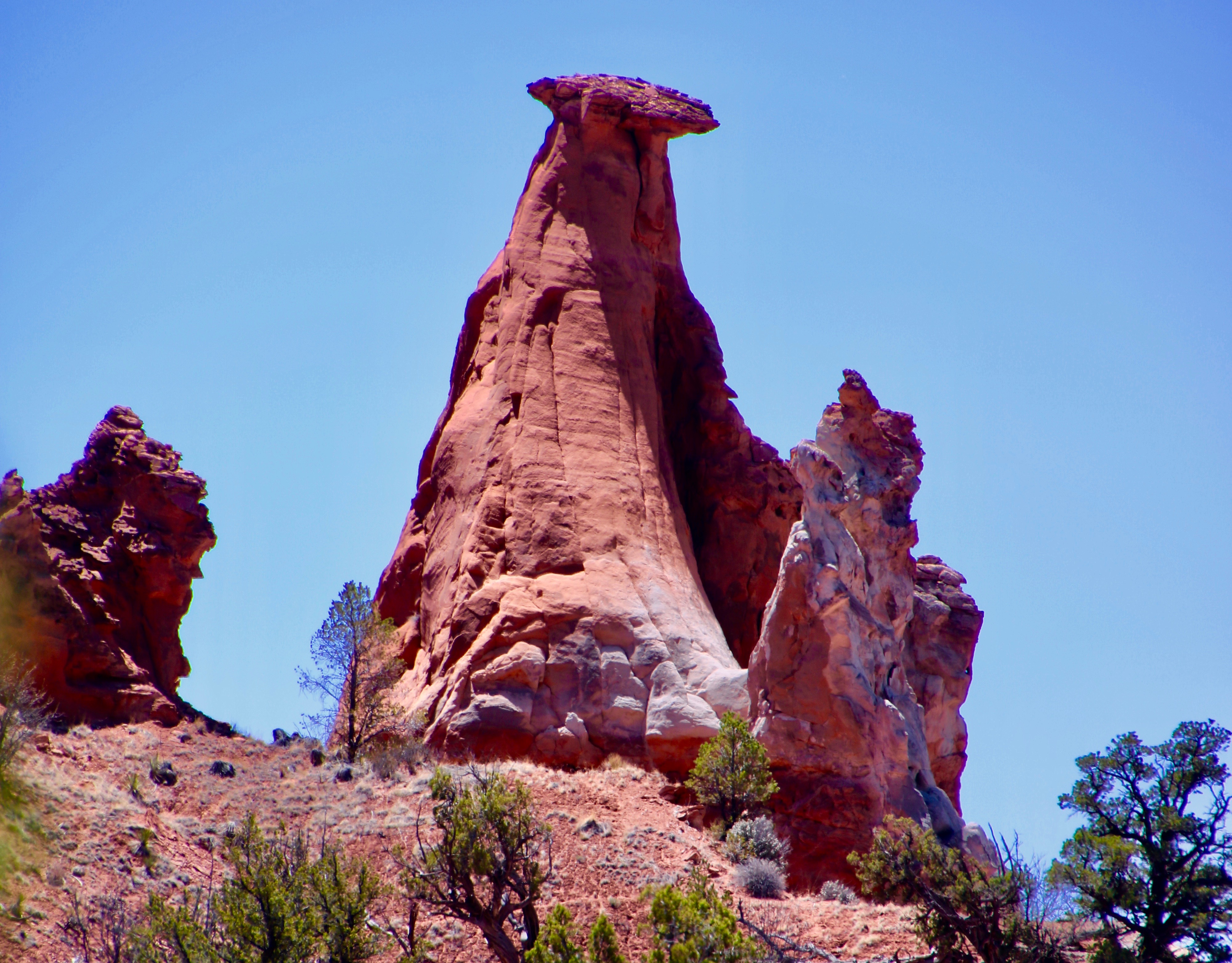
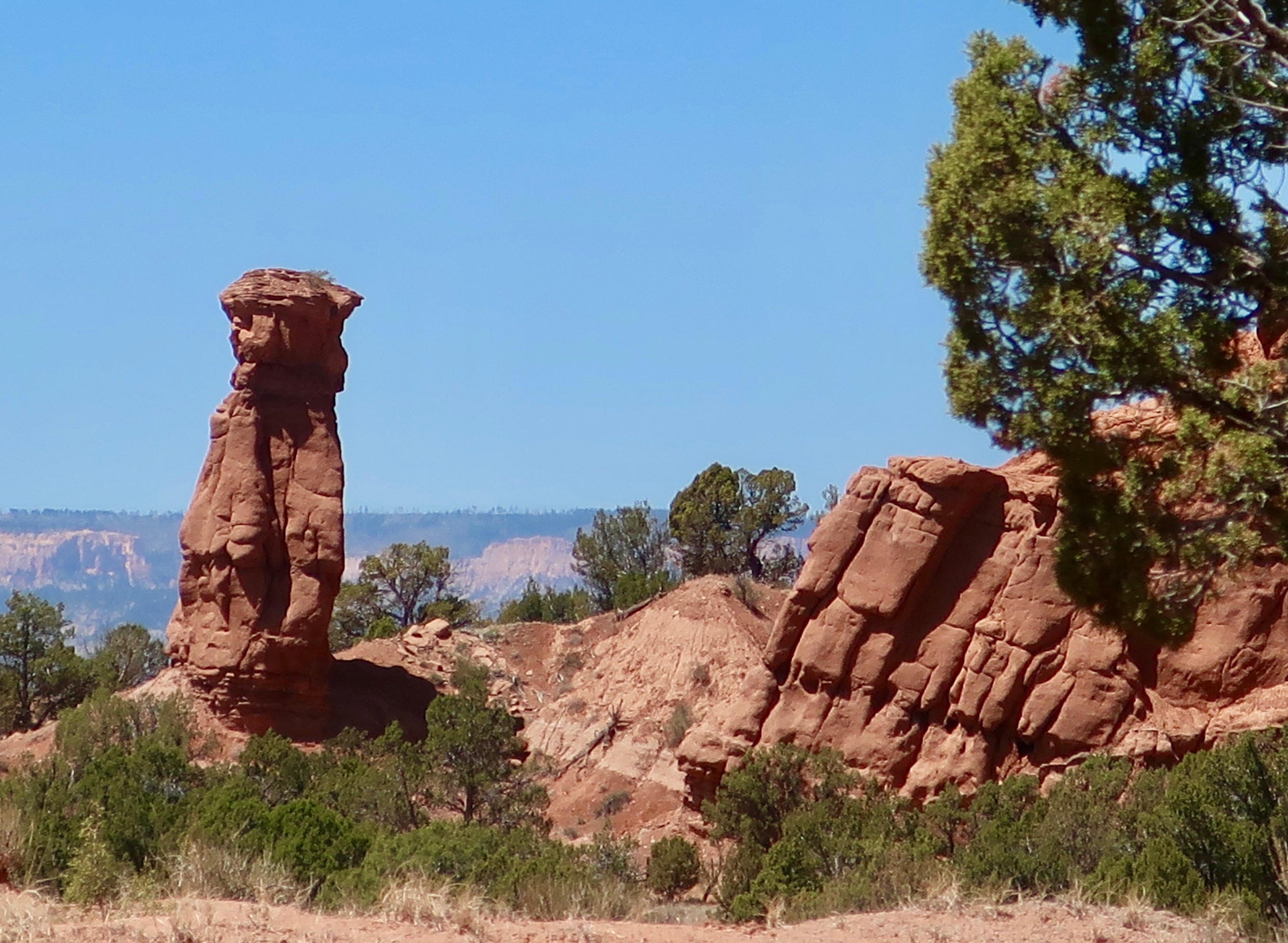
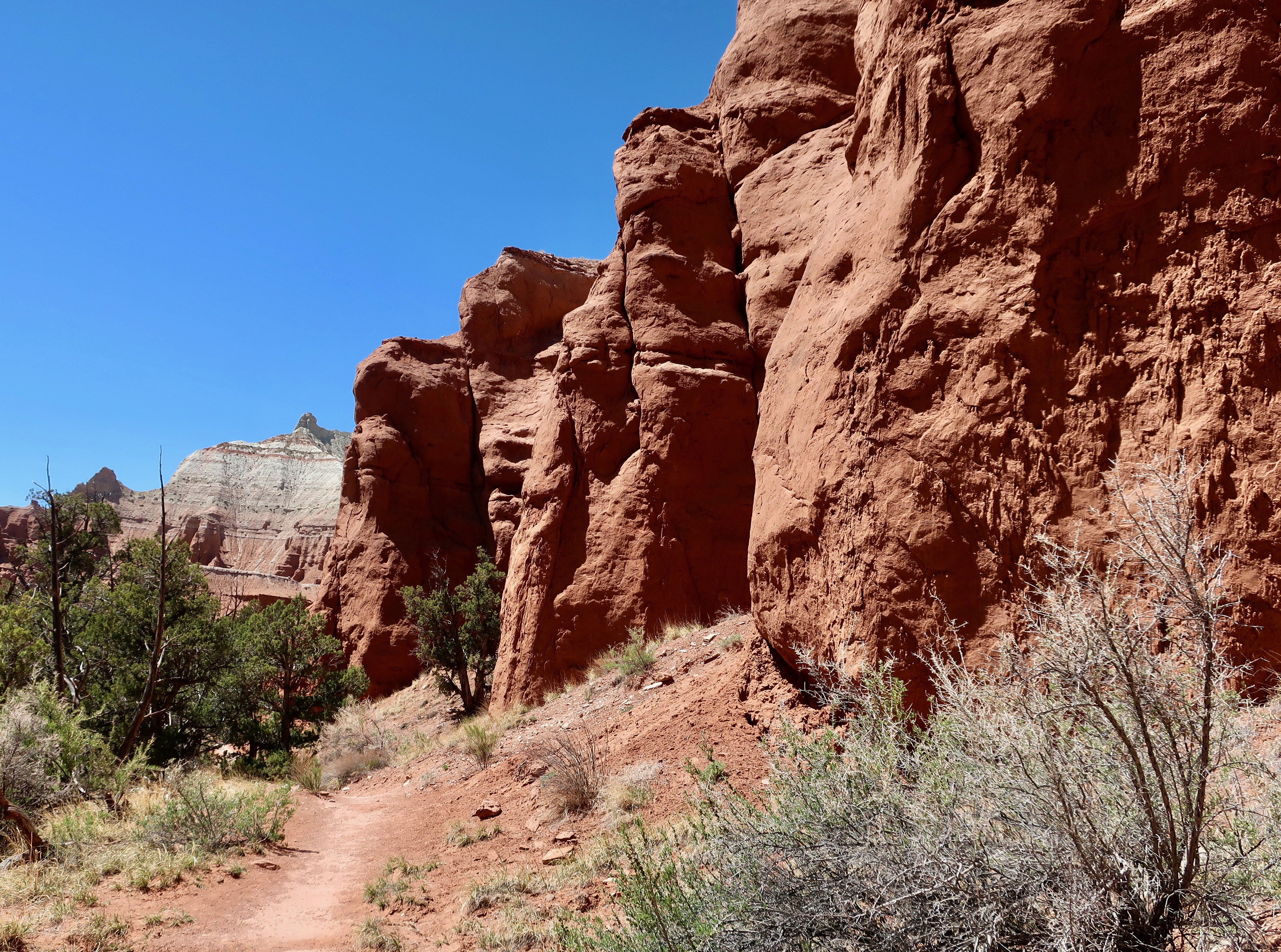
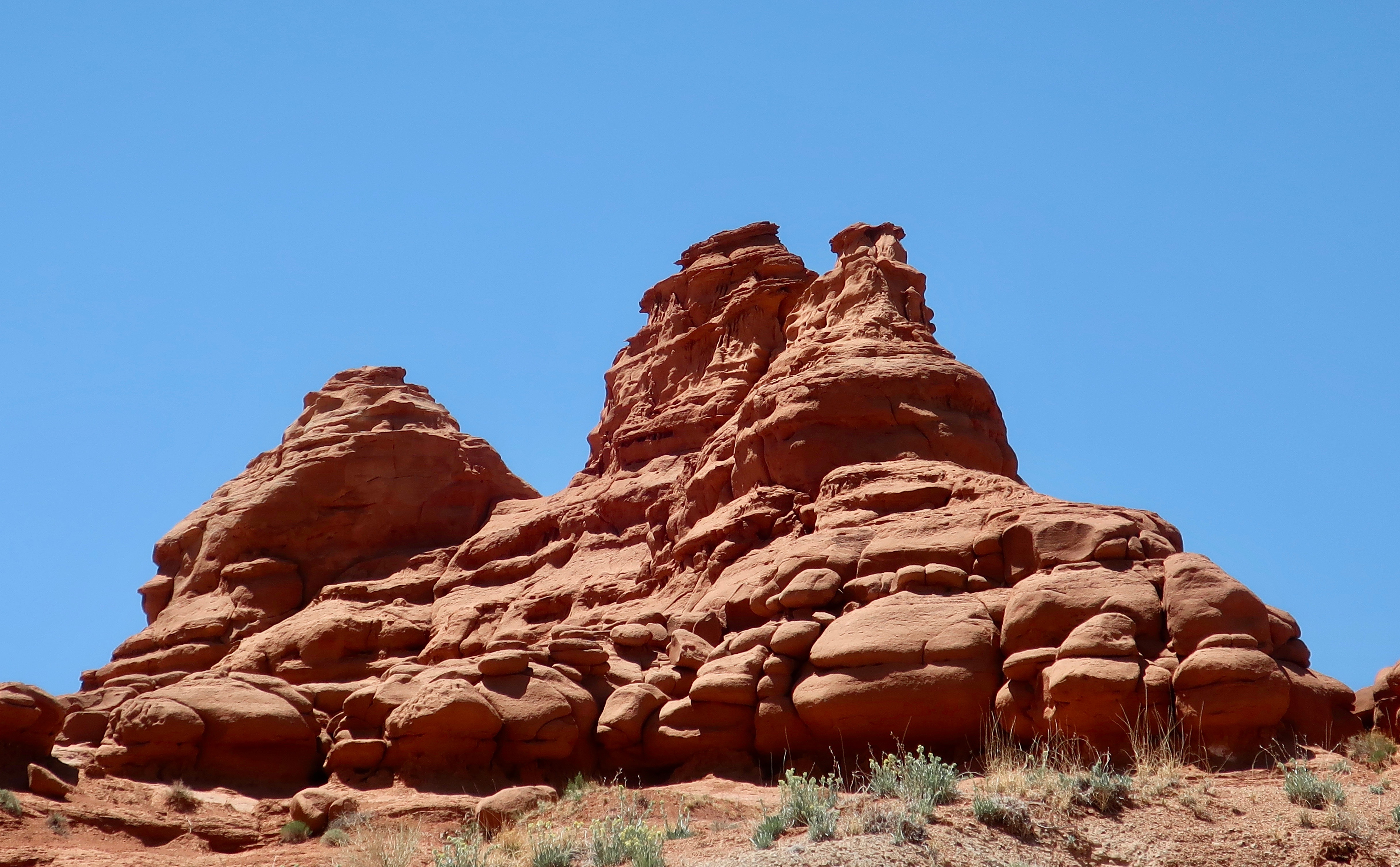
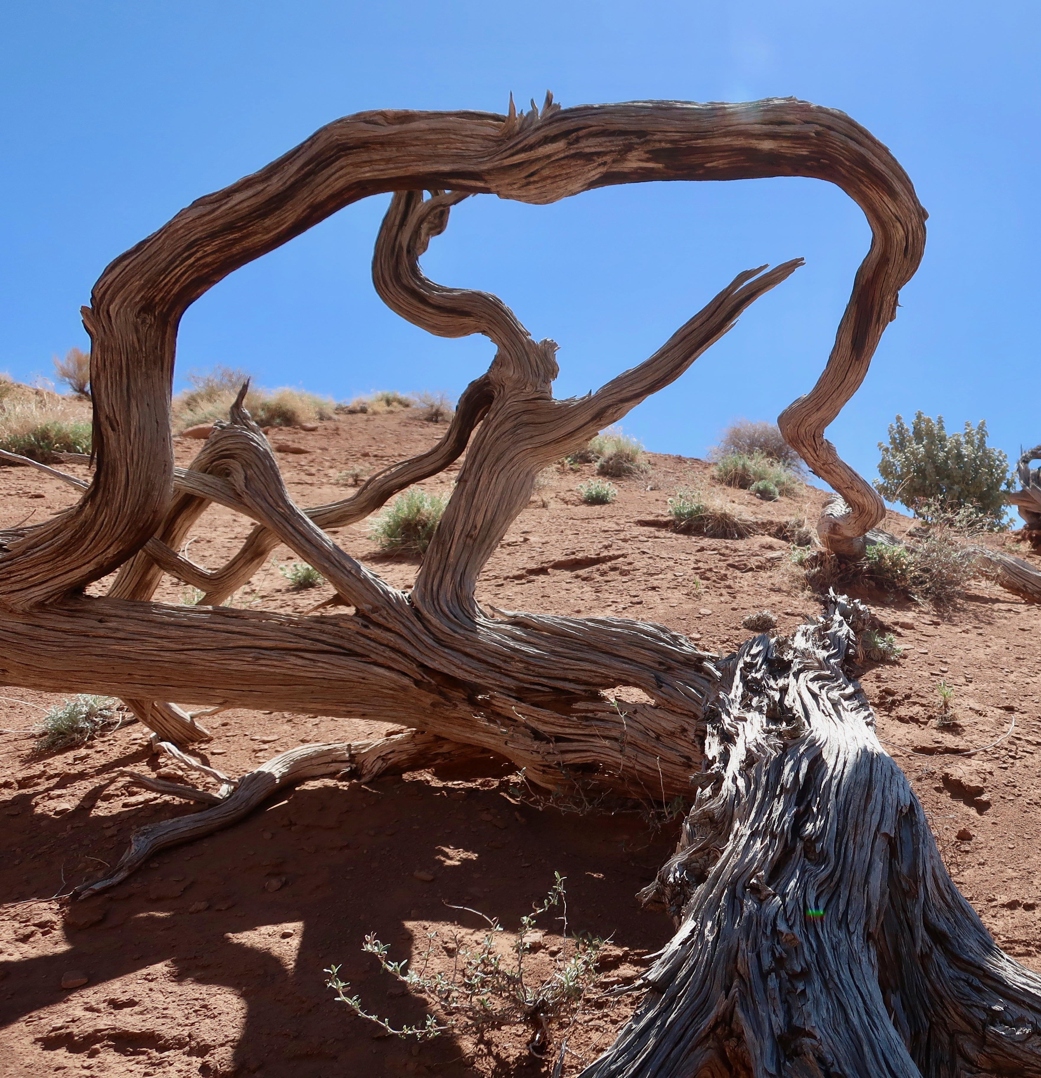
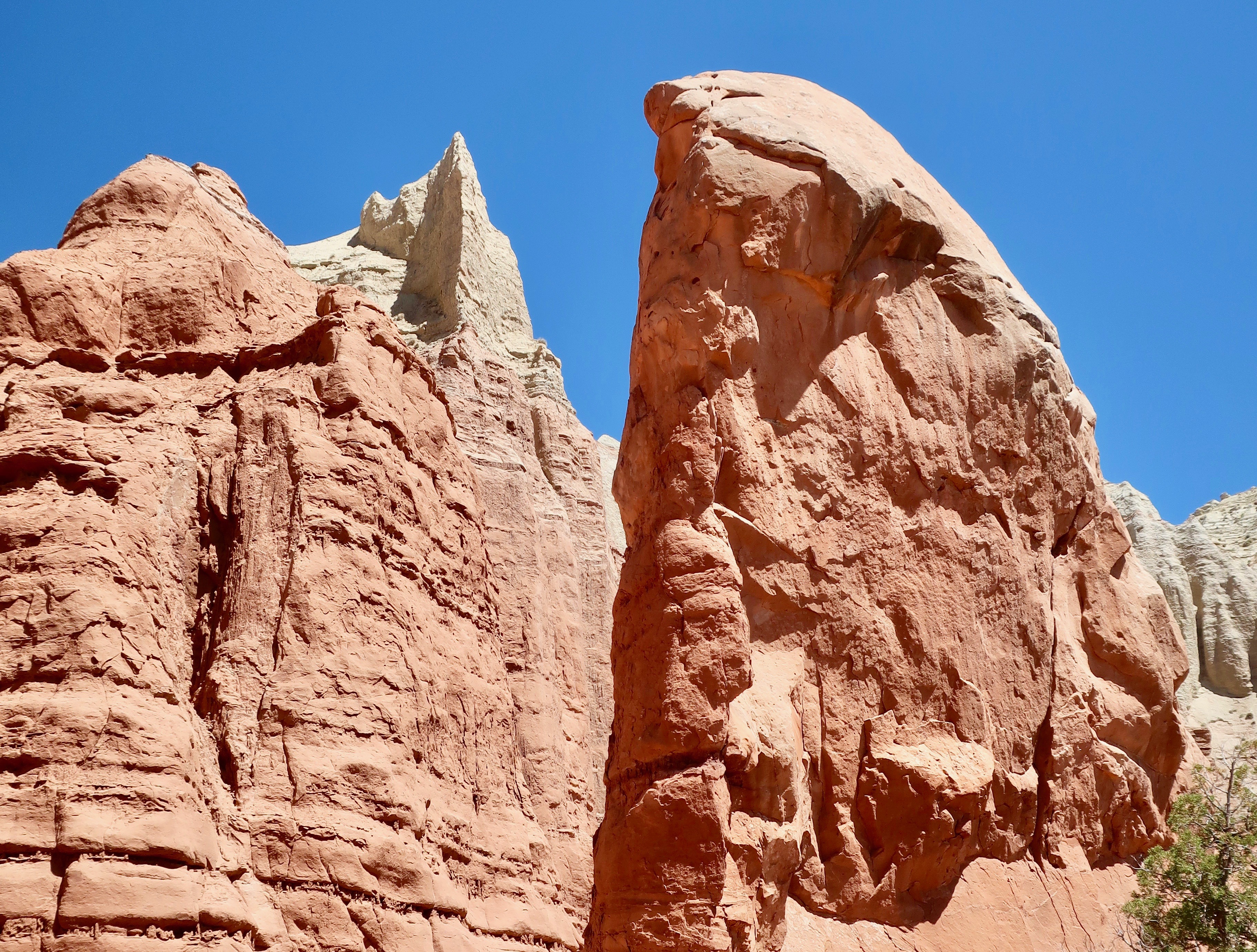
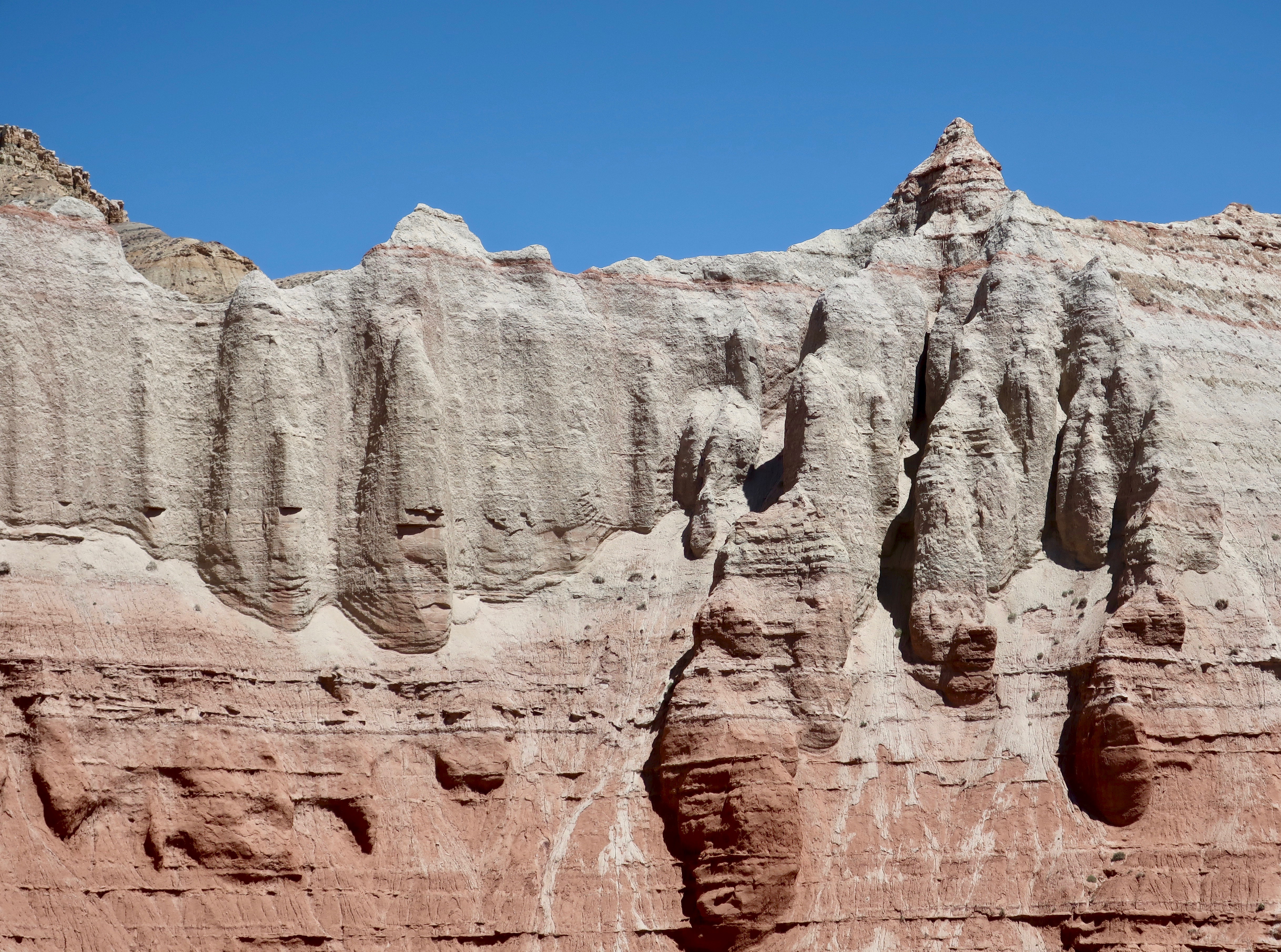
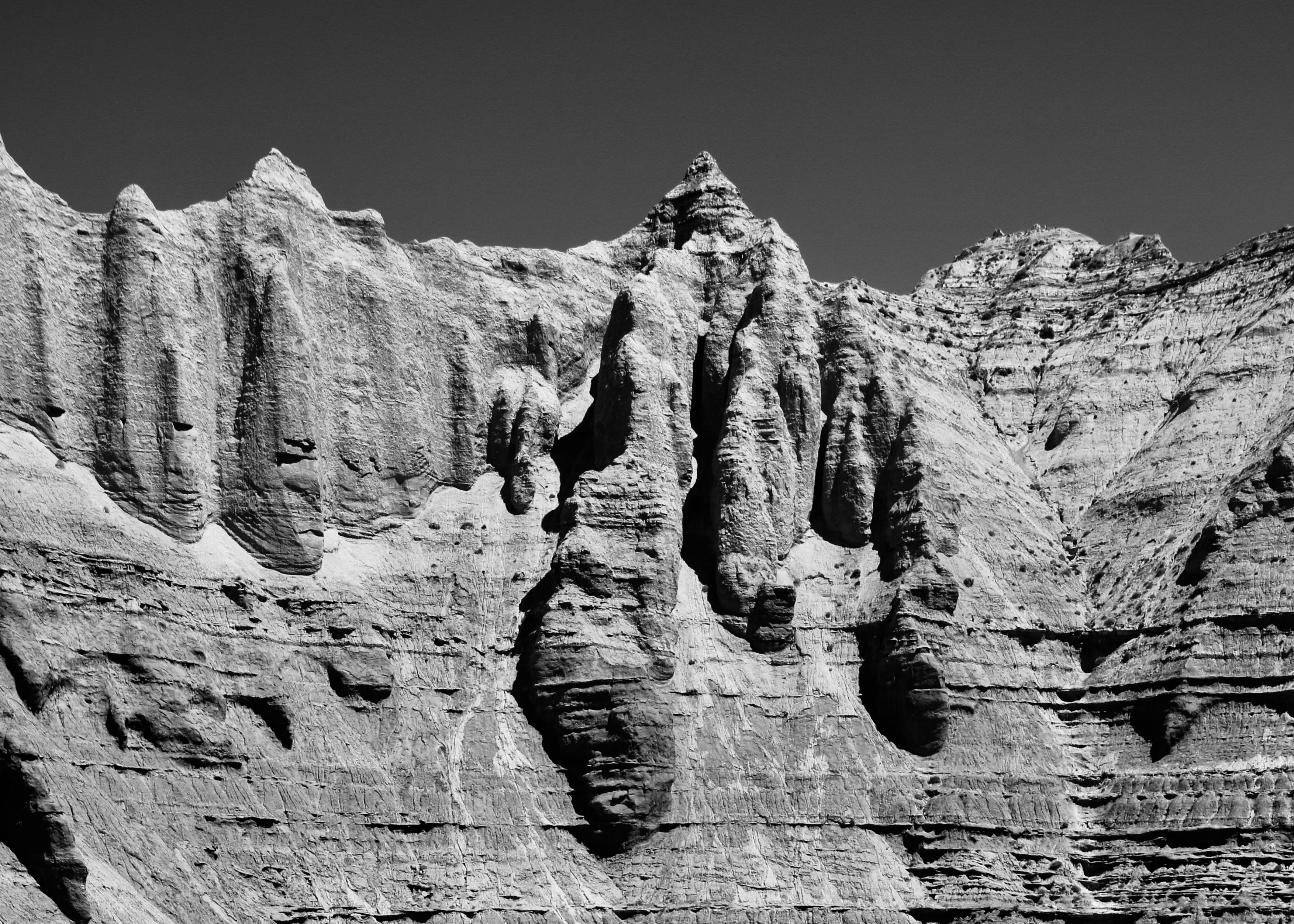
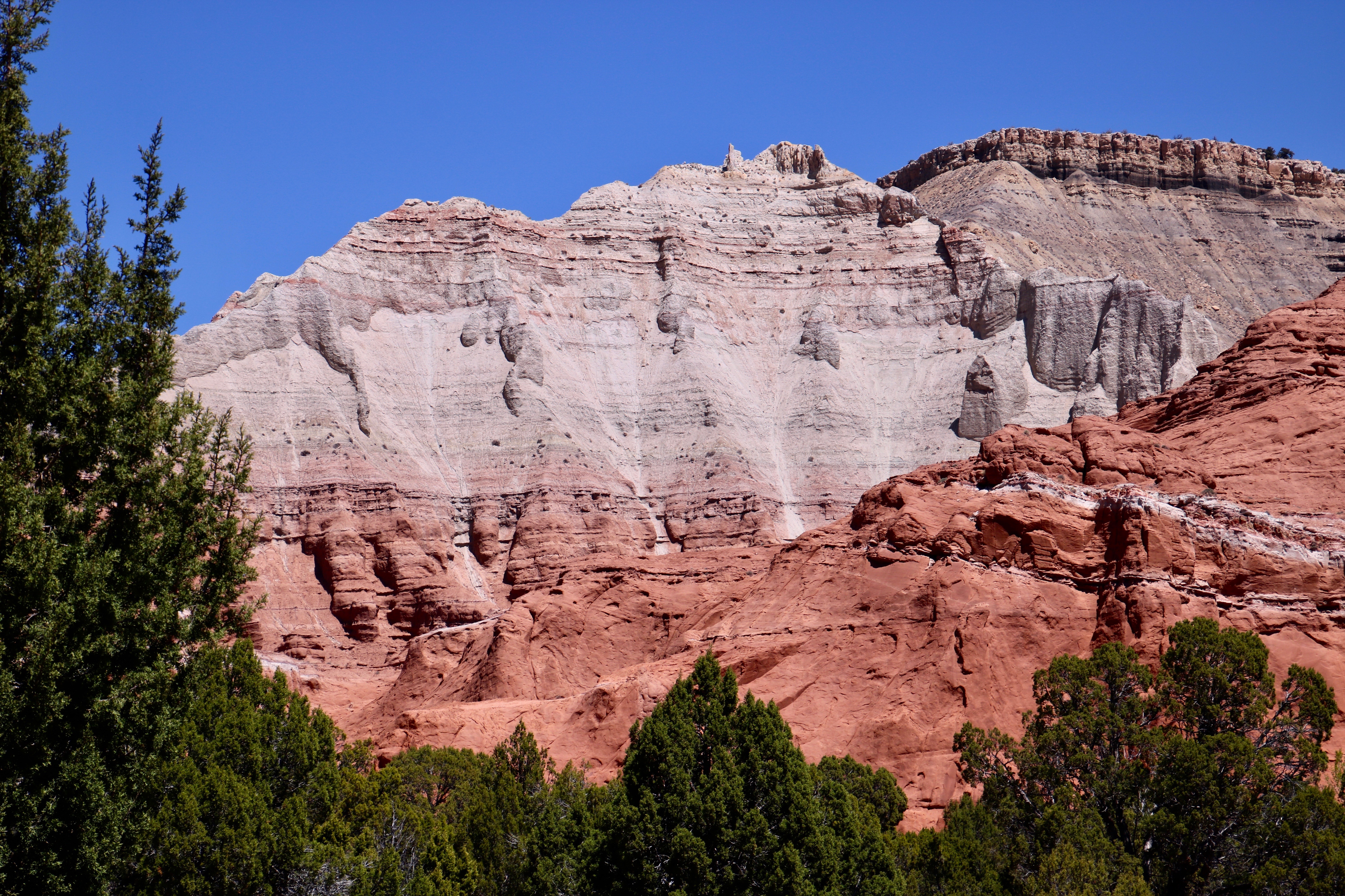
This white rock formation was on the road into Kodachrome Basin State Park…Plus this gorgeous white rock sculpture.Our first view of Kodachrome Basin State Park promised that we were in for a treat. We were not disappointed.These two large rocks were located at the entrance to the Park, like guardians.Given its face, I thought of this rock specifically as the Guardian of the Park. It was the back of the rock on the right that held the surprise, however. (Photo by Peggy Mekemson.) An unusual white pillar shot straight up from the red rock. Turns out that they are found throughout the Park. The rocks are known as sedimentary pipes but the jury is still out as to what creates them. (Photo by Peggy Mekemson.)I took a closer photo of the finger-like projection.There were also sandstone spires created by the more normal process of erosion. (Photo by Peggy Mekemson.)A number of the red sandstone spires and other rocks were in a row. I show some of them here. They were probably part of the same formation before erosion wore them down.This spire still sported its caprock. I loved the color on the rock to the right. (Photo by Peggy Mekemson.)There were also hoodoos found throughout the park like the one on the left. Expect many more in my other posts on Bryce Canyon and other parks in the area. (Photo by Peggy Mekemson.)A number of trails lead into the park. This is the one we chose to hike.The trail wandered among the red rocks shown above and then shot up a steep but short wall. We came around a rock and discovered another hoodoo.It was a handsome rock…A big fellow…And colorful. I took a photo from the other side shooting straight up, and caught some of the rock’s color.Peggy’s photo on our return trip caught the color even more. (Photo by Peggy Mekemson.)There were many other things to see along the trail. Peggy caught this photo of a tall, slender, sedimentary chimney. (Photo by Peggy Mekemson.)And a short, stubby one. (Photo by Peggy Mekemson.)I took photos of red sandstone rocks…And more sandstone rocks…I found a small juniper that I felt looked like a Japanese bonsai.And, a twisted wood sculpture…Finally we came to a steep drop off, towering rocks and a massive cliff that signified the end of the trail.We weren’t any more willing to climb up the cliff than we were willing to drop into the canyon. Grin.Peggy took a close up. (Photo by Peggy Mekemson.)I took a similar photo that I rendered into black and white.Other trails in the park promised many more opportunities for exploration. Unfortunately, we had run out of time for the day.I took a final photo of the park before heading on to our next adventure.
Next Friday I will feature Red Canyon, which in some ways matches Bruce Canon for sheer beauty and fantastic hoodoos. You won’t want to miss it.
Meanwhile, we wrapped up our Rhine River cruise. Here’s another teaser. We were wandering through Germany’s Black Forest when we came across this donkey at a historic farm museum.
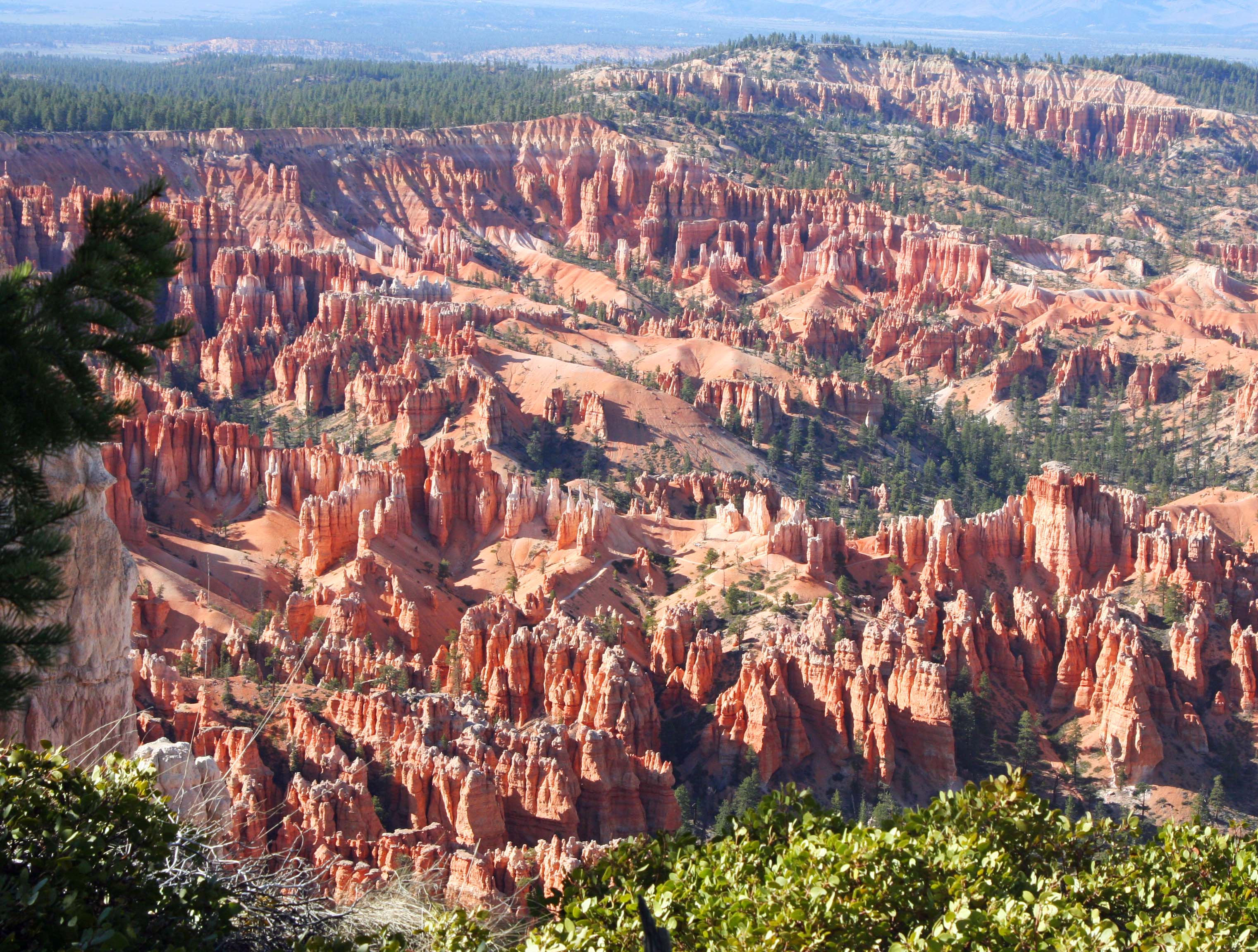
Bright colors combine with interesting rock formations to make Bryce Canyon.
There is nowhere in the world quite like Bryce Canyon. This is a place where you can let your imagination run as wild as it wants to run. I am always struck first by the colors of the rocks and then immediately afterwards by their shapes.
Thousands of years of ice-driven erosion have created a fantasy world of amphitheaters filled with hoodoos and other rock formations climbing down the side of the Paunsaugunt Plateau in Southern Utah.
The best way to experience the canyon is to hike down the trails but even a quick drive-through is rewarding. Early morning and evening are best times to catch the colors. Snow adds another dimension.
An overview of Bryce Canyon from one of the major overlooks.
Bryce Canyon is actually not a canyon created by a river but is a series of amphitheaters dropping on of the Paunsaugunt Plateau.
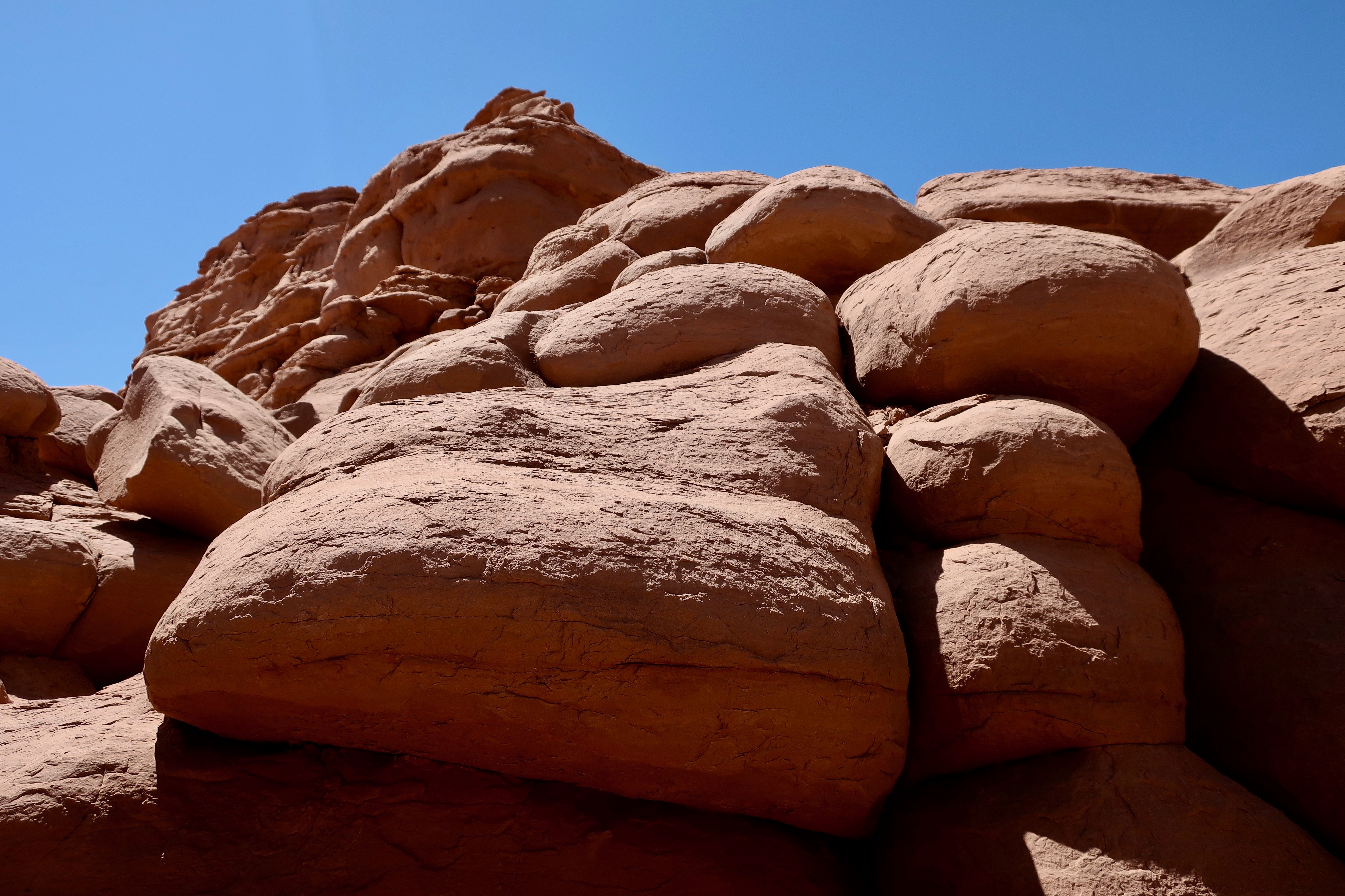
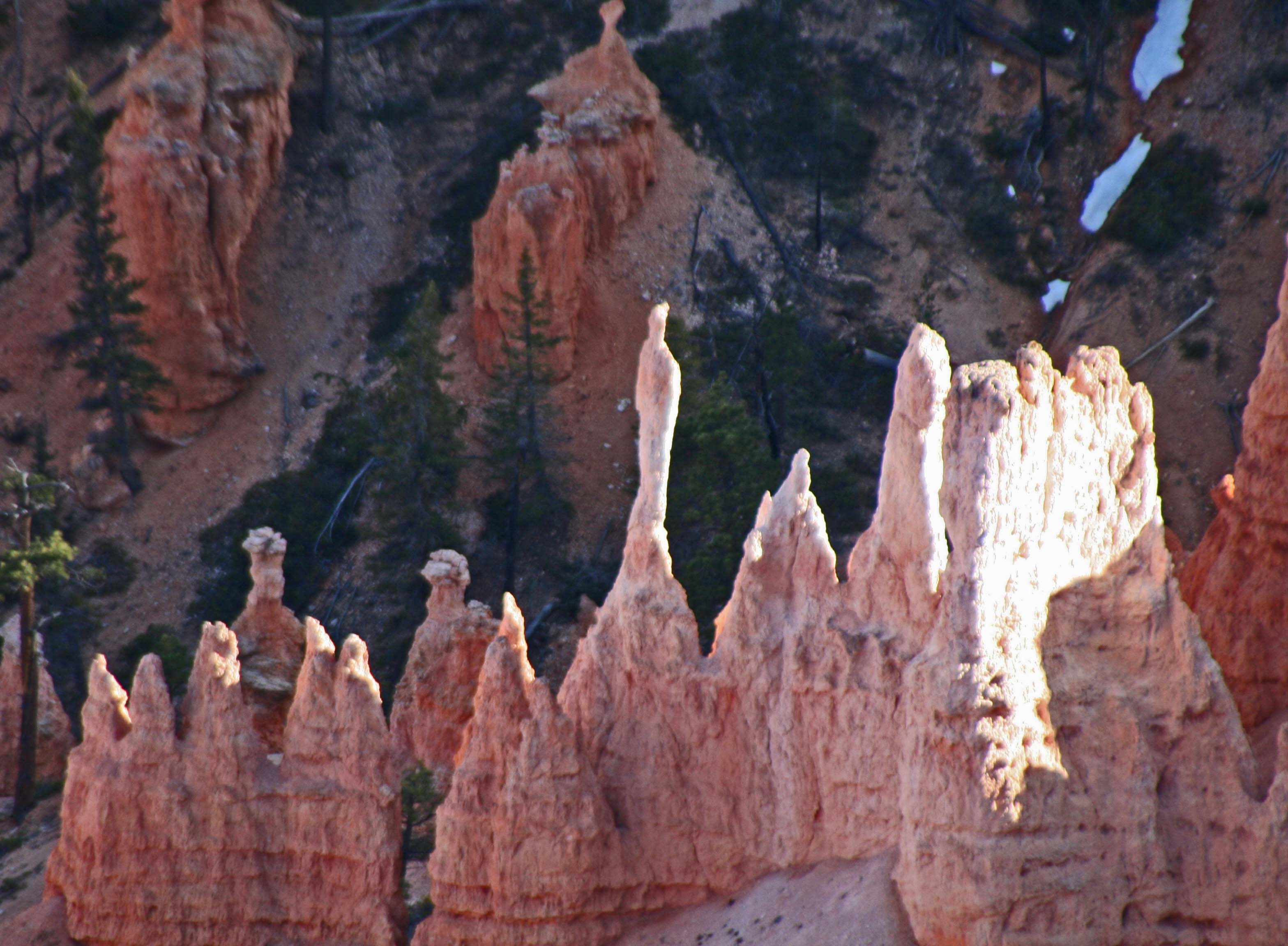
Hoodoos are stand alone rocks created by the process of erosion. A thick wall becomes a fin. Arches are created in the fin and then cave in, leaving hoodoo behind.
A close-up of hoodoo formation. The rock in the foreground is showing cracks and a small arch that will eventually fall in and form a hoodoo.