Big Bend National Park, like Death Valley, demonstrates how incredibly beautiful and diverse deserts can be.
I wasn’t going to blog about Big Bend today, given that I blogged about it last year. However, the plan to deploy US Army troops there encouraged me to include it sooner rather than later. It fits the series Peggy and I are doing on the importance of of protecting our national parks, monuments, and wilderness areas against present threats.
Sending troops into Big Bend is part of President Trump’s efforts to reduce illegal immigration into the US. Today’s post isn’t about the issue of controlling illegal immigration; it’s about the logic of sending troops into Big Bend given its potential impact on the Park versus benefits gained. Let’s look at the numbers.
Customs and Border Protection reported that there were 2600 migrant encounters in El Paso, 1600 in Laredo, and 165 in Big Bend during February. For the Park, this breaks down to an average of 5.9 migrants per day. In order to reduce these illegal entries, the Army has stated that it plans to send 500 troops and several Stryker vehicles into Big Bend. While the Army would not release the number of Strykers, let’s assume 6 for the purpose of this discussion. (A large truck hauling what looked like one zipped by us on I-10 not too far from the Big Bend turn off.)
Would it be an effective deterrent? I suspect the answer is yes. If I were an illegal alien faced with the possibility of encountering 83 soldiers (my share: 500 divided by 6) and one Stryker vehicle (more or less)on any given day, not to mention the usual contingent of Border Patrol, I’d seriously consider going elsewhere. Is it a cost effective use of resources given the extent of the overall problem? I can’t see how the answer would be anything other than no. Given this, compare the potential disruption to visitors and the possible damage to the Park given how much time the Strykers spend off road. Desert environments are very sensitive and require long times to repair. While it is difficult to predict what the President will actually do, or not, on any given occasion, the Big Bend scenario shows once again, that little— if any— consideration is given to potential impact on national parks, monuments and wilderness areas in his actions.
A US Army Stryker vehicle. Developed in the early 2000s to increase the army’s mobility and versatility, this million dollar vehicle weighs 19 tons, comes with all of the latest surveillance equipment, and can carry 2 crew members and 11 soldiers. It can travel up to 60 MPH on paved roads. The army claims it will be primarily used for surveillance in Big Bend but can be weaponized if necessary. One can only wonder what ‘necessary’ would constitute? (Media photo.)
And now on to our 25 photos of Big Bend. Once again our objective is to show the unique beauty, geology, flora, fauna, and human history of each area we feature and the value of protecting these national treasures for our children, grandchildren, and future generations.
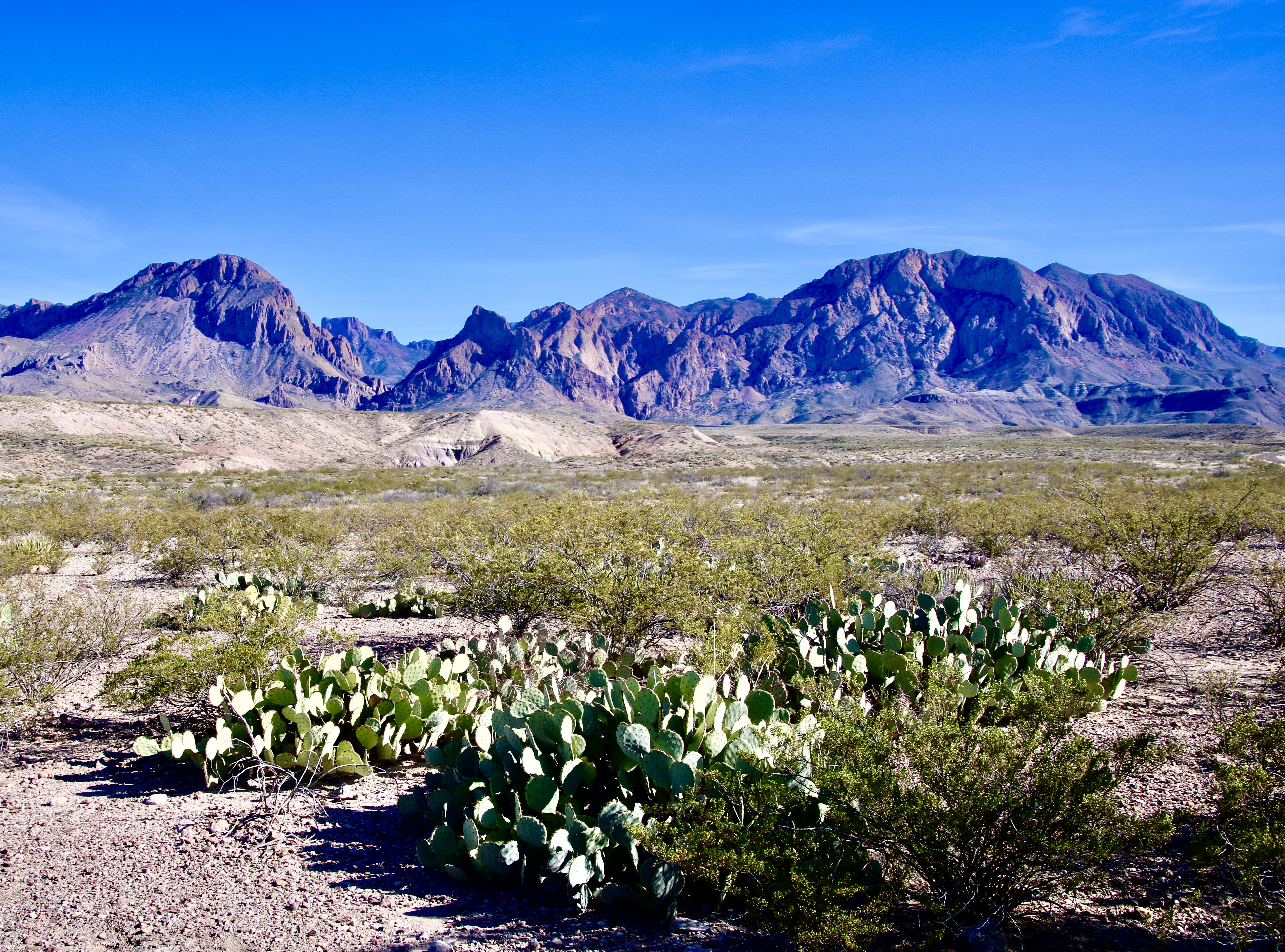
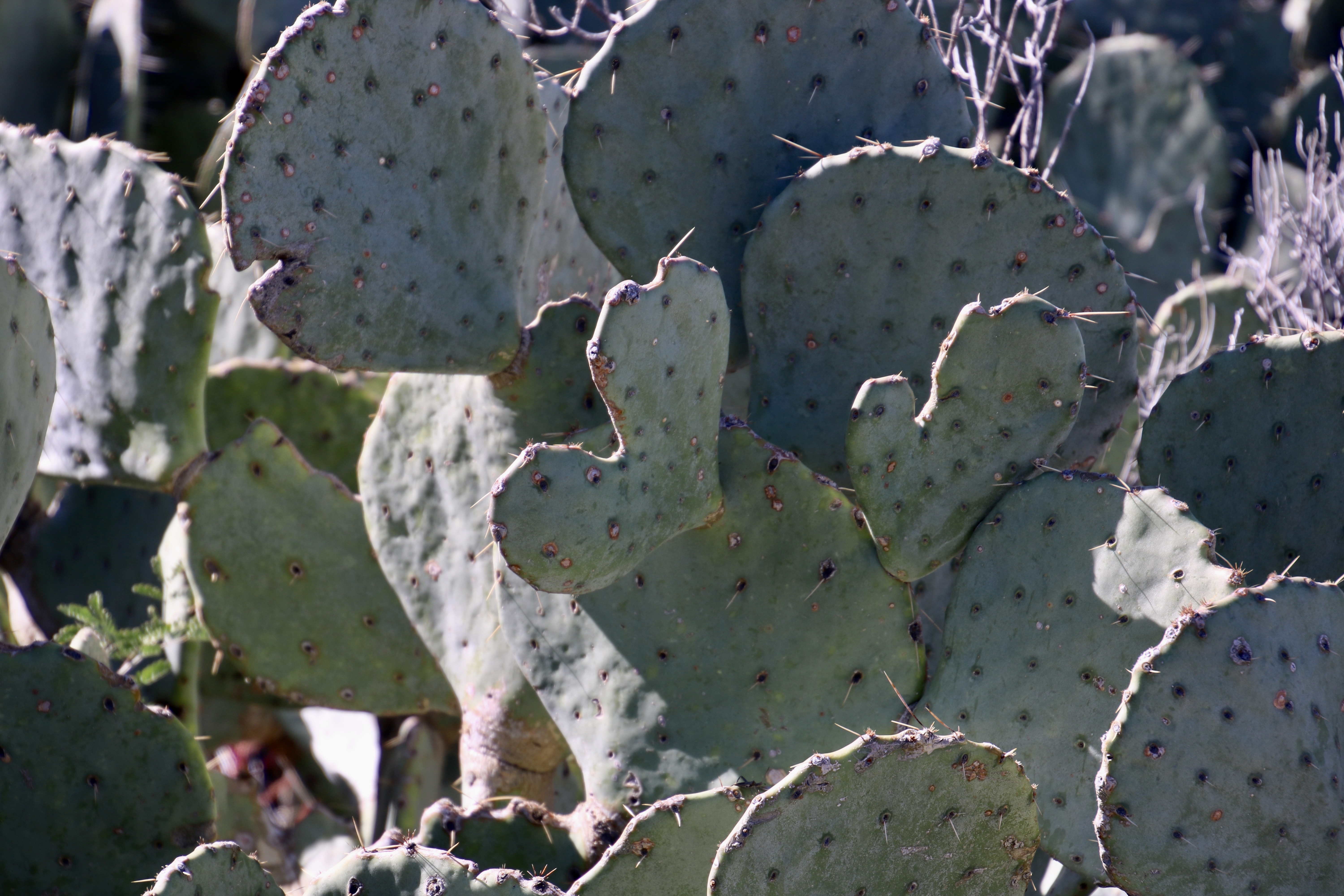
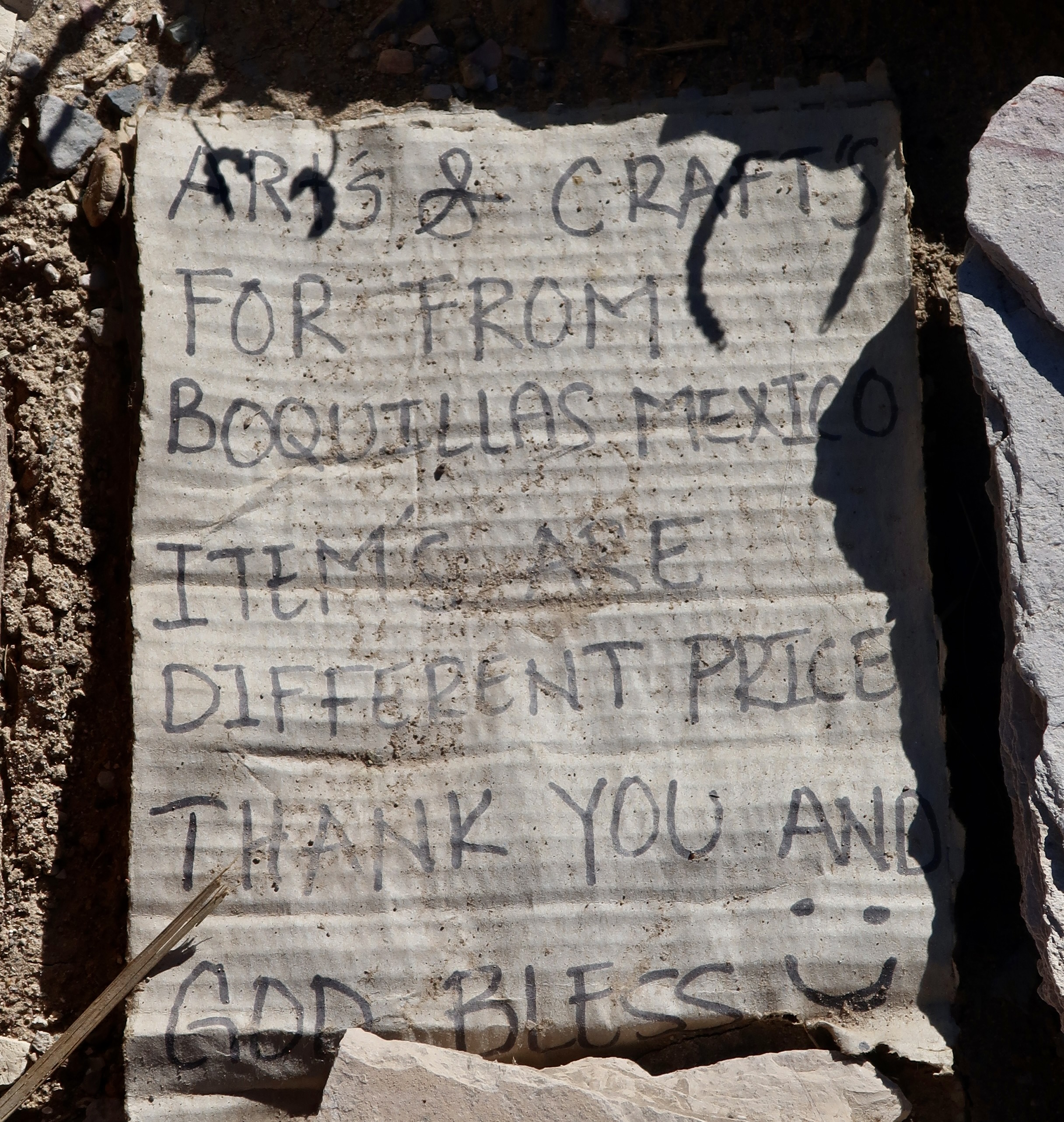
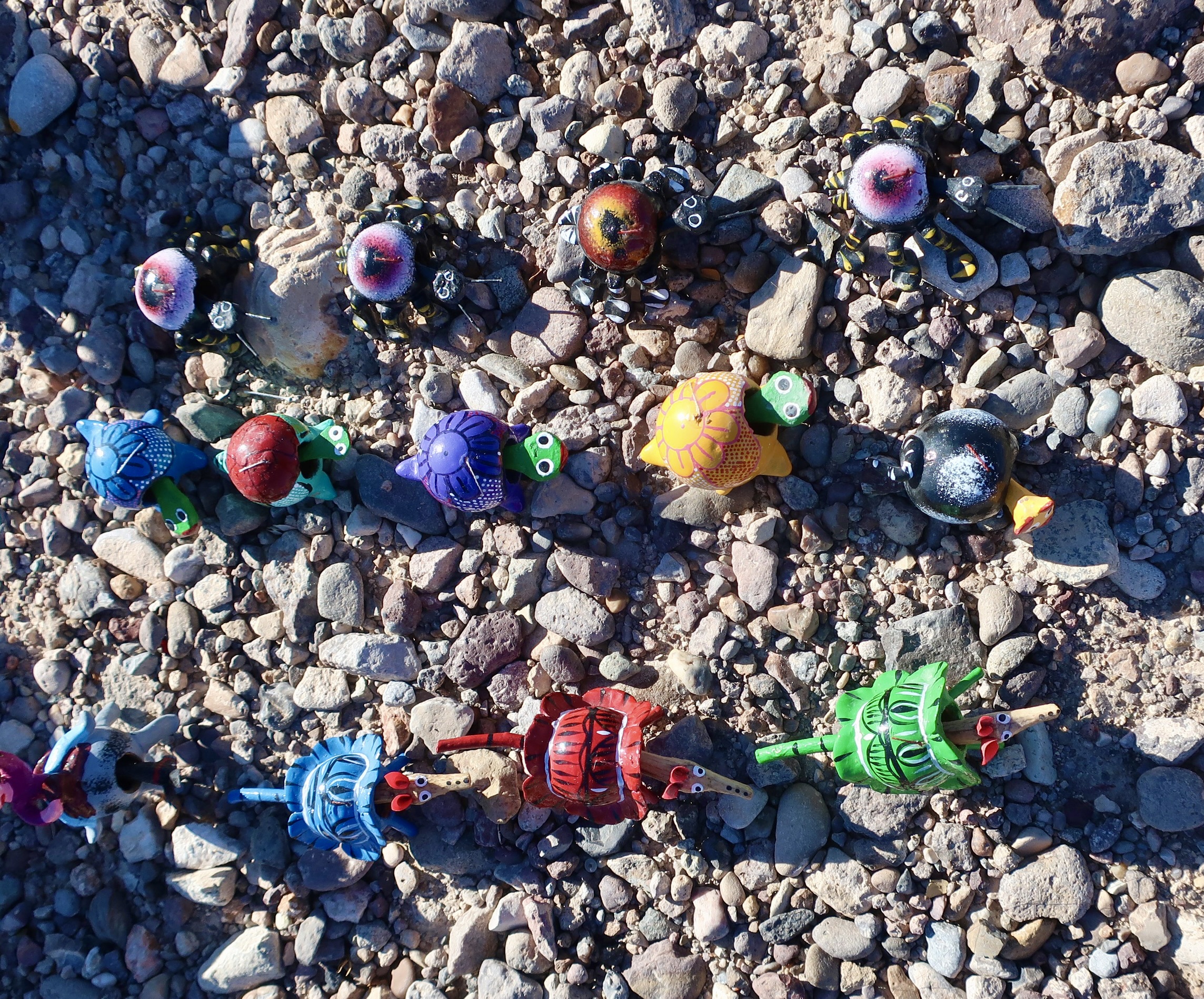
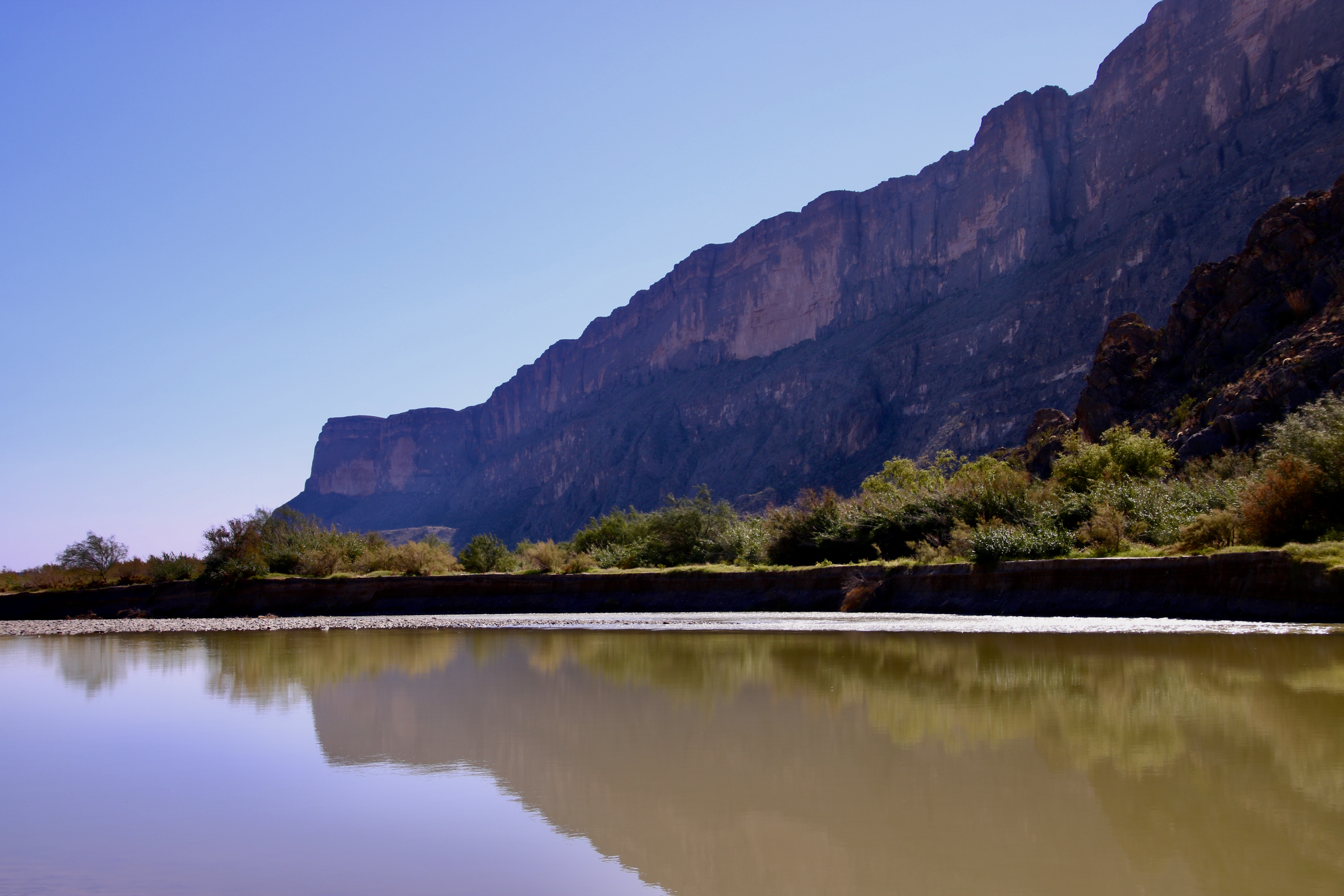
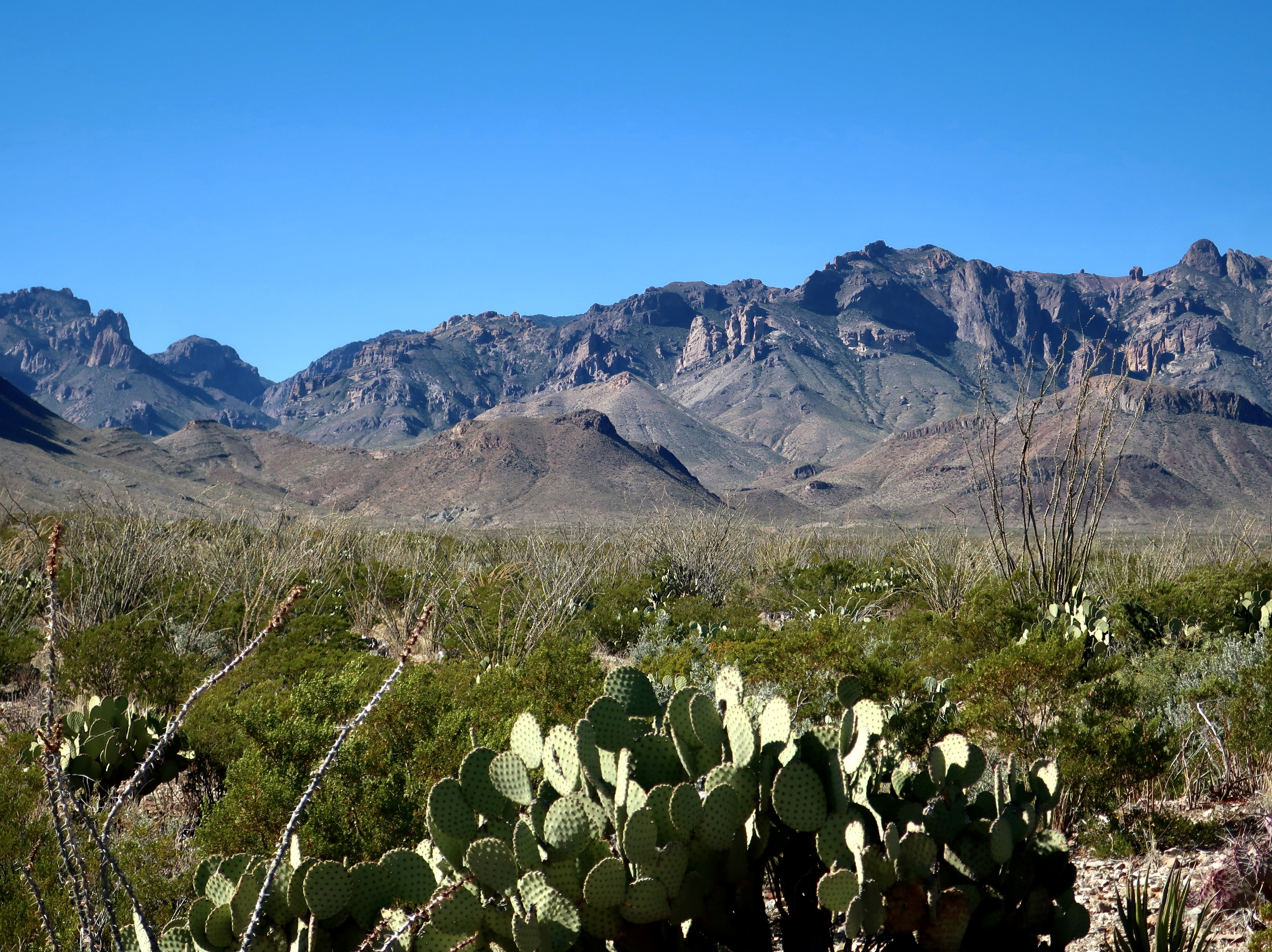
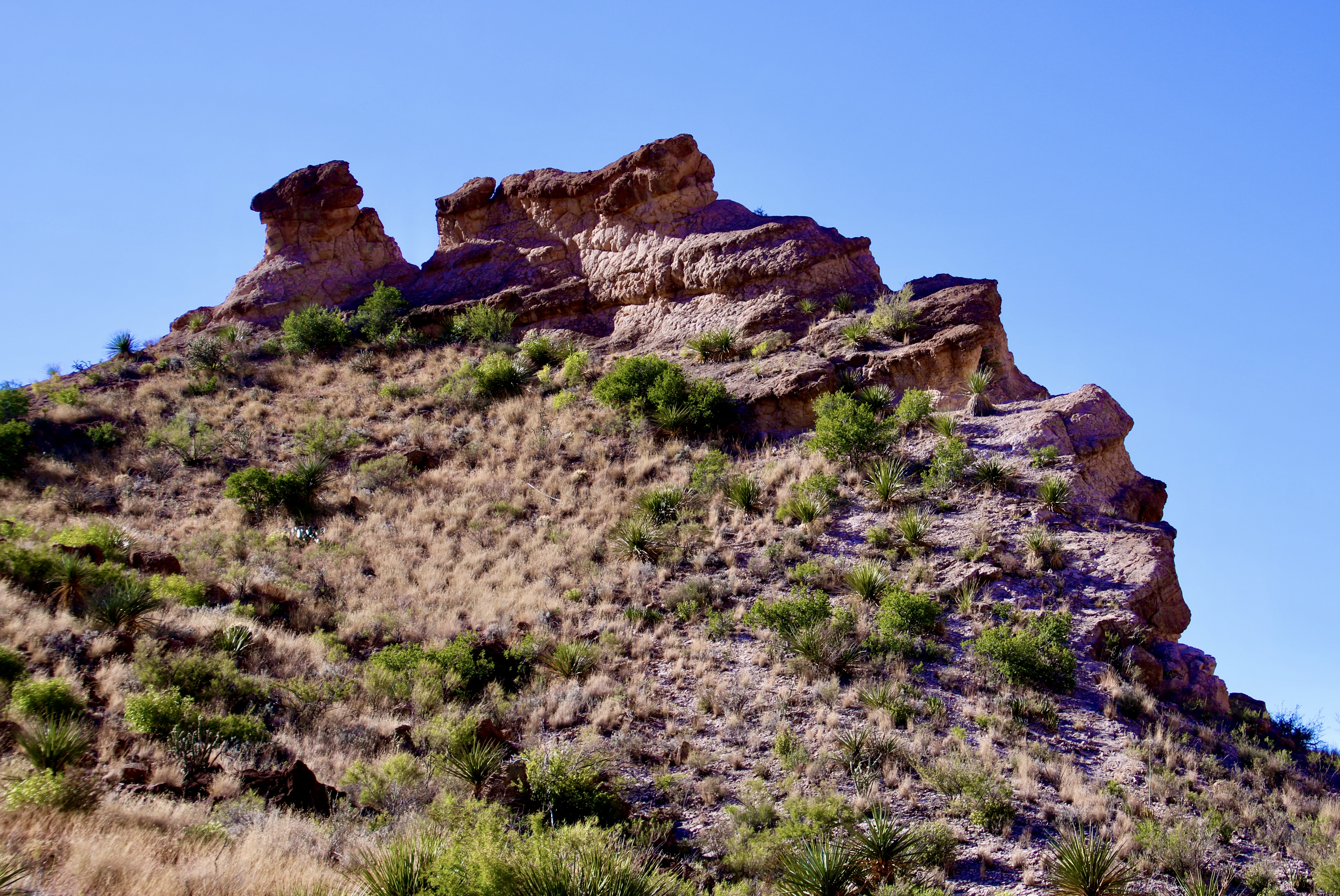
Sharing a border with Mexico provides unique opportunities and challenges to Big Bend. This is the Rio Grande River that forms the border between the two countries.Situated in the Chihuahuan Desert, the Park shows great diversity in its landscape, from the river to the desert floor to the mountains. Peggy has chosen a seat where she can look out over the desert toward the Rio Grande. Cerro Castellan towers over her.Looking across the desert at the distant mountains.This range is on the Mexico side of the river.A distant perspective with attention to both the desert floor and the Chisos Mountains.A closer look at the Chisos.The part of the mountains known as the Mule Ears.Desert floorA touch of greenColorful canyons invite exploration on foot.Peggy and I discovered this outcrop in the canyon.Tuff Canyon provides another opportunity for exploration.Erosion always adds interesting and often beautiful views in the desert. Peggy and I saw a ‘dog’ in this carving. How about you?Thorny cactus are expected in the desert, not so much flowers. But after a rain, they can provide a carpet of color.Speaking of thorns…The ocotillos’ normally bare limbs have broken out in tiny leaves, here.Prickly pears. The small dark spots will immediately teach you the meaning of prickly if you brush up against one. But someone has been chomping on these. Who would be so brave, or foolish!?This guy, a javalena. Their incredibly tough mouths allow prickly pears to be an important part of their diet. This fellow, plus several more, came roaming through our campground. We were tempted to ask to see their papers since they travel back and forth across the Rio Grande between Mexico and Big Bend.Fall colors added their touch to Cerro Castellan.Another perspective.The contrast between the dark lava, light tuff, a reddish ridge ridge and distant blue mountains made for a fun photo.Boquillas is a small Mexican town just across the Rio Grande from Big Bend. The residents supplement their income by selling their arts and crafts in a specific location in Big Bend approved by the border patrol. A metal container with a slit in the top serves as a bank for tourists to pay for what they buy in an honor system. A sample of crafts for sale. We stocked up. Partially because Christmas was coming and partially to help the folks from Boquillas.A number of sites feature historical artifacts ranging from ancient petroglyphs to this symbol of the Old West.And wild horses.
That’s it for Big Bend. Since we featured a desert national park this time, we’ve decided to follow up with another desert national park, one of my all-time favorites: Death Valley. I may also work in another post of what we are up to now. Peggy and I just spent three weeks dodging thunderstorms, heavy rains, floods, hail, and tornadoes as we made our way from Virginia to the Southwest to the start of our next adventure. We didn’t escape the winds— always fun when pulling a trailer. Anyway, our trip across didn’t leave a lot of time or energy for blogging. Back to it!
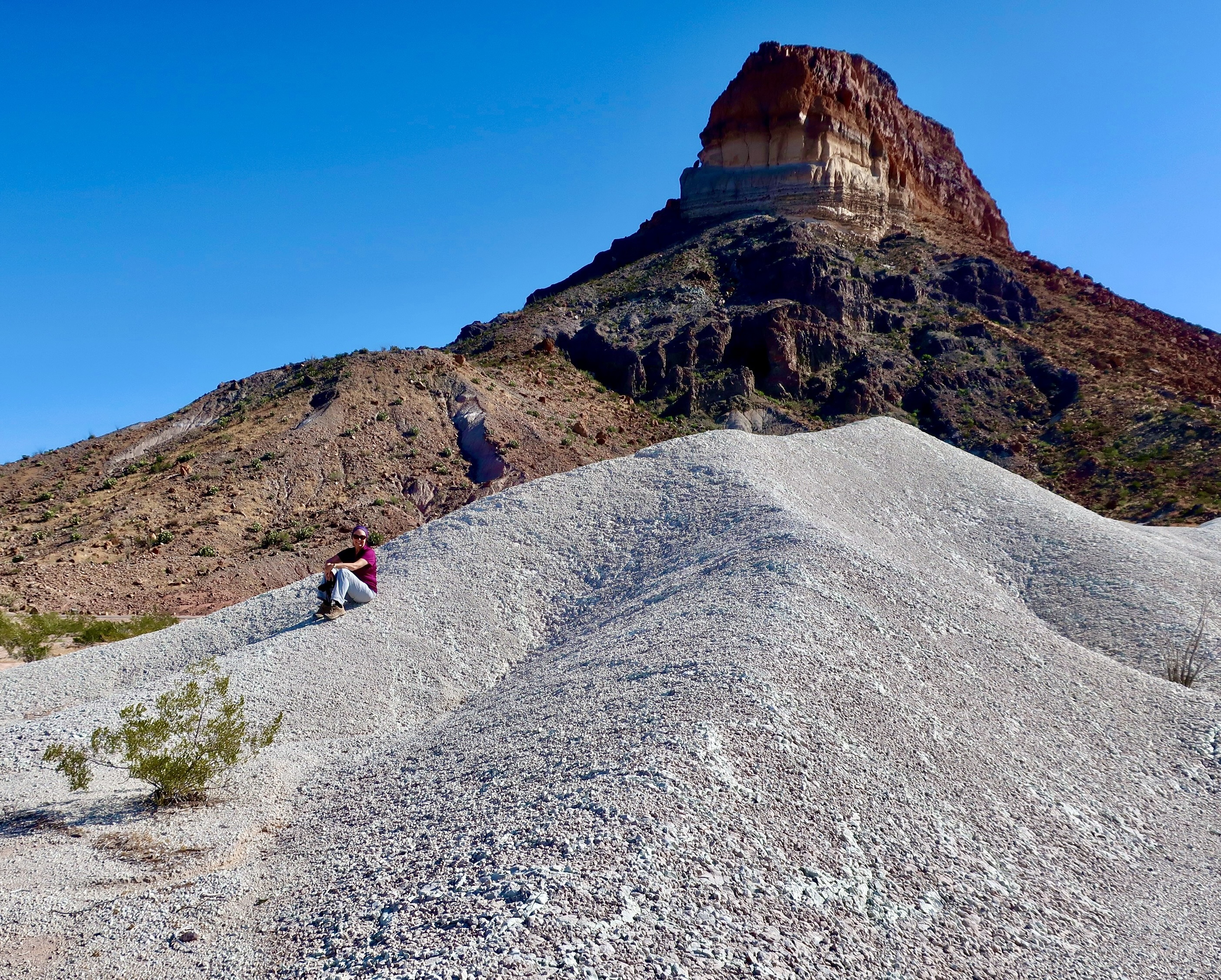
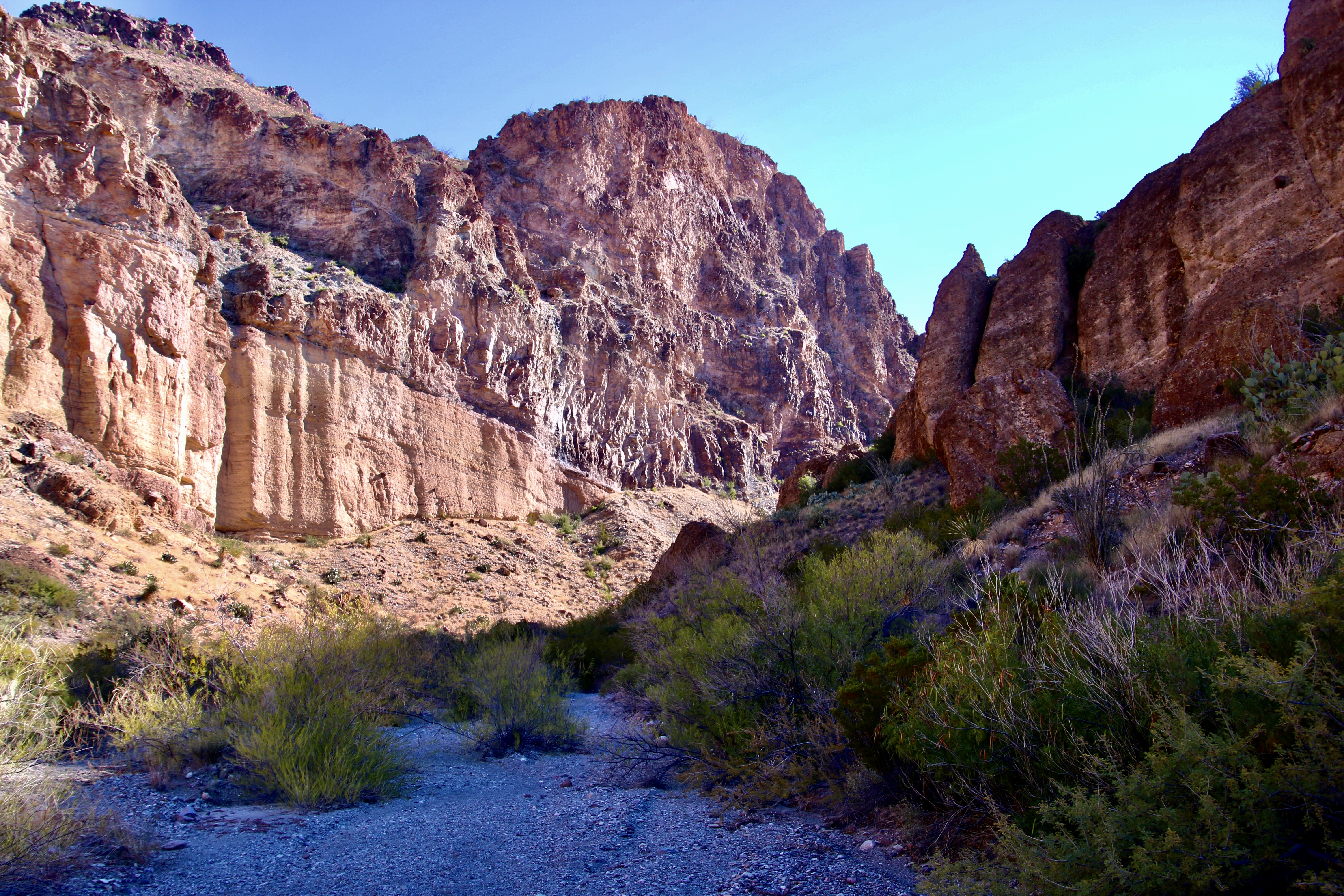
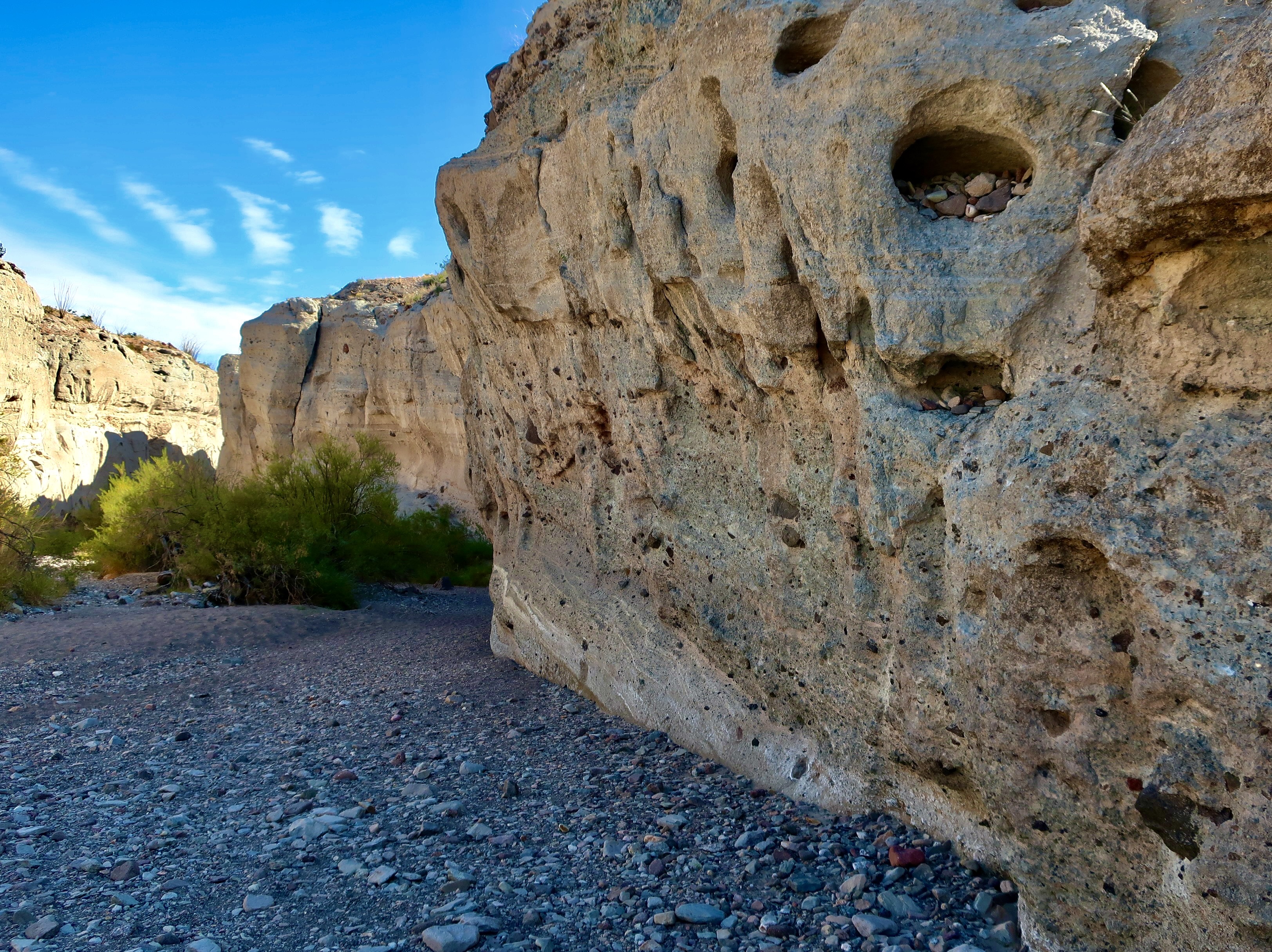
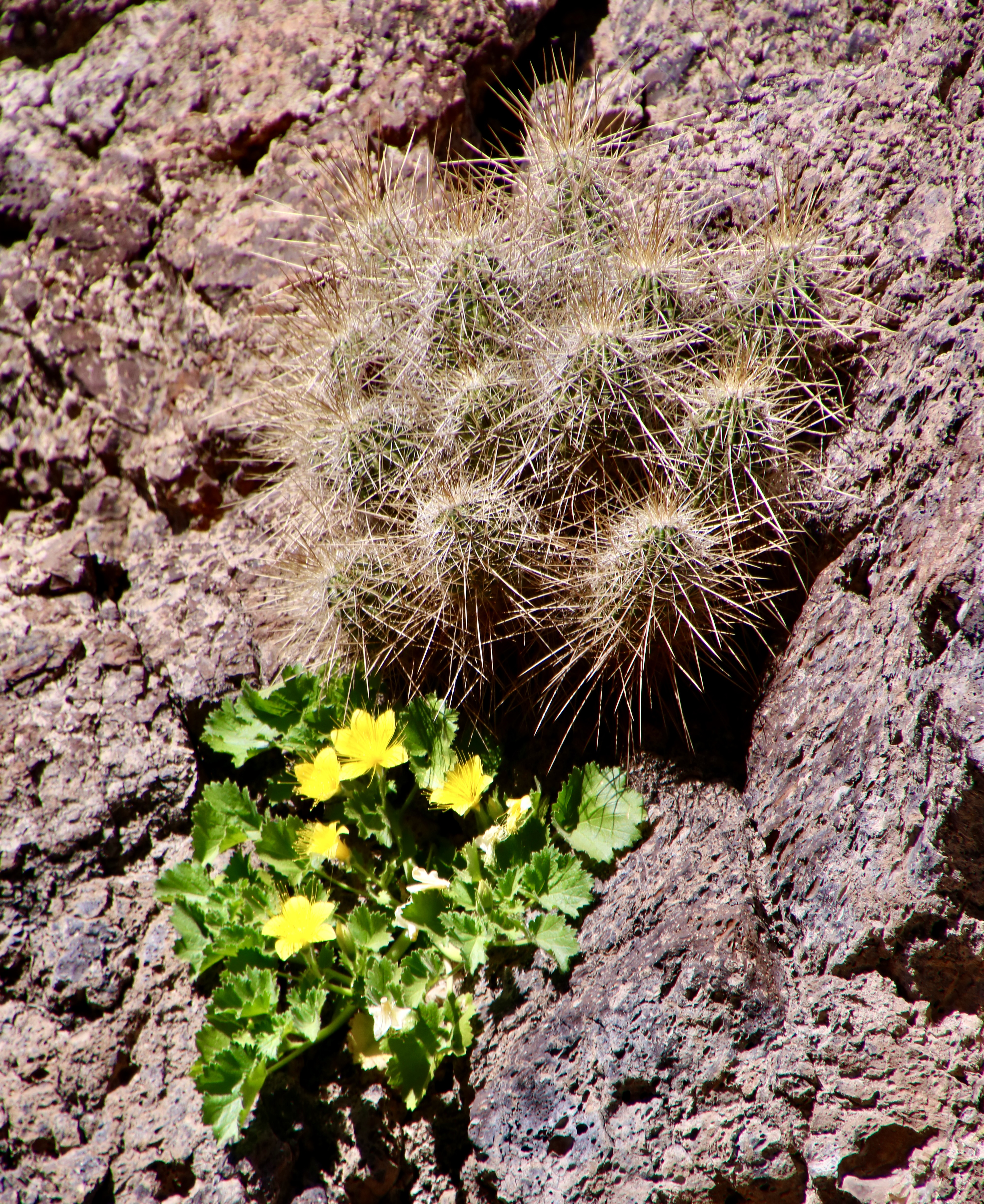
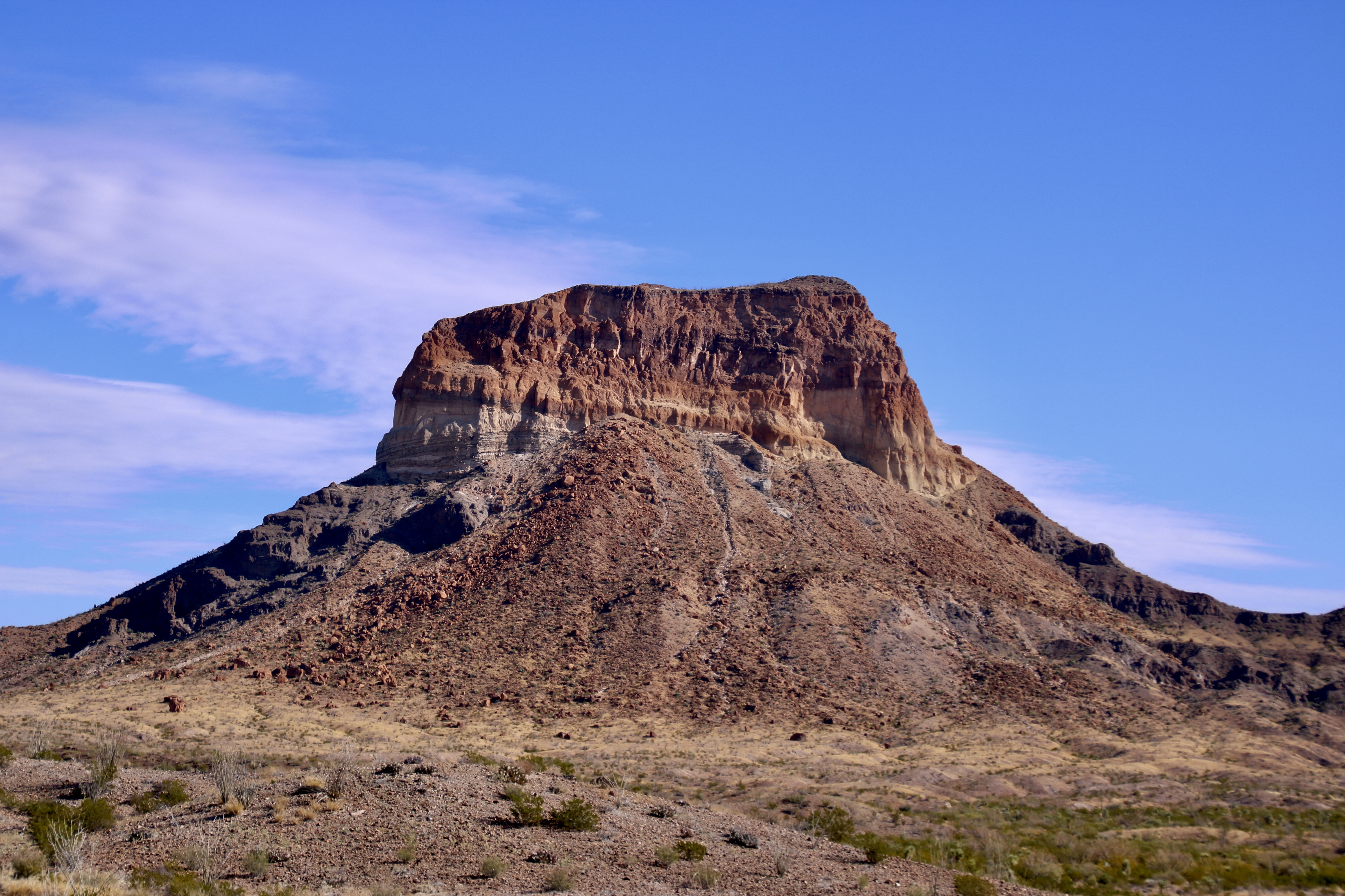
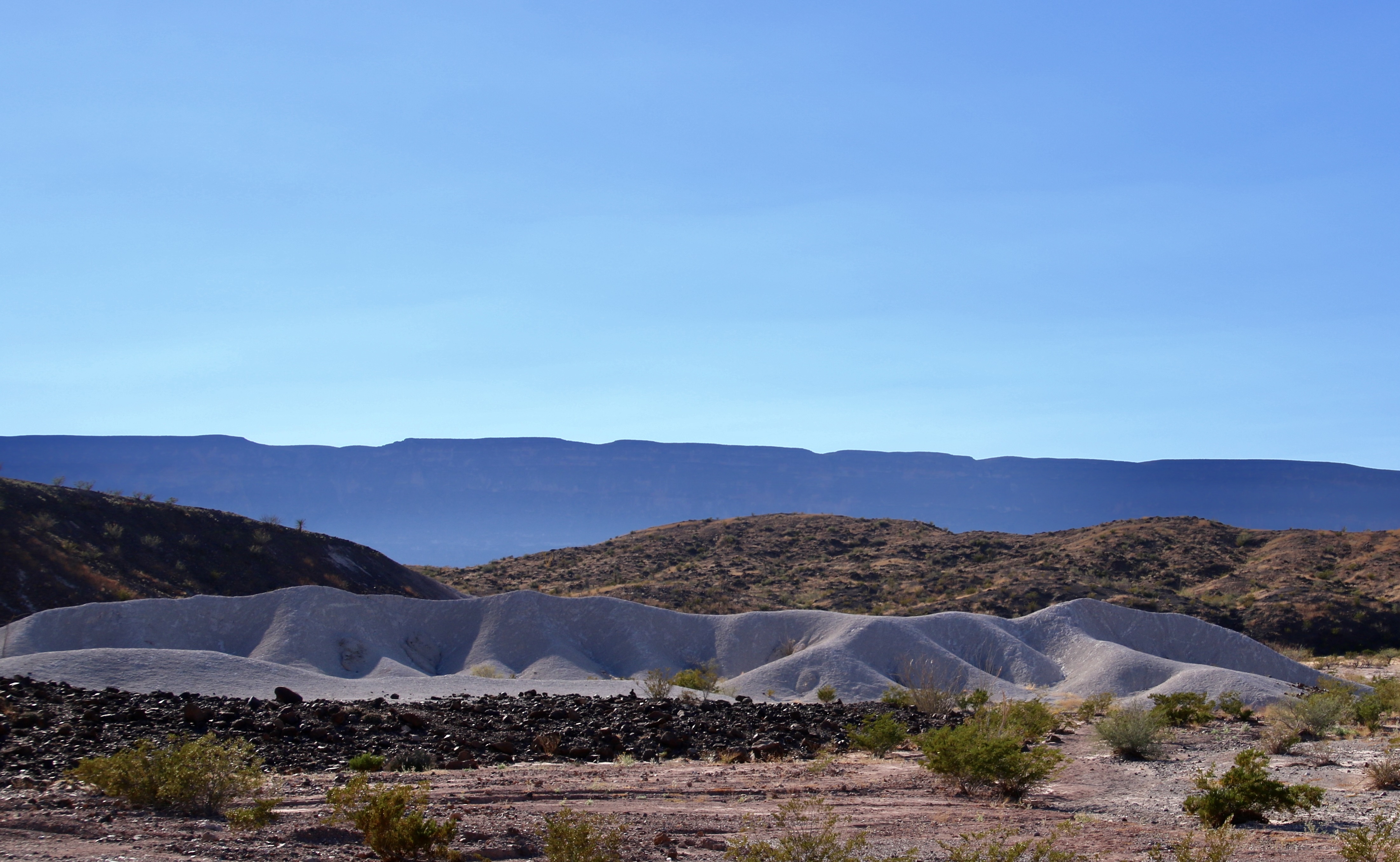
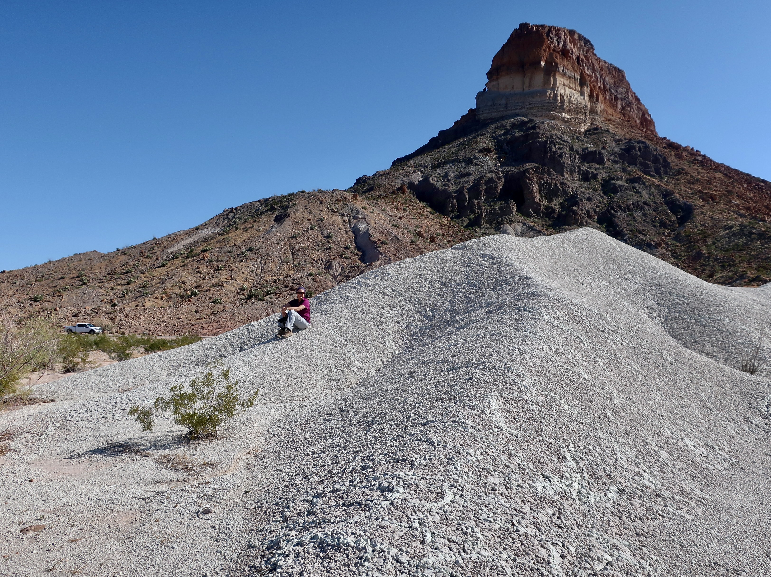
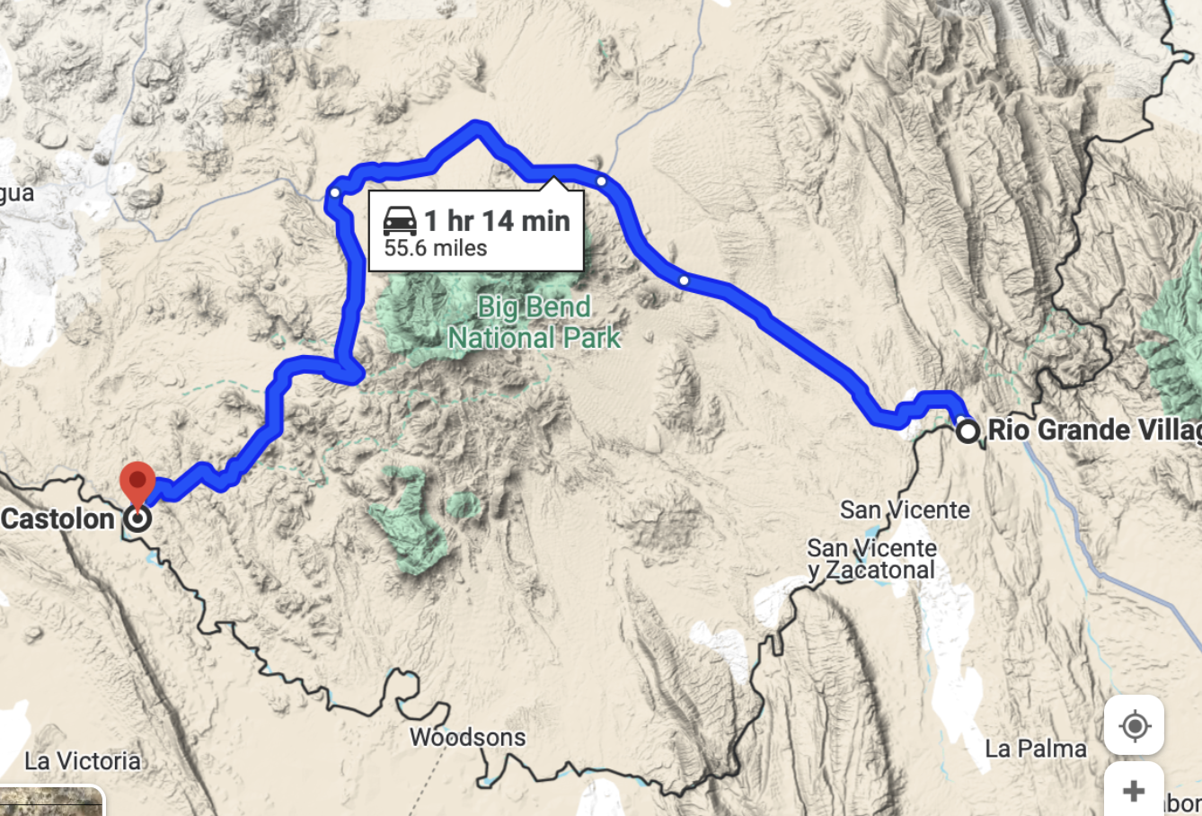
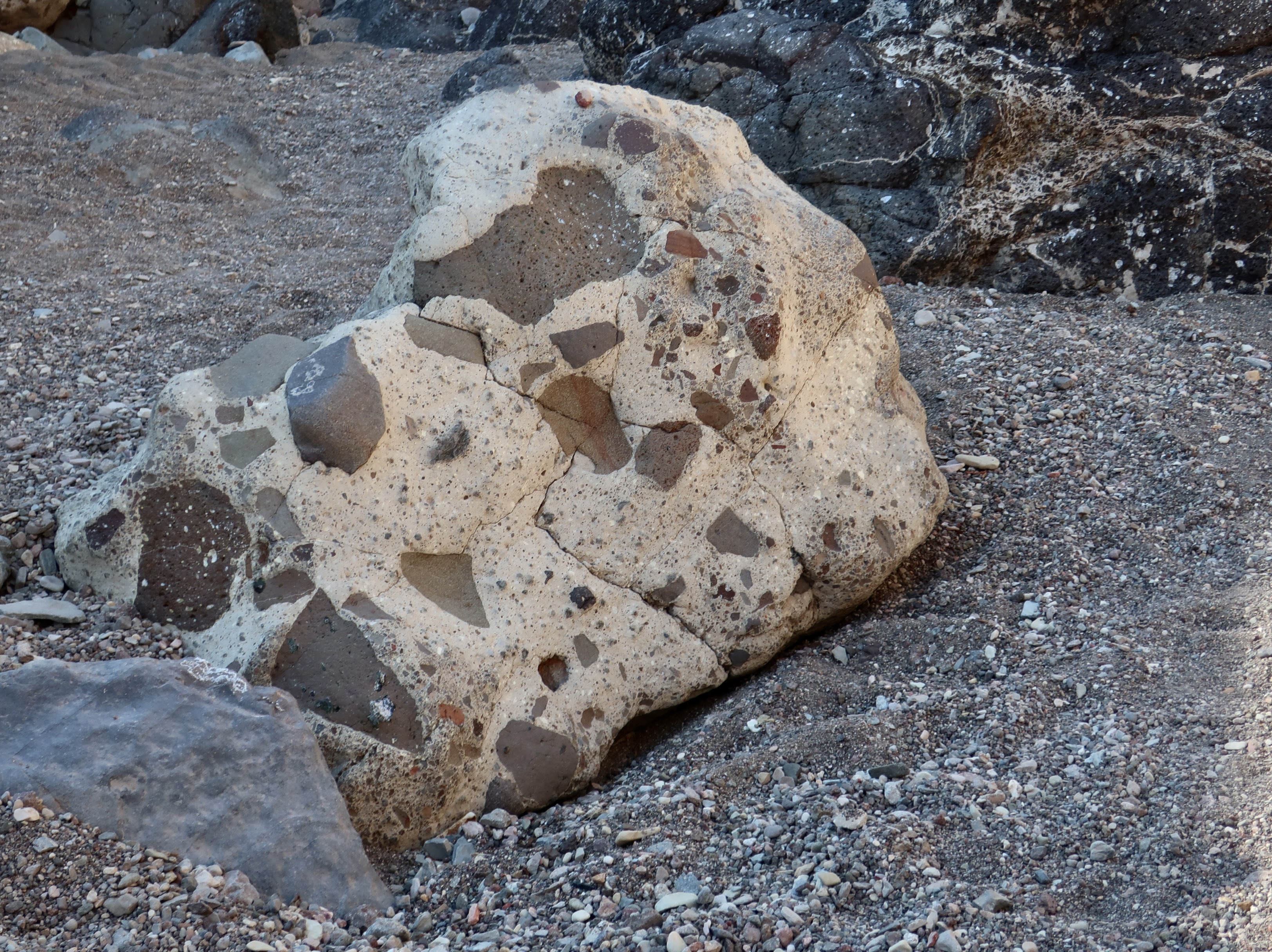
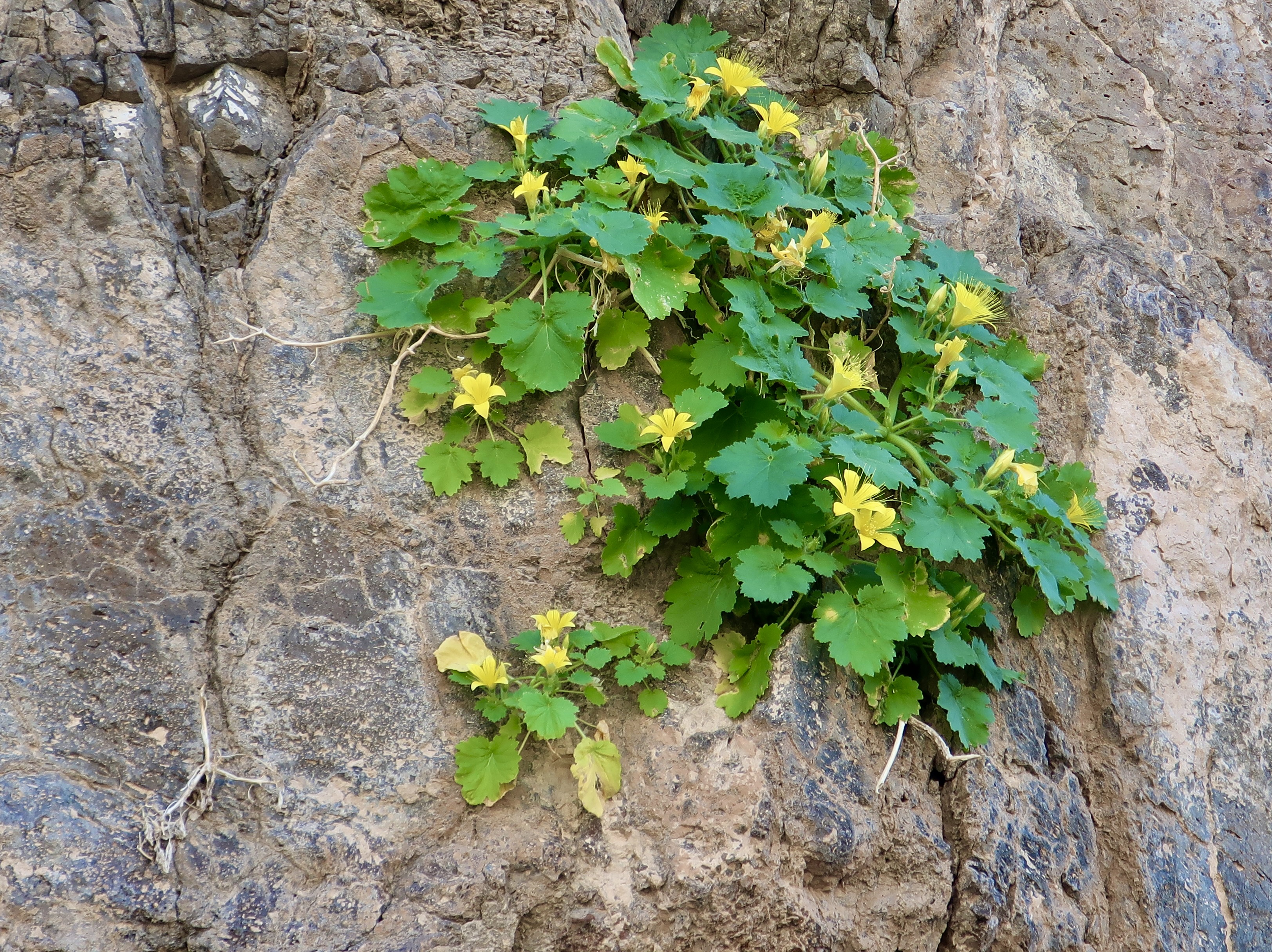
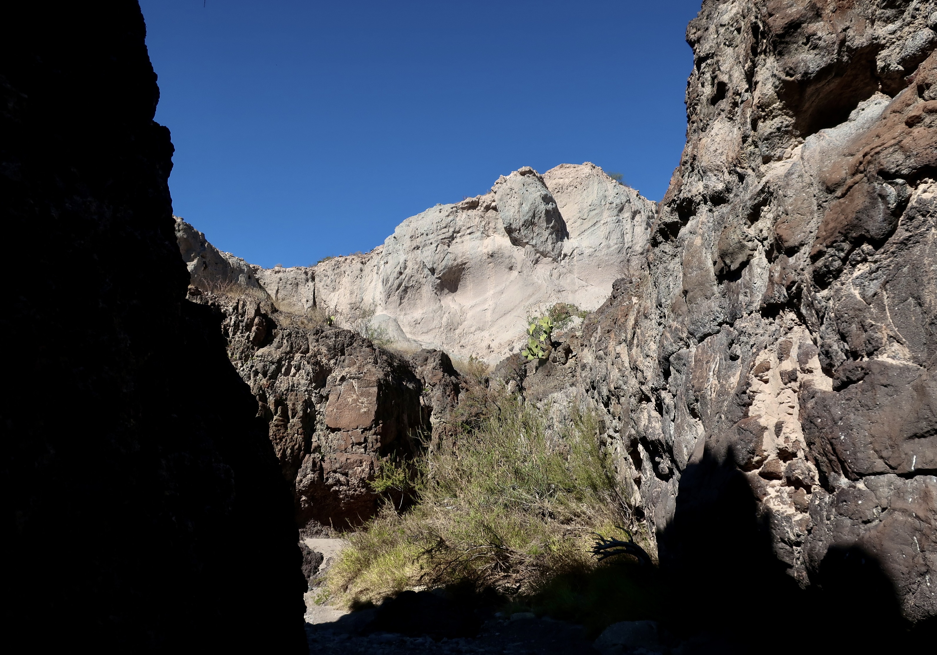
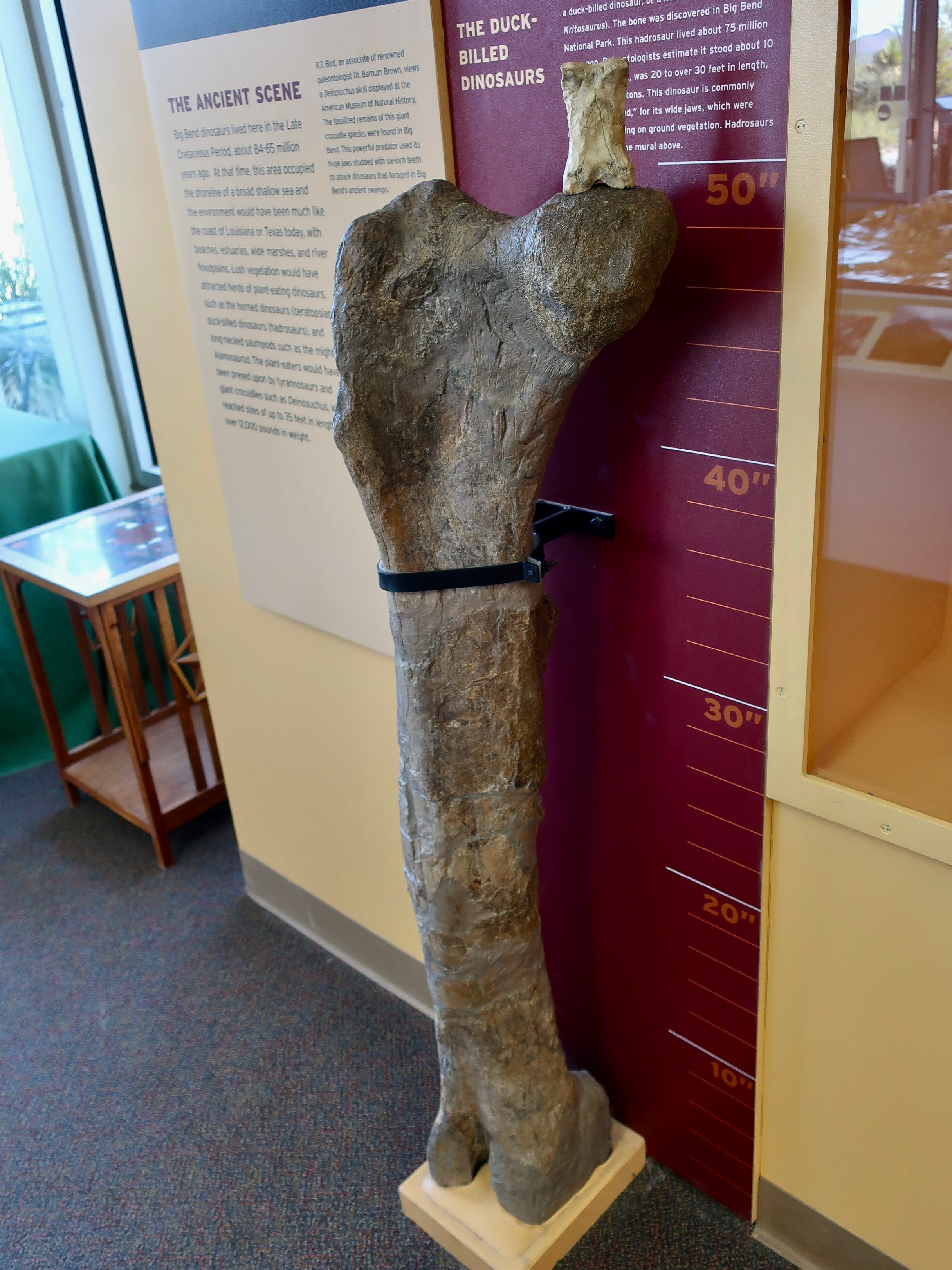
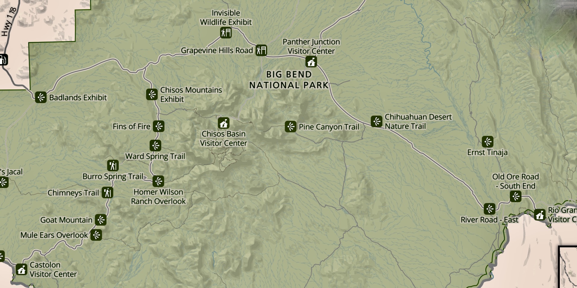
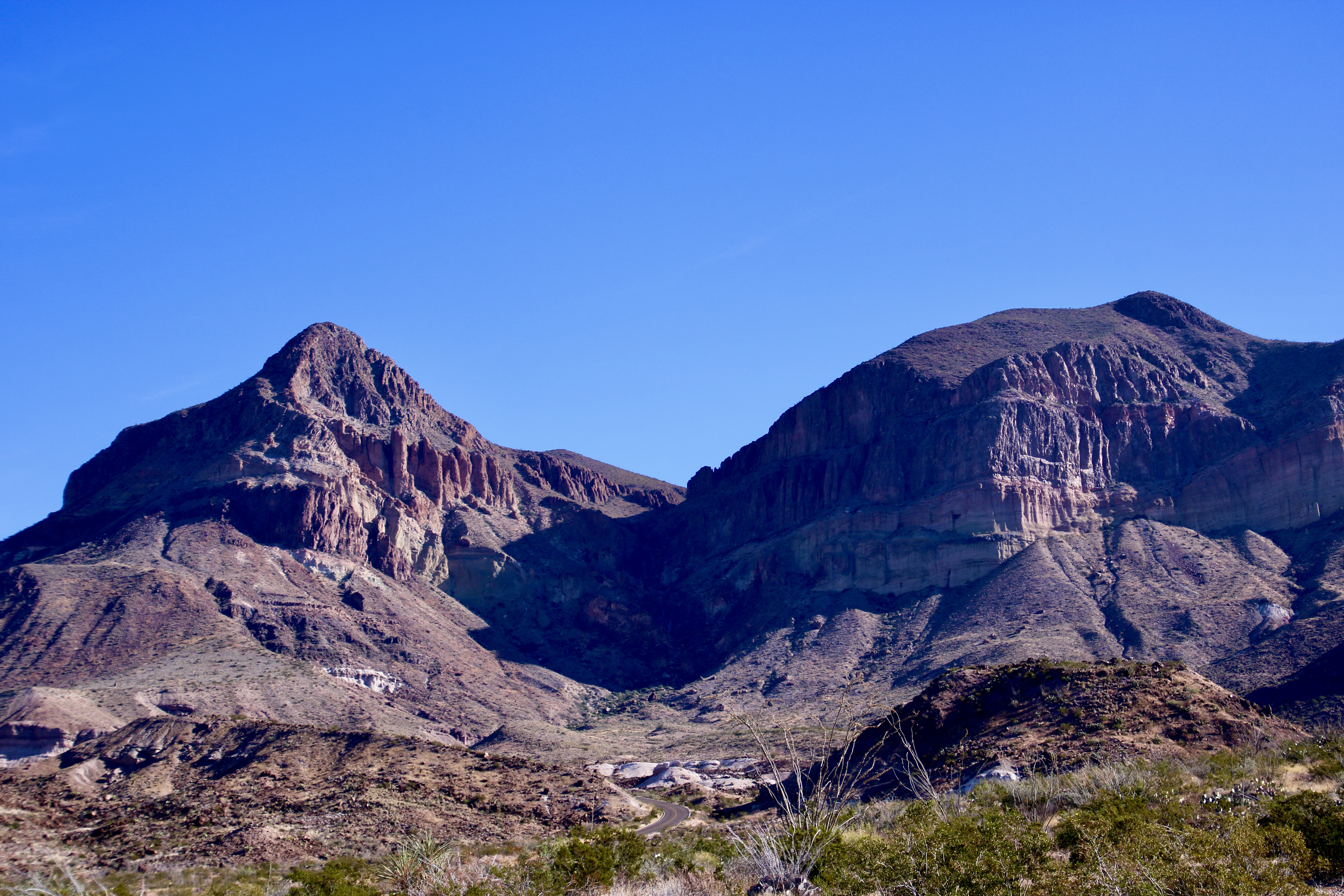
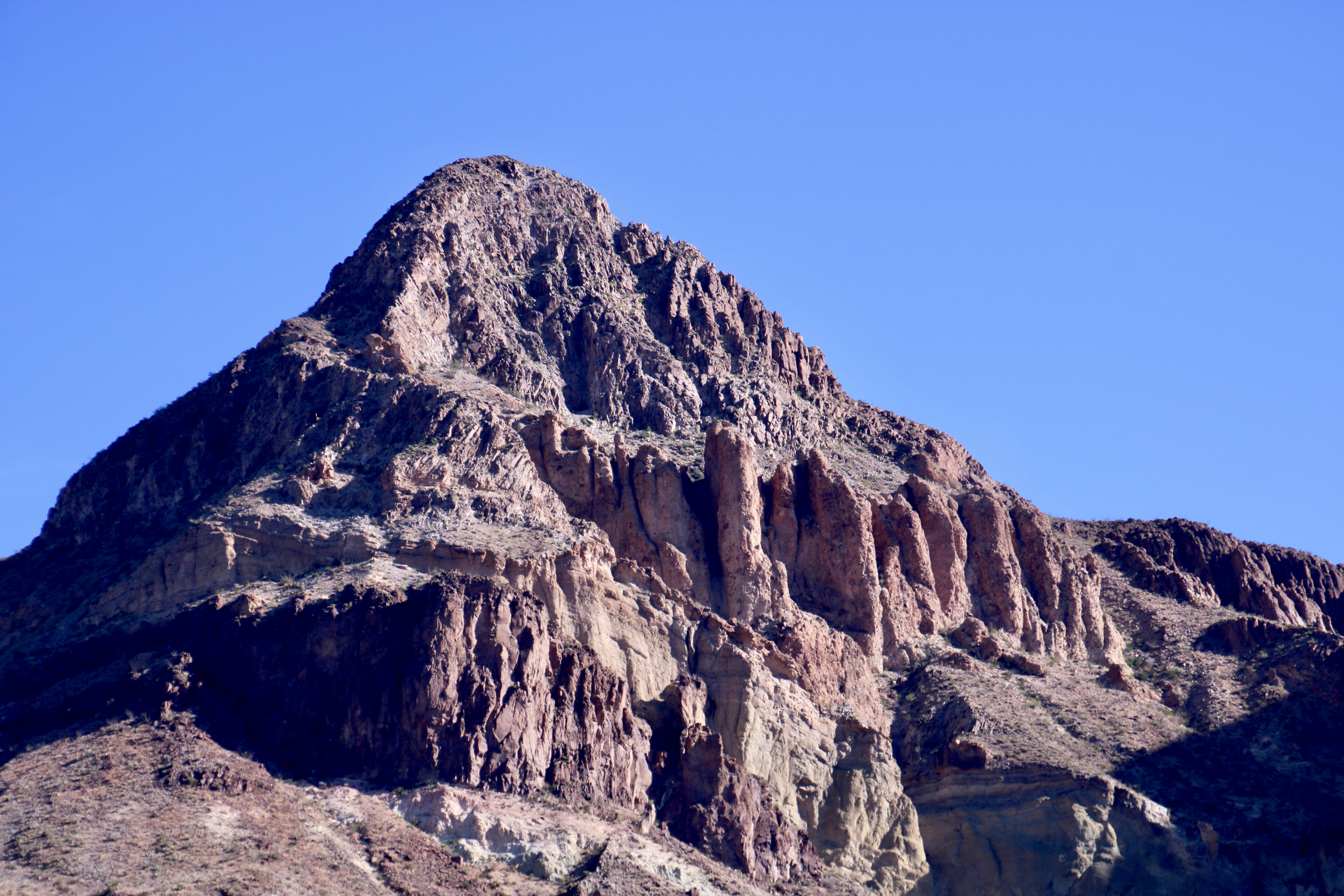
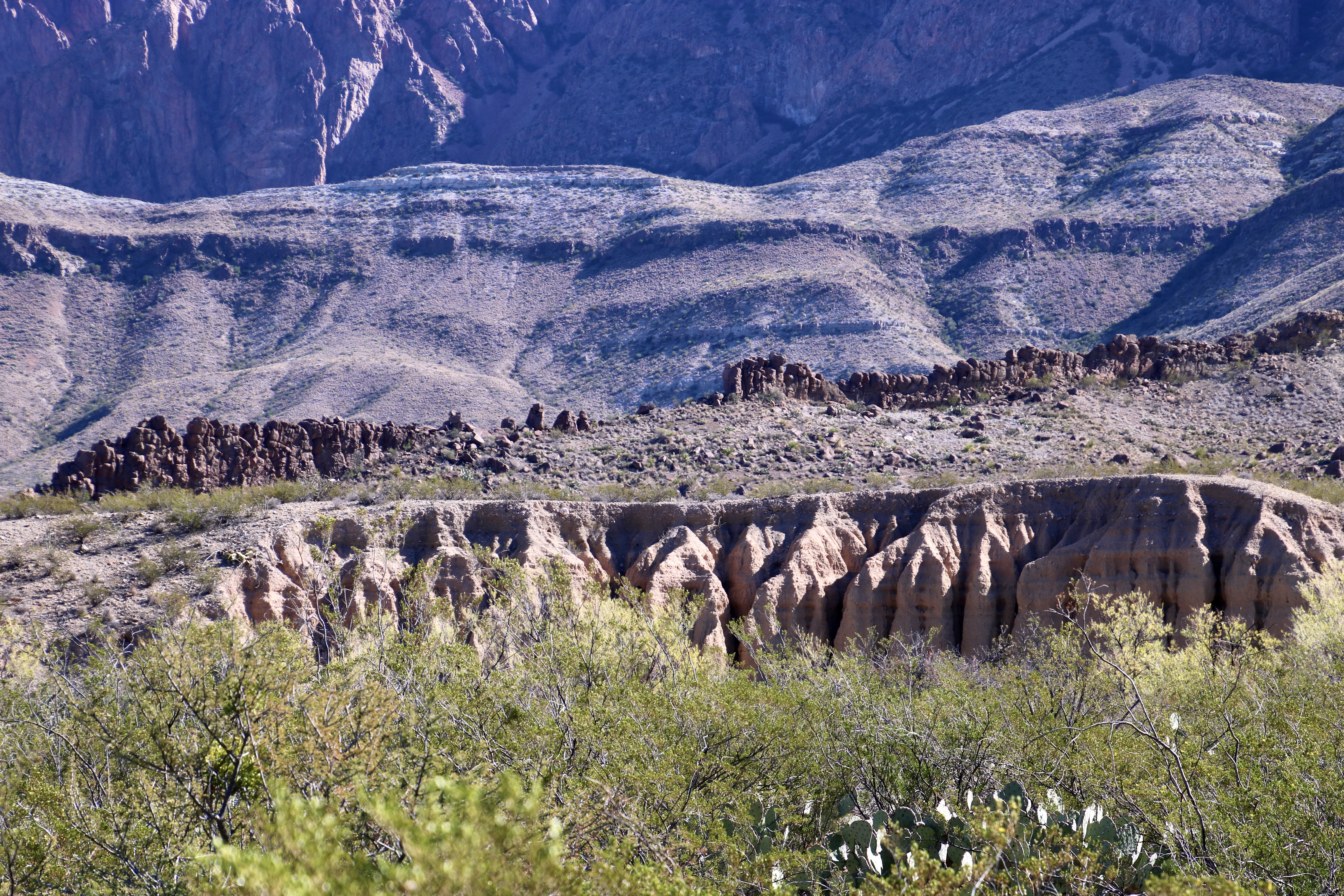
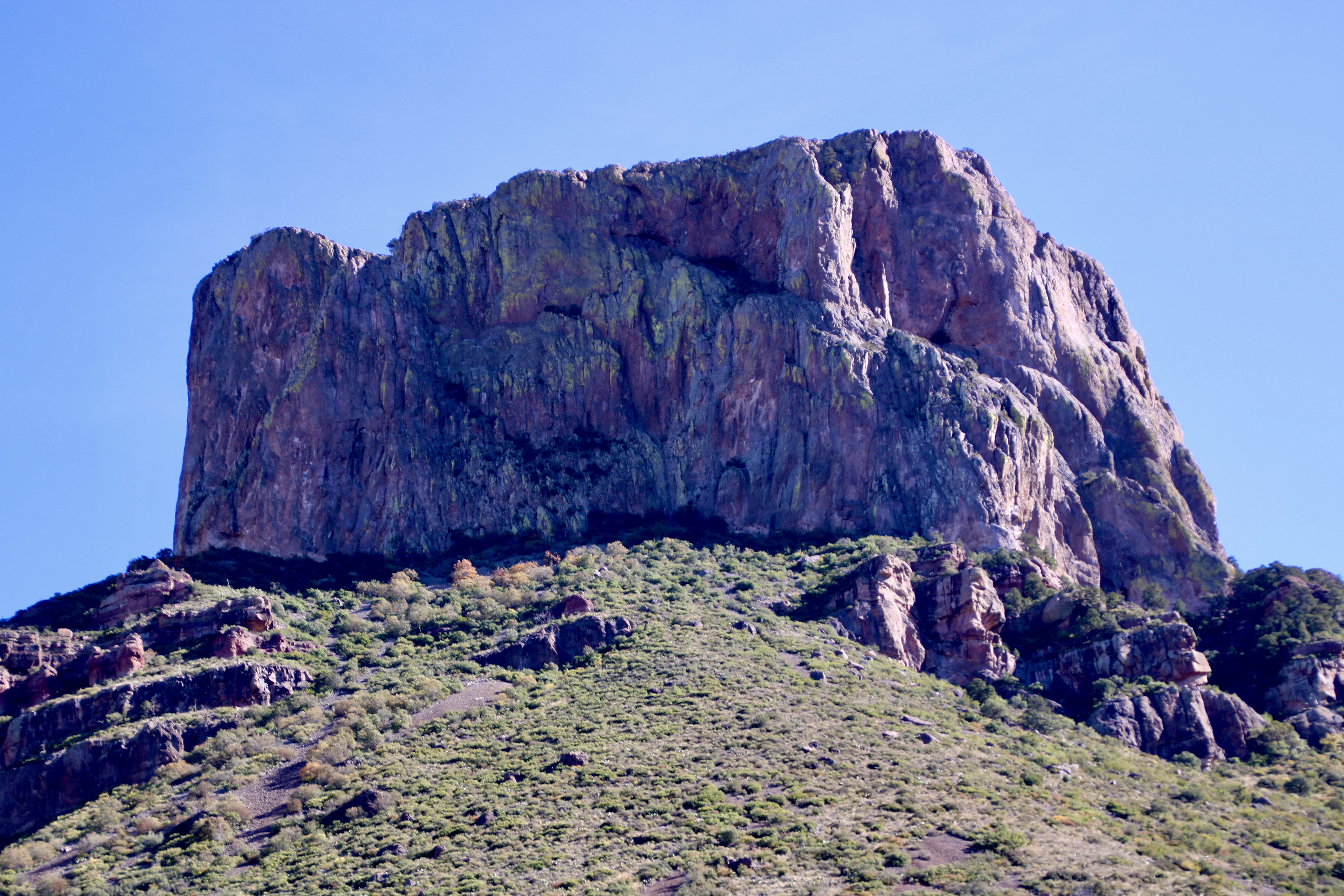
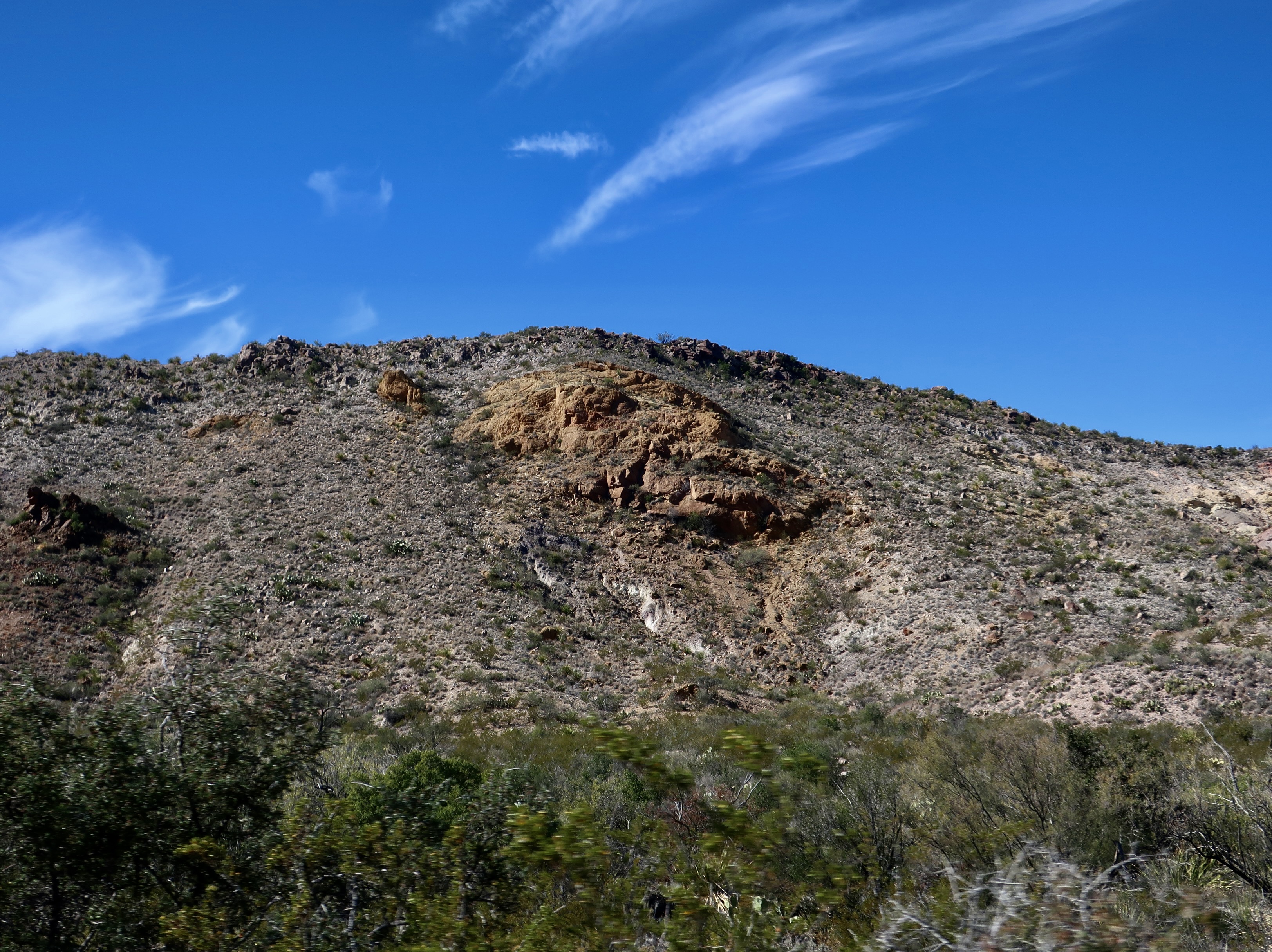
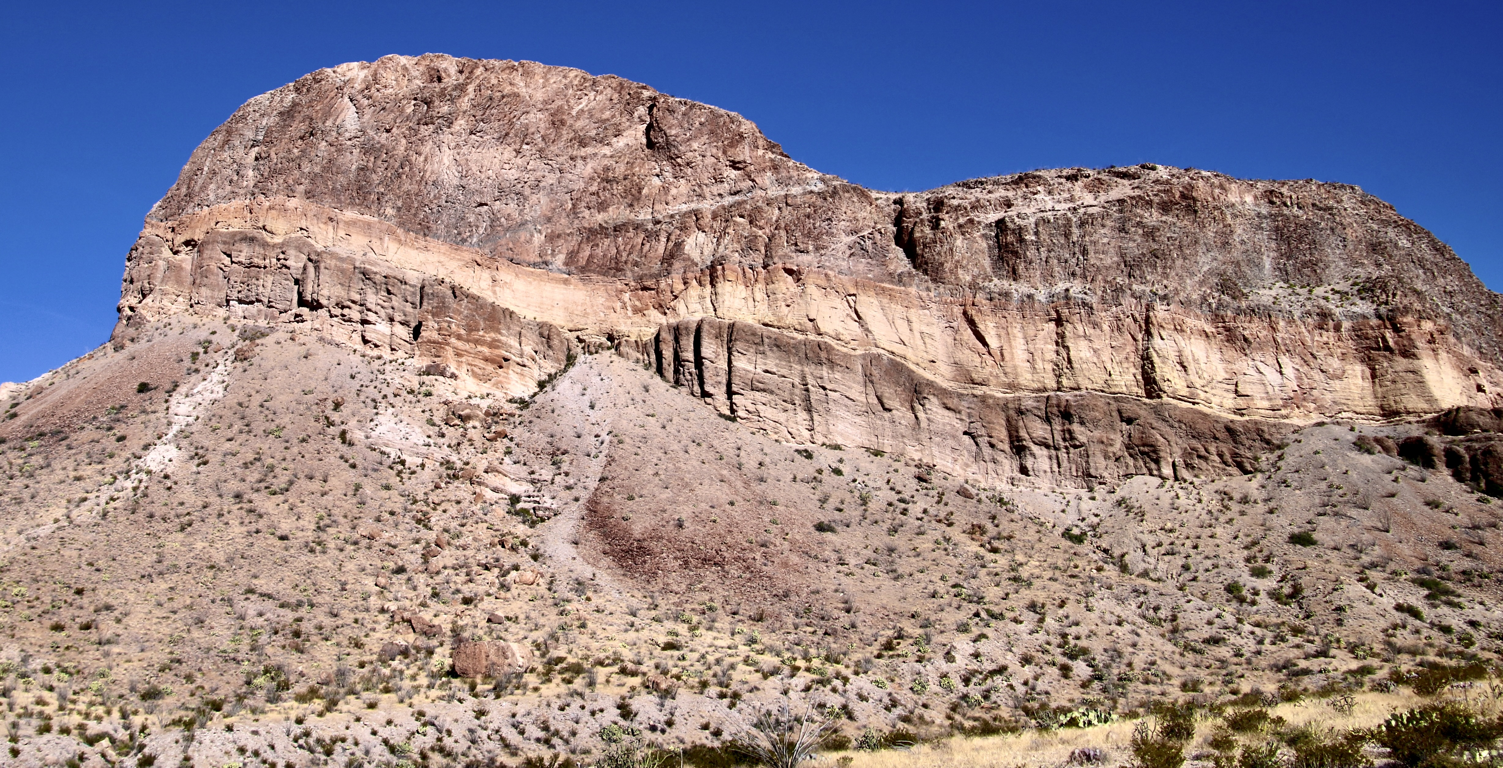
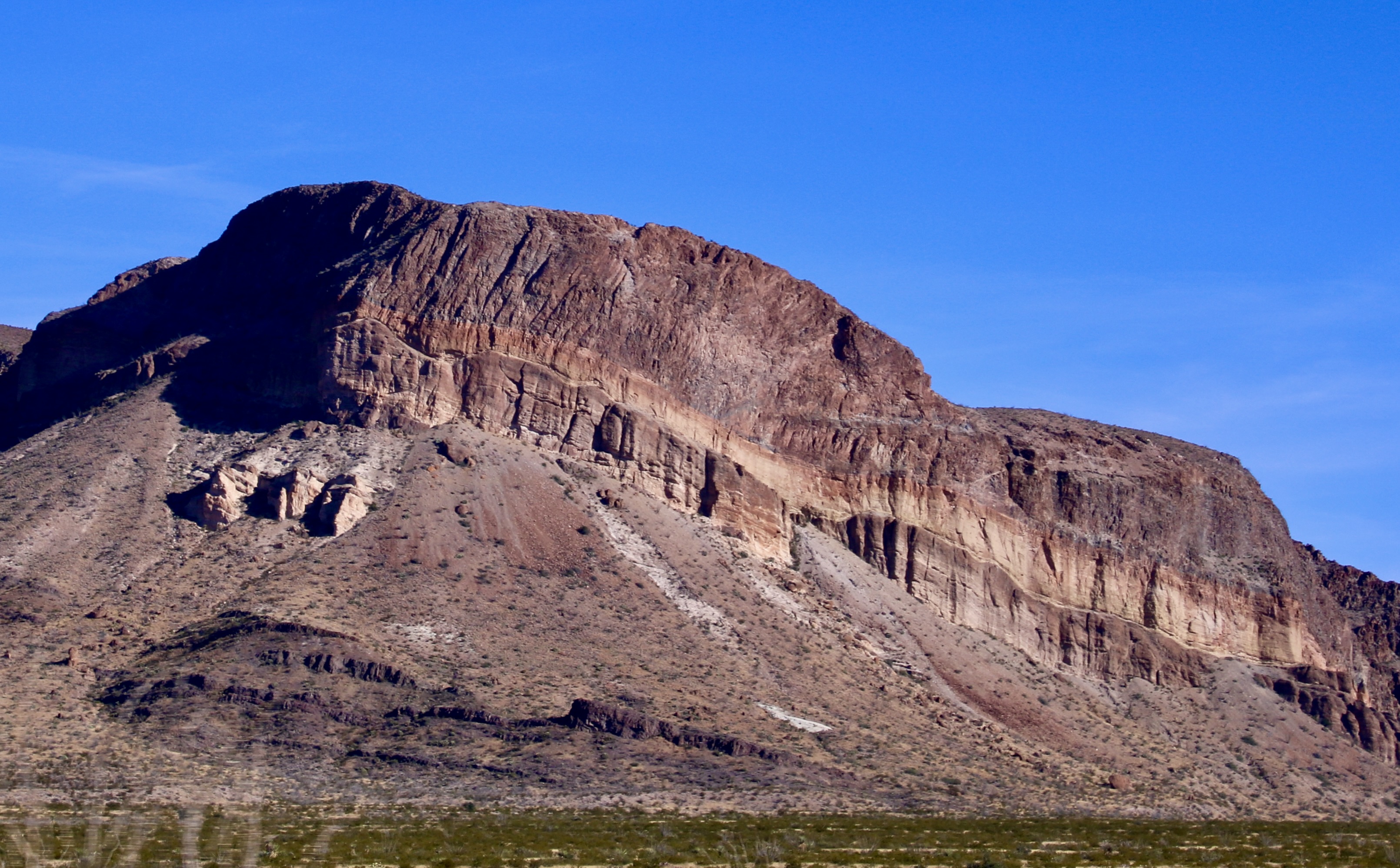
Our 55 mile drive from Rio Grande Village to our campground in Castolon through the Chihuahuan Desert and around the Chisos Mountains of Big Bend took us from the east side of the park to the west side. One of our first views on nearing Castalon was the Cerro Castellan peak. It’s impossible to miss. Peggy and our F-150 white pickup, Iorek, provide perspective. Peggy is sitting on tuff, which is consolidated volcanic ash. It isn’t as soft as it looks. Peggy told me that she had a tuff butt.We like Google maps when we are looking for an overview of our day’s drive. This shows our route from the Rio Grande Village to Castolon and provides an estimated drive time— assuming one isn’t pulling off every few minutes to admire the views. There is another reason why I like this map: It provides a clear view of why Big Bend is called Big Bend. The black line traces the flow of the Rio Grande as it makes its big bend.This National Park map shows the area around Castolon and shows the sites we will be including in today’s post: Cerro Castellan, Tuff Canyon, the Dorgan House and Santa Elena Canyon. The Visitor Center, closed in summer instead of winter, provides a clear hint about the region’s weather. You don’t want to face the heat of summer at Big Bend. Fall, winter and spring are normally mild. The story of Cerro Castellan is like so many other peaks found in Texas and throughout the Southwest. A rock highly resistant to erosion overlays other rocks that erode more easily. In this case, the top rock is from a dense lava flow that covered the area. Most of the rocks under it are also volcanic, just less resistant such as volcanic tuff, the buff colored rock. The dark rock at the base is basalt from earlier lava flows.We were treated to numerous views of Cerro Castellan. This one was from our camp. Not bad, eh.The opposite side provided a totally different perspective.More of a side view here. I believe the greenery is mainly creosote bush .A final side view of Cerro Castellan.There are overlooks where visitors can look down into Tuff Canyon, or with a short hike, you can climb down into the canyon and walk along it, which is what Peggy and I did. 30 million years ago, a nearby violent volcanic eruption sent ash and rocks shooting into the air. Heat and pressure when they landed turned the ash into the tuff seen along the canyon walls. We were curious about how these river bed rocks got into the erosion created holes. The only thing we could think of was a flooding stream working its way down the canyon.These were rocks that would have been thrown out by the eruption and embedded in the tuff.I liked this photo I caught of Peggy from what I recall was a shallow ‘cave’ in the tuff.Flowers growing out of crevices in the tuff wall. Life will find a way!Tuff cliffs towering over dark volcanic basalt. The end of the trail leading up the canyon.An ocotillo plant looked down on us from the rim.The Ocotillo, with a mouthful scientific name of Fouquieria splendens, is an interesting desert plant that usually looks like a dead, naked bush with wicked thorns, i.e. not something that you would want to mess with. The stems actually have chlorophyll and are capable of photosynthesis and sustaining the plant thorough dry times. Come rain, however, the plant becomes covered in leaves and really goes to work in food production. It also develops brilliant red flowers. Thus the ‘splendens’ in the scientific name.And finally we stopped to admire this mesquite tree on the way out.On our way to Santa Elena, we stopped for a walk up to the Dorgan House. There are several sites around Castolon that feature historical sites from the last 100 years or so. Dorgan was an architect involved in the local farming community. The remains of his house included this unique fireplace made from petrified wood. It was fun checking out the various rocks.I was particularly impressed with this rock. I saw an eye, a pig-like nose and a great set of choppers. I have the perfect location for it at home. But I didn’t take it. That’s a no-no in a National Park. If you should show up and find it missing, however, remember…I was framed. The Rio Grande River flows out of these limestone cliffs where it has cut the Santa Elena Canyon some 1,500 feet (450 m) deep at Santa Elena.The canyon travels back some 8 miles from its mouth (shown here). Visitors can sign up for a raft trip down the river, or even run it on their own assuming they have a degree of white water expertise. Or, when river is low and slow, like it is here, you can paddle up it for 3-4 miles and then paddle back out. Or, visitors can wade across the creek on the right and hike a brief distance into the canyon.A view of the Rio Grande as it flows on its way after leaving the canyon. We were visited by a herd of peccaries (known locally as javelinas) one evening when we were at the Castolon Campground. These mammals are found as far south as Argentina. He did not like the fact I was following him around snapping photos…You might say it was a hair raising experience.On our way out we stopped by the Panther Junction Visitor Center to check out its display on duck billed dinosaurs that roamed the area. Bone provided perspective on a leg bone. Coming from the leg of a horse just above the hoof, he could relate. Plus he is a great fan of old bones. That’s it for today and for Big Bend National Park. Next up is Theodore Roosevelt National Park in North Dakota where the buffalo still wallow…
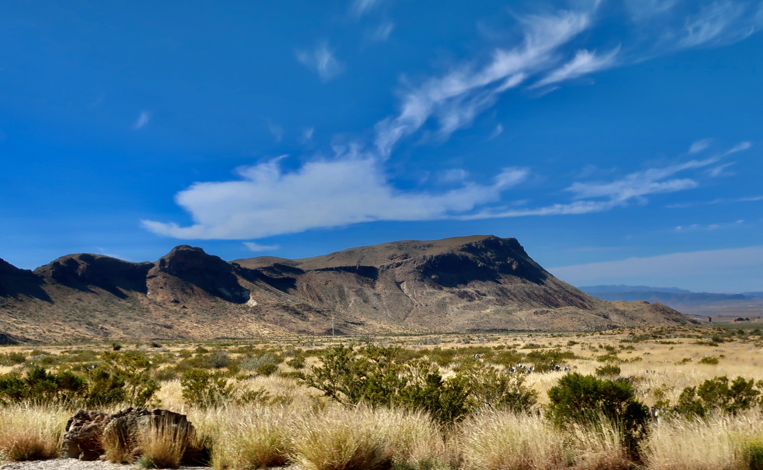
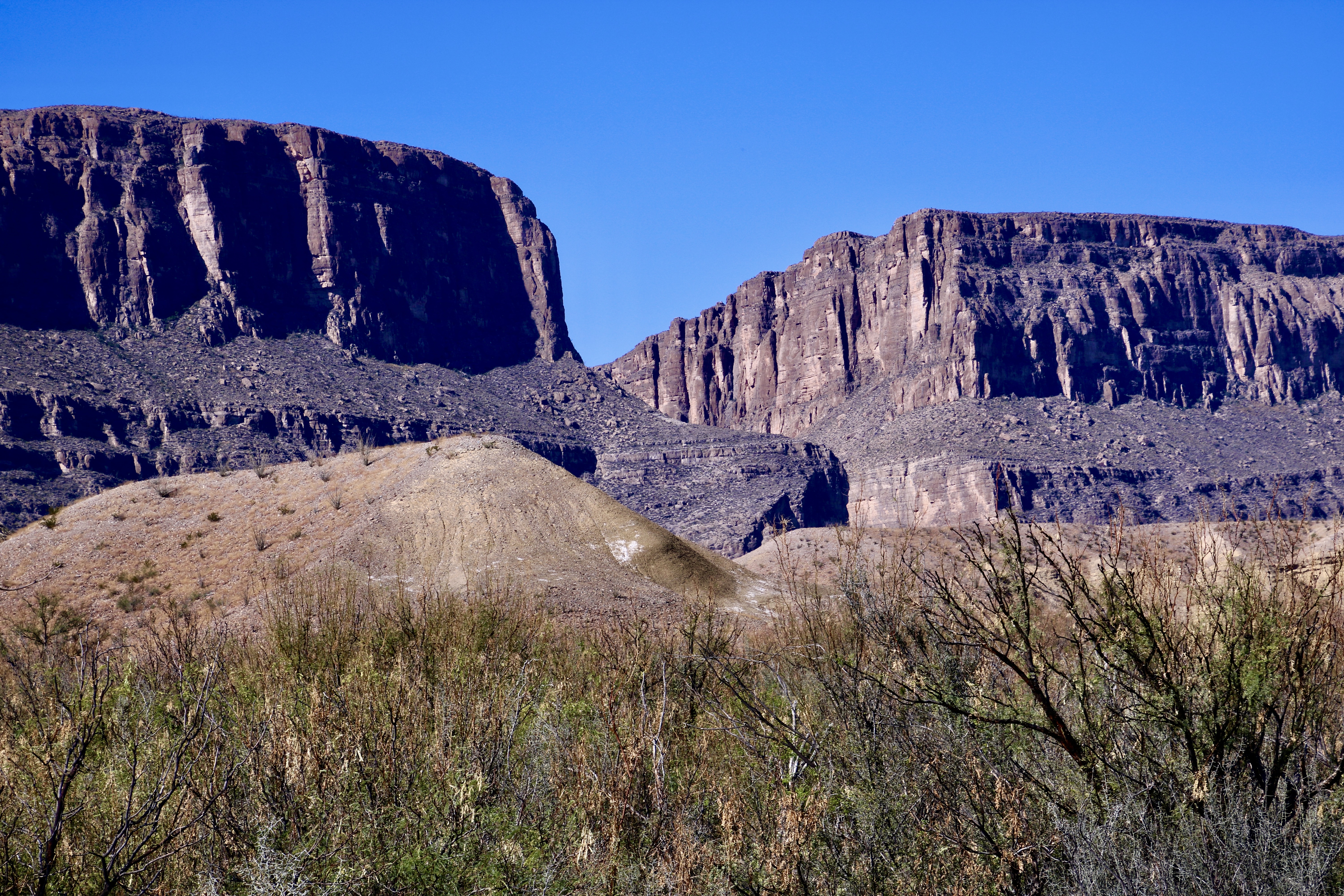
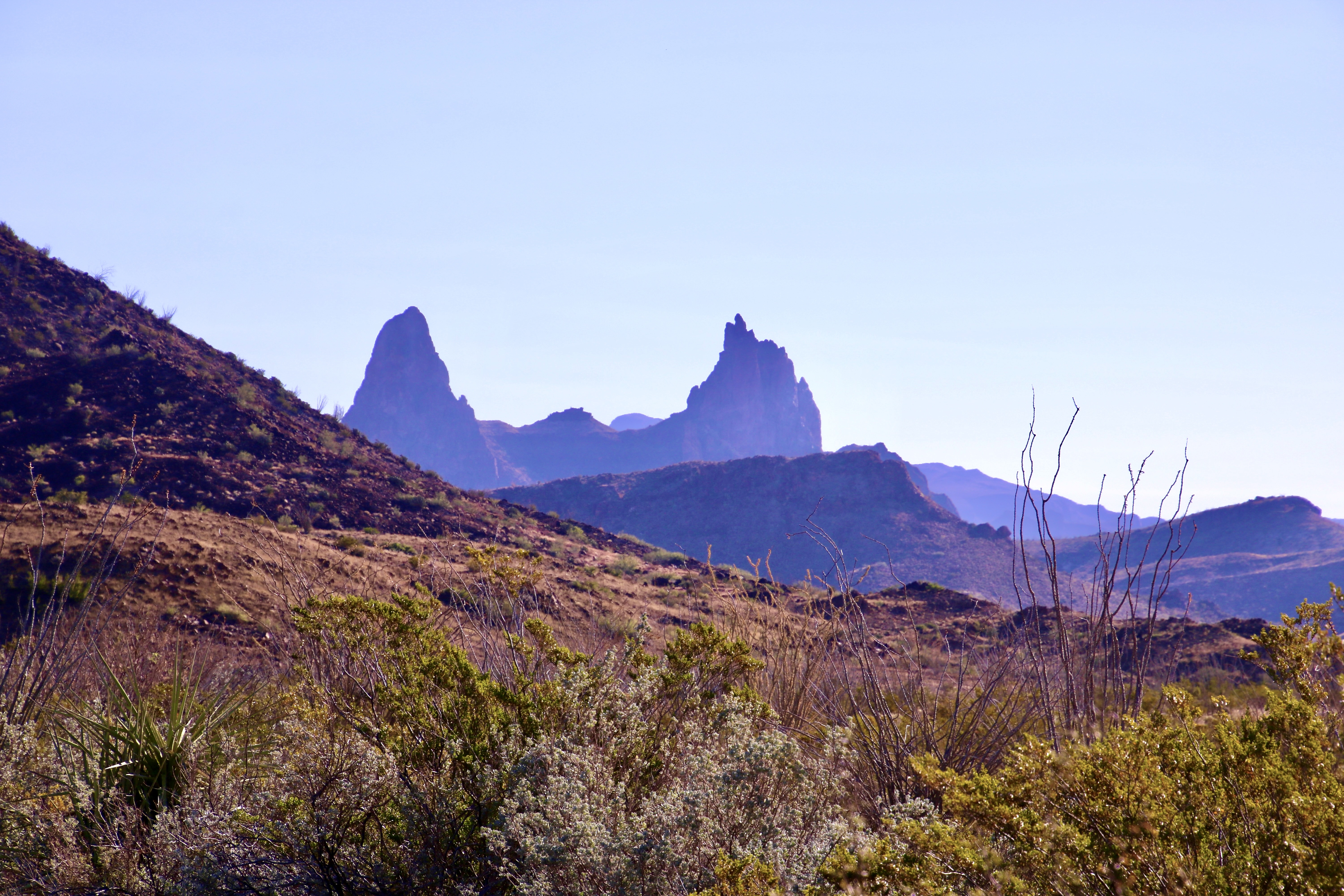
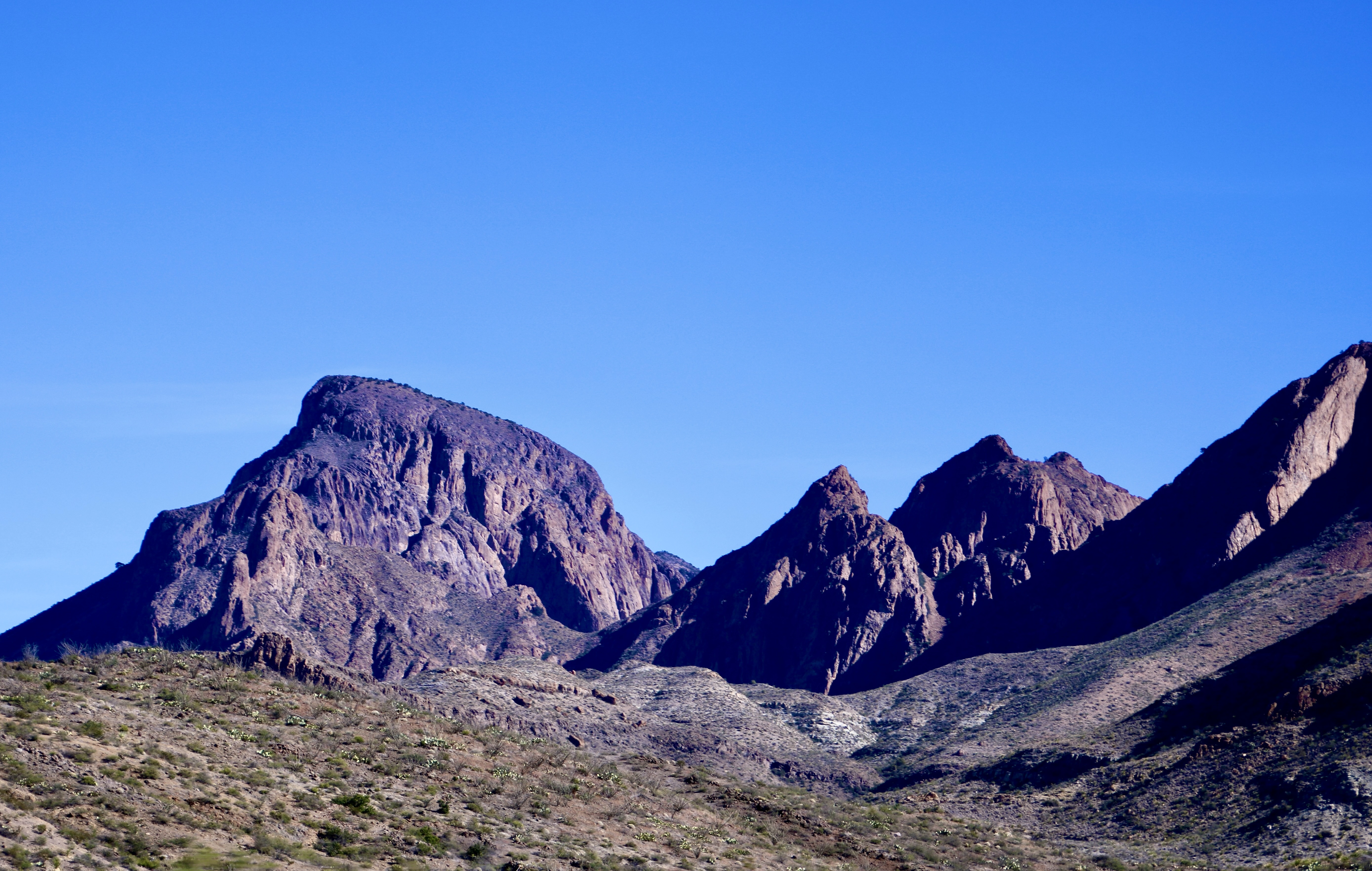
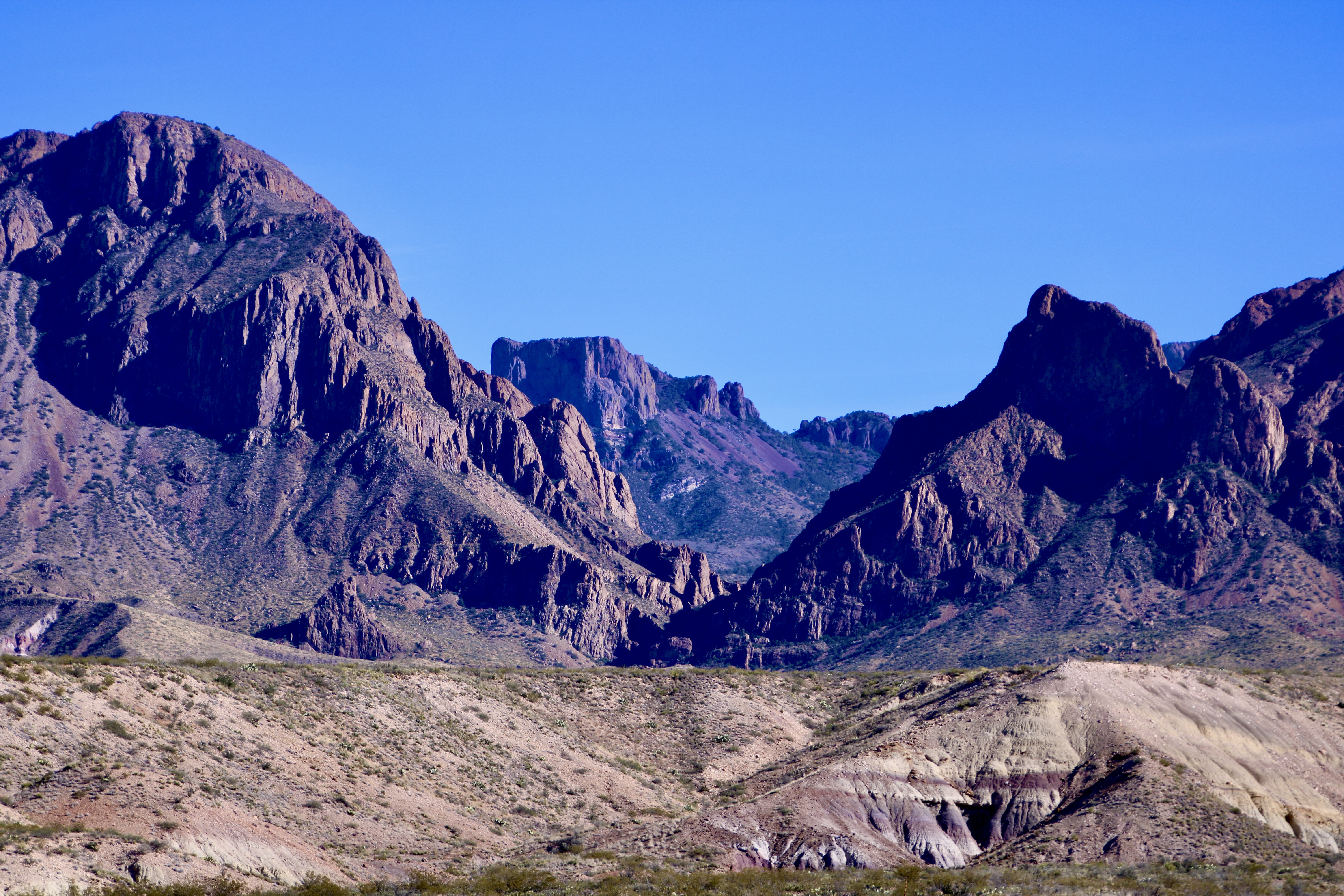
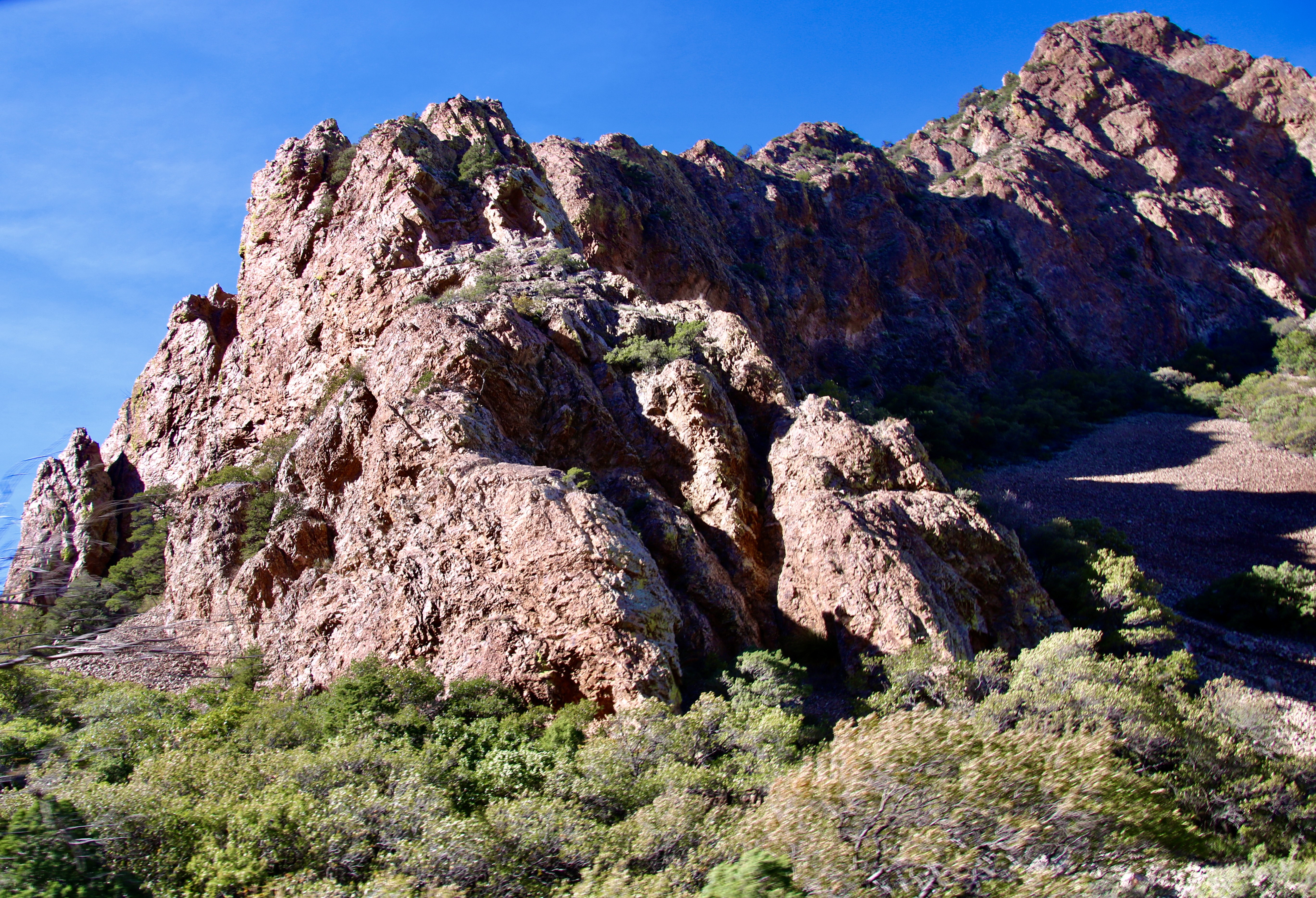
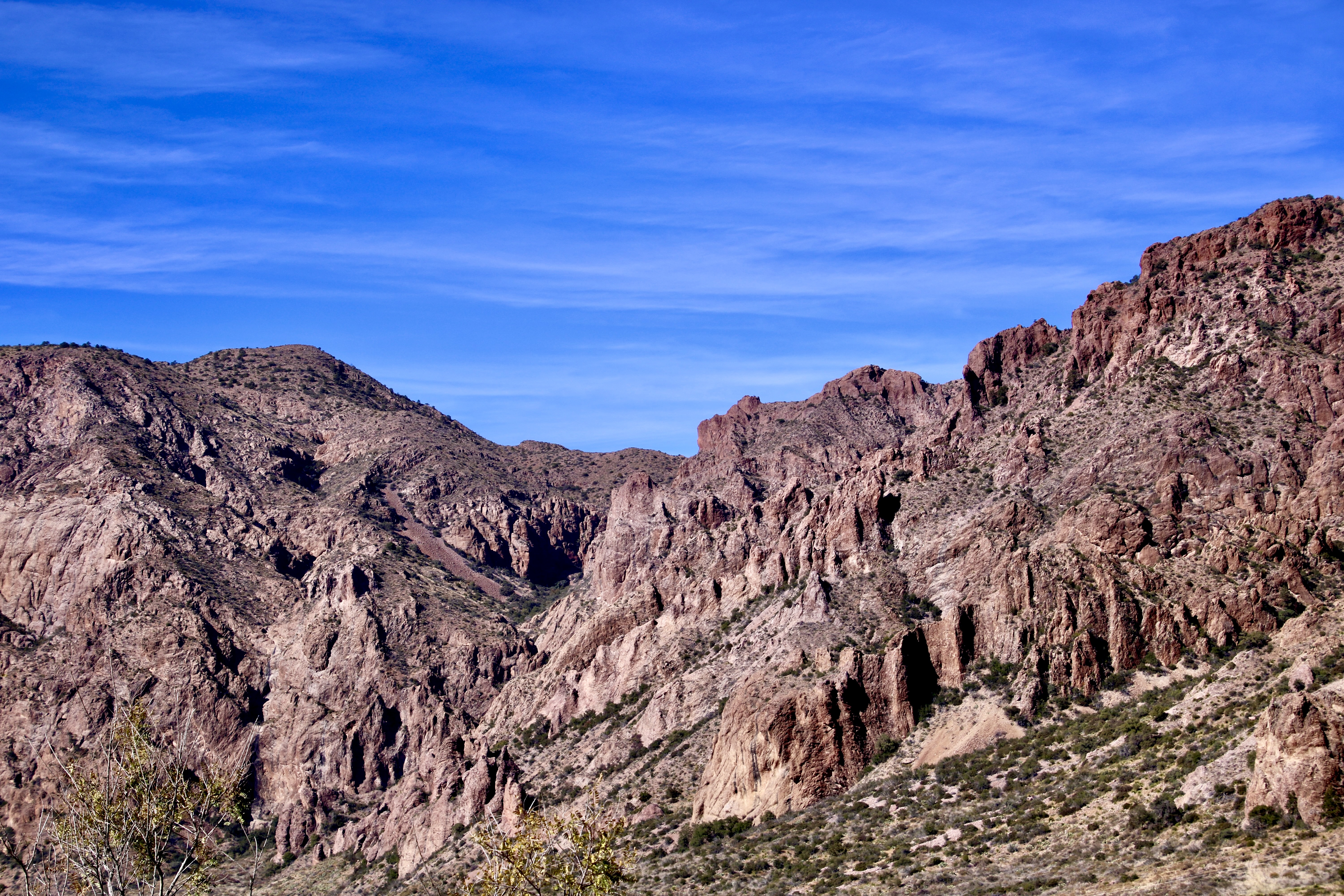
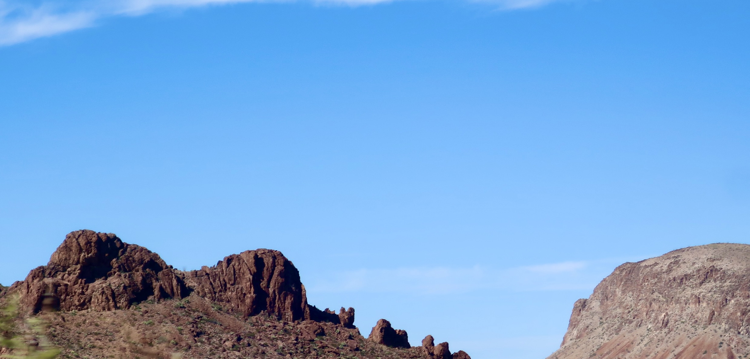
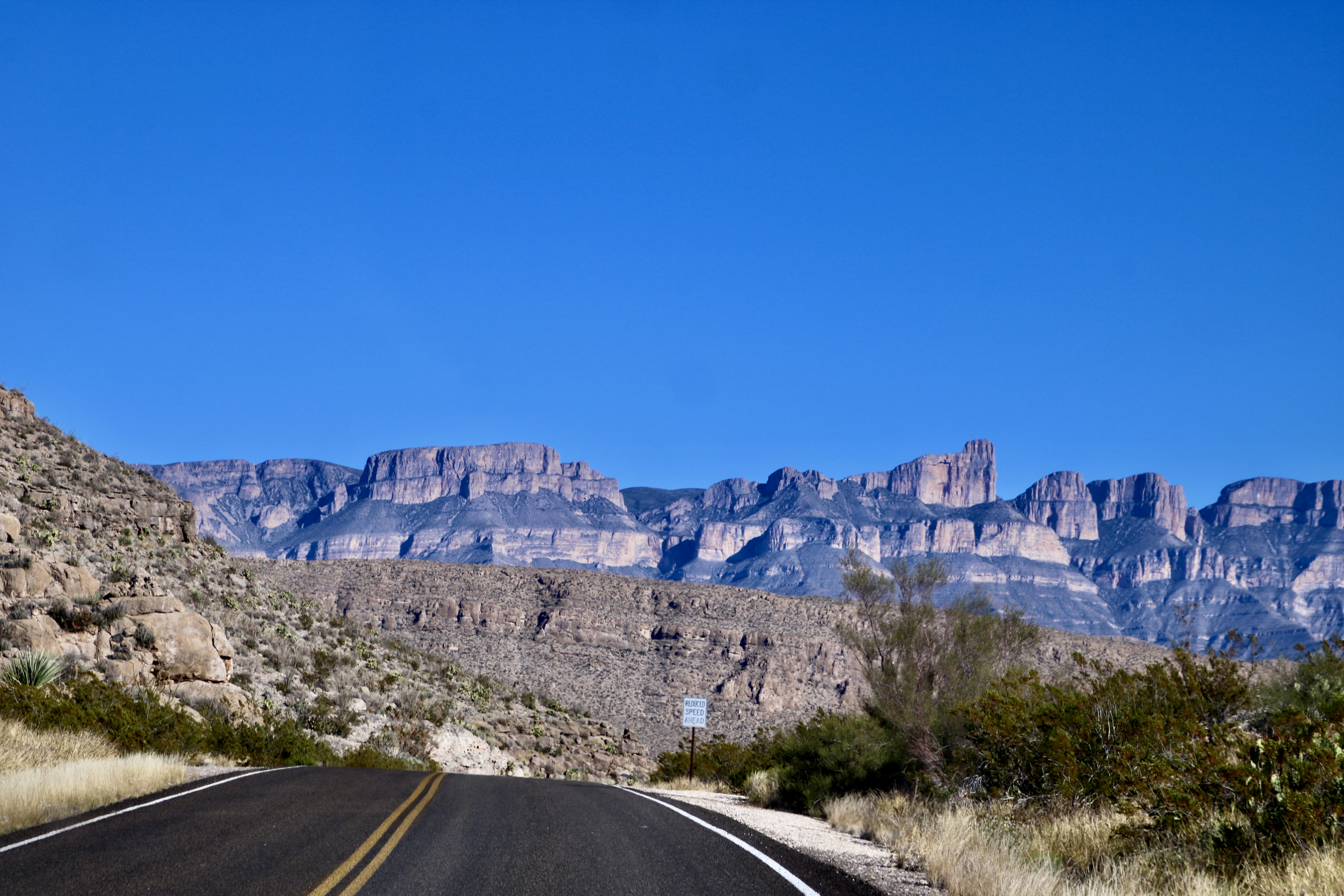
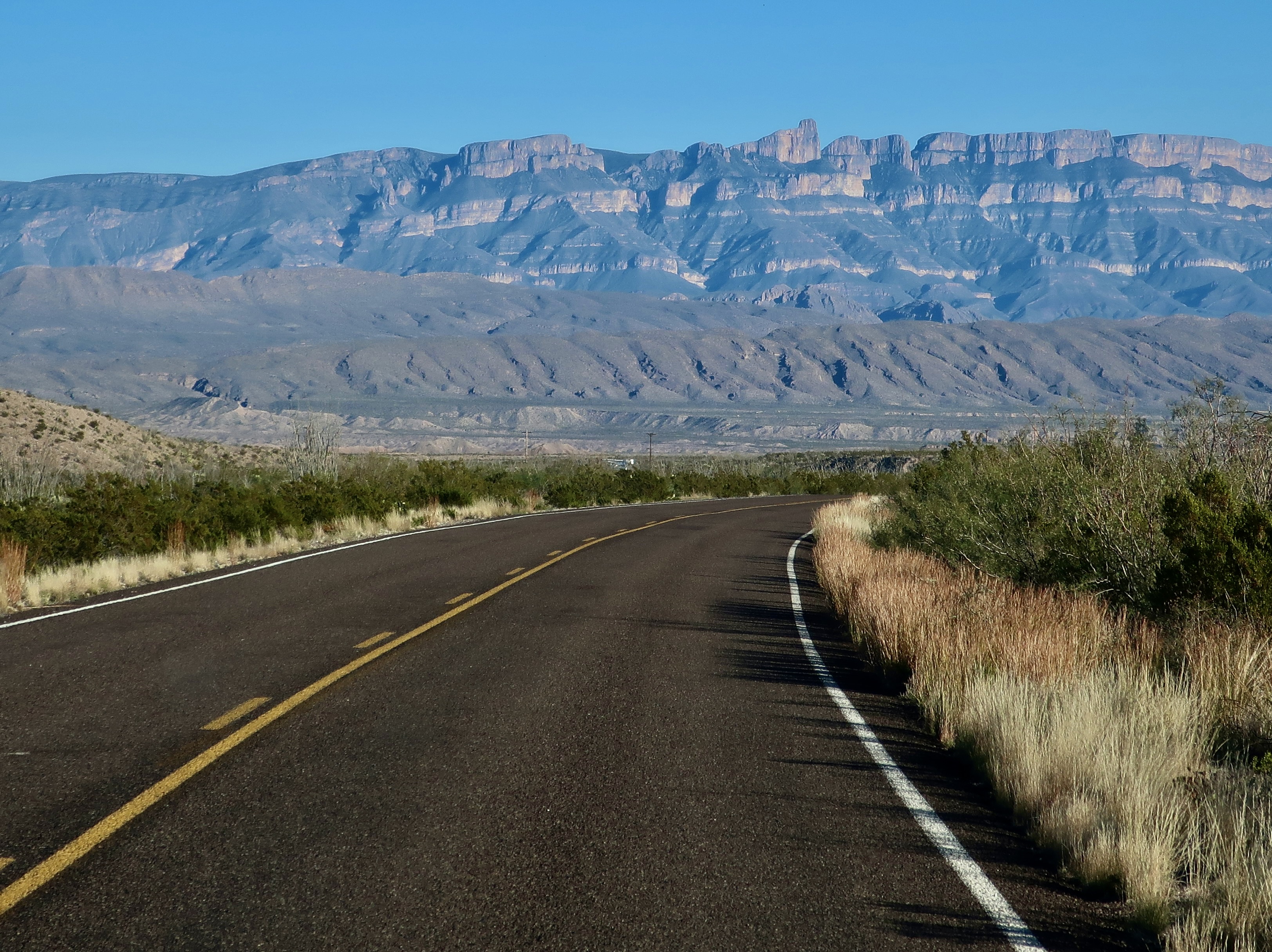
The Chisos Mountains of Big Bend were born 45 to 30 million years ago when the region experienced several episodes of volcanism followed by periods of quiet. We found the mountainous region to be quite beautiful. Our drive from our campsite at Rio Grande Village to our campsite at Castolon took us around much of the mountain range as shown in the National Park map below.Our drive from our campground at Rio Grand Village on the right to our campground in Castolon on the left took us around a significant portion of the Chisos Mountains. Most of our photos of the mountain were taken when we retraced our drive up from Castolon to visit the Chisos Basin. We did, however take photos from the Chihuahuan Desert Nature Trail on our way to Castolon. This is a Big Bend National Park map.The Chihuahuan Desert Nature Trail provided several views of the eastern side of the Chisos Mountains. I believe this is a view into Pine Canyon.Any view of the ‘Old West’ is enhanced by an old-fashioned windmill (not the gigantic modern types). We found this along the nature trail looking out at the mountains.Farther up the road, after we had cut off onto the Ross Maxwell Scenic Drive, the Chisos Mountains Exhibit gave us a northwestern view of the mountains. Emory Peak, the slight knob on the left, is the highest point in the park at 7,825′ (2385 m).Once situated in Castolon, Peggy and I decided to make a more leisurely trip up the Scenic Highway along the Chisos Mountain to the Chisos Basin. Our first view along the way was one of Big Bend’s most photographed sites: The Mule Ears. They look a bit devilish to me.Another perspective. Do they actually look like mule ears? Close…I took this photo at Phantom Ranch in the Grand Canyon.Next up on our list of things to see was Goat Mountain. It’s the peak on the left.Closer…Closest! Actually, Goat Mountain was misnamed. What the early pioneers were actually looking at were big horned sheep.But, hey, an ungulate is an ungulate, right? Can you spot the sheep? Just kidding.Remember the old ditty, ‘the bear went over the mountain to see what he could see,’? I’m like the old bear. Always curious. Goat Mountain is the peak on the end. Getting close to the turn off to the Chisos Basin, this was our view. Note the red ridges in the foreground.The red ridges are the Fins of Fire shown on the map. They are volcanic dikes formed when lava forces its way into crevices in rocks as it works its way to the surface and solidifies. Erosion has exposed the red dikes here.Close up of the dikes.Now it’s time to work our way into the Chisos Basin. A window view of where we are going. The large flat rock is Casa Grande.A grand house indeed! But it’s only one of the many views we found in the basin.They range from rocks with character like these…To rocks I found particularly beautiful. Like this.And this. Note the trees and bushes. We are no longer in the desert!Variety in the basin…Is truly…The spice of life.This is Emory Peak, the highest point in the Chisos Mountains.And this is a view back out into the Chihuahuan Desert, where we will return in our next post. See the slight notch on the horizon…It’s this: The Santa Elena Canyon. Located in the Castolon area, it is one of the places we will be exploring.
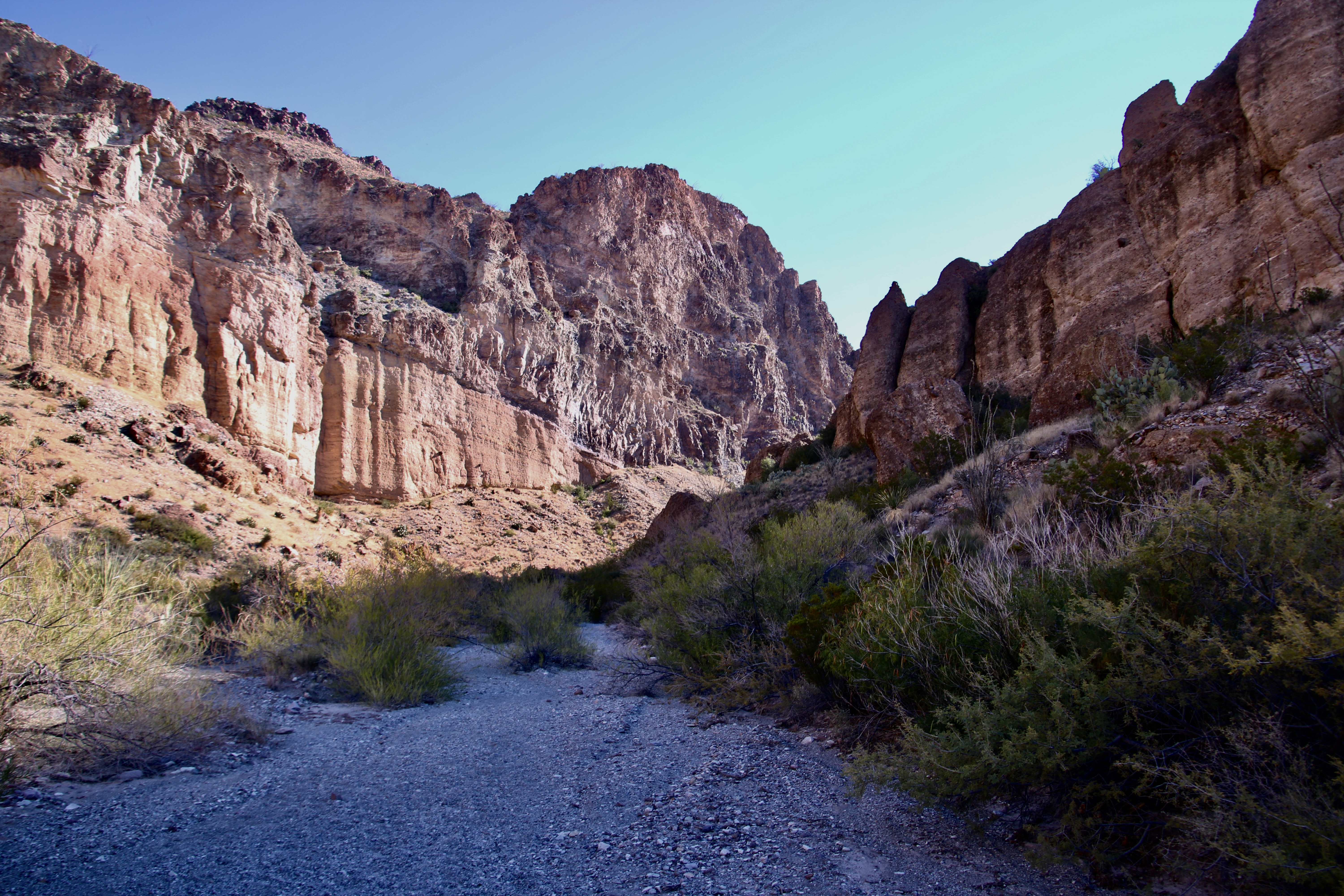
At first, we thought it said Burro Mesa Pulloff. That seemed to make sense. Maybe this was an historic location where burros pulled off to rest, drink water, and chew on a desert bush or two. Then we saw it was Pouroff. So what’s a pouroff? A contest between bartenders? We read the National Park info board. Apparently water poured off of Burro Mesa and down into this gravel canyon during thunderstorms, flooding it. Given that the canyon was quite beautiful and that there were no thunderheads looming overhead, Peggy and I decided to go for a walk.
Today’s post was supposed to be about Big Bends Chisos Mountains. I even included a ‘teaser’ photo in my last blog. When I reviewed our photos, however, I quickly decided that a fourth blog was needed. This is it. There may even be a fifth. Most of today’s photos were taken along the Ross Maxwell Scenic Drive shown below.
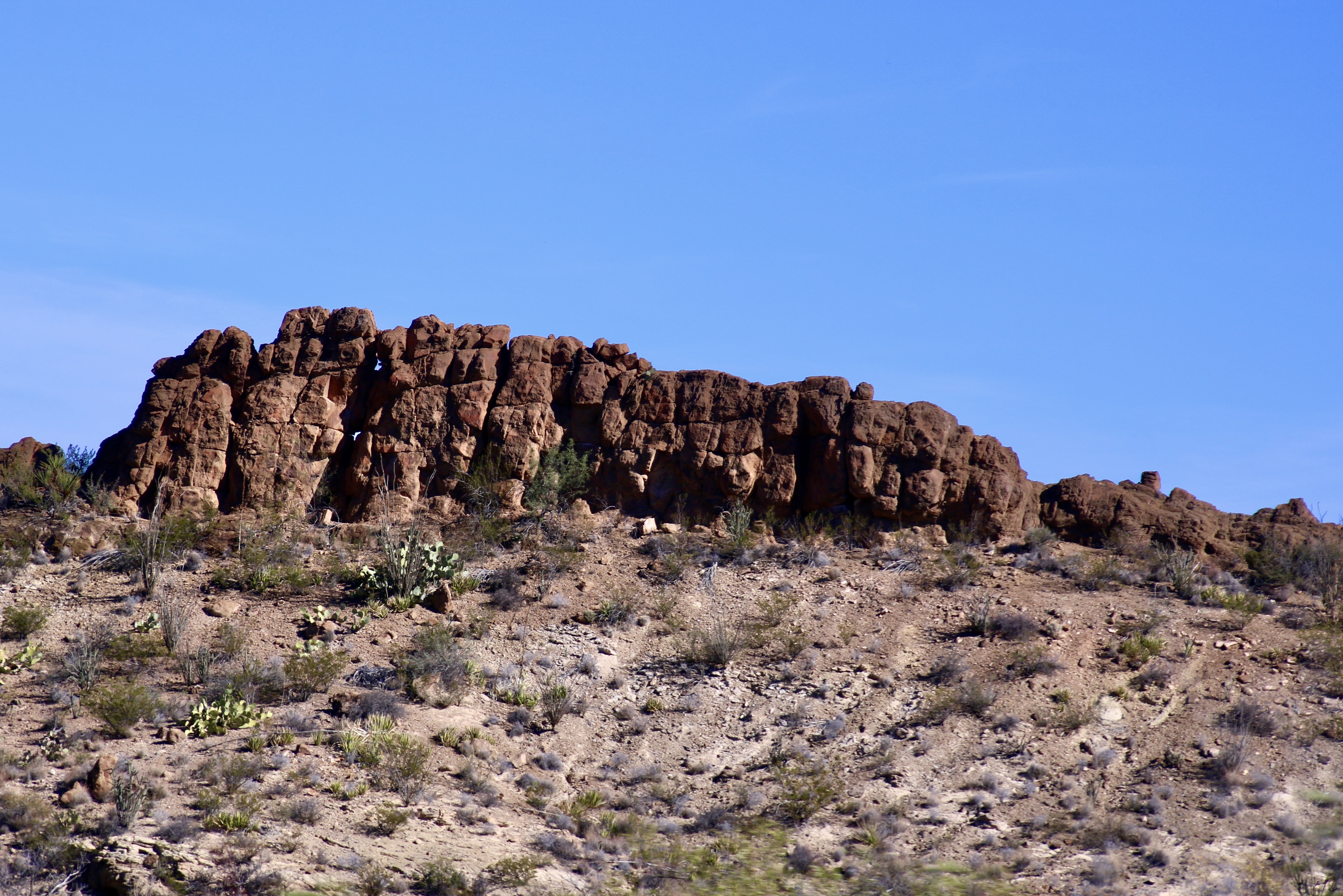
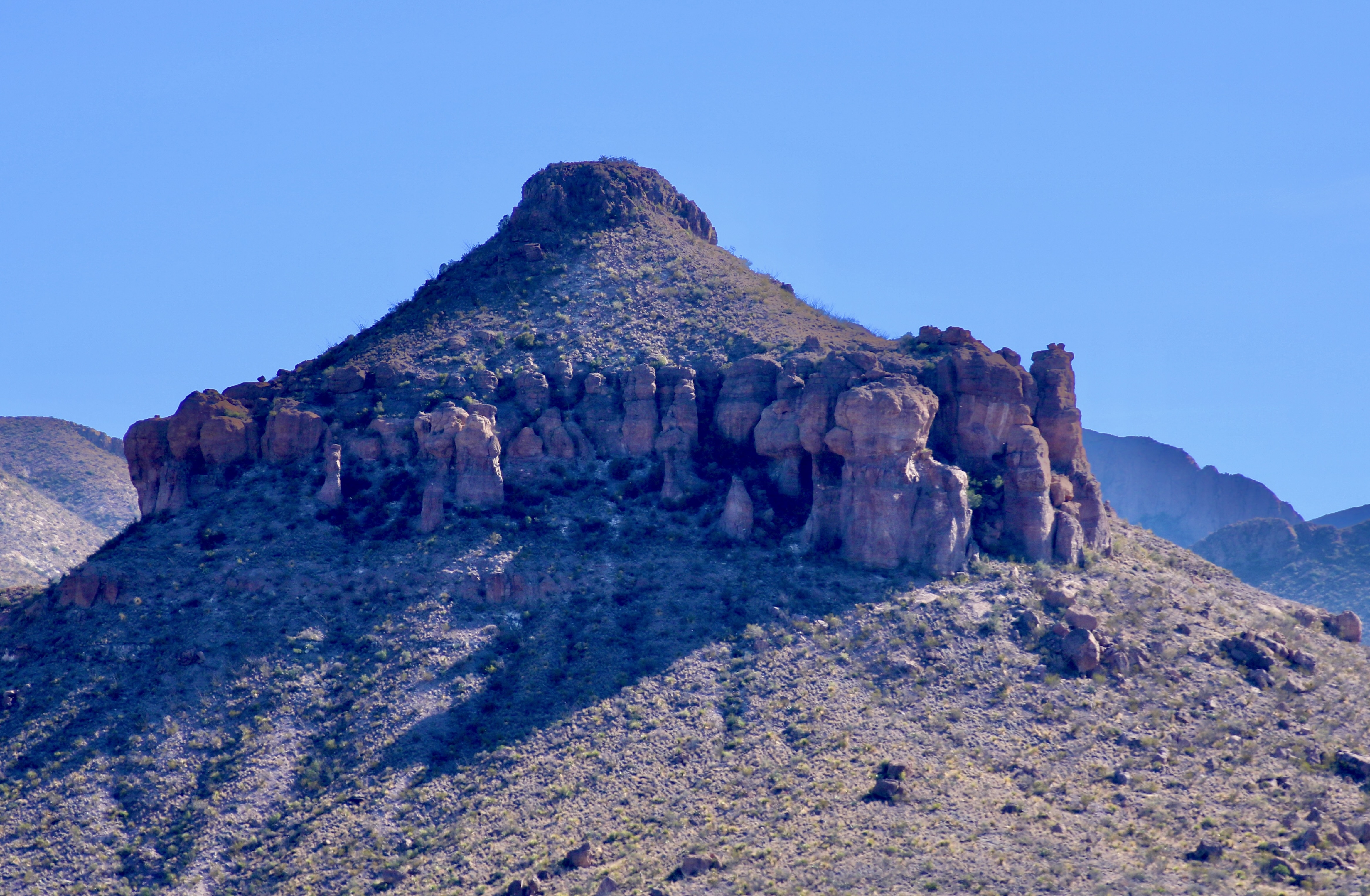
Ross Maxwell Scenic DriveThe little green hiker might be in a heap of trouble if water came pouring down the two steep canyons off of Burro Mesa.Peggy at the beginning of the trail. The buff colored rock is volcanic tuft.A close up.We were particularly impressed with the colorful tuft formation above the trail.And took several photos of it. And now for a potpourri of other photos we mainly took along the Ross Maxwell Scenic Road and a few thoughts on why we took them.Layer upon layer seeming to tumble down the cliff.Erosion can create wildly wonderful rock sculptures and this is one. We thought it looked like a dog. Too bad it didn’t look a bit more like a chihuahua given its location in the Chihuahuan Desert. Chihuahuas, BTW, got their name from the town of Chihuahua located in the Mexico portion of the Chihuahuan Desert. Geologists love deserts. There is little to hide the rocks. Peggy and I love deserts for the same reason. We are particularly fond of the formations like shown in the previous photos and the color shown in this one.It was worthy of a closer look. Peggy sees a face!Reds also capture our attention. Note the two red outcrops on top of the hill…I had a fleeting thought: Garfield.I liked the balance here, but even more the wisps of cirrus clouds that seemed to be rushing toward the divide.These layers of rock speak of millions of years and conditions from ancient oceans to deserts.Layers of rock resistant to erosion form cliffs that go on and on…Stretching off to the left…And to the right.This peak’s erosion had created a unique look.A different perspective.We’ll conclude today’s post from a distant look back at the Chisos Mountains, where we will go in our next post. Maybe.
“Roads go ever ever on, Over rock and under tree, By caves where never sun has shone, By streams that never find the sea; Over snow by winter sown, And through the merry flowers of June, Over grass and over stone, And under mountains in the moon. Roads go ever ever on, Under cloud and under star.” From the Hobbit and Lord of the Rings.
I just rewatched Peter Jackson’s trilogies on the Hobbit and Lord of the Rings, some 17 hours worth. Talk about going ever on. I’ve watched the movies four times. Peggy is a great fan. Me? Not so much. Long before the movies were produced, I read the Hobbit and then went on to read the Lord of the Rings. Also four times. I prefer Tolkien’s version over Jackson’s reinterpretation. The latter is less whimsical, more dark, and more tragic. Part of it is the medium. It’s one thing to read about the tribulations of Frodo. It’s something else to see them rendered graphically on the screen. But there is more. Dark parts are added to the movie, while lighter part are left out. For example, I’ve never forgiven Jackson for leaving out Tom Bombadil and Goldberry, two fun, fascinating characters, at the beginning of the Tolkien’s Fellowship of the Ring.
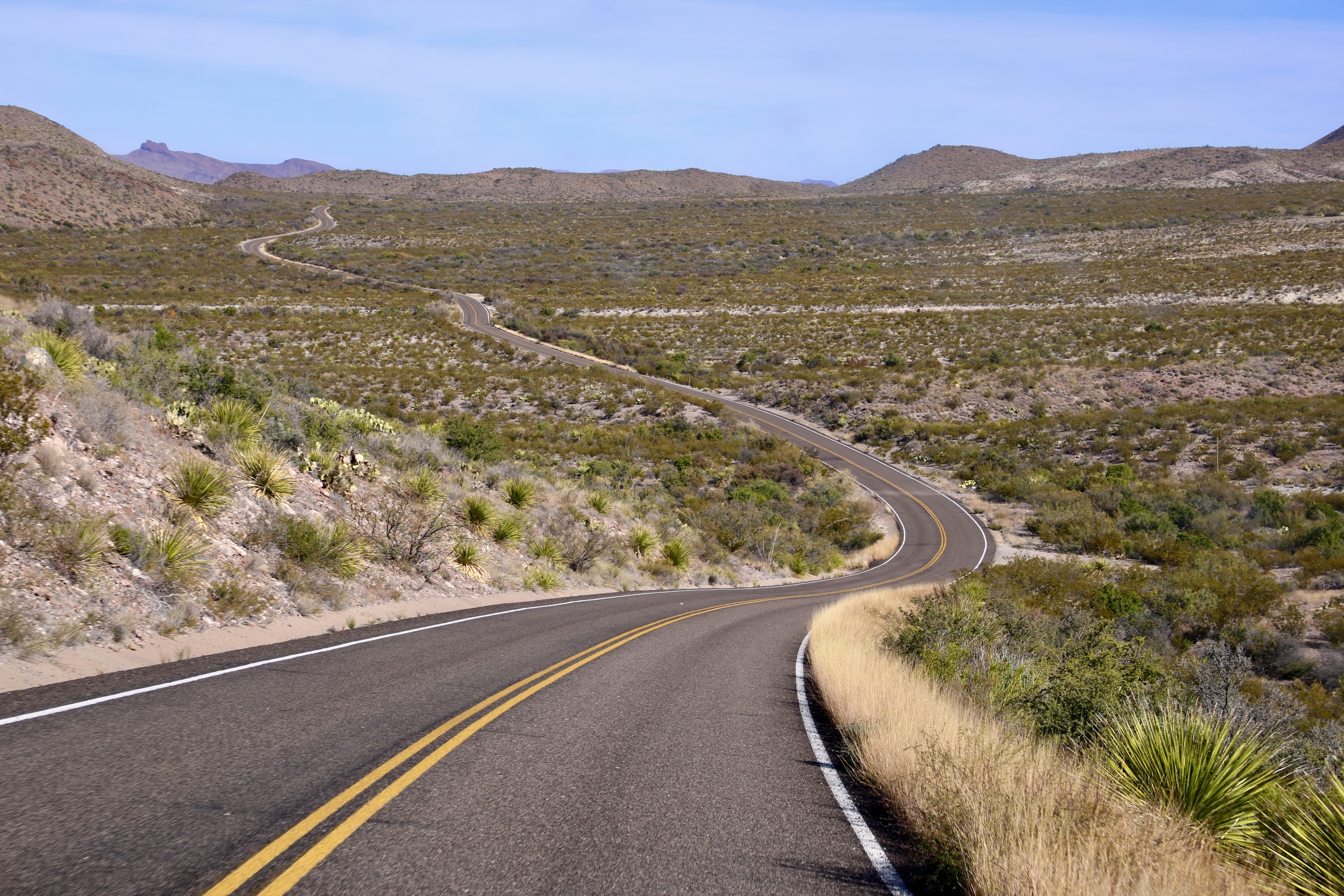
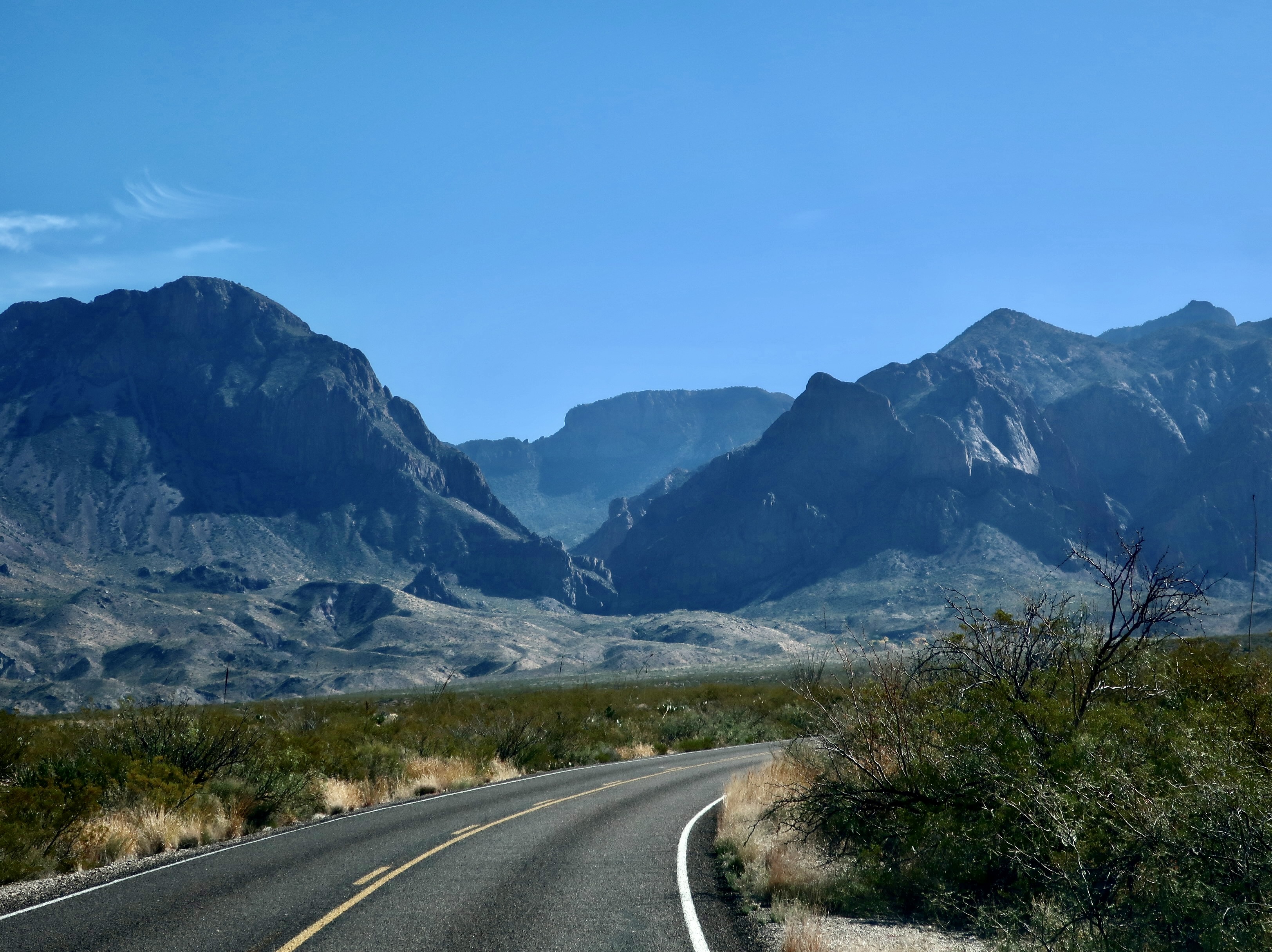
This post isn’t about the books or the movies, although it is about roads. I am going to kick off my first post on Big Bend NP with road shots. Also, I will note in passing, that I used the time we were watching the movies to pick out and process some 725 photos that Peggy and I took of the Park— and that I decided are blog worthy. You will see around a tenth of them is these posts!
I’m going to skip commentary on the road photos. The next two posts after this will feature many of the same areas, plus more. There will be plenty to comment on.
Shooting photos while driving down the road requires a different approach than shooting while still. The photographer is taking ‘snap shots’ in the truest sense of the word. There isn’t time to look for the best photo or consider factors like angles, shadows, sun, and content. Using a telephoto is much more difficult. The camera has to be ready, maybe even turned on. You spot something of interest, raise your camera, and shoot. Bang, bang, bang. Or the photo op has passed by. Note: When Peggy drives, I’m the photographer and vice-versa. Driving and taking photos at the same time fits the category of ‘very bad idea!’ Also, make sure your windshield is clean. Bug guts can ruin the best of pictures! Grin.
So, without further ado, these are some of the photos Peggy and I caught. While there is no requirement to include the road in a road shot, I have done so for the purpose of this post. You might note the lack of traffic. Big Bend is a long ways from major roads and cities! Enjoy.
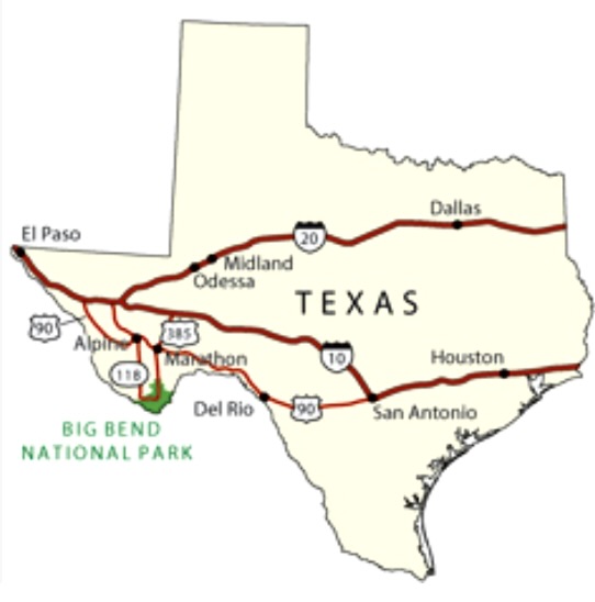
This national park map shows the location of Big Bend Park in Texas. it’s located in the far southwestern corner of Texas on the border of Mexico with the Rio Grande River serving as the borderline. In our next post, we will start on the eastern end of the park and begin to work our way westward.
Amid the craziness of the holidays, a primitive monster shows great ‘presents’ of mind.
We were down in Big Bend National Park in Texas when it came time to write our annual Christmas letter. The park features beautiful scenery, interesting culture, cacti, and lots of geology. It also features fossils from the Age of Dinosaurs, including a monster crocodile. The crocodile reminded me of one of the characters I created for Christmas Cards, Old Croc. He made it into my Christmas letter and today’s post.
You would not want to go wading in a lake with this crocodile swimming around. It was a common mistake of dinosaurs 35 million years ago. It’s a Deinosuchus skull which was originally found in Big Bend. In this early photo, scientists examine the skull at the Smithsonian. “My, what big teeth you have.” It was a Little Red Riding Hood moment.
There was also a large leg bone from a duck billed dinosaur. Bone couldn’t resist having his photo taken with it.
Bone has a thing for bones. He can never resist having his photo taken with them. Out of respect for the dinosaur, he took off his clothes.
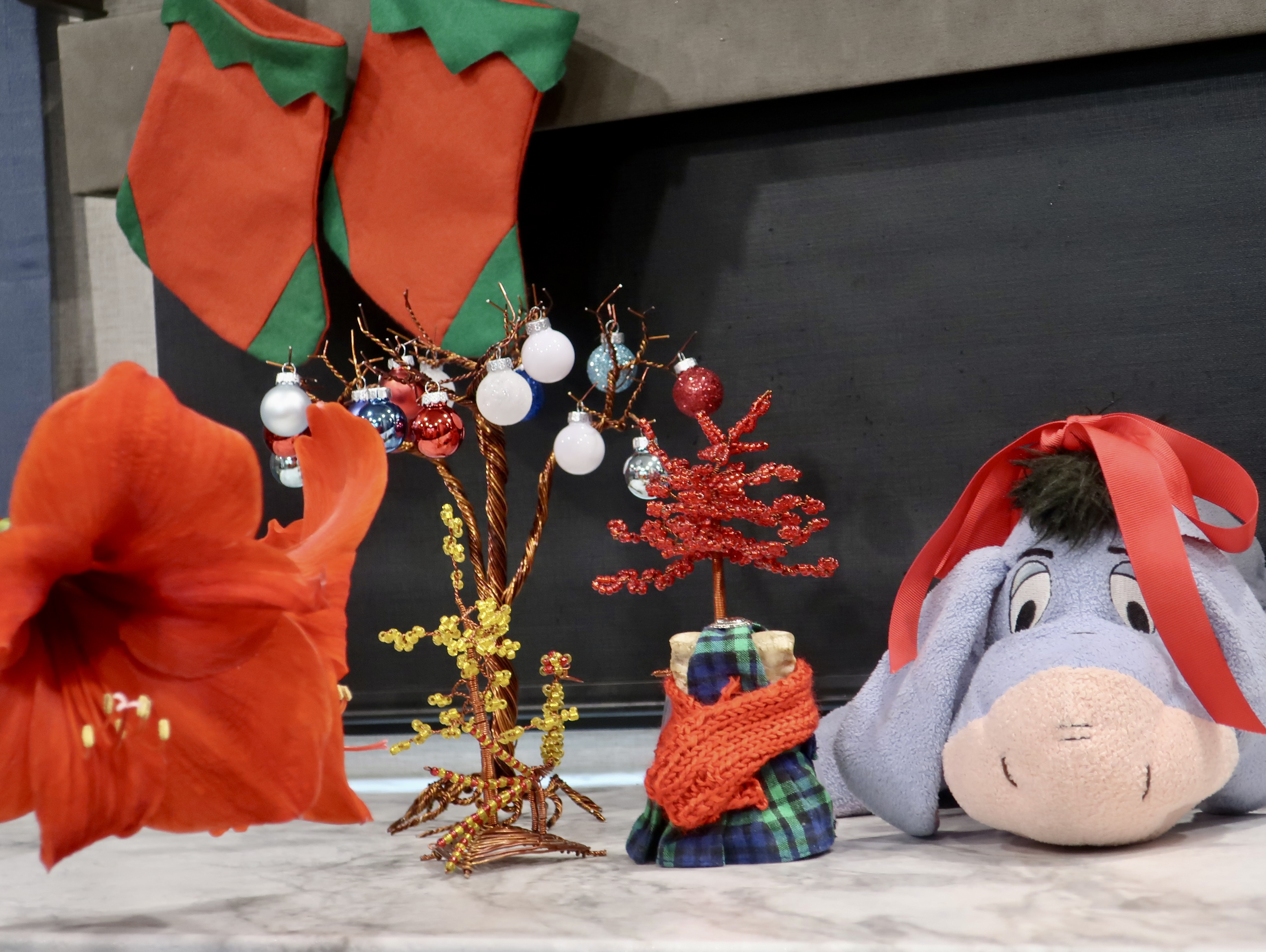
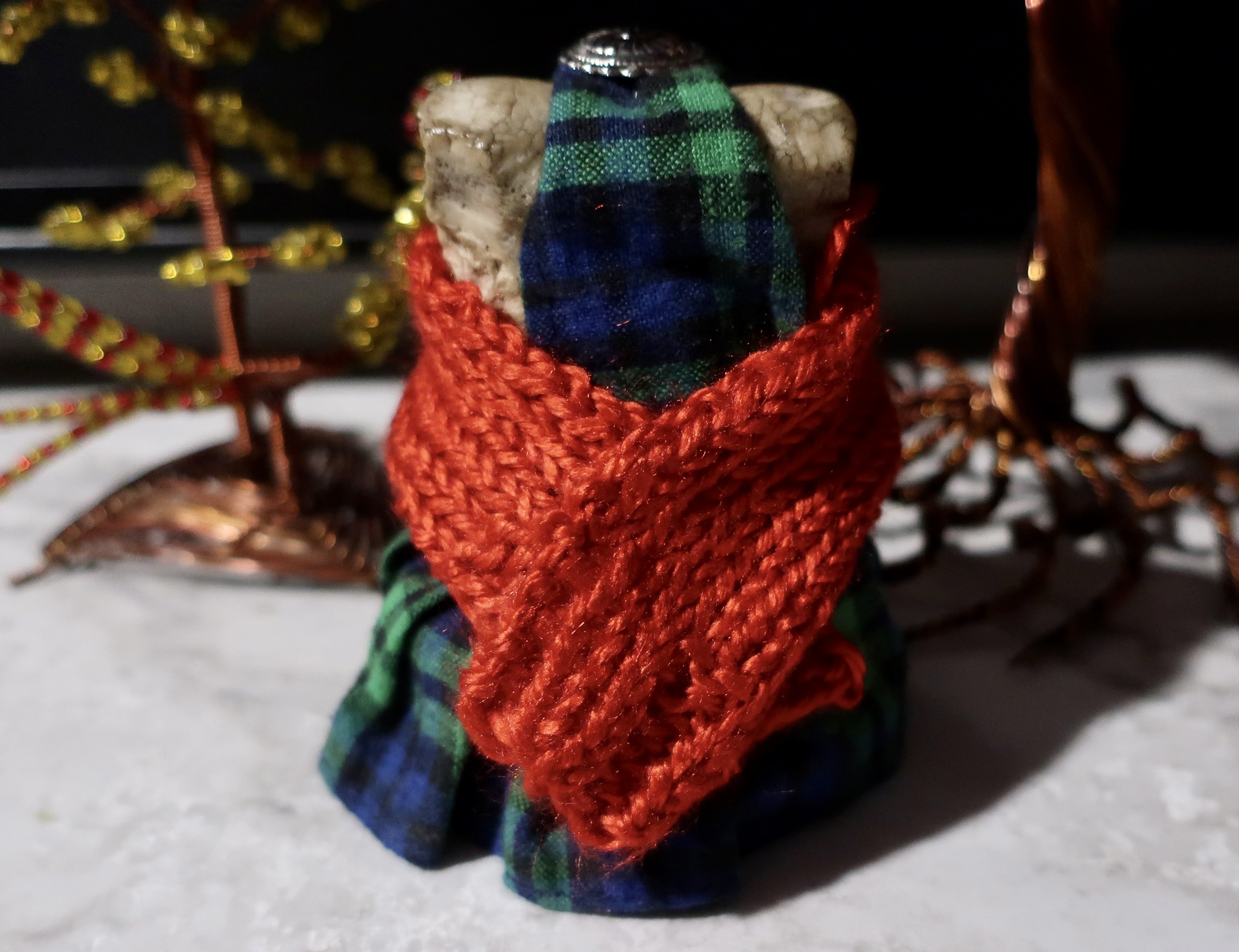
Peggy and I celebrated Christmas in 1999 at Big Bend. Not having a Christmas Tree, we used a hanging macrame. Our visit to Big Bend was before Christmas this year, but Peggy was still fired up with her passion for decorating. We found some hand-crafted Mexican Christmas ornaments for sale next to the Rio Grande. Bone, of course, insisted on joining the party. As did Bone’s traveling companion, Eeyore. We visited Peggy’s brother John and his wife Frances after Big Bend. Frances, knitted a Christmas scarf for Bone and donated a ribbon for the donkey.
Peggy’s Christmas scene from right to left: Eeyore, Bone, the Rio Grande ornaments, stockings and a blooming amaryllis. Peggy’s sister, Jane, gave us the stockings and amaryllis. Bone, dressed up in all of his sartorial splendor, wears his kilt and new scarf for Christmas.
Just in case you are new to this blog and have never met Bone, a friend of mine, Tom Lovering and I found him in a field of corn lilies when we were backpacking along the Tahoe-Yosemite Trail in 1977. He has been traveling with us ever since. In addition to Tom and me, a number of other people have carried him over the past 45 years on numerous adventures. He has visited over 50 countries. Among his many adventures are a 10,000 mile bicycle trip, a journey in the back of a truck the length of Africa, climbing mountains, and deep sea diving. He has travelled on the Amazon, attended a Presidential Press Conference, and been blessed by the Pope in St. Peter’s square. Four years ago he backpacked with me 750 miles down the PCT in celebration of my 75th Birthday, meeting numerous through-hikers along the way.
Peggy, I, Bone, and Eeyore want to wish you and your family a joyful Christmas and a great 2023.
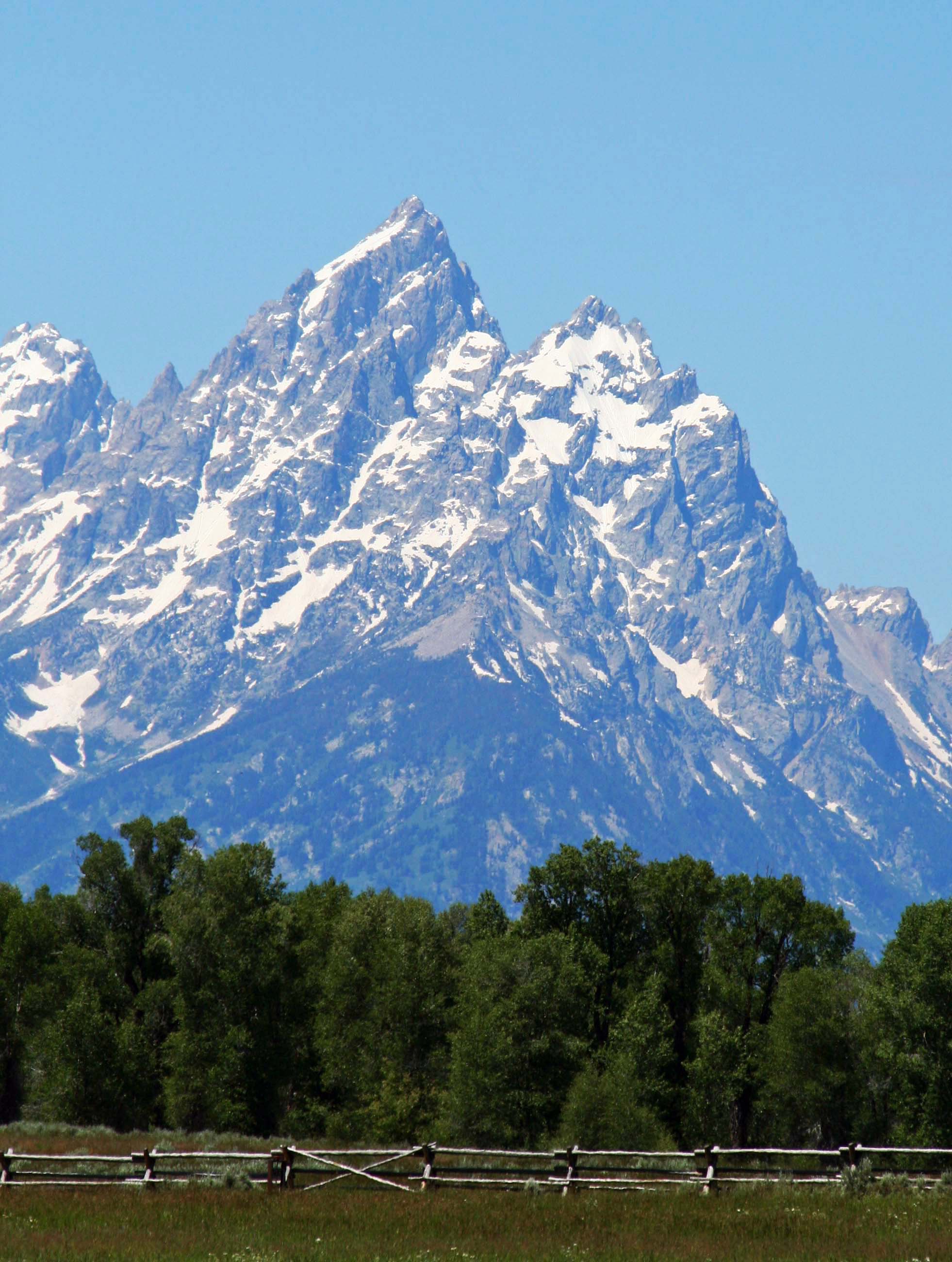
National Parks in the United States and throughout the world protect and preserve many of our most scenic natural areas. This photo is of the Grand Teton Mountains in Wyoming.
Peggy and I decided to take a year off from work in 1999 and travel around North America. I worked as a consultant/citizen advocate on health and environmental issues when I was behaving like a serious adult, and led wilderness treks when I wasn’t. Peggy was fully adult and served as an assistant principal at a middle school.
People were more or less resigned to the fact that I came and went. You might say I was self-employed and self-unemployed. The only person I really had to check with was myself. Peggy’s situation was different, but the school district really wanted to keep her. They offered her an unpaid sabbatical. We bought a travel van and off we went.
We left on July 1. Planning was close to zero. Our only obligations were to meet up with friends for backpacking and kayaking in Alaska and to join Peggy’s parents in Florida for Thanksgiving. Beyond that we could be wherever we wanted to be and do whatever we wanted to do.
Early on, we decided to visit National Parks, Seashores, Monuments and Historical sites whenever we had the opportunity. It was a goal we continued when Peggy retired from being an elementary school principal in 2007 and we wandered in our van for another three years. As a result, we have visited the majority of America’s National Parks as well as many in Canada.
Over the past three weeks I have blogged about a few of the parks we visited. I hope you have enjoyed the journey. Today, I will wrap up this series with photos from several more. I will return to the National Park theme from time to time in the future.
A view of Volcano National Park on the island of Hawaii. The white steam in the background is coming from an active volcano.
A view of the Rio Grande River as it winds through Big Bend National Park in Texas. Peggy and I spent Christmas at the park.
Exit Glacier at Kenai Fjords National Park. I ended backpack treks I led across the Kenai Peninsula near here.
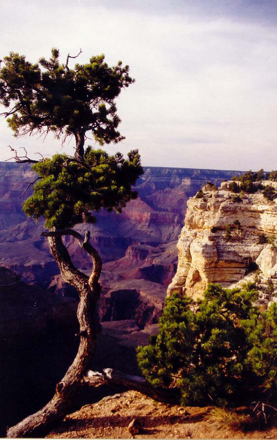
Sunset at Grand Canyon National Park in Arizona. (Photo by Peggy Mekemson.)
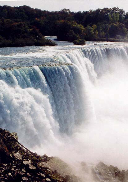
Niagara Falls is not a National Park but it is a National Heritage Site.
We found this colorful Luna Moth on the Natchez Trace, a National Historic Highway that winds through Mississippi and Tennessee. No commercial traffic is allowed on the road, which makes it great for bicycling. (Photo by Peggy Mekemson.)
This brick outhouse found on the Natchez Trace is included because it is my favorite brick outhouse in the world. I hid out in it with my bicycle as a tornado tore up the countryside nearby.
Rocky Mountains National Park in Colorado.
A view from inside of Mammoth Cave National Park in Kentucky.
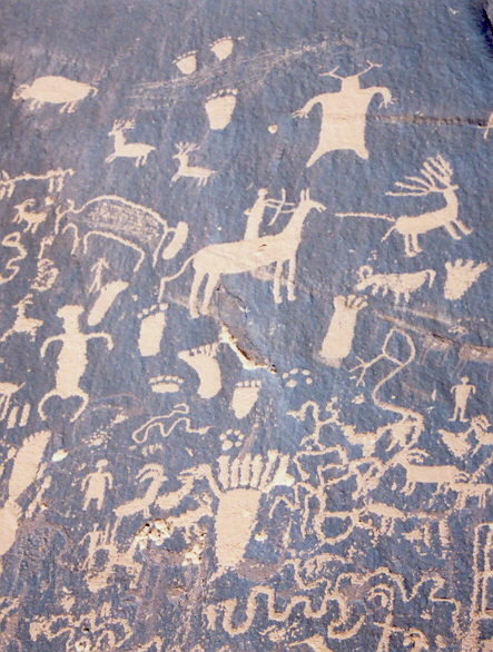
A small section of Newspaper Rock National Historic Site in Utah. Native Americans have been leaving messages on this rock for over a thousand years. Note the guy shooting the elk in the butt with an arrow.
Painted Desert National Park in Arizona.
I’ll conclude for today with this photo Peggy took of Capitol Reef National Park in Utah. (Photo by Peggy Mekemson.)
NEXT BLOG: We are off to Puerto Vallarta, Mexico and the beginning of a new series. First up will feature photographs of Pelicans diving for fish in Banderas Bay. We were fortunate to be close to the action and caught some great shots. You won’t want to miss this blog.