An Ugly Pit Viper Drops by for a Visit… Let’s go backpacking: Part 2

I heard a noise and looked up. A Diamondback Rattlesnake had come to visit.


Today’s post finds me out on a backpacking trip I went on last week. Friday’s post introduced the trip and took me off into the woods by myself.


I decided to remain camping where I was and go day hiking. That way I could explore the surrounding area early in the morning and late in the afternoon, while hiding out under a shade tree during the hottest part of the day. I had a number to choose from including incense cedars, ponderosa pines, white firs, and lodgepole pines. There was even a large sugar pine in the neighborhood with its 18-inch-long cones.

The Sugar Pine.

Staying in the shade involved moving as the sun made its way across the sky. This was a good thing; it forced me to get up every so often.

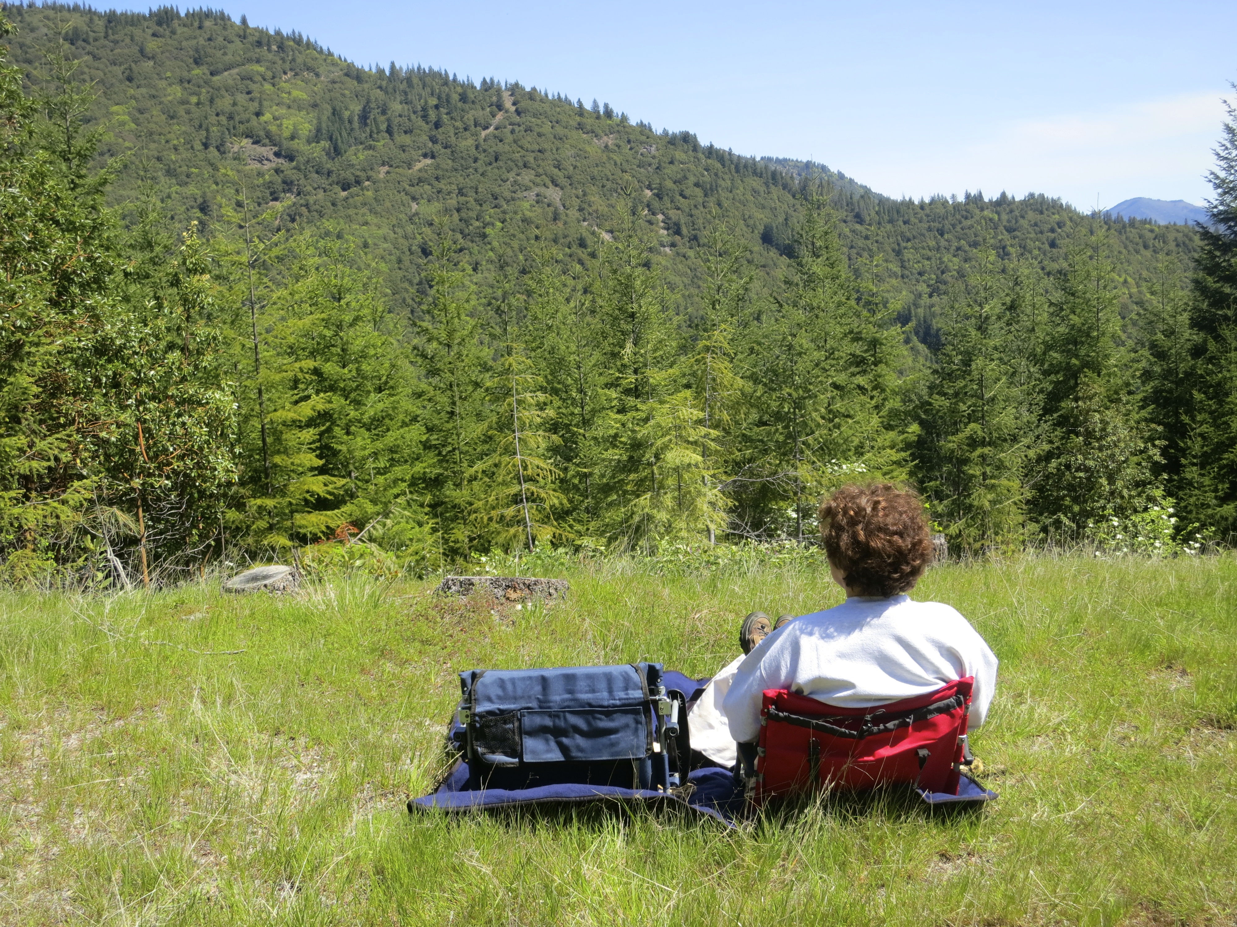
I create a very comfortable nest for myself in the woods, the type I can snuggle down in and read a good book, or write, or prepare a quick snack, meal or cup of coffee. My ‘kitchen’ is always on my right; my ‘living room’ and ‘office’ on the left. The Therm-a-Rest mattress converts to a chair and my backpack forms a great back rest. Everything is easily reachable from where I sit. Moving’s a bit of a bother (grin). It involves two trips and about five minutes to transfer everything. I quickly establish which trees provide the best shade and breeze for the time of the day.

Here’s my home away from home in the woods. Everything I need from entertainment and food to water and mosquito repellent is conveniently located. My clothes bag in the front rests behind my knees and adds comfort. My journal is resting on my chair.

I was in my five o’clock spot under a lodgepole pine when a movement caught my eye. I looked up from my Baldacci book and saw a Diamondback Rattlesnake slithering toward my tree through the pine needles. An ugly pit viper had dropped by for a visit! Keeping a close eye on my guest, I quickly pulled out my camera. The Diamondback kept coming. When it was about 10 feet away I said, “Ahem, Ms. Snake, do you see me? Do you even have a clue I am here?” (It might have been a male, but how in the heck do you tell the sex of a snake? I looked it up, actually, since I knew you would want to know. Male snakes have a couple of tiny penises under the skin inside their cloacal opening (vent under their tail.) You shove a snake probe up there. It goes up farther for a male than a female. Now you are an expert. I don’t think my snake would have cooperated.)

Ms. Snake came to visit me when I was sitting under one of the Lodgepole pines behind my tent.

The rattlesnake was close to four feet long and had ten rattles which suggested she was around five-years old. Note the triangular-shaped head that is typical of pit vipers.

She stopped abruptly as her neck and head rose into the air. Out came a forked tongue. Her spade shaped, pit viper head and yellow-slit eyes pointed in my direction, checking me out, fangs poised for action. Who or what had invaded her territory? Was I food or foe? Heat seeking facial pits that work something like infrared detectors determined that I was too big to eat and might be trouble. So, she started slipping off to the right. Naturally I had to get up and follow. (This is where Peggy normally urges me to do something else, anything else, but she wasn’t along.)

She raised her head and checked me out.

I walked a respectful few feet behind. You never want to get within striking distance. The Diamondback is responsible for the majority of snake bites in the US and its toxin loaded injection can be fatal. The snake kept twisting her head back Linda Blair-like, watching me. Her rattles were pointed up, ready to explode into the loud buzzing sound rattlers are famed and named for. Twice she almost coiled. I could have forced the issue— it makes for a great photo-op. A timely prod with a stick would have had her coiling and buzzing in a flash. But I figured she wasn’t bothering me so I wouldn’t bother her. At least not much. Finally, she slipped off into some brush and waved goodbye with her tail. I wished her good hunting. I think I heard something like “fat, juicy mouse.”

Her rattles were pointed up in the air, ready to start buzzing. The circles on the tail and diamond shapes above them identified the rattlesnake as a Diamondback. The pinecones are from a Lodgepole Pine.

While I wasn’t particularly bothered by the visit, I did move to a different shade tree on the other side of camp. Had Ms. Snake returned, she would have slipped up behind me. I was also more careful about watching where I stepped! Immediately afterwards, I called Peggy and related the story. She laughed. She knows my ways. Or maybe she was laughing from relief that I hadn’t been bitten.

Speaking of ‘my ways,’ one was that I would never carry a cell phone while backpacking. It was more or less written in granite. I go to the woods for tranquility, not the hustle, stress, incessant noise and constant connectedness of modern society. And nothing represents that more than cell phones. And yet, here I was with cell phone in hand. There was even a decent signal from a cell tower on I-80. My decision to break with my long-standing tradition was something of a compromise for my wife. Not many 74-year-olds go wandering off by themselves backpacking. In fact, the number of people who backpack alone at any age is limited to a relatively few adventuresome souls. Peggy is 100% supportive of my backpacking, even when I ramble off alone. But that doesn’t mean she isn’t concerned. My checking in on a daily basis— and being able to check in, if needed, in an emergency— helped allay her worries.

Cell phone service isn’t a given in the wilderness, however, especially in the US where profitability plays an important role in determining where service is offered.  So, I went one step further. I picked up an emergency Gen 3 GPS tracking device named Spot. It’s kind of like Spot, the family dog of Dick and Jane repute, or Lassie, if you will, able to track me down when necessary. But all I have to do with the Gen 3 is hit an SOS button and it immediately sends out a message to local rescue groups that gives my exact location and the fact that I am in a dire emergency situation. Help’s supposed to be on the way within the hour.

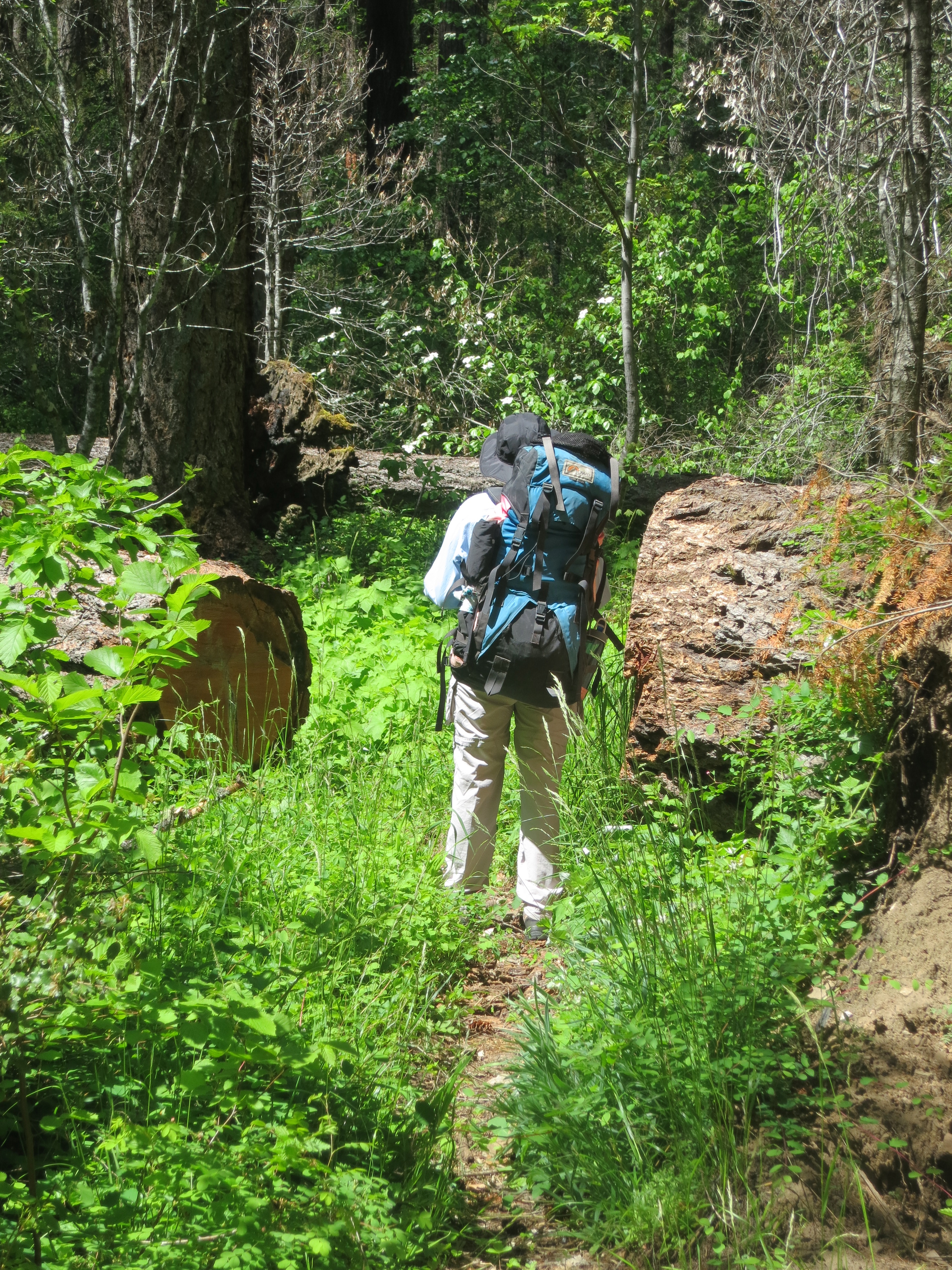
There were other steps I took as well— carrying trekking poles, for example. They cut down on wear and tear on the knees and add a degree of balance. More importantly, I did everything I could, minus eliminating my creature comforts, to reduce weight. Modern equipment makes a huge difference. When I first started packing in the late 60s, my pack for a week trip was normally in the neighborhood of 55-60 pounds. By the 90s it was 45-50 pounds. Now it is down to 35-40 pounds.

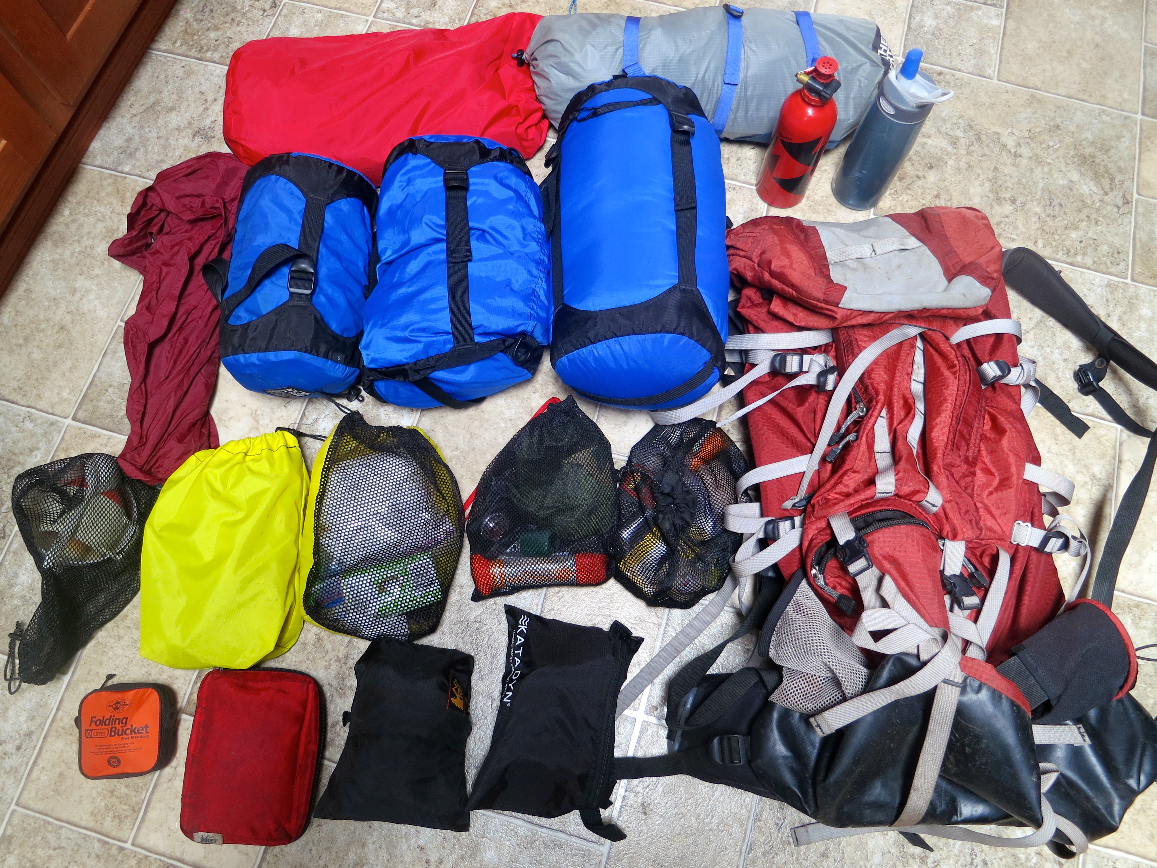
This is a photo of what I was carrying on my trip. Everything is organized in bags. So there is a kitchen bag, a bathroom bag, a ten essentials bag, etc. Each bag has its place in my pack which is organized for access and weight distribution.

Here’s my stove ready for packing, which will give you an idea on how compact and light backpacking gear is today.

Everything I carry is designed to reduce weight. A plastic spoon, bowl and cup are my dishes. I’ve been carrying the insulated cup for over 40 years. Once it was lost beneath 20 feet of snow. I found it when the snow melted.

Here’s another example of going light. This is my neckerchief, handkerchief, and topographic map. It also serves as an air conditioner! On a hot day, I dip it in a stream and wrap it around my neck.

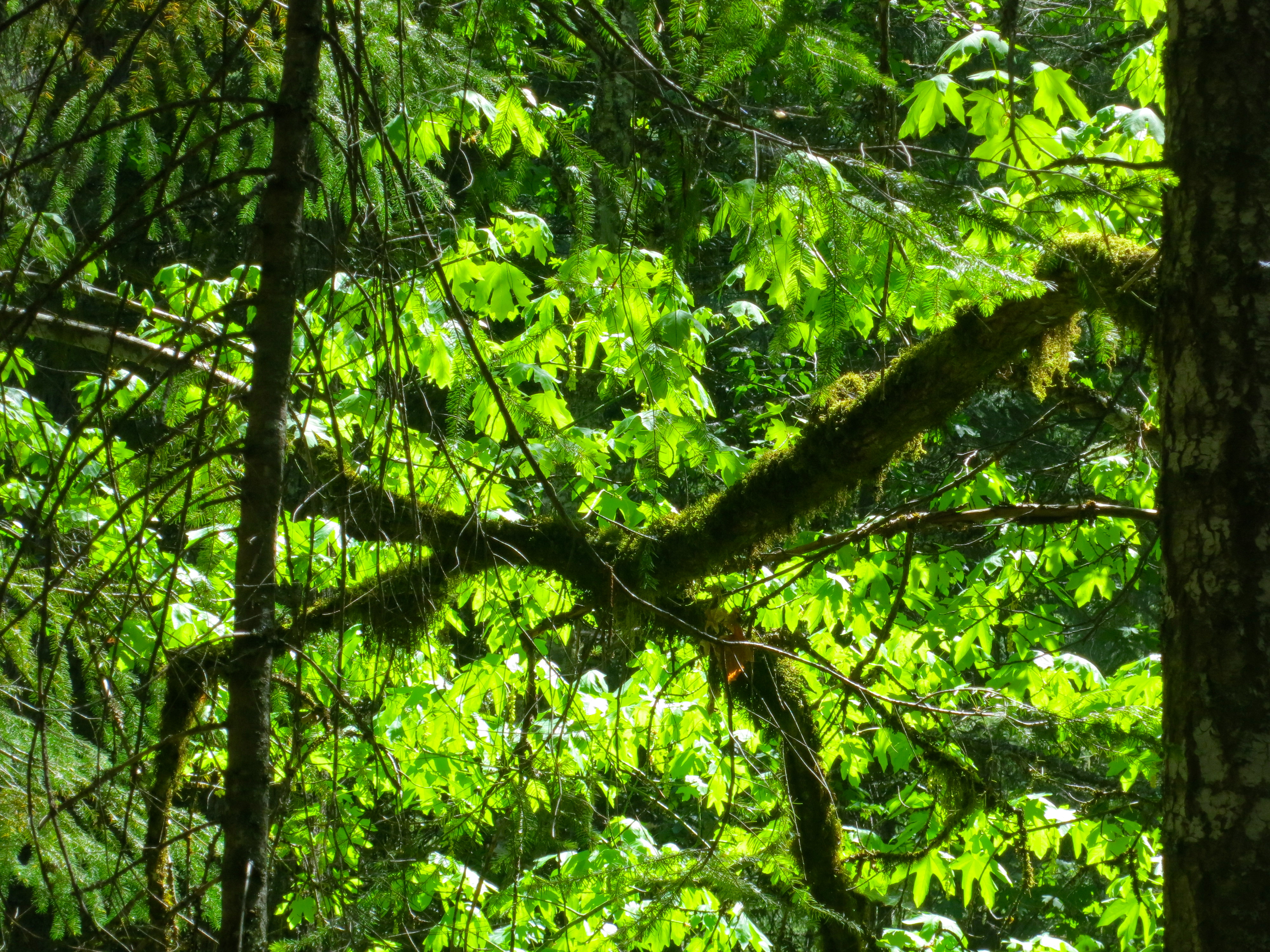
There is great beauty in the wilderness, if you are willing to slow down and look around. It ranges from expansive vistas down to plants, rocks, and wildlife.  Following are some more photos that reflect what I saw this past week. Enjoy.

Fordyce Creek was a half mile away from where I was camped and filled with snowmelt. The hiking bridge provided a way across the otherwise unfordable creek.

I captured this photo from the bridge. One of the challenges of backpacking early in the season is the amount of water flowing in the streams. Great caution is required when no bridges are available, which is usually the case in the Sierras. It is best to cross early in the morning before the sun begins to melt the snow.

The broken side-boards on the bridge made me wonder about its overall condition!

Thunderheads provided a dramatic backdrop but threatened a thunder and lightning storm. All of my gear was packed away in my tent, just in case.

These circling clouds would have made me think ‘tornado’ had I been in the Midwest or South. BTW… all I had was a few drops of rain with no thunder or lightning.

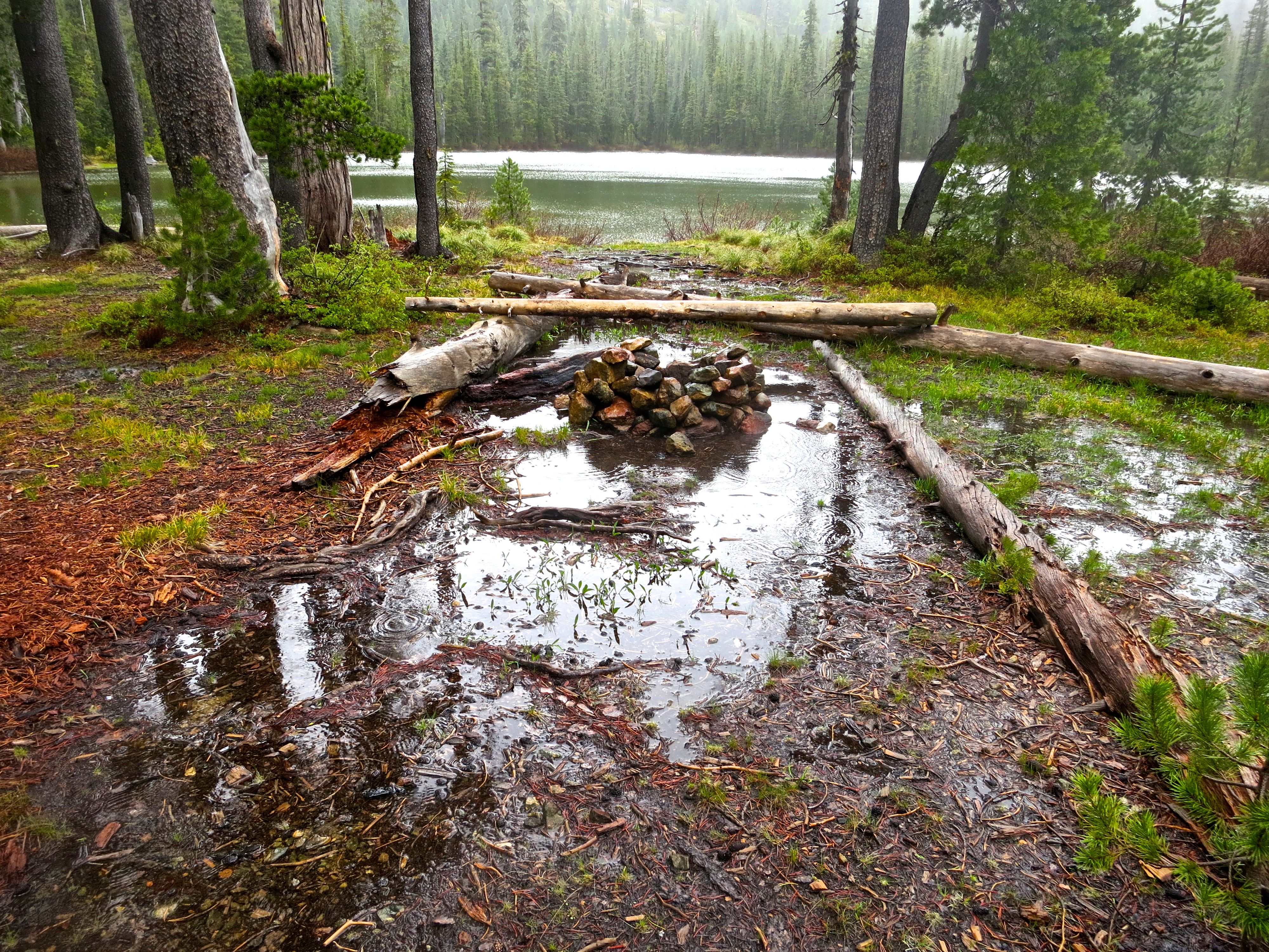
A small reflection lake was located a hundred yards from my camp. It came with its own water snake. The snake didn’t cooperate for a photo shoot, however.

I’ll close today’s post with this photo that provides a perspective on the size of the lake. Glaciers once worked their way through this portion of the Sierras, carving hundreds of such lakes from small to large.

NEXT POST: Native American rock art at Lava Beds National Monument in Northern California that dates back over 4000 years.


Into the Red Butte Wilderness… Backpacking at 71

Old Growth Cedar in Red Buttes Wilderness of Northern California and Southern Oregon.

There is much to be impressed with in the Red Buttes Wilderness, including magnificent old growth trees such as this cedar.

I know a bit about backpacking (mild understatement). A few years back, in 1974 to be exact, I was working as the Executive Director of the American Lung Association in Sacramento. The organization needed a new source of funding; I needed an excuse to play in the woods. So I combined the two. I proposed to my Board of Directors that I lead a nine-day, hundred mile backpack trip across the Sierra Nevada Mountain Range with the participants raising money to fight lung disease.

So what if my longest backpack trip ever had been 30 miles.

“You are crazy,” the board said. “You are crazy,” my friend in the backpacking industry said. It was like I had inherited a parrot.

And they were right. The only point they missed was just how crazy. Sixty-one people aged 11-71 showed up– many who had never worn a backpack in their lives. One immediately claimed she was a witch and would be over to bite me in the middle of the night. And how was I to know that my co-leader had participated in burning down a bank in Santa Barbara, or that my go-to guy in emergencies was a Columbian drug runner, or that the big fellow who got me through the toughest days was an explosive experts on the lam from the IRS. You can’t make these things up, folks! But this is a story for later this summer. It’s one you won’t want to miss.

Lets just say by the time I walked into the foothill town of Auburn, California nine days later on deeply blistered feet in 104-degree weather, I had persuaded myself that the money raised from Christmas Seals was more than adequate to support our organization, forever.

But then a strange thing happened. These people who I had almost killed and who had come close to killing me, started coming up one by one and demanding to know where we were going next year. I heard things ranging from, “This was the greatest experience in my life” to “I have lots of ideas for fundraising.” It took them several months to persuade me…

But persuade me they did. I would go on to add bike treks in Sacramento and eventually take the program nationwide where I became the national trek consultant for the American Lung Association. Millions of dollars were raised to prevent lung disease and thousands of people were introduced to long distant backpacking and bicycling as a result. More importantly, from my perspective, I got to play in the woods. For 30 years, I spent a part of each summer leading wilderness expeditions. And when I wasn’t leading treks, I was off backpacking by myself or with friends.

Founder of the American Lung Association Trek Program, Curtis Mekemson.

A much younger me gracing the front of the American Lung Association’s National Bulletin in my role as founder of ALA’s Trek Program.

Sadly, my last backpacking trip was seven years ago. Life happens, right? Peggy and I bought a small RV and decided to wander North America for three years; our kids started producing grand babies; we bought our property in Oregon and travelled to Europe and Alaska. I took up blogging and decided to write a book.

It was all good, but I missed backpacking– a lot. And there’s this thing. Our home looks out on the beautiful Red Buttes of the Siskiyou Mountains of Southern Oregon and Northern California. The mountains spoke to me, over and over and over. Finally I could no longer ignore their call. Peggy and I decided to hit the trail. So last week, we did.

Red Butte mountains of the Siskiyou Range.

The Red Butte Mountains as they appear from our house in spring through the lens of our camera. How could we not set out to explore them?

We planned a short trip: three days and 14 miles. It was to be something of a test to see how well we would do. After all, we had aged seven years. At 71, I couldn’t expect my body to behave the same way it had at 21, or 31, or 41, or 51, or 61. And even Peggy, a young woman of 64, was nervous.

I immediately pulled out maps and begin planning a route. I was like a little kid on Christmas morning (or Peggy at the chocolate store in Central Point). Had I been a dog, I would have been wagging my tail like my basset hound, Socrates, used to at the sight of a hotdog.

This forest service map shows the location of the Red Buttes Wilderness. The X marks the approximate location of our home.

This forest service map shows the location of the Red Buttes Wilderness. The X marks the approximate location of our home.

I planned out our route on a US Forest Service Topo Map. We followed the Butte Creek Trail to Azalea Lake.

I planned out our route on a US Forest Service Topo Map. We followed the Butte Creek Trail to Azalea Lake. I wrote in the small, circled numbers which I will refer back to.

A close up of the map shows the beginning of our hike. "T" marks the trailhead where we parked the truck. Topo lines reflect the steepness of the trail. The closer together, the steeper!

A close up of the map shows the beginning of our hike. “T” marks the trailhead where we parked the truck. Topo lines reflect the steepness of the trail. The closer together, the steeper! We started by hiking down into the canyon following the well switch backed trail. Down in the beginning, meant up in the ending. (grin)

Next came the gear. It was hiding out on shelves, in drawers, and long ago packed boxes. Would my MSR white gas stove still cook? Would the Katadyn Filter still pump safe water? And possibly even more important, would our Therm-A-Rest air mattresses still be filled with air in the morning? When you are disappearing into the backcountry, you can’t be too careful.

Here's my gear and backpack. The larger bags are tent, sleeping bag and pad, food, and clothes. Smaller bags are organized according to function: kitchen, bathroom, first aid, etc.

Here’s my gear and backpack. The larger bags are tent, sleeping bag and pad, food, and clothes. Smaller bags are organized according to function: kitchen, bathroom, first aid, etc. Total weight with food, fuel and water: 35 pounds.

Go light is the mantra of anyone who carries his house on his back. Fortunately, the backpacking industry is constantly developing lighter equipment, such as this fully functional folding bucket.

Go light is the mantra of anyone who carries his house on his back. Fortunately, the backpacking industry is constantly developing lighter equipment, such as this fully functional folding bucket.

There was the inevitable last-minute trip to REI. And Peggy and I even drove up to check out the trailhead on Mother’s Day. (Now, before all of you moms get excited, she got breakfast in bed first and we took a picnic lunch that we ate on a grassy knoll with a grand view. Peggy even managed to spot a hungry mountain lion disappearing into the forest. Maybe it was coming to join us for lunch. What more could a mom ask for?)

Peggy enjoying her Mother's Day Picnic. We saw the mountain lion a couple of hundred yards down the road on our way out.

Peggy enjoying her Mother’s Day Picnic. We saw the mountain lion a couple of hundred yards down the road on our way out.

And how was the trip? Forget for the moment that it was cold and rained much of the time. Forget that we were dead tired and went to bed at 7:00 PM. Forget that the trail came close to disappearing in the brush and we spent a fair amount of energy crawling over and around downed trees that blocked the trail. And forget about the noise we heard in the middle of the night that sounded like Bigfoot pounding on a tree trunk with a large limb. And why should you forget? I just got out my thesaurus. The trip was wonderful, beautiful, invigorating, marvelous, educational, and stunning. We laughed our way through the whole adventure.

I’ll let our photos tell the story.

Butte Creek trail in the Red Butte Wilderness.

After following switch backs down the dry mountain side, we came upon the verdant canyon of the Butte Fork of the Applegate River with its almost rainforest feel. (This and the following three photos are located near #1 on the map.)

Butte Creek trail in the Red Buttes Wilderness.

In 2012 the Ft. Goff fire had swept through the area. While the forest was relatively unharmed, some large trees had fallen across the trail and since been cleared to make way for hikers.

Smokey the Bear tree in the Red Buttes Wilderness.

We loved this tree poking its limb up in the middle of the fire area. Peggy at first saw a unicorn but I saw Smokey the Bear… reminding people to be careful with fire.

Horsetail fern growing in the Red Butte Wilderness.

We found this horse-tail fern growing in the canyon. Pioneers reputedly used this plant for scrubbing out pans.

CCC Cabin in the Red Buttes Wilderness area of Northern California and Southern Oregon.

An old cabin made out of red cedar shakes was built by the Civilian Conservation Corps in the 30s and then used by the forest service for storing fire fighting tools. (Located at #2 on the map.)

Roof of cedar shake cabin in Red Butte Wilderness area.

The hand-hewn cedar shake roof.

Chinquapin forest in Red Butte Wilderness.

Not far above the cabin, we came across a chinquapin forest. I had seen chinquapin bushes but never trees.

Chinquapin nuts, encased in these spine covered shells, are apparently quite tasty.

Chinquapin nuts, encased in these spine covered outer shells, are apparently quite tasty.

Flowering dogwood in the Red Butte Wilderness.

The trail at this elevation also featured beautiful flowering dogwood.

Peggy Mekemson hikes along the Butte Fork Trail through the Red Buttes Wilderness of Northern California.

Here, Peggy poses under a bower of it. I was going to point out that her pack weighed 32.5 pounds. She quickly corrected me. It was 32.8 pounds.

Small creek in Red Butte Wilderness area.

We had been hiking across dry slopes for quite some time. It was getting late, we were tired, and I was beginning to feel a bit of a grump coming on when we heard this creek. “I hear camp,” I told Peggy. (#3 on the map)

Camping out in the Red Buttes Wilderness.

There was barely room for our small North Face tent. But it was home. (Shortly after this photo it started raining.)

Old growth forest in the Red Buttes Wilderness.

This was our view looking up from our campsite. The Red Butte Wilderness includes some of the most impressive old growth forest I have ever seen including pine, fir and cedar trees.

Massive sugar pine tree in the Red Buttes Wilderness.

Peggy caught me standing next to one of the massive sugar pines. (Photo By Peggy Mekemson.)

Gravesite in Red Butte Wilderness.

This beautiful mound of rocks is found on my map at # 4. It’s a grave for three people buried here by family members after their plane crashed on July 28, 1945.

Burial site of airplane crash victims in Red Butte Wilderness.

The grave marker shows that Sylvan Gosliner, Ruby May Gosliner and Alma Virgie Pratt are buried here. Remnants of the plane can still be found in the canyon below.

Tree torn apart for bugs in Red Butte Wilderness.

Someone had a grand time ripping this rotting tree apart for it bugs. Was it a bear? Or how about Bigfoot? We found a large pile of scat (poop) nearby.

Cedar Grove in the Red Buttes Wilderness.

Cedar Grove is aptly named for its magnificent cedars. (Found at #5 on the map.)

Corn Lilies in red Butte Wilderness.

We also found corn lilies growing nearby in a meadow where the Goff Trail joins the Butte Fork Trail.

Trillium growing in Red Buttes Wilderness.

As we did this trillium.

Tree blaze carved into a cedar tree in the Red Buttes Wilderness.

Ever hear the phrase, “Where in the blazes are we?” Foresters, cowboys and other outdoors people used to mark their trails by cutting out this symbol in a tree, which is known as a blaze. I’ve followed them through forests from Maine to Alaska, often over trails that have long since grown over.

Curt Mekemson backpacking in the Red Butte Wilderness.

It was a tad wet in the cedars, as this photo by Peggy demonstrates.  The bottle on the left is filled with wine, BTW. It helps assure that Peggy will follow me up the mountain. (grin)

Peggy Mekemson stands on trail in Red Buttes Wilderness.

The trail between the cedars and Lake Azalea almost disappeared on one occasion. Peggy is standing on it.

Azalea Lake in Red Buttes Wilderness.

We finally reached Azalea Lake. Have I mentioned it was wet out?

Curtis Mekemson camping in the Red Buttes Wilderness.

We found a drier, more protected camp farther away from the lake and settled in. I’ve carried the coffee cup backpacking for 45 years. Once it spent the winter buried under 20 feet of snow. (Photo by Peggy Mekemson.)

Azalea Lake in the Red Buttes Wilderness.

The sun rewarded our trip the next morning by providing a lovely view of Lake Azalea. It was time to pack up and head back for civilization.

Curtis and Peggy Mekemson in Red Buttes Wilderness.

Selfie of two happy campers at trails end who have seen some beautiful country and proven to themselves that they can still put on backpacks and disappear into the wilderness.