Growl! Mmmm. Me Like Carpenter Ants… Bears along the PCT in Mt. Lassen National Park

Peggy was lucky to be on the scene when a large sow tore apart a log searching for carpenter ants in Mt. Lassen National Park. Claws firmly sunk into the rotting log, she used her weight to rip help open the dead tree. (Photo by Peggy Mekemson.)

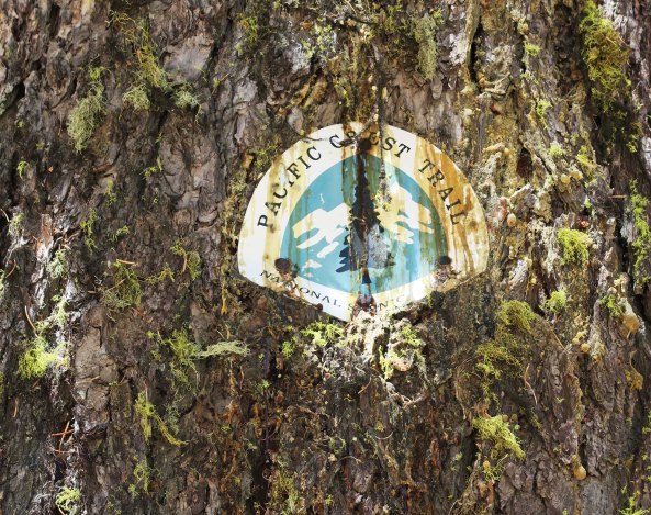
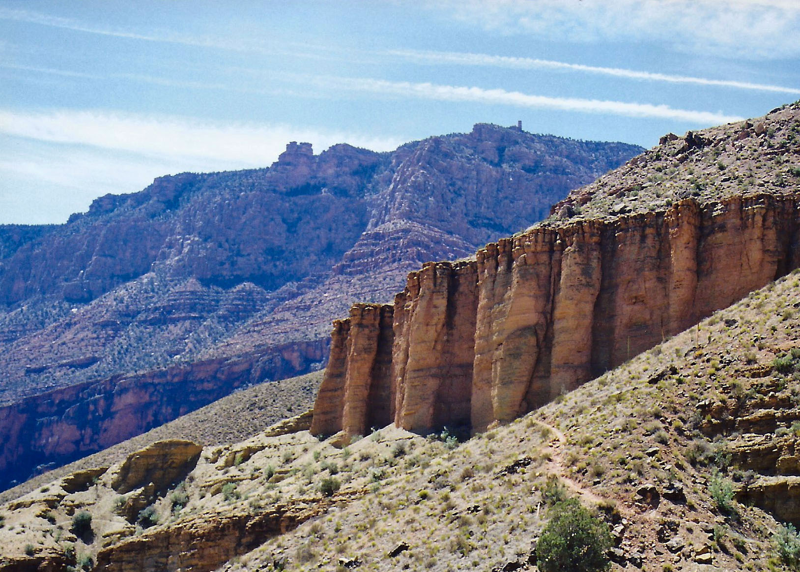
I began seeing a lot of bear sign as I hiked along the Pacific Crest Trail through Mt. Lassen National Park. There were the usual large piles of poop and trees had the tell-tale claw marks of bears chatting with other bears. The trees also provided bears with a great back rub. The effort helps remove winter coats and I’m pretty sure feels as good as it does to us when we get out back rubbed or scratched. It also provides the opportunity to leave a scent mark behind, a sort of personal wilderness want ad. “Large male seeks one night stand with attractive female. Don’t expect me to stick around and help raise the kids. In fact, I might eat them.” Doesn’t seem like the ideal qualities you would want in a mate, but it seems to work.

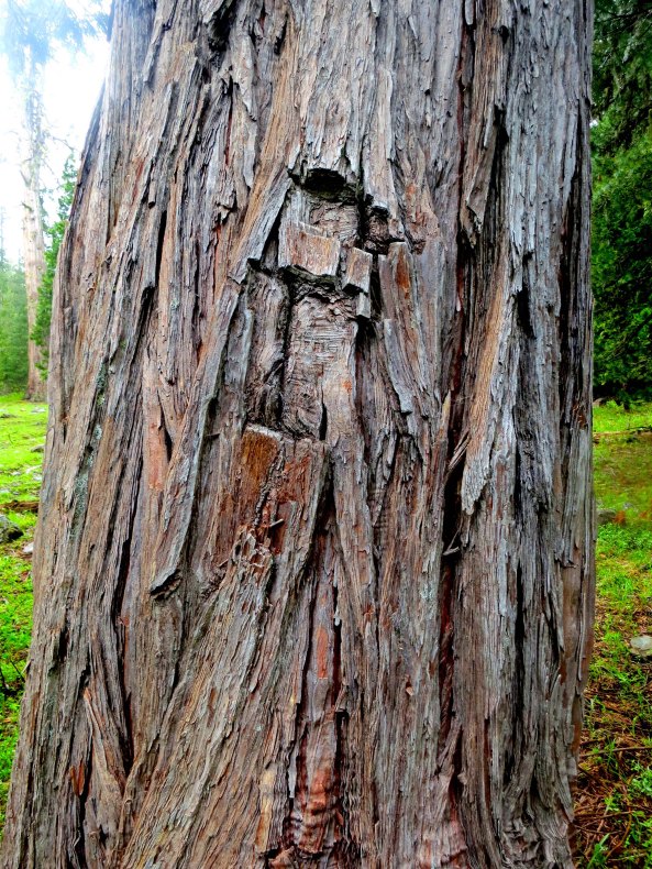
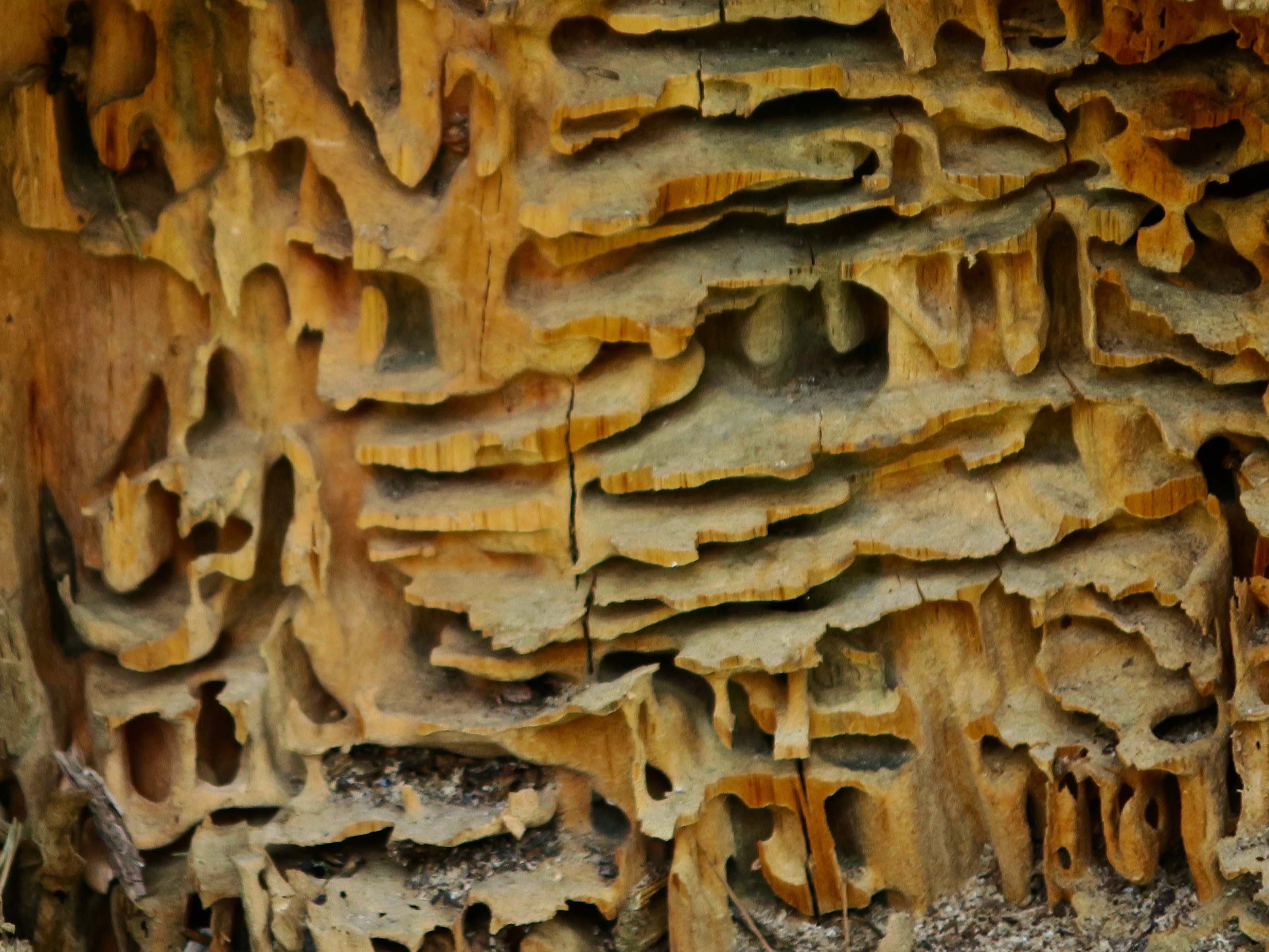
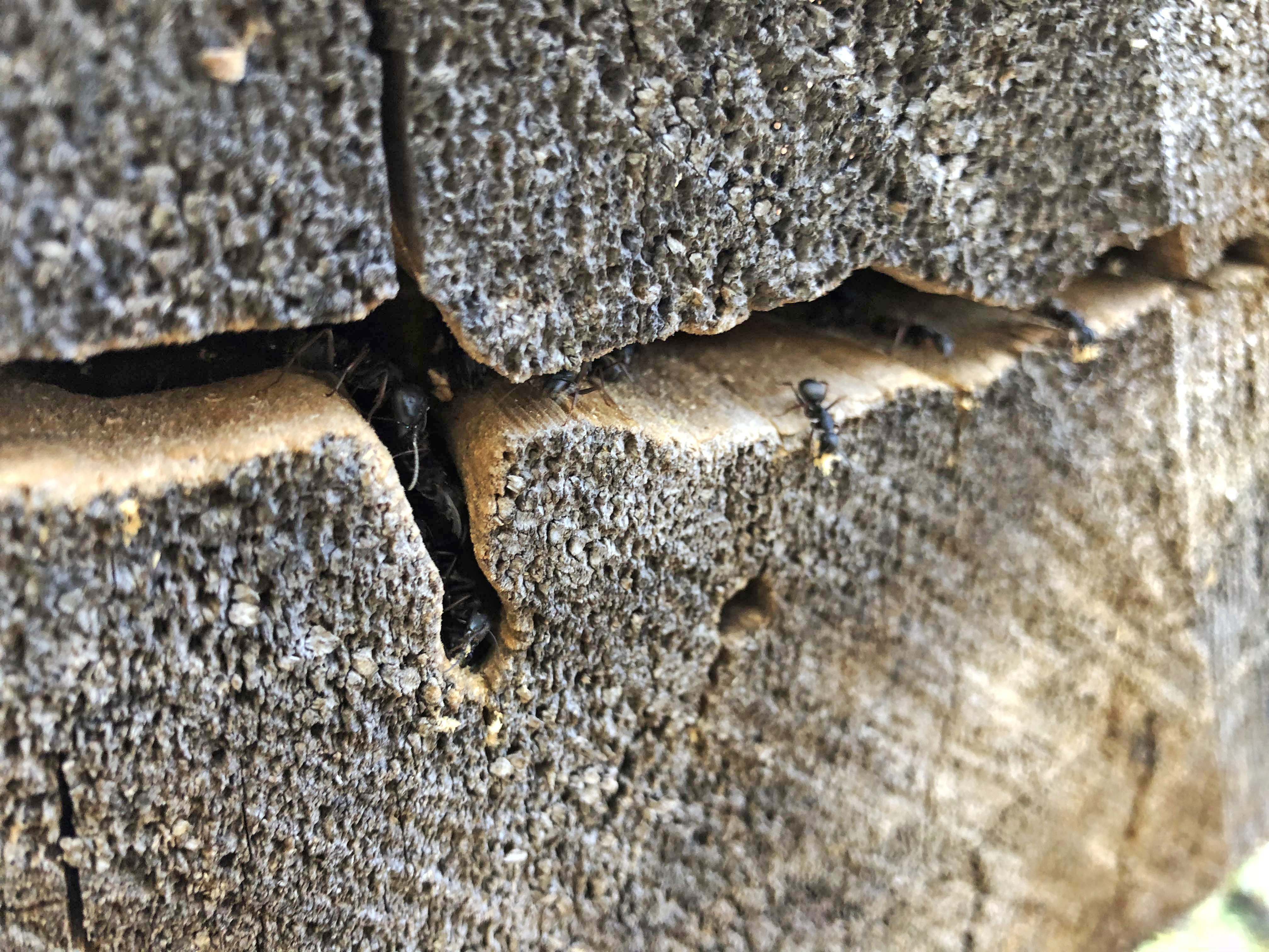
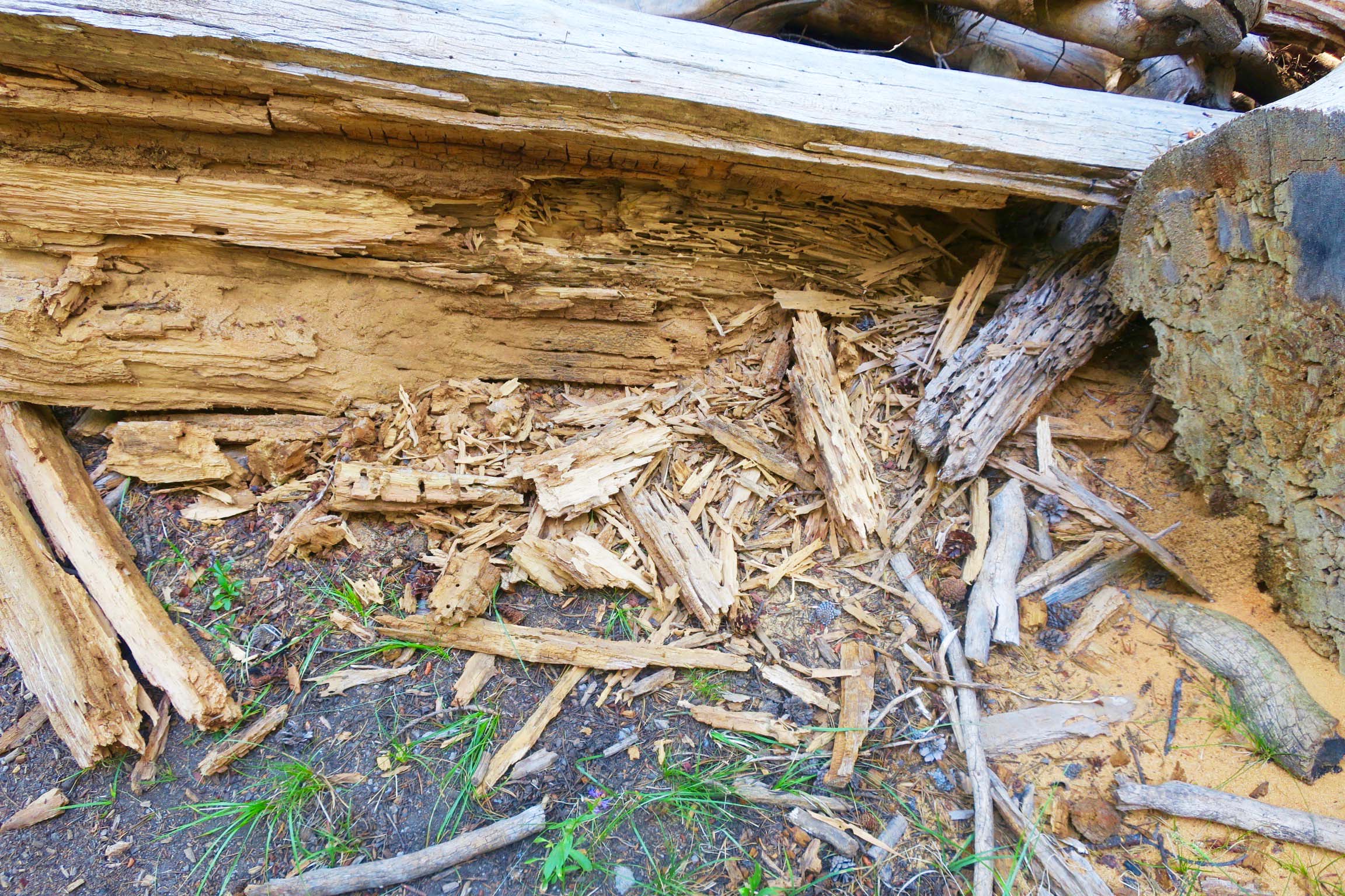
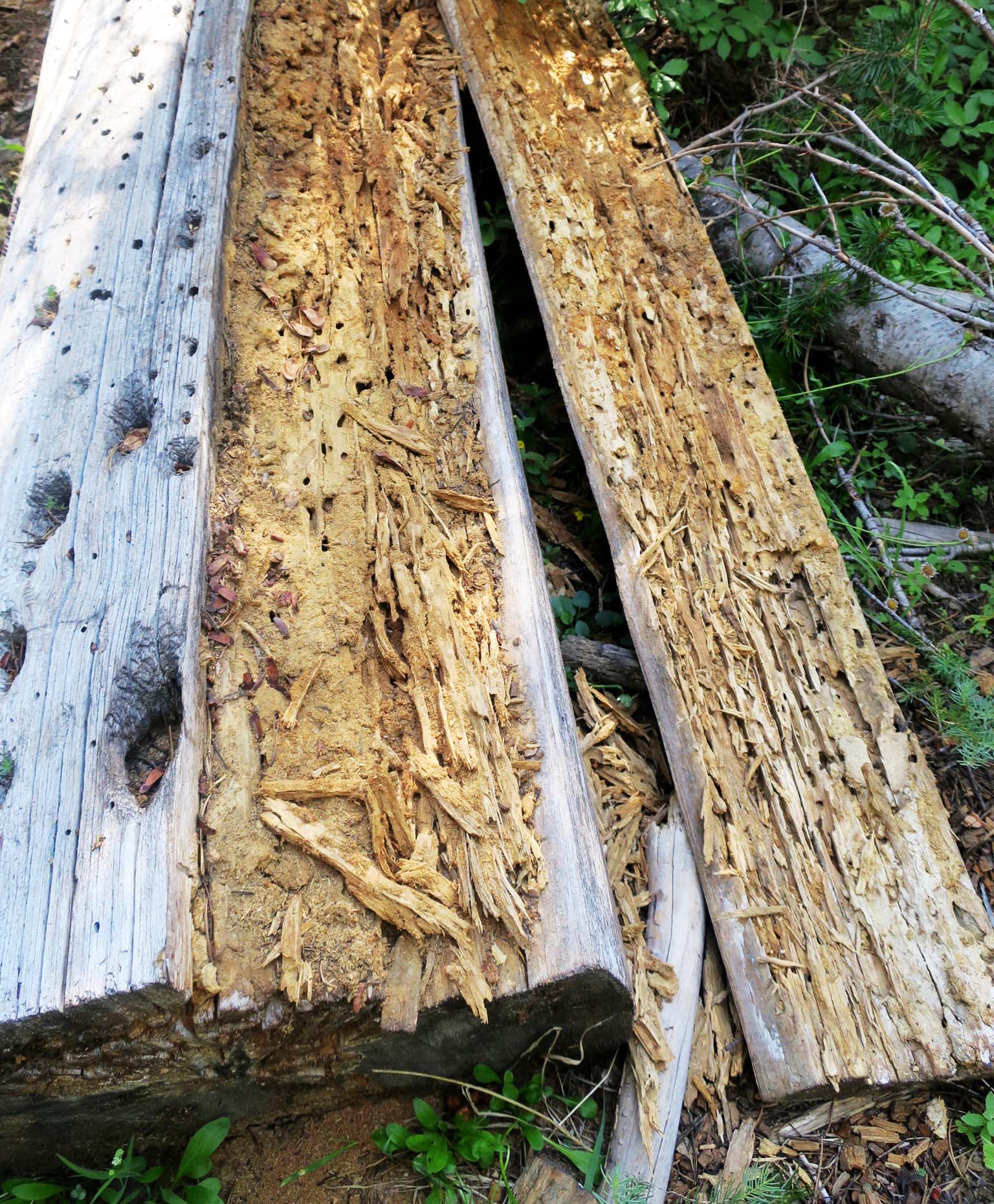
I also found a number of rotting logs torn apart along the trail. Black bears have a real taste for carpenter ants. “Sweet meat,” like my students of long ago in West Africa used to say about termites. And maybe carpenter ants are sweet. While they are known for tunneling through wood with all the enthusiasm of a chainsaw, they don’t actually eat the wood. They are dairy farmers. They raise and milk aphids for the sugary honey-dew they secrete by stroking them with their antennae.  “Come on sweetie, give it up.” Naturally they eat other things, like dead insects. They will surround the bug, suck out its juices and then return to their nest with full tummies to share. I read that they sometimes carry the head with them. (I can see them marching in and placing it at the feet of the queen. I wonder if they have a trophy room.) Like other ants, they inevitably find the shortest path back to their nest and mark the path with pheromones which other ants can follow. Big bugs can attract lots of ants, which means more pheromones, which means more ants. It can become quite the mob scene.

Carpenter ants build amazing labyrinths in dead trees. (Or possibly your house.) If I had to build a maze, I think I would hire these guys to plan it out.
They don’t eat the wood, however. They carefully dump it outside as the ant on the right is doing. More ants can be seen in the crevice to the left and right of the ant. (My nephew Jay Dallen took this photo on his iPhone when we were hiking from Etna Summit to Castle Crags.)
I found this log torn apart by a bear as I hiked down the PCT through Mt. Lassen National Park. Off to the right you can see a pile of sawdust that the ants have deposited. Normally a pile of sawdust like this would suggest that somebody has been working with a saw. 
Here’s another log I found along the trail that had been opened up by a bear. These guys go after a log like a six-year-old goes after a Christmas present.

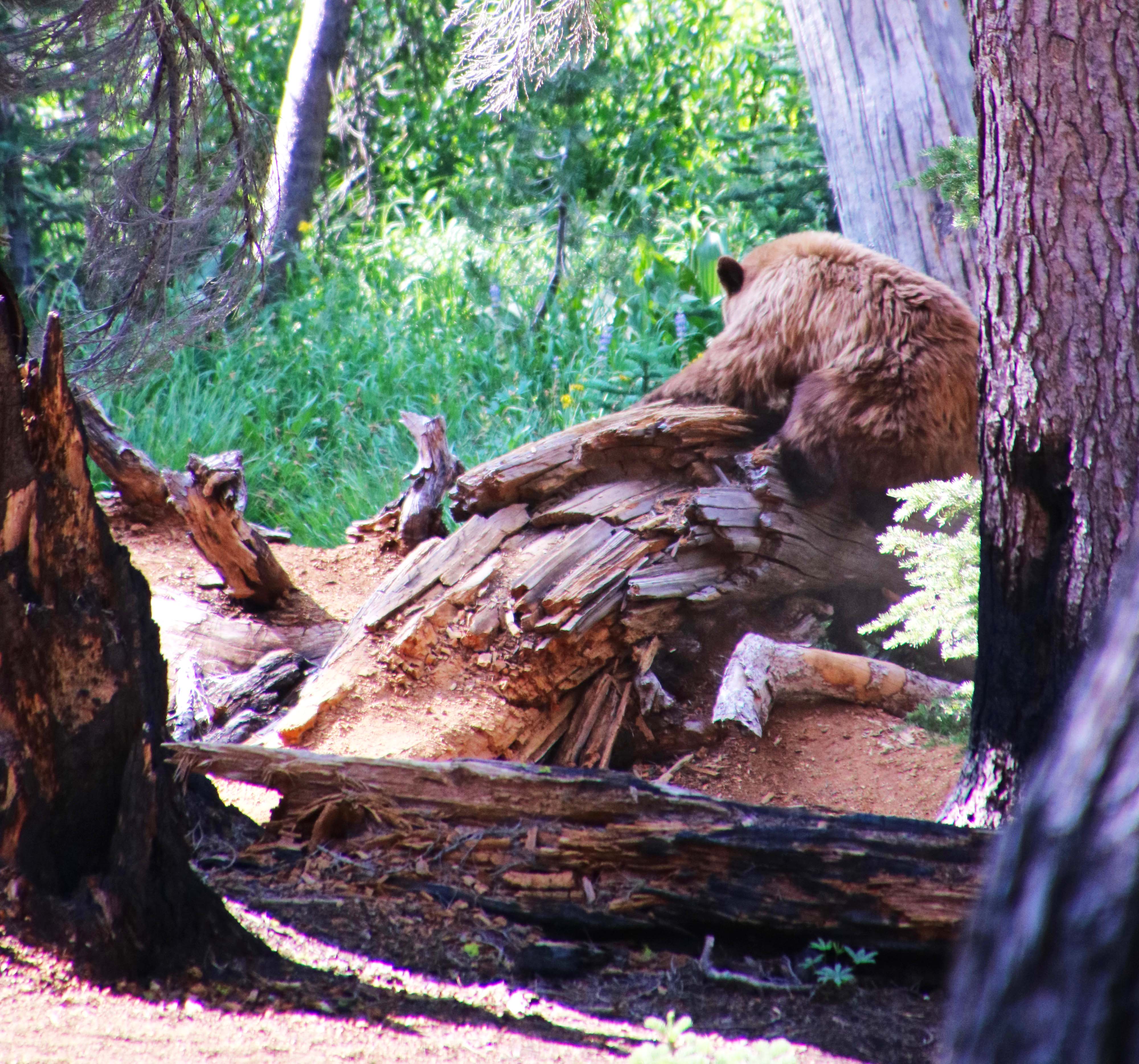
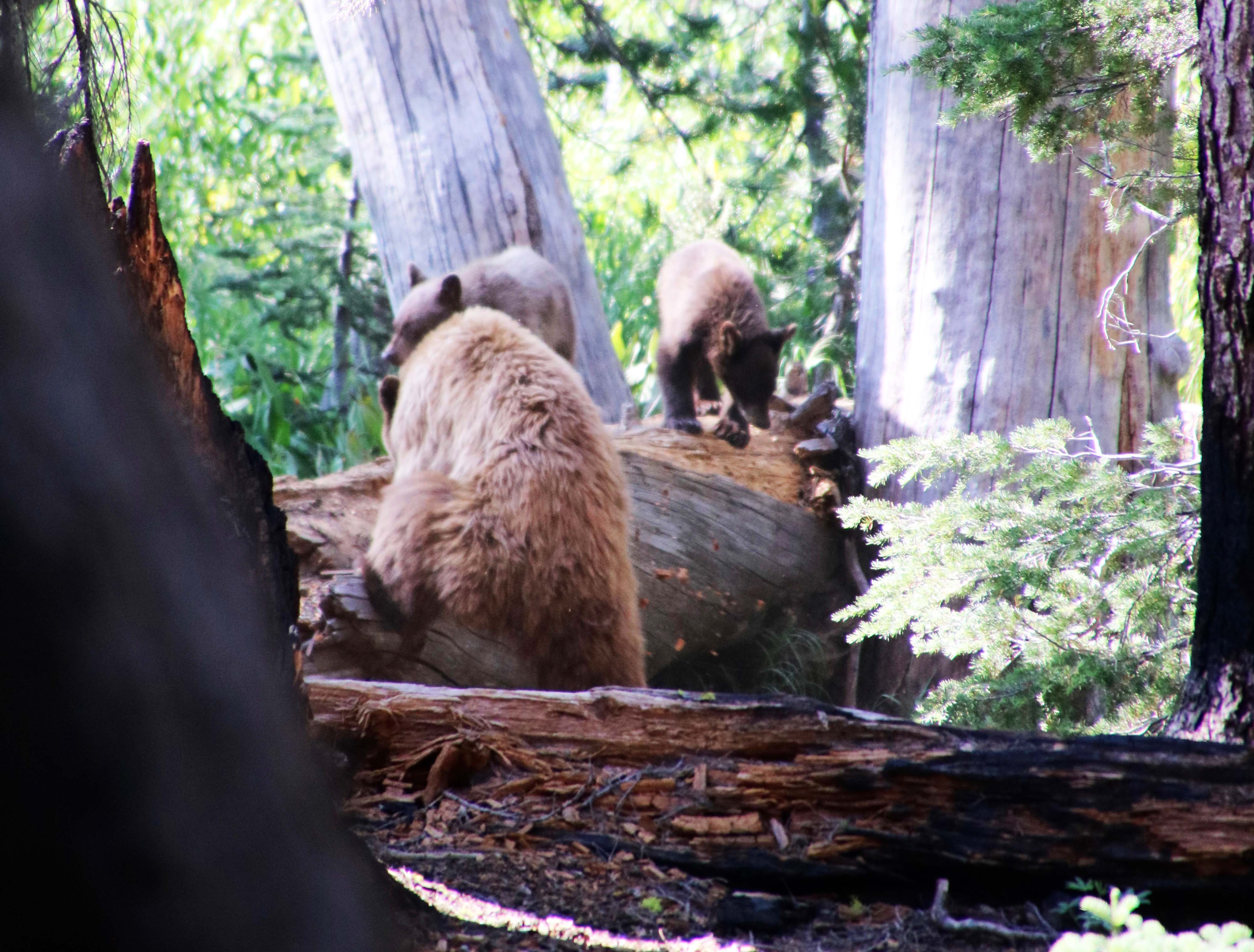
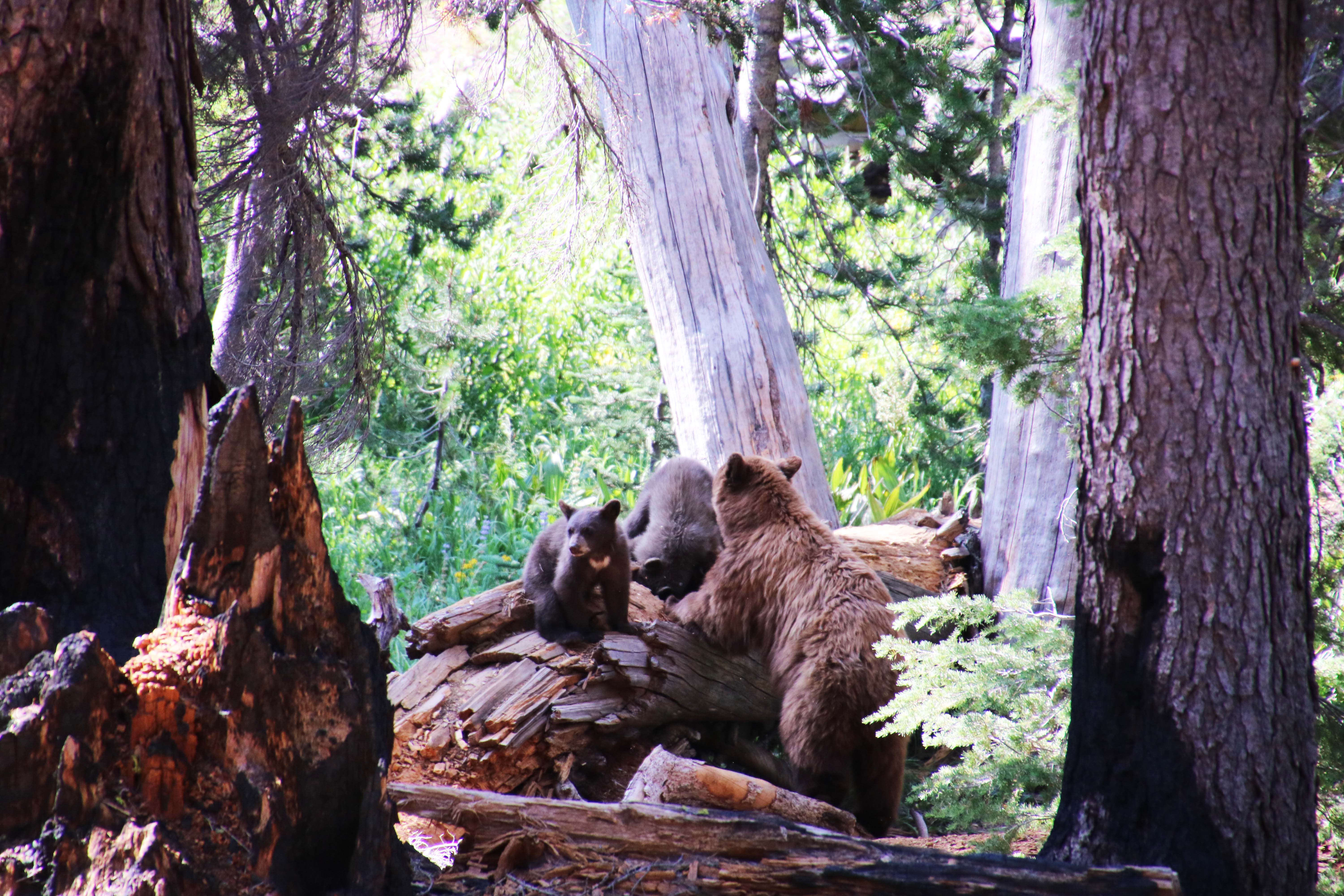
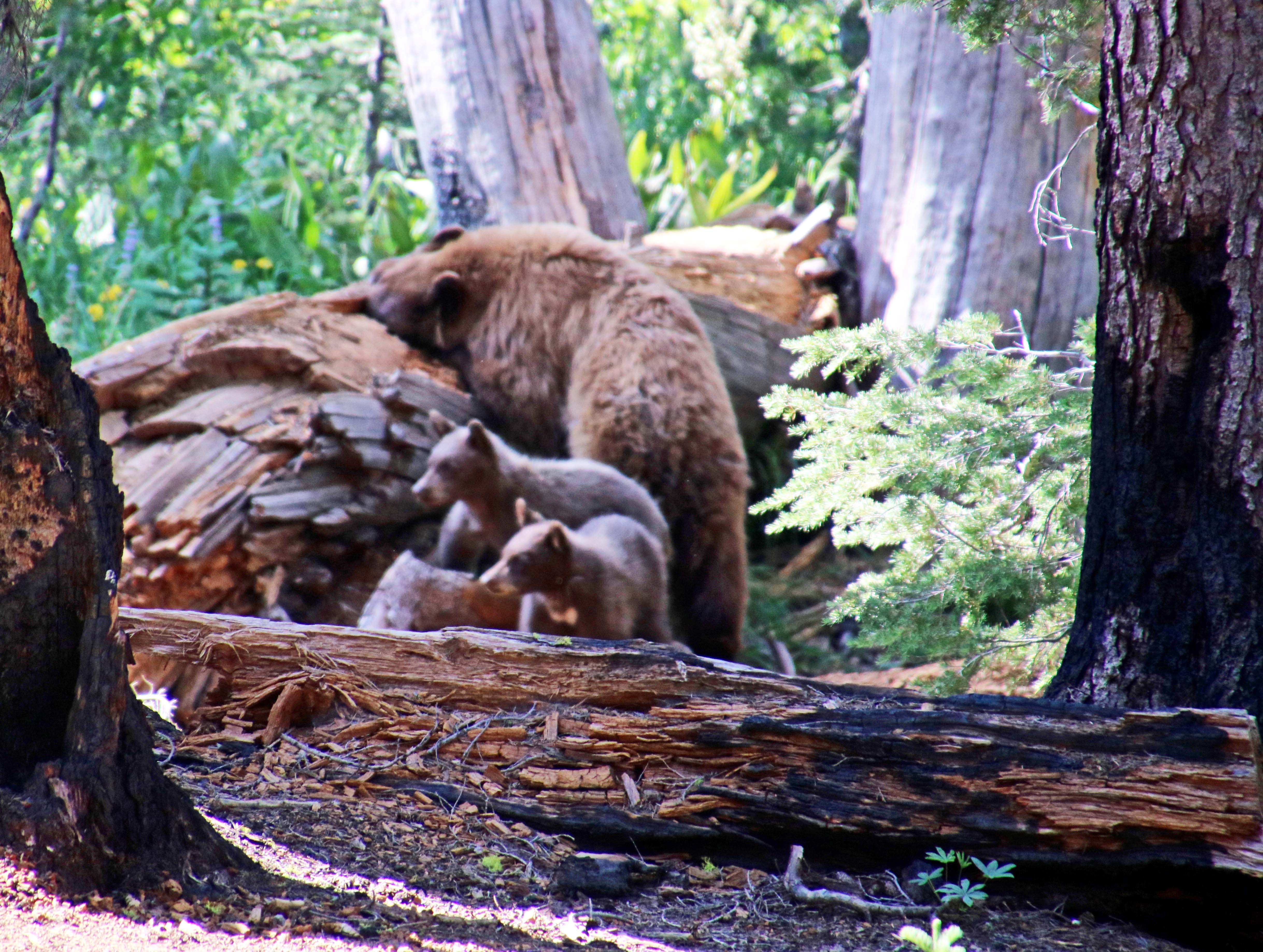
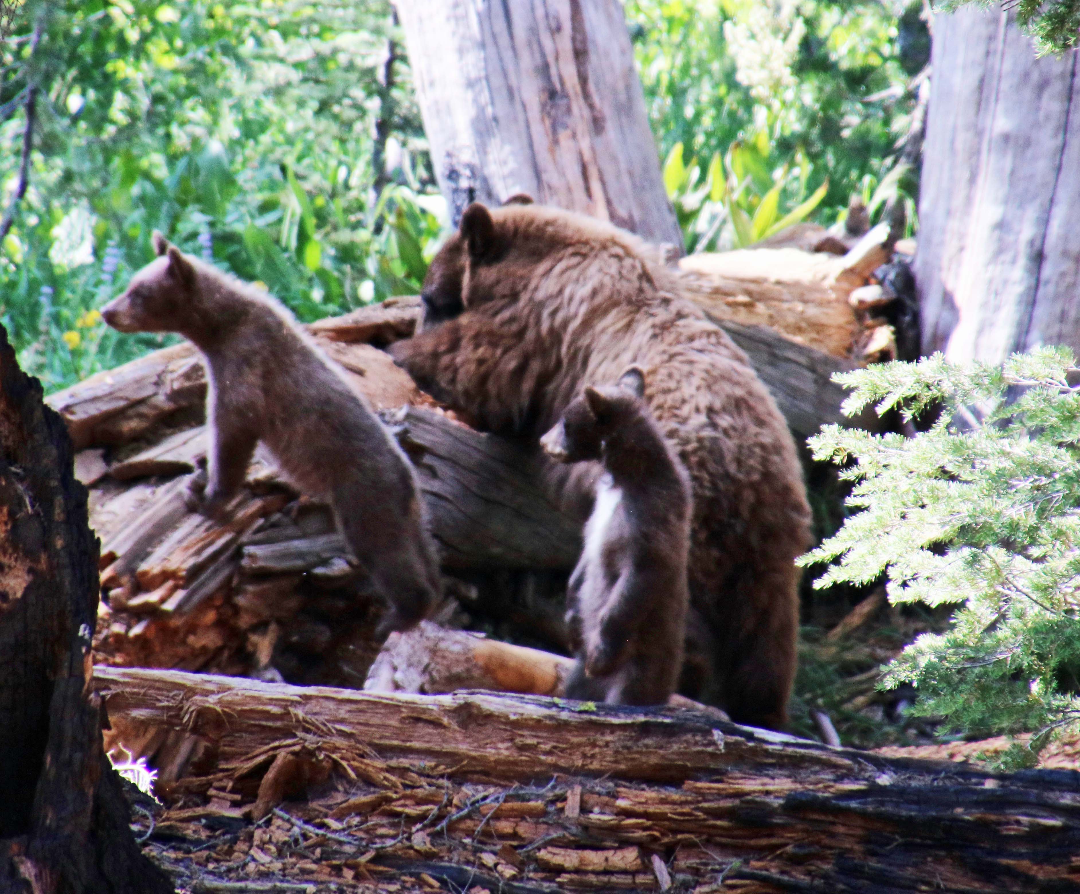
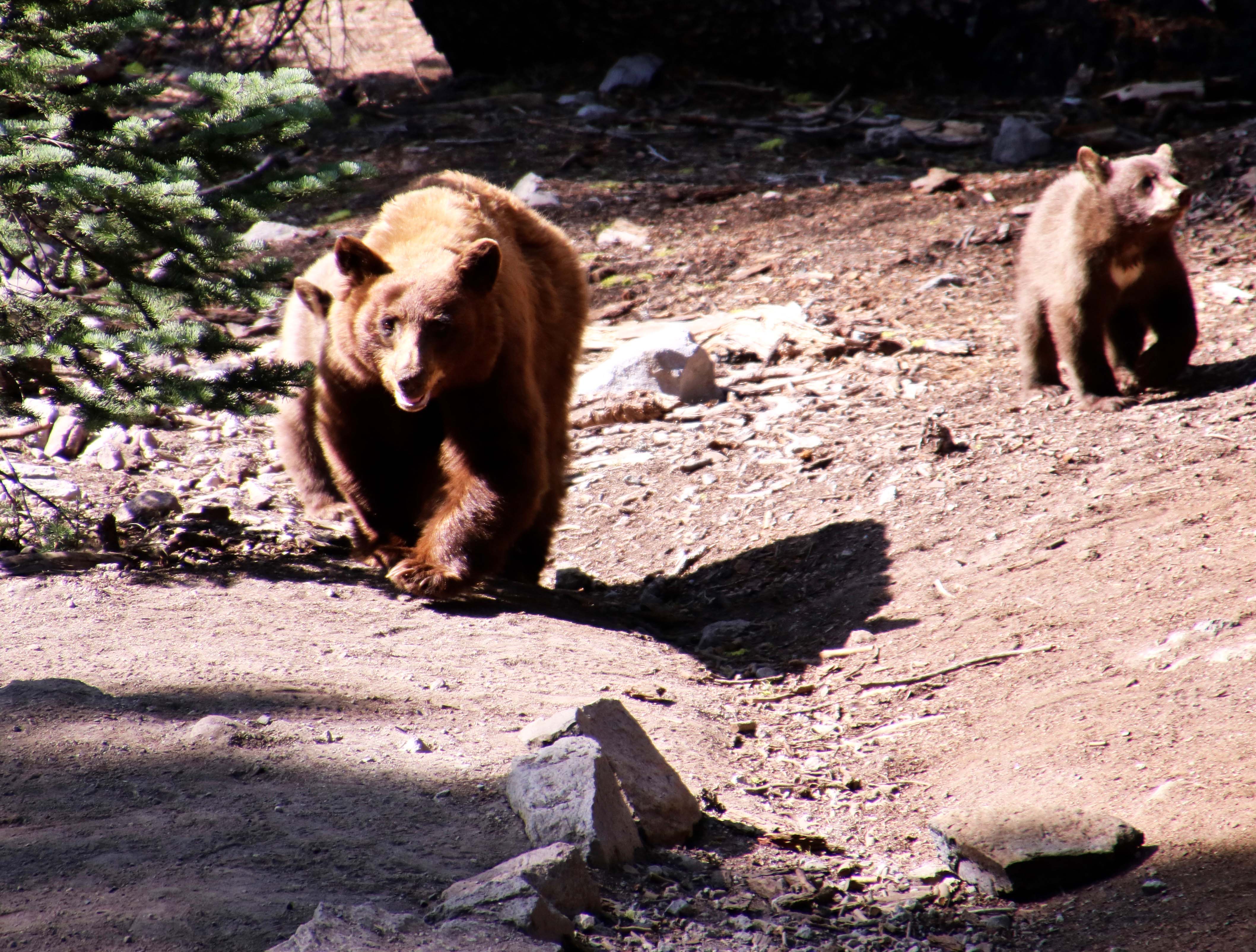
But back to the bears. I dearly wanted to see a bear tearing into a carpenter ant nest.  I didn’t even see a bear. Peggy who was driving around the park and checking out hiking trails while I was making my way along the PCT, had much more luck. She not only saw a mom and her cubs, she saw them ripping into a carpenter ant nest and took photos. When the bear and her cubs finished their meal, and started walking toward her, she made a rapid retreat to our small RV! Smart woman.

When mom had finished tearing open the log, she was joined by her two cubs. (Photo by Peggy Mekemson.)
One of the cubs snacked on a few ants while mom patiently watched. (Photo by Peggy Mekemson.)
They then let mom have her fill. (Photo by Peggy Mekemson.)
It even appeared that they were standing guard. (Photo by Peggy Mekemson.)
They finished their feast and then started walking toward where Peggy was taking photographs. She decided it was time to get back in the van! (Quick photo by Peggy Mekemson.)

When it comes to food, a black bear is an Omnivore’s omnivore,an opportunistic eater that consumes everything from insects to plants to carrion to any fresh meat it catches— although the latter rarely includes humans. As one of my trekking friends used to say, “If bears wanted to eat people, they’d move into towns where there are lots of people to eat.”  Bears, like other members of the animal kingdom, have learned that puny humans are nasty animals with a penchant for killing; they are best to be avoided. They have developed a taste for human food, however. Trash cans are a frequent target. We know. Our property in Southern Oregon backs up to a million acres of national forest. There are lots of bears. Once, one attacked the heavy Weber grill that lives on our back porch and turned it over.  As it came crashing down, my daughter, who was sleeping in the bedroom next to the porch, screamed,“Curtis!” It’s an appeal for help I’d heard before. Bears are also fond of backpacker’s food.

They would occasionally drop by our camp for a bite when I was leading hundred-mile backpack trips up and down the Sierra’s in the 70s, 80s and 90s, especially when I was any where in the vicinity of Yosemite. It wasn’t unusual for a trekker to yell my name on his or her first sighting of a bear up close. I spent a lot of time teaching people how to chase bears out of camp and hang their food in trees so the bears wouldn’t get it. We weren’t always successful.  The food bag is supposed to be at least 12 feet up in the air and 9 feet out from the tree hanging from a limb that is just large enough to hold your food. Otherwise, Mom might send her kids up to crawl out the limb and chew through the rope. One food bag is counterbalanced with another food bag and no ropes are left dangling. Bears are smart and I am convinced that they have a university near Yosemite where they teach their cubs how to outsmart backpackers.

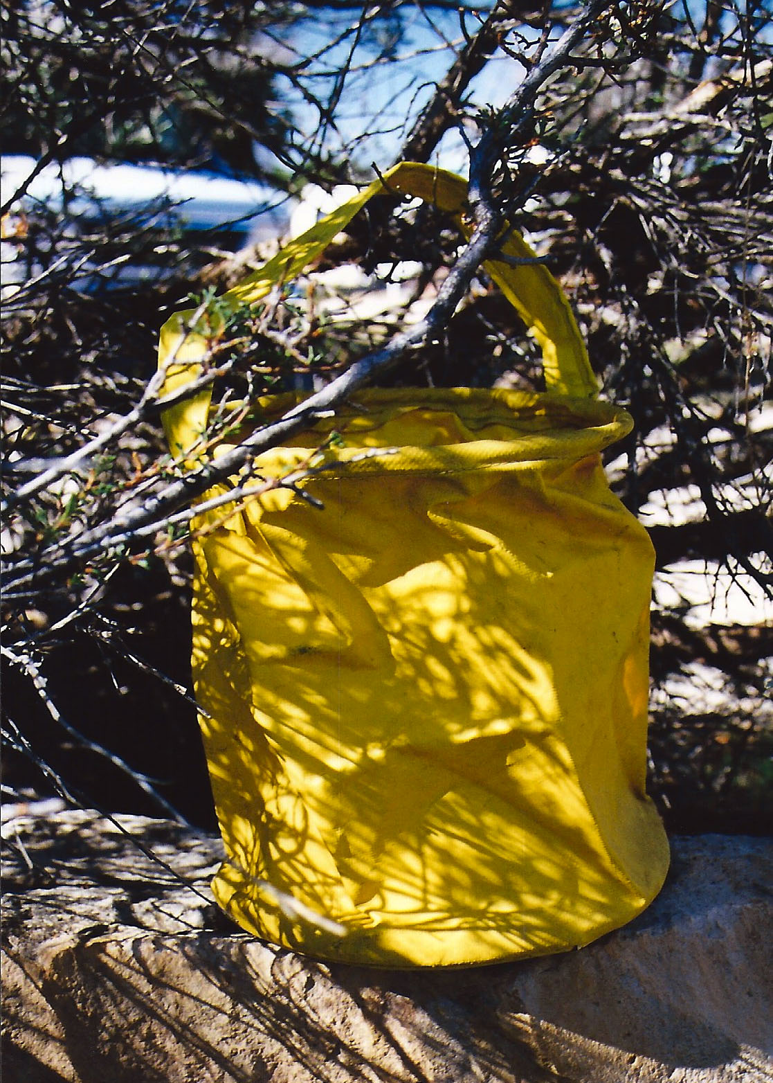
Today, there are bear canisters that are made of heavy duty plastic or carbon that are theoretically bear proof. They are tested by filling them with strong smelling goodies and tossing them into the cage of a hungry bear that has developed a taste for backpacking food. If the canister survives for an hour, it is given the seal of approval. Now days, when you backpack through Yosemite National Park or down the John Muir Trail, you are required to carry one. Just recently, the same policy was adopted for Mt. Lassen National Park. So, I was carrying one.

The good news about canisters is that they work. Bears are broken of the habit of eating backpackers’ food and go back to eating much healthier food, like maggots and ants. Backpackers are given the peace of mind of knowing that they will be able to make breakfast, lunch and dinner the next day. The bad news is that the canisters are heavy and awkward. They add two to four pounds of weight and are hard to fit into a pack along with other essential equipment. While the folks in charge of protecting our wildlands and their inhabitants would like to see backpackers use canisters all the time, it won’t happen until these problems are addressed.

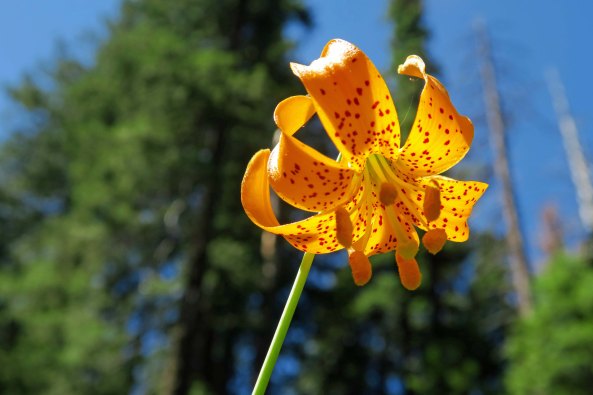
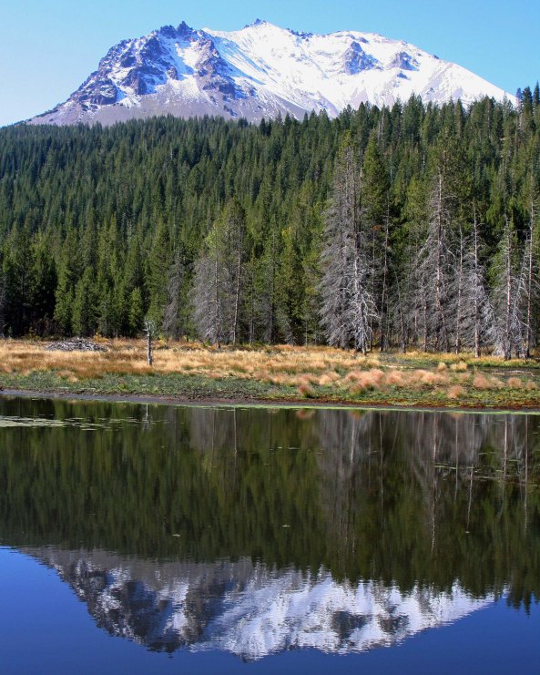
NEXT POST on hiking the Pacific Crest Trail through Mt. Lassen National Park: When the mountain blew its top, there is more to manzanita than scary roots, and a gorgeous lake struts its stuff.

The First 500 Miles on My Thousand Mile Backpack Trek: Mt. Ashland to Lake Tahoe

I should see the striking Mt. Shasta several times as I make my way through the Siskiyou’s, Marble Mountains and Trinity Alps— and quite likely after I cross Interstate 5.  Mt. Shasta is part of the volcanic Cascade Range that stretches up to Canada.


It’s time to get down to the nitty-gritty planning of my thousand mile trek from Mt. Ashland in Southern Oregon to Mt. Whitney in California. I’ve been poring over maps, thinking about distances and planning out resupply points. I love maps, so this is a fun activity for me. I think I am being realistic, but you never know. Most through hikers (as people who hike the whole PCT are called) can average around 20-25 miles per day. Maybe even more. That’s a marathon per day! But the 75-year-olds out there are few and far between. I am planning on 12-13. If I can do more, great.

Today, I am going to share the first half of my route, approximately 500 miles, beginning at Mt. Ashland and ending north of Lake Tahoe. While I have backpacked in the Marble Mountains, Trinity Alps, and Lassen National Park, it is the area I am least familiar with. Once you hit Interstate 80 southward to Mt. Whitney, the second half of my journey, you are in my ‘old stomping grounds,’ so to speak. I’ve hiked through this country many times over the years. Below is a map of the first half of the trail.

This map of the PCT traces my route from Mt. Ashland to Lake Tahoe. While not as clear as I would like, it provides a good overview. Peggy and I live just north of the trail where it snakes its way along the California/Oregon border. Our property backs up to national forest land.

The Sierra Nevada Mountains provide some of the most beautiful hiking in the world. They are John Muir’s Range of Light. The northern part of my journey lacks the drama of the Sierra’s, but there is still considerable beauty in the Siskiyou’s, Marble Mountains and Trinity Alps. Once I cross Interstate 5, I have Burney Falls and Lassen National Park to look forward to. Here are a few photos I have taken over the years to whet your appetite for what is coming.

Another view of Mt. Shasta.

The PCT works around the edge of the Red Buttes Wilderness where Peggy and I have been backpacking the last few years. This small lake is in the wilderness.

As are a number of giant trees such as this sugar pine Peggy is standing next to.

And this large red cedar.

Last year Peggy and I followed what is known as the Cook and Green Trail up to the PCT. We camped under this canopy of trees.

We found three through hikers on the pass. They were quite excited to be nearing the Oregon Border after their long sojourn from the Mexican Border. Most through hikers travel south to north.

We also found a PCT trail marker. They will serve as my guide on the trek.

The trail is well-marked for the most part. Where it isn’t, I’ll be using other guides, like maps and tree blazes.

The Marble’s and the Trinity Alps have numerous pristine lakes such as this.

And mountains. These are part of the Trinity Alps.

There are cascading waterfalls…

And large and small streams to cross— always a challenge for backpackers…

There are lovely flowers to admire, such as this Tiger Lily.

And possibly bears. This tree has been well-marked by bear claws! Peggy and I were in the Marble Mountains a few years back celebrating her birthday with a small cake I had brought along when a bear decided to drop in. Peggy told it in no uncertain terms that it was not invited to the party! Rather than face such a formidable opponent, it remembered some ants it wanted to eat.

Ponderosa Pine tree and Burney Falls in Northern California.

Once across I-5 , I will travel 83 miles to reach Burney Falls. In this photo, a lone Ponderosa Pine grows between the two channels.

Water comes out from layers of rocks as well as over the top at Burney Falls.

The water shooting out from the rocks provides an almost etherial quality to the falls. Peggy will meet me at the falls with resupply. Basically, she will be catching up with me once a week and I will have a layover day to feast, shower, and hopefully put up a post on my previous 6-8 days.

Burney Falls in Northern California. Photo by Curtis Mekemson.

A final view of the falls.

Another week down the trail should bring me to Lassen National Park, one of two parks I will be hiking through. The other is Yosemite. Mt. Lassen looms above the meadow. I’ve climbed to the top of both Lassen and Shasta.

I thought this reflection shot of the mountain was fun.

And this one.

I’ll close today with this view of a stream winding its way through a park meadow.

Next Tuesday, I will take you through the second half of my journey from Lake Tahoe to Mt. Whitney. Peggy and I will be doing our 40 mile conditioning trip down the Rogue River Trail. I should say conditioning plus trial. I’ll be carefully monitoring how my body responds to being back out on the trail with a loaded pack!

FRIDAY’S POST: MisAdventures. It is really hard to be a sports hero when you are as blind as a bat! Especially when it comes to playing hard ball… “Where’d that ball go?” Bonk!

There Is More than One Way to Skin a Mouse… Rafting through the Grand Canyon: Part 8

I took this photo just below the Tanner Rapids, which are seven miles below where we played in the Little Colorado River. While it looks similar to many other Grand Canyon photos included in this series, I was eager to get it. I had camped here once after backpacking down the Tanner Trail. My campsite was to the right of the small tree. Mousy had a nest under the tree…


I’ve just returned from playing for a week while celebrating my 75th birthday. So, I am a bit behind on writing posts and keeping up with comments and fellow bloggers. My apologies. It isn’t going to get much better. (grin) On Wednesday, Peggy and I fly back east to visit with our son and his family in Connecticut. We return from there just in time to fly to North Carolina and see our daughter and her family. After that, we will spend a month exploring several national parks in the southwest on foot.

Then it will be time for another Grand Adventure. I intend to walk out my backdoor in Southern Oregon and backpack 1000 miles to Mt. Whitney in California following the Pacific Crest and John Muir Trails. It’s a journey not many people make— especially 75-year-olds. “And what did you do this summer, Grandpa?” Going, of course, will depend on my doctor saying “Why not?” I hope to gain a book contract to write about the trip. Wish me luck on that one. I will be blogging much more about the trek in posts leading up to the adventure.

Since I played last week, I pulled up a previous post that is definitely relevant to the raft trip Peggy and I made down the Colorado with Tom and several other friends. When I left Alaska in 1986 and returned to California, I spent several months backpacking in the west. My first trip was into the Grand Canyon, a decision my body was not happy with! I had just spent the winter holed up in the Far North happily stuffing myself and drinking more beer than I should have…


Looking down from Lipan Point at the start of the Tanner Trail. Then sharp bend in the Colorado River... far away, is where I am heading. (The photos of the trail down I actually took several years later when I backpacked down with Peggy.)

Looking down into the Grand Canyon at the start of the Tanner Trail.  The curve you can see in the Colorado River is the Tanner Rapids, which is where we will be on our next section of our raft trip down the Colorado. Years before I rafted the Canyon I backpacked into it several times. Two of my trips were by the Tanner Trail, once by myself and once with Peggy.

“It’s not too late to make another decision,” my body told my mind as I hoisted my 60-pound pack and eyed the distant Colorado River. “There is a fine lodge with great food and even better beer 30 minutes away. It provides a fantastic view of the Grand Canyon. Much better than anything you will see on the insane hike.” “Shut up and walk,” my mind replied.

Tanner Trail dropped away under my feet as I made my first steps down the steep, poorly maintained path and descended through millions of years of earth history. About a half of a mile down, the trail disappeared, having been washed away by winter rains. “I told you so,” my body whispered loudly as I mentally and physically hugged the side of the Canyon and tentatively made my way around the washout with its thousand foot drop.

Although this photo is a little blurry and from another Grand Canyon trail, I included it because it provides a perspective on the trails into the Canyon that receive minimal attention from the Park service. Main tourist trails are like freeways in comparison.

Although this photo is a little blurry and from another non-maintained Grand Canyon trail, I included it because it provides a perspective on the trails into the Canyon that receive minimal attention from the Park Service. Main tourist trails are like freeways in comparison.

Steep drop offs are a common factor in all trails leading into the Grand Canyon. The first trails were created by Native Americans. Later miners, rustlers, and companies interested in promoting tourism would enhance the original trails and create new ones.

Steep drop offs are a common factor with all trails leading into the Grand Canyon. The first trails were created by Native Americans. Later miners, rustlers, and companies interested in promoting tourism would enhance the original trails and create new ones.

I am not sure when my legs started shaking. Given the stair-step nature of the trail and the weight on my back, not to mention an extra 20 pounds of winter fat, my downhill muscles were not having a lot of fun. Fortunately, Mother Nature provided a reprieve. The erosive forces of wind and water that have sculpted the mesas and canyon lands of the Southwest are less challenged by some types of rocks than others.

Somewhere between two and three miles down I came upon the gentle lower slopes of the Escalante and Cardenas Buttes, which allowed me to lollygag along and enjoy the scenery. I escaped from the sun beneath the shadow of a large rock, drank some of my precious water, nibbled on trail food, and took a brief nap. It would have made a good place to camp. Others had obviously taken advantage of the shade and flat surface, but the Colorado River was calling.

Ignoring the screams of my disgruntled body parts, I headed on. At mile five or so my idyllic stroll came to a dramatic halt as the trail dropped out of sight down what is known as the Red Wall. (It received this imaginative name because it is red and looks like a wall.) Some fifty million years, or 625,000 Curtis life spans, of shallow seas had patiently worked to deposit the lime that makes up its 500-foot sheer cliff. It is one of the most distinctive features of the Grand Canyon.

My trail guide recommended I store water before heading down so I could retrieve it when I was dying of thirst on the way out. I could see where people had scratched out exposed campsites here as an excuse to stop for the night. The accommodations weren’t much but the view was spectacular.

The rest of the five-mile/five month journey was something of a blur. (It was closer to five hours but time was moving very slowly.) I do remember a blooming prickly pear cactus. I grumbled at it for looking so cheerful. I also remember a long, gravelly slope toward the bottom. My downhill muscles had totally given out and the only way I could get down was to sidestep. I cackled insanely when I finally reached the bottom.

As tired as I was, I enjoyed the beauty of the inner Canyon.

I was so tired, I could hardly enjoy the beauty of the inner Canyon. (These photos are from a later trip I took down with Peggy. I waited until after she said “I do” before introducing her to the Tanner Trail. Otherwise she might have said “I don’t.”)

I smiled at the Prickly Pear Flowers on my way out of the Canyon that I had growled at coming in.

I growled at a prickly pear for looking so cheerful.

Looking back up the trail provided a perspective on how far I had come. The small, needle-like structure is Desert View Tower.

Looking back up the trail provided a perspective on how far I had come. The small, needle-like structure is Desert View Tower, about a mile away from the Tanner trailhead. You can see the trail on the right.

Setting up camp that night was simple. I threw out my ground cloth, Thermarest mattress, and sleeping bag on a sandy beach. Then I stumbled down to the river’s edge and retrieved a bucket of brown Colorado River water that appeared to be two parts liquid and one part mud. I could have waited for the mud to settle but used up a year of my water filter’s life to provide an instant two quarts of potable water.

My old yellow bucket, a veteran of dozens of backpacking adventures, holding Colorado River water. It retired after my second trip

My old yellow bucket, a veteran of dozens of backpacking adventures, holding Colorado River water. It retired after my second trip down the Tanner Trail.

All I had left to do was take care of my food. Since people camped here frequently, four-legged critters looked on backpackers as a major source of meals. I could almost here them yelling, “Dinnertime!” when I stumbled into sight. Not seeing a convenient limb to hang my food from, i.e. something I wouldn’t have to move more than 10 feet to find, I buried my food bag in the sand next to me. Theoretically, anything digging it up would wake me. Just the top was peeking out so I could find it in the morning.

As the sun went down, so did I. Faster than I could fall asleep, I heard myself snoring. I was brought back to full consciousness by the pitter-patter of tiny feet crossing over the top of me. A mouse was worrying the top of my food bag and going for the peanuts I had placed there to cover my more serious food.

“Hey Mousy,” I yelled, “Get away from my food!” My small companion of the night dashed back over me as if I were no more than a noisy obstacle between dinner and home. I was drifting off again when I once more felt the little feet. “The hell with it,” I thought in my semi-comatose state. How many peanuts could the mouse eat anyway?

The river water I had consumed the night before pulled me from my sleep. Predawn light bathed the Canyon in a gentle glow. I lay in my sleeping bag for several minutes and admired the vastness and beauty of my temporary home. The Canyon rim, my truck and the hoards of tourists were far away, existing in another world. My thoughts turned to my visitor of the previous evening.

I finished my last blog with a picture of the view across the Colorado River from my camp near Tanner Rapids. This and the photo below demonstrate how much colors change depending on the time of day.

The early morning view from my camp site near Tanner Rapids on the Colorado River.

Out of curiosity, I reached over for my food and extracted the bag of peanuts. A neat little hole had been chewed through the plastic but it appeared that most of my peanuts were present and accounted for. My small contribution had been well worth my solid sleep. I then looked over to the right to see if I could spot where the mouse had carried its treasure. Something on the edge of my ground cloth caught my eye. It was three inches long, grey, round and fuzzy.

It was Mousy’s tail!

Something had sat on the edge of my sleeping bag during the night and dined on peanut stuffed mouse. Thoughts of a coyote, or worse, using my ground cloth as a dinner table sent a shiver down my spine. I ate a peanut in honor of Mousy’s memory and threw a few over near his house in case he had left behind a family to feed. I also figured that the peanuts would serve as an offering to whatever Canyon spirits had sent the night predator on its way.

Then it was time to find a bush, cook up my morning gruel, and plan my day’s backpack trip up to the Little Colorado River. But my legs had another idea. They refused to move. I backpacked for about a hundred feet, set up camp in a small cave, and spent my day recovering while watching rafters yell their way through Tanner Rapids. I wondered what it might be like to raft down the Canyon…

Next Monday’s Post: I return to our raft trip down the Colorado.

WEDNESDAY’S POST: Driving on the Alaska Highway through the Yukon!

FRIDAY’S POST: It’s back to MisAdventures. It was almost a mantra in Diamond Springs where I grew up: If there was mischief in the town, the Mekemson Kids Did It.


SaveSave

SaveSave

SaveSave

SaveSave

SaveSave