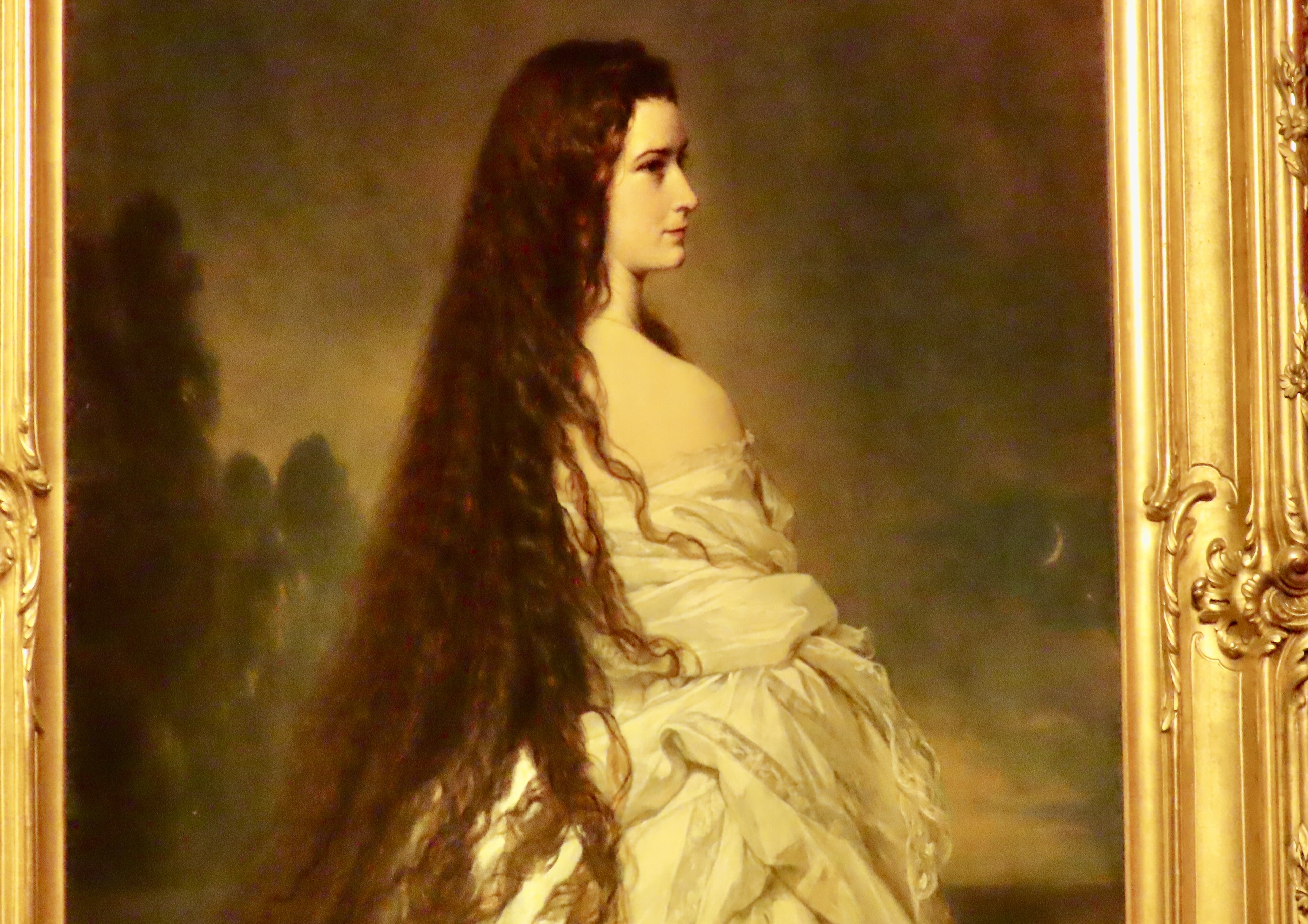
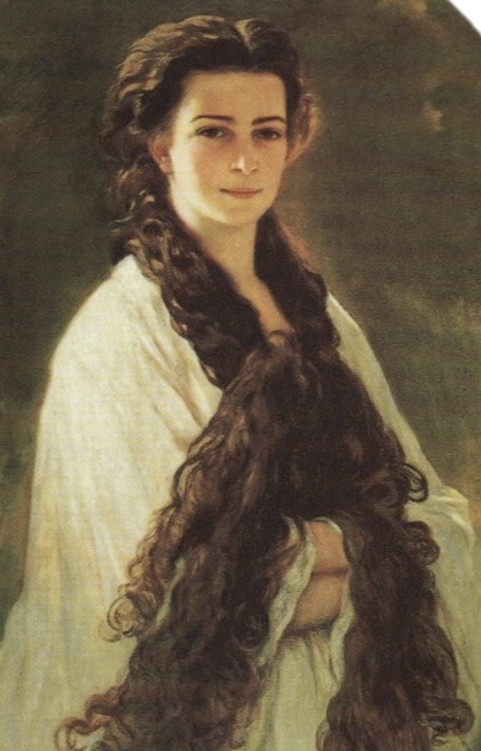
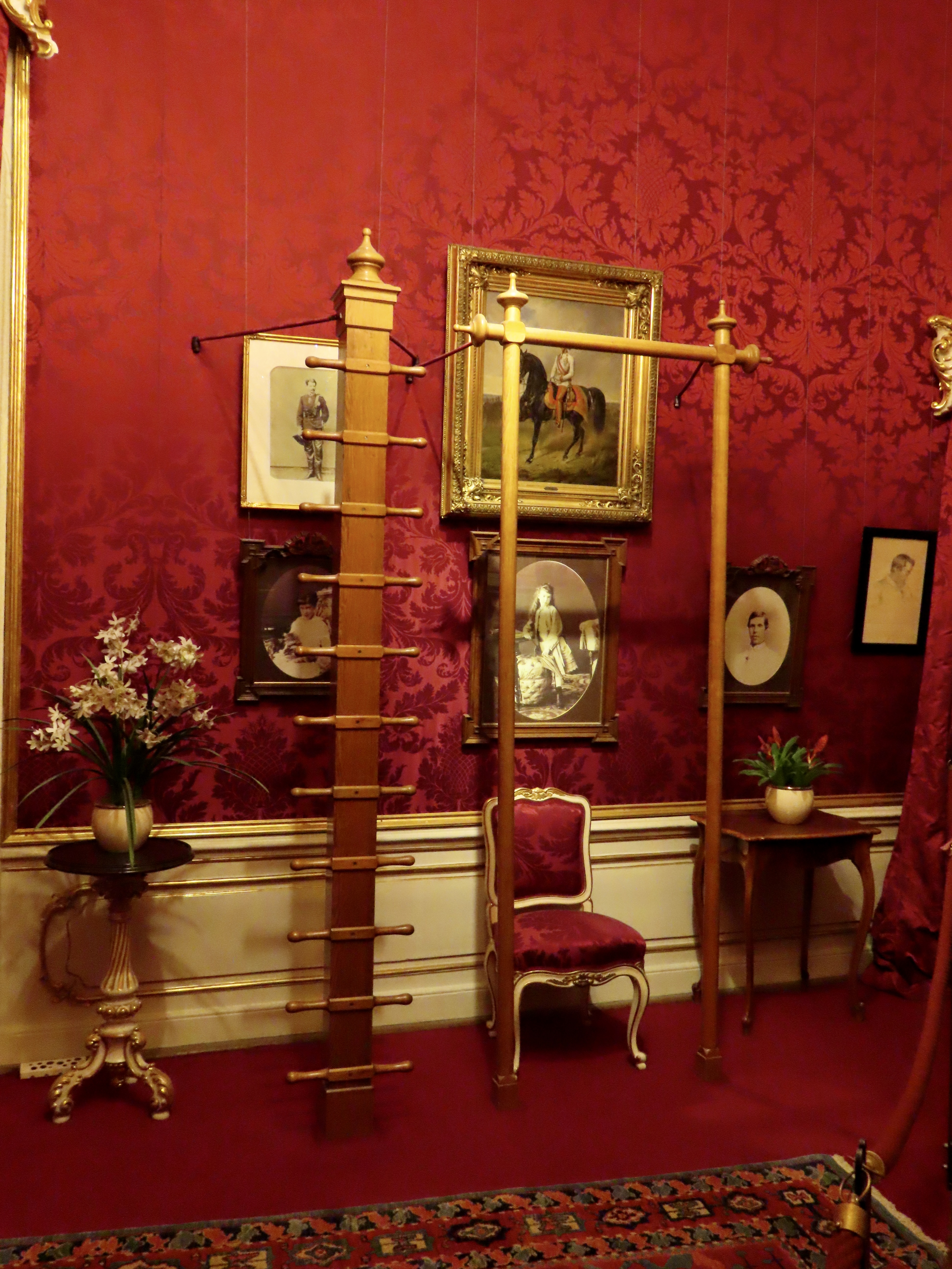
A German Duchess, Elisabeth (Sisi) Amalie Eugenie became the Empress of Austria at 16 in 1854 when she married the Habsburg Emperor Franz Joseph. He was supposed to marry her older sister. While Sisi loved Franz, she never did adjust to the limits placed on her as an empress. But, boy, could she grow hair! She’s a legend in Austria. (Painting in the Sisi Museum.)Sisi was considered one of the great beauties of Europe and thought of her hair as her greatest asset. It actually reached all the way to her feet when let down. Its care and maintenance required three hours per day. Sisi spent the time studying Greek and Hungarian, reading and writing. Every three weeks she had her hair washed with raw eggs and brandy. The process took a whole day, including drying. (Painting in the Sisi Museum.)The Sisi Museum is in the Hofburg Palace, the winter home of the Habsburgs. Peggy and I visited it as part of our tour of the historical center of Vienna. This was Sisi’s exercise room. She was as fanatical about exercise as she was her hair. Long workouts and multi-hour fast hikes were all part of her daily regimen. Her passion, however, was horseback riding. She was one of the premier horsewomen of her era.Sisi loved the out-of-doors and dreamed of exploring the world. A number of paintings in her rooms reflected her desires to travel and visit exotic lands, which she wasn’t allowed to do.Peggy was so fascinated by Sisi, she bought a biography on her. At 410 pages it was hardly light reading. Nor was it light carrying, or easy to fit in an already packed suitcase!
Peggy noted that the main reasons for Sisi’s unhappiness were the close-to-total control her mother-in-law had over her, and the fact that she was a very private person. The latter was a poor fit for being an empress of a vast empire expected to be constantly involved in public events and private meetings. She expressed her unhappiness in poetry. A particularly telling poem was included in the museum:
“I am a seagull of no land, I call no shore my home, I am bound to no place, I fly from wave to wave.”
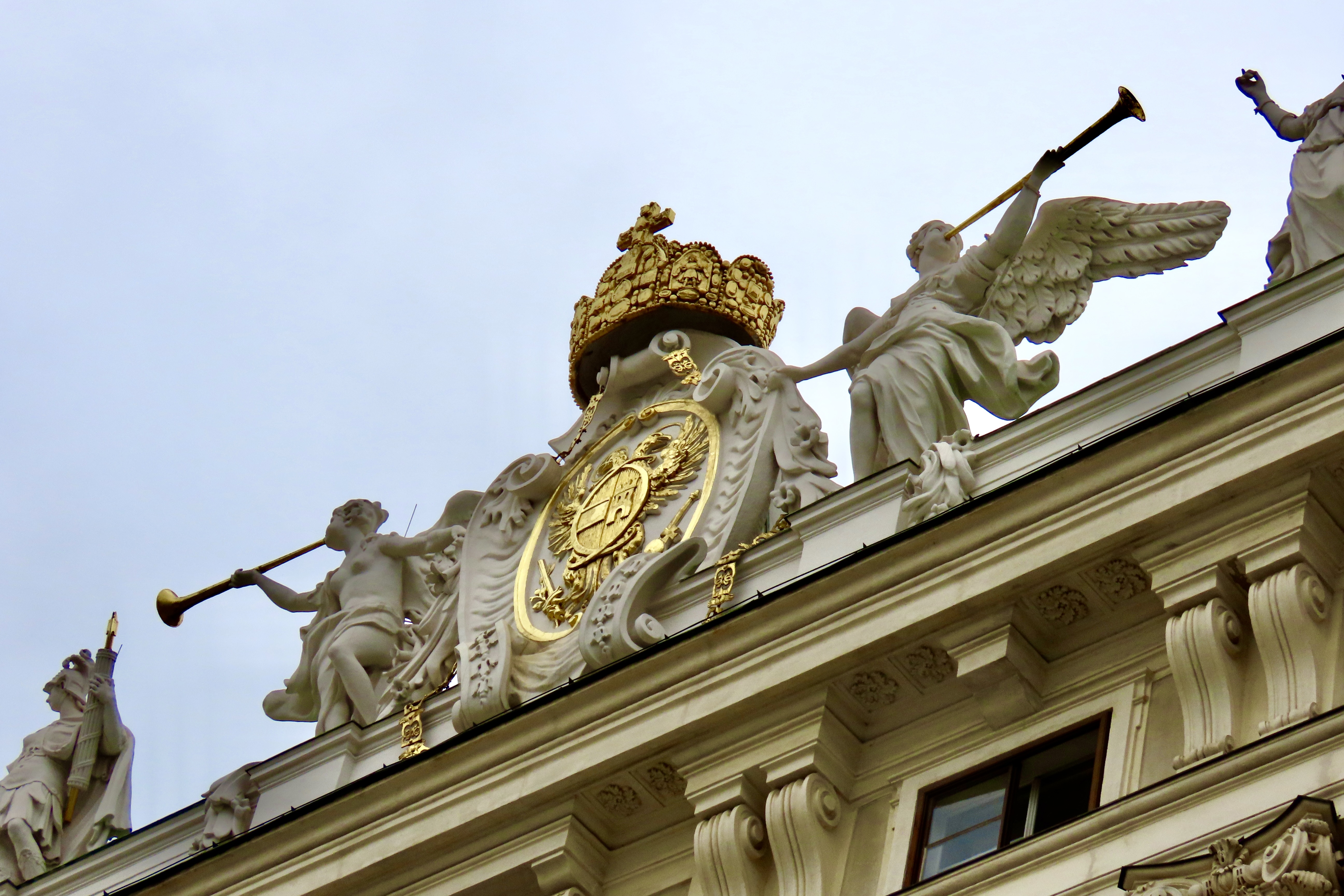
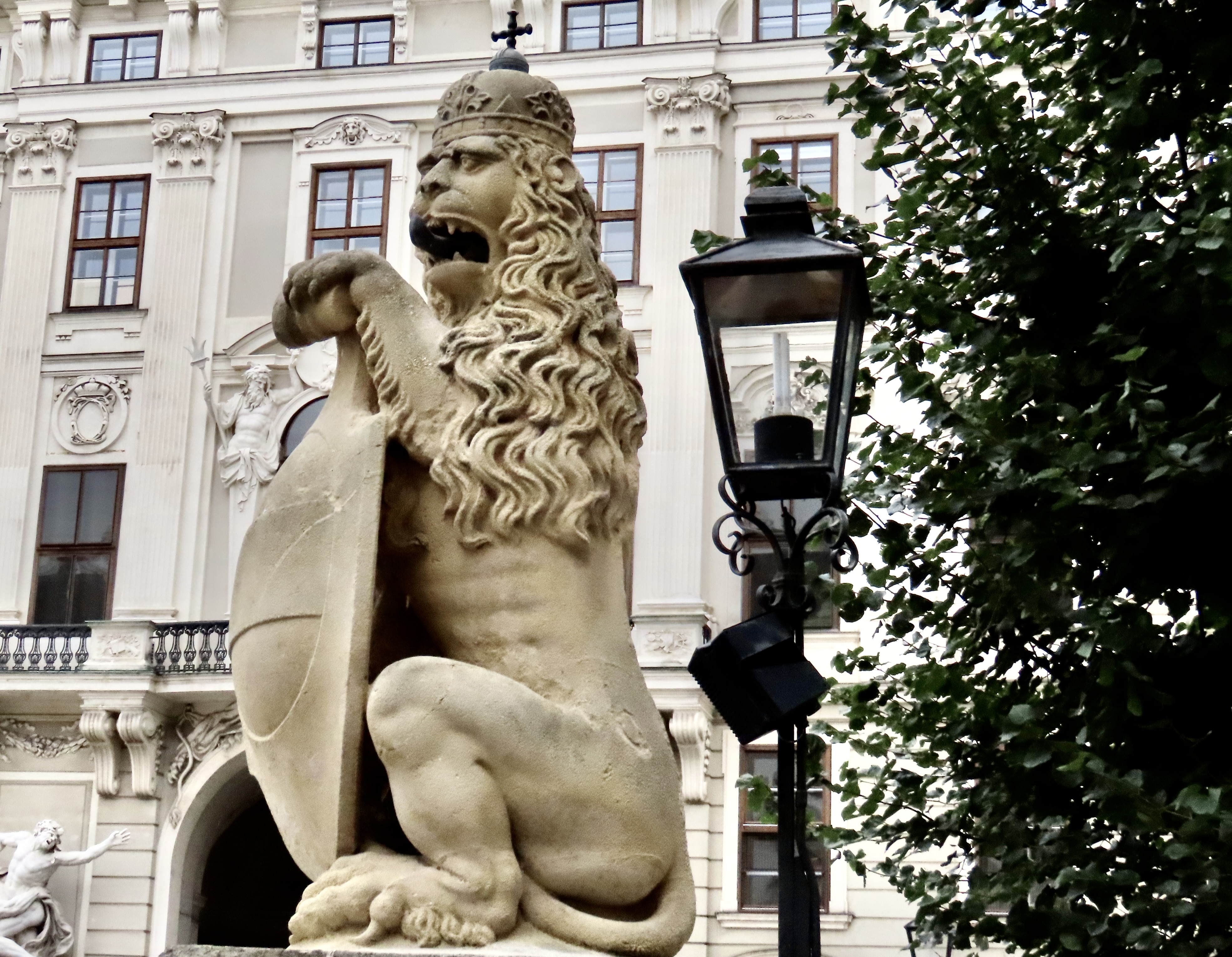
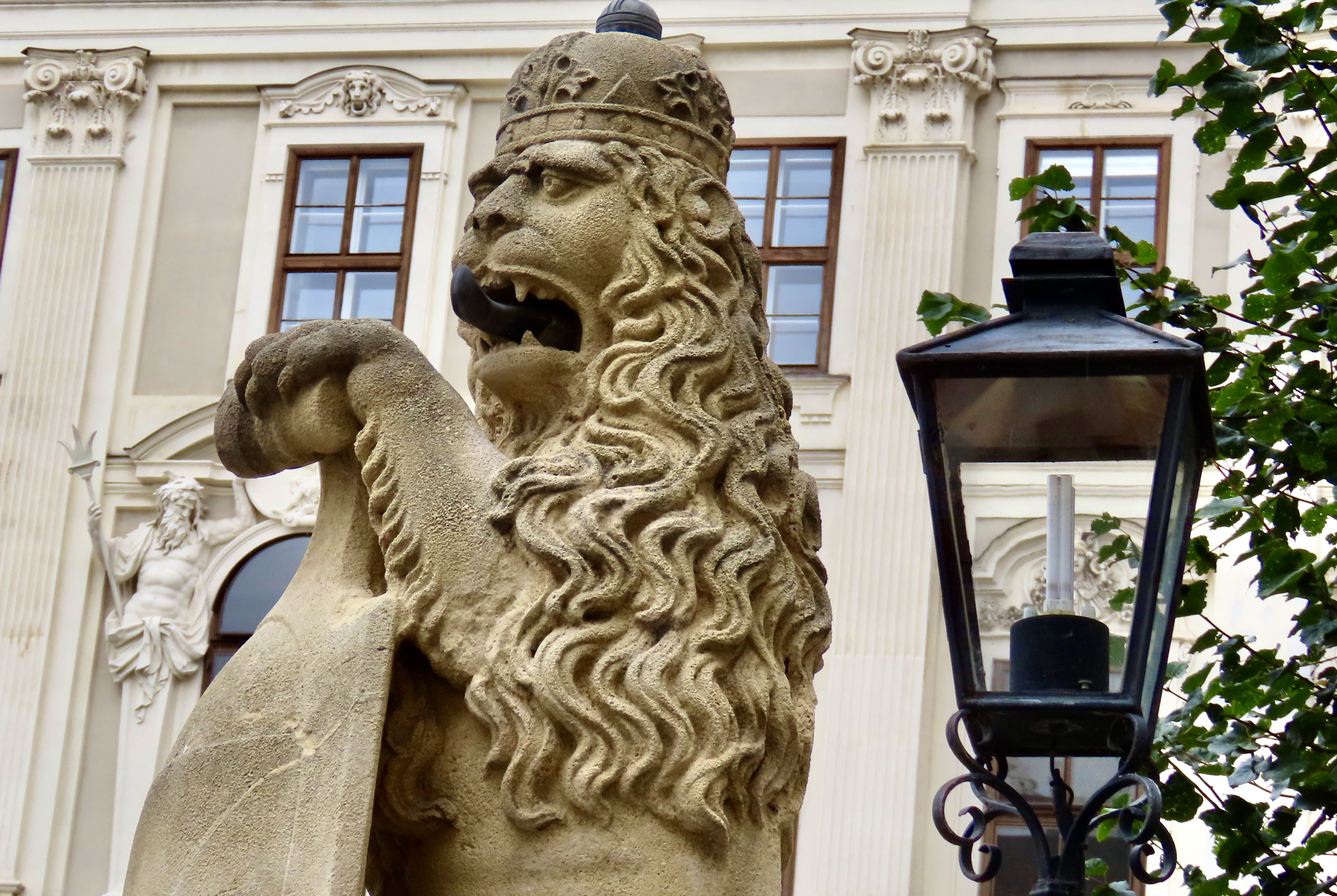
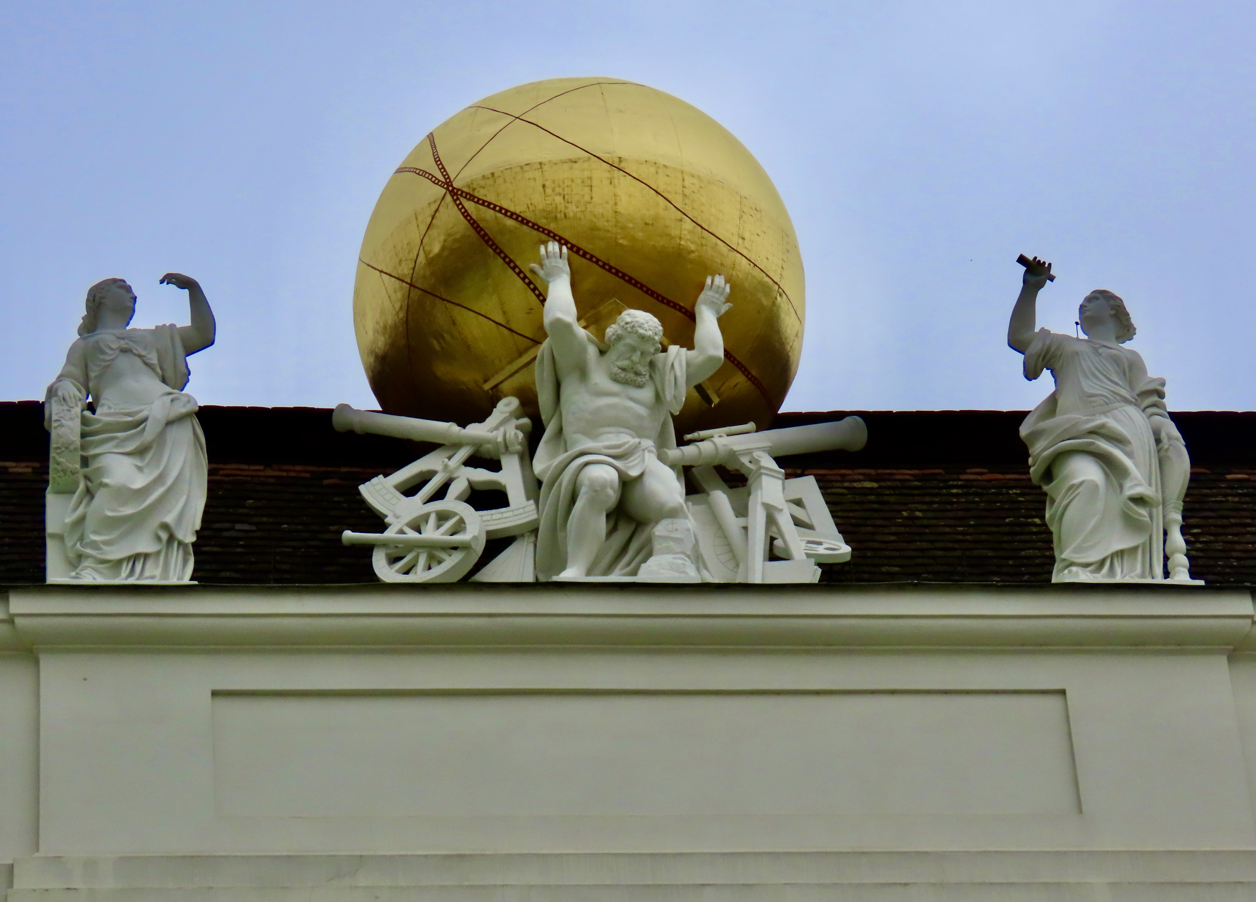
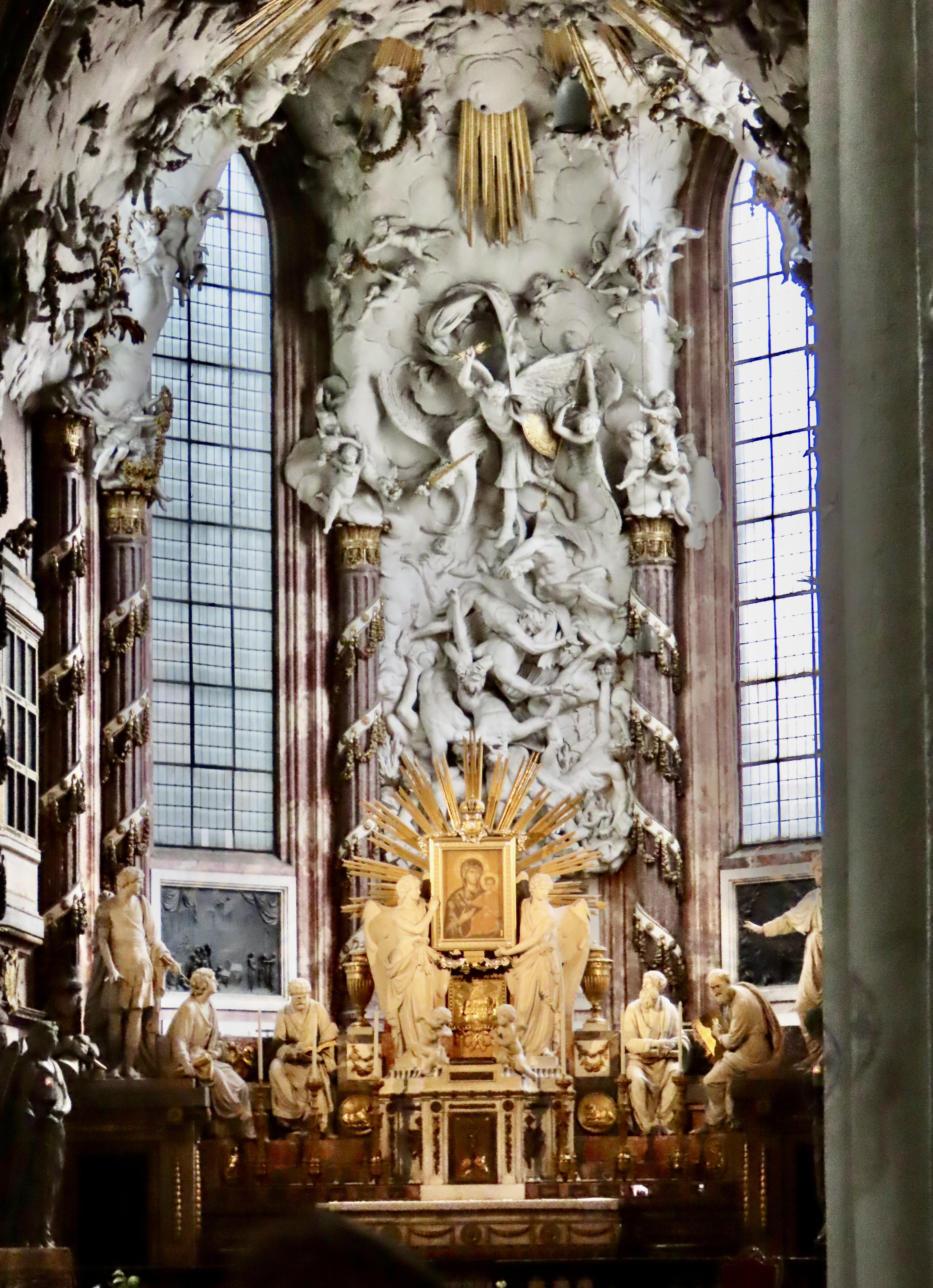
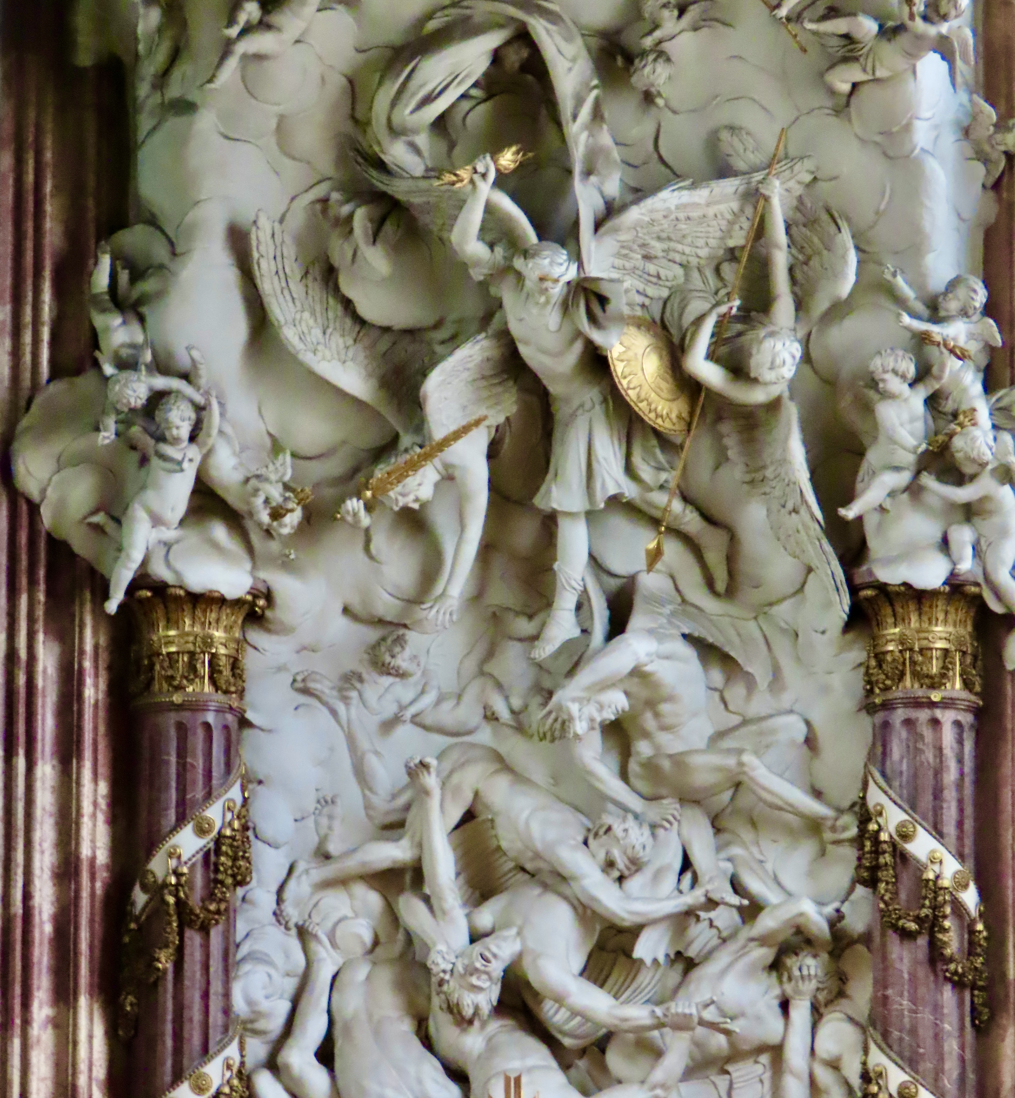
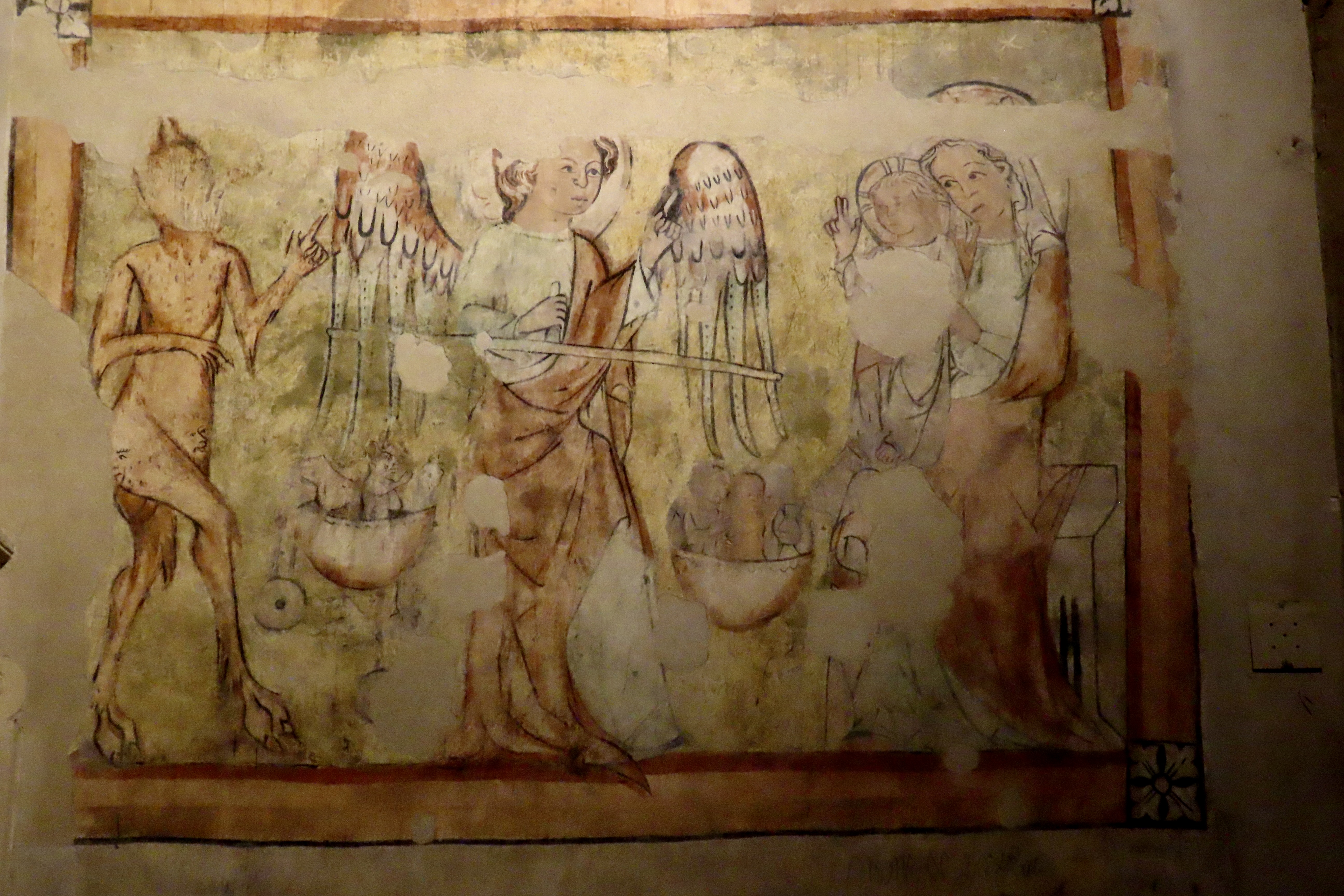
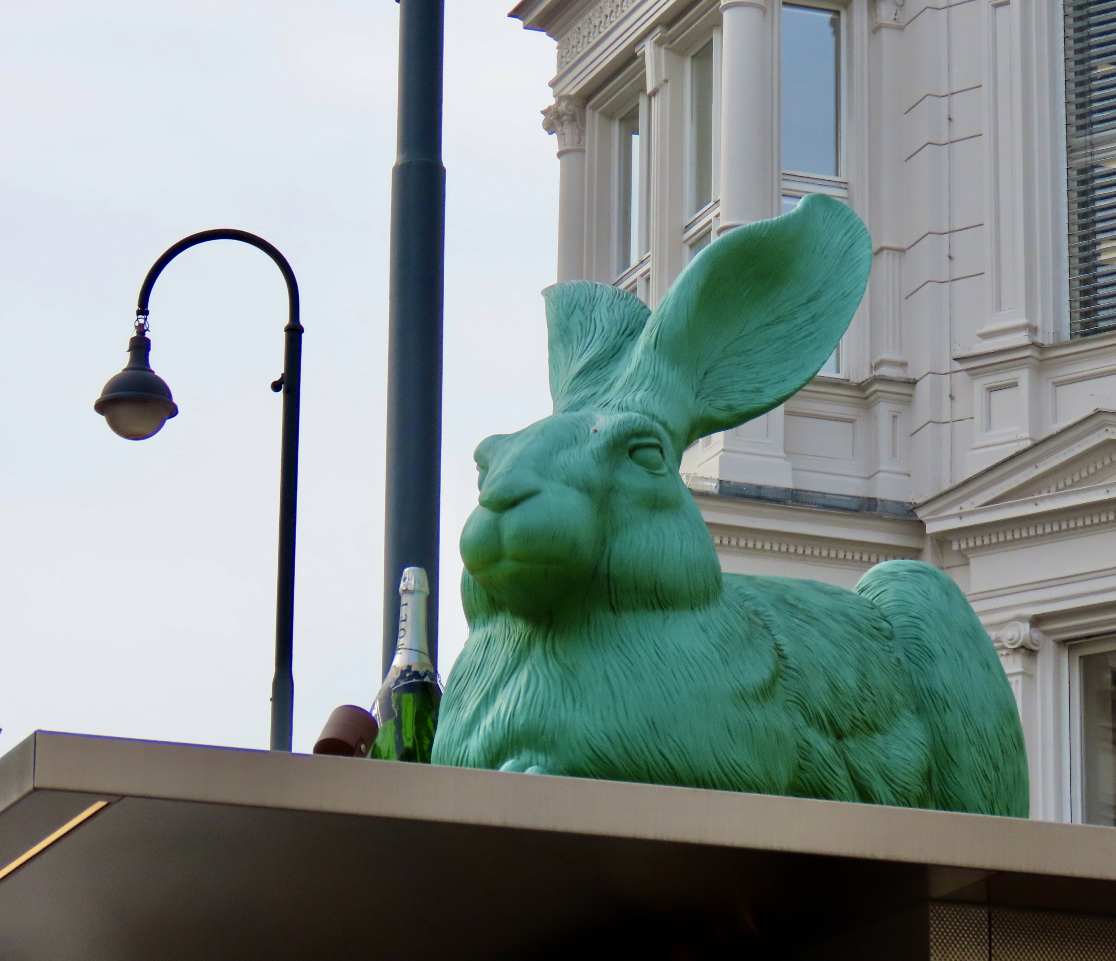
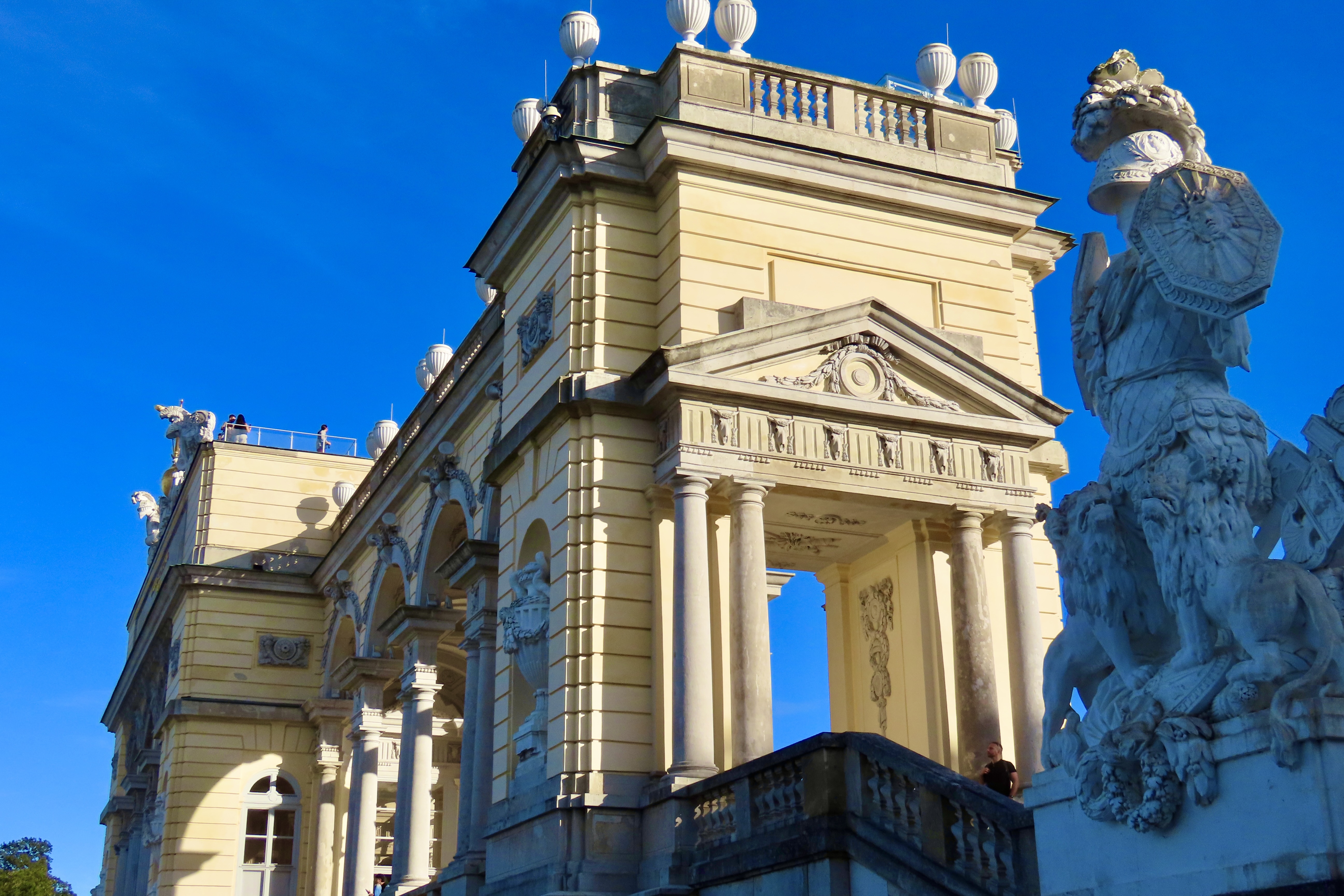
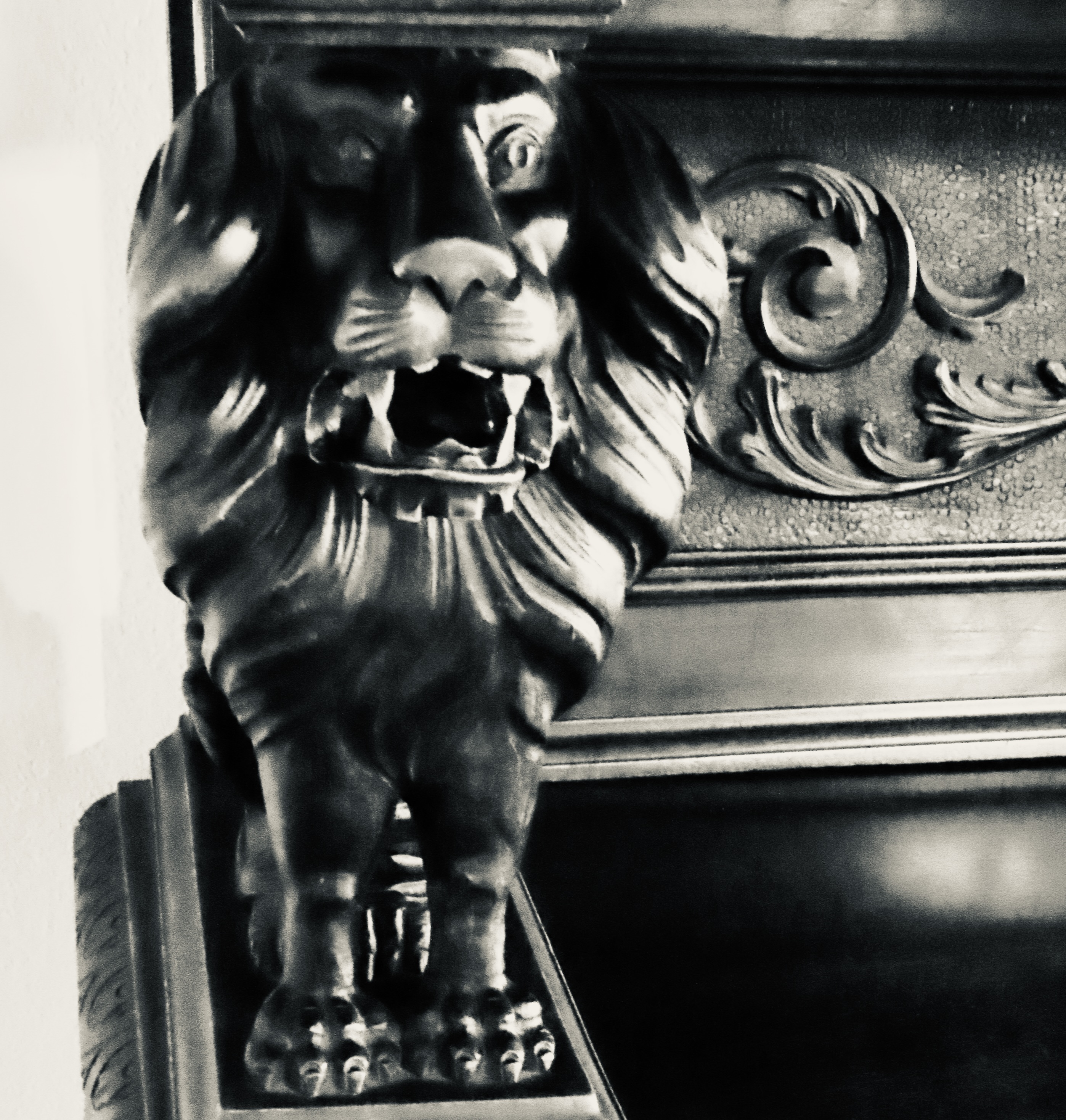
She was assassinated at age 60 by an Italian anarchist.This bricked up wall we found as we exited the museum was not designed to keep Sisi home. It’s designed to keep visitors out of the official residence and workplace of the President of Austria, which is located on the other side.The Hofburg Palace and its connected buildings could take several days to explore but Peggy and I only had two hours. This duplicate of the Habsburg Coat of Arms and Crown is located on top of the Palace. Angels trumpet the glories of the empire.We liked this royal lion seated outside what’s known as the Swiss Gate of Hoffburg Palace.He was a handsome beast that looked quite regal.Atlas was holding up the universe on top of the 2.5 million book Austrian National Library in the Palace complex. It was punishment. Atlas was forced to carry the heavens on his shoulders by Zeus for leading the Titans in a rebellion against the Olympian gods. The gods were quite creative when dishing out sentences. Remember Sisyphus who was forced to push a heavy boulder up a mountain for his transgressions. It would then immediately roll back down for Sisyphus to push up again. Poor Prometheus, whose crime was giving humanity fire, was sentenced to having an eagle peck open his body every day and eat his liver. It conveniently grew back overnight to feed the eagle the next day.One of the most popular places to visit at the Palace complex is the Spanish Riding School of Vienna, which features the white Lippizaner horses known for their superb training. Once bred for war, the horses now earn their living by corralling tourist dollars.While we are on the subject of white war horses, we photographed these guys running rampant over a person near Atlas. My only question is how can you eat an ice-cream cone (or anything) while being trampled by a horse and strangling a snake? Given Peggy’s love of ice cream, she might be able to answer the question, especially if it was coated with Heath Bar bits and hot chocolate fudge.One more horsey thought. I can’t remember what great military hero/emperor/etc. this is, but I do remember our guide told us you could tell how he died by the position of the horse’s hoof. One hoof up meant he died from injuries suffered in battle. All four hooves on the ground meant he died of natural causes. Both hooves off the ground with the horse rearing would tell us he died in battle. Other guides told us this as well. Validity? I don’t know.We’ll close today with a visit to St. Michael’s Church which is opposite St. Michael’s Gate at the Hofburg Palace. Remember how I thought a huge painting of St. Stephan being stoned to death on the altar of St. Stephan’s Church was a bit weird. This is even stranger. This represents the bad angels being kicked out of heaven to roam as demons among mankind forever while Lucifer was sent straight to hell. A close up. The good guys are on top armed with various weapons while the bad guys aren’t doing very well. I have to think the huge wings of archangels would get in the way during close combat.St. Michaels is old, with a history stretching back over 8 centuries. I thought that this picture we found on the wall when we were leaving, spoke to the church’s age more than anything else we saw. The fresco is from around 1350. What’s going on is psychostasy, which was a new word for me. It means the weighing of souls. Have you been good or bad? This particular scene even comes with a rooting section, with the Devil on one side and the Virgin Mary and Baby Jesus on the other. St. Michael is doing the weighing. Apparently, Jesus is winning, even though it appears the Devil has attached a weight to his basket. Tricky fellow. Note he has a face on his belly. If that’s not duplicitous, what is?Not sure whether we will get a post up on Friday, given that it’s Thanksgiving weekend. If not, we’ll be back on Monday with more on Vienna’s historic downtown including this large green rabbit who seems to have landed himself a bottle of expensive Moet Champaign. That’s all for now. “I’m late, I’m late, for a very important date.” The rabbit hole is waiting.
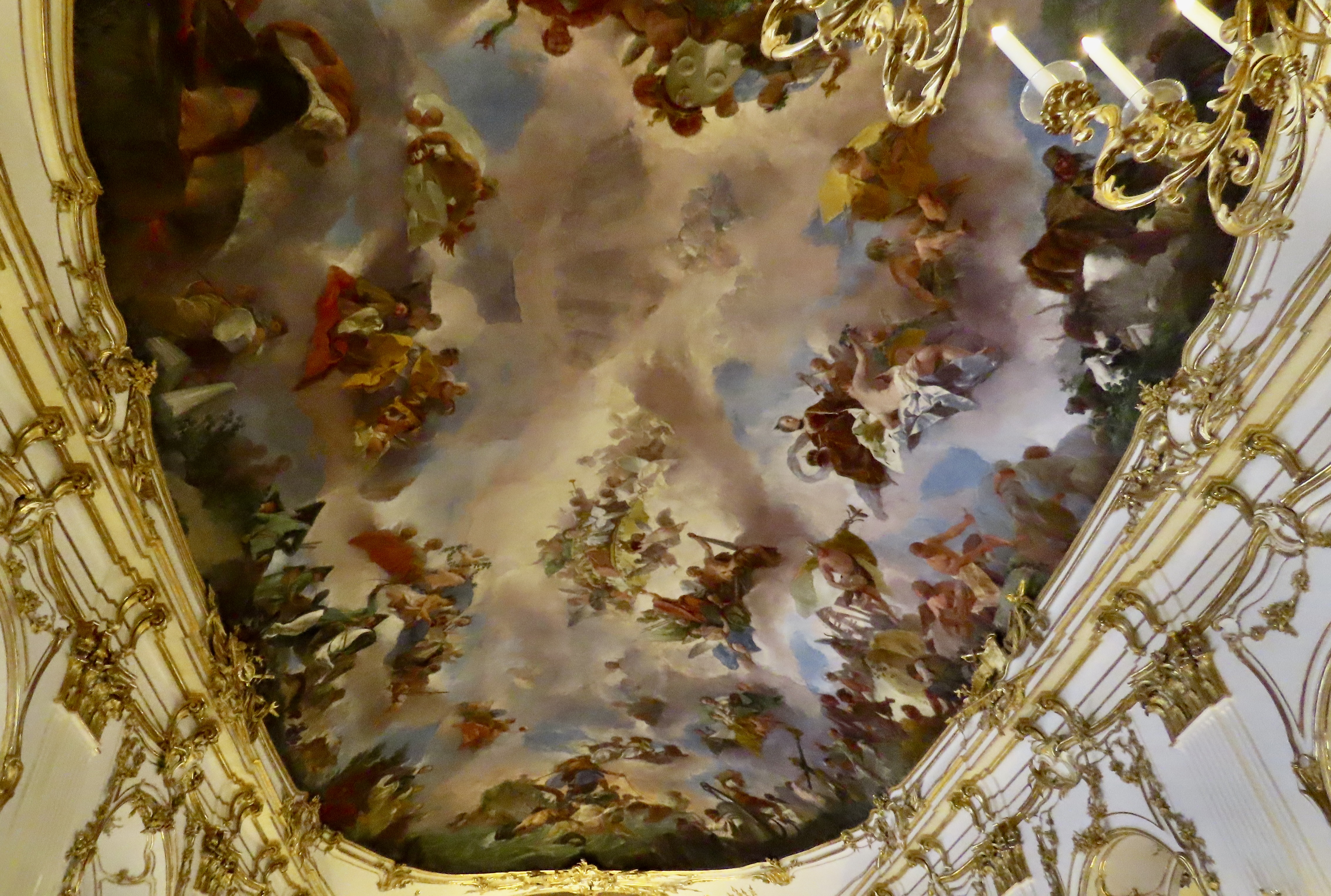
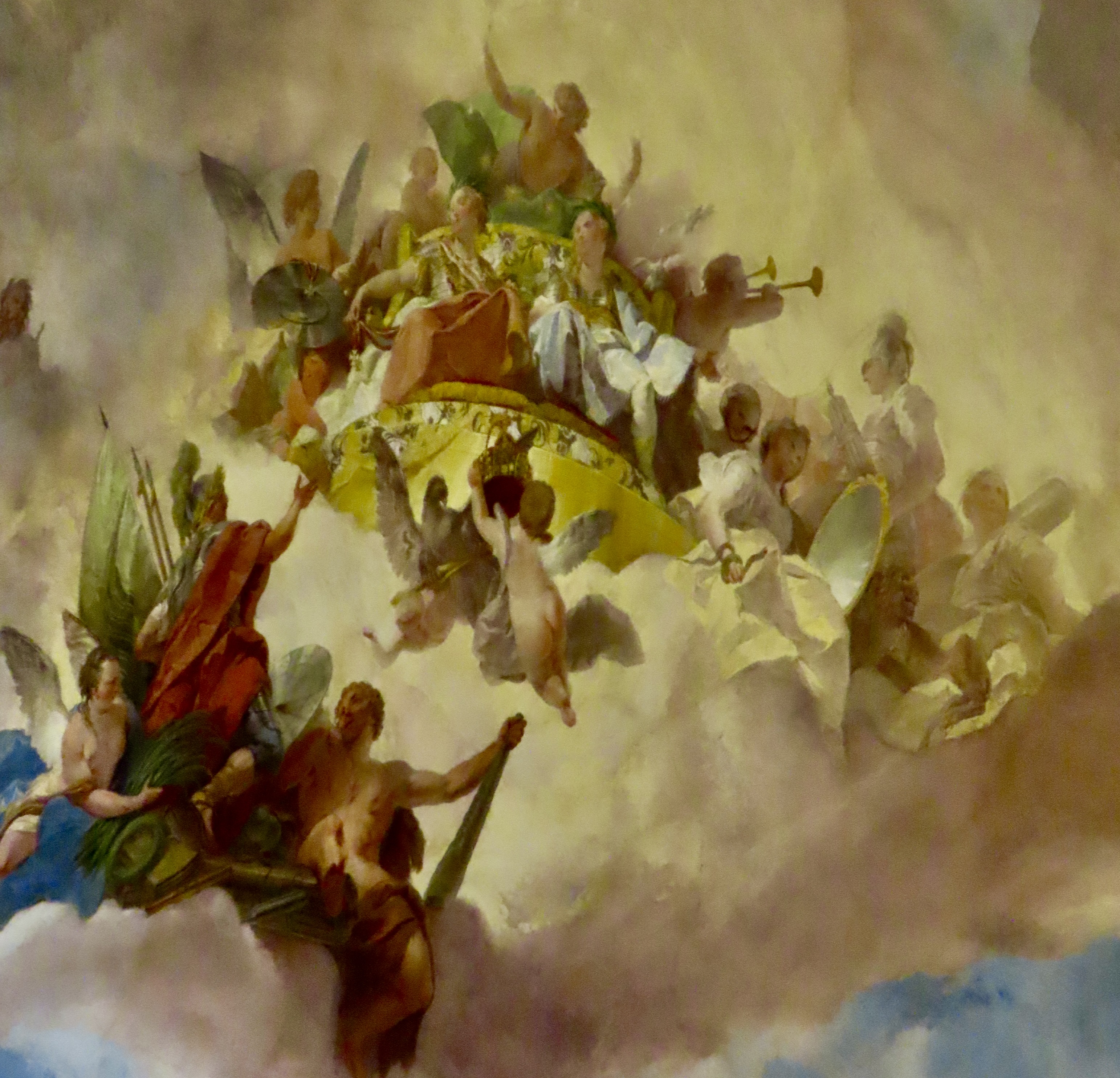
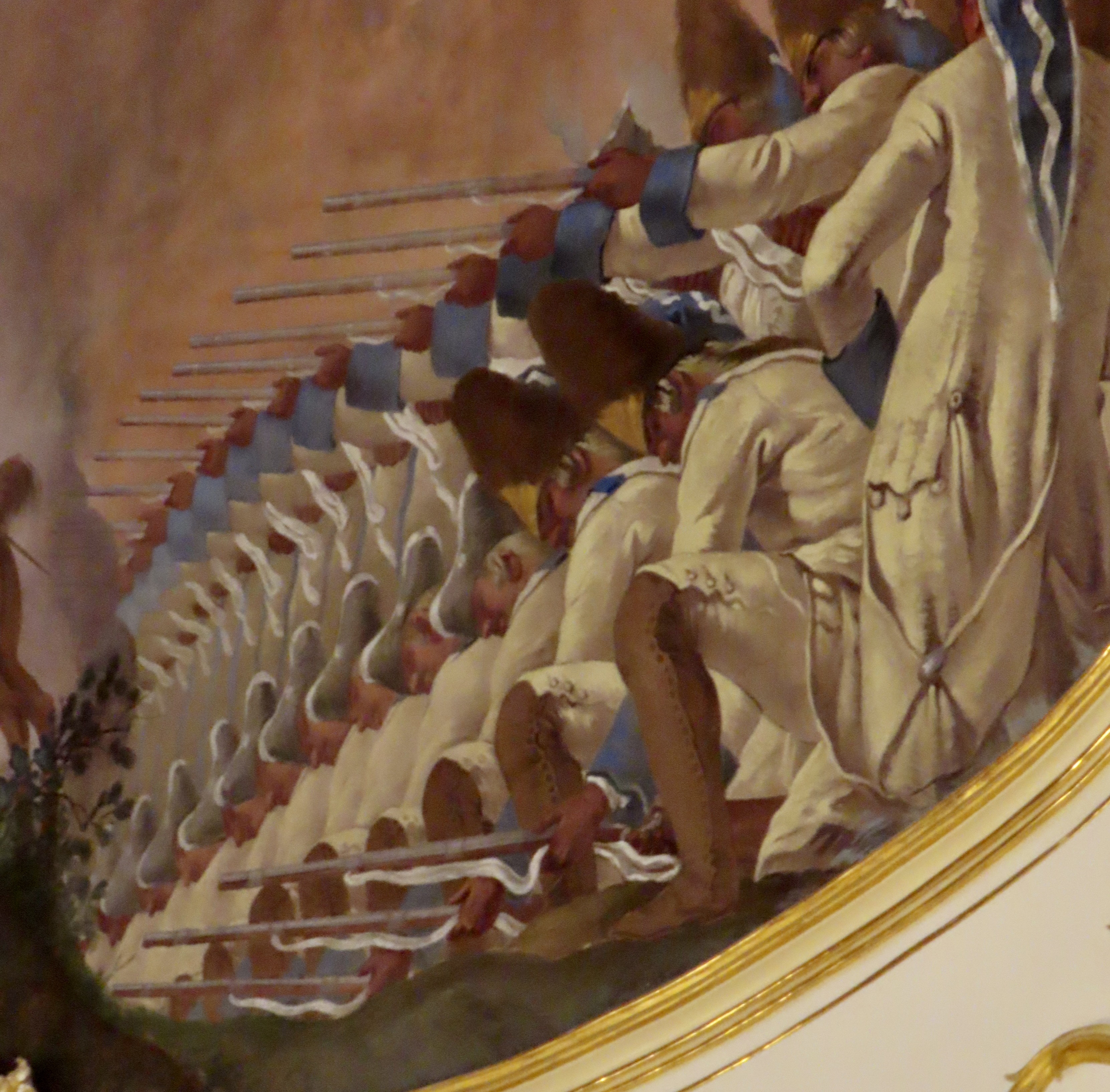
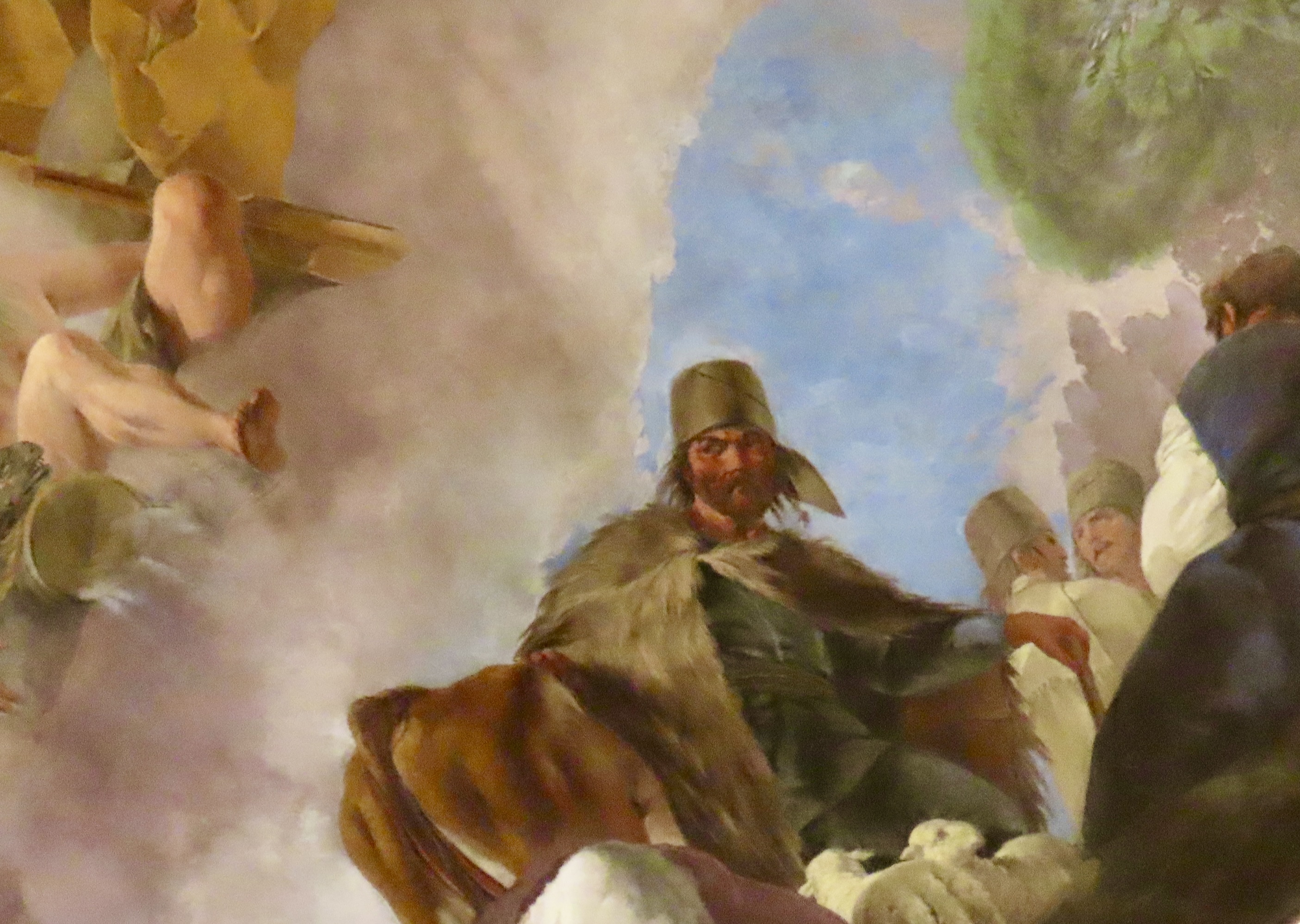
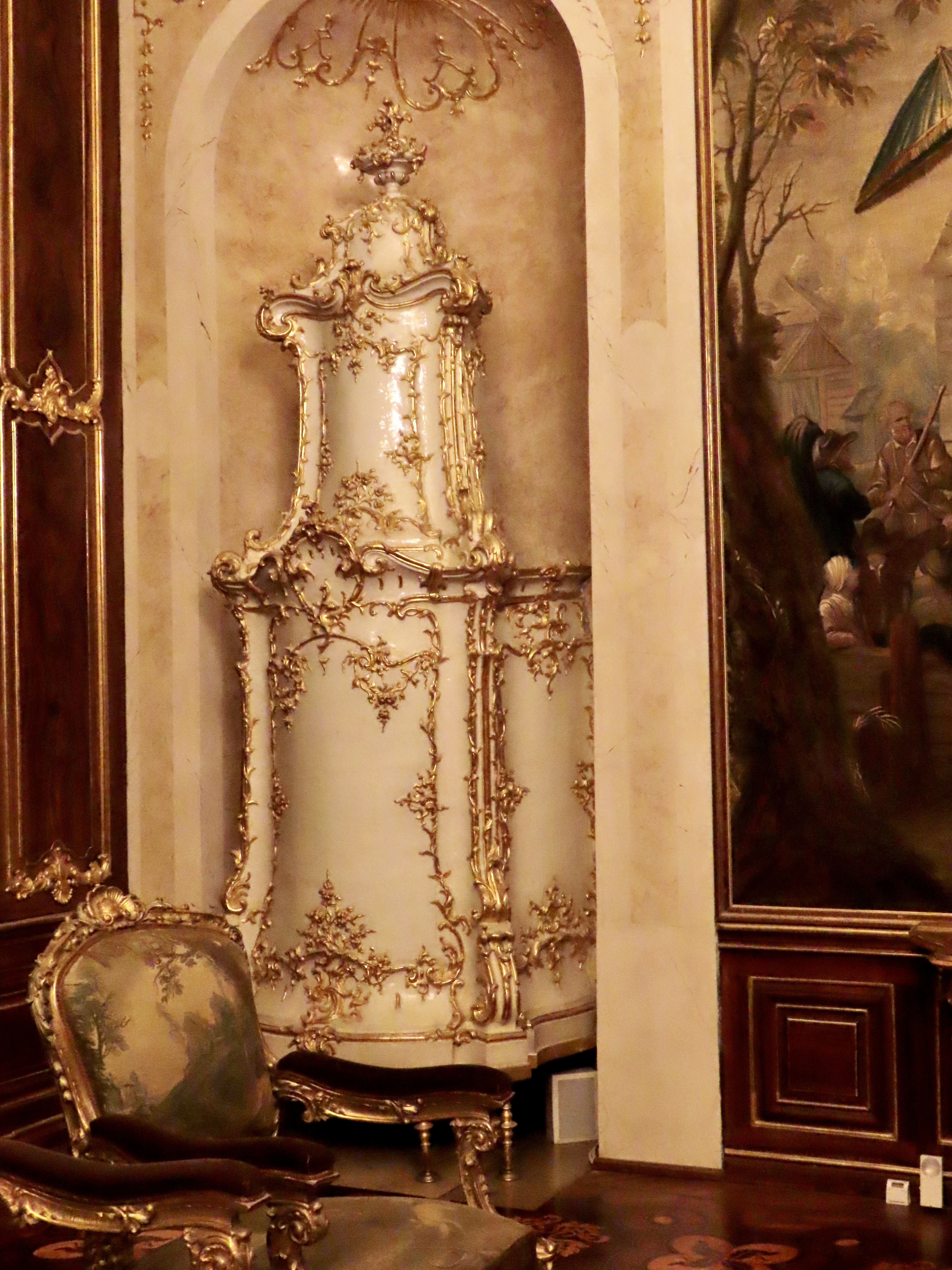
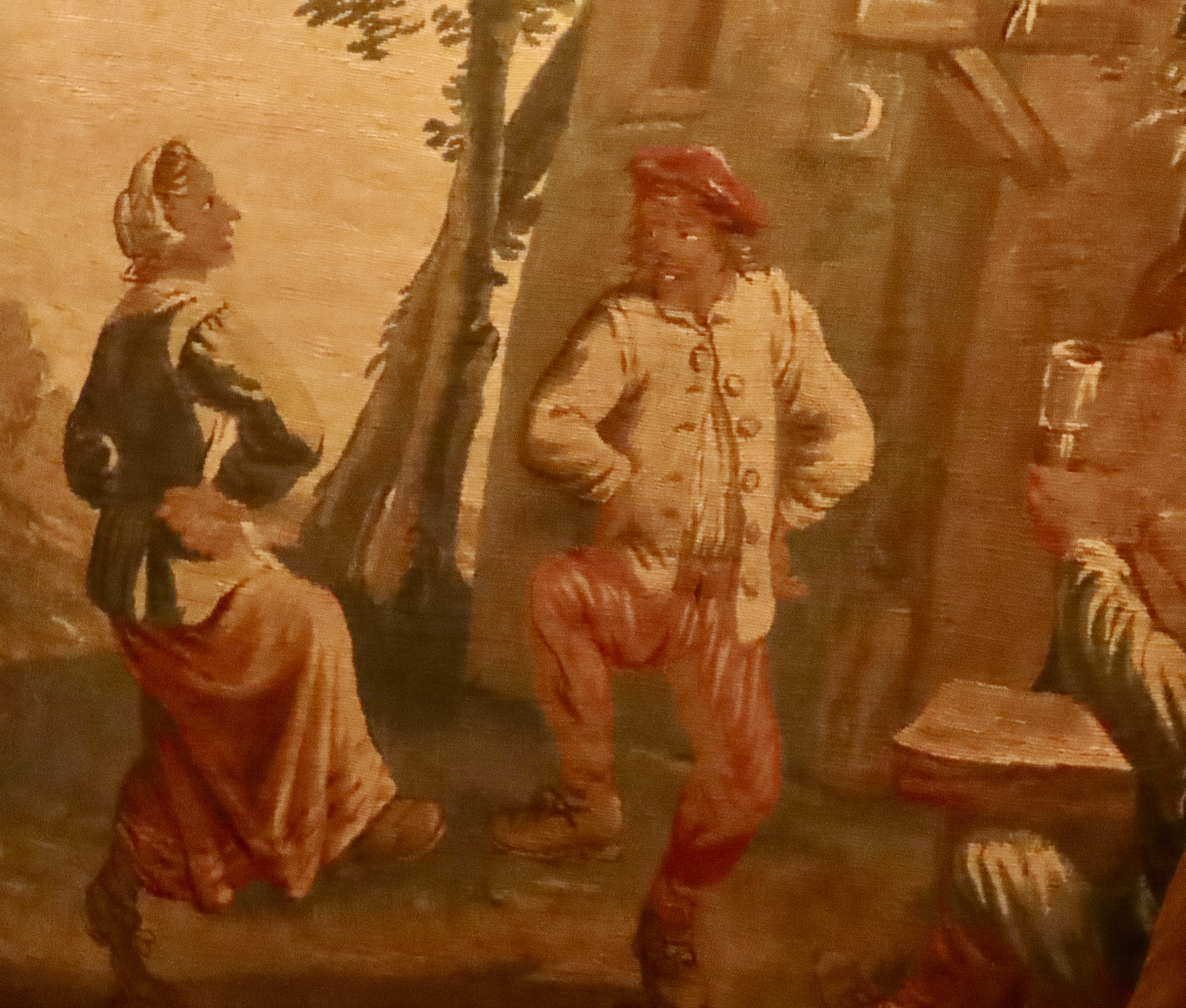
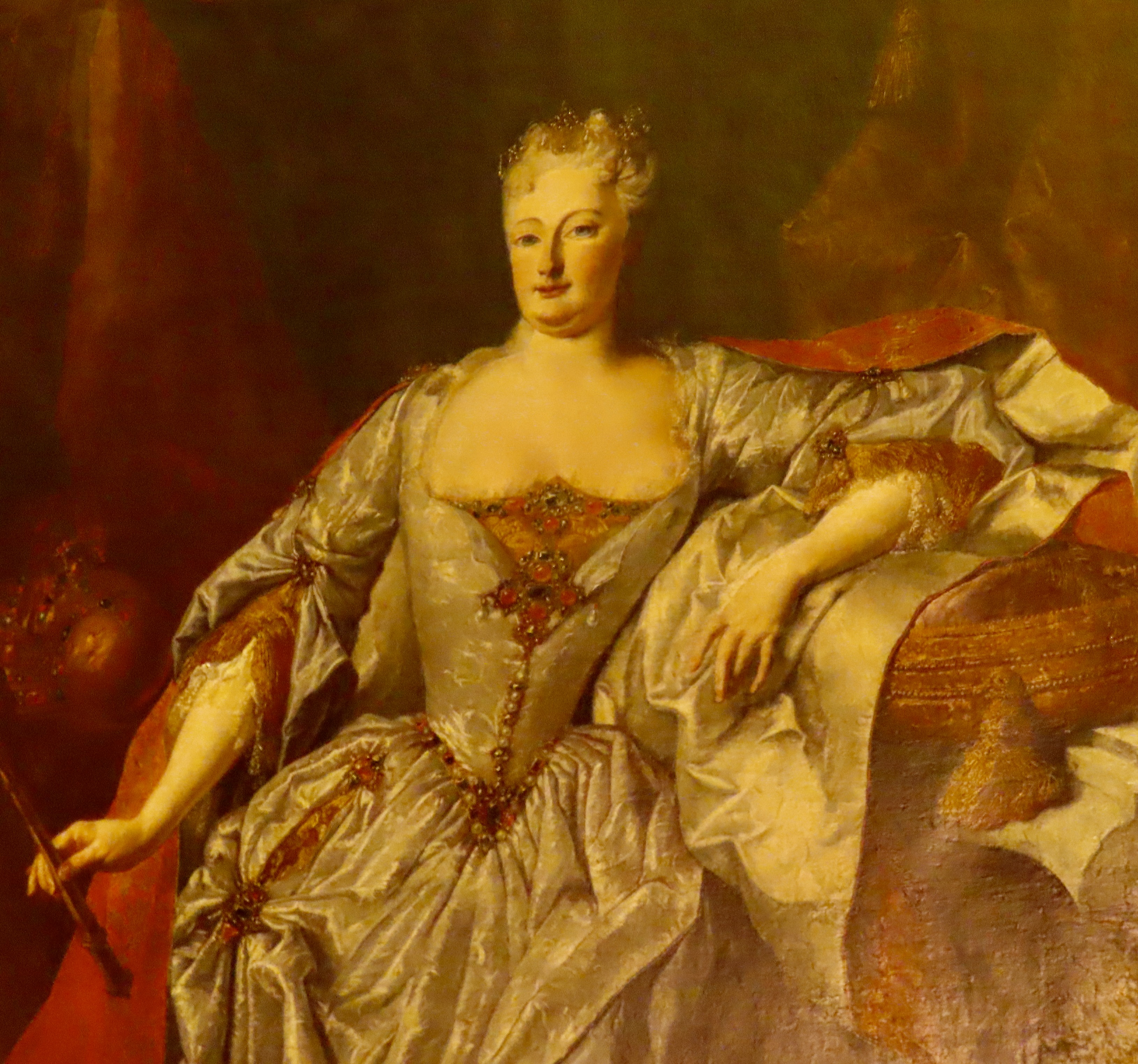
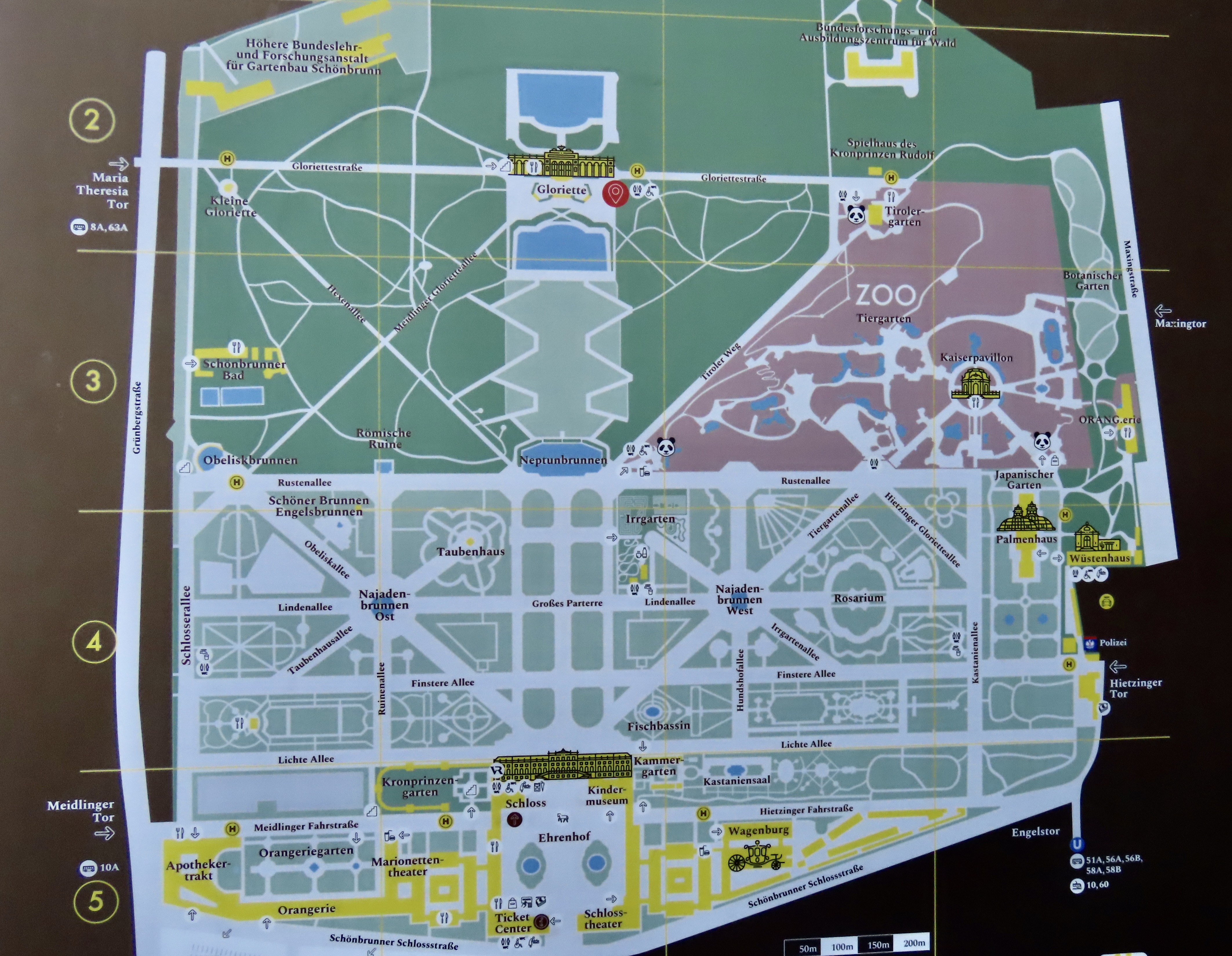
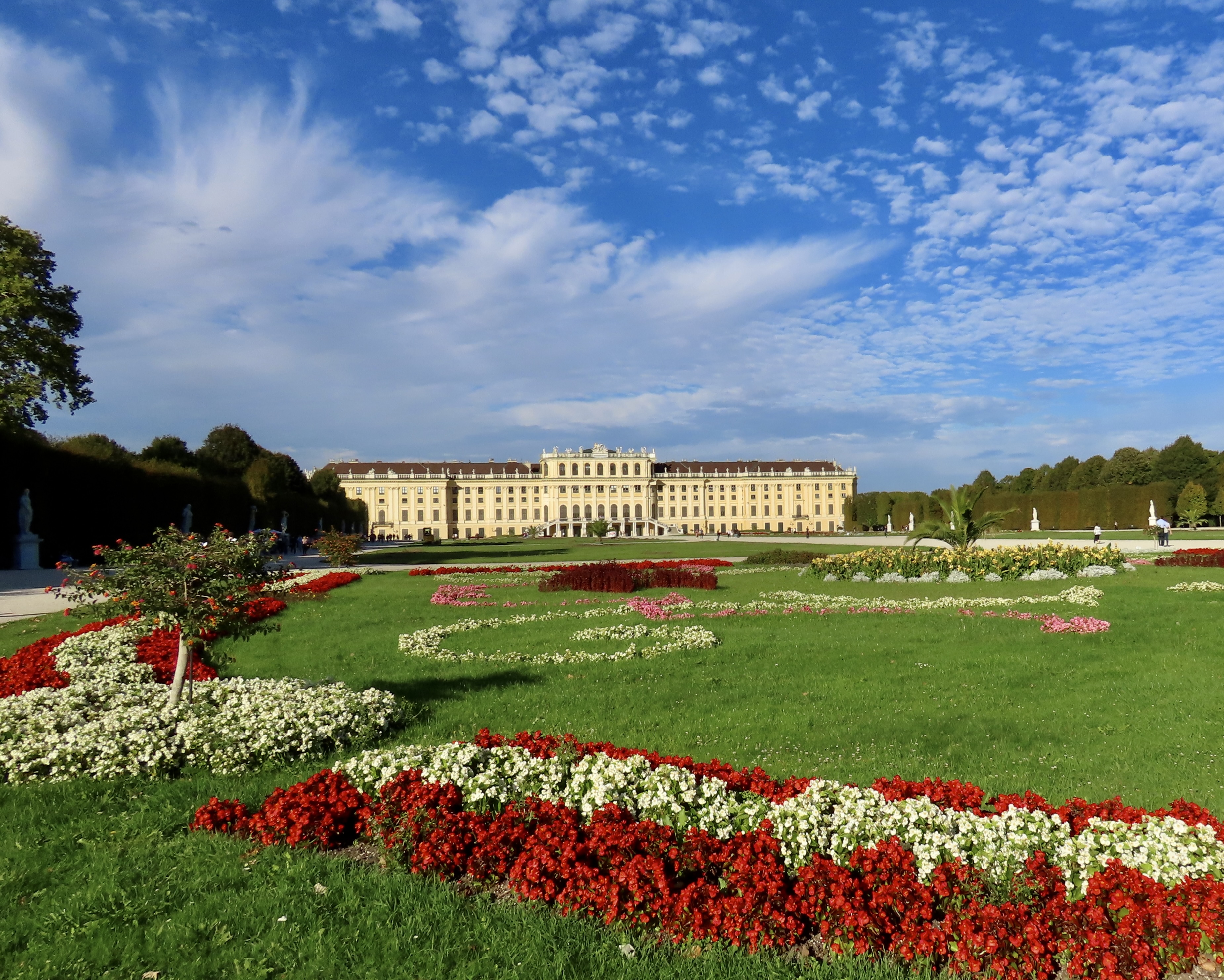
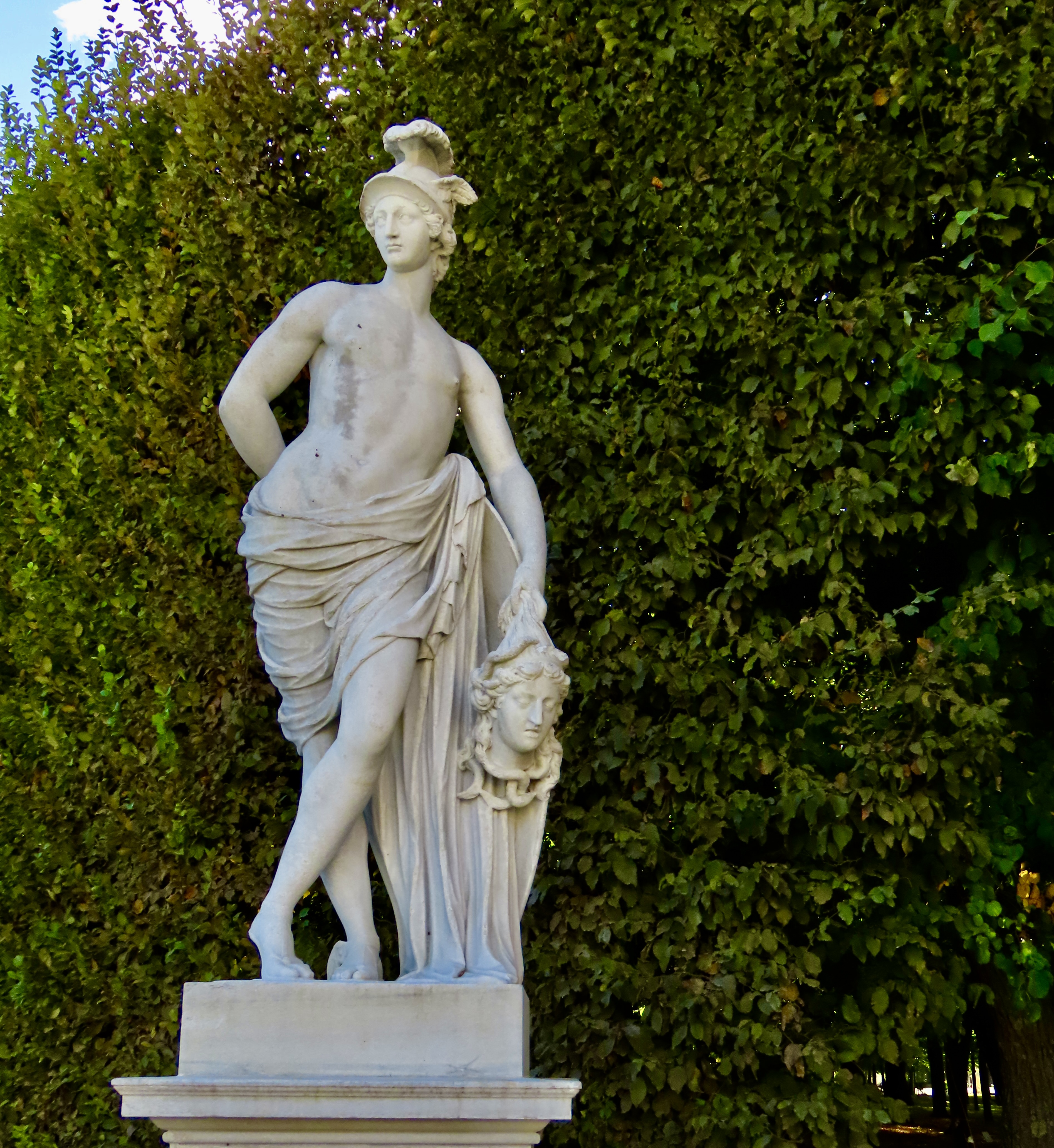
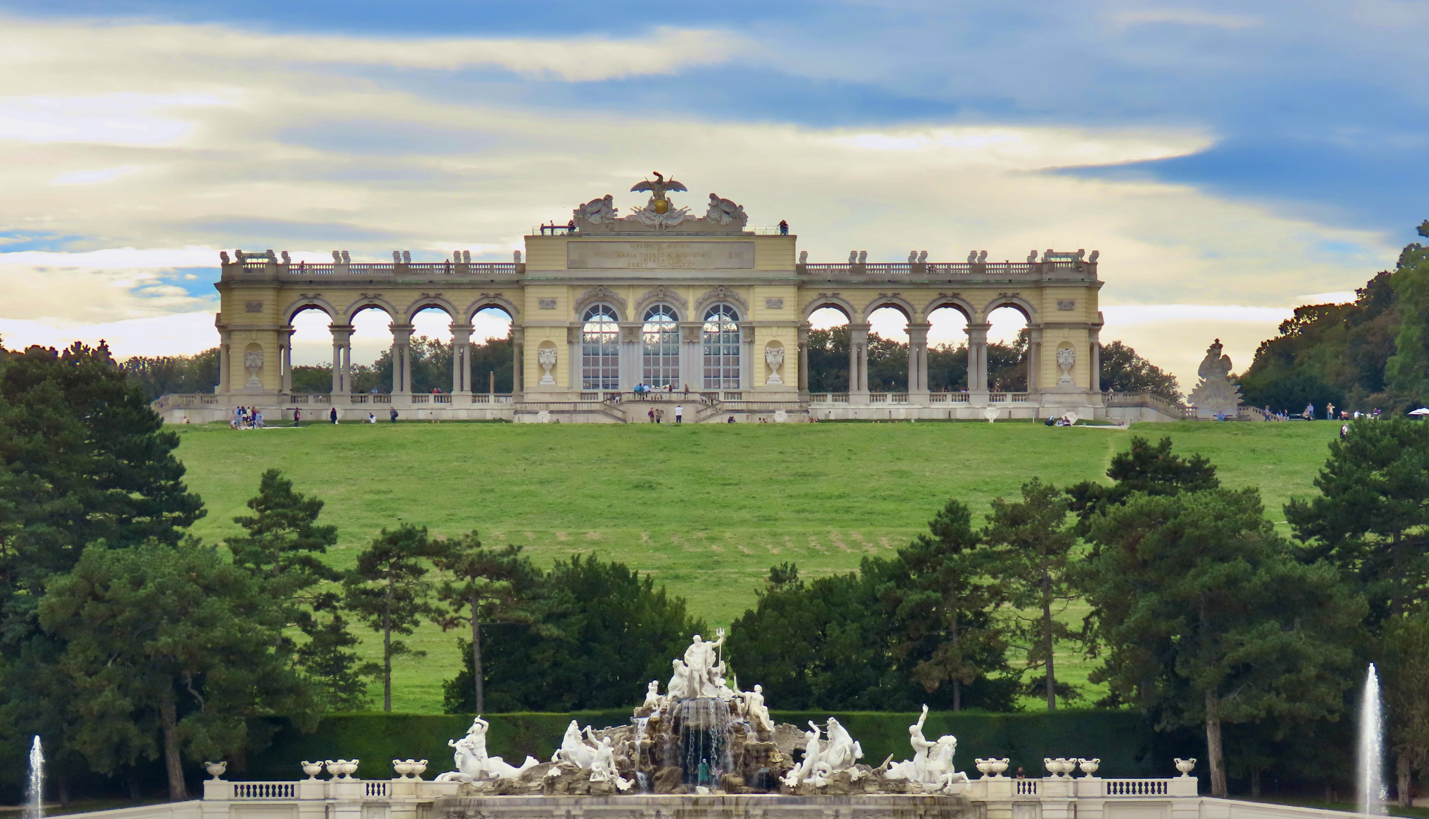
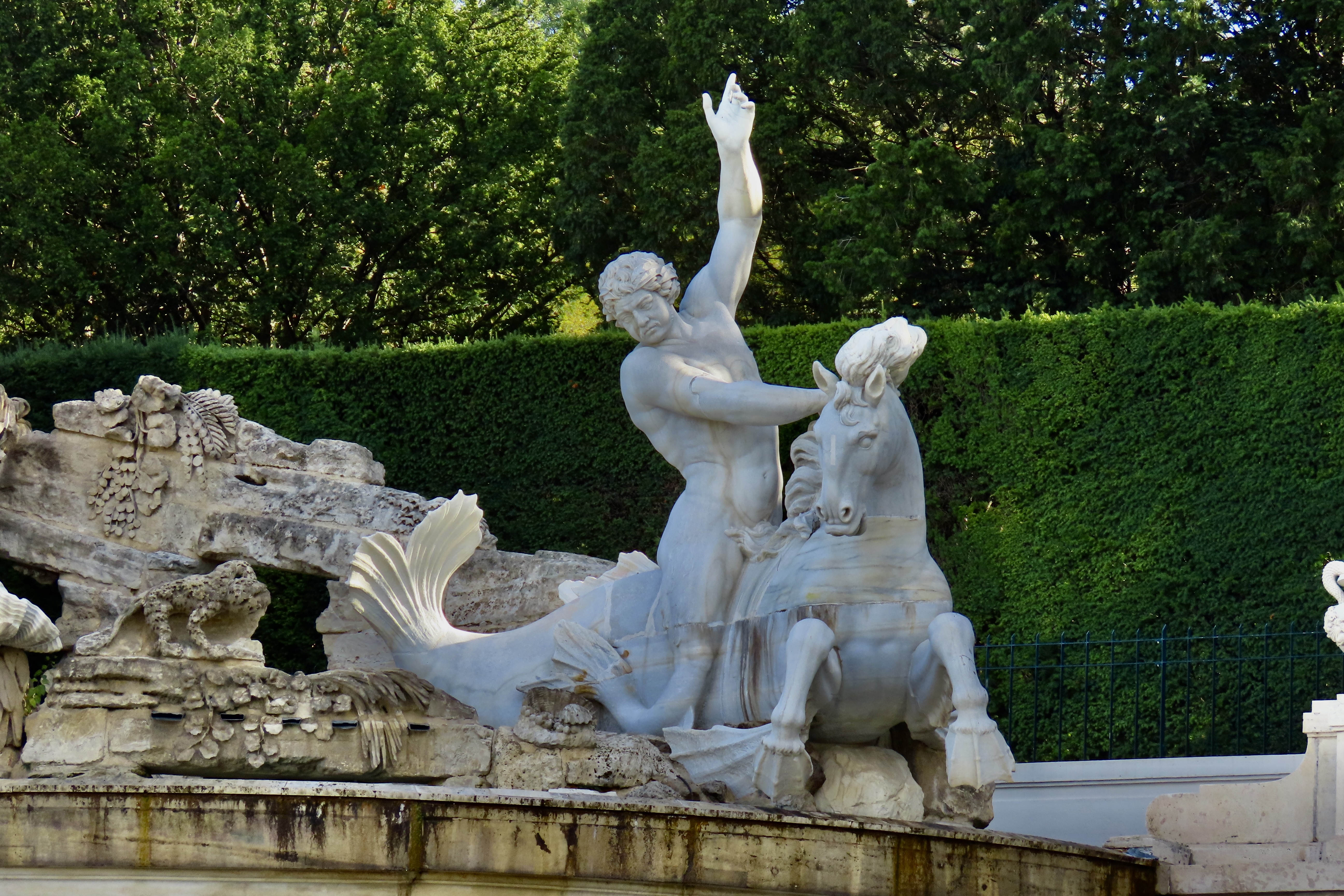
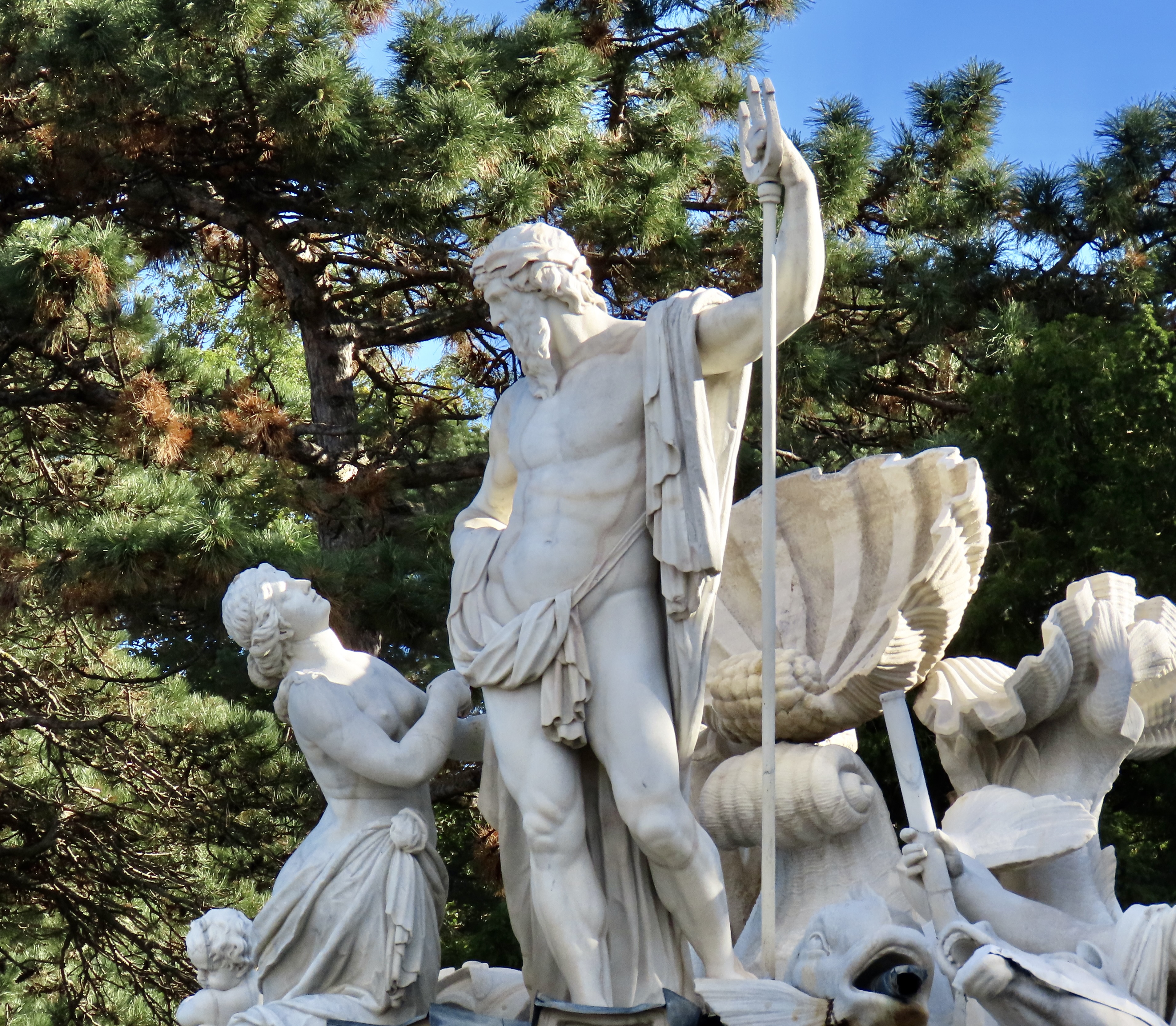
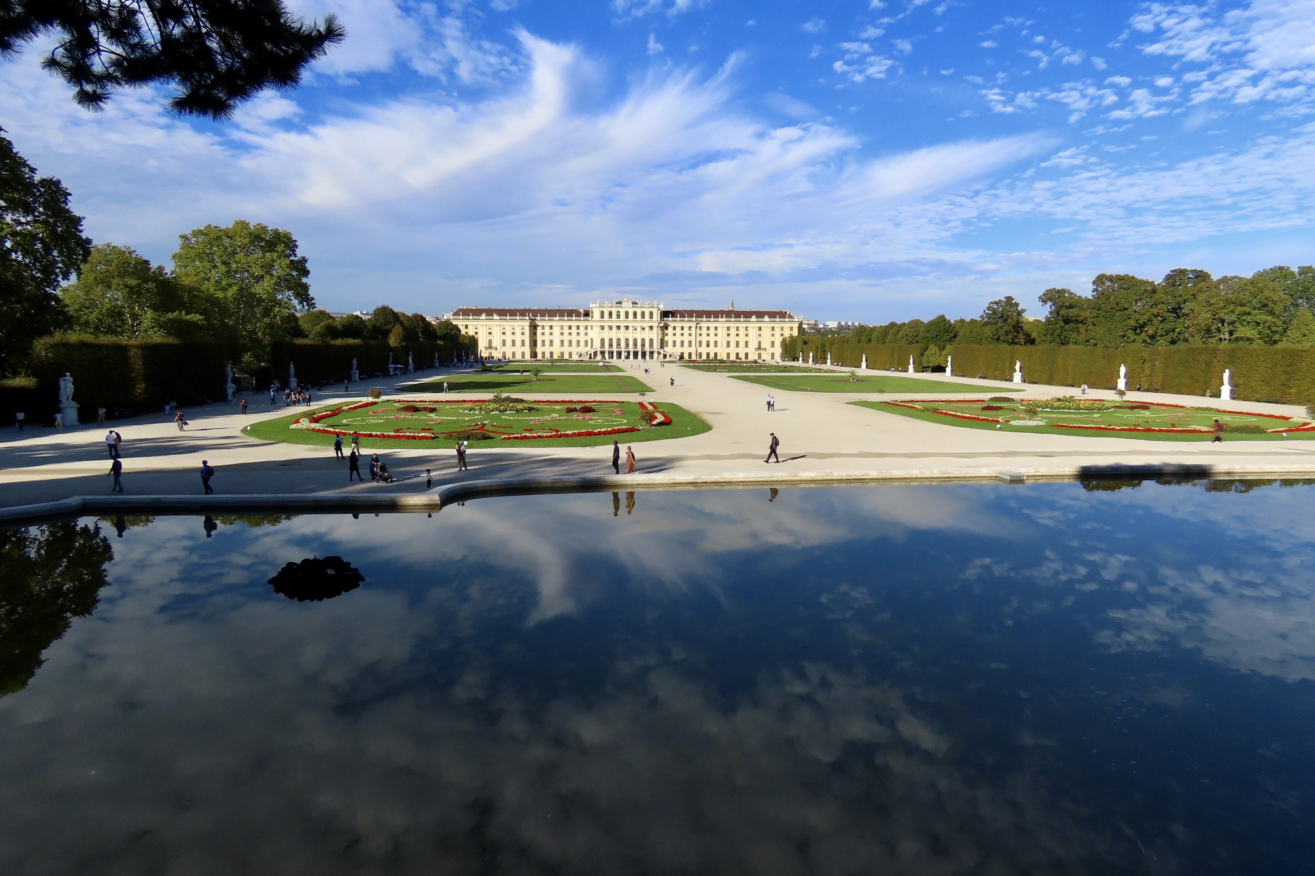
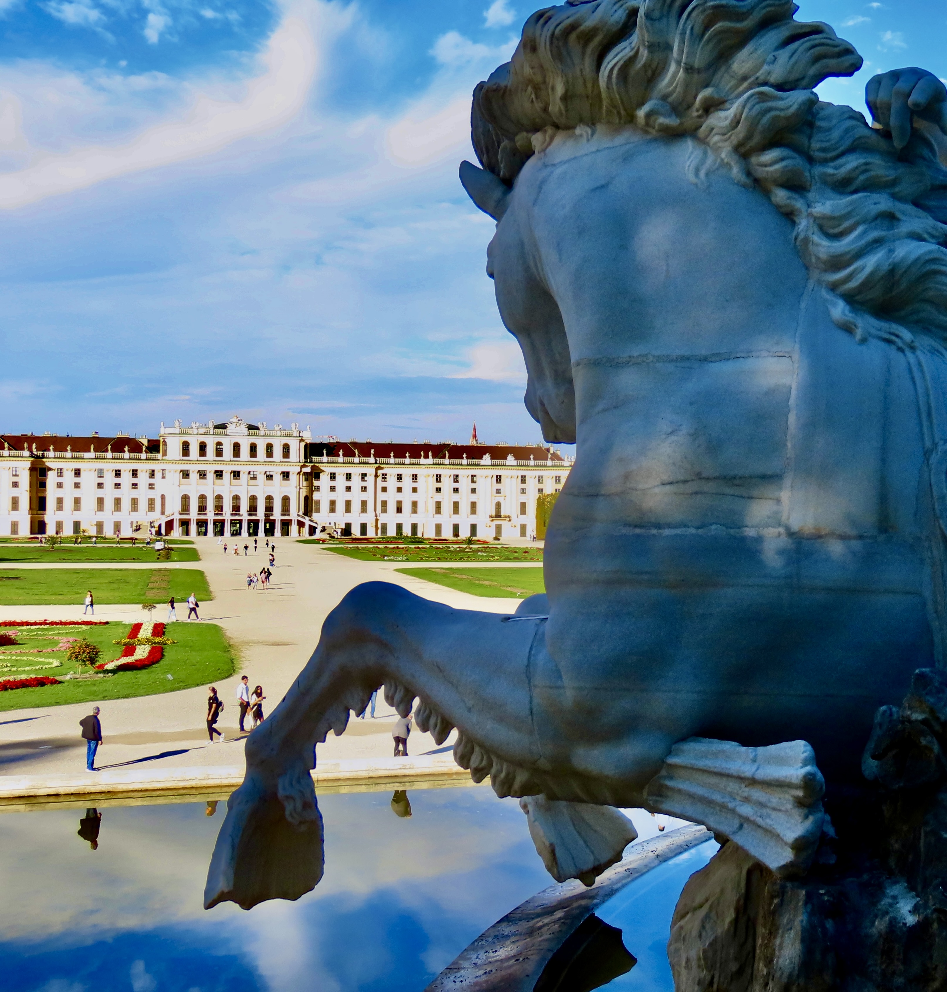
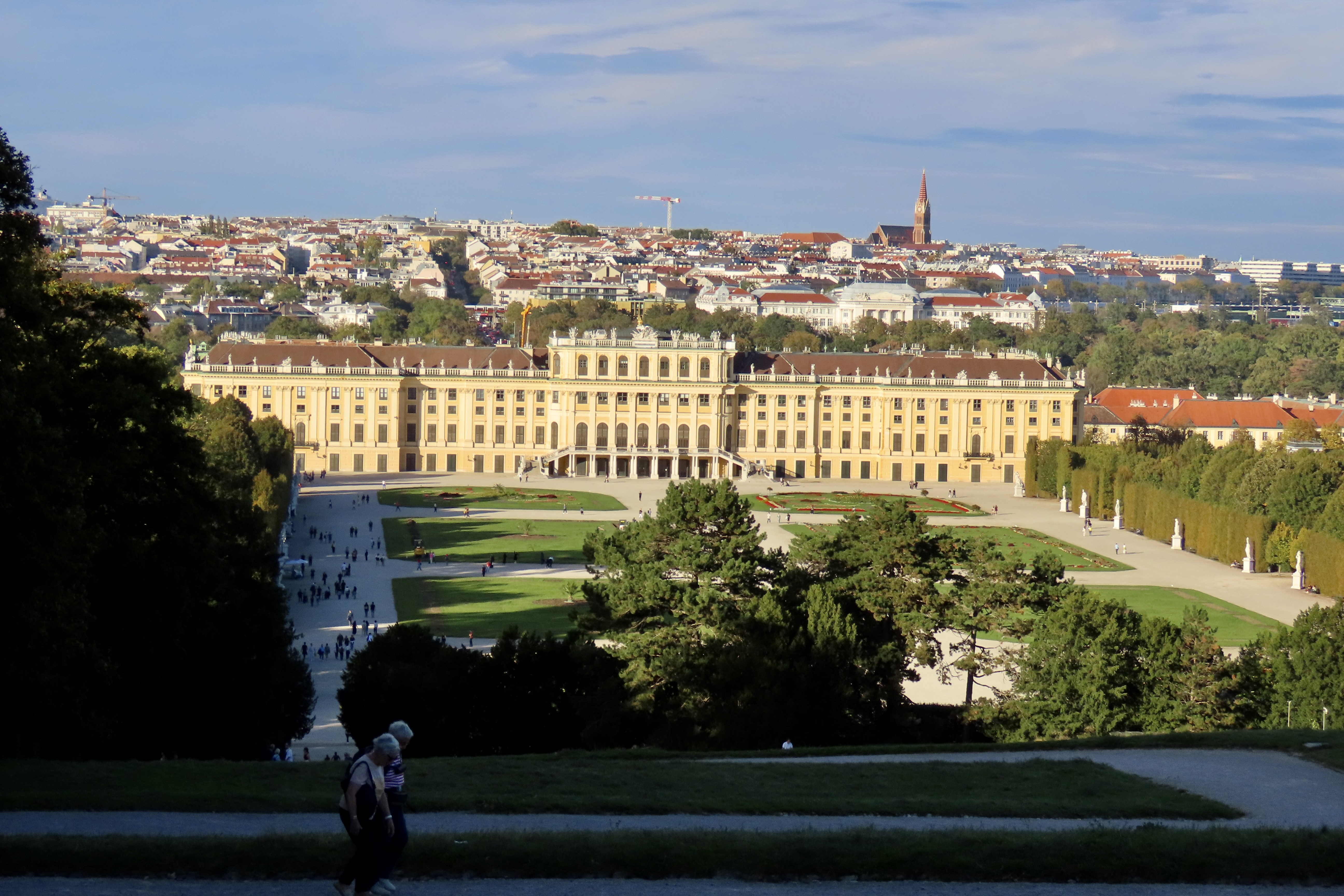
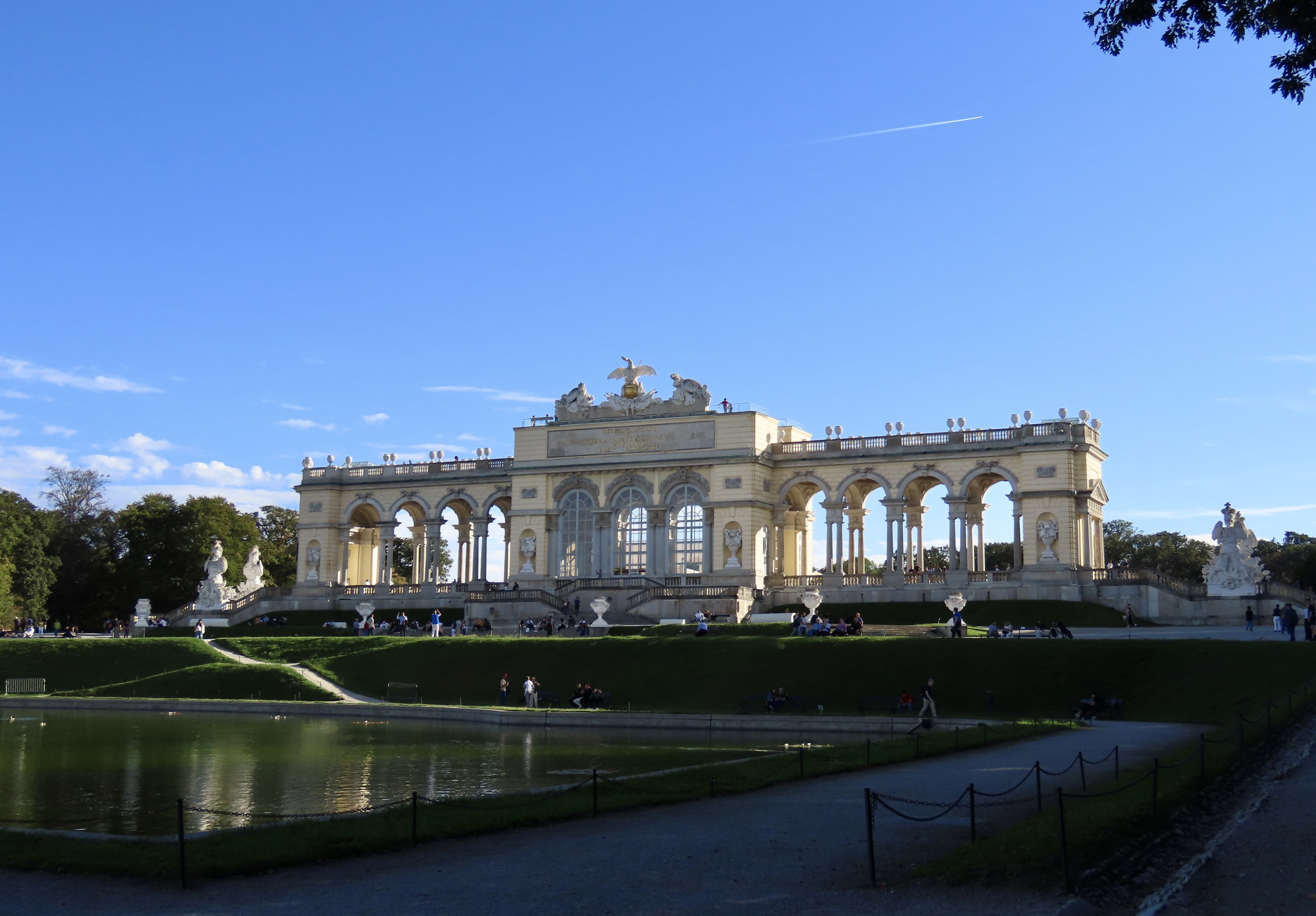
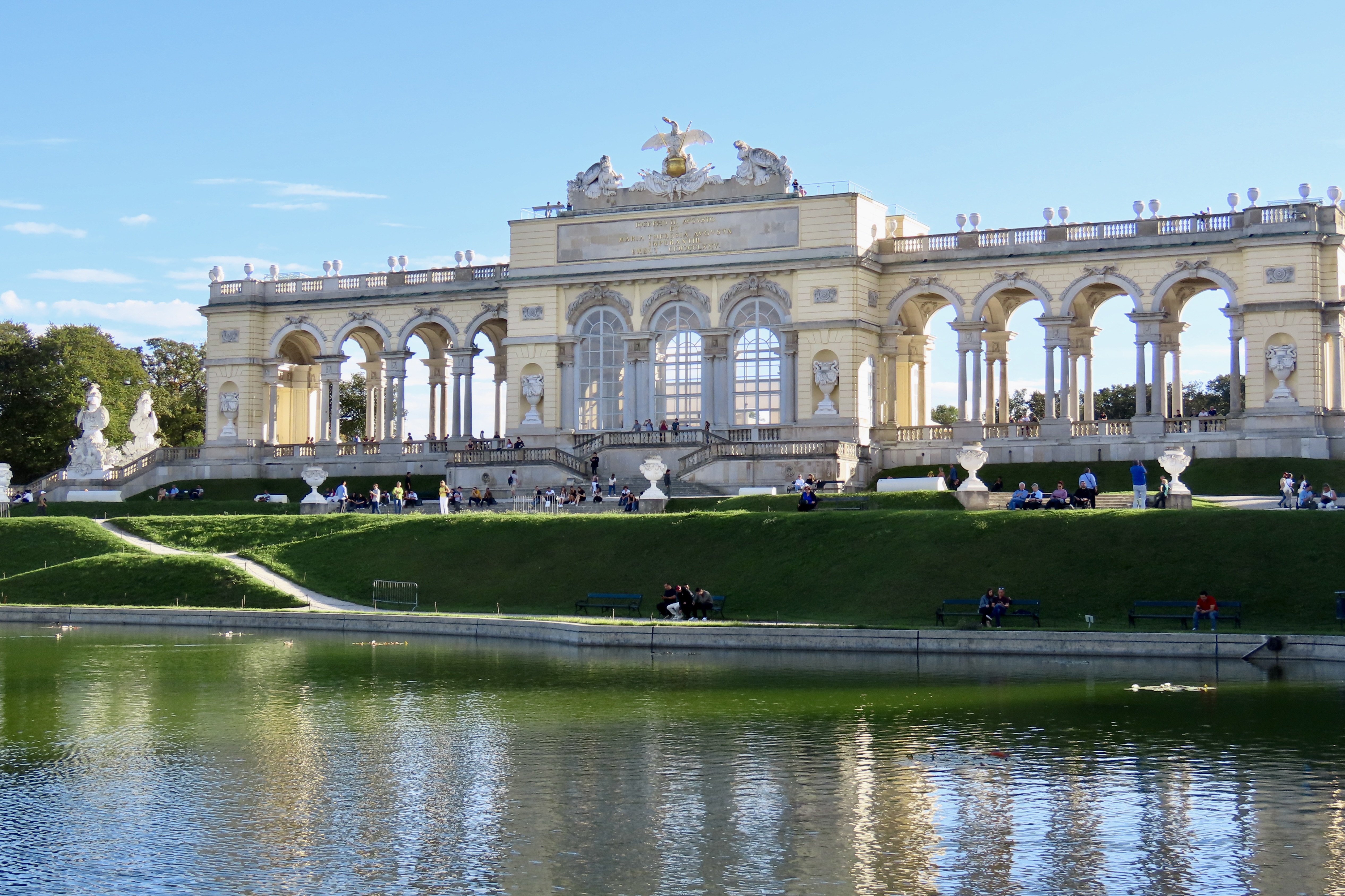
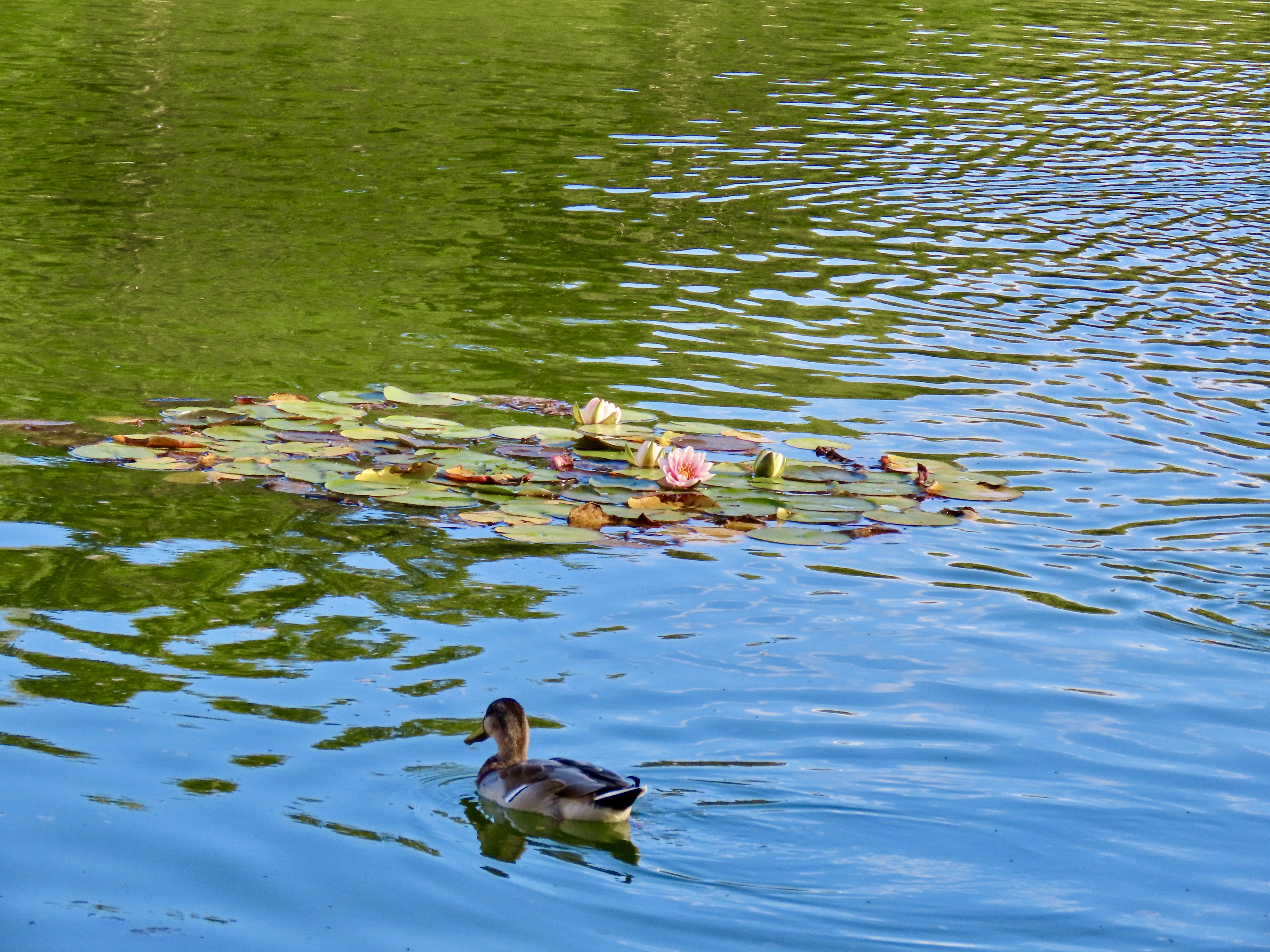
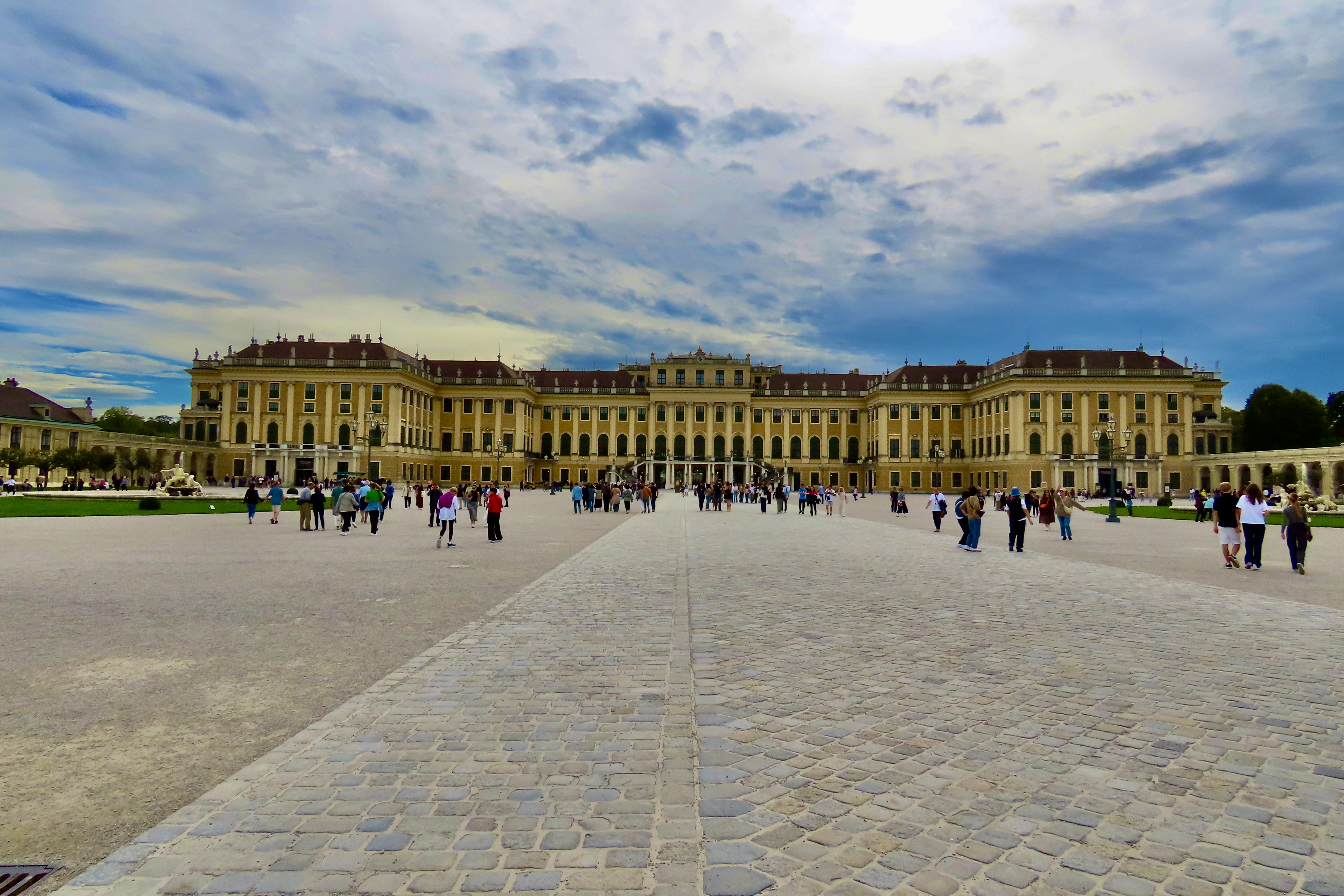
Imagine living in a place with ceilings painted like this. Baroque art doesn’t get any more baroque than it does in the Schönbrunn Palace. Angels float through the air in sky boats while humans fill in the sides with activities ranging from war to farming: It’s a world of fantasy with the barest of holds on reality.A sky boat floats through the clouds, probably carrying Habsburg royalty along with angels. Geese fly through the air. What about the trumpets? Are they announcing Royal and Divine presence or serving as horns clearing a path? Make way!A scary, more real ceiling painting shows soldiers lined up to fight. While one group was firing, the other was kneeling in front, reloading their muskets.Here, a stern looking shepherd tends his flock of sheep. I’d look stern as well if a guy was about to jump out of the sky and land on top of me— or my sheep.Ornate chandeliers matched the ornate ceilings. Check out the walls.What does your imagination suggest here?While the Schönbrunn Palace has some 1,441 rooms, we visited maybe 15. One of the things that caught our attention in the rooms were beautiful stoves like this one. Imagine keeping them all burning. It would have required an army of servants. Non obtrusive side doors entered the rooms from hidden servant corridors to allow servants to do their work. Numerous paintings like the one on the right were found in the rooms we saw. They ranged from everyday people doing everyday things to portraits of Habsburg rulers.This peasant couple looks a little fuzzy, but hey, they were dancing fast and having fun. A guy on the right toasts them. And does the half moon on the building behind them show an outhouse? Probably not. More likely, it was a sign for the tavern where the revelers were getting their liquid refreshments.No fuzziness here. Royalty required more attention in their paintings. They wore clothes, jewels and symbols of power that needed to be shown off— along with bosoms. This is Maria Theresa, who ruled the Habsburg Empire for forty years (1740-1780), and managed to have 16 children along the way, most of whom were married off to cement political alliances throughout Europe. One was Marie Antoinette of France, known for her profligate spending and supposedly saying, “Let them eat cake,” when the poor were rioting in the streets of Paris from starvation. Not a very thoughtful statement, considering. She lost her head over it.While there was much of interest inside the Palace, Peggy and I actually spent an equal amount of time wandering around outside on our own. The Schönbrunn Palace is more popularly known as the Summer Palace. The Habsburgs like to spend their summers here. This is a section of the front. I provided a complete view at the end of my last post.This map provides a view of the Castle and the grounds that featured beautiful gardens and interesting sculptures. We hiked from the Palace up to the ‘Gloriette’ at the top of the map on top of a steep hill. Note the large zoo on the right. Started in 1752, it is the world’s oldest zoo still in operation.While we were at the end of flower season for Vienna, the gardens were still impressive. This provides a back view of the Summer Palace.The walkways along the edge of the gardens were filled with 32 life-plus size mythical deities and historical figures. This is Perseus, who the popular Percy Jackson books and movies were based on. Here, he borrowed Hermes’ winged hat and shoes and flew off to Medusa whose look could turn you to stone. Perseus is carefully looking the other way. Judging from his present status, however, he may have been little late.Our goal was to visit Neptune’s statue and the Gloriette above it.Ride ‘em Cowboy. Neptune’s home above a small lake included a number of other mythological creatures besides the trident carrying god of the ocean. What you have here is a merman (part man, part fish) going for a joy-ride on a hippocampus (part horse, part fish).And here’s Neptune. Not sure whether the woman is a mermaid but I don’t think I have ever seen a picture of a mermaid wearing a dress. It appears she has his attention.Neptune’s statue provided great views of the Summer Palace.The Palace from the perspective of a Hippocampus.Remember how I said St. Stephan’s Cathedral dominates the skyline above Vienna. We took this photo above the Neptune statue on our way up to the Glorietta. The church is on the right. Its only competition was a crane.And finally, the Gloriette. A gloriette is defined as “a building in a garden erected on a site that is elevated with respect to the surroundings.” This one was built as a ‘Temple of Glory’ in 1775 and served a a great viewpoint and ballroom. It was Vienna, after all, where umpteen top Viennese composers were busy writing waltzes and other dance music.A closer view. The glassed in middle section served as the ballroom.This mallard happily made use of the pond in front of the Gloriette.We’ll wrap up today’s visit to the Summer Palace with a side view of the Gloriette. Next we will return to the historic downtown of Vienna and visit the Winter Palace as well as other sites.A downtown view.
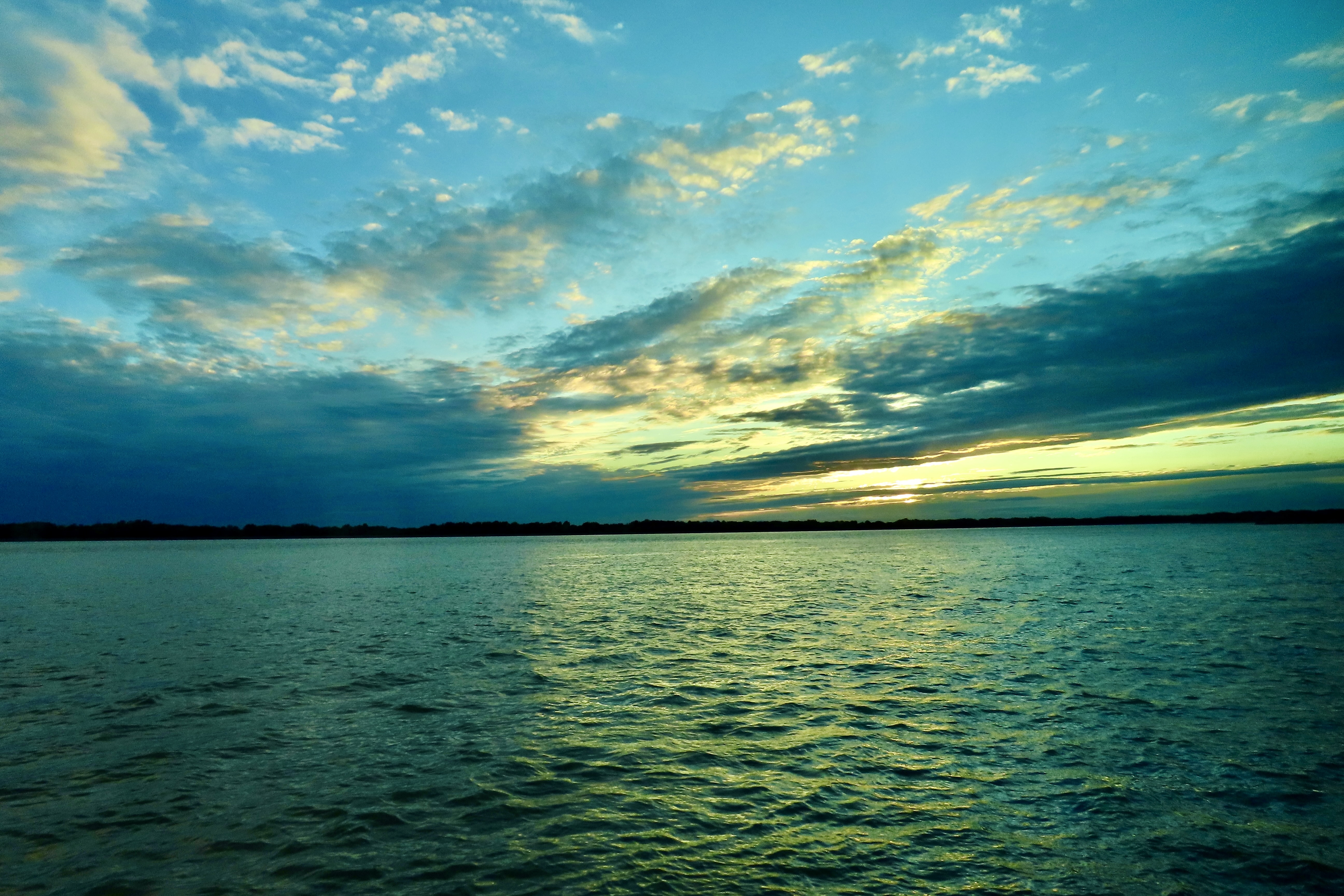
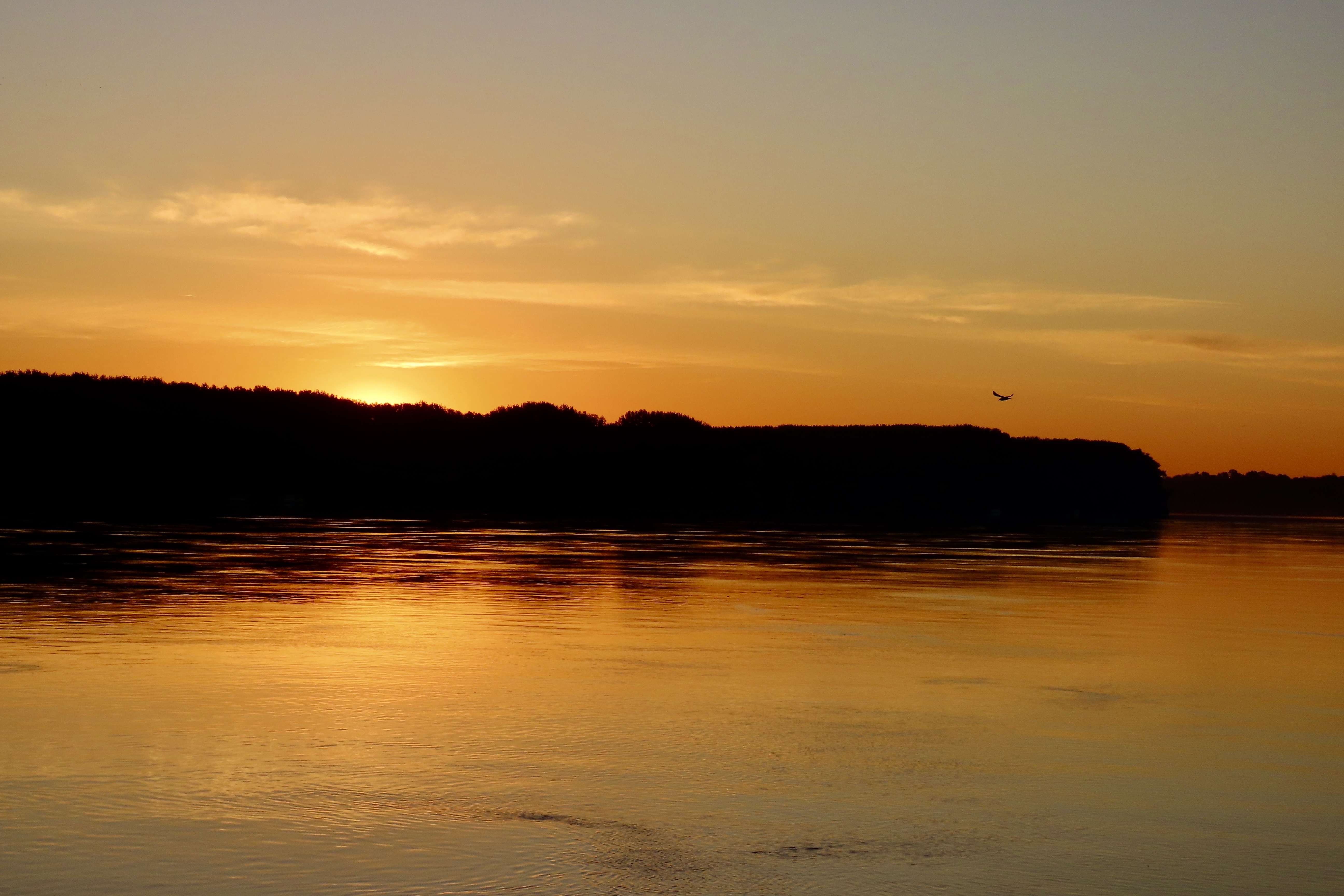
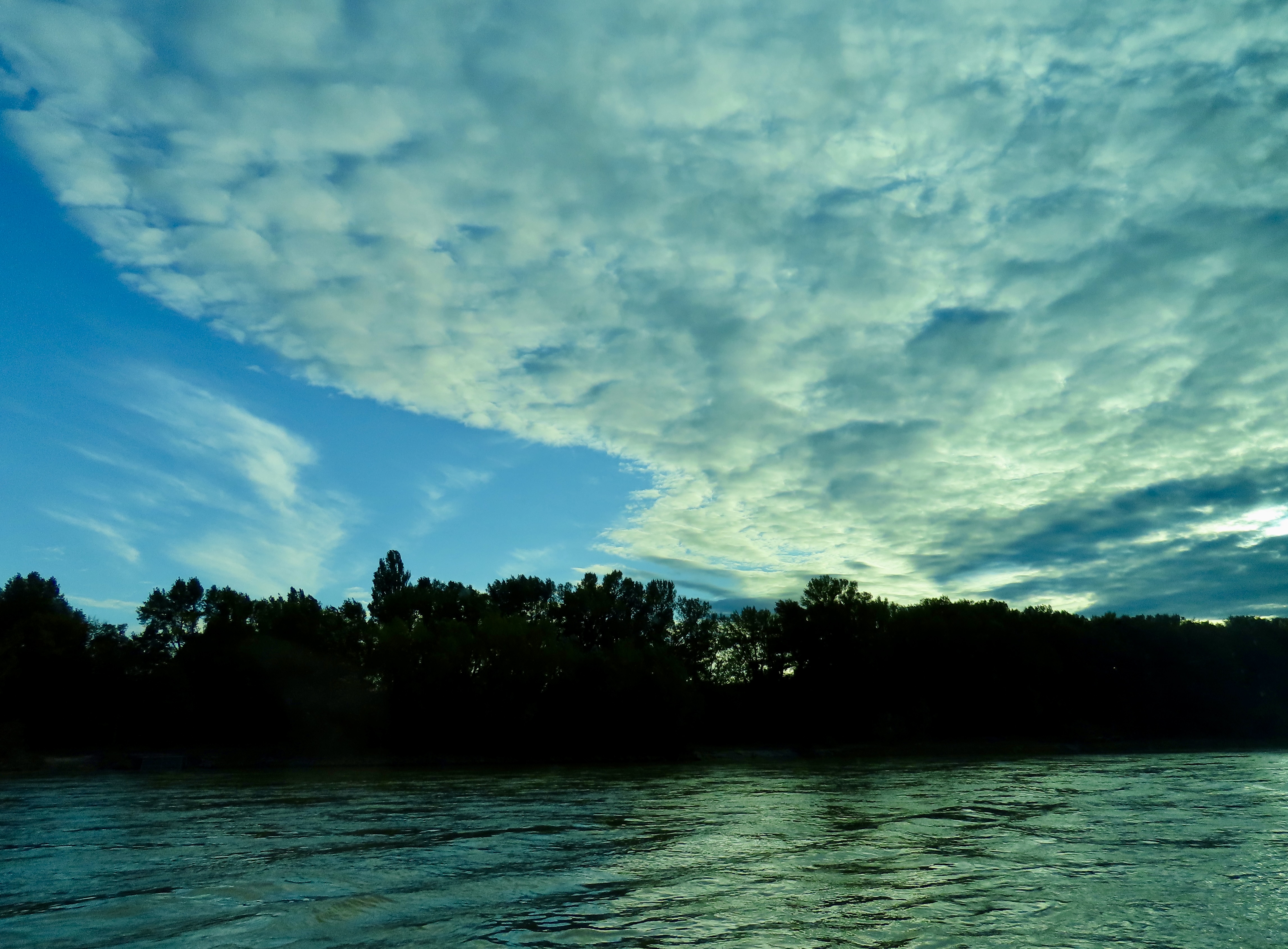
I’ve put on some mood music for today’s post: The Beautiful Blue Danube by Johann Strauss. Appropriately, it’s being played by the Vienna Philharmonic Orchestra. This is the river and its beauty. Its blue green tint is caused by the time of day and clouds. Like all rivers, it has a variety of ever changing moods.
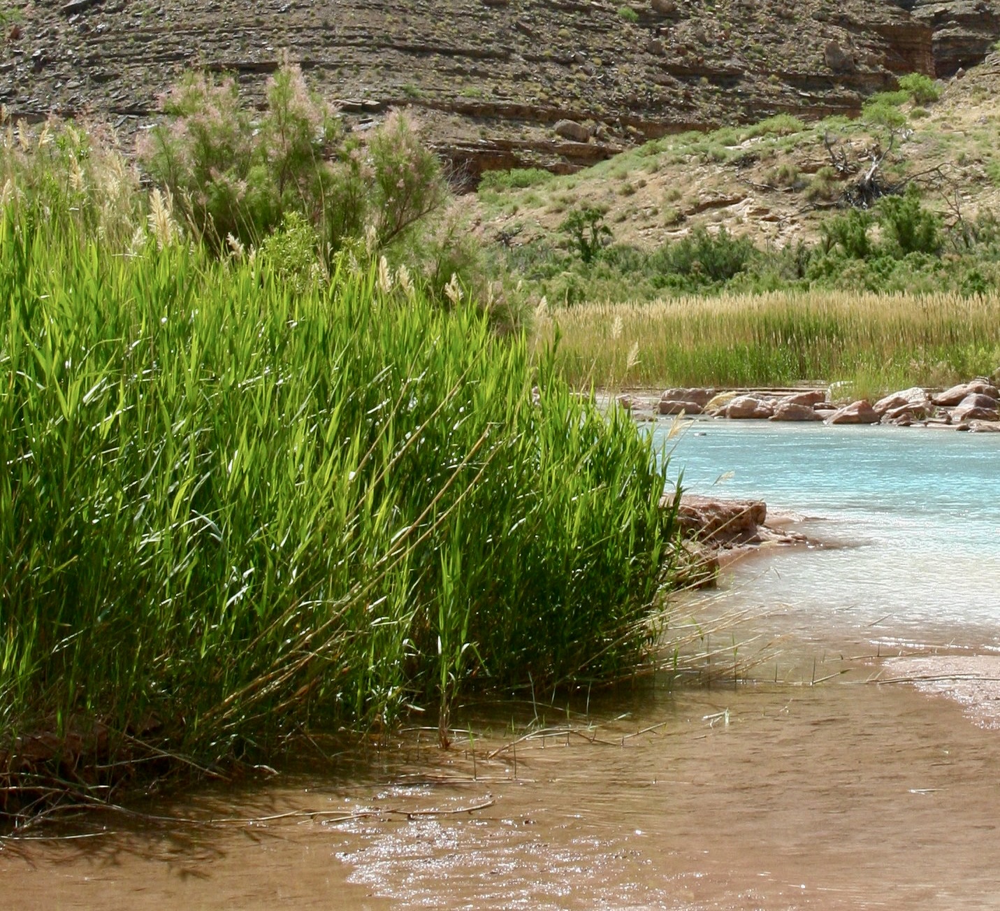
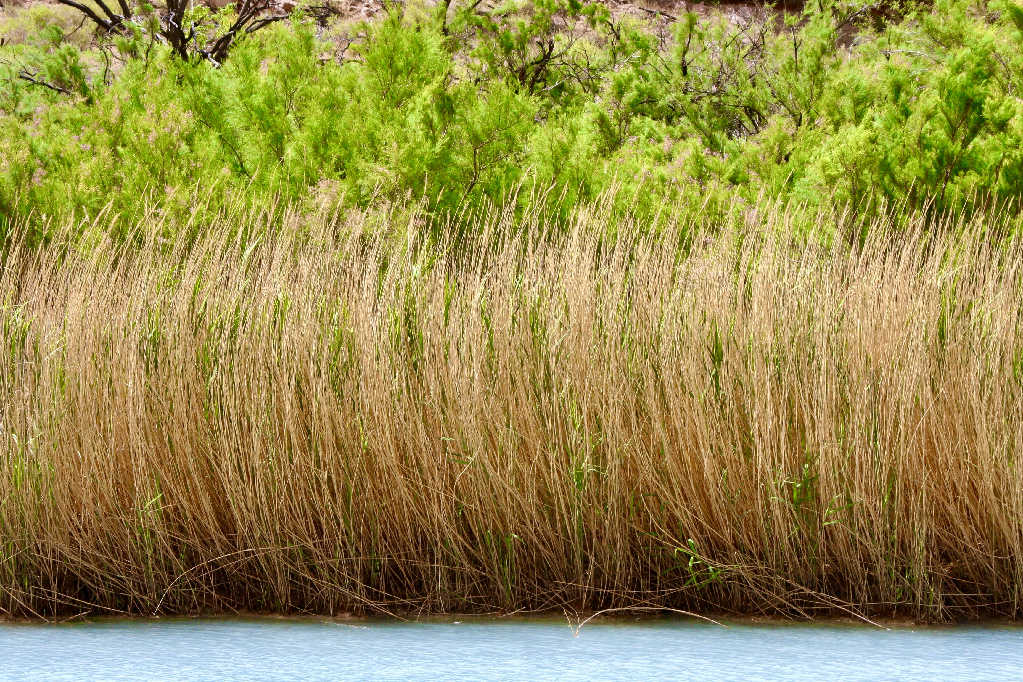
We leave the Colorado River as it flows through the Grand Canyon today and travel 6000 miles to the second river in our Great River Series, Europe’s Danube River. Peggy and I, along with her brother John and his wife Frances, cruised down the river from Vienna to the Black Sea for nine days in late September/early October this year while adding another 7 days with a pre-tour of Vienna in the beginning and a post-tour of Transylvania at the end.
Polar opposites come to mind when comparing the two experiences. The Colorado combined the world class natural beauty of the Grand Canyon with the high adventure experience of floating through roaring rapids in small rafts. Accommodations are best described as roughing it. We slept on the ground in our two person tent, prepared our own food, and took care of bathroom chores on the groover— which was hopefully hidden from public view by bushes and rocks. Whatever bathing took place was in the ice cold river or or side streams with our clothes on— might as well wash both at once, right? Side trips normally involved climbing up the steep, possibly dangerous sides of the Grand Canyon to enjoy the beauty or leap 10 to 20 feet off cliffs into small, hopefully deep, pools of water. As for weather, think up close and personal.
The Danube has a beauty of its own but lacks the incredible scenery of the Grand Canyon. Our ‘raft’ was a brand new river boat holding around 100 people, where we ate four course meals served to us by friendly, attentive staff. (Peggy had won them over on the first day. When we entered the dining room we’d hear, “Hi Peggy,” coming from all sides.) We slept on a king-sized bed, had large windows looking out on the river, enjoyed a hot shower every night, and had a toilet that, um, actually looked and behaved like a toilet. Our side trips were usually into major Eastern European cities known for their culture and stunning architecture. It wasn’t quite ‘roughing it.’
The primary difference, however, was on focus. On the Colorado, it was the river, the surrounding natural beauty, and the adventure. On the Danube, it was on history and the cities that border the river. The Danube had once served as the boundary for Rome. In the centuries since the region, known as the Balkans, had seen continuing invasions including the Mongols out of Asia and the Ottoman Turks from Turkey.
World War I started in Bosnia when Archduke Franz Ferdinand of the Austro-Hungarian Empire was assassinated by a Serbian nationalist. World War II ended with Russian tanks and troops rolling across the area and establishing the Communist Eastern Bloc nations. Ethnic rivalry, seen most recently in the bloody Kosovo conflict, has often been intense. The word Balkanization, which refers to a country or region breaking up into smaller, frequently hostile units as the result of ethnic, religious, or political differences, is actually based on what happened in the region.
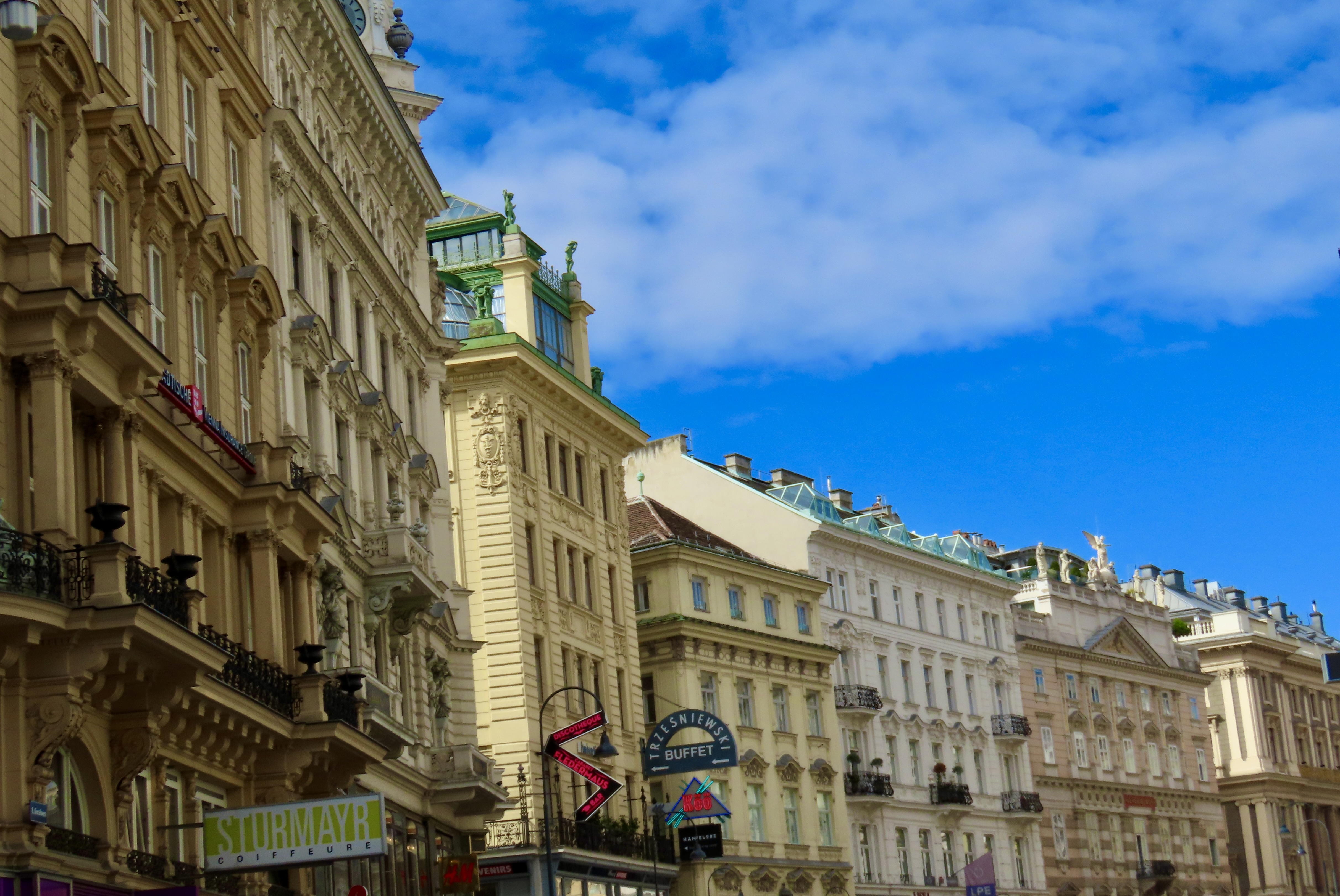
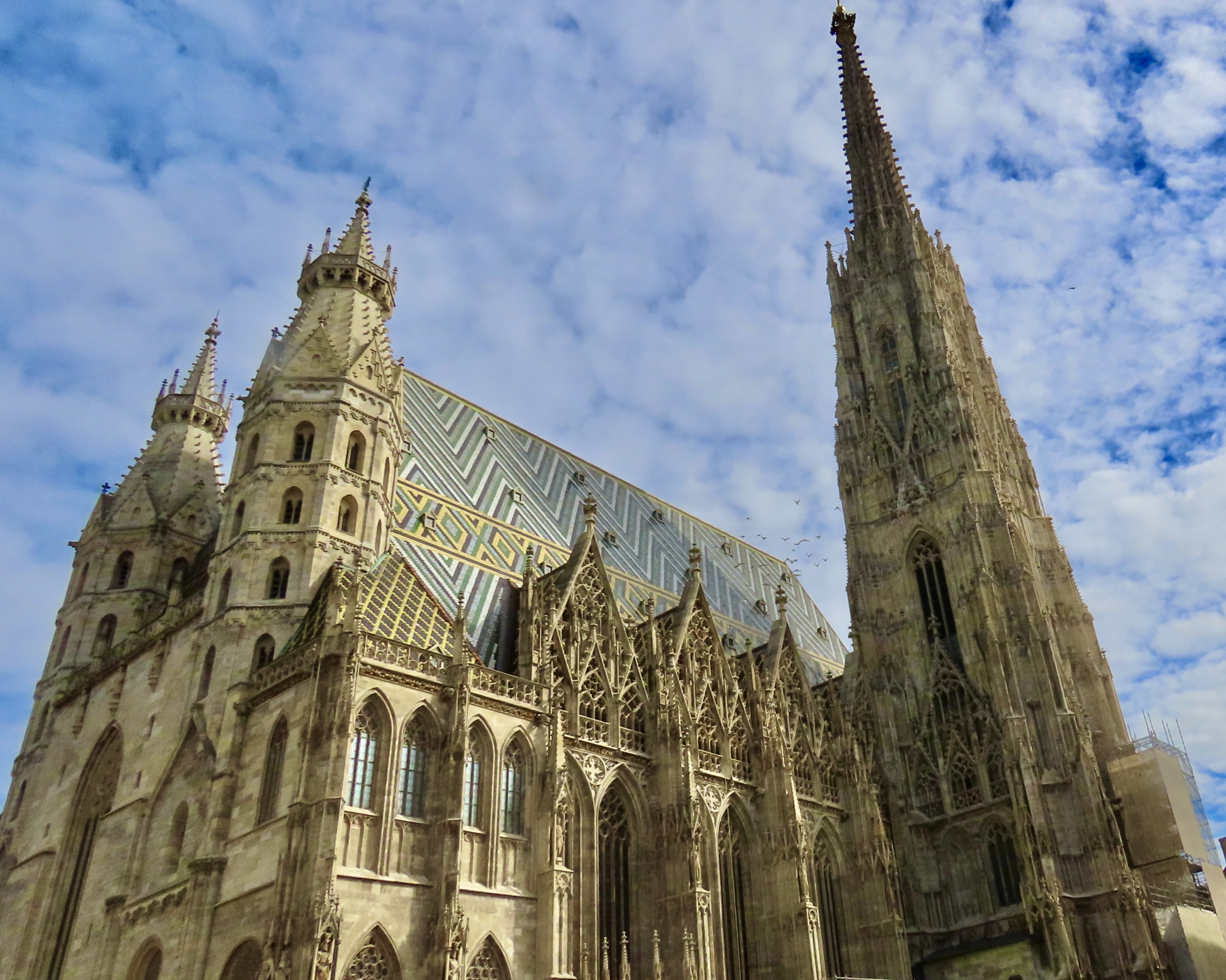
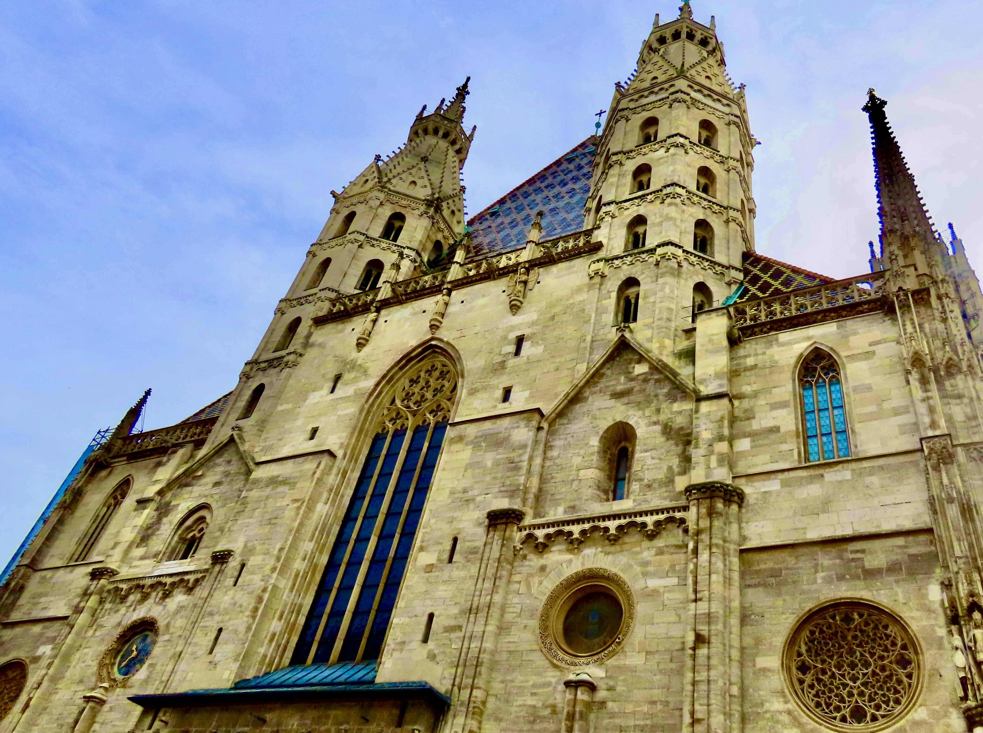
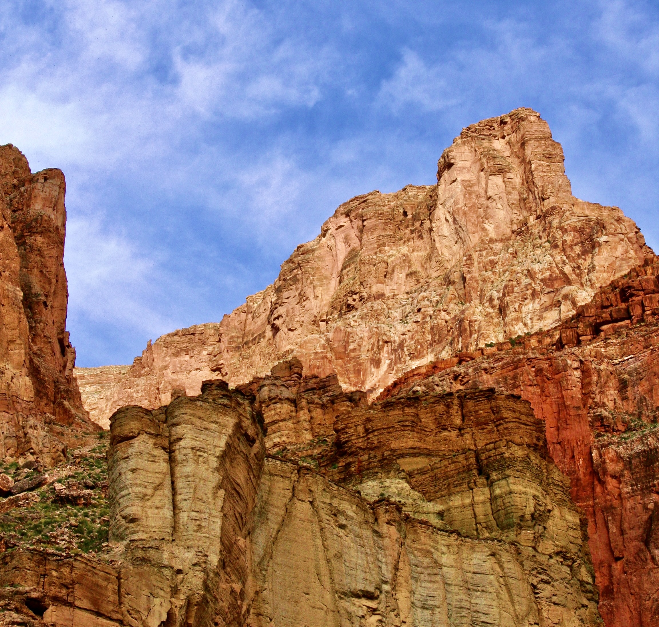
We followed the Danube River traveling for about 1200 (1930 km) of its 1700 miles (2,730 km) in a southeast direction starting in Vienna and ending at the Black Sea. I’ll start this series in the classic city of Vienna. On today’s post, I am going to feature St. Stephan’s Cathedral which dominates Vienna’s skyline and is remarkably beautiful. And strange, in a medieval sort of way.
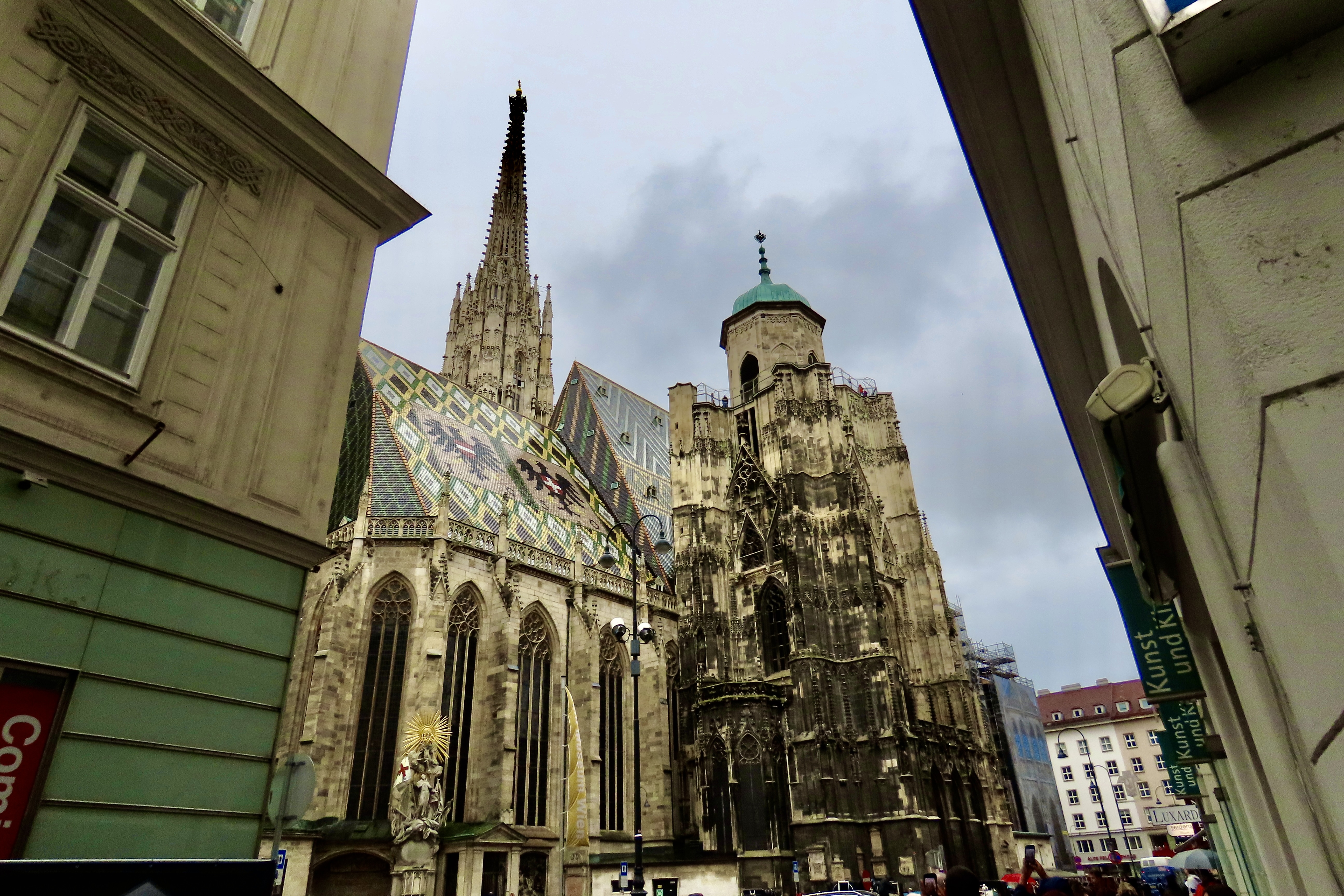
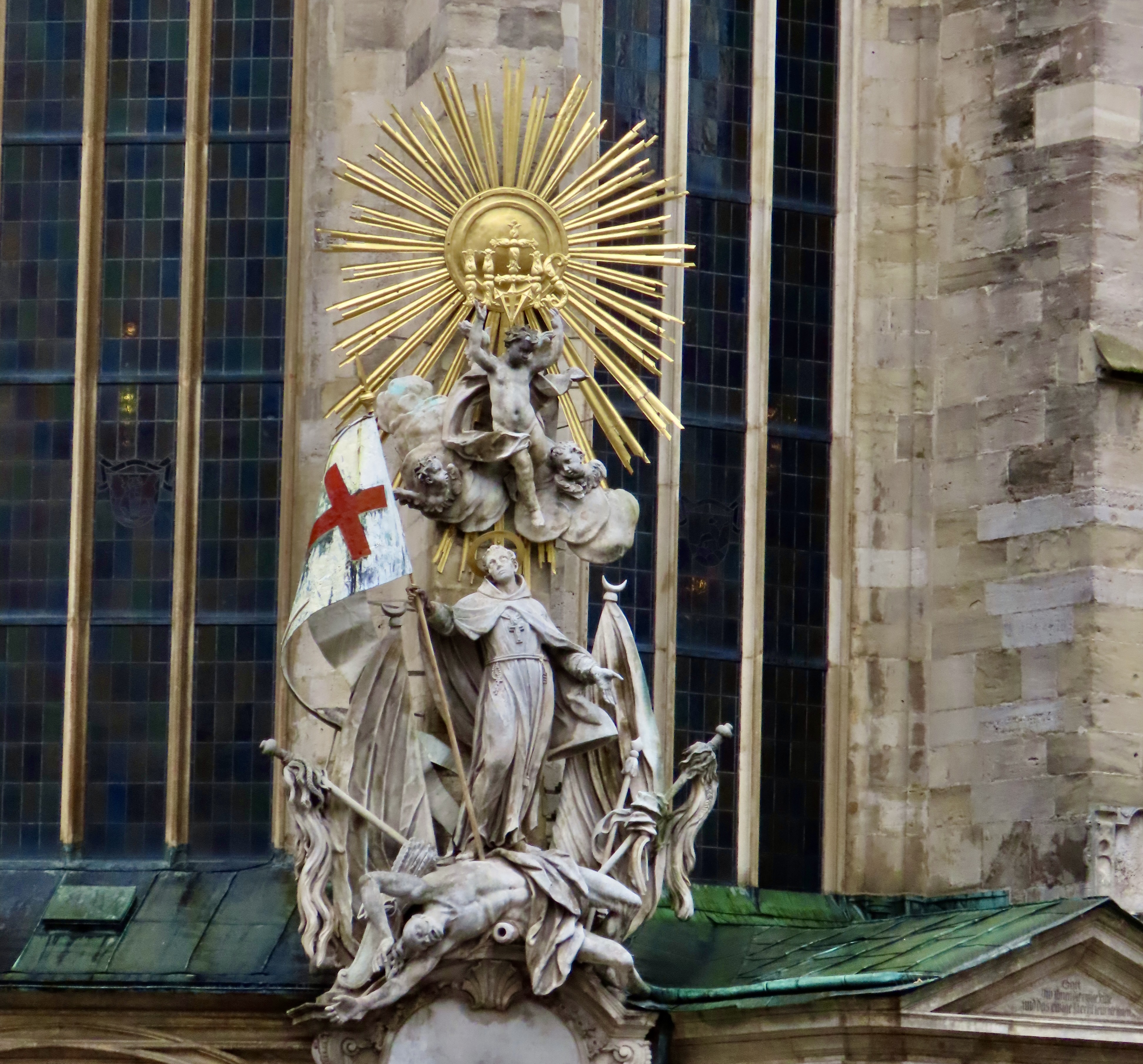
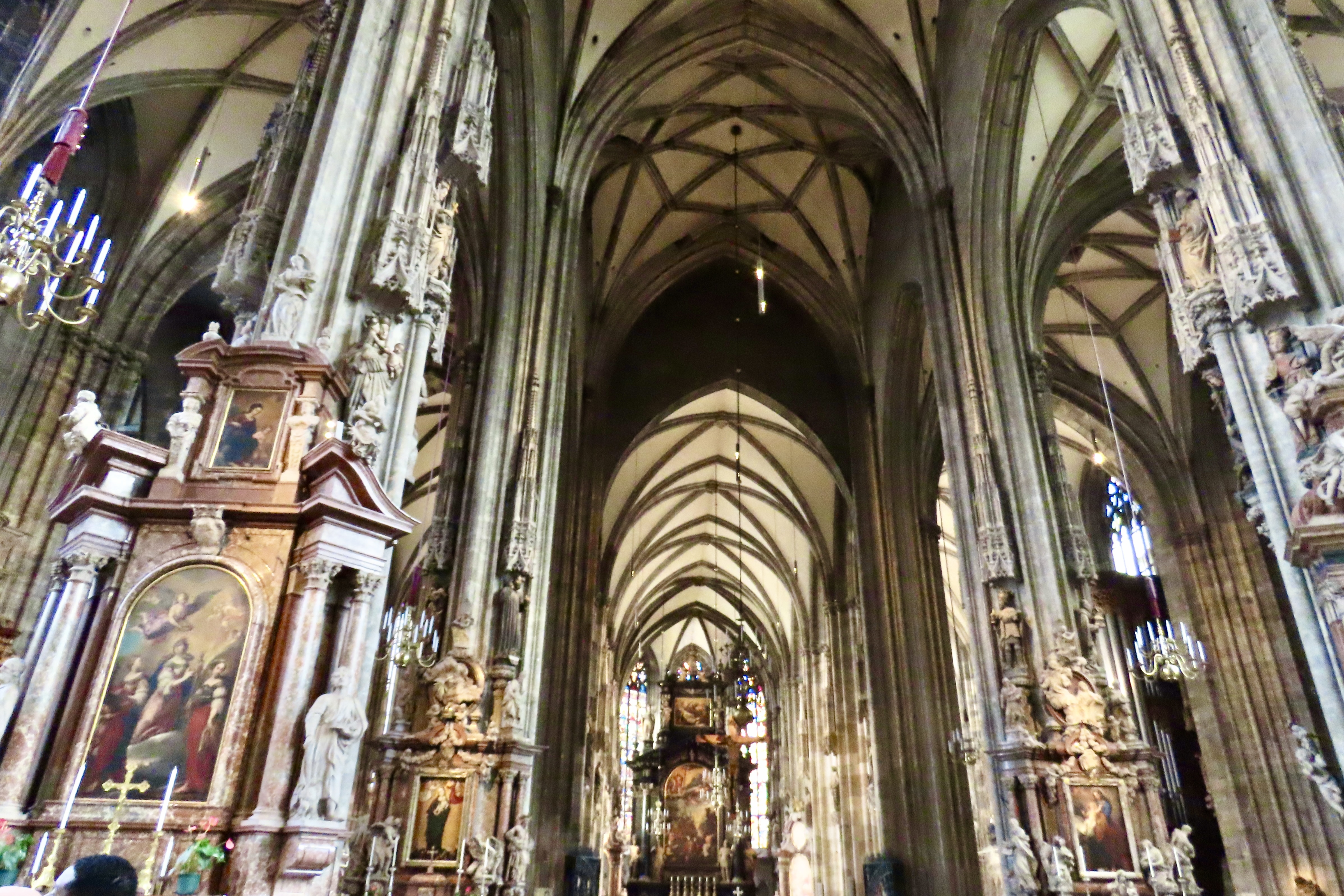
St. Stephan’s Church with its striking roof and its 446 feet (136 meters) tall south tower reaching for the sky. The roof is covered with some 230,000 glazed tiles. Note the birds flying between the tower and the roof. They had been disturbed by the ringing of the noon bell. It is said that Beethoven first realized how totally deaf he was when he saw the birds fly out of St. Stephan’s bell tower but couldn’t hear the bell ringing.A front view of St.Stephan’s. The main entrance to the church is just below the overhang. It’s know as the Giant’s Door. The story behind the name is that the thighbone of a mammoth was found in 1443 while workers were digging the foundation for the North Tower and hung it over the door, where it apparently resided for decades. Did they see it as a unique decoration? Or maybe they thought of it as a message from God…A view of the North Tower where the mastodon bone was found. Originally the tower was supposed to reach the height of the South Tower but the funding came to an end. It does, however house the Pummerin, or, as it is known locally, the Boomer, a 44,380 pound (20,130 kilogram) bell, which is the second largest swinging bell in Europe. The two eagles on the roof are the symbols of Austria and Vienna. Note the monument on the lower left…The Capistran Chancel was once the main pulpit in St. Stephan’s. It’s named after St. John of Capistrano, a Franciscan, who is said to have preached a Holy Crusade from it against the Muslim Turks in the 1450s. It shows St. Francis tramping on a defeated Turk. From what I’ve read about St. Francis, that’s fake news. St. Francis was a man of peace who risked his life to establish peace between the Christians and Turks.
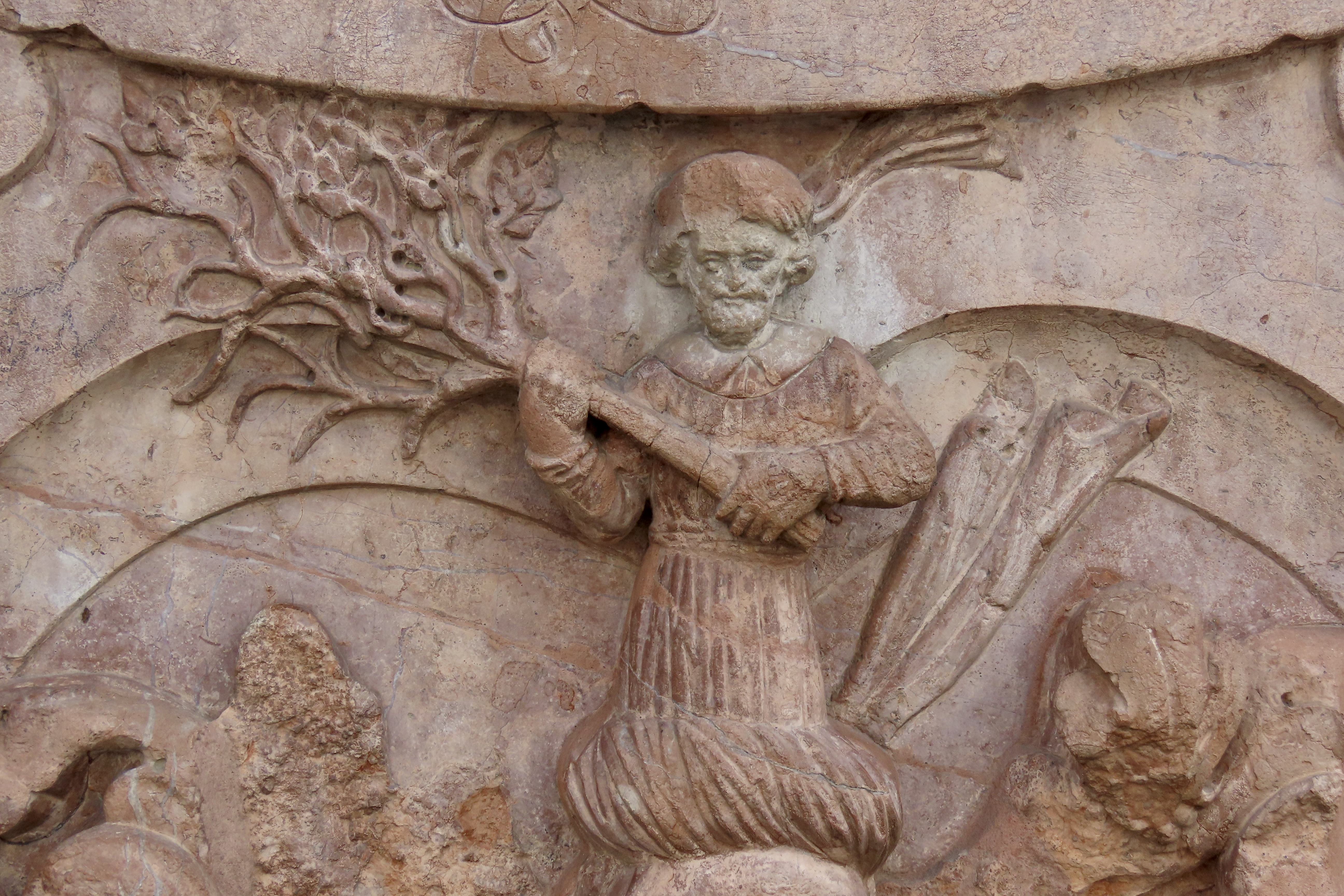
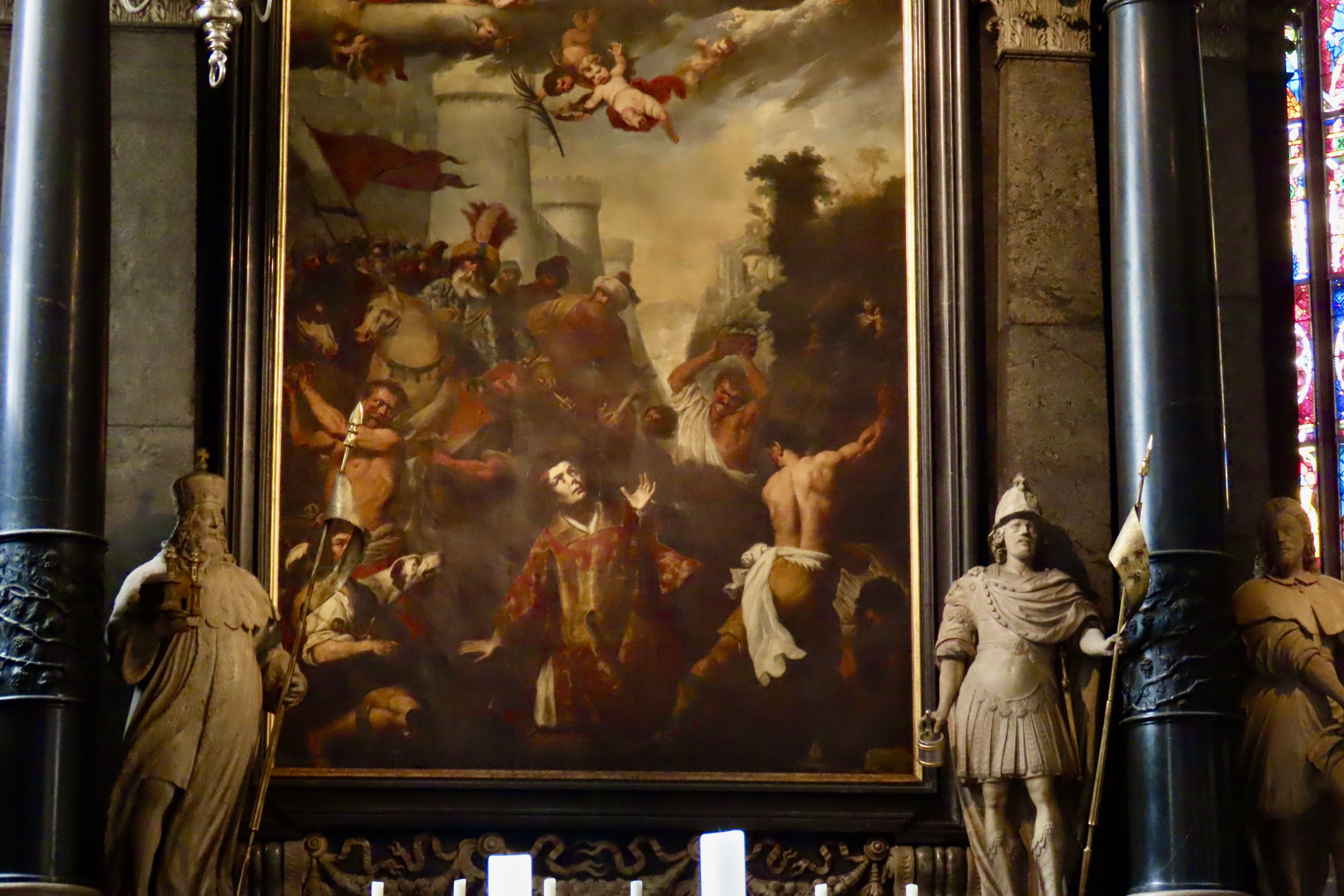
Also, I wouldn’t be surprised if you are thinking swallows when you hear Capistrano. And you’d be right. The Franciscans also named their early mission south of LA, California after the Saint, San Juan Capistrano. And that’s where the swallows return to each year. There is even a song about it. One final note: The door to the church’s catacombs is next to the monument. There are the skeletal remains of over 11,000 people in the catacombs. I wonder if the mammoth’s bone is there as well? Why not.Most people think of beauty and vast size when they visit Europe’s great cathedrals. And yes, there is that. After checking out the beauty, however, I like to focus in on the details. I found this stone carving on the side of the church. Is it a bird; is it a plane (as they said about Superman)? No! It’s St. Francis, appearing as a bird carrying a tree. It’s much more like the usual portrayal of a good saint than his image of stomping Turks. He loved trees and was said to talk to animals. If you see an image of a saint from medieval times with animals, birds or trees, you can almost bet it will be St. Francis.This is a photo of the inside of the Cathedral. It’s busy. I meant it to be. The number of statues and paintings of saints and important church personages was mind blowing. This is looking toward the high alter where a painting of St. Stephan is featured.He’s being stoned. It would be hard to find a painting of the saint when he isn’t. Even Rembrandt painted one. Here’s the thing. Most people were illiterate in the Middle Ages and the church fathers wanted their parishioners to know their saints and understand the messages they carried. Like St. Francis and nature. And St. Stephan and stoning. A bit gruesome perhaps, but most martyred Christian saints are tied to their martyrdom.
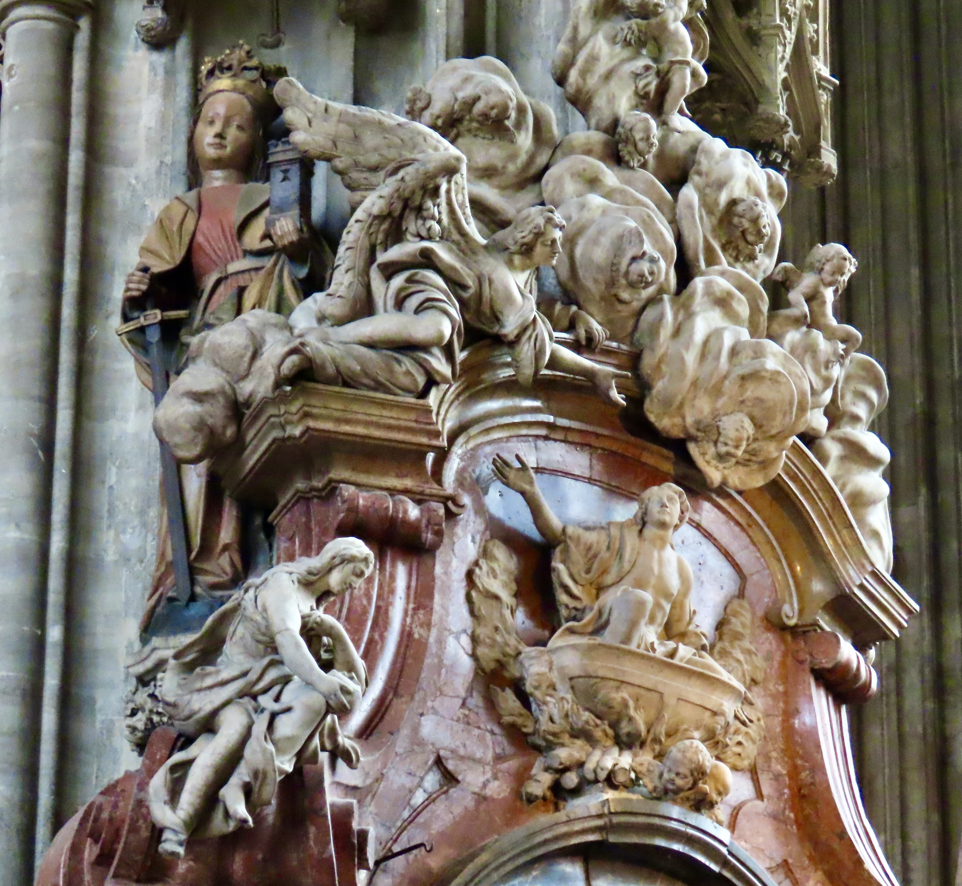
There are several at St. Stephan’s including St. Sebastian with arrows sticking out, St. Barbara holding a castle tower and St. Catherine of Alexandria holding a spiked wheel. Their stories are all similar. Deep faith brings them into conflict with non-Christian authorities. They are tortured and God miraculously intervenes to save them. Finally, they are killed. Thus you have faith, suffering because of faith, the power of God to miraculously intervene, and ultimately their willingness to die because of their faith. I assume they are all pulled into heaven where they live happily ever after. A story with a happy ending…
The woman standing behind at least 10 other beings, including the weird angels/people peeking out from the clouds, is St. Barbara. Her daddy kept her hidden away in a castle until he discovered she had converted to Christianity. Then he took her to the local pagan priest who submitted her to various tortures, from which she would miraculously be cured by God each night. Finally out of frustration, Daddy chopped her head off. On the way home he was struck by lightning and burned to a crisp. There’s a message here. Anyway, the castle represents where she was held, the sword with which she died and the crown her martyrdom. BTW, because of the lightning, St. Barbara became the patron saint of artillerymen and miners— things that go boom.
I, for one, if I ever have need for a saint, will stick with St. Francis of Assisi, the man of peace and nature who died of a natural disease. I like a guy who can talk to an almond tree and it suddenly breaks out in blooms.
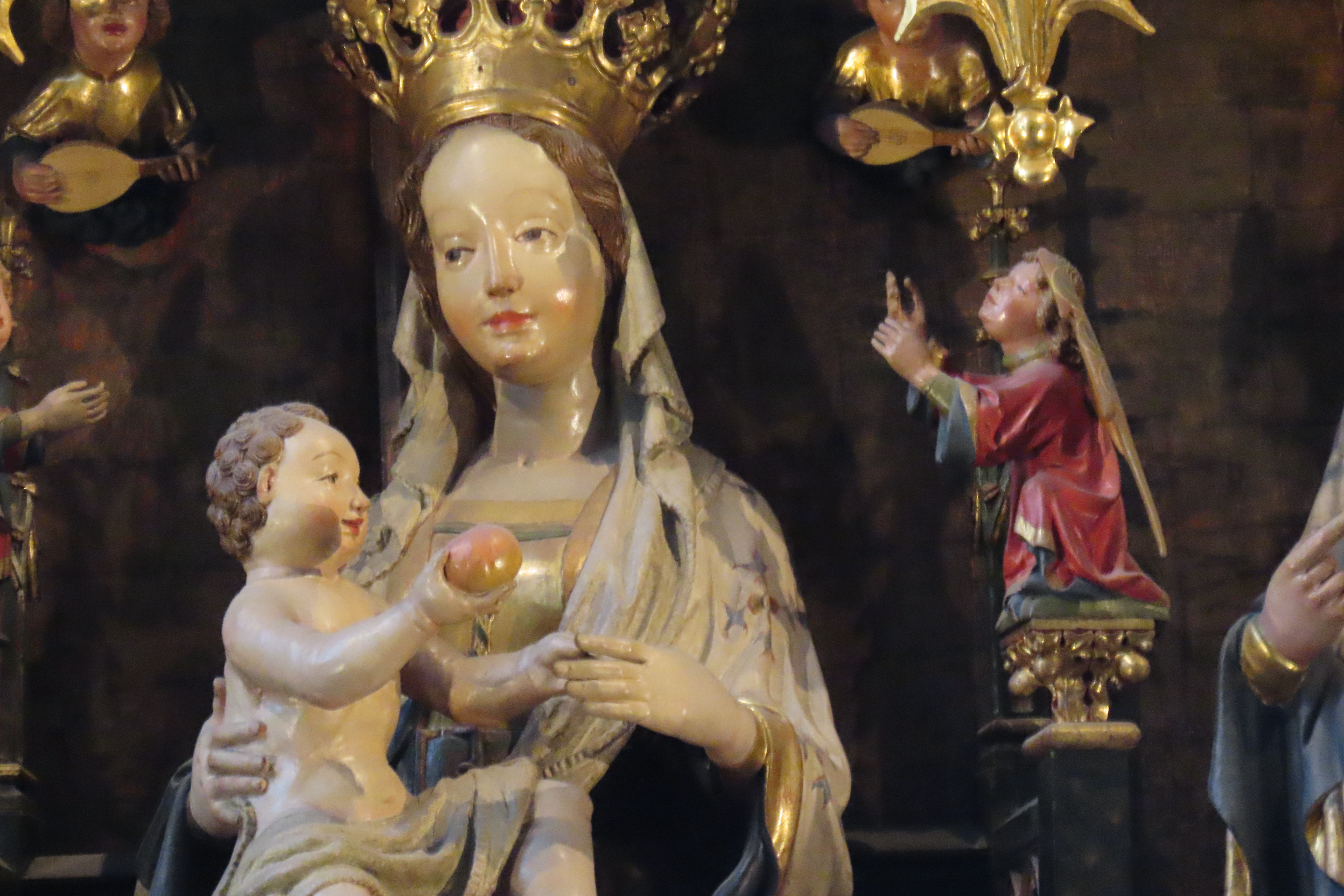
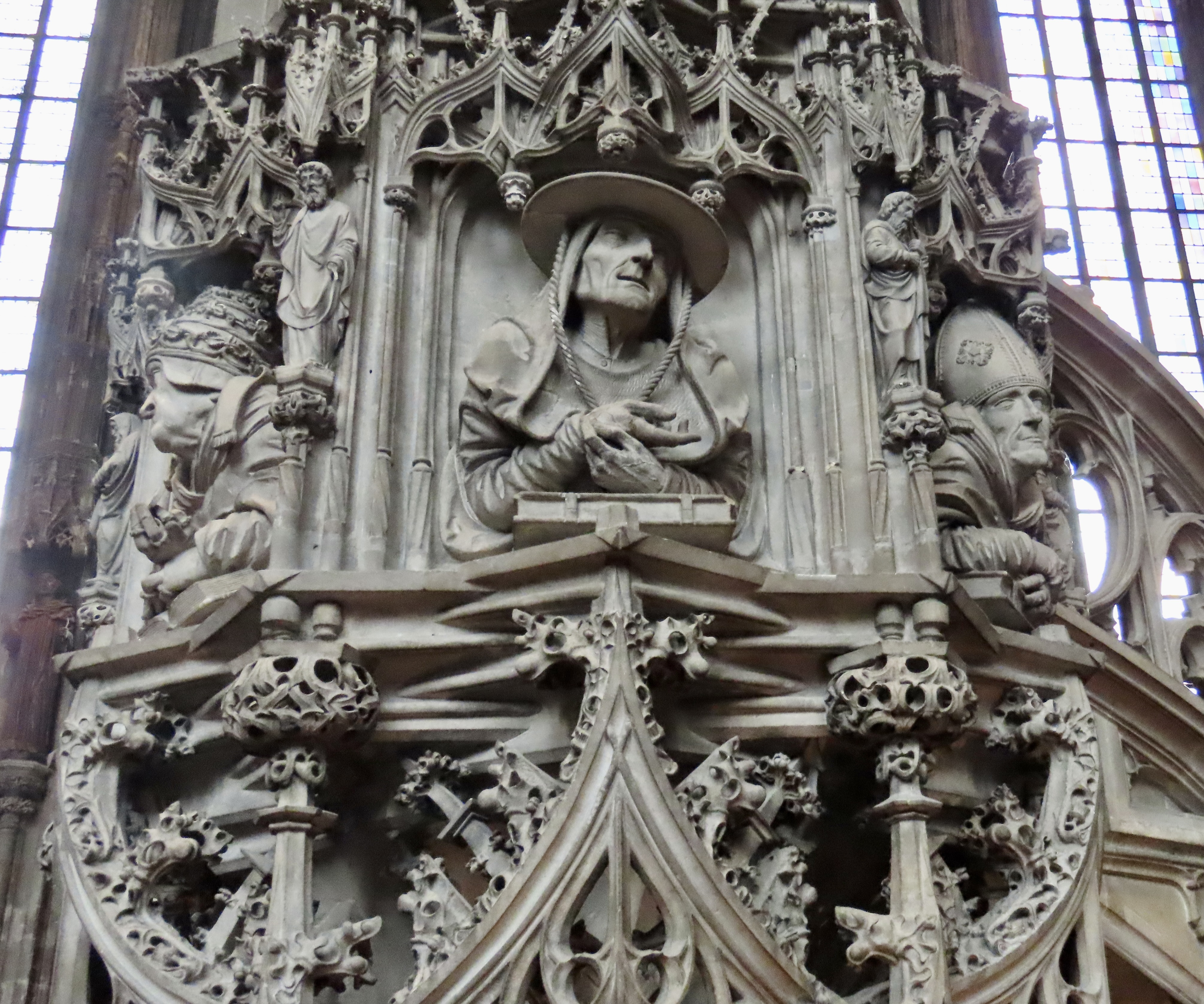
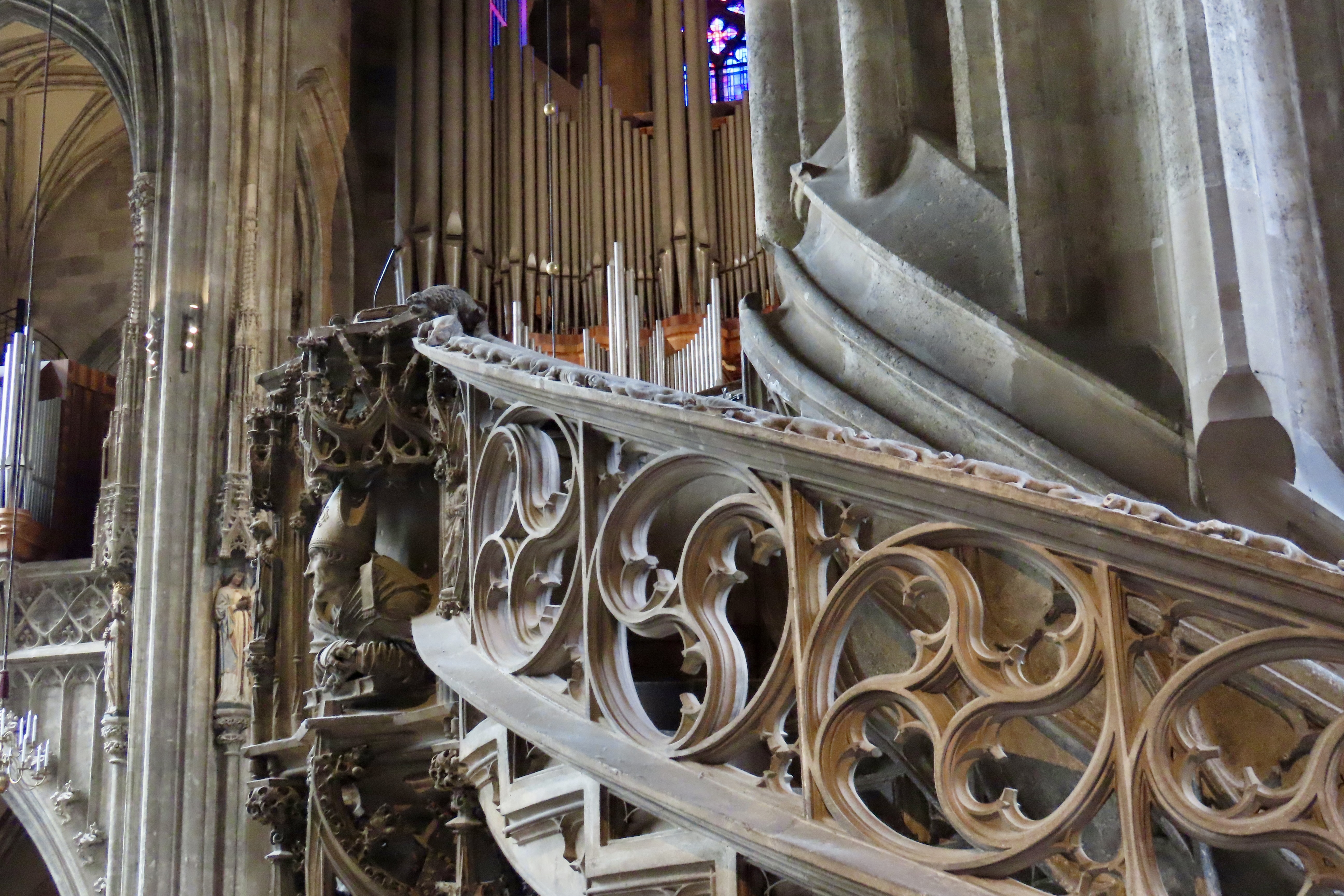
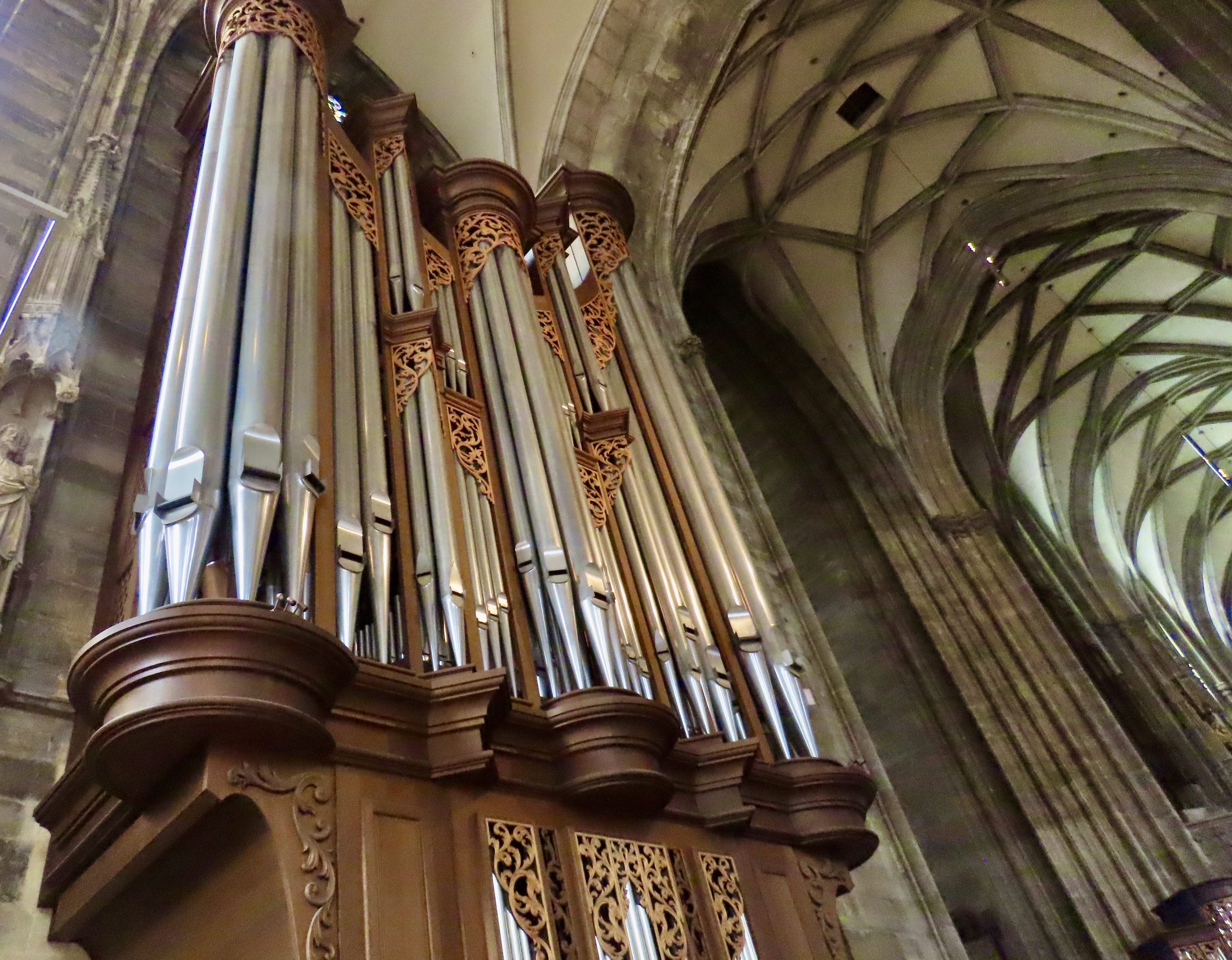
Here’s another symbol, Baby Jesus and his apple. It refers to him as the New Adam who will redeem humankind. I couldn’t help thinking, “Here Mom, your really should try this apple. Snake says it’s great.”The church’s pulpit is quite impressive. it includes realistic stone sculptures of the Four Fathers of the Catholic Church: Augustine, Jerome, Ambrose, and Gregory. The pulpit is found in the central part of the church rather than in the front. In the era before microphones, this was necessary for the priest to be heard. Note the balustrade on the right…It was covered with frogs and lizards biting each other, which, according to our guide, was to remind the priest/bishop/cardinal mounting the stairs of his many sins. A stone dog stood guard at the top of the steps to protect the speaker while he gave his sermon. Even then, it appears that dogs were considered man’s best friend. Cats, associated with women, were considered evil. Hmmm. An impressive organ can be seen beyond the stairs.Every cathedral we visited on our journey down the Danube had one. Looking at this one, I was reminded of the first massive organ I ever saw. I was on an Episcopal Church related trip in the early 60s and we stopped off at Grace Cathedral in San Francisco. At the time, Grace was one of the most progressive churches in America. It still is. My minister, Father Baskin, grinned at me and sat down at the keyboard. The sound was incredible, echoing throughout the church. He played an old ditty that I was familiar with, “The worms crawl in, the worms crawl out, the worms play pinnacle on your snout.” Father Baskin was one of the best men I have ever known. He was my kind of priest.There were many other strange sights that caught my attention as I wandered around the church, including this knight with his codpiece, meant to protect his vitals during battle. They were quite the fashion statement of the time and kept getting longer and longer. And don’t you wonder how his helmet (on the left) could ever fit over his hair.It’s time to move on, however. (Did I just hear, past time!) Next up is Vienna’s Summer Palace.
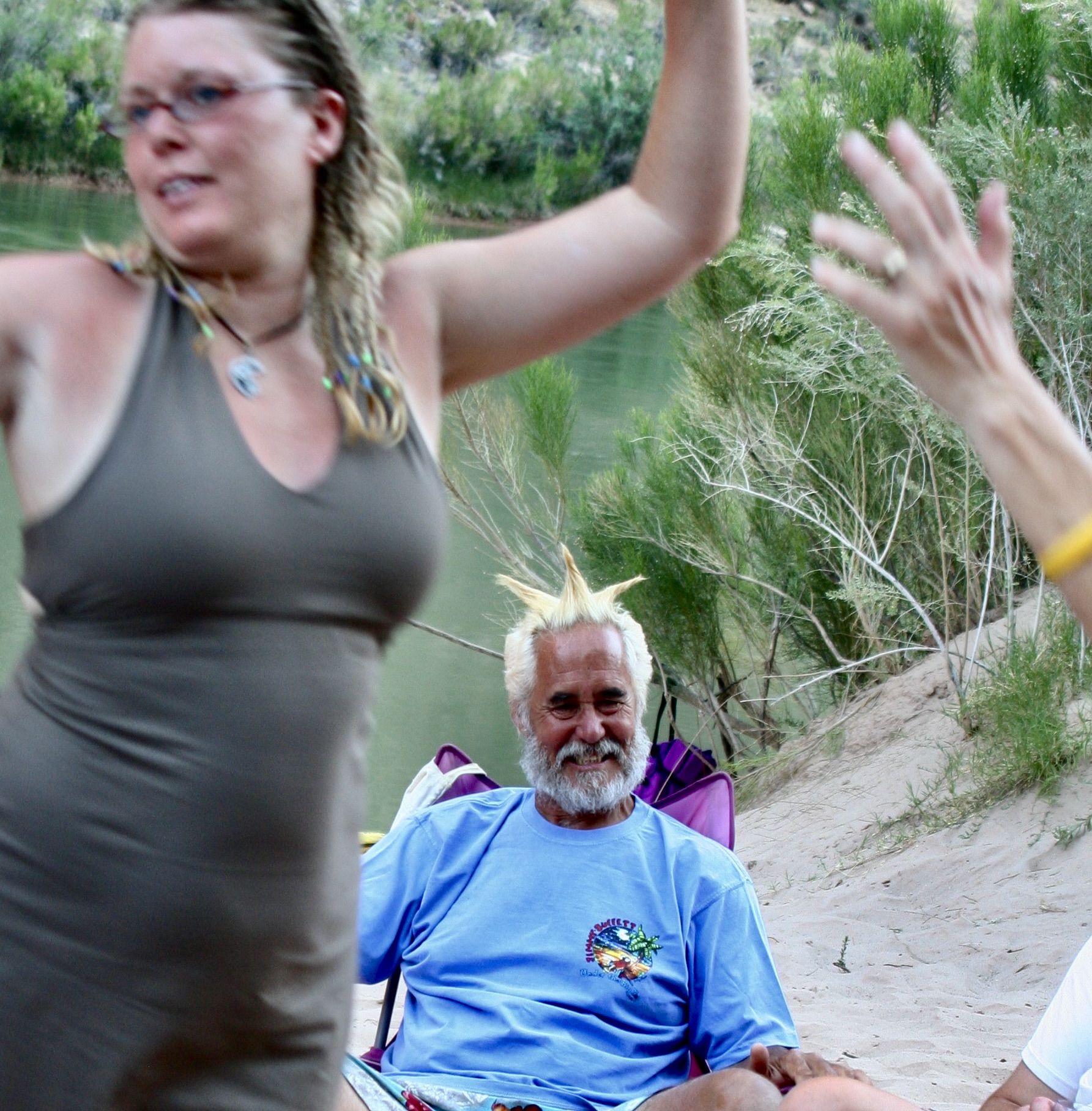
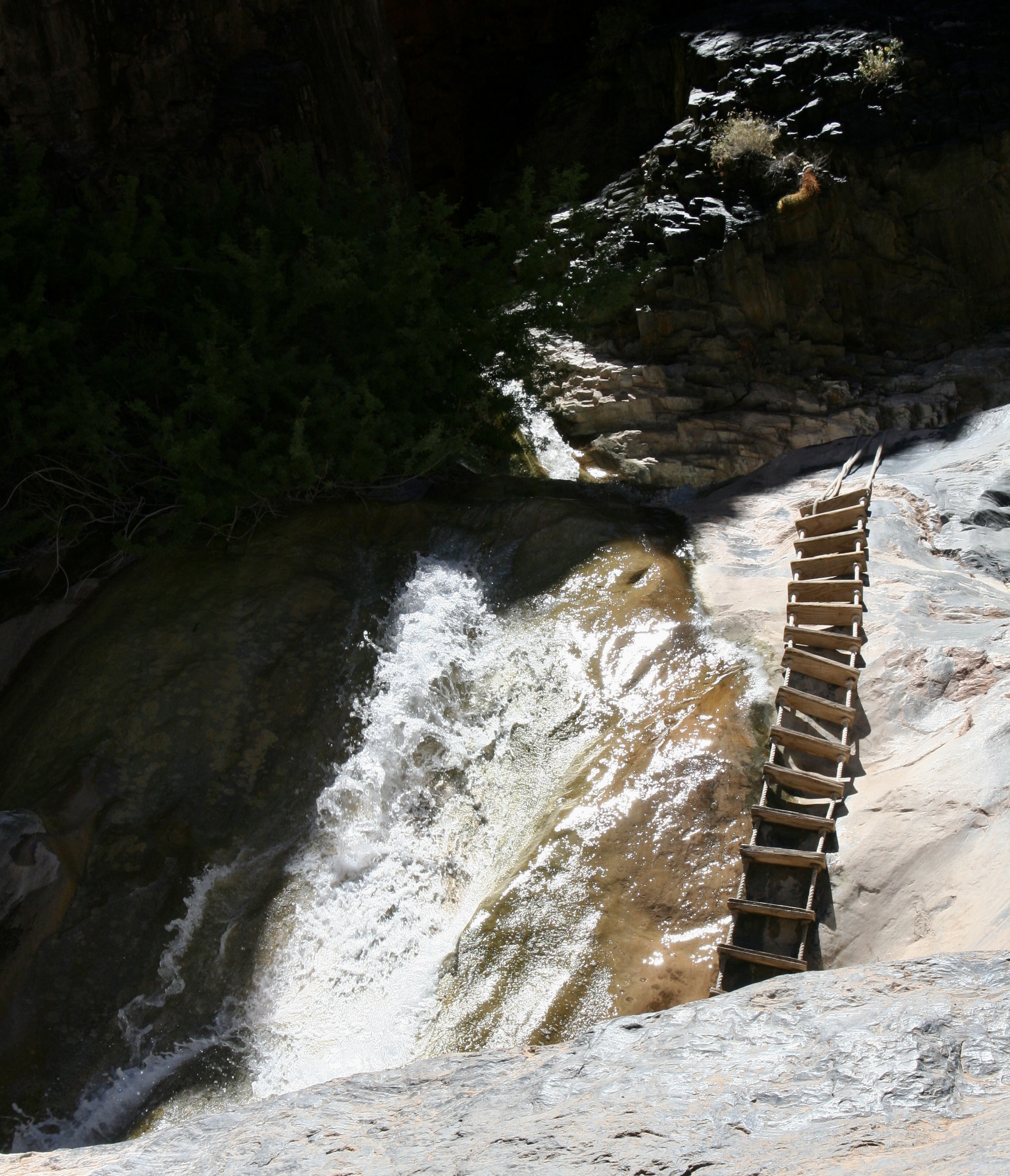
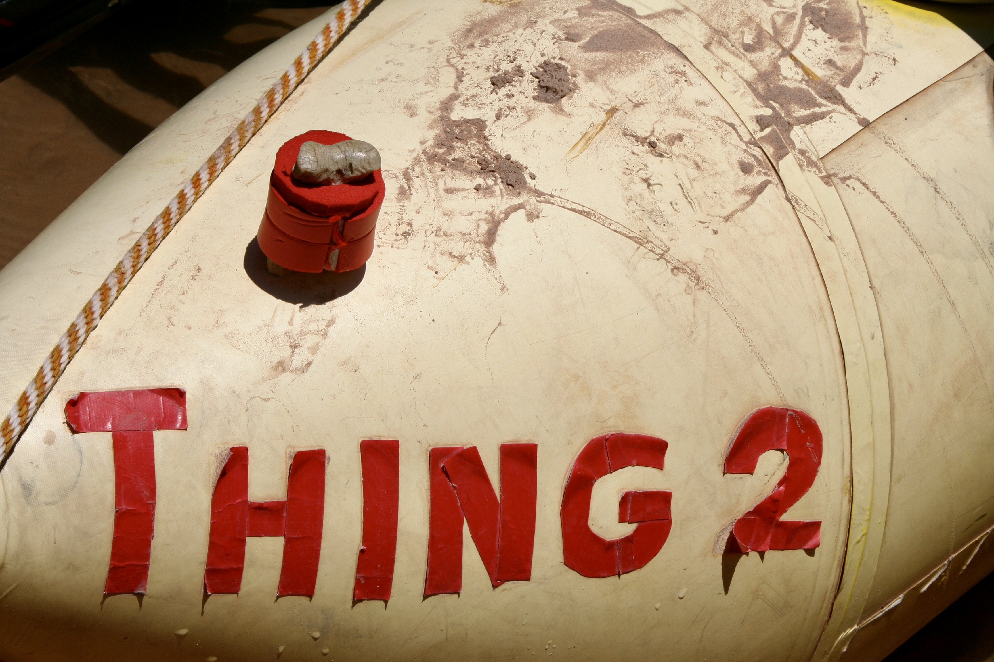
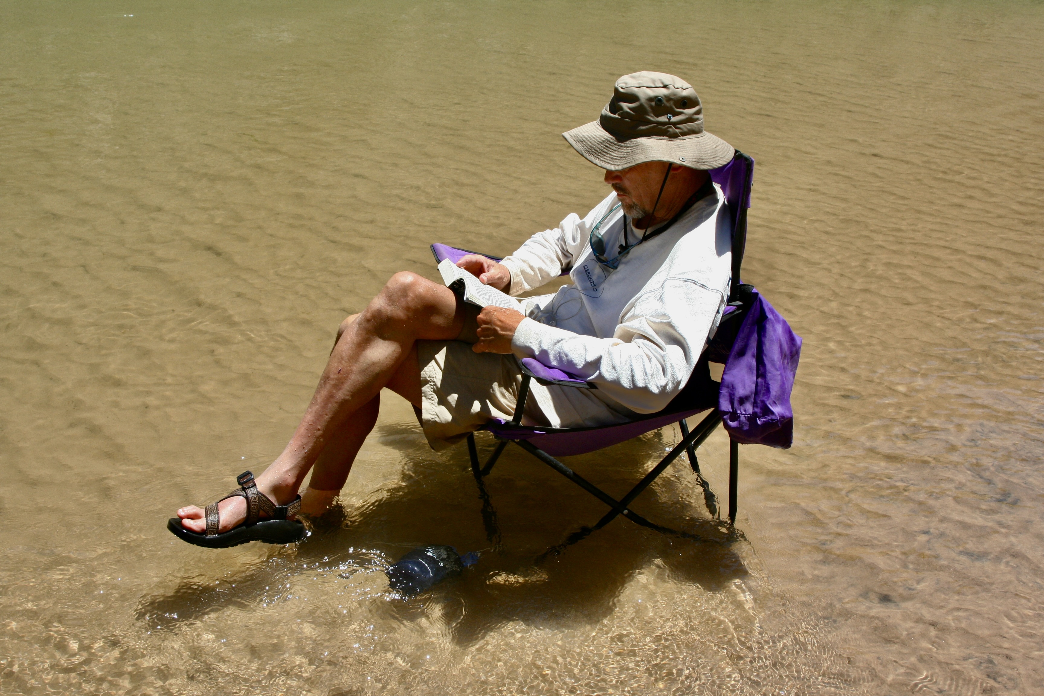
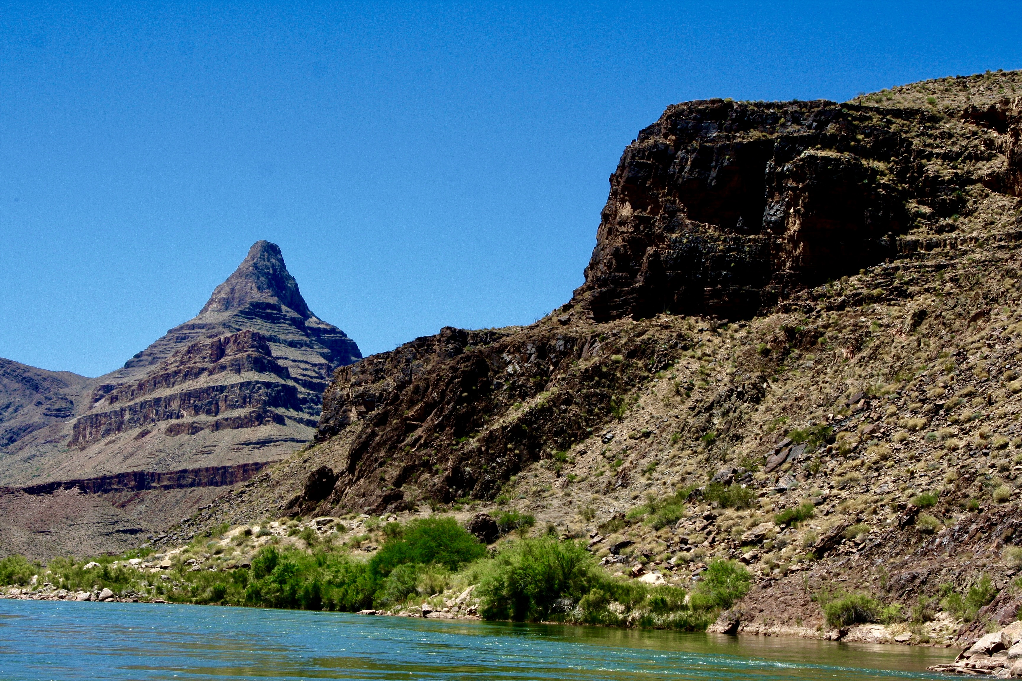
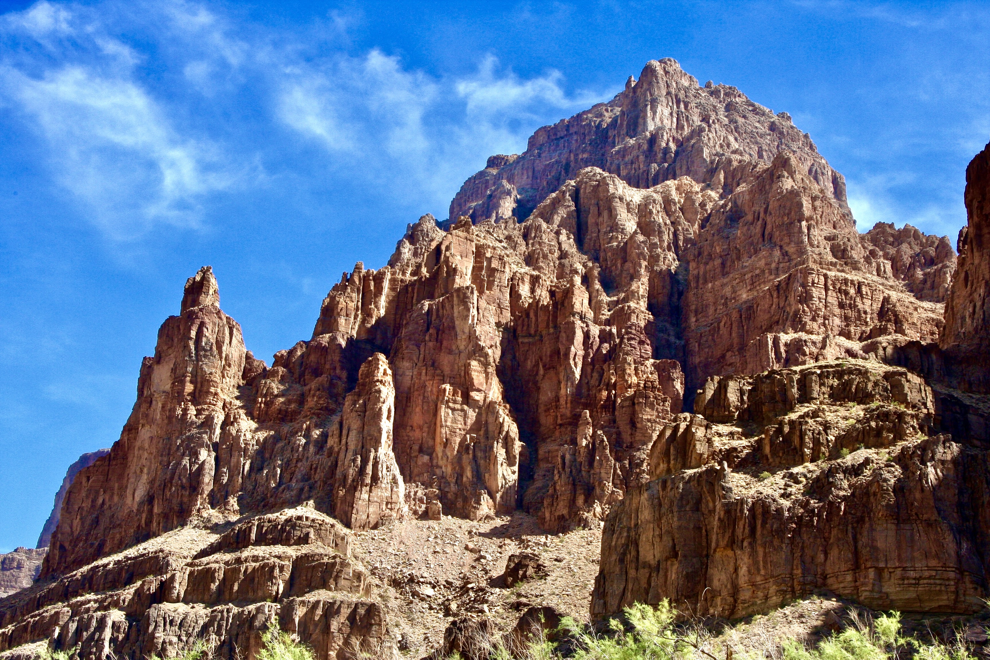
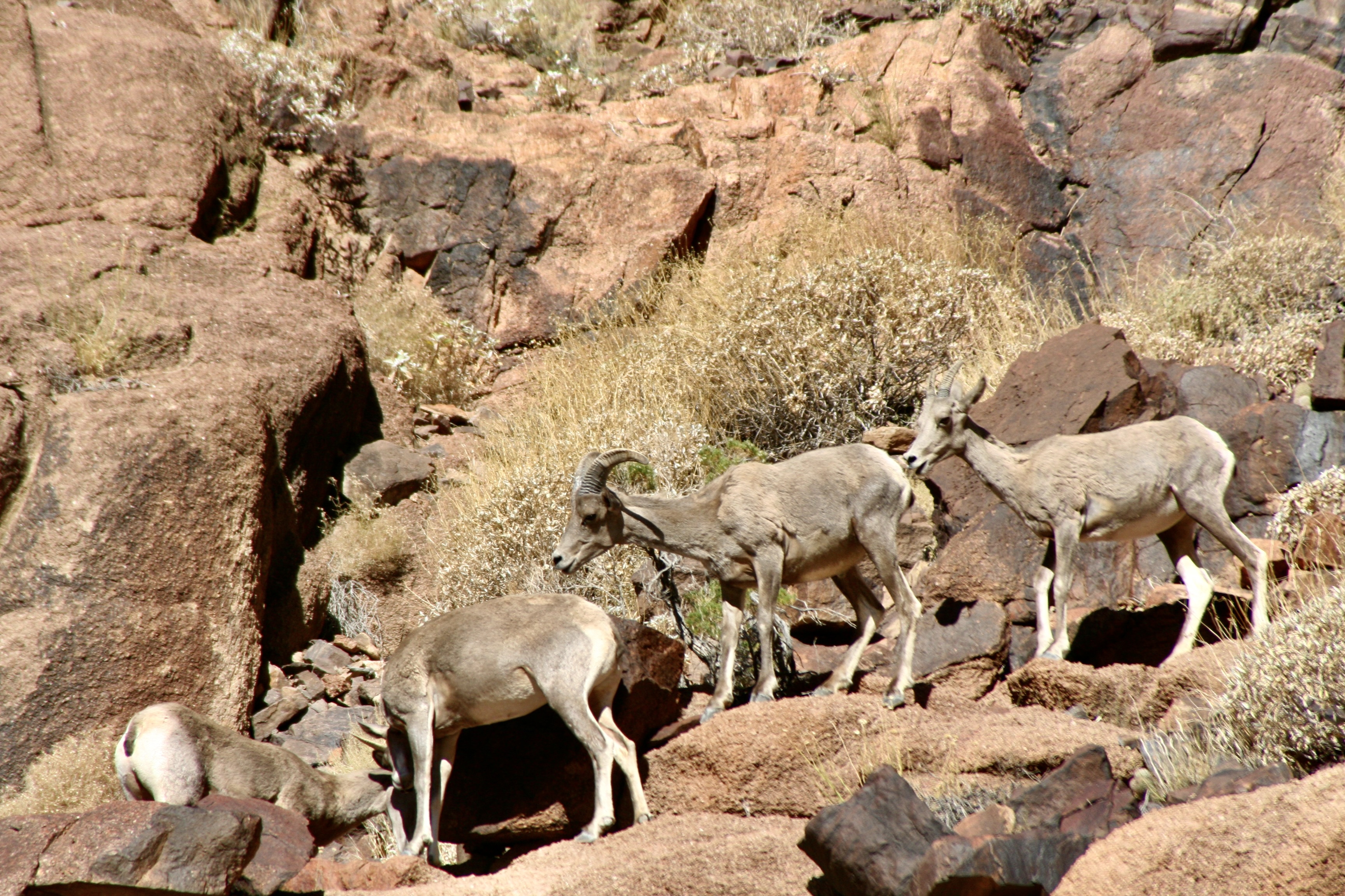
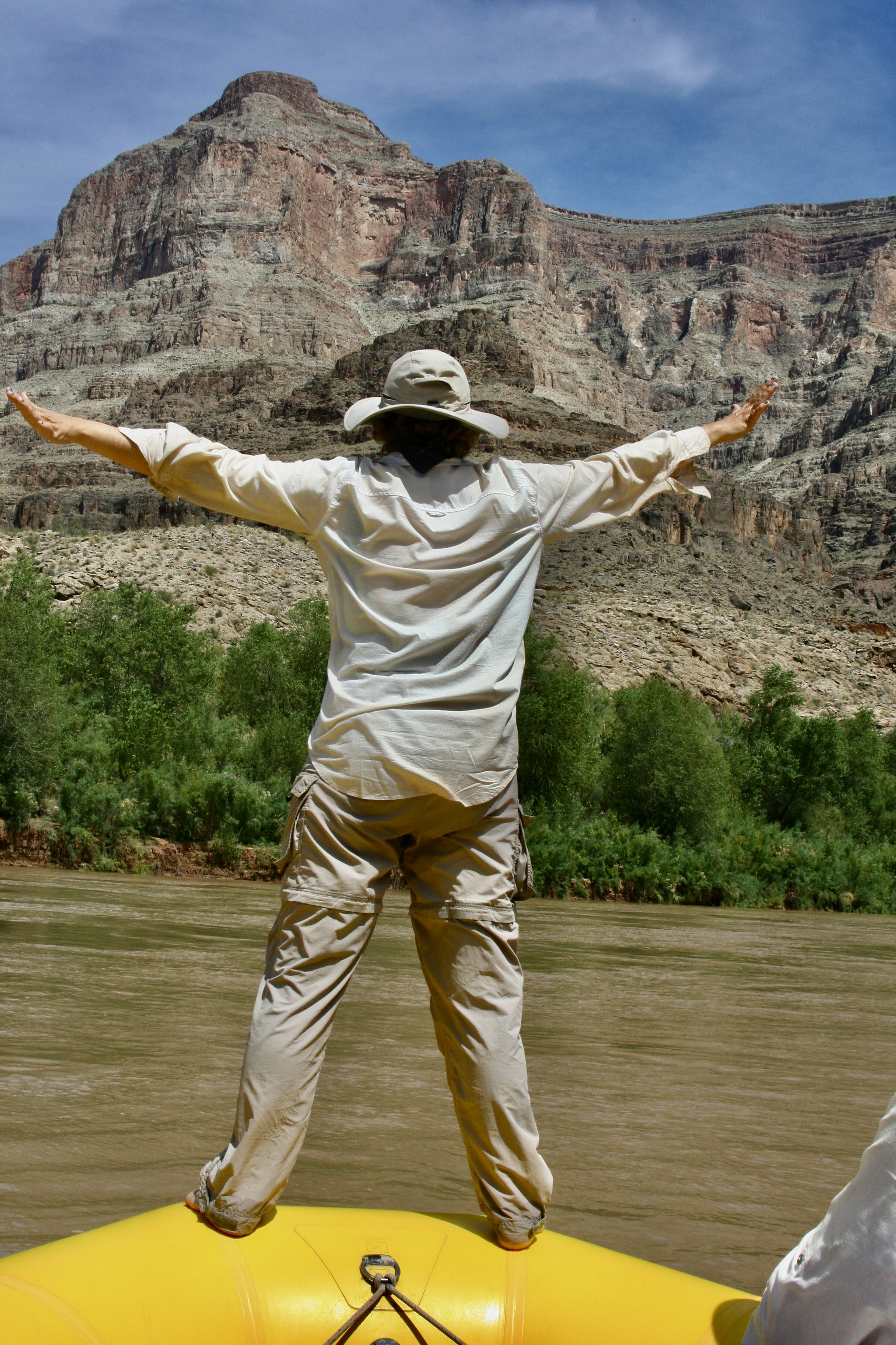
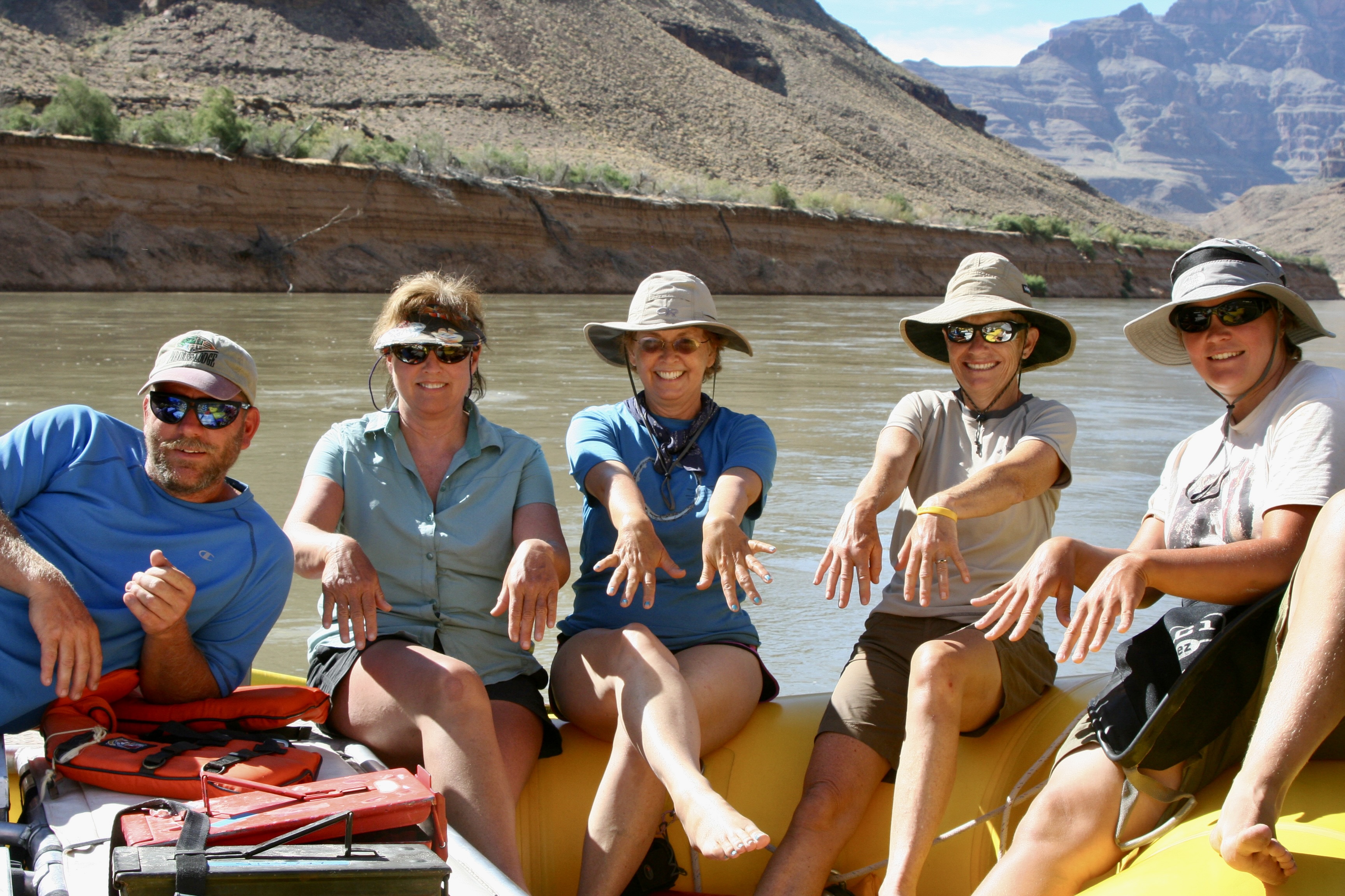
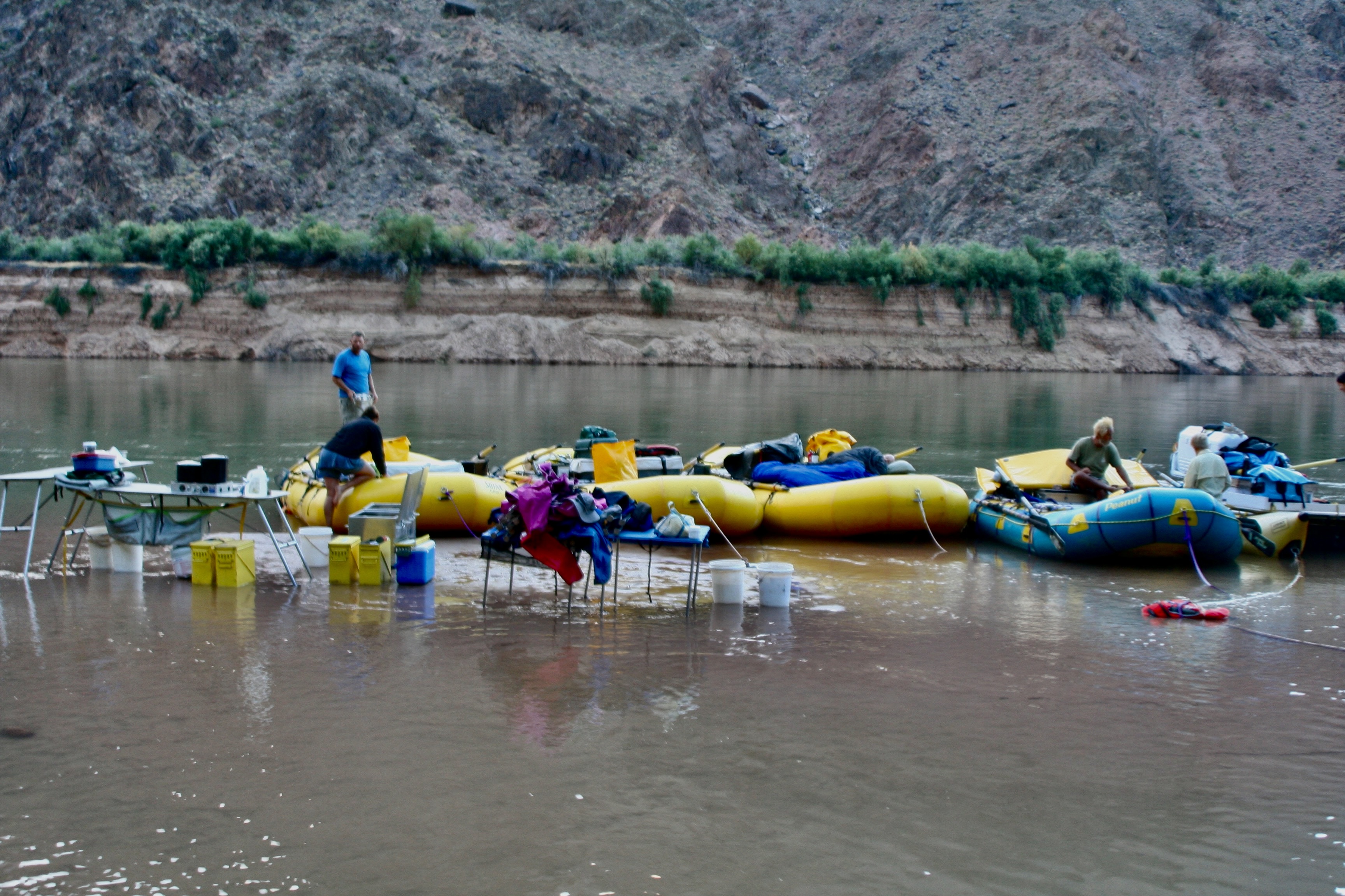
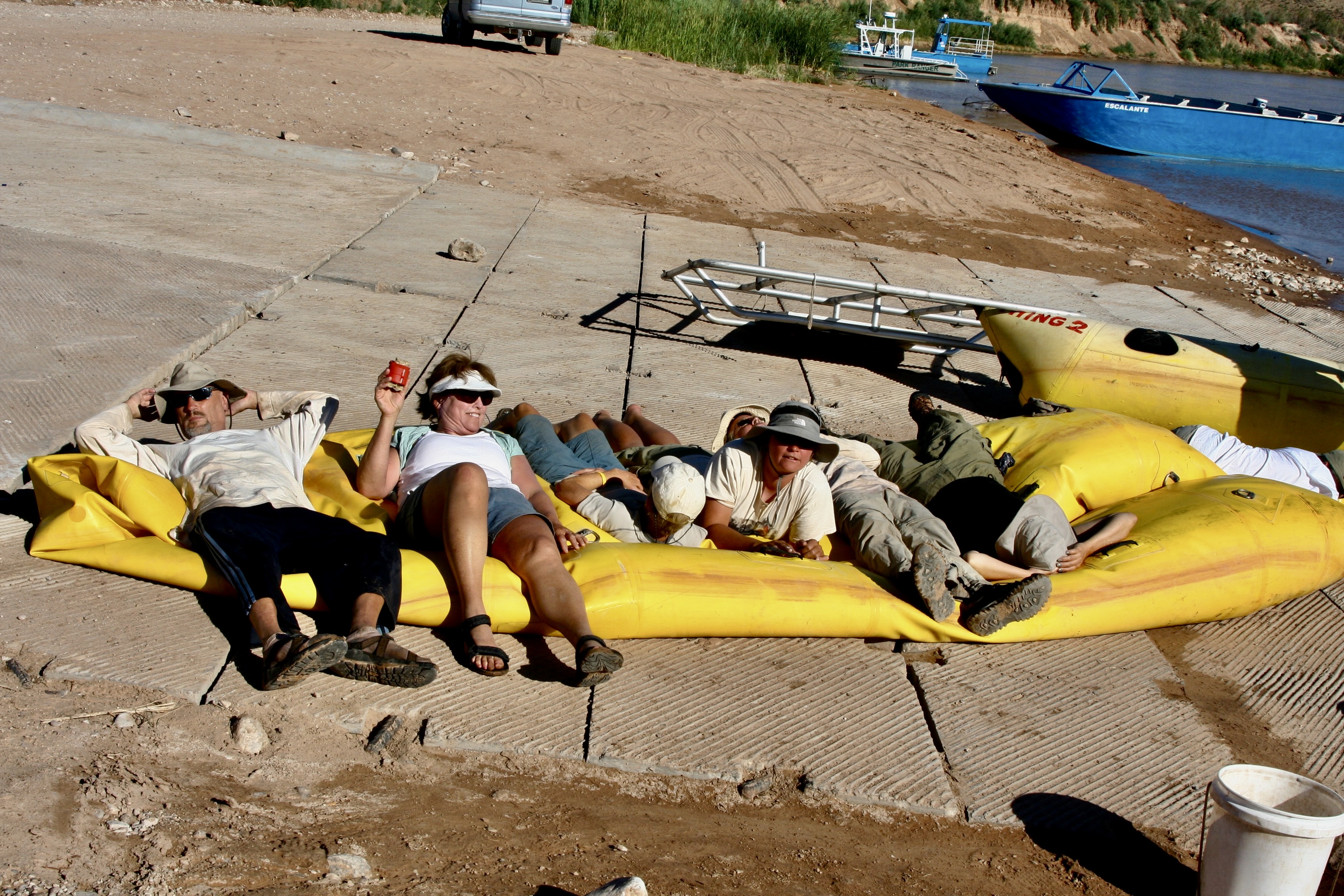
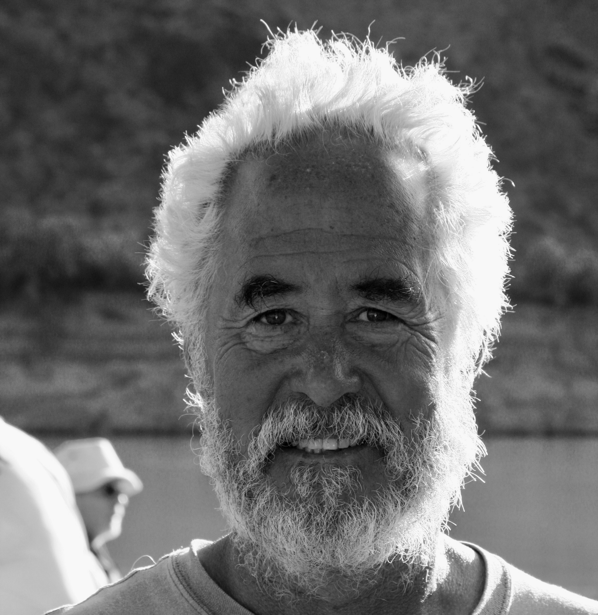
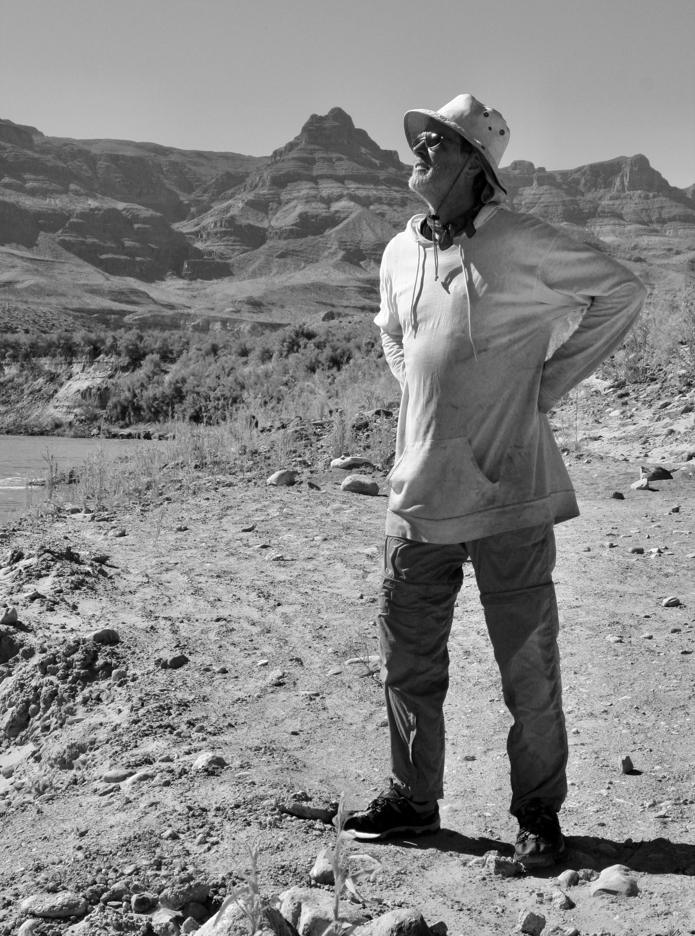
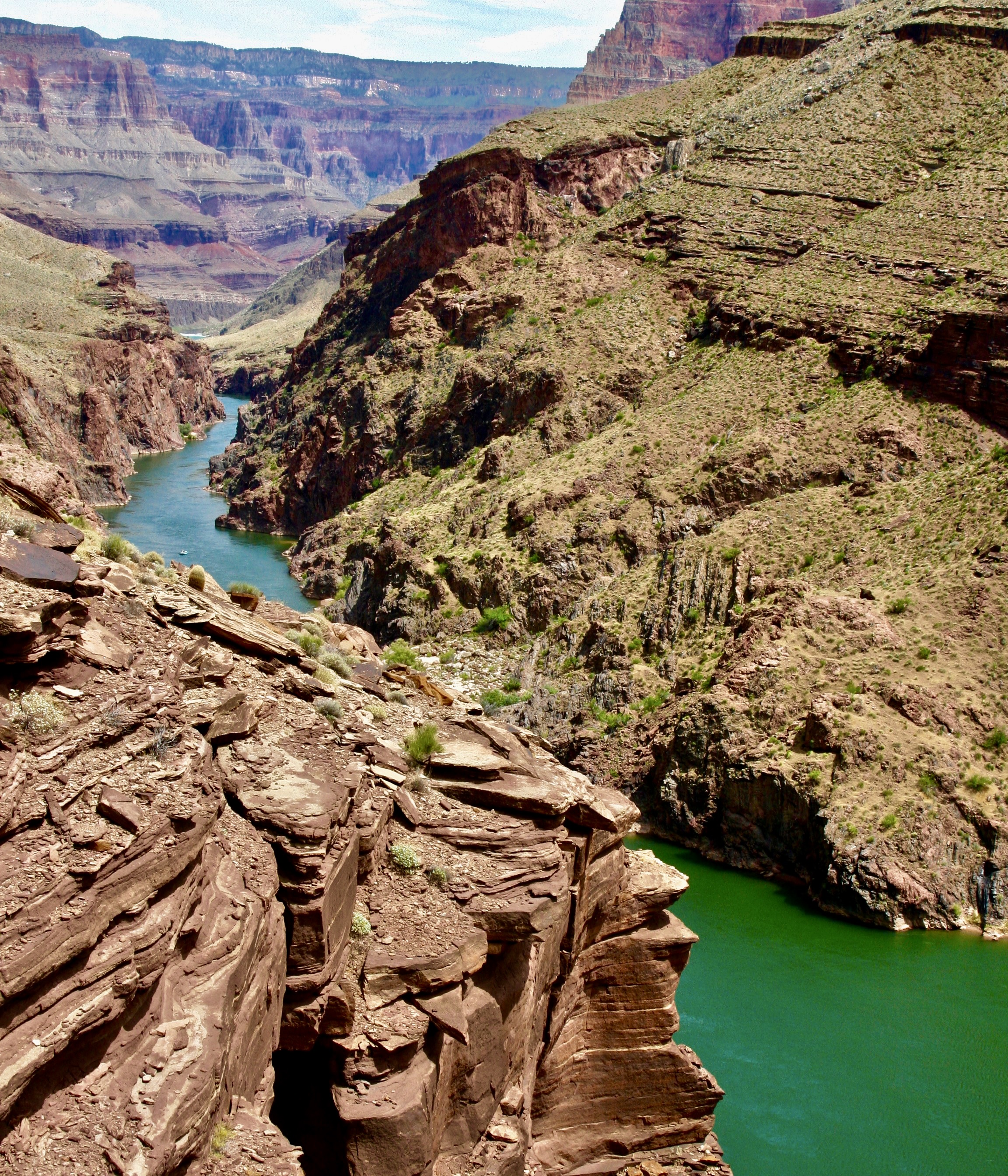
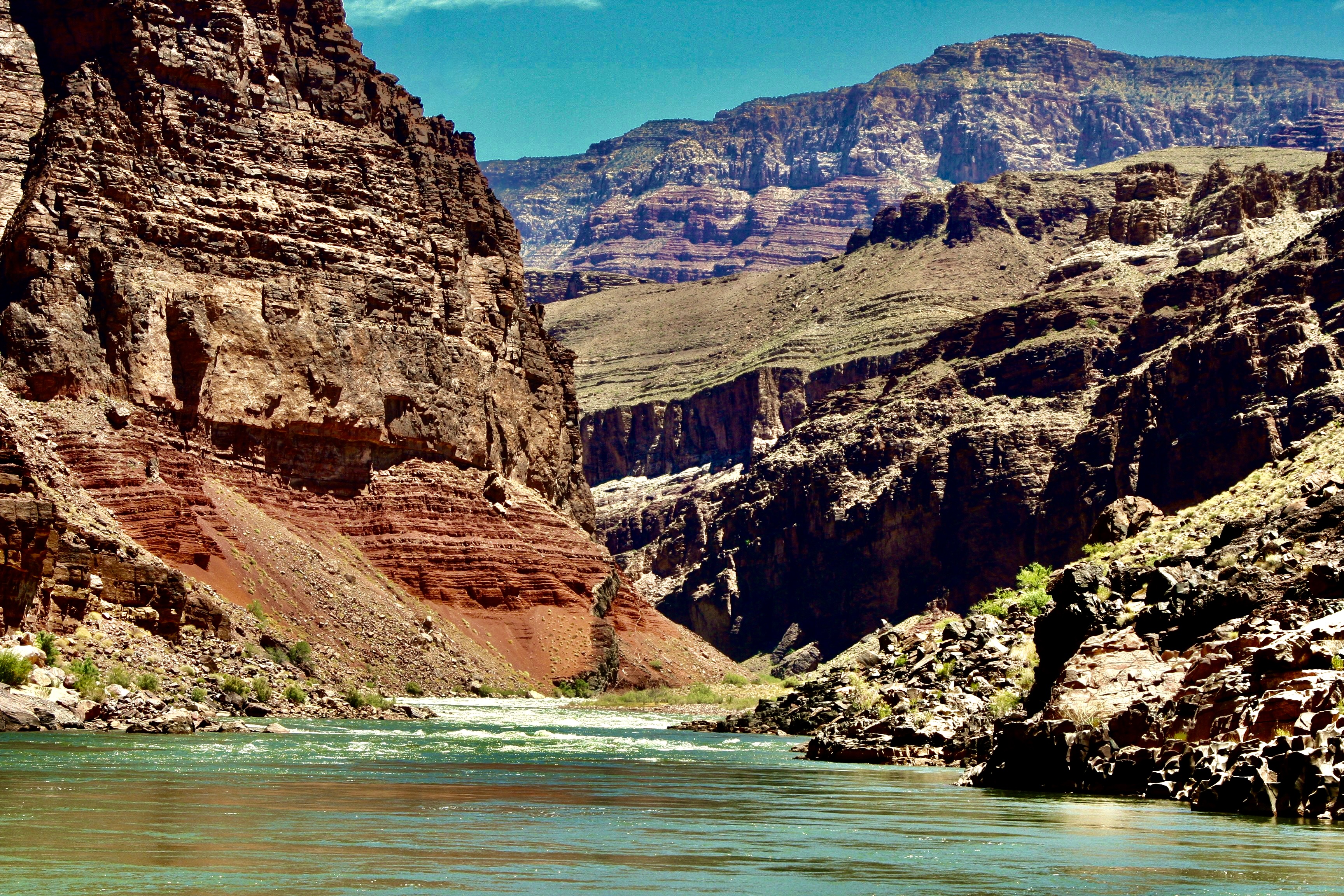
I’m going to wrap up our Colorado River posts on the Great River Series today. We will start just below Lava Falls Rapid where we ended our last post and journey to the beginning of Lake Mead where we finish our trip. I chose this photo from near the end to make a point: There never was anywhere in our trip down the Colorado that lacked in beauty.Much of this post will focus on the scenic views as we made our way from the Grand Canyon to Lake Mead. (Photo by Don Green.)I’ll also feature interesting rock formations such as this lava flow. This one was appropriately near Lava Falls Rapids. The columns are formed when a lava flow has turned solid but is still hot. And of course we will continue to feature the fun folks we had along on our trip and their interesting antics. Spontaneous dancing took place at camp after we had successfully made it through Lava Falls. Tom is in the background…Admiring the performance and supporting a new ‘do.’Further adventures awaited us as well…As expected, Bone would continue to find ways to get into mischief and amuse us.Now this would be a great place to row a boat!With most of the rapids behind us, I finally took a turn.Dave saw it as an opportunity to nap until we reached a minor rapid and I insisted he wake up to guide me through it.Peggy also was willing to take an oar. With Jame’s help…You can probably guess the name of this rock. It’s called Pumpkin Springs. The color is caused by minerals flowing out of the hot springs above it that include high levels of arsenic , as well as zinc, lead, and copper. Bathing in the hot springs is discouraged. Drinking the water is not an option!The cooking crew was getting a little rowdy in Camp.But Peggy was seeking balance.A convenient ledge gave those not working at the moment front row seats.Bone decided he had something in common with Steve Van Dore’s boat, Thing 2.A ‘cool’ way to read a good book?This pyramid-like structure in the background, Diamond Peak, reminded me of our trip up the Nile River. We will be returning there as part of our Great River Series. The dark rocks are volcanic.Tom had a final adventure planned for us that I mentioned above. it involved climbing this step/rope ladder near Diamond Creek. The Hualapai Tribe built series of ladders to help people access a ‘bathhouse’ on the creek.Beth climbing the ladder. (Photo by Don Green.)A cold shower was one of the options of the bathhouse. I decided Bone, me and my clothes would all benefit.A more civilized approach was a few feet away.I was attracted to a colorful set of rocks found in the area.Our ‘bathhouse’ provided creative frames.Another example.One of the most unusual sites we saw along the Colorado was this hundred foot waterfall made out of Travertine Rock.Another perspective.I caught this close-up of travertine framed by the sky at a stop nearby.And Don caught these maidenhair ferns.While Bone found a barrel cactus to perch on. Tough butt.And the scenery kept being spectacular as the miles rolled (rowed) by.Cliffs.Distant vistas.A combination of the river’s edge and far away.And a final view of the beauty that had awed us on our 280 mile journey through the Grand Canyon to Lake Mead.We were privileged to see several big horn sheep in our last hundred miles. I think these may have been lined up for their turn at a natural salt lick. It came as a big surprise when we spotted a different type of animal with horns…That convinced us that our journey was nearing its end! (Photo by Don Green.)Peggy struck her Titanic pose. I saw her do the same thing once over the piranha infested water of the Amazon River. At least, if she fell off here, the only thing that would happen to her is she’d get wet.Jame introduced us to a new way of rowing…And the women, for a reason I couldn’t quite fathom, decided to do a fingernail check. It’s possible that Jame felt as perplexed as I did. Or is that a semi-thumbs up?We woke up on our last morning with our campsite flooded. Go figure. Everyone good-naturedly went about his or her business of doing morning chores.A few miles down river we reached the take-out point. Our journey was over. It was time to pack up one last time. It may look like everyone was ‘laying down on the job’ here. Actually we were squishing the air out of one of the rafts. A final photo of Tom. He looked tired— but it was well earned tired. We all owed him a great debt of gratitude for the incredible adventure he had taken us on: For all of the planning and organizing, and for doing everything in his power to assure that we experienced everything the Colorado River and the Grand Canyon had to offer, and doing so in a safe manner— while having loads of fun along the way. While thanking Tom, I also want to thank the boatmen (plus Megan) whose hard work and skills meant so much to our successful journey.Don, I think, represented us all, while looking a bit scruffy, looked off into the distance one last time, contemplating the wonder of what we had just been through.Looking equally scruffy, I had added another whole layer of appreciation for the Canyon I had loved and explored over the years on foot, by mule, by car and by helicopter. And now by raft.And Peggy, who had loved every minute of the adventure, looked just about like she always does. How in the heck does she do it? (Photo by Don Green.)And finally: Bone. No-one had more fun than he did. Virtually everyone spent time with him. As a final gesture, he made sure that everybody initialed his PFD.
Next post: It’s on to the Danube River and Vienna!
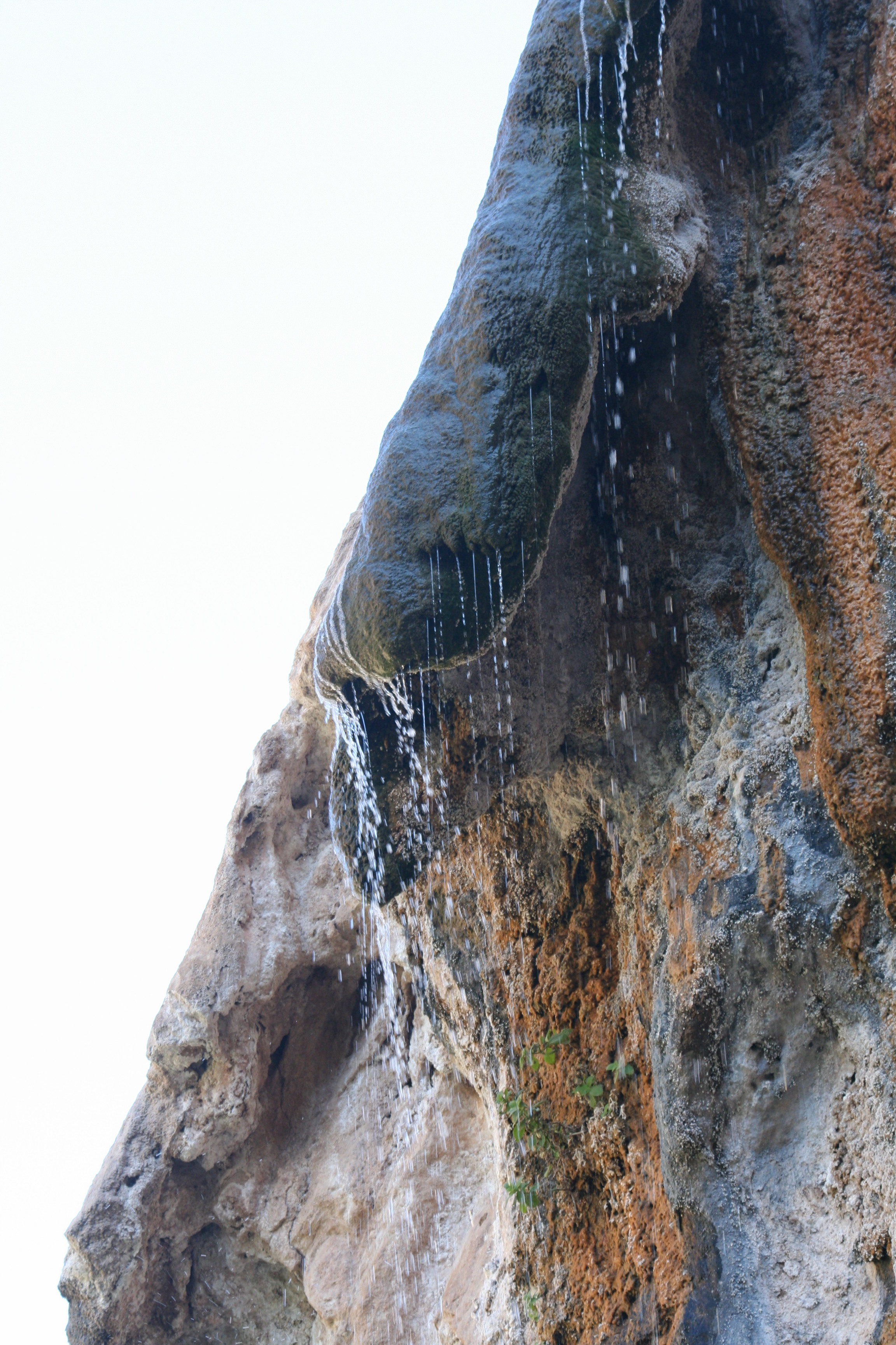
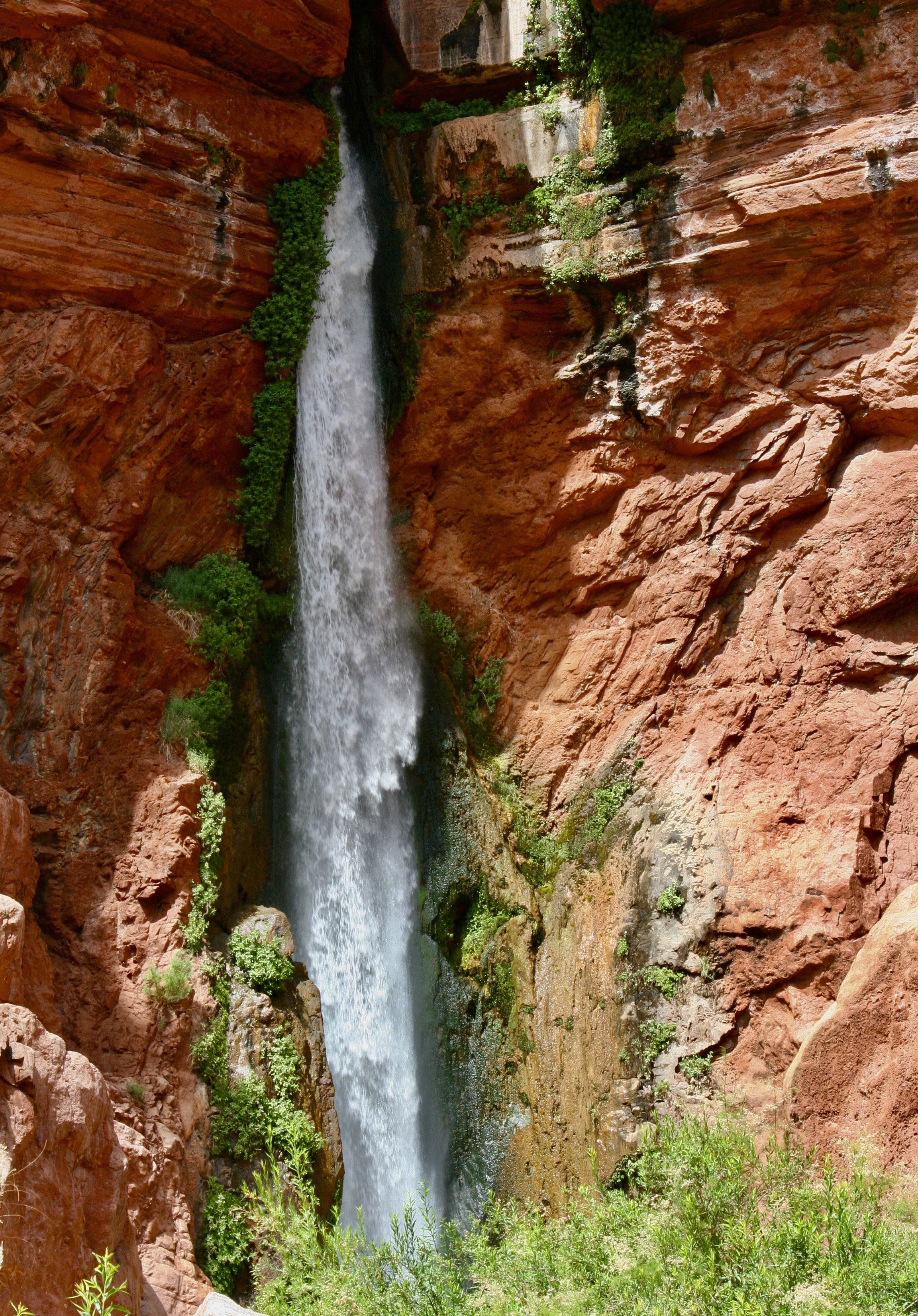
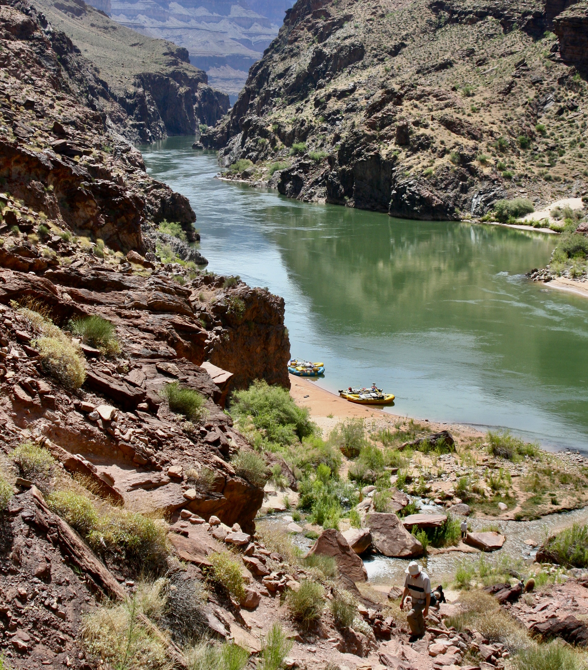
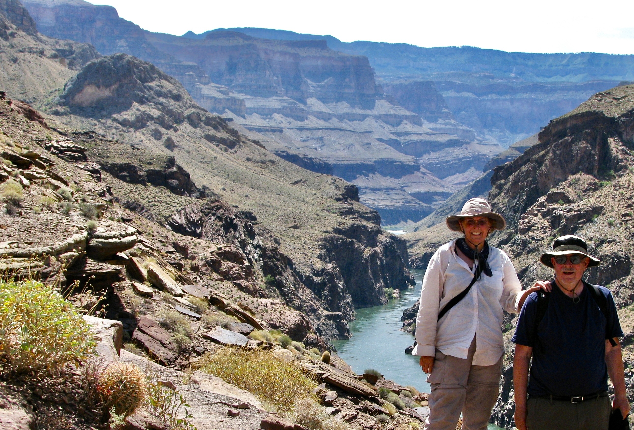
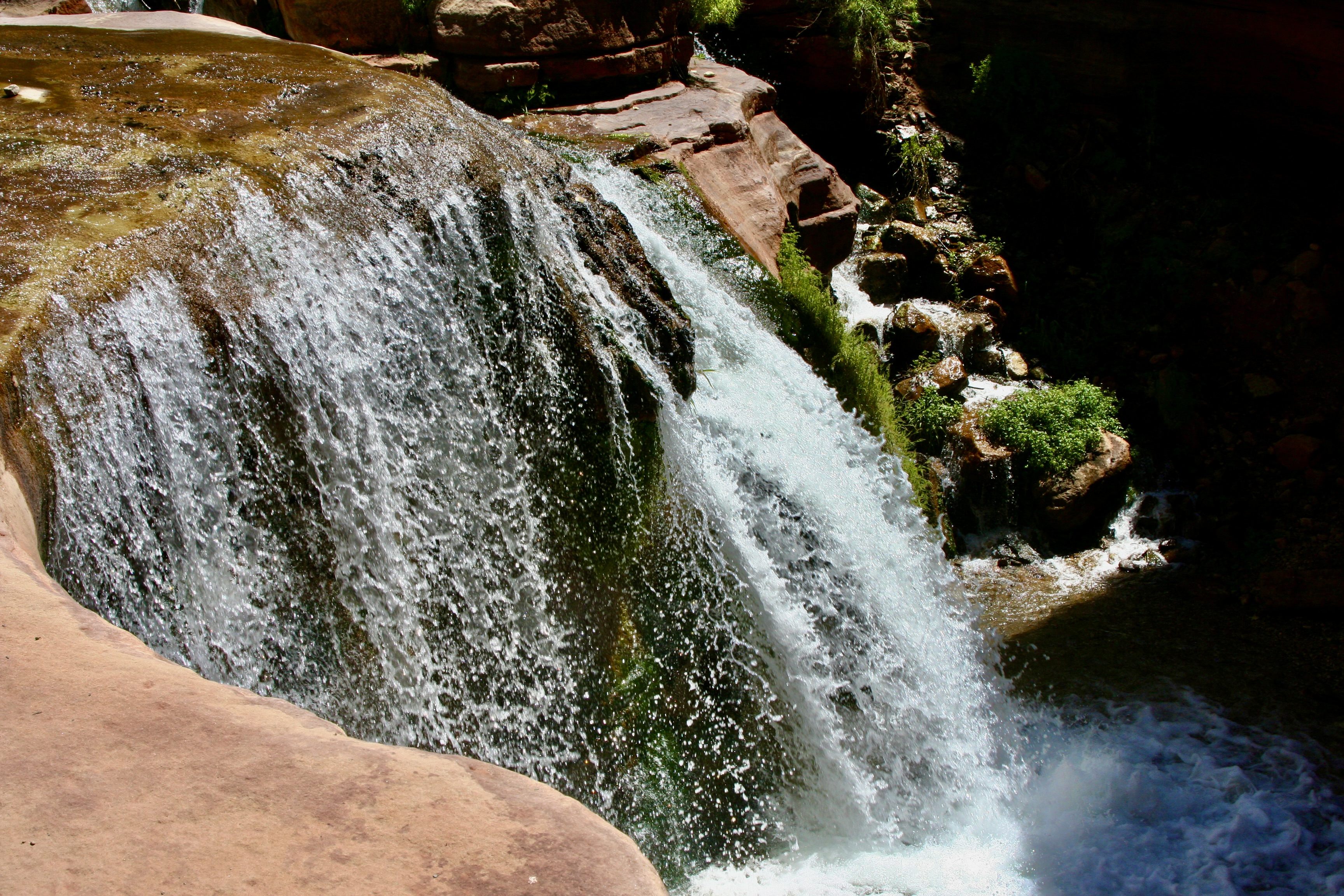
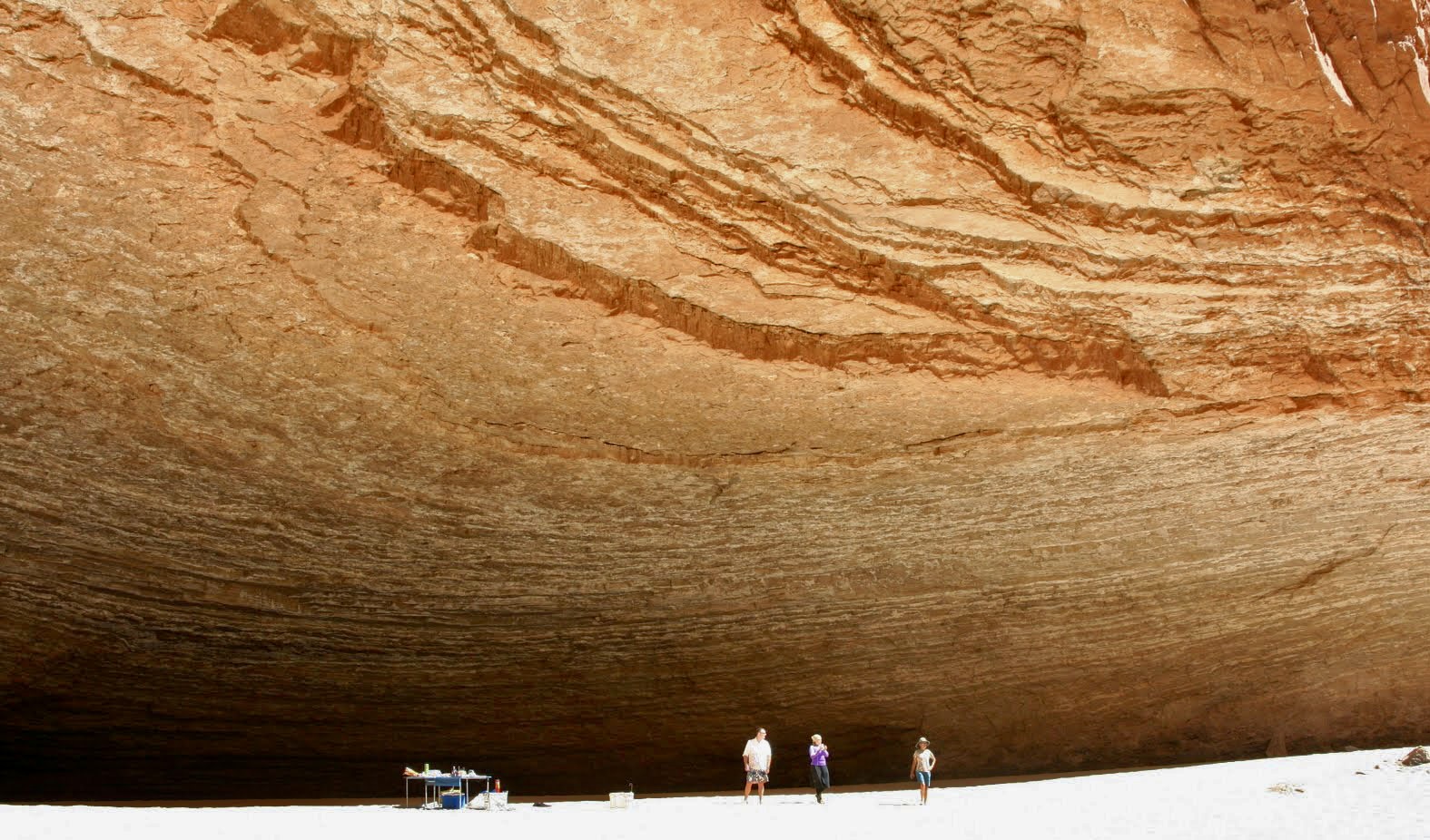
Deer Creek Falls was at mile 136, less than a mile below Christmas Tree Cave where I finished our last post. Here, Peggy enjoys the roar and the mist.
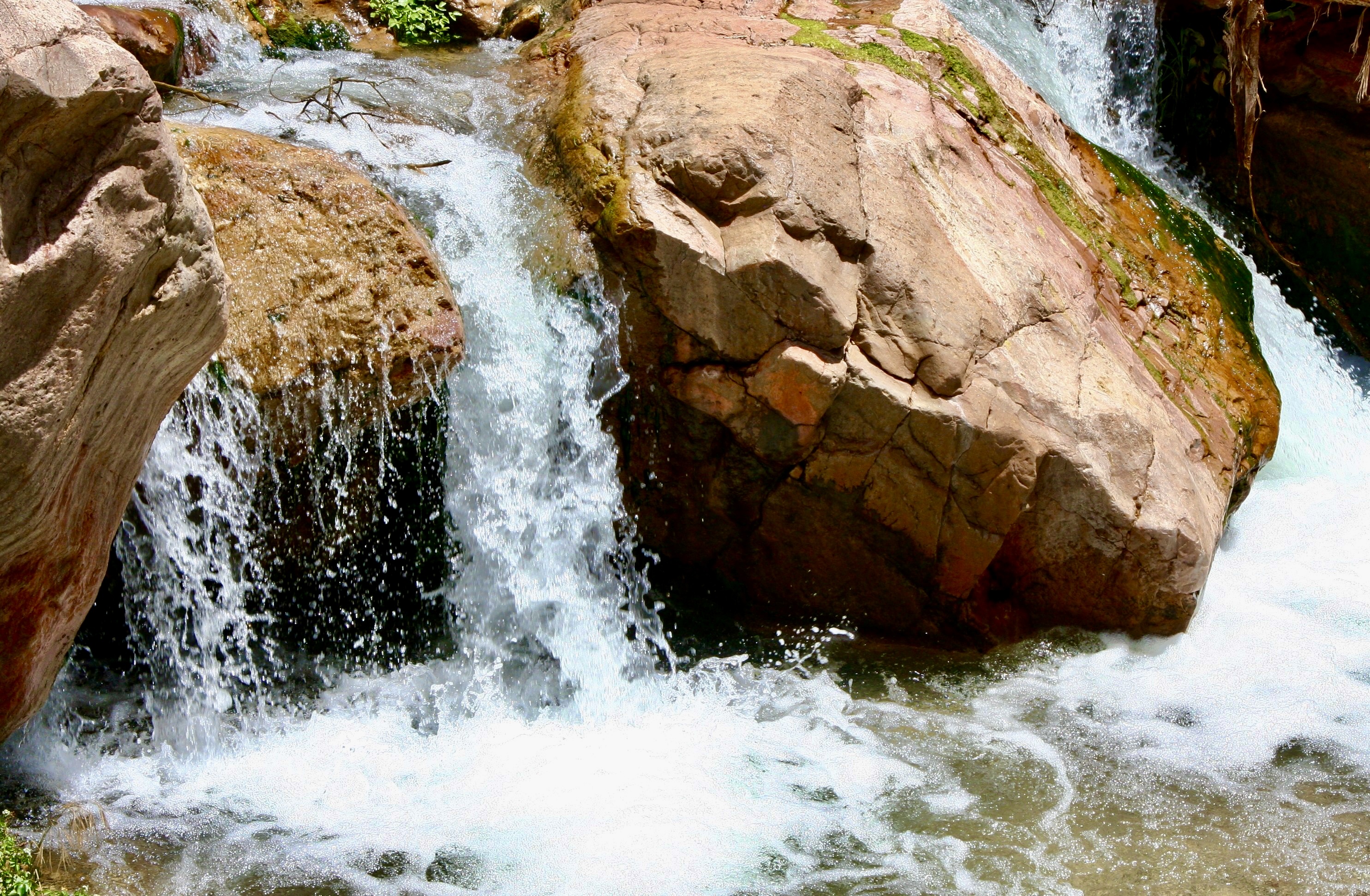
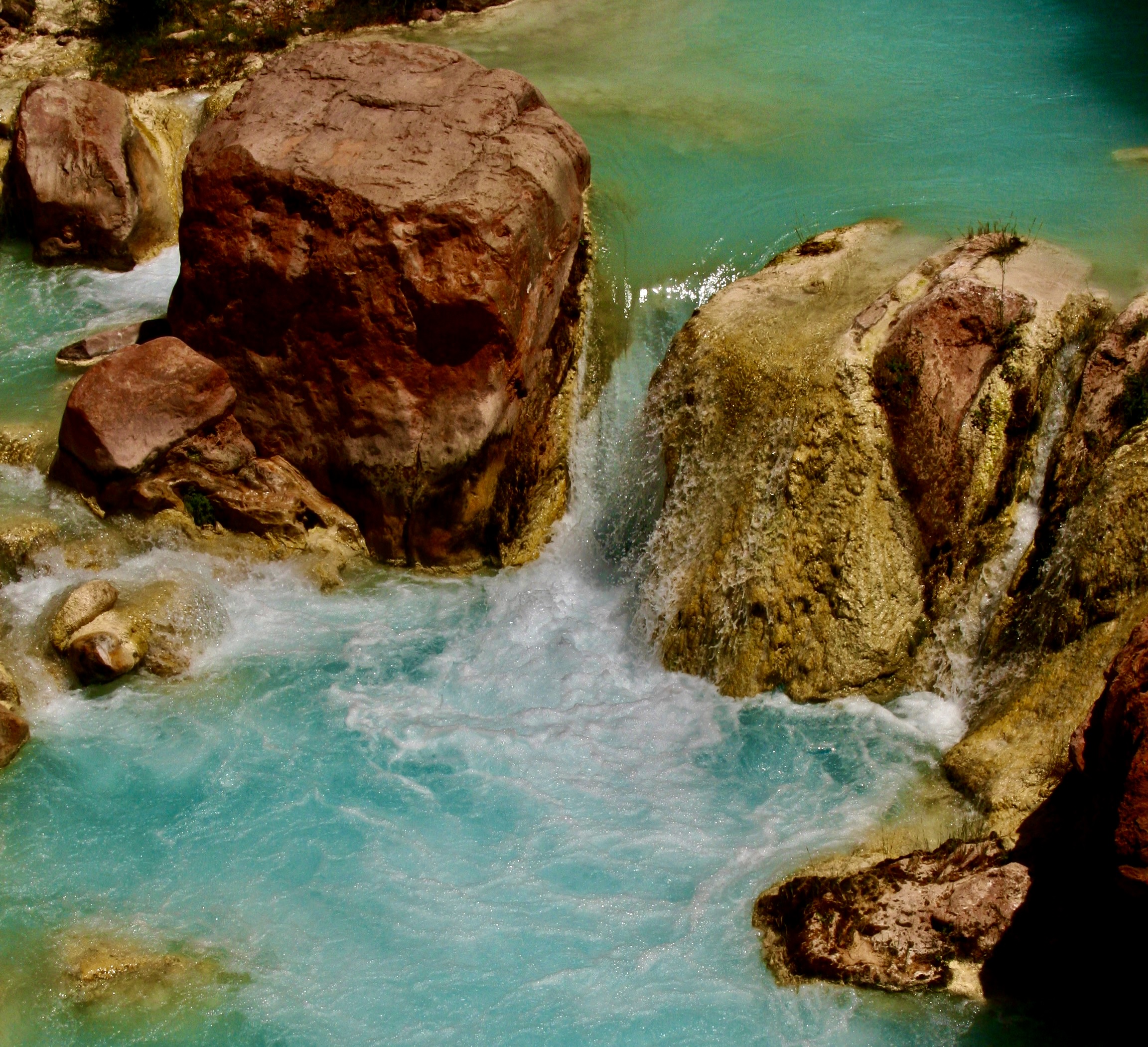
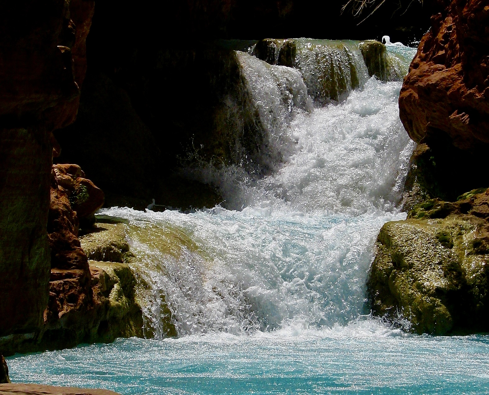
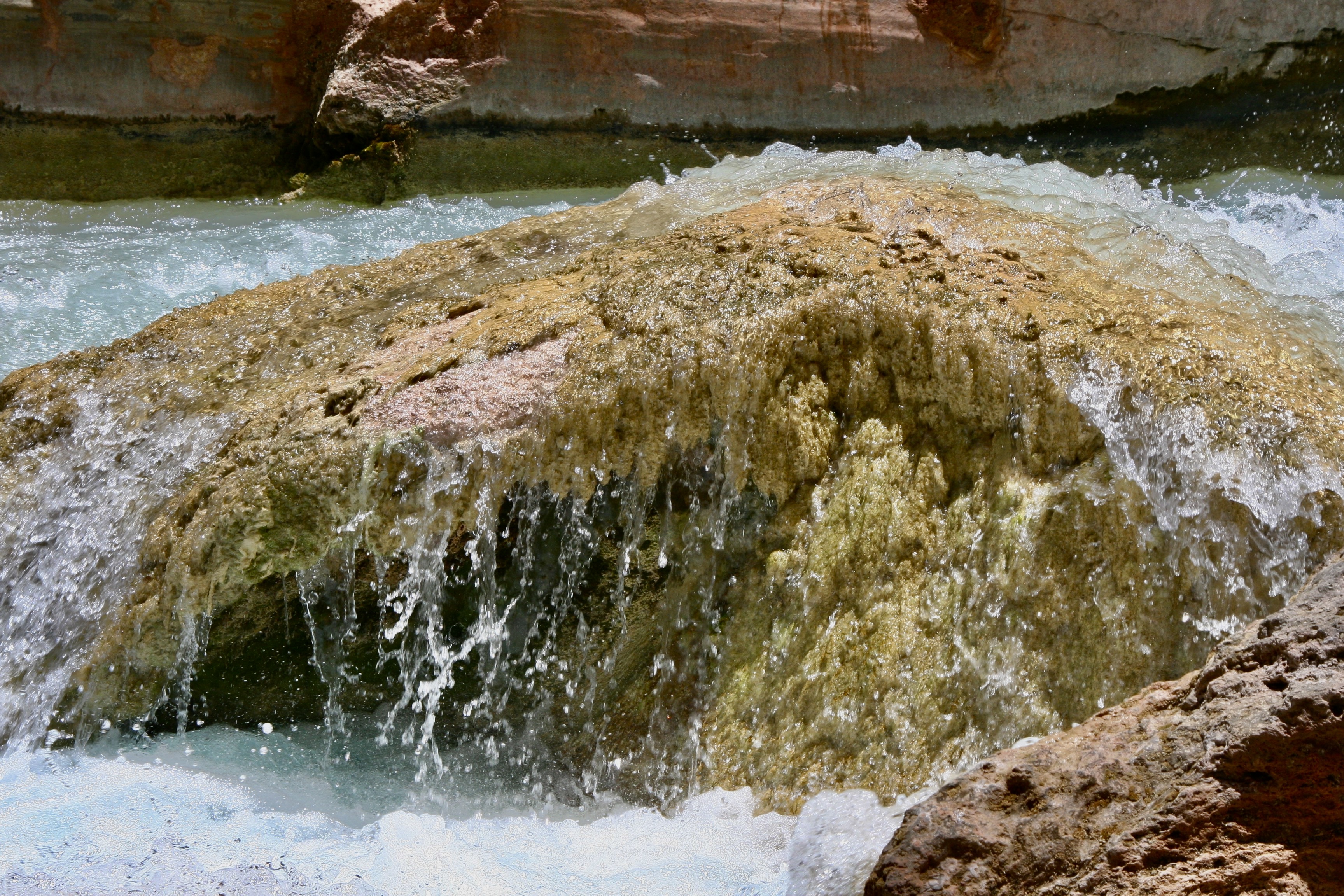
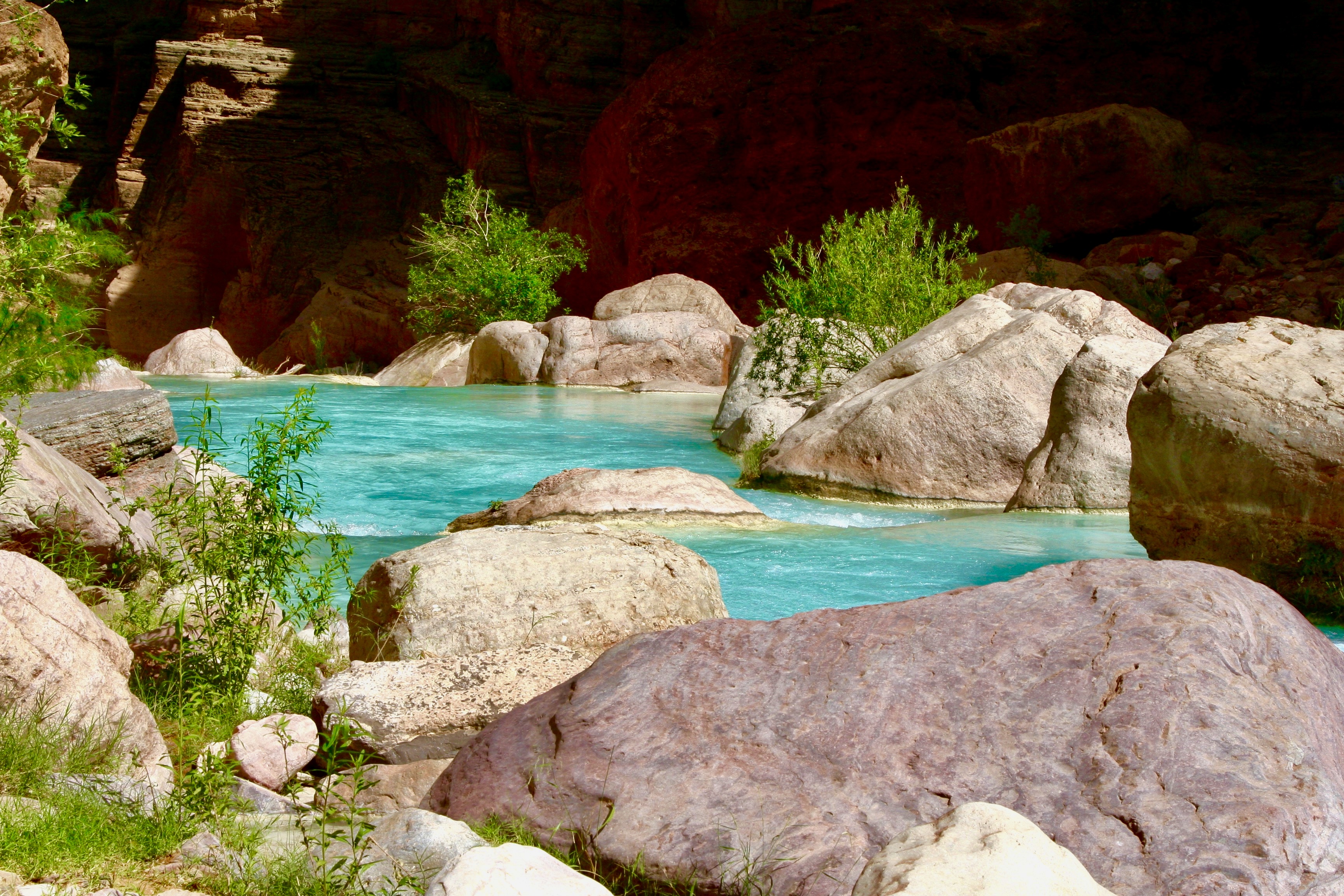
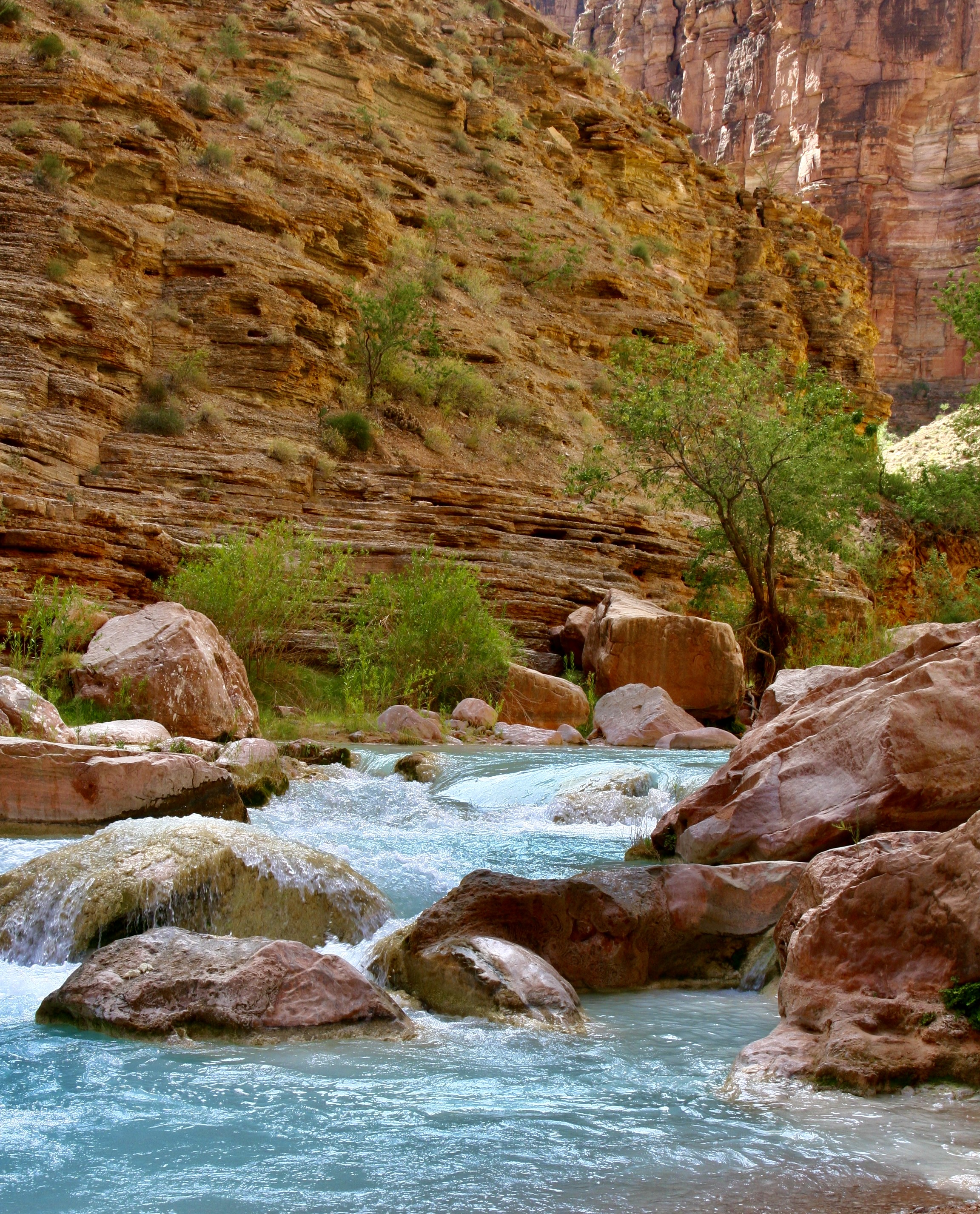
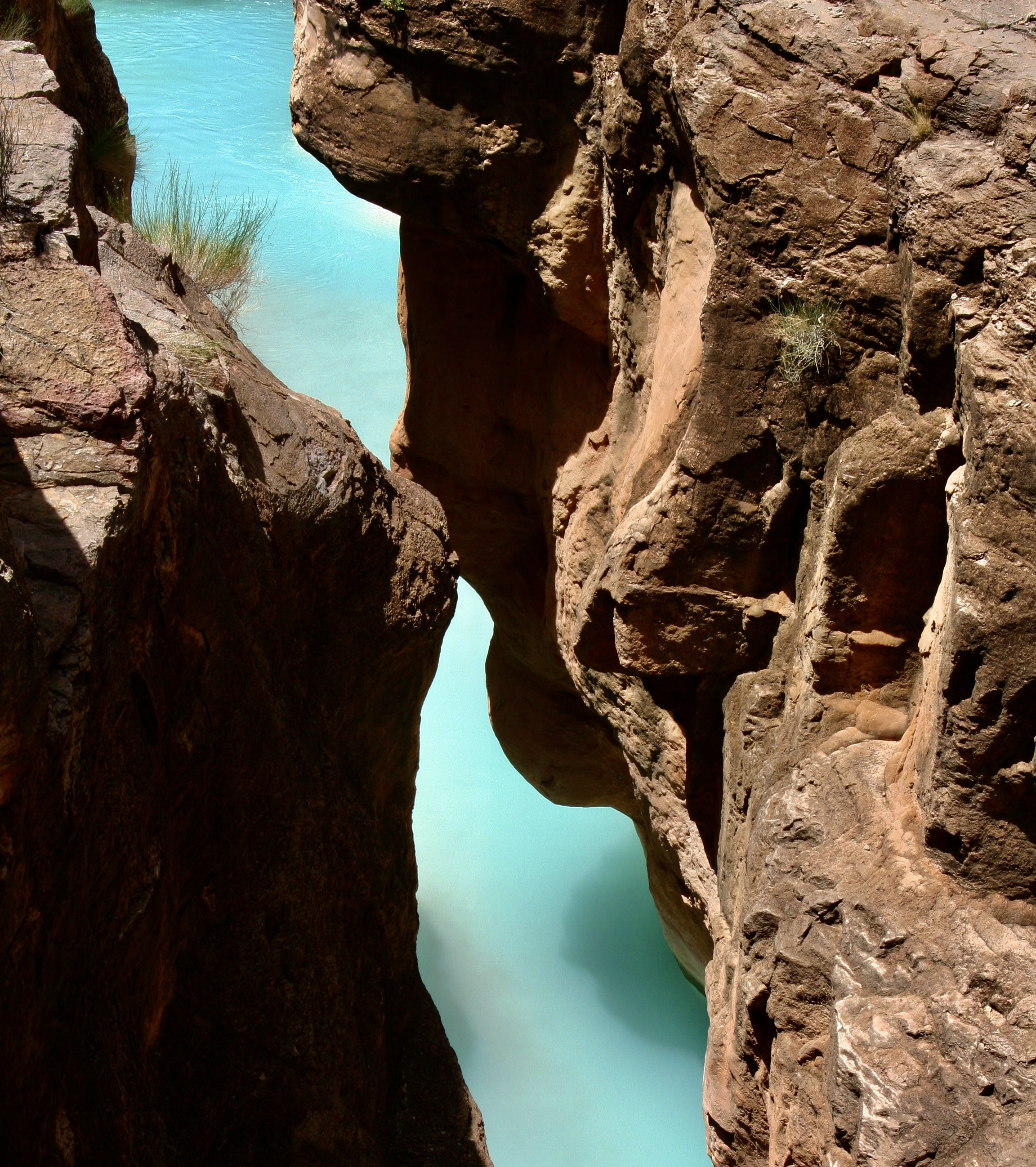
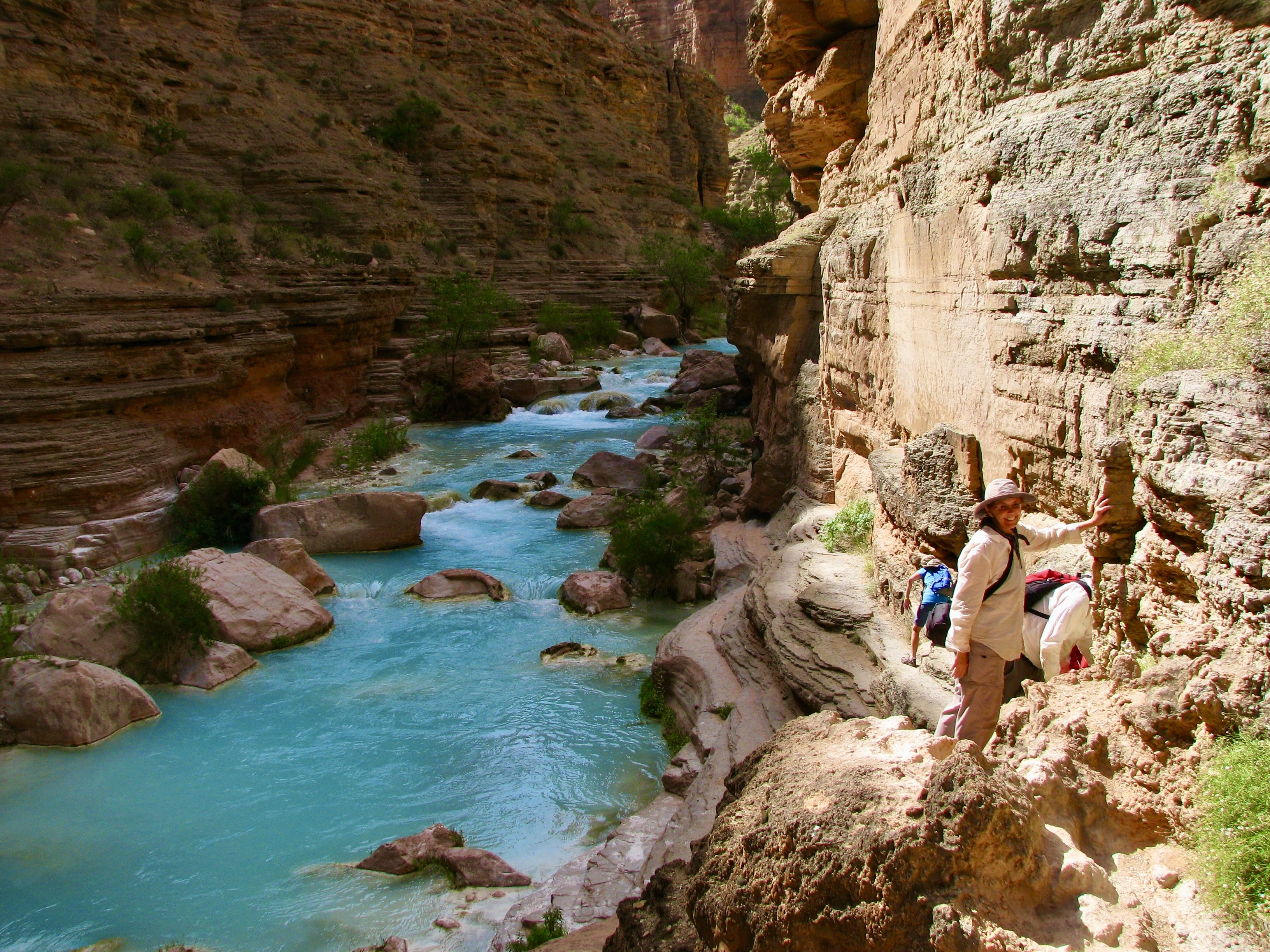
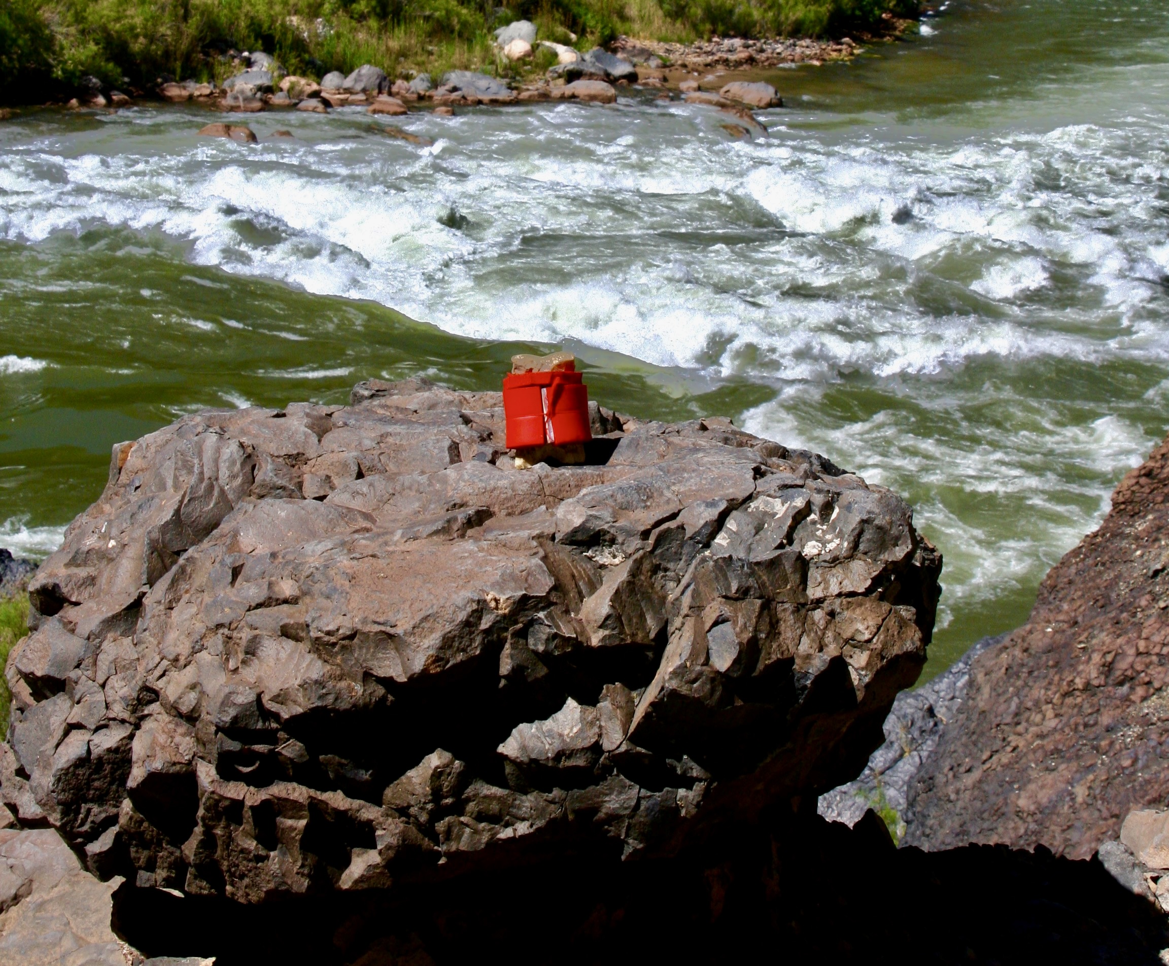
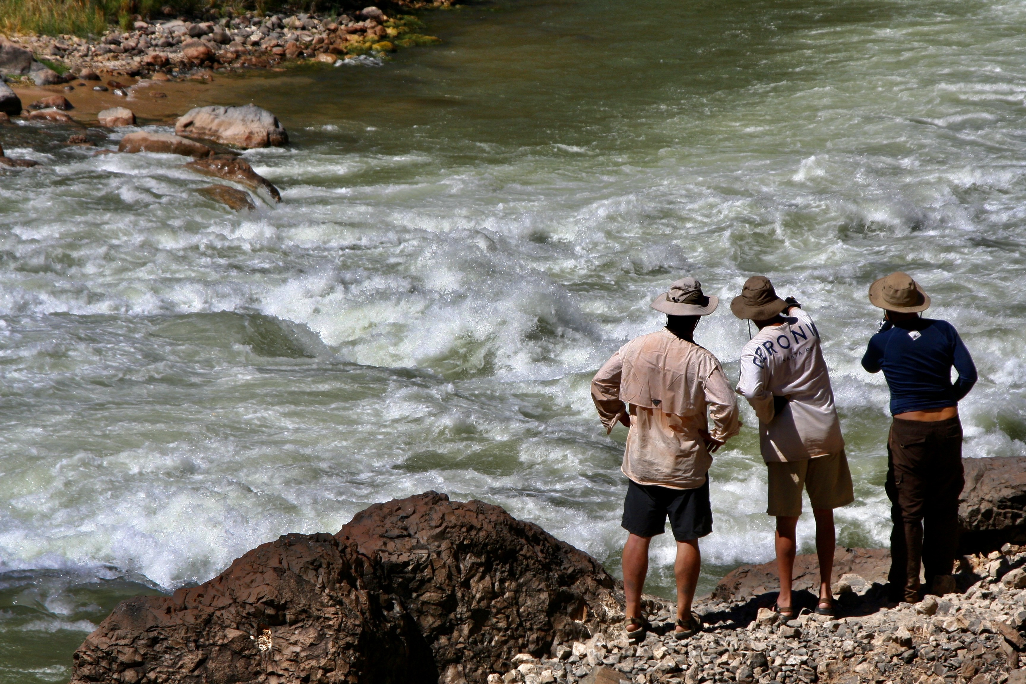
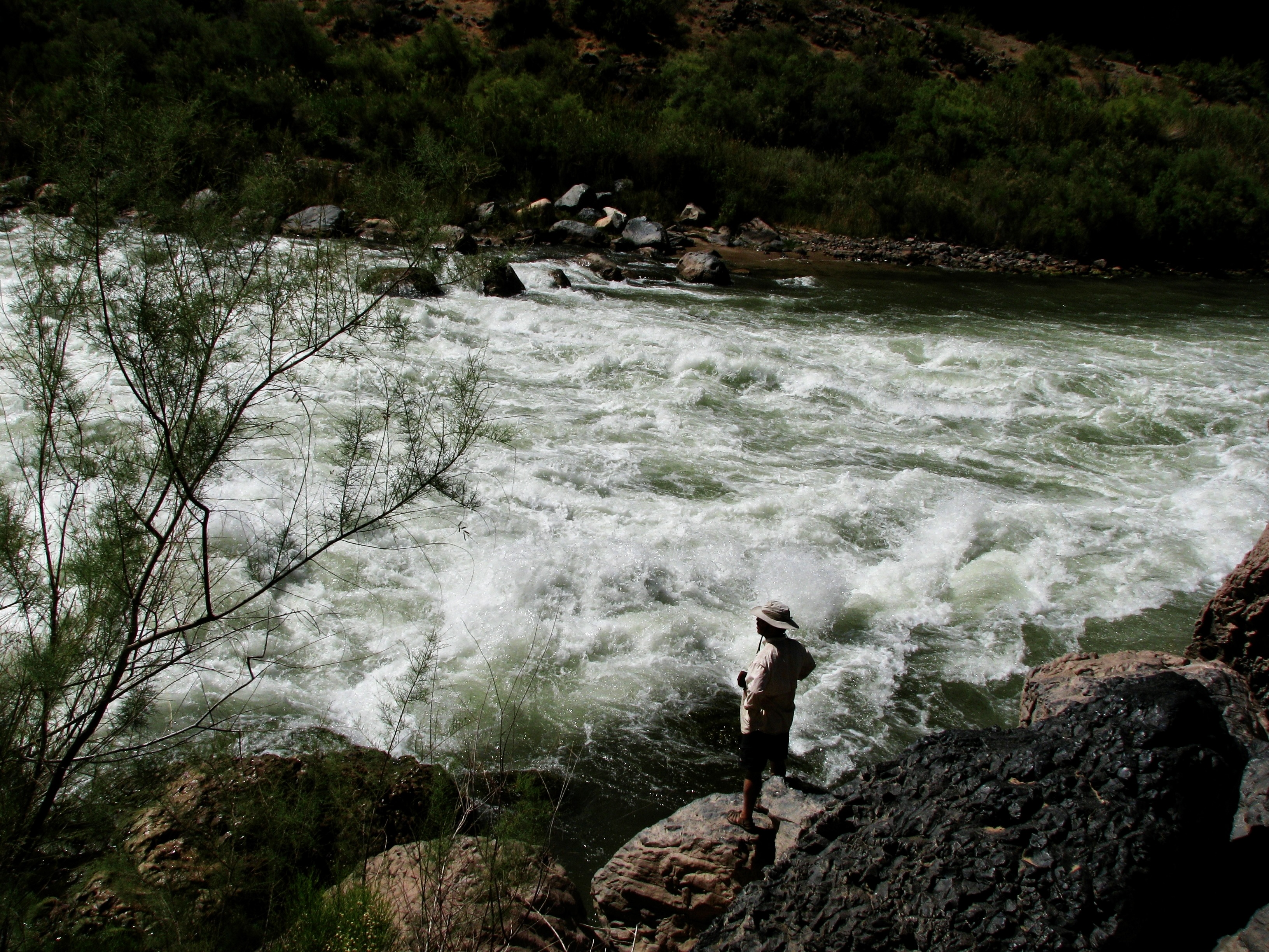
Today will take us another 44 miles down the river, which is short on miles but filled with both beauty and adventure. The beauty will be provided by Deer Creek Falls combined with a hike that takes us high above the river, and Havasu Creek that feature sparkling aqua blue water. Lava Falls Rapid will provide much of the adventure. Its #10 rating in difficulty recognizes it as one of the most challenging rapids in the world. We looked forward to it with excitement, and I might add, more than a little trepidation.
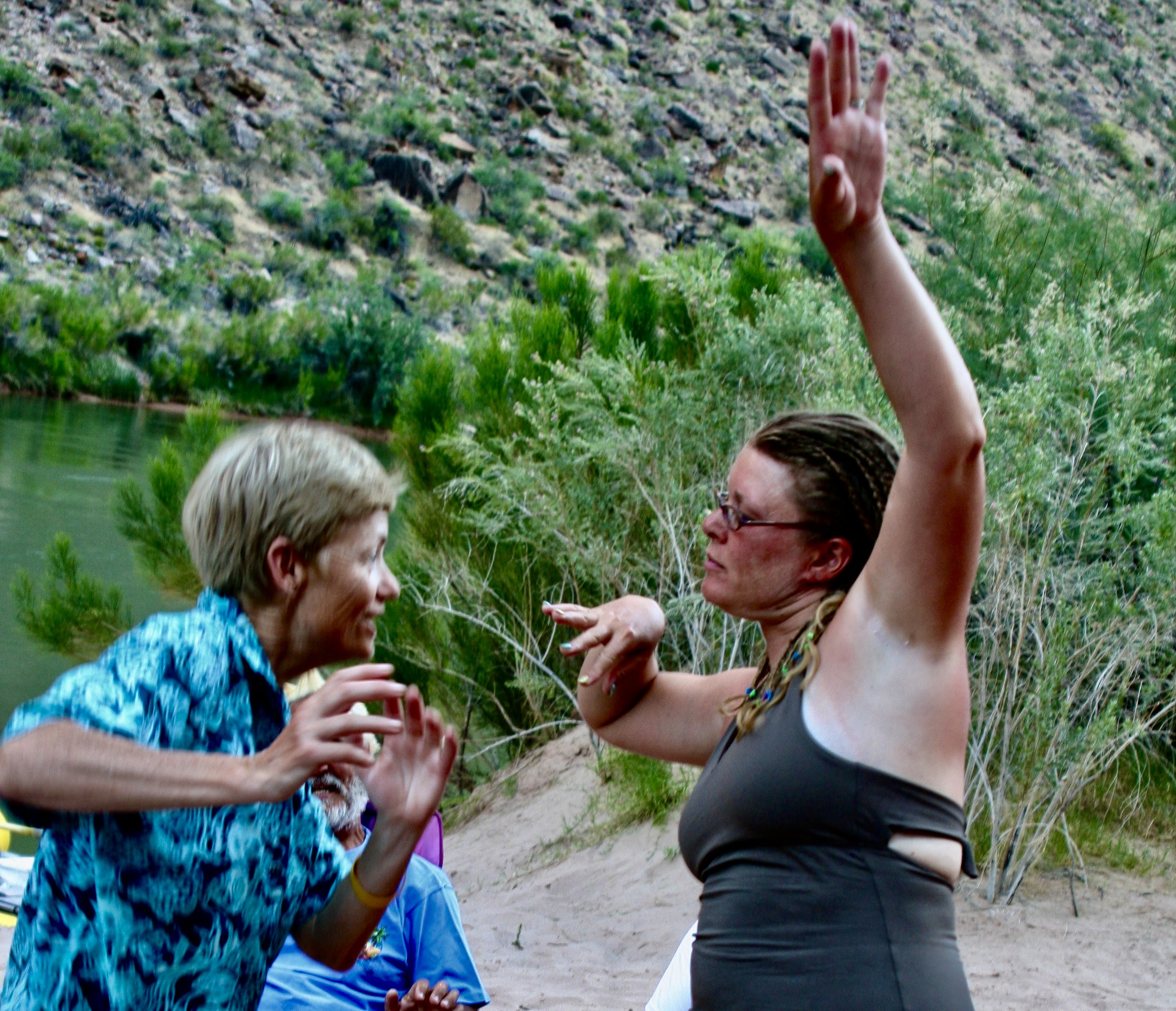
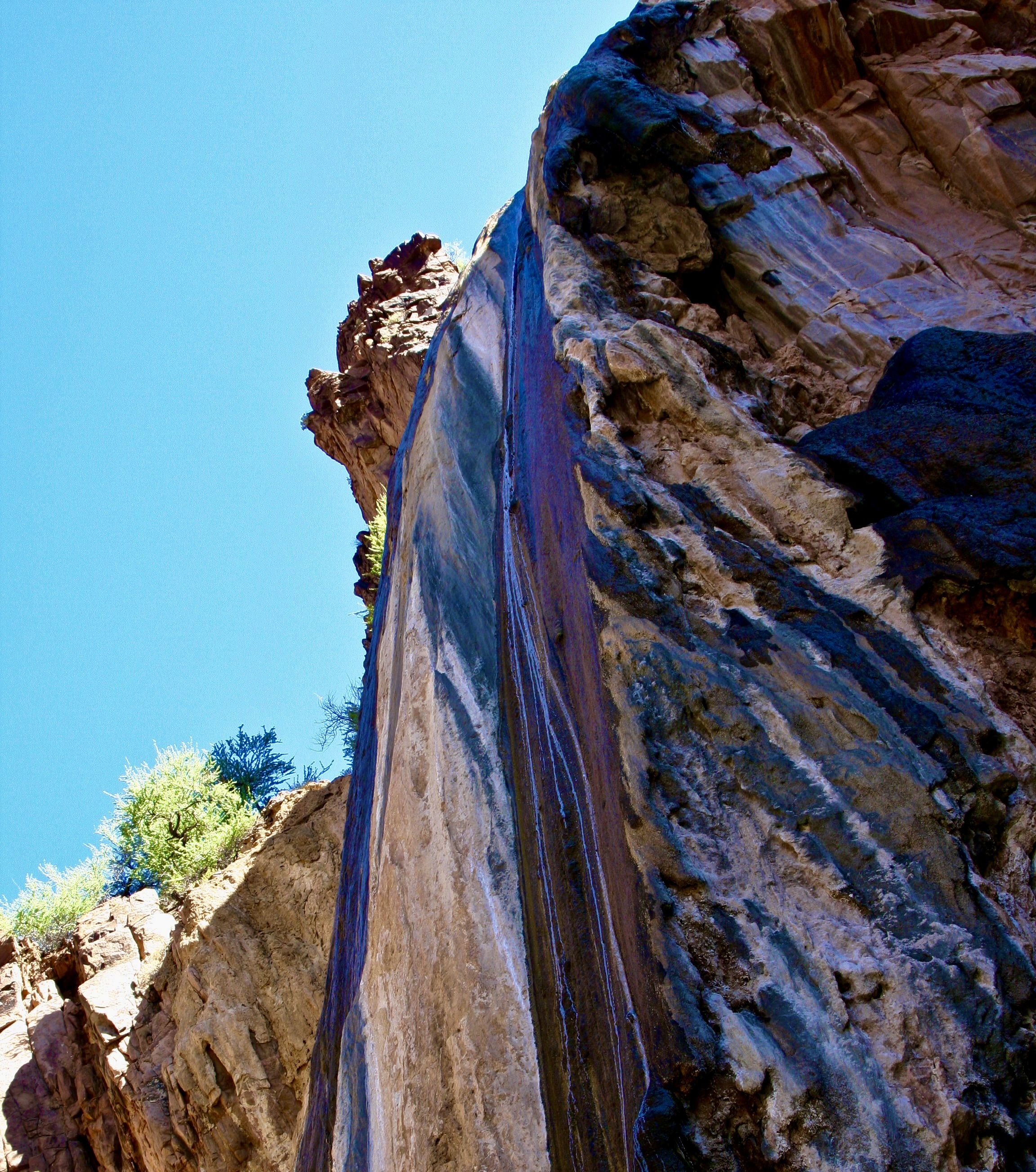
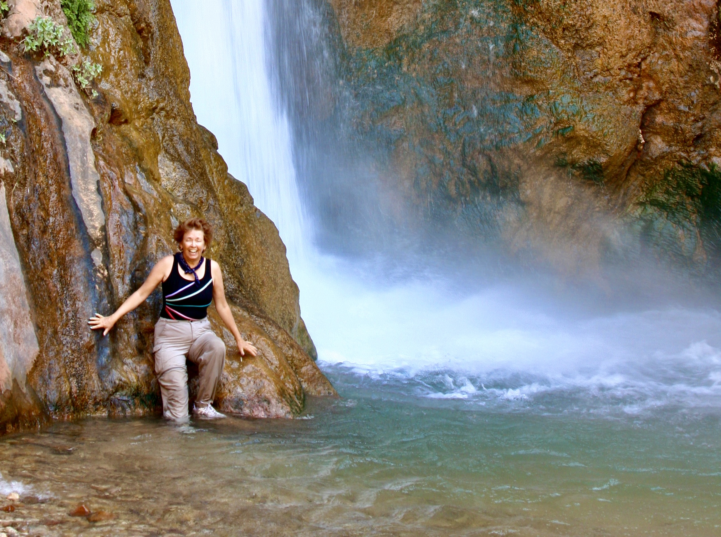
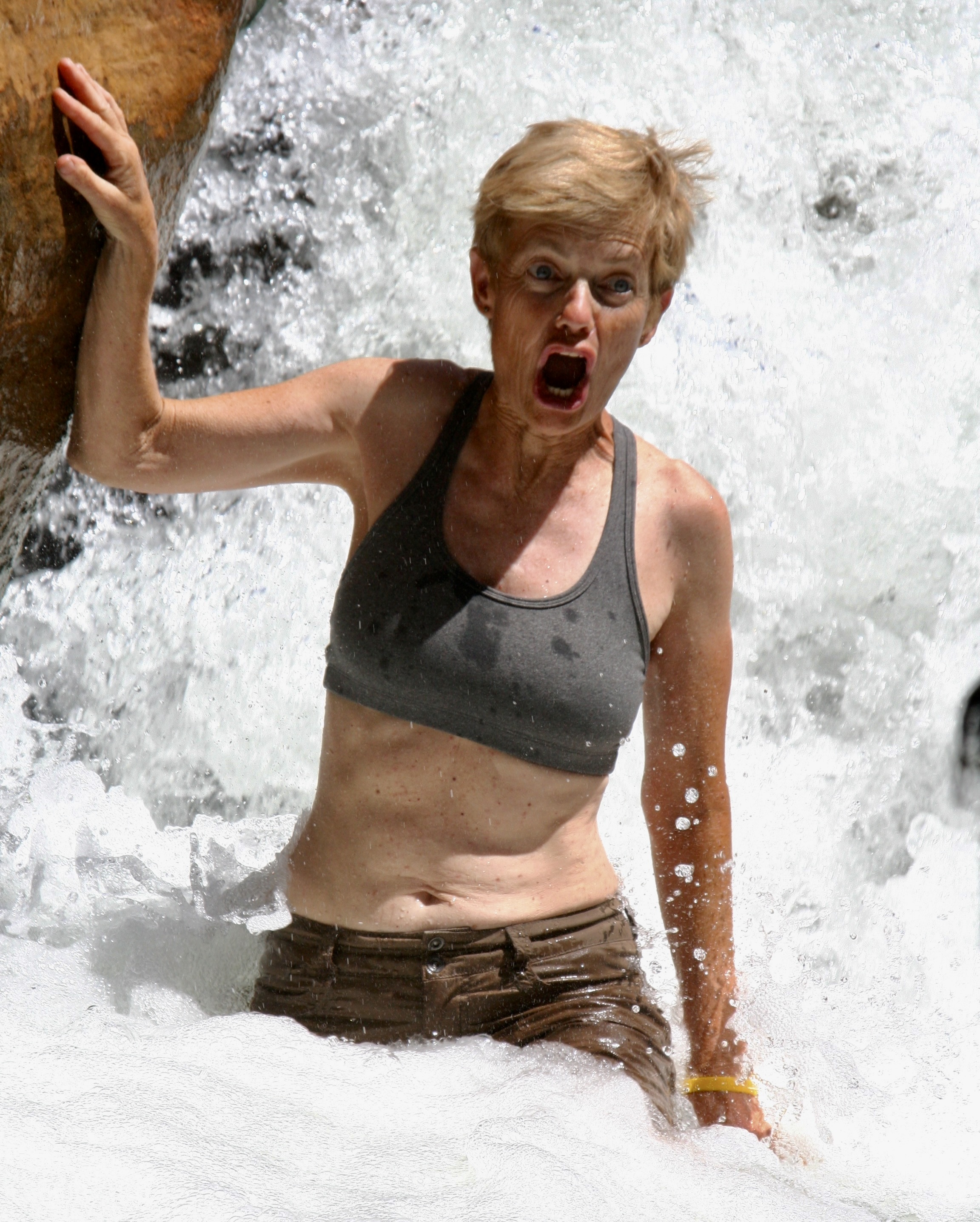
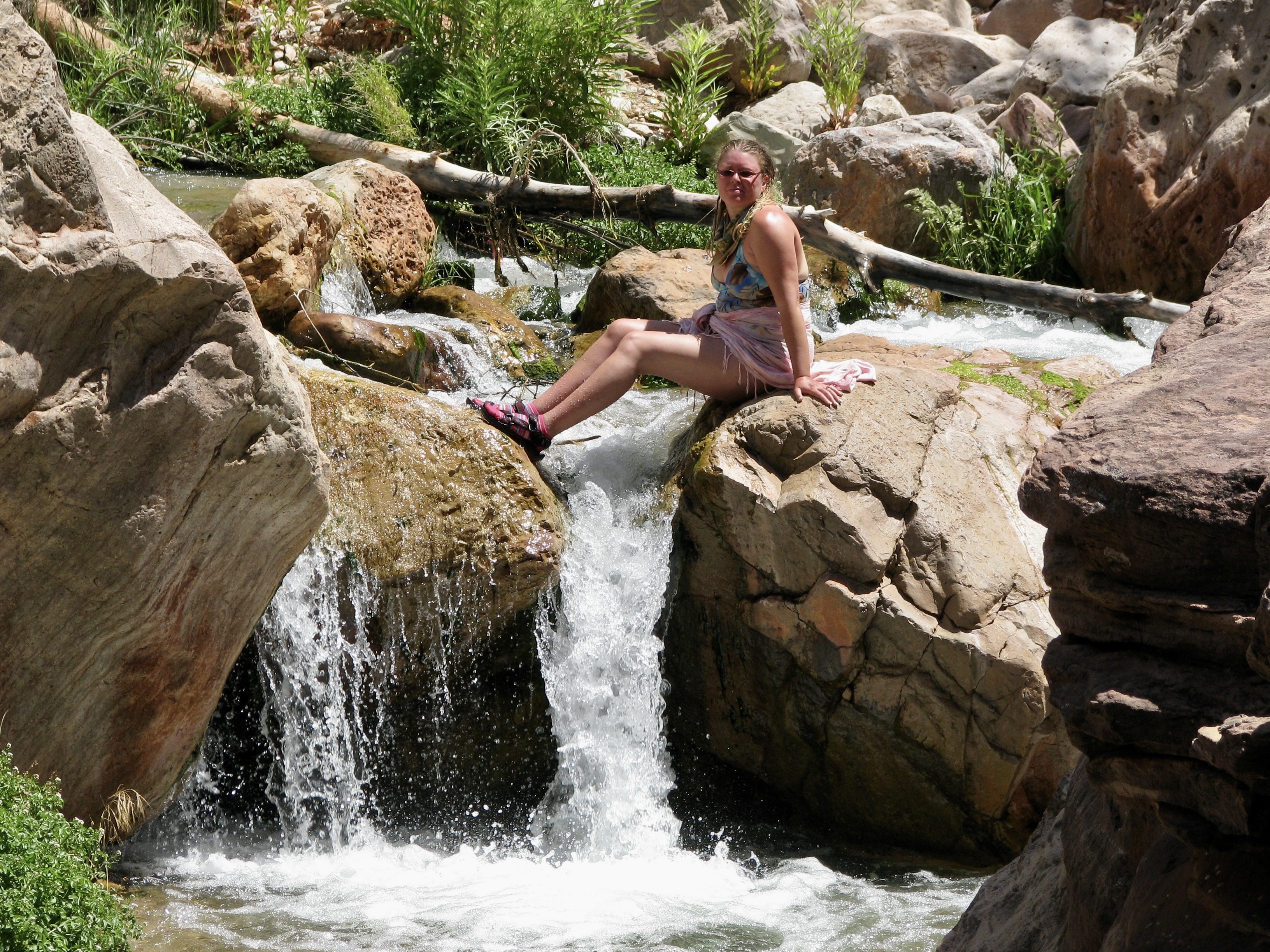
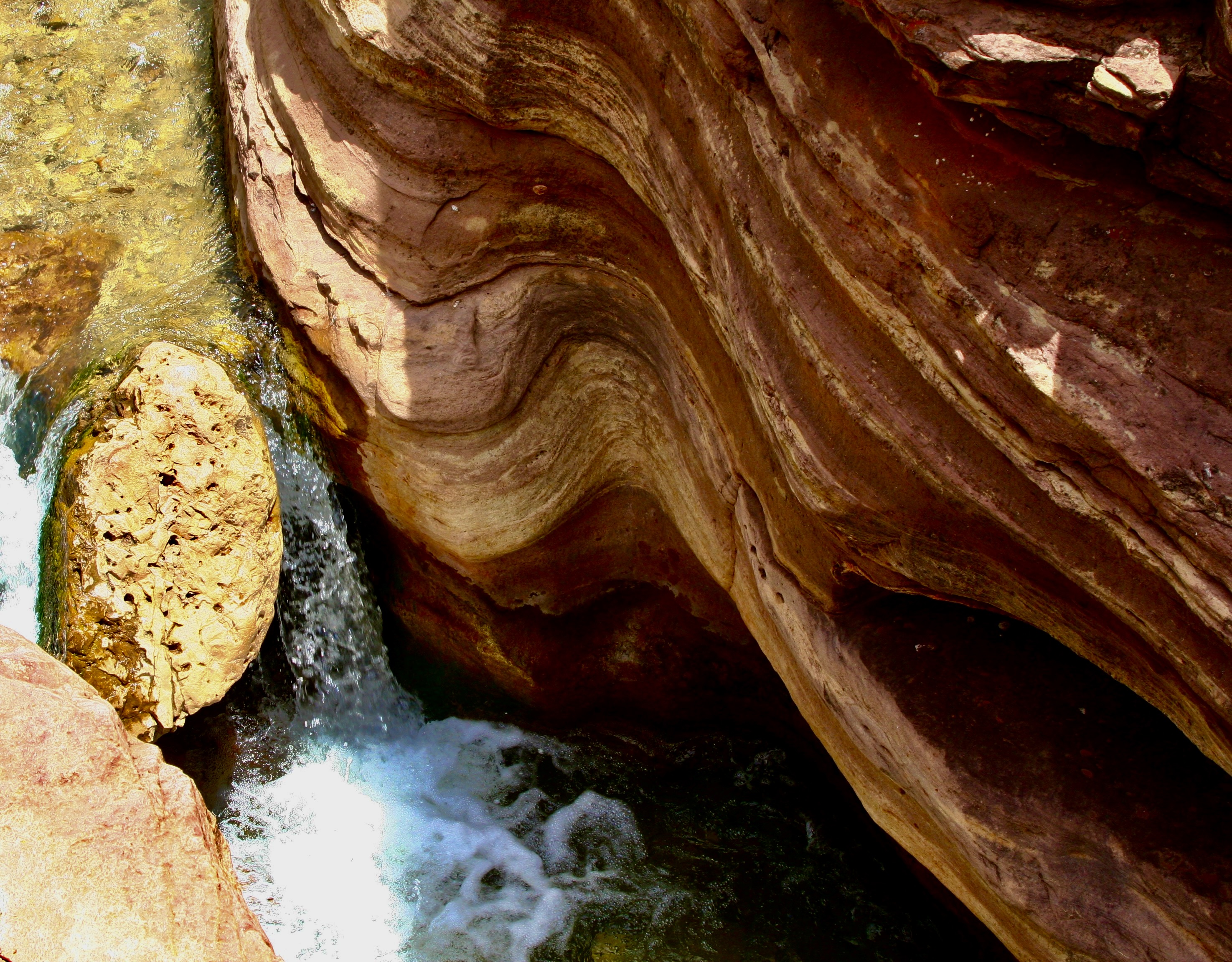
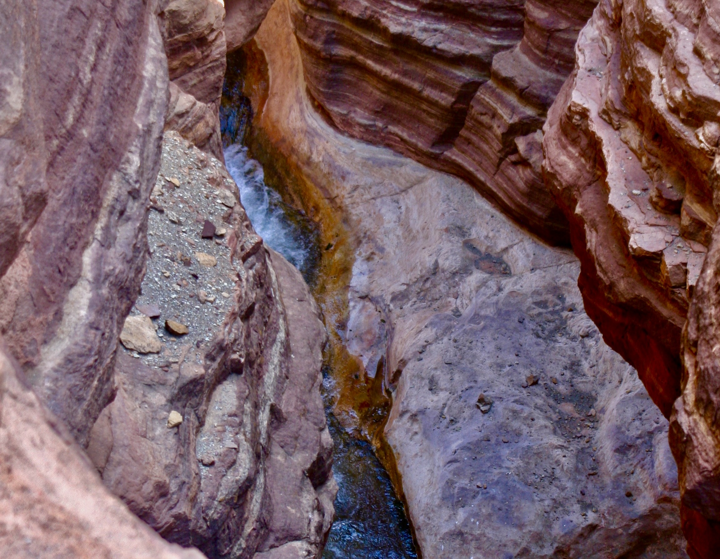
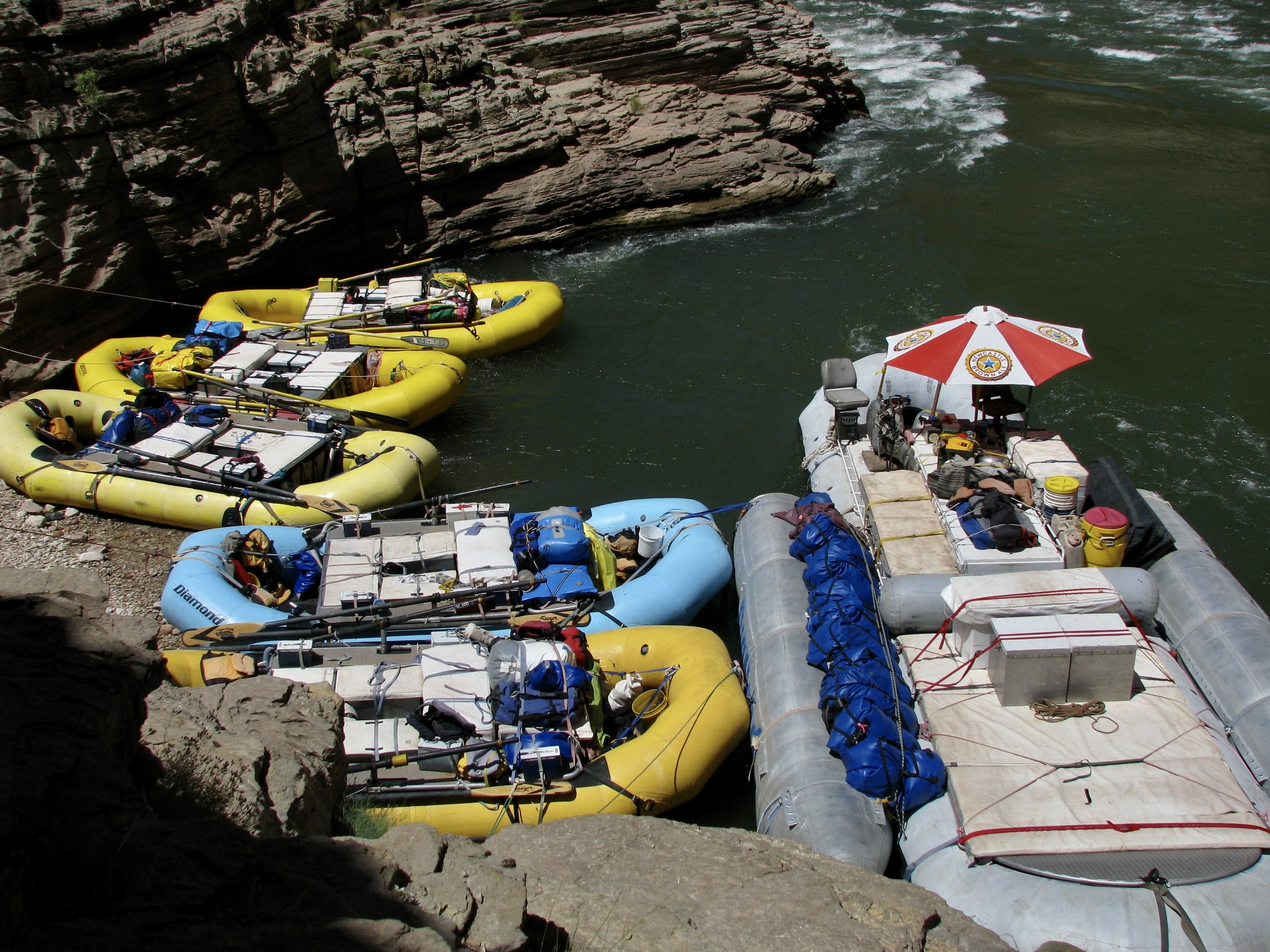
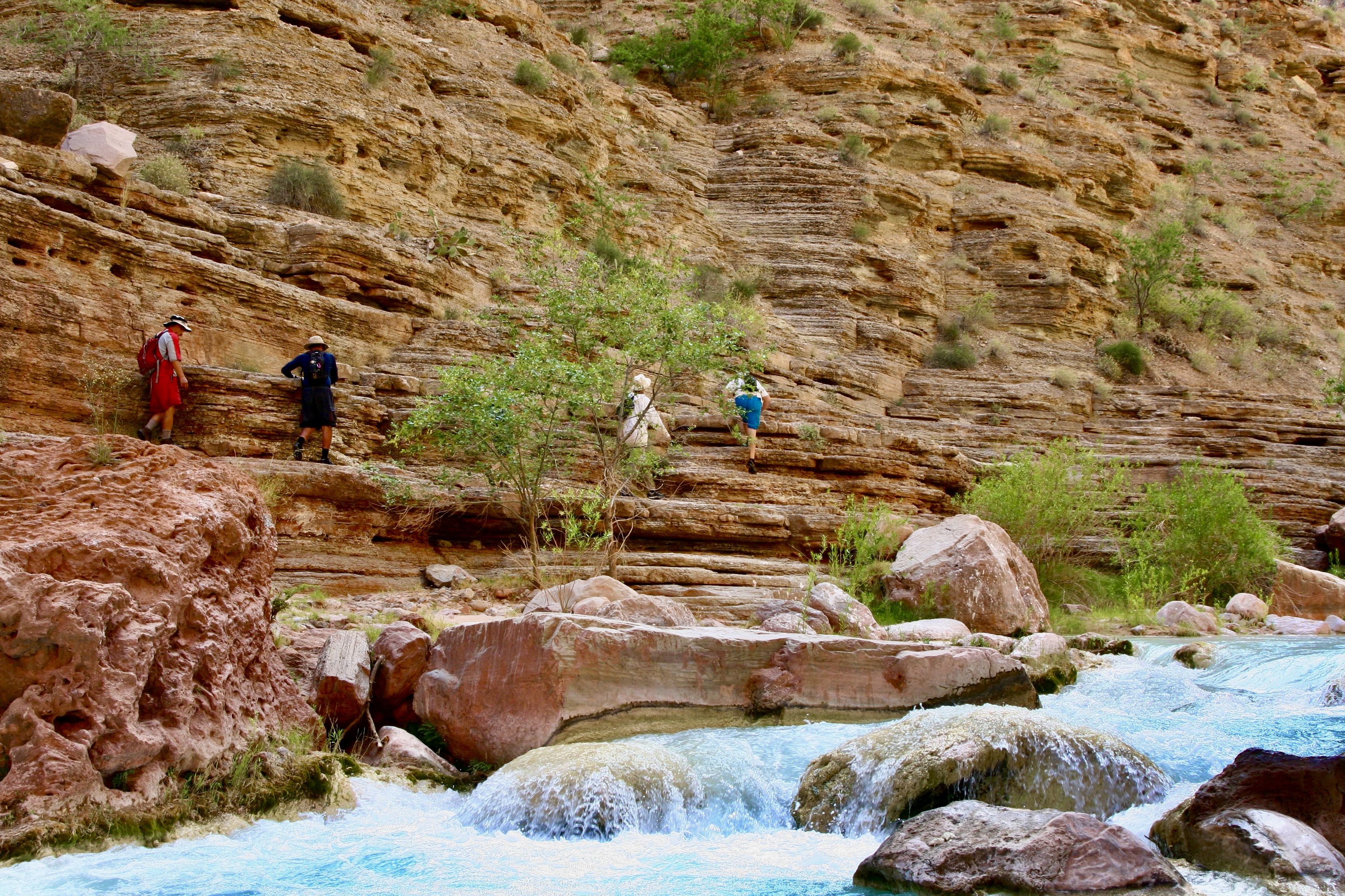
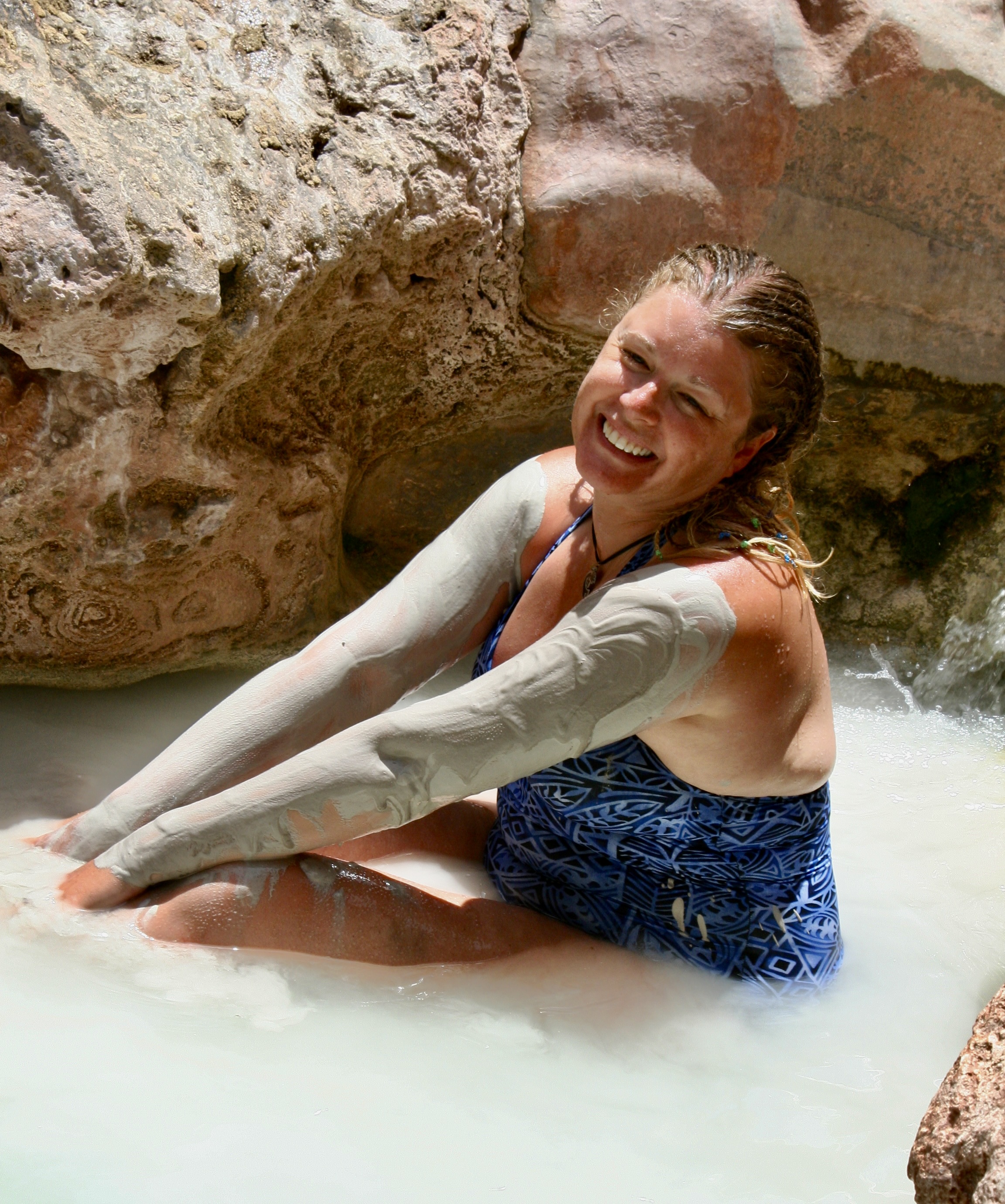
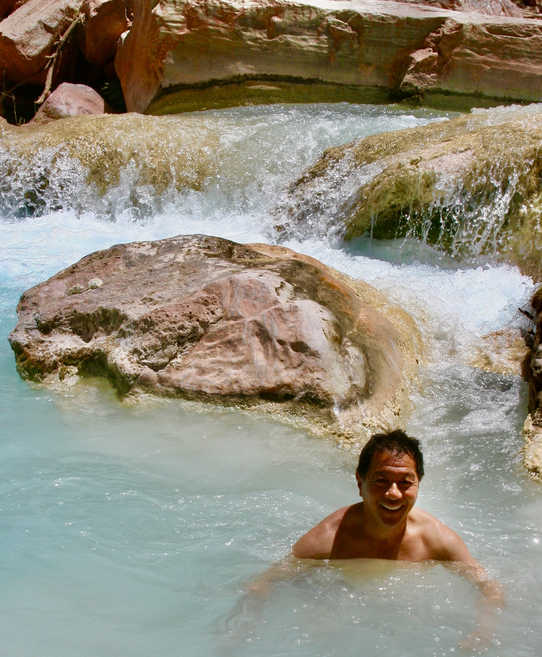
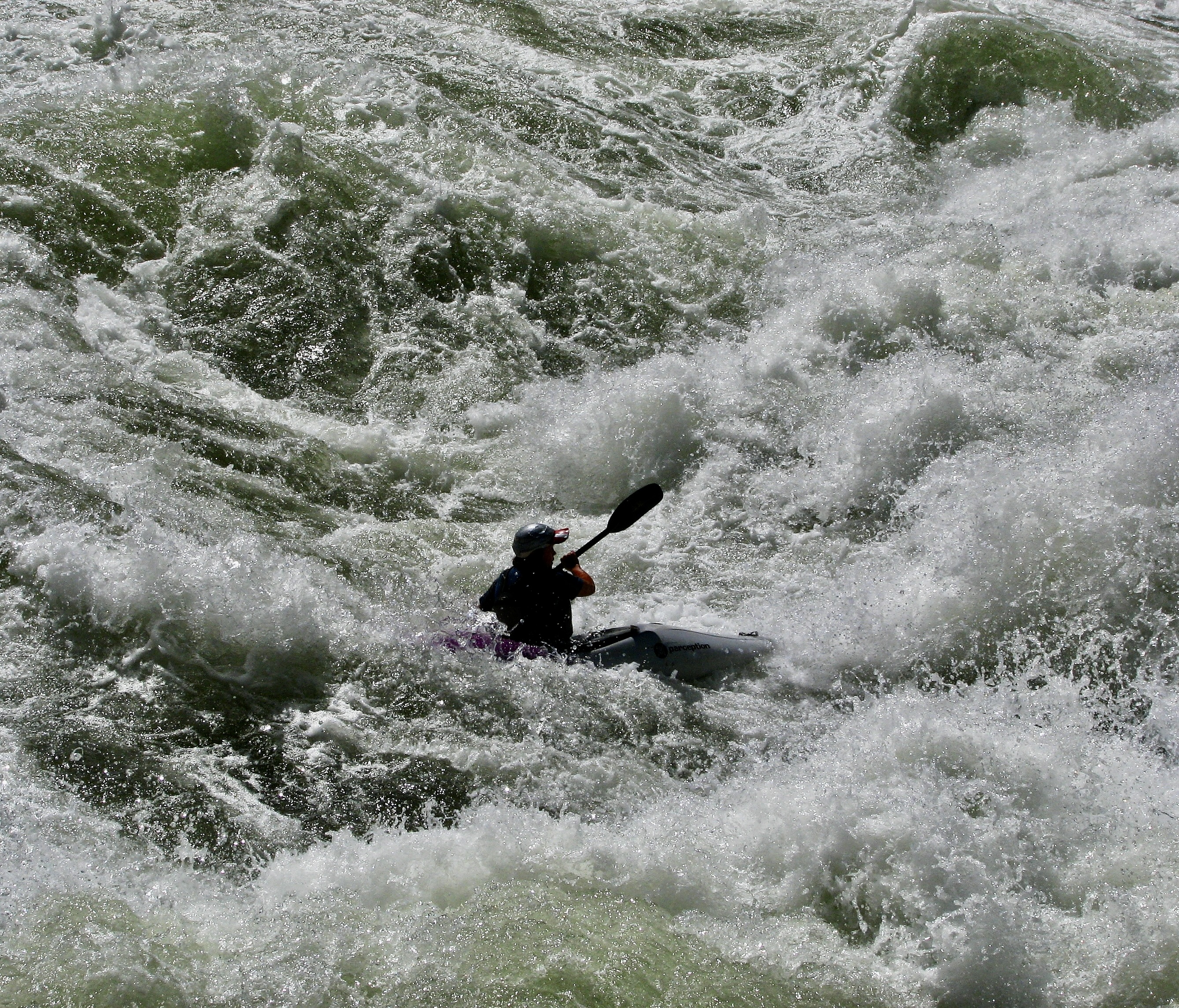
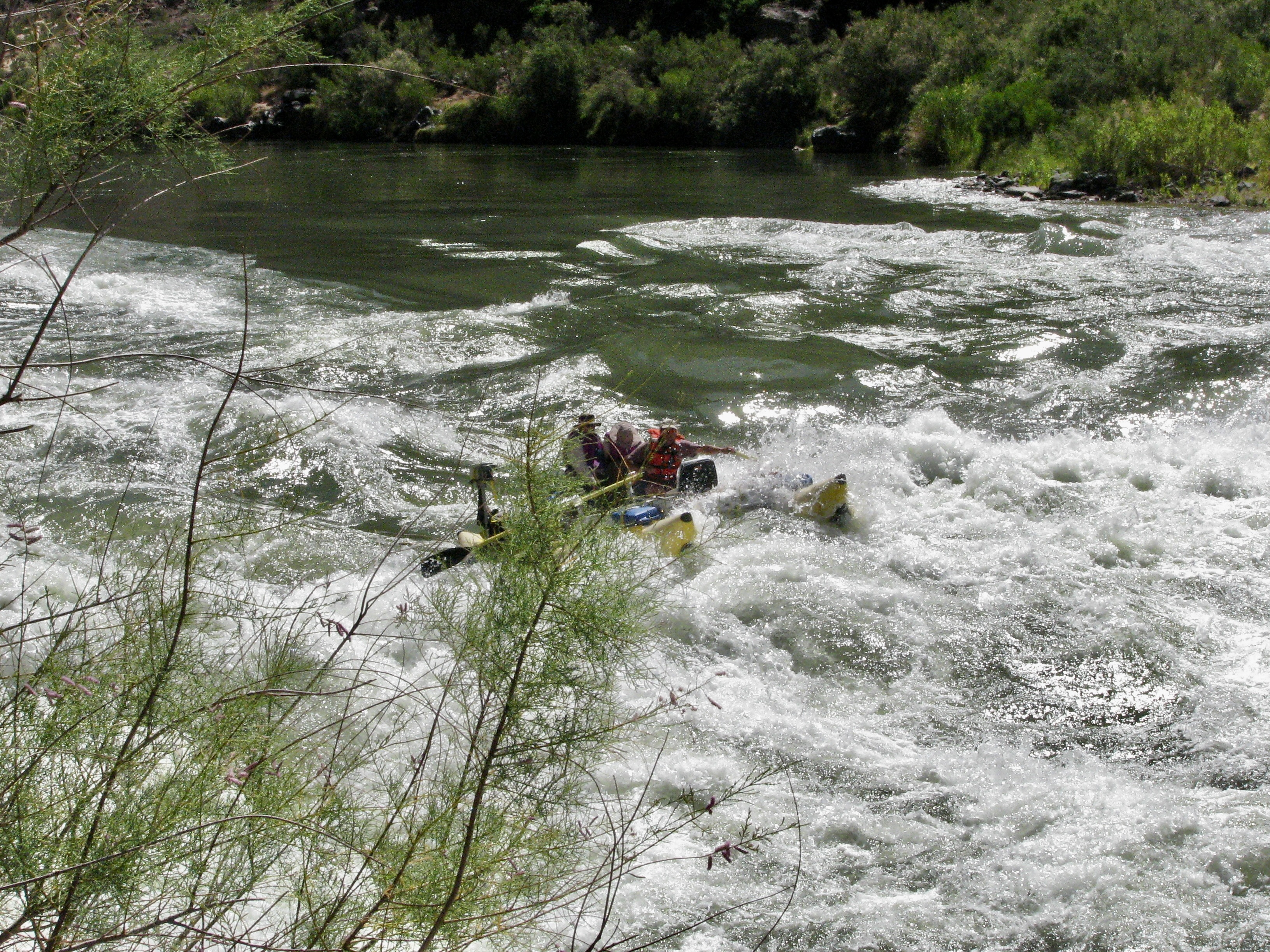
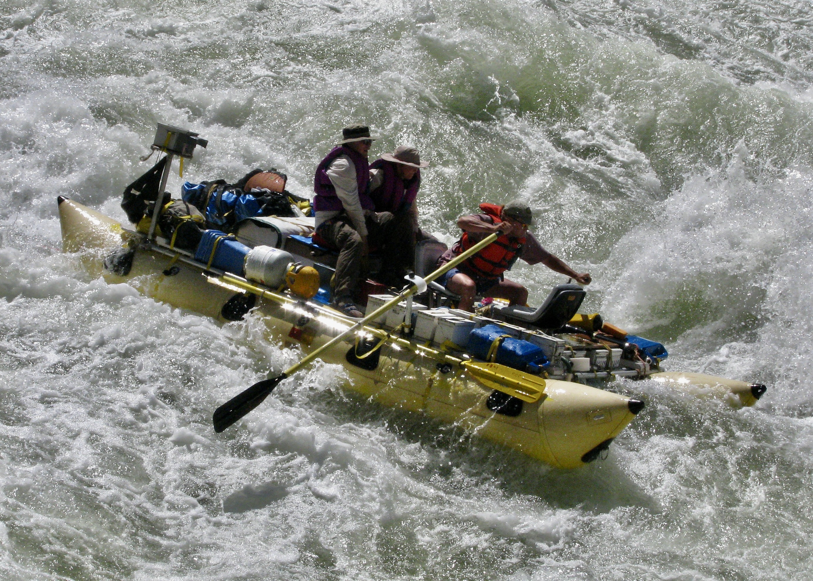
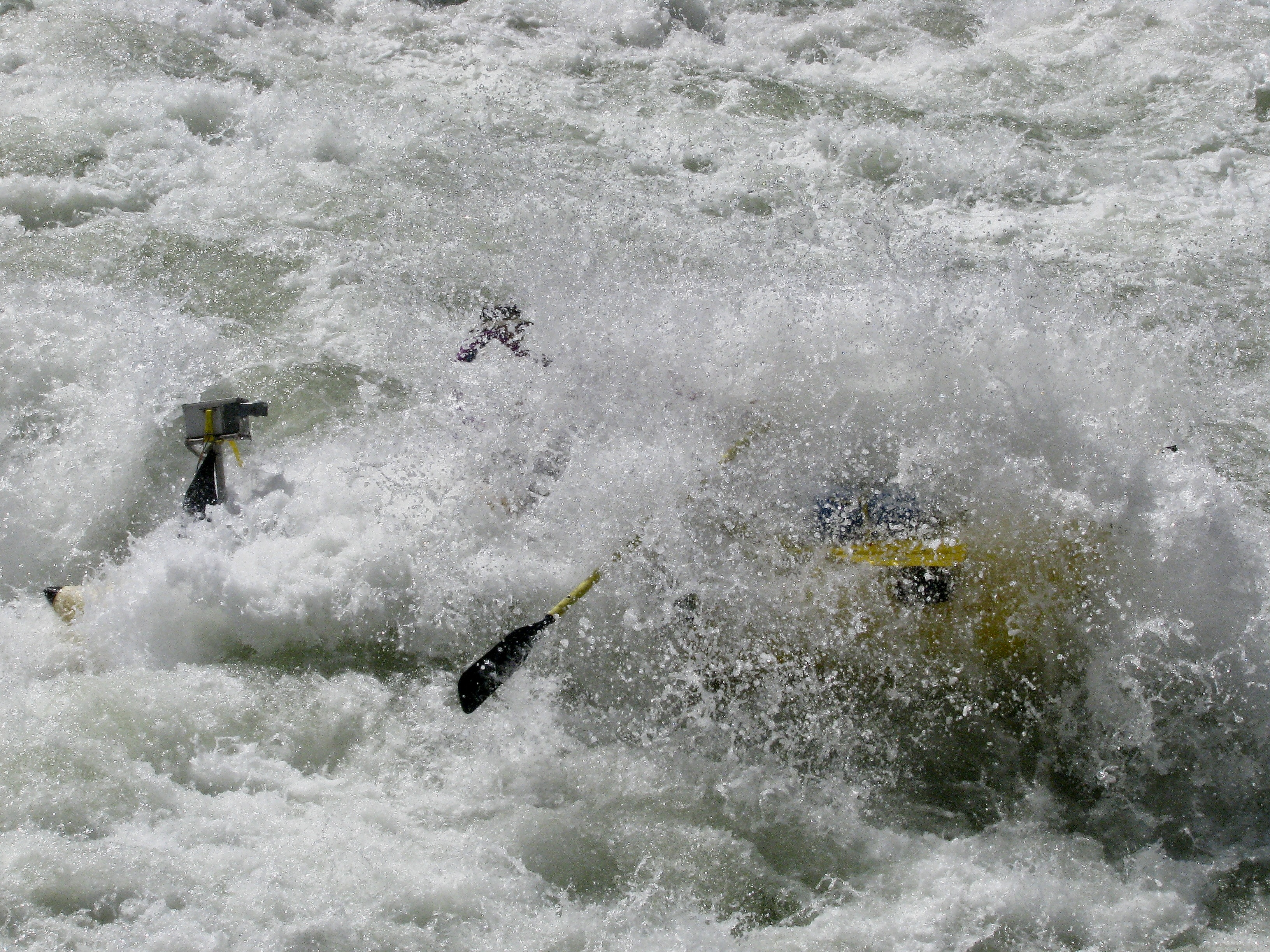
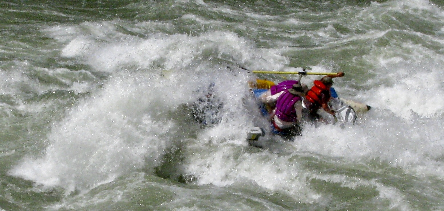
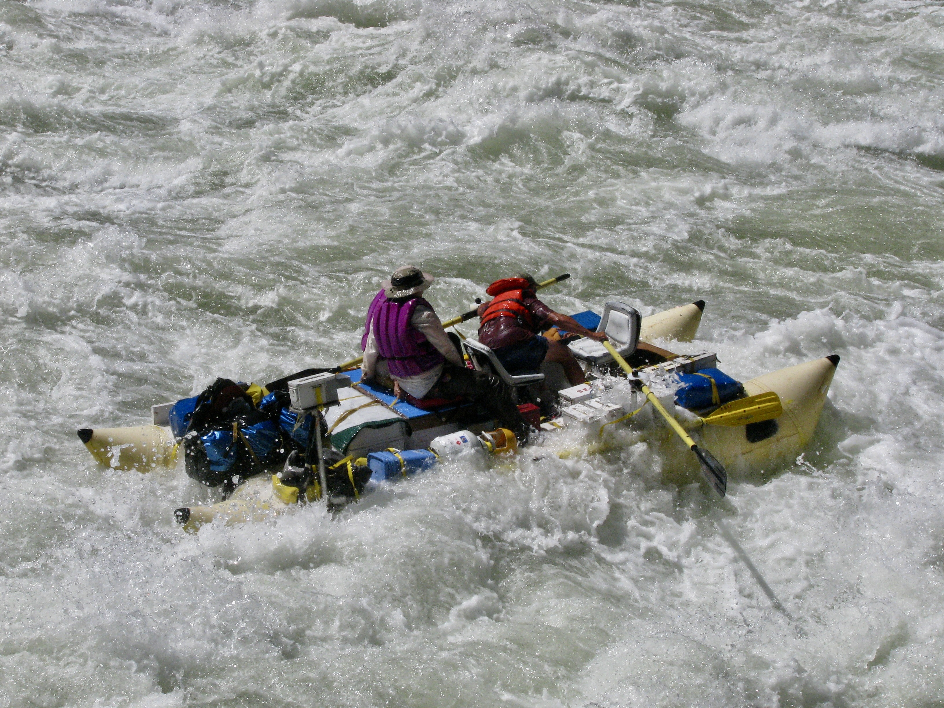
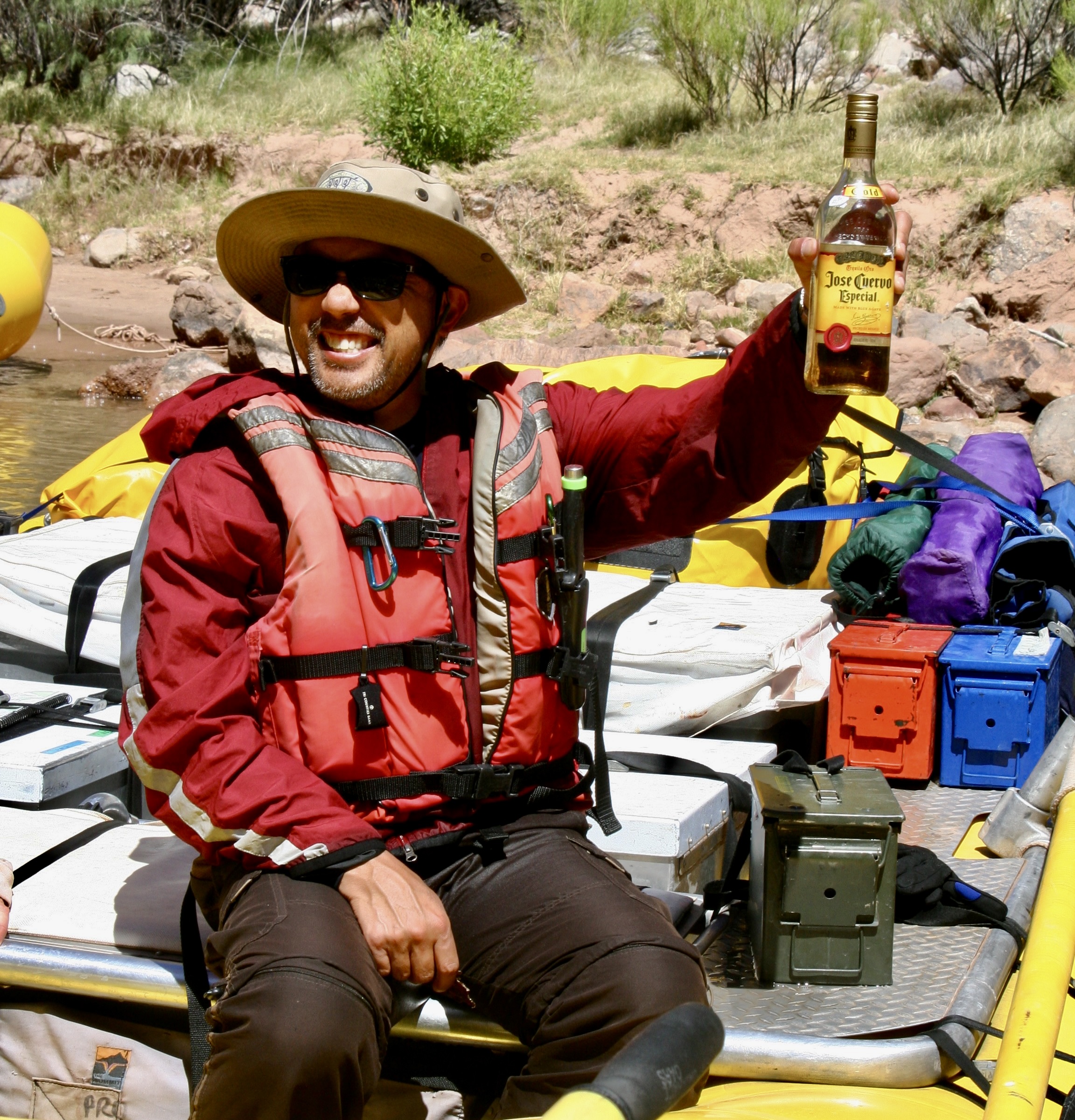
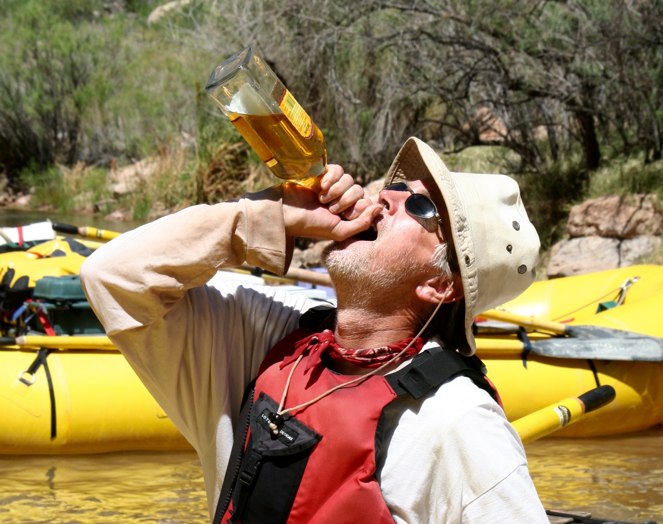
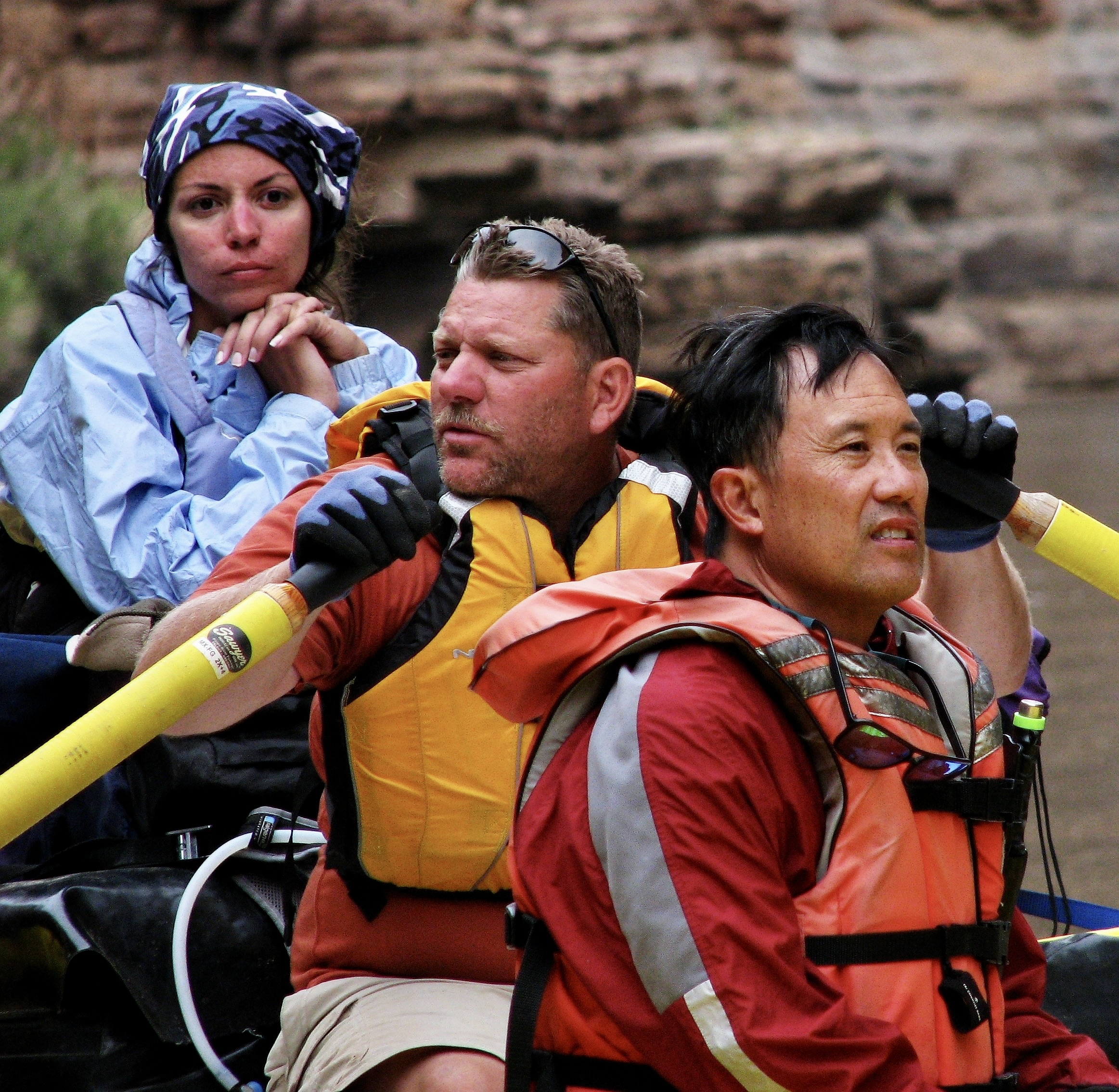
Deer Creek Falls and its 180 foot drop.Getting up to Deer Creek above the falls involved a substantial climb. You can see the trail as it makes its steep, windy way up.Don caught a photo of us high above the Colorado. (Photo by Don Green.)This Shangri-La with its welcome shade, magnificently carved rocks and cool water, made the trip up more than worthwhile.Or maybe I should say cold water. Susan obviously thought so.Beth Annon found another way to enjoy the coolness of Deer Creek. (Photo by Don Green)Bone wants to jump into the waterfall. Peggy is providing him with advice, “If you do that, it will be bye-bye Bone.”She also warned him to watch out for Tom and Don, the very definition of trouble.With good reason.After people got though playing in the waterfall, we all had time for R and R. Dave took it seriously. I’m convinced he can nap anywhere. The rope provided a rather unique pillow. Nice rubber band bracelet, too.Peggy and I took advantage of the time to capture some of the areas unique beauty.Deer Creek had cut an impressive canyon of its own.The colorful carved rocks and crystal clear creek made for fun photos.Another example.Our trip back down provided more views of the Colorado River…And our boats.Our continuing trip down the Colorado provided more views of the magnificent Grand Canyon.And another.When we reached Havasu Creek at mile 156.8, we weren’t alone. It’s a popular area and a commercial group was exploring the creek. They were wrapping up their visit, however, and we soon had the creek to ourselves. (Photo by Don Green.)The creek is known for its vibrant blue color and unique travertine formations, both of which are caused by large amounts of calcium carbonate in the water. The beauty of the area is jaw dropping. (Photo by Don Green.)Water flowing over a travertine formation.Whether flowing in a flat stream…Down a gentle rapid…Or through a carved canyon, it captured us.Even Bone found himself on edge over its beauty. We hiked up the creek along a narrow path. (Photo by Don Green.)While some continued to hike up the creek toward the Havasupai Village… (Havasu Creek is on the Havasupai land.)Others chose to luxuriate…..with a mud bath for example.Or quiet swim…Or seeking bliss. Peggy and I stayed behind because we had been to the Havasupai Village a few years earlier when our son Tony had flown us in by helicopter.While this looks weird, it’s a rafter tradition. The crew here is forming a butt dam. (Note Tom. I sometimes wondered if he had a hidden stash of magic mushrooms along.) When the ‘dam’ had created a lake…The crew dashed off to the side, creating a mini flood.Once again, we are floating down a beautiful calm river. That’s about to end. Lava Falls Rapid is waiting for us.First we camp, however. Don demonstrates how to be a pack animal. Was he planning to give up his day job as a probate judge and apply for a position as a Grand Canyon mule?You can hear the roar of Lava Falls Rapids long before you get there. Here we were floating down a calm river, came around a bend and there it was— churning! Waiting to eat our boats. We had been living in anticipation of this moment the whole 180 miles of our journey.Extremely careful scouting is called for.We look on in awe as our boatmen plotted out the best route. There was huge hole waiting to suck our boats in and a narrow pathway around it. Dave stood there for a long time, staring at the river, planning his route. He had been waiting for years for this opportunity, applying again and again for a permit. Don took this photo. I wish to thank him again for his superb job of capturing Peggy and me as we went through the rapids with Steve. Otherwise we wouldn’t have the record we do.This is Megan kayaking through the rapids. Can you imagine yourself being there? Shortly afterwards, she rolled. (Photo by Don Green.)And we begin one of the most intense experiences we have ever had. It’s the journey of a lifetime that lasts forever and takes approximately 20 seconds.I still get the jitters when I see this photo. Peggy and I were hanging on to special ties with all of the strength we had. Steve was rowing like a madman, using all of his considerable skills, trying to keep control of his boat. (Photo by Don Green.)Five seconds later we had disappeared under a wall of water on the edge of the massive hole. (Photo by Don Green.)And then emerged out the other side! Check out Peggy. I think she was hanging on with her teeth as well as her hands. (Photo By Don Green.)Even then our ride wasn’t over. Wait! Where’s Peggy? UH-OH. (Just kidding, she’s hidden on the other side of me.) Photo by Don Green.We made it to Tequila Point just below the rapids. The tequila was waiting!Folks helped Megan gather her equipment. She was fine, but definitely ready for a shot.Everyone was happy.Next post: The final hundred miles of our trip down the Colorado River.
This photo at mile 68.5 has a special meaning to me.
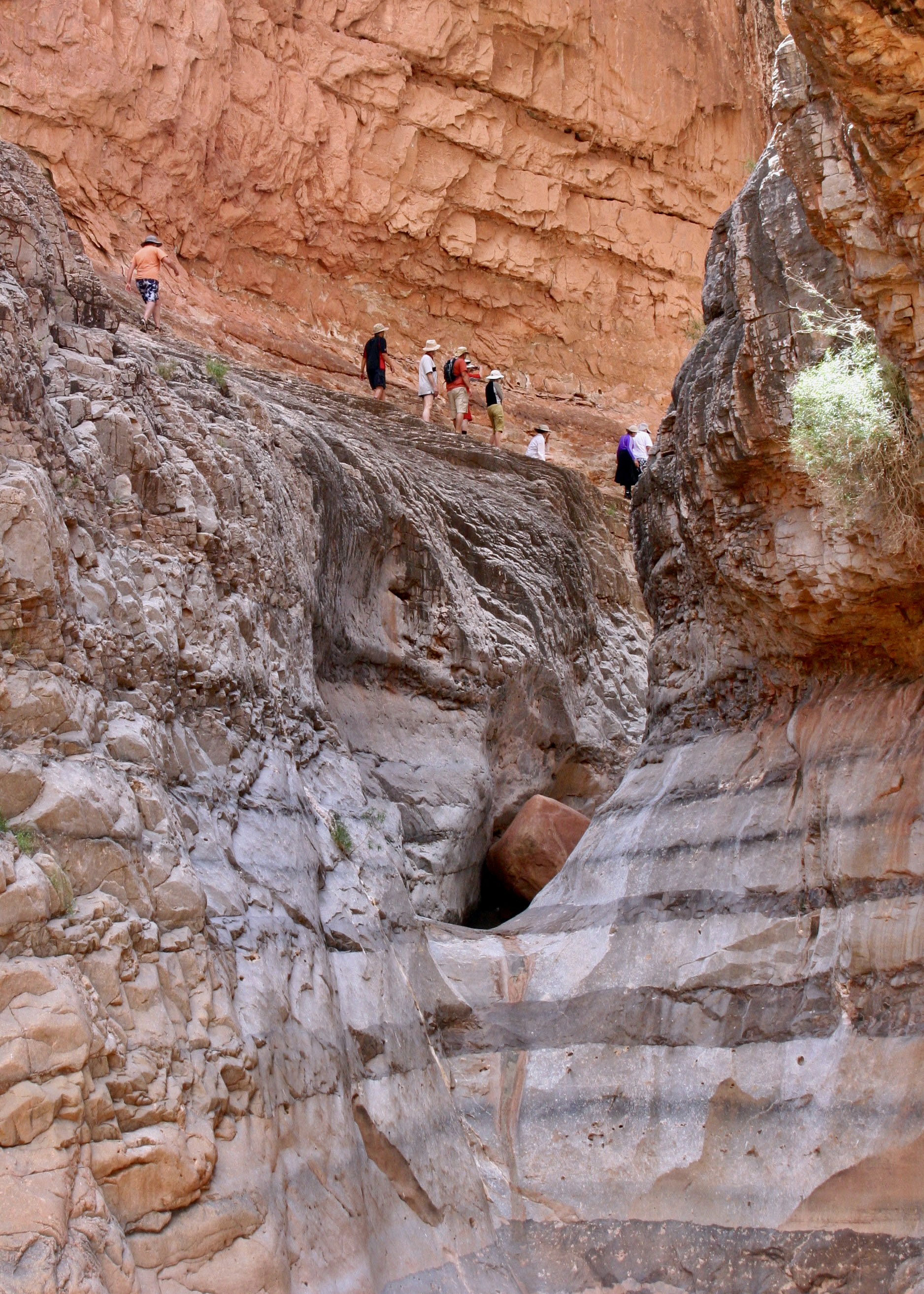
When I left Alaska in 1986 after three years of working as an executive director of a non-profit focused on health and environmental issues, I took six months off to solo backpack various locations in the West. My first stop was the Grand Canyon, perhaps not the best location to kick off a season of backpacking. Day one was spent hiking down the Tanner Trail from the high peaks on the rim to the scrawny tree on the right. I started with a 70 pound pack, including a generous amount of water. It was a steep, unmaintained, rocky and somewhat dangerous trail of 8-9 miles that dropped 4700 feet with the first source of water being the Colorado River.
Not surprising, I didn’t see another soul along the way and was exhausted when I arrived. I had just enough energy to pump some water, eat a handful of gorp, and throw out my tarp and sleeping bag. I buried my food bag in the sand next to me and crawled into my sleeping bag. That’s when the mouse chose to go dashing across my chest from its home at the base of the tree to my food sack. “Go away Mousey!” I yelled as I dropped into oblivion.
When I woke up in the morning, the first thing I checked was my food bag. Other than helping itself to some peanuts, Mousey hadn’t done much damage. I looked over at the tree to see if I could spot its home. Nope, but I did see something round, grey and skinny on the side of my tarp. “What the” I thought, and then it dawned on me. It was Mousey’s tail! Something had sat on the edge of my tarp and eaten the mouse during the night!
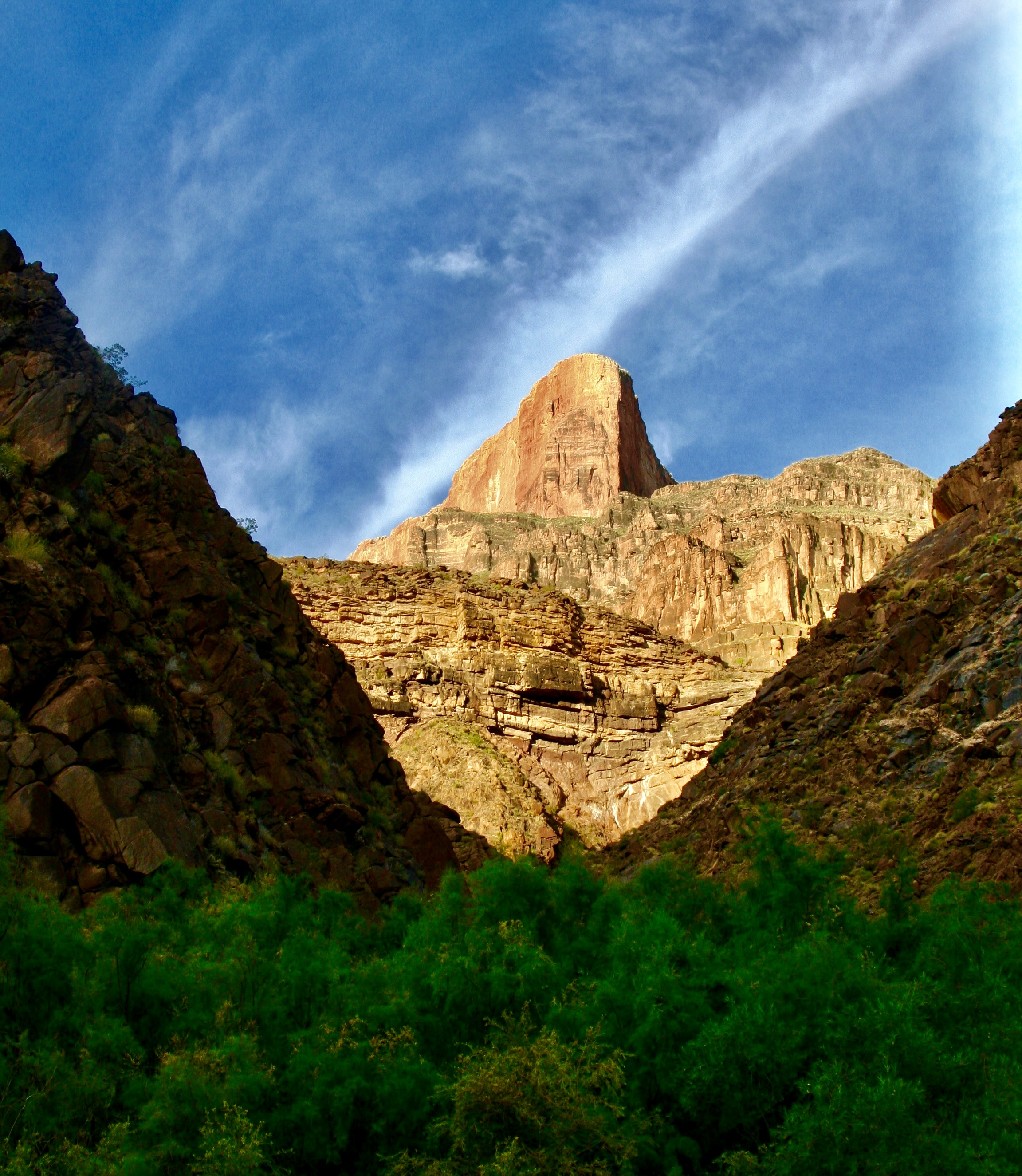
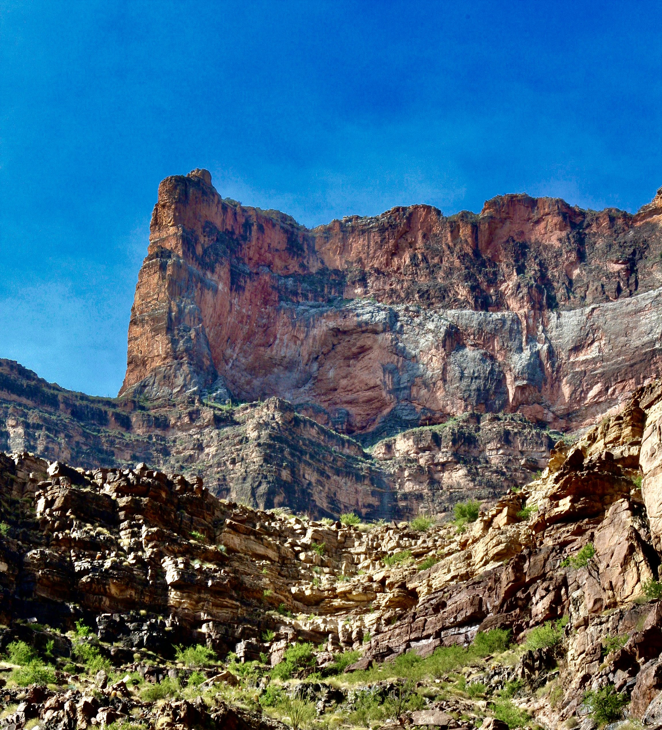
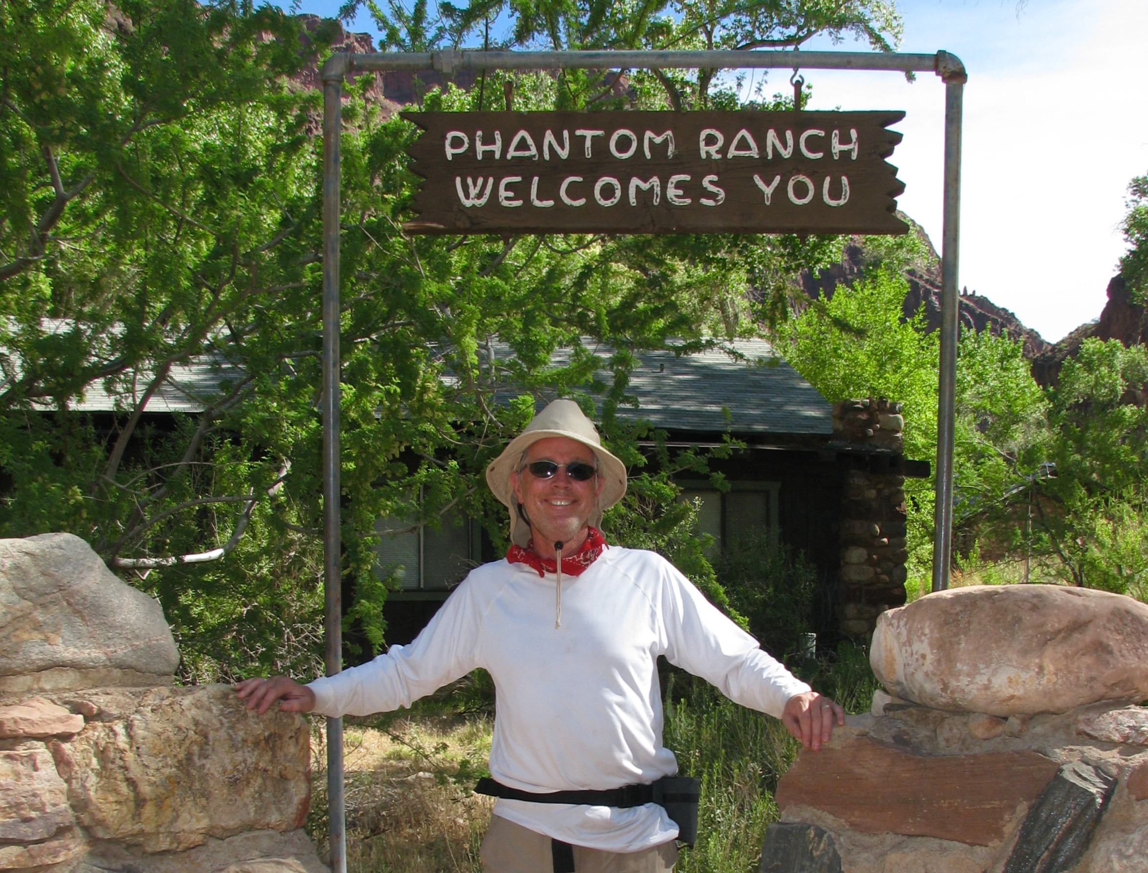
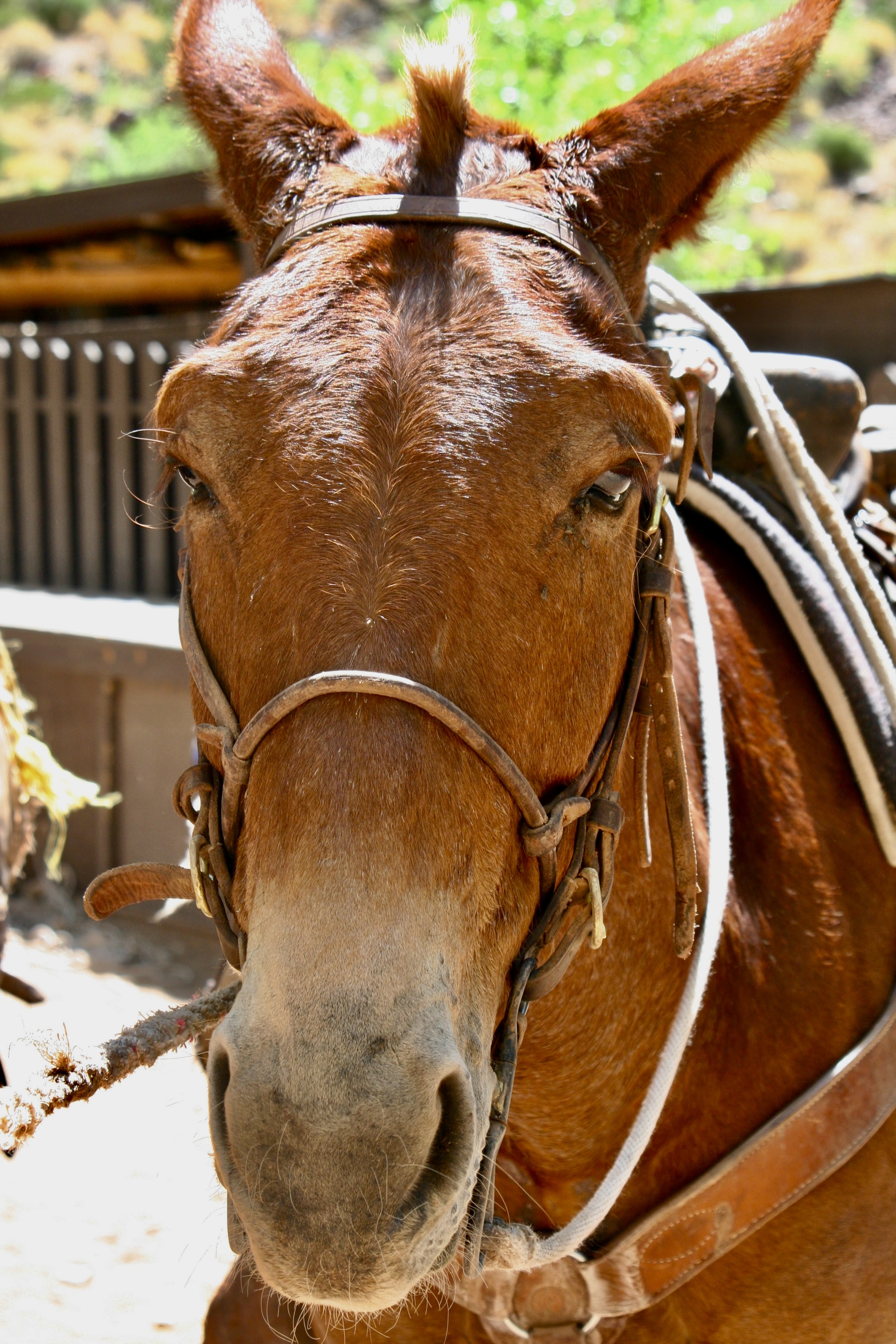
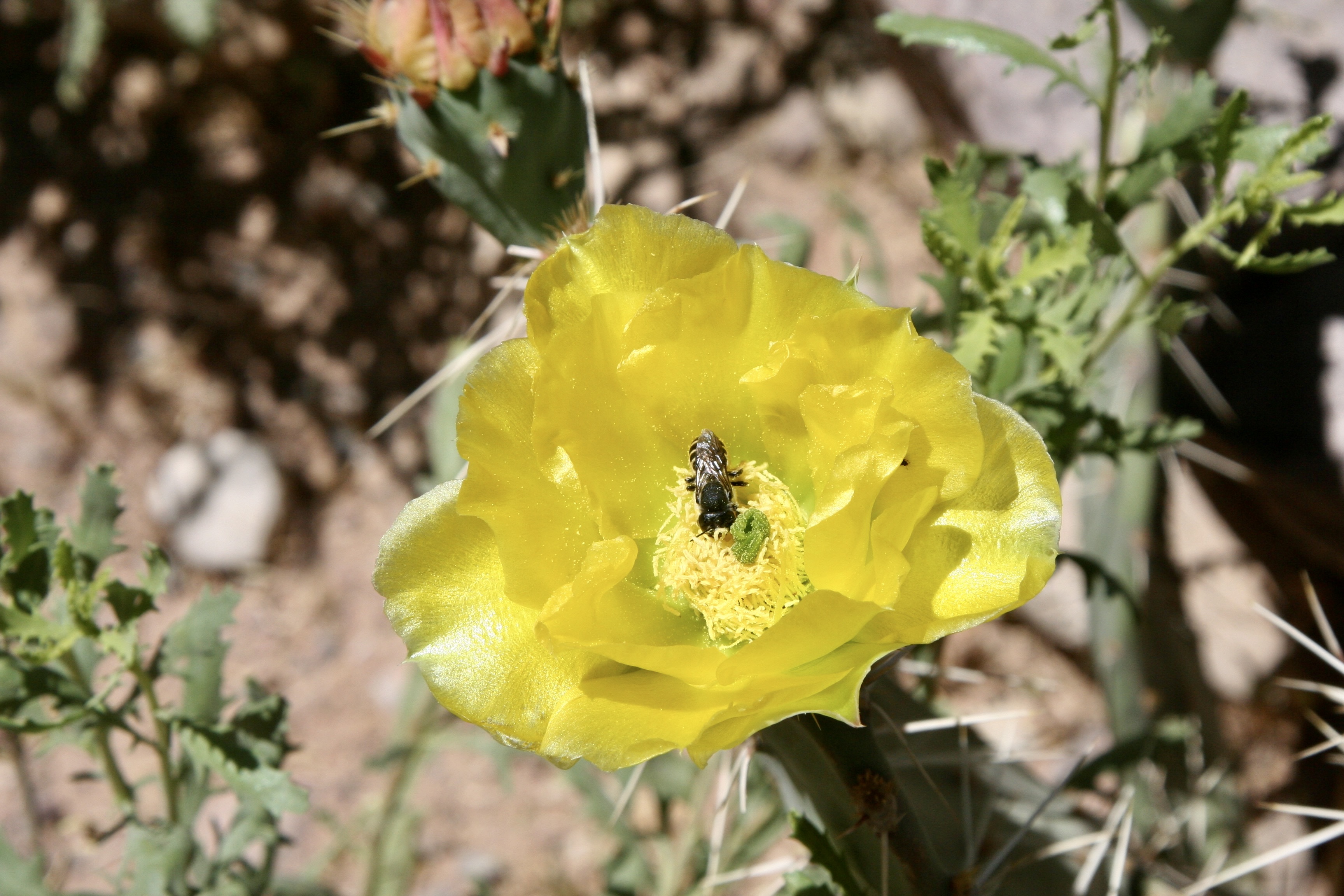
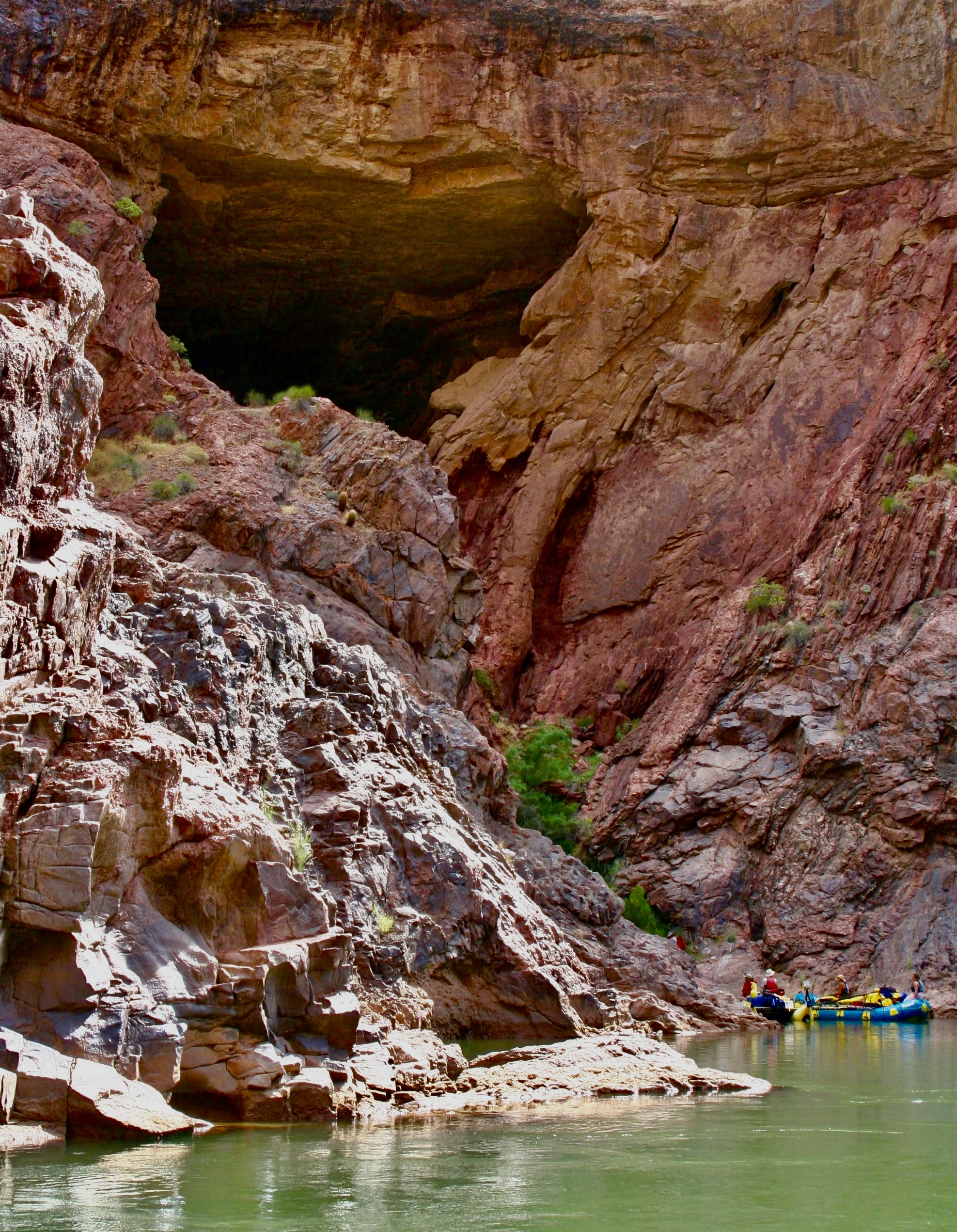
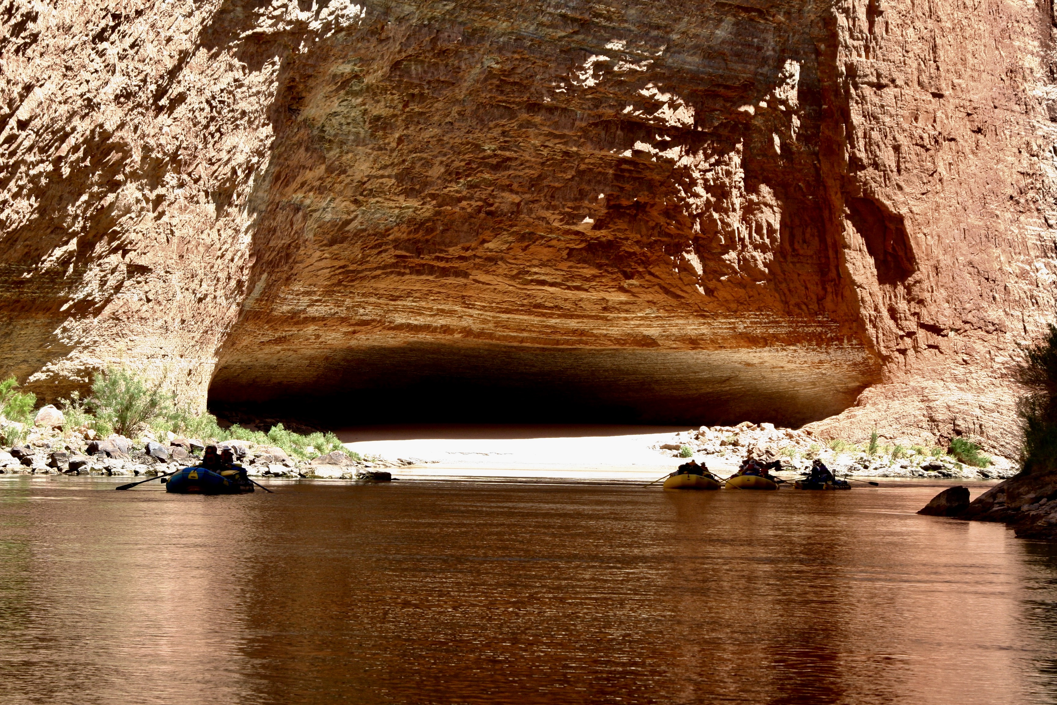
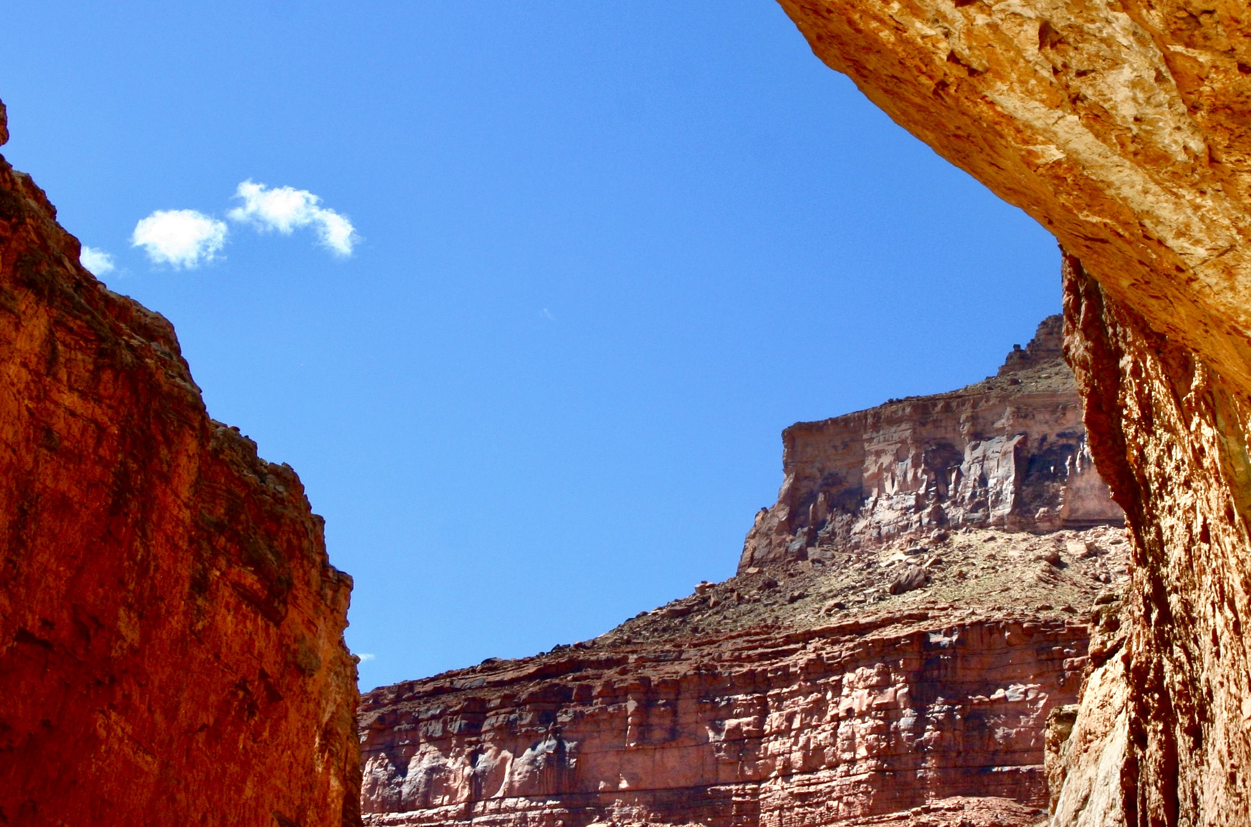
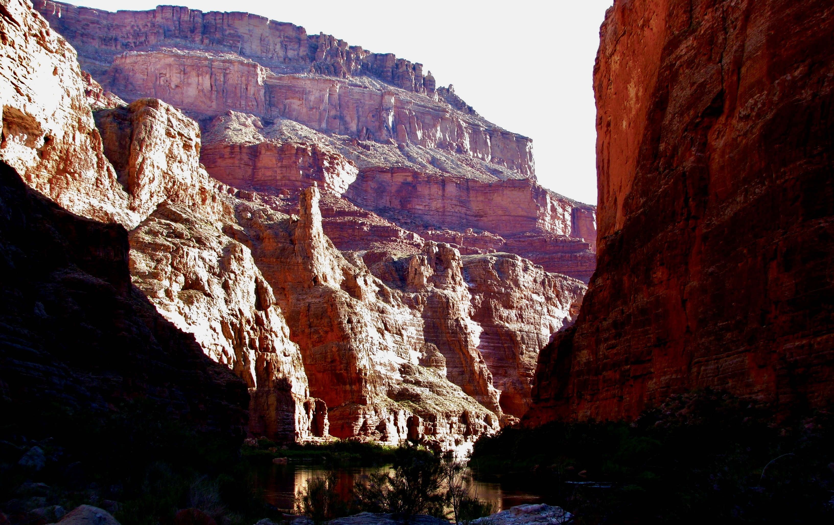
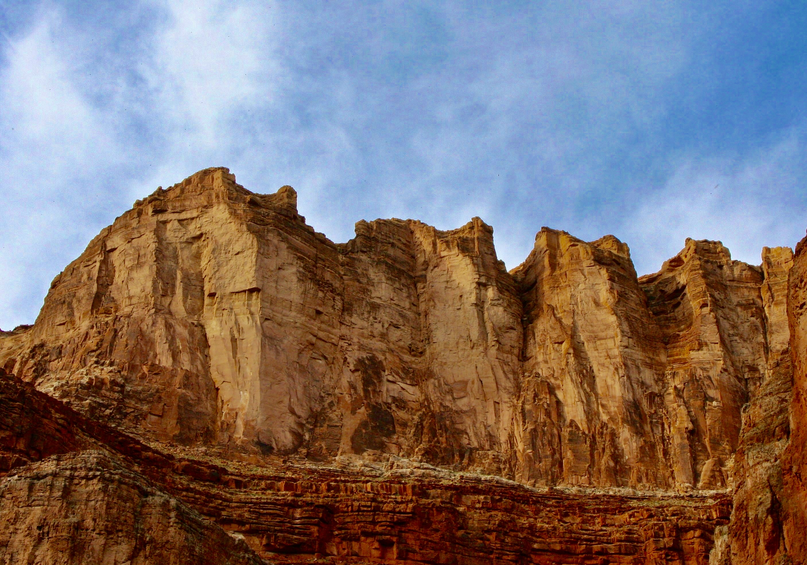
Heading on down the river, we continued our drop through time until we left the layered look of the canyon behind and and entered the dark metamorphic and granitic Vishnu Basement rocks of the inner canyon. That told us that we had passed the billion year mark in the Earth’s history.Just past mile 84, after a long day, we stopped for the night at the Zoroaster camp site. An intense game of bocce ball entertained the troops. There seems to be some question over whose ball was the closest. I think Peggy’s stare was meant to persuade her ball to move closer via telekinesis. Steve seemed to be involved in a similar activity. Either that or he was wringing someone’s neck.Sunset that night provided a dramatic contrast to the dark canyon walls and river. (Photo by Don Green.)Three miles down the river the next morning brought us to the Kaibab Trail bridge that hikers and mules use traveling from the South Rim to Phantom Ranch. Tom had camped us near since one of our rafters, Nancy Pape, would be leaving us to hike up to the South Rim, and another, Jonas Minton, would be hiking down to join us.Phantom Ranch welcomed Bone…And Don.Hamburgers and TV news occupied us while we waited for Jonas to arrive from his hike down the South Rim. I slipped outside…To talk to a mule…Admire the scenery above Phantom Ranch…And ponder a bee as it worked a flower on a prickly pear.Eventually Jonas, who was older than I, arrived exhausted from his hike down. I’d known Jonas since the 70s when he and Tom and I had been environmentalists in Sacramento fighting for clean water and air in California. He was known for his quirky sense of humor. Like Tom, Jonas was a longtime boatman. He would take over for Megan who was shifting to her kayak. We rode with Jonas to our next campground. Given how tired he was, the ride was a bit on the wild side with us bouncing off rocks twice. His experience and adrenaline kept us right side up, however, or as boatmen like to say, the messy side up. The smooth side is the bottom of the boat.Things got strange in camp that night as Tom struggled for a new look… (Photo by Don Green.)And decided to wear Bone. Bone told me afterwards: “You know Curt, I have had some strange experiences in my life. Like the time 50 Japanese tourists got off a bus and insisted on having selfies with me! But nothing has been weirder than this.” (Photo by Don Green.)Or maybe not. Don’t ask.We learned it’s always valuable to have a dentist along when someone’s foot needs attention. This is Bradley Yee, Tom’s dentist.And Megan demonstrated how to get the best out of a yummy dessert by licking her plate clean.All of which led Peggy to assume a bandida look and go incognito.There was another magnificent sunset that night.Crystal Rapids at mile 89, the next morning, presented a challenge. The water flow was high and dangerous. There was a long discussion between Steve and Tom whether to chance it or wait for the river to drop in a couple of hours. That’s possible because flows each day are determined by the amount of water released from Lake Powell, and the timing of the release. It was decided to wait, which meant more time to goof off.The Dread Pirate Steve assumed his pirate persona…And threatened to cut off Bone’s head if he didn’t tell Steve where he hid his gold.A commercial boat went flying past us, providing a contrast with our private trip.Working our way down the river, we passed a bighorn sheep.And came upon the attractive Shinumo Creek at mile 108.5…And hiked up it to see its 12 foot waterfall. The current was swift and the rocks were slippery. Thus the help. (Photo by Don Green.)A few miles farther along, Tom had us stop at this charming grotto: Elves Chasm at mile 116.5.And Tom, being Tom, had us leap 15 feet into an icy pool. Looks like Jamie was trying to fly. (Photo by Don Green.)Damn, that water was cold!Here I am looking much warmer and relaxed.River view.A camp group photo.A view from our campsite in the evening. Gorgeous, isn’t it!Moving on (because this post is already too long), another river view.And another campsite. It was getting hot and we were hanging out under a tarp and flying a Jimmy Buffet flag. Tom’s a fan. I went searching on Google for the date when Tom and I had attended a Buffet concert at Lake Tahoe in the early 80s. AI responded that Buffet had never had a concert at the Lake. Scrolling down to his tours, I learned Buffet had been there in 1981 and 82. I think we attended the Coconut Telegraph Tour in 1981. The moral of the story here is… don’t trust AI, at least not yet. If it can screw up Jimmy Buffet, imagine what it can do with medical information.Our final stop for this post was at Christmas Tree Cave ay Mile 135.5.It was big…And inhabited by strange creatures. Run! Next post: Two incredibly beautiful streams that flow into the Colorado River: Deer Creek and Havasu Creek. Plus the world famous Lava Falls Rapids.
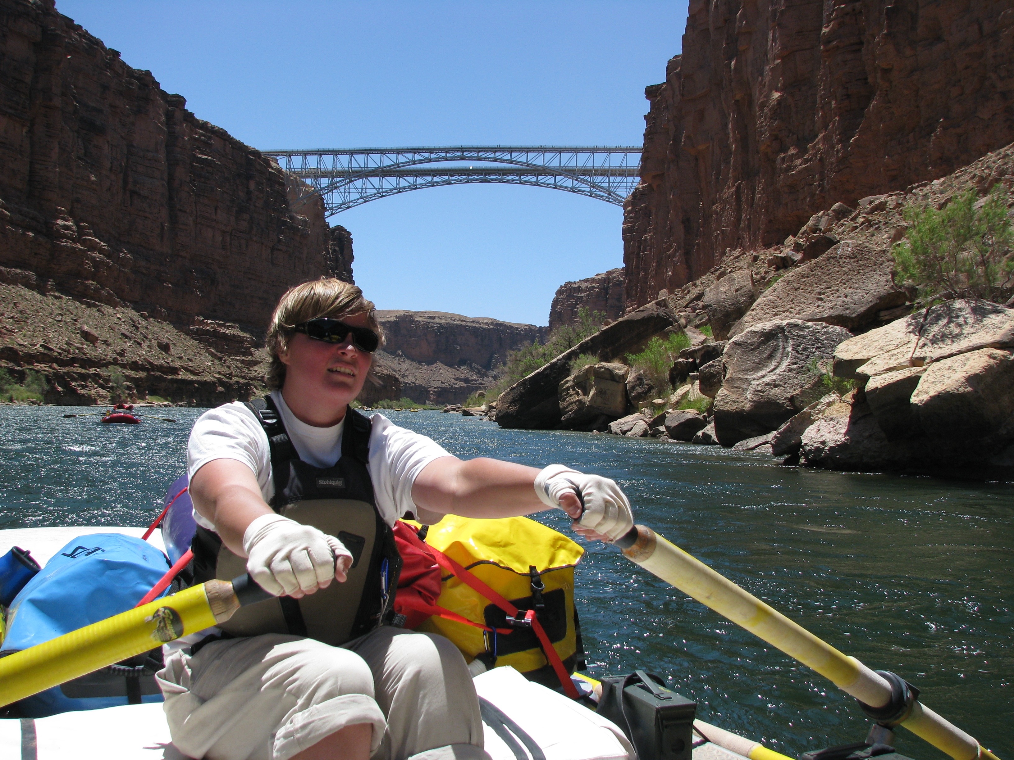
Megan rows toward Navajo Bridge at mile 4. It was our first notable landmark. Actually there are two bridges: an old one competed in 1929 to replace Lee’s Ferry and a new one finished in 1995 to accommodate modern traffic. The old one now serves as a a foot bridge. Crossing the bridge is how you get to the North Rim of the Grand Canyon from the South Rim. Or vice-versa. (Photo by Don Green.)
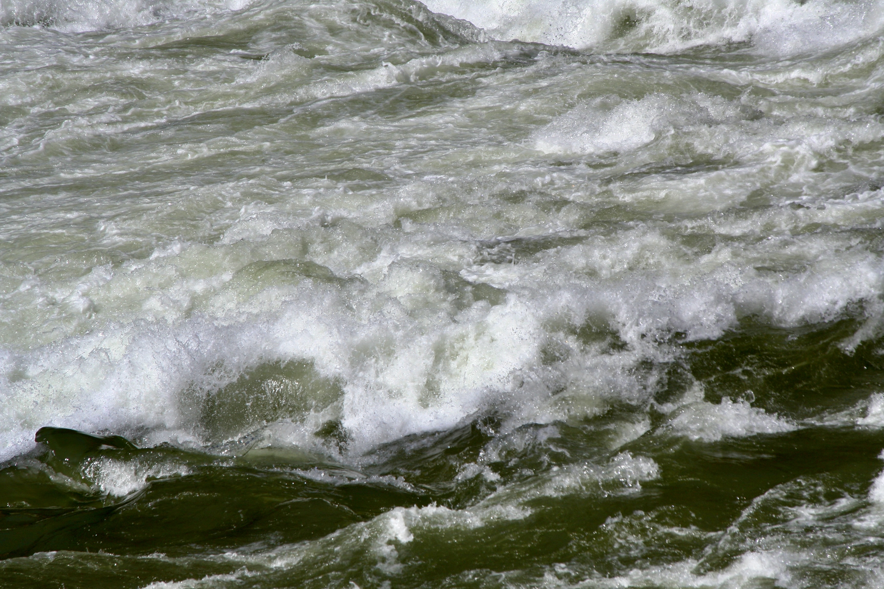
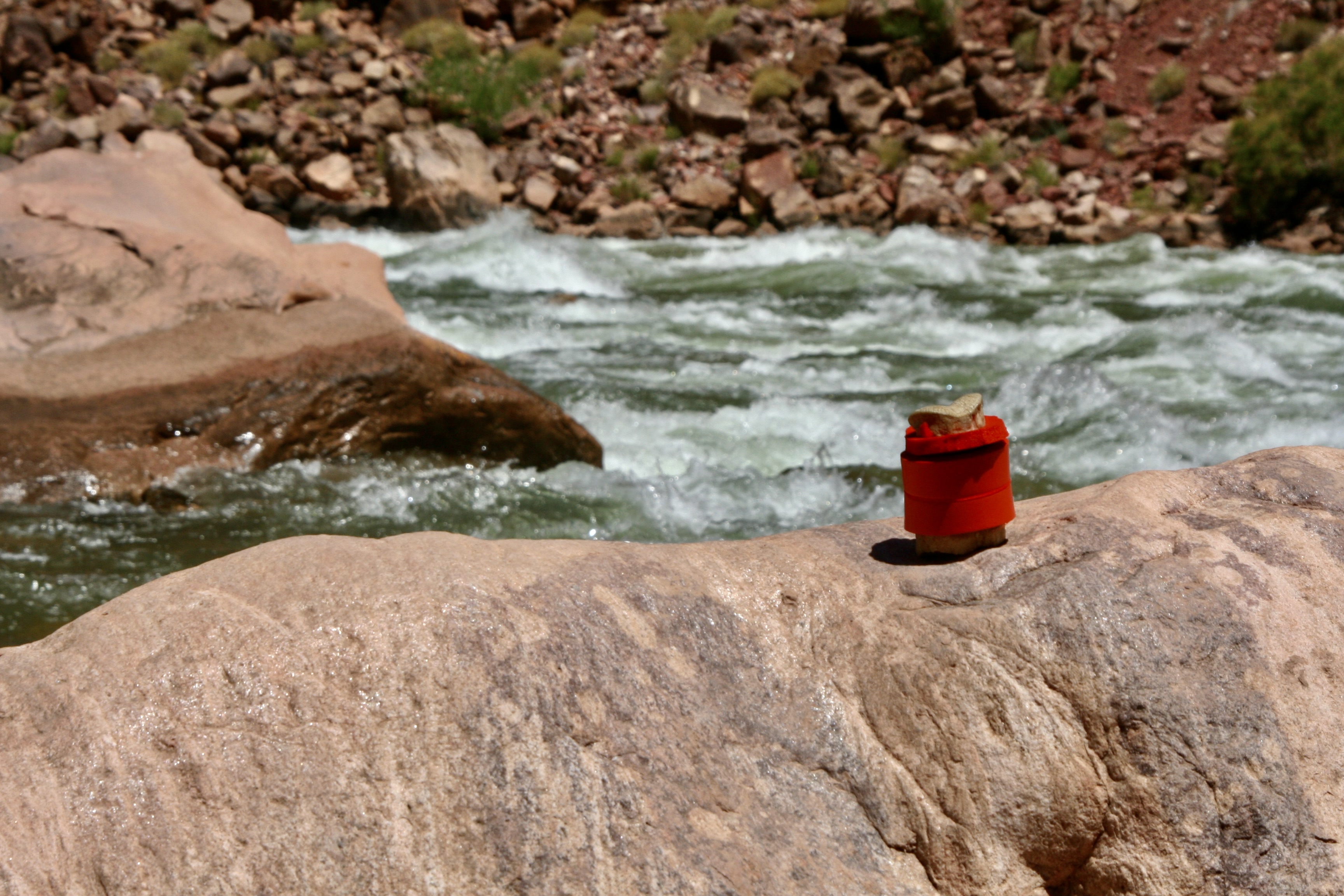
For those of you who like facts, here are a few about the river: The Colorado is 1,440 miles long from its headwaters in the Rocky Mountains to its mouth in the Gulf of California. I’ve backpacked through the area where it originates and kayaked in the Gulf of California. It ranks 6th in length among U.S. rivers. At its widest point it reaches 750 feet. At its deepest, 90. It flows along at 3-4 miles per hour but may reach 15 miles per hour in rapids. Given that the water comes out of the base of Glen Canyon Dam, it’s cold— an icy 46 degrees Fahrenheit during the upper part of our trip. Washing off in it usually elicited screams. Over the course of our adventure, it dropped 1700 feet in altitude, an average 8 feet per mile. That’s 25 times the average of the Mississippi River! Thus, the 250 rapids in the Grand Canyon.
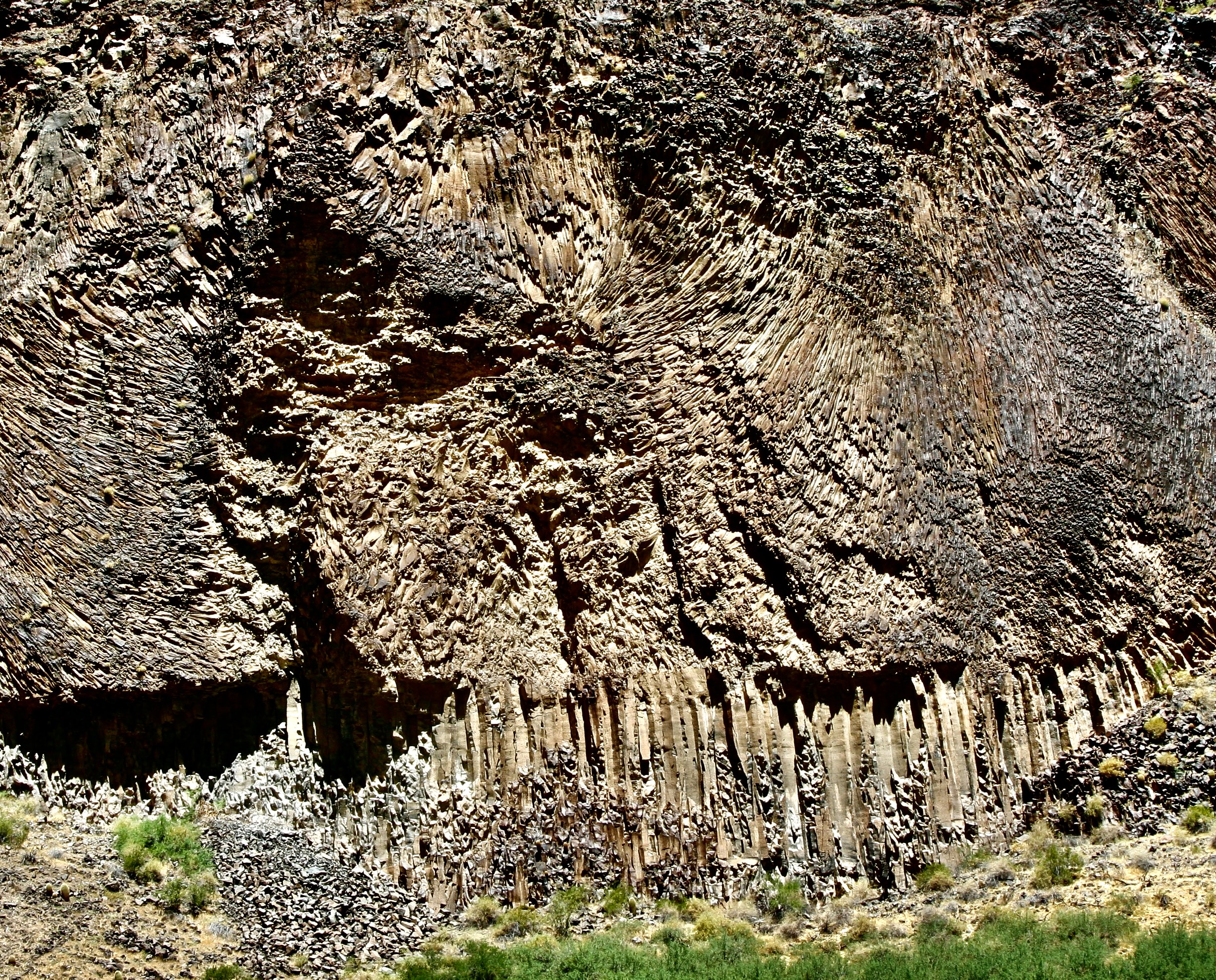
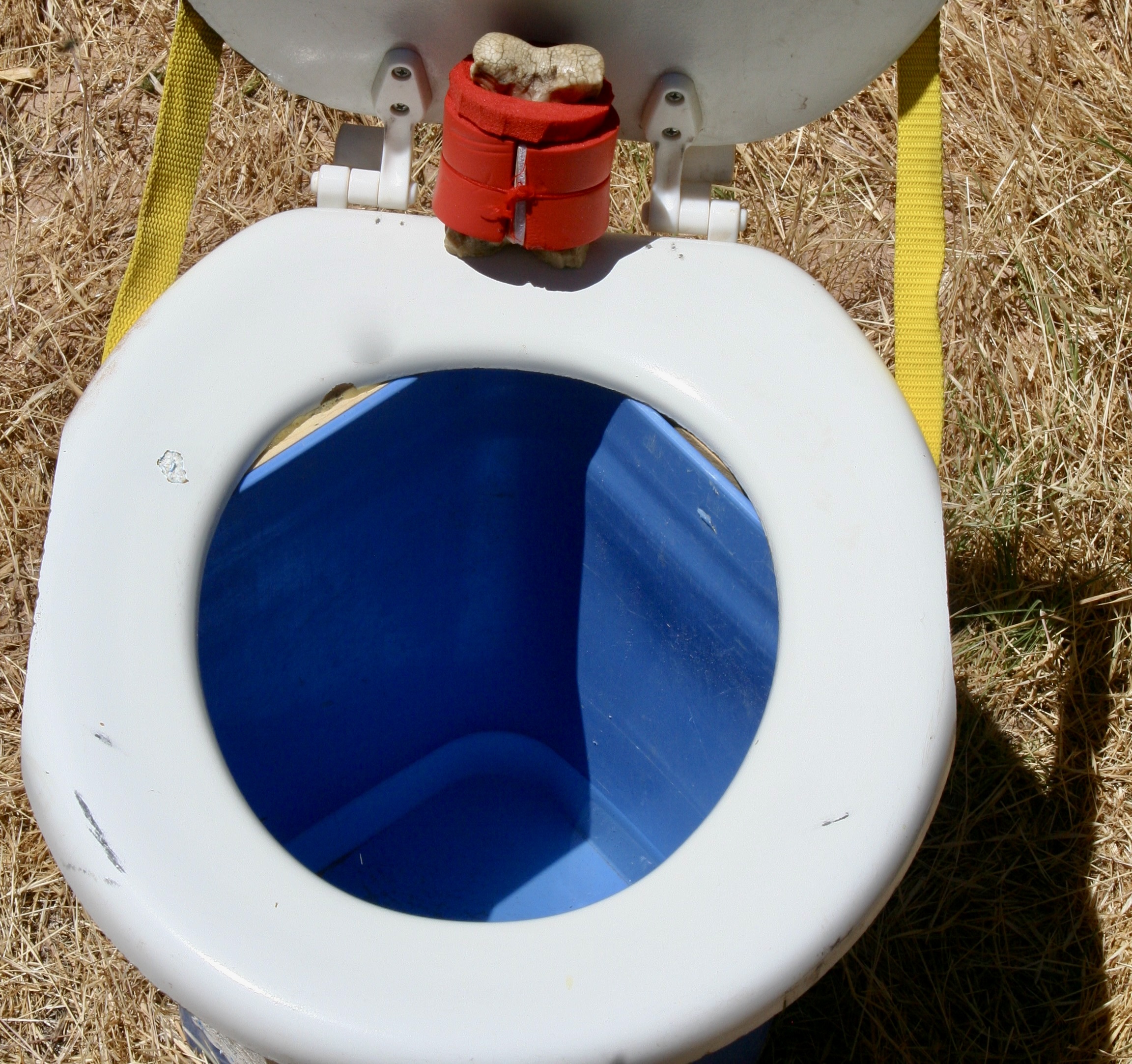
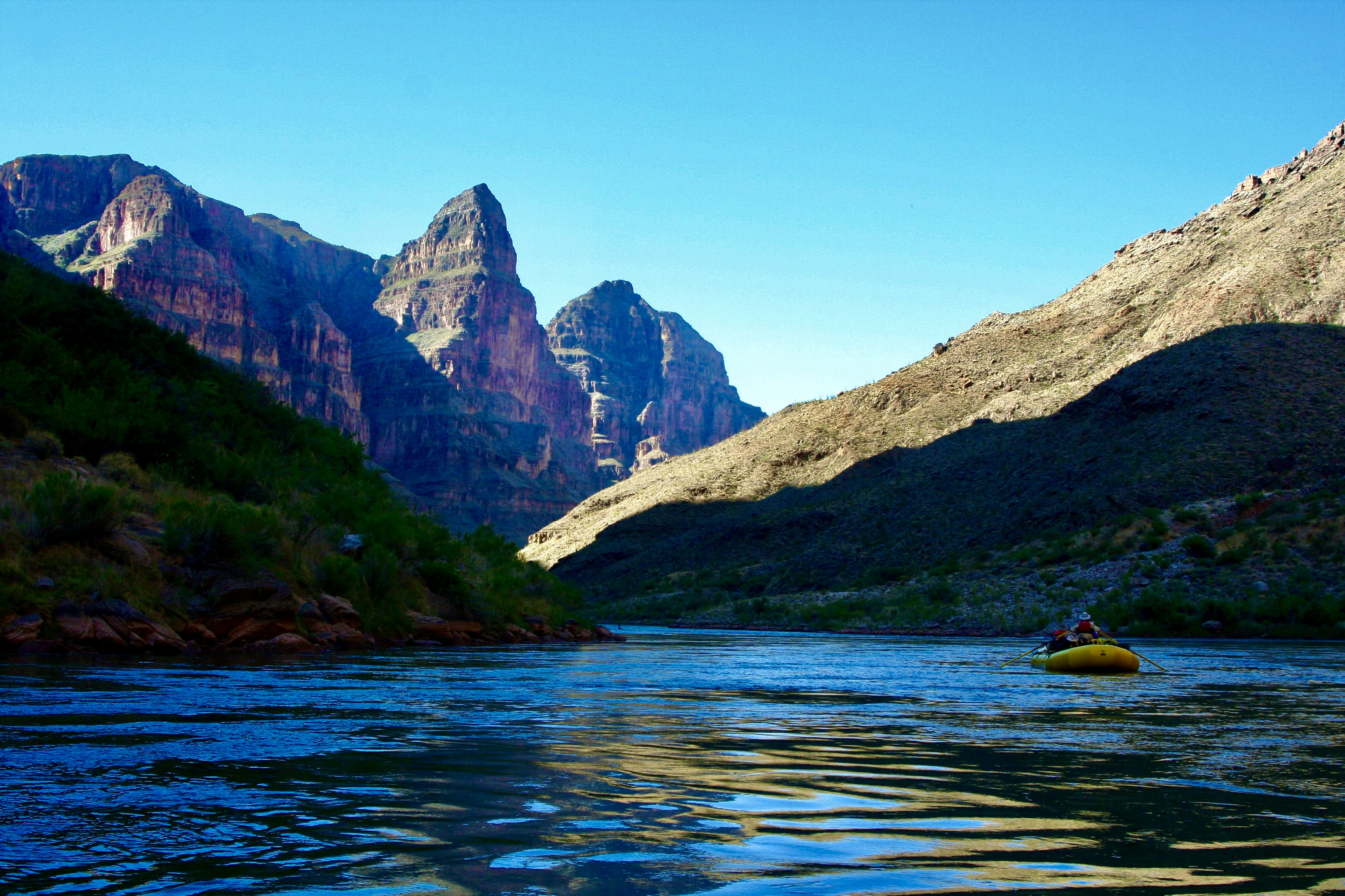
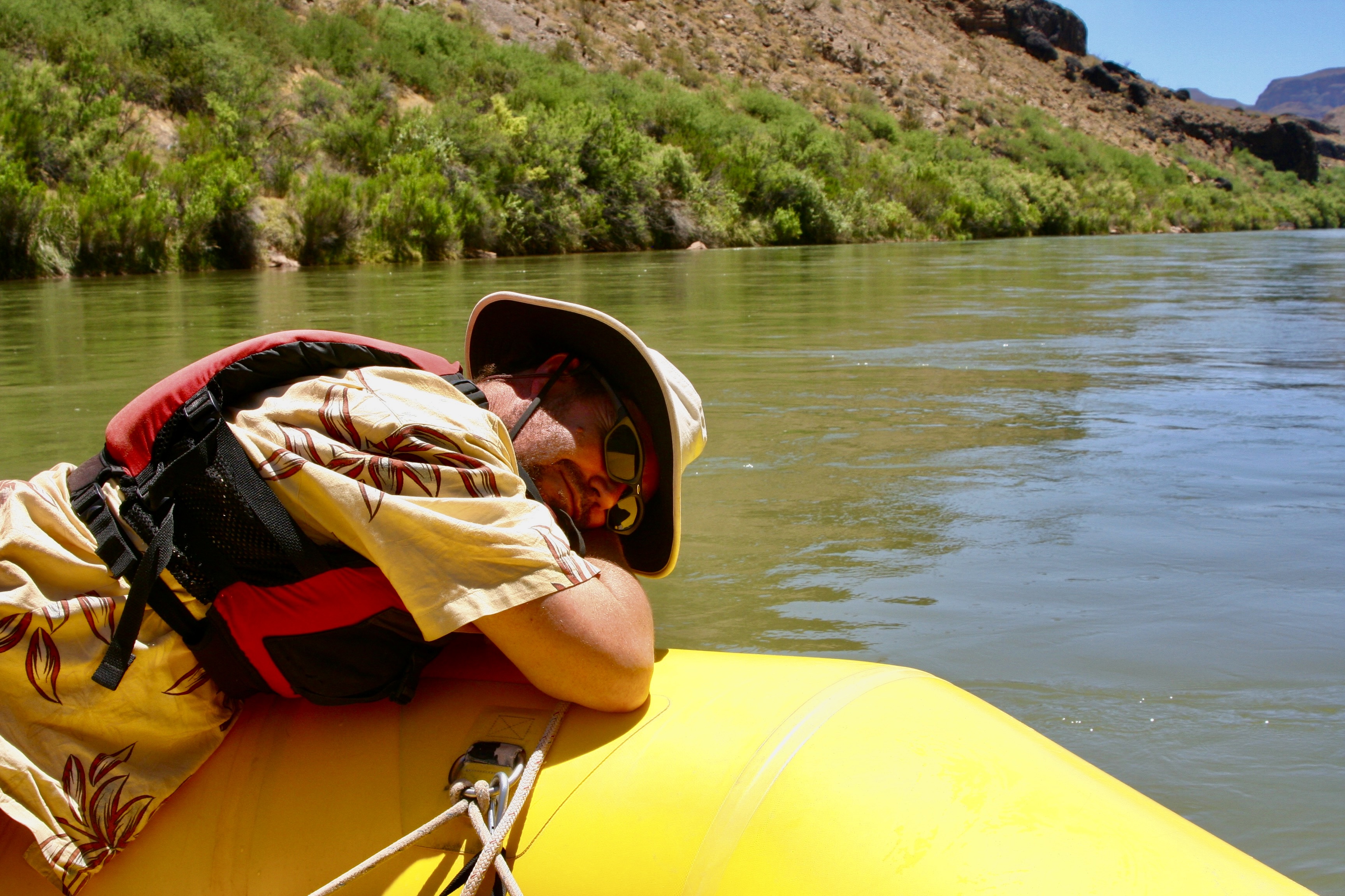
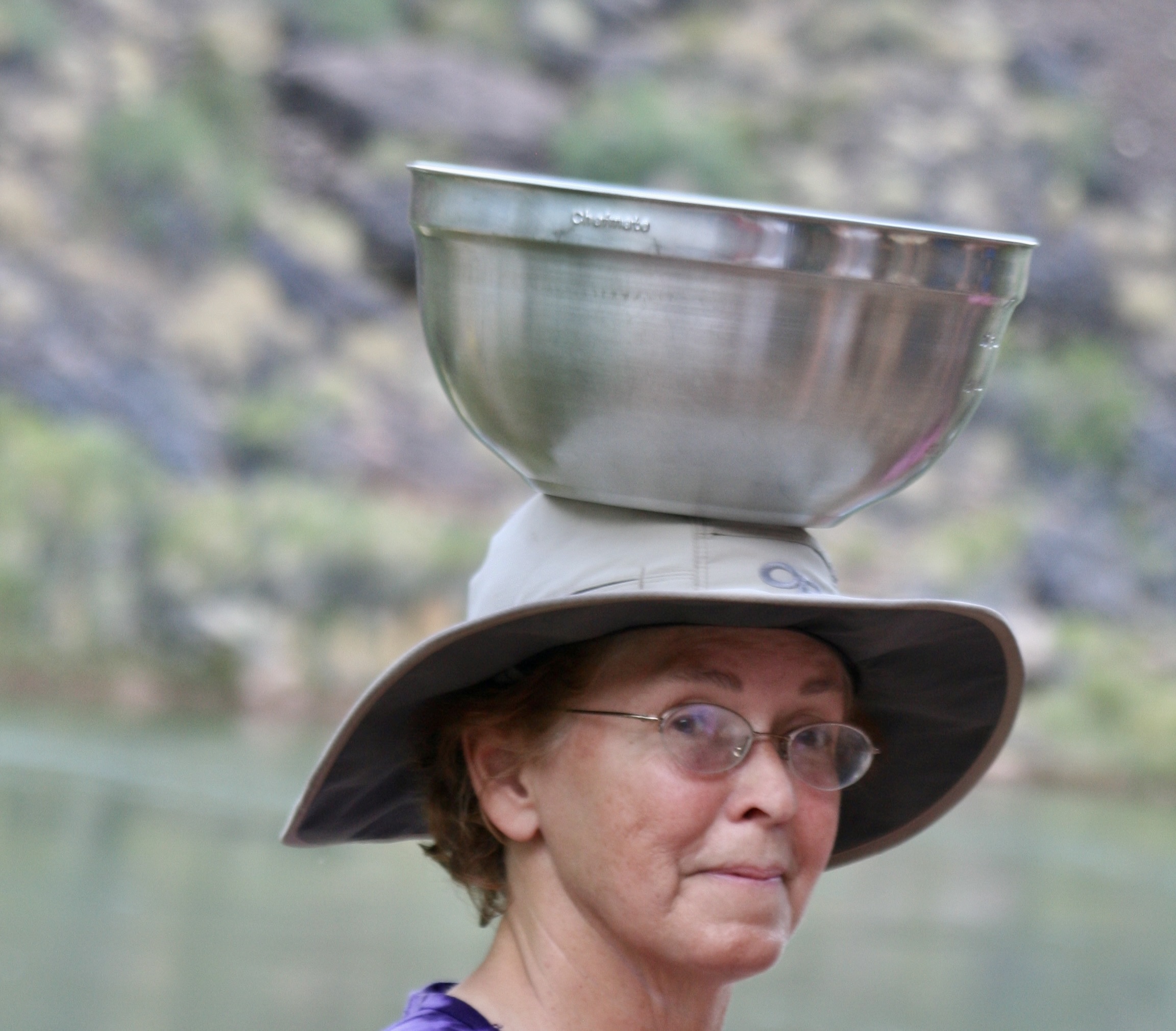
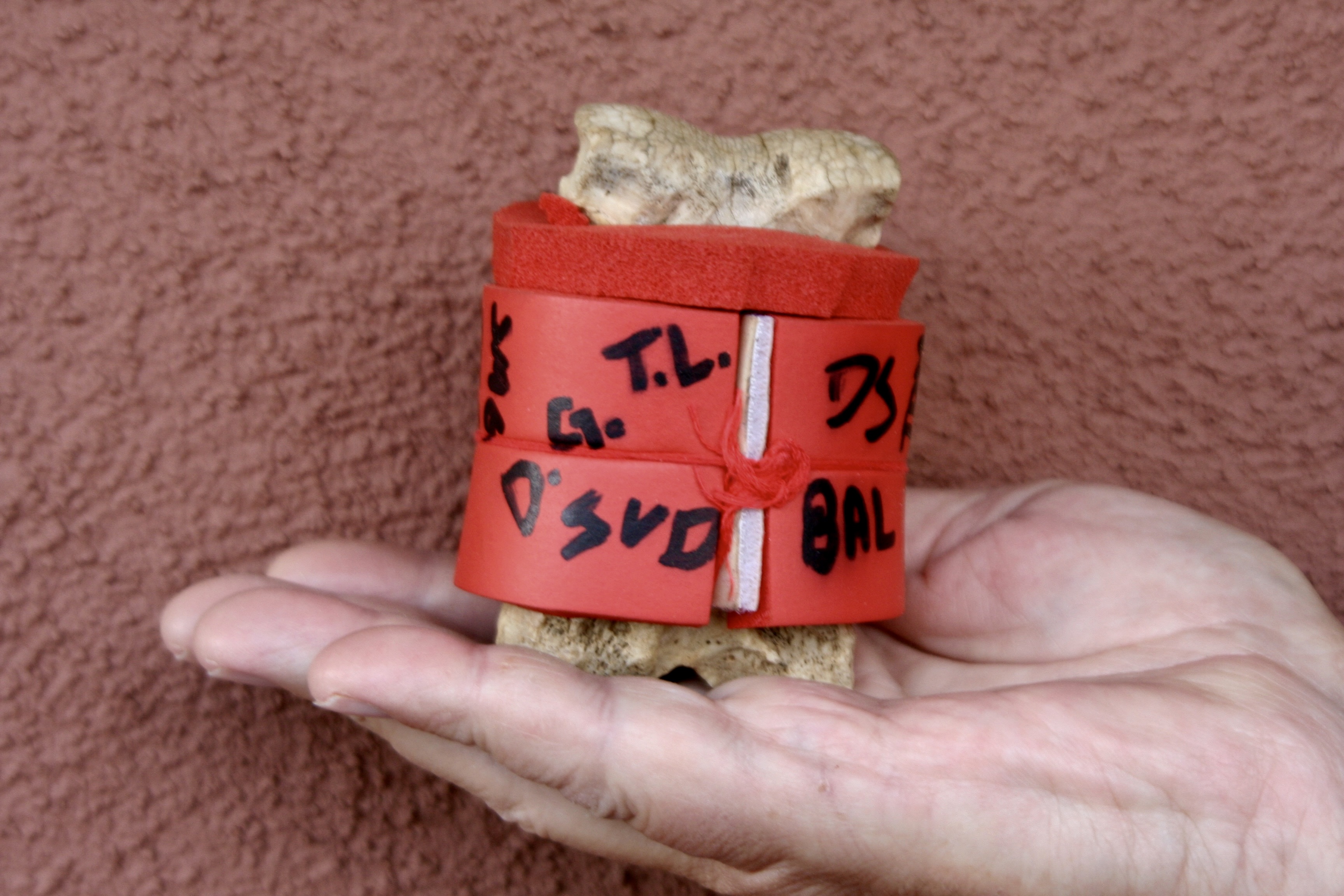
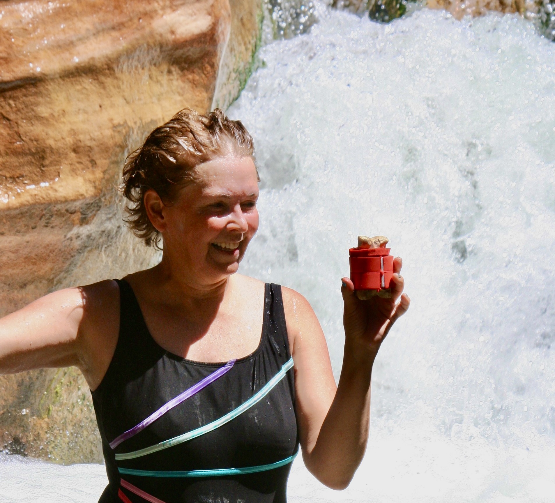
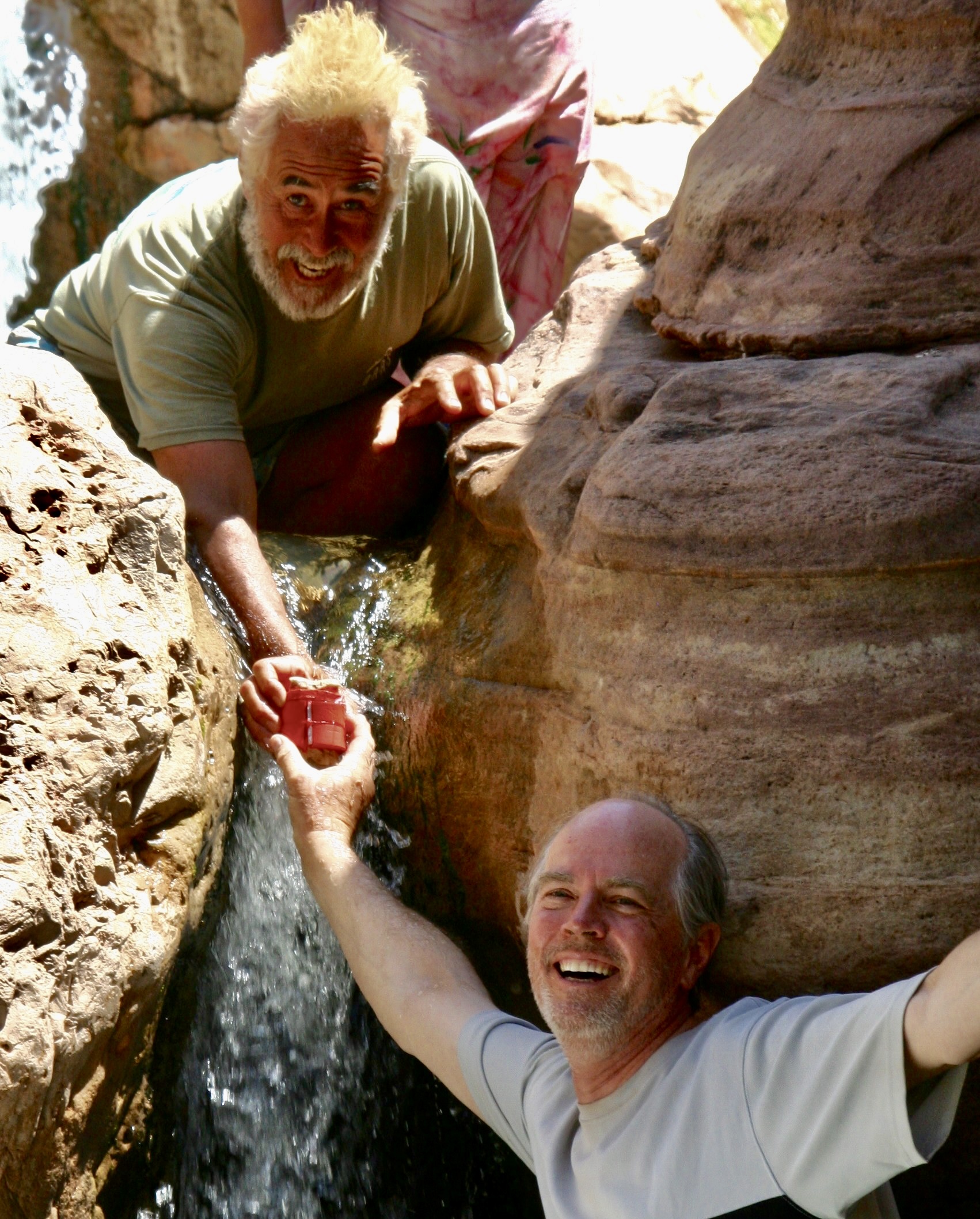
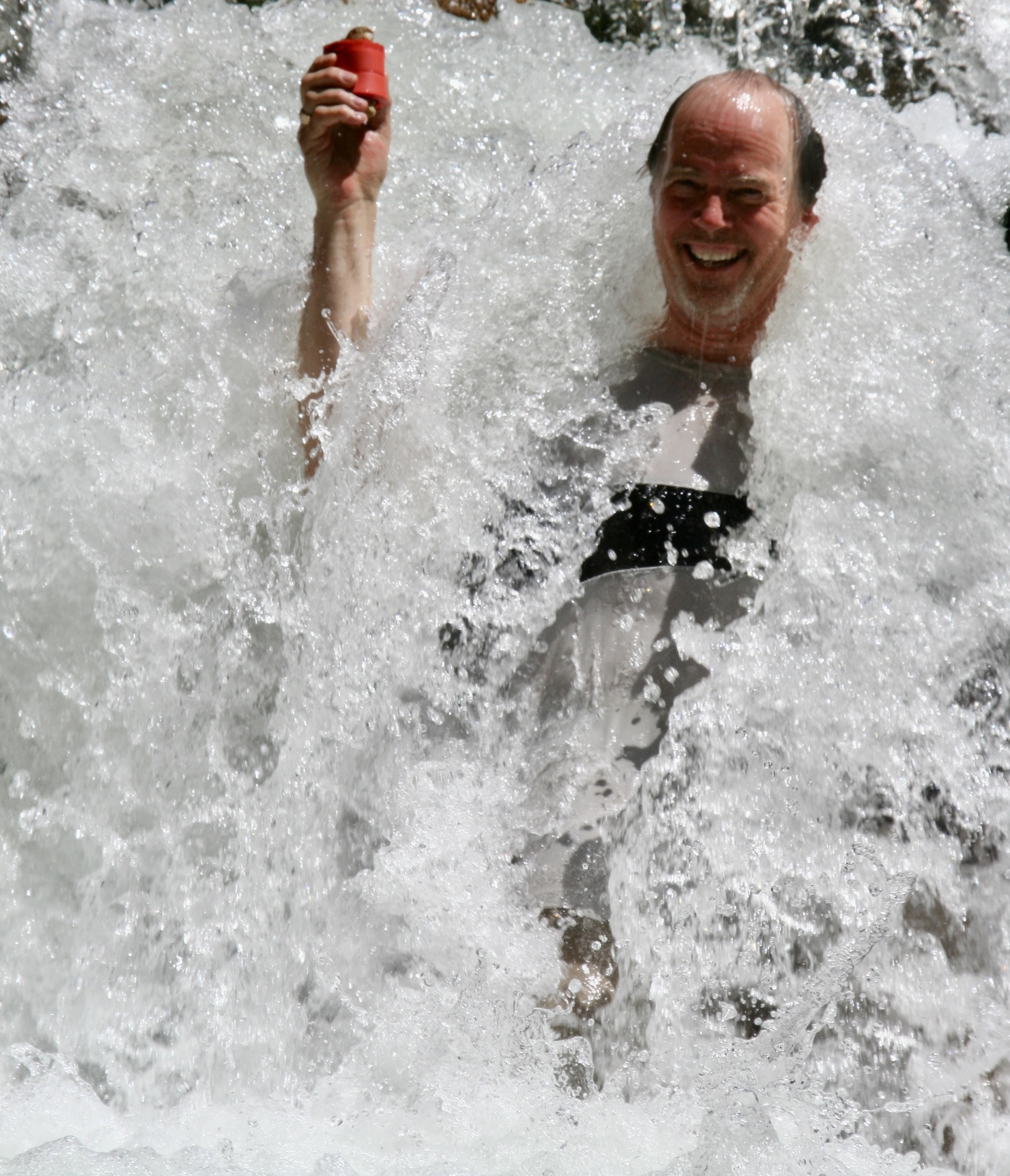
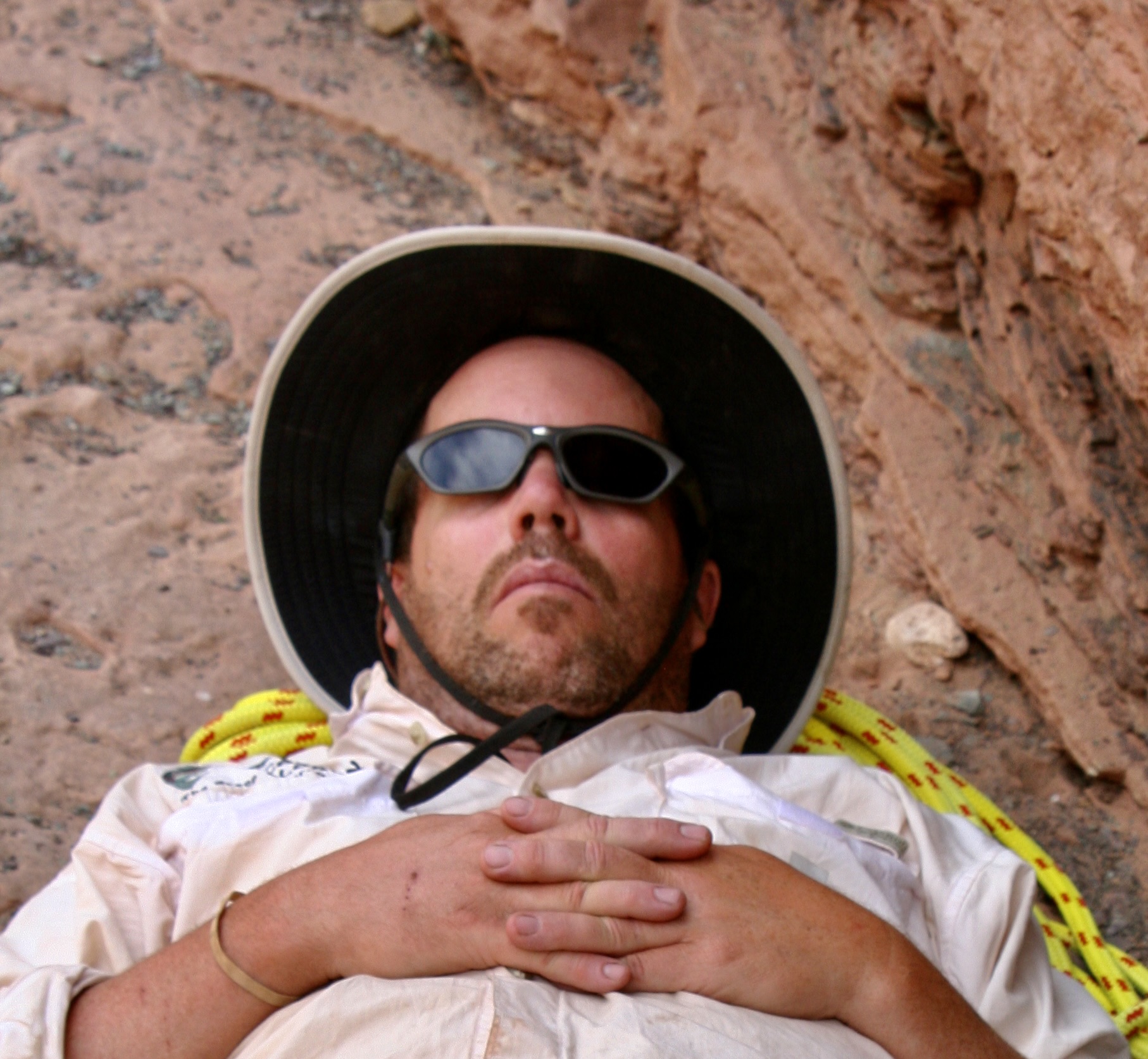
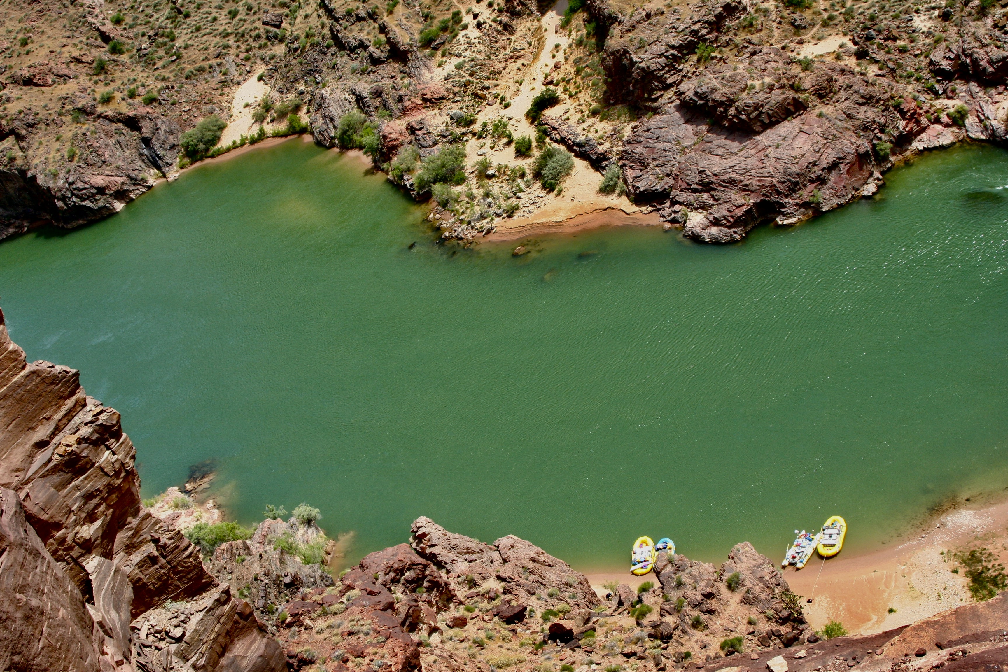
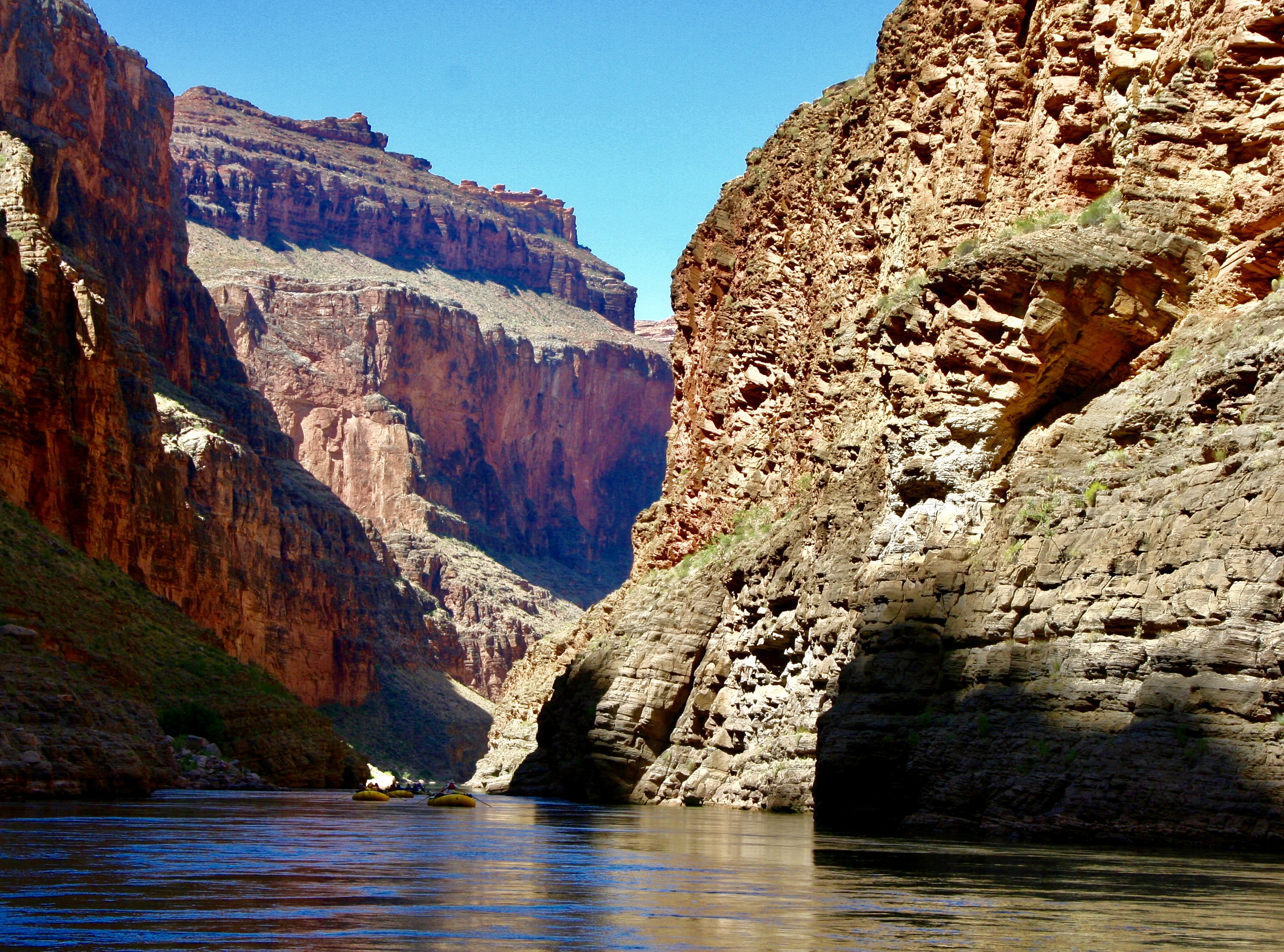
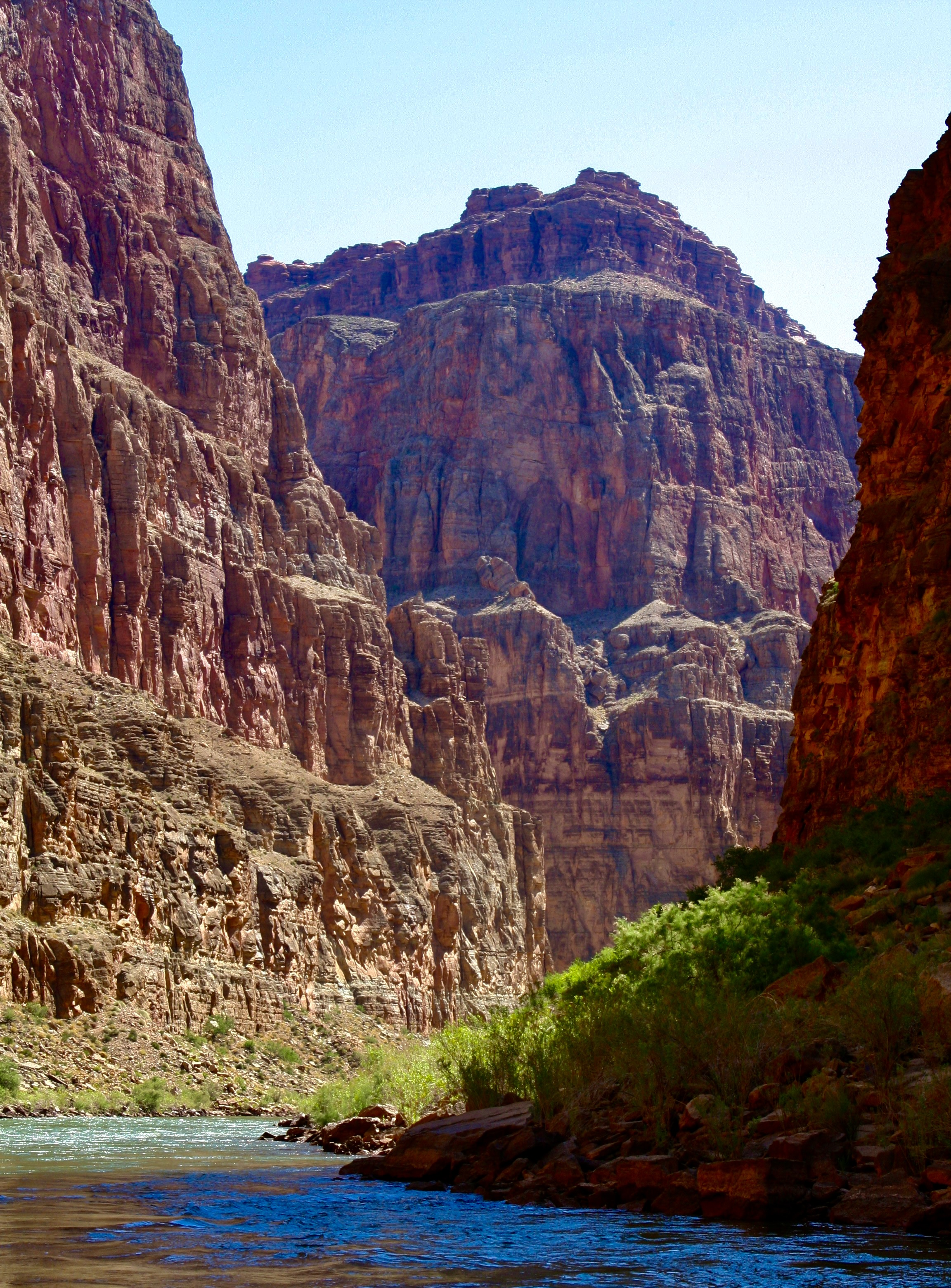
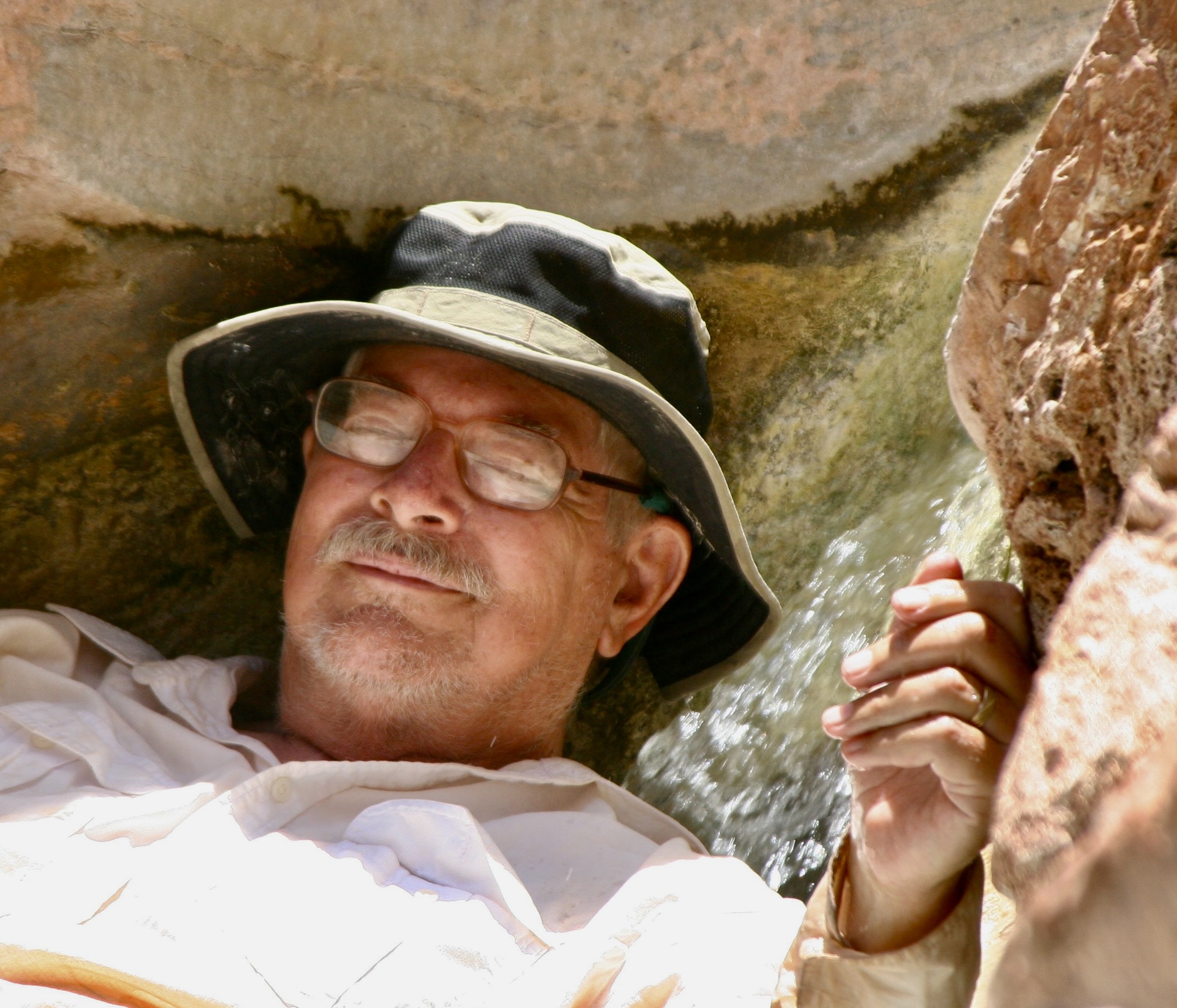
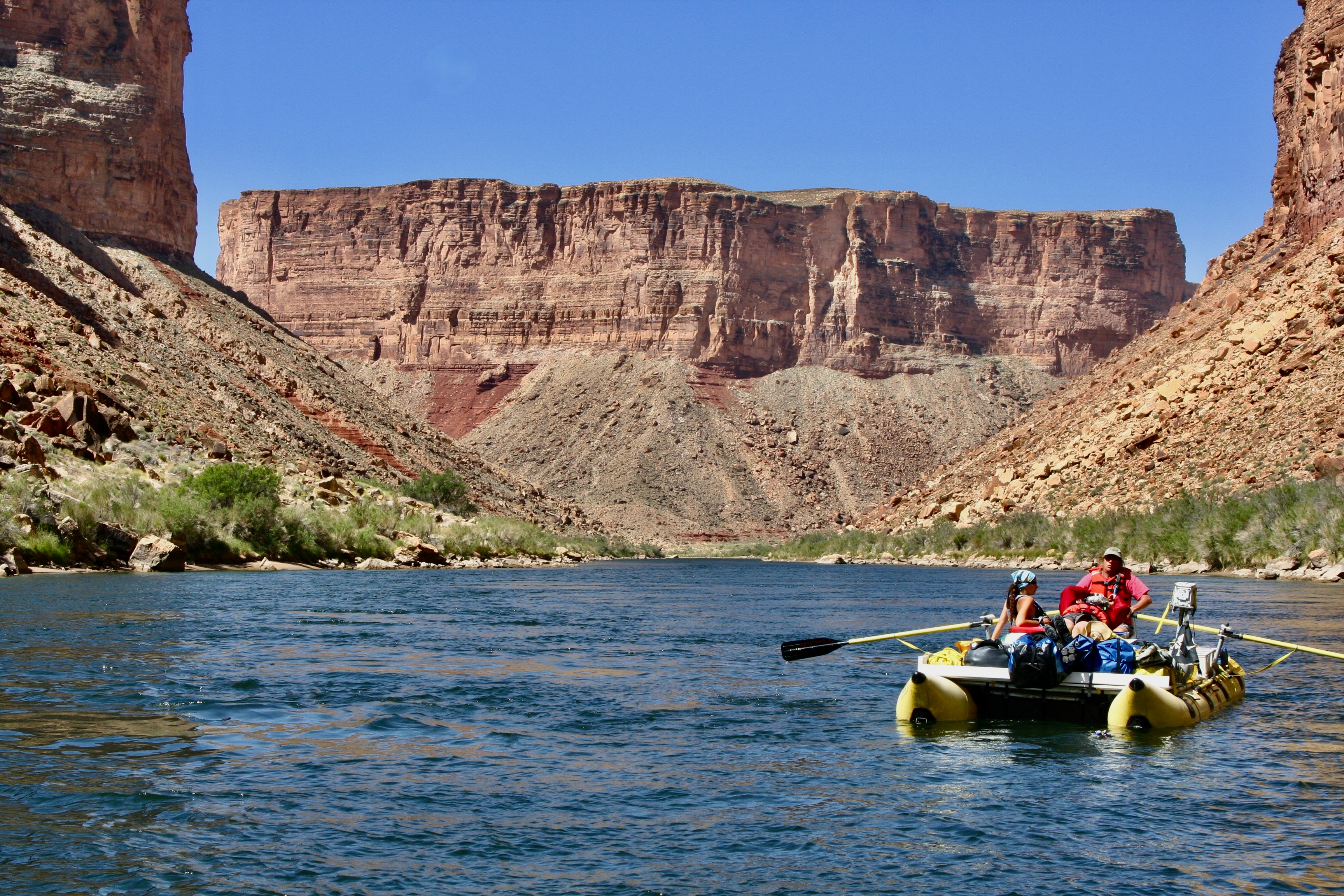
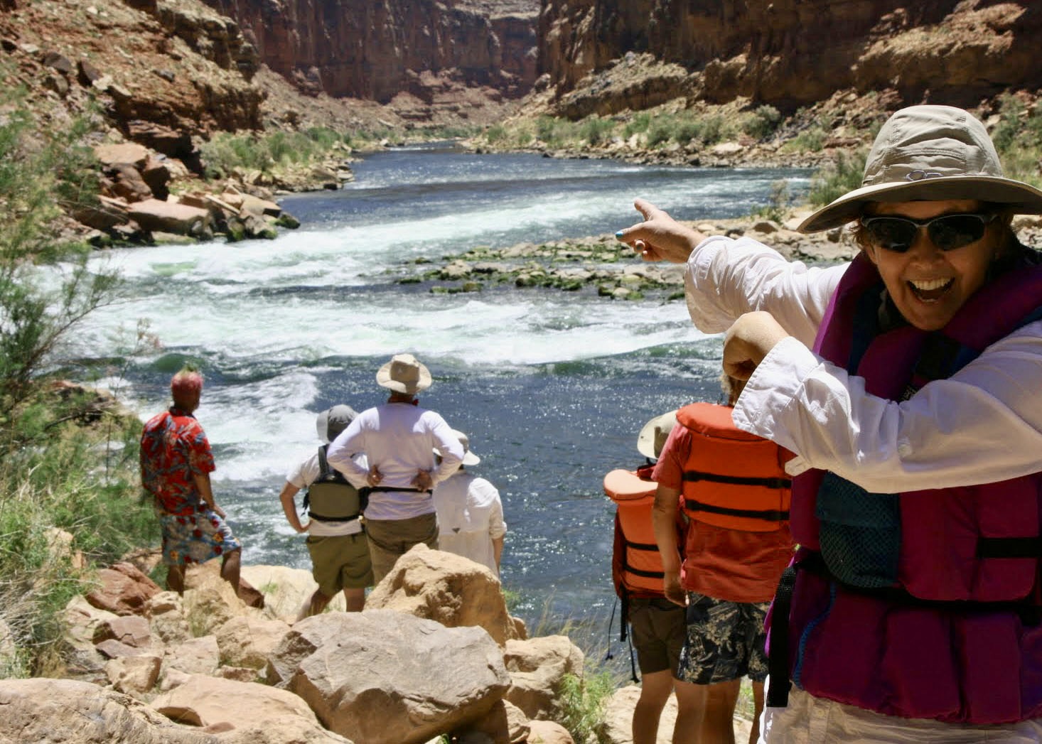
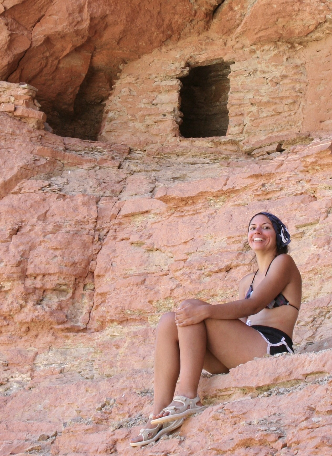
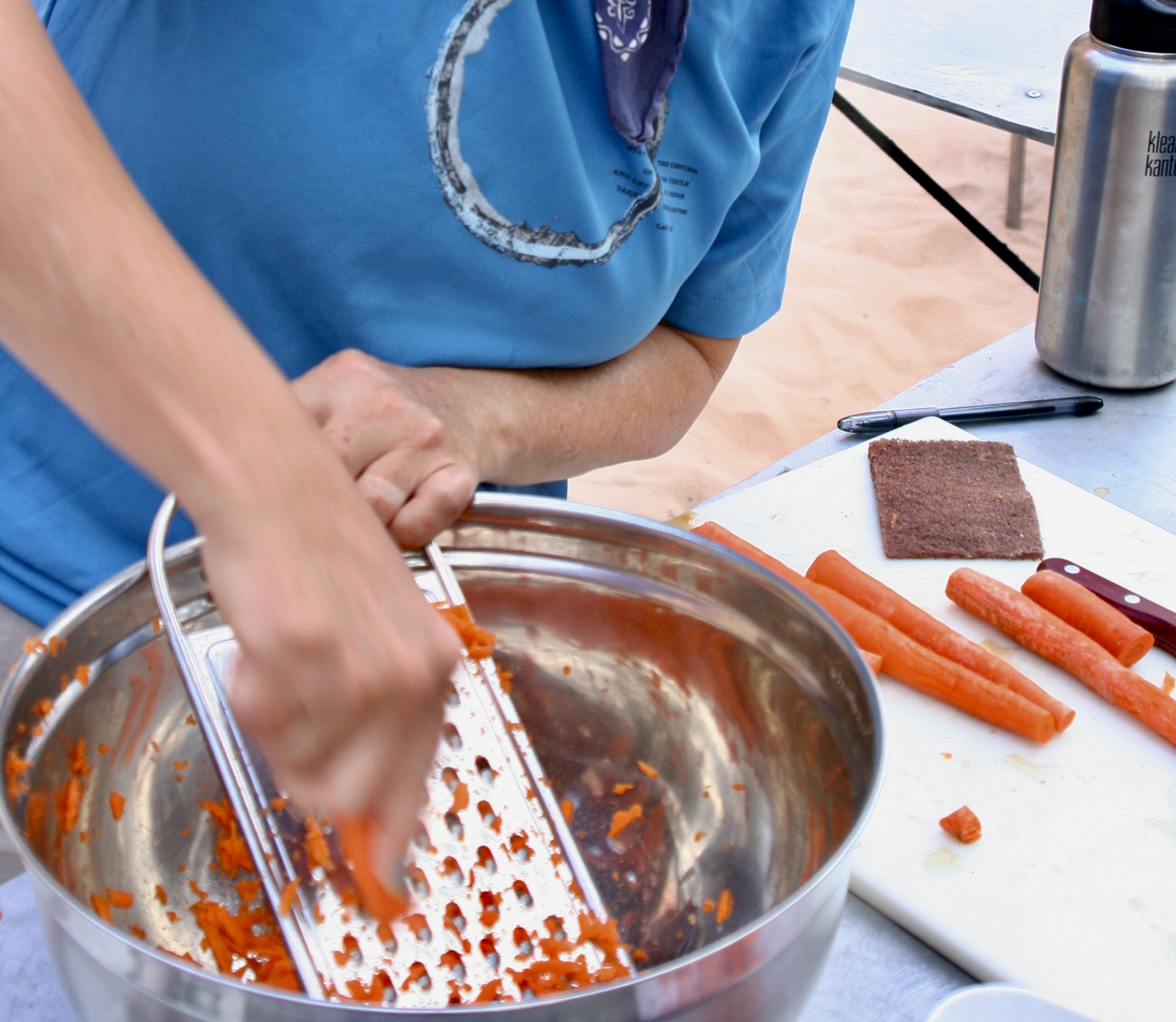
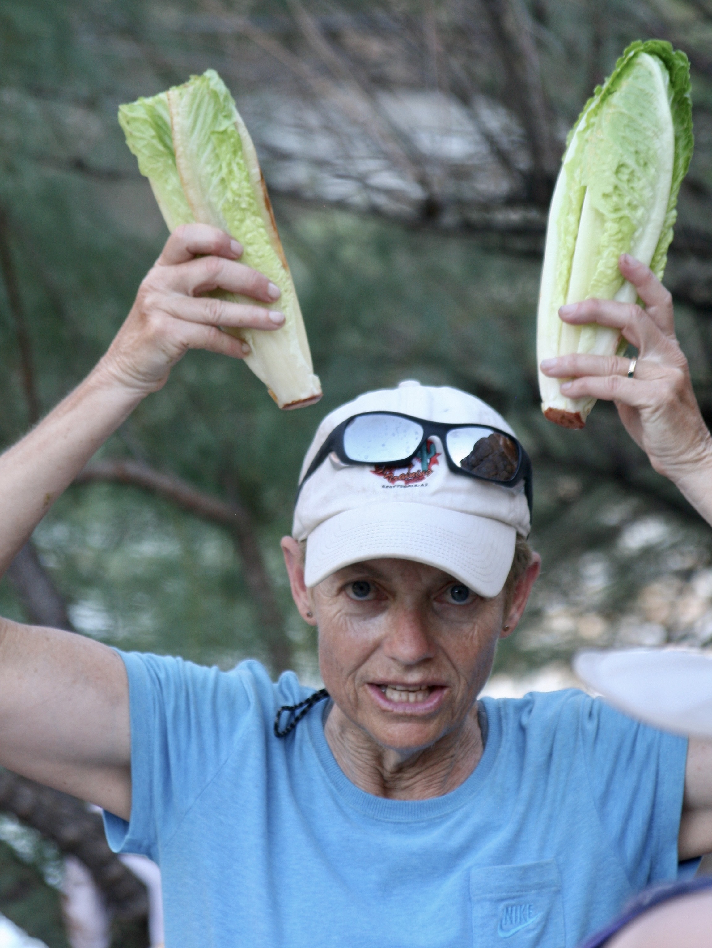
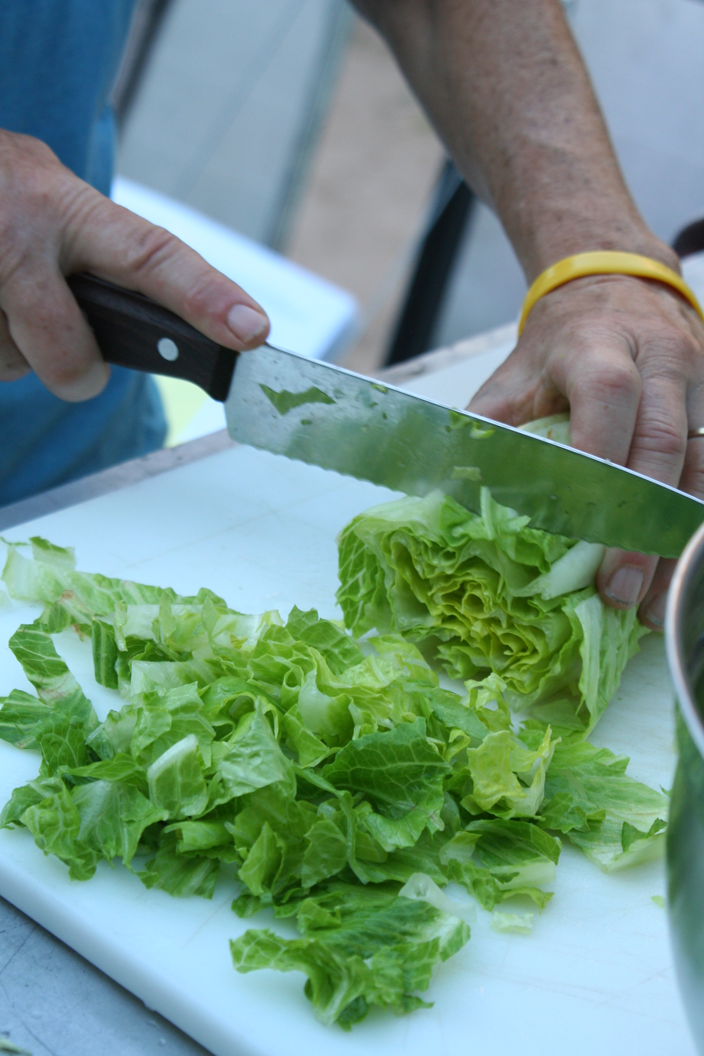
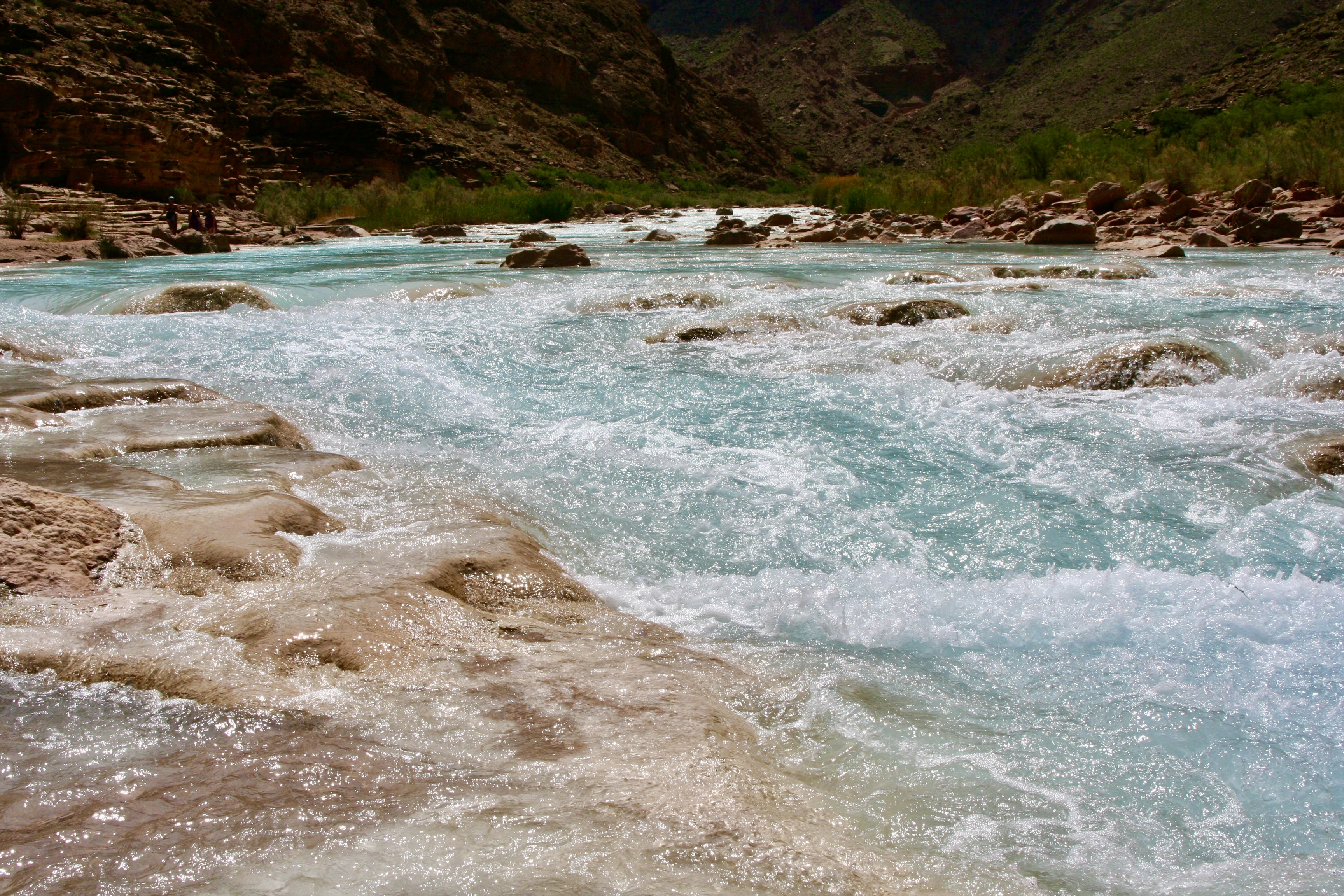
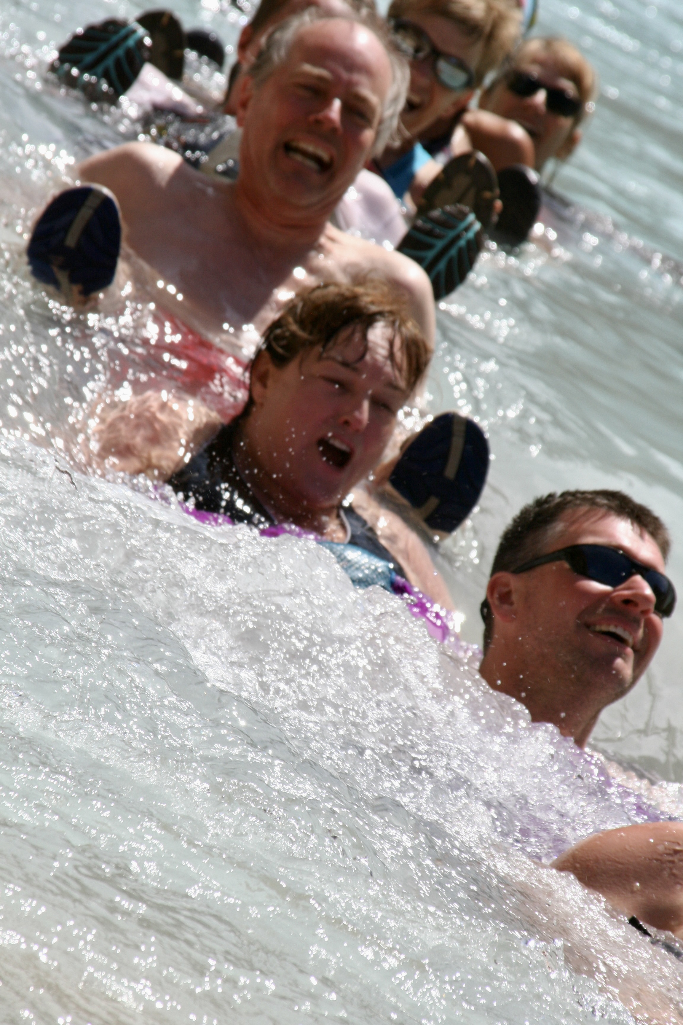
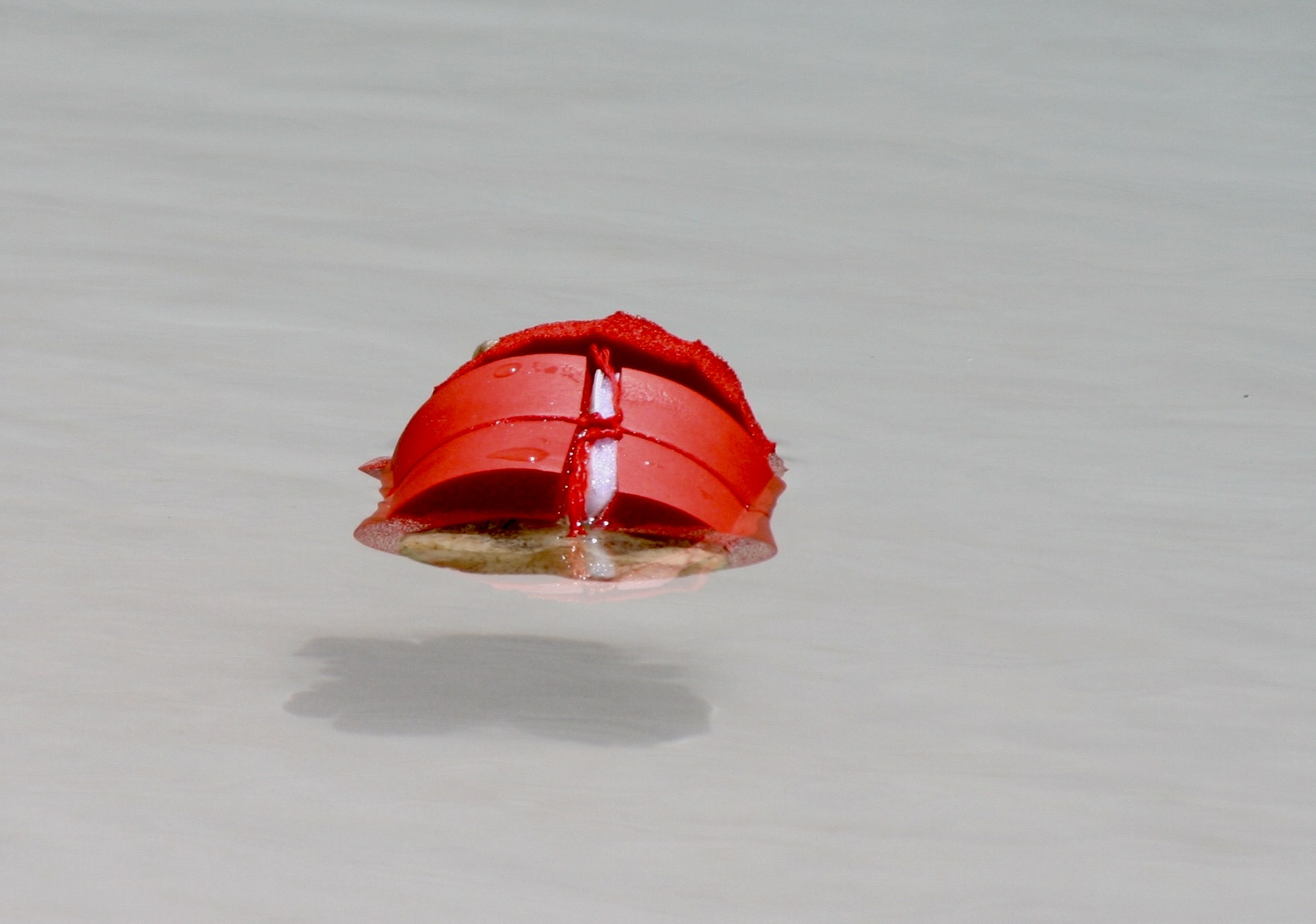
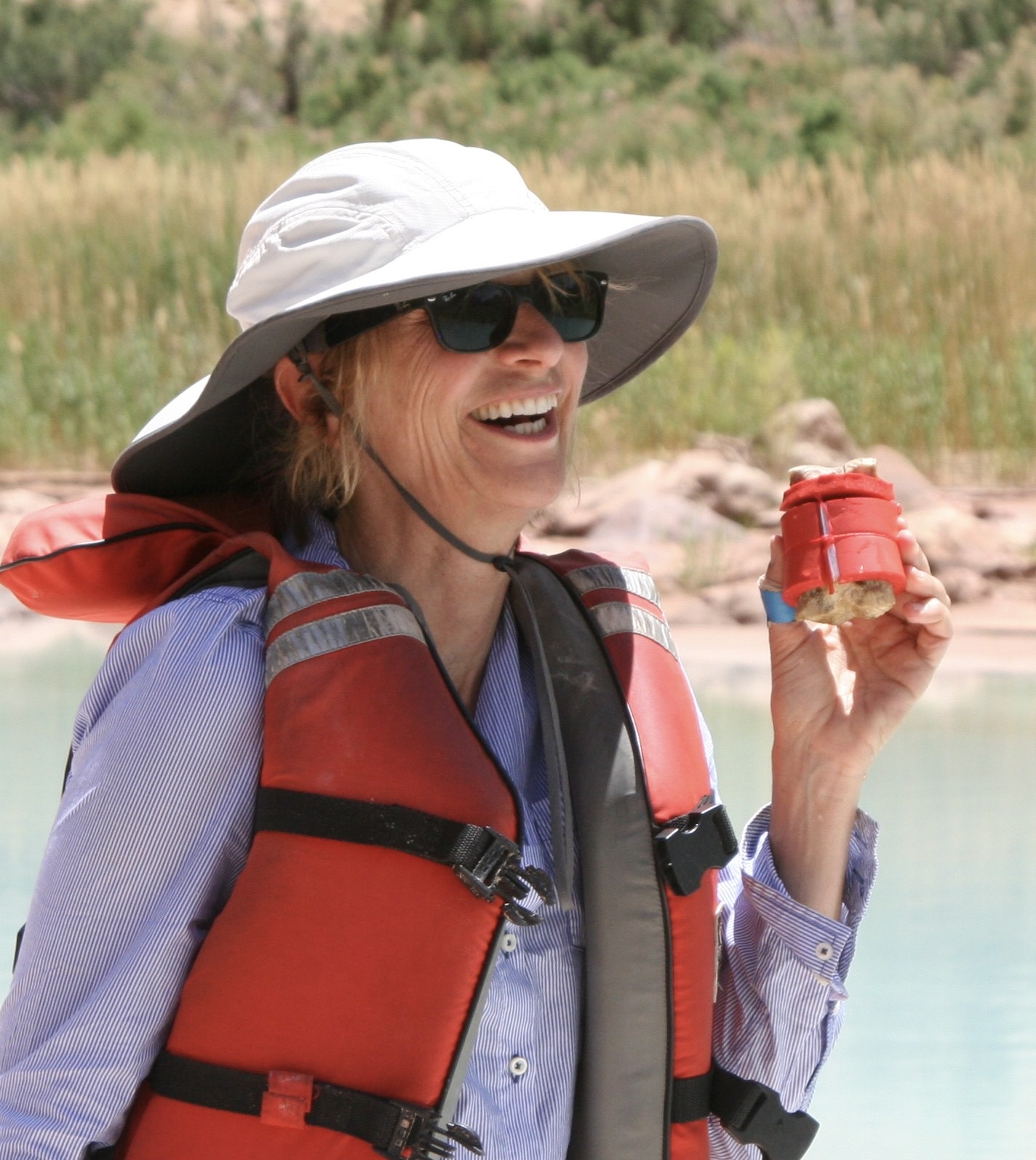
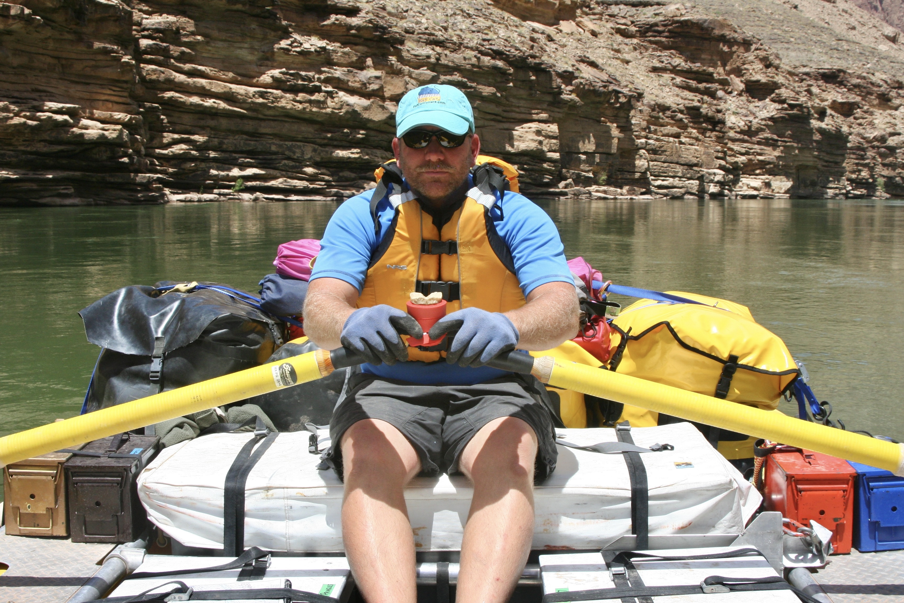
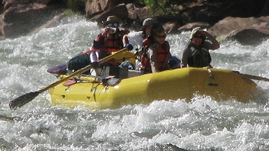
As we floated down the river, we were awed over and over by the surrounding beauty! The pontoon boat, BTW, is rowed by Steve Vandoor. Steve’s boat is rigged to carry groovers (honey buckets), which is something of a specialty of Steve’s. While it might seem strange, it guarantees that he is invited to join river trips on a regular basis. Does this mean Steve is groovy? More on groovers later.This huge slab of Coconino sandstone at mile 10 once stood hundreds of feet above the river before it came tumbling down and stuck— standing up. It’s a reminder of the constant geological forces involved in creating the canyon. As the river digs deeper, erosion brings rocks crashing down, widening the canyon. It’s also a reminder that one wouldn’t want to be anywhere near when it fell!This was one of our first rapids. It’s where Tom lost an oar and ended up rowing heroically to get us out. Afterwards was one of the first times I ever heard him be totally silent. (Photo by Don Green.)Major rapids like House Rock were always scouted by the most experienced boatmen. Peggy is obviously quite excited. “Listen to the roar, Curt!” I was thinking more about the ‘hole’ that we might be sucked into. The boatmen plot out the best way to avoid such obstacles. They were amazingly good.In addition to our raft trip down the river and camping, Tom had planned several excursions. This is in Silver Grotto, which was quite beautiful. I’d chosen to stay in camp for photography and a little ‘Curt Time.’ See the slot canyon. Tom had them hike to the upper rim and then slide down some 20 feet to a small pond in what was close to a straight drop. The rocks were wetted to assure a smoother slide. Everyone survived and had fun, but it did make me wonder about the ‘safety’ part of my responsibilities.I discussed the ‘thrill ride’ with a raven that came to visit me and perched on a boatman’s seat. It told me she would share her opinion for food. I declined. I’m pretty sure she would have said, “It’s easy. Just fly.”While the major rapids provided for a minute or two of pure adrenaline rush for both boatmen and passengers, floating on calm waters was a much more common experience for us.Every corner brought a new marvel such as this towering cliff. Check out our boats at the bottom for perspective.Vasey’s Paradise at mile 32 is one of the most beautiful waterfalls we saw on our journey. It flows out of what is known as the Redwall, one of the Grand Canyon’s most prominent features.As you might imagine, we all took photos. This is Leland Lee, who, in addition to being a talented photographer, is a periodontist.While we relaxed and enjoyed the falls, Jamie gathered the cold fresh water for our drinking and cooking needs. Gathering and pumping water through filters to purify it was one of our daily chores. Redwall Cavern, a mile or so beyond Vasey’s Paradise, is one impressive cave! We headed in for lunch.Some of our rafters and the lunch kitchen provide perspective on the cavern’s size. When John Wesley Powell, the one armed veteran of the Civil War and first dedicated explorer of the river, came on the cavern in 1869, he estimated it could hold 50,000 people. Modern estimates are closer to 5,000, but that is still a bunch!This is a view looking out from the Redwall Cavern at the surrounding canyon walls.I thought this was a great people shot by Don…And scenery shot. (Photo by Don Green.)Colorado means red, which is the color of the river after rainstorms (reddish brown). Obviously it hadn’t rained recently, and, as I recall, it didn’t rain at all during our trip. Quite the monument.Theresa provides perspective on the ancient Anasazi Granary we hiked up to visit high above the Colorado River near mile 53. (Photo by Don Green.)Looking down the Colorado River from the Anasazi Granary. One of us is making our way back toward the river in the shadows on the right. (Photo by Don Green.)A view looking up, downriver from the granary.And another.Food is quite important to river runners as I mentioned in my first post on the river. And why not, since the boats can carry massive amounts. It’s not like backpacking where every ounce matters. Here, Peggy is working on a carrot salad. Each of us was expected to do kitchen duty. Tom, who owned a popular Mexican restaurant in Davis at the time, the Cantina, was proud of what he had brought along to eat— and quite particular on how it was prepared. He hovered providing directions. Like a chef.For example, the correct way to cut romaine lettuce. Susan Gishi holds up the lettuce like rabbit ears on an old fashioned TV set. She is about to demonstrate how to cut it and looking much more serious than the rabbit ears would suggest.Like this.Tom discovered me tearing it up instead of cutting it and got quite excited. Being allergic to taking directions from Tom about cutting lettuce, I made a trade with Peggy. I would handle her groover duty if she would take my kitchen duty. Here’s the thing about groovers, you are required to carry your poop out. Peeing is done in the river. My duty was to work with Steve in finding a suitable private place for the men’s and women’s groovers when we landed in the evening and then loading them back on his boat in the morning. BTW, the reasons these large ammo cans are called groovers is because people sat on them directly until someone figured out how to attach toilet seats. Duh. They left grooves on your butt! (Photo by Don Green.)Our next great stop was at the Little Colorado River where it flows into the Colorado at mile 61. Its beautiful color is due to mineral content. The minerals settle out to form the rocks you are seeing. There is a cave a few miles up the river where Hopi mythology claims they made their entrance into this world.As always, my camera was kept busy.I suspect the Hopi would have seen these reeds as weaving material.Not a thong bikini. Bobbi Allen was busy taking photos as well, but more to the point, she is wearing her PFD upside down per Tom’s direction. The purpose was to enhance our floating down the Little Colorado. They seemed strange and looked like bloated diapers. I’m not sure Bobbi meant to serve as a model but I wasn’t up for a selfie. That would have been scary.People floated down as individuals or in groups. I couldn’t tell which one this was for sure, but If she looks a little out of control, you should have seen me. My PFD slipped down around my feet and I bounced down the river with my head removing rocks along the way. I think it was Jamie who waded in and pulled me out. My guess is that others thought of it as a Kodak moment, and Tom thought it might pound some sense into my head.Here’s a Conga Line with Tim Spann, Bobbi, and Don plus others.Even Bone gave it a try, but he preferred the calmer part of the river.A sucker found him amusing…Nancy Pape praised him for being so brave. Nancy and I go way back to the early 1980s when she joined me on one of the hundred mile backpack treks I led. And many more after that. She has also gone to Burning Man with Peggy and me, as have Tom, Don and Bone.And Jamie decided to teach Bone how to row.In fact Bone became so confidant in his rafting skills, he decided he could serve as a scout checking out rapids.Fortunately, no one drowned. That does it for today. Next Friday we will continue our trip down the river with its great beauty and wild adventures. (Photo by Don Green.)
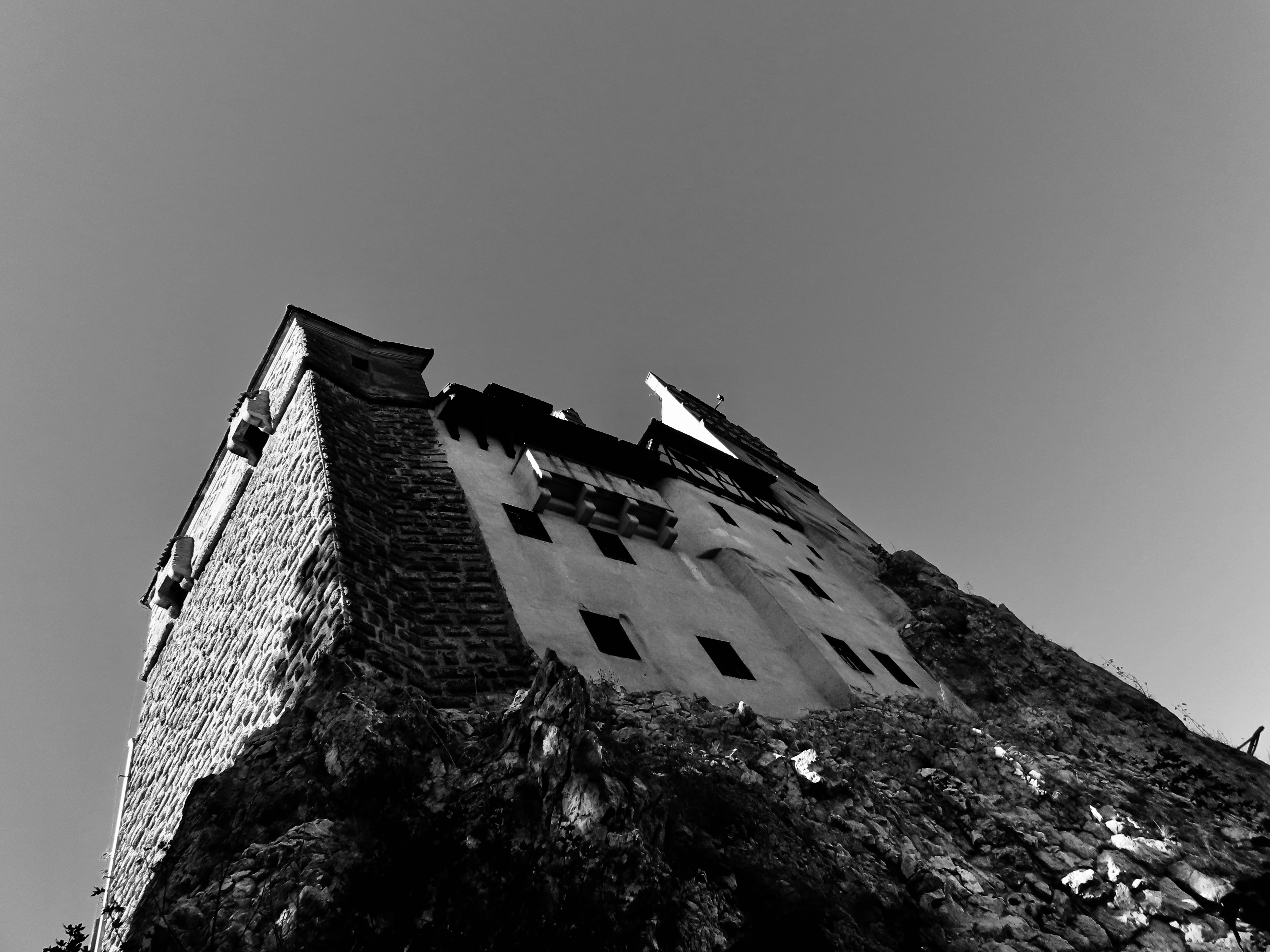
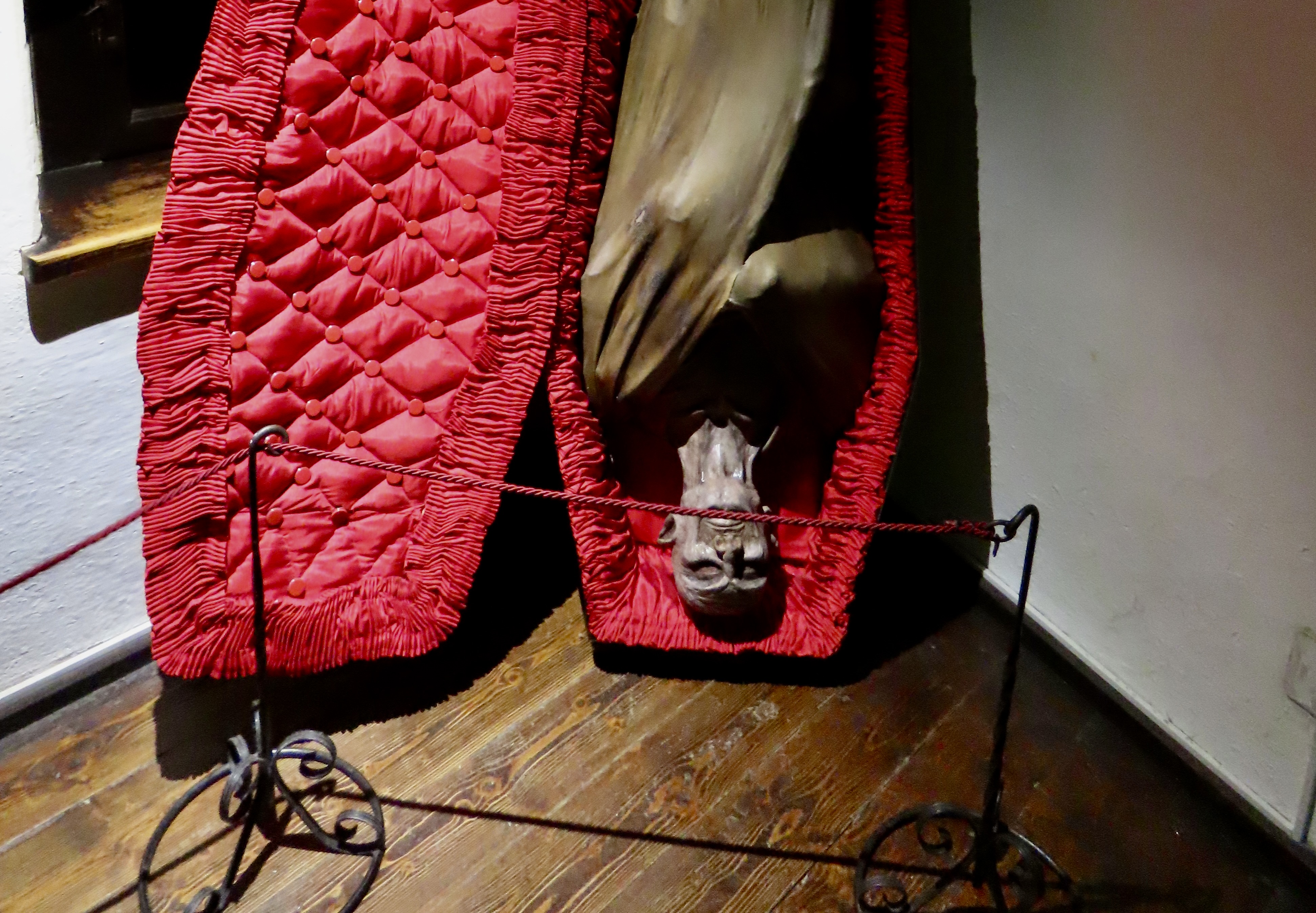
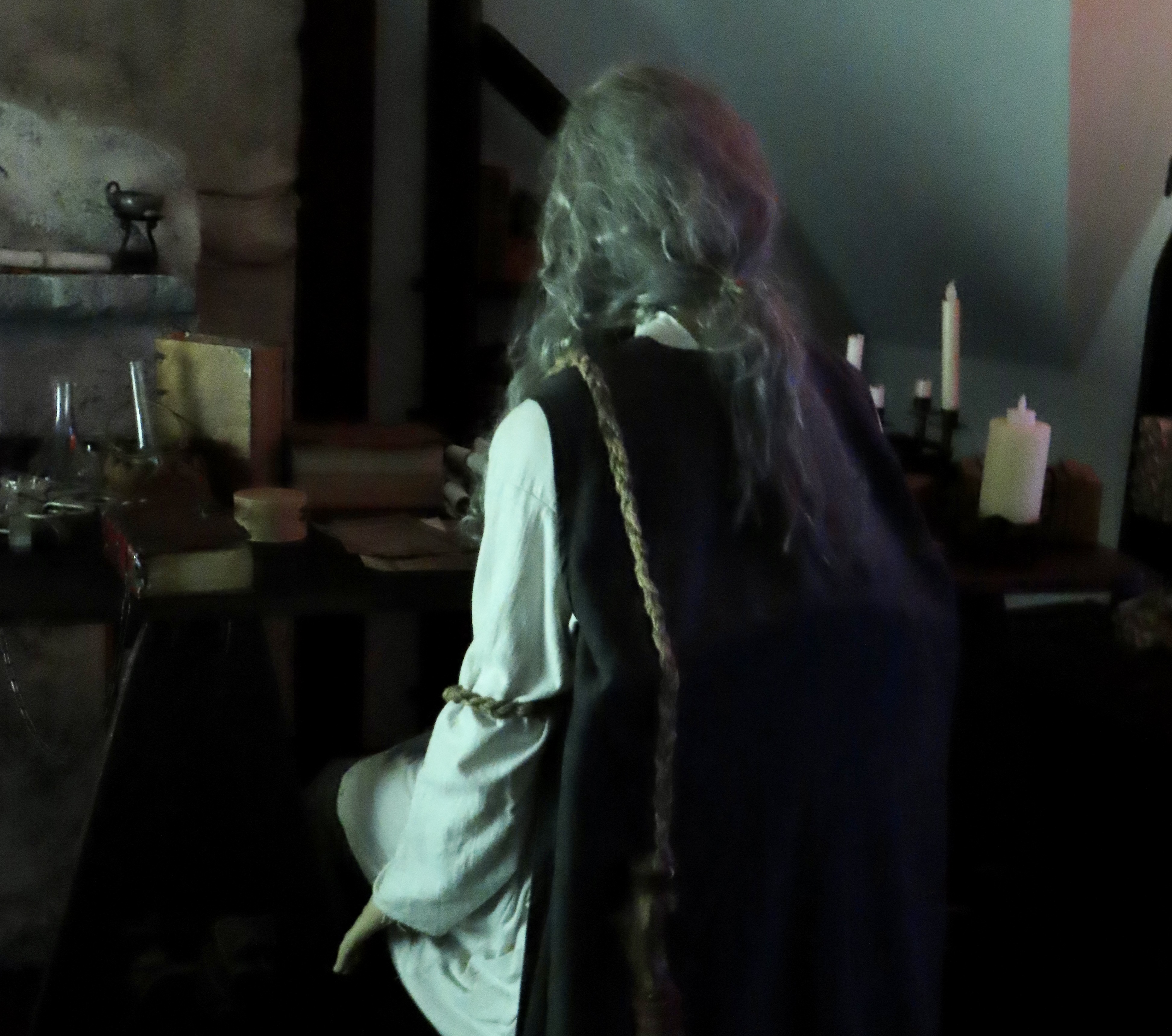
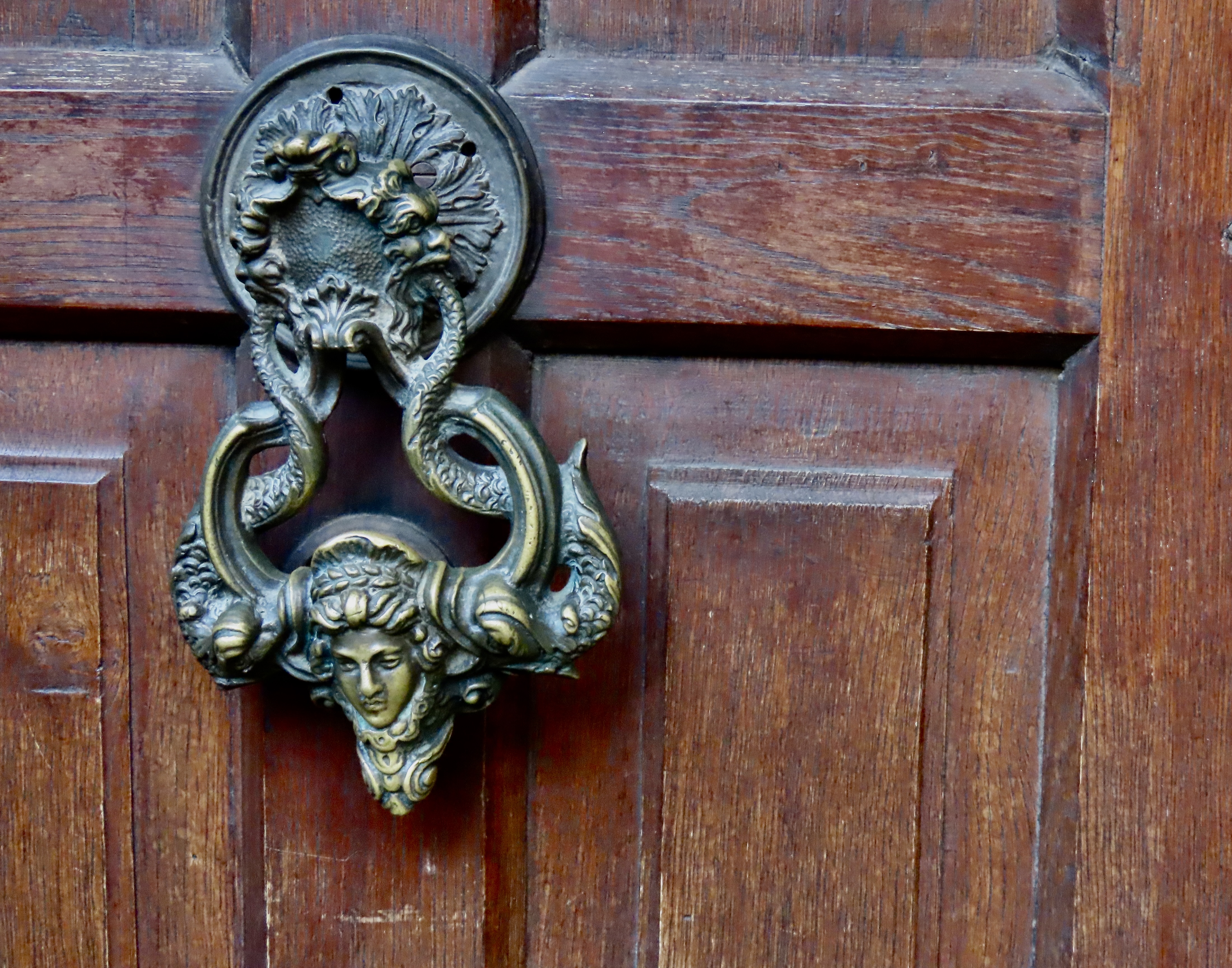
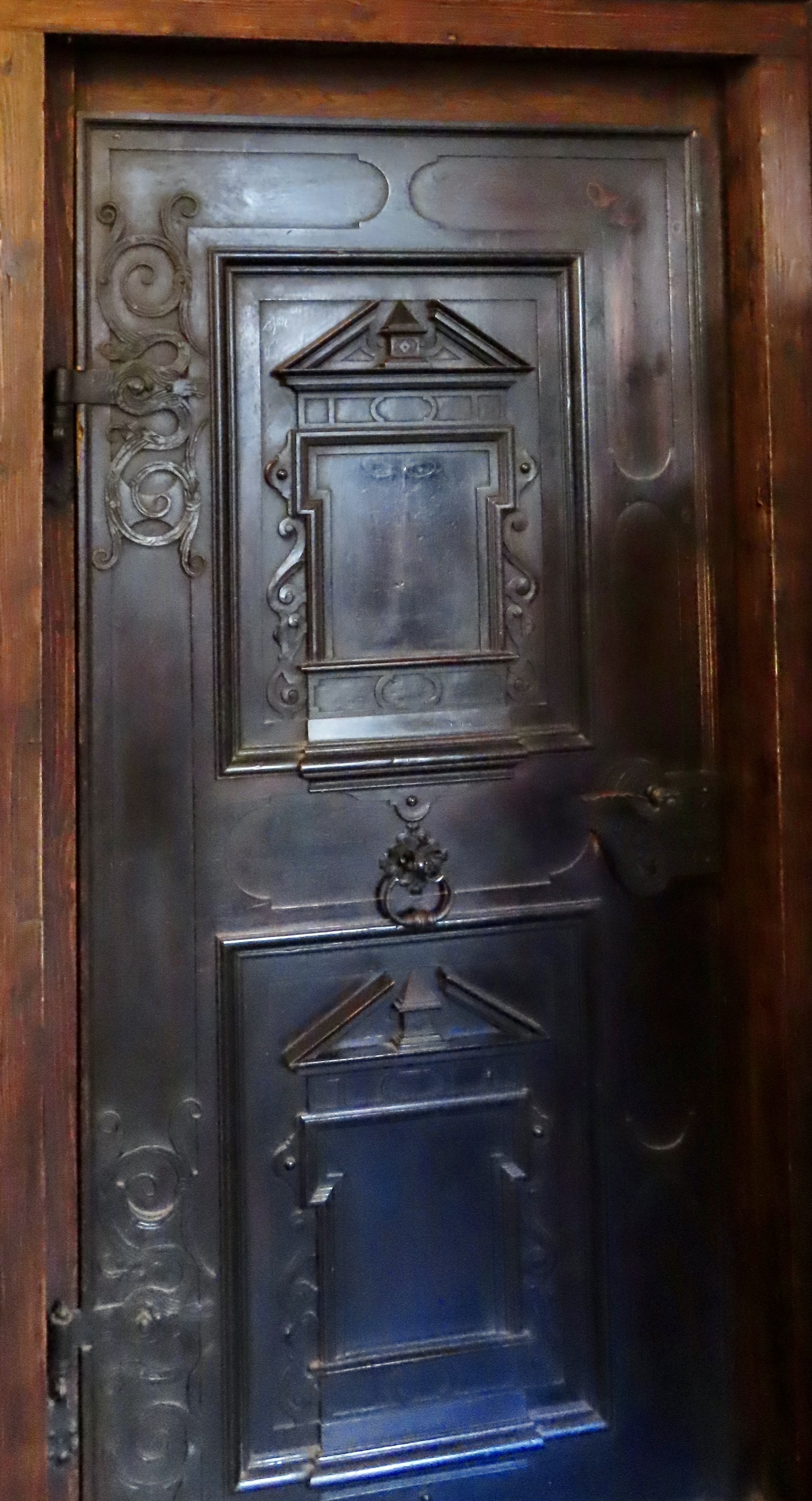
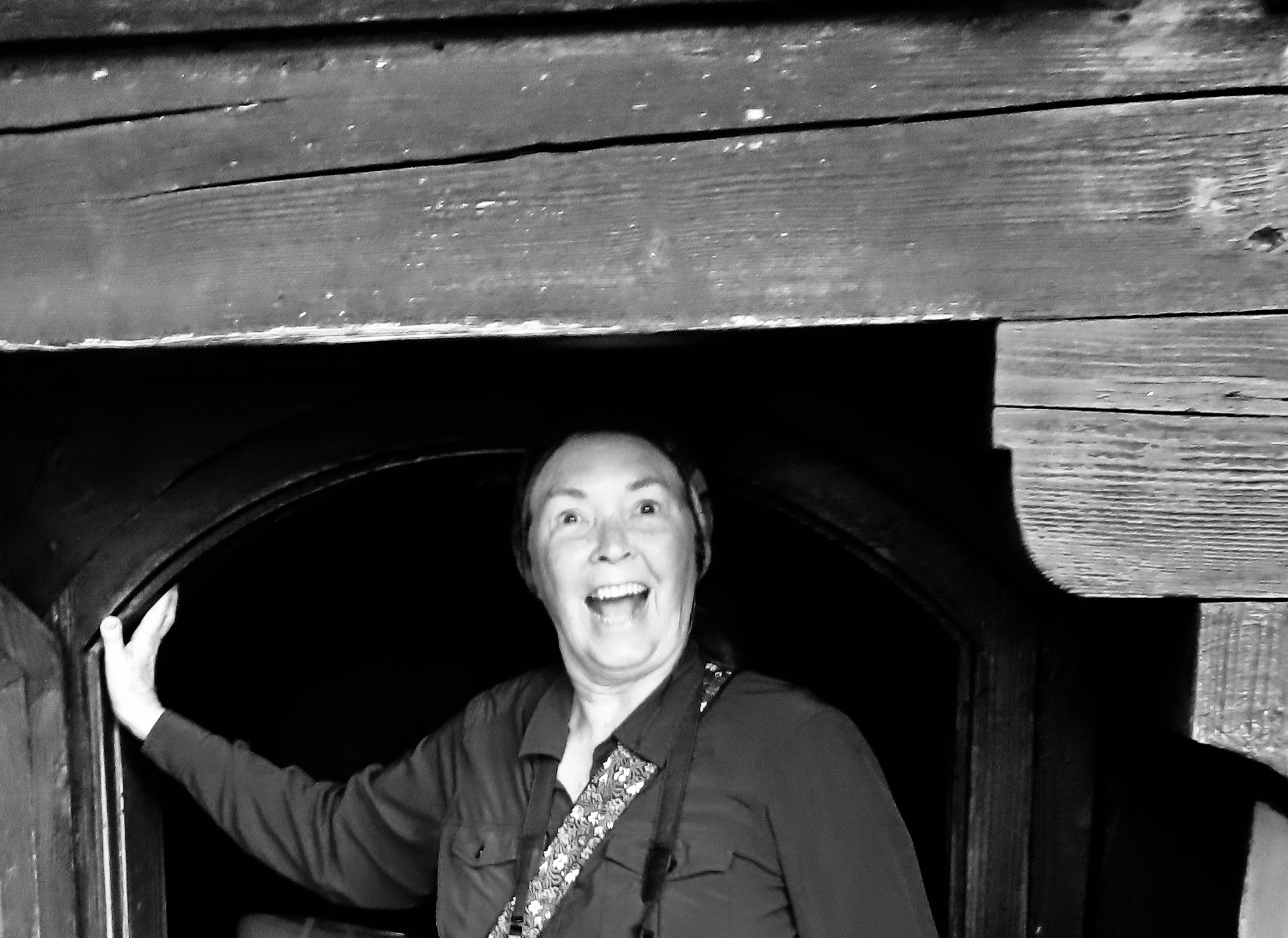
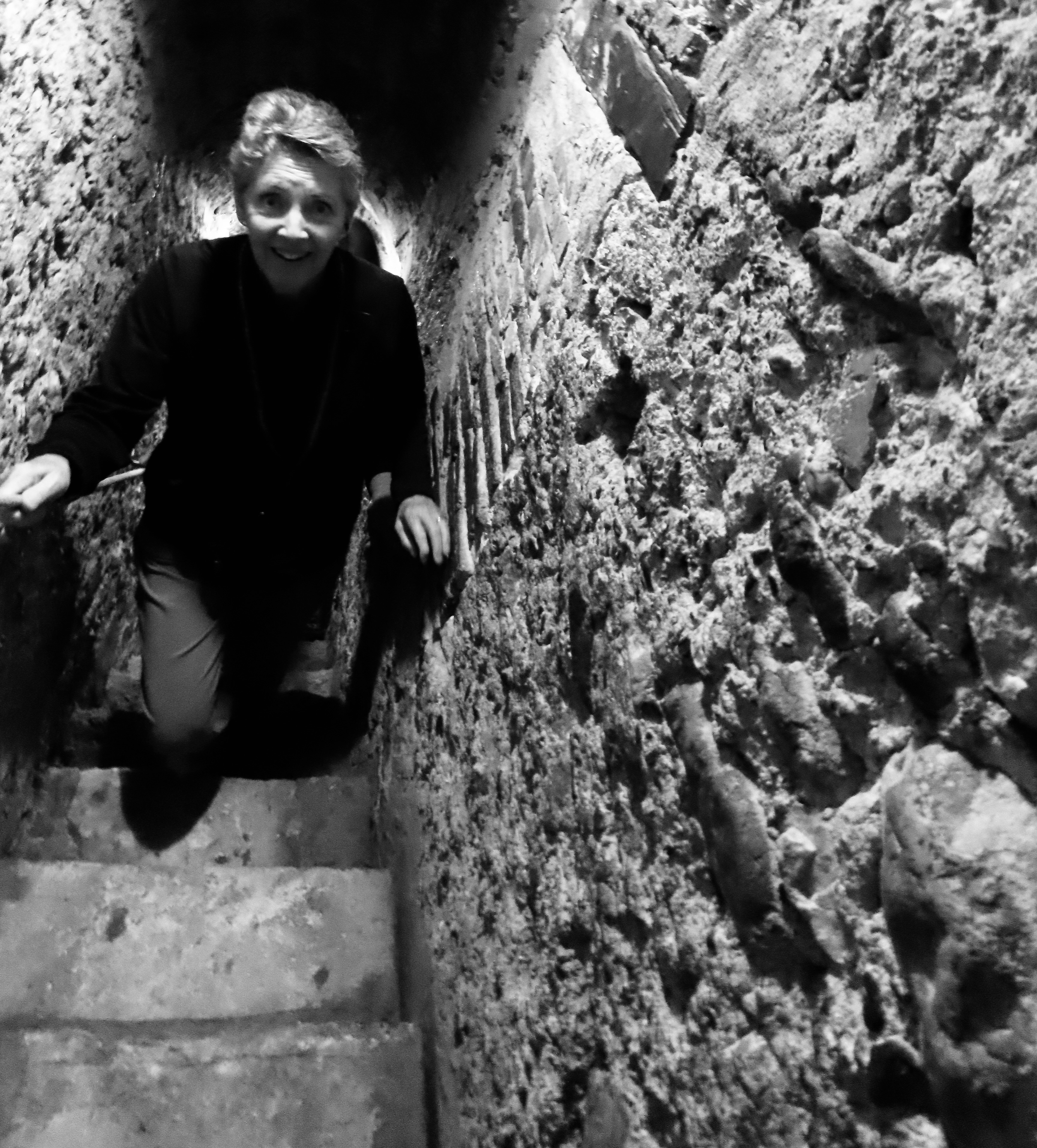
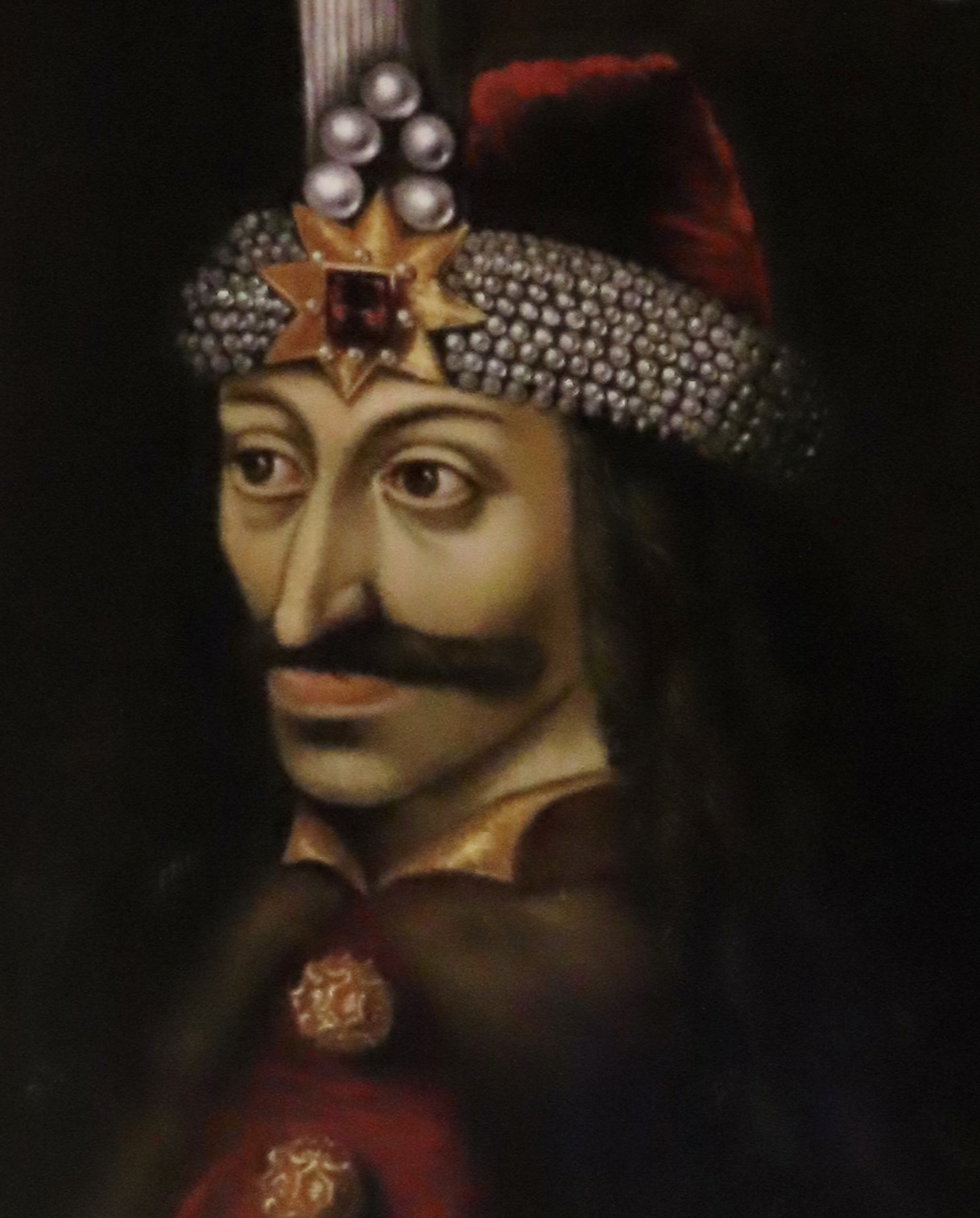
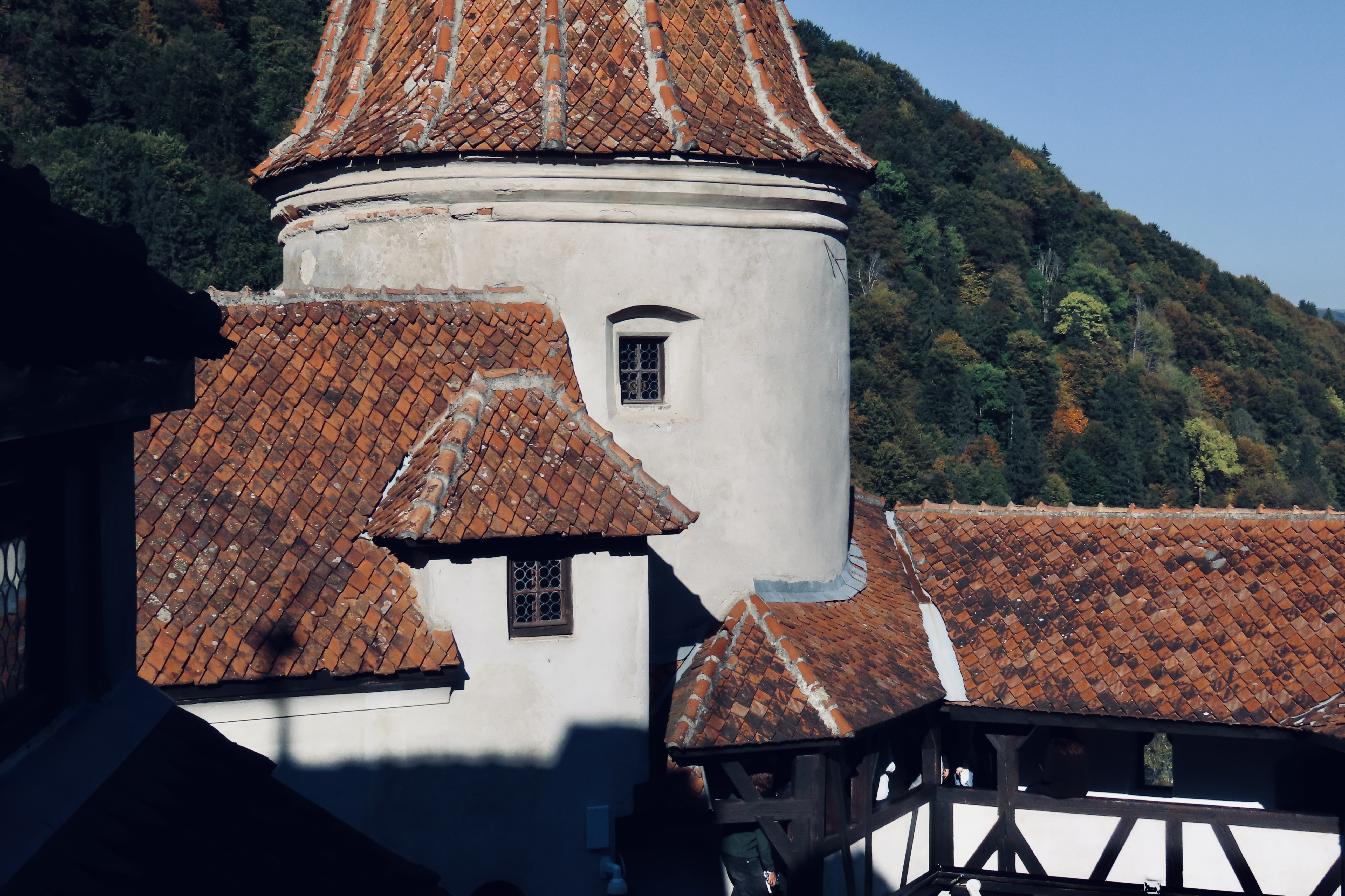
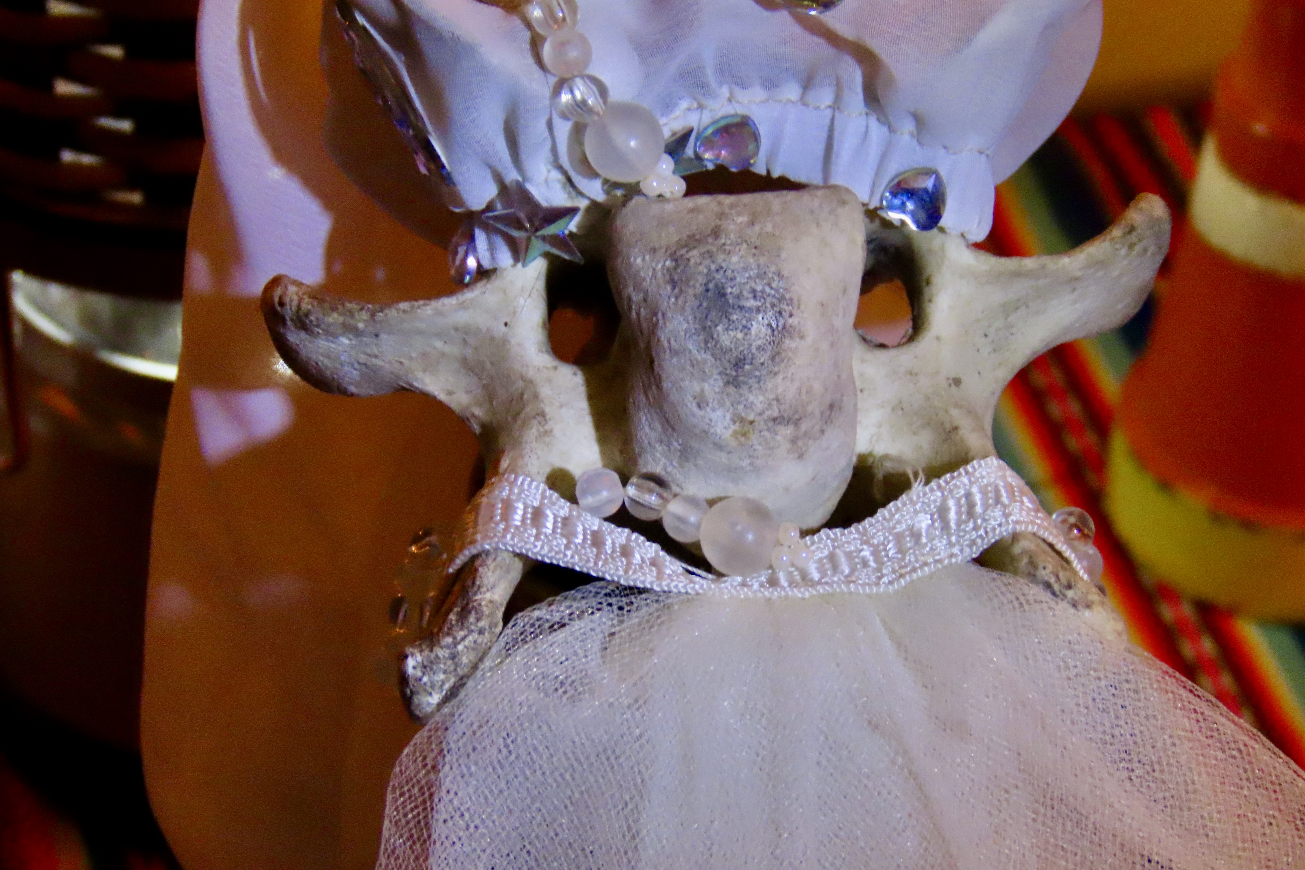
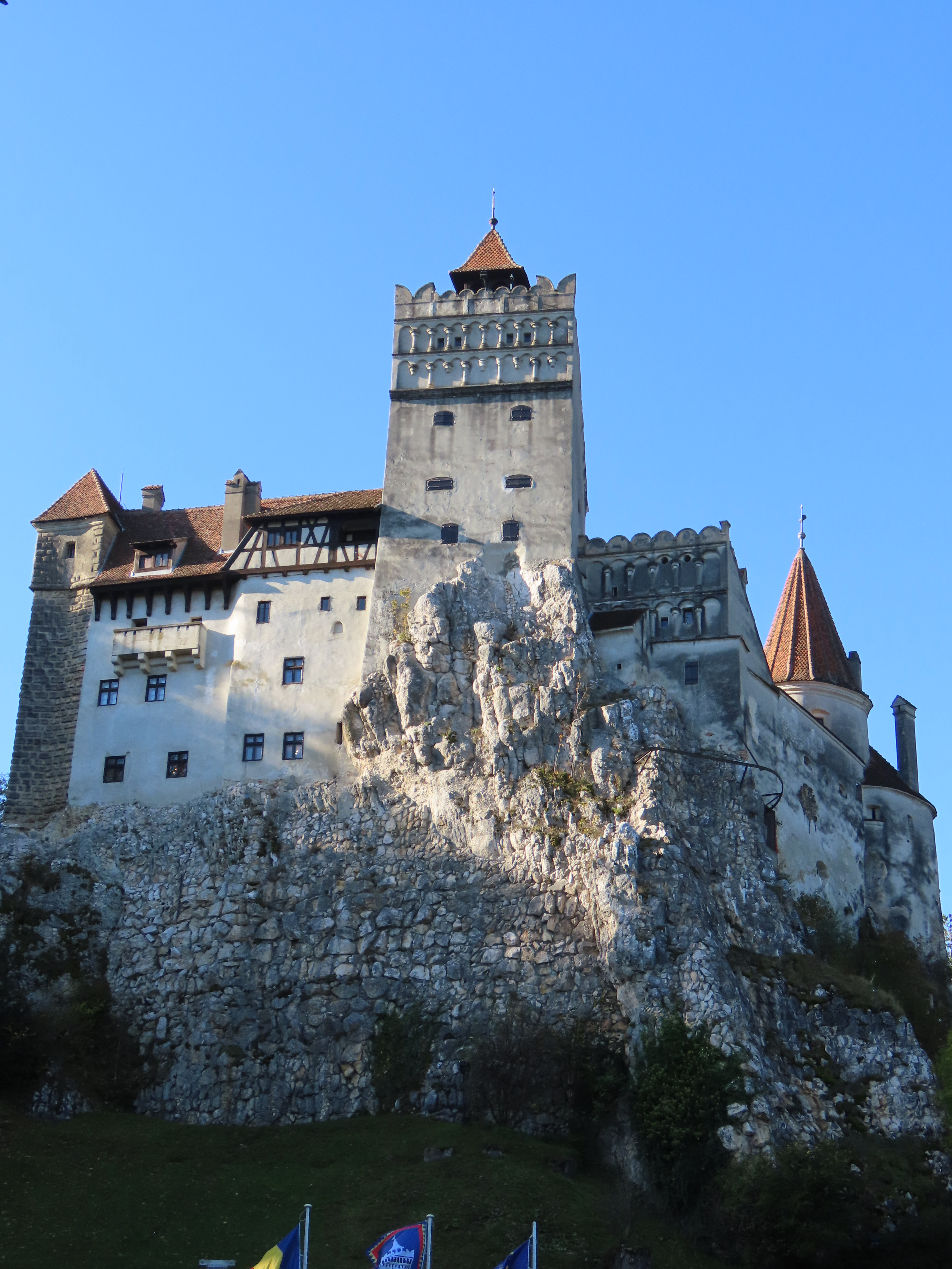
Peggy and I never expected to visit Dracula’s Castle in Transylvania but there it was on our Danube River trip itinerary. How could we resist? Halloween was only 2 1/2 weeks away.I felt right at home.There were even places for naps.And to sit.Or stand if you preferred…There was a danger of being tied up, however.And ghosts. This scary fellow was floating back and forth in a dark room, like a caged wild animal. Optical illusion? Perhaps…A wild lion with vampire sharp teeth peered out from a table…A lioness with frightening sliced eyes was hidden among scroll-like decorations.Looking closely, other evil creatures seemingly appeared out of nowhere, like this satan goat with dead eyes and his companion, a horned dragon.Even door knockers were threatening. “Beware!” rather than “Welcome” was the message. Monsters’ heads peered out from the medallion. Two snakes slithered out, wound around the knocker, and became a second set of massive horns on a cruel face with pursed lips.Strange metal doors invited opening. Dare we? What dark secrets does the room hide? Eyes stared out from the top panel. Halloween scary for sure.Peggy entered a dark room and came out screaming. Had her hair fallen out? (Our guide had hidden behind a curtain and jumped out yelling.)And there were lots of dark, narrow, ancient stairs to climb that led to mysterious heights. Was this damsel in distress wearing a nervous smile about to become Dracula’s latest victim? (We were traveling with Peggy’s brother John and his wife Frances. This is Frances negotiating the ‘dark, narrow stairs,’ with a smile.)Even the castle’s no-smoking sign had a bit of Halloween-type humor, which brings me to something much more scary than Bram Stoker’s Dracula, the real, historical Dracula, son of Dracul…Vlad the Impaler.
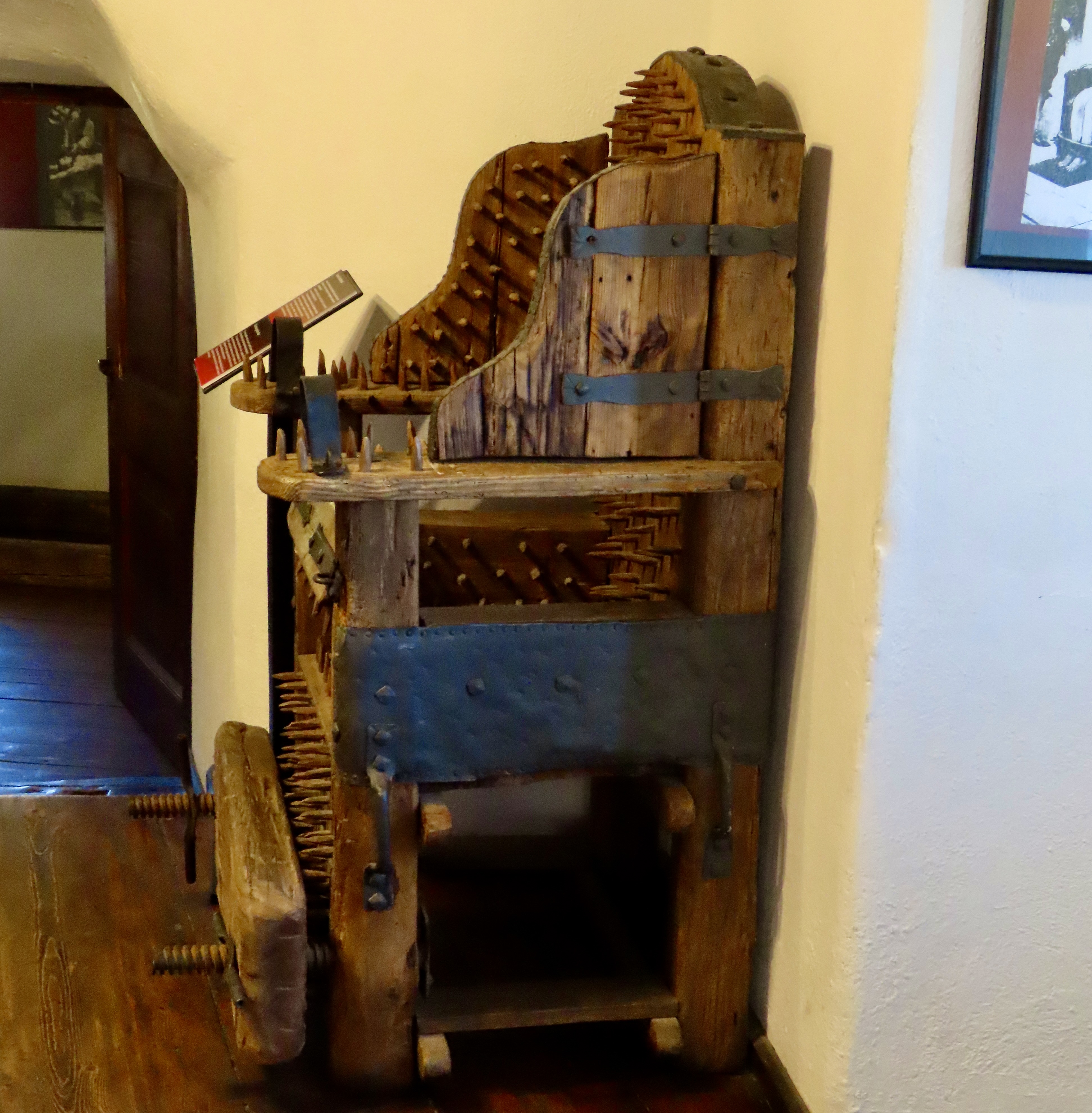
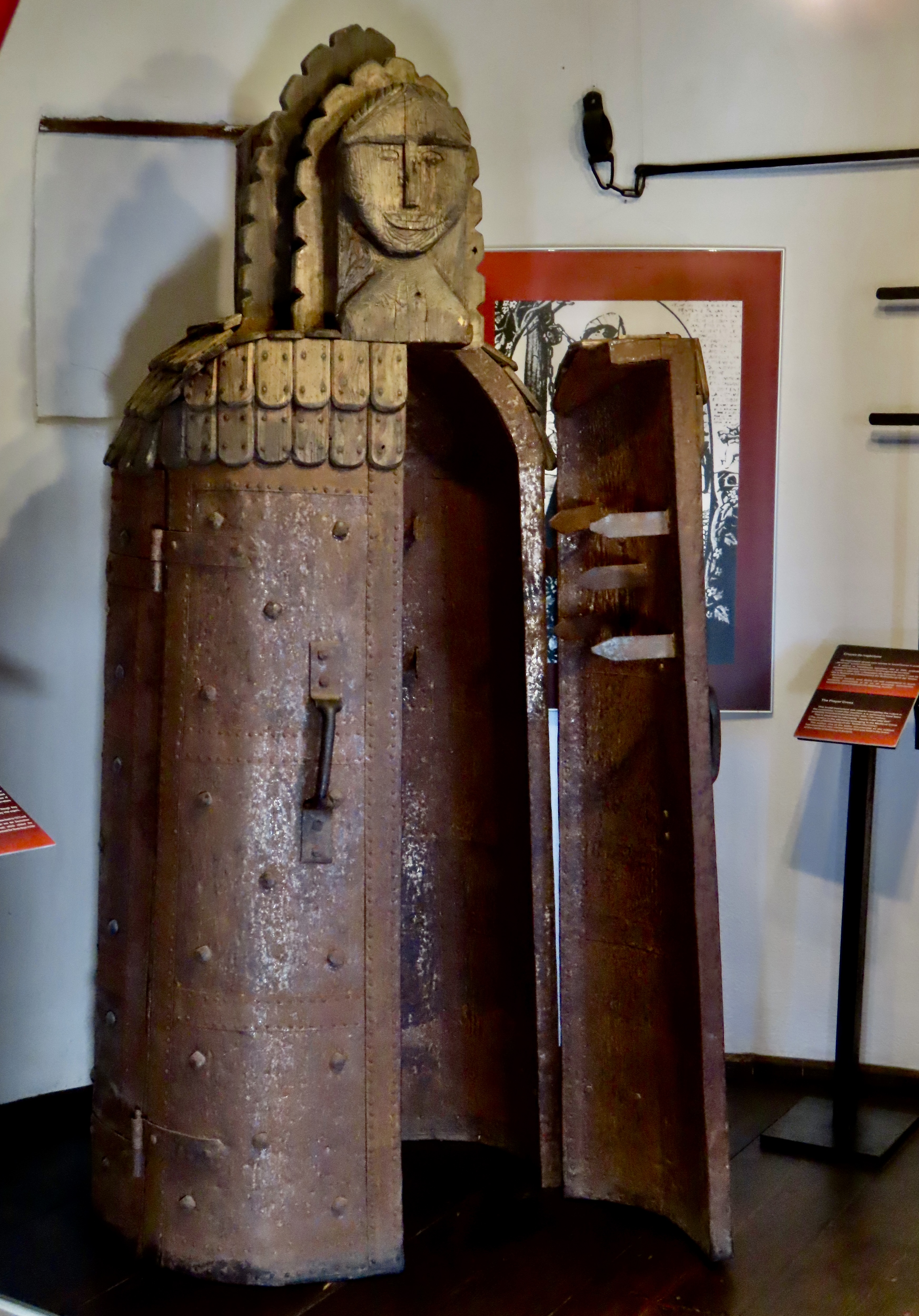
Stoker never visited Dracula’s Castle but he based his book partially on folk tales, legends, and the actual historical Dracula/Vlad the Impaler. Compared to him, Stoker’s Dracula was a wimp, a woozy, a rank amateur. Born in 1431, Vlad would be responsible for some 80,000 deaths throughout his 45 years of life, utilizing various means including torture— the worst of which was impaling. Not to get too graphic, but imagine sitting down on a yard long, pointed, narrow pole. Ouch. He once did in 20,000 Ottoman Turks using that method. The rest of the army turned and ran home. Even Pope Pius II was impressed. The gruesome chair and standing tomb above are other examples of torture implements he might have used. Once a delegation of diplomats visited Vlad and refused to take off their hats in respect. He had their heads cut off and their hats nailed to their heads. So, if you want scary, Vlad is your man.
These were violent times throughout Europe and Vlad was among the most violent. No wonder ghosts roam about his castle, virtual, or otherwise.
At one point, Vlad was imprisoned in this tower for a couple of years, a part of his own castle.
And now, to lighten things up, a leap forward to Halloween 2024…
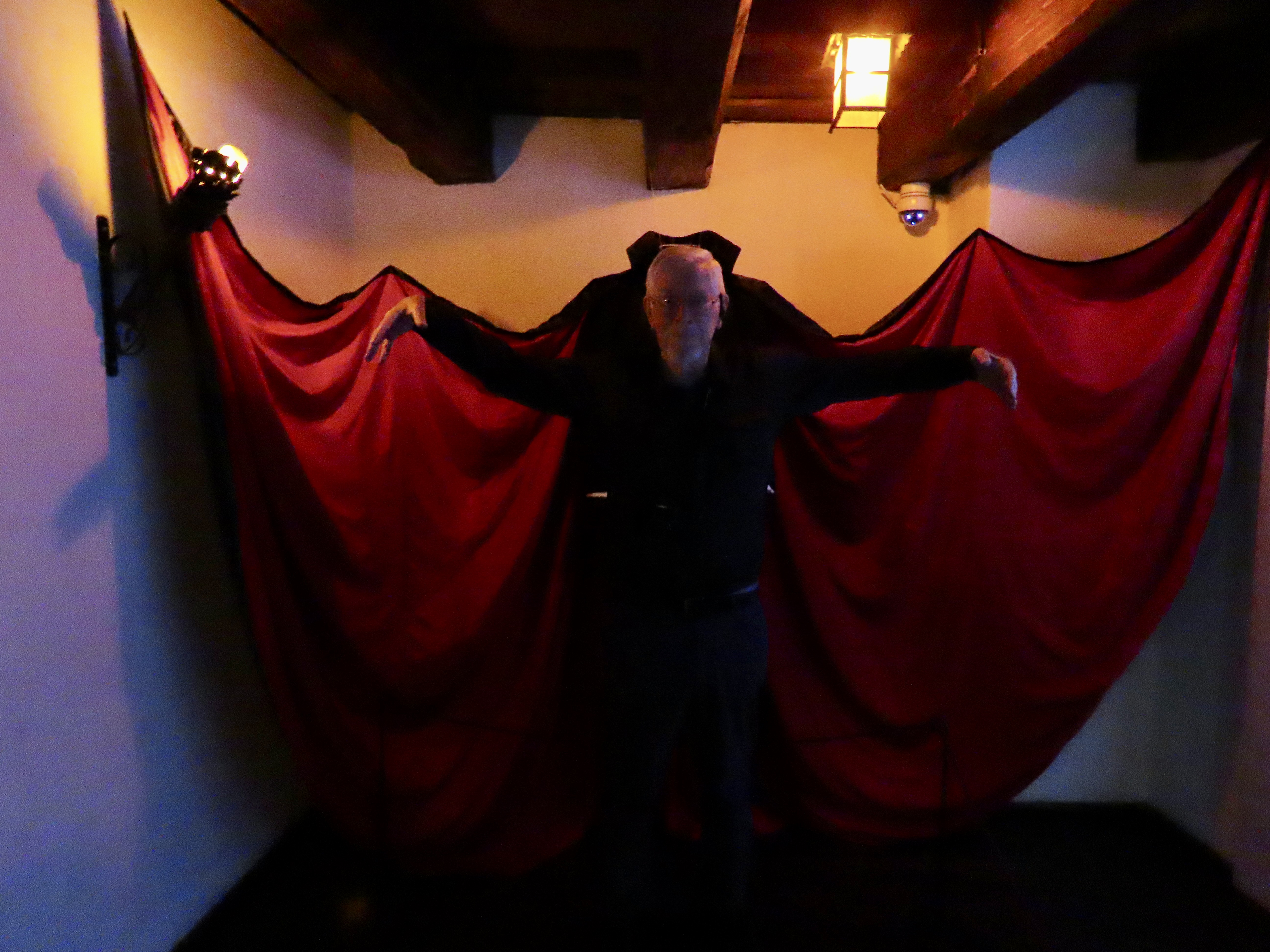
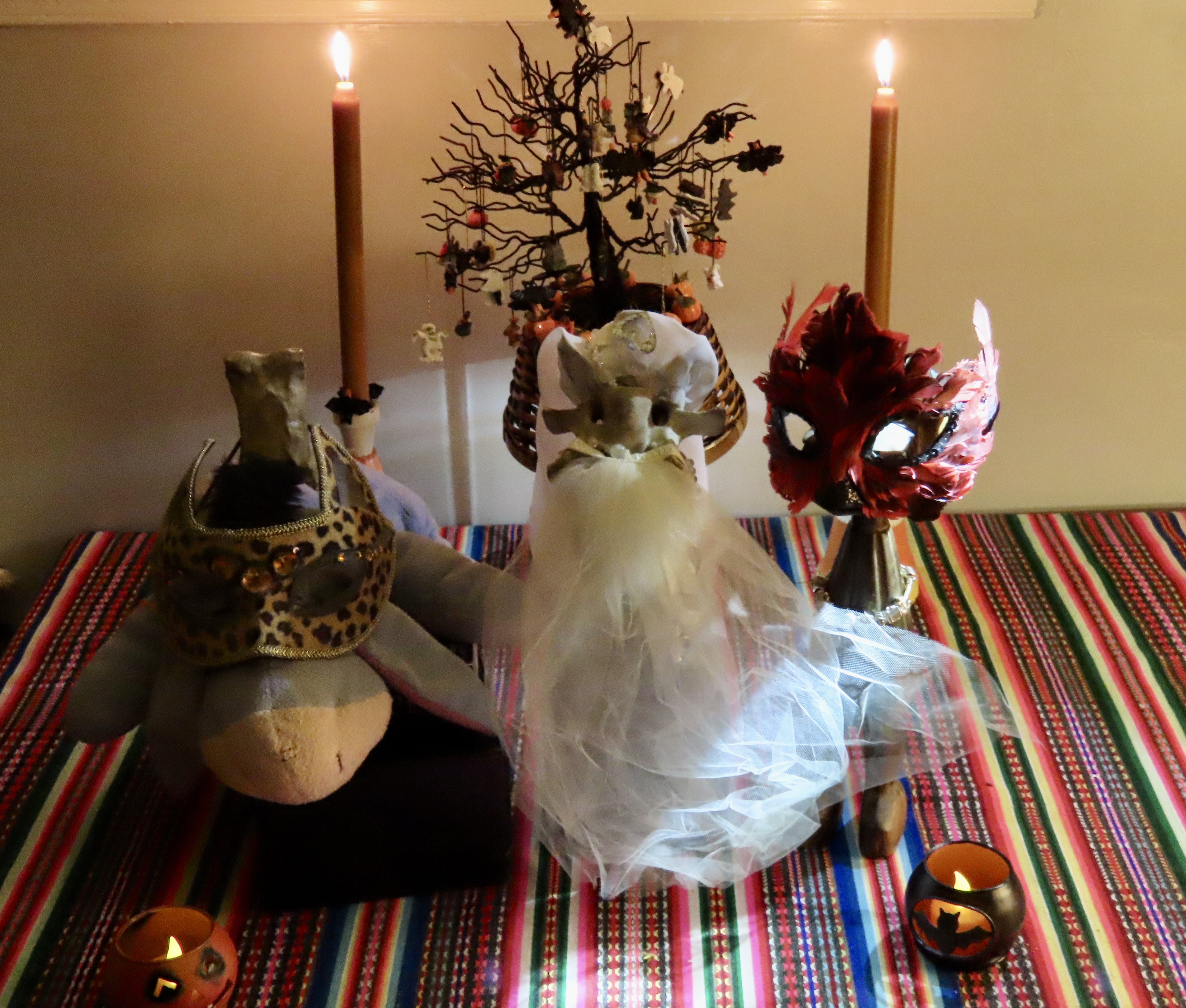
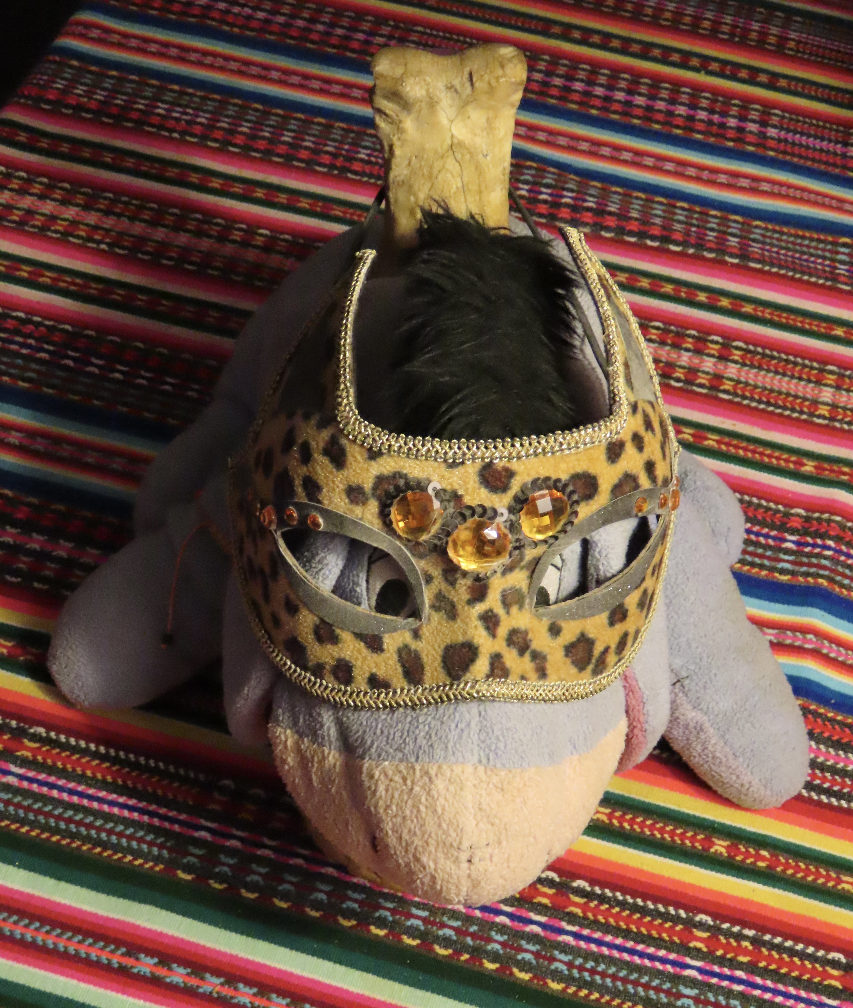
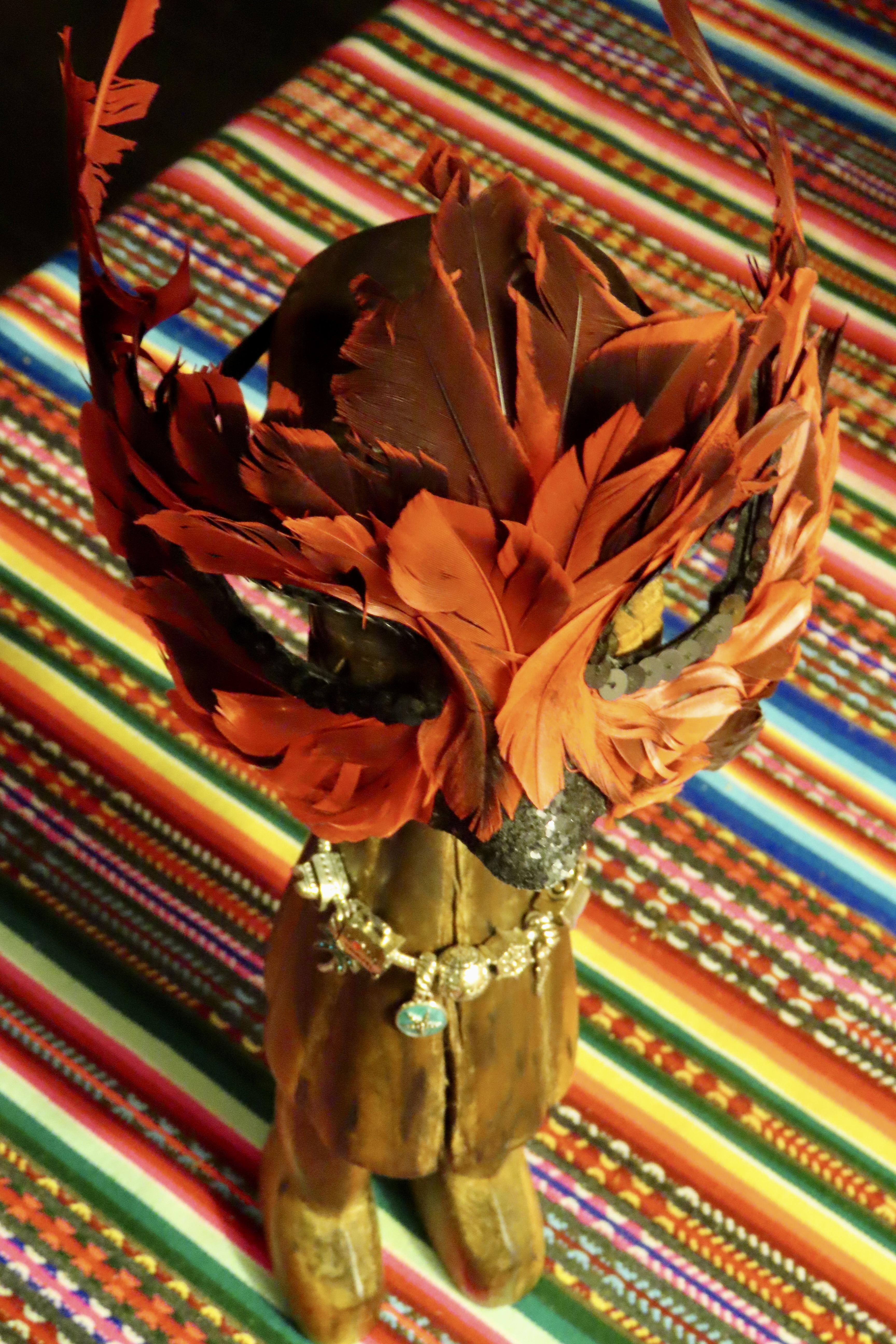
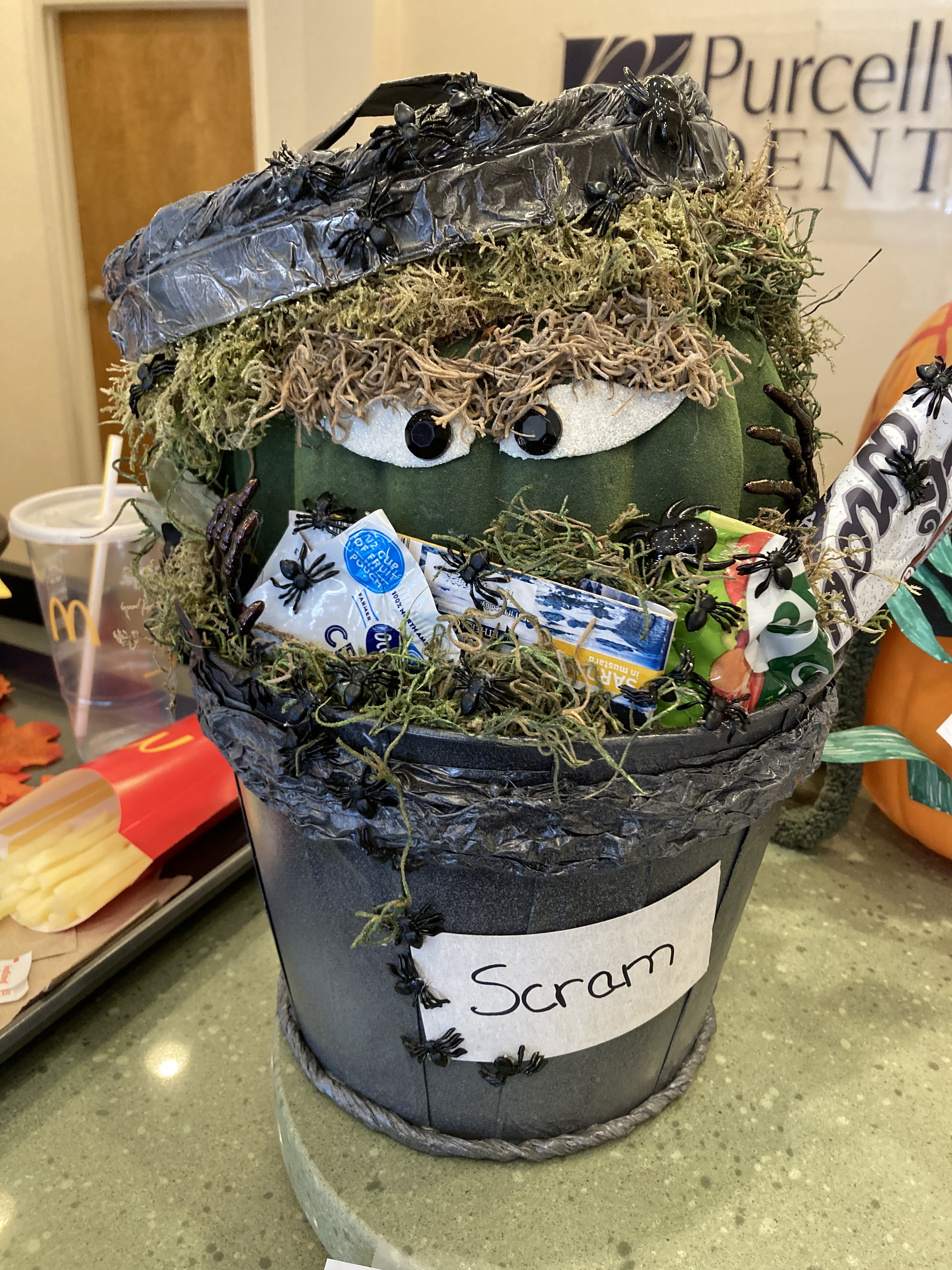
If you’ve been around this blog for a while, you know Bone, Eeyore, Bonetta, and George, the African Bush Devil. Bone has been wandering the world for 47 years, ever since Tom Lovering and I found him while backpacking south of Lake Tahoe; Eeyore has been his traveling companion for 25 of those years; Bone found Bonetta in a Florida swamp and married her at Burning Man; George came home with me from Africa in 1967 and is on the front of my book about my Peace Corps experience: The Bush Devil Ate Sam. They dressed up for Halloween— and you— using their Burning Man costumes.Eeyore and Bone have been wandering around North America together for 25 years. Bone gets Eeyore into trouble and Eeyore gets Bone out of trouble. Eeyore is wearing his leopard mask. Bone, BTW, is naked, which is his Burning Man costume. If Eeyore appears a bit bedraggled, it may be because he served as an elementary school mascot before joining Bone.The gorgeous Bonetta put on her Burning Man wedding dress to appear as the Bride of Frankenstein. (Baby Bone was sleeping in his coffin and no one wanted to hear him scream if he woke up.)George is wearing his dramatic Red Hawk mask. He was carved by a leper in Ganta, Liberia.And finally, the Mekemson and Cox Family Pumpkins. Clay’s lurks threatening in the background. Tasha’s is a First Grade Monster with eyes peeking out on the side. Ethan’s is an AI Robot (scary as a category five hurricane). Cody’s large mouth pumpkin is throwing up his innards. Peggy’s is the Castle of Dracula, and mine is Dracula’s Teeth. (I have a dental appointment this week and all I could think of was teeth. How much scarier can it get than trip to the dentist?)Actually, my dentist, Dr. Tim Smith, and his staff at Purcellville Dental are excellent. And have a great sense of humor! Their annual “Decorate for Halloween Contest” was underway. Each staff member creates a ‘Jack-o-lantern’ and patients are invited to vote for their favorite. This was mine.
Peggy and I, along with Clay, Tasha, Ethan and Cody and, of course, Bone, Eeyore, Bonetta and George would all like to wish you and your family a Happy and Safe Halloween filled with laughter, goodies, and slightly scary things.
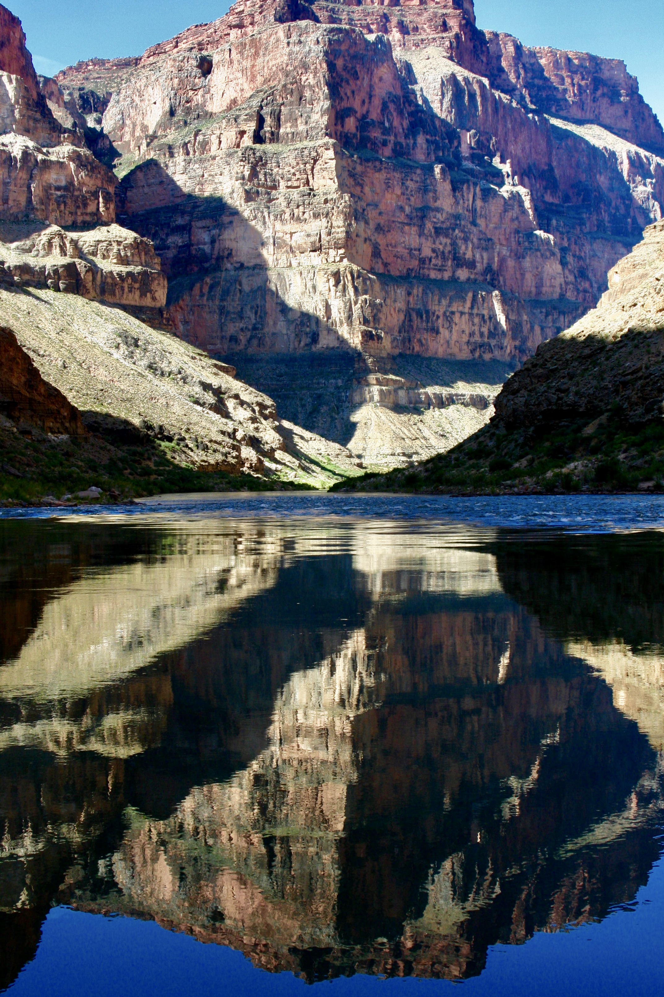
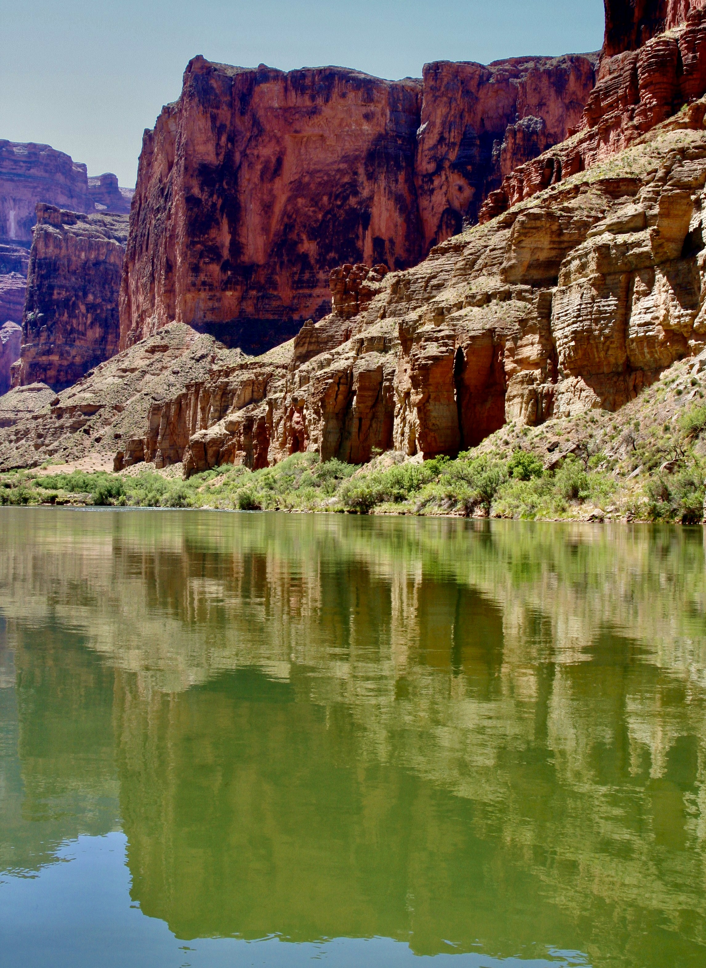
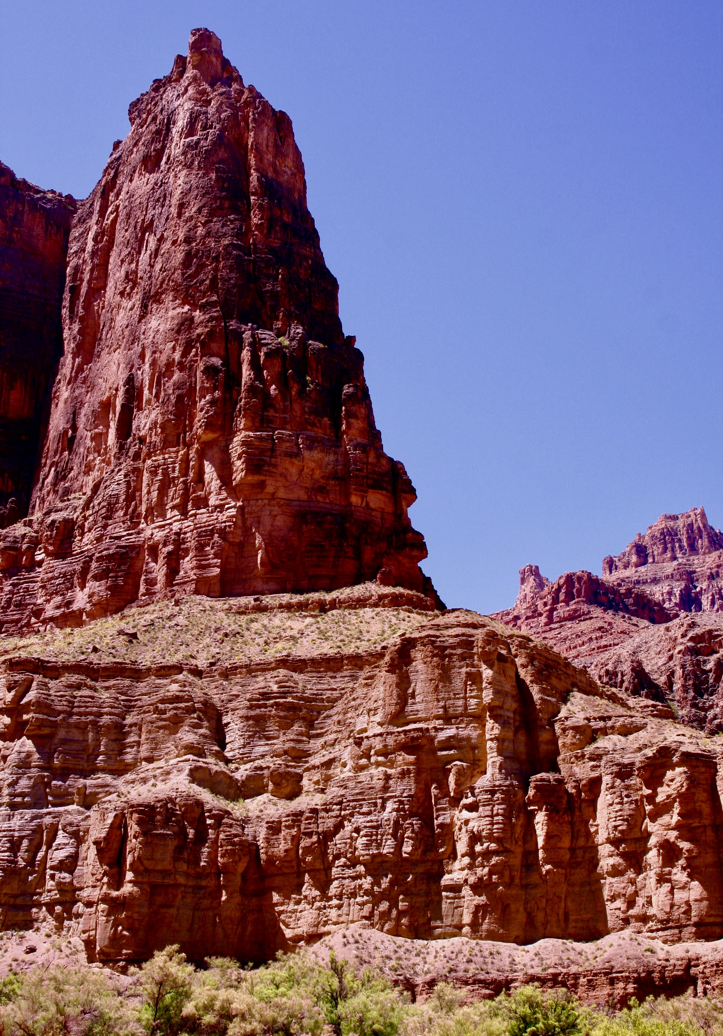
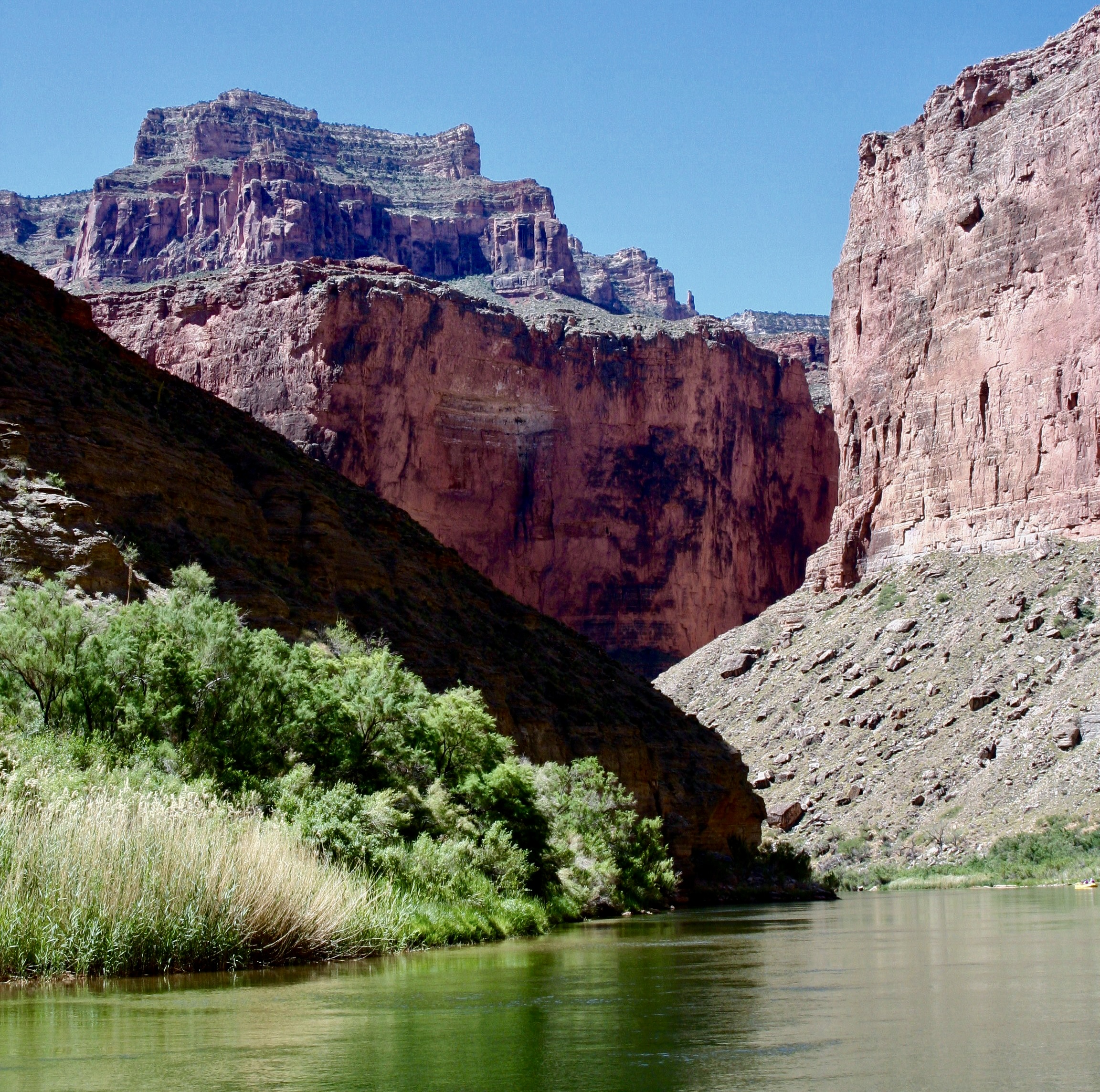
Over one billion years of the earth’s history, great beauty, and adventure await those who are lucky enough to raft through the Grand Canyon on the Colorado River.
Most of our adventures start with a fair amount of forethought. Our 18-day raft trip through the Grand Canyon was an exception. It started with a phone call from our friend Tom Lovering.
“Curt, you need to jump online right now and sign up for a chance to win a lottery permit to raft the Grand Canyon.” It was more in the nature of a command than a request. Tom was plotting. There are relatively few private permits granted every year in comparison to the ton of rafters who want them. Floating down the Colorado through the Canyon is one of the world’s premier raft trips, providing a combination of beauty and adventure that are rarely matched. Tom figured that the more people he persuaded to sign up for the lottery, the better the chances of getting a permit. He’d made the request to several friends.
I would have probably skipped the opportunity. We were in the midst of wrapping up a three year exploration of North America and were seriously looking for a place to light— a semi-wilderness home. We were closed to settling on Southern Oregon. We had an hour to meet the filing deadline and the chances of winning, as I mentioned, were close to zilch. Plus I was woefully out of shape and 67 years old. I wasn’t sure that my body would have a sense of humor about the journey. Floating down the river on a private trip actually involves a substantial amount of work and everyone is expected to do their share. Rightfully so.
My child bride Peggy, however, who is seven years younger than I am and loves everything related to water, went straight to the site, filled out the required information in my name, filled out another in hers, and hit send. Fine, I thought to myself. That’s that. We can go merrily on our way and report back to Tom that we tried.
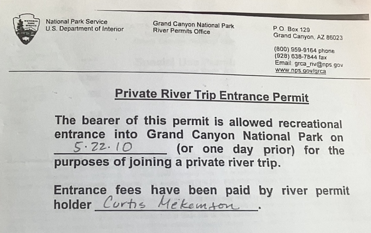
What I wasn’t expecting, as those of you have read my blogs about the trip know, was waking up the next morning and finding an email from the National Park Service announcing that I had won a permit. “Woohoo!” Peggy yelled. “Oh crap,” my fat cells responded. Tom didn’t believe me when I called him from somewhere in Nebraska. It took several minutes to convince him. And then he got excited. Here’s the actual permit:
My first task was to make sure that Tom would do the majority of the work in setting up the adventure. We didn’t have the time and I didn’t have the expertise for a white water raft trip. My experience was in organizing and leading long distance backpack and bicycle adventures. Tom, on the other hand, was an experienced white water enthusiast who had run the river several times and had boundless energy. Plus, he had volunteered. “There is a fair amount of paper work for you and certain responsibilities,” he mentioned in passing. Paper work, as I recall was a 40 page document, maybe it was 400. The responsibility, I learned was daunting. If we screwed up in some way by breaking the Park’s environmental or safety rules, I was accountable and subject to a large fine.
The raft trip in 2010 was the first blog series I ever did. I reposted it in 2018. Since I have already blogged extensively about the journey, I am going to use this and my next two posts as a summary of the trip and include many photos I didn’t use before.
I will note here that while the trip was even more physically challenging than I expected— and there were times I could have strangled Tom (and vice-versa, I’m sure)— I owe him a debt of gratitude for the opportunity. I love the Canyon and have explored it in many ways over the years including five backpacking trips into it. The river trip provided a whole new way to experience the beauty. Traveling with a great group was icing on the cake.
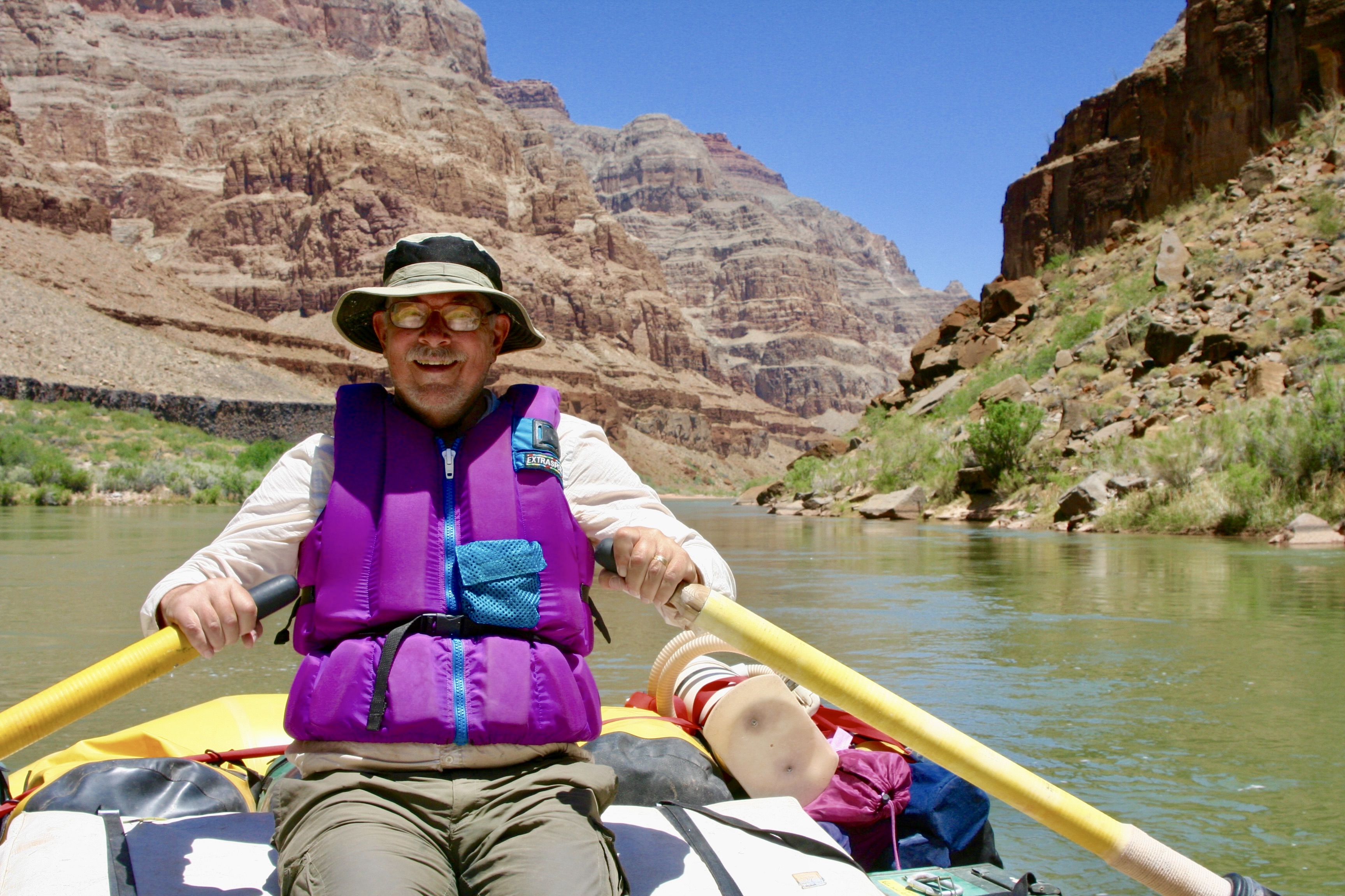
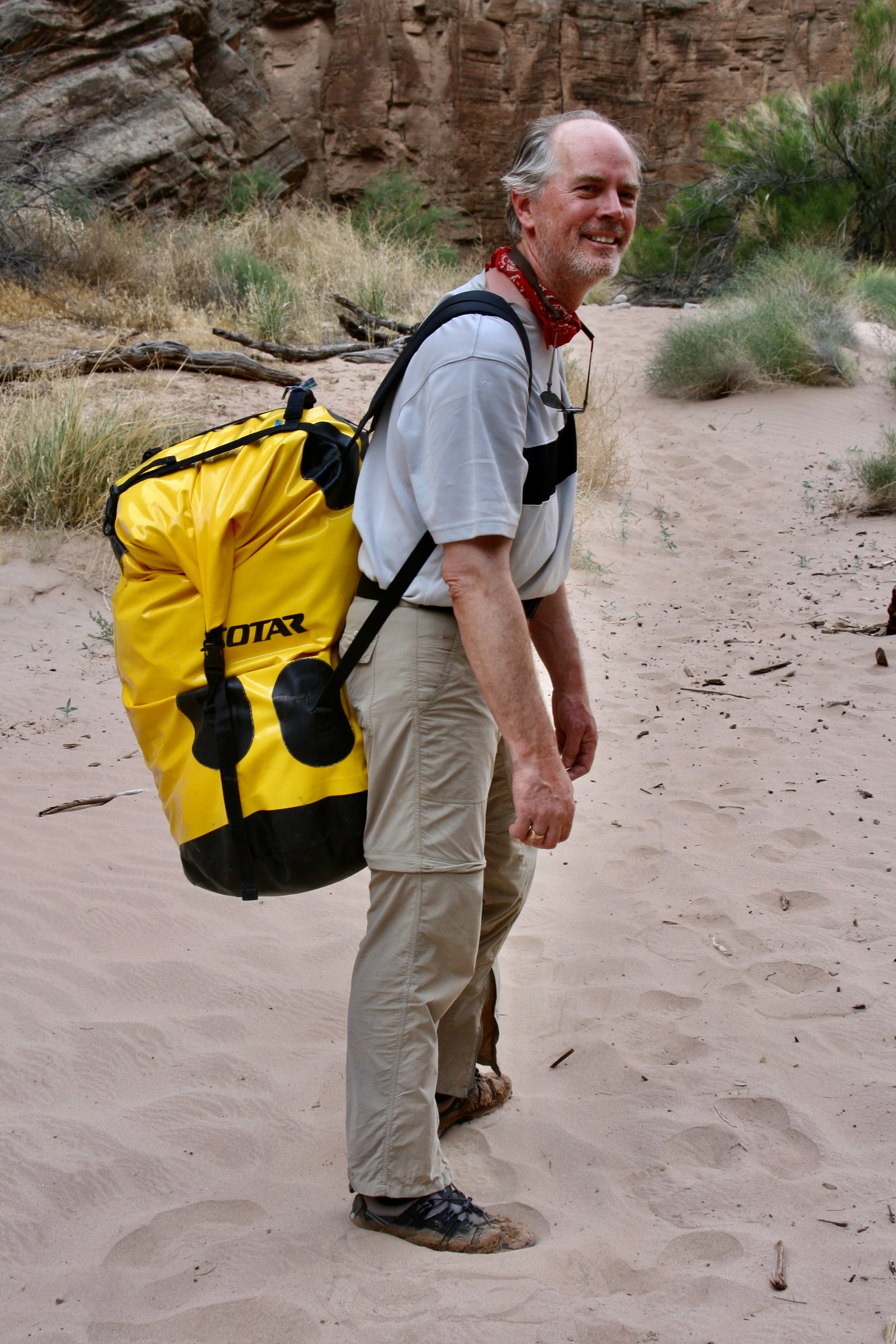
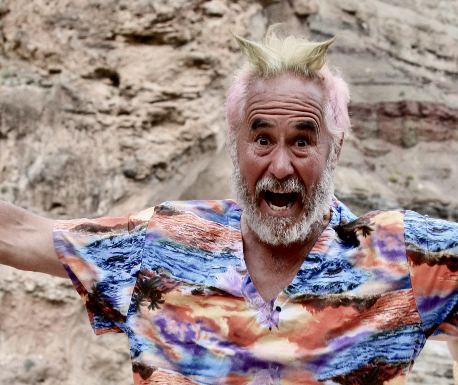
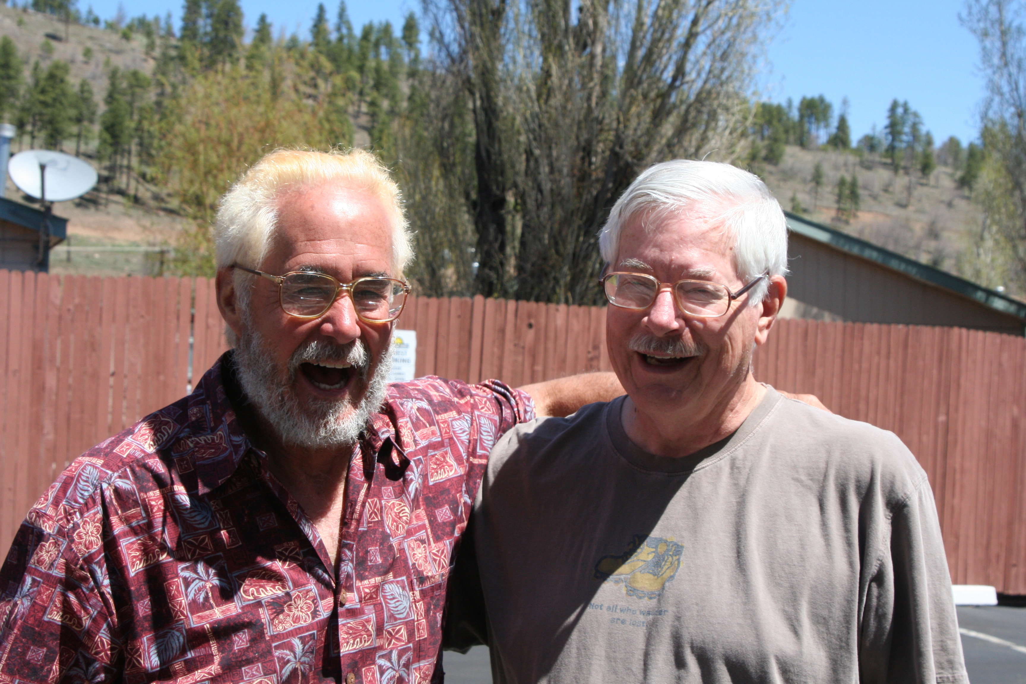
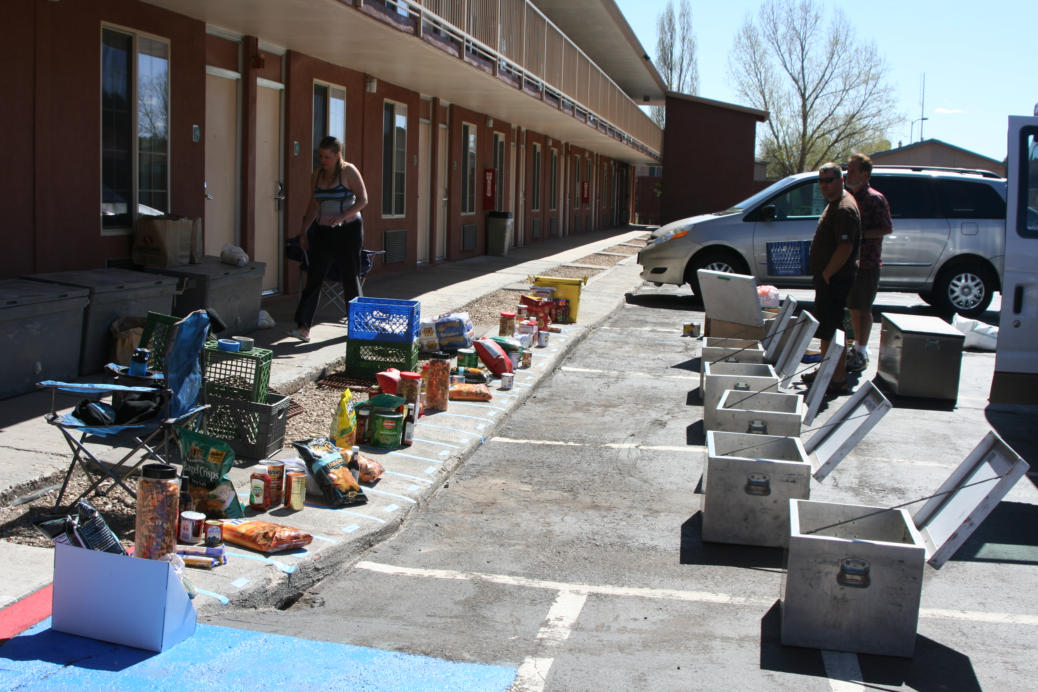
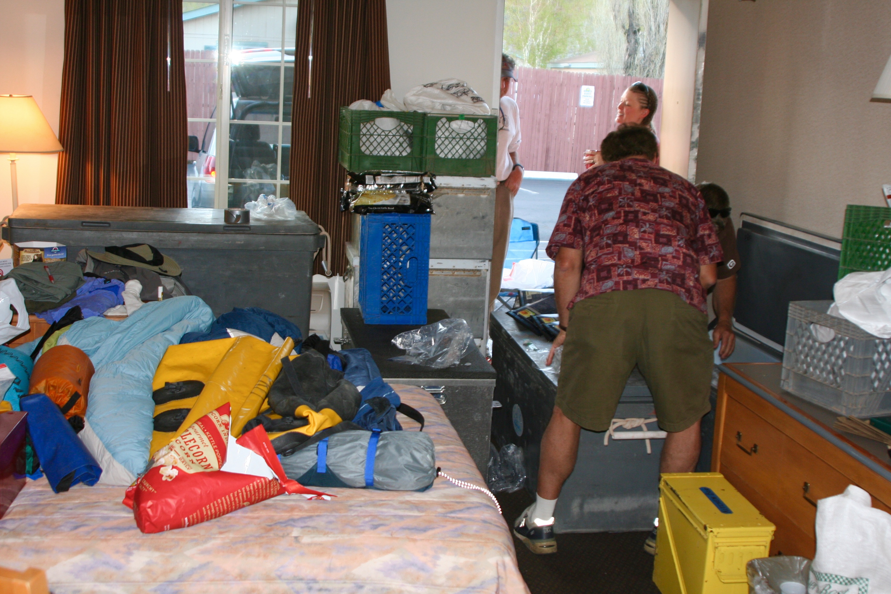
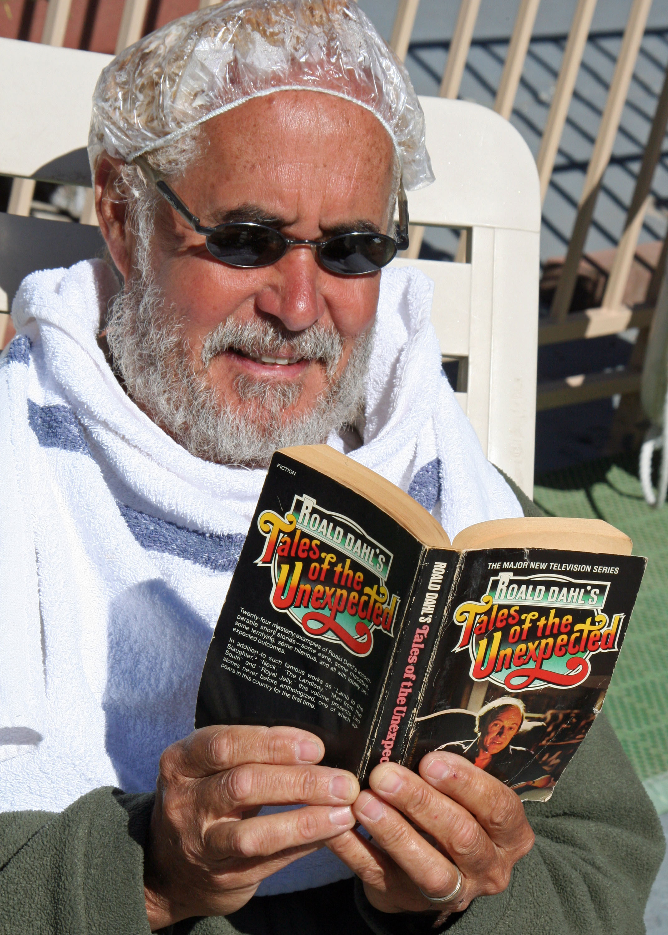
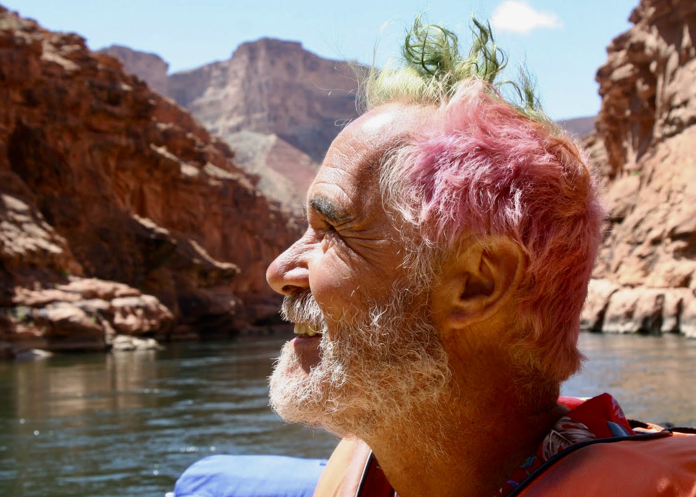
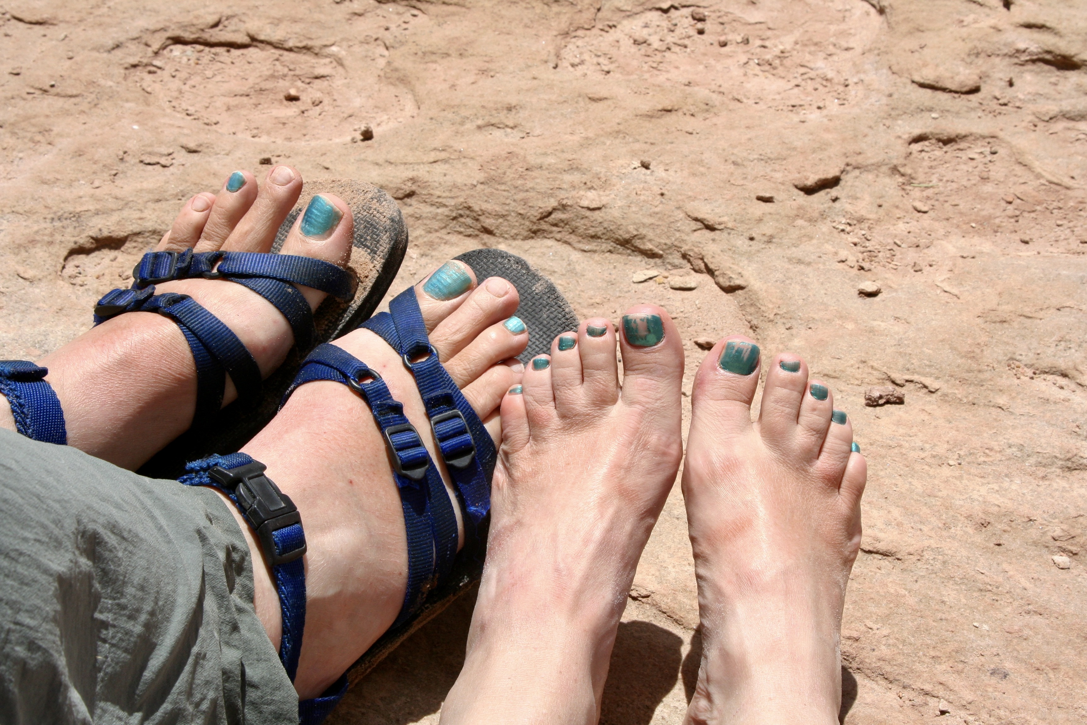
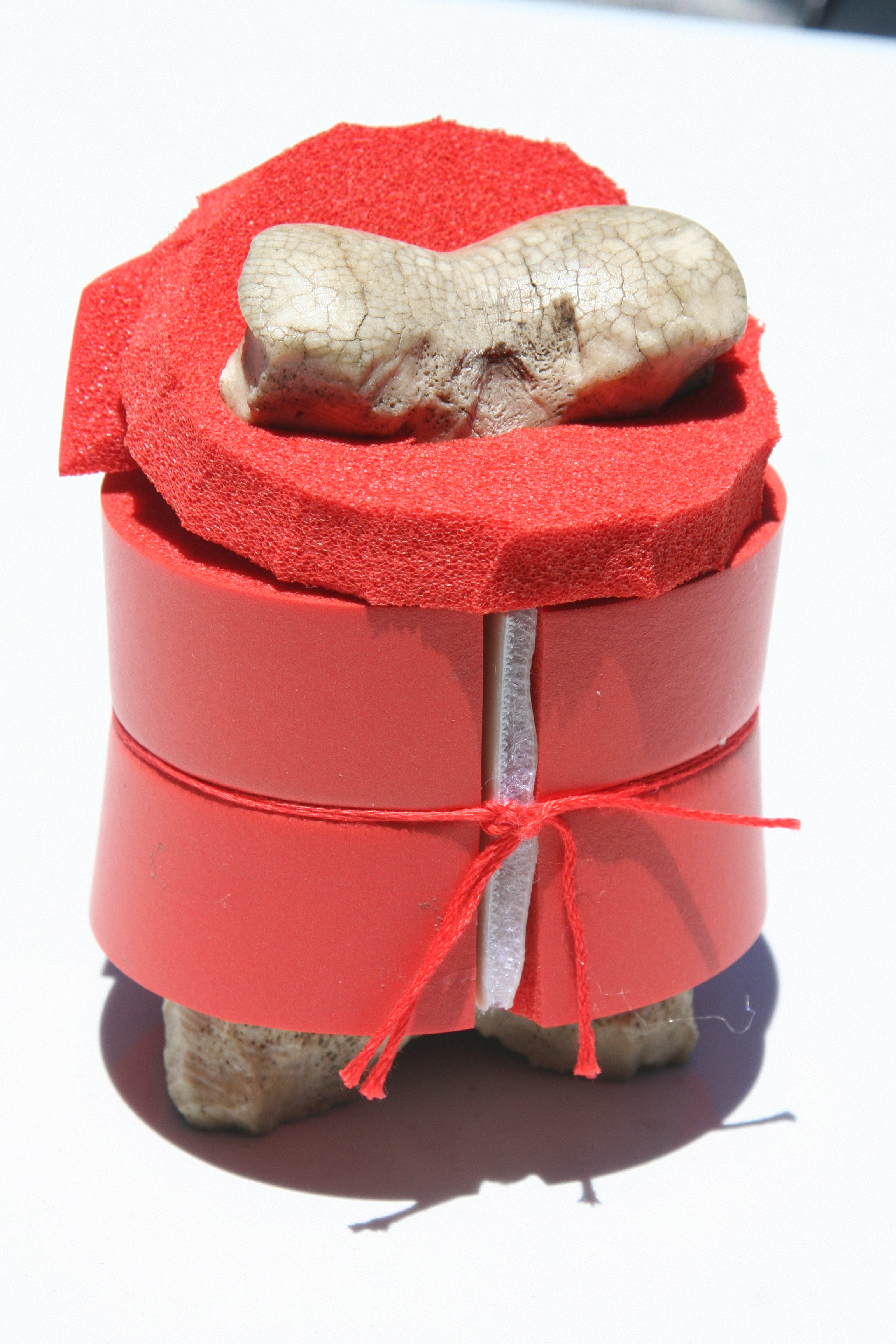
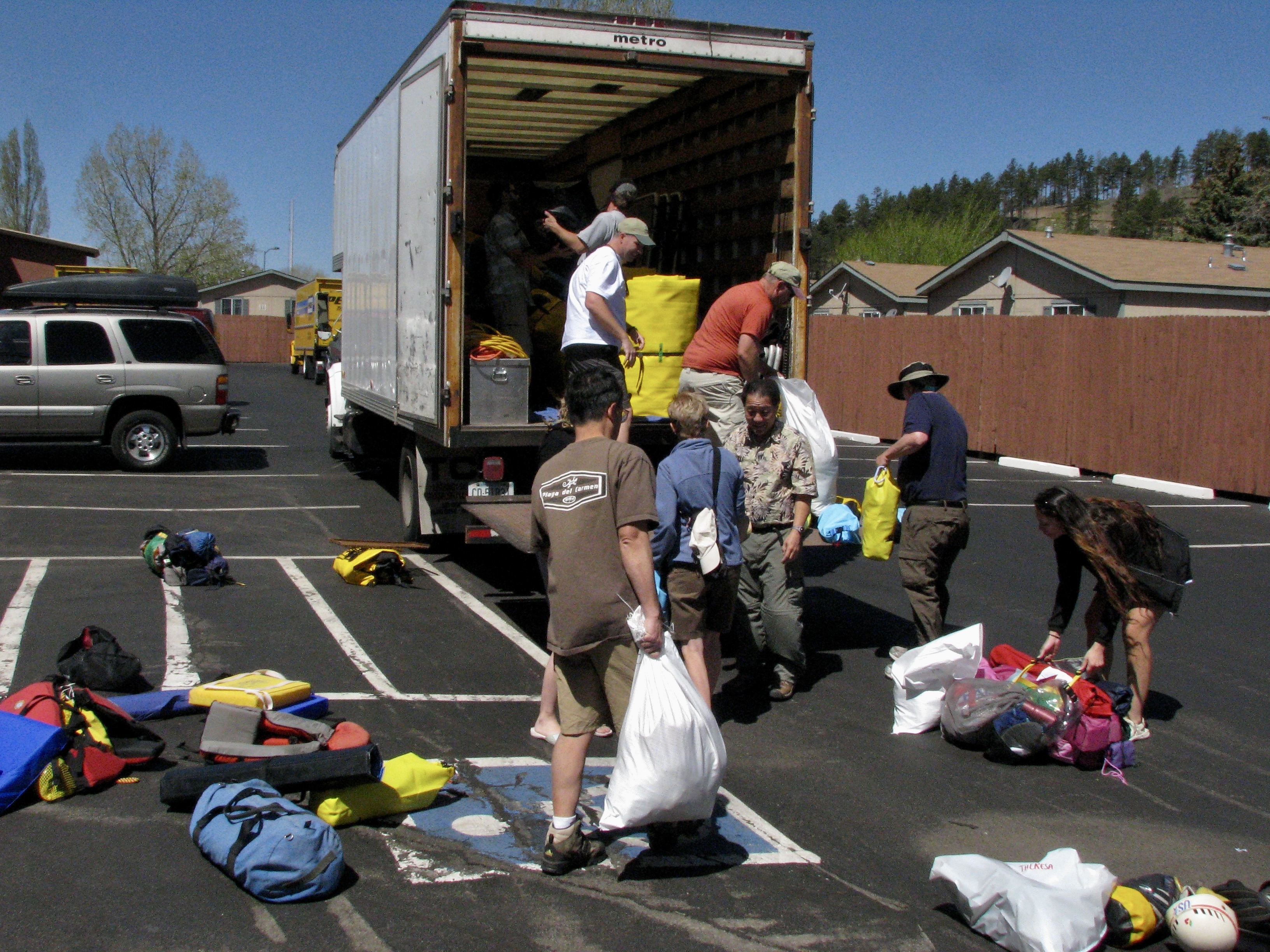
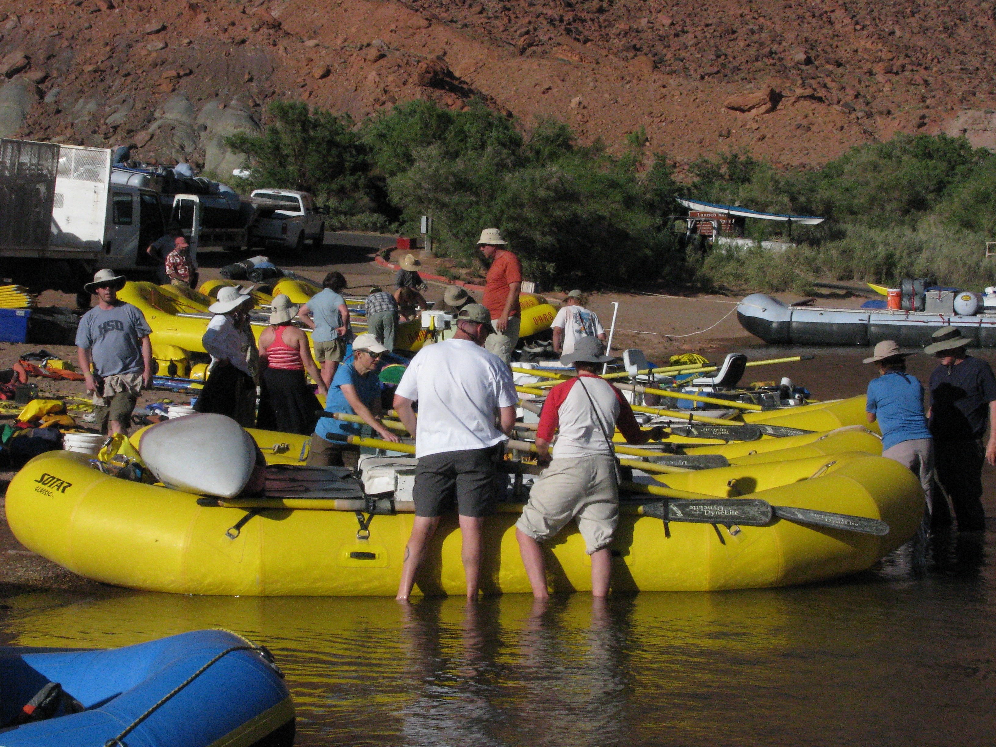
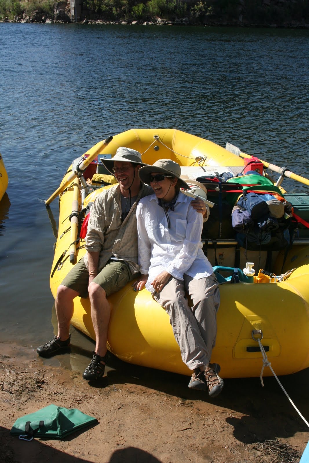
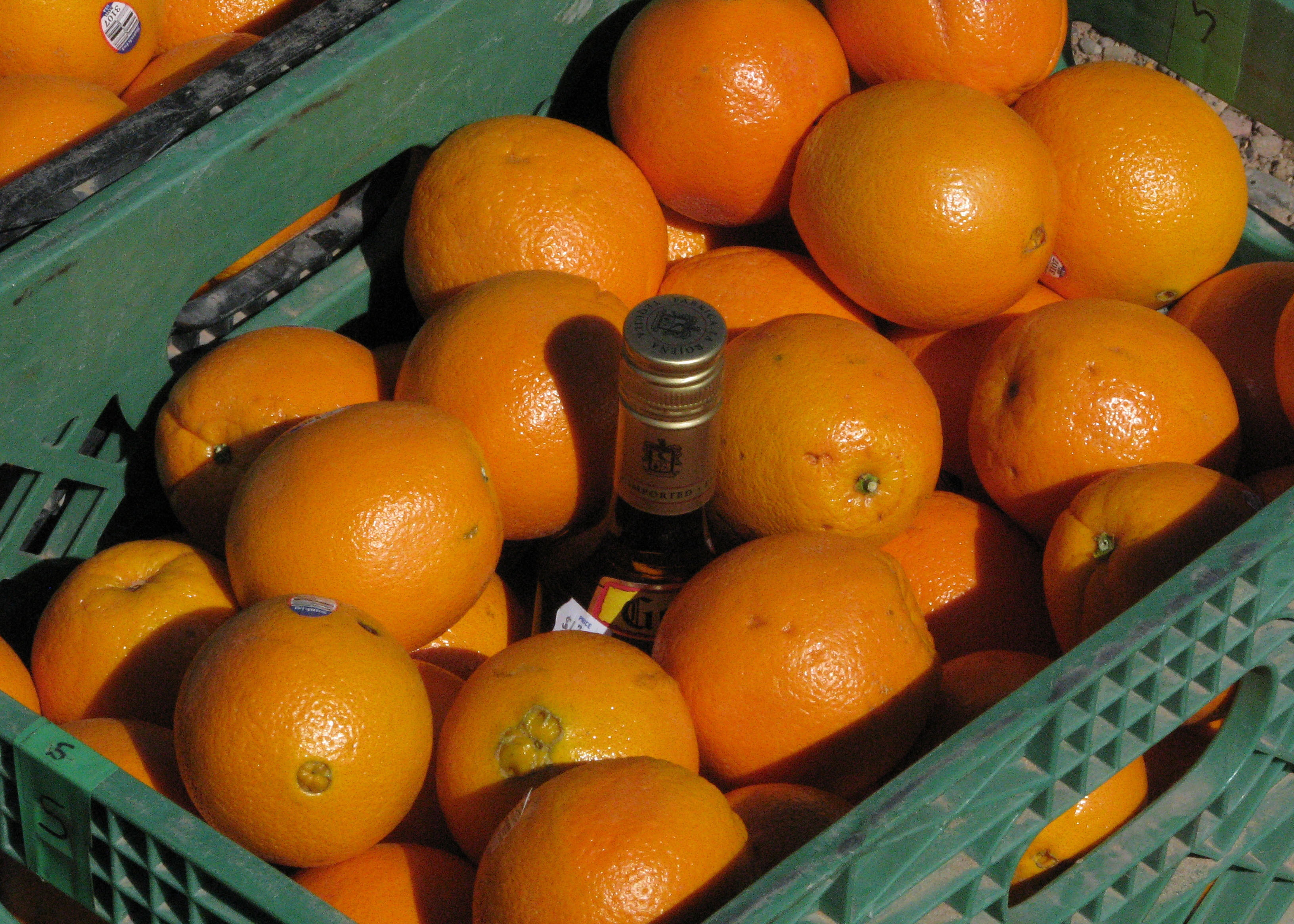
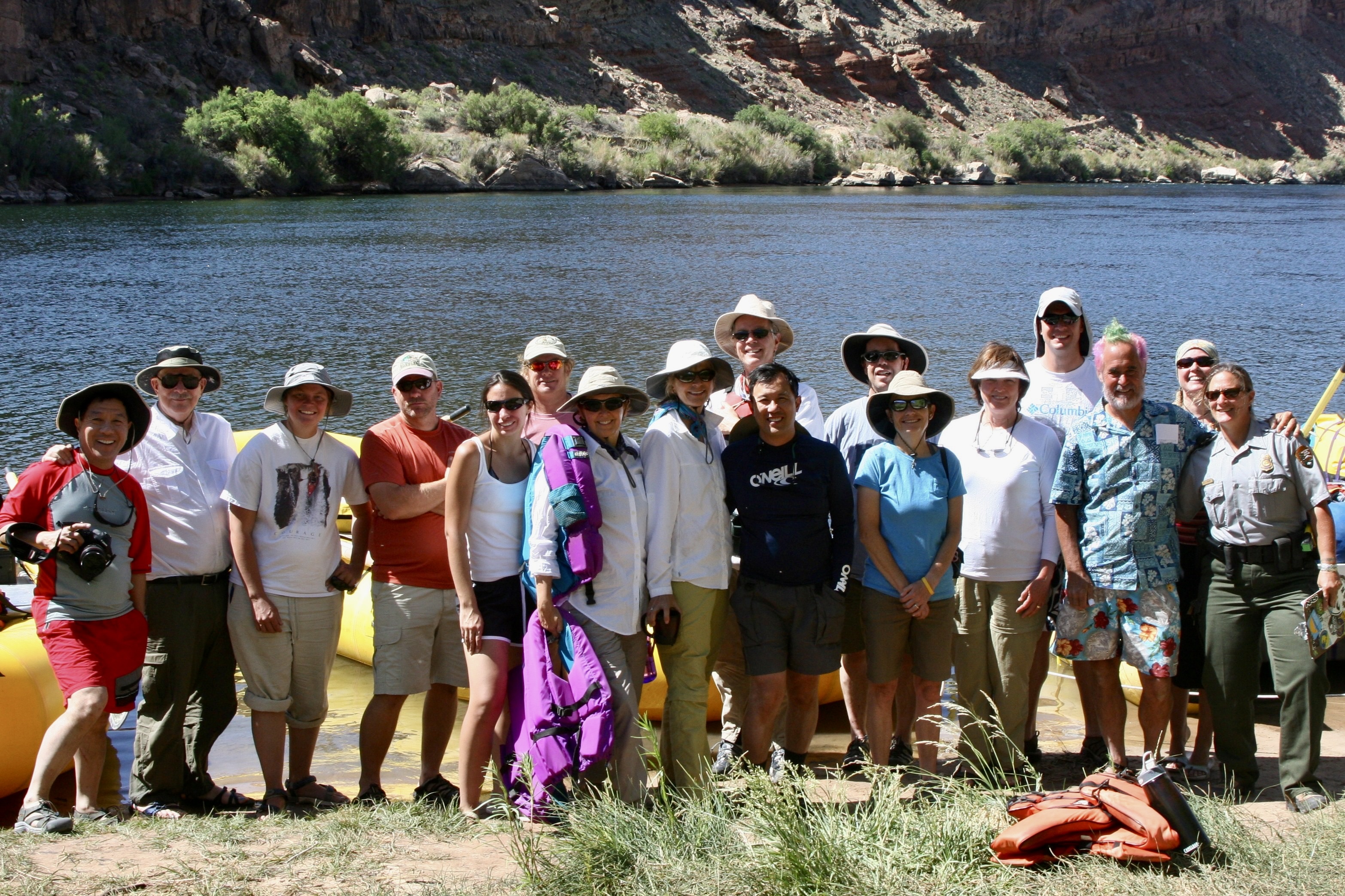
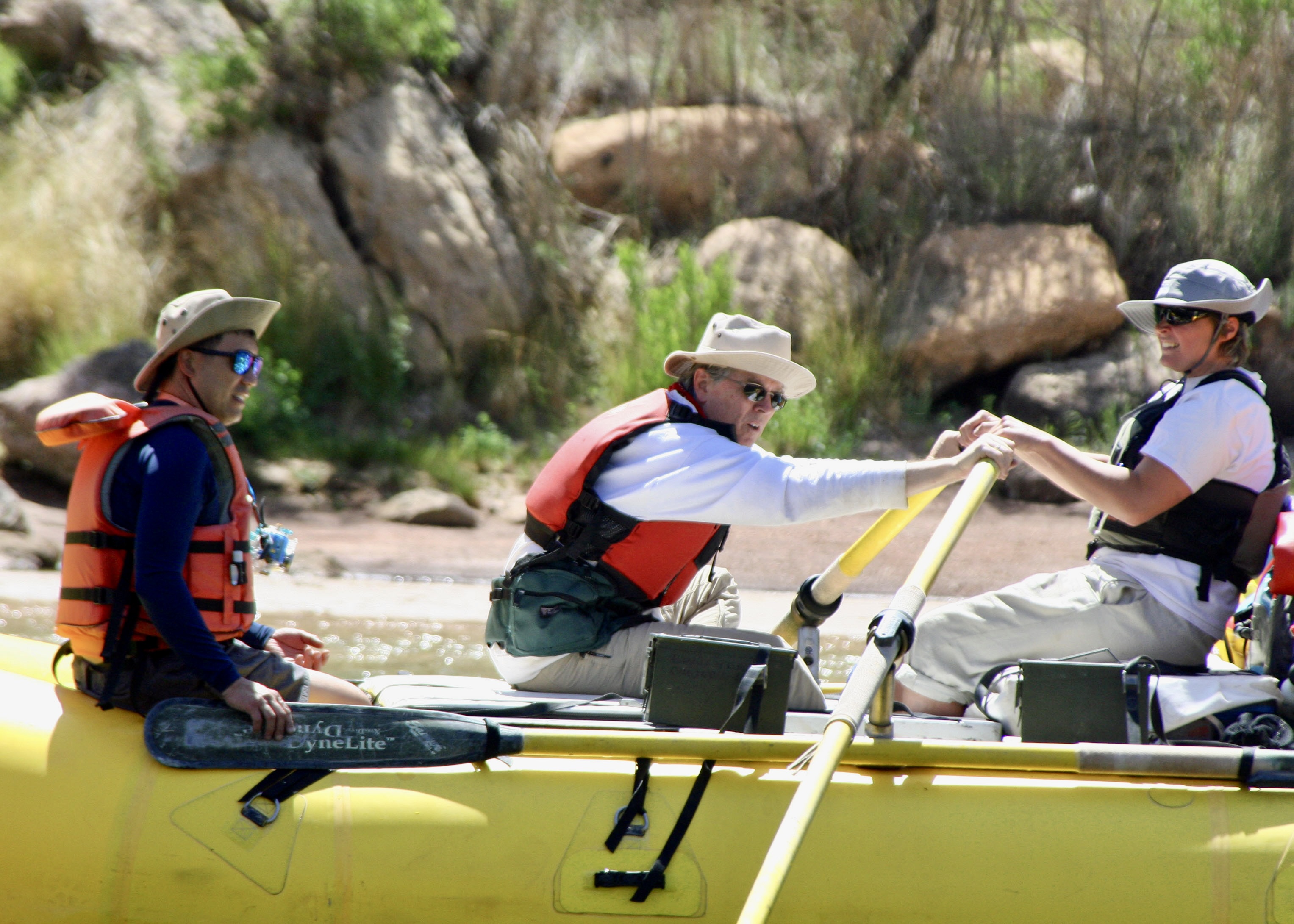
Tom had plenty to keep him busy in preparation for the trip. Finding qualified raftsmen and women was first up. The Park insists. Running the river is no joke. There are world-class rapids to negotiate. Food was another major item. River runners have a tradition of eating well, if not gourmet. He had a total of 54 meals to plan. Tom and his partner bought the nonperishables before coming. We bought the rest when we joined him in Flagstaff, Arizona, our base for the trip. Between Costco and Safeway, we packed our 22 foot Pleasure Way Van, twice.Tom and I in Flagstaff getting ready to go on the trip in 2010. Do I appear a little dubious?Large, specialized containers were required for the food. Each was labeled for what it would contain.Huge ice chests were necessary to keep perishable food cold for the 18 day journey. Our room had been the central storage point for food. Minus the Kettle Corn, the bed was covered with our camping gear for the trip. It would soon find its way into a large, waterproof dry sack. Things we would need during the day went into ammo cans like the yellow one on the right.Tom had other responsibilities as well. He’s getting his new “do” here, coloring his hair for the trip. Roald Dahl is one of his favorite authors. Tom likes weird, a trait I share. But coloring my hair isn’t one of them. Neither is painting my toenails.The results.One thing we were required to do was paint our toenails. River lore is it protects you from flipping your raft in rapids. “I won’t let you on my boat unless they are painted,” Tom warned ominously. I painted two of mine on each foot. We didn’t roll over in Tom’s boat when we went through a major rapid. But he did lose an oar. I might have felt guilty but it’s rumored that Tom travels through life without an oar. We had one more major responsibility: Get Bone ready for the trip. Tom and I had discovered him hanging out in the Sierra Nevada Mountain Range in 1977 and he has been wandering around with us and others ever since. He had to have a life vest. Finally everything was packed and the participants had arrived. We loaded the truck to the brim with what seemed like a ton of equipment, drove over to our starting point at Lee’s Ferry and unloaded the truck, all in 100° (38°C) plus weather. My body had some unpleasant, unprintable things to say to me about being out of shape. (Photo by Don Green, one of the participants and a long time friend of ours.)Next we had a quick lesson in rigging boats and went to work. (Photo by Don Green.)Dave Stalheim and Peggy pose on Dave’s boat. Dave was to be the first boatman that we traveled with. Dave came from the state of Washington where he worked as a county planner. The plan was to ride with different boatmen each day. Protocol involved that we ask for a ride and help in loading and unloading the boat.A bottle of tequila was slipped in among the oranges. It would be saved for drinking at Tequila Point, just below Lava Falls, where it would be needed! (Photo by Don Green.)That night we moved a couple of hundred yards down from where we had rigged and loaded the boats to a campground I had found. We went out for dinner and came back to a major wind and dust storm that was whipping our tents around and making them difficult to find. With the heat, wind, and dust, I was reminded of our trips to Burning Man. Here we are, ready to begin our adventure. Ranger Annie is down on the end. She’d been by the day before to check our gear. When Tom introduced me as the ticket holder, I commented, “We have an excellent leader in Tom.” She had looked at me steely eyed and said, “You are responsible.” My muttered response was, “I’ll try to keep Tom in line.” Yeah, like that’s possible. She came back that morning to remind us of all the safety and environmental rules.
That’s it for the preparations. Now the ‘fun’ begins. The wind was back! We spent our first day fighting headwinds with gusts up to 60 miles per hour. If my dreams of a leisurely float down the river hadn’t already been demolished, they were now. We actually took turns with our boatmen rowing double. All of the photos were taken by either Don, Peggy, or me. I’ll note which ones are Don’s.
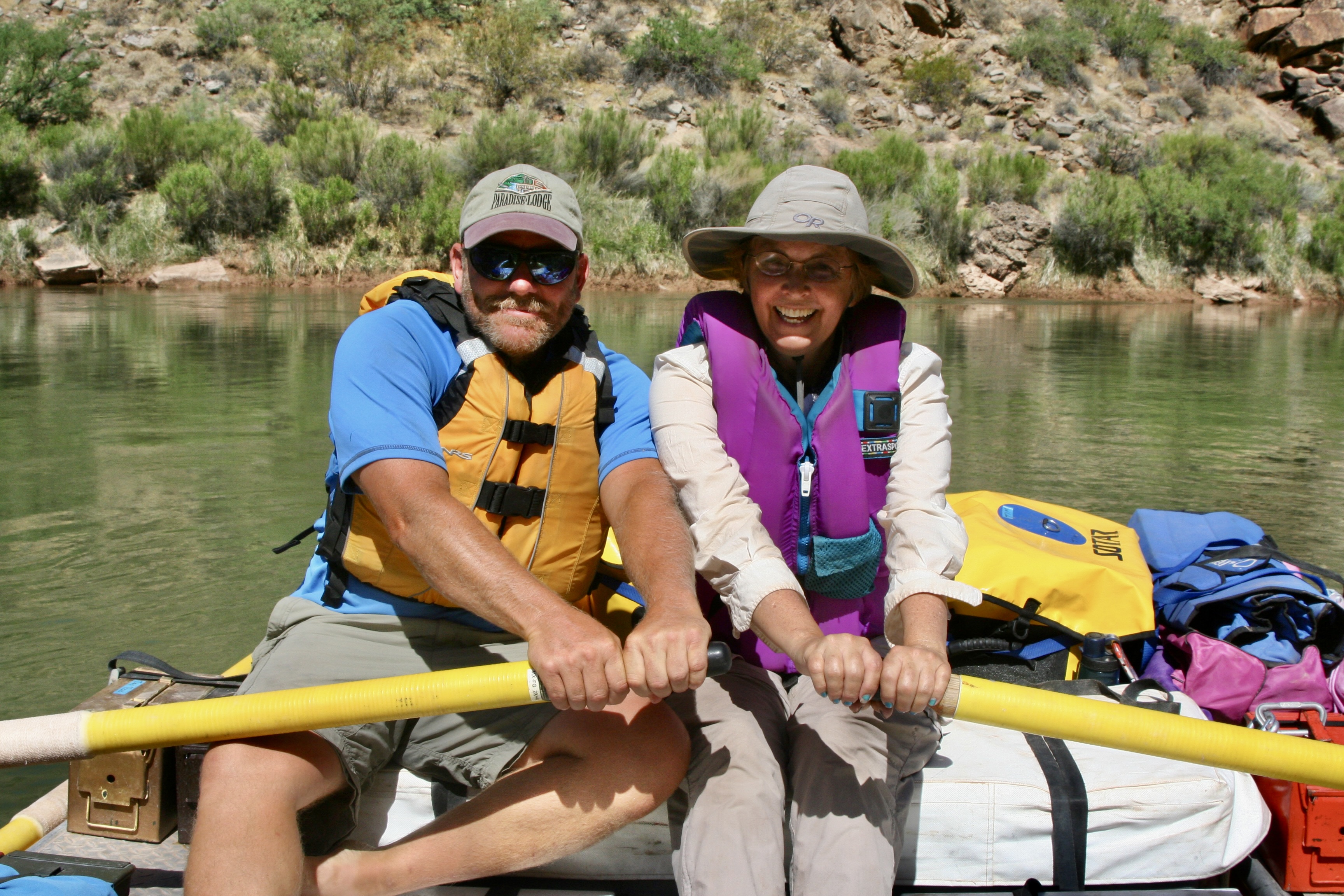
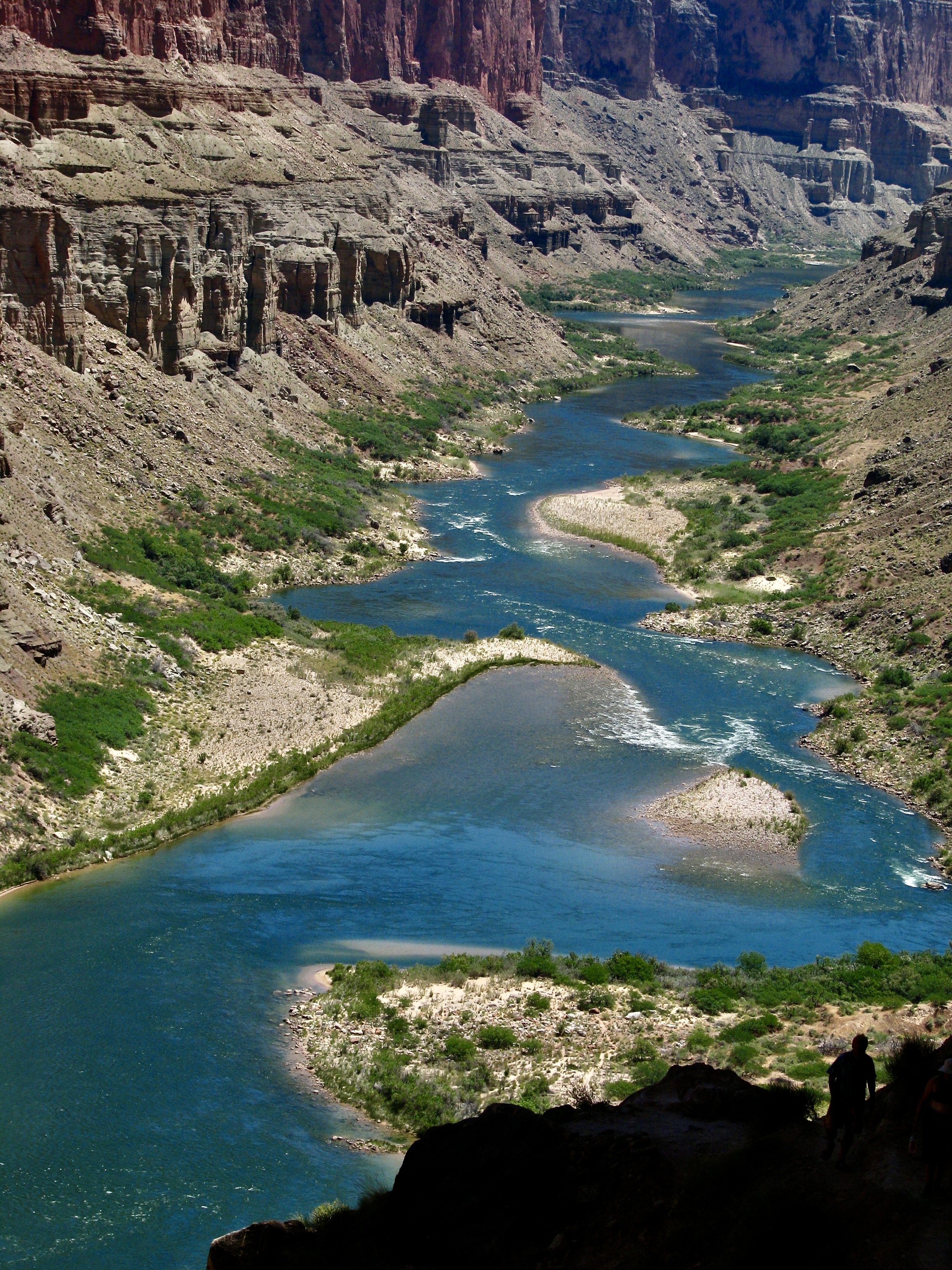
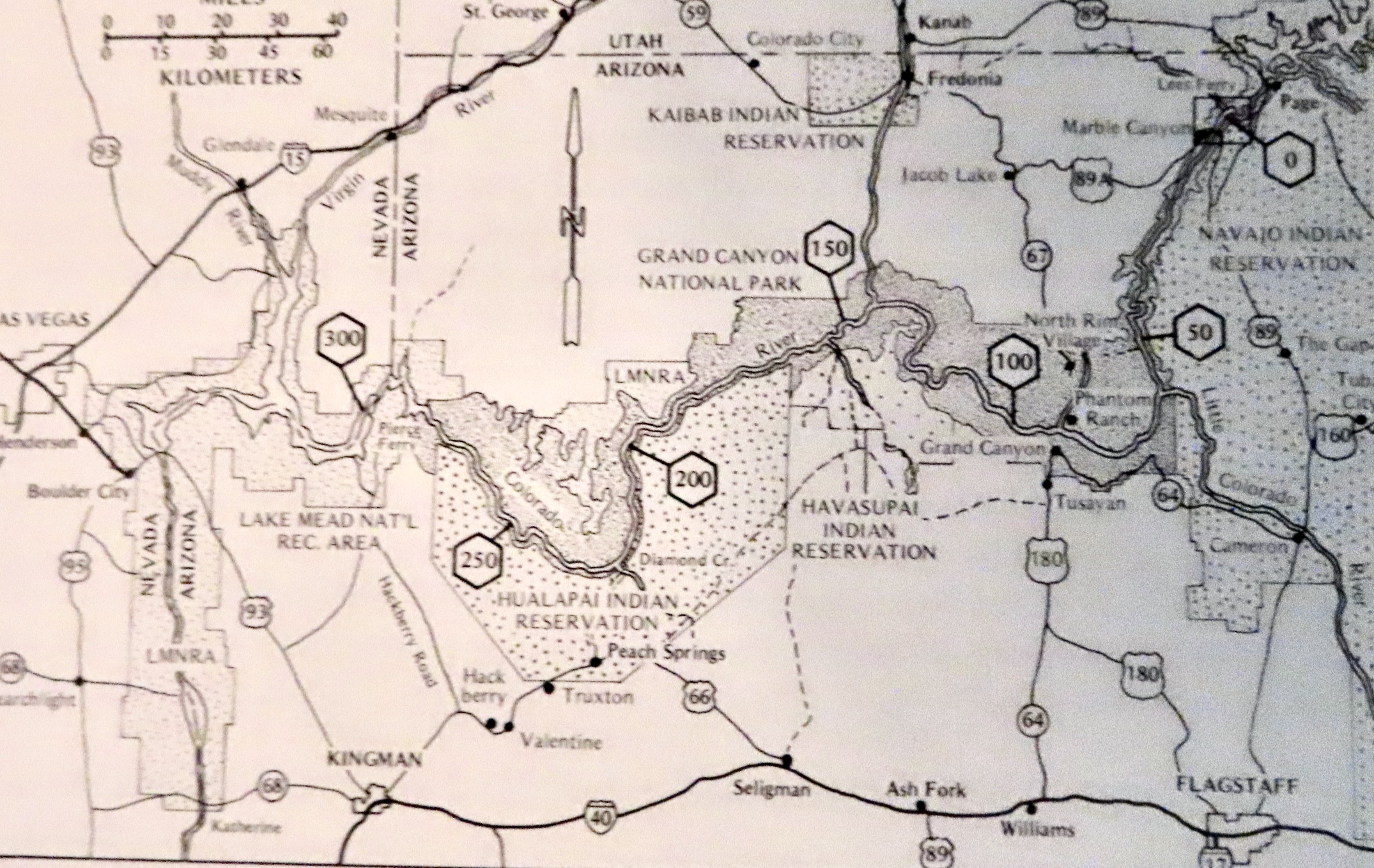
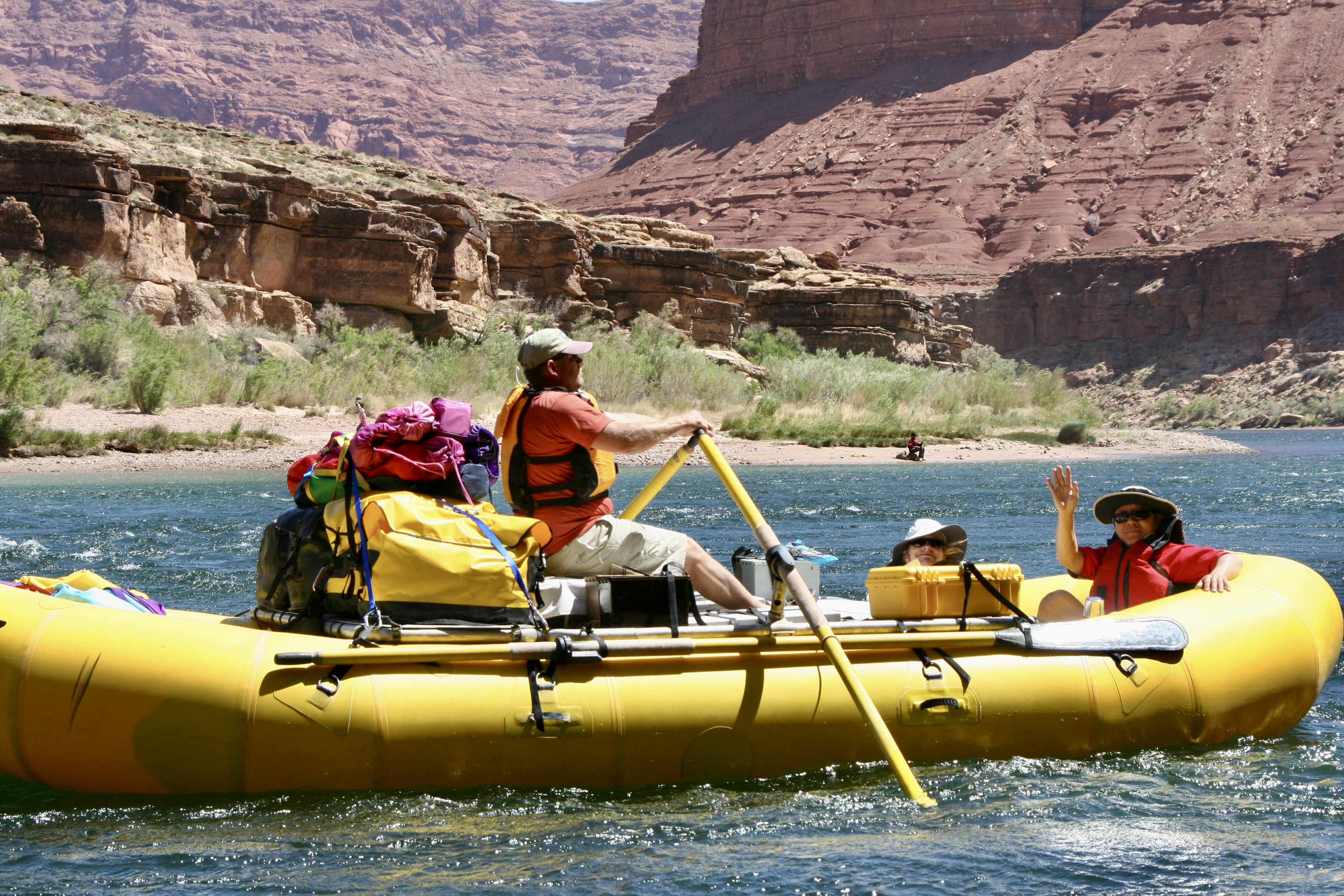
This map, which I took from the book The Colorado River in the Grand Canyon, an excellent guide by Larry Stevens, isn’t as clear in reproduction as I would like but still serves as a good reference for this and my next two posts. Our journey over 18 days would take us 280 miles down the Colorado River from mile 0 at Lee’s Ferry to mile 280 at Pierce Ferry, just this side of mile 300 at the beginning of Lake Mead. We finished putting the trip together in Flagstaff (lower right) and then followed Highway 89 up to Lee’s Ferry (upper right).Don Green and boatwoman Megan Stalheim double rowing to counter the strong head wind. Megan is David’s niece and, like me, was a former Peace Corps Volunteer in Africa. While rowing a raft was a new sport for Megan, her experience as an Olympic level white water kayaker gave her excellent knowledge of how to read and run a river.This photo of boatman Jame Wilson is a good example of what our fully loaded rafts looked like.
My post next Monday will take us from Lees Ferry to just below Phantom Ranch. Thursday is Halloween, however, and Peggy and I have a special treat for you, a tour of Dracula’s castle in Transylvania that we visited 2 1/2 weeks ago on our Danube River trip.
Clouds roll in threatening rain along the Danube River. Fortunately, the weather gods were kind to us. The river had flooded the week before our arrival due to heavy downpours upriver.
Today marks the beginning of our Great River series. The inspiration for it is our trip down the Danube from Vienna to the Black Sea that we just finished while traveling with Peggy’s brother John and his wife Frances.
Along the way, we traveled through Austria, Slovakia, Hungary, Croatia, Serbia, Bulgaria and Romania, all countries that I had never visited except Croatia. (Peggy had been to Austria, as well: Way back in BC…As in before Curt.) Other than the Romanian apple that got us in trouble with US Customs and a cold I picked up and undoubtedly shared along the way, our trip in a riverboat with the GoHagan travel company was quite good.
Knowledgeable (and often humorous) local guides led us on tours through cities, towns, churches, castles, and palaces while providing historical background that ranged from Mongol and Turkish invasions, to the Austro-Hungarian Empire, to the Russian Communist occupation following World War II.
We watched horses prance, people dance, and consumed at least three times as much food as we usually do. An ancient village with roots going back 5-6 thousand years and the beauty of the Carpathian Mountains of Romania/Transylvania wowed us.
Dracula/Vlad the Impaler called the Carpathians home. While we found the Impaler’s castle fascinating, I think Peggy was more excited to discover that the Cantacuzino Castle (where we stopped for lunch) serves as the site for the Nevermore Academy of the Netflix series Wednesday, a take-off on the TV series, TheAddams Family, of yore. How much does she like the series? Well, she has binged on it. More than once. Her scream of delight when she saw a sign promoting the castle as the series’ location led everyone on the bus to turn and look at her. I felt like I was married to a smitten teenager.
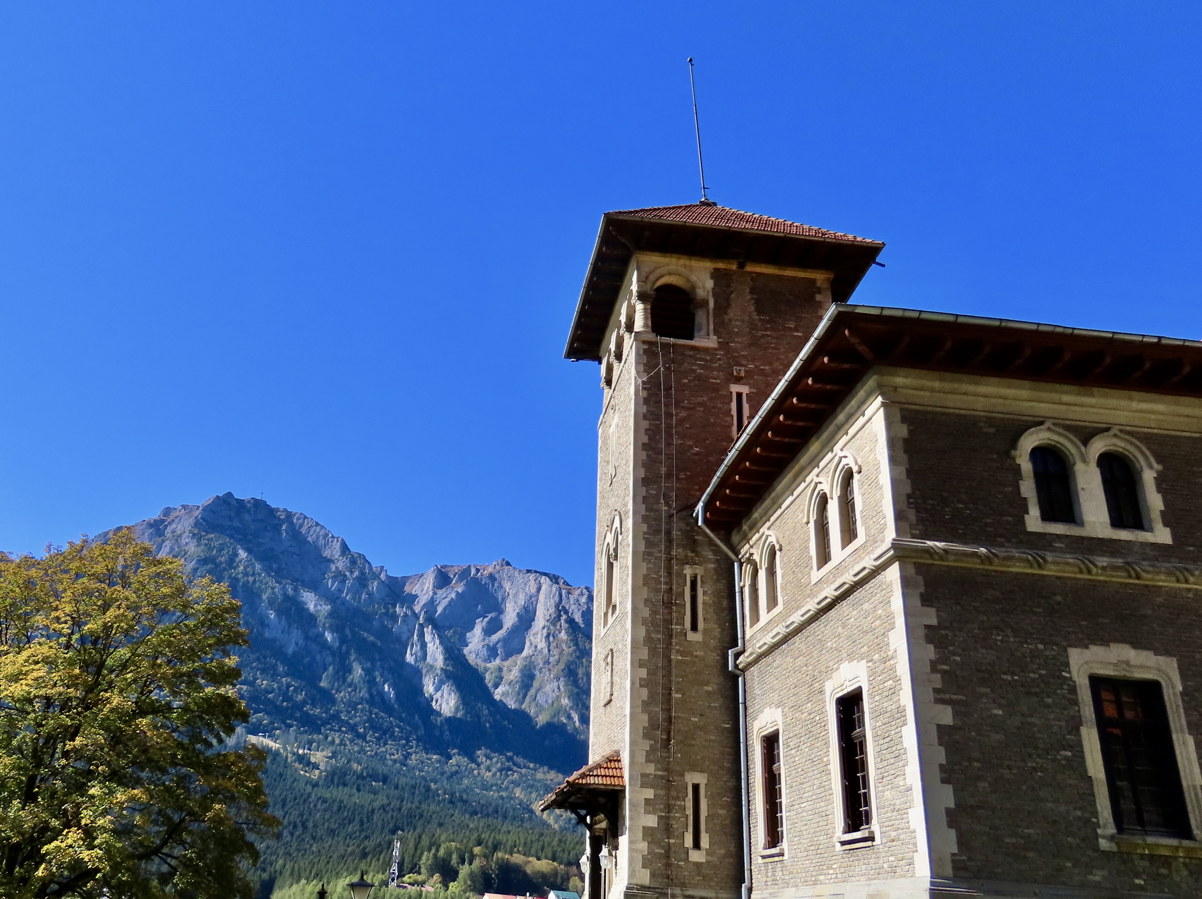
The Cantacuzino Castle that serves as the as the location for the Nevermore Academy of the Netflix series Wednesday with a view of the Carpathian Mountains of Transylvania in the background. The leaves were just beginning to turn as we made our way through Romania.The castle of Vlad the Impaler, aka Dracula, in Transylvania.
One great river doesn’t constitute a series, however. And we’ve promised a series which brings up what our criteria are for defining a great river. There are the normal factors, i.e. length and volume, but I would also add history and in beauty. The Nile is a great example for history, while the Colorado River on its run through the Grand Canyon is one for beauty. Both are mind-blowing.
There is one criterion that is strictly ours: We have to have floated on the river. For example, Peggy and I have crossed the Mississippi, Missouri, and Columbia Rivers numerous times from their headwaters to where they flow into the ocean. But our only personal experience has been to take photos and explore their history, with folks like Mark Twain and Lewis and Clark serving as our teachers. Peggy is known to stick a finger or toe in on occasion, however, “to test the water.”
In addition to the Danube, the series will include the Colorado, Amazon, Rhine, Nile, Zambezi, and England’s Trent and Mercy Canal— not a Great River perhaps, but Peggy and I had a blast navigating it in a 60’ long 10’ wide narrow boat, stopping at pubs along the way.
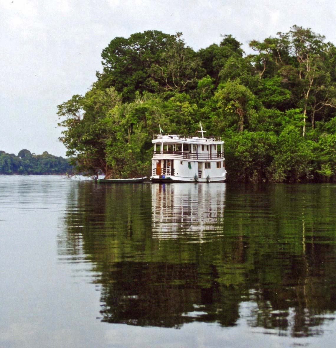
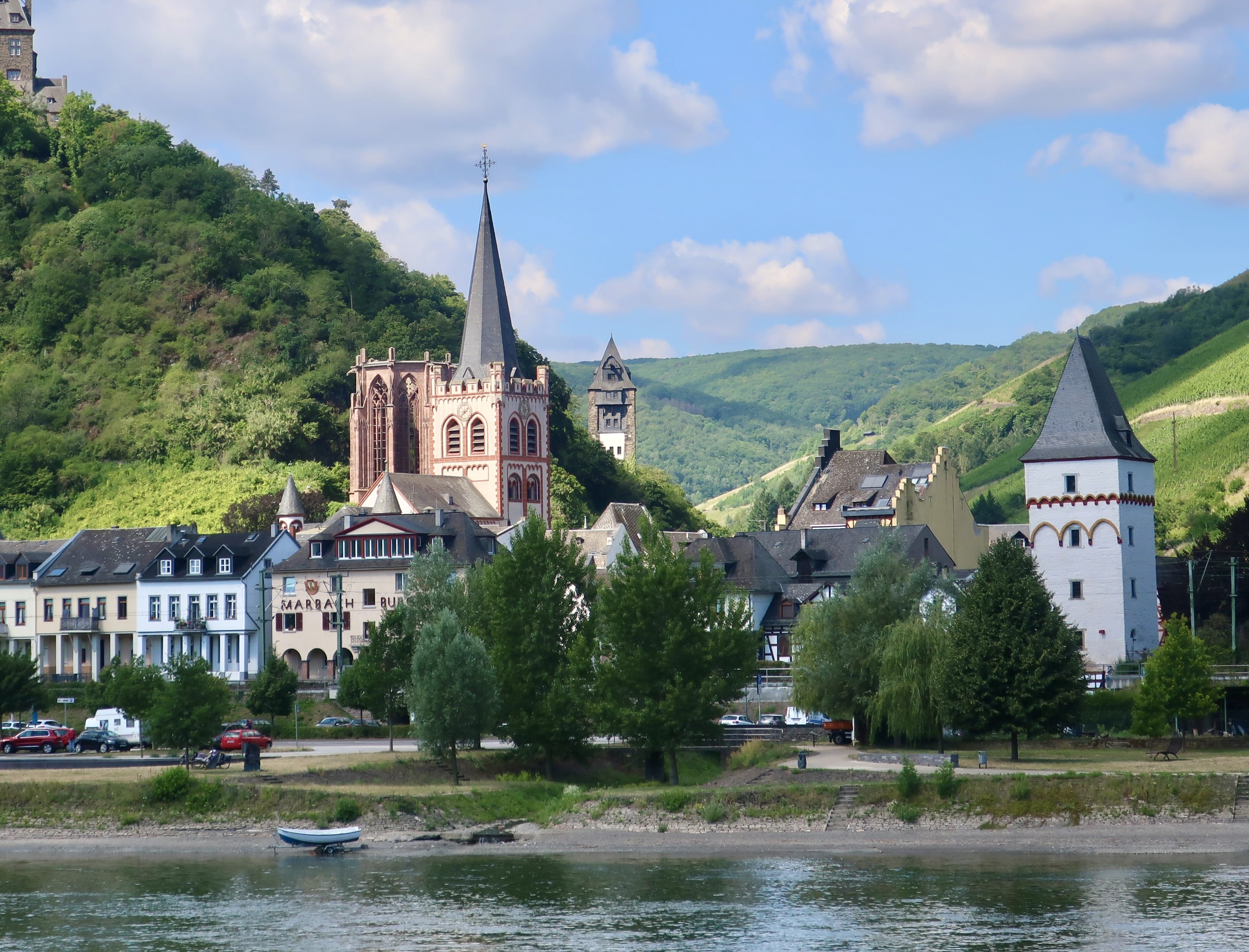
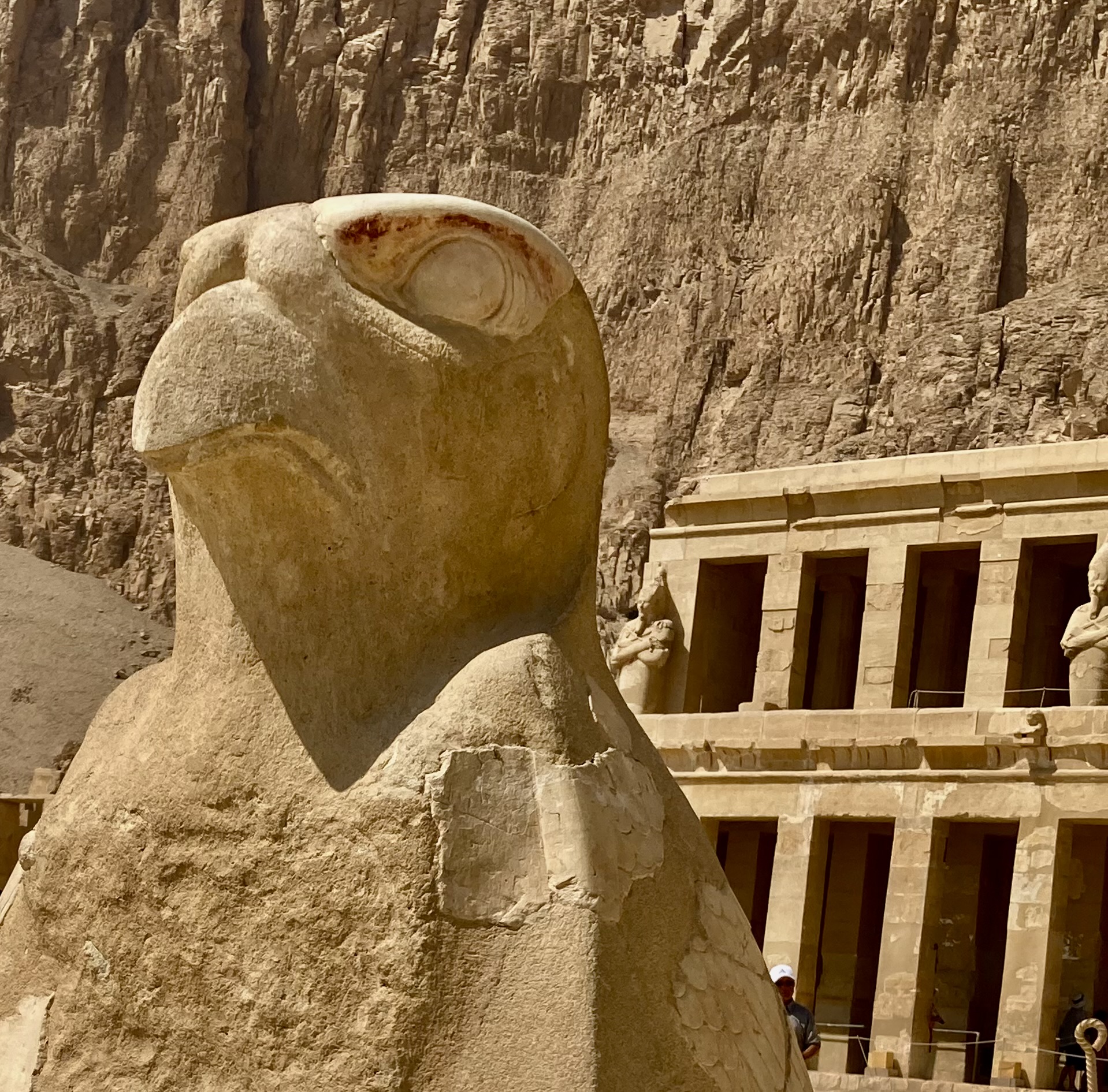
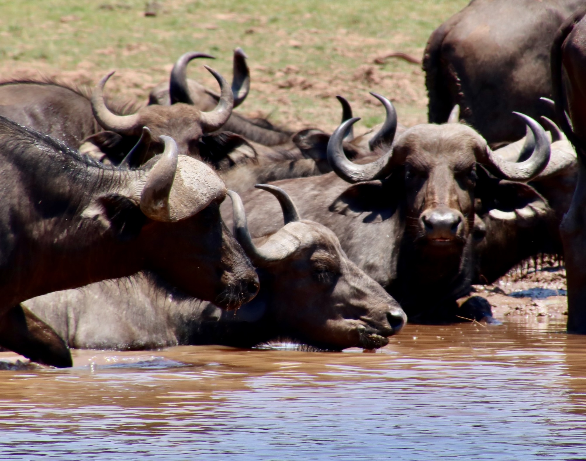
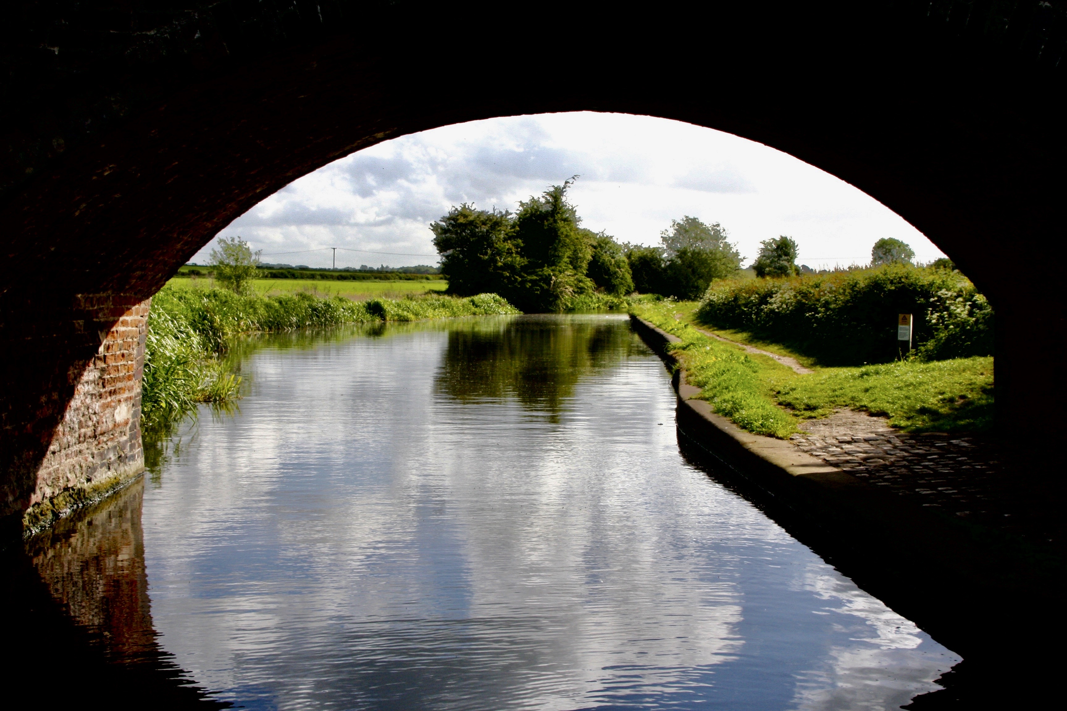
Our private 21 day trip through Grand Canyon National Park by raft was filled with beauty, adventure and fun.We explored the Amazon River out of Manaus, Brazil for a week on the Amazon Clipper, a small boat that we shared with four other couples plus crew. We dined on piranhas for dinner that night, the ones we had caught in the afternoon (carefully).Our trip up the Rhine River had it all: Charming towns, Medieval castles, towering cathedrals, bucolic countryside and history. Plus, we took our son, daughter, spouses and grandkids with us.Horus, the Falcon God of ancient Egypt in the Valley of Kings. The Nile is lined with such treasures.The Zambezi River of southern Africa brings its own magic ranging from water buffalo, to hippos, to crocodiles, to lions and numerous species of birds.An underpass on England’s Trent and Mercy Canal. “Low bridge, everybody down.” —Erie Canal song
Since we have already blogged about these experiences (other than the Danube) in the past, I’ll simply do a summary post or two on each one that focuses on photos. The Nile may include more since there were several blogs that I ran out of time to do after the trip last year.
Next week, a quick look at the incredible beauty of the Colorado River through Grand Canyon National Park. After that, we will start on the Danube.