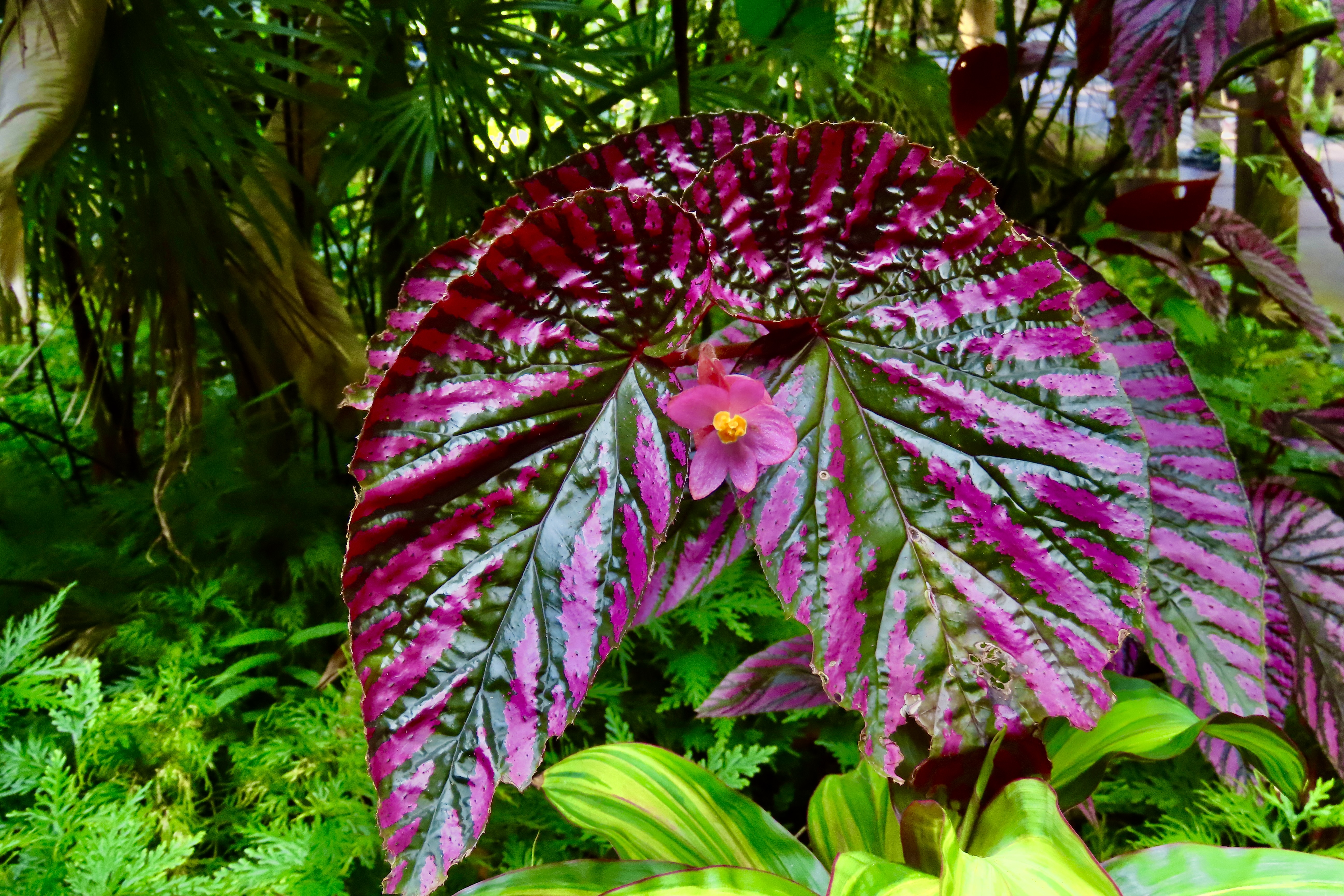
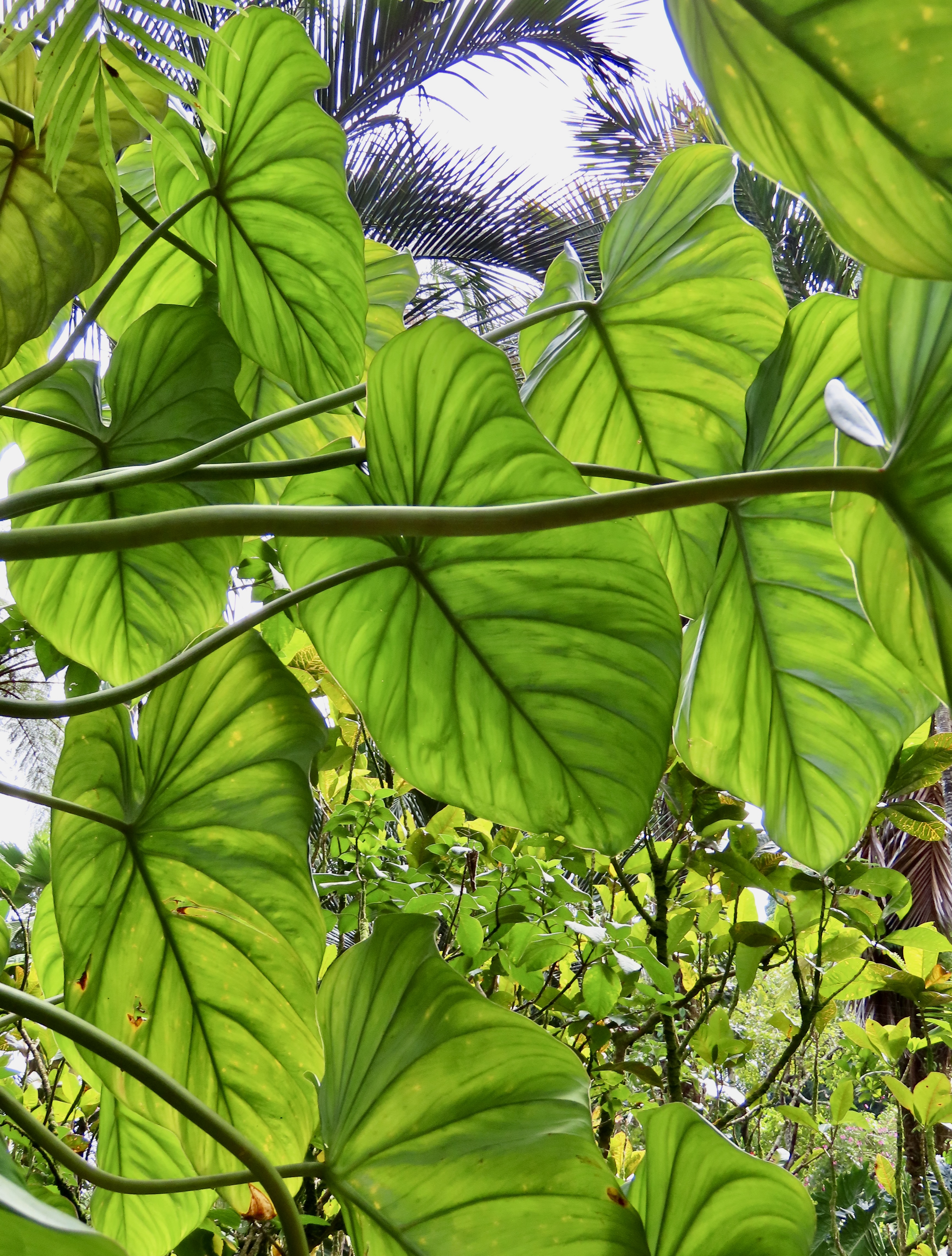
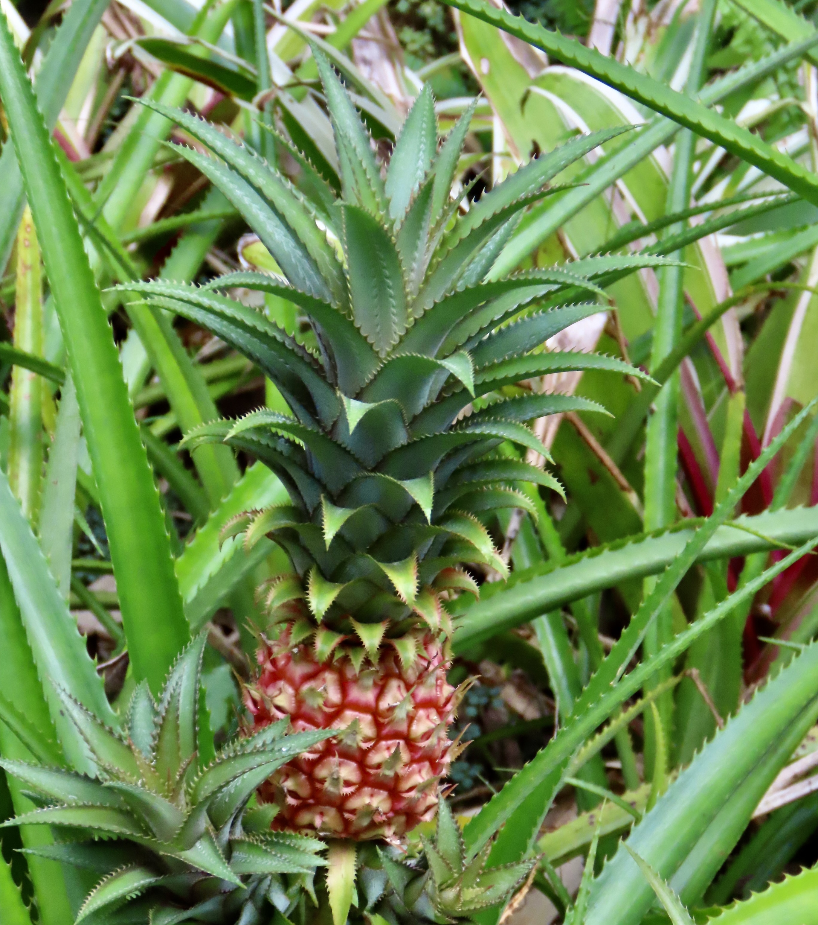
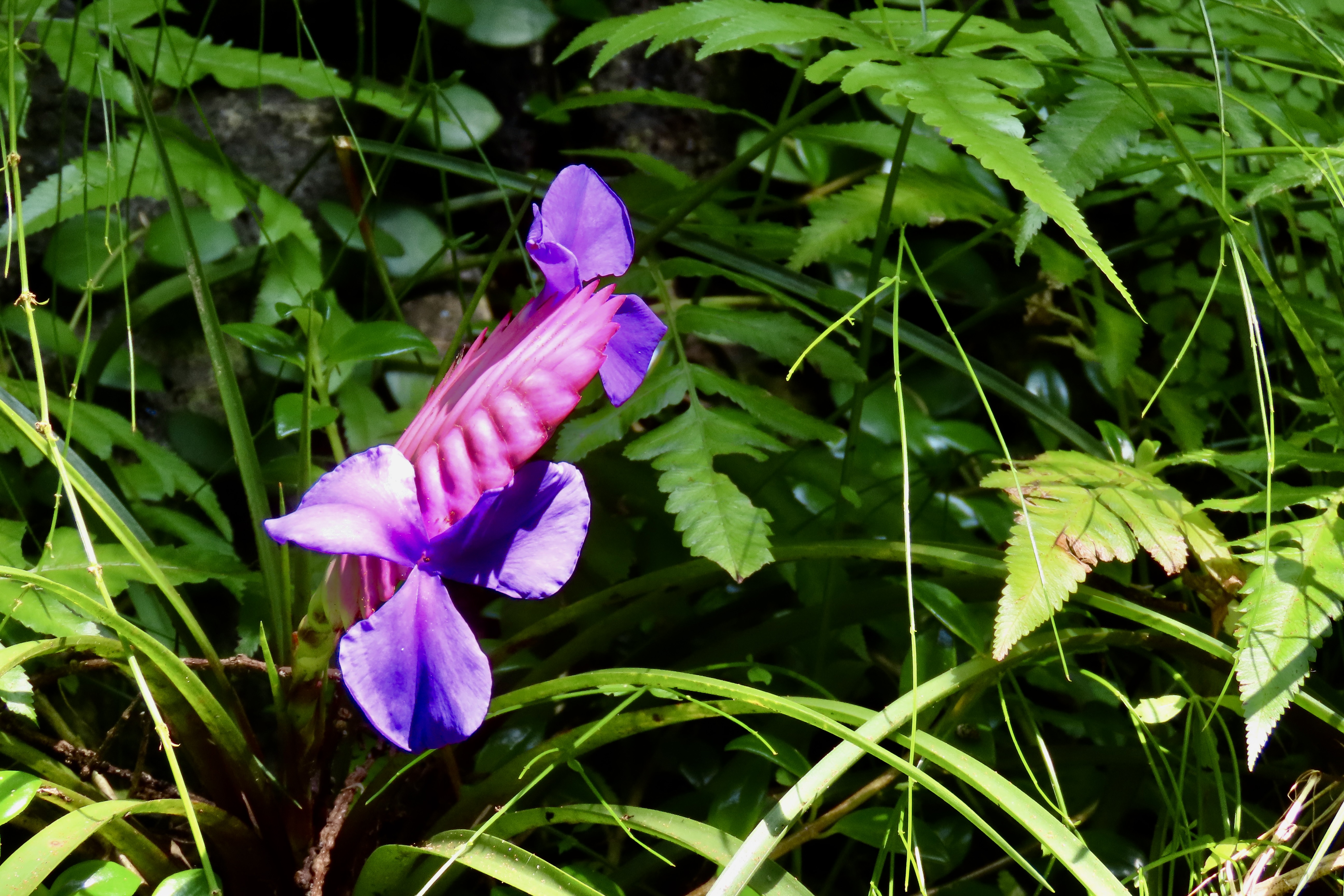
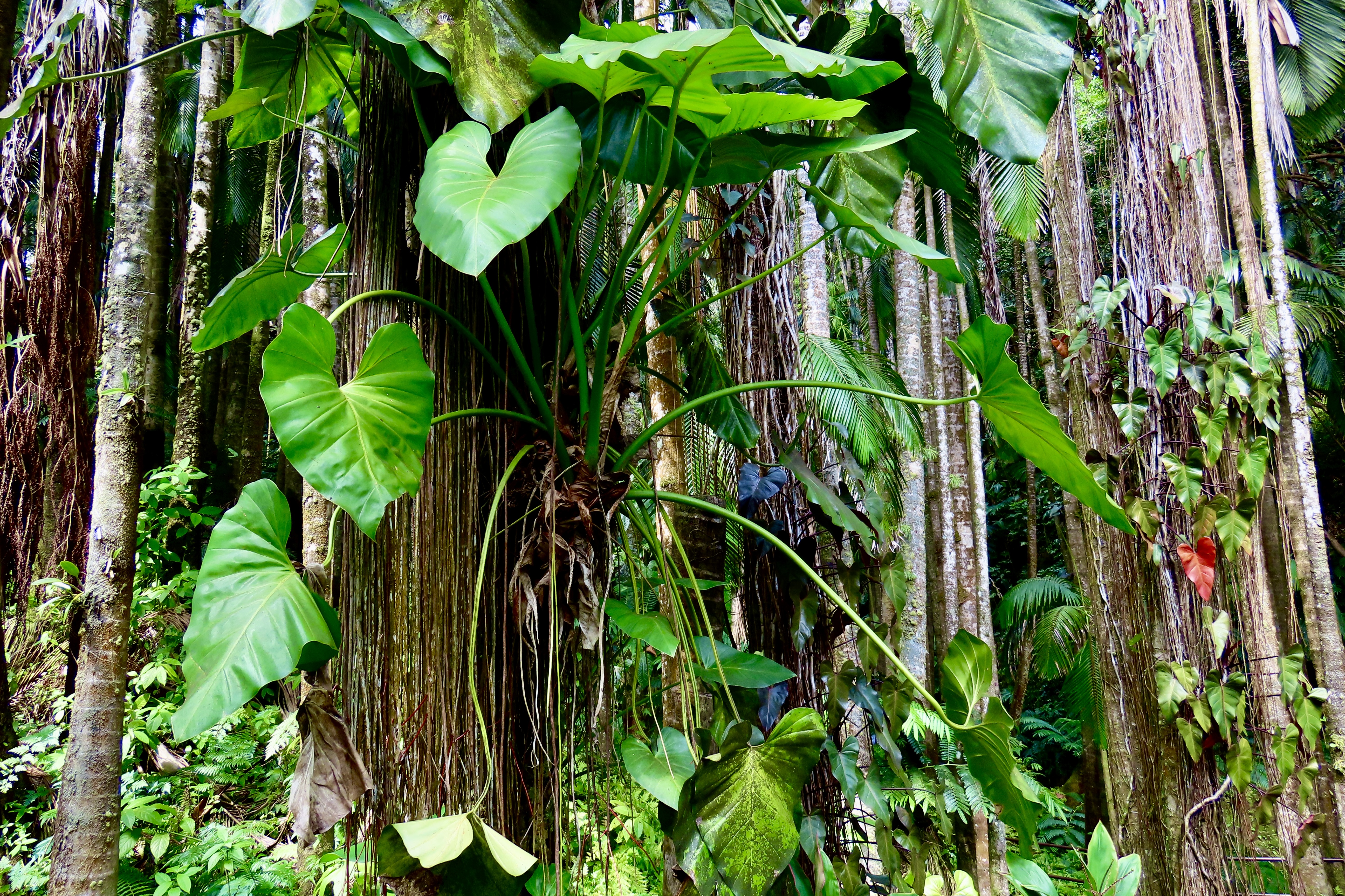
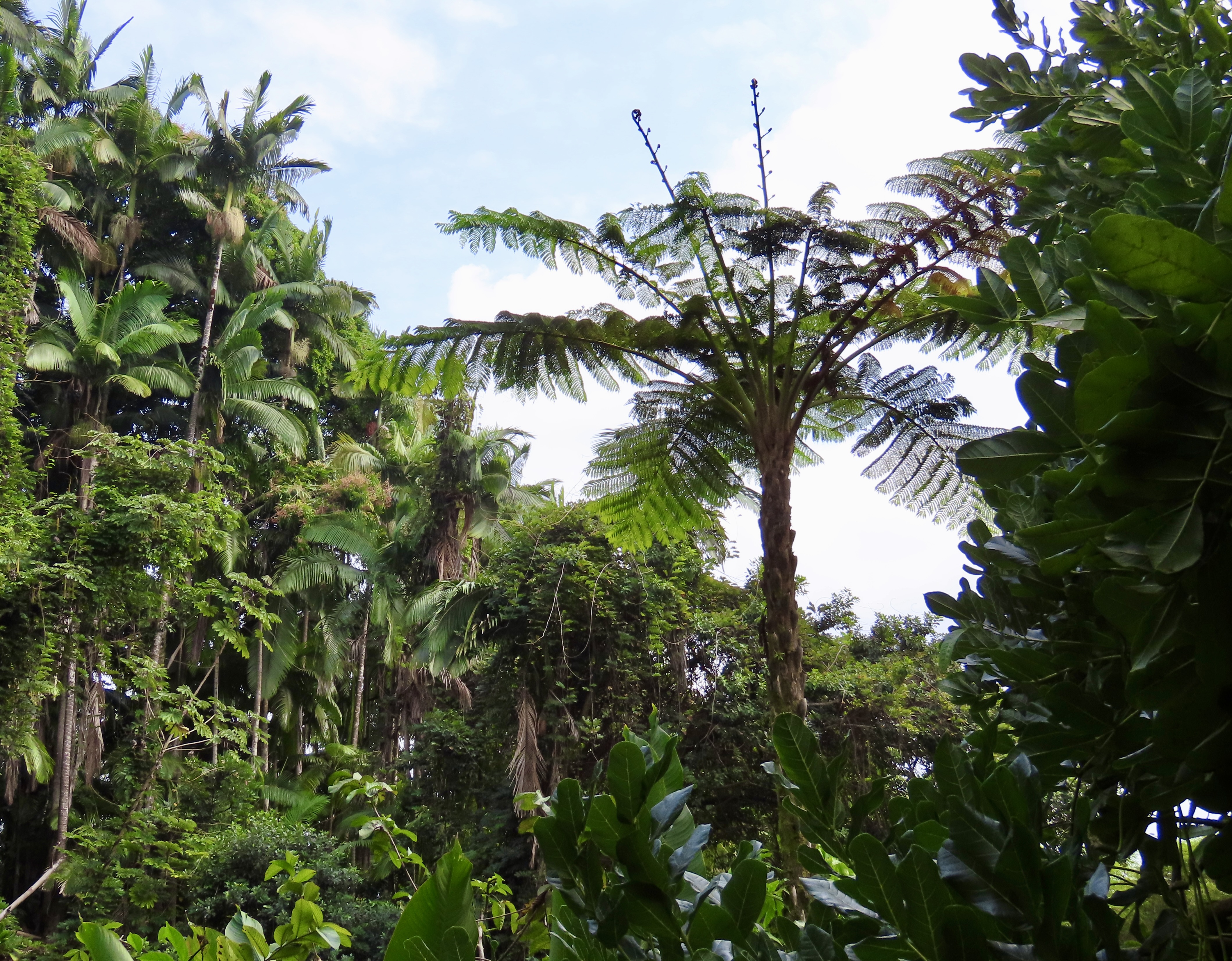
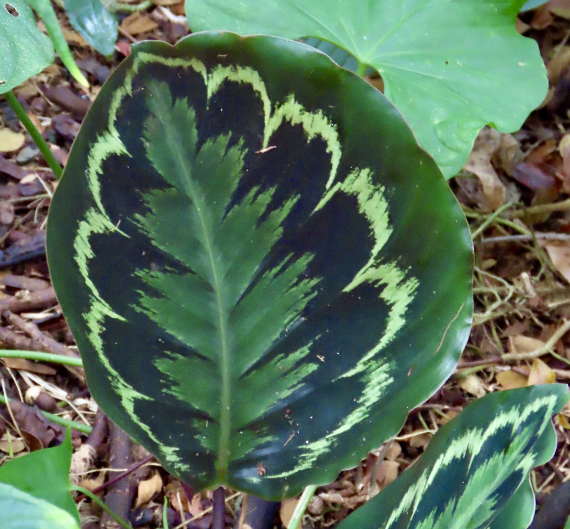
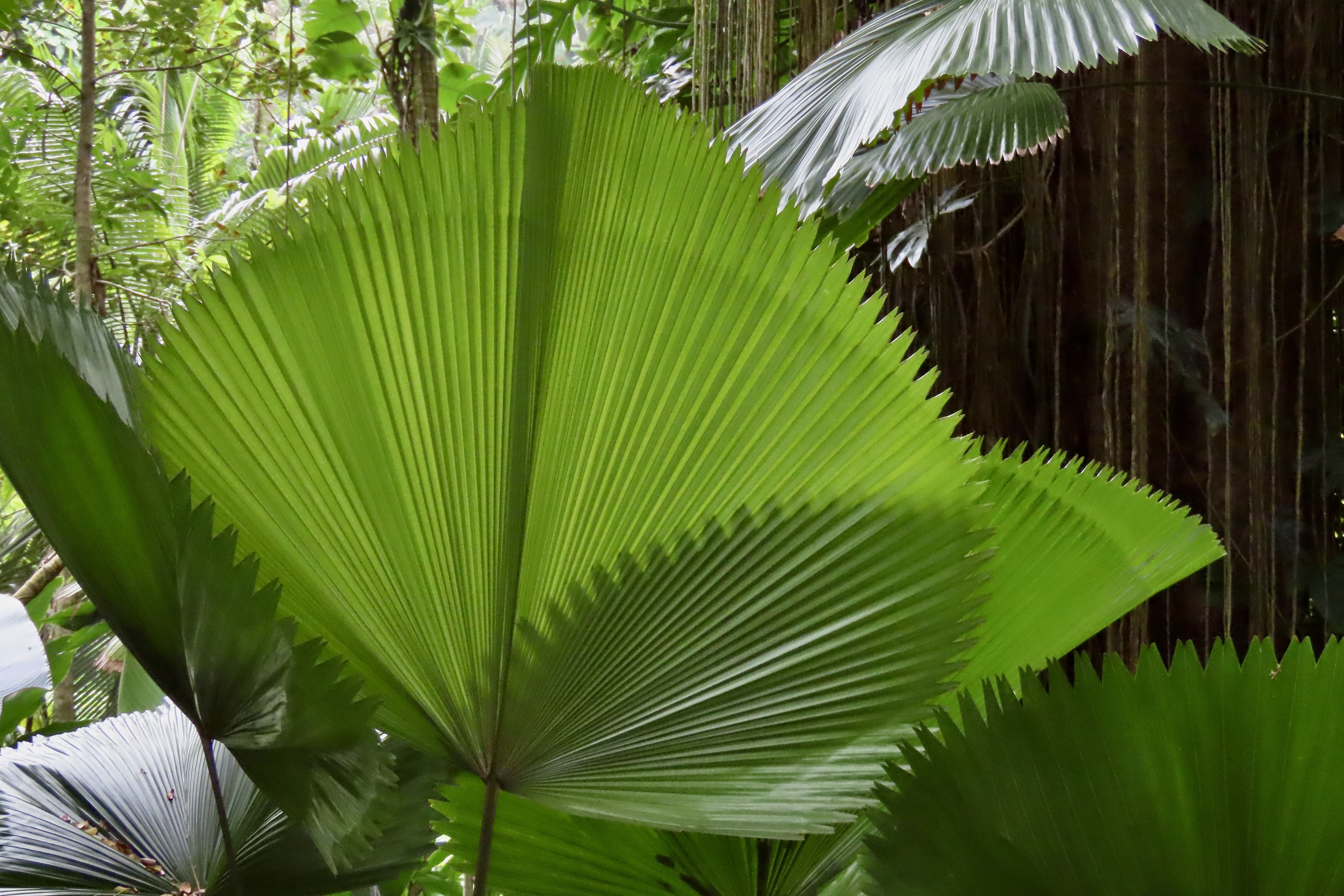
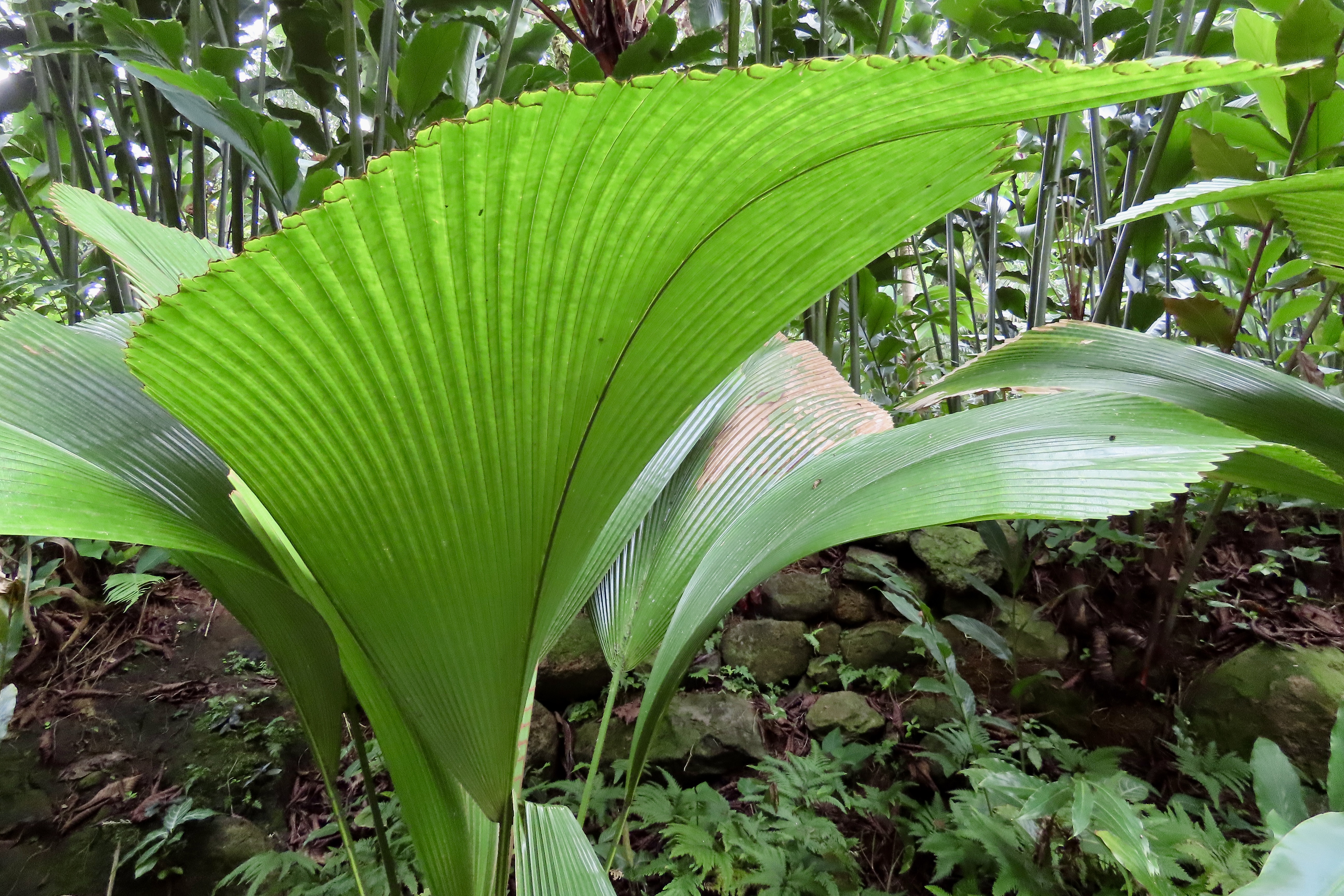
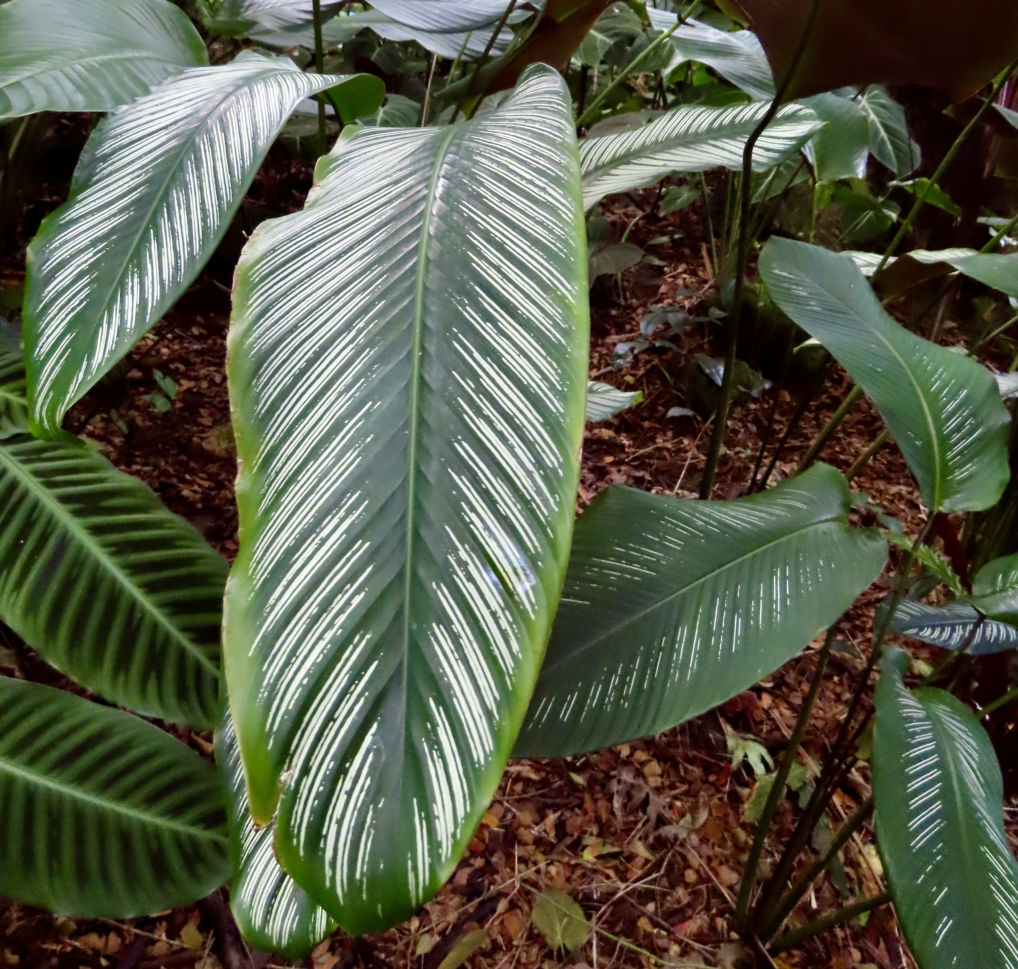
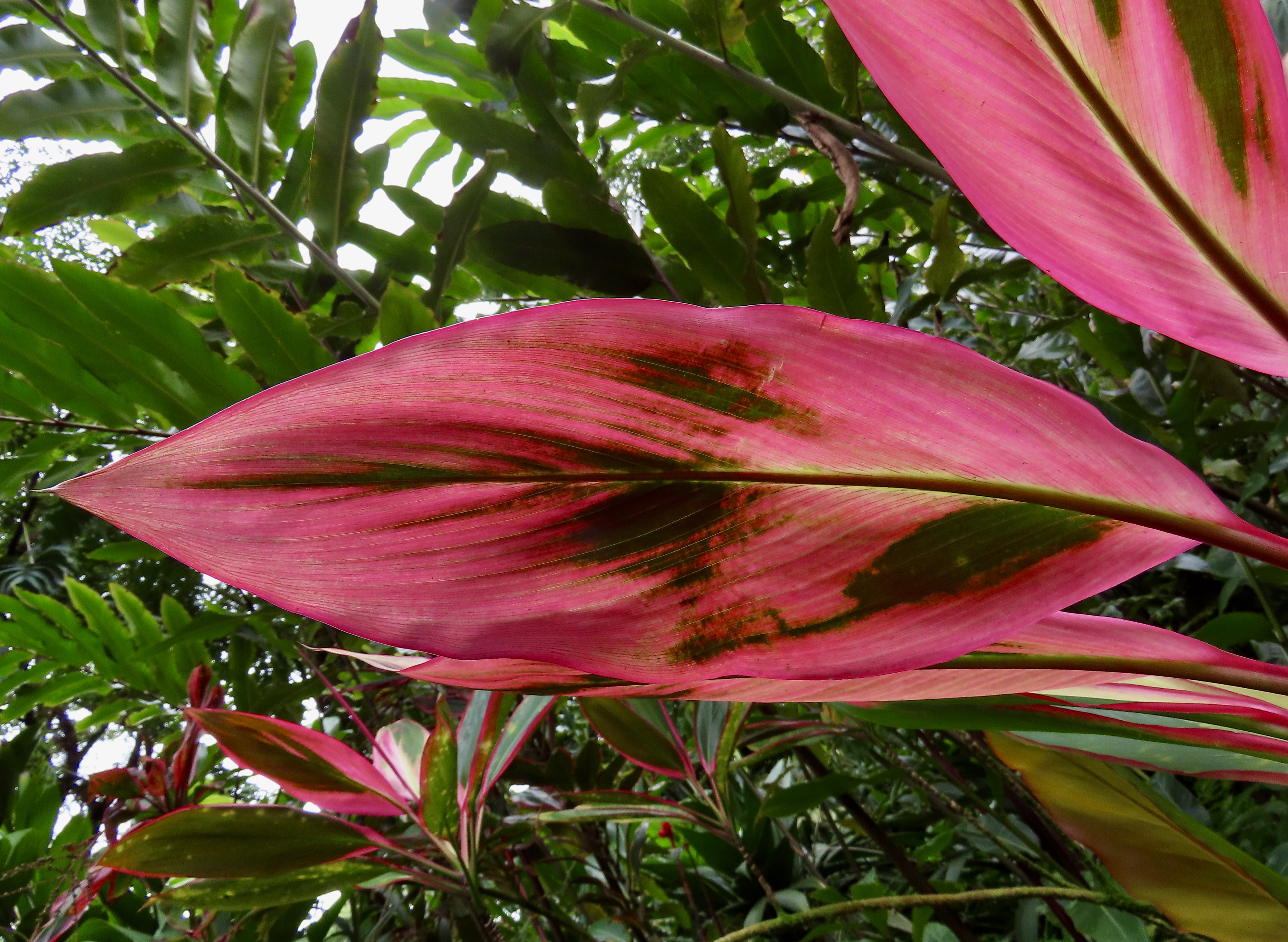
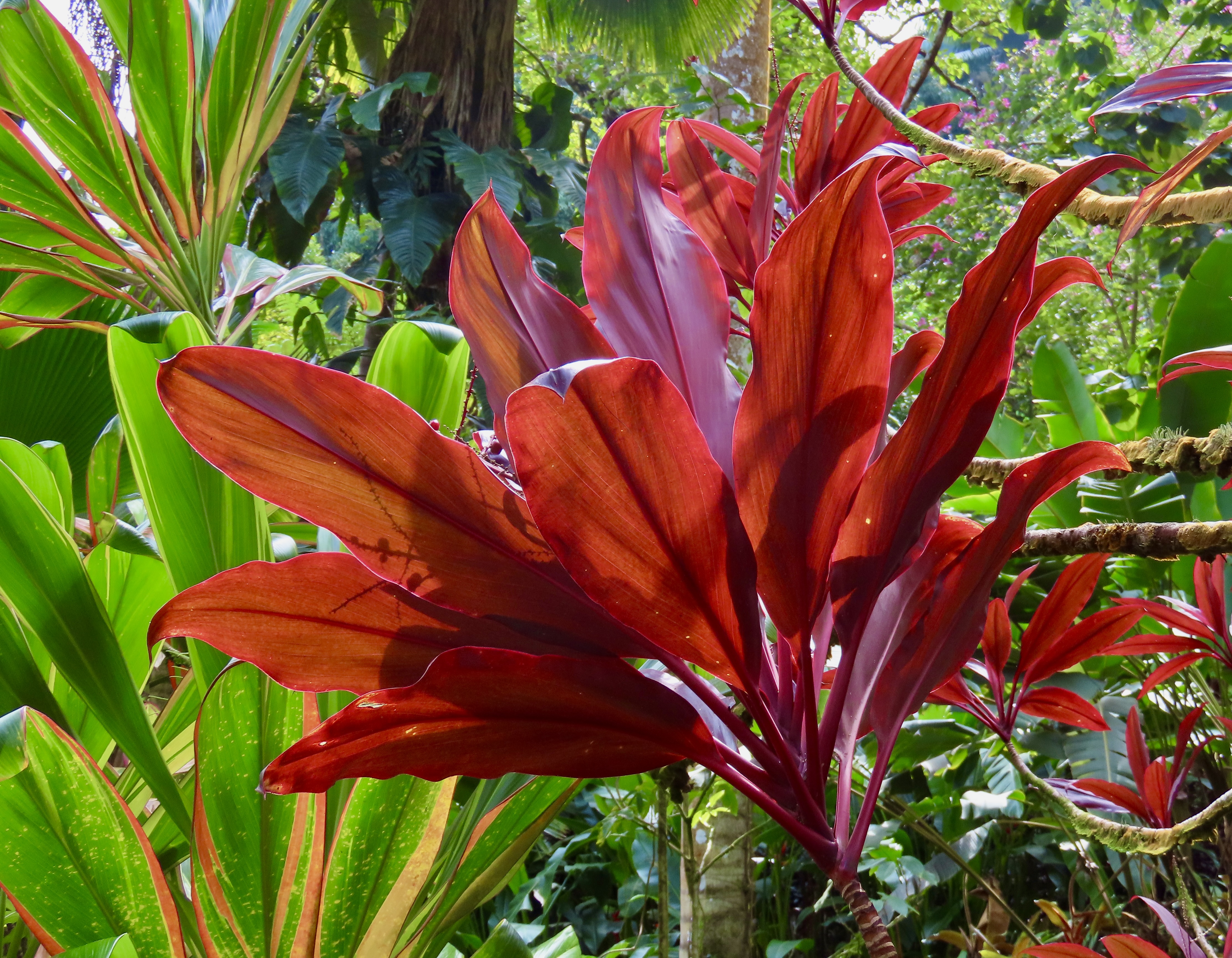
Peggy and I have been to a number of botanical gardens over the years. They have all been special, each offering something unique. The Hawaii Botanical Tropical Garden we visited two weeks ago is one of the best. Every few feet we screeched to a halt to admire yet another plant. Beautiful flowers, out of this world leaves, unique trees, vines galore, waterfalls and even an ancient Hawaiian God— the garden has it all. Today we are bringing the best of what we saw to you with minimal commentary. Happy Valentine’s Day. (Say it with flowers. Grin.)
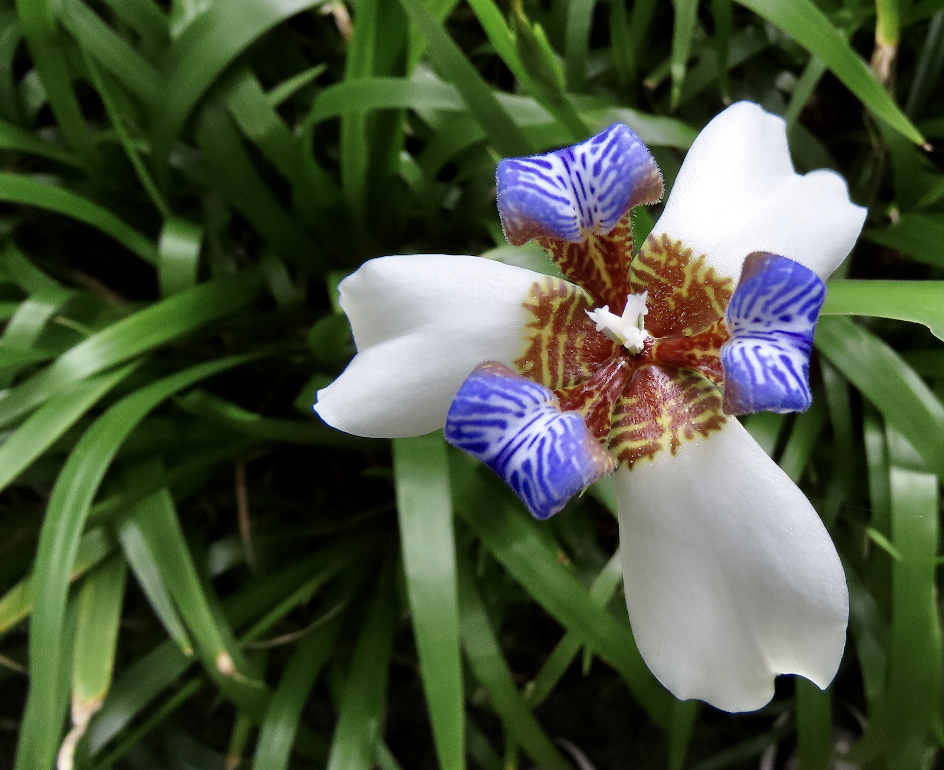
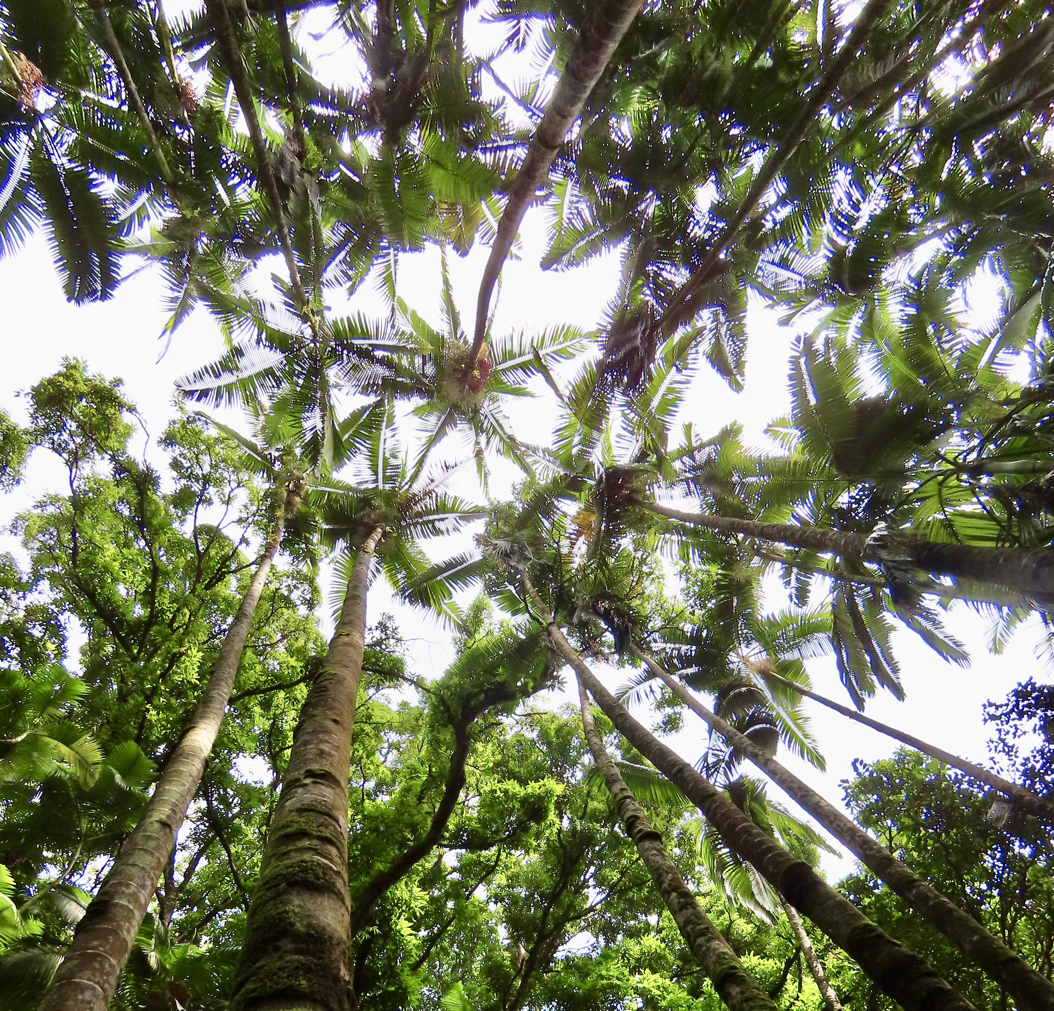
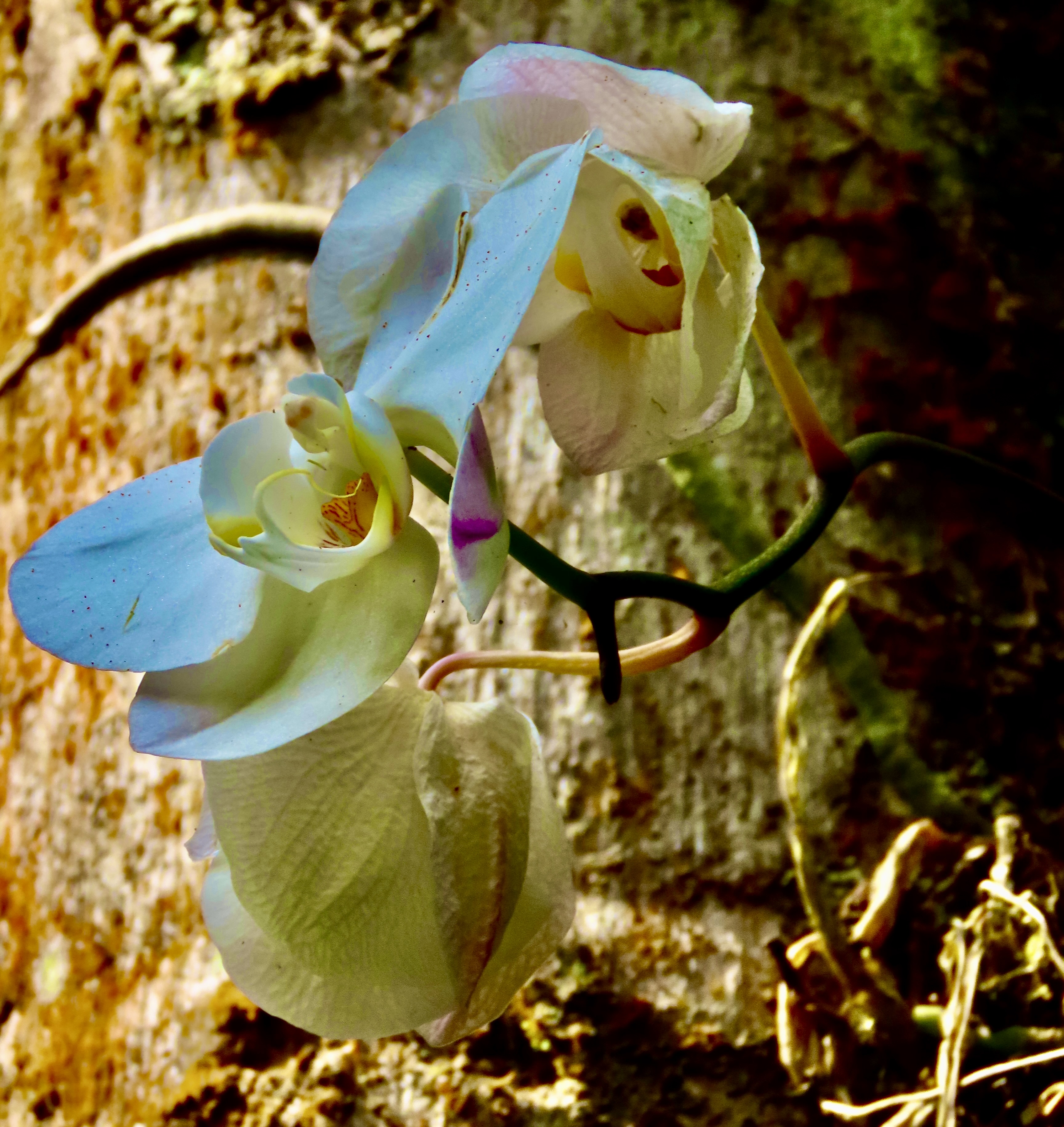
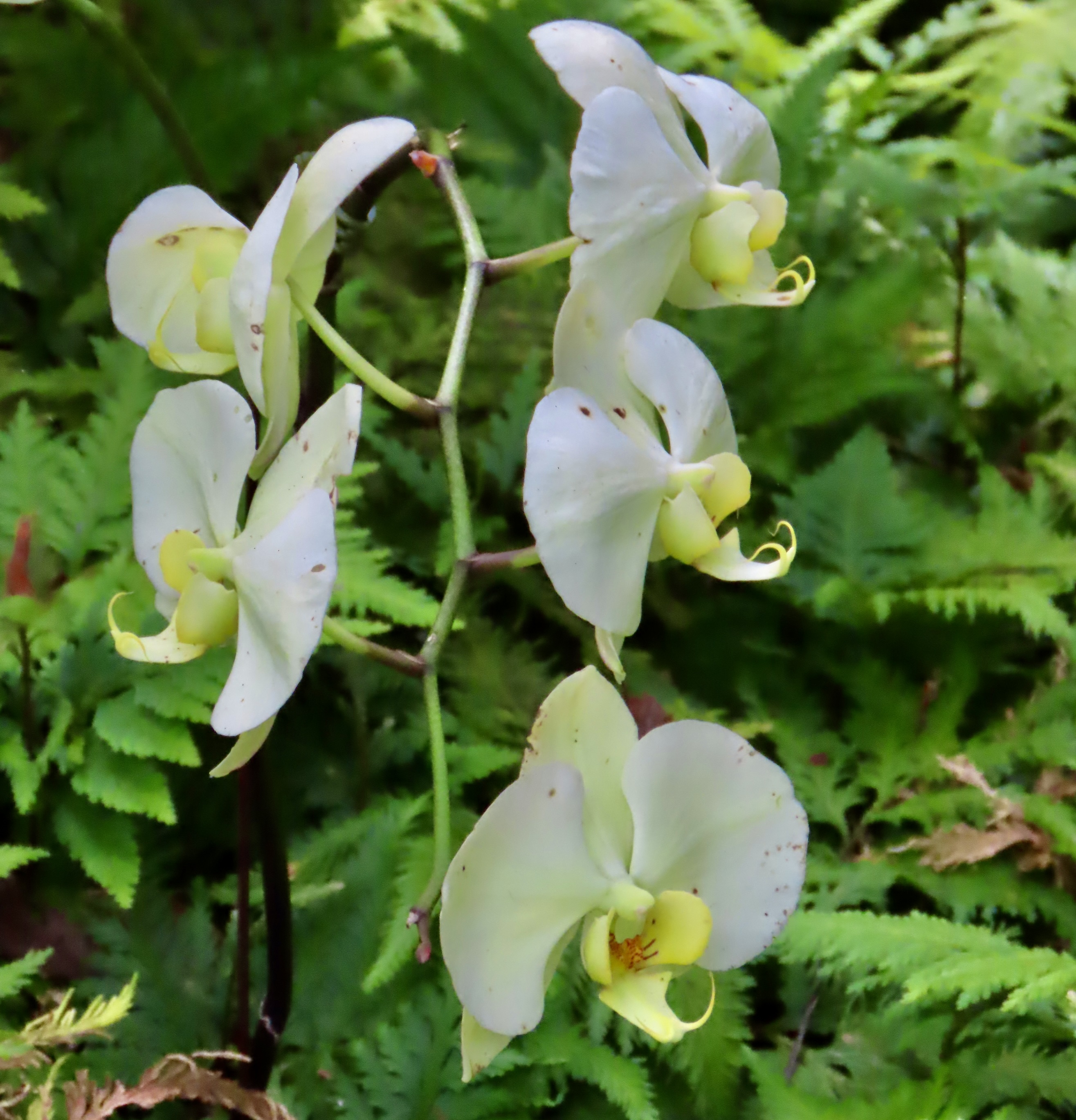
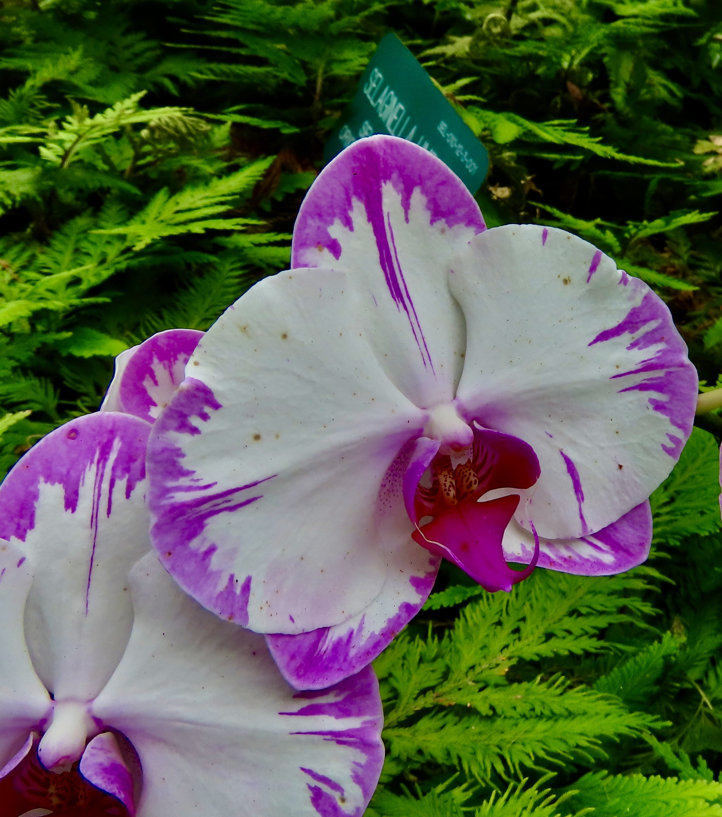
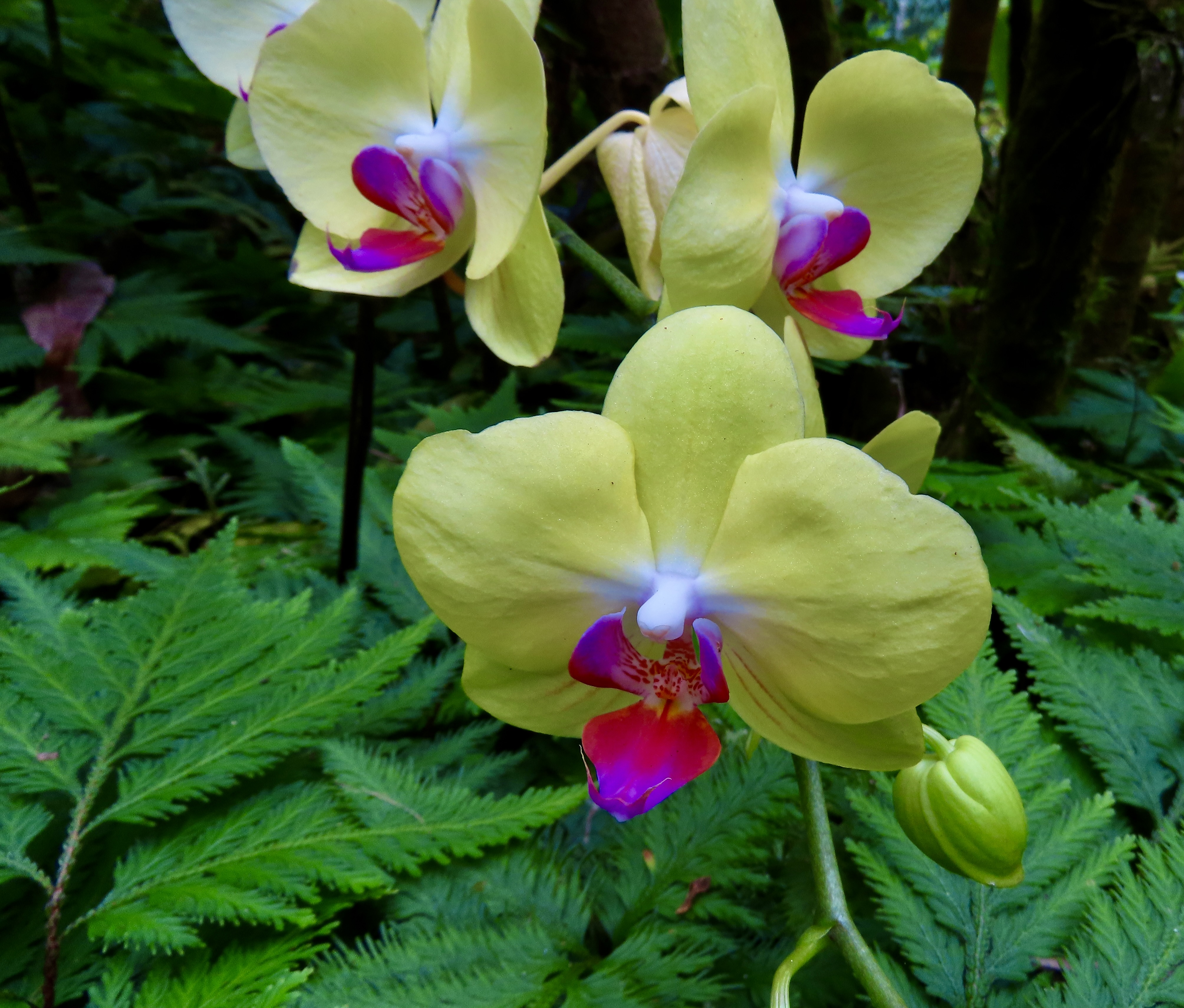
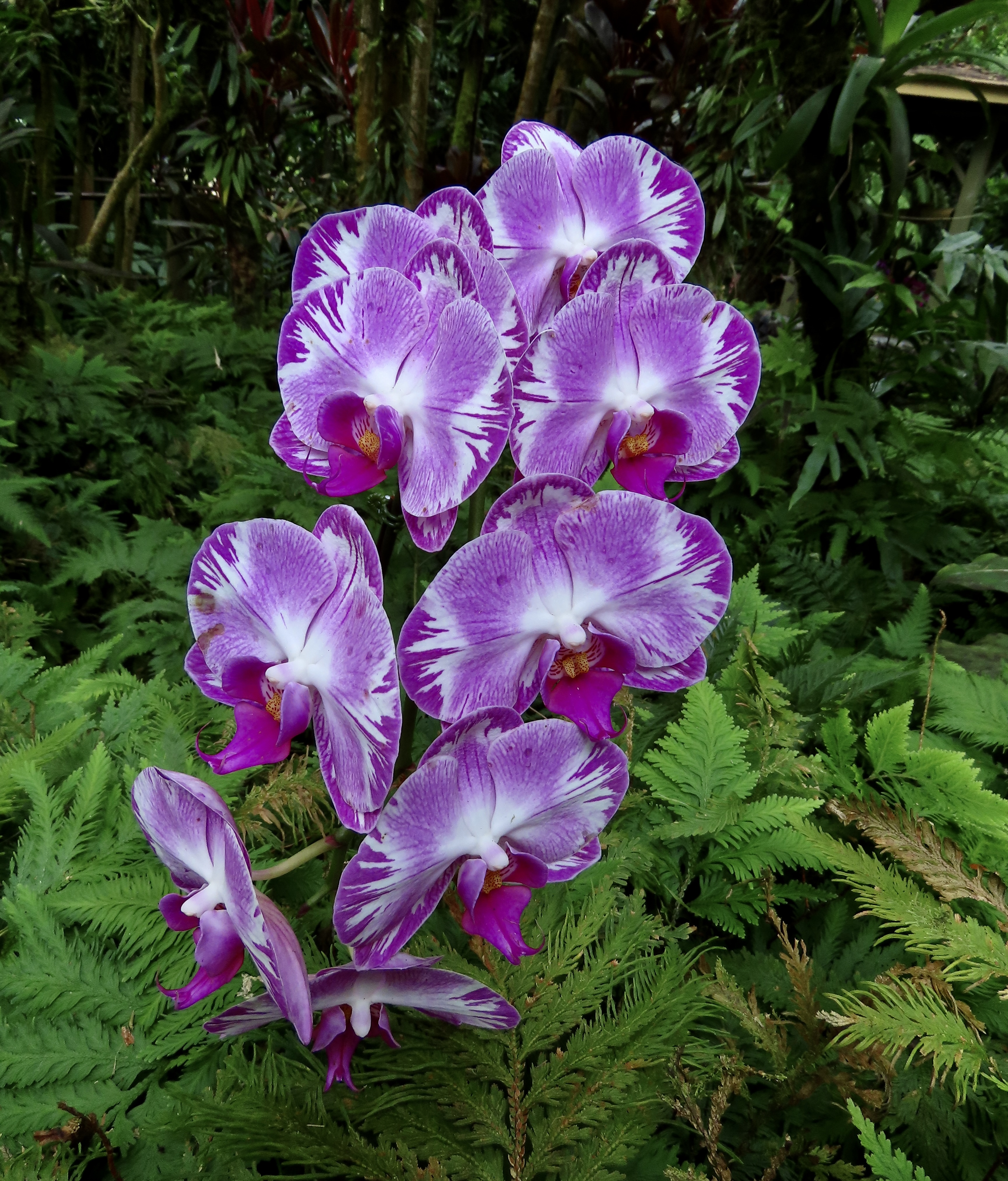
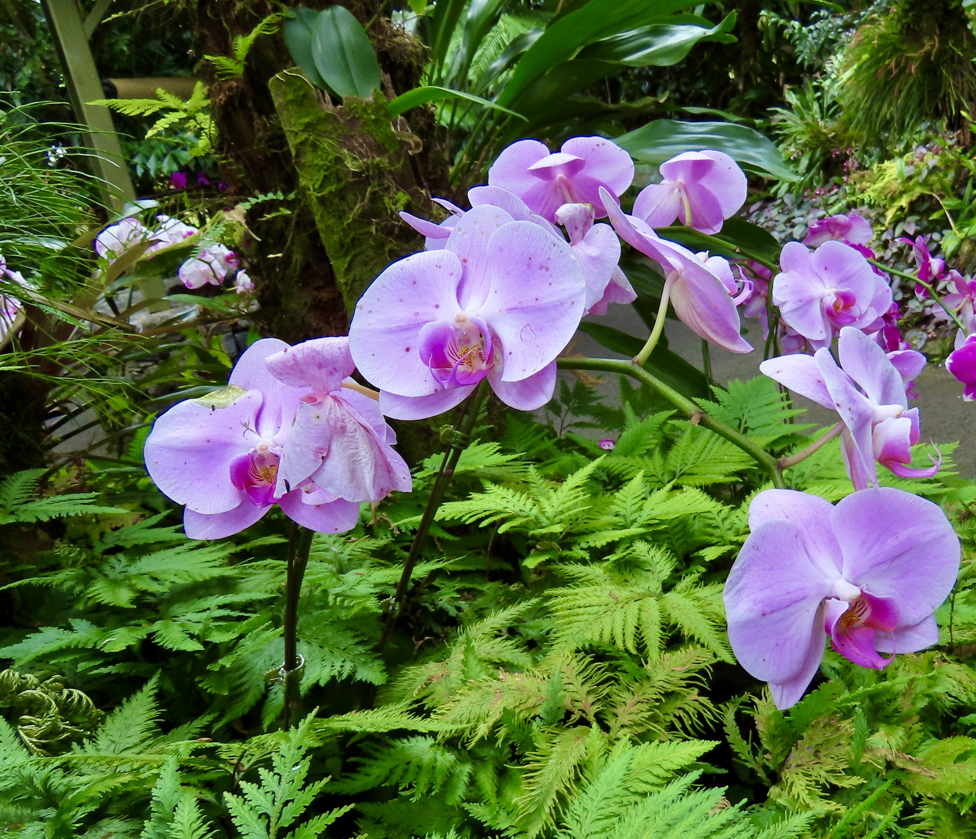
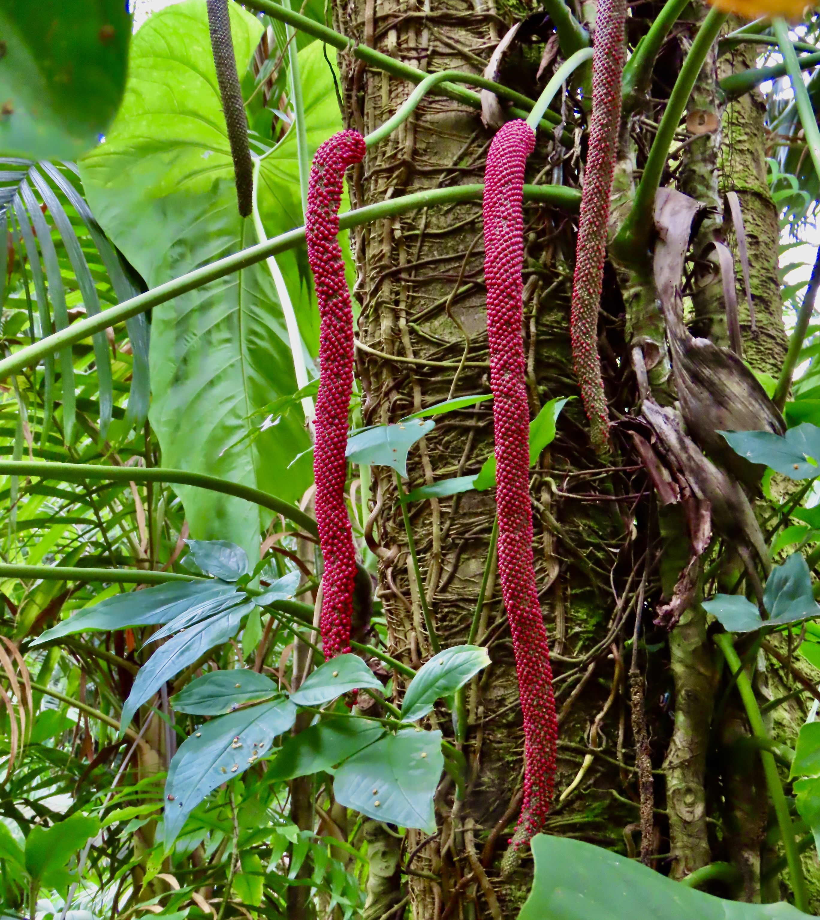
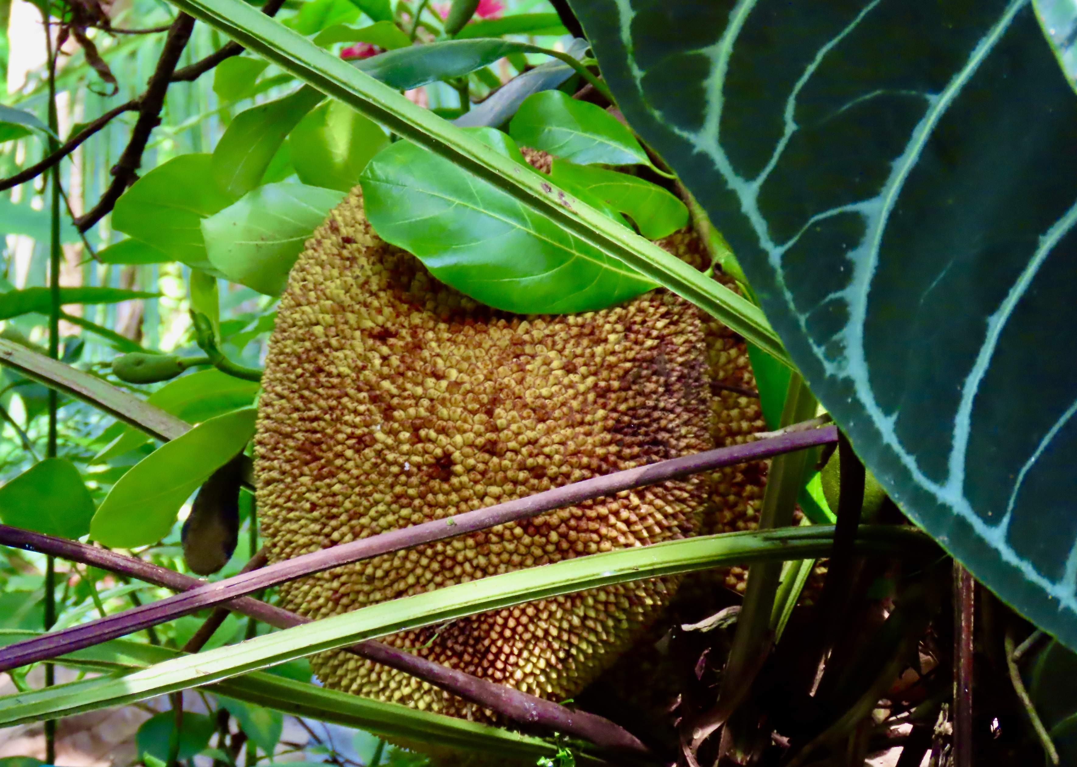
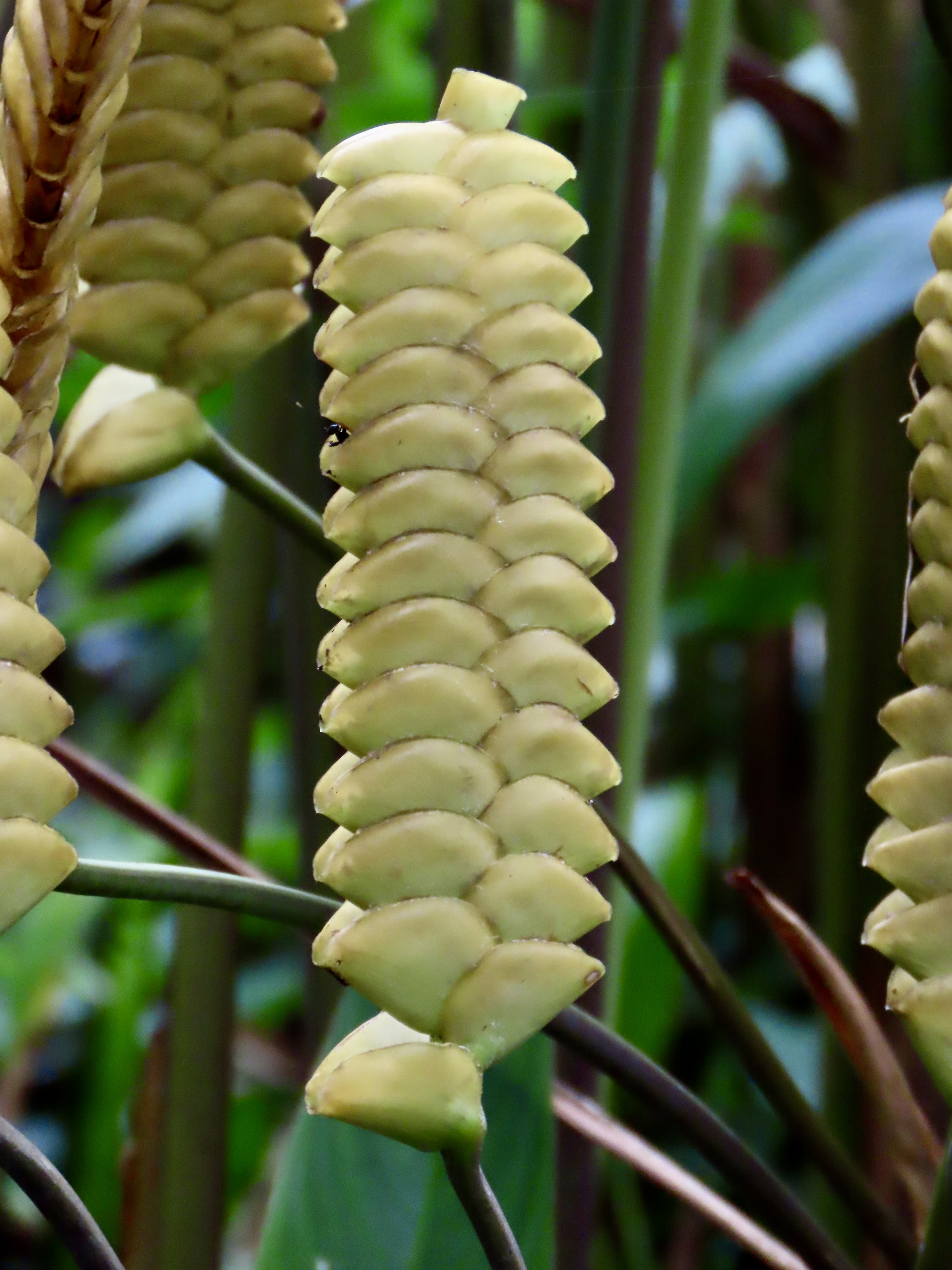
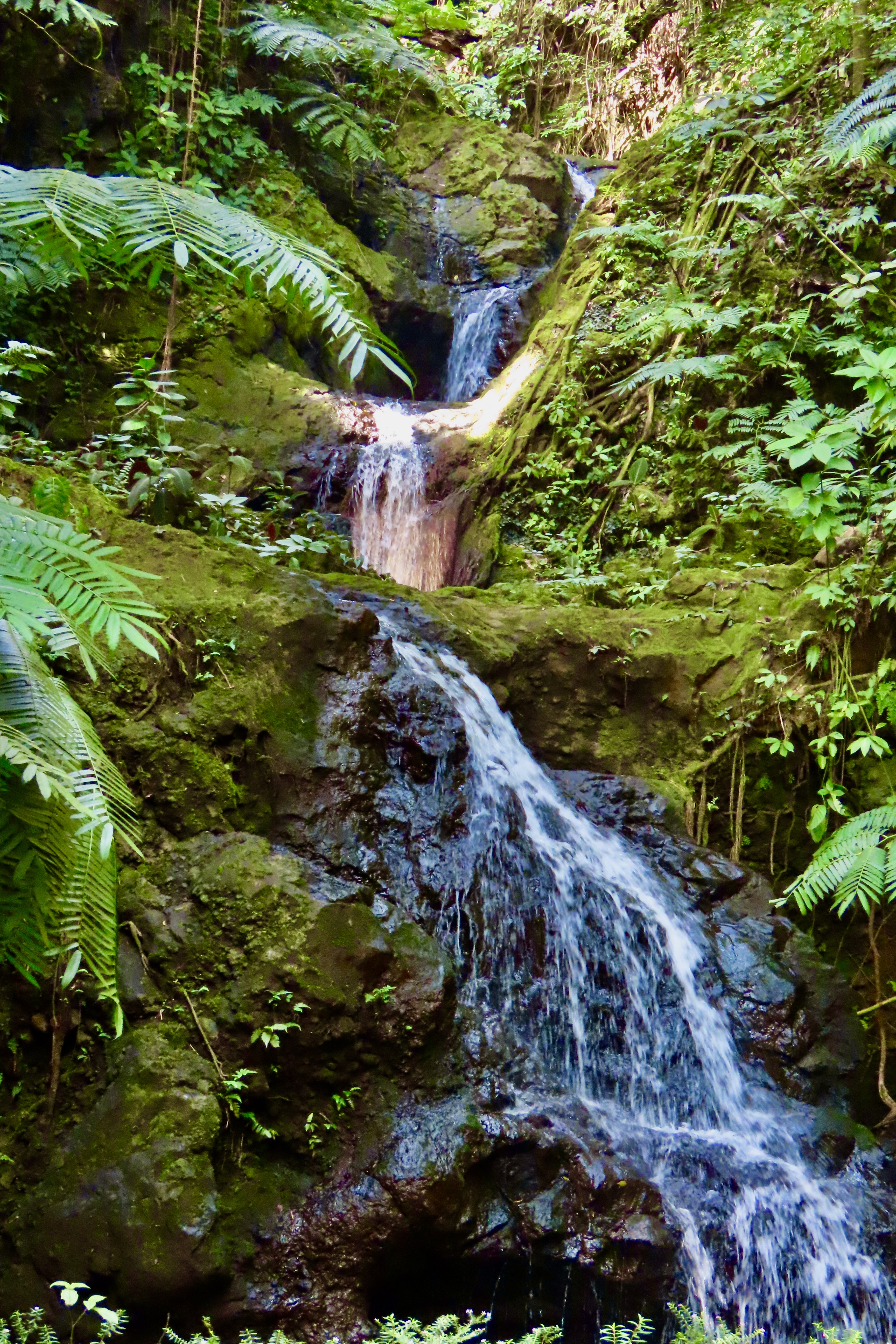
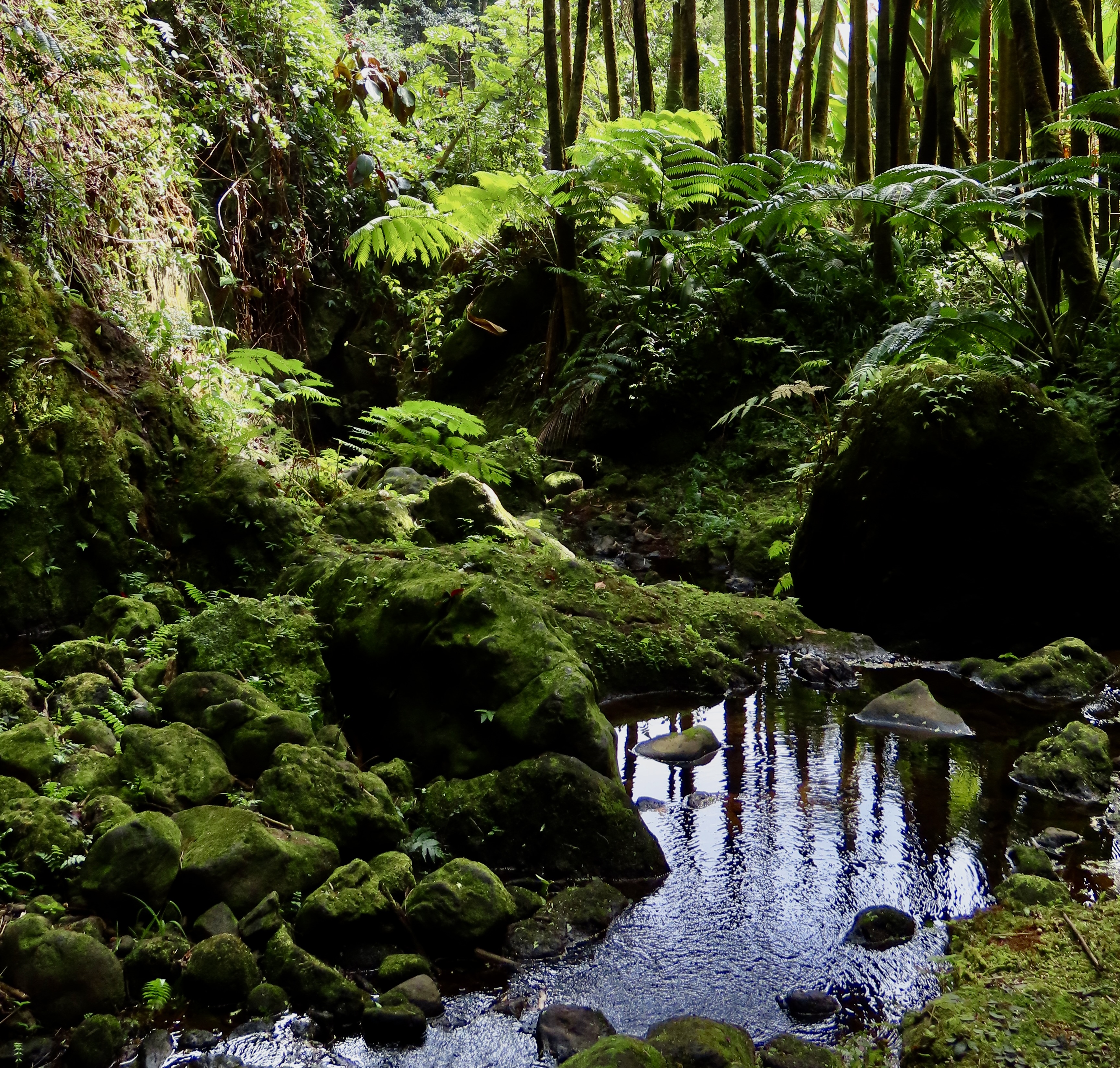
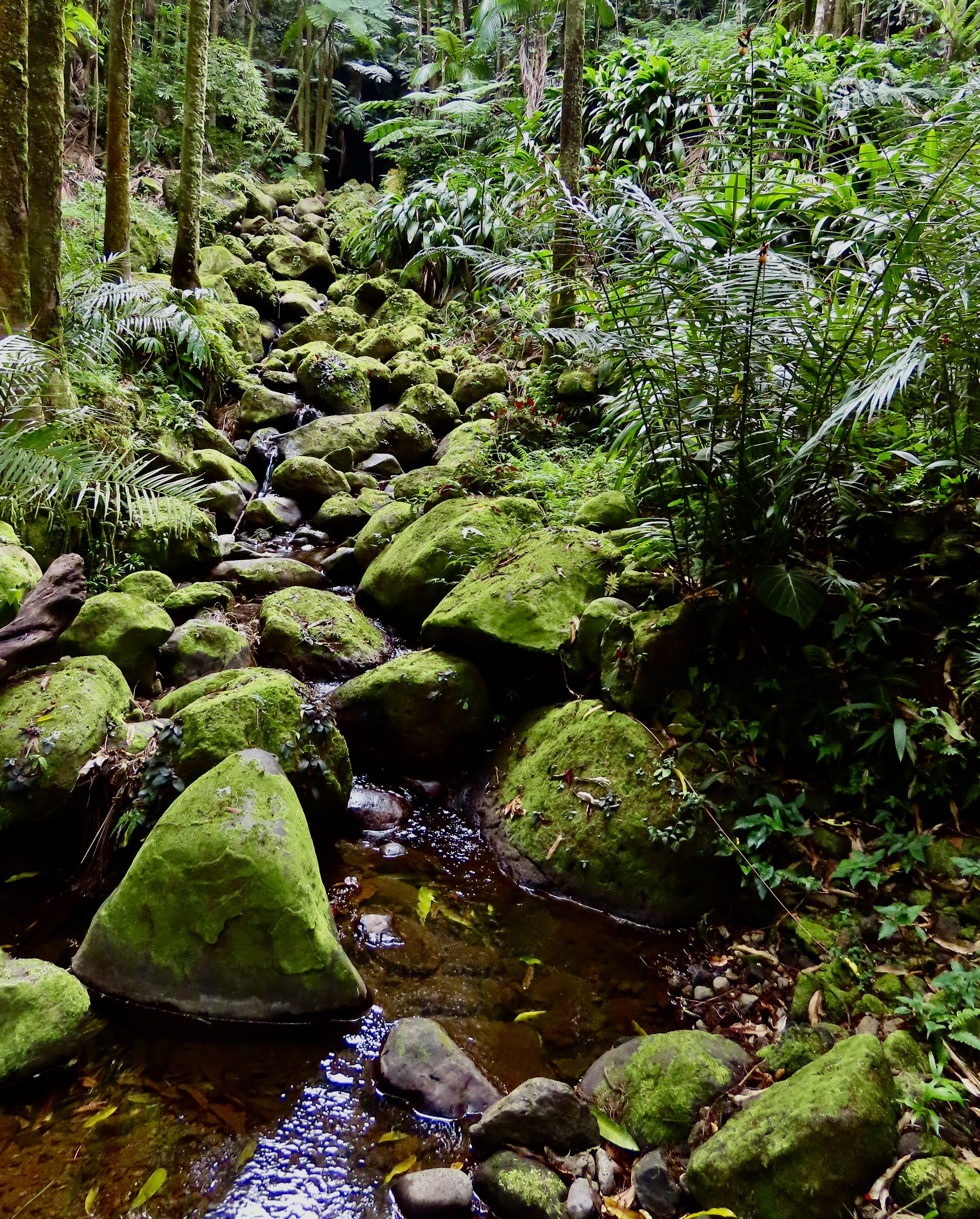
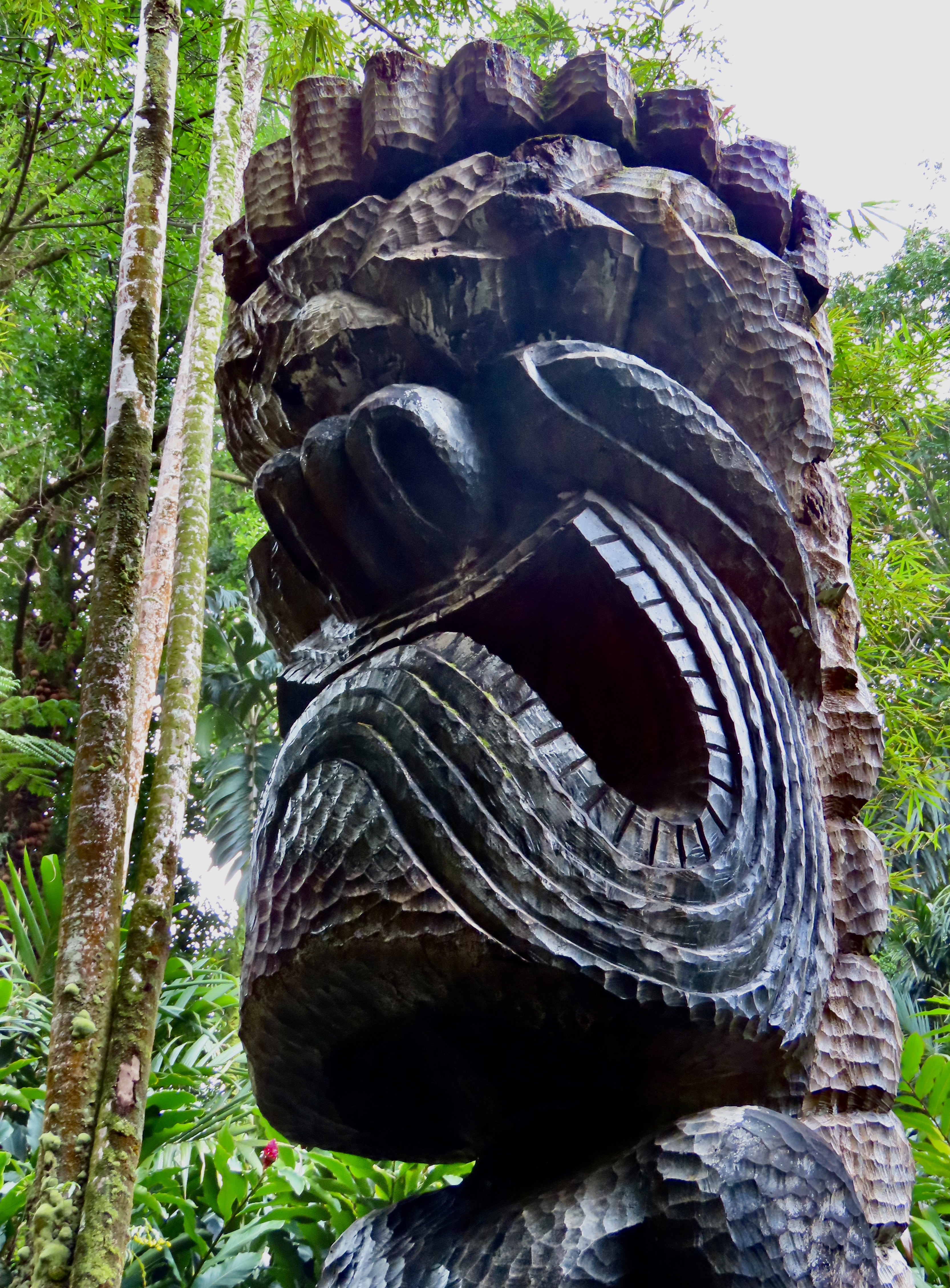
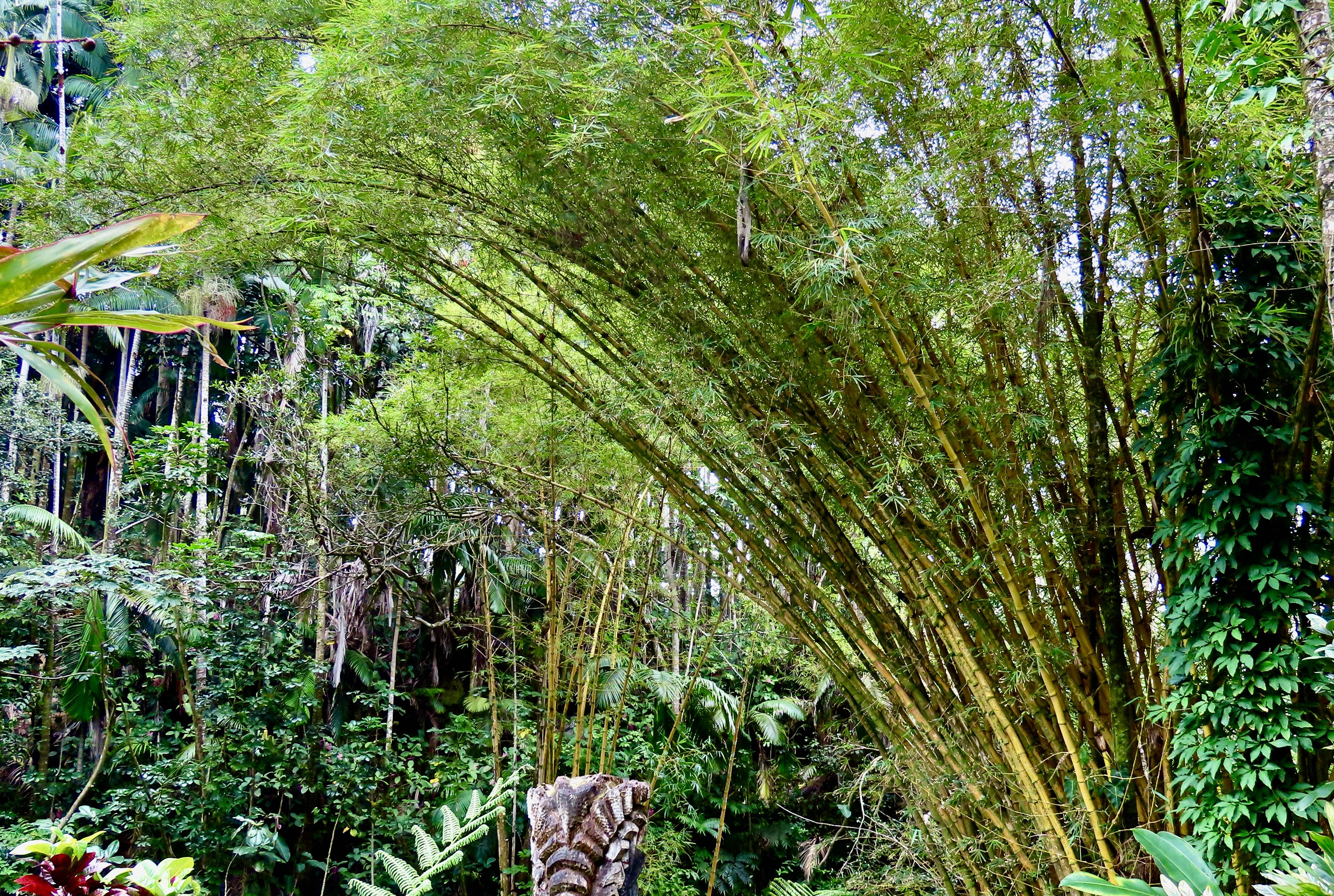
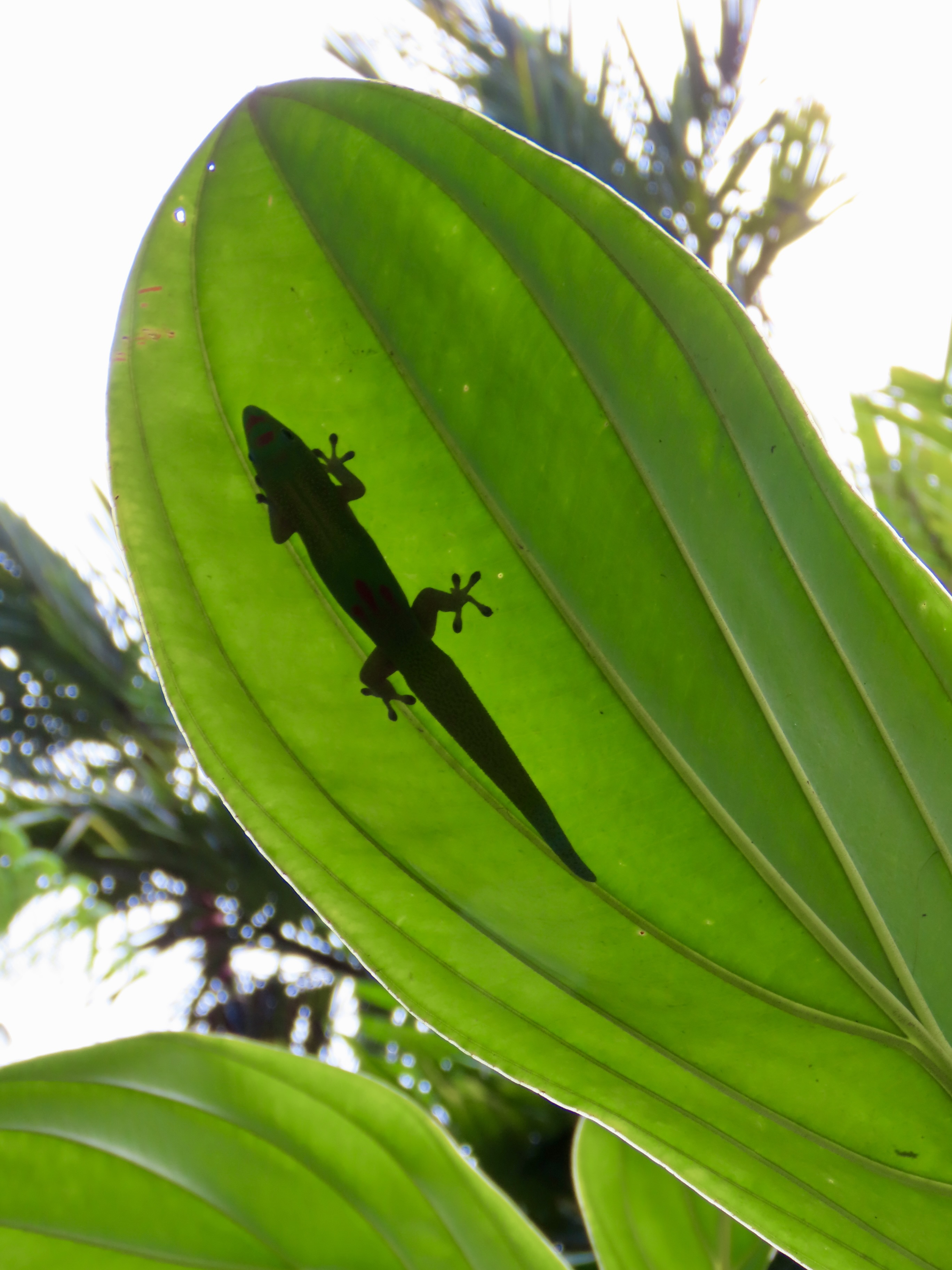
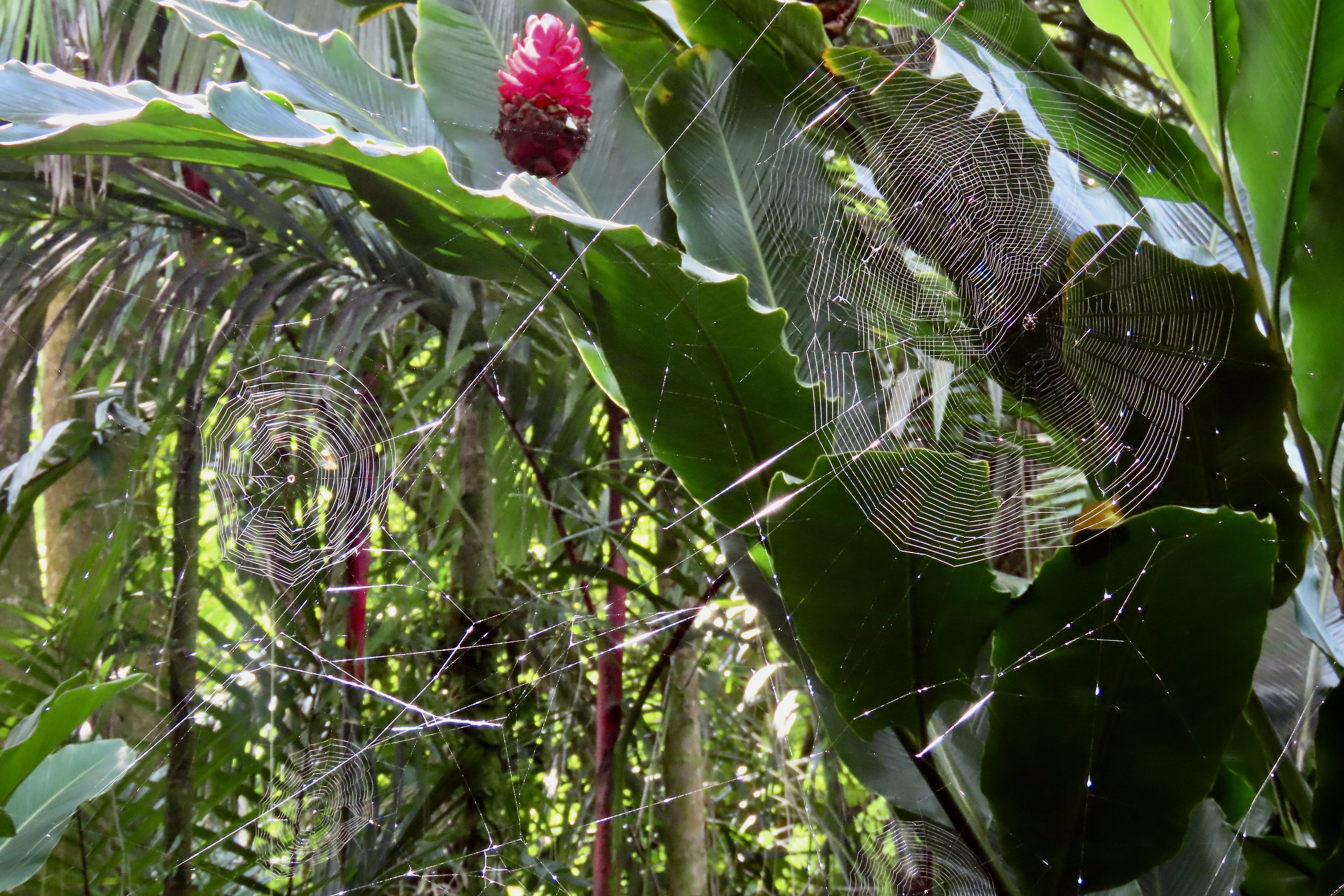
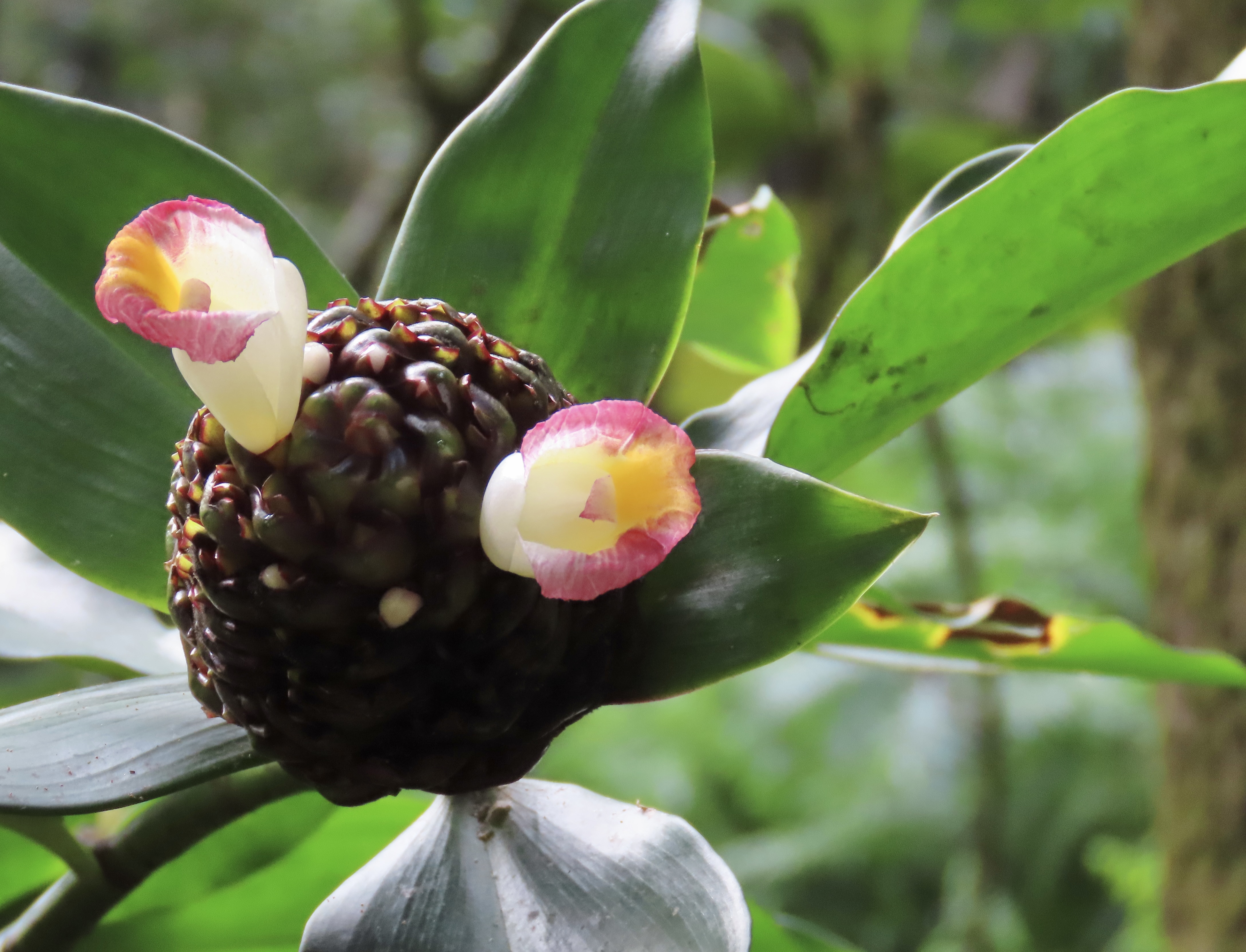
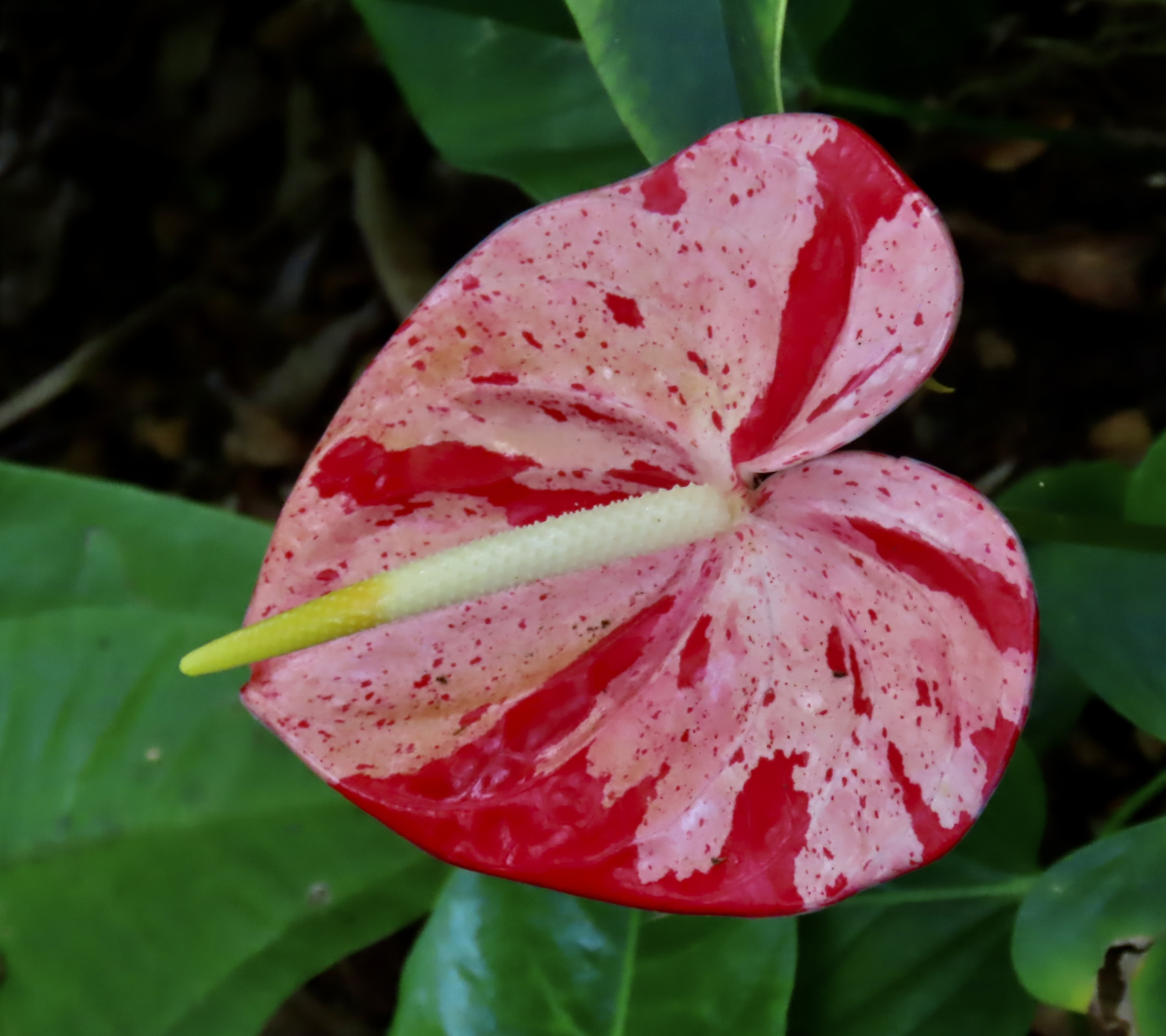
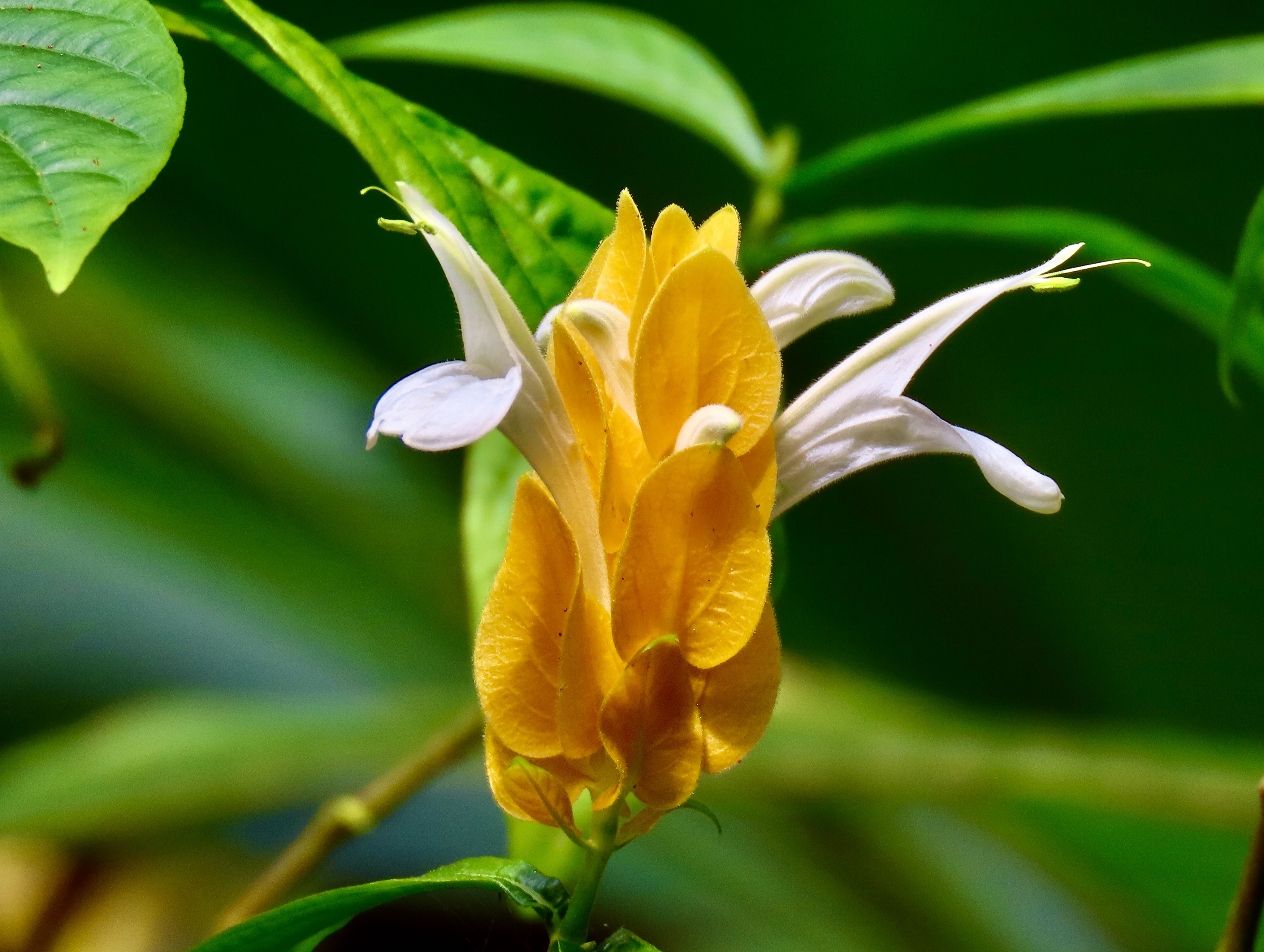
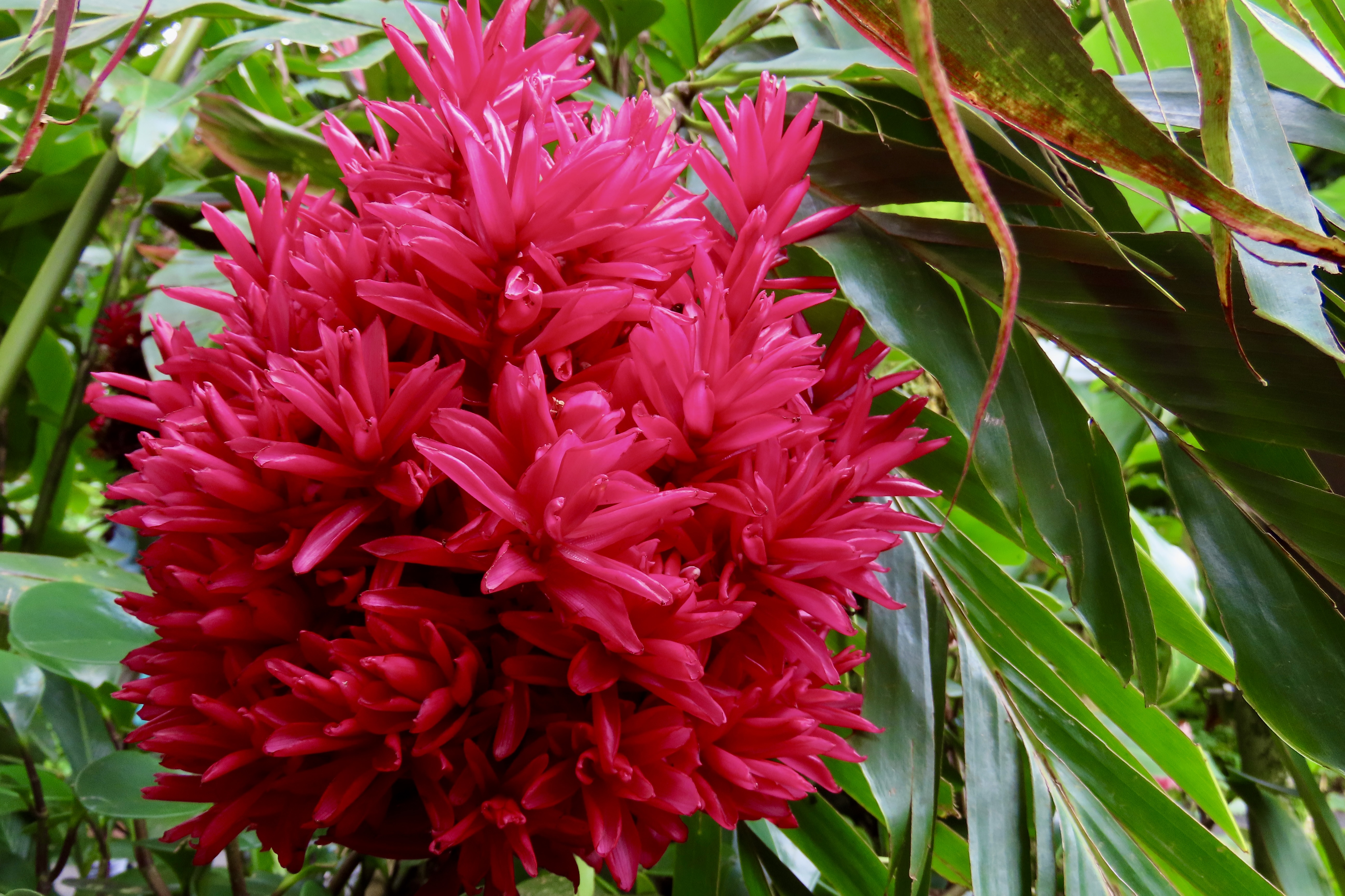
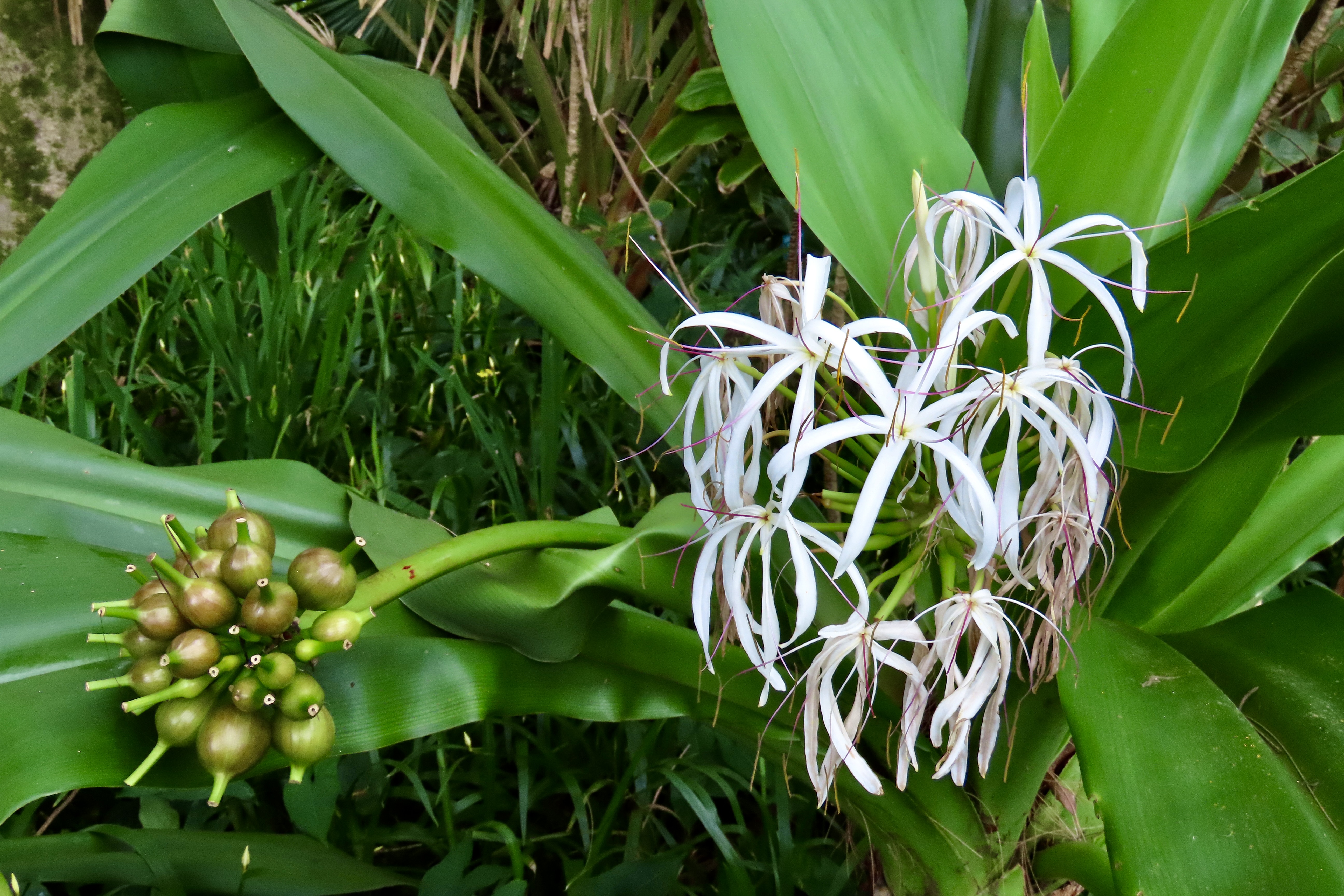
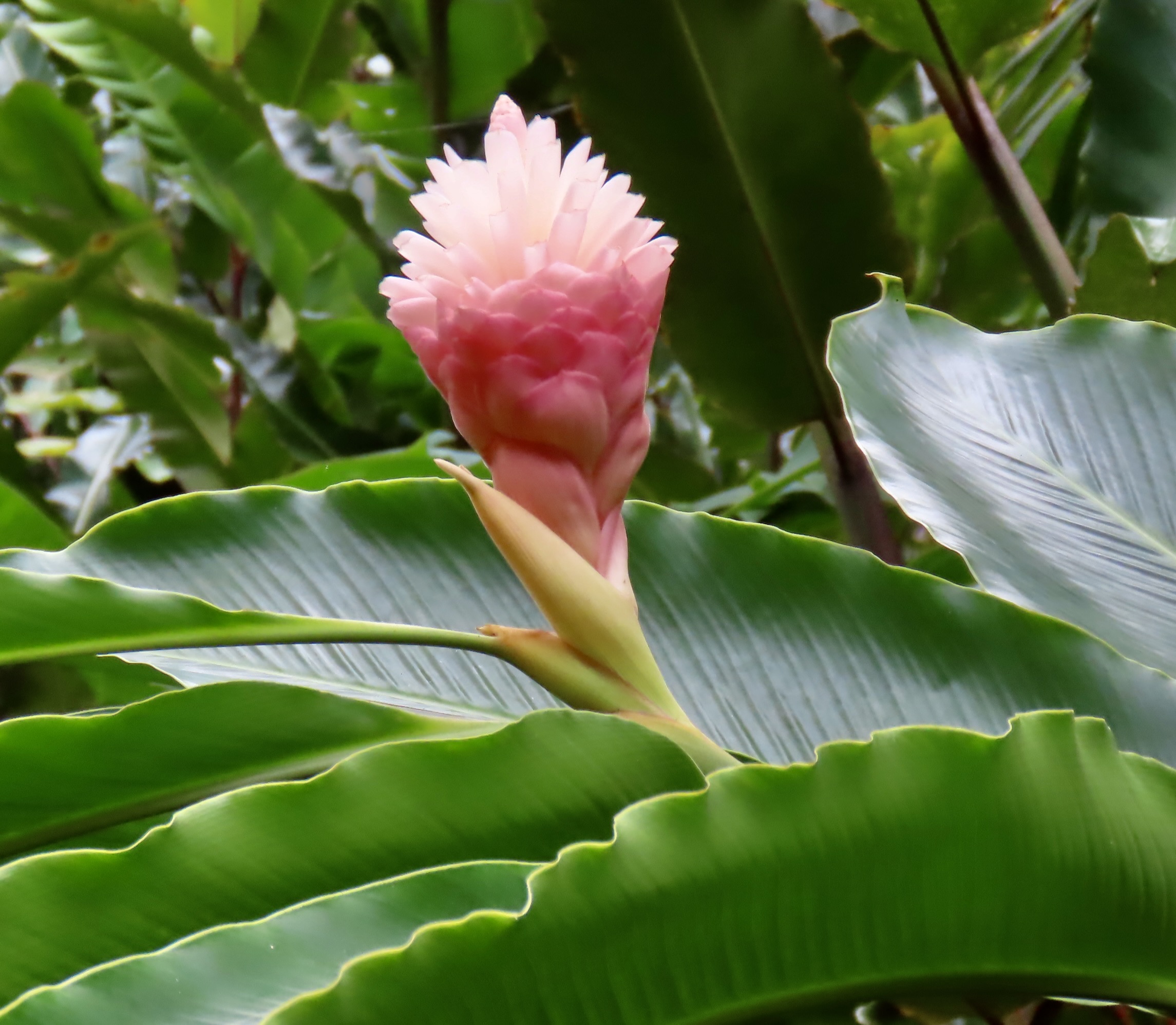
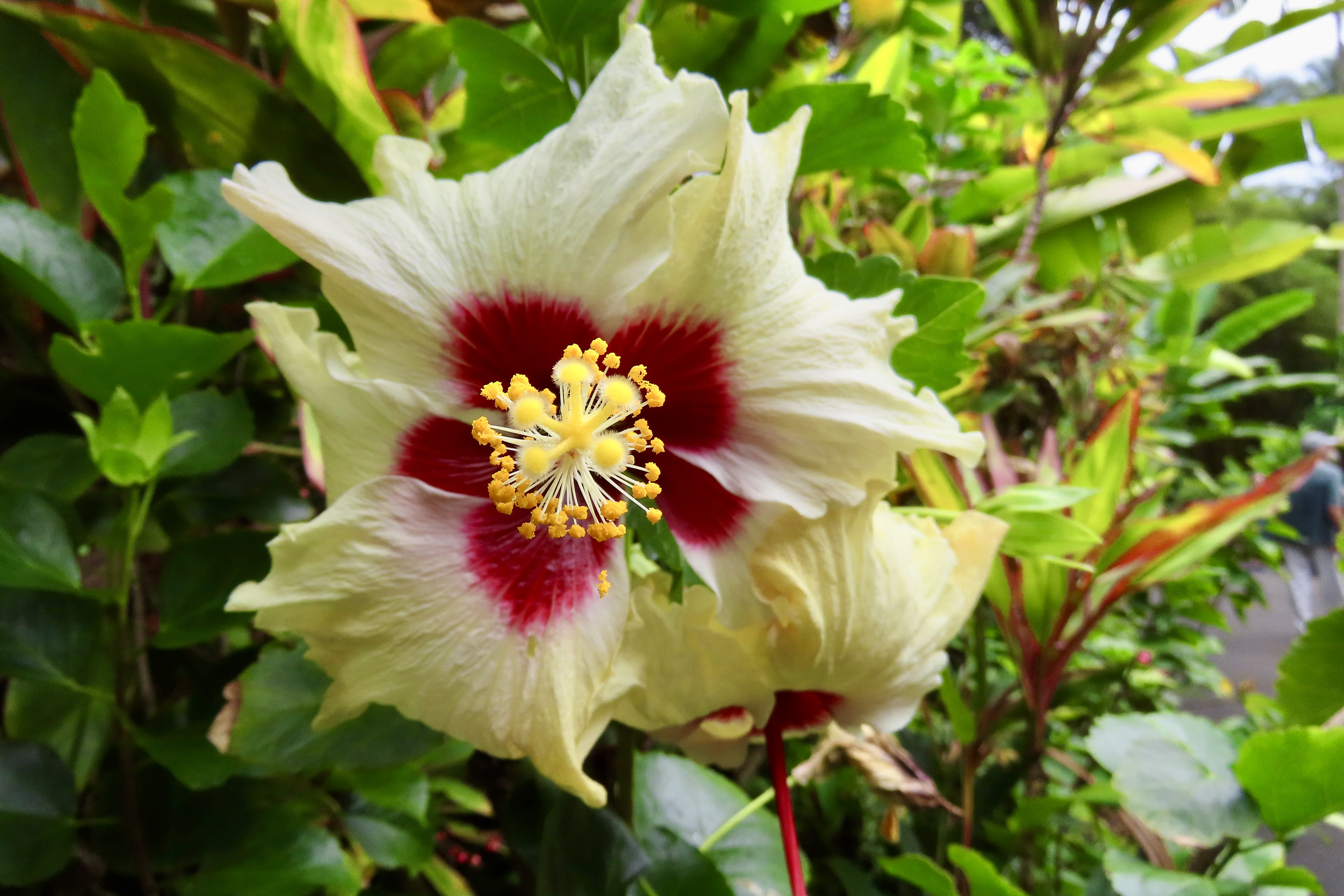
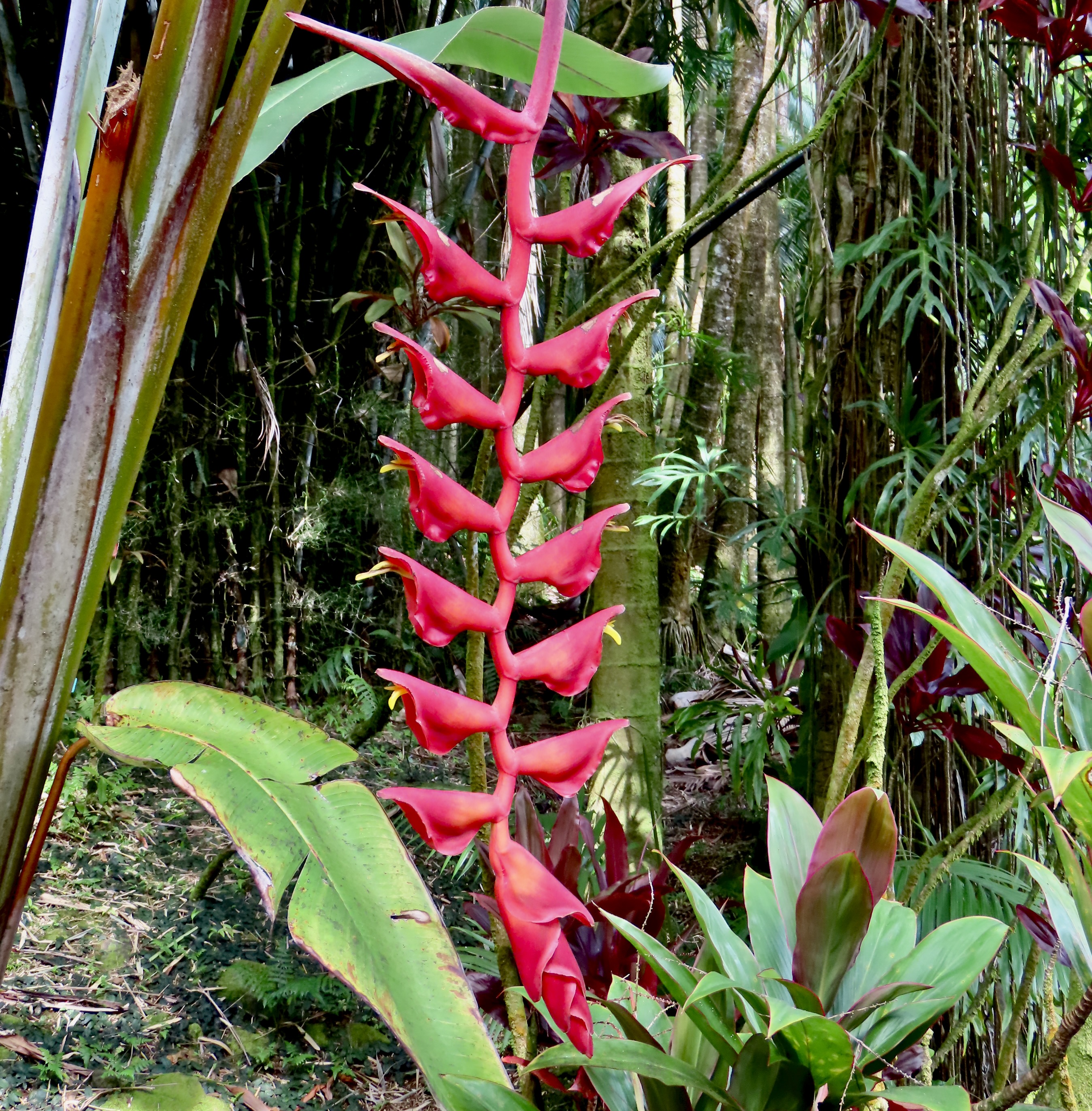
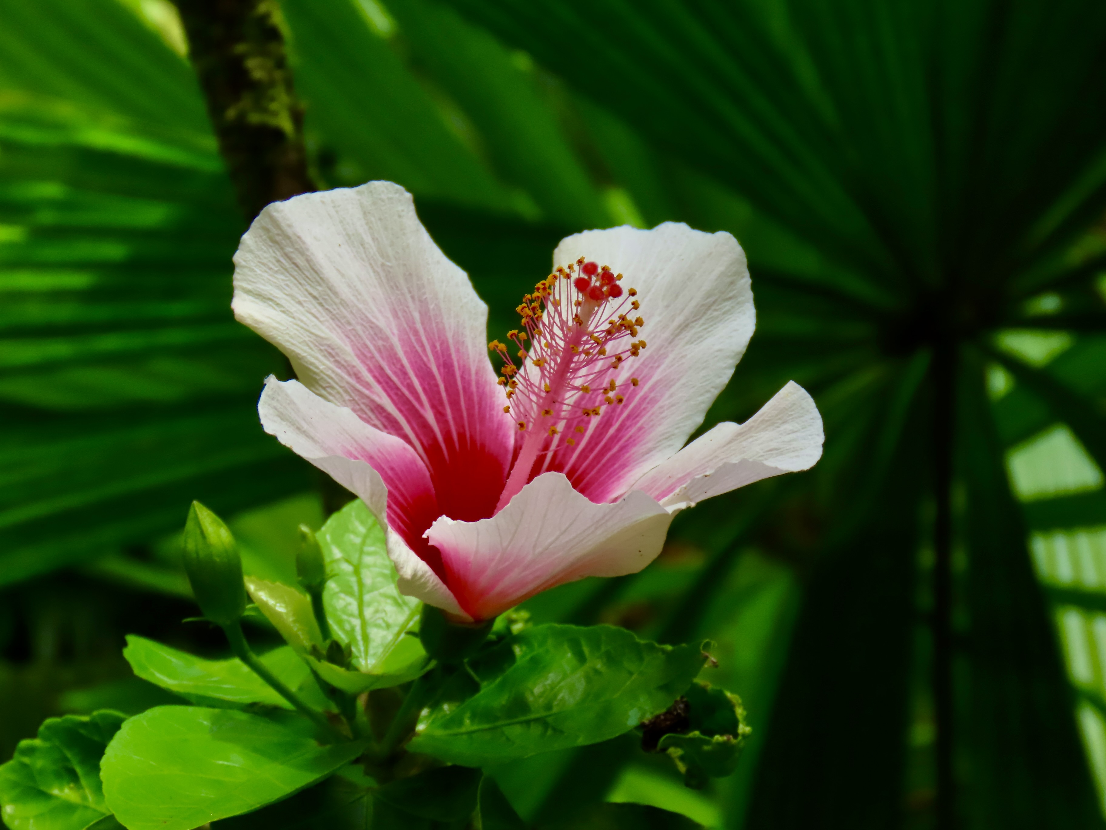
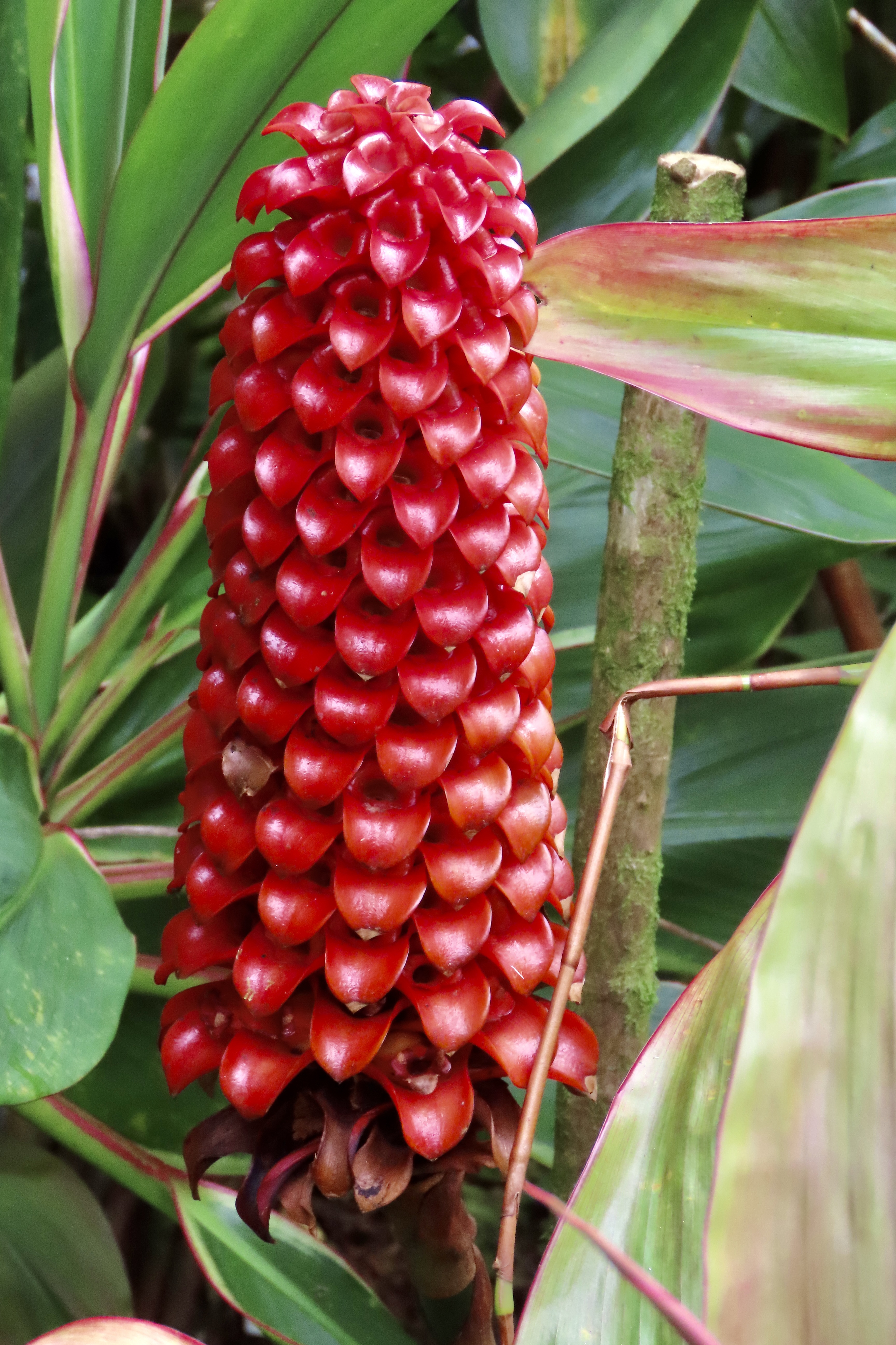
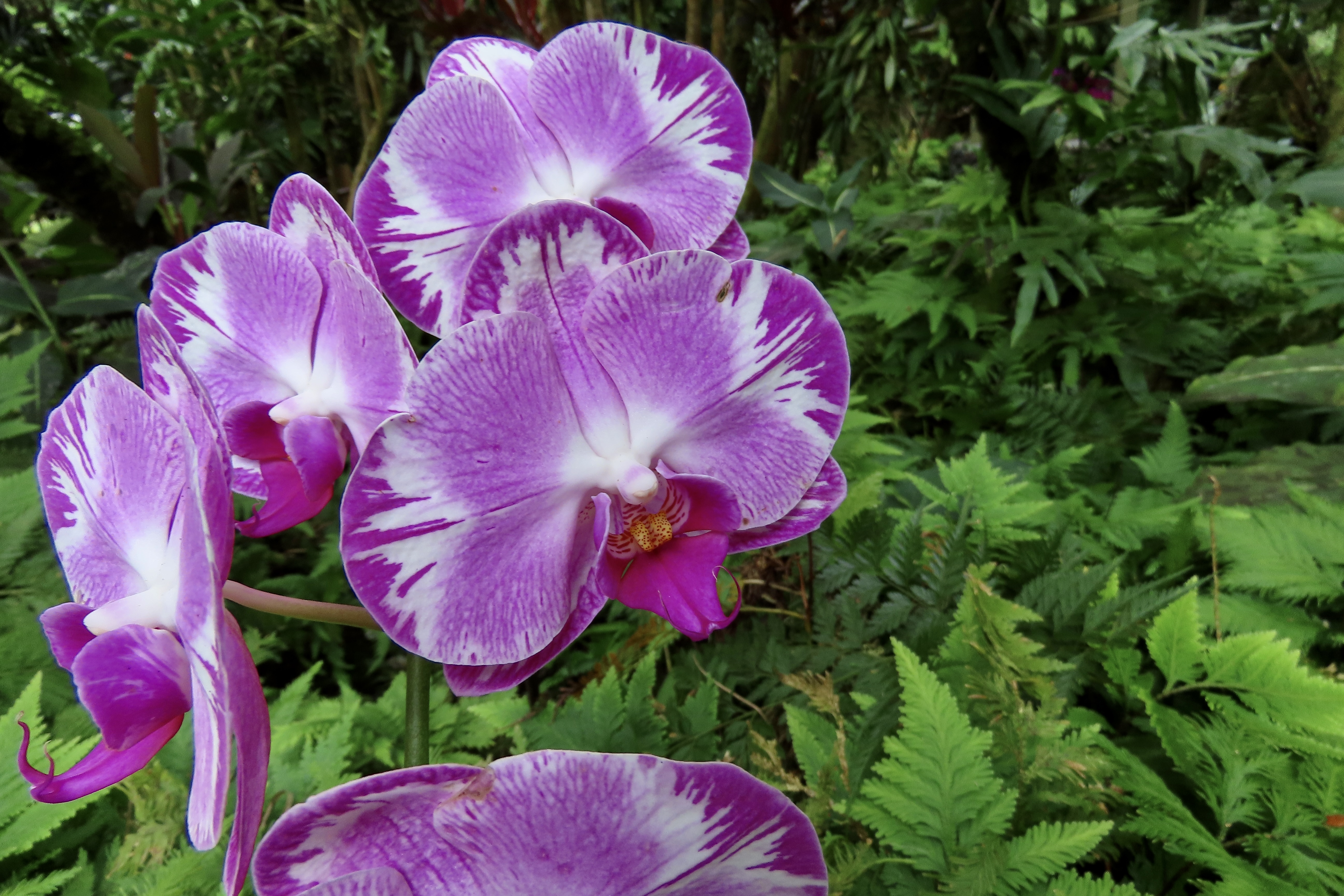
In the middle of large leaves, a single flower.It didn’t matter where we looked. There was beauty. And green.Pretty enough to eat. Grin.A bit strange.Striking.Looking up.Varieties of orchids from throughout the world were in the dozens.Elephant like?Did you know that there are between 25 and 30,000 varieties in the world?They come in many colors…And shapes.This is only a portion of the ones we photographed.As I noted, everywhere we turned, there was something interesting to photograph.Half of the time, what we saw was new to us.This flower made Peggy hungry for corn on the cob.There was a small multi-tiered waterfall.Quiet pools.Green, moss-covered rocks.And KU, a major Hawaiian God. (There will be more on KU when we do a post on the ancient Hawaiians.)Bamboo shaded KU.Leaves and vines were hanging everywhere, in profusion.Palm trees and fronds are a natural for the tropical garden.Leaves were almost as varied as the flowers.Green, yes. But not necessarily in a form we are used to. We thought the contrast created by the shadows was dramatic.Similar. And yet…Pin stripes?Not green.Likewise.A gecko caught Peggy’s attention. The Hawaiians call it Mo’o.Spider webs caught mine.We will close with a few more flowers. Some of them were even familiar to us. Note the ‘some’ word.Like this one.Orange and white.Red.Great buds, assuming they belong together.Pretty in pink.Look at me!Another old friend.And another.And this red beauty for Valentine’s Day to close our post.
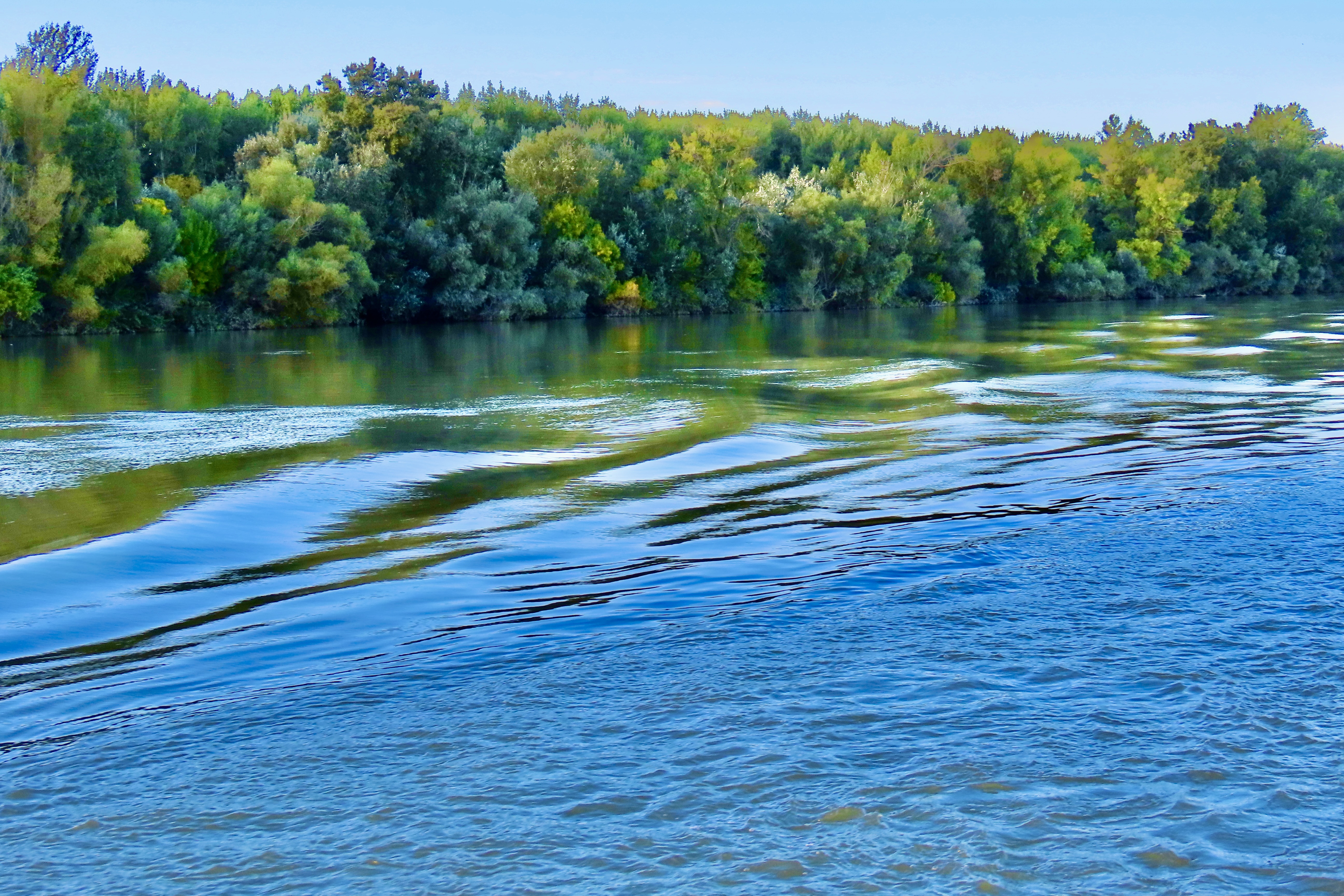
I just counted the photos that Peggy and I included in today’s blog. It struck me that we could have probably turned this into a month’s worth of posts doing one everyday. Or a small book. I hope it downloads. But we have so darned many things to blog about. Tough, I know. Our next post will find us floating down the Danube River again…
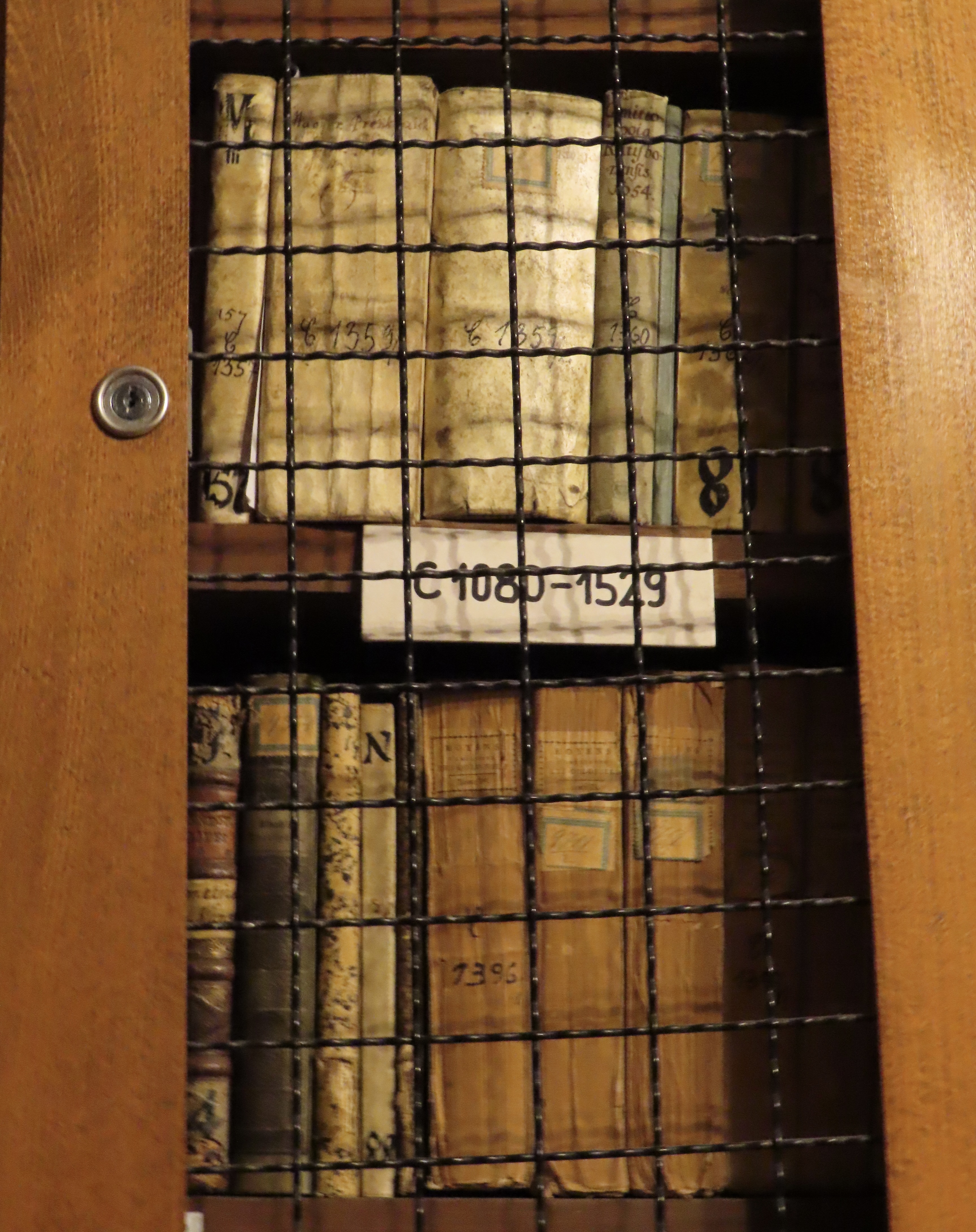
Meet Draco Aethiopicus. Ulisse Aldrovandi chose to include him in his 1640 book Serpentum et Draconium Historiae, a natural history of snakes and dragons. I think Draco looks pretty good, considering the age of the book. It’s one of 130,000 volumes found in the Cathedral Library of Kalocsa. Started in medieval times, most of the books were lost during the 150 year Turkish occupation of Hungary. Efforts to rebuild the library collection were initiated in the 1700s. The content of the books, in addition to religious materials, include medical, judicial, scientific and historical works.
One of the sources for Aldrovandi’s book was Claudius Aelianus (175 – 235 CE), a Roman author who wrote 17 books on the nature of animals. He, in turn, relied upon earlier accounts. Here’s the translation of what he said about Draco: “The land of Aithiopia (Ethiopia)–the place where the gods bathe, celebrated by Homer under the name of Okeanos (Oceanus), is an excellent and desirable neighbour–this land, I say, is the mother of the very largest Drakones (Dragon-Serpents). For, you must know, they attain to a length of one hundred and eighty feet, and they are not called by the name of any species, but people say that they kill elephants, and these Drakones rival the longest-lived animals.” Works for me. Except I like elephants.
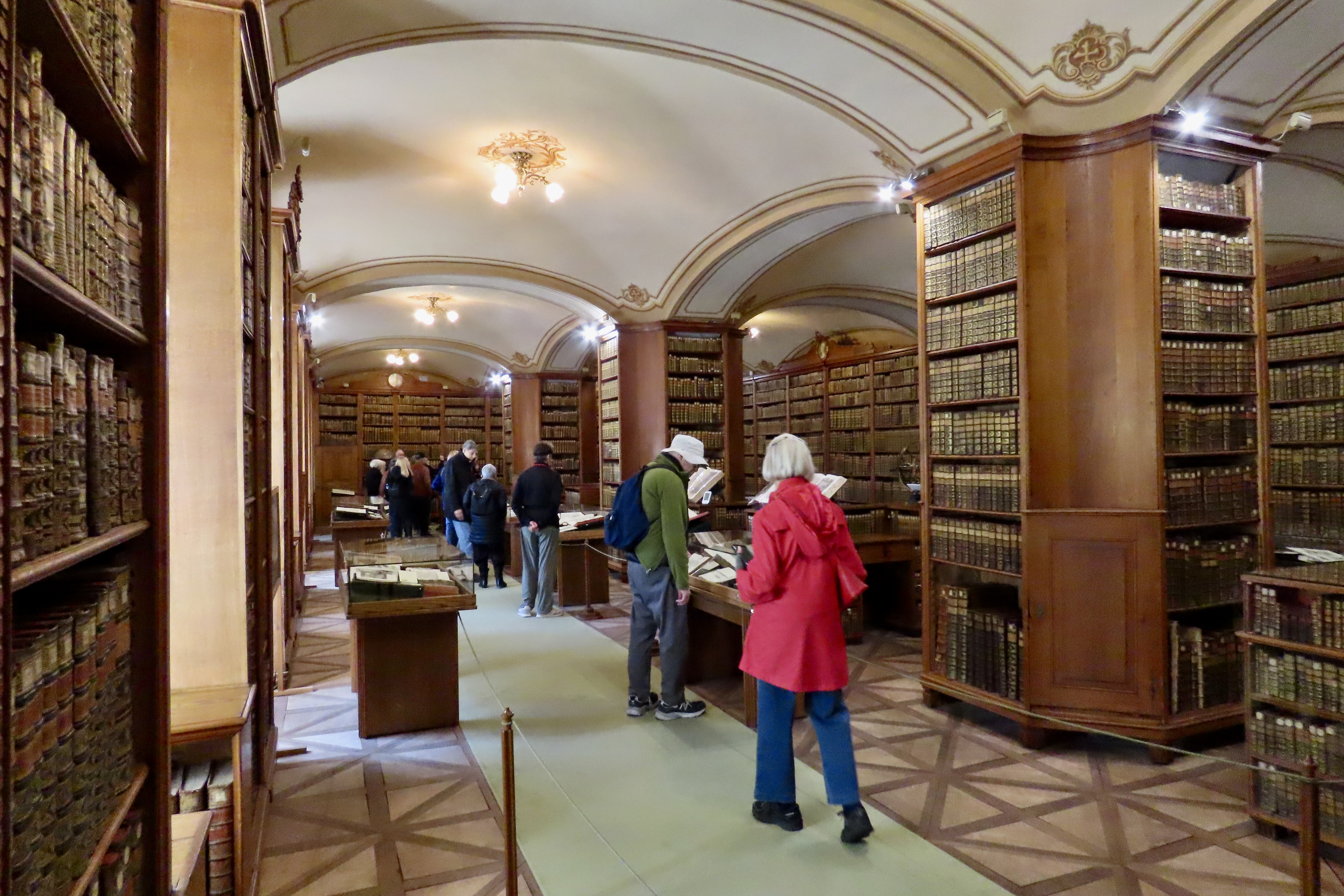
Peggy and I wandered around enjoying the collection and the illustrations on display.
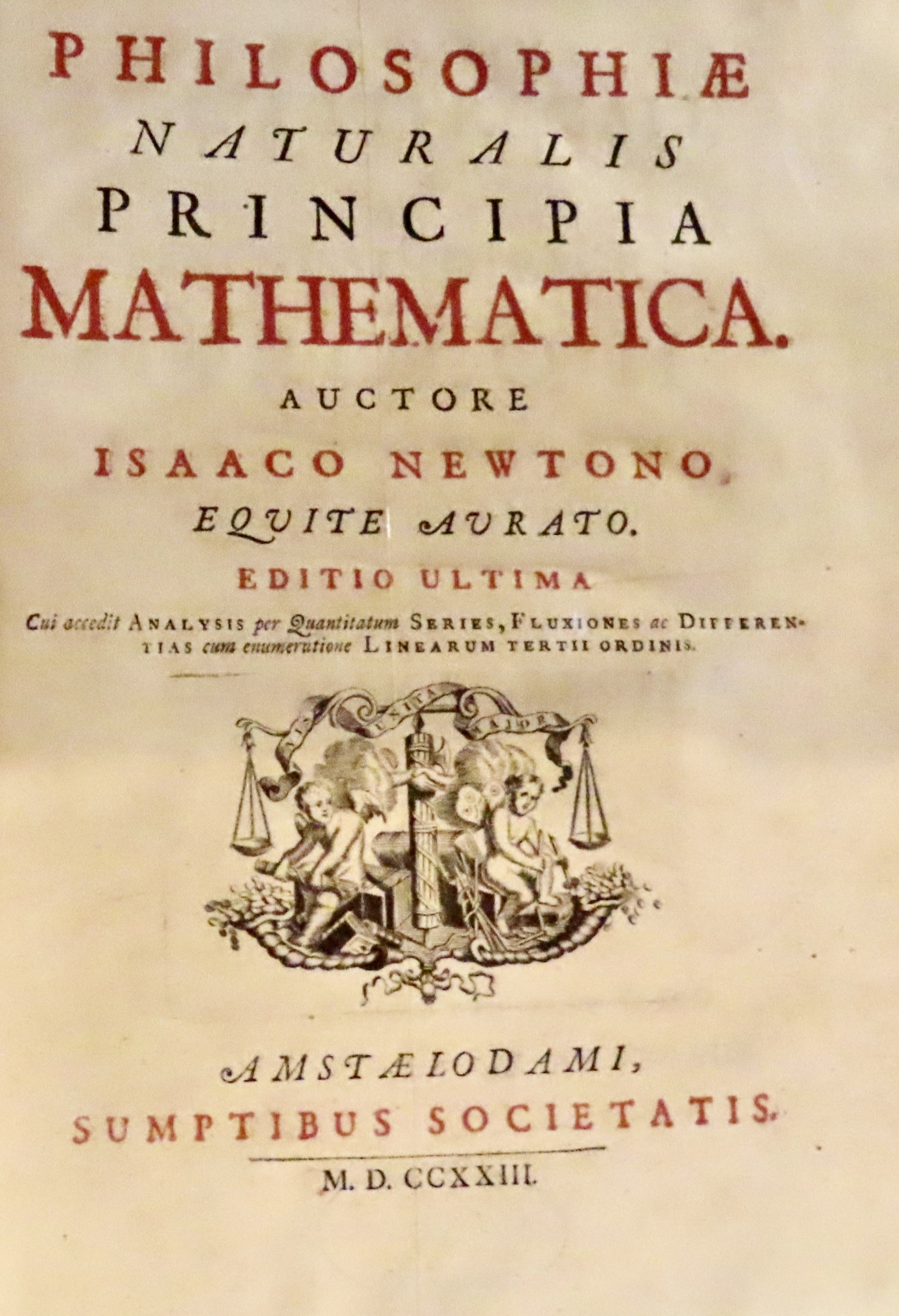
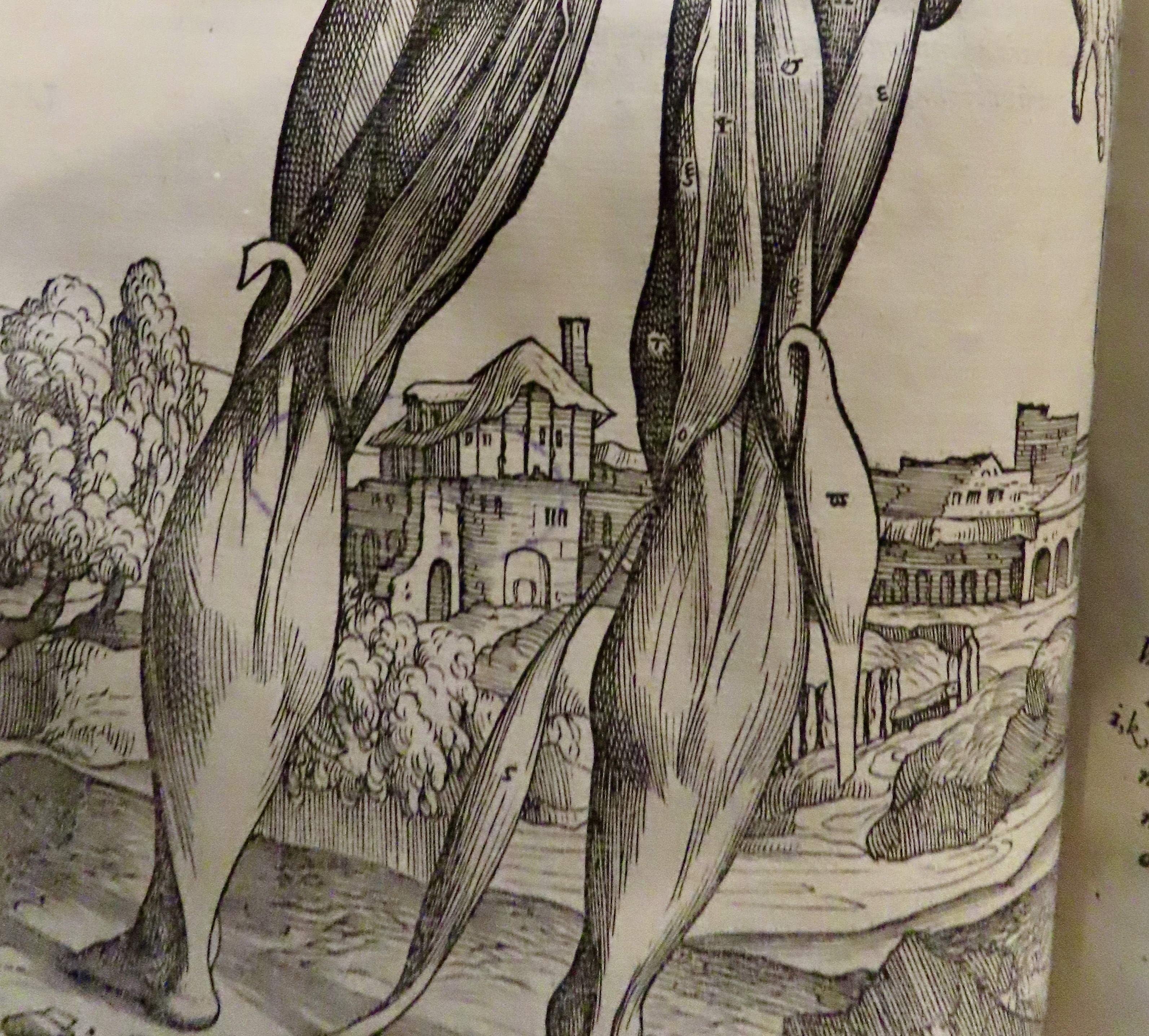
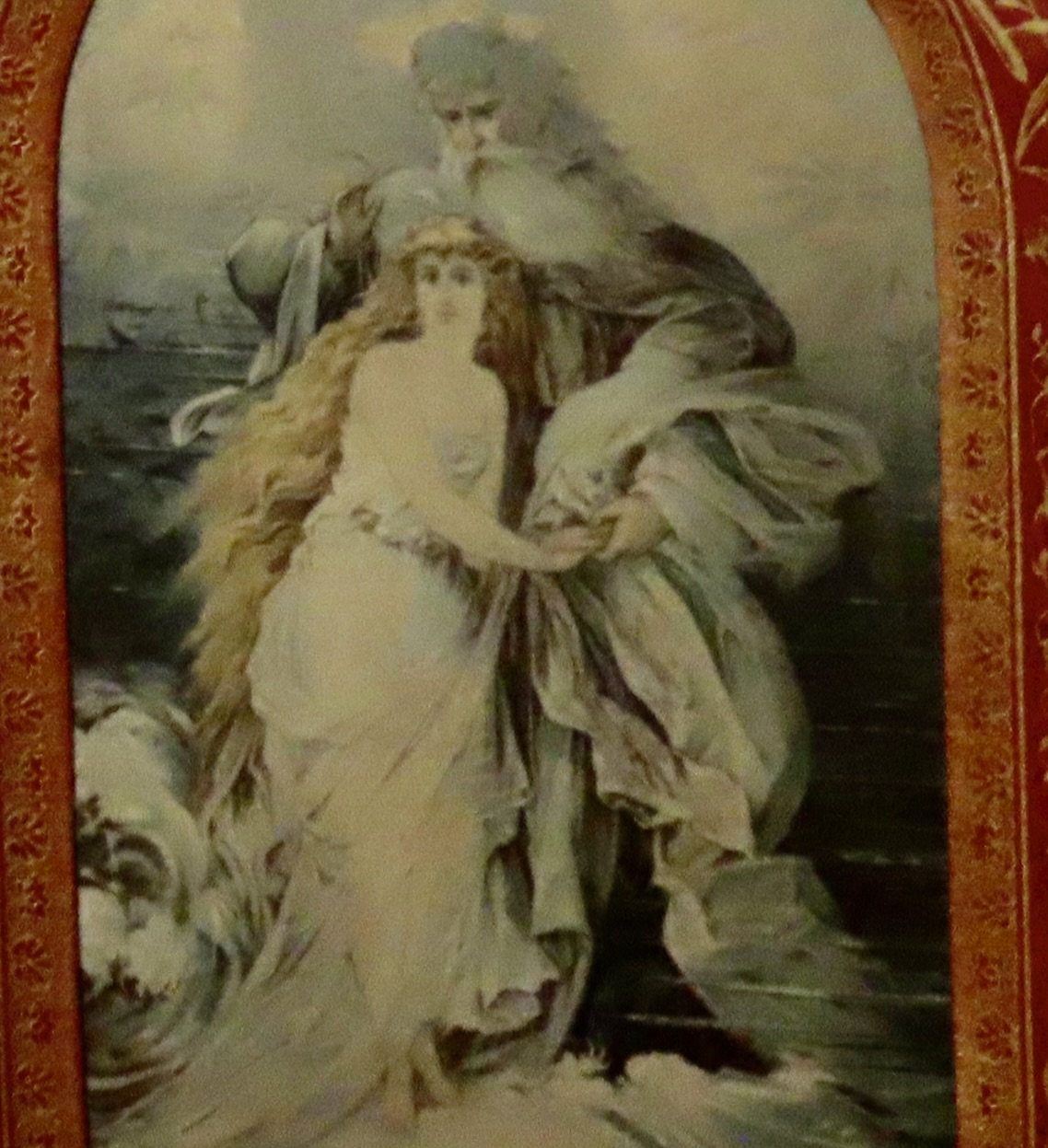
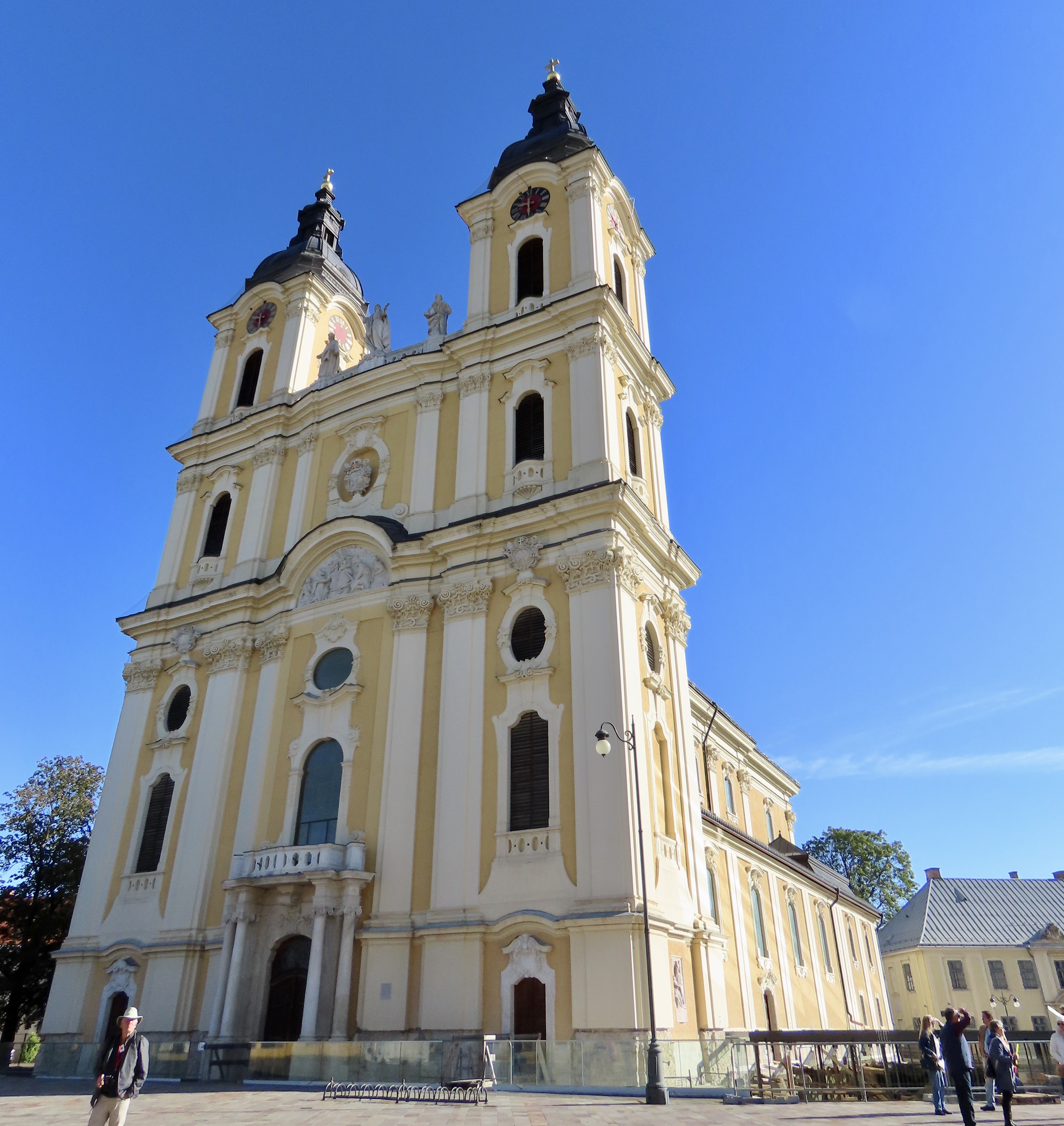
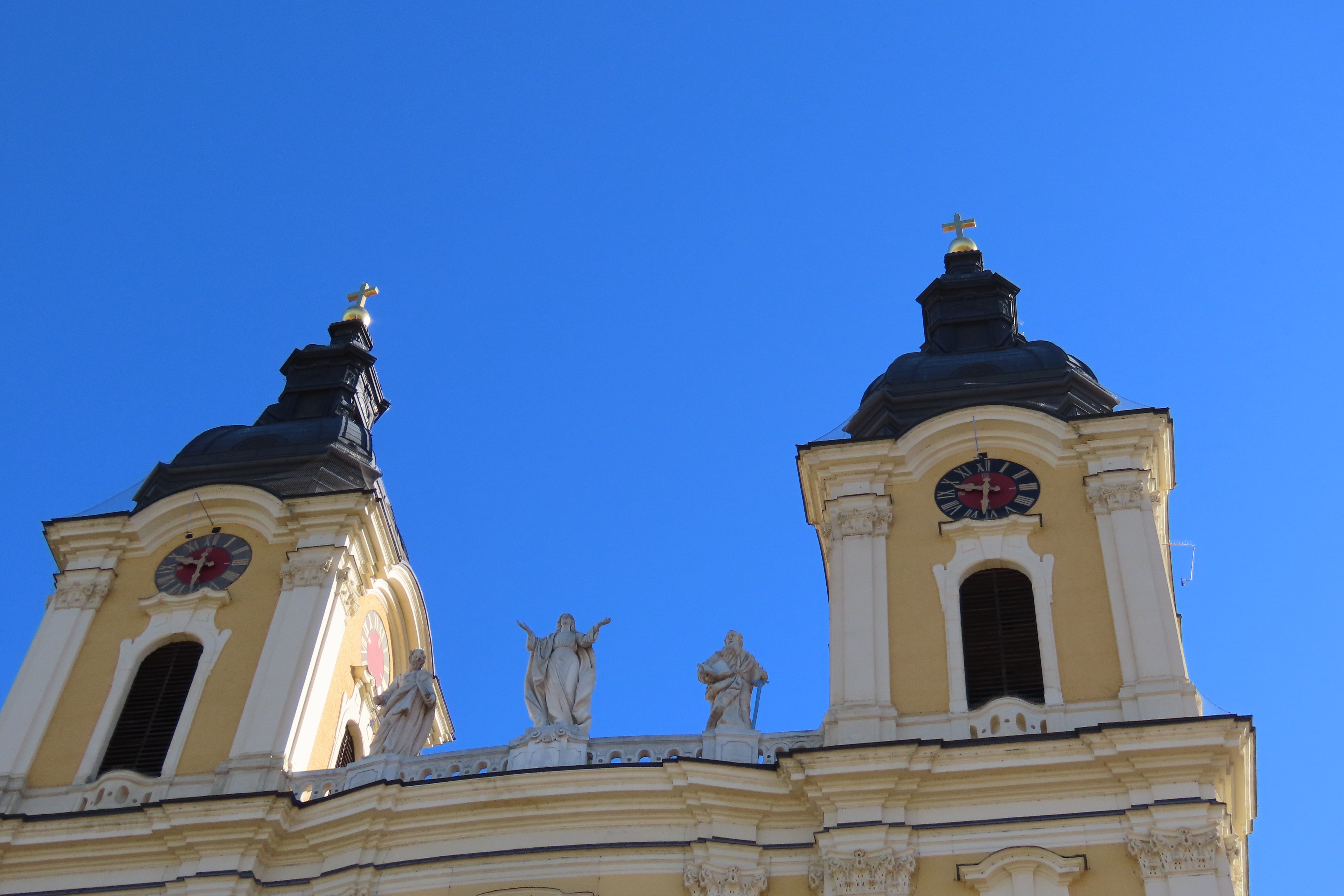
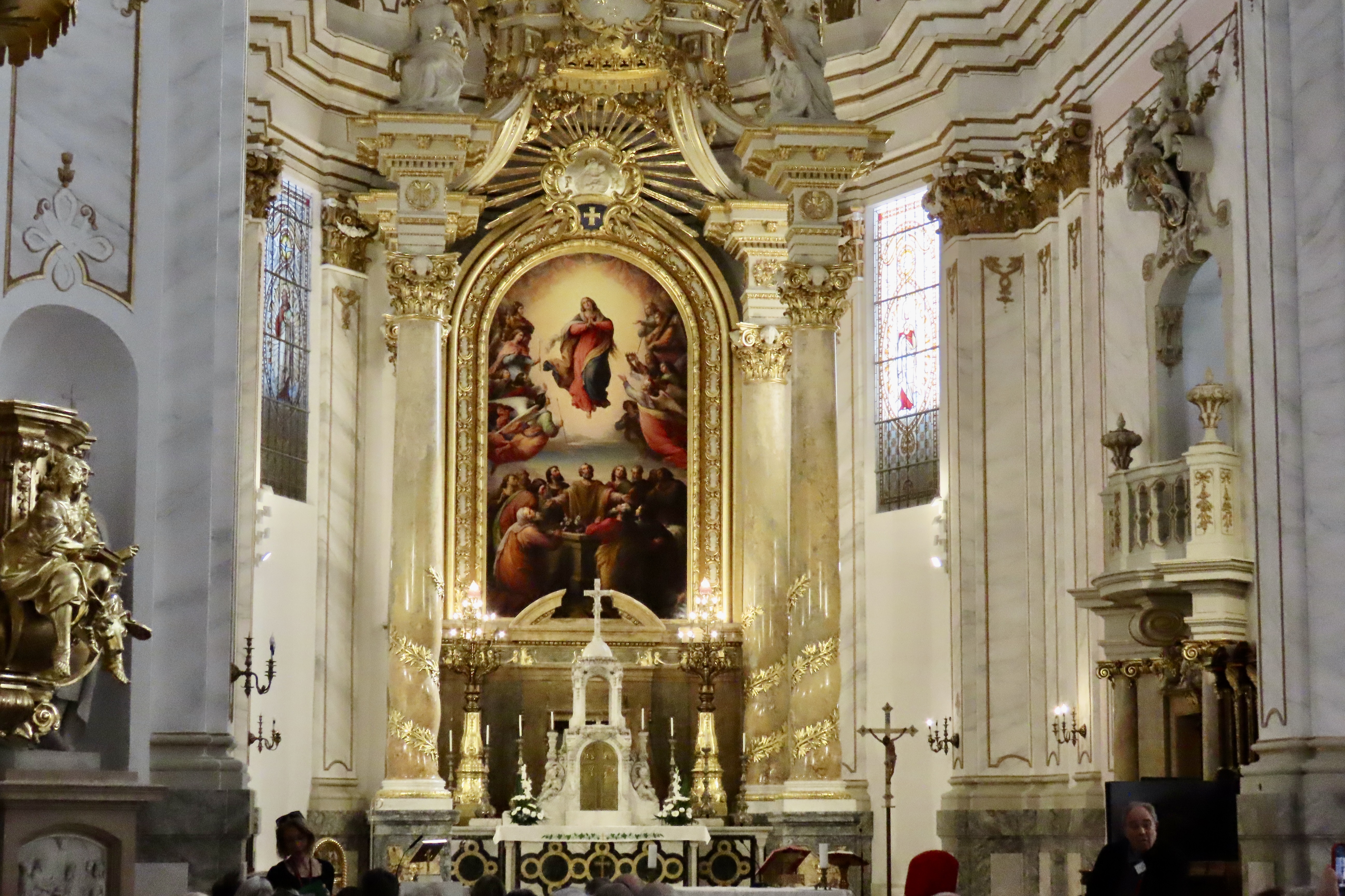
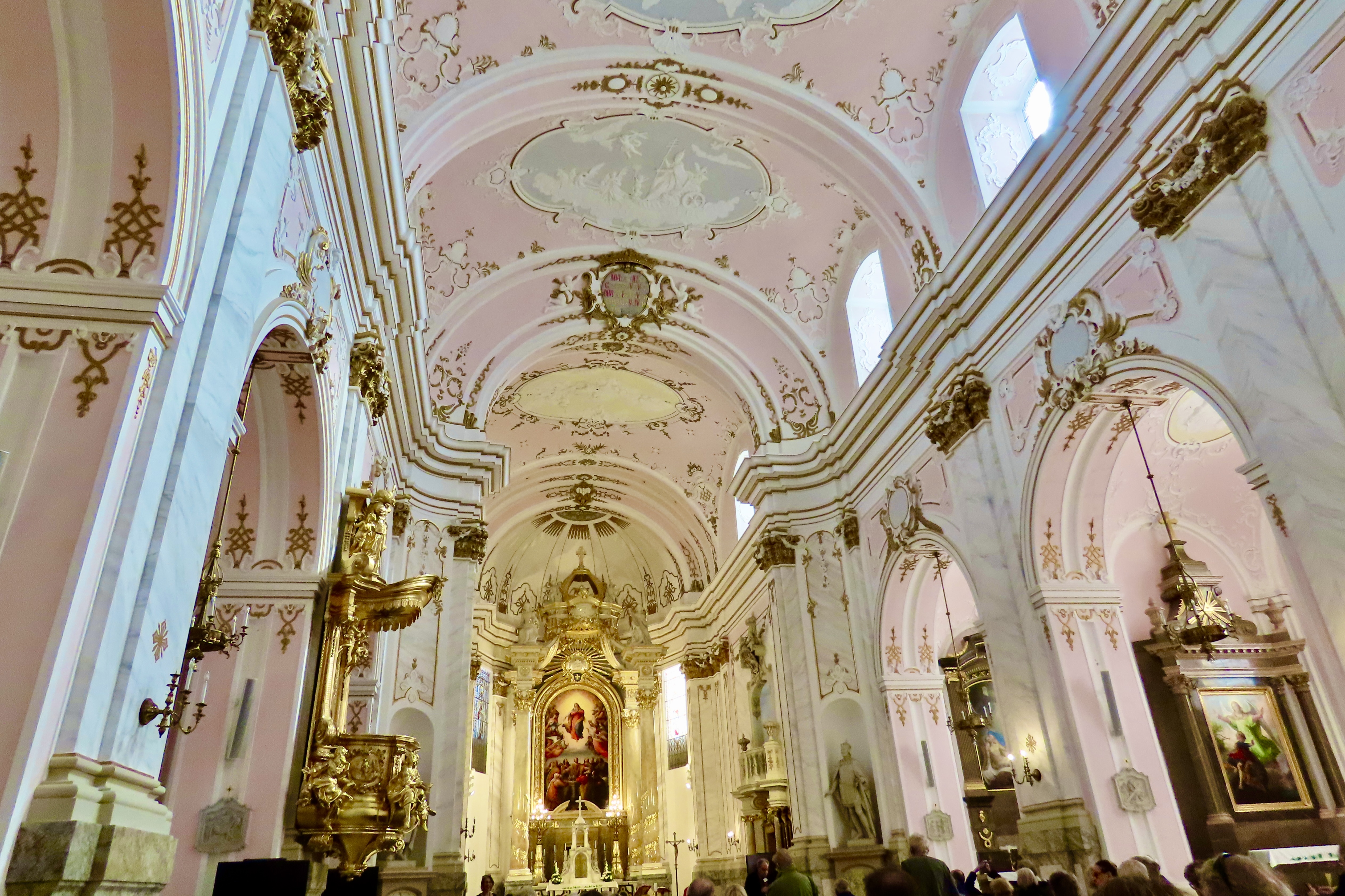
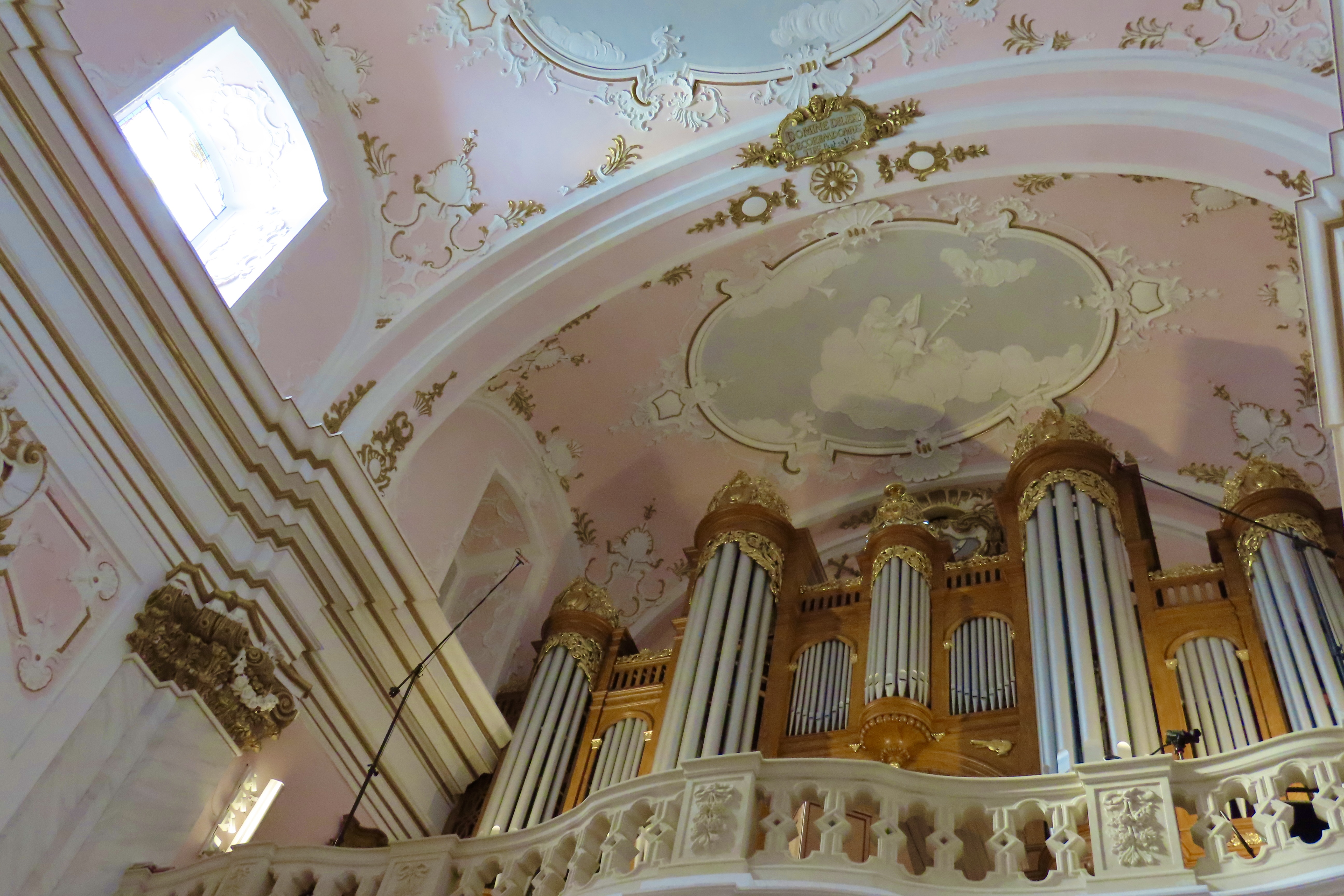
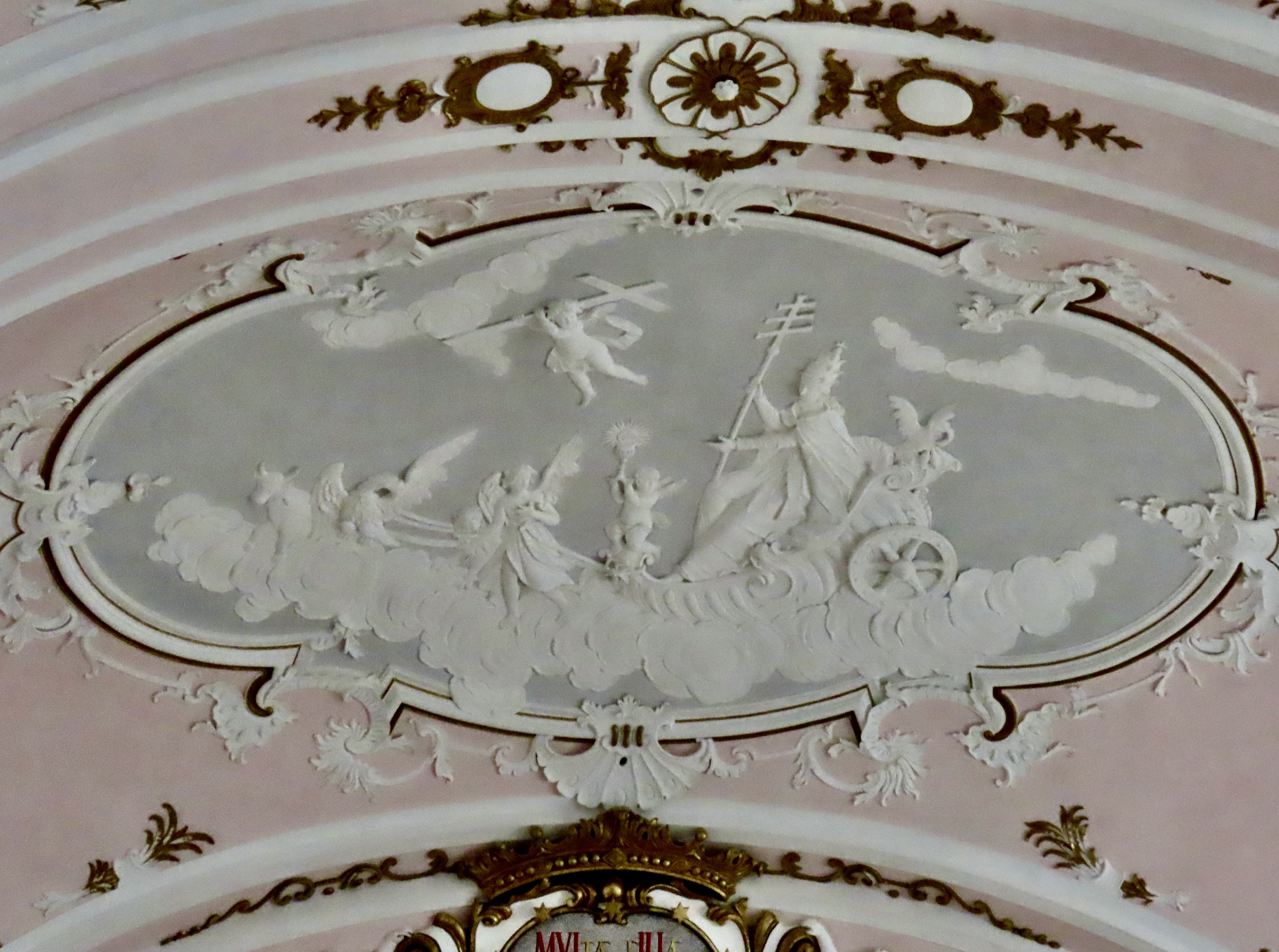
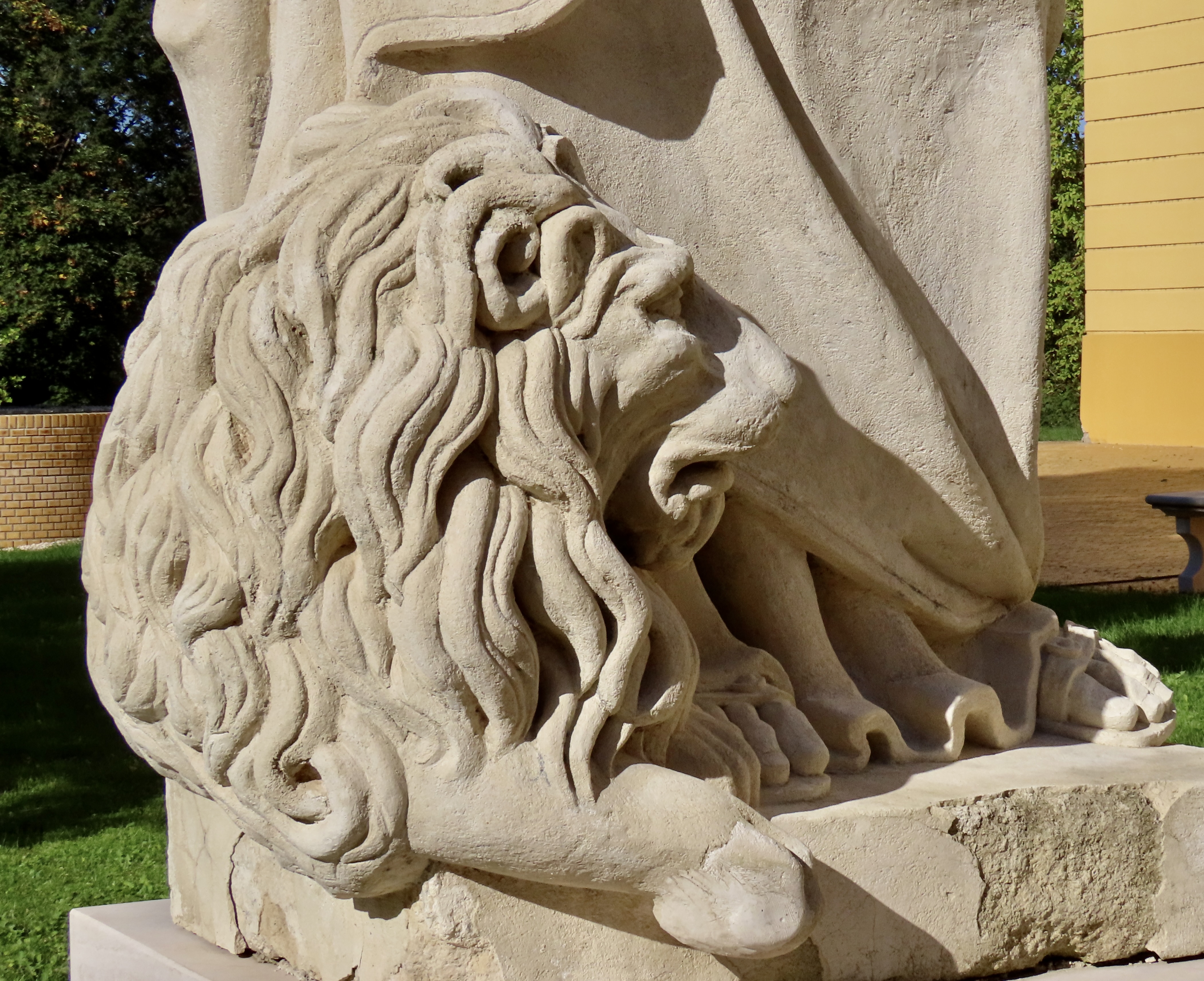
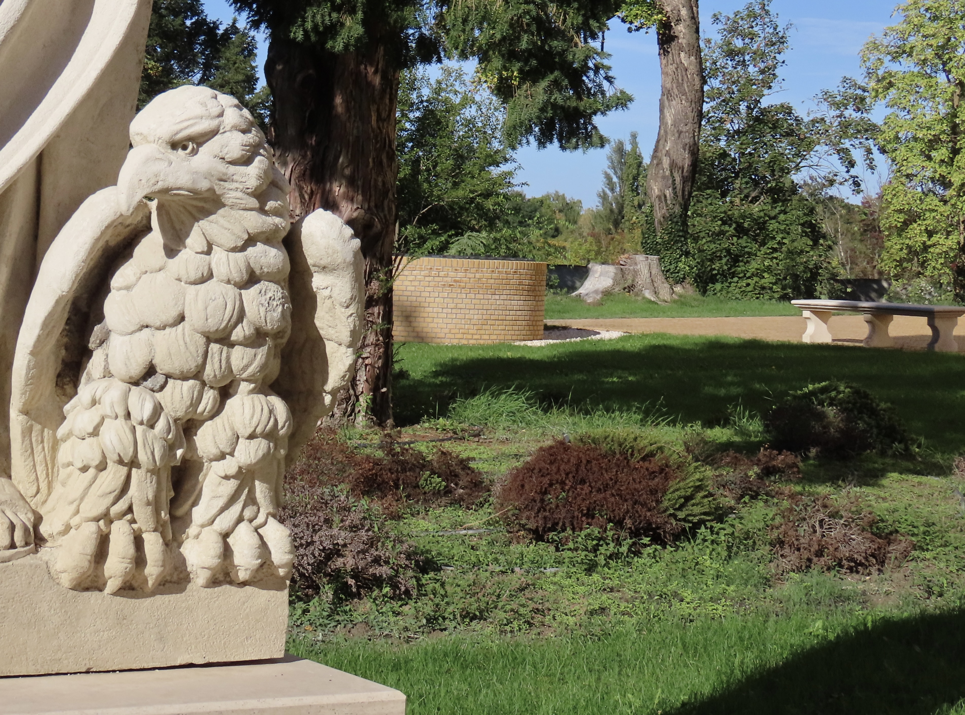
An early edition of Isaac Newton’s Principia Mathematic.A scenic anatomy lesson. My first thought was Biblical where the really old dudes got really young wives. Several of them— not counting concubines. My second thought was hairy. His and hers. It could be that the older man is the father of the young woman.Some of the oldest books in the library. Members of our group check out the illustrations provided in the library.The rather attractive Assumption Cathedral dominates the skyline of Kolocsa and the surrounding country.The Virgin Mary, St. Paul, and St. Peter are perched on top of the church, which led to an irreverent thought (not my first): Peter, Paul and Mary. And what were they singing? Puff the Magic Dragon, naturally, in line with this post.Outside the church, all of the buildings in the Holy Trinity Square were painted yellow. We found it attractive but wondered why one color. Turns out it was Queen Maria Theresa’s favorite. Best to keep the Queen happy.The altar inside the Church of the Assumption displays a large painting of the Virgin Mary being Assumed. (The Catholic Church’s words, not mine.) For my part, I’ll assume she made it, but I know that’s an assumption.The golden, pink and white colors inside the church made for an interesting look.The church’s organ.We found the stuccos on the ceiling of the church to be particularly impressive.Outside I found two rather impressive beasties. This lion…And an eagle. Check out the talons! There may be some kind of record here. That’s a wrap on Kalocsa, or, in the immortal words of Bugs Bunny, “That’s all folks.” In our next post Peggy and I are returning to the Big Island of Hawaii, where we will take you to the beautiful Hawaii Tropical Botanical Garden, which is almost out of this world.
When Peggy and I visited Hawaii’s youngest and most active volcano, Kīlauea, on January 17, we took this photo of lava erupting 200 feet into the air in the Halemaʻumaʻu Crater.The location of where we are staying for the month in Sea View, Hawaii at the Starlit Skies of Kalapana VRBO rental (Very nice). To provide perspective Hilo is 32 miles north of us via road and the Kīlauea Volcano is 46 miles to the west.
The Hawaiian goddess of volcanoes and fire, Pele, is said to live up in the Kilauea Volcano. She’s been restless since we arrived, spewing lava into the air and covering the floor of the Halemaʻumaʻu crater.
A painting in the park’s headquarters showed an artist’s conception of Pele. You might say ‘she’s hot,’ too hot to handle in fact. The temperature of lava when it erupts is somewhere between between 1,300 to 2,200 degrees Fahrenheit. Early Polynesians who arrived by boat between 1000-1200 CE, have a myth describing how Pele ended up on Hawaii: she was escaping from her sister, Nāmakaokahai, goddess of the ocean. In one version of the myth, Nāmakaokahai was jealous of Pele’s beauty and strength; in another, Pele had seduced her husband. (Before you ask, the egg contains Pele’s younger sister and companion, Hi’iaka),
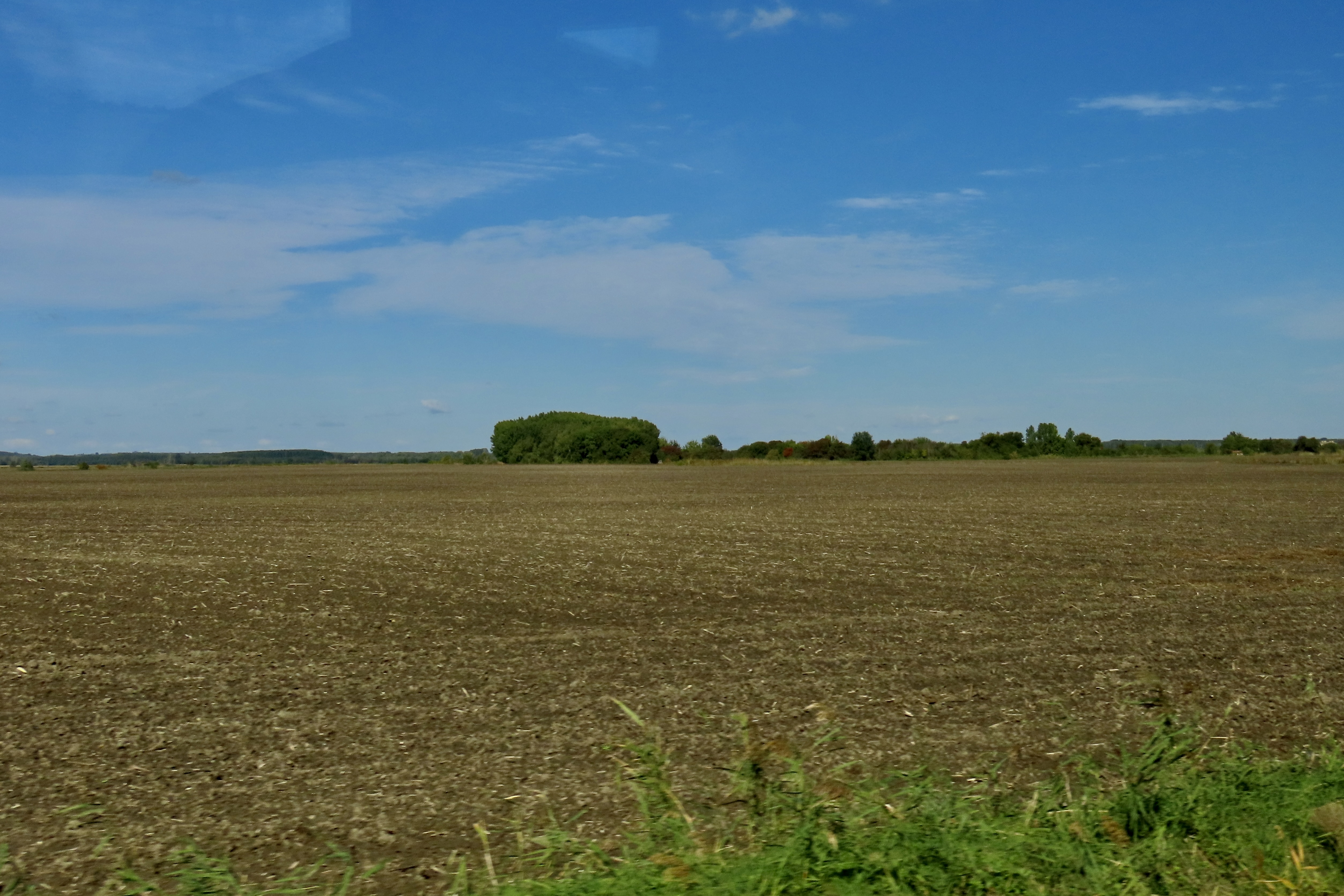
Scientists have a different theory of what makes Hawaii one of the most active volcano sites in the world. It is sitting on top of a hot spot in the middle of the Pacific Ocean where lava is rising up from the earth’s mantle. The island is making its way over the hotspot as the Pacific Tectonic Plate moves in a northwest direction at a speedy 2-4 inches per year. With the exception of Maui, the other islands have moved beyond the hotspot and their volcanoes are extinct. A new island named Loihi Seamount is currently being created about 20-30 miles southeast of where we are. You can expect to see it rise above the ocean— if you are around— in about a hundred thousand years or so.
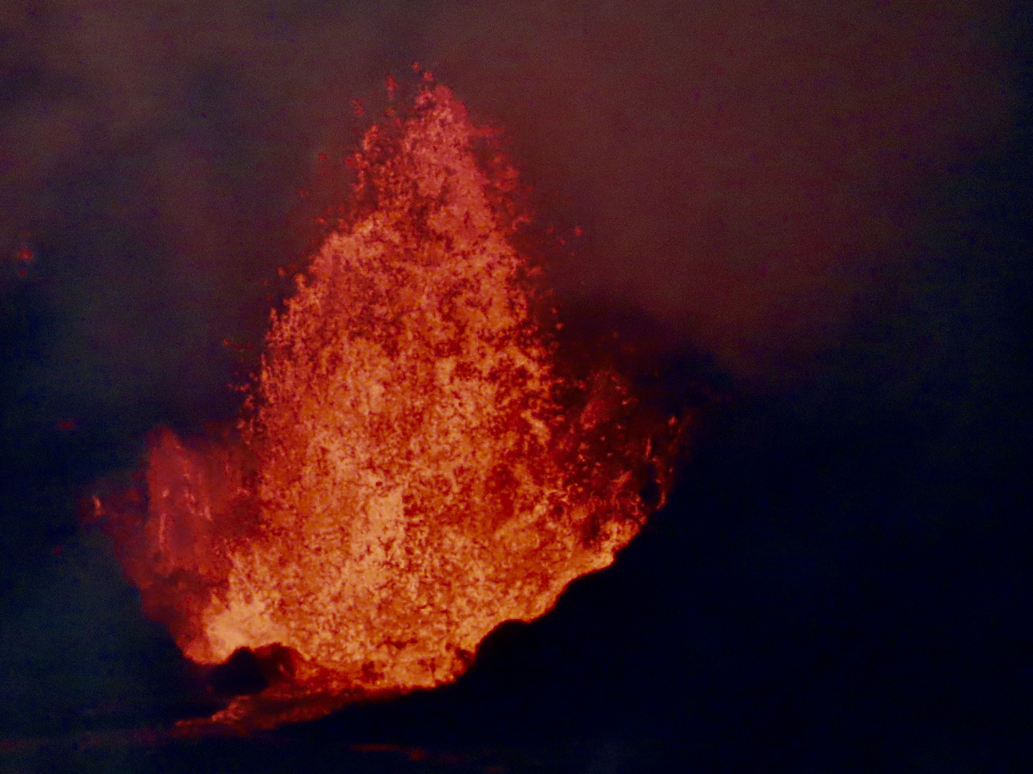
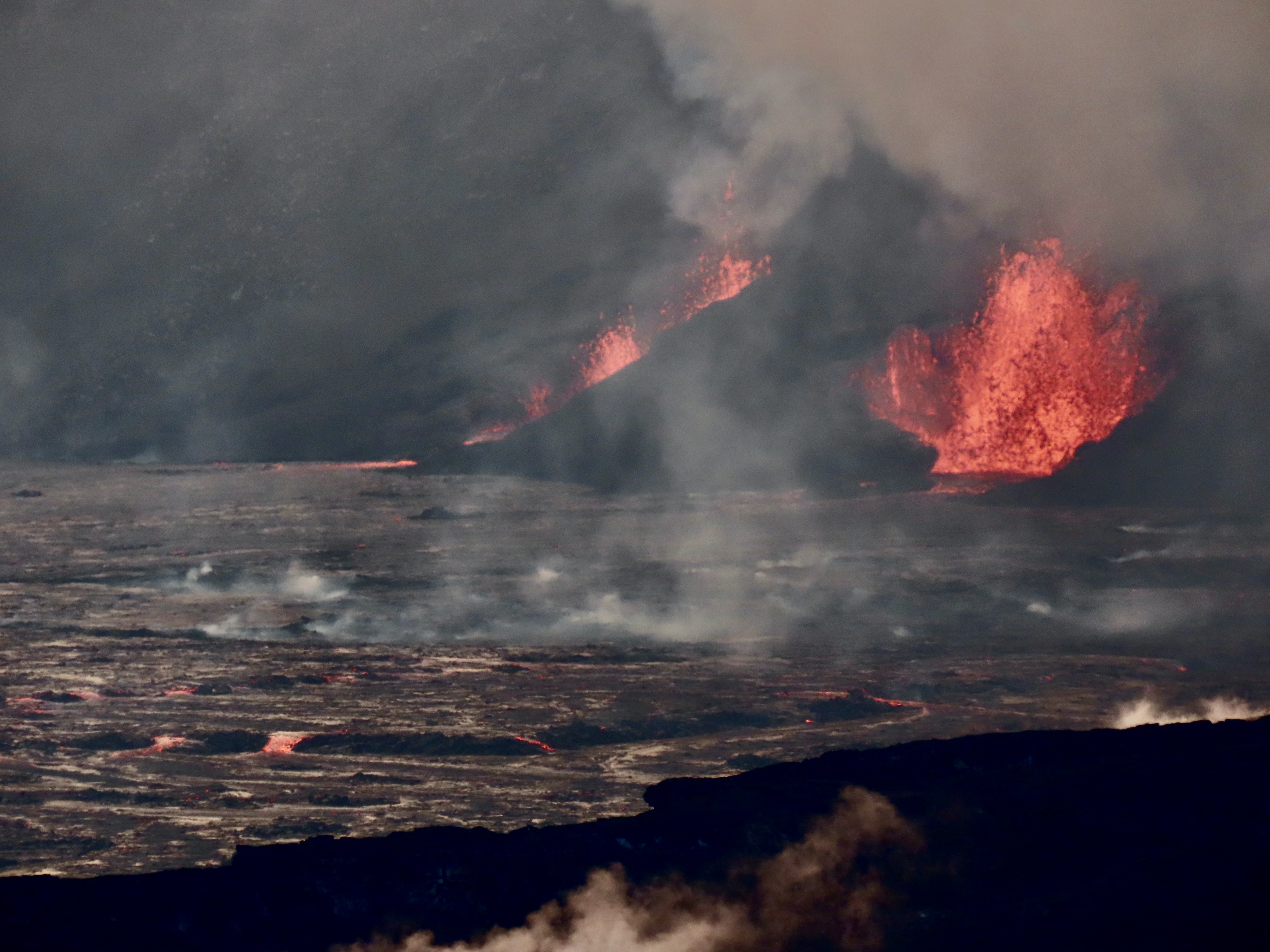
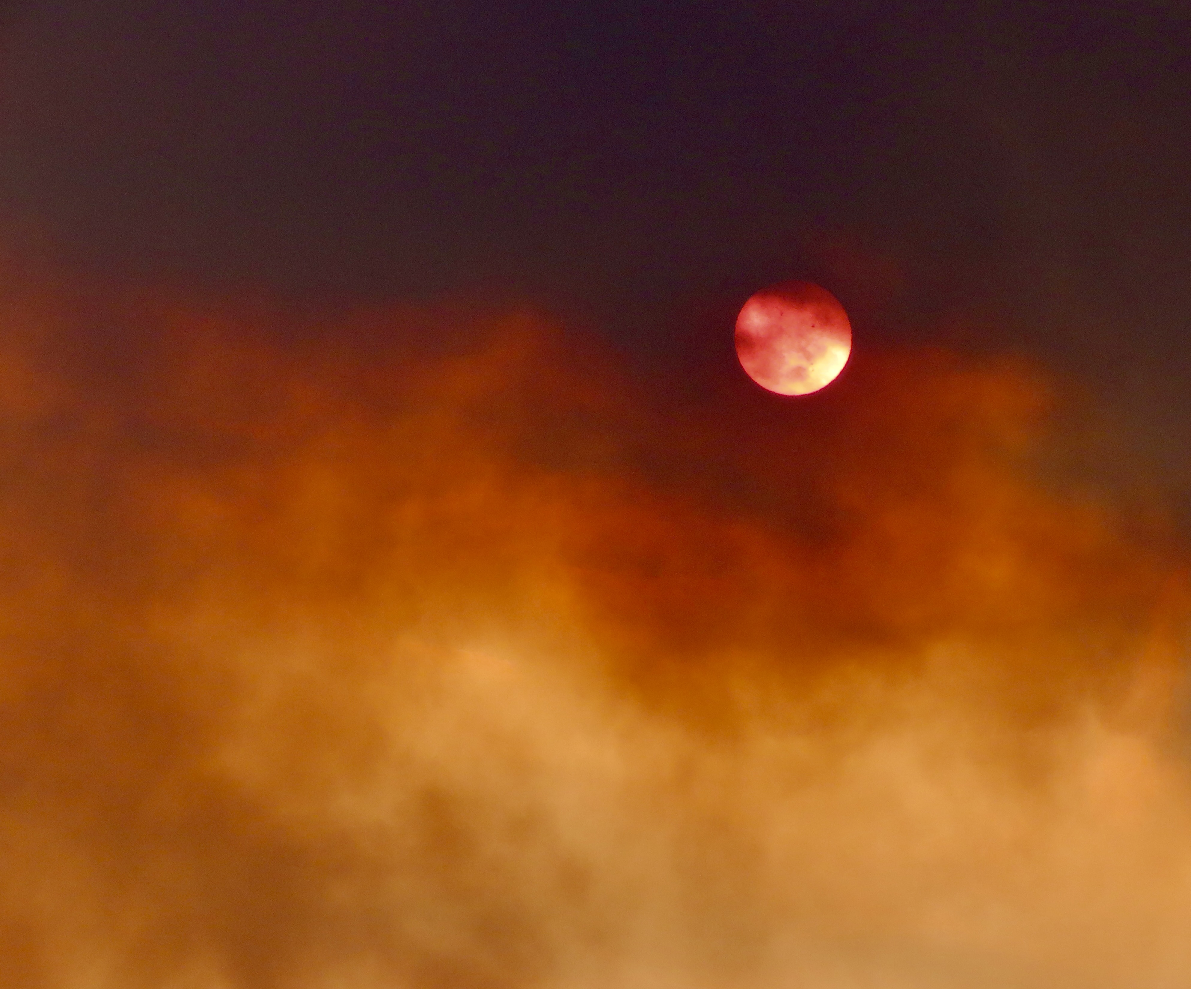
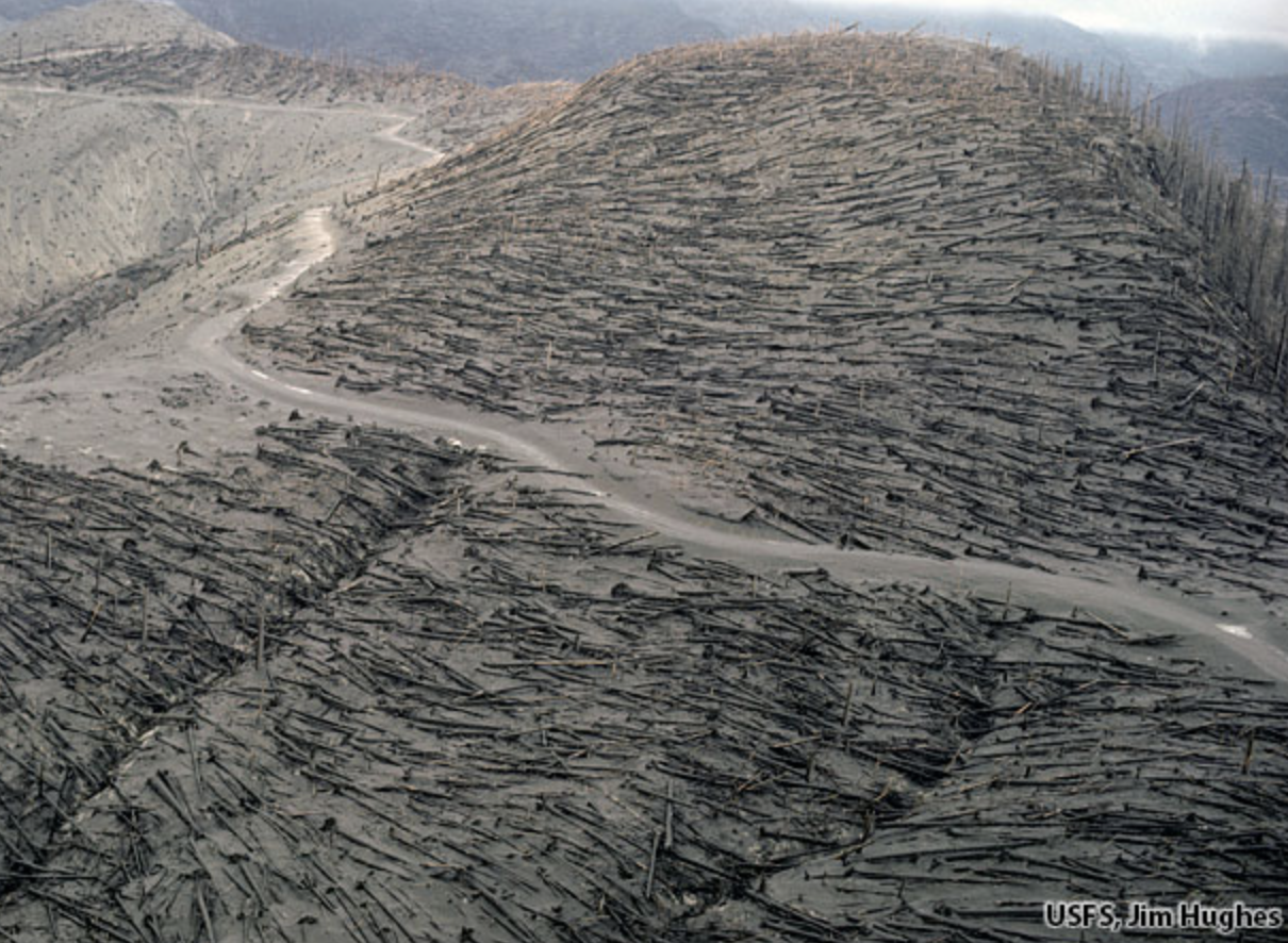
Most people think of the Hawaiian Islands as being the green ones on the lower right. There are actually 132 islands, atolls and undersea volcanoes included in the chain that extends over 2600 miles toward Alaska’s Aleutian Islands! They all originated over the hot spot that the Big Island now occupies. The area within the dotted line is the Papahānaumokuākea Marine Reserve (Pronounced Pa-pa-hah-now-mo-koo-ah-keh-ah in Hawaiian.) You will be quizzed on the name and its pronunciation later. (National Oceanic and Atmospheric Administration map.)Peggy and I standing in front of the Kīlauea Crater as the volcano does what active volcanoes do. The last time this particular section of the volcano erupted was almost 50 years ago. I was on the island at the time. The National Park had built a walkway out to the crater so visitors could look down into its seething mass.This time we were at least a mile away. Fortunately, we both have excellent telephoto lens.We could look into the heart of the crater. This is a close up of the lava spewing out.Two vents were blasting away. Note the lava flowing out of the vent on the right as it covered the crater floor.A view of the vents and a portion of the floor.A plume rose from the volcano and played hide and seek with the sun. (This is how far away the volcano looked without our telephoto lenses.)The plume led to a photo op, and an observation…At one point, the plume looked almost like a mushroom cloud created by an atomic bomb. It wasn’t, of course, but it did serve as a reminder that volcanoes are more than tourist attractions. They are dangerous, sometimes extremely so. Even the cloud carried a risk: Vog. Think smog but worse. When we were there, the National Park had posted a health advisory alert. We were also told to be on the lookout for Pele’s Hair. One could only ask, “what?” The National Park provided a photo…Looks like hair to me, but who knew Pele was a blond? Actually it is volcanic glass produced from lava stretched into thin strands and transported by air. Touching is not advised. It can break into small splinters and enter your skin.What we saw had already been broken into small pieces. I didn’t try to pick up one. Of much greater concern than the vog or Pele’s Hair is what magma decides to do when it erupts as lava. It depends on the type of lava. All magma holds gas that is highly compressed under intense pressure in the earth’s mantle. As the lava approaches the surface, the gas expands and has to escape in one way or another. Thicker lava, like that found along the Pacific Rim where the Pacific Plate is plunging under continental plates, holds the gas, not allowing it to escape. The result is violent explosions that lead to the creation of steep, conical shaped, composite mountains like California’s Mt. Shasta shown below.A photo of Mt. Shasta I took while I was hiking down the Pacific Crest Trail. The devastation created by these explosions can be extensive. I flew over Mt. St. Helens a couple of weeks after it erupted in 1980 and thousands of trees had been blown down by the eruption.This photo by Jim Hughes of the US Forest Service shows what I saw. Between asphyxiation and burns, 57 people lost their lives because of the eruption.
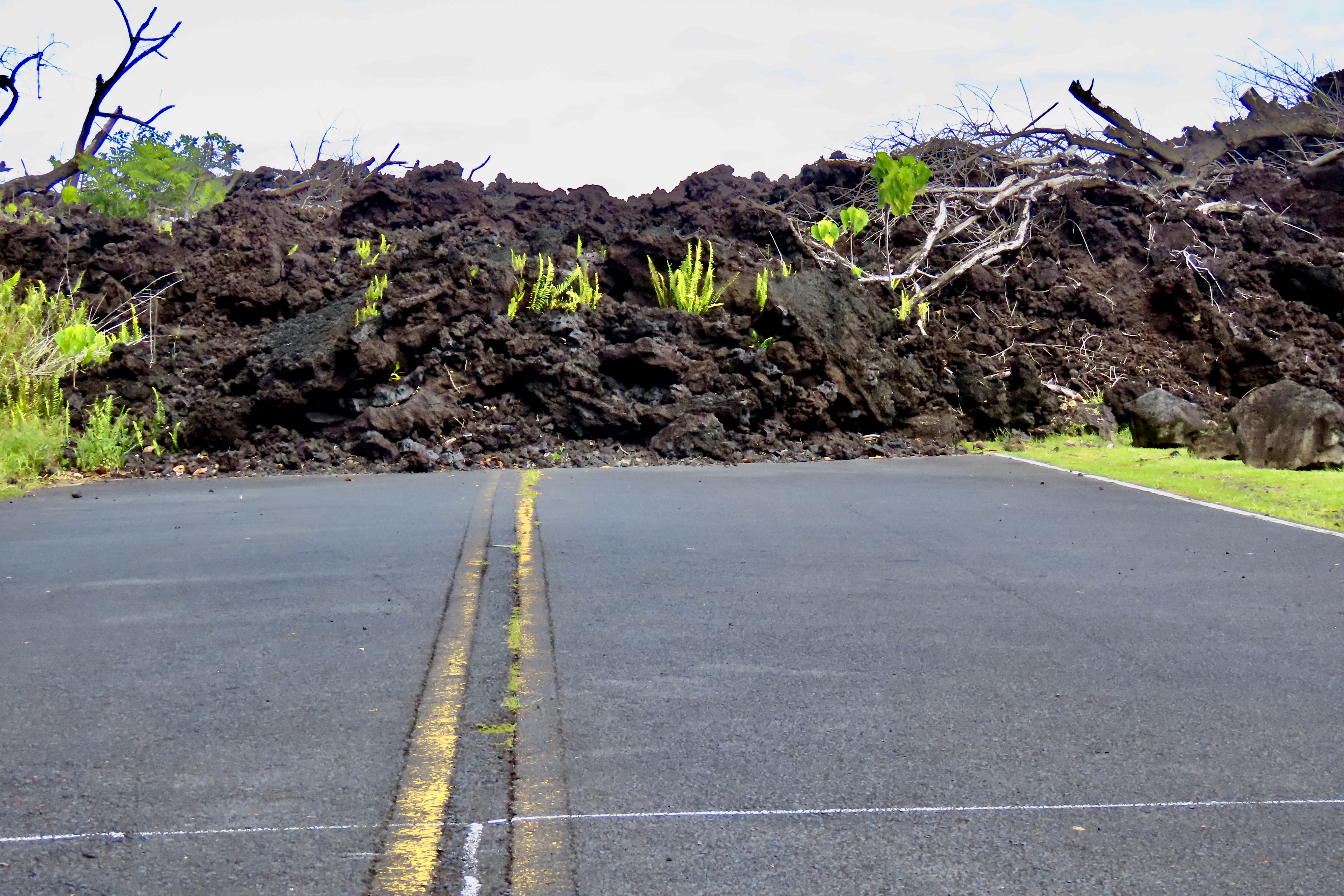
The lava flowing out of the volcanoes on Hawaii is much thinner. The gas can escape in bubbles. It doesn’t have to explode and is much ‘kinder,’ so to speak— if you don’t mind seeing your homes and roads burn and disappear under thick layers of lava. No one was killed in the major 2018 eruption that took place near where Peggy and I are staying. People could walk faster than the lava was flowing. The eruption will be the subject of our next post on Hawaii.
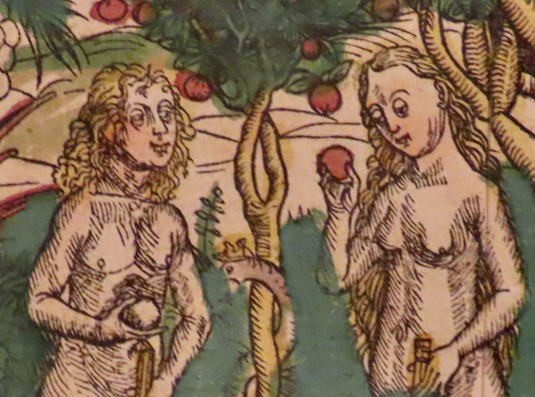
But first, as promised, we will return to our fall journey down the Danube River and the historic town of Kalocsa, Hungary where we visit a library featuring thousands of illustrated books that are hundreds of years old. I found this Adam and Eve illustration humorous. Is Adam holding a duck? (The words underneath are mine.)“Eat the apple,” Snake urges. “God made it. What could possibly go wrong?”
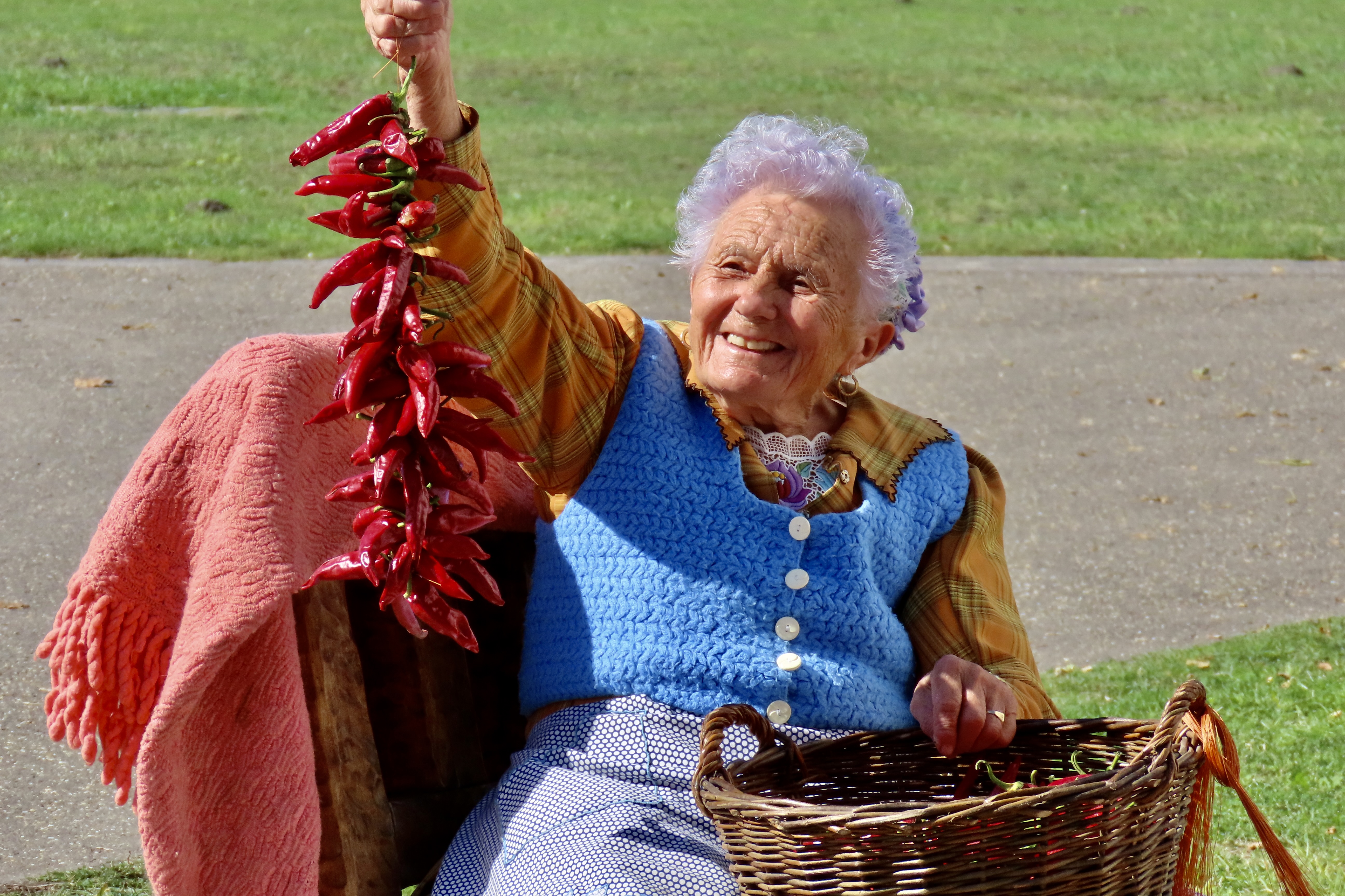
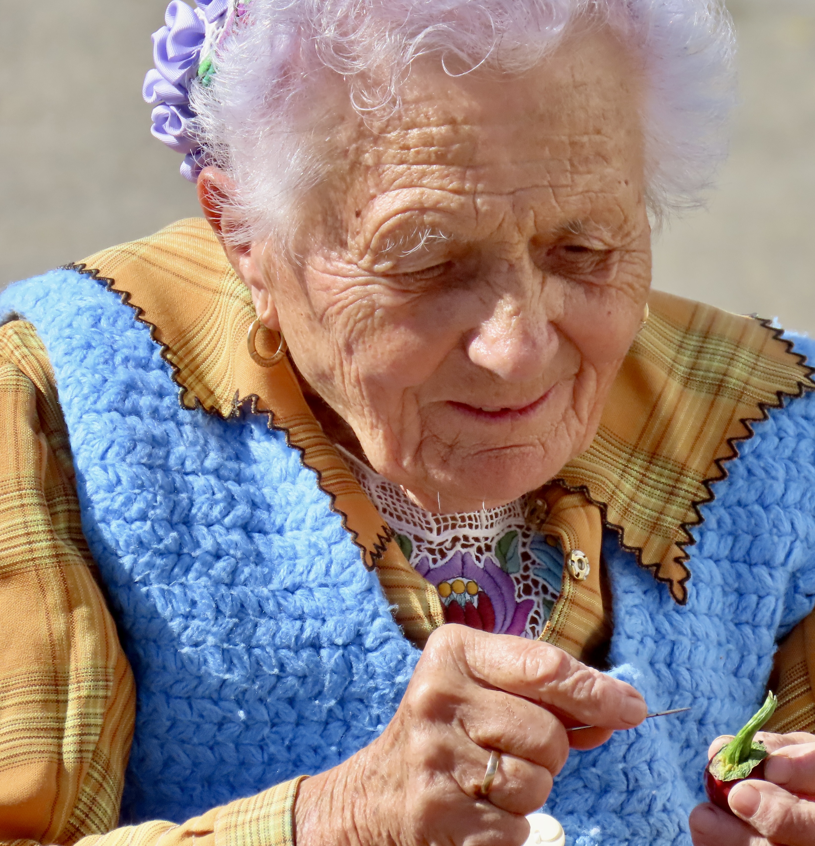
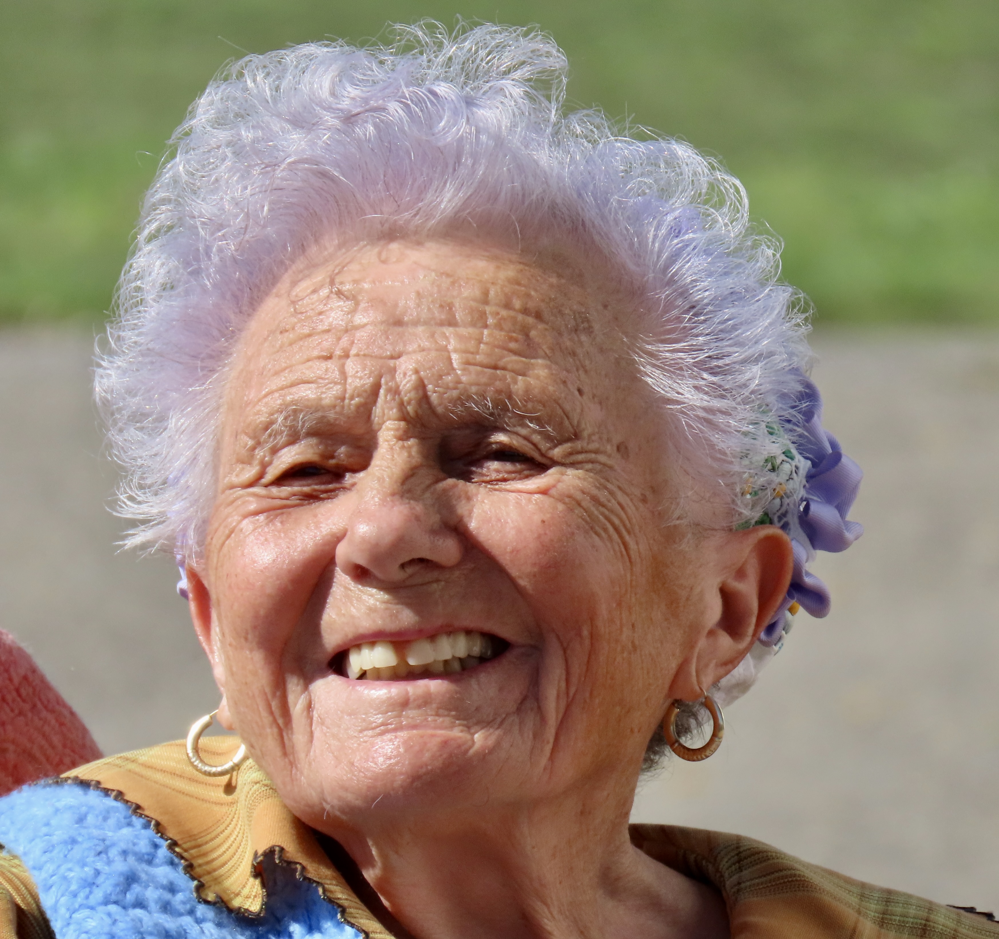
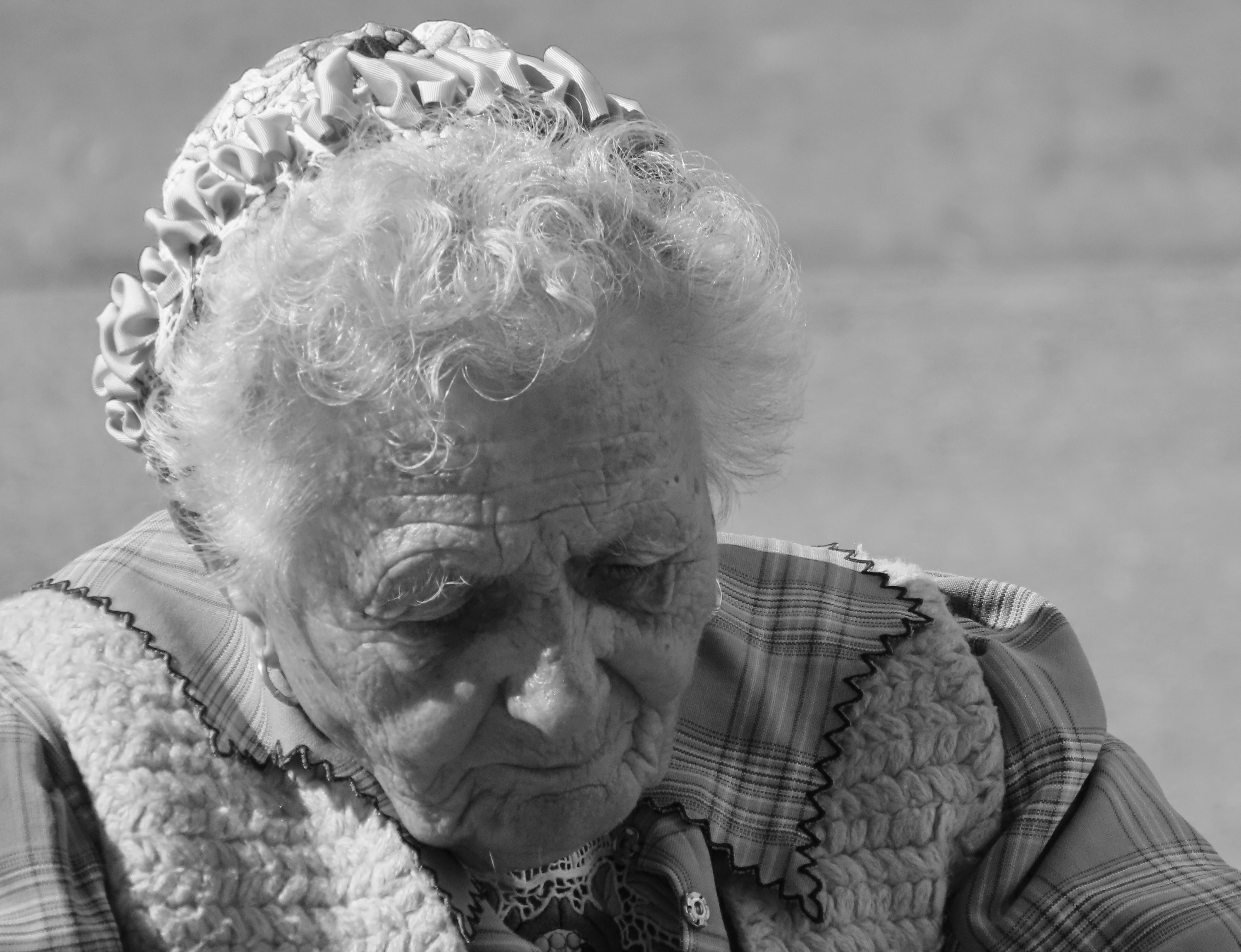
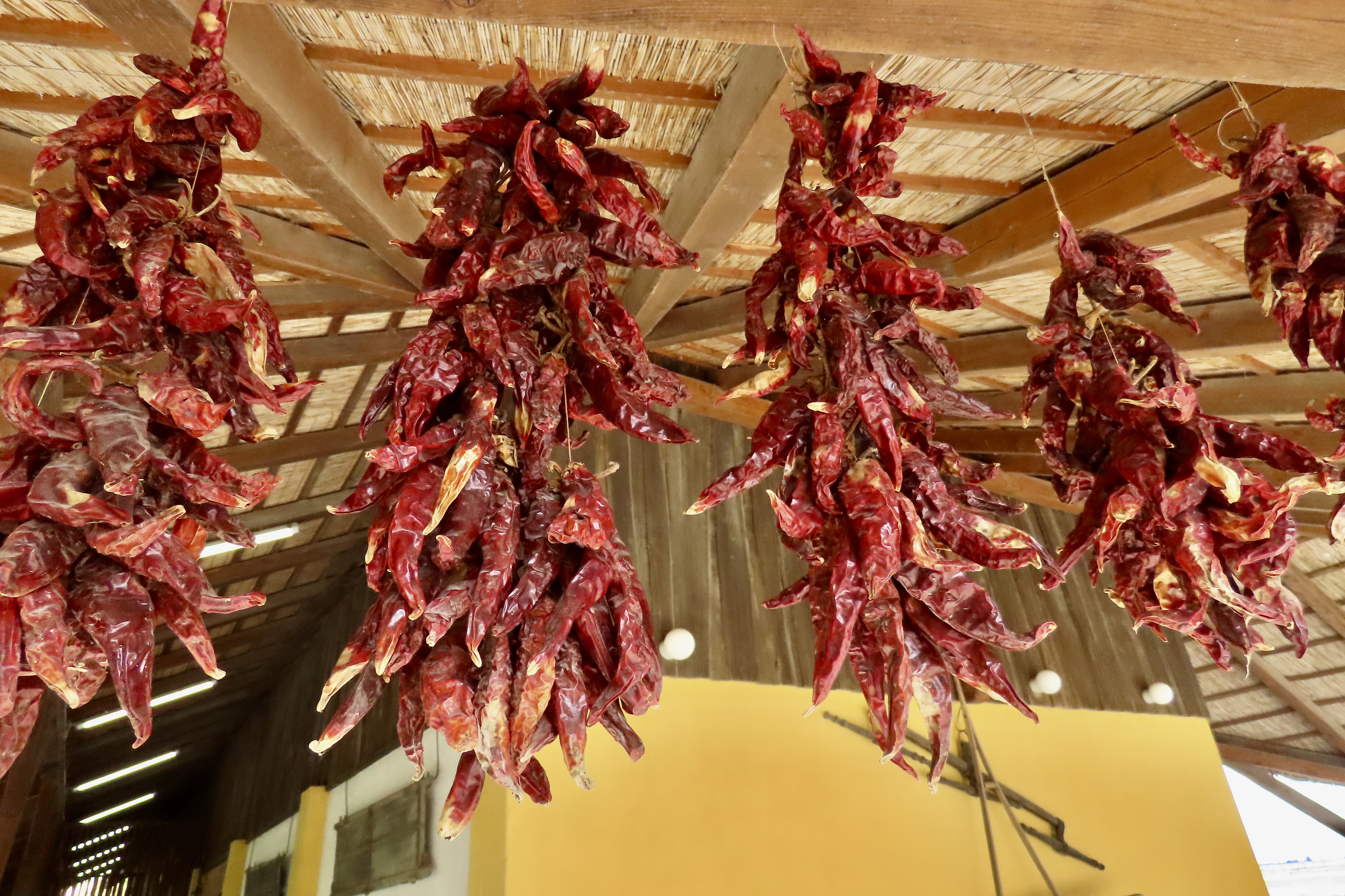
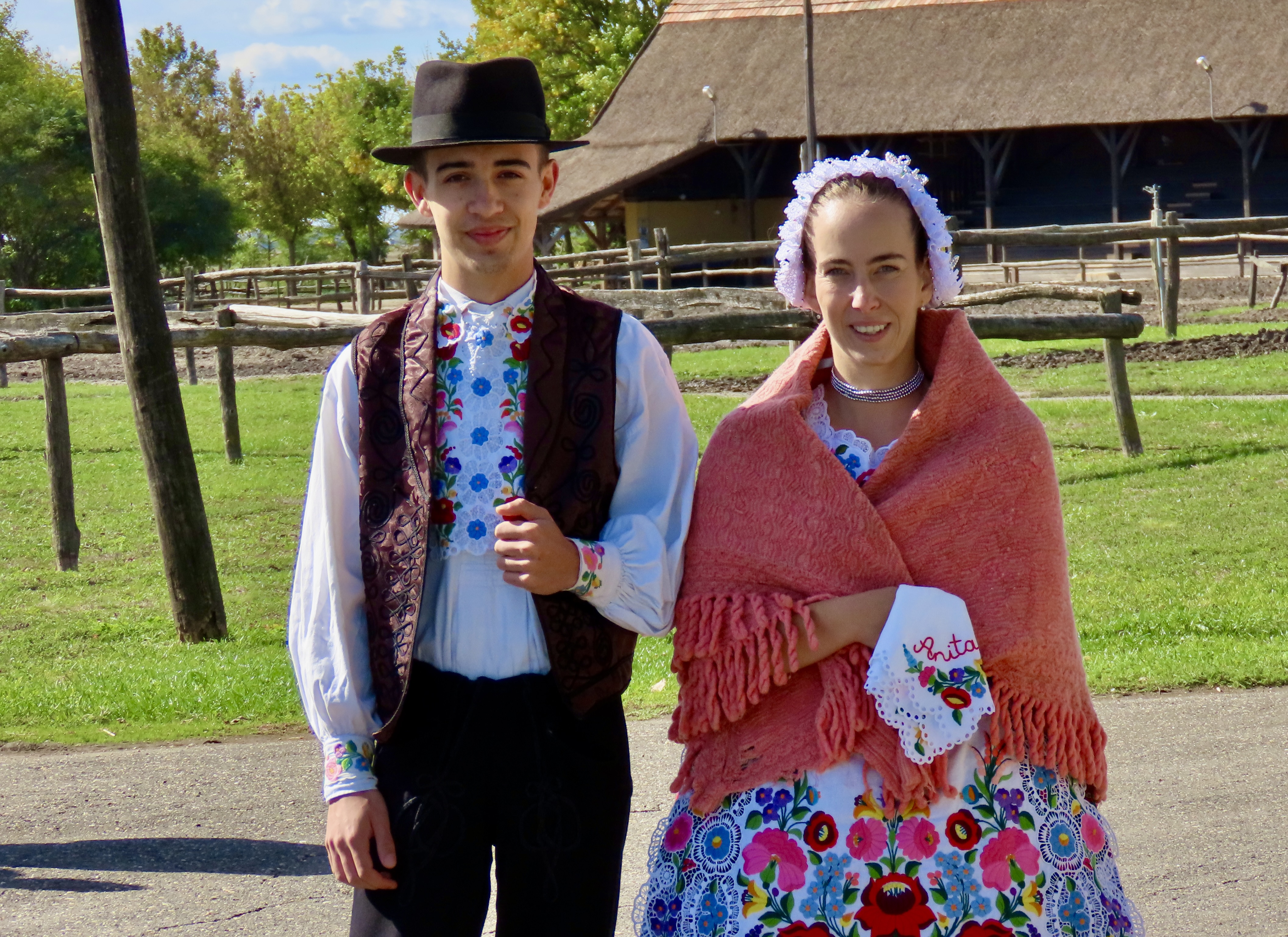
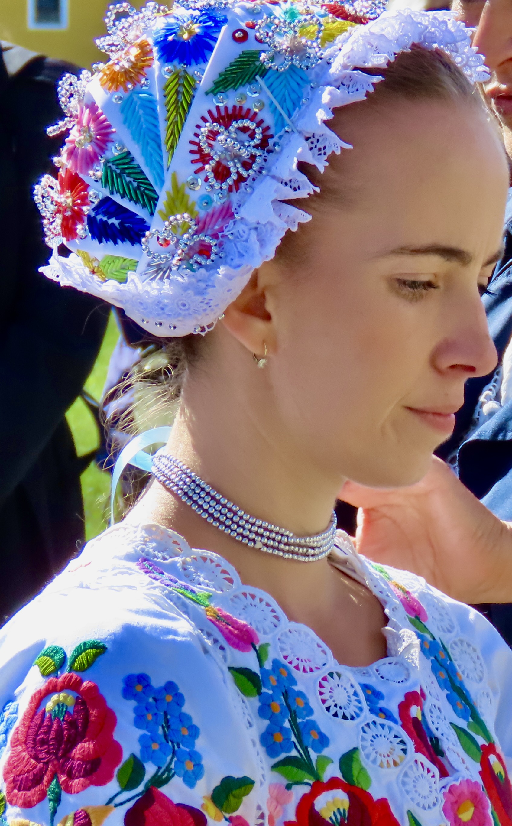
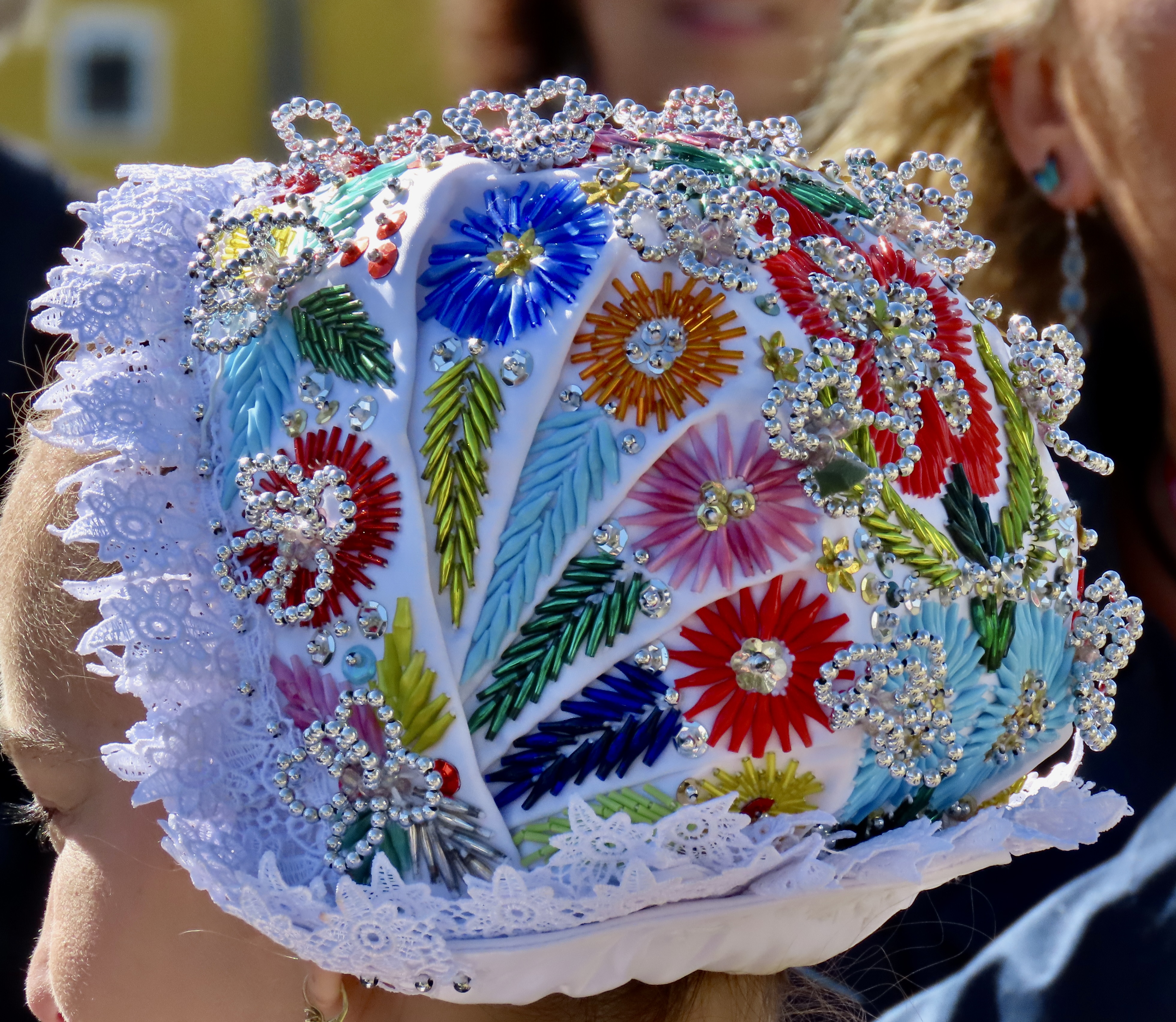
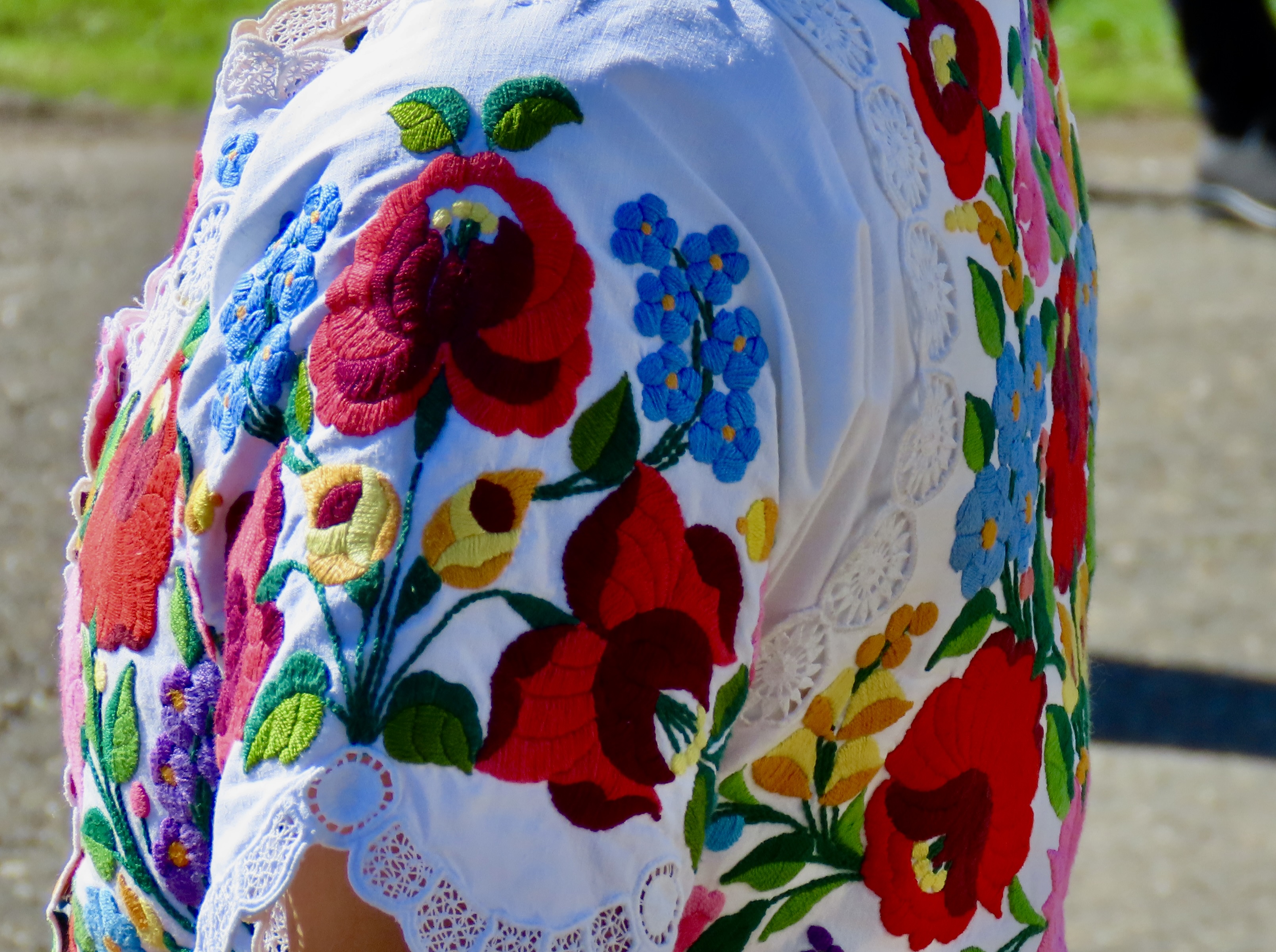
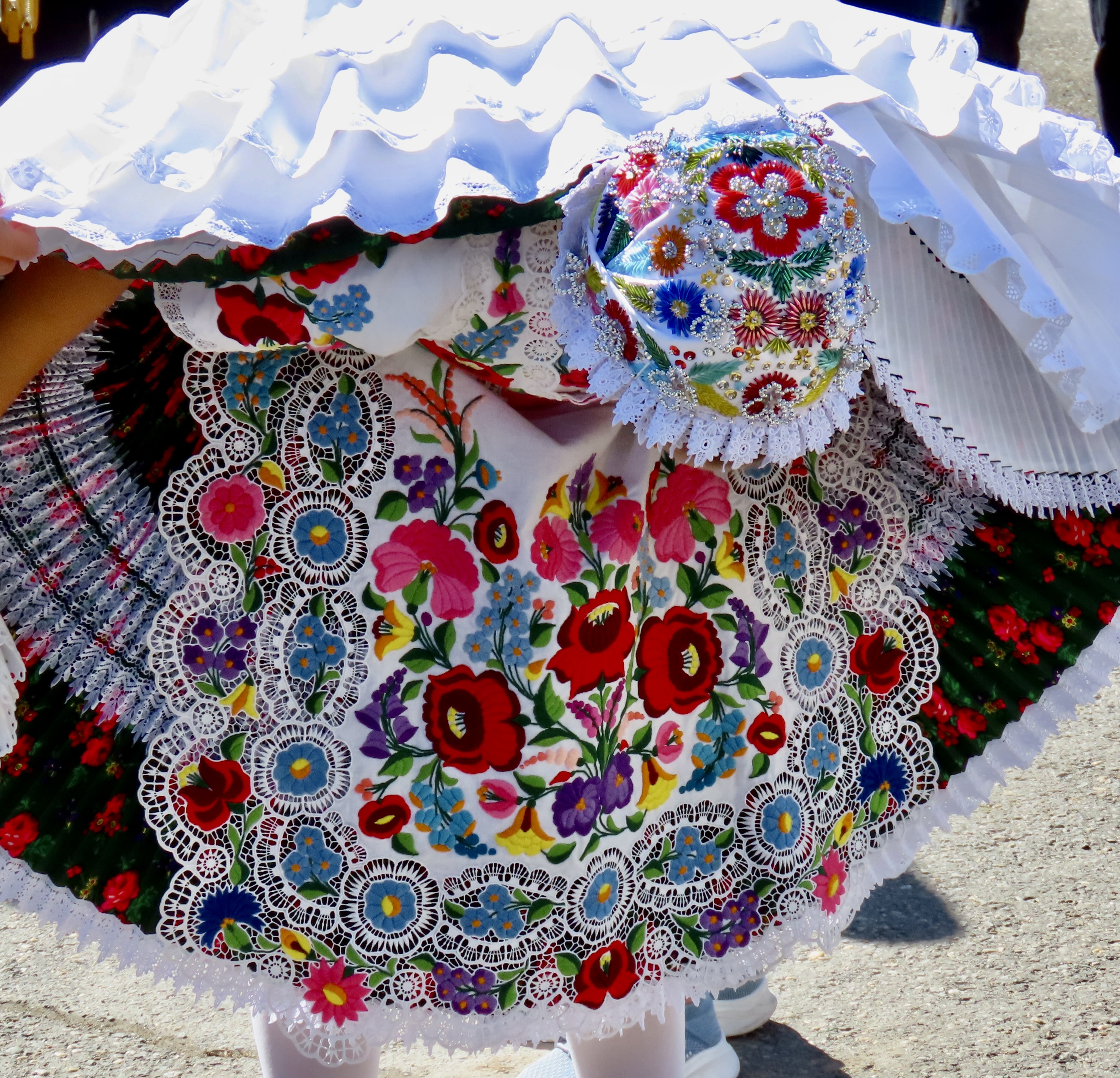
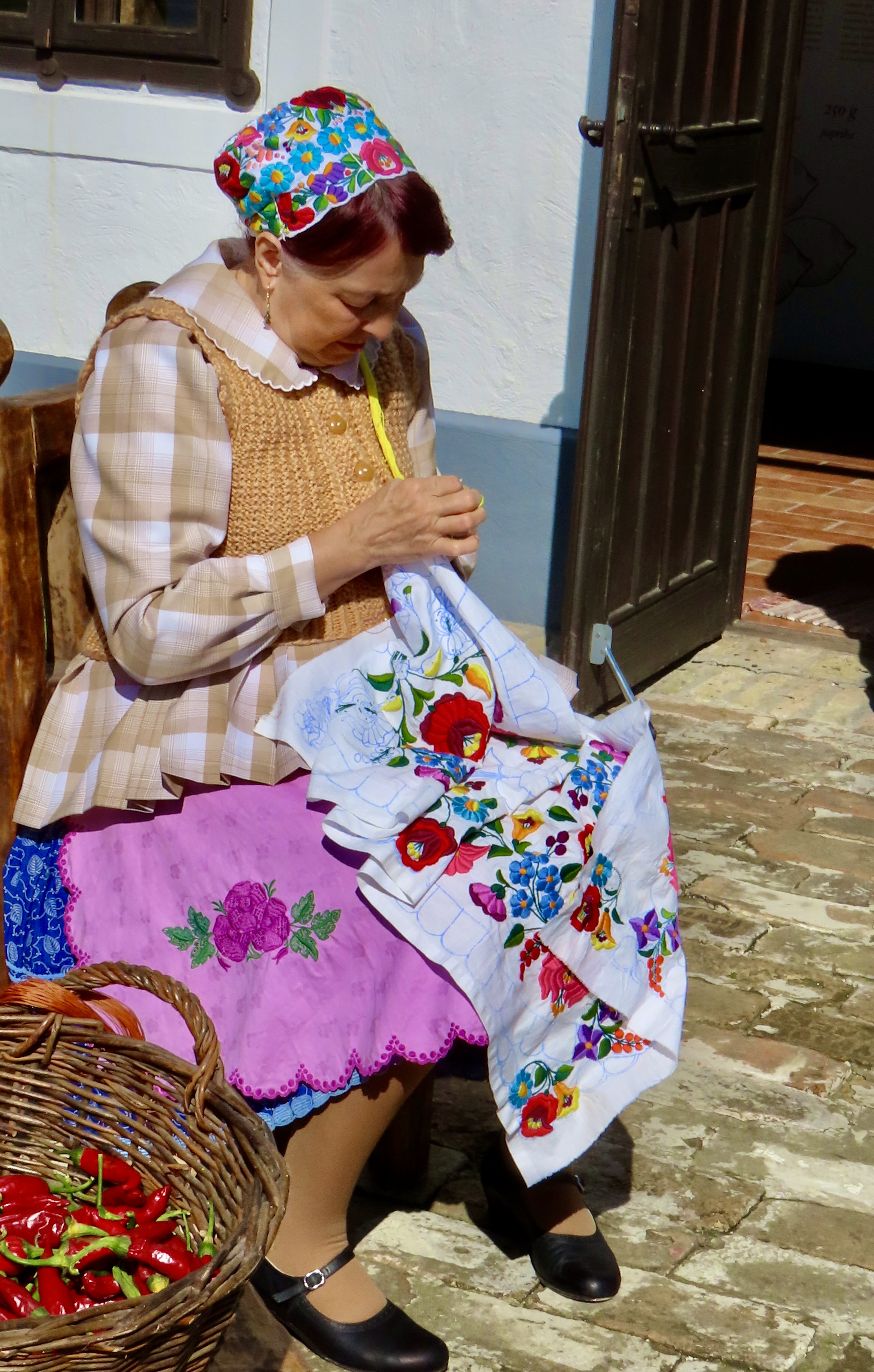
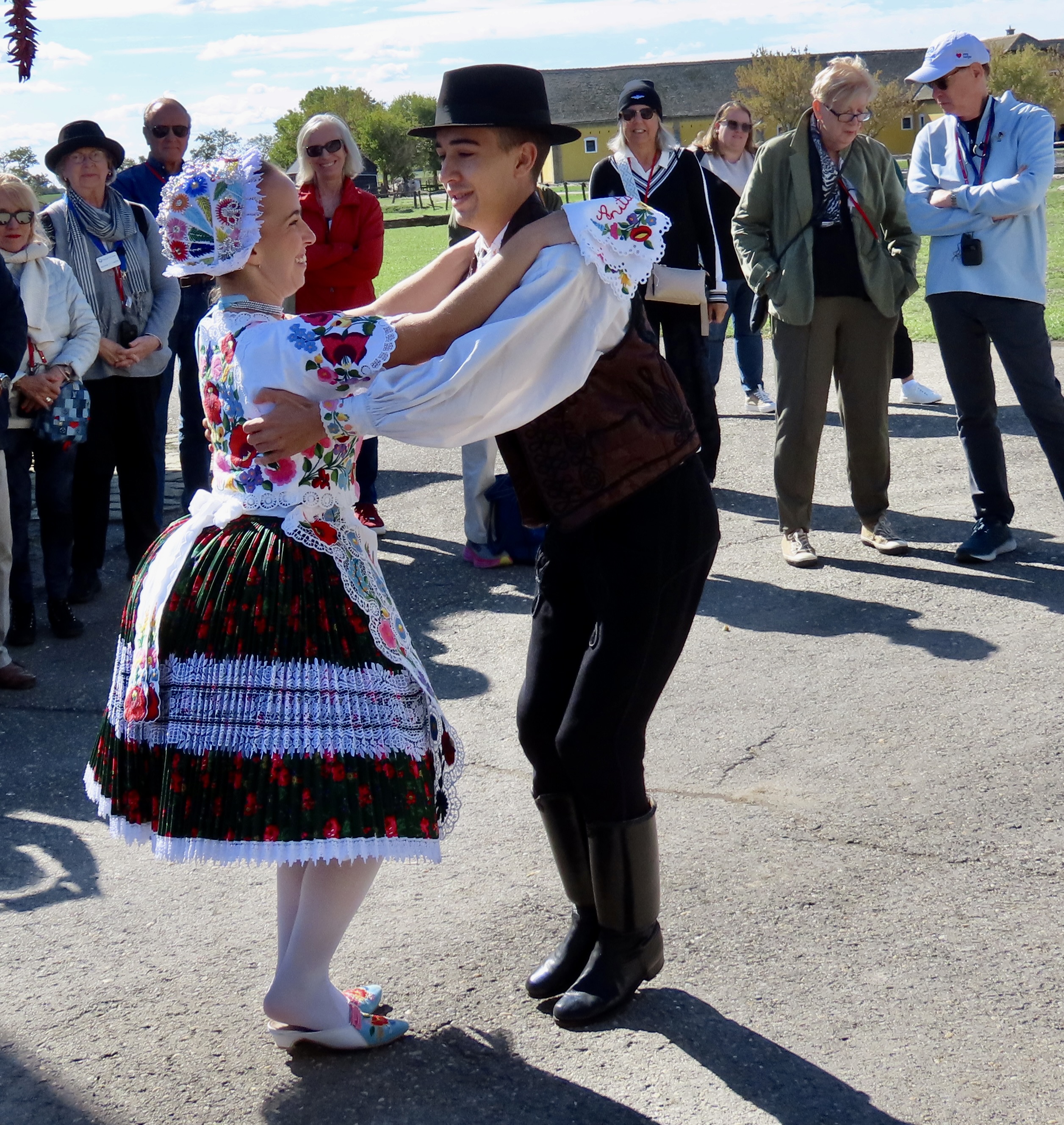
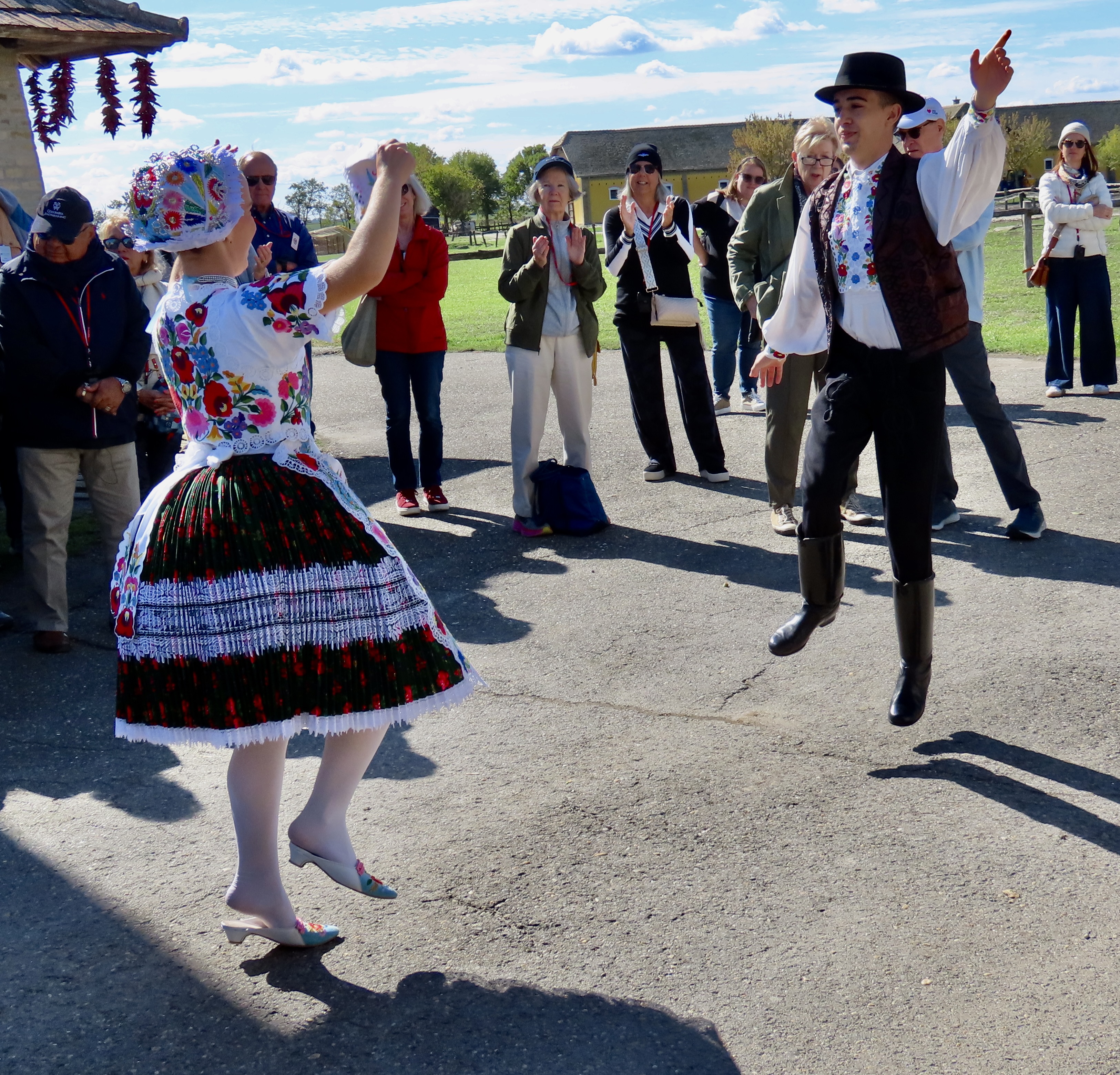
What’s more Hungarian than paprika? This delightful, elderly woman with her wonderful smile was stringing paprika peppers to hang at the Bakod Horse Farm near Kolocsa , Hungary.Peggy likes to sprinkle paprika on deviled eggs that disappear almost as quickly as she can make them. The spice comes in small tins and bottles and is sold almost anywhere one can buy spices. I didn’t know that the spice came in red peppers that originated in Central and South America and arrived in Hungary via Turkey. They range from mild to hot depending on the type of pepper used. The Kalocsa region is one of the world’s primary paprika growing areas.Another smile.The woman’s face in black and white. Strings of paprika peppers hung to dry.Folk dancing is an important part of Hungarian culture, right up there with eating paprika it seems. This young couple in their 20s came to the Bakod Farm to demonstrate the Csárdás, Hungary’s most popular folk dance. They were quite good. Anita is carrying a handkerchief with her name on it. Soon, she would be waving it about as she danced. I was equally impressed with their traditional Hungarian costumes. Note the bead covered head piece on Anita and the detailed embroidery on her dress.Details of the bead work.And the detailed, beautiful embroidery.Anita displayed her pleated dress, embroidered apron and some of the 8 petticoats that held her dress out. There was also a small pillow.Another Hungarian woman sat off to the side working on the embroidery for another costume.At first the couple danced together.And then they moved off on their own, almost seeming to fly. That’s it. We leave the Bakod Farm with its wonderful horses and Csikos and paprika and folk dancing today. My next post, I am going to take a detour to Hawaii and Volcano-land. After that we will visit Kalocsa before continuing our journey down the Danube and many more adventures.You may not remember the dramatic media coverage of lava spouting out of Hawaii’s East Rift Zone and slowly making its way to the sea, destroying homes and blocking roads as it went 7 years ago in 2018. We do. It was around 10 miles away from where we are staying on the Big Island. Peggy and I drove out to the ‘end go the road’ that passes by our rental on Monday. As Kilauea continues to erupt this week, 20 miles away, it’s hard not to remember 2018.
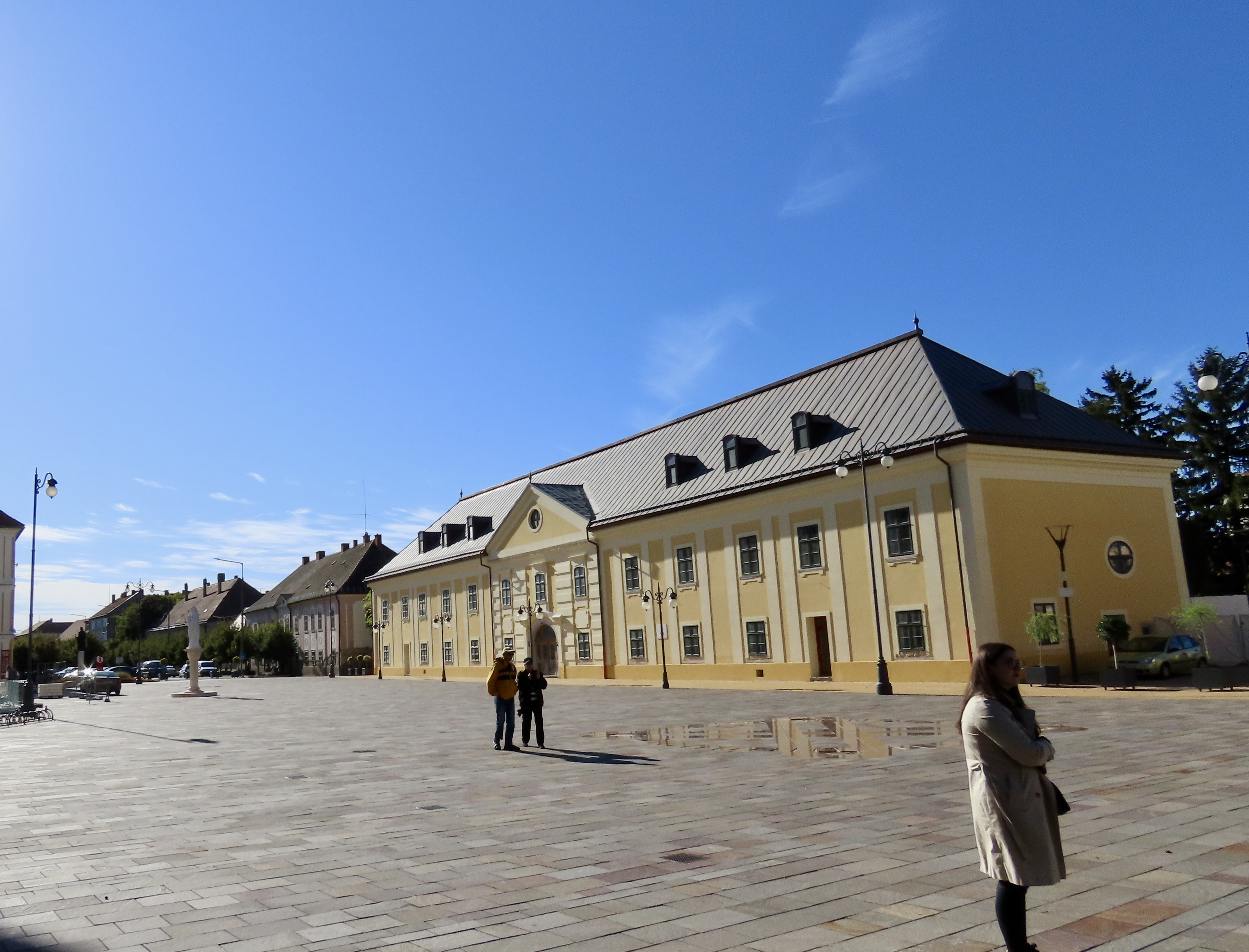
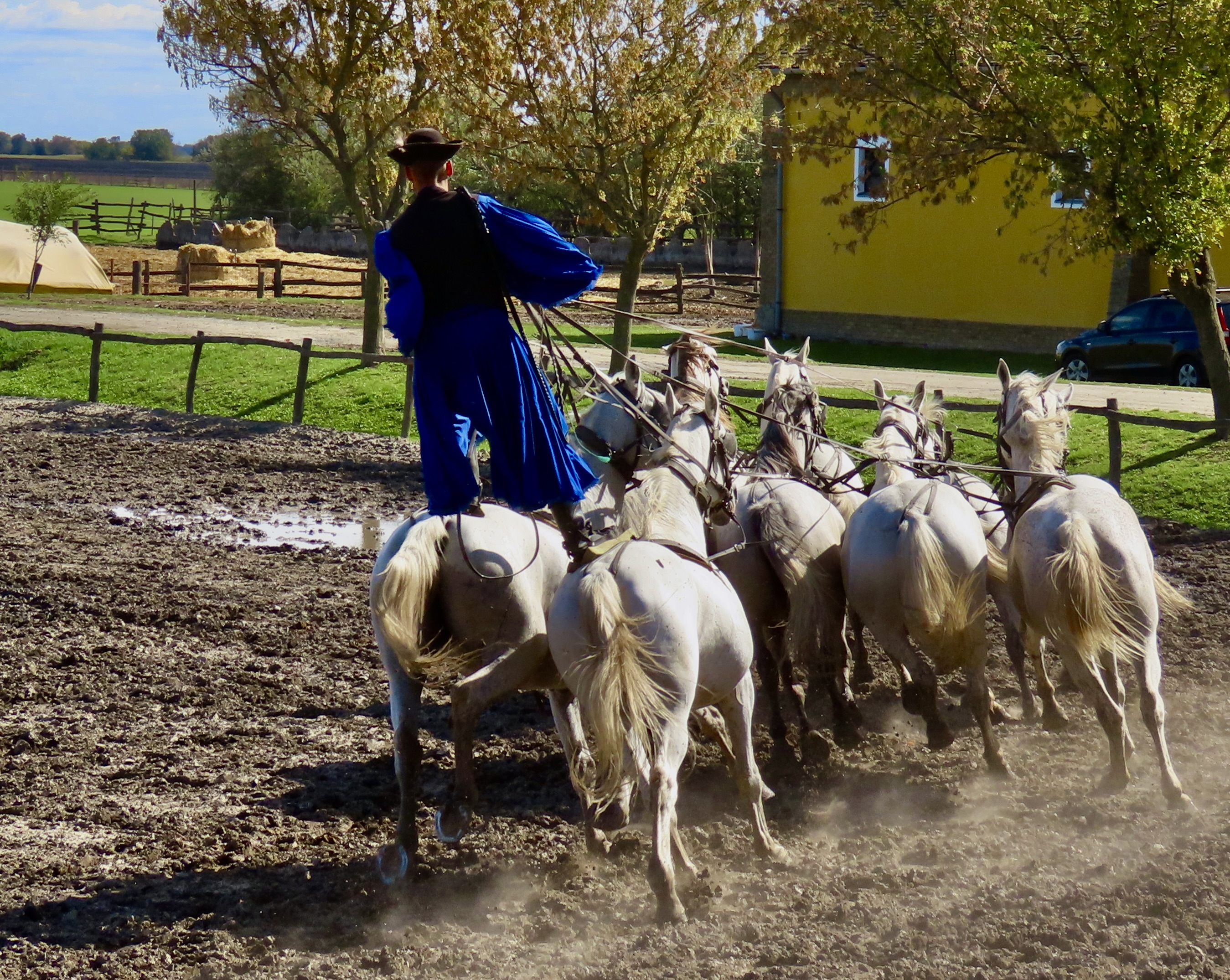
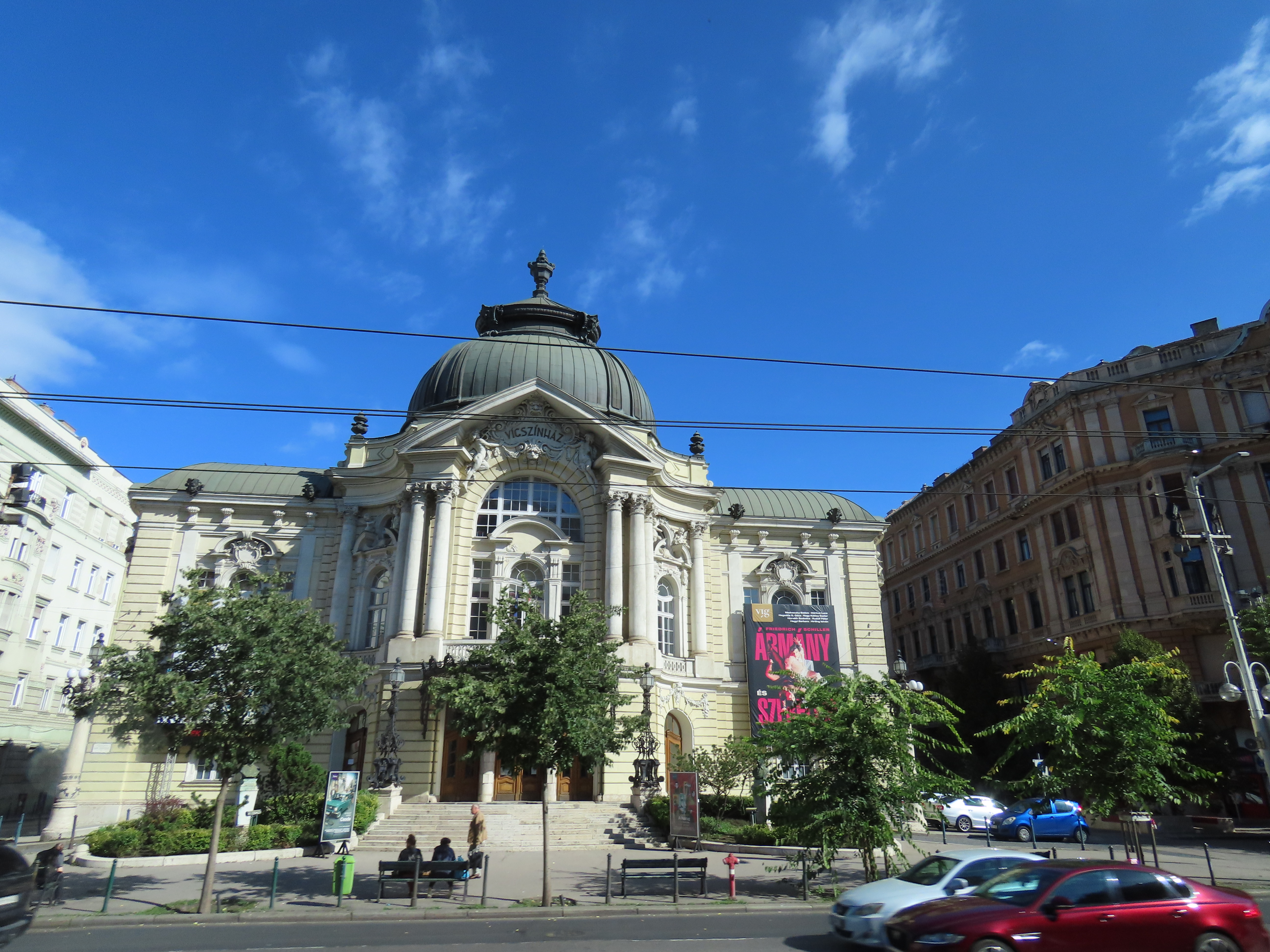
88 miles south of Budapest, we came to the Hungarian town of Kolaska. We’ll have a post relating to the town but, first, I’m going to feature the Bakod Horse Farm located near the town and its incredible horsemen, the Csikos, along with their handsome and well-trained horses. This particular display of horsemanship is called a Hungarian post.
We left Budapest feeling as we always do when we leave a new area: There was so much more that we could have done. Still, we had an introduction to the city’s beauty, culture and history, which was 100% more than we had before. No regrets. Plus, new adventures awaited us. Our next day down the Danube River would bring us to the historic town of Kolaska where we would explore the town and visit a farm that featured folk dancing, paprika, and horses. While I am not a horse fan per-se and the last time I had did folk/square dancing was in 1966, I do use paprika. Peggy who loves horses and dancing, and— on occasion— wishes I loved them more, was excited. Okay, I thought, I can do this.
I have a confession: I found the paprika interesting, enjoyed the folk dancing, and was blown away by the horse show. It’s up first.
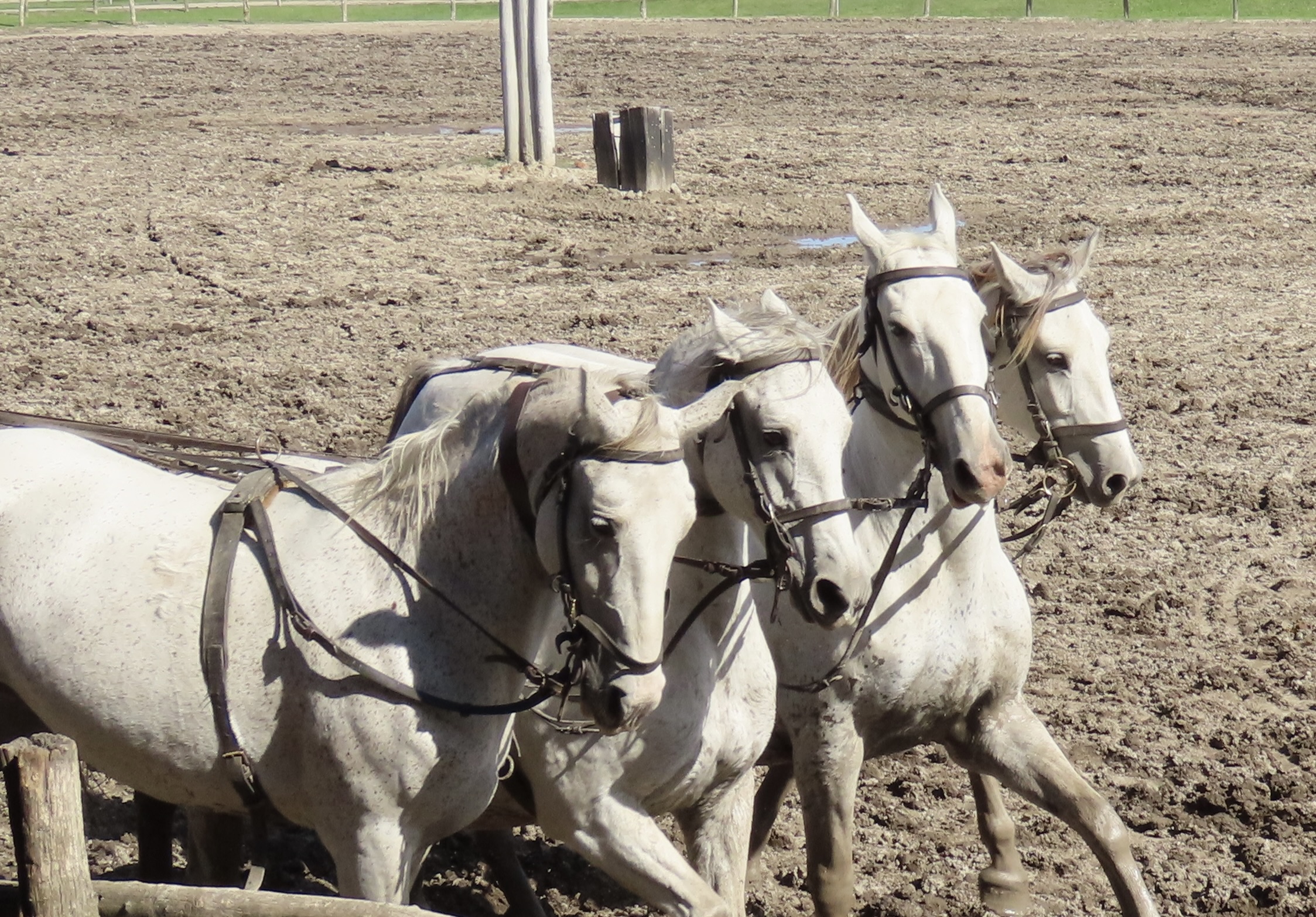
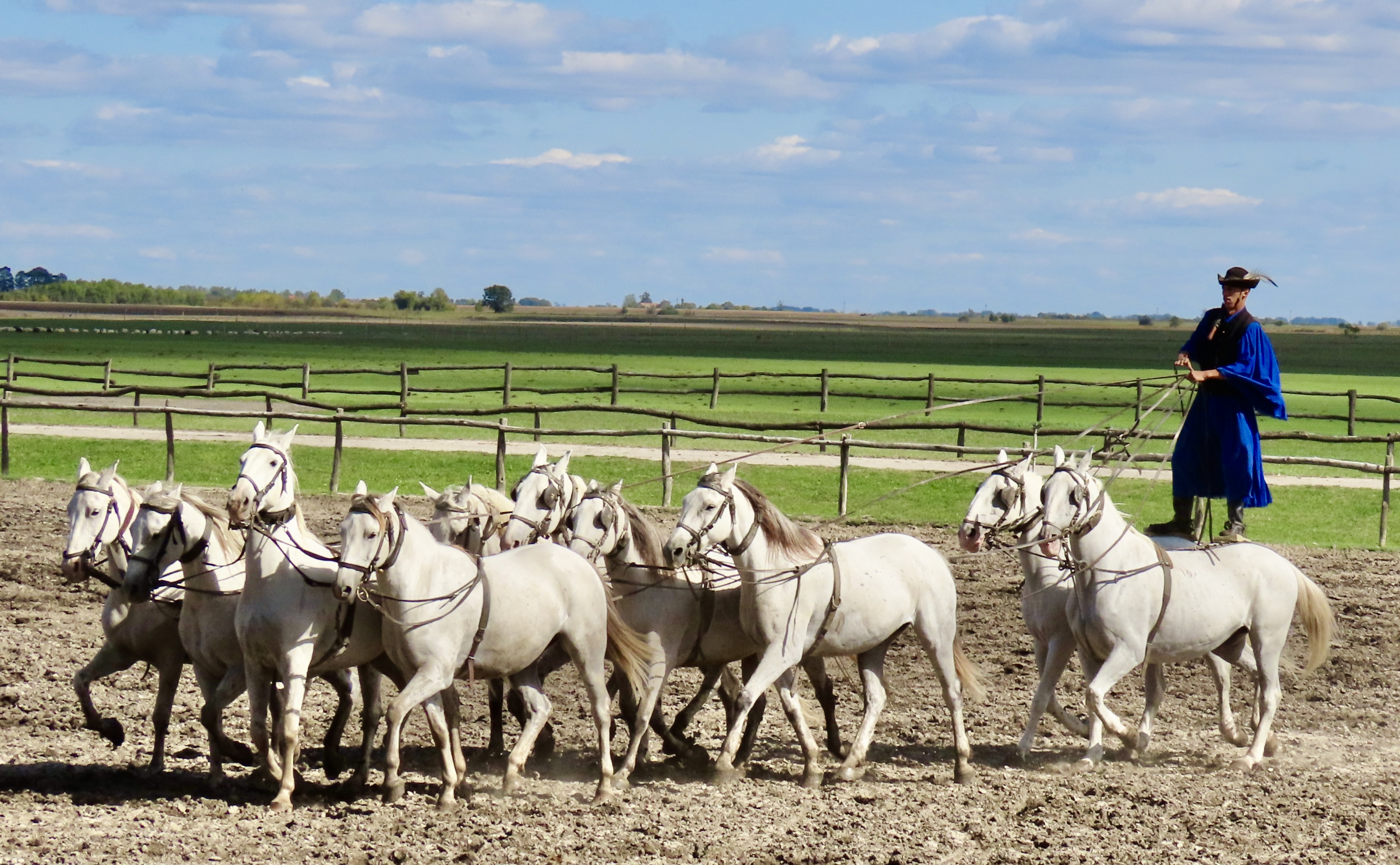
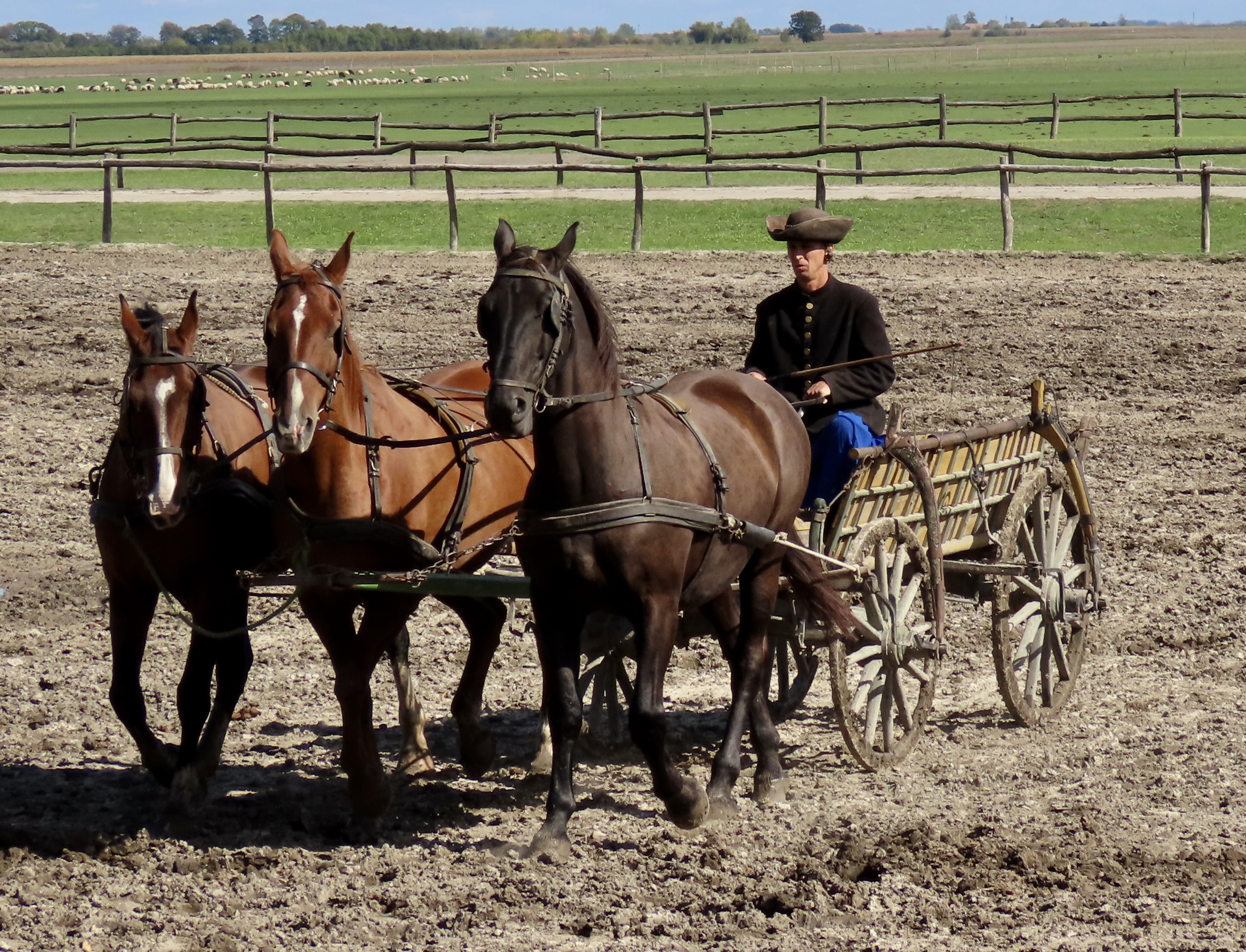
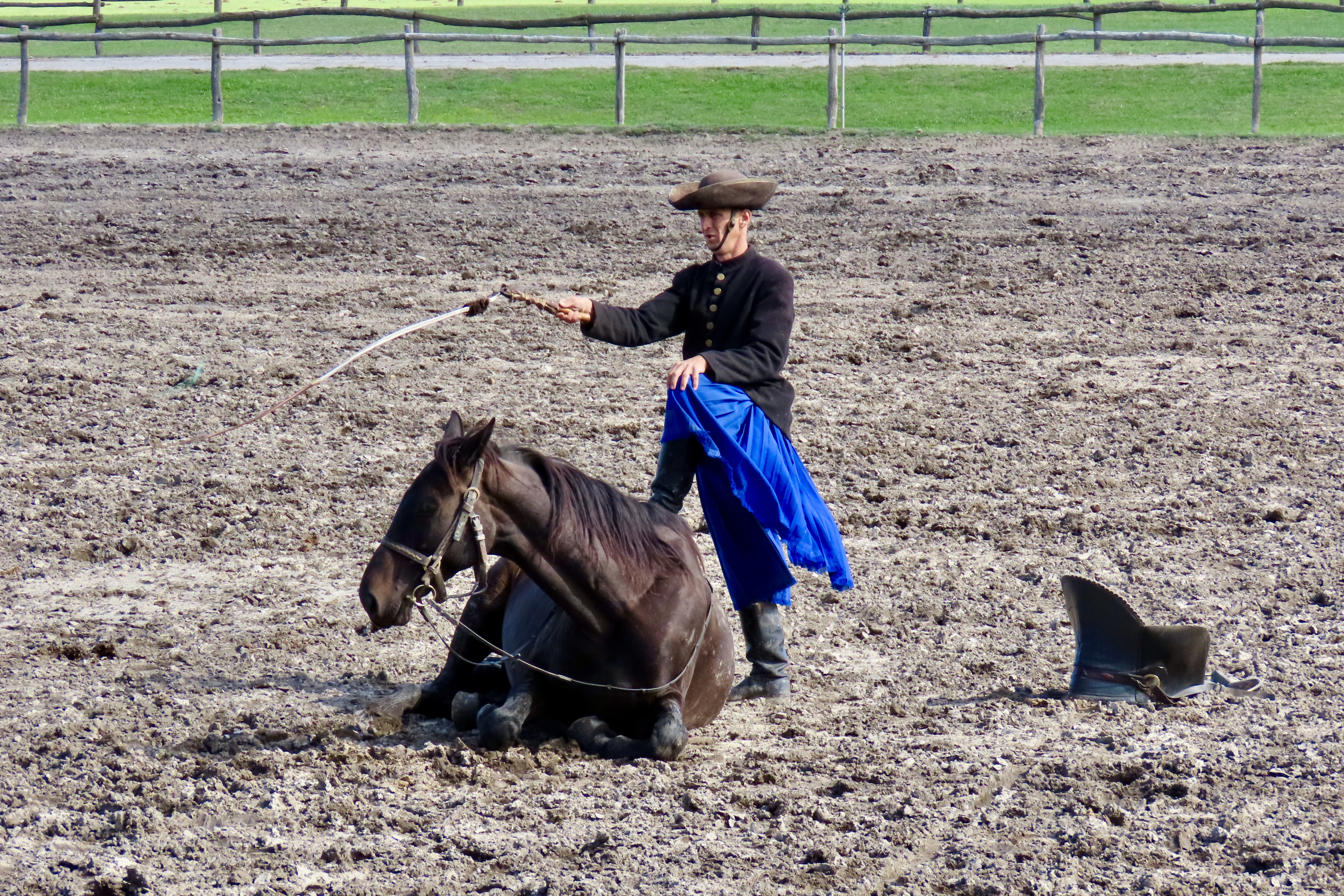
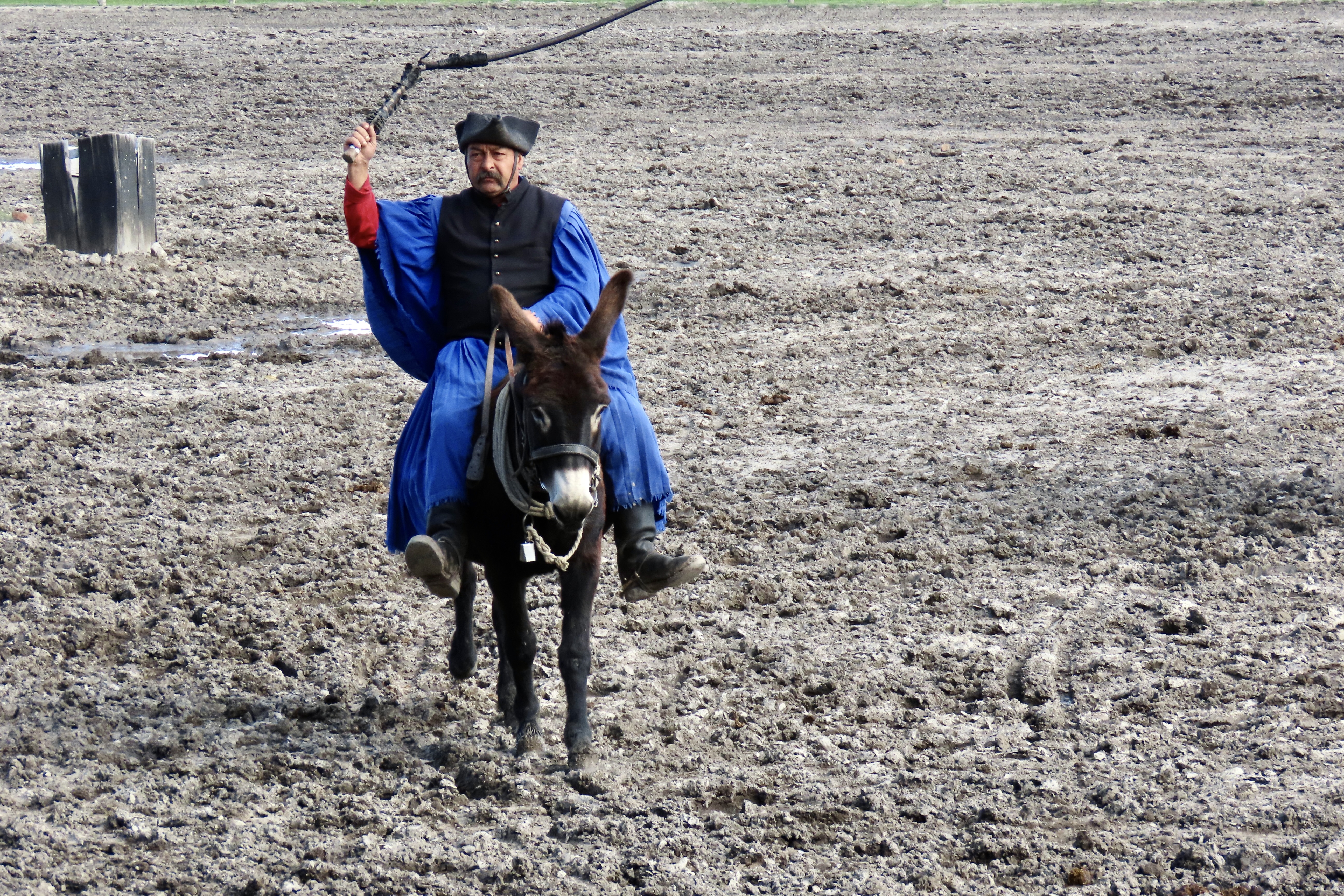
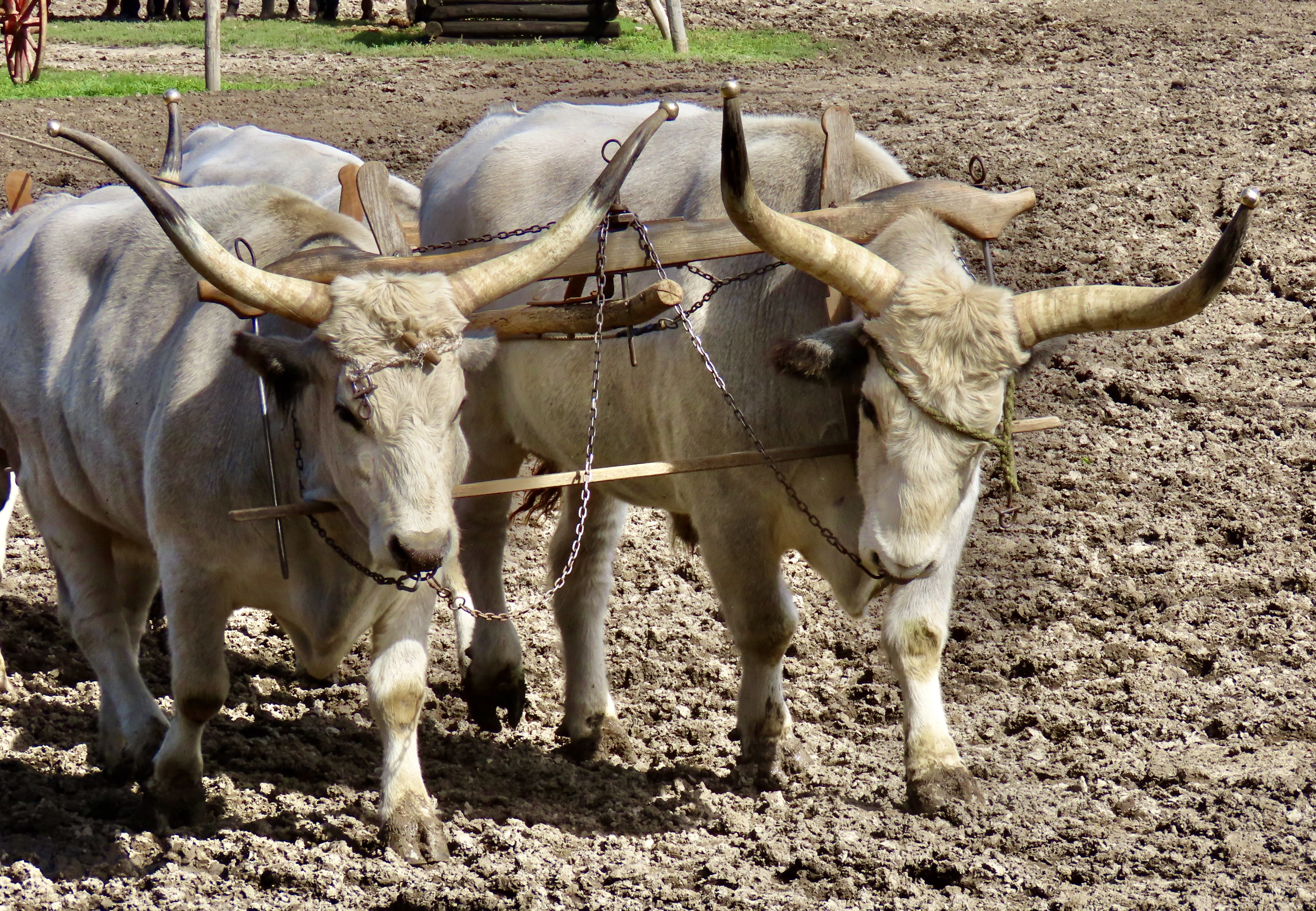
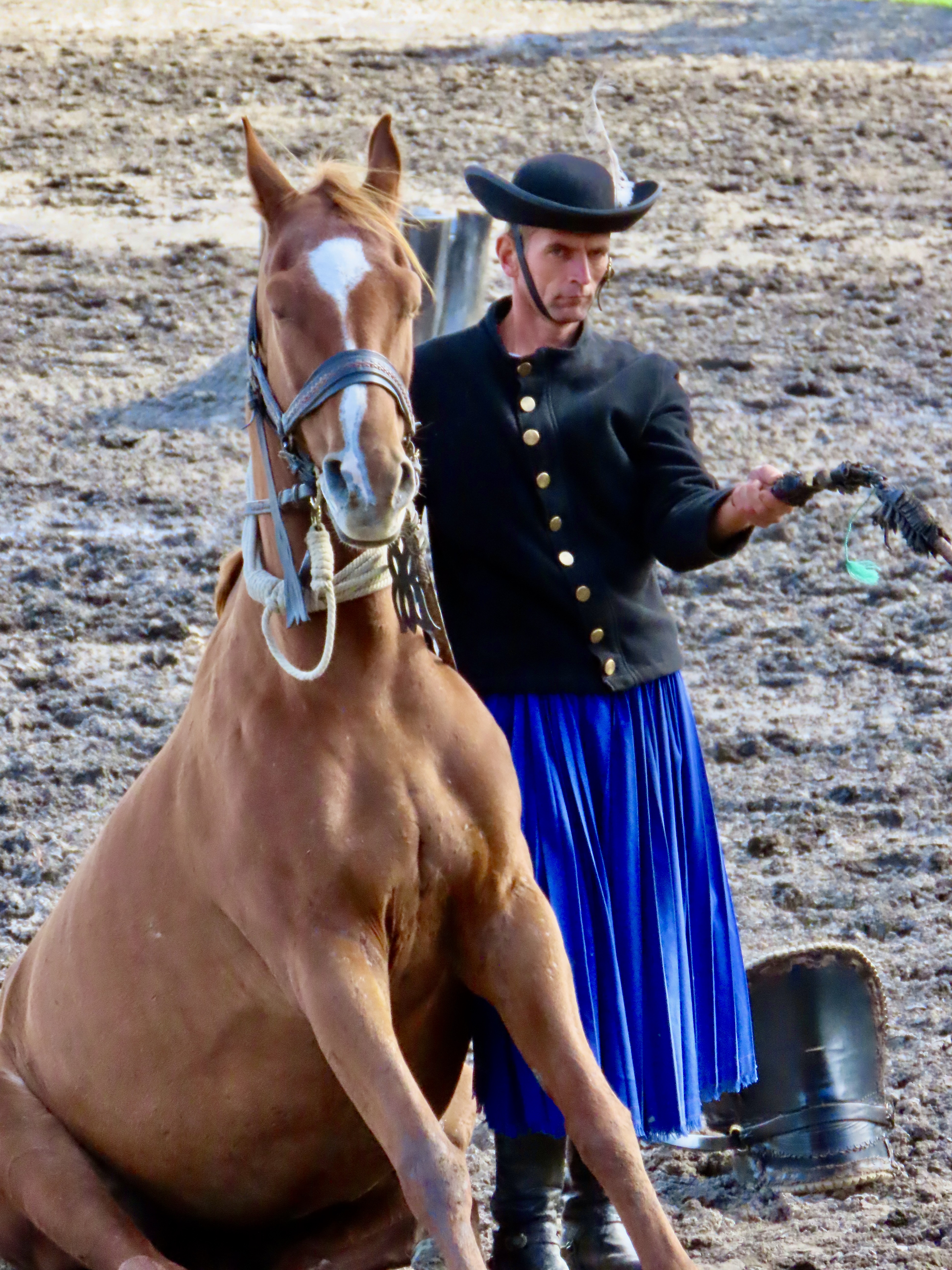
Any discussion of the Csikós and their horses needs to start with Hungary’s Puszta, a vast open plain which is a section of the Great Hungarian Plain. It covers some 19,000 square miles and is made up of saline steppes, low, wet forests, and freshwater marshes. The region has a pastoral history that goes back thousands of years and is associated with several breeds of Hungary’s domestic animals which includes the Nonius horses and Hungarian Grey cattle that are featured today. I’m not sure what the breed of the white horses used in the Hungarian post is.But they were handsome, if a bit muddy.A head on view of the Hungarian post at the Bakod Horse Farm. The Csikos rider is balanced on two horses controlling eight horses in front of him.This provides a good side view of the Hungarian post.Here’s how the Csikos rider places his feet on the two horses he rides.The Csikos horsemen had their beginning on the Puszta with its large horse and cattle herds. Unlike the famed cowboys of the Old West, however, their job was to work with the horse herds while shepherds handled the cattle and other domestic animals. That’s a whip over his shoulder.The go-to horse for the Csikos is the Nonius breed, which dates back to 1813 when Napoleon was defeated and the Hungarians helped themselves to one of his stud horses, Nonius, and rode him back to Hungary. Nonius was then introduced to the Hungarian State Stud Farm where he provided his services (happily, I assume) up to 1832— making numerous babies with cooperative mares and giving the breed its name.The Nonius horse has a strong, large-framed body which makes it excellent for pulling carts. Good natured and easily trainable, they also make great riding horses.The hat and blue riding clothes are traditionally clothing for the Csikos horsemen. I’m not sure about the feather in his cap. This is not a Nonius horse. The rider is sitting on his ass. You might say he is backasswards. Leading up to World War I, the last time warhorses were used in fighting, Csikos were hired to train them. The whip isn’t being used on the horse. It sounds like someone firing a rifle and was used to acclimate the horse to the sound and not panic when in battle. The object on the right is the horse’s saddle.The horses were also taught to lie down so they could hide when necessary.Here, the rider stands on his horse while cracking his whip. The highlight of the show, at least for me, was the horse sitting. I suspect that image will be sharp in my head long after the others have faded. The Csikos rider continued to crack his whip. Actually, they are quite skilled with their whips and put on demonstrations using it. Here, donkey-man cracks his whip while riding. The other riders were cracking their whips in unison. A bit like syncronized swimming, eh. (Peggy used to do that….without the whip!)The Csikos also demonstrated the use of Hungarian Grey cattle to haul a cart. These cattle with their massive pointed horns are native to the Puszta. Note that the horn tips are covered. For good reason.A closer look at the Hungarian Grays, complete with their nose rings.The Csikos finished off the horse show by giving us a ride out onto the Puszta. Next up, Peggy and I will do a post on the folk dancing and paprika. But first…
Aloha! Peggy and I had to fly out to Sacramento to a Celebration of Life for a very close friend. Since we were over half way to Hawaii, we decided why not go there as well. It makes perfect sense, right. What’s another 2300 miles. Anyway, here we are on the Big Island for a month about a mile away from the ocean and 30 miles away from Volcanoes National Park where the Hawaiian Goddess Pele is putting on quite a show in the Kilauea Caldera. We drove up to see it on Friday. Incredible!
We will try to slip in a couple of posts on the Big Island in between our Danube River posts over the next few weeks.
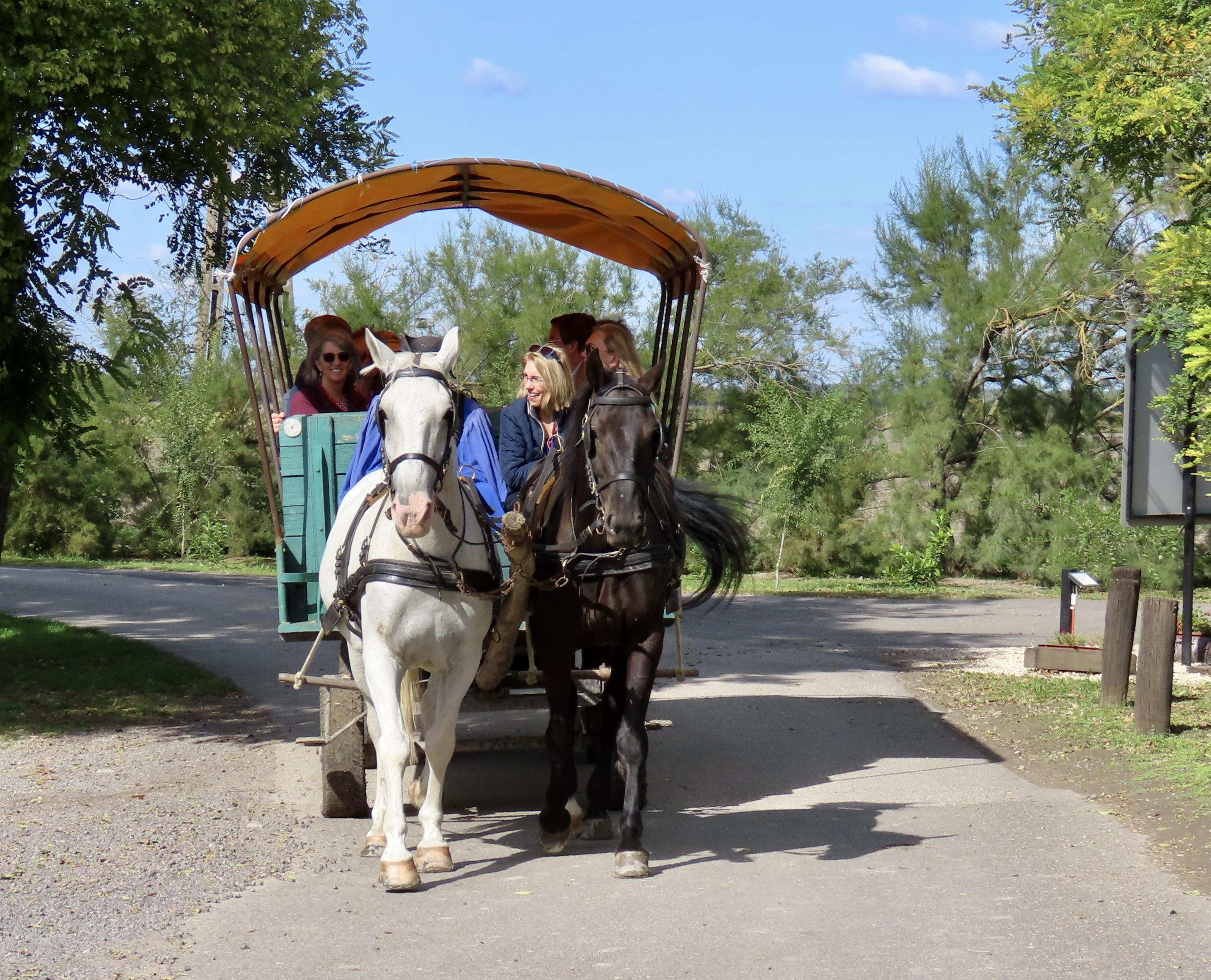
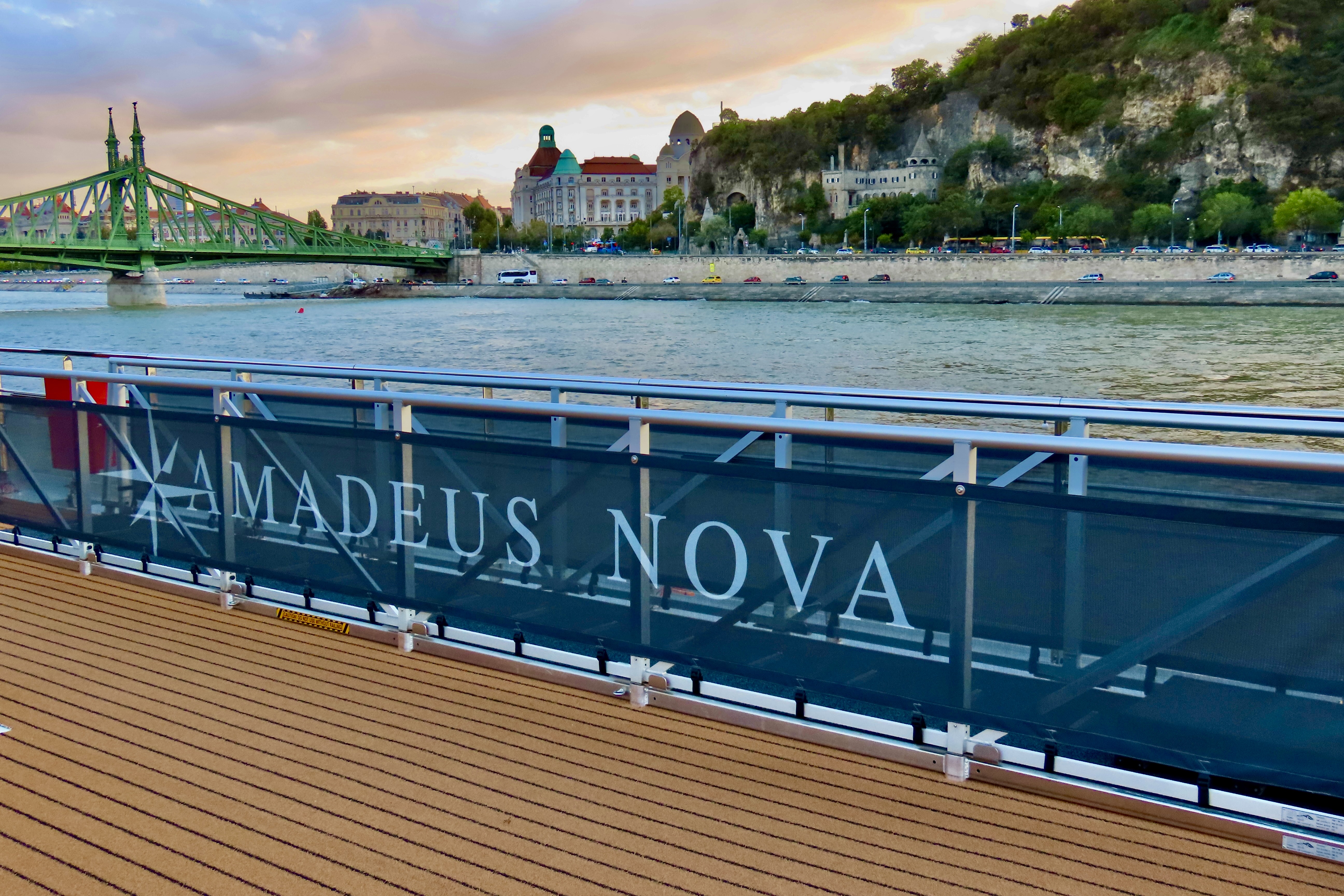
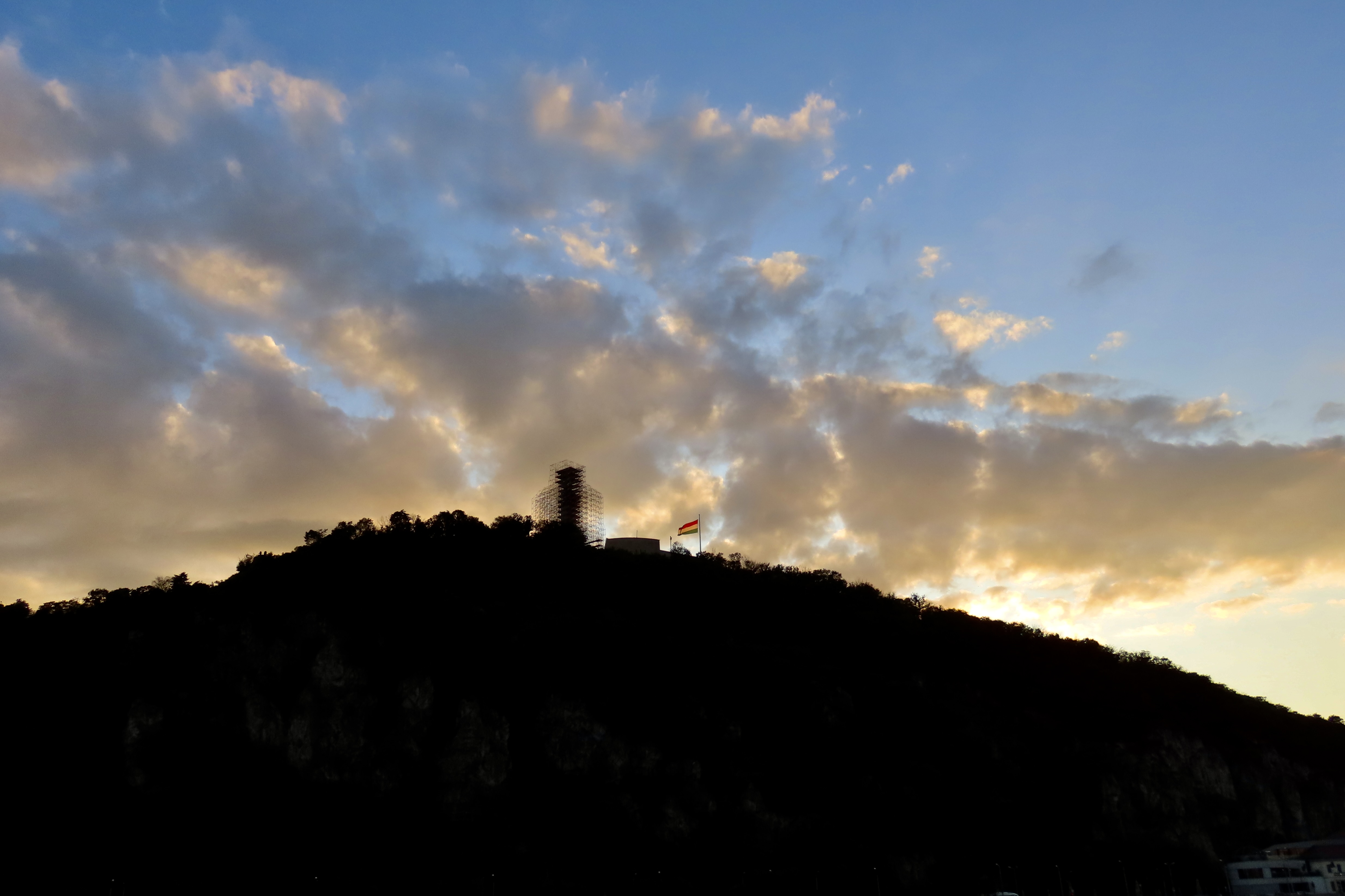
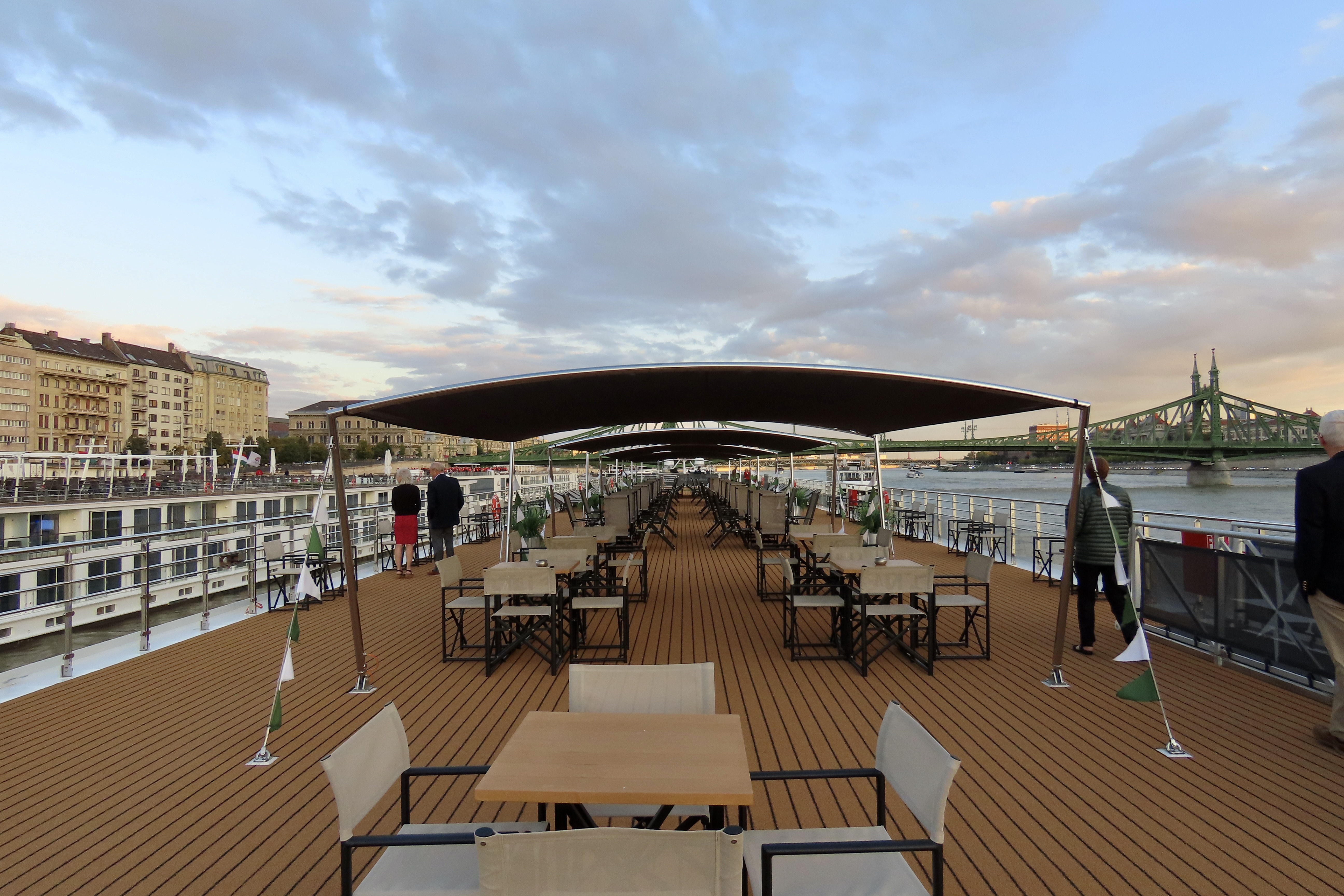
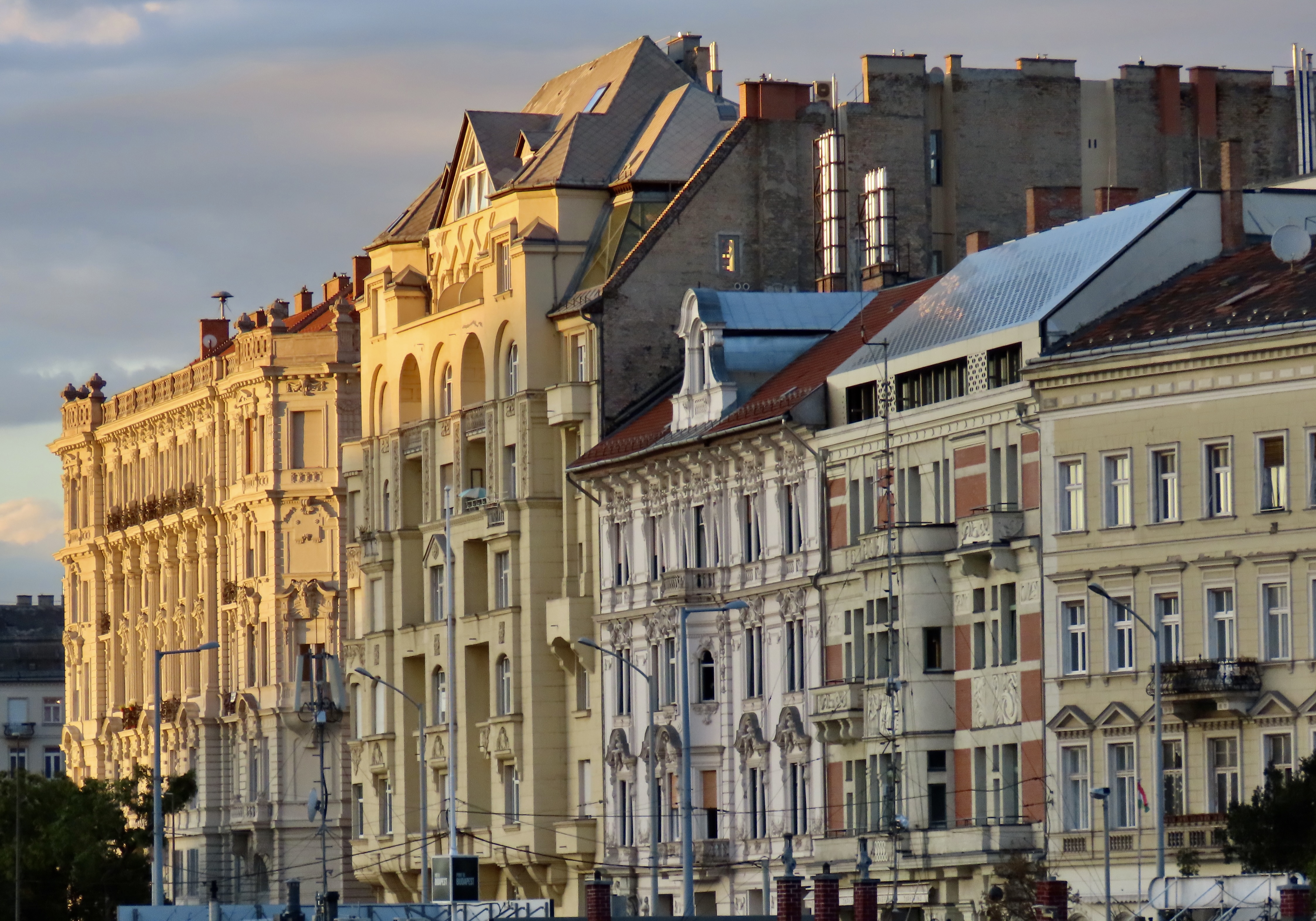
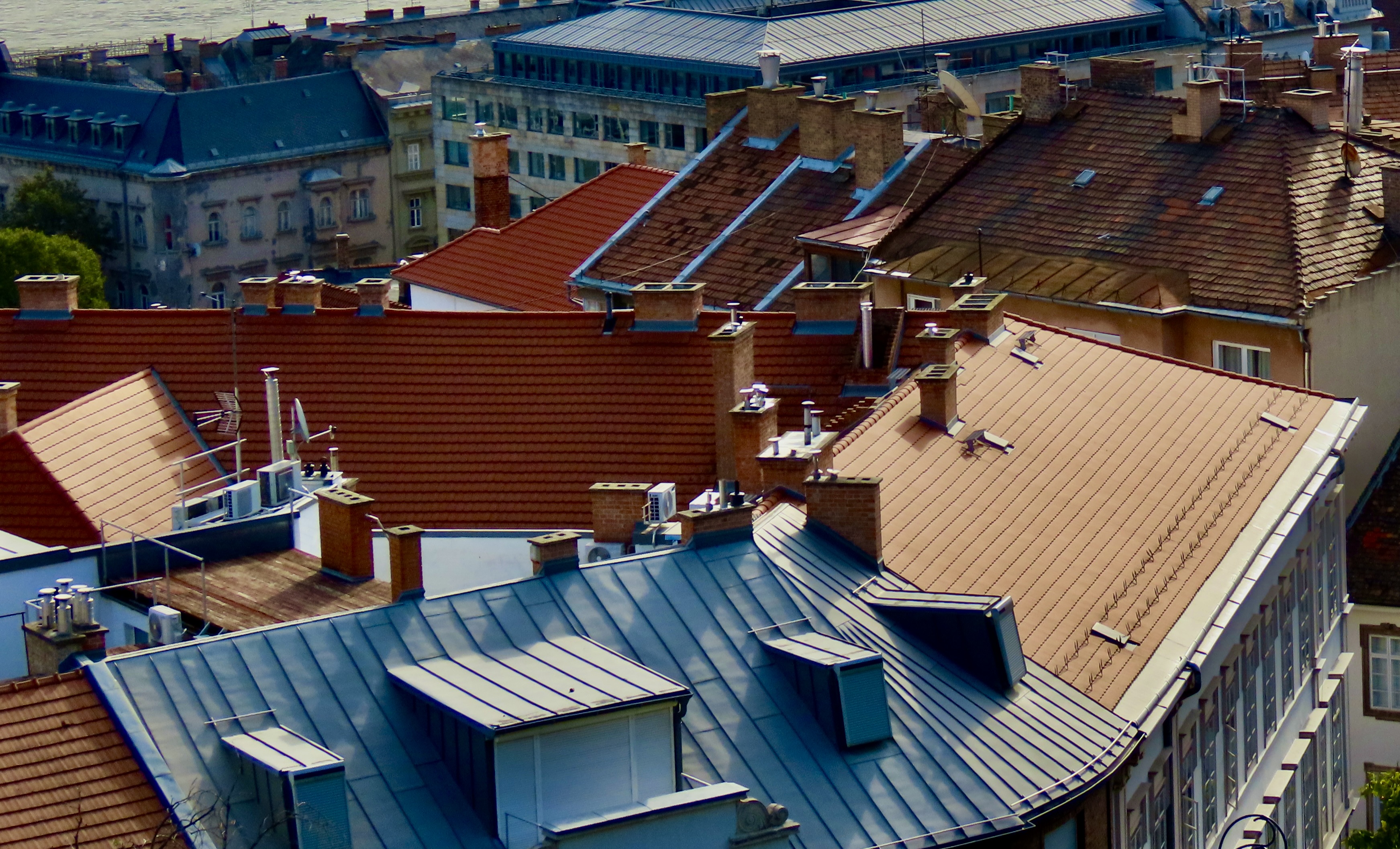
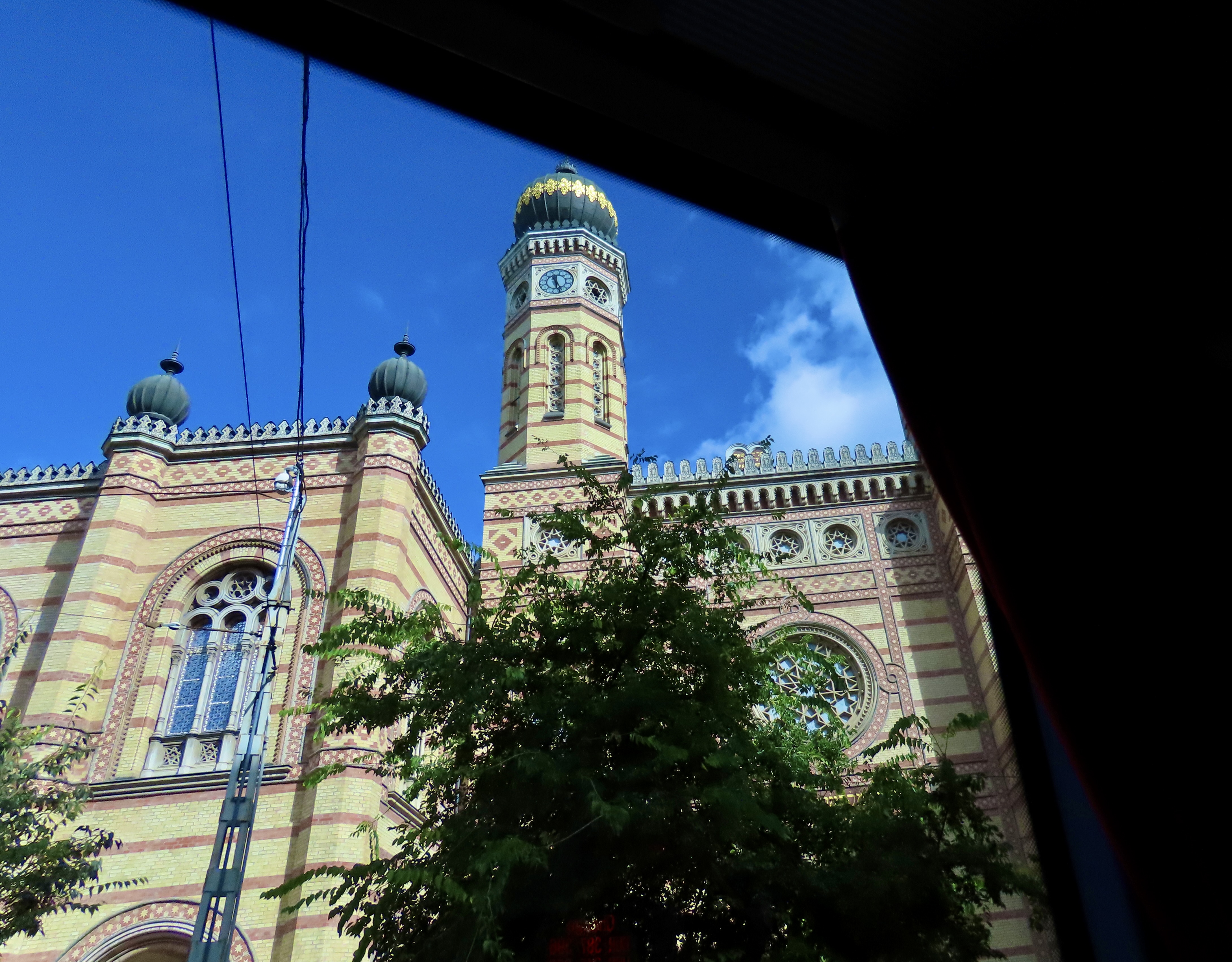
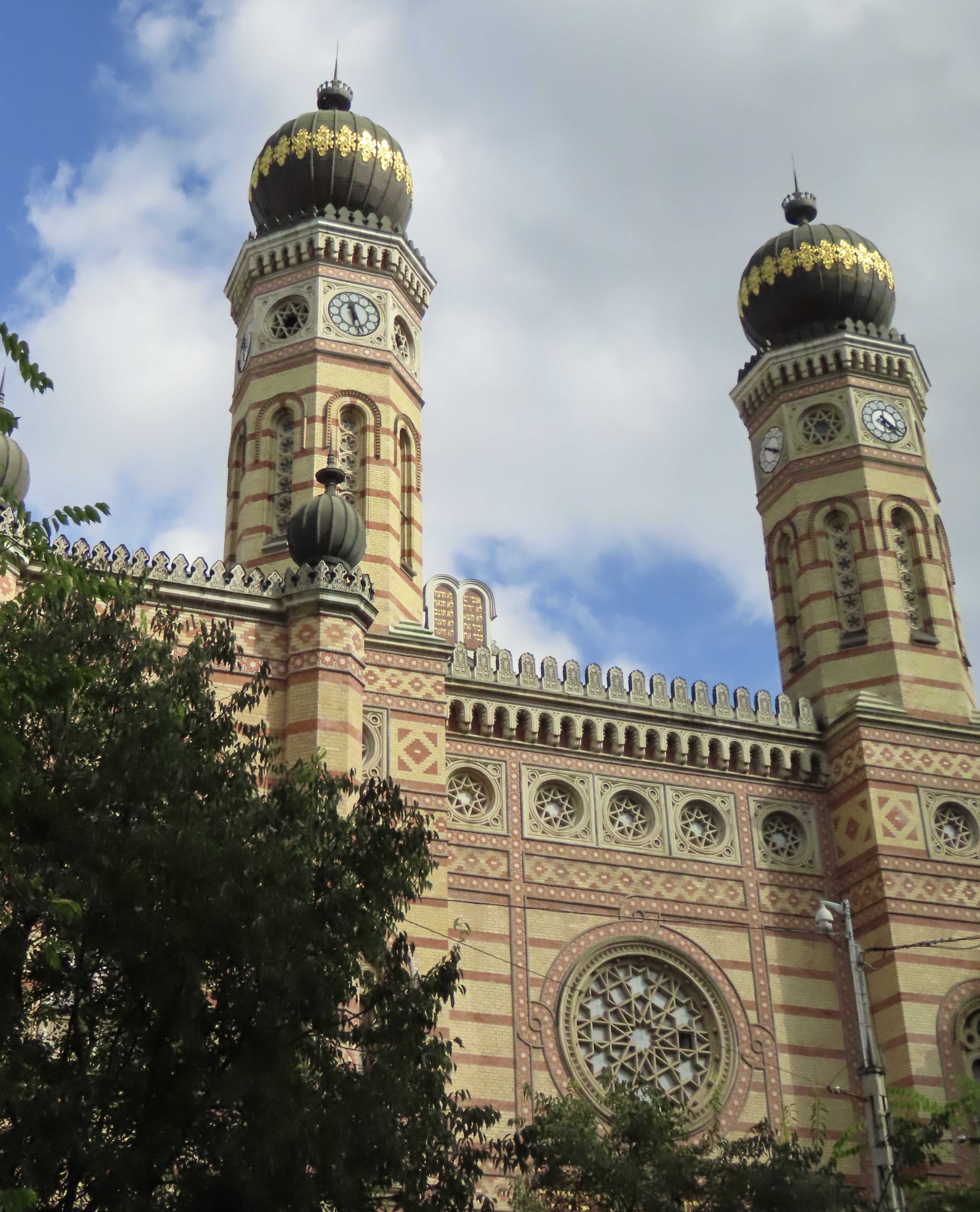
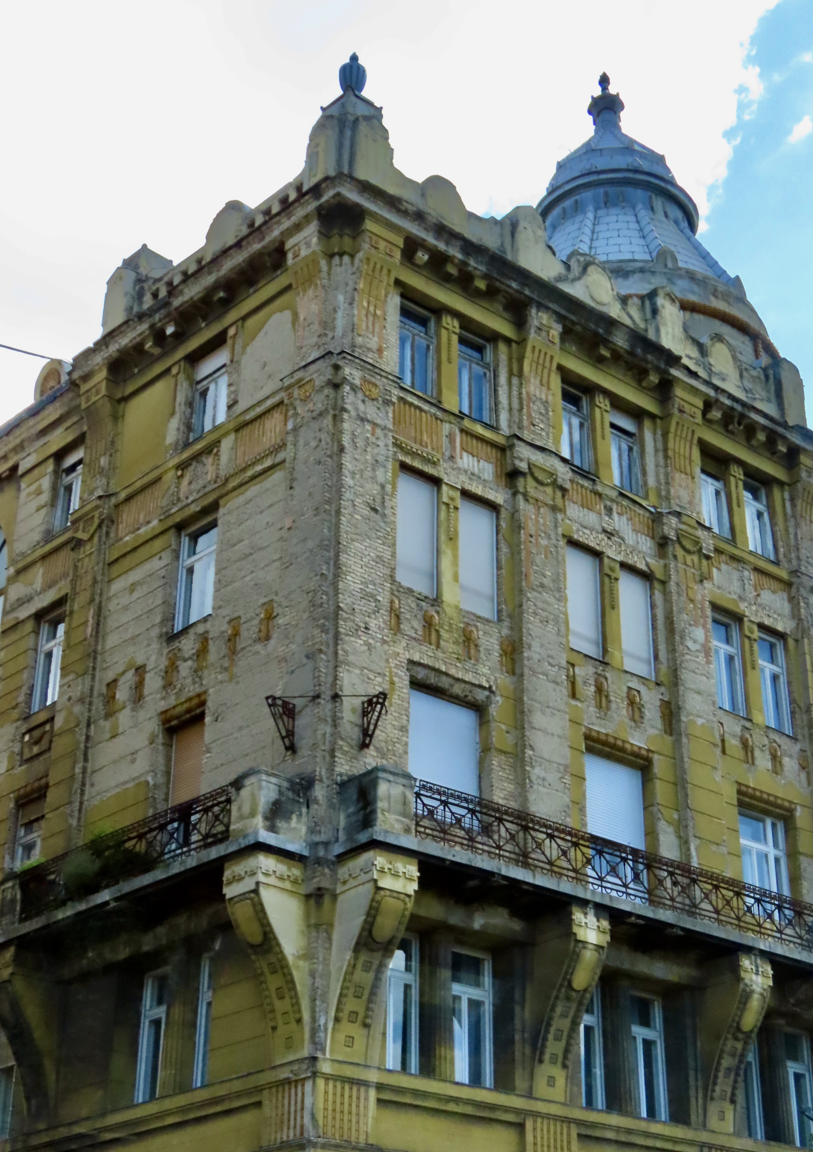
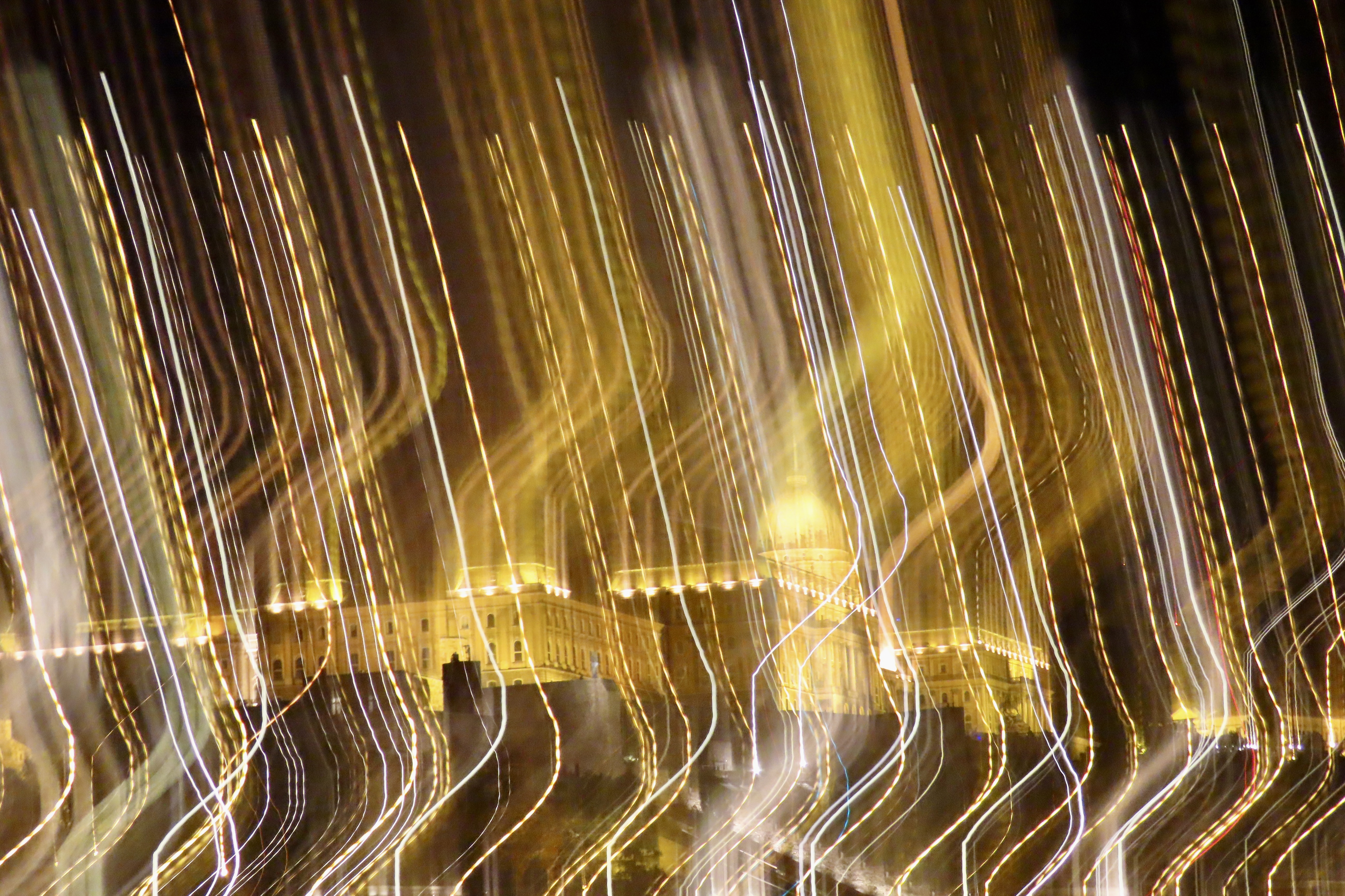
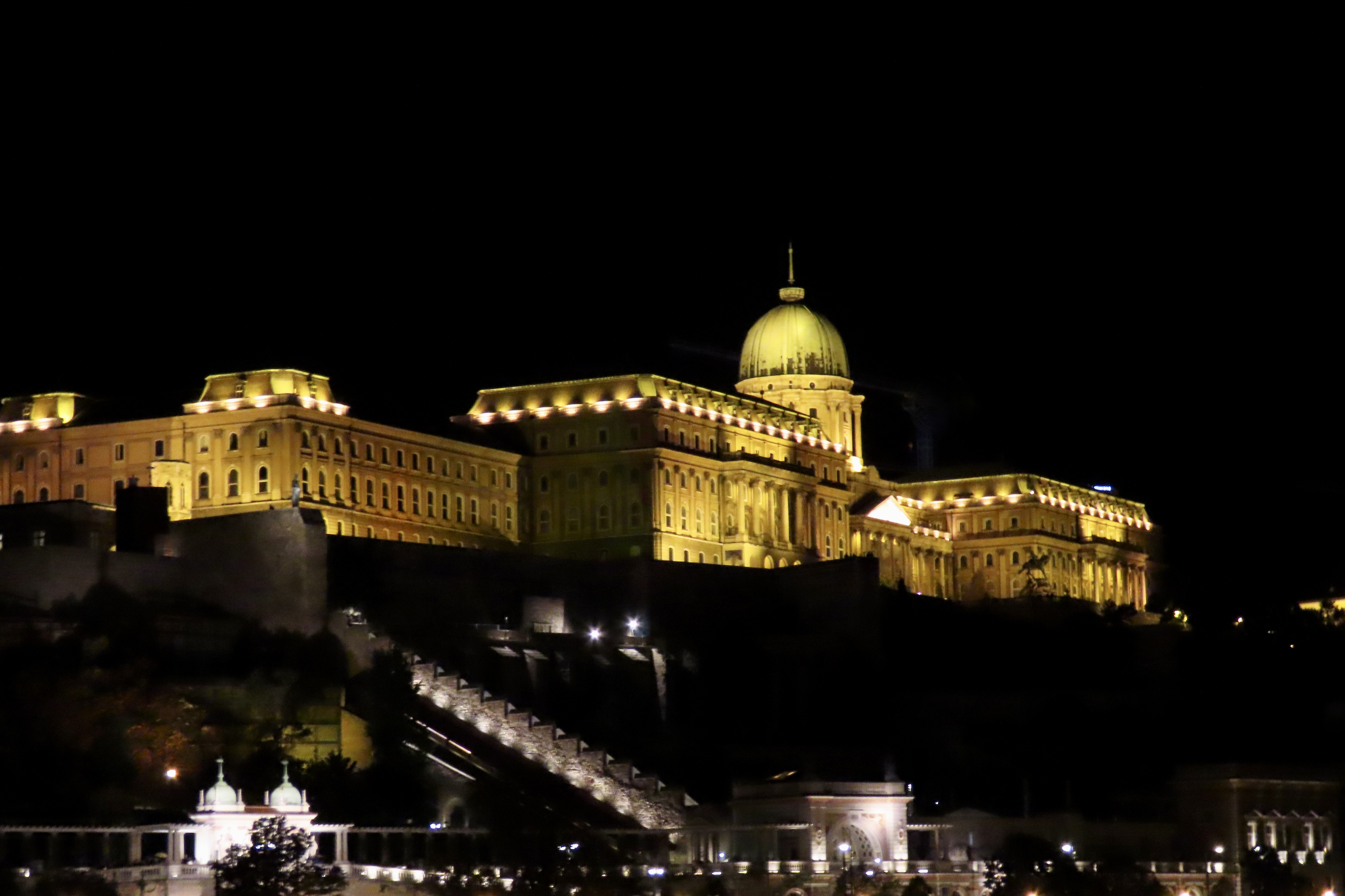
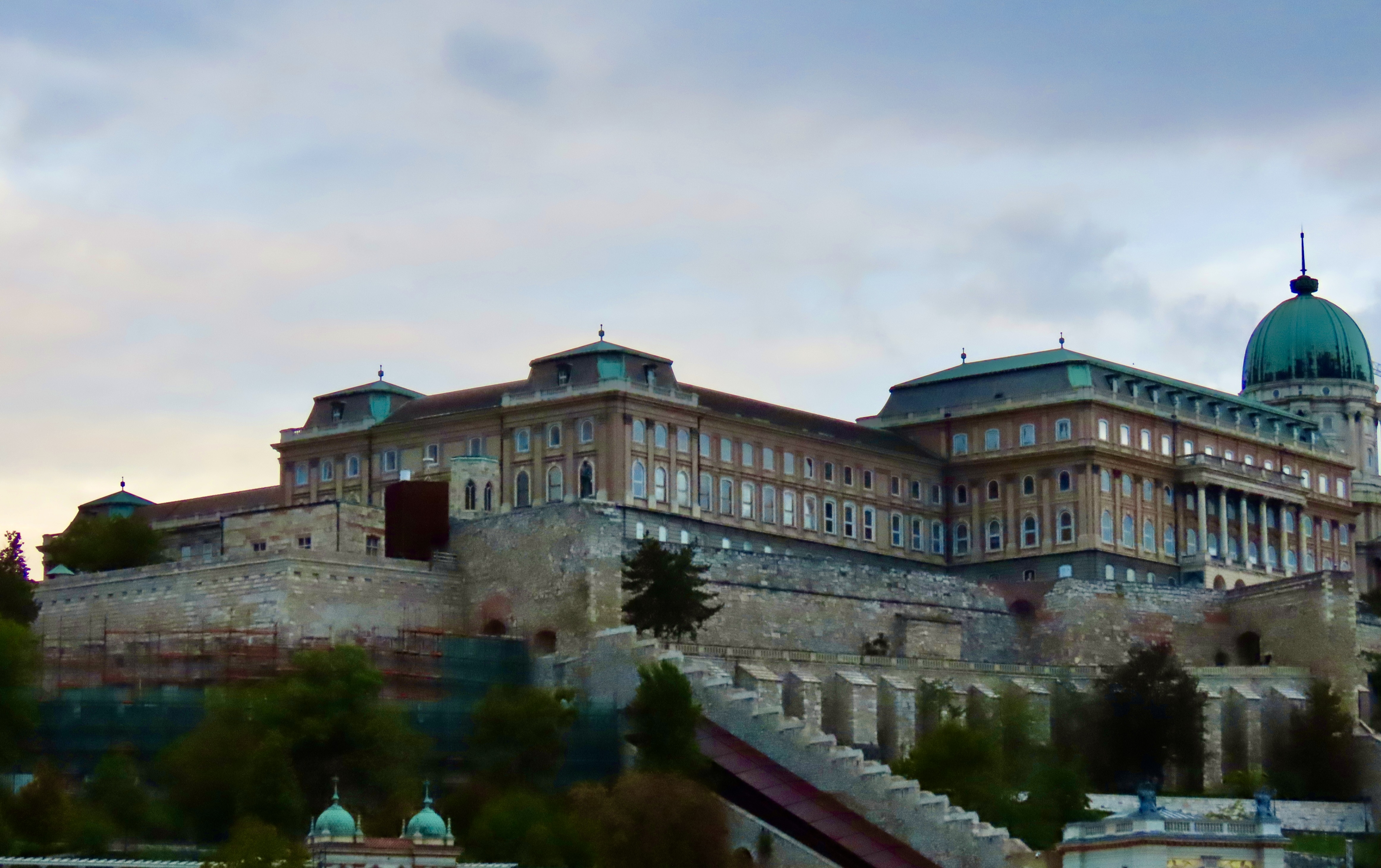
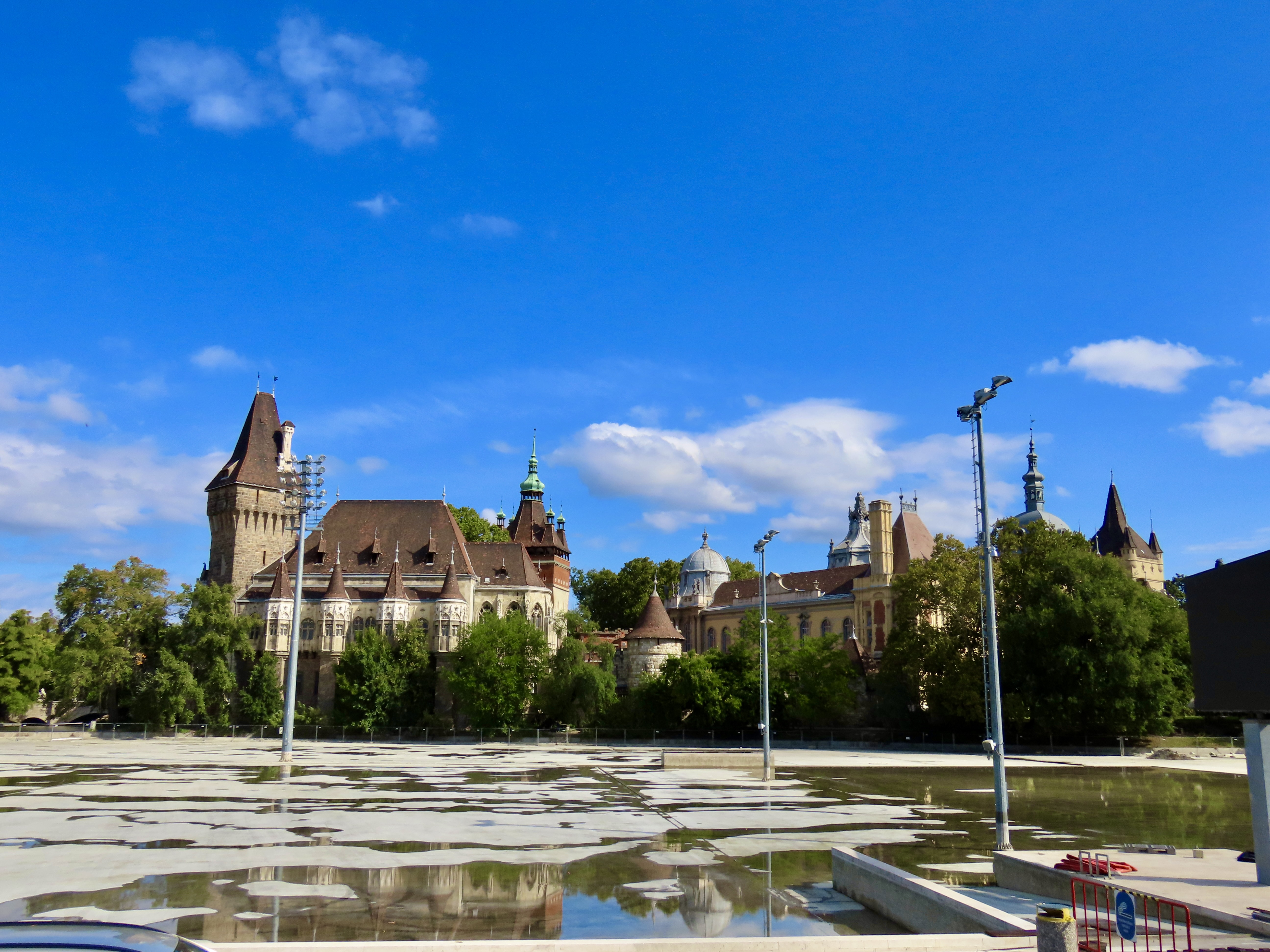
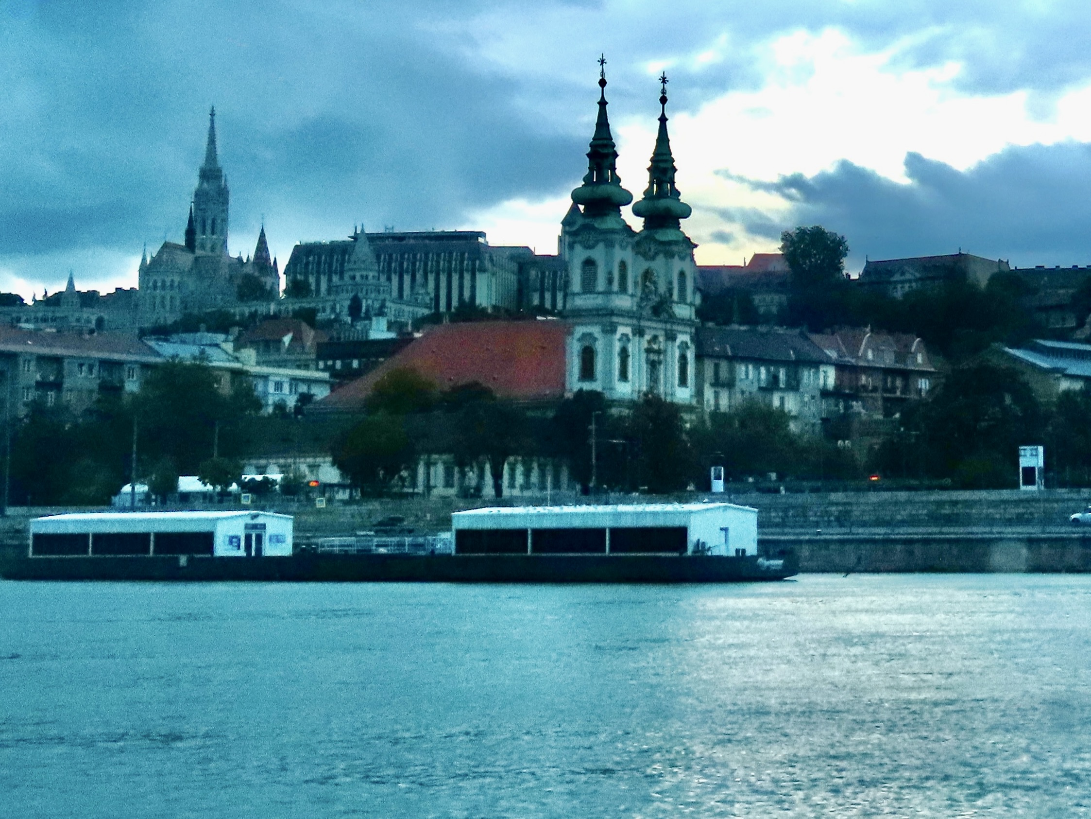
Today, Peggy and I are going to feature a variety of photos we took as we wandered through Budapest by both boat and bus. Here we are looking toward the Liberty Bridge and Budapest’s classic Gellert Hotel from the Amadeus. The bridge connects the Buda side of the Danube River with the Pest side. The hotel is presently being remodeled by the Mandarin Oriental Hotel chain with plans to reopen it in 2027 as the Mandarin Oriental Gellert Hotel. That seems a like a strange name for a historic hotel in Budapest, but no stranger than one being named the Hilton. Or something like Trump Tower.Looking at the Gellert Hotel from the front. The hotel is named after St. Gellert. He was passing through Budapest as an abbot from Venice in the 11th Century on his way to the Holy Land when King Stephens asked him to stay for awhile to educate his son and help convert the pagan Magyars to Christianity, which he did. At least until after Stephens died and a rebel group of Magyars decided they preferred their paganism. Gellert was shoved into a barrel, nails were driven into it, and he was rolled off the mountain and into the Danube, thus gaining instant sainthood.The Liberty statue, which represent freedom from Communist rule, stands on top of Gellert Hill.The monument is presently under renovation. I thought that the scaffolding created a unique, almost artistic look. Hungary’s flag is on the right.Another view of our boat. The cold, cloudy, fall day explains the lack of people on the sundeck.It didn’t deter Peggy’s brother John and his wife Frances from having their photo taken on the deck, however. Sunshine was teasing us by lighting up buildings in the background.We took a photo encourage it.We’ve already included several pictures from Fisherman’s Bastion in our previous two posts, but here are a couple more we liked. An early morning view of the Pest side of the river complete with a ferris wheel.Later, the sun allowed us the catch colorful roofs beneath the Fisherman’s Bastion on the Buda side of the river.Our trip to and from Hero’s Square (featured in our last post) allowed us to see several other buildings that caught our attention. This happens to be Budapest’s Great Synagogue. As always, taking pictures from a moving bus is tricky! Trees, power lines, and even windows get in the way, not to mention odd angles. But what the heck, such obstacles just makes the photo more interesting and more real.A slightly better photo. The Great Synagogue earns its name. It is the largest synagogue in Europe and has one room that can hold 3,000 people. The building suffered severe damage under Nazi and Communist rule. It was renovated in the 1990s with a $5 million contribution from the Hungarian government and a $20 million dollar gift from the Jewish Americans Tony Curtis and Estee Lauder.A random building photo from the bus’s window. The Comedy Theater of Budapest provided another opportunity for a bus window shot. We took a lot more photos like this (there is a reason why my photo library is now at 97,919 pictures— grin), but now it’s time for us to return to the Amadeus for an evening tour of Budapest.Taking photos from a moving bus is a piece of cake compared to night photography without a tripod on a moving boat. I’ll just label this one art. It’s Buda Palace.We were actually able to catch a good photo of Buda Palace so I will quit while I am ahead and use it to wrap up our three blogs on Budapest. Next up on our Danube River trip: A lesson on how to persuade a horse to sit.
Good morning and Happy New Year everyone. Here’s hoping you had a great holiday with family and friends. Peggy and I enjoyed our family time and consumed far too many calories. Now it’s back to work, so to speak. There are blogs to write, trips to plan, and left over holiday goodies to eat. Peggy just tempted me with one of our daughter’s brownies. My resistance was zero. I followed it with a second.
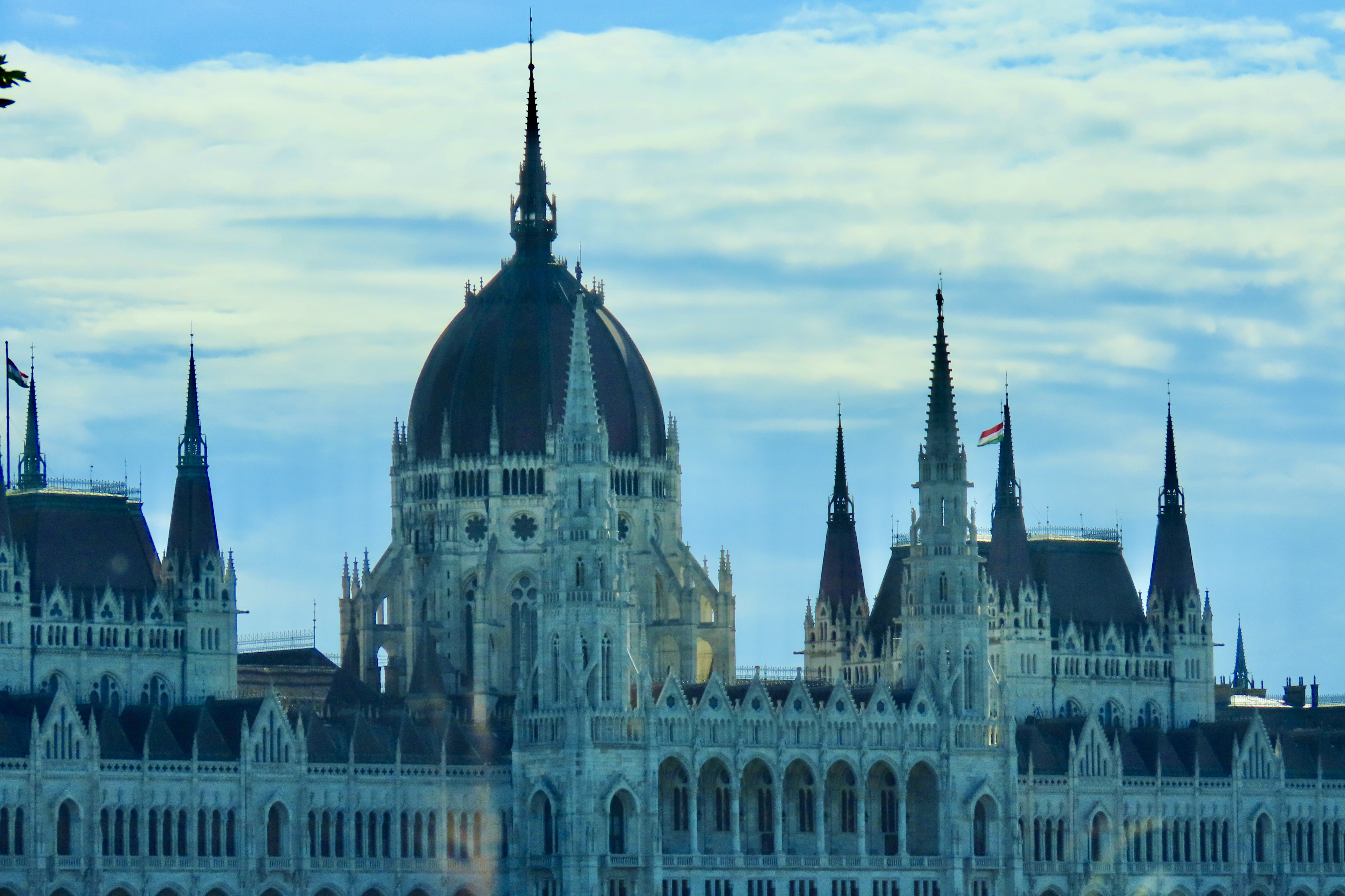
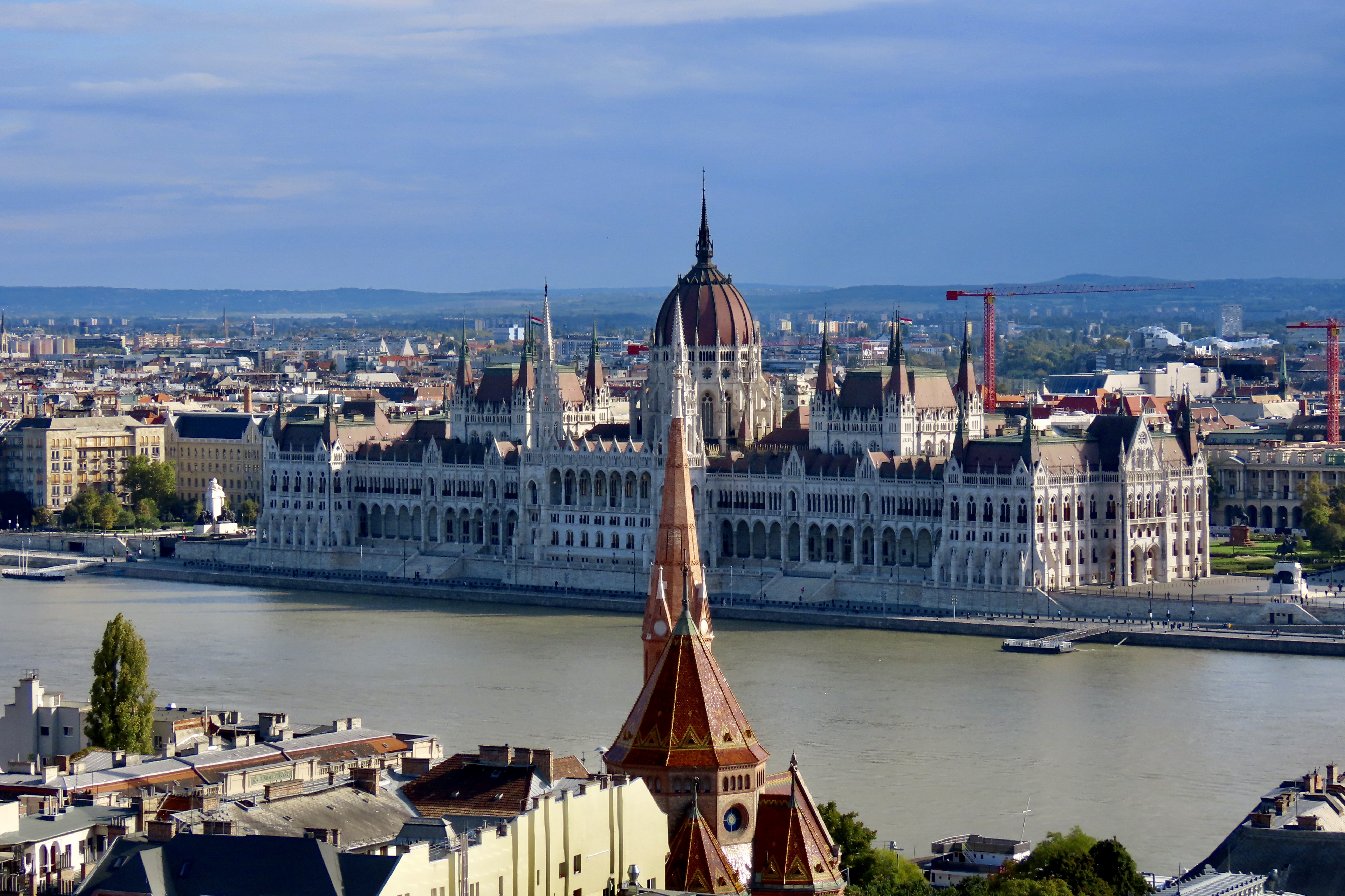
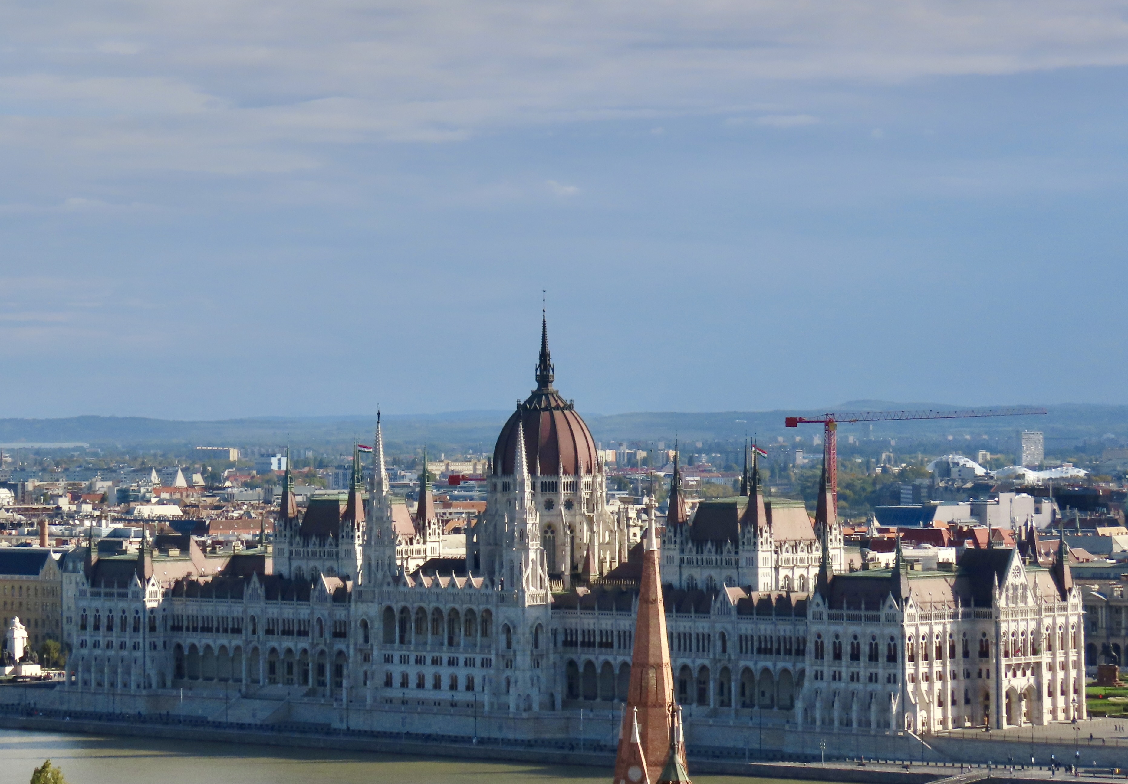
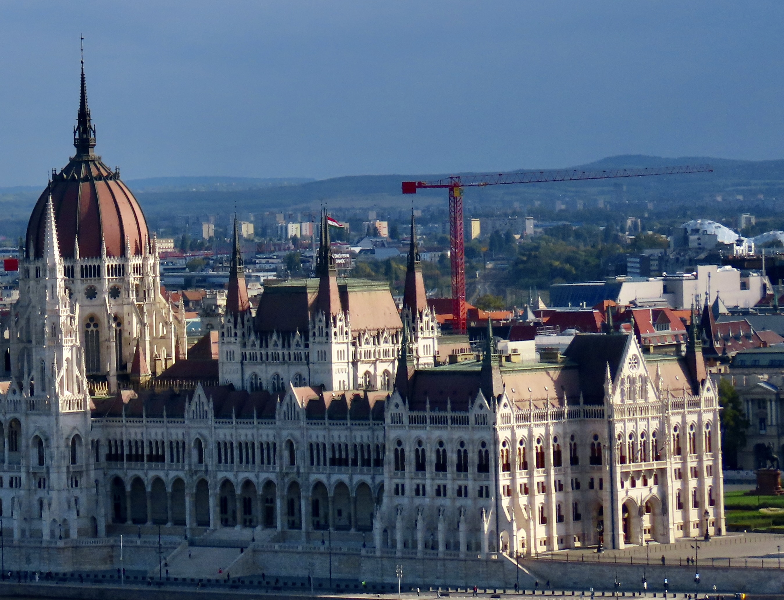
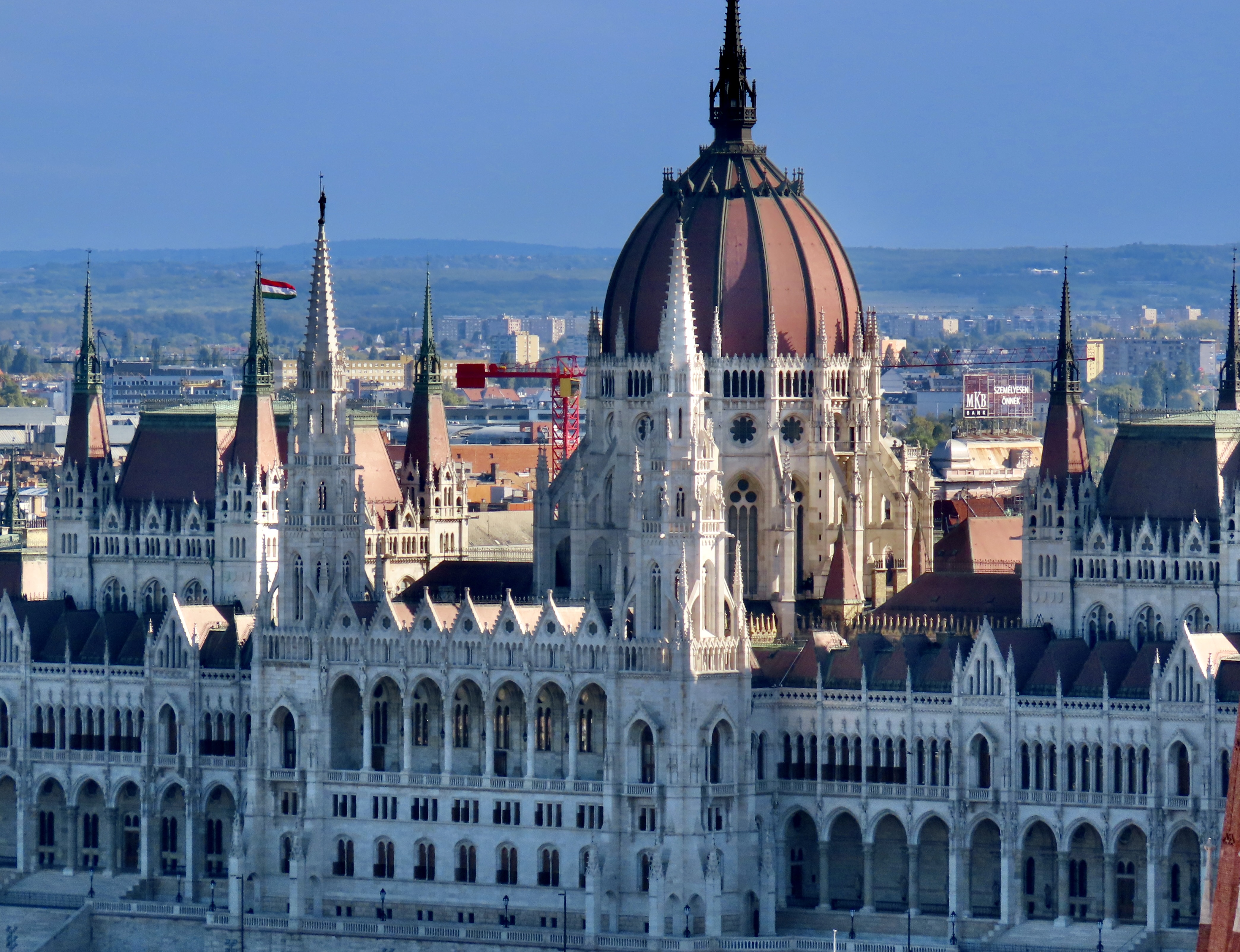
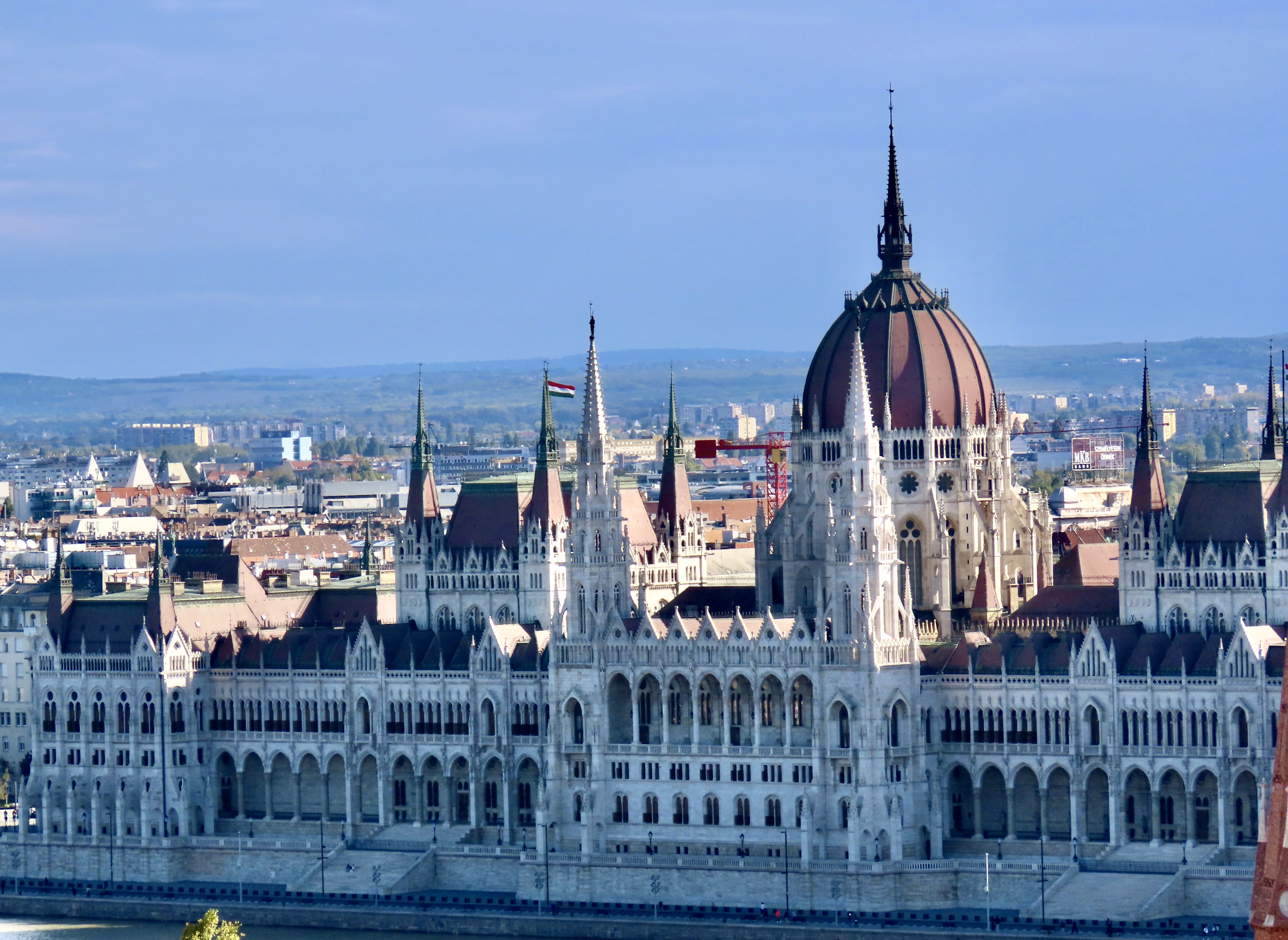
I’m starting today with where I left off before Christmas. The photo above is of the Hungary/Budapest Parliament Building, which happens to be one of the most popular destinations for visitors to Budapest. For good reason. It’s one of the most beautiful buildings in the city. This photo was taken when we arrived in Budapest and were still on the Danube. The early morning light was responsible for its fuzzy, ethereal, greenish-blue look.
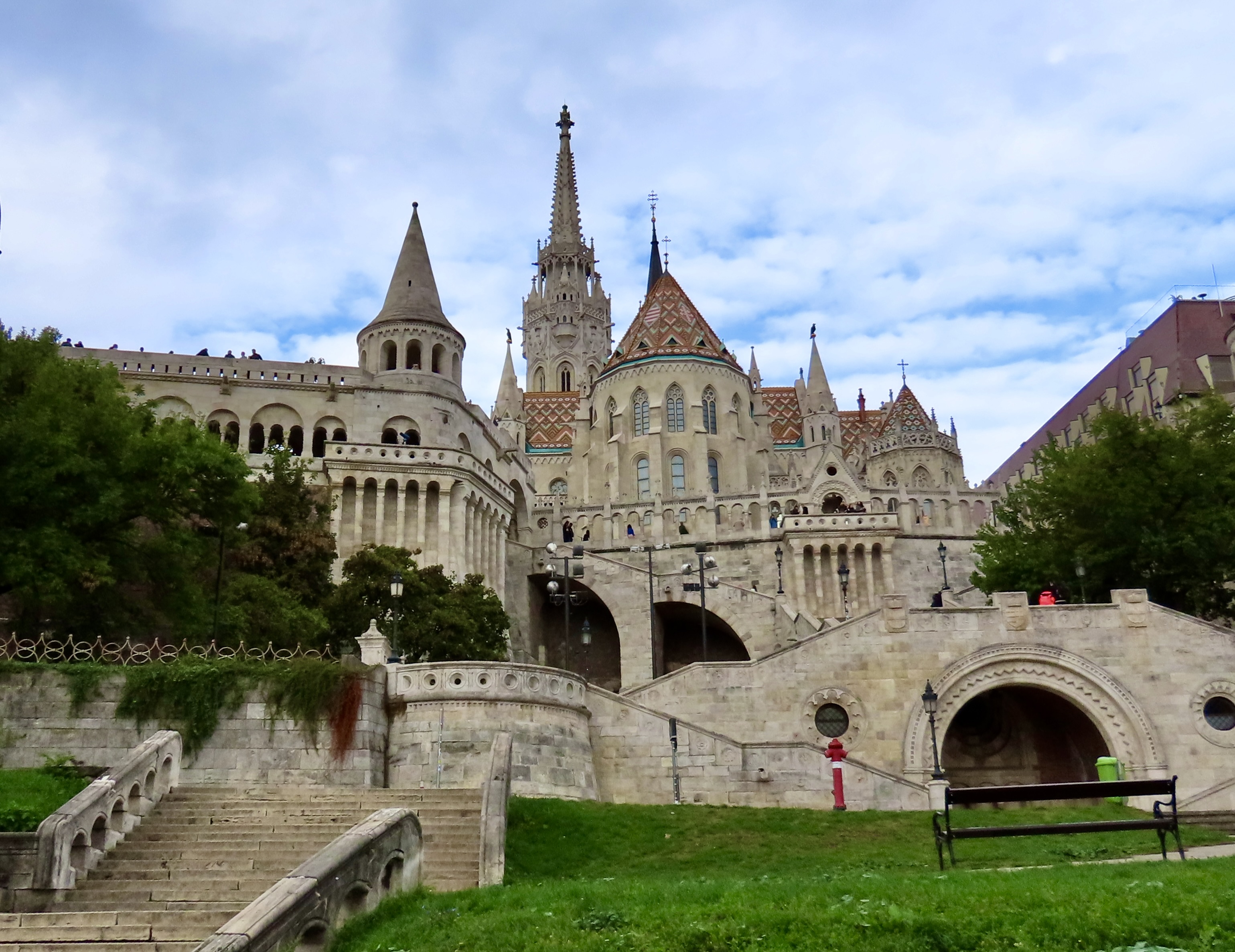
An early morning view from the Danube River of our arrival in the Budapest. Shortly after docking, we journeyed up to Matthias Church where we had great views from the Fisherman’s Bastion overlooking the Parliament Building.
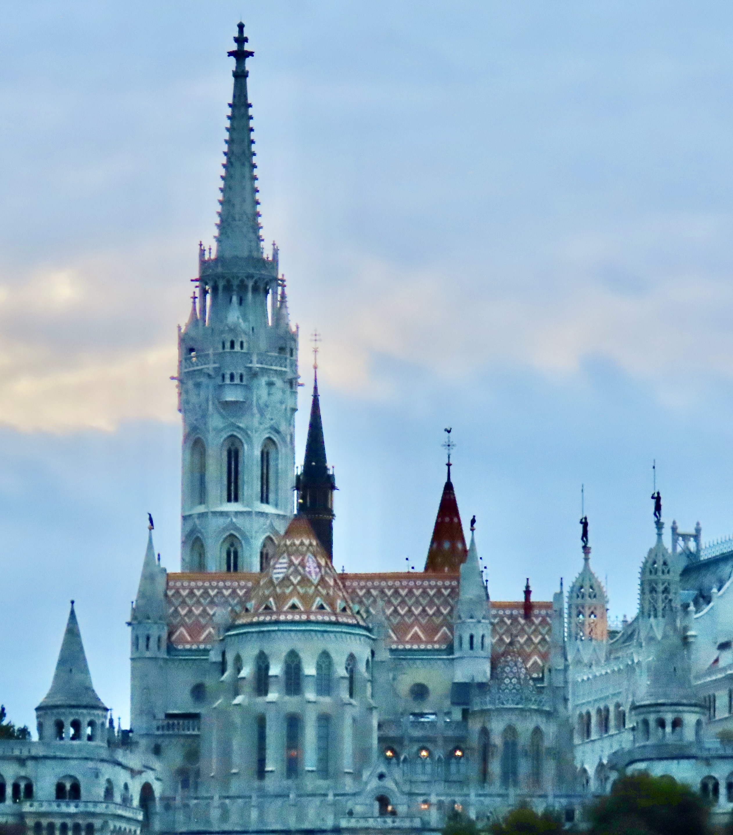
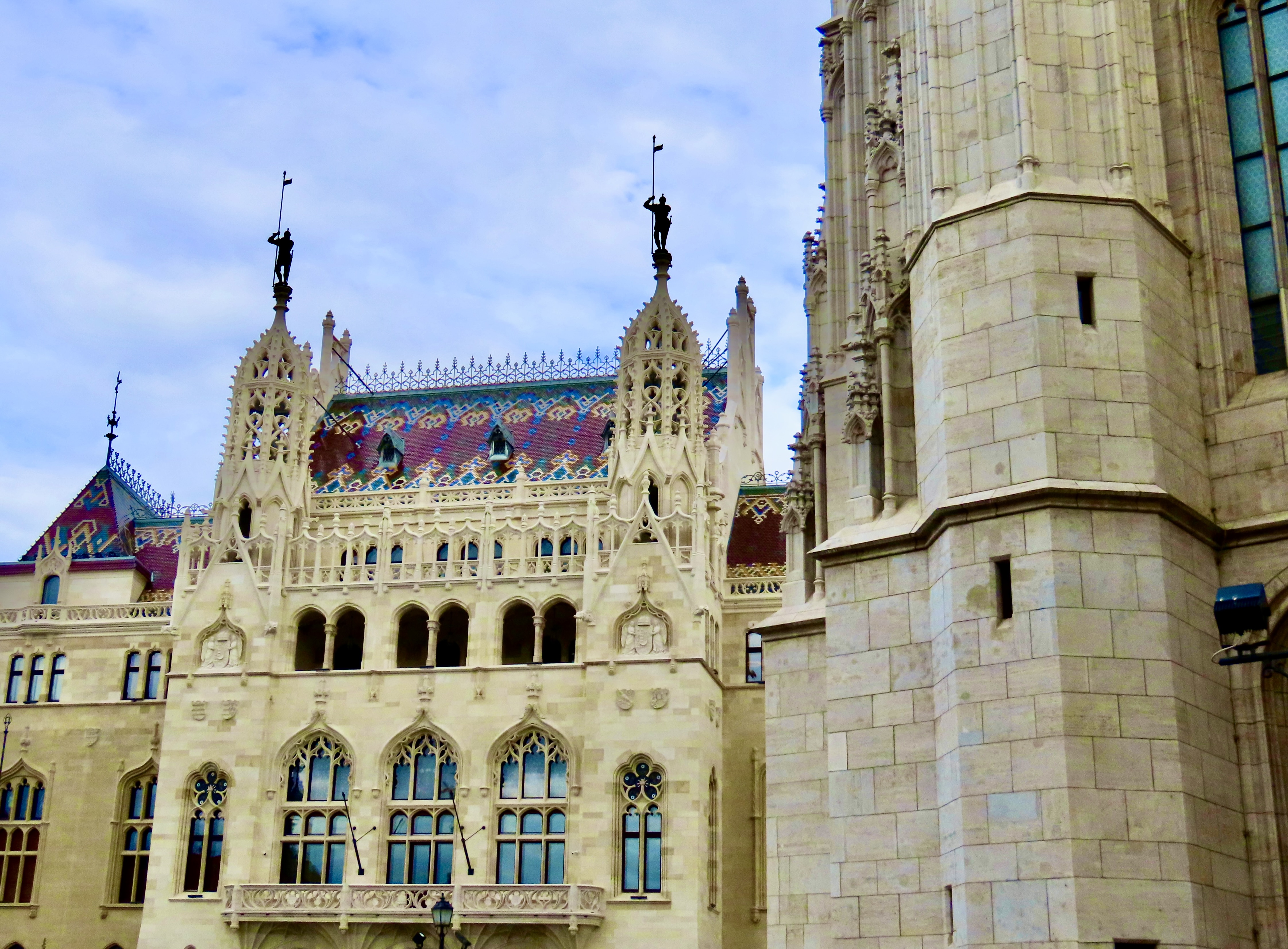
By the time we finished visiting Matthias’s Church, the sun was beginning to light up the Parliament Building. Unfortunately, a church steeple was busy photo bombing us, making it impossible to get a clear shot of the whole building.
We were able to minimize the steeple but our best solution was to photograph the building by sections.
The Parliament Building was inaugurated in 1896 in recognition of of the nation’s 1,000th anniversary and the 1873 uniting of three cities: Buda, Pest, and Obuda. Forty million bricks went into its construction, or so they say. Whatever, it was a lot of bricks. Approximately half of the building is used for today’s Hungarian unicameral legislature, while the other half is used for a variety of purposes including offices, conferences, ceremonies— and tours. If you feel the building bears a strong resemblance to Britain’s Westminster Place, you’d be right. Hungary wanted to emphasize its close relationship to Western Europe and England at the time.
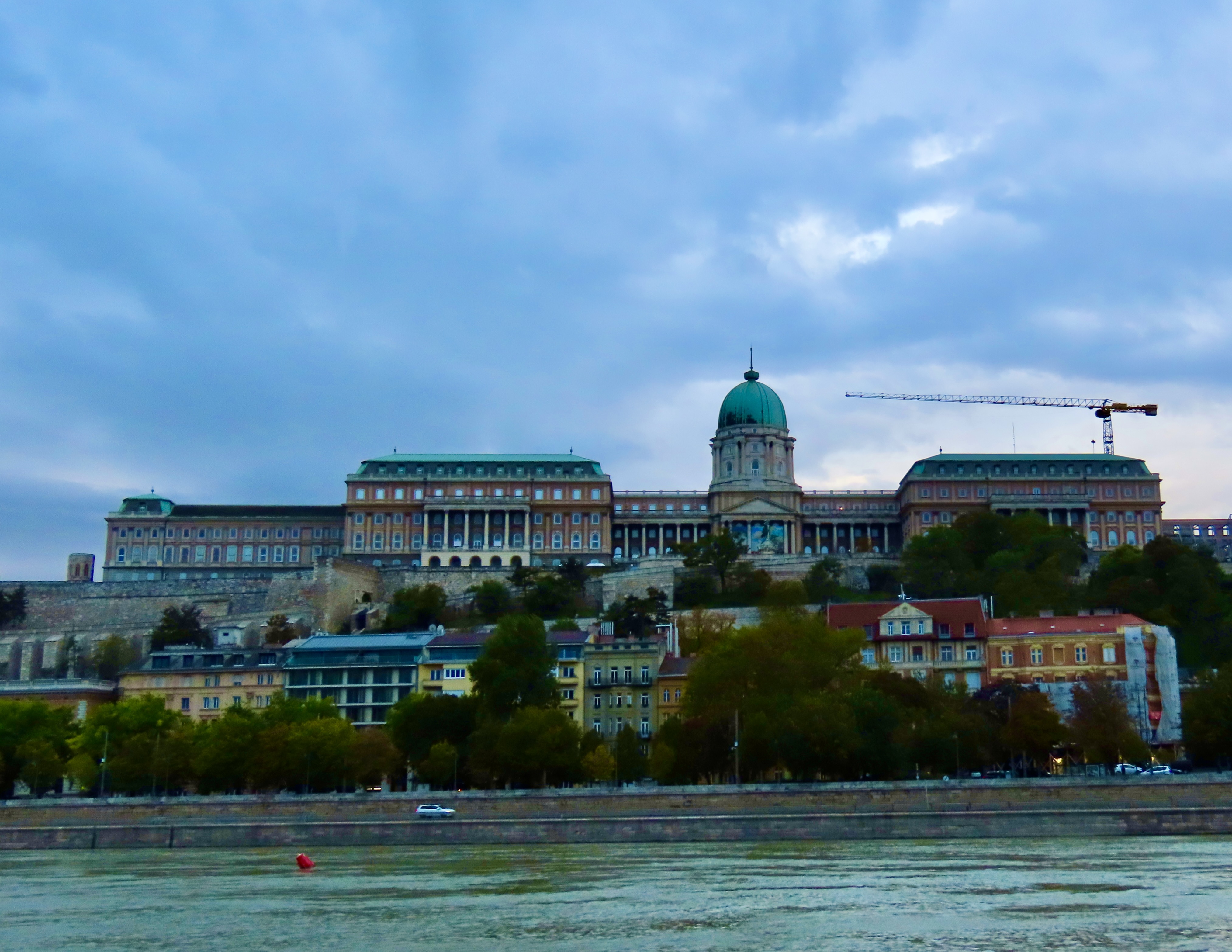
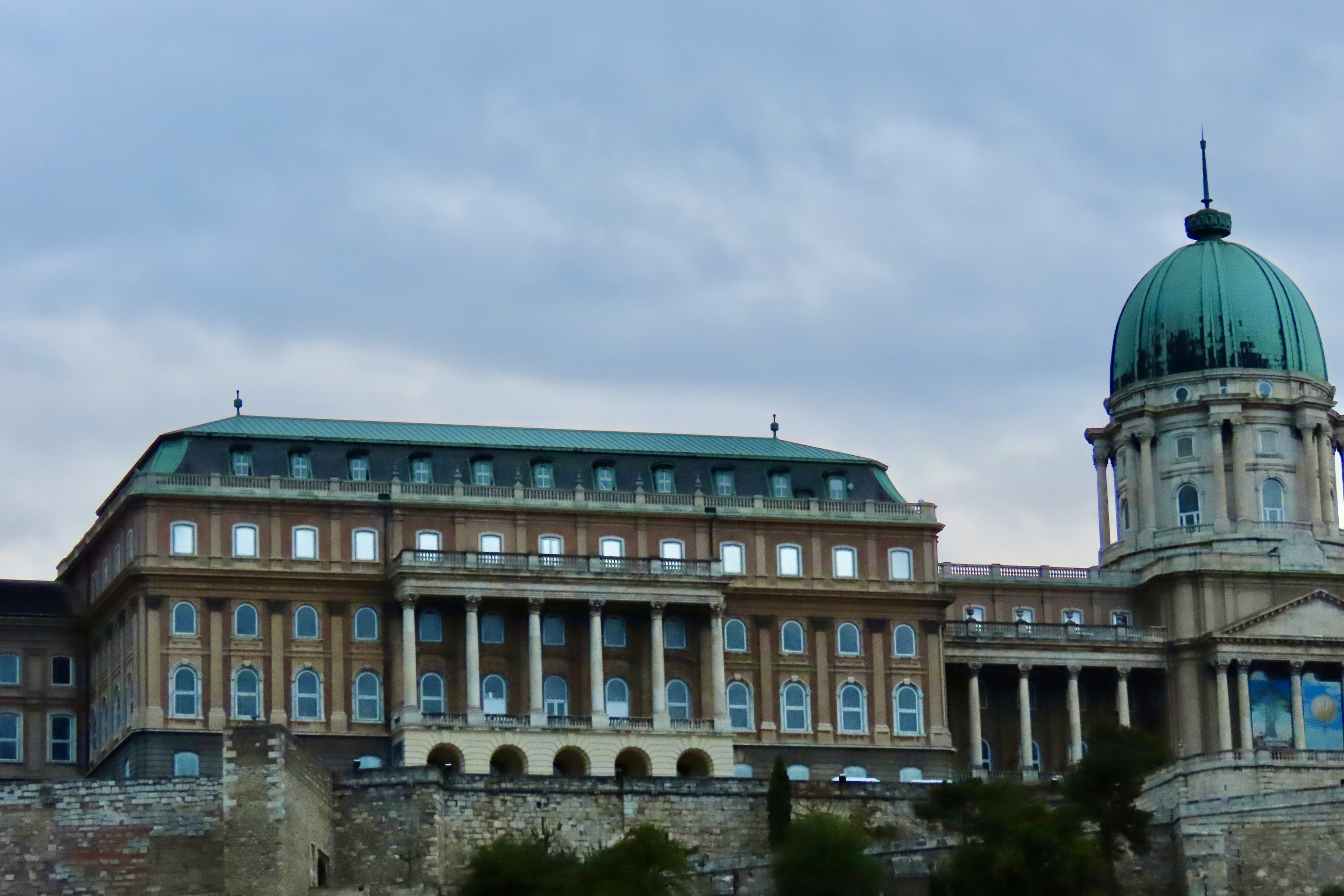
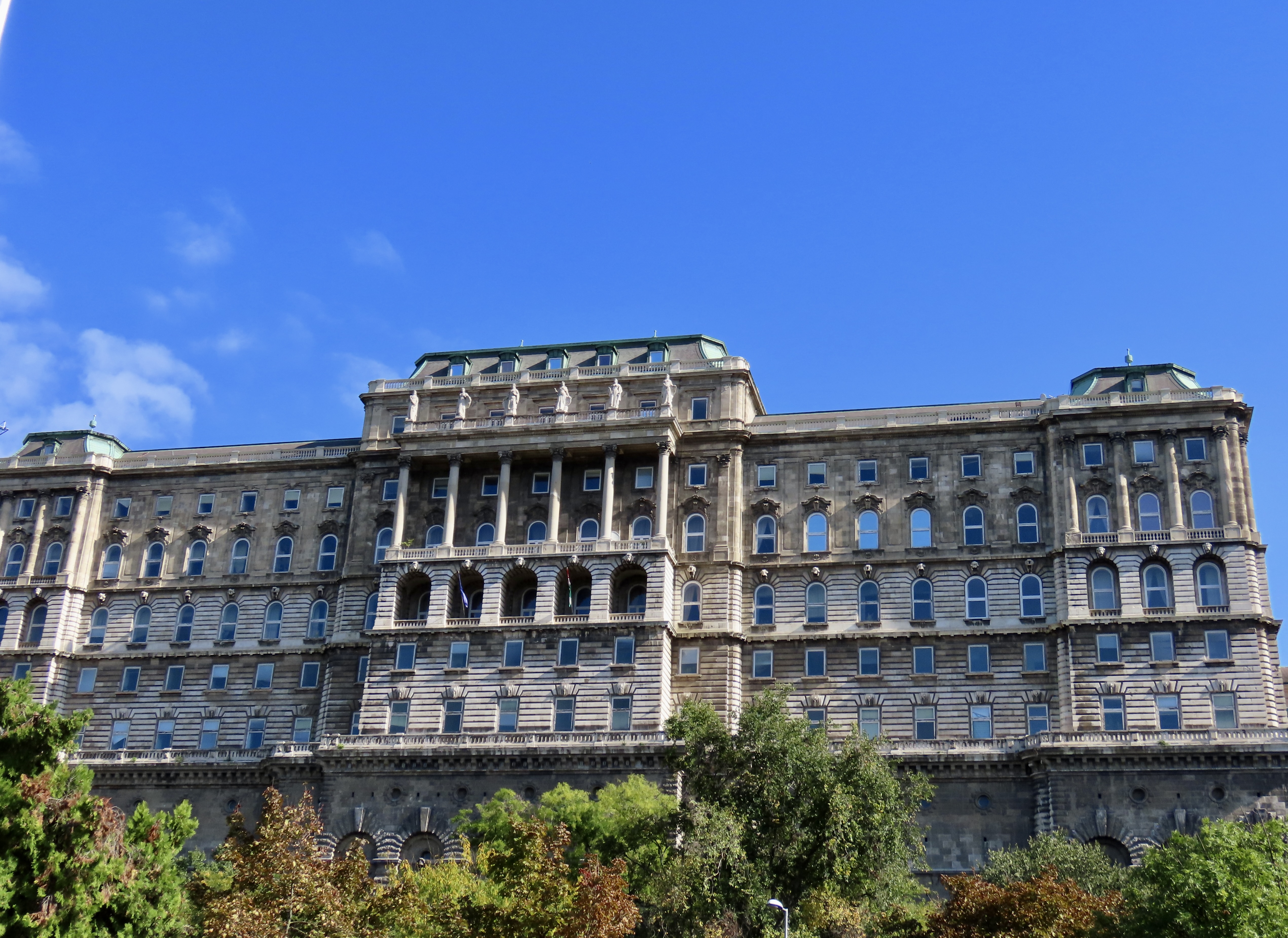
Buda Palace, once the home of kings, provided another early morning view from the Danube River. Originally dating back to 1265 and later destroyed, much of what you see above was built in the mid 1700s. That, in turn was severely damaged during WW II and then rebuilt during the Communist era. The buildings in front add a nice dash of color.
A closer look.
Our favorite view of the palace. Like Matthias Church and the Fisherman’s Bastion, Buda Palace is located on Castle Hill.
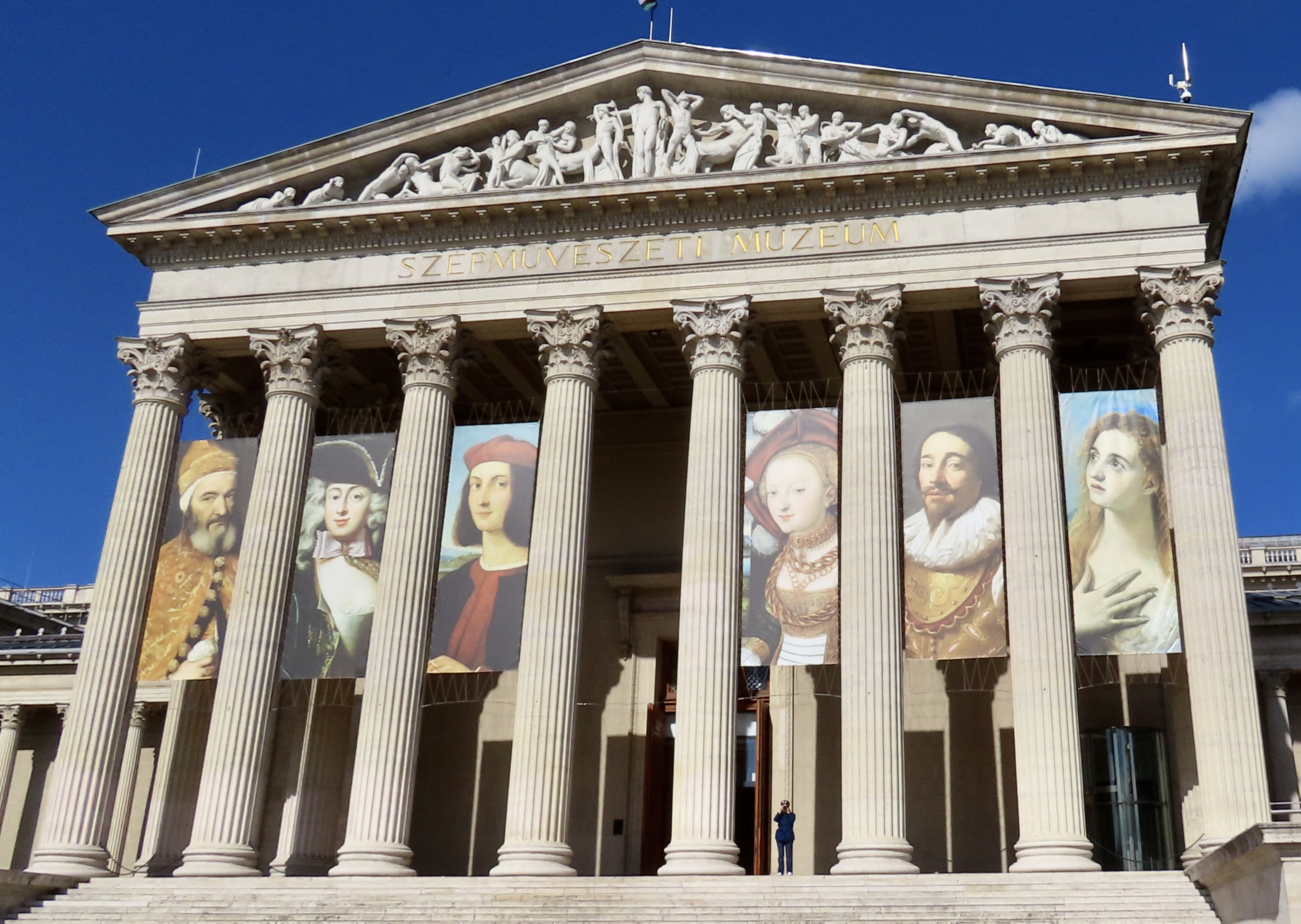
Our drive into Pest from Matthias Church provided a final view of the Palace. Shortly after this, we were crossing one of the bridges across the Danube and on our way to Hero’s Square, which, in addition to providing recognition for a number of Hungary’s heroes, also features an art museum and a castle.
Our first view was the Palace of Art. We didn’t have to guess which building it was. Unfortunately, there wasn’t time to explore it. One of the disadvantages of most organized tours is that there is rarely time for any more that a cursory exploration of what you are seeing.
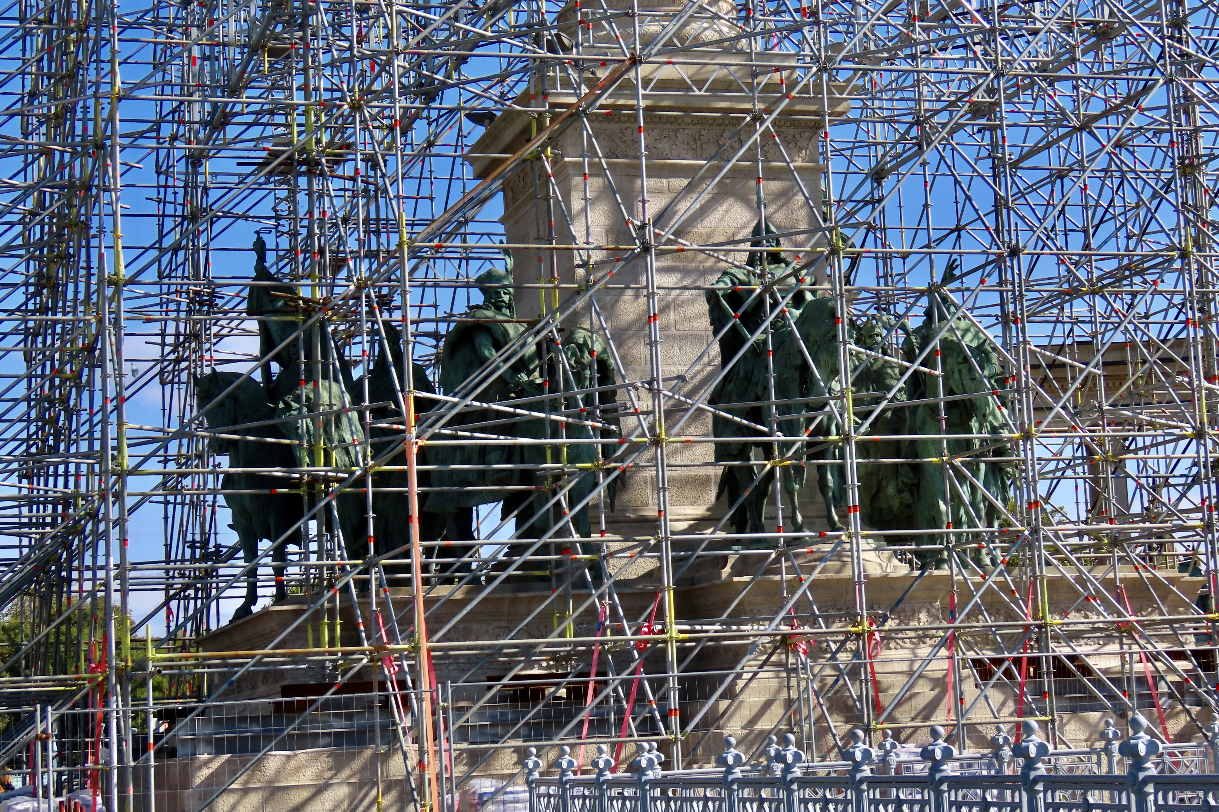
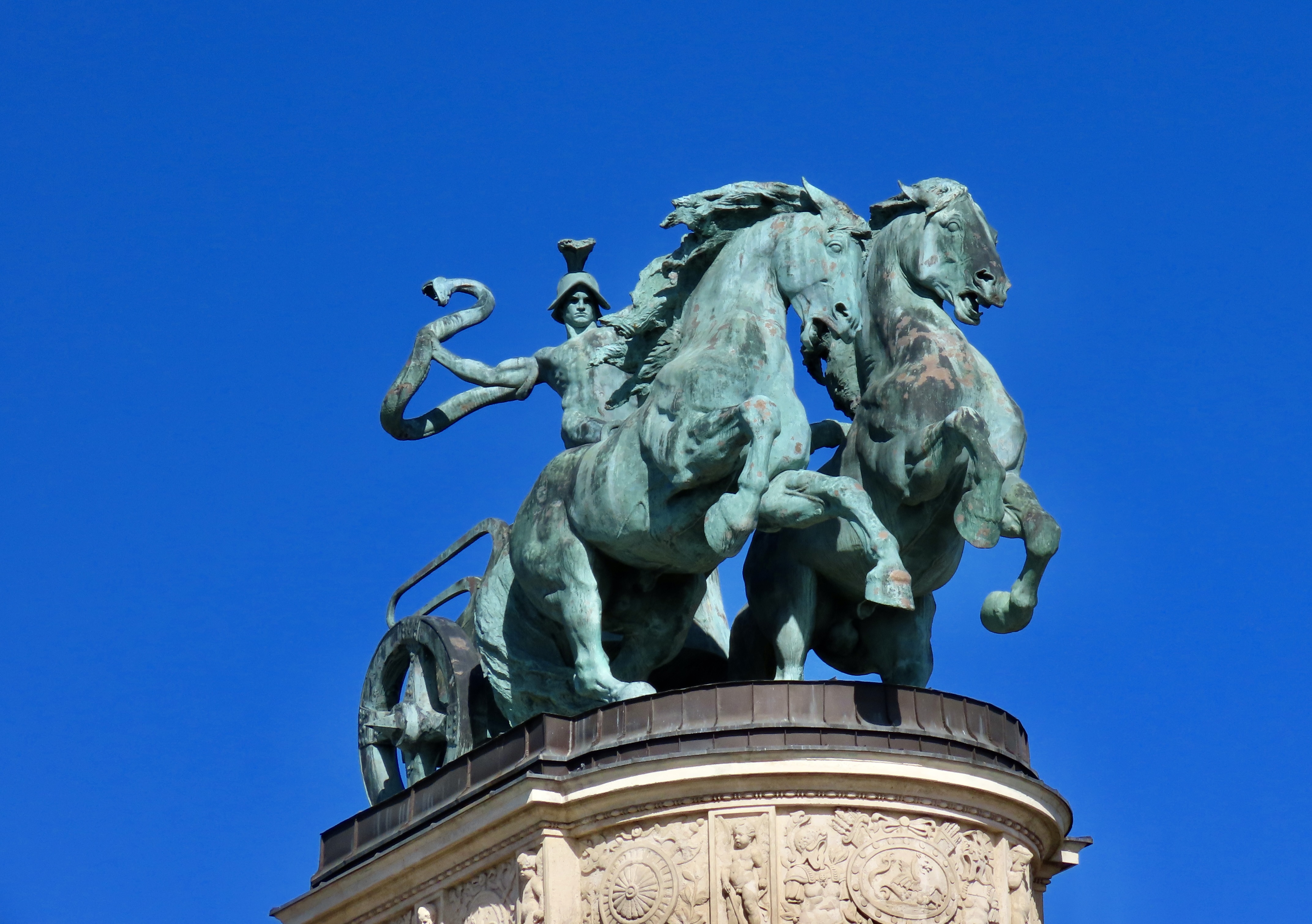
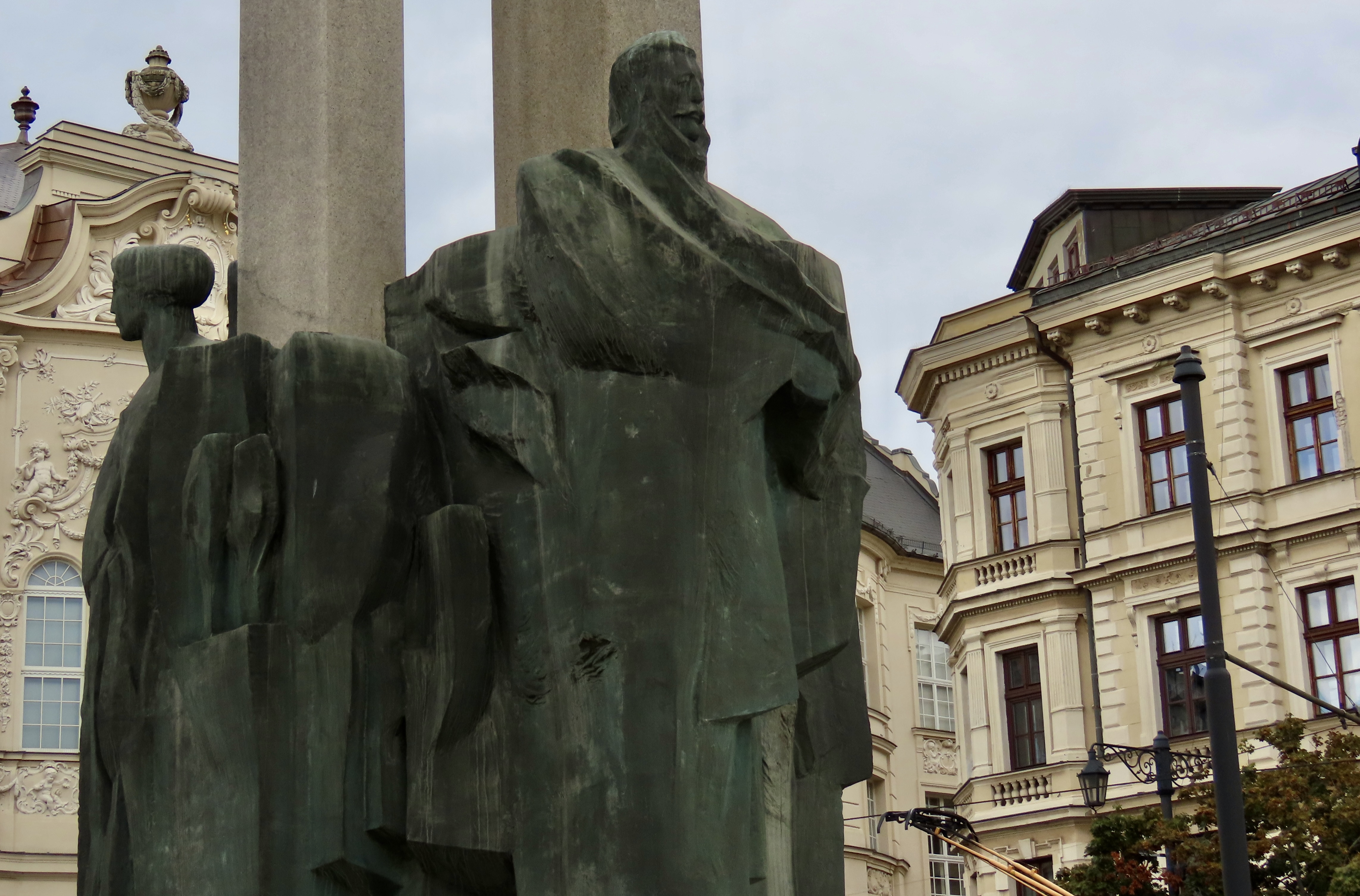
On the other hand, many of the things we see don’t require a lot of time. For example, this monument representing the seven Magyar chieftains who led the Hungarian people into the Carpathian Basin in 896 was hidden behind scaffolding.
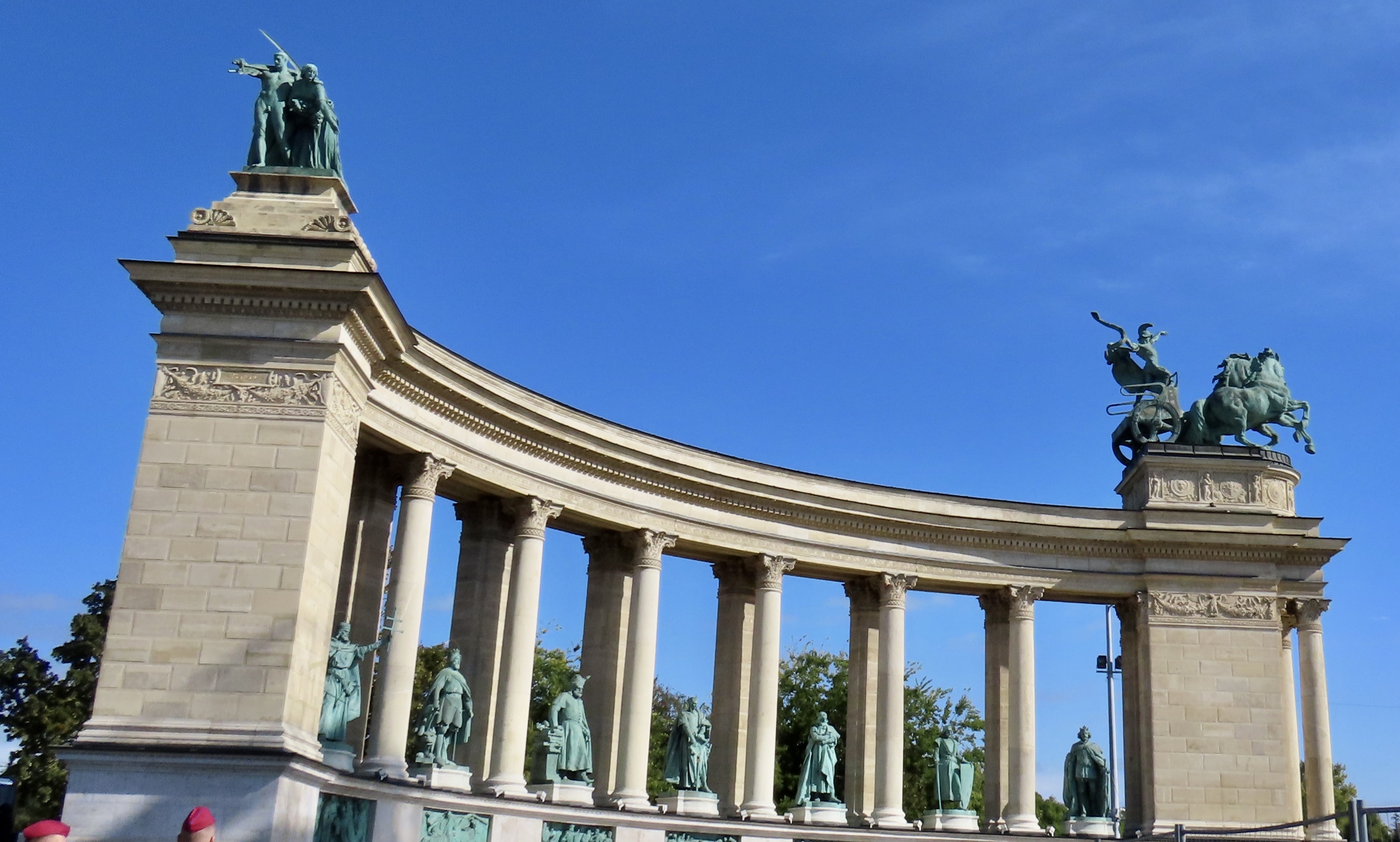
I found the two matching colonnades behind the Magyar Chieftains to be of more interest. The figures on top represented important aspects of Hungarian life and virtues. The bottom statues were of important historical figures.
Here, the man with the scythe and the woman sowing seeds represented labor and wealth. As to why a man would choose to go out into a field of grain and whip around a large, sharp object while being totally naked is a total mystery to me.
That this represents war makes more sense. But wait! His whip is a large snake. Various coats of arm and the ever present naked cherubs are on the pedestal.
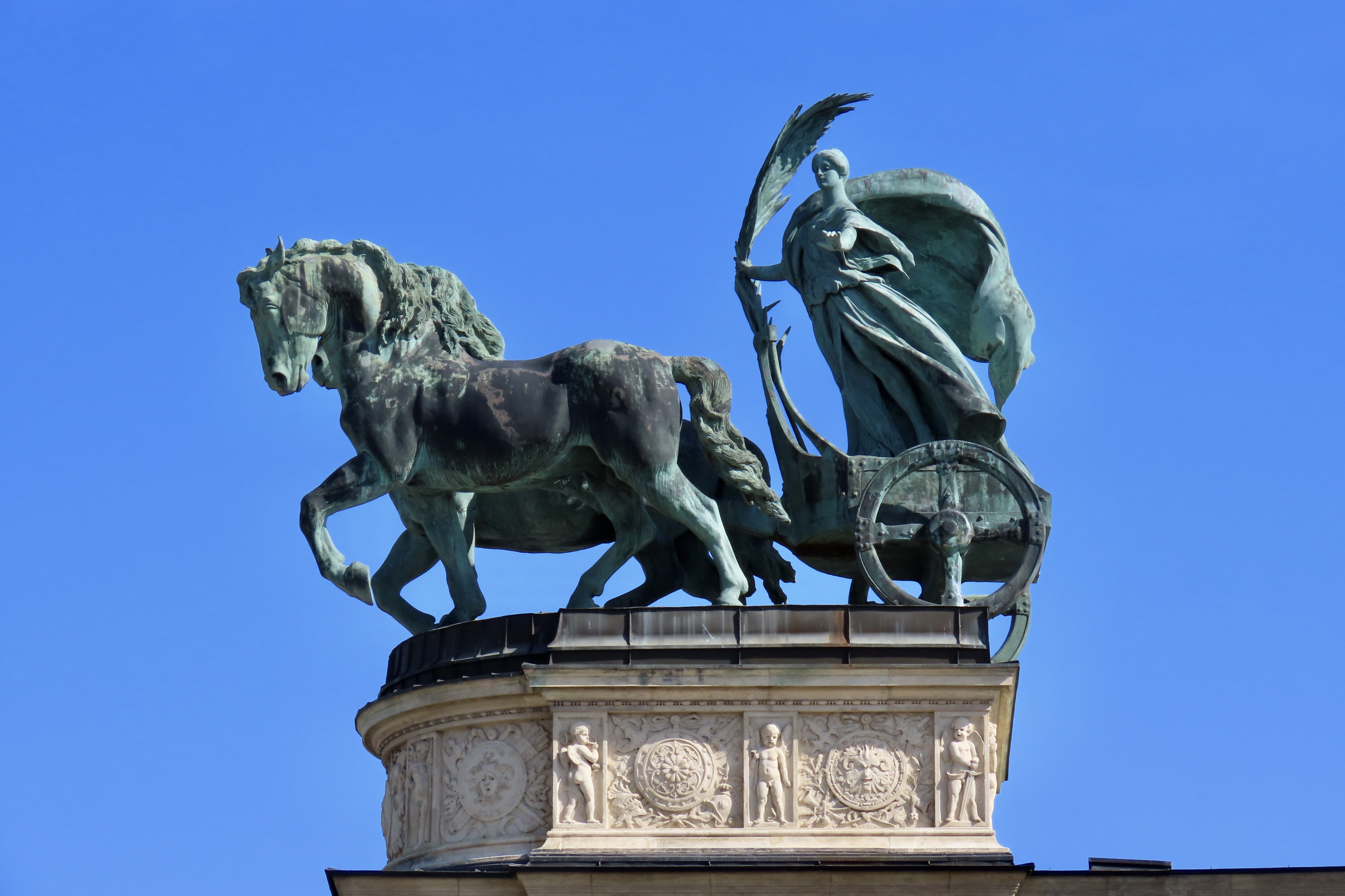
Facing war on the opposite colonnade is Peace with a palm frond and a billowing robe. We missed Wisdom and Glory. Darn.
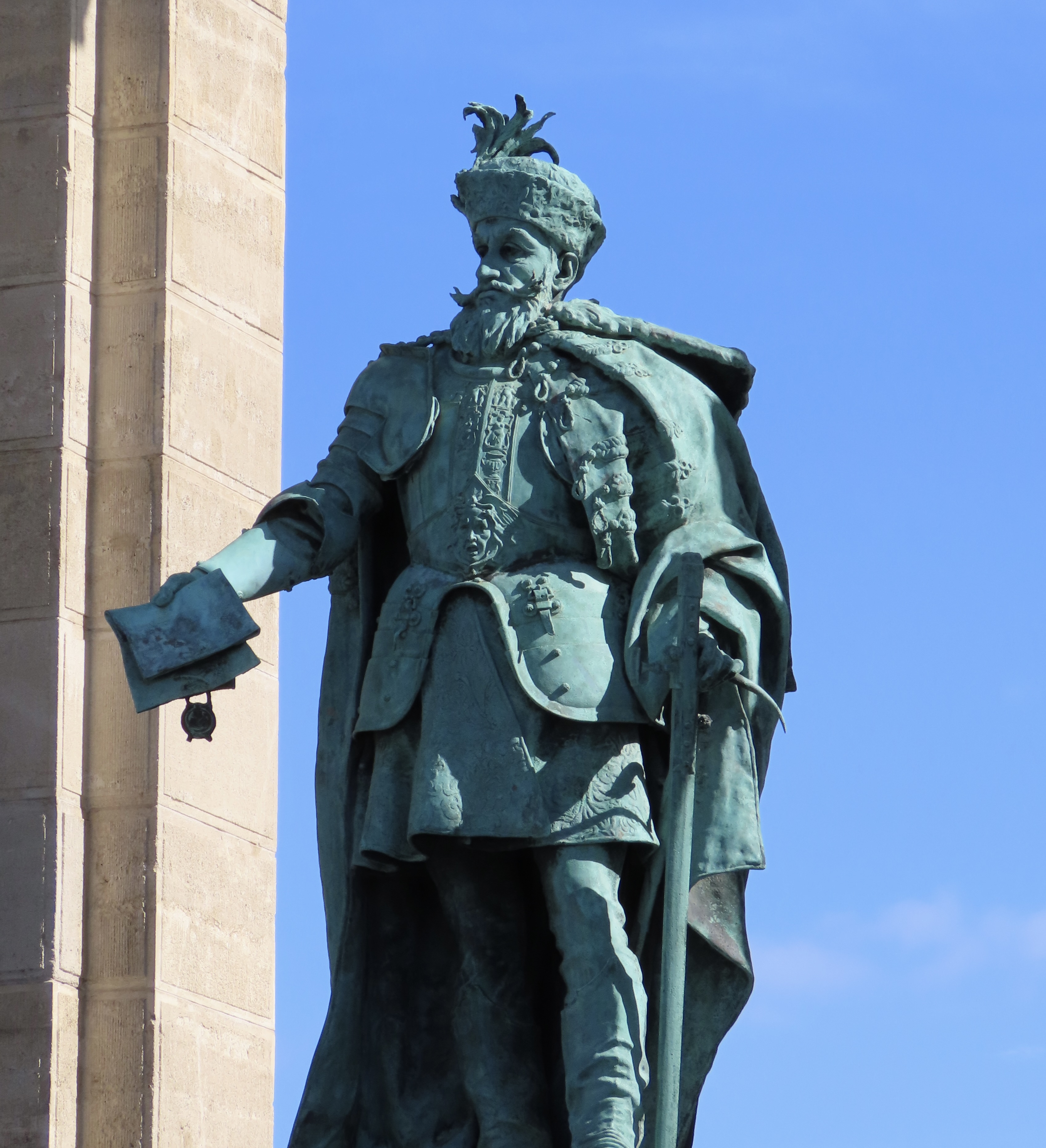
There were too many statues of Hungarian nobility and heroes to include in this post so I chose Gabriel Bethlem to represent them. He’s up there because he concluded an important treaty with Bohemia for Hungary. I didn’t choose him for that, however. I chose him for his mustache and hat.
I couldn’t resist.
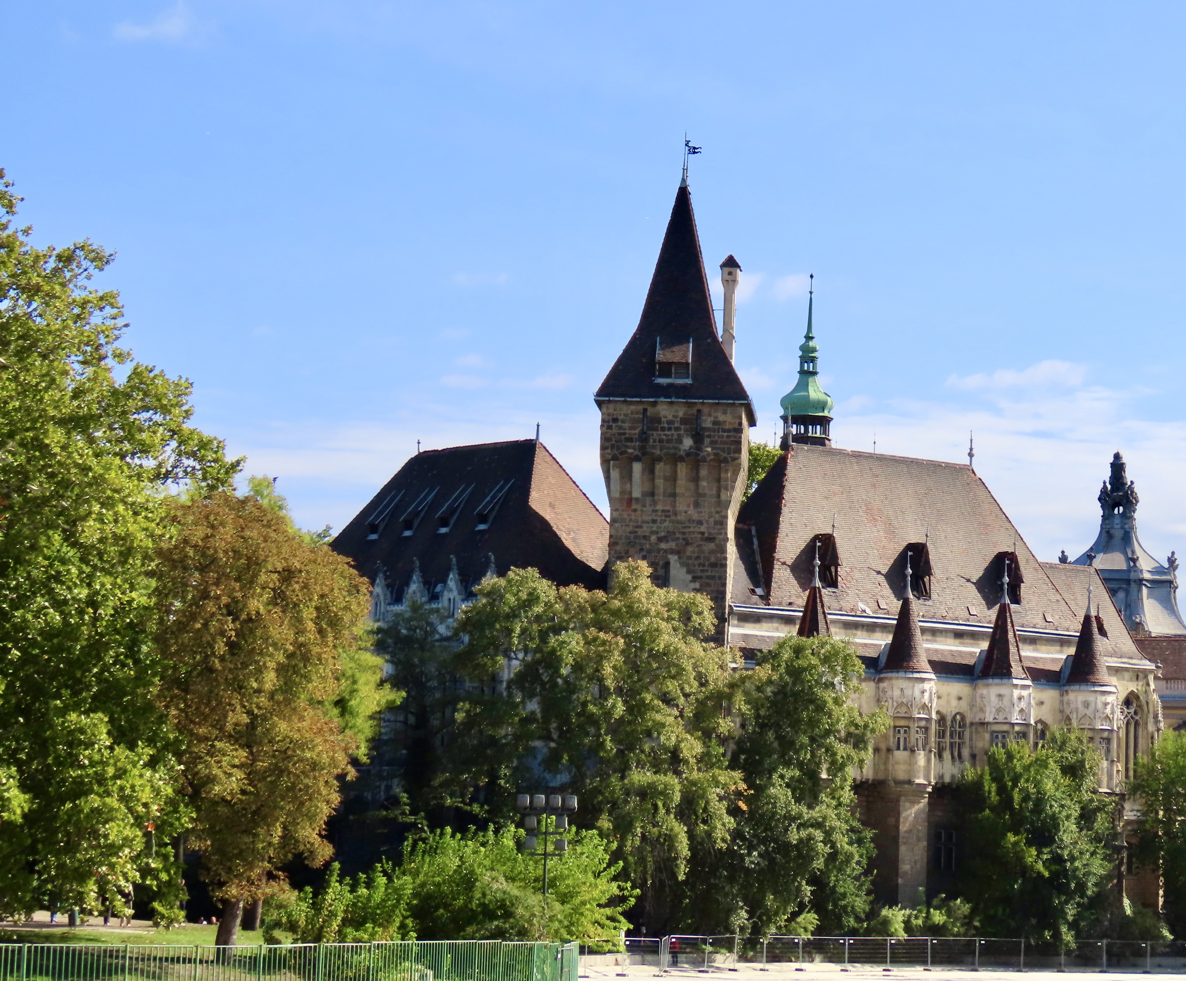
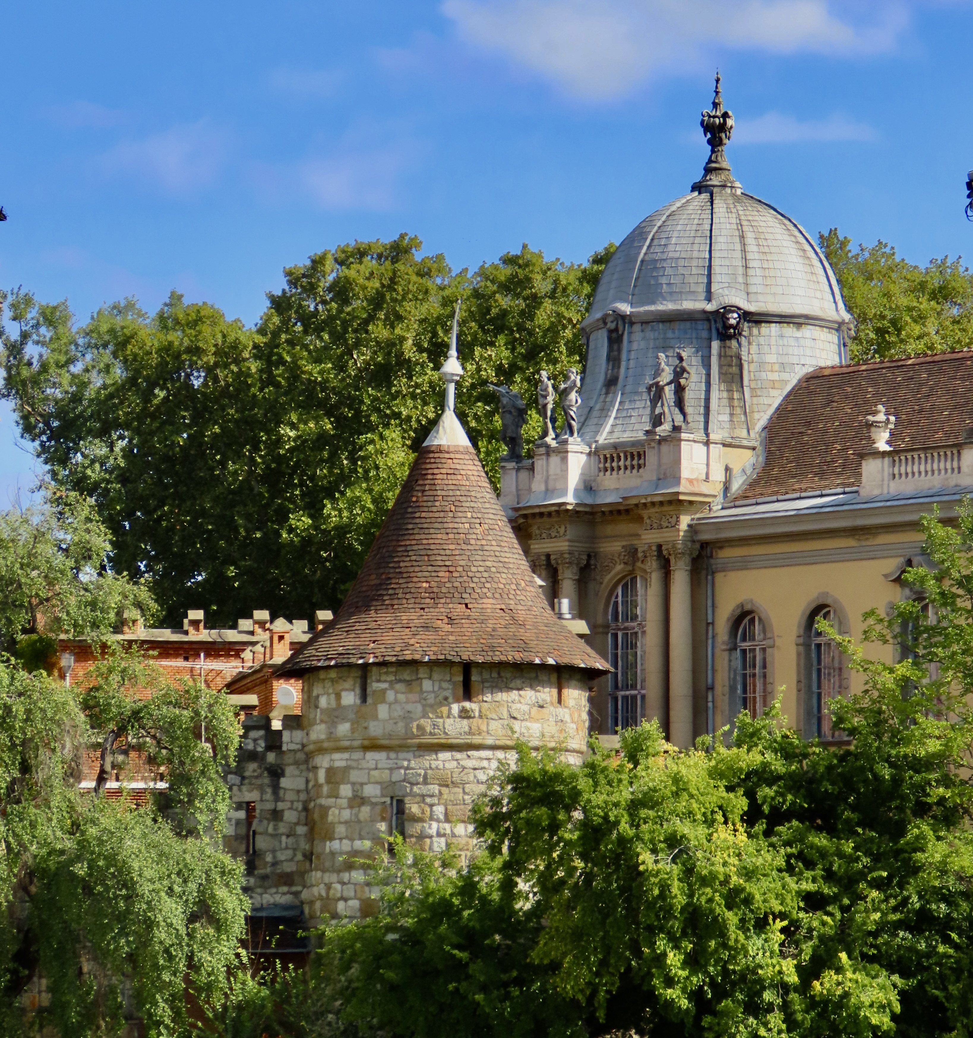
Vajdahunyad Castle is located in the City Park of Budapest just behind Heroes’ Square. It certainly looks like one of the historical castles we’ve featured from time to time in our posts. But looks can be deceiving, right? Originally it was made of cardboard and wood as part of the 1896 Millennium Celebration of the foundation of Hungary. It was so popular however, the stick and cardboard castle was torn down and replaced with real stones. It was designed to feature elements of several prominent castles from the region and illustrates Romanesque, Gothic, Renaissance, and Baroque styles.
Two more views. This one…
And this, which concludes today’s post. Next we will be featuring miscellaneous photographs we took while exploring Budapest by bus and river boat.
A night shot of Buda Palace taken while on an evening cruise.
Show up on your doorstep late Christmas Eve, they may have something important to say. You will have to listen carefully.
They are the Goats of Christmas Past.
Their message may be baaaa’d.
This is the Christmas Card I created for 2024 that Peggy and I have sent out to family and friends and are now sharing with our blogging family. Thanks so much for joining us in our adventures this previous year as we traveled from the Florida Everglades, to the Pacific Coast and National Parks of America, to the Danube River of Europe. We are looking forward to having you along in 2025. May you have a great holiday season and a peaceful and Happy New Year! Curt and Peggy
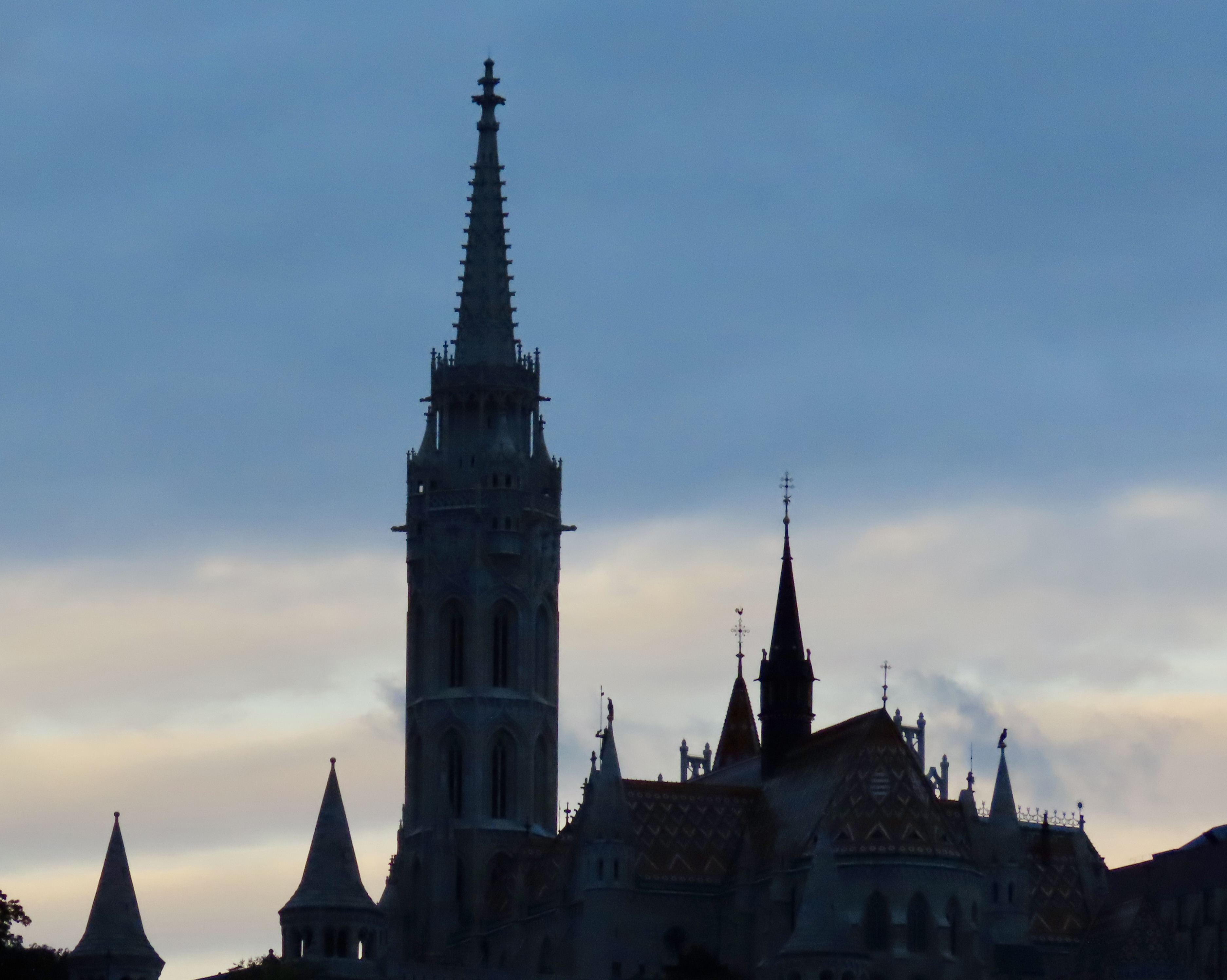
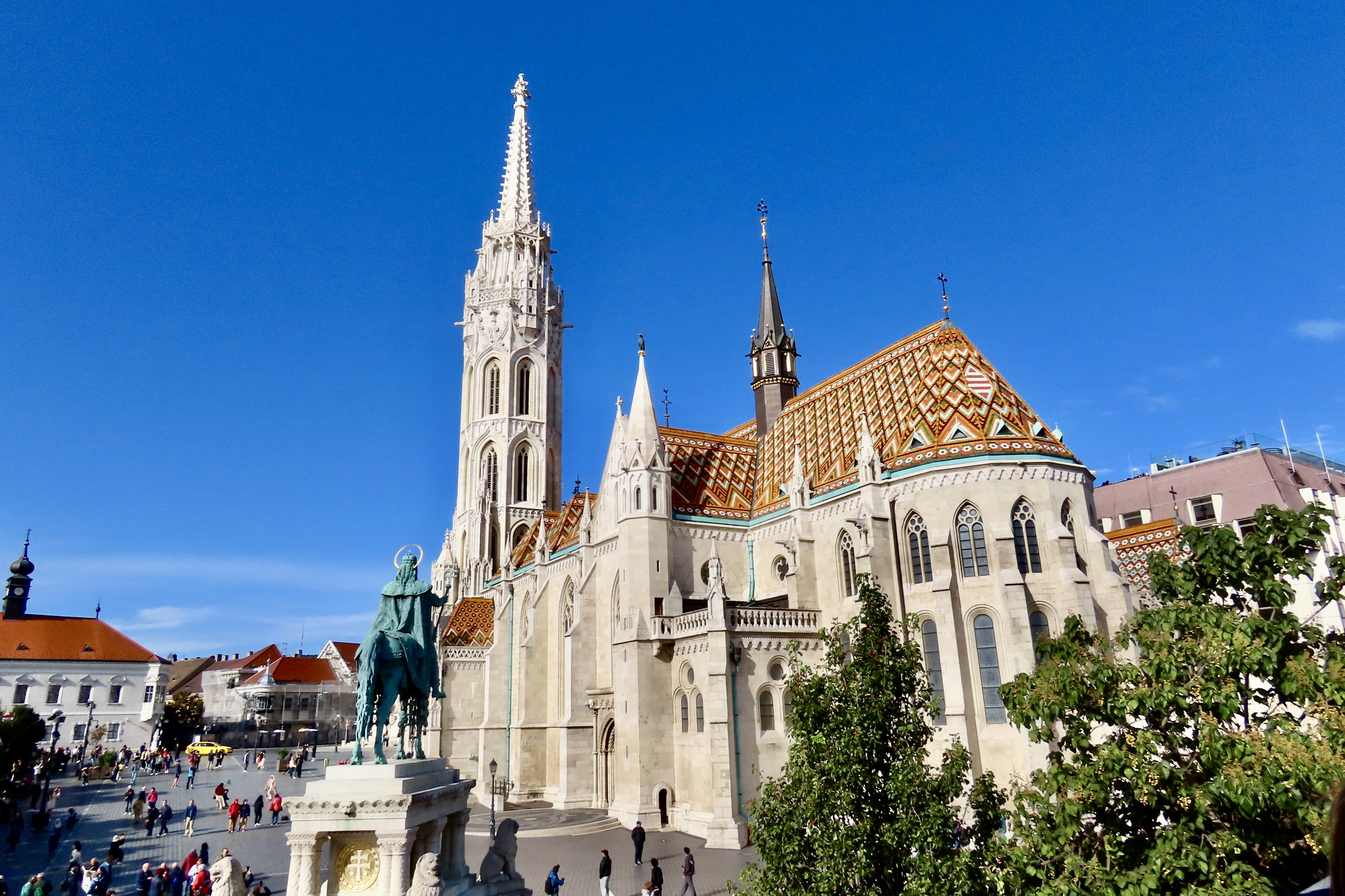
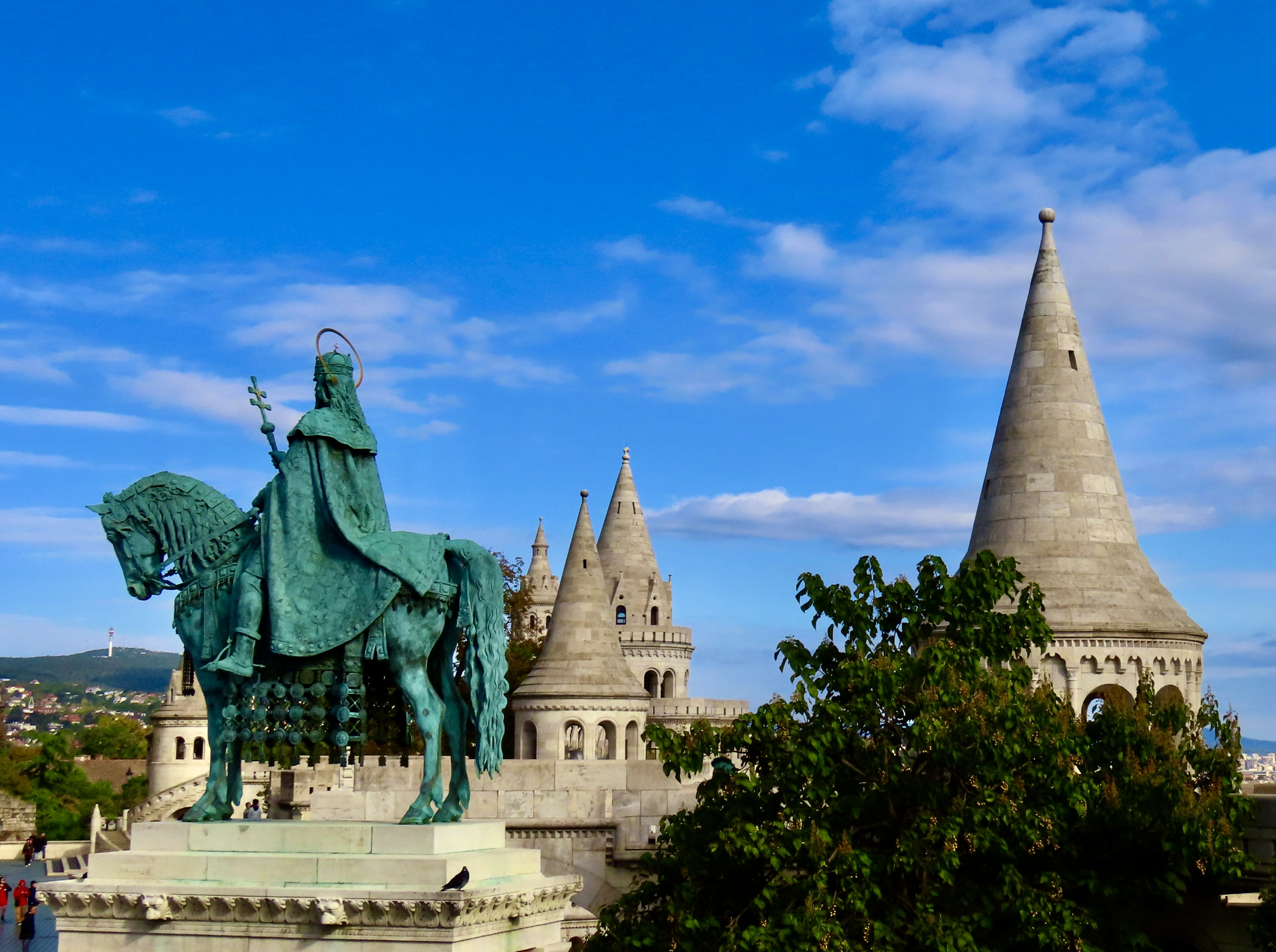
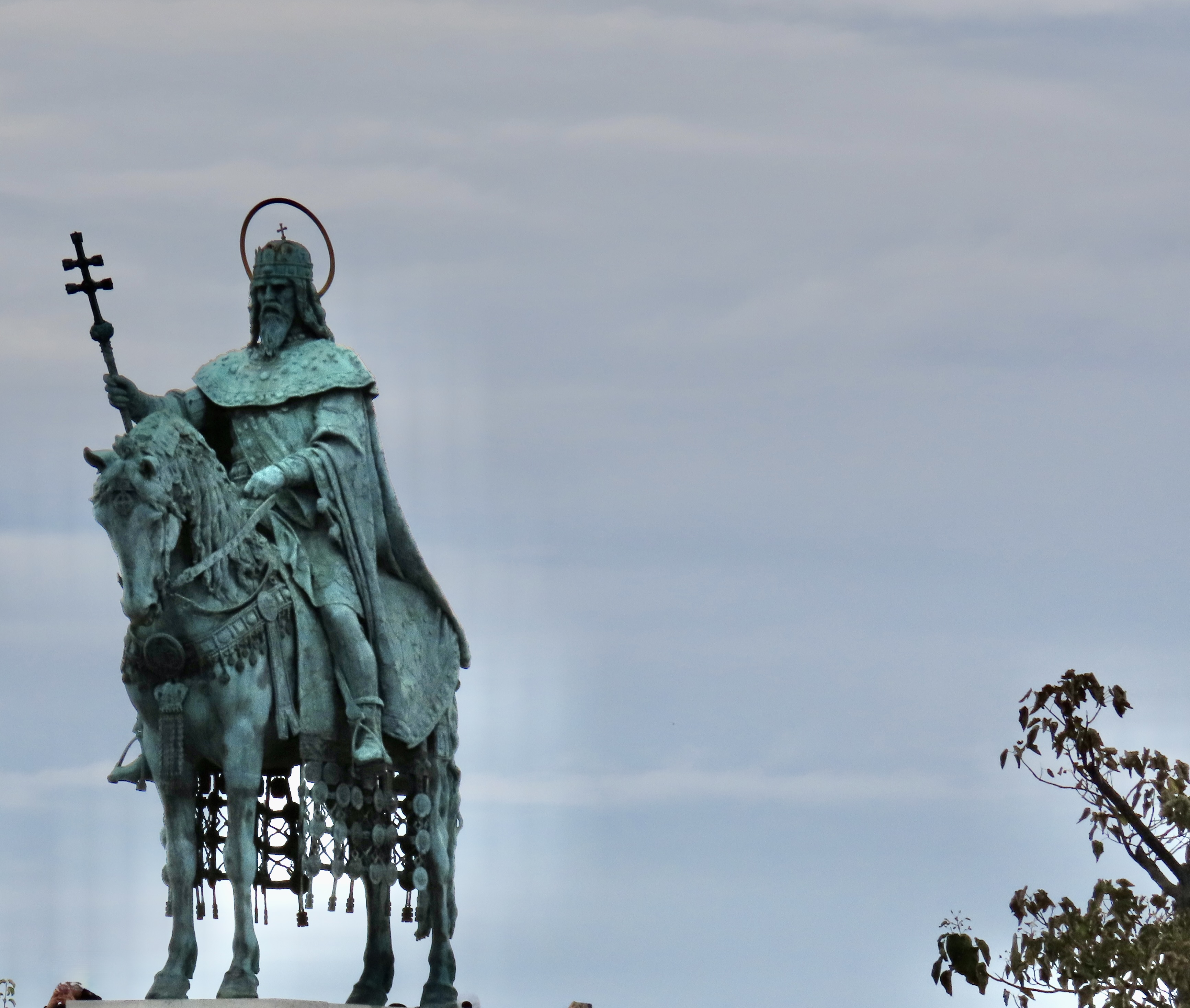
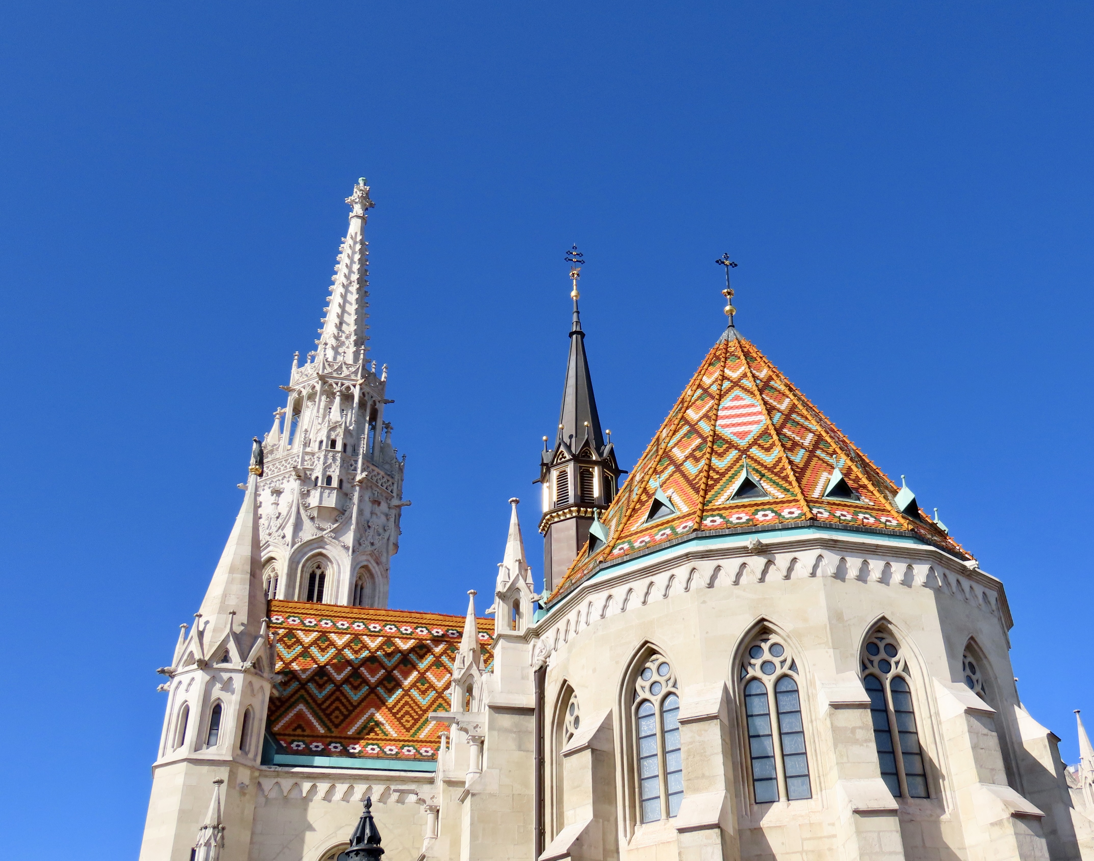
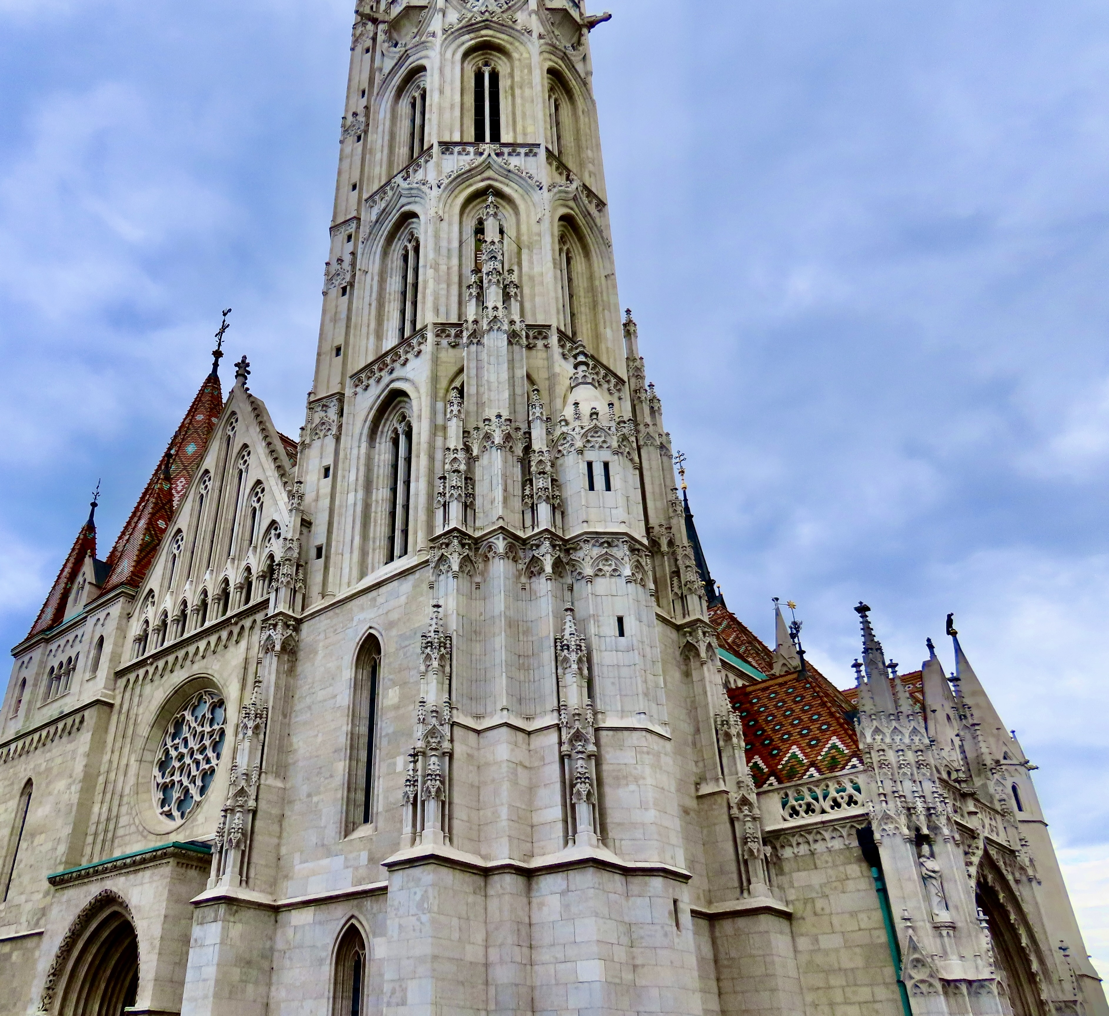
The sun wasn’t yet up when we arrived in Budapest. The captain of our riverboat had urged the evening before that we get up early so we could see the city in the early morning light. It was a good suggestion. There will be several photos in our posts on Budapest that will reflect what we saw. Here, we are looking toward Buda Castle Hill. The twin towers of St. Anne’s Church are on the right. Looking up the hill to the left is the beautiful Matthias Church that we will visit in today’s post.Focusing in on Matthias Church a few minutes later, the sun was lighting the sky quickly. I thought the slightly fuzzy quality our cameras produced in the low light added to the beauty.Then my camera decided to focus on the light behind the church, leaving it with a dark outline. It wasn’t what I was trying to accomplish, but I liked the result. The striking Matthias Bell Tower and a number of other towers stand out.Matthias Church caught under blue skies in bright sunshine. While the style is Gothic, the brightly covered roof speaks to a late 19th Century makeover, as does the inside of the church. The green guy on his green horse is the much revered first king of Hungary, King Stephen. We took the photo from what is known as Fisherman’s Bastion, another prominent landmark of Budapest.The King with his saintly halo and double cross is blessing the church. The towers are part of Fisherman’s Bastion. There are seven in total, representing the the seven chieftains of the Hungarian tribes that crossed the Carpathian Mountains and entered the Carpathian Basin in 895 CE (Common Era).Born a pagan but baptized as a Christian, St. Stephen was coronated on Christmas Day in 1000 CE and immediately set out to Christianize Hungary. Thus, his Sainthood.
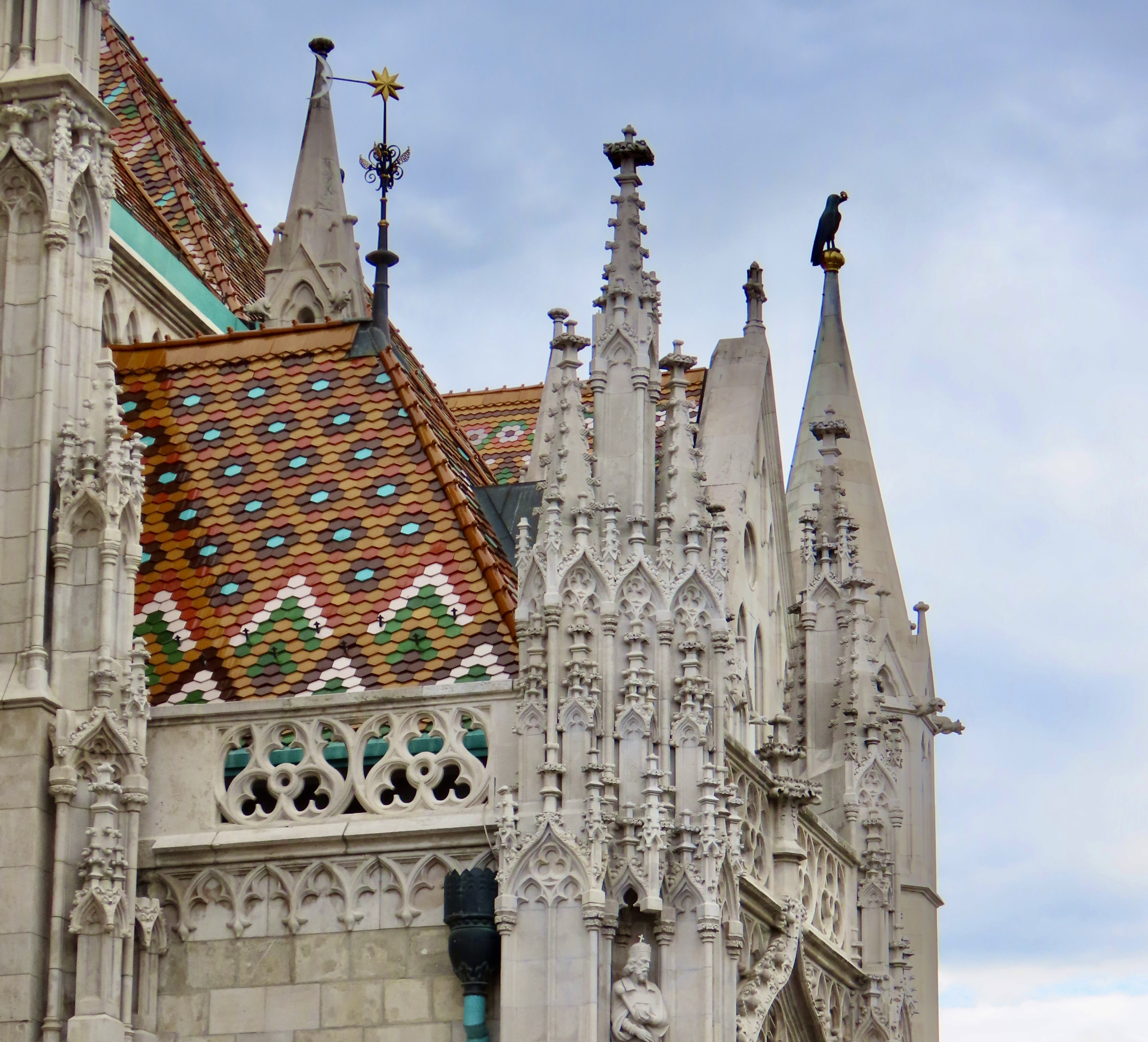
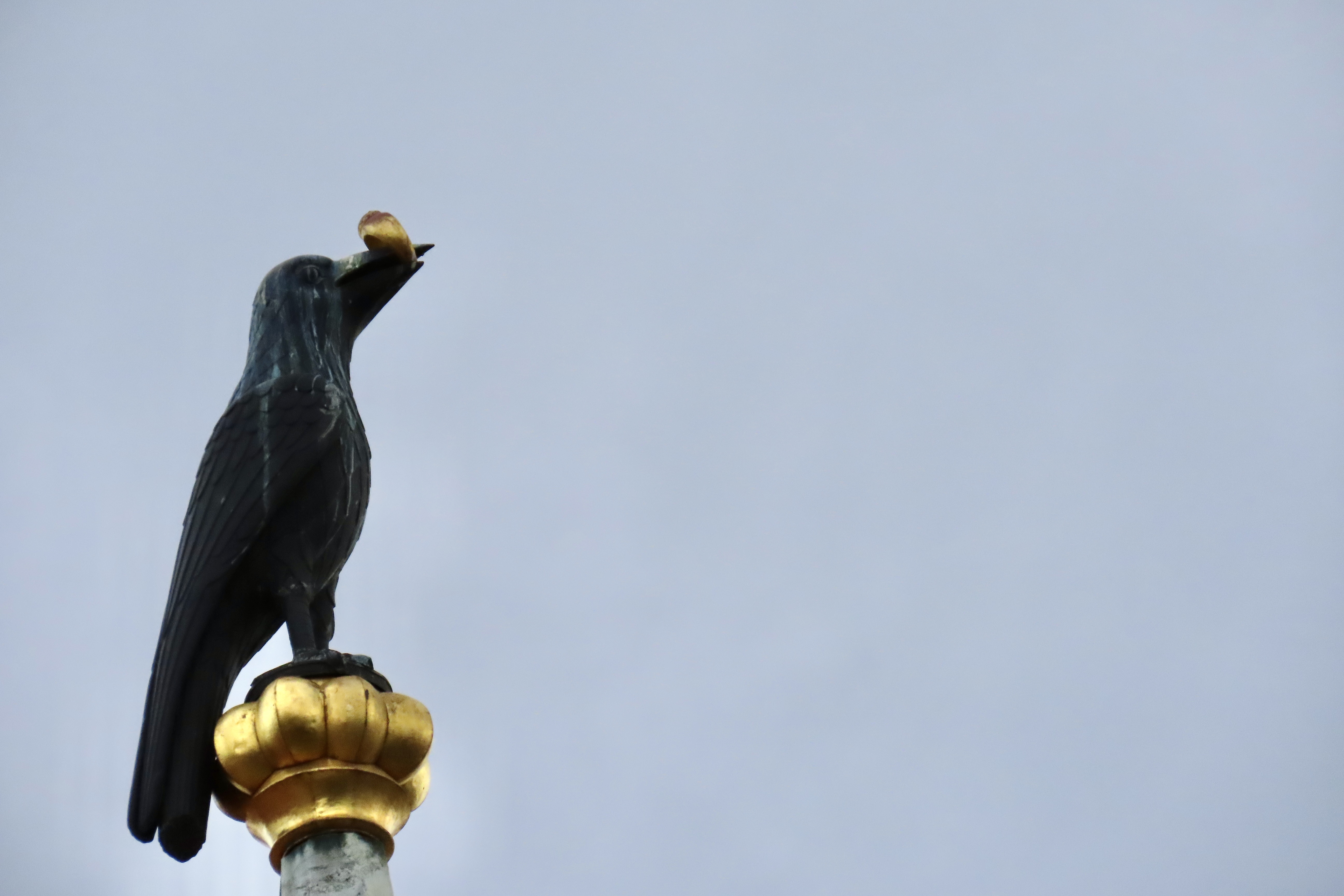
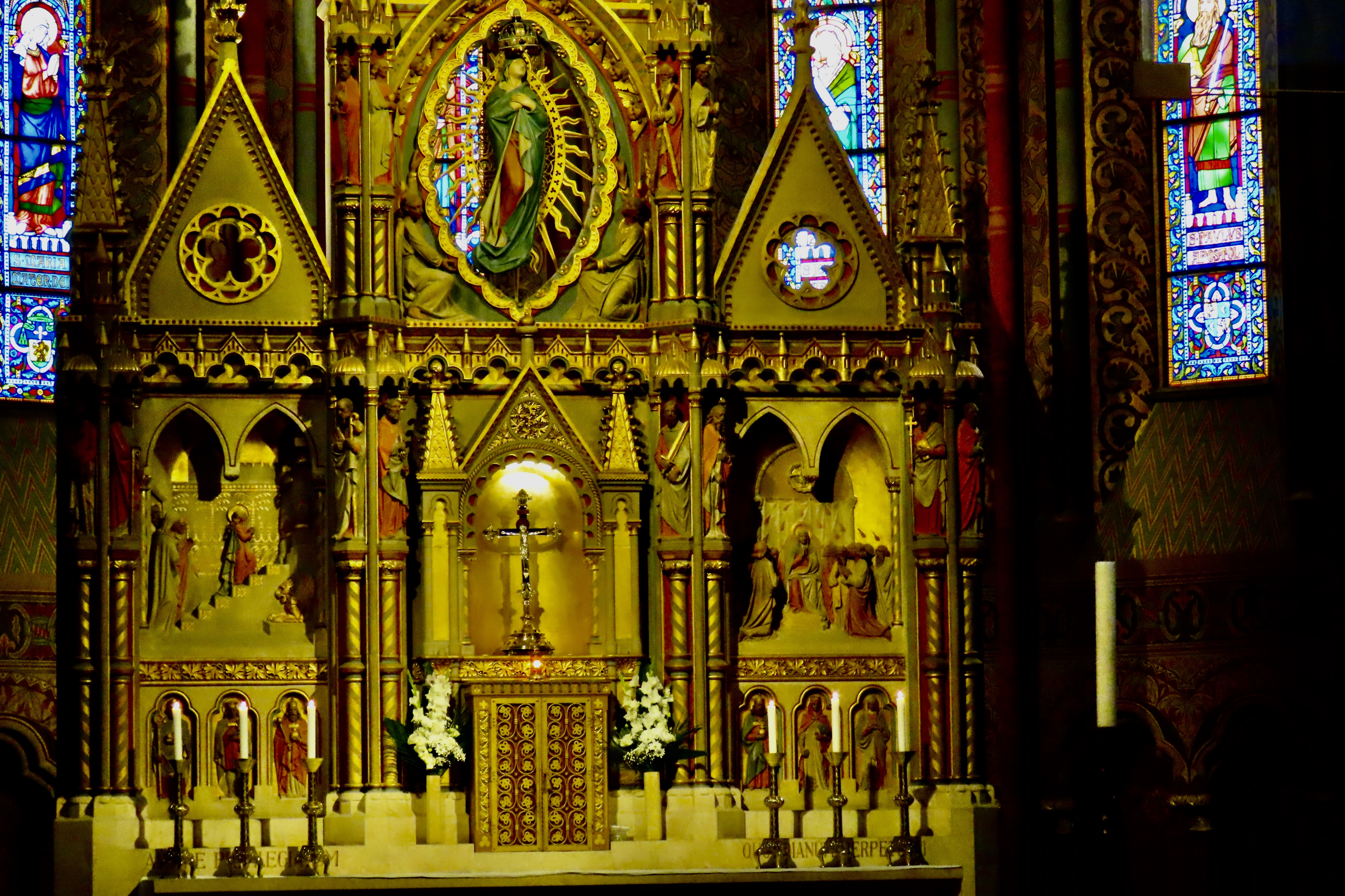
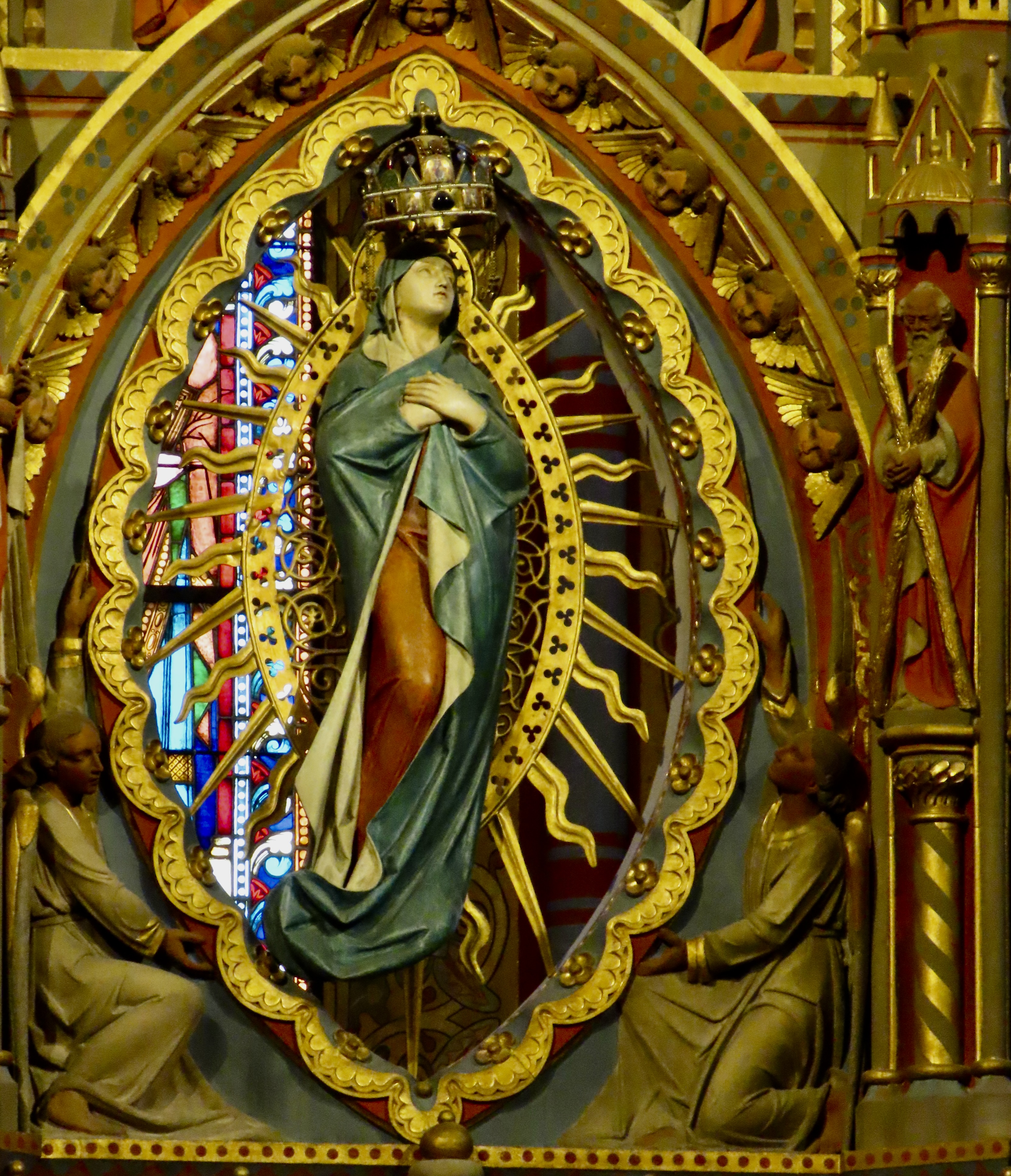
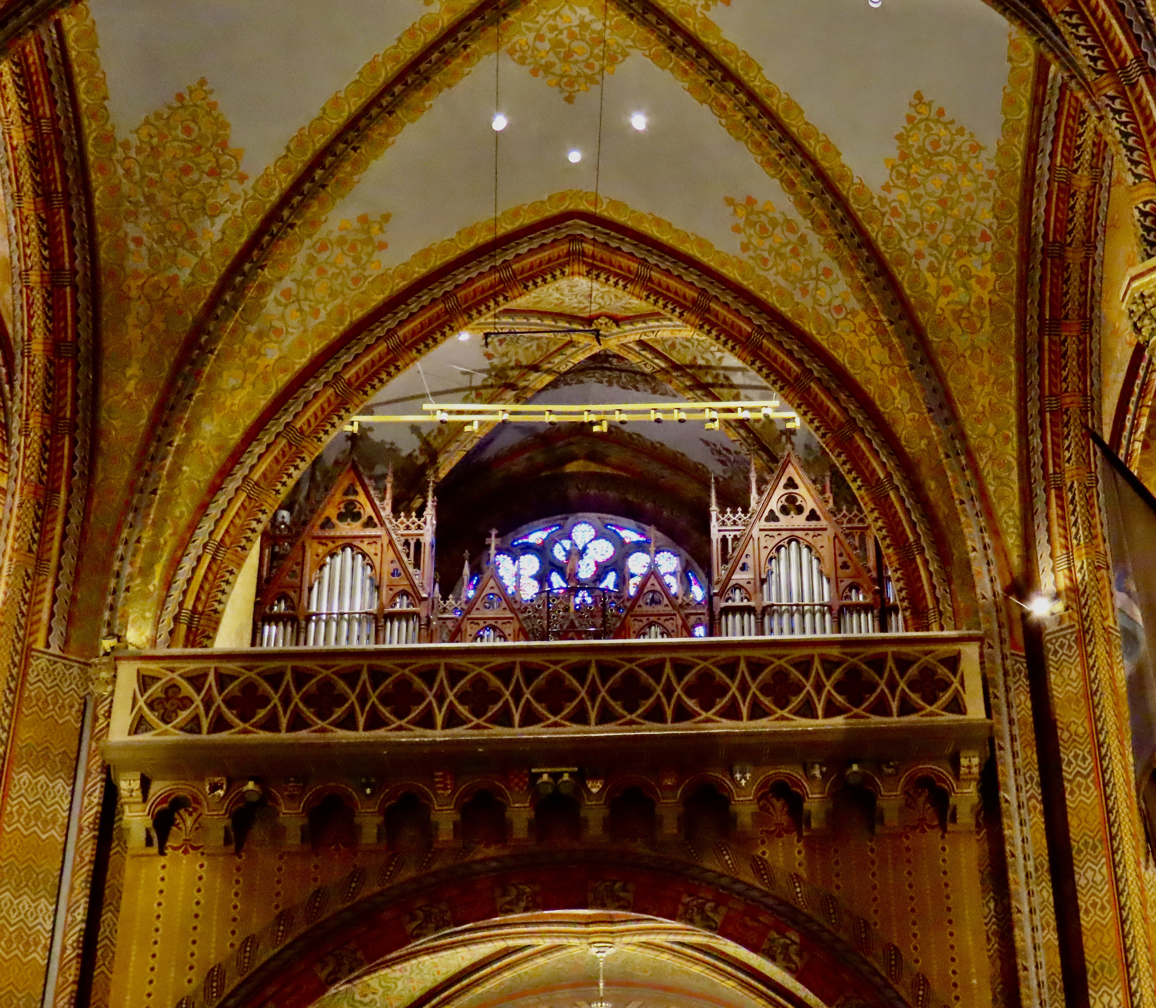
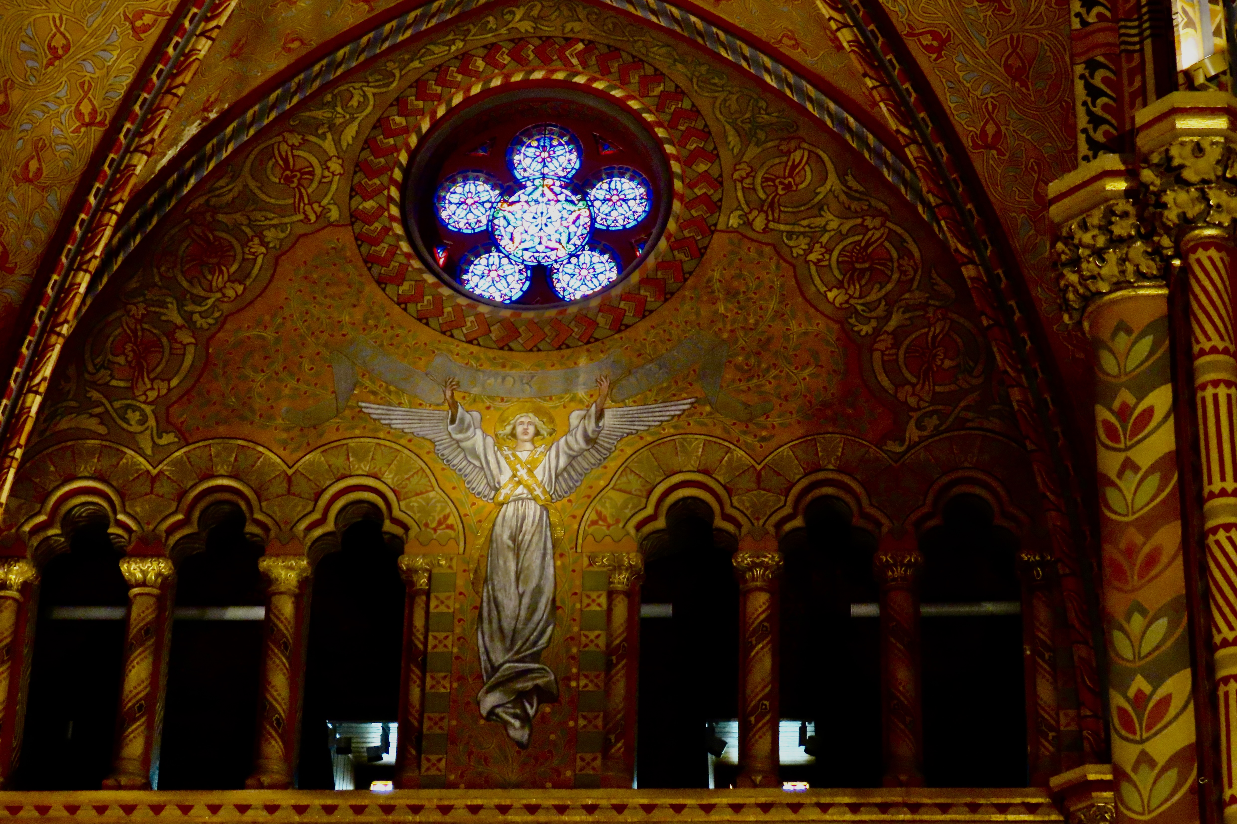
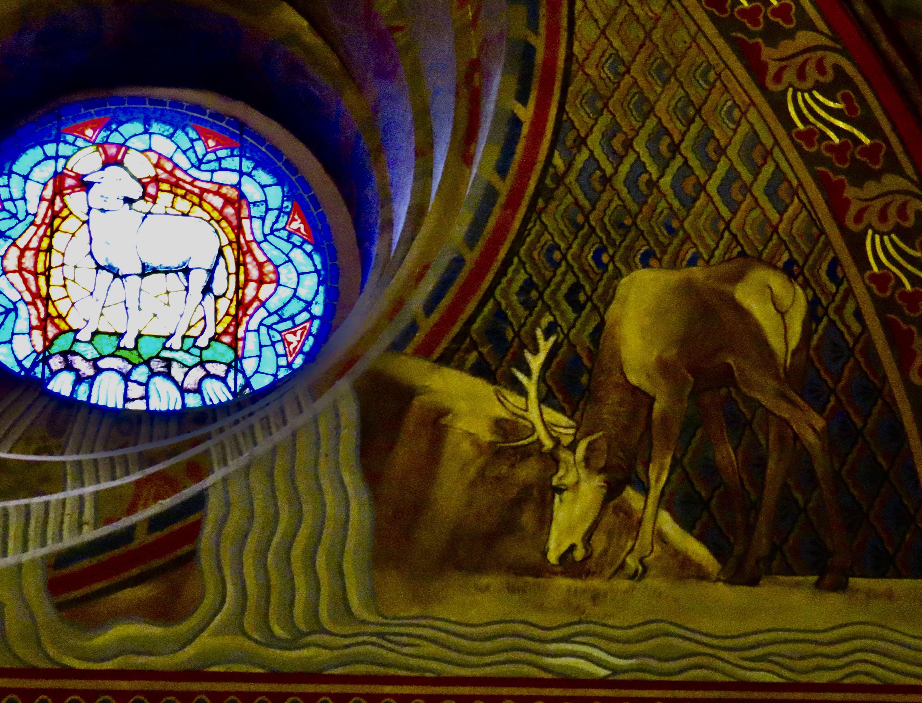
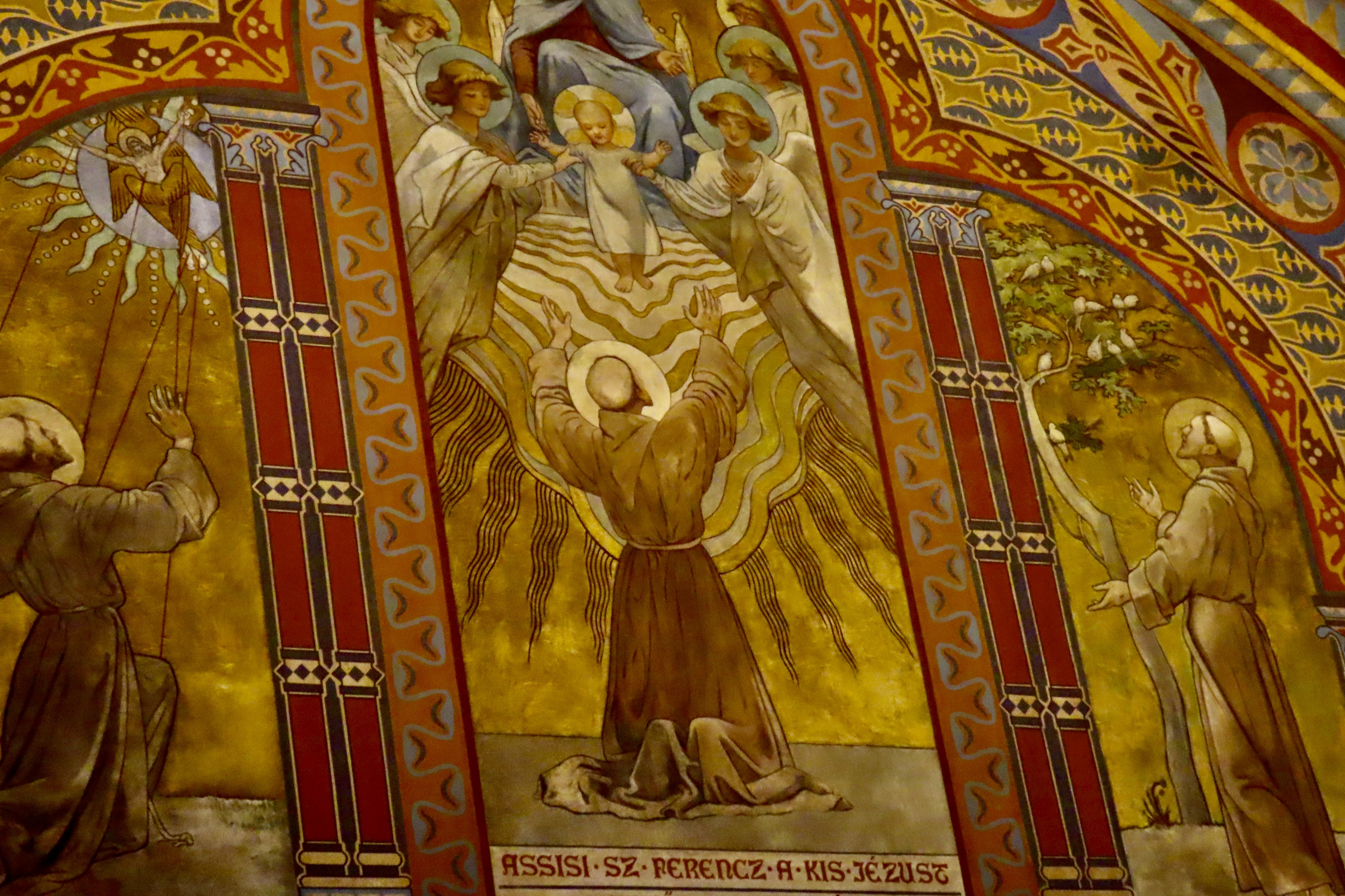
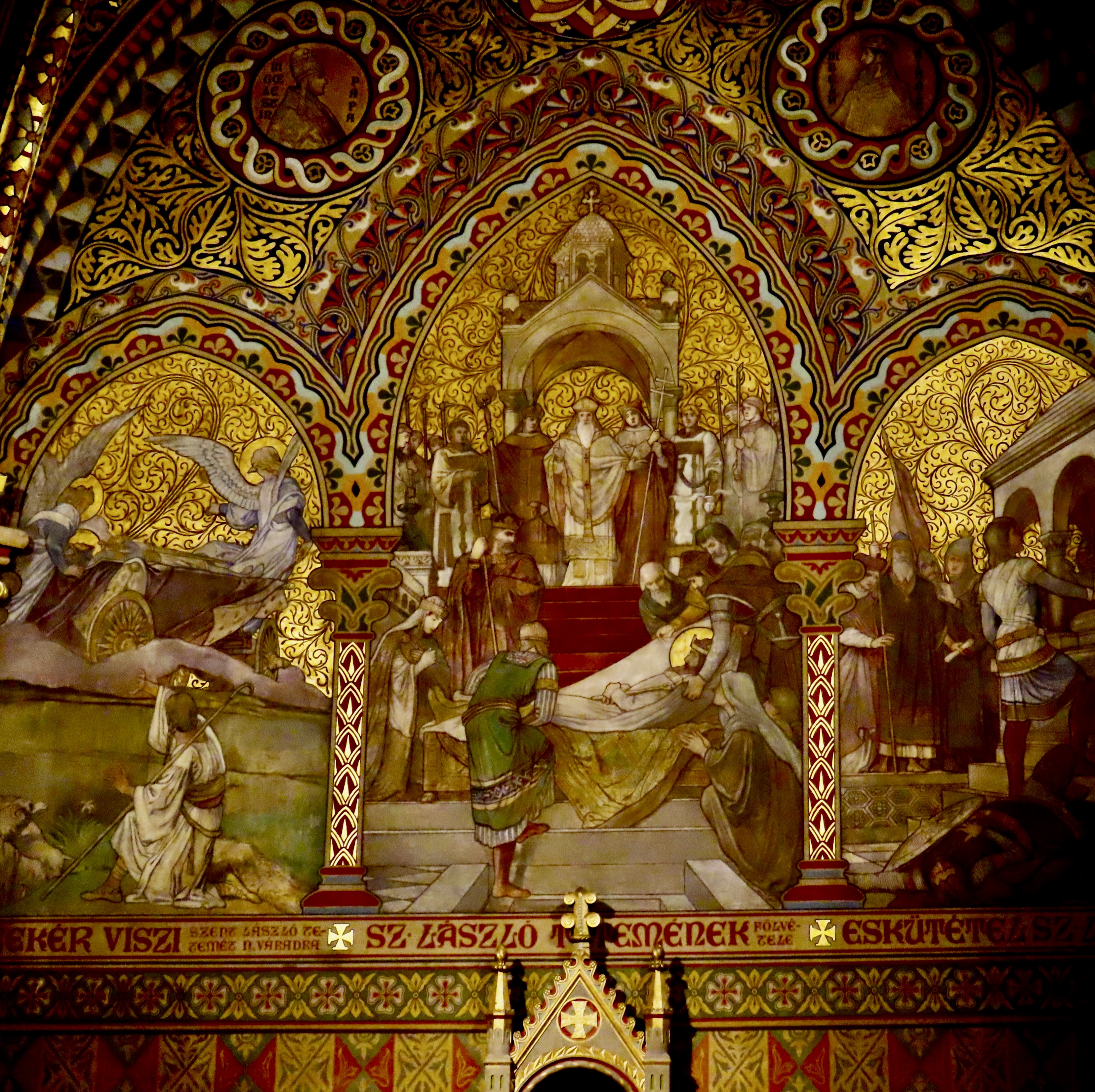
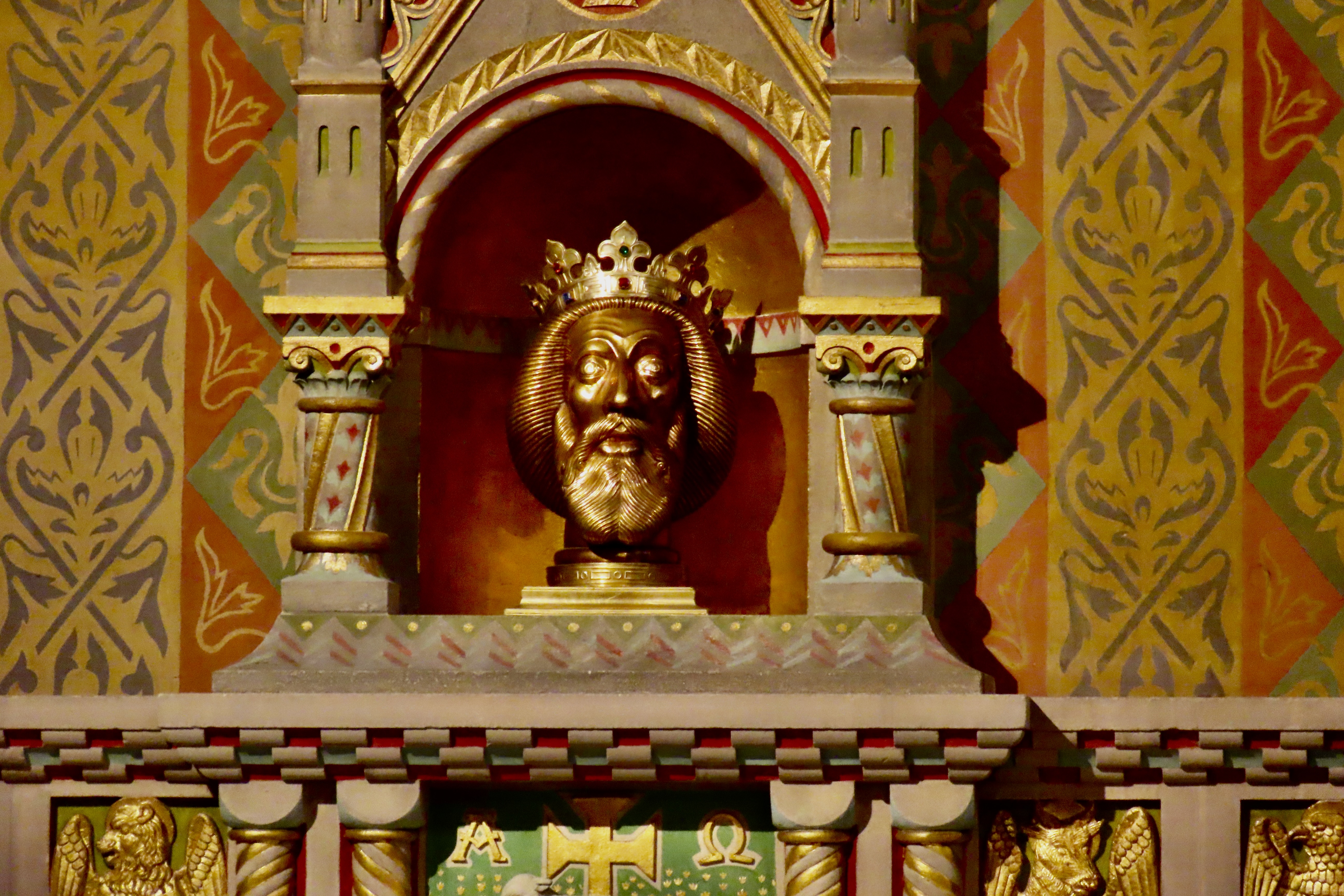
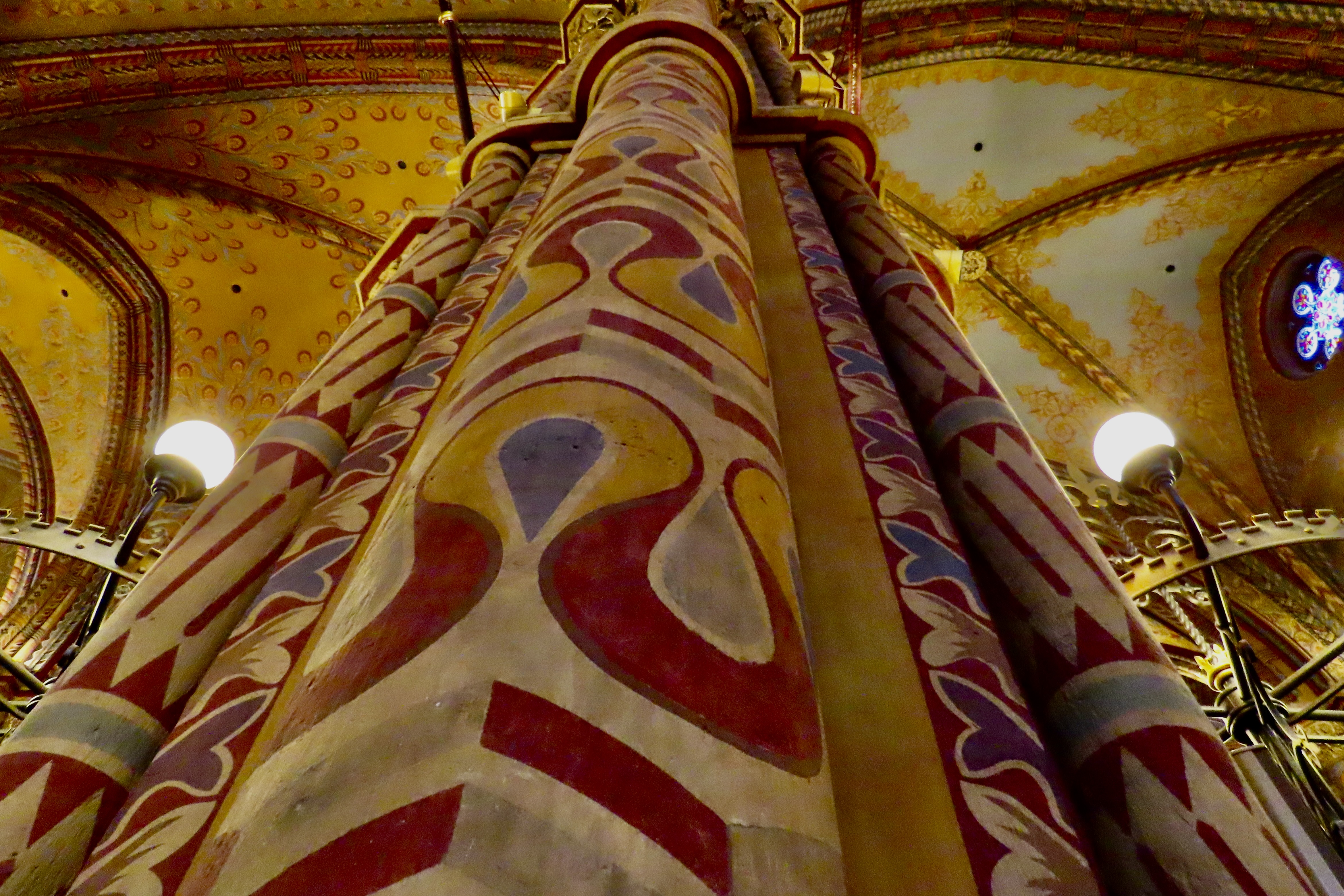
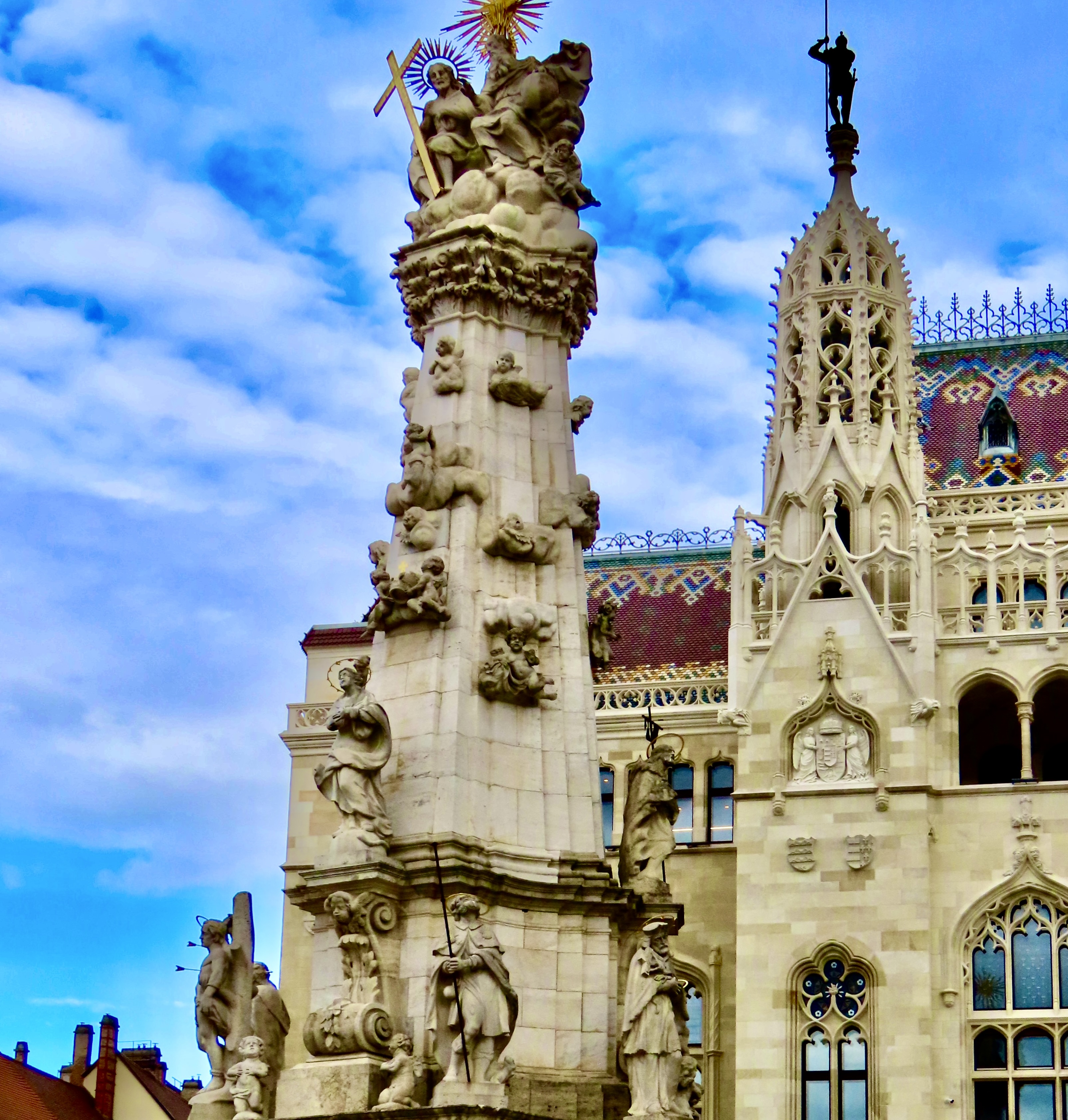
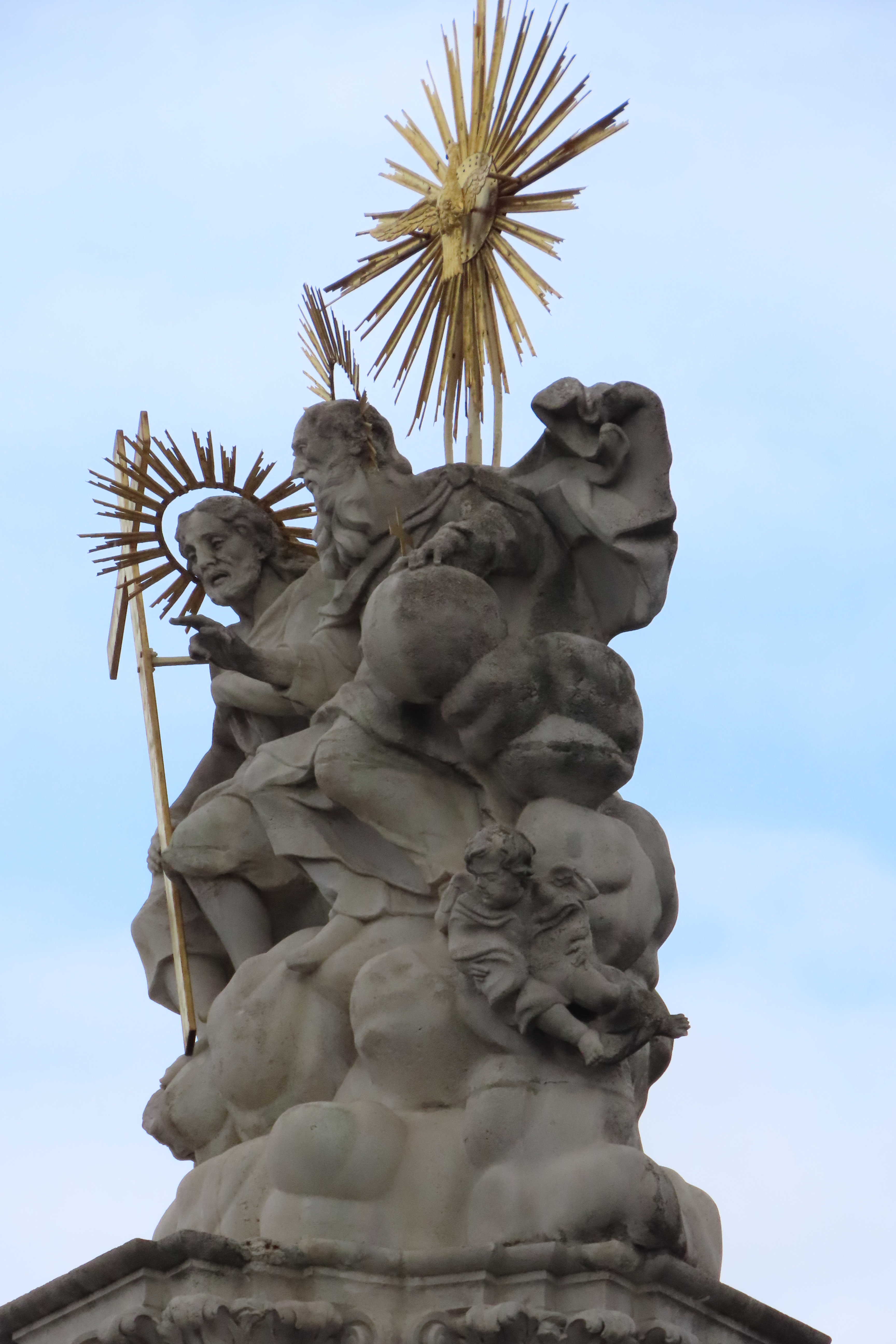
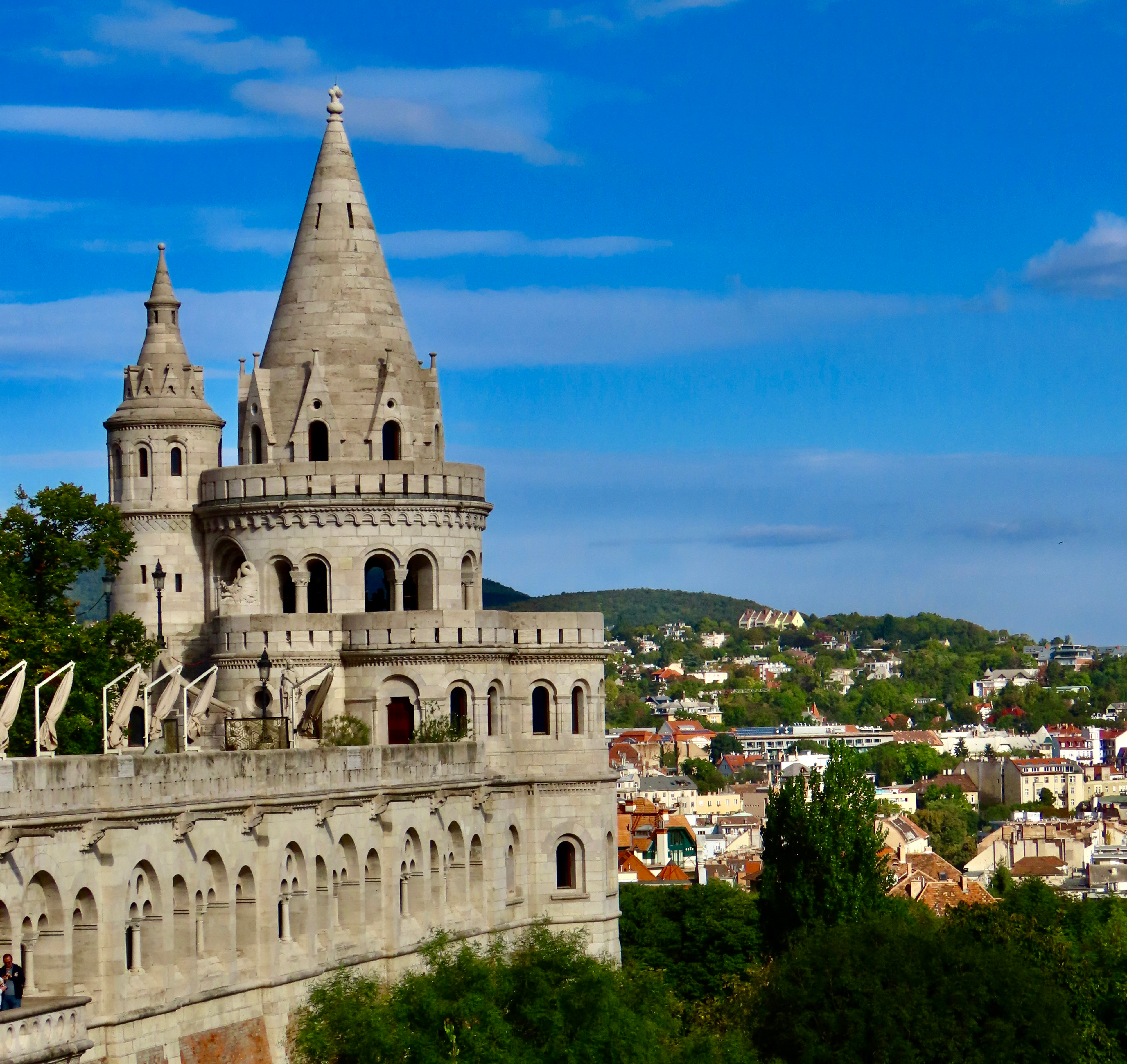
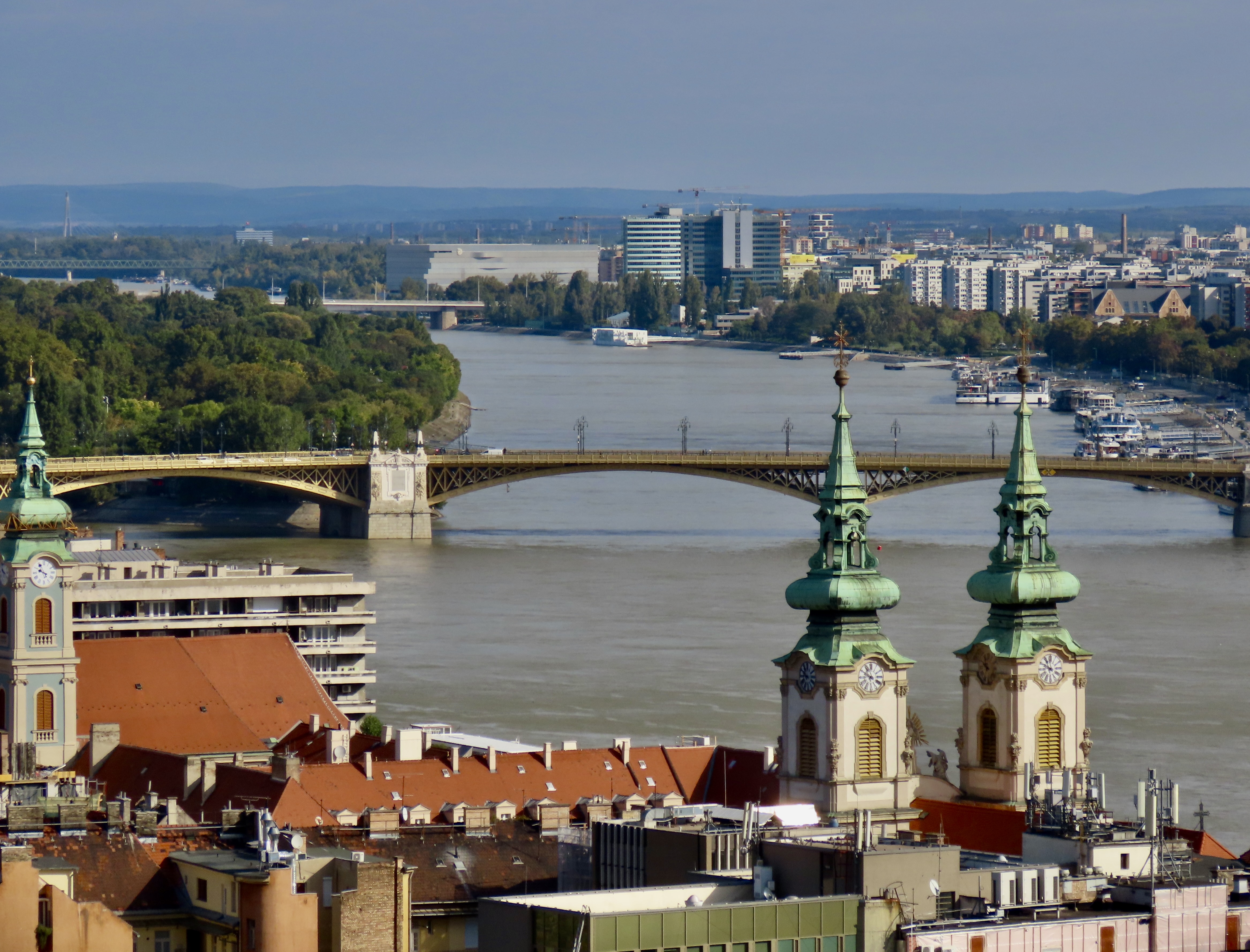
A true mark of a Catholic Saint during the Middle Ages, BTW, was that the faithful collected bits and pieces of you as relics to be worshipped. Praying over them could cure you of whatever, they thought. King Stephen donated his “naturally mummified” right hand to the cause when his tomb was opened in 1083 CE. I assume it was chopped off. He didn’t complain. It is one of Hungary’s most cherished relics. When the Ottoman Turks captured and occupied Budapest from 1541 to 1699, the hand was sent to Ragusa (Dubrovnik) for safe keeping where it was guarded by Dominican friars. They were reluctant to return it afterward. Lots of pilgrims generated revenue. They finally relented when Queen Maria Theresa promised to protect the city from a pending Russian invasion.Speaking of the invasion by the Ottomans, they actually took over Matthias Church and turned it into a mosque. I was wondering if the moon and star (upper center left), which are both symbols of Islam and are often found on top of mosques, commemorated their occupation? Also, of interest, is the raven seen in the upper right center…Legend has it that Matthias’ mother sent a raven to Prague with the ring urging her son to return home. King Matthias is another of Hungary’s loved rulers. He was said to travel around in disguise to get a feel for the life of his subjects, “doing justice to the poor, and shaming the powerful and arrogant.” He incorporated the raven into his coat of arms and put one on top of the church with a symbolic ring. He was known as the Raven King.The church really is beautiful…And impressive.A final view before heading inside.The warm brown and gold colors found on the main altar of Matthias Church are found throughout the church.I really liked the way Mary was designed to allow light from the stained glass windows to flow around her. This attention to detail was found throughout the church.Another example. Both unity and depth are achieved here. Also, do you see the lights hanging across the arch?Light was used throughout the church for emphasis.I liked this painting. It showed a stag doing what stags do— eat grass— while the ‘Lamb of God’ looks on.Several large paintings are incorporated into the church. This is Francis of Assisi encouraging the baby Jesus to walk to him.This mural depicting St./King Laszlo was even more richly painted than that of St. Francis. The bird headed people in the left corner seem rather strange.The King/Saint Laszlo with piercing, scary eyes was ensconced in an nook below the mural.My favorite: The pillars of the church!Outside the church we snapped a photo of the the Holy Trinity Statue that was built to protect the people of Buda from the Black Plagues that devastated Europe between 1691 and 1709, causing the death of up to 50% of Europe’s population. The Holy Trinity tops the column. Cherubs and angels are next, and various saints are on the bottom. Remember how we noted in Vienna that St. Sebastian was always depicted with arrows sticking out of him? Look to the left. They even sculpted the tree he was supposedly tied to.Here’s the Holy Trinity. The Holy Ghost hovers above as a dove with light emanating from it, God with his flowing beard is next, and Jesus is carrying his cross. A fat little cherub is on the lower right because fat little cherubs apparently like to hang around the powers that be. After our tour we were given some time to hike the walkway on Fisherman’s Bastion with its great views of Budapest.One of the views was of St. Anne’s Church with its Italian baroque tower that we had first seen from the river in today’s top photo.Another was of Hungary’s Parliament building which will be one of the sights featured in our next post.
That does it for now. We’ll be taking a couple of weeks off for Christmas and New Year’s but I will get a brief post up just before Christmas. Beyond that, see you in 2025. Have a great holiday!
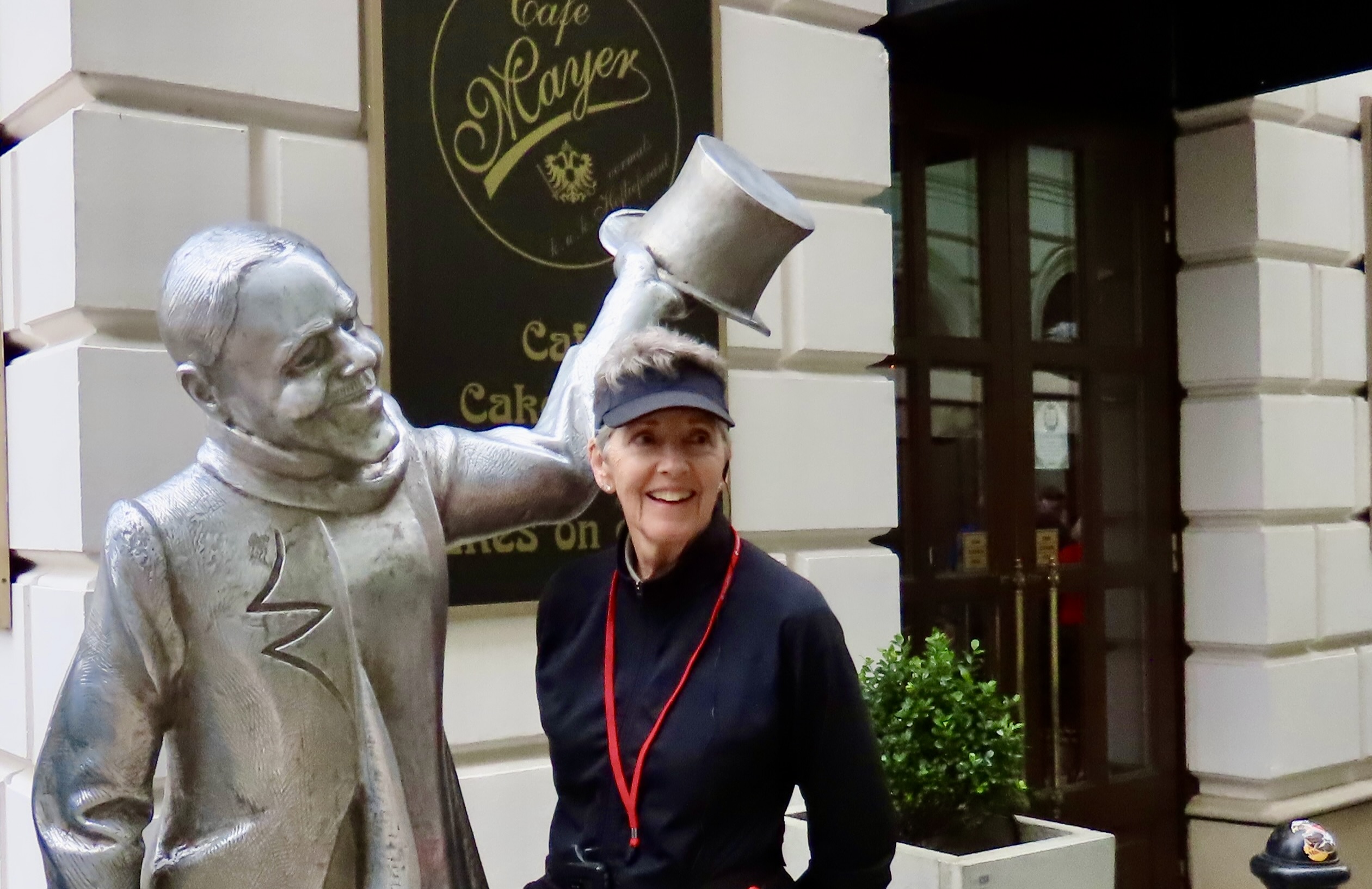
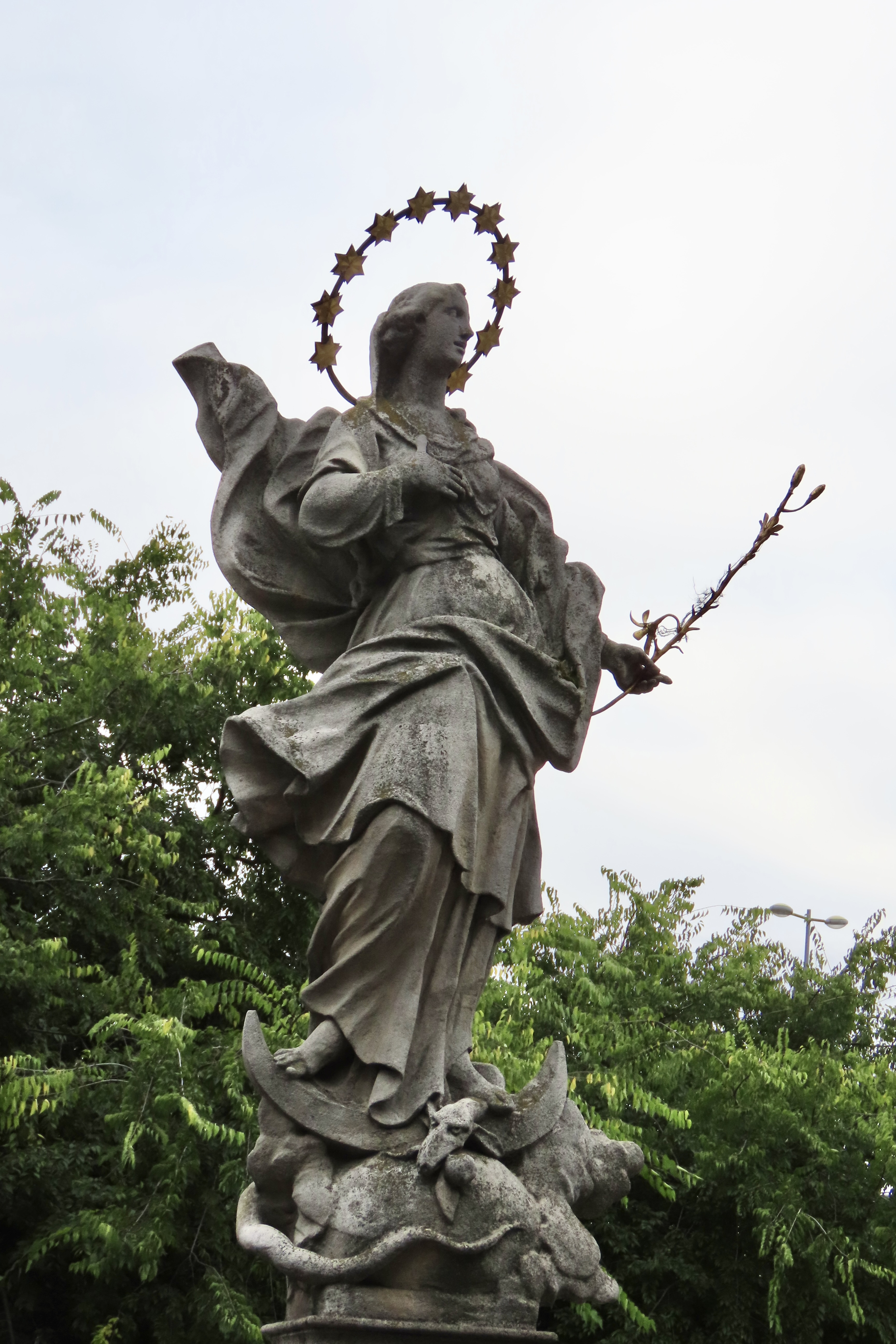
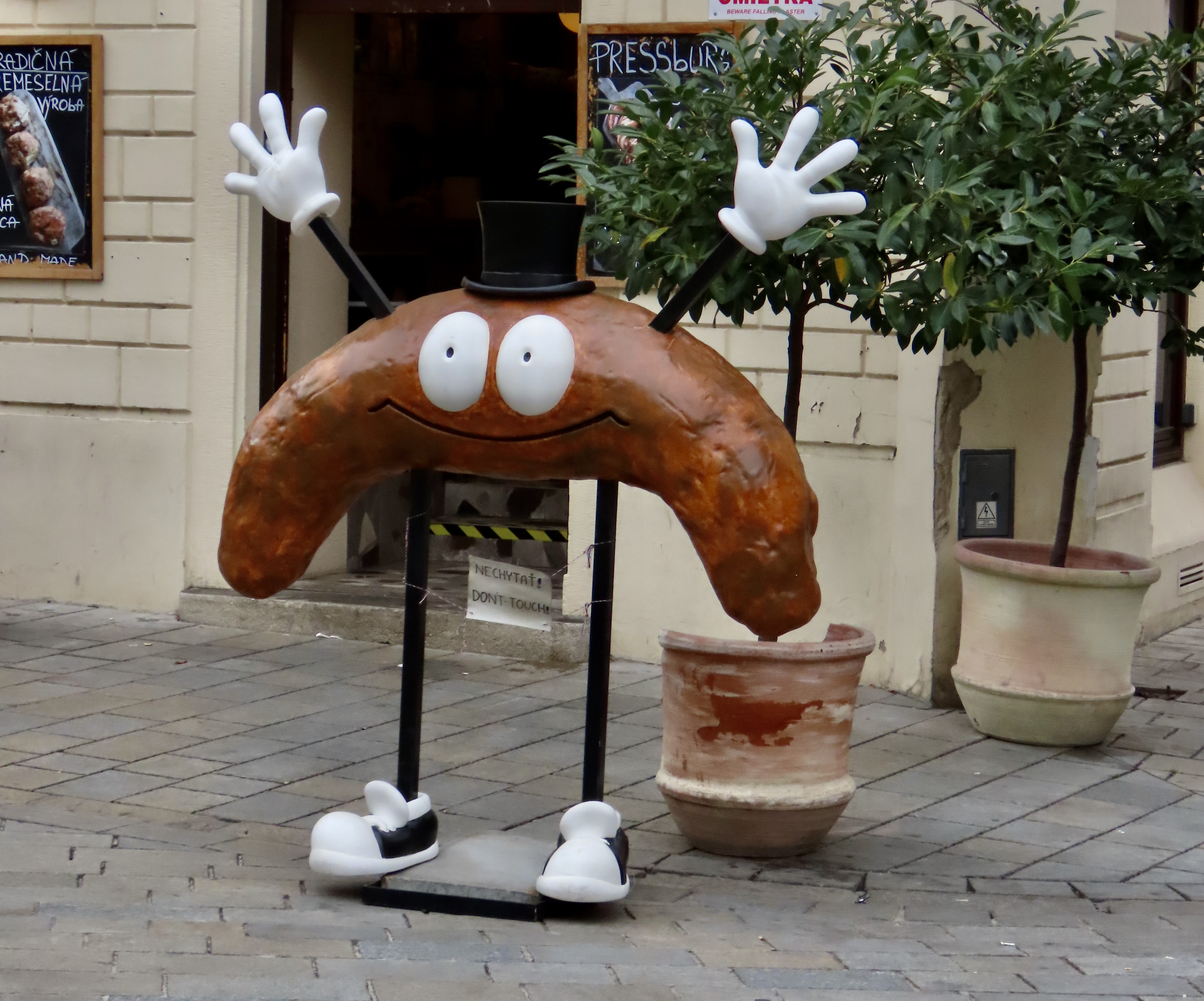
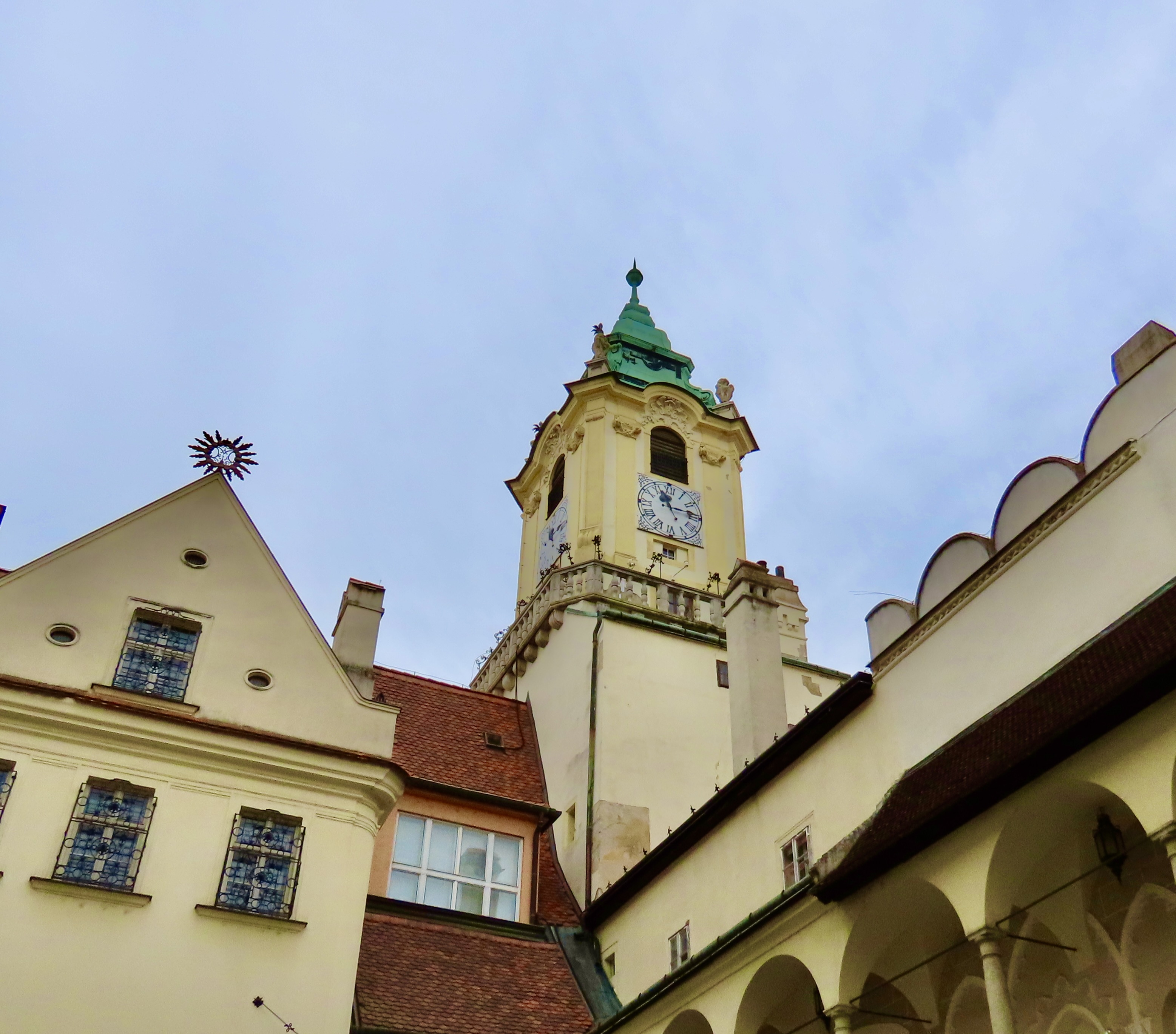
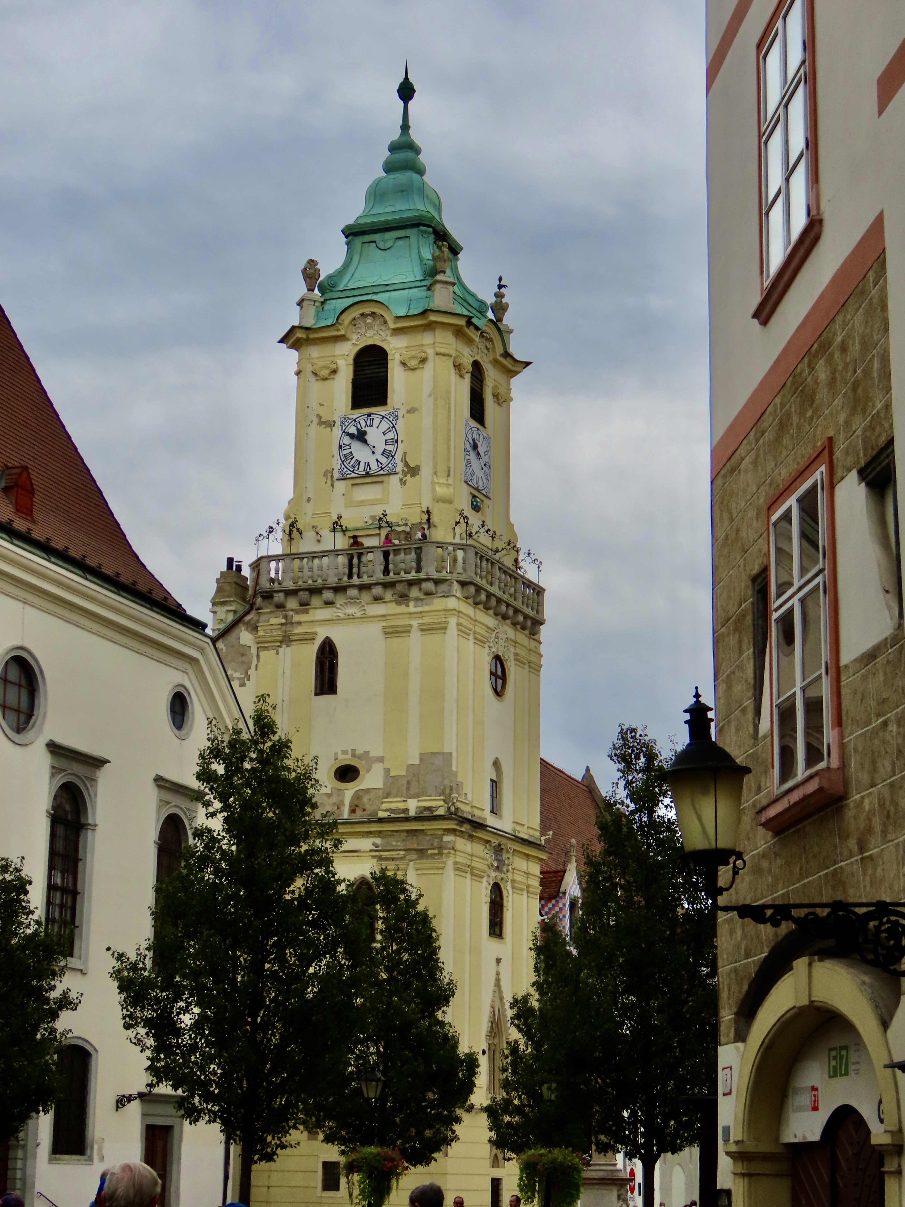
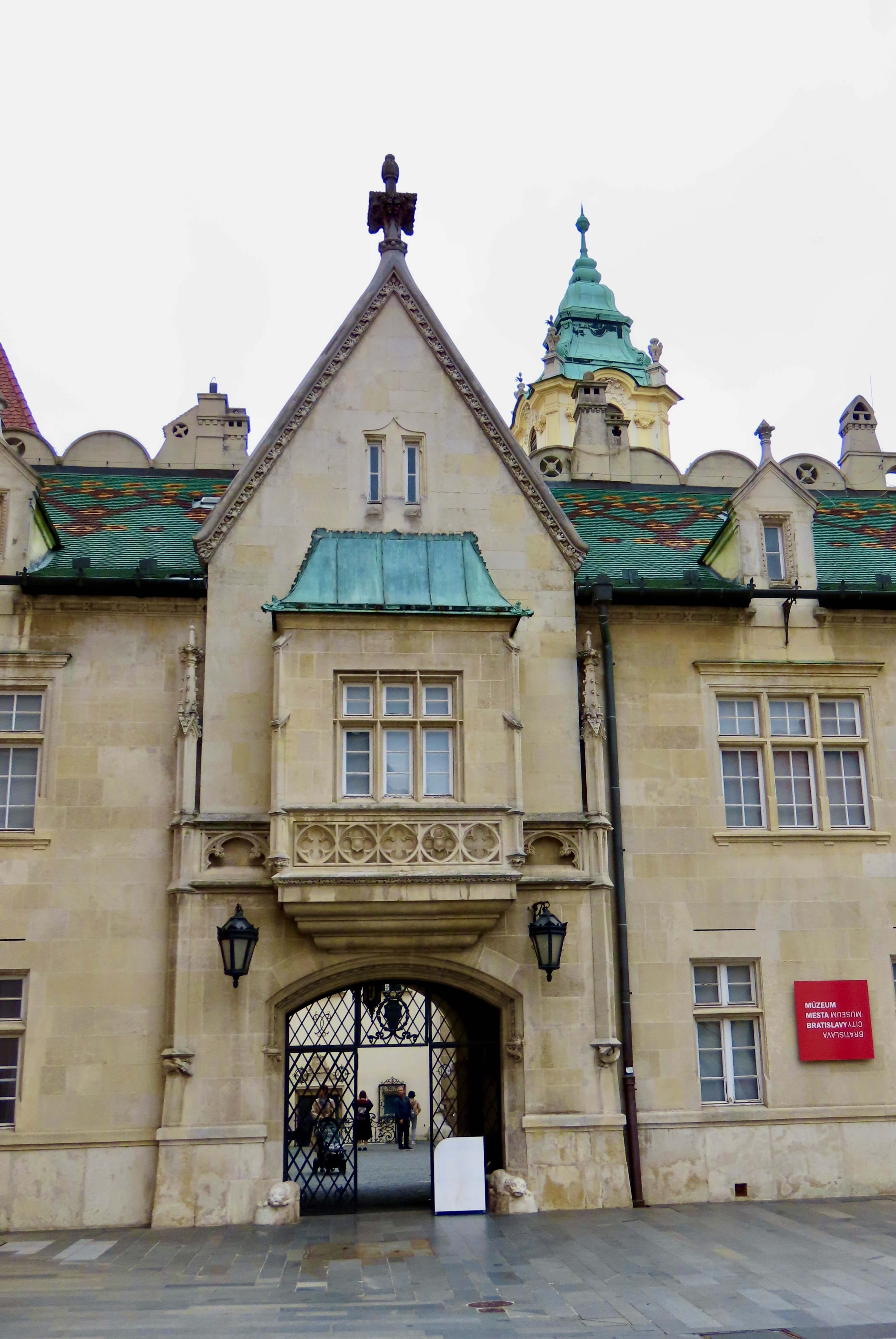
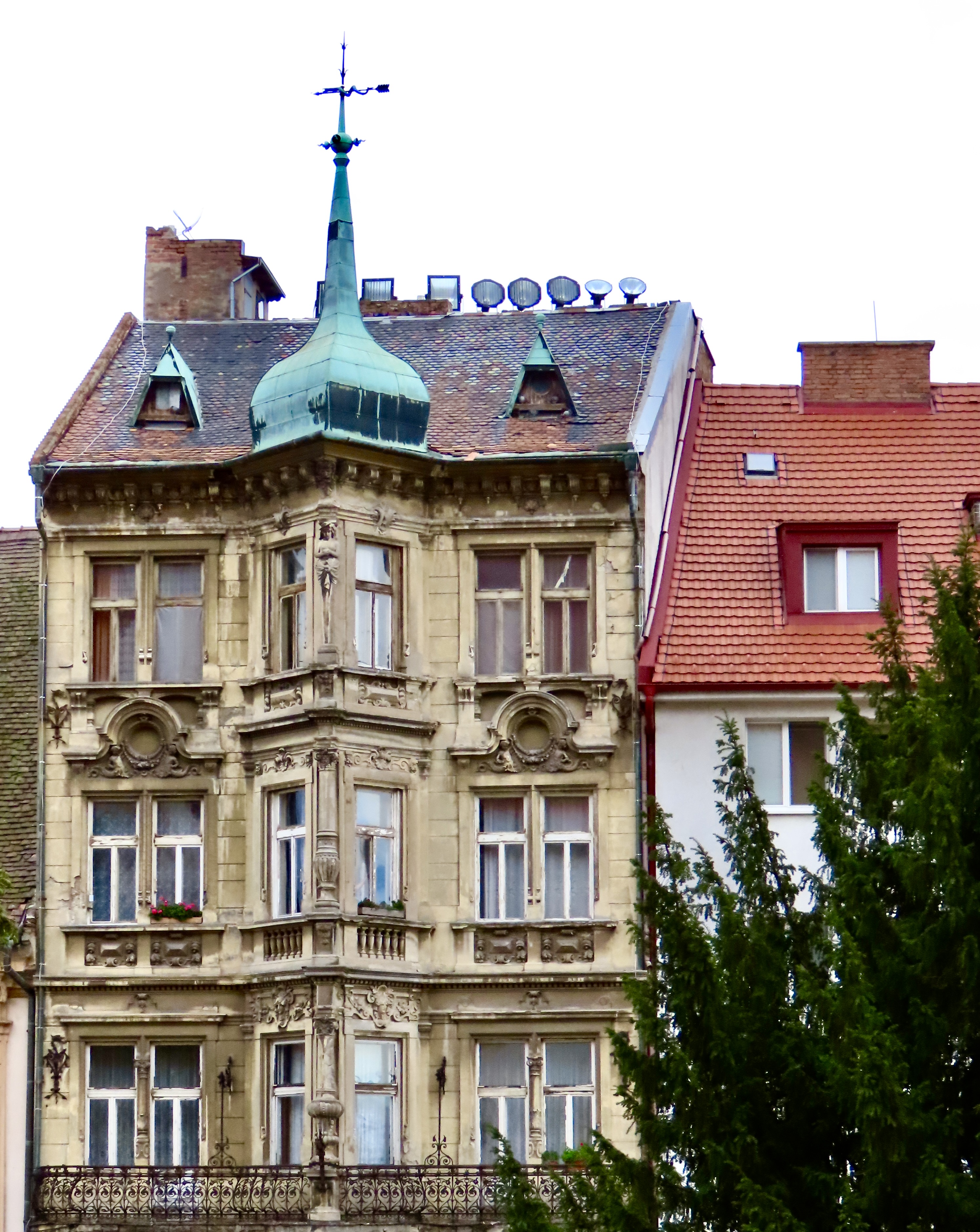
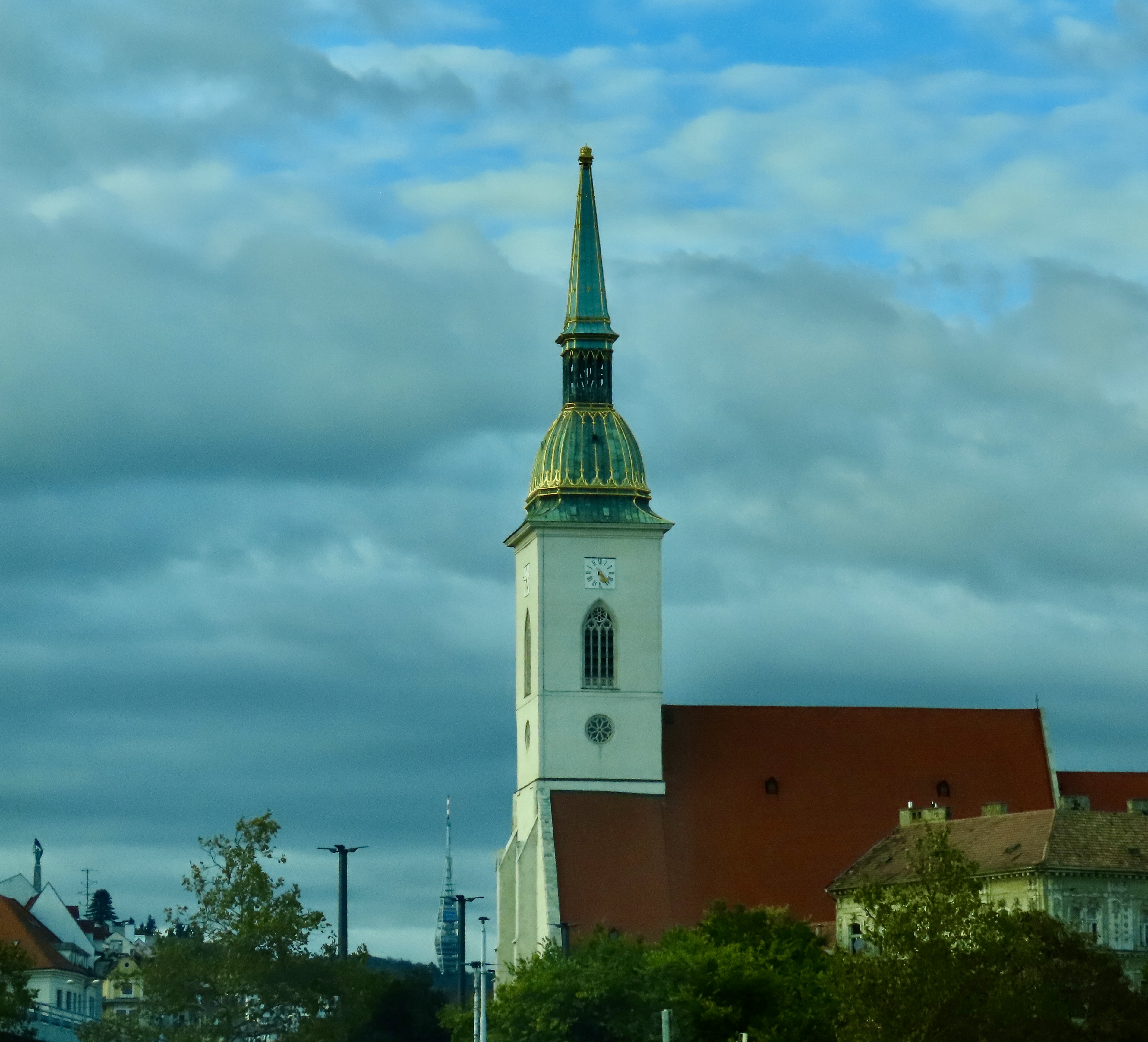
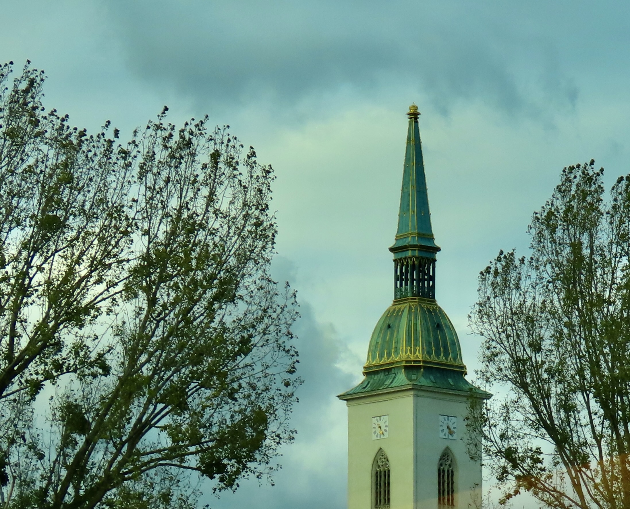
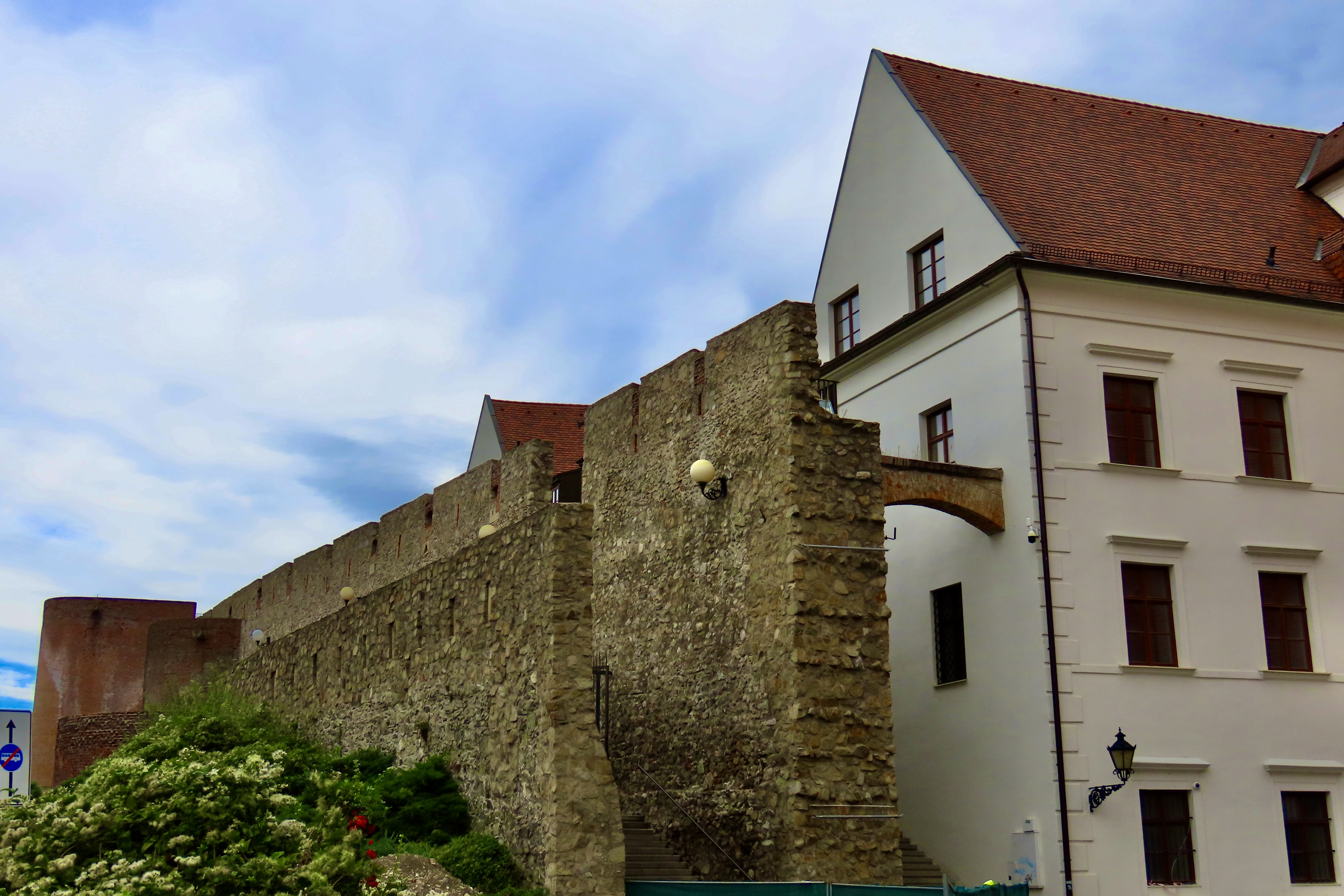
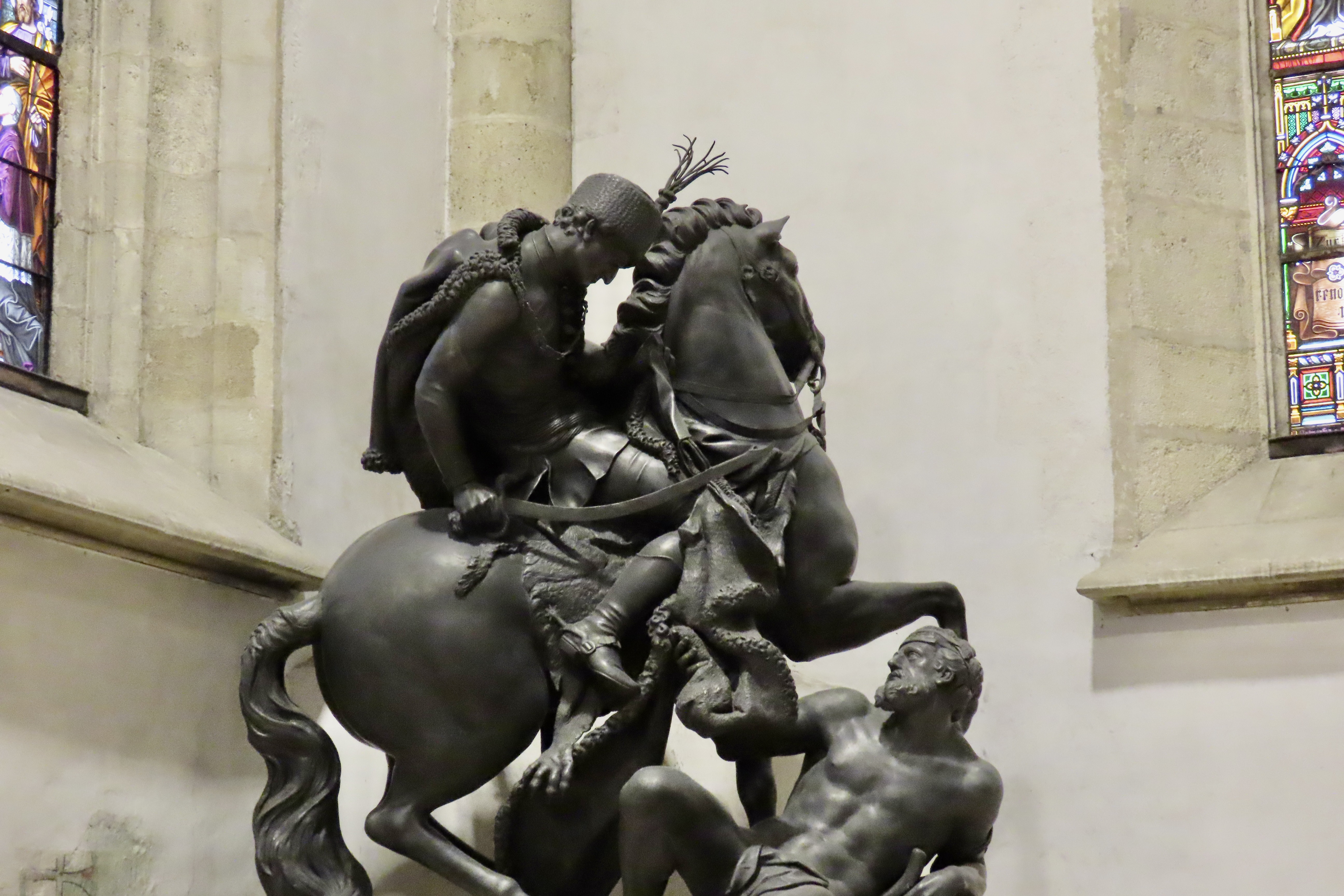
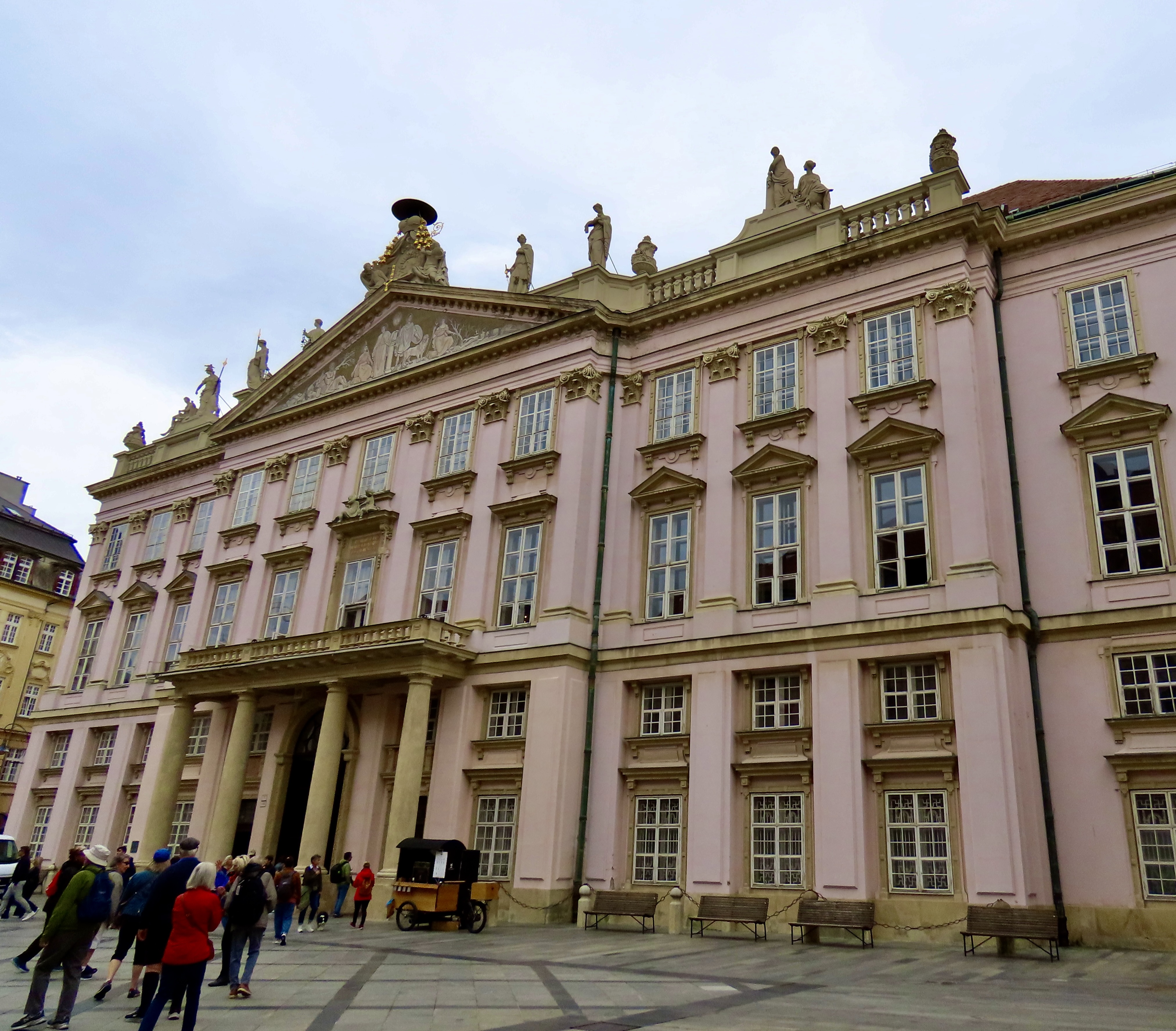
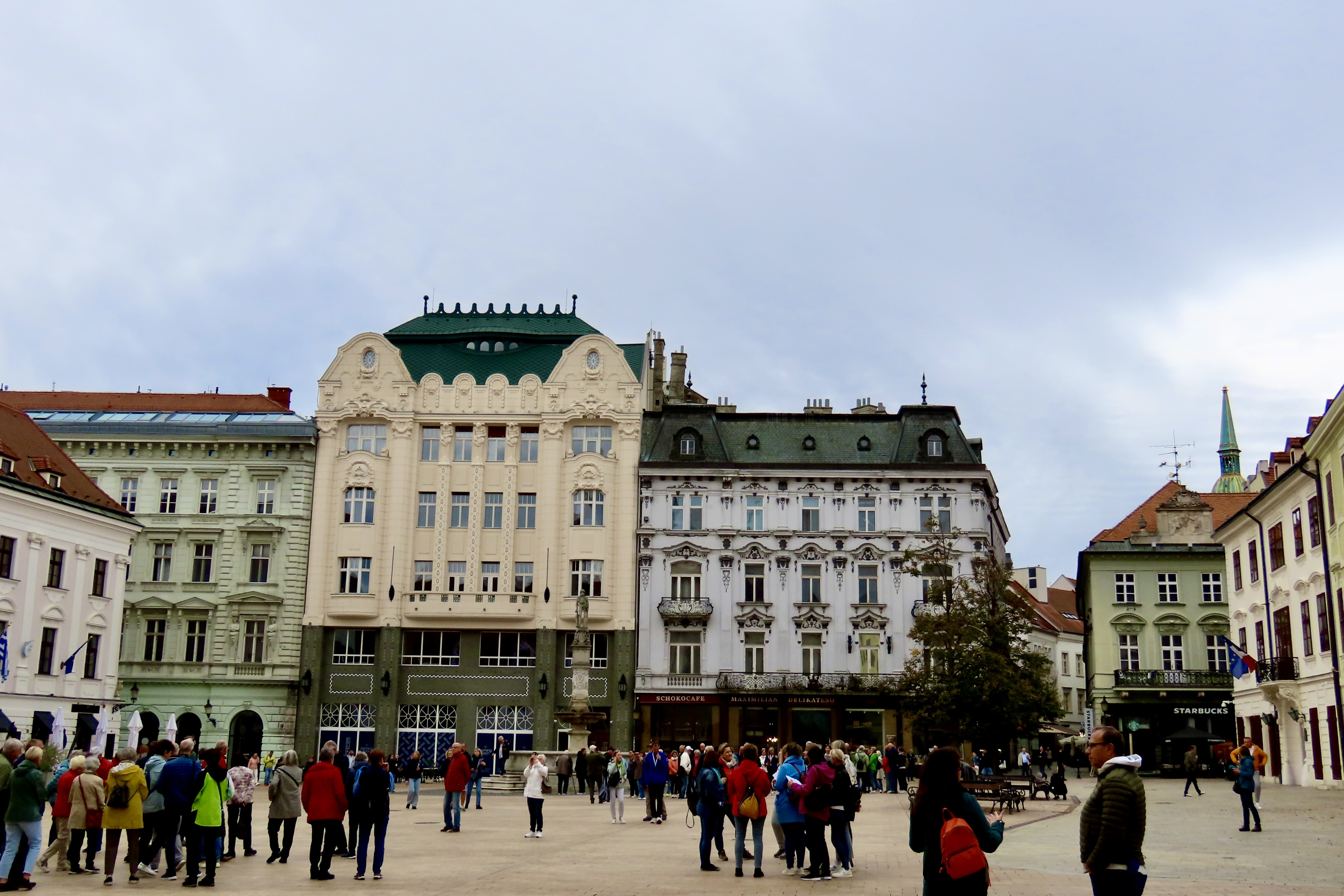
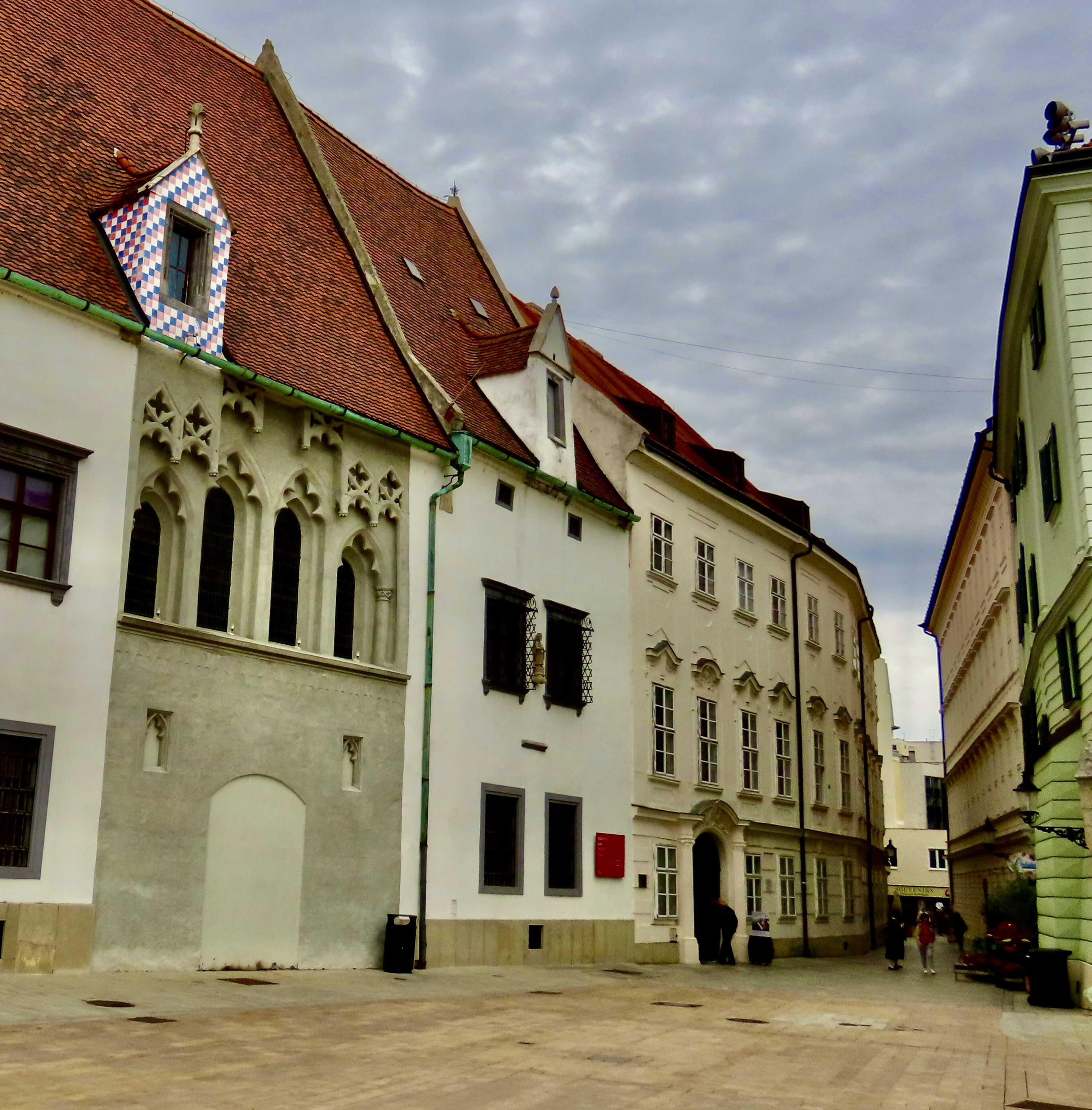
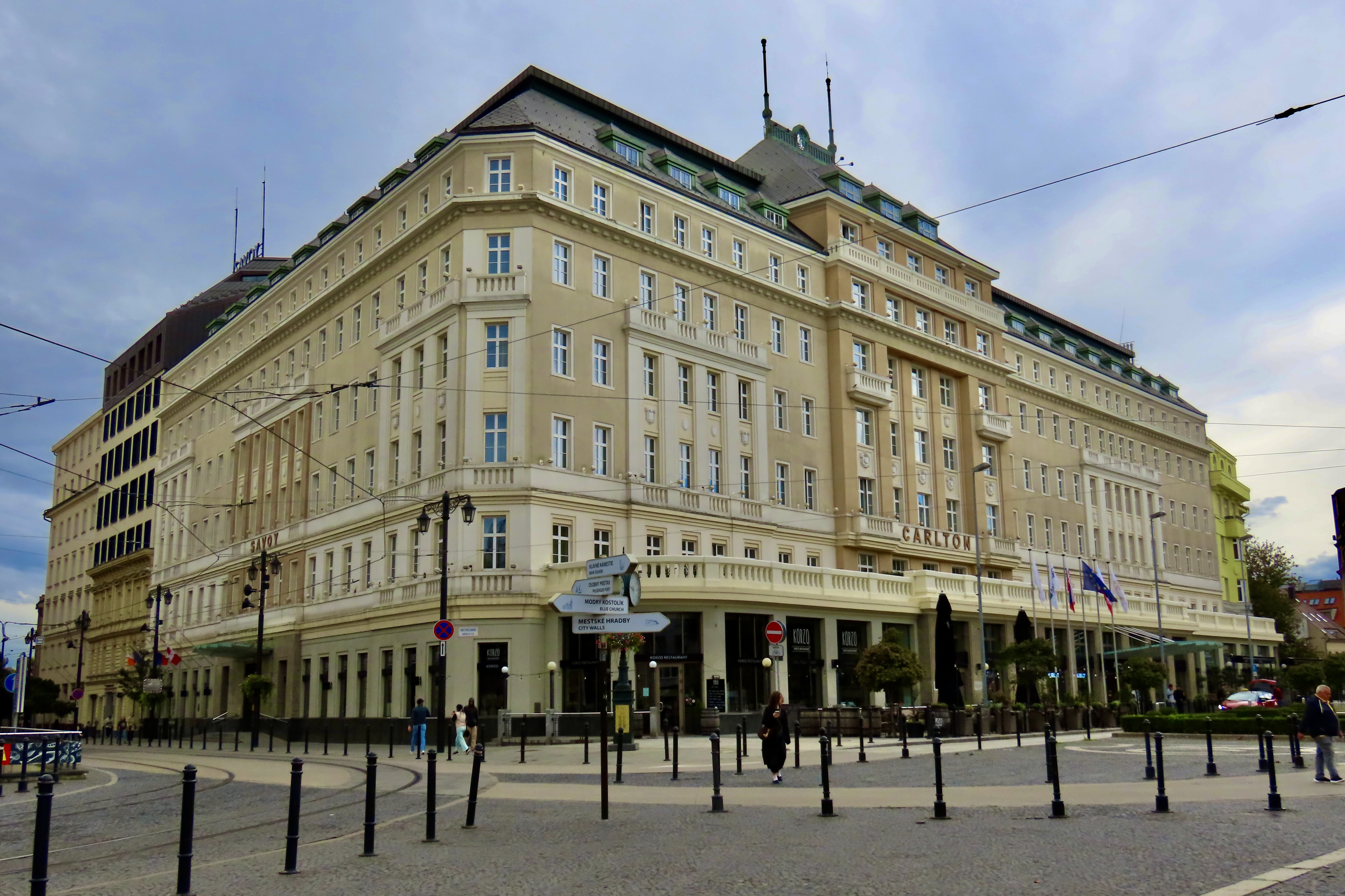
Meet Naci. He’s one of several statues scattered around Old Town, Bratislava designed to give the city a new image following the dark days of Communist rule that ended in the mid-1990s. Naci was actually a real person who would dress up in elegant clothes and wander the streets of the city. He liked the ladies. He was known to pick out a woman at random, tip his hat, bow, give her flowers and sing her a song. Here, our sister-in-law, Frances, poses beneath his top hat.Here’s a statue the Communists left behind. Quite the contrast, huh. It says a lot about Communist Russia’s rule of the Eastern Bloc countries. And, traveling much further back in time, I decided to throw in this statue. Not because of the Madonna standing on a crescent moon, but because of what else she is standing on…That is one depressed dragon! Check out the eyes and ears. You can almost hear it whining: “Damn, skewered again. And all I wanted to do was give her an apple.”And then there was this guy, inviting visitors into a restaurant that featured sausages.We spent our time in Bratislava exploring the Old Town section. This is a view of the tower connected to the Old Town Hall built approximately in 1370.Views of the tower can be seen from many different locations in Old Town.Here, it peaks out from behind the Old Town Hall. Its top features the same striking green we saw on several buildings in Vienna.The historic old pharmacy building also featured a green top.St. Martin’s Cathedral, known as the site where 11 Hungarian Kings were crowned between 1563 to 1783, has a dramatic green and golden steeple.A closer view.The church backs up to the ancient city walls. It actually served as a part of the fortification.As might be expected, a statue of St. Martin is included in the church. At first I thought he was threatening to kill the guy on the ground. Instead he is cutting his coat up and offering half of it to a poor man he had found outside suffering in the cold with minimal clothes, a saintly act for sure.A number of attractive, classic buildings are found in the Old Town. This is the Primate’s Palace.These buildings grace Bratislava’s main square. The steeple of St. Martin’s Church can be seen in the background.A street view leading off of the square. Part of the Old Town Hall is on the left.And finally, even the Carlton Hotel was a class act. That does it for Bratislava, the capital of Slovakia. Next up, we continue down the Danube to Budapest, the Capital of Hungary.A view looking up a hill toward Matthias Church in Budapest.