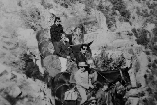
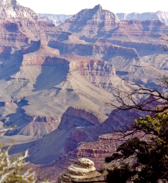
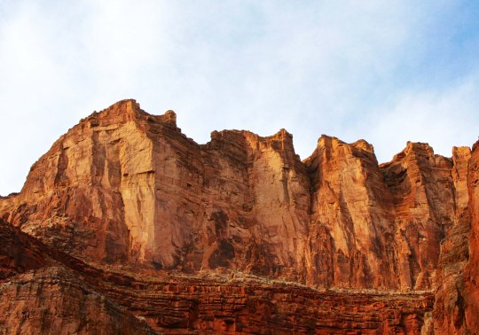
I have journeyed into the Grand Canyon several times over the years: on foot, by raft, and by helicopter. The first was by mule in the late 60s. That’s me, second from the top on Charlie. I was sore for a week afterwards. I was a pound over the weight limit, so Charlie kept trying to bite me, plus walk as close to the edge as he could!
The Grand Canyon is truly one of the world’s great natural wonders. It’s celebrating its 100th Anniversary this year and I am quite pleased— and a little proud— that I have been returning there on a regular basis for 50 of those years. I’ve posted on my trips into the Canyon by foot and boat many times. Today, since I am still working on Burning Man photos and don’t have another Pacific Crest Trail post ready yet, I decided to reach back into my WordPress archives and put up some Grand Canyon photos. Happy 100th Grand Canyon!
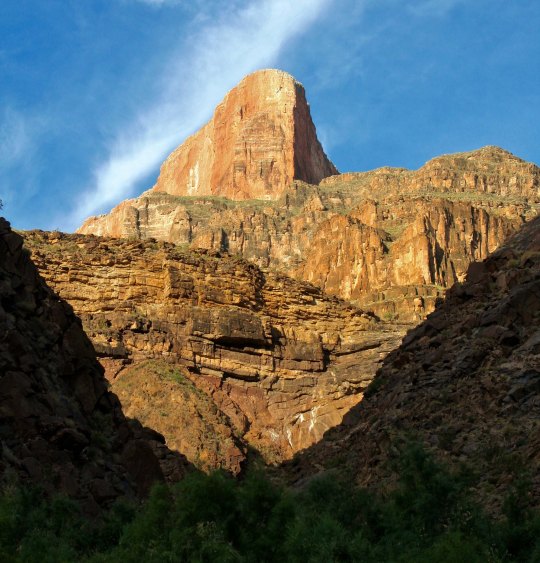
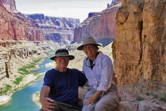
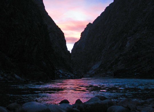
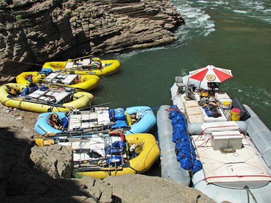
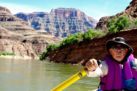
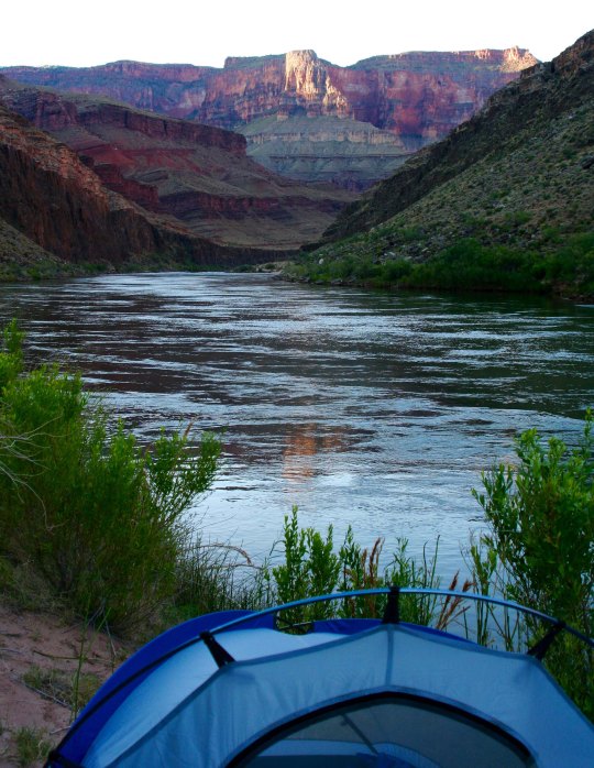
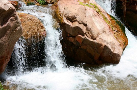
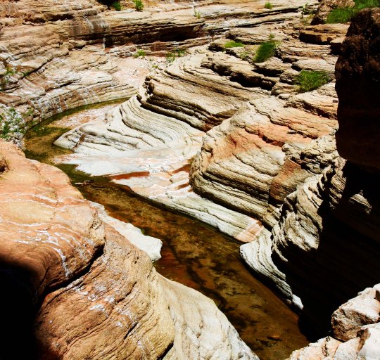
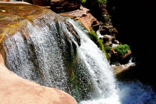
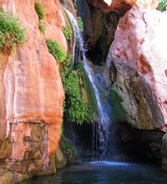
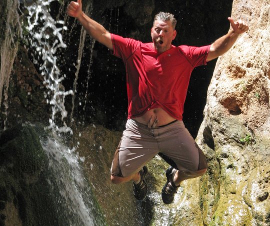
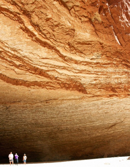
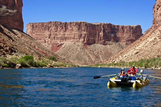
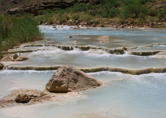
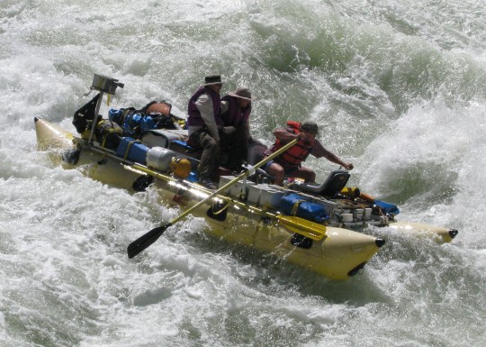
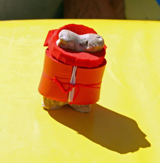
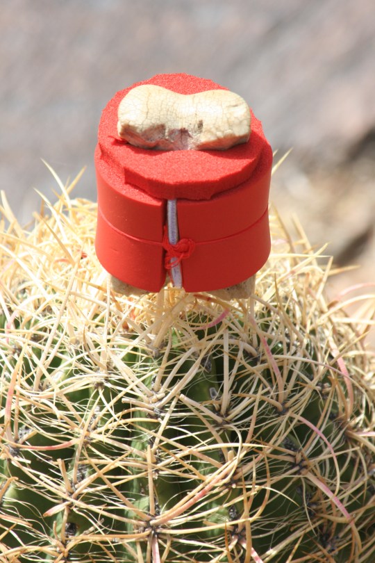
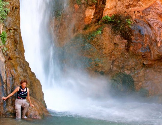
Sunsets in the Canyon are always spectacular, whether you are on the outside looking in or the inside looking out. This was from an 18 day rafting trip Peggy and I took down the Colorado River with a group of friends.Peggy and I are sitting above the Colorado River near an ancient Native American site.Sunset at Zoroaster Campsite on the Colorado River in the Grand Canyon. (Photo by Don Green.)You don’t have to hike or backpack, or raft, or fly, or ride grouchy mules to enjoy the beauty of the Canyon. You can drive up, and enjoy numerous pull-offs that give you incredible views.The mouth of Havasu Creek is a common stop for rafters in the Grand Canyon. Our rafts look small beside the large tour boat. Our trip was based on a lottery that I won for an 18-day private trip on the Colorado River through the Grand Canyon. Fortunately, I have friends with the expertise necessary to raft the Canyon.While a veteran crew of boatmen handled the more dangerous parts of our 18 day journey through the Grand Canyon, I was allowed near oars on some of the tamer sections.A morning view from out tent.. One of the fascinating things about the Grand Canyon is how it changes in the light. Numerous side trips away from the river provided opportunities to explore other parts of the Canyon.We were treated to views like this.Waterfalls along Deer Creek.This was a delightful waterfall, but I didn’t realize we were expected to jump off!Jamie Wilson demonstrates.This huge cavern is found along the river and is known as Redwall Cavern.Another river view.Looking up the Little Colorado River just above where it flows into the Colorado River. Note the water color and the mineral deposits. With Steve at the oars, Peggy and I enter the infamous Lava Falls on the Colorado River, a perfect ten… that’s 10 as in rapids don’t get any more serious. There was a point where we disappeared under the water. (Photo by Don Green)Bone, of course, went along on the raft trip and had his own life vest. Here, he decided that it was time for a photo op on the edge of a Sotar Raft.Here he enjoys a perch on top of a barrel cactus. Don’t try this at home, kids. Or anywhere else.Peggy stands next to Deer Creek Falls, a short walk from the Colorado River in the Grand Canyon.I’ll conclude with a final sunset view from one of our campsites.
NEXT POST: Either on Burning Man or the Pacific Crest Trail. Depends on what I get done. (grin)
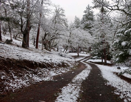
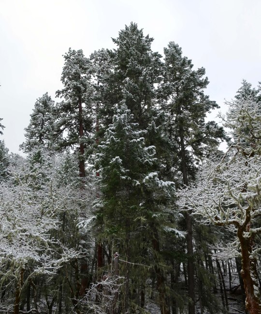
We haven’t had much snow this winter, but there has been enough to ‘top-off’ the rooster.
The climate here in Southern Oregon along the Upper Applegate River is worth crowing about, however. Mild winters are hemmed in by colorful falls and warm springs. The summer can get a tad warm at times, but they are mainly tolerable. Only the seemingly endless fires of August and September are a royal pain in the derrière. Pardon my French.
What snow we do get is always an invitation to go for a walk. I like to see what animals have left their tracks for me to peruse and to admire the beauty of the freshly fallen snow. And, of course, my camera goes along. It insists. As a result, you are pretty much guaranteed to get my annual snow post. I feel obligated. (grin) So here it is!
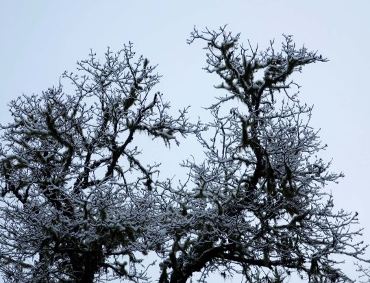
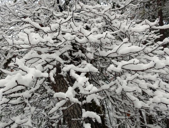
If the rooster seemed cold, imagine what the frog my brother bought for our bird bath turned deer watering hole was feeling. And believe me, the deer were not happy that their spring was frozen solid.I always start my snow walk by looking out from our patio at the distant mountains, if they aren’t socked in. Peggy and I hiked around the now white Red Buttes last summer as part of my journey down the PCT.Then I check out other views from the patio. This is looking down across the hidden Applegate River through our white oaks at Douglas firs across the way. Another view across the river canyon with the sun peaking through. Having satisfied myself that things are beautiful out front, I walk up our road to the Rogue River National Forest that forms the back boundary of our property. White oaks provided dramatic silhouettes from the road. And a snowy wonderland up close.We call this old fellow that lives in the National Forest the Lord of the Rings tree. We’re convinced that elves and hobbits find it a pleasant place to hang out.Different trees hold the snow in different ways. This is the Douglas fir ‘look.’And this is a ponderosa pine.A closer look at the ponderosa with its snow.Twisting and turning white oak branches covered in snow always provide a photo op.Group shot! The short guys are up front.And I will close today with this one featuring white oaks and a ponderosa pine.
NEXT POST: I’ve been working hard at going through and categorizing and culling out my umpteen thousand Burning Man photos. Assuming I finish, it will be fun to go through and highlight some of the better ones. I’ve created 12 different categories!
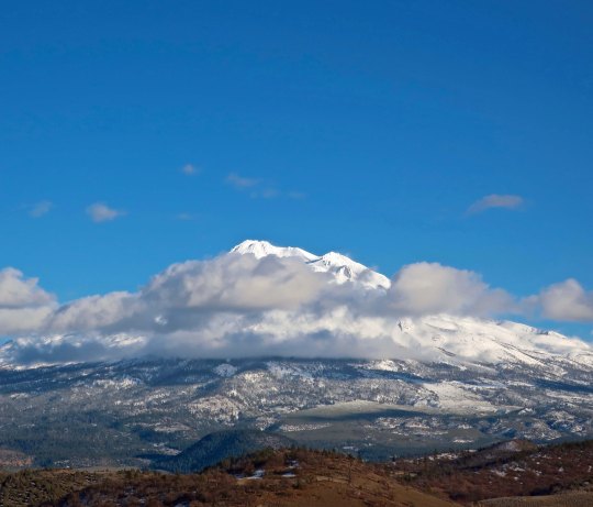
It used to be that obtaining an agent and a publisher was a lot like climbing this mountain: hard work but worth it when you reached the top. Maybe not so much anymore. (I took this photo of Mt. Shasta on my way home from the 2019 San Francisco Writers Conference.)
I’ve been AWOL from my blog, playing hooky at the San Francisco Writers Conference (SFWC). I’d been before, way back when obtaining an agent and a publisher were the primary options for being an author— the gold standard. This time, I packed my bags and headed off to the conference with that objective in mind, but I was also open to self-publishing, which is what I did with The Bush Devil Ate Sam. I bought a book by Andy Ross on how to write a book proposal and went to work. I like Andy, he fights hard for the people he represents. I also like him because he managed Cody Books in Berkeley for several years.
Cody’s was one of the nation’s great bookstores. I can’t count the number of times I walked through its doors, the hours I spent wandering the aisles, and the great books I bought— even when I could barely afford them as a student at Cal in the mid-60s. The bookstore was always on my to-do list every time I returned to Berkeley, until one day I hiked down Telegraph Avenue eager for a bookstore fix and discovered it was no more. It was like learning that a good friend had died.
Andy’s book, The Literary Agent’s Guide to Writing a Non-Fiction Book Proposal, is packed full of good advice, but it comes with a surprise ending: He self-published it. In fact, I quickly learned that a major thrust of the conference was on self-publishing. It has come of age since I had attended the SFWC in 2010. Still, there was plenty at the SFWC for those following the traditional path.
A number of agents were present and they ran workshops on how to pitch books to them during the agent speed-dating part of the conference. Think query letter with a lot less time. “You should be able to sell your book with one sentence.” Good luck with that. It’s the old Hollywood elevator pitch idea. When you catch a producer in an elevator, you have one floor to sell your movie script. Something like, “My movie is about Godzilla and Lassie teaming up to save Timmy.”
I sat down with Andy for 15 minutes to talk about my book, It’s 4 AM and a Bear Is Standing on Top of Me.I had a one page, carefully-thought-out summary that introduced the book, my writing style, and relevant background. Andy liked my writing and even more my sense of humor, but, he noted, travel memoirs are hard to sell and Bill Bryson and Cheryl Strayed had already written the books on the PCT and Appalachian Trail. (I don’t agree with that, obviously.) He did suggest that I seek out agents who focus on adventure travel, and made several other good recommendations.
I listened carefully to presentations by the other non-fiction agents who were attending the conference and none seemed particularly interested in adventure travel books. I wasn’t particularly disappointed. Finding an agent and a publisher are incredibly difficult, even more so when your book is a memoir. Rejection is the name of the game—unless you are incredibly famous, or have a ton of good luck. Being a decent writer with a good story is rarely enough. There are millions of us. Too bad my name isn’t Curt Kardashian. Wait, I’ll pass on that. I’d much prefer to self-publish.
The battle between print books and eBooks is a lively one. Pundits were ready to pronounce the print book industry dead for a while. But it has come roaring back. People still like the feel of a book. The 3000 or so in our library and scattered throughout our house certainly endorse the hands-on approach. But we also use our Kindles extensively. Travel, poor light, tired eyes, easy access to millions of titles, and cost are all factors. Both industries are here to stay, at least for now.
Writers have a different perspective on the issue. Having a publishing house print your book still has a certain prestige to it. And the advantage of getting your book into book stores. An agent and publisher also help assure that your book is well-edited and has a good title and cover. But the odds of getting a publisher, especially one of the big five in New York, are extremely low. They are now owned by large corporations who have one criteria: profit. Their only concern is will your book make money, lots of it. And that’s the tail that wags the dog.
There is more.
Publishing house contracts are notoriously one sided. A small advance with minimal royalties and maximum control are what first time authors can expect from a publisher. Time is also a factor. The project can easily take two years, and that’s after you have landed an agent and a publisher, which might take another year or so, if at all. Shelf-life is another concern. Yes, your books may get into bookstores, but if they don’t sell quickly, off they come. Bookstore owners have an agreement with publishers to take back unsold books and space is limited. Three months seem to be the outer limits. Your book is then destined for the burn pile— ashes to ashes, dust to dust.
Marketing is part of the answer. Publishers used to take this on as part of their responsibility. No more. Unless your name is J.K. Rowling, or David Baldacci, or Catherine Coulter (she spoke at the conference), etc., you are expected to do your own outreach. In fact, most agents and publishers won’t even consider your book unless you have a ready-made platform. Jane Friedman, who is a guru on authors’ platforms (and was also at the conference), defines platform as “an ability to sell books because of who you are or who you can reach.” A blog, for example, is a platform. Having one was highly recommended by just about everyone. There was a slight catch in the fine print: It helps to have 100,000 followers. My 5,600 followers, 530,000 views and 20,000 comments count as something, but not much. Get to work, Curt!
It is easy to see the appeal of going the Indie route and self-publishing. Your digital book has a virtual shelf-life of forever. From start to finish, you can have it up and out in months instead of years. Your profit per book sold comes in at between 50 and 100% as opposed to 15 and 20%. Modern print on demand capabilities mean your readers can still get the book in print as well as digitally. And, finally, you are in total control. Whether your book is published or not doesn’t depend on a 15 second decision by an agent or editor, who may be having a bad day.
None of this might matter if the publisher handled all of the marketing and used their considerable expertise to push our books. The effort and rejection that goes into obtaining a publisher would be worth it. But they don’t. If our success is going to depend on the energy and skill we bring to marketing as well as writing, then self-publishing becomes a viable option, and may indeed, be the preferable option.
It was a great conference. I felt I learned a lot. Now it’s time to get back to blogging and writing the book. The decision to self-publish or not can wait until the book is finished.
NEXT POST: I came home to snow. Not much but it was pretty. It’s time for my annual snow post!
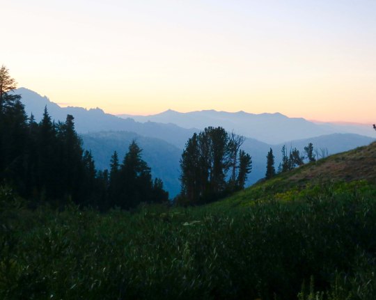
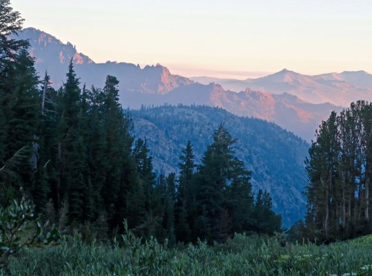
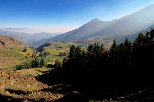
An evening view of the Mokelumne Wilderness from Noble Lake on the PCT.
I remembered Noble Lake from my 2003 trek when I backpacked 360 miles from Lake Tahoe to Mt. Whitney to celebrate my 60th birthday. For some reason, it didn’t seem as ‘noble’ this time. Maybe that’s because of all the other lakes I had passed on my hike down the PCT. But the views looking back toward the Mokelumne Wilderness were spectacular.
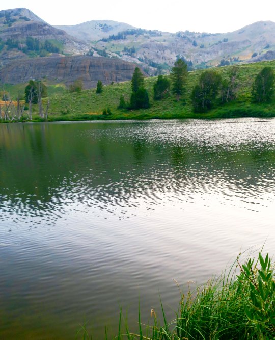
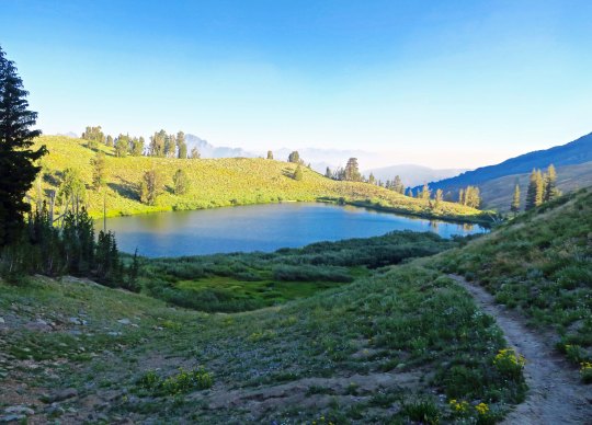
An afternoon view of Noble Lake. The lake is located south of Ebbetts Pass.
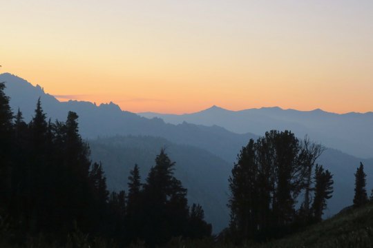
Another evening view of the Mokelumne Wilderness from Noble Lake. This is a situation where the smoke from the fires may have enhanced the photo.
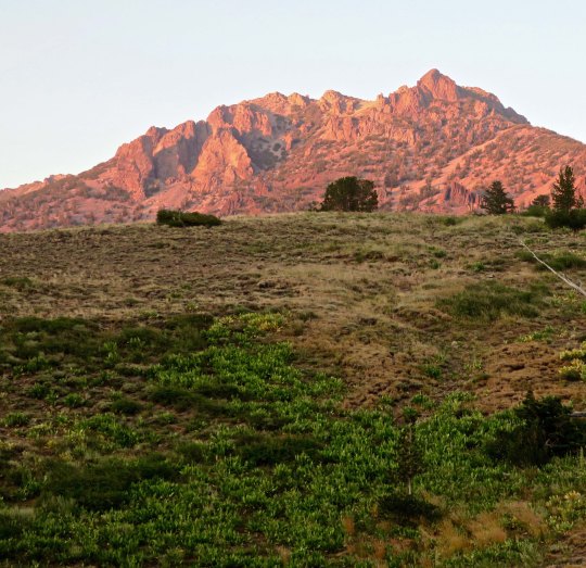
Looking up from the lake, I caught this mountain glowing in the evening sun.
I was treated to more views of the Mokelumne Wilderness the next morning. It’s fun to think that I had been hiking through the area the previous day.
As I watched, the sun continued to rise, bathing the peaks in a soft glow.
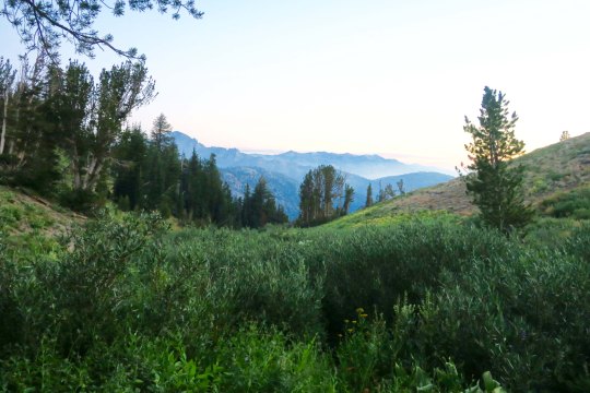
I would have lingered, but Peggy expected me to be at Sonora Pass the next day, and I had miles to go. As I hiked up the early morning trail, I said goodbye to Noble Lake. Would I be back for my 80th birthday? (grin)
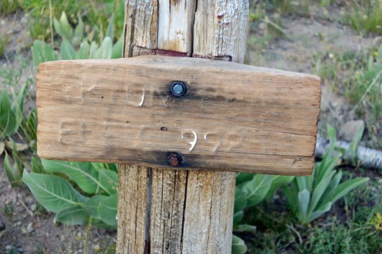
Up toward the pass, I was greeted by an old elevation sign. I think it told me I was at 9,980 something feet.
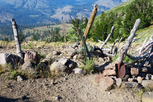
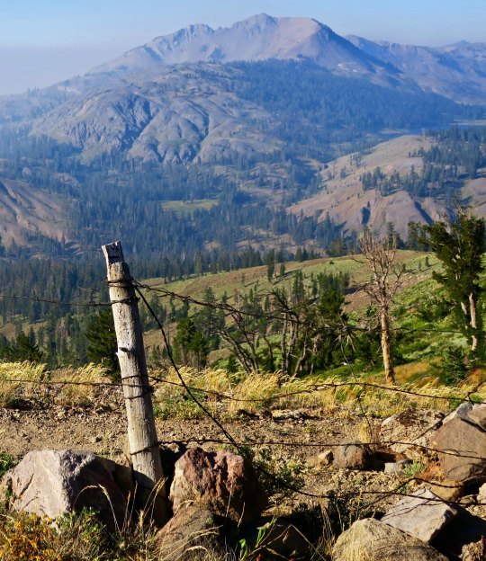
You know you are out West when you come to barbed wire fences. This provided a passage (sort of) that through-hikers could get through, but not cattle. The old shovel head spoke of earlier times.
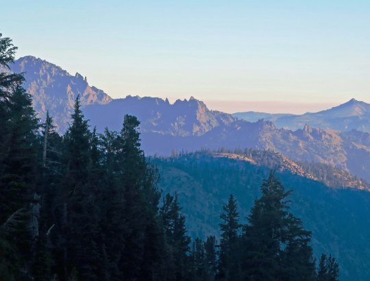
Looking through the wire, I could see my next destination, the Carson Iceberg Wilderness.
I’ll conclude today’s post with this view. It suggested another smoky day. Within 48 hours, the trail would be closed due to fire.
NEXT POSTS: Time’s limited since I am preparing for the San Francisco Writers’ Conference. I have one more post on this section of the PCT and then Peggy has two posts on her experiences as ‘trail angel.’ I think I will hold on these three posts until after the conference. In the meantime, I will put up some Burning Man eye candy since Peggy and I are hoping to go this year, assuming we can get tickets.
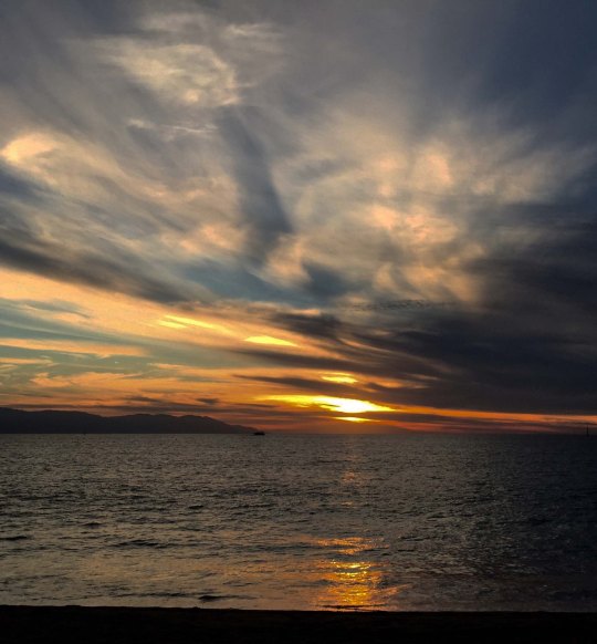
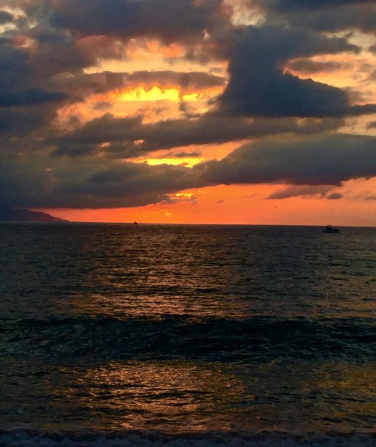
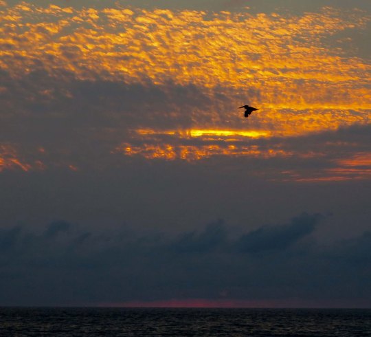
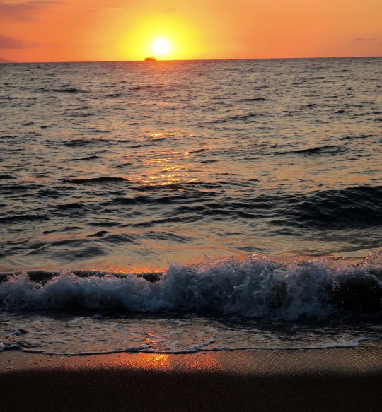
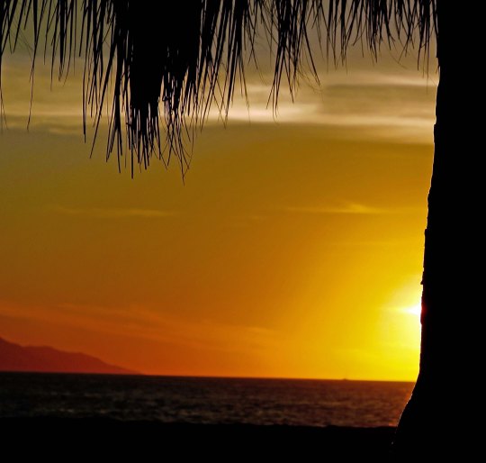
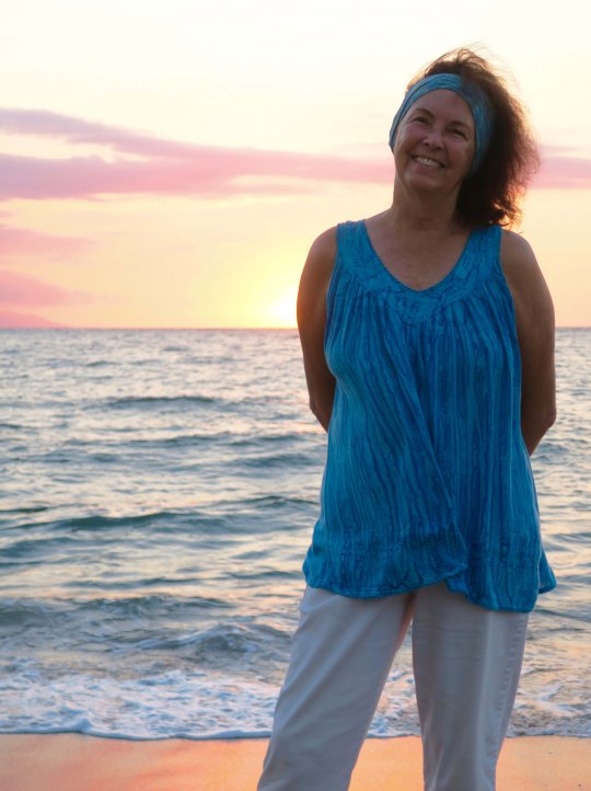
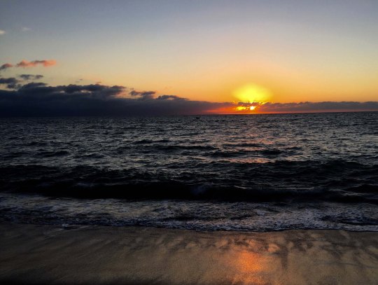
Puerto Vallarta has always produced pretty sunsets when we have visited. Sometimes they have been spectacular.
“Postcard pictures” is how my dad used to describe sunset photos somewhat dismissively. He was a serious landscape photographer and considered them less than desirable as a subject. Yet, when he passed away and I was going through his photos several years ago, what should I find? Sunset photos. Lots of them. I just smiled. Who can resist a beautiful sunset?
Peggy and I wrapped up our timeshare and said goodbye to PV this fall. I know we will miss the city with its friendly people, culture, great food, beautiful art, interesting wildlife, scenic settings and camera grabbing sunsets. I know we will be back some day, but for now, like the cowboys and cowgirls of yore, we are going to ride off into the sunset!
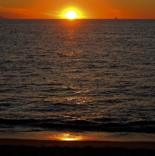
Every day, this fellow would ride by on our hotel’s beach. We rarely missed an evening of sitting out on the beach with a glass of wine or beer in hand to watch the sunset over Banderas Bay. And were rarely disappointed. Some days, when there was limited cloud cover, the sun just seem to fall into the ocean. There was almost always a sailboat in the Bay somewhere. When our son, Tony, had gotten out of the Marines, he had actually sailed a boat with his future wife, Cammie and our nephew, Jay, from San Diego to PV.When clouds were around, the sunset would linger however, often turning the clouds into almost unbelievable colors. Pelicans, graceful frigate birds and leaping dolphins often added to the evening’s show.As the sun sank into the West, it would often leave a gentle reminder on the waves and beach. Our palapa always provided a convenient viewing location. And a sunshade. While I always enjoyed and took full advantages of sunsets, I am more of a mountain man. Peggy enjoys the mountains, but she loves the ocean and beaches.Thank you Puerto Vallarta for your many years of joy. We will return someday. It’s a promise.
NEXT POST: South on the PCT into the Carson Iceberg Wilderness
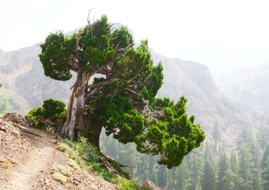
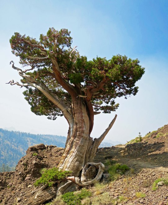
Another beautiful juniper along the PCT, this one just south of Ebbetts Pass. I was climbing up a very steep trail to Noble Lake. Check out the smoke. Excuse me while I go cough.
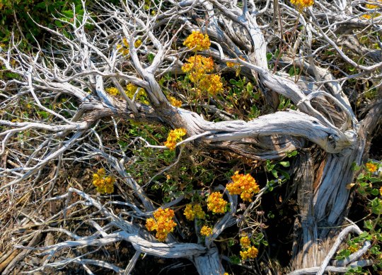
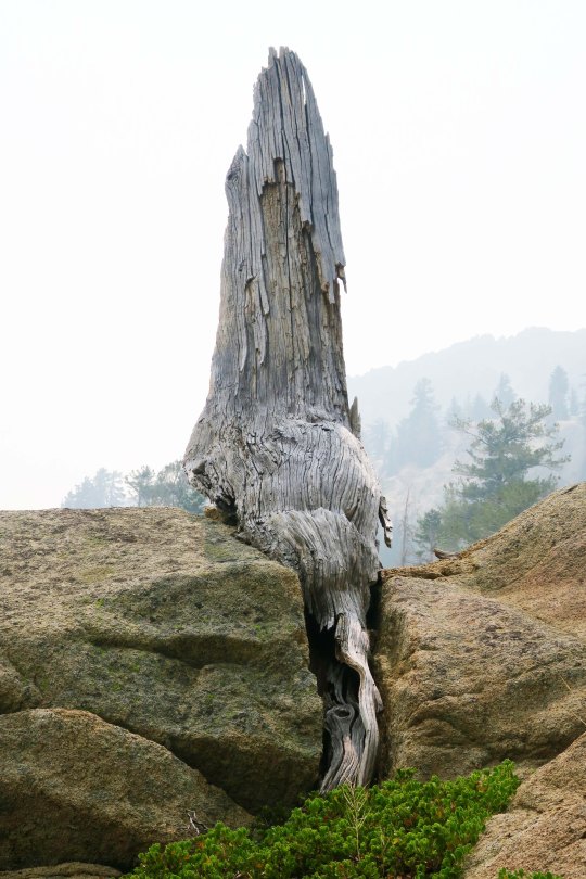
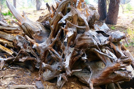
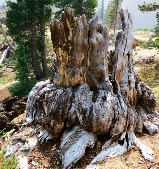
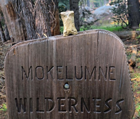
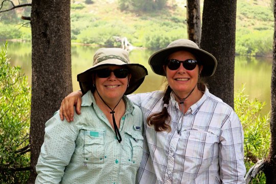
I left you in the last post about my hike down the PCT with photos of spectacular rocks and impressive trees. I say goodbye to the Mokelumne Wilderness in this post, hike across Highway 4 at Ebbetts Pass, and continue my journey southward. Of course there will be more pretty trees, but roots, snags, flowers, a family from Taiwan and through-hikers are the main subject for photos today.
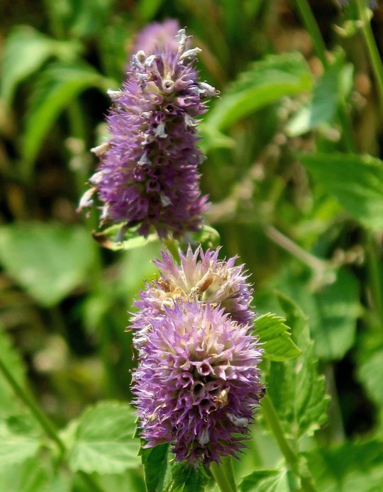
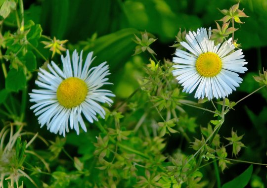
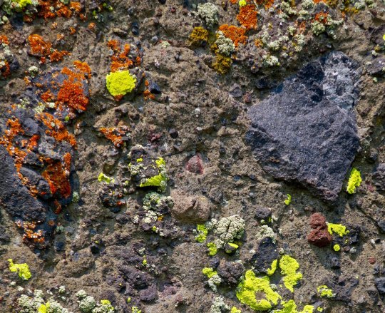
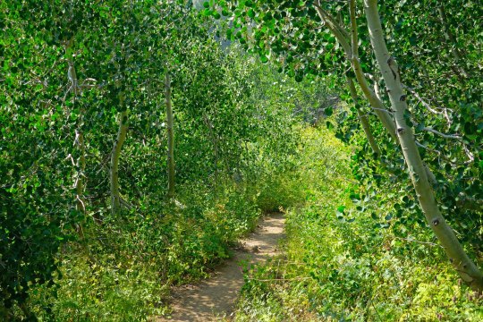
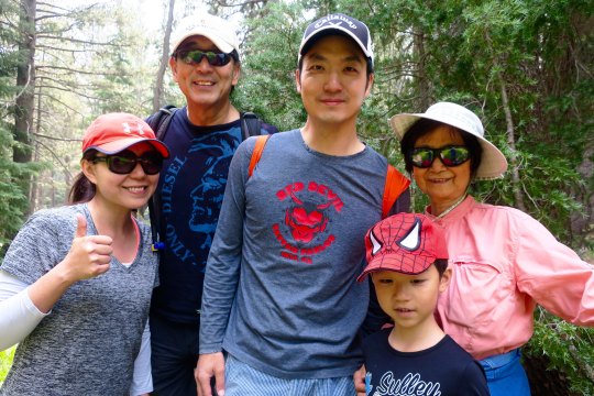
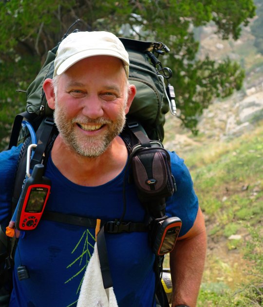
Have any aches and pains? Some people swear by this plant, self-heal, as being good for what ails you. I came across a list claiming it is good for ulcers, wounds, sore throats, hemorrhoids, high blood pressure, burns, insect bites, herpes and cancer. Woohoo. You might want to check with your doctor first. (grin)You’ve already met this fellow, flea bane, with its obvious name. Orange and yellow lichen— where algae and fungi co-habitate in a symbiotic relationship. An inviting green trail through aspen.A snag and dead flowers combine in a floral arrangement.This fellow was fun. I’ve never seen a snag sitting down with its tail hanging out behind. I was worried it might follow me home. How would I explain that to Peggy?Twisted roots!Stump with personality.Bone decided to get into the act when I left the Mokelumne Wilderness.These two sisters, Denise and Deborah were only doing part of the trail. Since we were hiking in the same direction, we kept crossing paths, so to speak. They were both carrying tents and explained to me, “We grew up having to share a room. That was enough.” They wrote me later saying that their hike was interrupted by the Sonora Pass fire. Mine too. I caught up with Wayne Chiang and his family along with their friend, Bass Chong, at Ebbetts Pass. They were out for a day hike. Wayne is a legislator with the Republic of Taiwan and has long term hopes of becoming Mayor of Taipei. Bass works at Ebay. This smiling fellow was from Germany and, I am sorry to say, I’ve misplaced his trail name. He wanted to take a photo of me to show friends and family back home that people of all ages hike the PCT. I was just glad that he didn’t say something like, “Really old people hike the PCT!” A final juniper photo for today.
NEXT POST: Adios, Puerto Vallarta… with a few spectacular sunsets.
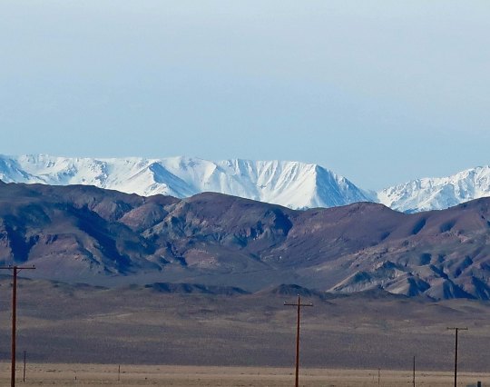
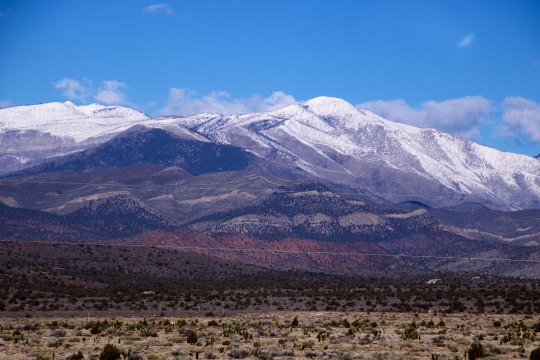
I have always liked the drive from Las Vegas north following Nevada’s Highway 95. One of many reasons is the great views it provides of the Sierra Nevada Mountains.
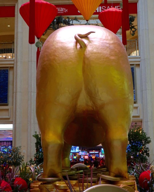
Usually when Peggy and I visit Las Vegas, I do a complete post on the Strip. Not this time. We went downtown to the Venetian Hotel and discovered that it was the Chinese Year of the Pig. The pig shared a room with a Burning Man sculpture that Peggy and I had admired on one of our many trips to the event.
Front of the pig.
Back of the pig.
Burning Man sculpture.
Having done the Las Vegas thing, it was time to head home. We decided to travel on Nevada 95, which runs up the west side of the state from Las Vegas to Reno. Most people experience the trip as vacant desert to be driven through as fast as possible. We see it as filled with beauty and quirkiness. It is one of our favorite drives.
Vacant desert, right? Unless you know what to look for. A town was built out here in the 50s. It was populated with fake houses and fake cars and fake people and fake pets and then blown up with a real atomic bomb. People drove out 65 miles from Las Vegas to watch the explosion as entertainment. The government promised it was safe. There was even a Miss Atomic Bomb. On a previous trip, Peggy and I had tried to drive out to take photos, A man in black driving a black SUV and wearing dark glasses stopped us and made us leave. Otherwise, we might still be in jail. Possibly you saw the Indiana Jones movie where Jones survived the “town’s explosion” by hiding out in a refrigerator…
Miss Atomic Bomb 1957.
Not interested in atomic bombs? How about cat houses? Or brothels as you might know them. There are several along lonely Route 95. Prostitution is legal in Nevada. You can tell this is a classy place by the Greek column, right? Peggy and I were amused when we drove by the Shady Lady to discover it had been turned into a bed and breakfast. You know what my thought was: Staying there might make an interesting post. Tempting… (grin)
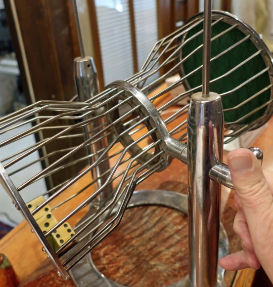
And then there is the Tonopah Station Hotel. It’s packed to the brim with quirkiness. Peggy and I always stay there. Meet James the bear.
Where else can you roll the dice to get a free room? We have yet to succeed, however. Are the dice loaded? (A selfie of my hand.)
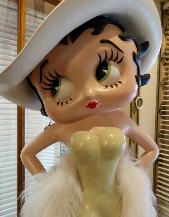
Probably not/ Betty Boop oversees the roll. She is looking away, however. Hmmmm.
A lamp post illuminates a British lion..
How’s this for a welcome sign?
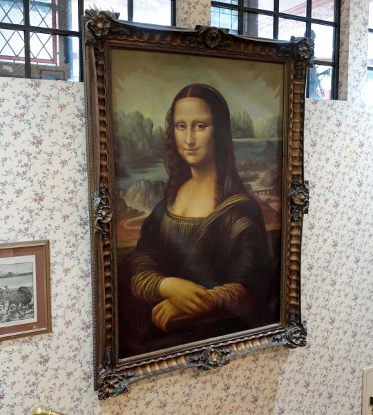
Mona Lisa guards a stairwell!
There is plenty of beauty along the way to augment the history and quirkiness.
Including some superb views of the Sierra Nevada Mountains that I kicked this post off with.
A more distant view.
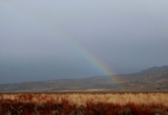
North of Reno on California 395 heading into Susanville, we picked up some weather including rain and high winds plus the sun breaking through and lighting everything up. I was driving and Peggy was in charge of photographs. She loves rainbows. I noticed afterwards that most of the photos contained one. (Photo by Peggy Mekemson.)
Another rainbow… (Photo by Peggy Mekemson.)
And another rainbow… (Photo by Peggy Mekemson.)
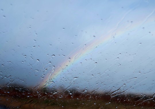
And finally, a wet windshield rainbow. (Photo by Peggy Mekemson.)
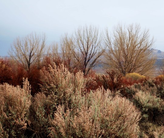
She did, at my urging, capture a shot of sagebrush being lit up by the sun. (Photo by Peggy Mekemson.)
North of Susanville we caught up with the snow, which was mainly rain. The heavier snow had fallen the previous week. It is hard for me to believe that a few months ago I was backpacking down the PCT not far from this location through 100 degree F weather with very little water!
NEXT POST: Speaking of the PCT, we will journey back to it in my next post.
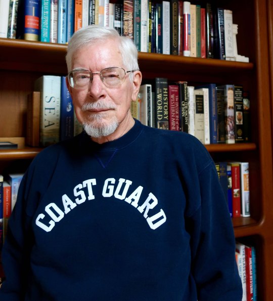
I’ve been wearing my Coast Guard sweatshirt over the past month honoring my son who is now going into another month without pay. This is a man who has risked his life for America both as a Marine helicopter pilot in Iraq and as a Coast Guard helicopter pilot saving lives and keeping dangerous drugs from entering America. Is this how we thank him and the thousands of other men and women who risk their lives daily to keep our shores safe? But there is more: Coast Guard members, FBI agents, and Homeland Security personnel are the backbone of protecting our nation within its borders. They are now effectively being limited in their jobs, seriously endangering America. It’s time to stop holding 800,000 American hostage. It’s time to end the government shutdown and let democracy work.
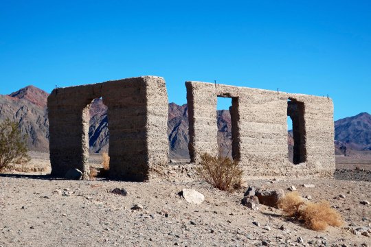
Old, abandoned towns of the West are given the name of ghost towns. While Ashford Mill hardly meets the requirements of being a town, I decided we could at least think of it as a ‘ghost mill.’
Abandoned mines litter Death Valley’s history. In my last post, I featured one of the most successful mines in the area, the Harmony Borax Works. It was so successful that the twenty-mule team responsible for hauling its ore across the desert served as a logo for the long running TV show, Death Valley Days. The show was hosted by none other than Ronald Reagan in the 1964/65 season when I was a student at Berkeley. It’s possible I even watched an episode or two while avoiding the baton-wielding police sent to campus by Edwin Meese, Oakland’s District Attorney at the time— and Reagan’s future Attorney General.
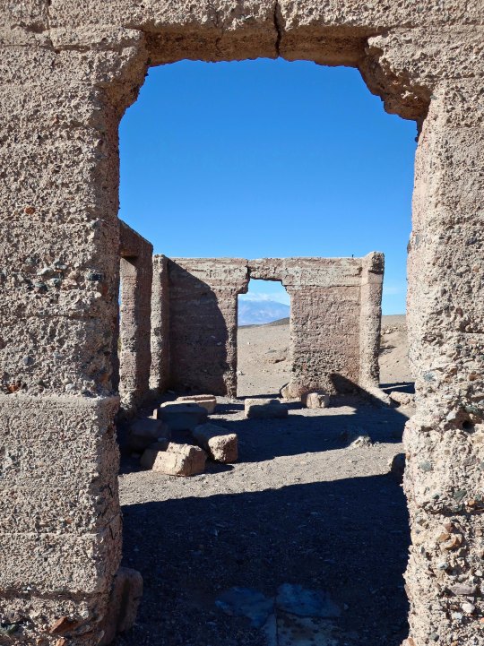
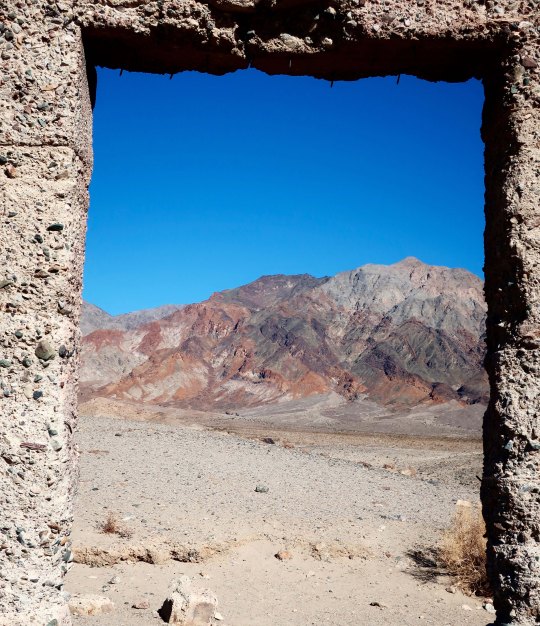
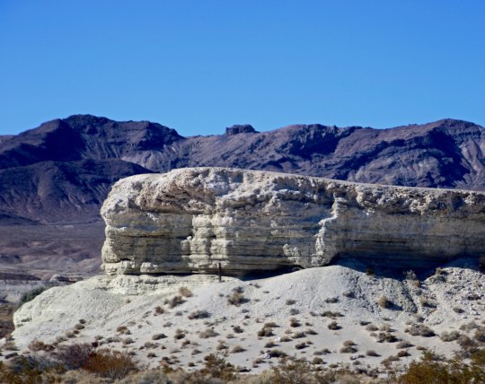
Mercury, talc, gold, silver, sodium chloride, Epson salts, tungsten, and copper were some of the other minerals that miners pursued with visions of wealth dancing in their heads. Few were successful. Some 2000 mine ruins were left behind as their legacy. Ashford Mill is one such ruin. It was built by the Ashford brothers to process ore from their Golden Treasure Mine located 5 miles to the east in the Armargosa Range. The brothers alternated working the mine and leasing it out to various companies for over 30 years until they finally gave up in the early 40s. A lot of money, work and heartache was devoted to the effort, but the ‘golden treasure’ was not to be found. Today, all that remains of the mill are the cement walls of what was the office and a few remnants.
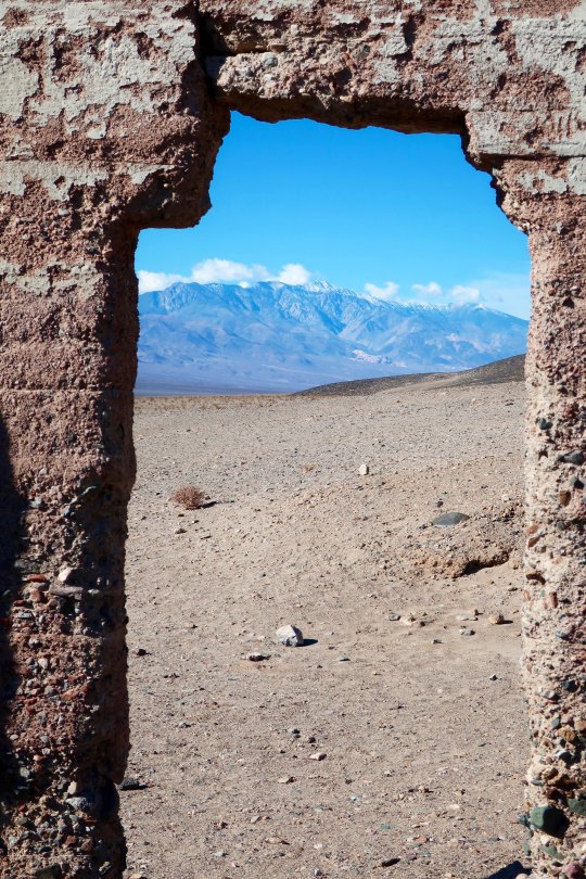
A view of the office as it now looks. I decided in would be fun to photograph the surrounding desert using the various openings as frames.
Looking out toward the Panamint Range.
The Golden Treasure Mine is located up in the mountains.
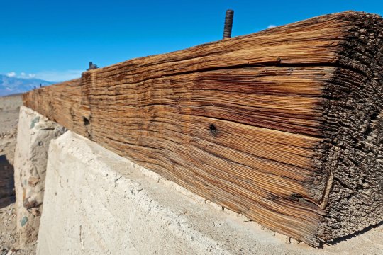
While there was little left of the old mill, I found this timber beam rather impressive.
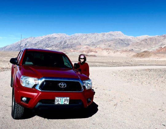
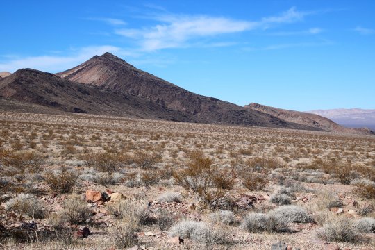
Here’s Peggy looking cool in her shades while standing next to our red Toyota Tacoma. The Amargosa Range is in the background.
For all of our trips into Death Valley over the years, Peggy and I have never entered from the south end of the park. We remedied that this time by heading over to Pahrump from Las Vegas following Highway 160 and then cutting over to the remote town of Shoshone on 178 and on into Death Valley. Following are some of the photos that Peggy and I took illustrating this route.
Looking east from the southern entrance to Death Valley, Mt. Charleston dominates the view. A ski area for Las Vegas is located up in the mountains. (Photo by Peggy Mekemson.)
The road worked its way around this rock. (Photo by Peggy Mekemson.)
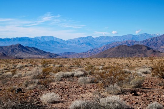
Climbing up toward the pass into Death Valley provided views like this. (Photo by Peggy Mekemson.)
And this.
Once over the top we began to make our way down into Death Valley.
The Panamint Range can be seen stretching across the horizon. (Photo by Peggy Mekemson.)
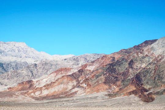
I liked the contrast here.
Rocks made up of different minerals and laid down under differing geological conditions provide the color for which Death Valley is famous. (Photo by Peggy Mekemson.)
Check out this mountain as an example.
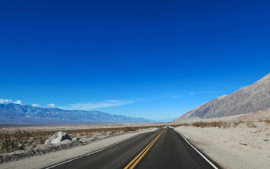
I’ll wrap up our trip into Death Valley with this photo that demonstrates just how flat things can get. I loved the perspective of the road disappearing into the distance. It seems like everything was converging.
NEXT POST: A bit of Las Vegas and the road north to Reno.
Our Toyota Tacoma pickup makes its way down a road that was once traveled by 20 mule teams hauling borax.
The red hood of our truck reflects a desert scene from the Twenty Mule Team Canyon in Death Valley. The short 2 1/2 mile side trip is one of our favorites in the National Park. Imagine, if you will, driving an 18 mule/2horse team hauling 10 tons of borax over 160 miles of desert. The total weight including wagons was 36 tons and the livestock and wagons stretched for over 180 feet! I asked my 278 horse power truck if it would like to pull such a load through Death Valley. The answer was a resounding no. Having struggled with hauling only myself and gear over the hills and mountains of the Park on my bicycle during my 10,000 mile bike trek, I heartily agreed.
This photo of the road suggests your team would be going right, then left, and then right— all at the same time. (Photo by Peggy Mekemson.)
This early, unattributed photo in the public domain, provides a view of the team with its Death Valley backdrop.
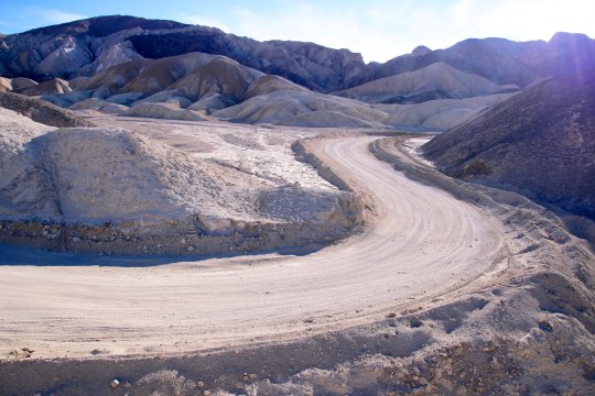
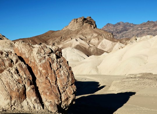
The real treat in driving over the short distance is the almost unreal beauty. Peggy and I stopped the truck several times along the road to get out and take photos. I’ve posted before on the canyon but we took all of these photos on Sunday.
The golden rock working its way up the hill from left to right caught my attention.
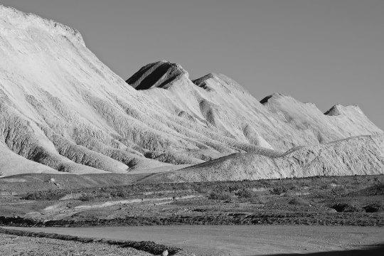
Peggy captured this ridge, which is one of the dominant features of the drive. Two people, not shown here, were making their way along the top. (Photo by Peggy Mekemson.)
I took a similar photo and rendered it in black and white.
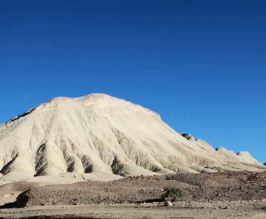
This hill, which seems to stand alone, was actually the start of the ridge.
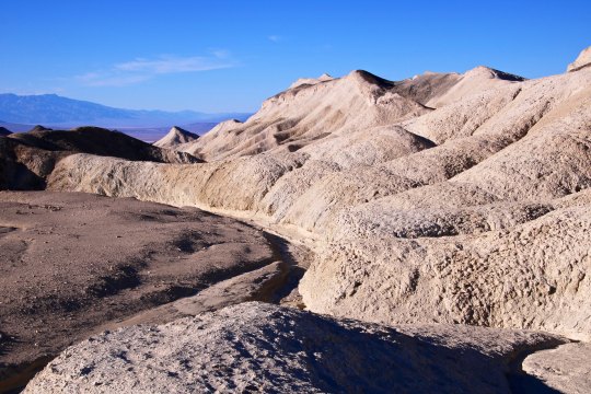
Erosion creates very interesting rock structures in the canyon and throughout Death Valley.This photo provides another example.Various colors reflect different types of rock laid down over millions of years through times when the area was covered by oceans, lakes, sand dunes and volcanos. (Photo by Peggy Mekemson.)I took a closer look at the sensuous landscape..Three different types of rock are quite clear here. I should note that different rocks have different hardness and erode at different rates, which also adds to the interest of desert landscapes.(Photo by Peggy Mekemson.)A view looking out toward Death Valley.Almost out, I’ll conclude with this rock and a peak rising in the background.
NEXT POST: I’ll conclude our journey through Death Valley National Park.
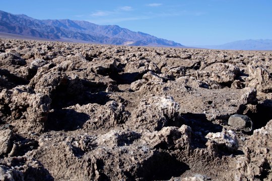
The sun beats down on the Devil’s Golf Course in Death Valley.
“Only the Devil could play golf here.” 1934 National Park guide book.
Peggy and I are playing hooky, extending our seemingly endless time away from home. One would think that backpacking the PCT, visiting Puerto Vallarta, and spending over a month with our kids in Florida and North Carolina would satisfy our wandering needs for a while. But no, here we are in Las Vegas, or Lost Wages, as I like to call it, ensconced in a comfortable suite at the very southern tip of Las Vegas Boulevard, the infamous Strip. Or is that famous?
Few people who visit this city venture outside of its mecca of gambling and entertainment pleasure palaces. Peggy and I always do. There is much to see and do. There is a desert on its doorstep, and it is a desert of rare beauty. Death Valley National Park is a prime example. It is a mere two hours away and Peggy and I drove out there on Sunday. To us, it’s like seeing an old friend; we have been there many times.
It is a geologist’s dream— there are rocks everywhere, and the rocks all have stories to tell. It’s a story of ancient seas and lakes and volcanic activities and clashing, mountain-building plates. Death Valley is a rift valley, or a graben in technical terms, formed along a fault zone between two mountain ranges. As the mountains were thrust up by tectonic forces, the valley dropped between them, several thousand feet. The two mountain ranges have since filled the valley up with eroded debris.
The shallow Lake Manly filled the basin a few thousand years ago. As the climate of the area changed and became more desert like, the lake dried up. Its briny waters left a deep deposit of salt behind, which brings us to today’s post. The Devil’s Golf Course is located a short 10 miles away from Bad Water Basin, which, at 282 feet below sea level, is the lowest point on the North American continent. Water that drains into the Basin melts the salt and becomes undrinkable, thus the name. The Devil’s Golf Course is several feet higher and avoids the melting water. Instead, capillary action pulls salty subsurface water up creating the crystalline structures that the area is famous for.
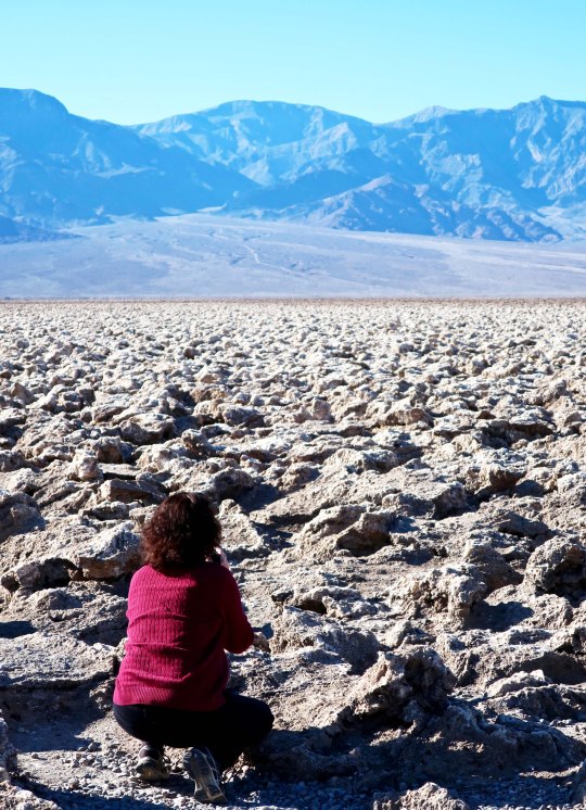
Peggy and I caught the area at a particularly good time for photography, which surprised me, given the location of the overhead sun. Anyway, here are the results.
This close up provides a view of the crystalline structures developed by the capillary action. BTW, they are composed of 95% table salt. (Photo by Peggy Mekemson.)
I took this photo looking east toward the Amargosa Range.
Looking southwest along the Panamint Range.
Peggy photographing the Devil’s Golf Course provides a perspective on the size of the crystalline structures.
A final shot of the Devil’s Golf Course backed up by the Panamint Range. (Photo by Peggy Mekemson.)
NEXT POST: A ghostly reminder of Death Valley’s past, and more.