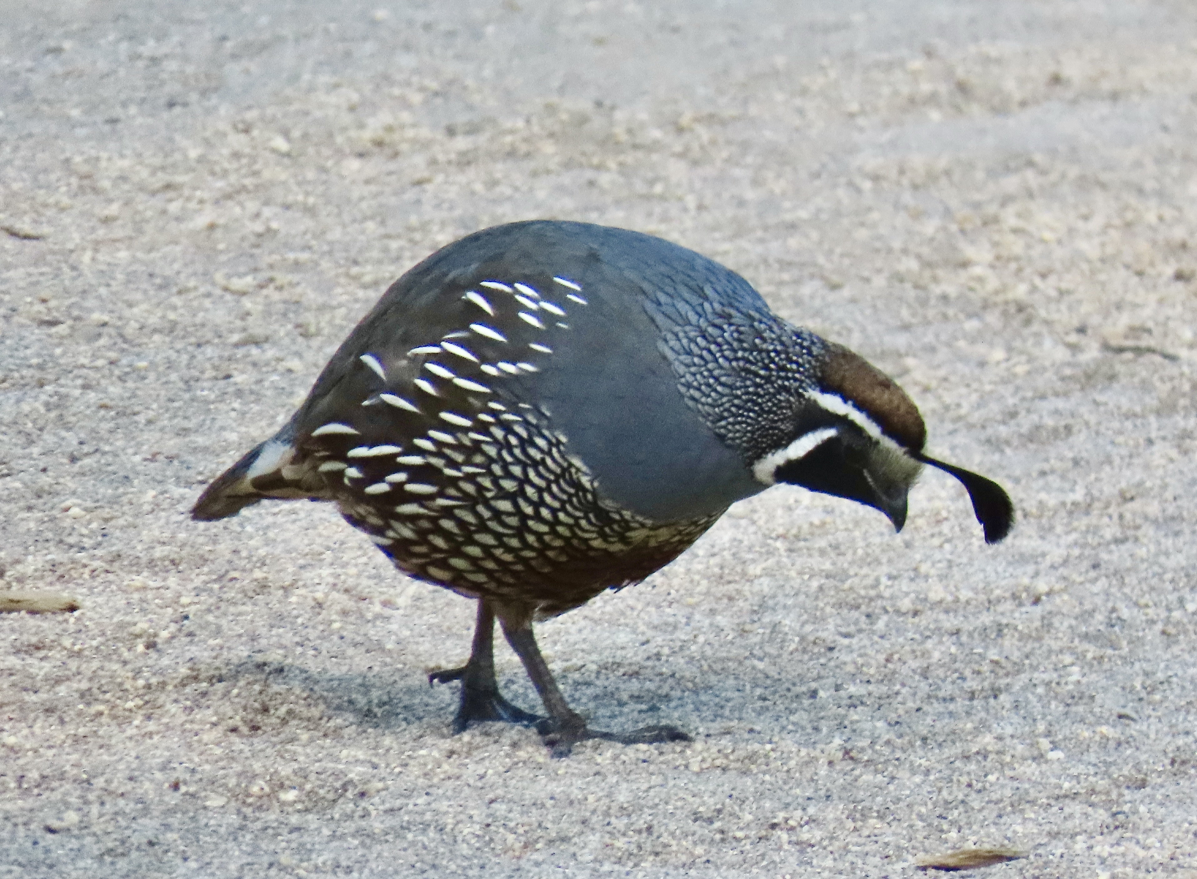
Peggy and I visited the historic Pierce Ranch during our recent two week stay at Point Reyes National Seashore. We didn’t go to see the quail, but there they were, everywhere. This one, wearing his ‘red cap with white trim, white beard, bushy eye brows, and big belly,’ reminded me of someone. A certain Mr. Claus perhaps? But what about the jaunty feather in his cap? Actually, it is six overlapping feathers.
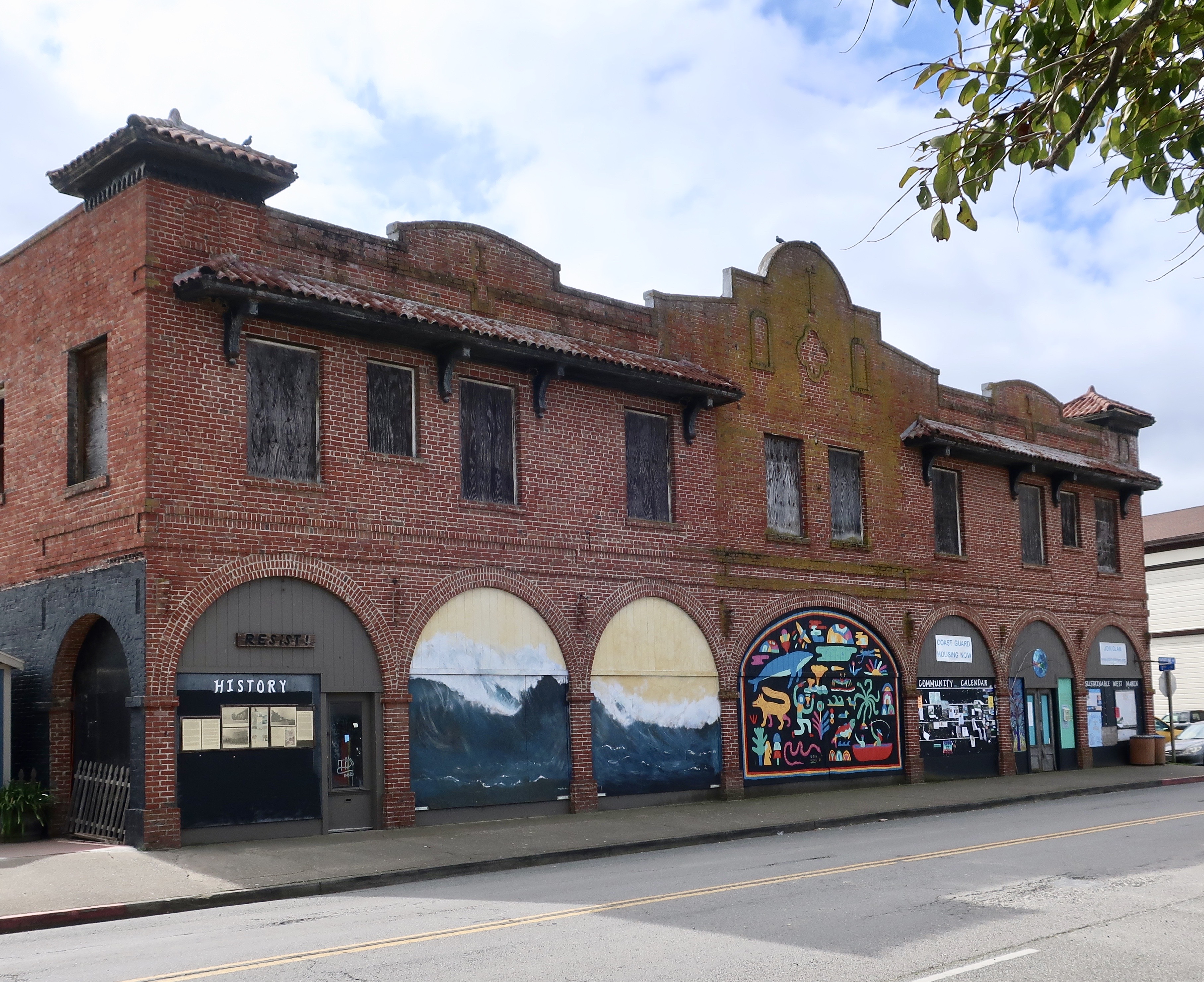
Anyone visiting Pt. Reyes National Seashore should visit the historic Pierce Ranch. It provides an excellent introduction to the dairy industry that started in the mid-1800s and still exists within the National Seashore boundaries today. Local ranchers worked together with the Sierra Club in the 1960s and 70s to preserve their ranches and avoid the onslaught of real estate speculators and developers who envisioned turning the beautiful area into massive profits for themselves and great homes for the few that could afford them— instead of one of the world’s premier national parks for everyone.
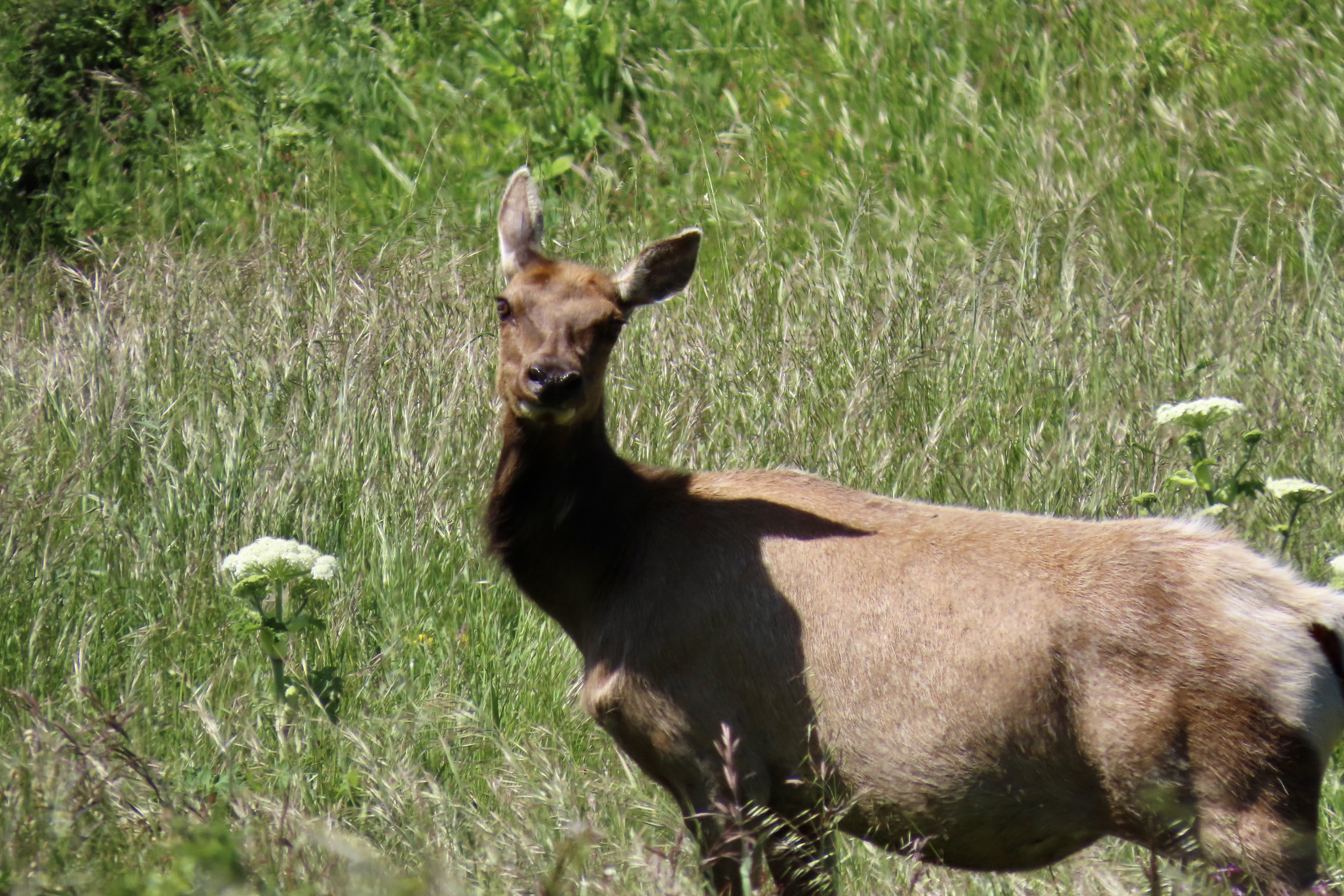
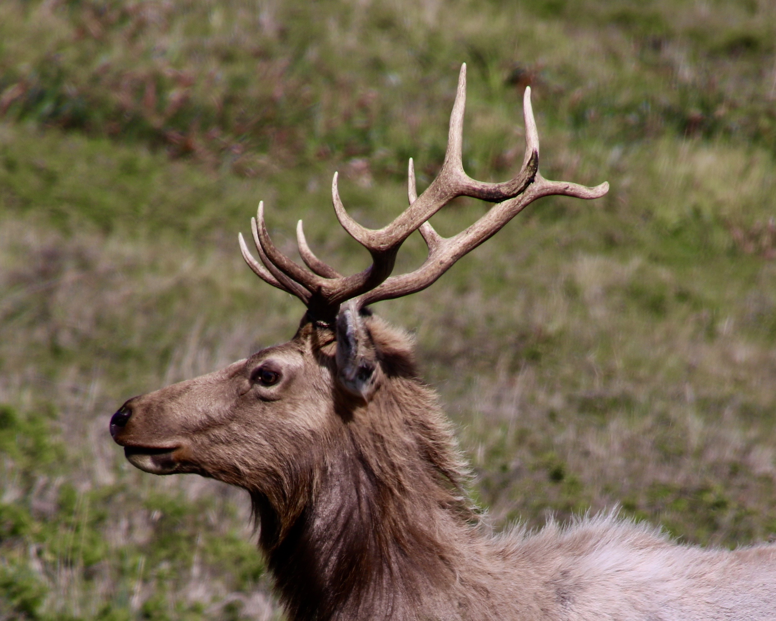
There is more to the ranch than history, however. For one, there is a tule elk reserve in the area. Having been eliminated from the region during the 1800s, they were reintroduced in 1978 and now constitute a sizable herd. A trip out to the ranch doesn’t guarantee you will see these magnificent creatures but the odds are you will. A short— or longer— hike out the Tomales Point Trail will increase your chances even more. Gorgeous scenery, wild flowers galore, birds and other wildlife are three more excellent reasons for a visit.
We actually went out twice on our visit: The first time was with our friends Tom Lovering and Lita Campbell, the second by ourselves. We didn’t need any excuse to go a second time, but the fact we had forgotten to bring our cameras except for an iPhone the first time was certainly a factor. We’ve become spoiled. Our photos are from both trips, however. Even Tom jumped in with his iPhone.
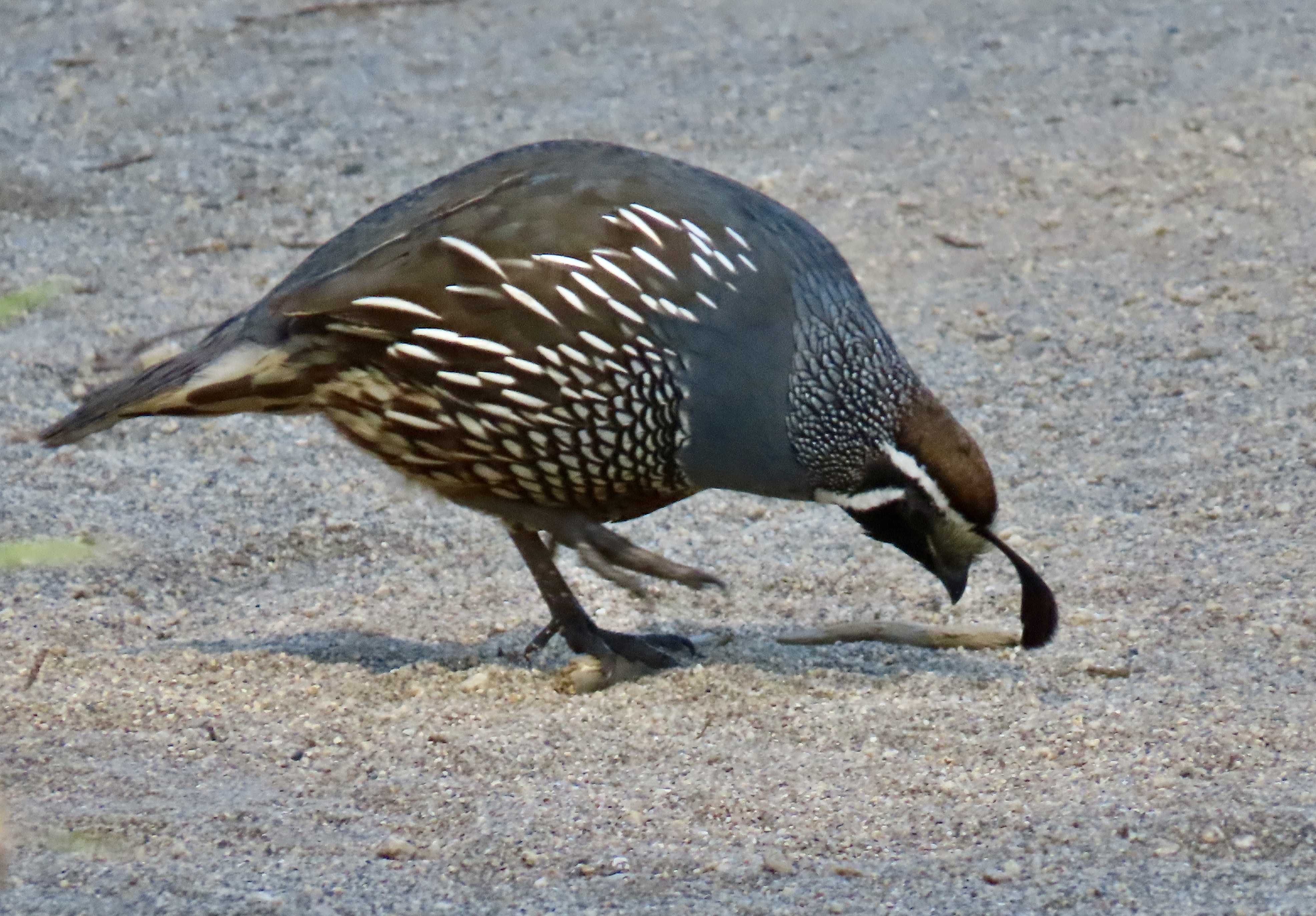
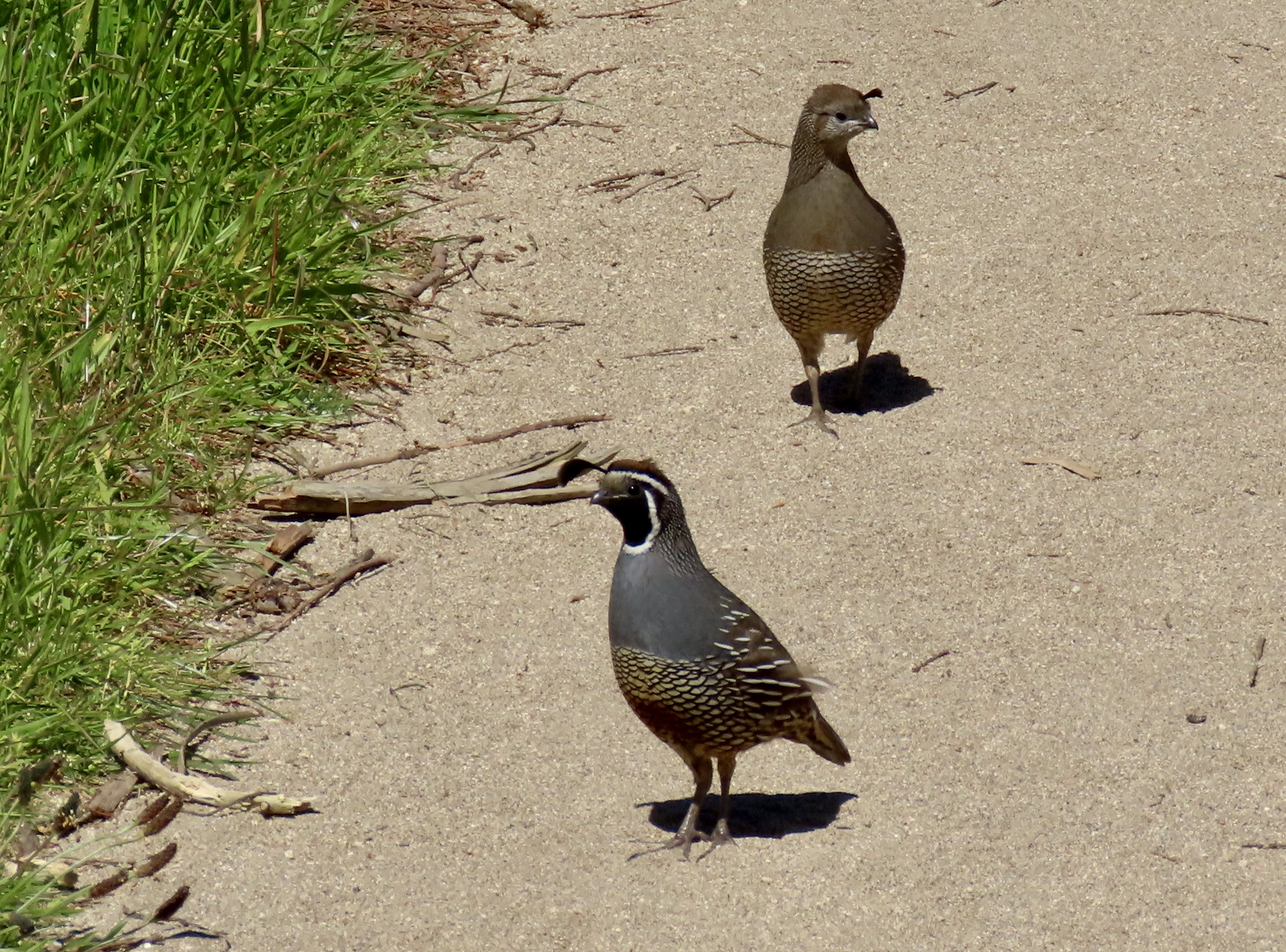
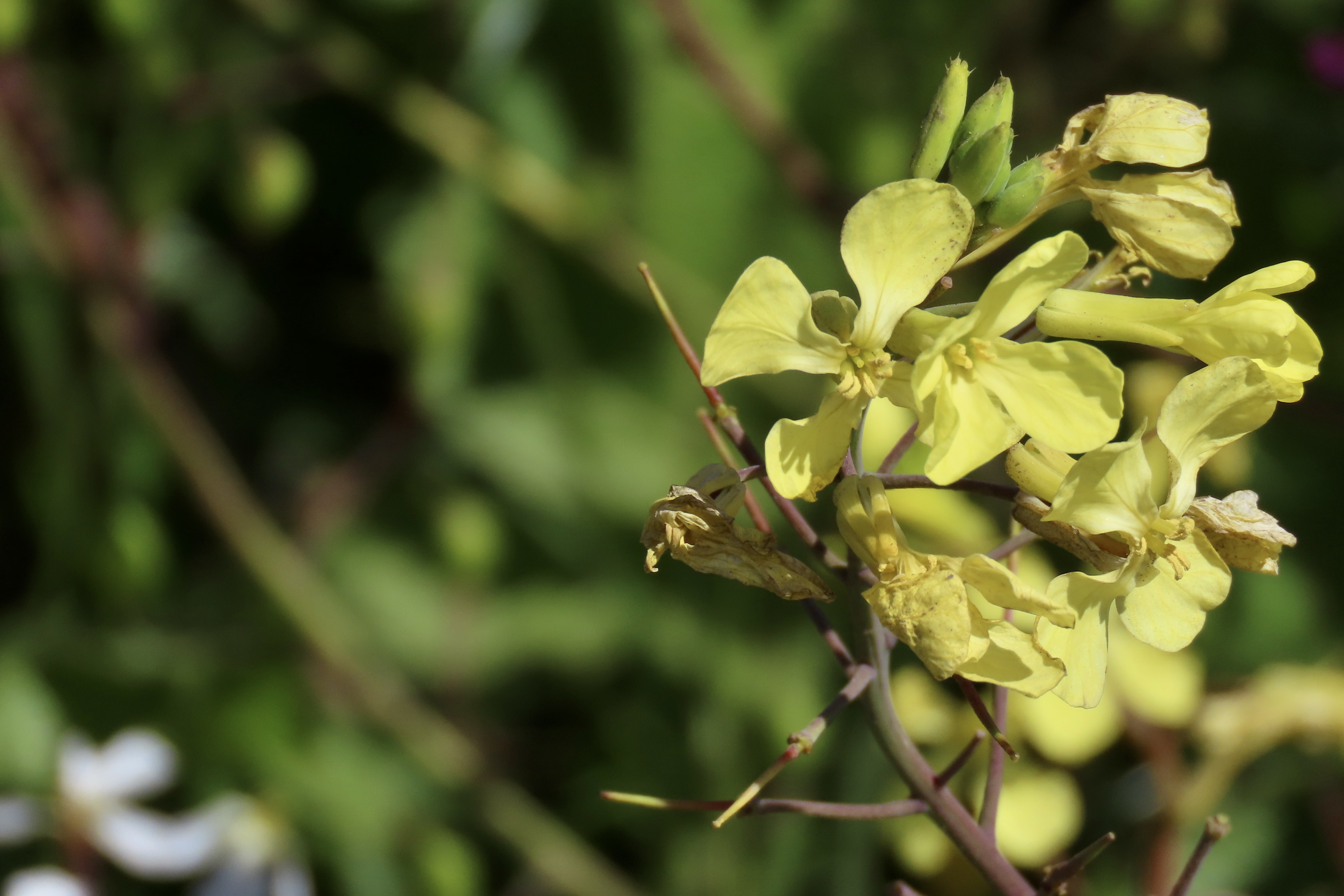
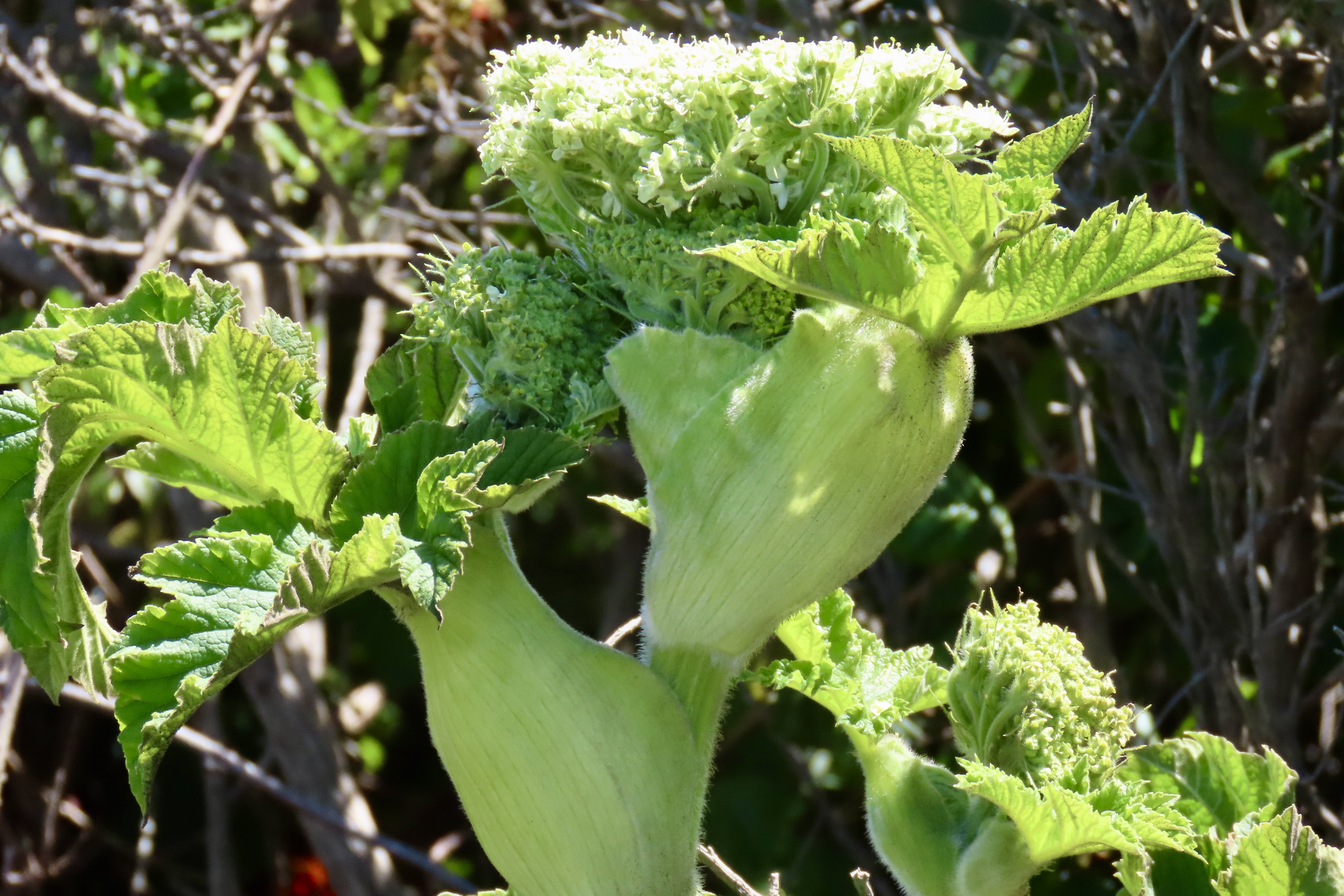
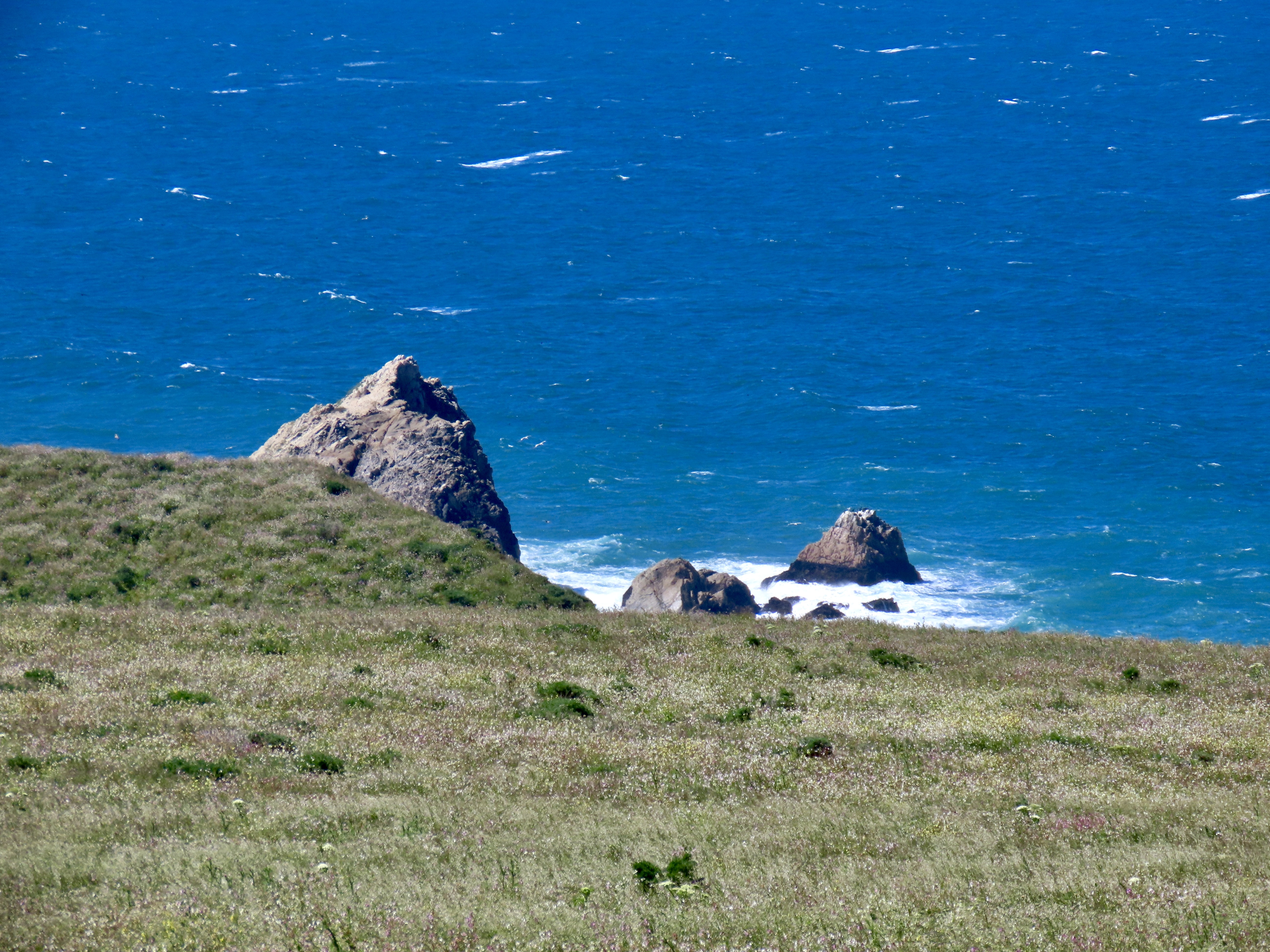
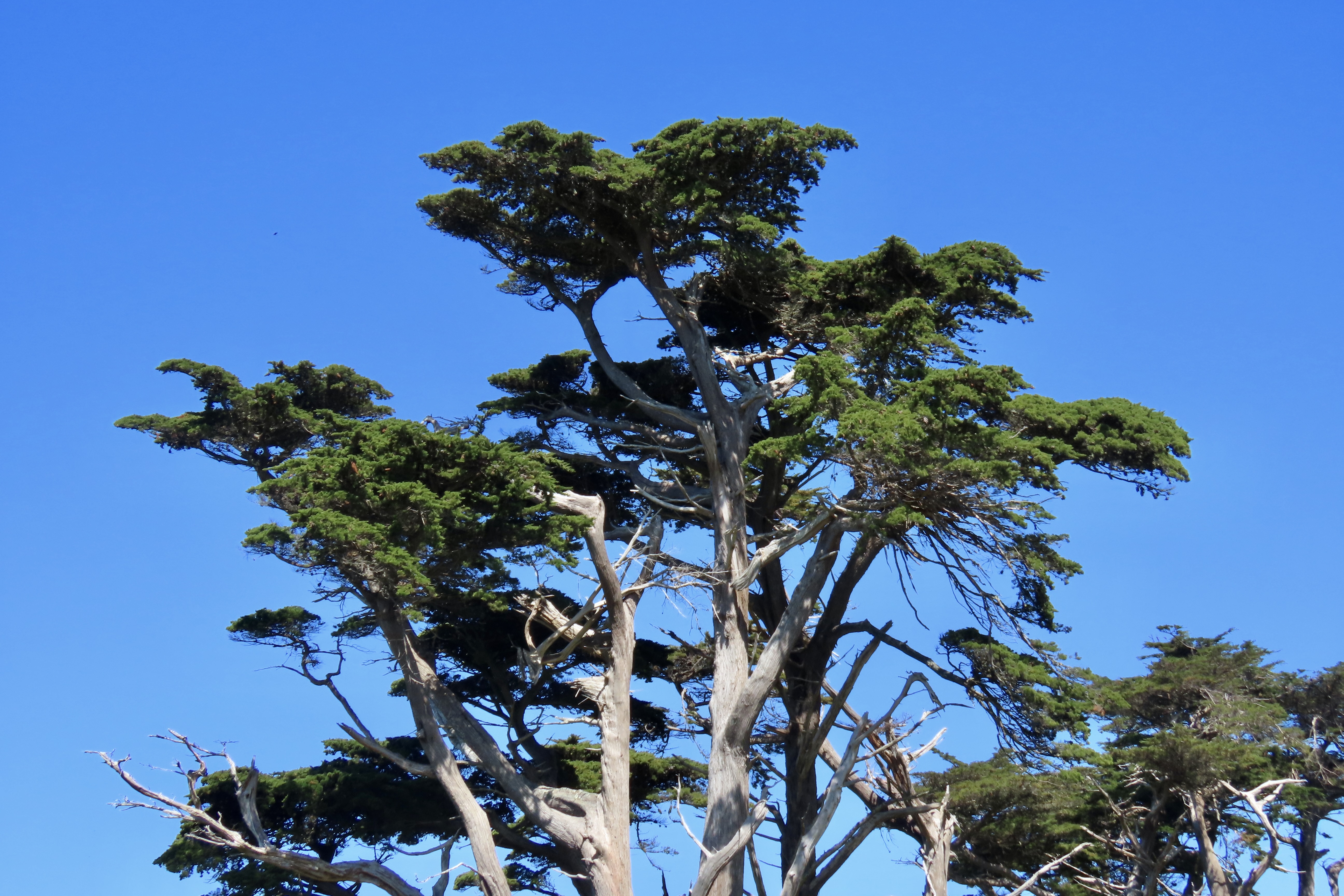
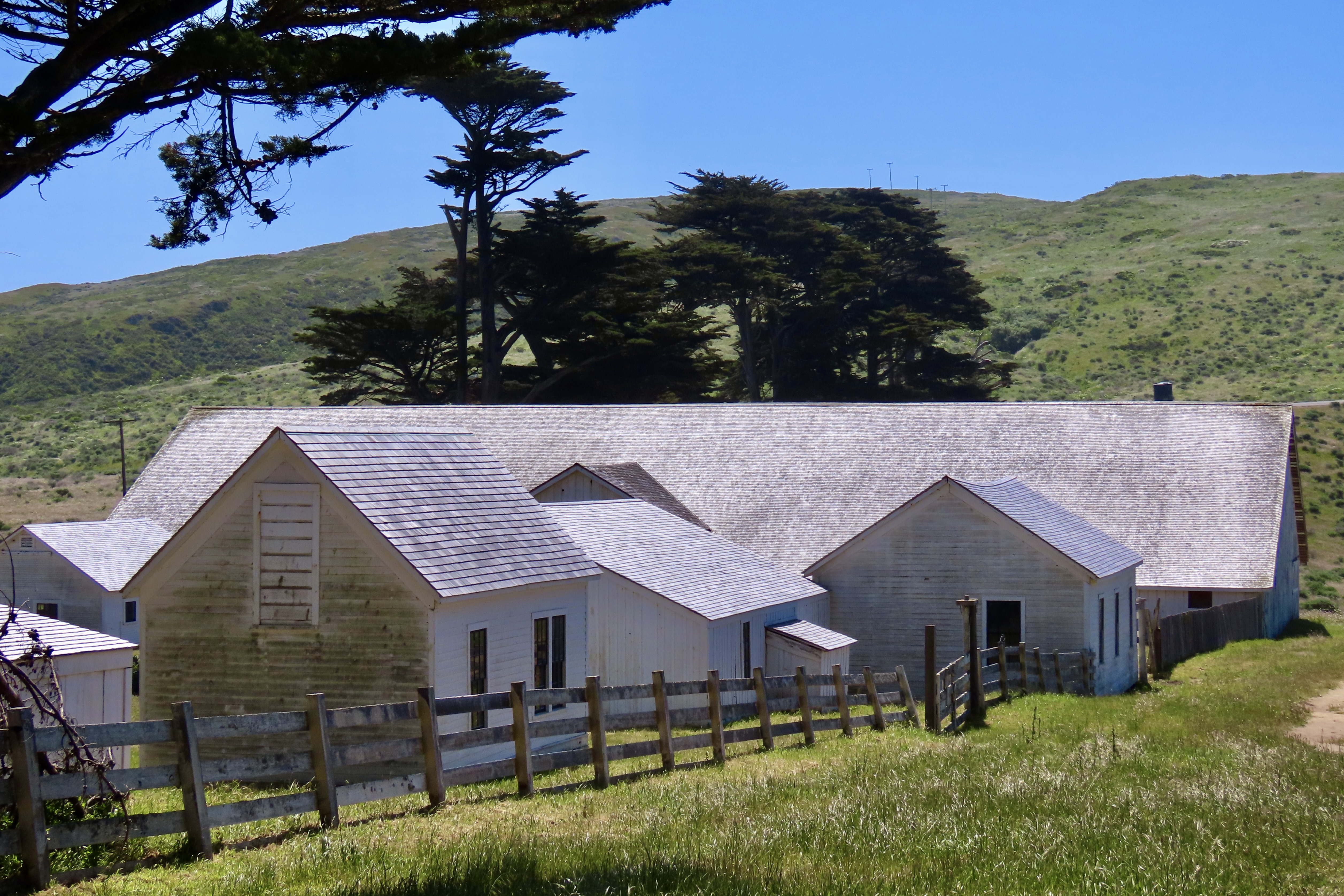
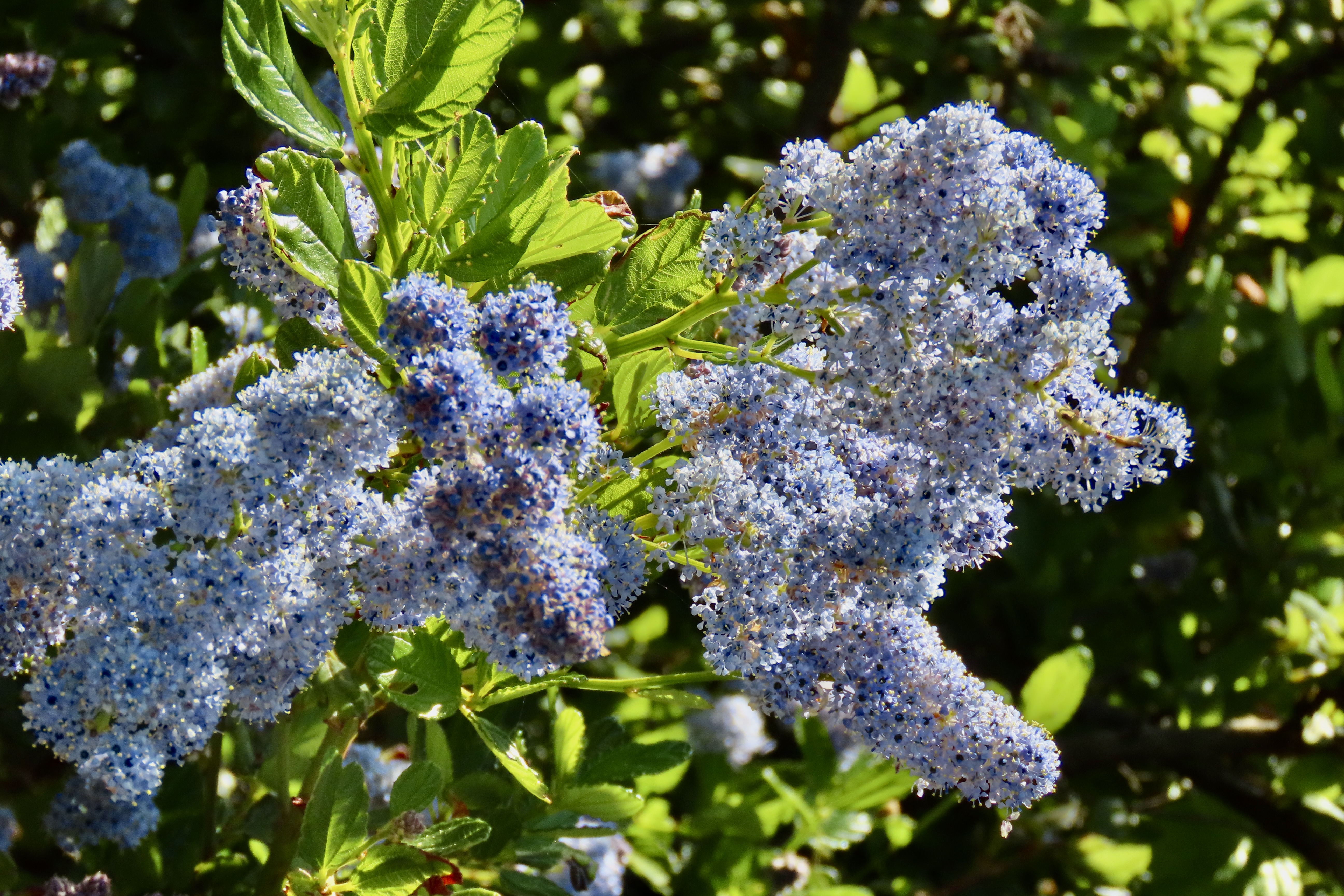
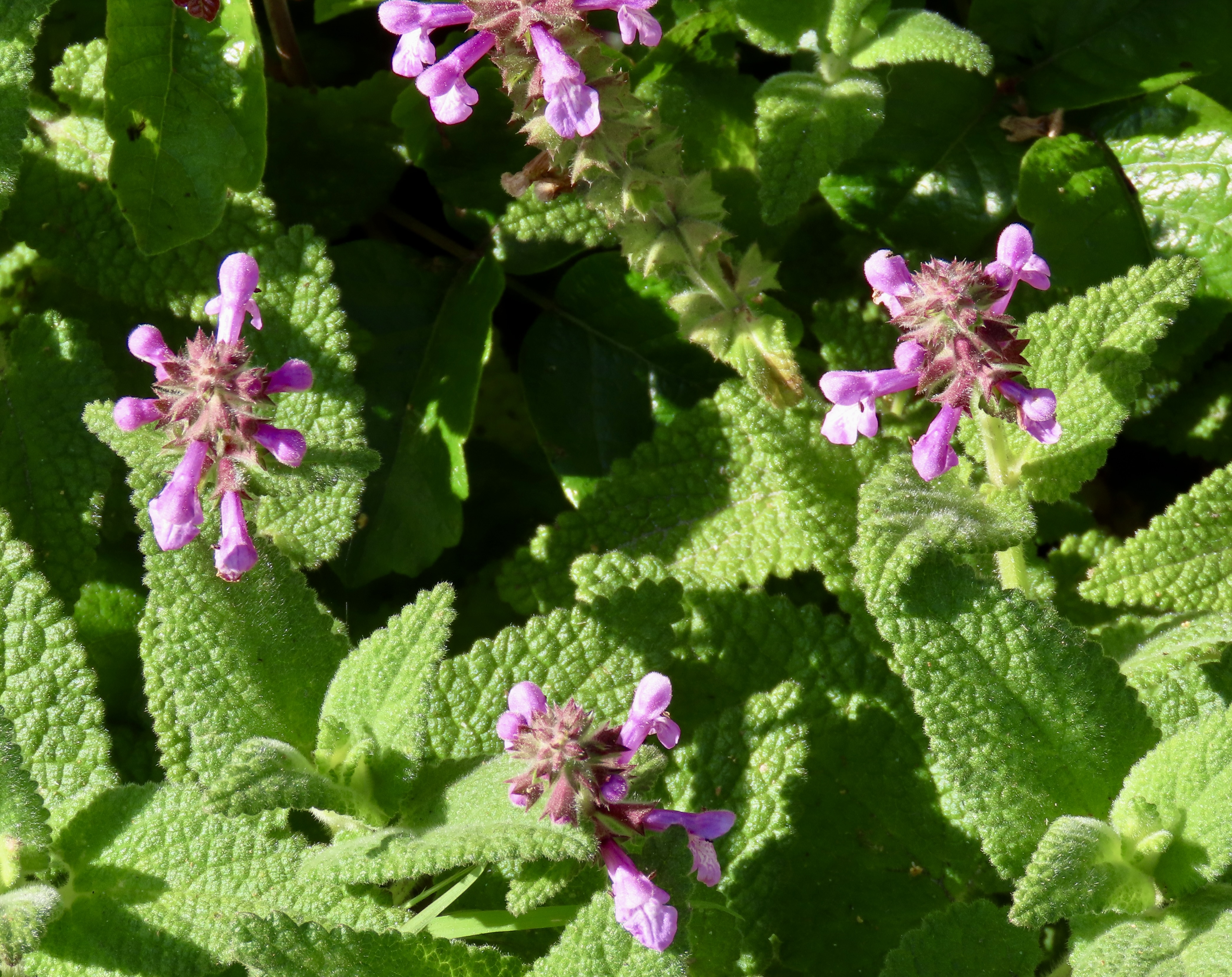
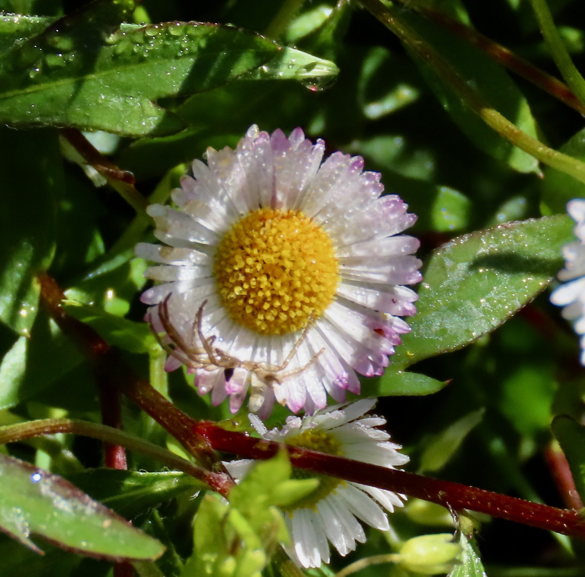
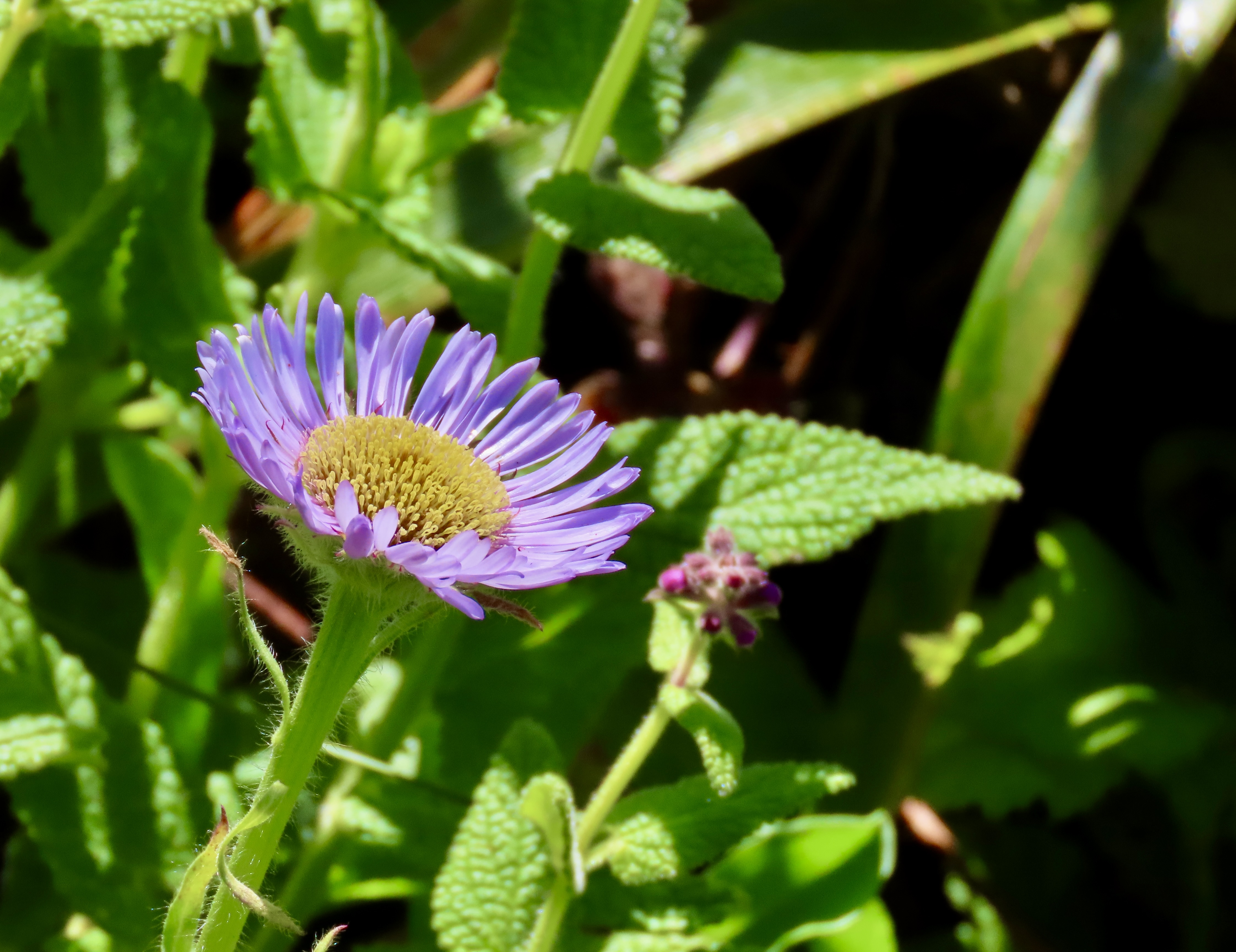
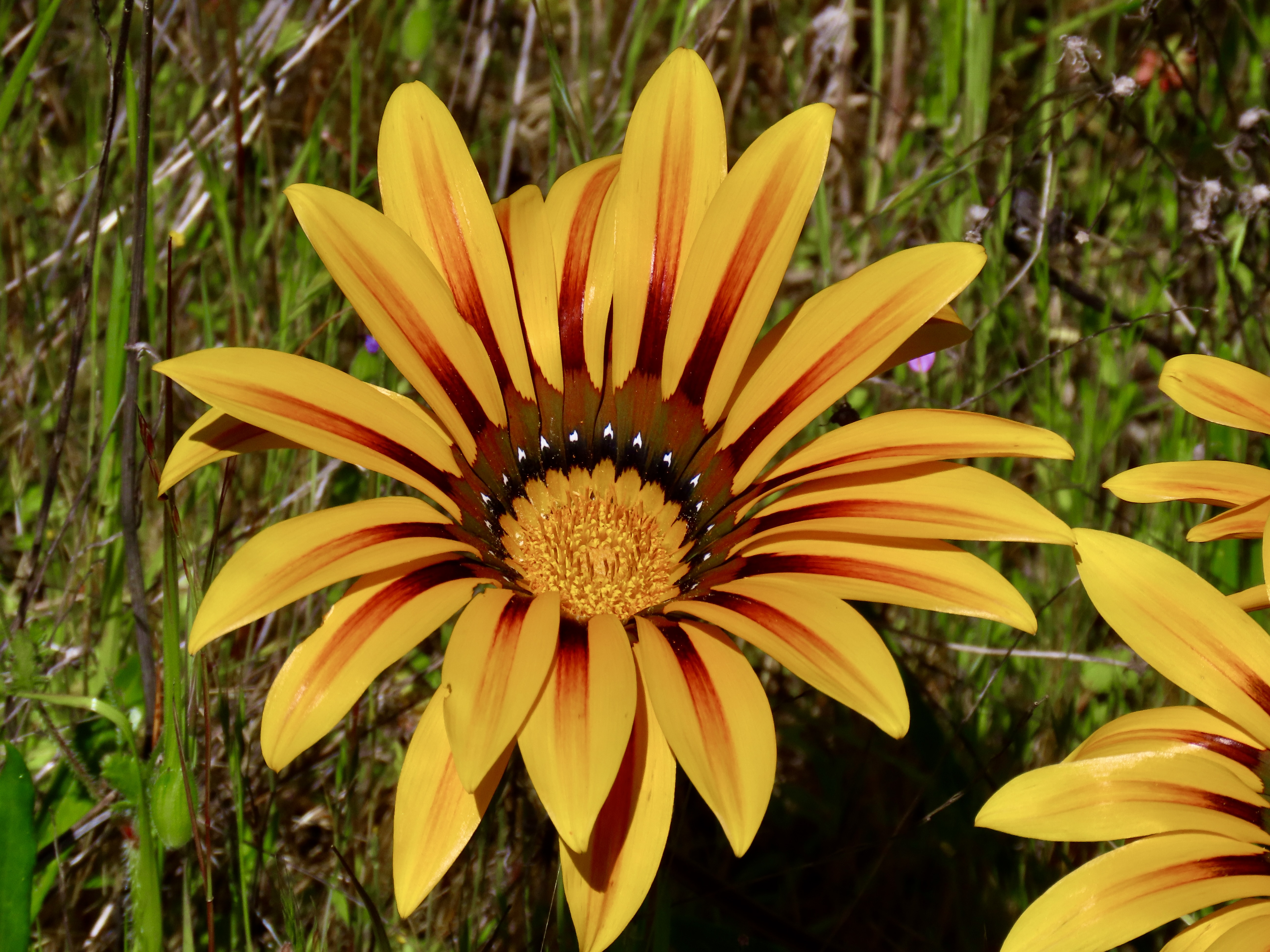
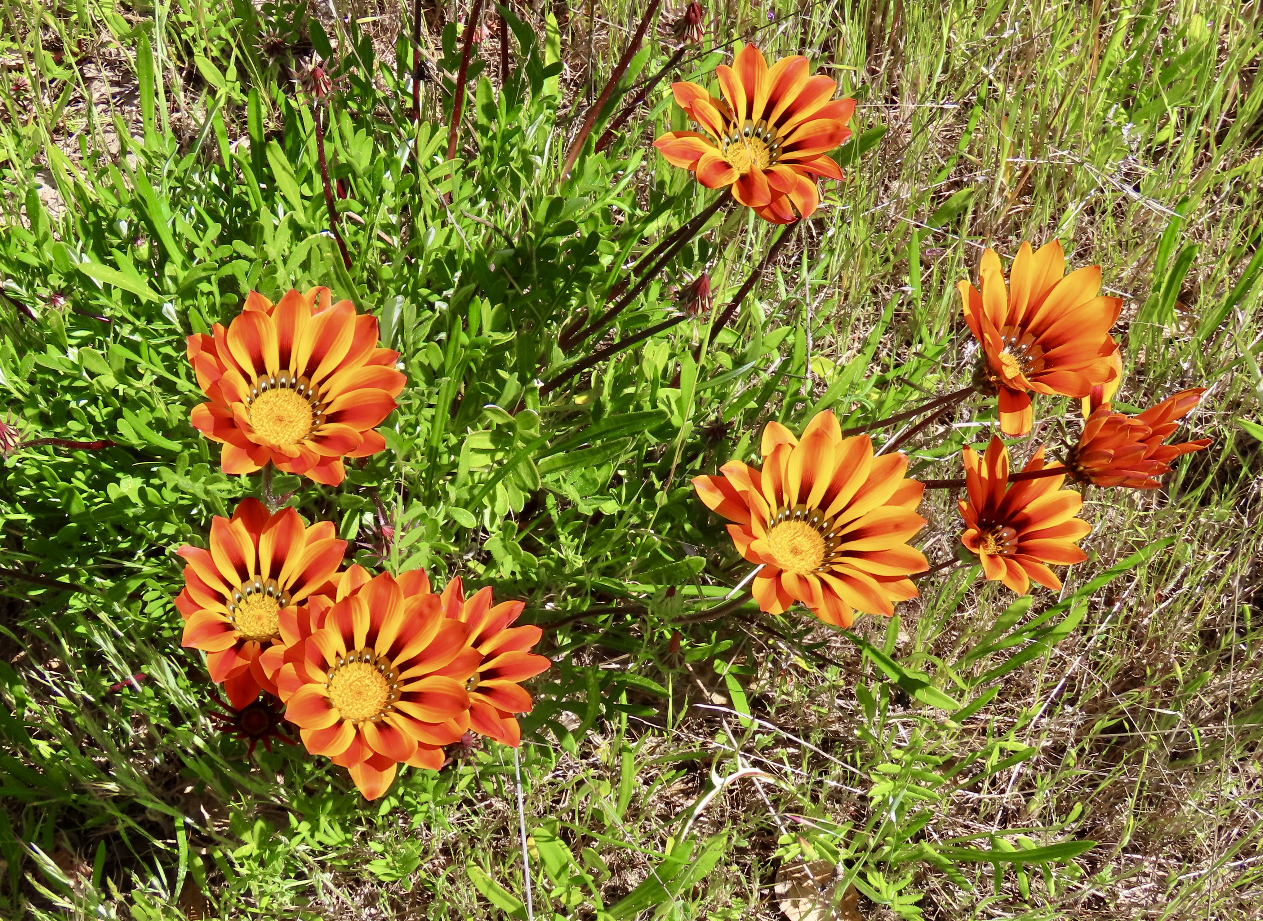
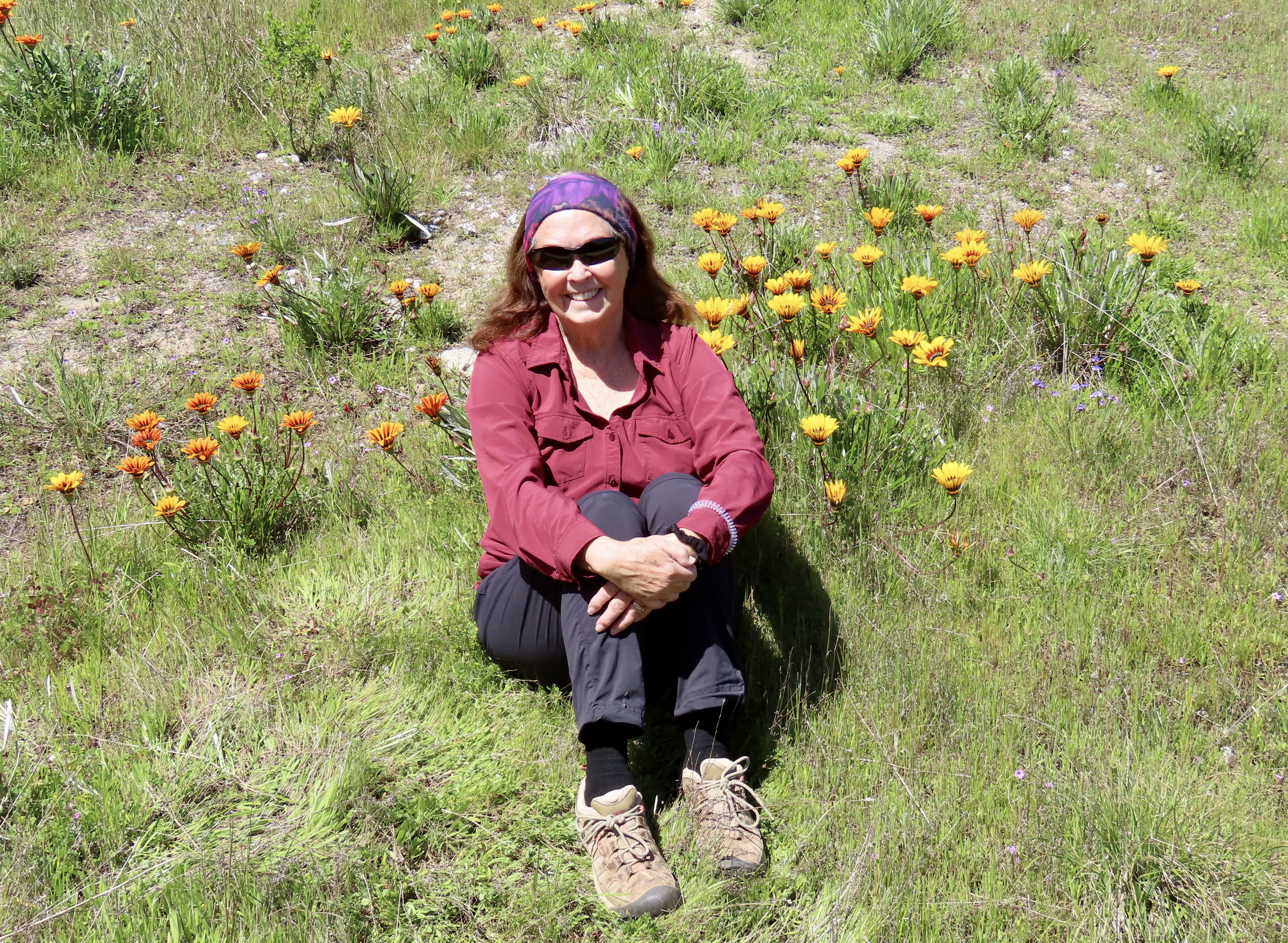
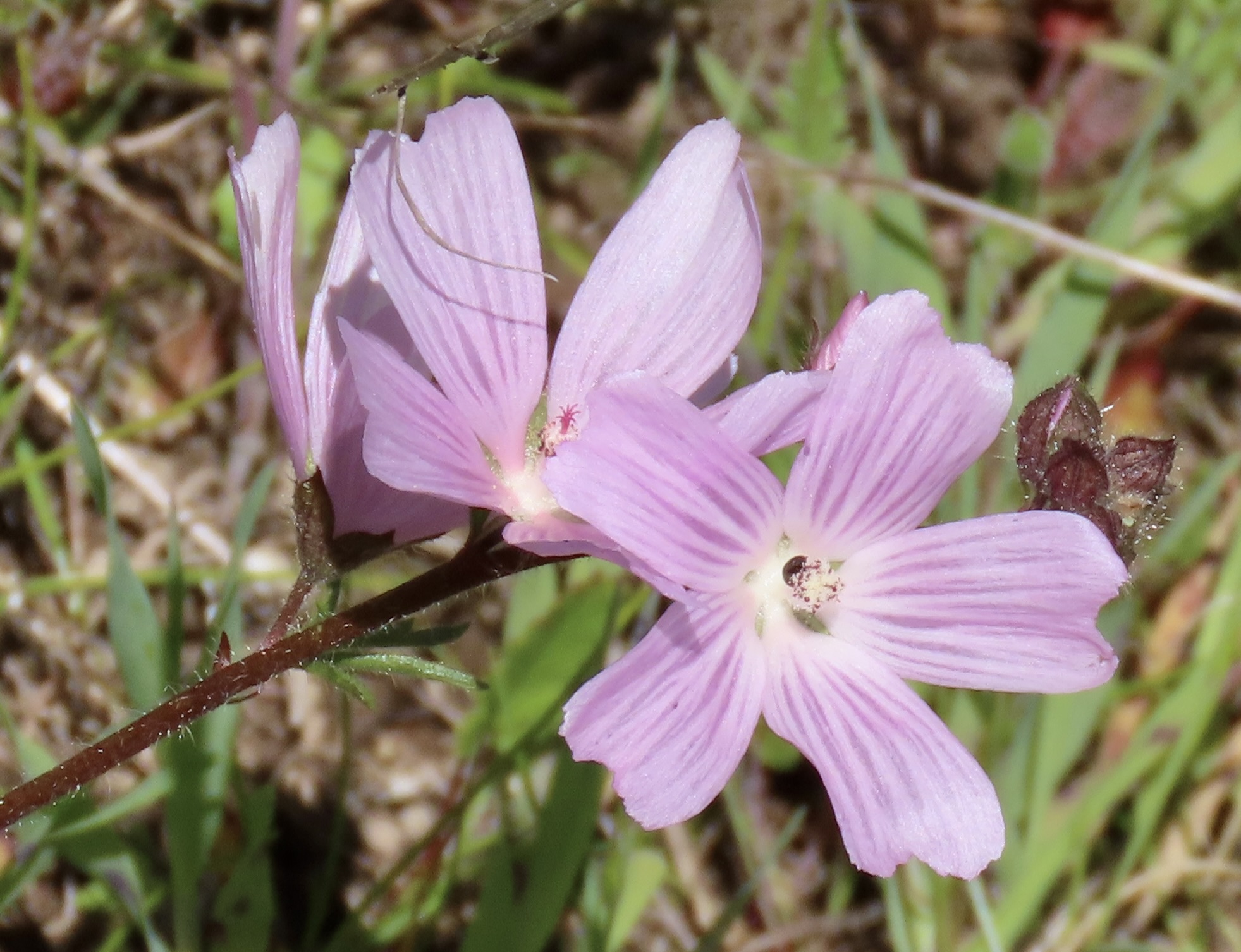
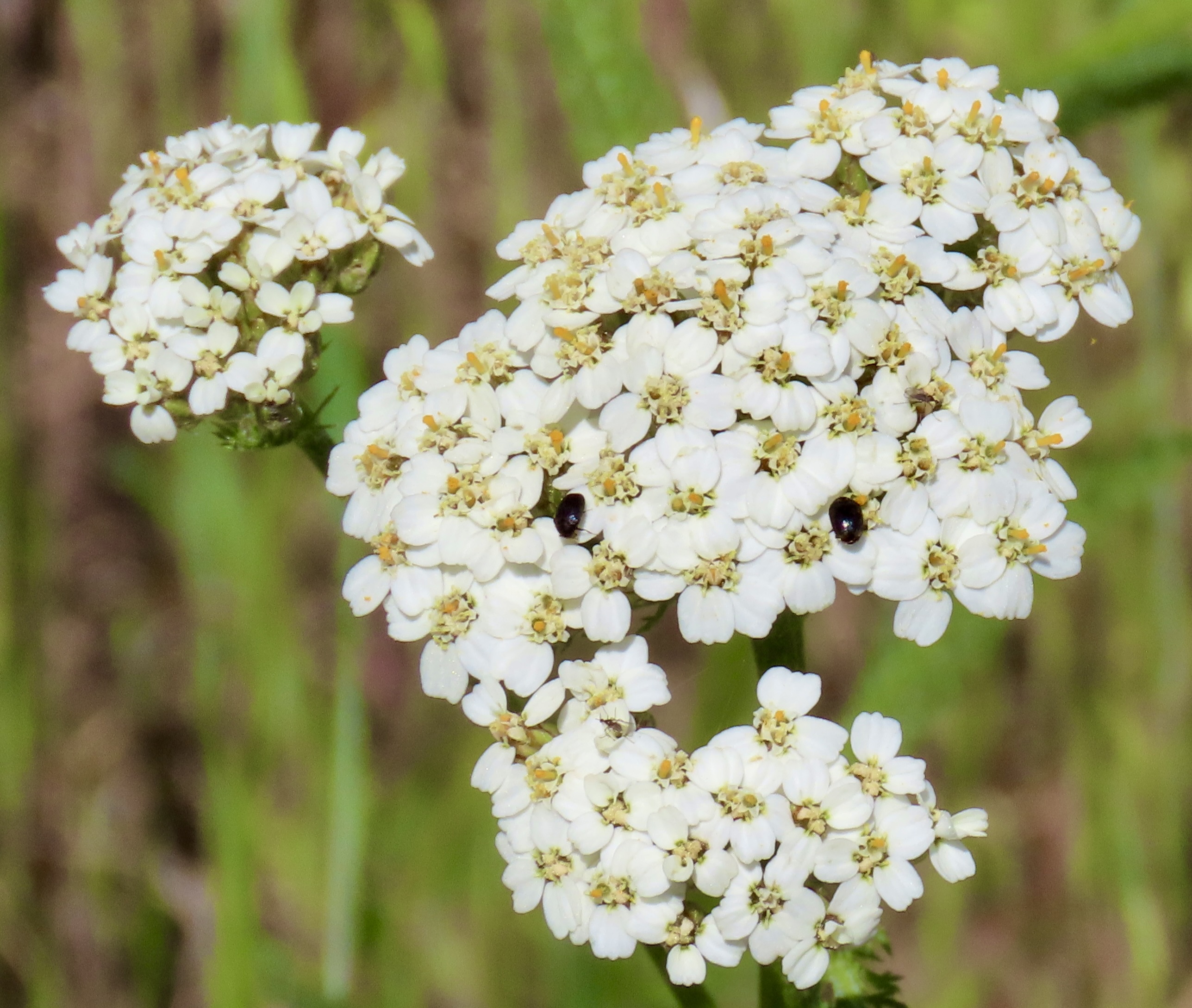
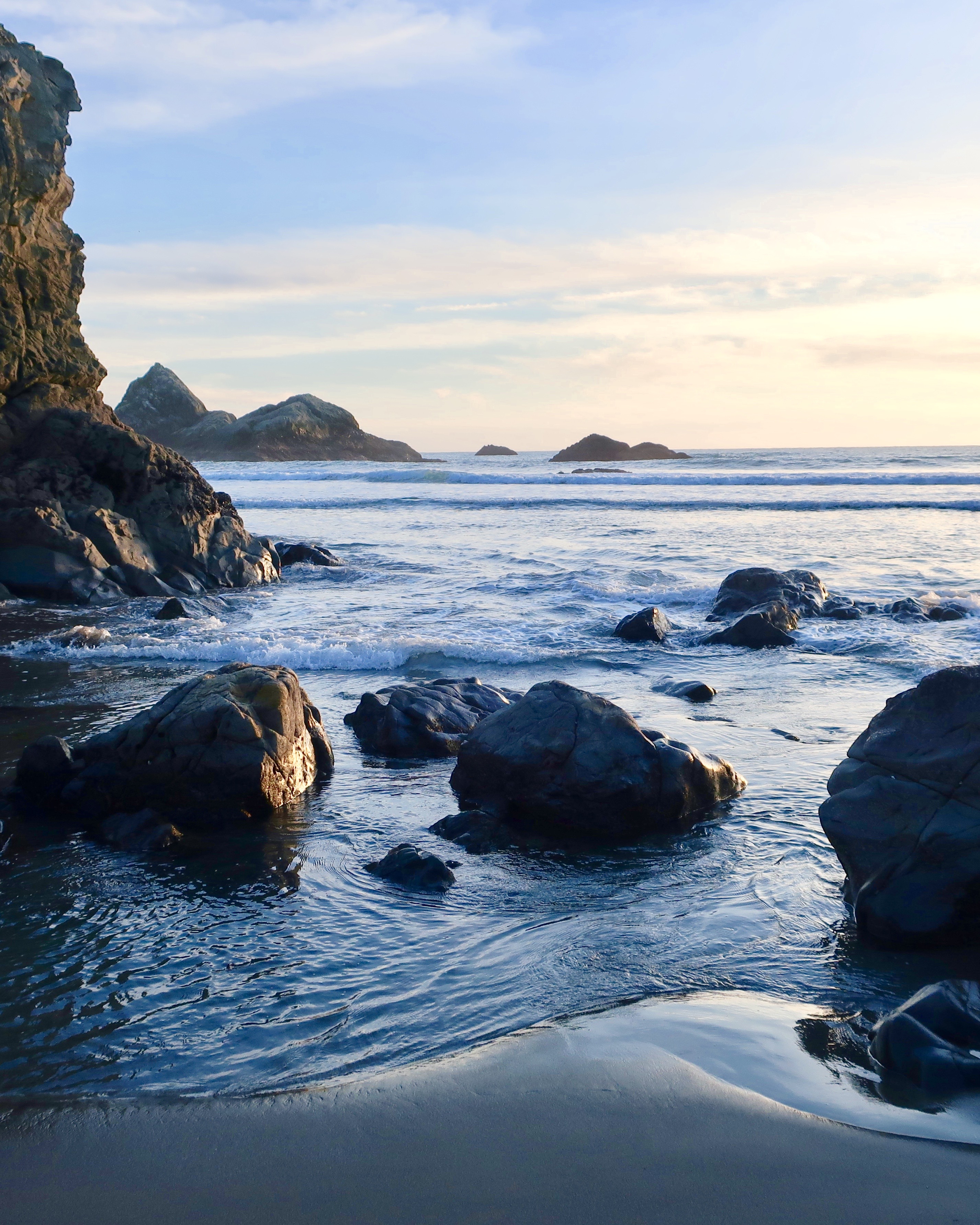
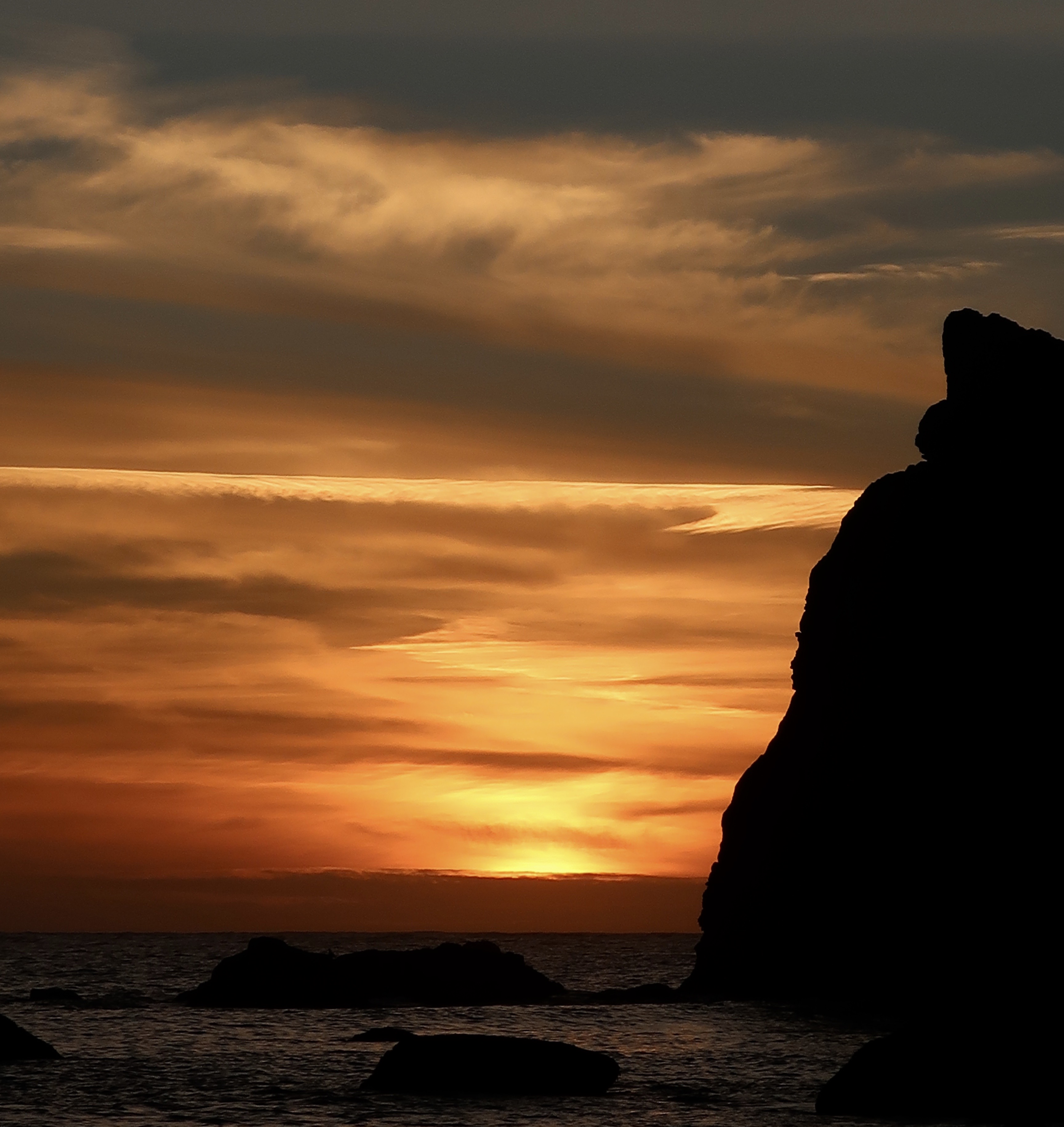
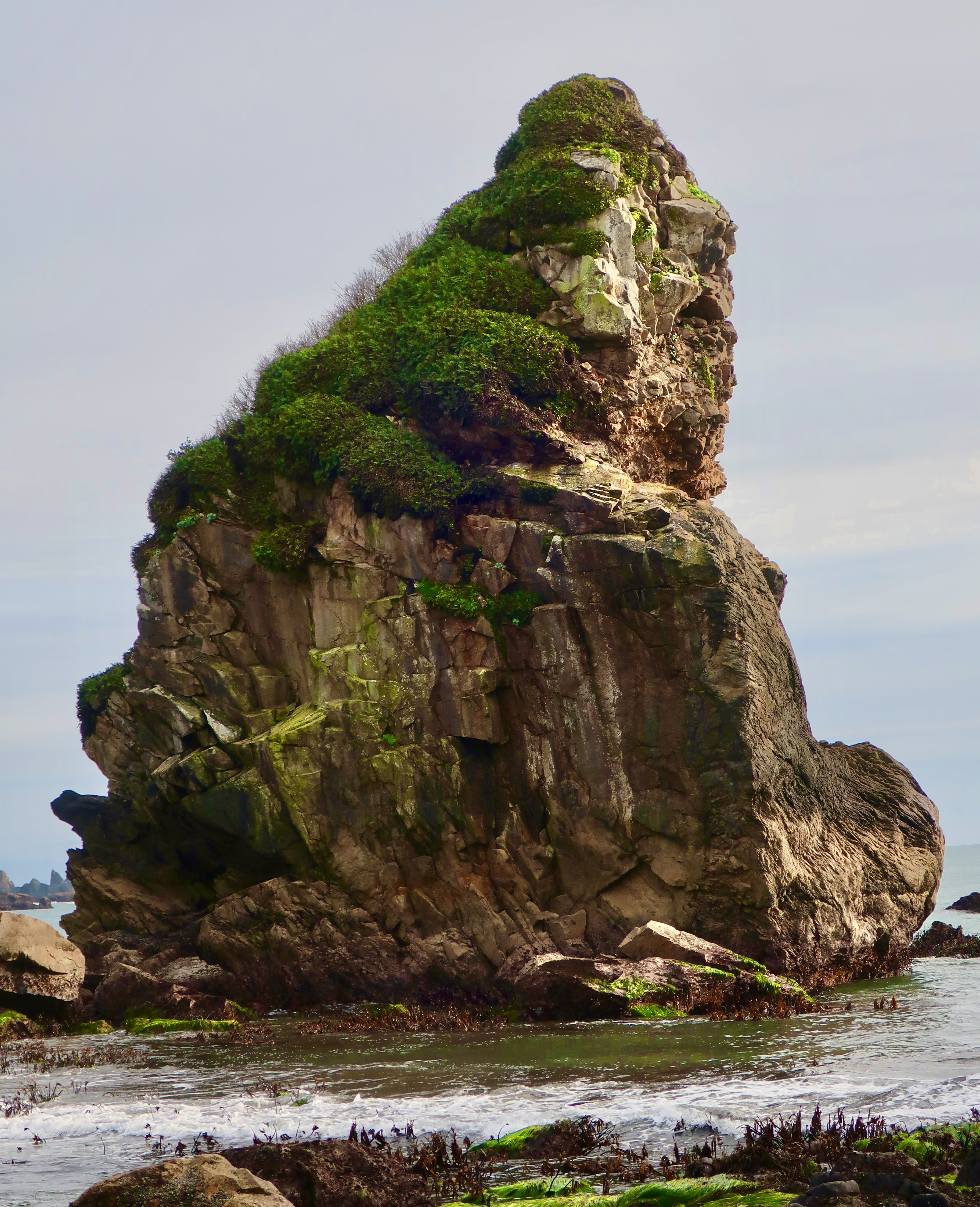
Quail eat a variety of plants and insects but seeds are always high on their list. This California quail is searching for them along the Tomales Point Trail.He stopped to check out a small stick.The wind added an interesting look to the quail as it came down the trail toward us.A feather dancer, perhaps. This is the time of the year when quail pair up. The hen, who had been searching for food in the grass, joined her mate. This shot provides a good view of the contrast between the male and female. Both are attractive. Soon they will have a clutch of eggs that can number up to the high 20s. It will be well hidden in the grass. When the babies hatch, it becomes the male’s job to serve as a guard. I’ve often watched one perched in a location that provides a view of the surrounding area. A quick call sends mom and babies into hiding when a threat appears. The chicks get “Freeze!” I once came on a group in the Marble Mountains of Northern California that had ‘froze’ on the trail in a tight little circle. While I was grabbing my camera, Mom realized her mistake and called “Run!” Boy, did they. In every direction.Meanwhile, back at the ranch (so to speak), a covey of quail had gathered. Except during mating season, this is the preferred lifestyle for quail. When frightened their first reaction is to run. They are fast! The next step is to zoom out. The sound that their wings makes is very distinctive, as is their calls. Once you have heard either, it is easy to remember.We discovered, when we hiked out the Tomales Point Trail, that we had hit the height of flower season. Three of the most common are shown here: Yellow and pink mustard, hairy gum plant (Grindelia hirsutula), and cow parsnip.It’s hard to travel anywhere in the US without encountering mustard. It comes in a variety of colors from white to yellow to blue to purple. While I don’t find the individual flowers particularly attractive compared to many others, a field of mustard can brighten up one’s day. Not so a dairy farmer’s, however. The plant is mildly poisonous to cattle. It can also give a bad taste to milk, cream, butter and, I assume, cheese. On the other hand, its tiny seeds produce mustard.Hairy gum plant hardly seemed the appropriate name for these cheerful yellow daisies.The real surprise to me, however, were the cow parsnips. The cow parsnip is a fairly common plant, a giant member of the carrot family. I’ve always admired them for their size, but I’ve never thought of them as particularly beautiful, until this trip.Nor have I ever noticed how they come wrapped up as young plants.Part of this cow parsnip is in bloom, while other parts are in the budding stage.Budding and blooming are combined here. In full bloom. While quite pretty and presumably edible (if you know what you are doing), I would neither pick this flower for a bouquet nor eat it. Sap from the stems is known to be phototoxic. If you get some on your skin, sunshine can turn it into a severe rash. While I was focusing on flowers, Peggy was capturing some of the impressive scenery. This is looking out toward Tomales Point. The Pacific Ocean is on this side of the peninsula. Tomales Bay is on the other. The Bodega Bay Headlands can be seen in the distance. Sea stacks that tower above McClure Beach. I really like the contrast here between the ocean and the grass with the massive rocks providing separation between the two. Here, Peggy caught the iconic cypress trees at the start of the Tomales Point Trail at Pierce Ranch.Tree tops.I took this photo because I was enamored with the rooftops. The large building once served as the dairy barn. The other buildings served a variety of purposes ranging from bunkhouses to where the butter was made. More cypress provide a backdrop for the barn.Tom and Lita were with us on our first trip out to the Pierce Ranch. The skies were threatening rain. Tom was rather taken with this single cypress tree that was peaking over the dairy barn and set off by stormy skies. I thought his capture of the barn was quite good as well. I amused myself inside by taking a photo out of one of the windows. Modern art?This might seem like a strange thing to throw into the middle of a blog on Point Reyes but Tom wouldn’t stop talking about it. I’ve know Tom in a great number of capacities during the 50 years we have been hanging out together, but somehow, I never imagined him as someone who would create a powerful, battery operated blender that you can take anywhere. Thus the name: All Terrain Blender. He designed it with outdoor activities and tailgaters in mind, but it turns out it will make an excellent addition to our RV or any area with confined space from apartments to small houses. (The top and the bottom can be flipped and fitted together for storage!) The product is now in its final stages of development. Market studies suggest that it will be very successful. It’s hard to say how successful, but one thing I know about Tom is that he will use a substantial part of any profits he makes to support good causes. That’s what he has been doing all of his life.Way off in the distance, you can see a tiny figure. That’s me, searching for elk. When we visited the ranch with Tom and Lita, the elk were hanging out beside the road and our only camera was our iPhone. When we came back with our good cameras, they were off in the far distance. Go figure. Peggy decided to stay in the truck while I went on my search.I actually found one. Its response was, “What in the heck are you doing here?” And then immediately ran off.This horse wasn’t likely to run off anywhere. We found him at a ranch on our way back to camp after visiting Pierce Point Ranch. Tom snapped its photo. Have you ever see such a swayback? That’s it for today. Our next post will wrap up our Point Reyes visit with a trip out to the lighthouse, a walk on the Earthquake Trail, and a hike to Tomales Bay.
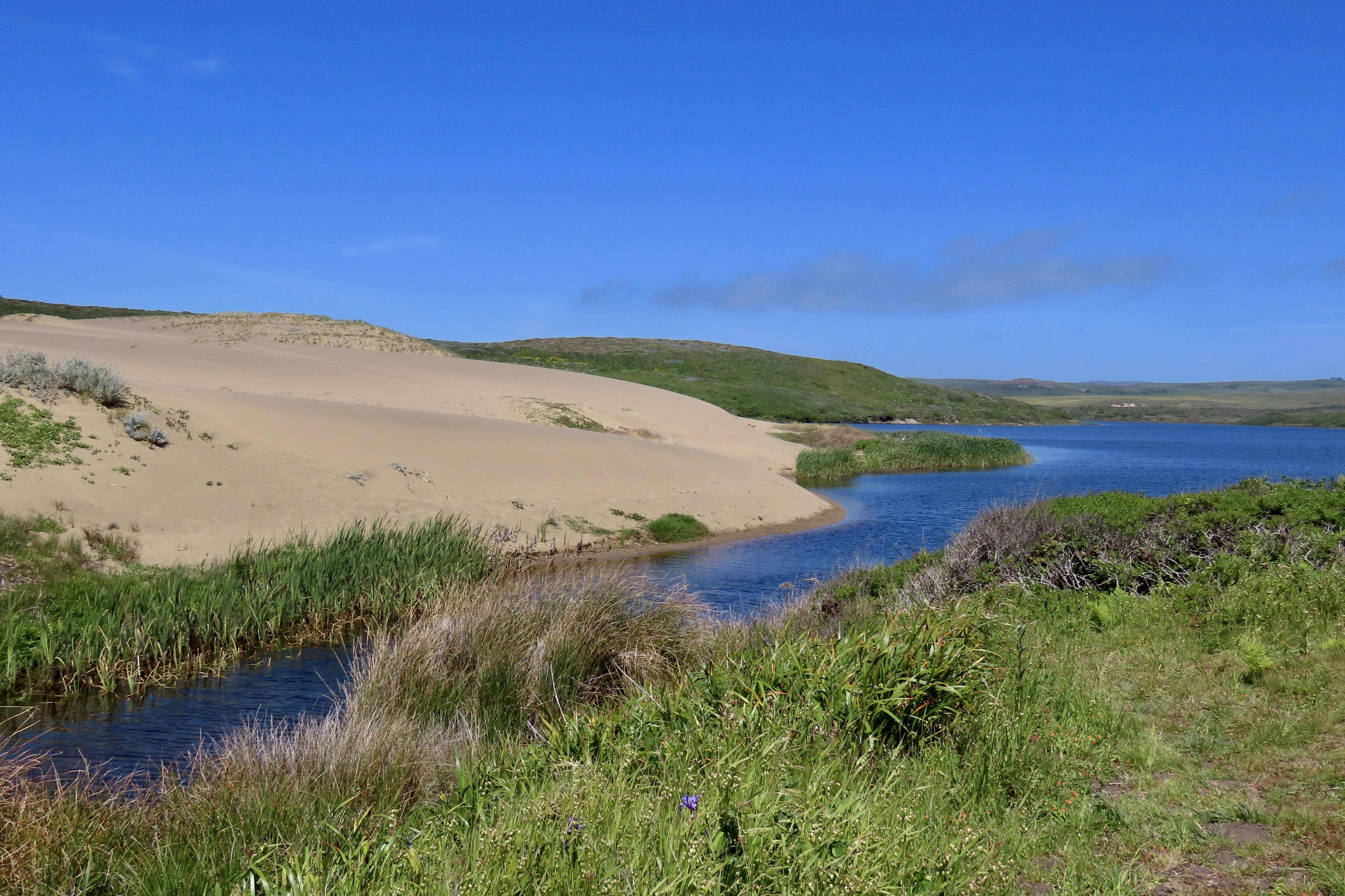
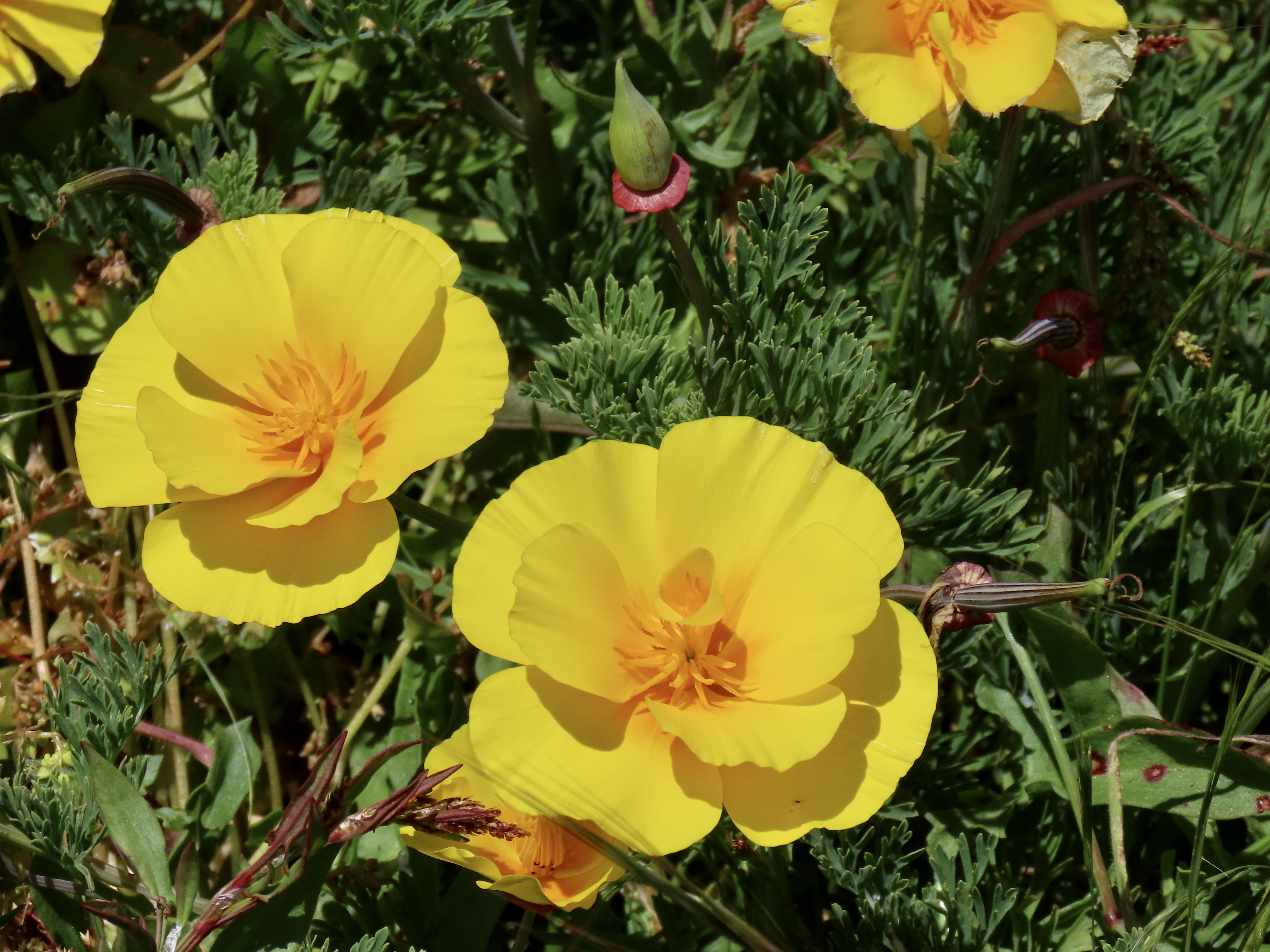
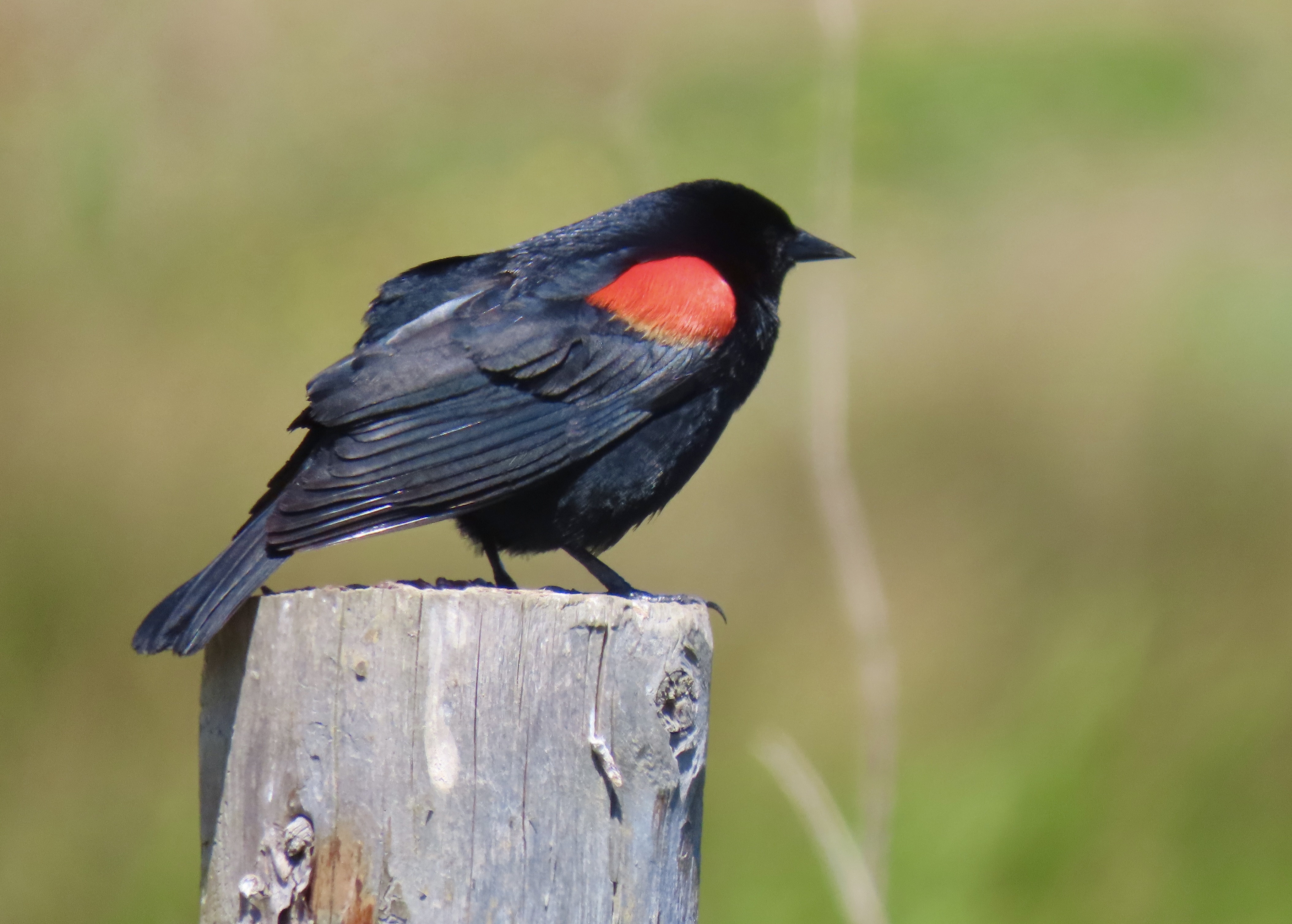
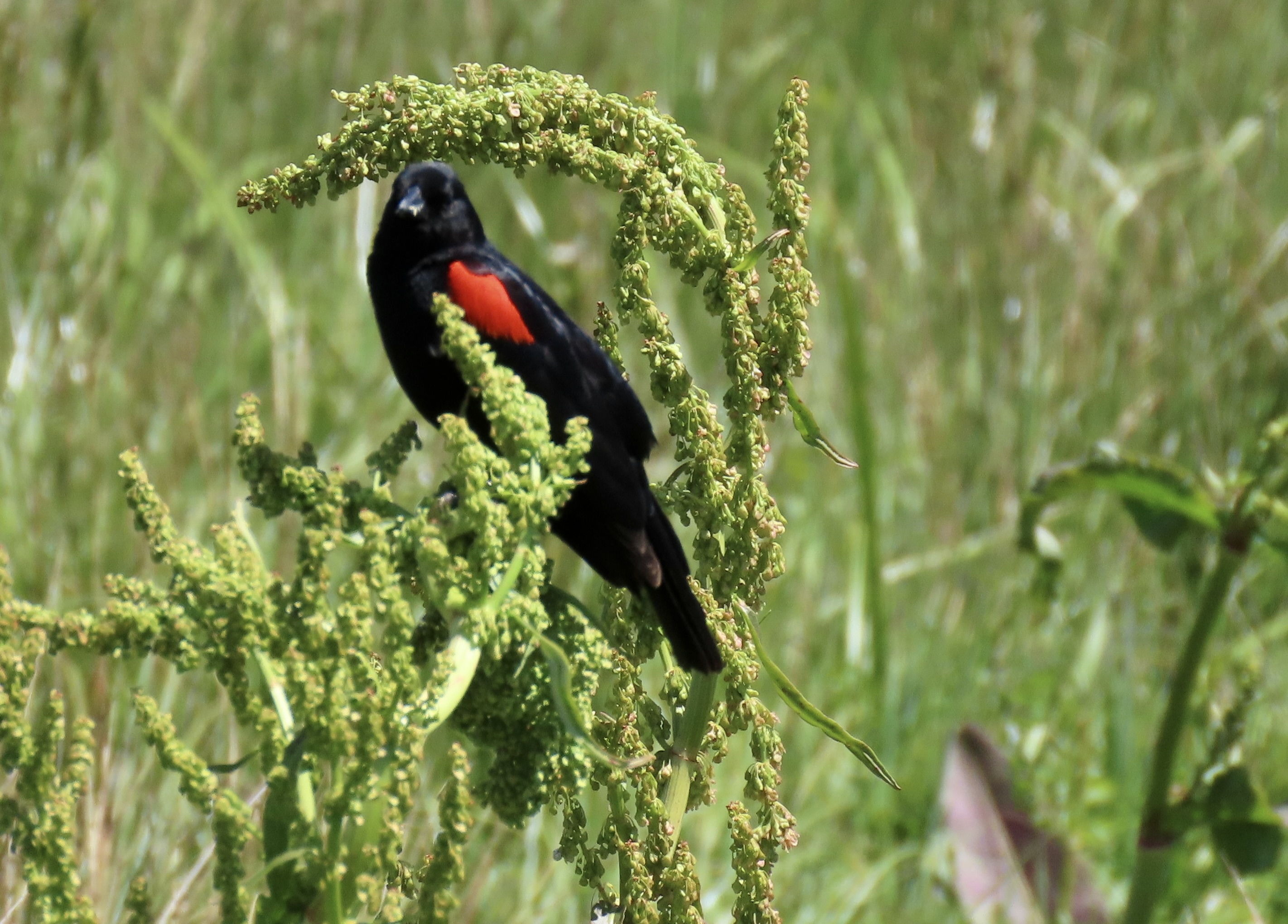
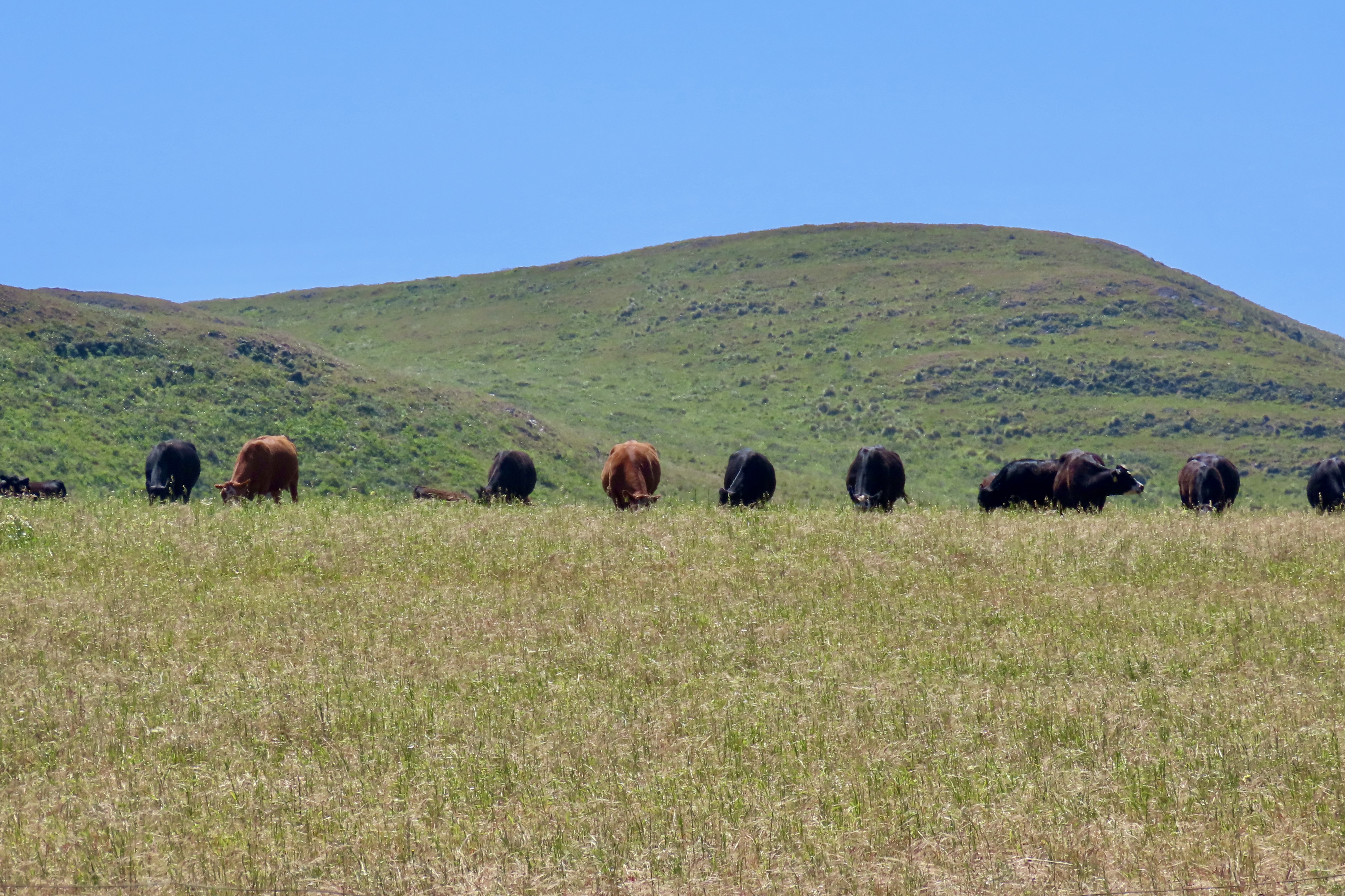
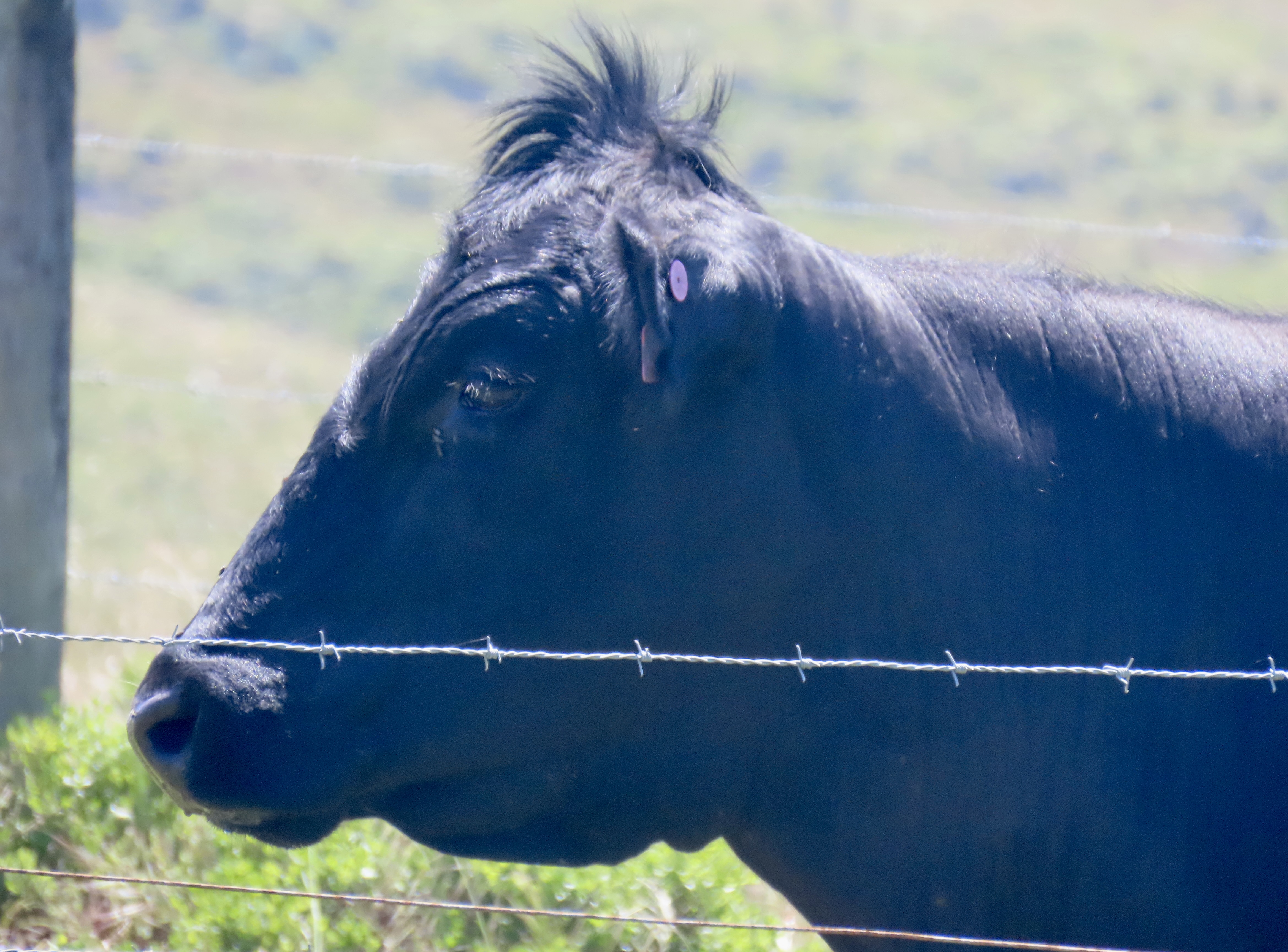
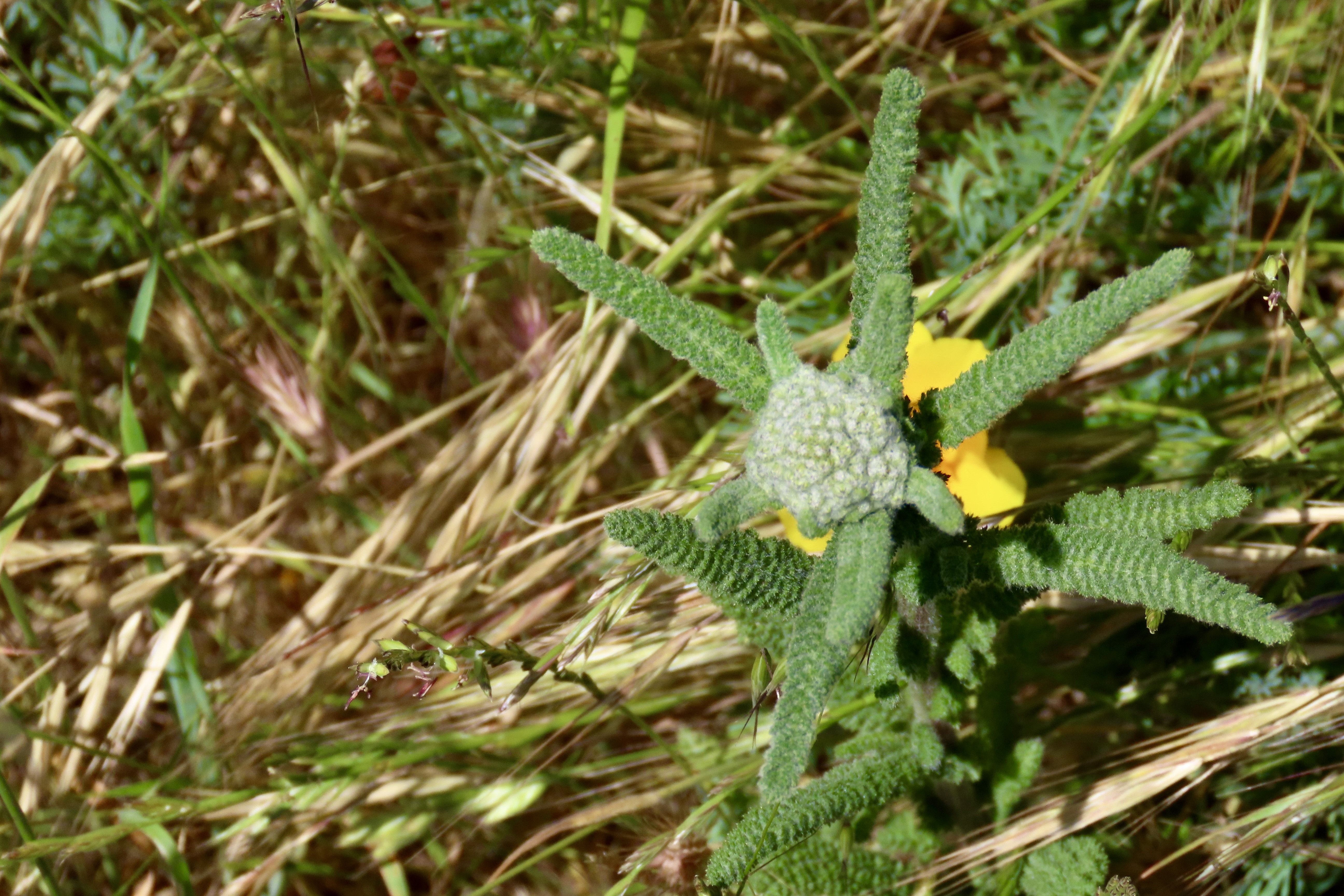
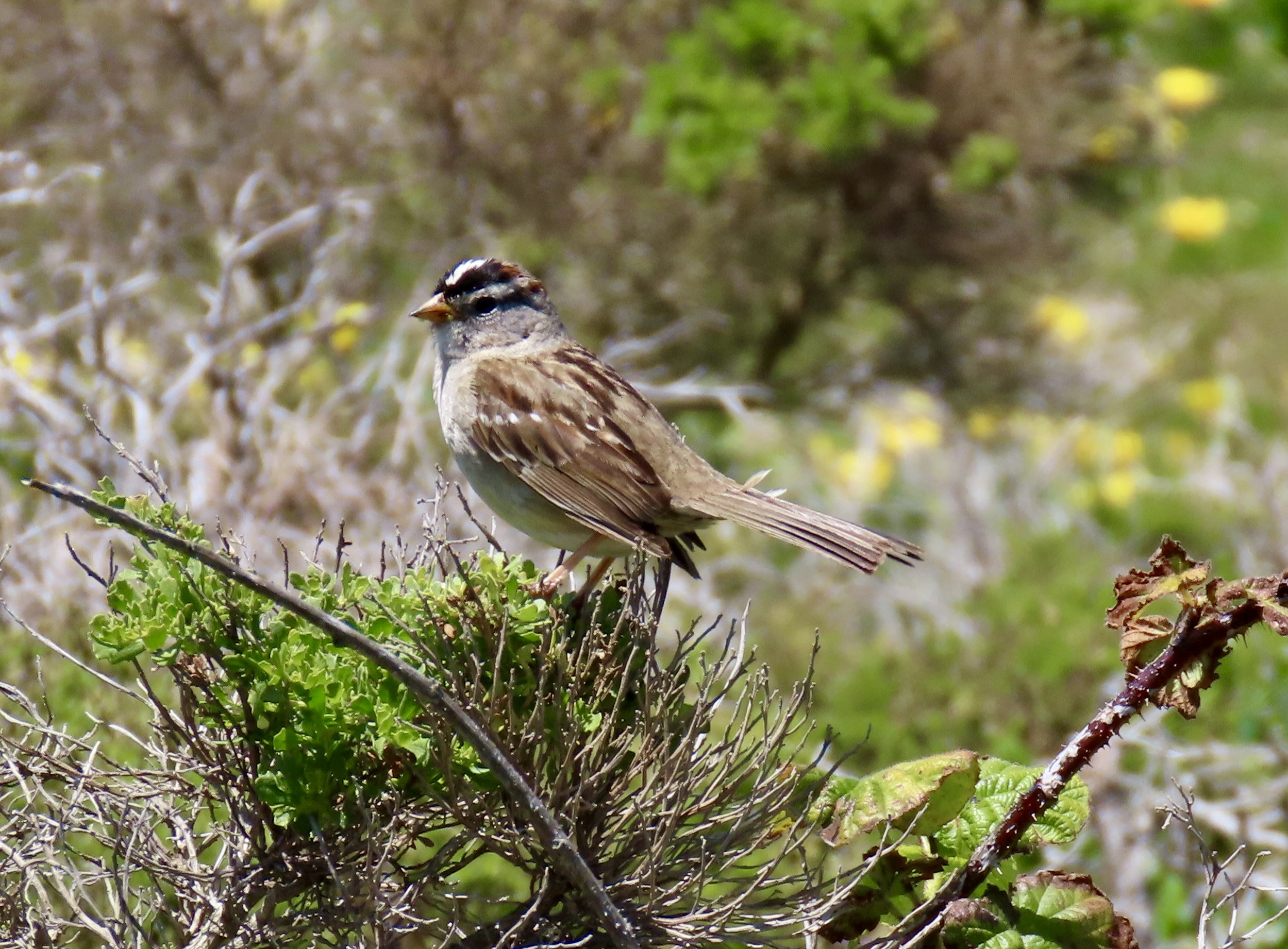
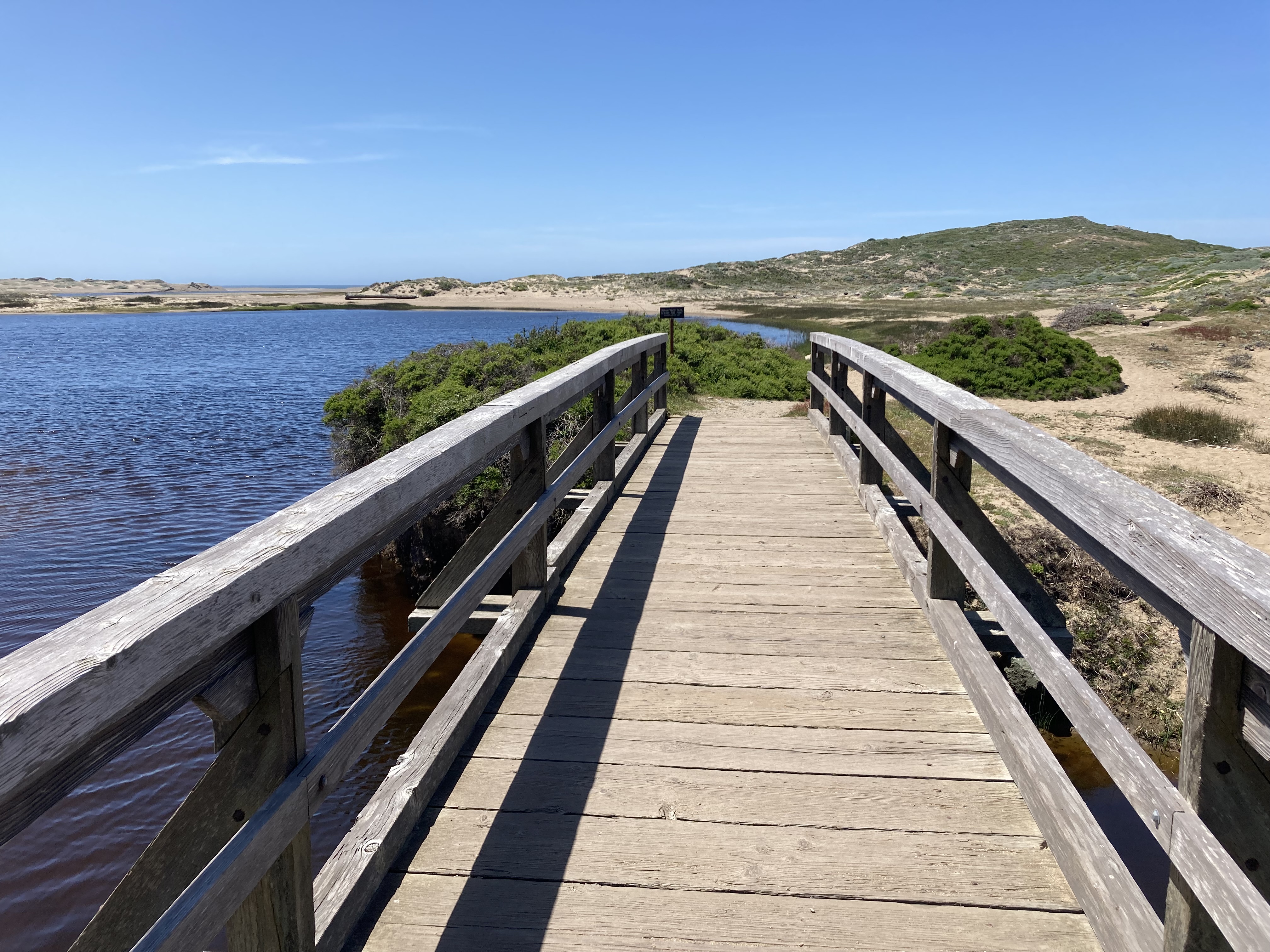
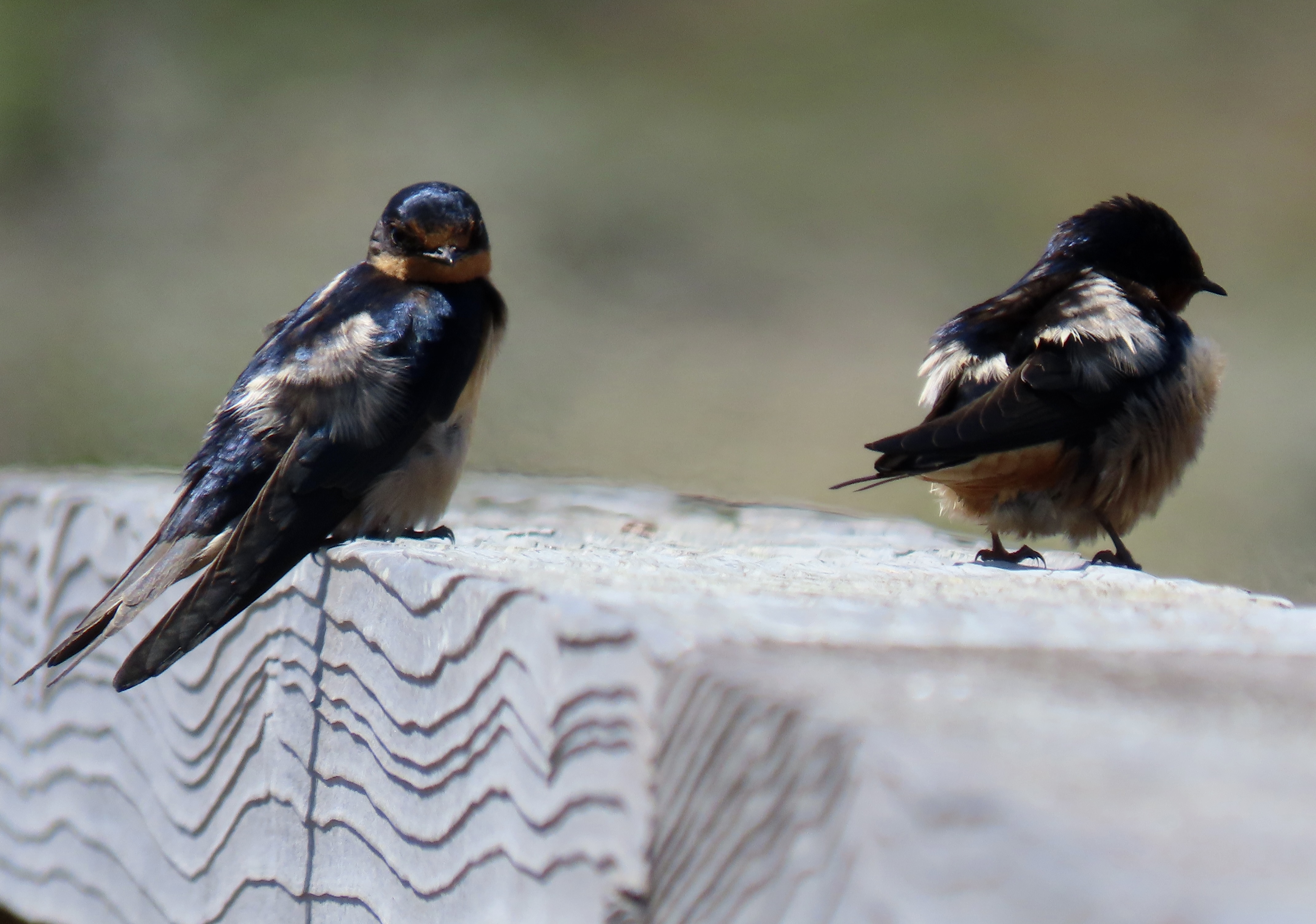
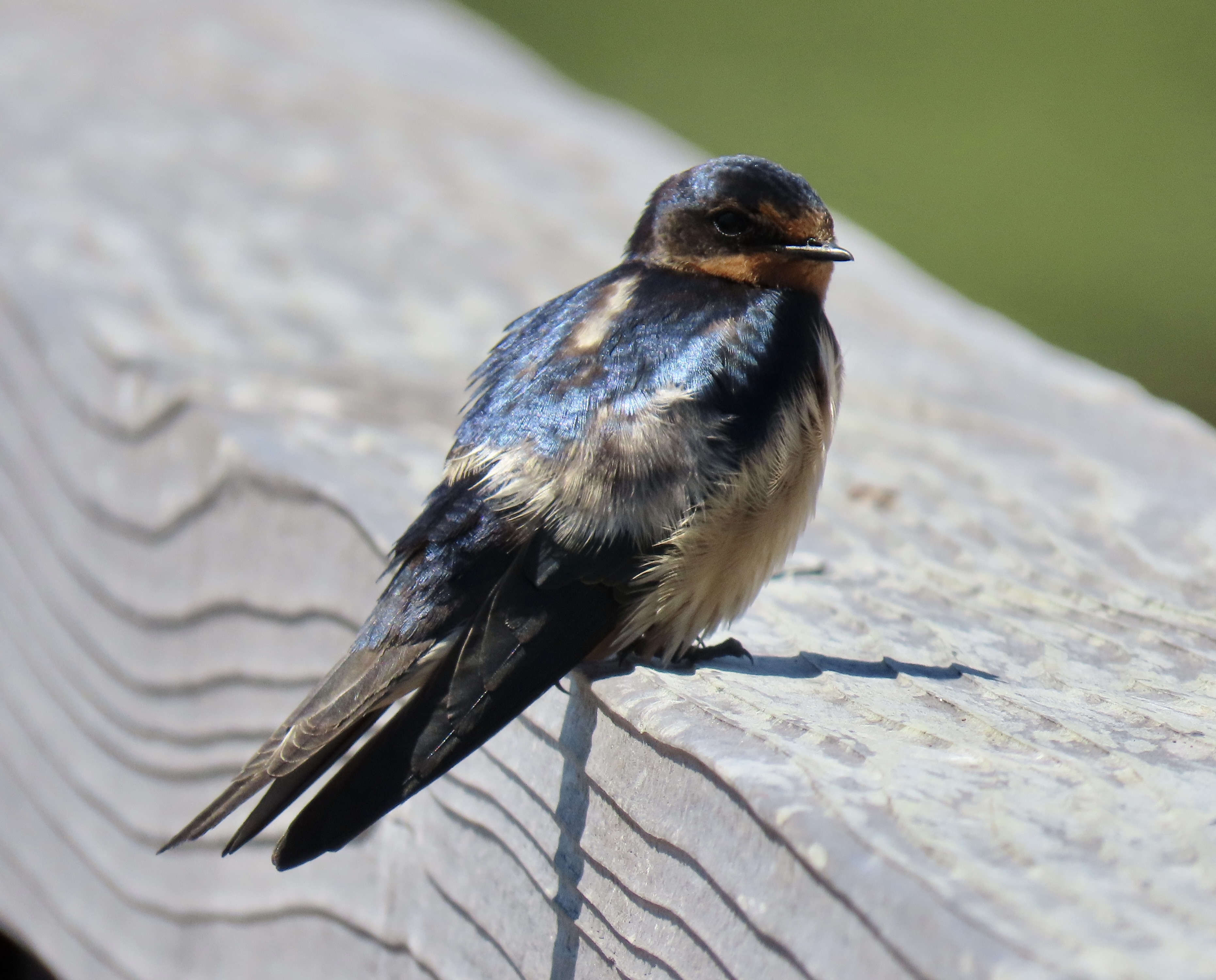
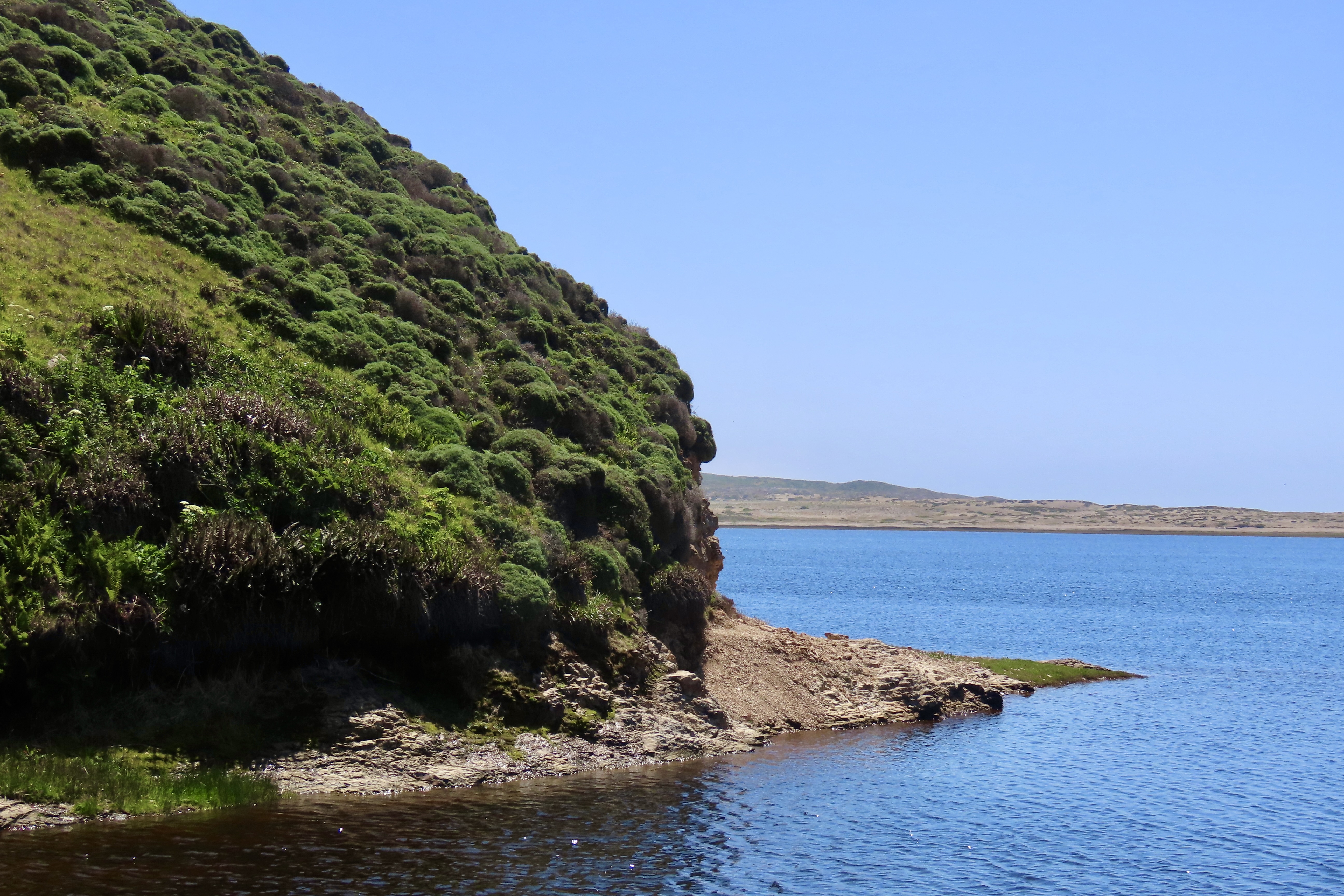
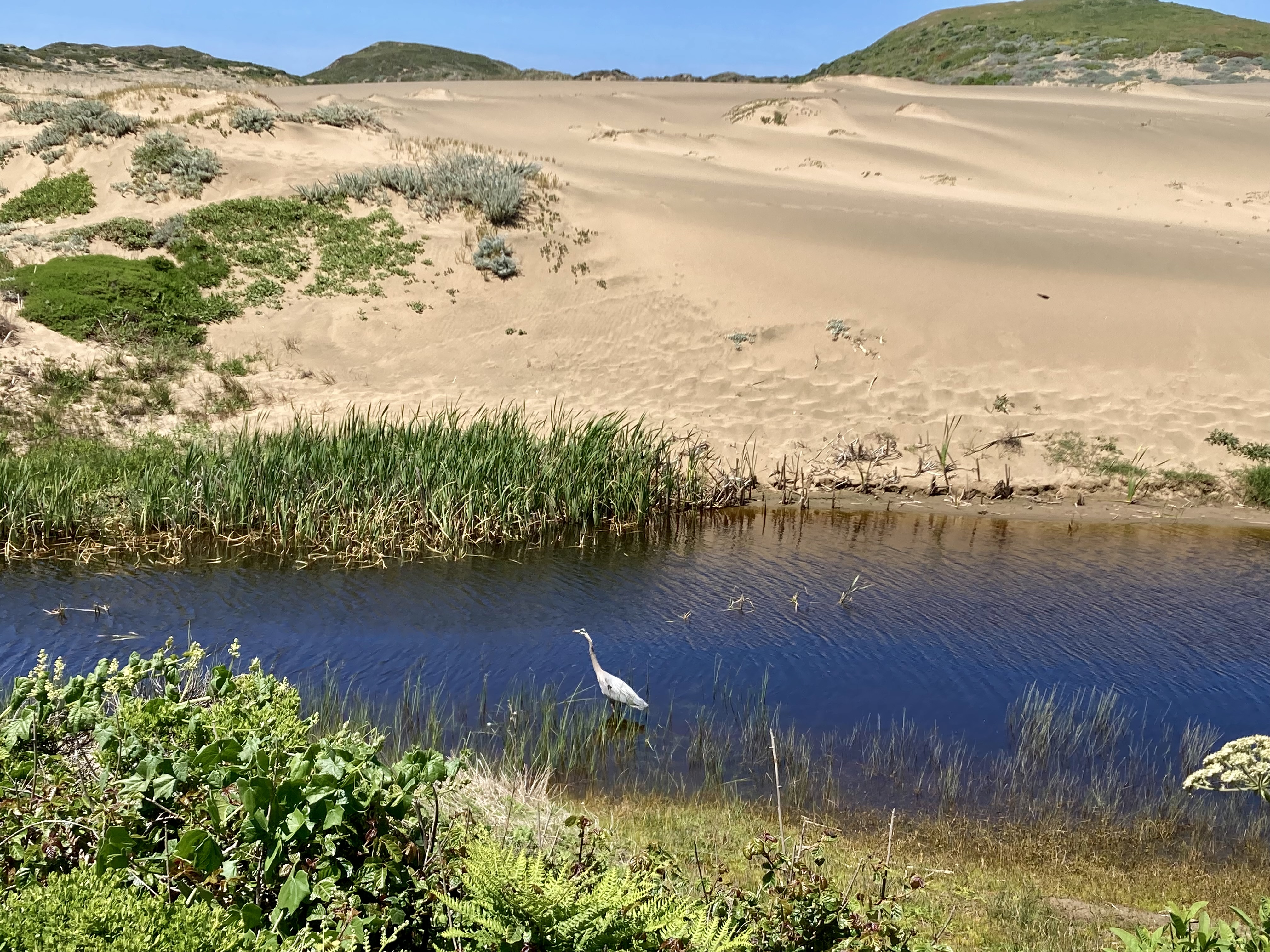
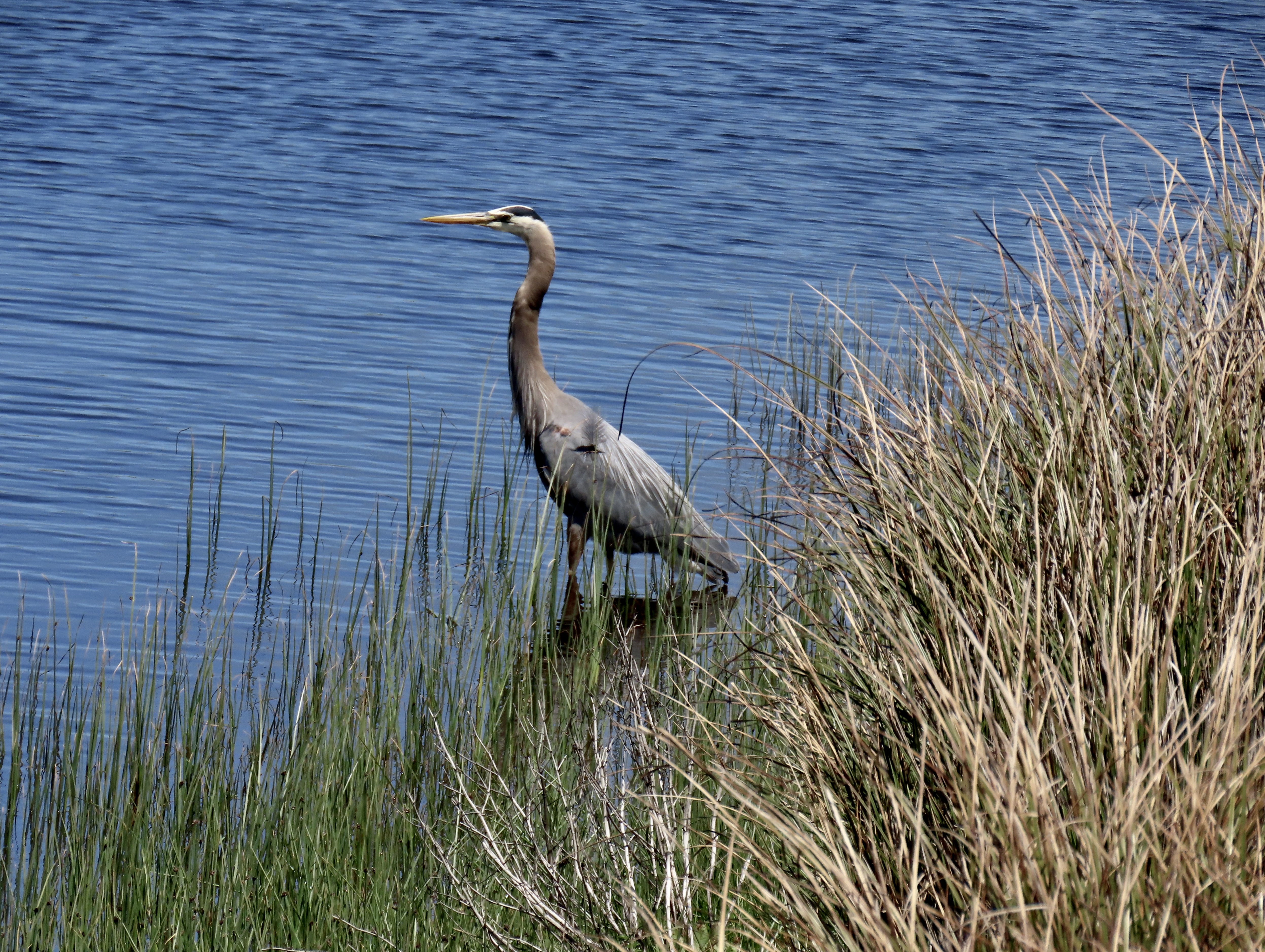
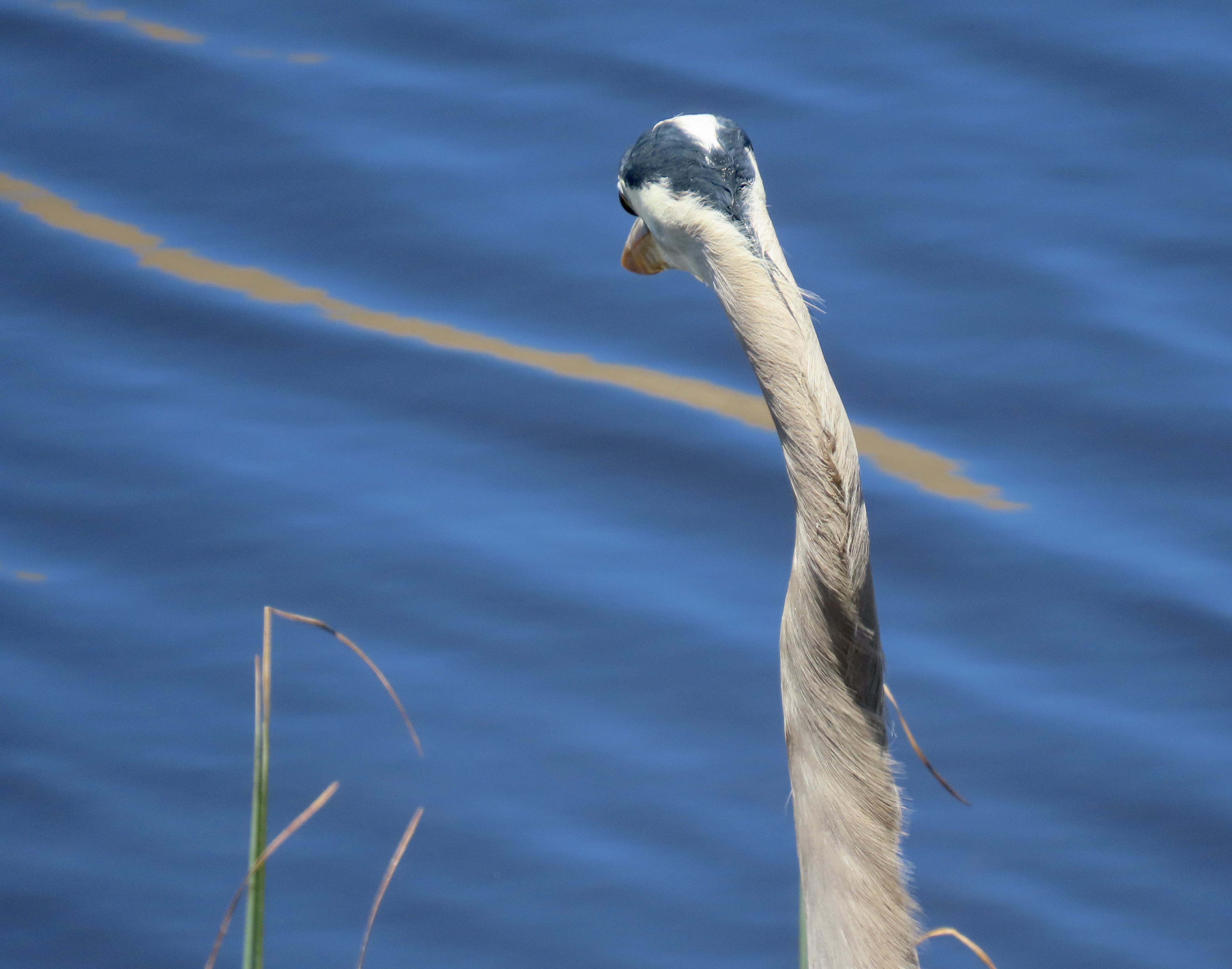
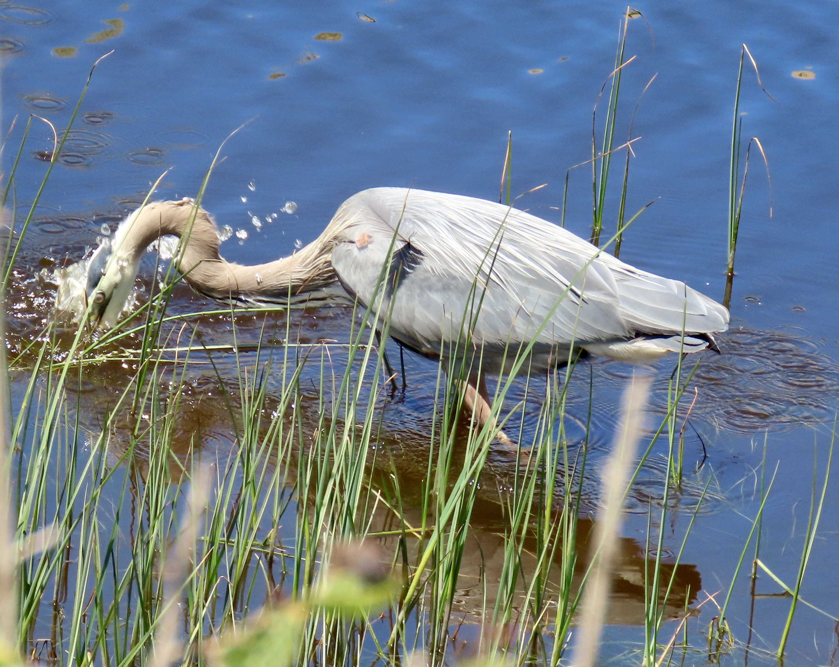
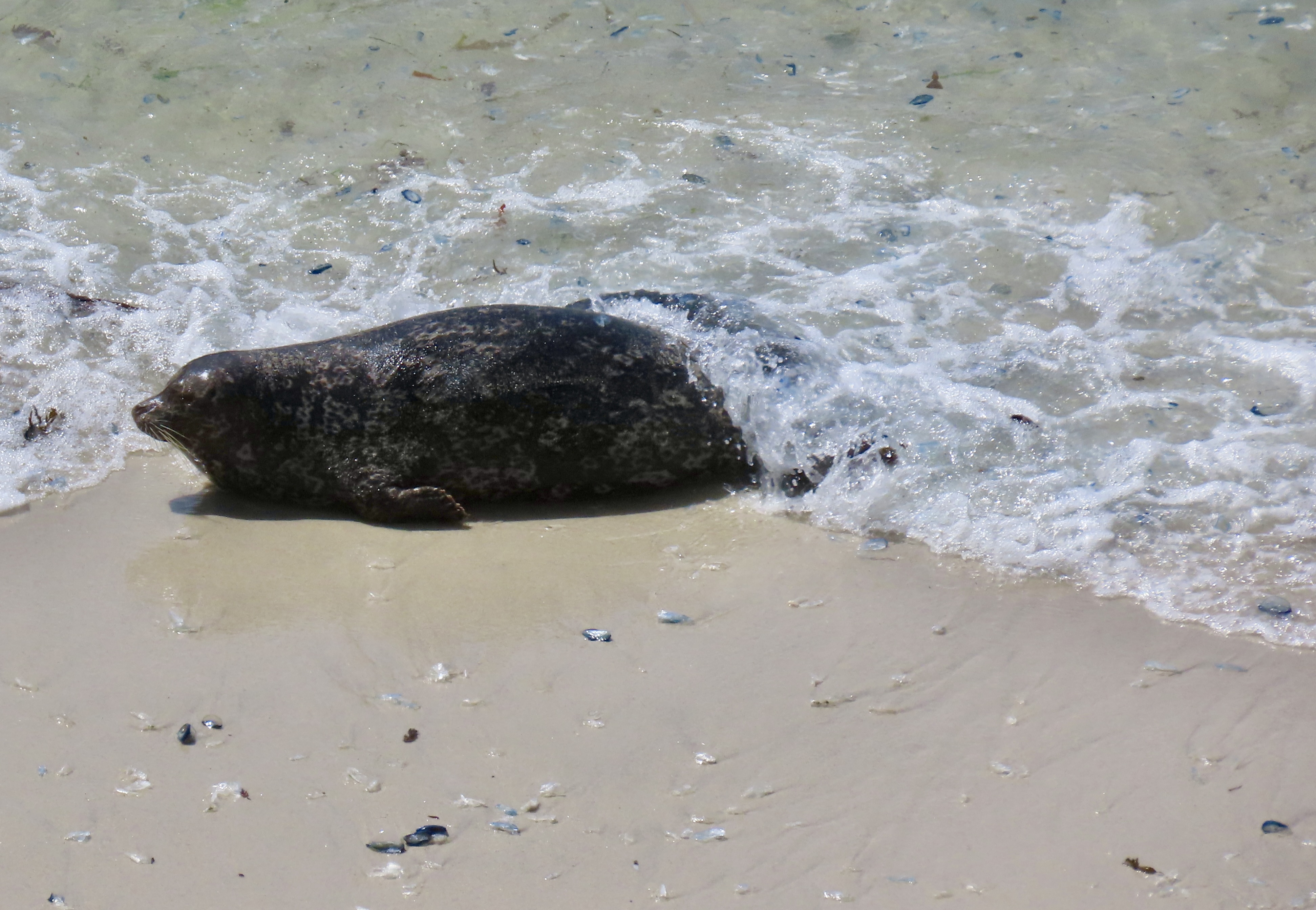
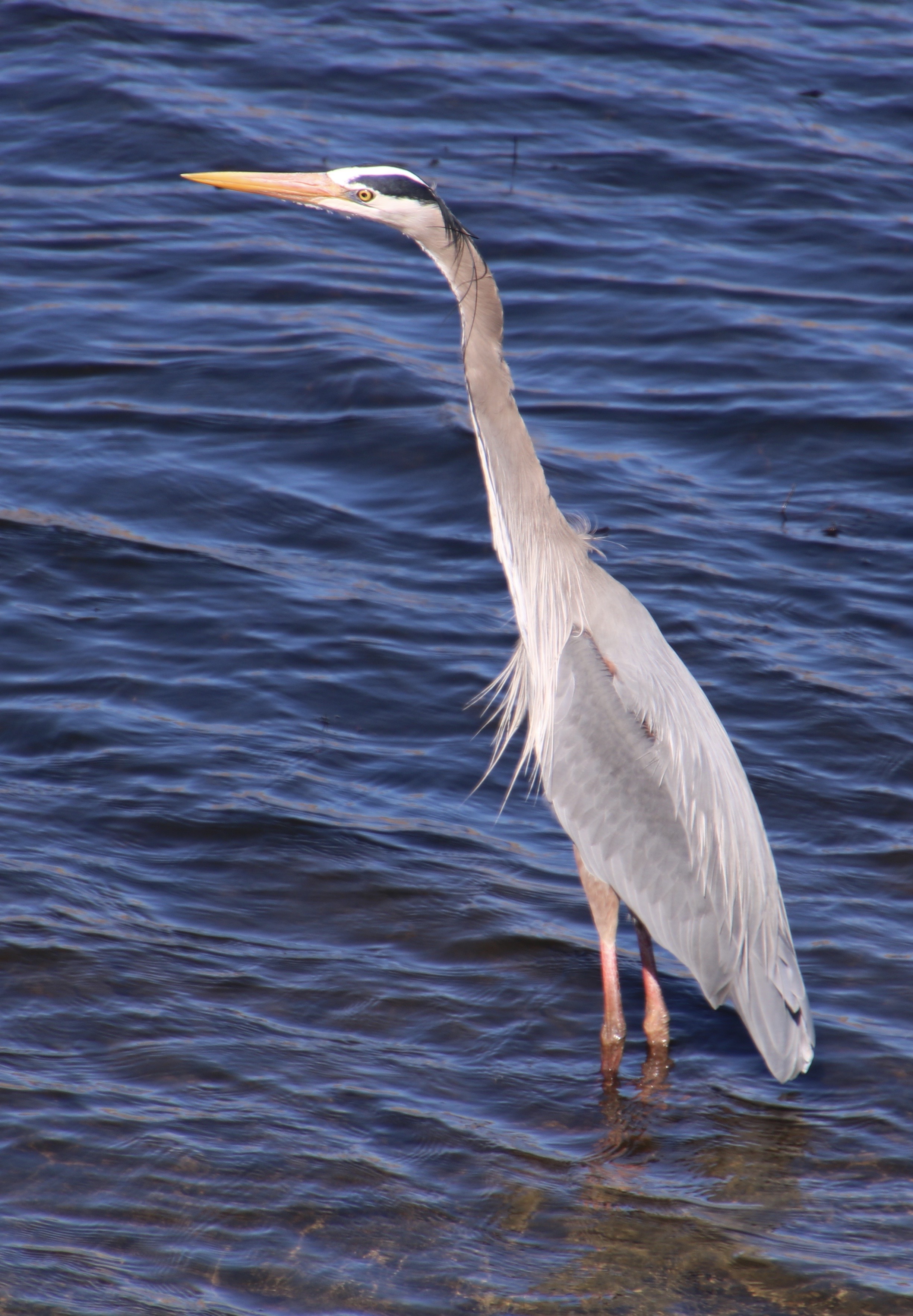
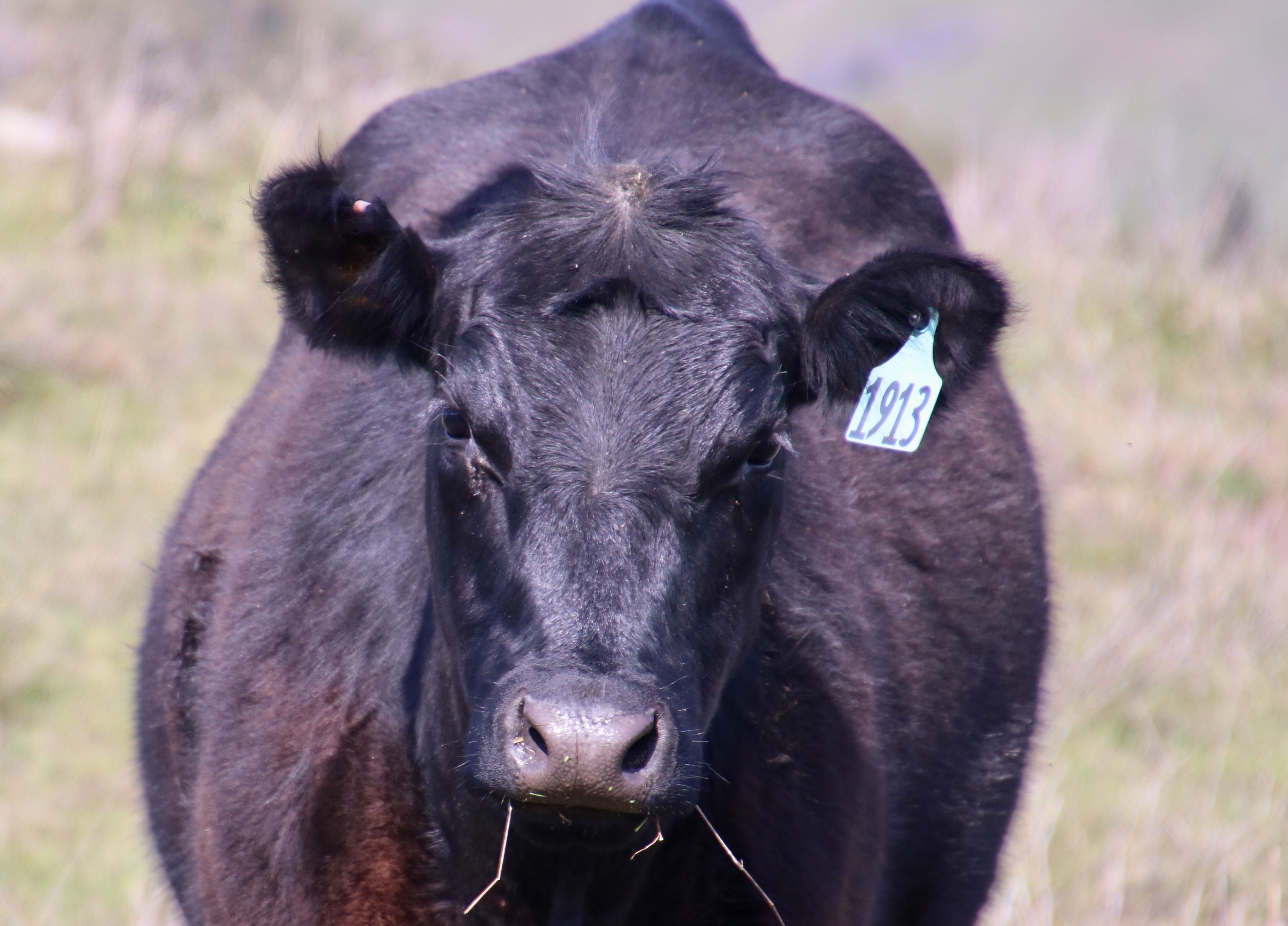
The great egret stopped to smell a flower. Just kidding. It was searching for a fish in the grass, which might seem even stranger— except it had dropped the fish there.Peggy and I found the great egret, and a great blue heron, fishing in Abbotts Lagoon at Pt. Reyes National Seashore.It was an easy and pleasant walk out to the lagoon from the trailhead. Flowers, birds and cows kept us amused along the way. Peggy fell in love with the poppies.She took lots of photos.A two-for-one shot.And two with layered petals.Large bunches of poppies added splashes of yellow to the scenery.A pond proved to be a perfect location for nesting redwing blackbirds.This one chose a post to sing his cheerful song from.And this one, a convenient plant.Several cows grazed over a hill above the pond like a 40-plus leg mowing machine. A number of dairy ranches are still functioning within the park.This cow, backlit by the sun, had a bad case of cowlick. At first, we thought it might be a bull. Nope. I checked.I spotted this plant and went searching in my memory for its name. The leaves gave it away.It was yarrow. One of the names for this flower is Devil’s Plaything. An ancient superstition said the Devil would walk the streets at night and shake the flower at houses he wanted to curse. One can only wonder how the superstition got its start.Neither Peggy nor I had any problems identifying this iris. Its name? Iris douglasiana ‘Pt Reyes’.A colorful thistle caught my attention. You can look, but you best not touch! BTW, nettles were common along the trail as well. They are definitely ‘do not touch.’Lupine has well over 200 species worldwide. Estimates range as high as 500! The beginning of the trail at Abbotts Lagoon is loaded with yellow lupine bushes (Lupinus aborius). It was a week or two early for most of them to bloom but one plant favored me with these.Peggy found a striking red dragonfly along the trail that flew ahead of us and conveniently landed in front of her.This white crowned sparrow wasn’t nearly as cooperative. The bushes alongside the trail were alive with them. One would think they would be easy to photograph. And they would be, if they were ever still longer than a second or two. Finally, we got lucky.We were even luckier when crossing the bridge that separates the upper and lower lagoons. A white crowned sparrow was below the bridge getting a drink. it’s easy to see how the bird got its name.The bridge and the lower lagoon. The ocean can be seen in the distance.A pair of swallows landed on the bridge railing.A close up of the colorful male.Another view of the lower lagoon.The main action was taking place on the upper lagoon just above the bridge where the great egret and the great blue heron were at work. The egret had spotted a fish and was heading out to get it.It plunged its head into the water…And caught a whopper! It’s the fish he dropped in the grass and had to retrieve.The great blue heron was 50 feet below the egret.A closer view.Searching for fish, it looked to the right…Straight ahead…And glanced quickly to the left…Before burying its head lightning fast in the water.All the way up its neck. We’ll leave the heron trying to catch its fish. (We never saw the fish, but we did see the heron swallow it.) Next post: On to the historic Pierce Point Ranch.
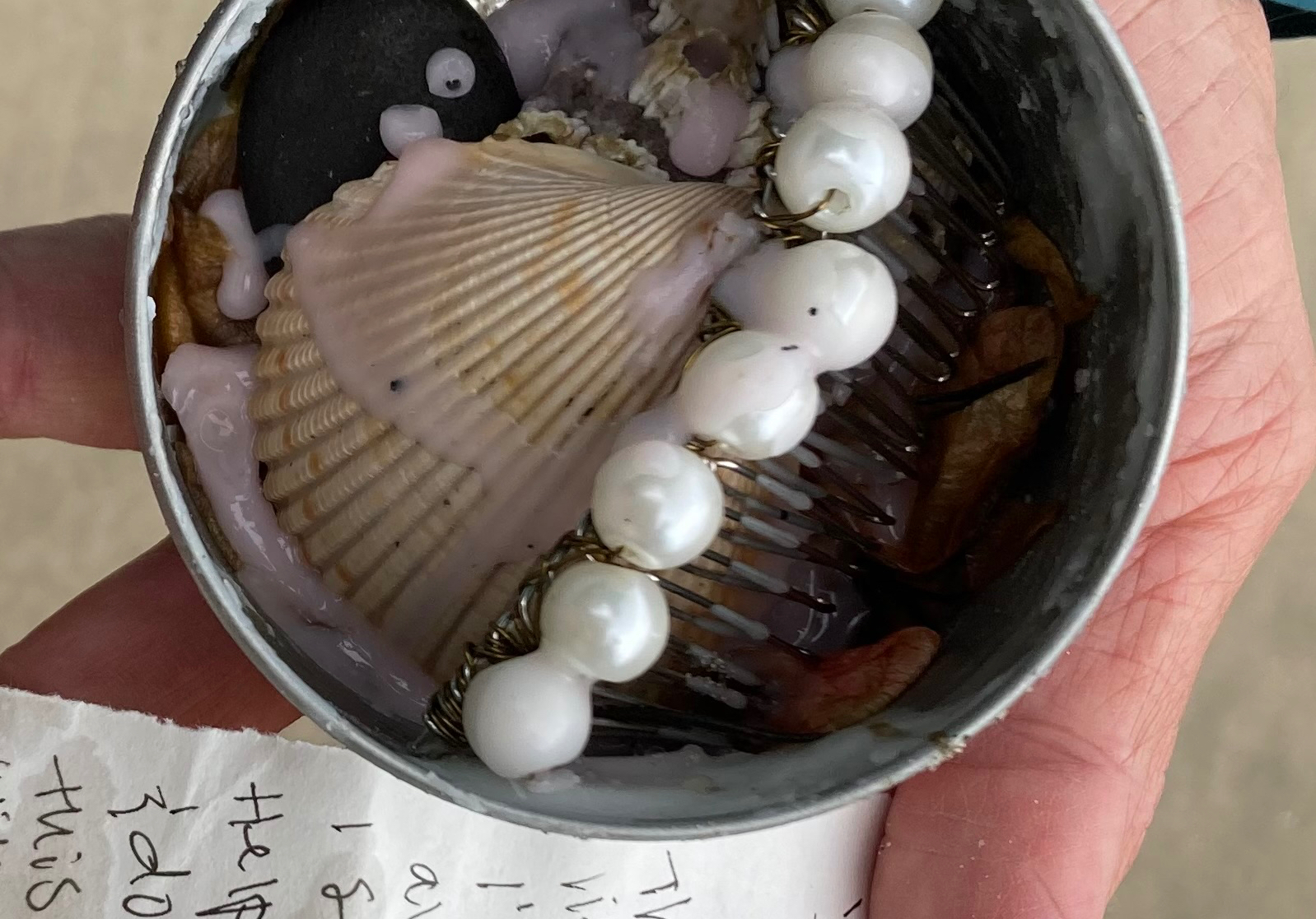
Have you ever found a message in a bottle or a tin washed up on a seashore? Or dreamed of finding one? We did last week on Drakes Beach at Pt. Reyes National Seashore.
I was walking along Drakes Beach with my friend Tom Lovering when he spotted a tin with a top on it in the sand. Peggy and Tom’s partner Lita were walking behind us. “Open it up, Tom,” we urged. He was already worrying the lid. There was a treasure inside. Someone’s comb with artificial pearl beads and seashells all held in by candle wax. And a letter! It had been brought in on the day’s high tide. Had it come from afar after weeks/months/years of travel. Or had a person thrown it into the ocean that morning with hopes that it would wash out to sea? There wasn’t a clue.
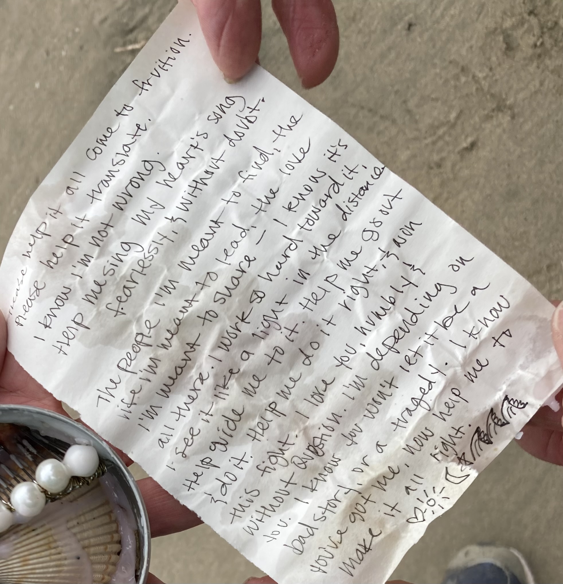
The letter. It was slightly damp and wrinkled but still easy to read. I’ve repeated the words below.
“Please help it all come to fruition. Please help it to translate. I know I am not wrong. Help me sing my heart’s song fearlessly and without doubt. The people I am meant to find, the life I am meant to live, the love I am meant to share— I know it’s all there. I work so hard toward it. I see it like a light in the distance. Help guide me to it. Help me go out and do it. Help me do it right and win this fight. I love you, humbly and without question. I’m depending on you. I know you won’t let it be a sad story, or a tragedy. Now help me to make it all right.”
One can only speculate on the sender, but I imagine a young woman (given the comb) asking for help. She is bright, and possibly troubled, but has faith and hope that her future will turn out right. Thoughts? Tom put the message back in the tin with the lid on it and left it on the beach for some other person to discover. We listened to Jim Croce’s Time in a Bottle when we got back to camp.
These towering cliffs are the same ones that Sir Francis Drake would have seen on his 1579 voyage around the world. They reminded him of England’s Cliffs of Dover. With his ship in serious need of repair, he had pulled into the bay. The belief that this is where he landed for repairs led to the bay being named Drakes Bay and the beach, Drakes Beach.This is Tom. We go way back. “Fifty years” he reminded me. We met in 1974.He had a bit more hair when this was taken in the late 70s.
He had even more in 1974 when I had walked into Alpine West, a popular outdoor gear store in Sacramento at the time. I was seeking a sponsor for the Sierra Trek, a hundred mile backpack trek across the Sierra Nevada Mountains that I had dreamed up to raise funds for the Sacramento Lung Association and future Breathe California. A hippie-looking 20-something was standing behind the counter. I walked over and asked him if I could speak to the owner or manager. “I am the owner,” Tom had told me rather stiffly. Oops! I introduced myself as the Executive Director of the Lung Association and explained what I wanted to do. “You’re crazy,” he had told me. “People may survive it but they will hate you and the Lung Association afterwards.” It wasn’t exactly what I was hoping to hear from one of Sacramento’s leading outdoor experts. But then he offered to sponsor the event… I left a little confused. If they hated the Lung Association, wouldn’t they hate Alpine West as well? We’ve been having adventures together ever since 1974. He’s been though several successful careers over the years. I’ll introduce his latest in my next post: creating a powerful, battery-operated blender. He couldn’t stop talking about it. But for now, back to Drakes Beach and another popular beach on Drakes Bay: Limantour.
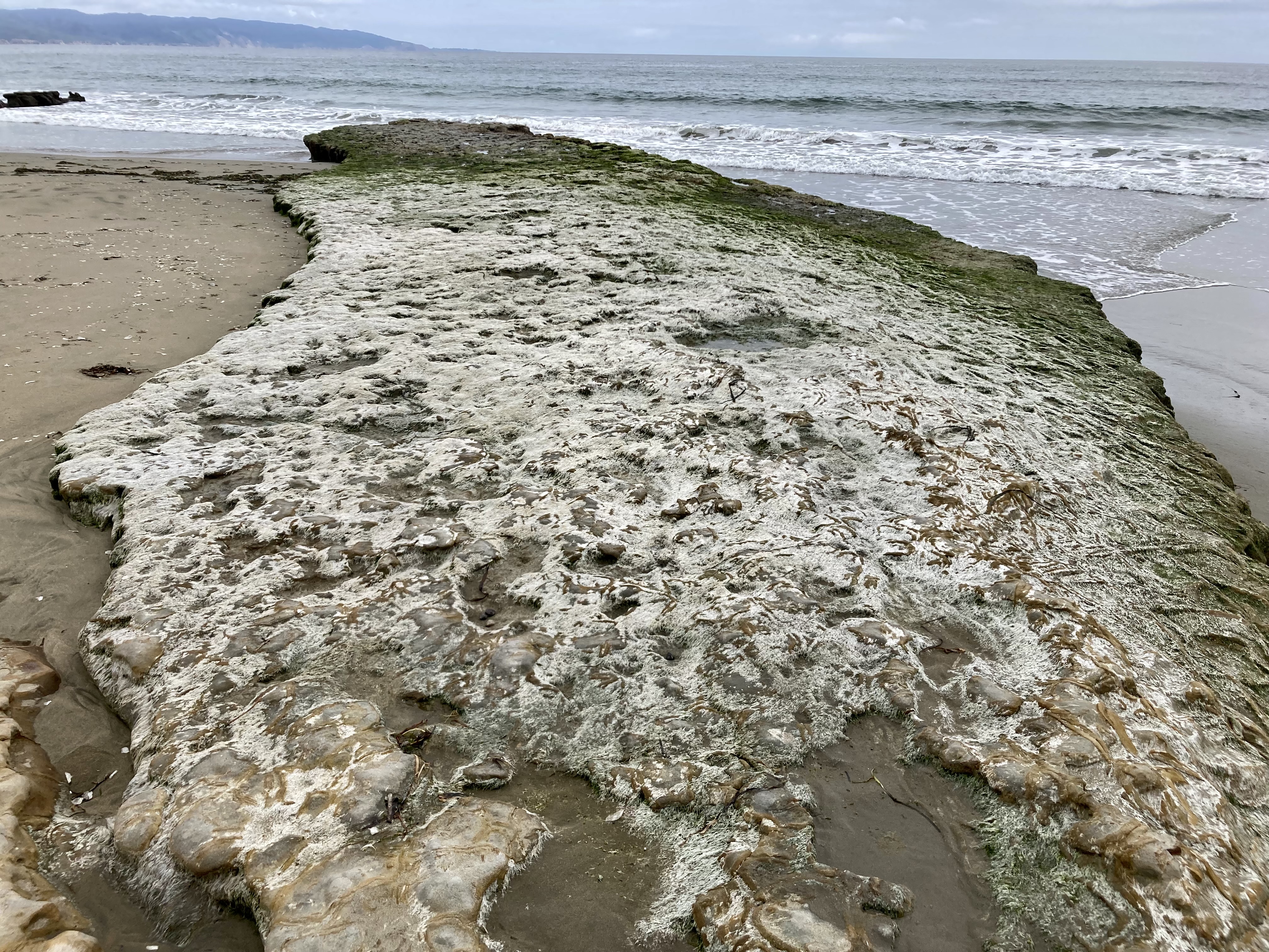
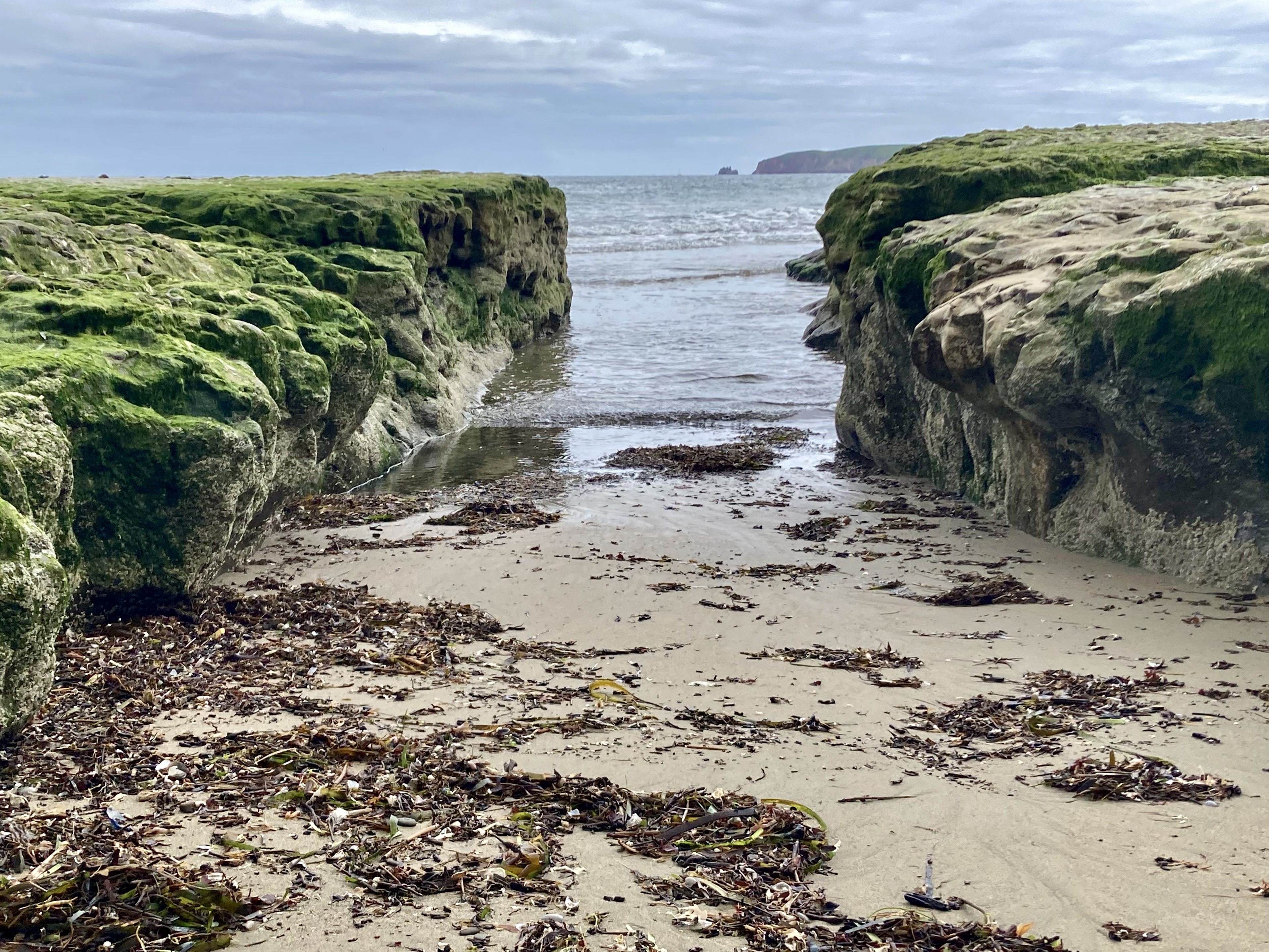
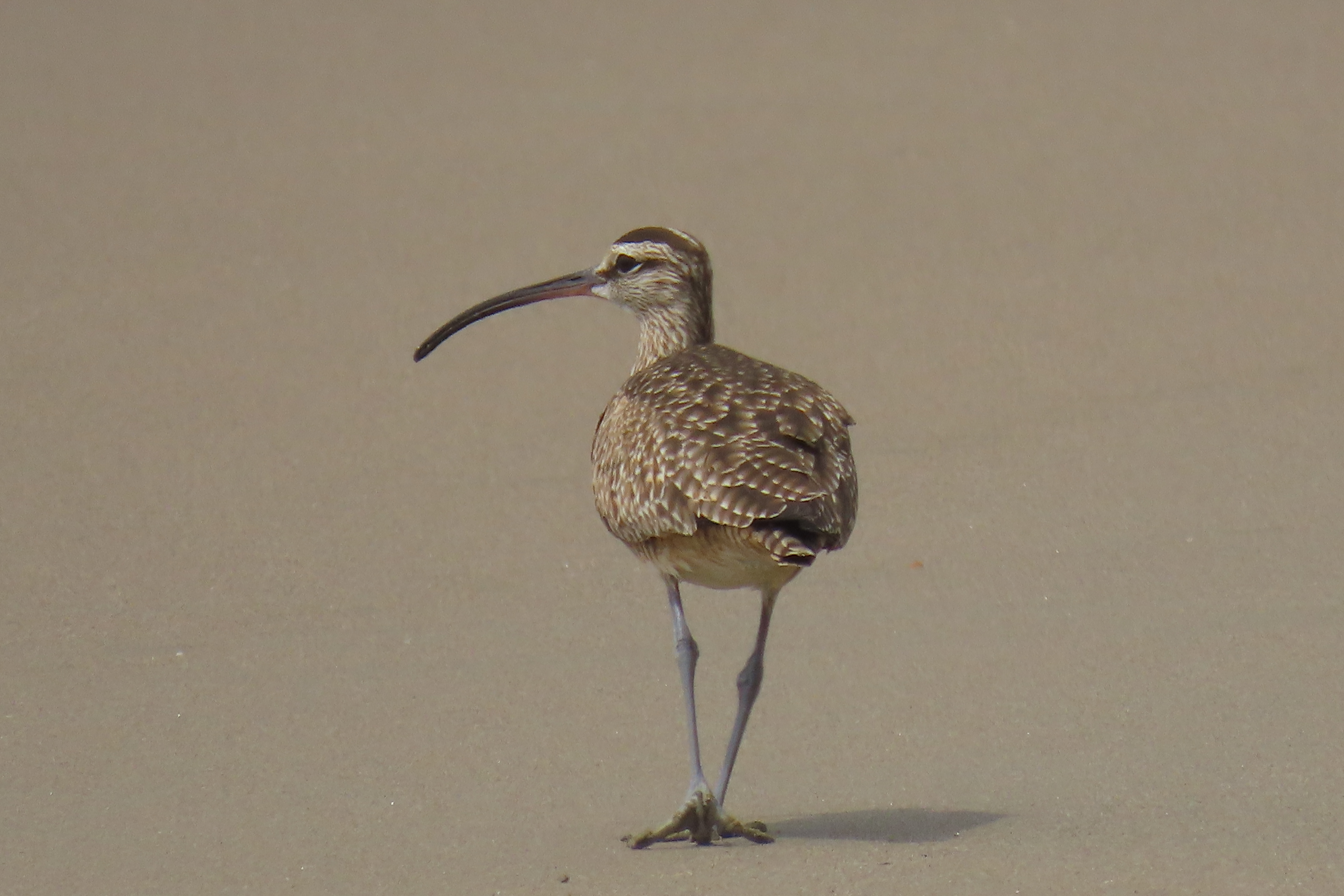
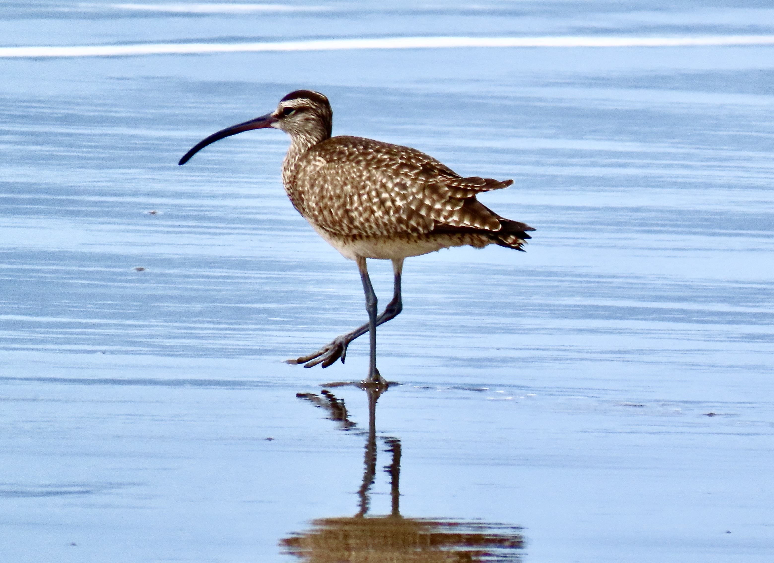
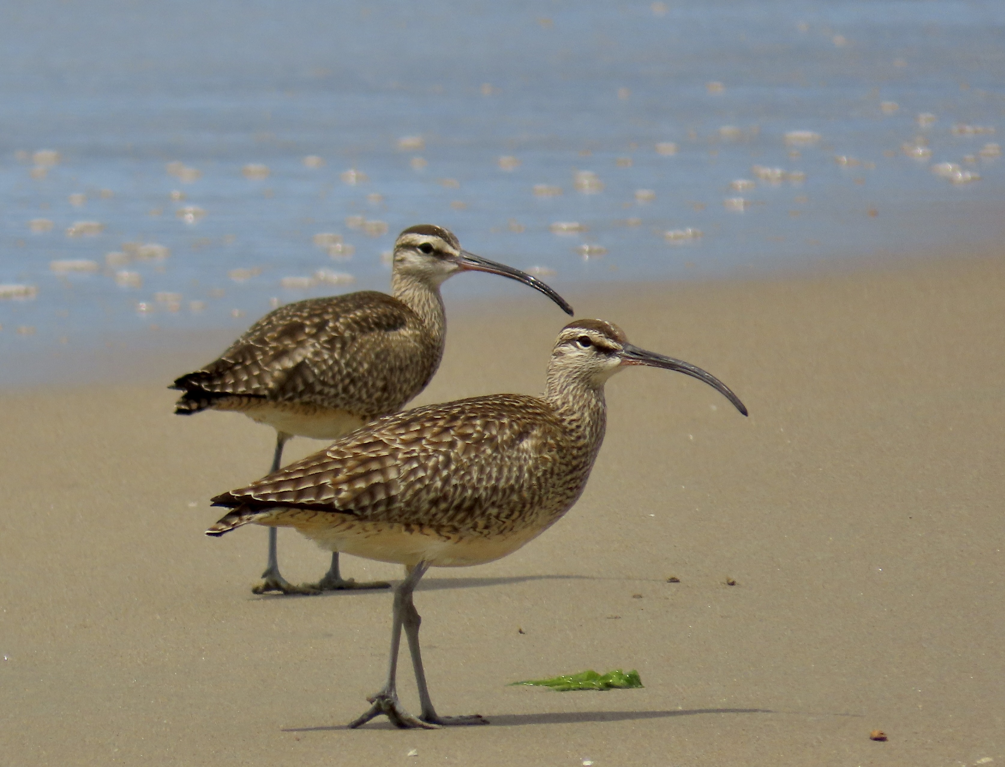
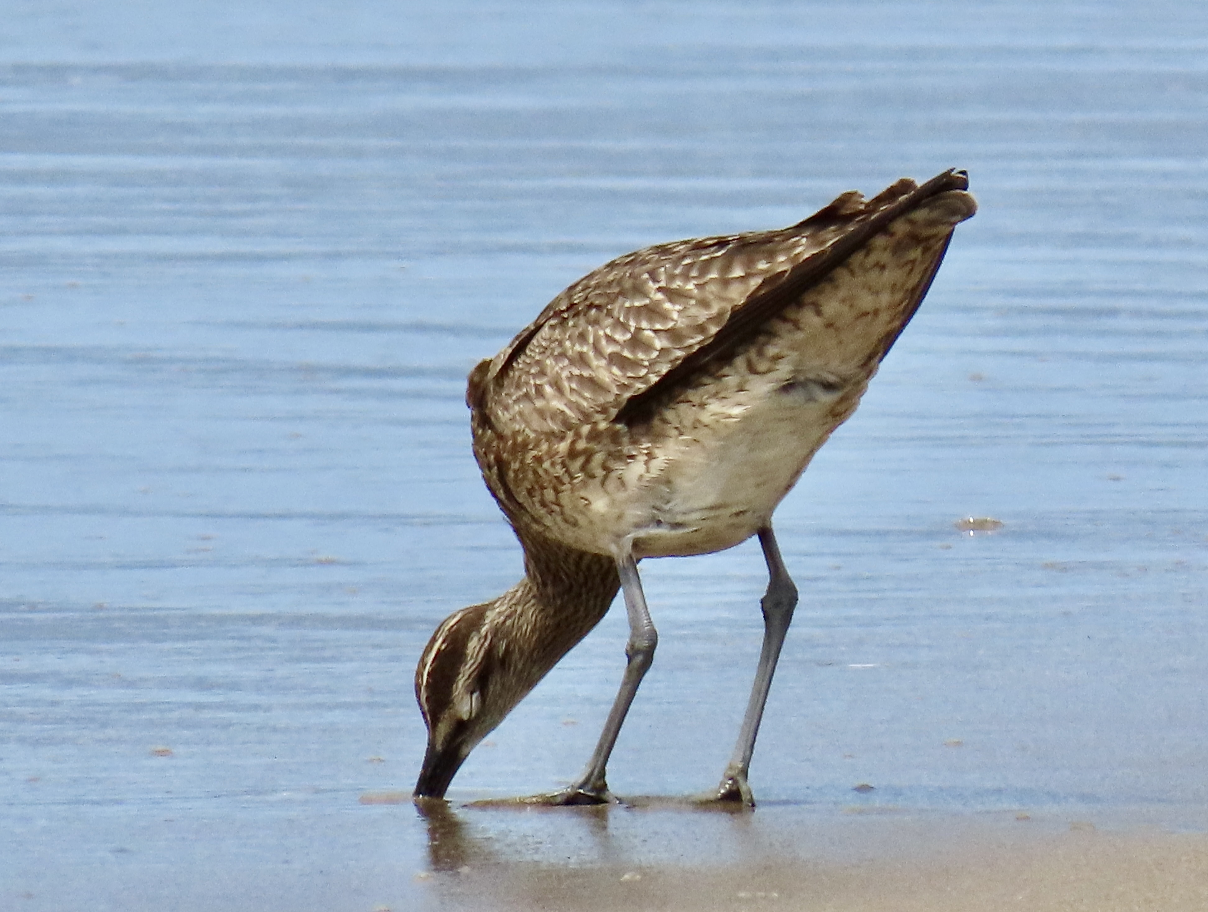
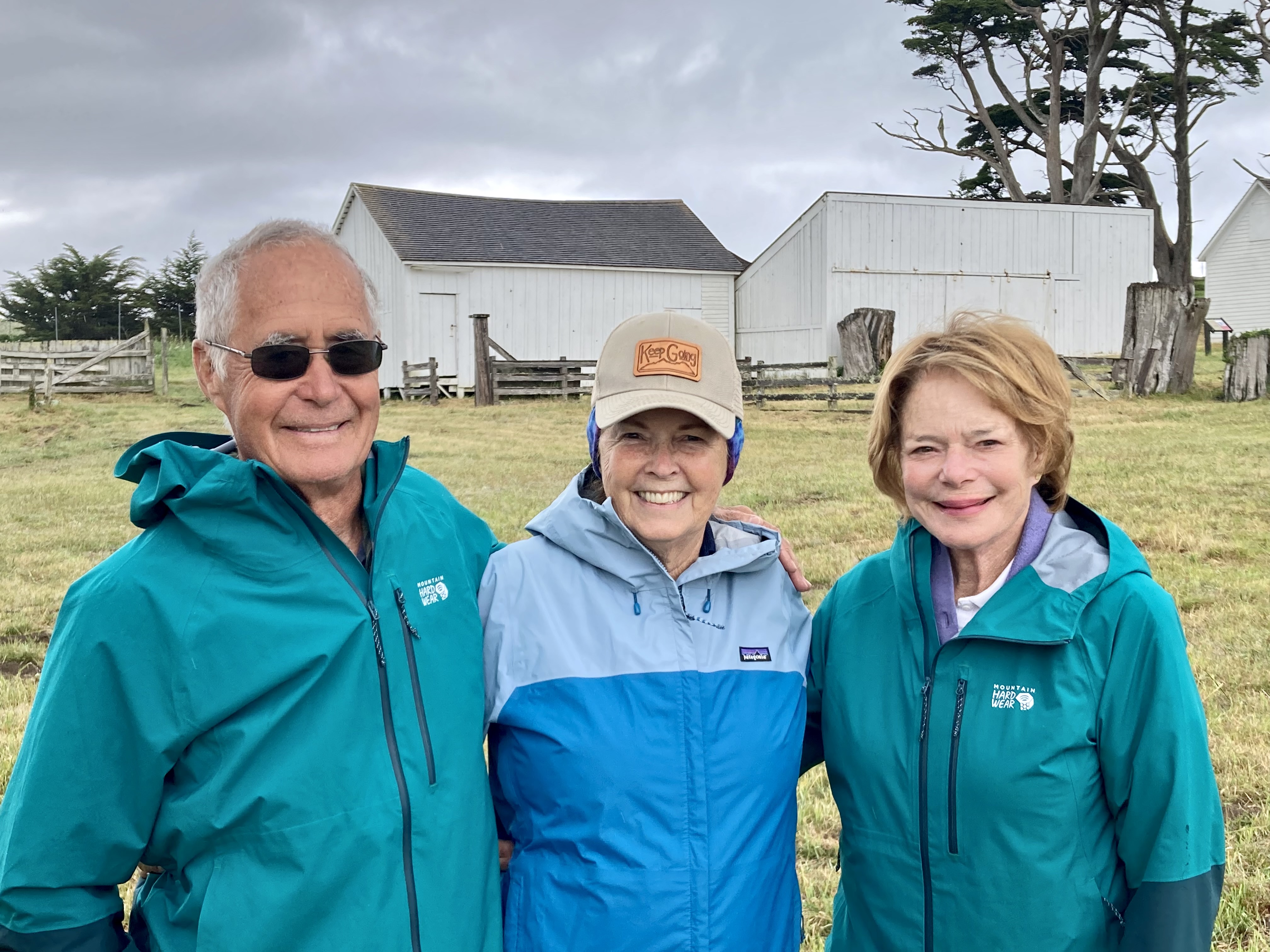
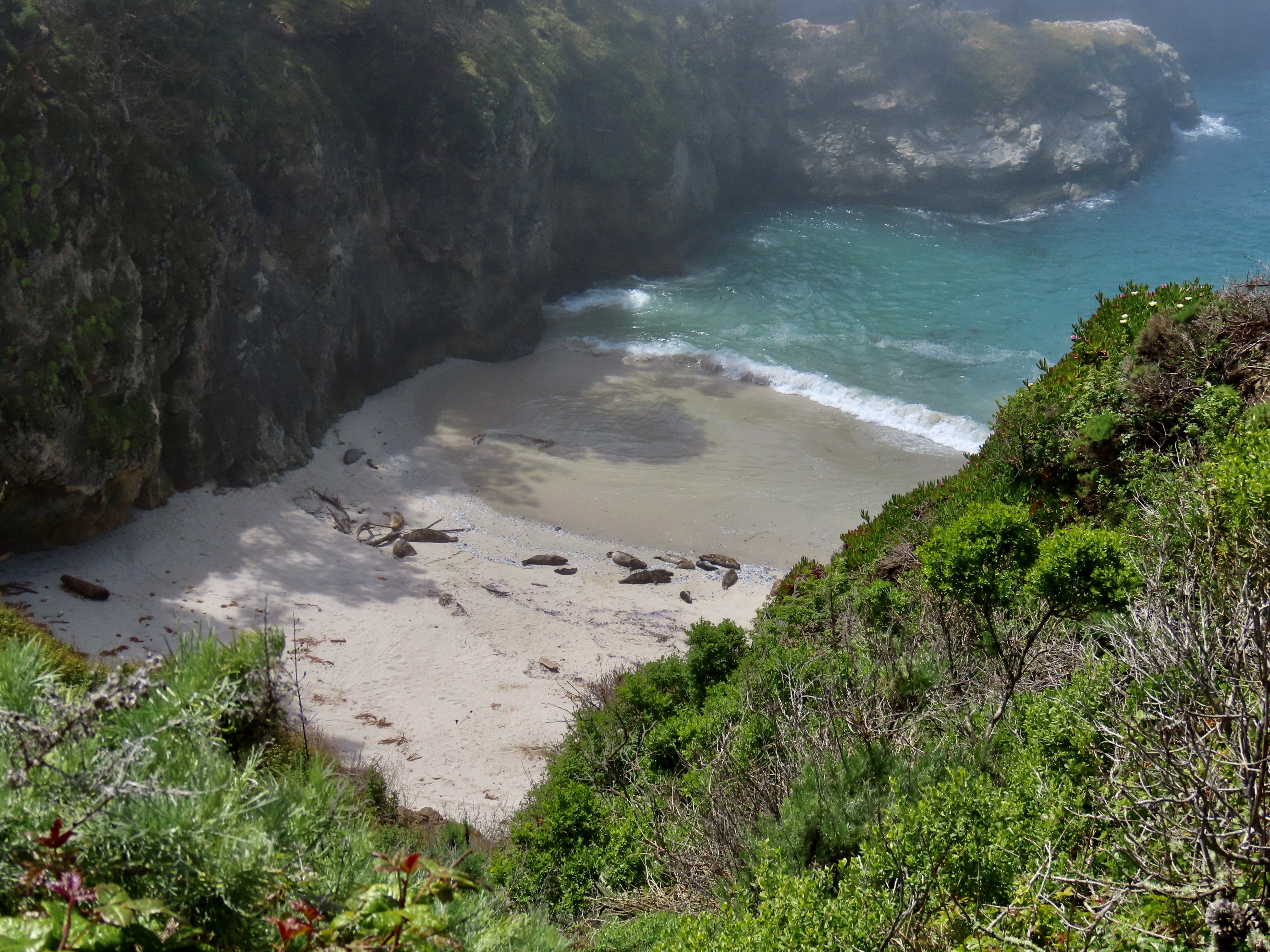
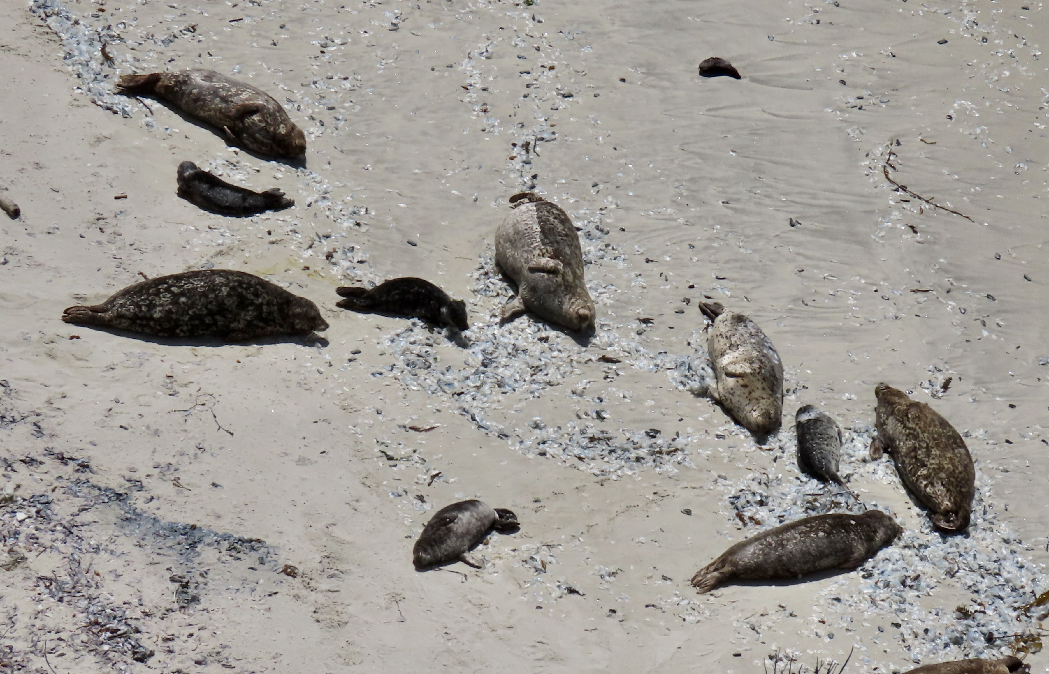
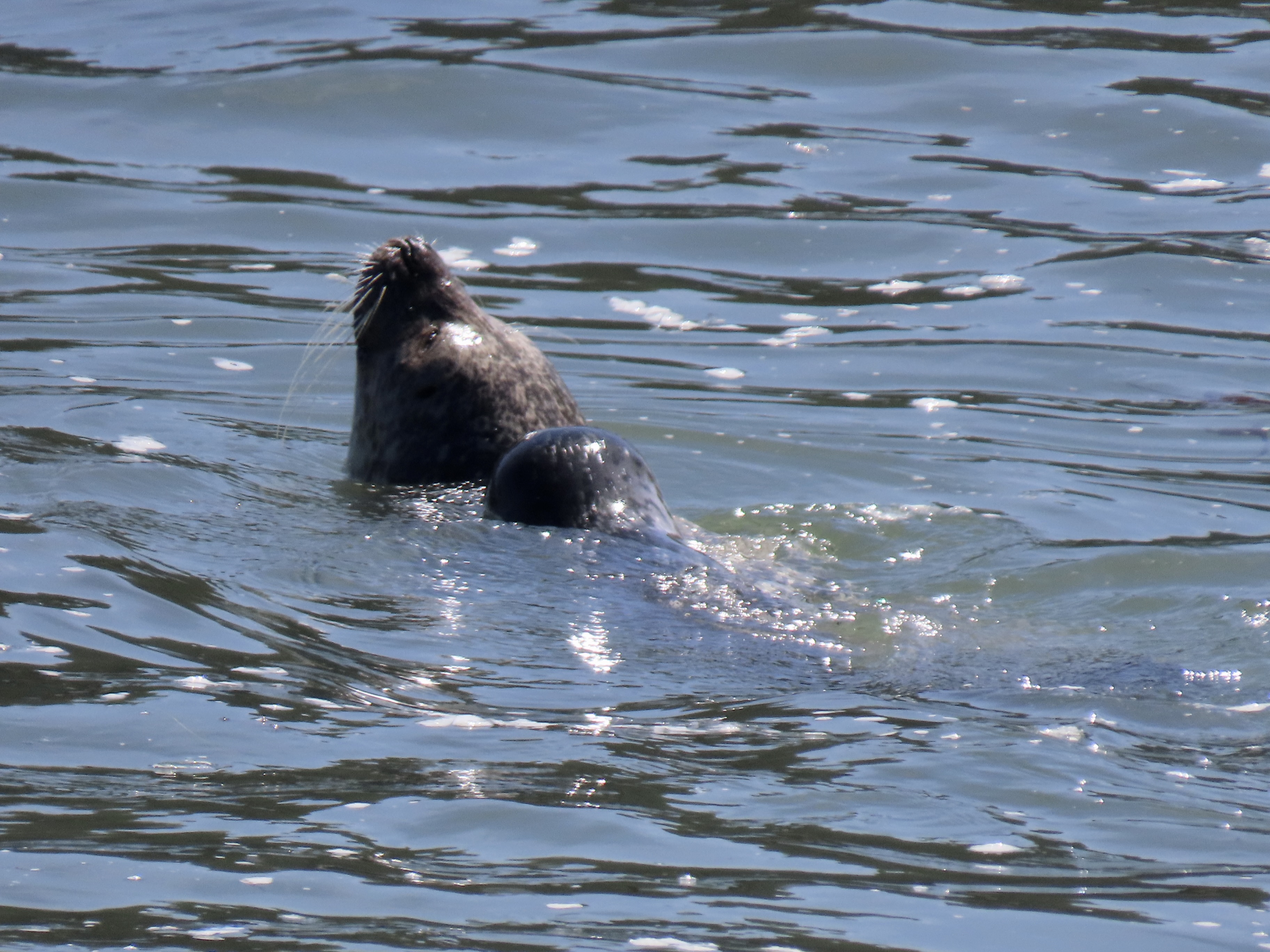
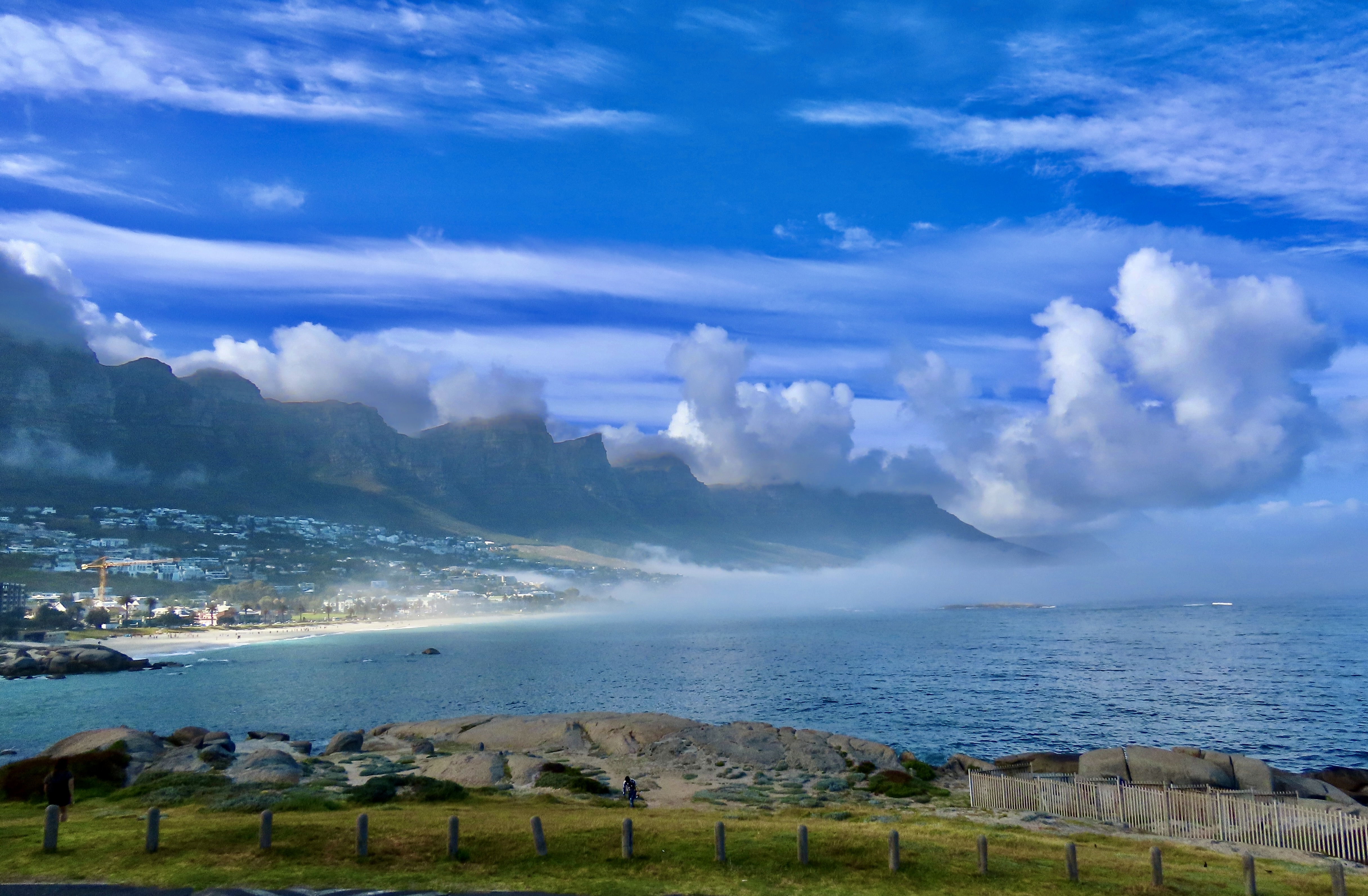
We have been to Drake’s Beach many times over the years. The last time the beach was filled with elephant seals. Not so this time. But that meant we could actually go for a walk on the beach.Several harder rocks had been more resistant to the ocean’s relentless waves. This one was heading out to sea.It had a unique look…And small depressions that caught seawater at low tide making mini-tide pools. Two of the rocks provided a window to the ocean. Chimney Rock can be seen in the distance.Peggy gathered seashells while I explored. Tom snapped our photo. We stopped to admire a Velella (By the Sea Sailor), a type of jellyfish, that had just sailed in on high tide and was in much better shape than the ones we had seen at Point Lobos.Limantour Beach and Spit is just south of Drakes Beach and also on Drakes Bay. Peggy and I explored it after Tom and Lita returned to Sacramento. Whimbrels, dunlins and brown pelicans amused us. This is a whimbrel.We found them quite attractive.Several of them were working the beach together.On a stroll.A small bubble suggests that dinner might be lurking down in the sand.Whimbrels use their curved beaks to probe for small crabs and other sea life buried in the sand.A little ocean water did not get in the way of finding a tasty tidbit.A flock of dunlins and a sanderling join the whimbrels in their search for food.Apparently, their search was successful.Meanwhile, brown pelicans were skimming the waves further out at sea in search of fish. Amazing birds! Check the wing span.A shot across Drakes Bay showed the cliffs above Drakes Beach.Peggy took this shot across Drakes Bay to the Chimney Rock and the Pt. Reyes Headlands at the northern end of the Bay. The Point Reyes Lighthouse is on the opposite side of the Headlands. We will feature it in a later post.Peggy posed for me as I took a photo south to catch the rest of the Bay. This is one long beach!She continued her search for perfect sand dollars.And goofed around! That’s it for the day!Our next post will feature the historic Pierce Point Ranch and Abbots Lagoon. Tom, Peggy and Lita stand in front of three of the outbuildings.
Pinnacles National Park is located inland from California’s Central Coast. Peggy and I followed a narrow, curvy, one lane road east of the small town of Soledad to get there, holding our breath each time we met another vehicle— especially if it was as large as our truck. While the location was a slight detour from our coastal focus, we are totally incapable of skipping a National Park.
Pinnacles National Park has a twin near the city of Santa Clarita some 200 miles to the south, the Neenach Volcanic Formation. Born of fiery rhyolite lava flows some 23 million years ago, they were ripped apart in their youth by the notorious San Andreas Fault. Pinnacles has been making its way north ever since: Inch by inch and earthquake by earthquake.
Noted for its personality-plus pinnacles, talus tunnels, and wild flowers, the region was declared a National Monument by Teddy Roosevelt in 1906. Legislation by Congressman Sam Far from the Monterey/Carmel area in 2012 led to its being established as a national park. (Sam, like me, was an early Peace Corps Volunteer. For a brief time, we worked together in the Western United States as Peace Corps Recruiters.)
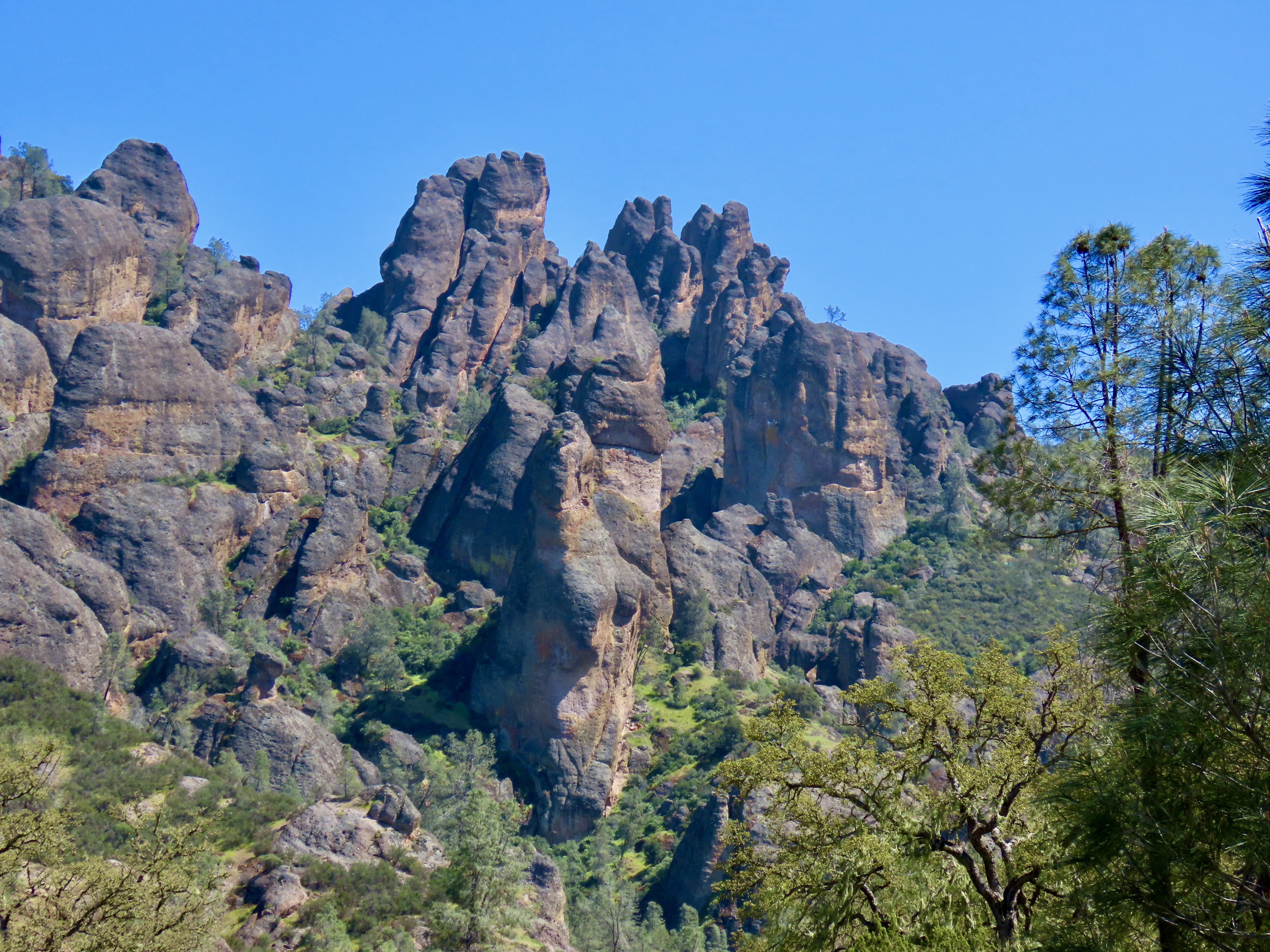
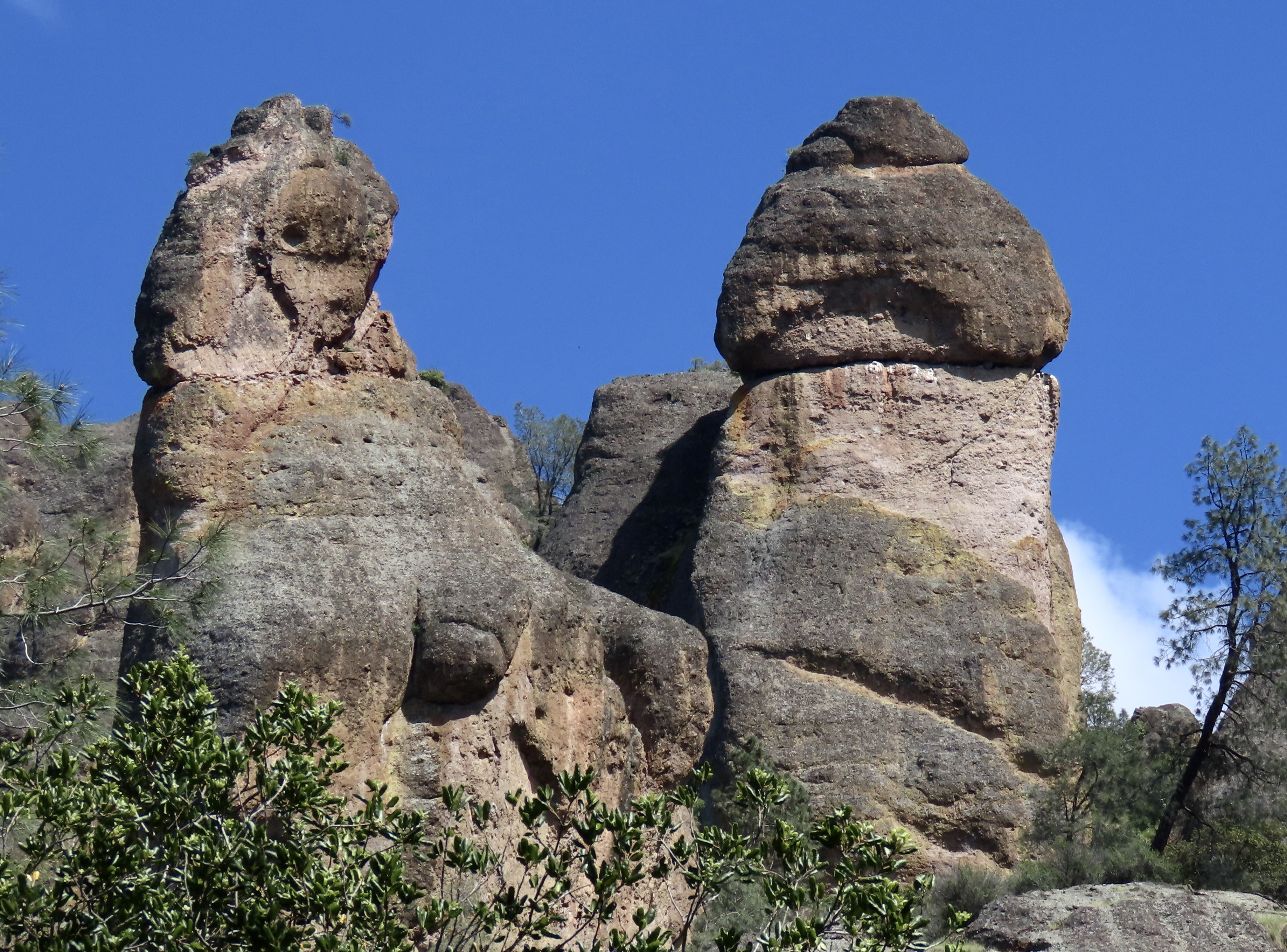
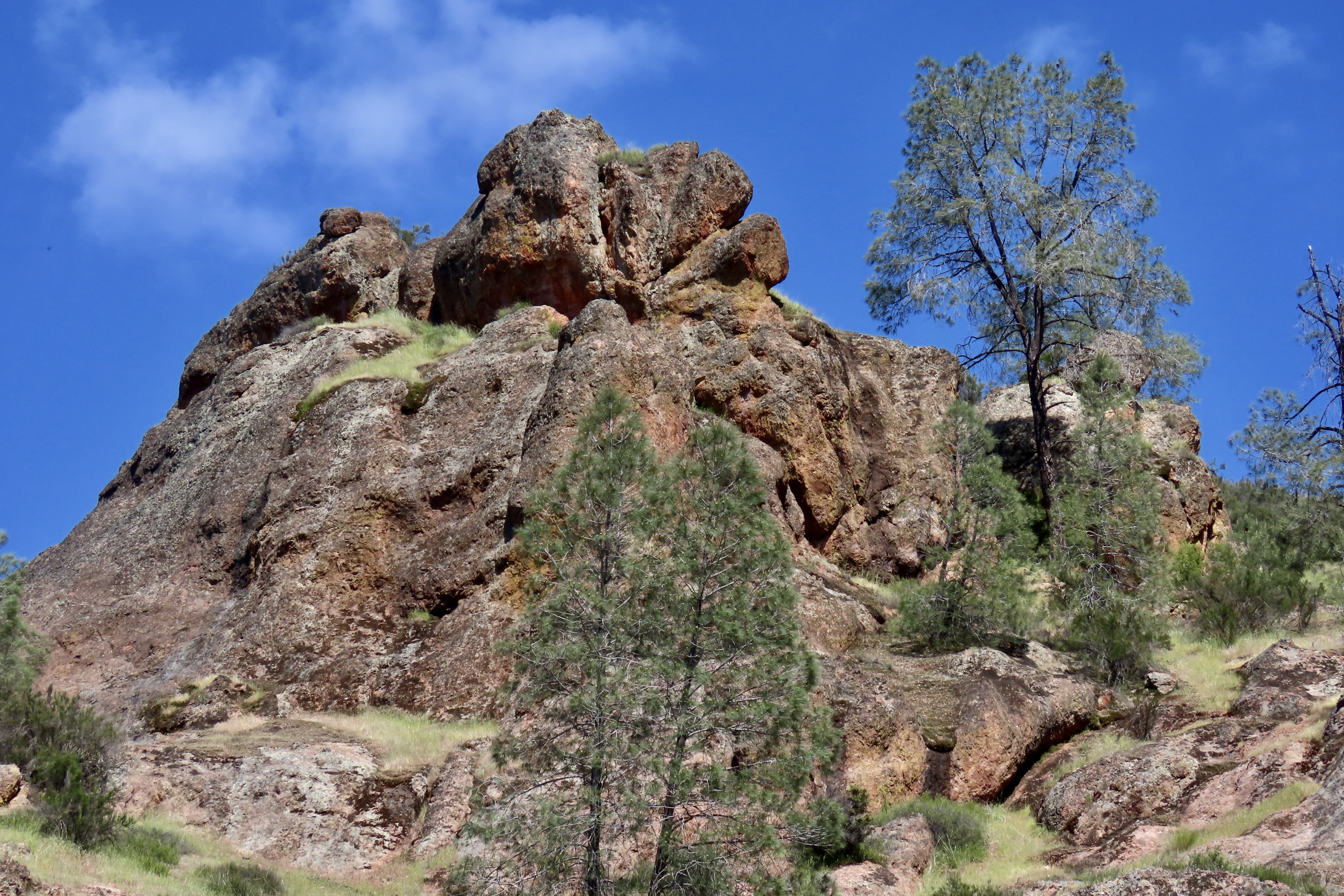
The Pinnacles are something of a poster-child for Plate Tectonics. While the existence of the plates and their impact on geology and geography is a well-known and accepted theory today, the history of the concept is relatively recent. I remember sitting in a geology class I took at UC Berkeley in 1964 when the professor came in almost glowing. “I have something to share,” he declared, “please understand that it is still a theory. I’m late because I was just in a meeting where substantial evidence was given that the surface of the world is made up of giant plates that separate, crash into each other, move along each other’s edges.”
The close relationship between the rocks and minerals of Pinnacles and the Neenach Volcanic Formation helped to show that the Pacific Plate and North America Plate have been moving past each other via the San Andreas Fault for 20 some million years. Pt. Reyes National Seashore north of San Francisco, where we are now, also sits on the San Andreas Fault and is another example of the movement. In fact, our campground is sitting on top of the fault. Our fervent hope is that it stays in place, at least for another week!
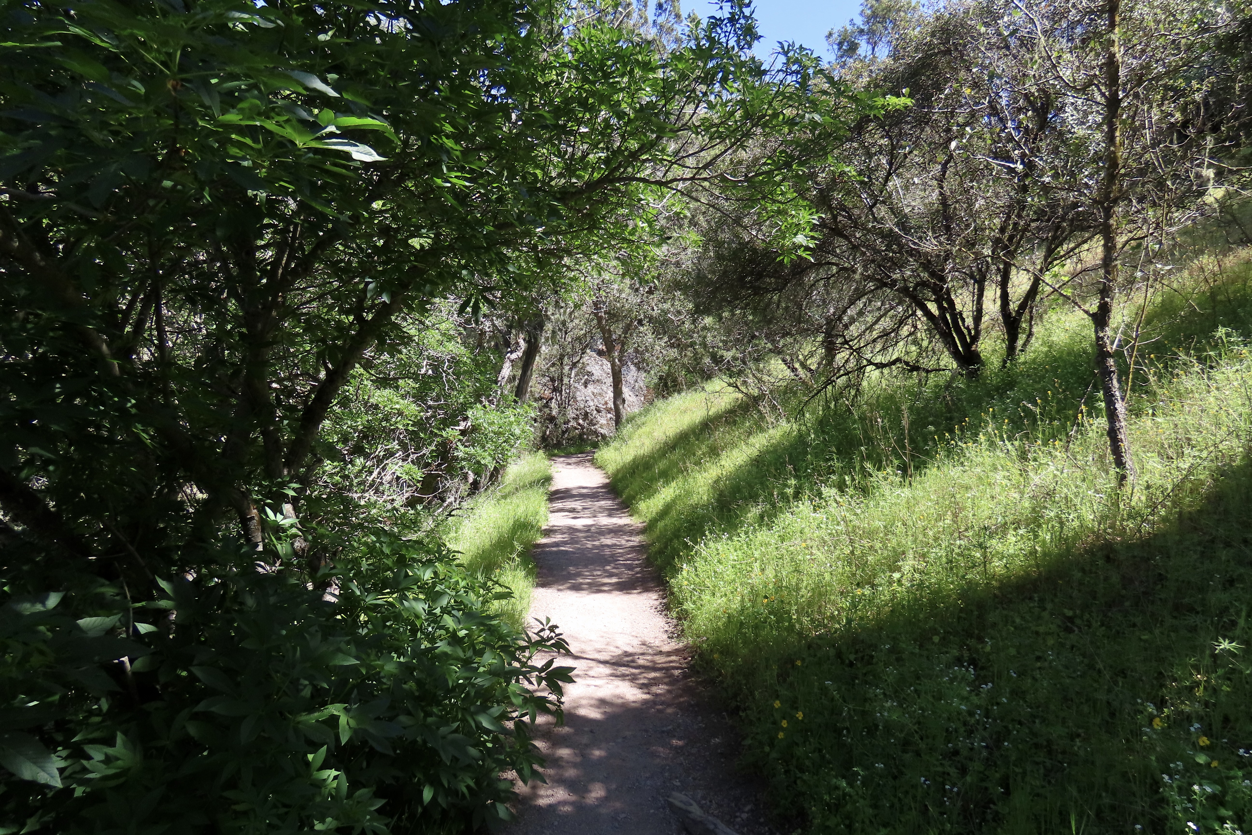
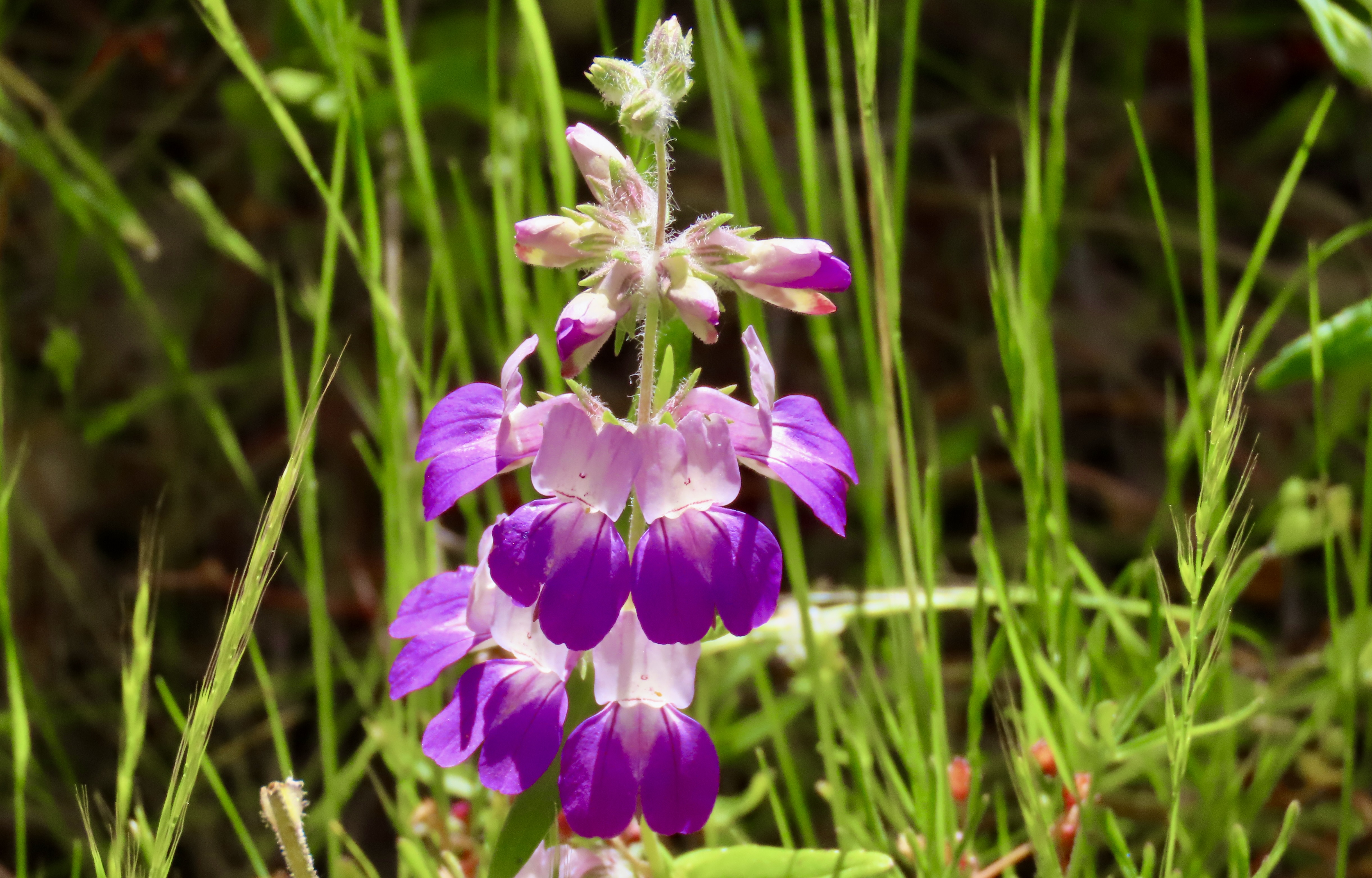
Our hike along Juniper Canyon Trail into the Park provided this view of the pinnacles. Not surprisingly, rock climbers get very excited about the challenges involved in climbing to the tops of the peaks. Here’s our trail. A small creek burbled along beside the trail.In places, the tiny creek was covered with huge boulders that had rolled down the mountain, possibly during earthquakes. They formed small tunnels known as talus caves. In other sections of the park, the talus caves can be miles long and people hike through them. This one was short enough I could stand on one end and photograph Peggy on the other. The embedded rocks in the rhyolite are breccia.Peggy’s perspective showed a colorful pool.What she couldn’t see was this magnificent bunch of shooting stars just beyond the pool. I’ve been admiring shooting stars for decades. I’ve never seen this many on a single stem. Our trip up the canyon provided numerous opportunities for Peggy and me to take close ups of the pinnacles.Each one was differentAnd had its own personality.Peggy called these “the fingers.”Can you spot the duck?Peggy became quite excited about her new camera’s ability to catch close-ups of lizards. This one was quite colorful. I believe it is one of several variations of a western fence lizard. We entered the Park from the West where this photo was taken. There is also an eastern entrance.This oak tree caught my attention.Wildflowers, like the shooting stars I featured above, were everywhere. Here are two more I found particularly charming. This is purple owl’s clover (Castilleja exserta), a species of Indian paint brush…And purple Chinese houses (Collinsia heterophylla), said to resemble fairytale pagodas.We were on the lookout for condors since they have been successfully reintroduced in Pinnacles National Park. Maybe…We hope you’ve enjoyed our introduction to the Pinnacles. If you are looking for a National Park experience without the crowds, this small park is definitely worth a visit. Next up: Pt. Reyes National Seashore, one of our all-time favorite parks.
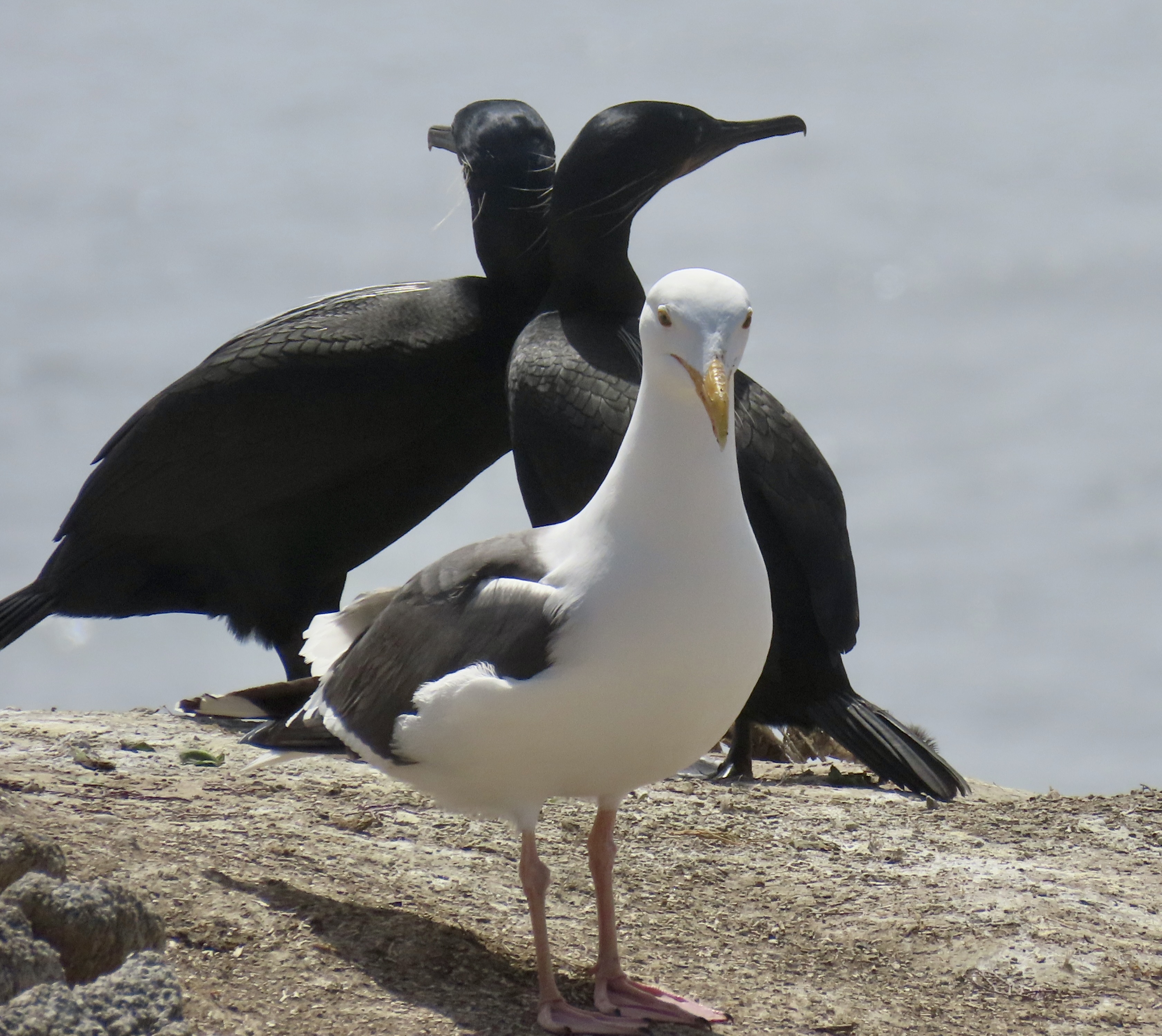
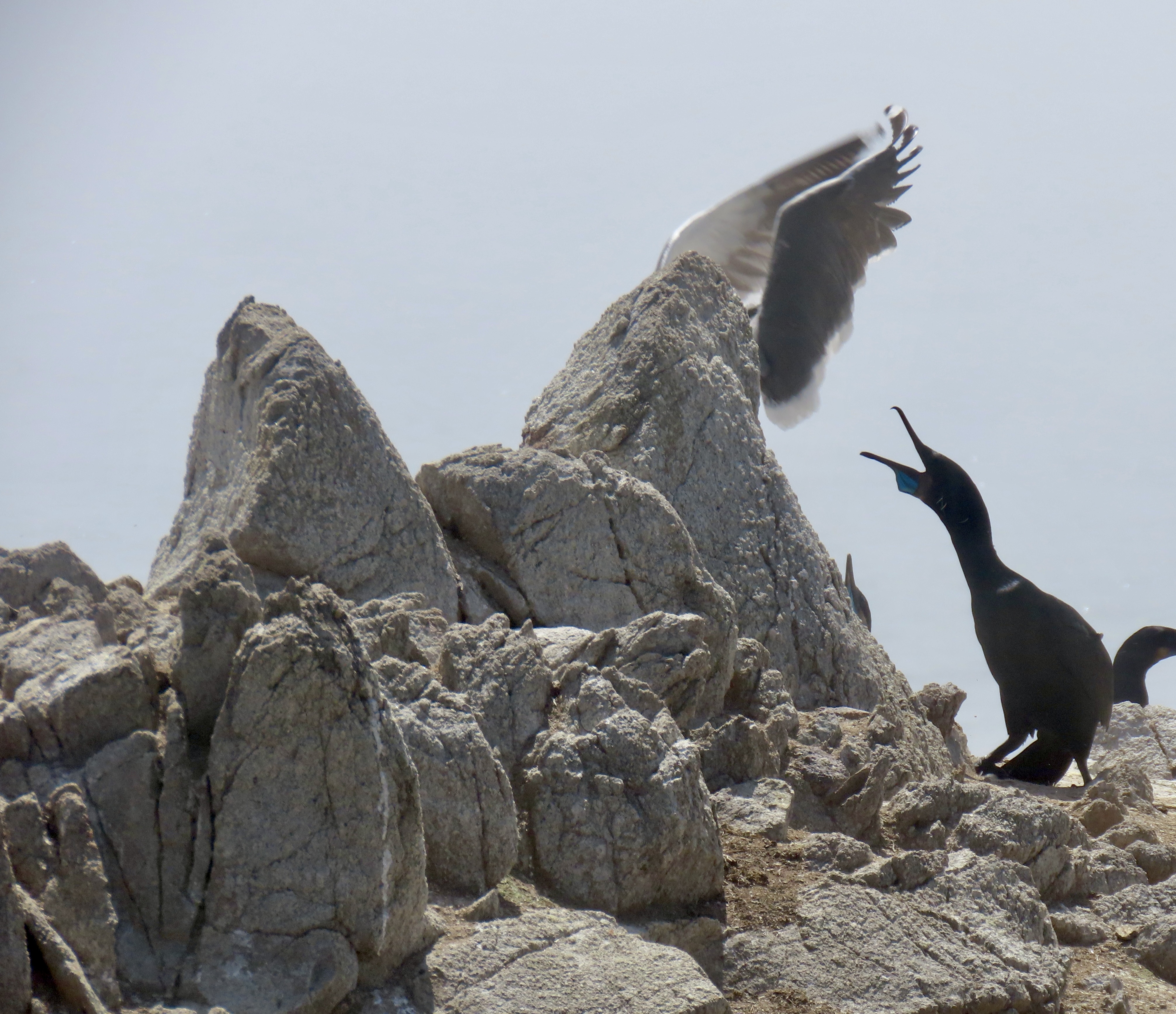
Peggy and I watched this pair of Brandt cormorants at the Point Lobos Reserve near Carmel, California as they shared a quiet snuggle. We had watched the two interacting for 10 minutes and we couldn’t help but think how human they seemed to be. The cobalt blue neck pouch and the white whisker-like feathers are both signs of mating season.
This is the second half of our series on Point Lobos. In my last post, we visited the northern part of the park and emphasized the natural beauty of the area. Today, we are going to explore the southern part of Point Lobos where we will feature the cormorants and seals. We had the opportunity— I might even say privilege— of watching cormorants as they went about the serious (and sometimes humorous) process of attracting and interacting with mates and mother seals as they watched over their babies. We will continue to explore the beauty of the park as well. How could we not? It’s Earth Day.
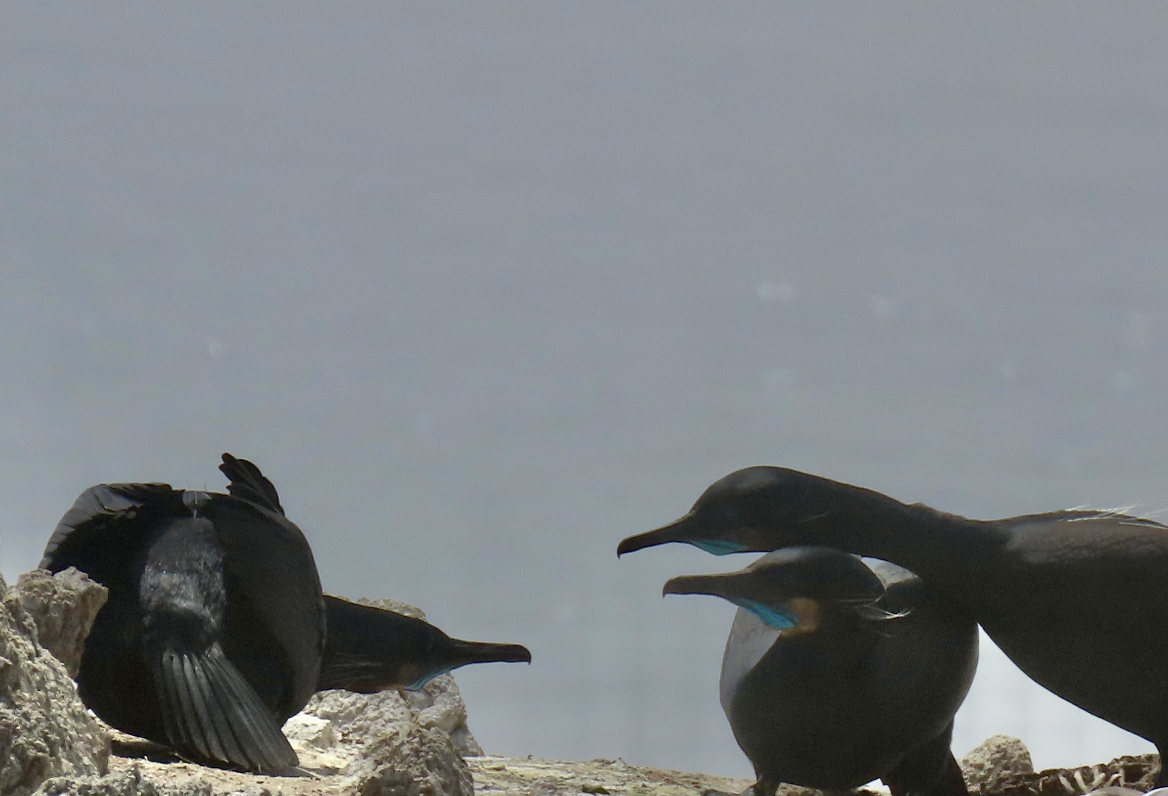
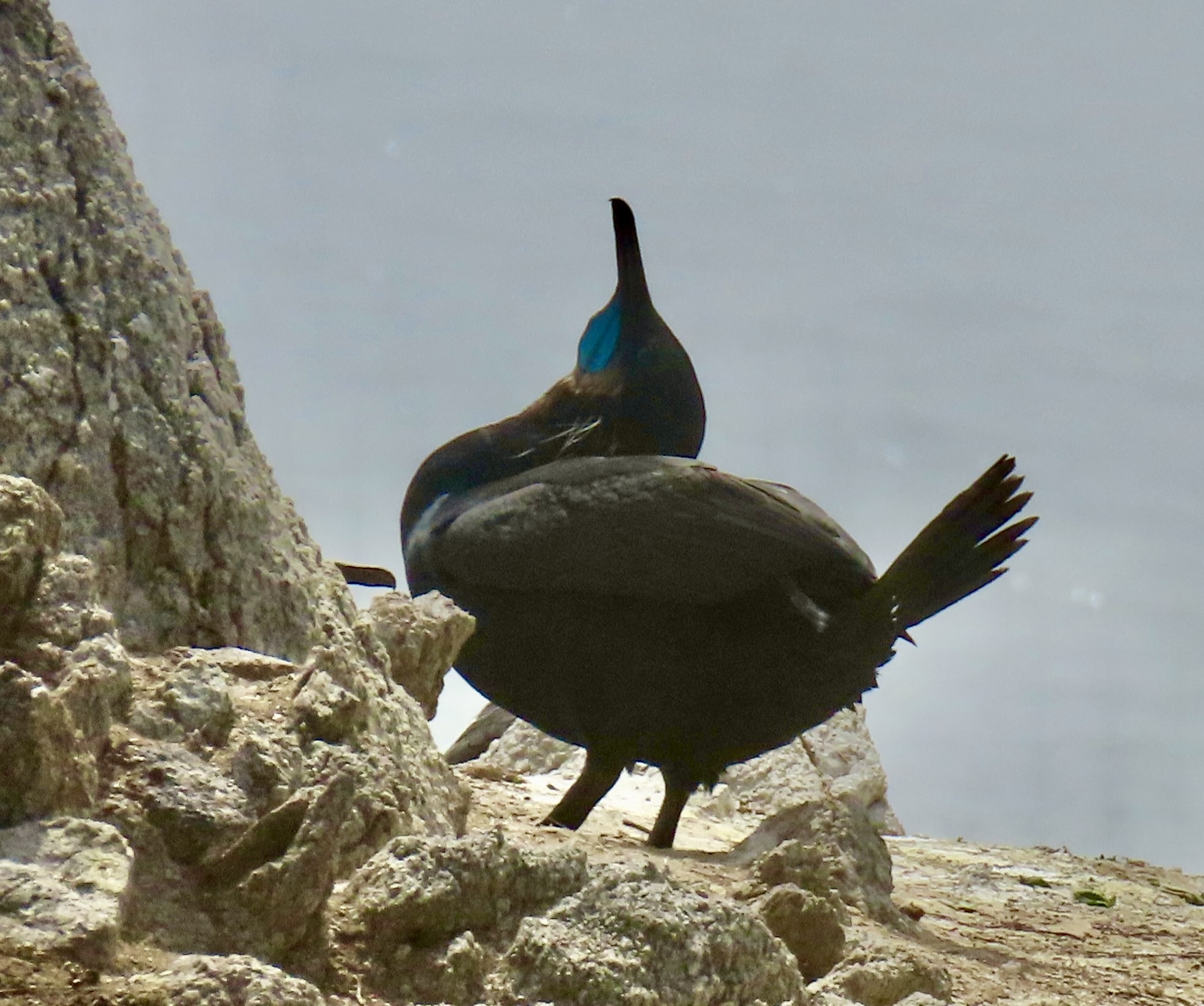
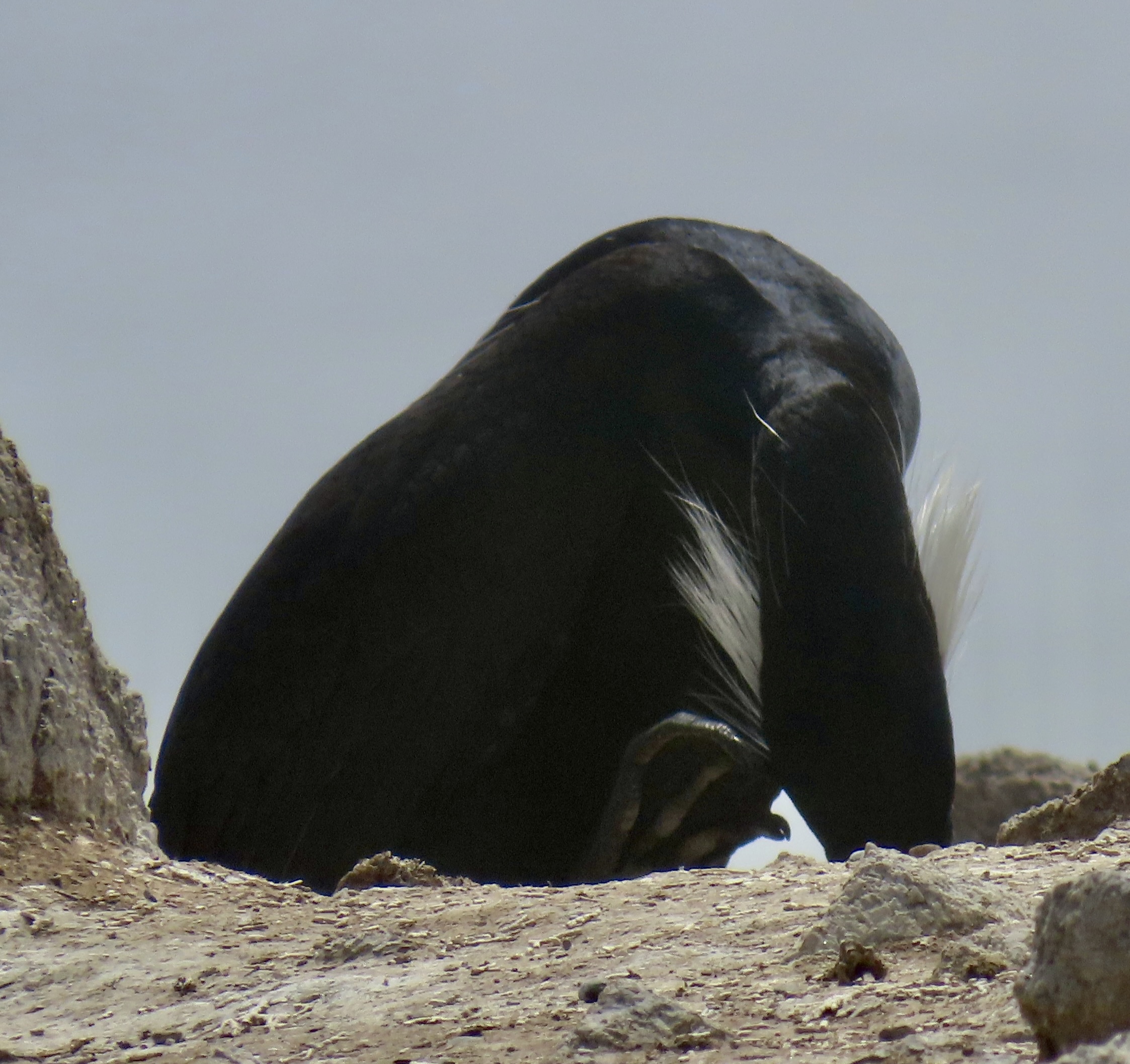
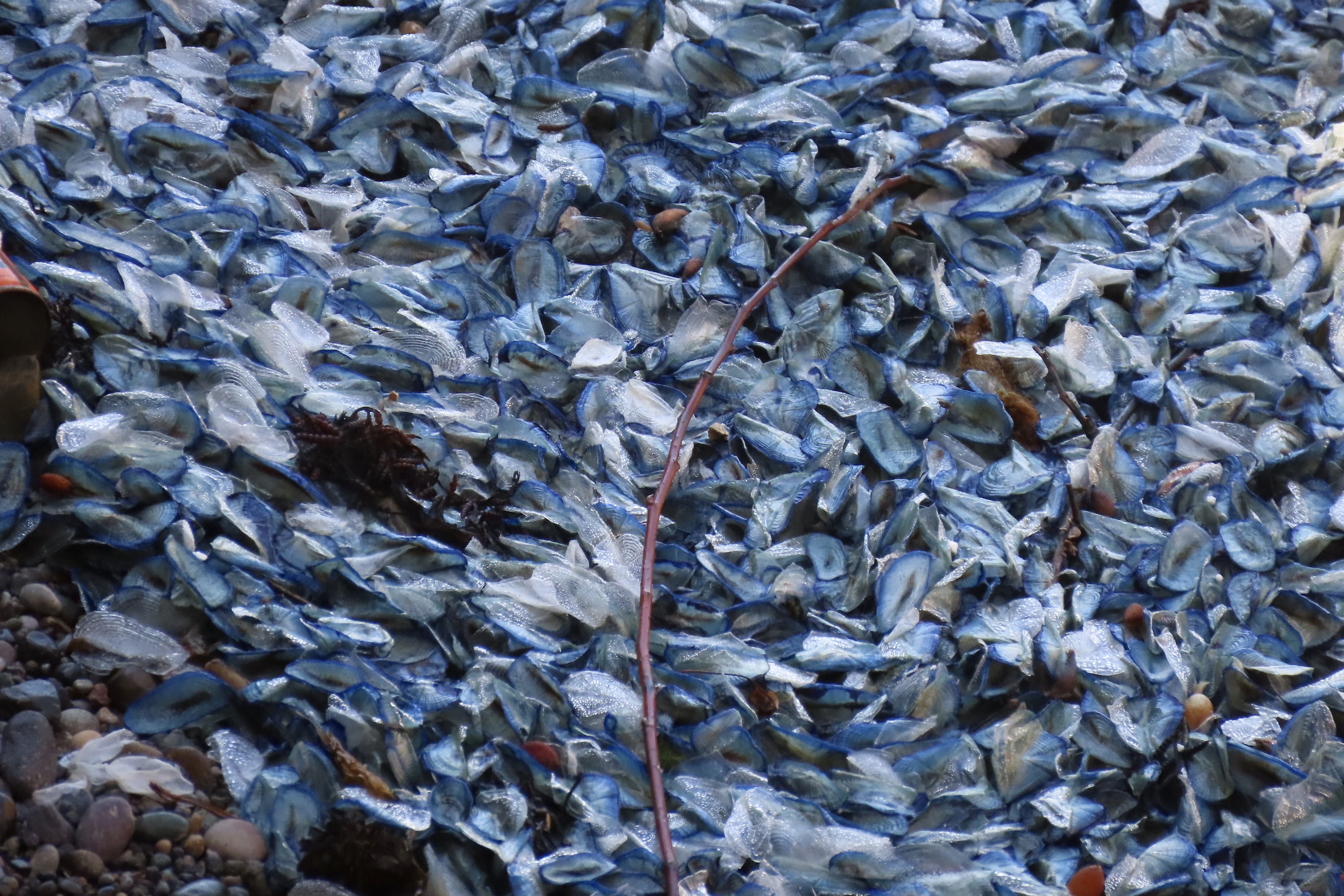
A California sea gull insisted on being in our first photos of the two cormorants shown above. The cormorants divided their attention between communicating with each other and checking their surroundings. Or maybe they were necking.They totally ignored the seagull. Is this a cormorant kiss?The gull decided to vacate the premises. It had gathered something in his beak that might have been nesting materials. It’s that time of the year. On the left, you can see another cormorant that apparently had something to say to the couple.In my imagination, she was seeking advice.Just before, the female had been eyeing a male on the rock above that seemed to be totally ignoring her. I imagined her asking, “How do I get his attention?”“You have to strut your stuff.”“We mean really strut your stuff.” Right about then, a pelican flew over and scared away her potential mate. She was not happy. Peggy caught the action.Meanwhile this pair went on with their discussion. Possibly they were discussing nest building. It’s the male’s responsibility. “You need to get busy, dear.” Was she egging him on?Actually, an important part of the mating ritual is for the male to build a nest with the hope of attracting a female to use it. We watched another male advertise his services. It appeared that the the nest was a little too makeshift. The female did not seem impressed. Maybe it was the fact that she had just watched him steal the materials from another cormorant! You can see the beak of the crime victim in the upper left hand corner about to deliver a peck.I liked this photo because it displayed the white whisker-feathers a Brandt cormorant grows during mating season. It also showed one of the big feet it uses for swimming. The cormorant is an excellent swimmer and can dive as deep as 200 feet in pursuit of fish.A final portrait of cormorants doing their thing.A seal birthing area was located right next to Bird Island where we watched the cormorants.This photo shows the steep cliffs that serve to protect the seals and their babies. It also shows the advantage of having a good telephoto lens to get close. Peggy and I happily snapped away.A mom and her baby had settled next to another seal that looked pregnant. The baby worked its way around to the other side of its mom. Was it looking for a hug?You may have wondered why we thought the other seal was pregnant. Well…There were several seals and pups in the area. I used this photo in my last post.We watched a mother seal swim in with her baby. A wave had washed the baby up against the mother.Peggy caught this shot of the mom checking up on her baby. Are you curious about all of the blue/grey/white stuff the seals are lying in?They are Velella, a small jelly fish that comes with a sail on its back. It normally lives offshore and uses the wind to move about in large numbers. Occasionally a strong Westerly will blow thousands of them ashore, however, where they die. And stink. I’ve seen and smelled them several times over the years. Apparently the odor does not bother the seals.Moving on from smelly jellies, here’s an Indian Paint Brush…And crashing waves…Lots of them…More…What they looked like close up. I don’t know which of us took this photo. It may have been a mistake, but I found it very interesting when I was looking through our photos for this post. Having expended its energy, a wave gently retreats back to the ocean.Neither Peggy nor I can ever resist stones that require little imagination to turn into creatures. We were sort of thinking Easter Island.Nor can we resist a flower garden framed like this?A series of sea caves were also quite photogenic. The water had a translucent quality.This rock offered two caves. Eventually the caves will cut all of the way through and create a sea stack. Of course the ‘eventually’ could mean a few hundred thousand or million years. Why hurry.The color of the water caught our attention here.These islands mark the southern boundary of Point Lobos.A final photo to wrap up our two posts on Point Lobos and another reminder of how beautiful and precious the world we live in is. And how important it is that we protect it. Next up: We go inland to Pinnacles National Park. One of the latest created in America’s great system.Peggy and I are in Sacramento now, heading out to our next Pacific Coast location: Pt. Reyes National Seashore. We came to town to visit with family and friends, which we always do when in the area. This time we had another special treat: Meeting with Jenny Collins, a fellow blogger on Word Press whose blog is Bulldog Travels/Photos by Jenny. Jenny and I started following each other 9 or 10 years ago. We have a lot in common. She loves traveling, nature, and photography, as many of us do. We also come from the same area, however, which adds another layer. This time we met at a restaurant in Auburn which Peggy and I used to frequent 30 years ago. It was the first time we met Jenny and we had a delightful time. I was reminded of just how valuable the friendships we make on WordPress are. Jenny’s last post was a gorgeous photo essay on Yosemite National Park. I recommend that you check it out at bulldog travels.com.
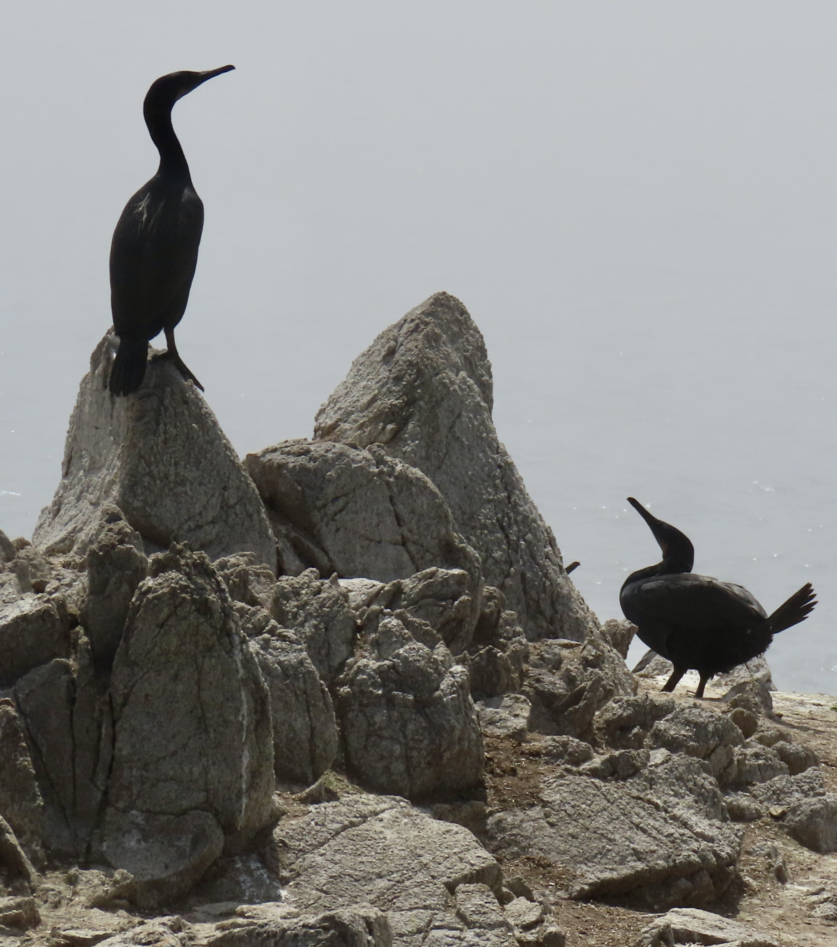
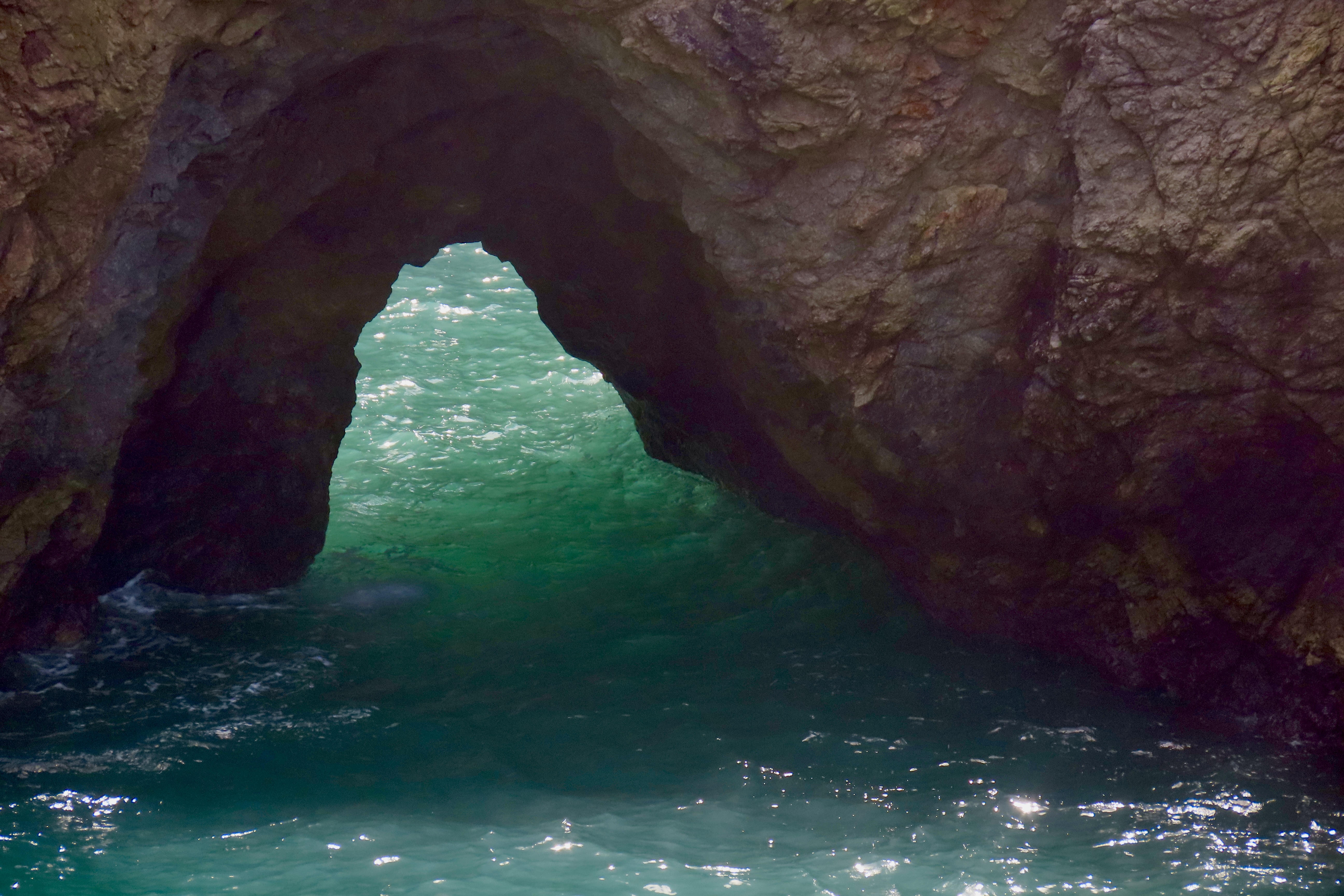
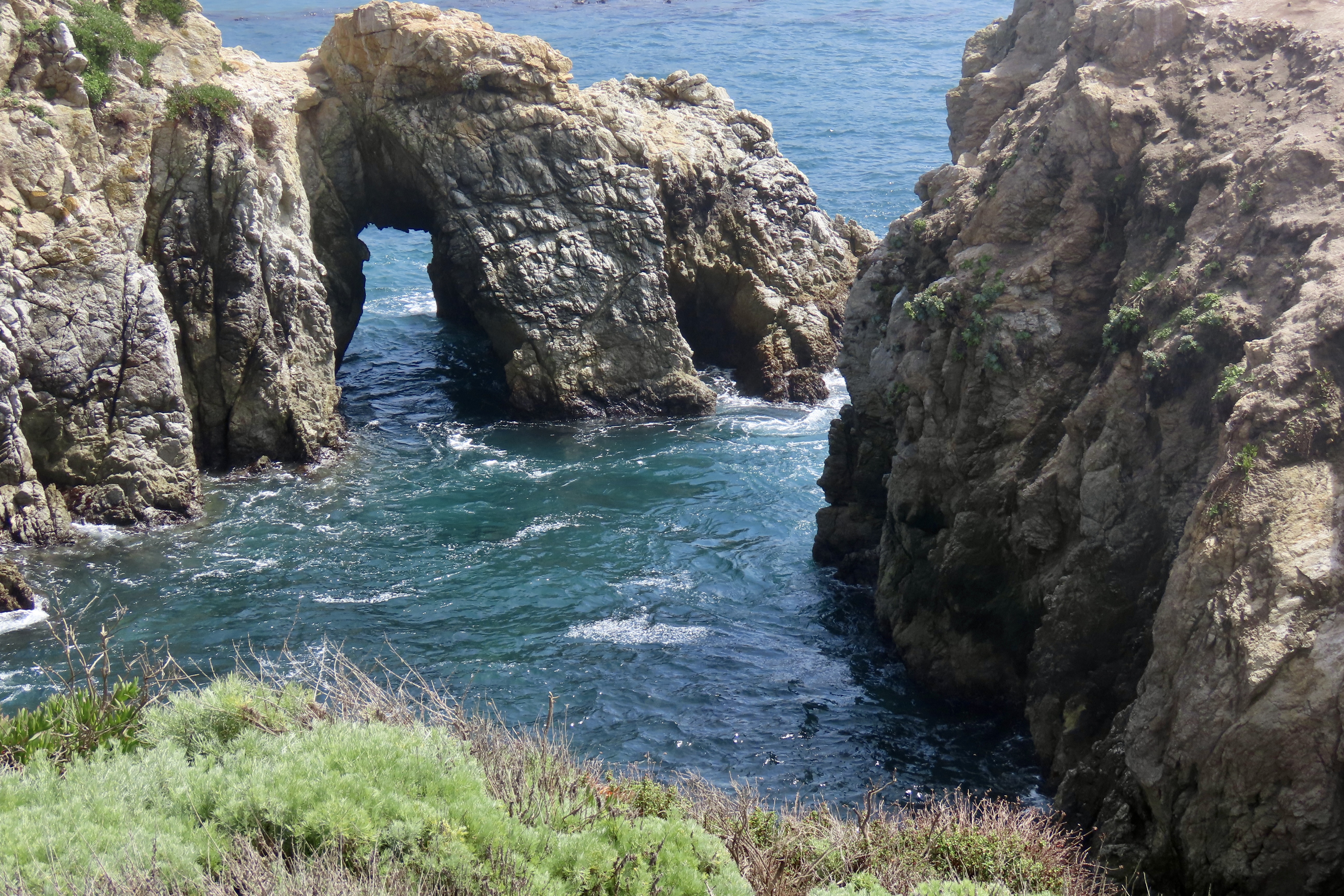
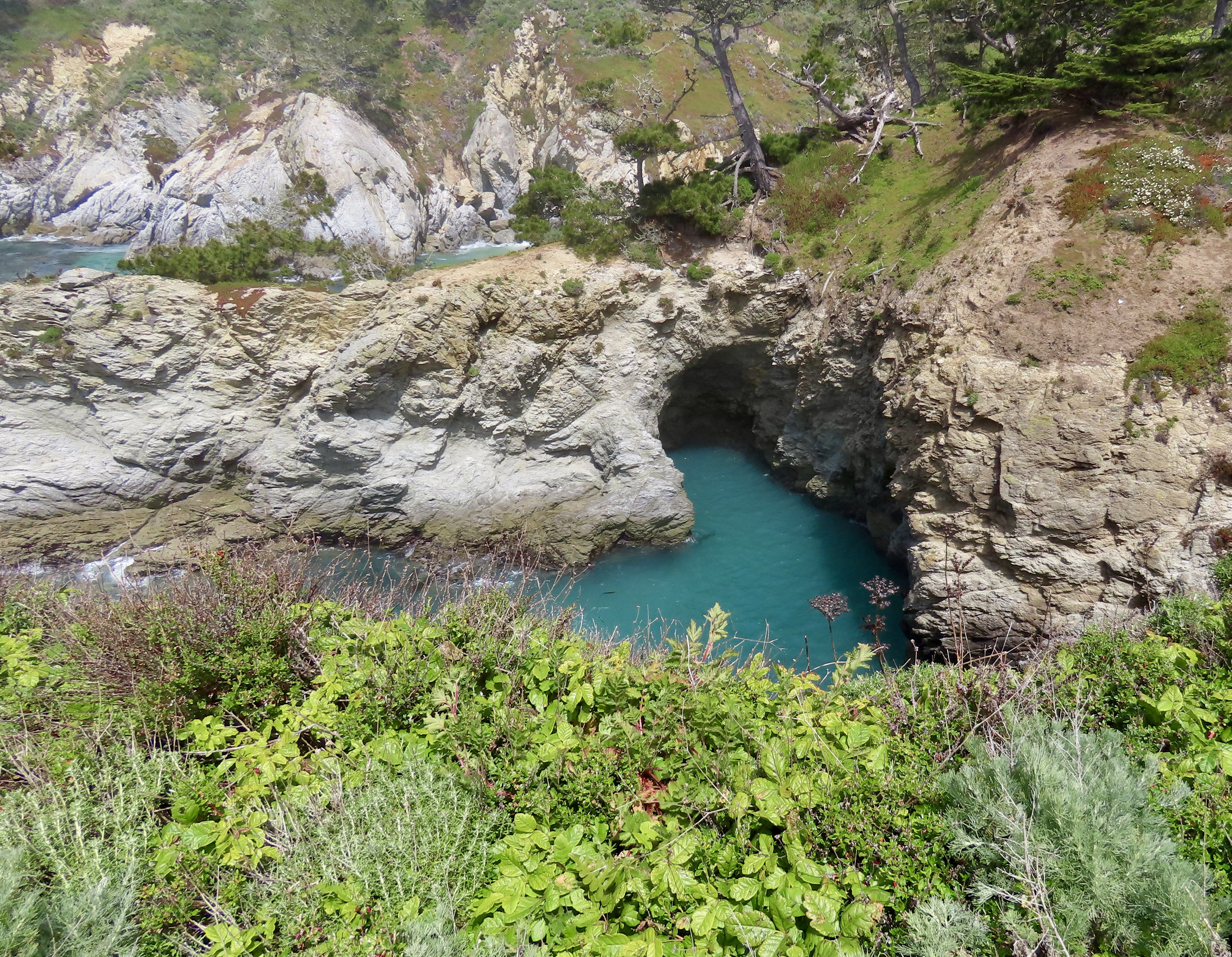
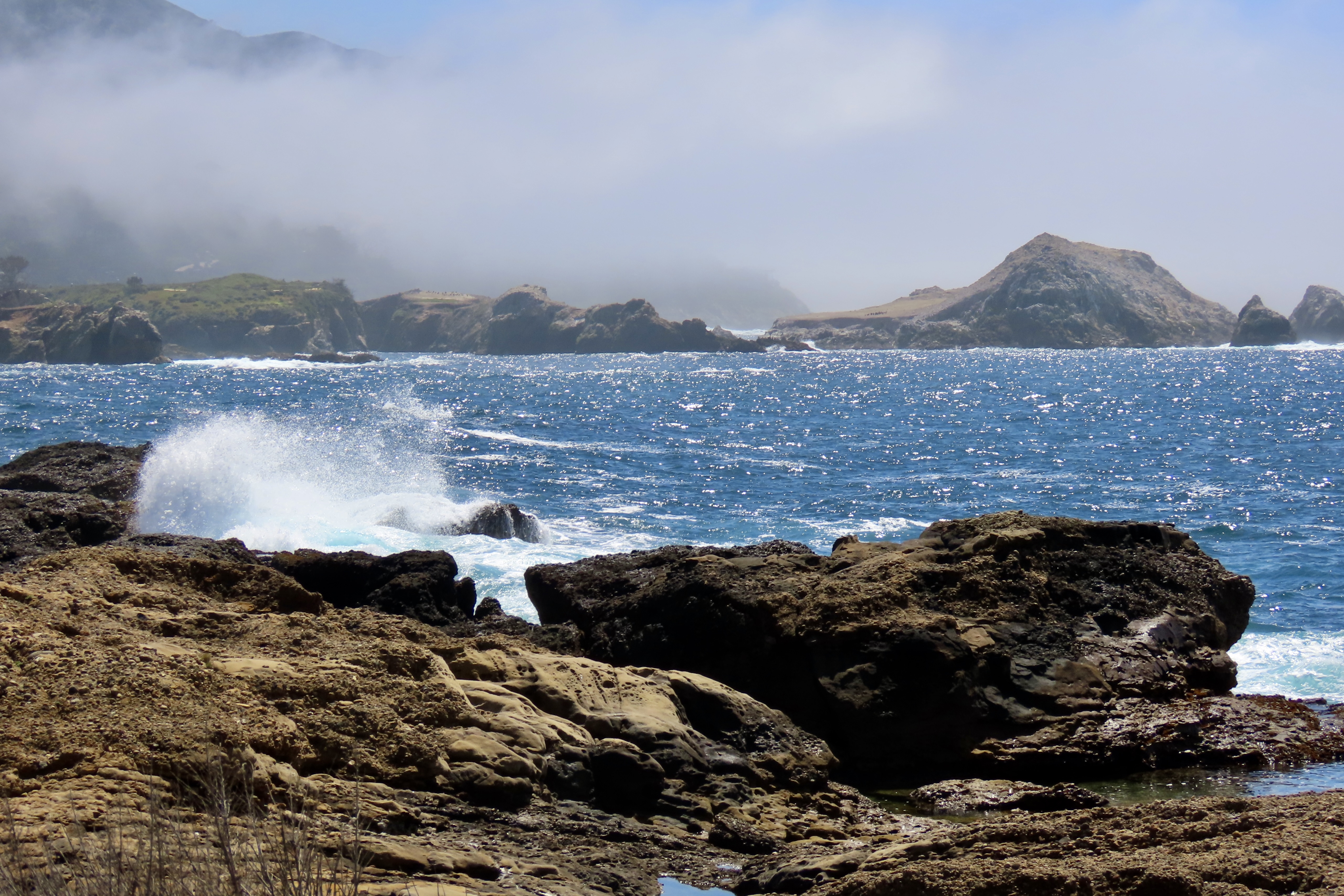
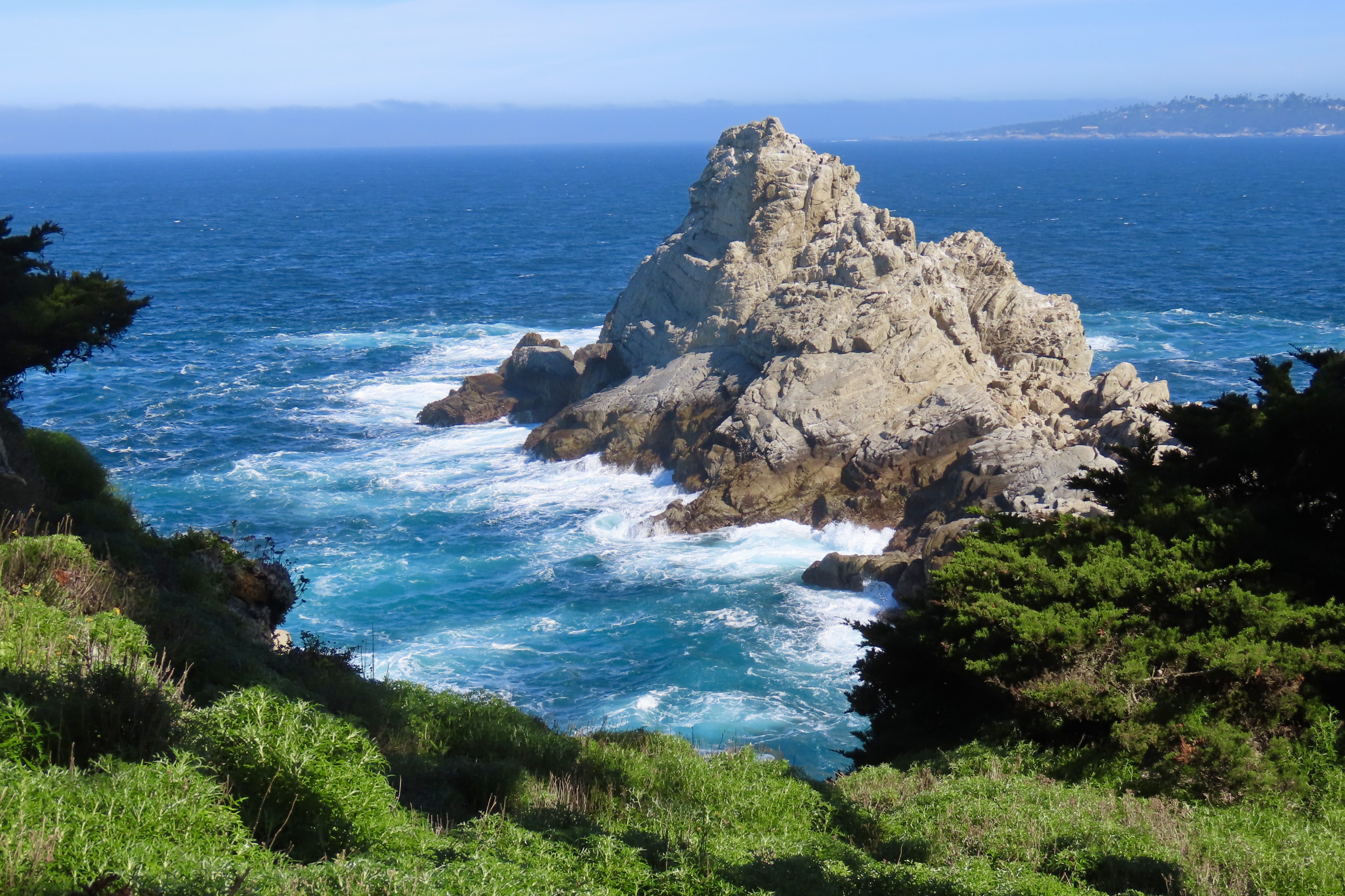
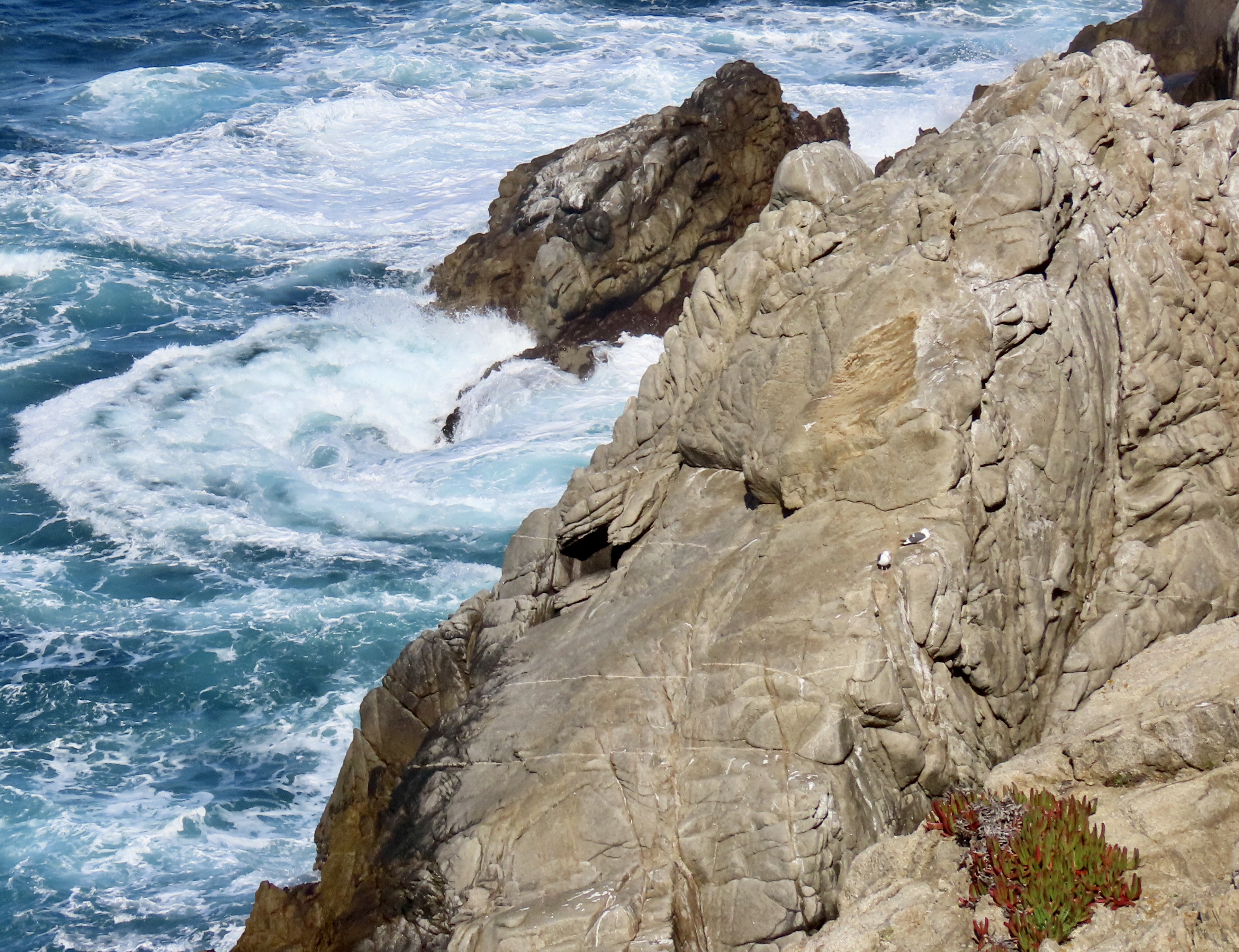
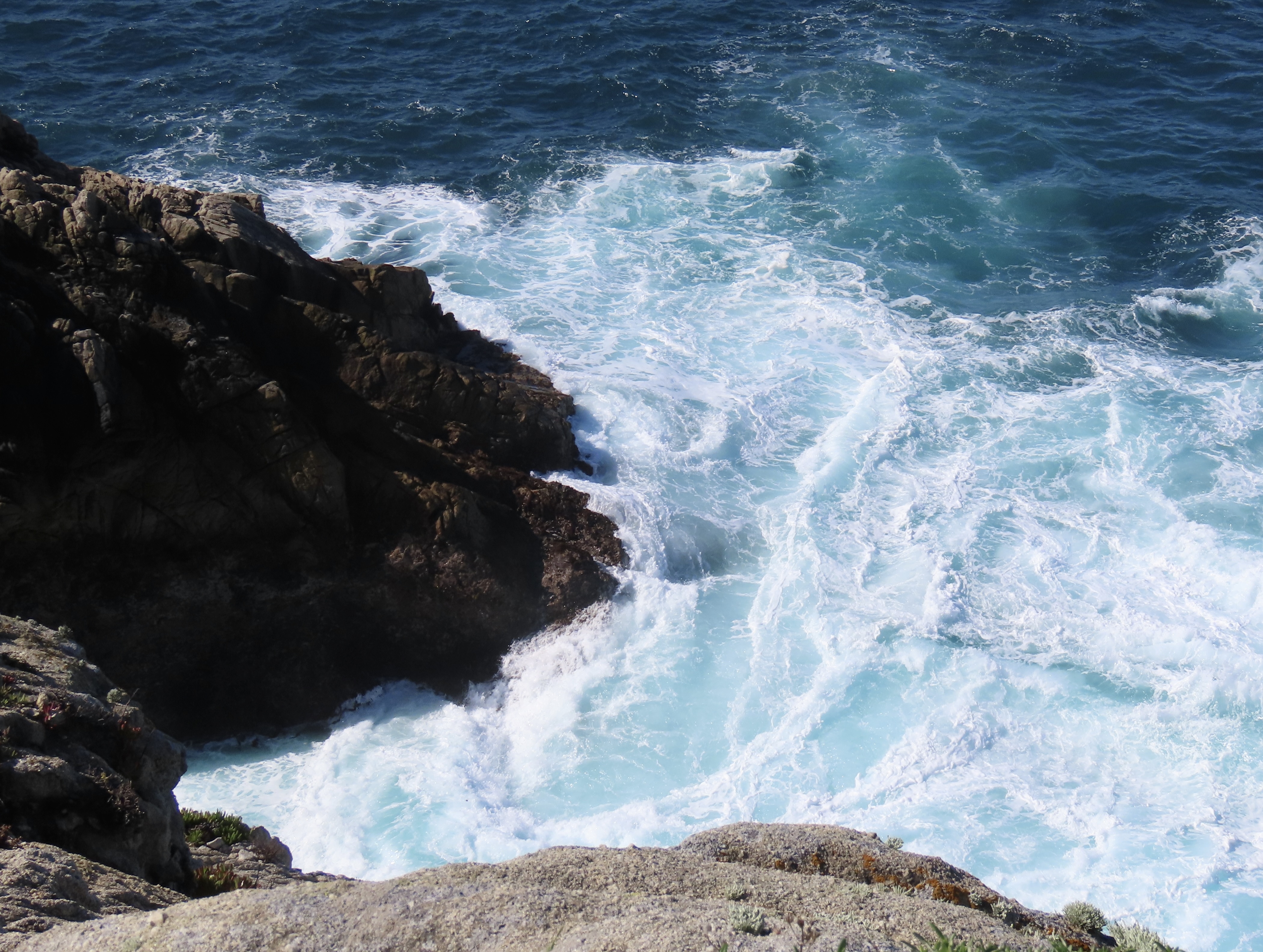
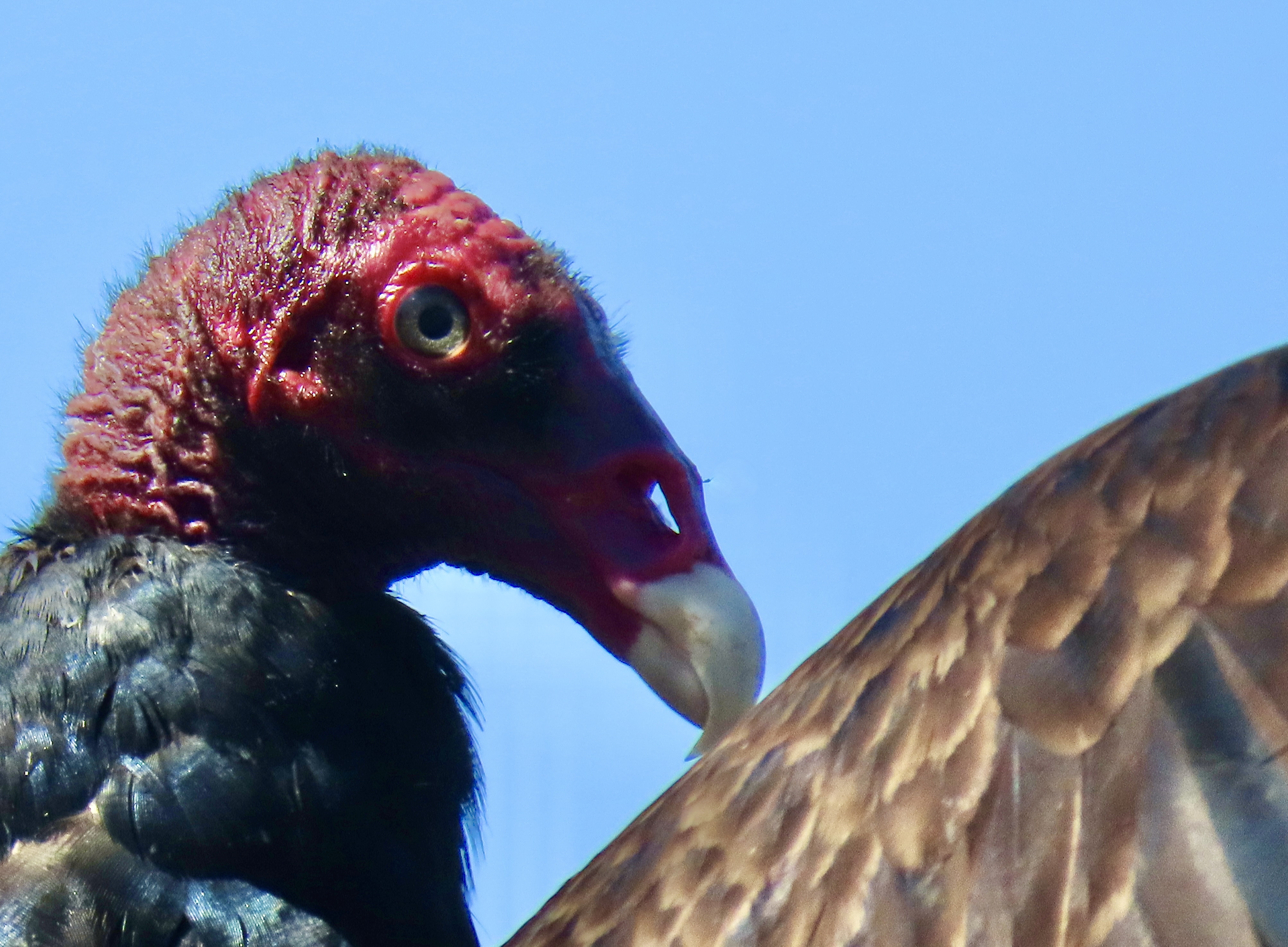
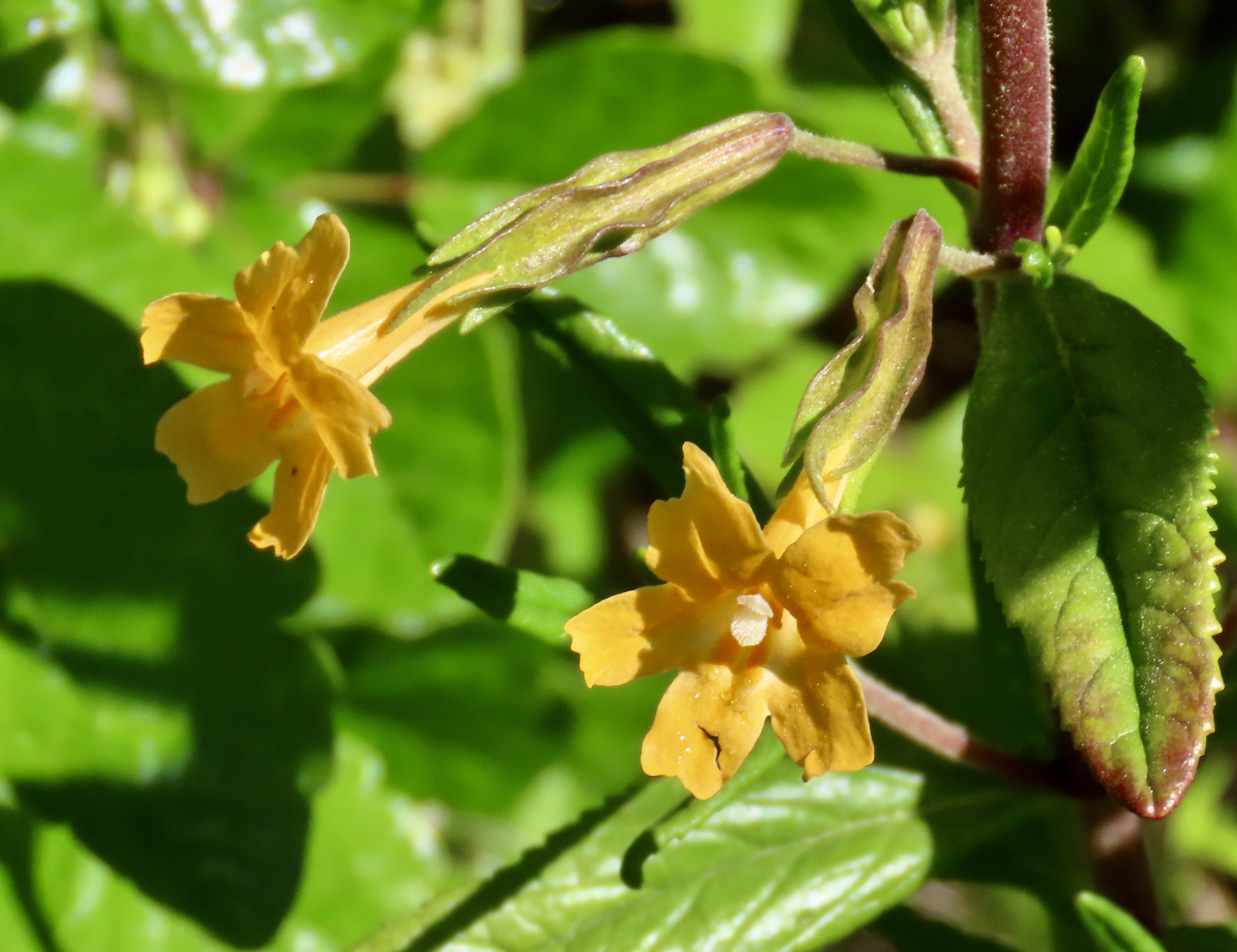
Point Lobos is considered one of California’s most beautiful state parks. The world renowned photographers Ansel Adams and Edward Weston would agree. They spent years returning to the park again and again to capture its beauty. it is located just south of Carmel along highway 1. Hiking out the Cypress Grove Trail, Peggy and I came upon this sea stack known at the Pinnacle.Peggy found unique ways of framing it, including the twisted limb on the upper right.She was having great fun with her new camera! See the black dots on peak…Like many sea stacks up and down the Pacific Coast, it had its own flock of cormorants.Another perspective. Following are other views along Cypress Grove Trail.Both sides of the peninsula leading out to the Pinnacle provided different views of Pacific Ocean waves rolling in.I am ever fascinated by the patterns in water created by the waves and tides— infinite works of art.A view from the south side of the Cypress Grove Trail.And another.A close up.As might be expected, we found some very impressive cypress trees growing along the Cypress Grove Trail.Ansel Adams and Edward Weston both loved the gnarly cypress trees. I rendered this one in black and white to honor them.Flowers are also abundant in the Reserve. I stopped to capture this iris. Peggy had beaten me to it.Invasive but striking, Oxalis or Bermuda buttercup, is another native of South Africa.Does a flower get any more yellow?Wild lilacs greeted us at the beginning of the Cypress Grove Trail.As did this nettle, coastal hedge. You can look, but best not touch.I had my nose in a flower when Peggy said, “Curt, check out this buzzard.” She had photographed it with its wings spread. We were on the Whaler’s Cove Knoll trail on our way to Whaler’s Cove.It had ignored Peggy but it started to give me the eye with a hungry look. Or was I imagining things?Hmmm. I wasn’t sure about being eyed by the buzzard, but I admired its beautiful feathers.This may the occasion for one of those “You know you are old when a buzzard thinks of you as a potential dinner,” jokes.The daisy I ‘had my nose in.’ I totally missed the spider!Another daisy of a different color. Our flower app identified it as a seaside daisy.An old friend: Bush, monkey flowers.A small museum housed in an old whaler’s cabin at Whaler’s Cove provided a bit of history. I should not have been surprised to learn where Monterey Jack Cheese came from. Jack made it. Grin. Actually, it was originally known as Jack’s Cheese. The Monterey was added later. A number of industries were located at Point Lobos. In addition cattle ranching, cheese making, and whale hunting, they included the largest abalone factory on the West Coast.One reason I wanted to hike over to the Cove was because the last time I was at Point lobos, I saw a seal nursing its baby there. We missed that, but we did see a mother with its baby swimming along behind. We had to travel down to the southern part of the park to find more mother seals and their pups. We will be featuring them, along with cormorants, and more great scenery in our next post.Next time: There will be close ups!
Jellyfish: The best aquariums have to have them and the Monterey Bay Aquarium is one of the best in the world. A whole room is devoted to their ethereal beauty…We, along with umpteen thousand other people, patiently made our way through the five person deep crowds gathering in front of each display case and dutifully took photos with our cell phones. The jelly fish came in a multitude of shapes, sizes and colors.
It was a rainy and cold last week when we visited the Monterey Bay Aquarium with high hopes that a combination of visiting mid-week during nasty weather might tamp down the crowds. Label that wishful thinking. The weather meant that people would be looking for an inside location. Duh. And, with the Big Sur highway washed out, there were a lot more people in town than usual. We joined a long line that snaked its way up the hill and around the side of the building before winding through a crowd control maze and back down the hill. Thankfully, the weather gods put the rain on hold for the 30 minutes it took to reach the entrance.
What had to be tamped down was my normal claustrophobia brought about by large crowds wanting to see the same thing I did. Fortunately, the jellyfish, sea otters, sharks and countless other forms of sea life were guaranteed to put a smile on my face and cure my grumpiness.
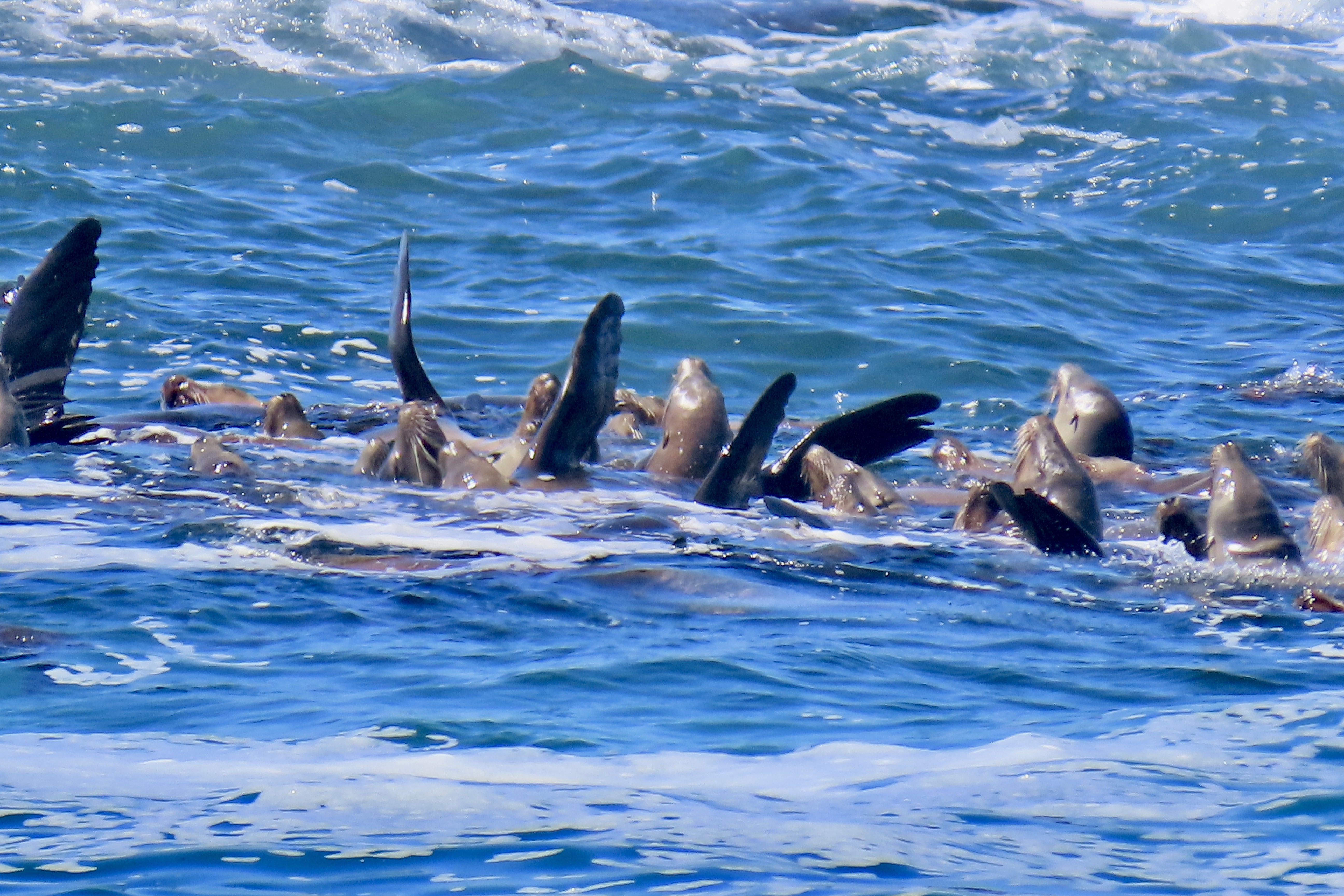
This smiling fellow with a barely hidden toothy grin is a moray eel. As friendly as it looks, you wouldn’t want to pet it. Morays have an extra set of jaws in their throats. When they bite into a tasty morsel with their front jaws, the back jaws spring forward and drag the meal down their throat. These snake like critters can grow up to five feet in length. Peggy was scuba diving in Corona Bay, Palawan in the Philippine Islands once exploring a sunken ship and peeked in a port hole. A giant moray took offense and shoved its head out of the port hole. Fast. But not nearly as fast as Peggy retreated.Colorful fish swim unharmed among predatory sea anemones. Apparently some fish develop a mucous coating that makes them impervious to the anemones’ stinging tentacles.A sea anemone, front and center, waves its tentacles in hopes of attracting its next meal.One of the top attractions at the Aquarium is a huge tank which supports a kelp forest and a wide variety of fish including this shark. Our cell phone didn’t take the best photo here, but you get the idea. Ocean View Blvd. starts just outside of the Aquarium and leads into Pacific Grove and around the Monterey Peninsula. It’s where Peggy found the seal balanced on a rock that we featured earlier.A seagull was hanging out at the same pullout, hoping for a handout.It had knobby knees.There were lots of flowers along the drive. In fact Pacific Grove, Monterey and Carmel are all filled with flowers. The large yellow flower belongs to an ice plant. The purple flowers are hairy dew flowers according to our flower ID app.Ocean carved boulders made their way down to Monterey Bay.Where the ocean continued its multi-million year task of creating new boulders.Ocean View Blvd. morphs into Sunset Drive, but we were a little early to take advantage of the evening show. Sunset Drive, however provides an entrance to the 17 Mile Drive which connects Pacific Grove with Carmel. The 17 mile Drive is equally famous for its views and golf courses. For a mere $47,000 you can buy a membership at Pebble Beach. There is also lots of wildlife along the way. This is Bird Rock. All the little black dots you see are birds, mainly cormorants plus a few brown pelicans. Closer view of the cormorants and one seagull. We have lots of fun photos of cormorants in our next post (soon) about Point Lobos State Park.What caught our attention more that Bird Island was a raft of sea lions, which was something that Peggy and I had never seen before.What we learned was that the sea lions come together to rest instead of climbing up on a rock or the shore. It’s thought that raising their flippers in the air is a way to control their body temperatures. The raft also provides some protection against predators such as orcas. The sea lions were also snoozing on a rock that was next to Bird Rock.I find it fascinating how they drape themselves over the rocks.Mmmm, a nice comfy pillow…Any drive down the 17 Mile Drive has to include the iconic Lone Cypress. I’ll finish up today rendering it in black and white simply to note that people have been taking photos of the Lone Cypress as long as they have had cameras to do so. I first saw it in the 70s when I used to drive my VW camper down to the area and park for free along the ocean south of Carmel. I was almost a hippie…Our next post will feature the beautiful Point Lobos State Reserve just south of Carmel. Mother seals and babies were just one of many sights Peggy and I enjoyed.
There is an entrance to the Fort Ord National Monument near us, a mere 20 minute walk from where we are camped at the Laguna Seca Regional Park. The monument was once an army base, rightfully billed as the most beautiful army base in America. Getting there from our camp requires climbing a steep hill and hiking along a ridge. We’ve been there twice. The first time we went without our cameras. Boy, was that a mistake. Wild flowers were bursting into bloom everywhere. Then we came upon a whole field of the eye popping beauties featured above. They came in multiple bright colors. Then and there, we vowed “We’ll be back!”
The next day found us climbing the hill again with my camera. Peggy’s camera, and our cell phone. Just in case. We entered the National Monument and I dutifully went to work, capturing wildflowers as I walked along the trail. Peggy took off like a greyhound. That woman can move when she has a mind to! I think she was afraid that the flowers we had so admired the day before would be past their prime, expired, and that somehow ten minutes was going to make all the difference. When I arrived a half hour later, the flowers were still in their prime, new ones had joined the crowd, and over a gazillion buds were waiting for their turn. Peggy quickly announced that she had taken over 20 photos of the flowers. She never takes 20 photos of any one thing. That’s what I do. Naturally, I had to add to her collection.
One challenge we faced was we didn’t recognize the flower. I knew it was a composite, a member of the vast family of sunflowers, daisies, asters, etc. Not a problem, we thought. Ha. That evening, I checked my National Audubon Field Guide to North American Wildflowers with its 666 entries. No luck. Okay, time to jump online. I typed in flowers of Fort Ord National Monument. Nope. How about flowers of Monterey County. Nothing. Flowers of the central Pacific Coast of California? Nada.
Then I remembered that we had added a flower ID app to our i-phone a few years back. Would it still be there? Peggy went searching and found it. She took a photo of my screen showing one of the flowers. And there was the answer: Gazania. What? We had never heard of it. Turns out it is a native of South Africa. I had taken photos of a number of flowers in South Africa on our safari trip there. But not Gazania.
Its beauty meant that it had been imported to the US and numerous other countries to adorn flower gardens. Not surprisingly, it had escaped. Monterey was listed as one of the counties where it happened. Following are a number of photos that Peggy and I took of the Gazania and other flowers we found along our walk both wild and wild-domesticated.
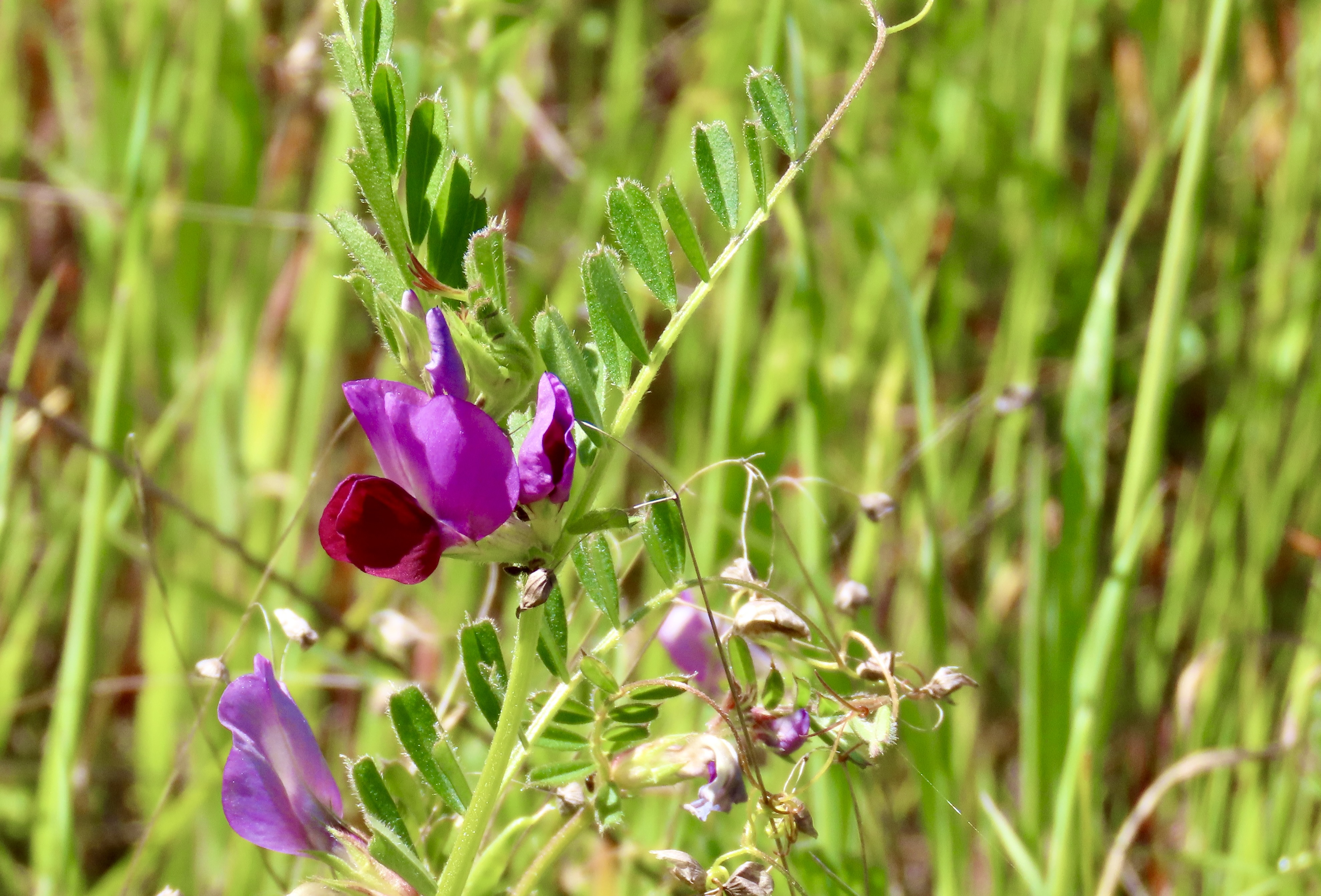
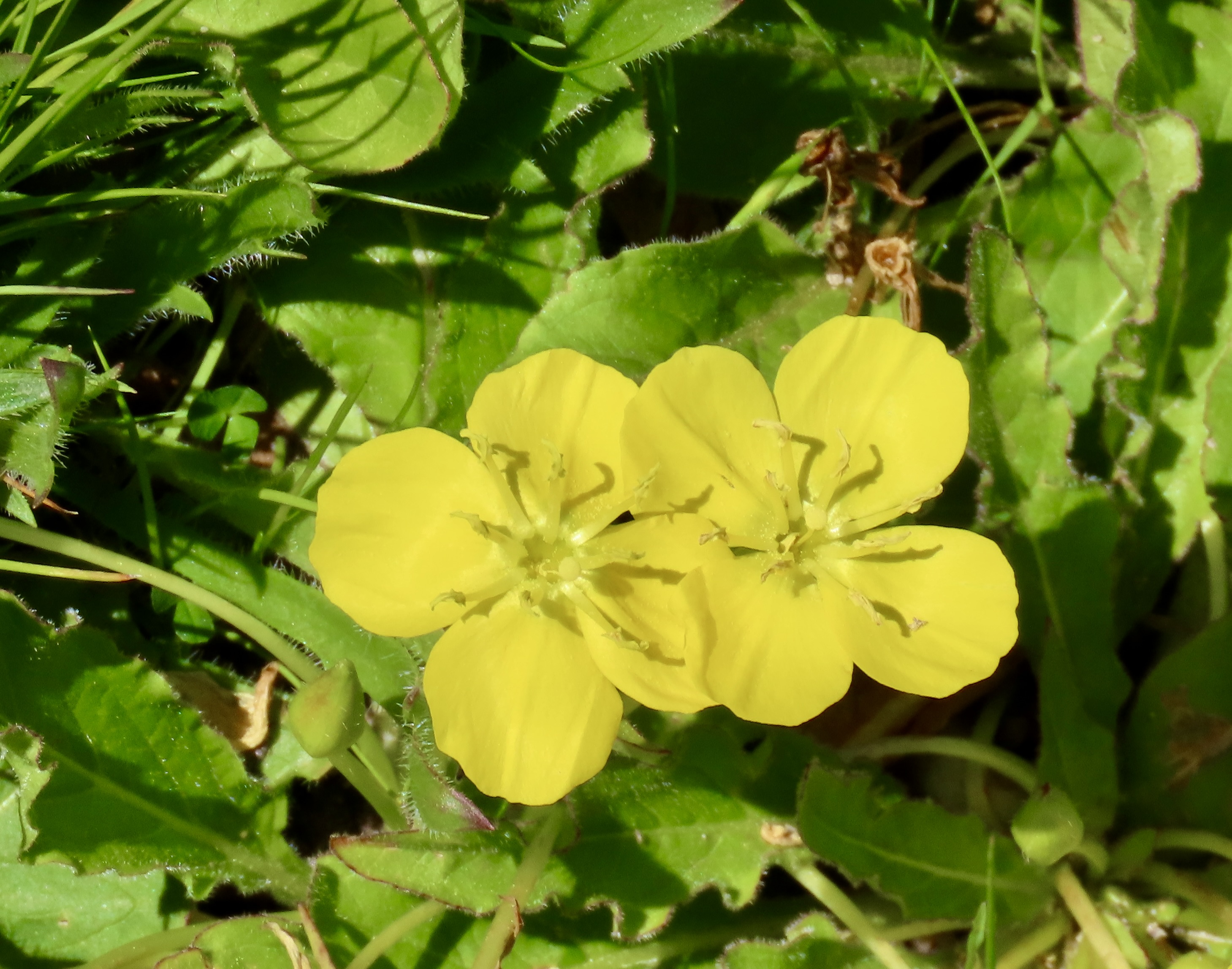
Yellow twins…Orange reddish triplets…A red single…A yellow single.A couple.A bouquet.Another bouquet.A field.A happy Peggy.Looking out from Fort Ord National Monument south toward the coast range and Big Sur.Coast live oaks on the edge of Fort Ord National Monument in Laguna Seca Regional Park. The top of a picnic table can be seen in the background. We walked through a very attractive tent campground on our way to the monument.We also found this flower growing on a bush in the campground just before we hiked into the monument. Our flower app described it as a gum Cistus.We were greeted by this sign as we walked into the park. With a rich military history behind it, the army base was closed in 1994 due to base realignment. In 2012, President Obama signed a proclamation declaring a portion of the former base as a national monument. Following are some of the wild flowers we saw. I knew most of them, but used the phone app to check.This golden violet was among the wild flowers I photographed along our trail.A member of the mallow family with spider. Can you find it?Bluedick with a bee.Yarrow with beetles.Vetch.Scarlet pimpernel.Golden eggs.It isn’t known for its beauty, but miner’s lettuce is noted for its edibility. The 49ers of the California Gold Rush mixed it into their salads regularly, as my mother did on occasion when I was growing up. I pulled a leaf and chomped down. Peggy nibbled a small bite cautiously.One of numerous members of the lupine family.Peggy and I were amused when we hiked back to our camp and found two Gazania perched above it that we had failed to notice previously. That’s it for today. Next up we will take you on two scenic drives: Ocean View Drive in Pacific Grove and the world famous 17 Mile Drive between Pacific Grove and Carmel.This view had Peggy and I both wondering what the heck we were looking at. Sea lions, yes. But doing what? I’ll explain what we learned in our next post.
An extended trip north up the Pacific Coast Highway from Carmel, California to Olympic National Park, Washington has been on my bucket list forever. It includes some of the most beautiful coastal lands in the world. Peggy and I have been to each of the places we will be visiting and they are all places we love. Starting at the bottom and working our way north for three months is new for us, however, a leisurely one way trip up the coast that promises to be uniquely rewarding. As always, you are invited to join us.
There is an ancient Chinese proverb from the Tao Te Ching that states “A journey of a thousand miles begins with a single step.” Although the distance and mode of travel may vary, it’s how all great adventures begin. I started my 750 mile backpack trek down the Pacific Coast trail to celebrate my 75th birthday with a single step and my 6-month, 10,000 mile solo bike trek around North America at 46 with the crank of a pedal. That was an adventure! An even greater one was waiting for me at the end… I met Peggy when I stepped off my bike in Sacramento. She gave me a dazzling smile and said, “You must be Curtis.” I was smitten and svelte at the same time. I’m still smitten…
I lucked out. Peggy loves adventures as much as I do and we have been on many over the past 30 years. In the past two years alone, we have traveled up the Rhine and Nile Rivers by boat, gone on an African safari, and explored 30,000 miles of North America in our pick-up, Iorek, and small trailer, Serafina. I’ve already blogged about these adventures, although I still have some catching to do.
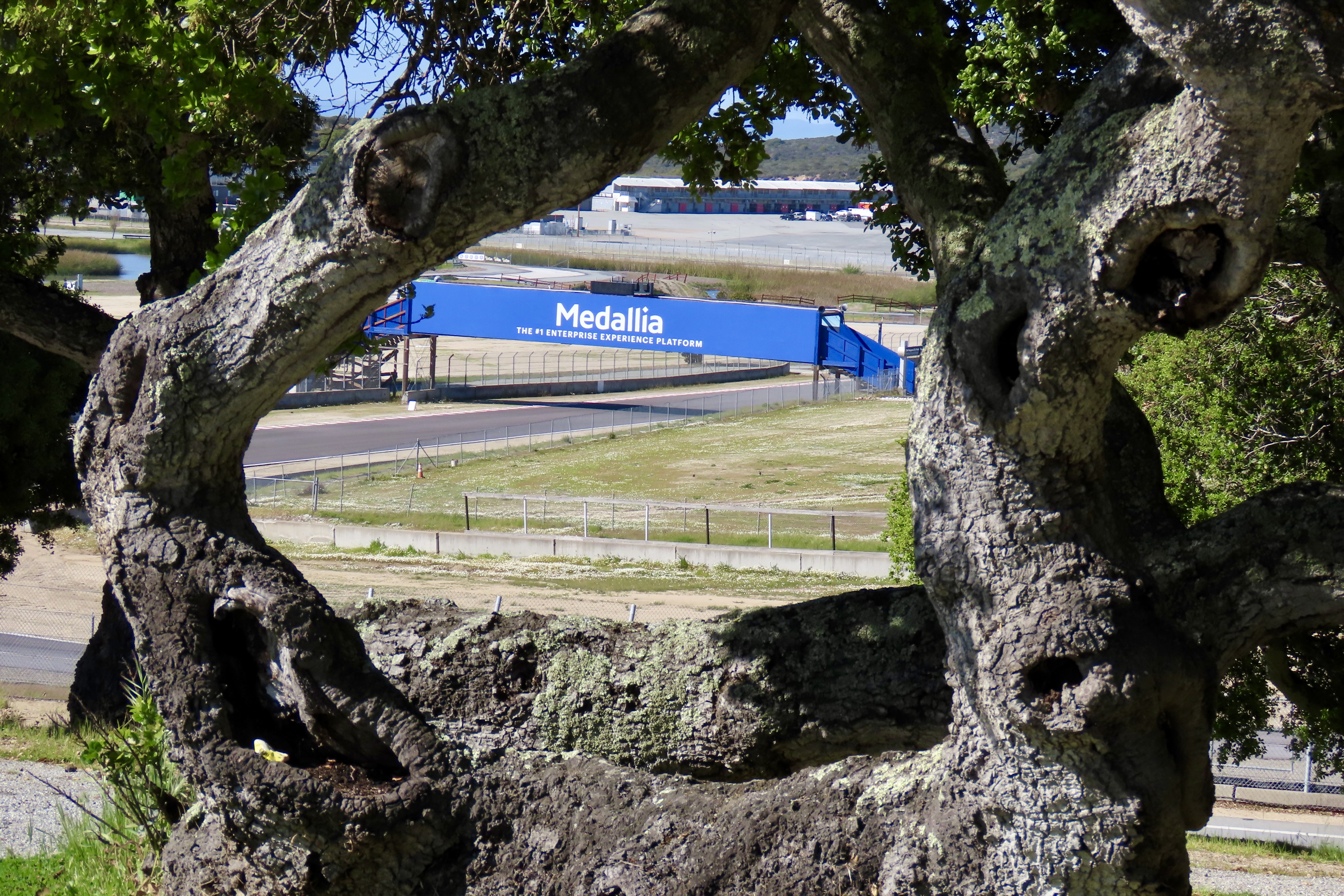
As I write this we are camped in a scenic site perched above the famous Laguna Seca (now Weather Tech) Raceway located between Salinas and Monterrey, California. An organization called Hooked On Driving— made up of a collection of passionate and dedicated high-performance driving enthusiasts and coaches— has rented the raceway for a weekend of fun and training. That’s not the big news here, however. The Sea Otter Classic starts in two weeks. Billed as the premier cycling event in the world, it will involve over 9,000 athletes, 77,000 fans and 1000 vendors! Mountain bike racing and road racing will be included with racers from beginner to pro participating.
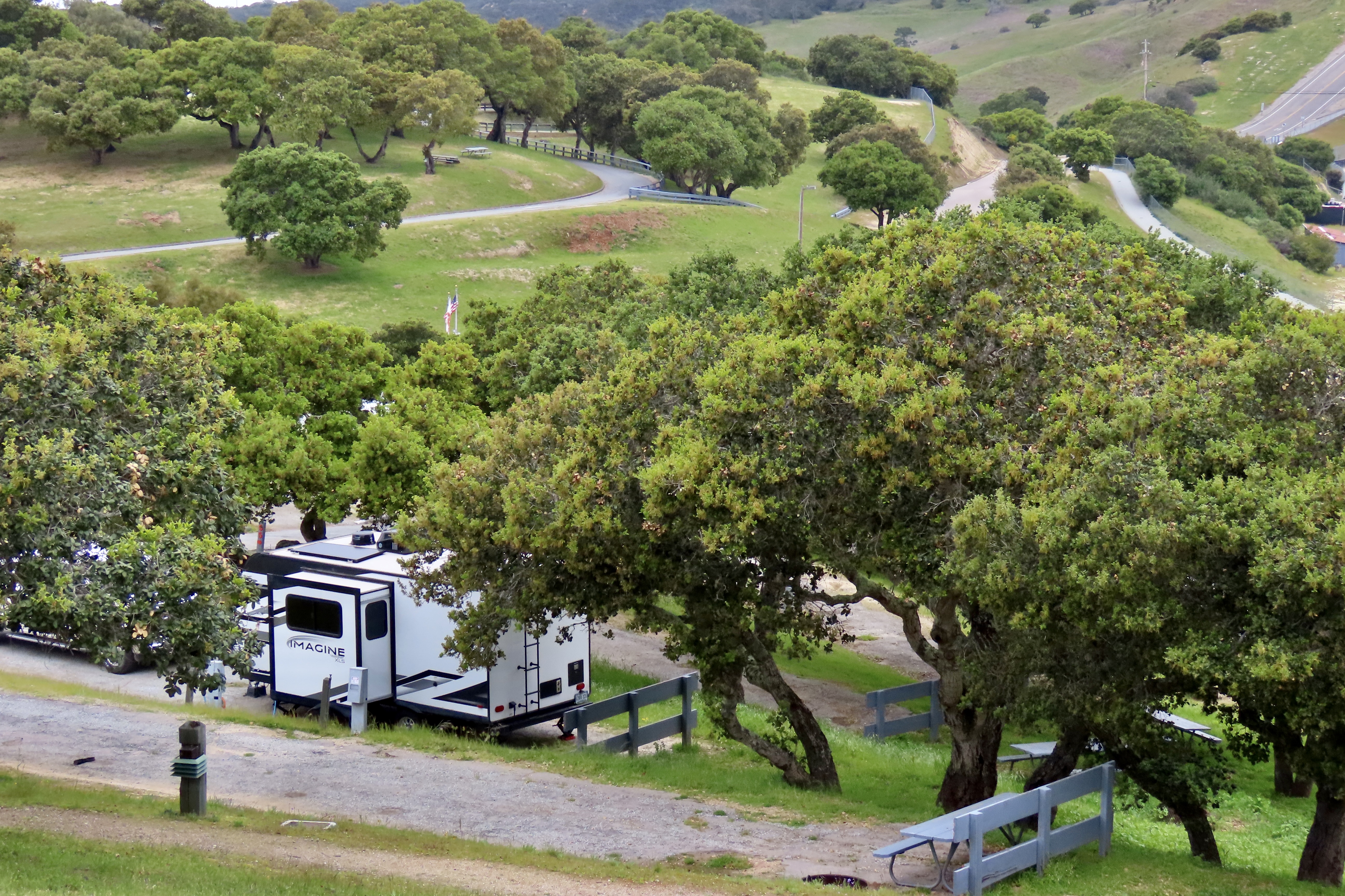
Our small Imagine trailer perched on the hill above the raceway.A view of the raceway from our campground. Fans of auto racing, motorcycle racing and bicycle racing would kill for this spot during major events.Here’s a map of the Weather Tech Raceway. We are camping at the small campground just to the right of the number 5 on the track. Fort Ord National Monument is just above us.
I suspect the participants down on the track roaring around its two mile course are having a blast. Assuming you are a fan of driving fast in a high performance automobile, imagine driving on one of the world’s top raceways. As camping spots go, however, it’s a bit noisy. Grin. Make that a lot noisy. I have my headphones on and am listening to Chopin. Peggy has hers on and is listening to songs from America’s Got Talent. Fortunately, the HOD folks will be out of here tomorrow and we will be gone before the cycling event starts. Linda, a volunteer who works at the entrance station, told us, however, that a TV crew is coming in to film a show in the next few days. I’m assuming it will involve noise. Will there be explosions?
When the race track isn’t busy, this campground is quiet as well as beautiful. It’s also inexpensive and ideally located for exploring Monterey, Carmel and Big Sur. If you follow the news, you know that Big Sur is off our itinerary this time. Part of the road a few miles below Carmel decided to go to sea a couple of days before we arrived. We were busy avoiding the storm as it made its way across Nevada. In fact much of our 3000 mile drive to get to this campground was spent avoiding storms, which we did except for one night we spent in Missouri where severe weather warnings were up on a thunder and lightning storm, high winds, hail stones that could be as large as soft balls, and a tornados. That was a fun night to spend in a trailer.
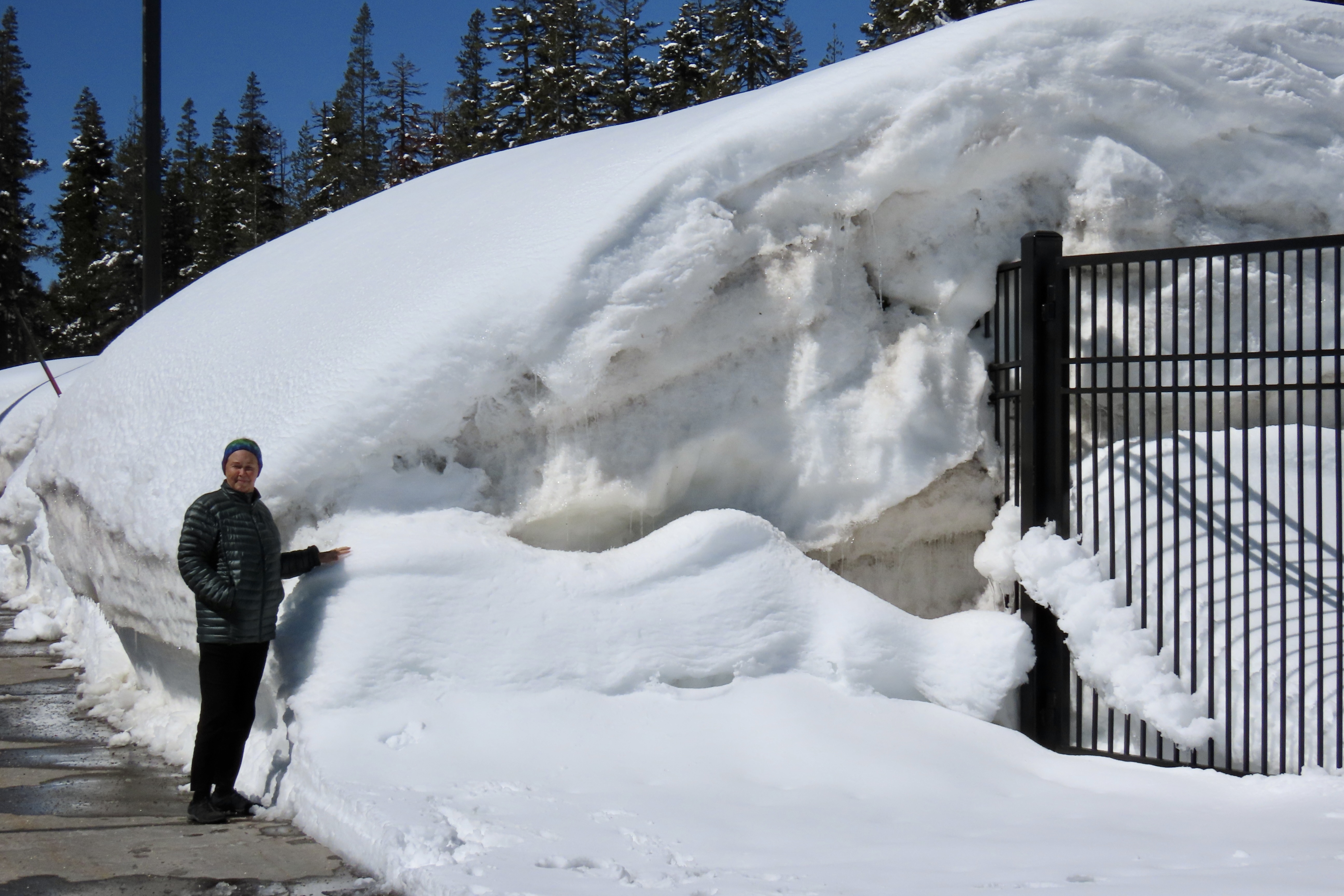
We hung out in Carson City, Nevada as the storm that closed the Big Sur Highway turned into a blizzard over the Sierra Nevada Mountains.
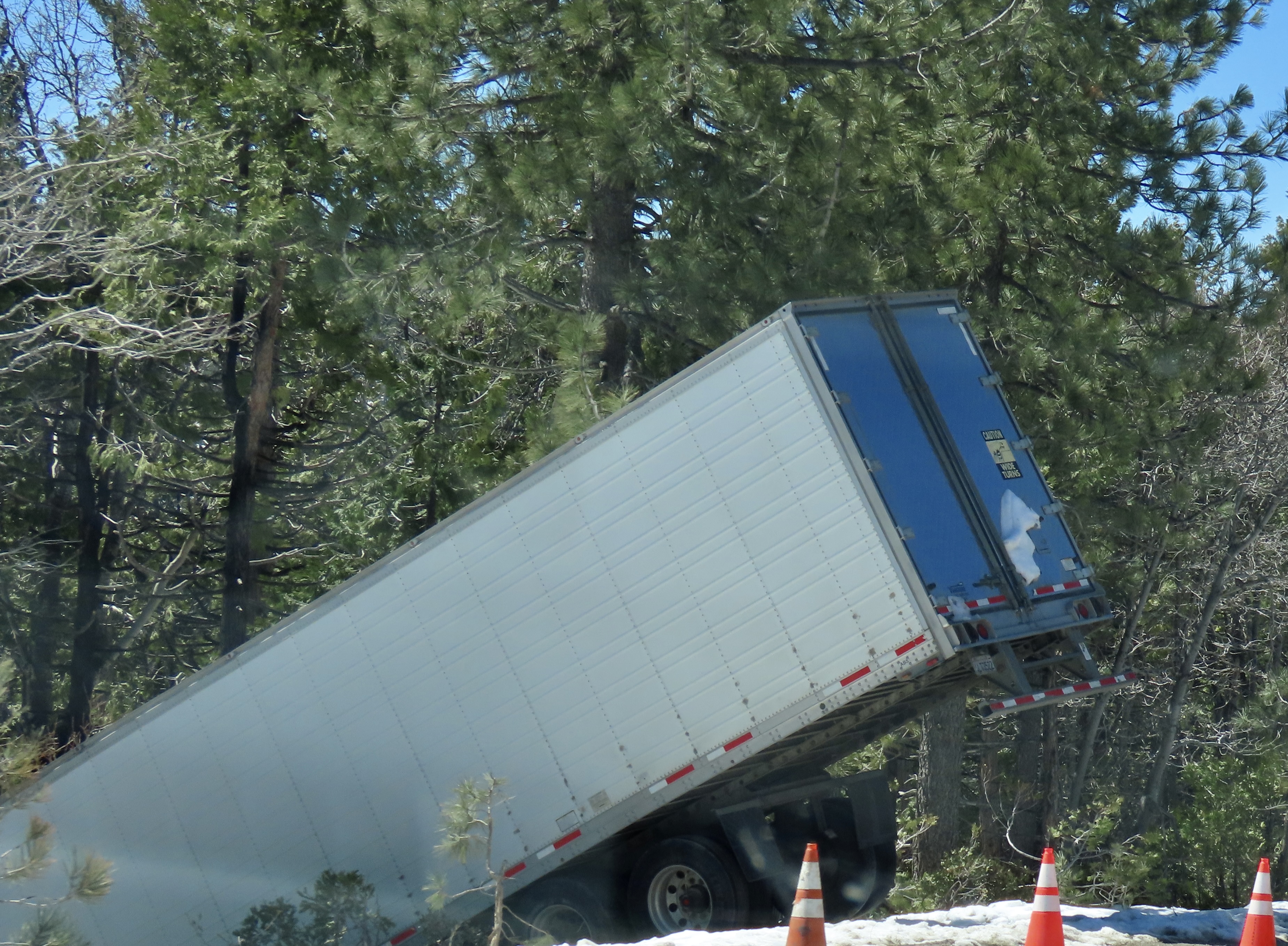
This is what Donner Summit looked like two days later.This big rig was a few miles down the road and Peggy snapped its photo. I imagine he was wishing he had hung out in Carson City with us.
Now, here are a few photos to show you what to expect over the next three months on Wandering Through Time and Place.
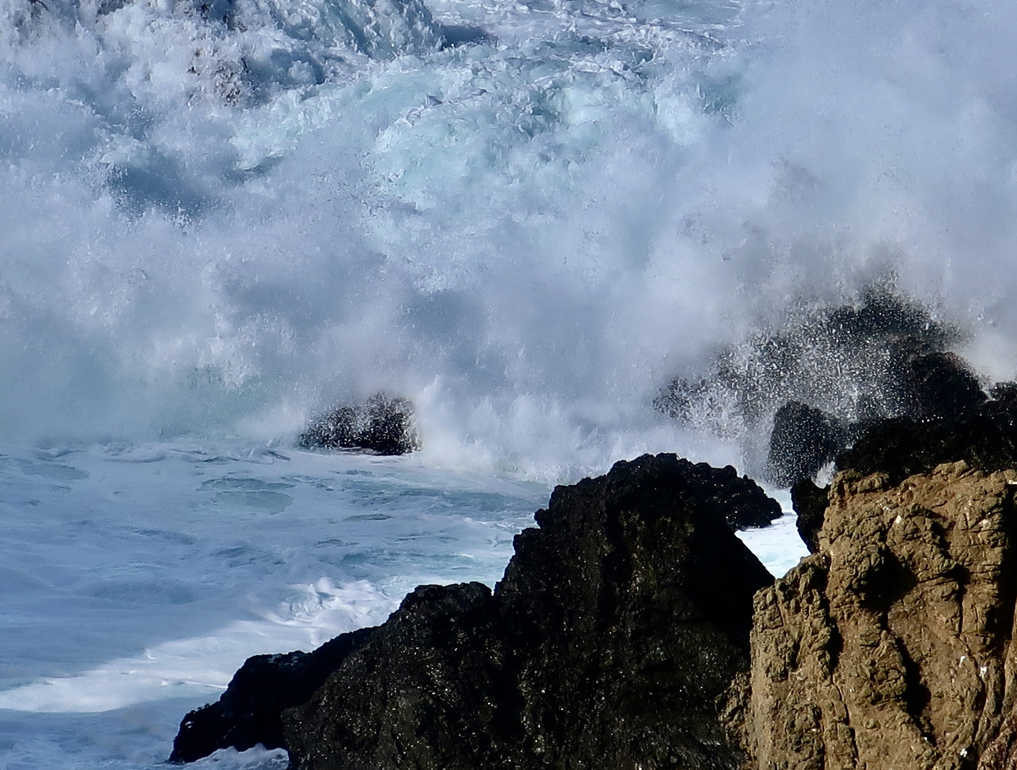
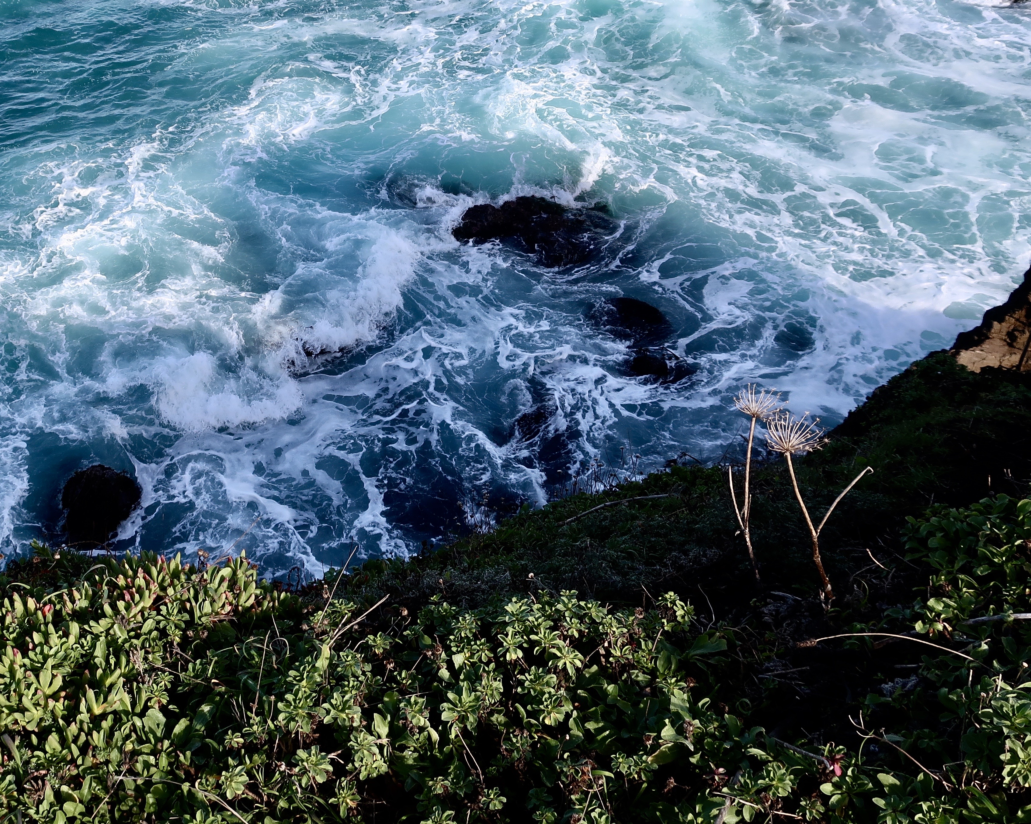
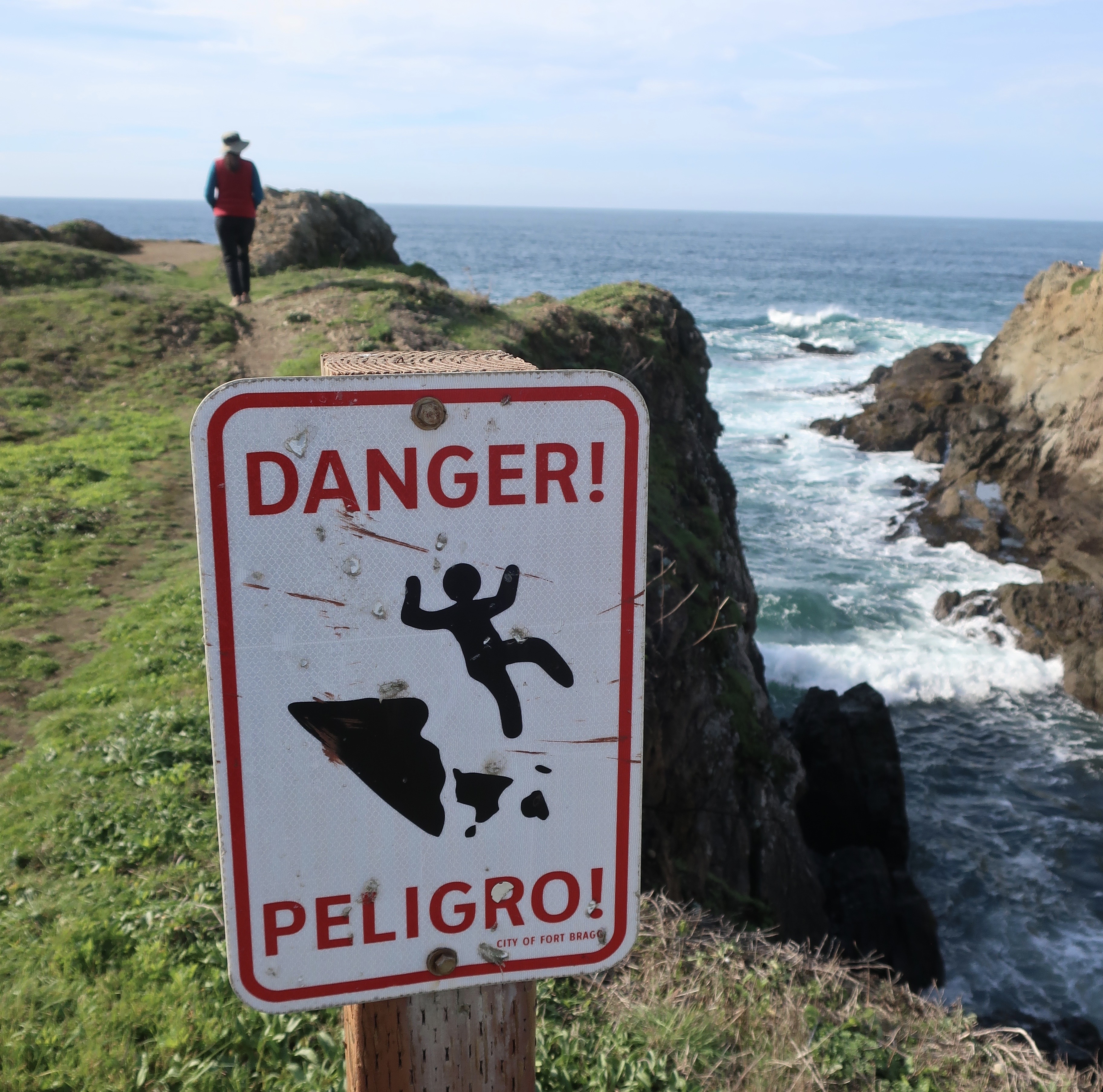
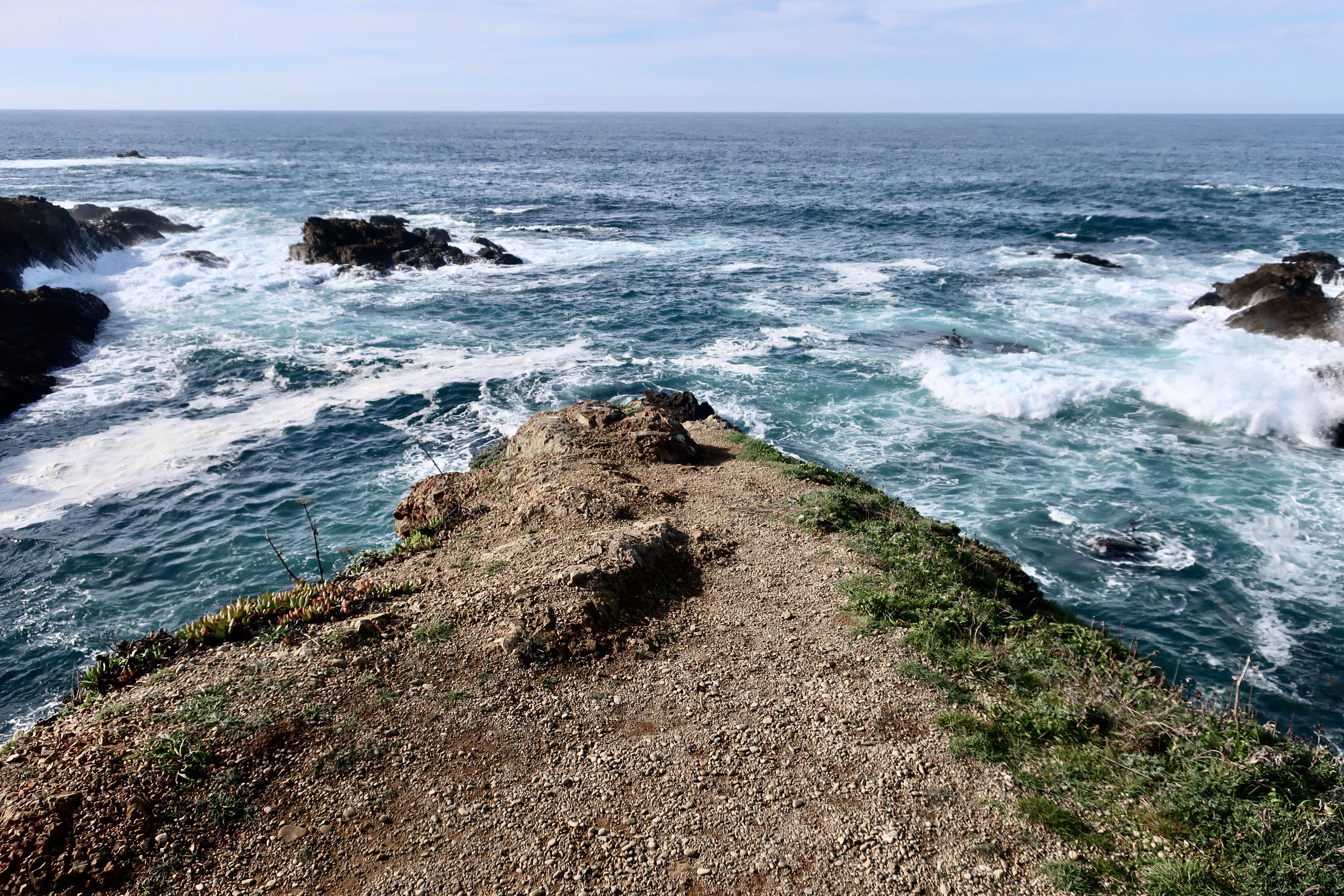
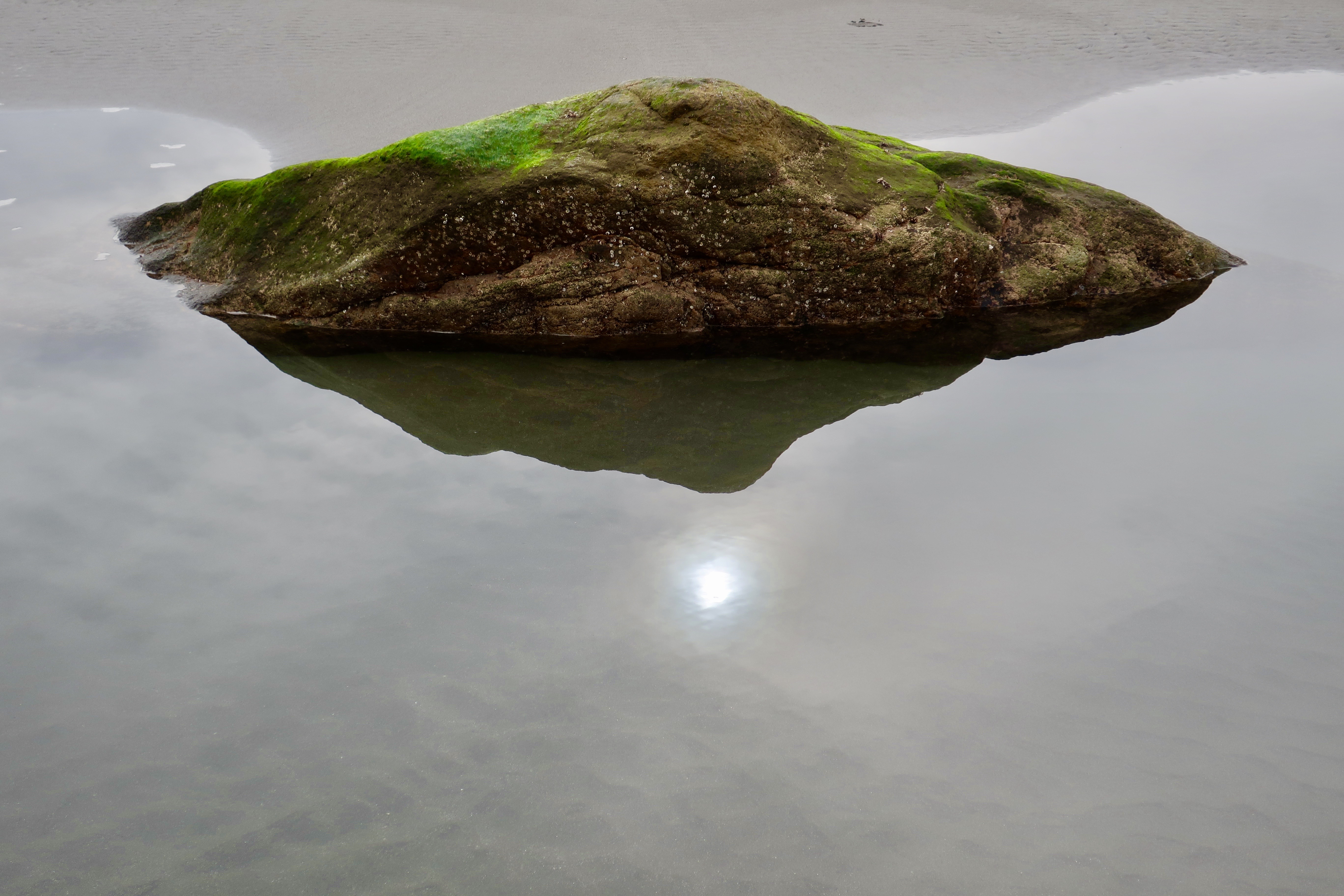
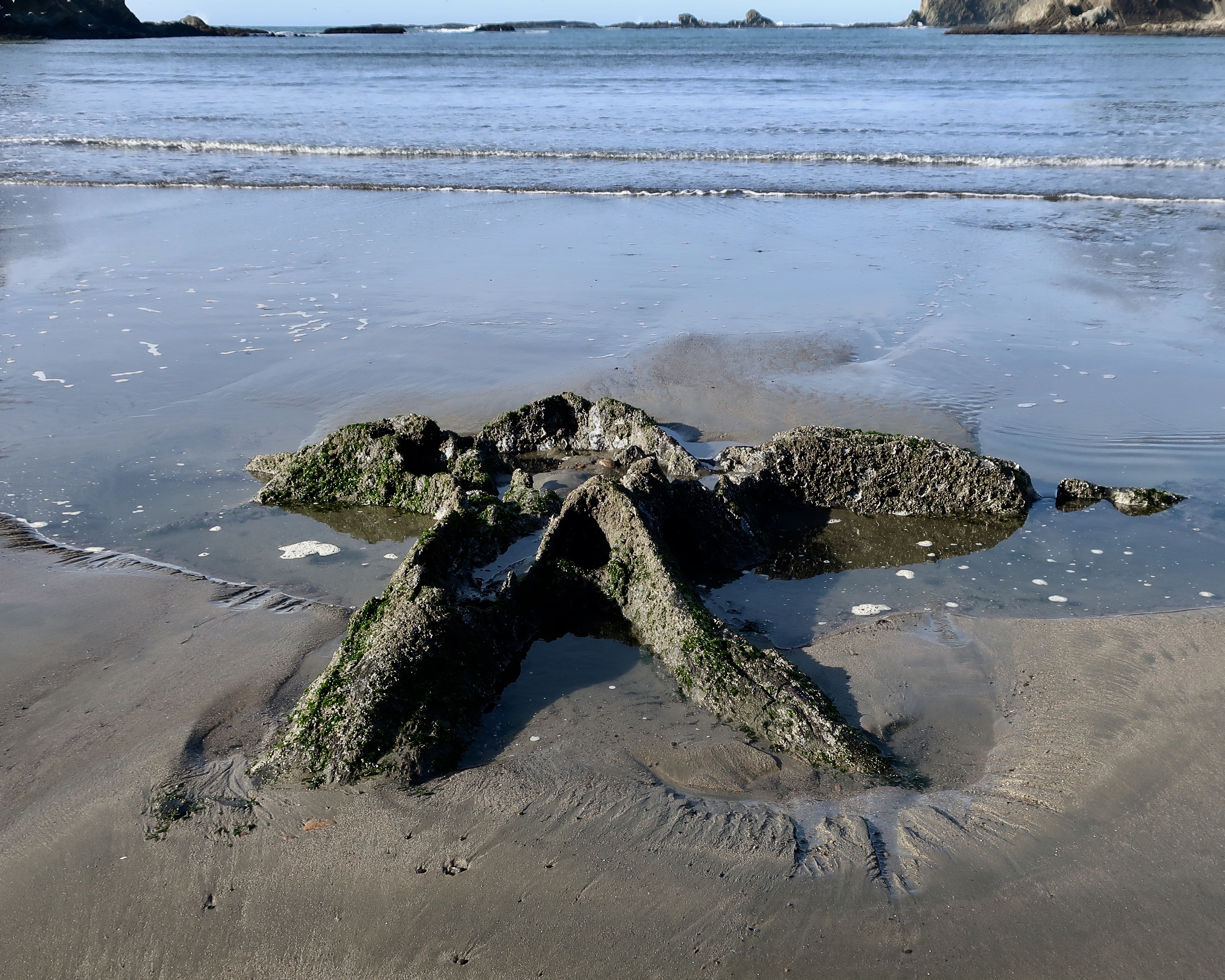
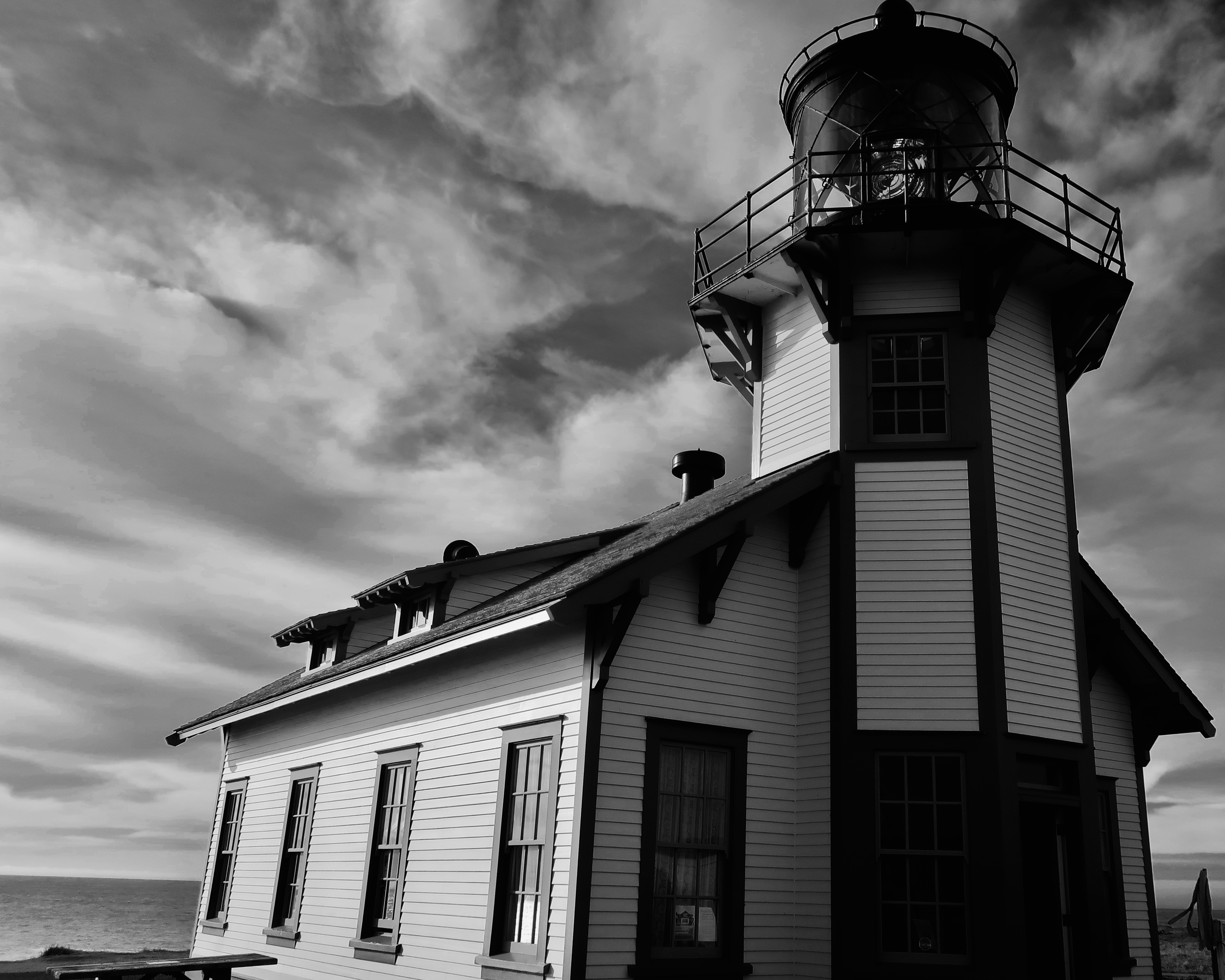
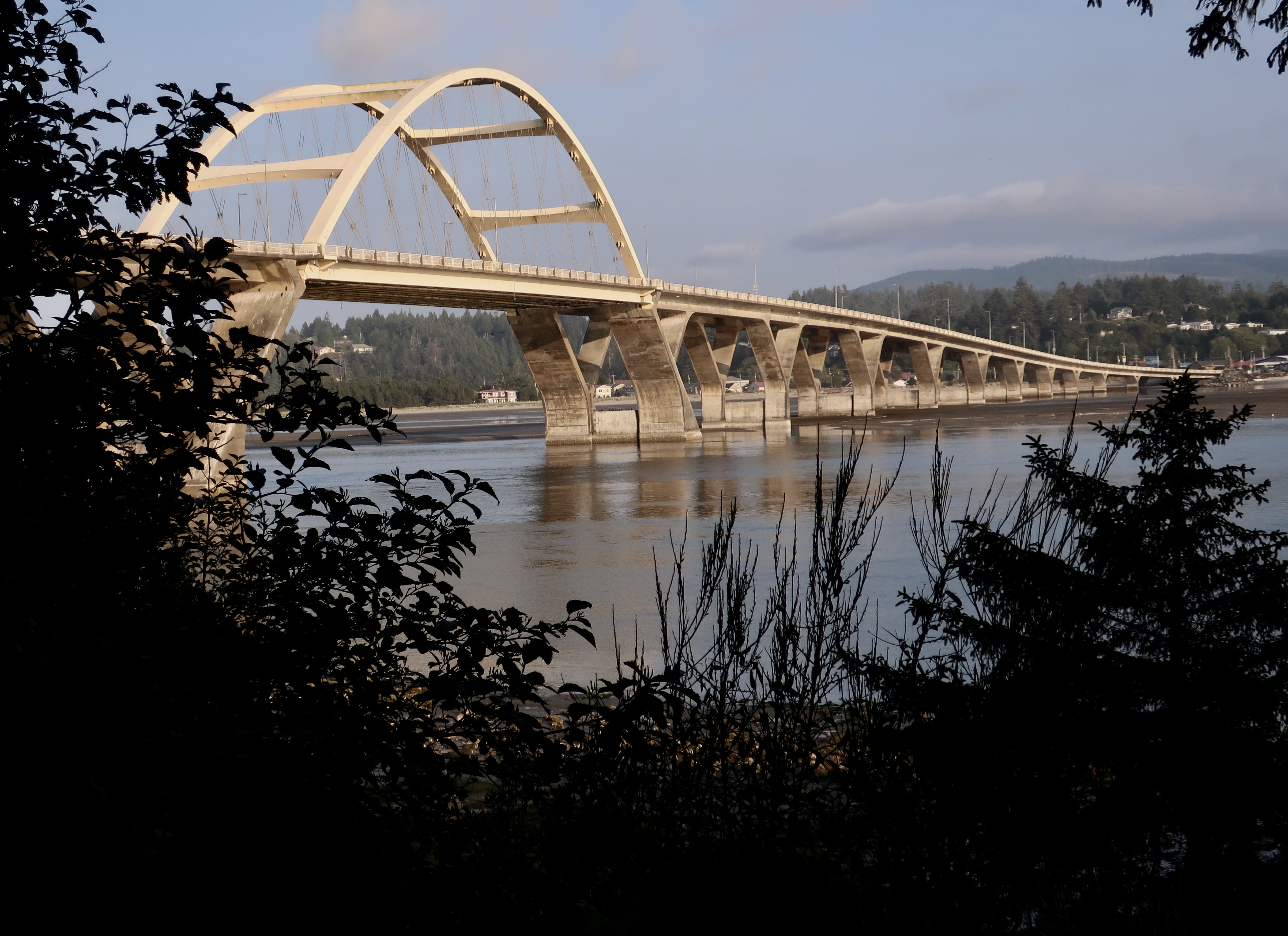
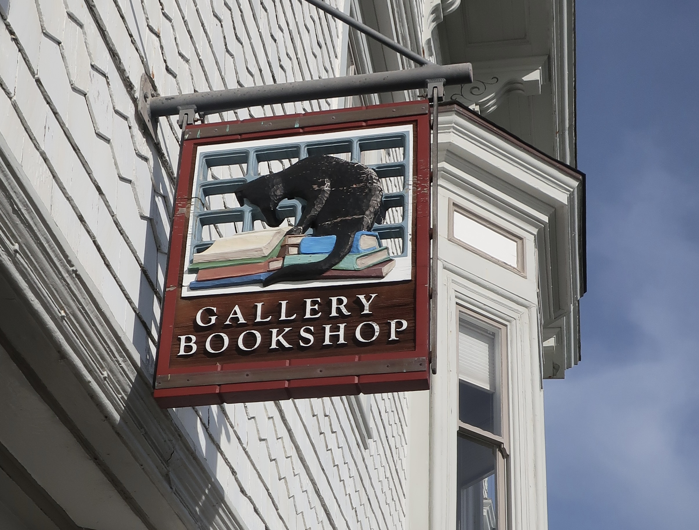
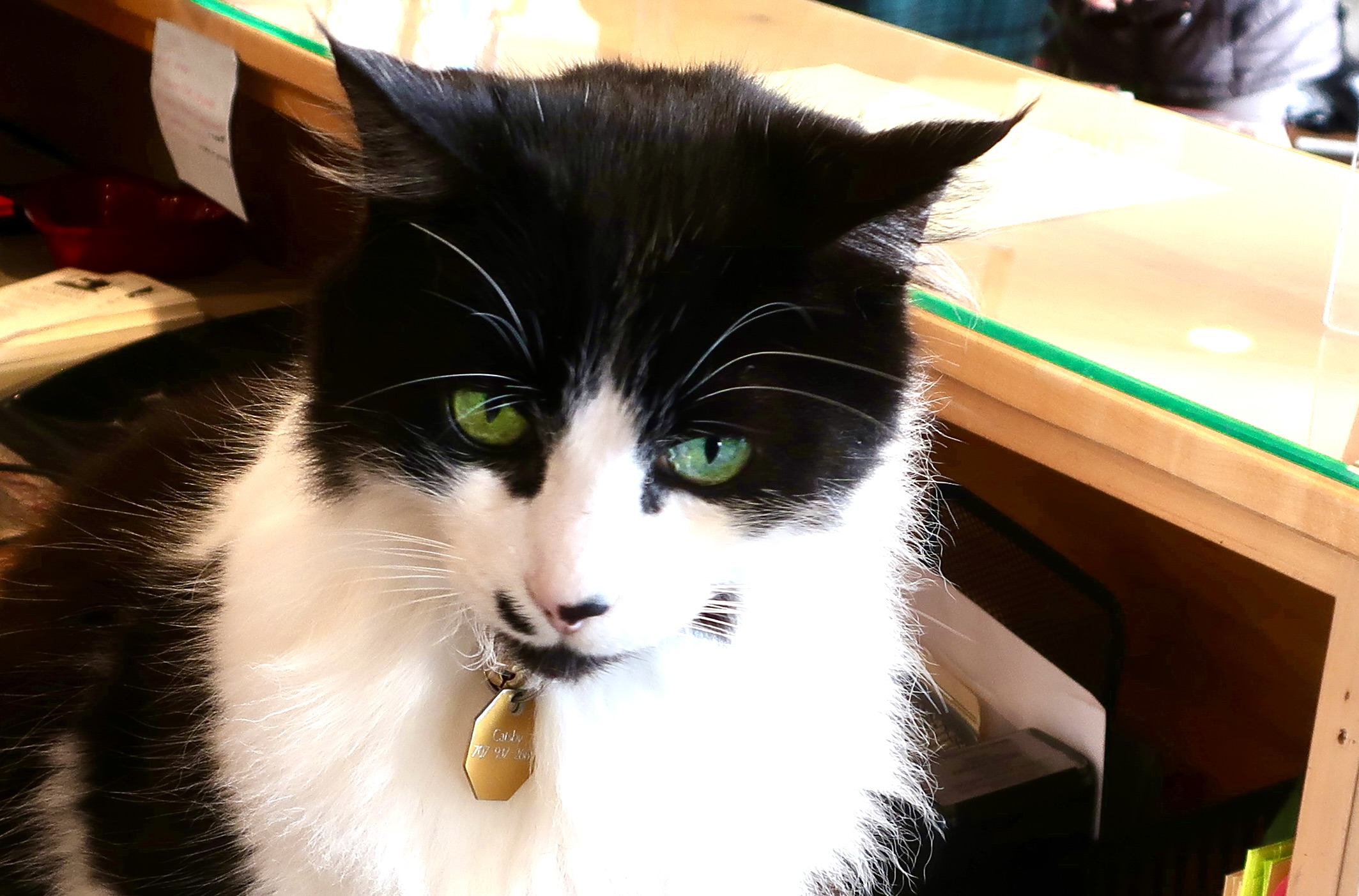
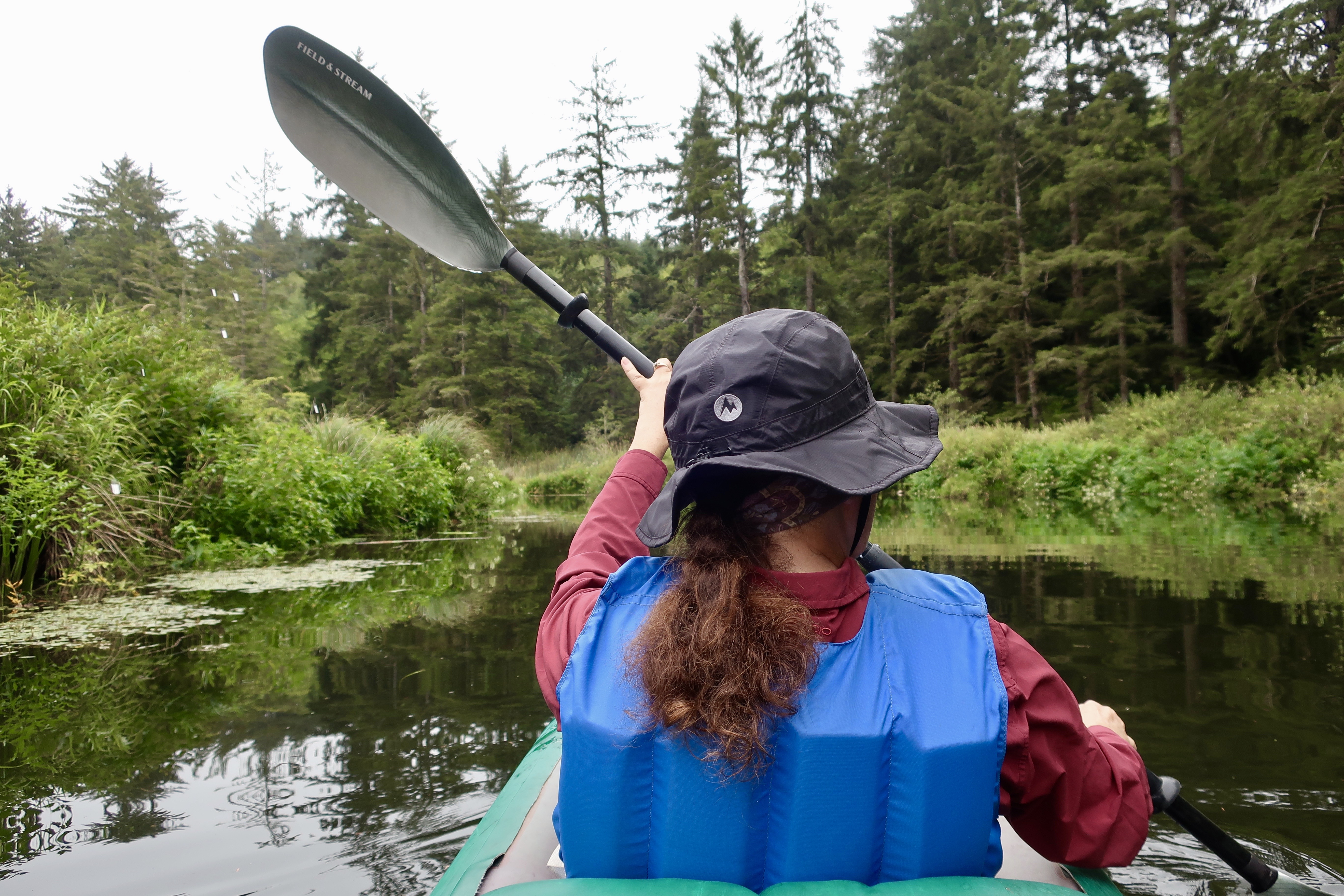
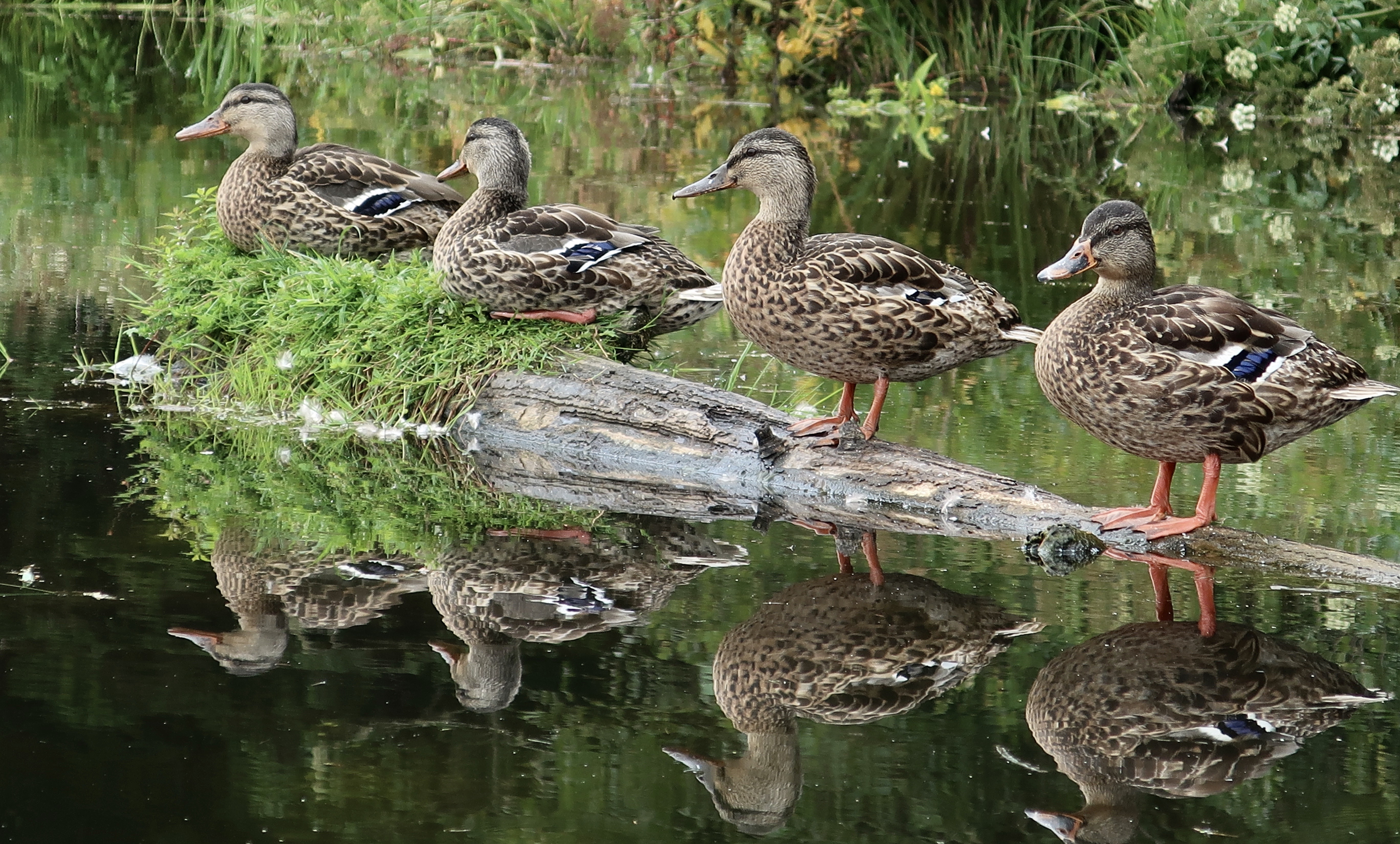
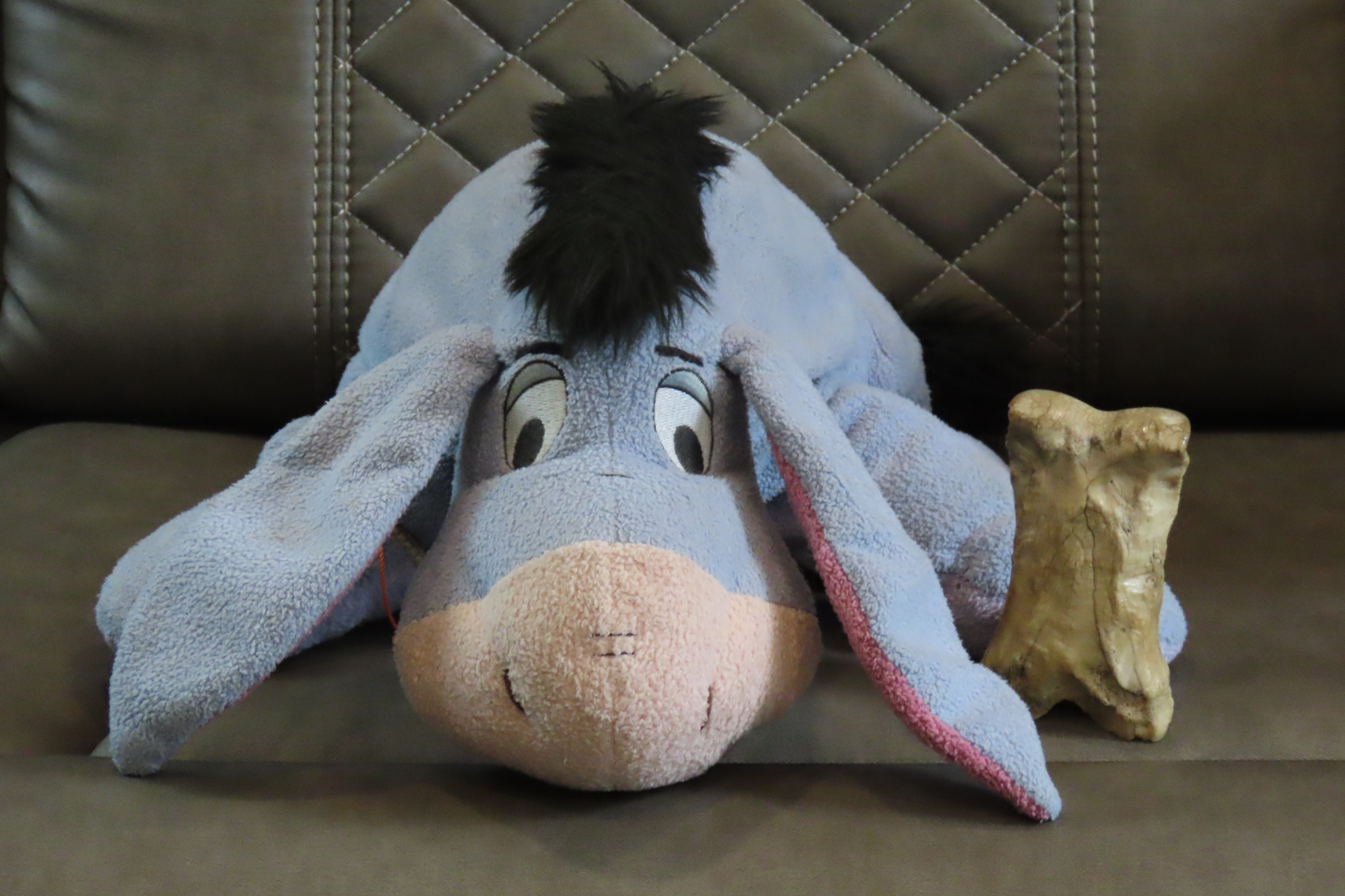
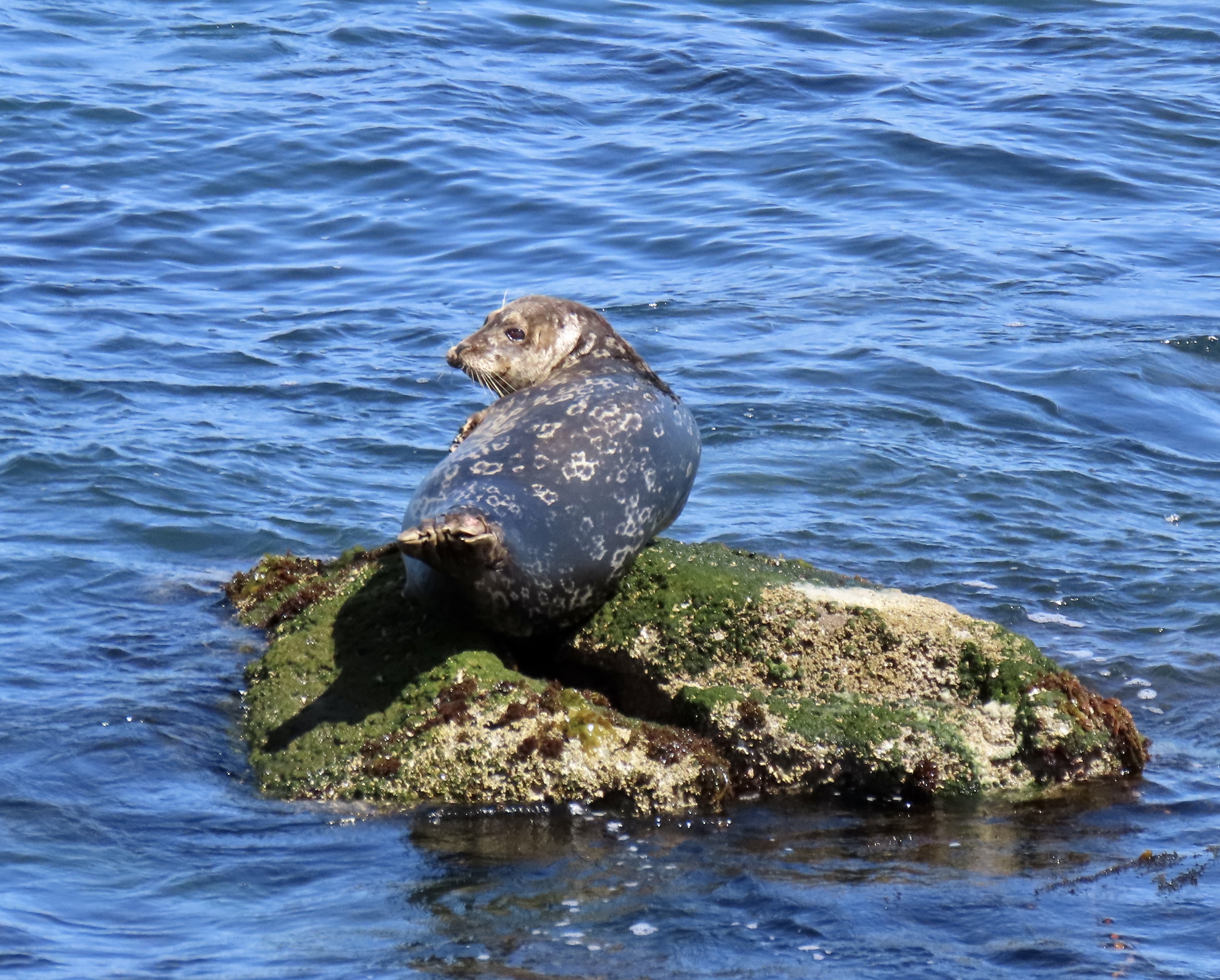
There will be huge waves crashing over rocks…Creating an infinite variety of swirling waters.You will join us as we hike out to the ocean’s edge— carefully. Does Peggy look worried???The edge, where she stood and took photos.The ocean will be calm as often as wild.With lots of gorgeous sunsets.Of course there will be tide pools. Peggy and I explore them with all the excitement of ten-year-olds. If you’ve ever spent time looking into them, you have probably seen a sea anemone…But have you ever seen one covered with shells and stones?Starfish…There will be dozens of magnificent sea stacks…As well as interesting smaller rocks…Any idea what this is? Once it was a tree that stood high above the ocean. A massive earthquake dropped the forest below sea level. This is what remains.Lighthouses are found all along the way.And beautiful bridges.Small coastal towns have special appeal to us. This is an historical building in Pt. Reyes Station above San Francisco.If there is an independent bookstore to be found, we will take you there. This is in Mendocino, California.And here is the bookstore cat. One way I judge a bookstore is whether it has a cat…Expect to meet many amazing creatures. This is a banana slug. Did you know that the banana slug is the school mascot for UC Santa Cruz?There will be magnificent wildlife such as this elk..Seals…And great blue heron.Expect a few cows as well.So here’s a question. Are these two butting heads or seeing eye to eye?We will have many adventures along the way, including kayaking.We may even get our ducks in a row.Eeyore and Bone are along for the trip…And, like us, hope you will join our journey. First up, we will be exploring the highways, byways and coast line of the Monterey/Carmel area, including the world famous 17 mile Drive. Peggy took this photo of a seal along Ocean View Blvd. in Pacific Grove, just before we climbed onto the 17 Mile Drive. I was so impressed with the photos my new camera took when we were on safari in Africa, I immediately bought one for Peggy. Expect lots more…
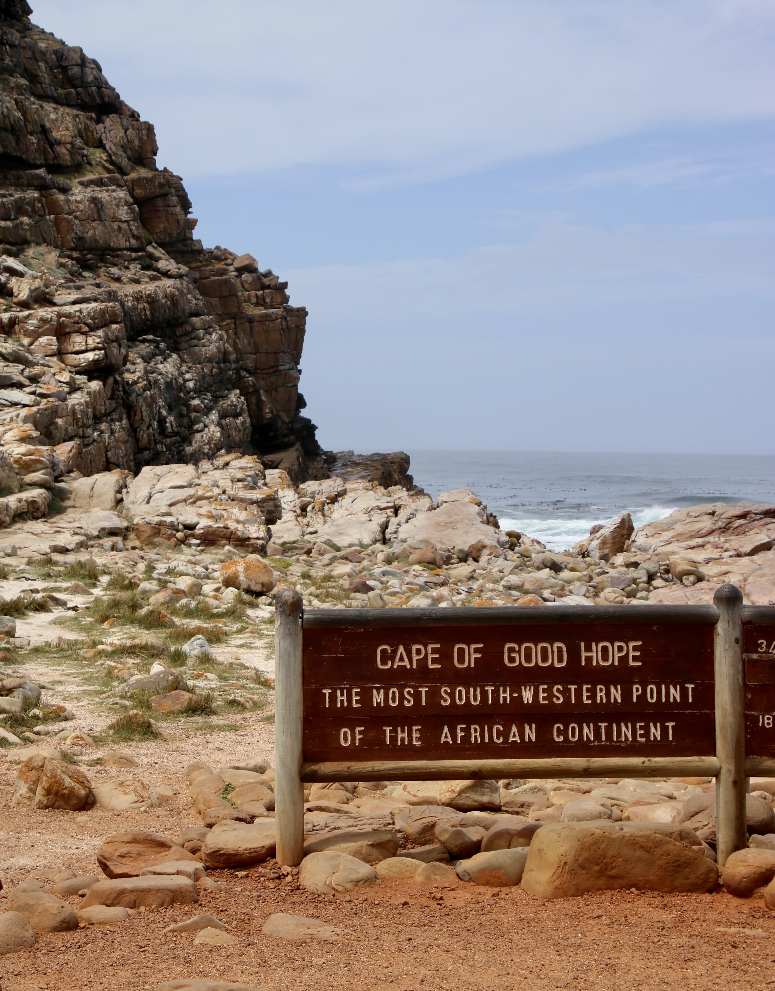
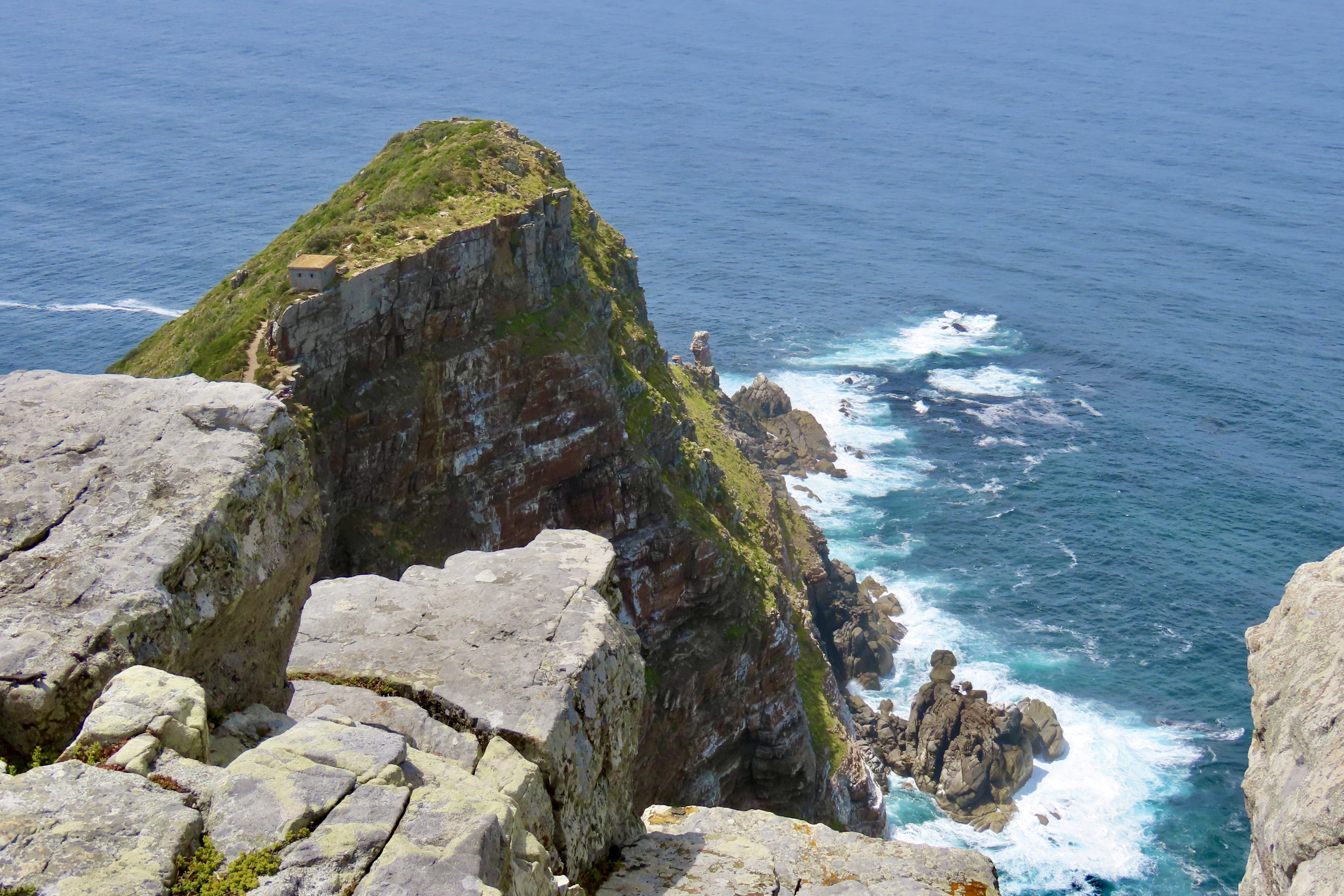
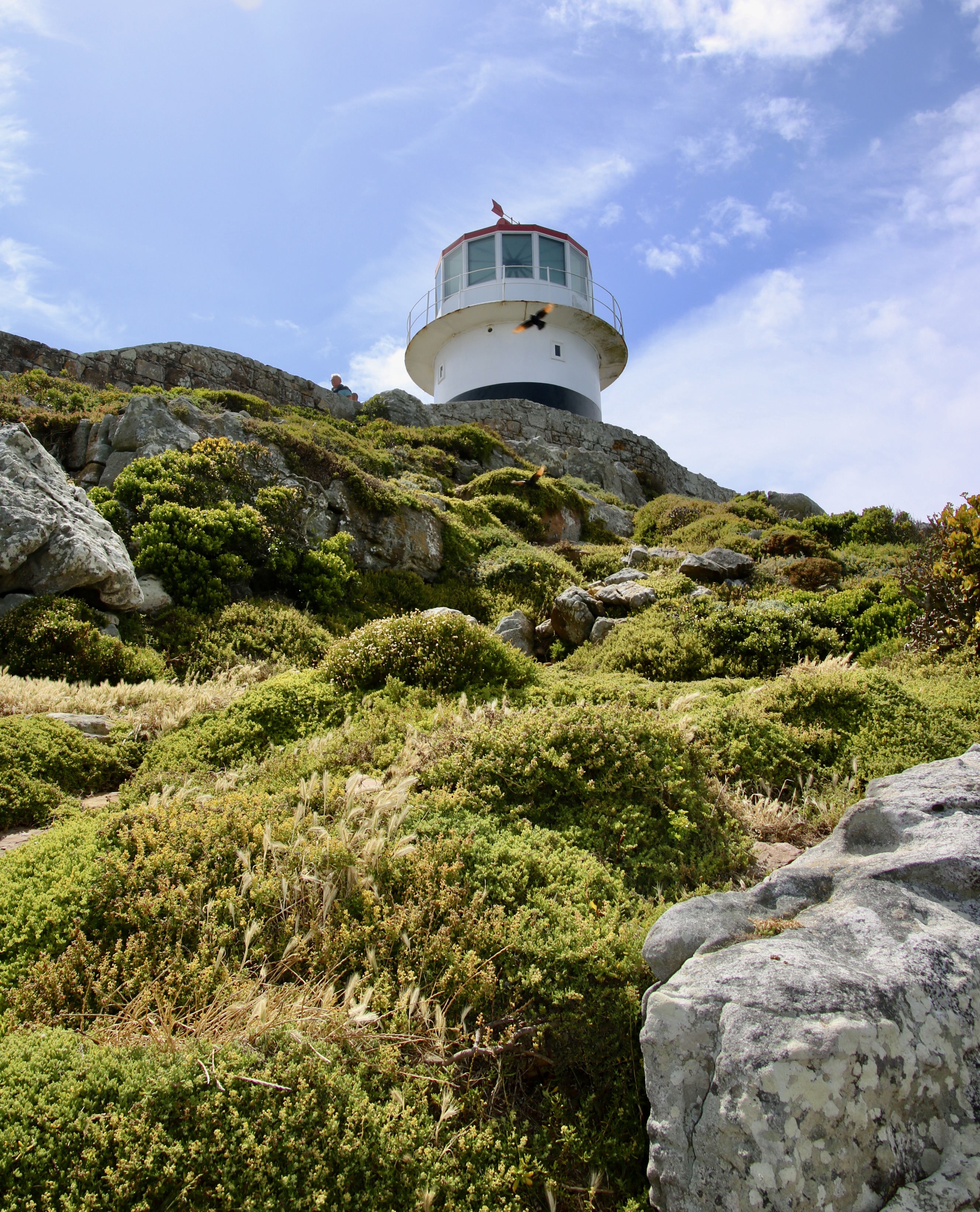
This is a view of the Cape of Good Hope as seen from on top of Cape Point. Portugal’s Bartolomeu Dias was the first to round it in 1488. He named it the “Cape of Storms,” for good reason. Ten years later, Vasco da Gama followed the same route and then sailed up the coast of Africa, prompting King John II of Portugal to rename it the “Cape of Good Hope.” It opened a sea route to fabulous wealth of the spice trade in India and the Far East.
Today marks my 25th and final post on our African Safari. As you read this, Peggy and I are driving between Carson City, Nevada and the Central Coast of California where we will spend the next two weeks exploring Big Sur, Carmel, Monterey, Pinnacles National Park and the surrounding area. The visit will kick off our next series: A three month, thousand mile journey following the Pacific Coast through Northern California, Oregon and Washington— one of the world’s most beautiful coastlines.
But first, a wrap up on South Africa where we will visit the Cape of Good Hope, Cape Town and Table Mountain.
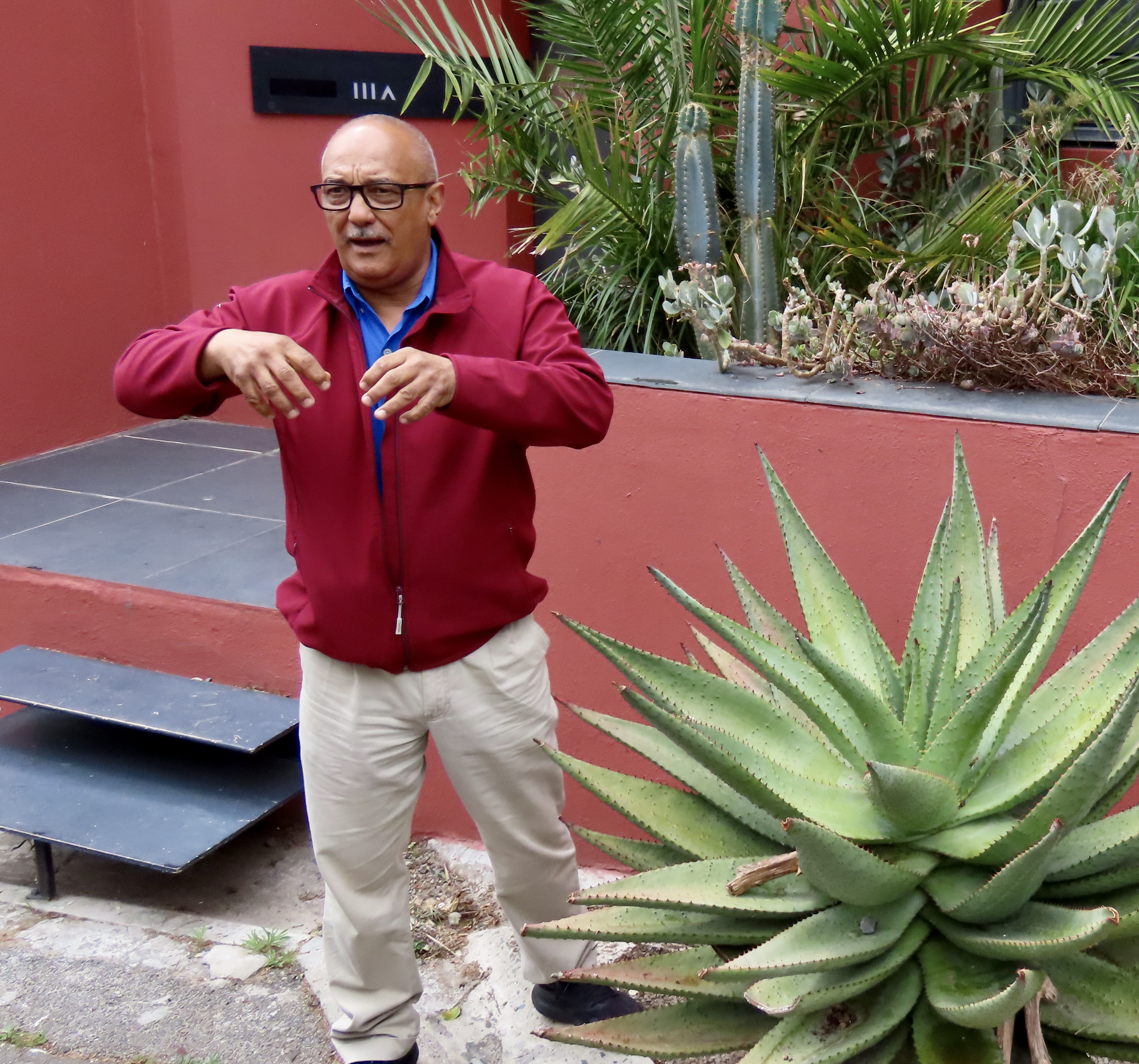
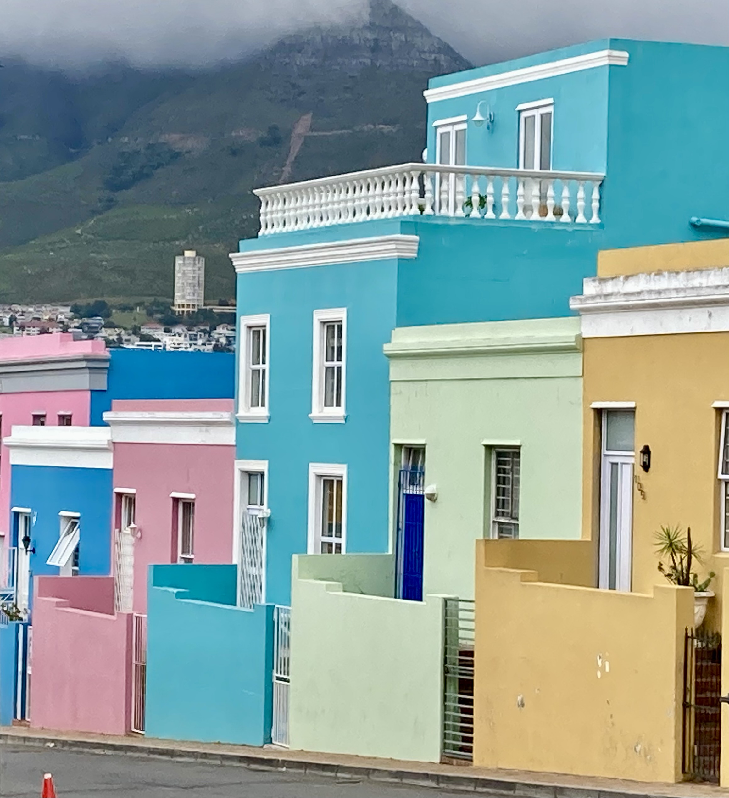
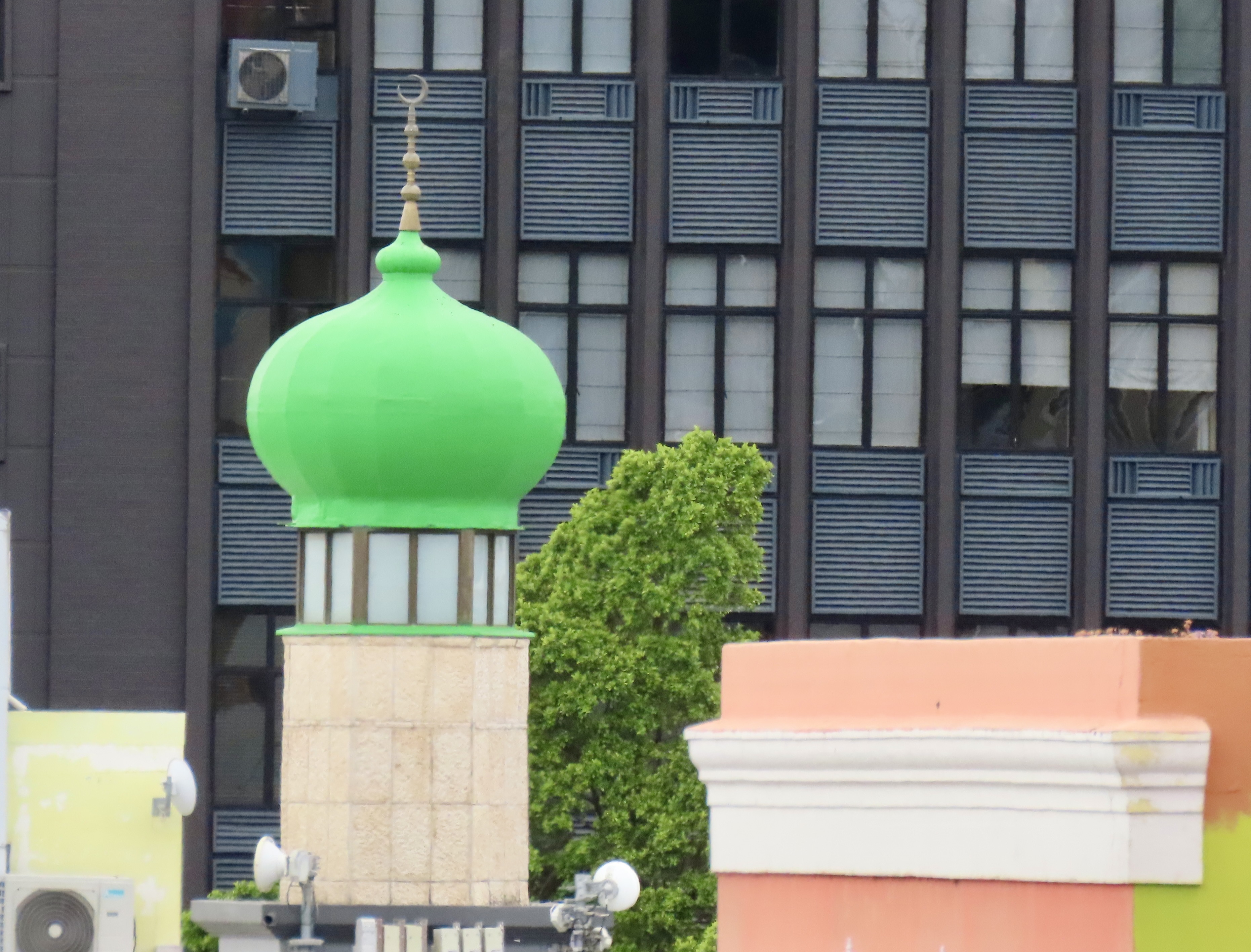
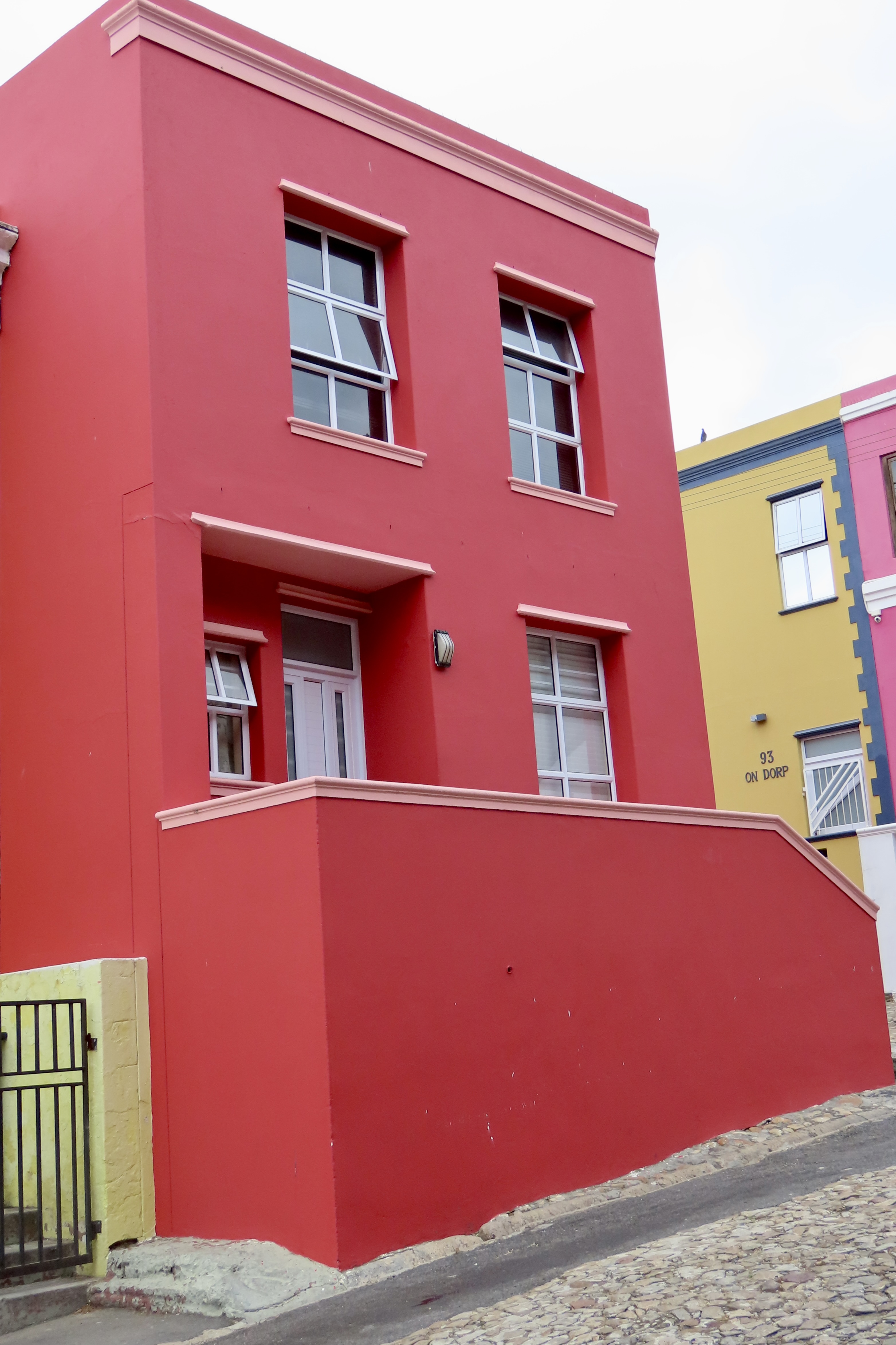
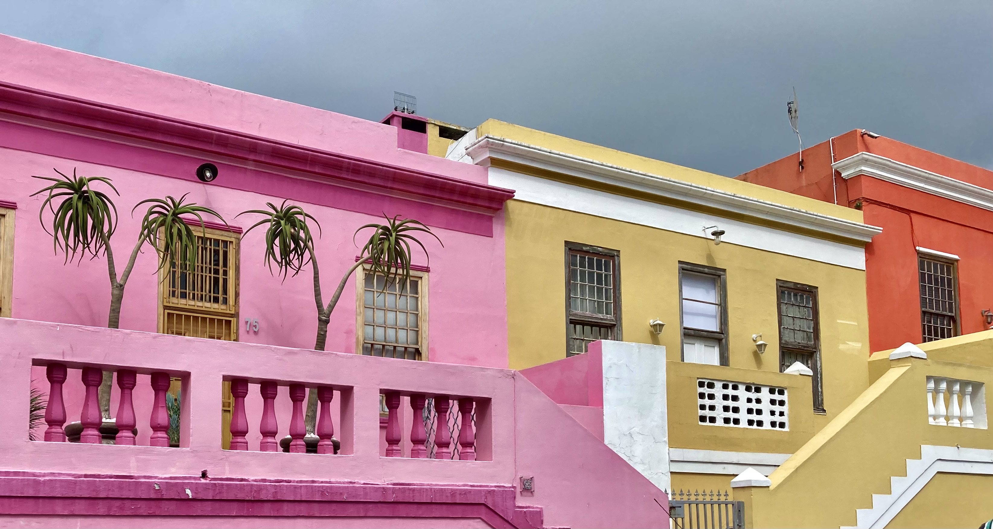
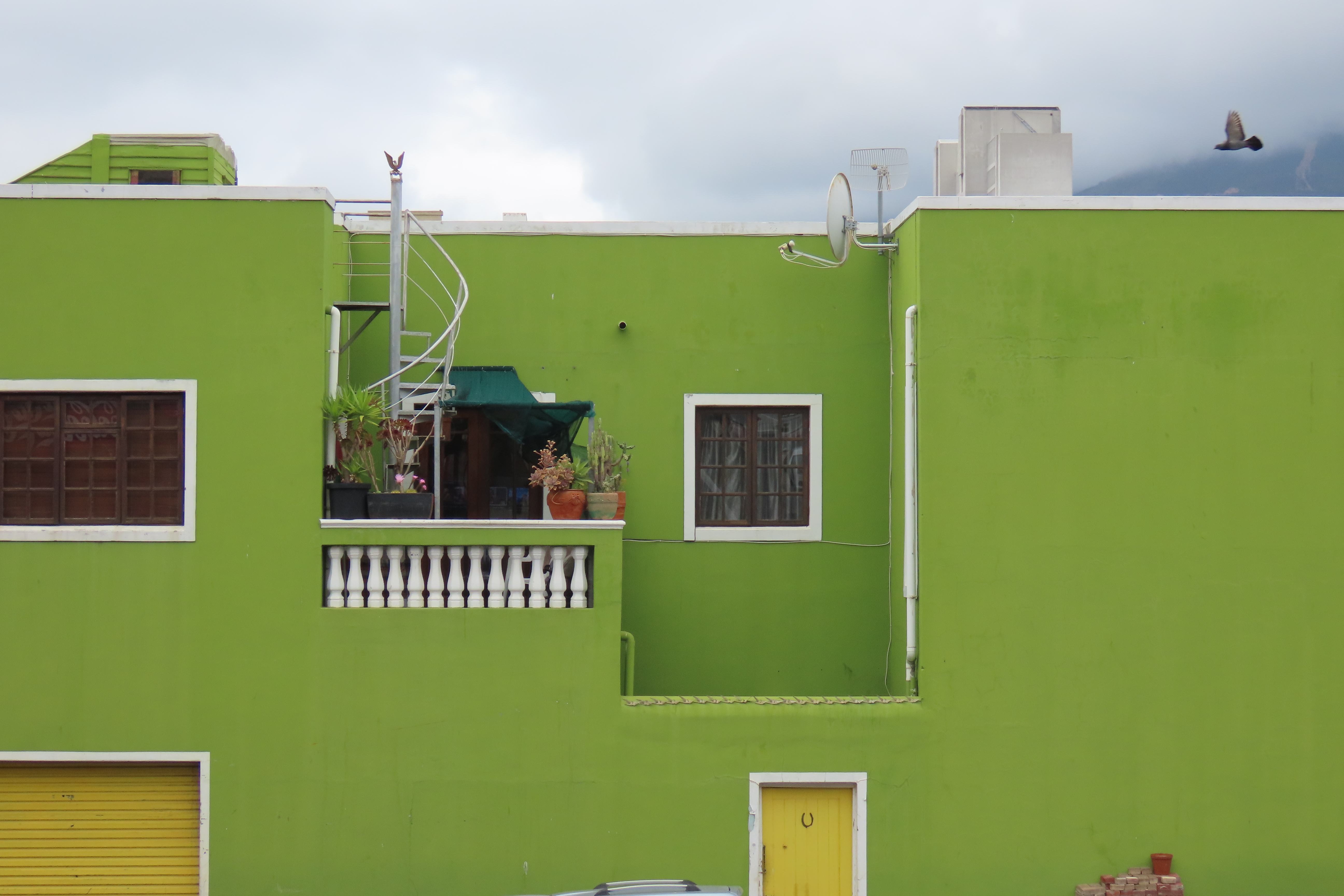
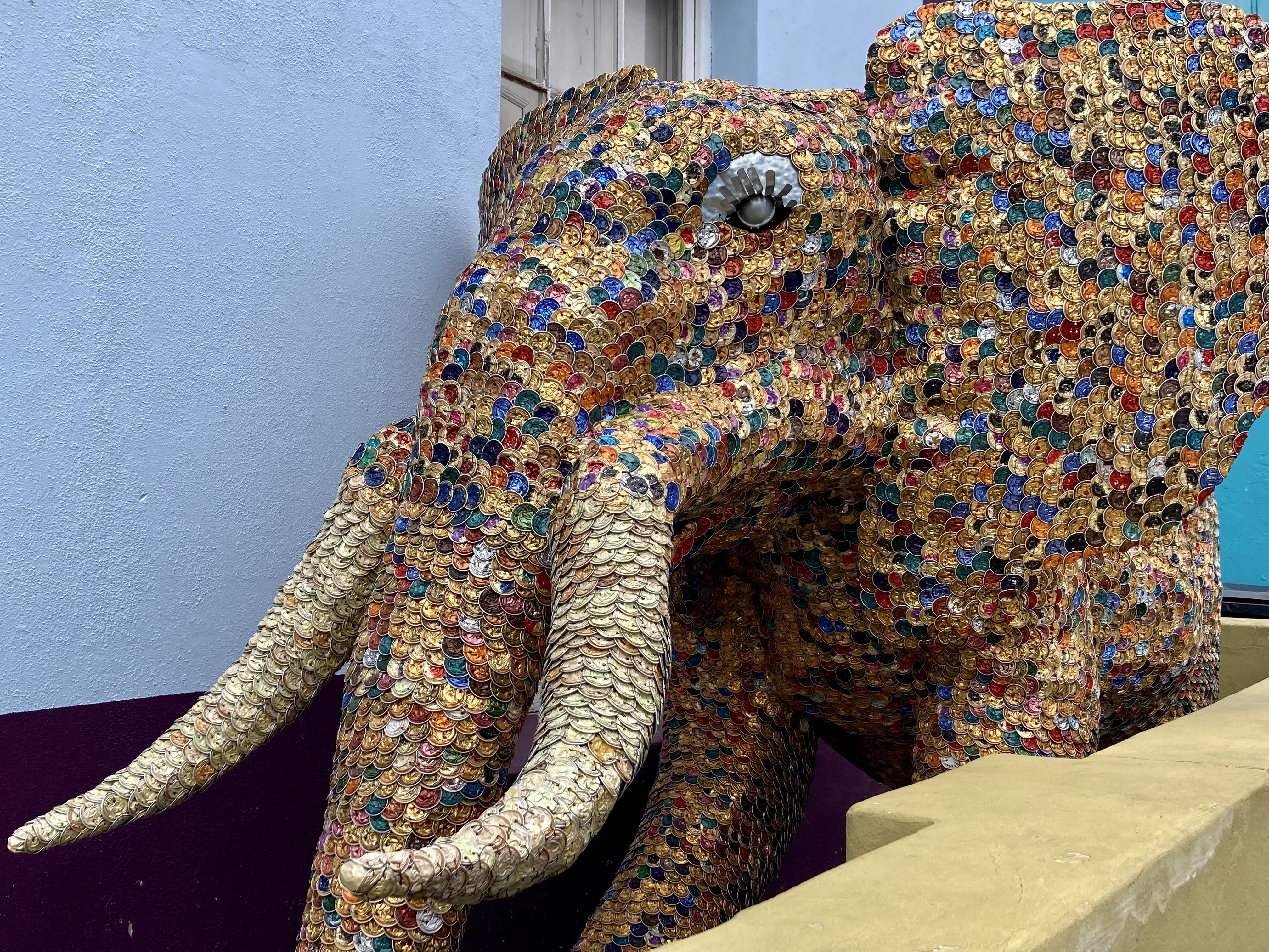
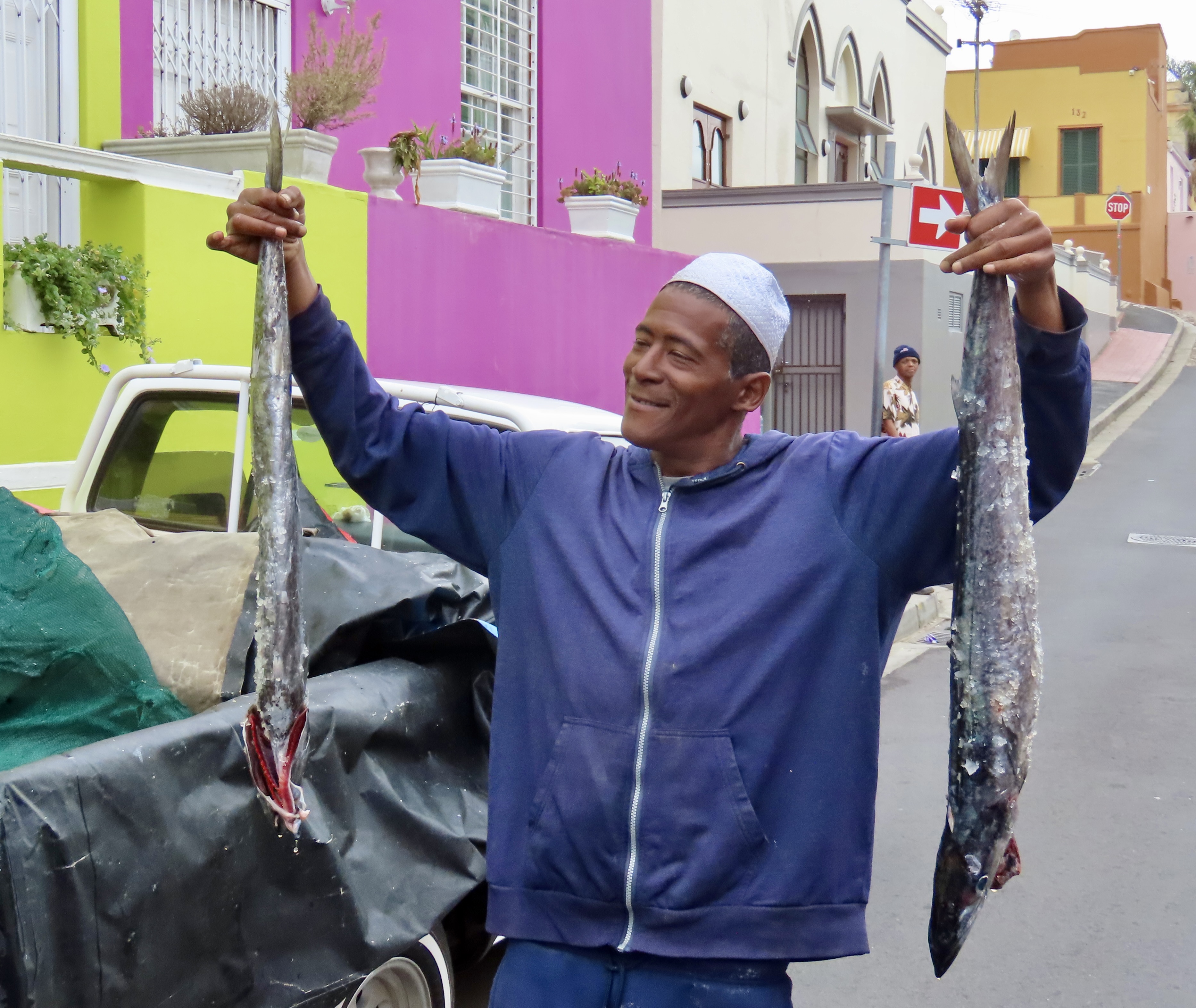
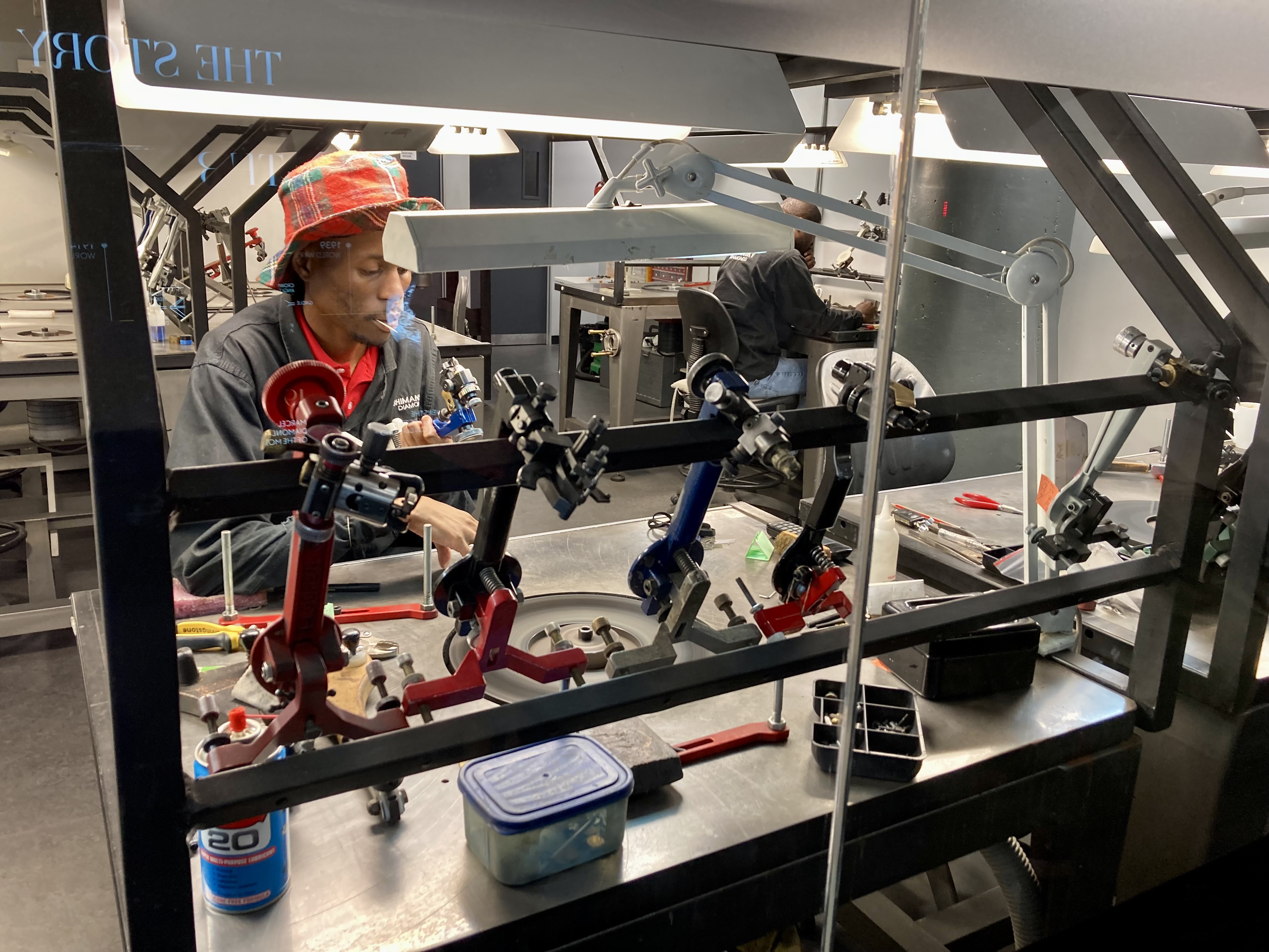
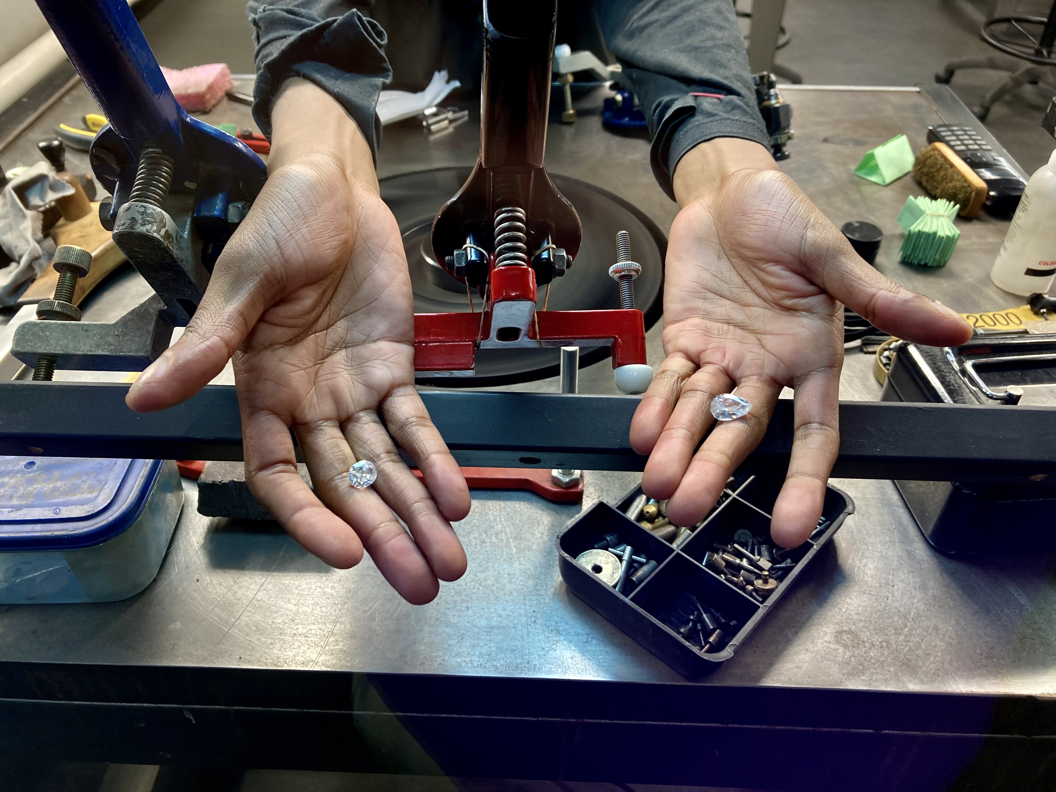
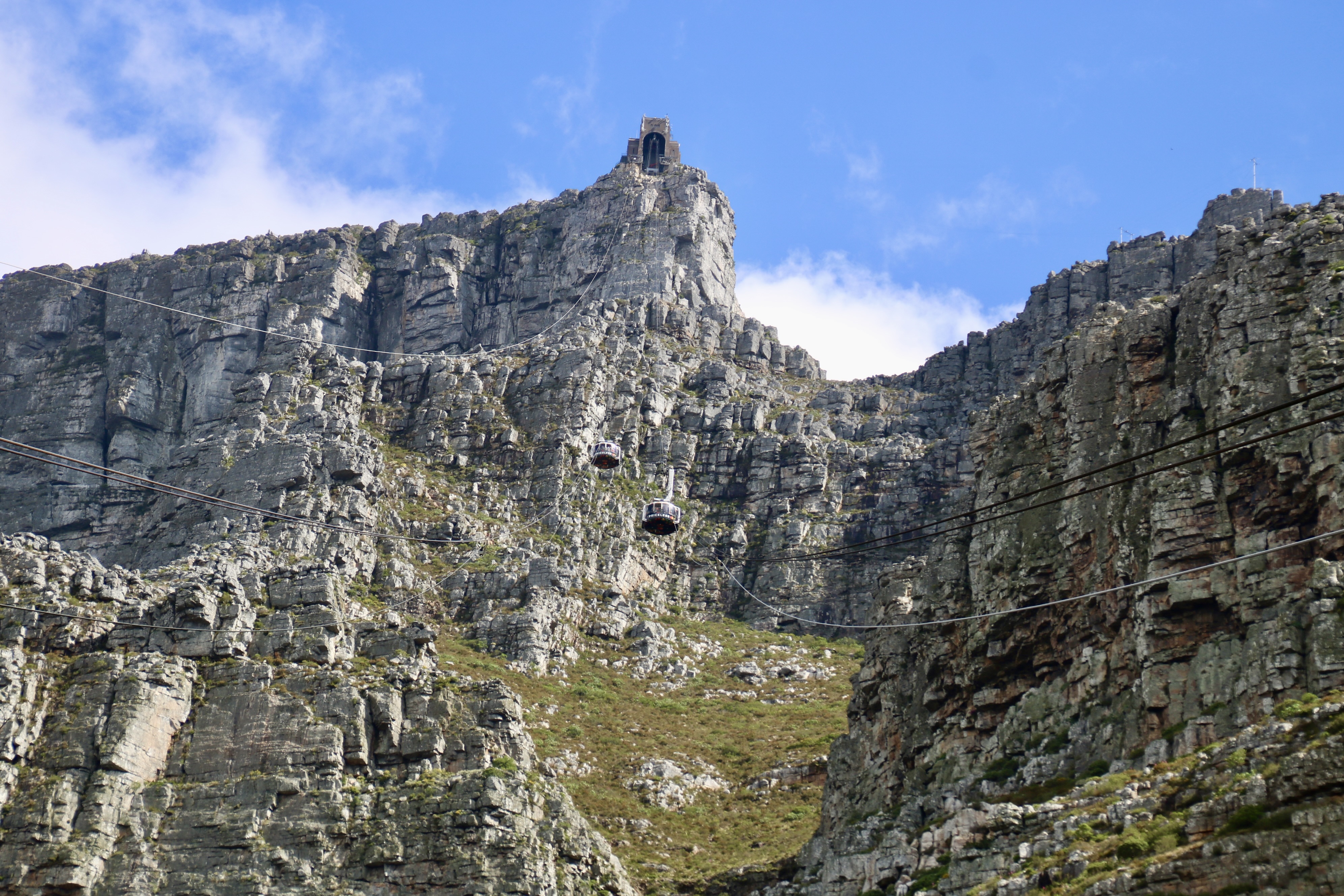
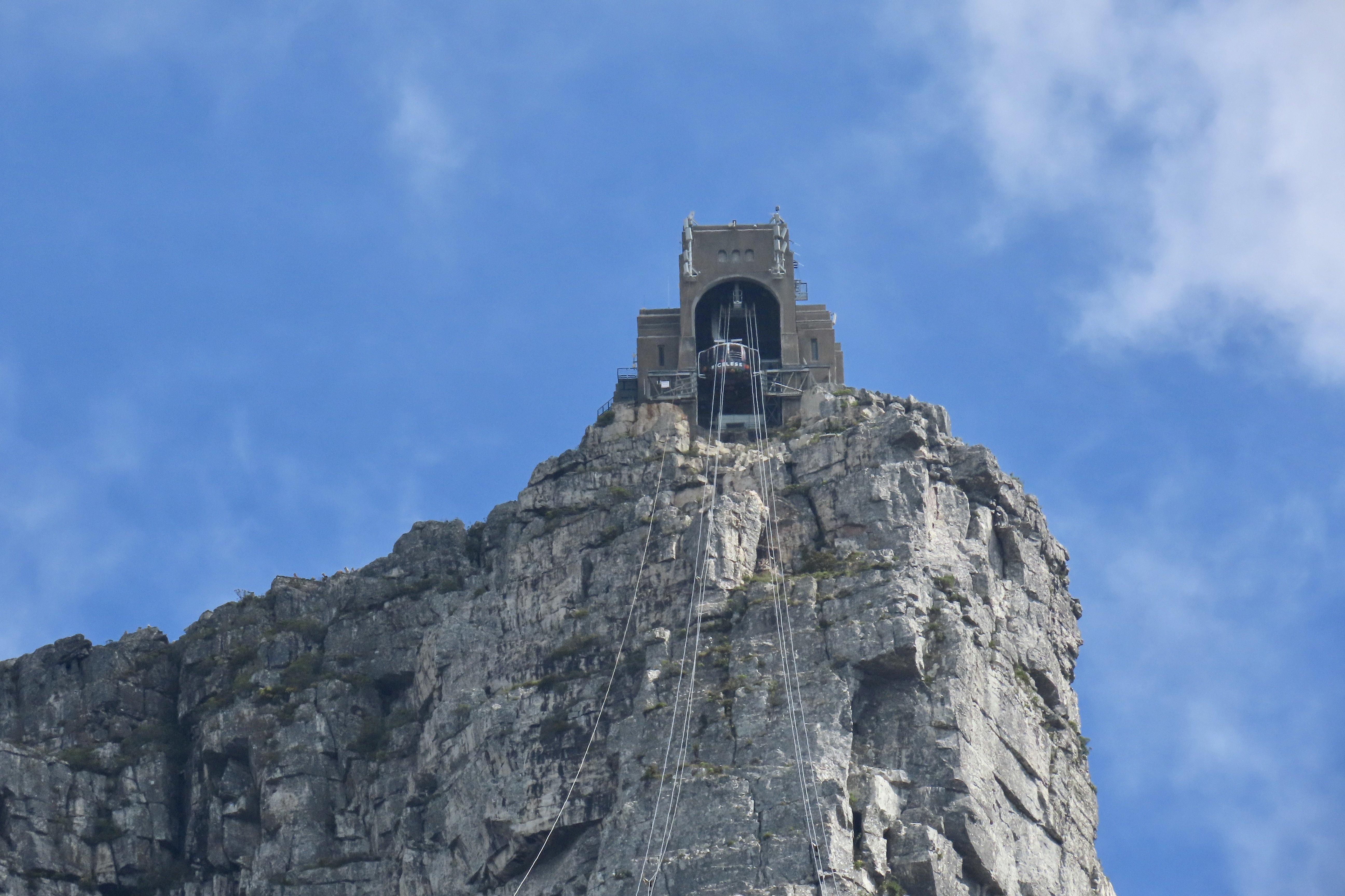
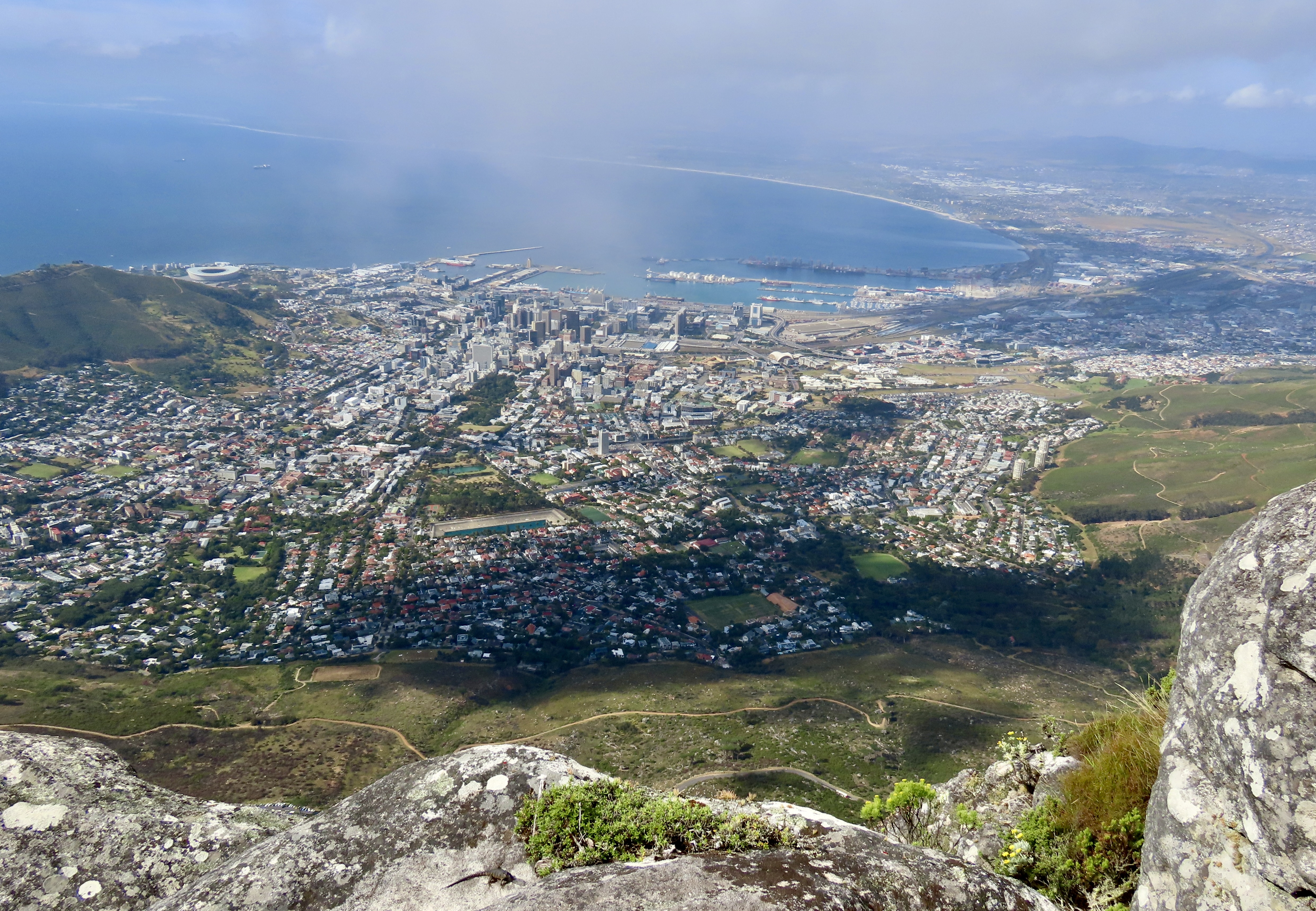
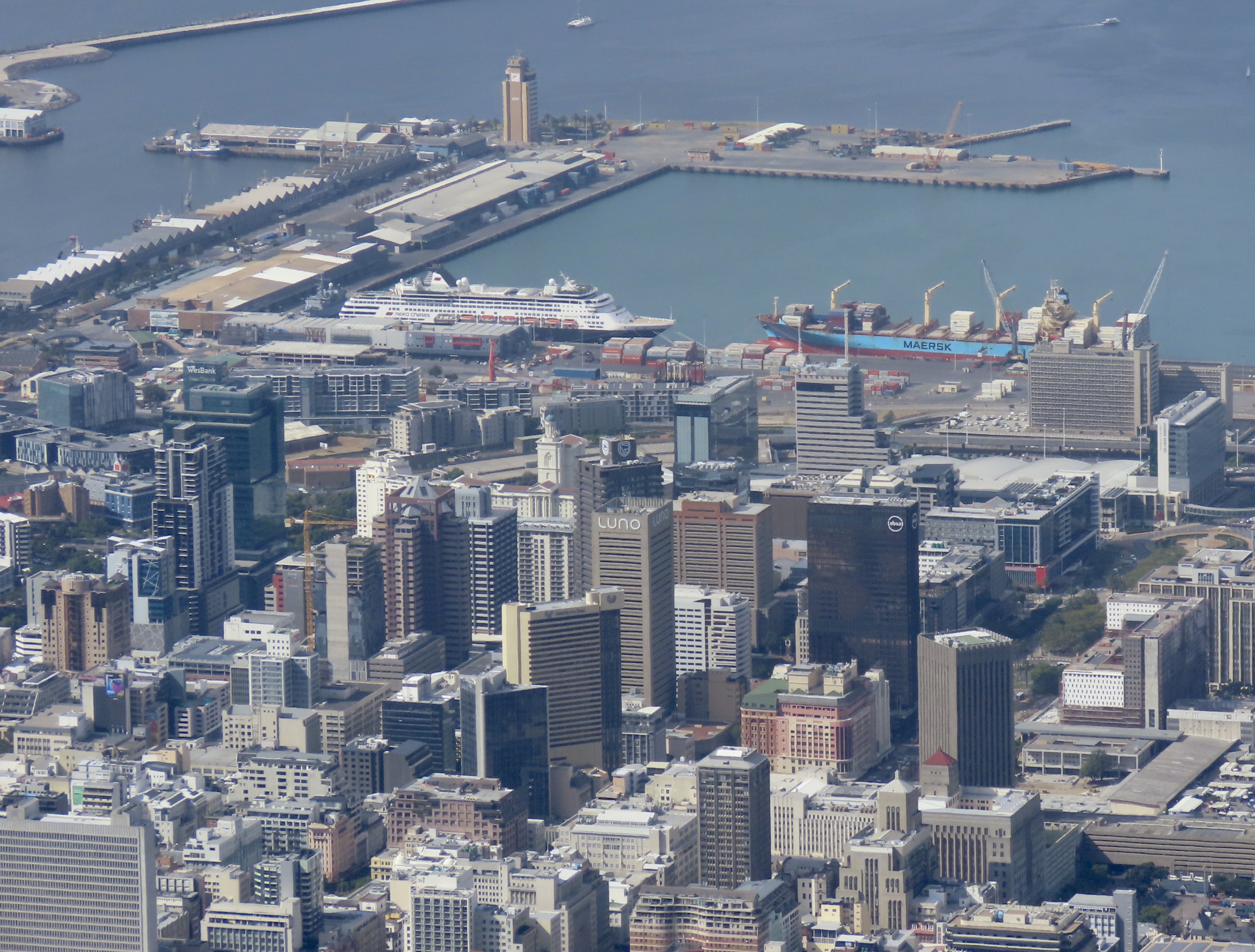
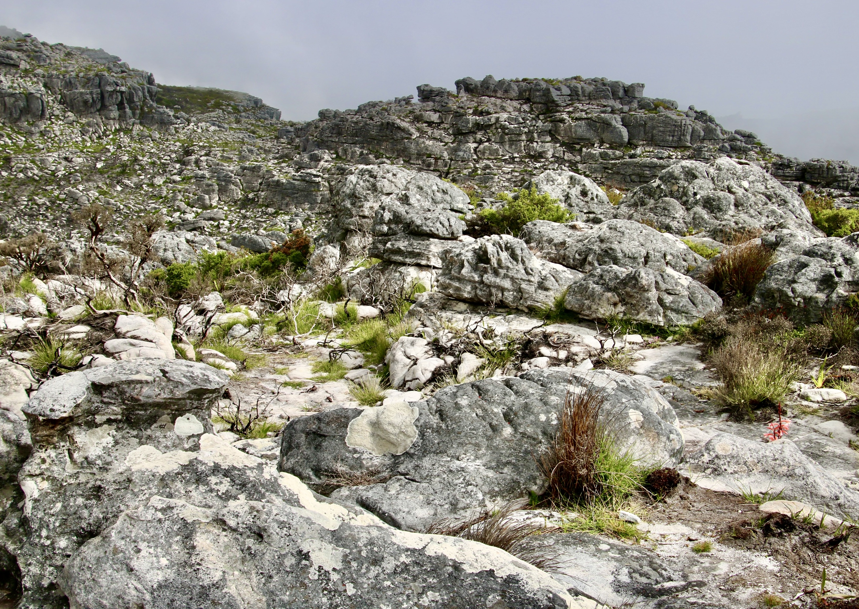
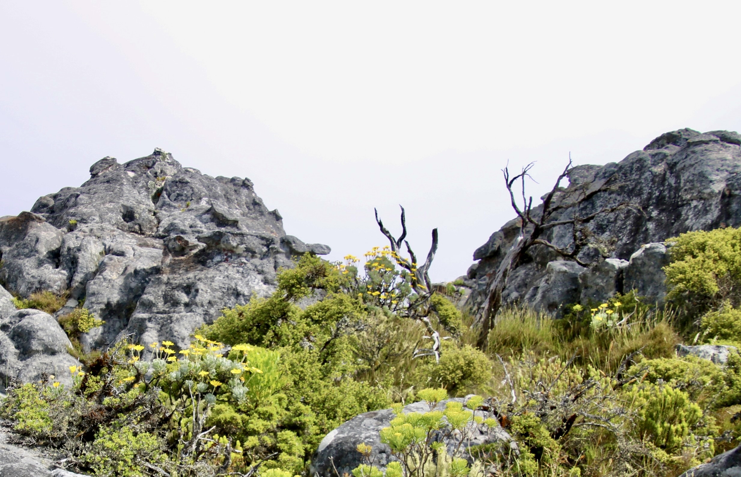
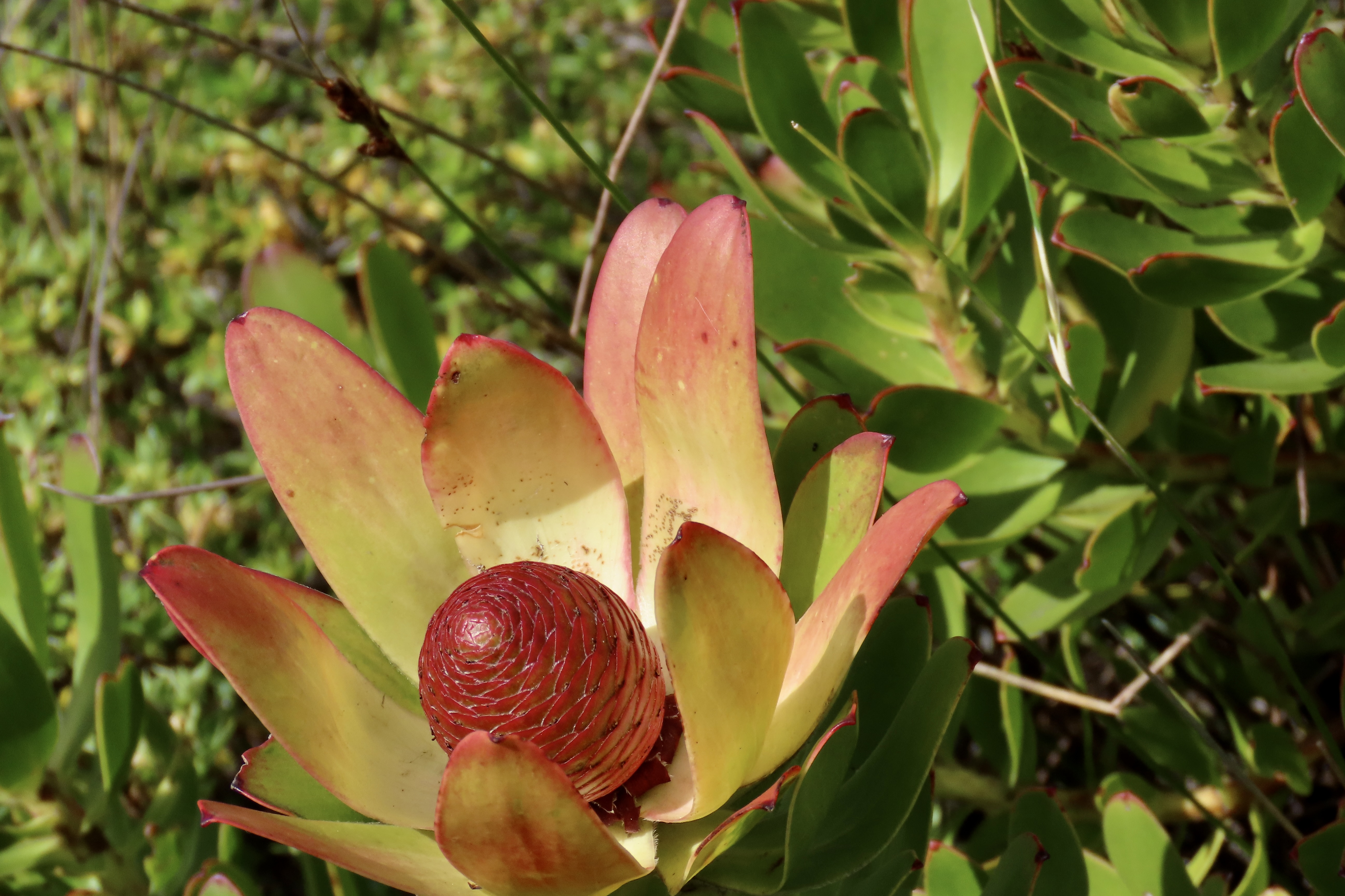
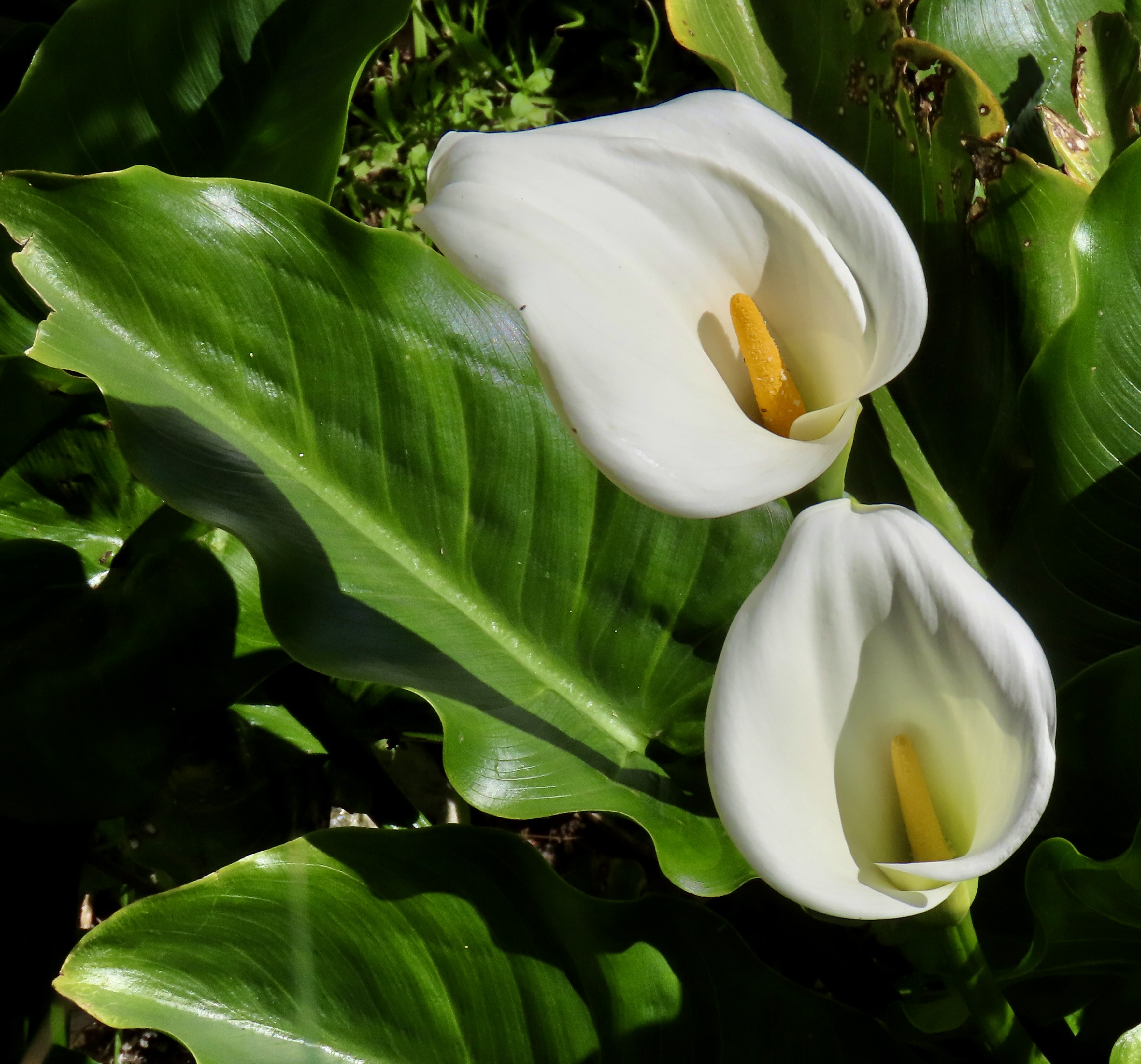
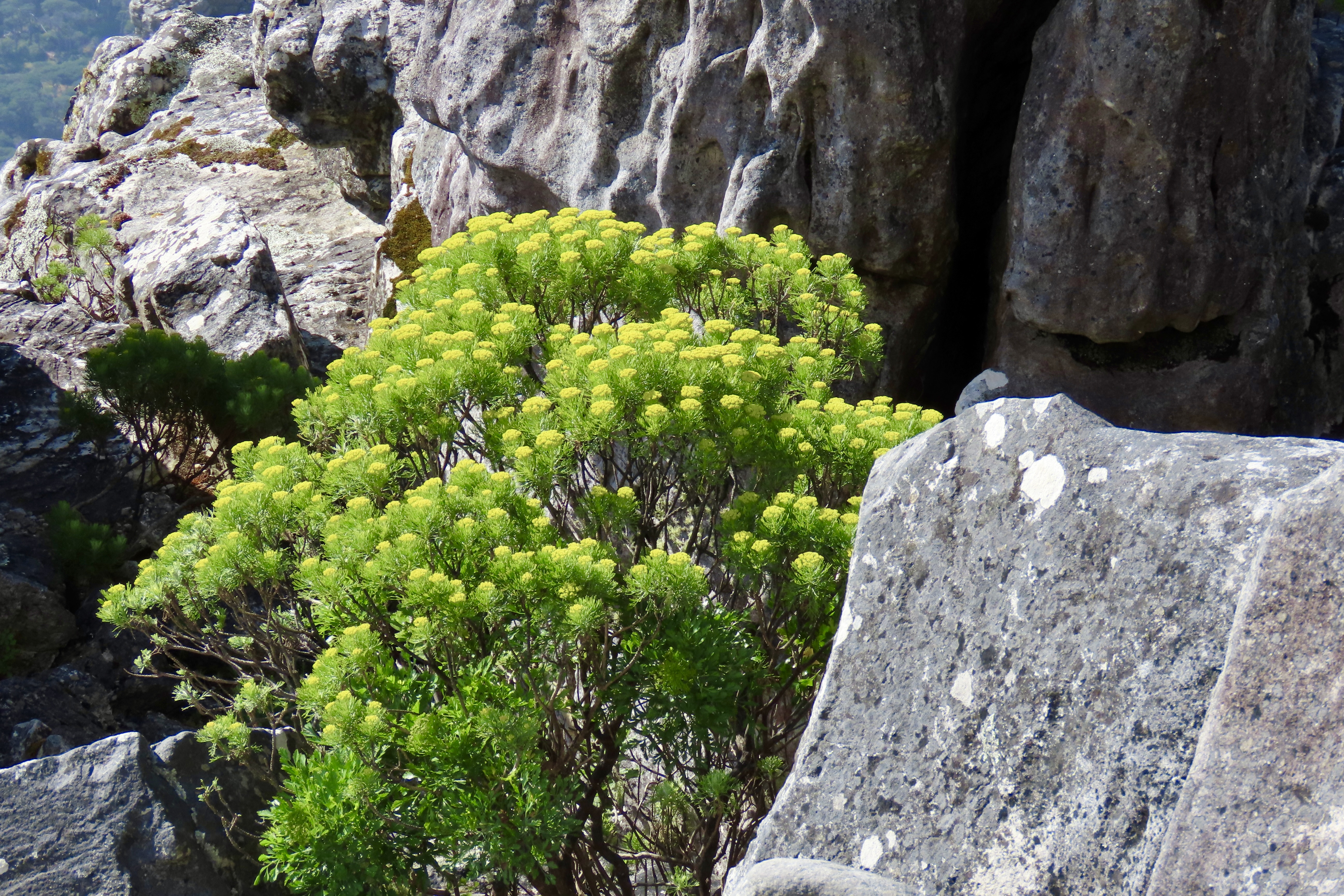
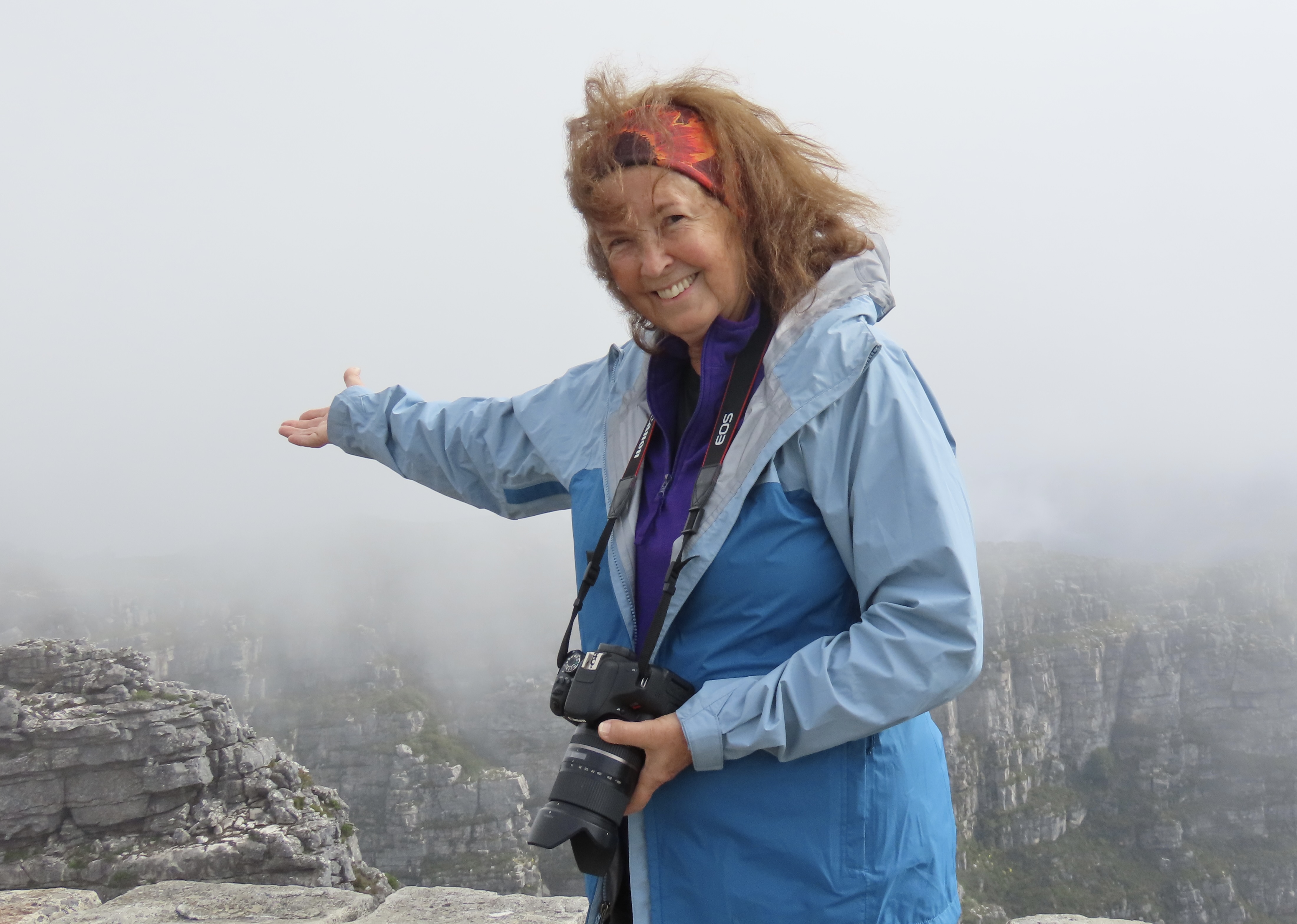
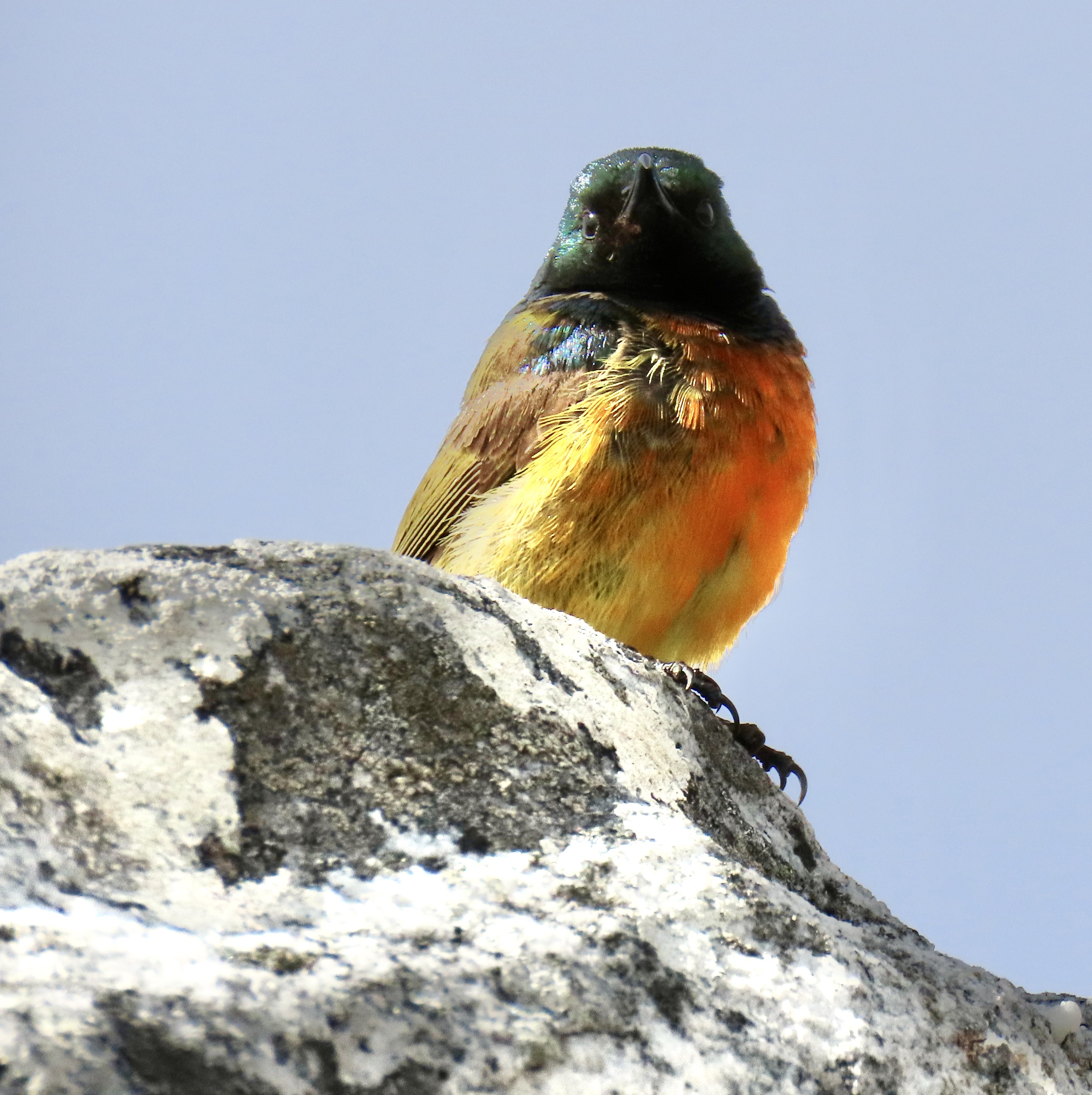
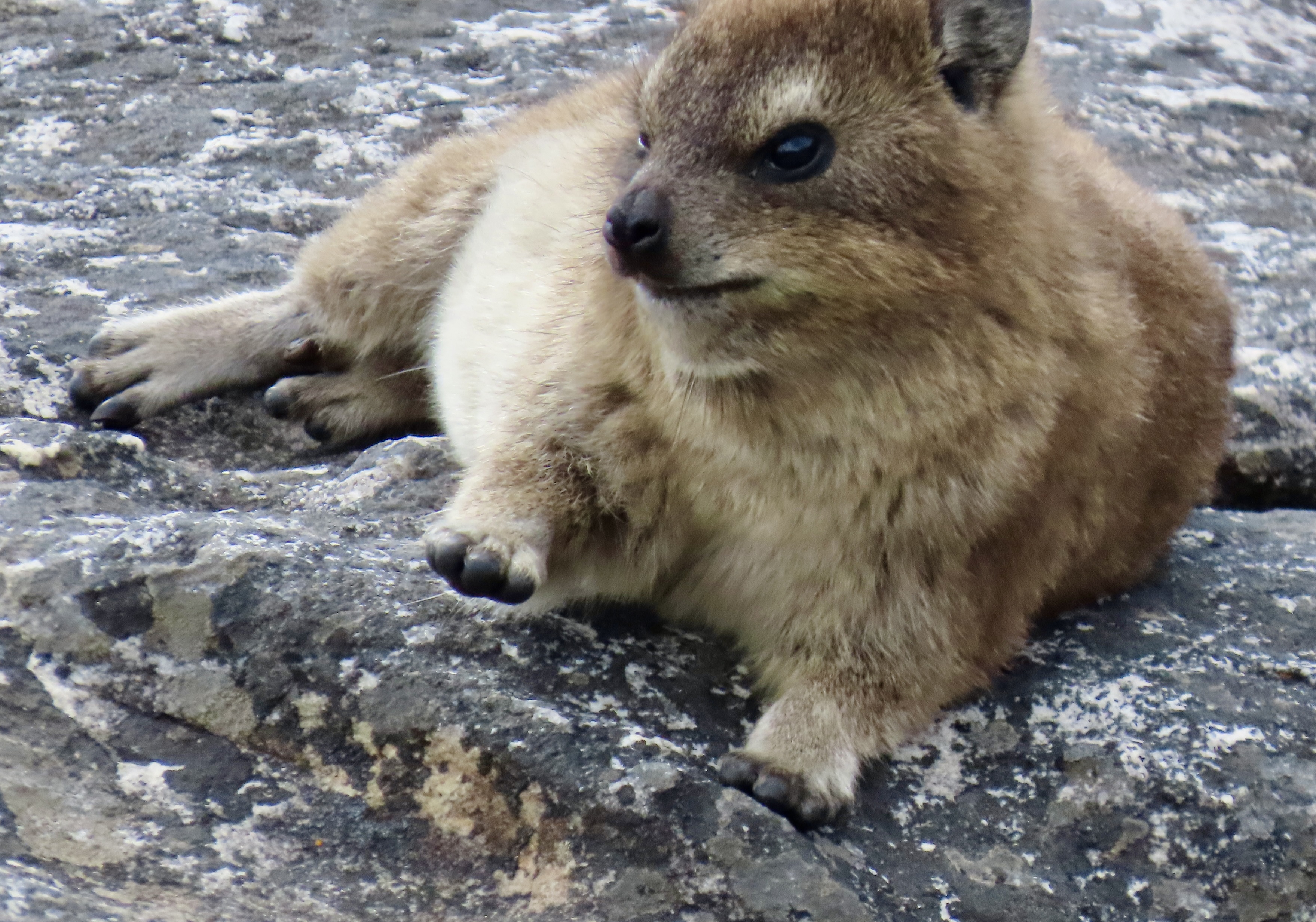
We took a full day excursion from Cape Town down to the Cape of Good Hope. Along the way, we were entertained by the ostrich, snakes, penguins and a lizard that you have already met in previous posts. This is the end of the road— as far as you can drive on the south-western coast of Africa without getting wet.This is Point Cape, just east of the Cape of Good Hope. Looking west, we had the view of the Cape that I showed in the first photo.This lighthouse was built was built in 1859 on Da Gama Peak, the summit of Cape Point, 780 feet (238m) above sea level, to protect sailors from the dangerous rocks off Cape Point and the Cape of Good Hope. It seemed like the ideal location. Unfortunately, it was often hidden by fog. A modern lighthouse is now located down Cape Point at 275 feet (78m). The hawk was a bonus.Our drive down to the Cape of Good Hope provided this view just south of Cape Town. We also saw this young caracal with its impressive long ears near the Cape. Our guide Johnathon was very excited and told us this was the first caracal he had ever seen in the wild. A member of the cat family, it hunts almost exclusively at night and is rarely seen by anyone! We were lucky. I moved quickly to get a shot before it disappeared into the brush.This rather impressive Peninsula Granite Fynbos wasn’t going anywhere, however. Peggy and I could take our time photographing it. It’s endemic to the Cape Town region and nowhere else.I managed to sneak up on one for a close up…And another. Now, back to Cape Town and the Springboks. I’m not talking about the attractive South African antelope known for its pronking, taking several 6 foot high leaps into the air in quick succession. I am talking about the South Africa’s Rugby Team that had just won the World Championship and was booked into our hotel for their Cape Town celebration.A large crowd had gathered around our hotel and was waiting their arrival. The police opened their cordon to let us through. Several people thought we were related somehow and snapped our photos. A number of teenage girls waited nervously. One actually managed to get a selfie with one of the stars. She tried to be cool when taking the photo but immediately screamed afterwards. So much for cool.Our guide, Jonathan, took us on a tour of Cape Town and Table Mountain in addition to taking us down to the Cape of Good Hope. Here, he is talking about the colorful homes in the small community known as Bo-Kaap that I featured at the end of my last post.The original residents of Bo-Kaap were descendants of slaves imported by the Dutch from Malaysia, Indonesia, India, and Sri Lanka during the 16th and 17th centuries.Because of their cultural heritage, Bo-Kaap is primarily a Muslim Community. Even the mosque was brightly painted, matching the brightly painted homes.One of the homes.It seemed that each one was painted a different color.A final exampleWe found this artistic elephant in Bo-Kaap…And this man selling freshly caught fish from the back of his pickup.Johnathon also took us to the Shimansky diamond jewelry shop where we watched diamonds being cut.The diamond cutters showed us two of the diamonds he was working on. Judging from their size, I’d say they were a bit beyond my budget. Quite a bit.Any trip to Cape Town should include a trip up to Table Mountain, the dramatic backdrop for the city. We got there by going up this tram.Almost there…Looking back at Cape Town from Table Top Mountain.Our hotel was mixed in among these tall buildings. View of the top of Table Top…And another view. A number of flowers demanded their photos be taken.Including one I had never seen: a peninsula conebush. The cone is tough and will only open and release its seeds as a result of fire. Cala Lilies were an old friend.These flowers created a pretty bouquet among the rocks.Peggy shows the mist rising up on the ocean side of Table Mountain. Her hair shows that it was accompanied by a breeze.This little beauty, an orange-breasted sunbird, was waiting for us as we neared the end of our time on Table Top Mountain.After all of the great people, incredible wildlife, and striking scenery, I think it is only appropriate that we end our African safari series with the small hyrax on Table Top Mountain, seemingly waving goodbye to us. The next morning we began our long air journey back to Virginia. I hope you enjoyed this series. We were ever so glad you decided to come along. Next up, an introduction to our thousand mile journey following the Pacific Coast.