Form, glaze and function make for stunning pottery. My brother Marshall picked out this teapot for Peggy and me from the work his daughter Marian does in Chattanooga, Tennessee.
As my body of work grows, my hope is that it will reflect a life filled with wonder and yearning, as well as serious play. —Marian Heintz
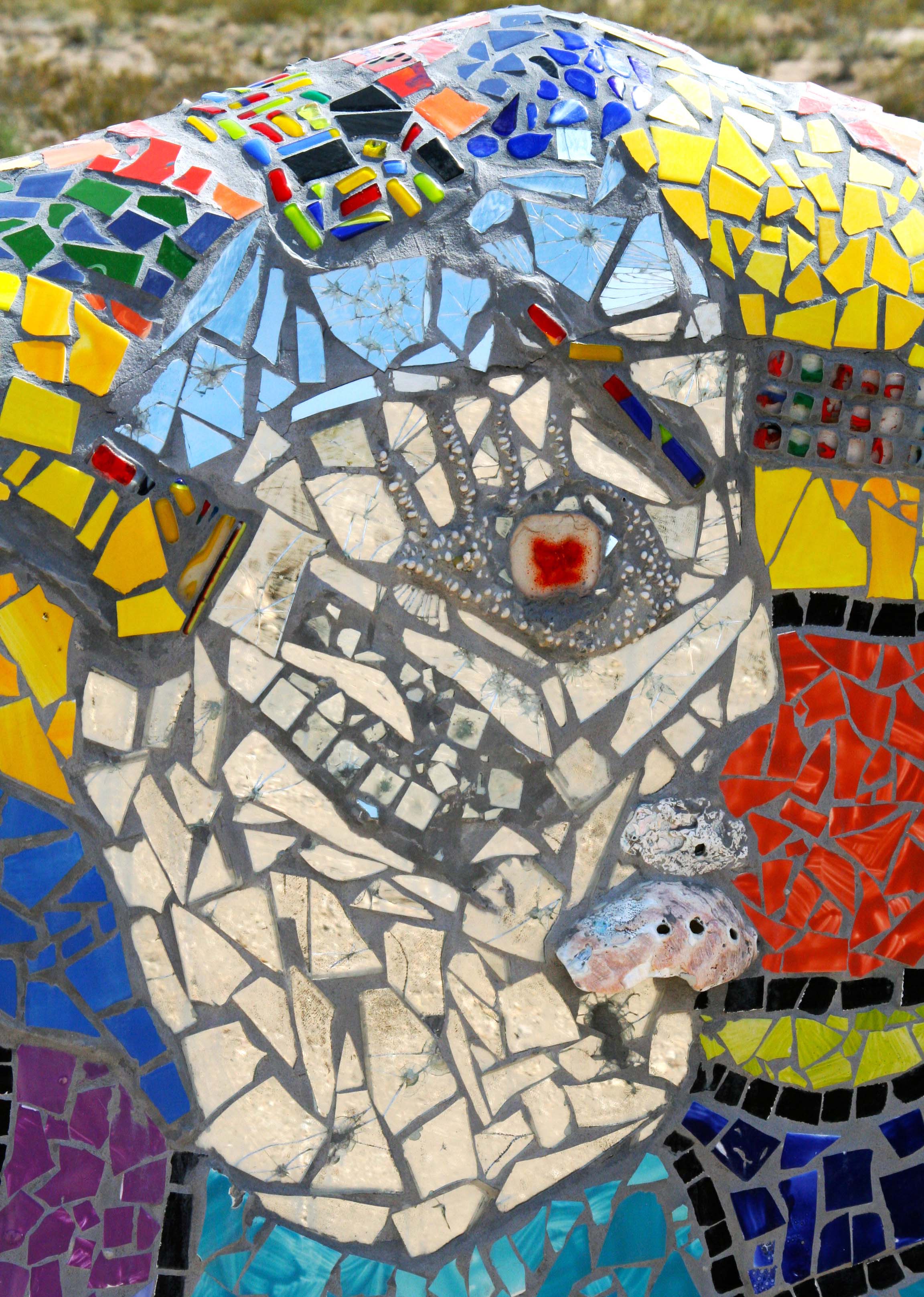
Marian was making hearts— and not 100% happy about it. Valentine’s Day is coming, however, and people like to buy hearts. People buying hearts puts money in the bank. So, for the day at least, Marian had put aside her inner artist to be pragmatic and was whipping out product.
It wasn’t quite mass production, though. “Each piece needs to be carefully finished,” she insisted. Marian is a dedicated craftsperson as well as an artist. No part-finished work would escape out her door, even if it meant less profit.

One of the hearts that Marian was producing for Valentine’s Day.
Peggy and I had driven down from the Nashville area after Christmas to visit with Marian in Chattanooga, and to check out her studio and work. Marian is my niece (my brother Marshall’s daughter), and I have known her since she was a toddler. It had been far too long since we had seen her.
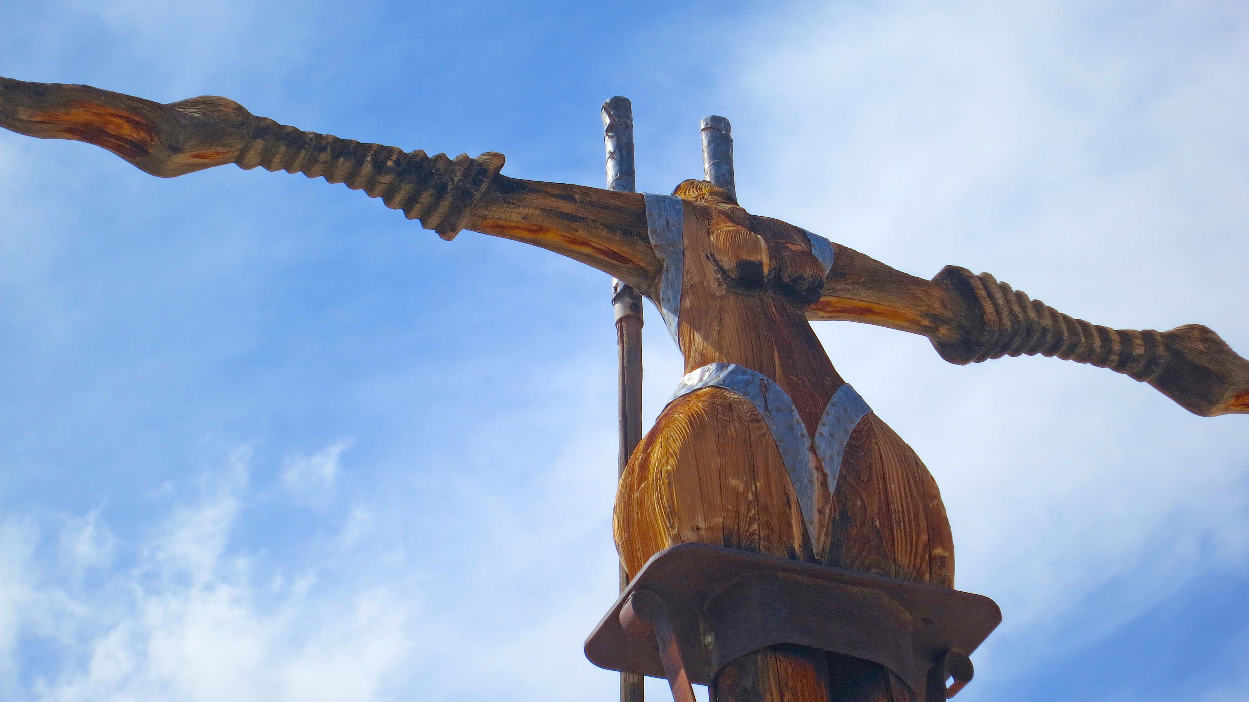
Marian has always had a creative bent, and it has carried her in several different directions. I first became aware of her passion for art when she was attending the Glen Fishback School of photography in Sacramento. She has a fine eye for photography, as does her brother, Wayne. She even managed to talk my dad into posing as a time-worn gold miner for her final portfolio at the school.
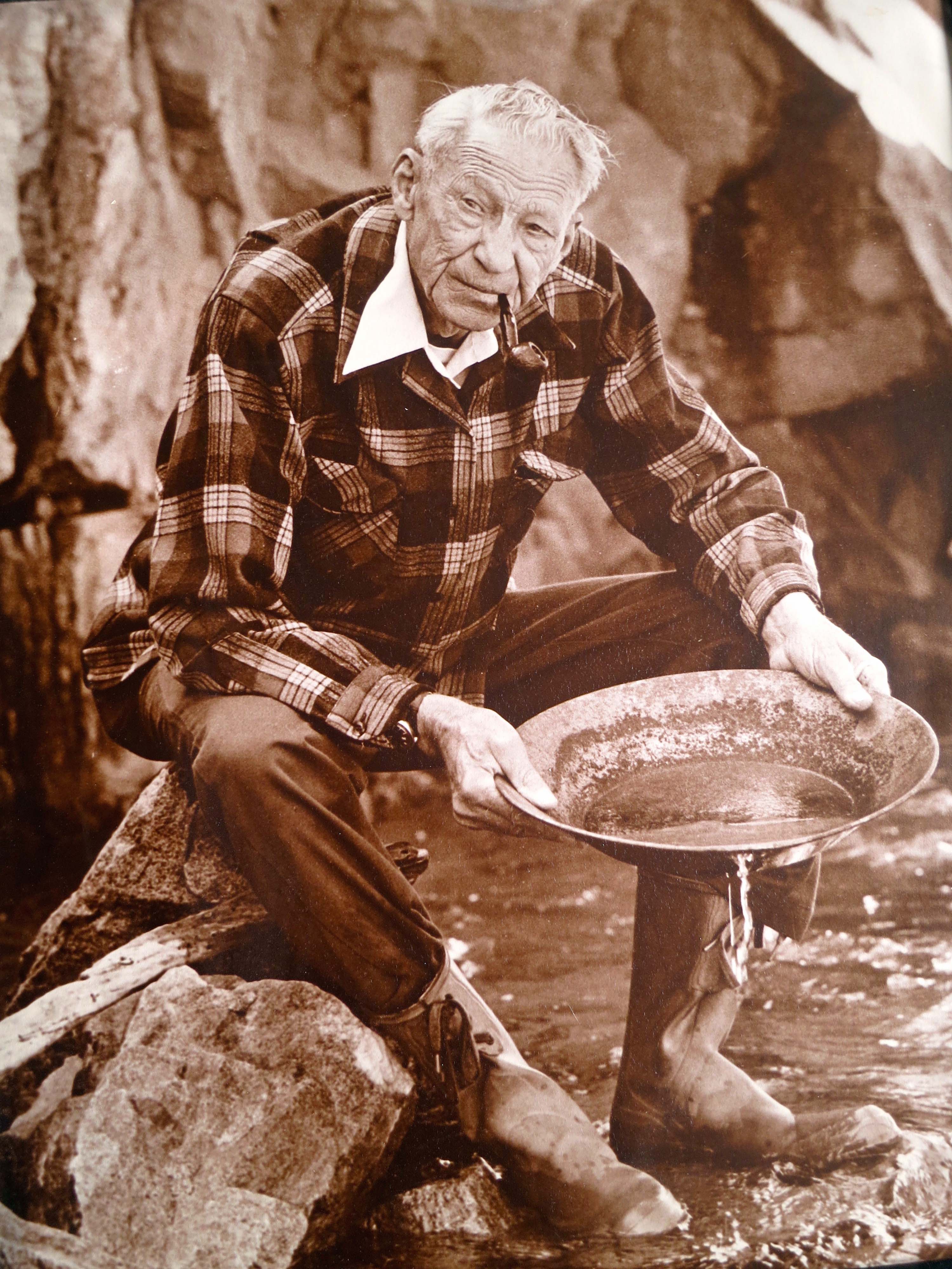
I have the photo that Marian took of my dad posing as a gold miner in his late 70s. Our daughter, Tasha, has put her name on the back of it to make sure she gets it in the future. (grin)
From photography, Marian branched out to the folk art of wheat weaving where straw is turned into decorative items and jewelry. From there, it was a natural step into making jewelry with copper and silver. Partially, as a result, she ended up teaching women in Haiti how to make jewelry out of rubble after the devastating 2009 earthquake.
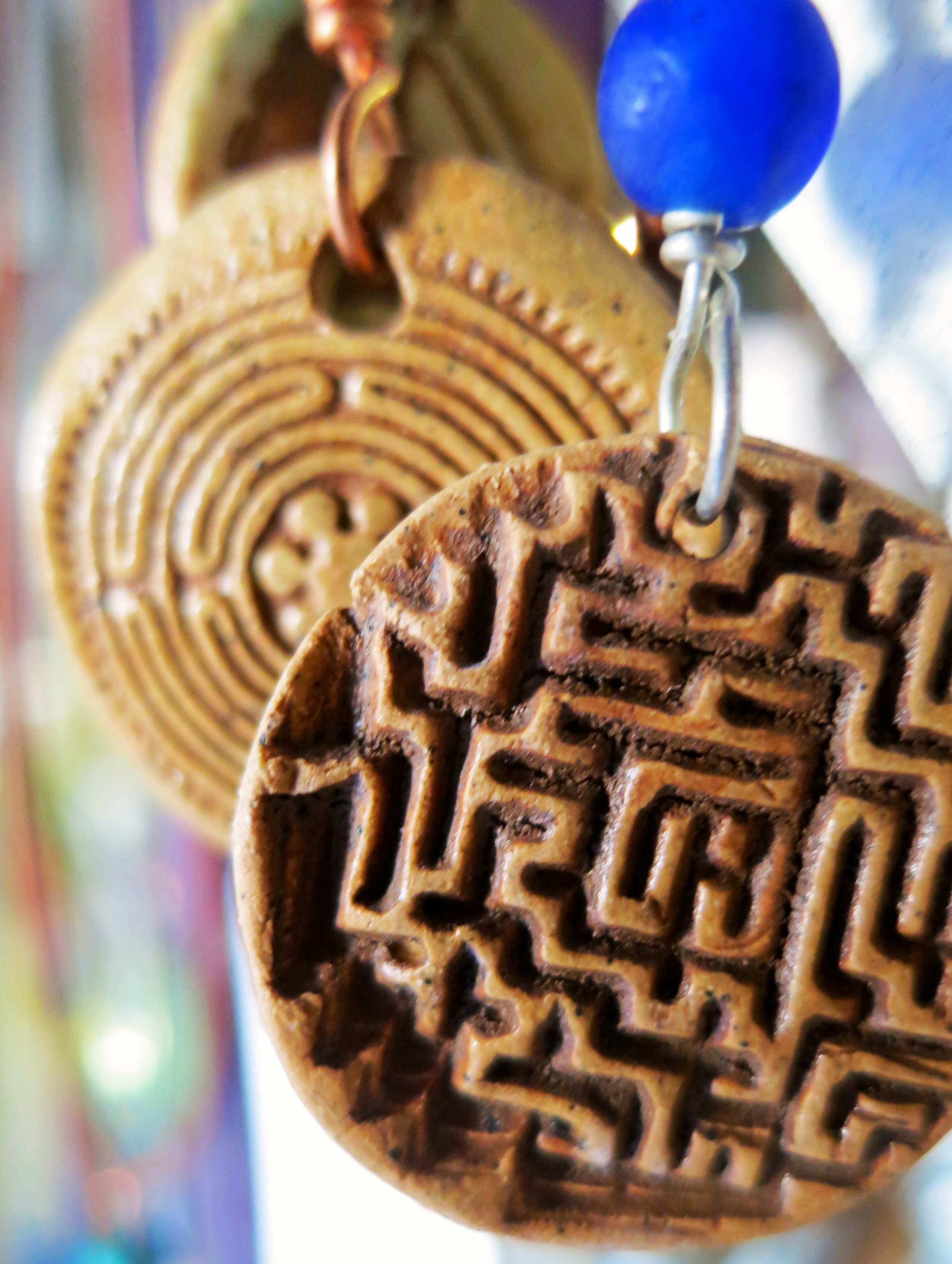
Marian still makes jewelry using her skills as a potter. Peggy had to have one. Marian explained that making the labyrinth and maze serve as meditation for her.
Her introduction to pottery came when she was working on her undergraduate degree at the University of Tennessee, Chattanooga. “I first began working with ceramics sixteen years ago, and fell in love with clay the first time I touched it,” she wrote in a bio sketch.
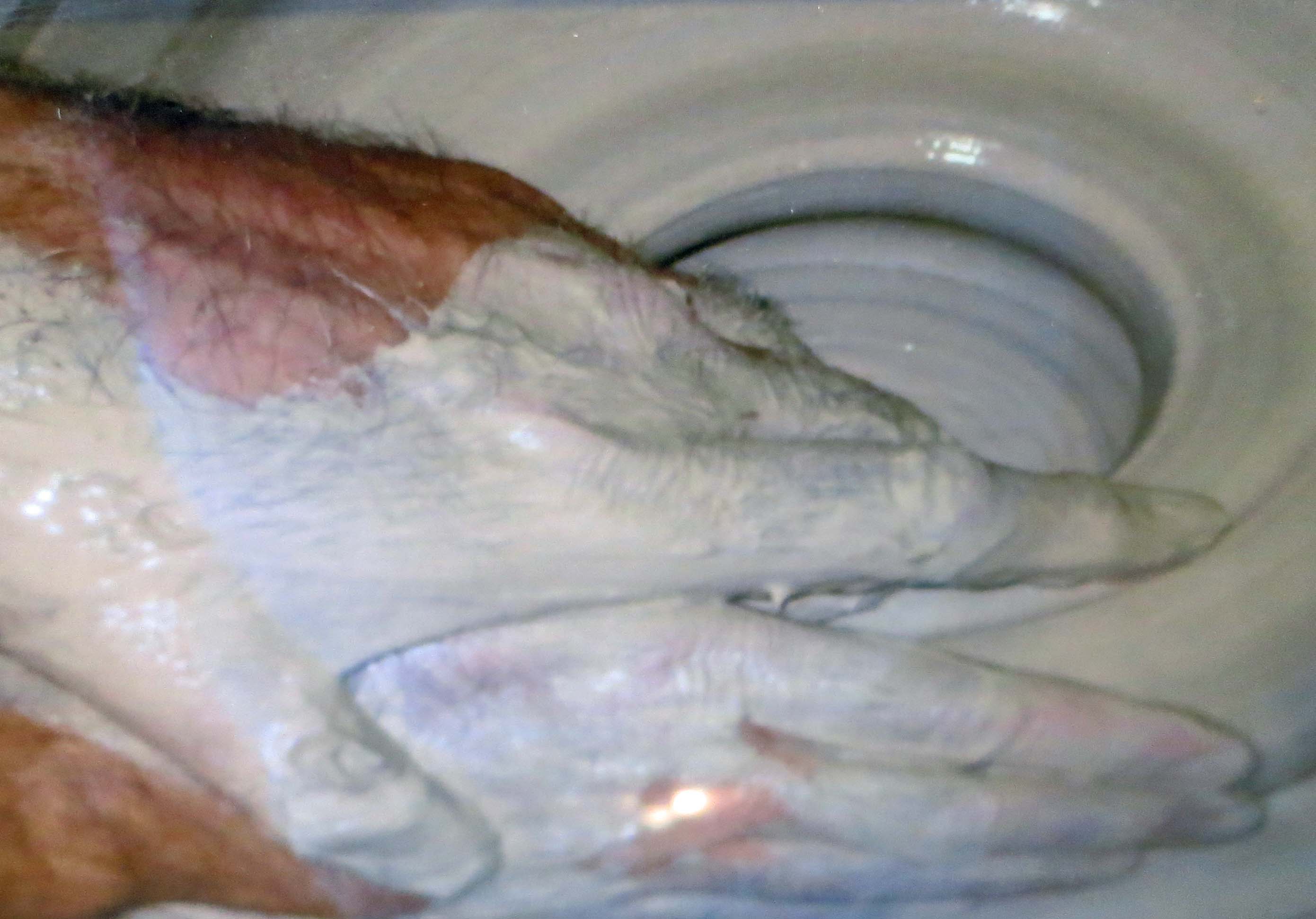
The hands of Marian’s friend and mentor Talle Johnson as he works clay and throws a pot.
A sample of Talle Johnson’s pottery that Marian keeps in her studio.
From 2007 up until he passed away in 2010, Marian worked as an apprentice to the highly talented and well-known potter, Talle Johnson. She credits much of her artistry, and in particular her emphasis on form, to his mentorship. As we entered through the backdoor of her studio, the first thing that greeted us was a memorial wall of photos featuring Talle and his work. The second thing to greet us was Wren, the studio cat.
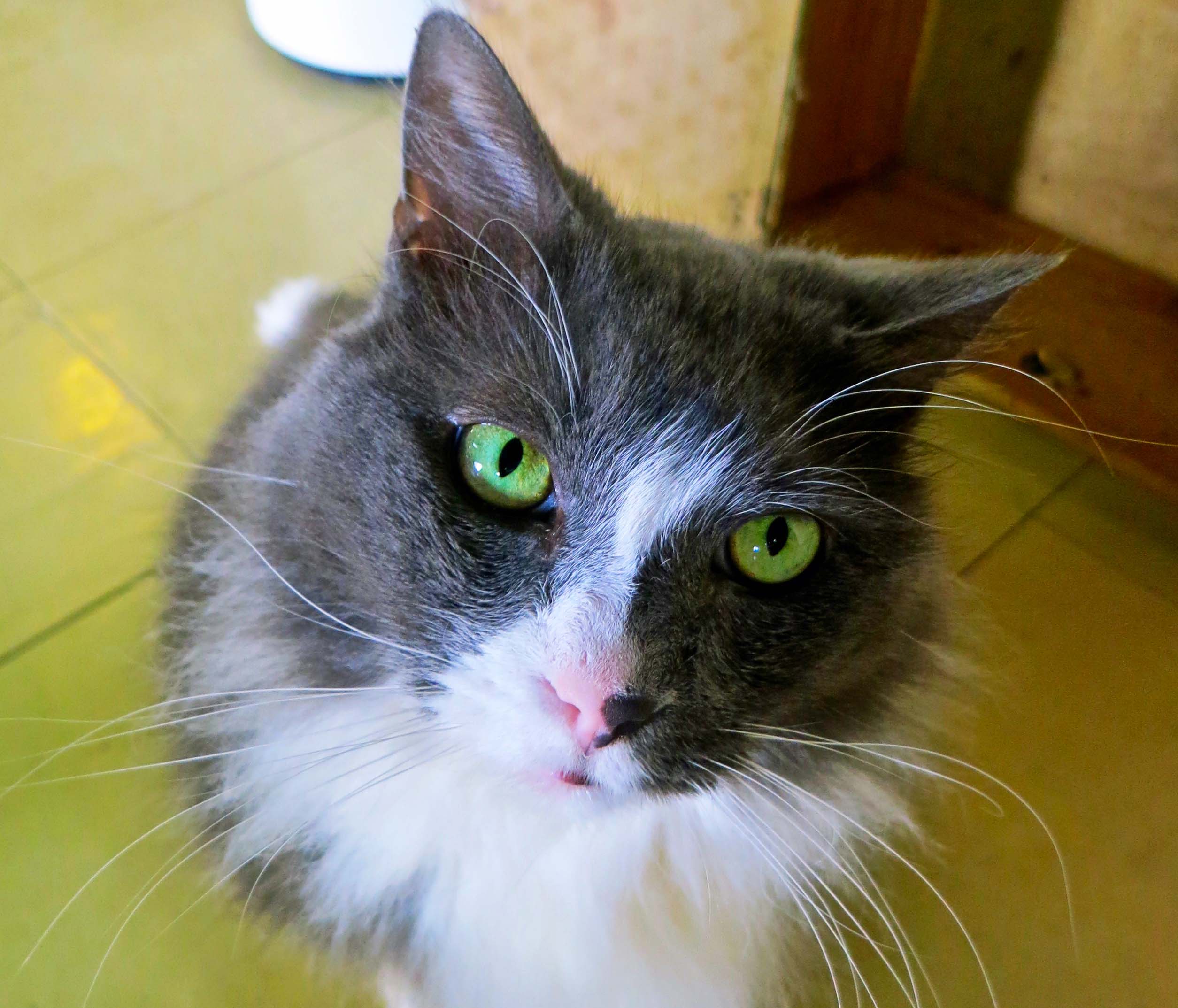
Wren, the studio cat.
Marian greeted us with the same enthusiasm that she puts into her work. Within minutes she had us settled into her comfortable ‘transition lounge.’ (Adult students are invited to relax with a bite to eat or a glass of wine to “transition between work and throwing clay.”) Three hours later, we had almost caught up on our lives— and almost provided Wren with the amount of rubbing he was sure he deserved.

The transition lounge was warm, colorful and comfortable— much like Marian.

Marion chatted for three hours, filling us in on her journey into pottery and how it has reflected her own journey in life.
Marian’s studio is located on Brainerd Road in Chattanooga. The street is reflected in the window of her shop below. In addition to serving as her studio and as a retail outlet for her work, the space also includes potters’ wheels for classes she offers. She sees her studio as a place where students can “come in and leave everything else behind,” providing, if you will, a community— a place of peace where one can get lost in the rhythm of the potter’s wheel and the earthy feel of clay.
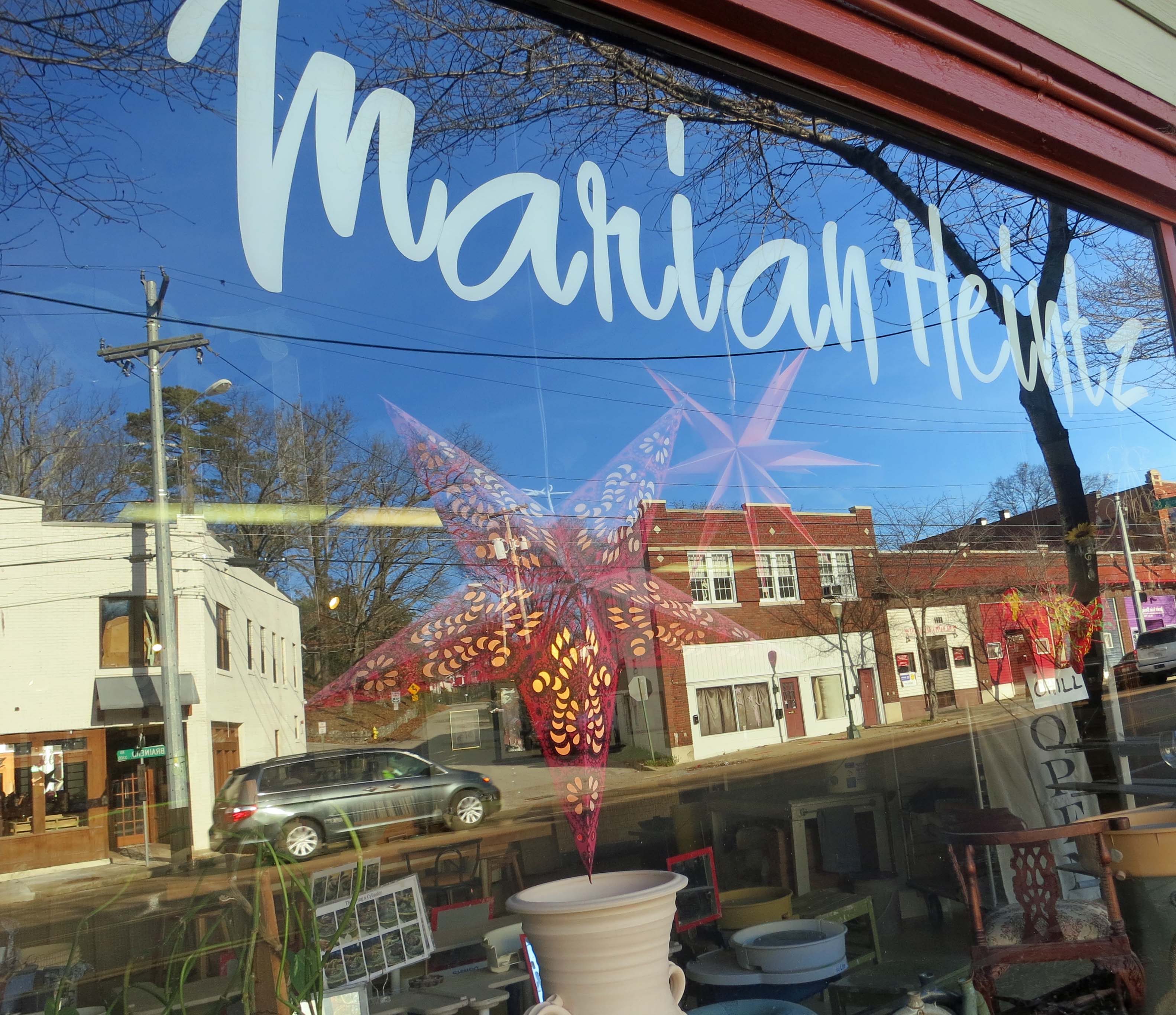
Chattanooga’s Brainerd Road is reflected in the window of Marian’s studio.
My work is both utilitarian and decorative, so that I try to find a balance between aesthetics and function. Using stoneware clay, I throw forms on the wheel as well as hand build. Some of these forms are altered on or off the wheel and many have paddled or textured surfaces. I would describe my forms as organic, sophisticated, yet simple and playful. There is a sense of movement and energy that radiates out of them. —Marian Heintz

Gravy bowl.
Simple flower vase.
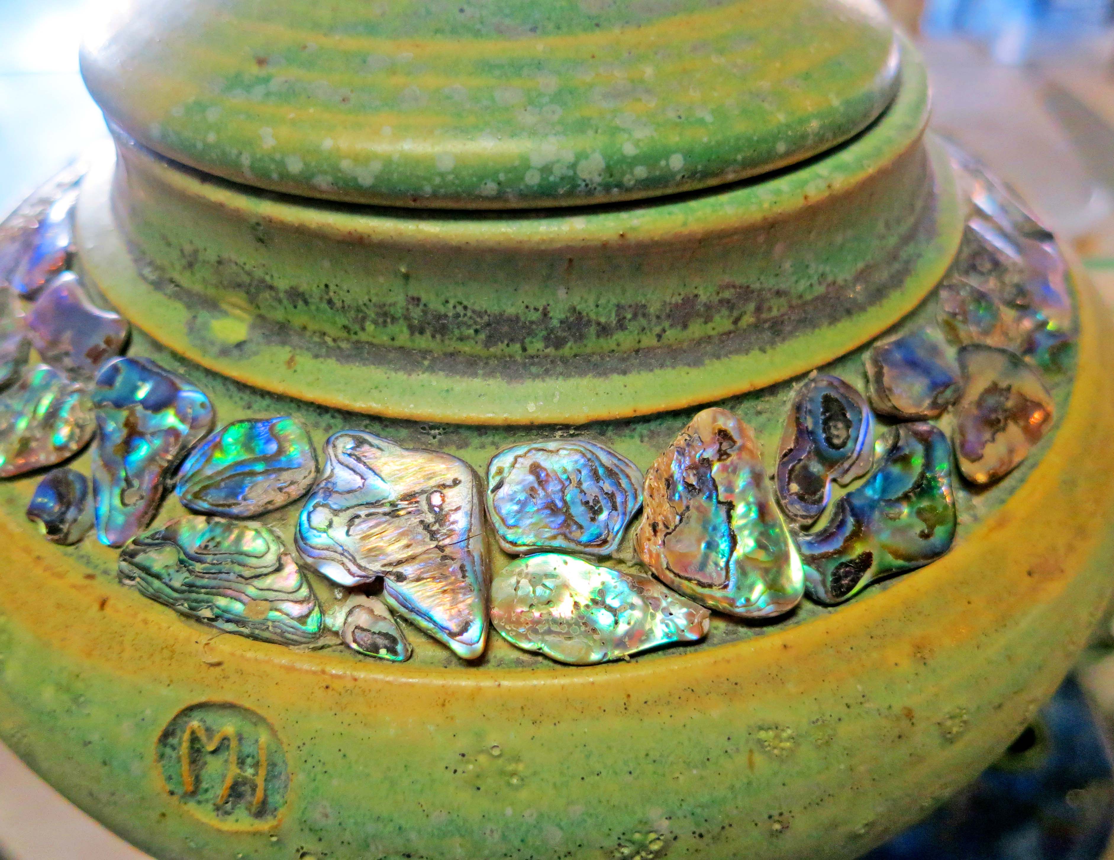
Pot incorporating abalone shells.

This coffee cup came home with me. The MH serves as Marian’s signature.

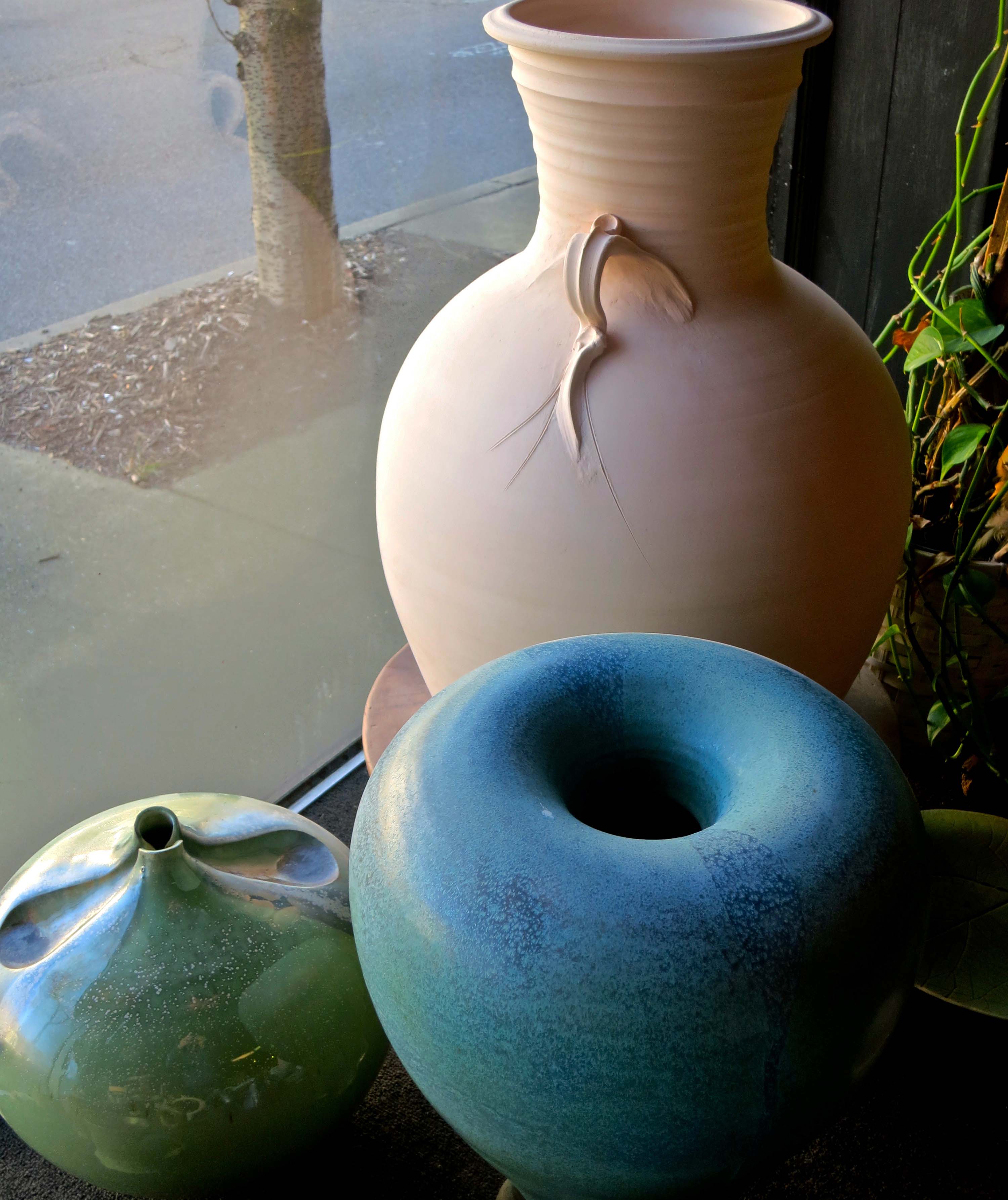
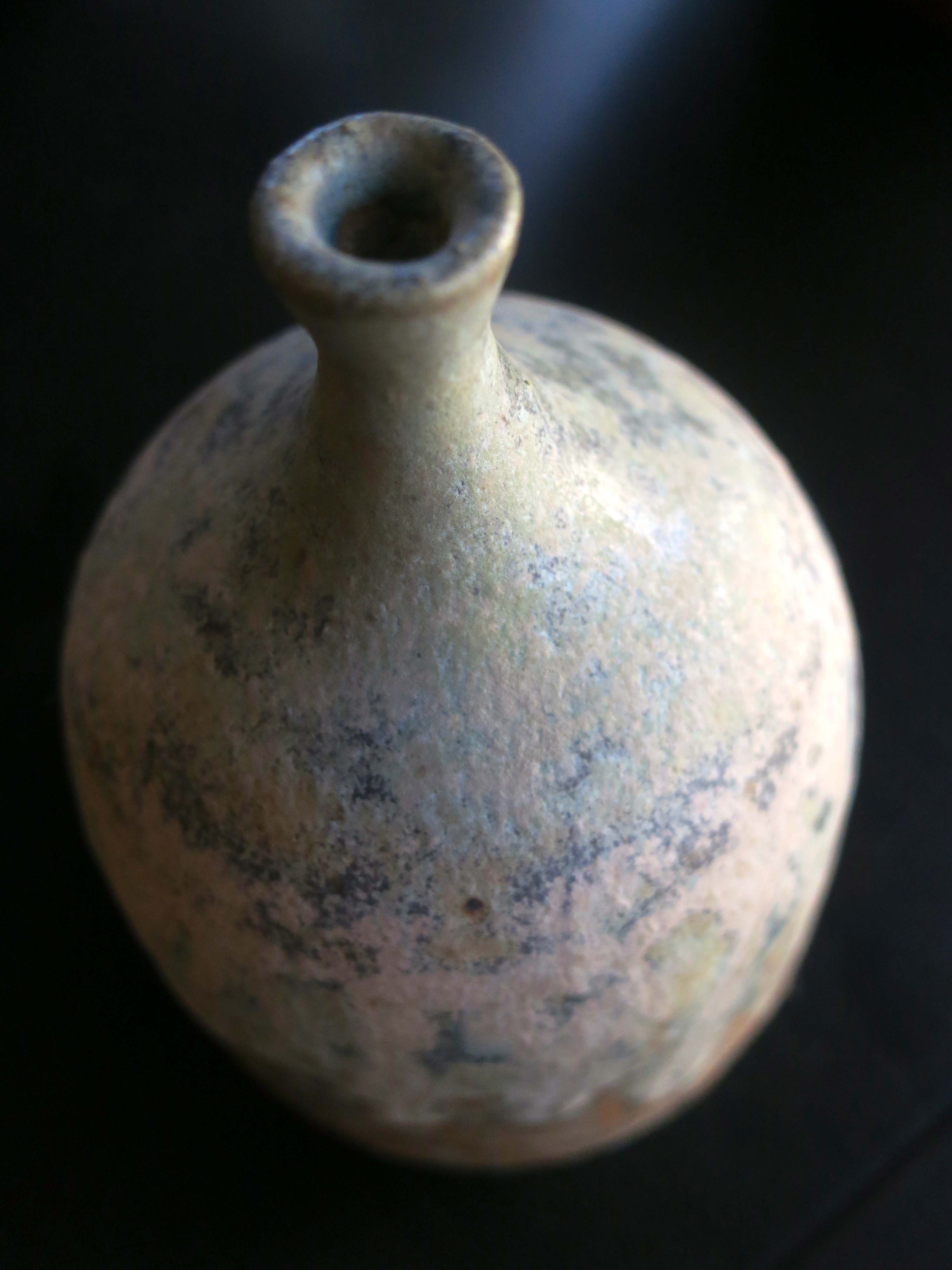
I enjoyed the top down perspective on this vase.

Marian has also branched out into porcelain.
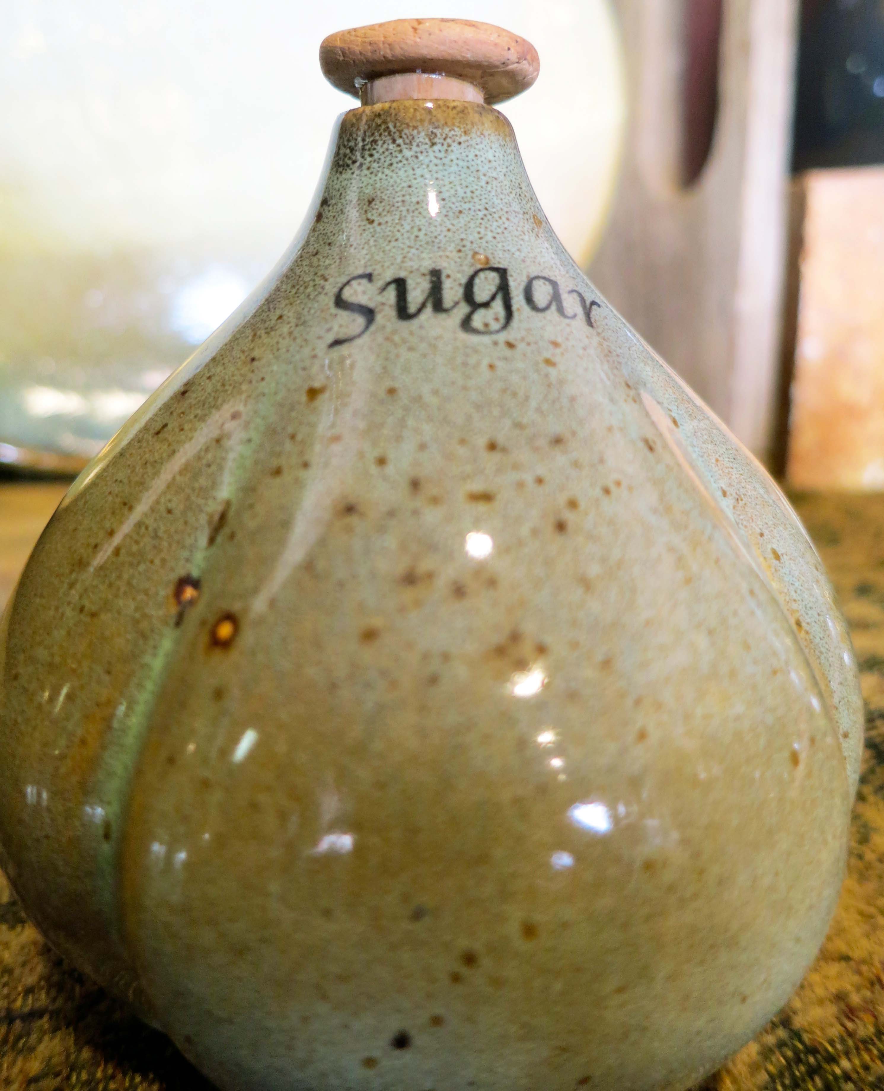
I found the small containers she made for sugar, salt, pepper and other spices quite unique.
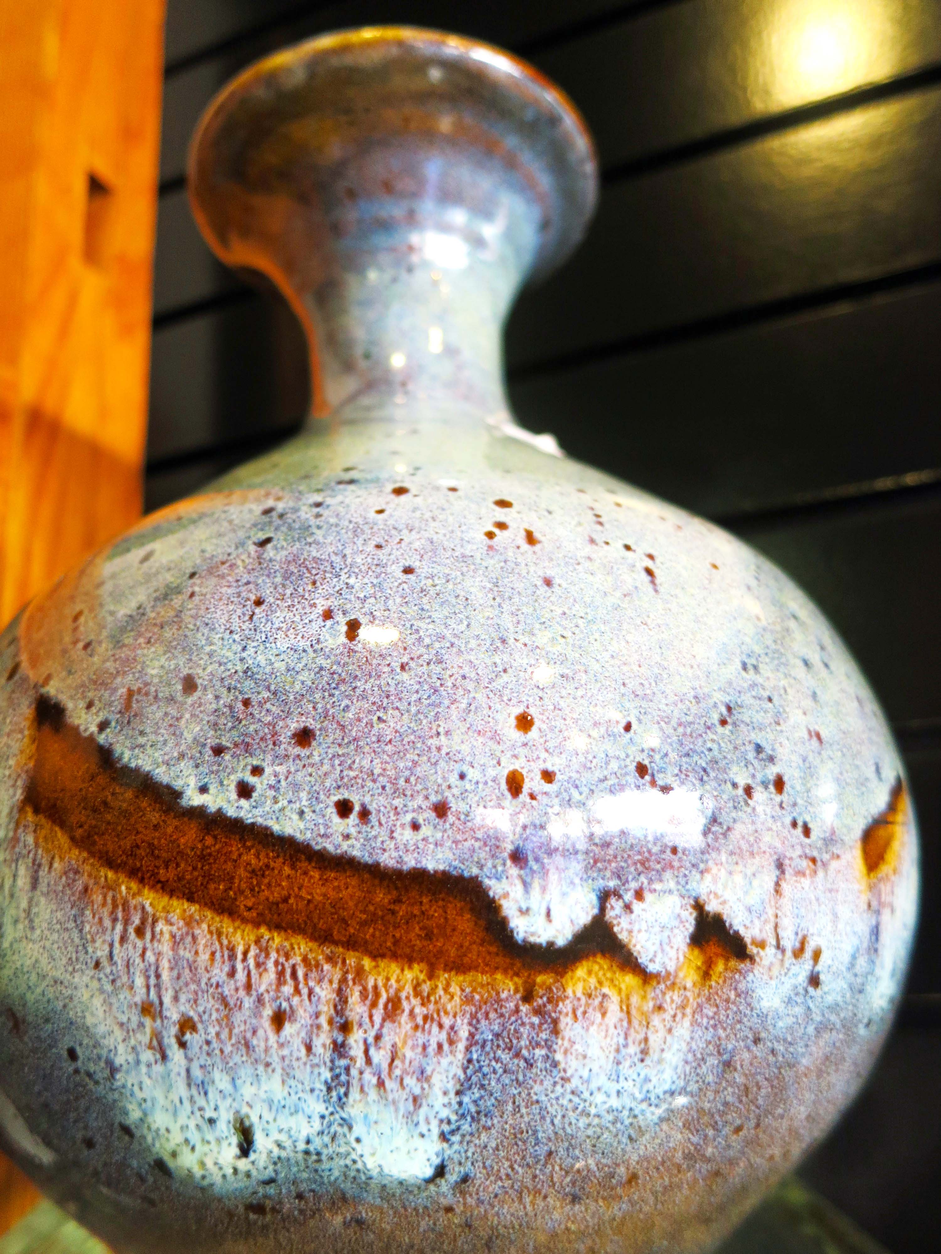
This vase made me think of Where the Wild Things Are.
Marian’s work has been shown at the Tennessee Arts Commission gallery in Nashville and a piece has been purchased by Commission to add to its permanent collection. You can learn more about Marian by checking out her website.
While we were talking, Marian had mentioned how she felt her work in pottery had reflected her struggles in life. “I am good at struggling,” she had noted with a grin. “I have a knack for it.” Her dad had once commented to her how she was always able to take lemons and make lemonade. Her response had been, “I don’t want to make lemonade. I want to make something more beautiful and permanent.”
I think she has succeeded.
NEXT BLOG: It’s off to the beautiful red rock country of Sedona, Arizona.