Peggy and I are wrapping up our travels around the US. This post features the hazards of our road trip and Massacre Rocks State Park along the Oregon Trail in Idaho.
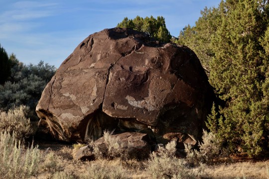
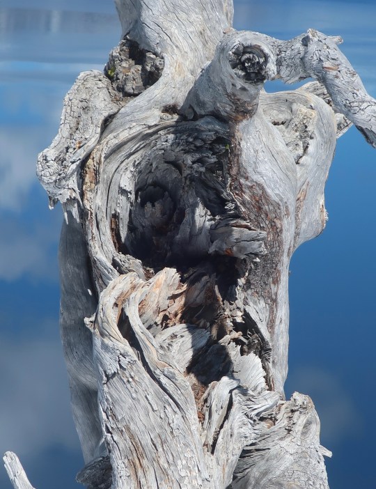
We were greeted by this ferocious beast at Massacre Rocks SP. (Photo by Peggy Mekemson.)
Peggy and I have been on numerous road trips over the years, a quarter of million miles worth according to the odometers on our two small RVs. But nothing can match how strange this summer has been. Let me start by noting our 8,000 mile journey has taken us through 18 states (plus the Navajo Nation) that have had the not-so-coveted designation of being Covid-19 hot spots. I start each morning by feeling my forehead and breathing a sigh of relief when it is cool. If I were you, I wouldn’t come within 600 feet of us. Or 6 miles. Screw the 6-foot rule. When we get home we are going to self-quarantine for 6 months. Or at least 6 days.
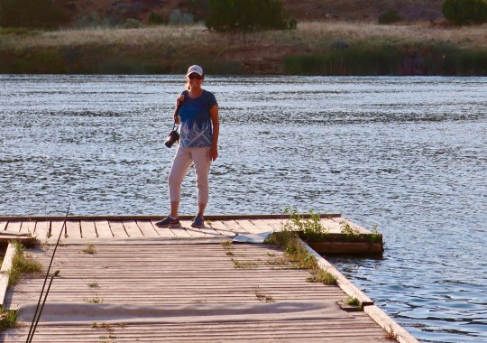
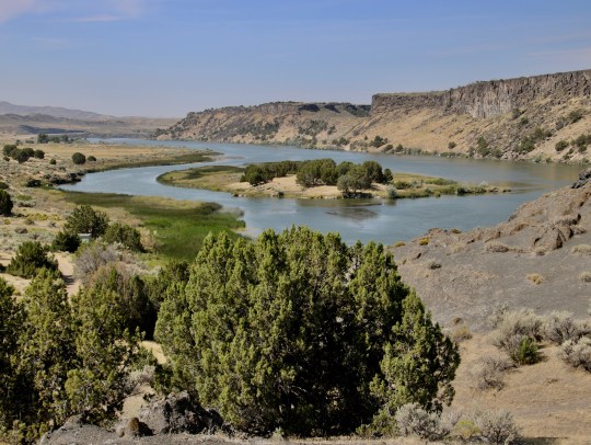
Peggy demonstrates just about the right amount of distance to stay away from us after our journey through 18 states noted for their Covid-19! She is standing out on a floating pier on the Snake River, enjoying the beauty of the area.
There were some potential Covid-19 hotspots we have avoided, however. Peggy and I crossed off South Dakota even though we wanted to visit the Bad Lands and I would have found the motorcycle rally in Sturgis interesting. It’s kind of a Biker’s Burning Man. Hanging out with 250,000 Harley fanatics who were reluctant to wear masks and liked to party in crowded bars didn’t seem particularly wise, however.
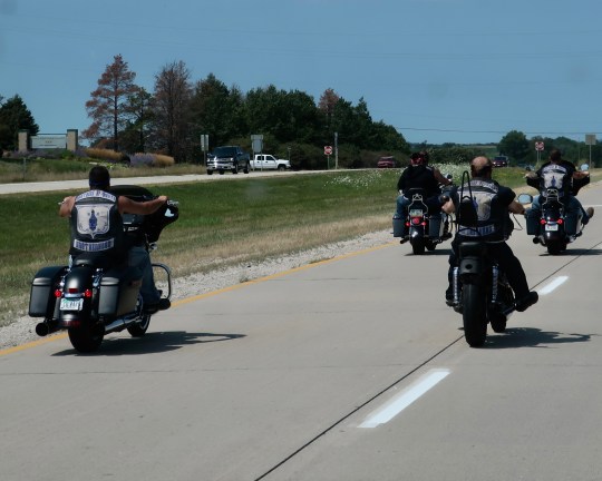
The Brothers of Morte (death), wearing leather jackets with an image of a skull with a candle burning out zoomed around us on their bikes heading for Sturgis. The message somehow seemed appropriate for the huge gathering during a highly contagious pandemic.
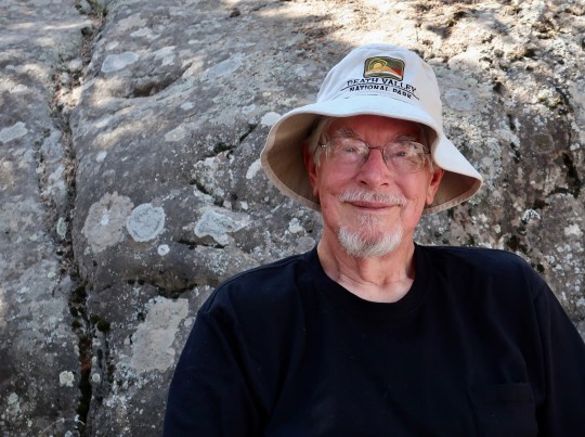
But Covid-19 has been only one of several potential disasters out here on the road this summer. For example, it’s 108° F outside now. That’s miserable, and it can be dangerous. But what if we were in Death Valley? It’s a go-to place for Peggy and me. We’ve been there many times. Earlier this week, it saw a whopping 130 degrees F (54.5 C)! It was the hottest place on earth at the time and was recorded as one of the four top temperatures ever documented. I put on my Death Valley hat in honor of the occasion. Why whine about 108?
Here I am with my Death Valley hat on in front of a large granite rock that dominated our camp site at Massacre Rocks State Park. (Photo by Peggy Mekemson.)
Lightning storms and forest fires come with the excessive heat and are once again devastating the West. Two years ago I was dodging fires as I backpacked 750 miles down the PCT. They’re back with a vengeance now, roaring through Northern California and causing deadly fire tornadoes. I’m ever so glad I am not out on the trail. Fires are much easier to dodge in Quivera the Van than on foot. And we have air-conditioning.
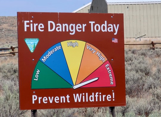
Peggy and I noted this sign as we drove up to the Oregon Trail Interpretive Center in Baker City, Oregon. We spotted a wild grass fire in the distance.
But how about dodging hurricanes? In mid-July, our kids rented a lovely house on the Outer Banks of North Carolina to celebrate Peggy’s 70th Birthday. It was the primary reason for our road trip and a fun way to bring our families together and make up for the family trip on the Rhine River Peggy had planned. Europe won’t let us near the continent.
Our grandkids were a little surprised, however, to see their 77 year old grandfather and 70 year old grandmother risking their necks out body surfing and riding boogie boards with them. “Older” people aren’t supposed to behave that way. It was the crowded beach that worried me, however. That and the dark clouds that hung on the horizon. A week later the Outer Banks had to be evacuated due to the threat from Hurricane Isaias. We dodged the bullet by a week.
The waves were fun and the beach was gorgeous on the Outer Banks but the crowds with their potential coronavirus and the dark clouds with their threat of severe weather were worrisome.
That was minor in comparison to the derecho that roared across Iowa. On August 8th, Peggy and I had driven across the state, laughing about how corn was the scenery. I’d stopped taking photos after 20 pictures. We were camping just across the border that night when a thunderstorm came through that rocked our van and lit up the night sky. We thought of it as entertainment without a clue about the massive storm that was brewing. When we pulled out in the morning, clear skies graced our road west. On the 10th, we were at Buffalo Bill’s Ranch enjoying a beautiful day on the North Platte when the derecho ripped across Iowa and wiped out 40% of the state’s corn crop.
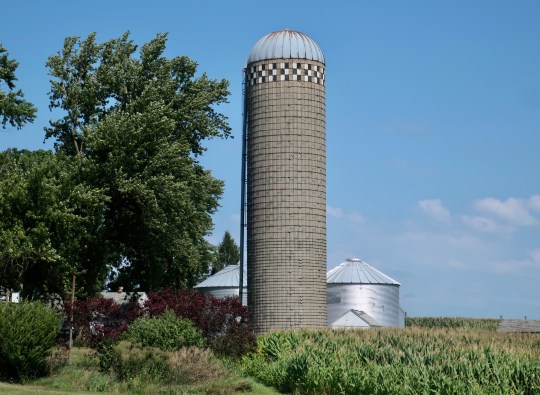
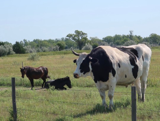
I took this peaceful photo featuring a silo and corn two days before the derecho had devastated 40% of Iowa’s corn crop.We were unaware of the derecho in Iowa as we wiled away the day at the Buffalo Bill Ranch on the North Platte River. Our only worry was the big bull nearby. (The horses were miniatures but the bull was still the biggest one I have ever seen!)
While dodging all of these potentials disasters, why visit a place known as Massacre Rocks? The answer is simple. How could we not? Peggy and I had been following the Oregon Trail since we left Nebraska and Massacre Rocks State Park on the Snake River in Idaho is a noted location along the way. As the name suggest, it is symbolic of one of the challenges faced by the pioneers, attacks by hostile natives. I suspect we would be hostile too if a stranger rode into town and wanted to steal our property.
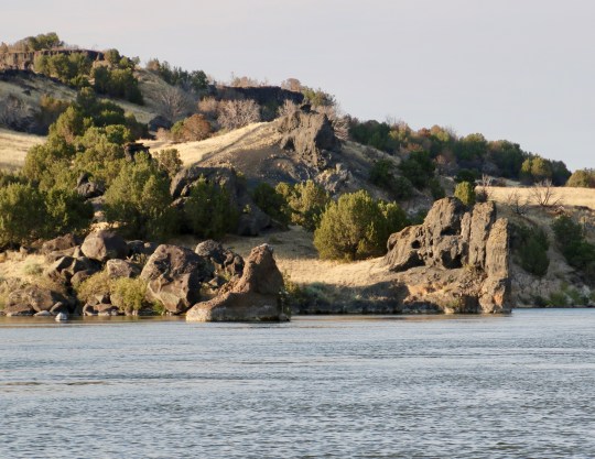
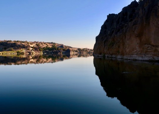
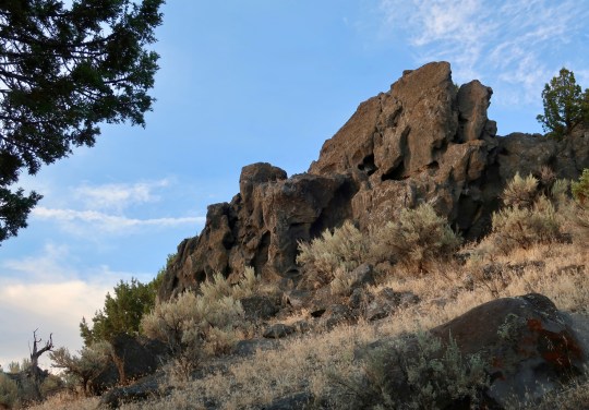
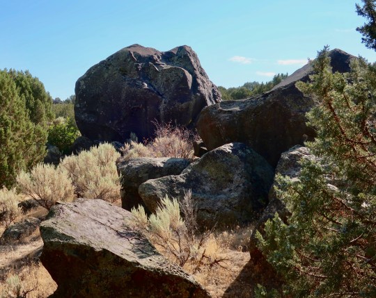
The name is something of a misnomer, since the attacks on wagon trains took place a few miles away. The pioneers were not happy with all of the large rocks in the area, however. They provided an ideal place to organize and ambush or to shoot arrows from behind. Peggy and I, on the other hand, were not worried about anyone shooting arrows at us and found the rocks and the river quite beautiful. I think you will agree…
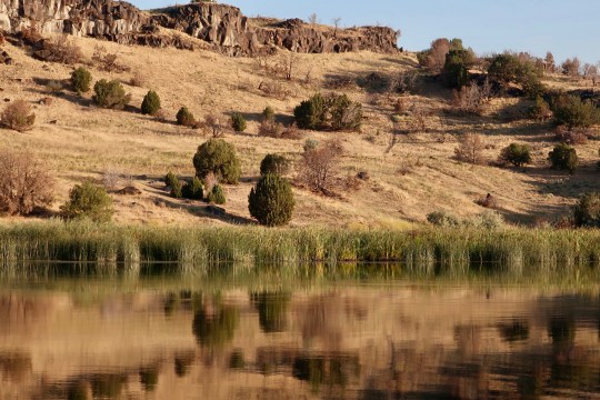
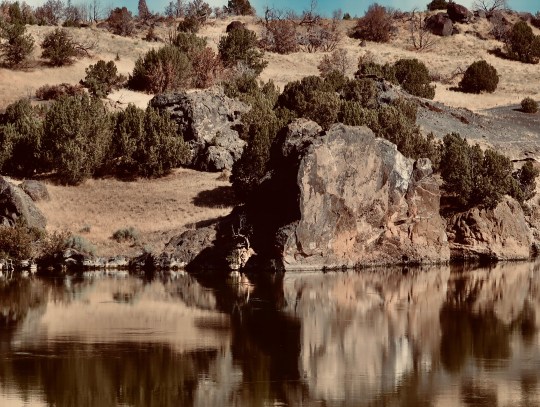
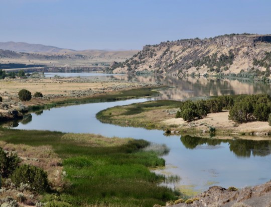
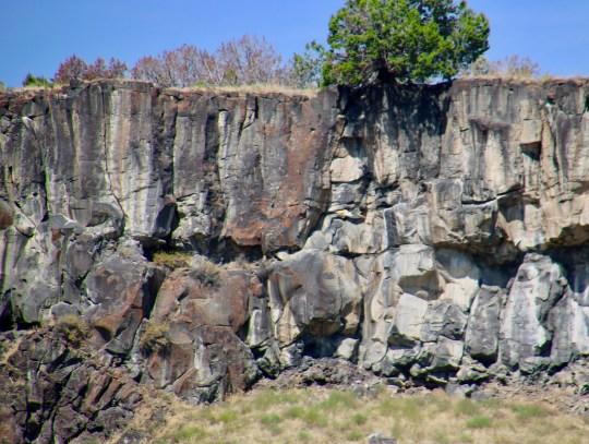
Peggy and I pulled into the park and checked out the river. We met the cottontail featured above and hiked out onto the small pier. These gorgeous cliffs were along the way.Peggy captured this photo of the cliff as we walked down and the following three photos from the pier.A different look at the cliff. (Photo by Peggy Mekemson.)Looking down the river from the pier. (Photo by Peggy Mekemson.)A view across the river. (Photo by Peggy Mekemson.)
While Peggy stayed in camp captured by a book she was reading, I went for a hike the next morning. Following are several photos I took.
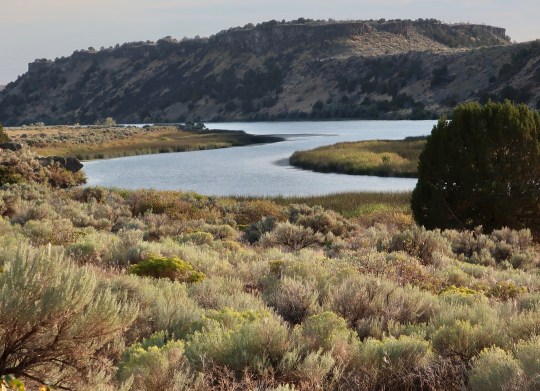
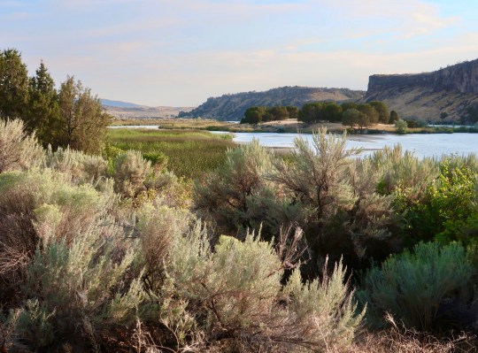
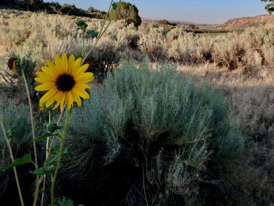
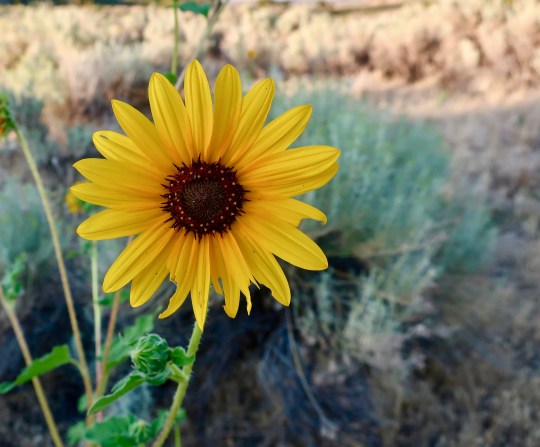
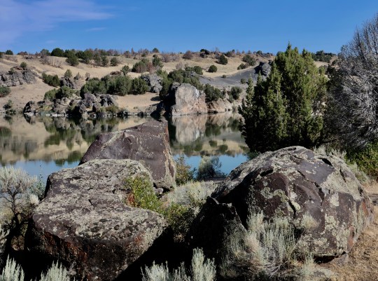
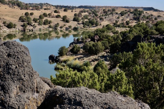
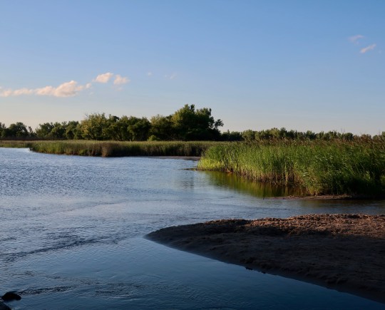
Early morning view from the floating pier.Downriver view across a field of sage. And another view featuring silver sage.Like sage, telegraph weeds and their bright flowers are a common plant of the West.This member of the sunflower family got its name because it grew in abundance along the disturbed ground created by building the first telegraph lines across America.I was treated to a different view hiking up the river. Cattail reflections seemed impressionistic.True to its name, the park was filled with impressive rocks.I took advantage of Apple Photo to create this old-fashioned look.Another upriver view.A number of impressive rocks were also found away from the river.
That evening Peggy joined me as I repeated the walk I had done in the morning.
Peggy caught this interesting view of one of two islands in river at the park.I took a side view that emphasized the cattails.A cap rock made of lava dominated the heights on the opposite side of the river.A close up. (Photo by Peggy Mekemson.)The setting sun bathed the Snake River in light…And, for my final photo, provided a soft look for the opposite side of the river.
NEXT POST: The Great 1908 Auto Race from New York to Paris.
I had originally intended to conclude my series on Arches National Park with photos of several of the more famous arches. But when Peggy and I were driving out, the late afternoon sun created photo-ops I just couldn’t resist. As Peggy drove, I snapped away.
Beneath Scotts Bluff, Nebraska: We are camped at the base of a towering bluff that once stood as a major landmark to pioneers traveling west in wagon trains. My great, great grandmother would have passed this way and stared up at it in awe with the welcome knowledge that she had left the Great Plains behind. And, indeed, we too are breathing a huge sigh of relief, glad to be back in our much loved west. The bluff was named after an employee of a fur trading company who had the misfortune to die not far from where we are camped. He likely would have been glad to live on and leave the bluff with someone else’s name. I, for one, prefer the Native American name, Me-a-pa-te, which translates ‘hill that is hard to go around.’
As I work on this post, Scotts Bluff looms in the near distance. This notable landmark once served to guide wagon trains on their way across America.
It has been an interesting couple of weeks as we have made our way west from Virginia. This past week we kept ahead of a major storm that whipped through the Midwest with winds up to 100 MPH. We also avoided numerous motorcyclists— most with a similar look and without helmets— as they dashed around us on their way to Sturgis, South Dakota and whatever fate awaited them.
One of many groups of motorcyclists that zipped past us on their way to Sturgis and a possible confrontation with Coronavirus. Those unfortunate enough to come in contact with the disease would carry it home.
Yesterday was particularly interesting. We started our day at Buffalo Bill’s historic ranch camped out on the North Platte River and then hopped on one of America’s most historic backroads, US 30, otherwise know as the Lincoln Highway. It was America’s first cross-country road. But that’s only a small part of its history. For thousands of years it served as a major route for Native Americans. In the 1850s it was part of the Oregon Trail. Pony Express riders used it on their two year ride to glory and the nation’s first transcontinental railroad was built beside it. In 1908 it became part of the greatest road trip/road race ever, the New York to Paris Road Race, which will be the subject of my next blog.
A view from our campsite on the North Fork of Platte River. Buffalo Bill’s historic home is less than a mile away.
But today, it’s time to say goodby to Arches National Park.
One of the many late afternoon views we had as we drove out of Arches National Park. I’ll share a few and let the photos speak for themselves.A final view. Goodby Arches. Hello road trip.
NEXT POST: What better place to start posts from our present journey around the US than what I consider to be one of the greatest road trip/races of all-time: The 1908 race around the world from New York to Paris. I’ve been meaning to do this blog ever since I came across the winner of the race at the National Auto Museum this time last summer. It’s epic!
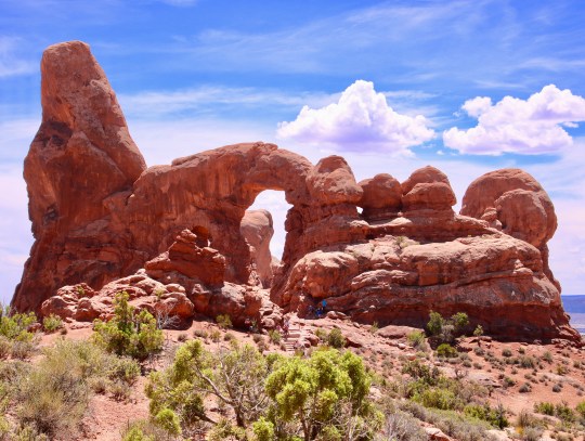
While every arch in Arches National Park shares a ‘see through look’, each arch is unique in the space created and in the surrounding rocks. One of my favorites is Turret Arch, shown here in a photo by Peggy.
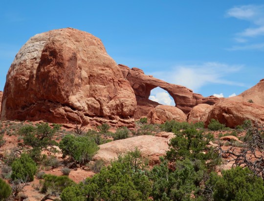
“But where are the arches?” my brother-in-law John asked Peggy about my series on Arches National Park. “There is more to Arches than arches,” Peggy had responded. John readily agreed but there was still a plaintive ‘where are the arches’ tone to his voice. This post is for you, John— and for all of our other followers who have been wondering about how anyone could do a series on Arches National Park without arches.
They aren’t hard to find. There are over 2000 in the park, the highest concentration of any place in the world. Of course you would need a month to find them all plus put in a lot of miles hiking. We only had a day and the 100 degree F heat (37.7 C) discouraged much roaming in the time we had. Not to worry. The road plus a little walking took us to some of the most famous in the Park. So without further ado, I’ll start with the arch I featured at the top of the post, Turret Arch, named for its resemblance to turrets on castles.
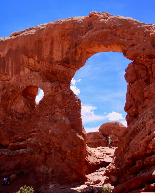
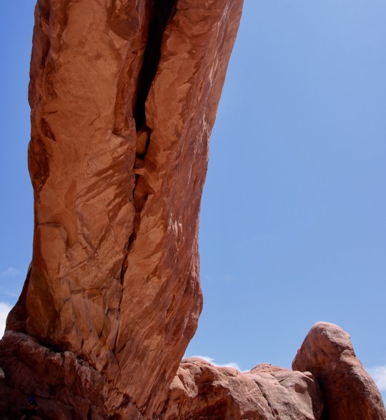
This was my view of Turret Arch. The turret rises above the arch on the left. This shot facing the arch provides a view of a smaller arch forming to the left. The dad and child seen through the arch give perspective. (Photo by Peggy Mekemson.)Here, Peggy captures the yin and the yang of the smaller arch.We were fortunate that impressive clouds added depth and interest to our photos. I couldn’t resist using the arch as a dark frame for the clouds.
A walk up to the Turret Arch easily includes two of the Park’s other Arches, North and South Windows.
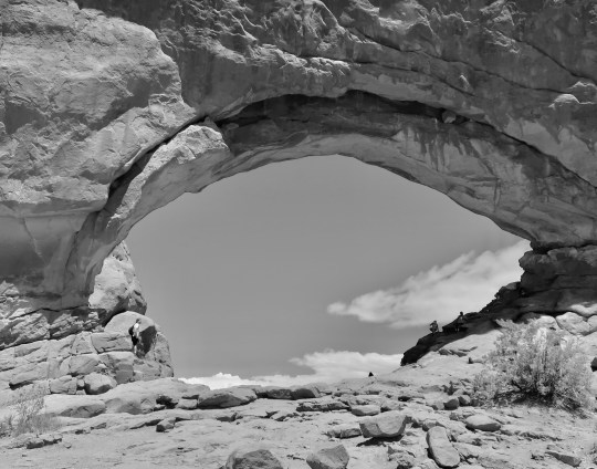
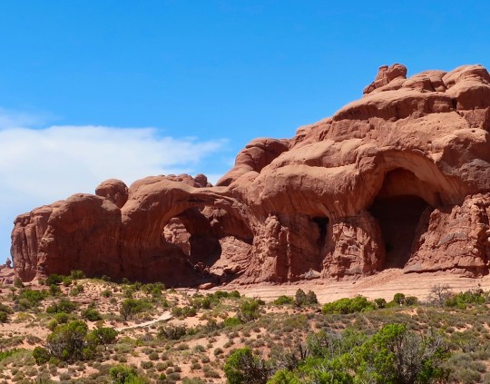
This is the view of North and South Window Arches from Turret Arch. I won’t hold it against you if you see two eyes and a large nose instead of windows. (Photo by Peggy Mekemson.)I took a close up.A view of the South Window Arch with the nose looking a lot more like a massive rock!The North Window Arch is more popular with an easy trail leading right to it from the parking lot. (Photo by Peggy Mekemson.)This photo by Peggy gives an idea of how massive the arch is. Note the person enjoying the shade! Also, check out the large crack, a reminder that these arches do come tumbling down.My shot looking up shows how thick the arch is. You can see the beginning of the crack.Which Peggy caught.We both had fun using the clouds as a backdrop. (Photo by Peggy Mekemson.)My contribution.And finally, I thought a black and white rendition of the North Window Arch would be interesting.The famous Double Arch is just down the hill from the Windows and Turret Arches. New arches can be seen forming on the right.You have undoubtedly seen photos of this Arch even if you haven’t visited the Park. Or perhaps you caught it at the beginning of the Indiana Jones’ movie “The Last Crusade.”While we have hiked down to and around the Double Arch in the past, I took this photo from our air-conditioned van!
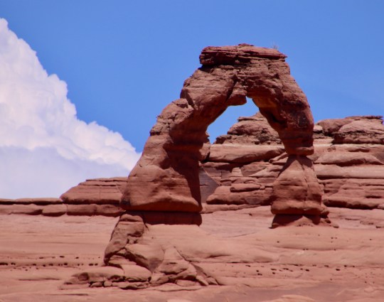
No trip to Arches is complete without a trip to see the Delicate Arch, which many consider to be the National Park’s most scenic arch. Rather than make the gentle three mile round trip at 3 P.M. when we were both hot and tired, we took an alternative one mile trip straight up a steep slope for an overlook. Hmmm.
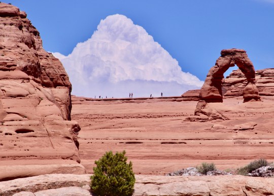
Peggy’s telephoto worked best for capturing Delicate Arch.I’ll conclude my post today with this shot of a towering cumulous cloud and tiny people making their way to the arch. (Photo by Peggy Mekemson.)
NEXT POST: As we drove out of Arches, I took several photos from our van that will serve as a closure to this series.
I am going to start at the end of the main road in Arches NP today. This is the trailhead to the Devil’s Garden.
Purcellville, Virginia— outside of Washington DC: We are at our daughter’s home where she lives with her husband, Clay and her kids, Ethan and Cody. They are renting an old home that was built in 1880. The main house next door once was part of the Underground Railway for slaves escaping from the South. I’ll do a post on the houses later.
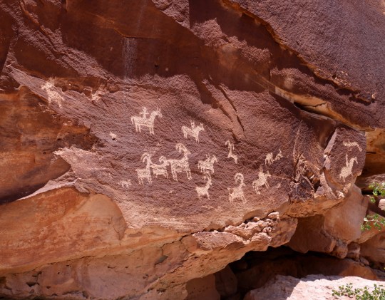
Our visit to Arches National Park today takes us back to the end of the paved road and the beginning of the Devil’s Garden trail. We hiked a way on the trail but the 100 (37.7C) degree heat encouraged us to make it a short. We then doubled back where we checked out the historic Wolfe ranch and some interesting Ute petroglyphs.
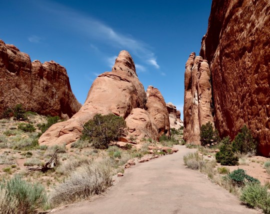
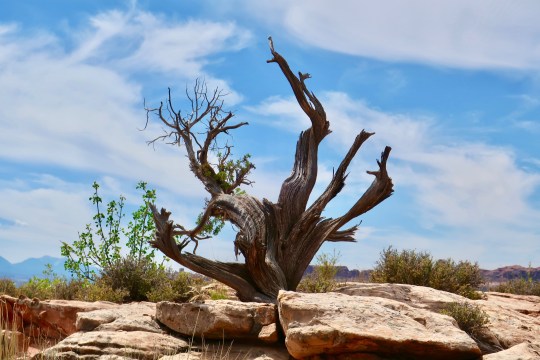
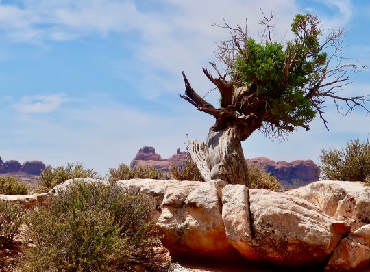
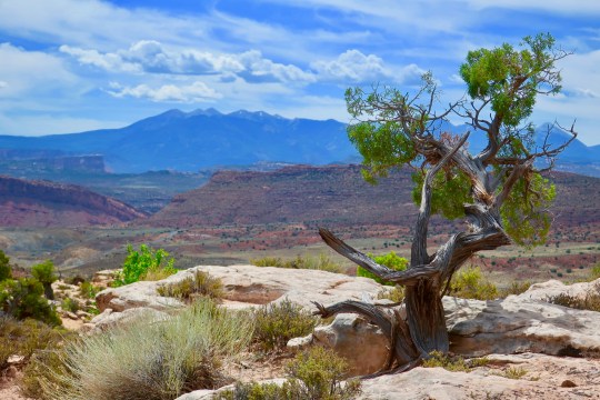
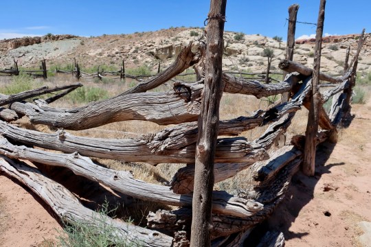
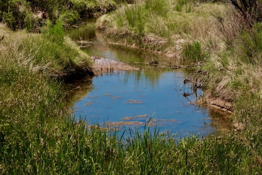
Like so much of Arches, impressive rock monuments filled the area.I was particularly impressed with this pinnacle.And took a close up.Gathering clouds added to the area’s scenic beauty.And called for a black and white photo.As always, I was drawn to trees. The red rocks provided a contrasting backdrop for this one we found along the Devil’s Garden Trail.The sky provided the backdrop for this tree near the Wolfe Creek Ranch.The rock foreground and the splash of green caught my attention here.Here, it was the La Salle Mountains looming in the distance.Wolfe Ranch provided a perspective on how the early pioneers in the area lived. This home was built in 1898 and occupied by his family for a decade. (Photo by Peggy Mekemson.)This old corral was part of the Wolfe Ranch.The Ute Indians occupied the area before the Europeans made their way into the area. They were quick to adapt to the horses that escaped from the early Spanish. These petroglyphs reflect the Utes hunting Big Horn Sheep with their dogs. The rock art would have been carved sometime after 1650 CE. (Photo by Peggy Mekemson.)Water was and is the lifeblood of the desert Southwest. This small creek would have provided water for both the Utes and the Wolfes.I’ll conclude today with a final photo of storm clouds gathering over Arches. (Photo by Peggy Mekemson.)
You can easily drive the road into Arches National Park and get a feel for the beauty and geology of the area. On a hundred degree plus day, it’s tempting to do just that! We didn’t, but I’ll confess that our walks were short.
Roanoke Rapids, North Carolina: Peggy and I have now moved on from our large beach house on the Outer Banks (OBX) of North Carolina where we were entertained by our kids and grandkids for a week. Peggy was treated royally in honor of her 70th Birthday. (Okay, I was spoiled too.) Eventually, I’ll do a post on OBX. Presently we are in an RV campground in Roanoke Rapids, not far from the Virginia border on an unexpected layover day.
When we arrived here yesterday, I noticed that we could get a mobile RV service to come by and fix the water line running to our pump from our fresh water tank. It hasn’t worked since shortly after we left home. Given that most RV repair shops are booked solid for weeks during the summer, we hadn’t had an opportunity to repair it.
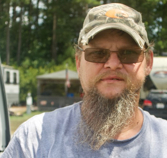
Rufus and Cleve arrived at five in Rufus’s brand new ‘shop,’ a 2020 Hemi. It would be hard to find two guys more country— from their looks to their accents. But they were genuine, fun and knowledgeable. Eventually, they found the problem. The plastic water tube buried beneath the water pump in an extremely difficult place to get at was twisted and frayed. Cleve returned this morning with new tubing to finish the job.
The plastic tube delivering water to our pump was twisted and frayed with a pin-prick sized hole in it. The tube was buried down in the innards of our van.Cleve had a rooster ringtone on his phone and a rooster tat on his arm. I asked him about it. “I just really like roosters,” he explained to me in his deep country drawl.
Today, I am continuing my series on Arches National Park. So far I have done posts on Balanced Rock and the road into Arches. In this post, I will start just beyond Balanced Rock at the Garden of Eden and follow the main road on to the the Fiery Furnace and beyond.
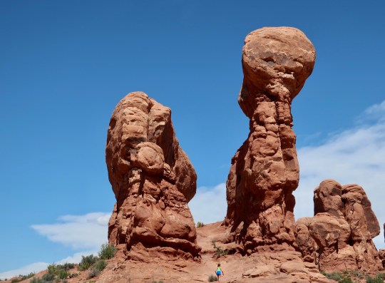
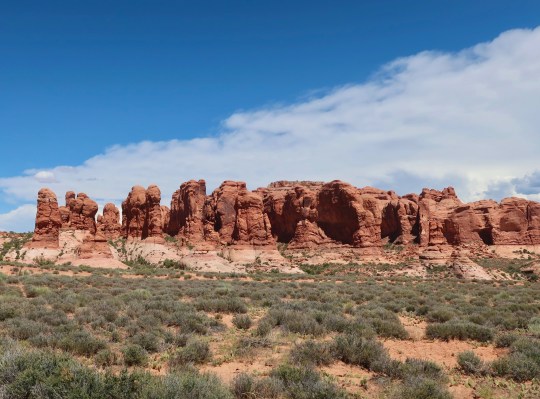
I am not sure why this section is called the Garden of Eden. I don’t think Adam and Eve would want to live here. Where would they find an apple tree? On the other hand, there are plenty of serpents. And lots of impressive rocks. The woman hiking up to the pinnacles provides a perspective on their size.The big fellow on the right is known as Owl Rock.Here is a close up of the giant pinnacle with its ‘owl head’ staring down at me.The Garden of Eden also has some impressive cliffs. Visitors are welcome to wander among the rocks in the Garden of Eden as long as they stay off of the easily damaged desert soil.
A final view before heading on to the Fiery Furnace.
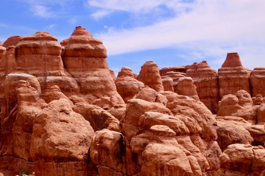
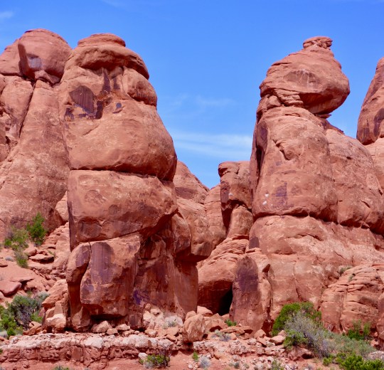
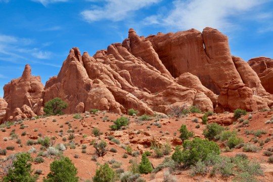
We were amused to go from the Garden of Eden to the Fiery Furnace. Turns out it isn’t so fiery if you go walking along the rock and tree shaded trails. The trails were closed because of Covid-19, however. (Photo by Peggy Mekemson.)This jumble of rocks was found nearby.As were these colorful pinnacles. (Photo by Peggy Mekemson.)I thought of the rock on the left as The Troll. (Photo by Peggy Mekemson.)Continuing our drive into the park we came on these dramatic fins. A more distant perspective.There was a path that led back into the fins. Peggy posed for me. Because there were a number of people on the narrow trail, we used our masks.As the day went on and the heat increased, clouds began to form and create a backdrop for our photos. (Photo by Peggy Mekemson.).I’ll conclude today’s post with this scene from along the road.
NEXT POST: Peggy and I drive to the end of the road and go for a walk along the Devil’s Garden trail.
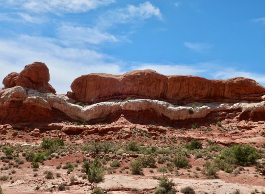
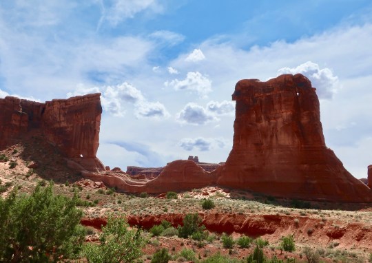
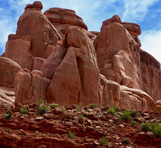
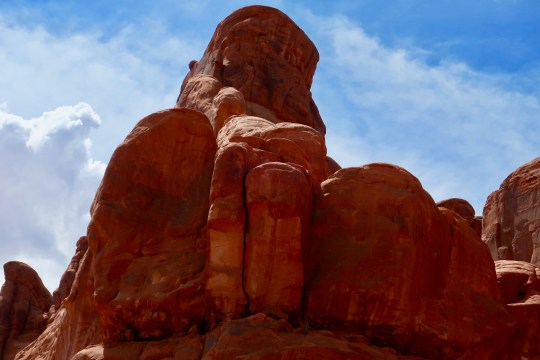
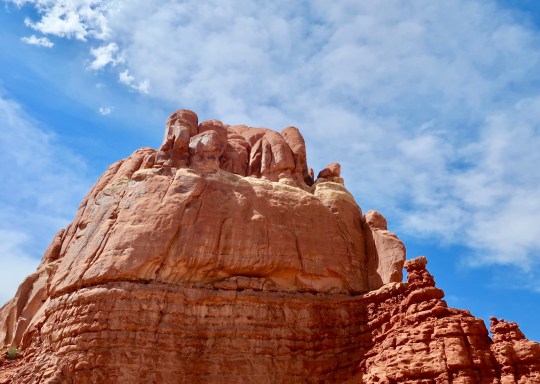
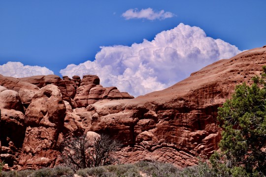
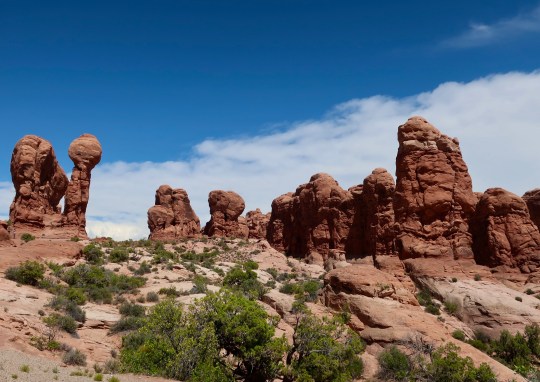
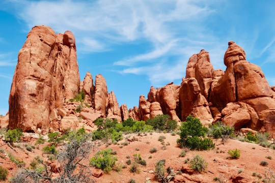
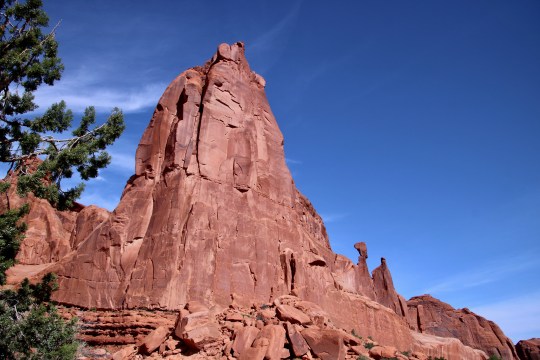
Impressive pinnacles with ‘unique’ personalities are found throughout Arches National Park.
Outer Banks, North Carolina: We have been on the road for a month now— zig zagging across the country— climbing over mountains, crossing rivers, traveling through deserts and forests, zipping through urban areas and moving more slowly through rural. We’ve traveled from the Pacific Ocean to the Atlantic and driven through 13 states so far.
Let me report: It’s strange out there when it comes to the pandemic. Some states are doing everything possible to reduce the the number of people catching Covid-19 and the resultant deaths. Others are like, whatever. Or they feel that restarting the economy takes precedence. Sadly, had they aggressively fought the pandemic to start with, we would now be in a much better position to get people back to work.
We drove through Atlanta a few days ago where the governor of the state was suing the mayor of the city because she wanted to implement a city-wide mask ordinance. Thankfully, more and more people are voluntarily wearing face coverings. Even the President is declaring it patriotic. My sense is if wearing a mask can save just one life, it’s worth it.
It isn’t strange, however, that Arches National Park has a lot more than arches to ooh and aww over. In fact, I find the fins and pinnacles located throughout the park equally awe-inspiring. I’ll provide some of my favorite examples over the next two to three posts. My last post on the park will be dedicated to arches.
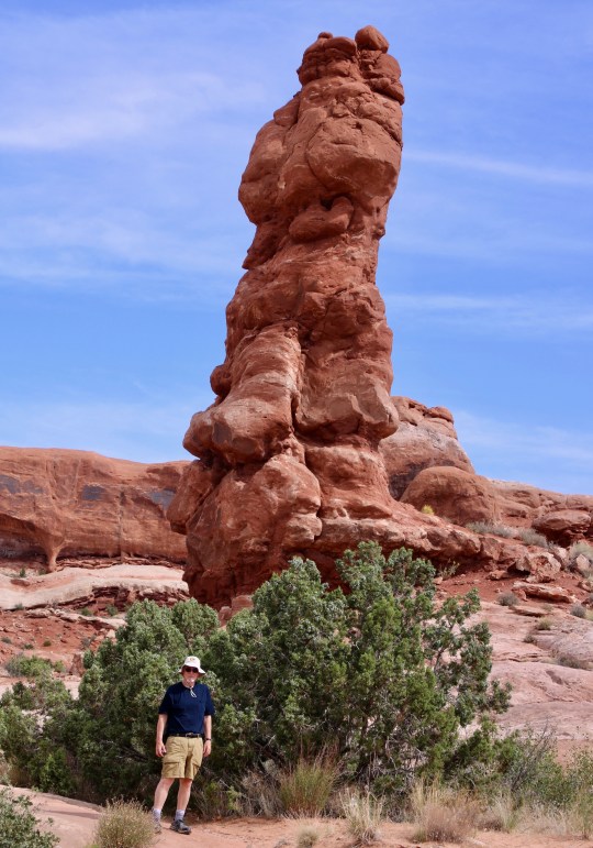
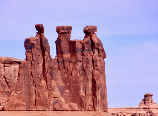
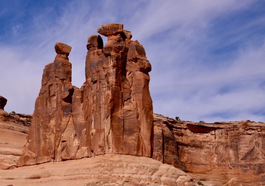
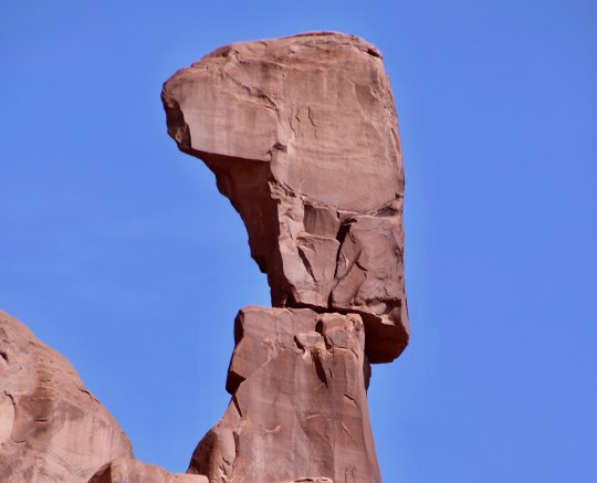
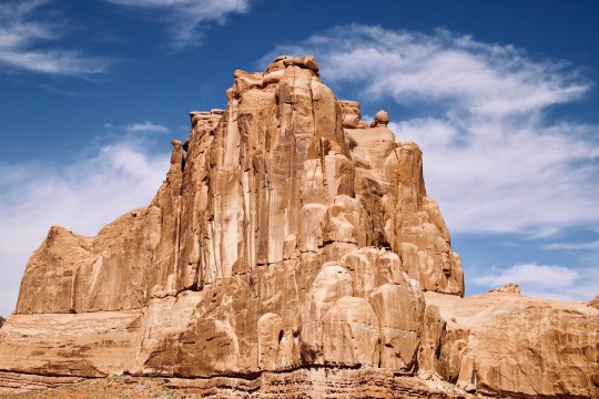
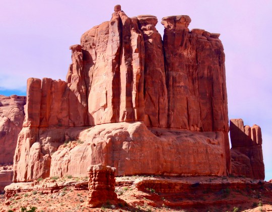
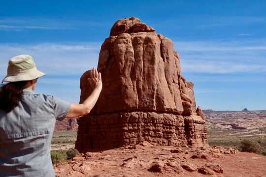
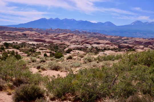
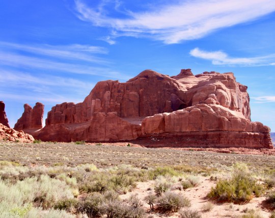
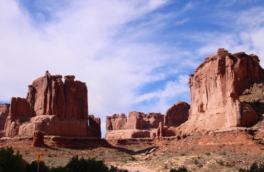
This is a close up of the pinnacle I featured at the top of the post.And this knobby guy— with my help— provides a perspective of just how large the pinnacles can get. (Photo by Peggy Mekemson.)A different view.These would-be/will-be pinnacles are known as the Three Gossips. A different perspective suggests that one of the gossips might have dinosaur blood. Gossiping about it might lead to getting your head chomped off.This is one of the views that greets you when you when you enter the park. If you look to the right, you can see a precariously balanced rock.I think it is more impressive than Balanced Rock if only judged on its odds of teetering over. But who knows? Maybe it will hang out up there for another thousand years. (Photo by Peggy Mekemson.)This is another view that welcomes visitors to the park.This fin is known as Wall Street. In other words, some person at some time thought that these eroded rocks had a skyscraper look. Here’s another view of Wall StreetMost of the major landmarks have names given to them over the years. I find it more fun to look at them for the impressive monuments to nature and geology that they are.Or provide your own names. Peggy saw this as The Hand.Here, she demonstrates why.Here’s one I can easily see, the Sheep. Its nose was once part of an arch. (Photo by Peggy Mekemson.)We found this interesting. “Petrified” sand dunes frozen through chemical reactions in ancient times. The La Sal Mountains serve as a colorful backdrop.I’ll conclude with a couple of scenic views Peggy and I found at the beginning of the park.
NEXT POST: Peggy and I travel farther into Arches.
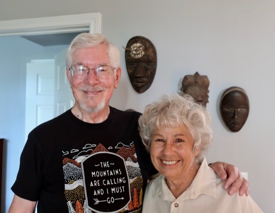
Linda Leinen from her Word Press blog, The Task at Hand, and I in front of her Liberian masks in League City, Texas.
Safety Harbor, Florida: I had intended to make a big deal out of my tenth year of blogging, which, surprisingly, coincided with my thousandth post. But both slipped right by. Post #1,000 was on Balanced Rock in Arches National Park. I was eager to get it up and totally missed my landmark occasion. We’ve covered a bit of ground since and are now in Florida with our son Tony, his wife Cammie and our grandsons Connor, Chris, and Cooper. There hasn’t been much time for blogging— or even backroads. So I am even further behind!
Given all of this, I decided that Texas hospitality would make an ideal blog for post #1001. It began with celebrating Peggy’s 70th birthday. We stopped off in Georgetown, Texas where Peggy’s brother John and his wife Frances live. They spoiled us rotten— feeding us salmon, ribs and steak. When we left, they loaded us down with chocolate cake, pumpkin bread (a true weakness of mine), and beautiful, large, garden tomatoes.
But our spoiling wasn’t over. We drove from Georgetown to League City just outside of Houston where Linda Leinen, a good blogging friend, had prepared another Texas feast for us. It came complete with brisket, potato salad and fruit salad finished off with Blue Bell ice cream topped with cherries. (Linda has been raving about Blue Bell for a long time.) She had also stocked in Texas beer and Texas wine. I’ll get back to Linda; but first, John and Frances.
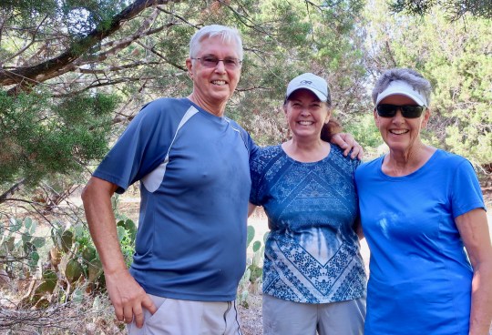
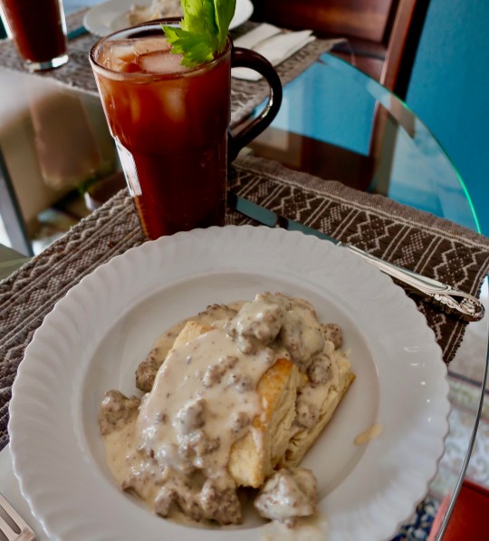
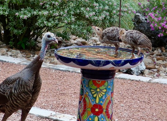
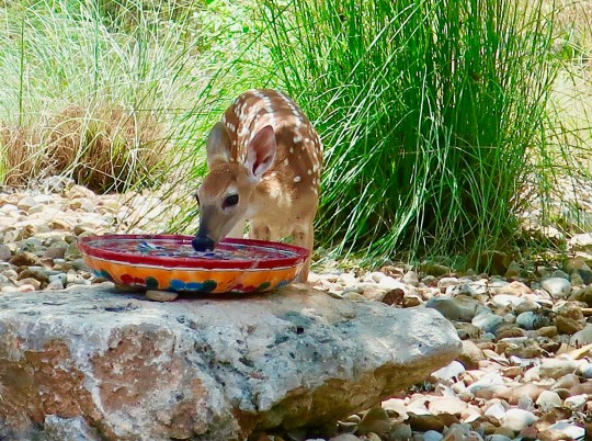
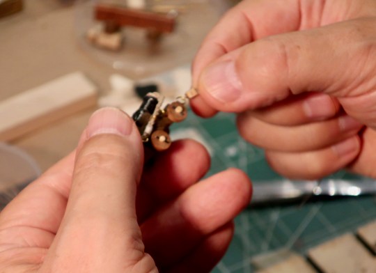
John and Frances share a moment with Peggy on a hiking trail in Sun City.“You have to try my biscuits and sausage gravy,” Frances insisted on Peggy’s birthday morning. “It’s a true Texas dish.” And it was delicious. I gained a pound just looking at it. Frances is a great cook. Breakfast came with Bloody Marys that John made. “They are light on vodka,” he assured us. “Only 25%.” Hmmm, they were BIG Bloody Marys. Light probably meant a couple of shots. At least.John and Francis live in a the developed senior community of Sun City near Georgetown. Its suburban nature does not discourage the wildlife. Peggy awoke on her birthday morning with four large, whitetail bucks parading by our bedroom window. John and Frances call them ‘The Boys’ Club.’ They are frequent visitors.A turkey and her chicks also came by and drank out of the bird bath!And a fawn stopped off to drink out of another bird bath strategically placed at fawn height. The wildlife made Peggy and me feel right at home!I love it when people have a passion for doing something. John’s is building magnificent sailing ships. It goes along with his passion for history, which we share.The attention to detail is incredible.John was working on putting together canons for his latest sailboat project. Everything from wheels to recoil ropes needed to be meticulously added. “How long does it take you to do a ship?” I asked. “2,000 hours,” was his response. Now, that’s passion!
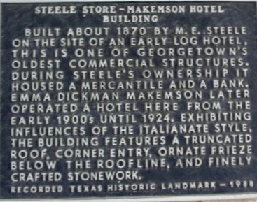
Georgetown has a bit of family history tied to it. The Mekemsons/Makemsons came down from Illinois prior to the Civil War and were among the early settlers of the area. William Makemson was sheriff of the town following the Clvil War and later served as editor of the town’s newspaper. He eventually ran for Governor of Texas on the Republican ticket but lost. It was a time when only Democrats won. Texans still blamed the Republicans for freeing the slaves and for the ‘Reconstruction’ period that followed the Civil War.
A Texas historical marker provides background information on the Steele-Makemson building in Georgetown.
While we were visiting John and Frances, I got a note from Karen at the WP blog, Philosopher Mouse of the Hedge. “I can’t believe you are in Georgetown,” she exclaimed. “My family had the original Spanish land-grant for the area!” Odds are that our families would have known each other. It’s possible that they even intermarried. Like Linda, Karen lives in the Houston area.
Visiting Linda had been on my agenda for several years. We had almost pulled it off four years ago when Peggy and I had re-driven the 10,000 mile route I had followed on my bike trek around North America in 1989. I had ridden my bike across Texas at the time. It’s a long way by car, so you can imagine what it is like on a bicycle! We had missed that connection with Linda on our road trip, but this time we succeeded.
In addition to enjoying blogging, photography, nature and wandering, we have another bond. We both lived in upcountry Liberia, West Africa. I was a Peace Corps Volunteer there from 1965-67. Linda was connected with a Lutheran Mission in Liberia starting in 1970. We often share tales of our experiences.
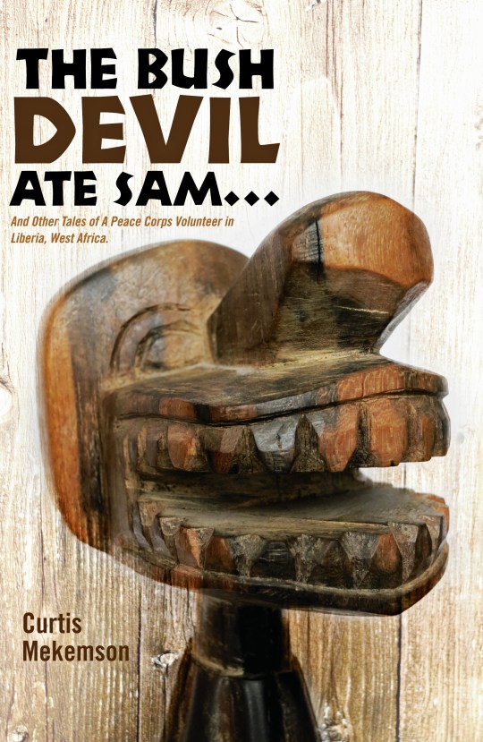
When Peggy and I walked into her house, I immediately noticed Liberian tribal masks on her wall and decided we had to have a photo with them as a backdrop. There was also Liberian country money on display. Even more significant to me, she had a wood-carved crucifix from the leper colony in Ganta. If you have read my book, The Bush Devil Ate Sam, the carving of the bush devil featured on the front also came from the colony. It’s possible that Freddy the Carver did both of our pieces. My friend Morris Carpenter, who served as a Peace Corps Volunteer in Ganta and introduced me to Freddy, had a crucifix from him that looked quite similar to Linda’s.
The bush devil was possibly carved by the same leper that carved Linda’s crucifix. Sam, BTW, who had worked for us as a 13 and 14 year old, would later become a physician and work at Phoebe Hospital where Linda had spent some of her time working while in Liberia.
We had a delightful evening with Linda. At 73 she is full of both energy and laughter and can still put in a full week sanding and varnishing sailboats in the harbor next to her condo, which is how she makes her living. She shared some of her fascinating history with us, which I will leave up to her to share other than to note the time she hitchhiked from Liberia up to London. If you have ever been in Africa, you have some idea of what a monumental task that would be! It speaks to what an adventuresome soul she is.
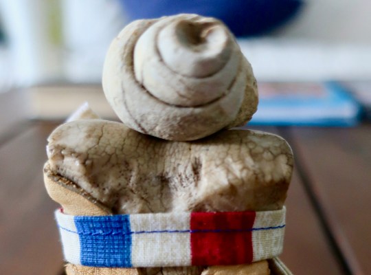
As we left, I noticed that Linda had a collection of rocks in a basket on the floor. I was going to comment on how they reminded me of the collections of rocks you find scattered around Georgia O’Keeffe’s house in New Mexico. Before I could get my observation out, Linda commented, “I collected the large rock from below Georgia O’Keefe’s house.” Forever generous, she reached down into her collection and came up with a fossilized snail from Texas and handed it to us as a memento of our visit.
Later that night, I thought “Darn. I meant to take Bone in to meet Linda.” Turns out she had her own bone that she wanted Bone to meet. “Next time,” she told me in an Email.
Bone, wearing his Covid-19 mask, took an immediately liking to the fossilized snail. I think that he decided that the snail would make an excellent Texas hat! I told him that it made him look jaunty.
Our thanks to John, Frances and Linda for showing us the true meaning of Texas Hospitality!
NEXT BLOG: Who knows. The good news is that I have plenty of new blog material. The bad news is that I don’t have any time to blog. From here we are heading up to North Carolina where our kids have rented a large home on the Outer Banks as another celebration of Peggy’s birthday! She isn’t suffering. This morning, our son Tony took her flying while I finished this post!
Every couple of years I update Bone’s travel history because he continues to wander the world. This time, I’ve added his 750 mile trek down the Pacific Crest Trail. As you read this post, he is preparing for another 7,000 mile journey in Quivera the RV to some of the remote corners of the contiguous United States in honor of Peggy’s 70th Birthday. He’ll be wearing his face mask and reporting along the way!
Bone has travelled twice to the base of Mt. Everest. Twice.
Sometime in the 1900s Bone started his life as part of a horse wandering through the Sierra Nevada Mountains. The horse was allegedly eaten by a bear. Bone ended up in a high mountain meadow practicing Zen and being nibbled on by a miscreant rodent.
1977: He was ‘discovered’ by two lost backpackers (Curt Mekemson and Tom Lovering) on the Tahoe Yosemite Trail south of Lake Tahoe and launched his career of wandering the world.
Normally, Bone likes to hang out in Curt and Peggy’ library in Virginia. His favorite section is travel.
He also has a fondness for George, the Bush Devil, who is on the cover of Curt’s book, “The Bush Devil Ate Sam.” Here, the two of them share a laugh.
1980-81: Bone commenced his first World Tour with Tom. He visited Asia including Japan, Hong Kong, Bombay, Delhi and Katmandu where he trekked to the base of Mt. Everest. He then wandered on to spend spring and summer in Europe stopping off in Greece, Spain, Portugal, France, Italy, Austria, Liechtenstein, Luxembourg, Germany, Belgium, England and Ireland. Getting cold, Bone headed south and hitched a ride in the back of a truck through Algeria, Niger, Chad, Nigeria, Cameroon, Central African Republic, Zaire, Sudan, Kenya (where he crossed the Equator), Tanzania, Zambia, Zimbabwe, Botswana and South Africa. He signed on with Tom as crew of a sailboat in Cape Town and headed north to Mallorca, stopping off on the islands of St. Helena, Ascension, Cape Verde and Madeira. Back in Europe he explored his possible Viking roots in Sweden, Norway and Finland.
1983-86: Bone assumed Cheechako status and moved to Alaska with Curt where he was stalked by a grizzly bear on the Kenai Peninsula, explored Prince William Sound by kayak, learned to winter camp in 30 degree below zero weather while listening to wolves howl, backpacked in the Brooks Range north of the Arctic Circle, and discussed the finer points of eating salmon with Great Brown Bears in Katmai National Park. He escaped briefly to the warmer climate of Hawaii and participated in the New Orleans Mardi Gras.
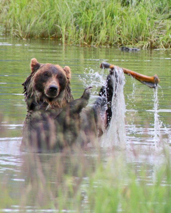
One look at this fellow and Bone decided that he wanted to be elsewhere.
The big guy was playing with a distant cousin of his.
1986: He backpacked the Western US for five months with Curt exploring the Grand Canyon, the Gila Wilderness of New Mexico, the Rockies, and the Wind River Mountains of Wyoming before returning to his beloved Sierras.
1989: Bone joined Curt on a six month 10,000-mile solo bike tour around North America visiting 18 states and 4 Canadian provinces. He ended his journey by meeting Peggy in Sacramento.
1990: The International Society of the BONE was formed at Senior Frogs in Mazatlan, Mexico, where Bone spent the afternoon being pickled in a pitcher of margaritas and being kissed by lovely senoritas.
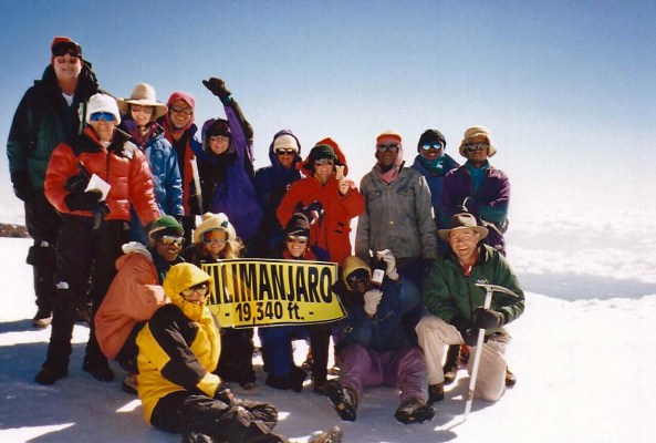
1991-97: Various members of International Society accompanied Bone on numerous adventures. Highlights included a White House Press Conference with Bill Clinton, being blessed by the Pope in St. Peter’s Square, visiting with Michelangelo’s David, going deep-sea diving in the South Pacific and Caribbean, doing a Jane Austin tour of England, and exploring the Yucatan Peninsula. A group adopted him as a good luck charm and took him back to visit the base of Mt. Everest one year and to climb Mt. Kilimanjaro another.
Bone loves high places. Here he is on top of Mt. Kilimanjaro in East Africa. (He’s with MJ, fourth from right, standing.)
Bone went diving in the Pacific in 1997 with Jose and Barbara Kirchner, visiting a Japanese ship sunk during World War II and receiving his diving certificate.
1998-99: Bone embarked on 40,000-mile journey in the van, Xanadu, through the US, Canada and Mexico with Peggy and Curt, visiting over 30 National Parks, driving the Alaska and Baja Highways, checking out Smokey the Bear’s and Calamity Jane’s graves, kayaking in the Sea of Cortez, leaf peeping in Vermont, jetting to the Bahamas, pursuing flying saucers in Roswell, New Mexico, and completing his visits to all 50 states.
Bone was quite impressed with the size of his ancient relatives. Here he rests on dinosaur toes at the Dinosaur National Monument Visitor Center.
2000-02: Bone journeys up the Amazon, returns to Europe, cruises to Belize, Cancun and the Cayman’s, and goes to New Zealand where a misguided customs agent tries to arrest and jail him as animal matter.
Bone, who likes strange things, insisted on having his photo taken with a mudstone concretion in New Zealand.
2003: Bone undertakes a 360-mile backpack trip in celebration of his discovery and Curt’s 60th birthday. They begin at Squaw Valley near Lake Tahoe and end by climbing Mt. Whitney. Various friends join them along the way.
Bone got a little high when he helped Curt celebrate his 60th birthday, which isn’t surprising considering he is a California bone.
2004: Bone visits Hemingway’s grave in Idaho, goes horseback riding with Australians and Bahamians in Montana, and makes his first pilgrimage to Burning Man in Nevada, a very Bone like type of place. He also jets off to Costa Rica.
Bone has a love for anything ancient. Here, he perches on a Mayan sculpture in Costa Rica.
2005-2007: Bone returns to Burning Man twice and revisits Europe twice including special stopovers in Portugal, France, Holland, Germany, and Belgium. He also revisits Mexico.
2008 – 2011: Bone commences another exploration of North America. This time he travels in the van, Quivera, along with Curt, Peggy, and Eeyore the Jackass. His journey takes him over 75,000 miles of American Roads. Along the way, he barely escapes the hangman’s noose in Tombstone, Arizona. In May of 2010 he helps Curt initiate his blog, and rafts 280 miles down the Colorado River with Tom, Curt and friends through the Grand Canyon.
Bone barely escaped the hangman’s noose after being a Bad Bone in Tombstone, Arizona.Bone, wearing his PFD, scouts a major rapid on the Colorado River before rafting though it.
2012-2017: Bone goes into semi-retirement in Southern Oregon. Please note the semi, however. He continues the exploration of the West Coast ranging from Big Sur to Vancouver Island, where he kayaks for a week in search of Killer Whales. He wanders through England and Scotland helping Curt find his roots and spends a week traveling by Canal Boat. Later, he returns to Europe again, traveling through the Mediterranean visiting Turkey, Santorini and other Greek Islands, Dubrovnik, Venice, Rome, Pompeii, Florence, and Barcelona. He returns to Burning Man several times. On one trip, he is married to the lovely Bonetta, who he met while exploring a swamp in Florida. Rumor has it that it was a shotgun wedding. This past year he traveled with Peggy and me on our 10,000 mile trip around North America retracing Curt’s bike route. He made a very special trip with fellow blogger Crystal Truelove to visit with Native Americans of the Cherokee Nation in Oklahoma.
Burning Man is one of Bone’s all-time favorite activities.
Bone and Big Nose Bonetta are married in a temple at Burning Man in 2013. Bone’s kilt was made for him by an 80-plus year old woman from Kansas. Bonetta is wearing a designer wedding dress with very expensive plastic jewelry to match.
Bone got a wee bit jealous when I snuggled up to this mammoth of a bone when Peggy and I were re-visiting by van my 1999 10,000-mile bike trip.
2018: Bone joins Curtis in celebrating Curt’s 75th Birthday by backpacking 750 miles in Oregon and California. Highlights include the Rogue River Trail, Three Sisters Wilderness and the Siskiyou Mountains in Oregon. In California, Curt and Bone more or less follow the Pacific Crest Trail through the Klamath Mountains, Marble Mountains, Trinity Alps, Cascade Mountains and Sierra Nevada Mountains— taking detours whenever the mood strikes, including revisiting where Tom and Curt found him in 1977! Along the way, Bone meets and chats with numerous through-hikers on the Pacific Crest Trail who are hiking from Mexico to Canada. He also spends a lot of time dodging horrendous forest fires. Peggy joins Curt and Bone for three sections of the journey and provides welcome backup for the rest of the journey.
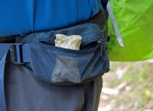
Bone had a privileged position on the front of Curt’s Backpack during the 750 mile journey down the Pacific Crest Trail.Bone met many through-hikers making their way from Mexico to Canada including a hiker whose trail name was Bone! Here we have Bone and Bone.As we arrived at Bone’s home south of Lake Tahoe, he entertained Peggy with tales from his childhood.
2019-2020: He joins Curt for a trip down California’s beautiful Highway 395 among the Eastern Sierras and visits the Alabama Hills where cowboy movies of yore were made with the likes of John Wayne, Hopalong Cassidy, the Lone Ranger and a host of others— voices from the past that have echoed down through time. “Hi-yo Silver away.”
Bone and his traveling companion Eeyore donned covid masks for 2020 RV trip to the Outer Banks of North Carolina to celebrate Peggy’s 70th Birthday.
2022-2026 “Is that a bone in your suitcase? Hand it over.” Worried about being confiscated by the TSA or some similar organization overseas, Bone decides to limit his travel to the US with a 10,000 mile road trip each year. Highlights include 3-month trips where he explores the Pacific Coast, the Southwest, the Northwest, and New England. Taking different routes to get to these locations, he also spends time in the South, Midwest, East and West in general. Along the way, he manages to visit most of the National Parks, travels Route 66, and goes to Burning Man again. He also goes backpacking and kayaking. He now lives in Virginia with Curt and Peggy.
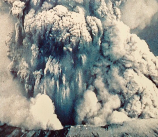
A photo of Mt. St. Helens erupting on display at the National Monument.
In 1980, the American Lung Association of Washington invited me to help plan a 500 mile bike trek to Mt. St. Helens as a fund raiser. At the time I was serving as the national consultant to the American Lung Association on long distant backpacking and bike treks as fundraisers. I had created the concept and written the how-to manual. I flew up to Seattle and worked with the staff in planning the trek. As often happened with events I helped organize, they invited me to go along. Tempting. The trek covered a lot of beautiful country and looked like great fun, but I was supposed to be in Alaska helping to organize a backpack trek across the Kenai Peninsula around the same time. The rest is history.
On May 18, several weeks before the trek was to take place, Mt. St. Helen’s blew her top. It was fortunate that it hadn’t happened in the middle of the event! ALA Washington quickly arranged another route. This isn’t the end of the story, however. I was flying to Alaska six weeks after the explosion and the pilot flew us over the mountain. The devastation was incredible. It has lived in my mind ever since. In 2013, Peggy and I took another trip up to Alaska, this time driving the Alaska Highway. On the way back we stopped off at Mt. St. Helens. I did a post at the time. In honor of the 40th Anniversary of the eruption, I am reposting it today.
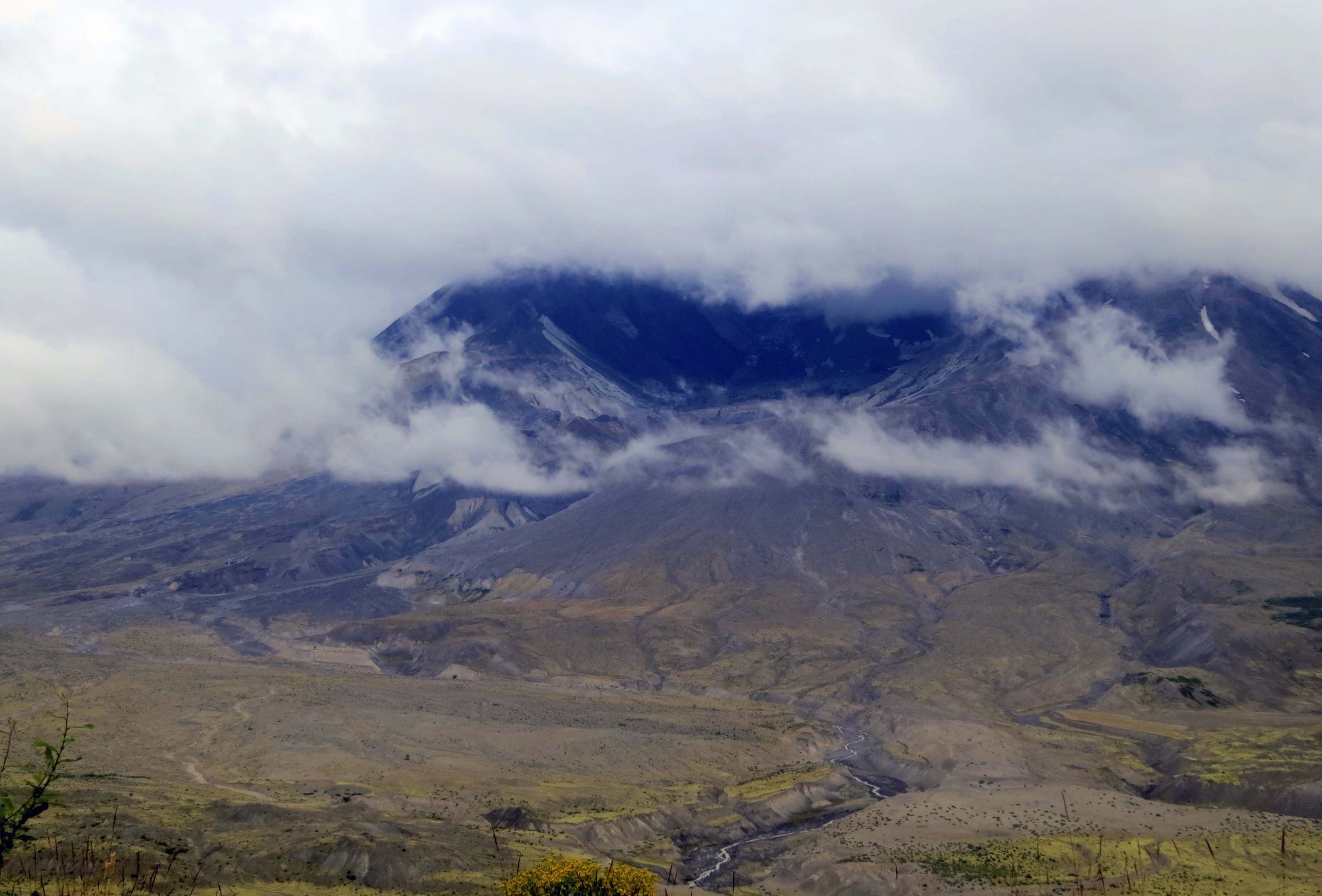
Mt. St. Helens in August, 2013. Peggy and I were looking down into the crater from the Johnston Ridge Observatory.
It was in early July 1980 and I was flying north to help plan a hundred-mile fundraising backpack trek in Alaska. The pilot deviated from his route to show us Mt. St. Helens.
It was total devastation, a scene from Dante’s Hell.
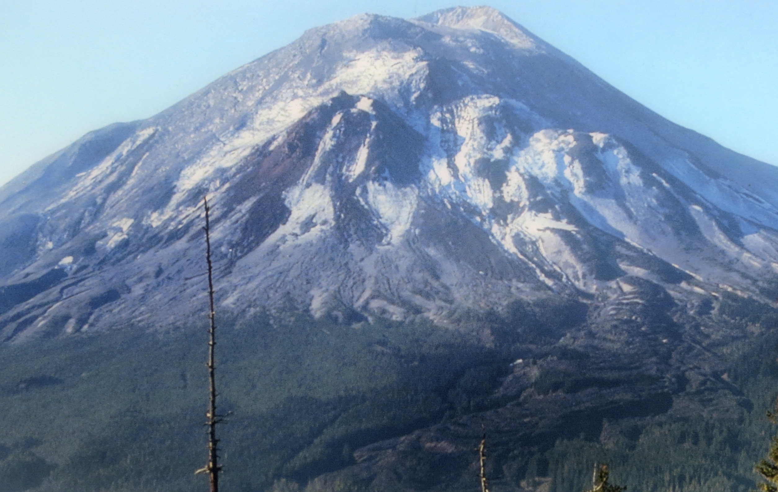
A month and a half earlier, on May 18, Mt. St. Helens had blown her top, literally. On May 17 the mountain had stood 9677 feet tall; on May 19 it stood at 8,364 feet. The mountain had a history of being the most active volcano in the Cascade Range of volcanoes— mountains that dominate the skyline of the northwestern part of the US and are part of the ring of fire that stretches around the edges of the Pacific Ocean.
This photo on display at the Mount St. Helens National Monument shows the mountain before the explosion.
Another photo at the Monument shows Mt. St. Helen four months after the eruption.
Peggy and I call the Cascade Range home, now. In fact I have climbed two of the mountains, Shasta and Lassen, and we see a third, Mt. McLoughlin, every time we drive the 30 miles into town for groceries. Normally we think of the mountains as dormant and a beautiful addition to our region. But all are capable of awakening. And all are capable of spewing disaster.
Weeks before Mt. St. Helens blew up, she had been showing signs of an imminent explosion. Couched between the two major urban areas of Portland and Seattle, the area had become a mecca for tourists, volcanologists and, of course, the media. Worldwide attention was guaranteed.
The explosion, when it came, was much more devastating than had been expected. A huge, lateral blast sent a cloud of dense, super hot steam filled with debris rolling down the mountain at 300 miles per hour and devastating an area of 230 square miles. Next to the volcano nothing was left. Starting at about seven miles, thousands of trees were snapped off at their base and laid down pointing outward. Further out, a narrow zone of trees had been left standing but the trees were scorched beyond recovery.
The side of the mountain that was blown away added to the disaster. Crushed rock and melted glacial ice joined with downed trees and rushed into Spirit Lake and down the Toutle River travelling at speeds up to 150 miles per hour. Hummocky deposits between 150 and 620 feet high were left behind.
Today, Mt. St. Helens stands as a National Monument to educate people about volcanoes and the recuperative power of nature. Three visitor centers tell the story extremely well. Peggy and I have driven by the area several times and promised ourselves each time that we would visit. Finally, on our trip back from Alaska, we succeeded.
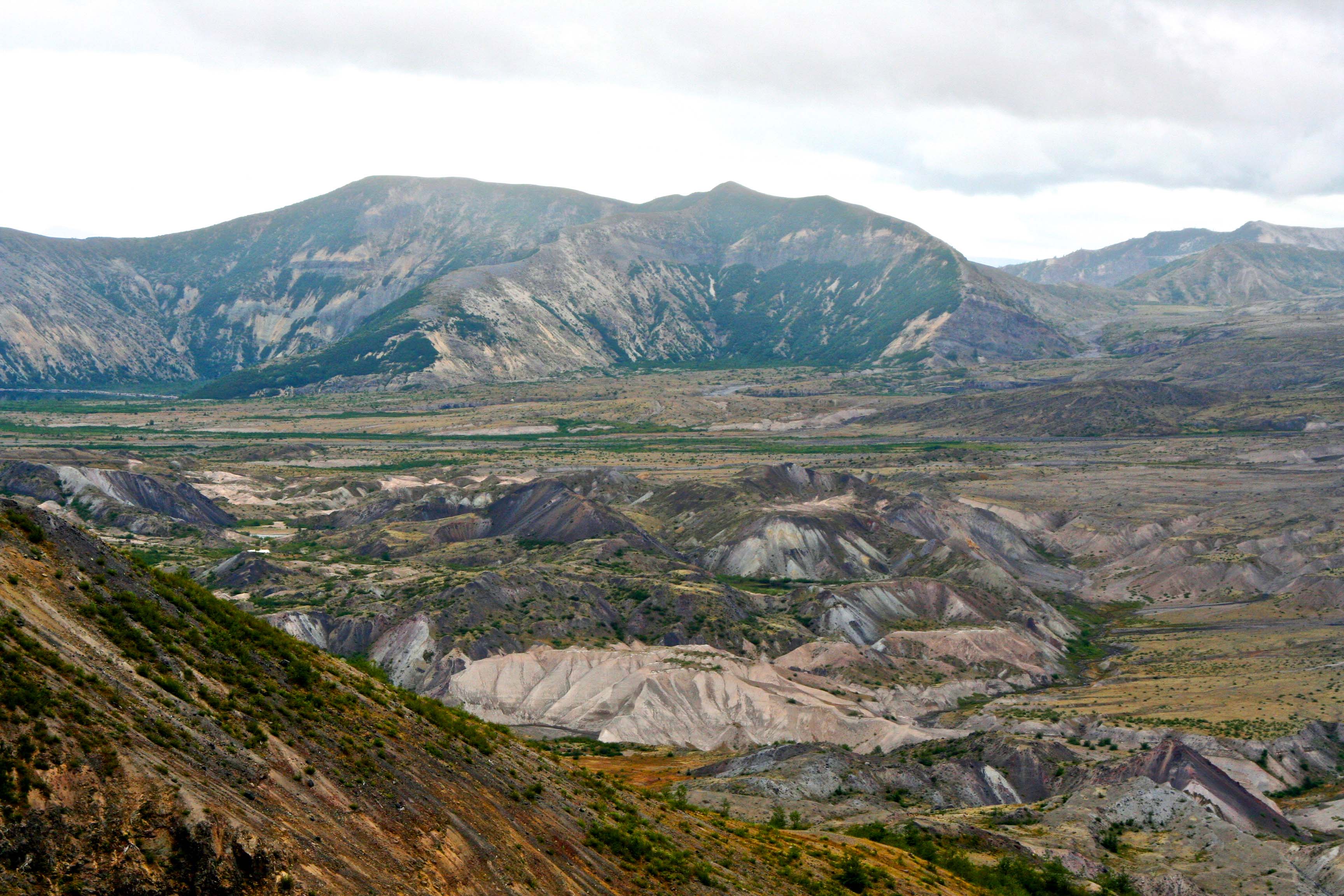
Looking down at the valley floor in front of Mt. St. Helen, the Toutle River carves through debris left behind by the eruption. The debris reaches a depth of over 300 feet in places. (Photo by Peggy Mekemson)
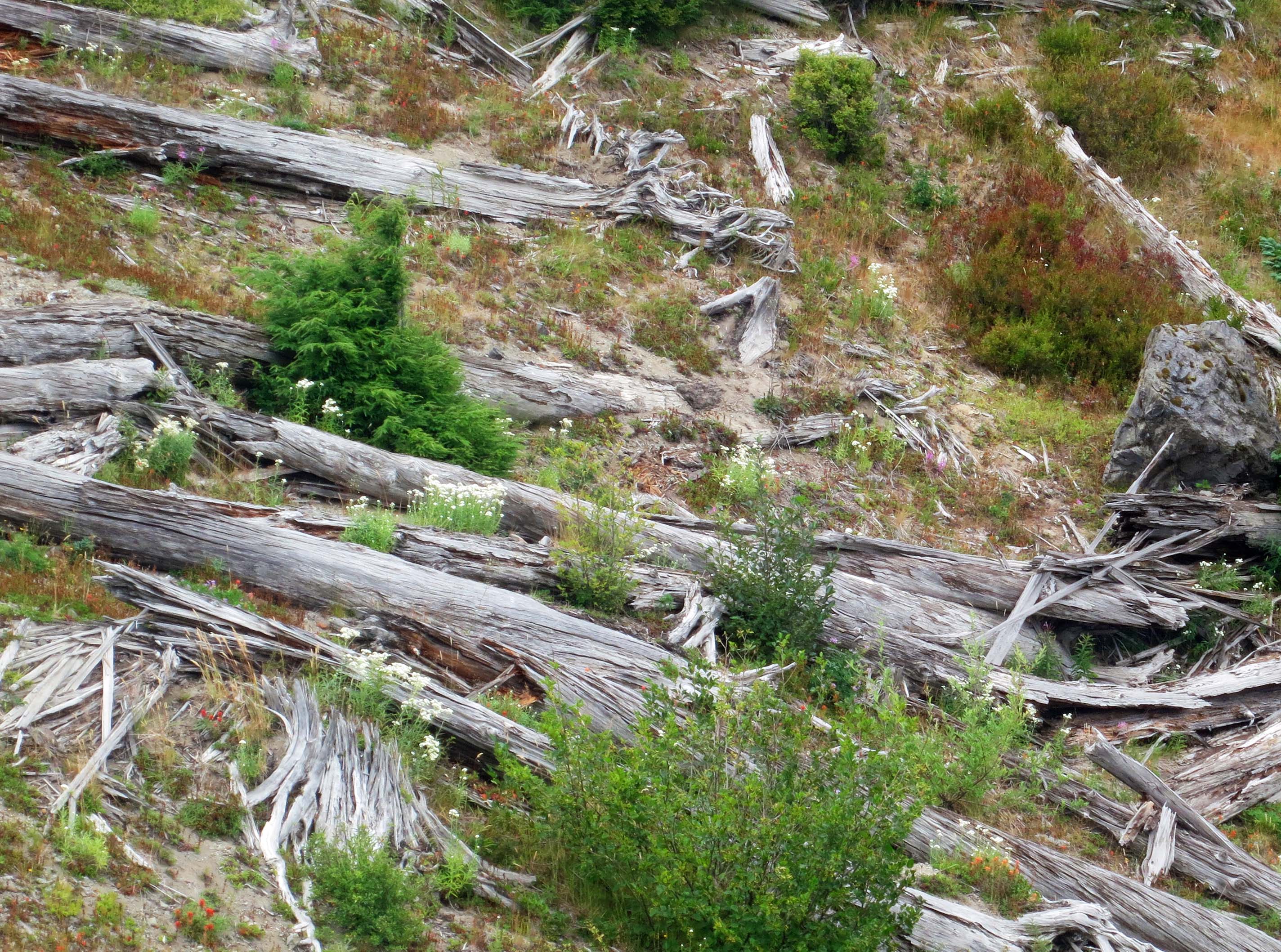
Thousands of trees were literally blown down by the eruption. Many can still be seen today.
This stump shows how the trees were ripped off from their bases by the blast.
Looking northeast (left) from Johnson Ridge, Spirit Lake can be seen at the base of another ridge. Once, it was a beautiful resort area. One of the biggest stories at the time of the explosion was how Harry Truman, an elderly man who owned a lodge at the lake, refused to leave and died when the avalanche buried the lake.
Jimmy Carter, who was President at the time, flew over the area in a helicopter and described it as a moonscape. I flew over it in a passenger jet and came to the same conclusion. (Photo by Peggy Mekemson.)
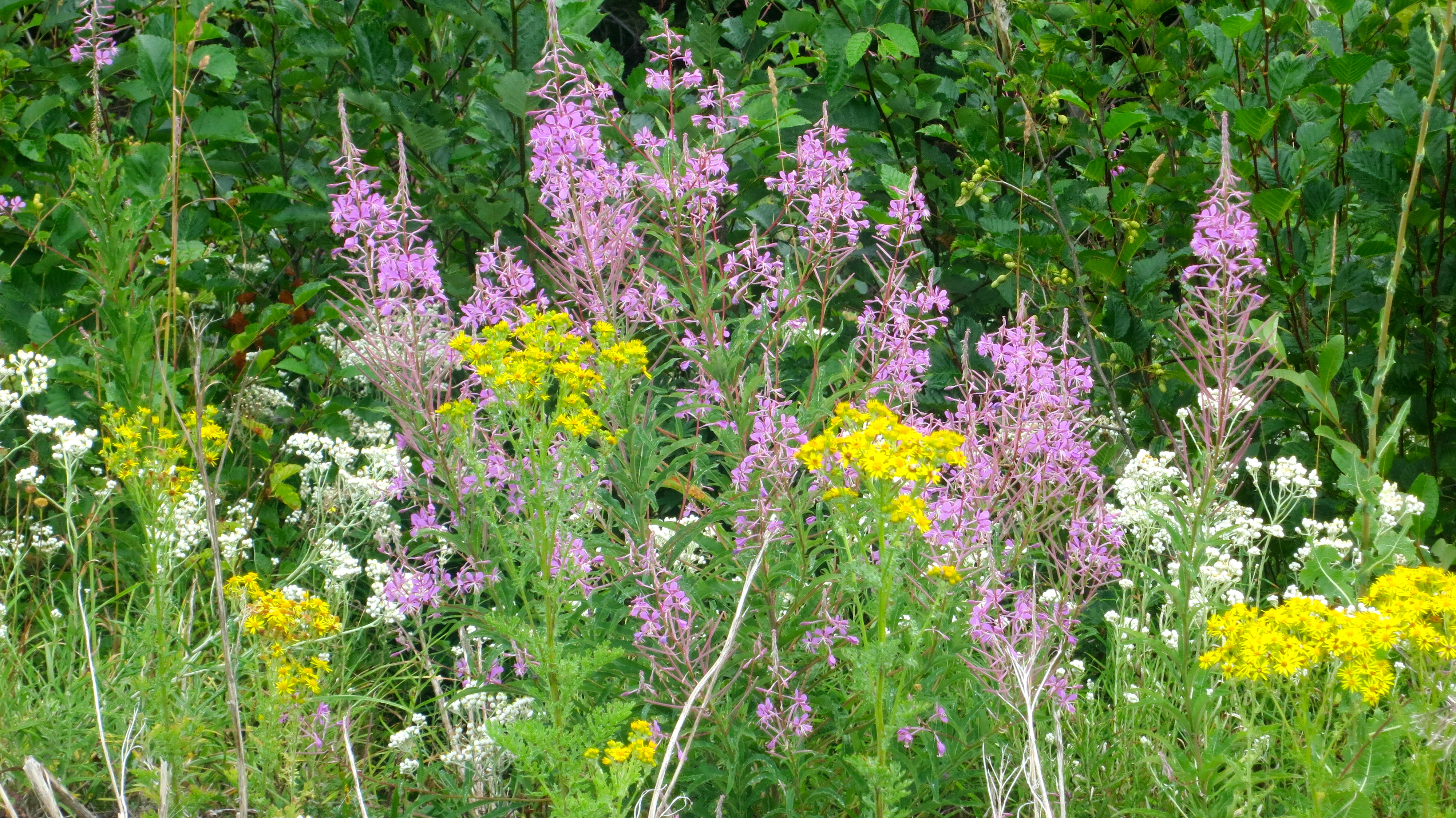
The recuperative power of nature is half the story about Mt. St. Helens. It is recorded that fireweed, the pinkish red flower here, was growing out of the ash 20 days after the explosion.
I felt the young tree growing out of a stump at Mt. St. Helens provided the best example of nature on the rebound. (Photo by Peggy Mekemson.)
As we drove off down the ridge into the mist, I couldn’t help but wonder when Mt. St. Helens would choose to explode again. It will happen. (Photo by Peggy Mekemson)
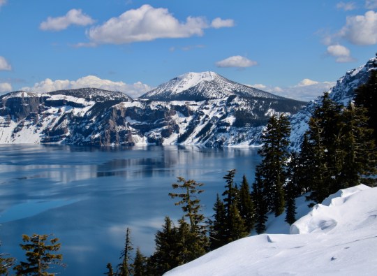
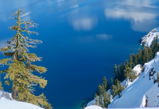
Crater Lake National Park is renowned for its beauty and the deep blue color of its water. It has an icy blue look here. Peggy took this photo from the Rim Village. Scott Mountain dominates in the distance. (Photo by Peggy Mekemson.)
The massive, 12-mile-high Mt. Mazama blew its top 7000 years ago. Local Native American legend claims that it had gone to war with Mt. Shasta, a hundred miles to the south. Mazama lost. It wasn’t that the massive explosion used up all of its bullets, aka lava. The problem was that using the magma emptied out the large chamber beneath the mountain and the weight of the Mazama brought it crashing down into the empty chamber, leaving behind a large crater or caldera to use the technical term. The caldera filled with water and voila! Crater Lake was born.
A photo I took of Mt. Shasta. Had Mt. Mazuma survived its explosion of 7,000 years ago, it may have looked something like this.
Peggy and I visited the National Park a week ago. It’s about a 2 ½ hour drive from our house. We drove up by ourselves and were careful to keep the virus-safe distance from the relatively few other people who were visiting. One individual insisted on invading our space, however…
This fellow apparently thought sniffing my shoe was more important than maintaining the 6 feet recommended to avoid coronavirus. “What are you thinking, guy?” I asked. “It’s a girl,” Peggy informed me. “She’s wearing pink.”
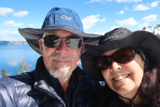
We had visited Crater Lake twice last summer and were eager to see it in the winter covered with snow. We were really glad we did. For one, it was as beautiful as we had expected it would be— and, two, the park closed on Tuesday because of coronavirus. The odds are that it will be closed until long after the snow melts. Here’s a map and some of the photos that Peggy and I took.
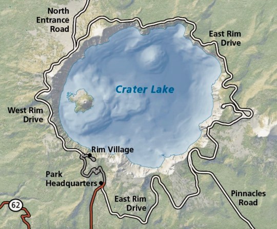
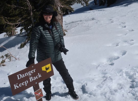
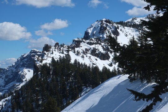
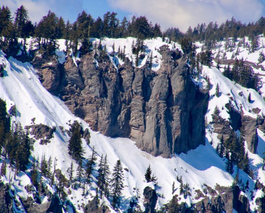
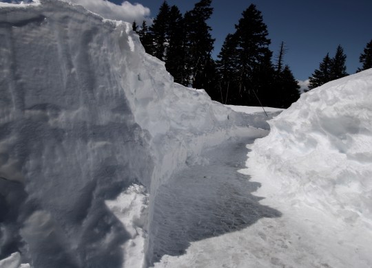
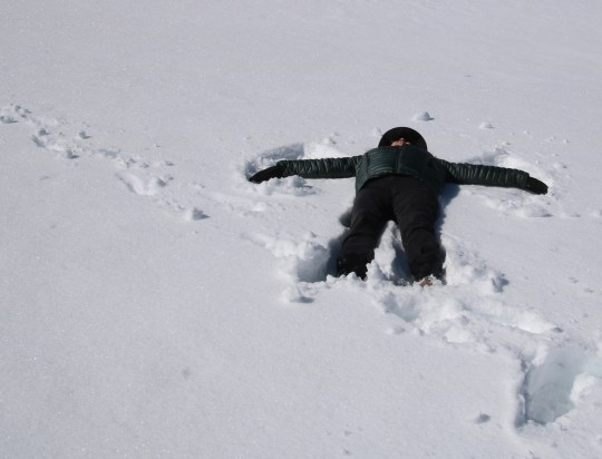
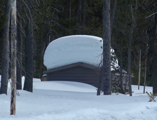
This National Park map provides an overview of the lake. Peggy and I were at Rim Village. The road around the lake is closed in winter and doesn’t open again until sometime in the summer. Wizard Mountain is on the left. The sheer cliffs around the lake are obvious. The lake is 1978 feet deep at its deepest spot. It is 6.2 by 4.5 miles across.I’ve never met a tree stump I didn’t want to photograph. Let me put this one into perspective…Wizard Island provided a backdrop. Llao Rock, named after the Klamath Indian god of the underworld rears up behind the island. The deep blue water reflects both Wizard Island and the clouds above the lake.A close up of Wizard Island. It is actually a small volcano that rose up from the lake’s floor. You can visit it by boat if you are willing to walk the thousand feet to the water. Afterwards, you get to hike the thousand feet back up. (Photo by Peggy Mekemson.)Other than the one trail, it’s a long way to fall to get to the lake and there are plenty of signs to warn you. The smaller sign forbids the use of drones.This photo gives a perspective on the steep drop.The cliffs as seen looking across the lake. I liked the impressionist-like reflection. (Photo by Peggy Mekemson.)Impressive rock formations surround Crater Lake. This one is located south of the Rim Village. I believe it is Garfield Peak.These were on the opposite side of the lake above Wizard Island. (Photo by Peggy Mekemson.)This is the trail that took us from the parking lot into the Rim Village overlook. (Photo by Peggy Mekemson.)Peggy points out the depth of the snow.This photo of two of the buildings at the Crater Lake Rim Village also provide a look at the depth of the snow. The trail leads over to the lakes rim. I rendered the photo in black and white. Peggy captured two fun photos of the roof. (Photo by Peggy Mekemson.)And the left edge of the building. (Photo by Peggy Mekemson.)All of the snow demanded a snow angel and I volunteered Peggy.It came out three dimensional! Peggy thought it was a bit spooky. Something took a big chunk out of her side. (It was from her knee getting up.)As always, we wandered around taking random photos. One of mine included this tree with its bone-colored limbs.Peggy caught these backpackers on snowshoes.Speaking of backpackers, the Pacific Crest Trail runs through the park. We didn’t see any through hikers, which wasn’t surprising. This is the restroom at the trailhead! Peggy and I will likely backpack through the park starting here this coming summer.I’ll conclude today’s post with a selfie of Peggy and me at the Lake’s edge— our last visit before lockdown. 🙂