“Climb the mountains and get their good tidings. Nature’s peace will flow into you as sunshine flows into trees. The winds will blow their own freshness into you, and the storms their energy, while cares will drop off like autumn leaves.” –John Muir
As the physician who had threatened to tell the media I was running a ‘pot smoking orgy’ in the mountains packed up to leave, my thoughts turned to the challenges of our second day’s route. We were facing a hike where the first water and possible campsite were 16 miles down the trail. Considering how much fun I had getting our Trekkers through seven miles on day one, I was not excited about day two. We had one access point approximately half way where a road crossed our trail. Steve and I planned to have the jeep there to resupply the Trekkers with water for the second part of their journey.
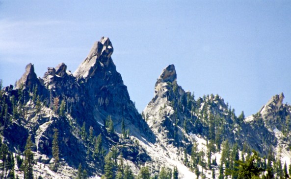
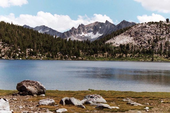
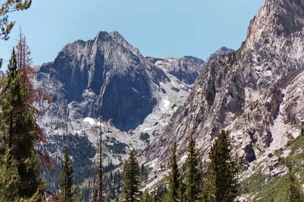
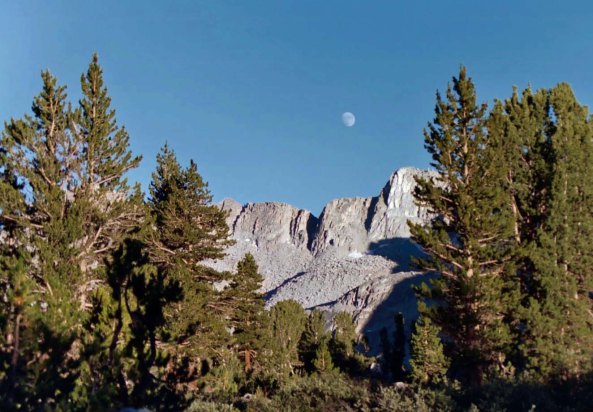
Today’s photos are focused on the mountains of the High Sierra. These towering peaks of granite are topped off by Mt. Whitney at 14,505 feet (4421.0 m). John Muir loved the Sierras and returned to them again and again. “The mountains are calling and I must go,” he declared. It is a passion I share. In honor of Muir’s love for mountains and wilderness, I am using a different quote of his for each photo. These quotes were gathered by the Sierra Club.

“Keep close to Nature’s heart… and break clear away, once in a while, and climb a mountain or spend a week in the woods. Wash your spirit clean.” –John Muir (Here I am, keeping “close to Nature’s heart.” Mt. Whitney is in the background.)
When the Trekkers were packed and ready to go, I called them together for a final briefing. I reminded them of how difficult the day would be and then gave them very specific instructions:
“If the jeep isn’t there when you arrive at the road, wait for it.” It would not be the last time in Trek history my directions would go unheeded.
As per plan, I sent Steve on ahead as trail leader while Charlie and I provided rear guard support. In retrospect, I should have recalled that this was the section of the trail that the hawk had ‘chased’ Steve for miles, apparently all 16. Far from being a gentle ridge walk, we were climbing in and out of small canyons over hot, dusty trails. By the time we had covered five miles I was beginning to worry and by six, I knew had to come up with an alternative. Otherwise many of our folks would be making a dry camp out on the trail.
I had quickly discovered that the walkie-talkies from Bob-of-No-Name didn’t work because of all the canyons. My only solution was to hustle up to the front of the line and catch the Trekkers before they left the jeep. I dubbed Charlie as primary rear guard and took off moving as fast as my short legs would go, passing the majority of our group along the way. When I arrived at the jeep, Steve was there with 15 people. “Damn,” I thought, “some of the Trekkers have already gone on.” Maybe I could catch them.
“Hey Steve,” I jumped in as he greeted me, “it’s time for Plan B.”
“Which is…” he asked grinning?
“We need to send the Trekkers by road into Robinson Flat with jeep back up. It’s only about 5 miles by road versus 10 by trail plus the jeep can provide water along the way and shuttle people if necessary. But first, how long ago was it when the rest of the Trekkers left the jeep?”
“I don’t know,” Steve confessed. He’d had a group of Trekkers walking on his tail and let them pass (thus breaking one of our cardinal rules). Even worse, Steve Locke didn’t know either. Apparently 15 of the Trekkers had arrived before the jeep and chosen to go on. Another five had actually waited, loaded up with water and then taken off, approximately 30 minutes before I arrived.
“Great,” I responded. Thanks to Steve letting people go ahead, we now had 20 people out on the trail in front of us without a leader— and 15 with limited water.
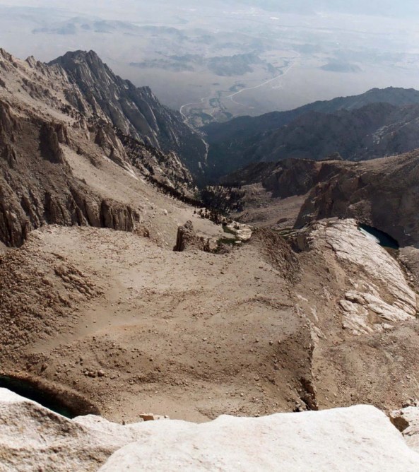
“In God’s wildness lies the hope of the world – the great fresh unblighted, unredeemed wilderness. The galling harness of civilization drops off, and wounds heal ere we are aware.” –John Muir (Here you are looking from the top of Mt. Whitney east toward Lone Pine and the Owens Valley. The road winds through the Alabama Hills where many Westerns have been filmed.)
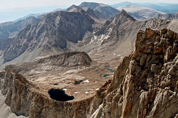
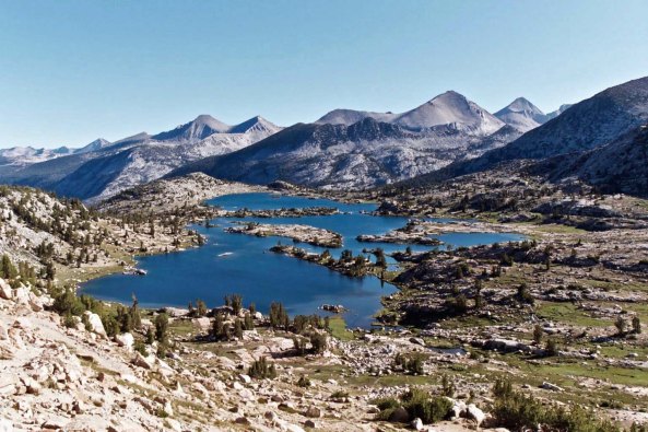
“This grand show is eternal.” –John Muir (This photo looks north from Mt. Whitney into the heart of the High Sierras with mountains as far as you can see.)
Day two, which had started with the doctor and his ‘pot smoking orgy,’ had gone from bad to worse. I made a command decision. Steve would continue on with Plan B as I had outlined it, moving the remaining Trekkers via road to Robinson Flat. I would continue along Red Star Ridge and provide backup for the group who had chosen to hike another 8 miles without water access.
I had little doubt about what type of foul mood my wayward charges would be in and who they would blame for their predicament. (It certainly wouldn’t be themselves for failing to wait for the jeep.) We would camp on Duncan Creek and hike the two miles into Robinson Flat the next morning.
“No one is to budge from Robinson Flat until I get there,” I instructed with the fervid hope my instructions would be followed this time.
First, however, I had to go back and retrieve Charlie. I wanted to personally be sure that all of our other Trekkers made it to the jeep. I asked Crowle and Locke to hold everyone. I found Charlie a mile or so back the trail with another broken pack. Boy, were we having fun. If my learning curve got any steeper, I was going to fall off.
“I’ll hike on with you Curt to provide support and company,” Charlie insisted.
I knew I was tired and could only imagine how he must feel given his extra 25 years and 50 pounds. I was beginning to realize that older people are often tougher than young people half their age with twice their strength. The journey we were on was as much psychological as it was physical. Maybe more so.

“The clearest way into the Universe is through a forest wilderness.” –John Muir
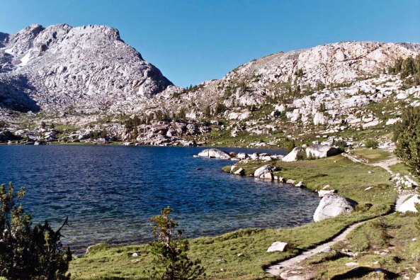
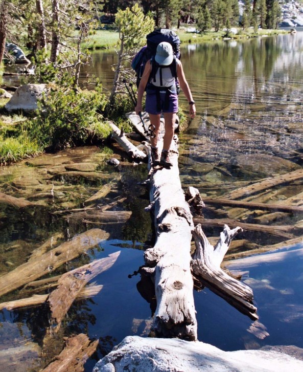
“Between every two pine trees there is a door leading to a new way of life.” –John Muir (Over the years, I have known numerous people who have decided to change their lives while backpacking for a week through the Sierras.)

“Another glorious day, the air as delicious to the lungs as nectar to the tongue.” –John Muir (The same photo as above a couple of hours later as the setting sun colors the ridge. This is in the Dusy Basin near Bishop.)
We initiated phase two of our journey around 2:00 p.m. In a little over 30 minutes we caught our four eleven-year-olds, who we had nicknamed the Four Mouseketeers, crawling along at a pace that a turtle would find embarrassing.
“Joe is really slow,” one of the urchins informed me.
Yeah, I thought to myself, and you guys are so glad he is because it provides all of you with an excuse to move at the same pace.
After about an hour of moving along at ‘Joe speed,’ Charlie plaintively informed me he wasn’t going to make it into camp if he couldn’t move faster. Having determined that three of our Mouseketeers really were good hikers, I assigned them to Charlie and took Joe on as my personal challenge. The experience was similar to moving my Basset Hound down the trail after he spent a full night of digging. Joe would go a quarter of a mile and stop, plopping down onto the dusty trail. We had managed about a mile of this when I came on Charlie again, standing beside the trail and pointing off to the left.
“Careful, Curt,” he began, “there is a huge timber rattler coiled up there.”
Adrenaline gave me a spurt of energy I didn’t know I had. Huge was hardly an adequate description. The snake was as thick as my wrist and about six feet long. Joe, either out of exhaustion or not caring, came to a shuffling halt mere inches away from the poised pit viper and kicked dirt into its face.
“Um, Joe,” I whispered trying to sound calm and not wanting to frighten him or the snake into precipitous action, “if you will look down to your left, you will see a snake. Don’t move.”
Had I received such instructions, I would have been 20 feet down the trail in one prodigious leap. Joe, on the other hand, looked down at the huge, coiled rattler, said ‘oh,’ and shuffled on down the trail. The snake didn’t budge; Joe was not food, friend or foe. We left the snake guarding the trail.

“Man must be made conscious of his origin as a child of Nature. Brought into right relationship with the wilderness he would see that he was not a separate entity endowed with a divine right to subdue his fellow creatures and destroy the common heritage, but rather an integral part of a harmonious whole.” –John Muir

“Everybody needs beauty as well as bread, places to play in and pray in, where nature may heal and give strength to body and soul alike.” –John Muir (Few solid chunks of granite are more beautiful or famous than Half Dome in Yosemite.)

“Another glorious Sierra day in which one seems to be dissolved and absorbed and sent pulsing onward we know not where. Life seems neither long nor short, and we take no more heed to save time or make haste than do the trees and stars. This is true freedom, a good practical sort of immortality.” –John Muir
Charlie went on ahead with his three charges and I continued to herd my half dead companion. It was after dark when I heard the stream that I knew meant camp. It was an extremely welcome sound; Joe and I had been traveling for at least 30 minutes by flashlight. Charlie was waiting for us outside camp.
“We have a problem Curt…” he began for the second time that day, although the day had already stretched out forever and I hadn’t known one minute when the ubiquitous problem did not exist. As supportive as Charlie had been, I had thoughts of killing the messenger.
“What’s it this time,” I asked, struggling to keep the grump and whine out of my voice.
“One of the Trekkers is lost and the rest of the Trekkers are ready to string you up from a tree,” he reported matter-of-factly. But then, it wasn’t his neck. “I’ve calmed them down by telling them all you have done today,” he went on. “Now they are just going to give you the silent treatment.”
I am not a praying type of person but I looked up at the sky and said, “God, get me back to Sacramento and I promise I will go back to running Christmas Seal Campaigns with my 80-year-old, lady volunteers and be perfectly happy.” The odds against any future Trek program had just hit 1000 to 1.
Before going to bed, I insisted that the Trekkers gather around so I could learn what I could about the missing person, Dick. Silent treatment or not, I needed to think through an action plan for the next day. Dick was the school teacher who had claimed he could carry his weight in booze. He had been hiking alone and hadn’t talked to anyone about leaving the route. The Trekkers could only give me an approximation of where they had last seen him.
I decided to get folks up early in the morning. I would high-tail-it the two miles into camp and see if Dick had shown up at Robinson Flat. If not, I would check with the ranger station and help organize a search party. Two of my strongest hikers would stay behind in camp in case Dick showed up there. Charlie would bring the rest of the Trekkers on to Robinson Flat.

“When one is alone at night in the depths of these woods, the stillness is at once awful and sublime. Every leaf seems to speak.” –John Muir (I sometimes backpack by myself in the wilderness and spend nights with nothing but myself and nature. I highly recommend the experience.)
I was exhausted and couldn’t go to sleep but somewhere in the wee hours I must have dozed off because I woke with a start as Charlie lobbed pebbles at my sleeping bag. I was up and packed in a zip. After a few words of encouragement to the troops, who had made a miraculous recovery over night, I was bounding off up the trail like a hare with the hounds of hell in hot pursuit. Just as I came into camp, Dick came hoofing in from the opposite direction. I didn’t know whether to kiss or to kill him, but he was too ugly for the former and possibly too tough for the latter.
I settled for, “Are you okay Dick?”
“Sure,” he replied in a why-wouldn’t-he-be tone.
“What happened,” I demanded, allowing my irritation to surface.
“I got thirsty,” Dick explained. “I could see French Meadow Reservoir at the bottom of the ridge so I hiked down to get a drink. When I got there, I was tired so I set up camp.”
My irritation boiled over.
“Why didn’t you tell someone you were leaving? Didn’t you realize we would be worried sick and mounting a search and rescue effort?” I was on a roll and Dick was on the receiving end of a great deal of frustration I was feeling. Fortunately, guilt had driven him to get up before dawn and make his way to Robinson Flat as quickly as he could. It might have been worse, much worse.
The crisis was over, but I still had chores. First up was to go back and collect the rearguard I had left at Duncan Creek. I could have sent Steve but I needed the down time. As I hiked, I made my second command decision of the day. Even though we had only hiked for two days, the group could use a layover day. Hell, I could use a layover day. In fact, I needed a layover day. I deserved a layover day. The next day could wait for its turn. What else could go wrong? Hah!

“God does not appear, and flow out, only from narrow chinks and round bored wells here and there in favored races and places, but He flows in grand undivided currents, shoreless and boundless over creeds and forms and all kinds of civilizations and peoples and beasts…” –John Muir (Wise words in these troubling times of division.)

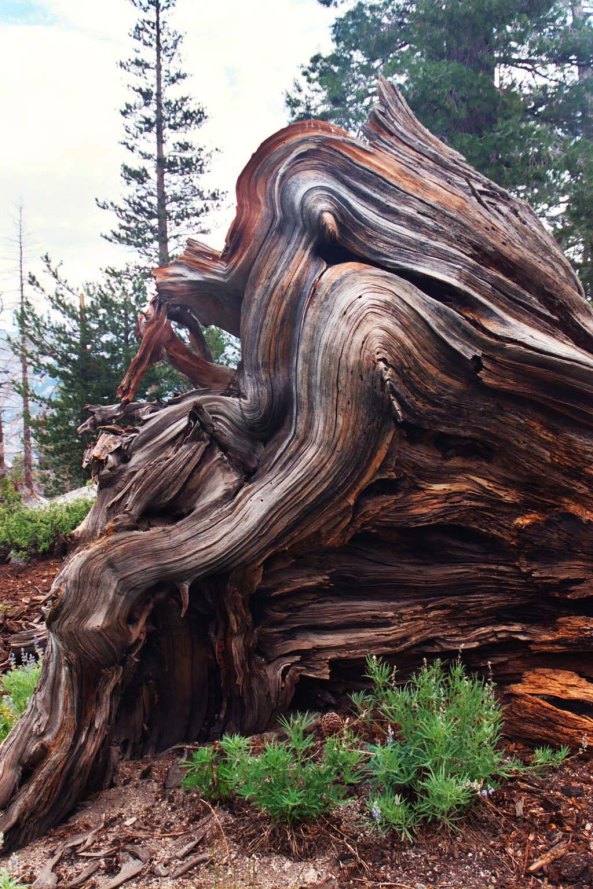
“It took more than three thousand years to make some of the trees in these Western woods — trees that are still standing in perfect strength and beauty, waving and singing in the mighty forests of the Sierra. Through all the wonderful, eventful centuries … God has cared for these trees, saved them from drought, disease, avalanches, and a thousand straining, leveling tempests and floods; but he cannot save them from fools — only Uncle Sam can do that.” (Something to think about as ‘Uncle Sam’ moves to eliminate the Environmental Protection Agency and the regulations that protect these forests from destruction.)

“Then it seemed to me that the Sierra should be called, not the Nevada or Snowy Range, but the Range of Light. –John Muir (With 50 years of wandering the Sierra Nevada Mountains behind me, I agree.)
NEXT BLOGS:
Friday: An amazing octopus and rhino. More on the mutant vehicles of Burning Man.
Monday: Sully and his airplane.
Wednesday: Sierra Trek: The layover day where all sorts of interesting things happen.