The Bush Devil Ate Sam is an important record and a serious story, yet told easily, and with delightful humor. This is one of the most satisfying books I have ever read, because it entertained me thoroughly AND made me feel better informed. —Hilary Custance Green: British Author... Click on the image to learn more about my book, the Bush Devil Ate Sam, and find out where it can be ordered.


Not just a gorgeous rainbow, but traces of a double rainbow! We were treated to a nice one on our arrival in Lhasa.
Always, a treat, huh John. We used to get some beautiful double rainbows when we lived in Oregon and a couple of times at Burning Man.
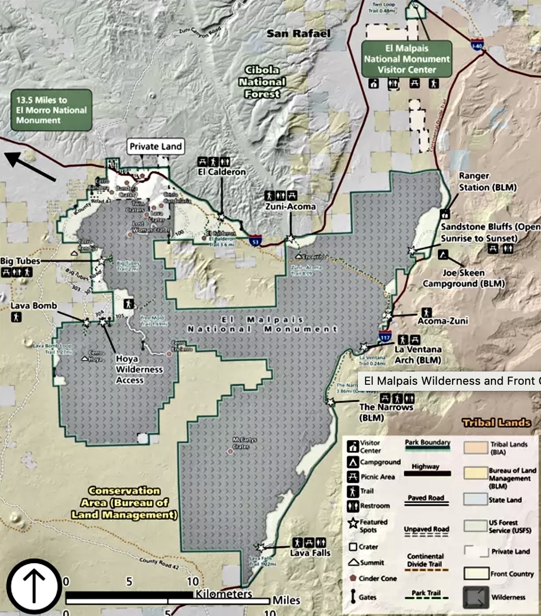
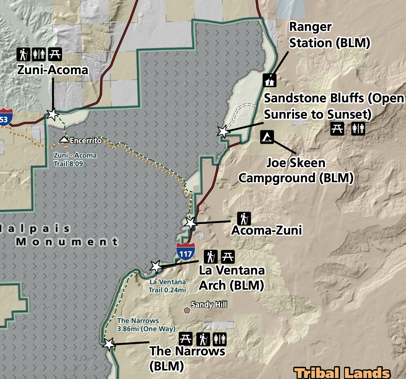
What a great trip down memory lane, thank you! We visited El Malpais just as a day trip from Albuquerque, so we didn’t have nearly enough time to explore. It was nice to see some of the sights we missed here in your post. Also, good to know about the sign of a red ant nest; I never knew that but hopefully now I’ll recognize one if I see one and save myself some pain.
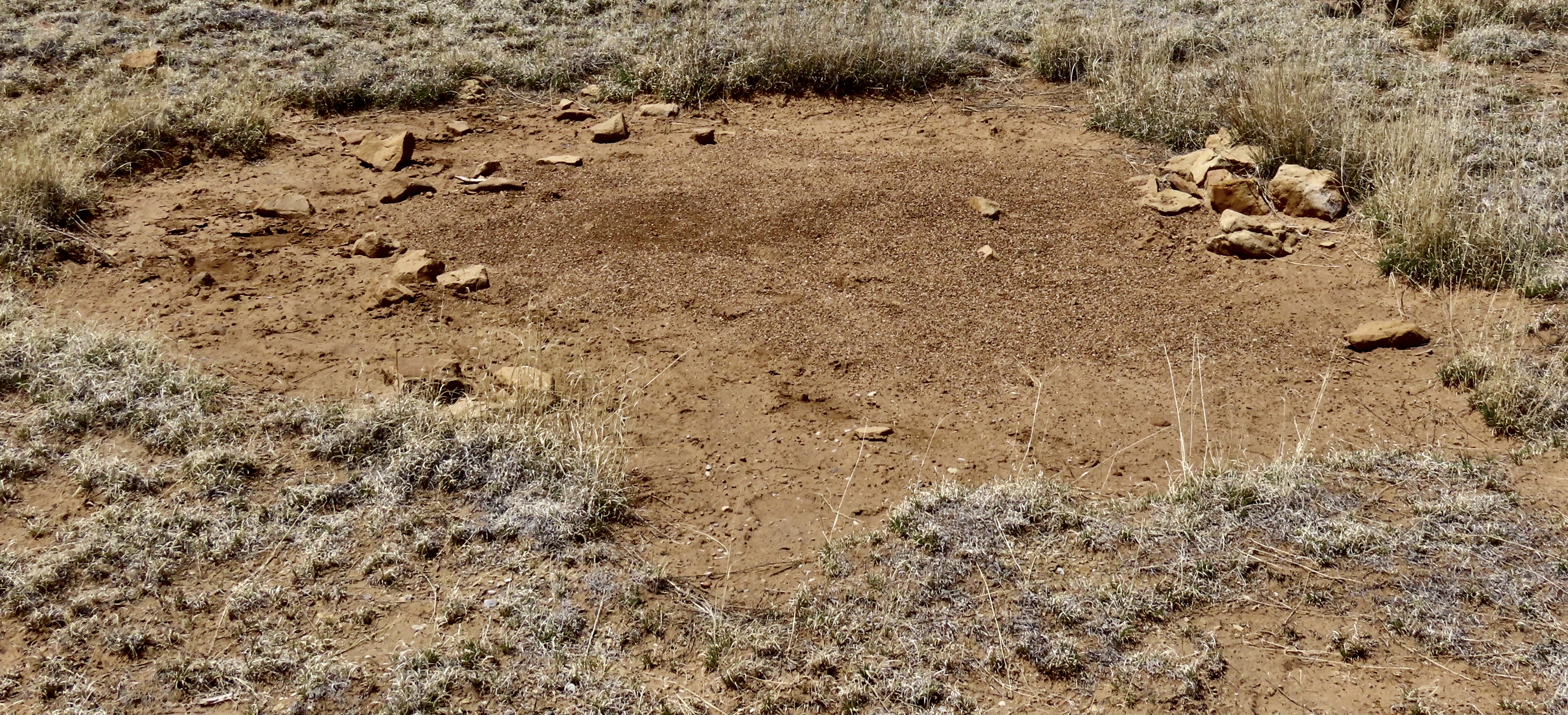
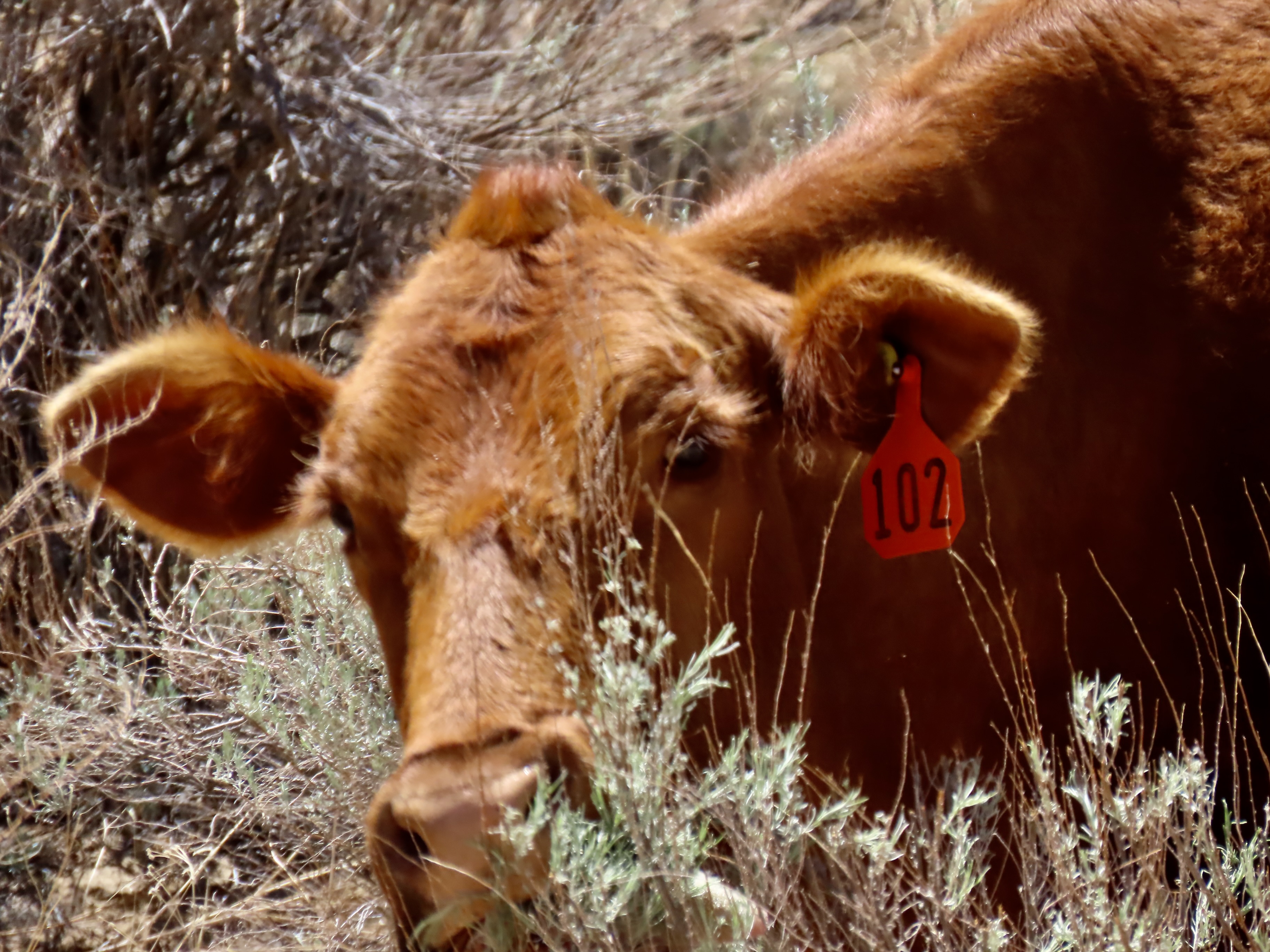
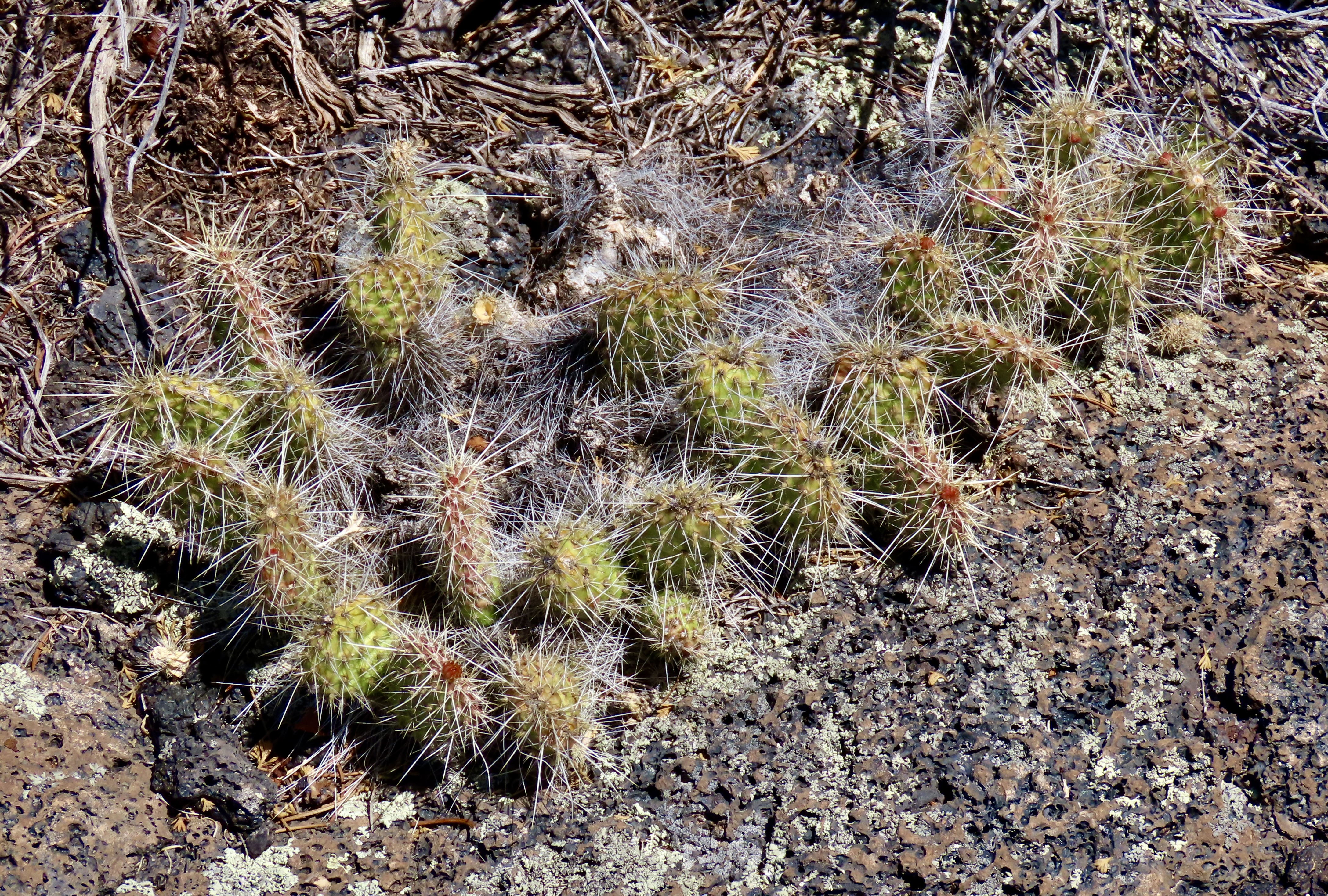
Glad you enjoyed it, Diana. I was mentioning above how lucky we are that settlers considered certain areas bad lands because they couldn’t make a living or money off of them. I’m fascinated by ants. The red ants and their ferocity remind me of the army ants I dealt with in Africa when they decided to move in next door.
I thought we had covered almost everything in New Mexico over the years. But the more I read in your post, the more I realized I was confusing them with the Carrizozo Volcanic Field further to the southeast. Great images as always; we saw double rainbows now and then in southwest Florida, but I never captured an image so wonderful as yours.
I think one could spend months in New Mexico, Ray, and never find all it has to offer. It has been one of favorite states for a long time.
As for the rainbow, sometimes we just get lucky!
Fascinating.
Indeed it is, Cindy.
People should heed your warning about red ants – they can put you into shock!
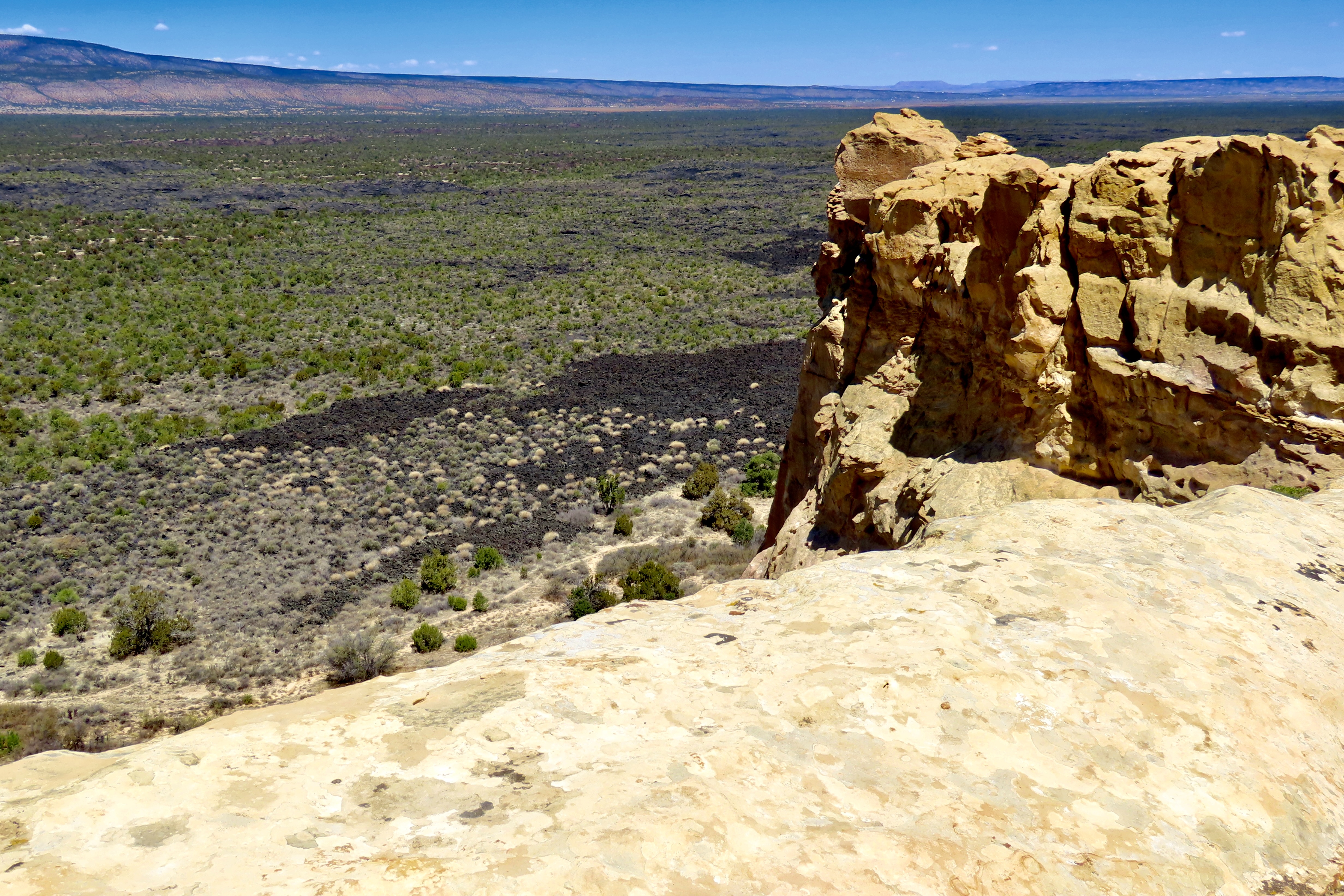
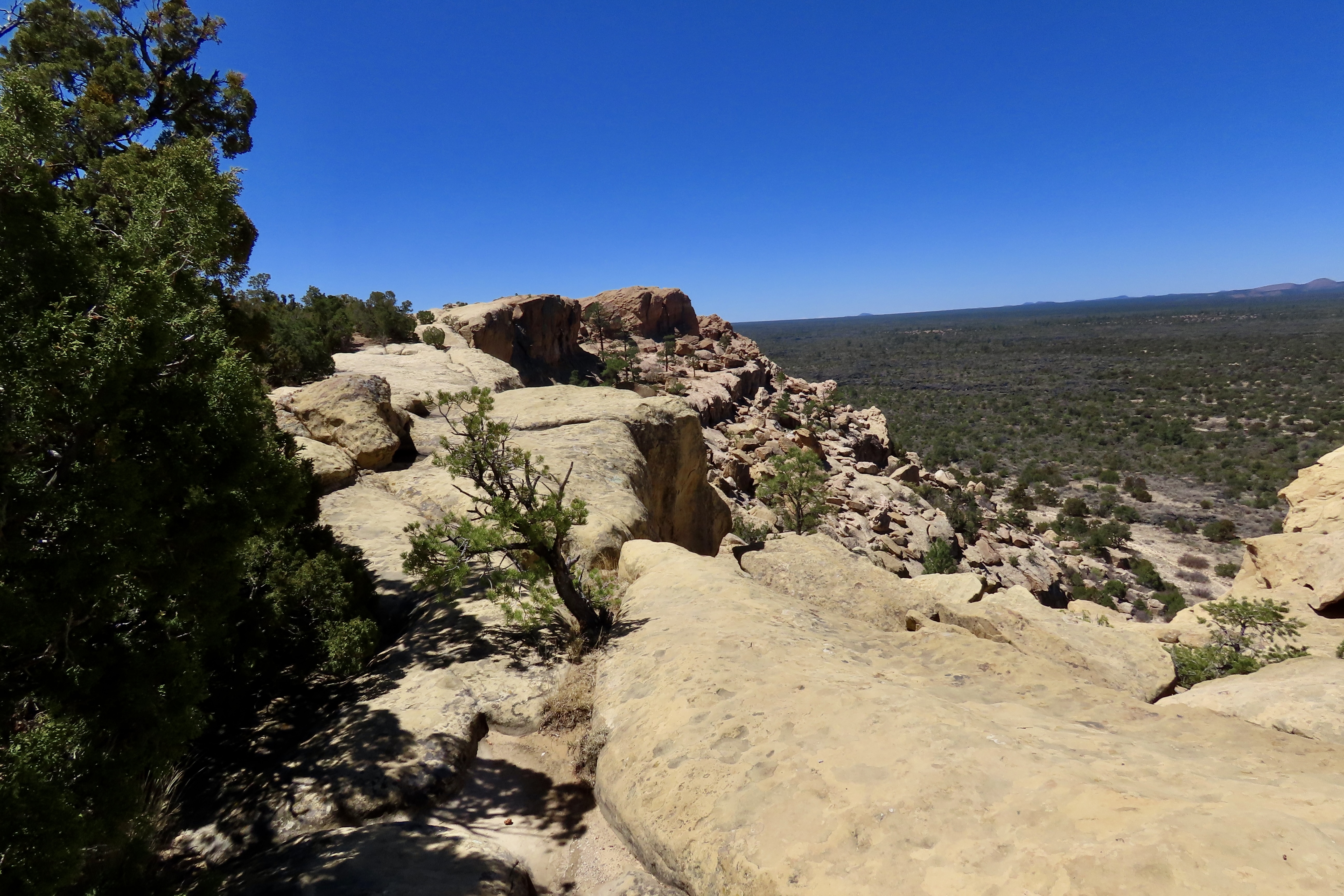
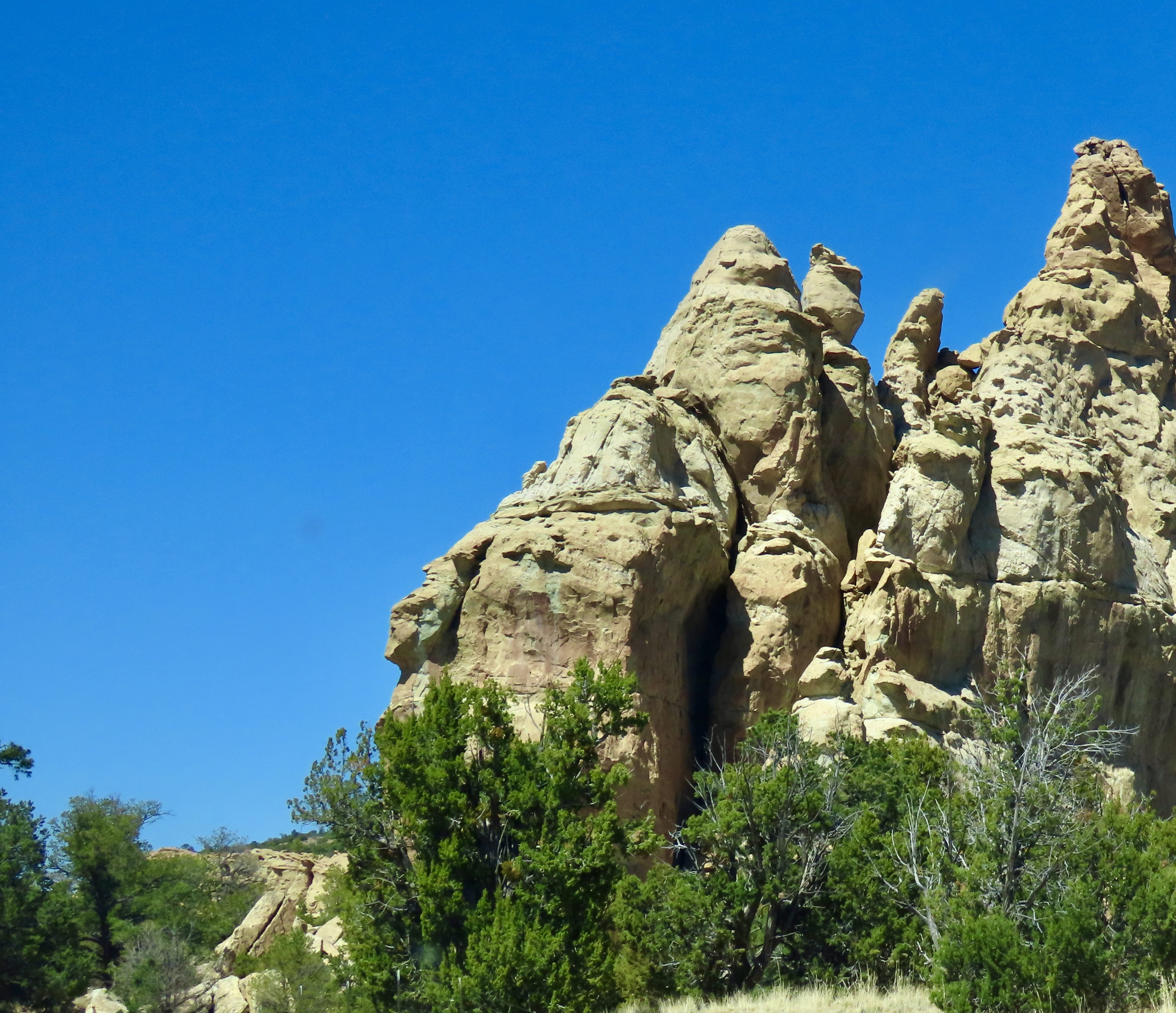
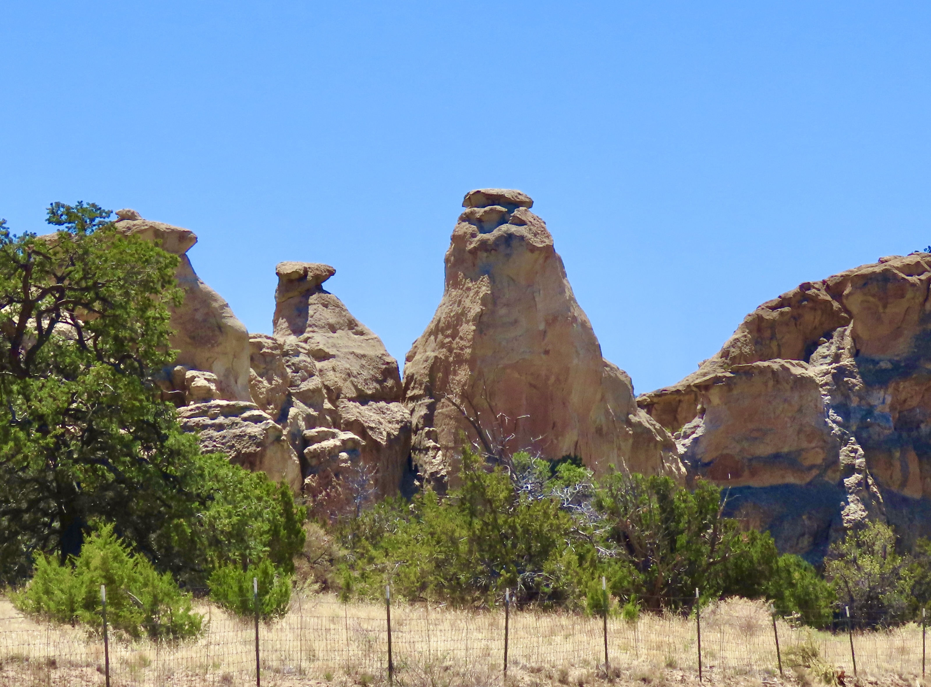
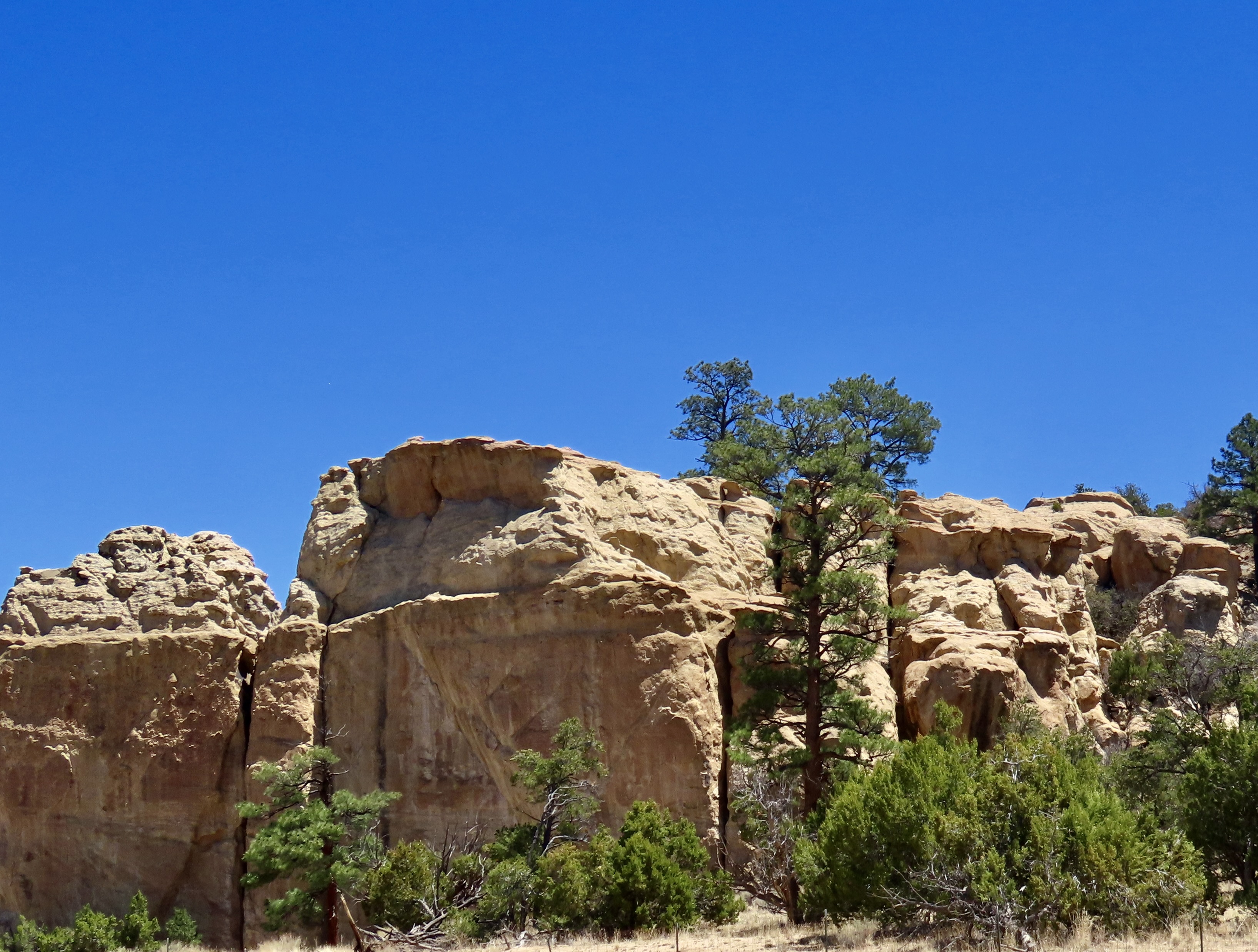
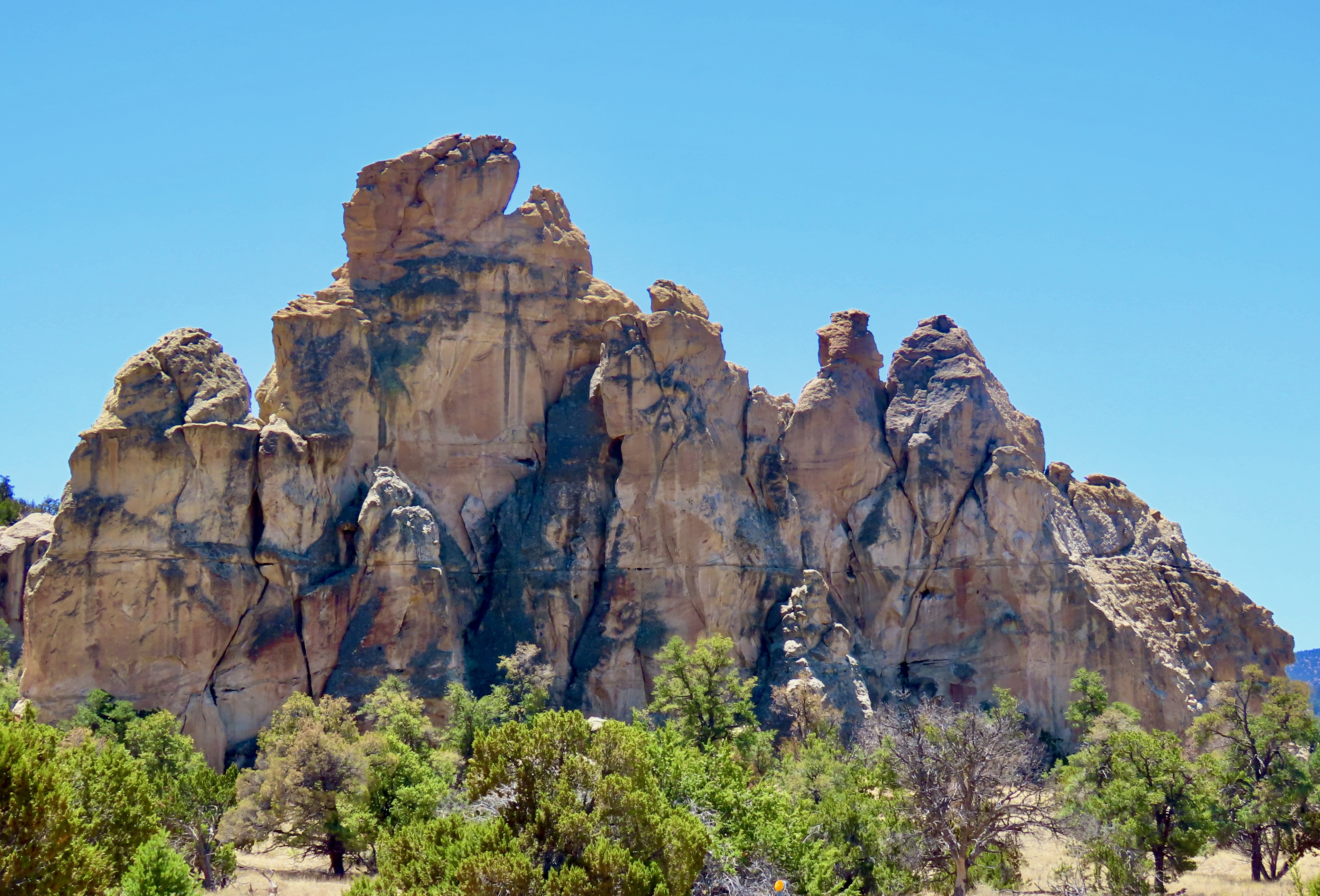
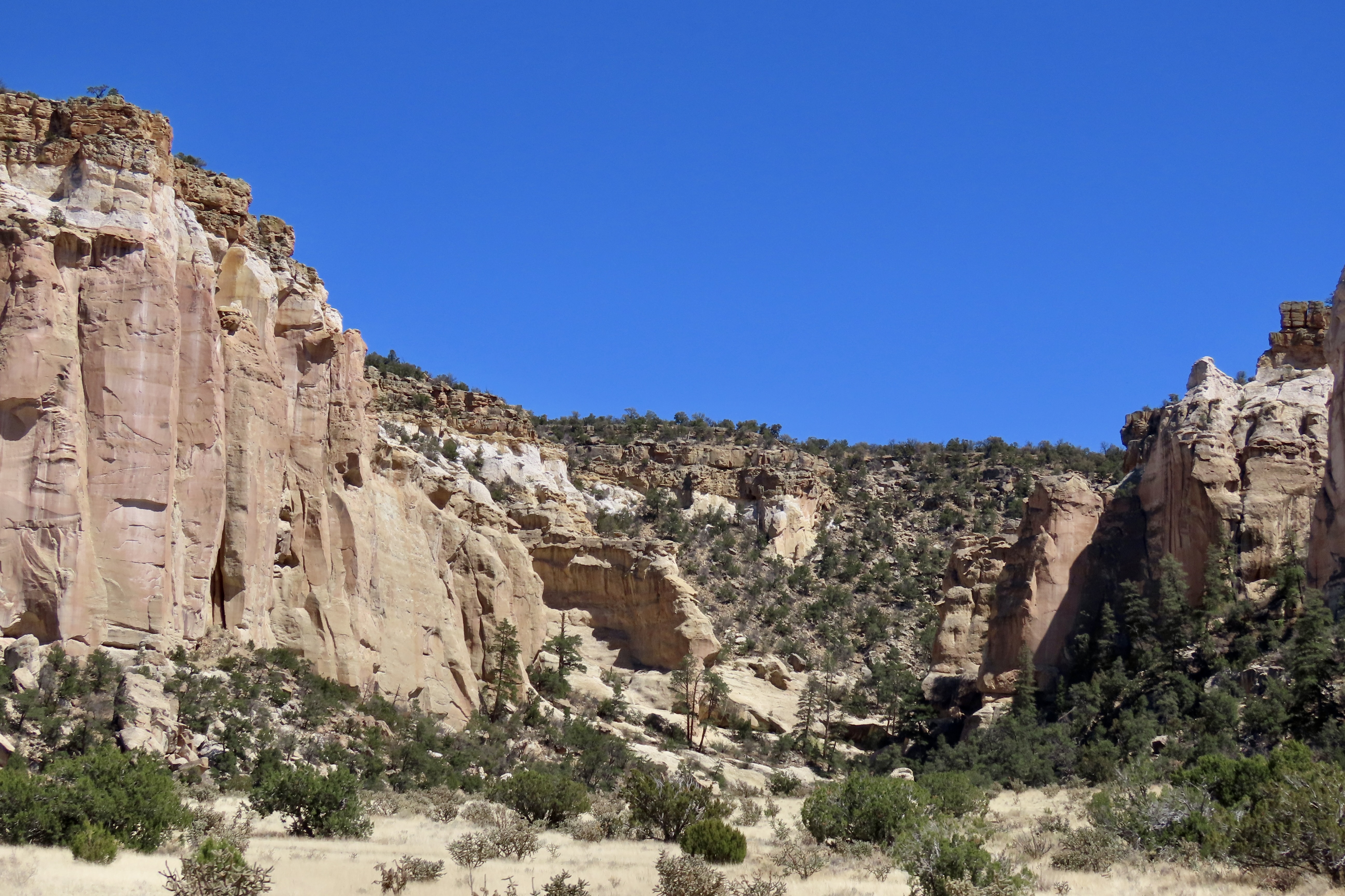
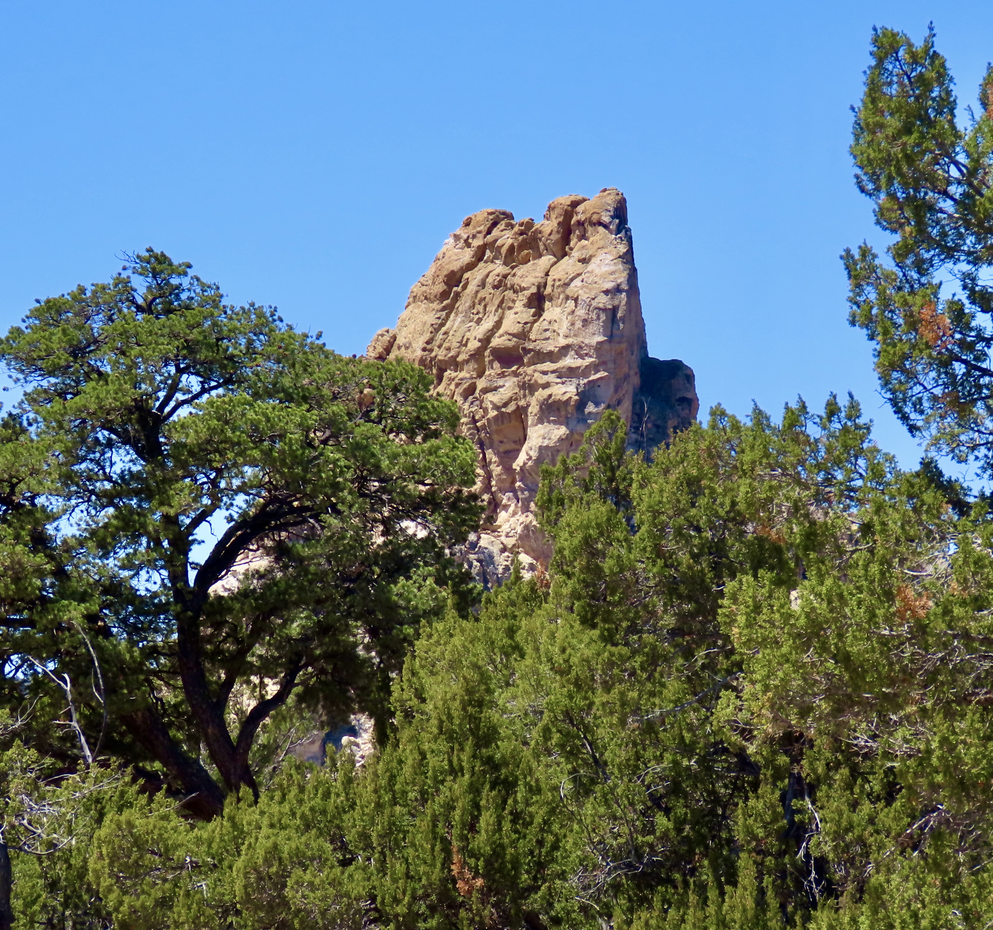
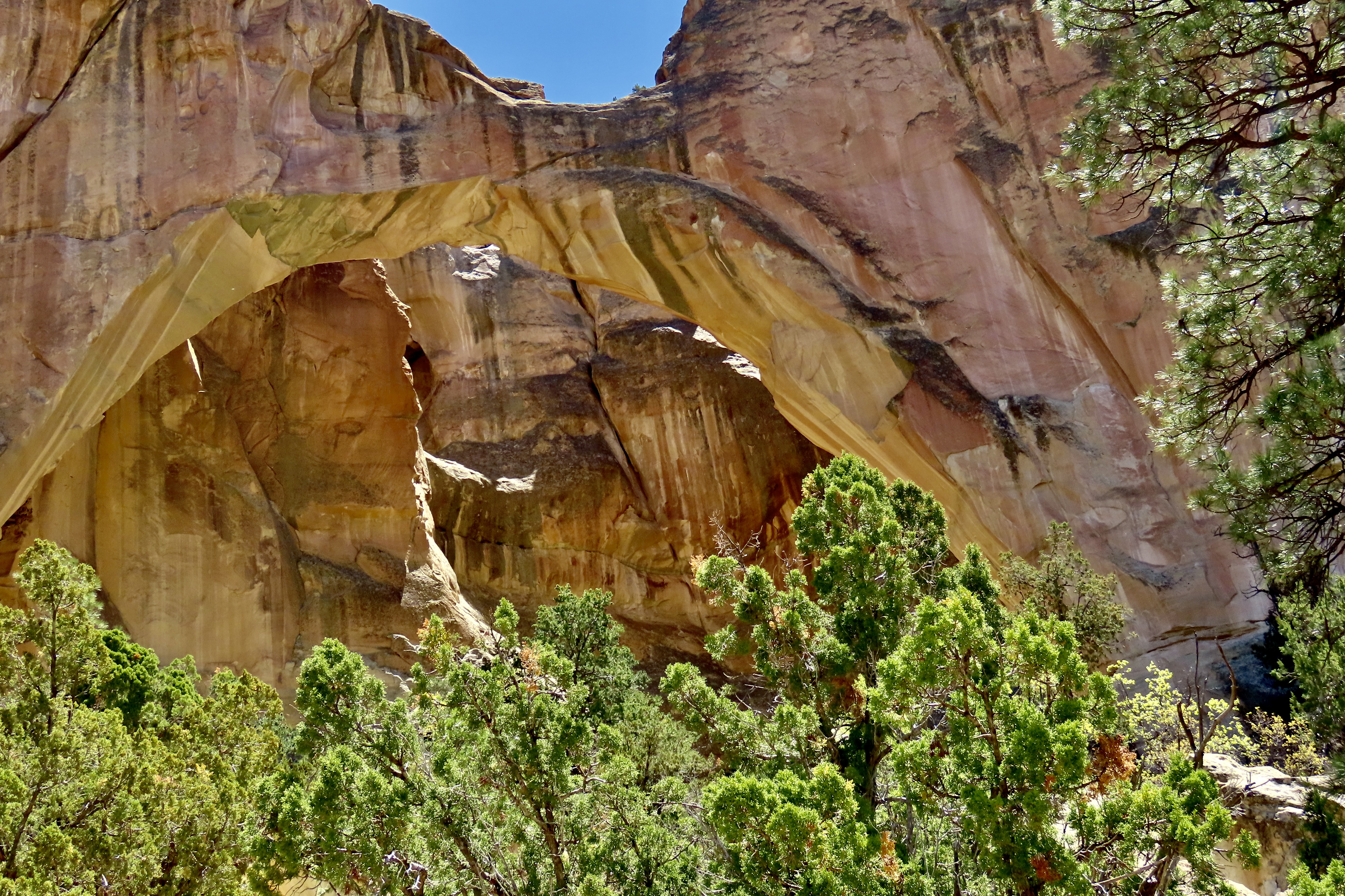
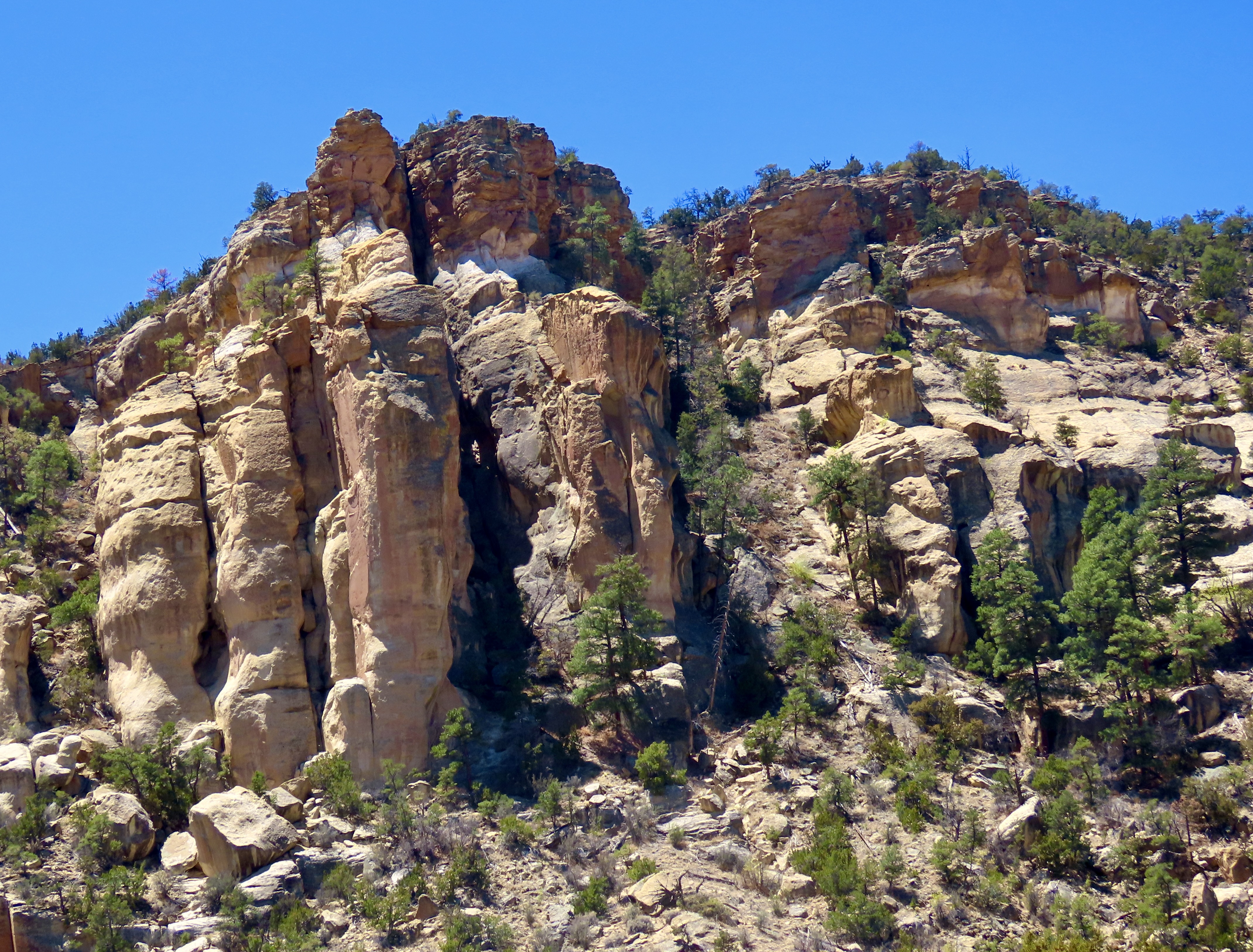
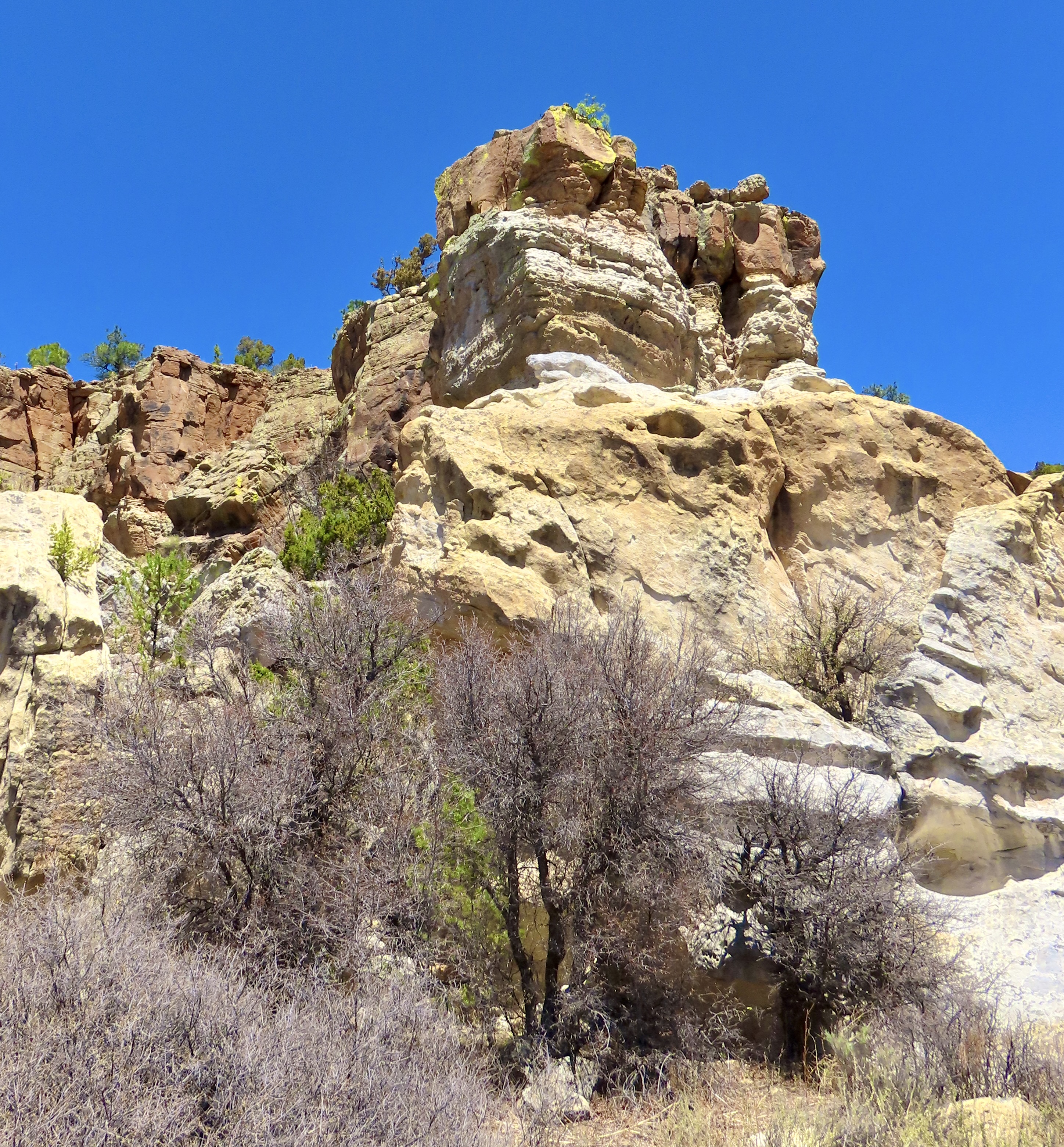
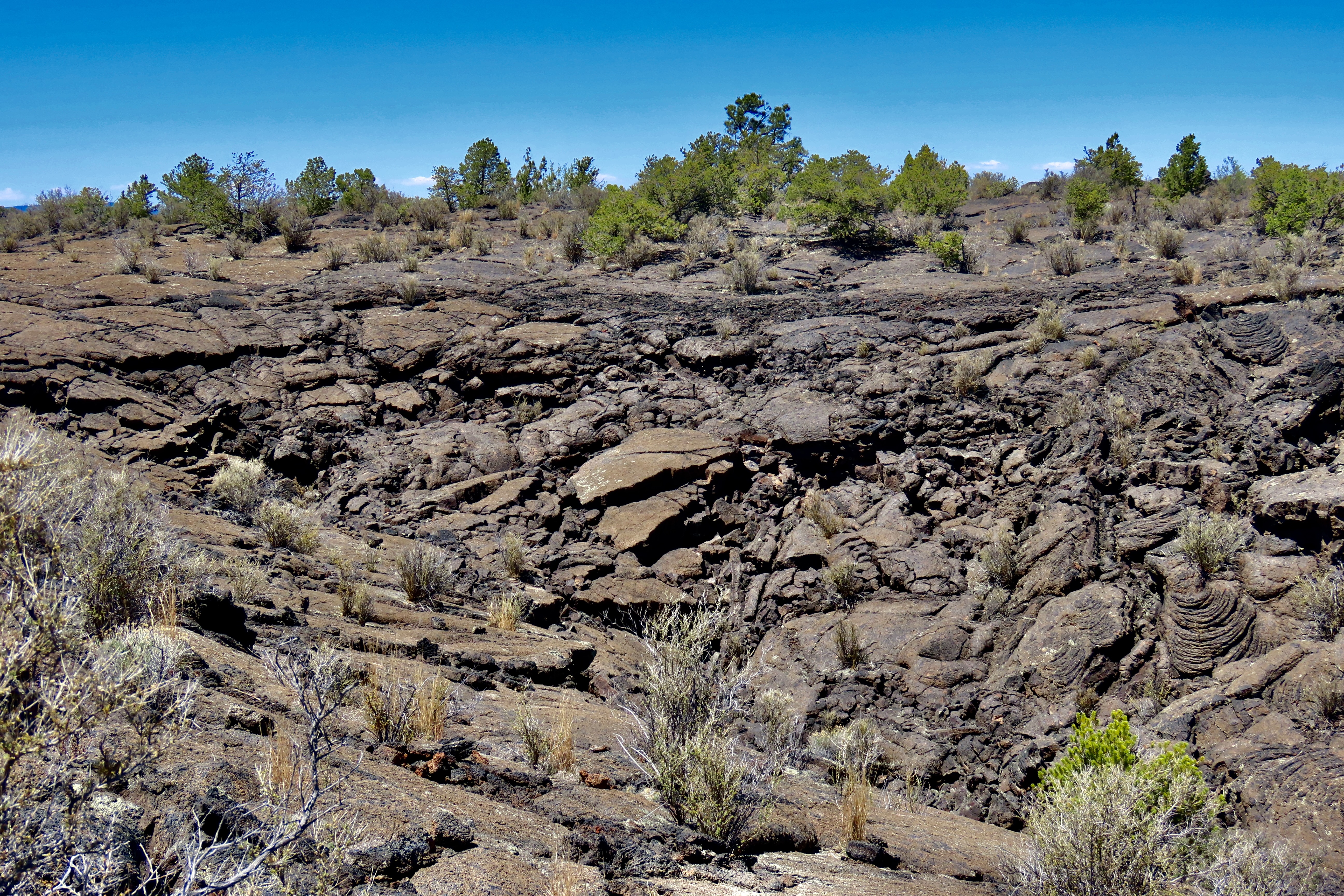
I can understand how the Spaniards thought this area to be a wasteland, but it’s interesting for us with the rock formations.
They remind me of the army ants I dealt with in Africa, G.
A lot of beautiful areas have been preserved because the early settlers thought as them as worthless if they couldn’t make a living or grow wealthy off of them. Thankfully. Grin.
Oh, I remember you mentioning those ants in your book!! Yikes!
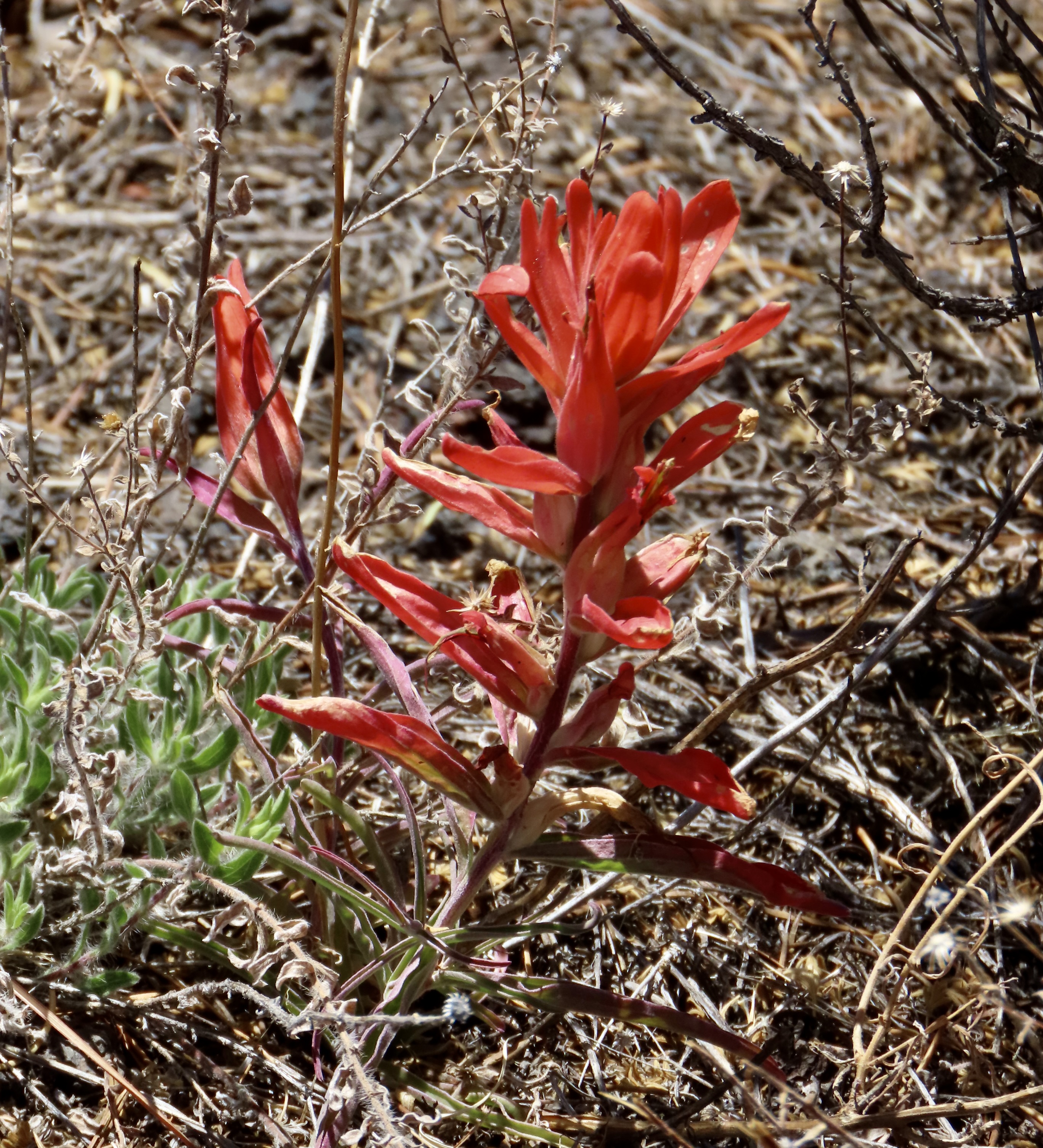
Double rainbow!!! And I love that wherever you go, no matter the terrain, you always find a flower or two. That single Indian paintbrush looks so pretty!
The flower certainly stood out! And we are always up for photographing a rainbow, that means are doubly so for a double rainbow. Grin.
What an incredible post! Ending in a double rainbow. A beautiful blessing. Thank you. Reminds me of a few sacred sites in Arizona.
Thanks, Michele. Over the years, we’ve visited a number of such sites in the Southwest, and it seems there is often something unique about areas that Native Americans chose as sacred. Some are drop dead gorgeous while others feature a particular geological structure.
True, yes. Thank you for the thoughtful reply. Best to you two!
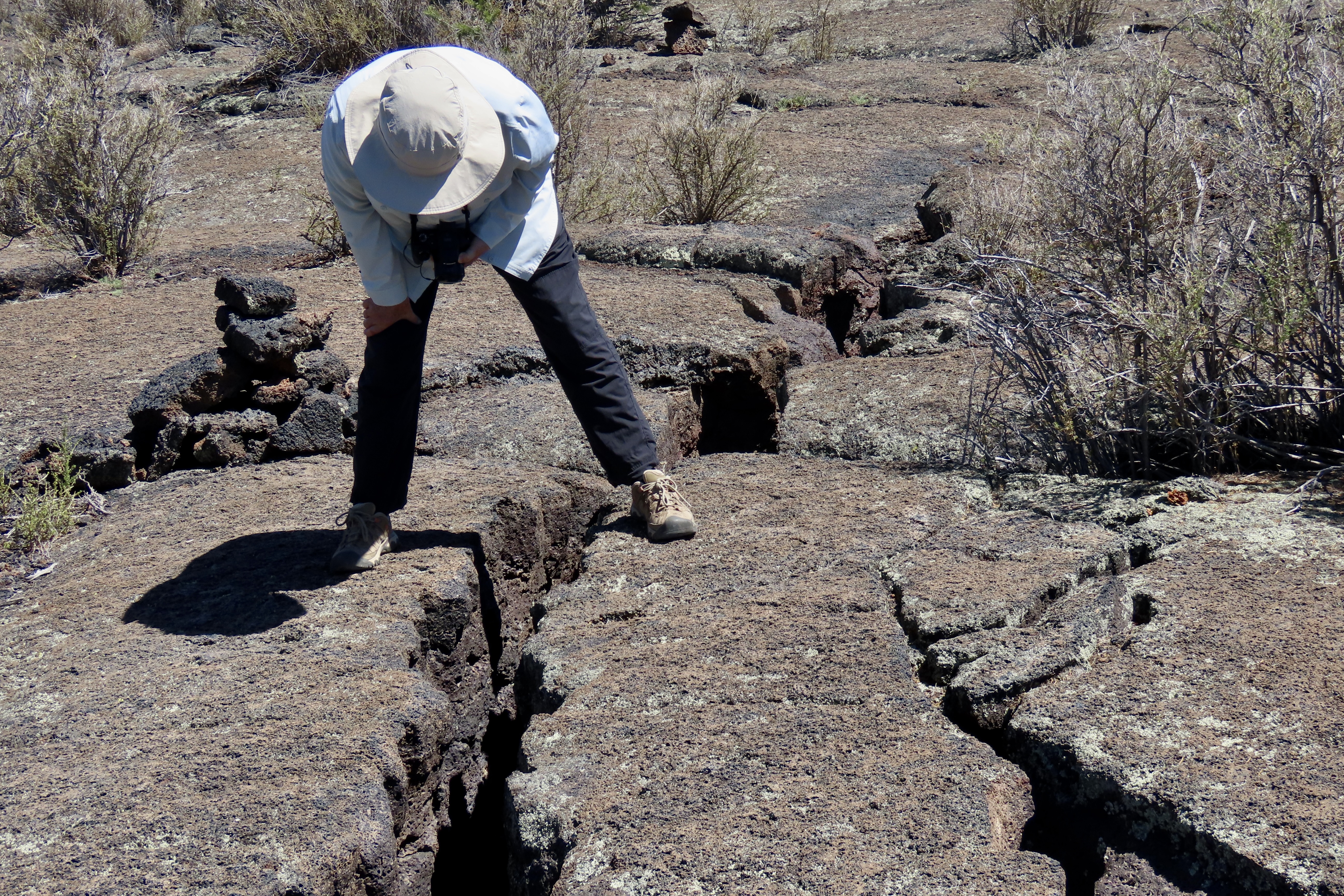
Wholly molly, Curt, that was a thorough post. Are you sure you are starting a travel company?! You could you know. Honestly, I would go and not even know what I just saw and most likely fall through the crack Peggy took the picture of, without a tour guide. Love the ants.. I thought it was some weird scat. I love cholla sticks. They looked like people. Ending with that double rainbow was killer.. sooo gorgeous!!! 🌈
I once contemplated starting an adventure travel company, Cindy. One of those many paths I would have been happy to follow. There is enough variety in El Mapais to entrance even the most jaded of travelers. Thanks.
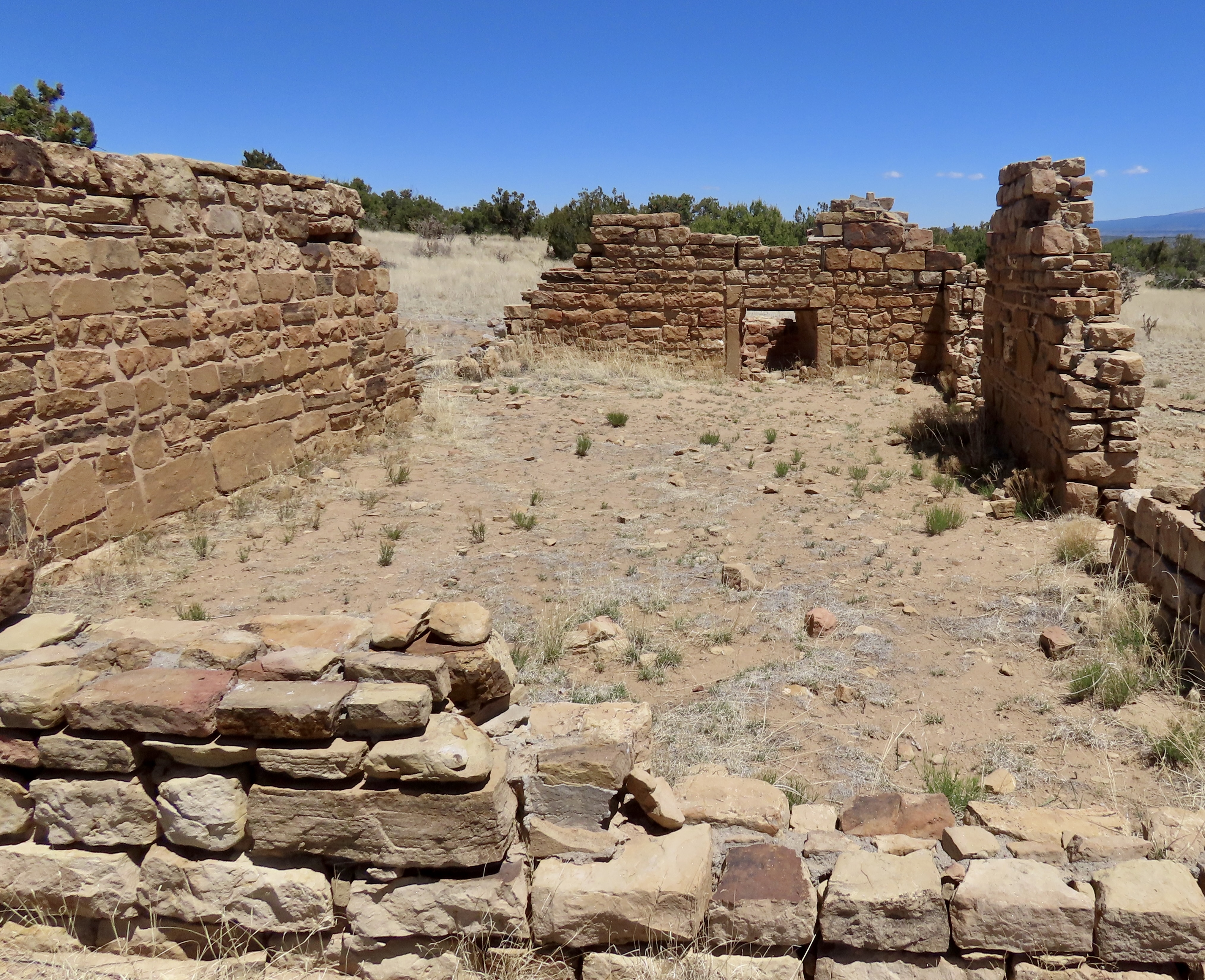
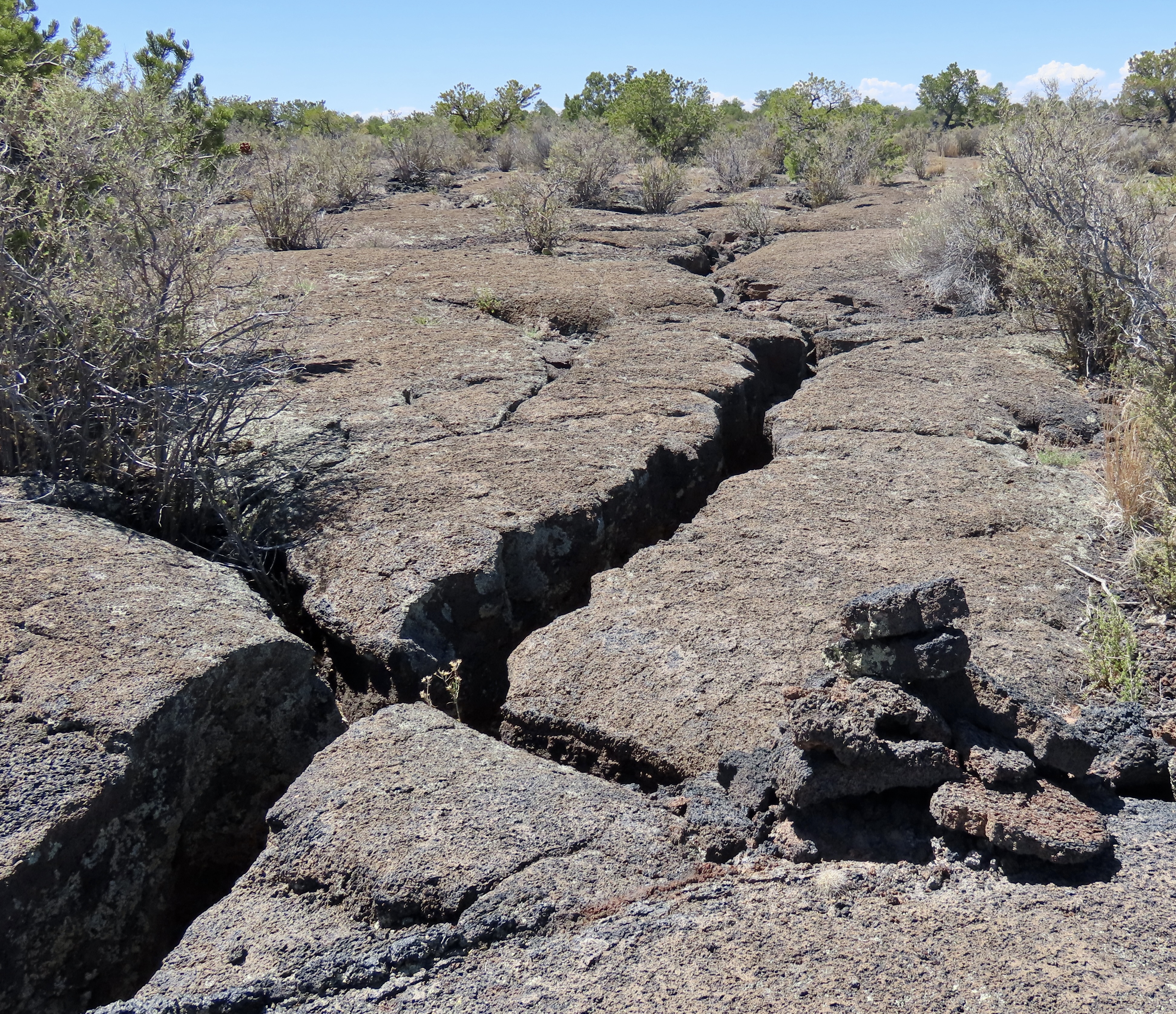
It’s amazing to me how “recently” pioneering and homesteading happened in the West. That was true about where my parents lived in western CO, where rough cabins were still being built in the 60s. I like El Malpais’s rock formations, which I suspect were used to mark trails for its early inhabitants. I like the explanation on “unconformity,” Curt. Another thing to capture the imagination. And finally – what a fantastic double rainbow. It always doesn’t look read. 🙂
I lived in Alaska from 1983-86 when homesteading officially ended, D. Plenty of the spirit of it still alive however where lots of folks still love the challenge and isolation involved in it. My son-in-law loves the TV shows that feature it. The distinctive rock formations and lack of vegetation would make it almost impossible to truly get lost in El Mapais, although you certainly could get into trouble! I first became aware of unconformity in the Grand Canyon where there are around 1.2 billion years of geological history missing!
Got to love a good rainbow. Grin.
I like TV shows about that too. It was a childhood fantasy to head out and live in the wilderness. I still like to play at it. 🙂
You and me, both, D! Although, I’m not sure about the homesteading part. Lot of work there. It would interfere with my wandering ways. Grin. Sorry for this long overdue response. I’ve been going through older comments and discovering some I missed. My apologies.
No worries. At least you find them. I can’t guarantee that I do.
I almost didn’t. Definitely feel guilty when I miss one. Grin.
That is an outstandingly fabulous last shot, Curt. Gorgeous catch on that rainbow!
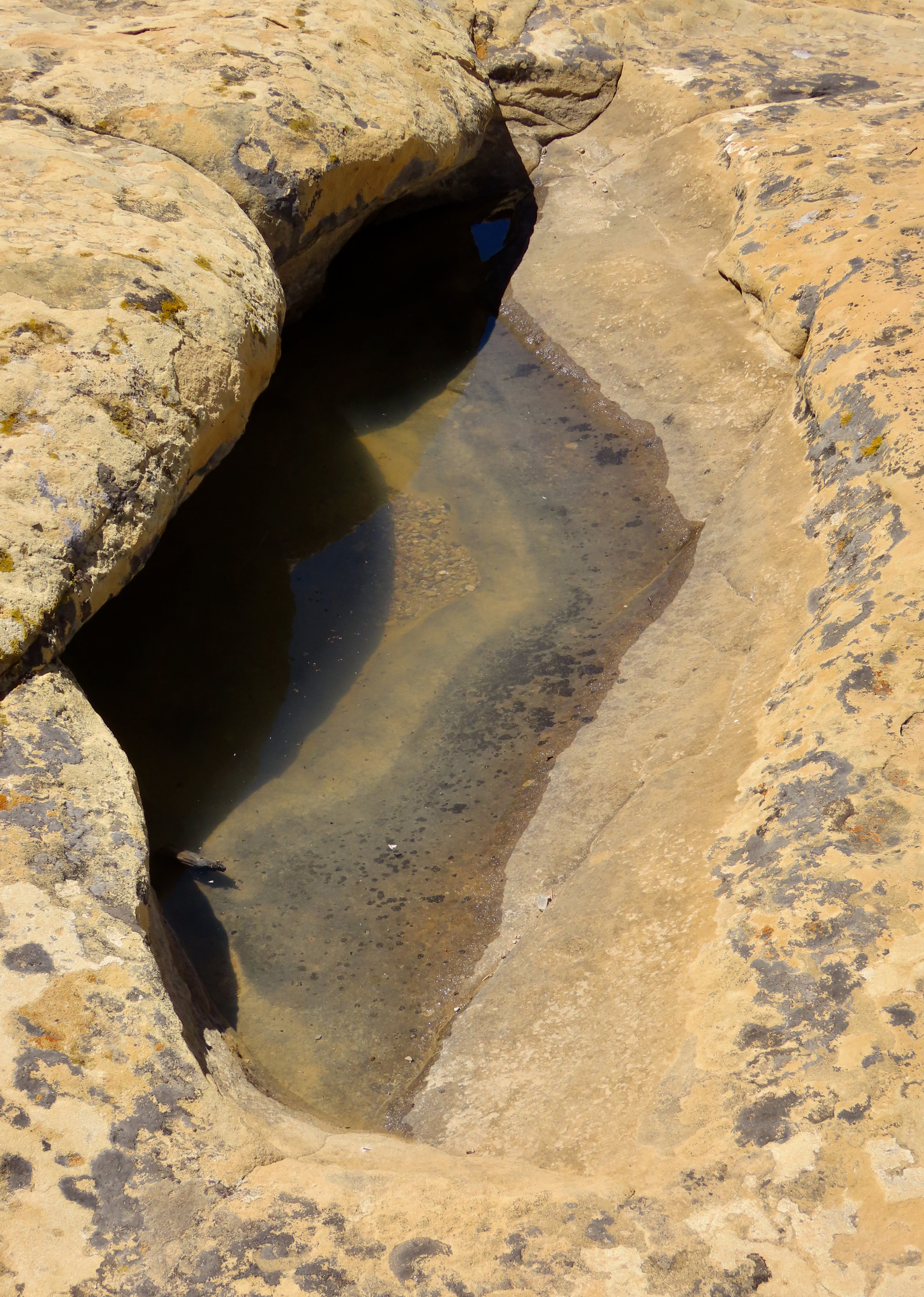
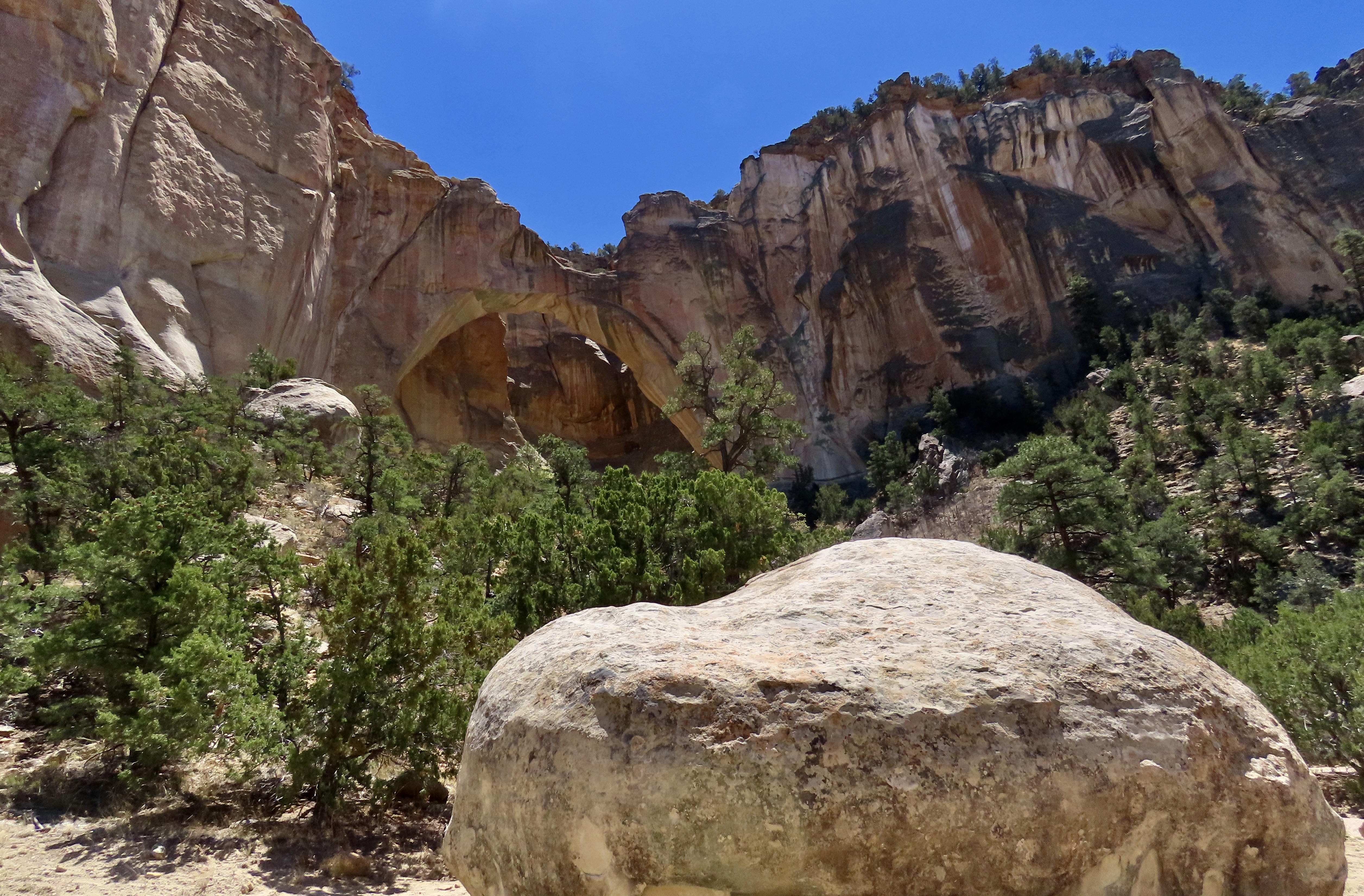
Your perspective on so many rock formations is the best part about these posts. The way you and Peggy spot things via your imaginations is so entertaining. The water catchments in the rocks is a marvelous way for nature to provide. Those spots must have had some good trails to them when people who lived there relied on them.
Thanks, Crystal. I became fascinated with rocks as a child when I would wander around exploring deer trails, creeks, etc. filling all of my pockets with rocks I found interesting. My pants would almost fall off. 😳
No doubt about the trails to the catchments. I’m pretty sure that the Ancestral Puebloans would have been delighted to have water they didn’t have to climb down off of their mesa’s in order to get a drink!