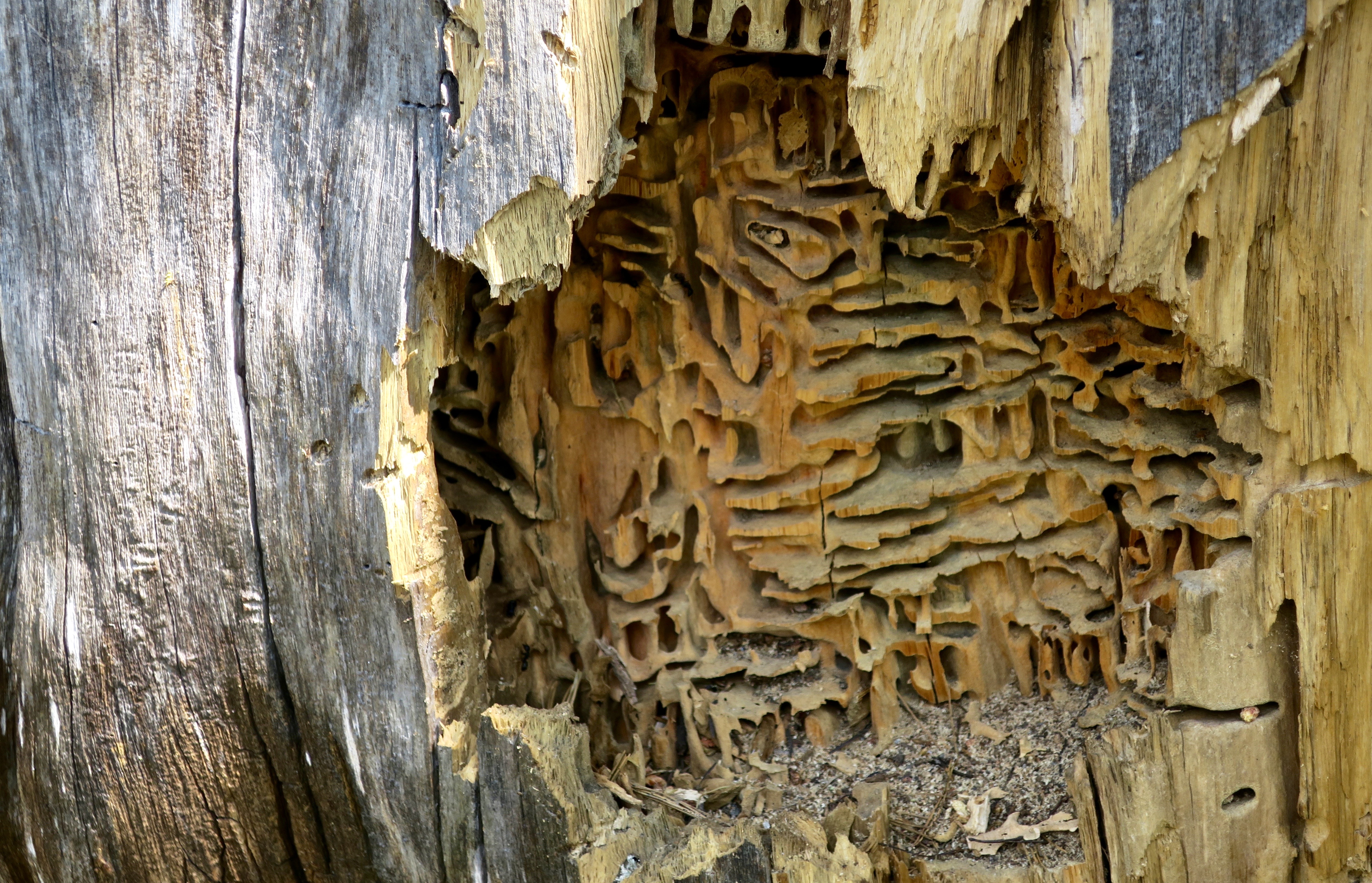
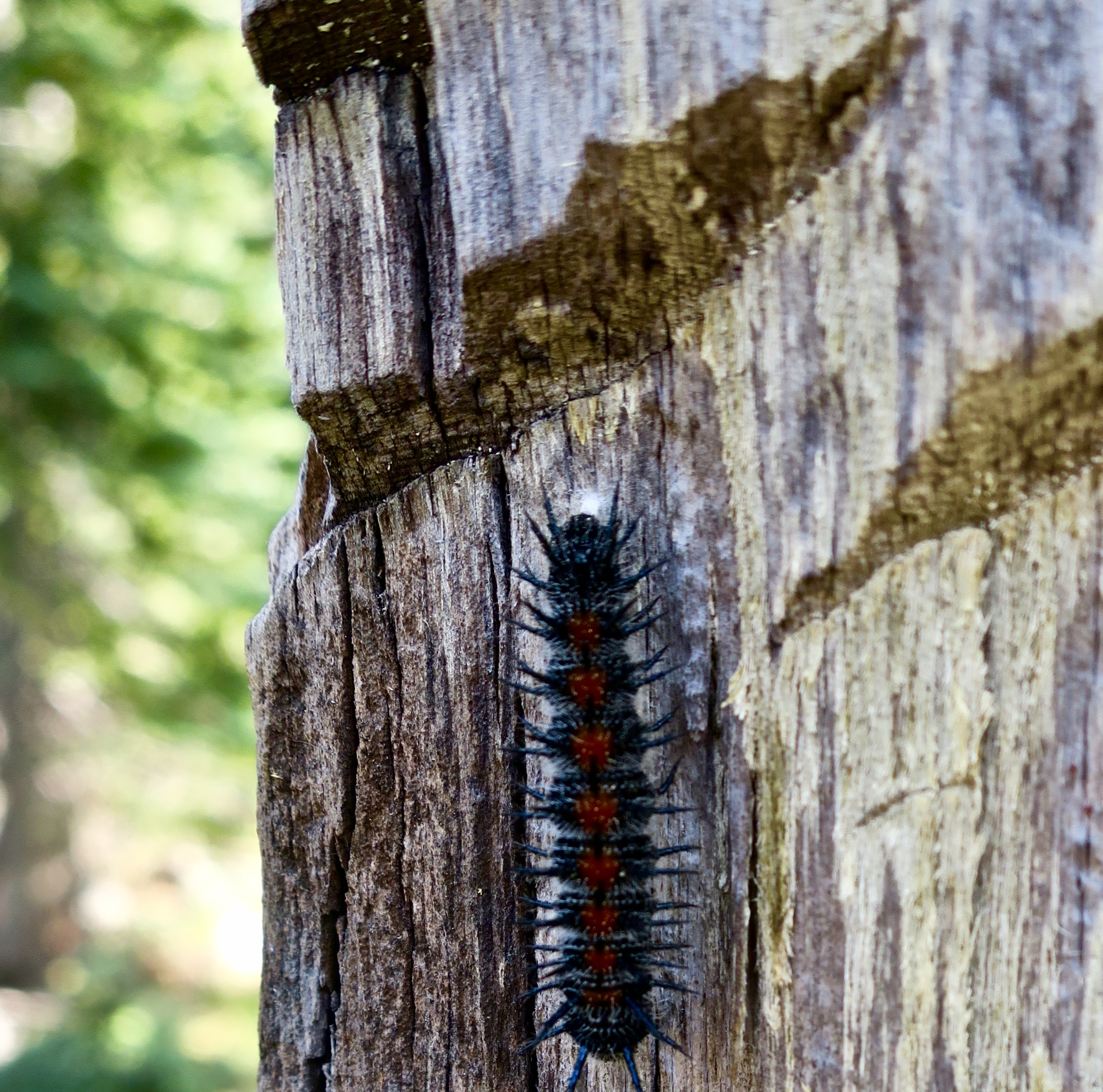
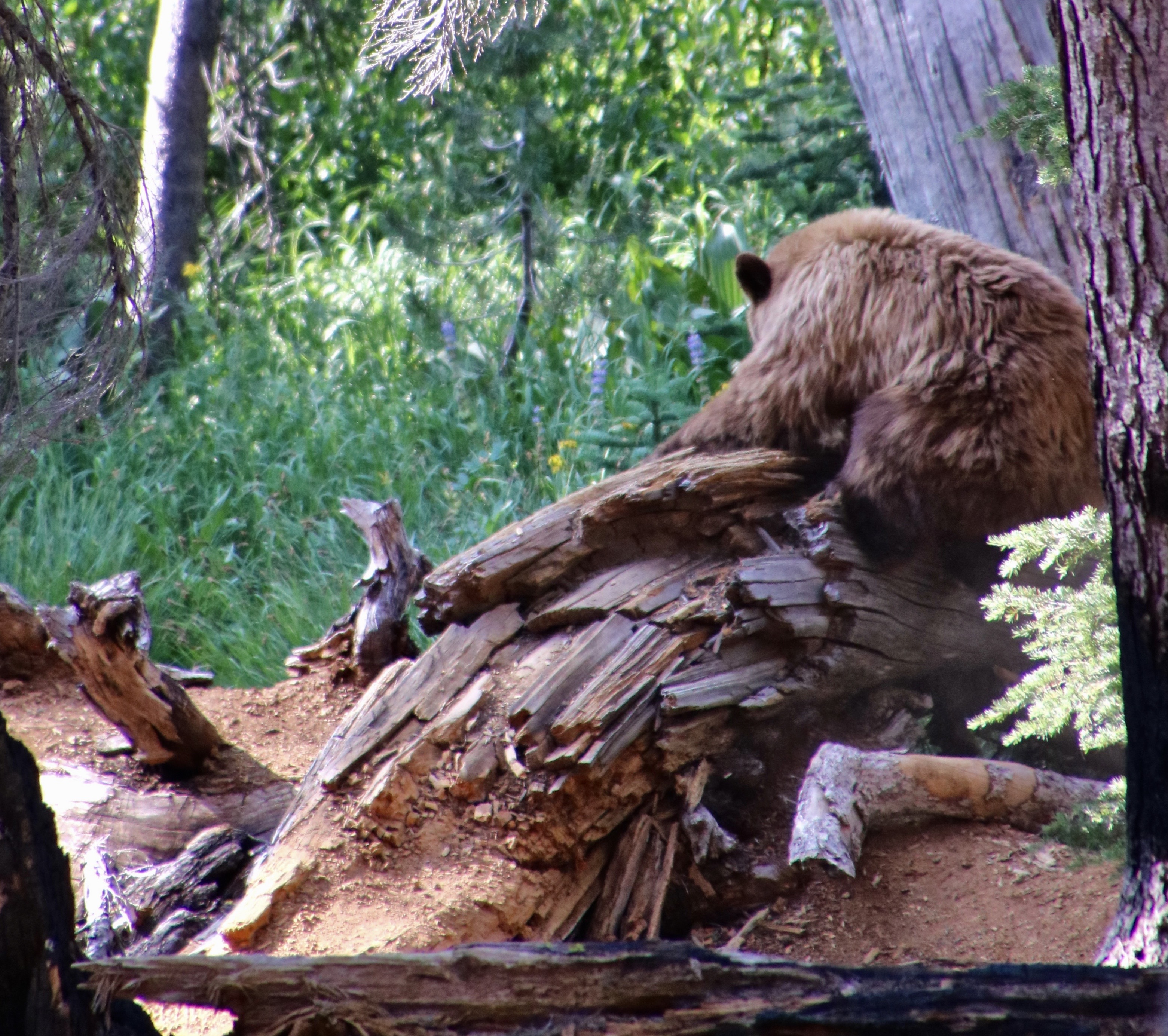
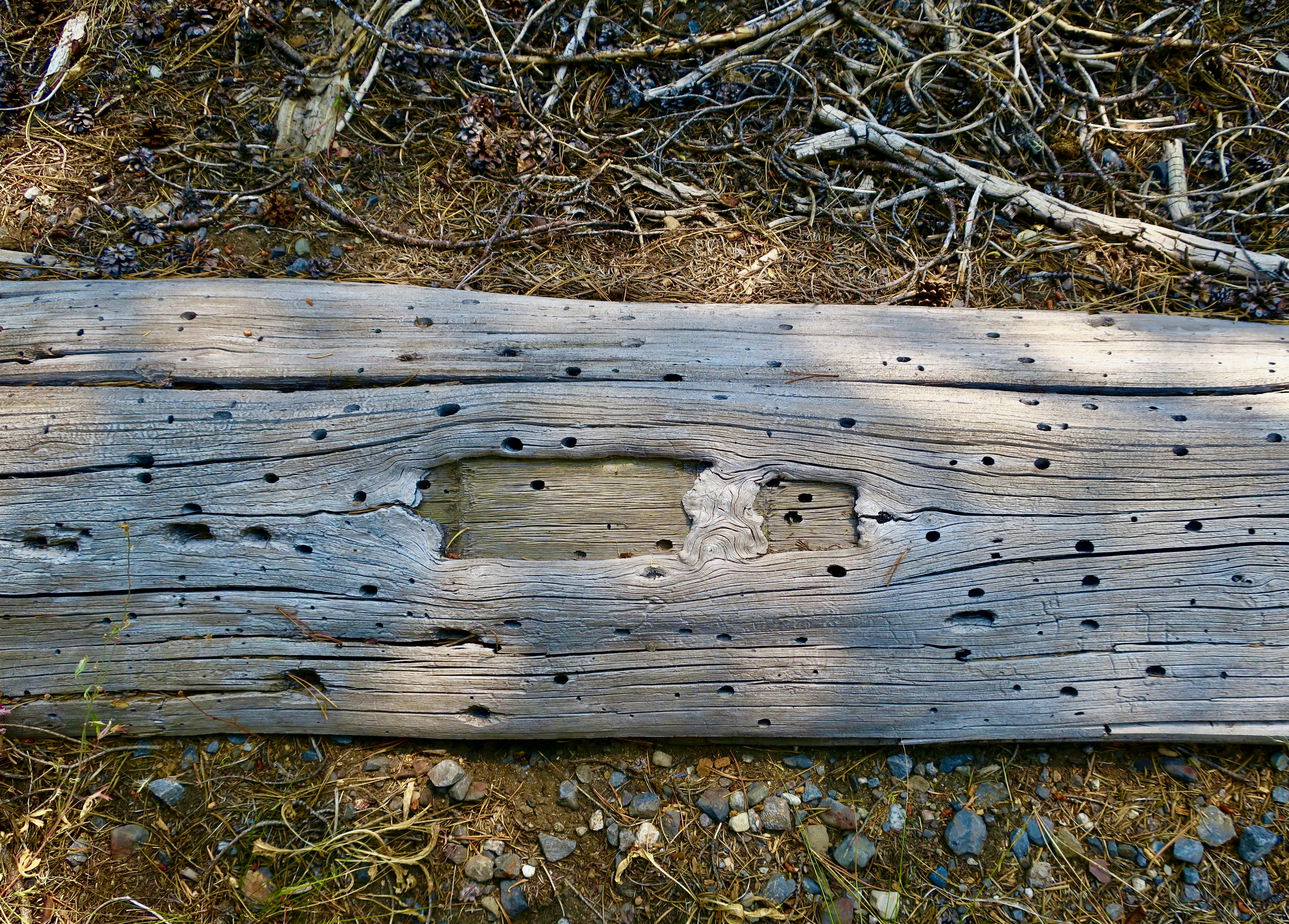
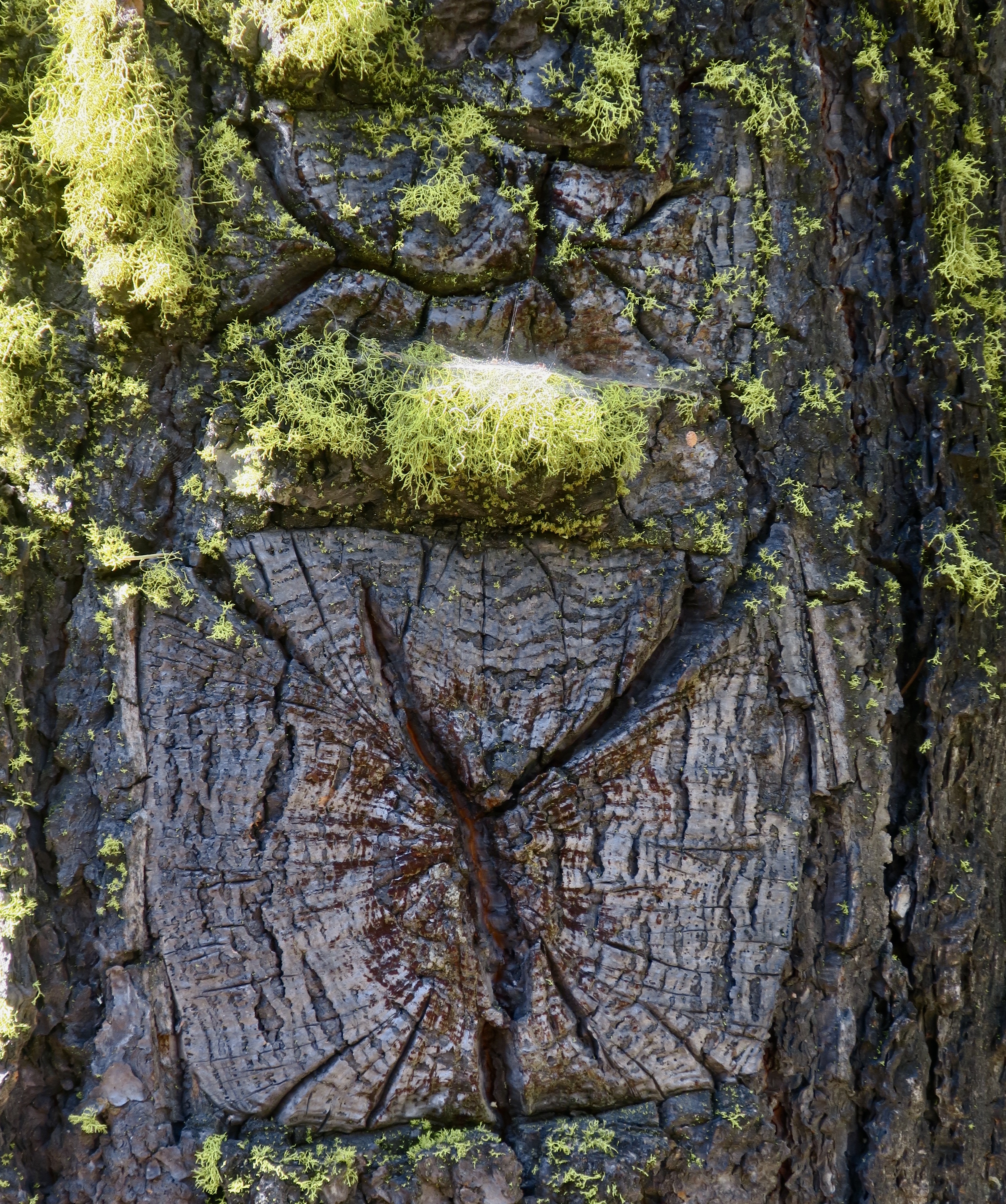
There is a fascinating world to be discovered on America’s pubic lands. For example, you will occasionally find a pile of sawdust next to a dead tree. Odds are that carpenter ants have been at work building an apartment complex. This ‘cut-away’ view in Granite Chief Wilderness provides an inside view of their home. If you are lucky, you will see the ants plying their carpenter trade. They appear out of a crack or hole in the wood with mandibles filled with sawdust, which they drop on their pile and then return to chew/break out another load. Unlike termites, they don’t actually eat the wood. The ants provide a valuable service in the forest breaking down dead wood (not so valuable when it’s the lumber in your house).So, who or what opened up the tree? Clue, it wasn’t me. Nor was it the caterpillar, obviously. I photographed it just above the ant apartment complex for perspective on the size of the slashes just above it. They tell the tale. They are bear claw marks. A bear had torn open the log for breakfast. Or was it lunch?While I was backpacking through Lassen National Park on my 750 mile/75th birthday trek in 2018, Peggy caught this photo of a bear and her cubs opening up a log on a trail near the park’s road. “Dust and wood were flying everywhere!” she told me. Peggy quickly vacated the premises. You do not want to get close to a mama bear with cubs!
Today, Peggy and I are continuing our series on national parks, monuments, wilderness areas and other public lands with an emphasis on their unique beauty, geology, flora, fauna and history that makes them so important to us today— and to our children, grandchildren and future generations. I can only repeat how vital it is at this point in history to let decision makers know how we feel about protecting and maintaining public lands.
In my last post, I discussed a bill by Republican Senator Mike Lee of Utah to be included in President Trump’s “Big Beautiful Bill” that would require the government to sell of 50-75% of BLM and National Forest Lands in America over the next five years. Here’s what the Southern Utah Wilderness Association has to say about the bill:
It bypasses public process, allowing public land to be sold with minimal transparency, and depriving the public of input on the future of their public lands. It also bypasses any environmental, cultural resources or endangered species reviews.
While Senator Lee attempts to make his bill more palatable by claiming that it will create opportunities for affordable housing, it does no such thing. There is no requirement that any housing developed on sold public lands would be affordable or meet any affordable housing requirements.
There is no provision to prevent lands sold under Lee’s bill from being developed into high-end vacation homes, Airbnbs, or luxury housing projects, which would be especially desirable near scenic or high-demand areas.
The bill will primarily benefit real estate developers and speculators rather than addressing real housing needs.
The Pacific Crest Trail Association also noted this week that the bill would have serious implications for the PCT by blocking access to the public lands that the trail now crosses over. The 750 mile trip I did for my 75th birthday would not be possible. But that’s nothing compared to the millions upon millions of people who would forever lose future access to these lands that now belong to all of us. Please, let your Senator know Lee’s bill will do irreparable damage.
But, now on to my post about hiking through the Granite Chief Wilderness on the Pacific Crest Trail.
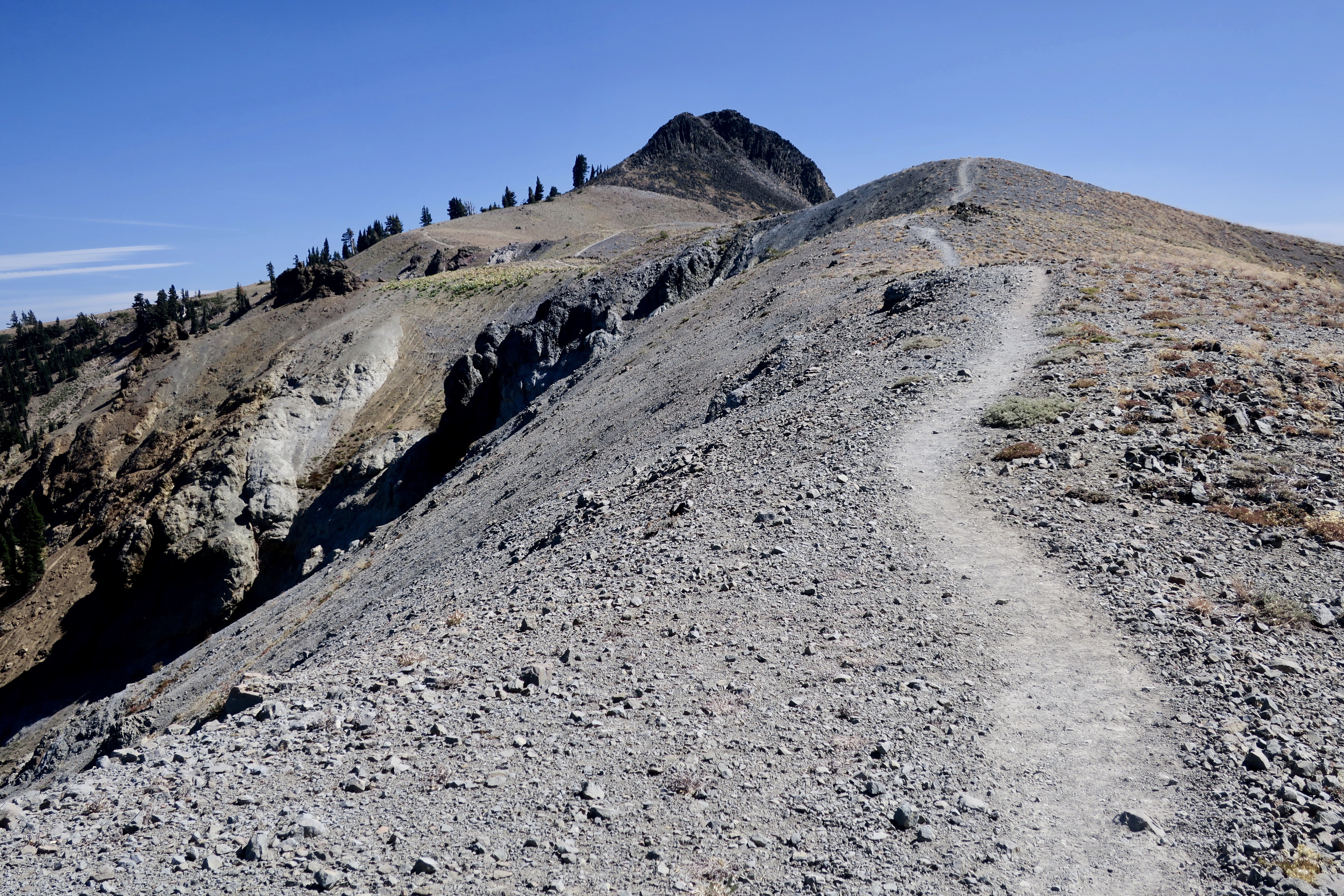
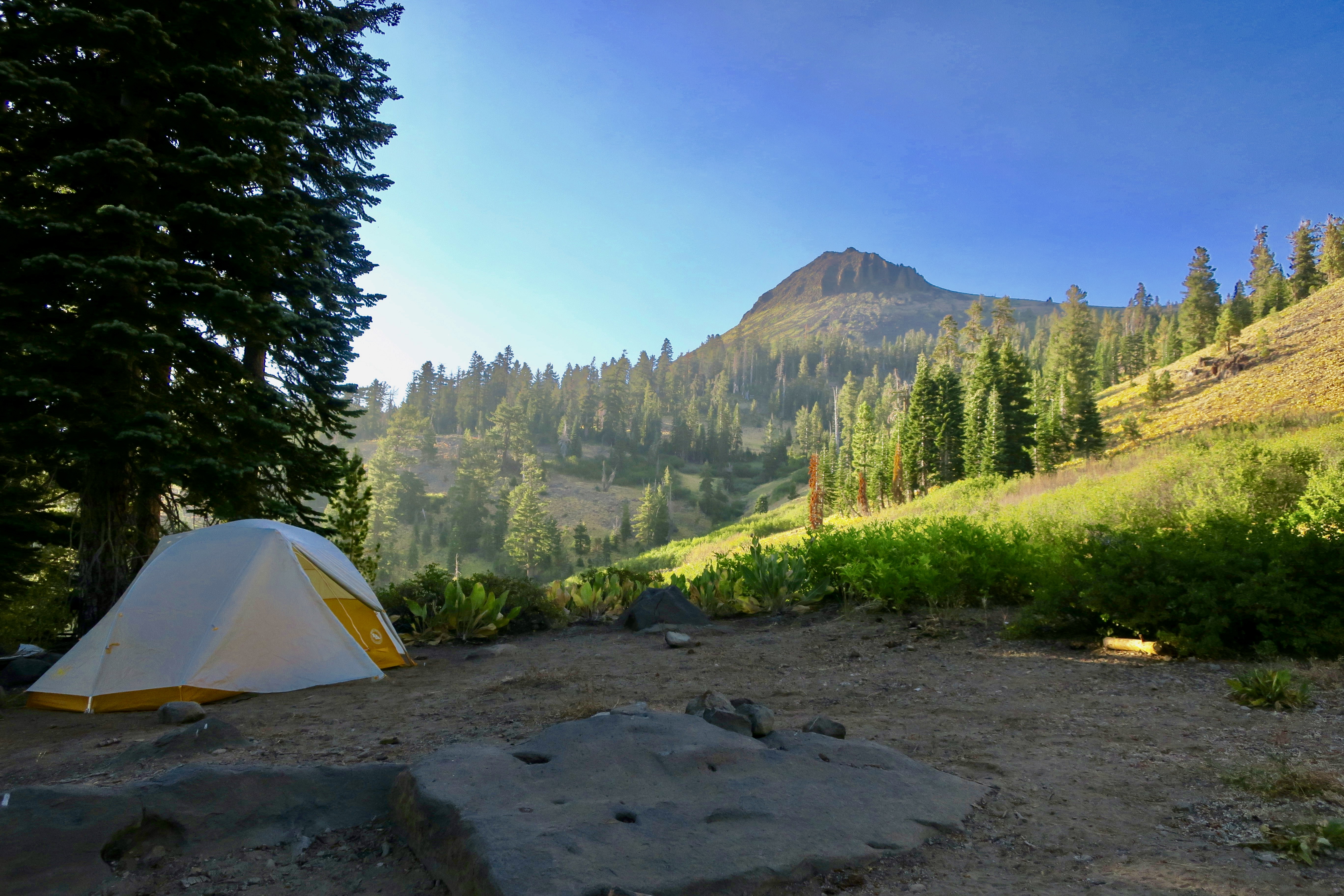
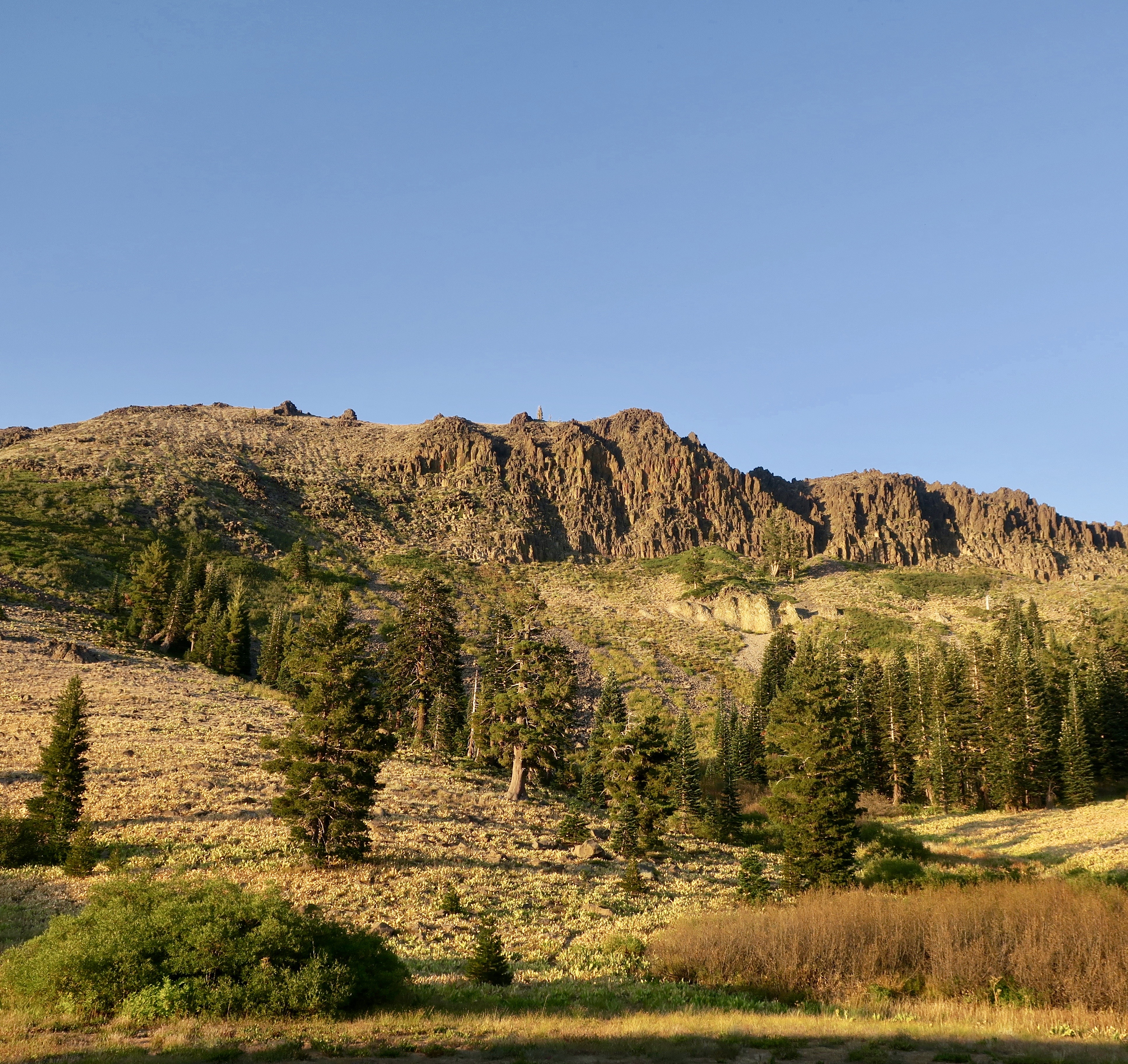
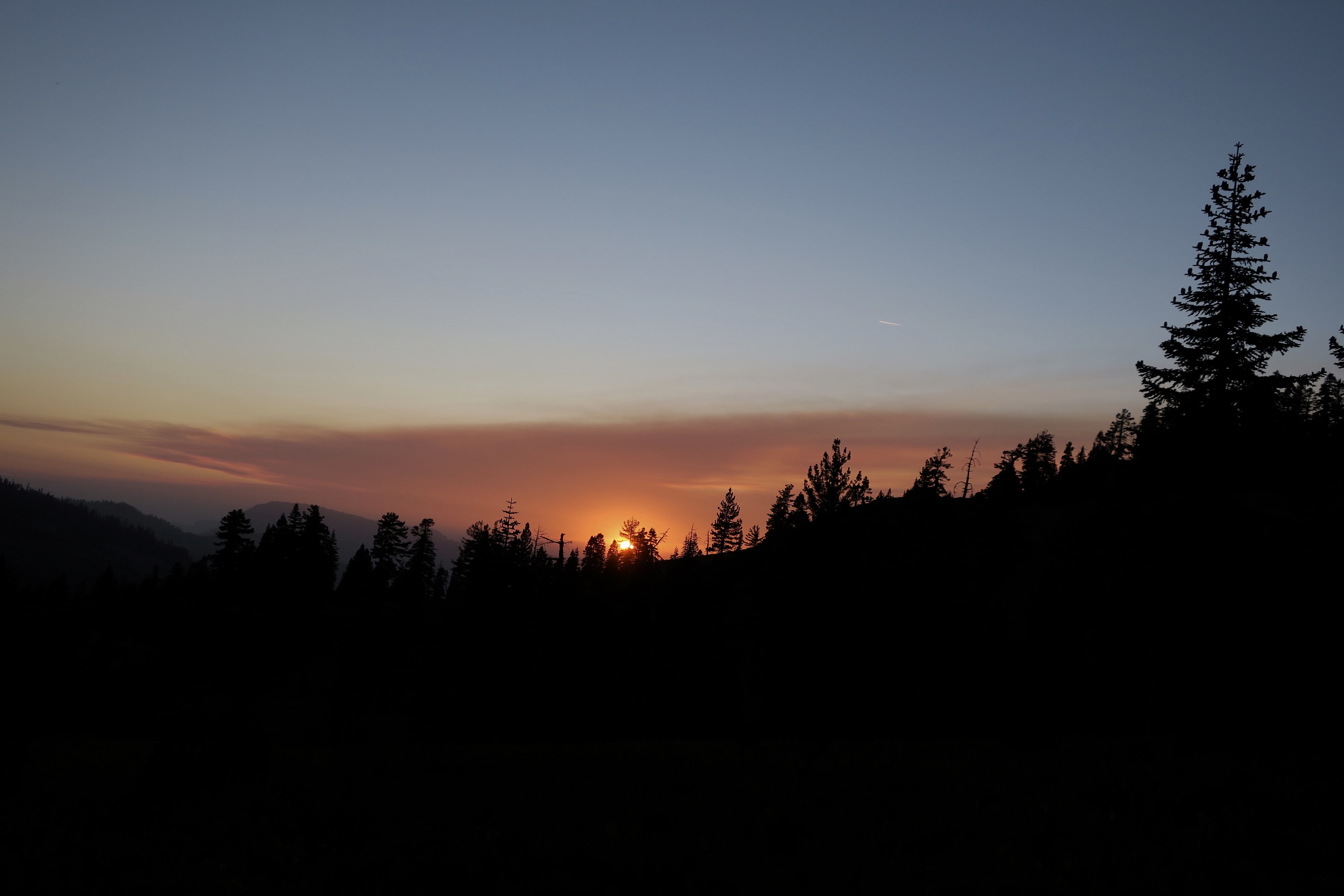
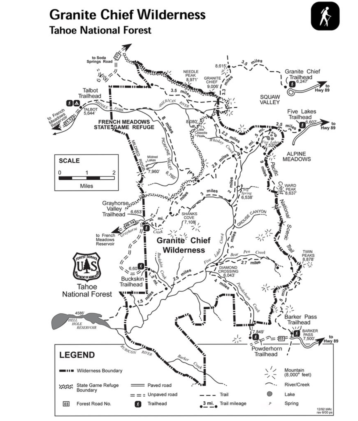
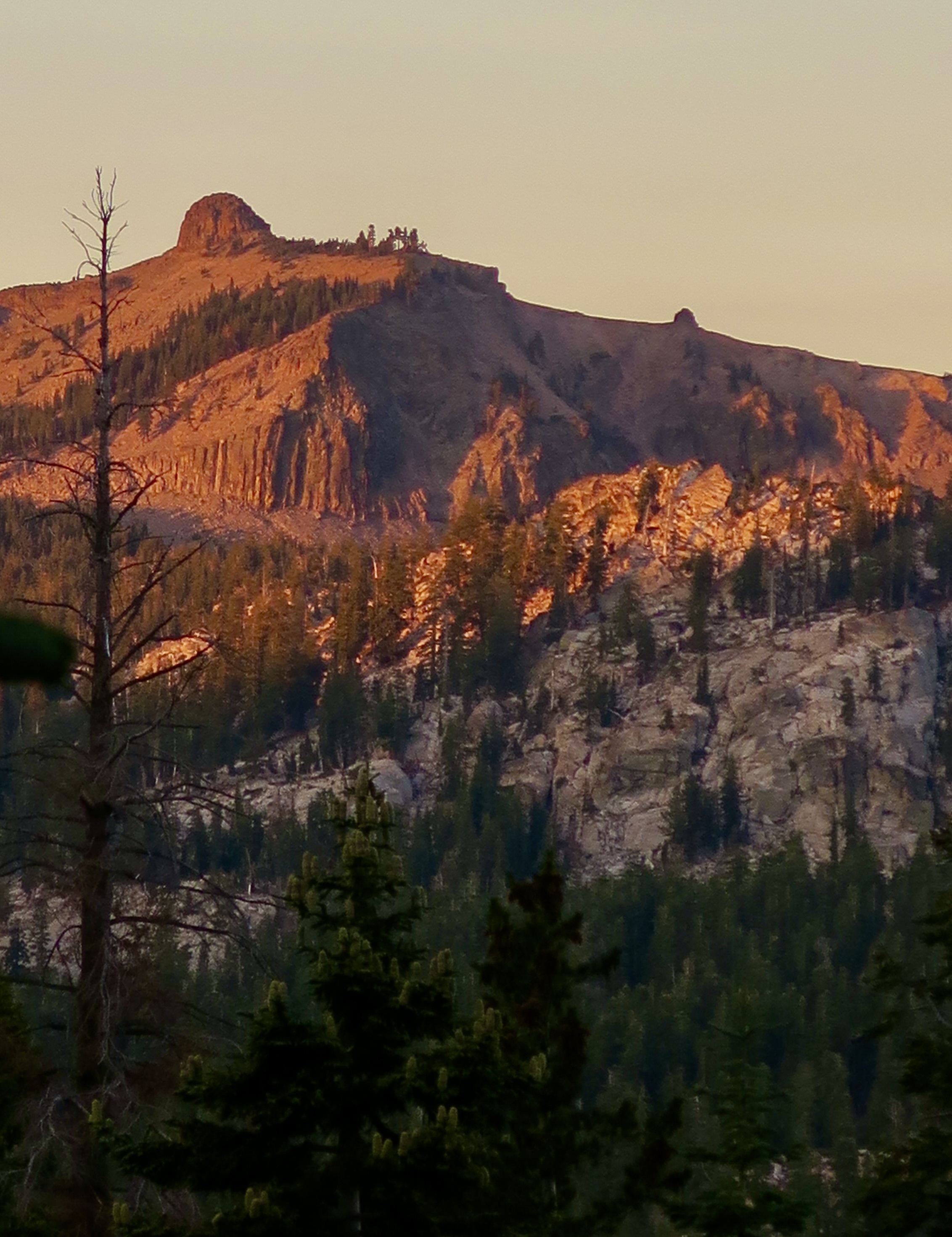
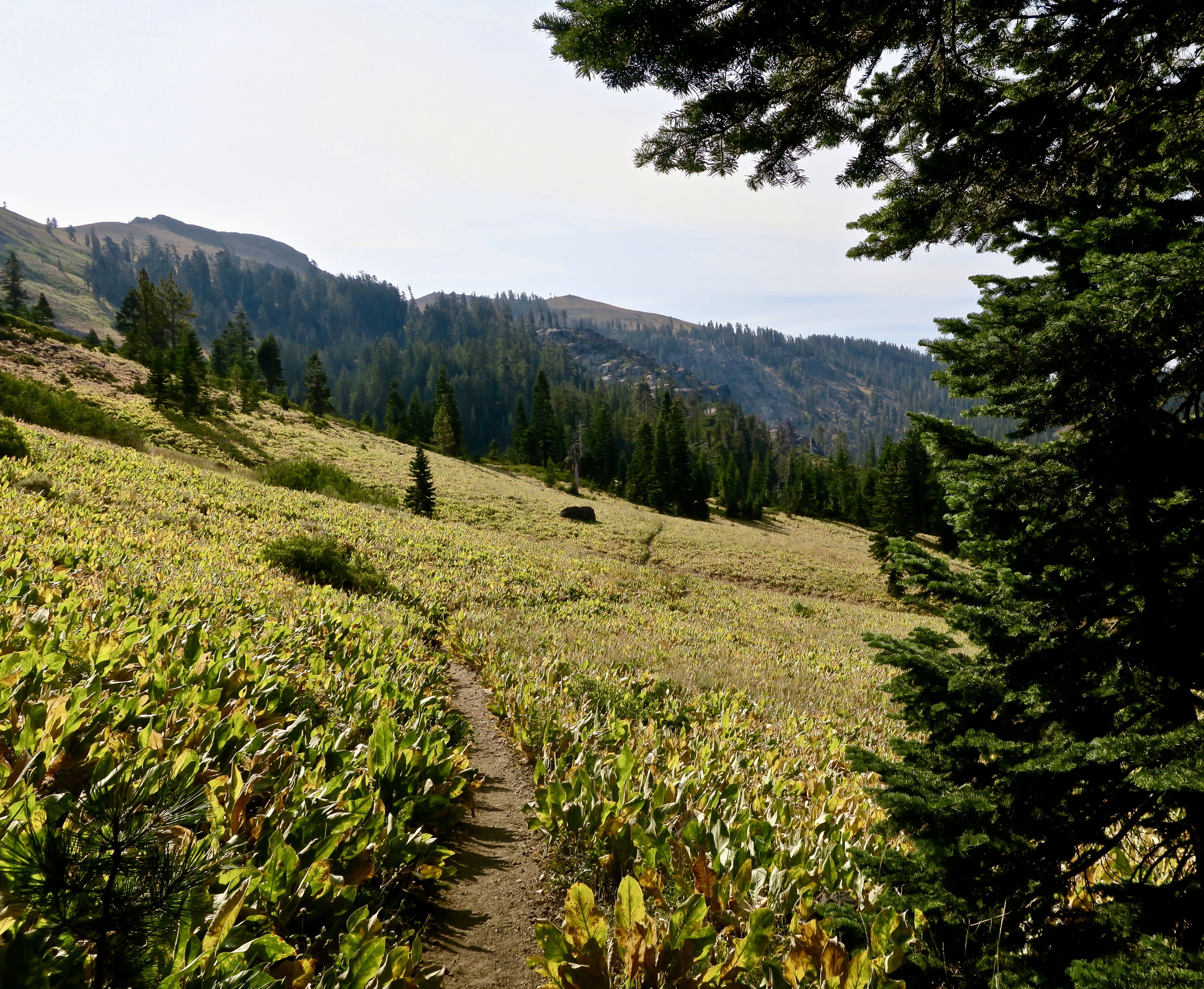
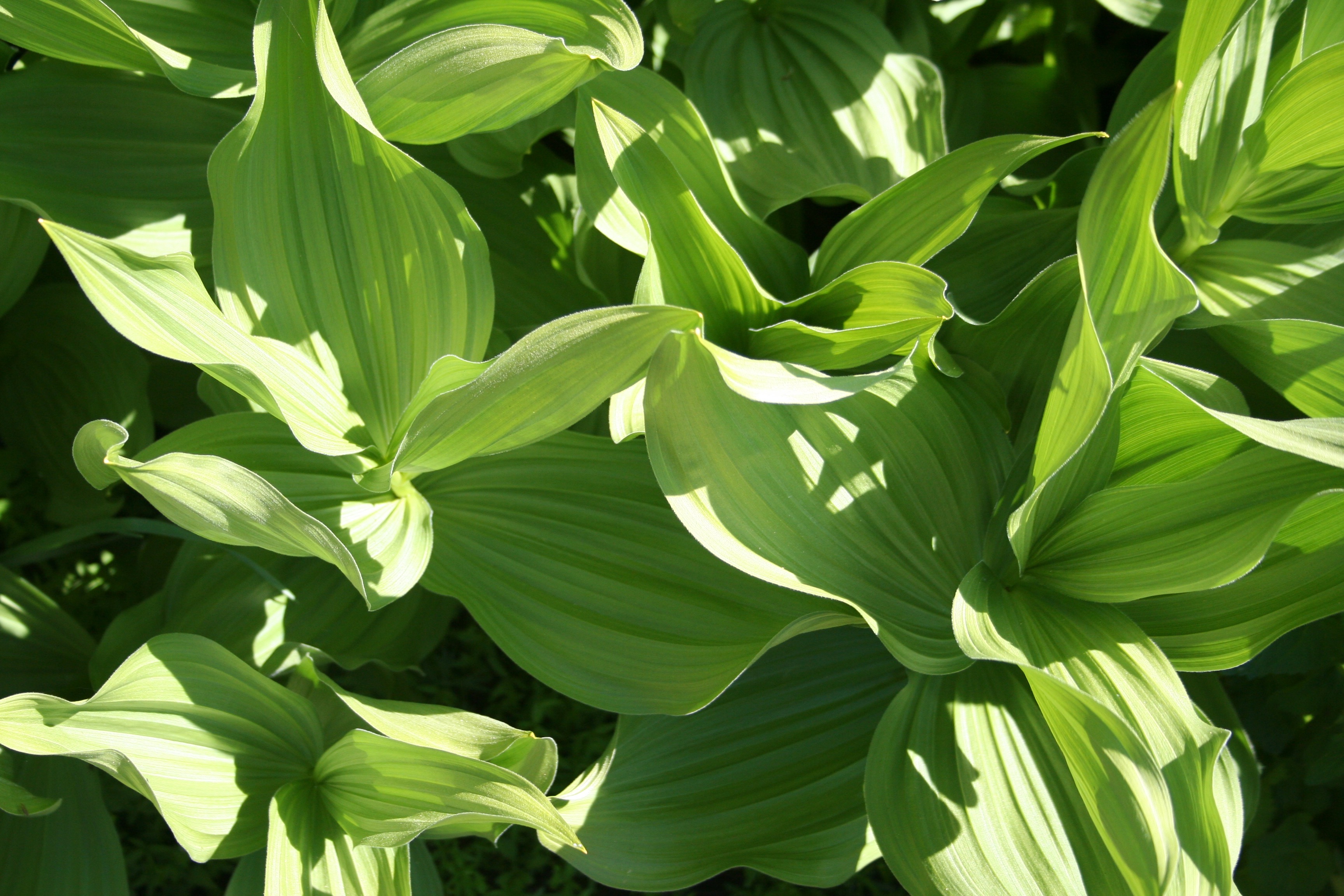
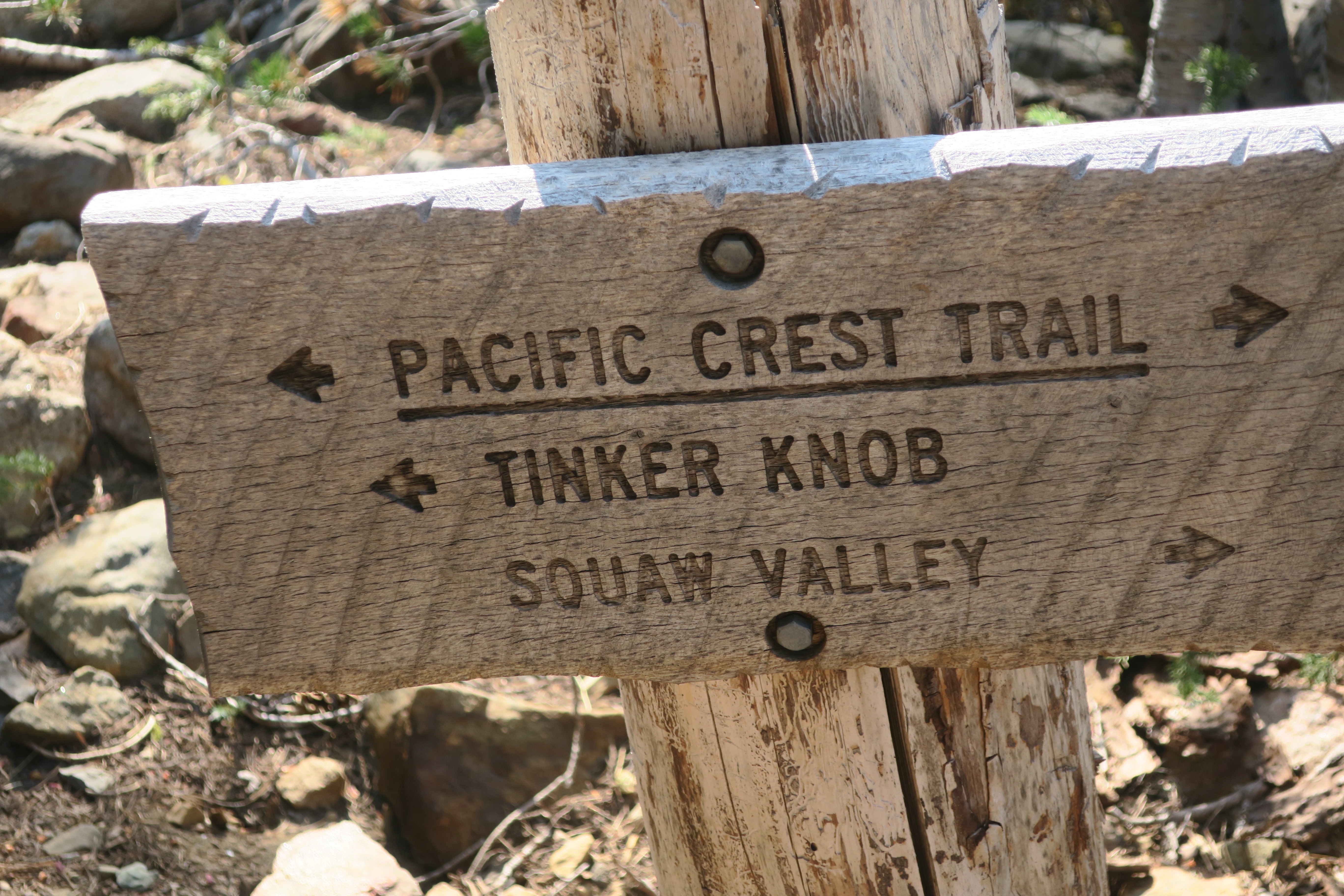
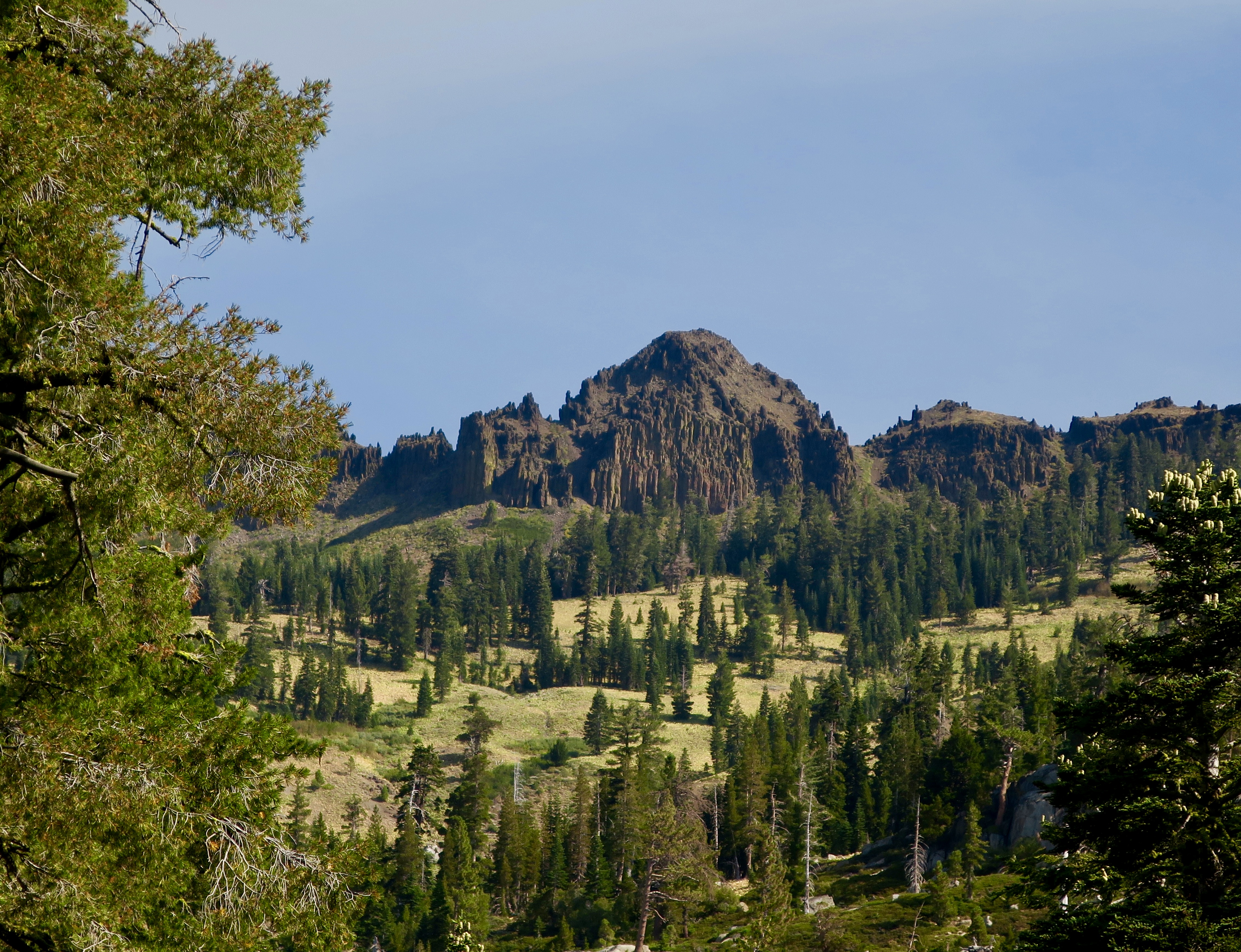
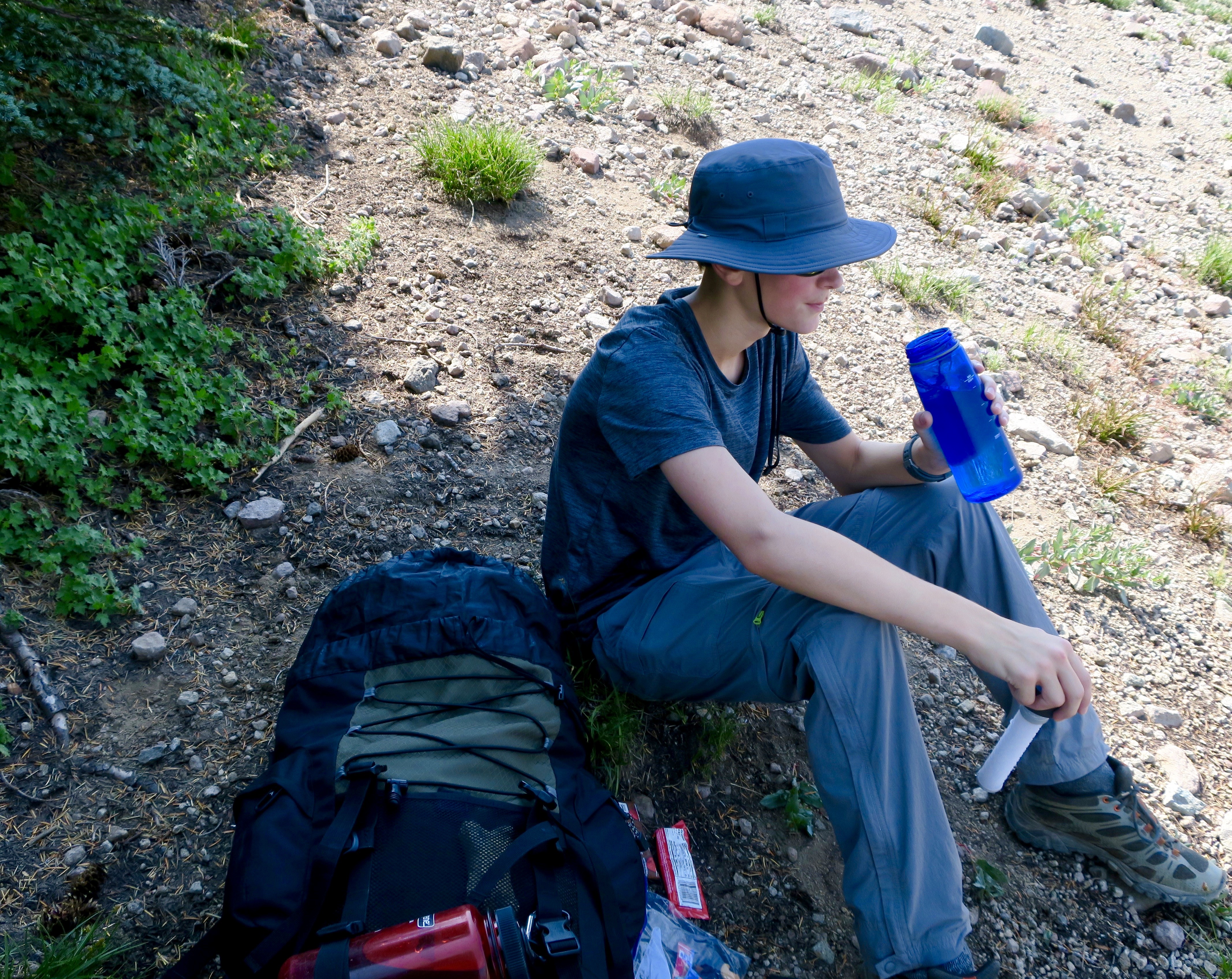
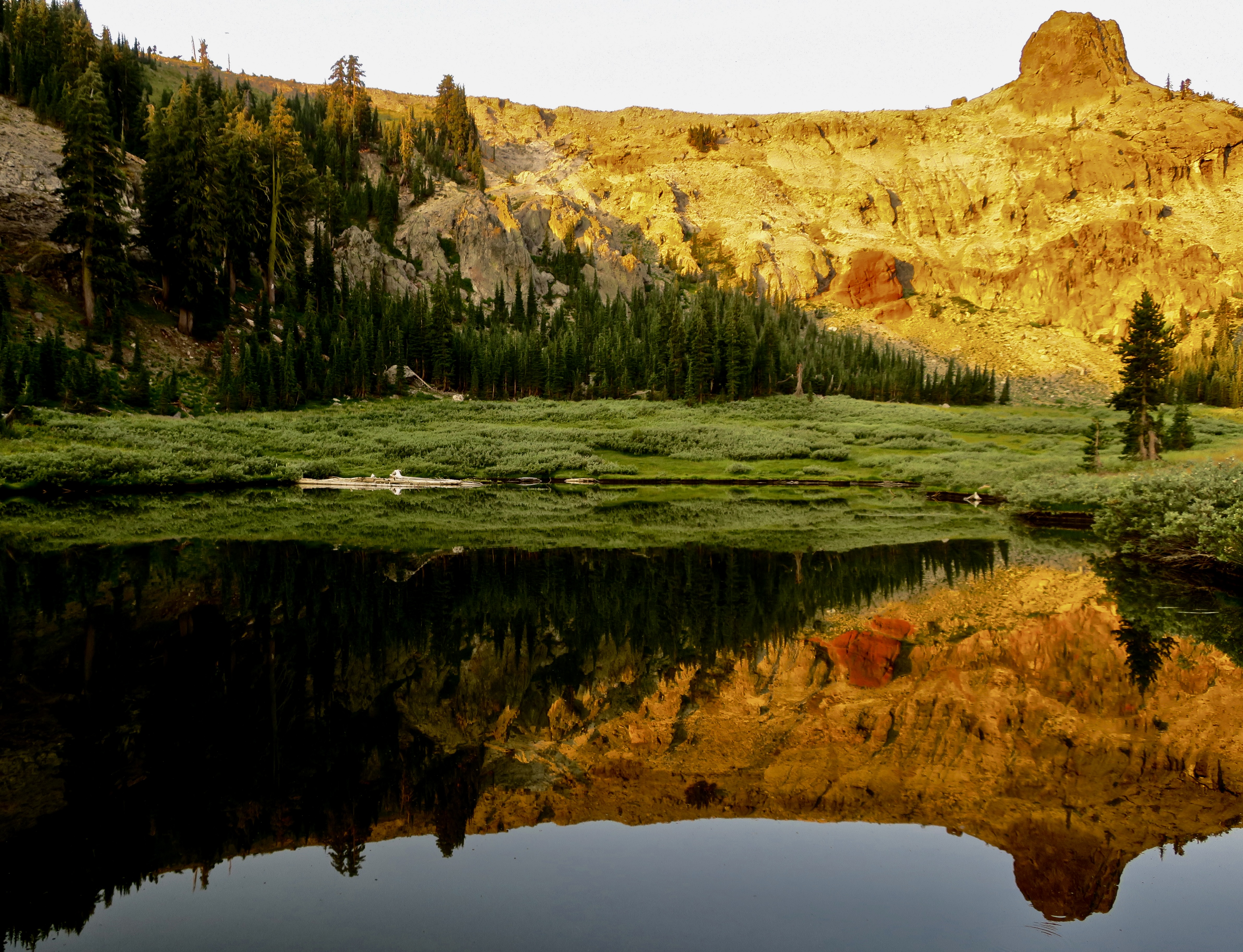
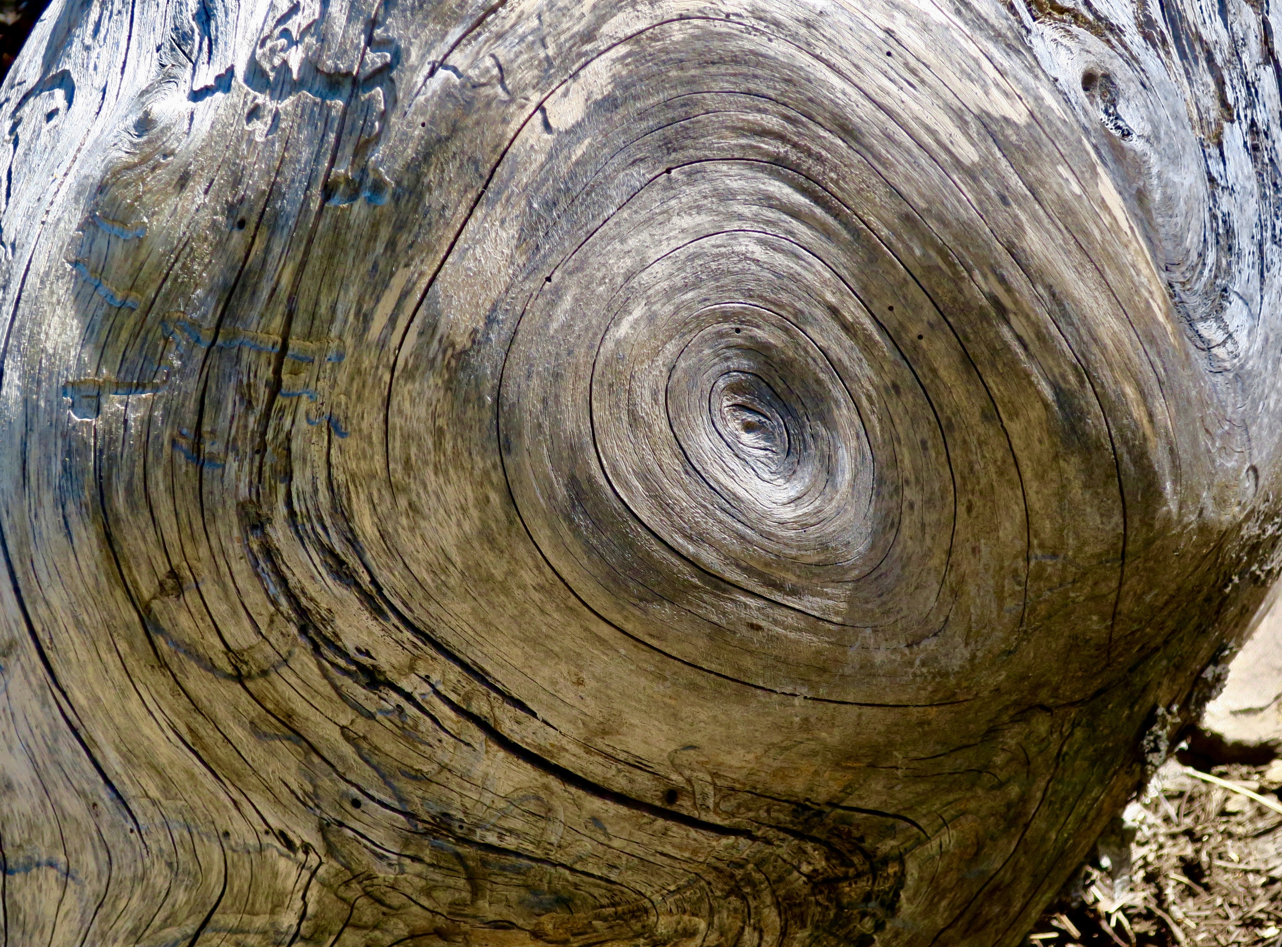
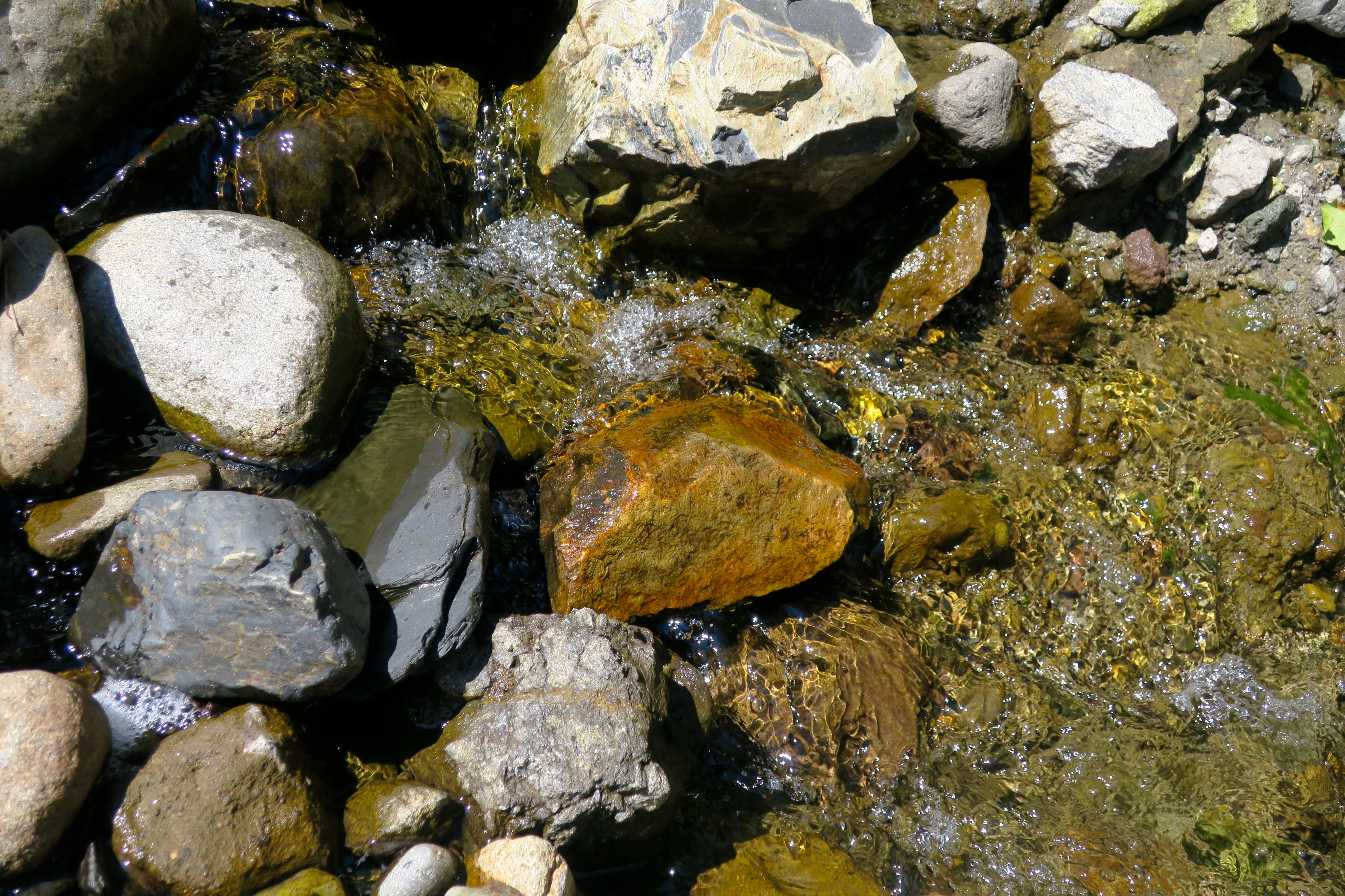
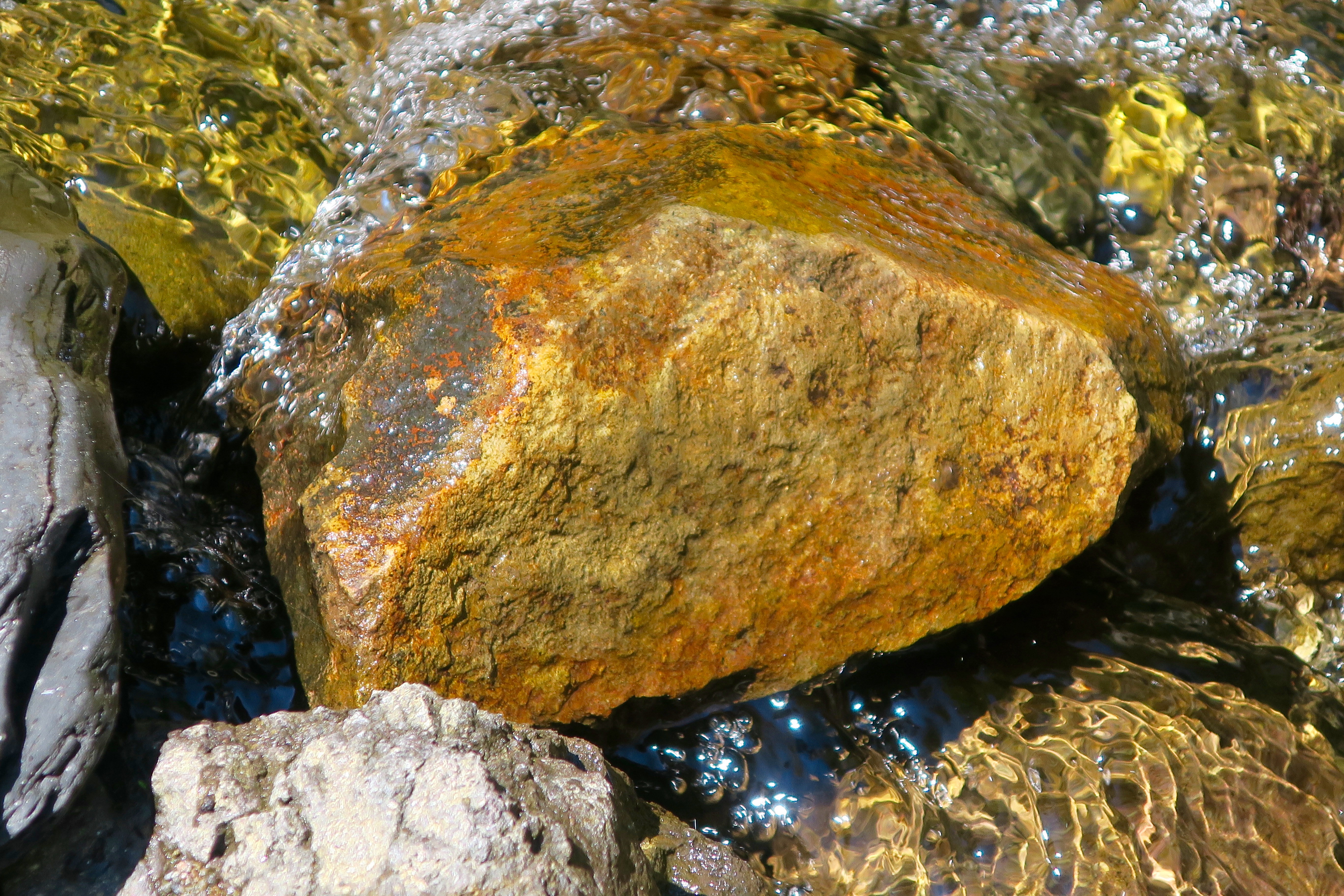
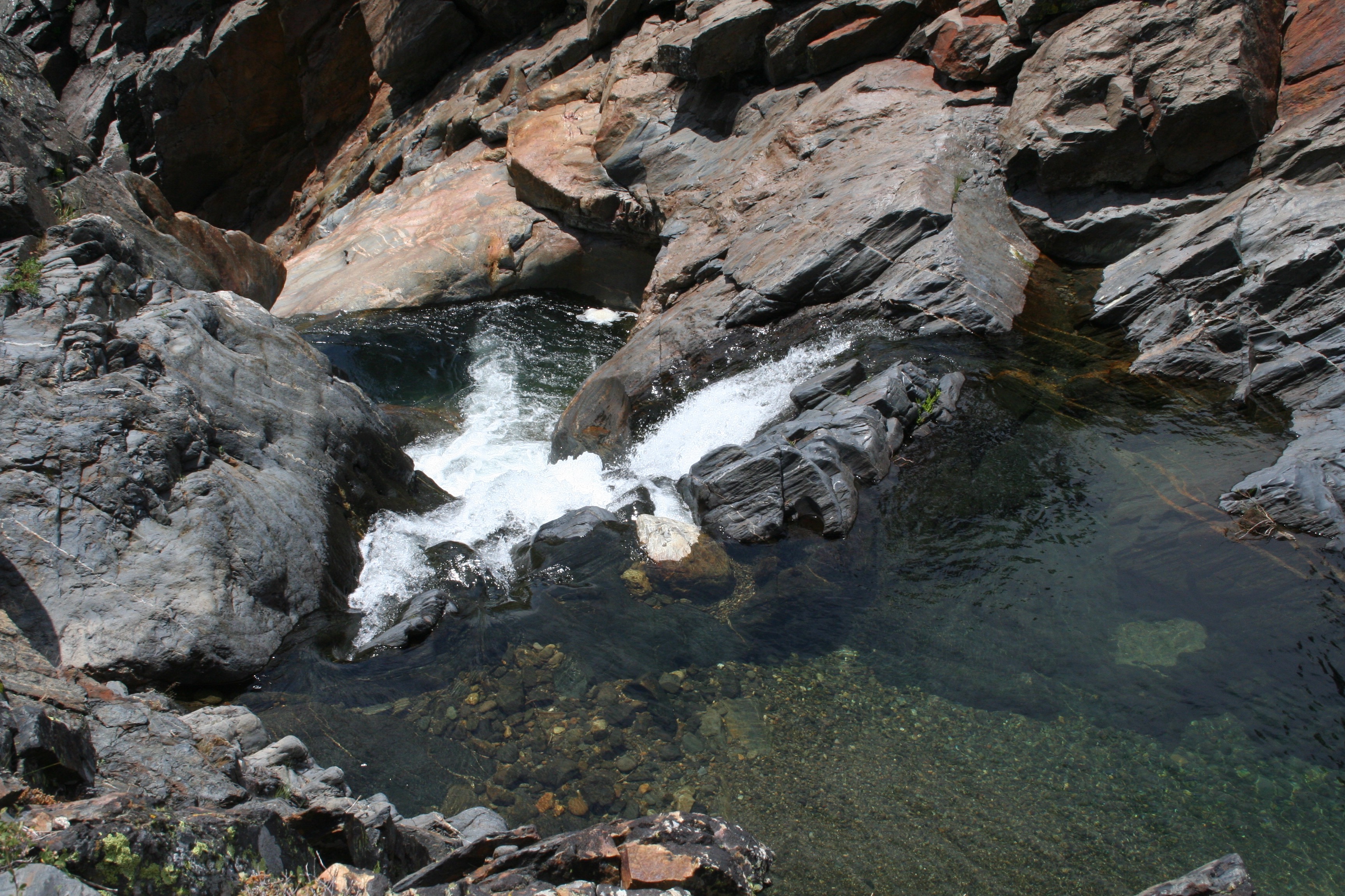
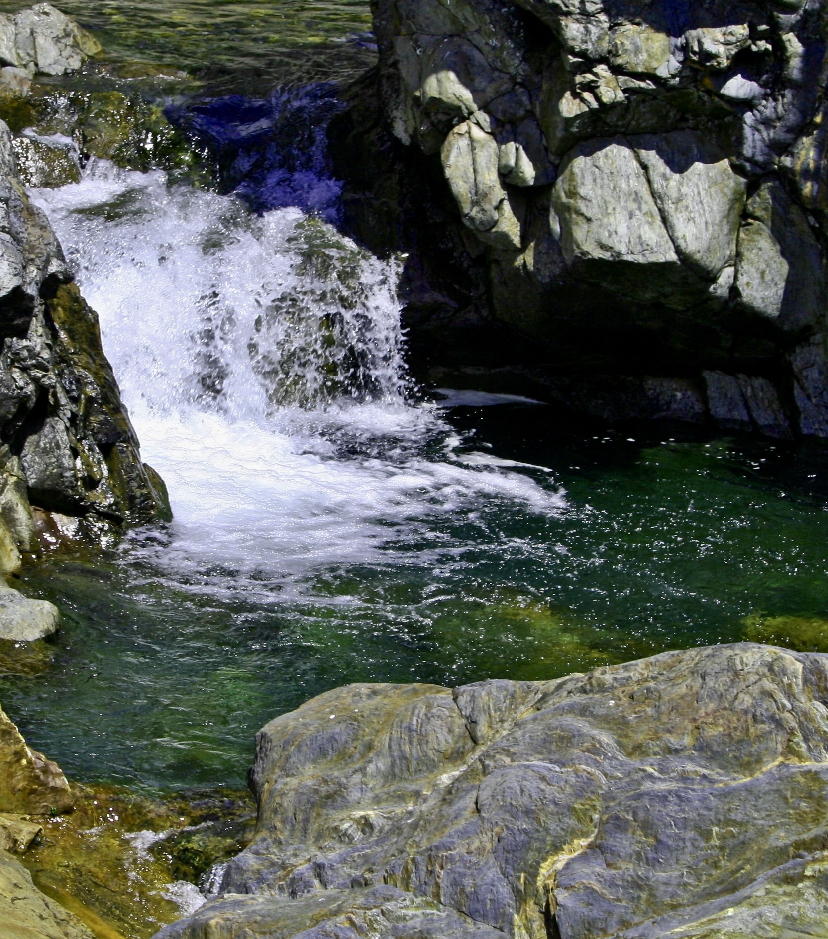
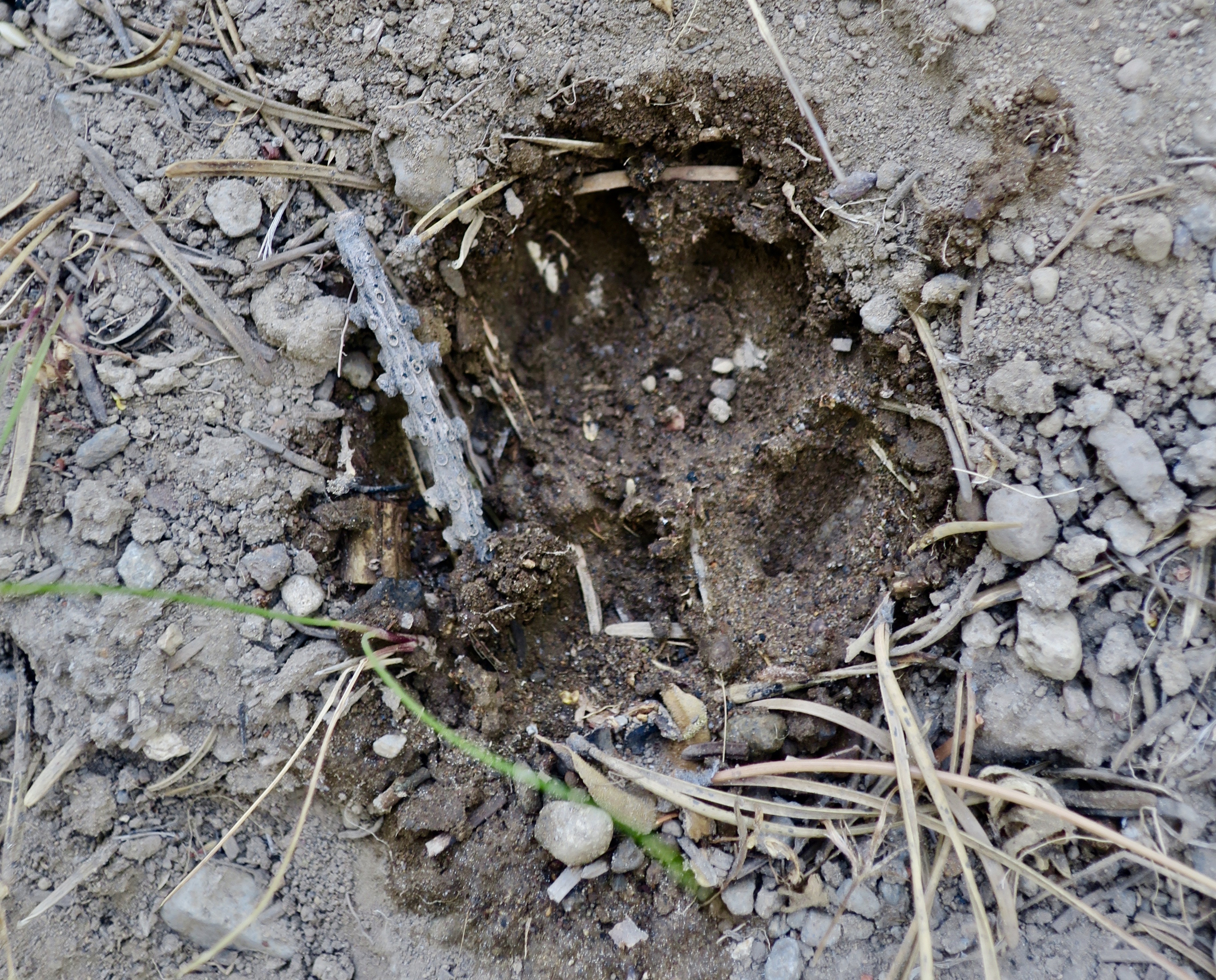
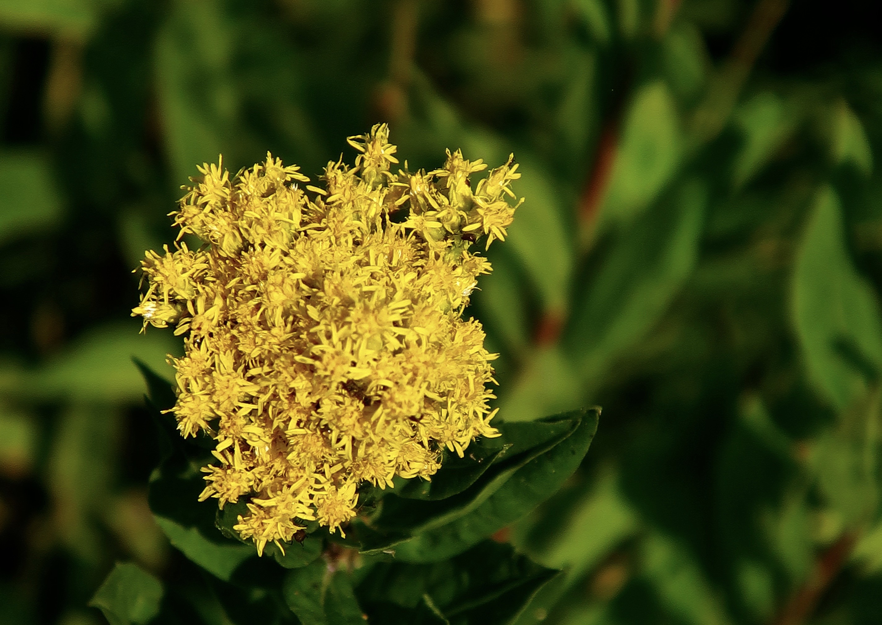
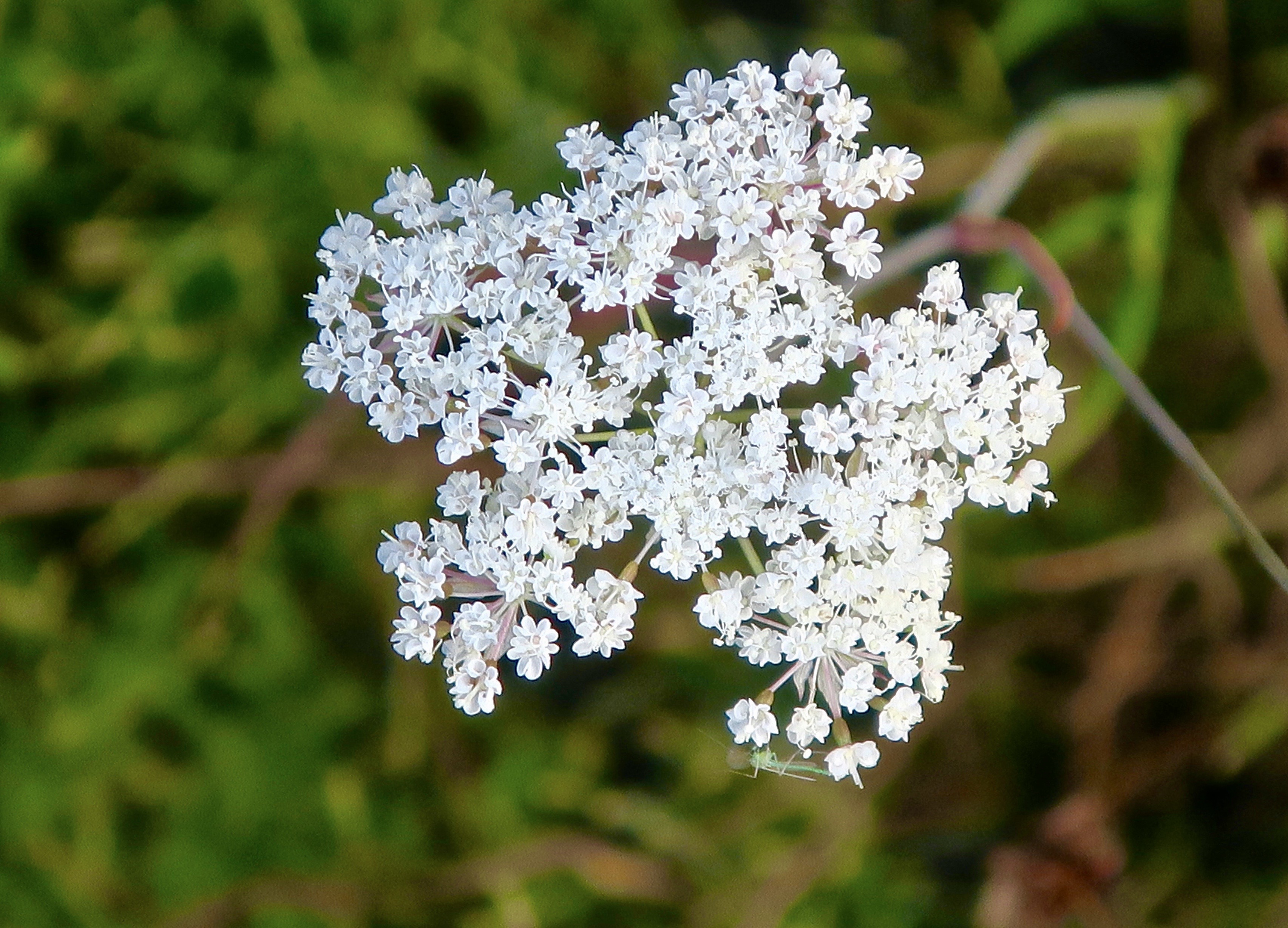
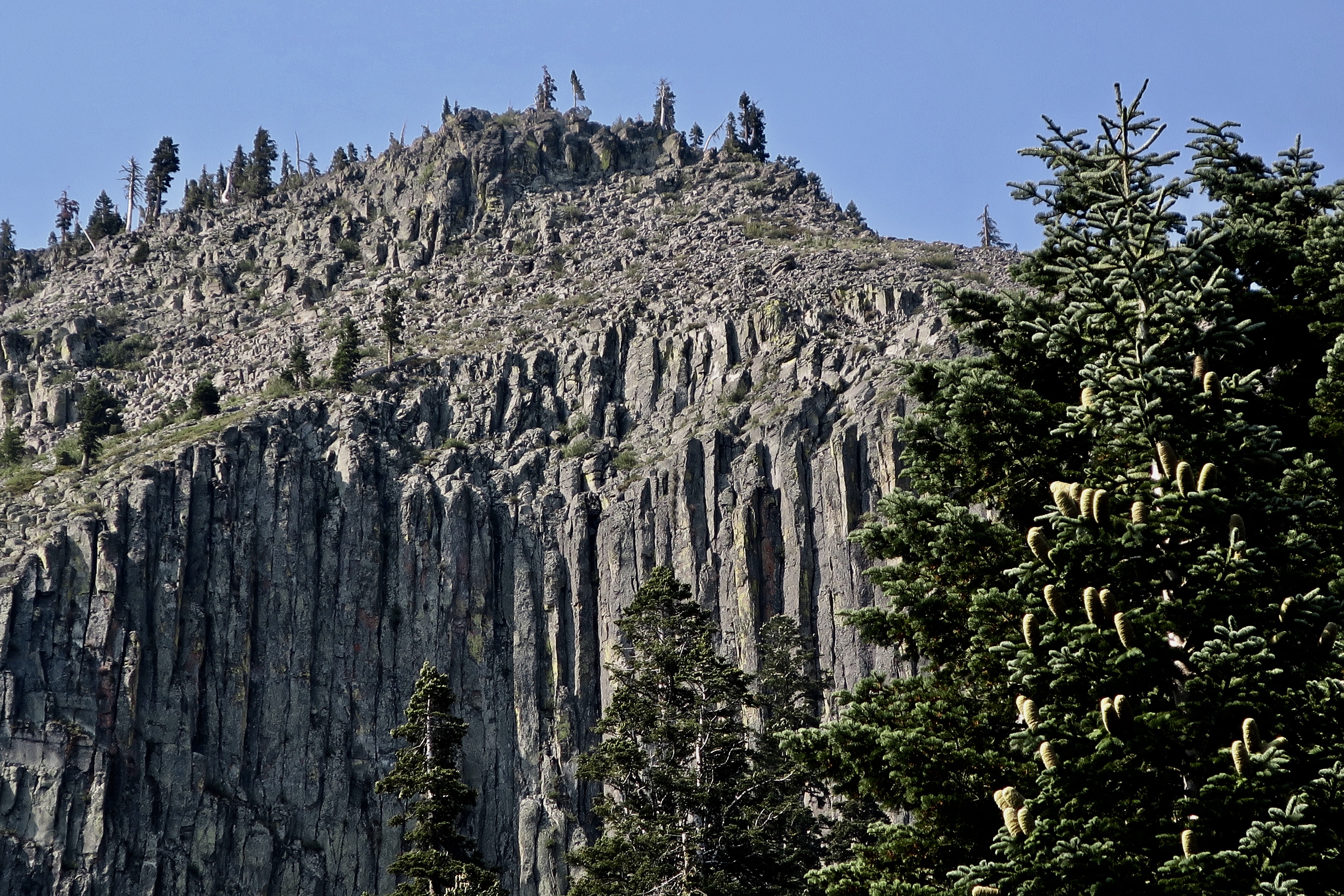
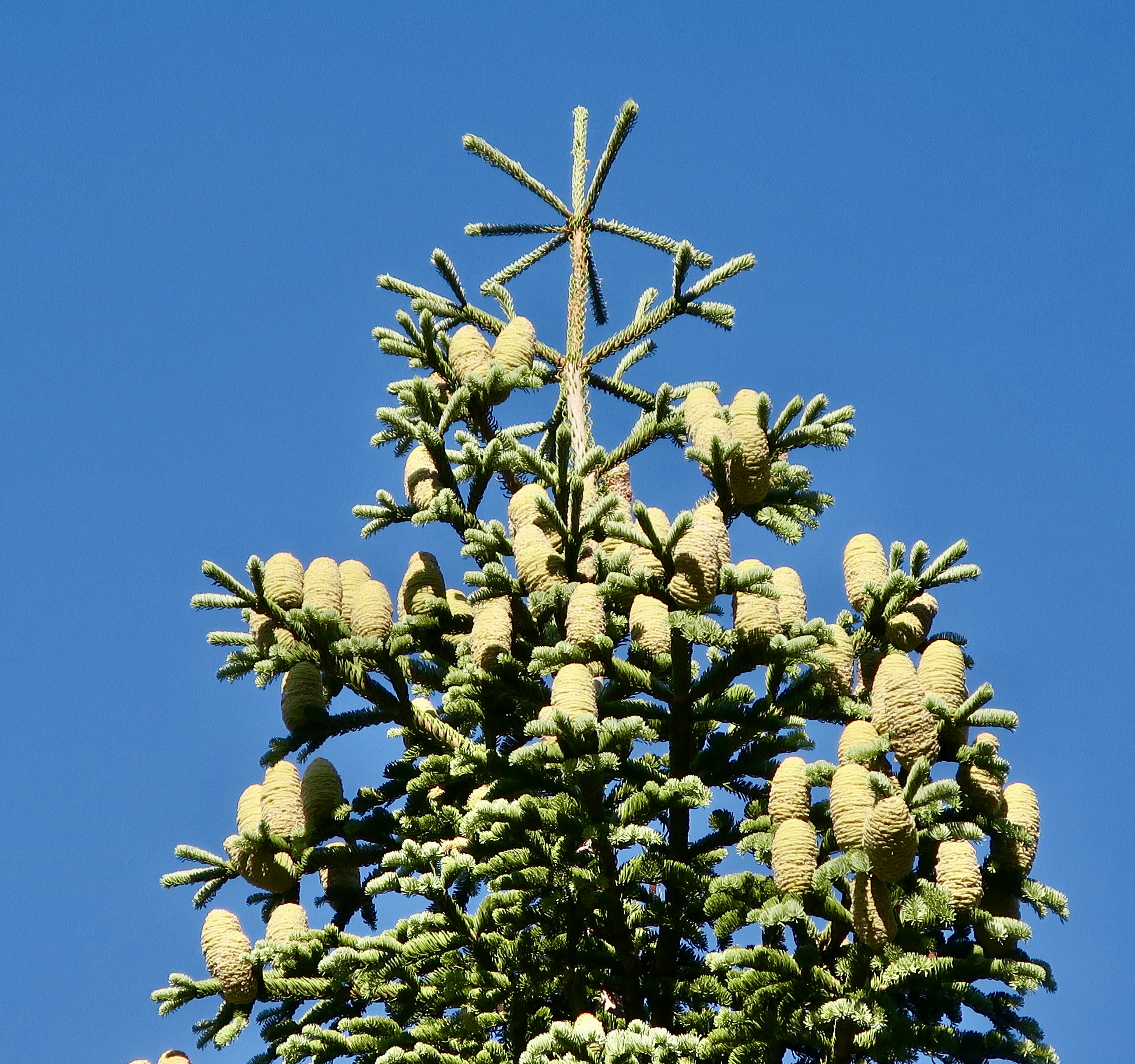
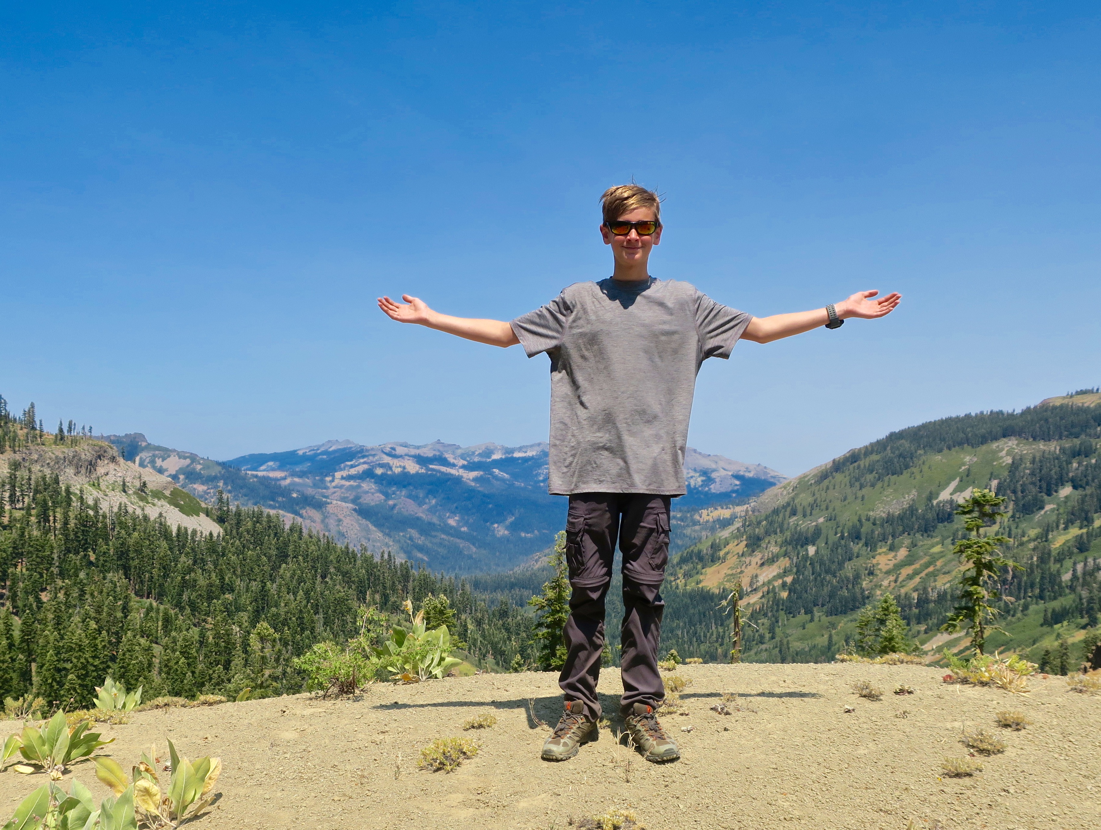
I began this section of the PCT where I hiked through the Granite Chief and Desolation Wilderness areas on historic Highway 40 near the Sugar Bowl and Donner Summit. Before it was replaced by I-80, it was part the Lincoln Highway, America’s first cross country road. Like most of the Sierra Trails I know, the PCT here begins with a climb. The peak you see up ahead is Tinker’s Knob. The Knob, BTW, was named after James A. Tinker, a freight-hauling teamster in the area. Legend has it that it was named after his nose, which was said to resemble the knob.Having got a late start after Peggy dropped me off, I camped that night with a view of Tinker’s Knob. As far as I know, not one other person was camped in the valley. That’s one of the beauties of backpacking.The views from my campsite were gorgeous.I watched as the sun set on Tinker’s Knob, outlining it in golden, warm colors.And then went for a short walk and watched the sun set in the west. A note here: Tinkers Knob is just outside of the Granite Chief Wilderness in the Tahoe National Forest. It’s part of the land that Lee’s bill might open for sale. I can see a land speculator grabbing this and making it available to developers for huge profits who would then sell it to multi-millionaires for homes at even greater profits. No trespassing signs would quickly follow.This map of the Granite Chief Wilderness provides a fairly accurate view of the trail system. Tinker’s Knob is on the top, just outside of the wilderness to the north of the 9005 Granite Chief Pass.I caught this photo the next morning. There are two Needle Peaks in the Granite Chief Wilderness. Needle Peak and Little Needle Peak. This is the former. Both are made up of volcano cores.Leaving my camp, the PCT took me through an extensive field of corn lilies.I came across this old PCT Trail sign placed before the name of Squaw Valley was changed. The name squaw had become controversial. Since the 1960 Winter Olympics were held at the Squaw Valley Ski Resort, the name was changed to Olympic Valley.The Granite Chief Wilderness is just behind the mountains. All I had to do was hike over them.I actually made two trips though the Granite Chief Wilderness on my 750 mile PCT Trek. The first was with my grandson Ethan. We took the tram up from the Olympic Valley floor to reach the wilderness area and then hiked through Granite Chief Wilderness and part of the Desolation Wilderness when Ethan sprained an ankle. I decided on a do-over starting at historic Highway 40. I needed the miles given the areas I had to skip because of forest fires. The following photos are from both trips.Ethan and I spent our first night at Little Needle Lake beneath Little Needle Peak. It’s a relatively short hike from where we got off the tram and an old favorite of mine going all the way back to the 1974 when I first started leading hundred mile backpack trips through the Sierras.Instead of following the PCT through the Granite Chief Wilderness, we dropped down off the ridge to Five Lakes Creek. Once, this trail marker, known as a blaze, would have marked the trail along the creek. It’s likely that carpenter ants carved the holes.Another old blaze on a tree that still lives. I’ve followed blazes many times over the years. Especially when the trail disappeared under the snow.A limb came out of this snag when the tree was young. The rings take you back in time to its youth. I thought it made a neat photo.A small amount of water was still flowing in Five Lakes Creek.The trail follows the creek for five miles and reaches what is known as Diamond Crossing where I have often camped.Earlier in the season there is a small, but photo-worthy waterfall just up Five Lakes Creek from Diamond Crossing.With a great swimming hole to cool off in.The trail leaves the canyon at Diamond Crossing and heads up a long steep climb following Powderhorn Creek. I heard something splashing in Powderhorn on my second trip when I was by myself. I snuck up and discovered two bobcats frolicking in the water. They took off before I could get my camera out but I was able to pick up one very wet track left behind.I continued to follow their trail out of the canyon. Here kitty, kitty, kitty.By late August most of the flowers were finished, but I did find abundant goldenrod…And Queen Anne’s Lace.There is ample evidence of volcanic activity throughout the Sierras. This view is of a basalt lava flow that cooled and contracted into vertical hexagonal columns can be seen from the upper section of the Powderhorn Creek trail. The tree on the right is a red fir. Unlike pine cones, red fir cones disintegrate. Another view of ancient volcanic activity: A volcanic mudflow. I believe the talus slope in the background is from the basaltic lava flow.The climb up from Diamond Crossing is no joke. Ethan had every reason to celebrate! The Granite Chief Wilderness stretches out to the farthest peaks in the background where Ethan and I started and I had hiked twice in a row. You can barely see Big Needle Peak below Ethan’s right arm. The Barker Pass road provides and easy exit or entry point for both the Powderhorn Creek Trail and the PCT.
Peggy and I will be taking a break from our blog over the next three weeks. We are in Sacramento this week visiting with friends and relatives. Next week we are flying to Florida where we celebrate Peggy’s 75th Birthday with our son and his family. The following week we fly back here and will continue to celebrate. This time with a backpack trip retracing the route of the first backpack trip I ever took— in 1969! Then we will continue our exploration of the southwest and blog series.
Always impressed by your photos but I think the ant community is my favorite and also the bear! The ant picture reminds me of…in the 1950’s, you had so buy a small ant farm and watch them in the plastic window. The ants may have lived at least a day or a week! Thank you for more beautiful pictures of our world!
I remember those ant farms, Wendy! I never owned one, however. One year at Burning Man, a group made a giant, human sized replica about 40 feet tall that people were able to walk through.
Thanks for your comments on our photos. Appreciated!
I can only hope that the wilderness will remain intact for future generations. Curt, you’ve been to so many beautiful places, it is so hard to keep track of them.
Your next backpacking trip plan is pretty bold, I would say, I hope the trail is in same/better condition than 56 years ago. Wow!! And I hope future generations will be able to hike it again in 256 years from now🥰
So true, Christie, we can only hope. Peggy and I know how privileged we have been able to go the places we have been able to visit and have the experiences/adventures we have. What a tragedy it will be if future generations don’t have similar opportunities.
It’s a relatively easy trip we are going on next week. But it is incredibly special to me in that it was my introduction to backpacking. Over the years, I’ve been able to take many people into the area.
We have lots of carpenter ants in our woods. We are helping them out, sort of, by having all the dead trees felled and chipped. We spread the chips and it is interesting how quickly they become nutrients. Plus they hold moisture in the ground. Double win for my landscaped part of our property.
It’s always fun for us to relive the adventures, Peggy! The bill, sadly, passed— thanks to the lack of courage shown by Republicans who disagreed with Trump to stand up to him. Let’s see, what’s more important: The future of the nation or your career as a politician?
I hope the public wakes up and votes in the mid-terms to replace the problem politicians with those who care about the people and the nation.
You, and hopefully the majority of Americans,Peggy. If not…
Spectacular, Curt. I don’t know if you’re getting even better in your shoots or you got a new camera but the detail is spectacular. Amazing shots and good Peggy got out of there. Thanks for keeping us abreast on the cuts with the Parks. It’s unimaginable! So special to share that trip with Ethan. Sending love ❤️
Peggy and I both love photography, Cindy. But beyond that I have to give credit where credit’s due: The beautiful places we are privileged to visit. As for the damage being done by the Administration, it is truly beyond comprehension.
I would love to hike the PCT from one end to the other, Curt. Your photos/posts are just fabulous and wonderfully inviting.
I heard that the parliamentarian removed the sale of public lands from the Big Ugly Bill, because it was “policy” not “budget.” That doesn’t mean it won’t be rewritten to qualify or that it won’t come up later, but it’s out for now. Keep up the pressure to preserve these beautiful places for future generations, my friend.
Thank goodness for the parliamentarian. And of course Trump will try again. And of course the Congressional Republicans that disagree won’t have the guts to stand up against him.
If I were a few years younger, grin, I would too. But I think I would do it over time. Basically ‘running’ through all of that incredible beauty doesn’t fit my personality.
I think our public lands are screwed, Curt, unless things can be stopped at the midterms. But that’s a year and a half away. Sigh. The Republicans will do whatever the dictator says without conscience.
So far, they certainly haven’t paid any attention to their constituents. Hopefully, that will come back and bite them.
It looks like there’s a little bit of that “biting” starting to happen. 🙂

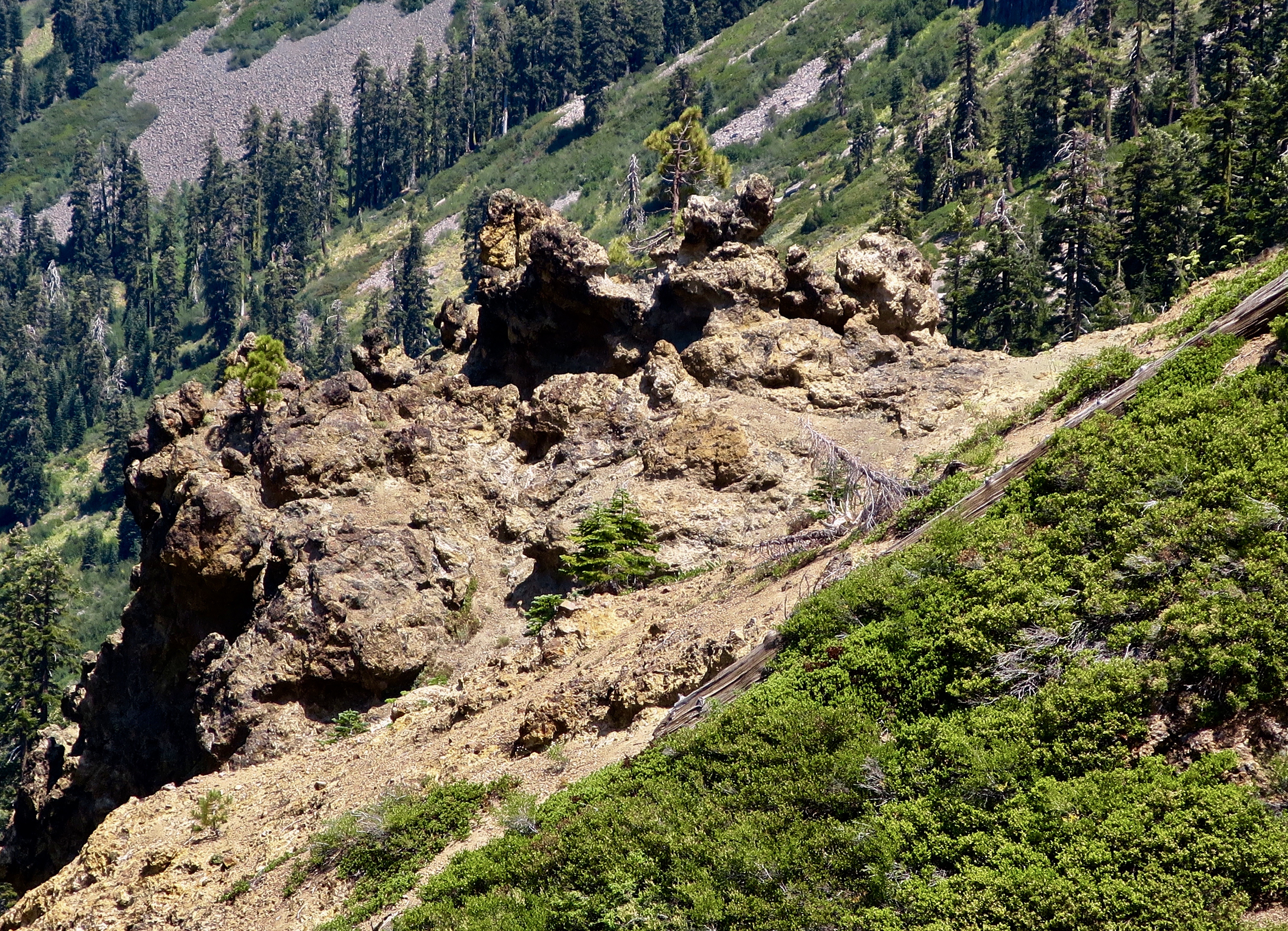

I always enjoy your photos of shapes, usually conveying motion, in rocks and trees.
Interesting perspective, Ray. I hadn’t really thought about it, but now you mention it…
Always impressed by your photos but I think the ant community is my favorite and also the bear! The ant picture reminds me of…in the 1950’s, you had so buy a small ant farm and watch them in the plastic window. The ants may have lived at least a day or a week! Thank you for more beautiful pictures of our world!
I remember those ant farms, Wendy! I never owned one, however. One year at Burning Man, a group made a giant, human sized replica about 40 feet tall that people were able to walk through.
Thanks for your comments on our photos. Appreciated!
Burning Man! I am so impressed!
I can only hope that the wilderness will remain intact for future generations. Curt, you’ve been to so many beautiful places, it is so hard to keep track of them.
Your next backpacking trip plan is pretty bold, I would say, I hope the trail is in same/better condition than 56 years ago. Wow!! And I hope future generations will be able to hike it again in 256 years from now🥰
Happy birthday to Peggy!! xx
So true, Christie, we can only hope. Peggy and I know how privileged we have been able to go the places we have been able to visit and have the experiences/adventures we have. What a tragedy it will be if future generations don’t have similar opportunities.
It’s a relatively easy trip we are going on next week. But it is incredibly special to me in that it was my introduction to backpacking. Over the years, I’ve been able to take many people into the area.
We have lots of carpenter ants in our woods. We are helping them out, sort of, by having all the dead trees felled and chipped. We spread the chips and it is interesting how quickly they become nutrients. Plus they hold moisture in the ground. Double win for my landscaped part of our property.
Carpenter ants and chipping: Both good!
I remember when you did the walk. Thanks for taking and sharing such glorious photos. Hoping that bill goes nowhere.
It’s always fun for us to relive the adventures, Peggy! The bill, sadly, passed— thanks to the lack of courage shown by Republicans who disagreed with Trump to stand up to him. Let’s see, what’s more important: The future of the nation or your career as a politician?
I hope the public wakes up and votes in the mid-terms to replace the problem politicians with those who care about the people and the nation.
You, and hopefully the majority of Americans,Peggy. If not…
Spectacular, Curt. I don’t know if you’re getting even better in your shoots or you got a new camera but the detail is spectacular. Amazing shots and good Peggy got out of there. Thanks for keeping us abreast on the cuts with the Parks. It’s unimaginable! So special to share that trip with Ethan. Sending love ❤️
Peggy and I both love photography, Cindy. But beyond that I have to give credit where credit’s due: The beautiful places we are privileged to visit. As for the damage being done by the Administration, it is truly beyond comprehension.
Happy birthday to Peggy, and enjoy all your travels!
Thanks, Diana.
I would love to hike the PCT from one end to the other, Curt. Your photos/posts are just fabulous and wonderfully inviting.
I heard that the parliamentarian removed the sale of public lands from the Big Ugly Bill, because it was “policy” not “budget.” That doesn’t mean it won’t be rewritten to qualify or that it won’t come up later, but it’s out for now. Keep up the pressure to preserve these beautiful places for future generations, my friend.
Thank goodness for the parliamentarian. And of course Trump will try again. And of course the Congressional Republicans that disagree won’t have the guts to stand up against him.
If I were a few years younger, grin, I would too. But I think I would do it over time. Basically ‘running’ through all of that incredible beauty doesn’t fit my personality.
I think our public lands are screwed, Curt, unless things can be stopped at the midterms. But that’s a year and a half away. Sigh. The Republicans will do whatever the dictator says without conscience.
So far, they certainly haven’t paid any attention to their constituents. Hopefully, that will come back and bite them.
It looks like there’s a little bit of that “biting” starting to happen. 🙂
I’m hoping for an all out chomp. Grin.