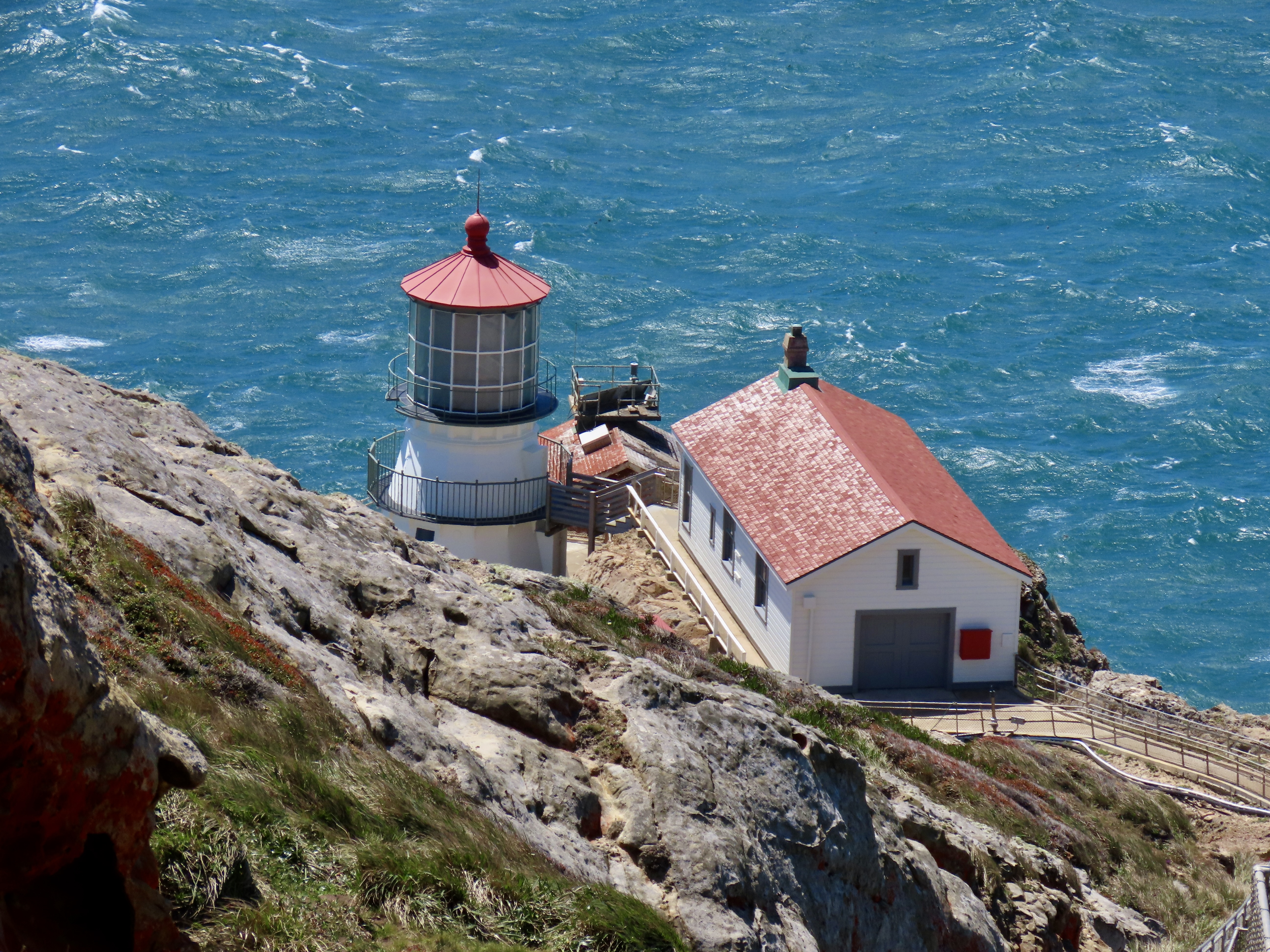
The Point Reyes Lighthouse protected mariners sailing past dangerous rocks off the coast for 105 years from 1870 until 1985 when the Coast Guard replaced it with an automated light just beneath the lighthouse.
Peggy and I have visited the Point Reyes Lighthouse with its dramatic location perched above the Pacific Ocean several times. The wind was blowing so hard this time, it was hard to open the doors on our truck and almost impossible to put on our windbreakers outside in the wind. None-the-less, we vowed to make the half mile trek out to the observation tower overlooking the lighthouse. It’s just too impressive not to.
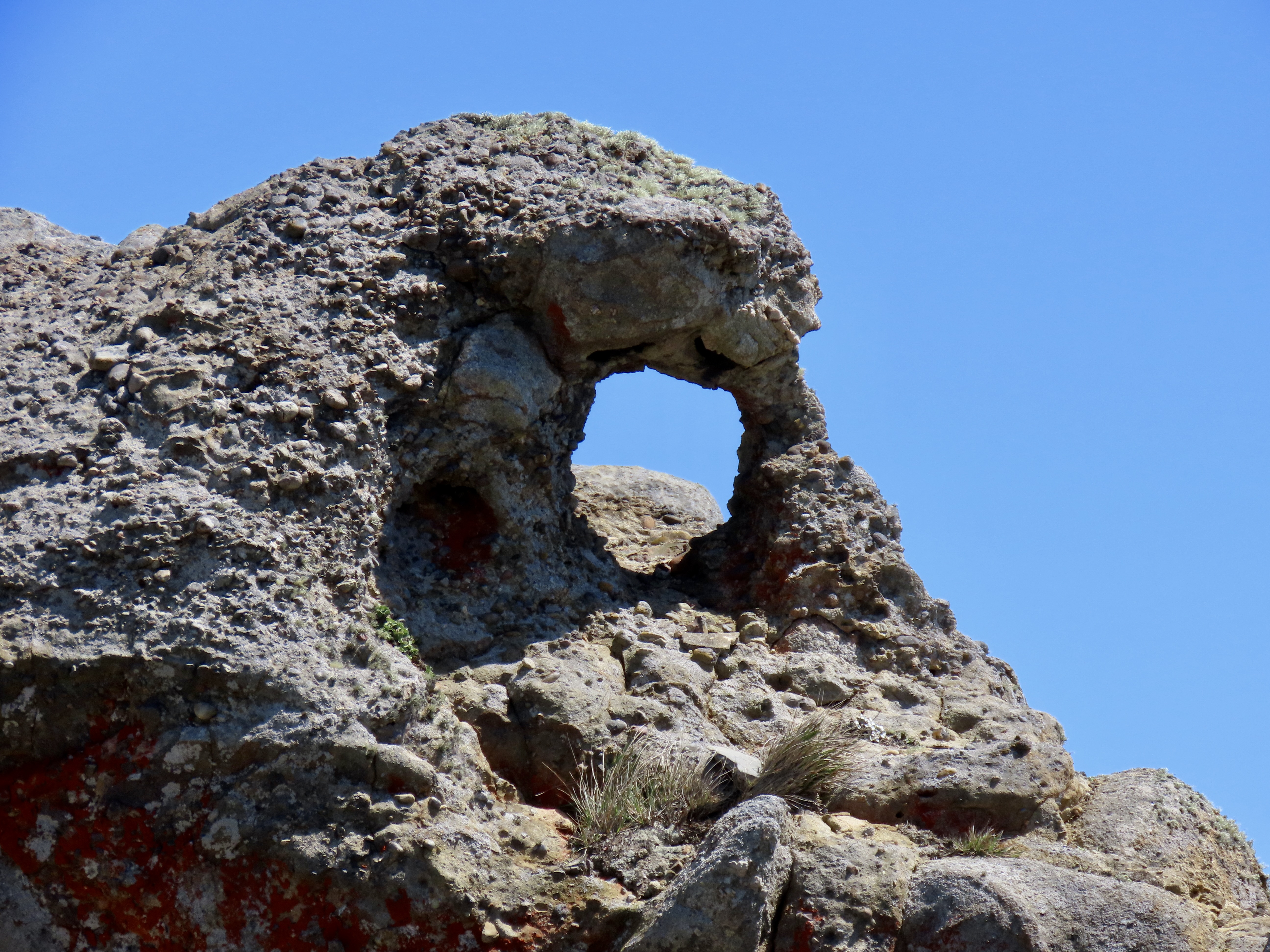
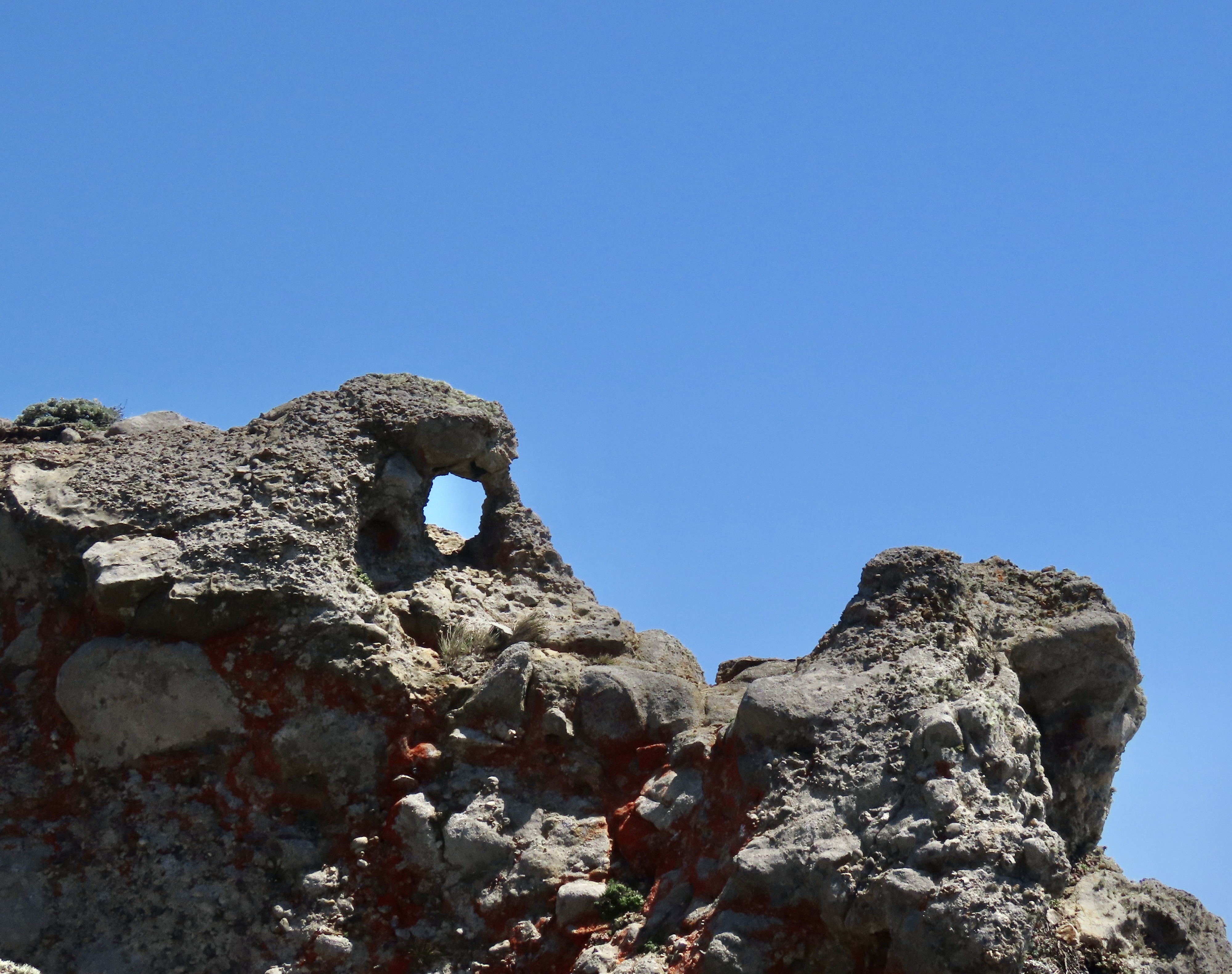
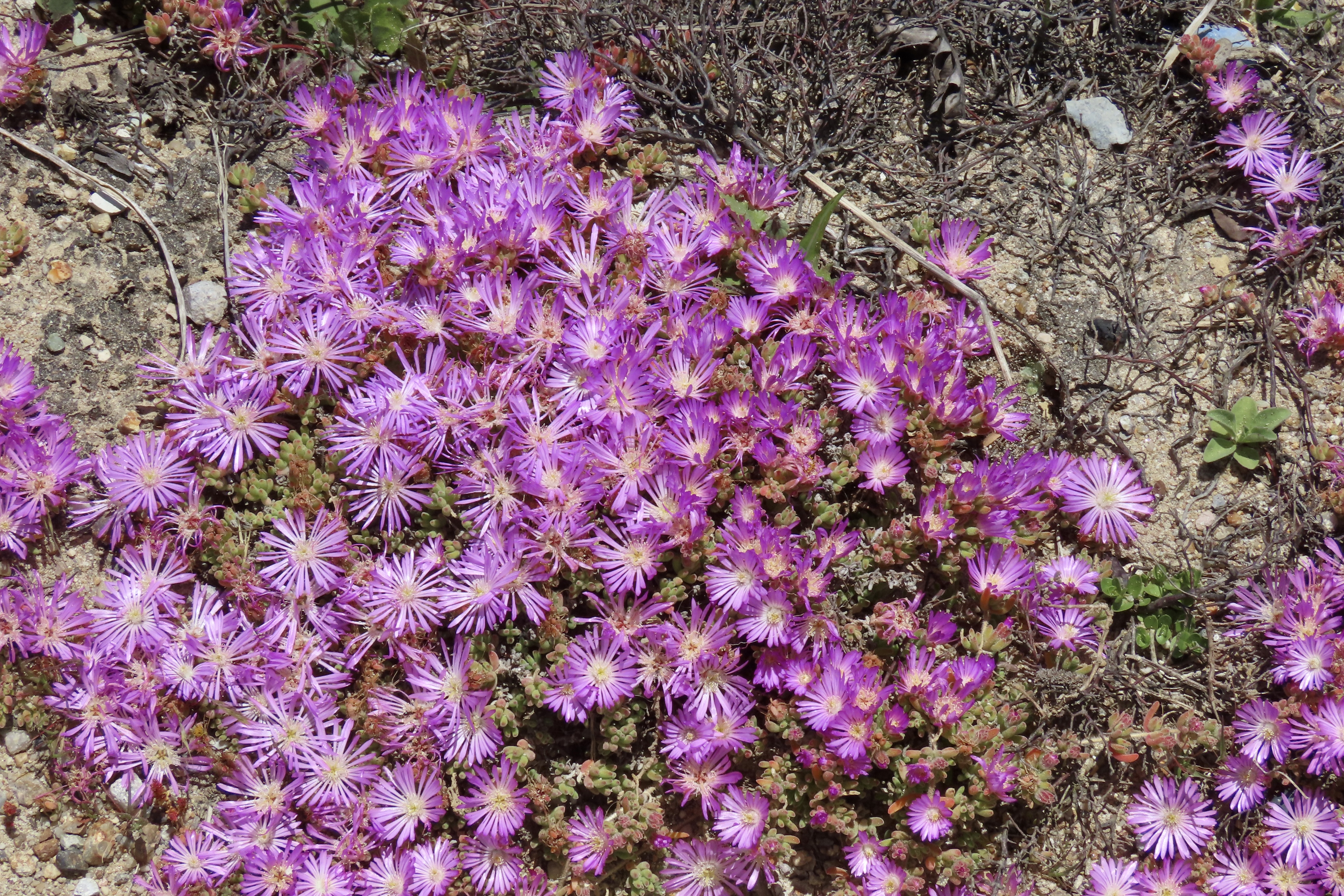
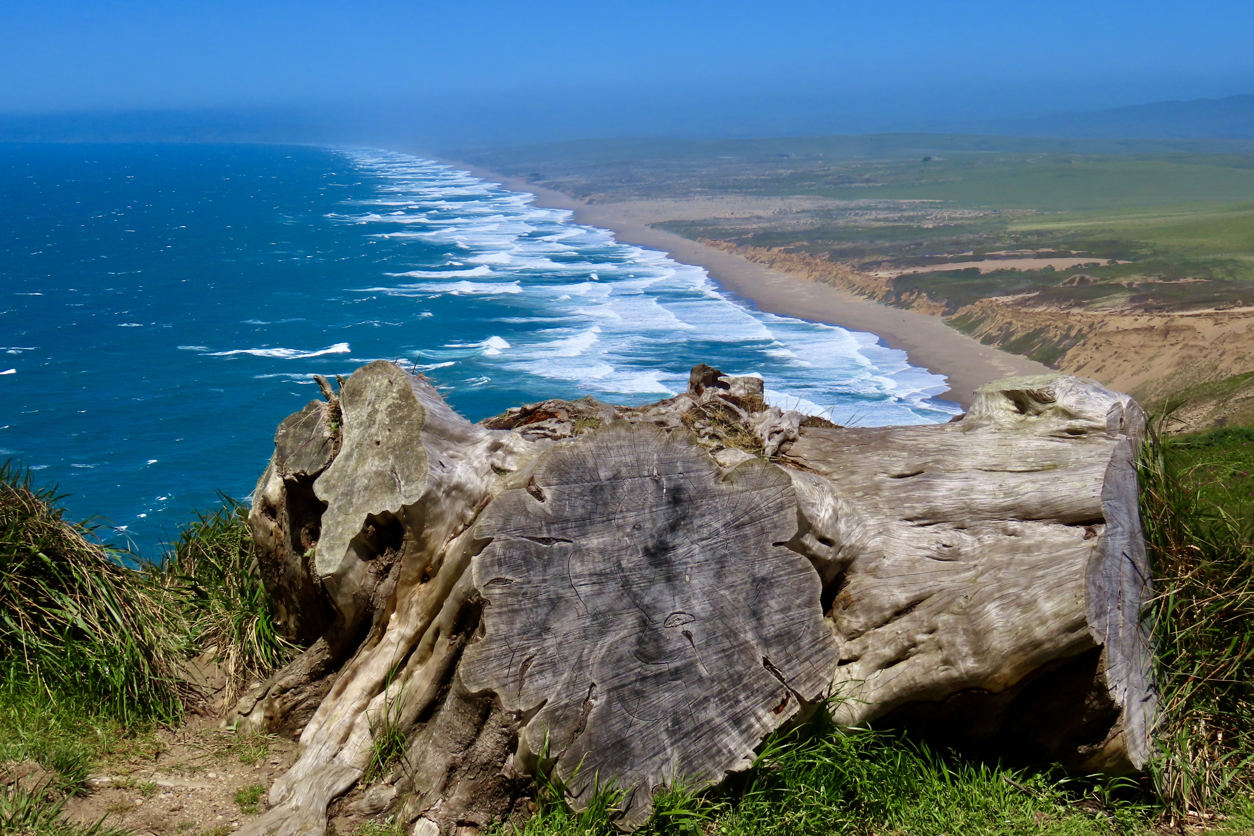
The steps down to the lighthouse were closed. Given the wind, we weren’t disappointed. It was more like, “Thank you National Park Service!” Holding our cameras steady was enough of a challenge! The Park actually has a policy: When wind speeds exceed 40 mph, the stairs leading down to the lighthouse are closed for visitors’ safety. My guess is that the winds were closer to 60 mph.There was no lack of great views or opportunities for photos.Our cameras even brought the lighthouse close.There are a number of other things to see on a walk out to the lighthouse, such as watching waves crash into rocks. The nesting seabirds that had painted the rocks white were probably cormorants. There is even the skeletal head of a female blue whale. I posed for perspective. The rock next to my shoulder, BTW, is known as Point Reyes conglomerate and may be over 50 million years old.Peggy spotted what she thought looked like a head carved out of the conglomerate and couldn’t resist photographing it. This was just above the whale head.She was also taken with this hole in a rock on the ridge opposite the whale head. An eye with an iris?I photographed the ridge.And discovered some striking flowers hanging out on the rocky cliffs: rosea ice plant.They expanded out to this cluster…And worked their way down the steep cliff.On our way back to the car we were treated to this view of Point Reyes South Beach. I used to hike on the beach with my basset hound Socrates in the early 70s.Another view of South Beach.This map near the overlook provides a view of the National Seashore and a dramatic illustration of plate tectonics. “You are here,”marks the location of the lighthouse. Drakes Bay is to the right with Drakes Beach to the left of Drakes Estero, which cuts inland from the bay. Limantour Beach is to the right of the Estero. Traveling north up the coast from the lighthouse, the small lake you can see is Abbots Lagoon. The Pierce Ranch and the elk reserve are to the north of that. That covers my Point Reyes posts so far.
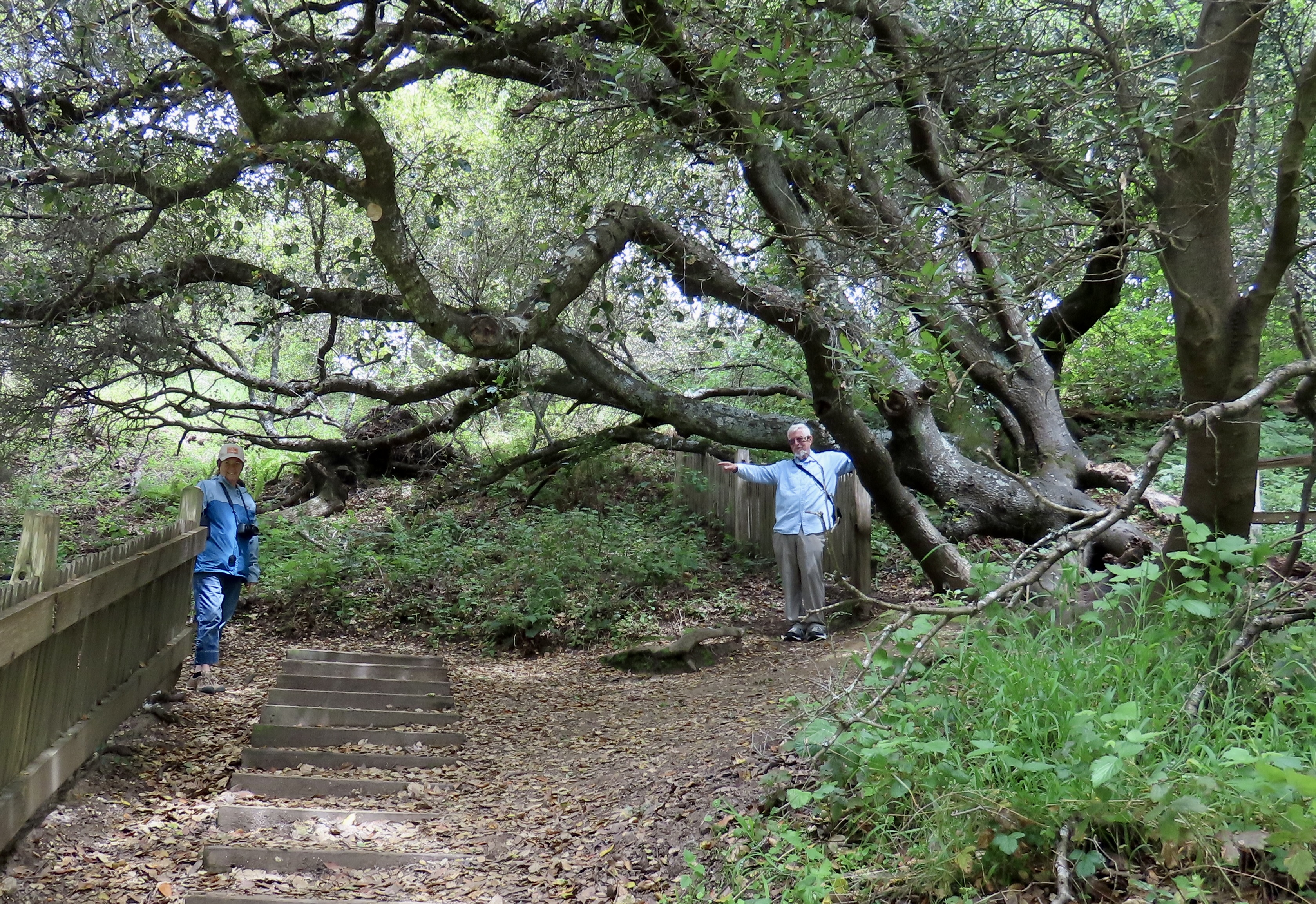
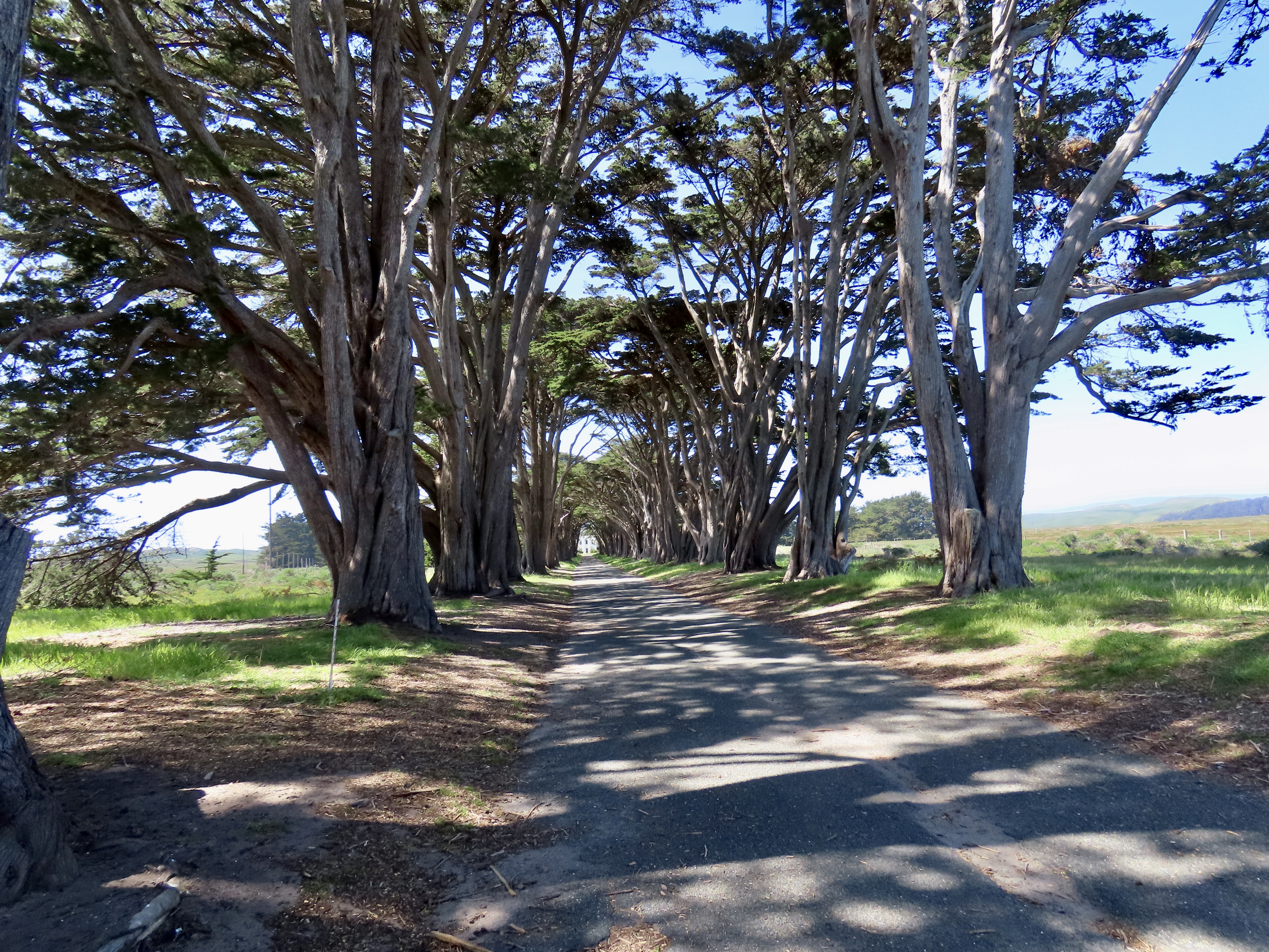
The long inlet to the right is Tomales Bay. If you follow along the bay and keep going south along the valley, you will reach Bolinas Lagoon. This route marks the direct path of the San Andreas Fault. To the east is the North American Continental Plate; to the west is the Pacific Plate. The Pacific Plate is working its way north, scraping along the Continental Plate, slowly— moving at about the rate your fingernail grows. It began its journey as part of the Tehachapi Mountains 310 miles to the south. It doesn’t move at a steady rate, however. It remains still for long periods of time and them leaps forward causing earthquakes, including massive ones like like 1906 earthquake that destroyed San Francisco. It also had a major impact on the Point Reyes area.Earthquake Trail is next to the Point Reyes NS Visitor’s Center in Bear Valley about a quarter of a mile from where we were camped at Olema. It provides a dramatic illustration of just how powerful the 1906 earthquake was. While the fence shown here is relatively new, it is a replica of the one that was here when the earthquake struck. Peggy and I would have been standing together before the earthquake. Afterwards we would have been close to 20 feet apart (although I doubt we would have been standing). That’s how far Point Reyes moved north. (Photo by Lita Campbell.)On our drive back to camp from the lighthouse, we drove by the iconic Cypress Tunnel and stopped for a quick look. The road leads to the historic Historic KPH Maritime Radio Receiving Station that was built in 1929 by Marconi to allow communication with ships throughout the Pacific. That’s a wrap for our Point Reyes series. Next, our journey takes us to the beautiful Mendocino Coast of California where we stayed in Fort Bragg on the banks of the Noyo River. It was Mother’s Day yesterday and I gave Peggy a bouquet to celebrate, a 40 acre bouquet. We took a trip to the nearby Mendocino Coast Botanical Garden and spent two hours strolling down paths filled with azaleas and numerous other gorgeous flowers. Our walk will be the subject of my next post on Thursday. Prepare for beauty!
Beautiful and dramatic shots of the ocean! Just looking at work being done along the coast of California. It would seem that there may be a day when it will not be possible to drive a long the coast. And then…earthquakes…I have experienced three in my lifetime here in Olympia. We are right on top of a fault line! No thank you! Happy travels!
Thanks, Wendy.
The cost of maintaining Highway 1 is high. And it is constant. We drove along a short portion of Highway 1 on our way to Redwood National Park from Fort Bragg yesterday. There were two sections where they were working to keep the road from sliding into the ocean. Having lived in California, Oregon, and Alaska, I’ve experienced my share of earthquakes as well. No thanks here as well!
Your travels are always interesting, Curt. I enjoy lighthouses but haven’t visited any in California. Beautiful sights of the rocks and beaches. And what a lovely Mother’s Day gift to Peggy – 40 acres of flowers. 🙂 Happy Travels.
Plenty of lighthouses in Oregon, D. I think I’ve visited all of them. California does have some beauties, however.
Peggy was quite happy with her ‘bouquet.’ Thanks.
Gorgeous photos, Curt! Lighthouses are amazing, and the skeletal head of the blue whale is fascinating in its size! Wow! And we’ve walked on the earthquake trail many times. Wonderful, as always! Happy traveling!
There is something incredibly romantic about lighthouses, Lauren, hanging out where they do and doing their job. Especially in the old days when lighthouse keepers ran the show, before automation. Laughing. I, too, have hiked the earthquake trail many times.
Hahahaha, yes indeed! Oh how right you are, Curt!!!! 🙀
Scary kitty is right! Grin.
🙀😹😻
“I doubt we would have been standing.” Ha!! Good one. The ice plants spilling down the hill and painting it fuchsia is magnificent. And that image of Pt. Reyes is my favourite glimpse of plate tectonics at work. I was randomly scrutinizing a map of the coast one day when I saw it the first time. I felt like Vasco de Gama or something – a grand discovery, all on my own, ha ha ha.
Spotting it on your own is a Vasco de Gamma type discovery, Crystal! BTW, I’m glad we weren’t there to fall down. And finally I agree on the color cascading down the cliff.


Breathtaking scenery,stunning shots.My hat off to the both of you.
Thanks, Peter!
Beautiful and dramatic shots of the ocean! Just looking at work being done along the coast of California. It would seem that there may be a day when it will not be possible to drive a long the coast. And then…earthquakes…I have experienced three in my lifetime here in Olympia. We are right on top of a fault line! No thank you! Happy travels!
Thanks, Wendy.
The cost of maintaining Highway 1 is high. And it is constant. We drove along a short portion of Highway 1 on our way to Redwood National Park from Fort Bragg yesterday. There were two sections where they were working to keep the road from sliding into the ocean. Having lived in California, Oregon, and Alaska, I’ve experienced my share of earthquakes as well. No thanks here as well!
Like you, I’m glad the stairs were closed. Can’t have you being swept into the sea.
A long way to fall, followed by a cold bath. Grin.
Your travels are always interesting, Curt. I enjoy lighthouses but haven’t visited any in California. Beautiful sights of the rocks and beaches. And what a lovely Mother’s Day gift to Peggy – 40 acres of flowers. 🙂 Happy Travels.
Plenty of lighthouses in Oregon, D. I think I’ve visited all of them. California does have some beauties, however.
Peggy was quite happy with her ‘bouquet.’ Thanks.
🙂
Oh the wind! We experienced the same in Patagonia. We could barely walk.
Love the cypress tunnel.
Alison
And hang on to your hats! The cypress tunnel has always been a point Reyes favorite of mine, Alison. –Curt
Gorgeous photos, Curt! Lighthouses are amazing, and the skeletal head of the blue whale is fascinating in its size! Wow! And we’ve walked on the earthquake trail many times. Wonderful, as always! Happy traveling!
There is something incredibly romantic about lighthouses, Lauren, hanging out where they do and doing their job. Especially in the old days when lighthouse keepers ran the show, before automation. Laughing. I, too, have hiked the earthquake trail many times.
How did I miss this one with the blue whale almost engulfing you.. lol. Wow such gorgeous terrain walking on earthquake trail no less💕
One bite away. 😳I suspect you live really close to the San Andreas Fault, Cindy. You may have your own earthquake trail. Grin.
Hahahaha, yes indeed! Oh how right you are, Curt!!!! 🙀
Scary kitty is right! Grin.
🙀😹😻
“I doubt we would have been standing.” Ha!! Good one. The ice plants spilling down the hill and painting it fuchsia is magnificent. And that image of Pt. Reyes is my favourite glimpse of plate tectonics at work. I was randomly scrutinizing a map of the coast one day when I saw it the first time. I felt like Vasco de Gama or something – a grand discovery, all on my own, ha ha ha.
Spotting it on your own is a Vasco de Gamma type discovery, Crystal! BTW, I’m glad we weren’t there to fall down. And finally I agree on the color cascading down the cliff.