I’ve saved the best for last in my Zion National Park series, and I’ve done it for two reasons. First and foremost, I wanted to emphasize that there are other areas in Zion that deserve your attention, areas of incredible beauty and interest like Kolob Terrace, Kolob Canyon, East Zion, and the petroglyph hike Peggy and I took you on. Second, I wanted to suggest areas that lack the crowds you will face in Zion Canyon. We didn’t see anyone on our petroglyphs hike.
None of this is meant to detract from the beauty and grandeur of the Canyon. There are reasons why millions of people visit it every year. It is one of the great natural wonders of the world. I wouldn’t think of going to Zion National Park without visiting, and I’ve been doing so for 50 years. My first trip there was in 1973. I put on my backpack and hiked up and over the 2000 feet canyon walls to a lovely oasis known by the unglamorous name of Potato Hollow. Nobody was there, either. Grin. I remember the aspens carved with names of early Basque sheep herders and a cool stream. I’m a bit ashamed to mention that I remember the hike down even more. It was 105° F. I finally arrived back at my car with hot, blistered feet where I had an iced cold beer waiting. Something like a Bud. It may have been the best beer I have ever downed. It was so good, I immediately drank a second.
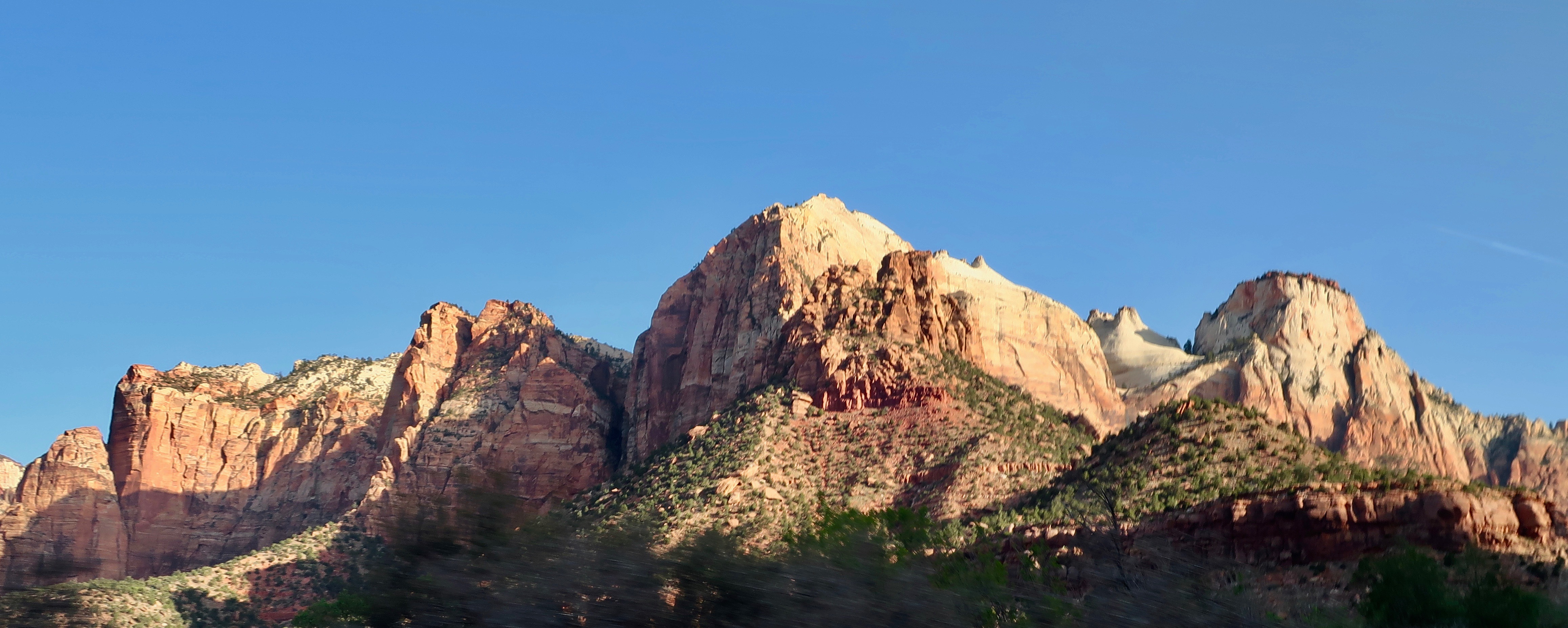
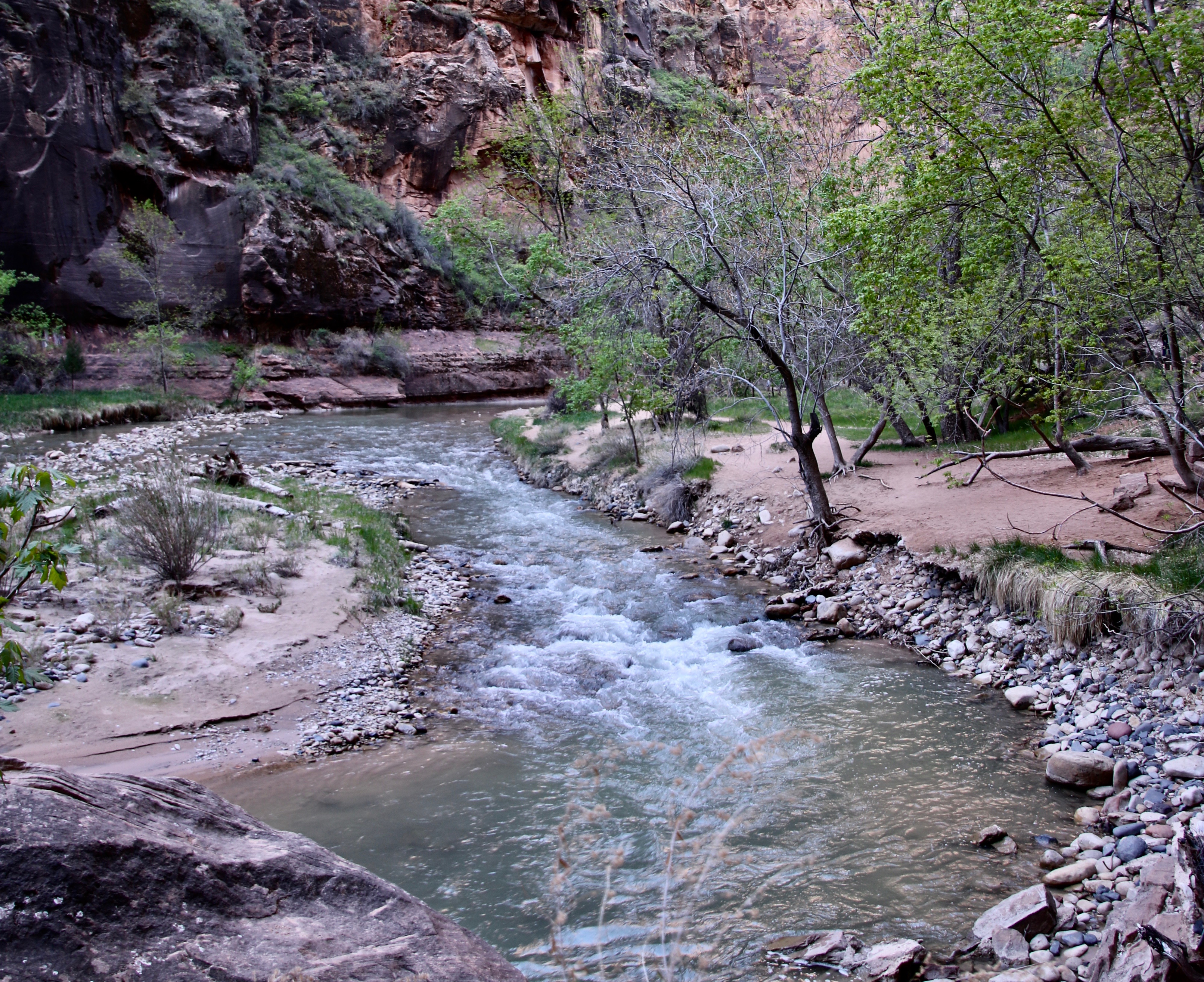
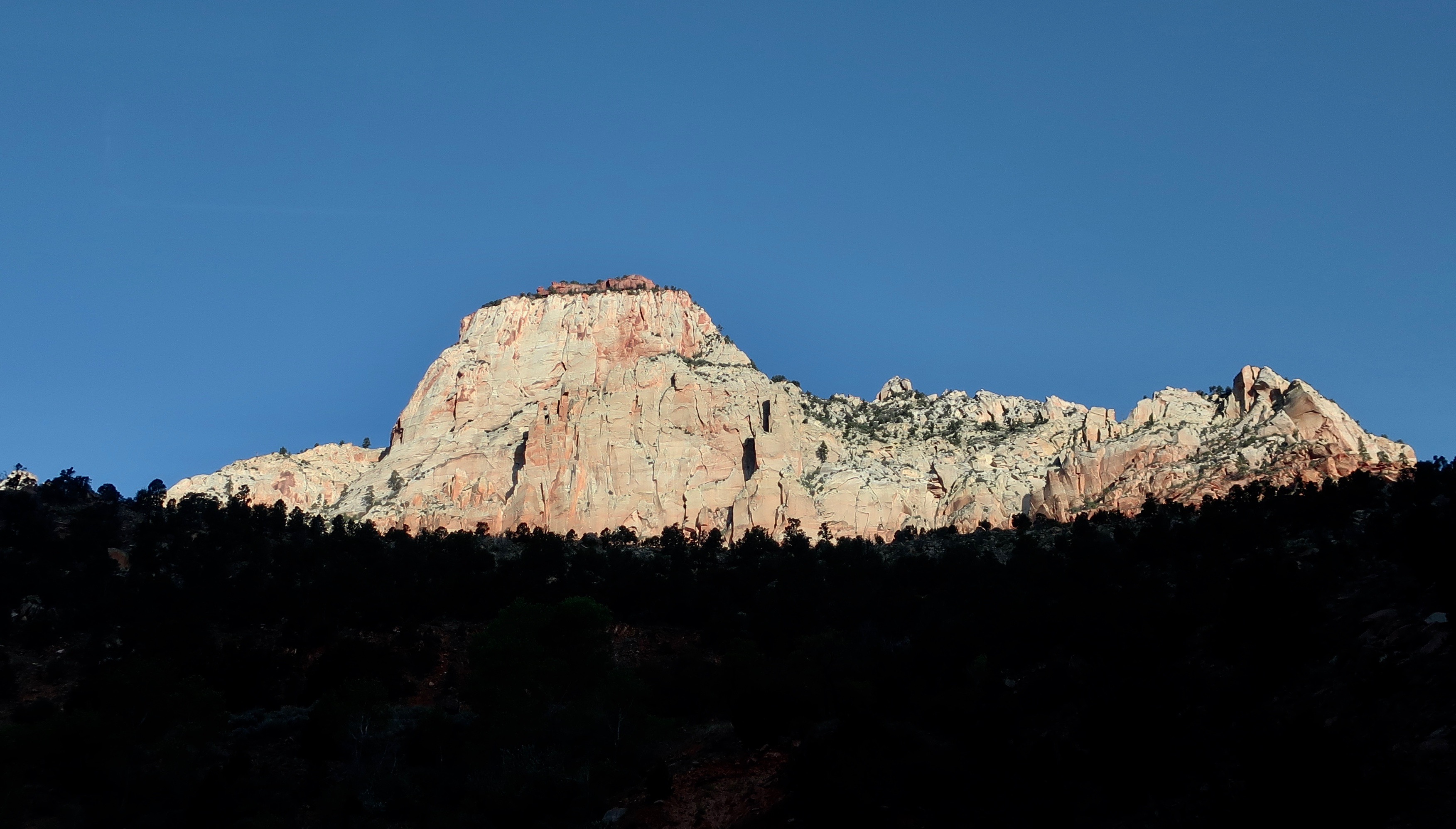
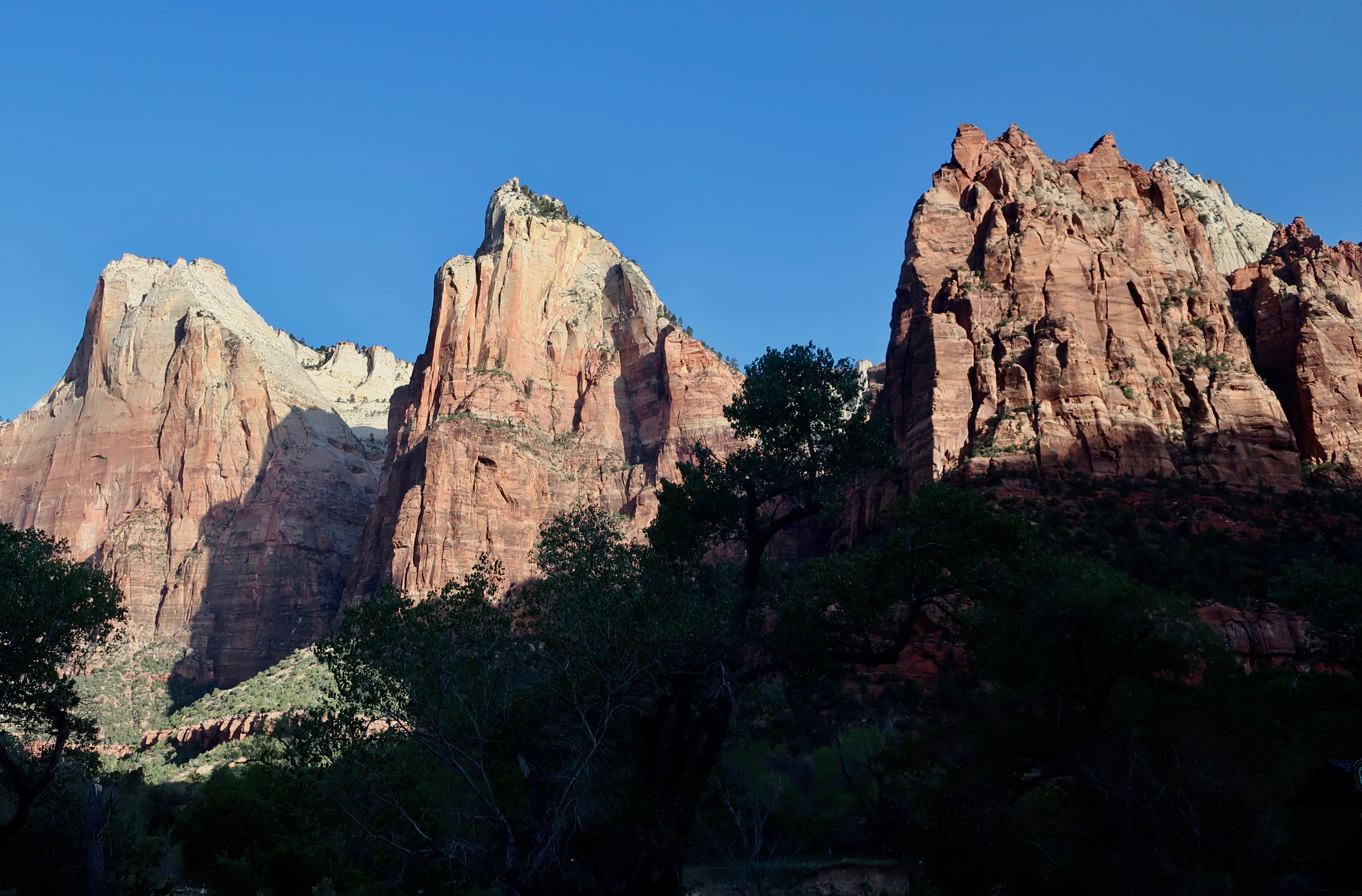
Peggy and I took a shuttle from our campground in the small town of Virgin into Springdale and grabbed a Park shuttle out to the end of the road. It was 7 AM and cold. We then jumped off and on shuttles, stopping at major sites and working our way back to the beginning of the park. We took 200 photos which I then worked down to a hundred and finally the 22 shown below. I’ll skip the commentary today on most of the photos. They speak for themselves. They are split between photos Peggy took and photos I took.
The Virgin River.For fun.
This wraps up our visit to Zion National Park. Peggy and I hope you have had as much fun with the posts as we had putting them together. Next up is Bryce National Park. Once again we will focus on the surrounding area as well as the four miles of Bryce Canyon most people visit. I’m estimating that there will be seven posts altogether. As you read this we will have finished our trip up the Rhine River and returned to our base camp near Waterford, Virginia. Starting in September, we will be on the road again, this time for five or six months.
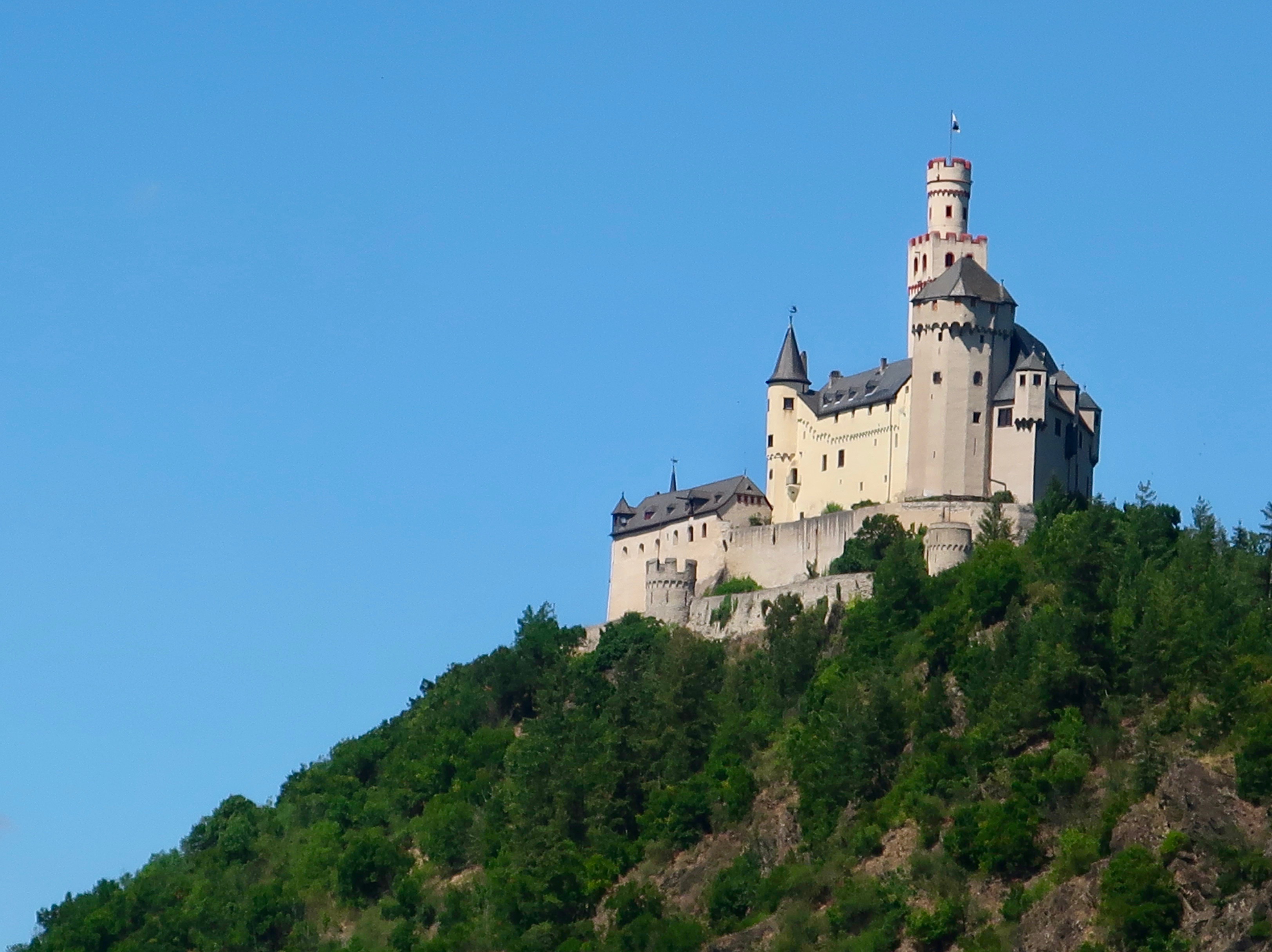
We are wrapping up our Rhine River Cruise. Considerable beauty… And lots of castles! This is Marksburg Castle which was one of three we toured.
Note: As you read this, Peggy and I are in Amsterdam at the beginning of a Rhine River cruise between Amsterdam and Basel. I’ve been scheduling posts ahead of time so I can maintain a more regular presence on WordPress than I have been able to for the past several months. My goal for now is once a week on Fridays. At this rate, I already have enough material on the Southwest national parks we visited in April and May to keep going for three months. LOL. I may never catch up.
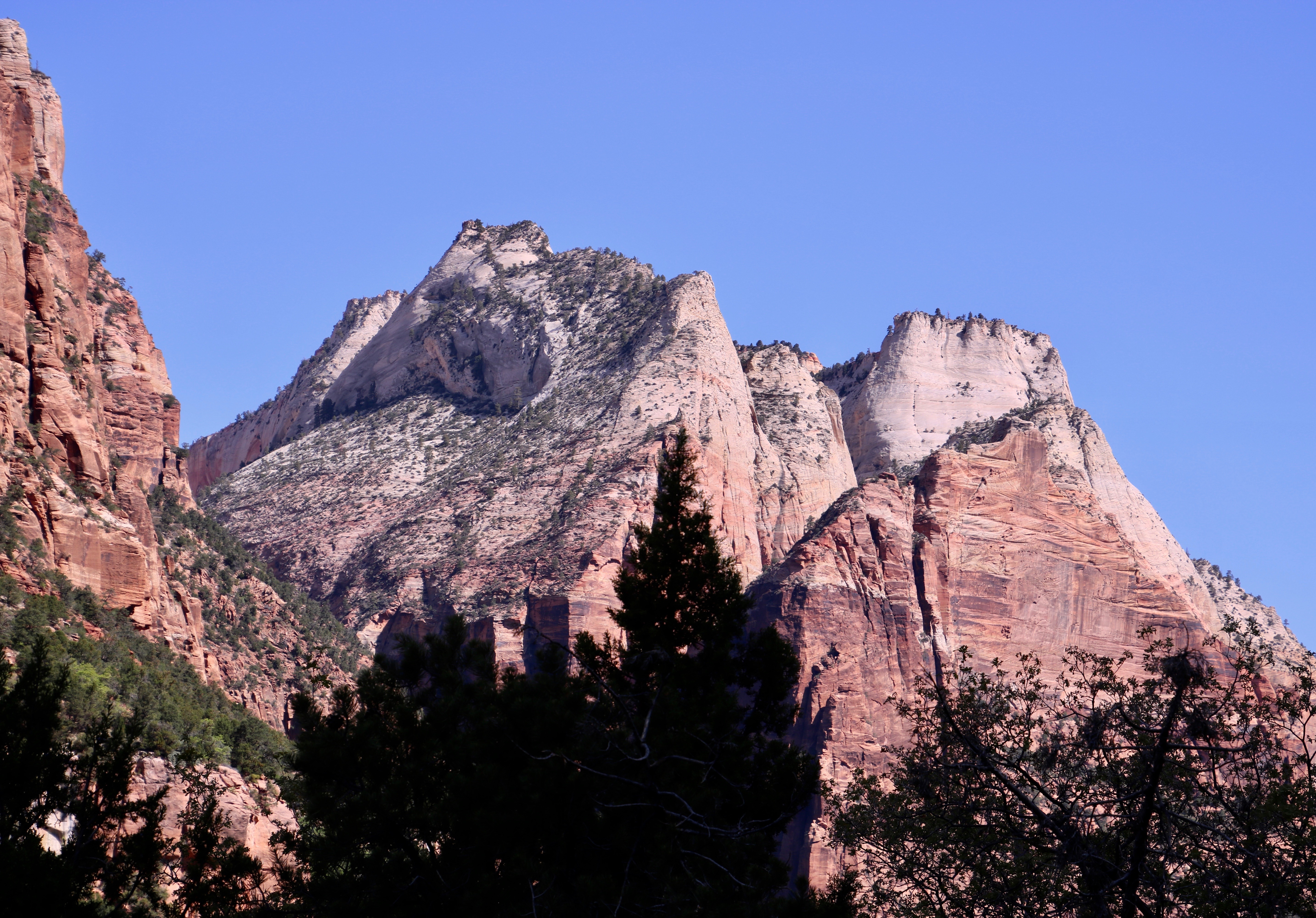
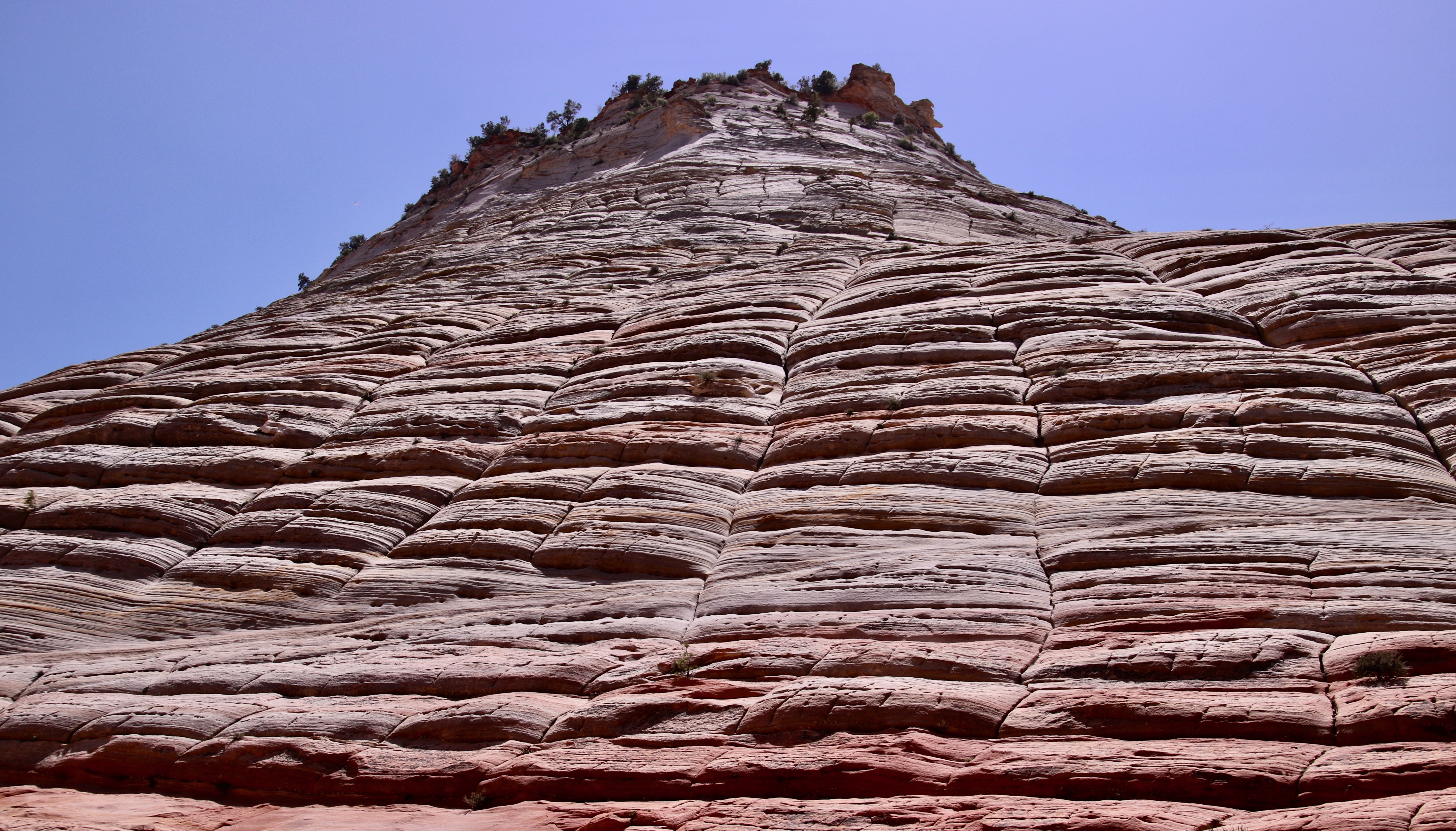
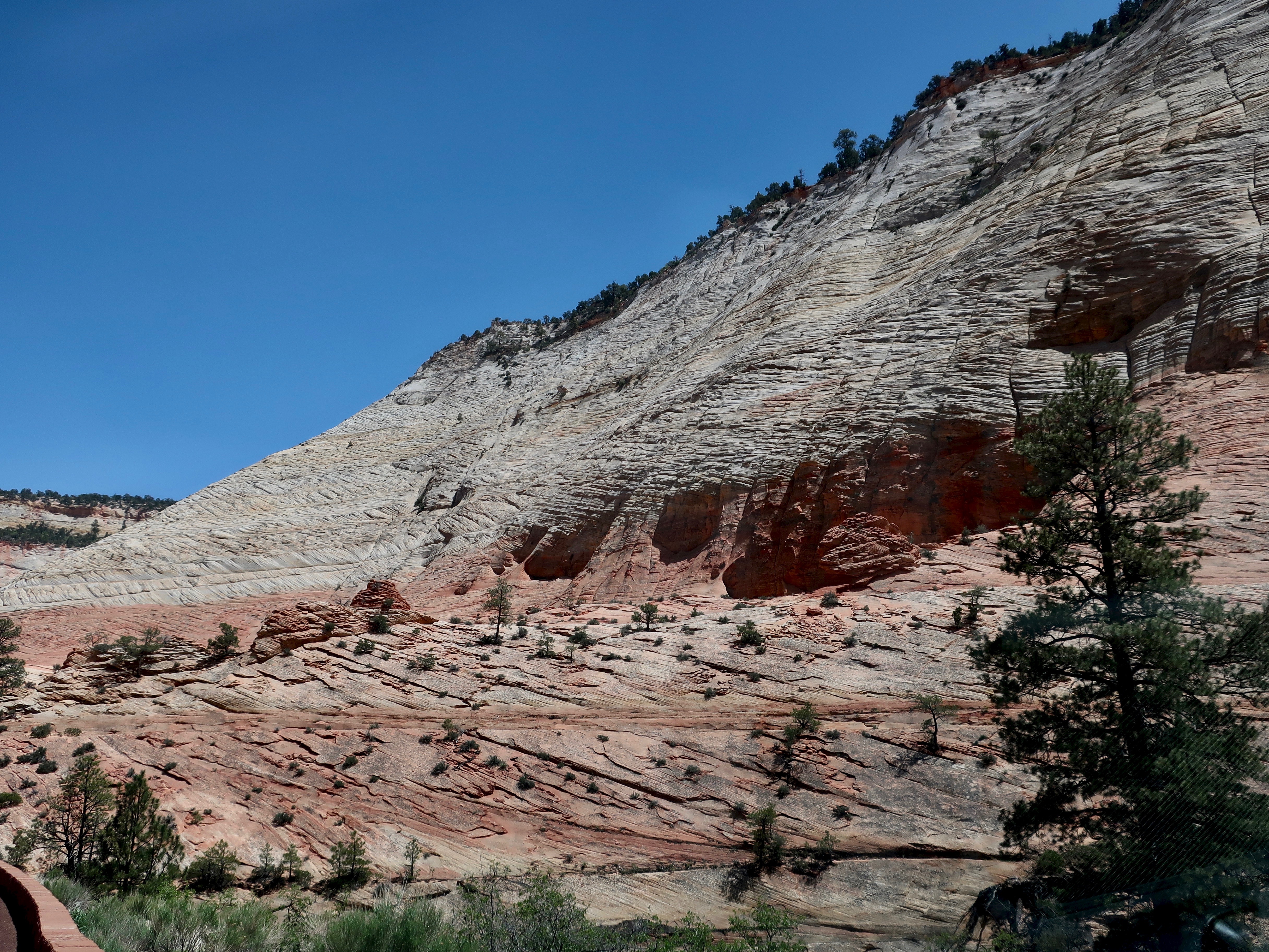
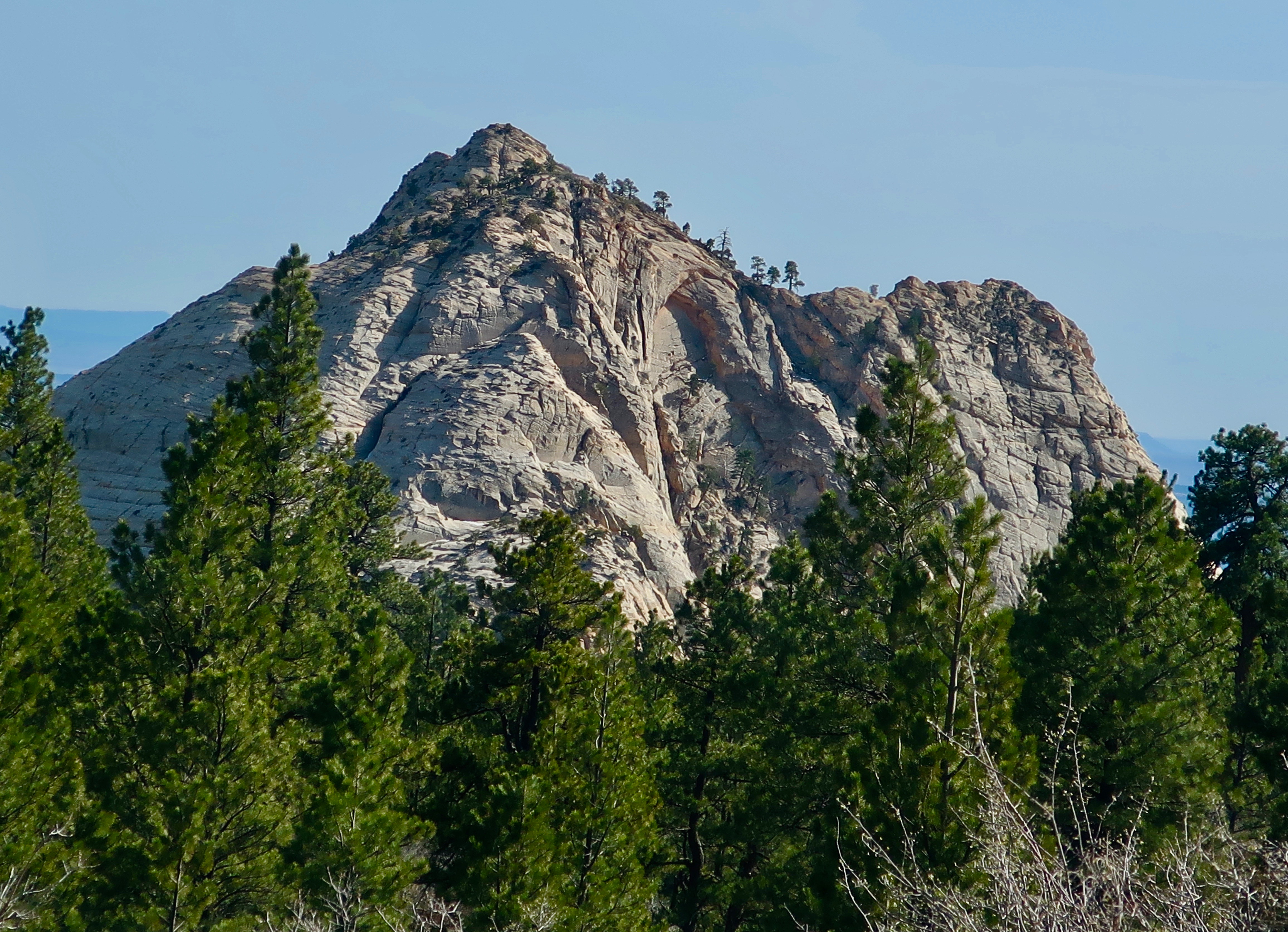
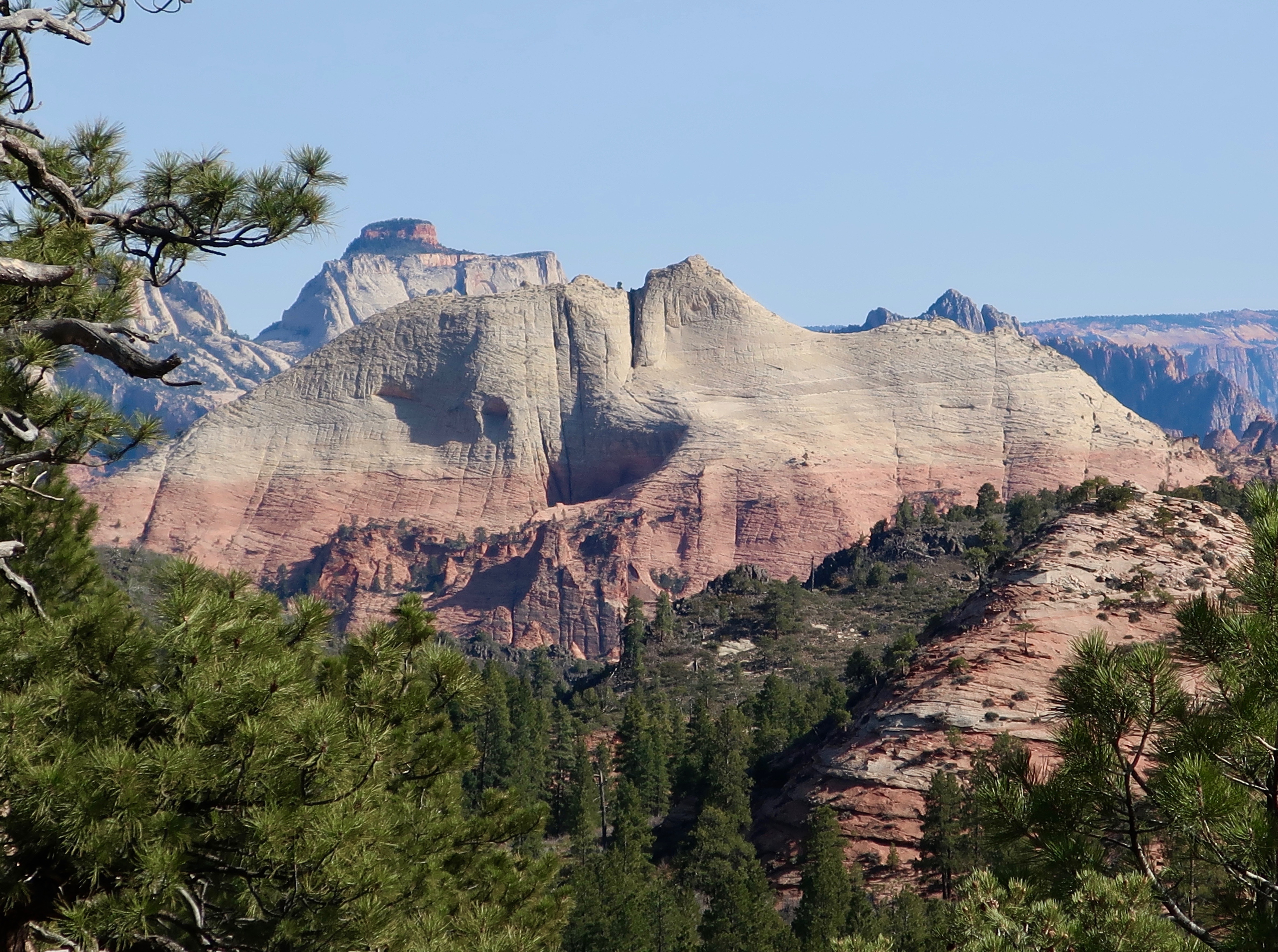
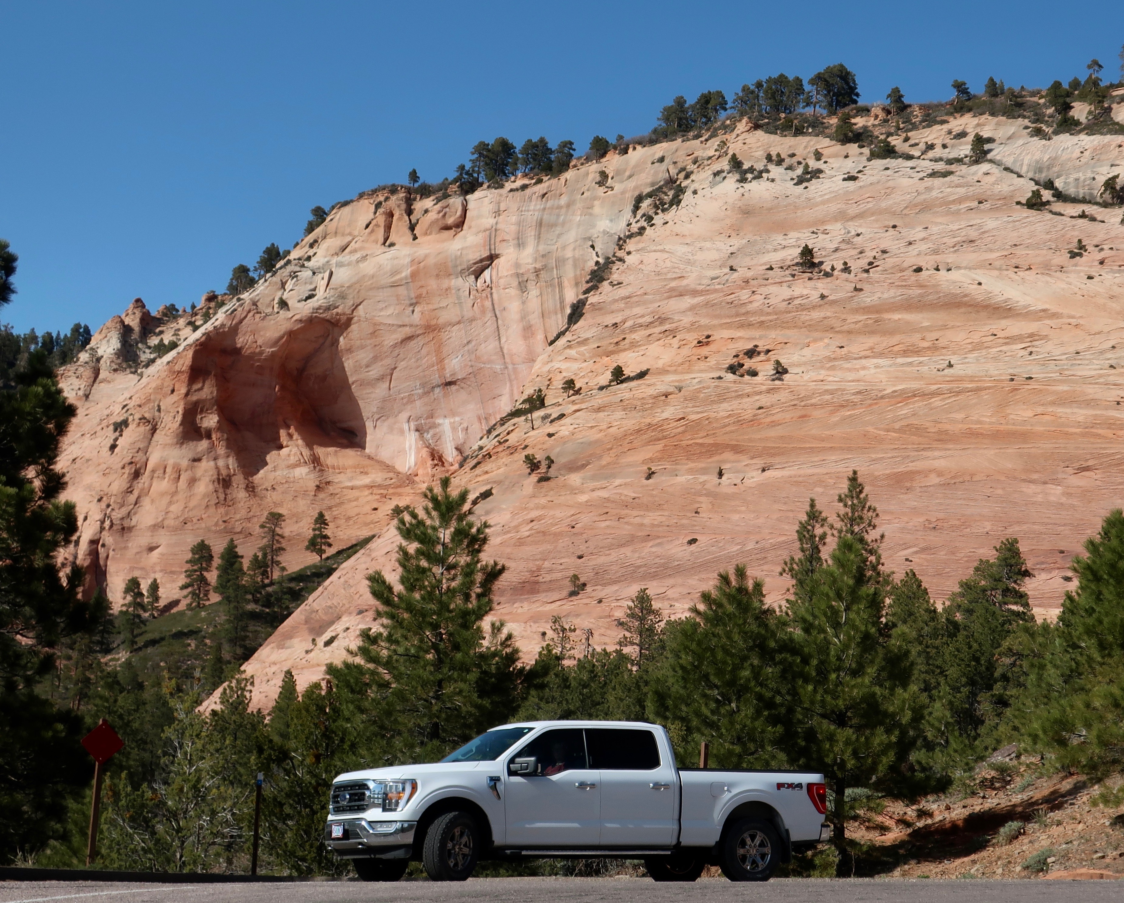
Checkerboard Mesa is the dominant geological feature of the eastern section of Zion National Park. (Photo by Peggy Mekemson.)
Rudyard Kipling said it:” East is East and West Is West, and never the twain shall meet.” That’s not true of Zion National Park, of course, but the eastern section of the Park will provide you with a significantly different experience than you have down in the Canyon or the western sections of Zion. Checkerboard Mesa shown above is the primary example. We can thank ancient sand dunes laid down in an early-Jurassic-era, Sahara-size desert that covered significant portions of what is now Nevada, Arizona, Utah, and Colorado 190 million years ago. The horizontal lines are caused by what is known as cross-bedding of the dunes. The vertical lines are caused by breaks in the cross bedding caused by freezing and thawing. It was thought that the results resembled a checker board, thus the name. Peggy and I found the mesa a fun subject for photography.
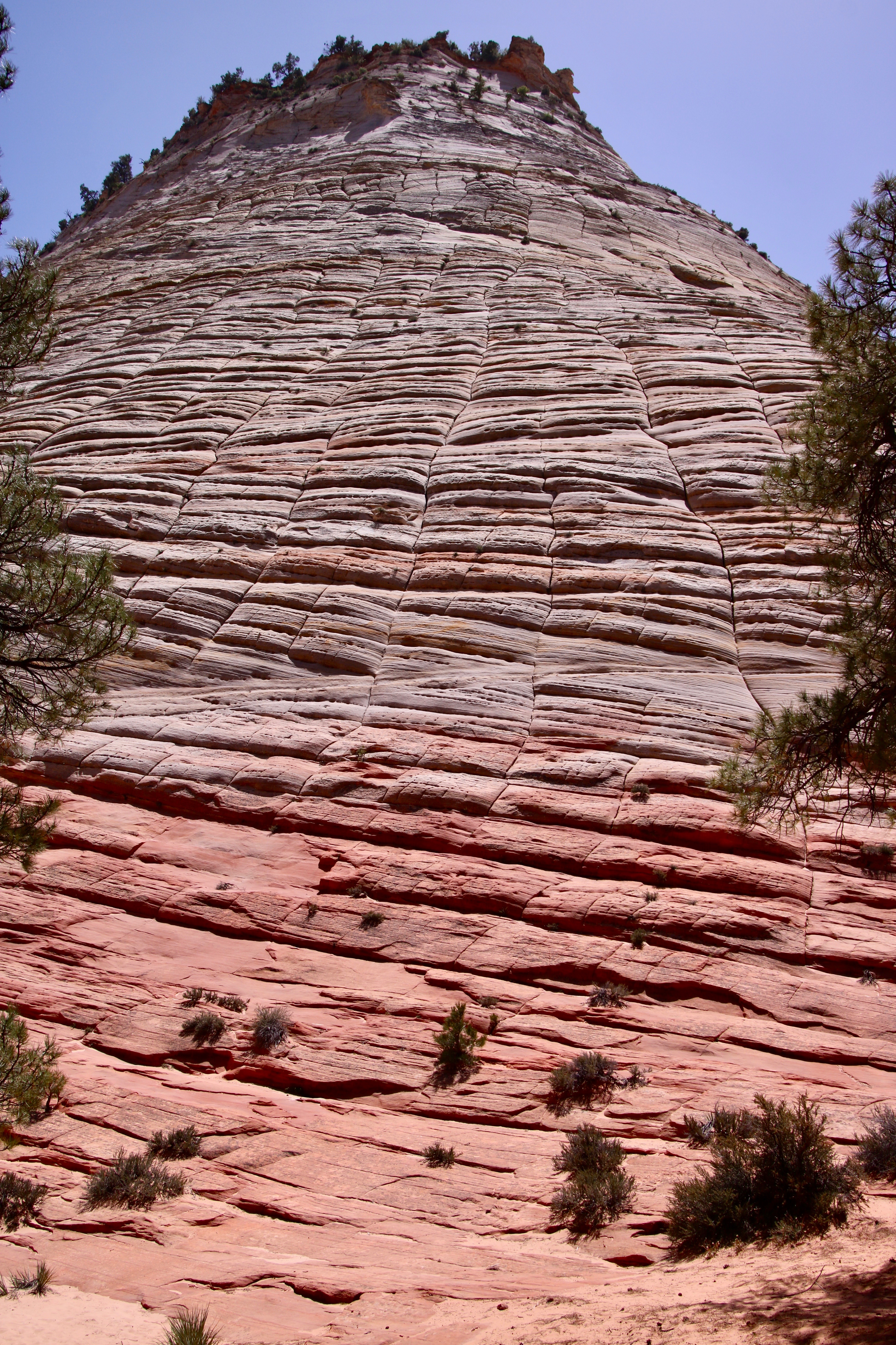
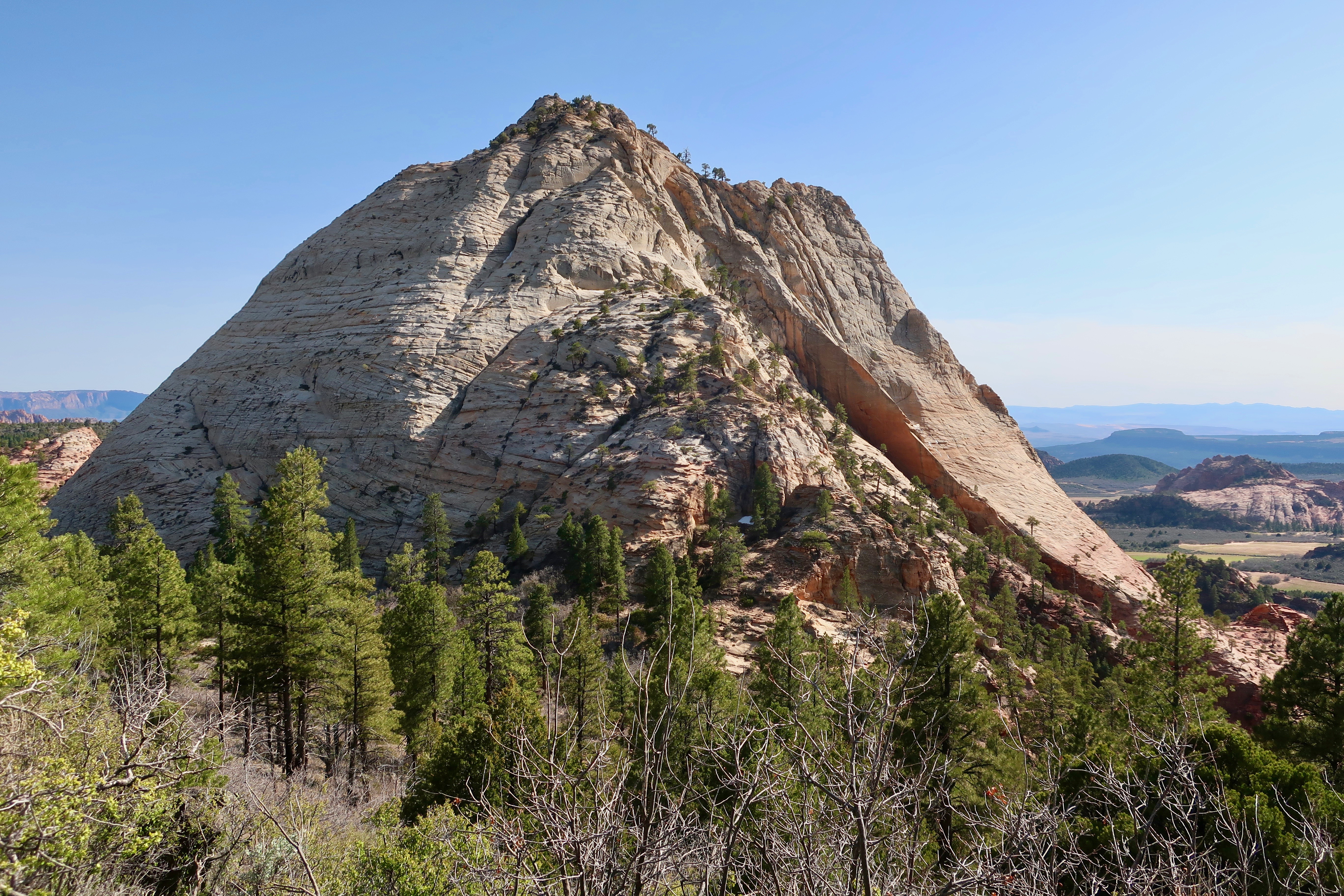
I moved back to provide a broader perspective on the Mesa using pine trees for framing.Peggy added a photo of the massive chunk of Navajo Sandstone reaching toward the sky. It’s quite a scroll down. Grin. (Photo by Peggy Mekemson.)If you are driving up from Zion Canyon, this will be your first view of Checkerboard Mesa.We were both interested in the cross-bedding. Peggy took this interesting side view.(Photo by Peggy Mekemson.)This was the view looking a bit farther north of Peggy’s photo.This was the view looking south.
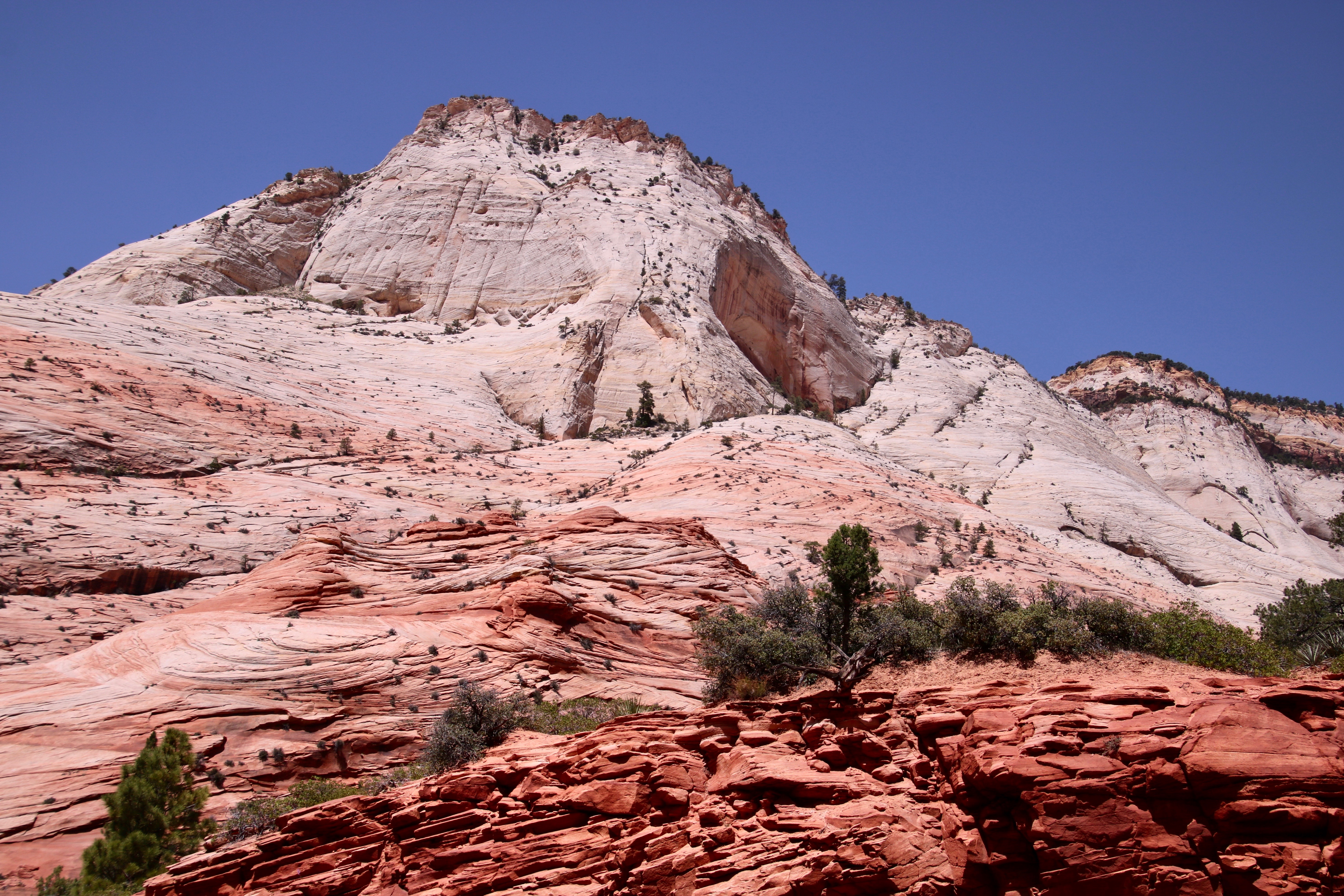
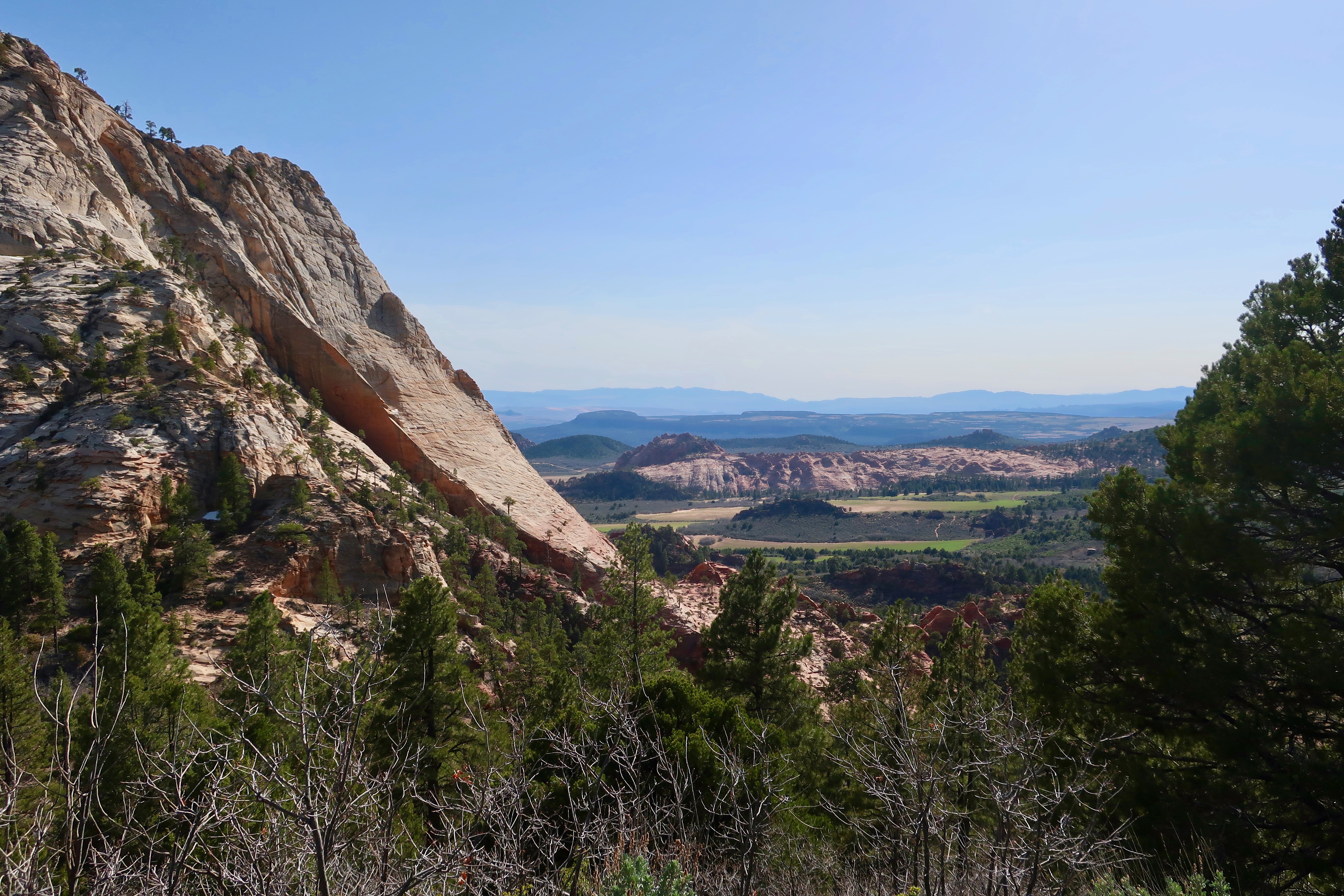
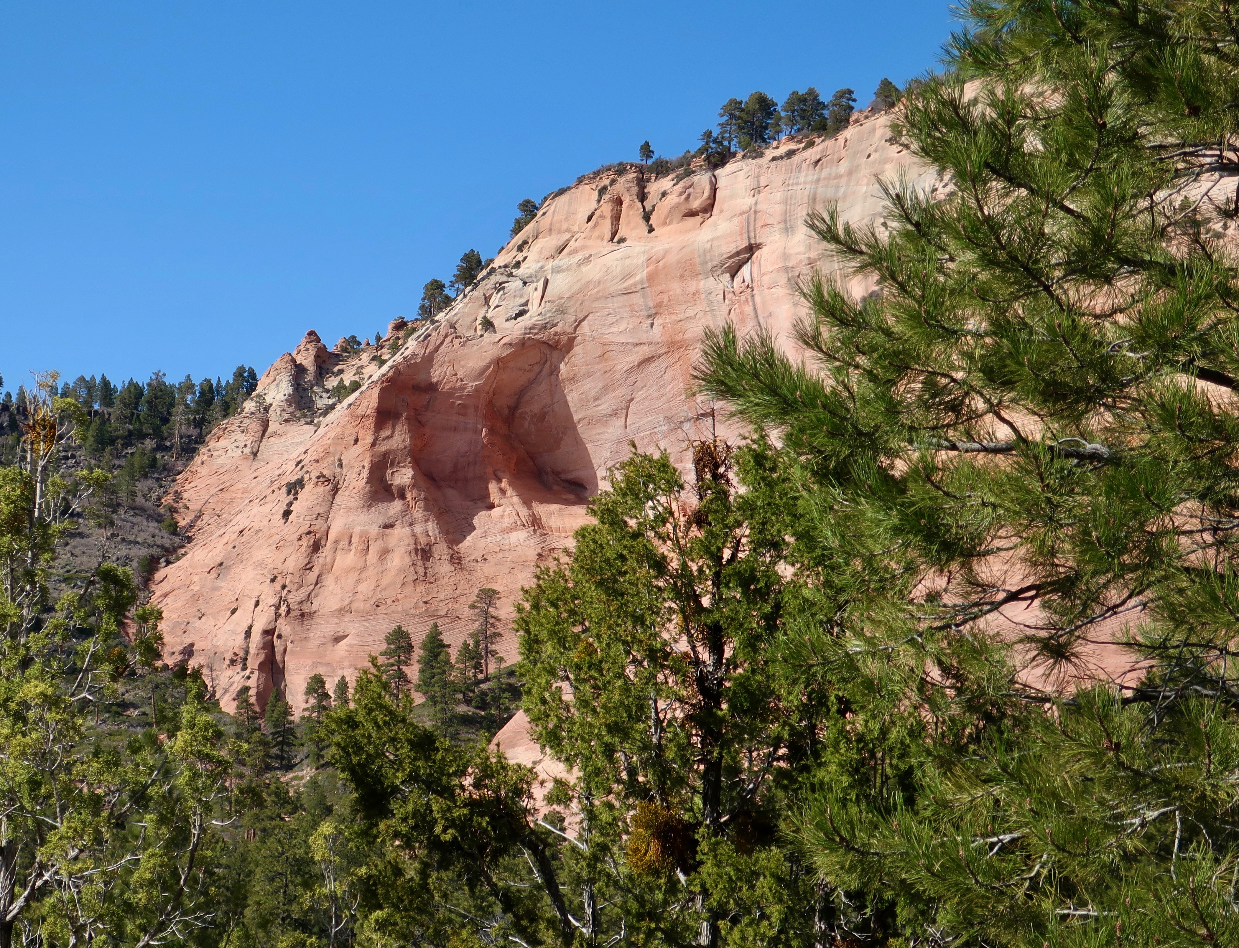
If you have been in Zion and either entered or left by the east entrance/exit, you know there is much more to East Zion National Park than Checkerboard Mesa. One thing that fascinated Peggy was the alcoves that may eventually lead to towering arches such as those found in Arches National Park.
Looking toward the top of a Navajo sandstone mountain, you can see how the ridge coming down the front is eroding from both sides. This may eventually lead to an arch. (Photo by Peggy Mekemson.)This provides a straight on view of the alcove on the right of the ridge. Note how deep the alcove is. (Photo by Peggy Mekemson.)Another alcove. Alcoves and arches are created when a harder capstone is on top of a softer stone that erodes more rapidly. (Photo by Peggy Mekemson.)And another alcove photographed by Peggy. Had there been more, I am sure that she would have photographed them as well! (Photograph by Peggy Mekemson.)
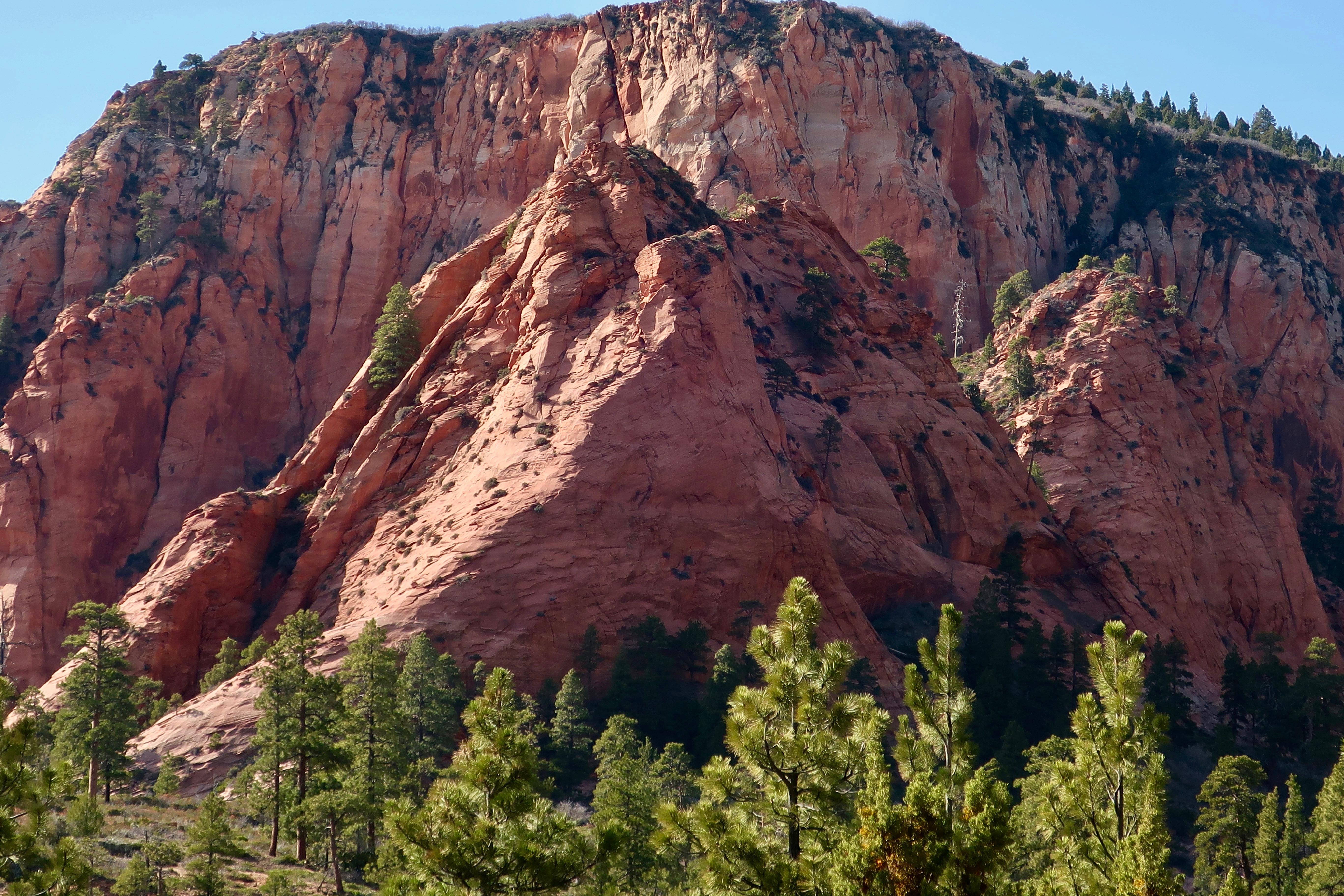
While Peggy was busy photographing wannabe arches, I was concentrating on other landmarks of East Zion National Park.
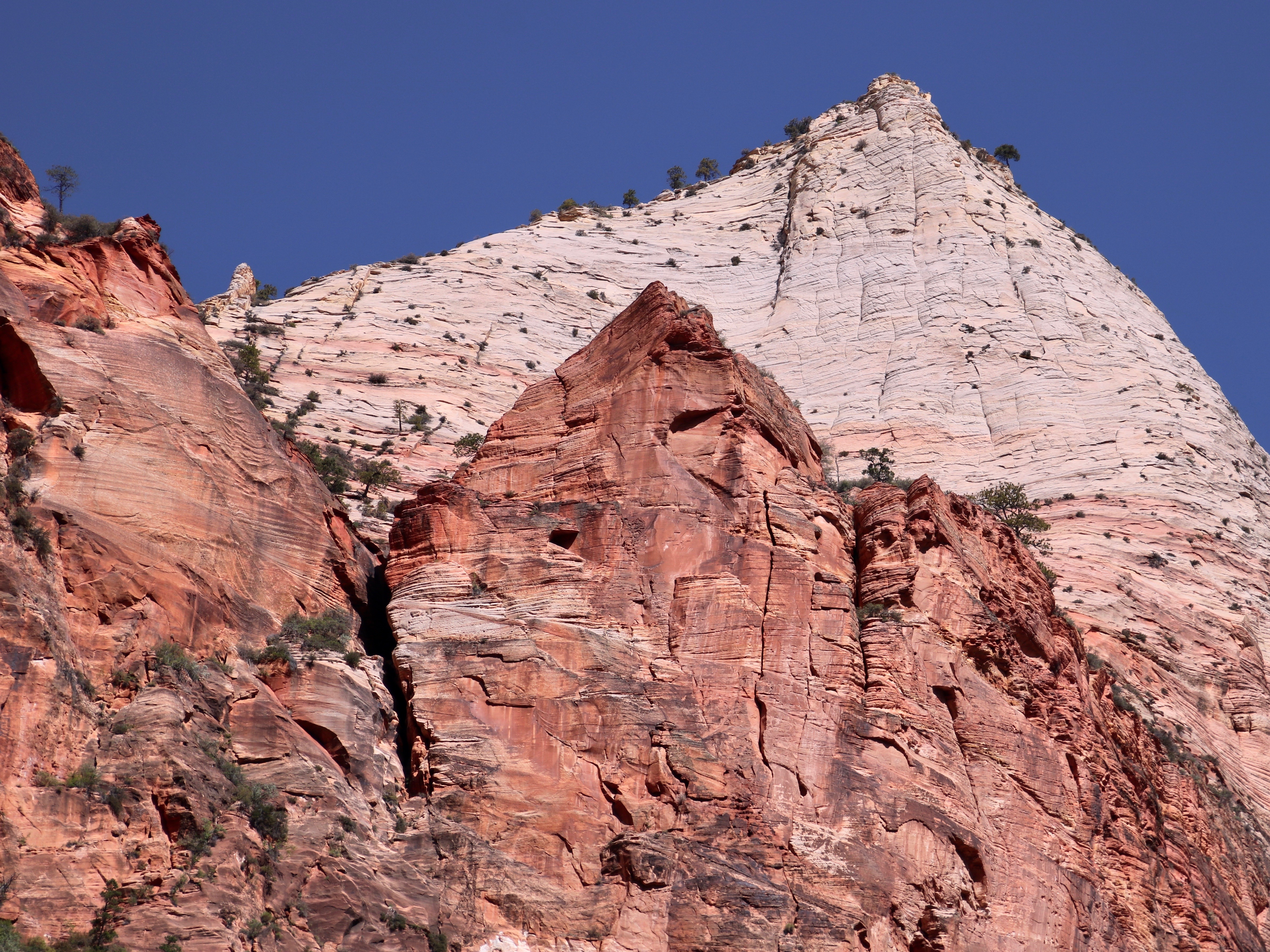
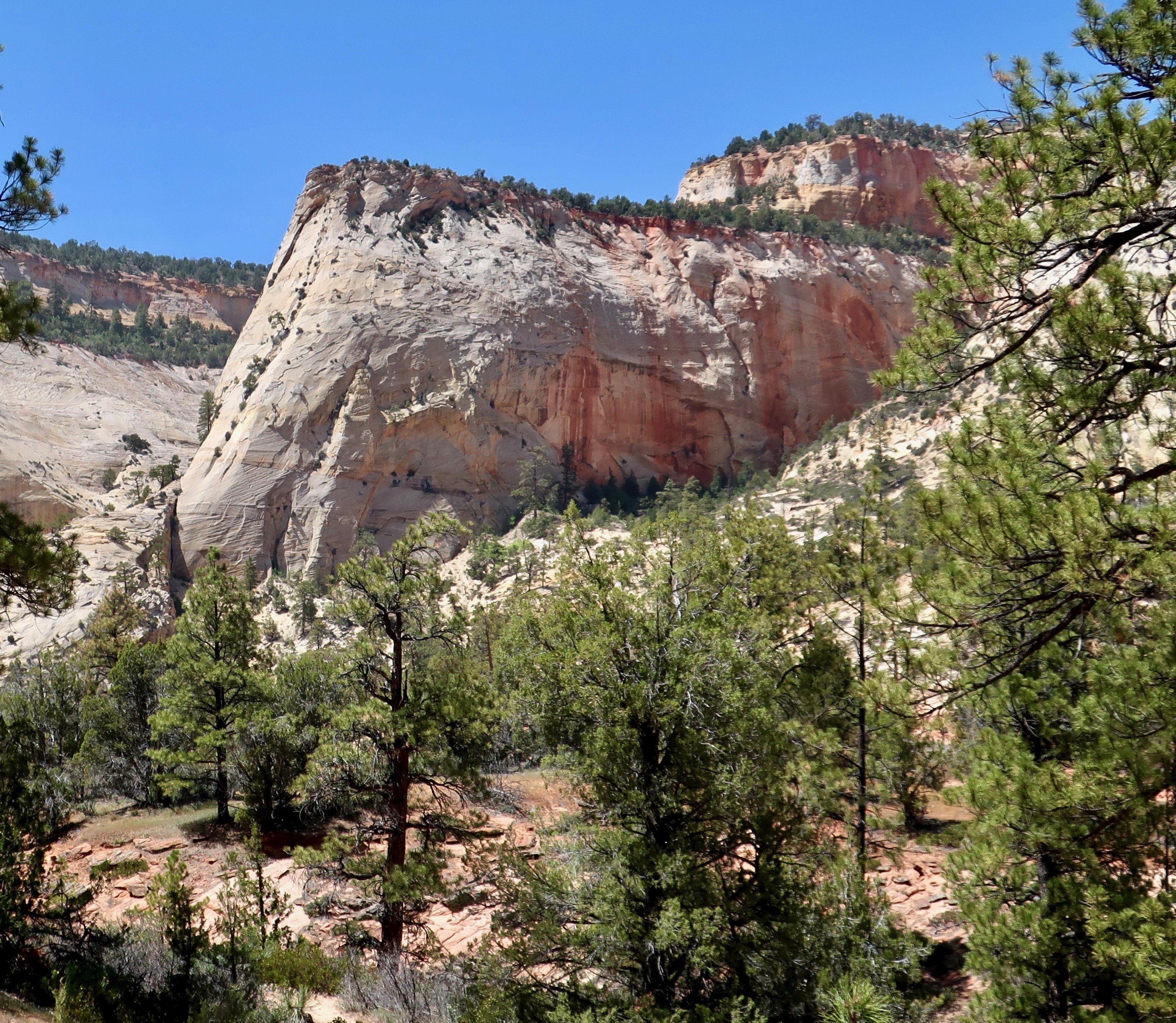
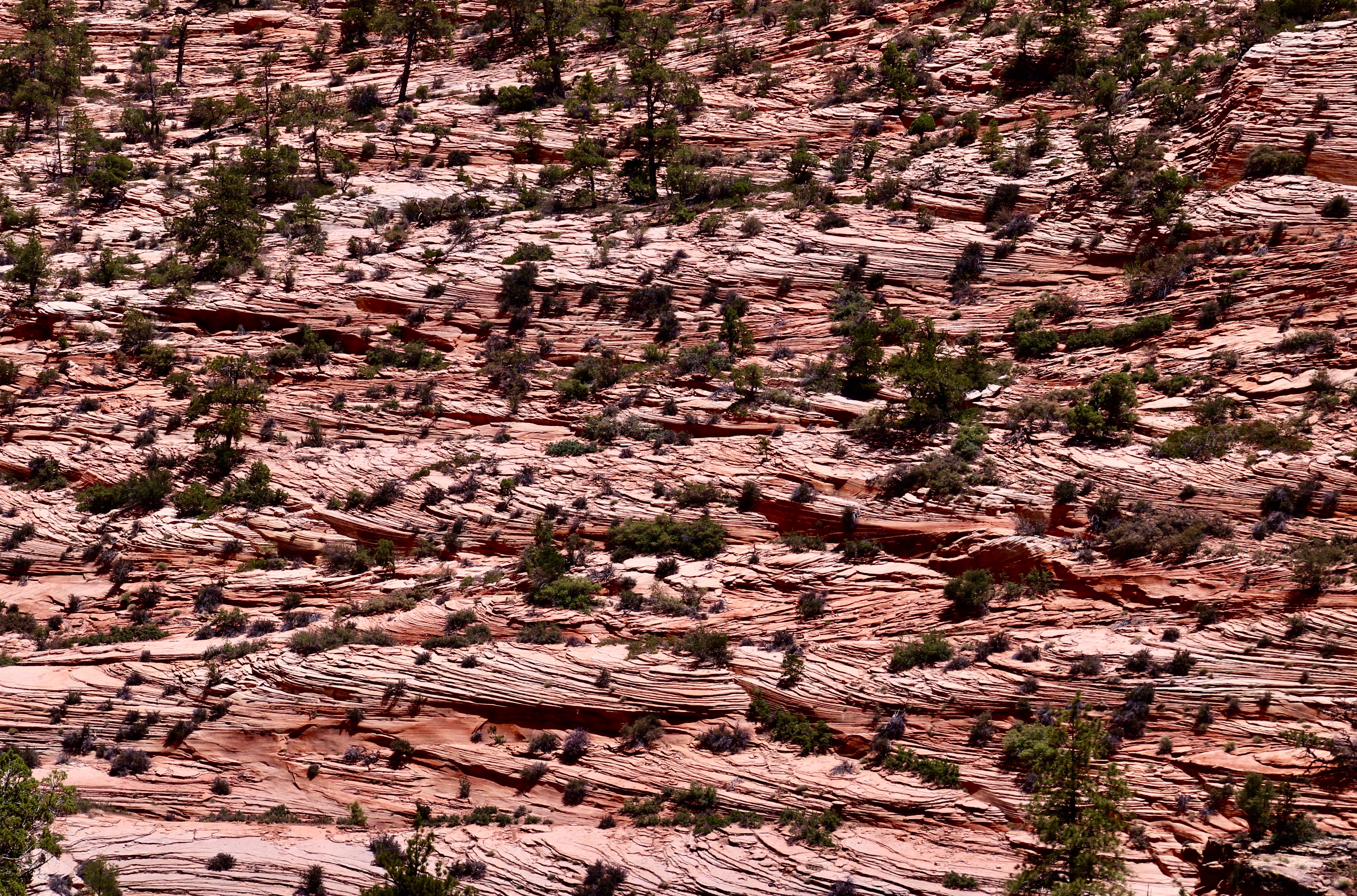
I found this landmark rather impressive.I wondered about the huge chunk of rock that left behind a bright red scar in this landmark. The other side is one of the alcoves that Peggy photographed. Another prominent Mesa standing out like the prow of an ocean liner.A mesa on a mesa. Peggy was impressed with its color. (Photo by Peggy Mekemson.)I’ll close today with this interesting photo that Peggy took of shrubs and small trees growing on cross-bedded sandstone. I thought, ‘Wow, this would make one heck of a challenging puzzle!’ (Photo by Peggy Mekemson.)
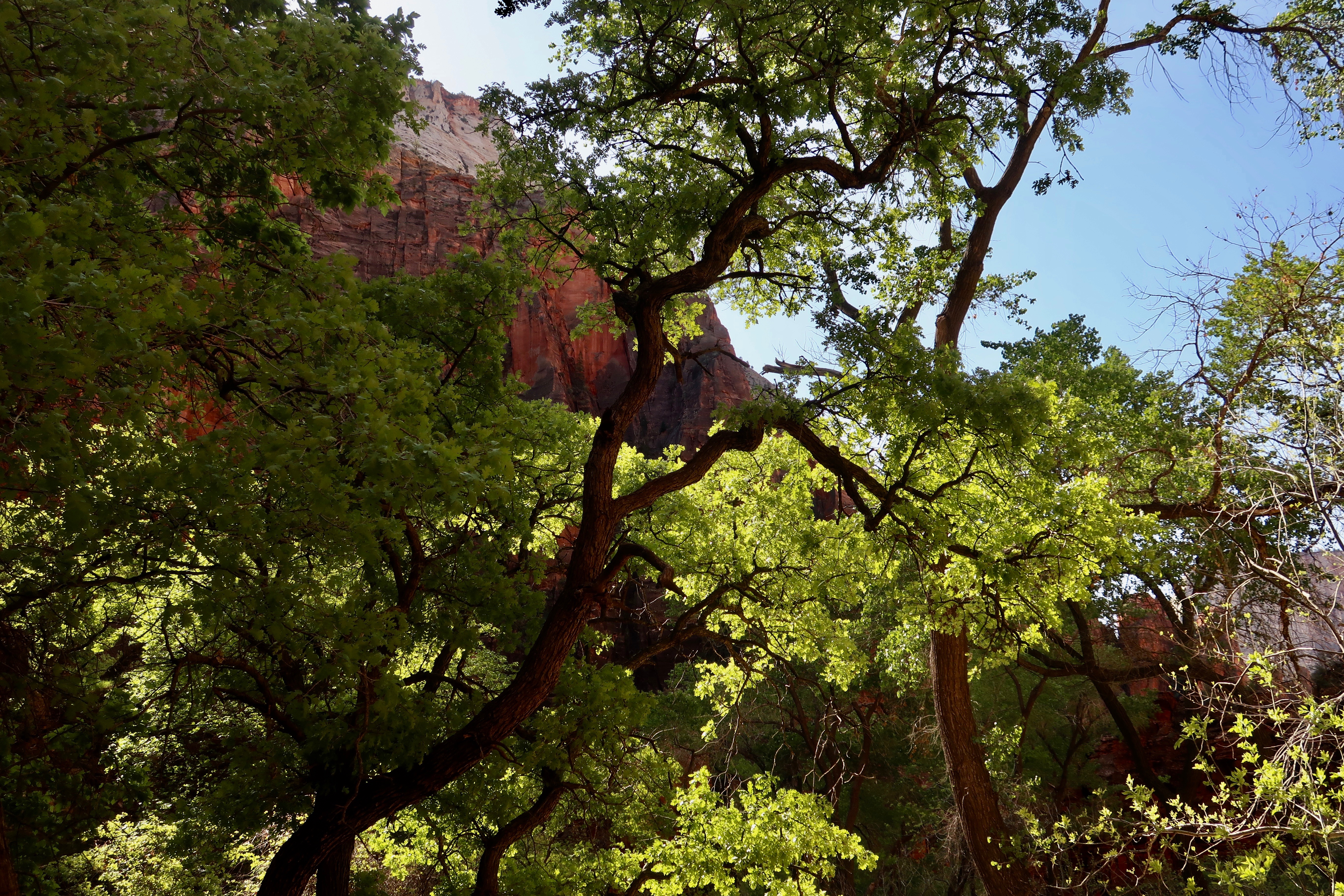
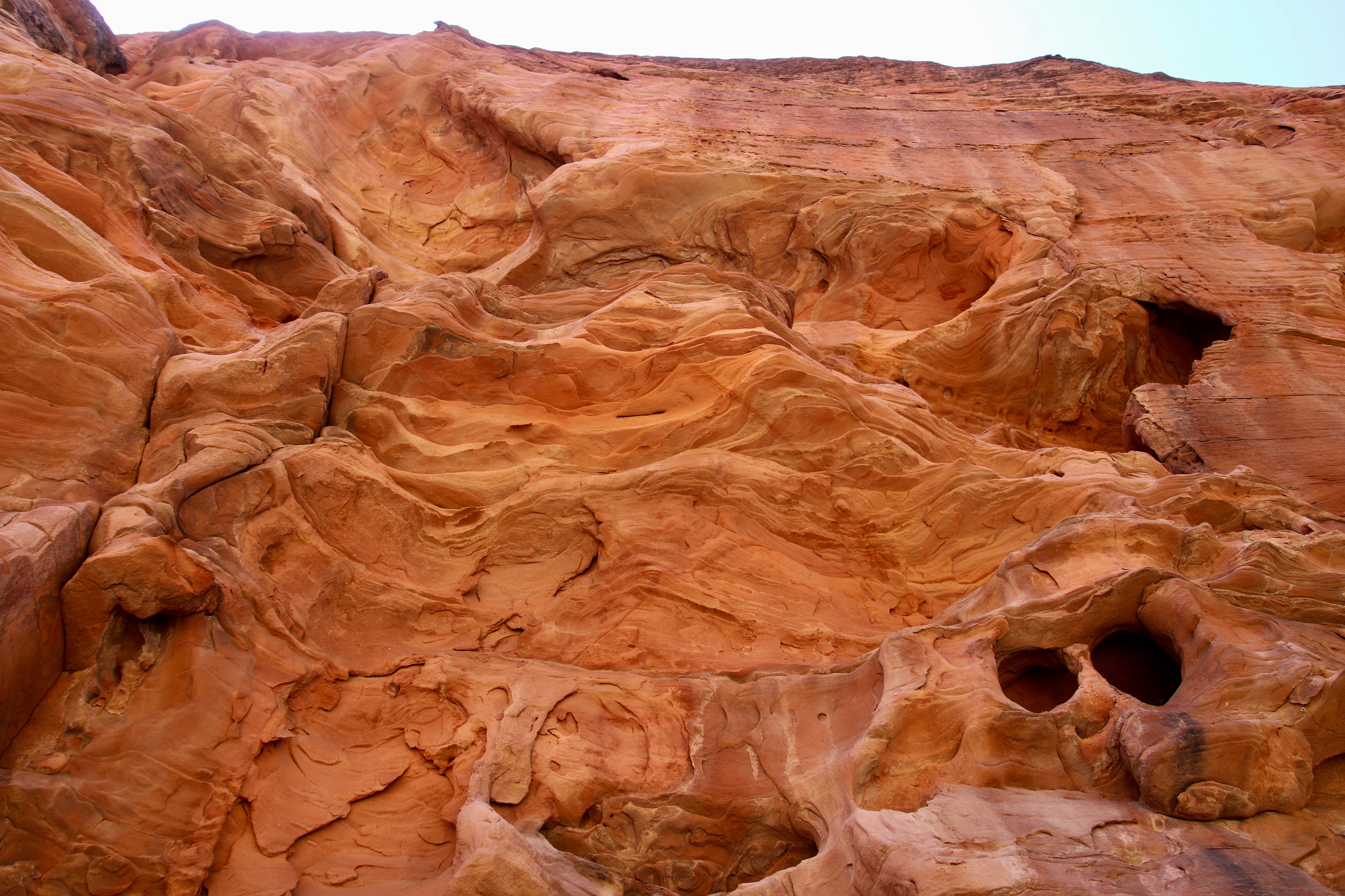
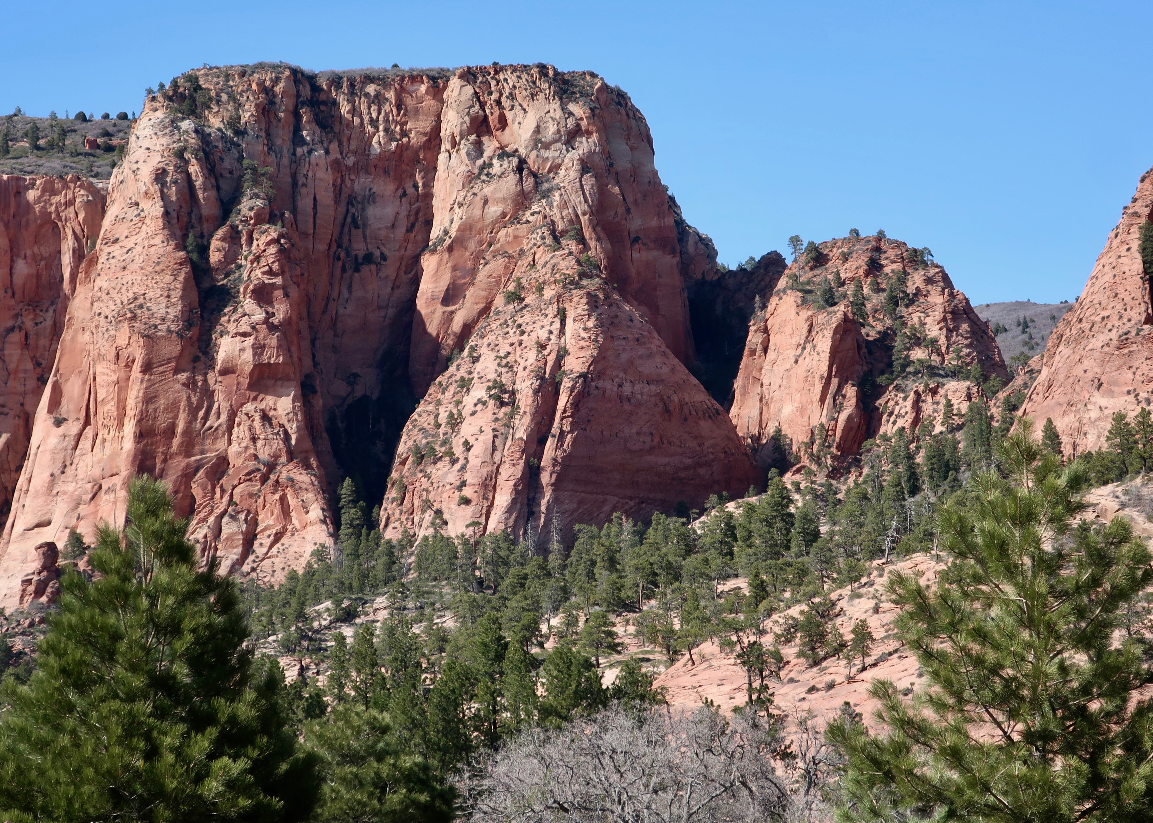
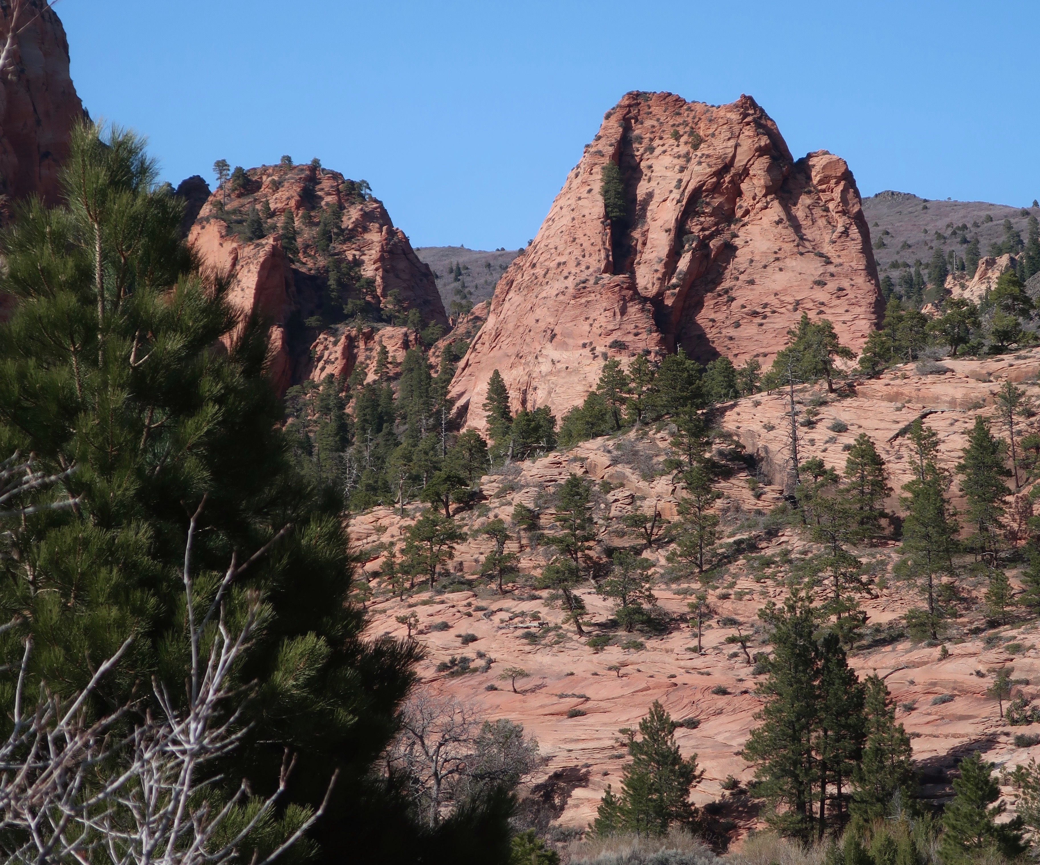
Peggy and I found this interesting rock formation looming above the petroglyphs that we located in the eastern section of Zion National Park. It was only the beginning of unusual rock structures that defined the area.
I quickly learned when I was a Peace Corps Volunteer in West Africa that my reality was substantially different from that of the tribal students I was teaching. It was a lesson that has served me all of my life. The human mind is incredibly flexible and our reality, to a large extent, depends upon what we are taught. Given my 1965-67 experience in Liberia, I can’t even start to imagine what people believed 7,000 years ago.
That’s when humans first started wandering the area now known as Zion National Park. They started with Archaic peoples, moved on to the Anasazi and Fremont cultural groups, and, in turn, were followed by the ancestors of modern day Native American Paiutes. Any or all of these groups may have left petroglyphs in the slot canyon Peggy and I explored in the eastern section of the Park. And all of them reflect thinking that we can only guess at.
Peggy and I are fascinated by petroglyphs, both from the connection it gives us to people from hundreds or even thousands of years ago, and from the unique look of rock art. We have visited sites throughout the Southwest. There is a certain commonality to the rock art depending on the culture represented. We have also found a similarity to sites selected by the ancients to leave their messages. Not surprisingly, they tend to be near water, which is where the people lived. But there was also an inclination to select locations that stood out from the surroundings. Possibly it gave a sense of sacredness to the area.
The site we visited was an excellent example of this, as our photos show. The strangeness, however, started with the directions to find the site. As I remember them: “Go down into the canyon and find a sand wash. Follow the wash up the canyon until it comes to the tunnel under the road. Go through the tunnel and follow the wash until you come to a trail to your left.” There was as much room for interpretation in following the directions as there was for interpreting what the petroglyphs meant!
Our photos start with the tunnel.
It was appropriately hidden by trees and bushes.The sandy wash led right to it, however. The light we could see on the right suggested that the tunnel was a few feet long. (Photo by Peggy Mekemson.)Reality was different. It was much longer than it appeared to be. Fortunately, there was a light at the end of the tunnel.Peggy walked toward the light and disappeared. She boldly went forth where numerous others had obviously travelled, judging from the foot prints in the sand. But did they ever return? Maybe a little Sci-Fi/Horror movie music is called for here.She was waiting for me in the sandy wash that led onward, supposedly toward a trail that would lead off to the left and petroglyphs. We quickly learned that there were several trails leading off to the left where people had gone in futile searches! Fortunately, Peggy and I had an advantage…We were looking for an area that suggested the presence of petroglyphs. This rock structure seemed a likely candidate. We started looking for a trail to the left, and found even more interesting rocks.Peggy caught this photo and the following one.Photo by Peggy Mekemson.How’s this for unusual? If I were a shaman, I’d think this would be a great location for petroglyphs.This fellow was not a petroglyph but part of the rock face, so to speak. I’ve learned a new word, BTW: pareidolia, the tendency to read into patterns and interpret visual stimuli, even when there is no intentional meaning present. A lot of that happens in my blogs. (Photo by Peggy Mekemson.)There was something surreal about the beauty of the area. (Photo by Peggy Mekemson.)I looked up and caught this colorful view.And then we reached the site. It was just beyond the green shrubs if my memory serves me correctly. It’s hard to imagine a more stunning location. We were prepared to enter the alternate reality suggested by petroglyphs.The petroglyphs were waiting. This is obviously a human like figure, probably a woman, but what’s with the strange diagram underneath? Does it represent power lines reaching out to the universe from the individual. I stared at it for a while and wondered if it didn’t represent a reflection in water. Or a moon shadow. Remember the song by Cat Stevens? (Photo by Peggy Mekemson.)Another reflection shot? A selfie? Or possibly a mating couple. Such images are not uncommon in petroglyphs.This is frequently thought of as being an origin petroglyph, representing the entry into this world from another world. This panel clearly represents petroglyphs created in different times with the figures in the upper right being of more recent origin. Are they hiking with packs? Or are they paddling a boat? The wavy line may represent a lake and a stream. Or a snake? The lower guy on the right seems to be asking the question while the guy on the left seems to be running like crazy to escape. (Photo by Peggy Mekemson.)I labeled this guy as a moose. Why not— even though there is no record of moose in the Park area except in 2013 when one showed up. 🙂 Tourists were told to keep their distance. We’ve found women portrayed like this throughout the Southwest. The circular figure may be the sun. I wondered if the wiggly lines represented counting, or a snake, or a river. Or…My imagination placed this woman on the warpath! 🙂 (Photo by Peggy Mekemson.)
There were many other petroglyphs. At the end of the panels, Peggy and I found steps carved into the canyon wall leading up to a ledge.
I thought it might be interesting to climb up them and explore the ledge. Peggy felt it best that her 79 year old husband be grounded. Grin.
Wandering up the trail in search of more petroglyphs, we found a dead big horn sheep that may have slipped while climbing the walls. Or been taken out by a cougar.
It did not look very happy. Peggy wondered why I wanted to photograph it and decided it was a sign that we should turn around. Admittedly, it did look a bit Satanic…
Shortly afterward we came to what was obviously the end of the trail unless we wanted to scramble over rocks. We turned around leaving the sheep, the petroglyphs, the beautiful canyon and the tunnel behind. It had been quite an adventure. In my next post we will explore more of the unique beauty of East Zion National Park.
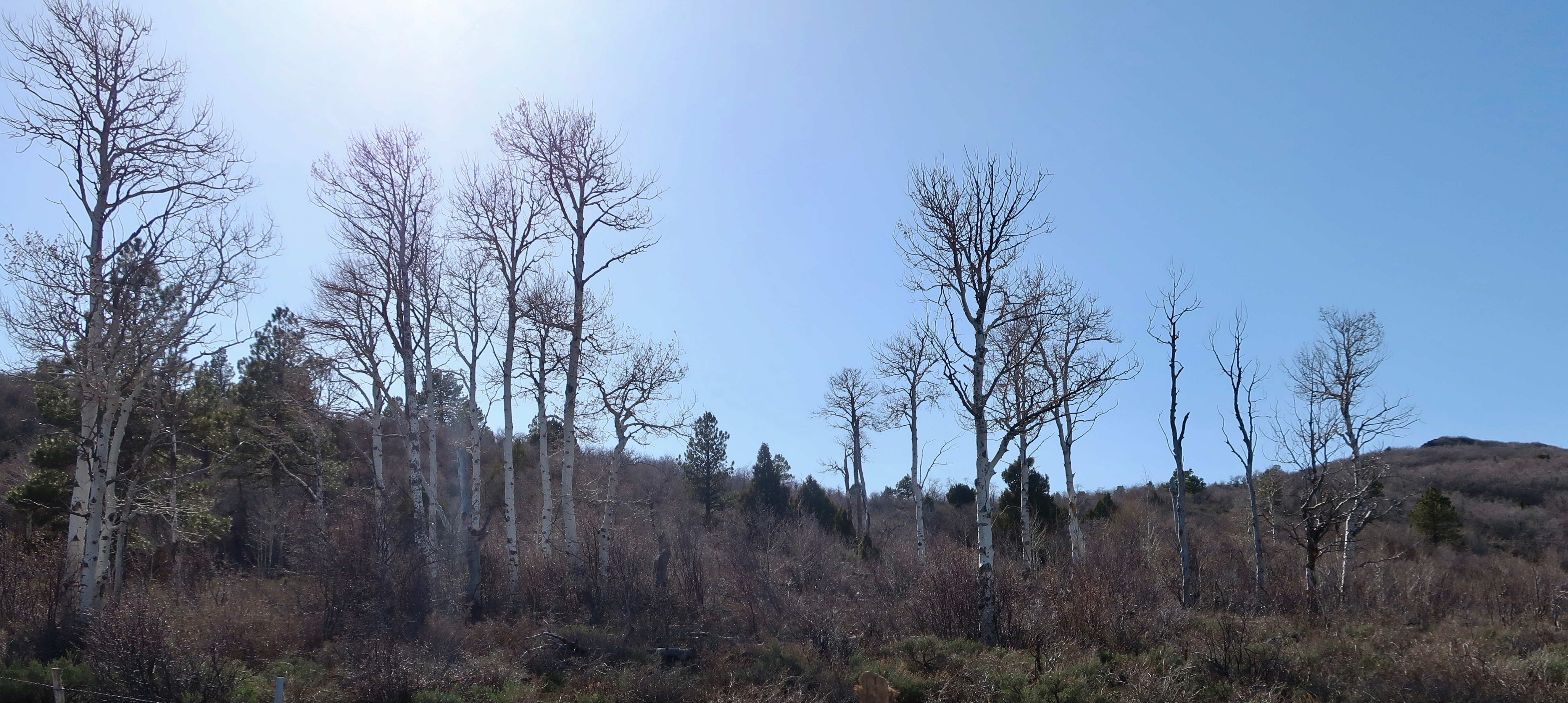
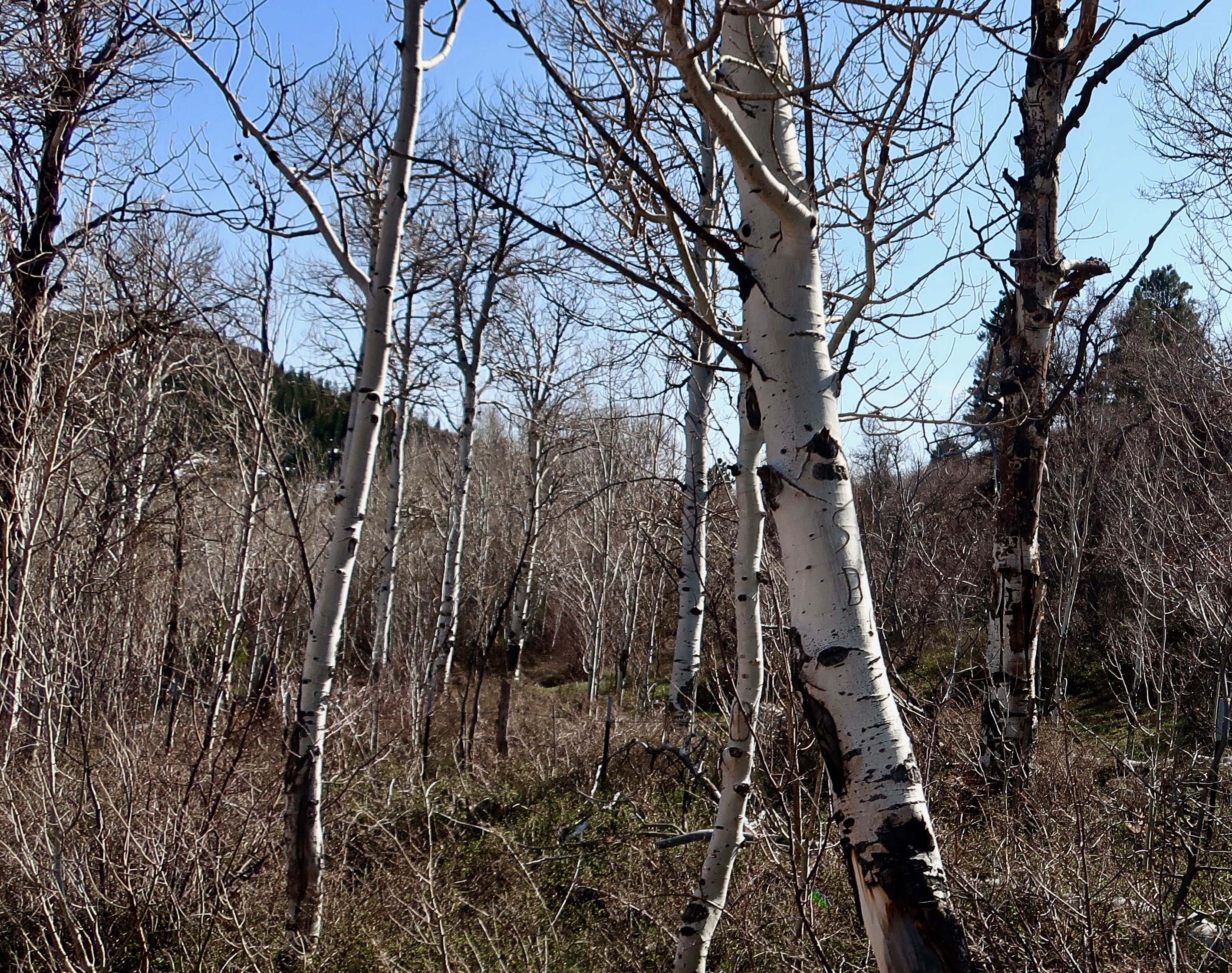
At 8,100 feet, the aspens on Kolob Terrace in Zion National Park were convinced it was still early spring. Or maybe late winter. We had climbed 4,500 feet since leaving our campground on the Virgin River of Utah.
The thunder rolled in with an unending rumble and the wind shook our trailer until I thought it might tip us over. We are in Kansas and I couldn’t help but think of Dorothy and her faithful dog, Toto. I half expected to hear the tornado sirens go off or see a wicked witch fly by on her broom. It was not conducive to sleep. Instead, I watched the lightning dance across our skylight while Peggy slept soundly. Maybe she thought I could worry enough for both of us. “Oh, was the wind blowing last night?” she asked me the next morning.
We’ve now left the backroads, mountains and mesas of the Southwest behind. It will be mainly freeway from here on out as we dash across the country to catch our Icelandic Air trip to Amsterdam— except it isn’t that much of a dash. We’ve simply eliminated our 5-7 day layovers between travel days. We still only plan to travel around 200 miles a day with every other day a layover. I’ve never had a sense of humor about driving 4-5 hundred miles straight. And it certainly hasn’t improved with age.
I may change my mind if this weather continues, however. We are under severe thunderstorm watch again tonight. We could be at our daughter’s in Virginia in four days instead of the two weeks I am planning. I have even less tolerance for tornados and golfball size hail than I do driving long distances. Tempting…
Meanwhile, my blog is still in Zion. I have at least three more posts on it, maybe more! 🙂 And then there is Bryce and the North Rim of the Grand Canyon, and Mesa Verde, and the Rockies, and dinosaur tracks, desert wildflowers and petroglyphs. Will it ever end? 🙂 Peggy and I have taken at least a thousand photos. I’m afraid to count them. But don’t worry, we won’t subject you to all of them.
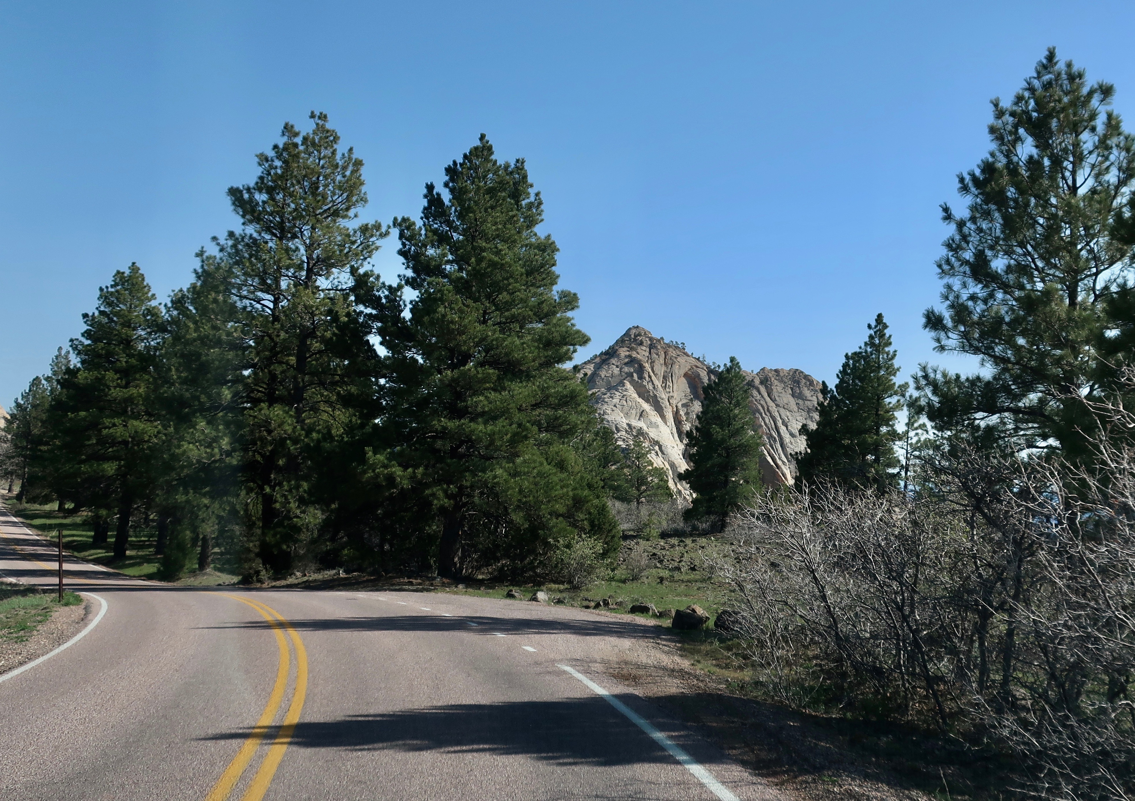
Today, my focus continues to be on the Kolob Terrace section of Zion National Park. After some very winding roads we made it to the top of the Terrace. The views continued to be spectacular.
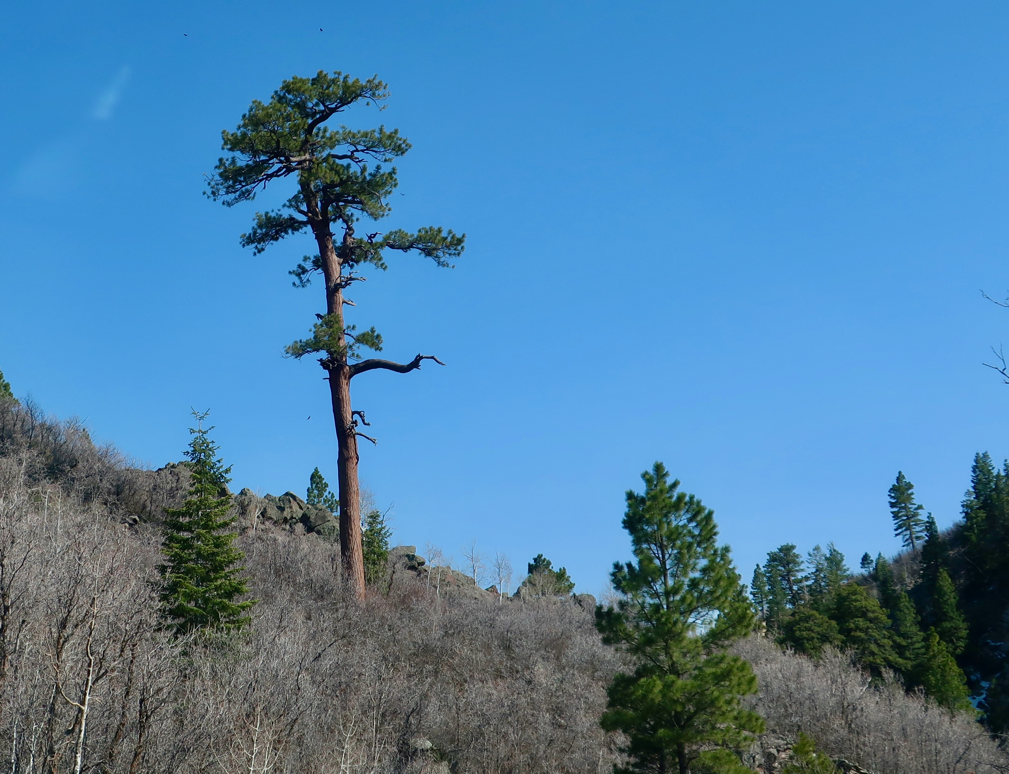
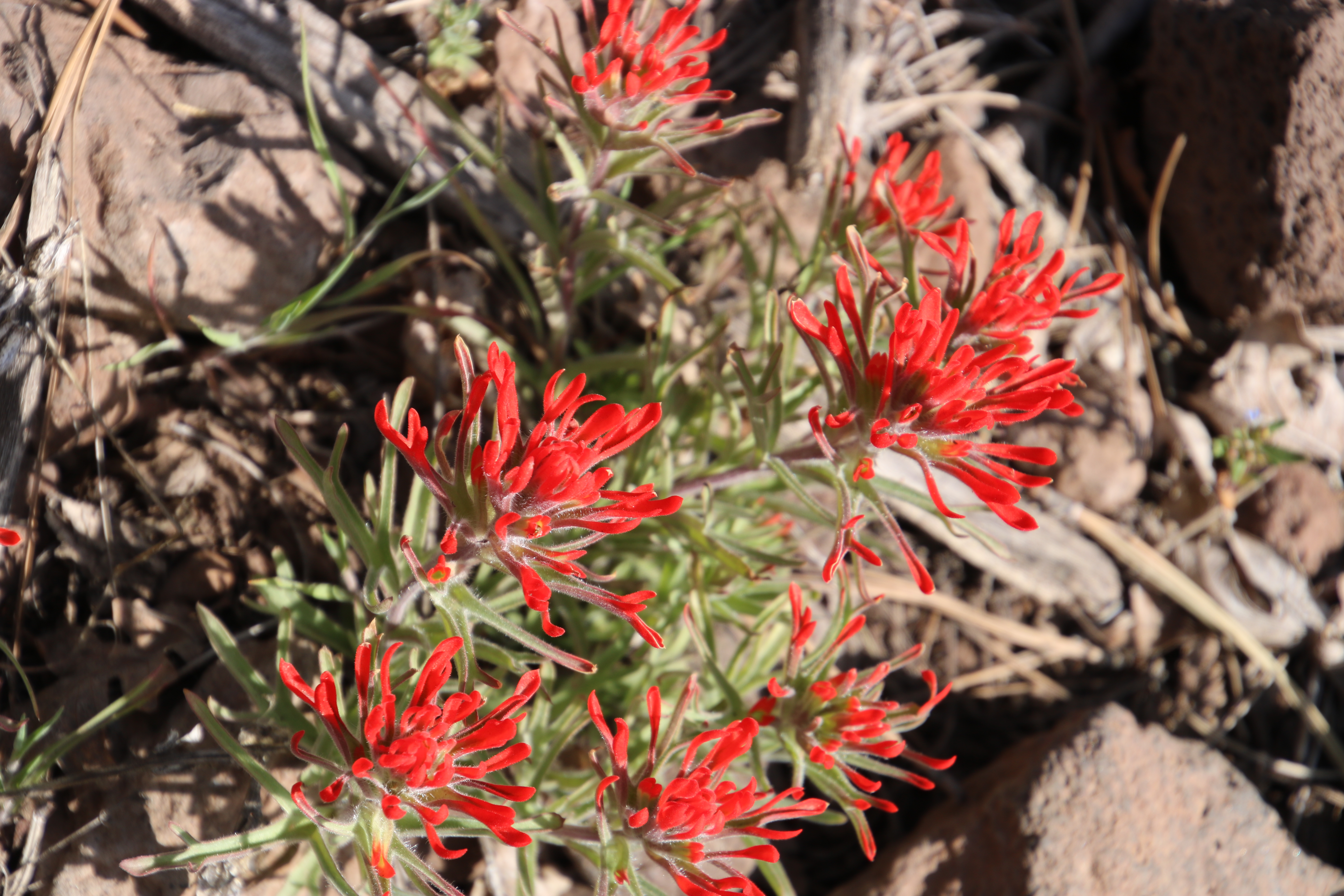
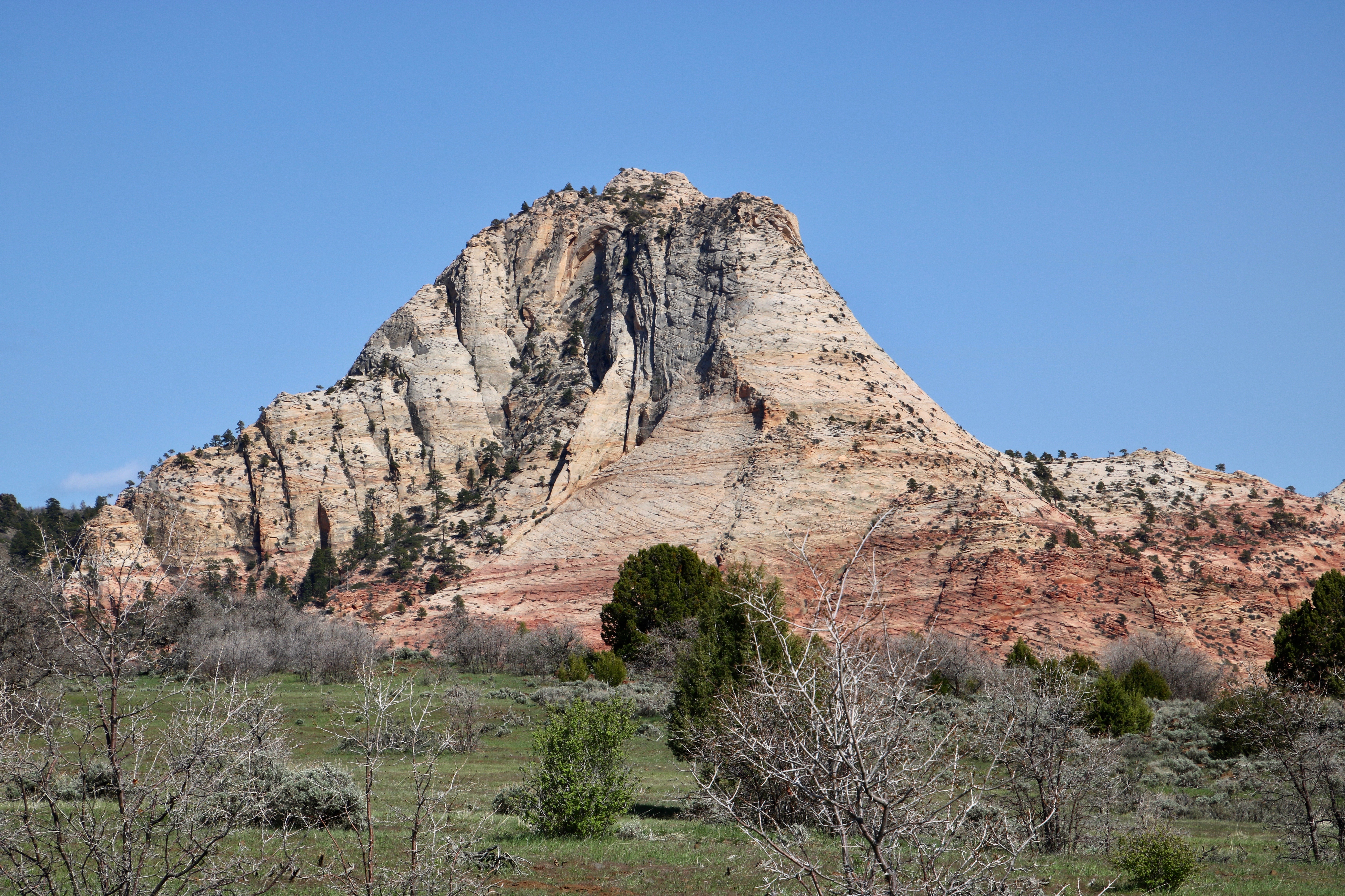
It’s important to know that the road up to Kolob Terrace is steep and curvy. If you decide to drive up to it, and we highly recommend you do, I wouldn’t take a large RV on the road.Another view of the aspen grove on Kolob Terrace in Zion National Park. There were no leaves to quake in the wind!This was a road view of what we might see once we reached the top of the terrace. As always, the conifers didn’t worry about the snow and cold.I was impressed with this lone pine tree.As Peggy and I were with this peak. We stopped to admire it.And were rewarded with this view.And a view of the valley 4000 feet below.We also spotted this attractive rock monument.And felt it was worth a closer look.While I was staring off into the distance, Peggy looked down and spotted this colorful Indian paintbrush. (Photo by Peggy Mekemson.)
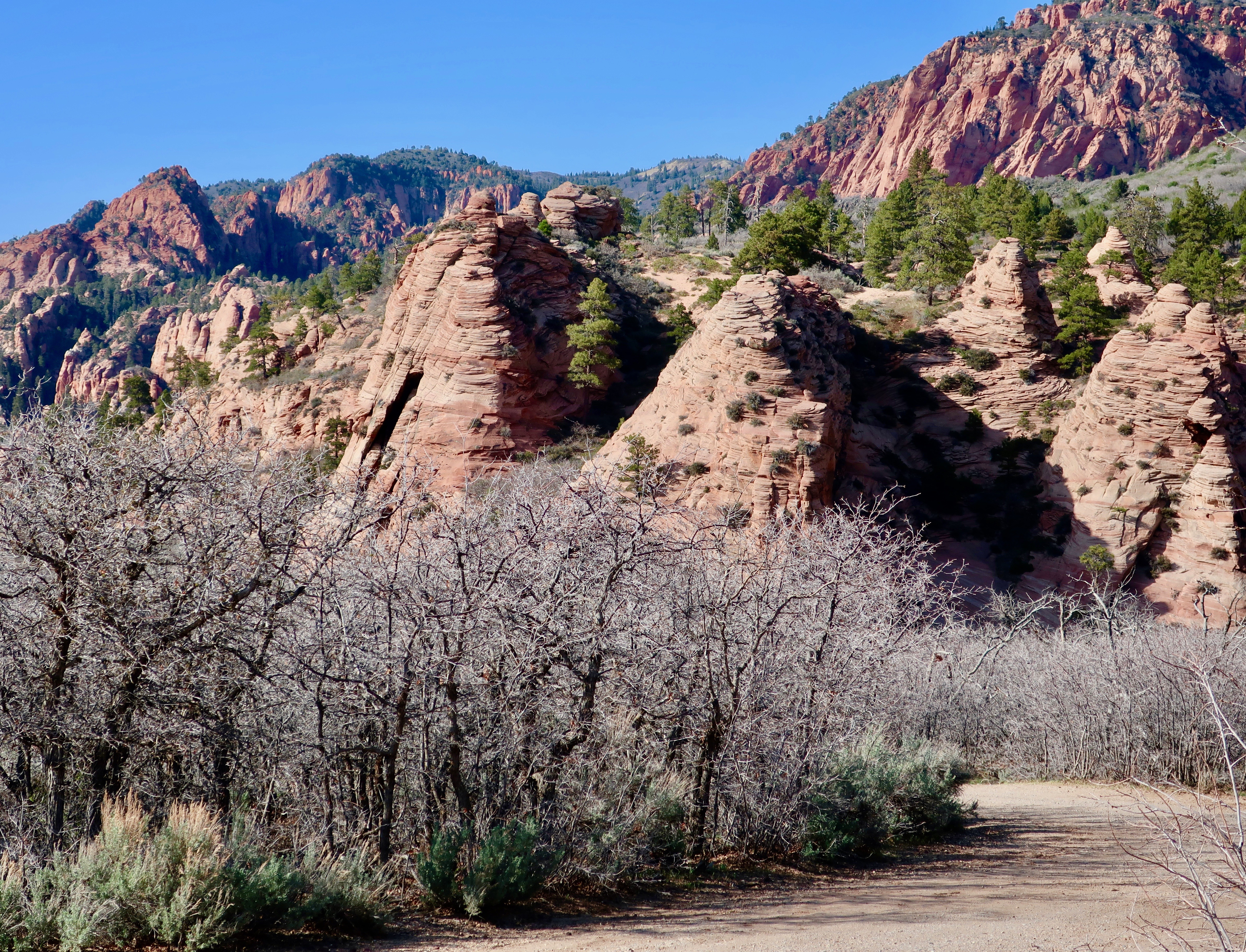
Following are several more photos of the scenery that Peggy and I saw up on Kolob Terrace and on our drive back down.
Another road shot.Peggy caught this photo. (Photo by Peggy Mekemson.)“Pull over, Curt,” Peggy insisted, “I have to take a photo of this.” It was the most streamlined kite we had ever seen.And, of course, she had to photograph the colorful background behind the kite. I’ll conclude today’s post here. In my next post, we will be moving on to Kolob Canyon. (Photo by Peggy Mekemson.)
The road had been gradually climbing since we started our exploration of Kolob Terrace in Zion National Park. It was about to get serious as it made its way up to the terrace above the cliffs. (Photo by Peggy Mekemson.)
We are continuing our exploration of the Kolob Terrace section of Zion National Park as part of our full-time experience of living on the road.
I am always curious about how things get their names. I wasn’t familiar with Kolob. Was it a Native American name? Was it the name of an early explorer or pioneer? Turns out it comes directly out of the Book of Abraham, a sacred text of the Mormons that Joseph Smith supposedly translated from an Egyptian papyrus scroll. I wonder if he used his rose colored glasses. I should have guessed the Mormon connection. Utah is Mormon country and has been ever since Brigham Young brought his band of followers into the state in 1847 to escape religious persecution in the east. Kolob is either a star or a large planet in the center of the Milky Way Galaxy close to the throne of God. Some Mormons believe that is where they go when they die. It shows up in the Musical, The Book of Mormon where the lyrics proclaim “I believe that plan involves me getting my own planet.” The modern church has challenged the assumption.
Imagining Kolob to be a rather pleasant place from a Mormon perspective, I can understand why the early pioneers gave its name to the terrace. Peggy and I also found it pleasant. Actually, I’d much prefer to go there when I die rather than the biblical Heaven where the ‘streets are paved with gold.’
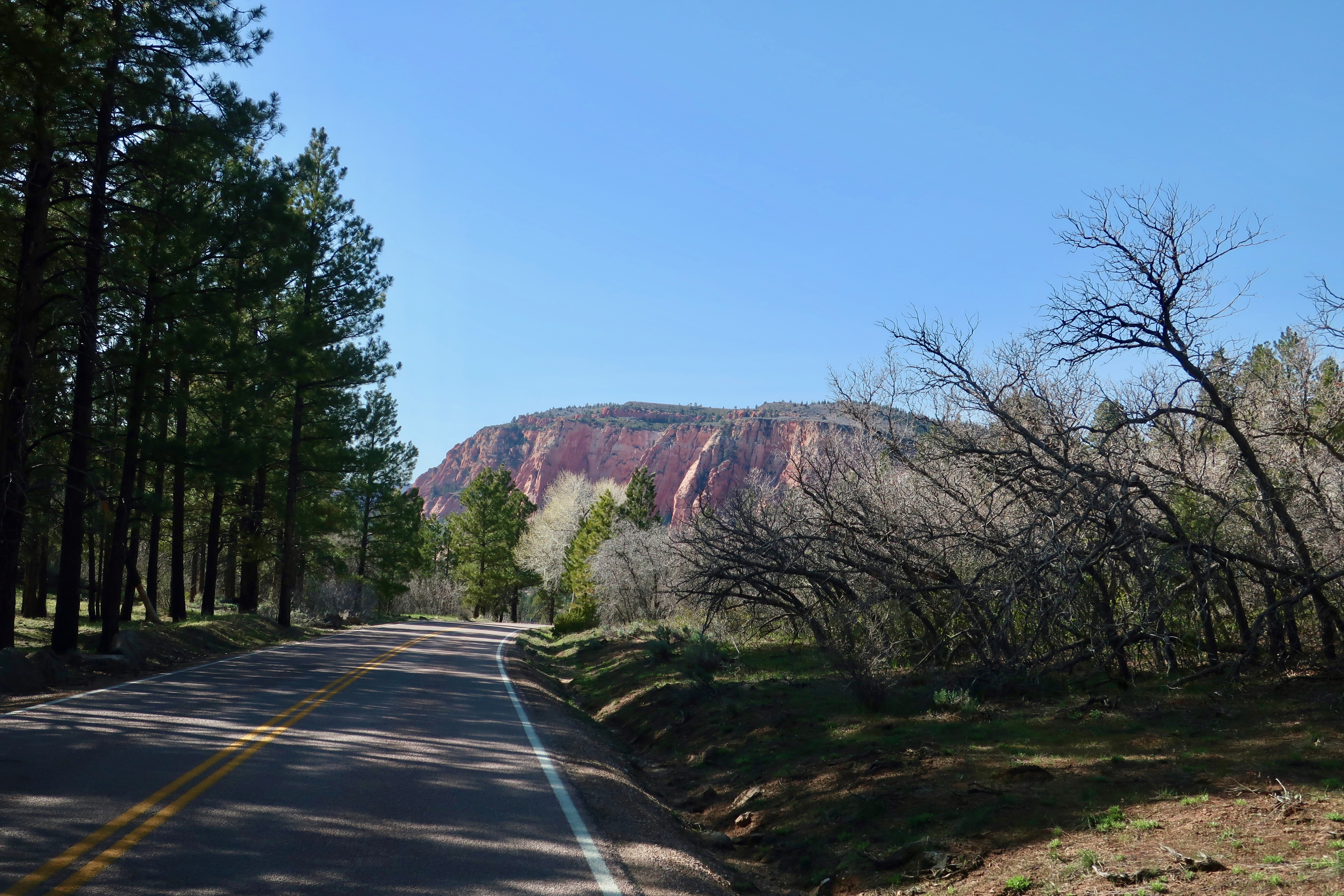
We pulled off the road frequently to take photos on our way up and down.
Peggy uses the cab of our truck to photograph the cliffs below the terrace.Where our F-150 was parked when Peggy took the photo…Peggy’s photo. If you have ever wondered how the impressive rock bridges of the Southwest are formed, this is potentially one in progress.
More photos that I took on our way up to the terrace…
I’ll conclude with this photo of a private road winding its way below the cliffs. I was intrigued as to where it went and could easily imagine Peggy and me living there. My next post will feature photos we took up on the terrace.
Today, our full time RV adventure of exploring North America takes us to Zion National Parkin Utah.
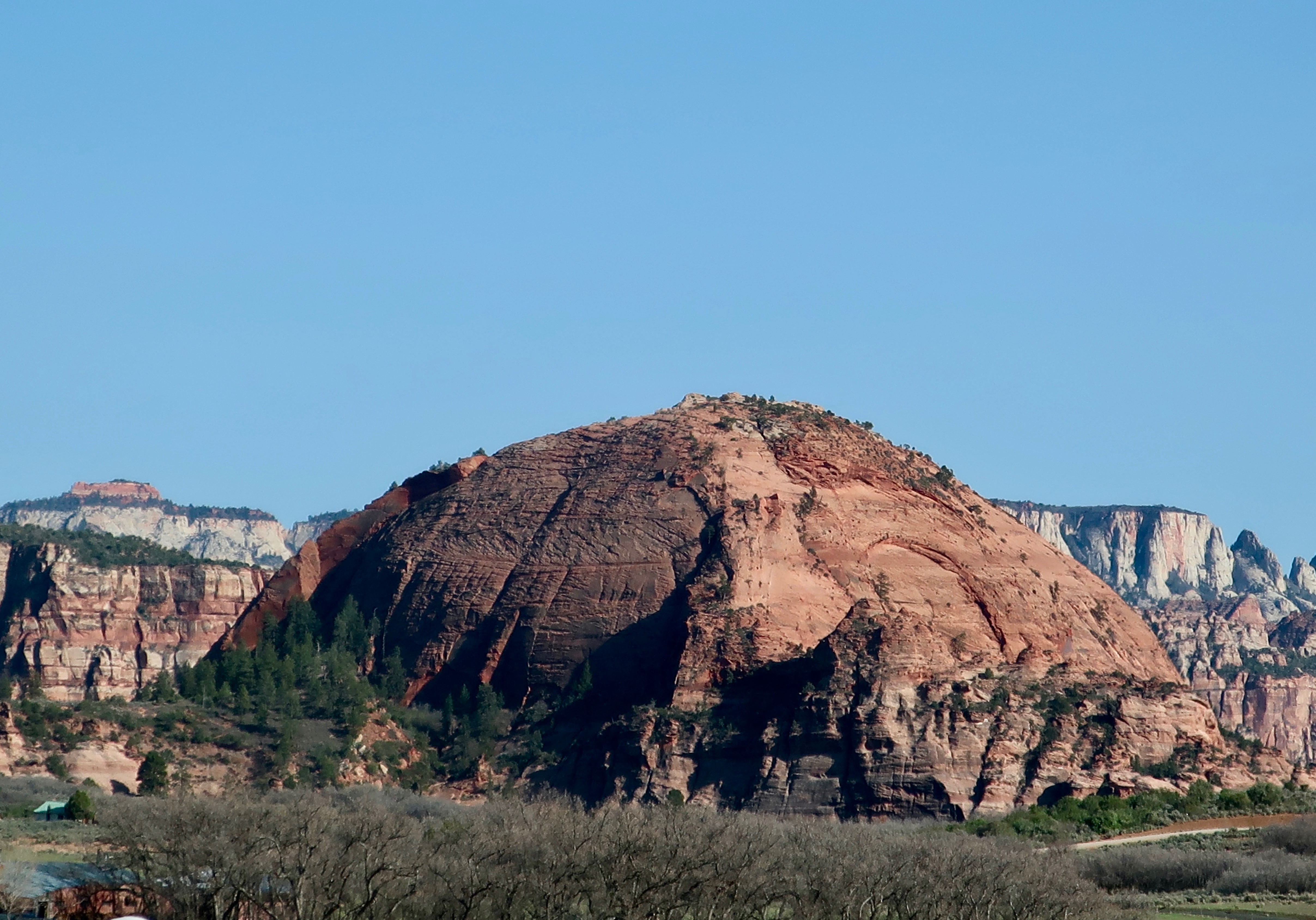
This was one of many delightful monuments Peggy and I found when we explored Kolob Terrace in Zion National Park. Note the lack of traffic!
Peggy was reading an article in the Washington Post a few days ago on Zion National Park. Bring your patience, the article urged. Over 5 million people are projected to visit in 2022. The majority will be from April through September. Expect massive crowds if it is on your vacation itinerary. Parking spots will be difficult to find. Shuttles will be full. There will be long lines to get in, long lines at the restrooms, long lines to visit major sites, and long lines to get food. Finding a place to stay in or near the park will be close to impossible unless you already have a reservation— or get lucky.
It’s my idea of a nightmare.
Peggy and I were fortunate to arrive in late April for our visit. But even then, the crowds in the canyon exceeded my ideal by a factor of 10, or is that 100. Grin. I’ll tell that story at the end of my series on Zion. (Spoiler alert: it was still worth it.) But, for now, I am going to let you in on a little secret, there is more to Zion National Park than Zion Canyon. A lot more. And much of it matches and may even surpass the canyon in beauty. Peggy and I are going to take you on three short road trips to various sections in the park outside of the canyon to prove our point: Kolob Terrace, Kolob Canyon, and the east side of the park. Plus a ghost town.
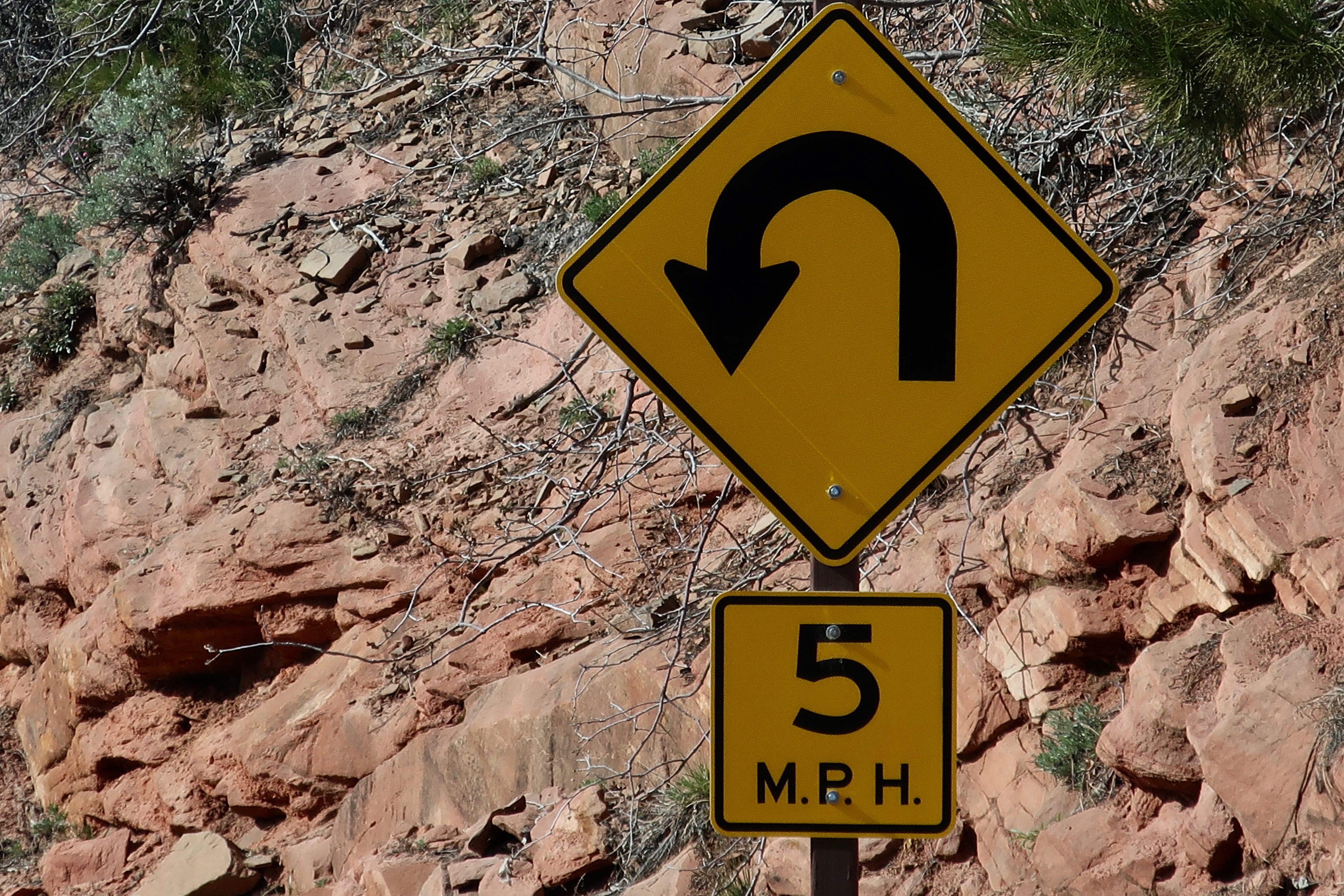
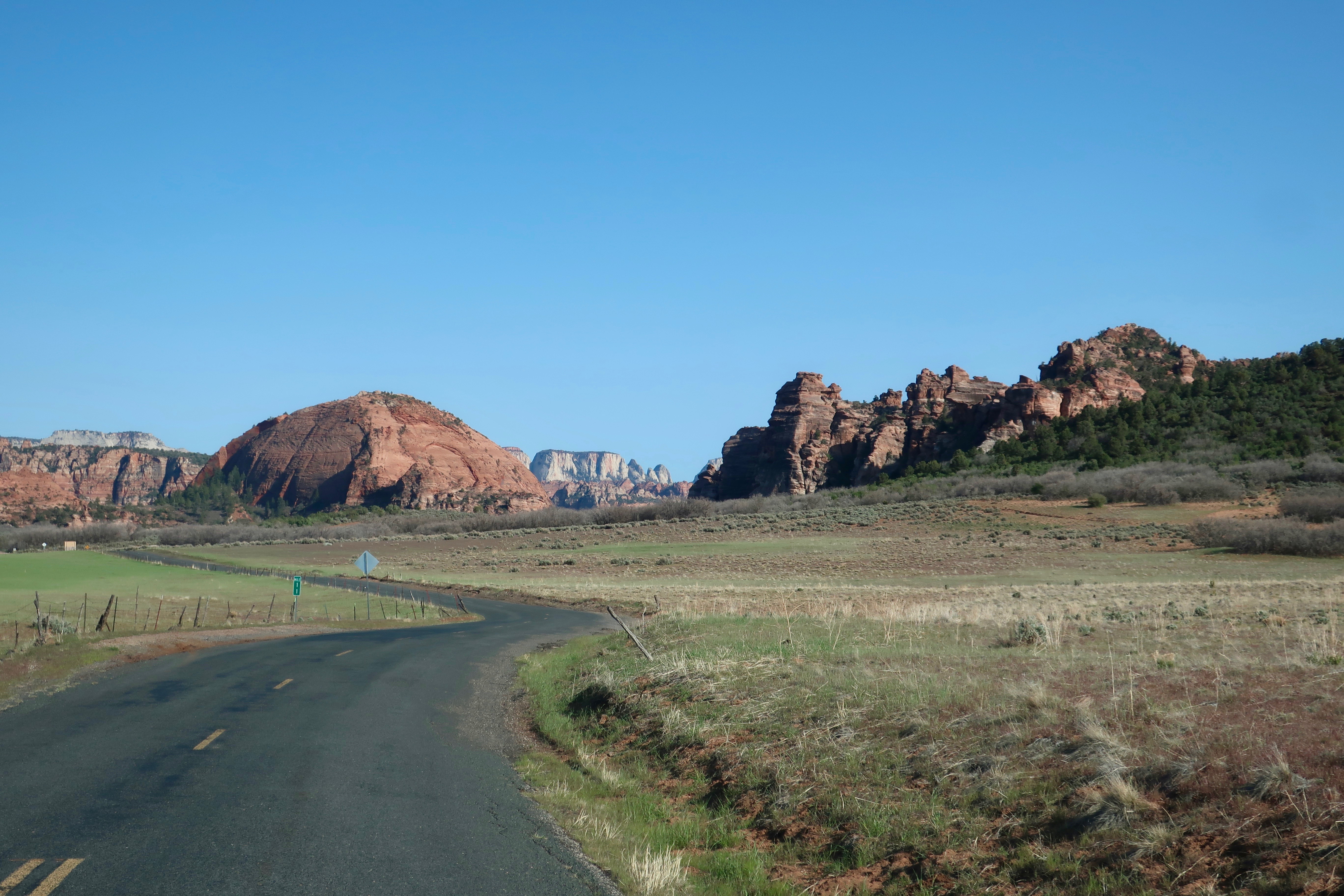
I am going to start with the Kolob Terrace. Peggy and I were staying at an RV campground on the Virgin River in the small town of the same name 14 miles from the canyon. The road into the terrace was less than a mile from where we were camped. We drove up it for 15 miles before turning around, stopping frequently on both our way up and back. We met a dozen cars along the way. There may have been 30 parked at the various trailheads and overlooks. Compare that with the 14,000 or more people who were exploring the canyon on that day! Following are the photos Peggy and I took. I am going to divide them into three posts since there are too many for one. (Note: I take five times as many photos as Peggy. :))
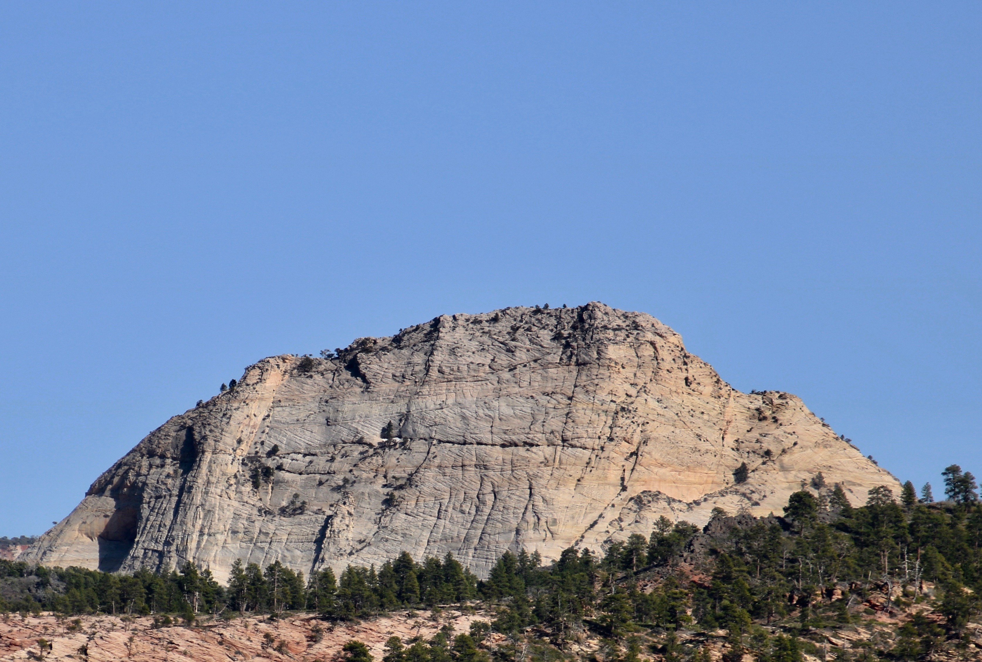
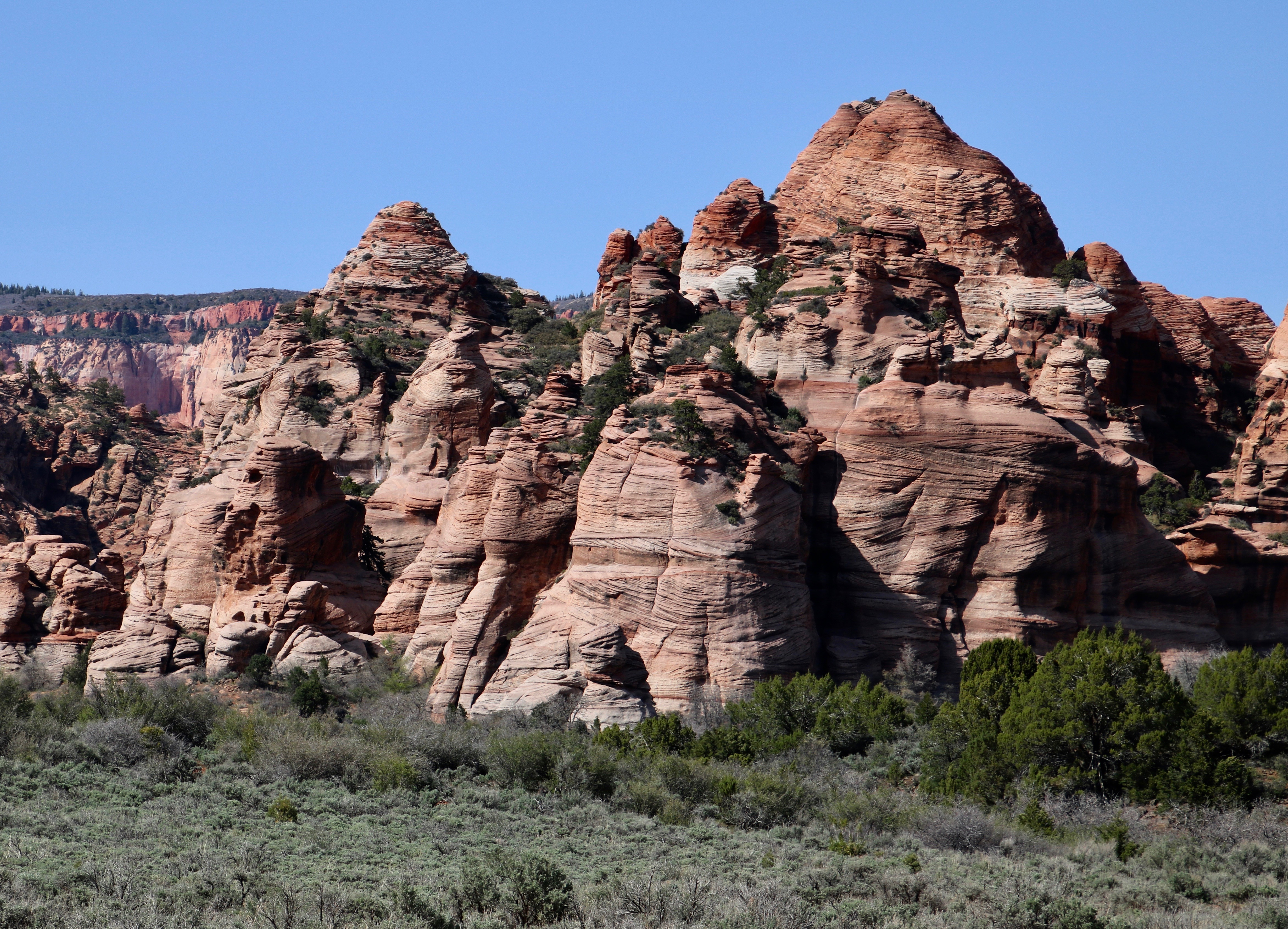
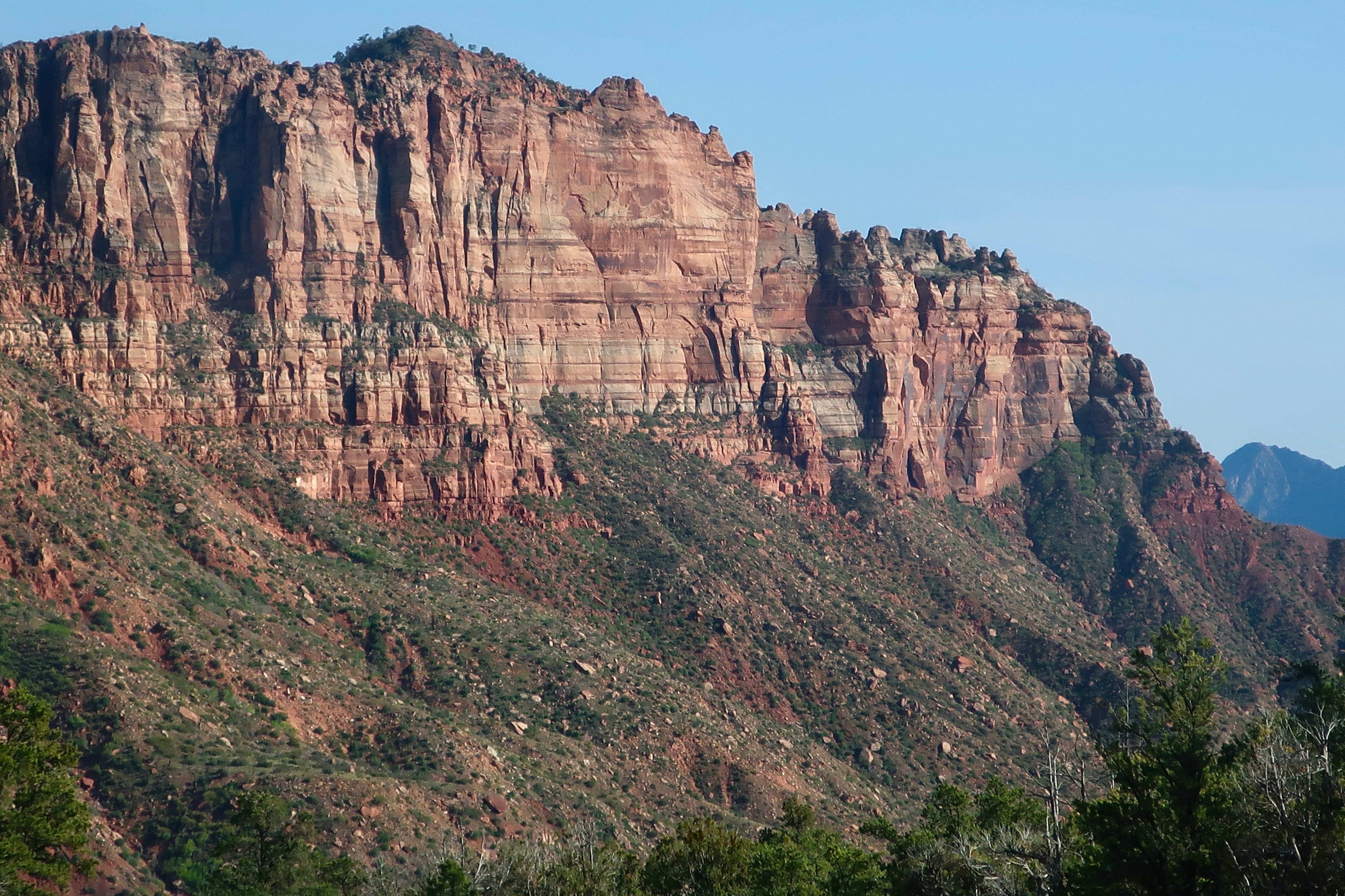
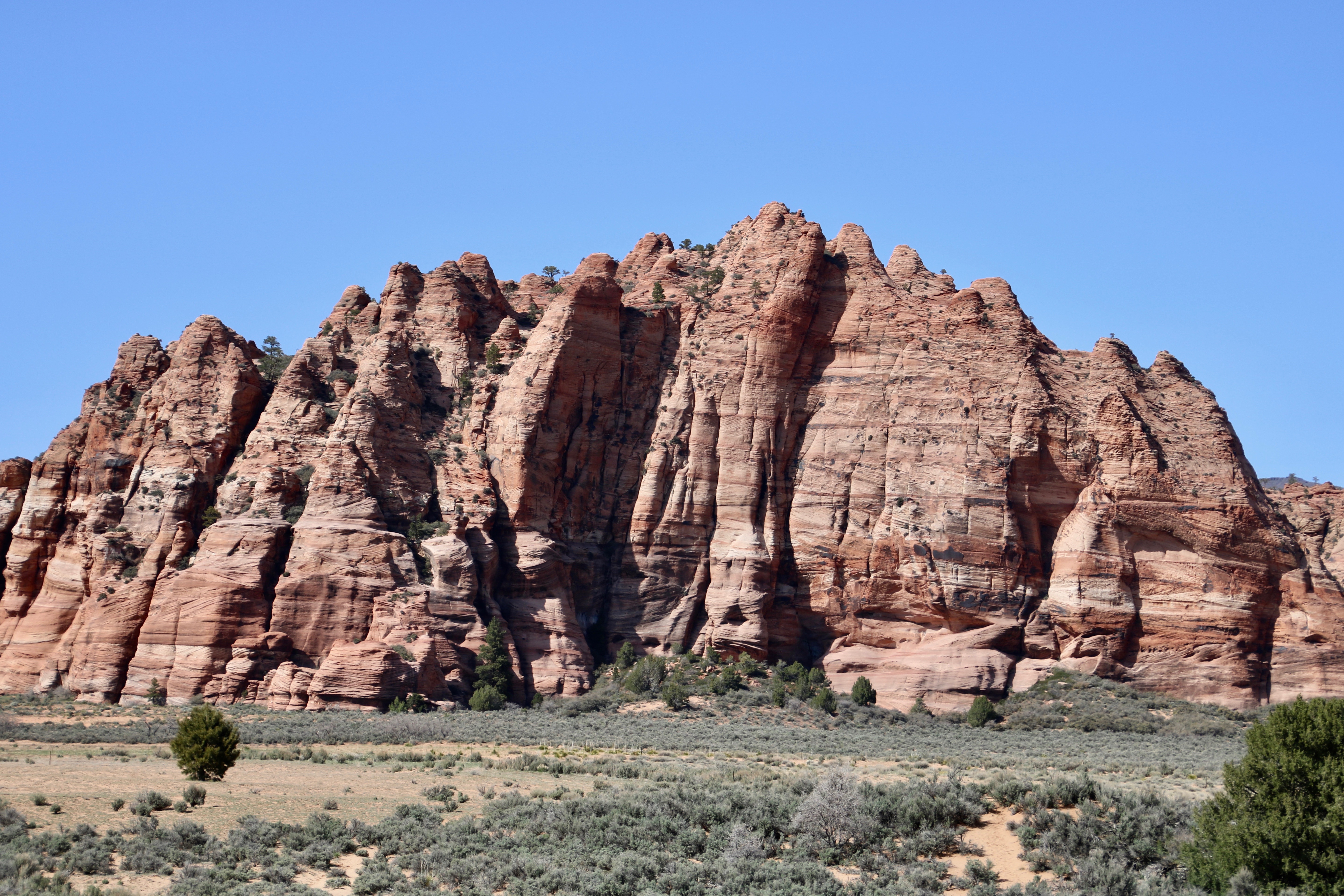
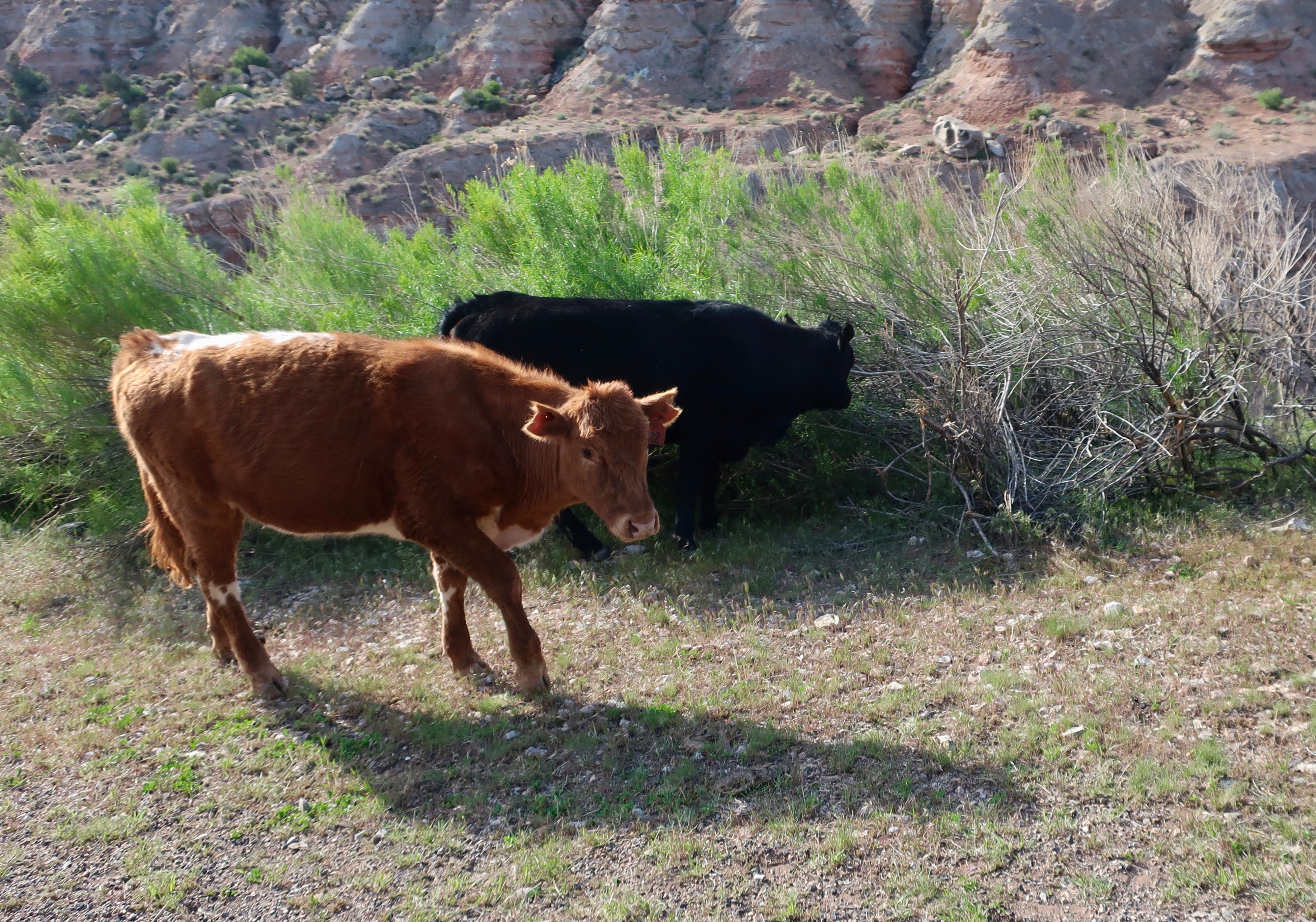
The beginning of our journey up to Kolob Terrace. It was obvious from our initial view that we were going to enjoy the ‘detour’ from Zion Canyon.I think this striking monument was Peggy’s favorite. (Photo by Peggy Mekemson.)She even took more than one photo! I always think that things like the trees in the left foreground add interest and help draw viewer’s eyes into the picture. (Photo by Peggy Mekemson.)I took at least six of this monument on Kolob Terrace featured at the top of the post! Most of the rock structures in Zion are made from sandstone, which, on its own, tends to be white. Like I mentioned in my Death Valley posts, it is oxidized iron that leads to the reds, oranges and pinks.This distant road shot gives an idea of the numerous shapes and colors of the various monuments on Kolob Terrace.Here’s an example of the variety of shapes. I always think of these rock formations as a fairy community, or maybe a troll town. (Photo by Peggy Mekemson.)Sheer cliffs like these found in Kolob Terrace will eventually be eroded by the forces of water, ice, wind and gravity. Different types of rocks erode at different speeds leading to the wonderful shapes found throughout Utah and the Southwest. Note the extensive talus slopes seen beneath the cliff.This distant formation provides an example of the erosive forces at work.A closer view of the same formation. the layer of rock on top is eroding faster than the layer beneath it. like the triangular face of the rock.This massive formation in Kolob Terrace shows a rounded character to the erosion. (Photo by Peggy Mekemson.)The Kolob Terrace road runs through national park and private land. Signs warn that you might find cattle along the way. We did. They had the grace or good sense to stay on the side of the road. I’ll conclude today’s post with a shy rock formation that is hiding among the trees….Caught it. On Friday, Peggy and I will continue to explore the beauty of the Kolob Terrace section of Zion National Park.
Bryce Canyon National Park in Utah is a fantasy land of rocks guaranteed to impress visitors.
The first time I came across a group of hoodoos, I stopped and stared. Then I grabbed my camera. But I didn’t have to rush. Hoodoos are strange rock formations of arid regions. They don’t go anywhere. They just stand there for centuries as nature and erosion do their work, carving whimsical statues of stone.
Bryce Canyon National Park is a superb location for hoodoo watching. They come in a multitude of shapes, forms and colors creating a fantasy land that even the wildest of imaginations can appreciate.
Hoodoos are created in Bryce Canyon through the erosion of sandstone, which eventually creates whimsical statues.
Carved from sandstone of the Paunsaugunt Plateau, Bryce Canyon drops some 2000 feet in altitude to the valley below. Trails ranging from easy to challenging provide the visitor with numerous opportunities to meet the hoodoos up close. Or you can stroll along the rim trail. Be sure to check the park out at sunrise and sunset.
Bryce Canyon is located off of Highway 89 in Southwestern Utah. An easy day’s drive can take you to either Capitol Reef or Zion National Parks and through millions of years of geological history. I consider Utah’s Highway 12 that connects Bryce National Park with Capitol Reef to be one of the most scenic roads Peggy and I found in our 200,000-mile exploration of America.
A family of Hoodoos hidden in a canyon.
Following one of the many trails into Bryce Canyon will bring you face to face with one of the National Park’s unique sculptures.
Another sandstone hoodoo. This one reflects the warm colors of the setting sun.
Erosion created a box canyon here. I saw it and thought immediately it would have made a great corral for cattle stolen by outlaws of the old west.