Planning for the unexpected along the PCT… Peggy’s Perspective: Part II

Smoke along the PCT near Chester, CA in the summer of 2018.
Curt’s extensive experience backpacking, didn’t prepare him to deal with the smoke and fires along the PCT last summer. This photo was taken near Chester, California.

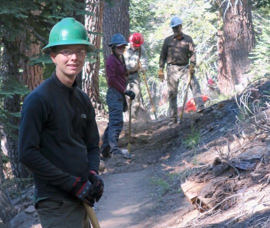
Curt knew I would be nervous without detailed planning of trails, mileage, rendezvous points, and alternatives. With 50 years of backpacking experience including planning, organizing and leading backpack treks for 30, he is something of an expert on the subject. Having a GPS/Spot Gen 3 tracker along was a new experience for him, however. He could upload his location each night via satellite and I could track his progress on my maps. He could also use Spot to signal for emergency help if needed and carried a cell phone, which he could use in the rare times he had cell service or if he had to hike out for some reason.

Then there was the unexpected— lack of water, smoke, fire, and possible injuries on the trail plus my challenges on the road of finding campgrounds and spaces near trailheads, power outages, limited cell service, and RV repair issues. 

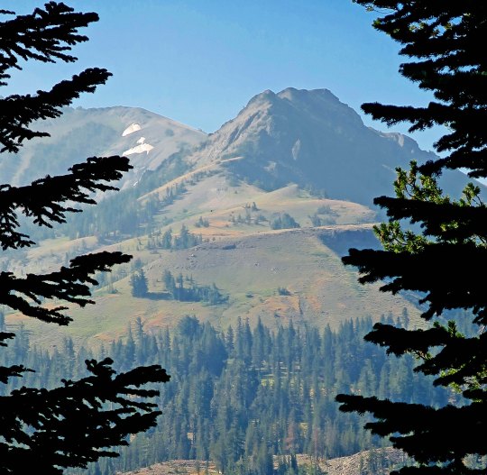
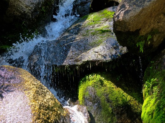
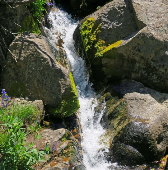
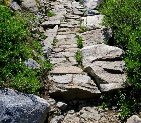
The first part of the trek introduced us to water shortages! Following mountain ridges over much of its length, the PCT is noted for its limited supply. The mild winter of 2017-18 with its lack of snow fall in the Siskiyous, Cascades and Sierras made it worse. Streams that would normally have been running through July were dry. Springs were sometimes a mere trickle. Even though we had downloaded the most recent information from the PCT site on water sources, the situation was changing rapidly. Our first day on the trail from Mt. Ashland proved the point.

We had planned a 10-mile day since it was our first day out. There had been sufficient water over the first seven miles. It wasn’t the case when we came to our planned camp site. Curt parked me in a pleasant location and took our water bottles down into the canyon where a stream was located. And came back empty. The stream was dry. “The map shows that there’s a spring in about a quarter of a mile off on a side road,” he announced. “We can camp there.” I loaded my pack and away we went. The spring was also dry. Have I mentioned that I was getting grumpy? Our options now appeared to be hiking three miles back or three miles ahead on the trail. “Let’s try farther down the canyon,” he suggested as a third alternative. I dutifully followed along. Fortunately, we hit water in a half mile. Curt’s experience with all-things-woodsy had paid off. The creek, by the way, was the headwaters of the Applegate River, which runs past our front yard.

We had just set up our tent when crashing thunder announced a deluge. I made it inside dry. Curt came in soaked. Mother Nature was having fun at our expense!

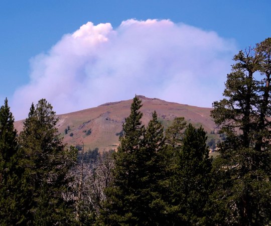
The greatest surprise and challenge was fire and smoke. The thought of making a fast exit ahead of a fire was always on our minds, but smoke was the main problem. Curt’s many years of working with the American Lung Association had educated him to the danger. “Wildfire smoke can be extremely harmful to the lungs, especially for children, older adults and those with asthma, COPD and bronchitis or a chronic heart disease or diabetes,” ALA warns. “I resemble one of those categories,” Curt said. Older people are to stay inside and avoid strenuous exercise. Ha!

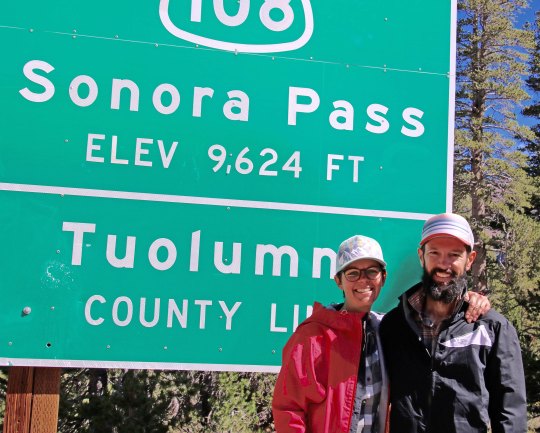
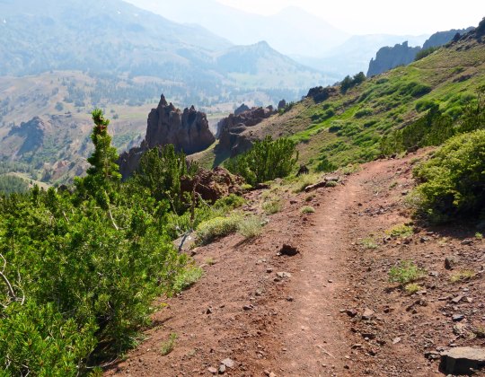
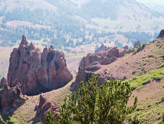
Fires started to impact the plan as soon as Castle Crags and smoke changed the trail plan totally in Chester when we couldn’t see a hundred yards into the forest. As Curt has shared on his blog, he had to alter his journey to avoid the worst of smoke and fire. Was I worried? Yes! The most difficult situation encountered was at Sonora Pass. I awoke the morning I was to meet him there to learn that a new fire had started on the far side of the pass. As I waited, I watched the smoke billowing from the fire grow larger and larger. When Curt hadn’t arrived several hours after I expected him, I became quite concerned. Fortunately, a long skinny fellow with the trail name of Bone came hiking up to our RV.

Sonora Peak as seen from Sonora Pass where I was waiting for Curt. He’d be coming around the peak to the right.
I hiked up the trail for a couple of miles hoping I would meet him along the way. No luck.
My worry about Curt being late increased substantially as smoke from a new fire filled the air.

“You must be Peggy,” he said. When I responded yes, he told me that he had passed my missing buddy on the trail. Curt had asked him to pass on the information that he was fine and should be along in an hour or two. Much relieved, I settled in to wait and invited Bone to charge his cell phone in our van and have a cold beer. After Curt’s safe arrival (he tells the story in his blog), we drove to an RV campground for the night and learned that the pass and the PCT trail had been closed after we left! 

Bone wearing his Portland Blazer T-shirt with a small guitar attached to the back of his pack. Note how skinny Bone is, thus his trail name.

While Curt was facing challenges out on the trail, I also had my share doing back up. As I mentioned earlier, I’d had lots of experience in camping with the RV. But I was a newbie at camping alone. Fires and lightning caused outages at campgrounds and RV parks, cell phone service was often spotty, And Quivera, our RV, demanded attention.  Internal lights, the awning, and the air conditioning unit all had issues. 

Normally, this wouldn’t be a problem. We’d just find a shop that serviced RVs. But the local shops had a common response: “If you have a problem, call 30 days in advance for a reservation.” Does anyone else see a problem here? Repairs were up to me. Fine. The awning jammed, my solution? U-tube! I fixed it. Internal lights out? I read the manual, rewired the one I needed to read by and decided to let the other three go. AC servicing:  well, other than pumping out playa dust from Burning Man— a forever problem— it was still working. Why worry? 

There was a good ending to my efforts to find an RV service shop. I stopped by Camping World in Rockland near Sacramento and talked with the service staff. One of them walked out with me, confirmed that I would need to replace the awning eventually but told me bungee cords were a great temporary solution. He then replaced all the lights for me. Last but not least, he told me how to flush the AC with a hose. There was no charge for his good advice and help! 

Next up: I will talk about the help that was generously offered to me along the way and a unique way of communicating with Curt: The Trekker Telegraph. Bone was a good example. 

Fire on the Trail… Hiking down the PCT

Cow along the PCT in the Carson Iceberg Wilderness
I stopped for a discussion with a cow about trail conditions in the Carson-Iceberg Wilderness.

I was late, like the white rabbit, for a very important date. Peggy was waiting for me at Sonora Pass and I had miscalculated the distance and difficulty of the trail. The night before I had found this lovely little campsite on the edge of a creek that I couldn’t resist. Later, as large ashes began falling on my tent, I began to question the wisdom of my decision. The 97,000 acre Ferguson fire near Yosemite and the 229,000 acre Carr fire near Redding that had been filling the skies with lung-choking smoke for the past month were now contained. Another fire was lurking out there— close by somewhere — and it was suggesting that I get on down the trail.

My goal, I decided, would to be get up at four and on the trail by five. But sleep had been as elusive as my knowledge about the fire. My eyes had popped open around 6:30. There would be no early start. The good news was that the smoke had partially cleared. All that remained of my previous night’s threat was a thin layer of ash. By 8:00 I was fed, watered, packed and raring to go. I figured the 1000-foot, three-mile drop into the East Fork of the Carson River would fly by. I figured wrong. The last part of the trail was steep and narrow over loose rock. It was not the type of trail that one flies over, at least not at 75 . I was ever so glad that I hadn’t tackled it the evening before when I was tired. 

It was with relief that I began hoofing up the Carson River. While I had a 2500 foot climb ahead of me up to 10,000 feet, the first part of the trail was relatively gentle. I was making good time when a small root hiding out in the shade caught the toe of my boot and I went crashing down. This wasn’t one of those stumbles where you catch yourself, or at least slow your fall. It was a nose crunching, glass breaking fall. Thankfully, I bounce well. Lying there face down in the dirt, I reached up and touched my nose. It was solid and not spurting blood, although my finger came away bloody. Even my glasses had survived without a scratch. I picked myself up, shook the shock out of my head, and babied the scratch on my nose. 

Right about then a through-hiker came hurrying by, going in my direction, moving out. We said hi as he disappeared down the trail. A thought passed my mind. “Can I ask a favor,” I called out to his disappearing back. He stopped immediately and walked back. 

“My wife Peggy is waiting for me at Sonora Pass, I explained, “and I am running a couple of hours behind time. I know she will be worried. Could you carry a message for me?” I figured he would be there by mid-afternoon. 

“Sure,” had been his response. I provided the details and we introduced ourselves using our trail names. “I’m Bone from Portland,” he told me. I imagined a small squeak in my pack and yanked Sierra Bone out. I made the introductions. “Bone meet Bone,” I said. Naturally there had to be a photo of Bone with Bone.

2018 PCT through-hiker Bone.
Bone and Bone.

Relieved that Peggy would get the word that I was alive and well, I continued my journey and started the slow, steep climb out of the river canyon. I spotted a couple near the top who were off the trail eating a snack. One called out, “You must be Wanderer,” she said. “Your wife is worried about you.”  Of course. Turns out Camilla and Bastien were from Leon, France and Peggy had met them while they were waiting for resupply at Sonora Pass. She had fed them scones loaded down with peanut butter. Peggy, Camilla explained, was concerned because the parking lot closed at five and she would have to move. Bastien chipped in that he didn’t think I would get there in time.

French through hikers, Camilla and Bastien, at Sonora Pas in 2028.
Photo of a happy Camilla and Bastien after eating peanut butter with a scone attached. (Photo by Peggy Mekemson.)

I wasn’t concerned. I had two hours and it was only four miles. Still, I moved out and made it in a little over an hour. Bone was waiting with Peggy when I arrived. She had offered our van to charge his phone. He was enjoying a beer. While Peggy got me one, Bone and I discussed the wind we had encountered up on the mountainside. He had put his pack down and barely caught it as the wind had pushed it down the narrow trail toward the edge. My pack was fine but the wind had almost sent me tumbling off the cliff. We estimated that there were gusts between 50 and 60 miles per hour. I’d had to lean in toward the mountain to keep my balance.

The wind was having another impact as well, pushing a fire up the mountain. As we watched, a small plume of smoke had grown to cover half of the sky. It was the Donnell fire that had dropped ashes on my camp the night before. It was frightening to think of being out on the trail facing a fire pushed by 60-mile an hour winds. An hour after we left, the Sonora Pass road was closed. The next day, the PCT was closed between Ebbetts Pass and Sonora Pass, the trail I had just hiked. 

The following photos are taken along the Pacific Crest Trail between Ebbetts Pass and Sonora Pass traveling south.

A smokey day along the PCT in the Carson Iceberg wilderness.
PCT Association volunteers working on the trail in the Carson-Iceberg Wilderness.
A trail crew of volunteers from the Pacific Crest Trail Association. Much of the PCT trail work is carried out by volunteers.
Tree along the PCT in Carson Iceberg Wilderness with scars caused by barbed wire.
This was an interesting tree trunk. The ridges were caused when the tree grew over attached barbed wire. We have a few like it on out property.
Cattle in the Carson Iceberg Wilderness.
Cattle are not uncommon along the PCT. I always stop to chat with them.
Rhyolite boulders along Pacific Cres Trail in the Carson Iceberg Wilderness.
I was surprised to find rhyolite boulders along the trail.
The boulder had an interesting little cave. I wondered what lived there.
Guess who volunteered?
A patch of asters was growing nearby.
Here’s the reason why Boulder Mountain is called Boulder Mountain. It was one heck of a scree slope.
A tree perched on a granite rock caught my attention…
And I took several photos.
Hiking down into the East Fork of the Carson River provided this view.
I filled my water bottles here at a small creek crossing the trail.
This is a photo of the Eastern Fork of the Carson River. The water falls were indicative of the fact that the trail had started to climb.
When I stopped to photograph the river, I also caught these roots.
And this knot with a personality.
PCT trail work in the Carson Iceberg Wilderness.
Climbing higher I came across some extensive trail work. I have nothing but admiration for the crews that placed these heavy rocks.
A view of the trail after I left Camilla and Bastien.
Looking down toward the Sonora Pass where Peggy was waiting.. This is where Portland Bone and I had encountered the high winds.
Another view.
I’ll conclude today with this shot of smoke boiling up from the Donnell Fire. Had it been like this an hour earlier, I might have made that last 4 miles in 30 minutes instead of an hour! (grin)

NEXT POST: You met the large mutant vehicle animals of Burning Man in my last post, now it is time to meet the small mutant vehicle animals.