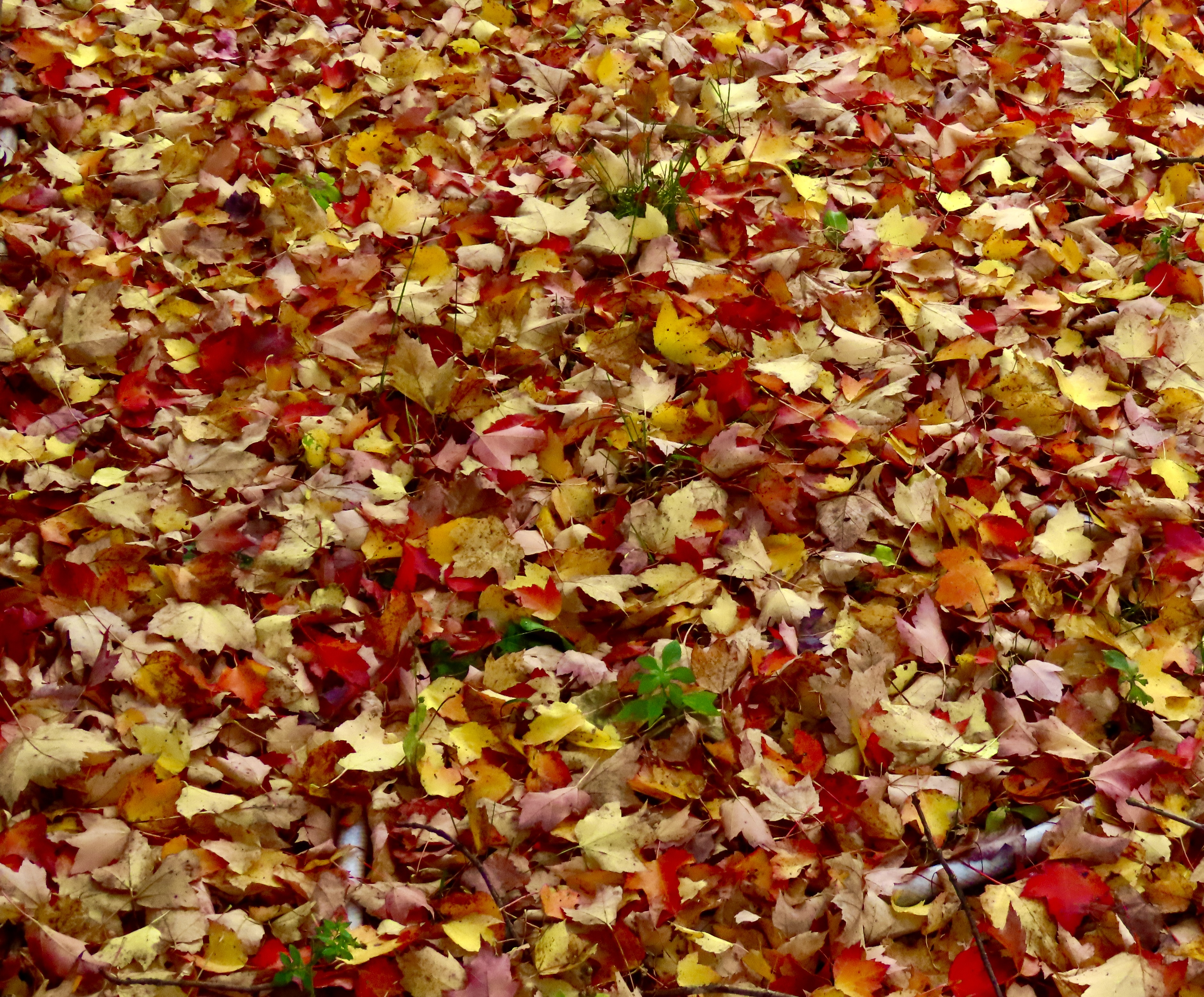
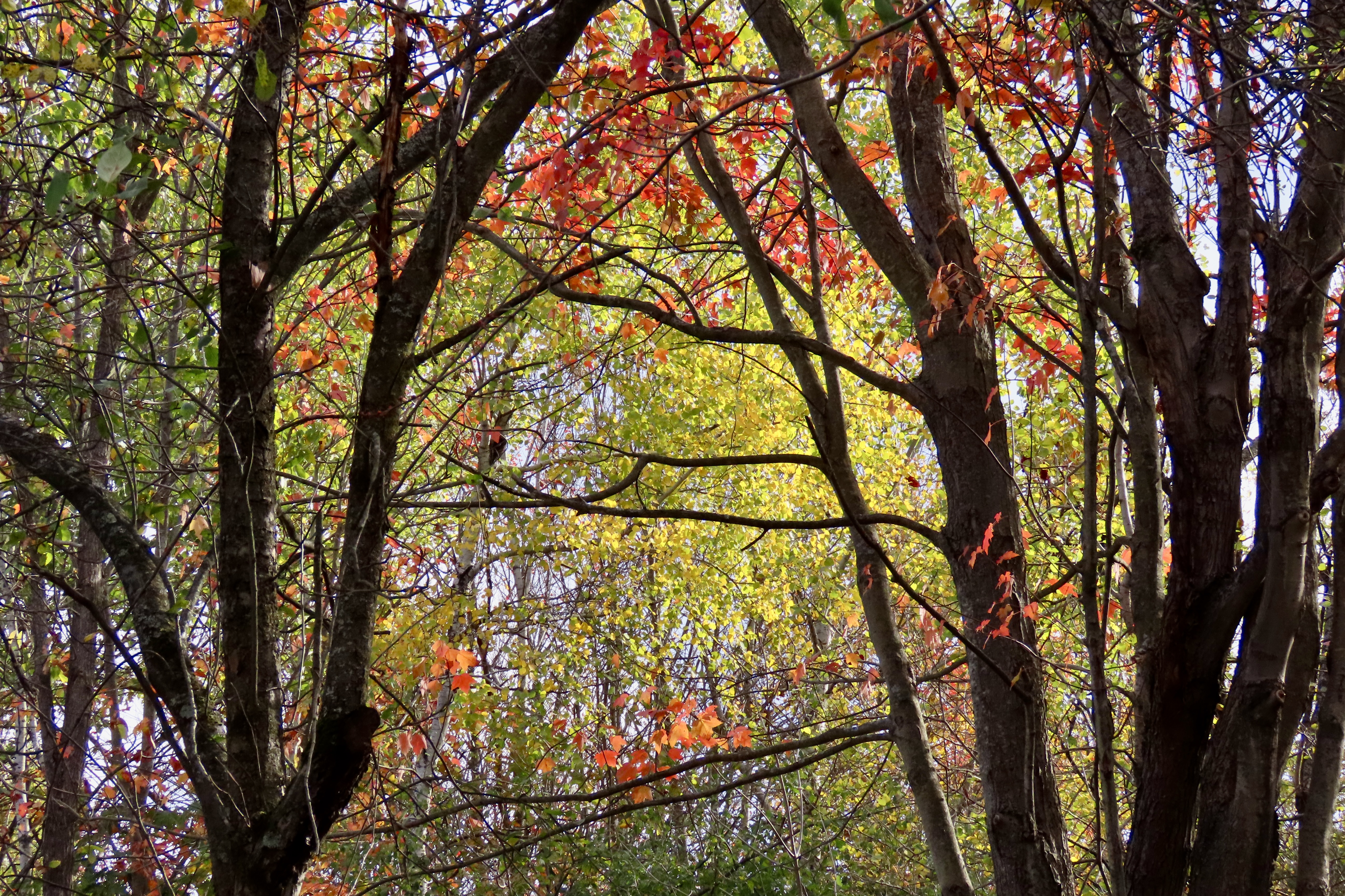
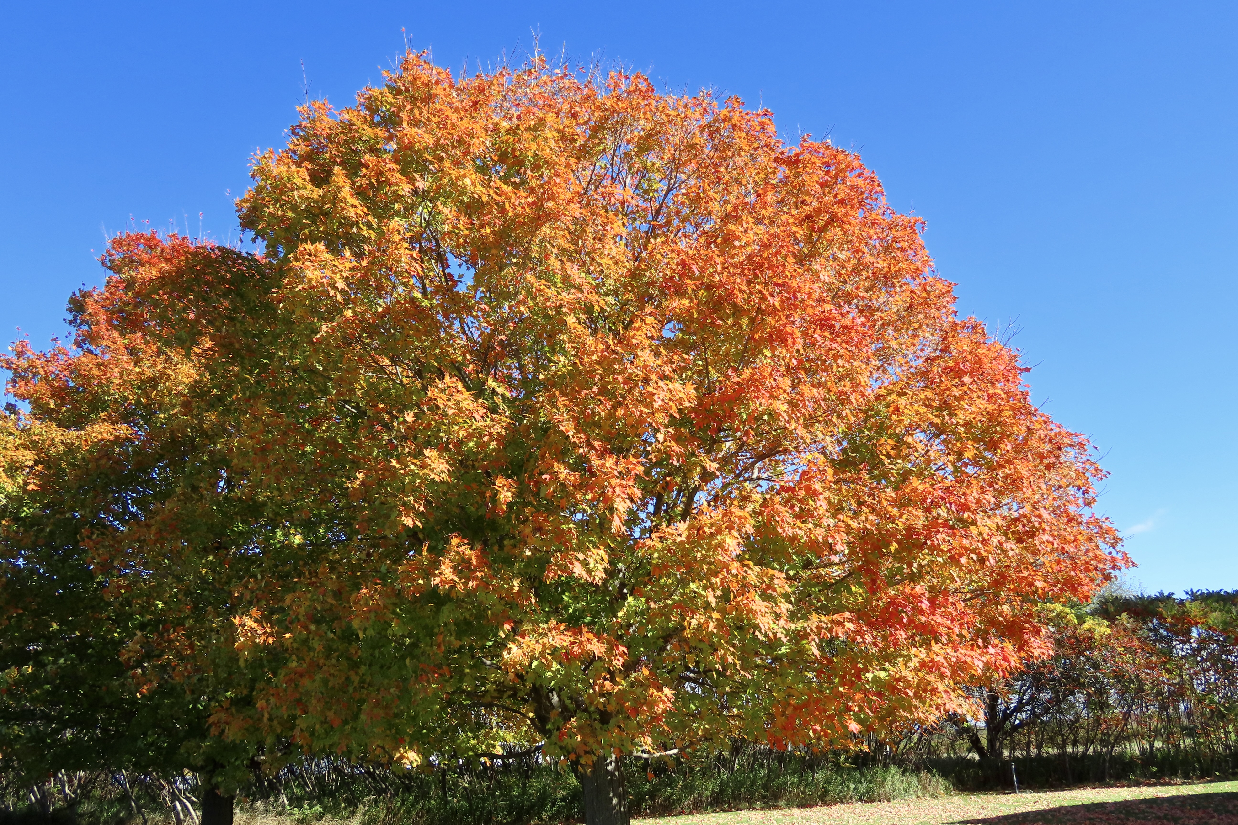
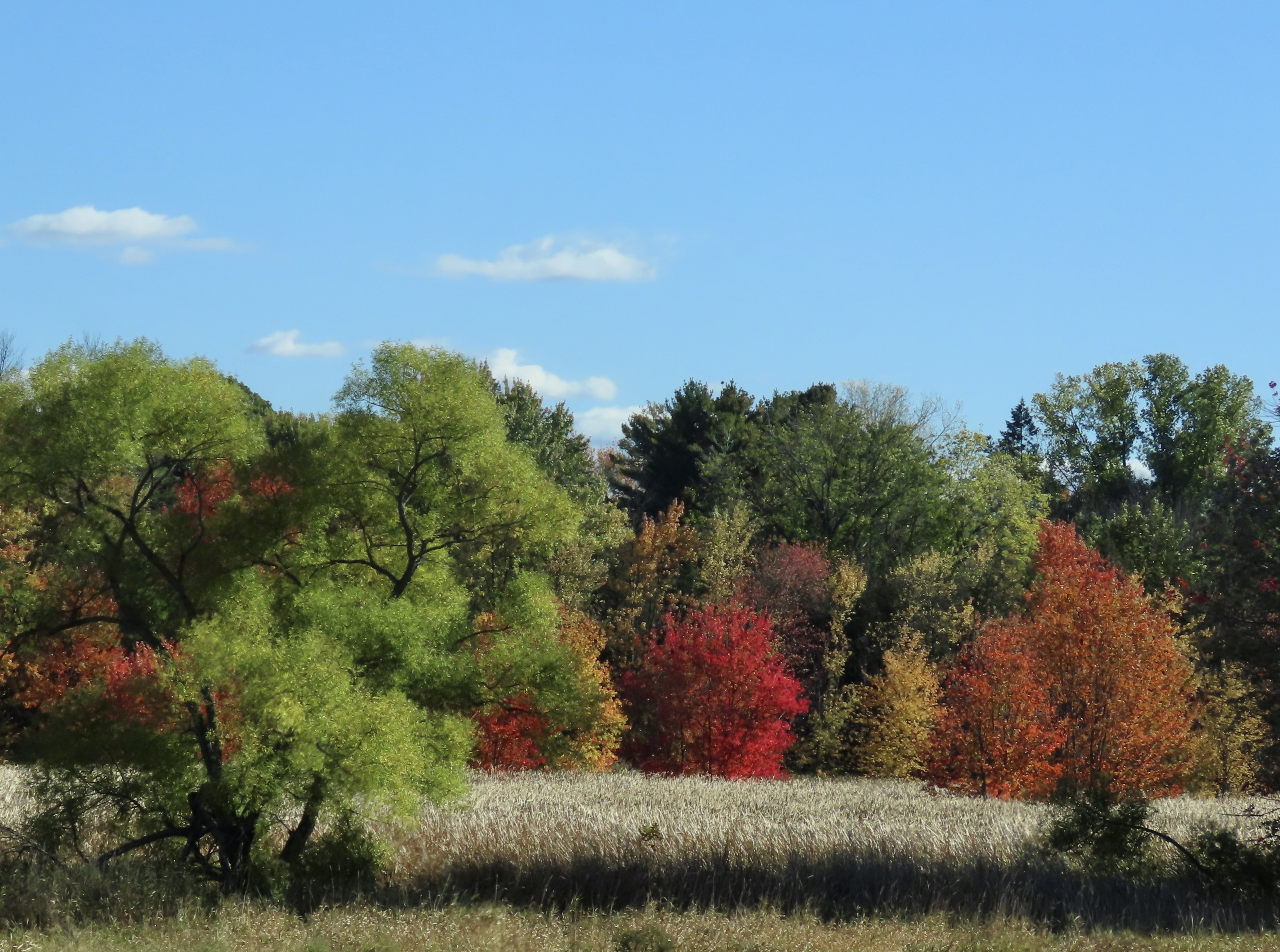
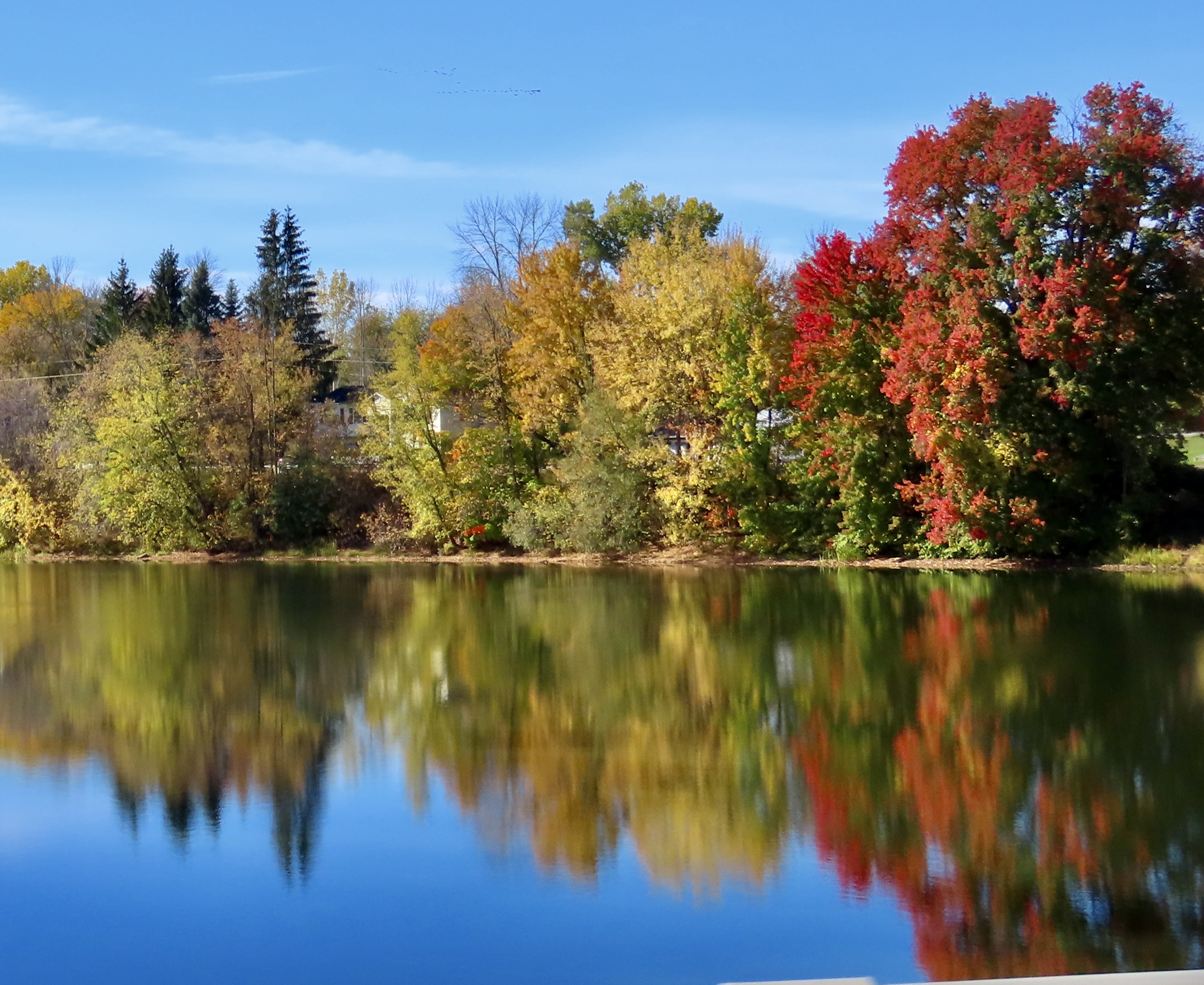
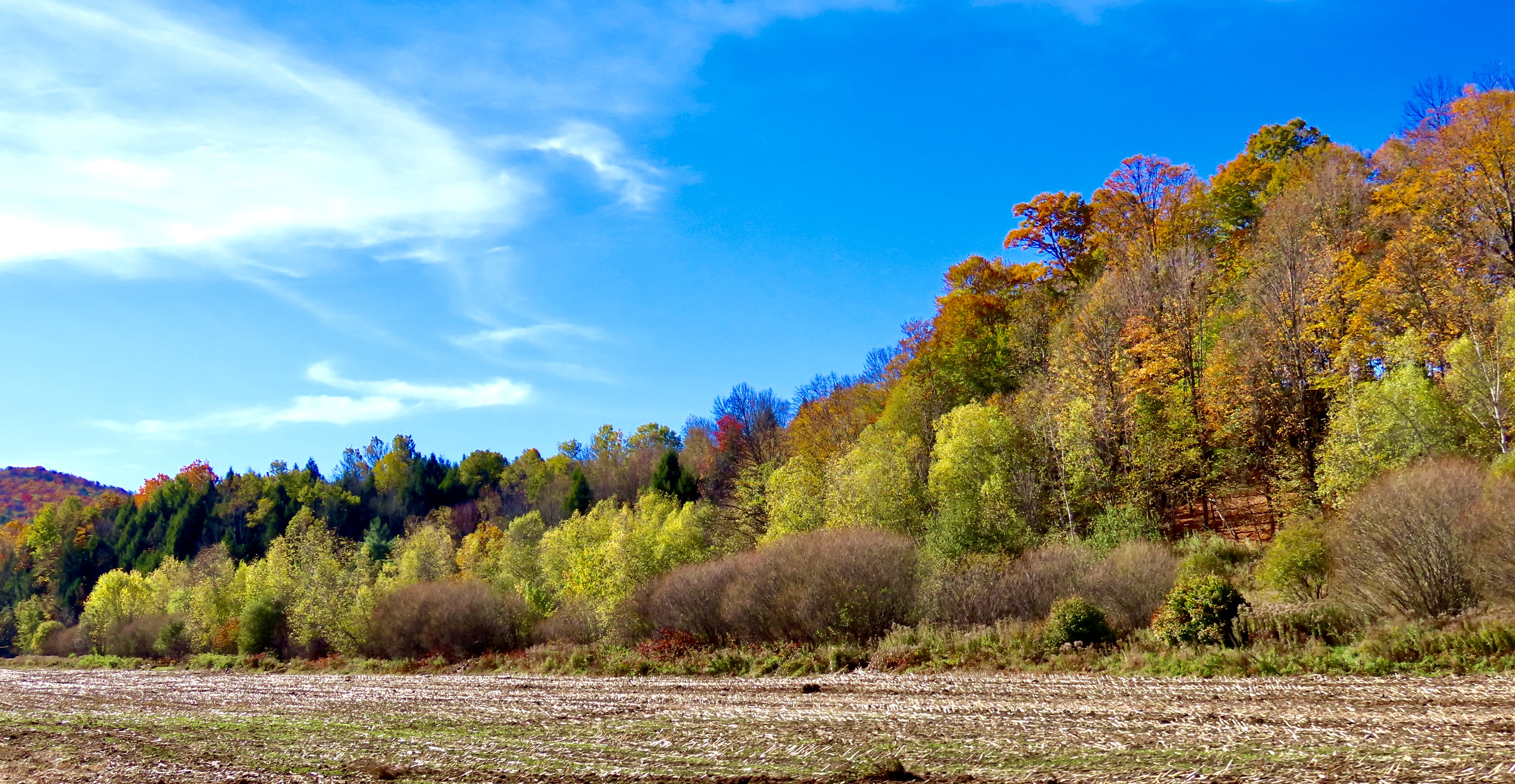
Beautiful leaves, but are any left on the trees?The answer was yes. These two photos were both taken at our cabin near Chazy, New York. The sunlight here reminded us that we still had a lot of leaf peeping to do.
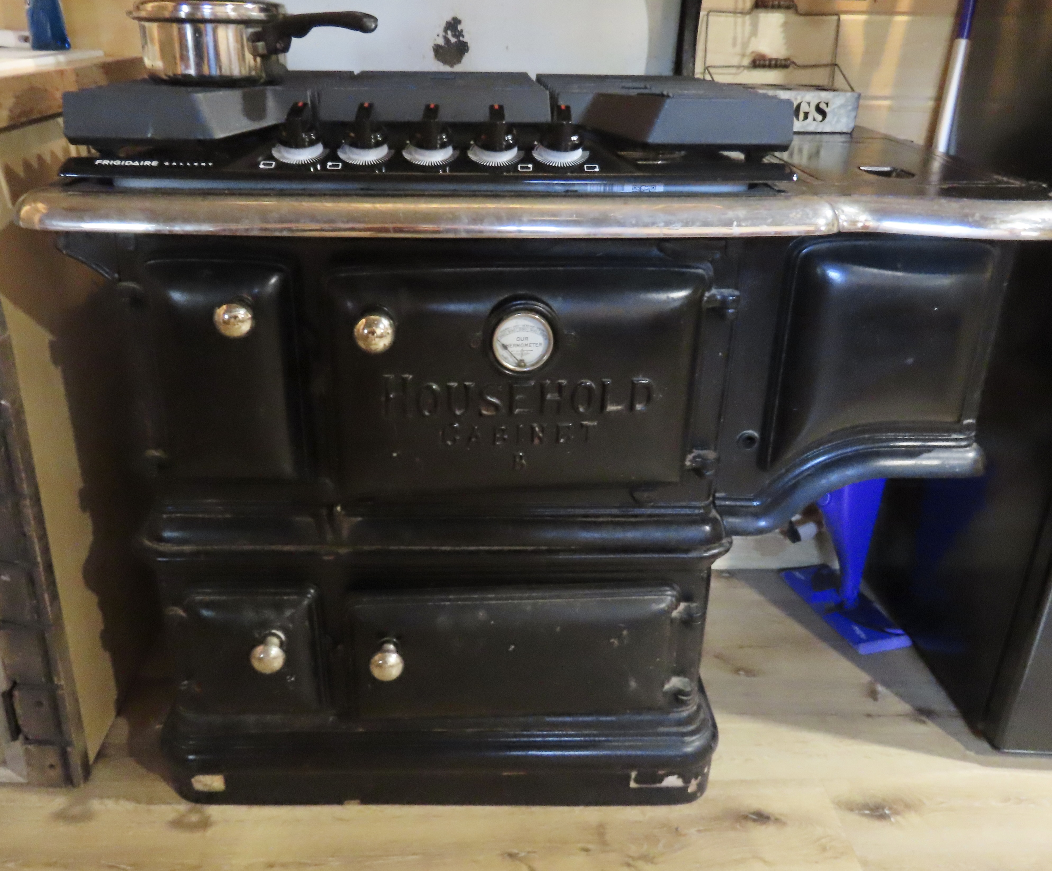
Our West Chazy NY cabin was the second one on our tour. I already blogged about the first: Bare minimum: no electricity, no heat, no insulation, no water and an outhouse— all on the coldest day of our three week trip. The second was the direct opposite: A full kitchen, bathroom, sitting room, streaming TV, fun decorations, heat, and, I might add, excellent insulation. The owner, Shane, greeted us when we arrived and told us that he had put a dozen eggs in the refrigerator! “Our chickens are producing eggs faster than we can eat them,” he told us.” Let me know if you need more.” When we went online to give the cabin a five out of five, we were surprised that Shane had already been there and given us a five out of five as guests! Both cabins cost about the same to rent. It’s a tale of two cabins, a dickens of a story, if you will.
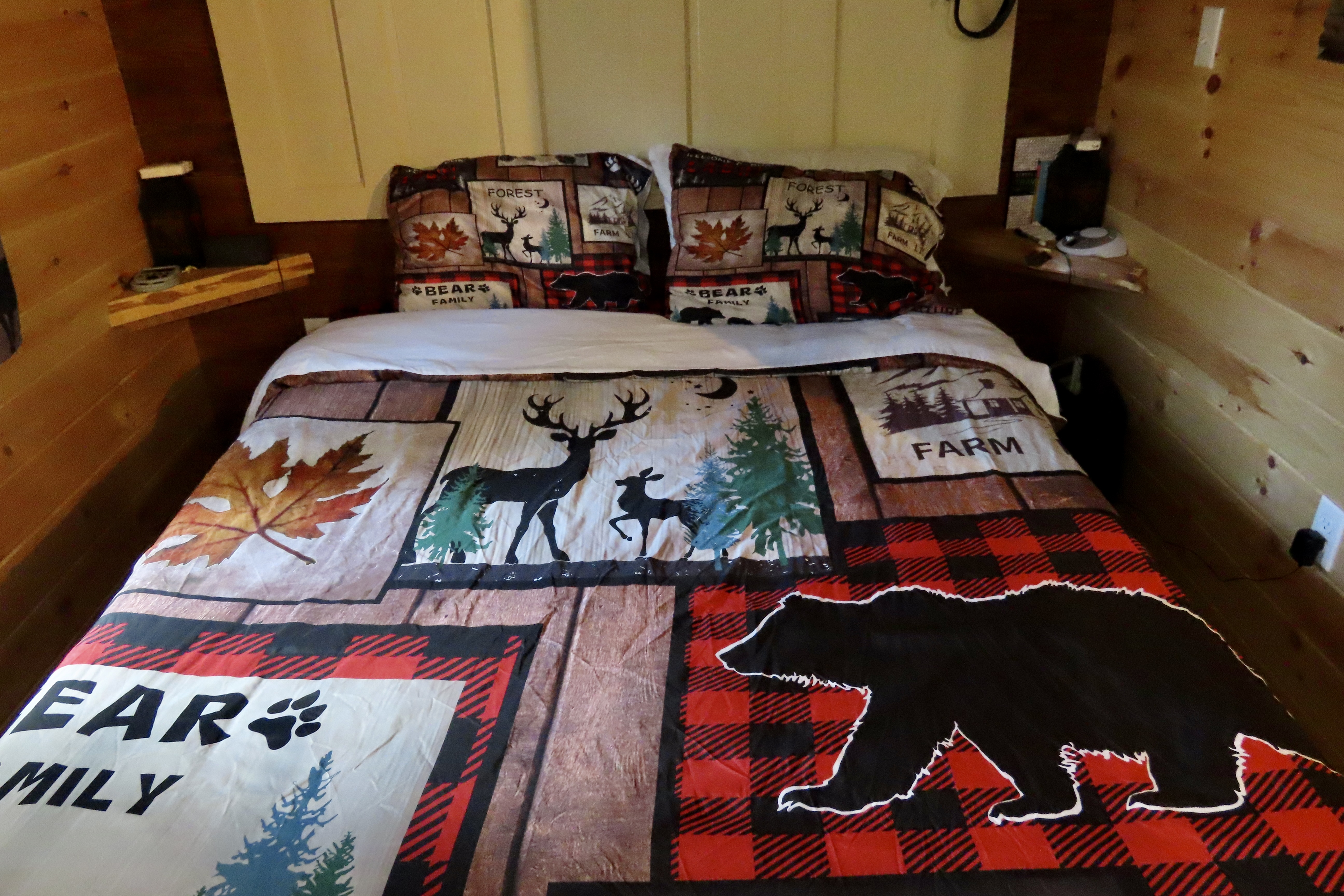
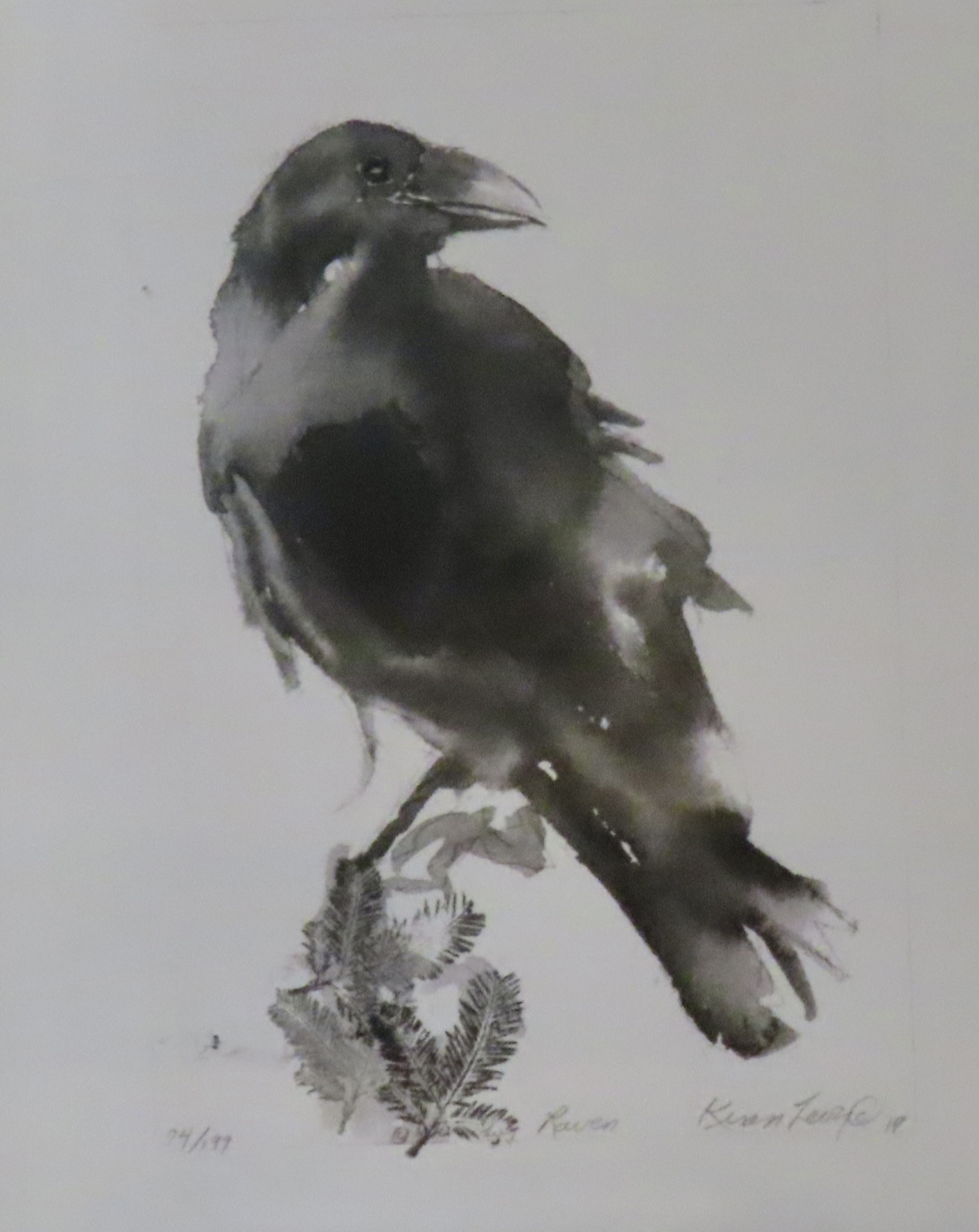
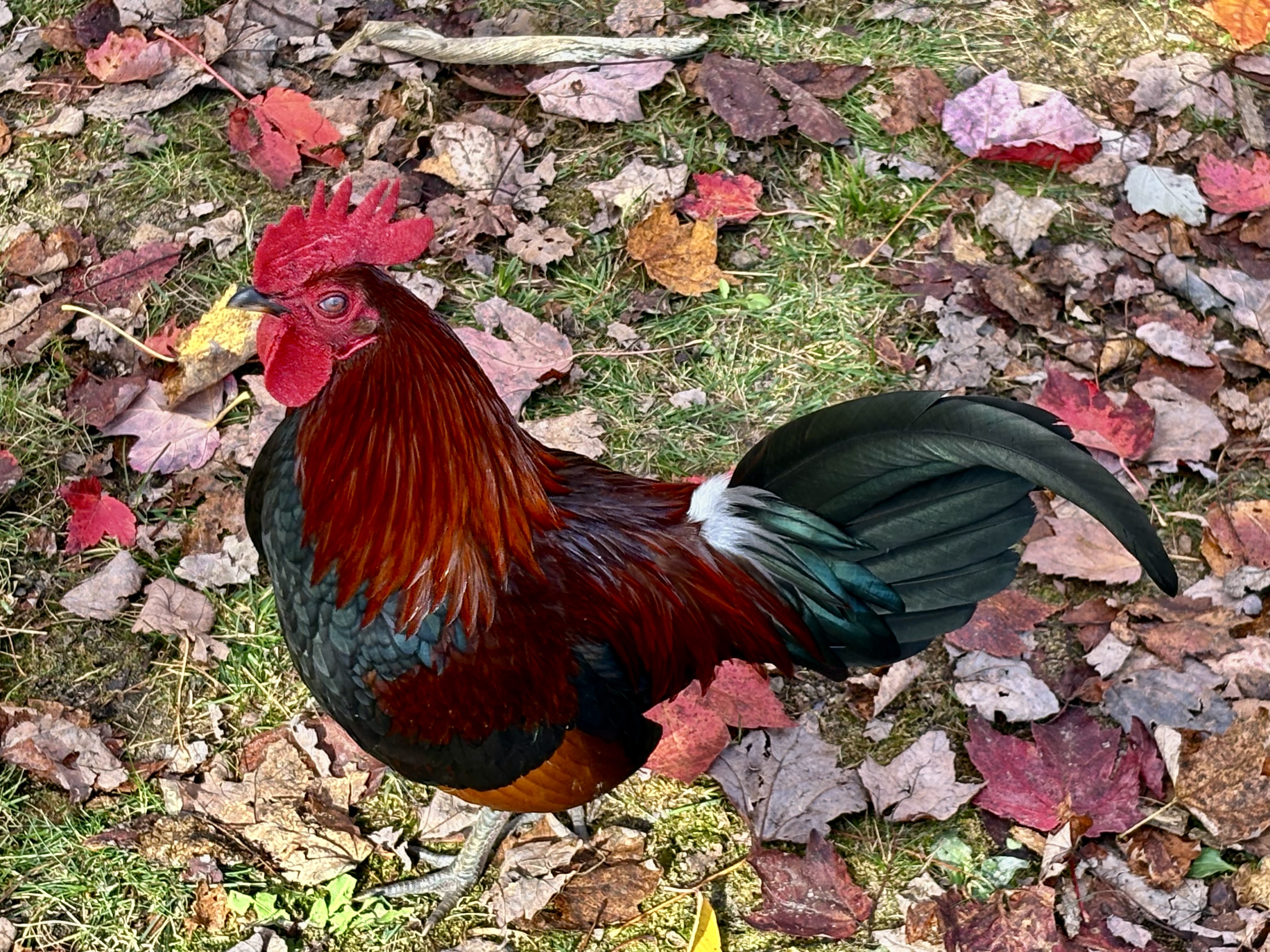
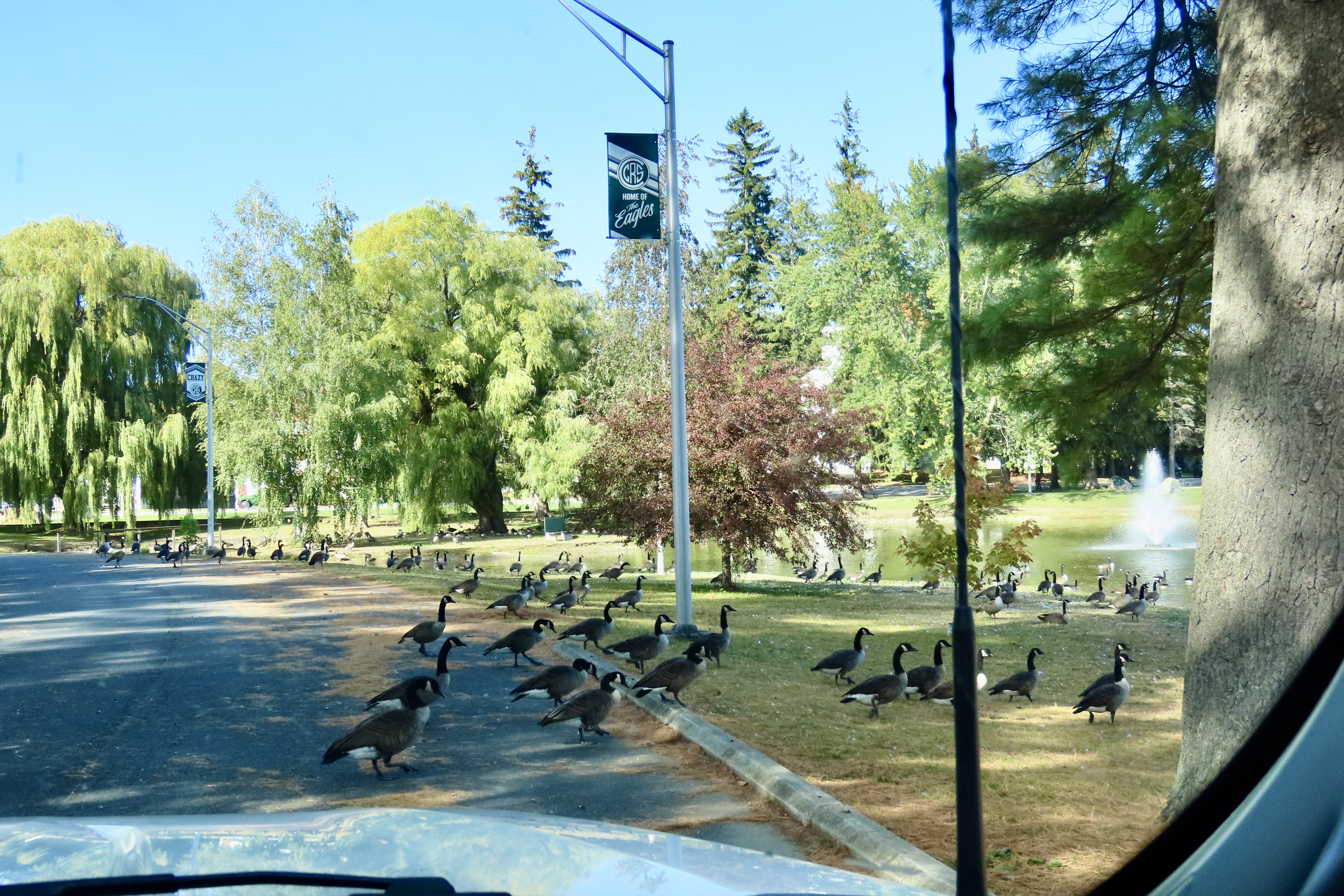
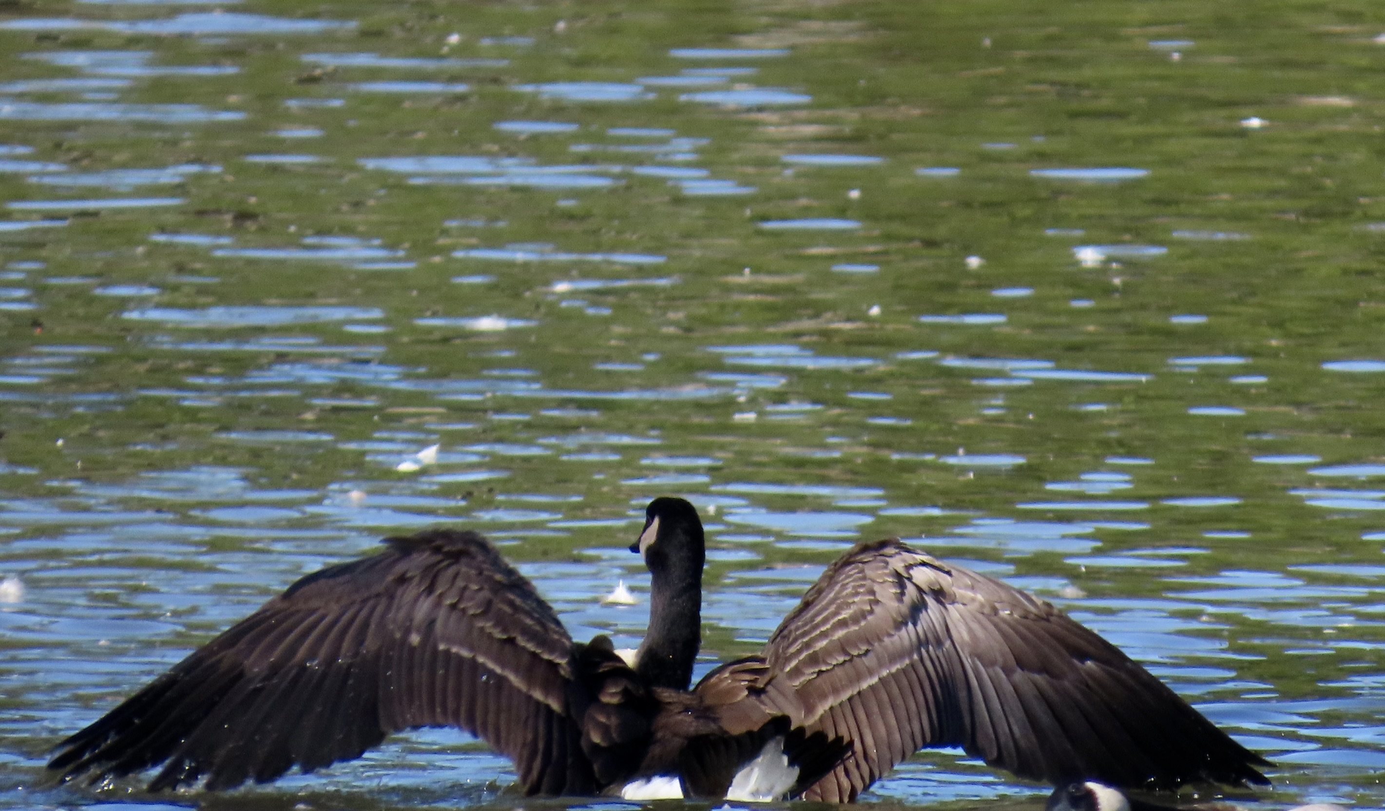
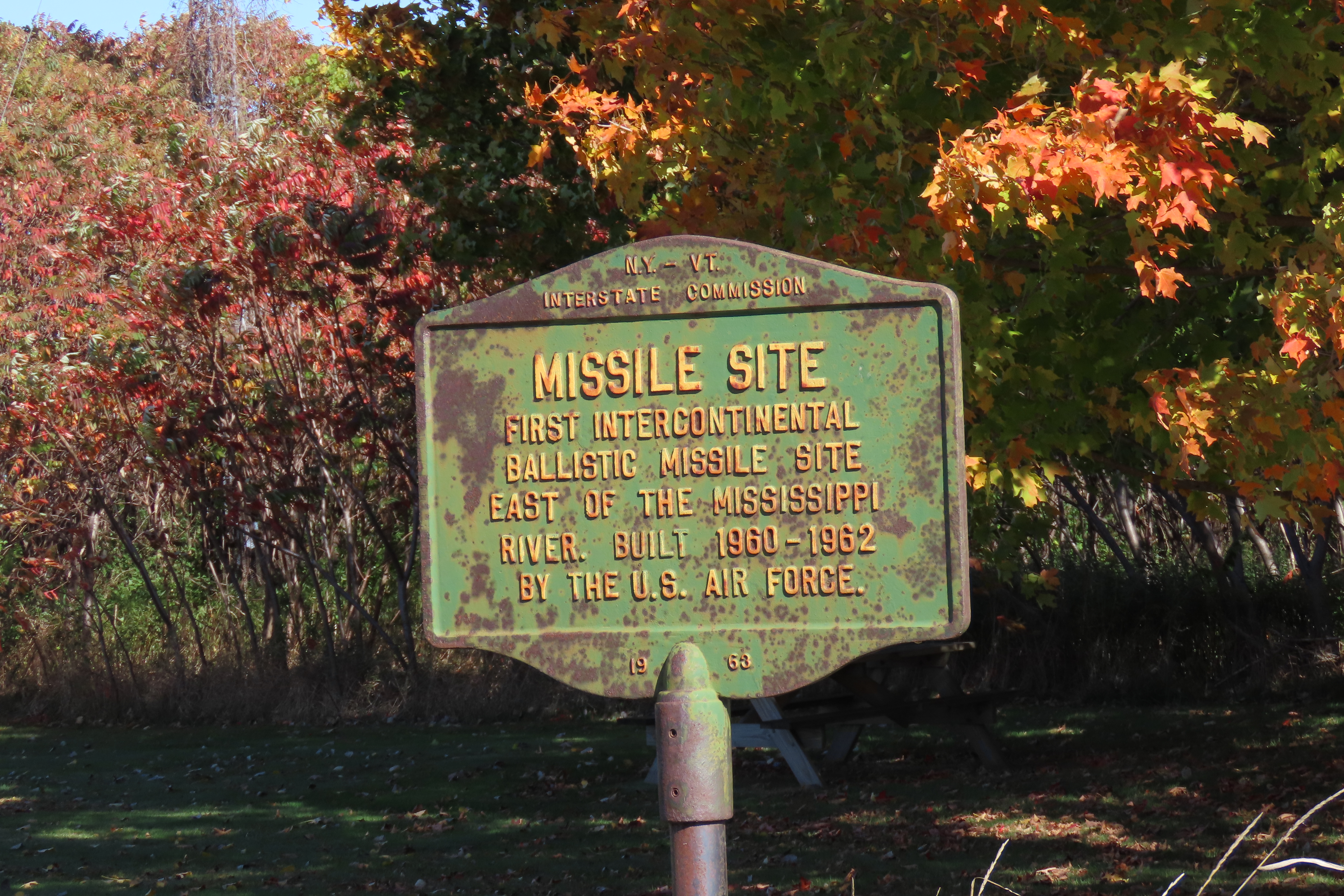
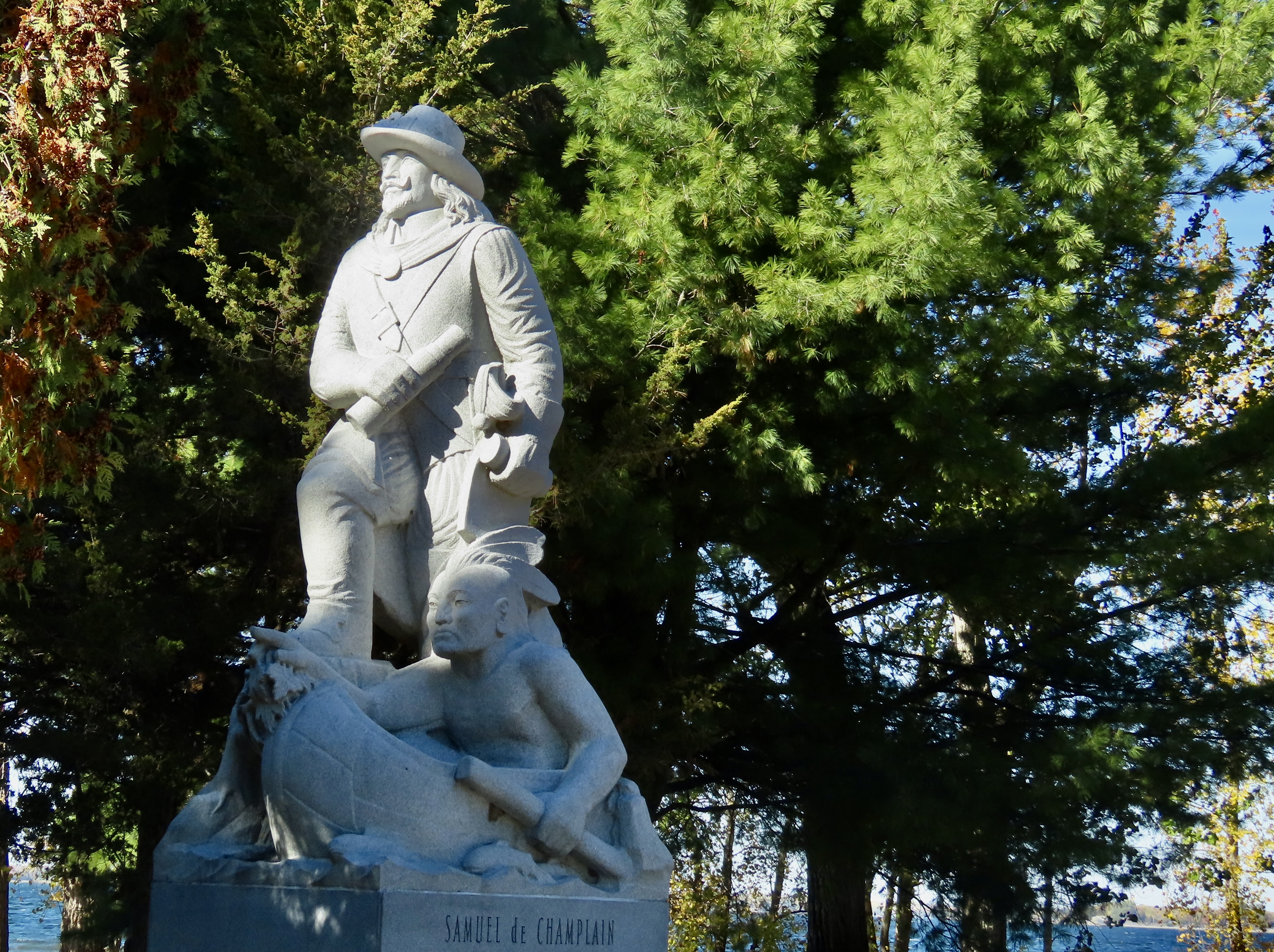
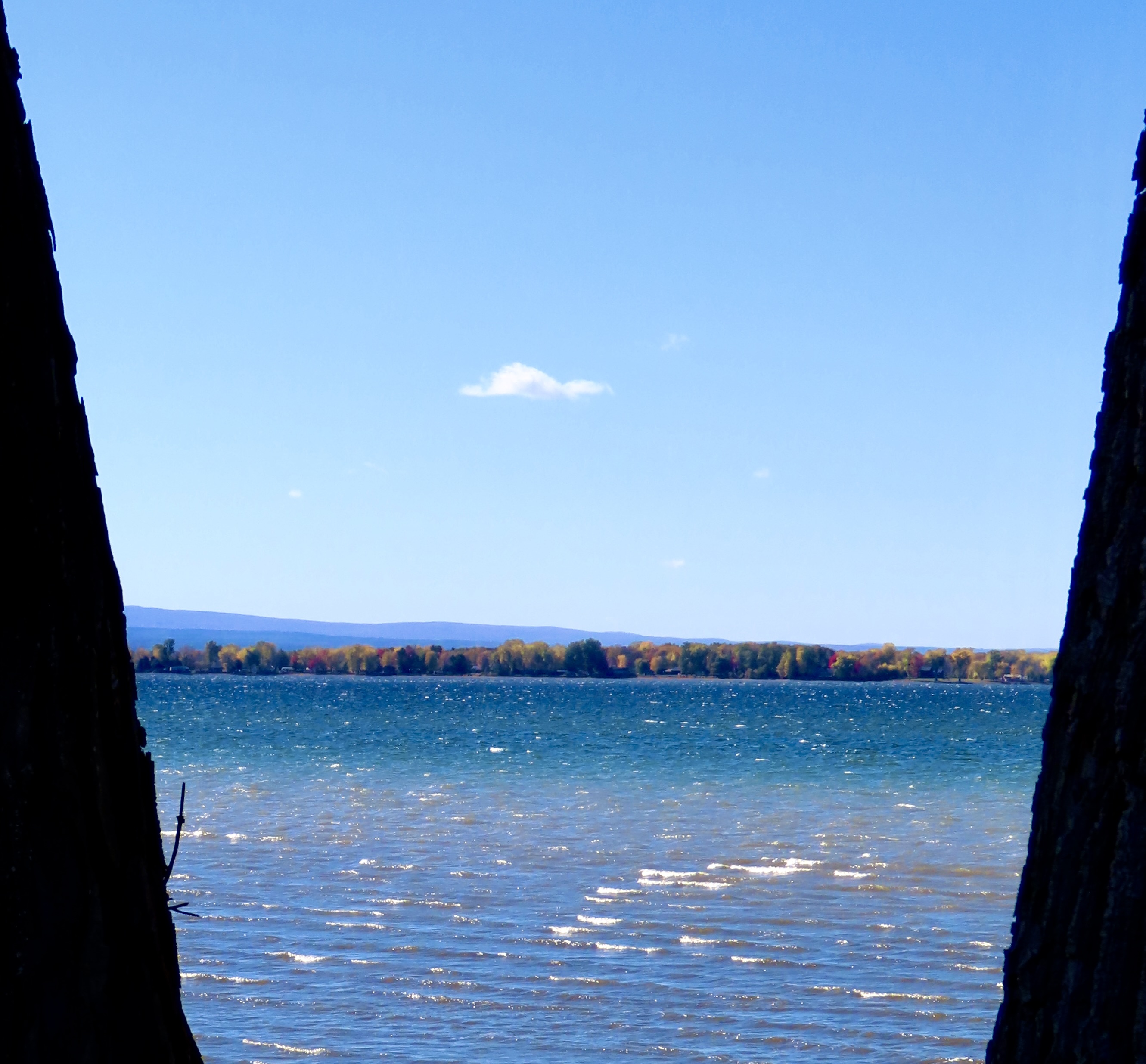
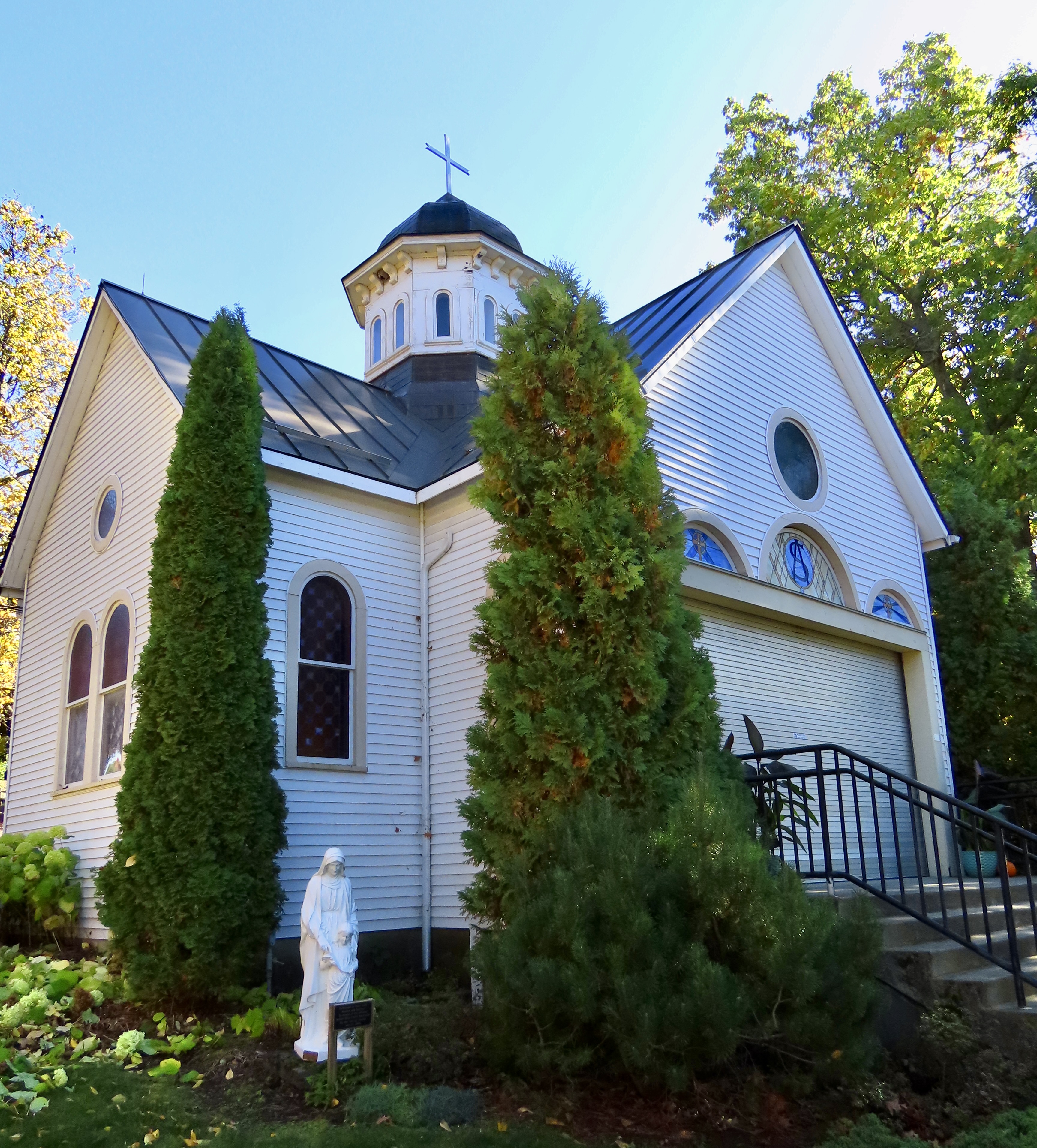
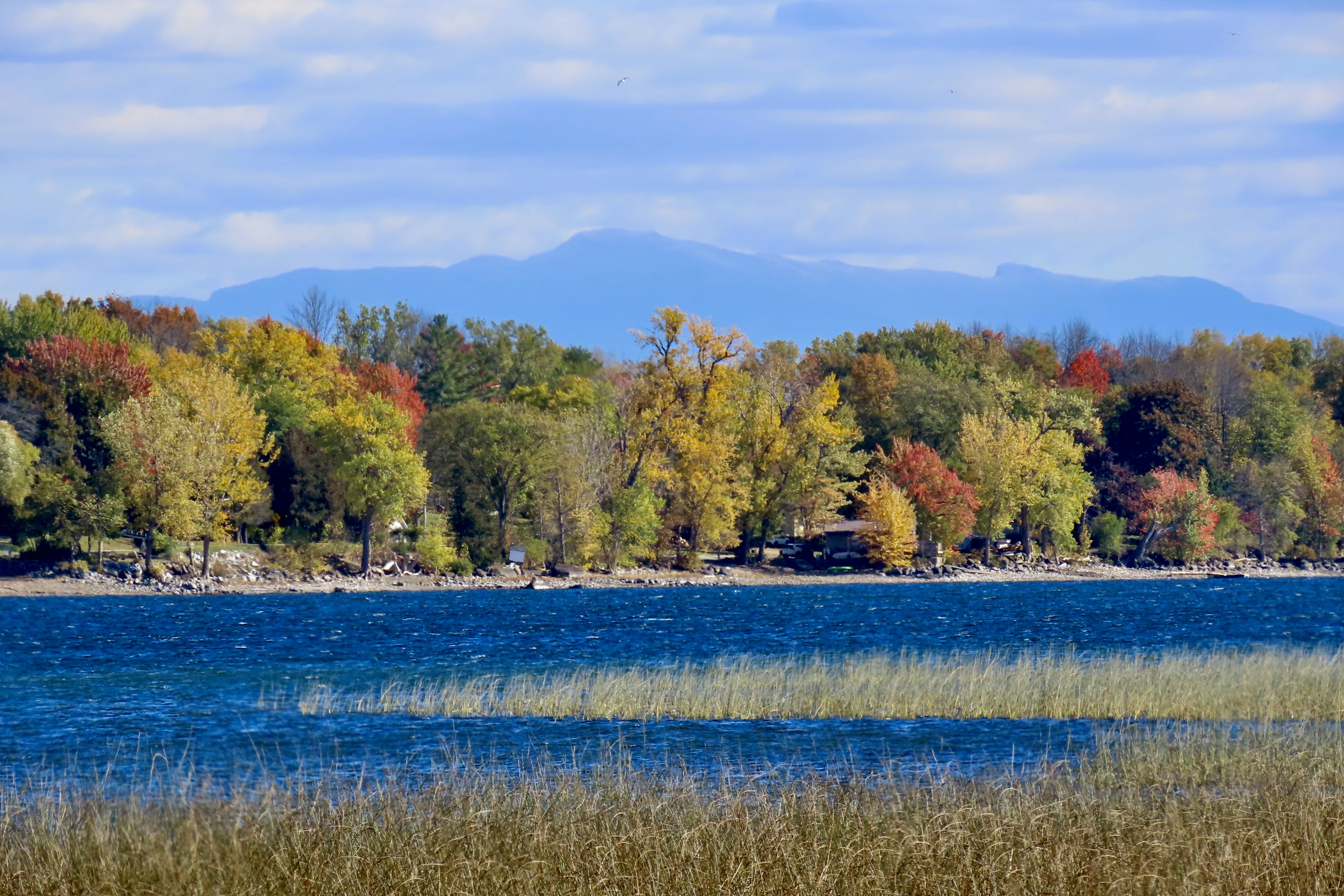
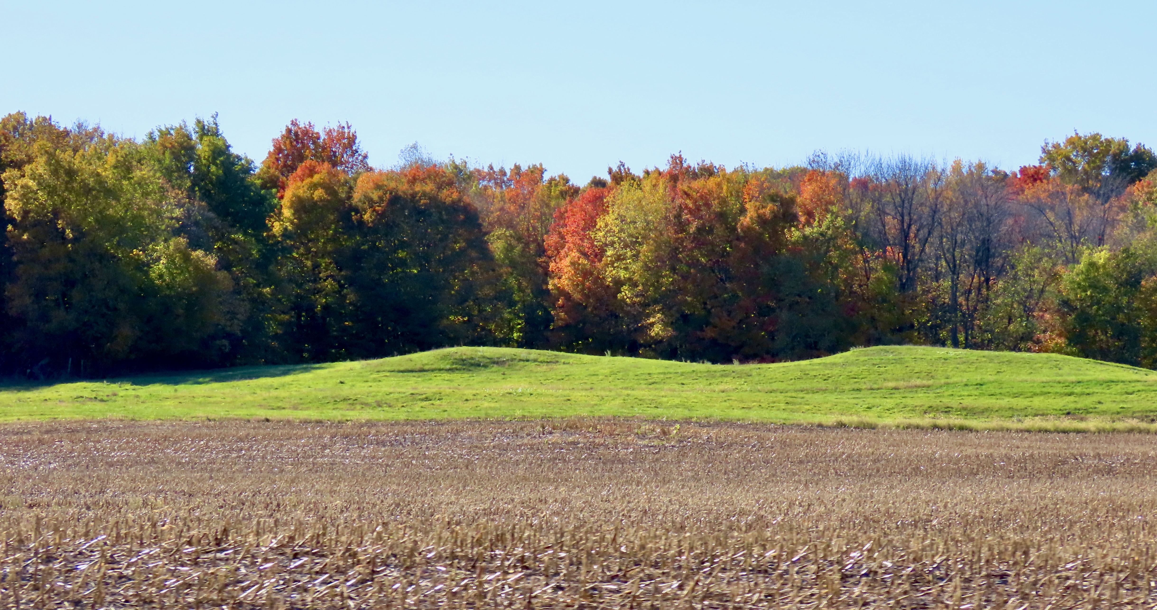
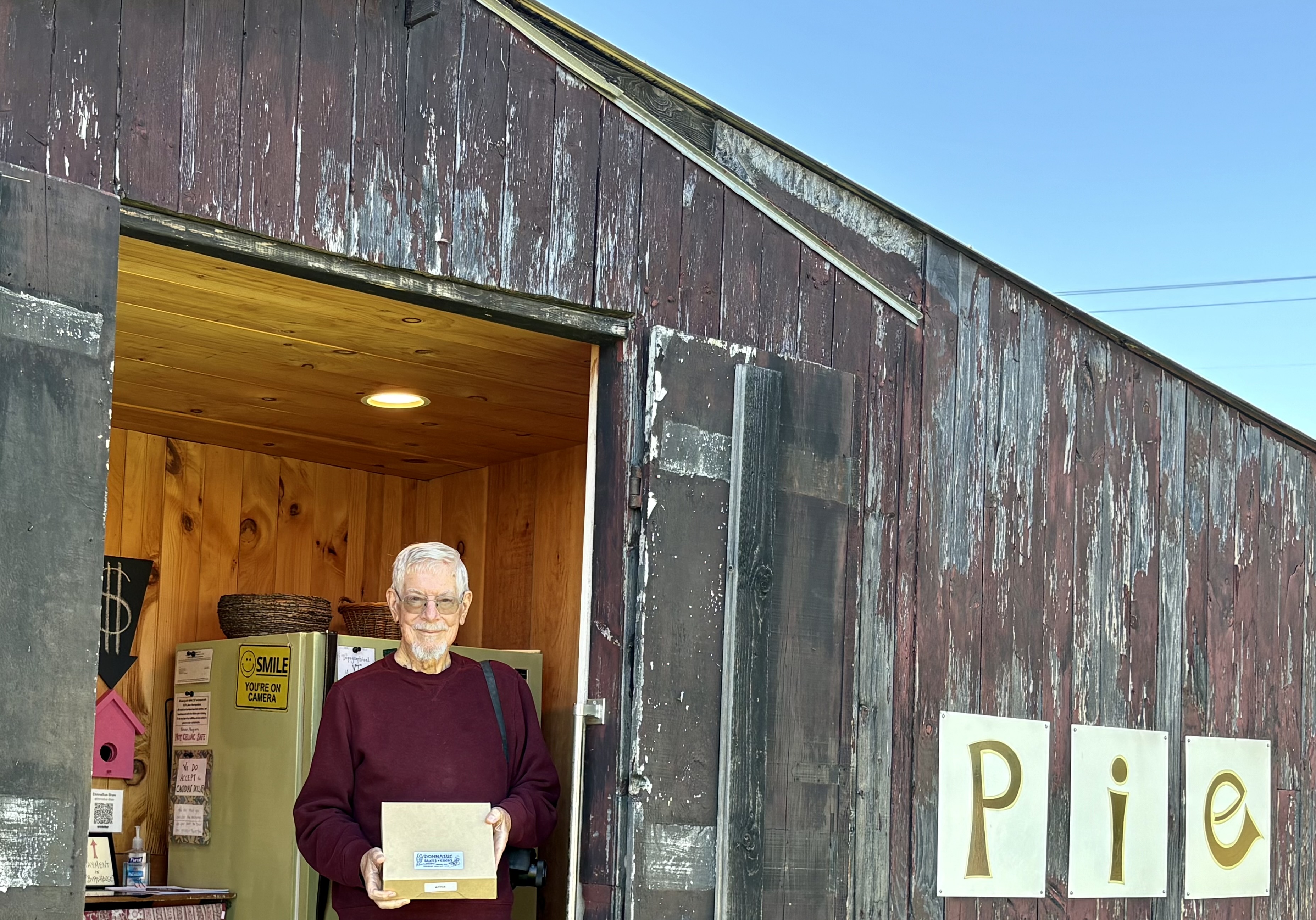
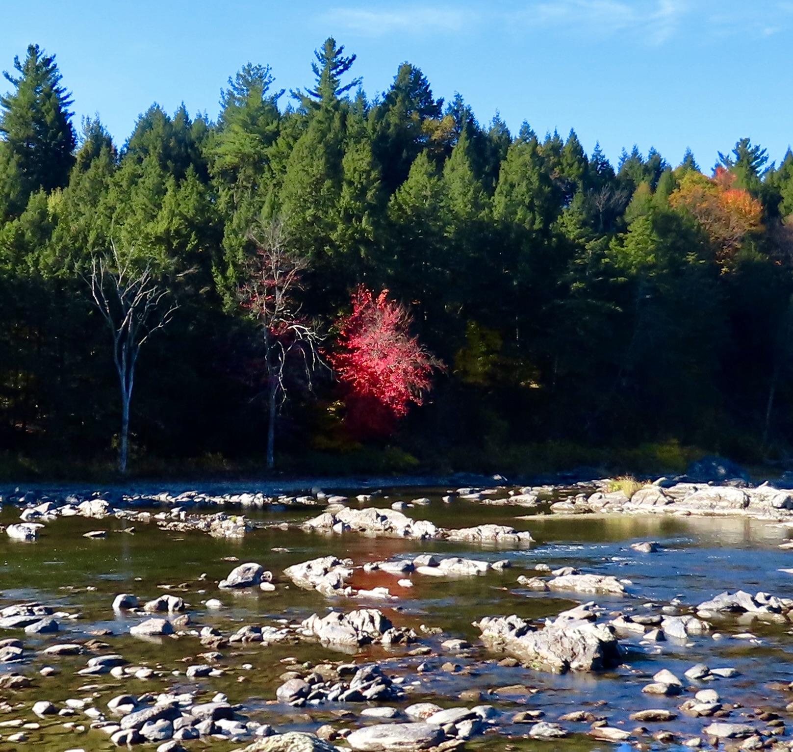
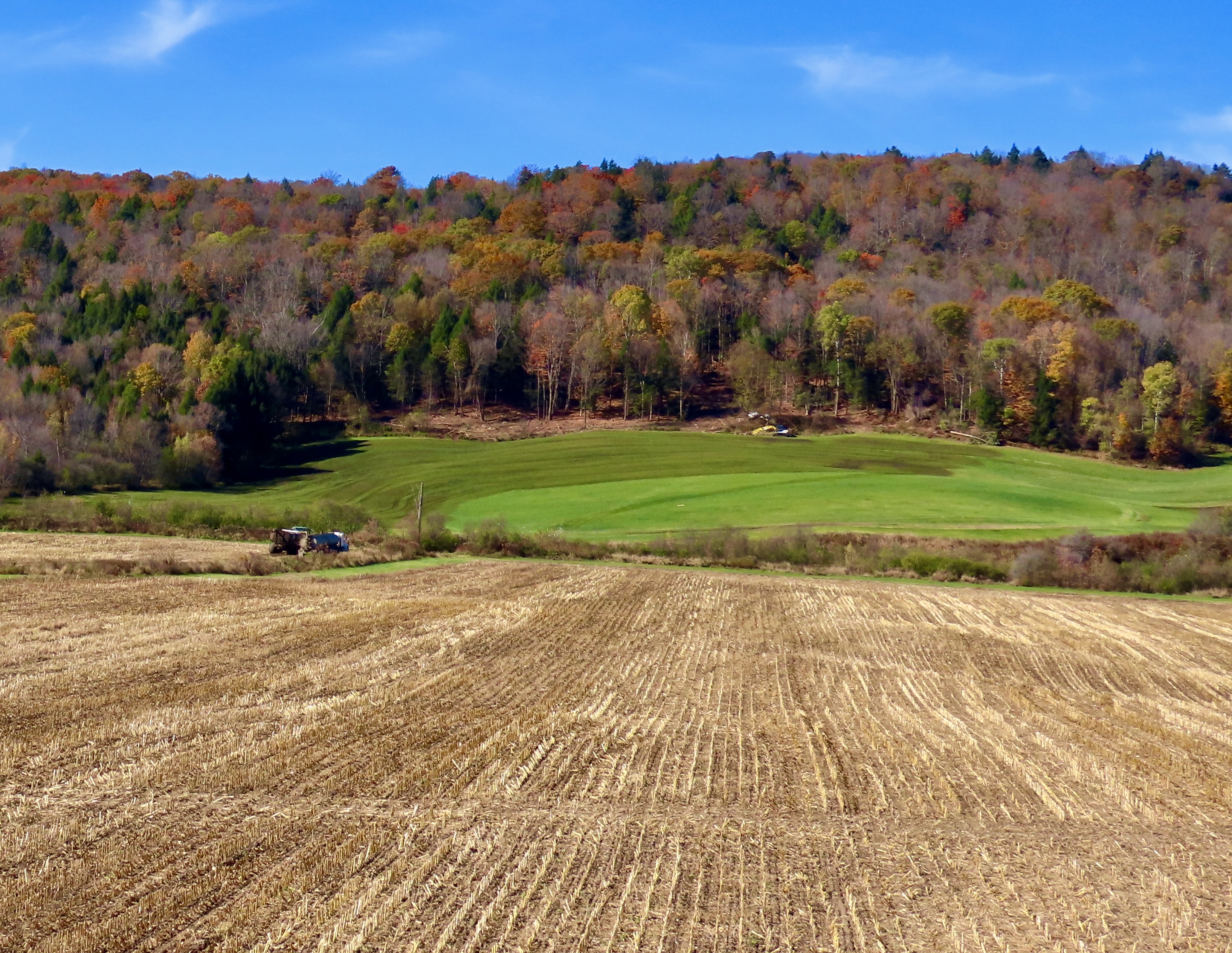
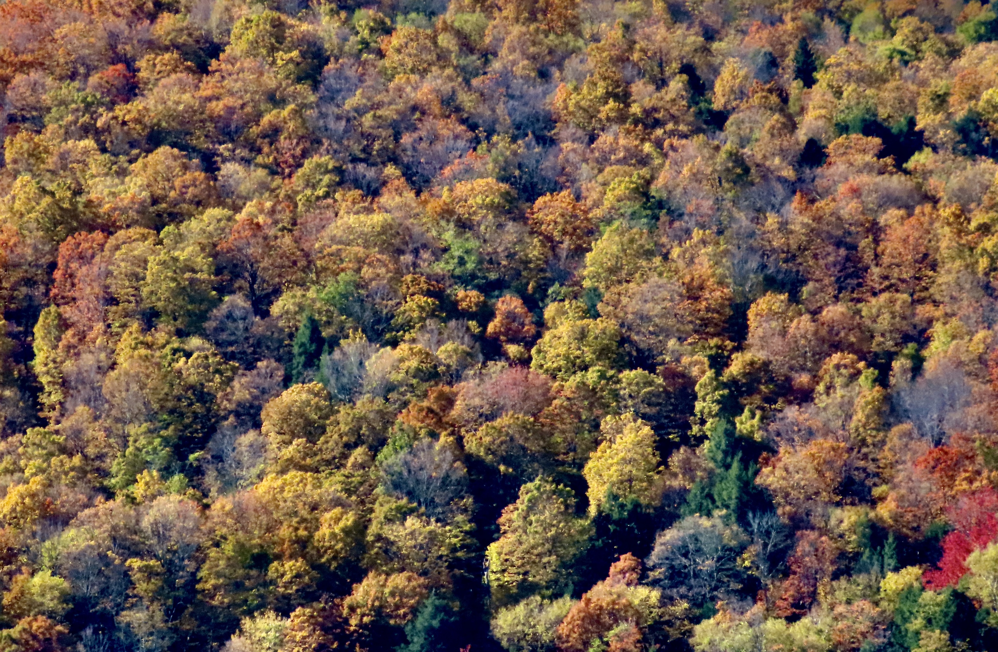
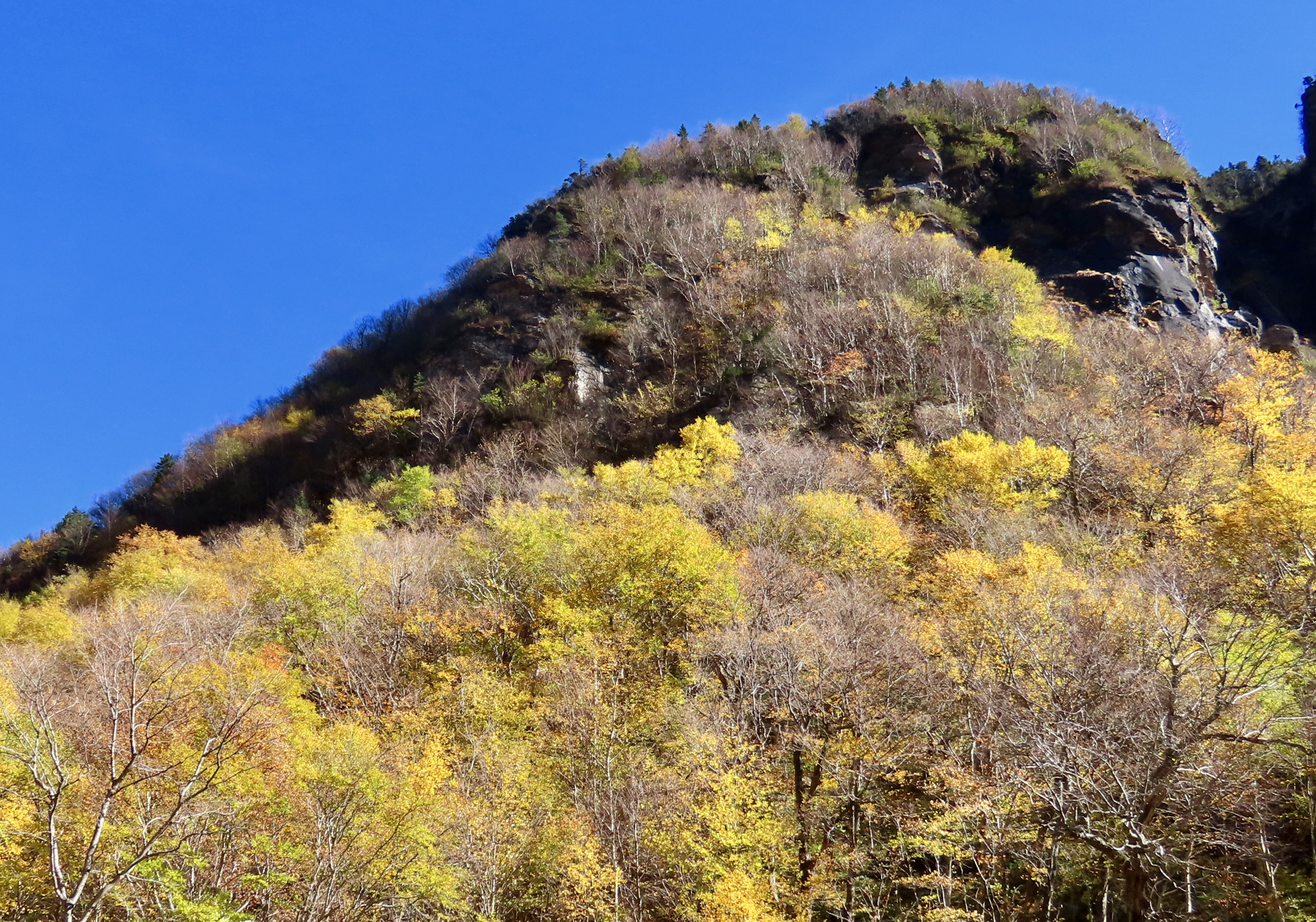
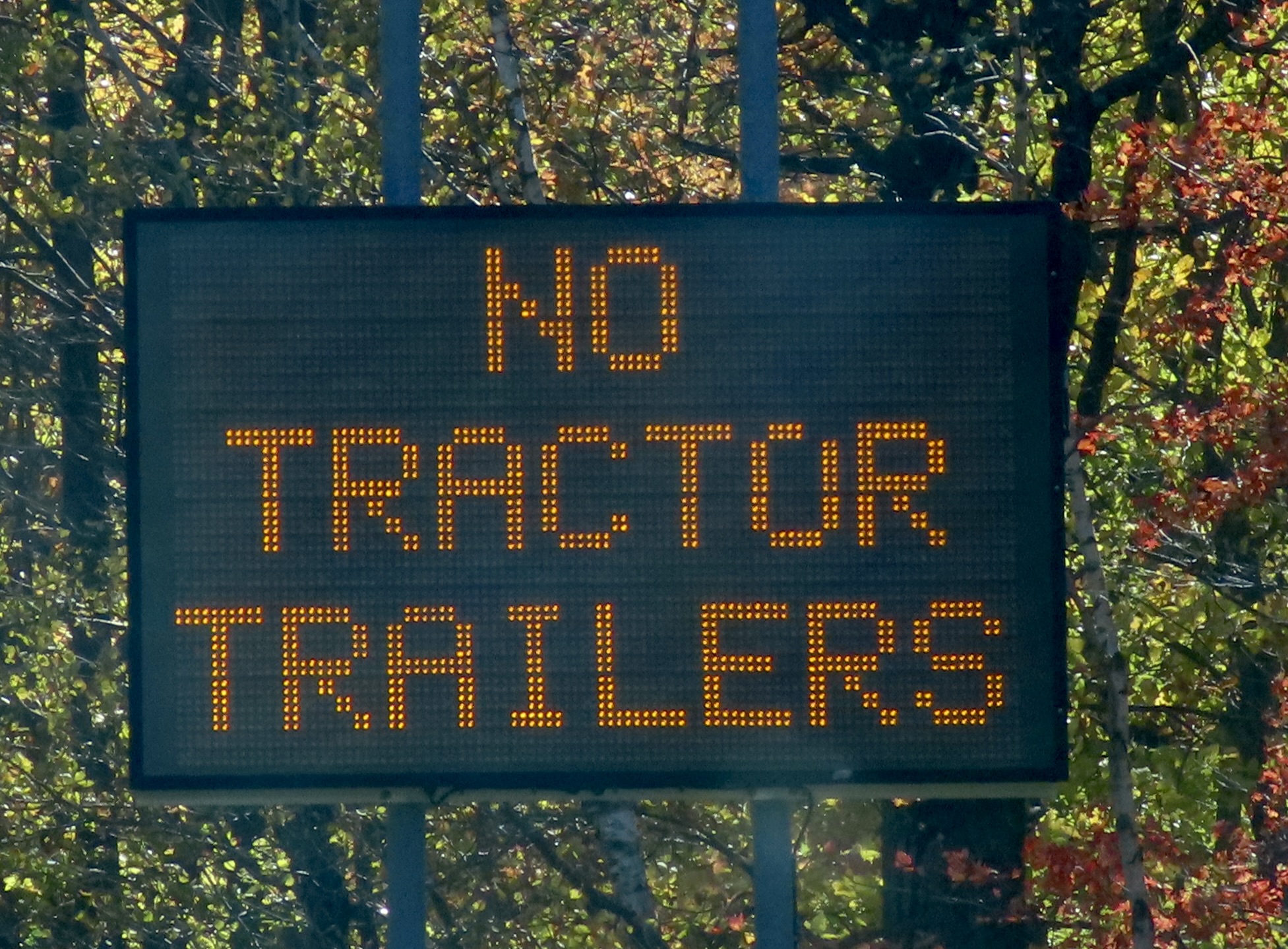
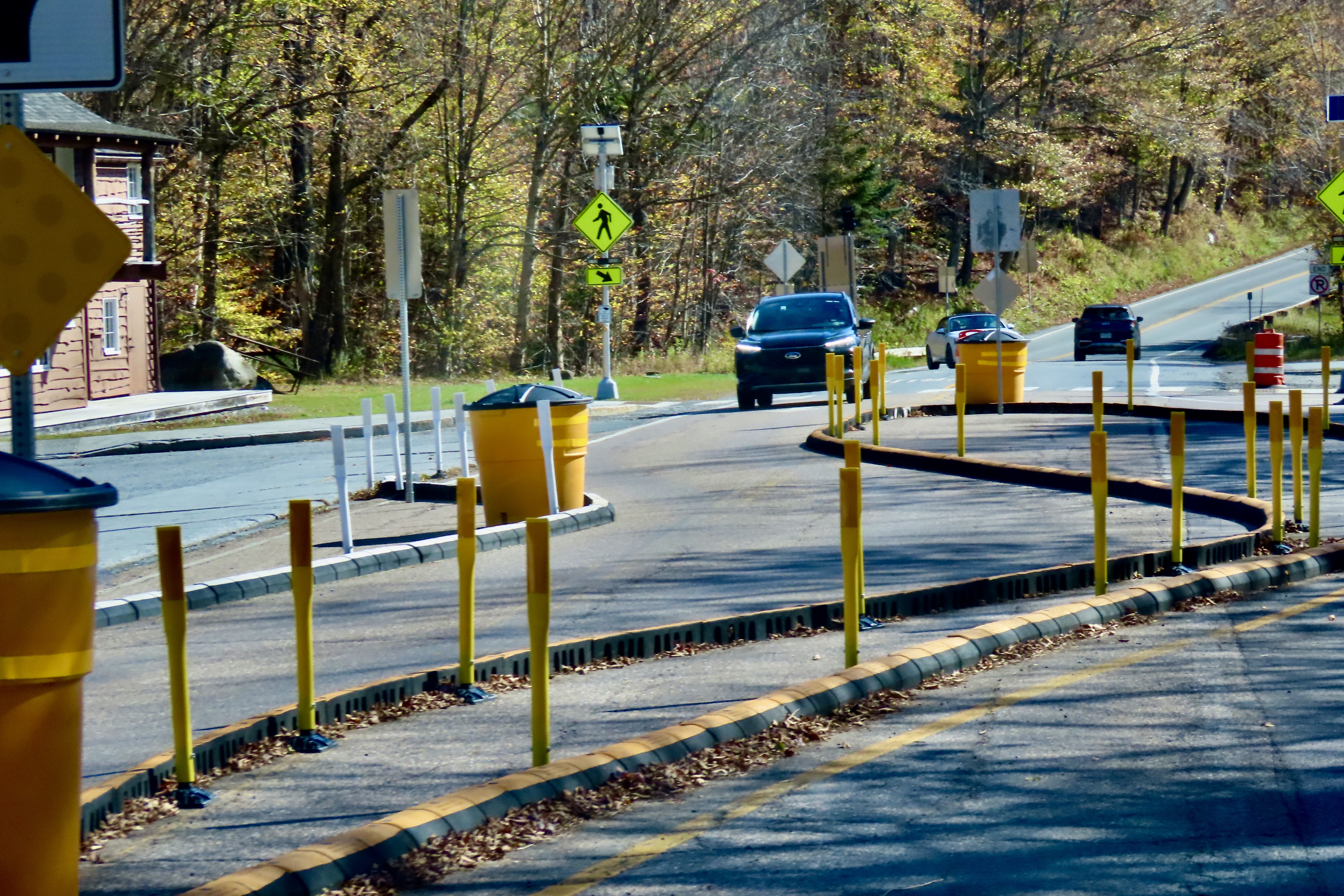
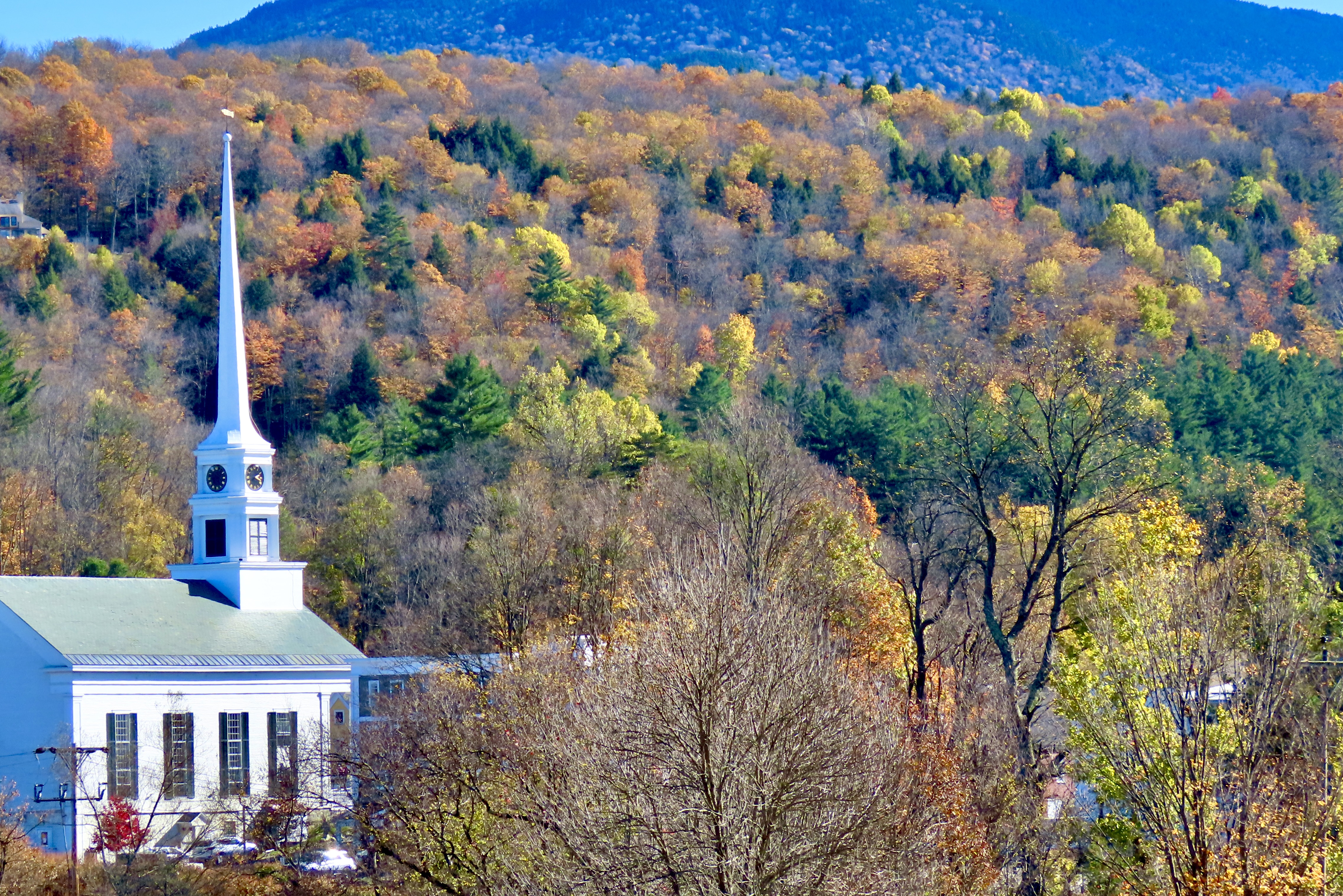
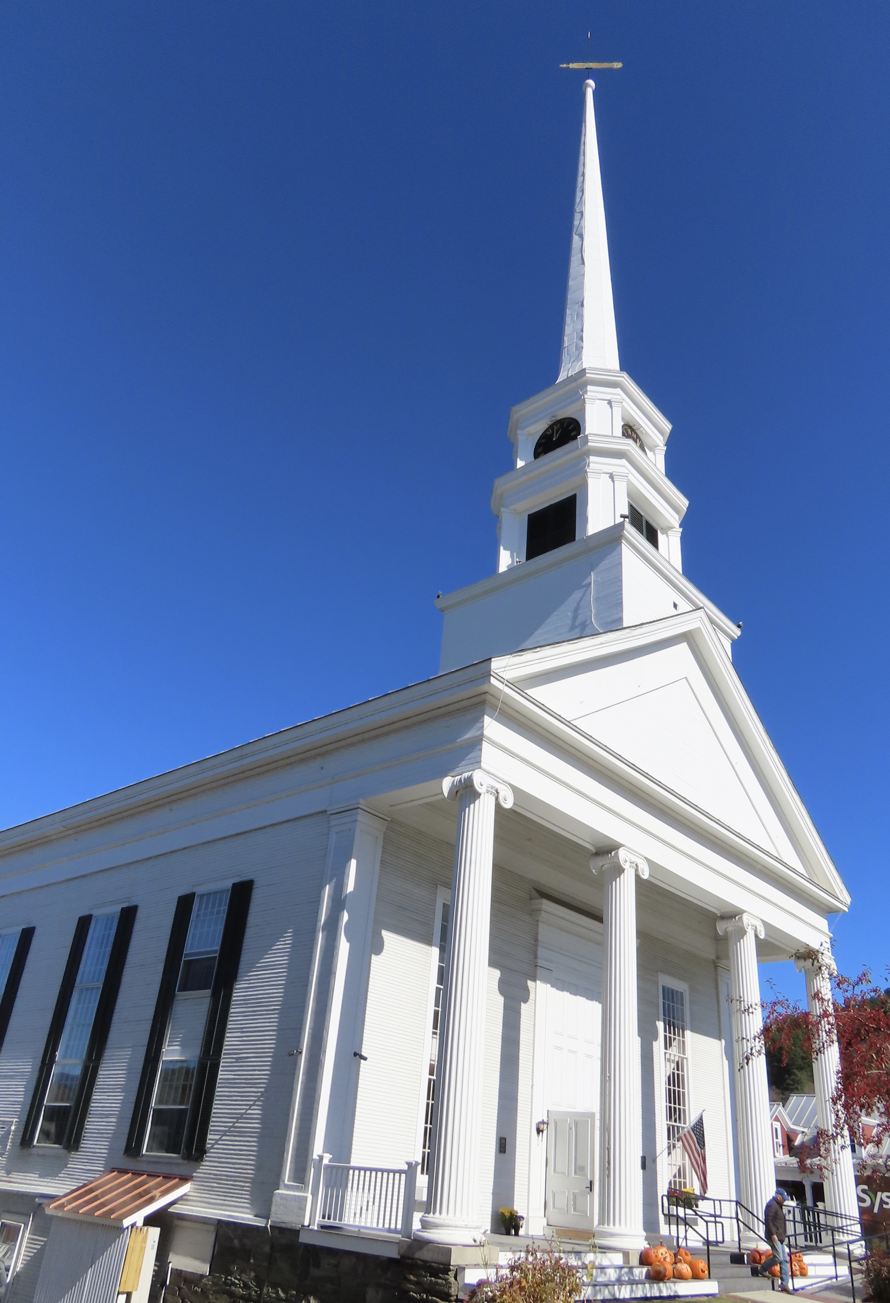
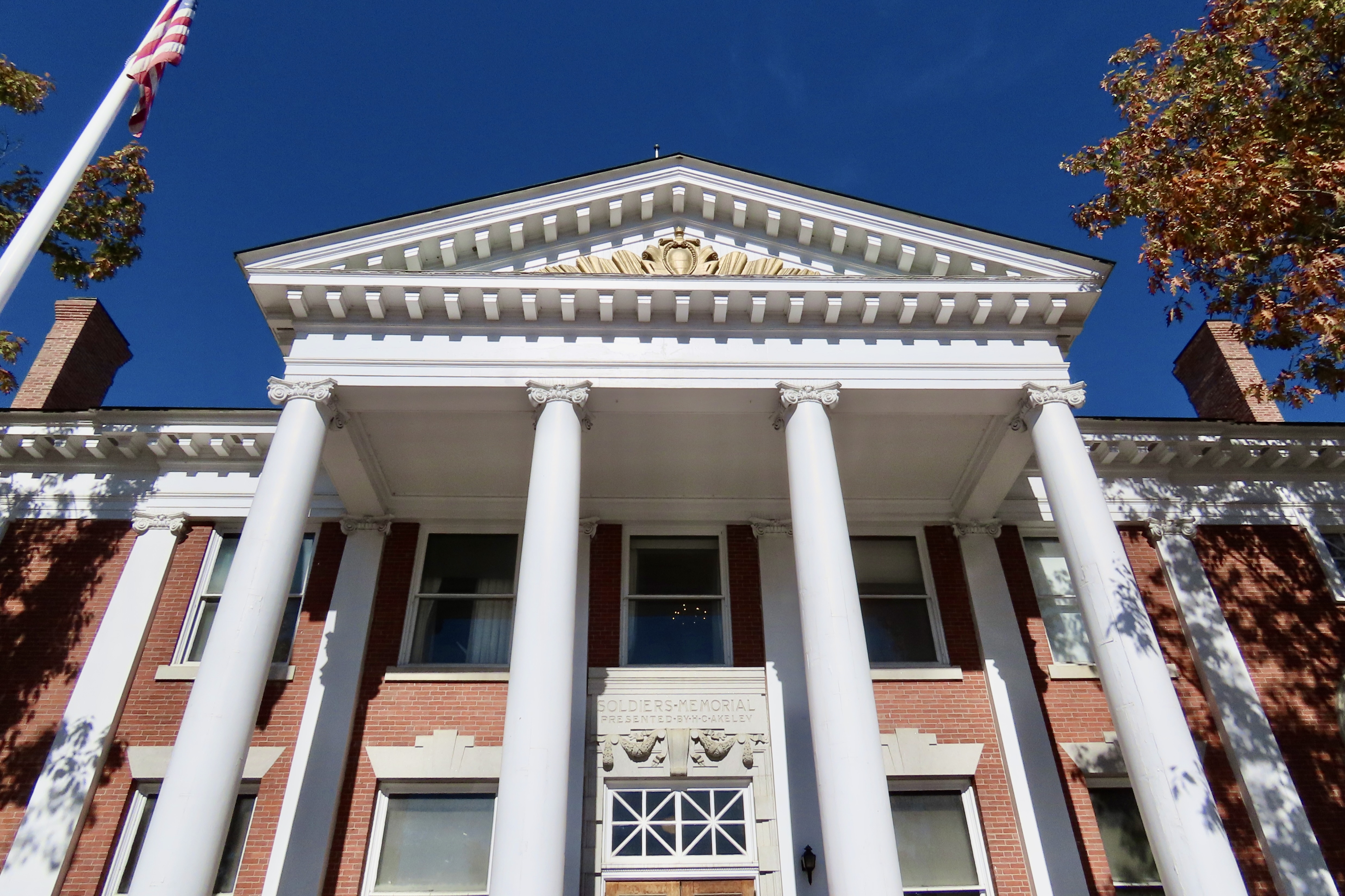
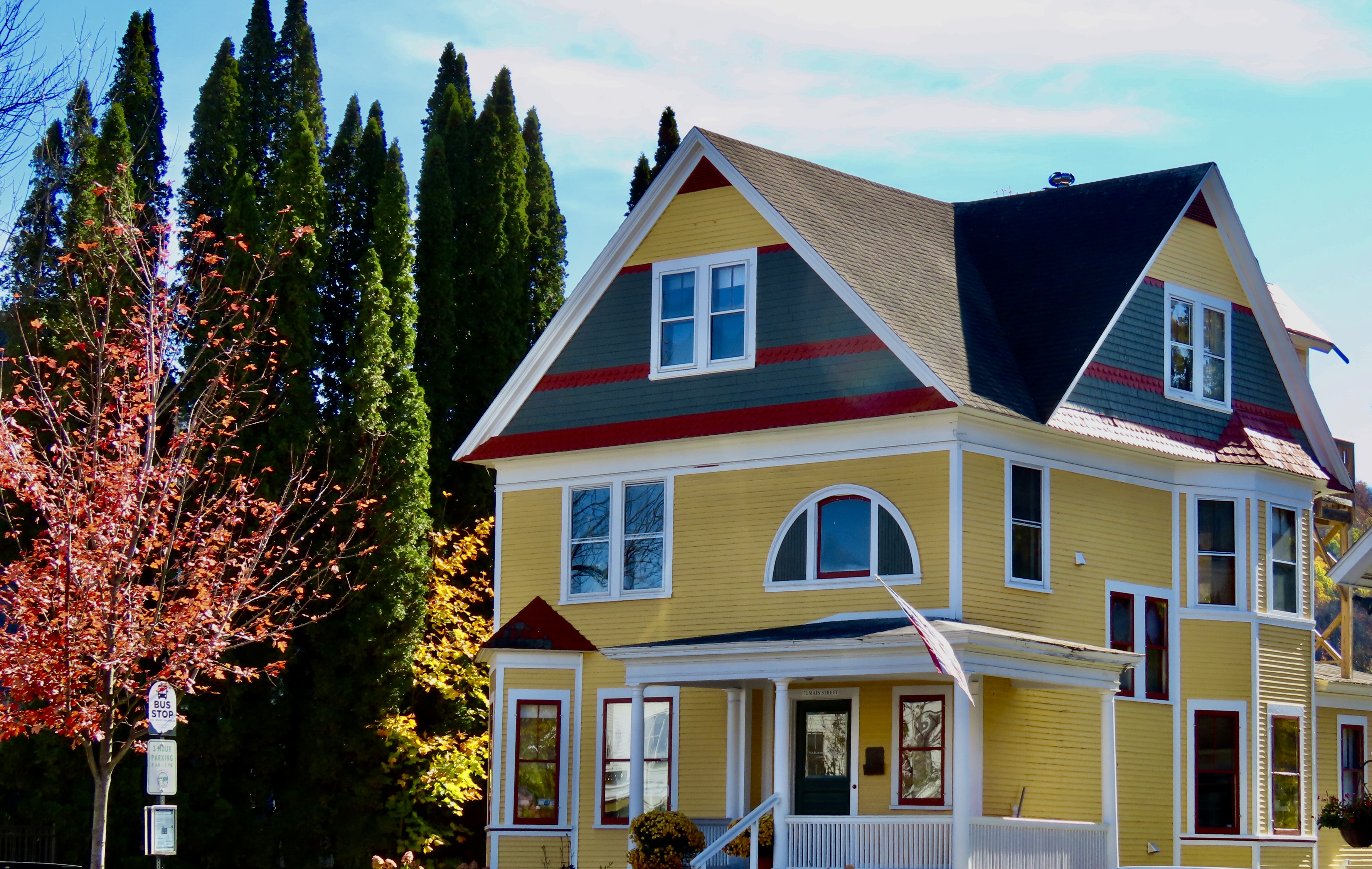
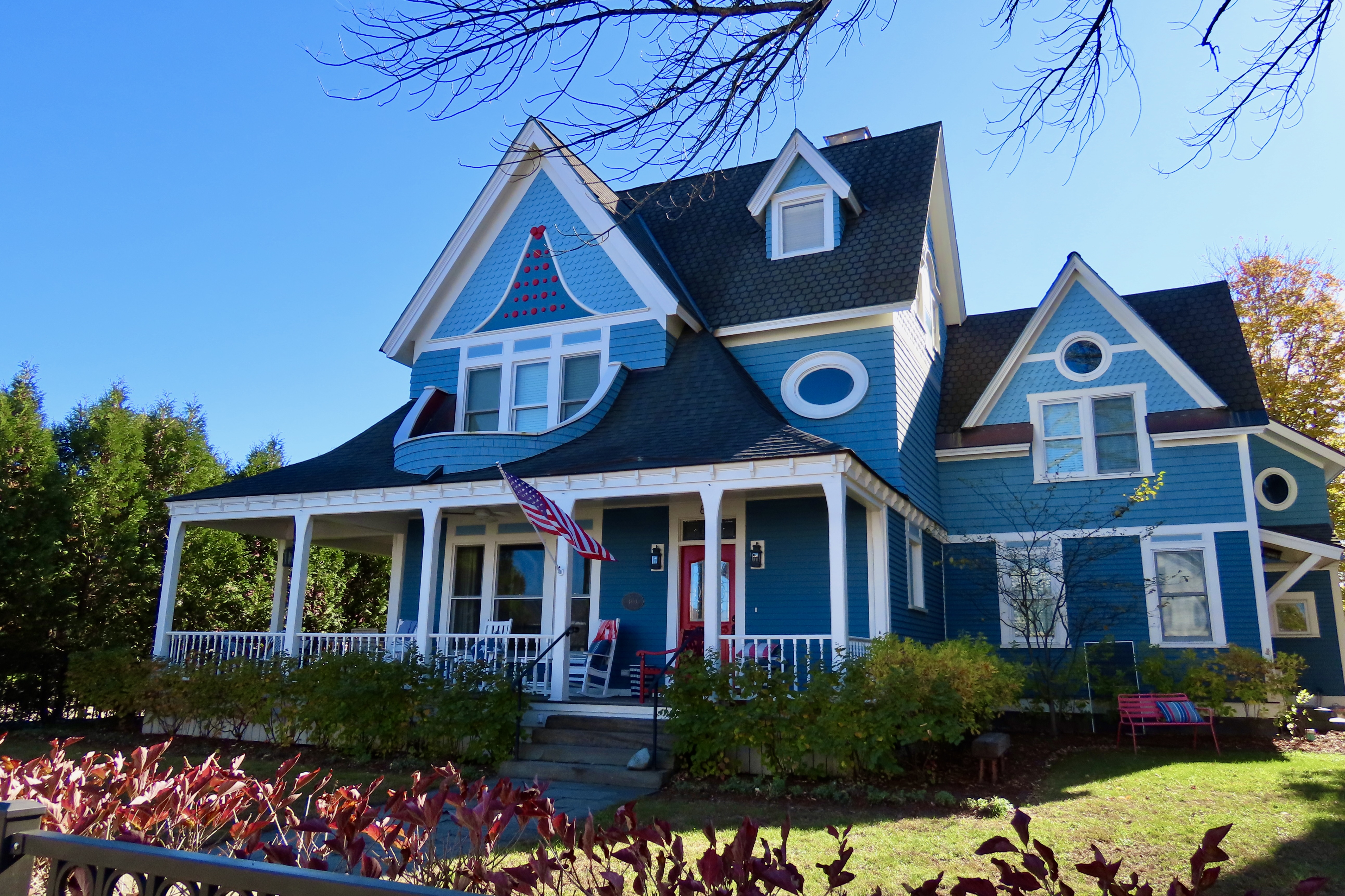
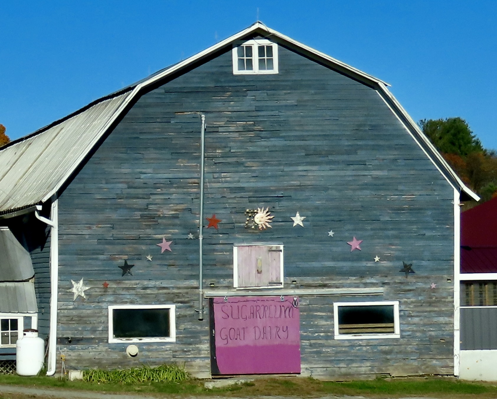
This stove serves as an example of what Shane had done in the cabin. He had taken a beautiful antique wood stove and modified it by putting a modern gas stove on top. It was the best of both worlds.Bedspread, pillow cases, curtains and rugs all included outdoor scenes packed with wildlife and country themes.There were also lots of crow decorations. This was due to the fact that Shane calls the cabin, the Crow’s Nest. In fact you can look up the cabin at Crow’s Nest, West Chazy, NY.We didn’t see any crows outside, but this banty rooster was strutting his stuff. He crowed about how he was inspiring the chickens to lay eggs. There were also goats, a white turkey, and the egg laying hens that guests could visit.The most common member of the bird family we found in the area were Canada Geese. There were dozens/hundreds of them. Everywhere. In creeks, small ponds, and Lake Champlain. No body of water was too small or too large. We noticed that they seemed a little skittish and headed into the water whenever we got close. We also wondered why they were hanging out near the Canadian border and hadn’t flown south. And then it dawned on us. They didn’t have passports, they didn’t haven’t visas, they didn’t have US citizen papers, and, worse, they were dangerous criminals: They pooped in public parks and on people’s lawns. The geese, frightened that we were ICE agents, prepared to fly back across the border on a moment’s notice.You are now cleared for flight on runway #1.Since the Vermont islands on Lake Champlain were a short drive away from Chazy, we made a day trip over to visit them. This gorgeous tree was right next to the Vermont Information Center. Peaceful, huh?This sign stood next to the tree. I was once exploring an ICBM site north of San Francisco when I heard a loud grinding noise. A large cover drew back and out came the missile with its nose pointed toward the sky. Scary, eh! That would have had me fleeing toward the mountains ( and probably peeing my pants), except I knew that the site was decommissioned and some type of visitor demonstration was scheduled.The islands are all connected by bridges and a road. The first Island we explored was Isle de Motte. It featured a large statue of Samuel Champlain, who the lake is named after, and a native. Both were holding rolled up documents, which I assume represented treaties between the Hurons, Algonquins and France. The allies were attacked by a large body of Iroquois when Champlain was first exploring the lake in 1609. Champlain saved the day by shooting two of the Iroquois chiefs with his flintlock. Note how the Indian wisely hid behind a rock while Champlain fearlessly faced the enemy. (One of the reasons the Americans were able to defeat the British during the Revolutionary War was that learned from the Indians.)An actual self-portrait done by Champlain of how he pictured the event. My thoughts are: Duck! But that wouldn’t be nearly as impressive to the folks back home. Champlain became known as the Father of New France while the Iroquois became forever enemies of the French, siding with the English during the French and Indian War.As Champlain used his muzzle to sight in on the Iroquois, I used a tree near his statue to sight in on the shore of New York State. Our cabin was about five miles away from the shore. The Adirondacks can be seen rising in the distance.A small attractive chapel that is part of St. Anne’s Shrine, stood just across the road from Champlain’s statue. For services, the large door in front opens up to a covered patio in front of the church where the congregation sits.We continued to have great water and fall tree views as we drove around the islands. The mountains in the distance are the Green Mountains of Vermont.Farm lands made up much of the property on the islands. Here, the corn had been harvested and farmers were getting ready for winter.Iorek, our truck, made a quick left turn into a small, self-service bakery run on the honor system. We picked out an apple pie and stuffed our money into the birdhouse door beneath the large $ sign. We actually made the pie last for three days, which was amazingly disciplined considering how yummy it was.A final photo from the lake area. It was now time to begin our journey across Vermont. We packed up the truck and sadly left our cabin in the woods, telling Shane we would likely be back, maybe for a month.Following back roads across northern Vermont toward Stowe, we continued to be treated to gorgeous leaf peeping treats.As many as we saw, there was no danger of burnout! This was an interesting combination of river, green, and one bright tree peering out of the dark shadows, caught by the sun. Gets your attention, huh.A fun part of photography is taking photos that can pull viewers into the photo. We felt that the straight lines of the harvested crop heading down to the green field and then the forest did it here.The tree line starting up close on the right and moving down into the distance also pulls viewers into the photo.Sheer color splashed across the photo by nature, like paint on a Jackson Pollock painting, works as well. Grin.Smugglers notch was so intriguing we did it twice. One reason was the beauty. Another was history. As the name suggests, it was used by smugglers. In 1807, when Thomas Jefferson embargoed trade with Canada because of conflict with Britain, Northern Vermont residents smuggled goods into Canada as a way to survive. Later, the gap worked as part of the Underground Railway moving escaped slaves to Canada. Finally, it kept Northern Vermonters in booze during Prohibition.Finally, as this sign suggests, the road is a challenge to drive. Up on top it turns into a narrow one way road that snakes its way around large boulders in hairpin tight curves that even Iorek had problems with. Sign after sign forbid large trucks from going across and provided convenient turn-around locations.Finally, everyone is required to drive through low-height barriers called chicanes that mimic the narrow road and tight curves. A sign informs drivers that if they can’t make it though, they won’t make it over the pass. This applies to tourists pulling trailers as well as 18 wheelers. Regardless of the precautions, several tractor trailers end up trying to get over and jackknifing on the curves each year, causing delays that can end up taking hours to clear. There’s a hefty $2500 dollar fine plus whatever it costs to get a tow truck (or tow trucks) up on top to solve the problem.Coming down off the pass, we got our first views of Stowe. If you don’t mind crowds of tourists and packed highways, a stop is definitely worth it. This photo shows its iconic New England Church that sits on the main street.A view of the church from downtown.Town Hall.What impressed Peggy and me the most, however, were the beautiful homes.I’ll conclude with Peggy’s favorite. In our next post we will finish our tour across Vermont, take you through New Hampshire and end in western Maine.Dairy goat farming, we learned along the way, is becoming a big thing in Vermont. This is the Sugar Plum Goat Dairy.