Introduction to the National Park Series… A Quick Review of the Five We Have Visited in 2024

Each national park has its own beauty and uniqueness. We visited the Florida Everglades in February just before we started our trip west.

Peggy and I are great fans of national parks. Each has its own beauty and uniqueness. After all, that’s how they become national parks! In 1999 Peggy and I took a year’s sabbatical from our jobs for an extended trip around North America. One of our goals was to see as many national parks as we could. We ended up visiting 50, which was close to all that America had at the time. We also visited Canadian national parks as we drove the Alaska Highway up and back from Alaska.

We’ve continued to visit parks ever since. Several, we have returned to many times. Our journey up the Pacific Coast that we just concluded included four. I’m going to do a quick review of them today and throw in the Everglades since we were there before we headed west. Then I will move on to the two parks we just visited: North Cascades and Glacier. But there is more—as they always used to say on late night tv ads.

Over the past three years, as Peggy and I zigzagged our way across the US six times, we visited several parks including four that I didn’t have time to blog about: The North Rim of the Grand Canyon, Mesa Verde, Big Bend, and Theodore Roosevelt. That will bring the total in this series to 11 counting today’s review. Let’s get started! Note: All photos in this series were taken by either Peggy or me unless otherwise noted.
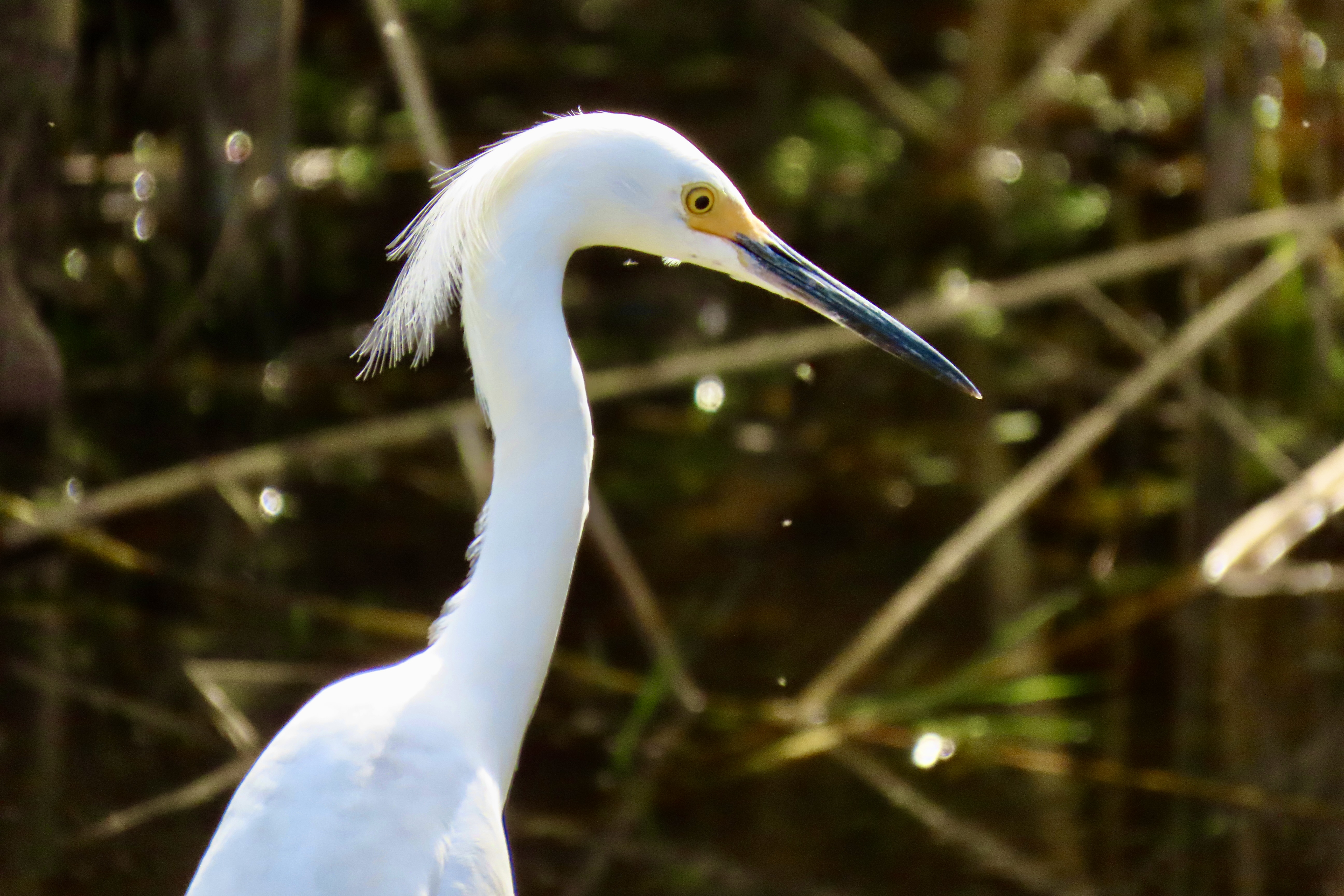
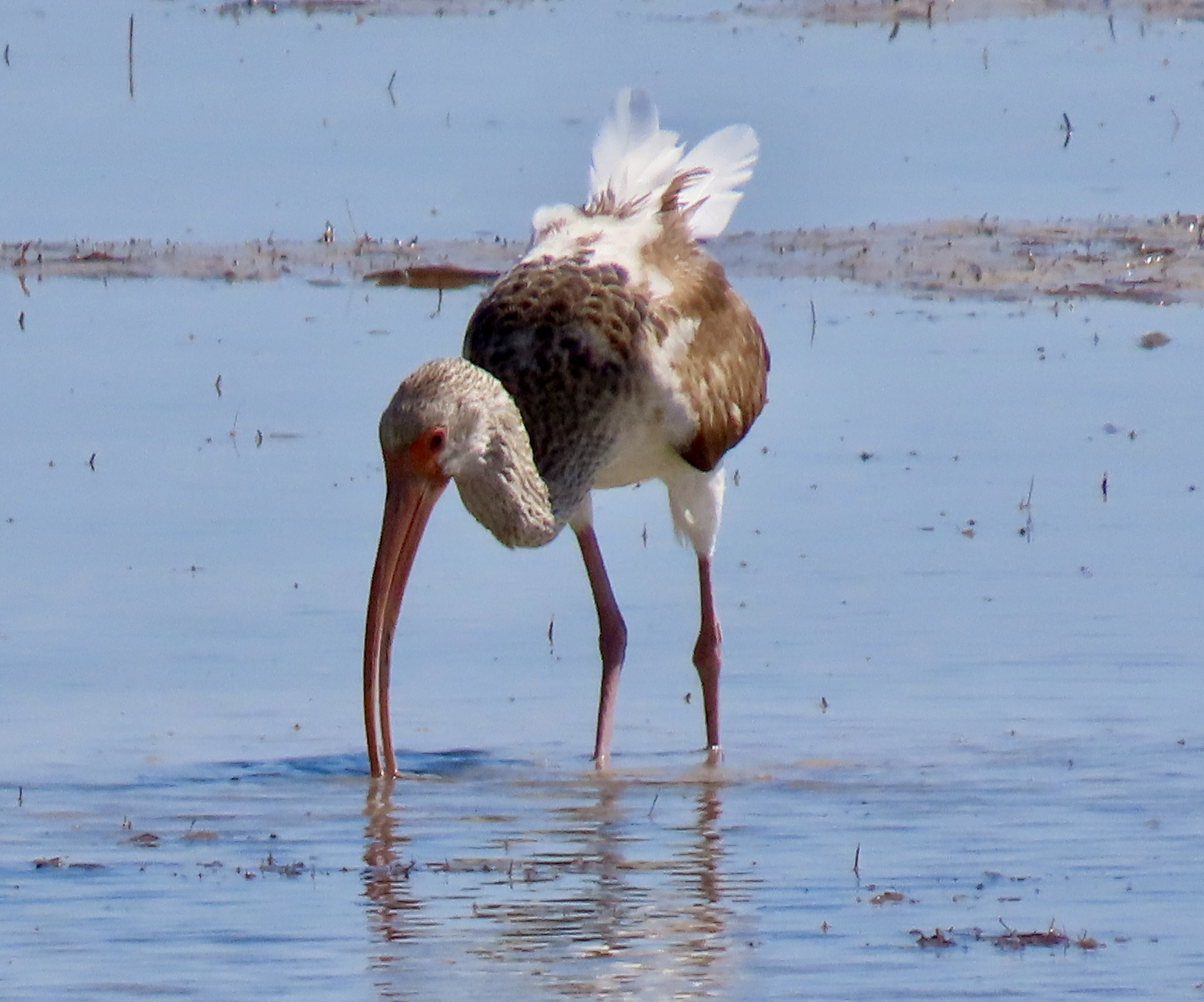
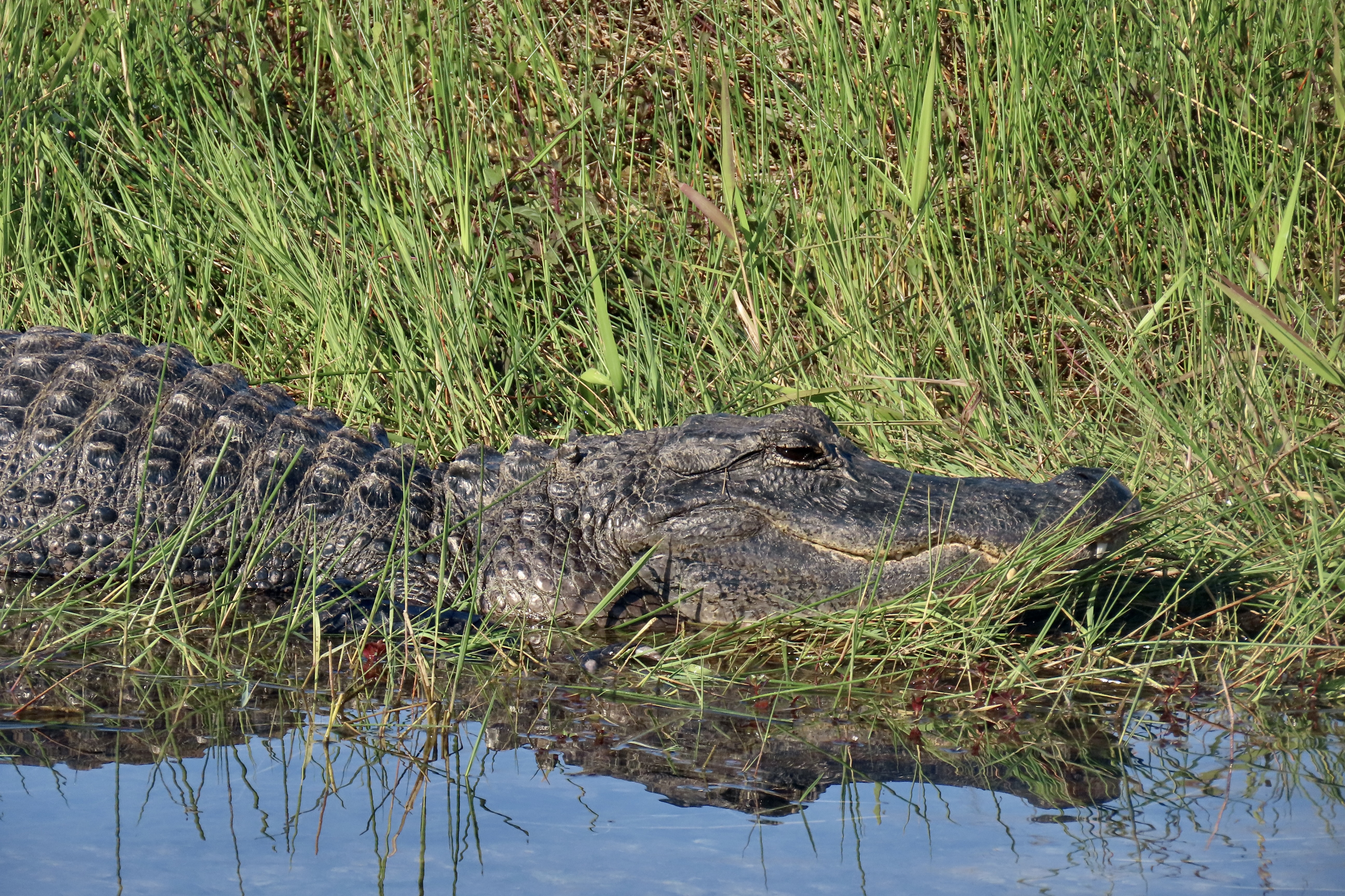
THE EVERGLADES

One way to think of the Everglades is as a vast, slow flowing river spread out over 7,000 square miles. According to the National Park Service, the “Everglades are home to frogs, toads, alligators, hundreds of species of birds, 300 different species of fish, Florida panthers (endangered), crocodiles, and snakes, just to name a few!” There are, also, more mangroves than anywhere else in North America.

The bird life was incredible! It ranged from Osprey…
To anhingas…
To snowy egrets…
To ibis and many, many other species.
We also saw a number of alligators, and several crocodiles. We liked the reflection on this alligator. The look on its face made us wonder what it had been up to!

THE PINNACLES…

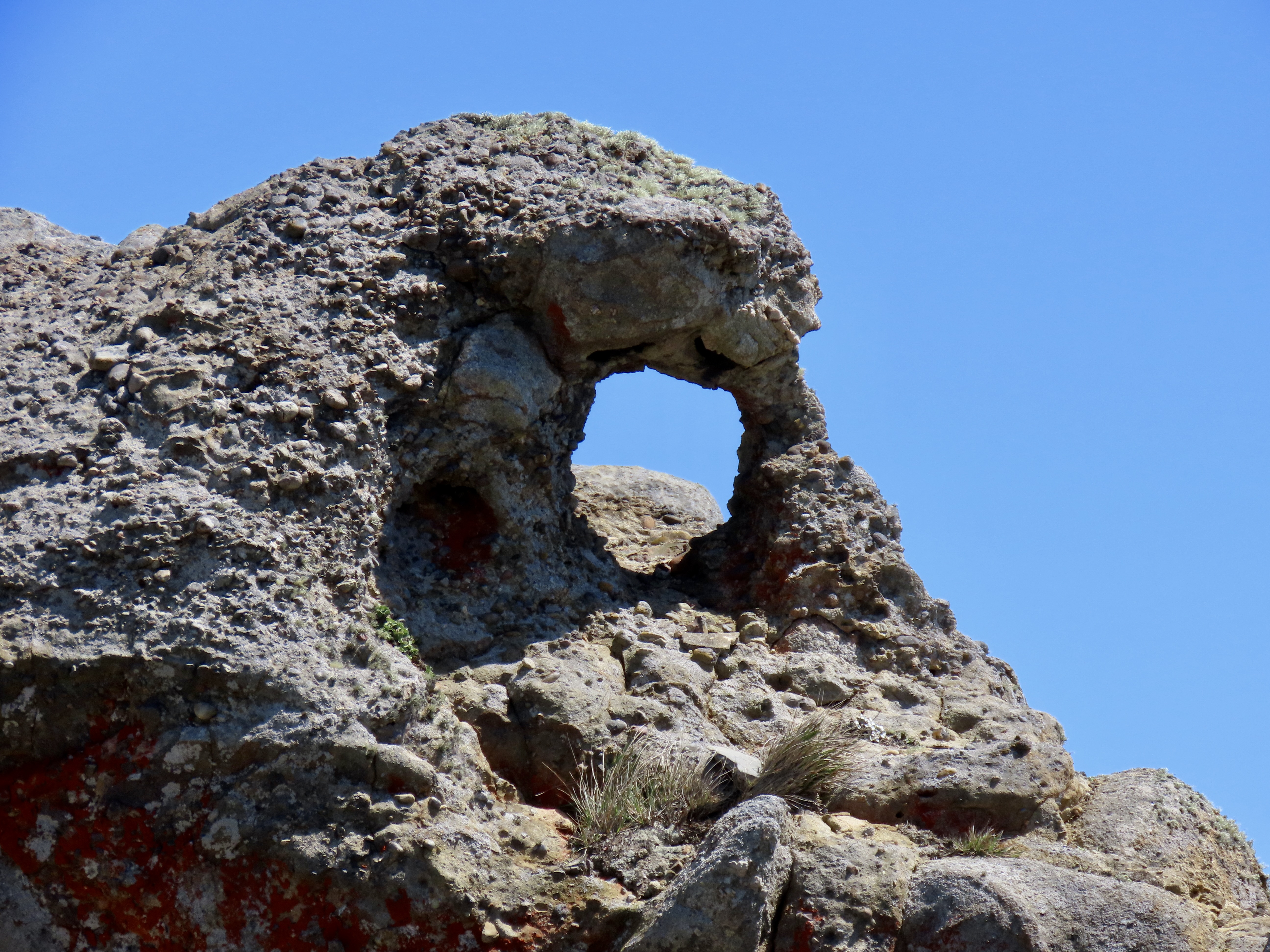
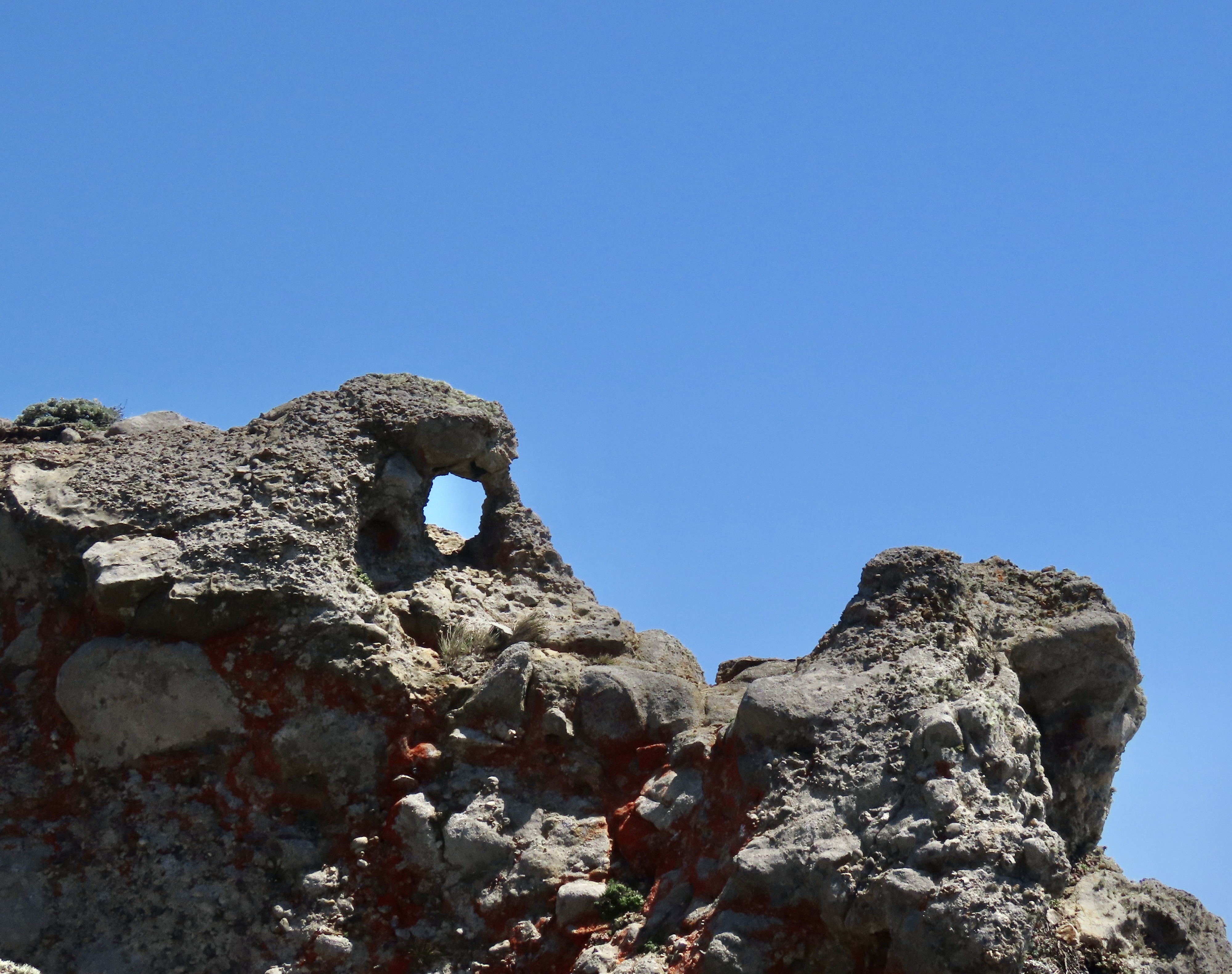
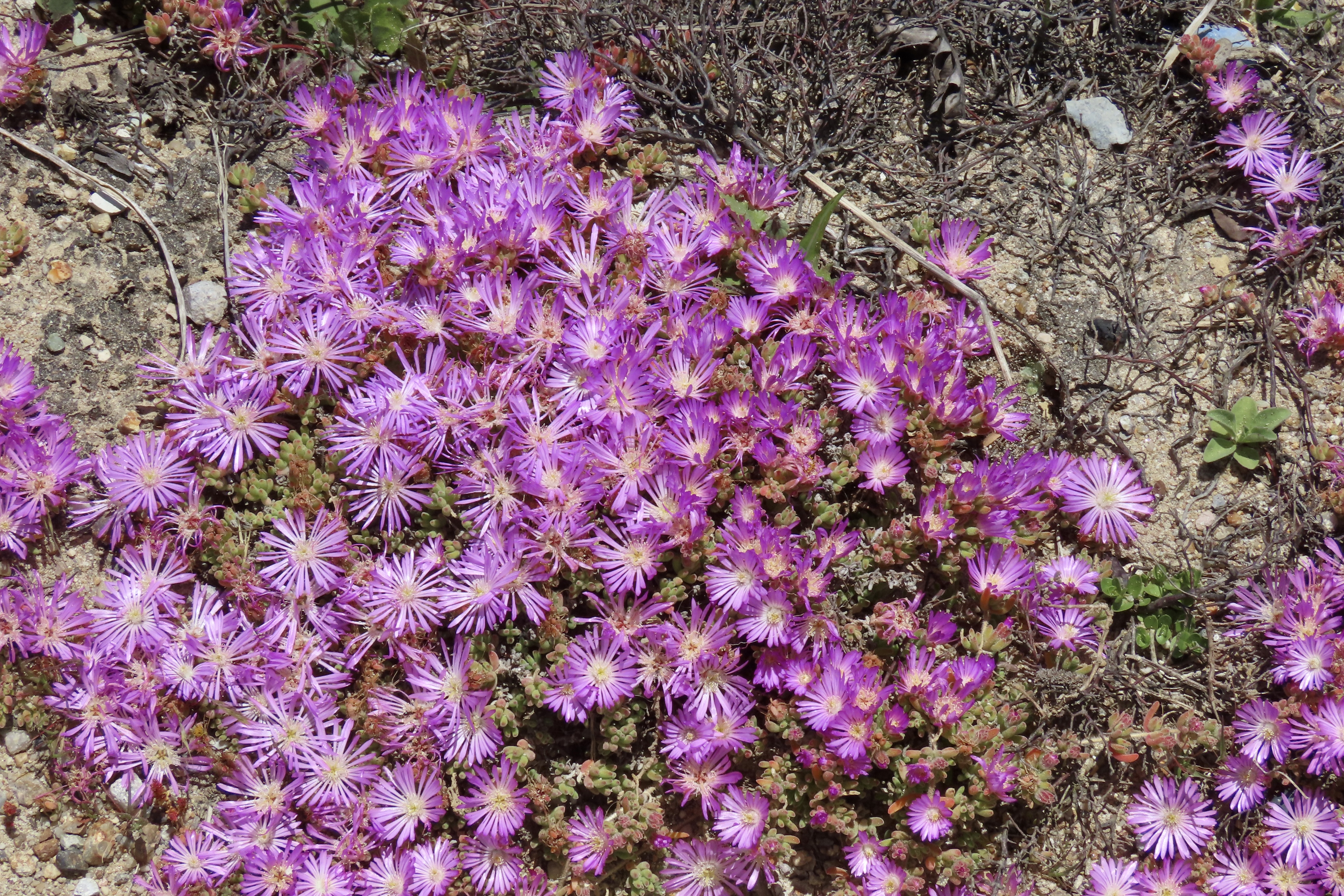
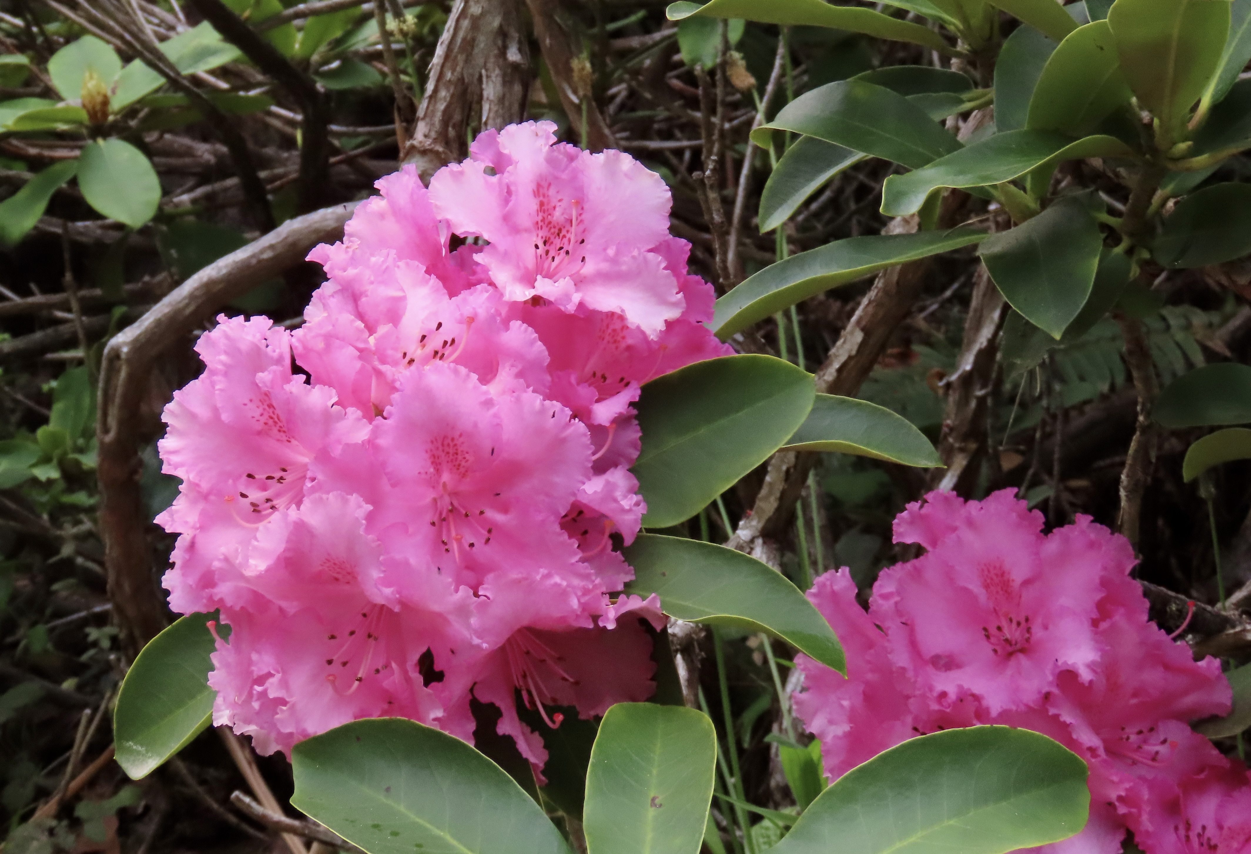
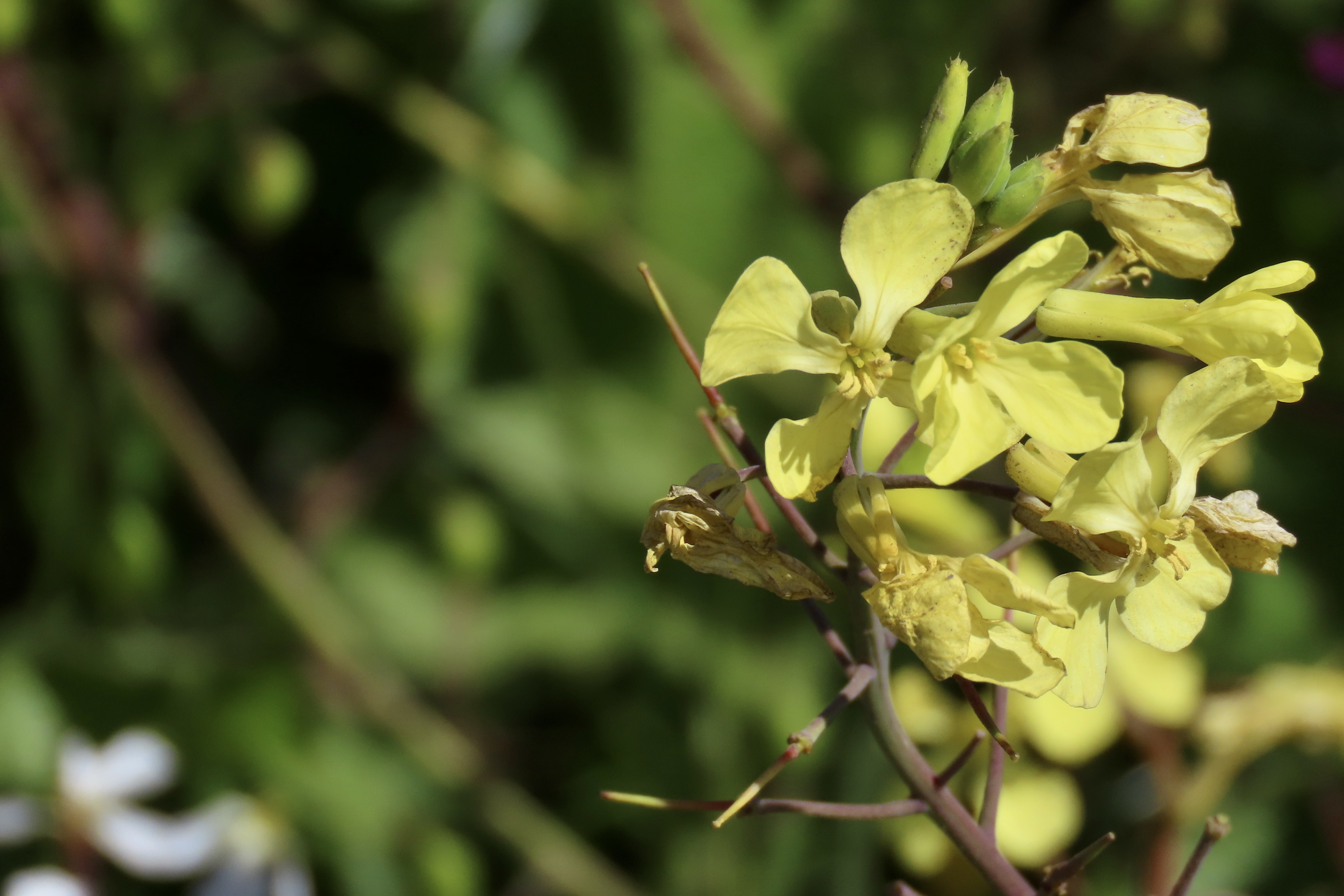
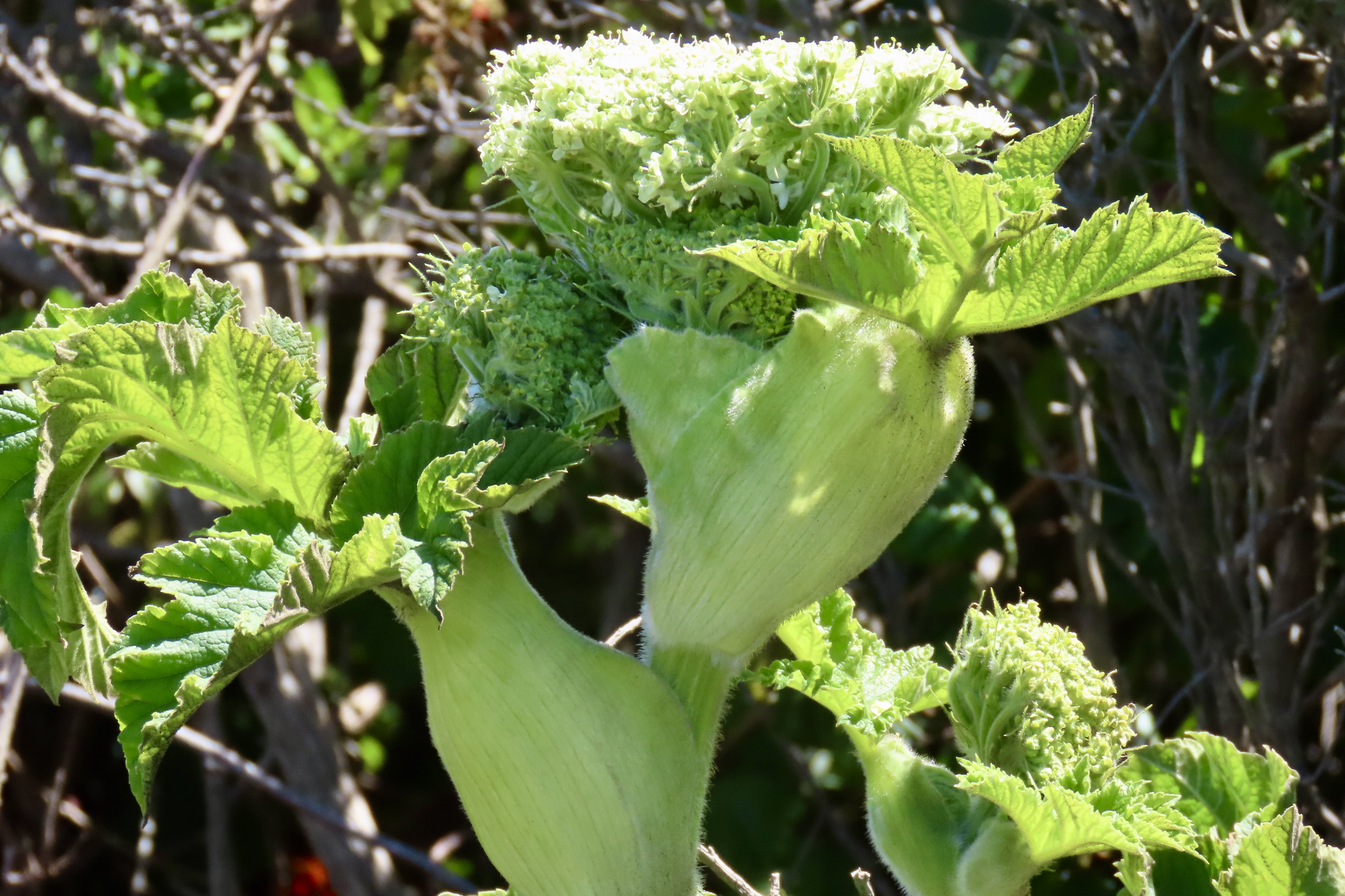
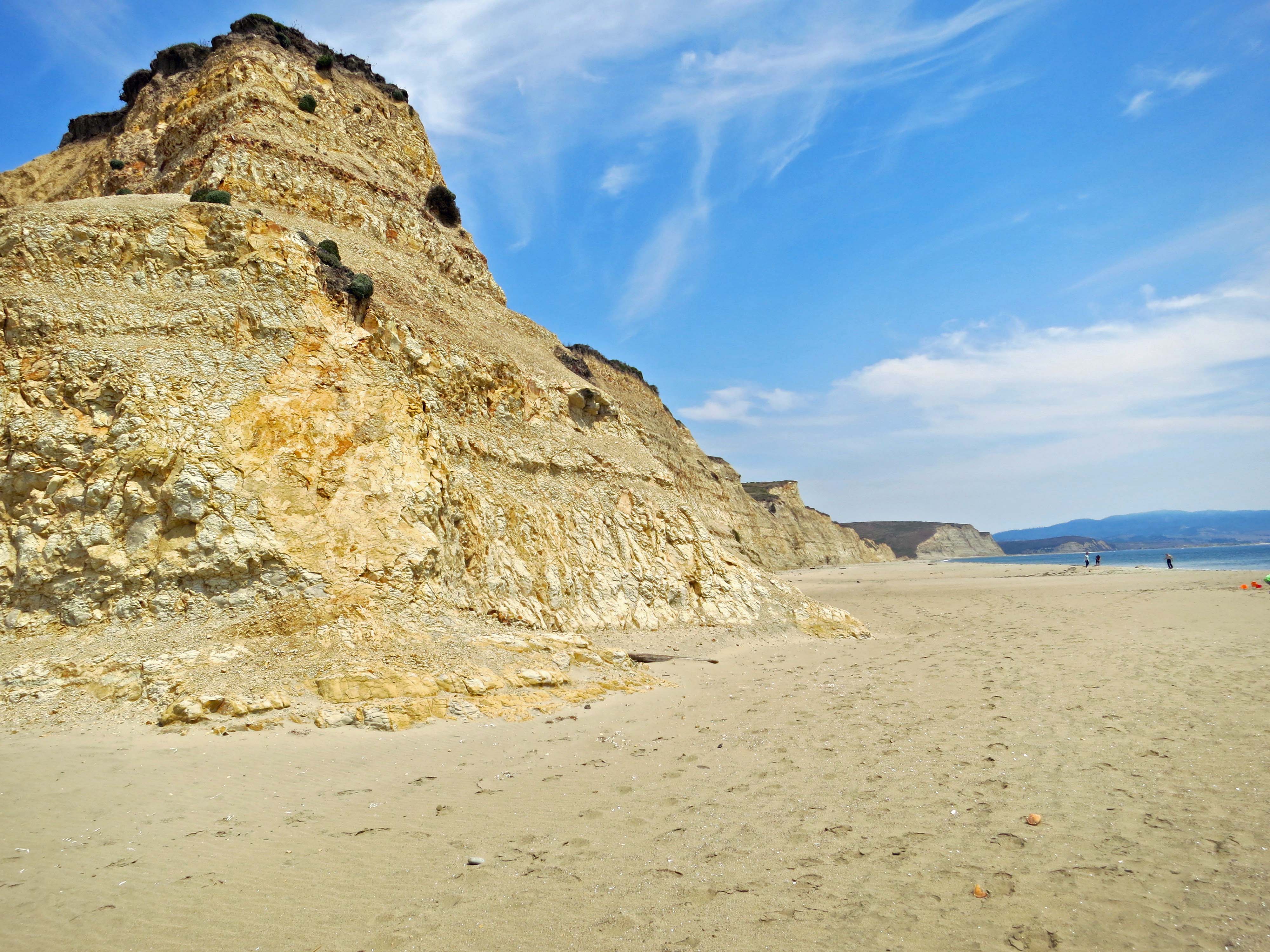
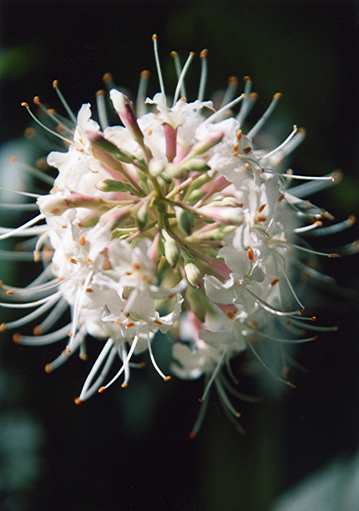
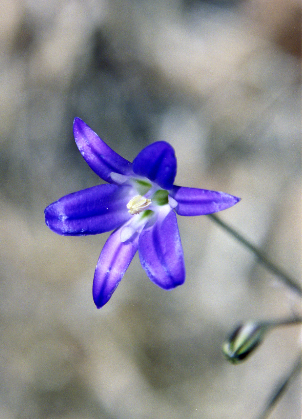
The Pinnacles National Park, located just east of the Salinas Valley in central California, was the first national park we visited on our trip up the coast. Raised to national park status in 2013 by President Obama, it is a recent addition to the system. The park is noted for its monoliths, spires, canyons and the beauty of its spring wildflower display.

Huge monoliths rise up from the ground…
As do impressive spires.
Massive boulders have tumbled down from the ridges creating talus slopes and ‘caves’ people can actually walk through. This small one contained a creek we followed up a canyon.
We were there in April and wildflowers were everywhere. We had never seen a shooting star displaying this many flowers.
A lone oak standing on the crest of a hill caught our attention.

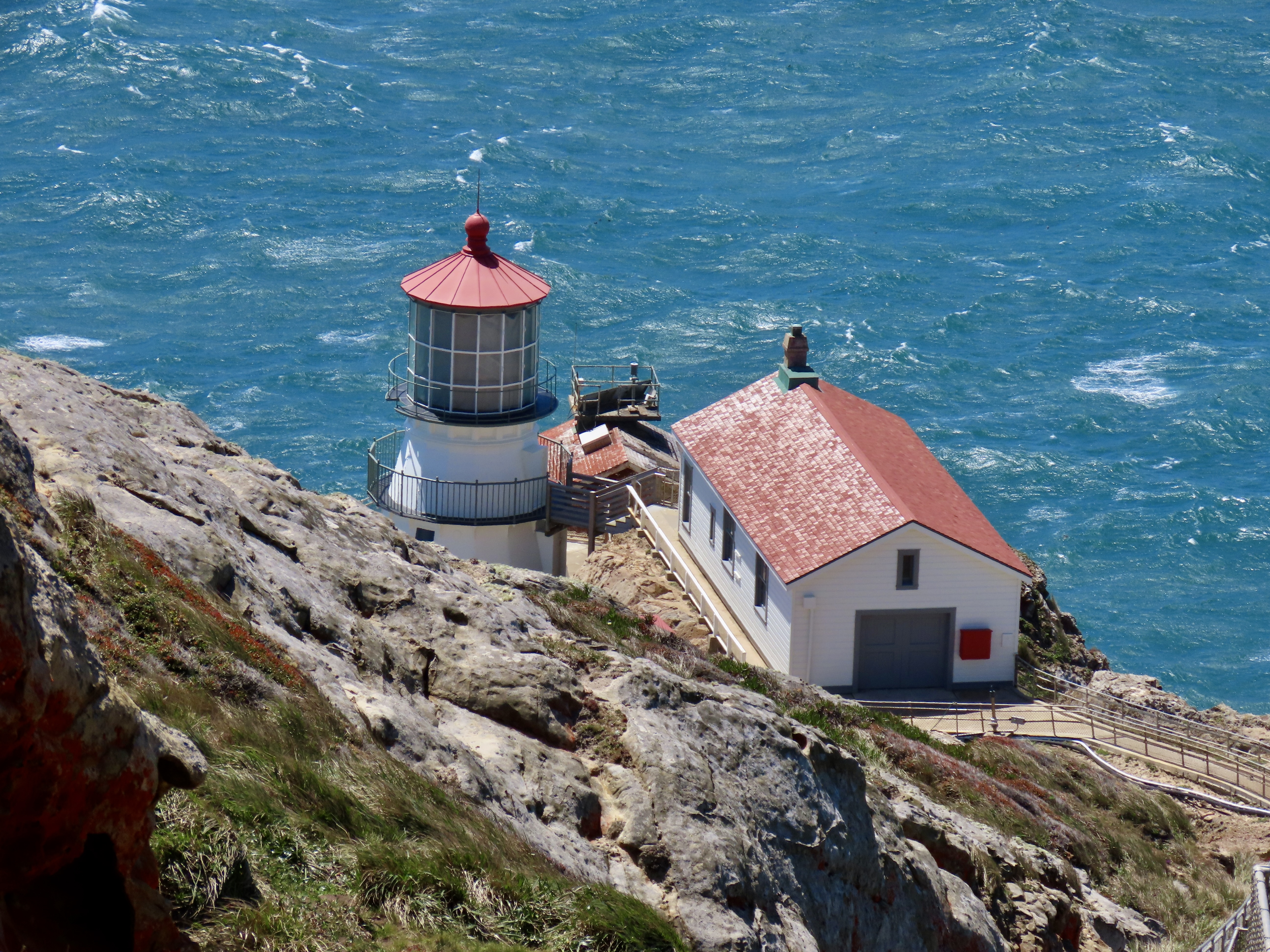
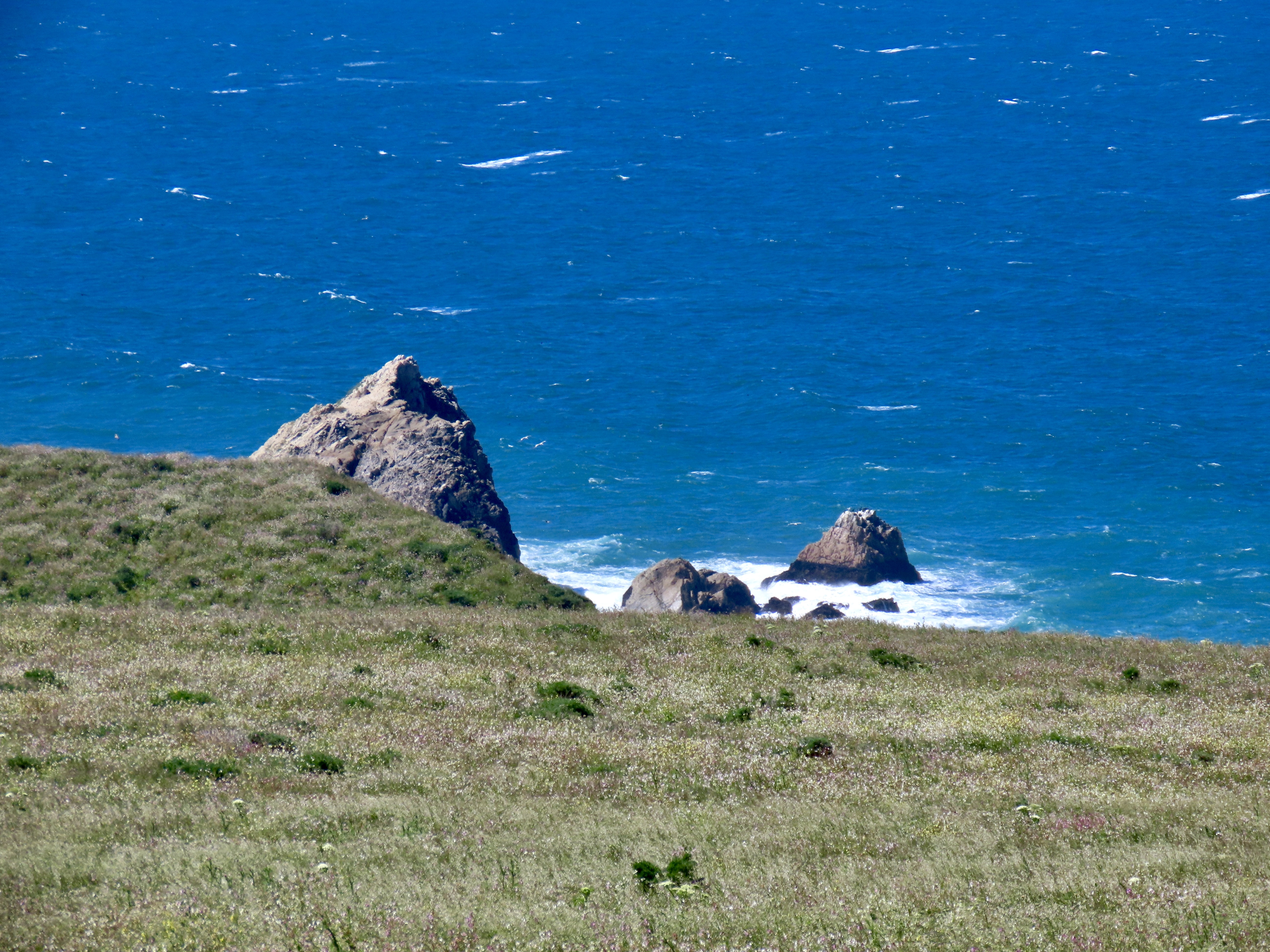
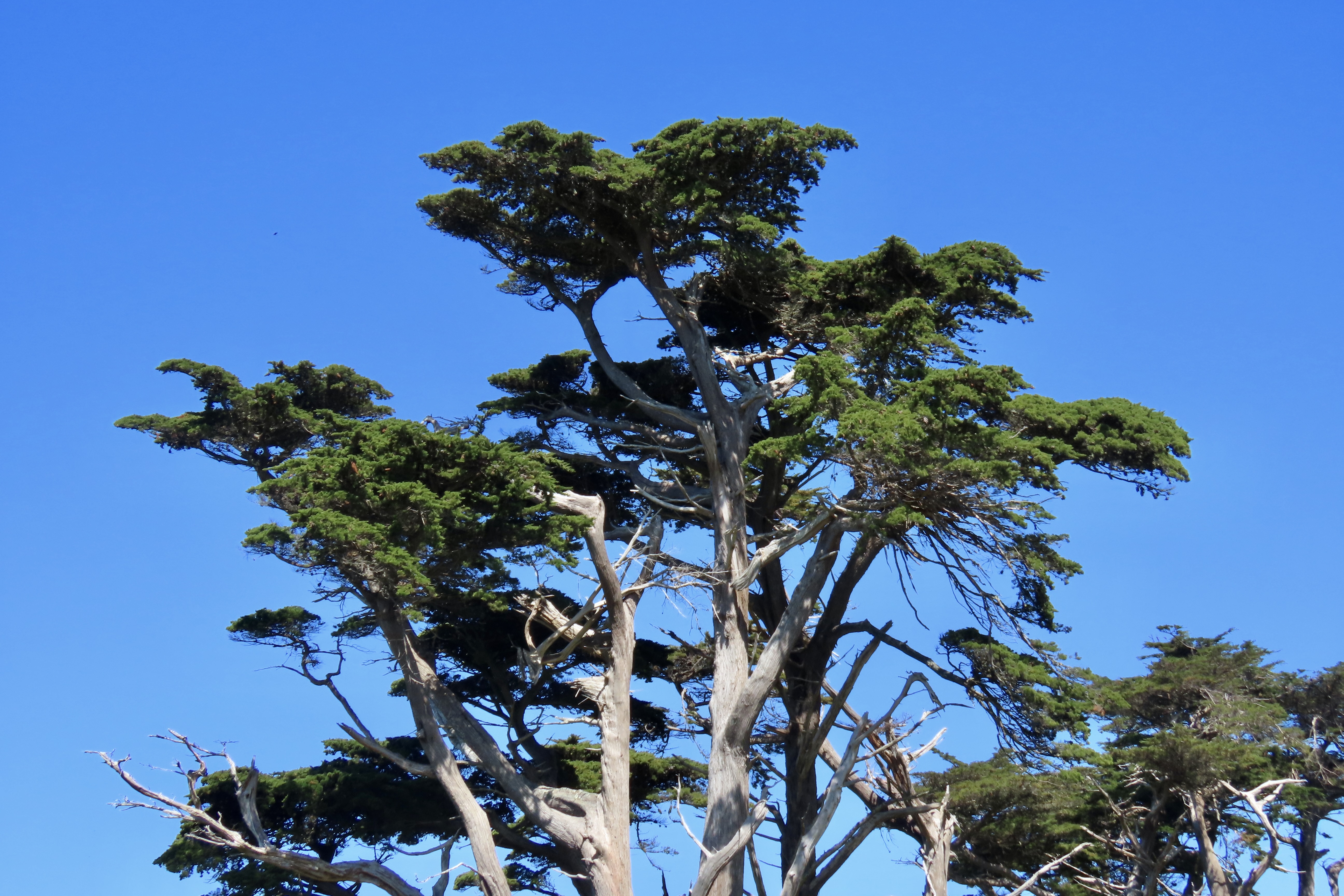
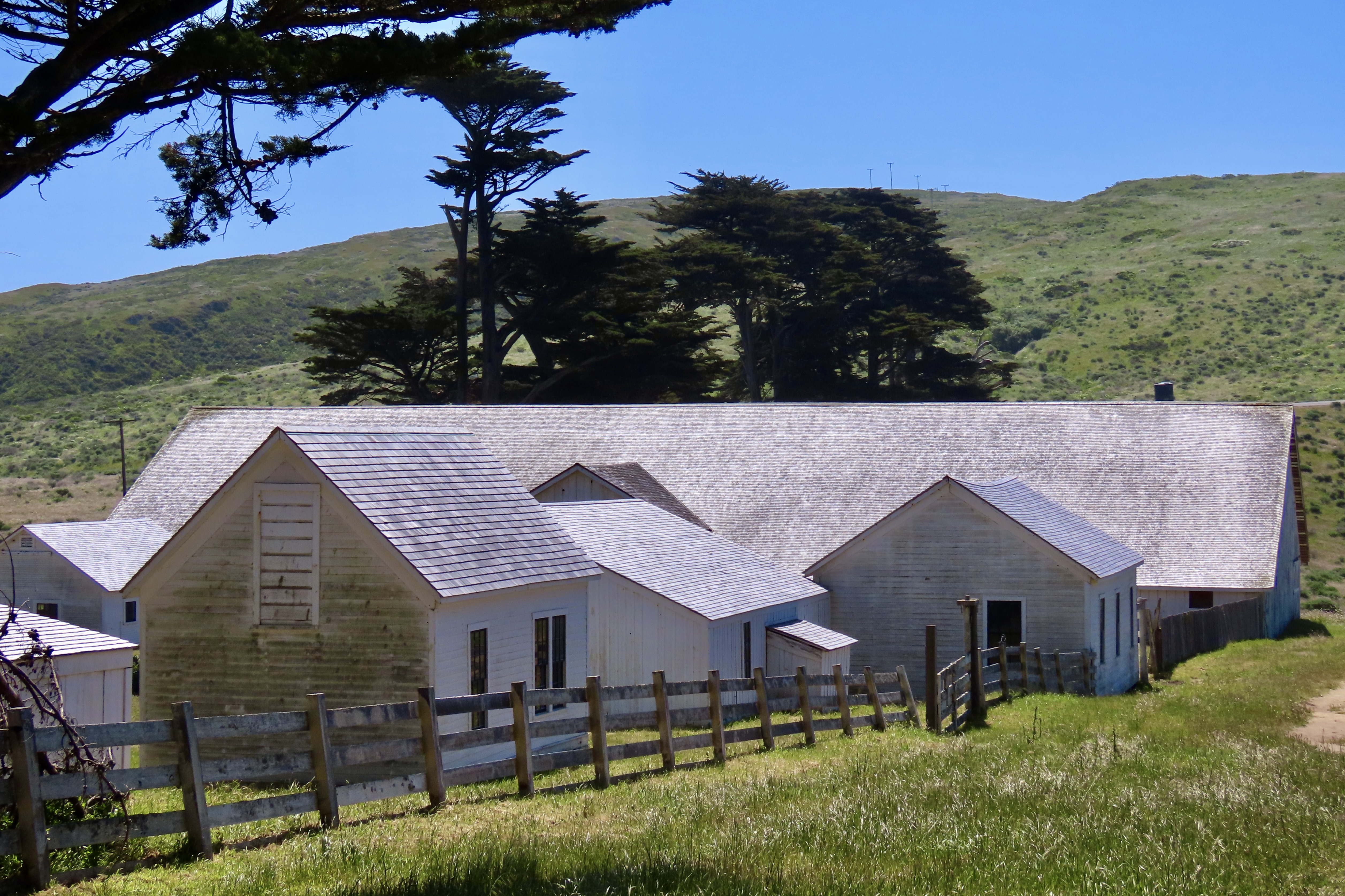
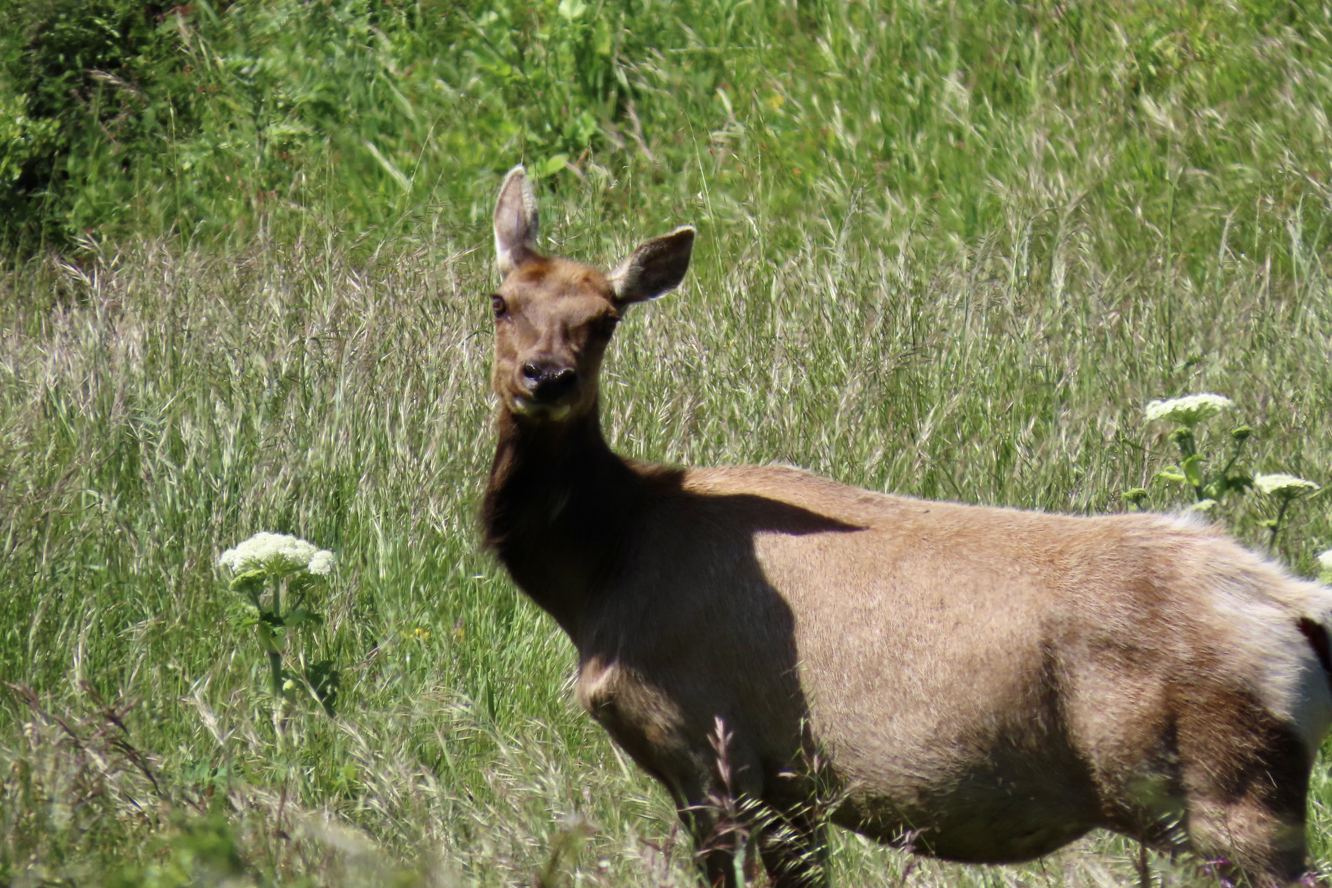
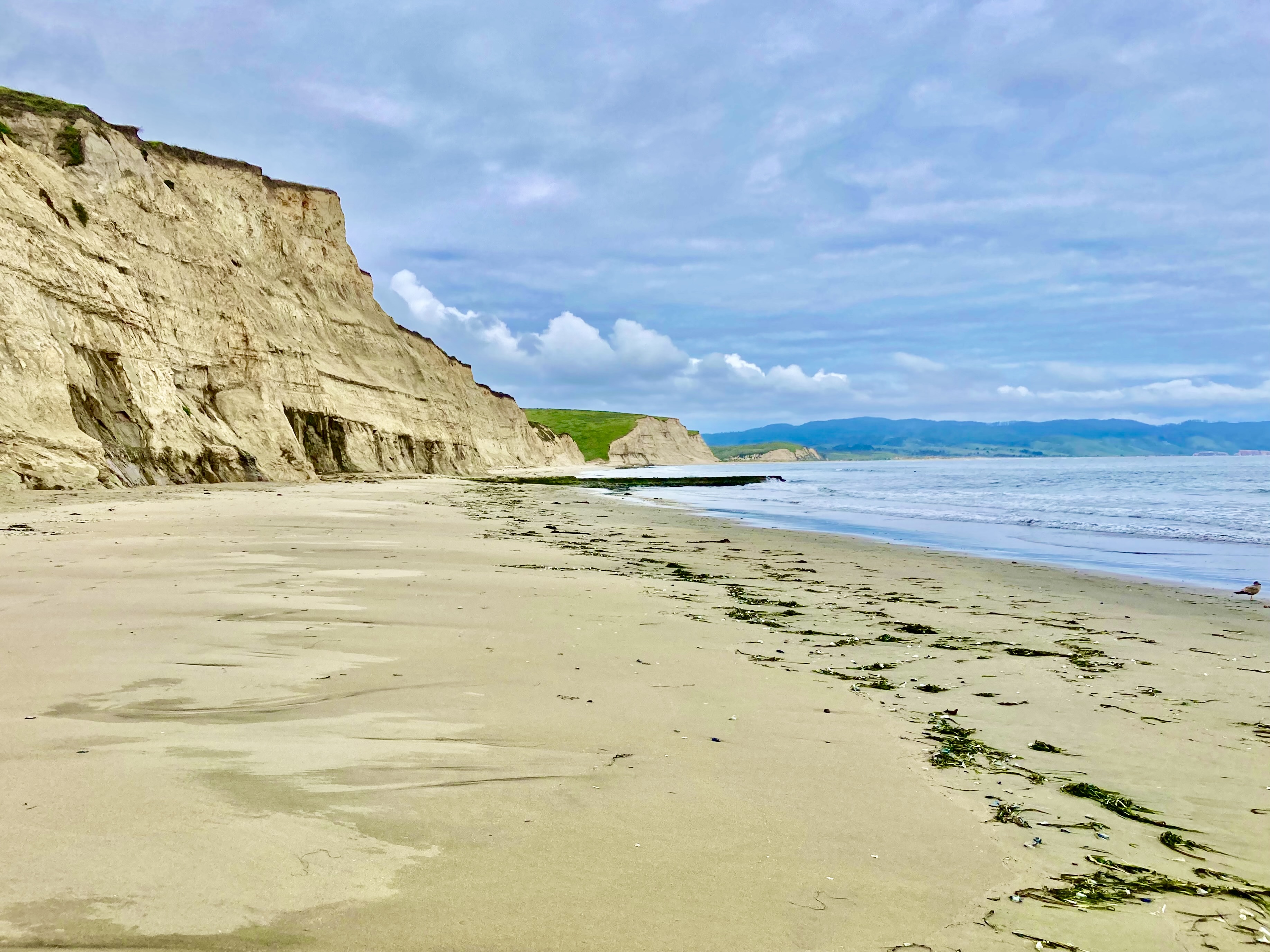
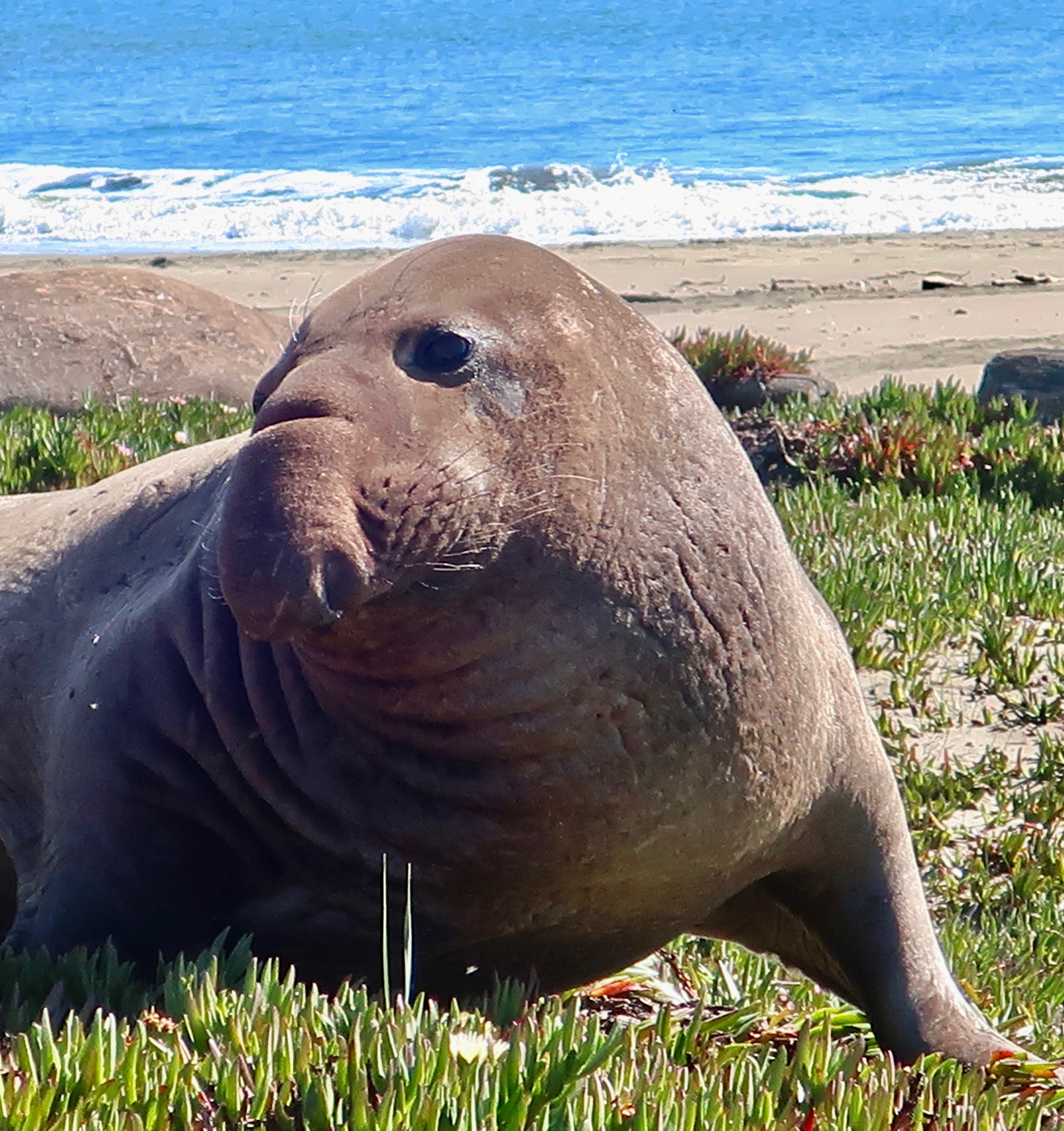
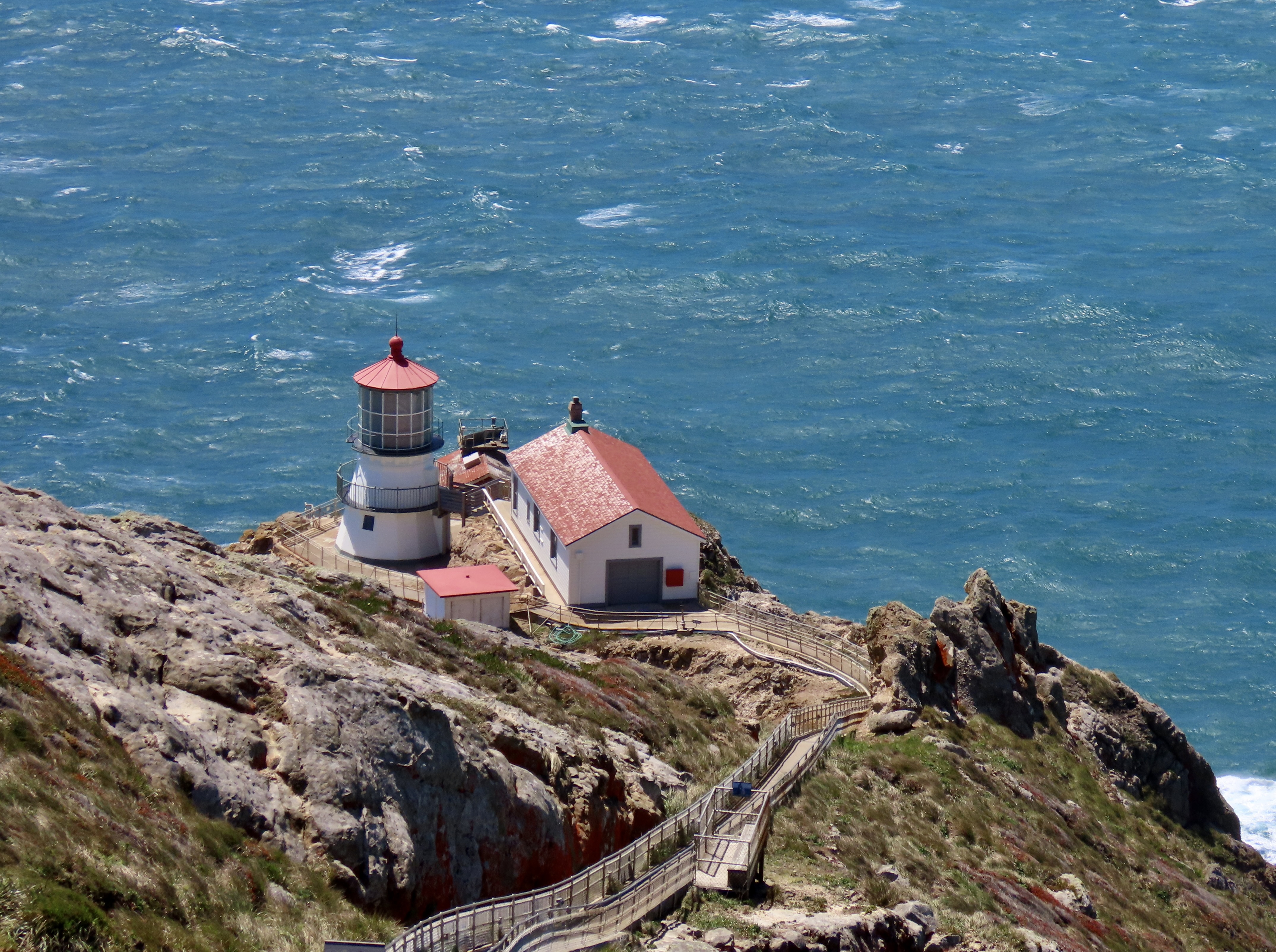
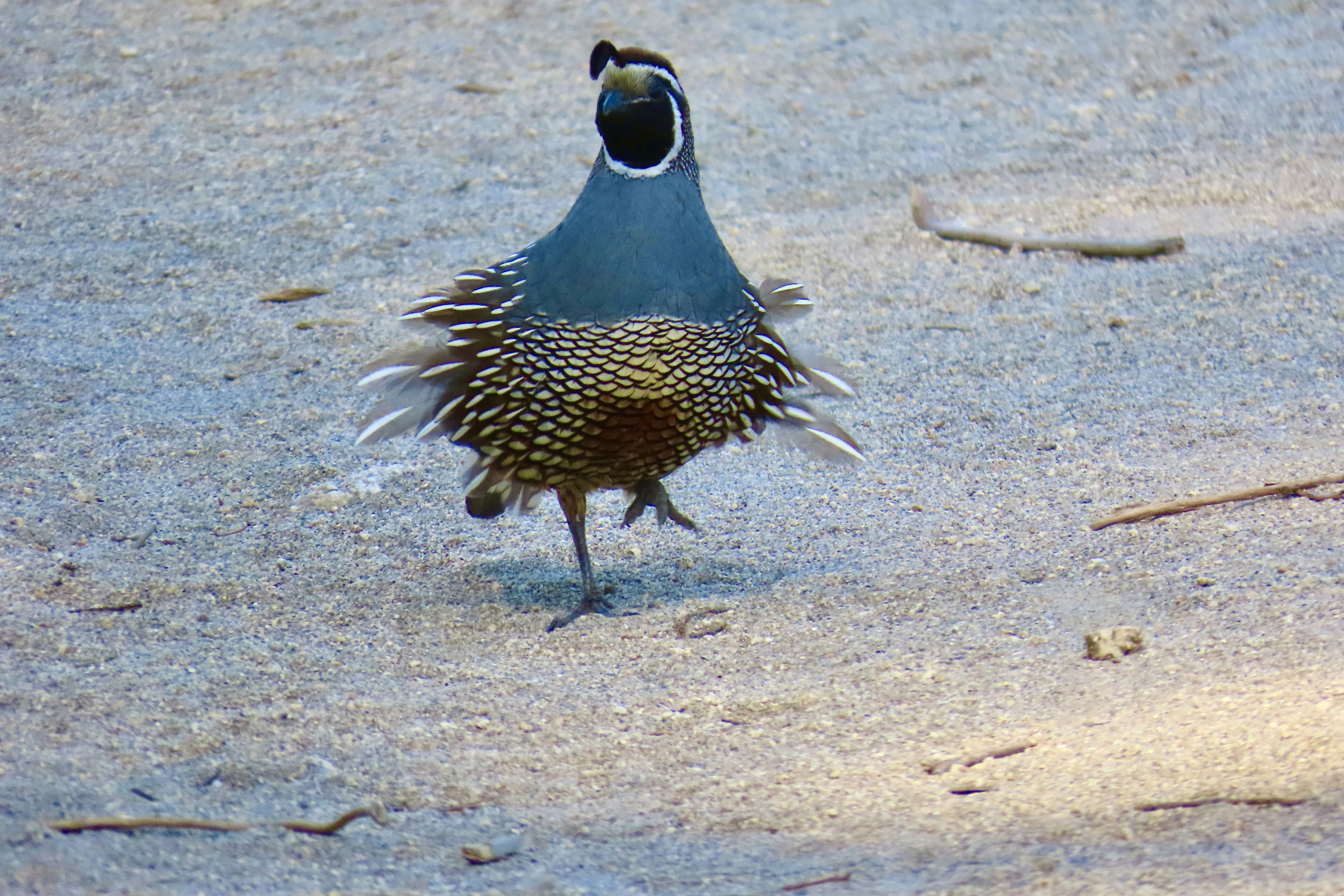
POINT REYES NATIONAL SEASHORE

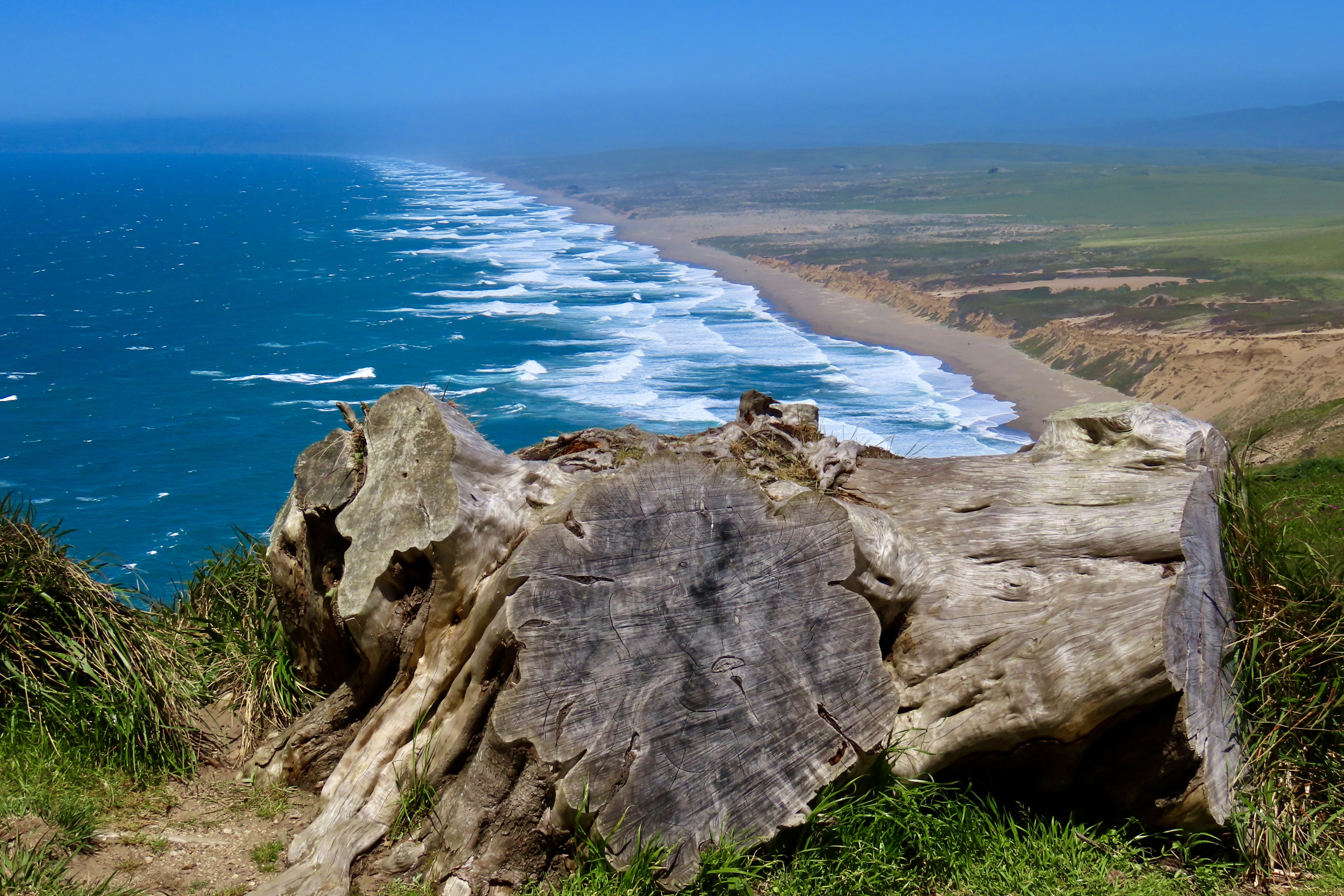
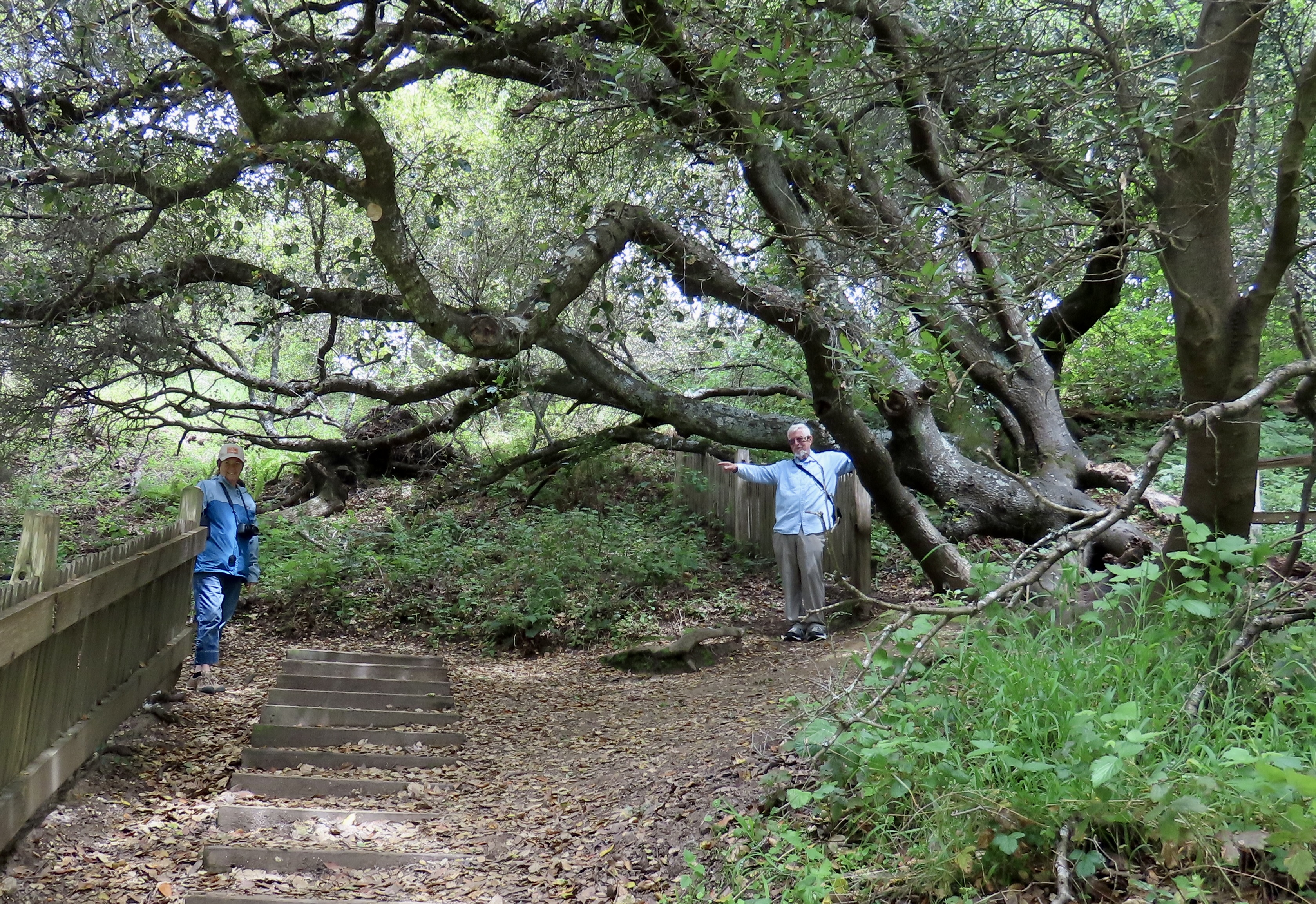
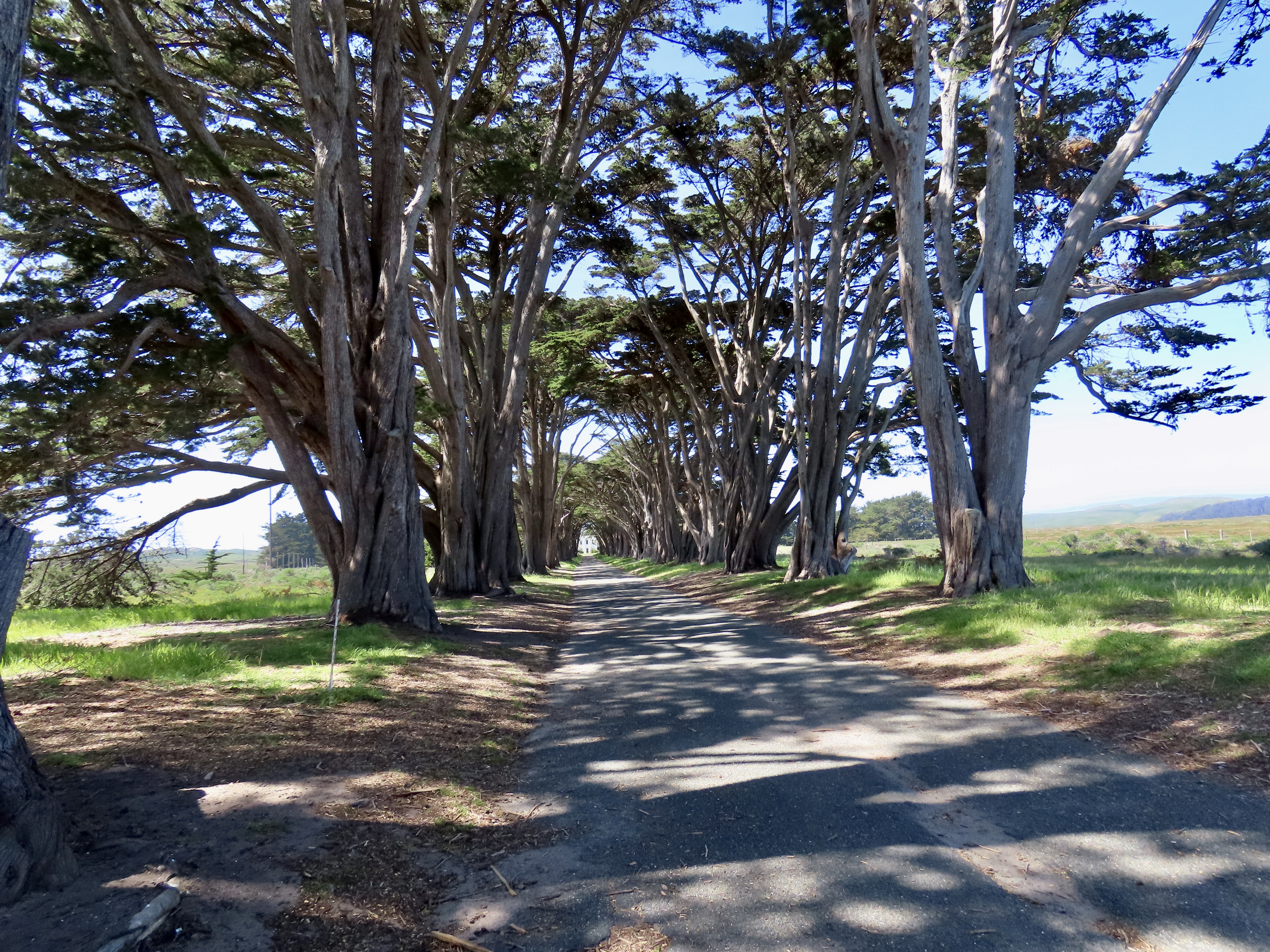
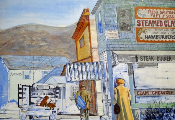
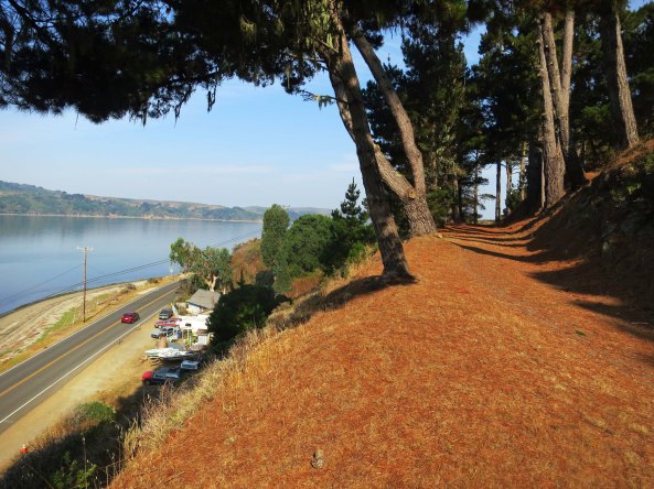
Technically, Point Reyes National Seashore is not a national park. The primary reason is that the land incorporates a number of dairy ranches that were there before the park was created. But it is a unit in the national park system. And, I might add, a well-justified unit. Located just north of San Francisco, it is renowned for its beauty and wildlife. It also has the interesting geological history of having migrated north from Southern California along the San Andreas Fault. (Pinnacles has a similar history.) I was a regular visitor during the years I lived in Sacramento. It served as my winter go-to break. The summers were for the mountains.

Long Beaches with spectacular cliffs, forested mountains, grass covered hills and valleys, plus abundant wildlife contribute to the appeal of the park. During December through March, this beach will be busy with elephant seals breeding and having pups.
We found this charming fellow and other elephant seals at Drake’s Beach on a previous visit. He’s come ashore looking for love.
This whimbrel was strolling down the shore at Limantour Beach.
A great blue heron made a lightning fast strike to catch a fish at Abbots Lagoon.
The Point Reyes Lighthouse, always worth a visit.
The Pierce Point Ranch provides an introduction to the historic significance of dairy farming at Point Reyes.
California quail were running around the ranch when we visited. The wind was ruffling this guy’s feathers.
And a large herd of tule elk is usually found nearby.

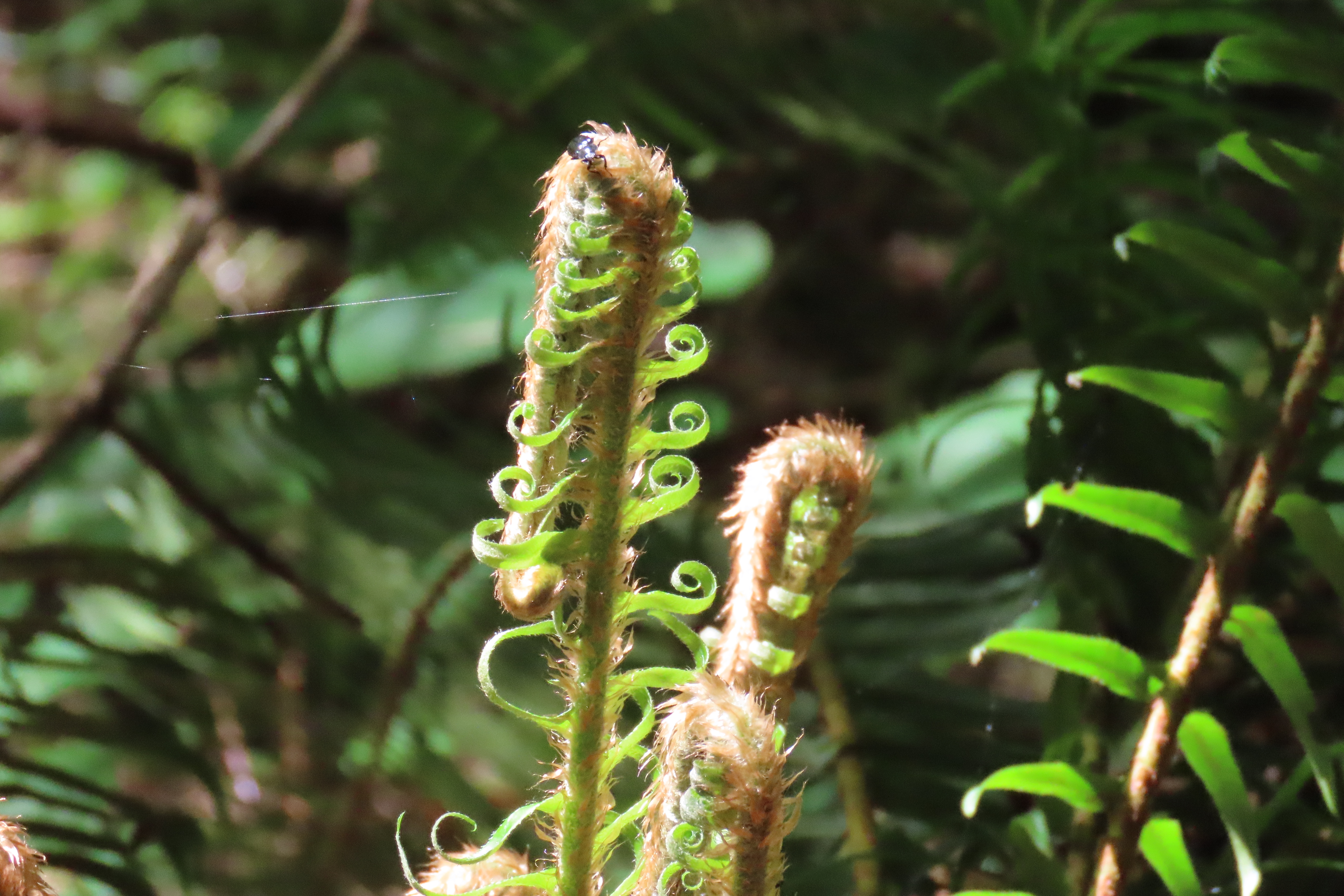
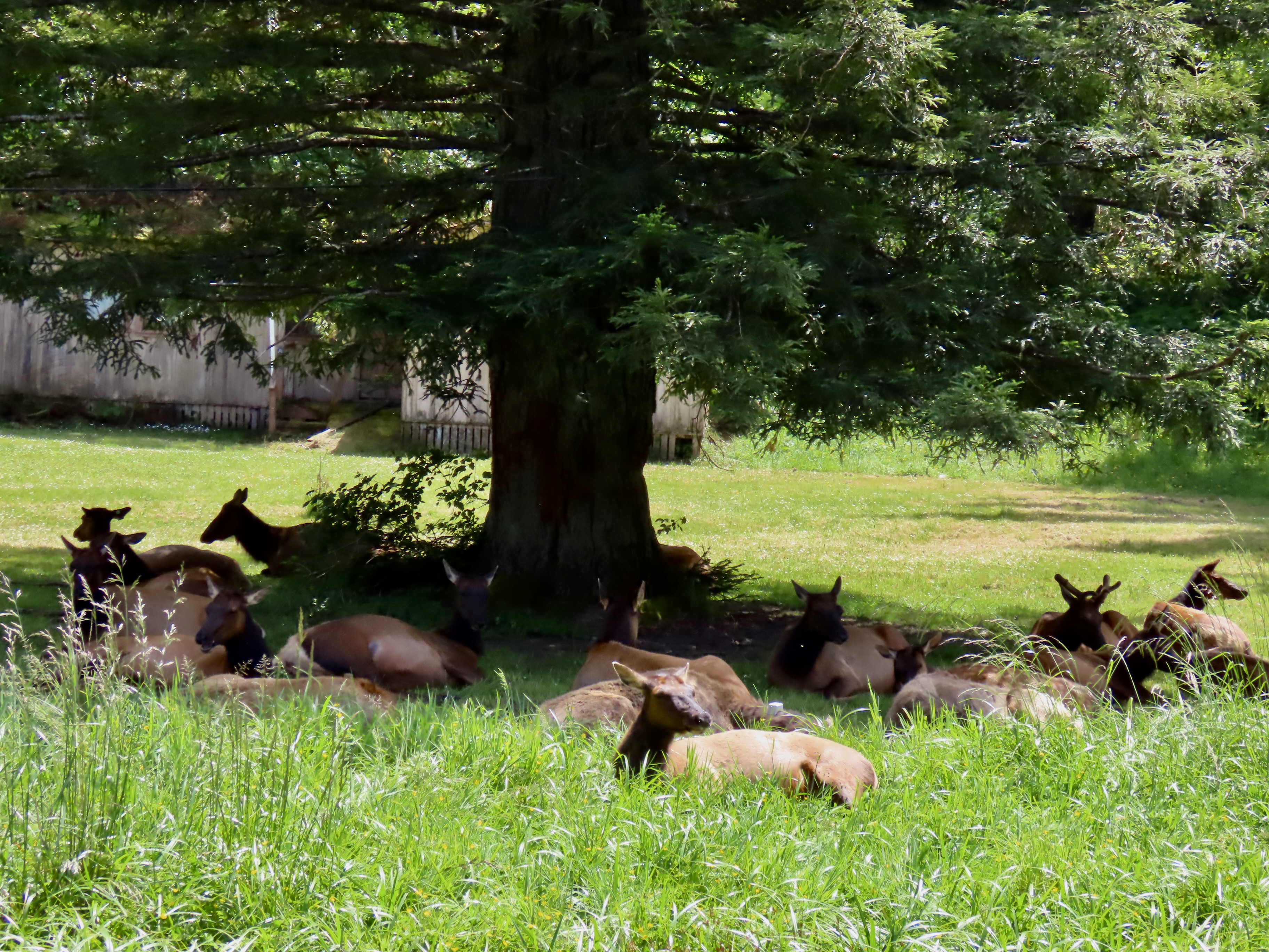
REDWOODS NATIONAL PARK

The National Park Service works in close coordination with the California Department of Parks and Recreation to maintain the towering redwoods that grace the coastal area of far northwestern California. It’s all about the trees , some of the oldest and tallest in the world, but its rainforest character, crashing waves and wildlife add to its splendor.

Massive trees reach for the sky…
Crashing waves roll ashore…
The rainforest harbors ferns whose origins are lost in the mist of time…
Herds of Roosevelt elk are as likely to be found bedding down in someone’s front yard as they are wandering through the redwoods…
And hundreds of seals pull up on remote shores to rest and bathe in the sun.

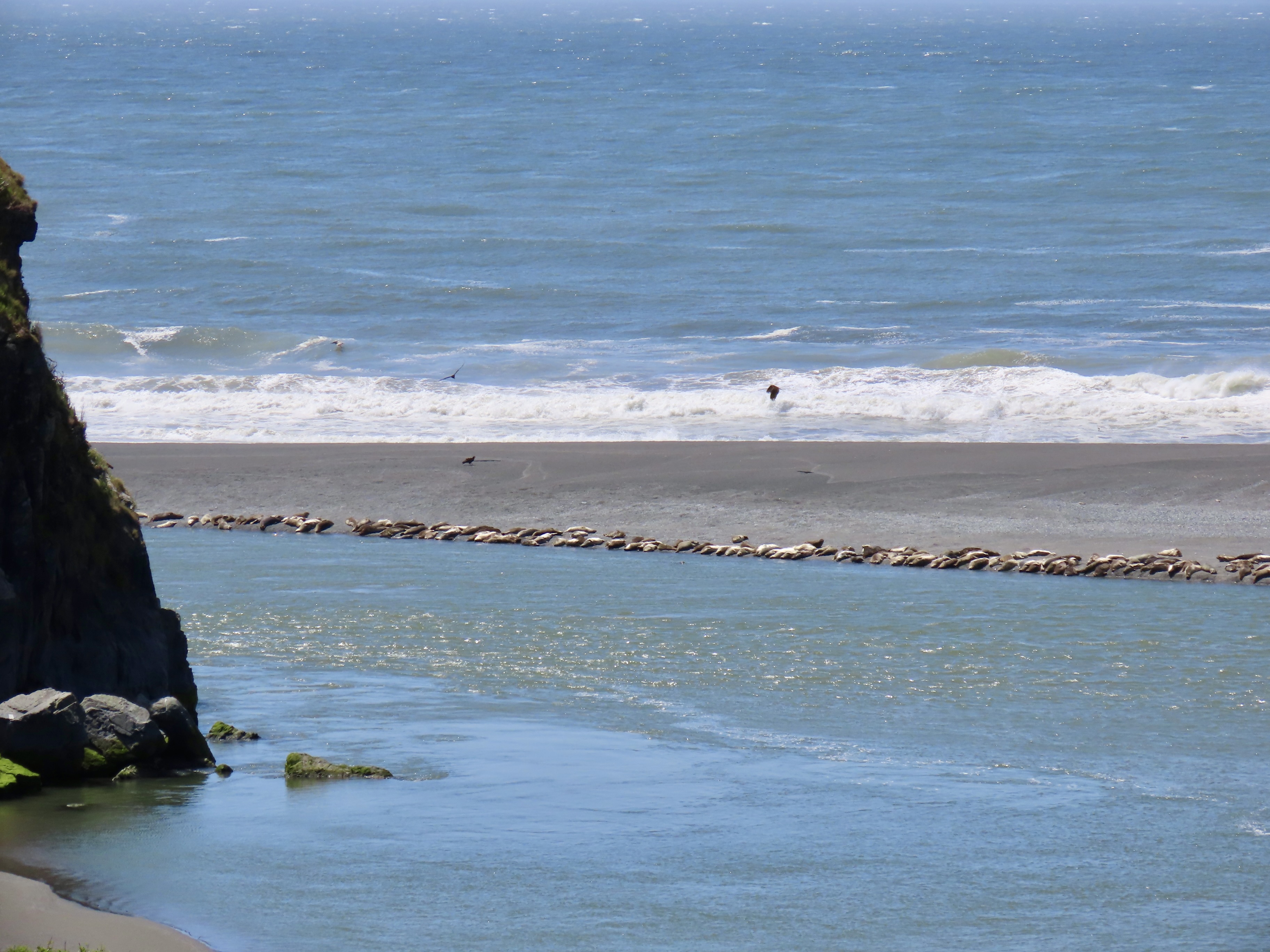
OLYMPIC NATIONAL PARK

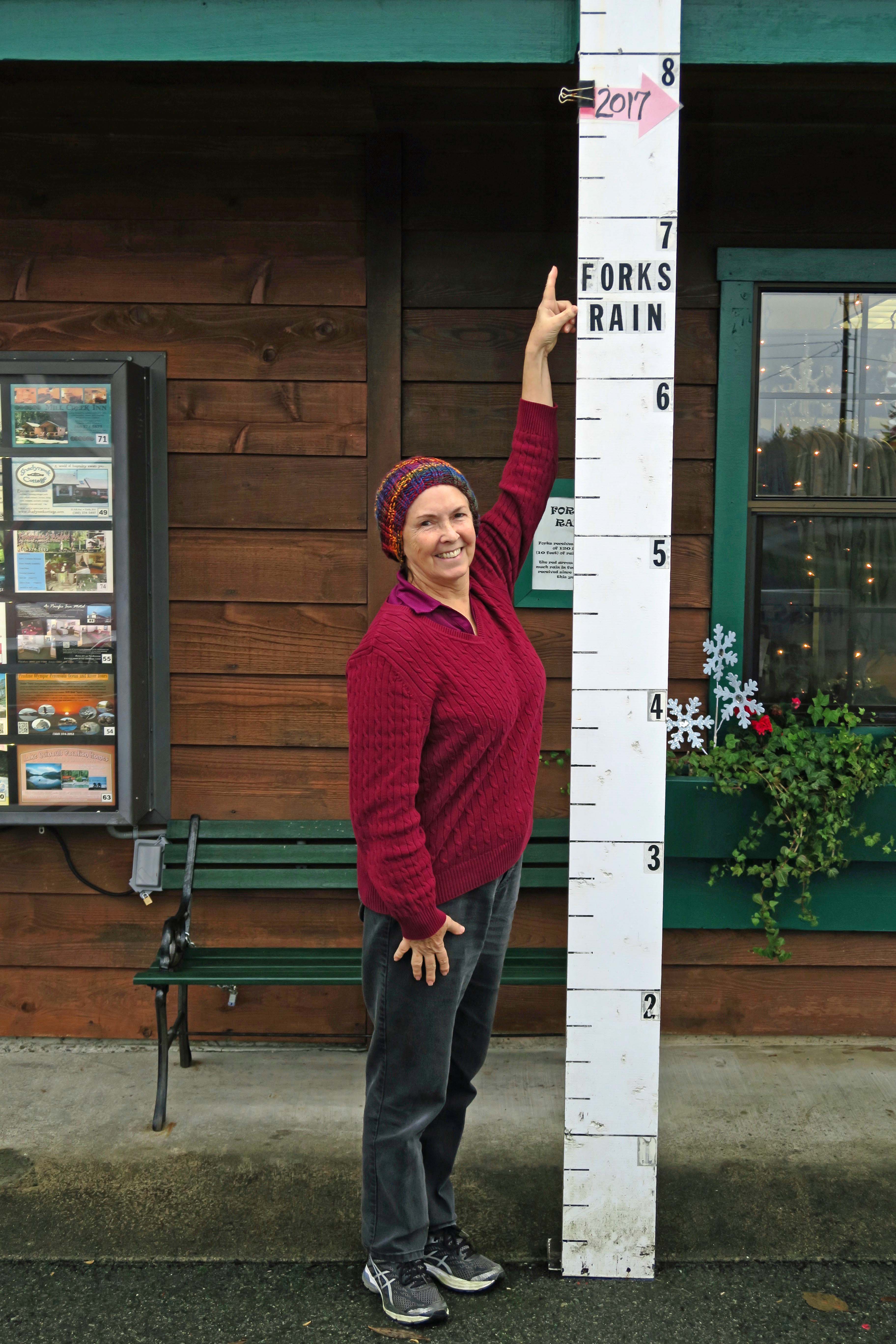
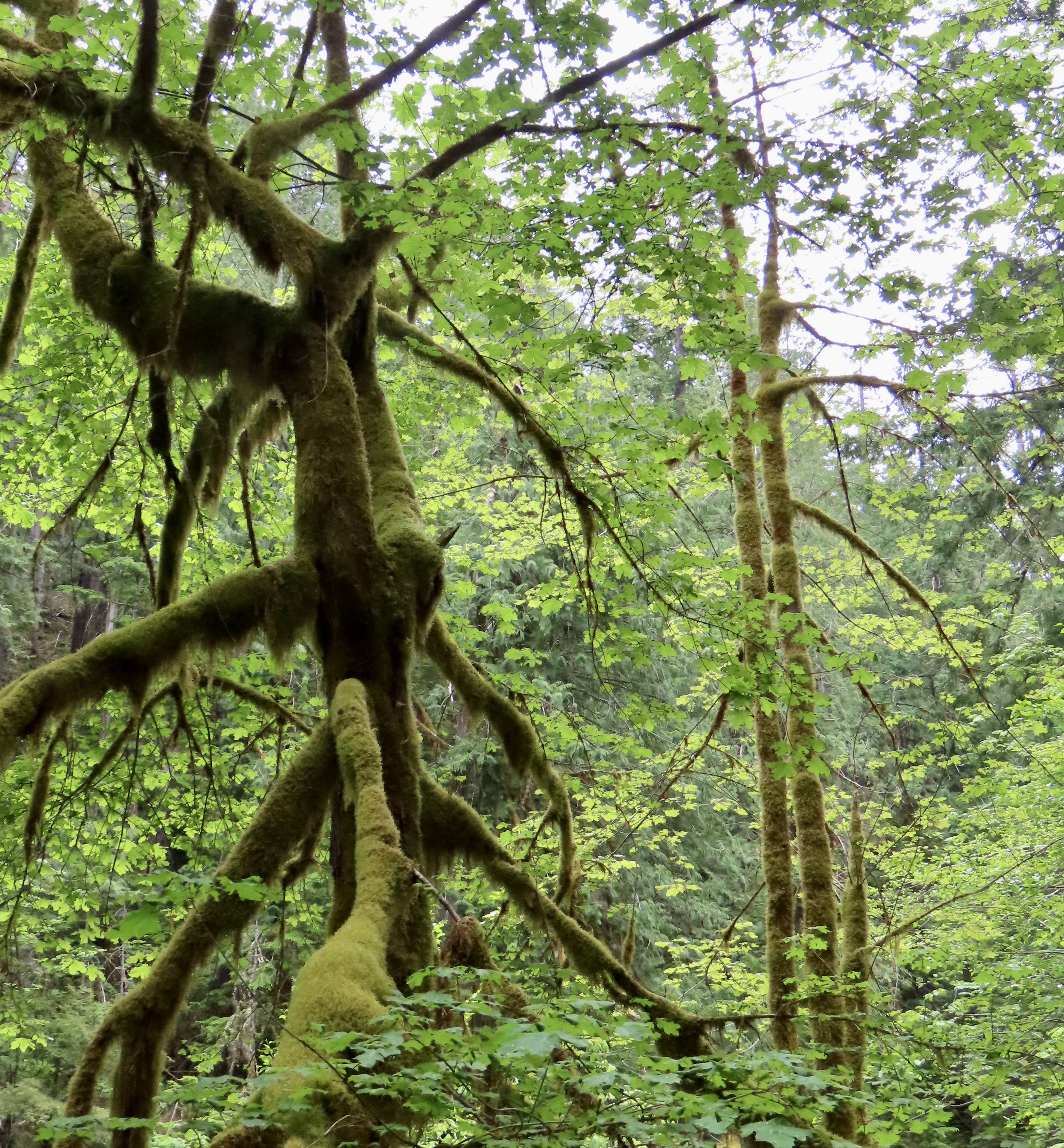
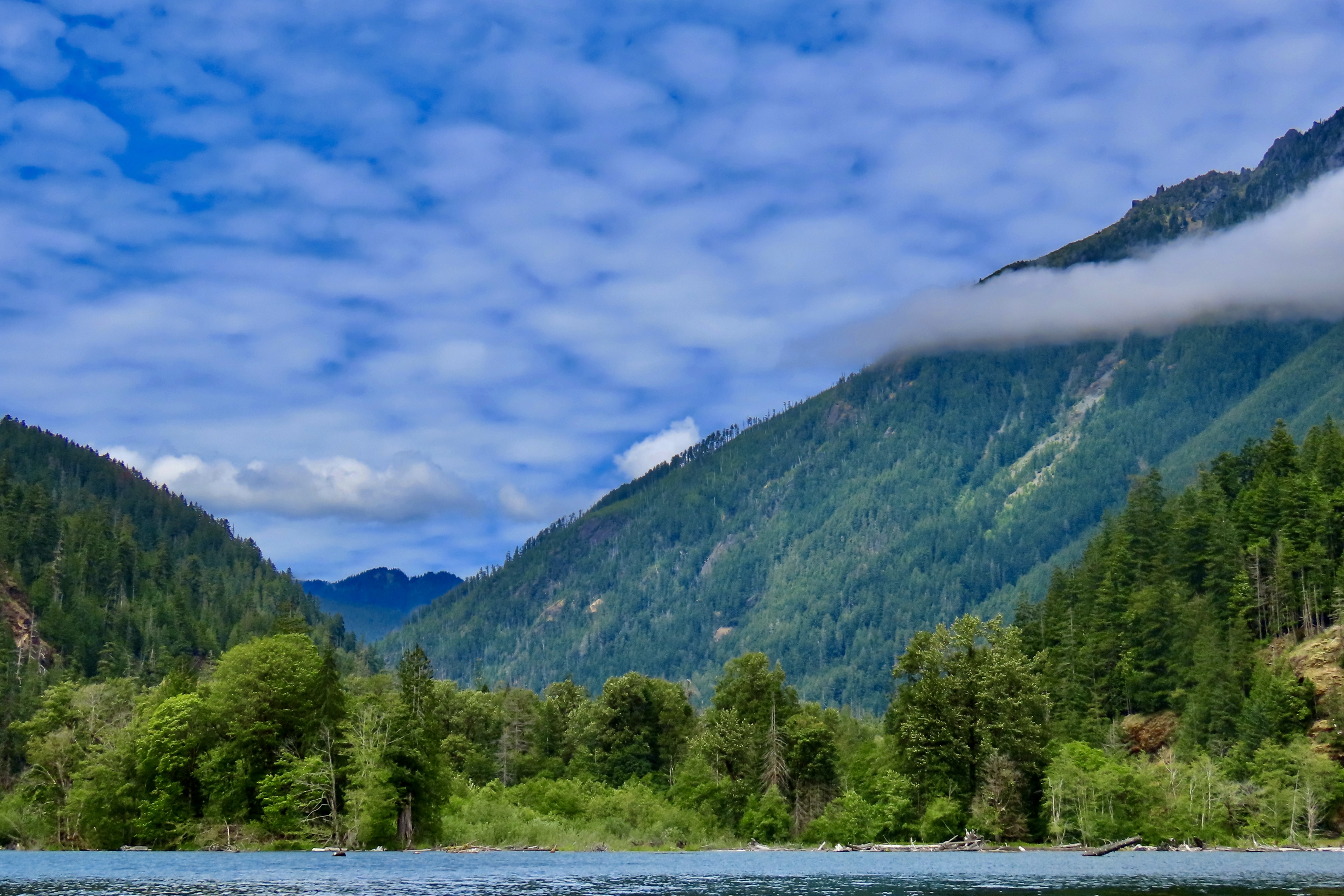
Olympic National Park serves as an iconic example of a temperate rainforest receiving over 150 inches of rain on its west side while harboring old growth forests on its drier east side. Major rivers come tumbling down from its glacier covered peaks. Its 62 miles of wilderness coastline constitutes the longest undeveloped coastline in the contiguous US. As I noted in my post on Olympic National Park, our visit was limited this year, so I have added a couple of photos from previous trips. The other photos you will probably remember from last week!

The Skokomish River is one of several that flow out of the park fed by the extensive rainfall and high glaciers.
Photo of rainfall at Forks, Wa. by Curtis Mekemson.
In 2017 we stopped in the small town of Forks (home to the Twilight books and movies) on the western side of Olympic National Park. Here Peggy points out how much rain the park had received by November.
On that same trip, we drove over to the wilderness part of the park that runs along the Pacific Coast. Here Peggy is admiring sea stacks. Huge piles of driftwood brought in by Pacific storms stretch up the coast.
Back on the southeastern portion of the park, we admired the moss covered trees that are typical of temperate climate rainforests.
Our hike up the Staircase Rapids trail along the Skokomish, led to this view we had when crossing a bridge that had been wiped out twice before by the raging river during spring melt.
A final photo that provides a view into the park from our kayak trip on upper Cushman Lake. Next, we will explore the impressive mountains of Cascades National Park as we leave our trip up the Pacific Coast and start our journey back to our basecamp/home in Virginia.
Cascades National Park

A Lighthouse, Cypress Tunnel, and the 1906 Earthquake: Pt. Reyes NS… North Coast Series 8

The Point Reyes Lighthouse protected mariners sailing past dangerous rocks off the coast for 105 years from 1870 until 1985 when the Coast Guard replaced it with an automated light just beneath the lighthouse.

Peggy and I have visited the Point Reyes Lighthouse with its dramatic location perched above the Pacific Ocean several times. The wind was blowing so hard this time, it was hard to open the doors on our truck and almost impossible to put on our windbreakers outside in the wind. None-the-less, we vowed to make the half mile trek out to the observation tower overlooking the lighthouse. It’s just too impressive not to.

The steps down to the lighthouse were closed. Given the wind, we weren’t disappointed. It was more like, “Thank you National Park Service!” Holding our cameras steady was enough of a challenge! The Park actually has a policy: When wind speeds exceed 40 mph, the stairs leading down to the lighthouse are closed for visitors’ safety. My guess is that the winds were closer to 60 mph.
There was no lack of great views or opportunities for photos.
Our cameras even brought the lighthouse close.
There are a number of other things to see on a walk out to the lighthouse, such as watching waves crash into rocks. The nesting seabirds that had painted the rocks white were probably cormorants.
There is even the skeletal head of a female blue whale. I posed for perspective. The rock next to my shoulder, BTW, is known as Point Reyes conglomerate and may be over 50 million years old.
Peggy spotted what she thought looked like a head carved out of the conglomerate and couldn’t resist photographing it. This was just above the whale head.
She was also taken with this hole in a rock on the ridge opposite the whale head. An eye with an iris?
I photographed the ridge.
And discovered some striking flowers hanging out on the rocky cliffs: rosea ice plant.
They expanded out to this cluster…
And worked their way down the steep cliff.
On our way back to the car we were treated to this view of Point Reyes South Beach. I used to hike on the beach with my basset hound Socrates in the early 70s.
Another view of South Beach.
This map near the overlook provides a view of the National Seashore and a dramatic illustration of plate tectonics. “You are here,”marks the location of the lighthouse. Drakes Bay is to the right with Drakes Beach to the left of Drakes Estero, which cuts inland from the bay. Limantour Beach is to the right of the Estero. Traveling north up the coast from the lighthouse, the small lake you can see is Abbots Lagoon. The Pierce Ranch and the elk reserve are to the north of that. That covers my Point Reyes posts so far.

The long inlet to the right is Tomales Bay. If you follow along the bay and keep going south along the valley, you will reach Bolinas Lagoon. This route marks the direct path of the San Andreas Fault. To the east is the North American Continental Plate; to the west is the Pacific Plate. The Pacific Plate is working its way north, scraping along the Continental Plate, slowly— moving at about the rate your fingernail grows. It began its journey as part of the Tehachapi Mountains 310 miles to the south. It doesn’t move at a steady rate, however. It remains still for long periods of time and them leaps forward causing earthquakes, including massive ones like like 1906 earthquake that destroyed San Francisco. It also had a major impact on the Point Reyes area.
Earthquake Trail is next to the Point Reyes NS Visitor’s Center in Bear Valley about a quarter of a mile from where we were camped at Olema. It provides a dramatic illustration of just how powerful the 1906 earthquake was. While the fence shown here is relatively new, it is a replica of the one that was here when the earthquake struck. Peggy and I would have been standing together before the earthquake. Afterwards we would have been close to 20 feet apart (although I doubt we would have been standing). That’s how far Point Reyes moved north. (Photo by Lita Campbell.)
On our drive back to camp from the lighthouse, we drove by the iconic Cypress Tunnel and stopped for a quick look. The road leads to the historic Historic KPH Maritime Radio Receiving Station that was built in 1929 by Marconi to allow communication with ships throughout the Pacific. That’s a wrap for our Point Reyes series. Next, our journey takes us to the beautiful Mendocino Coast of California where we stayed in Fort Bragg on the banks of the Noyo River.
It was Mother’s Day yesterday and I gave Peggy a bouquet to celebrate, a 40 acre bouquet. We took a trip to the nearby Mendocino Coast Botanical Garden and spent two hours strolling down paths filled with azaleas and numerous other gorgeous flowers. Our walk will be the subject of my next post on Thursday. Prepare for beauty!

Historic Ranch, Wildflowers, Elk— and Quail: Pierce Ranch, Pt. Reyes NS… Pacific Coast Series7

Peggy and I visited the historic Pierce Ranch during our recent two week stay at Point Reyes National Seashore. We didn’t go to see the quail, but there they were, everywhere. This one, wearing his ‘red cap with white trim, white beard, bushy eye brows, and big belly,’ reminded me of someone. A certain Mr. Claus perhaps? But what about the jaunty feather in his cap? Actually, it is six overlapping feathers.

Anyone visiting Pt. Reyes National Seashore should visit the historic Pierce Ranch. It provides an excellent introduction to the dairy industry that started in the mid-1800s and still exists within the National Seashore boundaries today. Local ranchers worked together with the Sierra Club in the 1960s and 70s to preserve their ranches and avoid the onslaught of real estate speculators and developers who envisioned turning the beautiful area into massive profits for themselves and great homes for the few that could afford them— instead of one of the world’s premier national parks for everyone.

There is more to the ranch than history, however. For one, there is a tule elk reserve in the area. Having been eliminated from the region during the 1800s, they were reintroduced in 1978 and now constitute a sizable herd. A trip out to the ranch doesn’t guarantee you will see these magnificent creatures but the odds are you will. A short— or longer— hike out the Tomales Point Trail will increase your chances even more. Gorgeous scenery, wild flowers galore, birds and other wildlife are three more excellent reasons for a visit.

We actually went out twice on our visit: The first time was with our friends Tom Lovering and Lita Campbell, the second by ourselves. We didn’t need any excuse to go a second time, but the fact we had forgotten to bring our cameras except for an iPhone the first time was certainly a factor. We’ve become spoiled. Our photos are from both trips, however. Even Tom jumped in with his iPhone.

Quail eat a variety of plants and insects but seeds are always high on their list. This California quail is searching for them along the Tomales Point Trail.
He stopped to check out a small stick.
The wind added an interesting look to the quail as it came down the trail toward us.
A feather dancer, perhaps.
This is the time of the year when quail pair up. The hen, who had been searching for food in the grass, joined her mate. This shot provides a good view of the contrast between the male and female. Both are attractive. Soon they will have a clutch of eggs that can number up to the high 20s. It will be well hidden in the grass. When the babies hatch, it becomes the male’s job to serve as a guard. I’ve often watched one perched in a location that provides a view of the surrounding area. A quick call sends mom and babies into hiding when a threat appears. The chicks get “Freeze!” I once came on a group in the Marble Mountains of Northern California that had ‘froze’ on the trail in a tight little circle. While I was grabbing my camera, Mom realized her mistake and called “Run!” Boy, did they. In every direction.
Meanwhile, back at the ranch (so to speak), a covey of quail had gathered. Except during mating season, this is the preferred lifestyle for quail. When frightened their first reaction is to run. They are fast! The next step is to zoom out. The sound that their wings makes is very distinctive, as is their calls. Once you have heard either, it is easy to remember.
We discovered, when we hiked out the Tomales Point Trail, that we had hit the height of flower season. Three of the most common are shown here: Yellow and pink mustard, hairy gum plant (Grindelia hirsutula), and cow parsnip.
It’s hard to travel anywhere in the US without encountering mustard. It comes in a variety of colors from white to yellow to blue to purple. While I don’t find the individual flowers particularly attractive compared to many others, a field of mustard can brighten up one’s day. Not so a dairy farmer’s, however. The plant is mildly poisonous to cattle. It can also give a bad taste to milk, cream, butter and, I assume, cheese. On the other hand, its tiny seeds produce mustard.
Hairy gum plant hardly seemed the appropriate name for these cheerful yellow daisies.
The real surprise to me, however, were the cow parsnips. The cow parsnip is a fairly common plant, a giant member of the carrot family. I’ve always admired them for their size, but I’ve never thought of them as particularly beautiful, until this trip.
Nor have I ever noticed how they come wrapped up as young plants.
Part of this cow parsnip is in bloom, while other parts are in the budding stage.
Budding and blooming are combined here.
In full bloom. While quite pretty and presumably edible (if you know what you are doing), I would neither pick this flower for a bouquet nor eat it. Sap from the stems is known to be phototoxic. If you get some on your skin, sunshine can turn it into a severe rash.
While I was focusing on flowers, Peggy was capturing some of the impressive scenery. This is looking out toward Tomales Point. The Pacific Ocean is on this side of the peninsula. Tomales Bay is on the other. The Bodega Bay Headlands can be seen in the distance.
Sea stacks that tower above McClure Beach. I really like the contrast here between the ocean and the grass with the massive rocks providing separation between the two.
Here, Peggy caught the iconic cypress trees at the start of the Tomales Point Trail at Pierce Ranch.
Tree tops.
I took this photo because I was enamored with the rooftops. The large building once served as the dairy barn. The other buildings served a variety of purposes ranging from bunkhouses to where the butter was made. More cypress provide a backdrop for the barn.
Tom and Lita were with us on our first trip out to the Pierce Ranch. The skies were threatening rain.
Tom was rather taken with this single cypress tree that was peaking over the dairy barn and set off by stormy skies. I thought his capture of the barn was quite good as well.
I amused myself inside by taking a photo out of one of the windows. Modern art?
This might seem like a strange thing to throw into the middle of a blog on Point Reyes but Tom wouldn’t stop talking about it. I’ve know Tom in a great number of capacities during the 50 years we have been hanging out together, but somehow, I never imagined him as someone who would create a powerful, battery operated blender that you can take anywhere. Thus the name: All Terrain Blender. He designed it with outdoor activities and tailgaters in mind, but it turns out it will make an excellent addition to our RV or any area with confined space from apartments to small houses. (The top and the bottom can be flipped and fitted together for storage!) The product is now in its final stages of development. Market studies suggest that it will be very successful. It’s hard to say how successful, but one thing I know about Tom is that he will use a substantial part of any profits he makes to support good causes. That’s what he has been doing all of his life.
Way off in the distance, you can see a tiny figure. That’s me, searching for elk. When we visited the ranch with Tom and Lita, the elk were hanging out beside the road and our only camera was our iPhone. When we came back with our good cameras, they were off in the far distance. Go figure. Peggy decided to stay in the truck while I went on my search.
I actually found one. Its response was, “What in the heck are you doing here?” And then immediately ran off.
This horse wasn’t likely to run off anywhere. We found him at a ranch on our way back to camp after visiting Pierce Point Ranch. Tom snapped its photo. Have you ever see such a swayback? That’s it for today. Our next post will wrap up our Point Reyes visit with a trip out to the lighthouse, a walk on the Earthquake Trail, and a hike to Tomales Bay.

When …—… Saved Lives: The Marconi Telegraph Station at Point Reyes


1 Tunnel of Cypress Trees at Marconi-RCA wireless site Point Reyes

This tunnel of cypress trees leading into the Marconi-RCA wireless receiving station at Point Reyes National Seashore in California is considered one of the most beautiful tree tunnels in the world.

Do you recognize the dits and dahs? I memorized what they meant for a Boy Scout badge back in the Dark Ages, back before satellites and modern communication systems came to connect almost anyone, anywhere, anytime. Here’s a clue: the three dots stands for S, and the three dashes for O. Think SOS: Save Our Ship. You will recognize the whole alphabet spelled out in dits and dahs as Morse Code, named after the American inventor Samuel Morse, who developed it in 1838.

Morse Code

Morse Code

Combined with telegraph lines and operators, it revolutionized communication. Getting the quickest message between points A and B no longer required finding the fastest horse or train. Seconds instead of days or weeks became the rule for sending important communications over long distances.

What Morse did for land based communication, Guglielmo Marconi did for oceans. His claim to fame was being the prime inventor of wireless communication using radio waves. He started at the young age of 21, working in his attic in Italy with his butler Mignani. (I am reminded of the young Steve Jobs, sans butler, working out of his garage in Palo Alto.) Like Jobs, Marconi was an entrepreneurial genius as well as an electronics wizard, or geek, if you prefer. He began by sending a message across his attic in 1894 to ring a bell. By 1902, he’d cornered the market on sending wireless messages using Morse Code across the Atlantic Ocean.

Ships at sea and their passengers were among the primary beneficiaries of the new technology. “Surprise, you are a new father. Send money,” could now be transmitted immediately instead of weeks down the line. There was also a safety factor. For the iceberg bound Titanic, it meant that 30% of its passengers were saved— instead of none.

By 1914, Marconi had extended his operation to the Pacific Ocean and built sending and receiving stations in the Marin County towns of Bolinas and Marshall north of San Francisco. (Because of interference, sending and receiving stations had to be separated.) During and immediately after World War I, military concerns combined with a touch of nationalism, and, I suspect, a generous dollop of old-fashioned greed, led to the take over of Marconi’s American operation and its transformation into RCA, the Radio Corporation of America.

A Mural in Olema, California that provides a look at what the community looked like when it served as the sending station of Marconi telegraph. The blue surfboard represents a bit of artist creativity. (grin)

A mural in Olema, California just north of San Francisco that provides a look at what the community looked like when it served as the Pacific Ocean telegraph sending station for Marconi-RCA telegraph. The blue surfboard represents a bit of artist creativity. (grin)

An early photo of the Marconi receiving site in the small town of Marshall on Tomales Bay.

An early photo of the Marconi receiving site in the small town of Marshall on Tomales Bay. Workers lived in the hotel.

The hotel as it looks today as part of the Marconi Conference Center.

The hotel as it looks today as part of the Marconi Conference Center.

6. Old Highway 57 and Highway 1 in Marshall

Old Highway 57, the dirt road, once serviced the Marshall Marconi wireless receiving site. Modern Highway 1 is seen below along with Tomales Bay. The distant hills are part of Point Reyes National Seashore.

7 Old 1873 Seafood restaurant in Marshall Ca

Historic Marshall included this old/now deserted seafood restaurant built in 1873.

Today, Marshall is know for its oysters and kayak eco-tours.

Today, Marshall is known for its oysters and kayak eco-tours.

I hound this old rocking chair sitting alone Highway one. All it needed was an old codger to sit in it.

I found this old rocking chair sitting along Highway 1. All it needed was an old codger to sit in it.

In 1929, the Marshall operation was moved to Point Reyes. It was still there actively receiving messages when I first started visiting the National Seashore in the late 60s and early 70s. A forest of receiving antennas and no trespassing signs announced its presence. Most of the communication with American ships involved in the Vietnam War passed through the facility. On July 12, 1999, the station sent its last message. Dits and dahs had been made obsolete by bits and bytes.

I was drawn there on my August trip up the North Coast of California by a statement I had found on the Net stating that the cypress trees at the entrance formed one of the most beautiful tree tunnels in the world. Even though I had driven by the facility dozens of times over the years, I had never noticed. Shame on me. When I drove up, a group of amateur photographers with expensive cameras were busily proving the point. I joined the queue with my small Cannon S-100.

I was also blessed with a touch of serendipity. A display sign announced that the Maritime Radio Historical Society was featuring a display on telegraph use in Marconi’s impressive Art Deco headquarters. I drove down under the tunnel of trees and walked through the building’s open door. An hour later I emerged with the distinctive sound of a telegraph keys clattering away in my ears and enough information for a dozen blogs.

The lovely art deco building built by Marconi-RCA for its telegraph receiving station at Point Reyes National Seashore.

The lovely art deco building was built by Marconi-RCA for its telegraph receiving station at Point Reyes National Seashore.

Steven King, a volunteer with the Marine

Steven King, a volunteer with the Maritime Historical Radio Society and the Point Reyes National Seashore spent most of an hour explaining how the Marconi-RCA wireless receiving station worked during its heyday.

12 Telegraph call letters for ships at Marconi-RCA wireless site Point Reyes

Every ship at sea had its own call sign for receiving telegraphs. These were left when the last telegraphs were sent out in 1999.

A view of the telegraph receiving antennas as they look today.

A view of the telegraph receiving antennas as they look today.

This tunnel of cypress trees leading into the Marconi-RCA headquarters receiving station at Point Reyes National Seashore in California is considered one of the most beautiful tree tunnels in the world.

I had a final opportunity to drive under the beautiful bower of trees as I returned to the highway.

NEXT BLOG: I head north for the small town of Bodega to explore where Alfred Hitchcock’s movie The Birds was filmed and discover a church that was photographed by Ansel Adams.

Olompali: Miwoks, the Grateful Dead, and a Hippie Commune… The North Coast Tour

I photographed this picturesque oak tree at Olompali State Park. Later I discovered the same tree was featured on the cover of the Park's brochure. Acorns from oaks were a major source of food for the Miwok Indians.

I photographed this picturesque oak tree at Olompali State Park. Later I discovered the same tree was featured on the cover of the Park’s brochure. Acorns from oaks were a major source of food for the Miwok Indians.


When Peggy headed off to England with her sister in August to visit English gardens, I headed off to the north coast of California for a couple of weeks to see what mischief I could get into. Peggy has promised some guest blogs on her experiences. Here is the first of several blogs on mine. 

The small community of Novato lies 20 miles north of San Francisco along Highway 101. The little known California State Park of Olompali is just north of Novato. The staff at the Days Inn where I stayed didn’t even mention the park when I asked about interesting places to explore. “Go to the Marin Museum of the American Indian; explore historic Novato; check out the Marin French Cheese Company,” they told me. And I dutifully complied. My adventure started just outside my door.

To me, the coastal ranges of California provide some of the most scenic views in the world. This was behind the Days Inn where I stayed in Novato. I love the contrast between the gold of the grass and the green of the oaks.

To me, the coastal ranges of California provide some of the most scenic views in the world. This view was behind the Days Inn where I stayed in Novato. I love the contrast between the golden brown of the grass and the dark green of the oaks.

One evening I went out and captured the same shot as the sun went down.

One evening I went out and captured the same shot as the sun went down.

It is a good thing that the Marin Cheese Factory isn't located near my home. I'd end up weighing 300 pounds. Its brie cheese is to die for.

It is a good thing that the Marin French Cheese Factory isn’t located near my home. I’d end up weighing 300 pounds. Its brie cheese is to die for.

As for Olompali, I had to find it on my own. It was a mile up the road from the motel, just past the US headquarters of Birkenstocks. It proved to be a very interesting place, indeed.

Once, the area had been home to the Miwok Indians. They had been living in the region for over 3000 years when Sir Francis Drake landed at nearby Point Reyes. Although he was something of a pirate, and would have been an illegal alien by today’s definition, Drake claimed the land for Queen Elizabeth. The Spanish arrived a few years later and claimed the land for Spain. The Miwoks weren’t invited to participate in either decision.

These distinctive cliffs at Drakes Bay in Point Reyes National Seashore were used to help identify where Sir Francis Drake landed in

These distinctive cliffs at Drakes Bay in Point Reyes National Seashore were used to help identify where Sir Francis Drake landed in the late 1500s. The tracks in the foreground speak to how popular this beach is in the summer. I had a difficult time capturing a photo that wasn’t packed with people.

By 1776, when Americans were fighting for independence from Great Britain, the Spaniards were busy establishing their first missions north of San Francisco, an effort that was a continuation of the work of Junipero Serra. In return for supplying ‘civilization and salvation’ to the Miwoks, the Catholic priests expected the natives to work for nothing in what can best be described as a system of slavery. Going home to visit family without permission, or even going fishing, could earn a whipping and a jail sentence. And, if ‘civilization and salvation’ weren’t enough, the Spaniards brought the European diseases with them that more or less wiped out the native population and opened the area for white settlement. It’s small wonder that California’s remaining Native American population didn’t celebrate the recent canonization of Junipero Serra with enthusiasm.

The Miwok, for the most part, were a gentle people who lived in close harmony with the land. An area of Olompali State Park has been put aside to display the native plants and housing the Miwoks used. The natives practiced house cleaning in the extreme: They burned down their houses once a year to get rid of bugs and vermin that had taken up residence.

The Miwoks built some of their homes with redwood siding, or at least redwood bark. This example of a Miwok shelter is located at Olompali.

The Miwoks built some of their homes with redwood siding, or at least redwood bark. This example of a Miwok shelter is located at Olompali.

While most of the plants on display were suffering from the drought, an attractive Bay Laurel caught my attention. A signpost reported that the Miwok had eaten the fruit raw. Nuts were dried and then pounded into flour that was used for bread. The leaves were used for spice. A tea made from the leaves was used for stomach-aches, colds and sore throats. Fresh leaves were put on the head for headaches and an infusion of the leaves was used for washing sores. Shoots growing from the tree were used as arrow shafts. Visiting the Bay Laurel, it seemed to me, would have been like making a trip to the grocery store. I found several of the plants the Miwoks made use of, such as the California Buckeye and Harvest Brodiaea, were also common to the Central Valley of California and the Sierra Nevada Mountain foothills where I lived for many years.

The drought that has California in such a tight grip, didn't seem to impact this Bay Laurel that was growing in the garden of native plants important to the Miwok.

The drought that has California in such a tight grip, didn’t seem to impact this Bay Laurel that was growing in the garden of native plants important to the Miwok.

Buckeye trees in bloom along the American River Parkway in Sacramento. Buckeyes, well leeched to remove poison, served as back up food when acorns were scare.

Buckeye trees in bloom along the American River Parkway in Sacramento. Buckeyes, well leached to remove poison, served as back up food for the Miwoks when acorns were scarce.

A close up I took of buckeye flowers while hiking along the American River Parkway. The fruit of the buckeye was also crushed by the Miwok and thrown into streams to knockout fish that were then gathered for food.

A close up I took of buckeye flowers while hiking along the American River Parkway. The unleached fruit of the buckeye was crushed by the Miwok and thrown into streams to poison fish that were then gathered for food.

Bulbs of Harvest Brodiaea were baked, boiled or eaten raw by the Miwok. This is another photo I took along the American River Parkway.

Bulbs of Harvest Brodiaea were baked, boiled or eaten raw by the Miwok.

Wild animals, like native plants, were central to the existence of the Miwok. An informative book by Betty Goerke, Discovering Native People at Point Reyes, notes that the Miwok considered Coyote the creator of their world. As in much Native American lore, Coyote was also a trickster god, often getting into mischief. His god-like status kept him from getting eaten, however. Other animals didn’t fare as well, but even they deserved respect. “It was necessary and a common courtesy to honor an animal when it was killed,” Goerke notes. Beads were thrown into a fire to honor a dead bear. Even a small bird would receive a dance— “so it wouldn’t feel bad.” I’m not sure the dead bird appreciated the dance, given an option, but I like the sentiment behind it.

NEXT BLOG: How Olompali moved from being home territory for the Miwoks to a temporary home for the Grateful Dead and then the site of one of California’s most famous hippie communes.