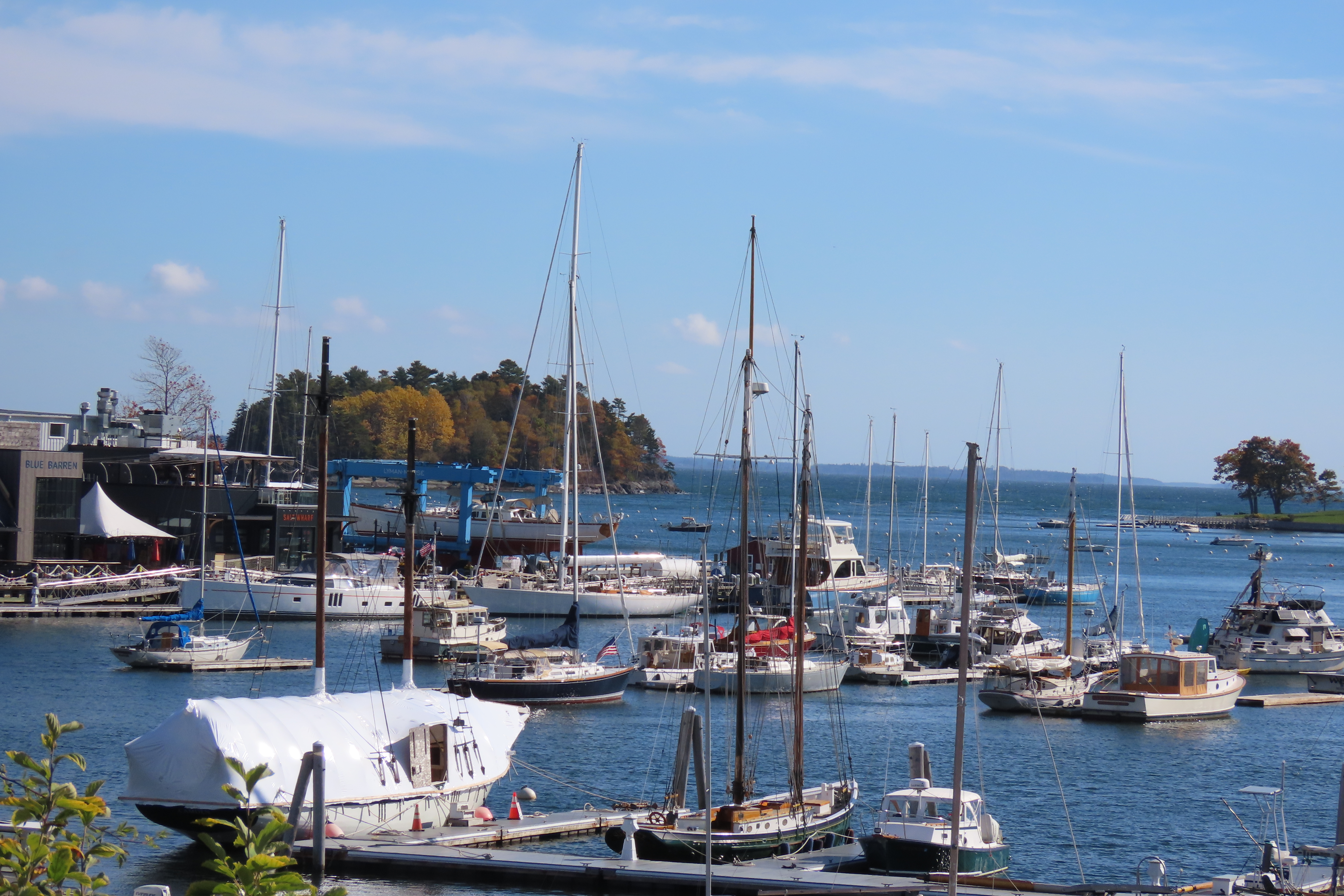
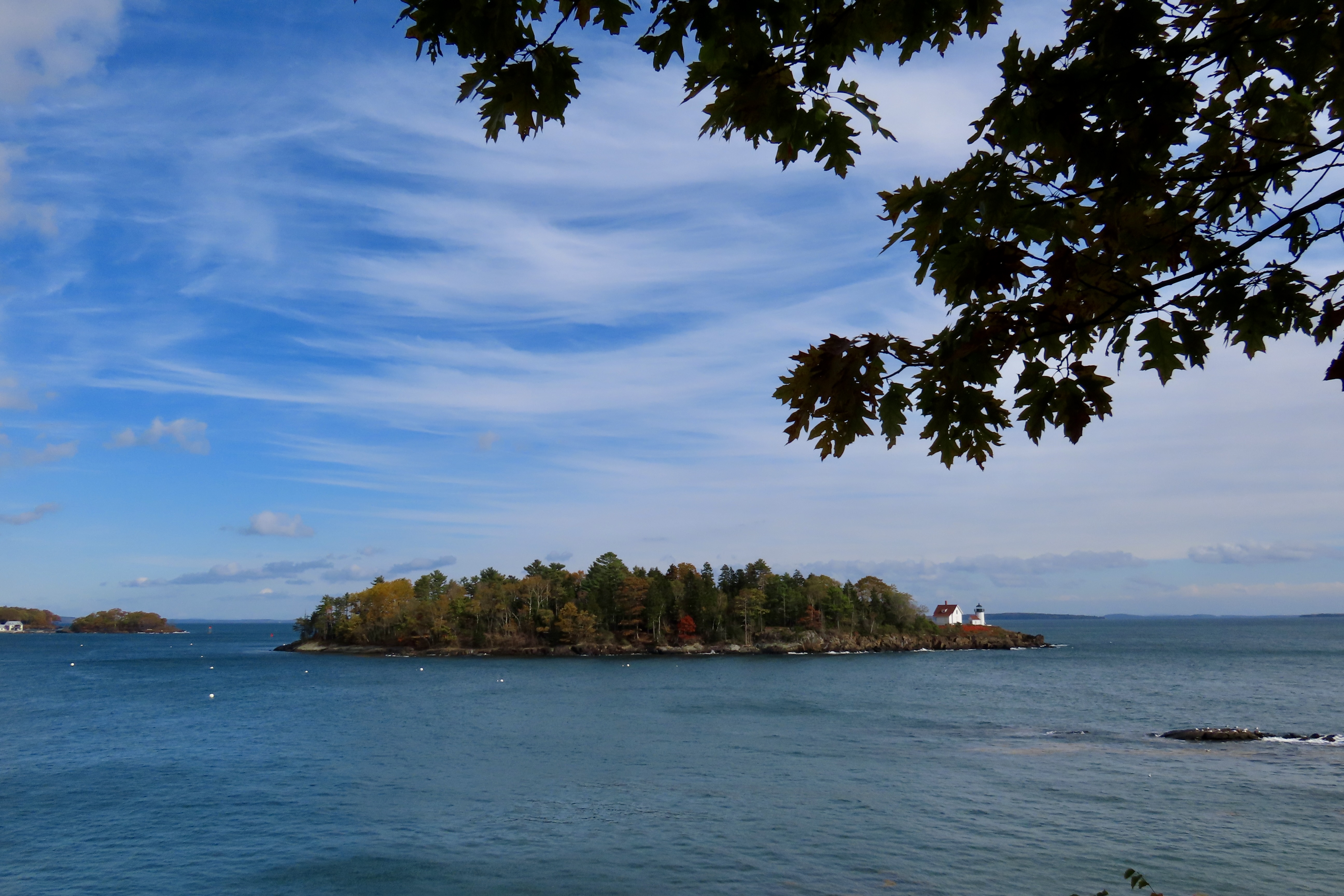
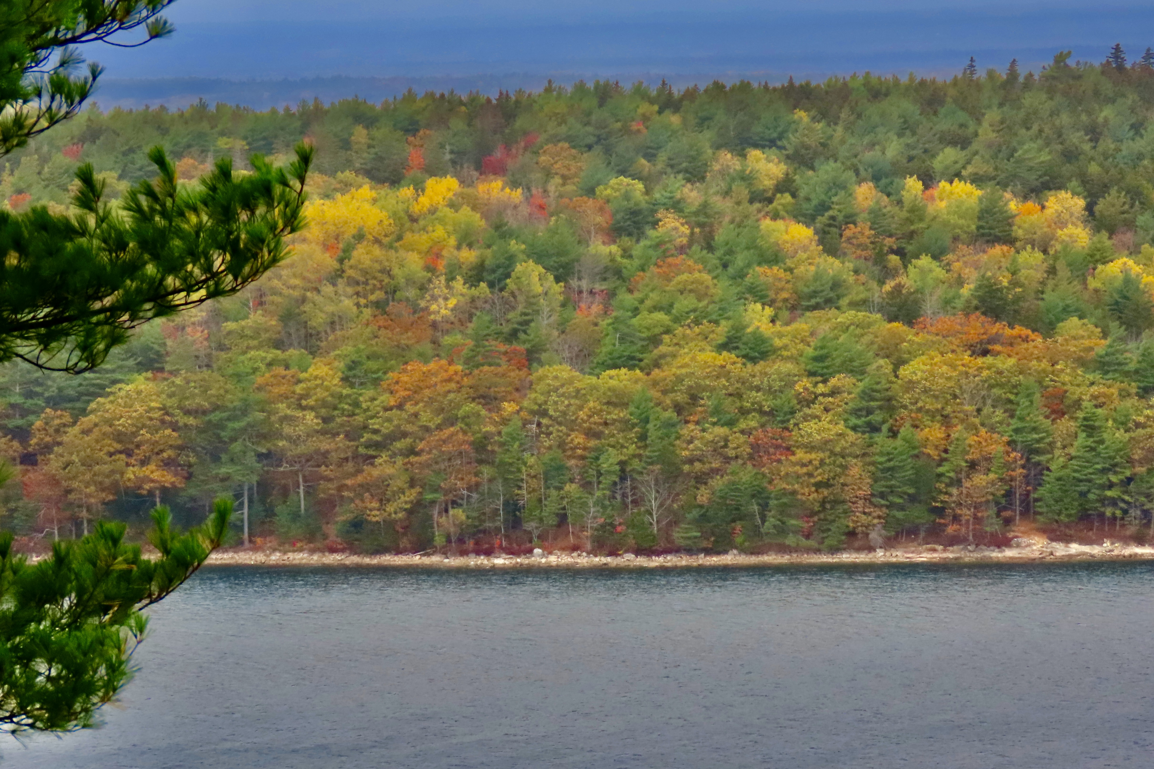
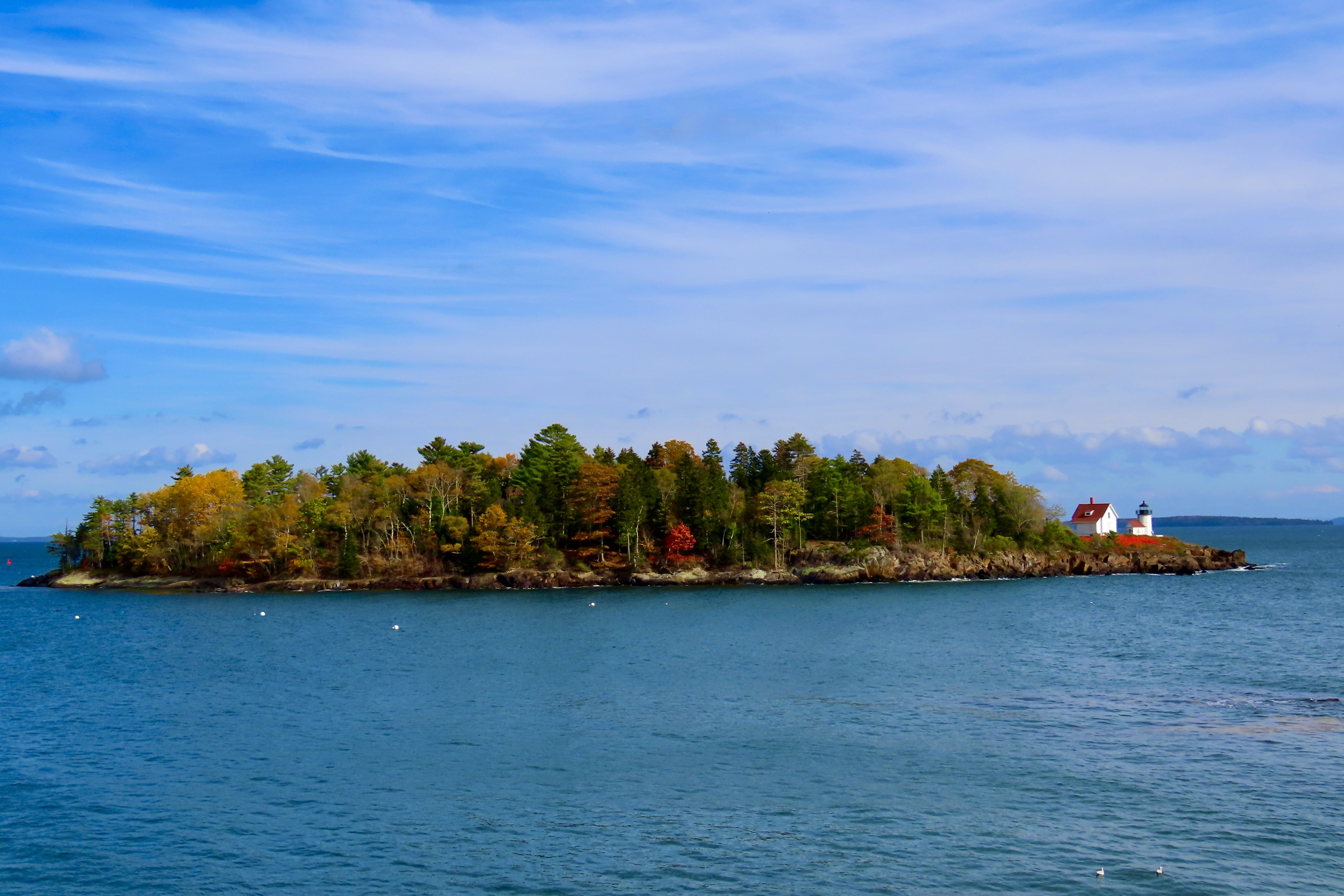
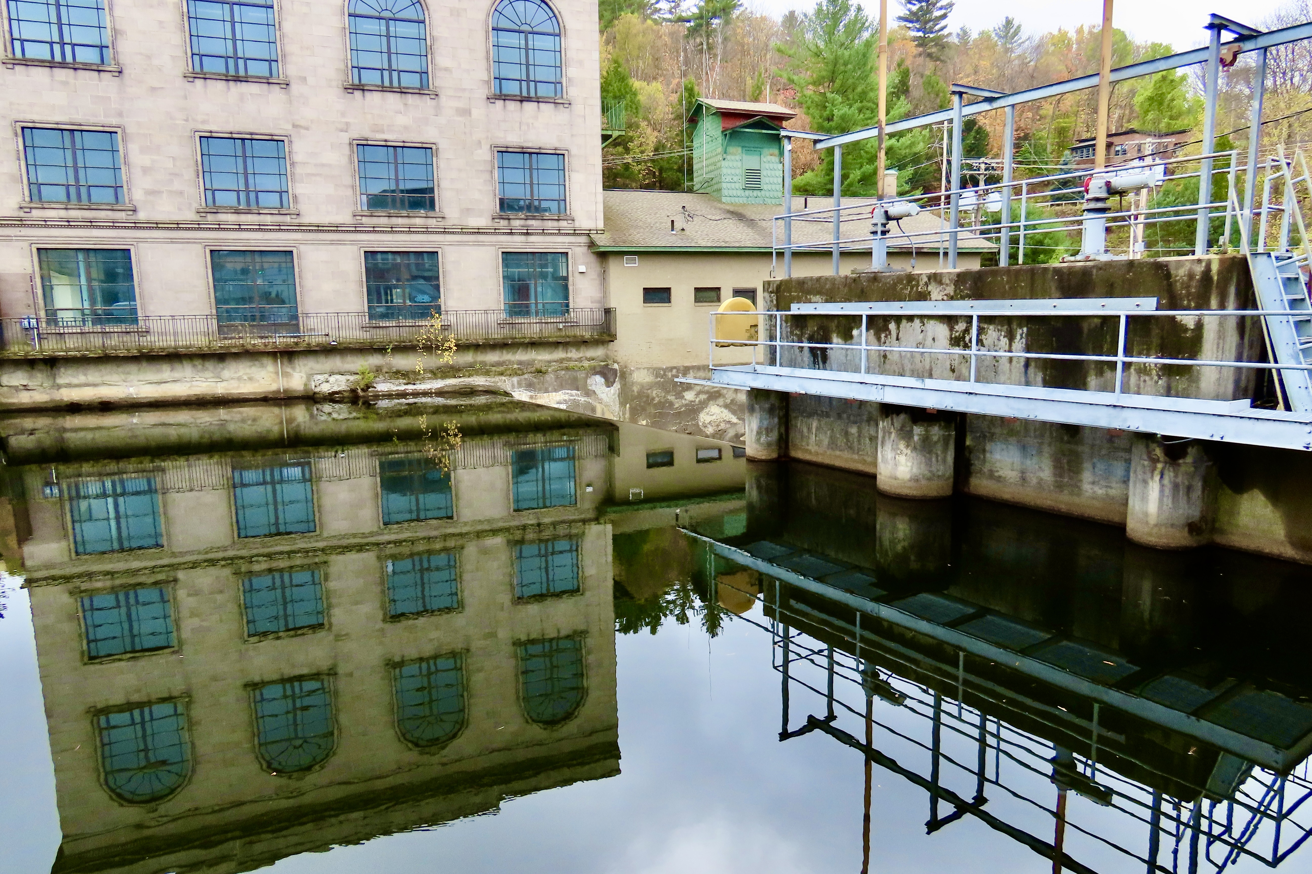
In our last post, we introduced Curtis Island. Here it is seen across the Belfast, Maine harbor. Belfast is where we ate the delicious lobster rolls I featured earlier.
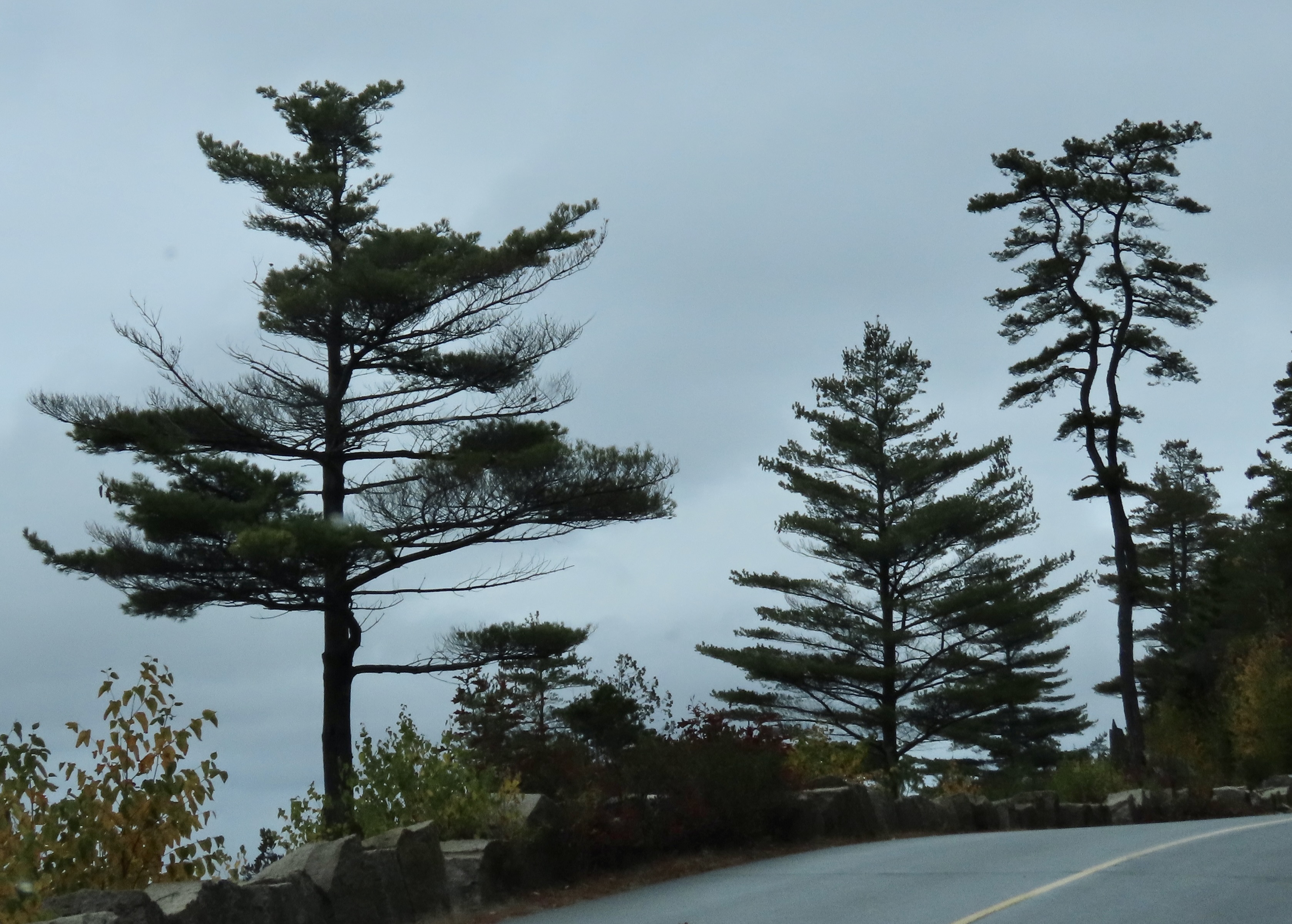
We are wrapping up our leaf-peeping tour of New England tour today. I’ll close out the series with photos of the Island and three spectacular trees at Camden Hills State Park. And then add a few more as we travel back to Virginia.
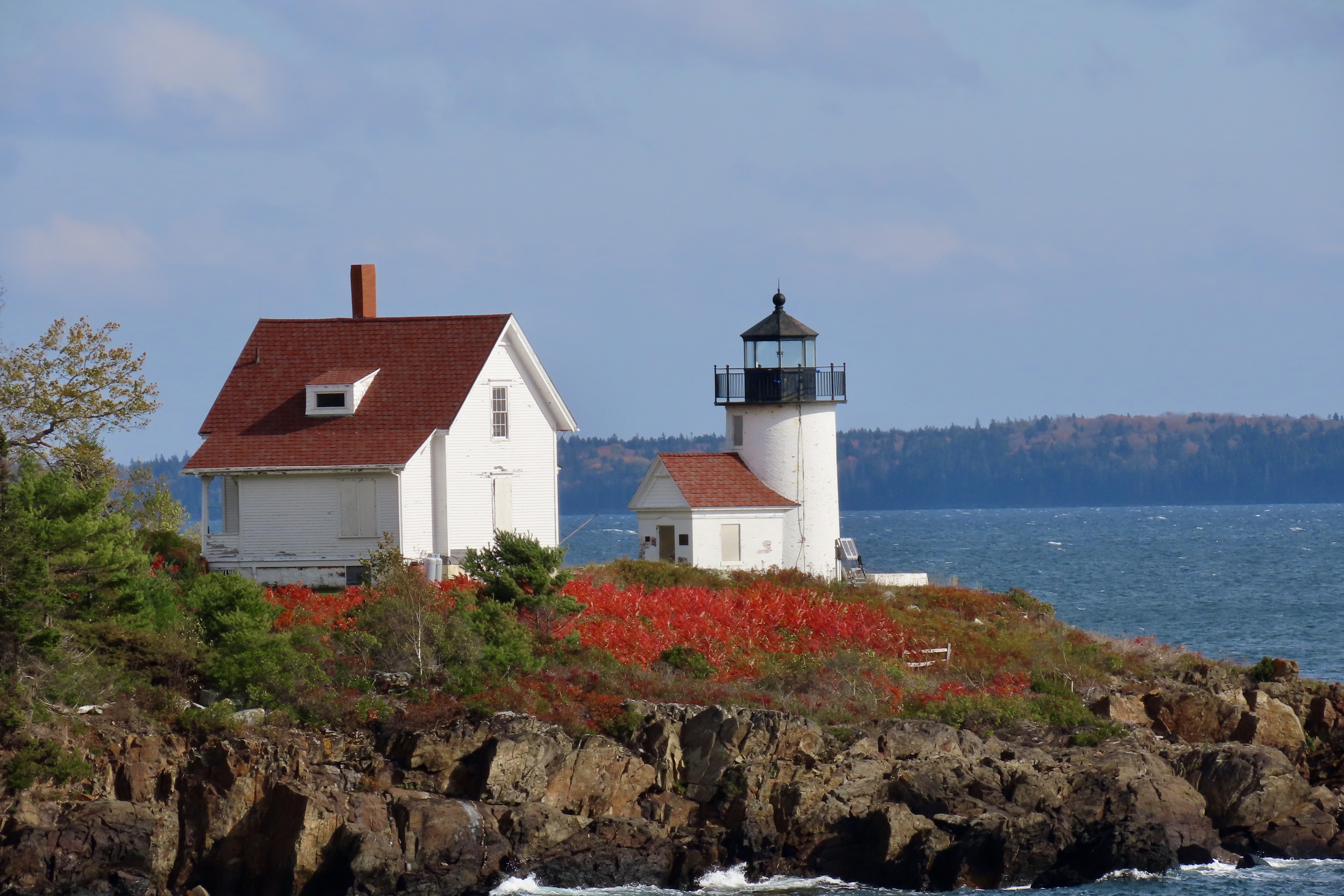
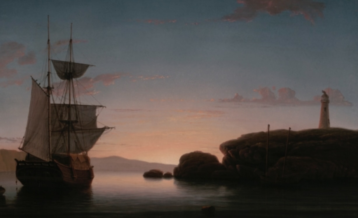
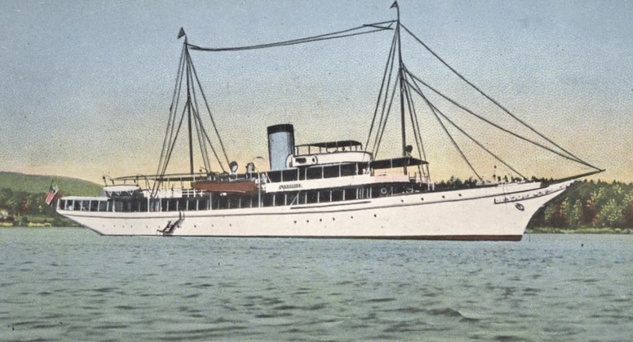
This photo of Curtis Island includes its lighthouse on the far right hand corner.Close up. I’m not sure what the red plant is. Whatever, its brilliant red matches the roofs. The lighthouse is one of 65 found along the Maine coast. There are so many Maine has become known as the Lighthouse State. In comparison there are approximately 80 along the whole Pacific coast including the states of Washington, Oregon and California.1851 painting of Curtis Island by marine painter Fitz Henry Lane.I mentioned in my last blog that Curtis Island was named after the publisher Cyrus Curtis. Did I mention he was wealthy? This is a photo of his boat, er, yacht. Curtis’s summer home was in Camden just south of Belfast where he was Commodore of the Yacht Club from 1909 to 1933. Of course when you build the club, donate it to the town, and dock your 230 foot yacht out front, you should be Commodore.
Curtis was the creator of the Ladies Home Journal and the Saturday Evening Post. Both have interesting stories. Legend has it that when Curtis first published the Ladies Home Journal he gave a copy to his wife, Louisa Knapp, for review. She more or less told him it was crap. His response was “Do you think you can do any better?” Hers, “Yes,” His, “Fine, you do it.” During its day, the Journal became the most widely circulated women’s magazine in the U.S.
The Saturday Evening Post had its beginnings some 80 years before Curtis purchased it in 1897. It traces its beginning back to 1821 when it was printed out of the same shop and using the same print type that Benjamin Franklin had used for the Pennsylvania Gazette. It achieved its highest circulation with 90,000 nationwide subscribers in the 1860s. Curtis pushed this up to the highest circulation of any magazine in the world by the 1920s. His wealth was calculated at $43 billion in today’s dollars. No wonder he could afford the yacht. He actually had three built, all with the name Lyndonia. Two of them would actually do military service. One in WW I and the other in WW II.
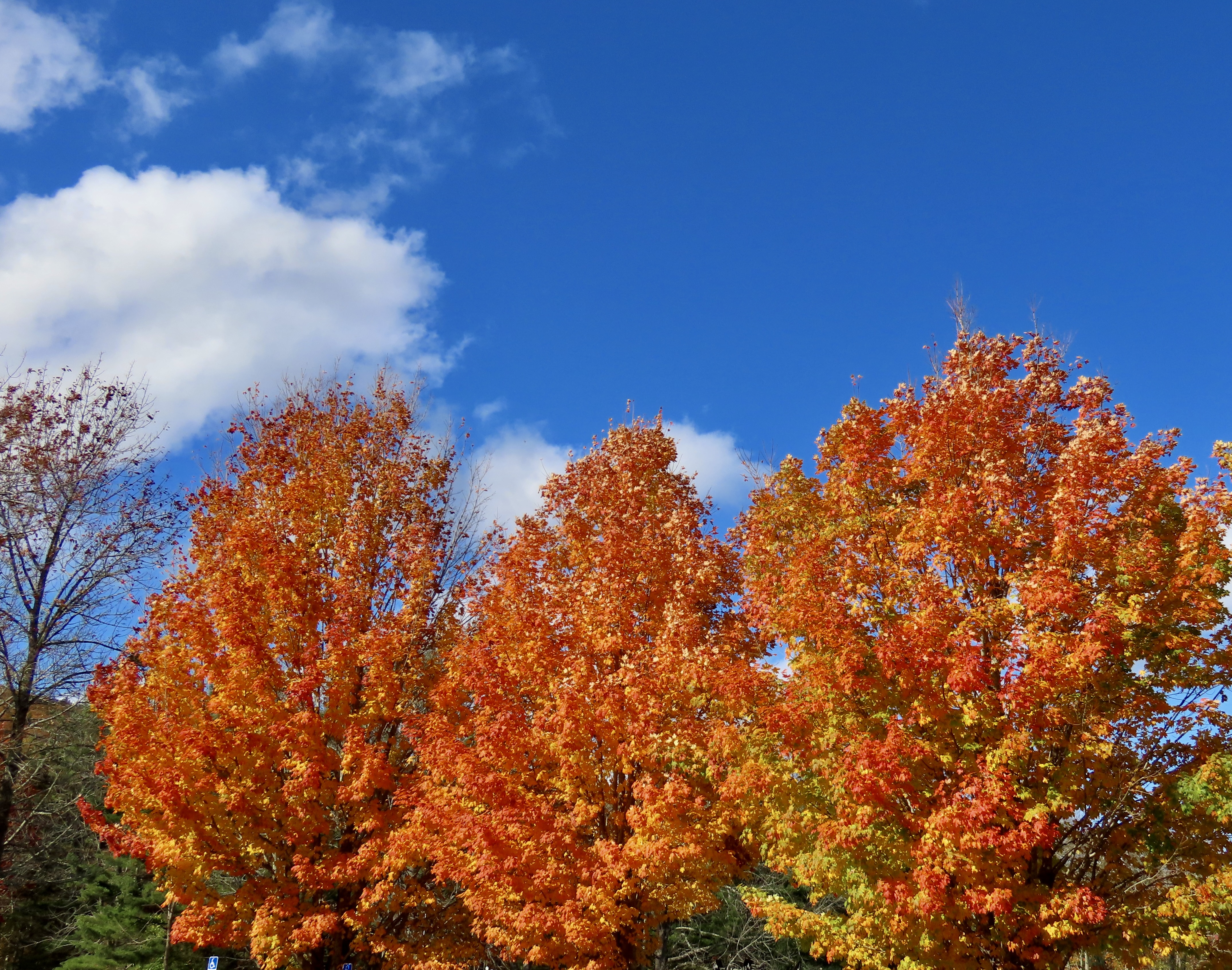
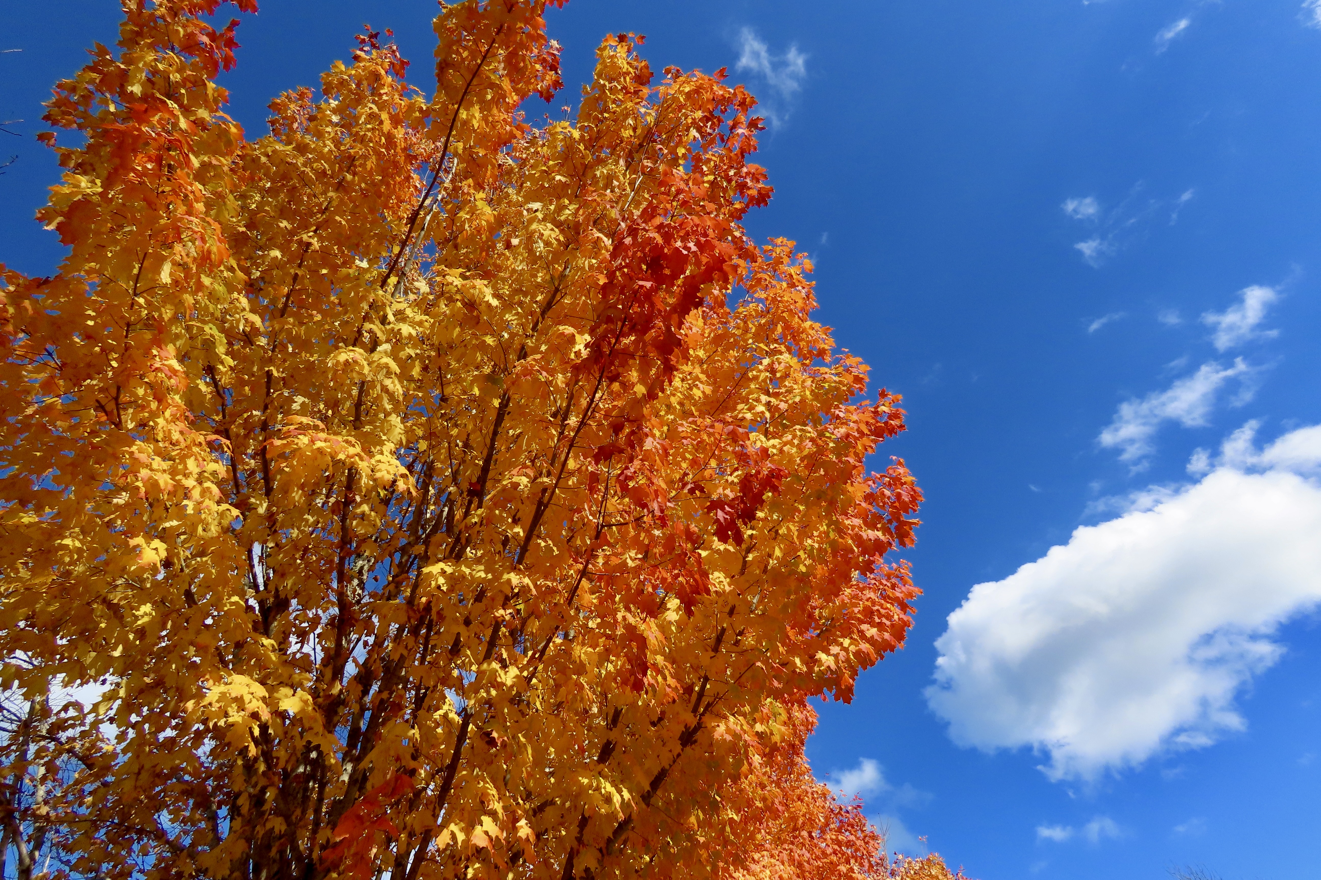
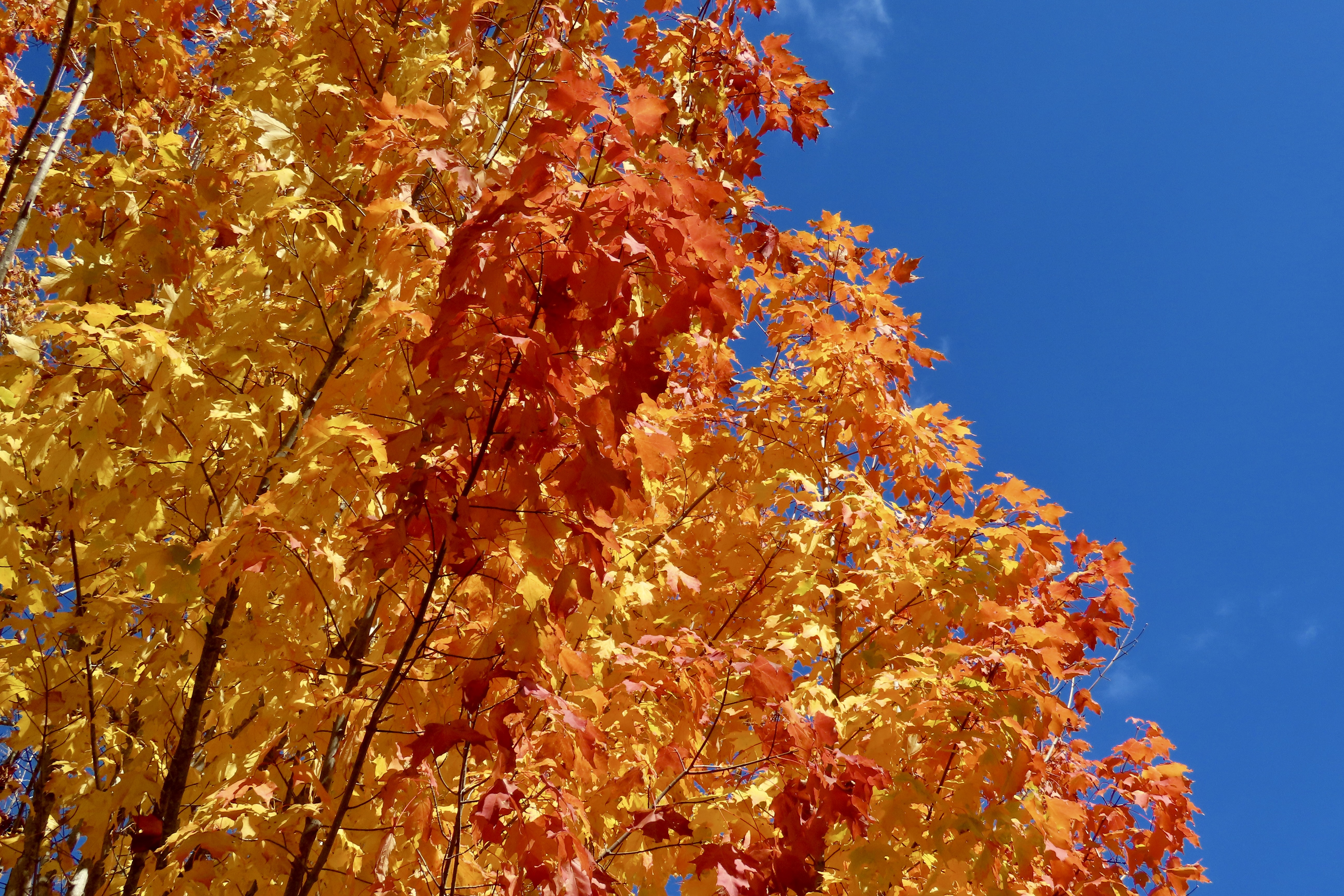
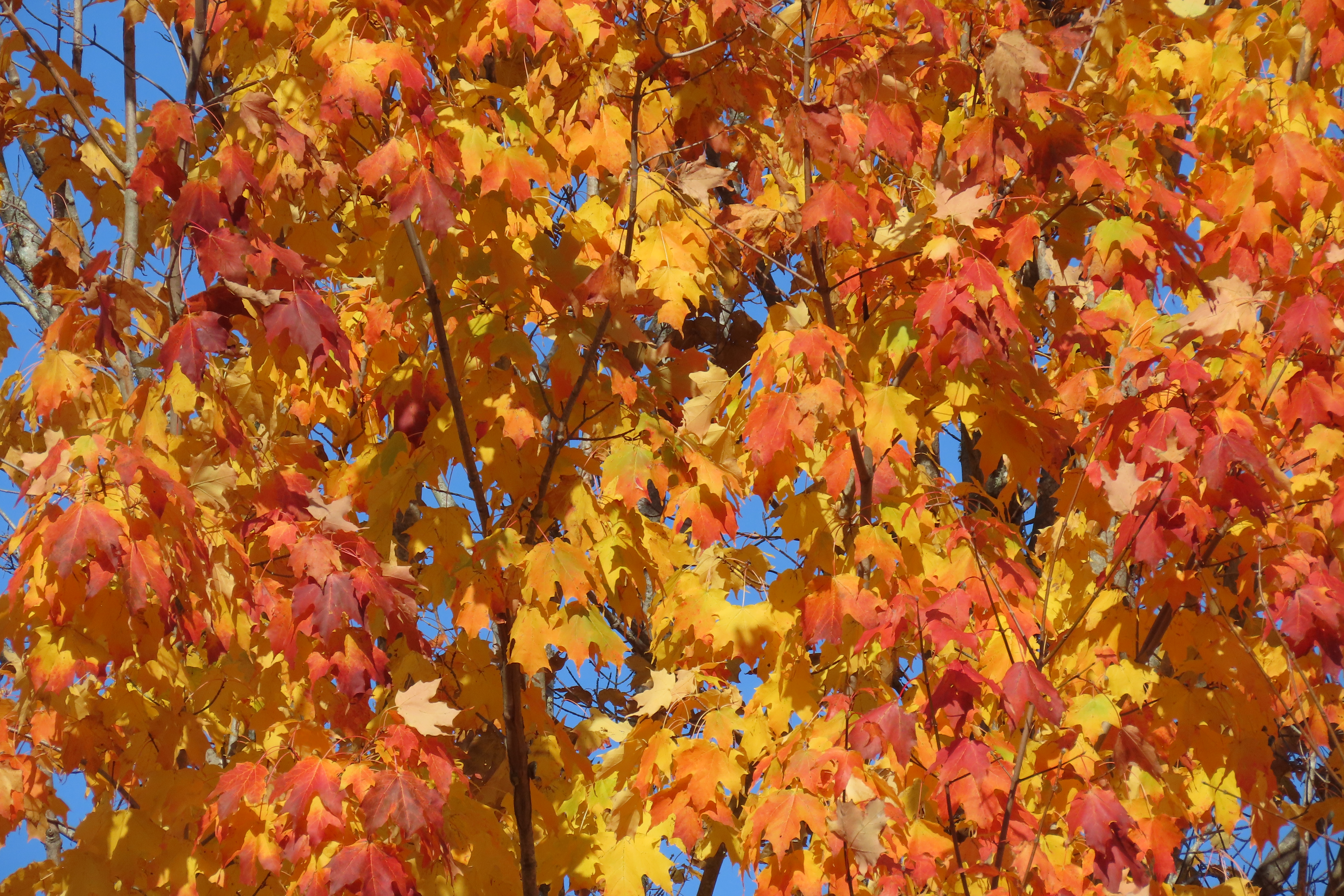
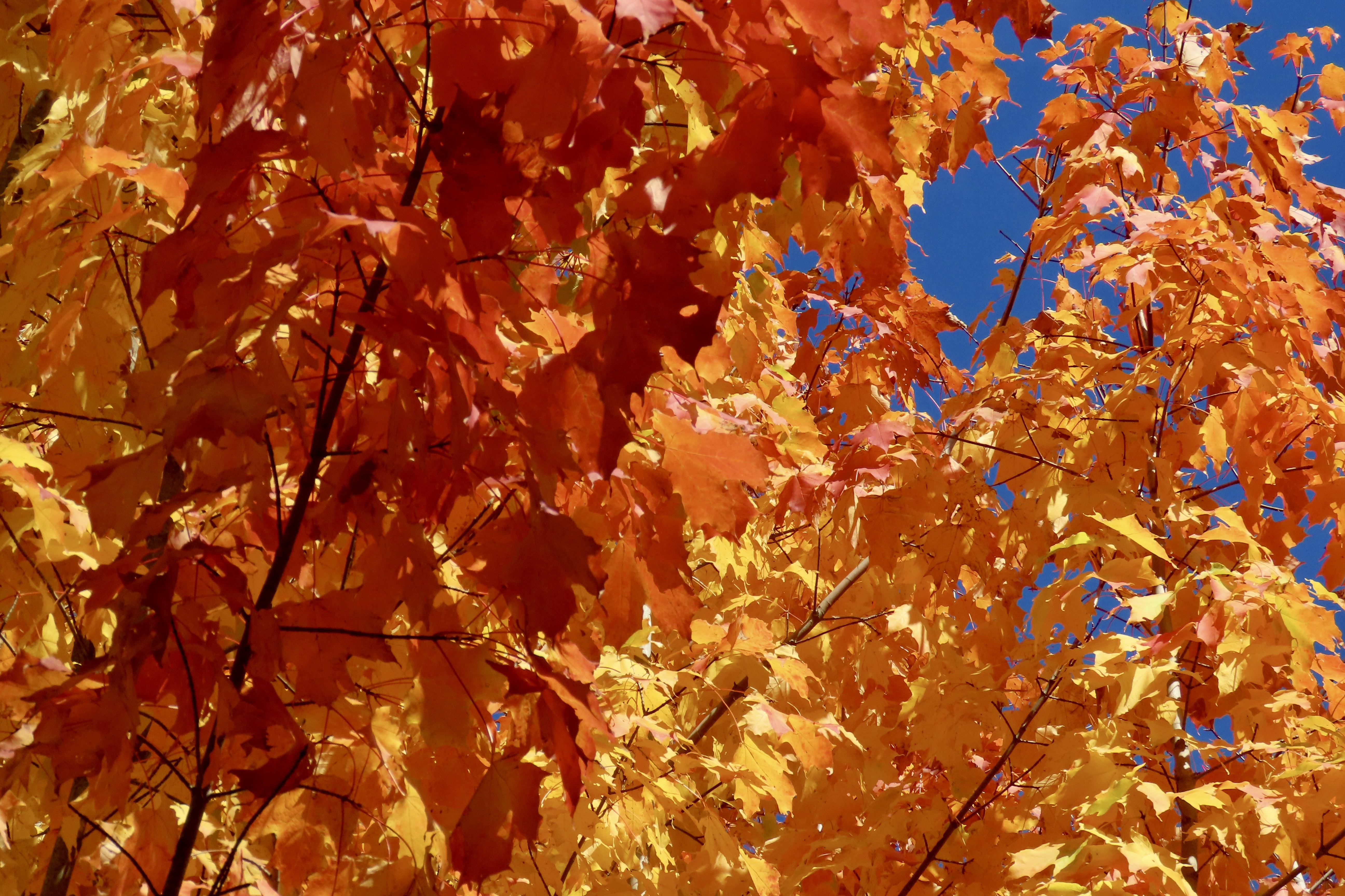
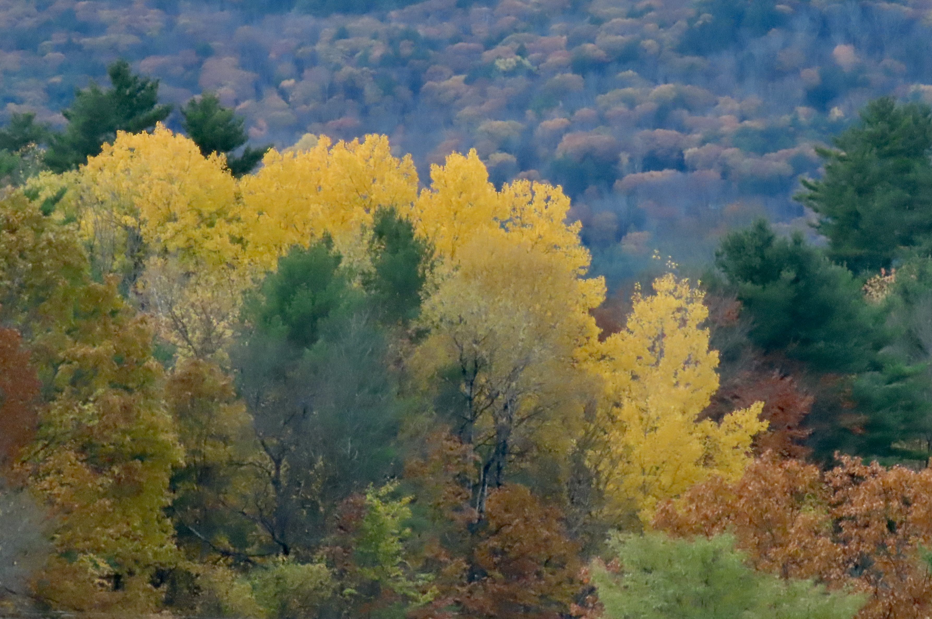
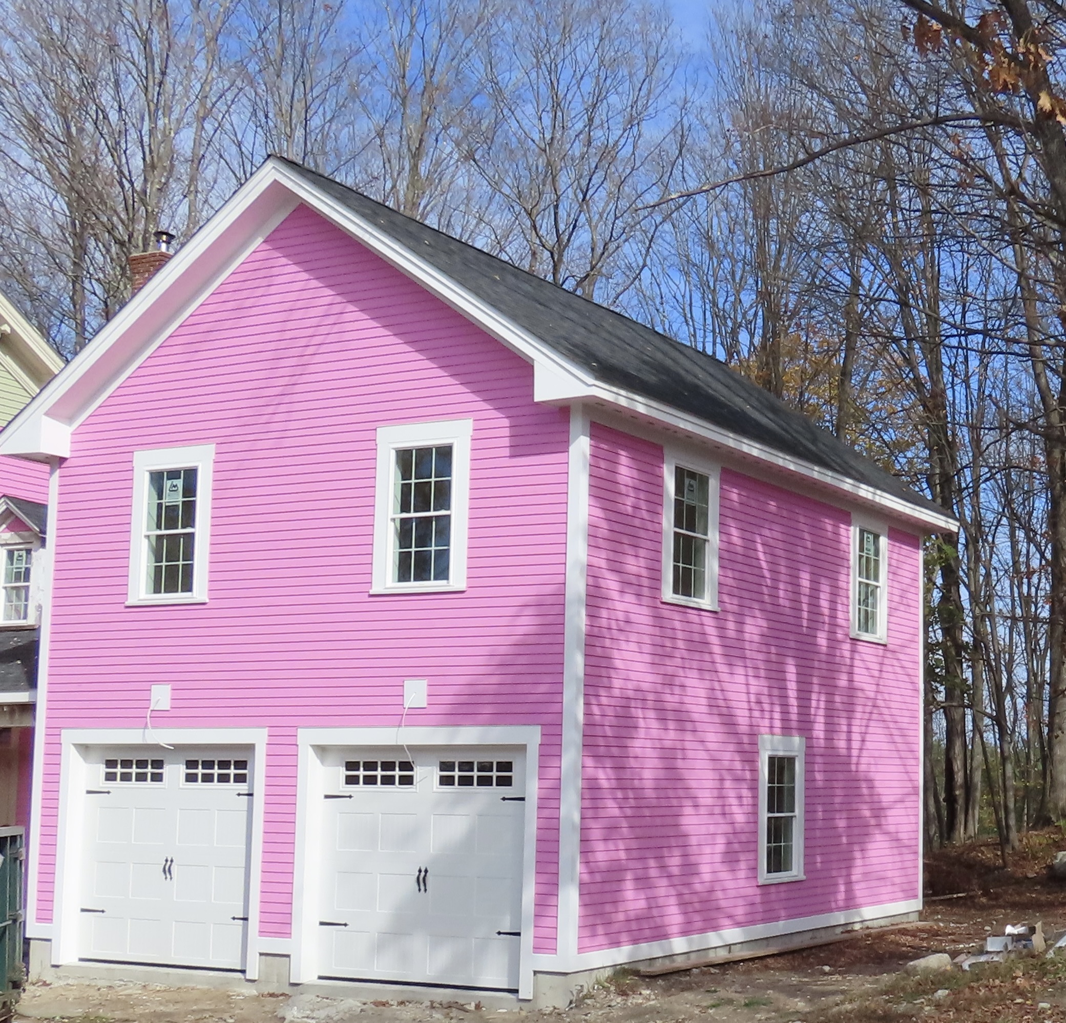
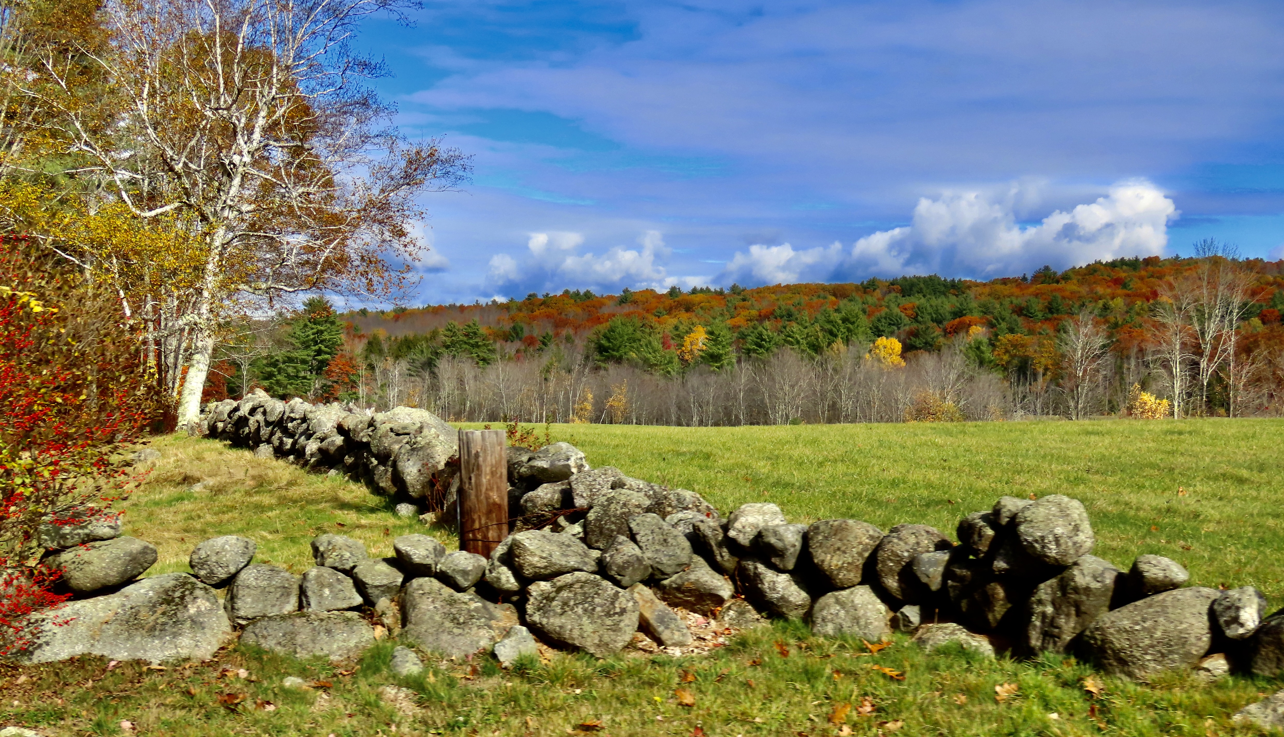
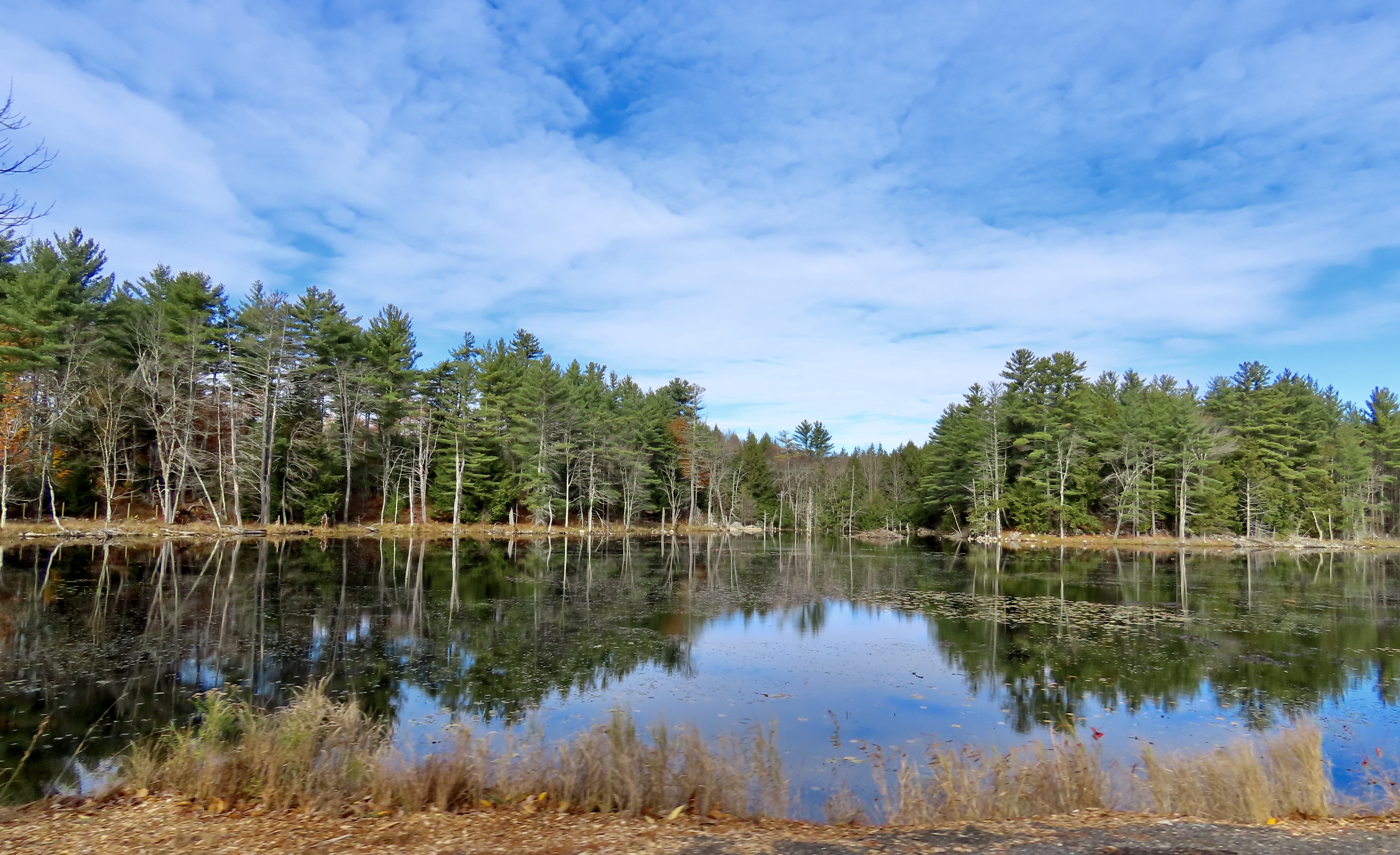
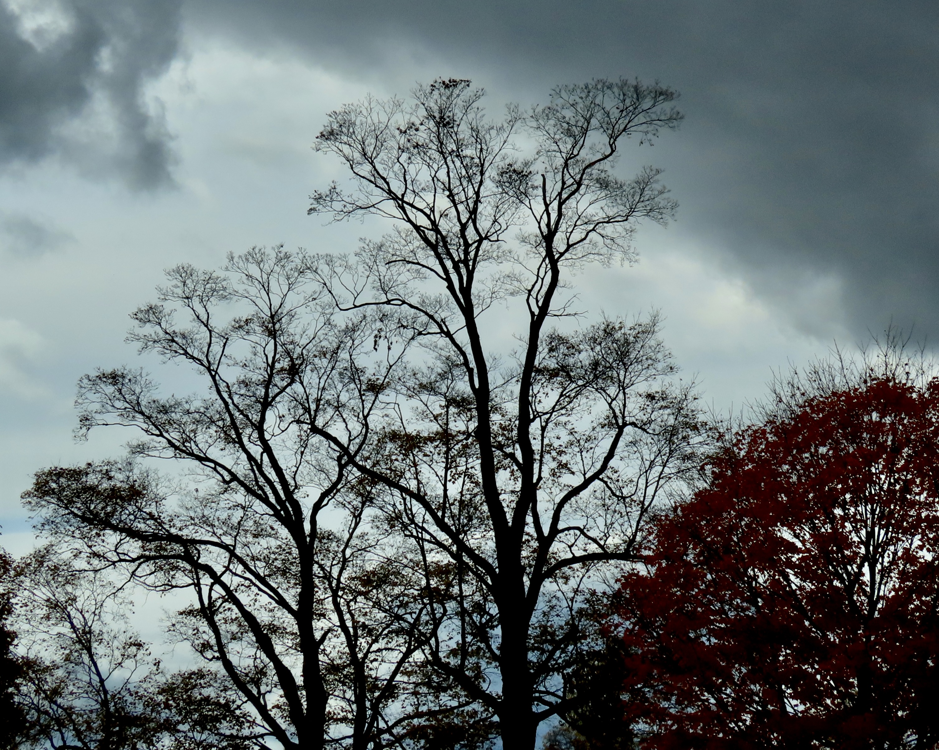
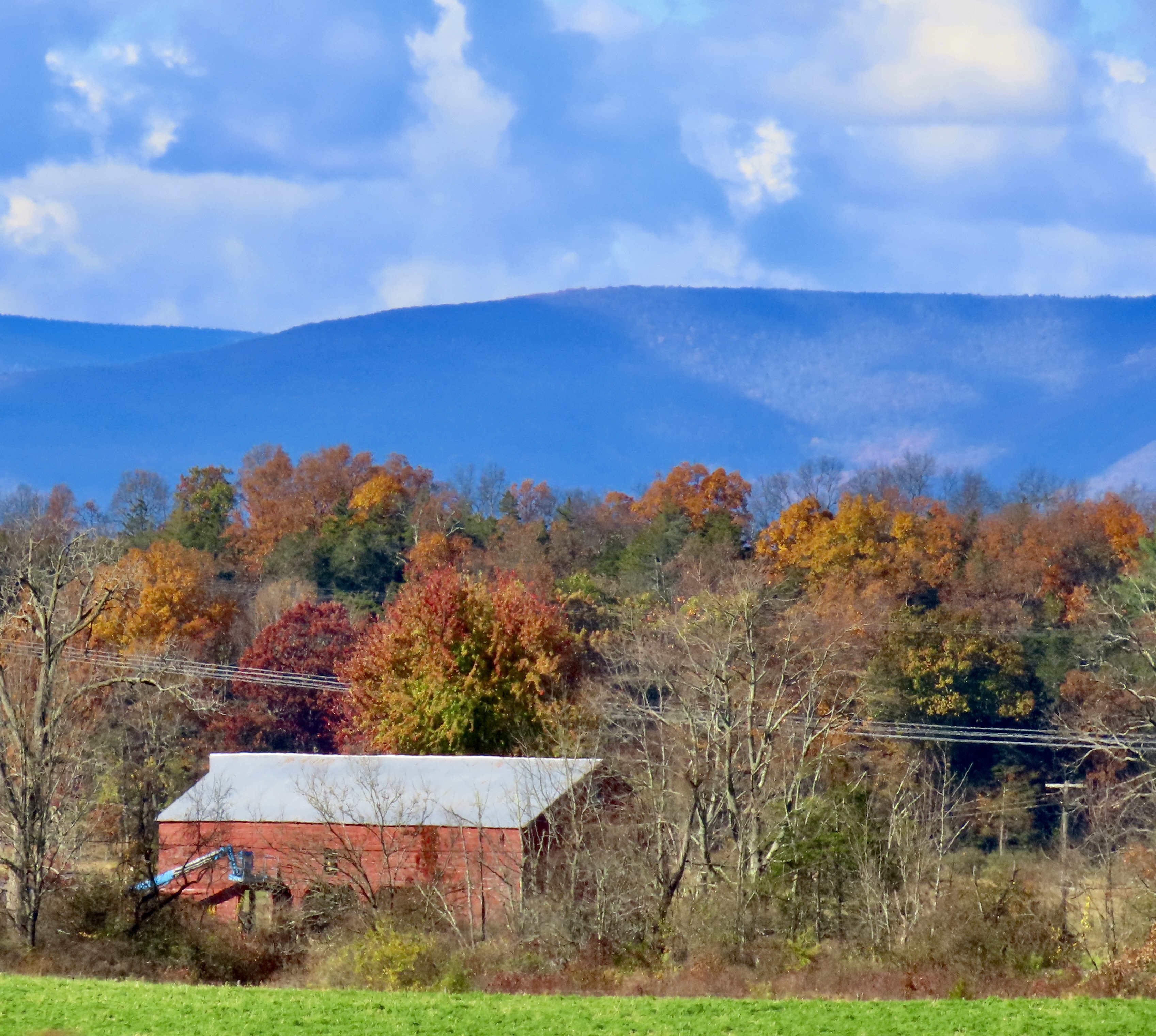
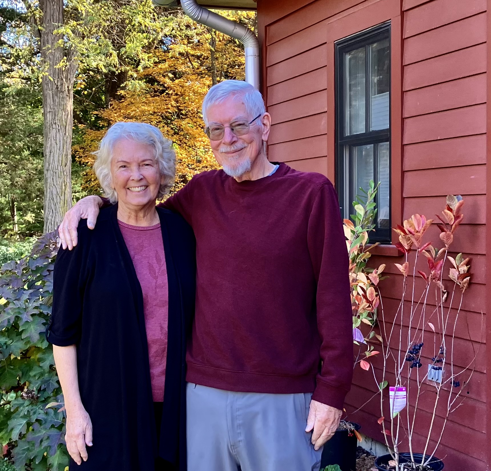
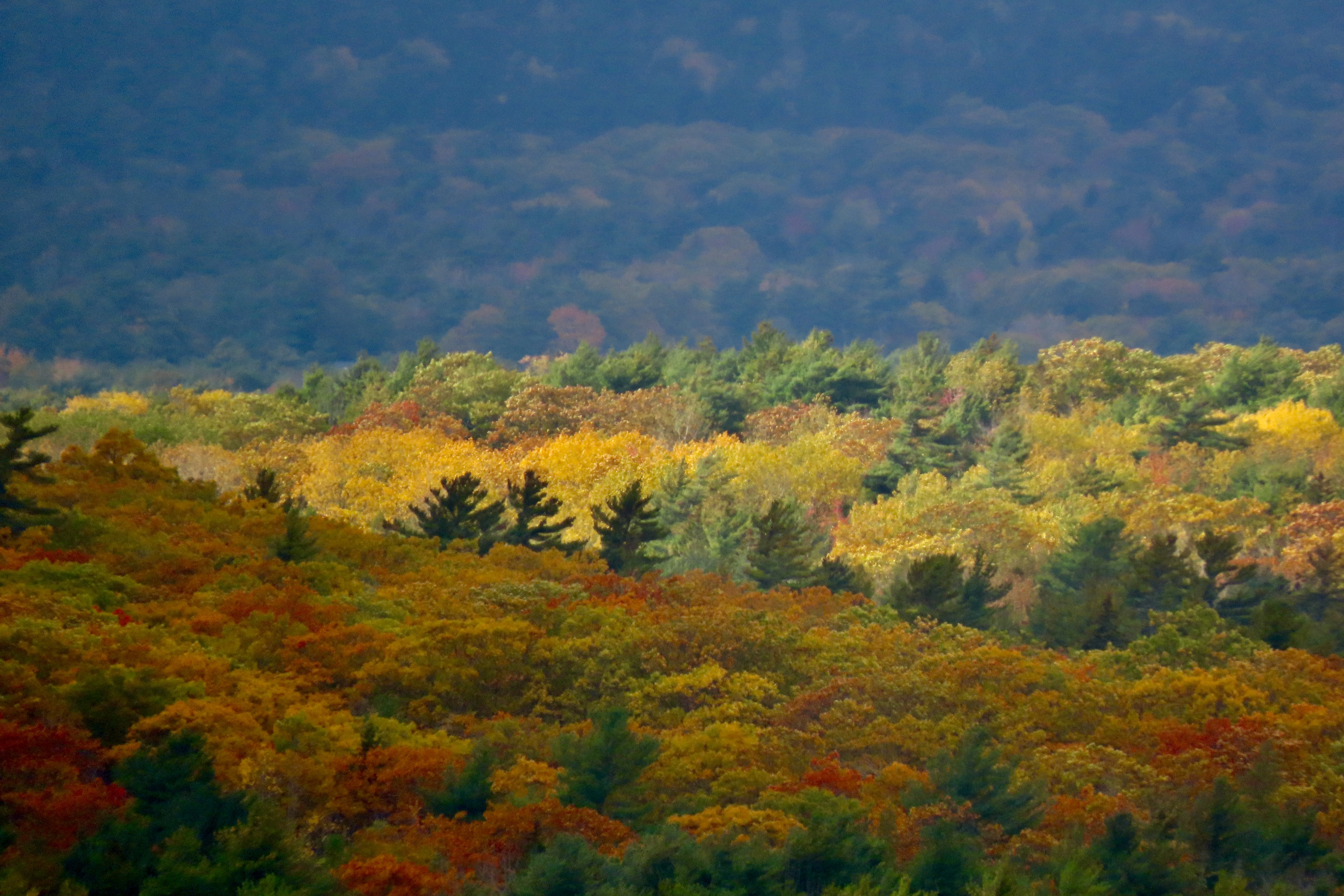
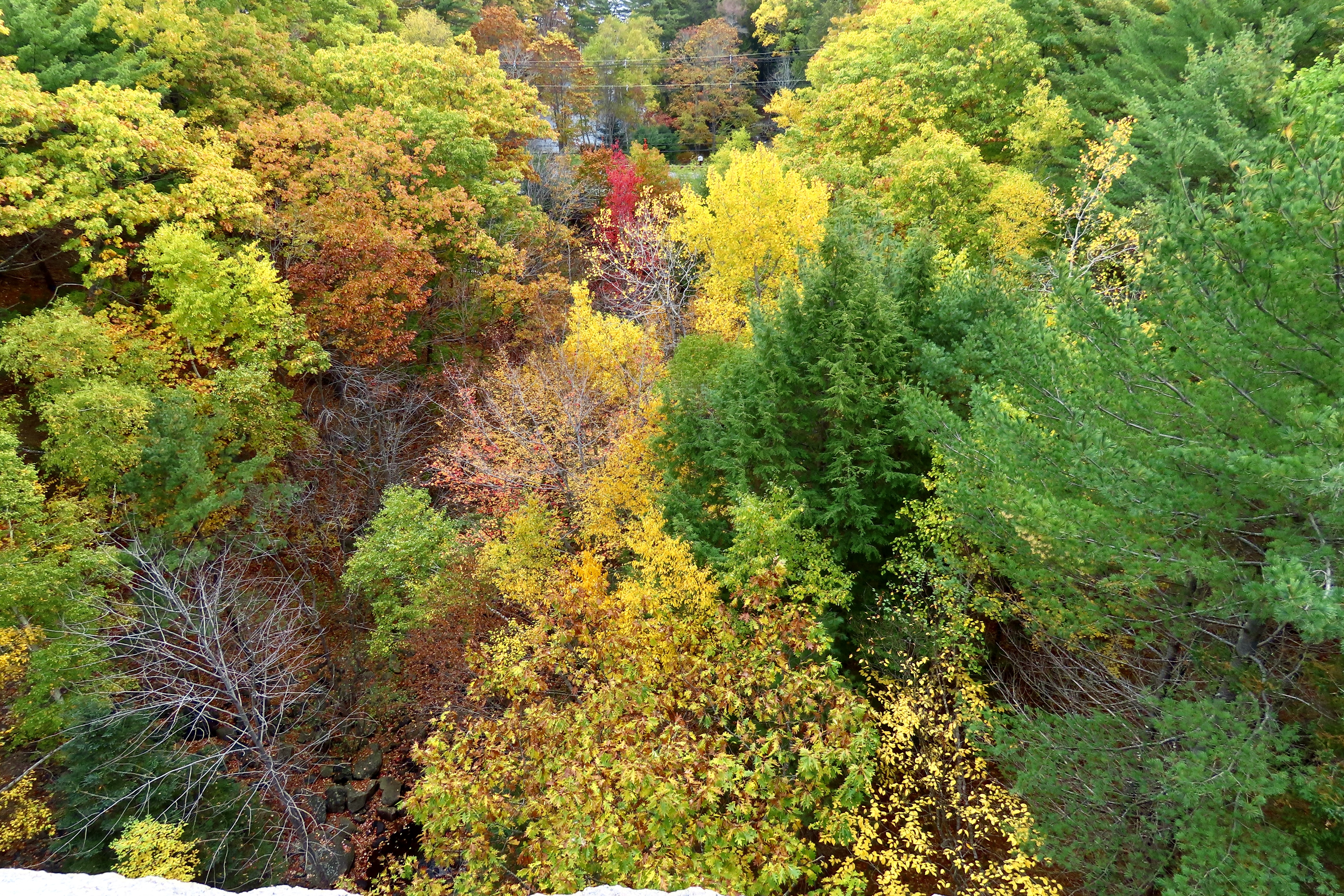
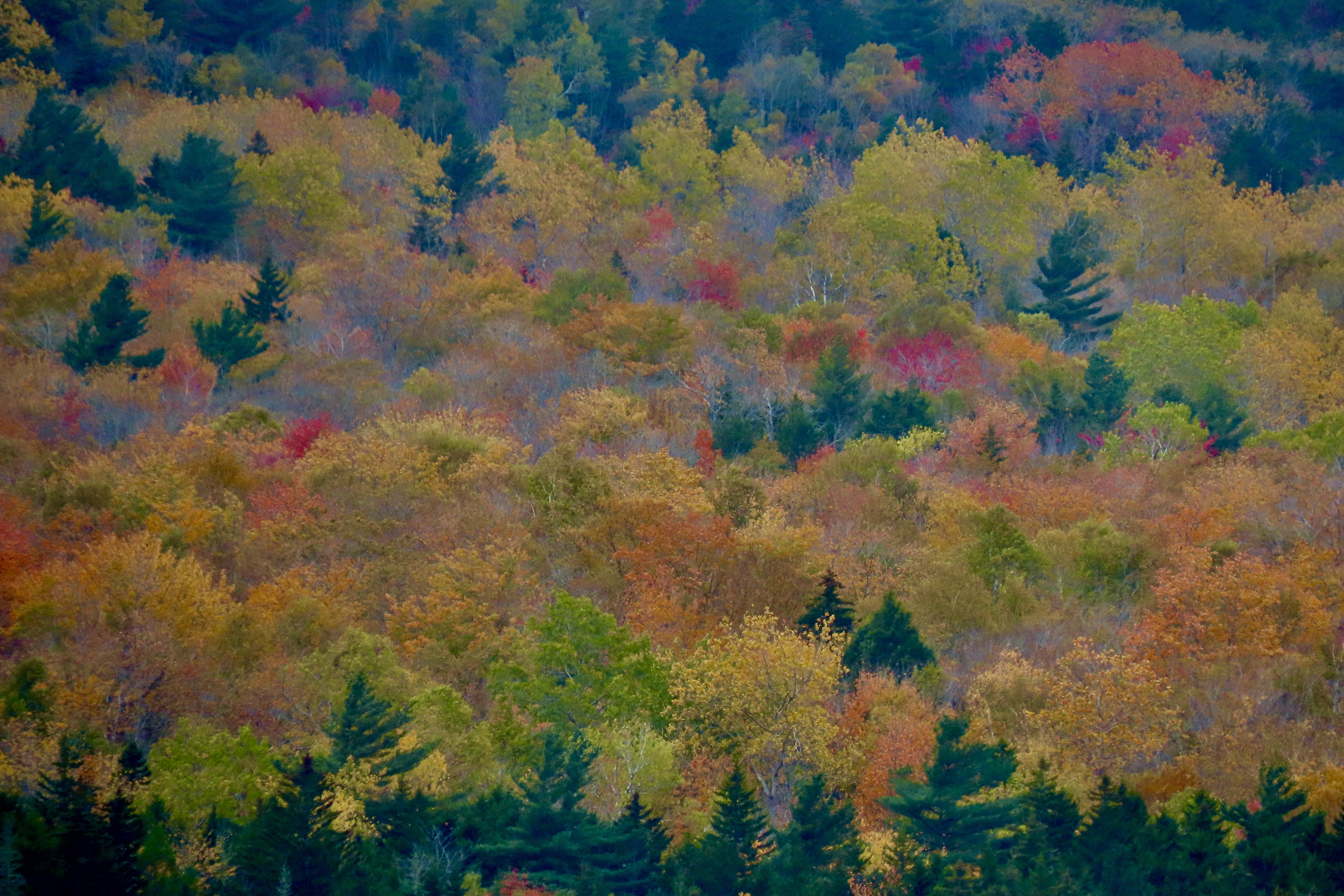
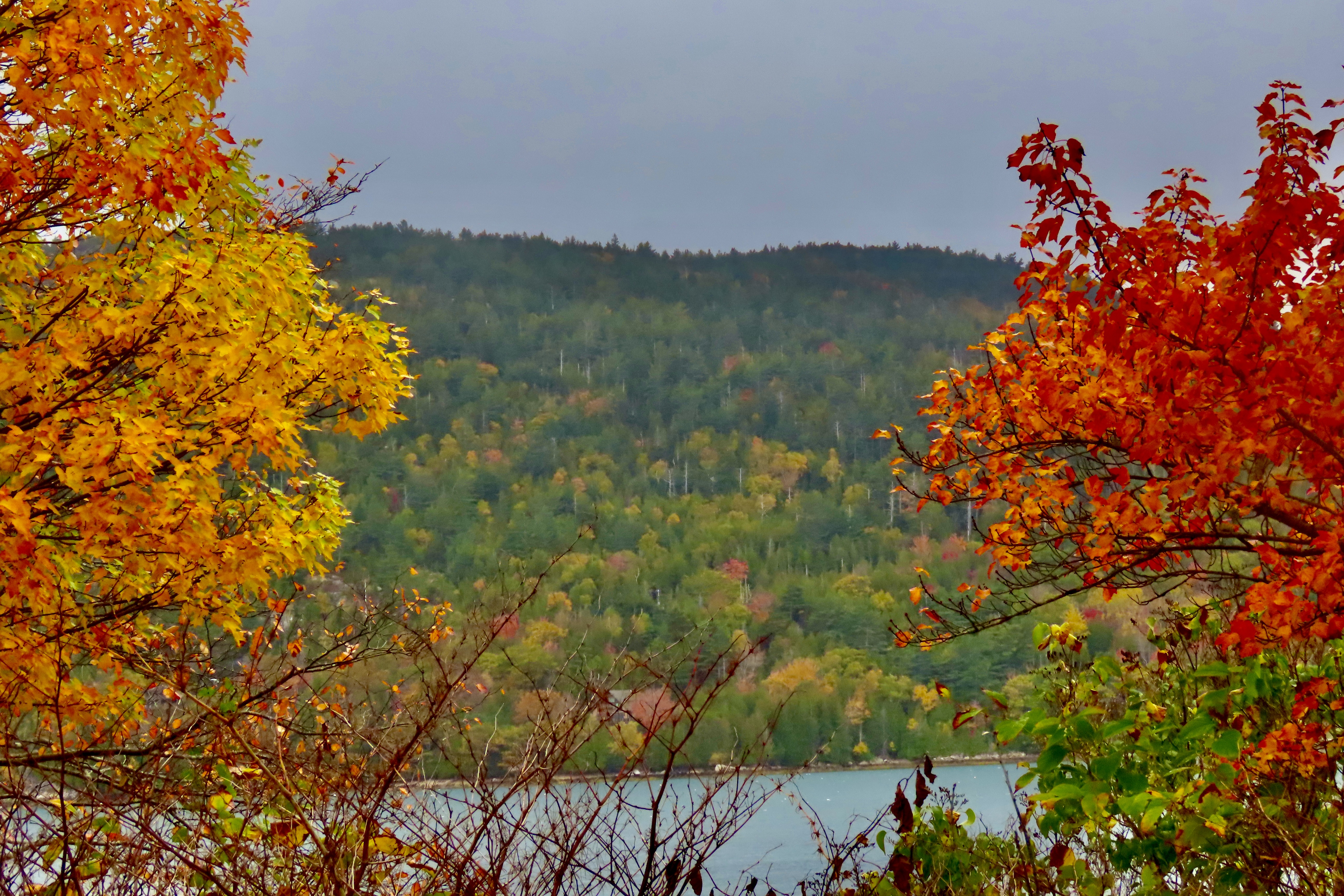
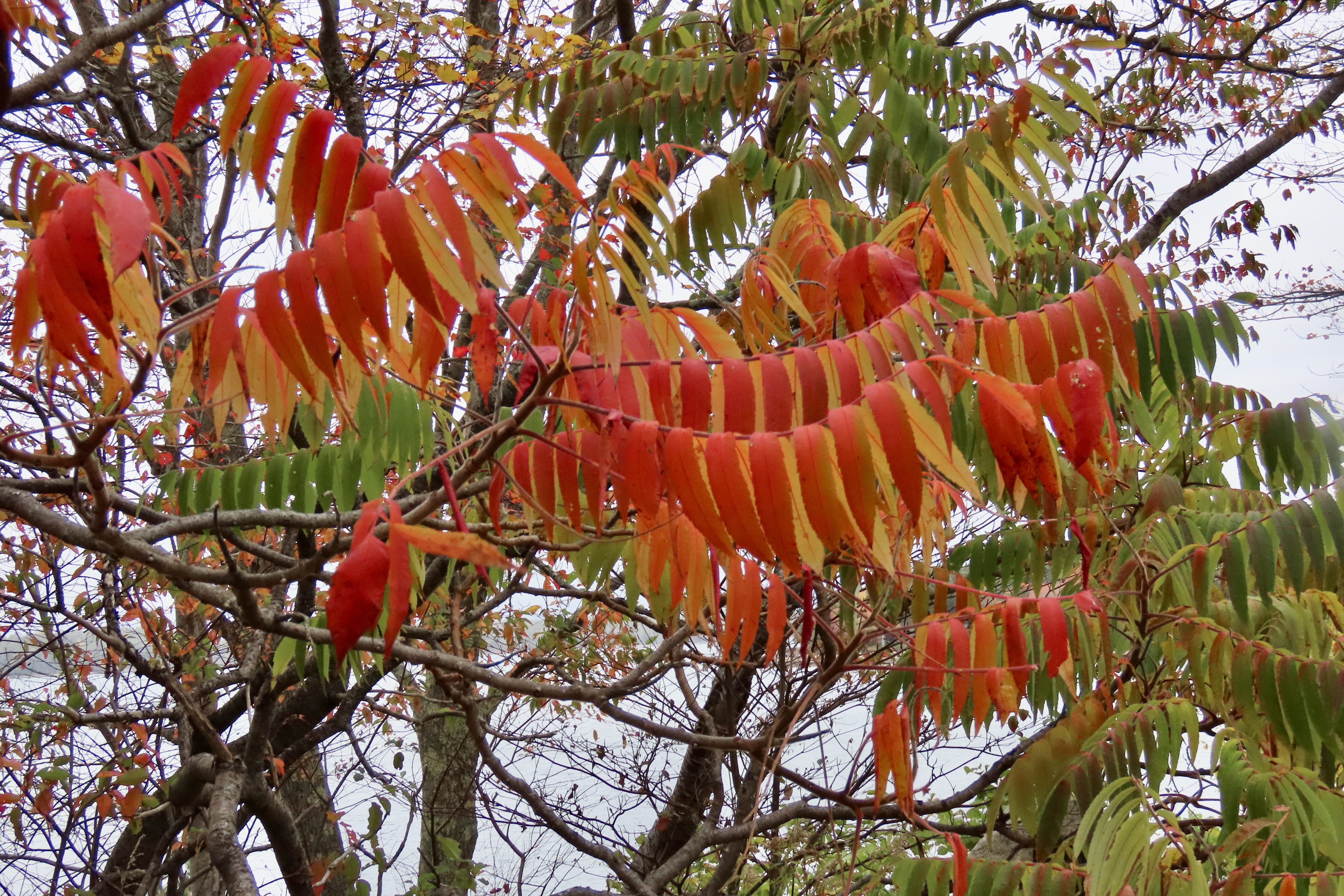
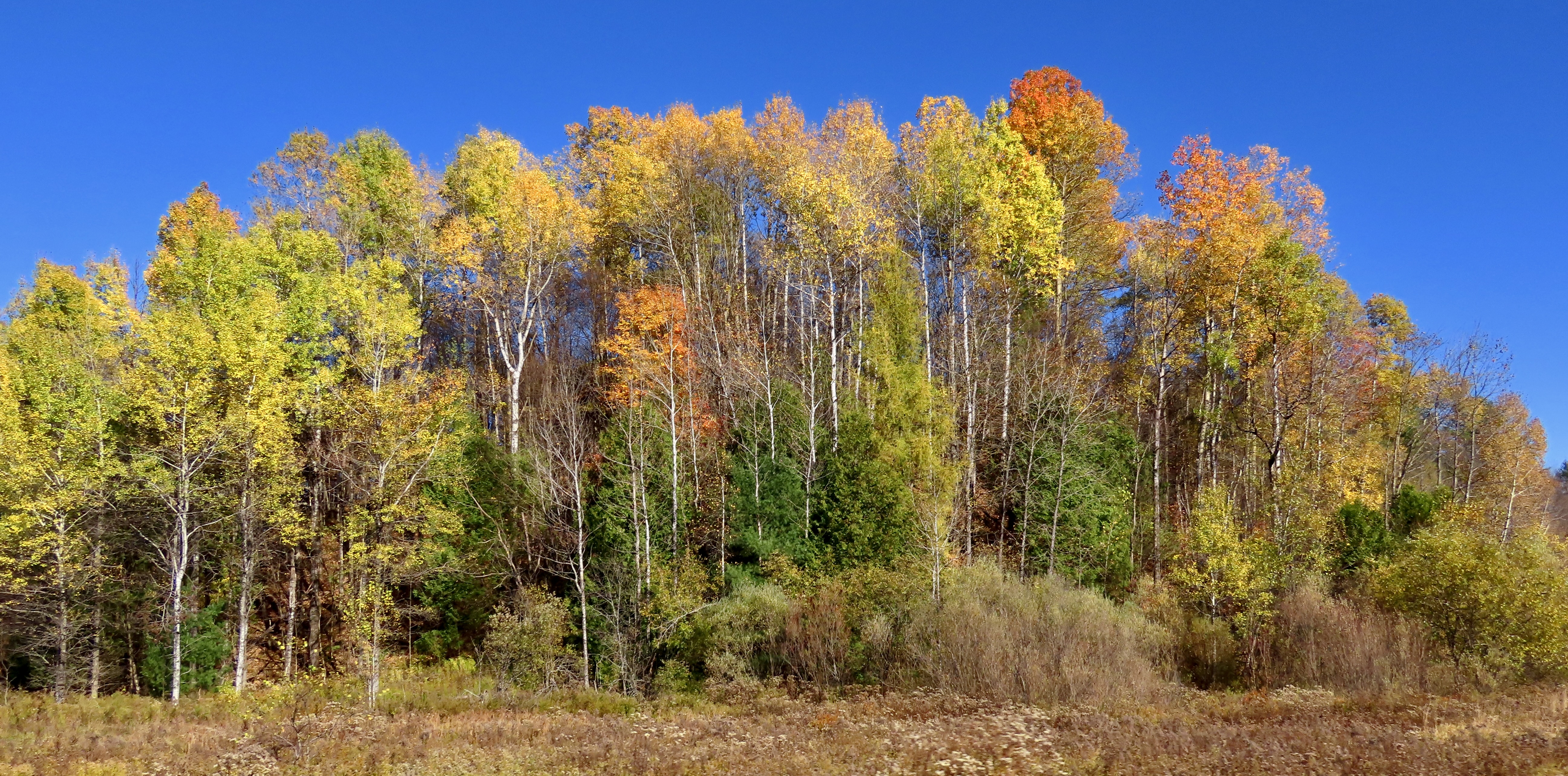
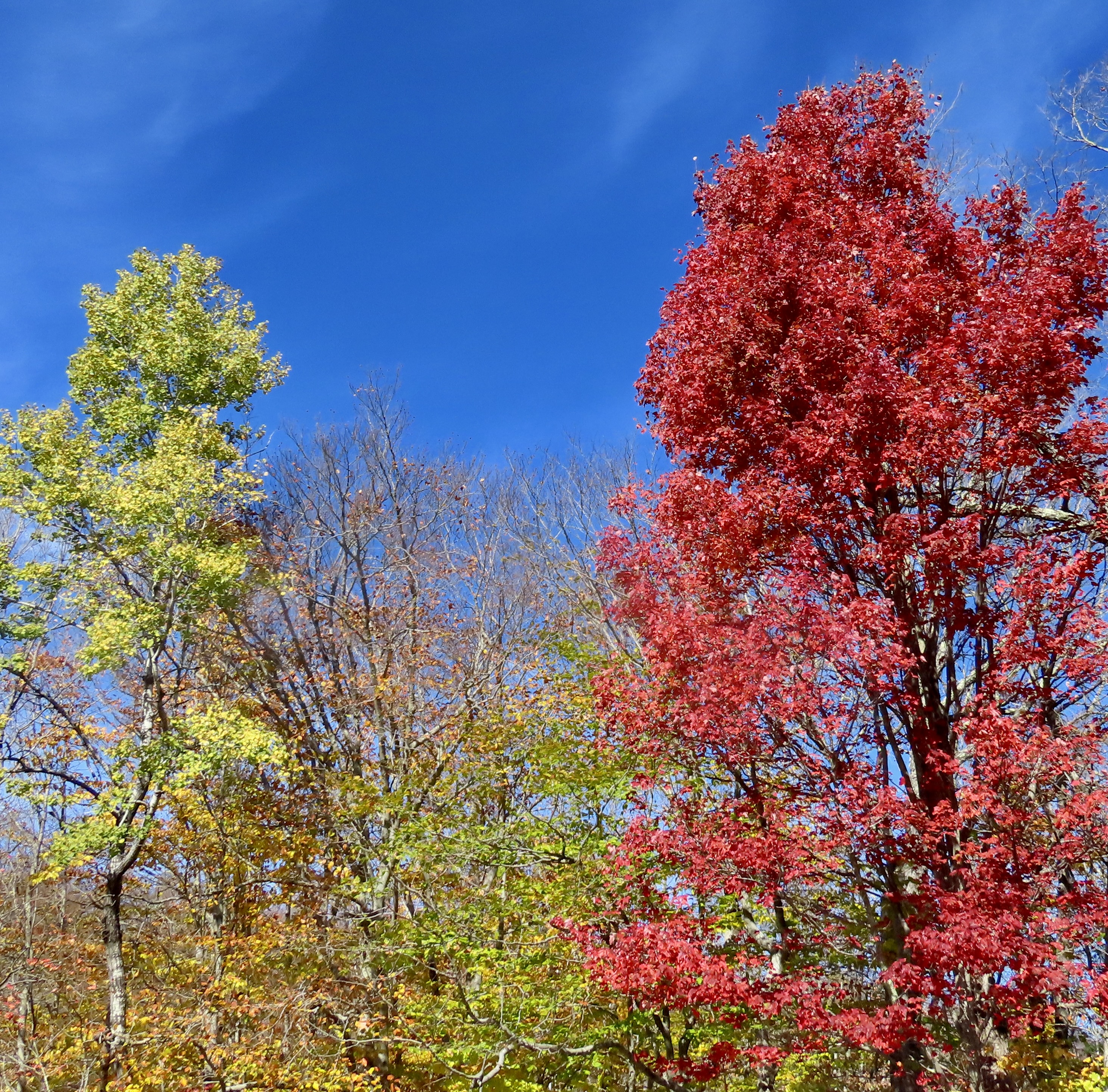
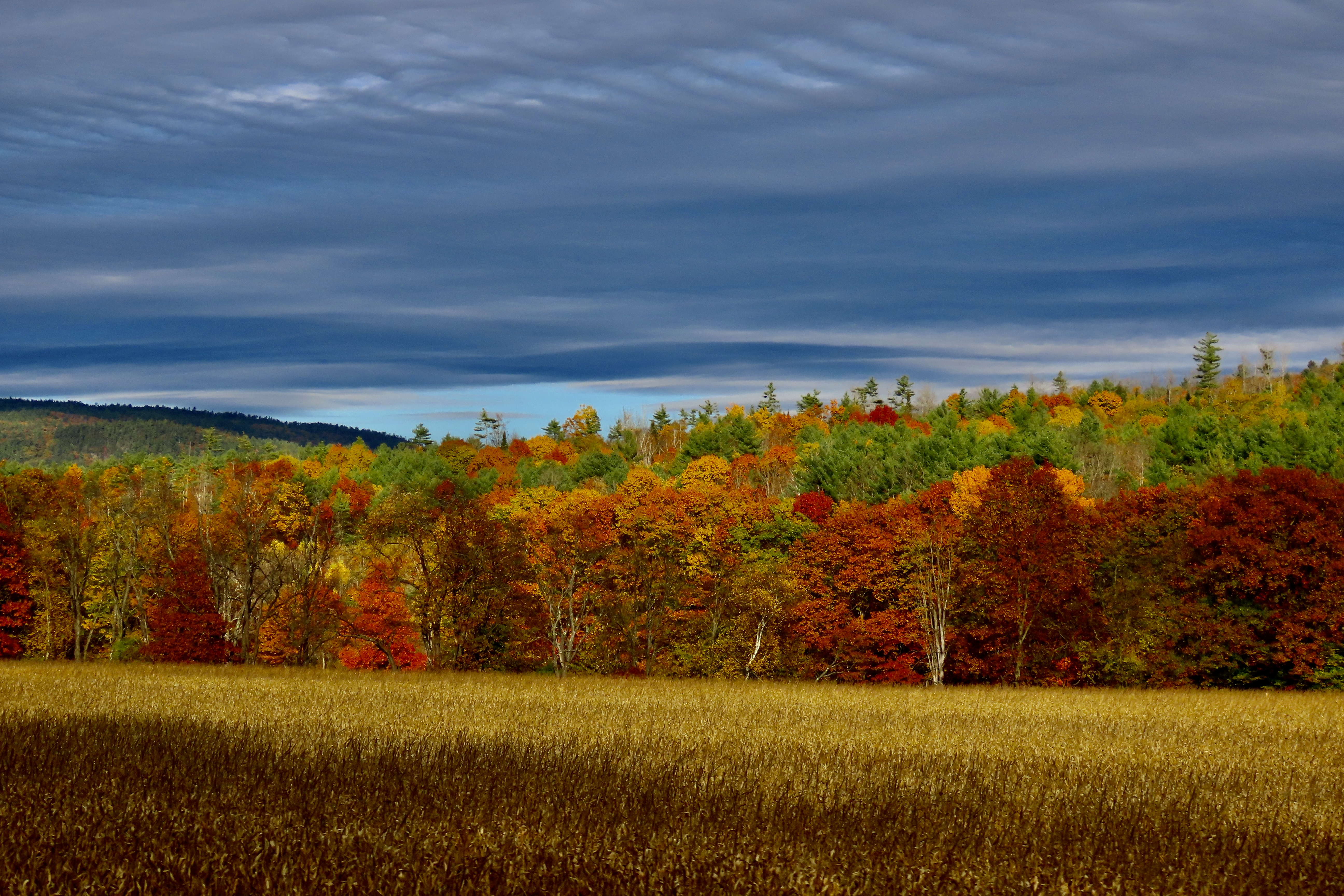
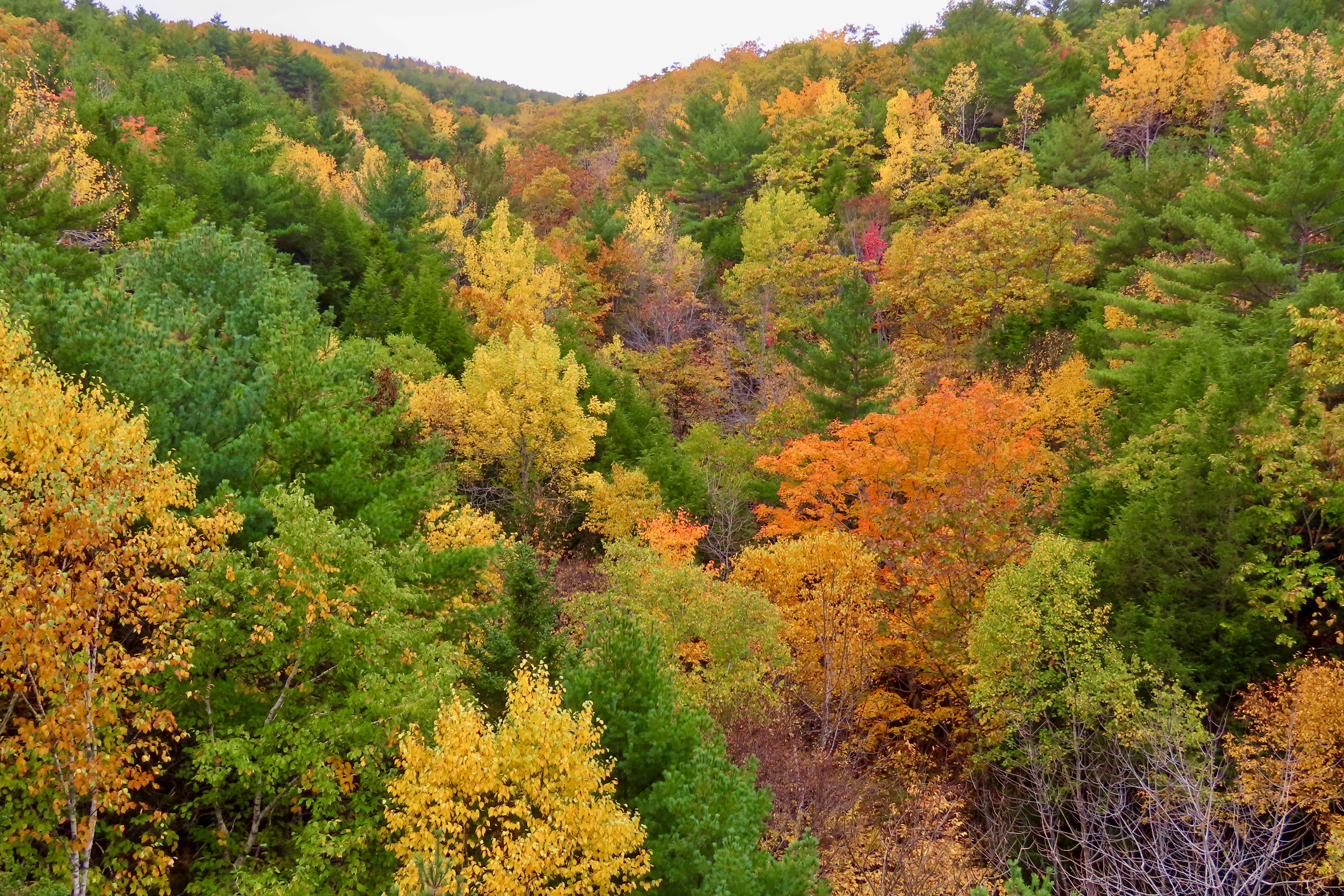
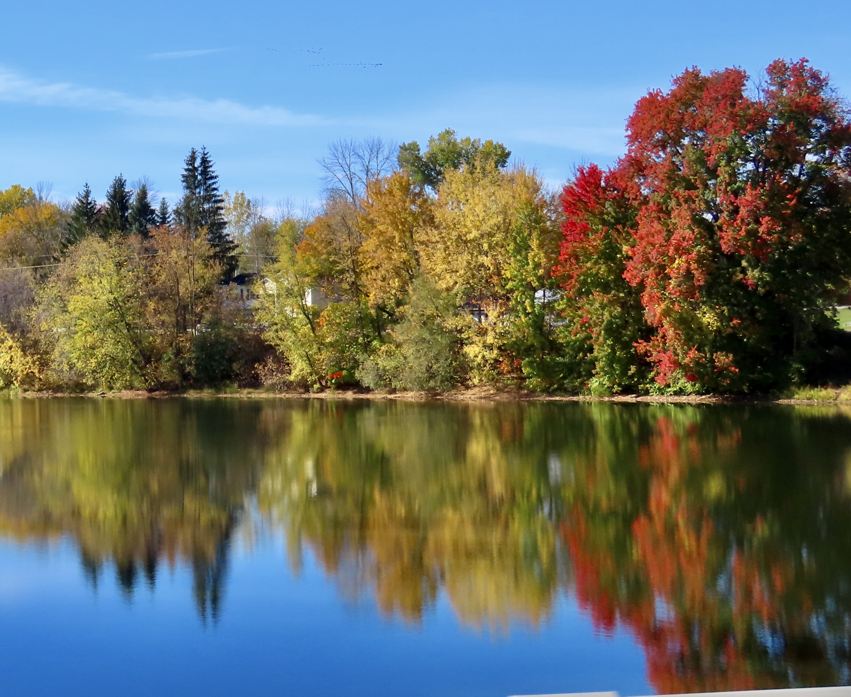
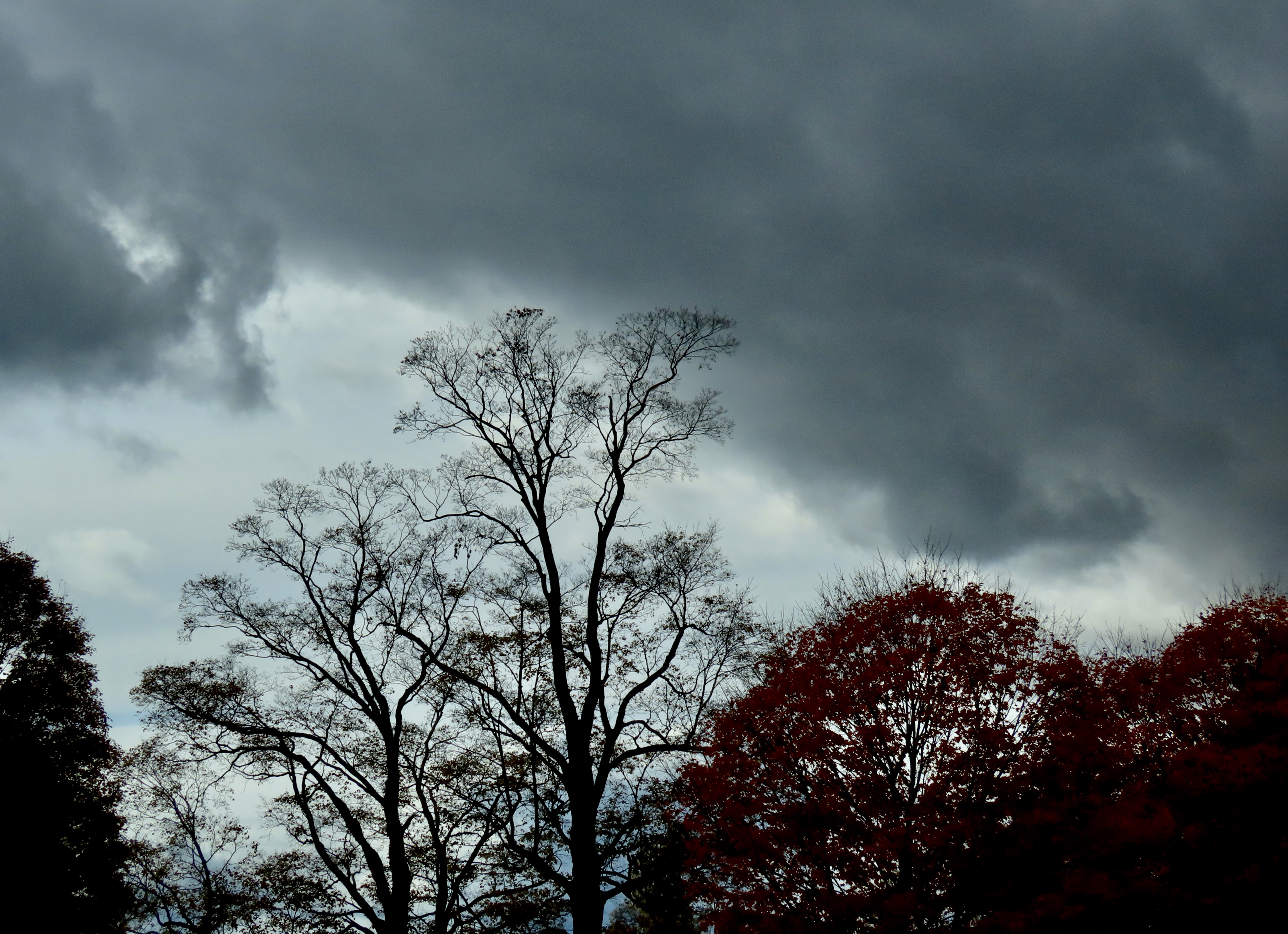
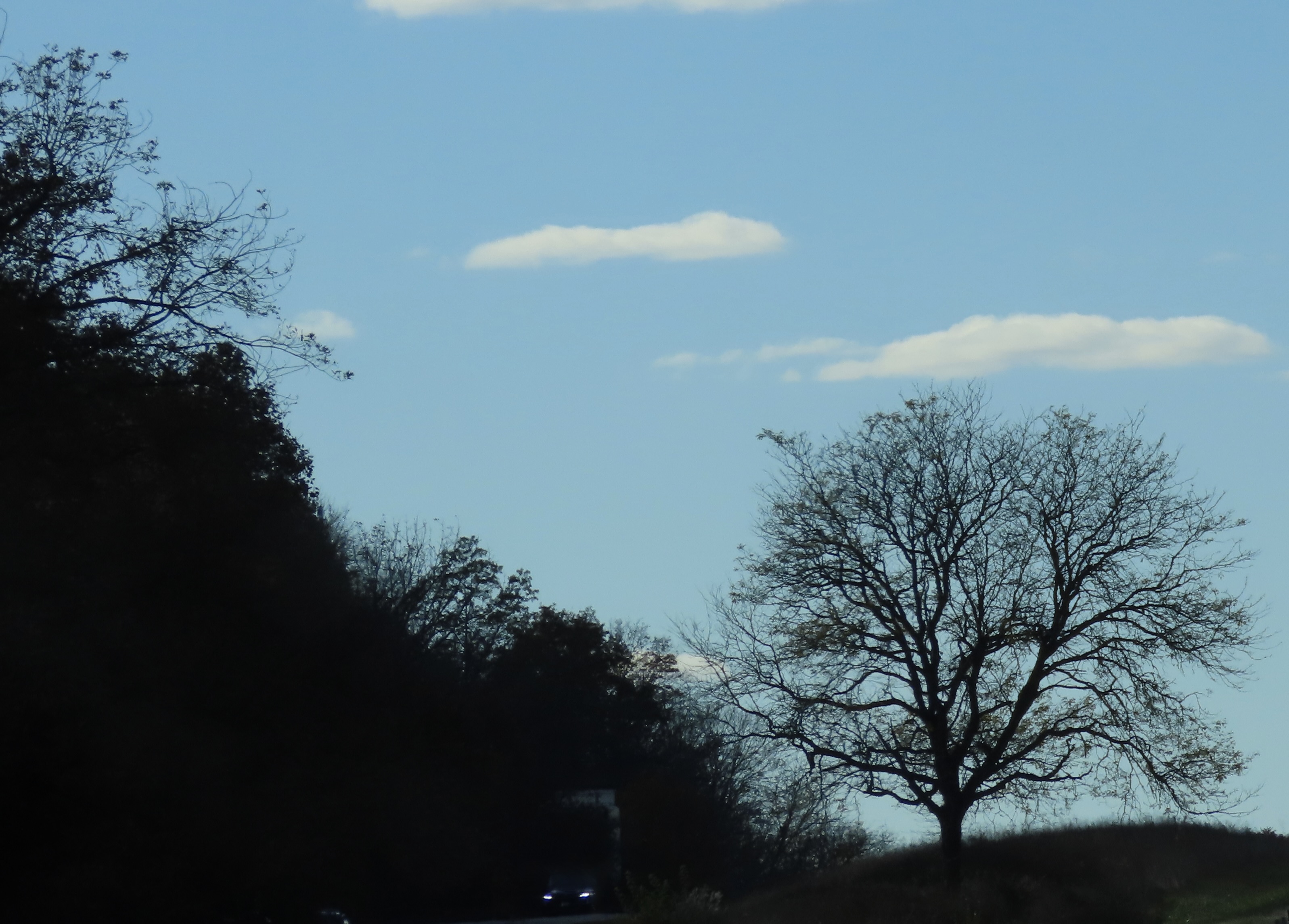
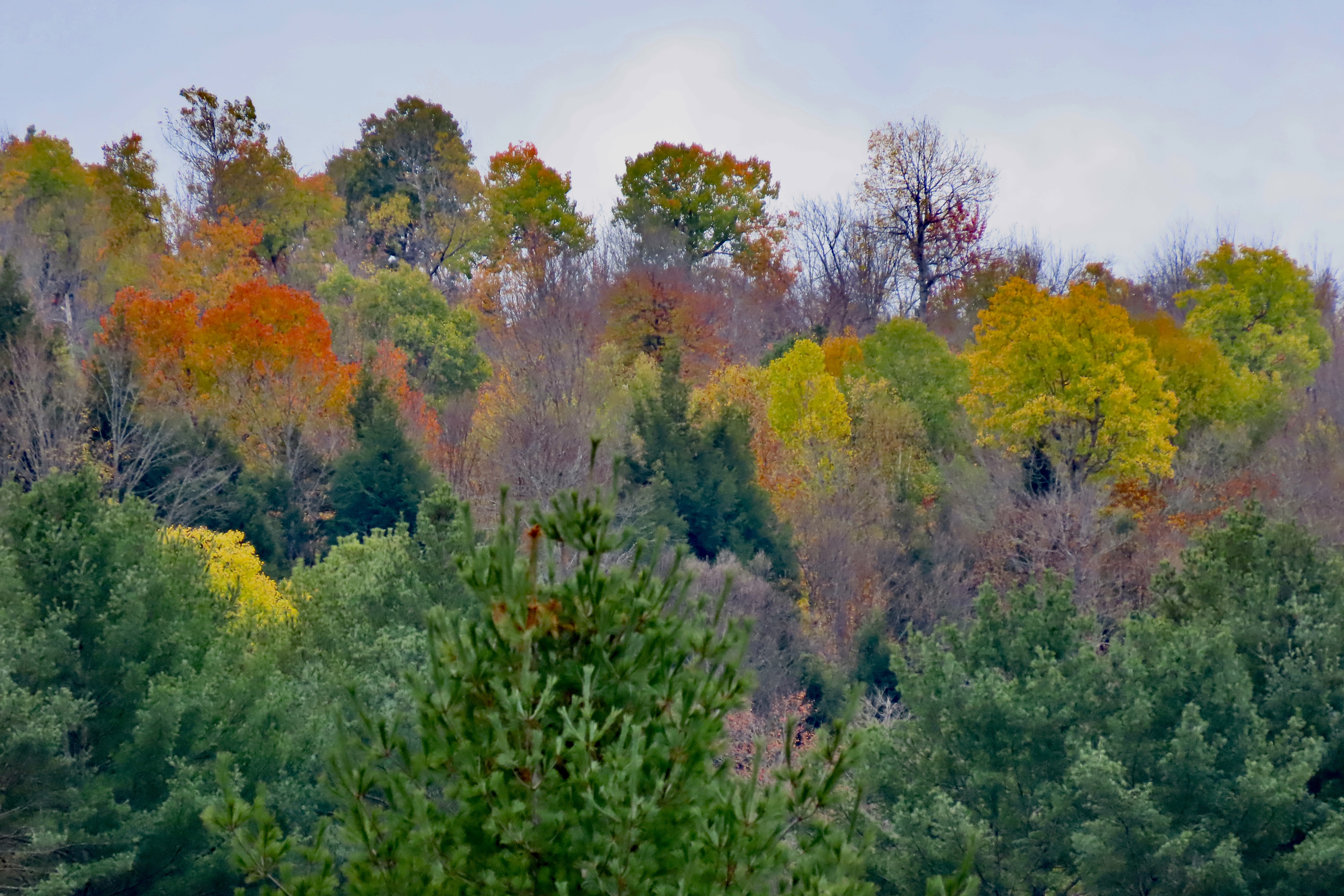
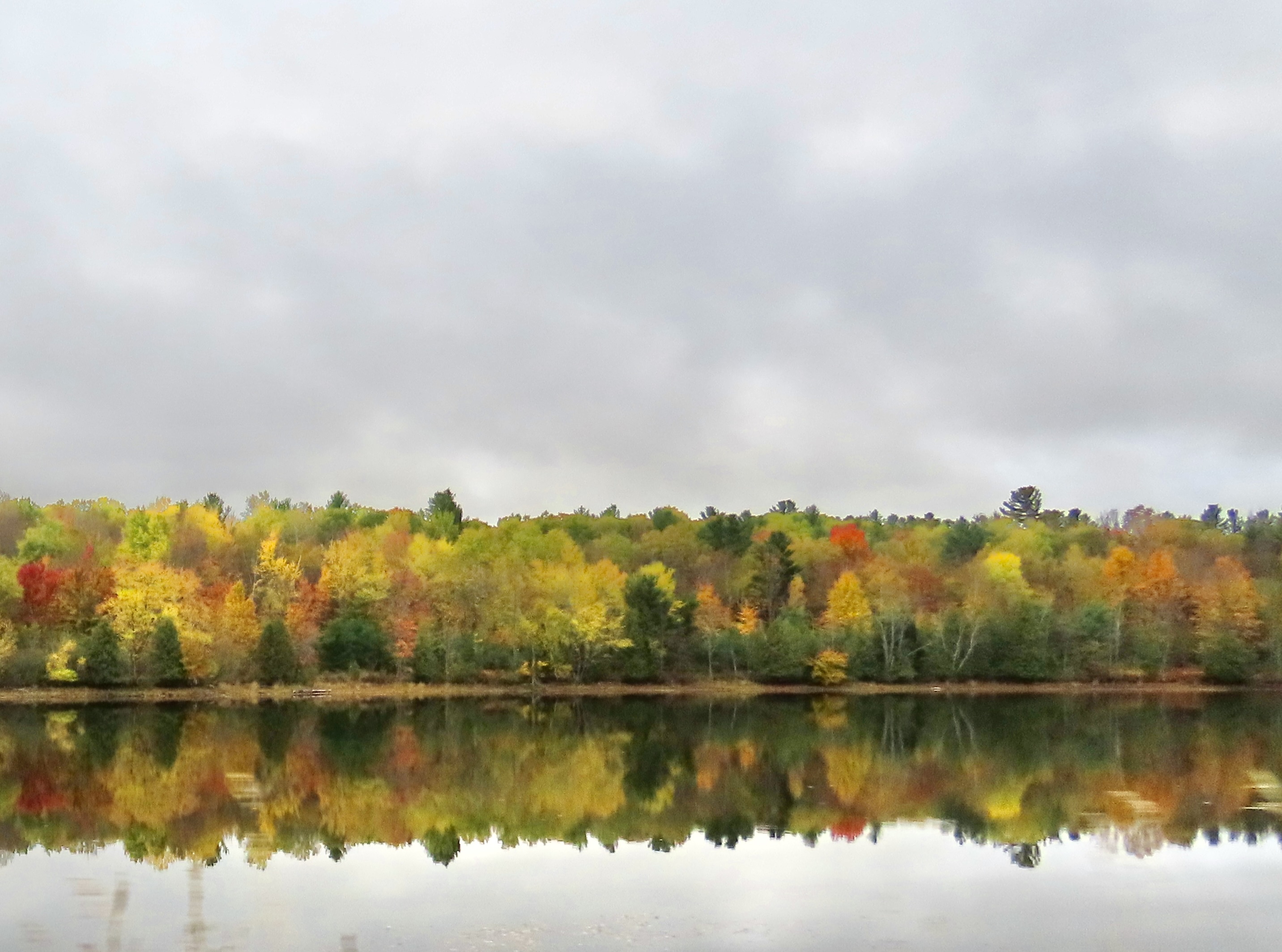
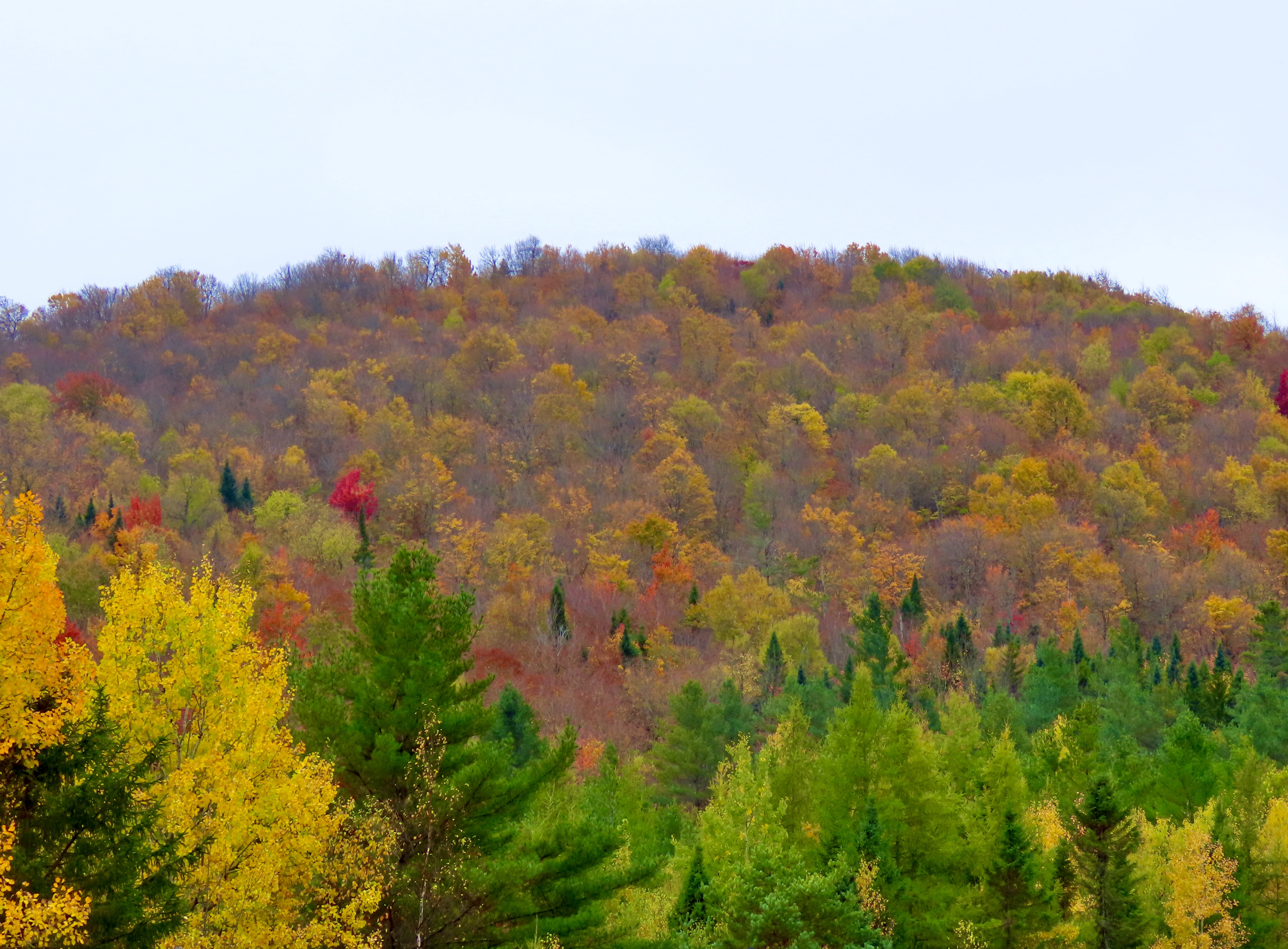
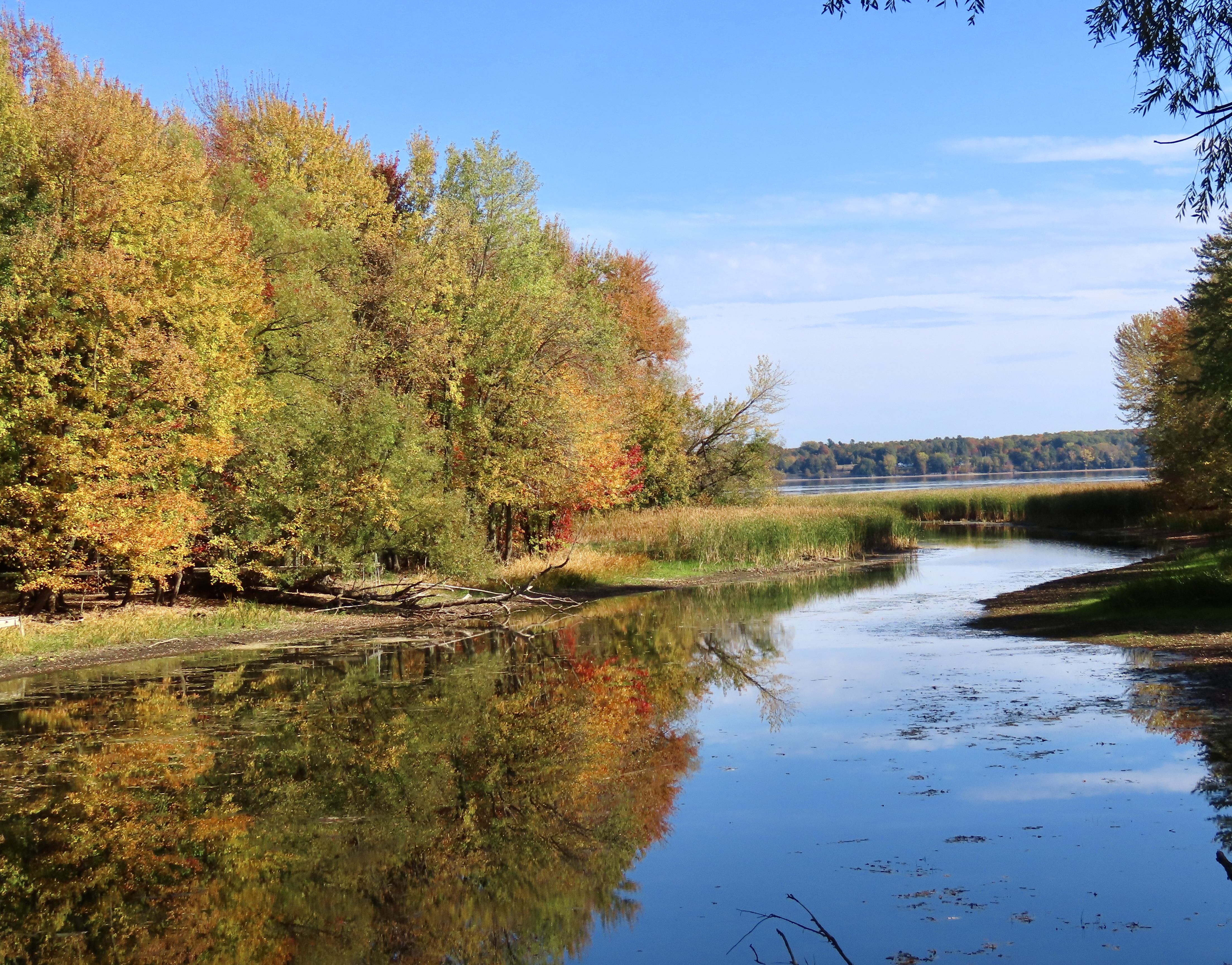
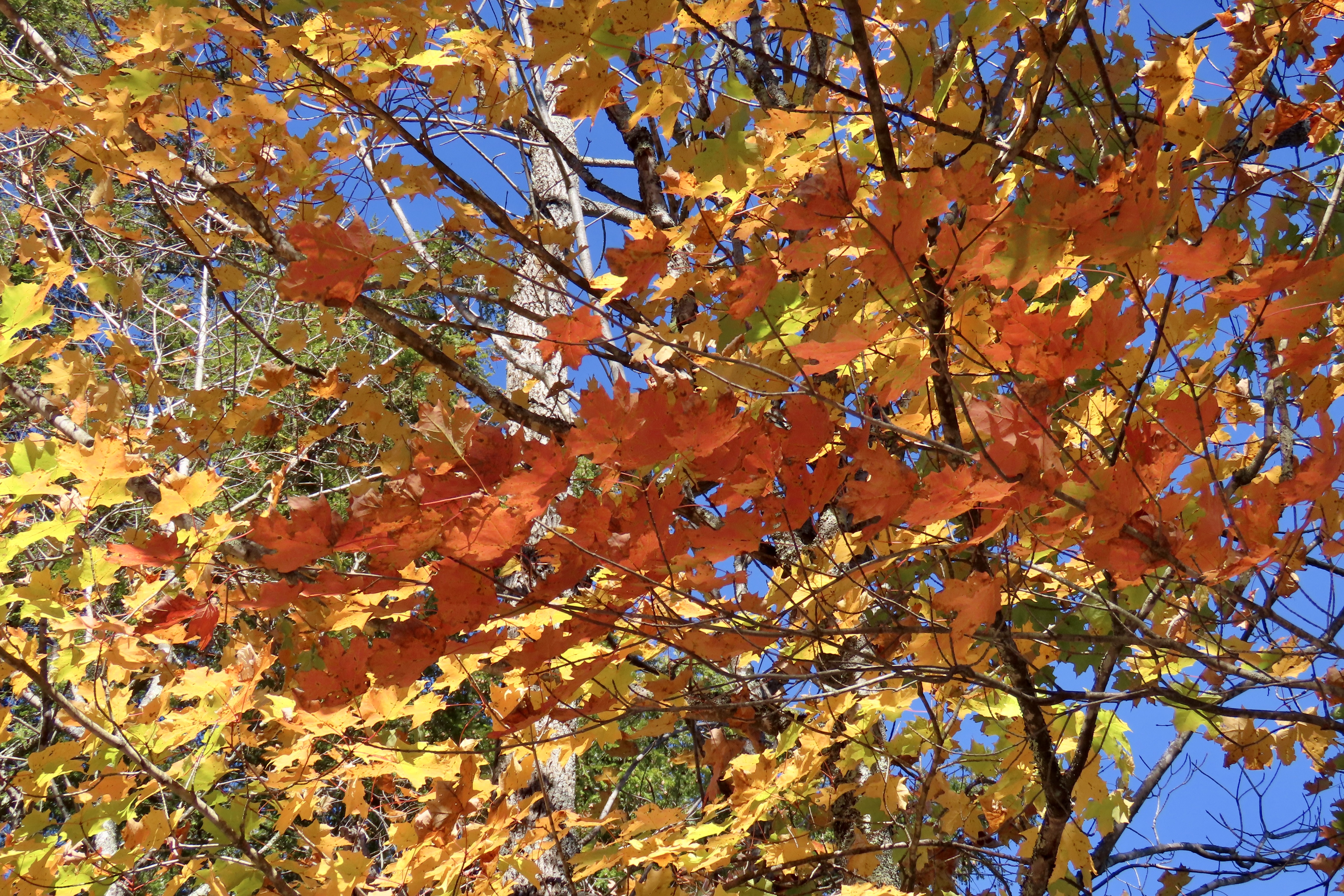
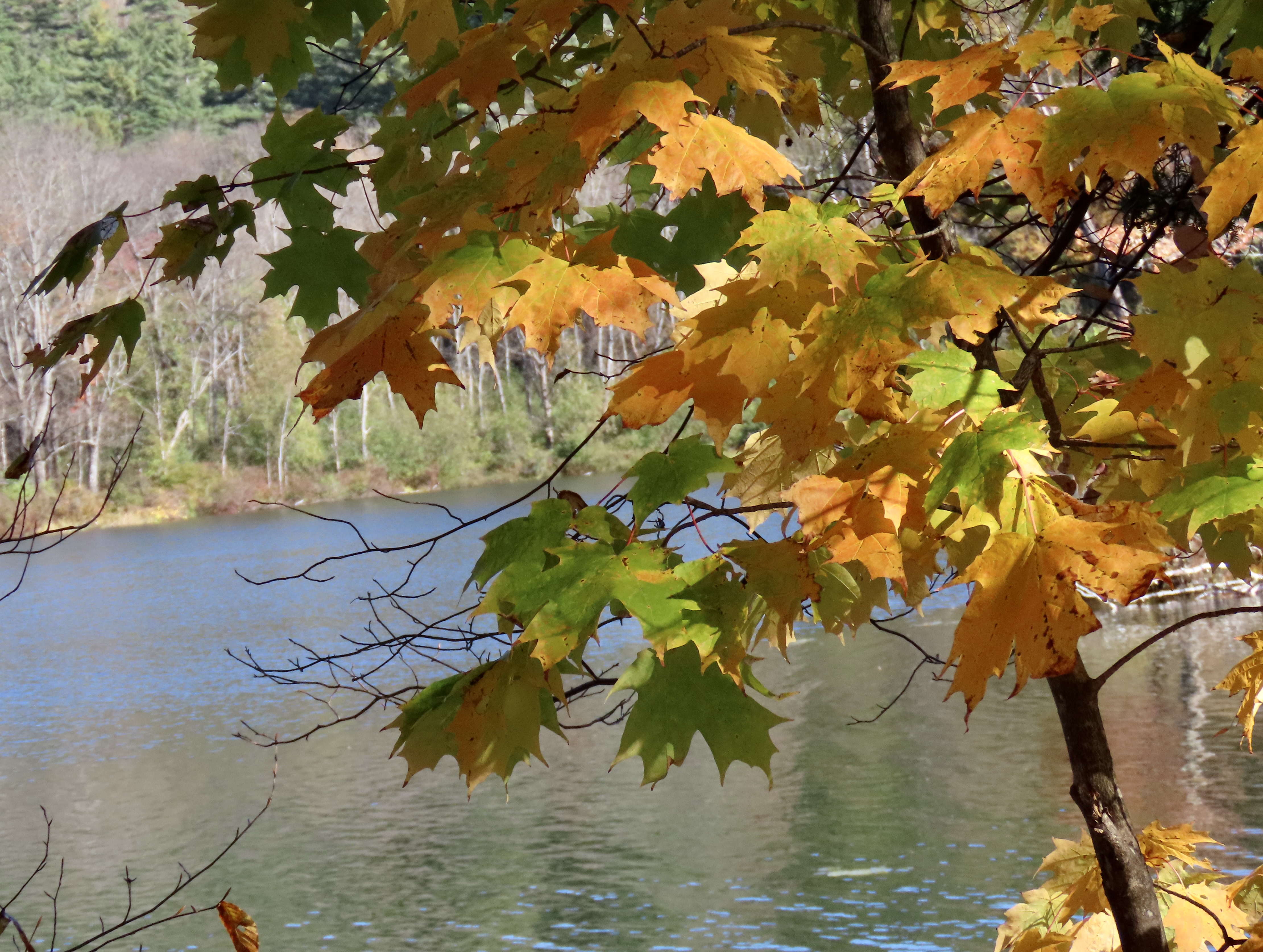
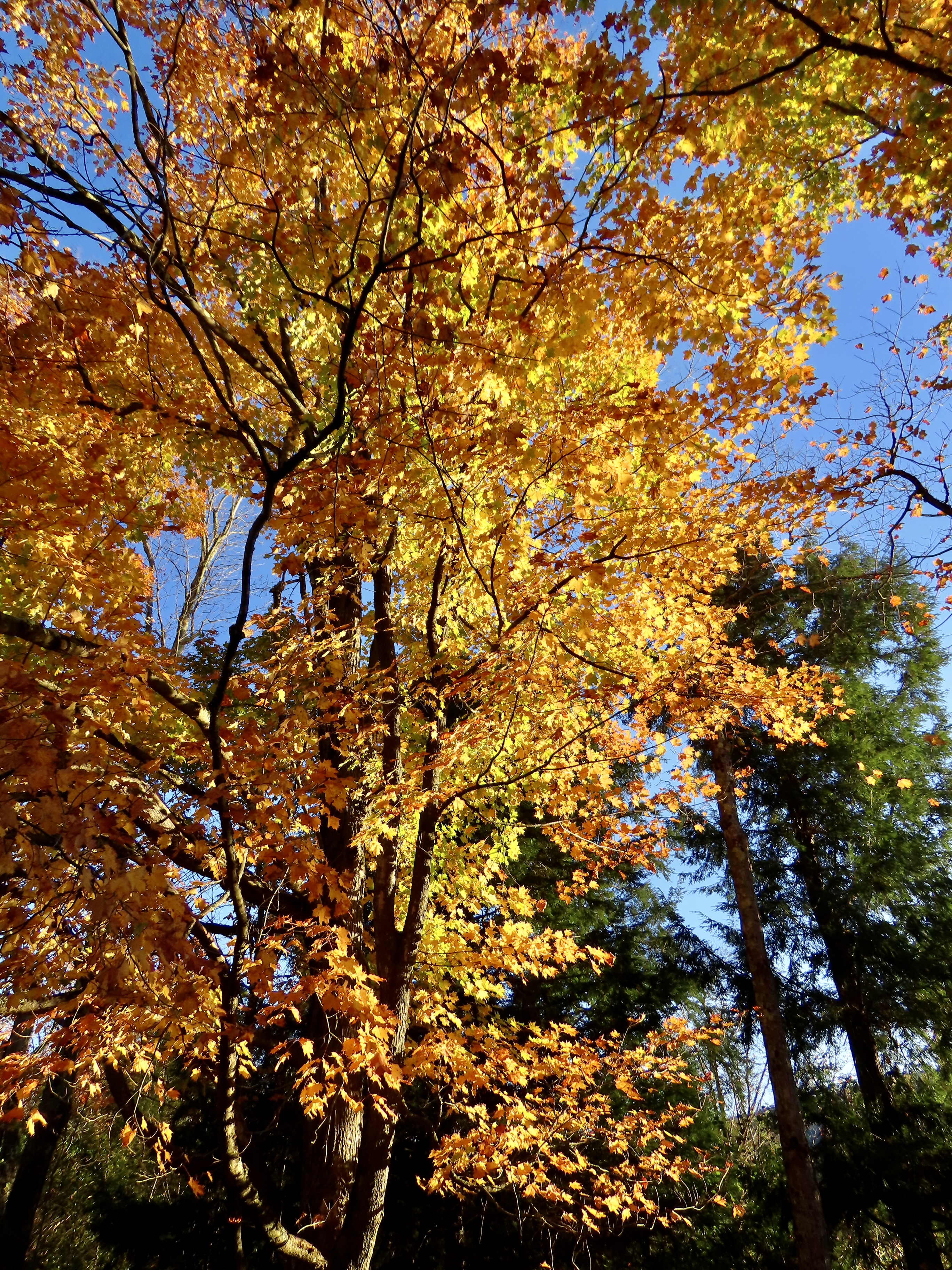
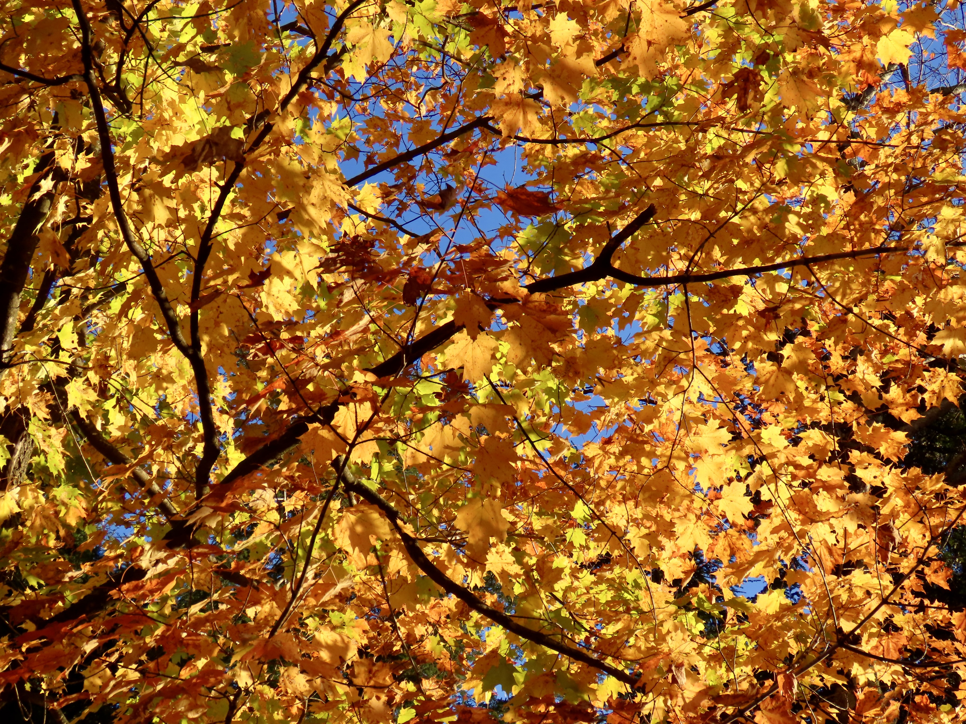
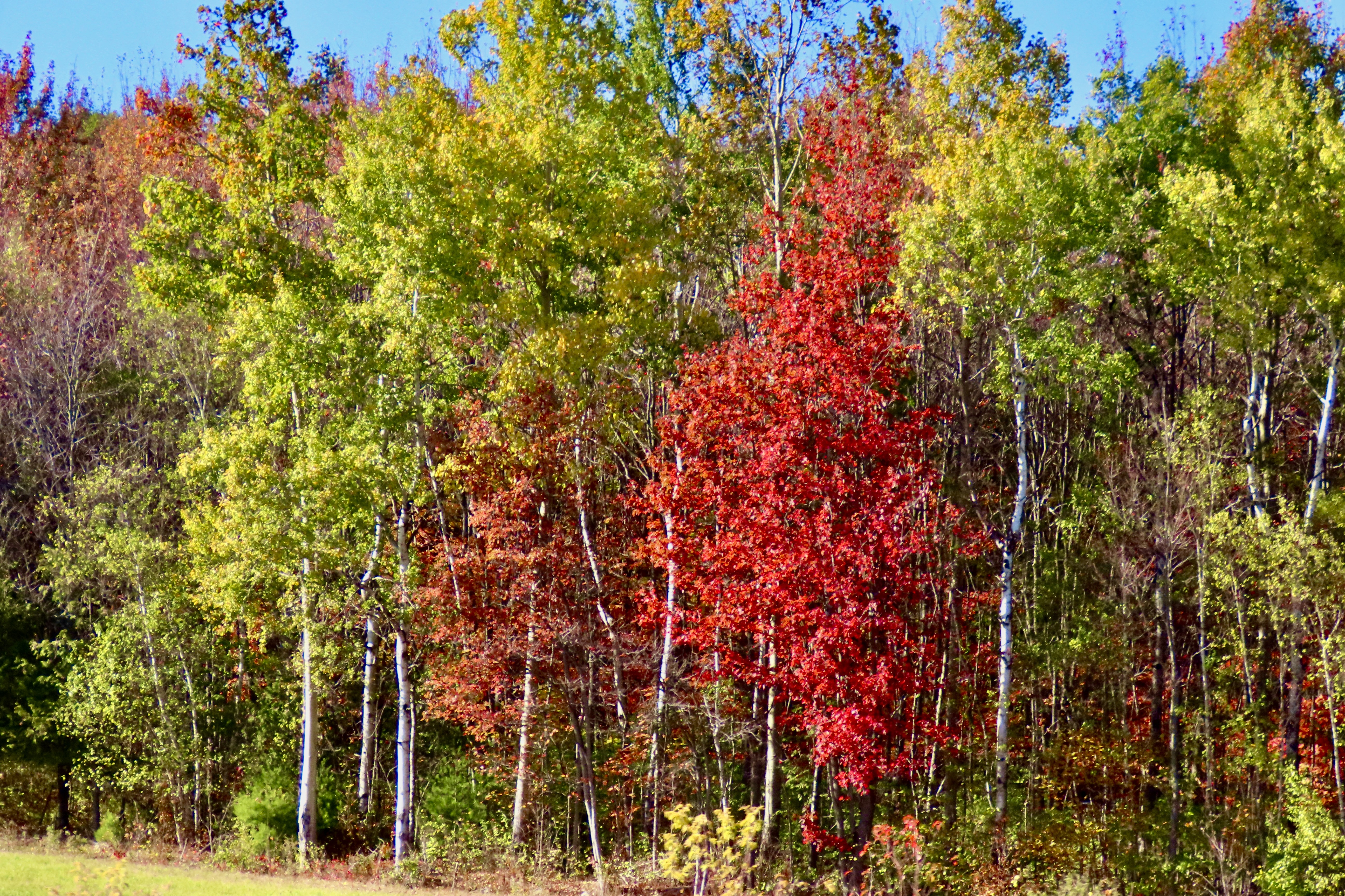
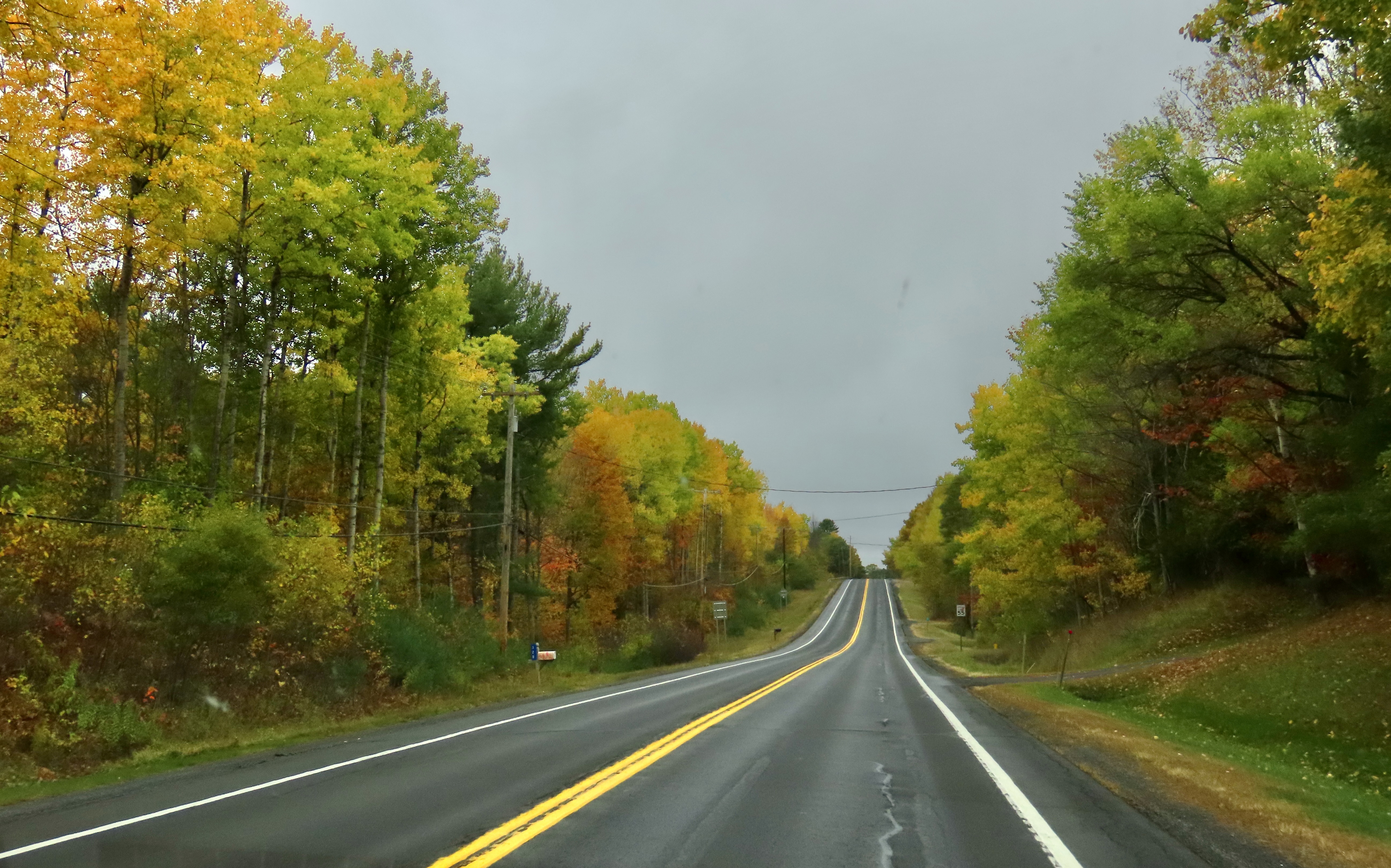
We pulled off at Camden Hills State Park to take advantage of its restrooms and were treated to our last view of fall color on the Maine Coast— and what a view it was!The trees were just reaching their peak.Reds, oranges, and yellows were all present.Providing opportunities for close ups of the orange, yellow and…Red maple leaves.Then it was time to begin our zip across New England and New York back to Virginia. We continued to be treated to fall colors.And a hot pink garage that was attached to a hot pink house.Stone fences reminded me of Robert Frost’s poem, Mending Walls.Small lakes provided opportunities for reflection shots.While cloudy skies served to promote silhouettes.Driving down to see our friend Betsy in New York gave us views of the Pocono Mountain Range.I’ll conclude today’s post and this series on New England leaf peeping with a photo of Peggy and me taken by Betsy at her home in Red Hook, New York. We hope you have enjoyed the tour. Thanks for coming along!Turkey Dressing for Thanksgiving Dinner.
Happy Thanksgiving from Peggy and me! (This is one of 50 cards I have created for family and friends over the years.)
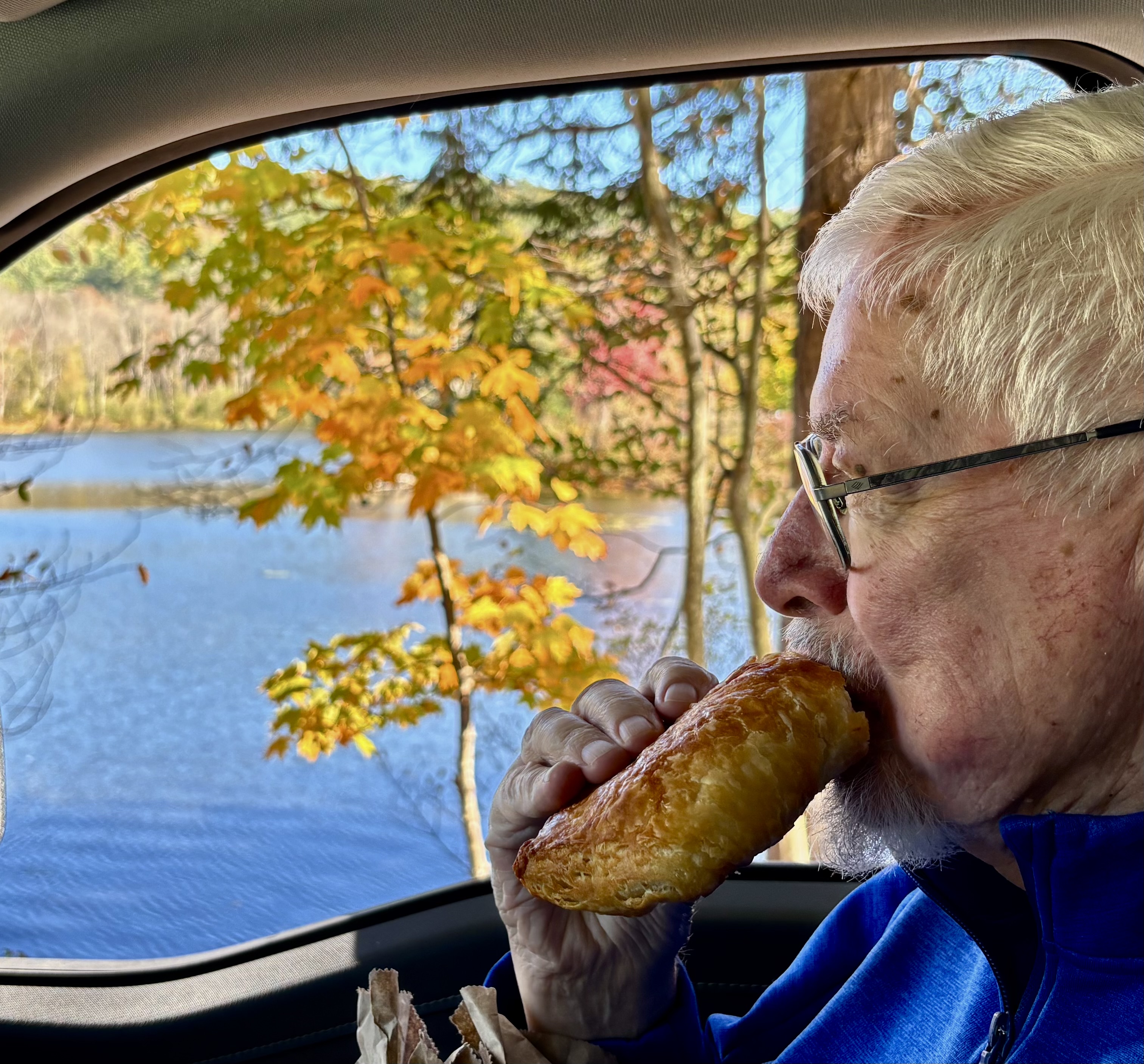
Whatever the sun was up to here, other than being the sun of course, its selective lighting created a colorful photo op that Peggy and I could not ignore— even though it involved fitting our long F-150 into a space it was clearly not designed for. “Good job!” I told Peggy. I was impressed. Had there been some park rangers around, they might have had another opinion. But given the government shutdown, none were to be found. Acadia National Park was packed with leaf-peepers and visitors were on their own. Our infraction was mild in comparison to some we saw.
This was our second time visiting Acadia during leaf peeping season. The first took place in 1999 when Peggy and I both took sabbaticals from our jobs to explore North America with a focus on National Parks. (We visited 50.) Before reaching Maine, we had already been enjoying fall colors for three months! Our adventure had started in June with a drive up the Alaska Highway to Alaska. By the time we finished exploring the state, backpacking, and kayaking, it was mid-August. The leaves were already changing. We followed the advent of fall down through western Canada and across the northern tier of midwestern states to Maine. It was color the whole way. And It continued for another 2000 miles as we traveled down the Appalachian chain of mountains into Georgia.
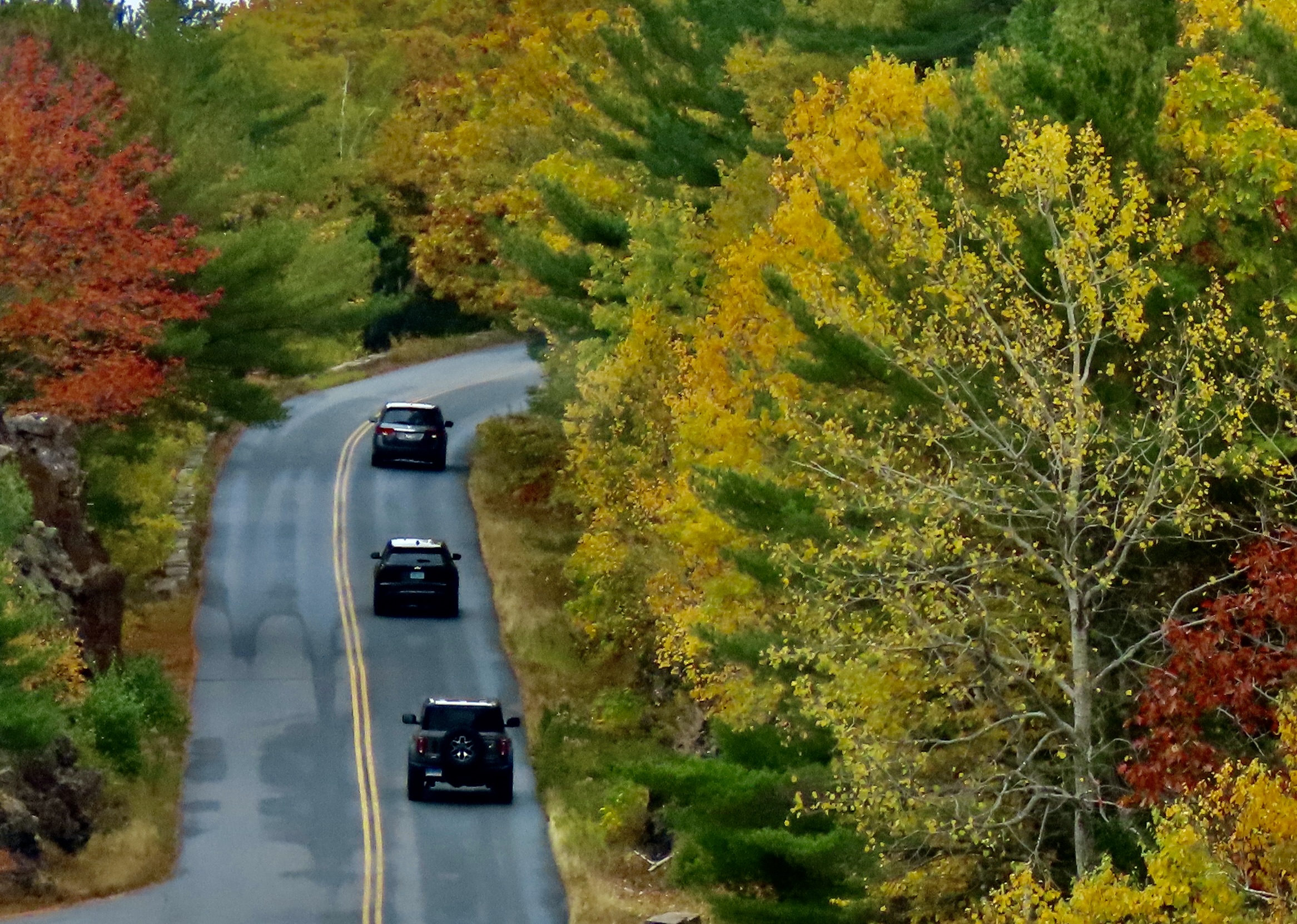
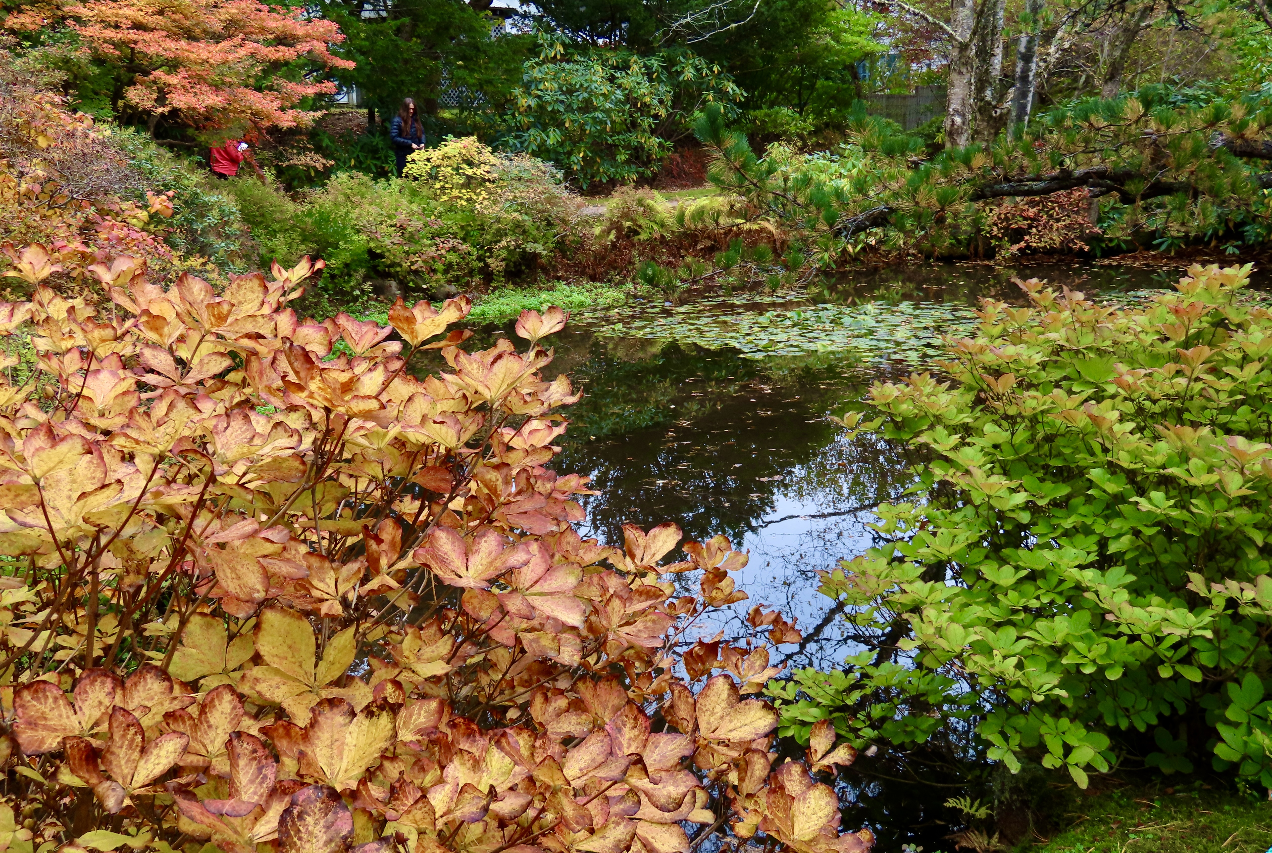
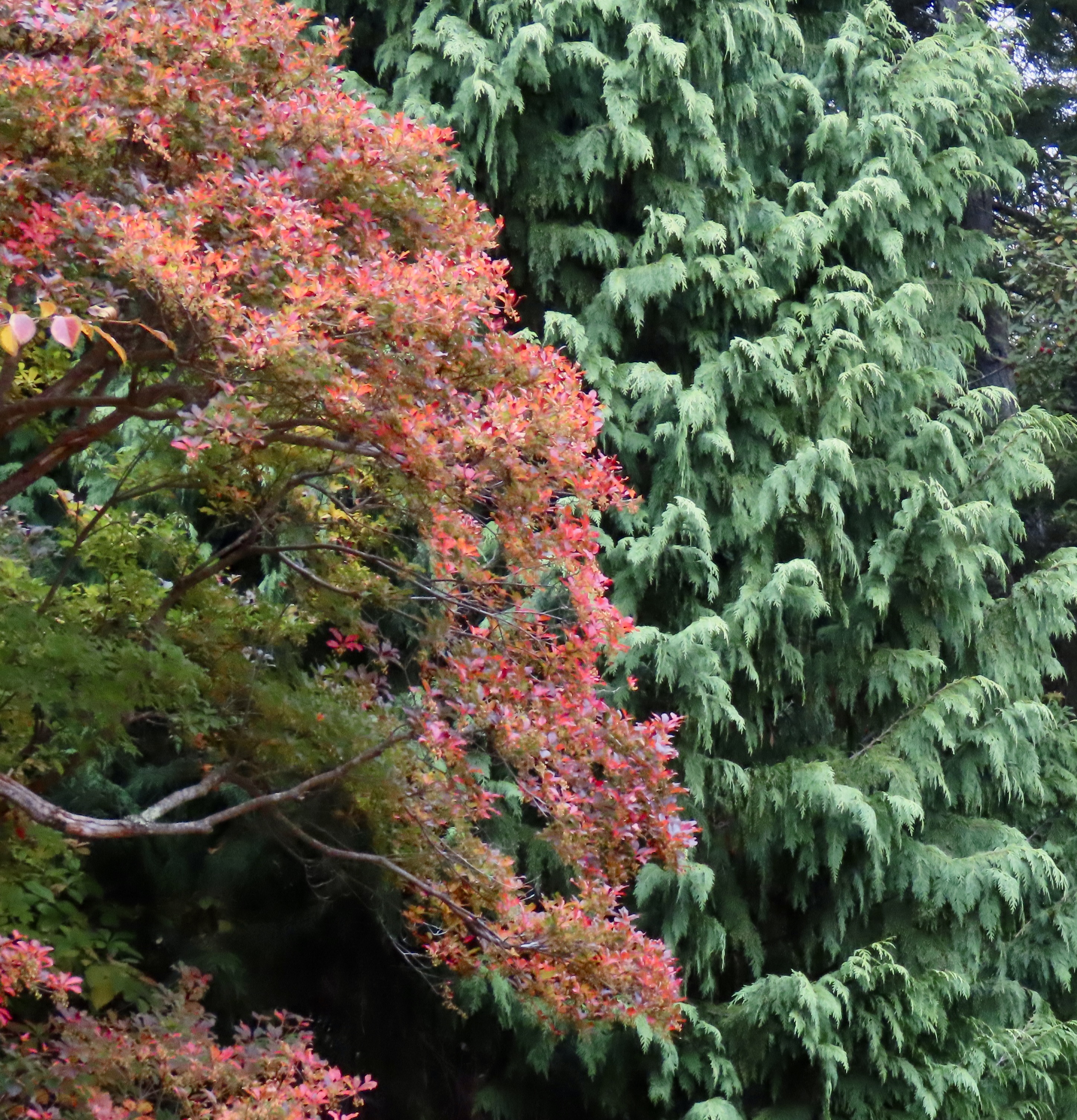
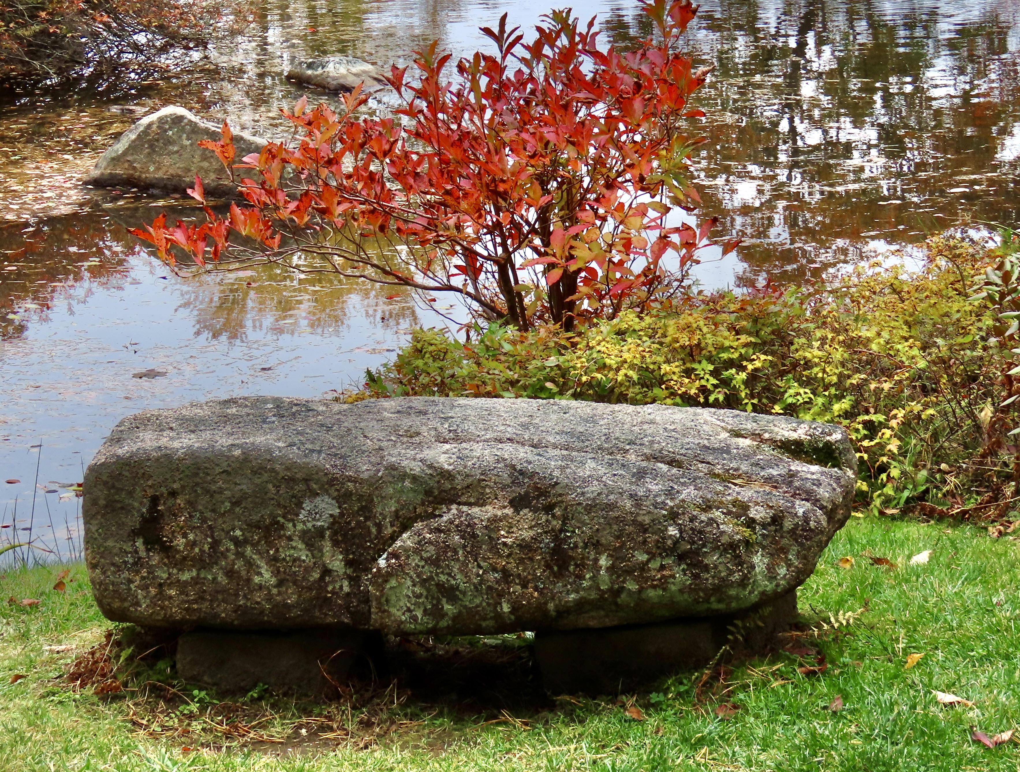
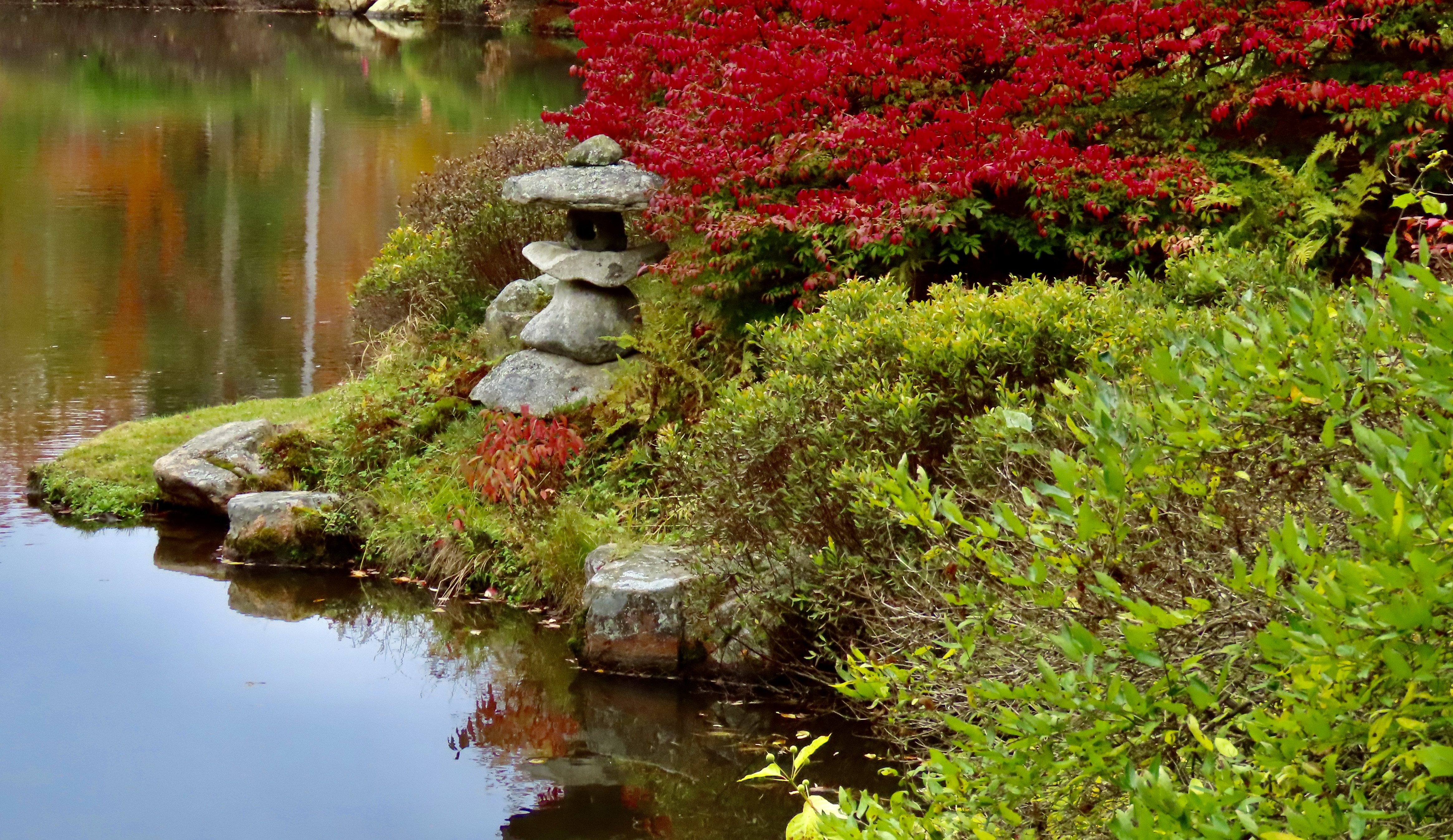
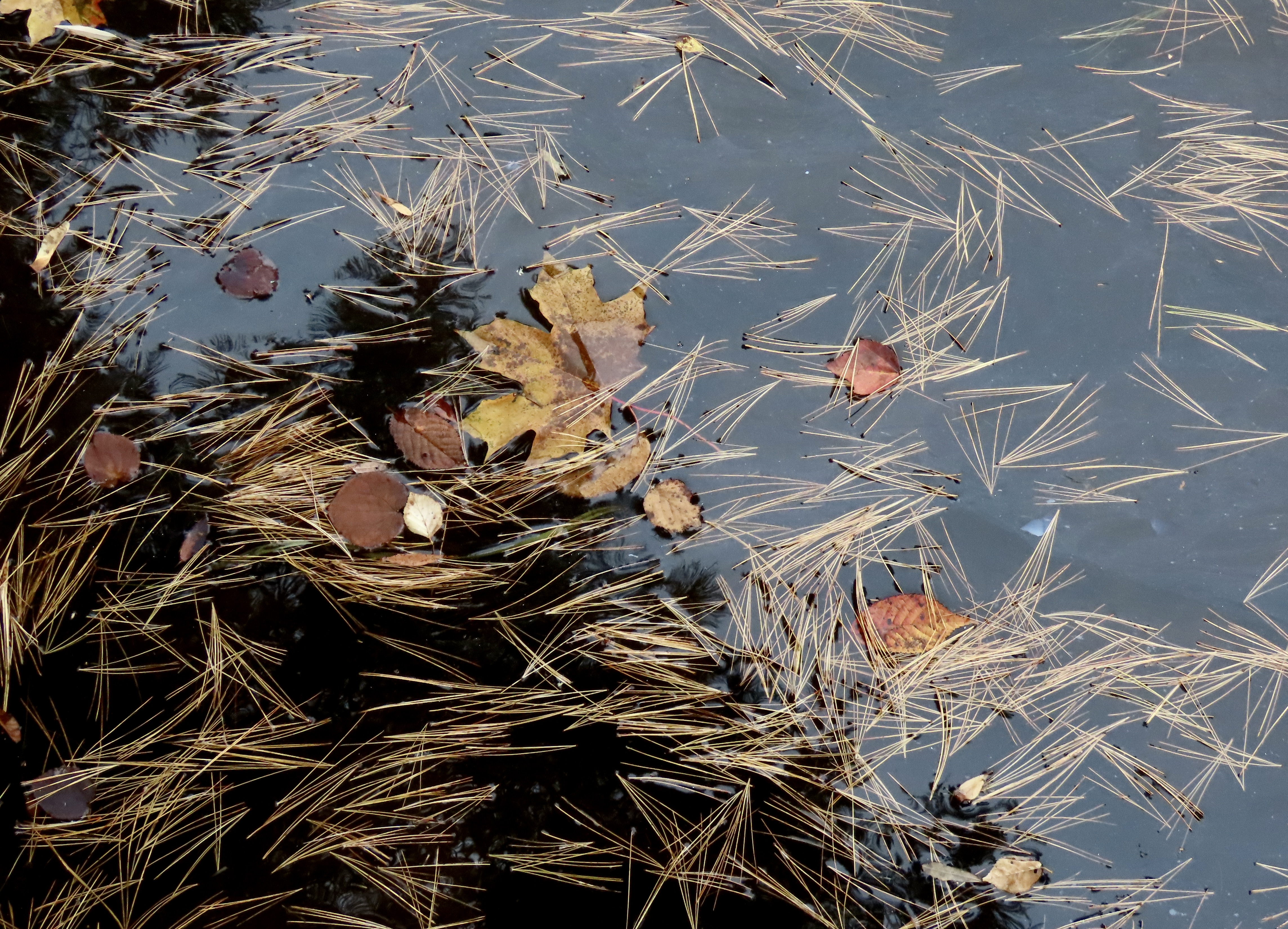
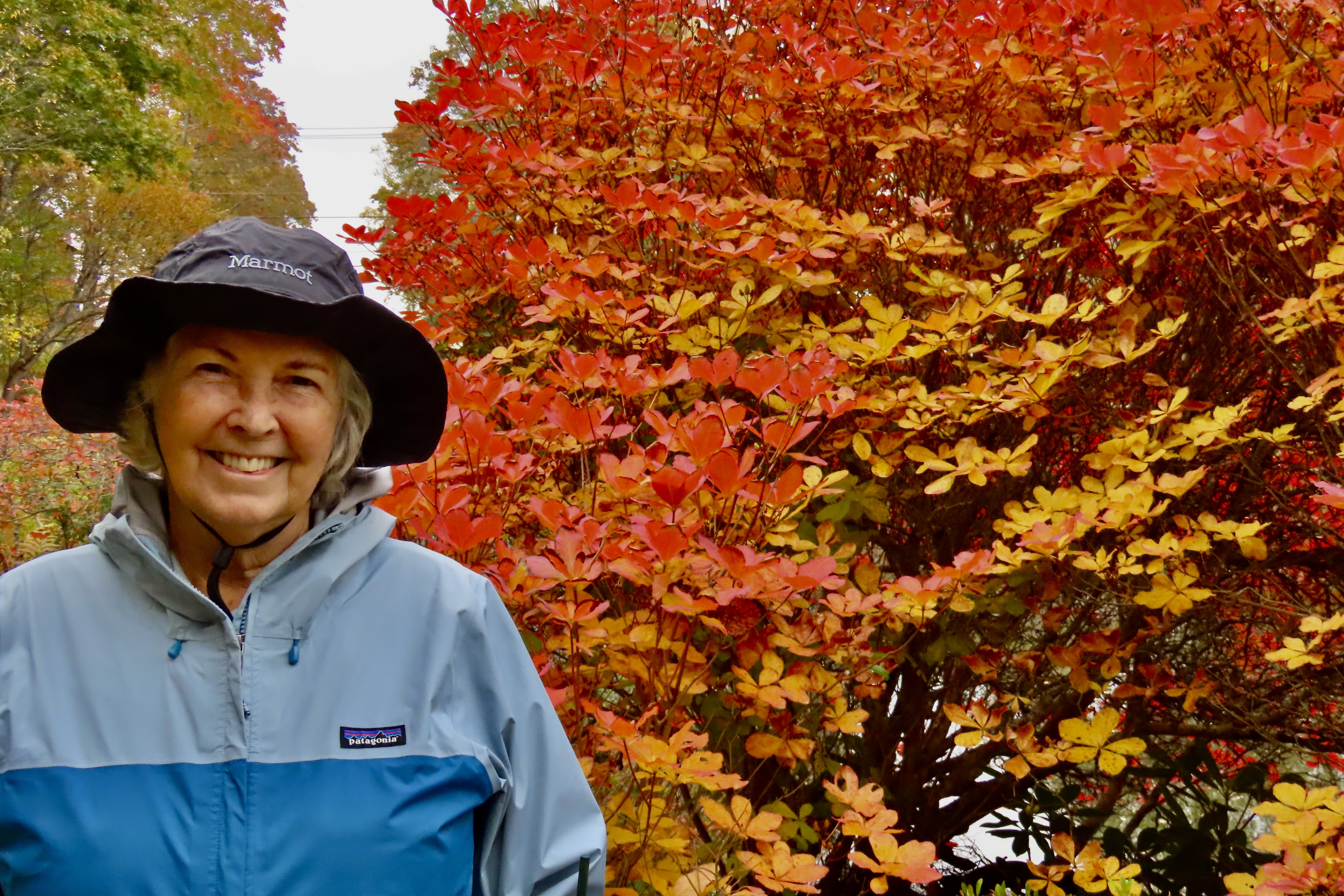
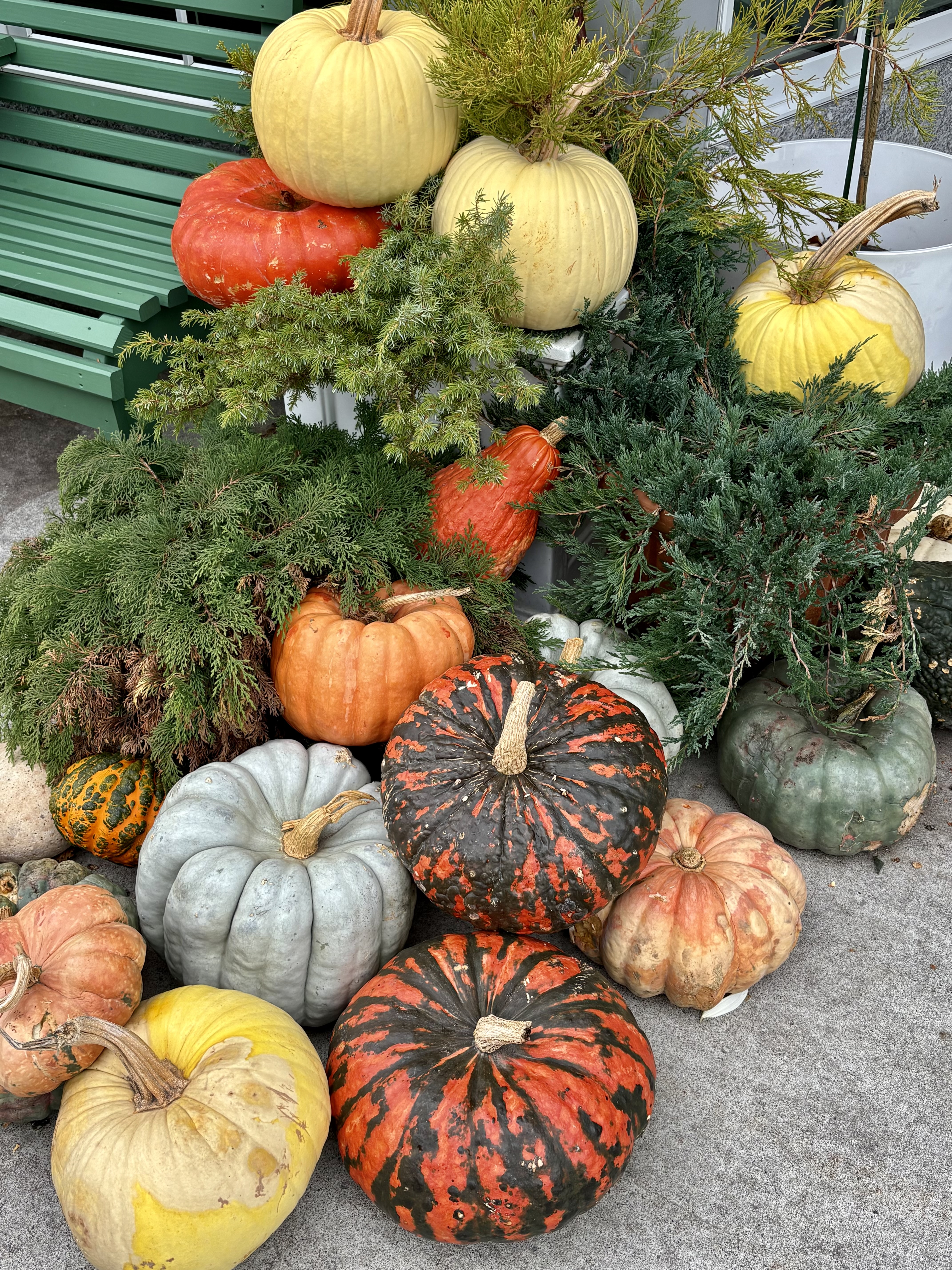
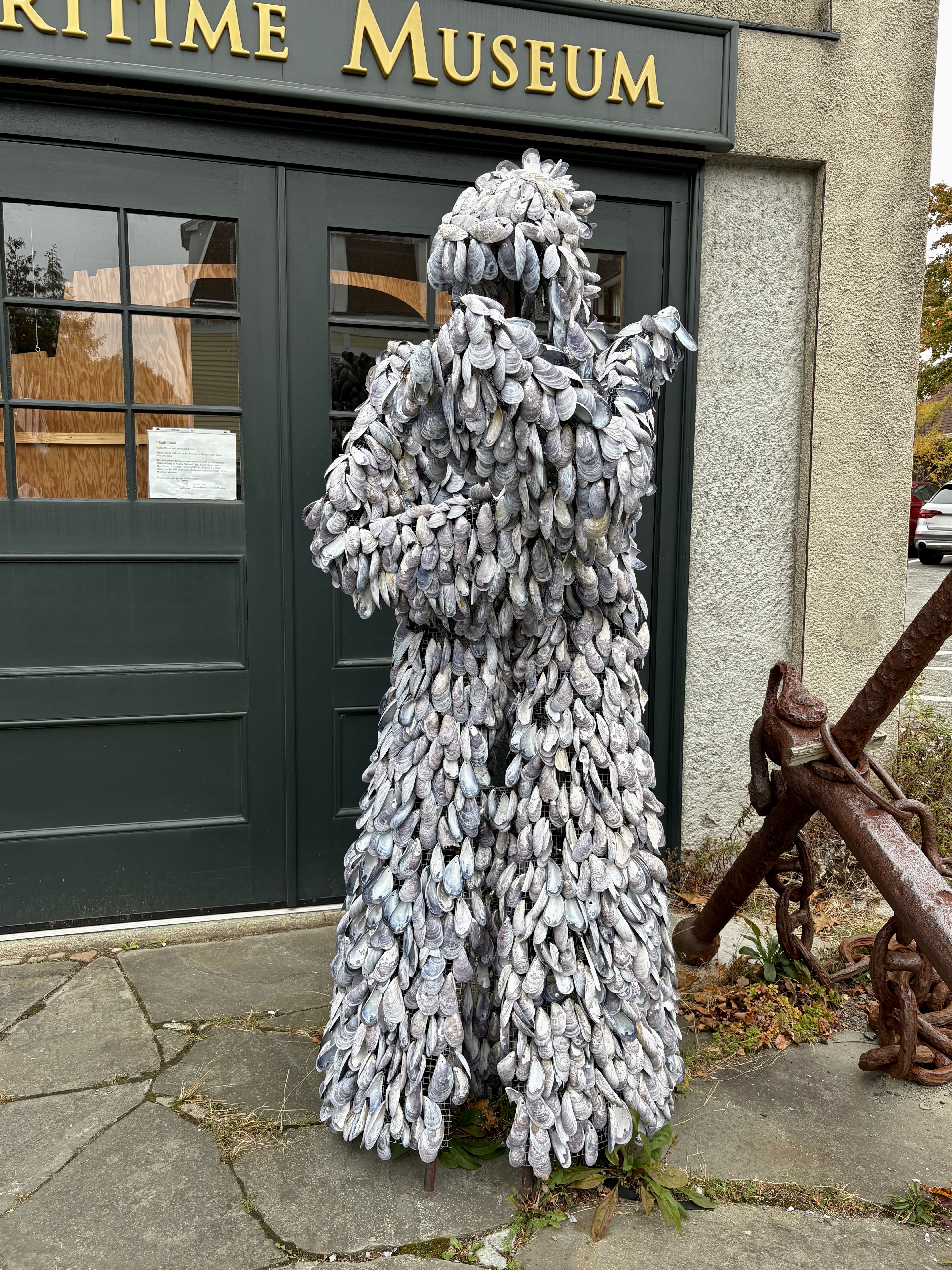
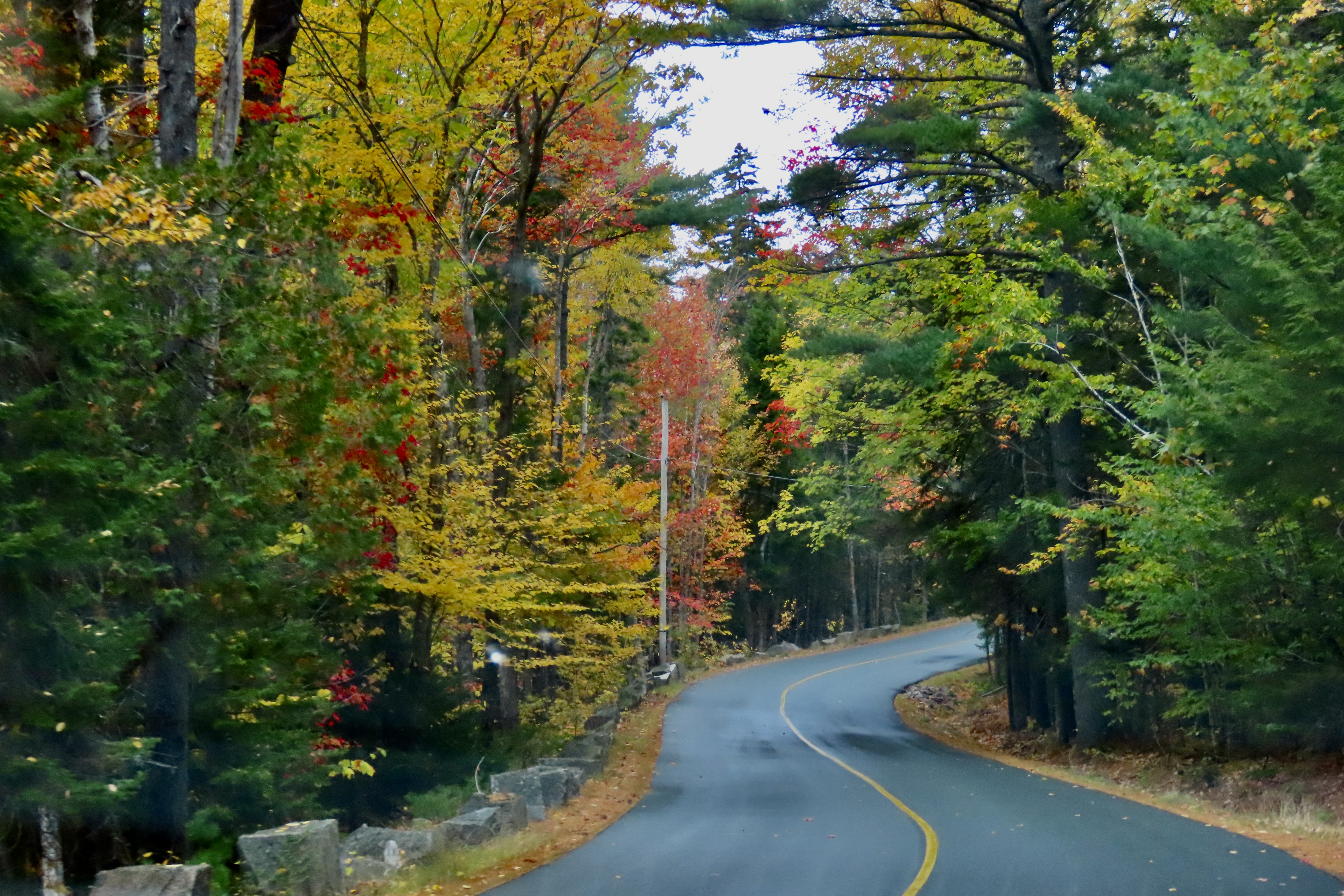
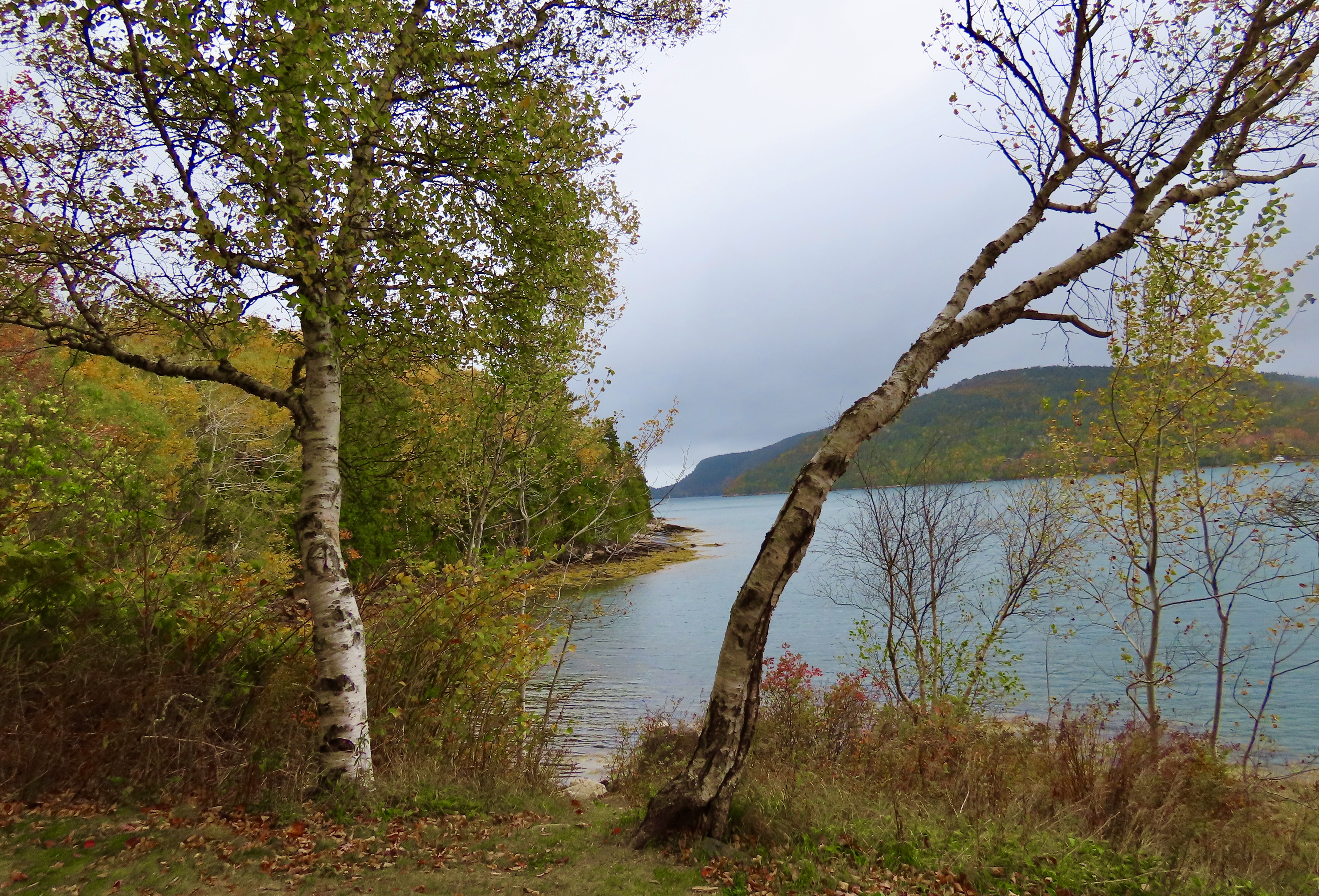
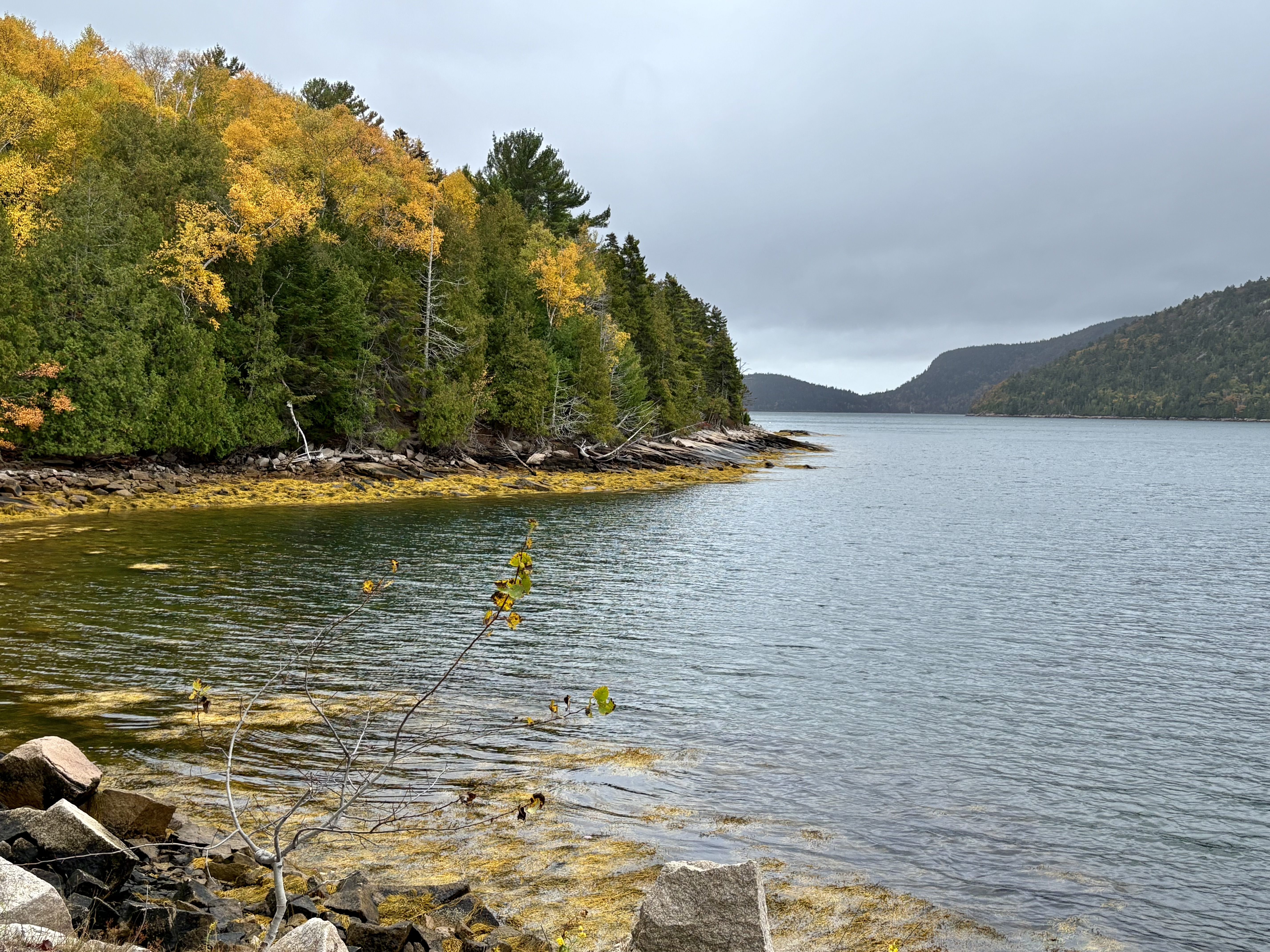
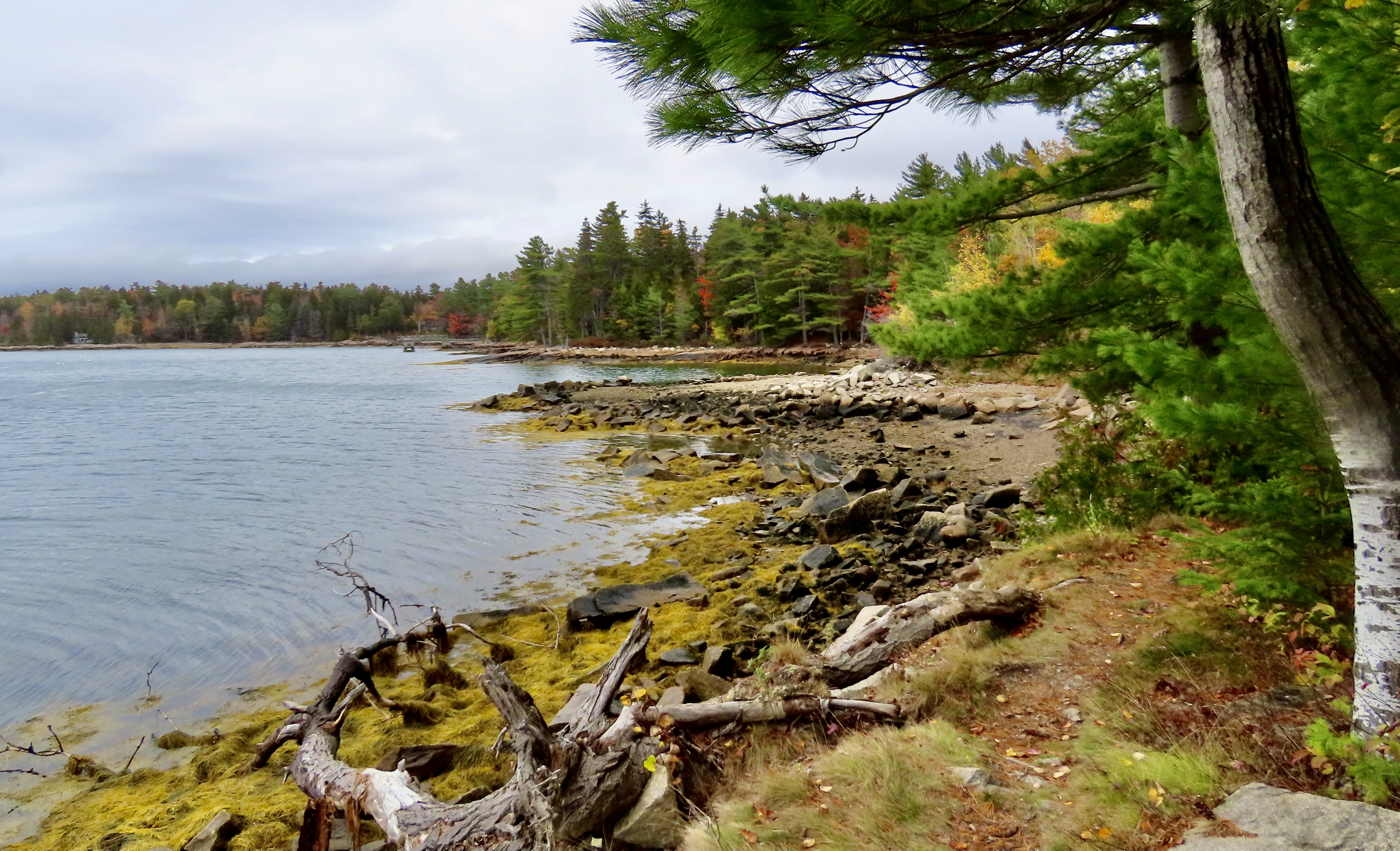
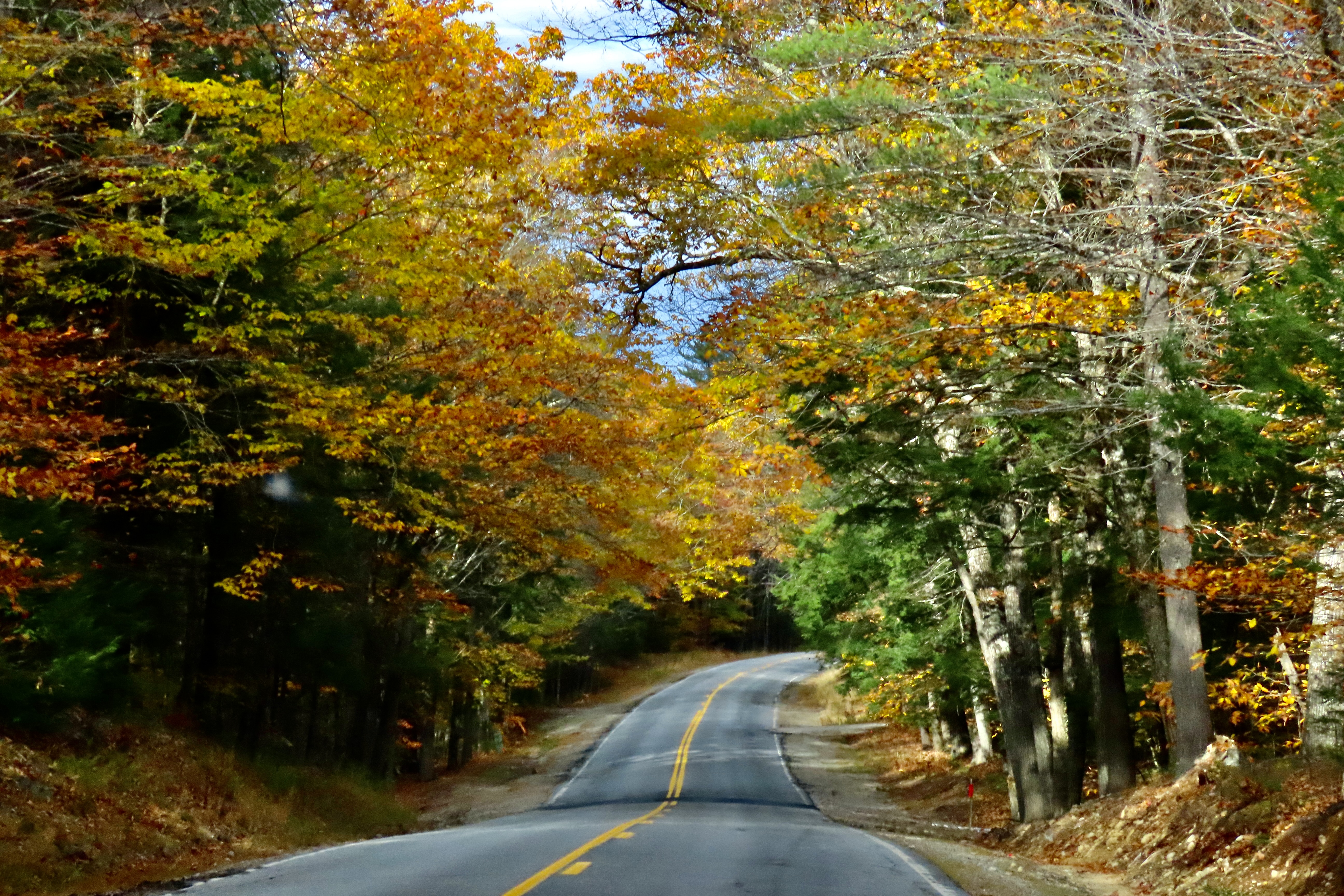
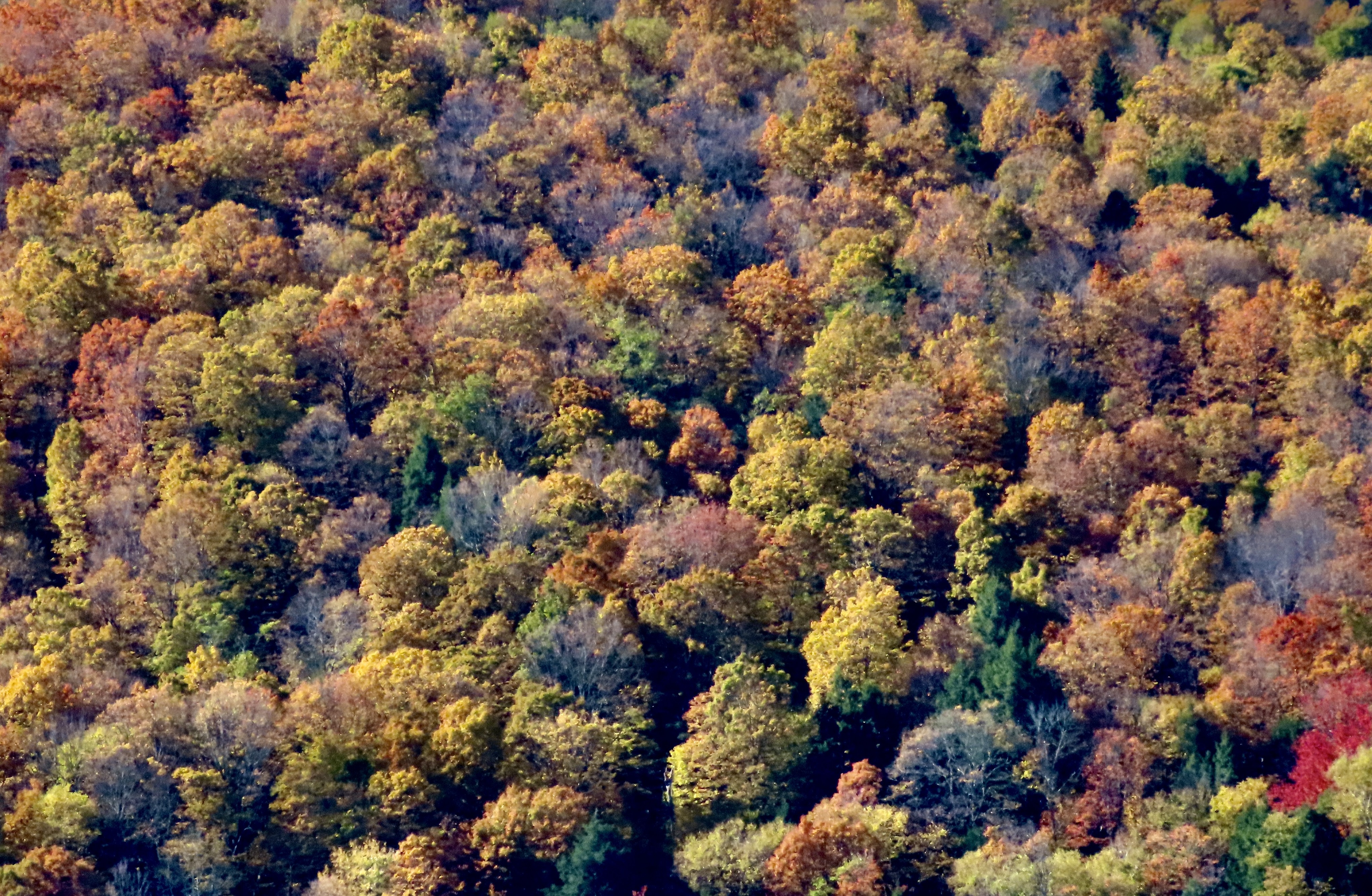
I concluded my last post with a photo of what we considered the most colorful section of the park. This was from the same area. The combination of being close to the trees and bright sunlight made the colors pop out.With distance and lack of sun, the colors faded in this view across Jordan Pond…And blended, like an impressionistic painting. Still beautiful.Roads continued to provide the opportunity to get up close and personal with the fall foliage, however— and traffic.The roads were full. Wherever there was a pulloff meant to feature the beauty of the park, it was packed. Even large parking areas were filled to the brim with people fighting to get into spaces whenever they opened up. While Peggy and I normally avoid national parks during peak season, we knew there was no option when peak-season is defined by peep-season. Still, it was a bit much for us. We headed for roads just outside of the park where the views were similar but traffic was minimal.We came on a small local park near Northeast Harbor named the Asticou Azalea Garden that demanded our attention. It was too late for the azaleas, but the fall colors made up for it…Cascading down…Providing a backdrop for a large granite boulder…And hosting an Oriental sculpture with brilliant red.The pond provided an interesting perspective on fallen leaves and pine needles floating on water while being divided between light and darkPeggy got into the act by providing an opportunity for a final photo of the garden’s colors.Having worked up an appetite, we headed into the nearby town of Northeast Harbor for lunch. It was busy shutting down for winter. Our waitress told us it was the restaurant’s last day for the year. After lunch, Peggy captured this colorful collection of pumpkins and squash on the sidewalk outside with her iPhone. Few things say ‘fall’ better.She was also attracted by a unique sculpture made out of shells in front of the Maritime Museum. It made us think of Davy Jones Locker in Pirates of the Caribbean.We found a small road (Sergeant Drive) leading out of Northeast Harbor along Somes Sound that fit our needs perfectly. It had all of the beauty of Acadia National Park with minimal traffic. Make that zero. We didn’t see any.It provided a number of views across the sound.Dark grey skies provided interesting silhouettes of the trees. I was particularly fascinated by the one on the right with its matching curves.Suminsby Park, created in memory of a beloved scoutmaster and selectman whose efforts helped preserve the area, provided us with closer views of Somes Sound and a peaceful stop.A golden, brown rockweed in the sound added to the fall colors.Looking down the sound from the park. Note the rockweed’s contribution.Looking up the sound.A wrap-up for today: Christmasy red and green leaves hovered above the memorial to Bob Suminsby. I couldn’t help but believe that the old scoutmaster and local leader would be well-pleased with the park that had been given his name. That’s it for today. Next up Peggy and I travel down the Maine coast to the town of Belfast, where we discover Curtis Island. I insisted we check it out.Curtis Island, Maine with its lighthouse. The island, btw, isn’t named after me, sigh, it’s named for Cyrus Hermann Kotzschmar Curtis, founder of the Saturday Evening Post.
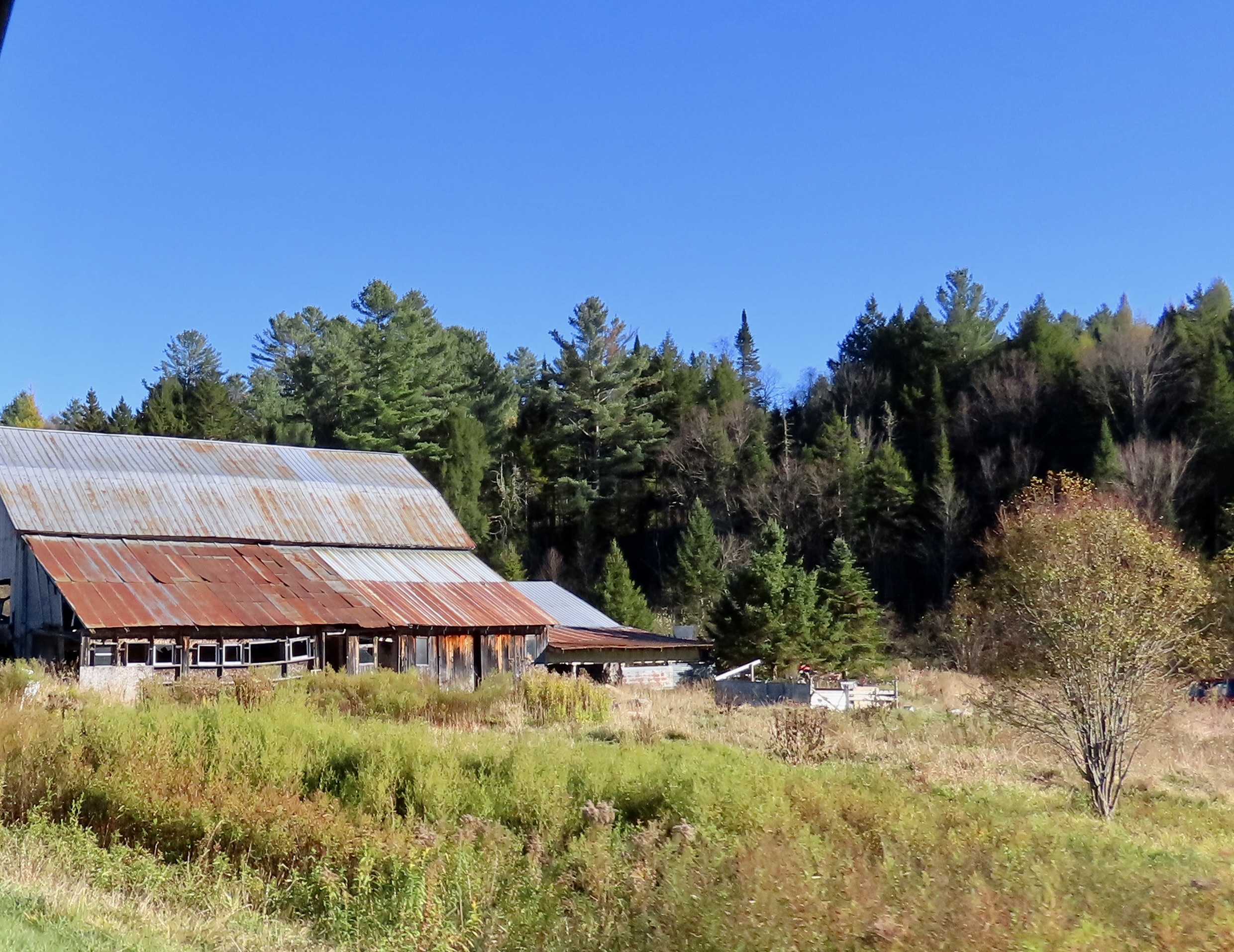
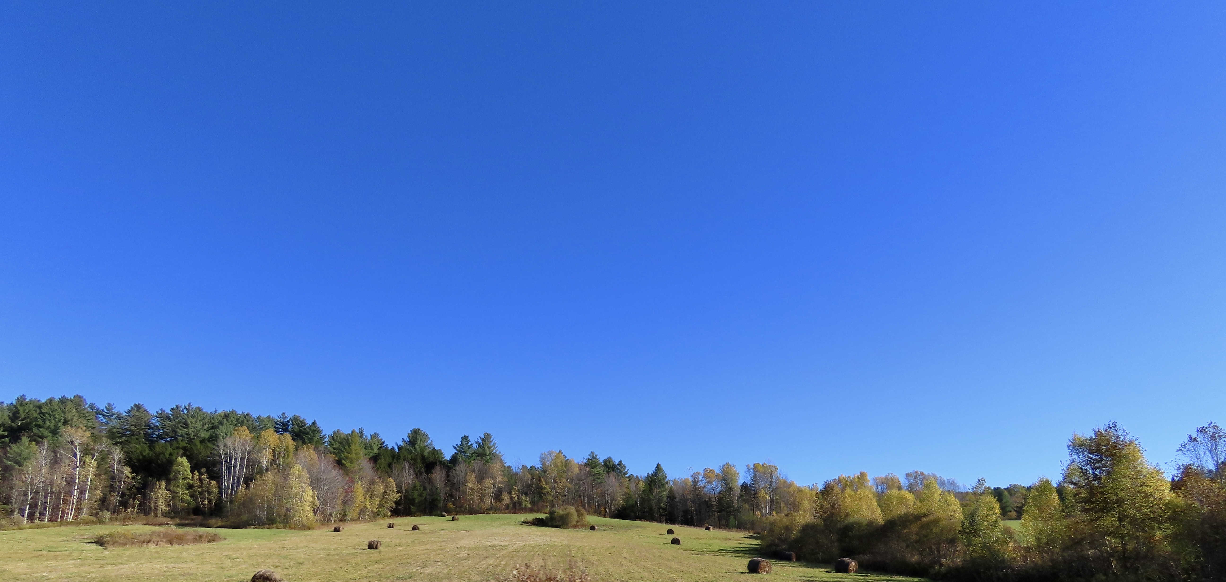
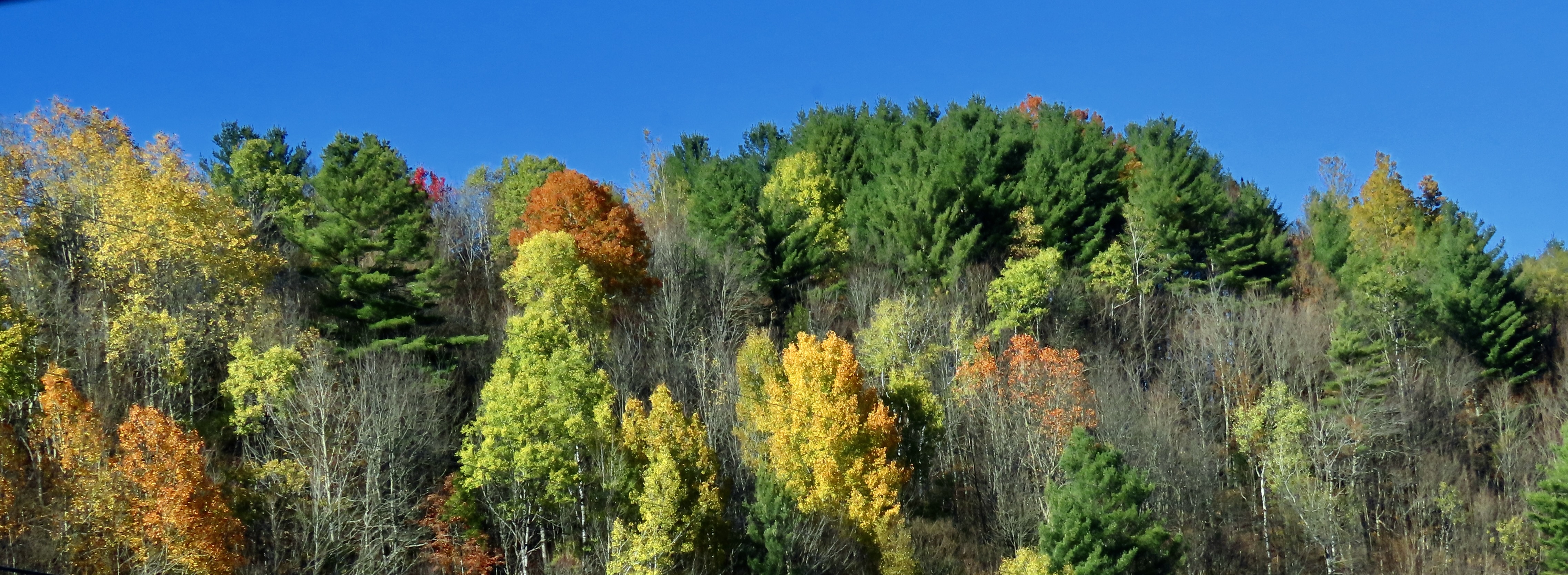
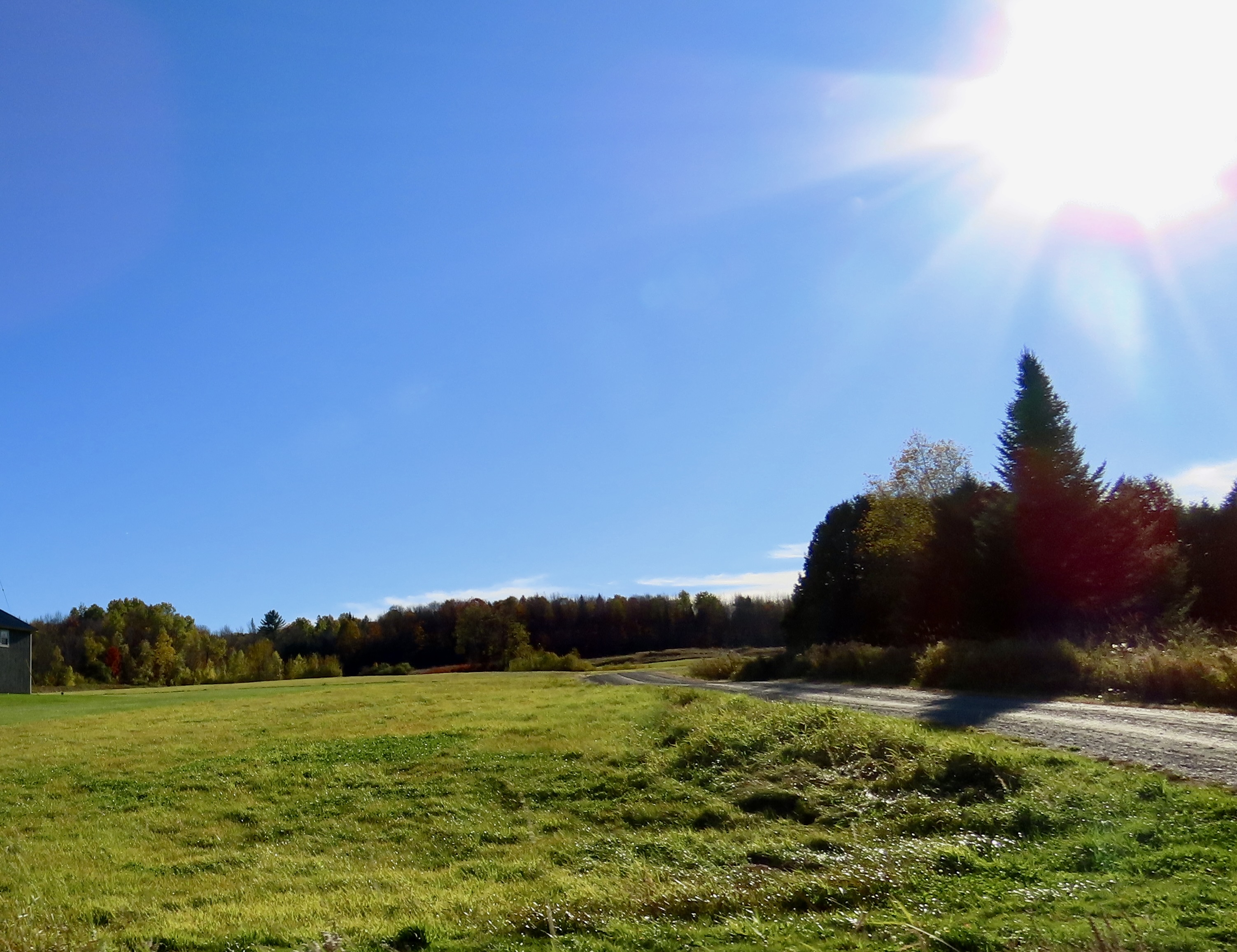
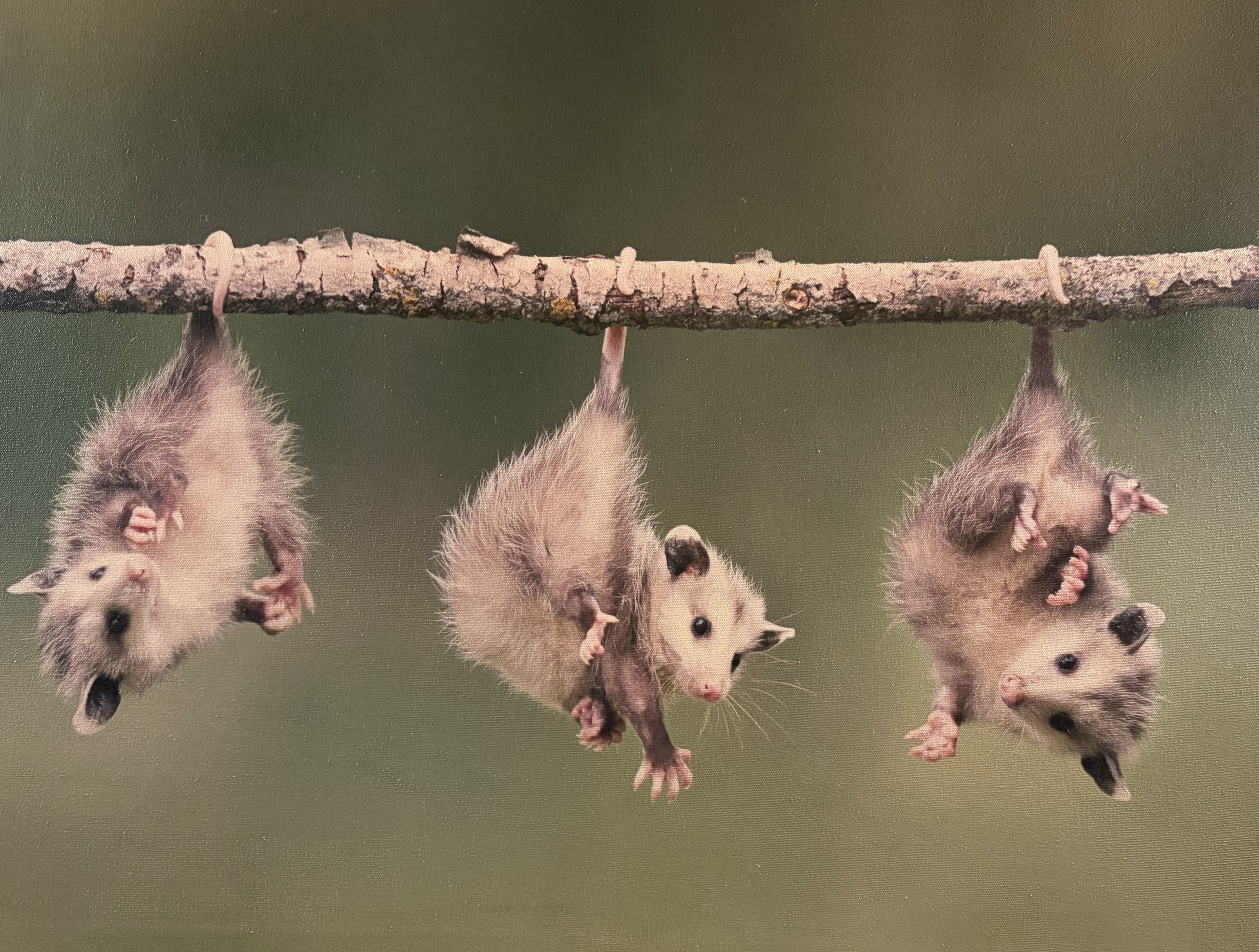
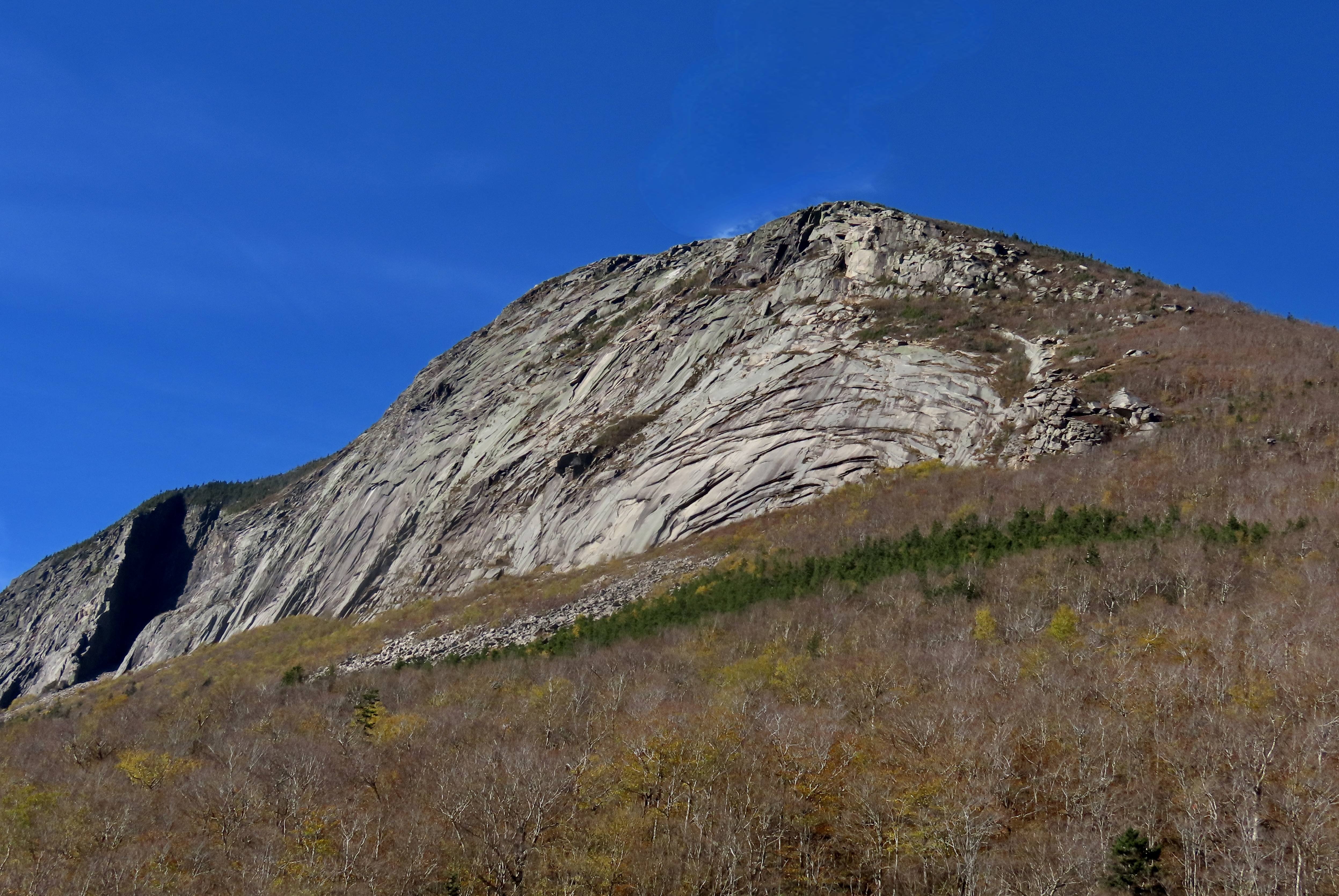
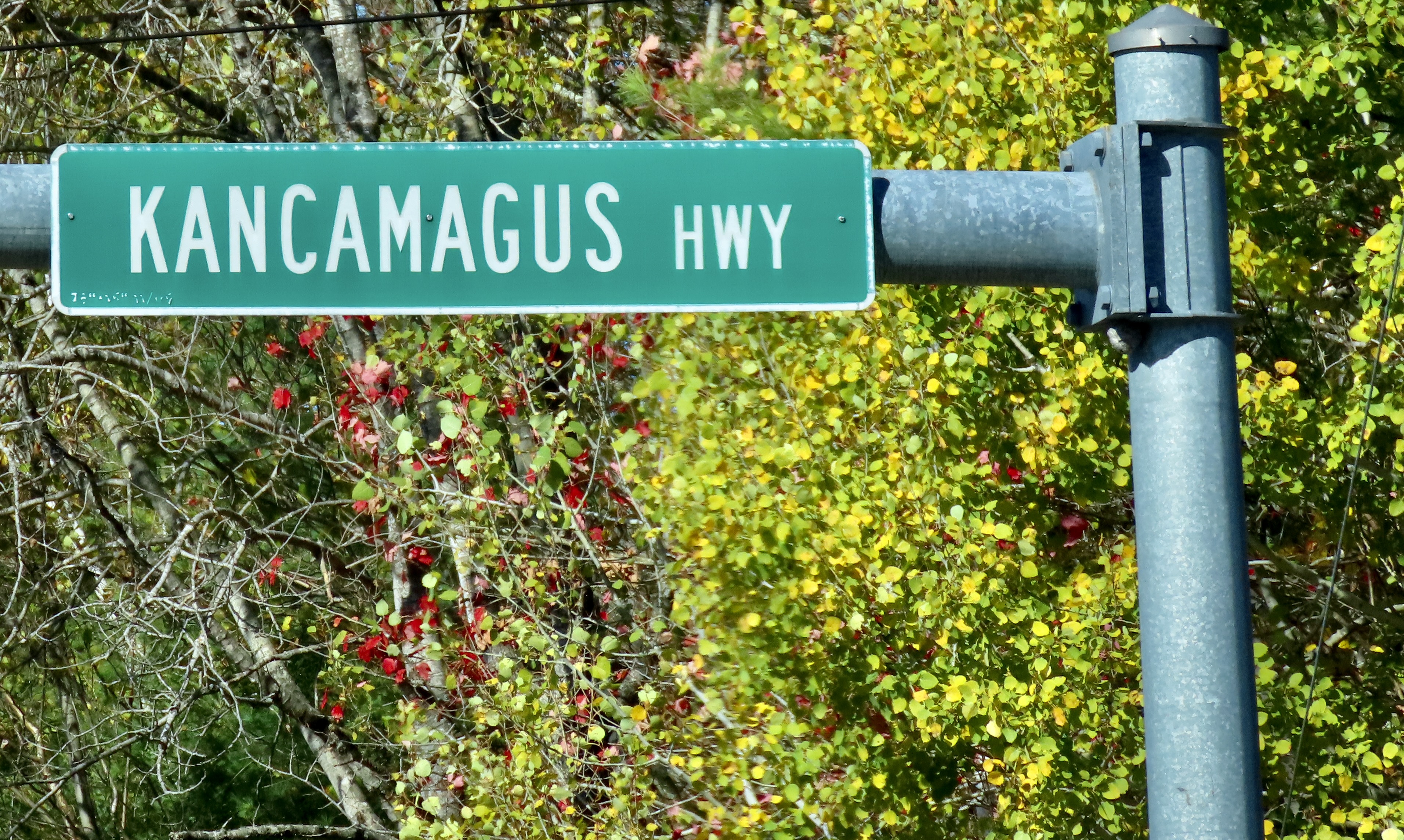
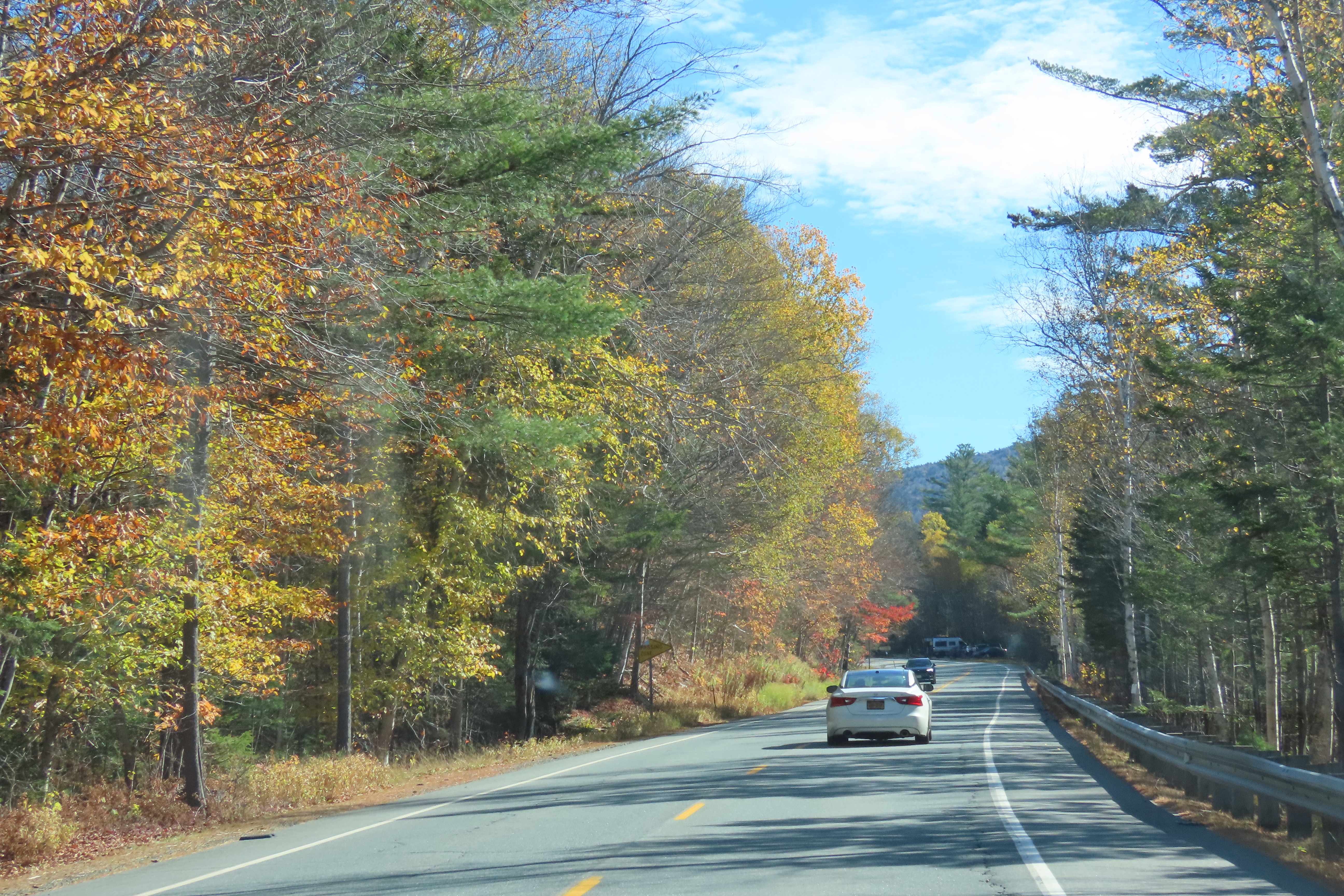
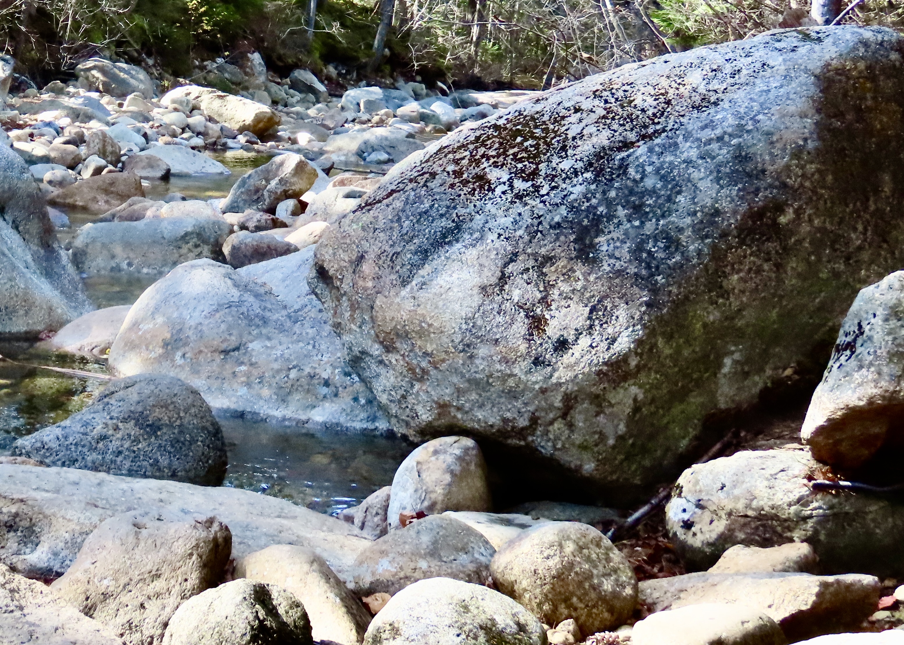
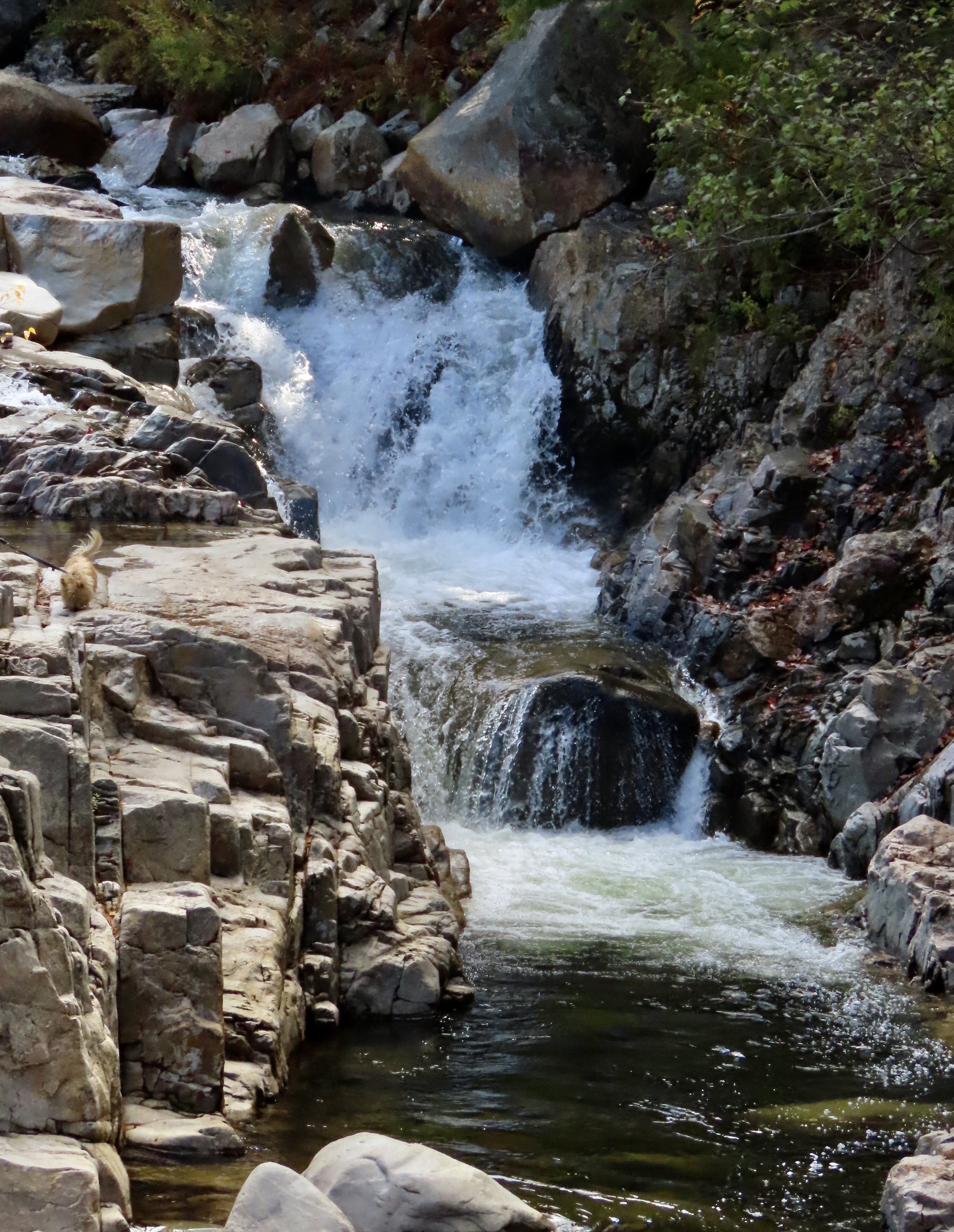
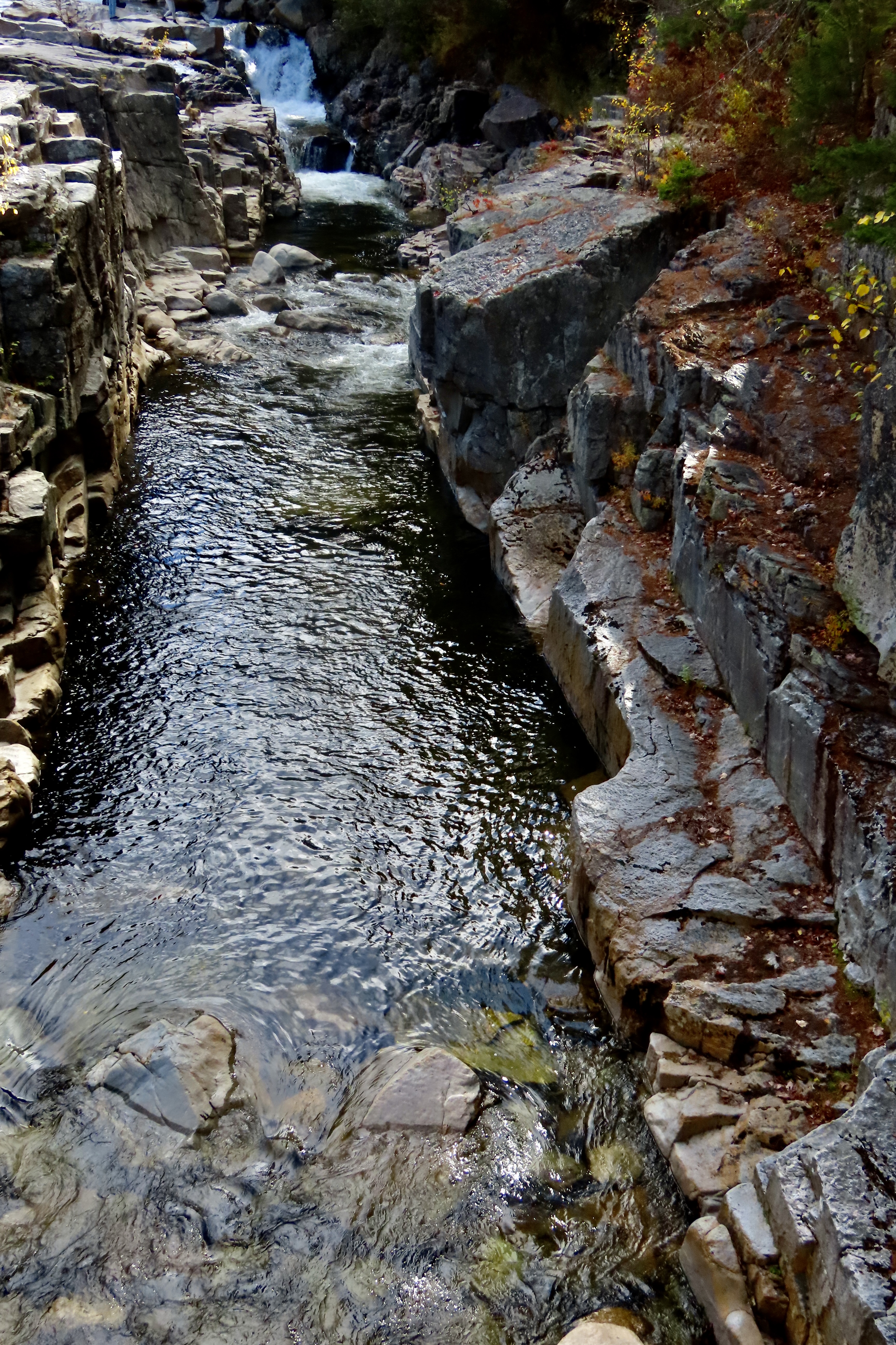
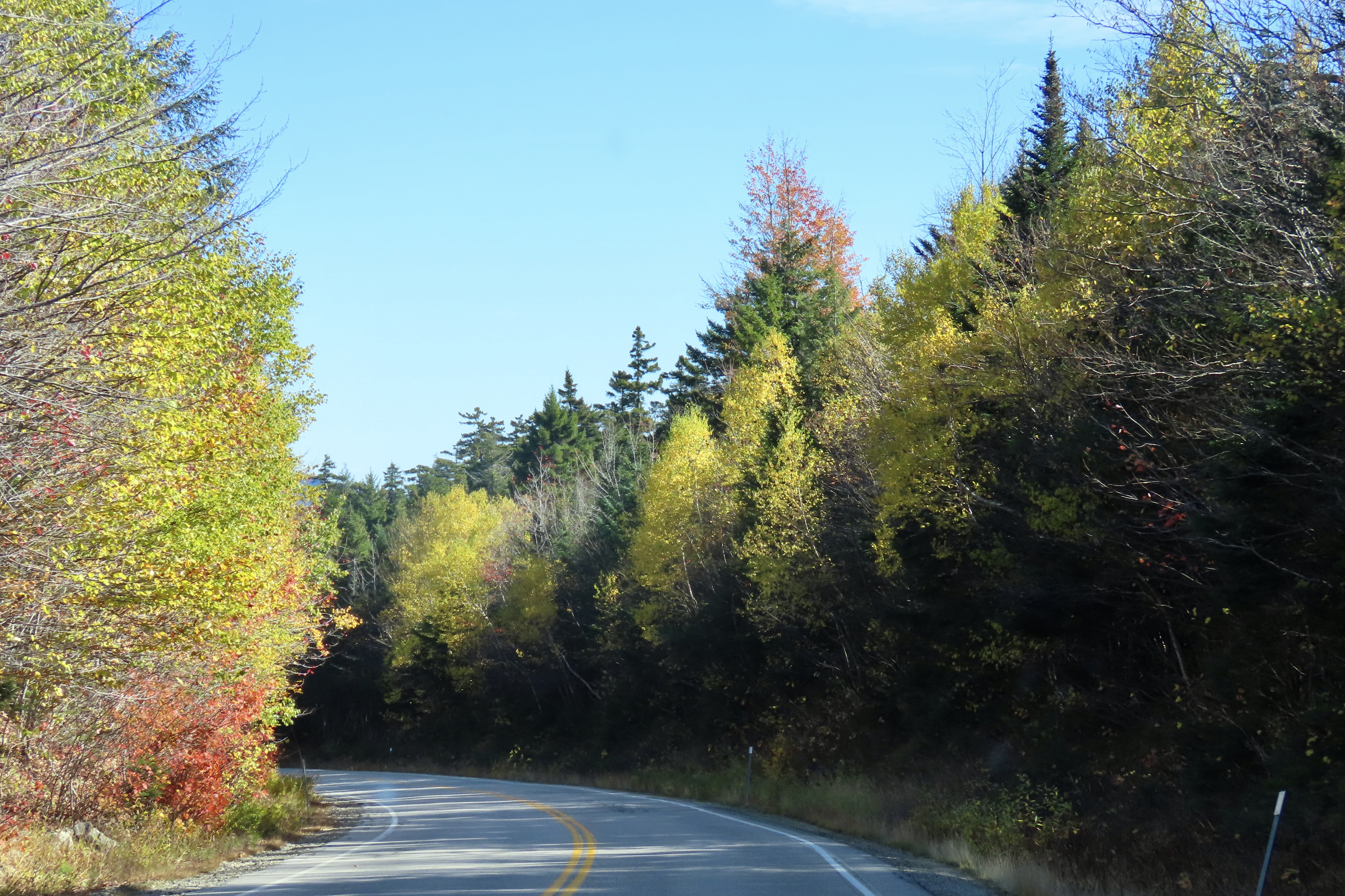
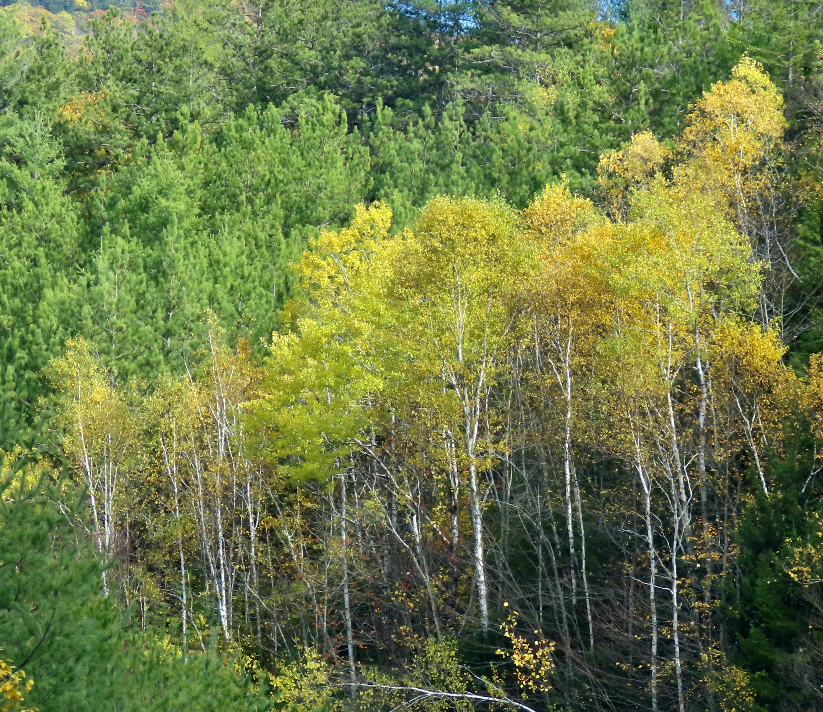
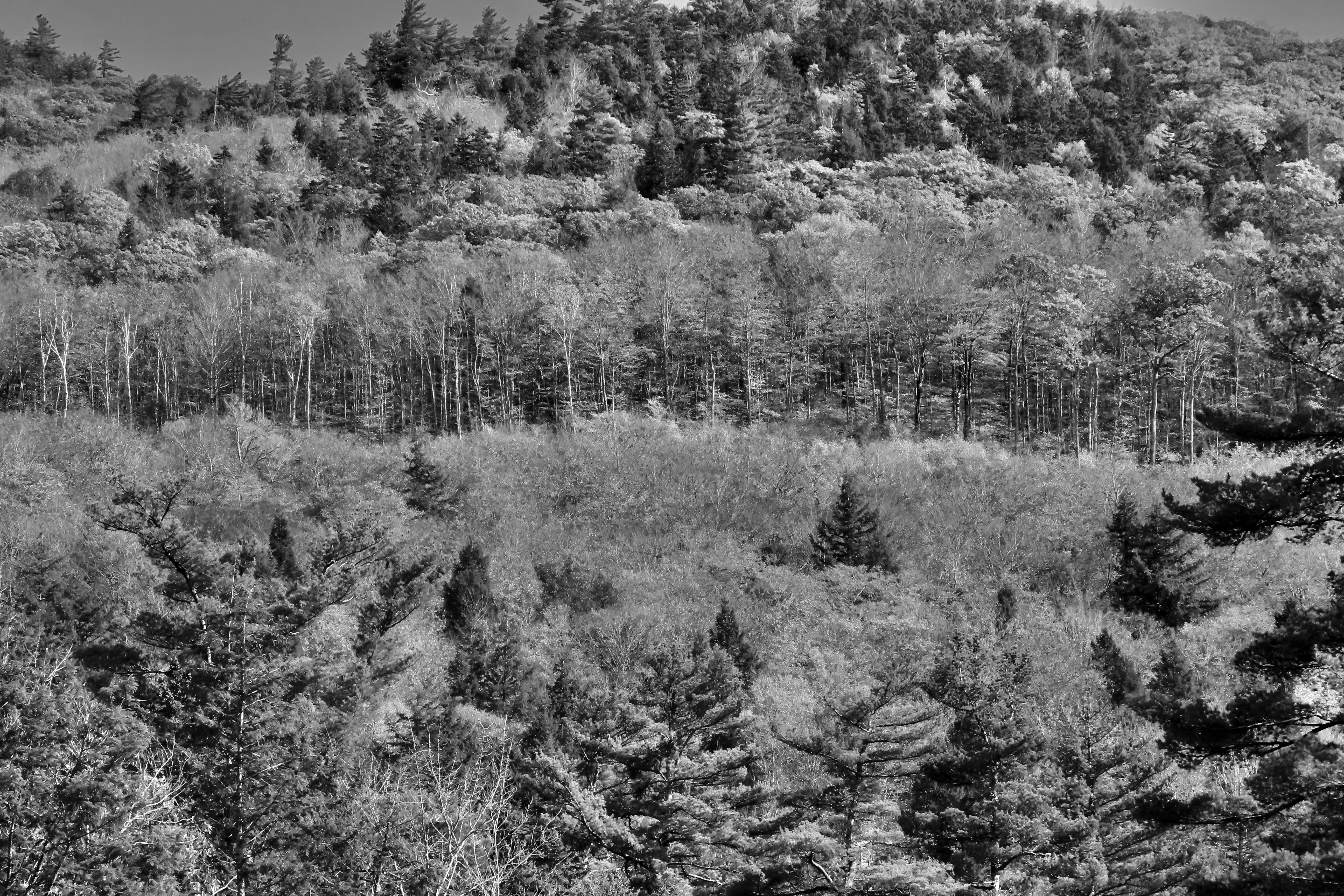
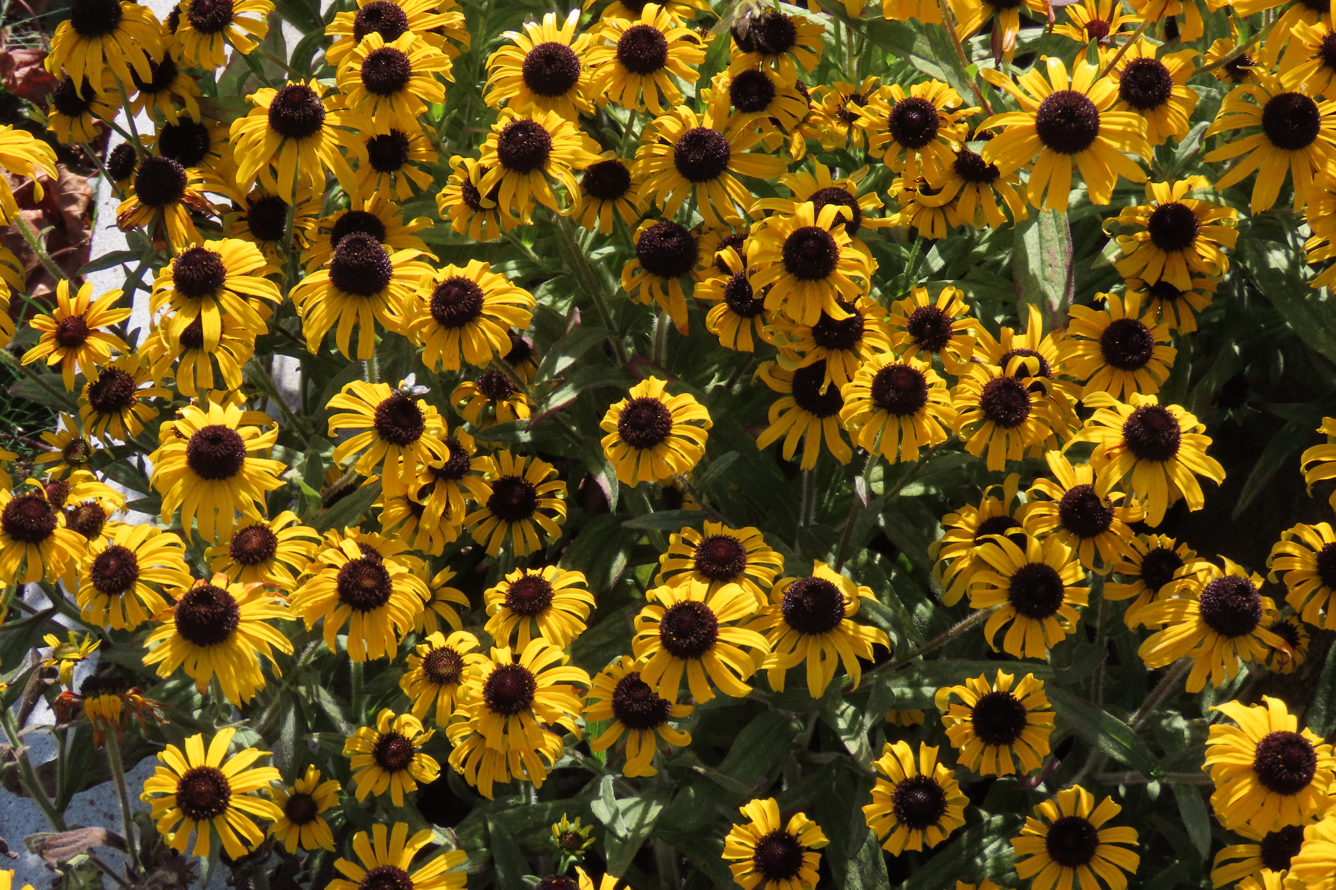
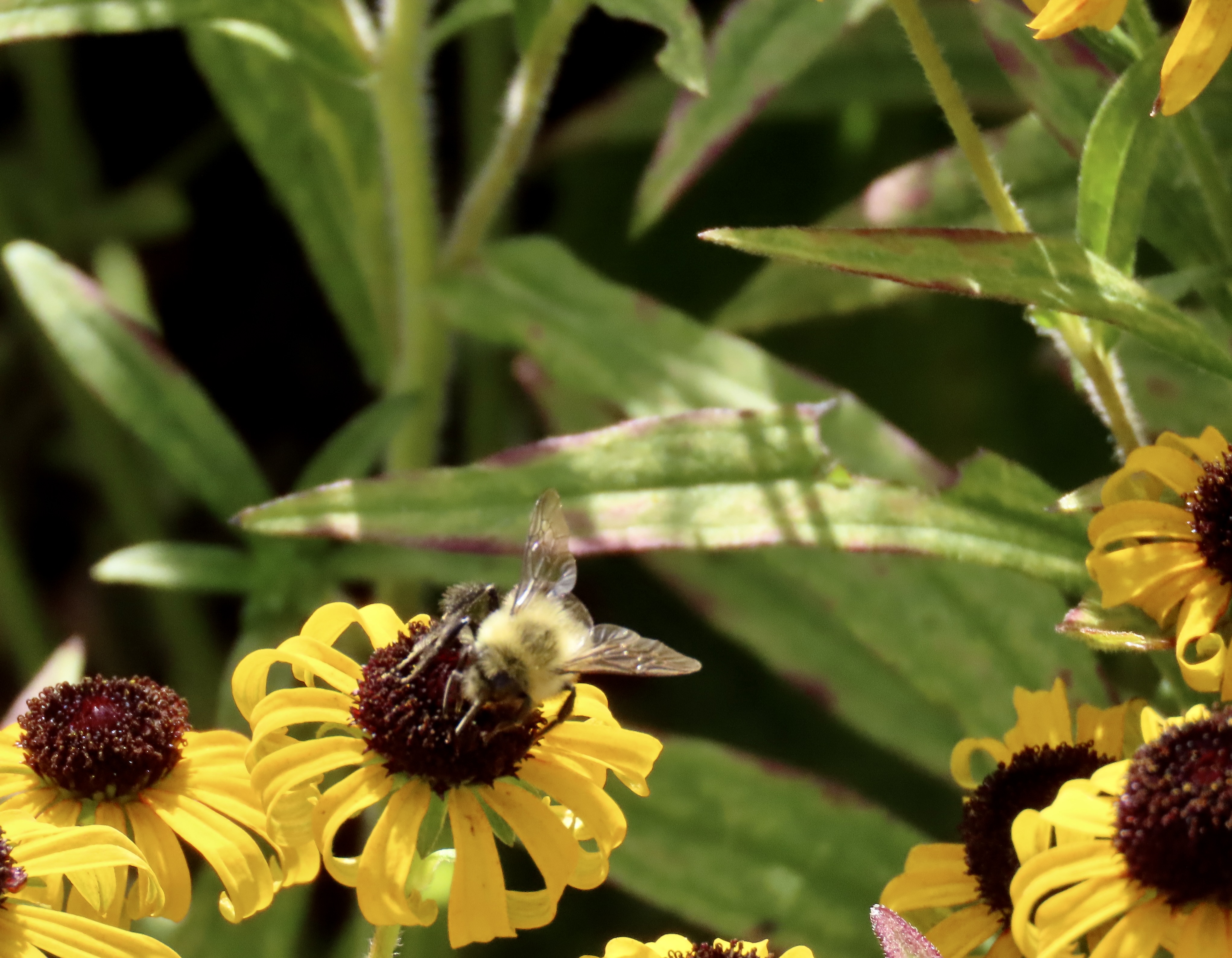
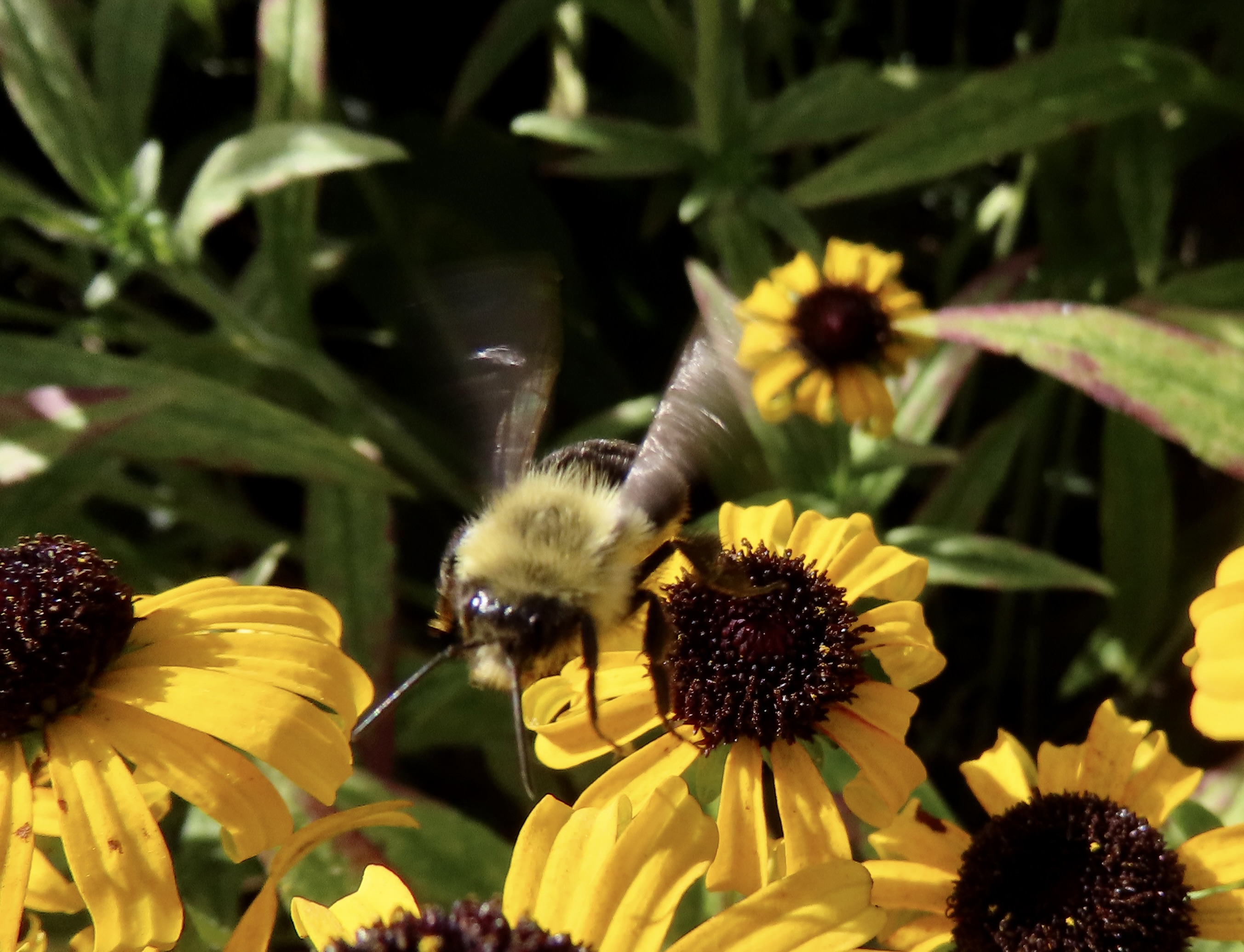
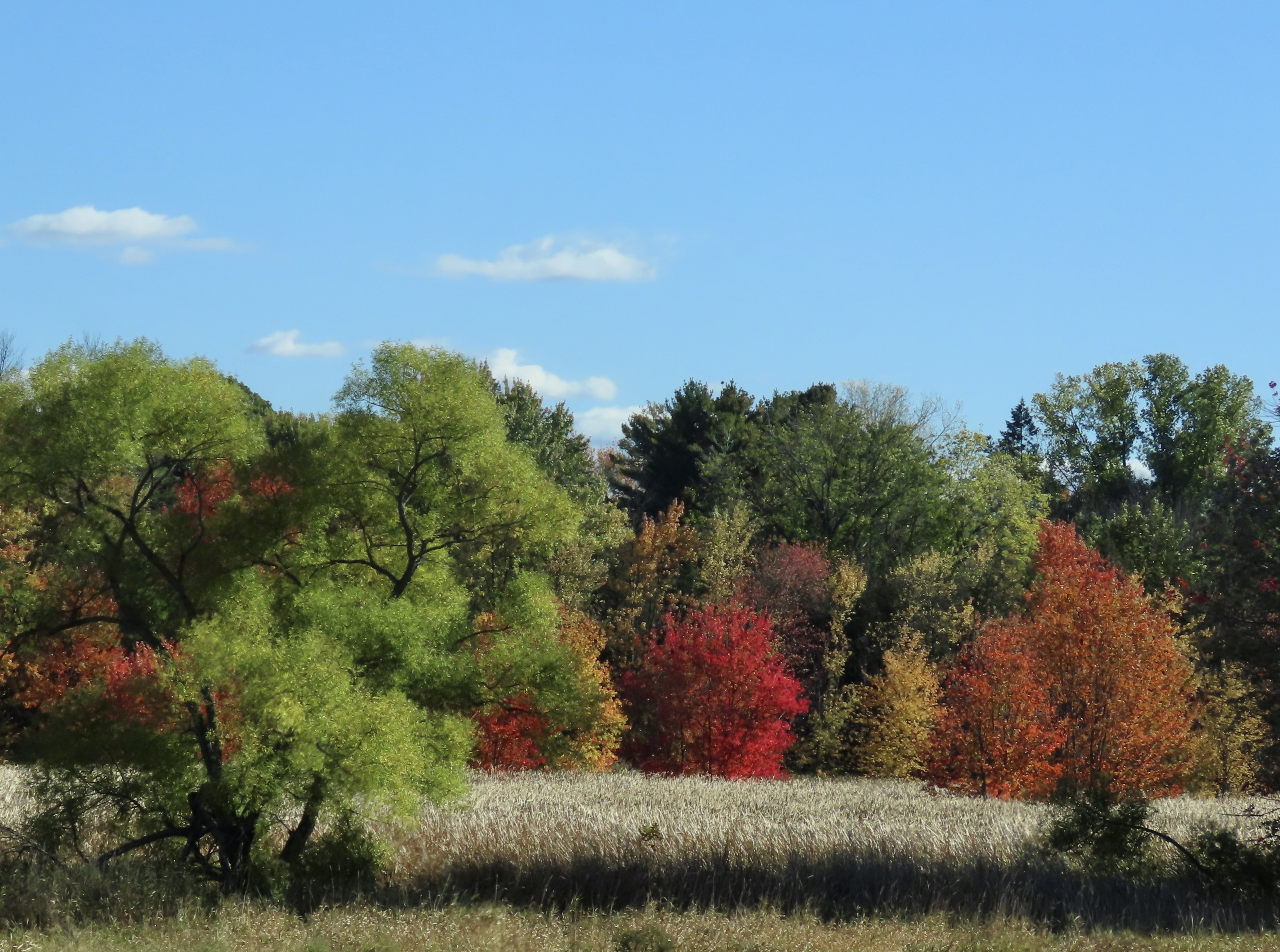
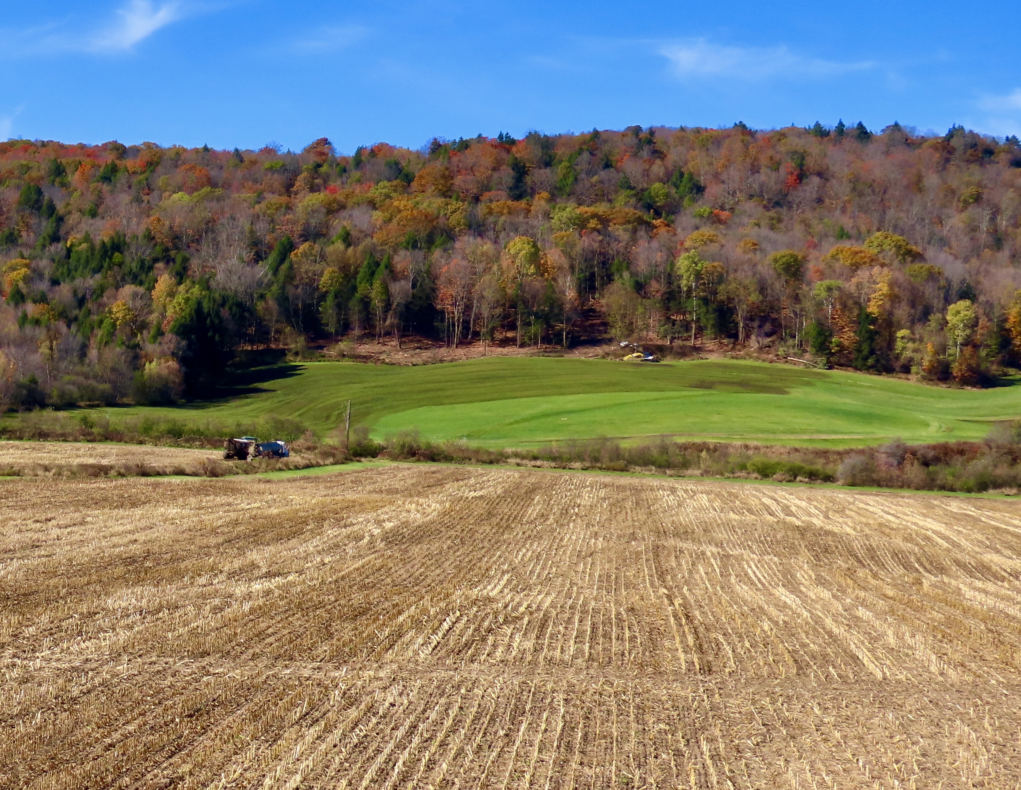
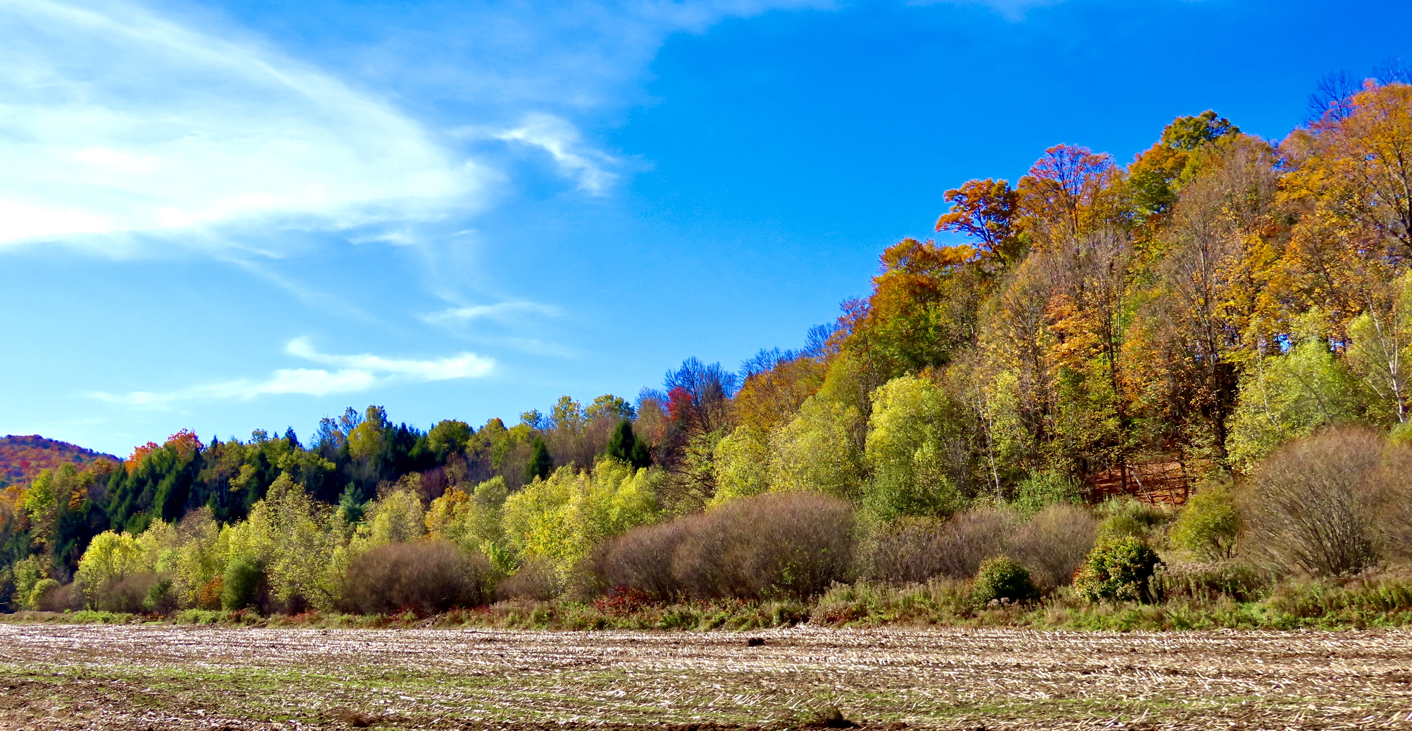
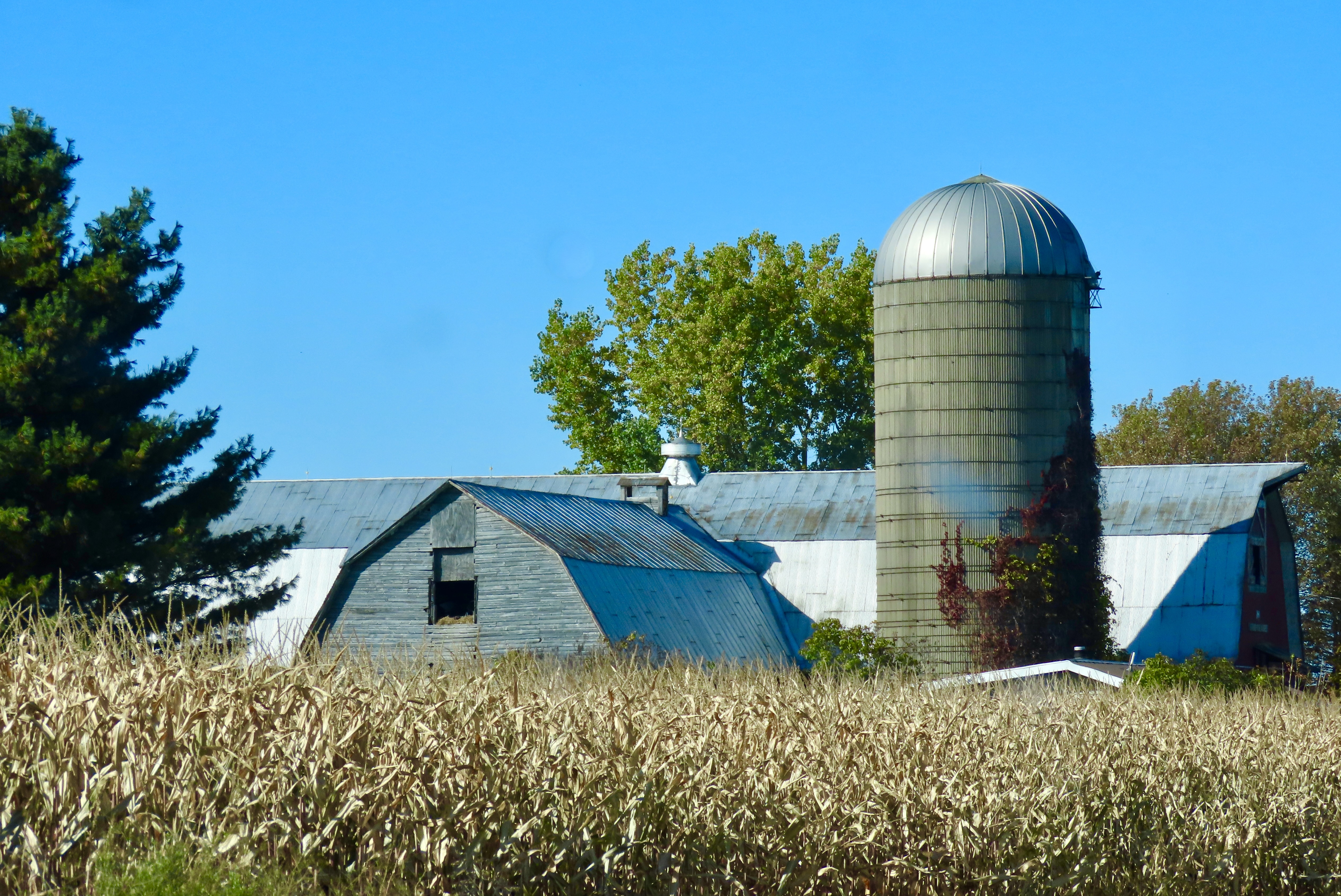
We left the crowded sidewalks and packed streets behind when we left Stowe, traveling the backroads of Vermont. You may have heard our sigh of relief as we once again had time to admire the scenery. Like this. This old barn with its overgrown fields was part of it.Rolled up hay bales were one more sign that Vermont had left summer behind and was preparing for winter.There was still plenty of color to catch our eyes.And a bright sun to illuminate the fields and trees.A photo of cute baby possums adorned the wall of the Pine Grove Motel where we stayed in Barton, Vermont that night. As it should. We were in the Possum Room. The motel was ancient and small but remodeled and clean with amenities including a refrigerator, microwave and even a toaster. Two single beds served our sleeping needs. At least they did until midnight when we heard a strange noise. At first I thought in might be an animal in the attic and happily pictured a possum. Peggy and I quickly realized, however, that someone was using a key and trying to get into our room. My assumption was that he/she had mixed up room numbers. I’ve done that. I went over and politely said through the door that the person had the wrong room. (No way was I opening the door!) The person continued to work his key and wouldn’t quit. Maybe he was drunk. I was getting worried. “You have the wrong room,” I said loudly. “Go away!” He smashed the door with his fist. But left. It took a while for us to go back to sleep.The next morning we climbed on I-91 and zipped down the freeway to I-93 where we left the Green Mountains of Vermont behind for the granite White Mountains of New Hampshire. There is a reason why New Hampsire is known as the Granite State!Our goal was New Hampshire’s Kancamagus Highway noted for its fall colors. At 34 miles long, it is considered New Hampshire’s most scenic drive. The US Forest Service even charges people $5 to drive the road if they use any of the pullouts. (Our handy-dandy National Park Senior Citizen Pass that we have been using for a quarter of a century worked.)Unfortunately, the famous fall colors were past their prime.So we went looking for other things that might catch our eyes, like this boulder filled stream along the highway. More granite.Farther along, we found a waterfall to admire.Sunlight lit up a corner, creating translucence.We thought that this ‘long shot’ provided an interesting, different perspective. The waterfall was at the very top. Dark, inky water ran along the channel and then gained a tad of color as it flowed over rocks at the end.Of course we found some colors along the highway. After all, it was still early in October and we were in New Hampshire.Birch trees were still showing off their yellow leaves and white bark.And maples still provided a dash of red.My favorite photo, however, was this picture that we took and I rendered in black and white. Soon after we left the Kancamagus Highway, we entered Maine and once again found ourselves on backroads with close to zero traffic. GPS and I had an argument over which way to go. We were in Robert Frost country, however. He had spent the majority of his life in New England. My decision was easy: “Two roads diverged in a yellow wood, and I took the road less traveled by,” as I often do. It’s my motto. I had even memorized Frost’s poem, The Road Not Taken, in high school. GPS was disgusted and kept telling us to turn around for miles.We spent our night in Farmington, Maine where we had a large room with a kingsize bed, no one tried to get into our room, and there was an excellent Chinese restaurant about 50 yards from our doorstep. While most of the photos we took the next day on our way to Bar Harbor resembled the ones you have been seeing throughout this series, we were particularly impressed with the brownish tint of this scene…And the reddish brown in this one.Having time on our hands before we could check into our motel in Bar Harbor, we stopped at an information center in Bangor, Maine. These Black Eyed Susans greeted us.A bee was busy harvesting the nectar.When I got too close, it flew toward my lens. I liked the wing action. That’s it for today. Next up: Acadia National Park!The colors of Acadia National Park.
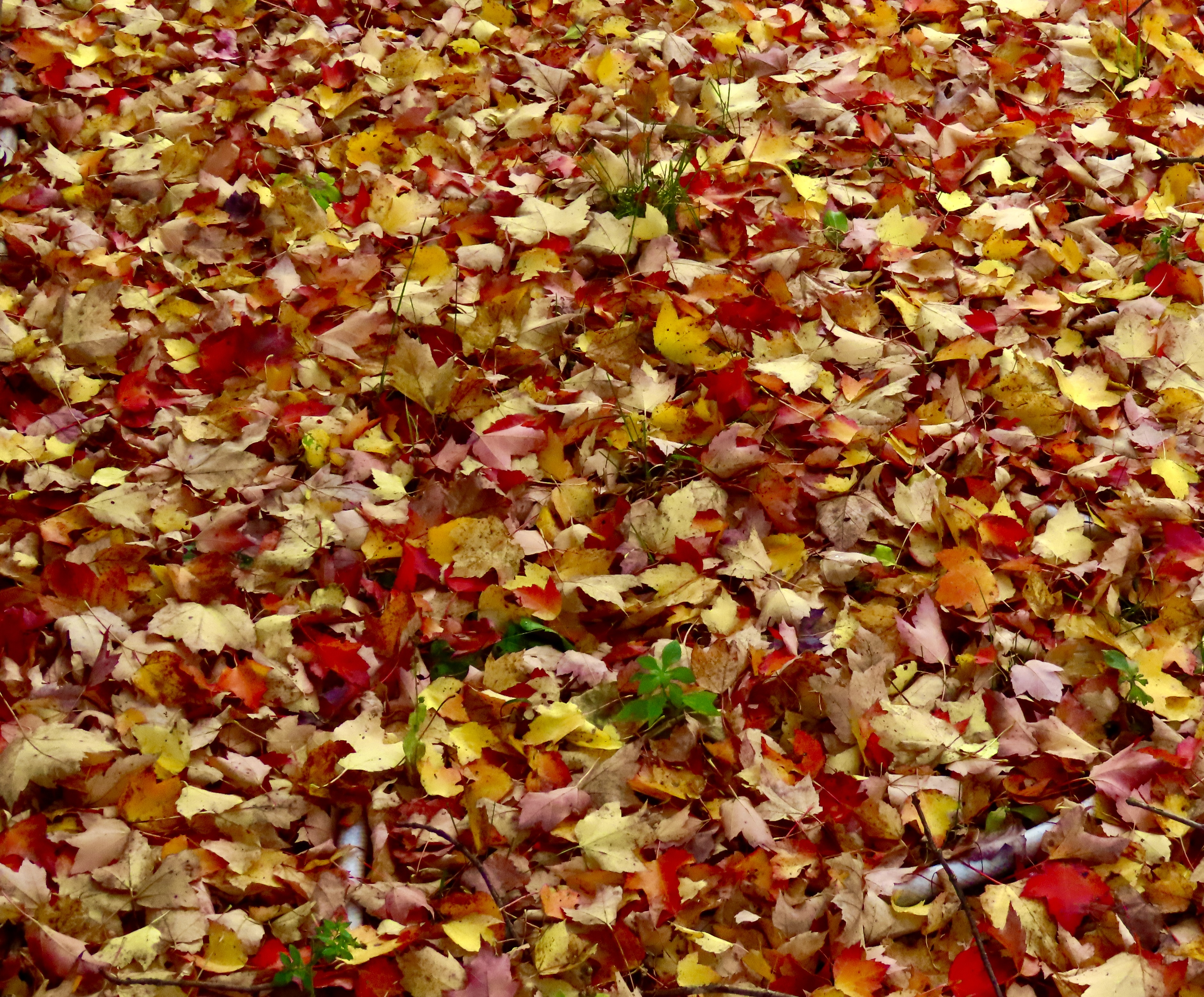
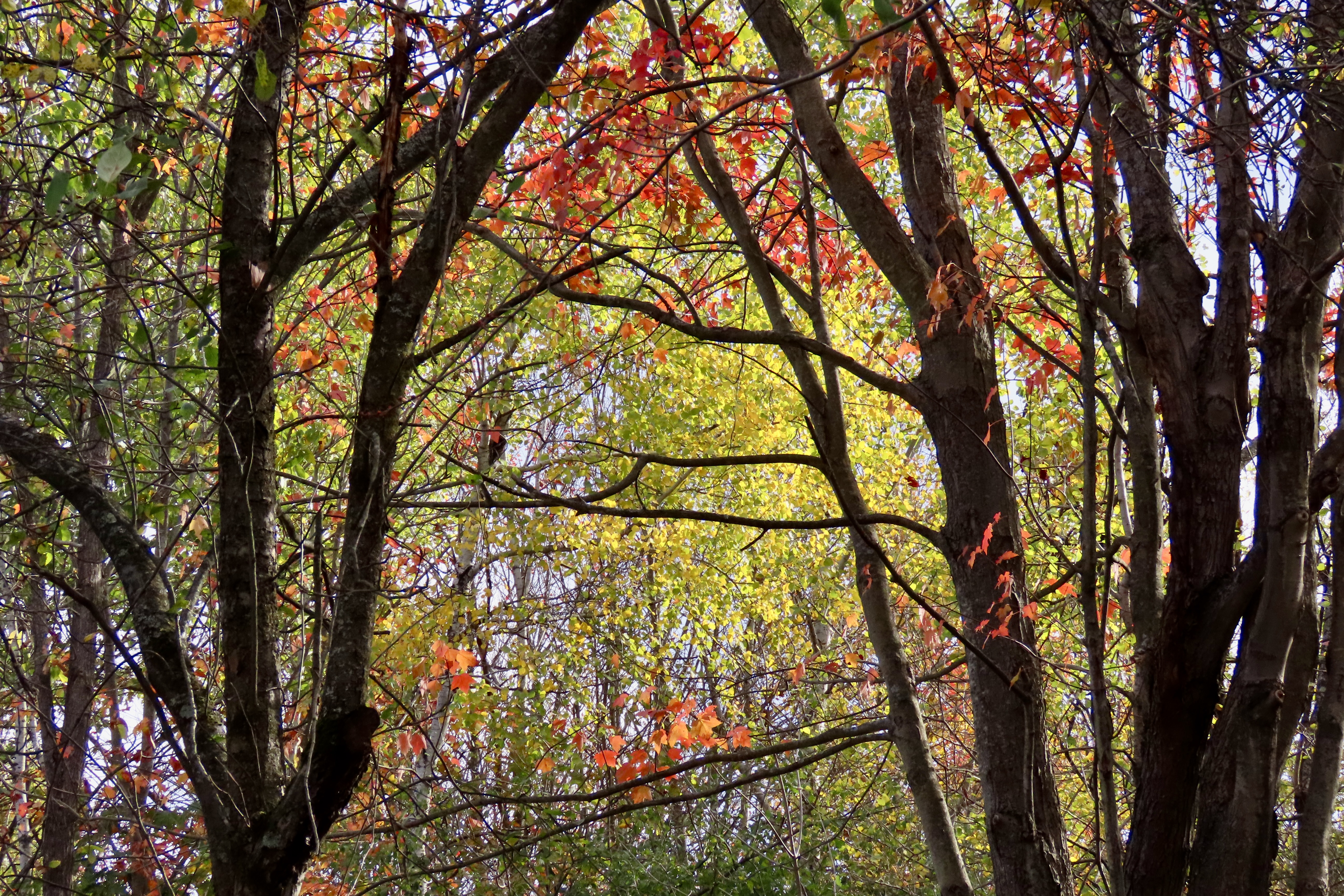
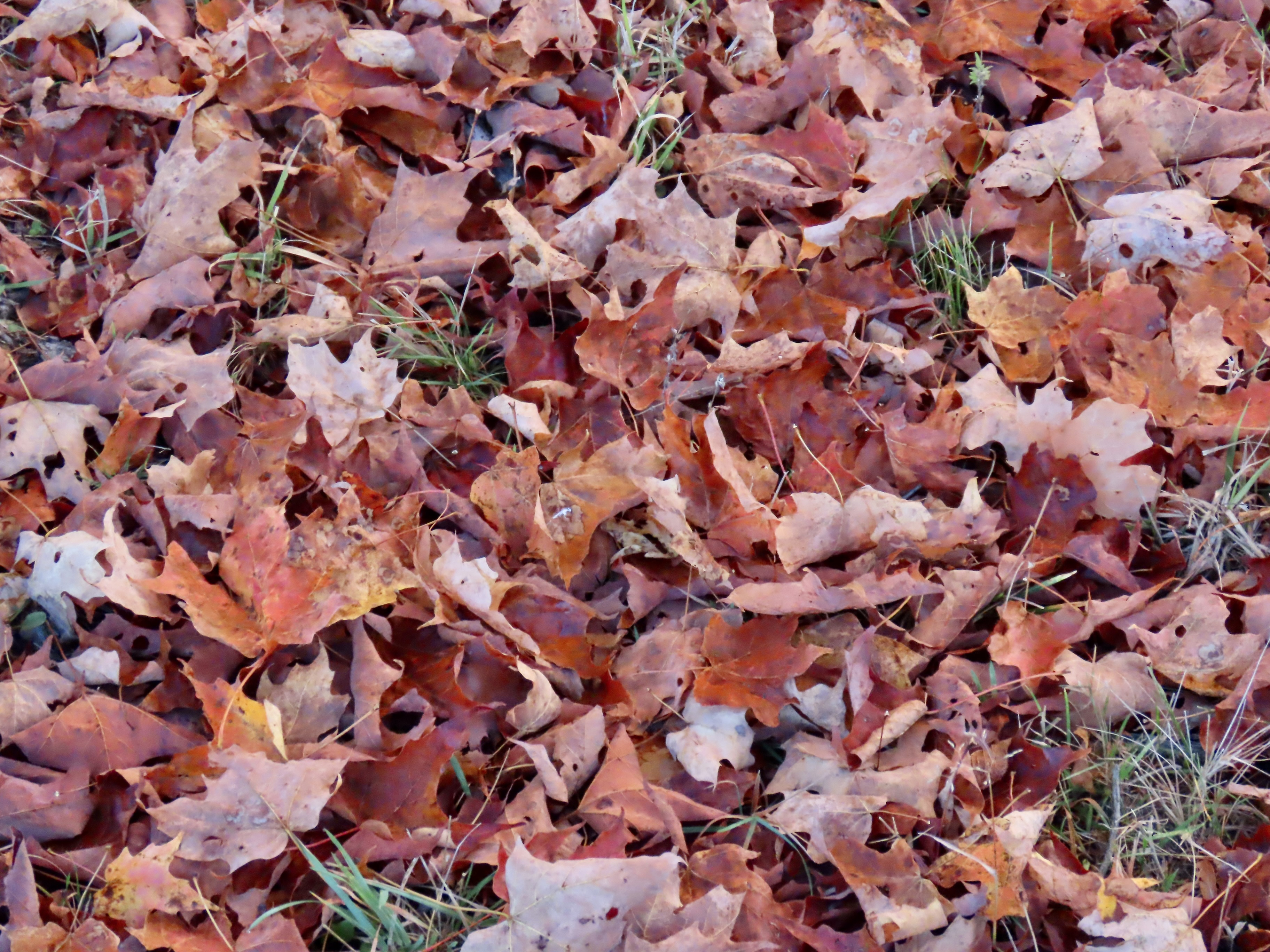
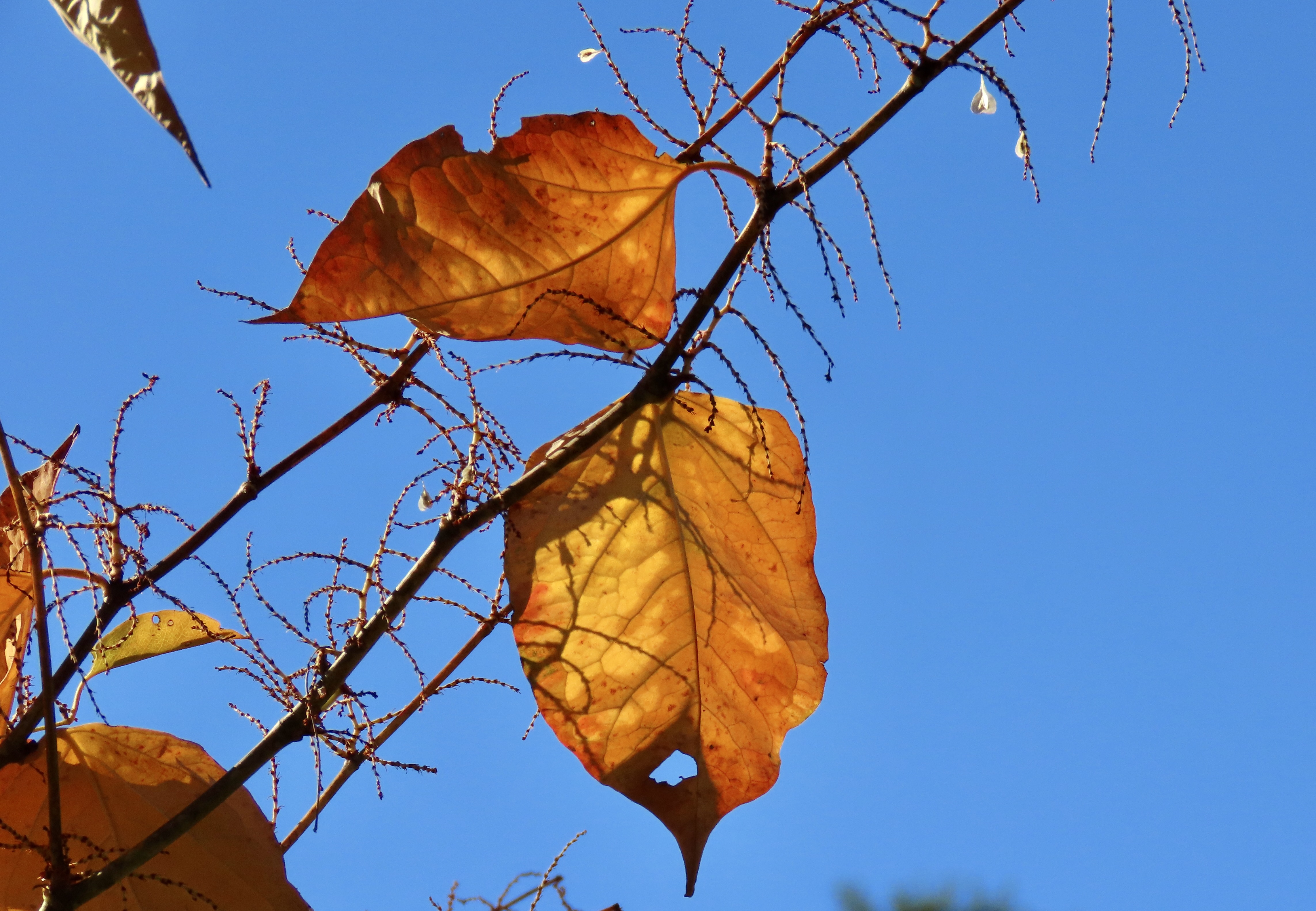
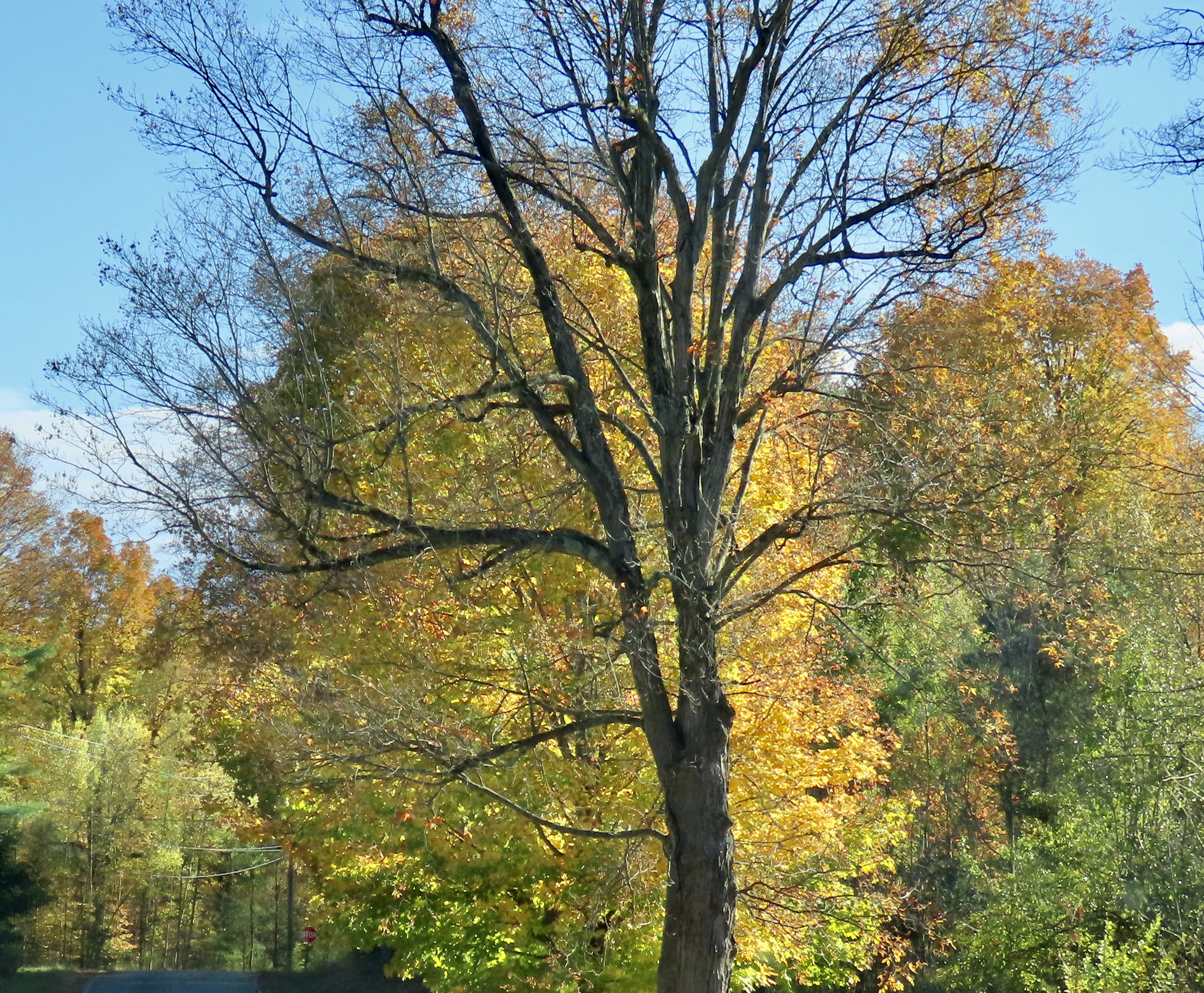
Beautiful leaves, but are any left on the trees?The answer was yes. These two photos were both taken at our cabin near Chazy, New York. The sunlight here reminded us that we still had a lot of leaf peeping to do.
Our West Chazy NY cabin was the second one on our tour. I already blogged about the first: Bare minimum: no electricity, no heat, no insulation, no water and an outhouse— all on the coldest day of our three week trip. The second was the direct opposite: A full kitchen, bathroom, sitting room, streaming TV, fun decorations, heat, and, I might add, excellent insulation. The owner, Shane, greeted us when we arrived and told us that he had put a dozen eggs in the refrigerator! “Our chickens are producing eggs faster than we can eat them,” he told us.” Let me know if you need more.” When we went online to give the cabin a five out of five, we were surprised that Shane had already been there and given us a five out of five as guests! Both cabins cost about the same to rent. It’s a tale of two cabins, a dickens of a story, if you will.
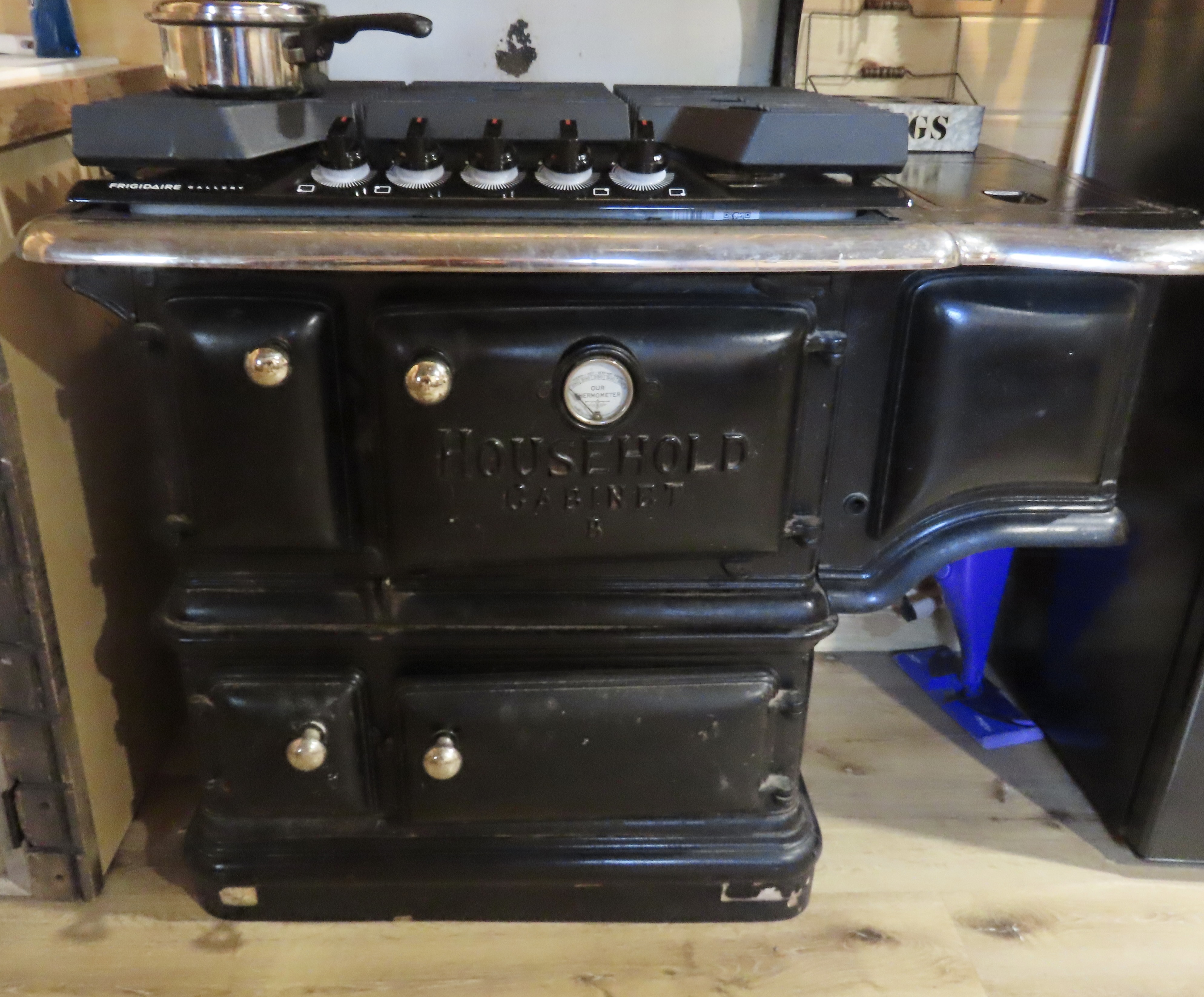
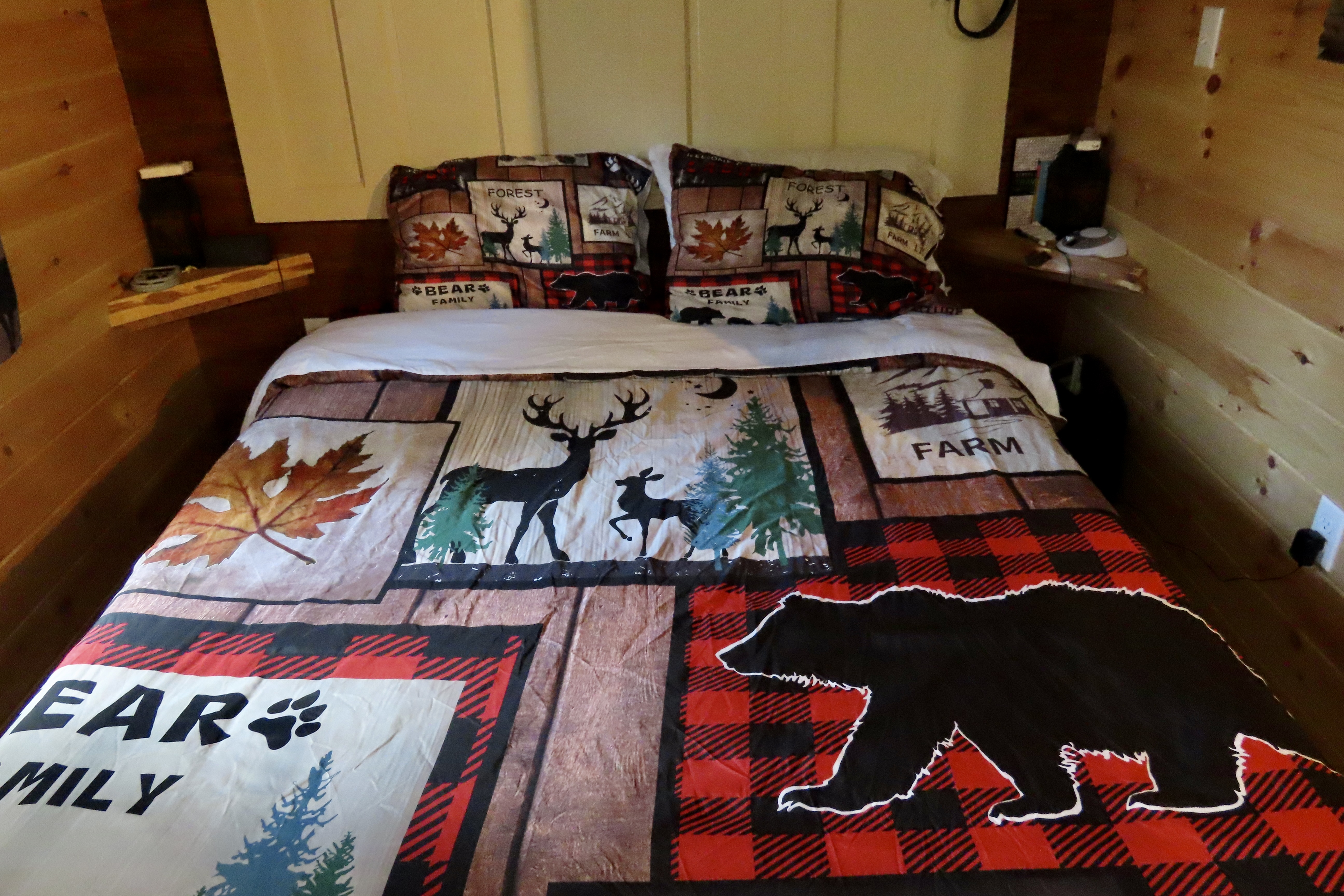
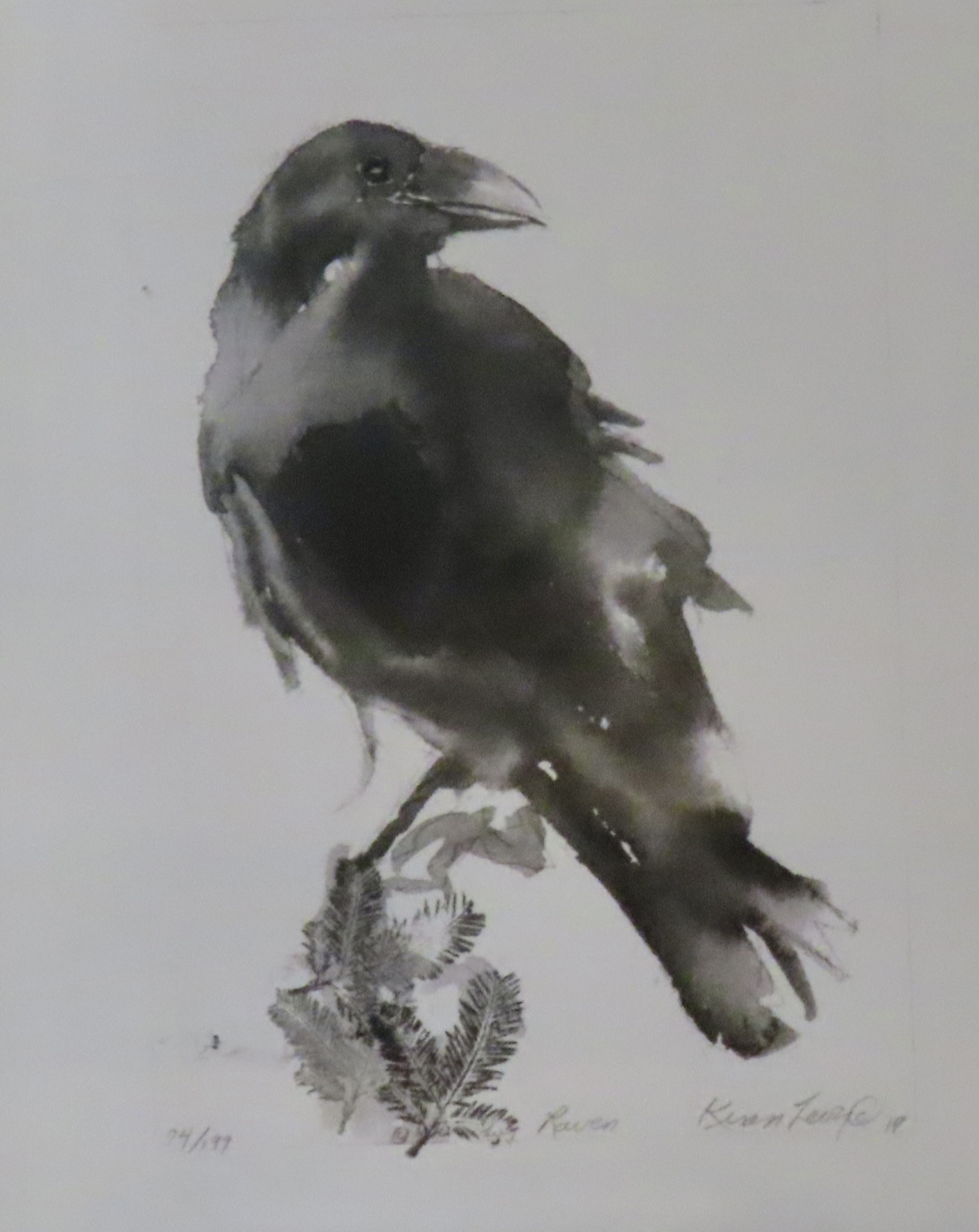
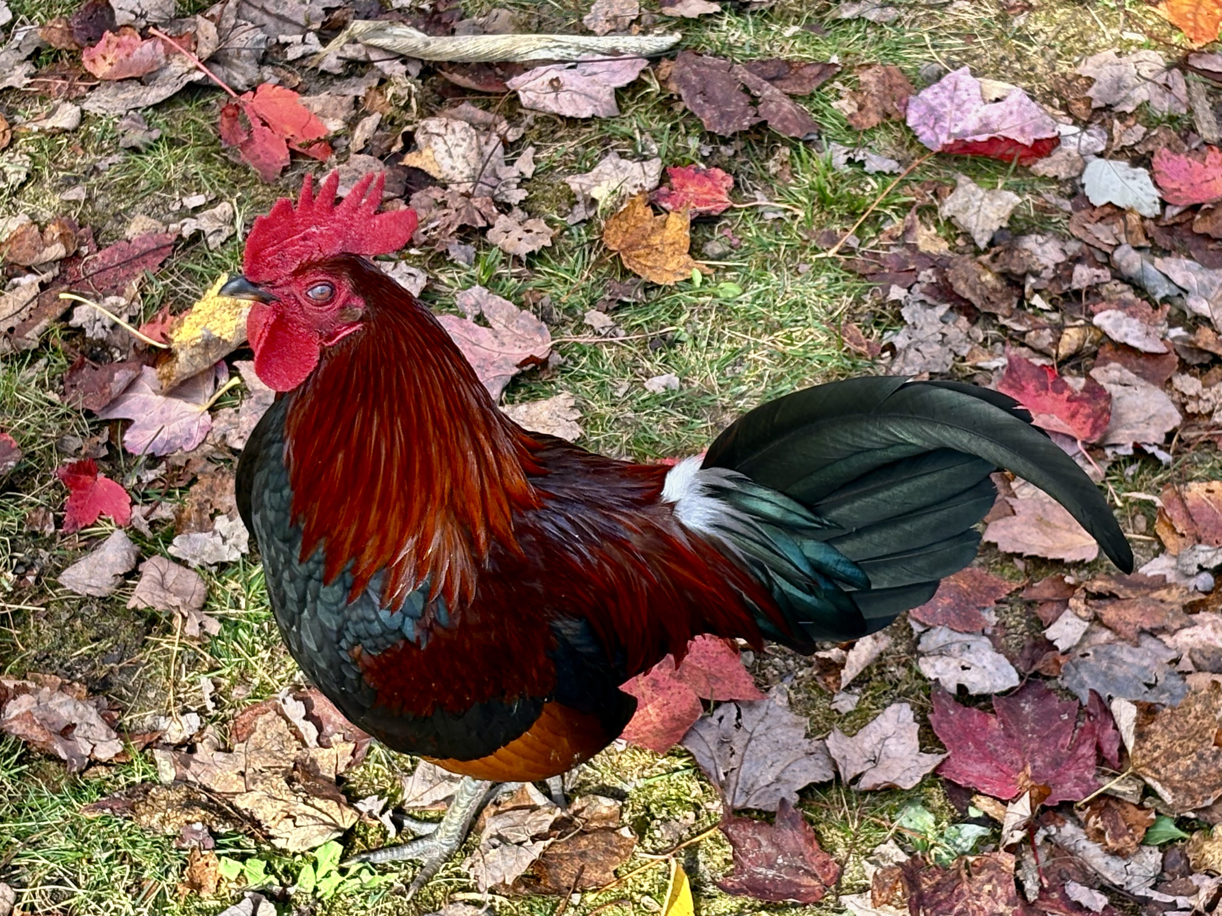
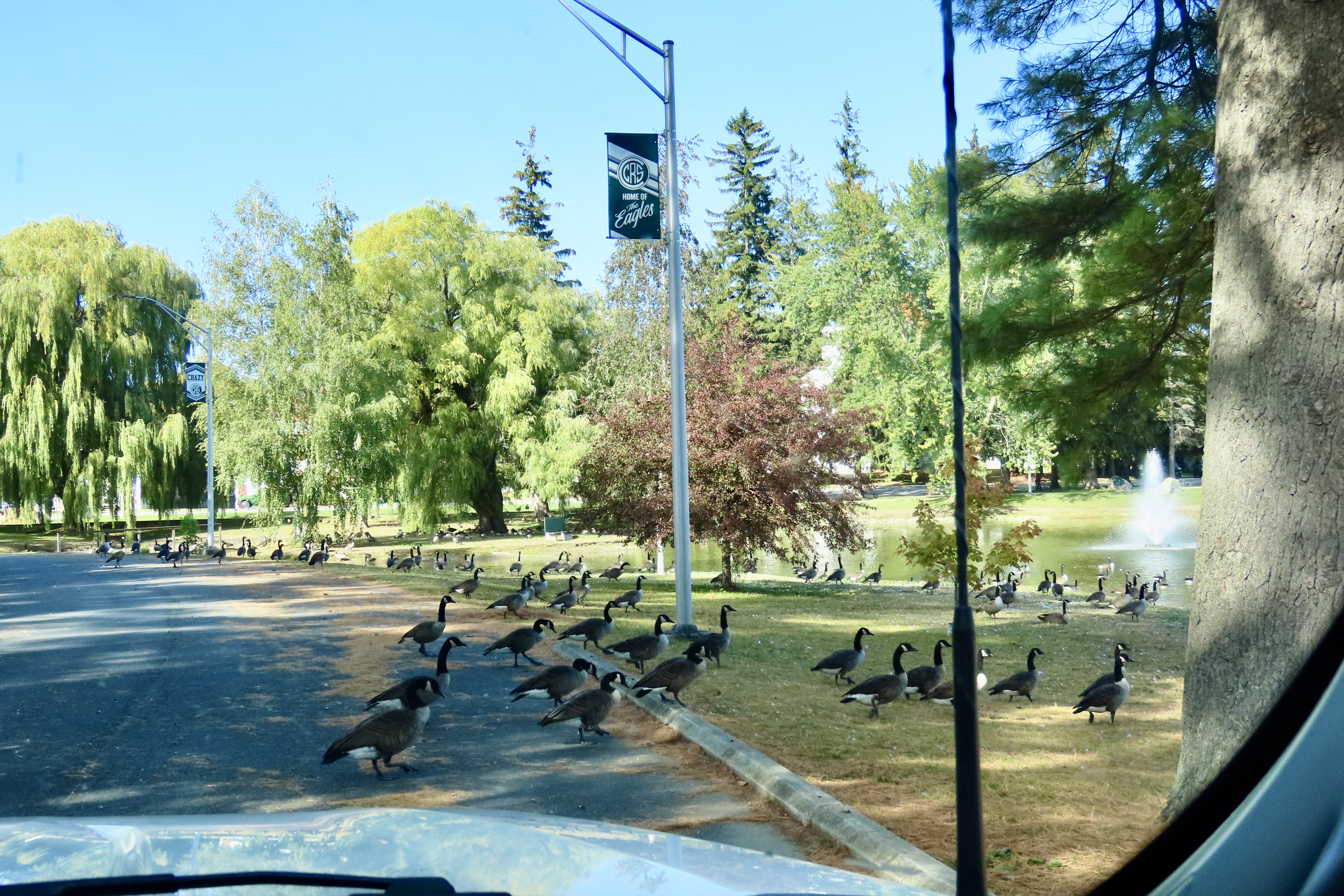
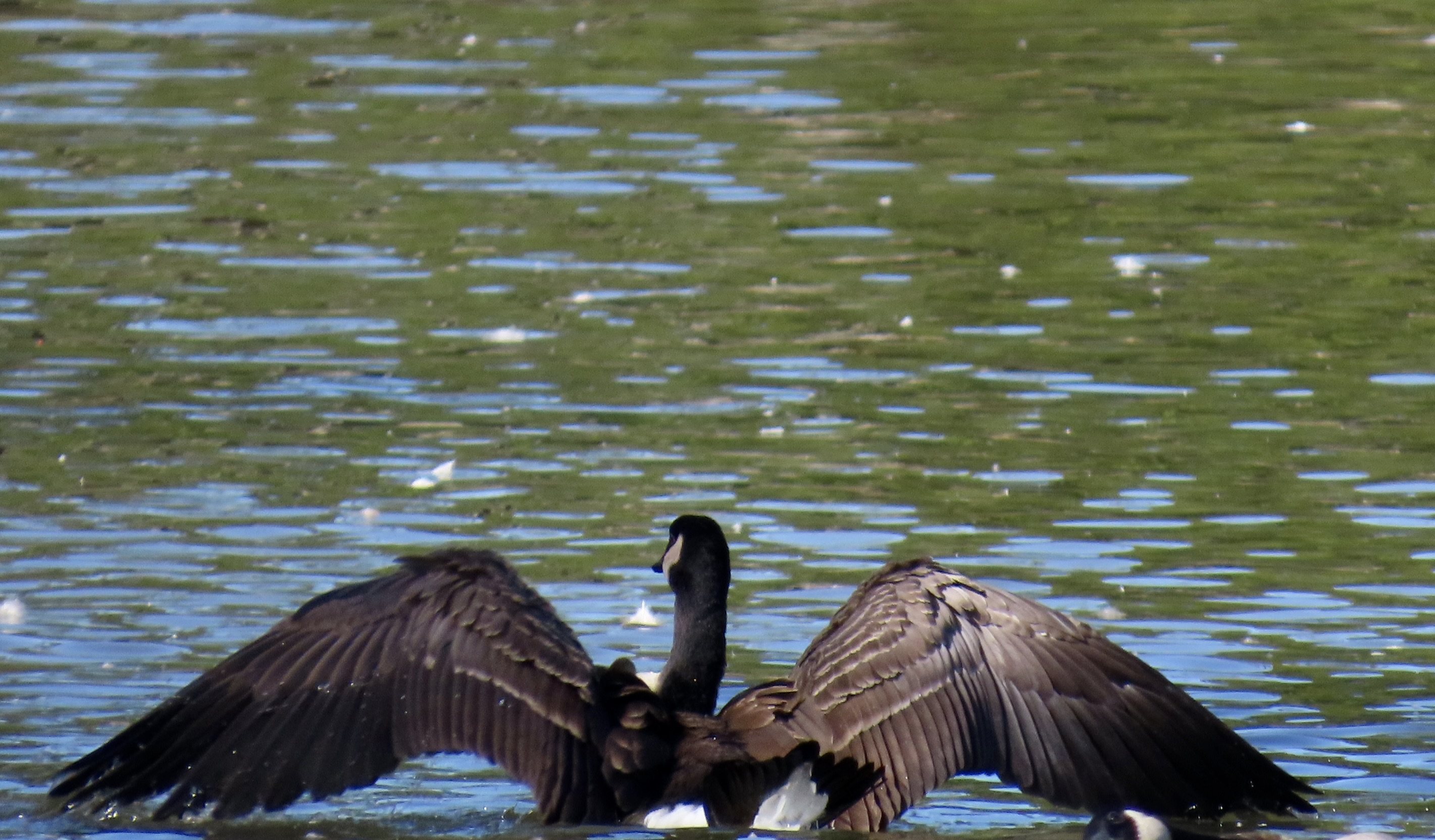
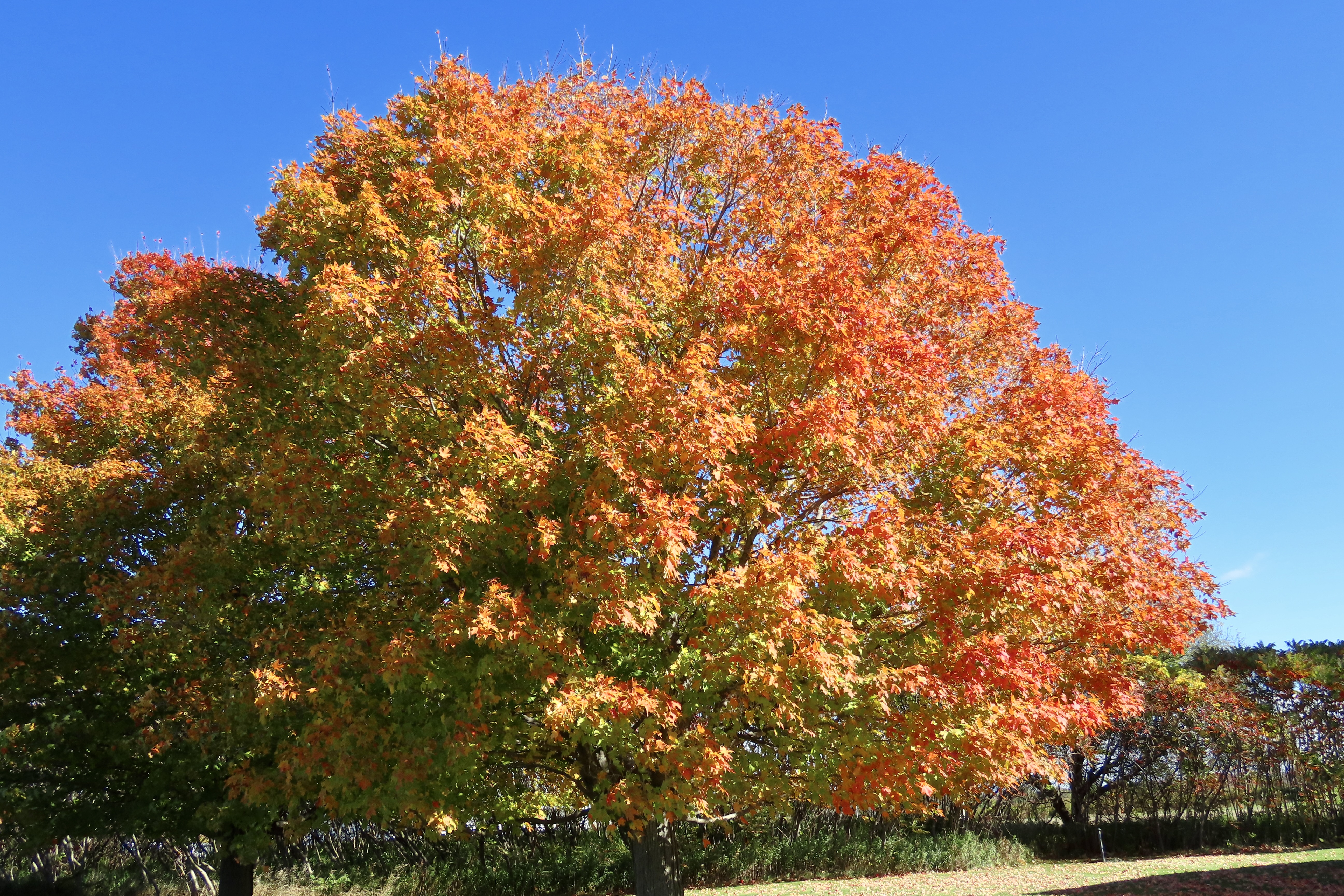
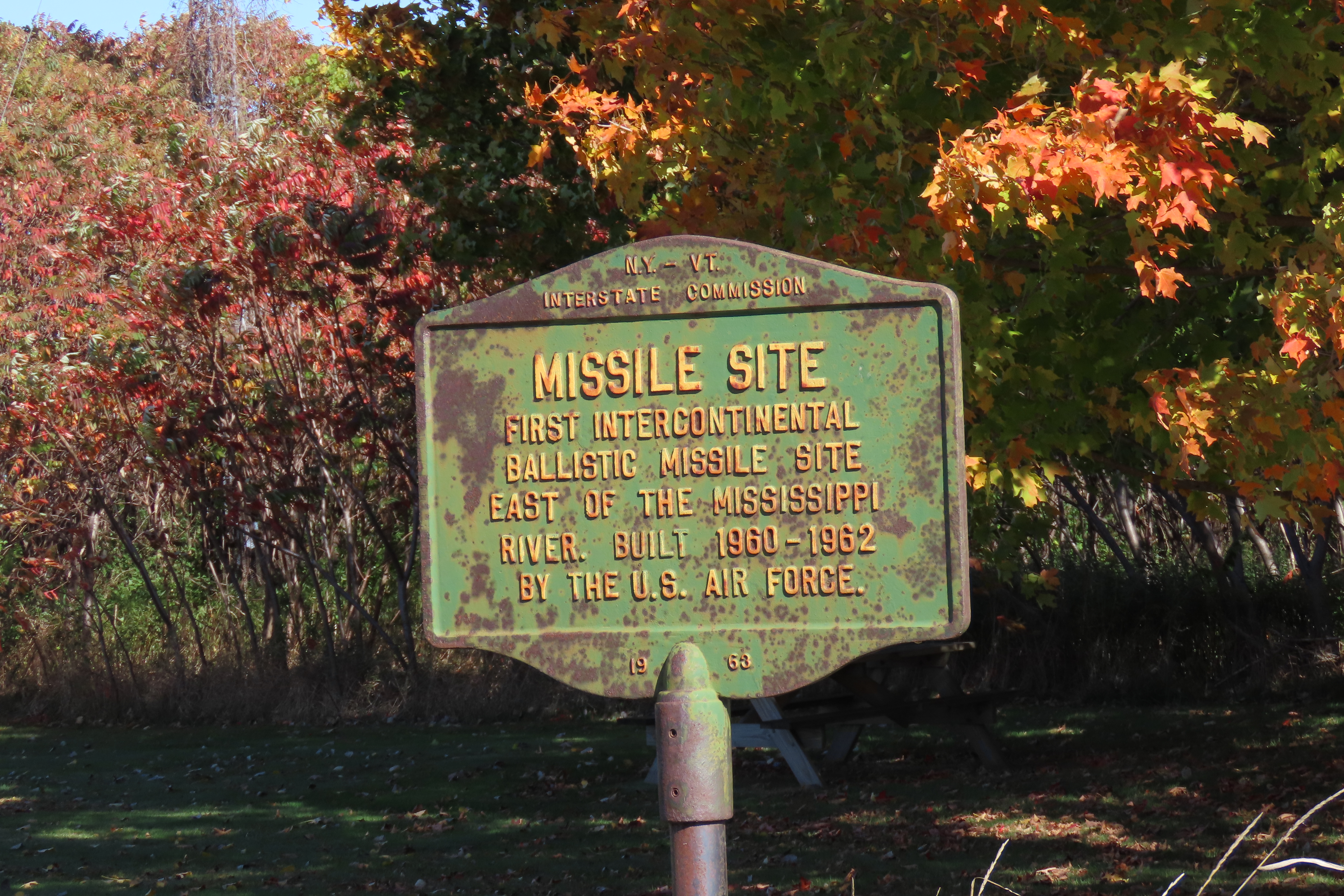
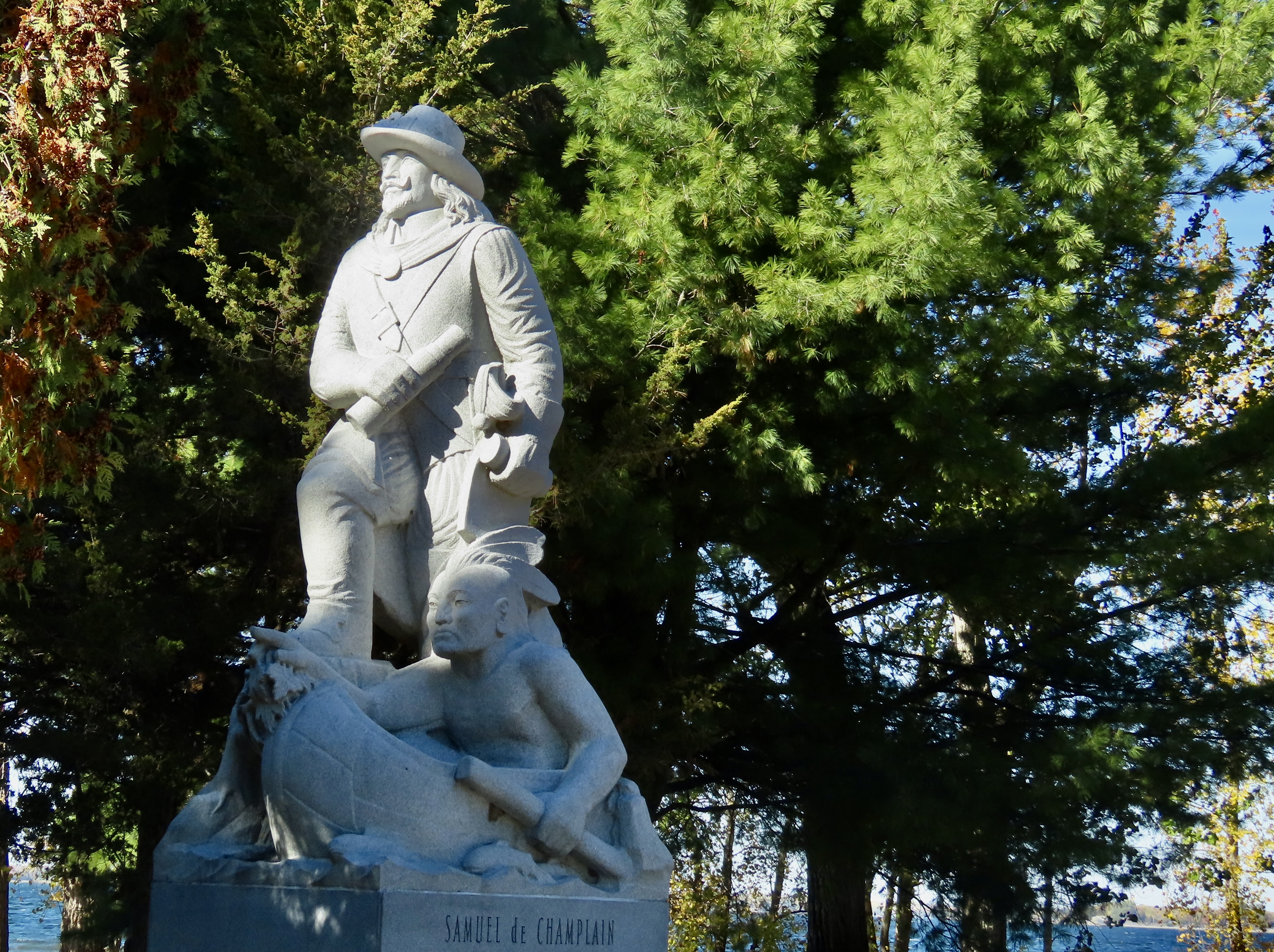
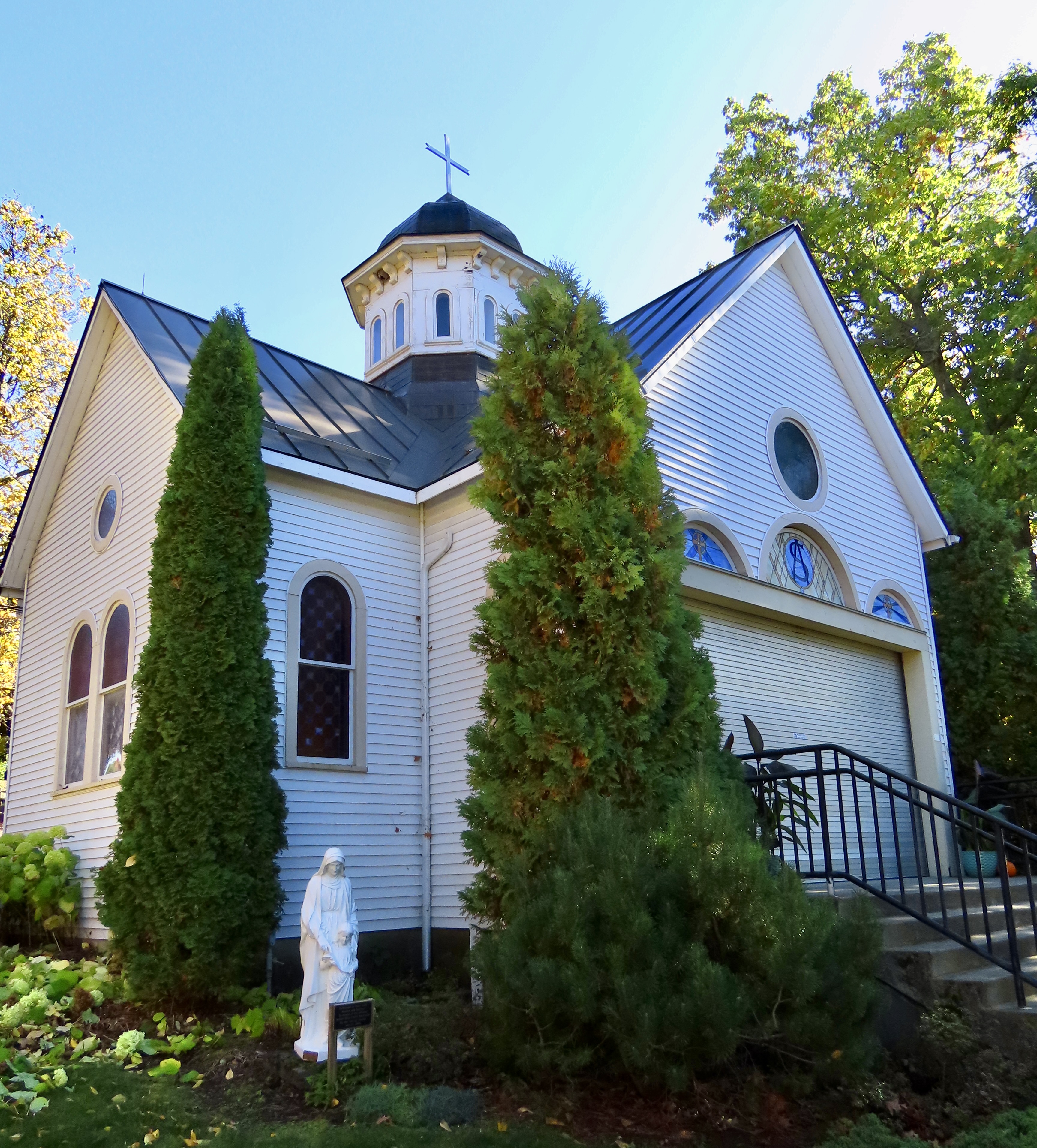
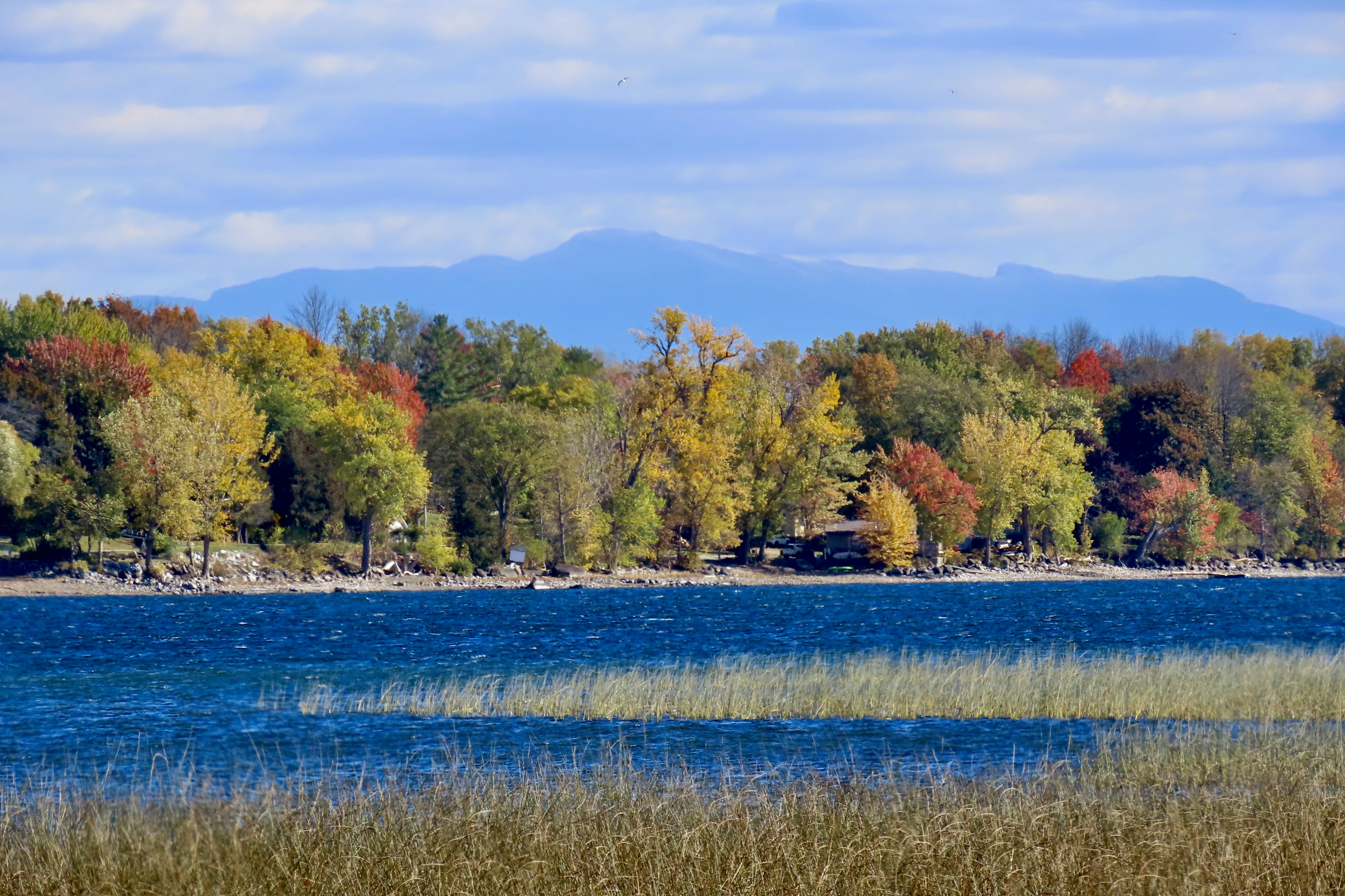
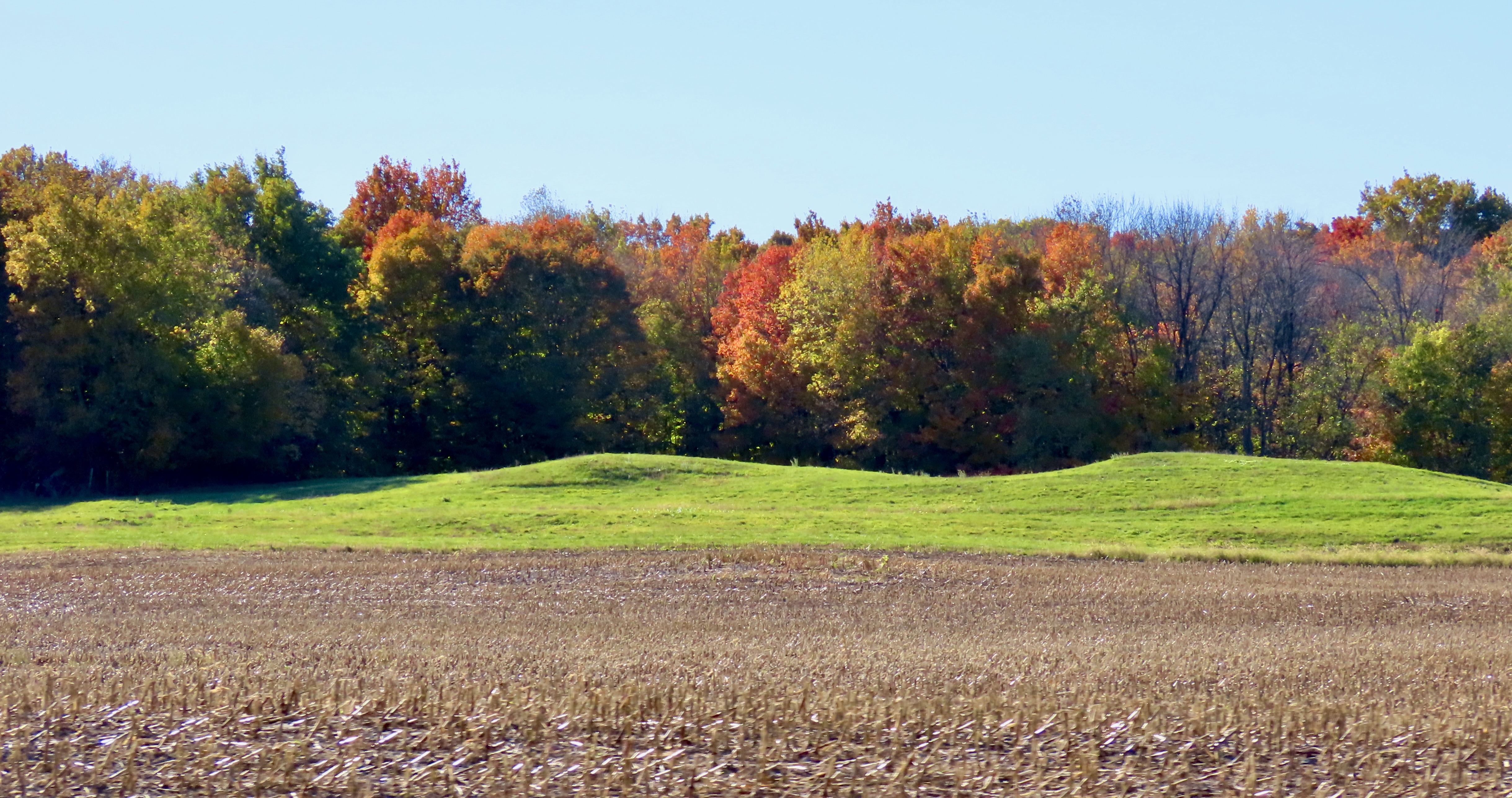
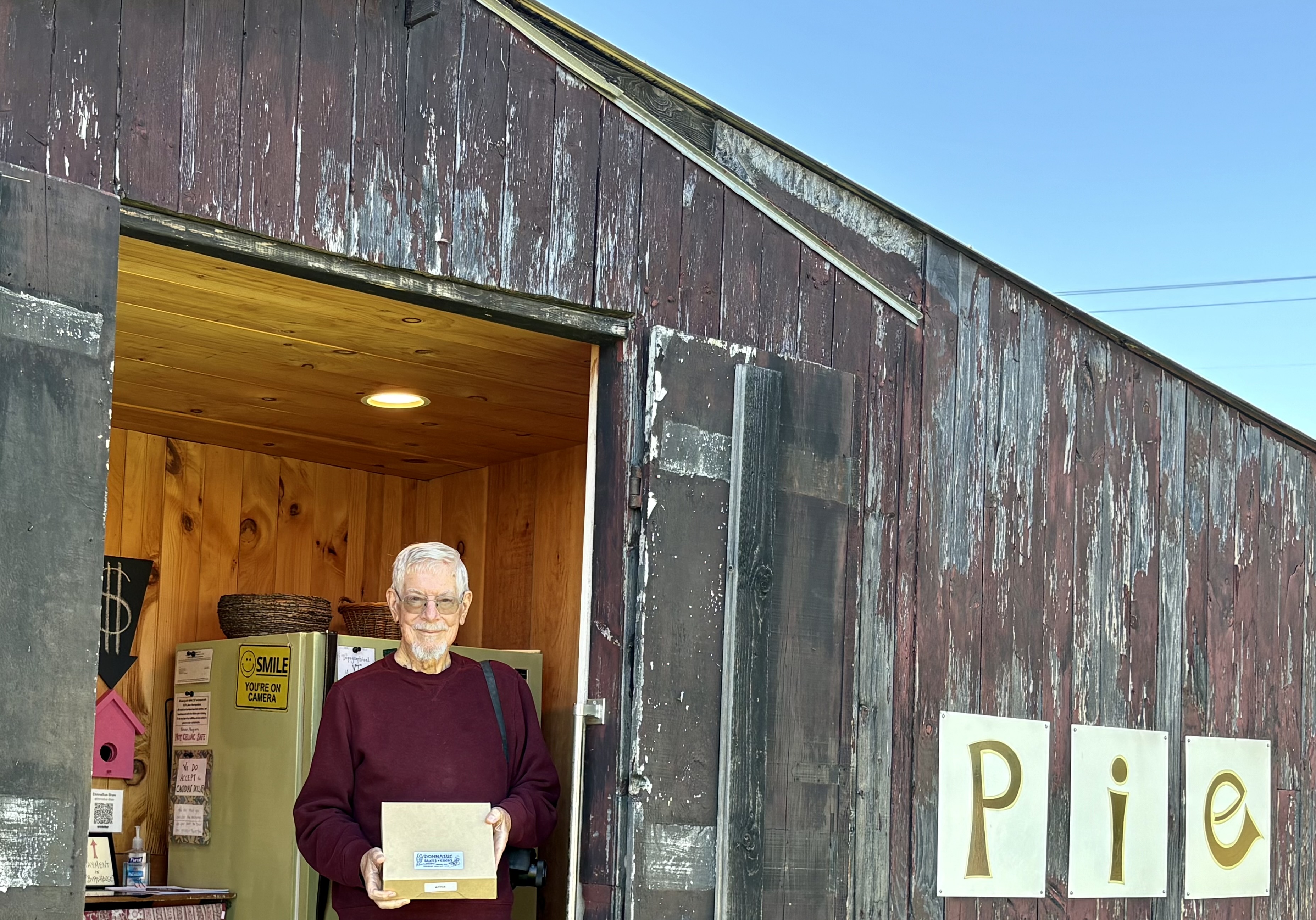
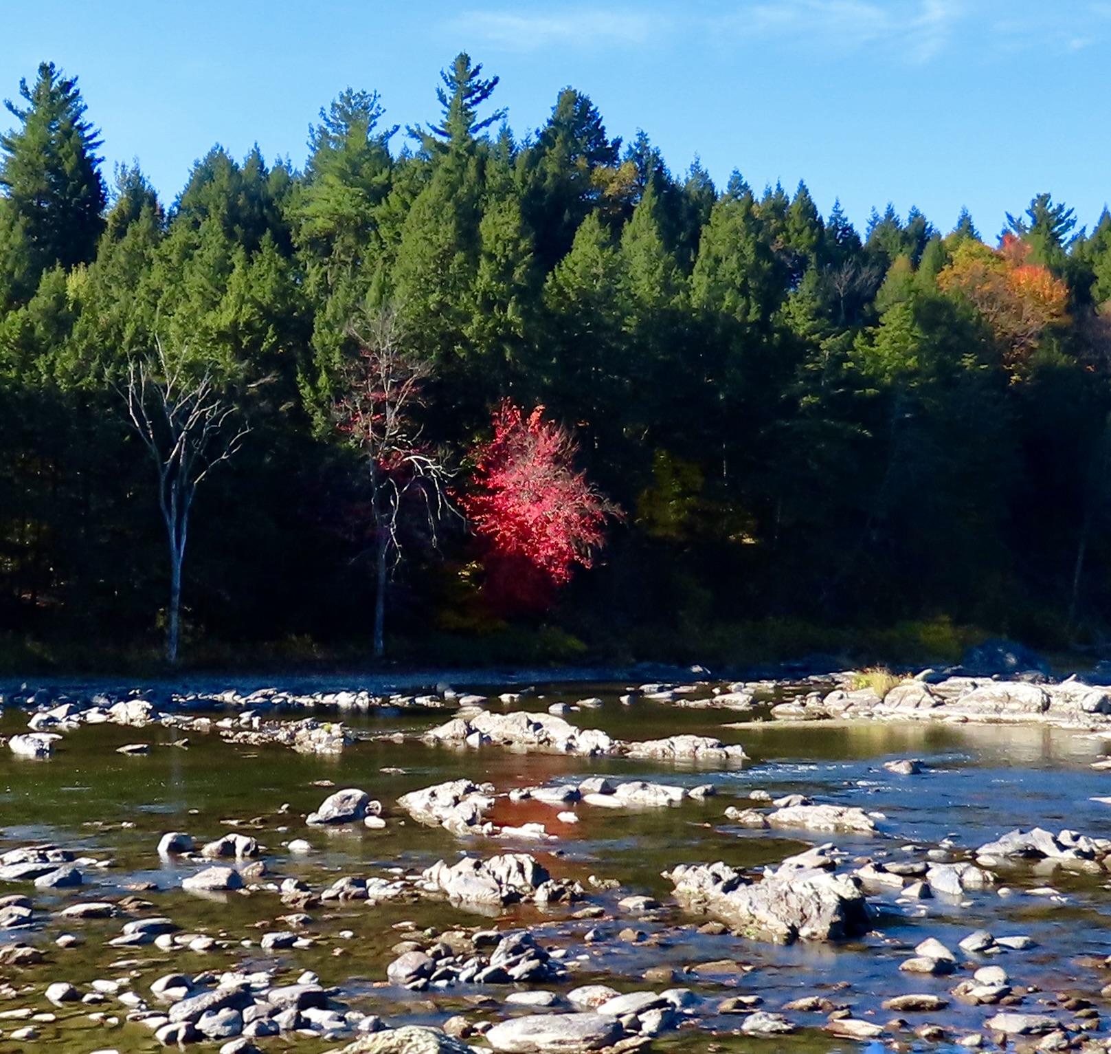
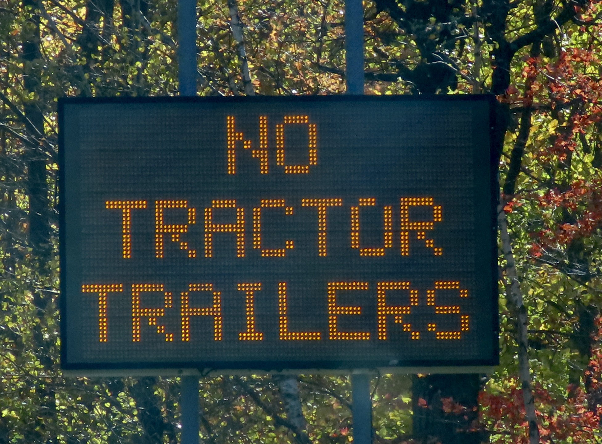
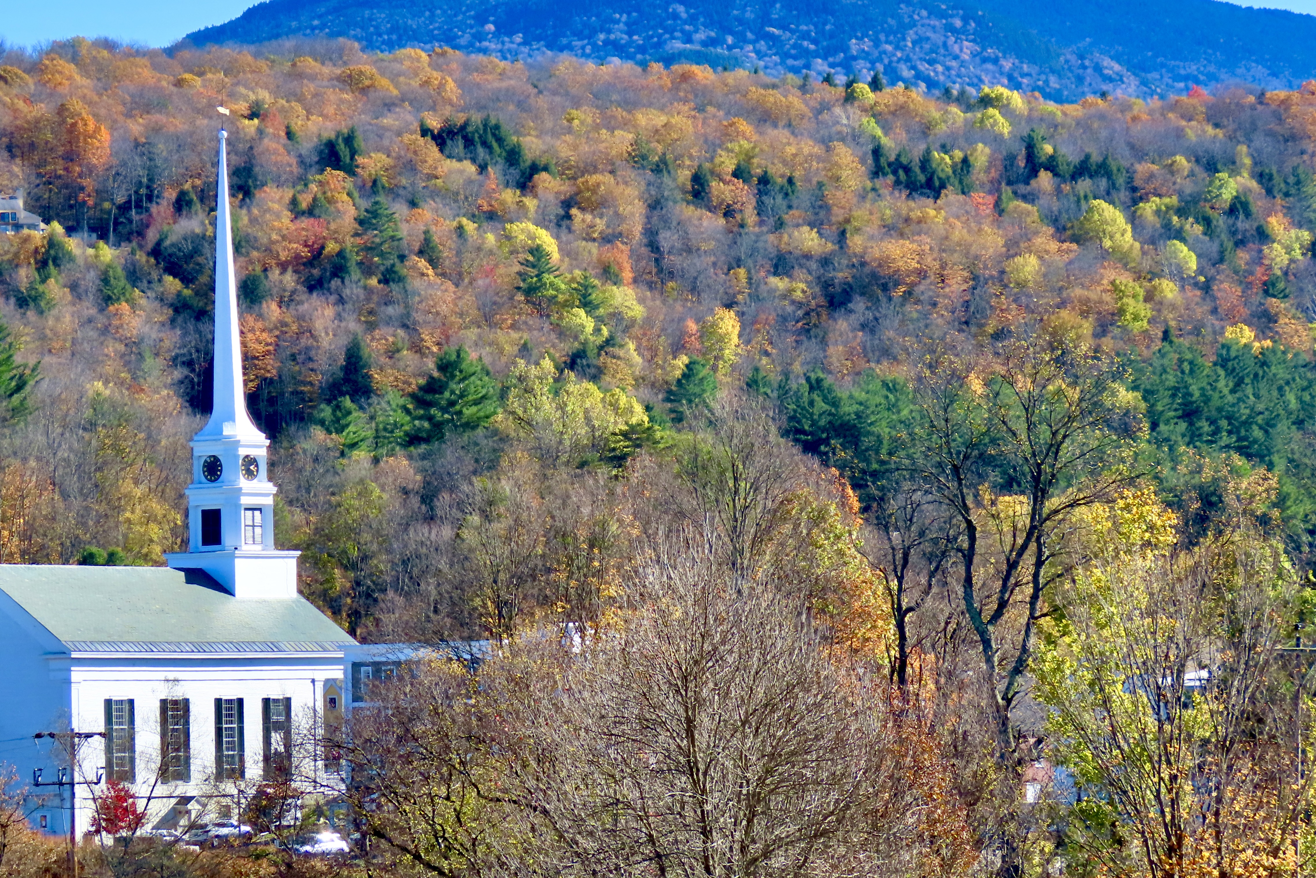
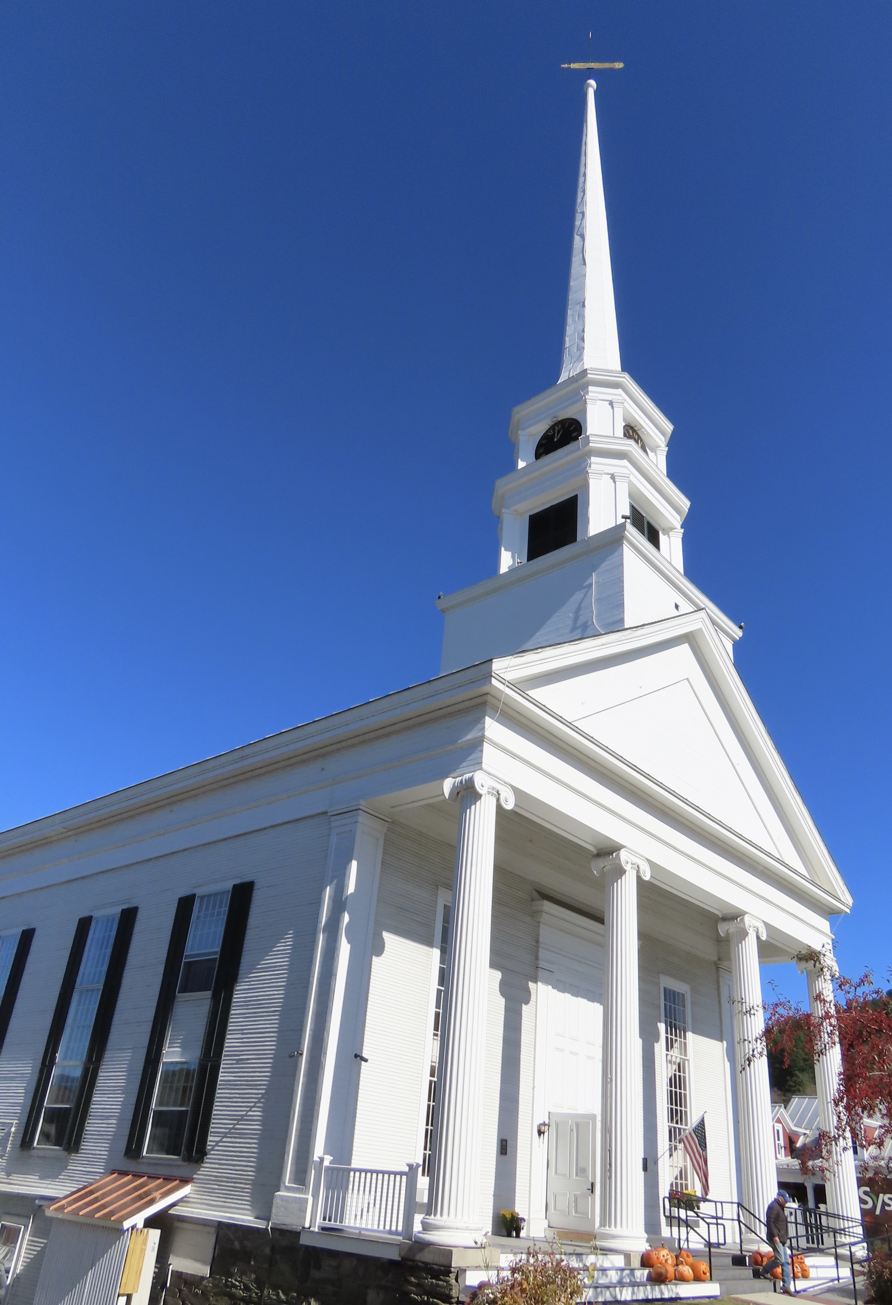
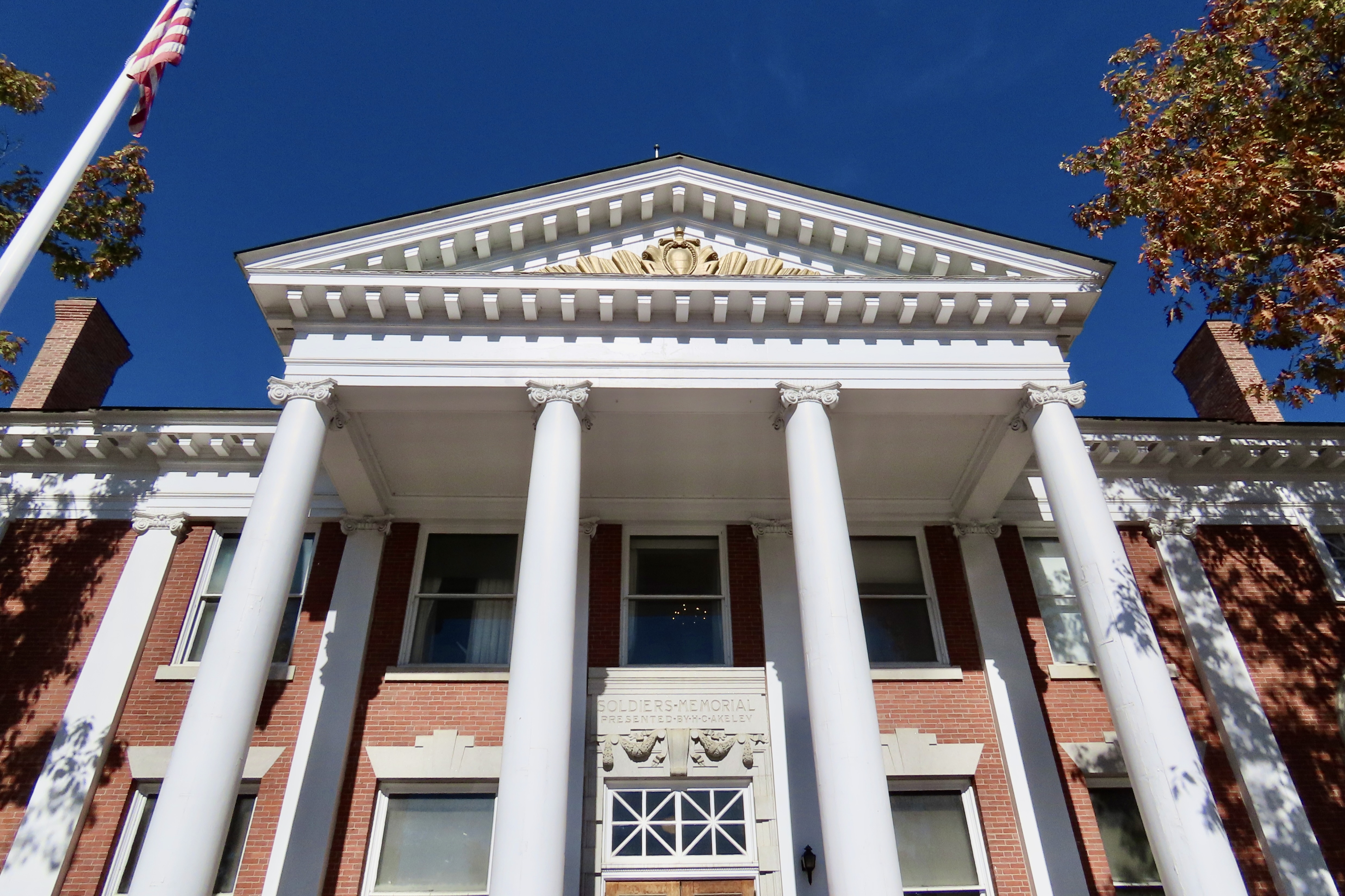
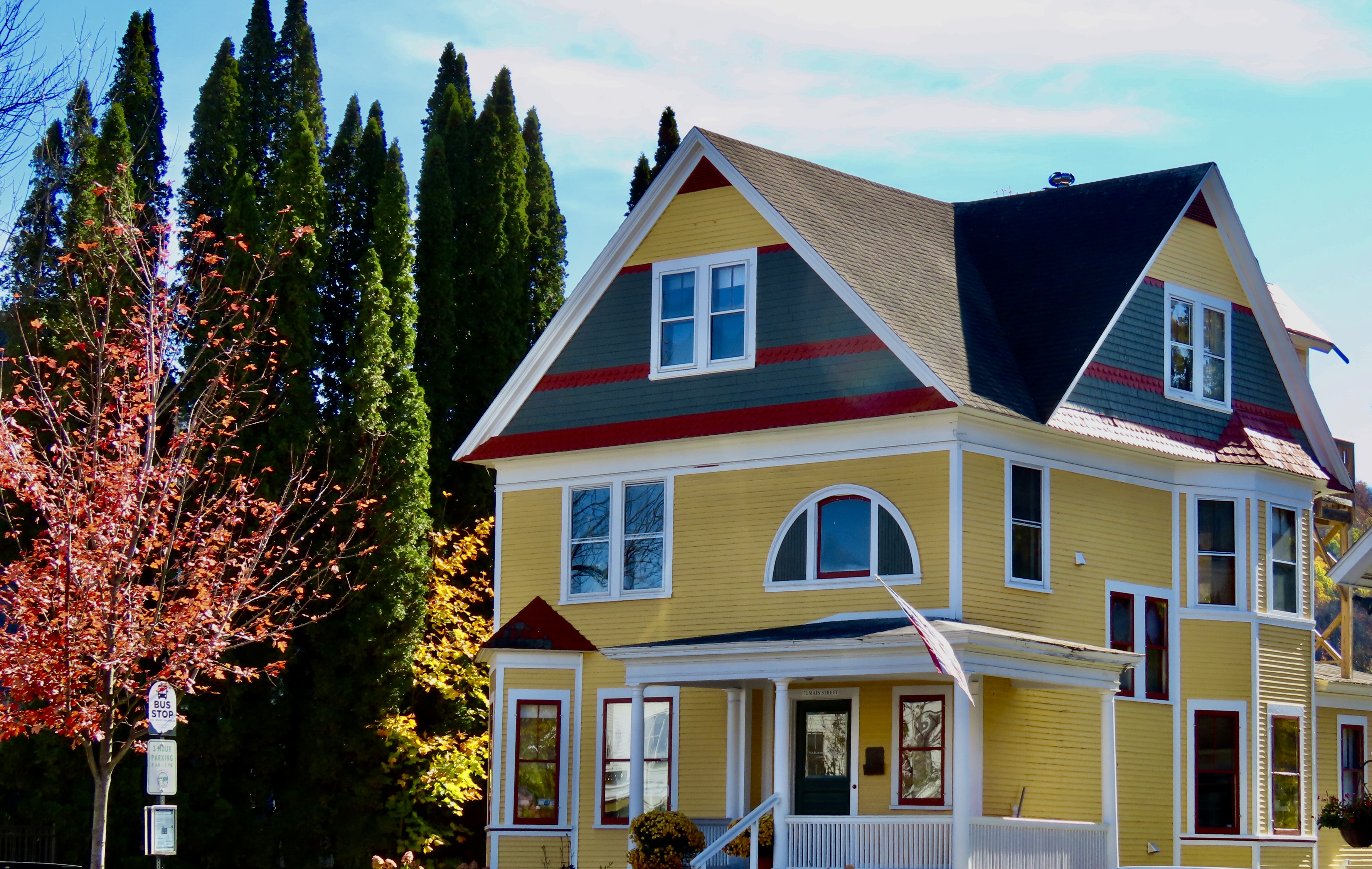
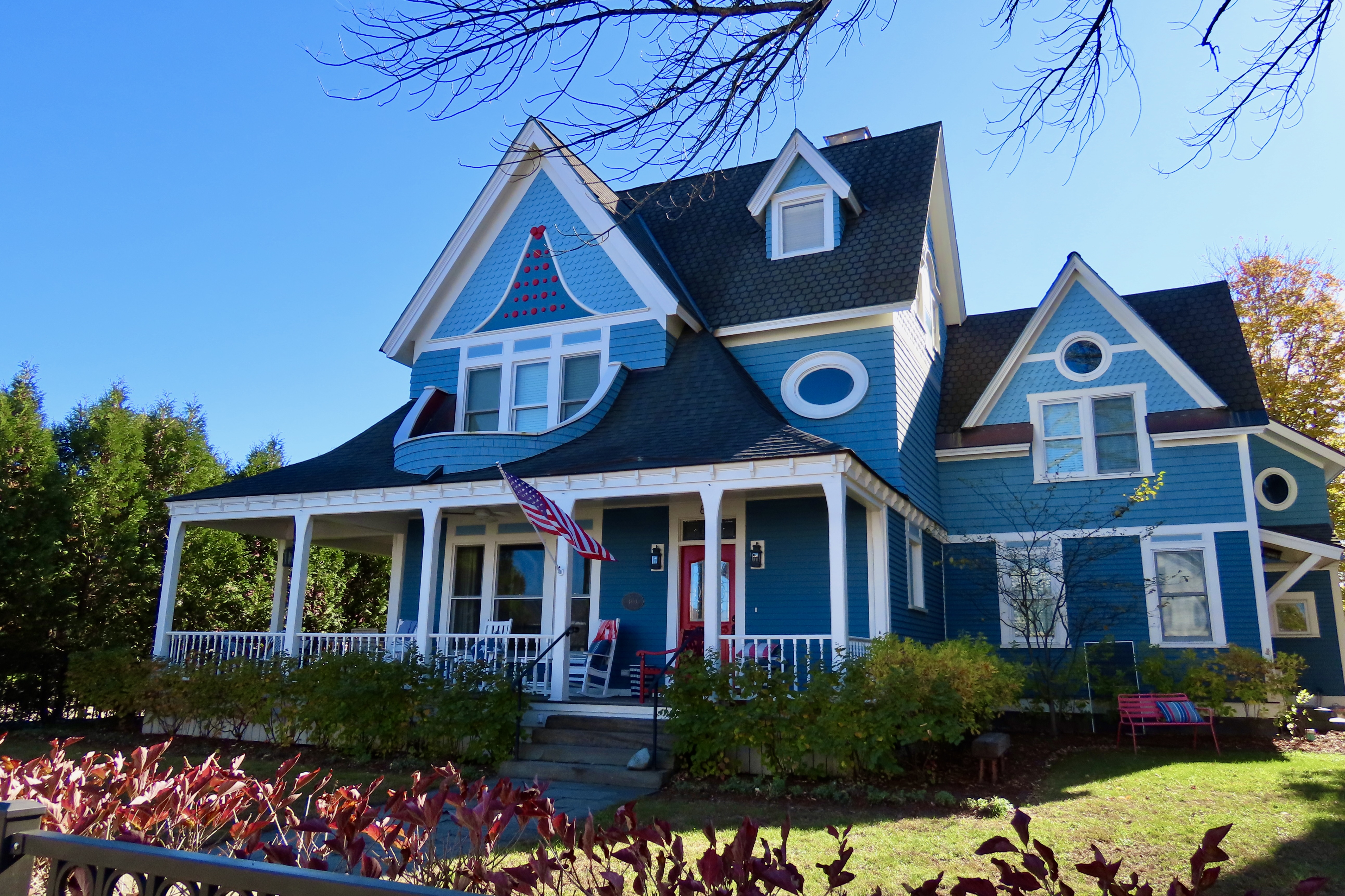
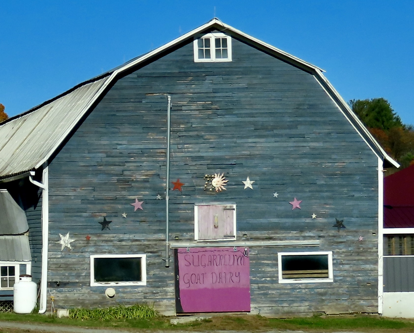
This stove serves as an example of what Shane had done in the cabin. He had taken a beautiful antique wood stove and modified it by putting a modern gas stove on top. It was the best of both worlds.Bedspread, pillow cases, curtains and rugs all included outdoor scenes packed with wildlife and country themes.There were also lots of crow decorations. This was due to the fact that Shane calls the cabin, the Crow’s Nest. In fact you can look up the cabin at Crow’s Nest, West Chazy, NY.We didn’t see any crows outside, but this banty rooster was strutting his stuff. He crowed about how he was inspiring the chickens to lay eggs. There were also goats, a white turkey, and the egg laying hens that guests could visit.The most common member of the bird family we found in the area were Canada Geese. There were dozens/hundreds of them. Everywhere. In creeks, small ponds, and Lake Champlain. No body of water was too small or too large. We noticed that they seemed a little skittish and headed into the water whenever we got close. We also wondered why they were hanging out near the Canadian border and hadn’t flown south. And then it dawned on us. They didn’t have passports, they didn’t haven’t visas, they didn’t have US citizen papers, and, worse, they were dangerous criminals: They pooped in public parks and on people’s lawns. The geese, frightened that we were ICE agents, prepared to fly back across the border on a moment’s notice.You are now cleared for flight on runway #1.Since the Vermont islands on Lake Champlain were a short drive away from Chazy, we made a day trip over to visit them. This gorgeous tree was right next to the Vermont Information Center. Peaceful, huh?This sign stood next to the tree. I was once exploring an ICBM site north of San Francisco when I heard a loud grinding noise. A large cover drew back and out came the missile with its nose pointed toward the sky. Scary, eh! That would have had me fleeing toward the mountains ( and probably peeing my pants), except I knew that the site was decommissioned and some type of visitor demonstration was scheduled.The islands are all connected by bridges and a road. The first Island we explored was Isle de Motte. It featured a large statue of Samuel Champlain, who the lake is named after, and a native. Both were holding rolled up documents, which I assume represented treaties between the Hurons, Algonquins and France. The allies were attacked by a large body of Iroquois when Champlain was first exploring the lake in 1609. Champlain saved the day by shooting two of the Iroquois chiefs with his flintlock. Note how the Indian wisely hid behind a rock while Champlain fearlessly faced the enemy. (One of the reasons the Americans were able to defeat the British during the Revolutionary War was that learned from the Indians.)An actual self-portrait done by Champlain of how he pictured the event. My thoughts are: Duck! But that wouldn’t be nearly as impressive to the folks back home. Champlain became known as the Father of New France while the Iroquois became forever enemies of the French, siding with the English during the French and Indian War.As Champlain used his muzzle to sight in on the Iroquois, I used a tree near his statue to sight in on the shore of New York State. Our cabin was about five miles away from the shore. The Adirondacks can be seen rising in the distance.A small attractive chapel that is part of St. Anne’s Shrine, stood just across the road from Champlain’s statue. For services, the large door in front opens up to a covered patio in front of the church where the congregation sits.We continued to have great water and fall tree views as we drove around the islands. The mountains in the distance are the Green Mountains of Vermont.Farm lands made up much of the property on the islands. Here, the corn had been harvested and farmers were getting ready for winter.Iorek, our truck, made a quick left turn into a small, self-service bakery run on the honor system. We picked out an apple pie and stuffed our money into the birdhouse door beneath the large $ sign. We actually made the pie last for three days, which was amazingly disciplined considering how yummy it was.A final photo from the lake area. It was now time to begin our journey across Vermont. We packed up the truck and sadly left our cabin in the woods, telling Shane we would likely be back, maybe for a month.Following back roads across northern Vermont toward Stowe, we continued to be treated to gorgeous leaf peeping treats.As many as we saw, there was no danger of burnout! This was an interesting combination of river, green, and one bright tree peering out of the dark shadows, caught by the sun. Gets your attention, huh.A fun part of photography is taking photos that can pull viewers into the photo. We felt that the straight lines of the harvested crop heading down to the green field and then the forest did it here.The tree line starting up close on the right and moving down into the distance also pulls viewers into the photo.Sheer color splashed across the photo by nature, like paint on a Jackson Pollock painting, works as well. Grin.Smugglers notch was so intriguing we did it twice. One reason was the beauty. Another was history. As the name suggests, it was used by smugglers. In 1807, when Thomas Jefferson embargoed trade with Canada because of conflict with Britain, Northern Vermont residents smuggled goods into Canada as a way to survive. Later, the gap worked as part of the Underground Railway moving escaped slaves to Canada. Finally, it kept Northern Vermonters in booze during Prohibition.Finally, as this sign suggests, the road is a challenge to drive. Up on top it turns into a narrow one way road that snakes its way around large boulders in hairpin tight curves that even Iorek had problems with. Sign after sign forbid large trucks from going across and provided convenient turn-around locations.Finally, everyone is required to drive through low-height barriers called chicanes that mimic the narrow road and tight curves. A sign informs drivers that if they can’t make it though, they won’t make it over the pass. This applies to tourists pulling trailers as well as 18 wheelers. Regardless of the precautions, several tractor trailers end up trying to get over and jackknifing on the curves each year, causing delays that can end up taking hours to clear. There’s a hefty $2500 dollar fine plus whatever it costs to get a tow truck (or tow trucks) up on top to solve the problem.Coming down off the pass, we got our first views of Stowe. If you don’t mind crowds of tourists and packed highways, a stop is definitely worth it. This photo shows its iconic New England Church that sits on the main street.A view of the church from downtown.Town Hall.What impressed Peggy and me the most, however, were the beautiful homes.I’ll conclude with Peggy’s favorite. In our next post we will finish our tour across Vermont, take you through New Hampshire and end in western Maine.Dairy goat farming, we learned along the way, is becoming a big thing in Vermont. This is the Sugar Plum Goat Dairy.
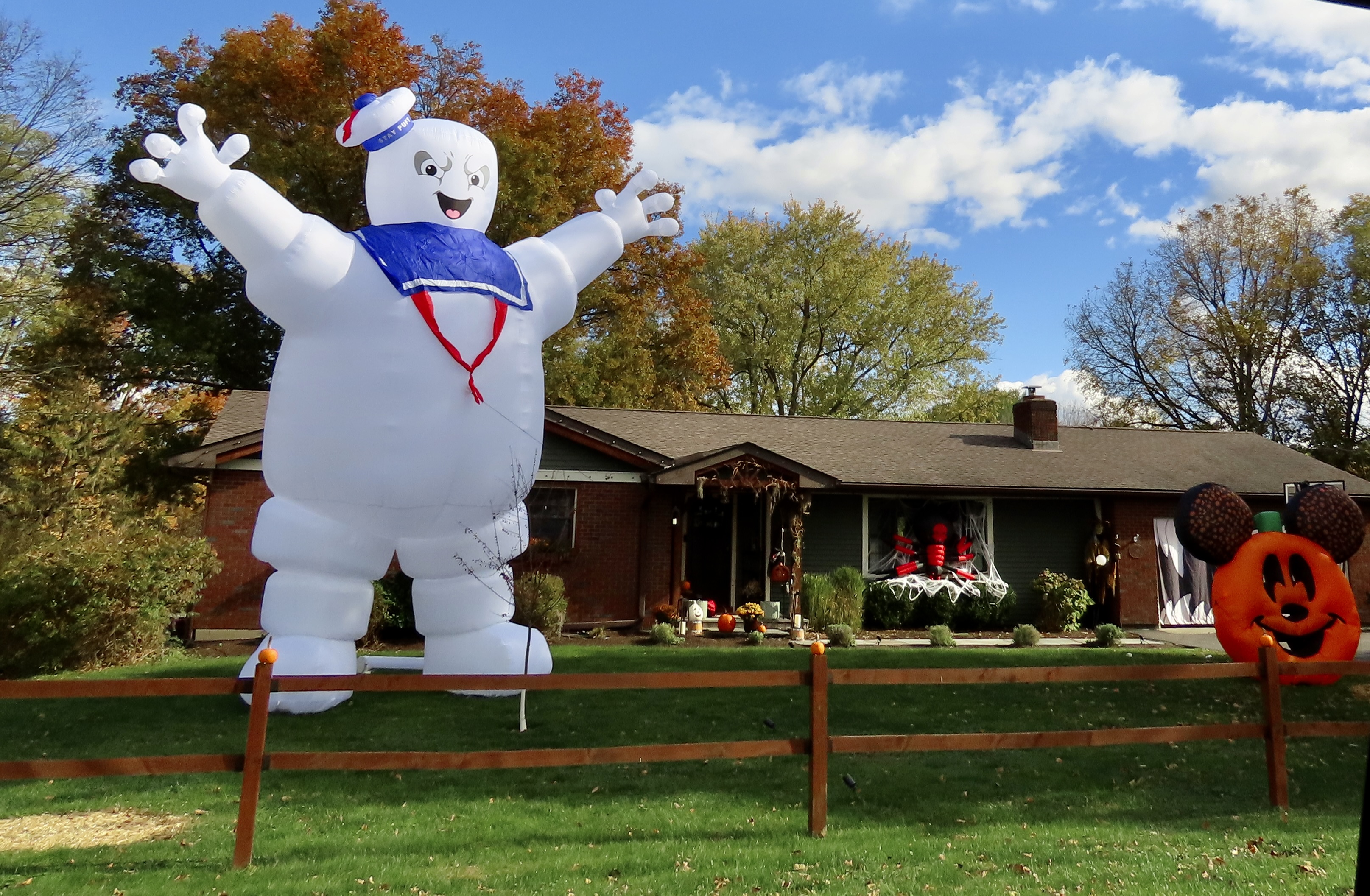
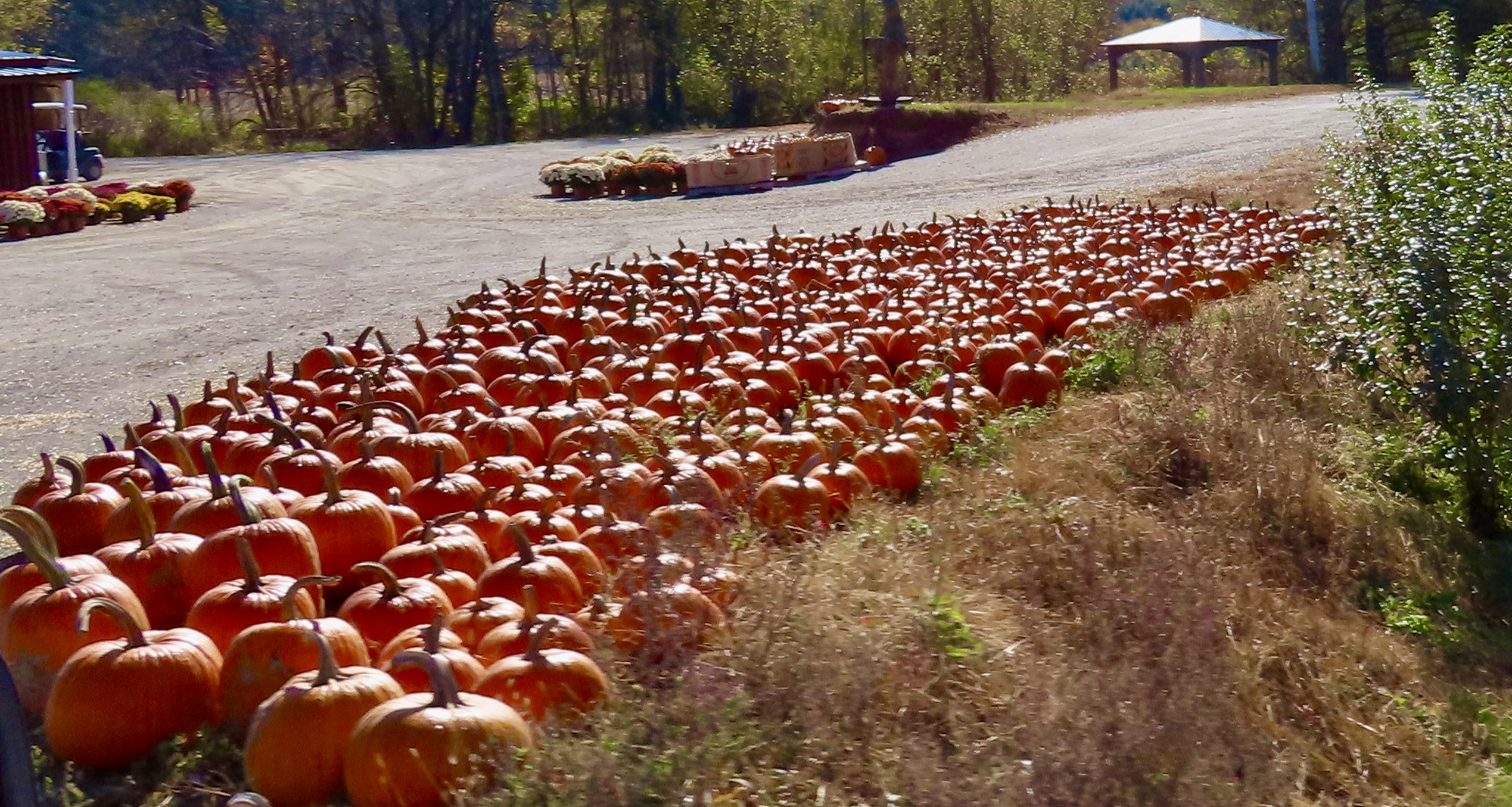
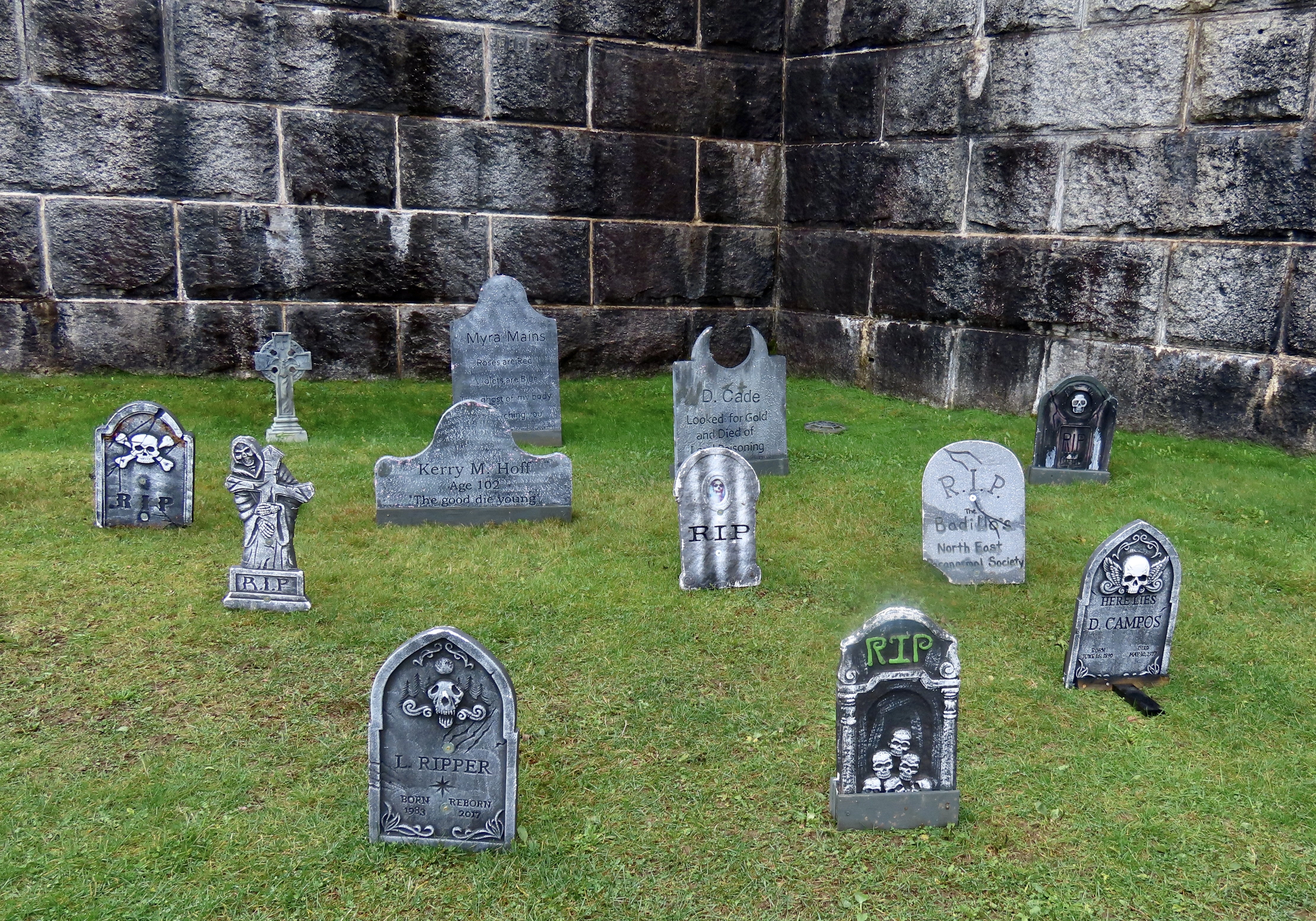
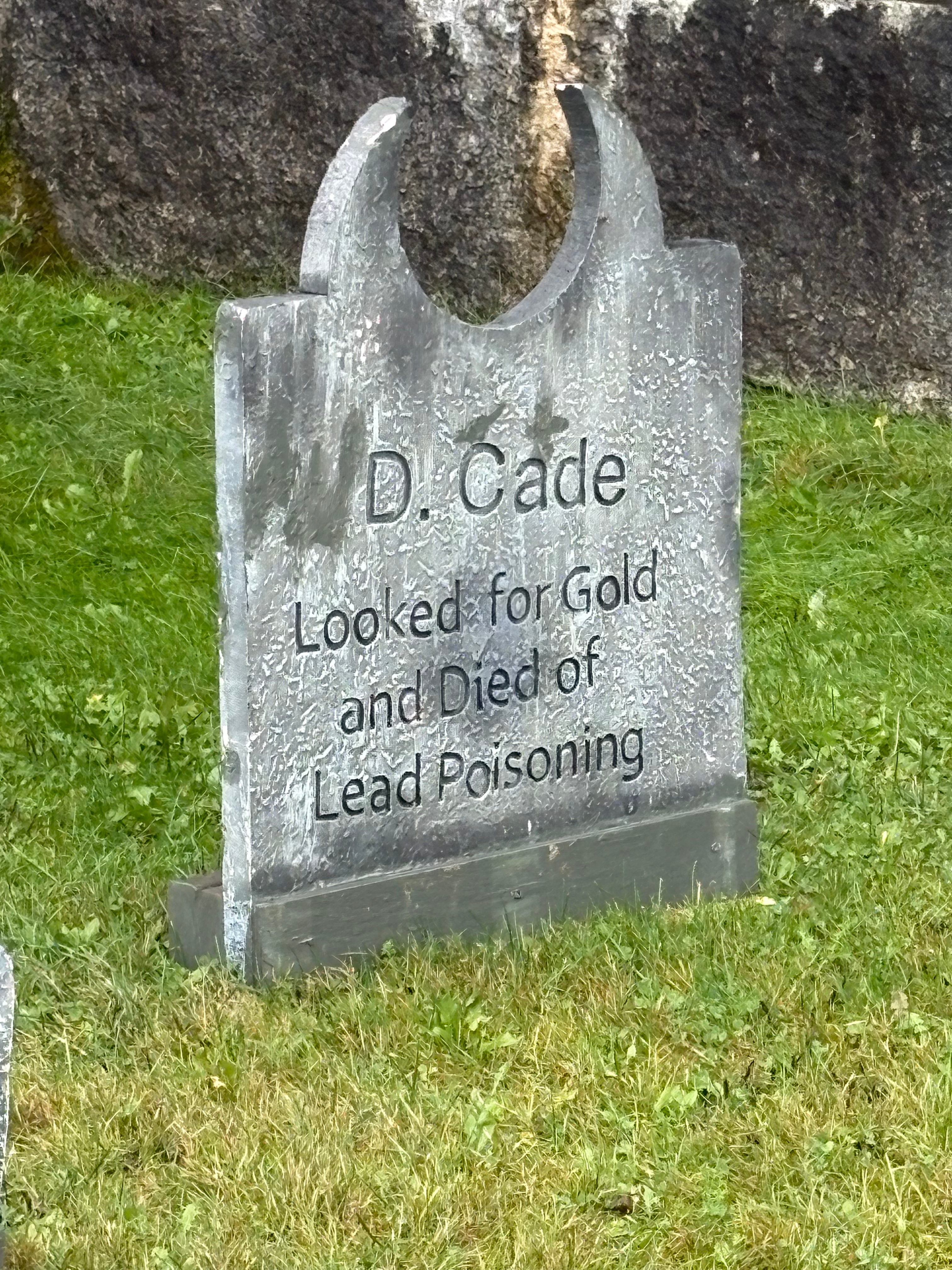
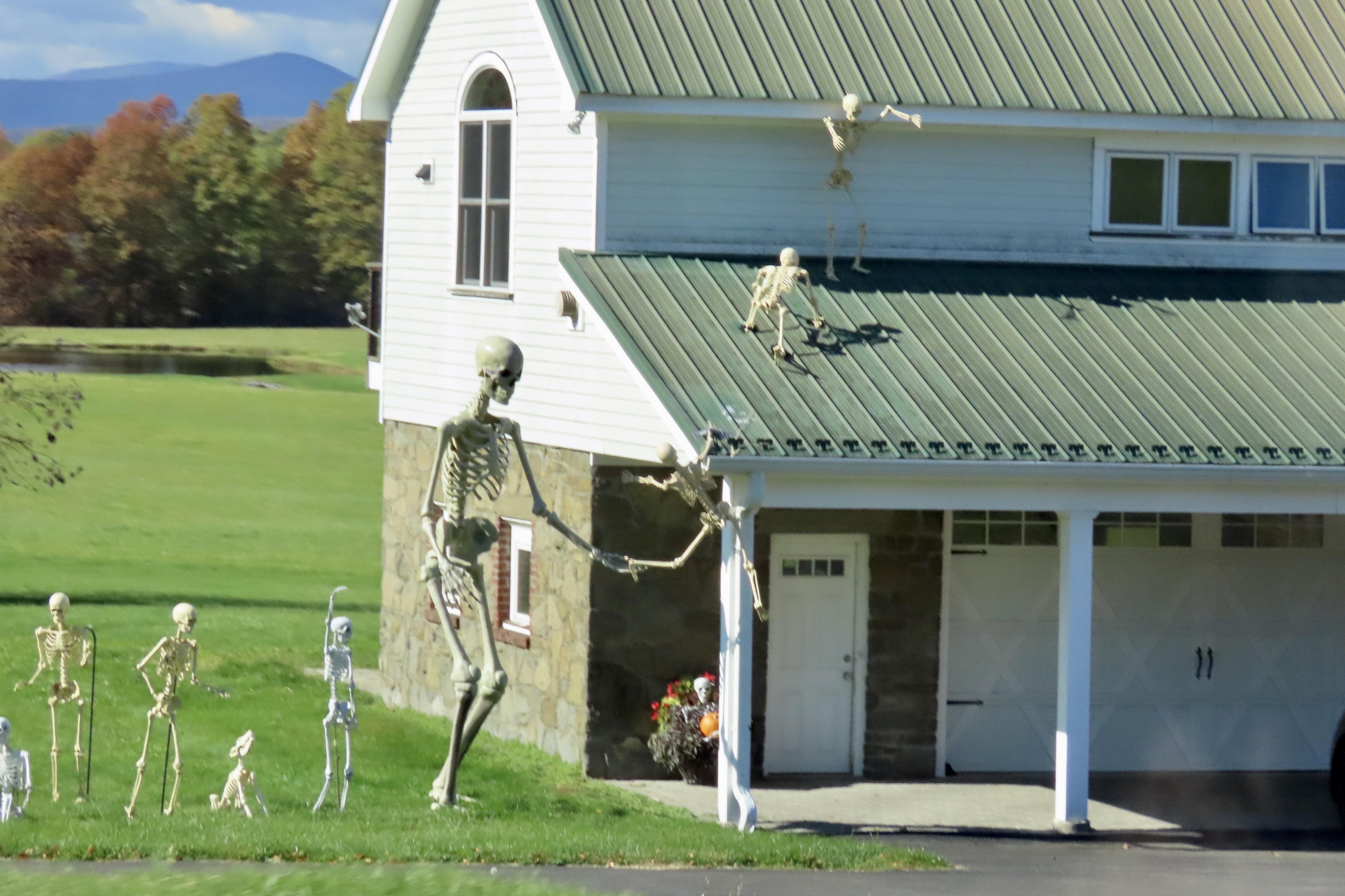
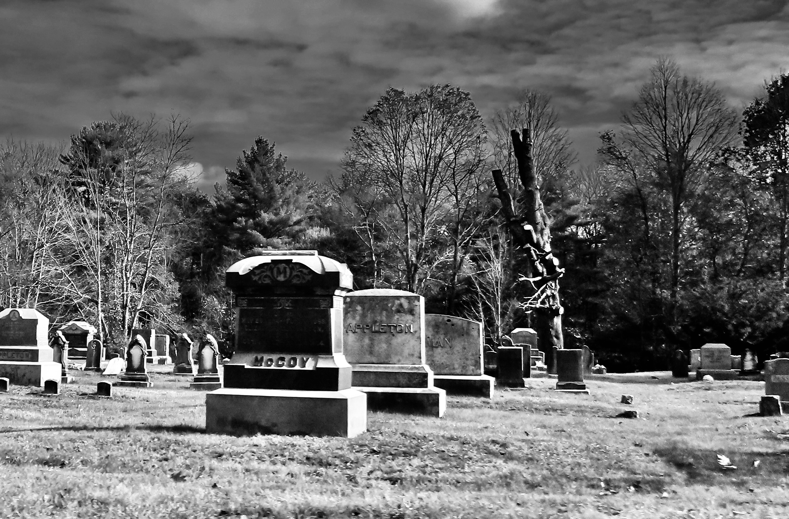
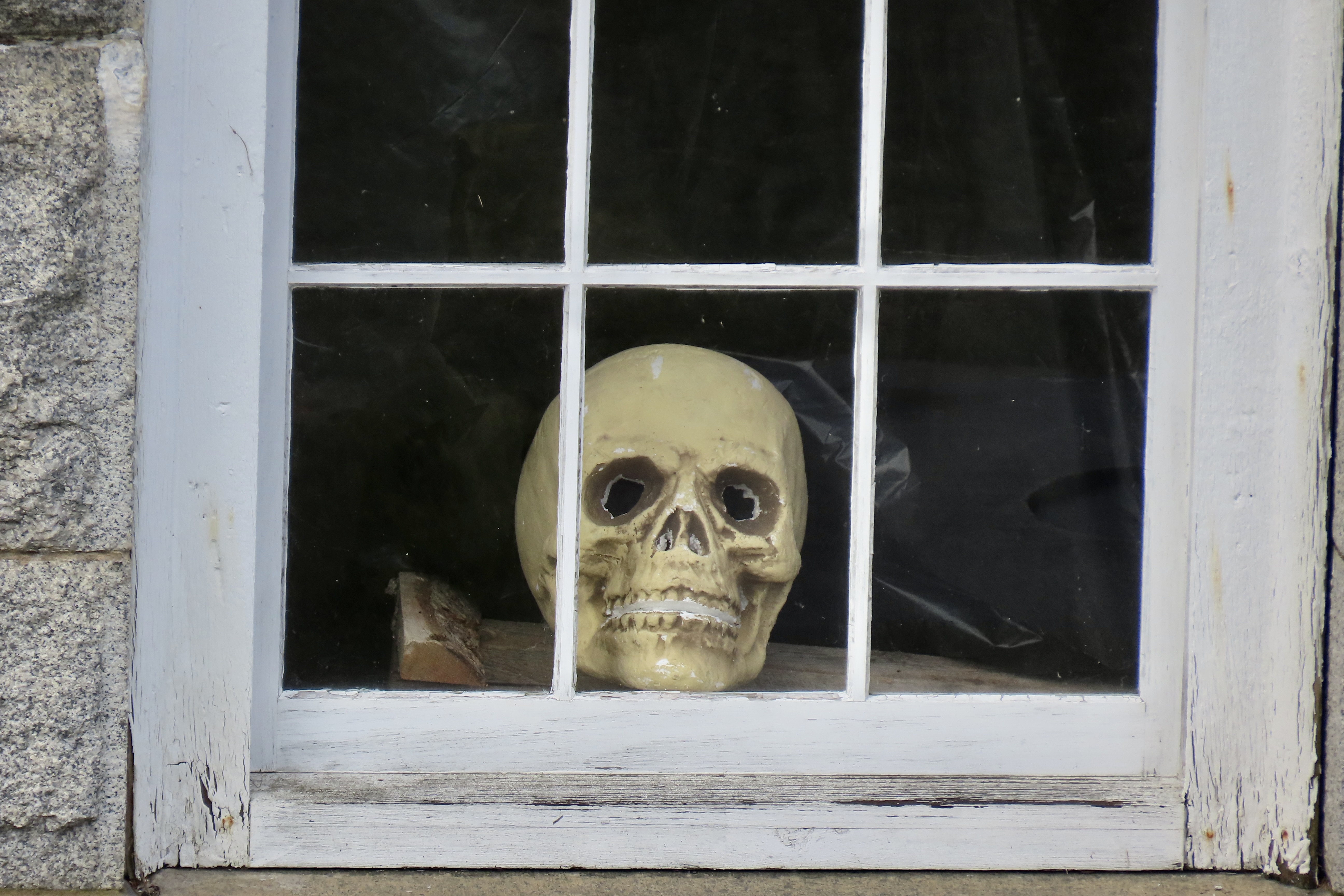
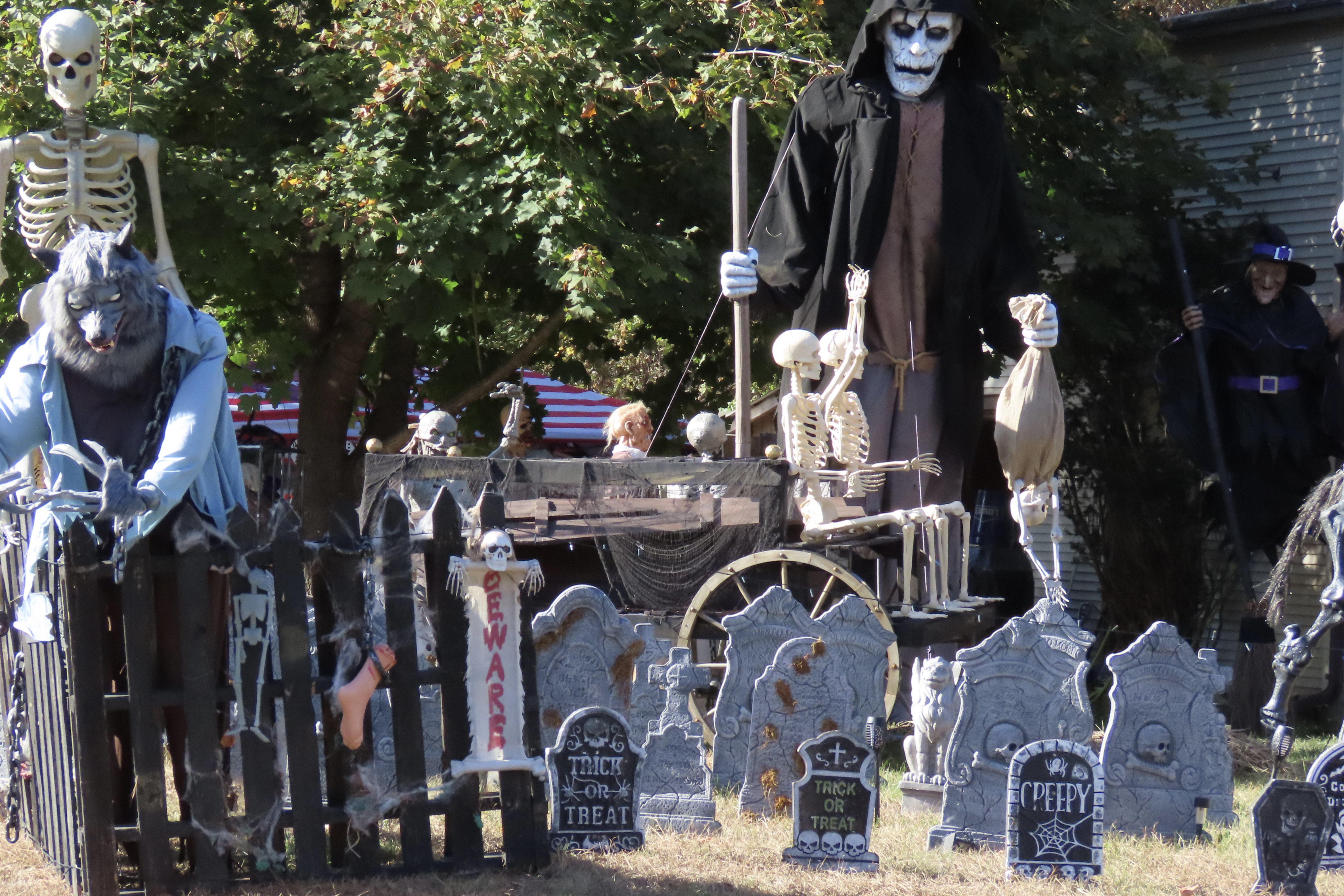
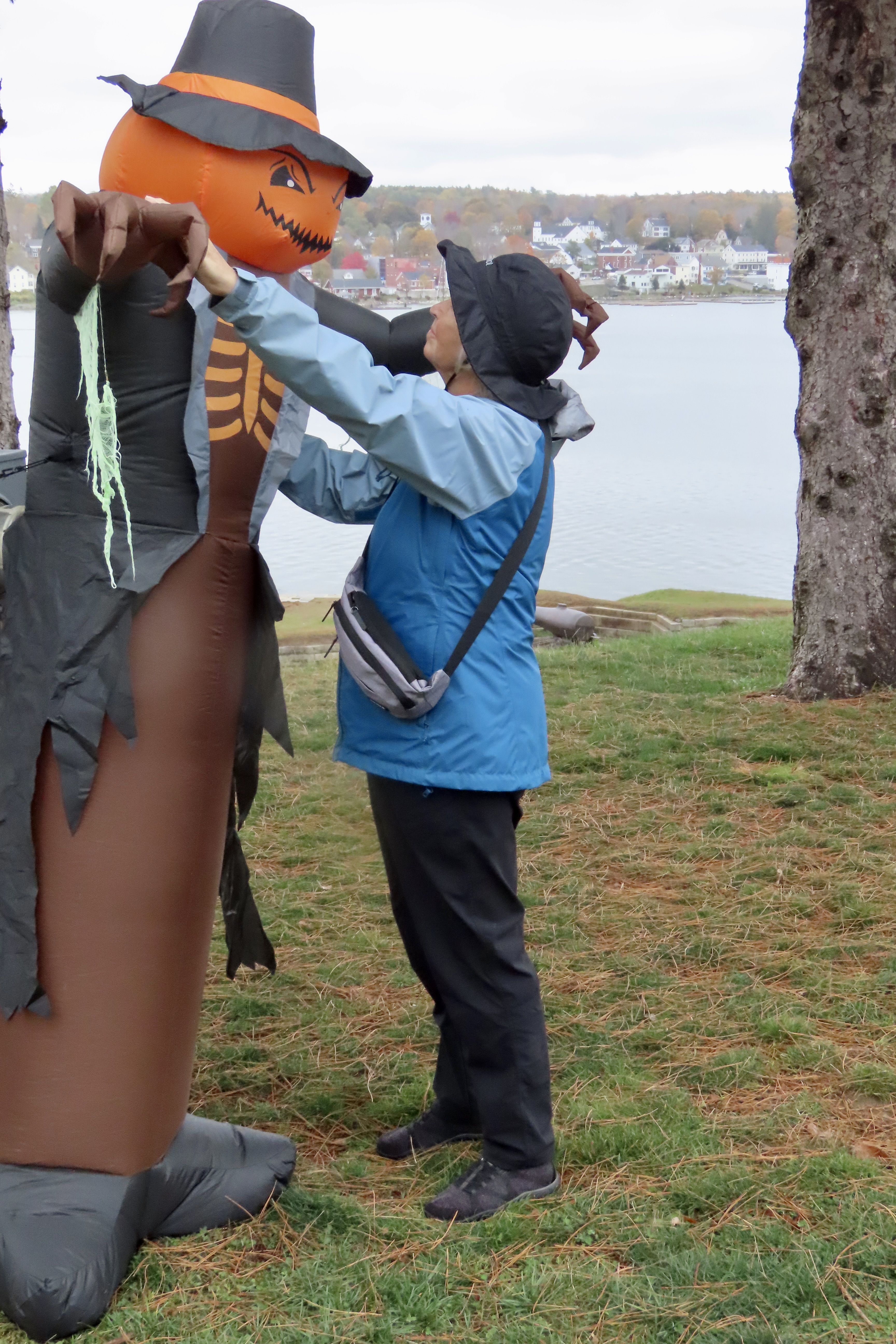
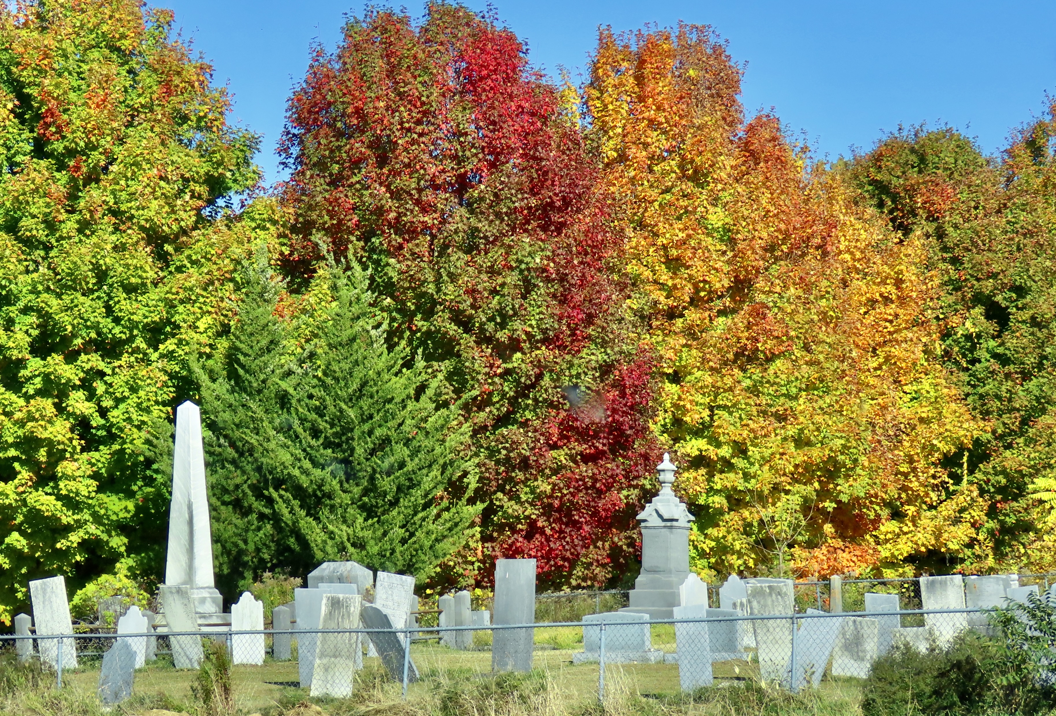
Remember when a well decorated Halloween house consisted of candle lit carved pumpkins welcoming trick or treaters? Things have changed. Halloween is catching up with Christmas in terms of decor. Who would have ever imagined being greeted on All Hallows Eve by Stay Puff the giant Marshmallow Man from Ghost Busters. Or Mickey Mouse’s country-bumpkin-pumpkin cousin, Dickey. We were in Red Hook, New York visiting with Betsy Bauer, a good friend of ours, when we came upon this giant marshmallow. “I just have to add this to my Halloween post,” I told Betsy.This isn’t to say that pumpkins have gone out of style on Halloween. It seemed like every few miles of our leaf peeping trip we came on another ‘patch’ like this. The only things that seemed to outnumber them in New England were graveyards and Dunkin’ Donuts outlets. We flew past the graveyards; not so the Dunkin’ Donuts. Oink.While on the subject of graveyards, they have become a go-to decoration for Halloween. These were part of an elaborate display at Fort Knox on Maine’s Penobscot River. Note the demon/devil horned tombstone in the back.Its epitaph reminded me of Boot Hill in Tombstone, Arizona. The name suggested that D. Cade had been buried for a while. He was no longer fresh. Or is that flesh?Skeletons competed with pumpkins in New York and New England for being the most common decorations. A kid’s party seemed underway here. There was even a dog skeleton that was excited about a game of catch. On our leaf peeping journey through New York and New England, we also saw cat skeletons, a horse skeleton, and several rooster skeletons!Of course nothing can match a real graveyard for scary, especially at night— or with a little help from a photo ap.
I know something about scary graveyards. I was raised next to one and have blogged about the experience several times. To say it was overgrown is a serious understatement. During the day, it became a jungle playground populated with ferocious tigers, bone crushing boas, and half-starved cannibals. My brother Marshall and I played there often. Since it was within easy calling distance of the house, our parents didn’t worry. Either that or they were glad for the peace and quiet brought on by our absence.
Night was different. The Graveyard became a place of mystery and danger. Dead people abandoned their underground chambers and slithered up through the ground. A local test of boyhood bravery was to go into the Graveyard after dark and walk over myrtle-hidden graves, taunting the inhabitants. Slight depressions announced where they lived. Marshall, who at nine was two years older than I, persuaded me to accompany him there on a moonless night. I entered with foreboding: fearing the dark, fearing the tombstones, and fearing the ghosts. Halfway through I heard a muzzled sound. Someone, or thing, was stalking us.
“Hey, Marsh, what was that?” I whispered urgently.
“Your imagination, Curt,” was the disdainful reply.
Scratch, scratch! Something was digging behind a tombstone and it was not my imagination. Marshall heard it too. We went crashing out of the Graveyard with the hideous creature of the night in swift pursuit. Wagging her tail.
“I knew it was the dog all of the time,” Marsh claimed. Yeah, sure you did.
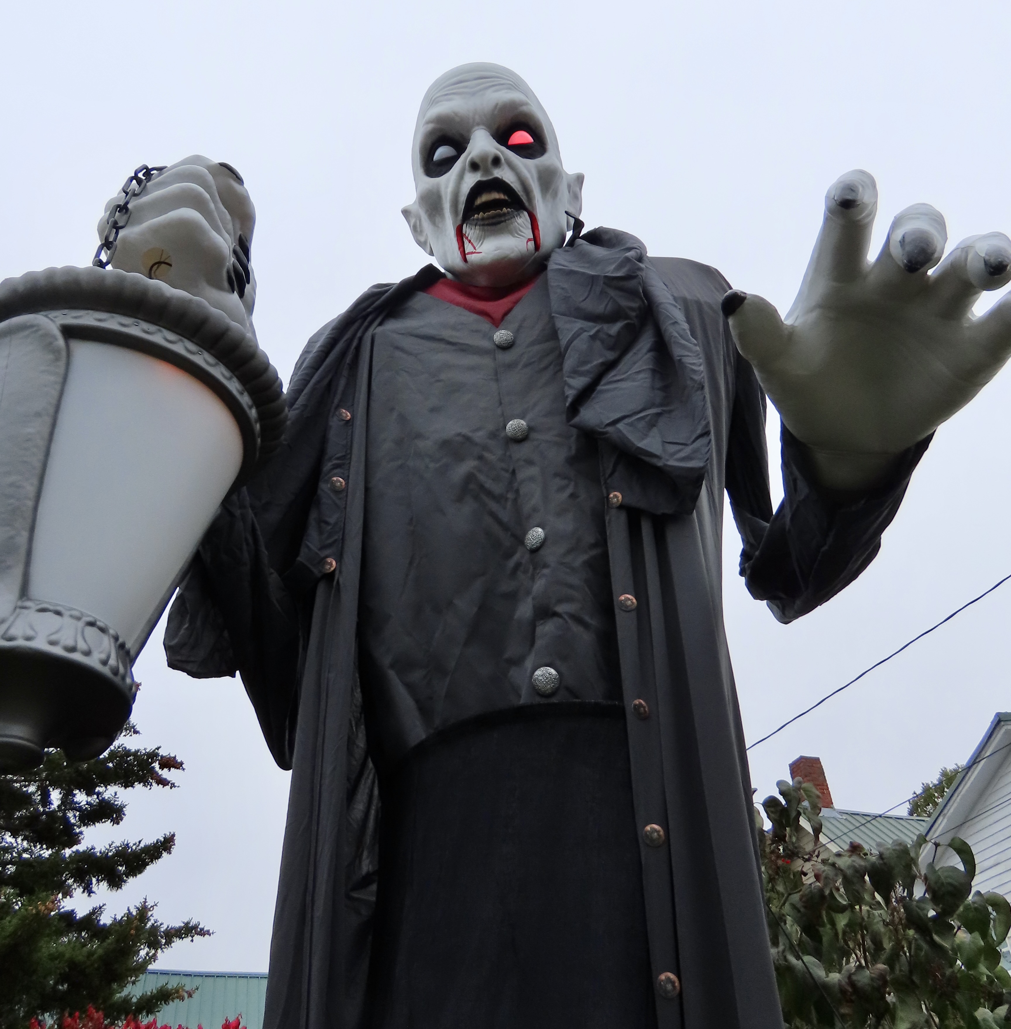
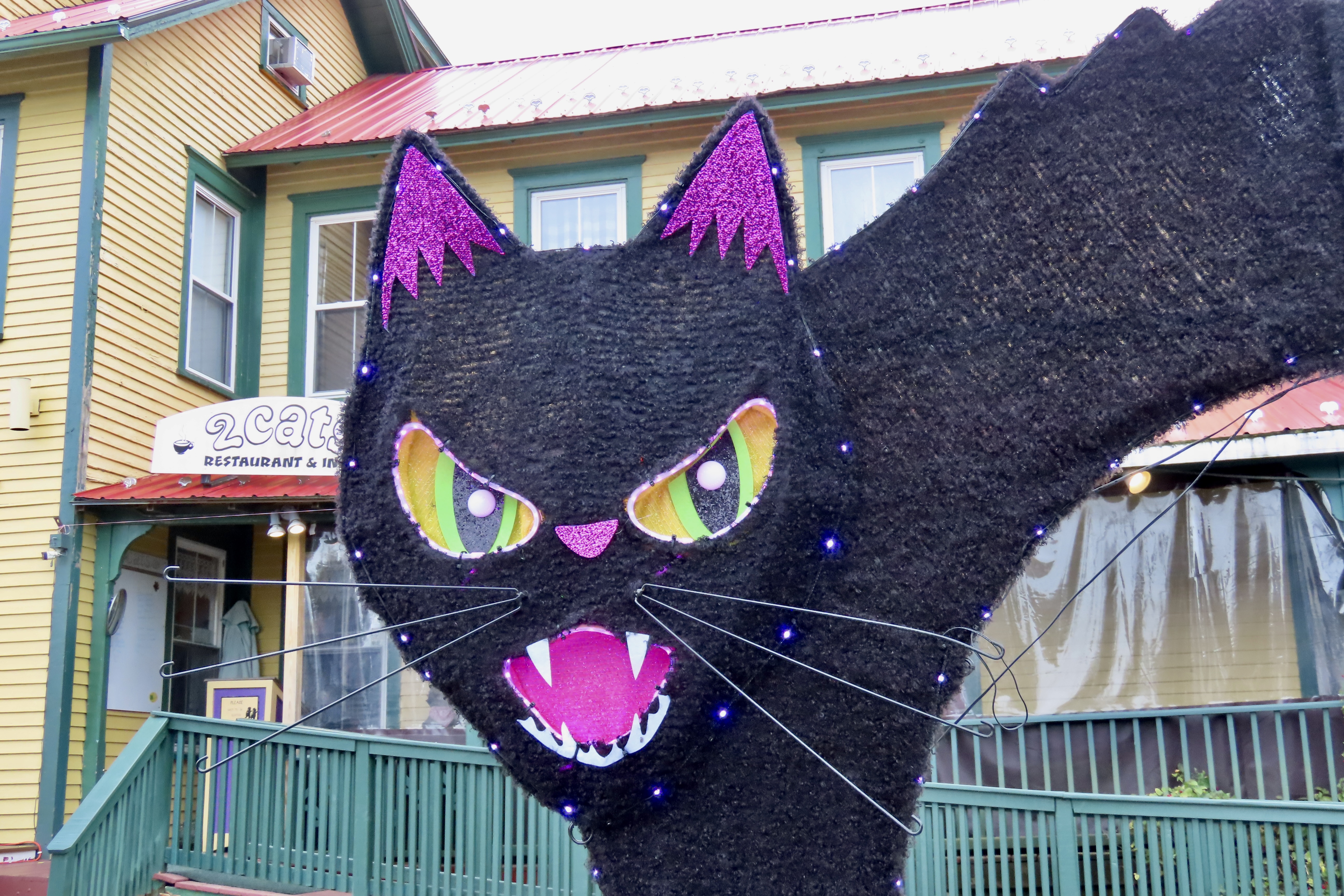
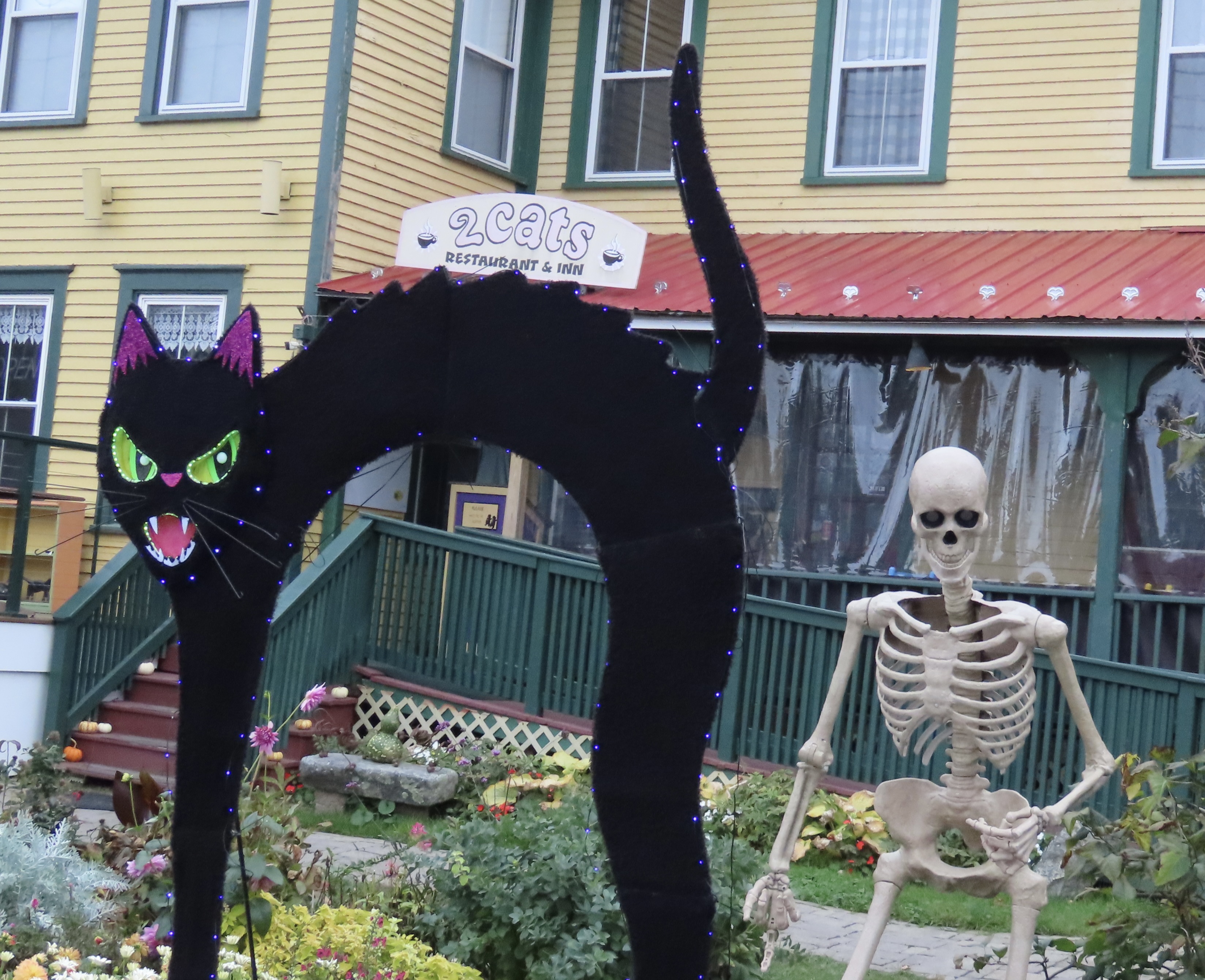
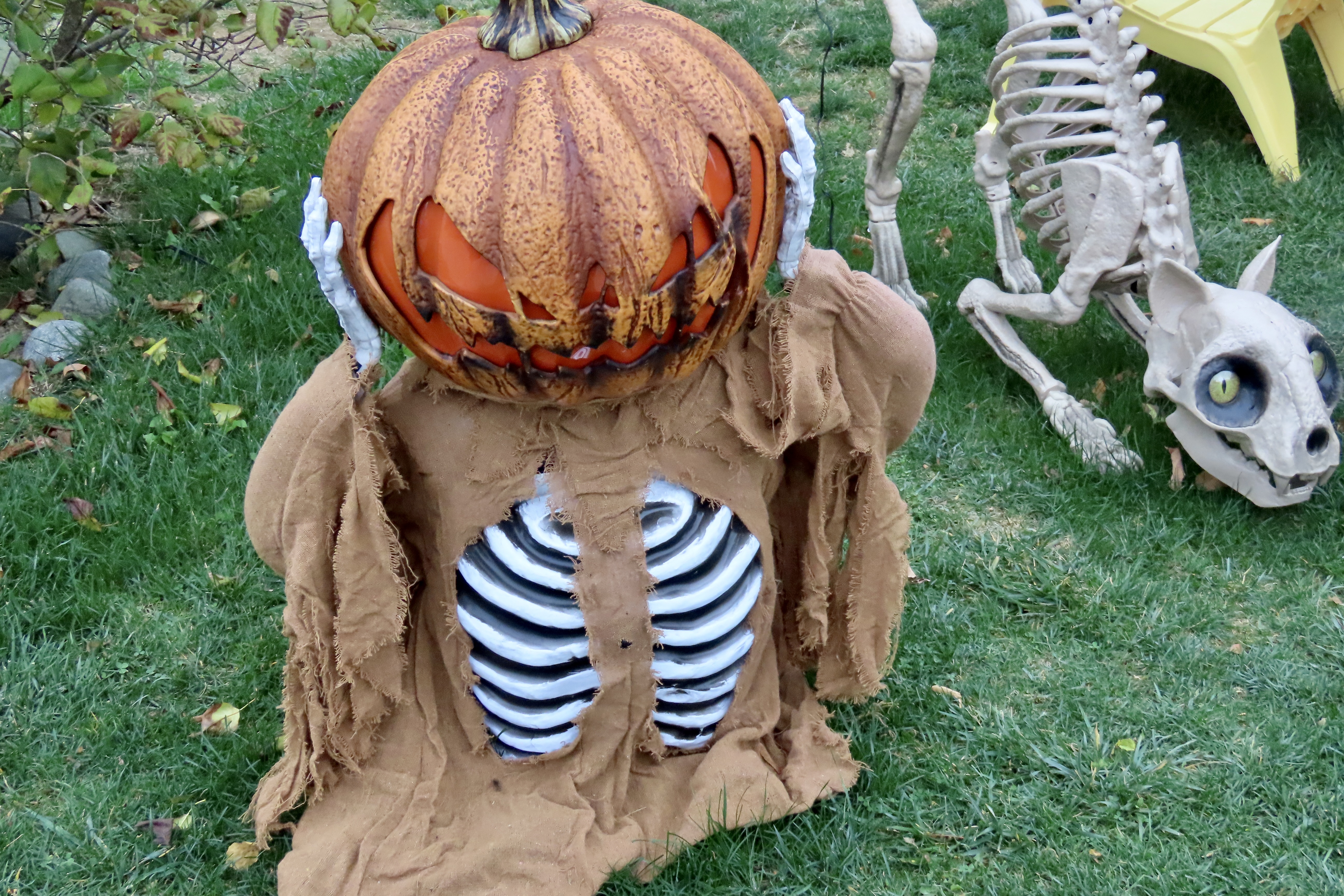
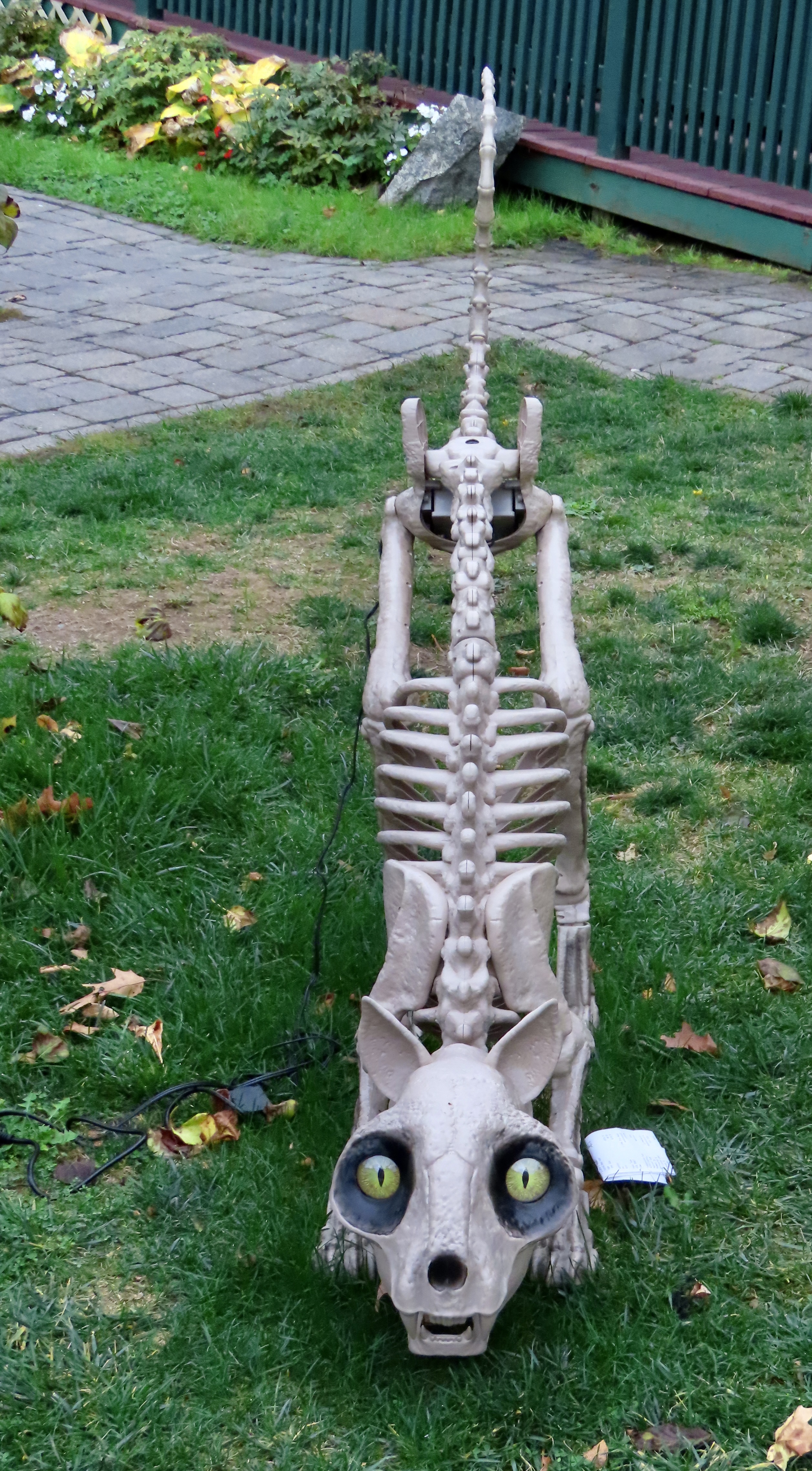
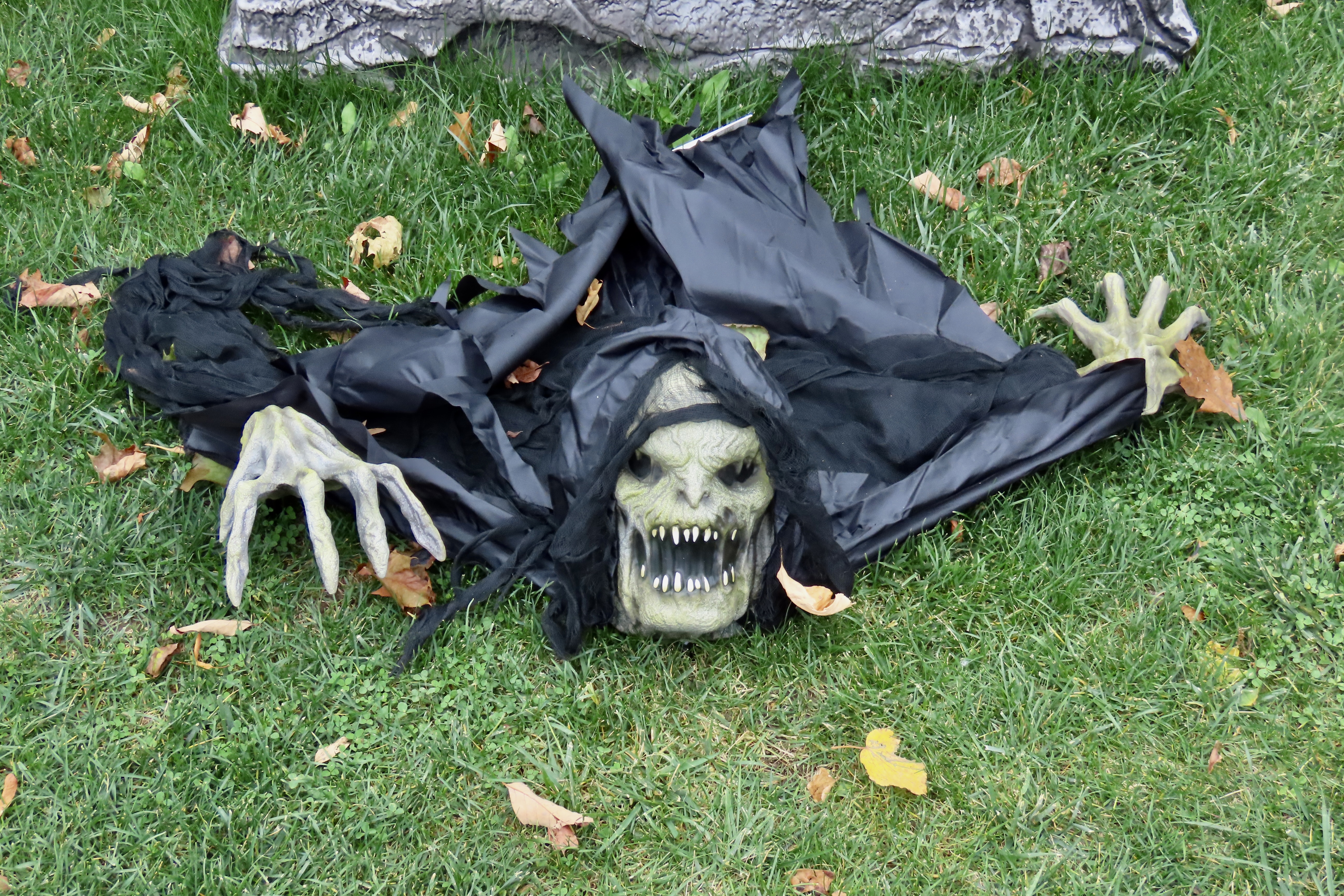
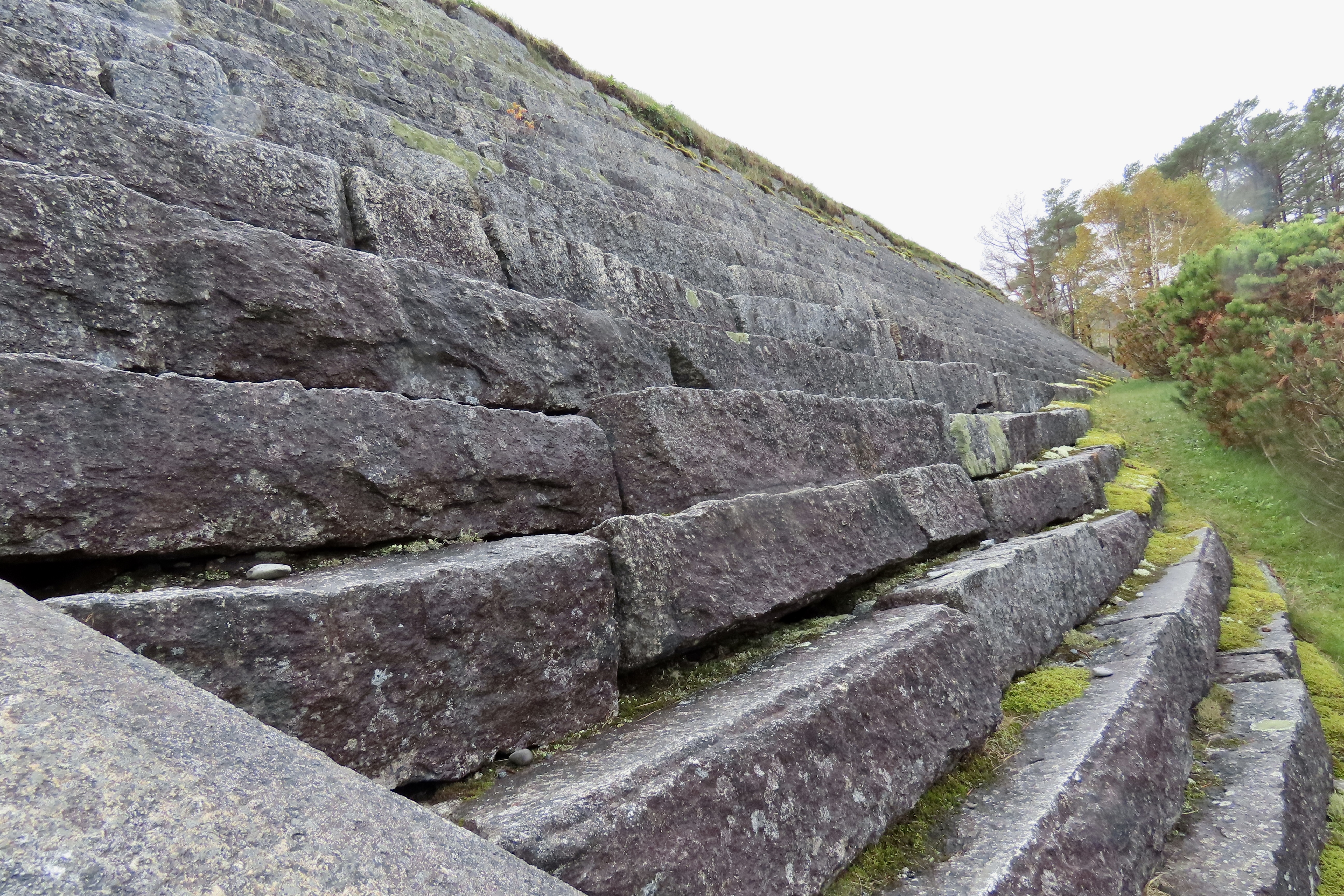
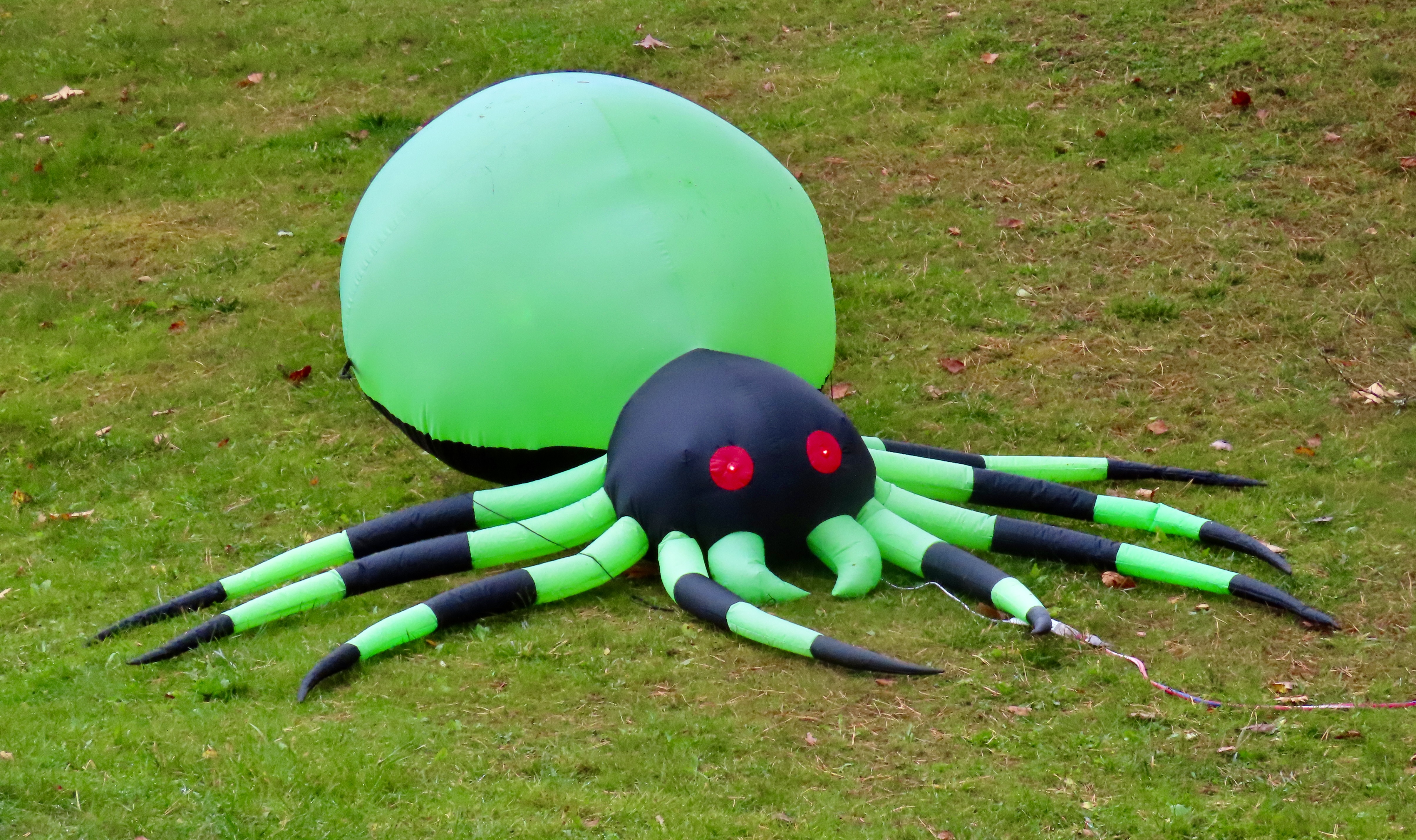
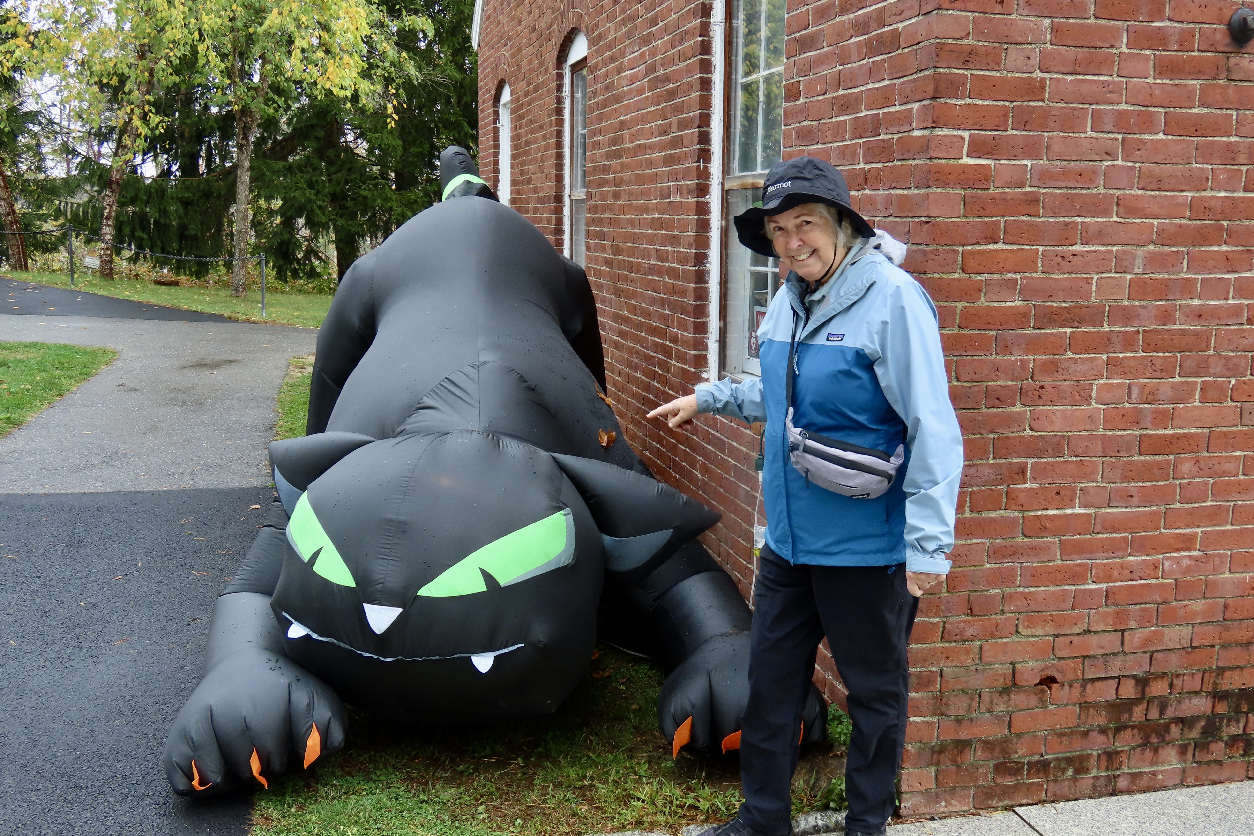
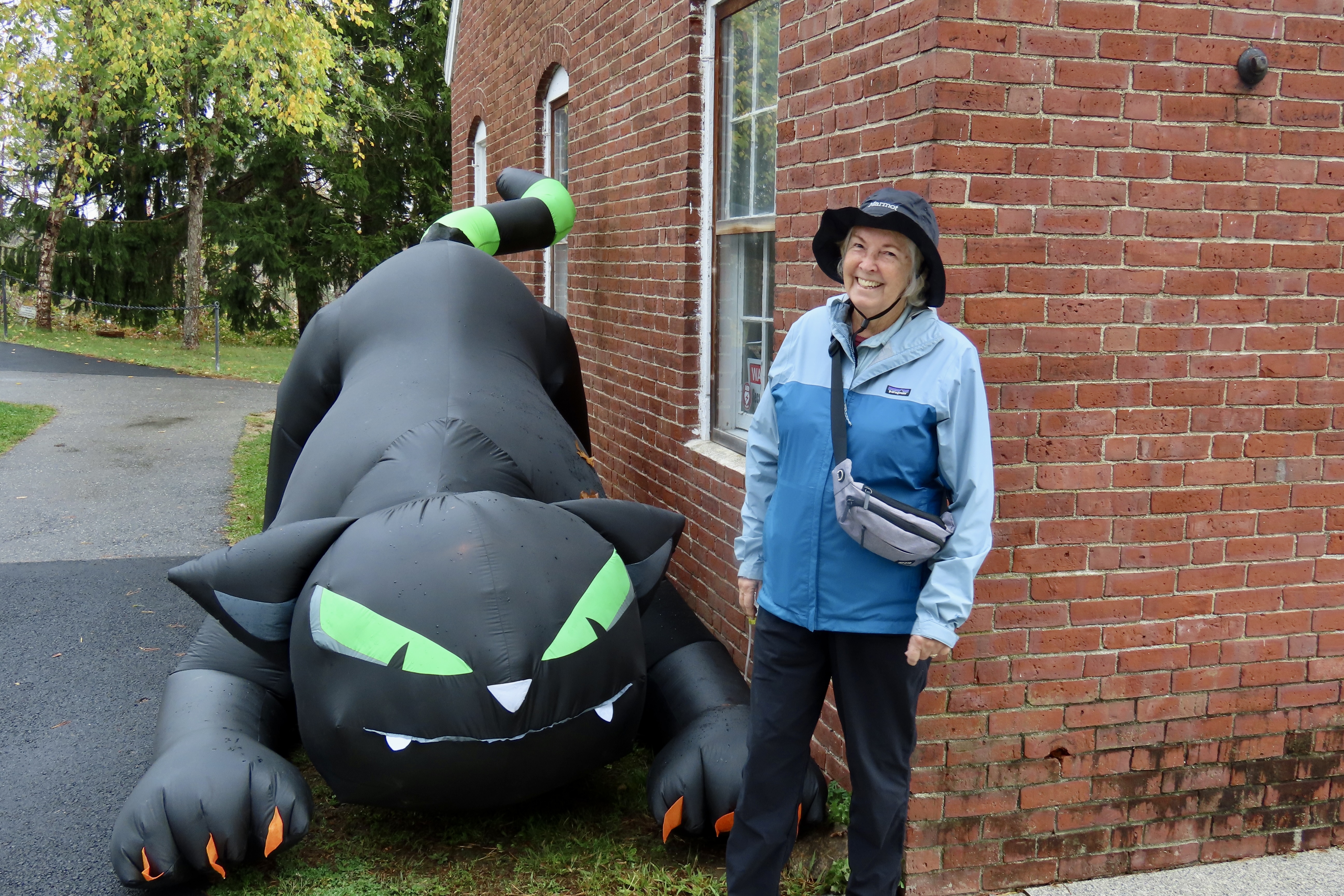
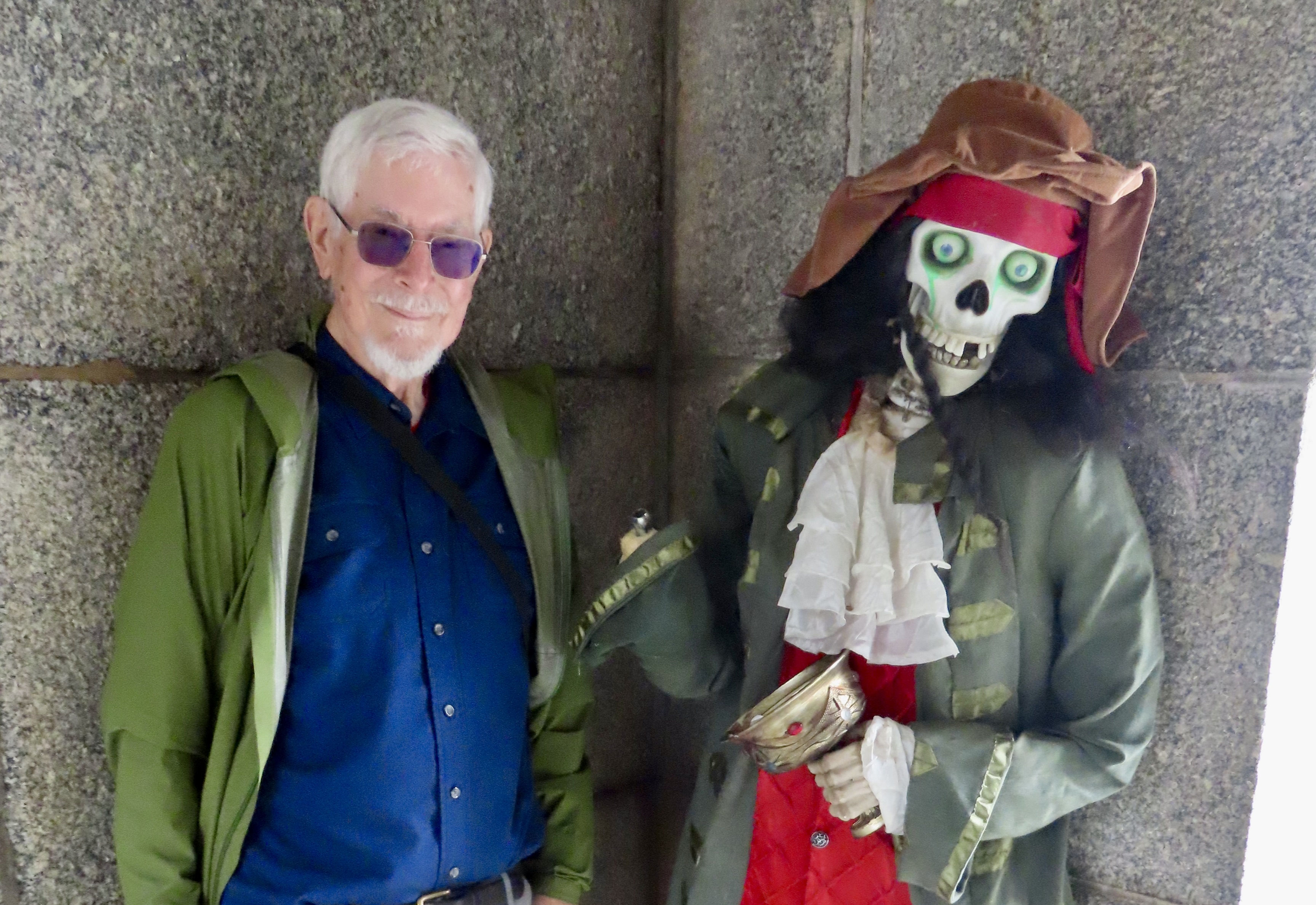
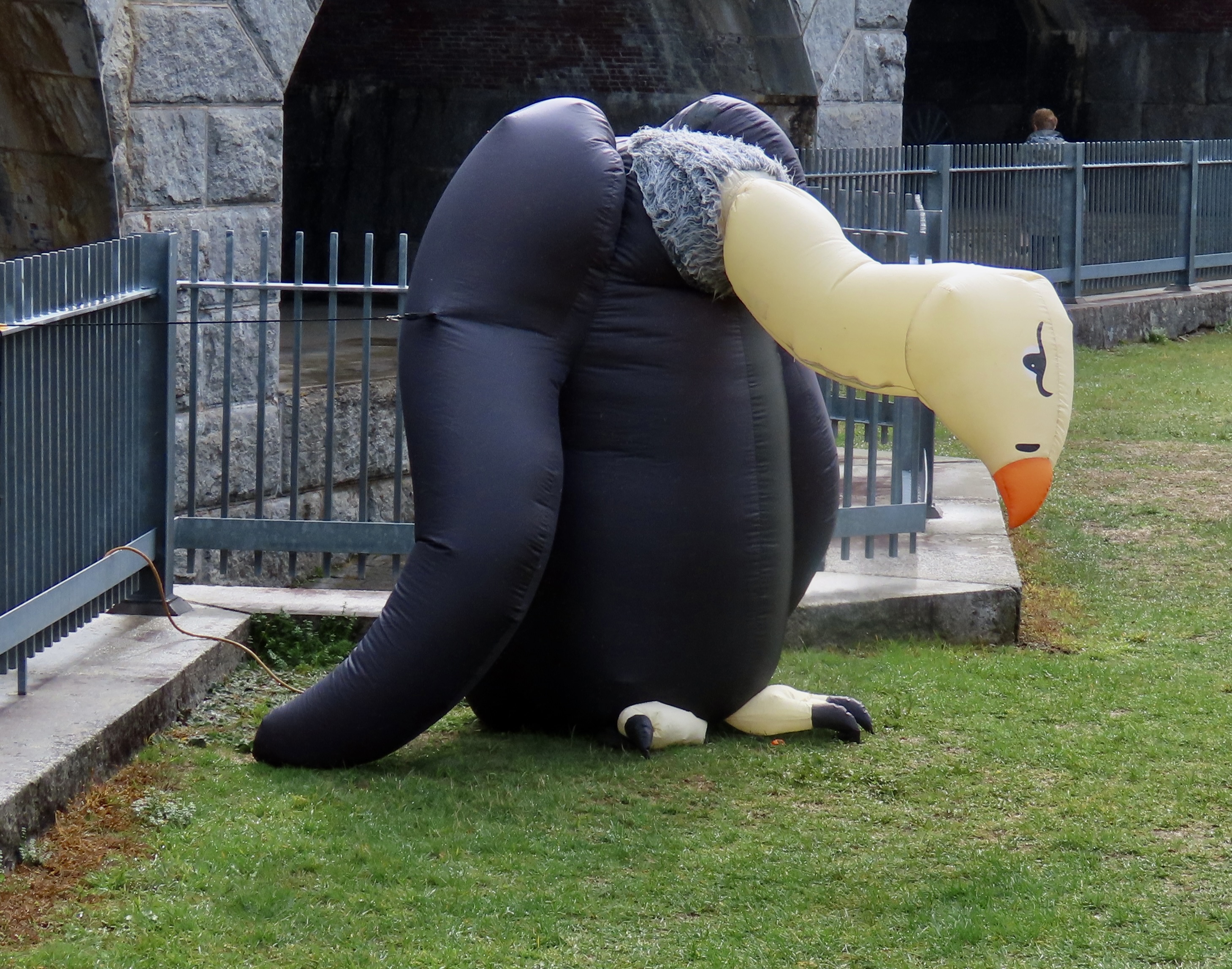
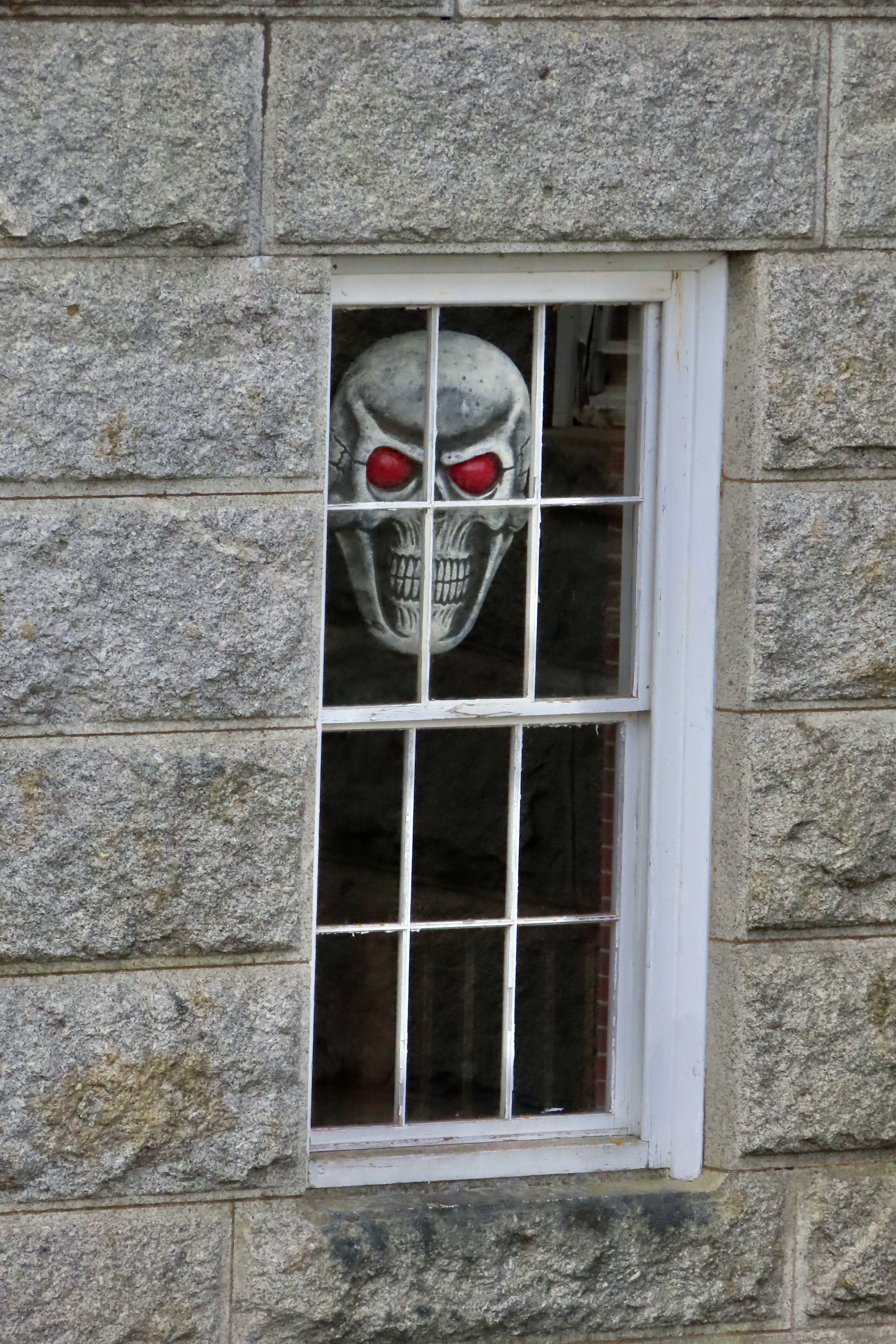
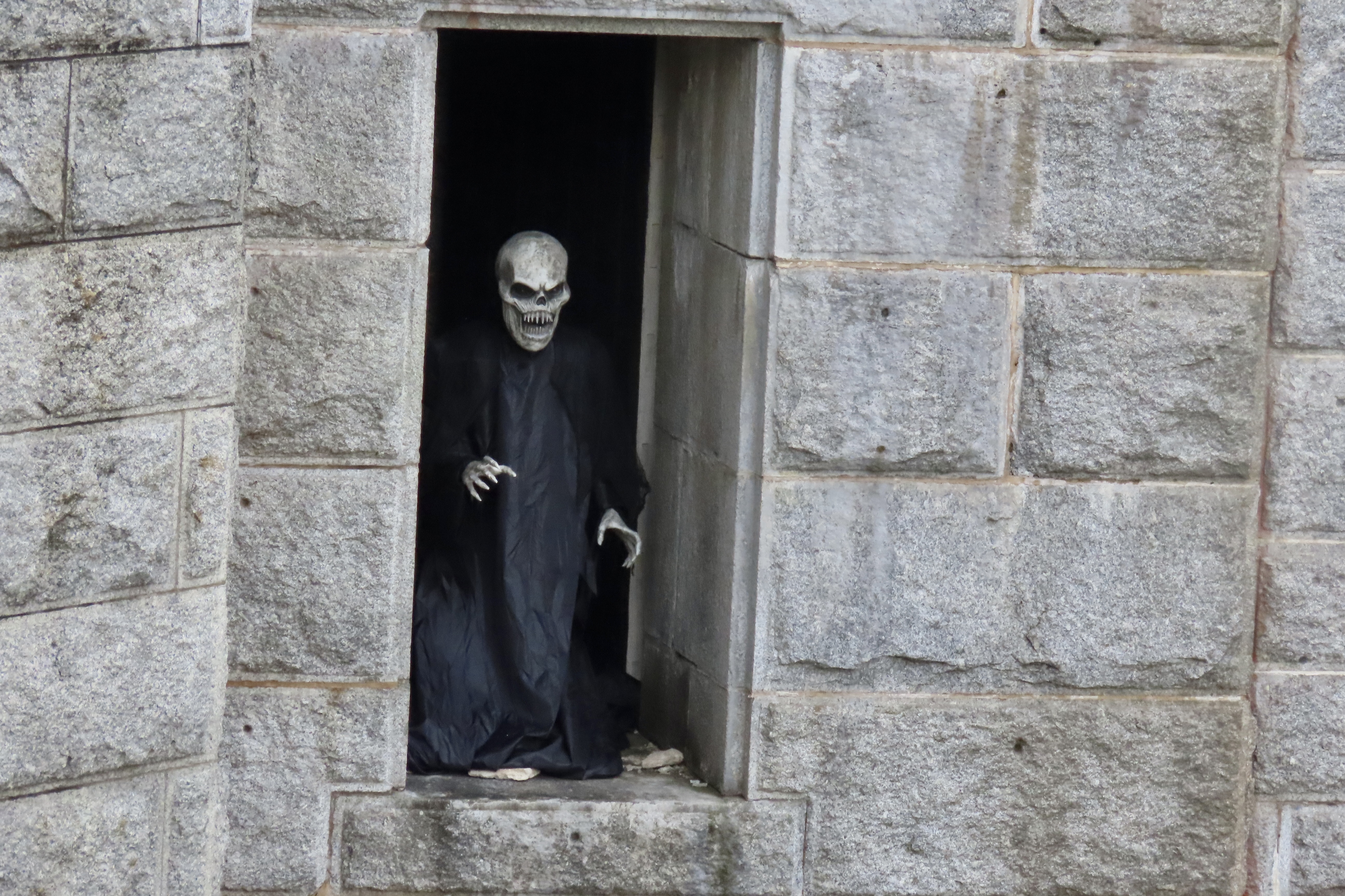
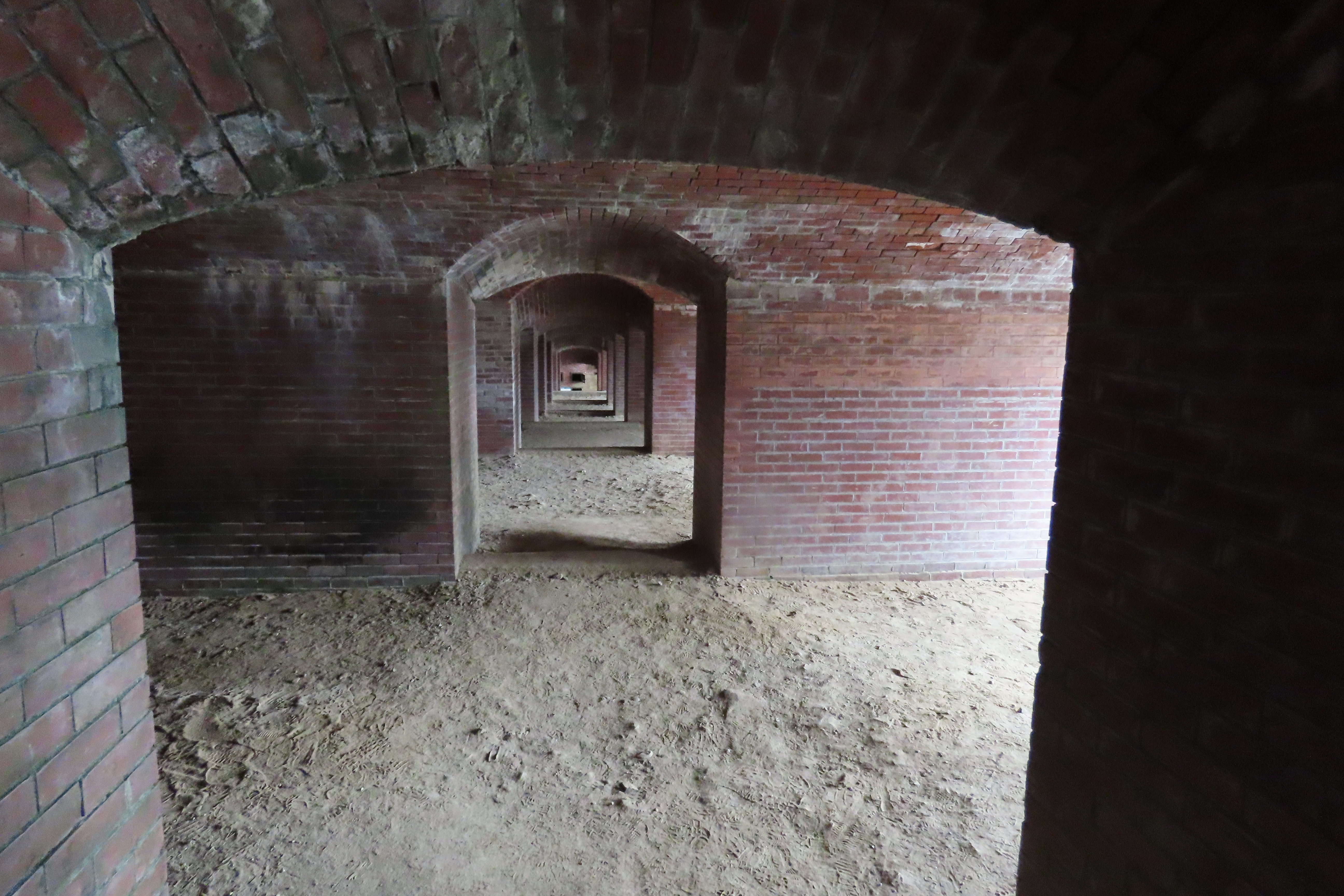
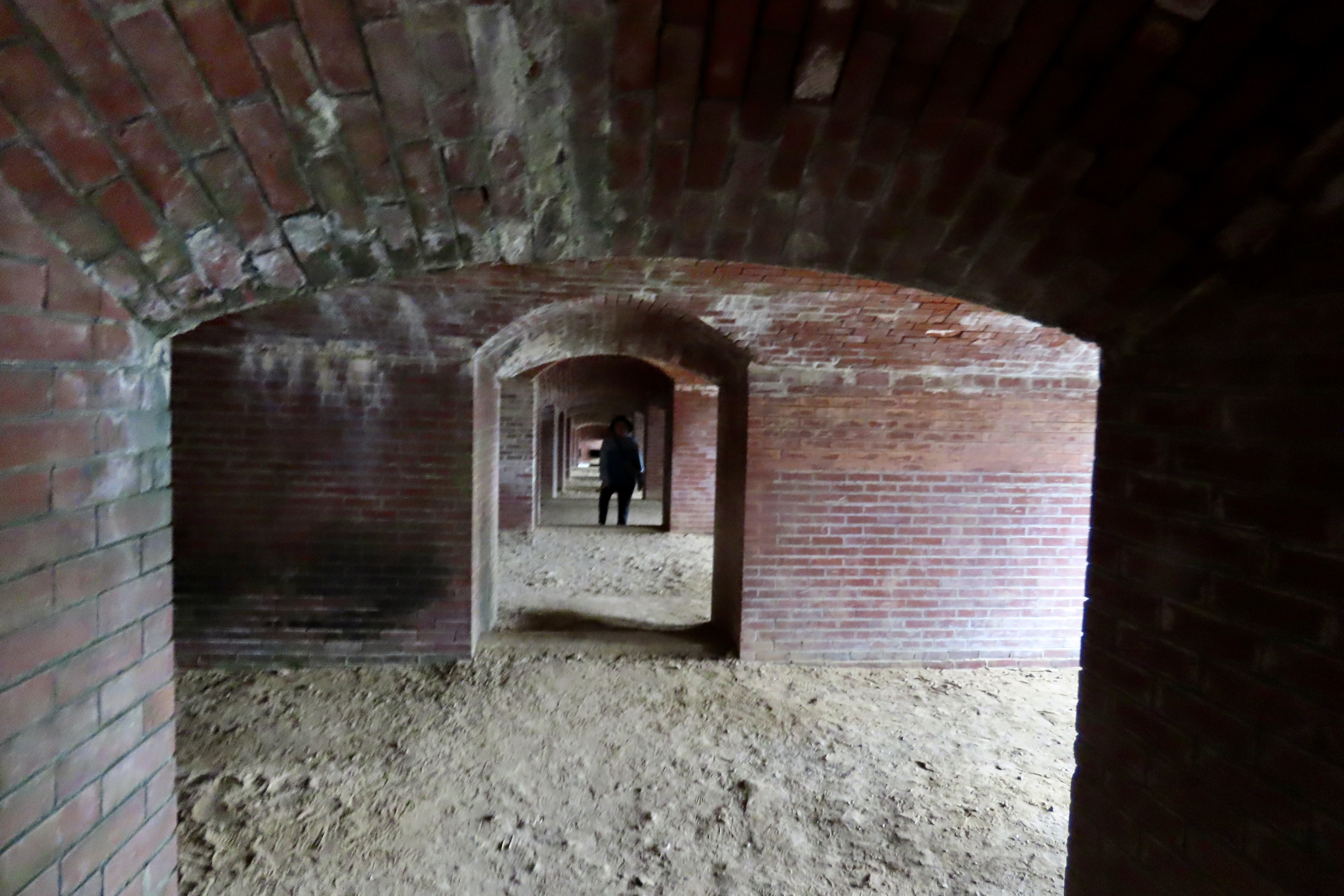
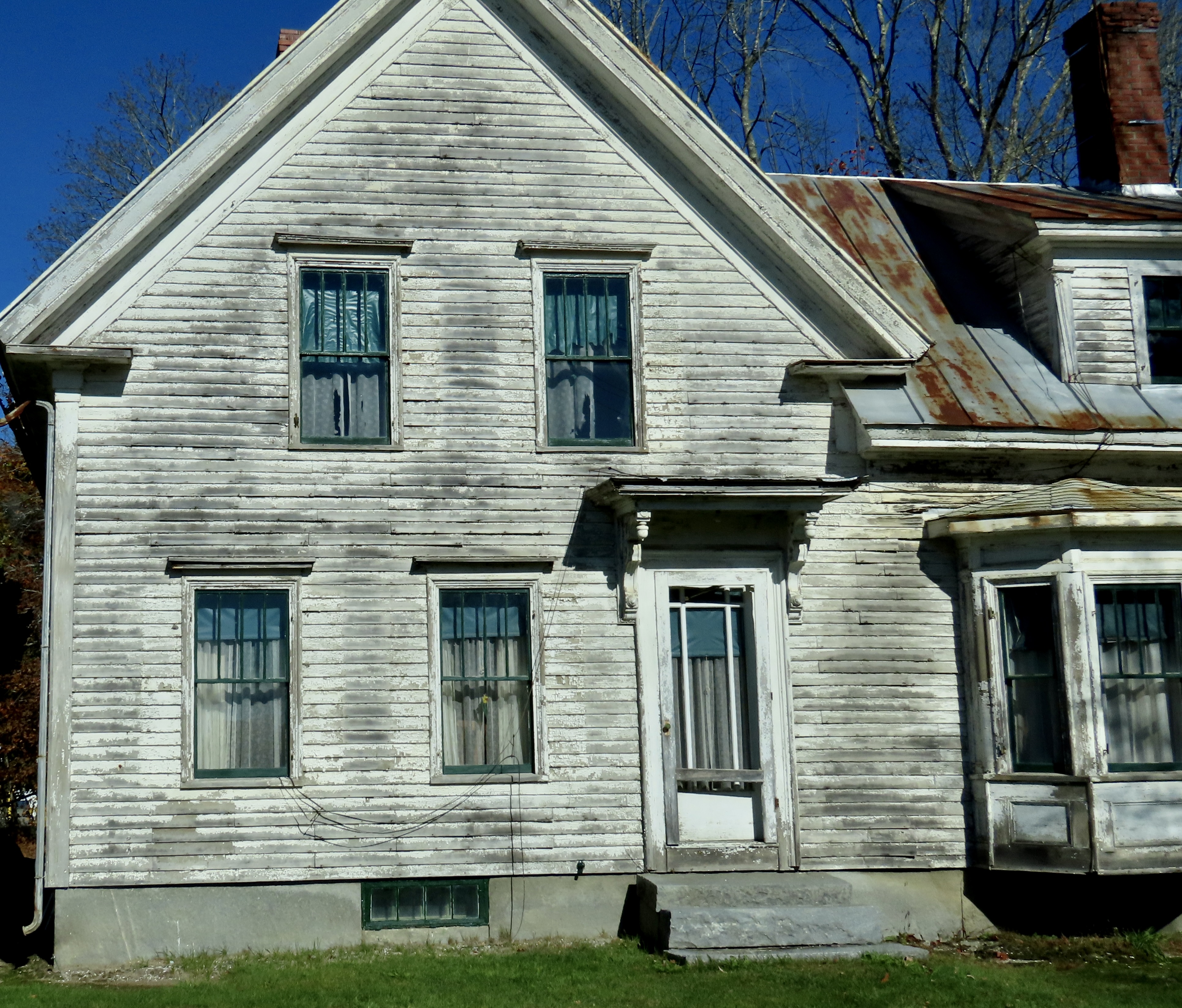
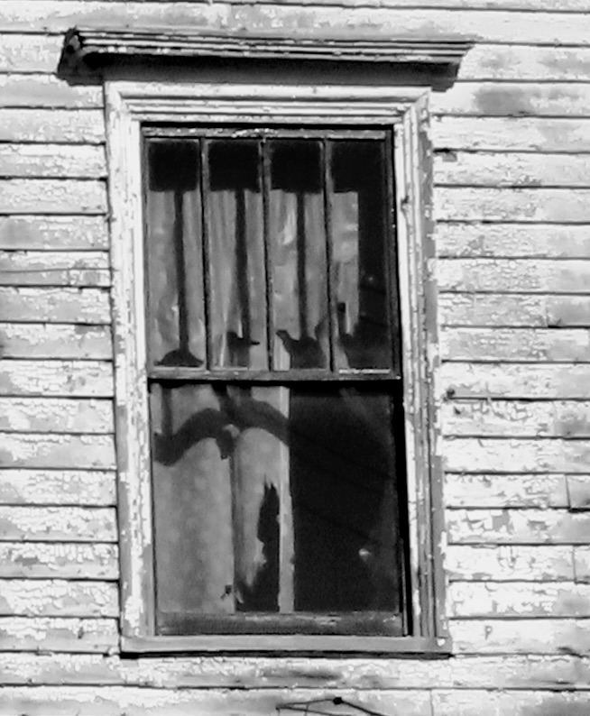
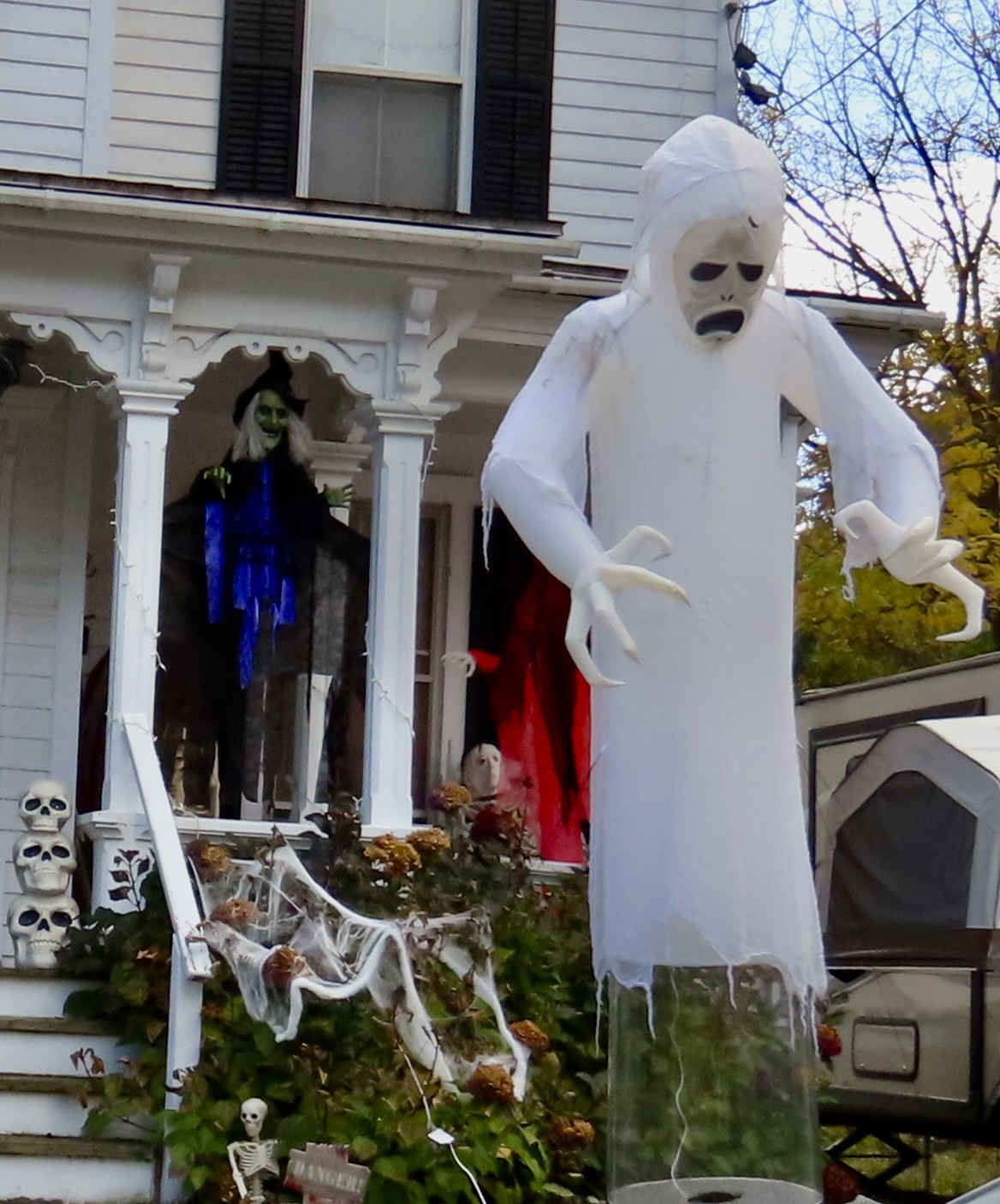
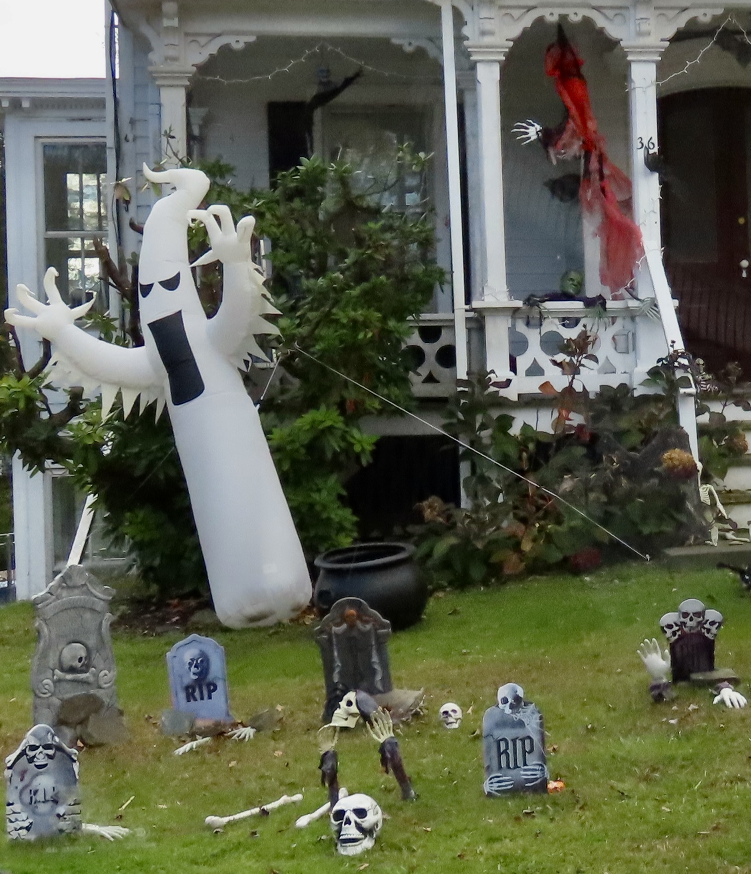
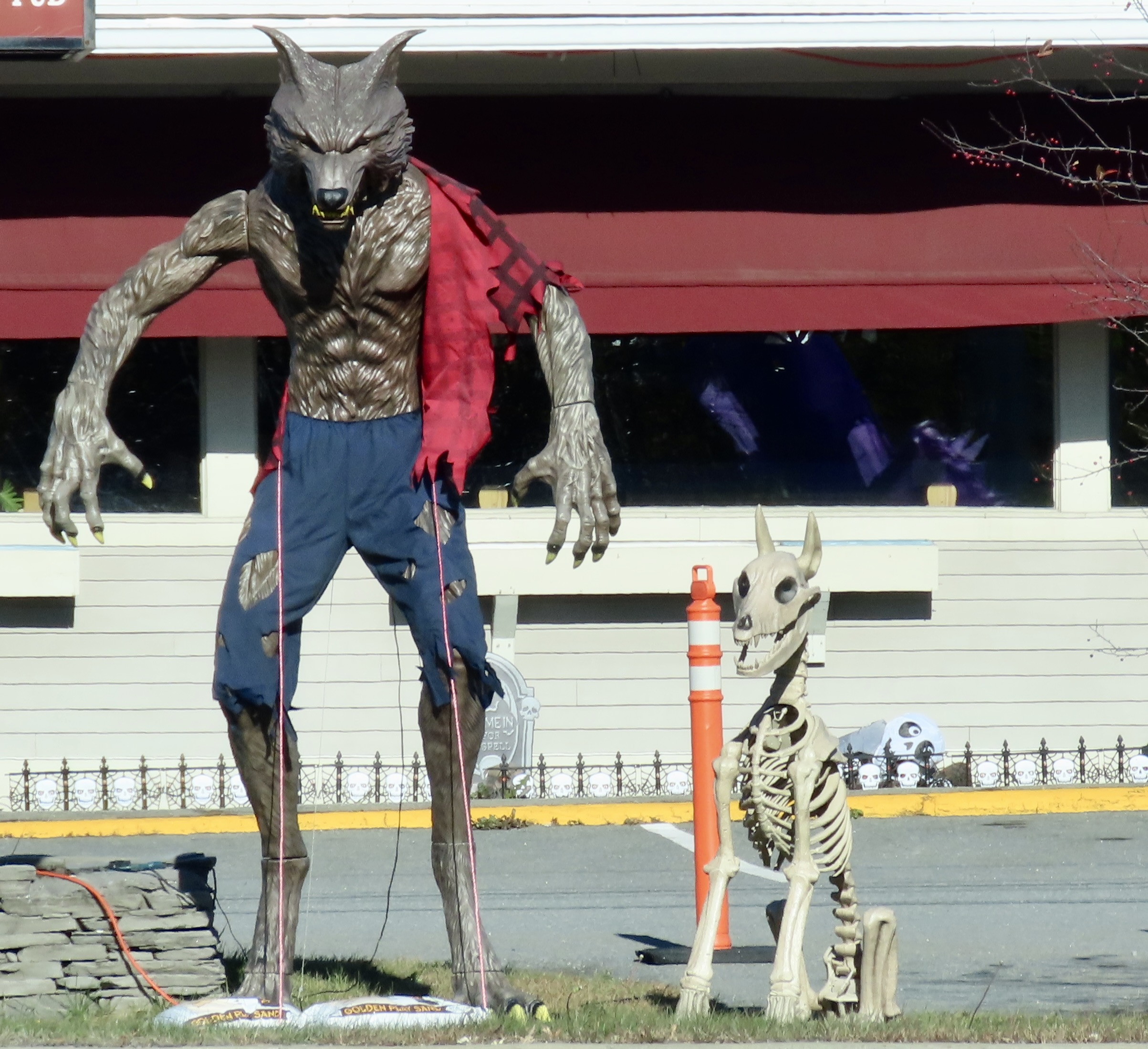
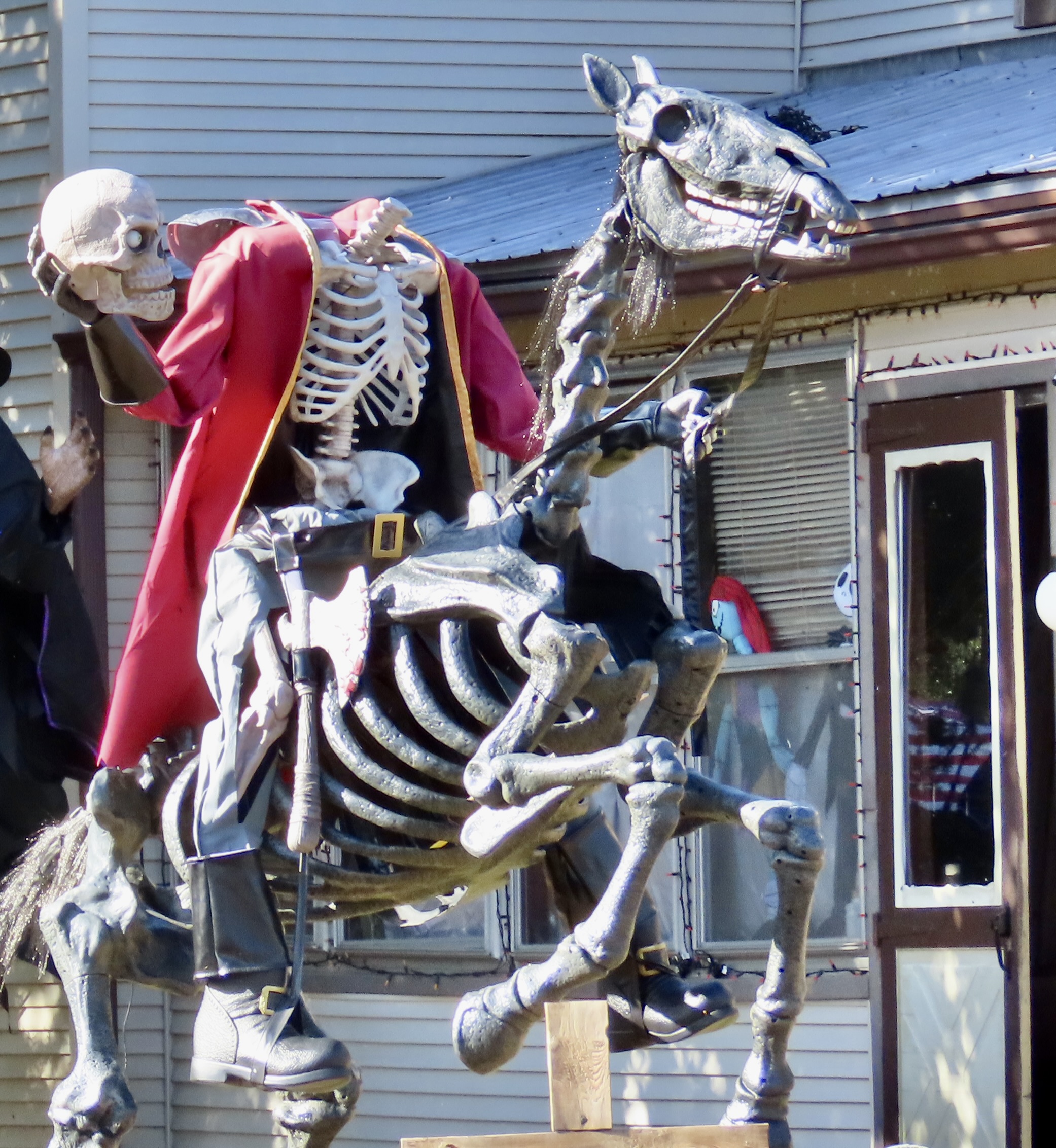
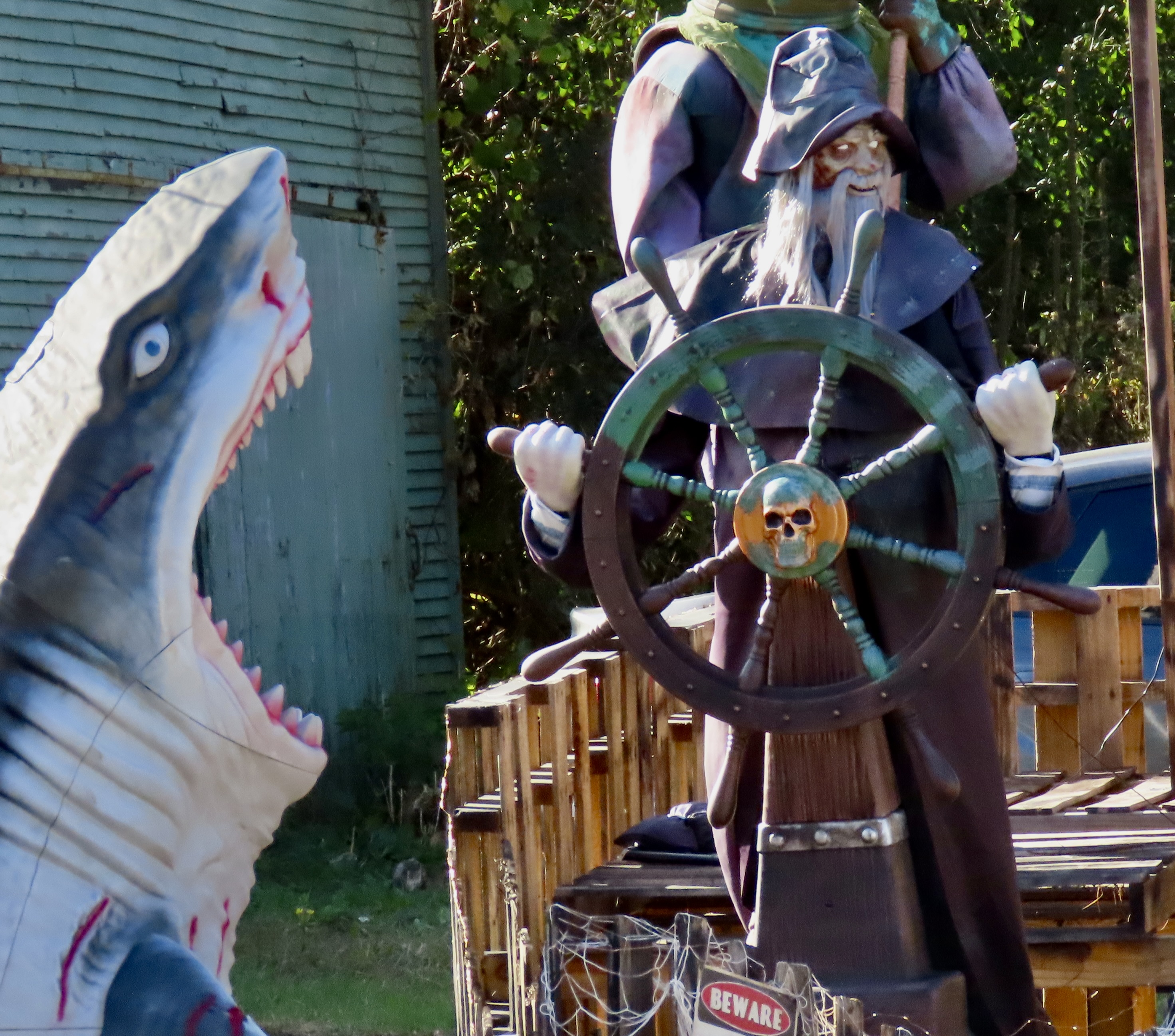
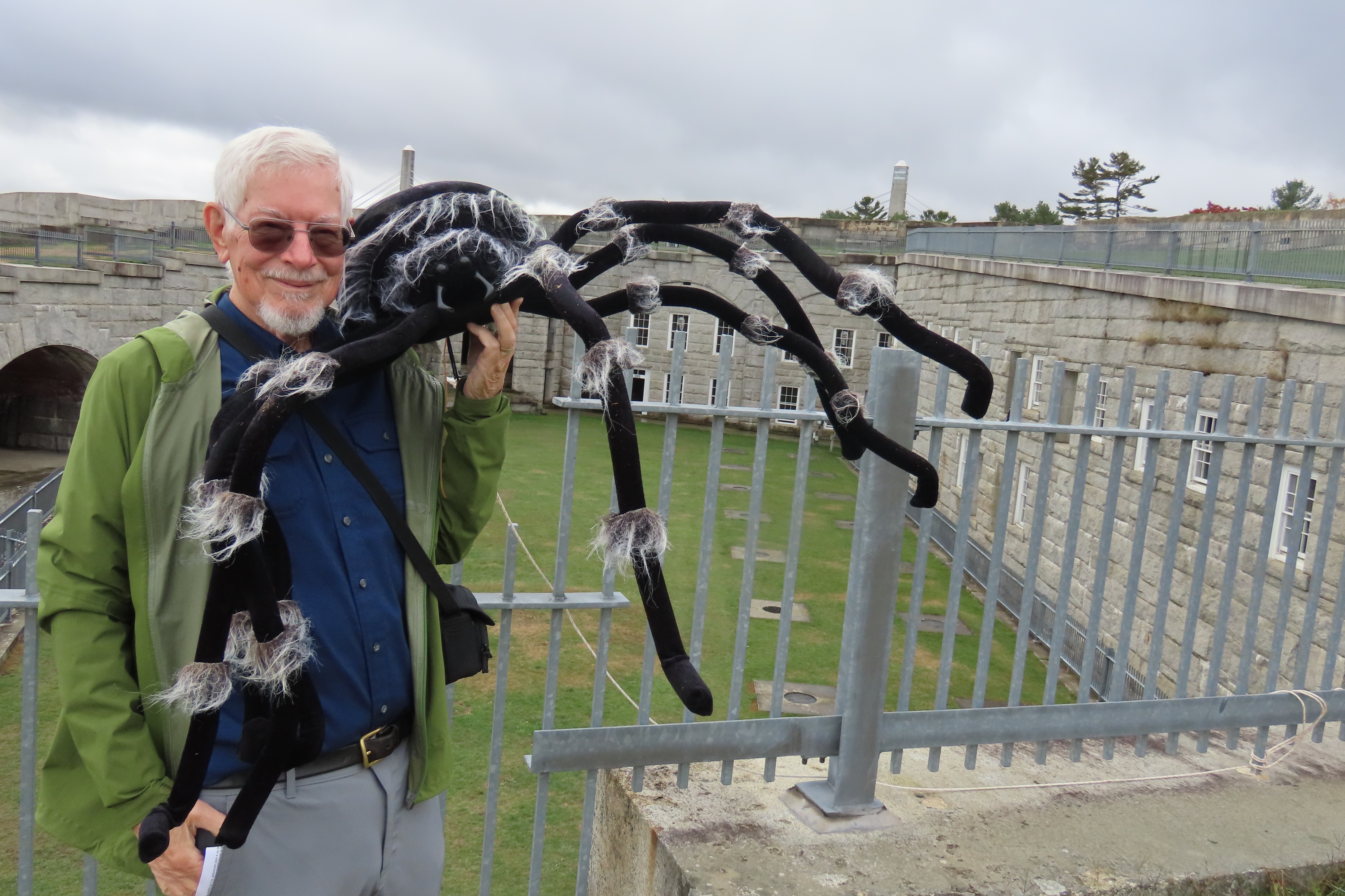
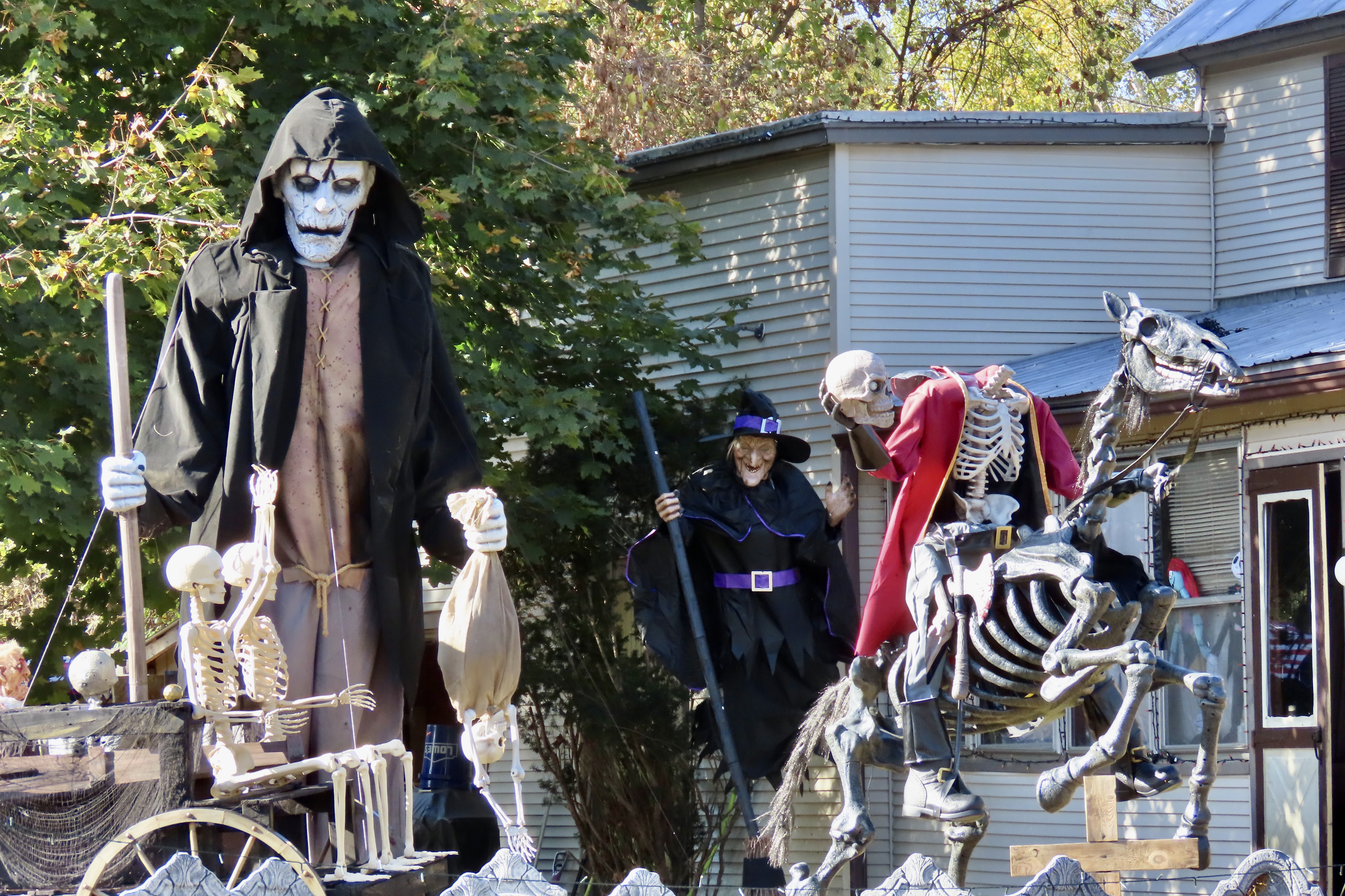
It could have been a ghoul. We found this 8-foot tall fellow at the Two Cats Restaurant in Bar Harbor, Maine. He moved and talked.The restaurant appropriately included a cat, as well.Its arched back provided an obvious photo op. When I arrived, three 20-something young women were taking a selfie under it and giggling. A ubiquitous skeleton with glowing eyes was in the background.Mr. Pumpkin head was also part of the show. He seemed to be making adjustments for a better fit. Off to his right was a skeleton dog wanting to play…While I admired Mr. Pumpkin’s head, the dog lay down, without, I might add, the mandatory three dog turns. It merely stretched its legs out behind with a motor’s aid. Backward was lying down. Forward, ready to play. Clever.I was standing hypnotized by Rover’s eyes when a loud bang made me jump. Mr. Pumpkin had ripped his head off his skull. I heard laughter up the road. The young women had stopped to watch my reaction. “You were waiting for that, weren’t you,” I accused them, and was greeted by more laughter. Some fun.I’d be remiss in leaving the Two Cats Restaurant display without including this bony apparition crawling out of the ground. I think it lived on toes. Mine had retreated as far back into my shoes as they could go.Peggy and I took a break from our leaf peeping and ghost seeking to admire Fort Knox on Maine’s Penobscot River. The massive structure was built during the mid 1800s but never actually saw any action. We quickly discovered that the state park that housed the fort, was also into Halloween! My basset hound, Socrates, once lived a few miles away in 1976. He hung out with my friend Morris Carpenter, the housing administrator for the Penobscot Indians, while I was off exploring the South Pacific for several months.We were greeted by a large green spider. It made us wonder if a UFO had crashed nearby. Its color suggested it had been sucking the blood of little green men from outer space.Peggy stopped to admonish a bad kitty that was growling at her at her and swishing its tail back and forth.The cat responded by moving its head so it could determine whether Peggy was edible or not. Note the raised tail as well! Peggy vacated the premises. This fellow greeted me when I entered the fort.Peggy, claiming a family resemblance, insisted that I pose with him.A number of other Halloween characters occupied the fort, including this angry vulture. “You promised me some roadkill. Where is it?”Skulls glared out at us through windows.Including a rather realistic looking one. Wouldn’t want to meet up with this guy on a dark night. Or at high noon.A downward trending series of rooms also contained spooky potential…Especially when a dark, cloaked figure appeared and then disappeared…Leaving the fort, dark cloudy skies and leafless trees added to the Halloween feel.‘Eyes’ staring at us out of the night added a nice Halloween touch to one scene.As for haunted houses, there were no lack of candidates in New England. The upper right window on this one made us look twice. The curtain appeared to be moving.Turns out, the curtain was in tatters, which always serves as a sign of haunted for me. Or maybe what we were thinking of as a tattered, was the shadow of the creature that moved the curtain. A little horror movie music, please…Blow-ups have become a common way of representing ghosts. At night, this one would appear to be floating on air. The blue-clothed witch in the background was prepared to grab anyone who escaped the sharp talons of the ghost. Beware trick or treaters. Whatever tricks you have in mind, will pale in comparison to what these two have to offer.Another floating blow-up ghost. This time with a red-clothed witch as back-up.An unholy trinity for sure. We thought of it as a diorama.We were zipping down the road in Vermont when we flew by a comic-book-like wolf man and his faithful companion.To conclude today’s Halloween journey through New England and New York, we are returning to a display we featured last week as a promo for this week. It was in the small town of Sciota, NY, near where we were staying in West Chazy. Remember the headless horseman? I couldn’t help but think, “Alas poor Yorick, I knew him well.” Isn’t the horse a magnificent beast! And check out the bone ax.The yard featured what we considered one of the most unique and unusual Halloween scenes we would encounter. Another, more furry, wolf man can be seen on the left. There are also skeletons, tombstones, and the lurking figure of Death. His bagged prey was trying to escape. The horse’s tail (and horse) is off to the right.Just across a small alley on the left, a sea captain with ghostly eyes steered his boat toward a waiting shark. That’s it for today. Peggy and I hope you’ve enjoyed our scary treat. Happy Halloween! Next week, we return to leaf-peeping.
In my last post, I whined a bit (or more?) about how our trip through the heart of Vermont following Highway 100 had been lacking in color because of drought and an early leaf fall. Following a recommendation, we headed over to Lake Champlain and its islands in hopes of having more luck. We took it a step further by finding a great cabin in Northeast New York near the Vermont and Canadian borders and driving into the Adirondacks.
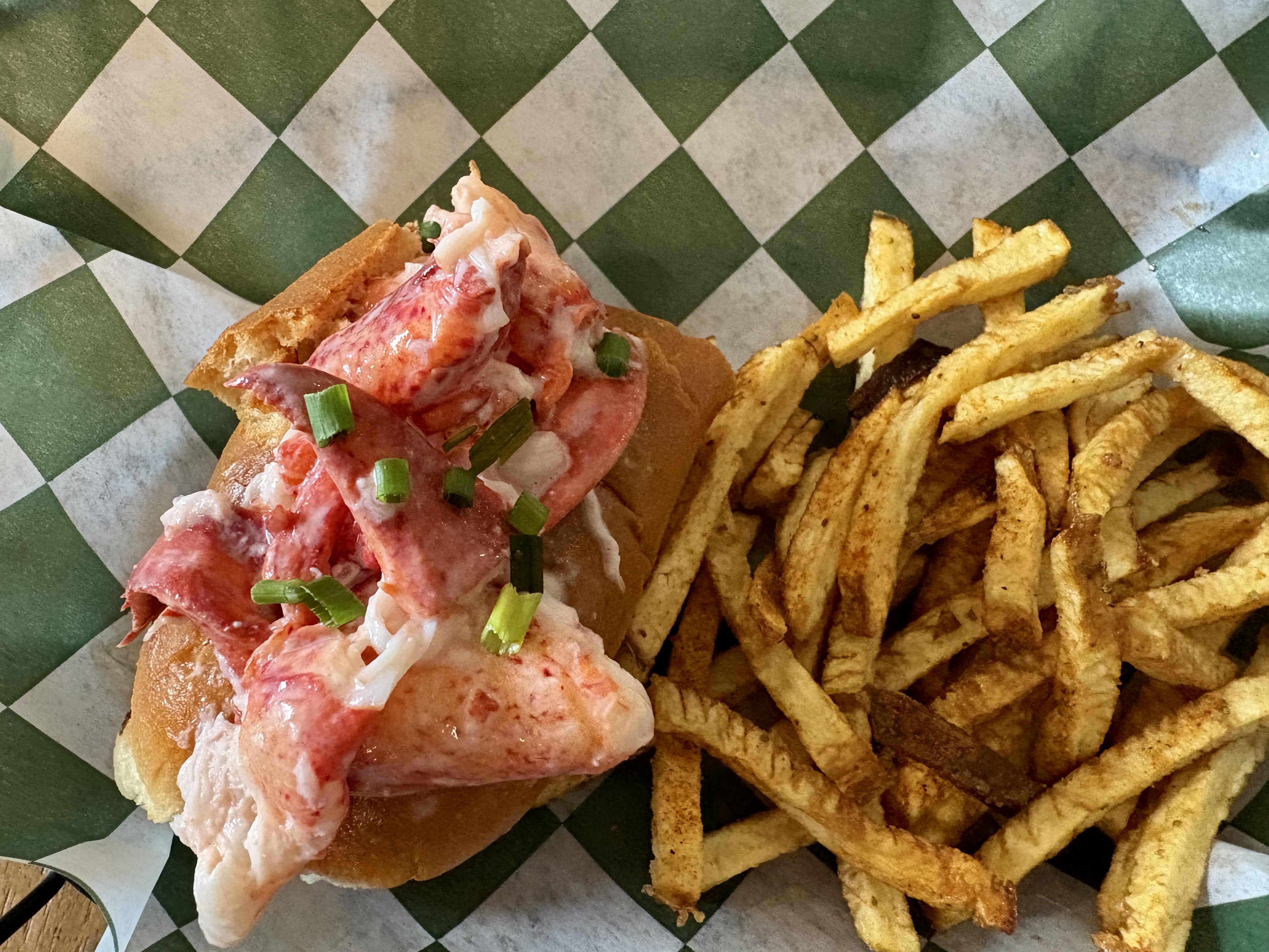
Today, Peggy and I are going to feature our trip into the Adirondacks of New York. We have now explored northern Vermont, traveled across New Hampshire, and made our way to coastal Maine, which included a trip into Acadia National Park. We’ve found so much color that our cameras have become picky about what they will photograph. New England definitely has its fall mojo back. We’ve turned to other things, like stuffing ourselves on lobster rolls. It’s a quintessential Maine experience. Did you know that the state provides over 90% of America’s lobsters?
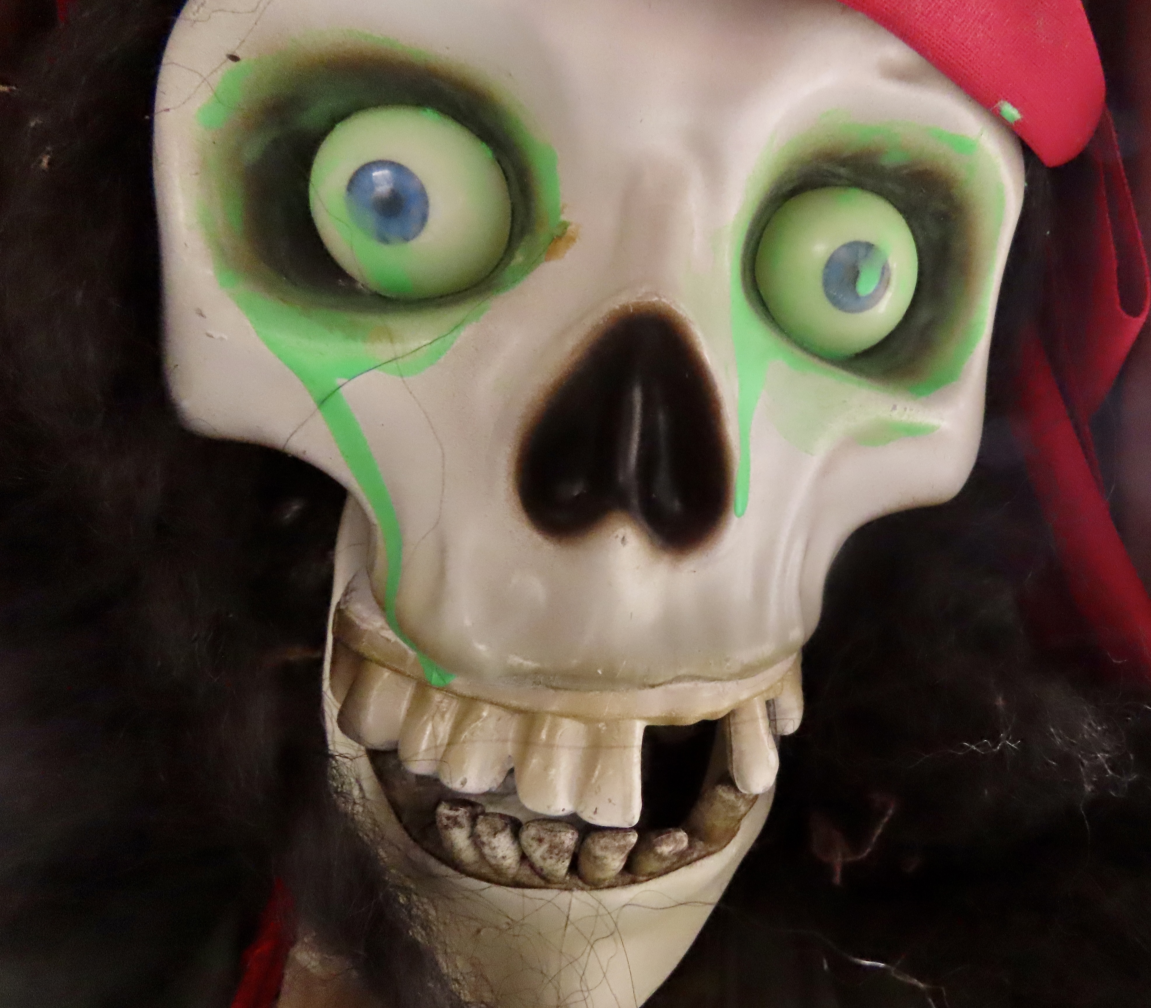
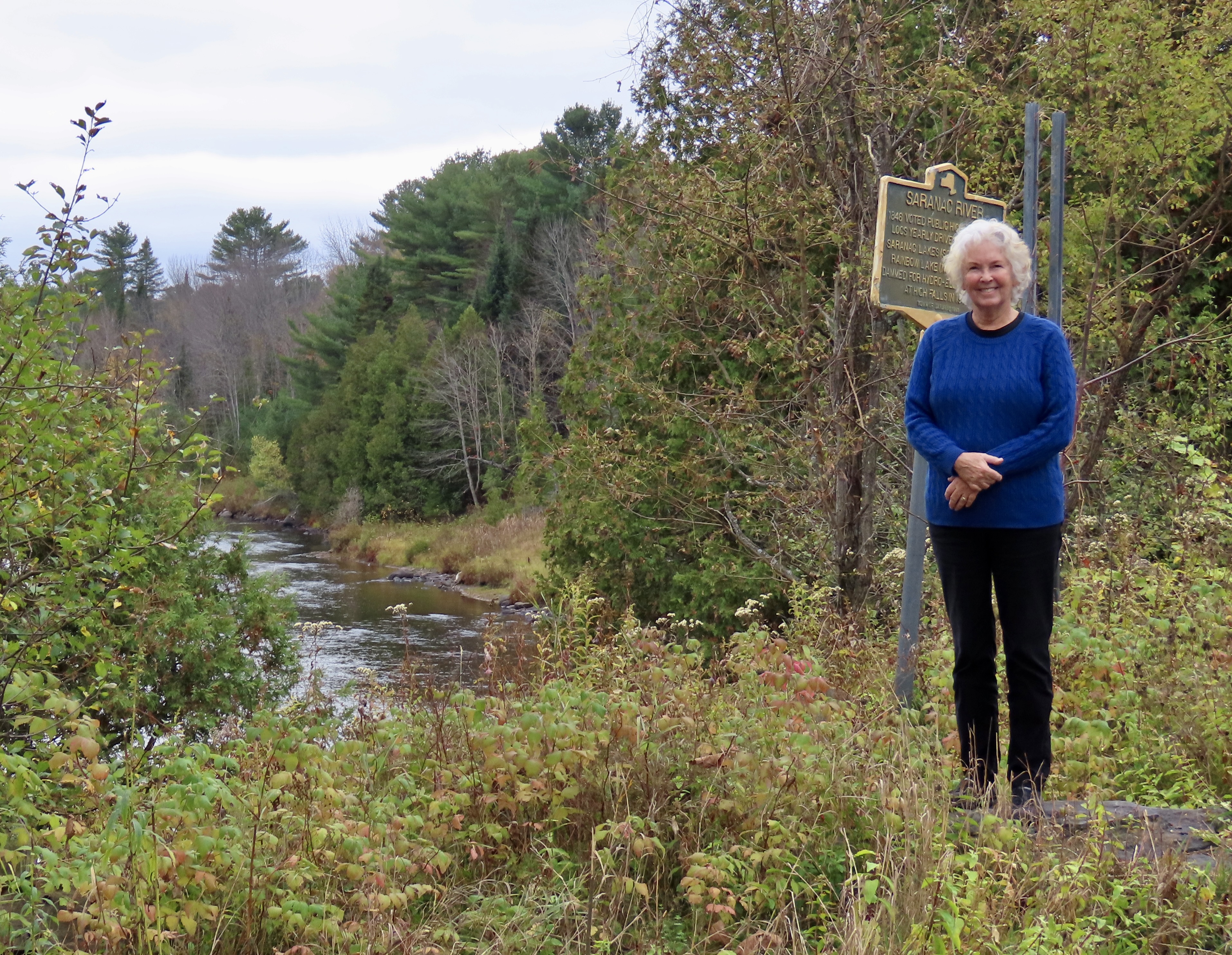
Would it be possible to pile more lobster on a lobster roll? And we bought the mini-sized ones! This is from the Must Be Nice Lobster restaurant in Belfast, Maine.Shortly after we settled into our New York cabin, Peggy and I decided to venture into the Adirondack Mountains. We were looking for fall colors. Our journey would take us along the Saranac River to the town of Saranac Lake. (Not many fall colors here— but Peggy’s smile lights up the photo. And the colors are coming.)
First considered wild and inaccessible by the early European settlers, the Adirondacks later became a major logging area. The sign behind Peggy noted that some 200,000 logs were sent down the Saranac River behind her in 1846. By the early 1900s the Adirondacks had become a playground for the wealthy including the likes of the Vanderbilts, J.P. Morgan, Andrew Carnegie, and the Rockefellers.
Today, the Adirondacks Park is known for its size and who owns it. Not only is it larger than any national park in the contingent 48 states in the US, it is made up of a blending of public and private ownership. Another unique fact about the area is that its ancient mountains are actually rising, something that was considered long over among eastern US mountains. Like two hundred million years long over. Apparently, there is a bulging volcanic hot spot under the Adirondacks.
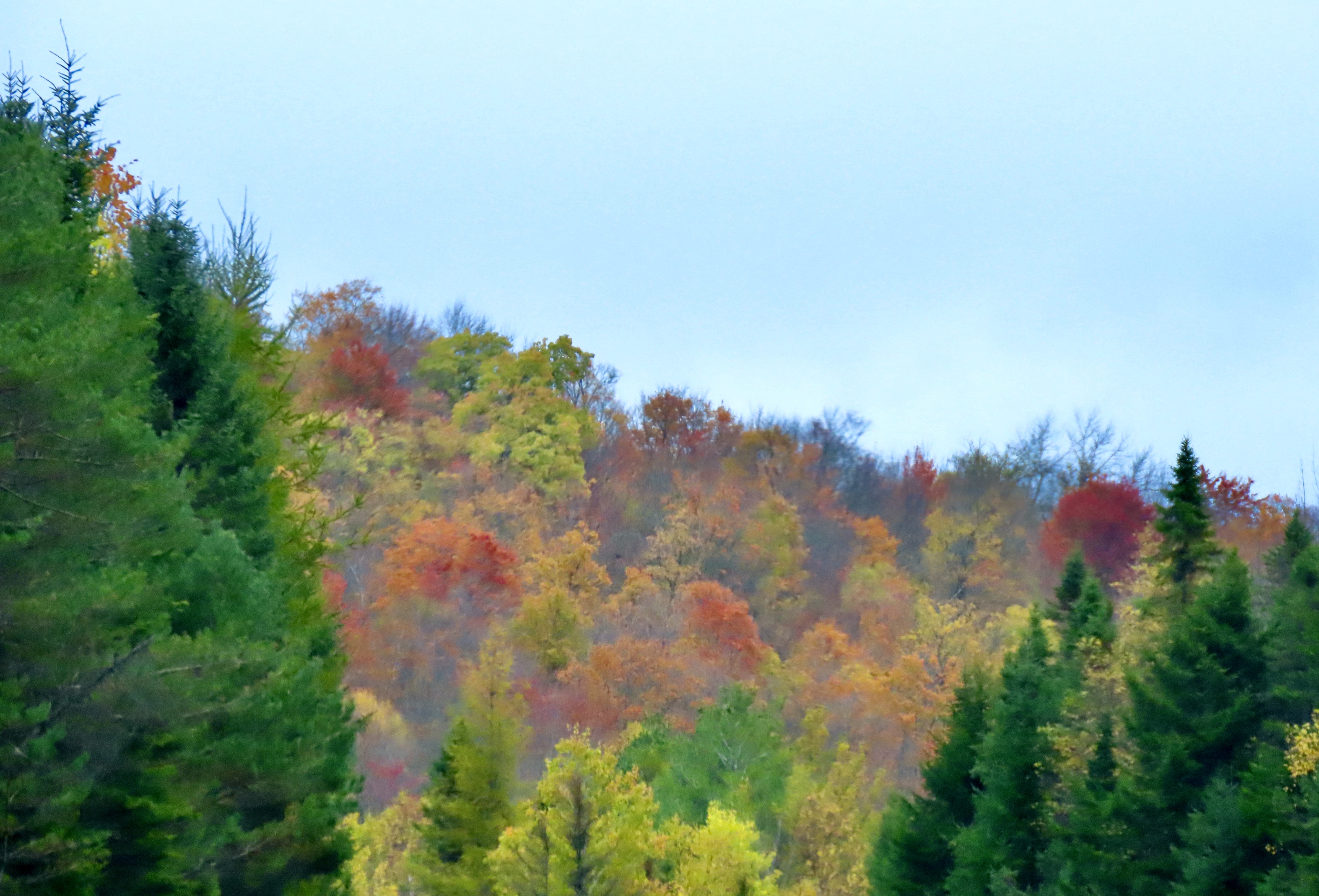
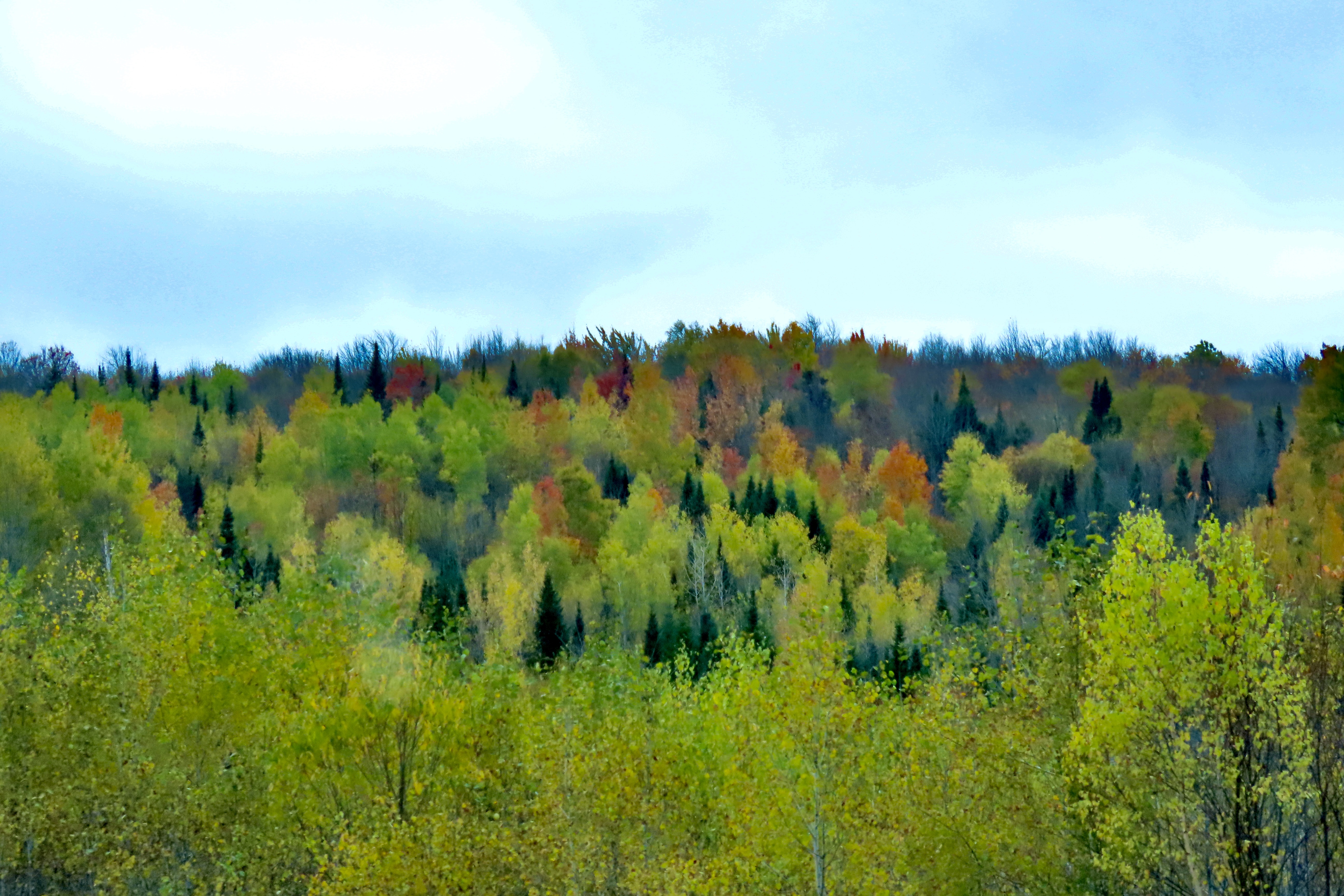
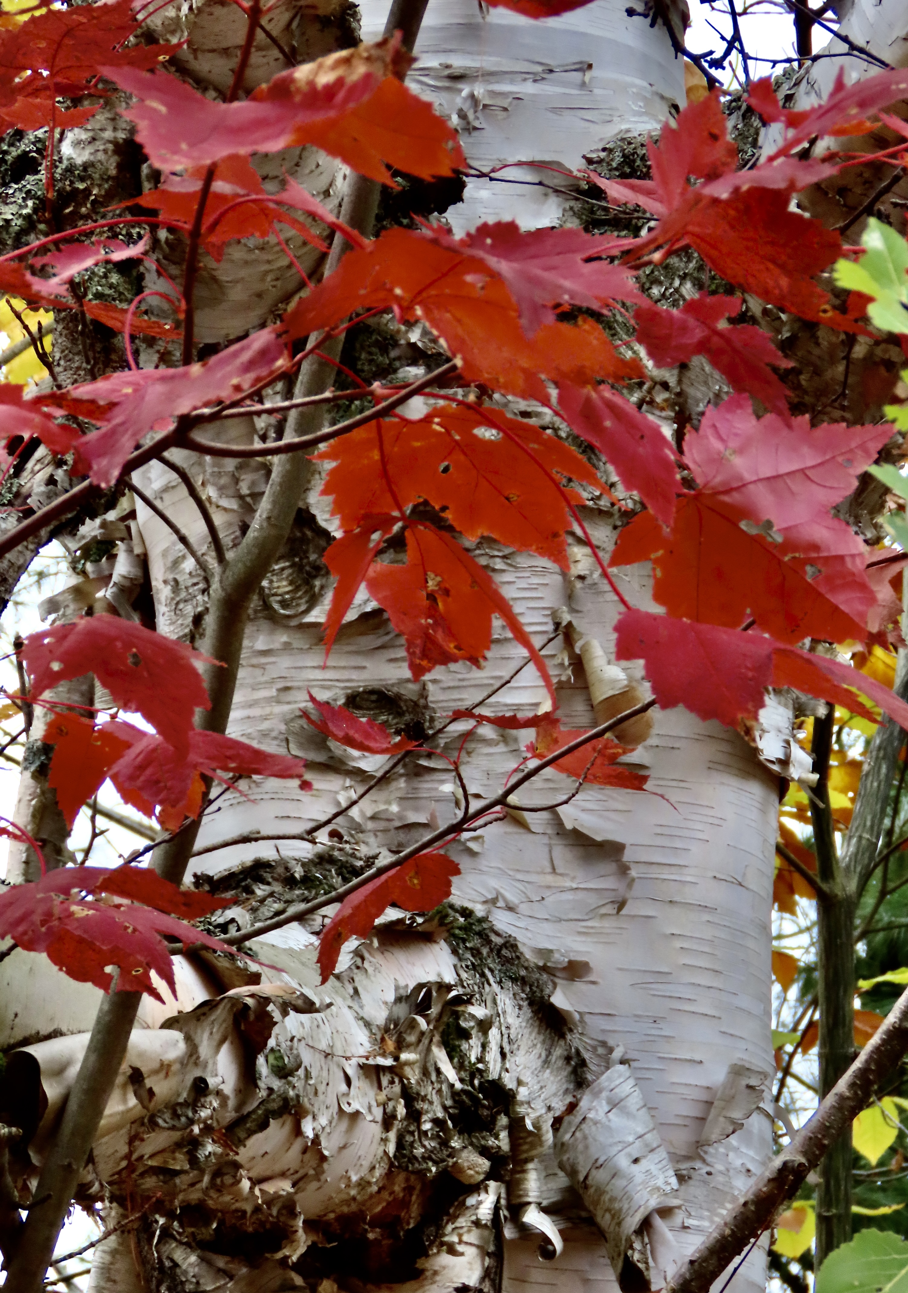
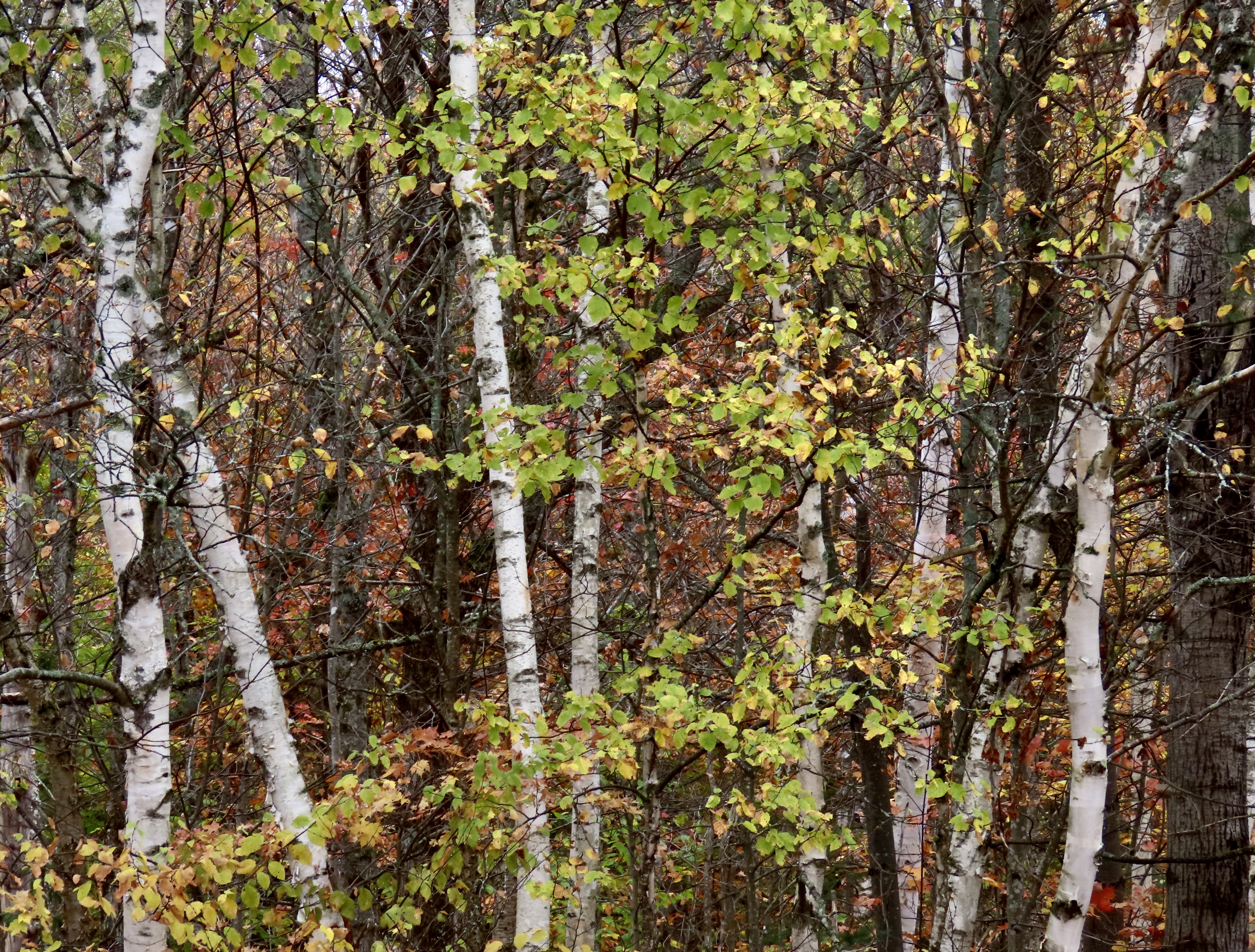
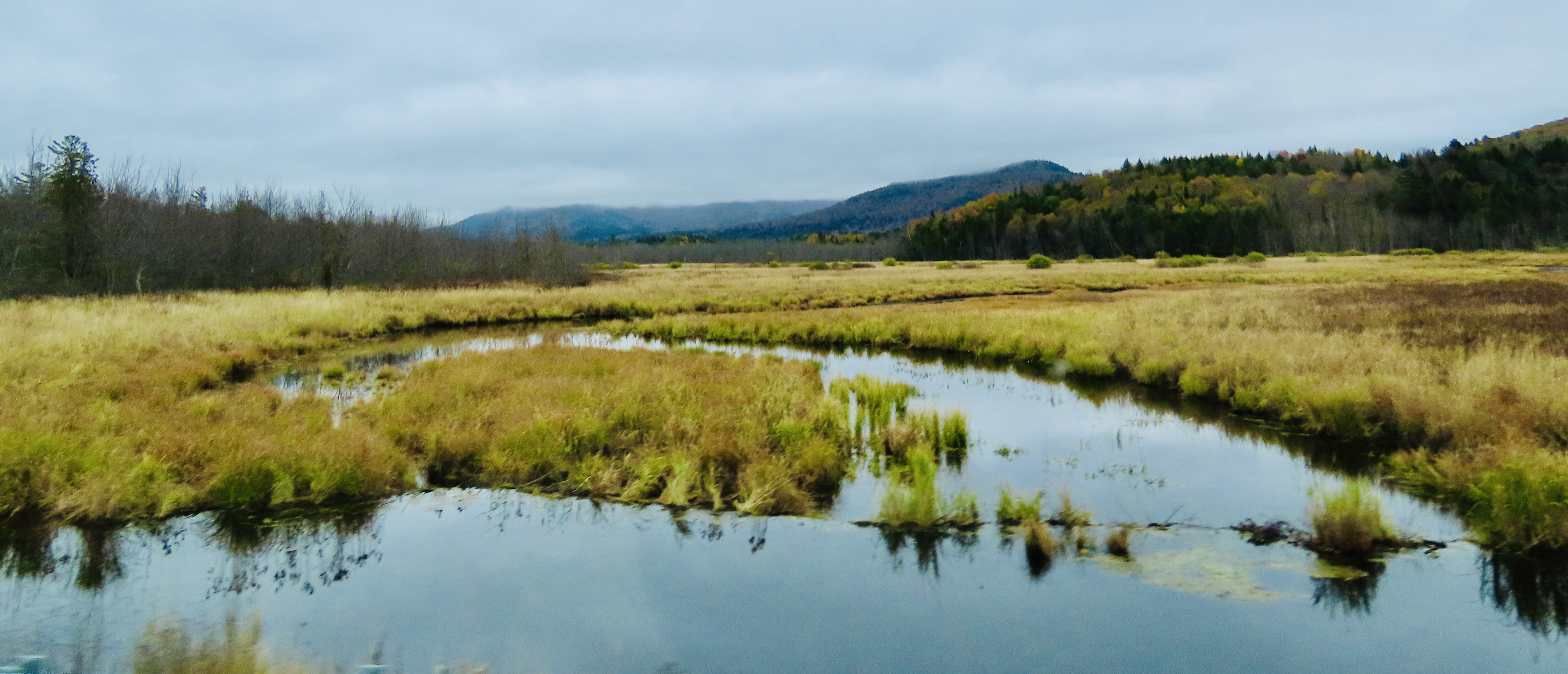
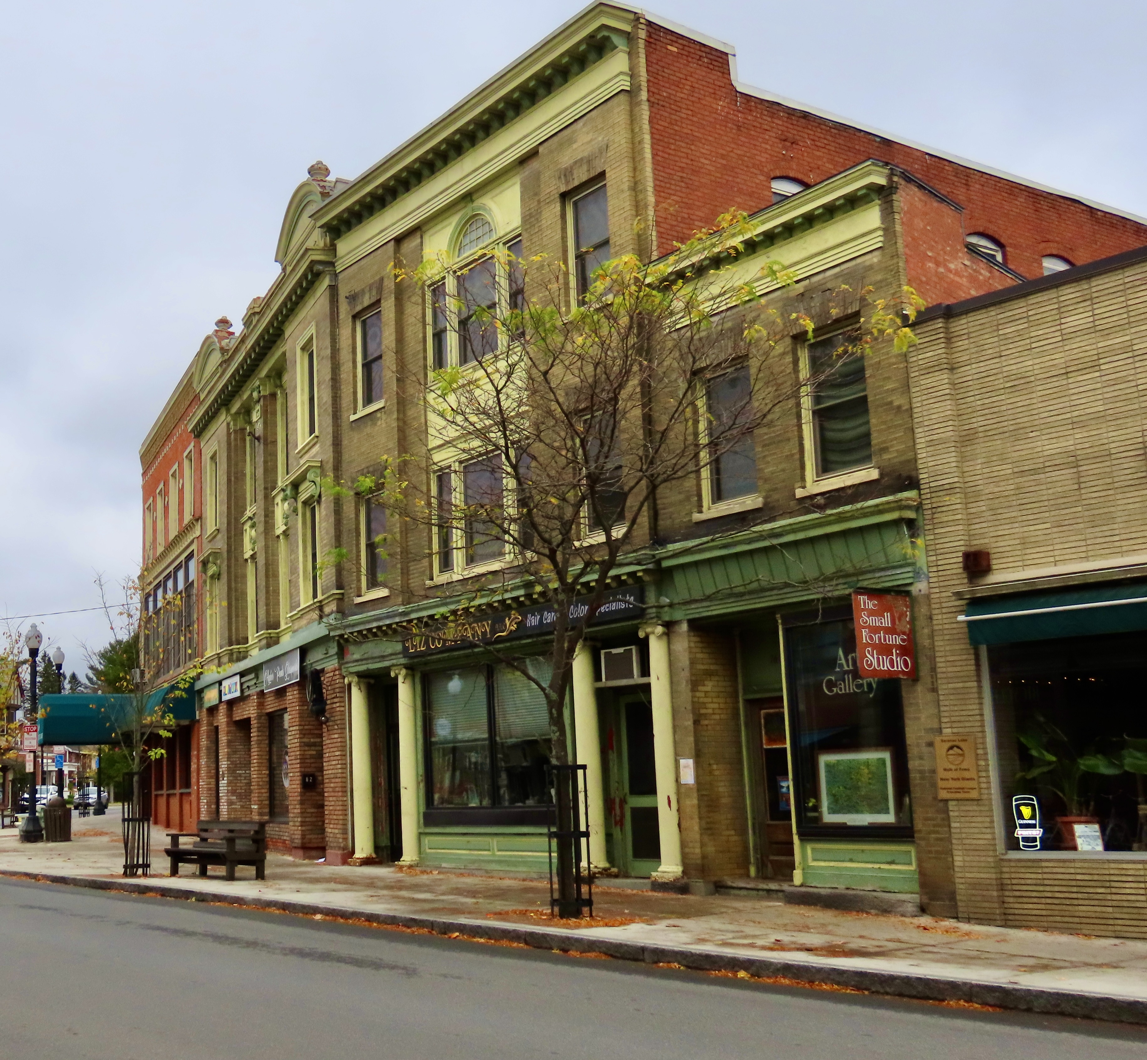
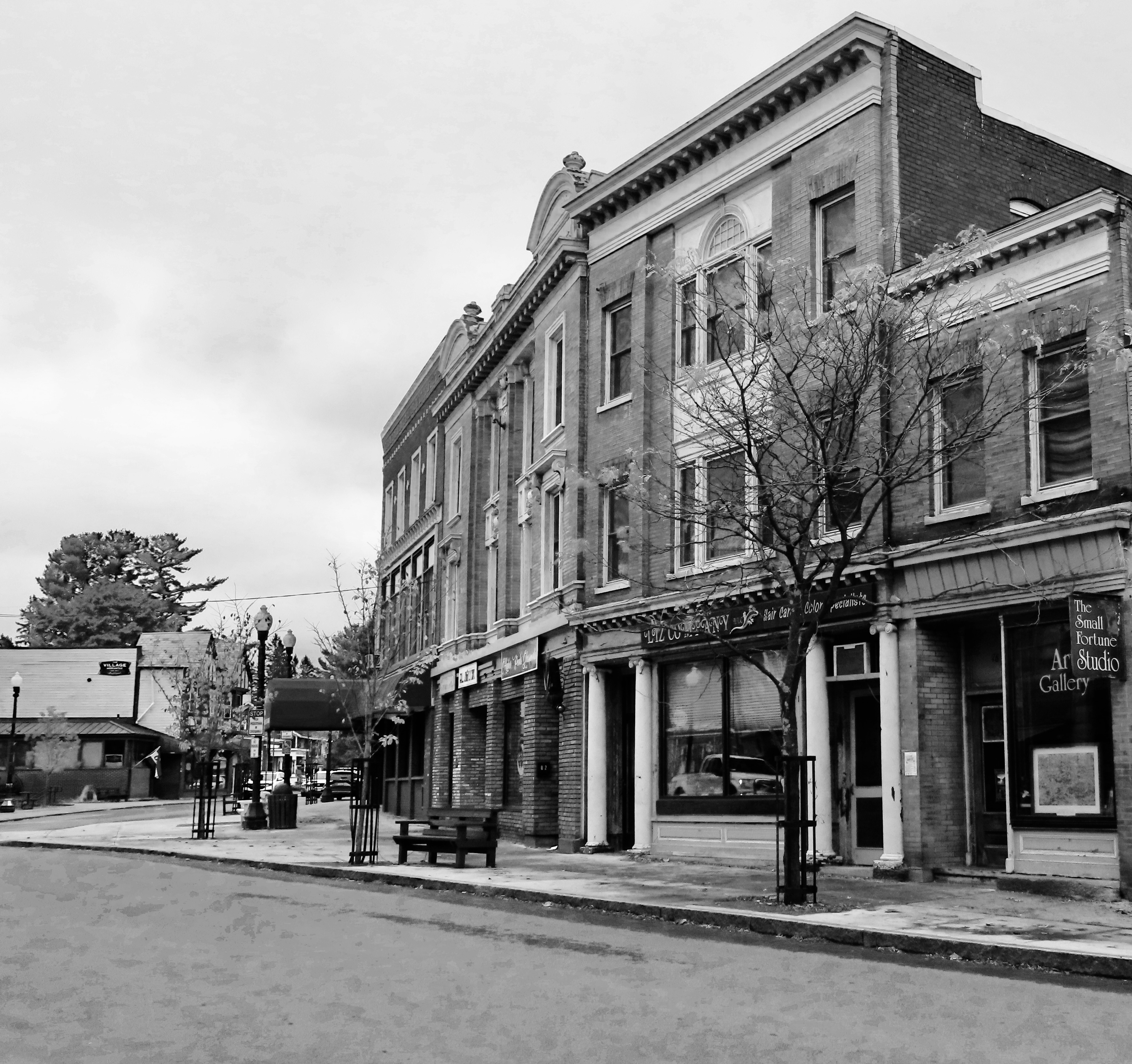
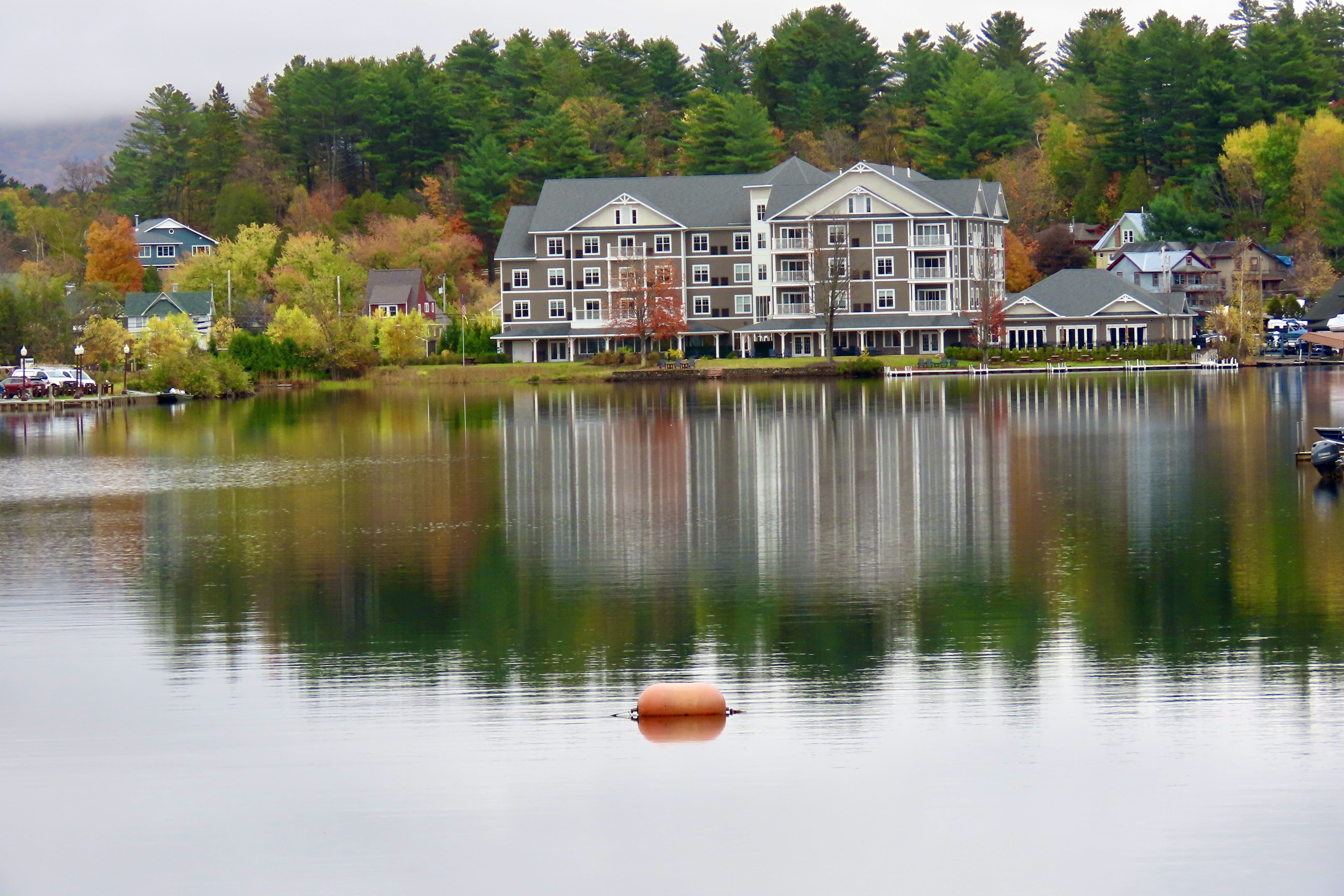
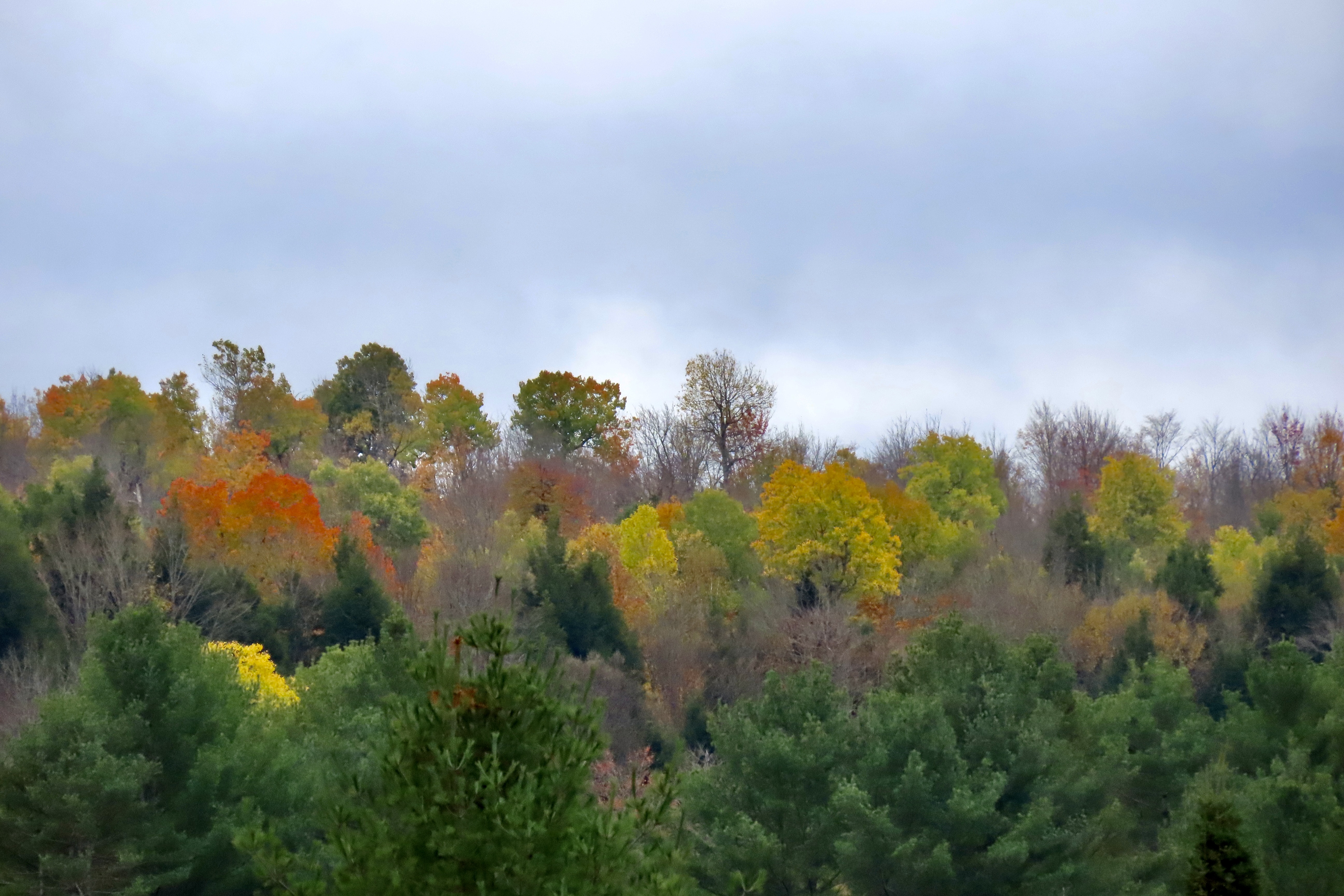
We soon discovered that fall color was alive and well in the park. The cloudy day and trees without leaves gave a water color painting look to the scene. There is another factor as well. I shoot lots of photos from our truck as it zooms along the road. It requires a different skillset than normal photography where you get to leisurely think about and compose your photos. I have about five seconds if the photo is out the the front window, or less if the photo is on the side. My camera sits in my lap with the lens cover off. I see an interesting photo, turn on the camera, and shoot. Due to the speed of modern cameras, my photos are normally clear, but they can be slightly fuzzy, adding to the water color effect. Peggy doesn’t like to take photos from a moving vehicle. She insists on thinking about and composing her photos. By the time she gets ready, the photo is a few hundred yards down the road. “I’ll drive. You take the photos, Curt,” she insists. Grin.Another “water color” road shot. I really liked the color contrast here between the yellow, green and orange plus the ‘towering feel’ provided by the tall trees. Peggy likes the way the limbs on the conifers reach out. “Fingers,” she calls them.It was the shape and dark color of the conifers in comparison to the deciduous trees (ones that lose their leaves) that caught our attention here.A few pull offs did allow us to get out and take clear photos. This one shows bright red maple leaves set off by white birch bark. The birch’s leaves turn bright yellow in fall.These are young birch trees. We took this photo at the same stop we took the photo above.A reflection shot on the Saranac River, managed to catch the full range of fall colors including the brilliant yellow of the beech trees. In addition to having a water color feel, I thought this photo was like an Impressionistic painting. We like this shot because of the reds and oranges. The yellows and the greens provided emphasis.We took this photo not far from the town of Saranac Lake. it shows that fall colors are about more than just trees!In addition to its modern reputation as a tourist magnet, Saranac Lake once served as an early research center for TB and as a TB Sanatorium. For a brief period it also provided a home for Robert Louis Stevenson, the author of such classics as Treasure Island, one of the books I devoured as a child.I rendered the above photo in black and white to create an ‘old time’ feel.A pretty little lake sits on the edge of town. Peggy and I first assumed it was also Saranac Lake. Actually it is Flowers Lake named after a governor of New York. Before that it was named Mill Pond because the river had been dammed up to run a saw mill. We felt the small buoy made a nice addition.I thought this made an interesting photo and reflection shot. Can you spot the overflow for the Flower Lake Dam? Check out the left end of the reflection.The backup behind the overflow outlet was perfectly calm. The different perspective here provided an interesting reflection of its own. That’s it for today. Next up will by our annual Halloween Post. New England takes its decorating seriously.As do I. My newest BFF… Best Friend Forever.And Peggy. She decided to do a turn on the dance floor with Mr. Pumpkin Head.
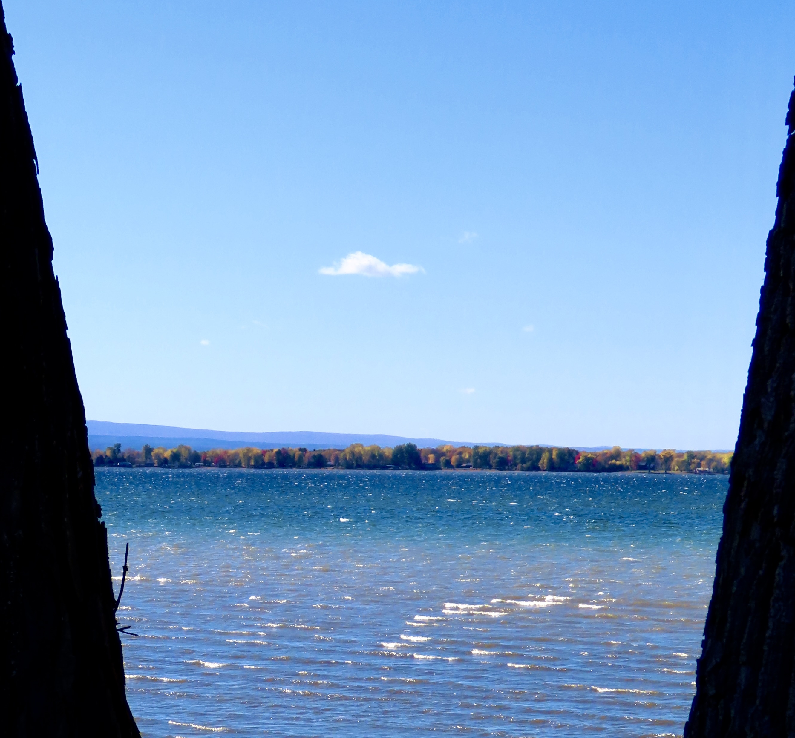
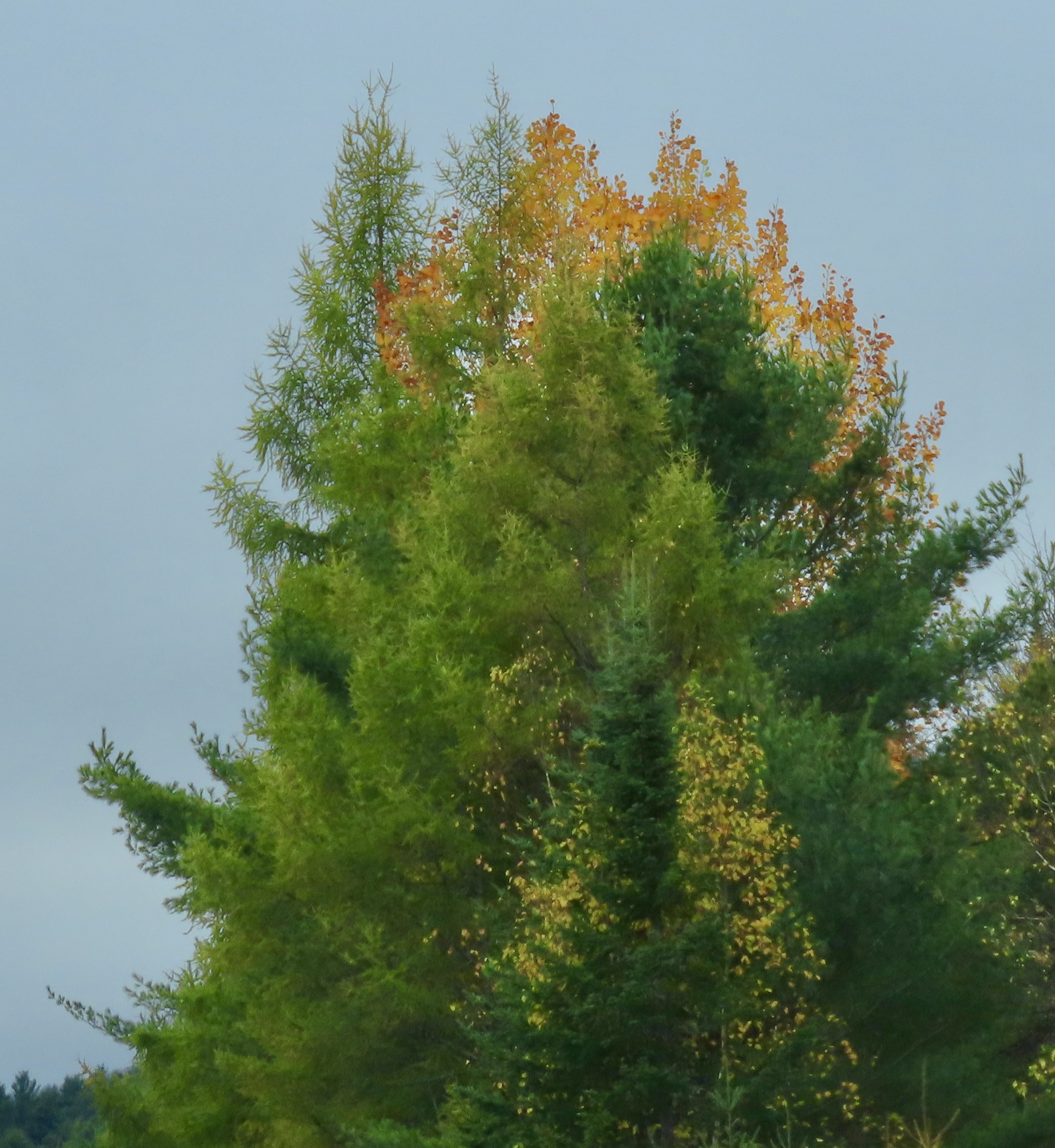
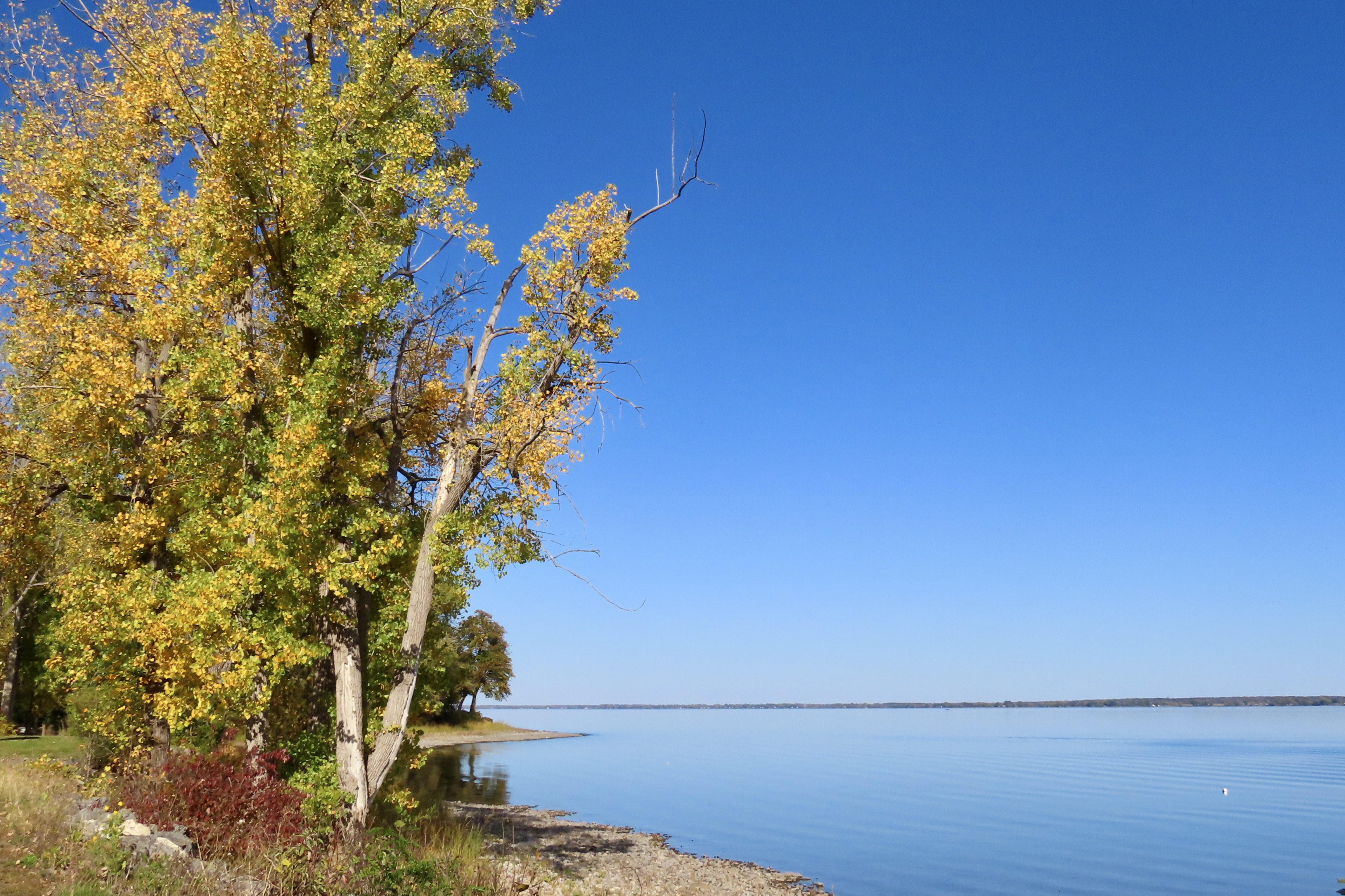
As I write this post, Peggy and I are situated in a cozy little cabin near Chazy, New York. Lake Chaplain is 5 miles to the east and the Adirondack Mountains are 5 miles to the west. The Canadian Border is 6 miles to the north. Here, we are looking out at Lake Champlain from the New York side. The land in the distance is Isle La Motte in Vermont, one of several islands in the lake. The reflection caught our attention.Another view of Lake Champlain. No islands here. You’ve undoubtably heard of Nessie, the Loch Ness Monster, but have you heard of Champy, the Lake Champlain Monster that looks and behaves in the same way: illusive. And why am I thinking of Sasquatch now? Anyway there have been over 300 reported sightings of Champy over the years in the 125 mile long lake. I’ve stood on the edge of Loch Ness in an ancient ruined castle and searched the waters for Nessie. Minus the castle, I’ll do the same here. Just in case…
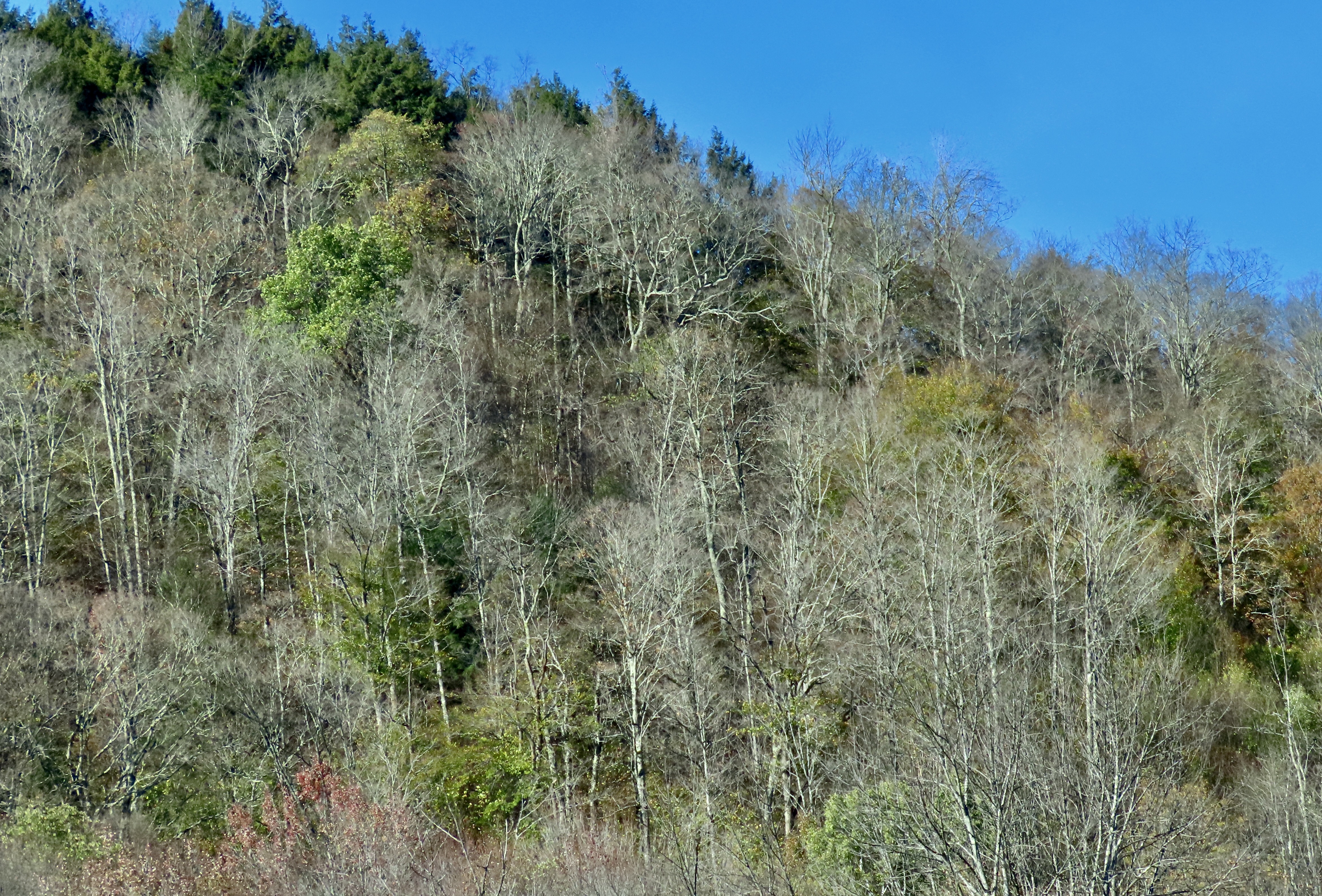
Peggy and I made a trip through New England in the fall 25 years ago when we had both taken a year-long sabbatical from our jobs. We decided it was time to visit the beautiful fall foliage again with Vermont and New Hampshire as our destination plus a side trip to Acadia National Park and a few of the scenic towns along Maine’s coast.
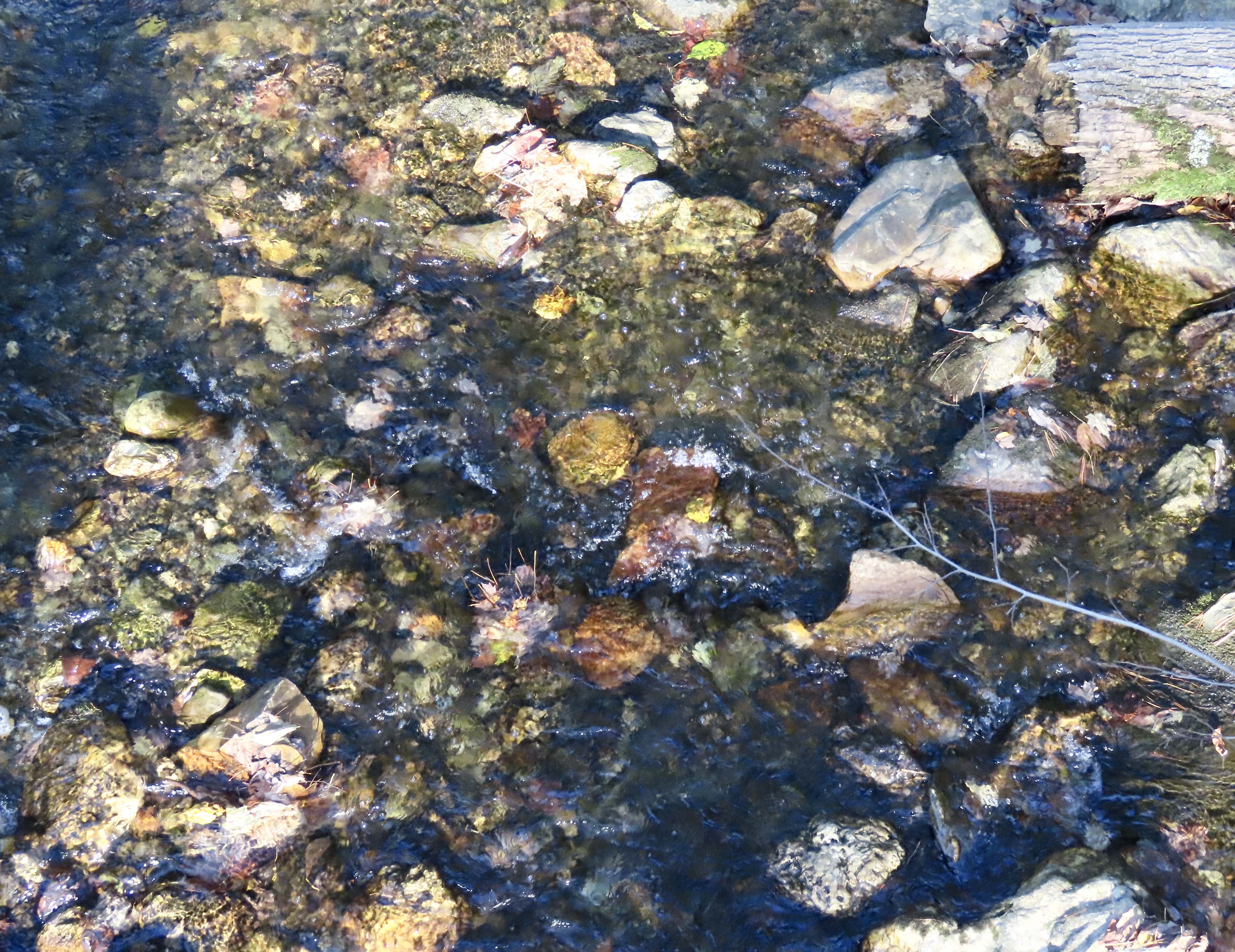
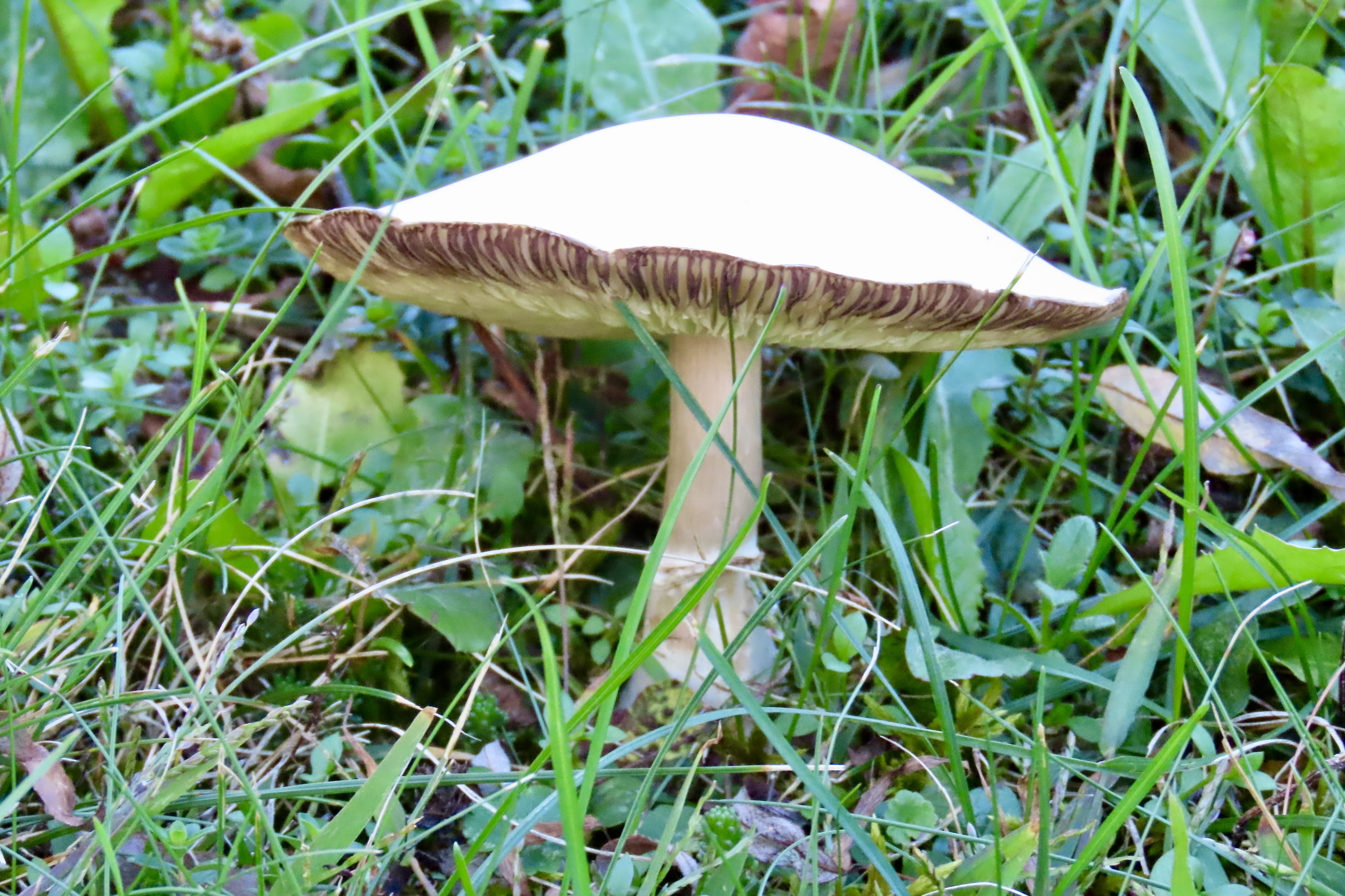
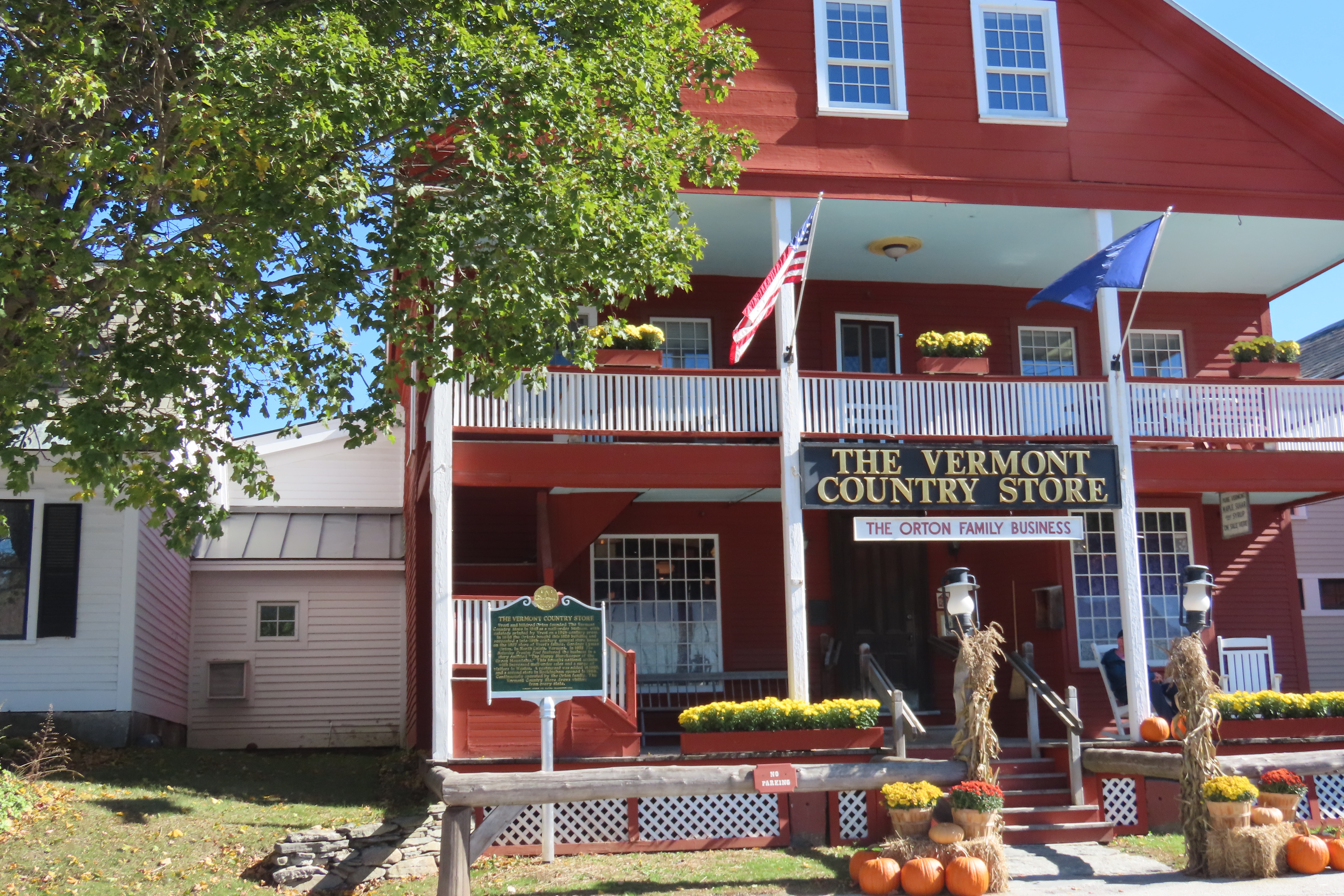
While one can normally expect fall foliage in Vermont to last into the first week in October, our arrival in the area suggested we were too late. There were more leaves on the ground than in the trees. The woman at the Sticky Fingers Bakery (yummy), on Route 100 up through the heart of Vermont, told us that the state was facing a serious drought. The normal 25 inches had turned into 6. That’s desert level rain! Hello Global warming! The leaves, she told us, hadn’t been nearly as vibrant and had dropped early.New England is beautiful with or without its colorful fall leaves, however. There would be plenty to occupy our time (and cameras). Our first night was spent in Williamstown, Massachusetts, a small town on the Vermont border. This colorful creek was flowing by the 1896 House and motel we were staying at.We found a brilliant white capped toadstool growing on the lawn. It literally defined white.Route 100 is chockfull of fun stores, restaurants and breweries to explore. The Vermont Country Store in Weston is the grandaddy of the stores. It was so big that Peggy got lost. I almost called for a search and rescue team. It turns out, however, what I call lost, Peggy calls shopping. She was busy buying Christmas presents. Our kids and grandkids love top grade Vermont maple syrup. And maple sugar candy. It melts in your mouth.
One of the clerks at the store told us that the peak of the fall color was the previous week. She suggested we drive over to Lake Champlain on Vermont’s western border to catch more color. That’s why I kicked this post off with photos from the lake.
The limited fall foliage didn’t mean there weren’t hold outs. A few trees had volunteered to stay dressed up for the week. The lack of color made them stand out! They were the belles of the ball, so to speak.We parked under striking orange and yellow leaves next to a small lake where we had stopped for lunch. Peggy was eating a cinnamon roll from the Sticky Fingers Bakery and I was eating an apple turnover. Healthy, huh?Looking out toward the lake.Even these two beatup holdouts were alive with color.Me, happily consuming my Sticky Fingers apple turnover. Peggy just had to take a photo.The winner for our fall Vermont colors was right outside a small cabin we had rented north of Stowe.Looking up through the leaves.This is our handsome little cabin and the tree. The cabin comes with a story.
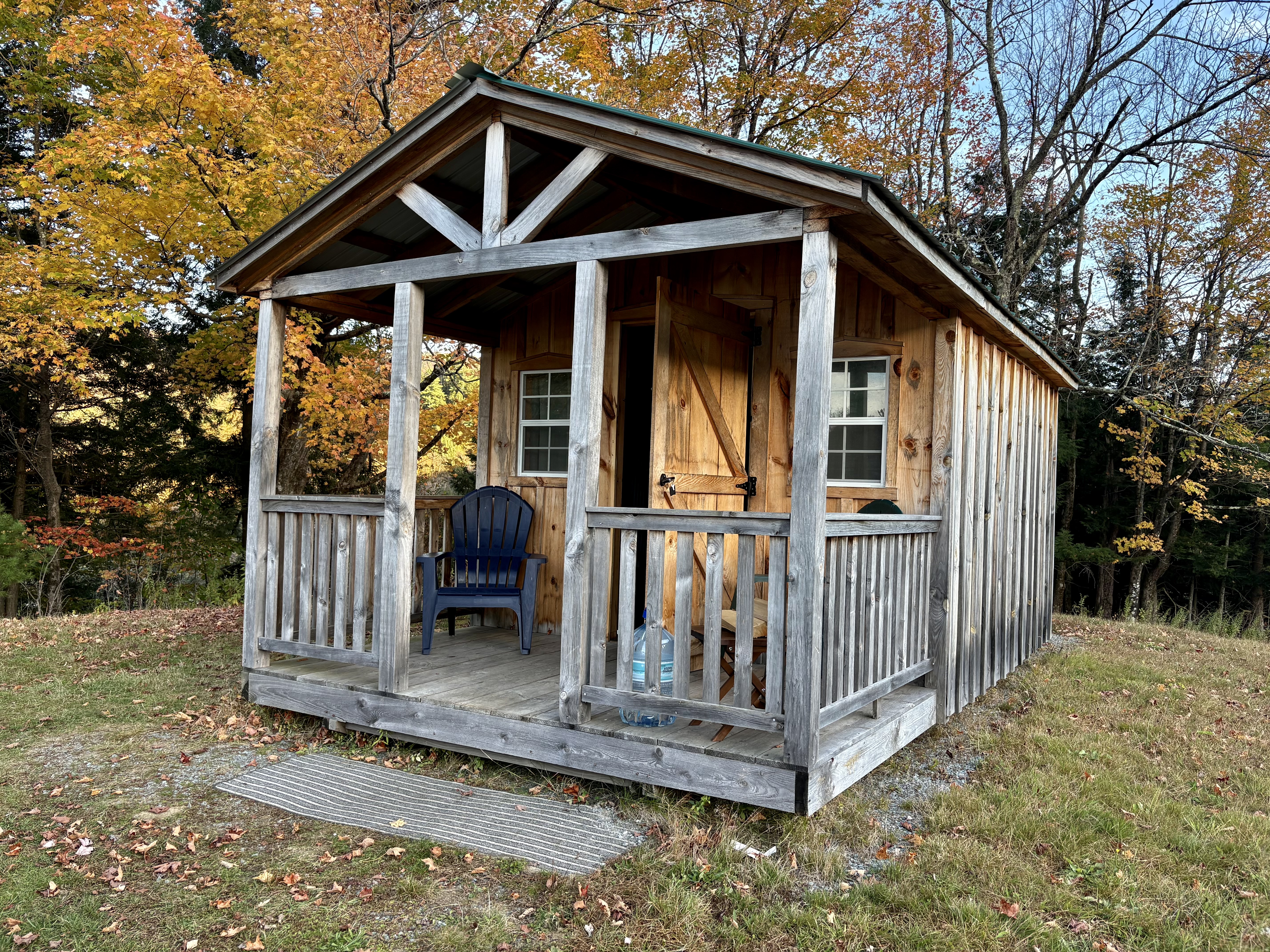
Our original plan had been to stay in Stowe, Vermont. It’s considered the most picturesque of the Vermont towns. When I saw the $300-350 prices per night of available places left to stay, sticker shock set in. I started looking at the surrounding areas. This small cabin was about 25 miles to the north and came in at under $100. It was love at first sight. “Go for it!’ my buddy exclaimed. We like cabins in the woods. “Bring warm blankets,” the owner urged, which suggested that heating might be a problem. We threw in four quilts, a down cover and our backpacks.
Beyond that, I apparently didn’t read the small print.
After a pleasant drive over country roads, we arrived at the cabin. As promised, the owner had left the key in the door. Inside, we discovered our furniture was a double-bed sized futon and a coffee table. Electricity was a battery connected to a small lamp. Our water was in a large bottle on the porch. As for a bathroom, it was an outhouse located about 25 yards away. None of this mattered to us. We are backpackers. We even had an extra lantern, a backpacking stove and headlamps along.
The real challenge was the cold. Temperatures were dropping below freezing and the cabin came with air conditioning, i.e. gaps in the structure that guaranteed that the temperature inside matched the temperature outside. Somehow, I ended up with one blanket. Peggy ended up cozy. I’ve never been able to figure out how she does that. It was a warm blanket, however. My biggest problem was cold feet. I put on my slippers. The other problem was having to pee, not once, not twice, but three times. I rarely have to go twice and never 3 times! Out I dutifully went each time, at least off the porch.
Peggy woke up at 12:30 after my second trip and we renegotiated the blanket distribution. I actually slept warm and cozy up to 5:30 and my third adventure into the great outdoors. I managed three hours of sleep throughout the night. Not bad, considering.
I’ll conclude with a few fall photos we took near Chazy, NY, where we stayed after our Vermont cabin.
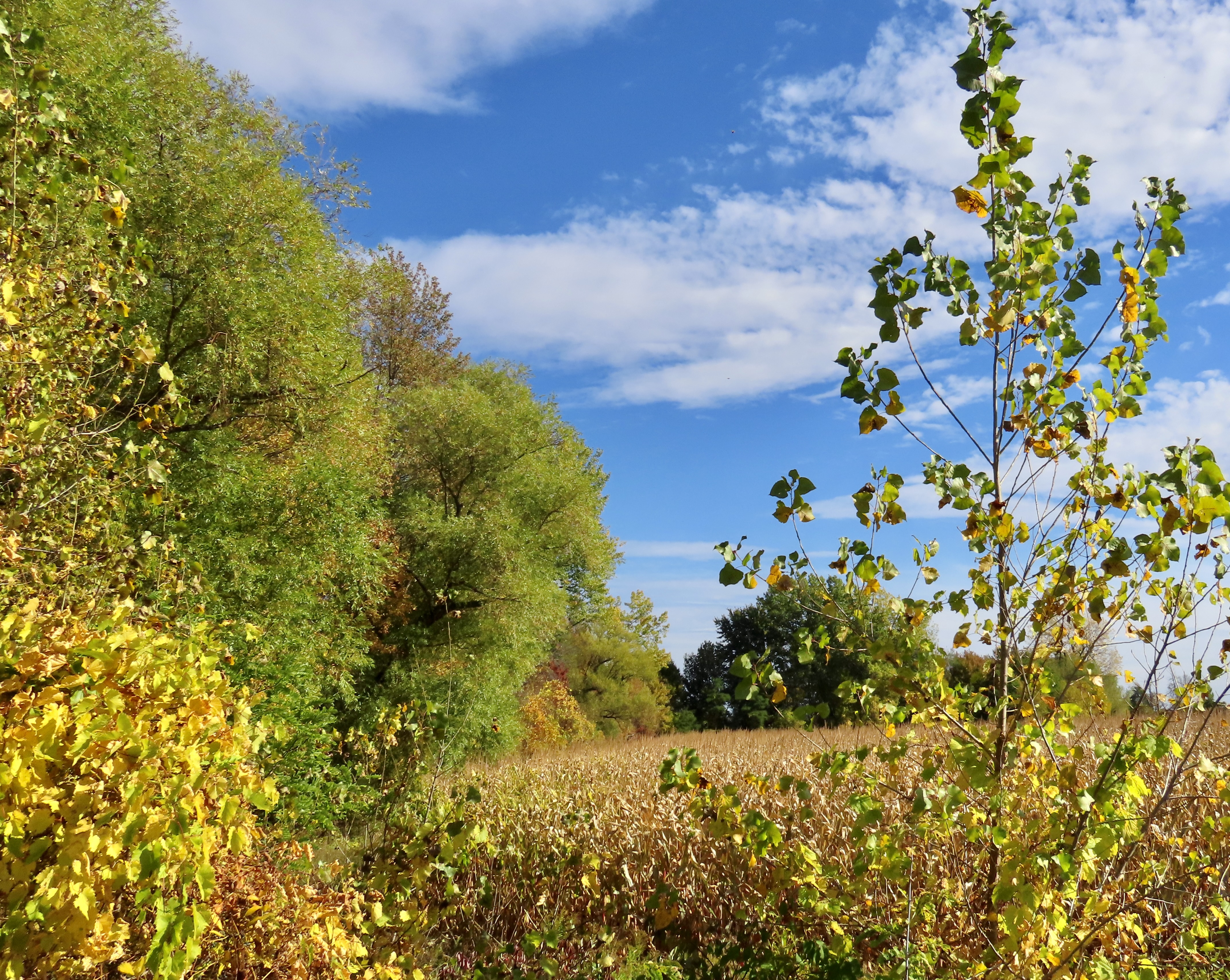
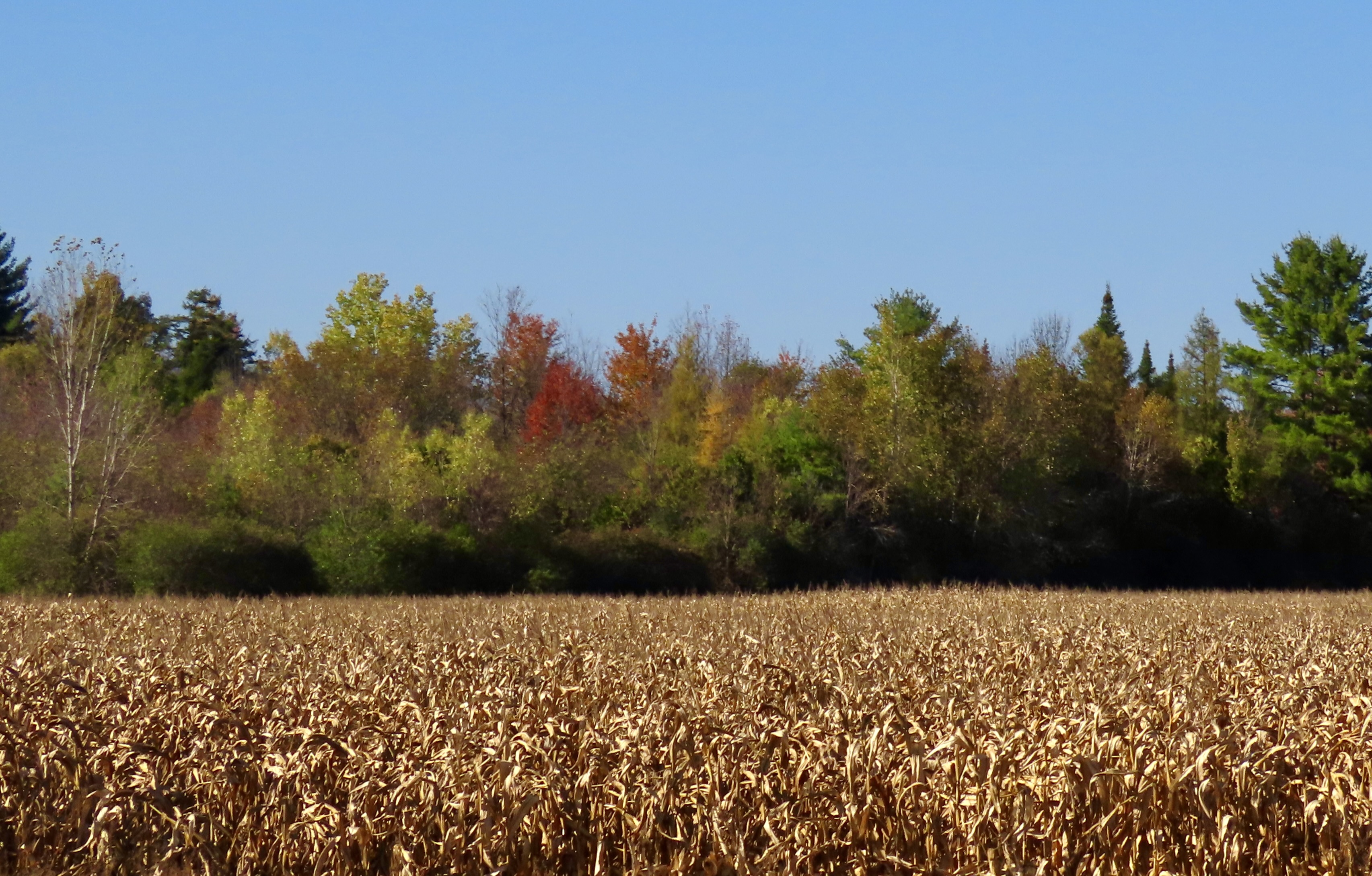
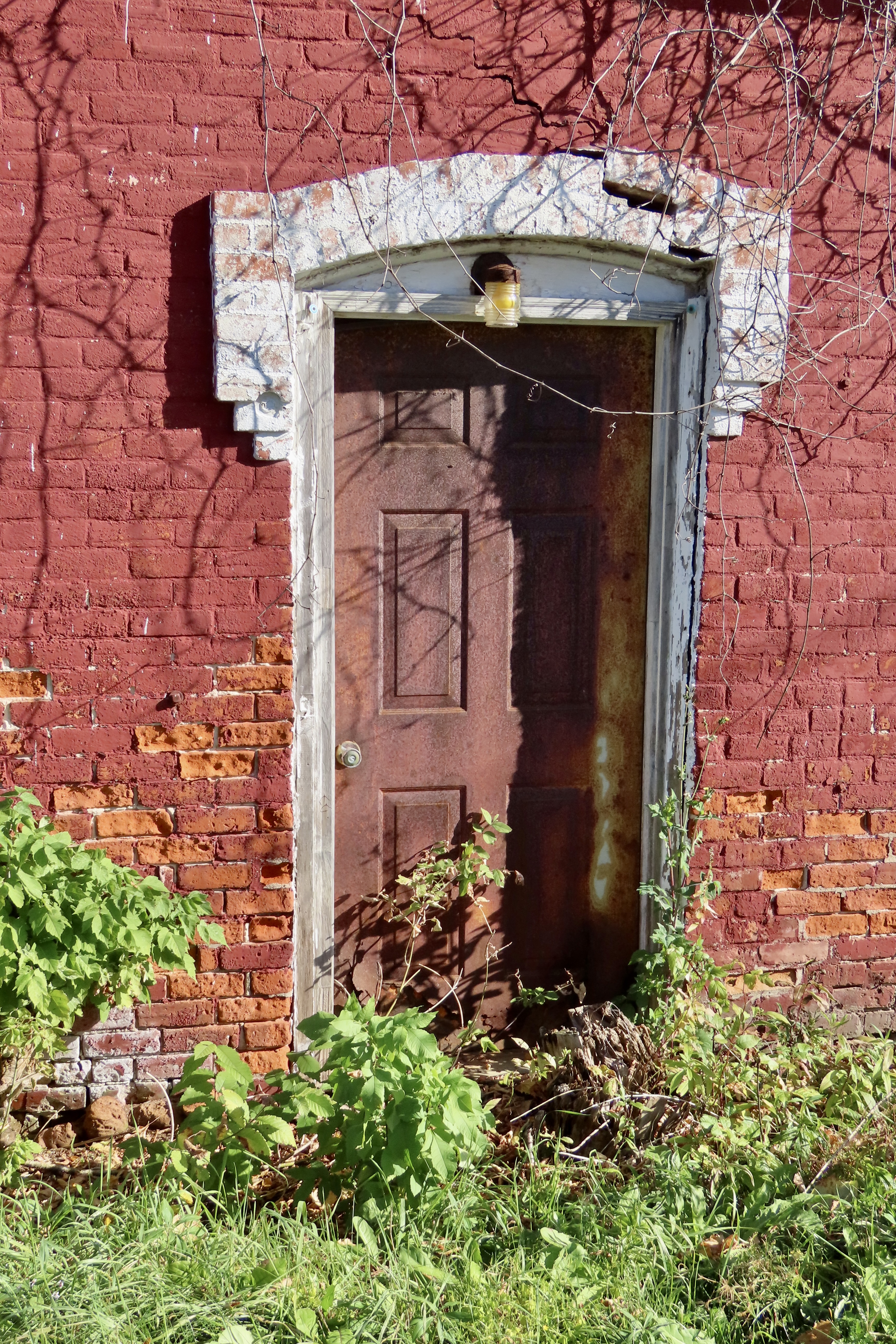
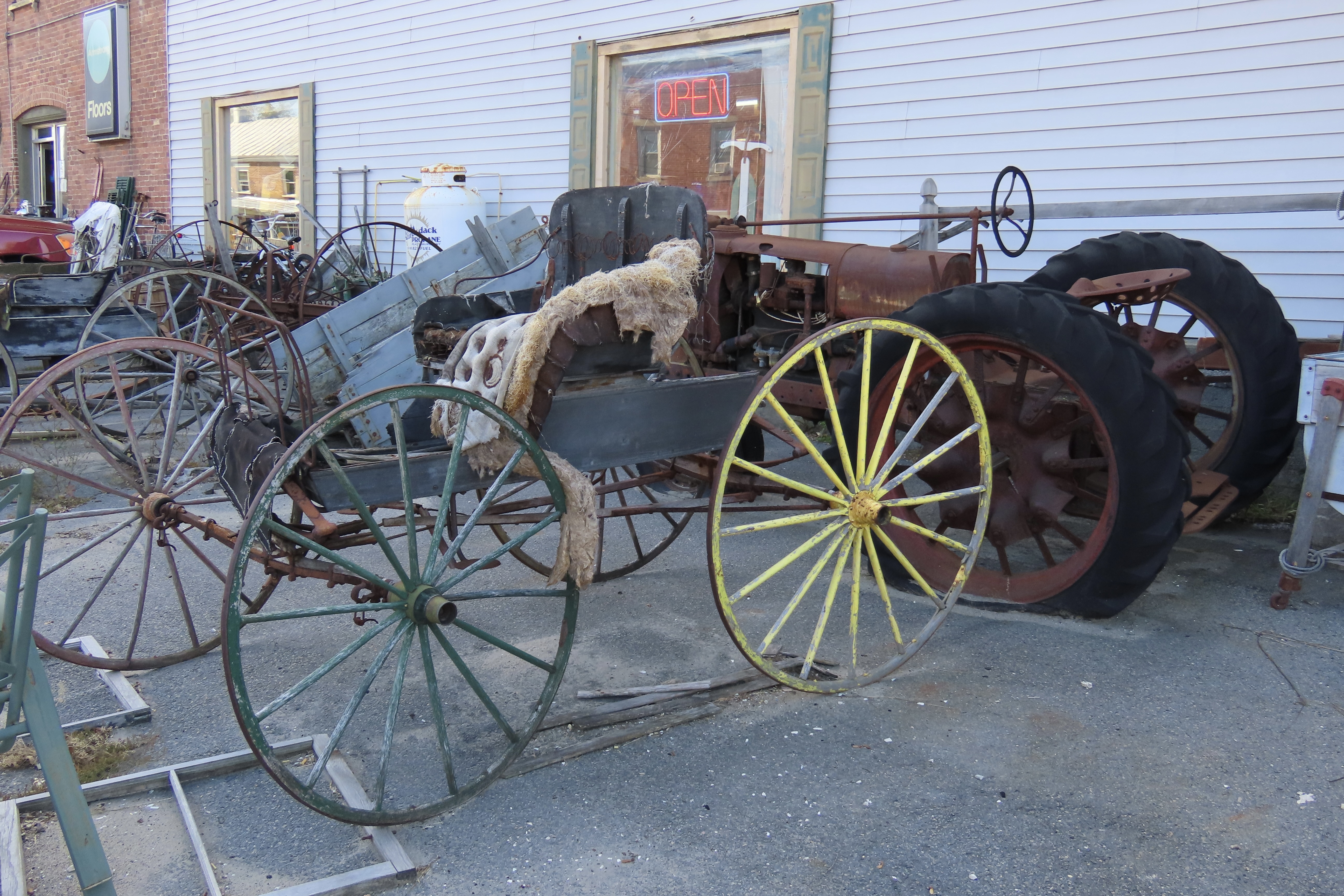
Cornfield and color. The dried corn shucks went with the season.Awe shucks.An old barn near Lake Champlain.The ghosts would be out dancing on their tombstones on a harvest moon night. T’is the season.While thinking ghostly thoughts, we came across this display in a small town near Chazy. Happy Halloween.For those of you who like old doors. It, too, has spooky potential.I’m betting you’ll know why we took this photo of an old buggy. Yellow.Red.I’ll conclude today with this roadside attraction. Next up, Peggy and I journey into the Adirondack Mountains where we find even more color and end up at Saranac Lake, a few miles from Lake Placid, site of the 1932 and 1980 Winter Olympics. America’s Olympic teams still train there.A rainy day in the Adirondack Mountains.
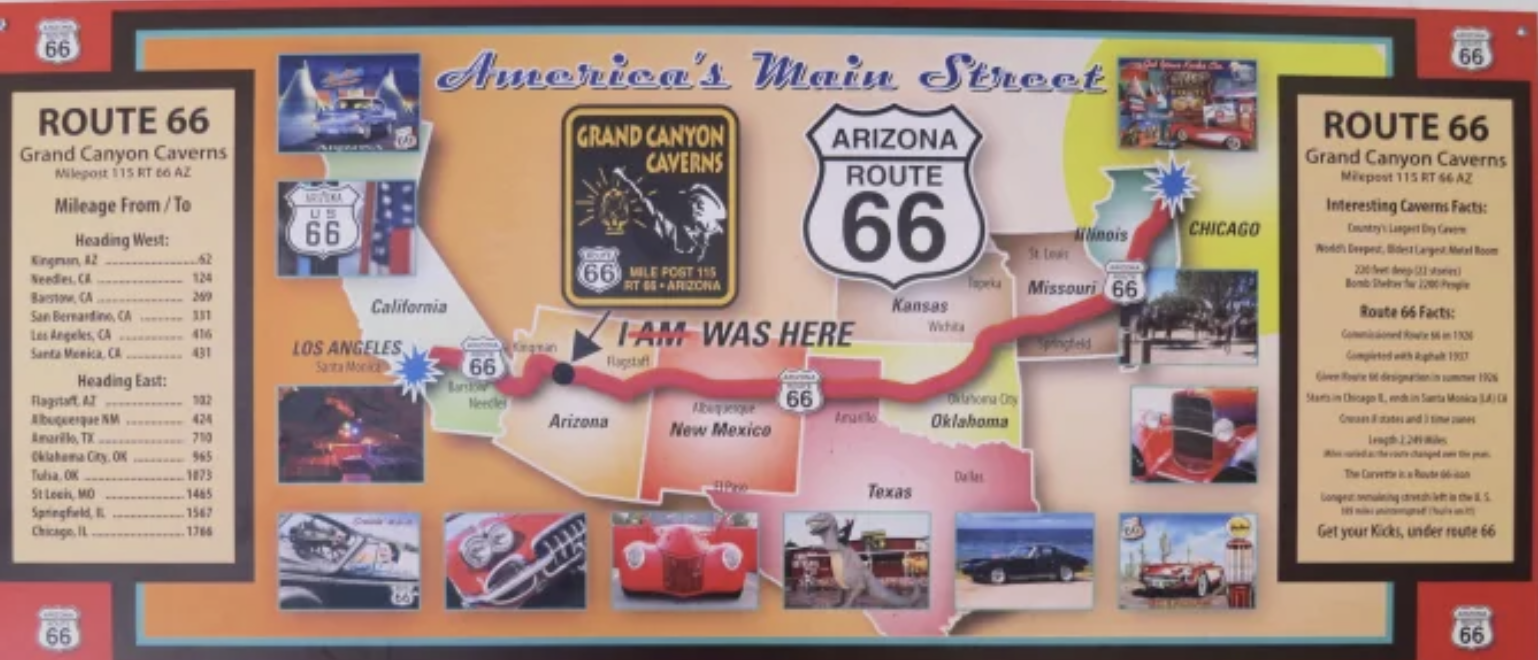
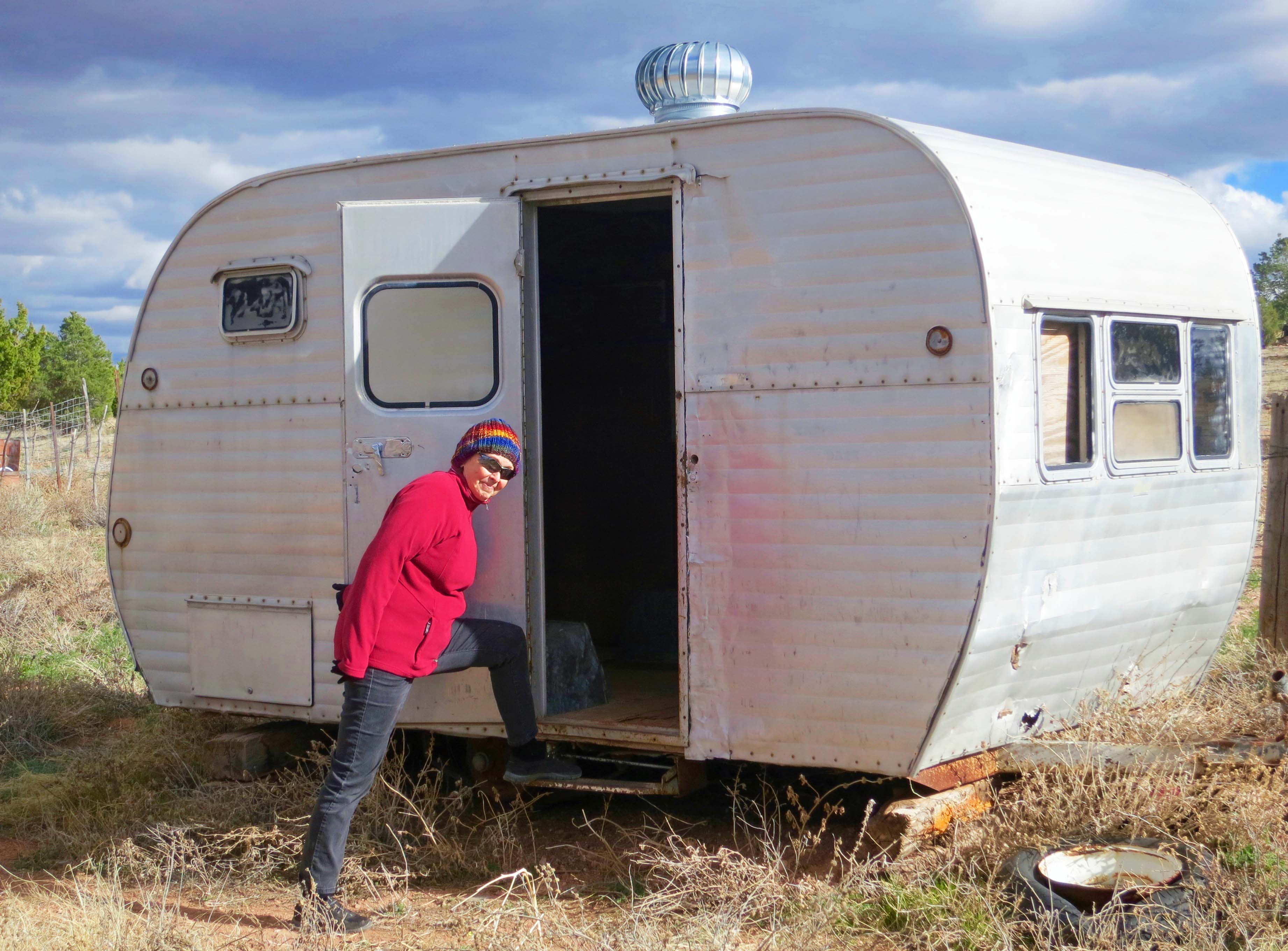
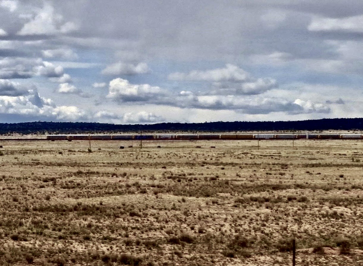
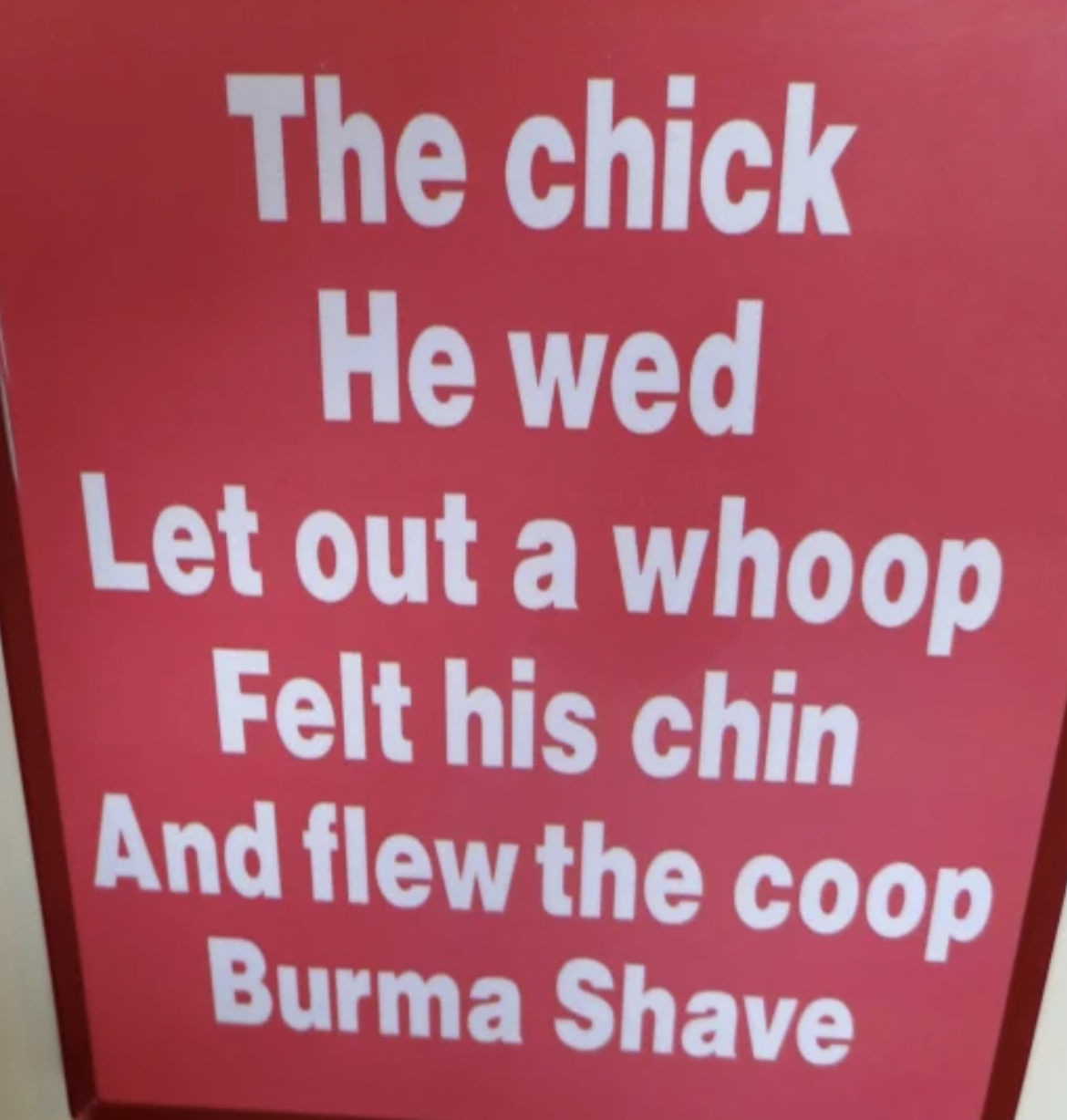
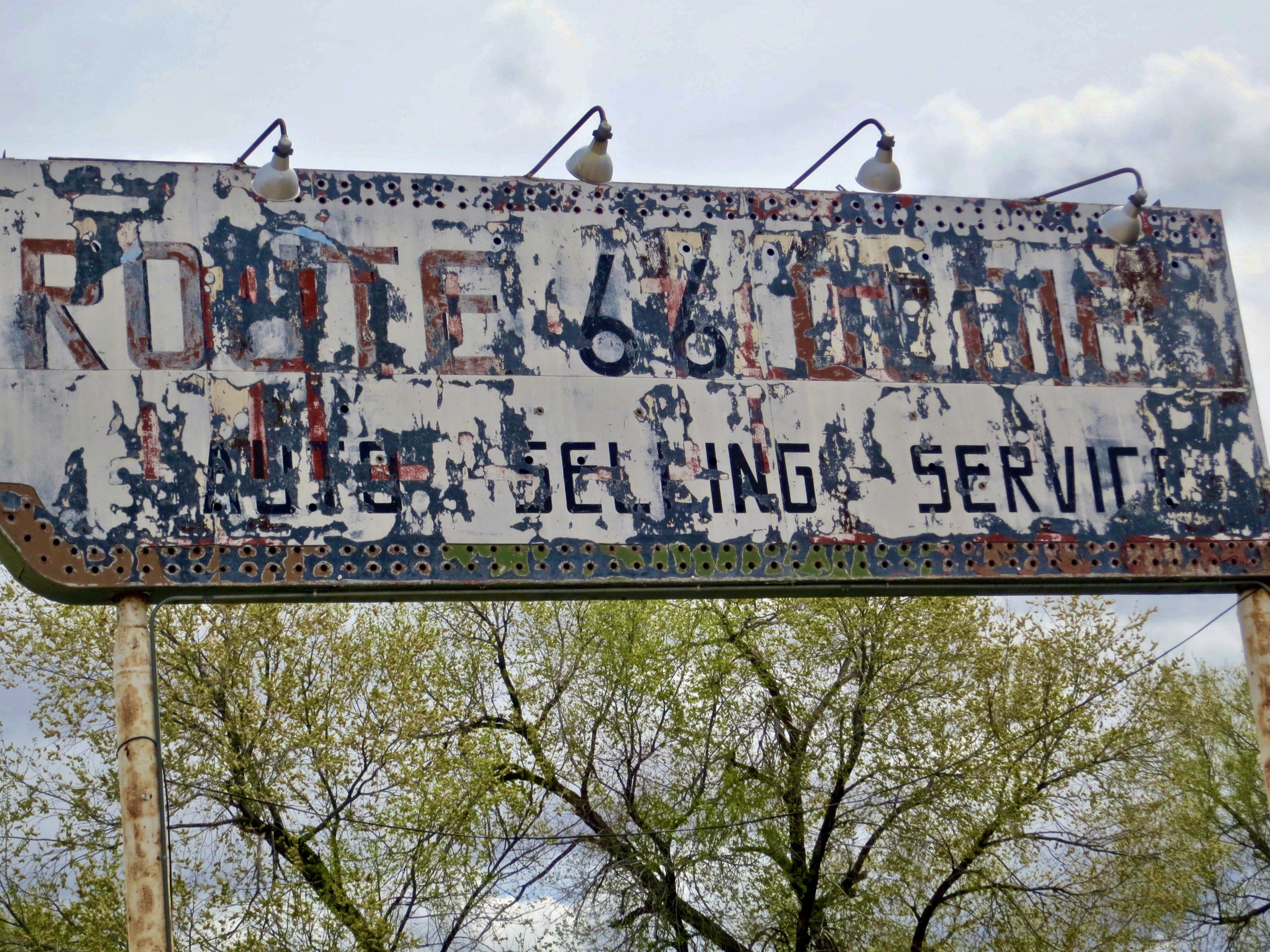
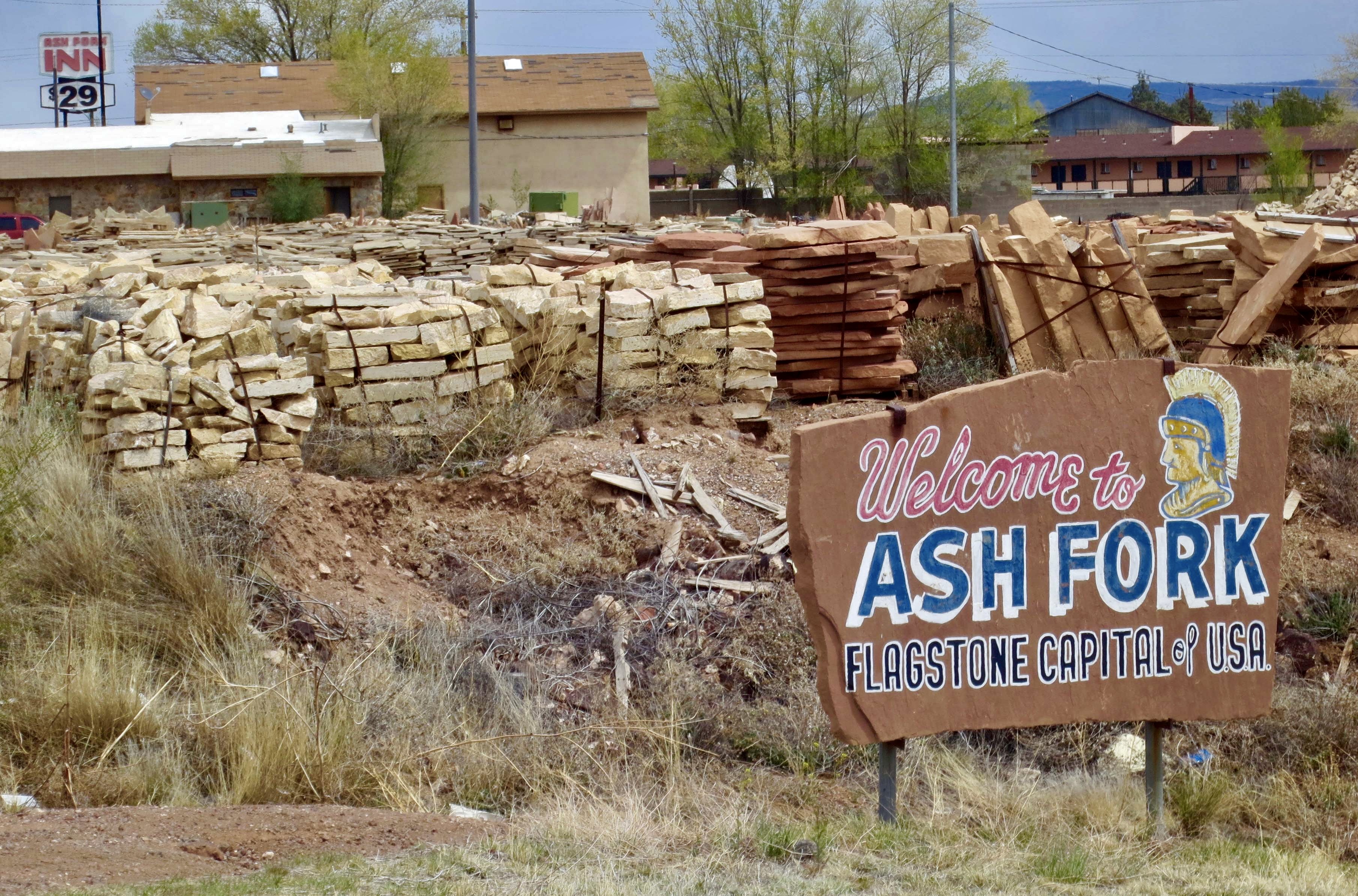
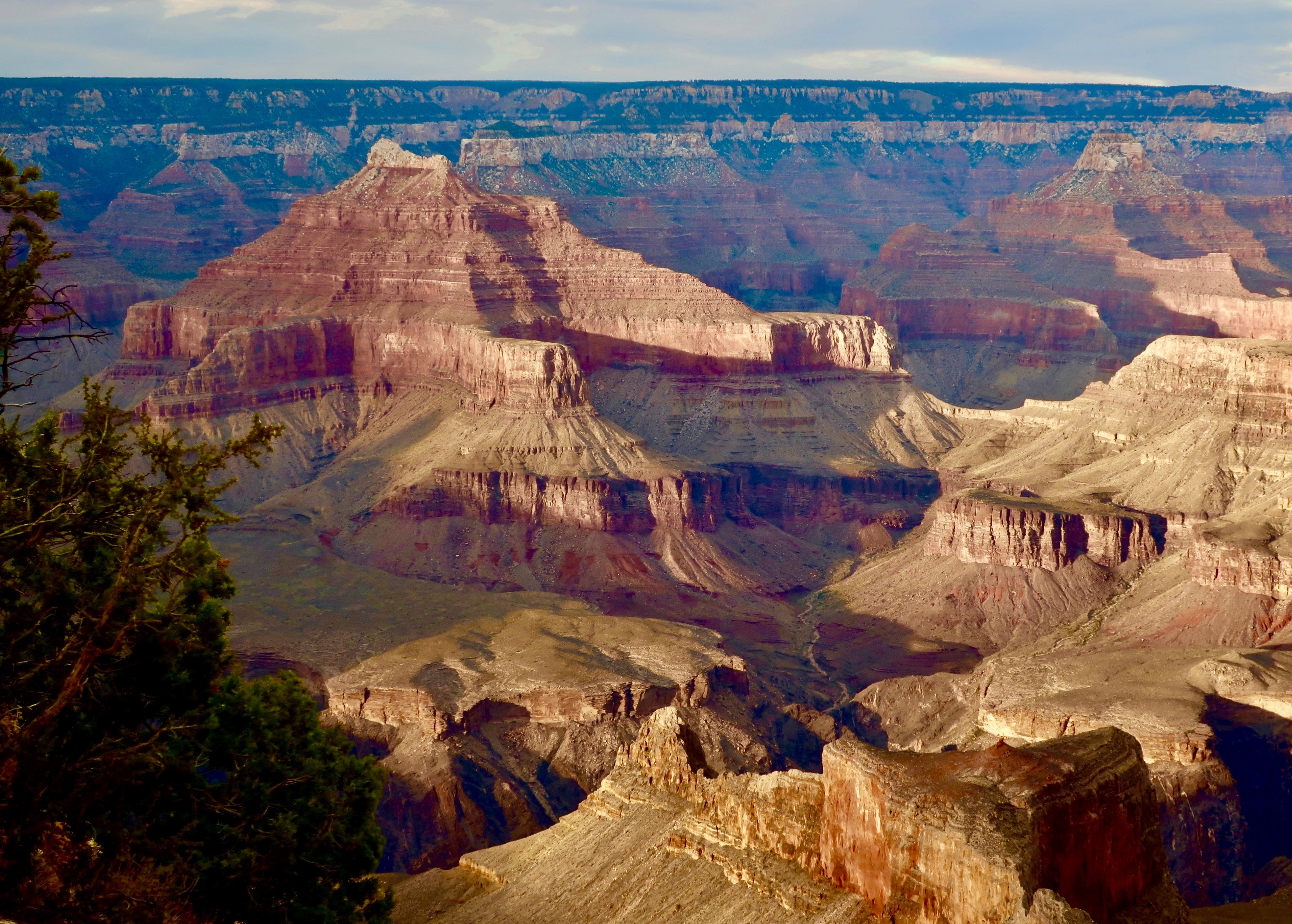
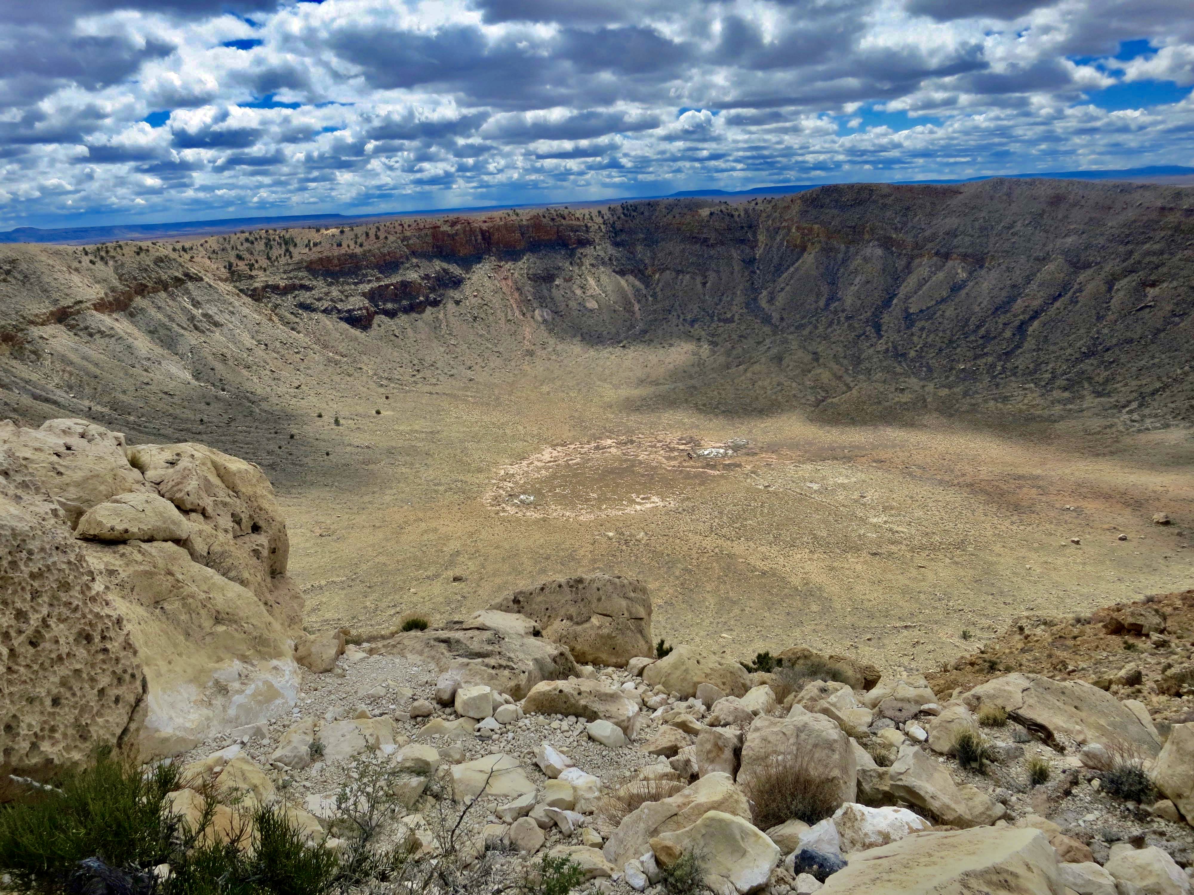
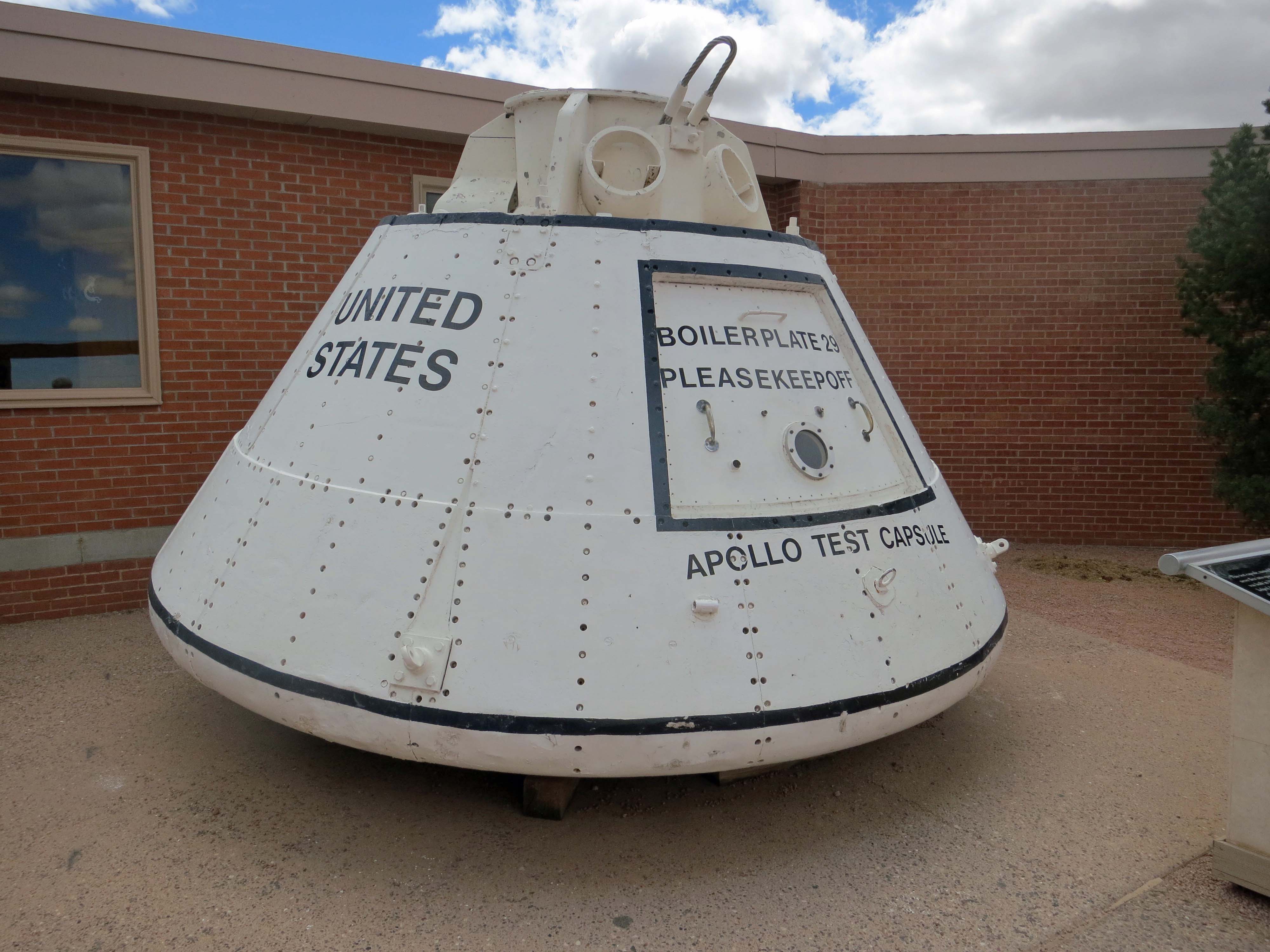
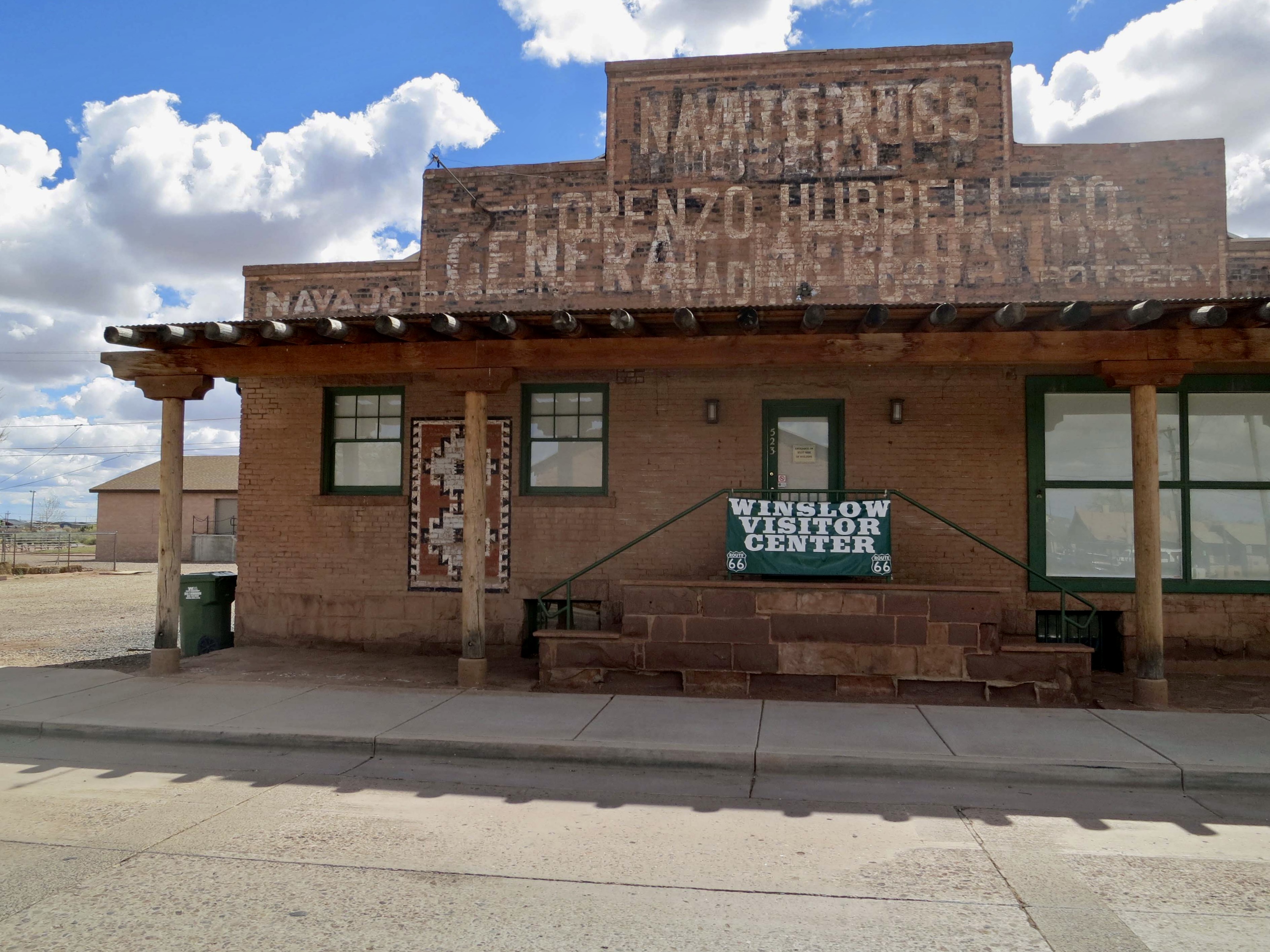
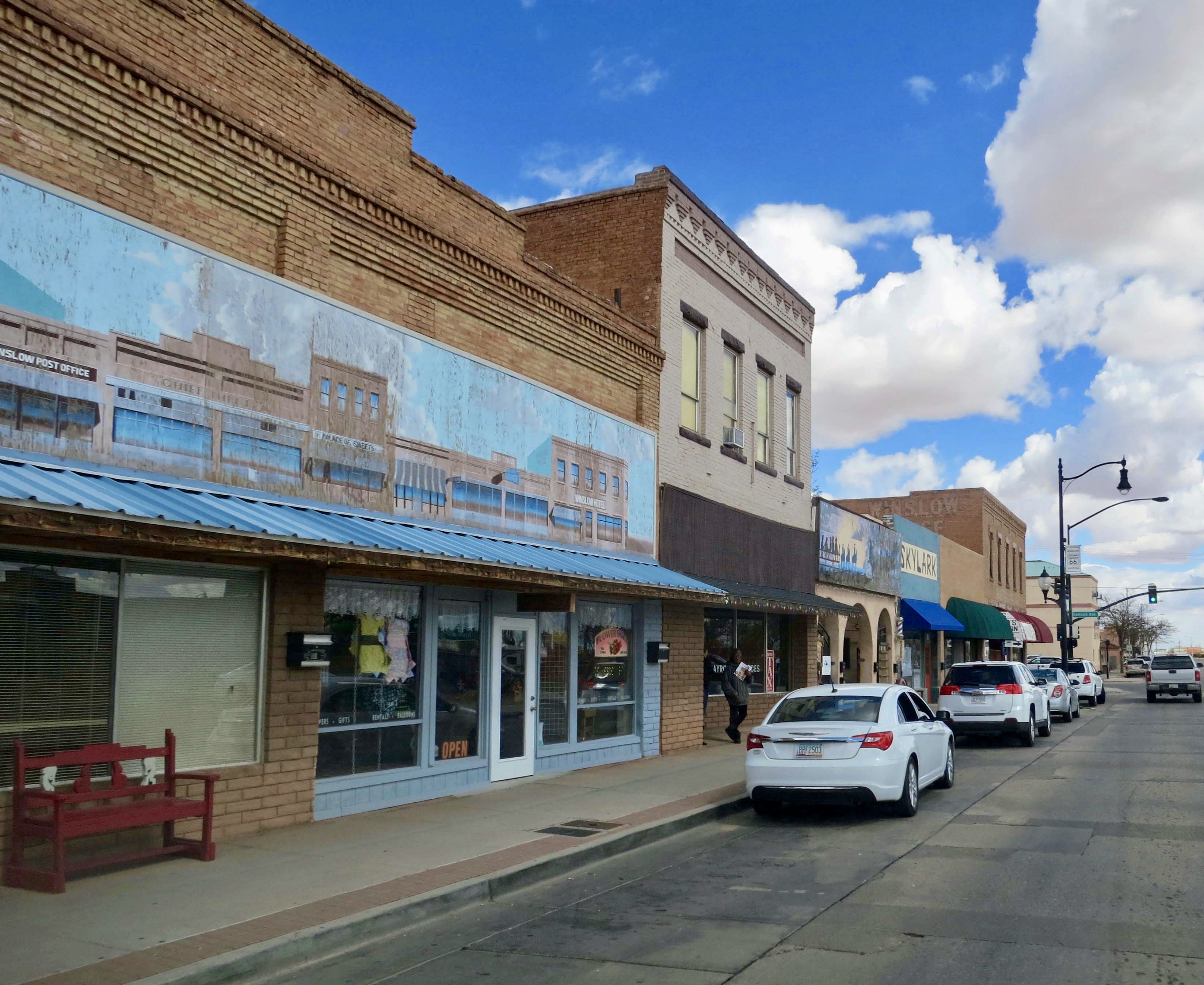
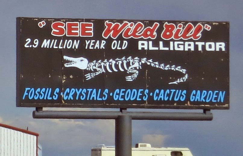
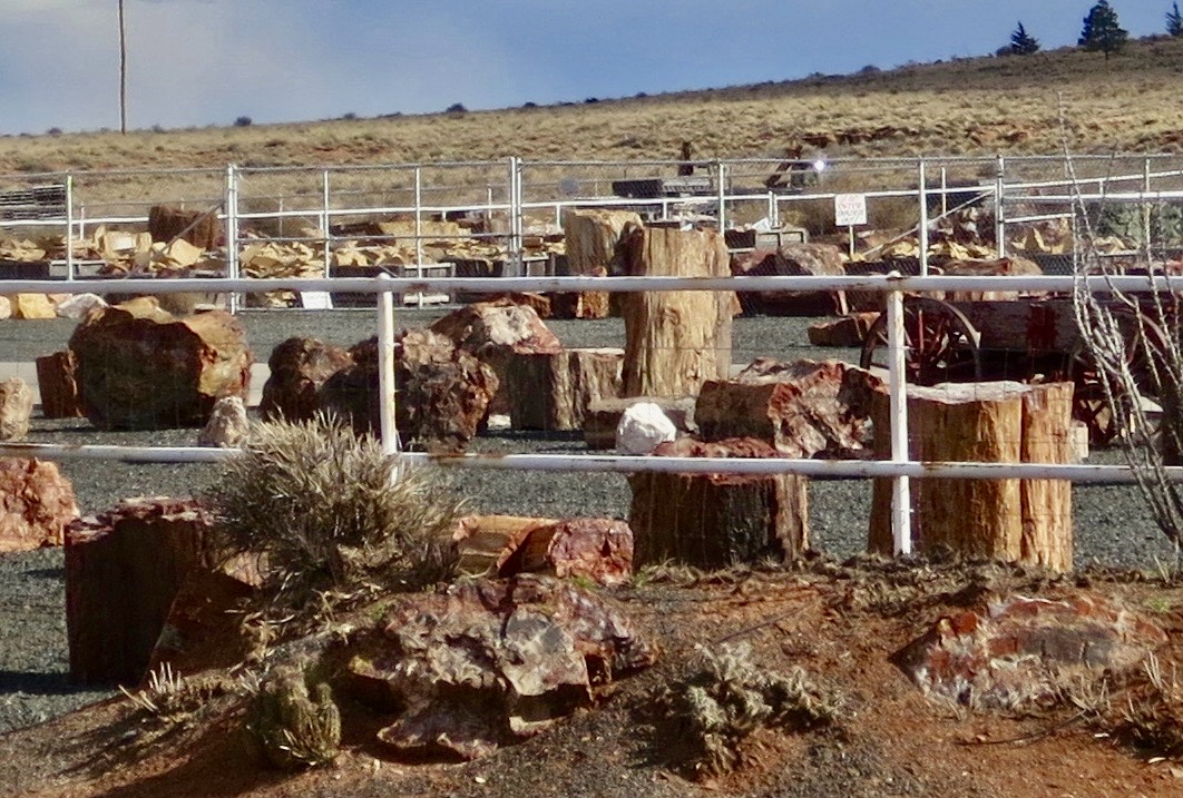
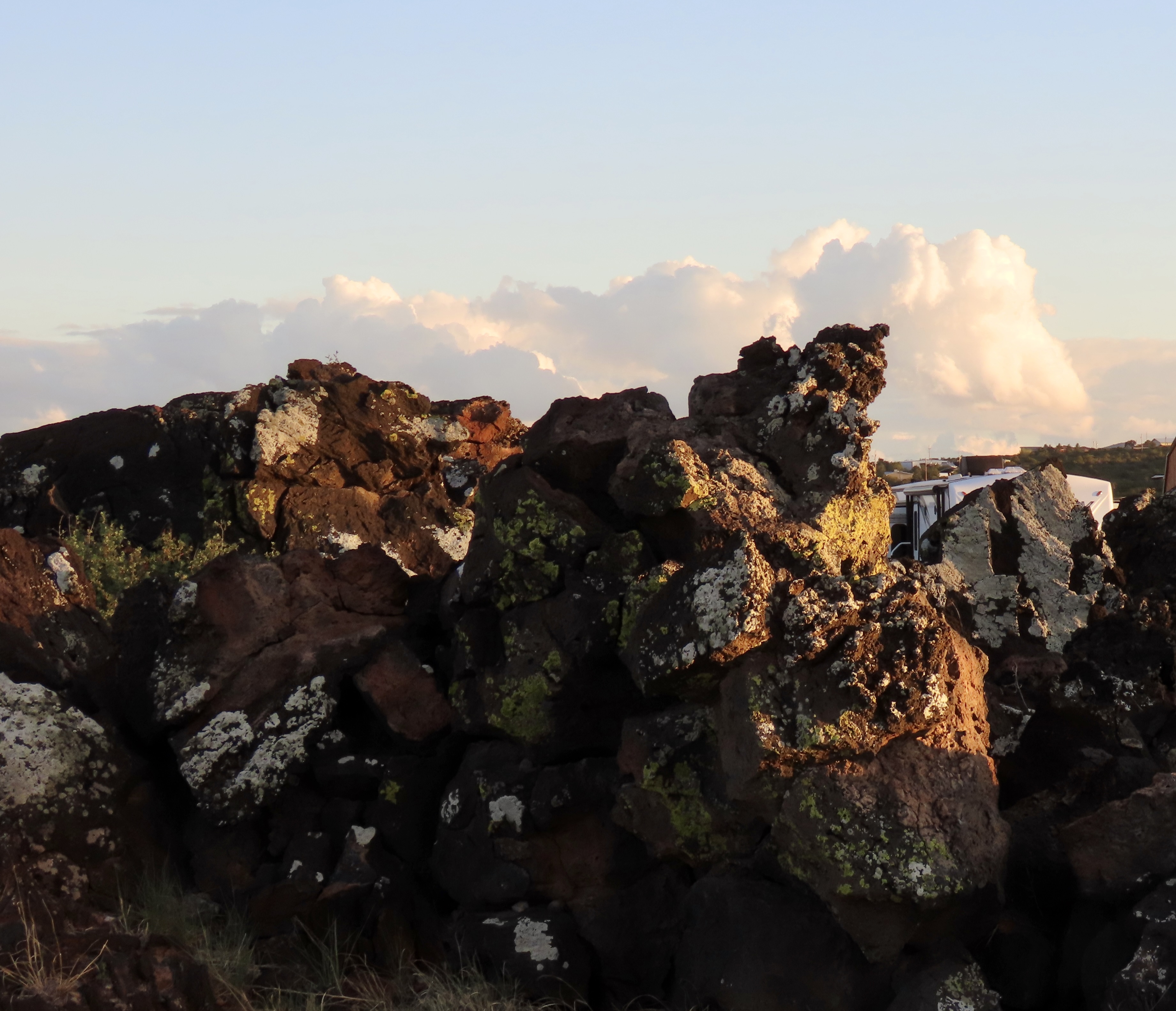
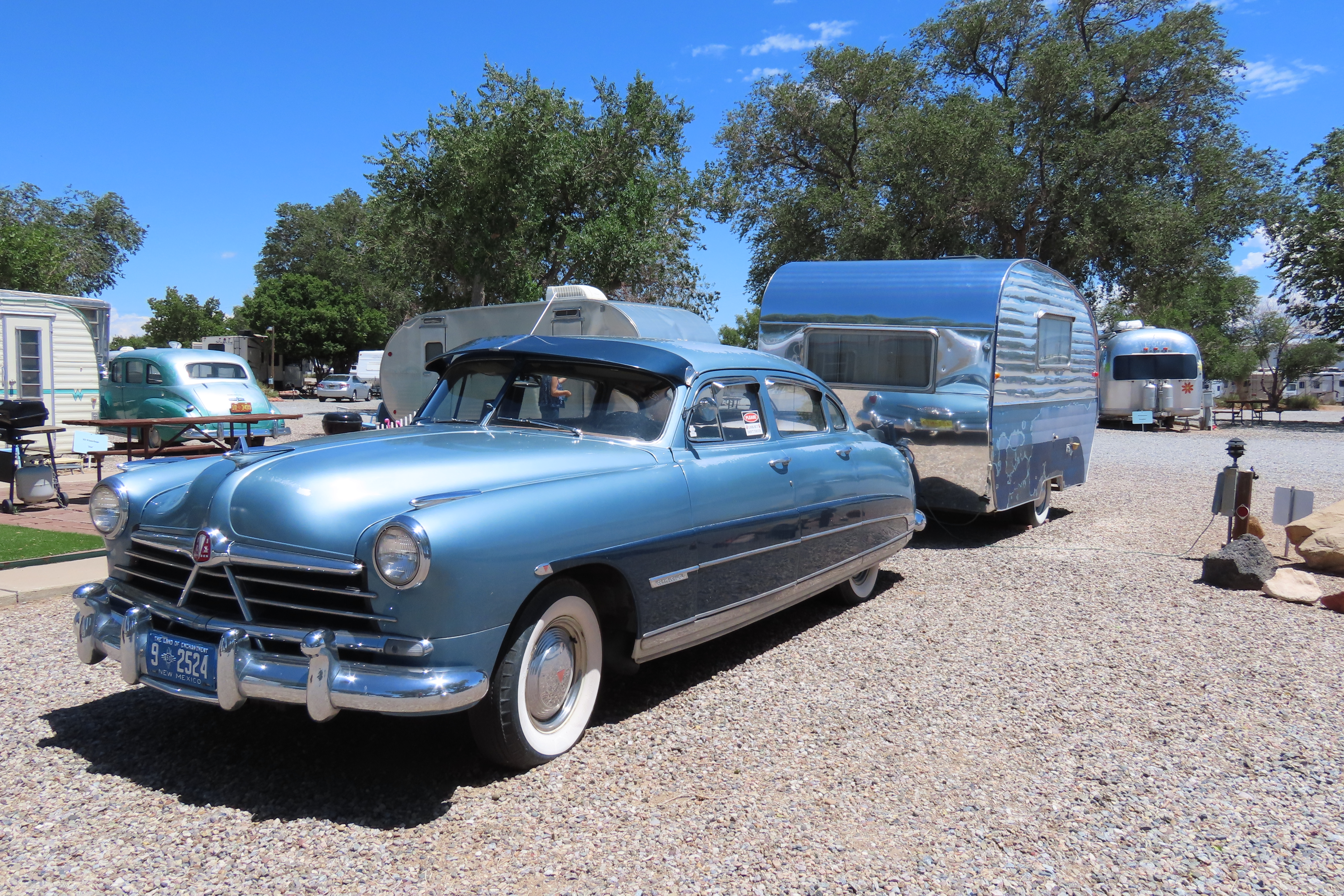
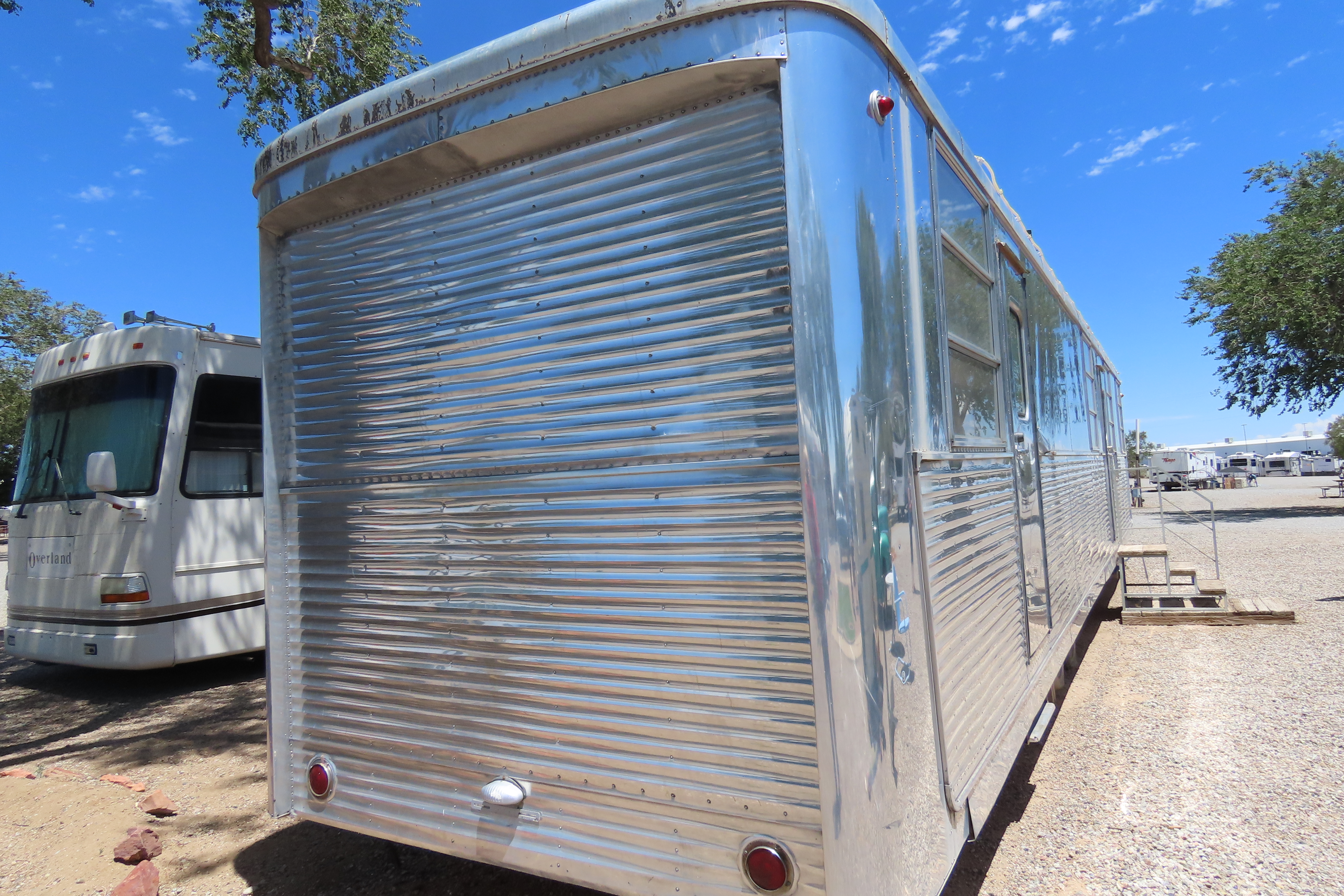
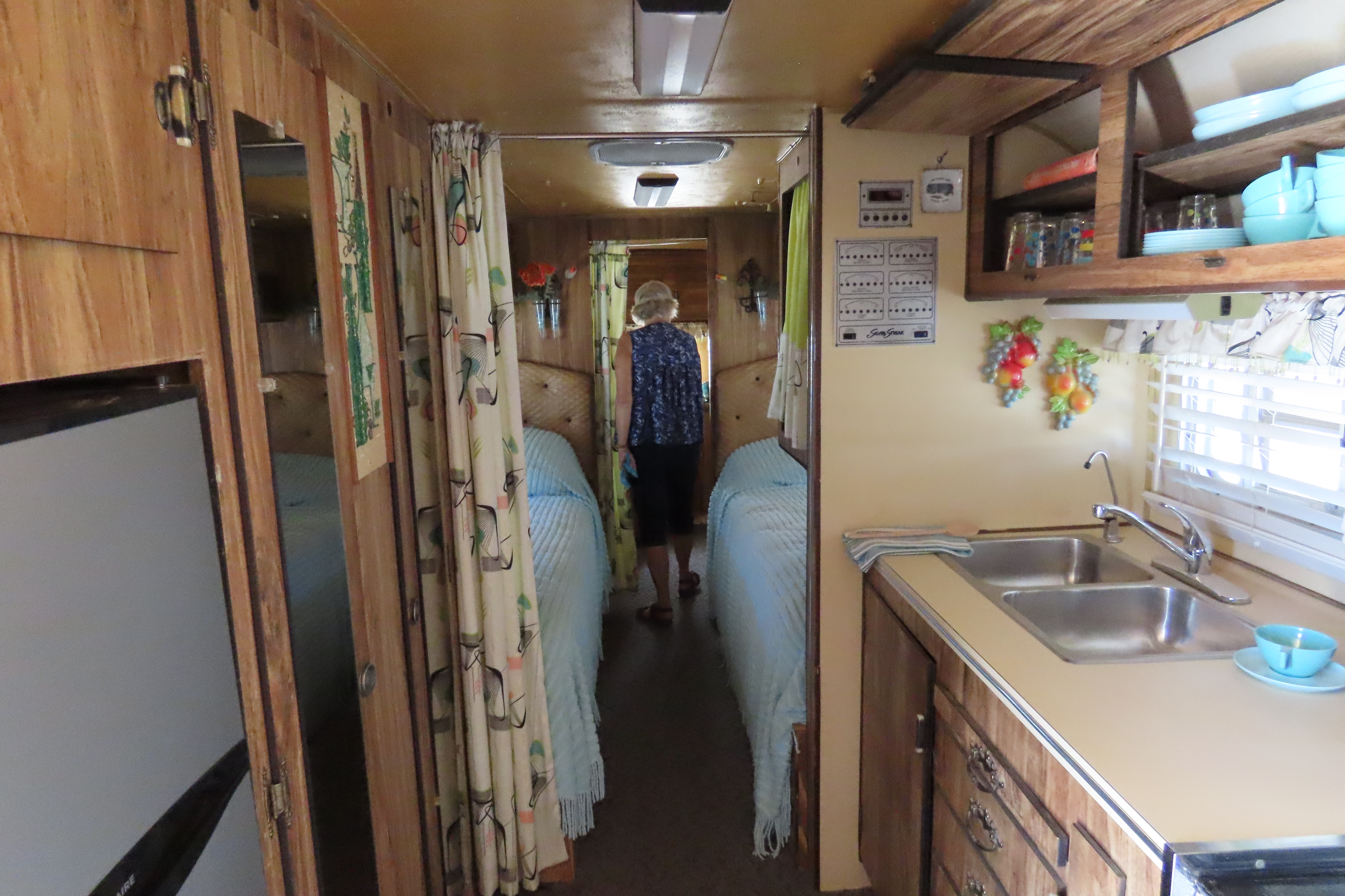
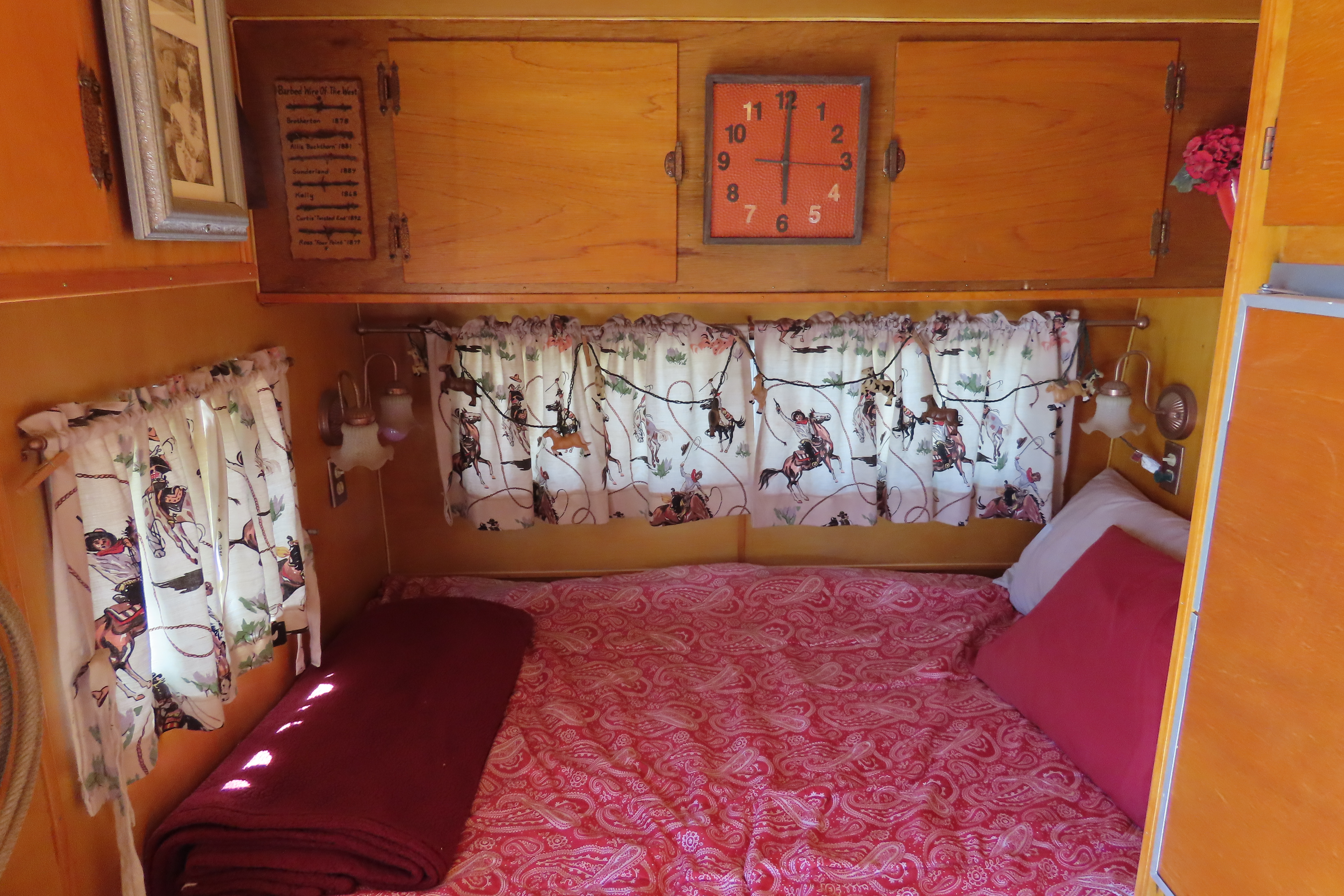
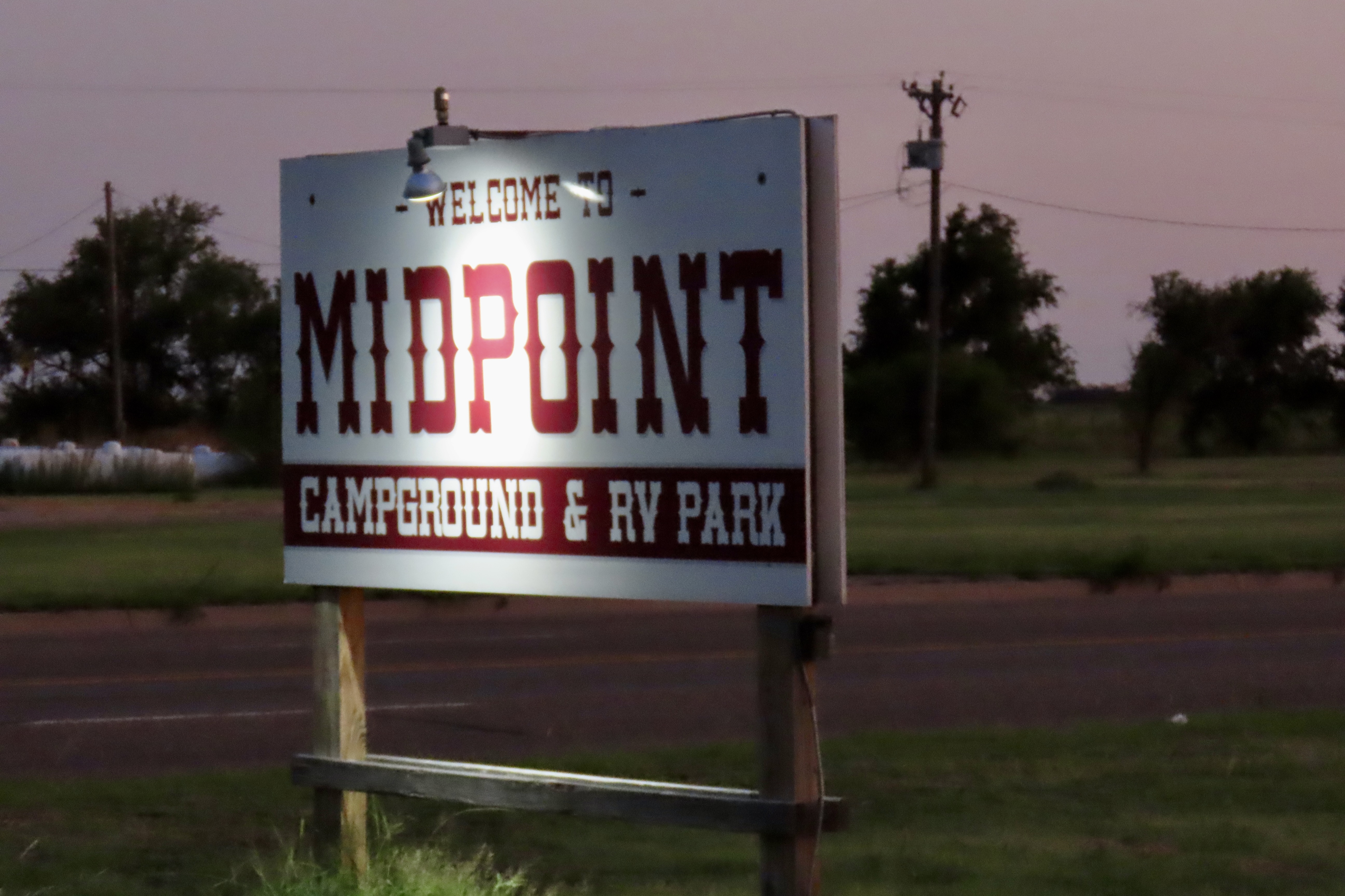
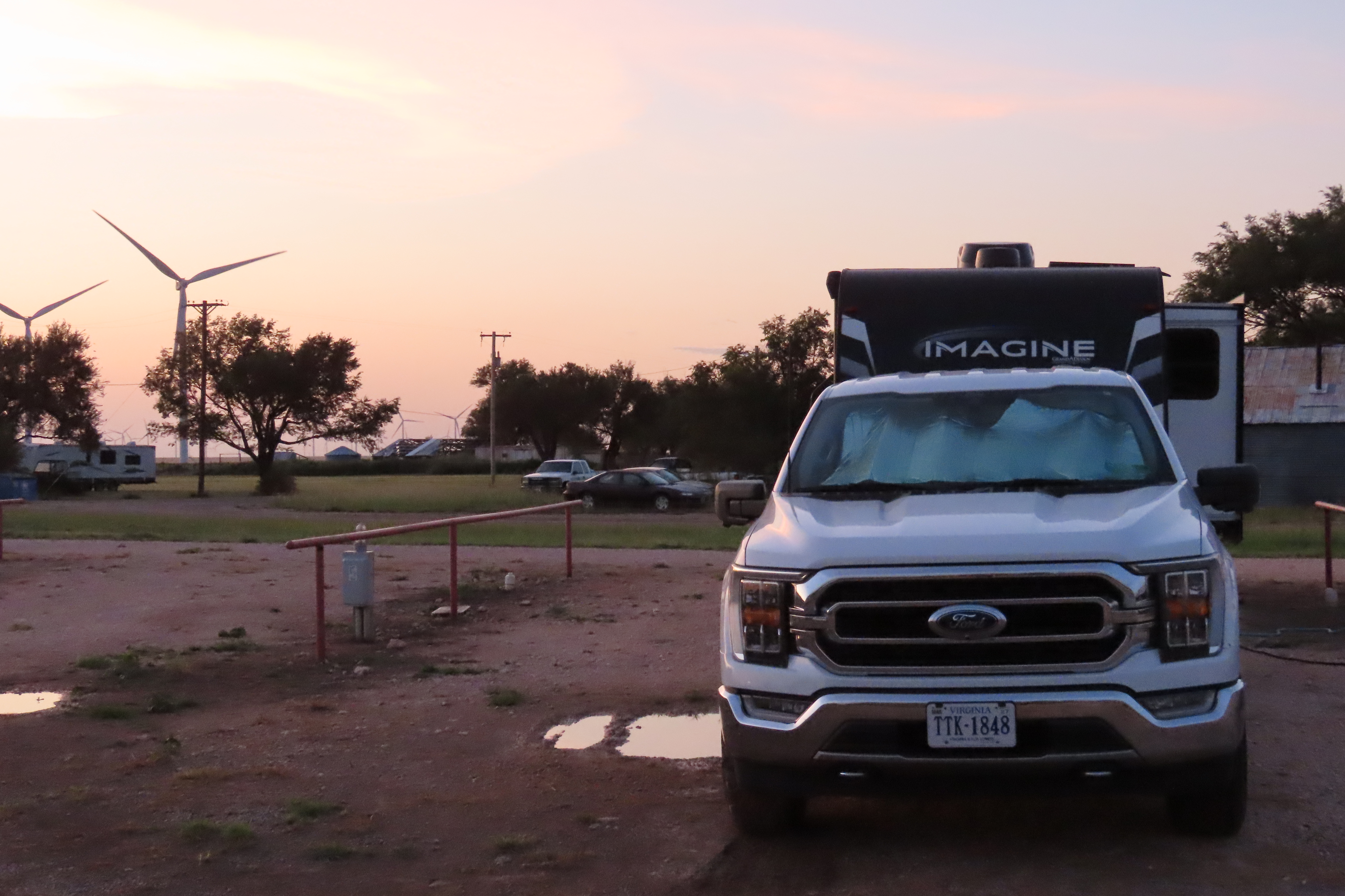
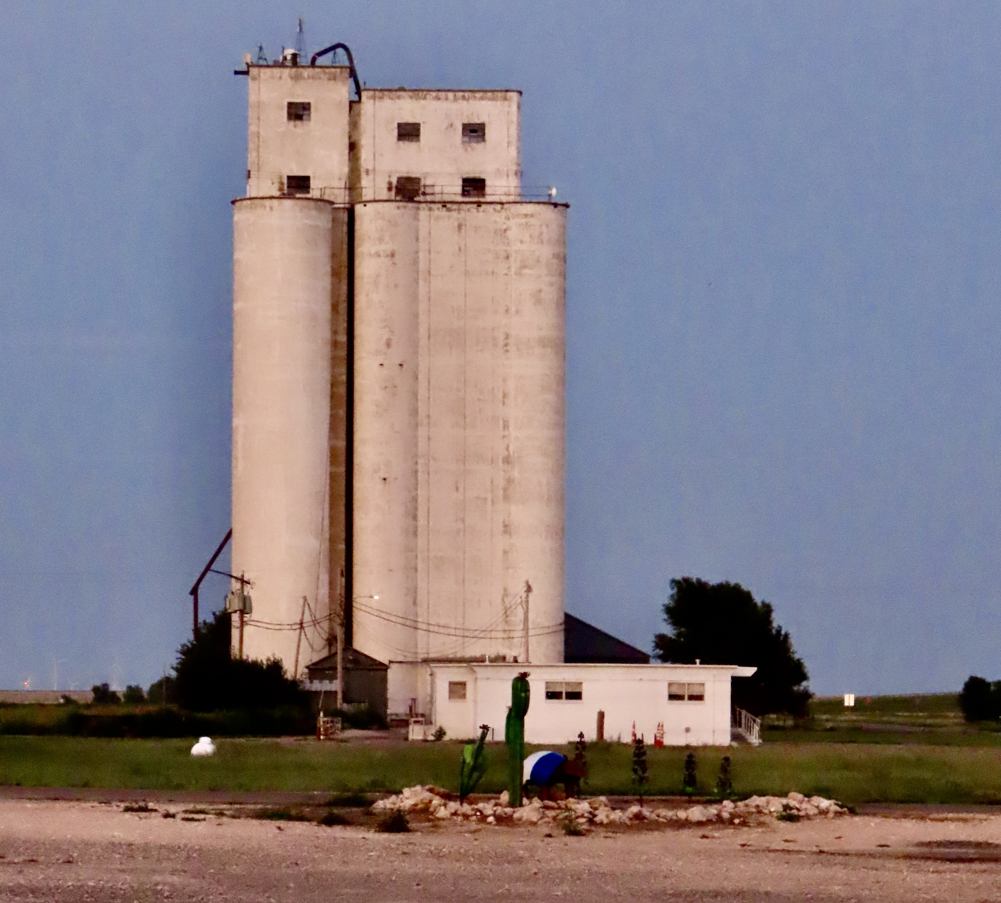
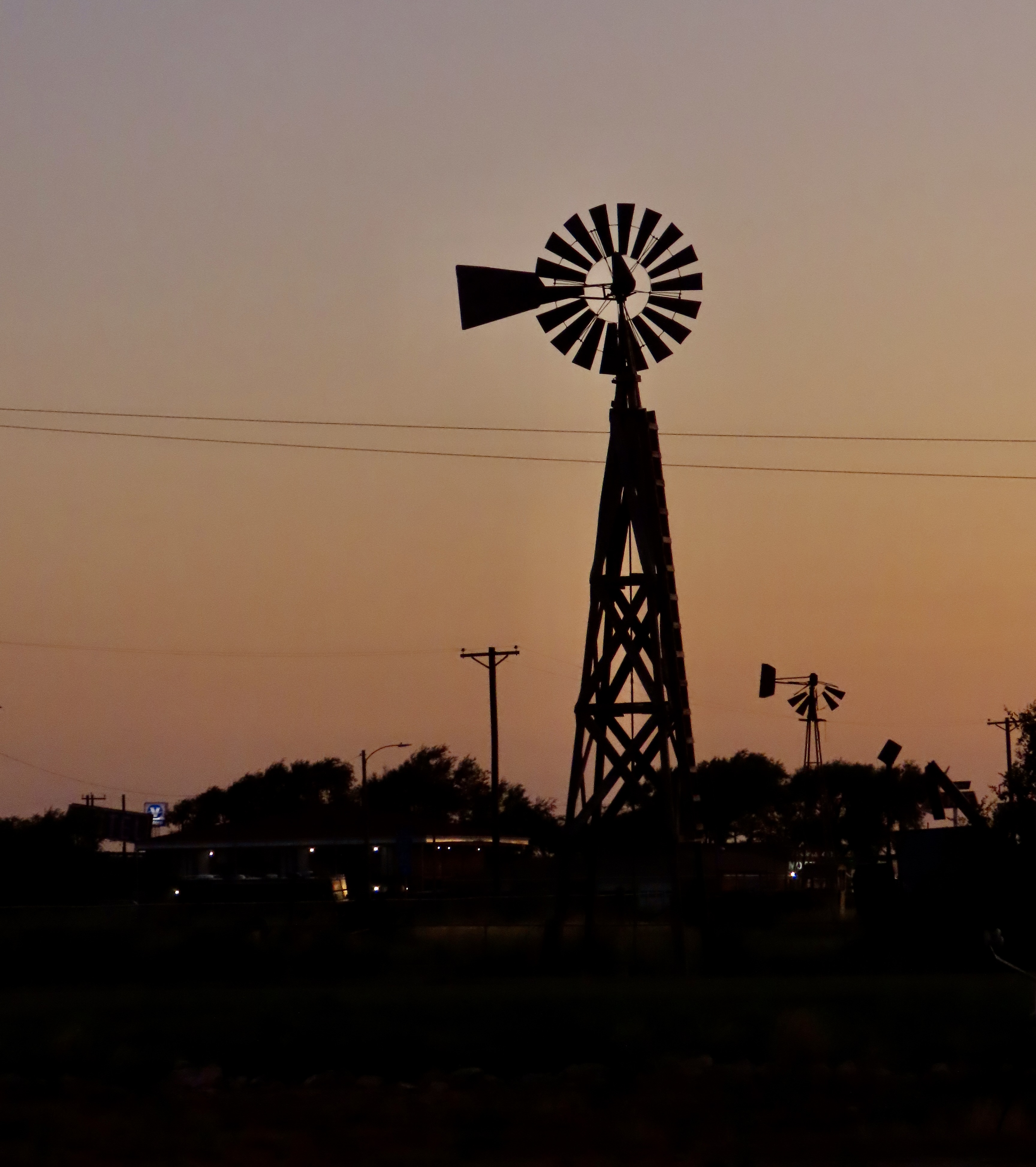
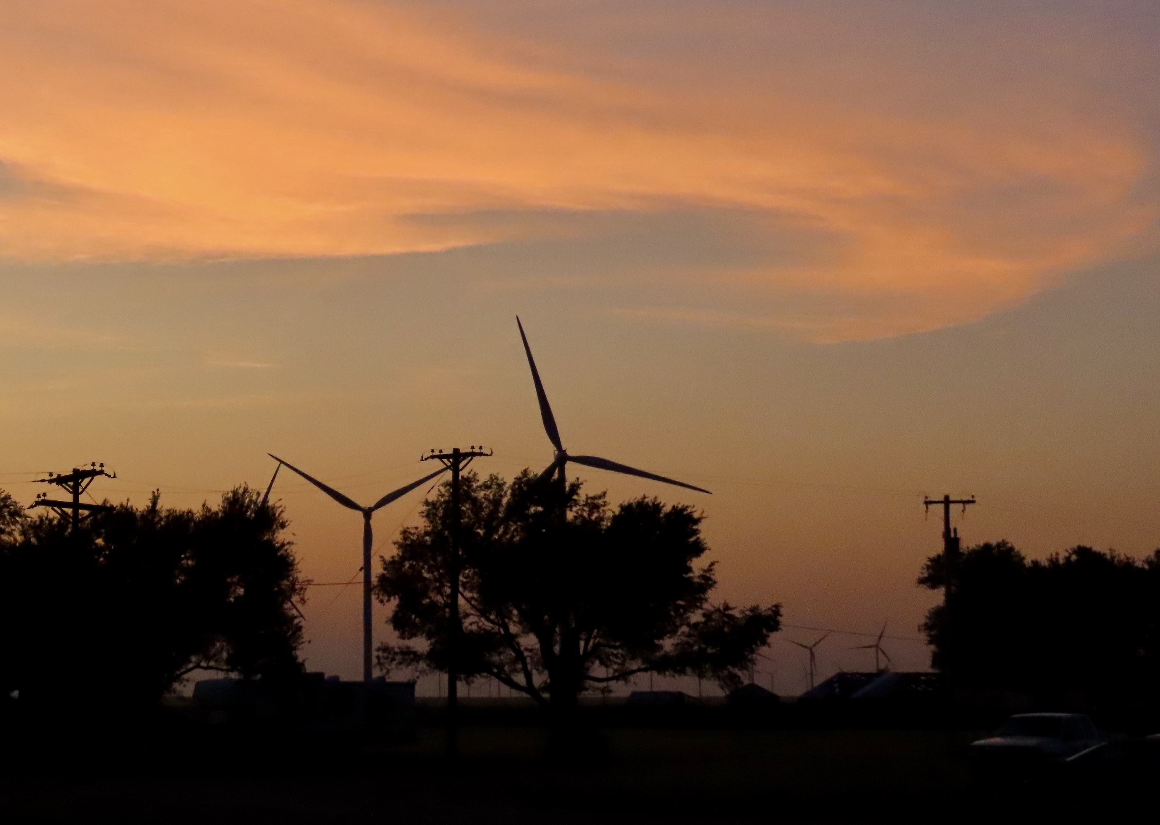
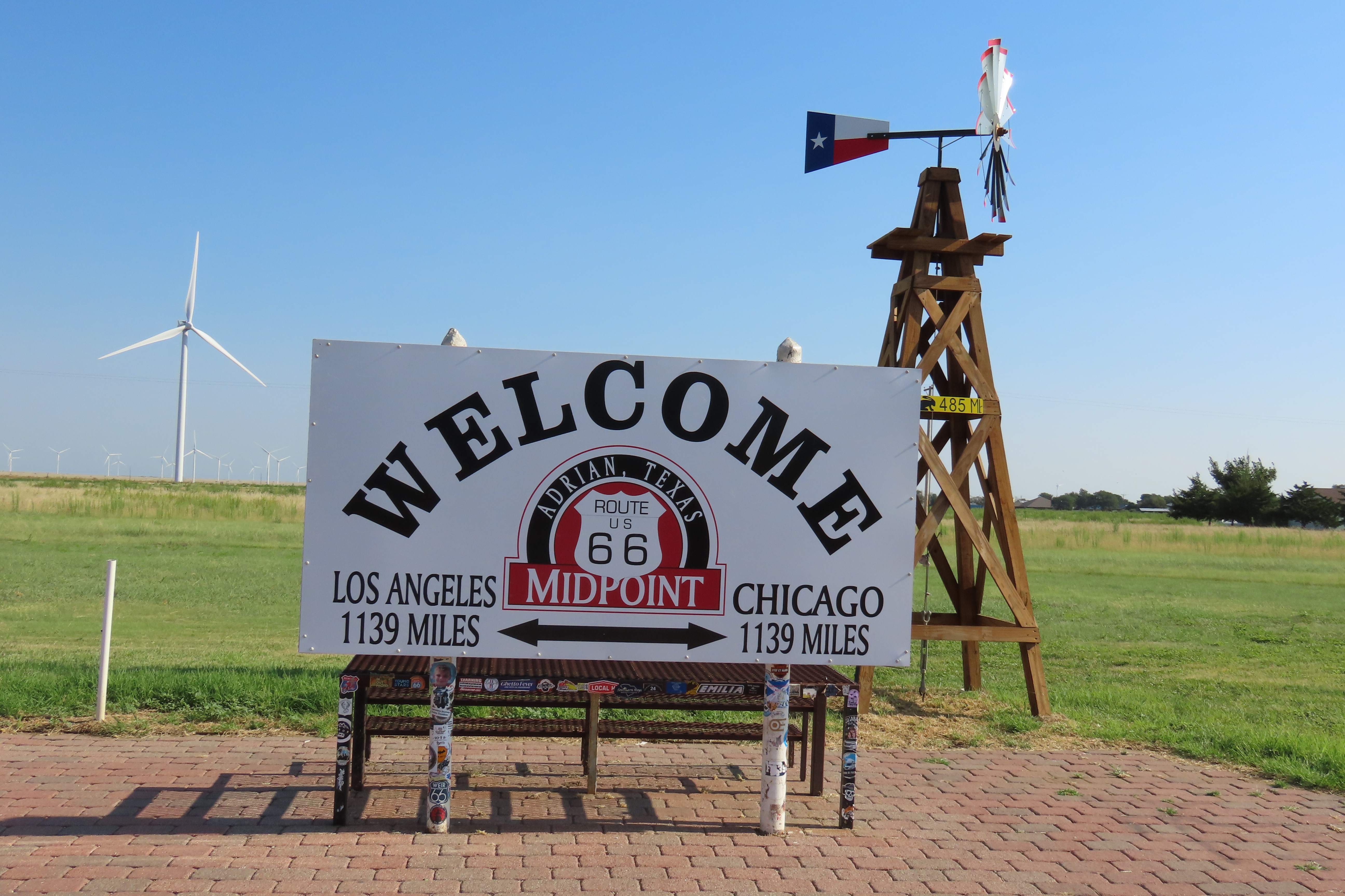
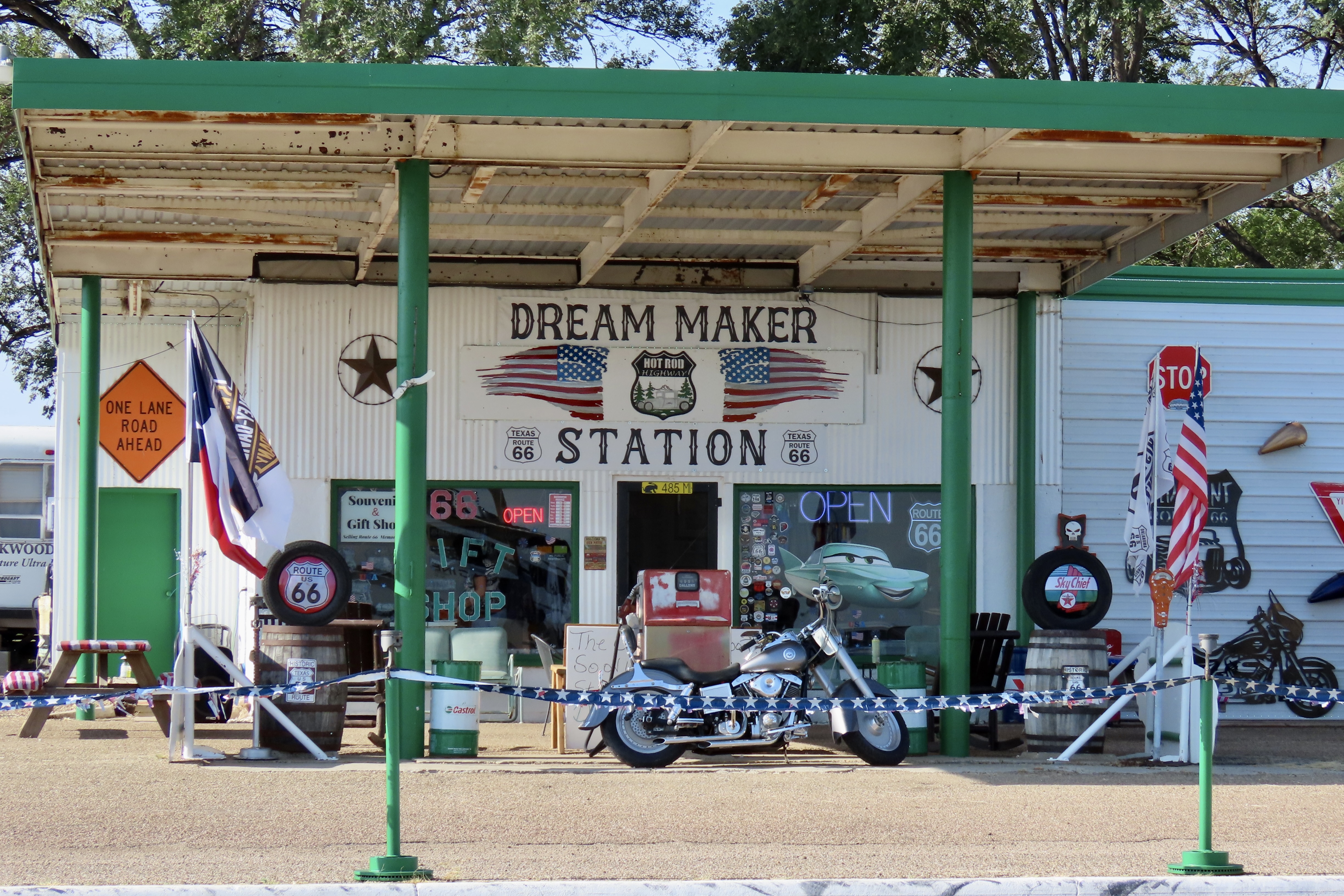
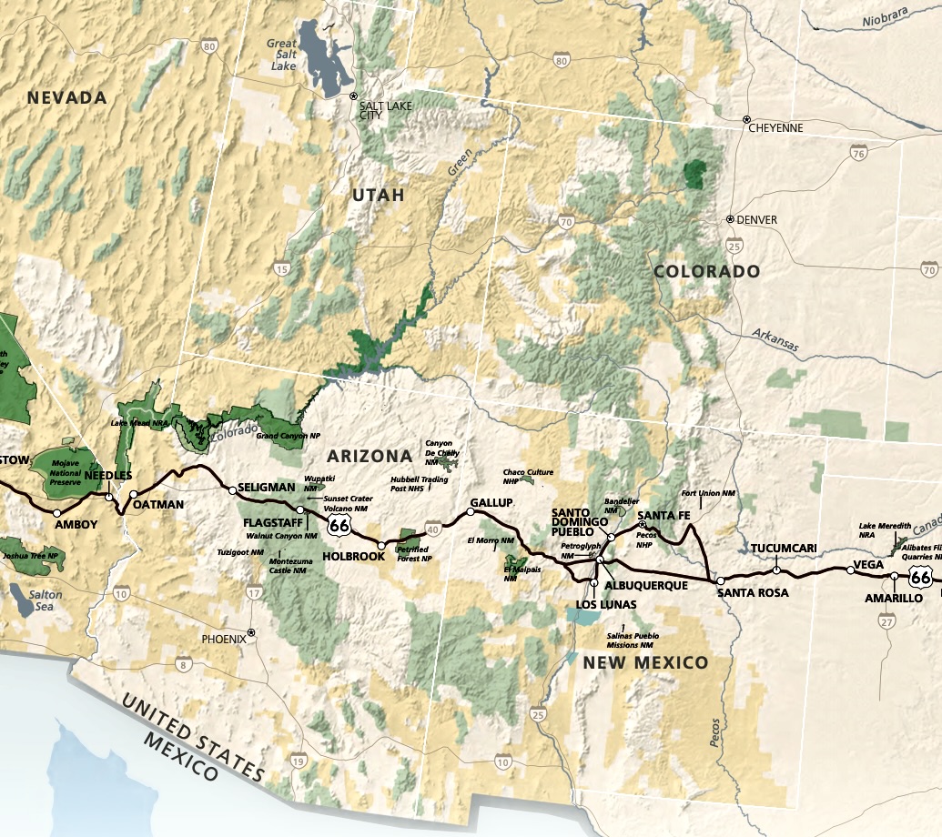
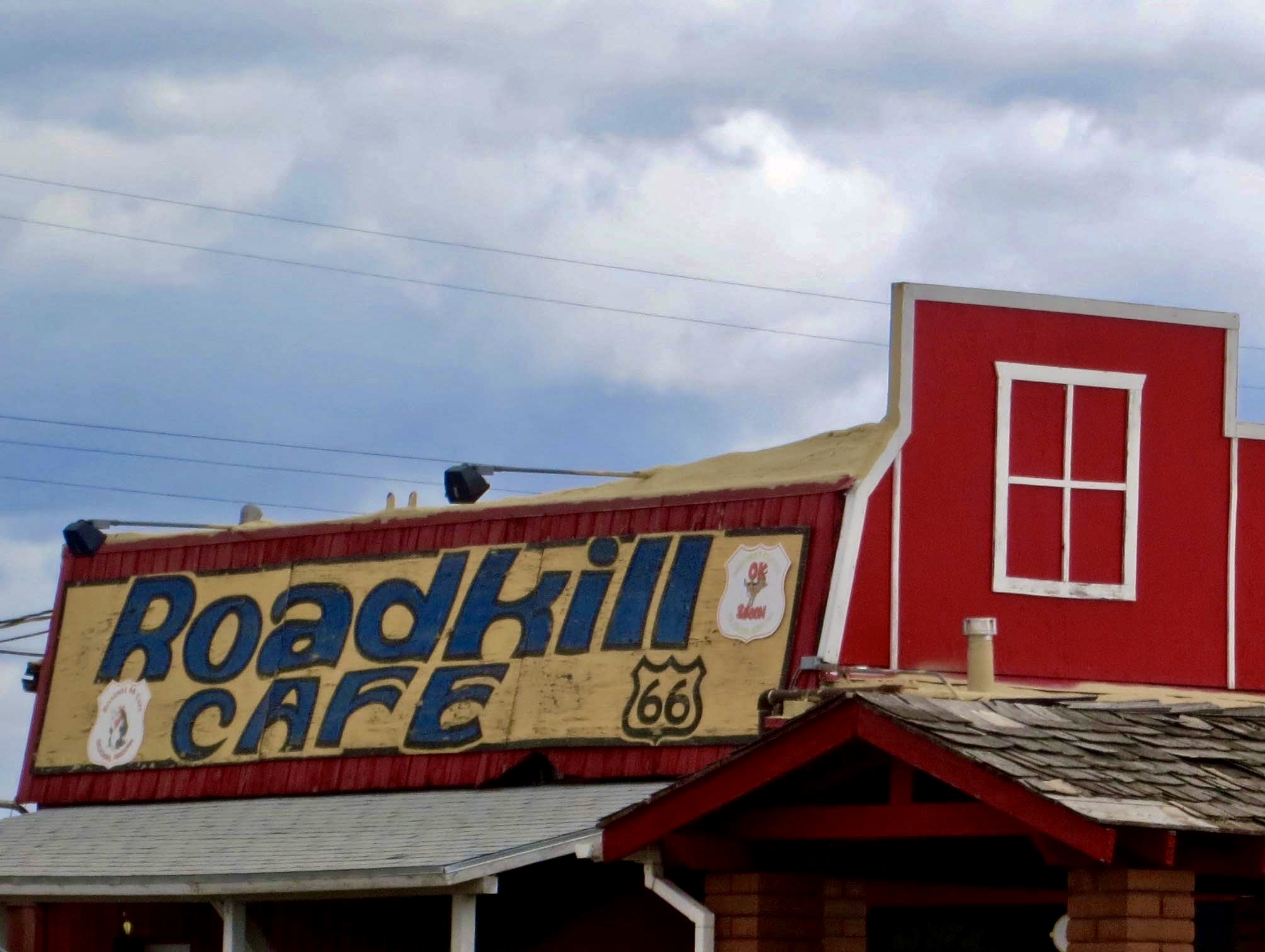
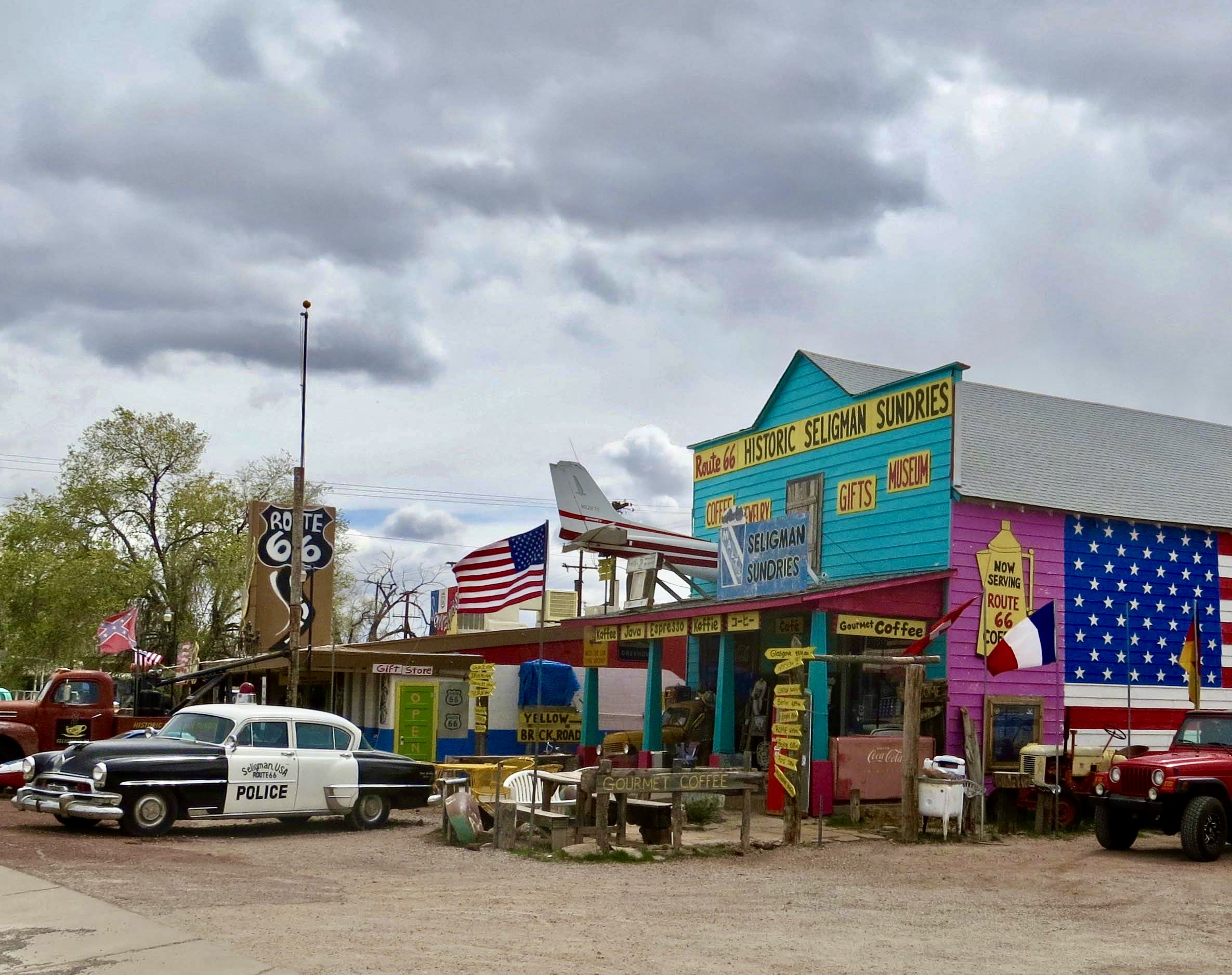
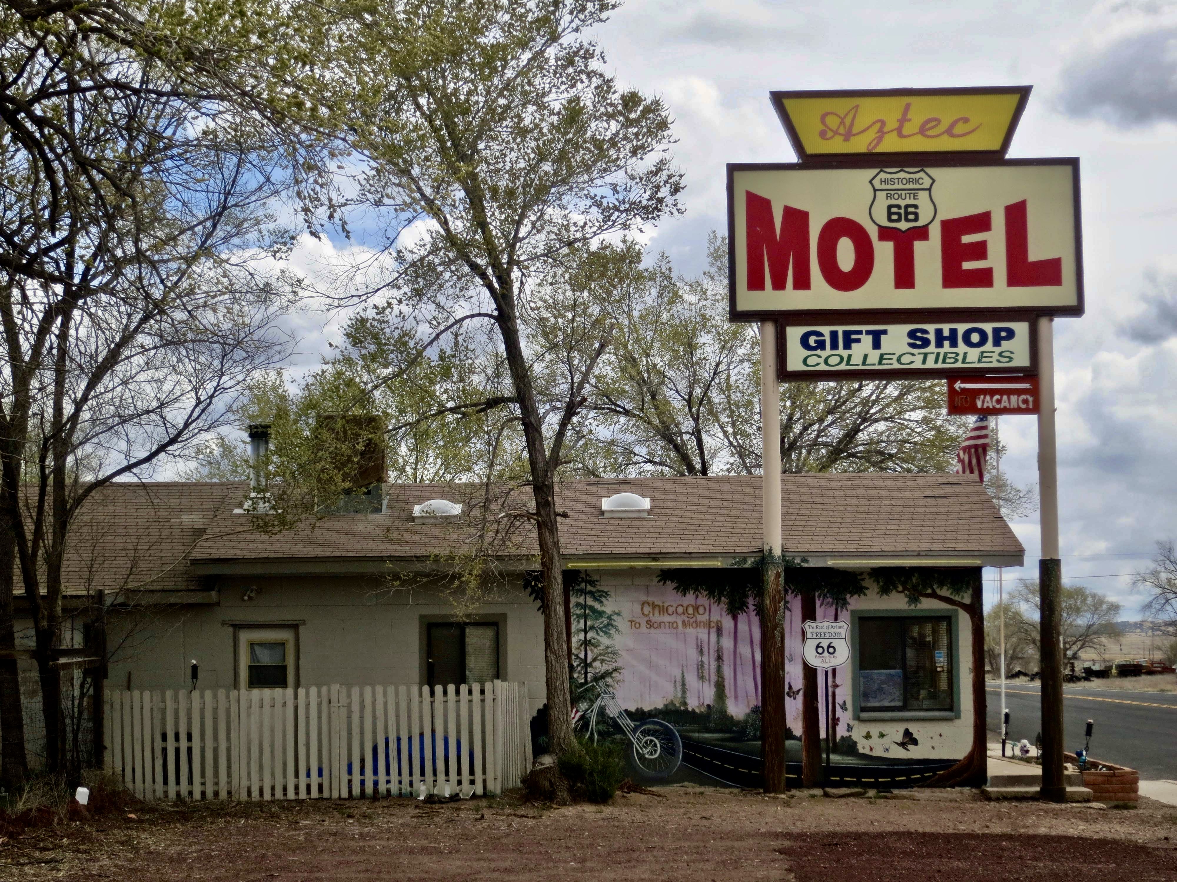
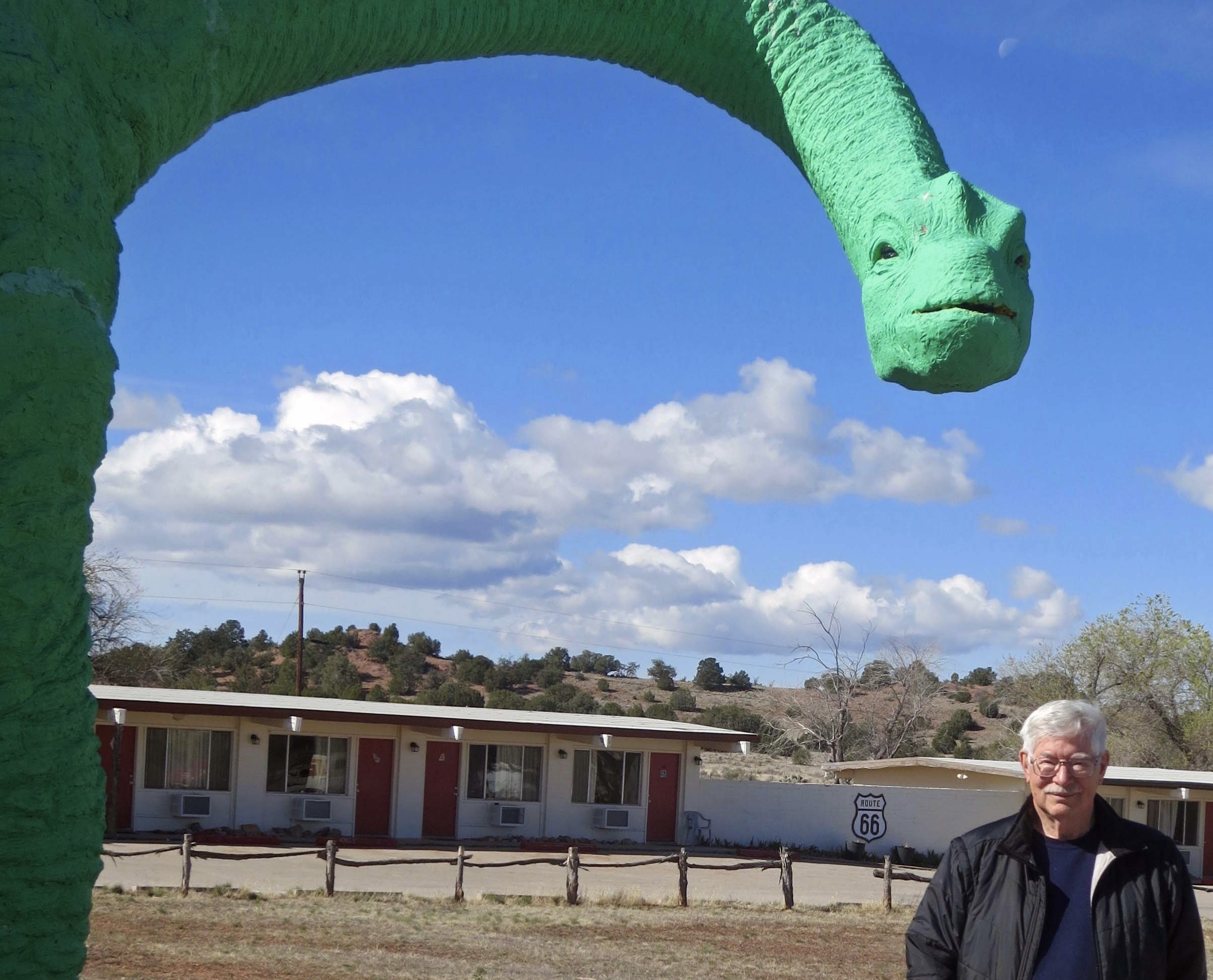
It’s in the interest of the merchants who live along Route 66 to entice people off the speeding freeways like I-40. History, scenery and nostalgia work, but a special twist doesn’t hurt. Donkeys provided an extra incentive in Oatman. Seligman had the Wild West tie in and the Road Kill Cafe. “Hey, I ate at the Road Kill Cafe” has bragging rights. The Grand Canyon Cavern has a cavern— and a couple of dinosaurs. I introduced you to the brontosaurus at the end of my last post. Here’s a hungry T-Rex. Dinosaurs are a mainstay Route 66 attraction. We’ll meet more along the way.If you want to go for an extended spin on Historic Route 66, pick up the highway in Kingman and follow it to Seligman, or vice-versa. The road is 83 miles long if you return to I-40 at Seligman, or 92 miles if you continue on to Ash Fork. It’s the longest, uninterrupted stretch of the historic highway and an excellent example of what Route 66 would have looked like in the 50s and 60s. I bicycled this stretch on my trip around the country. Grand Canyon Cavern is about half way. I camped there, as did Peggy and I when we retraced my bike route.We found this tourist map in the motel memorabilia shop. We were there! While the Caverns are the main attraction and the dinosaurs capture people’s attention when they drive by, the site had also adopted the name Grand Canyon as another way to attract tourists— even though the South Rim is 120 miles away! The map is titled ‘America’s Main Street,’ which along with The Mother Road, is a common name for Route 66.When Peggy and I were out hiking behind the Caverns, we found this ancient trailer that may indeed have been traveling up and down Route 66 in its glory days. It wasn’t going anywhere. The wheels had been removed. “Hey, Curt,” Peggy called out, “I’ve found us a cheap room.” We had to dodge cow pies getting there.It can get lonely when you are riding your bike solo across America’s vast open spaces for hundreds of miles. A distant train was often my only companion in the West. That and cattle. I’d stop to watch the train. I’d moo at the cows. When I got lucky, one would moo back. I took this photo between the Grand Canyon Caverns and Seligman.Burma Shave signs once dotted the highways of the West. They can still be found on occasion on Route 66. This one was featured in Kingman’s Route 66 Museum. Out on the highway, the sign would have been divided into five parts: The chick he wed— Let out a whoop— Felt his chin— And flew the coop— Burma Shave, each one farther down the road. I remember riding down a California highway with my family as a kid, waiting in anticipation for the next sign. It was a great, inexpensive way for Burma Shave to advertise and keep kids (and adults) entertained at the same time.Peggy and I stayed at a campground in Ash Fork on our recent Southwest trip. It’s just above Seligman going east. The old sign greeted us. No fake news there. I suspect the ‘auto sales’ featured a used car lot. A “Great Deal” could be found. And probably, a used car salesman. Our campground advertised it fronted Route 66.Ash Fork’s primary source of income in the early 1900s and continuing to today is flagstone.Traveling up Route 66 provides an opportunity for enjoying some of the greatest scenery America has to offer. For example, the Grand Canyon. Travelers along the highway could have stopped at Williams, 20 miles up the road from Ash Fork, and taken a train up to the South Rim. You still can.Flagstaff was another major stop along 66. We didn’t stay there on this trip, but we did visit the 2025 Overland Expo with our friends Tom and Lita. The expo featured everything for escaping into the wilderness in your favorite backroads vehicle from tents that could be attached to the top of a pickup to this monster. Peggy provides a perspective on its size. I had the feeling that one could go to war in it. Tom was there promoting his battery driven blender. After all, what wilderness oriented person driving into the backcountry wants to be stuck out in the woods without the ability to whip up a margarita? Makes sense to me. I’m sure that Tom would argue it’s even small and light enough for backpacking. “Okay, Tom, you carry the tequila, mix, ice and salt.”This meteor crater, 37 miles east of Flagstaff off of I-40/Route 66, was another ‘must see’ stop for early Route 66 travelers. Zooming at 29,000 miles per hour, the 160 foot wide meteor hit the earth around 50,000 years ago. Being 3,900 ft (1,200 m) in diameter, 560 ft (170 m) deep, it’s a testament to the impact that large meteors can have. It would have awed Route 66 travelers. It certainly awed us. It’s considered the best preserved meteor crater in the world.Before Neil Armstrong made his ‘giant leap for mankind’ on the moon, he was wandering around in the meteor crater, along with Buzz Aldrin and Michael Collins, as part of his training program. This test module used by the astronauts in their training is on display at the crater.Another 18 miles up the road brings us to Winslow and its Visitor Center. This old building once served as part of the Hubble trading empire that sold Navajo made products including rugs, pottery and jewelry. Located on the Santa Fe Rail line gave the traders access to both the east and the west coast for its products. A number of stores, several of them dating back to the 40s-50s, still sell hand made Native American products and Route 66 memorabilia along the highway today. Huge billboards announce their presence. The Main Street of Winslow. Jackson Browne of the Eagles was stranded here in 1972 when his car broke down and was inspired to write the song Take It Easy with the words: Well I’m a-standin’ on the corner in Winslow, Arizona, With such a fine sight to see, It’s a girl, my lord, in a flatbed ford, Slowin’ down to take a look at me. The song became the first Top 40 hit of the Eagles and made Winslow famous. Today the town has a statue of Browne standing on a corner as one of it’s main attractions.As promised earlier, here are more dinosaurs. It’s all about them (and rocks) in Holbrook, the next town up. Compared to the fences in Jurassic Park, this one looks rather feeble. I wonder how often the dinosaurs escape to wander the streets of Holbrook.One of many billboards along Route 66/I-40. Fossils are found throughout the area. Wild Bill serves as an attraction to get people into the shop.As rocks for sale go, petrified wood is the most common. There are tons of it. While it can’t be gathered at Petrified Forest National Park, there is plenty found on private lands surrounding the park.As I pointed out in an earlier post, Petrified Forest National Park is quite proud of its position as being the only national park that Route 66 passes through and commemorates it with this old Studebaker.While Grants, New Mexico was also along Route 66 and emphasized its connection, we were too busy exploring El Morro and El Mapais National Monuments to spend much time there. The KOA we stayed at was in the middle of a lava flow. This lava outcrop was in the middle of the campground.The Enchanted Trails RV Park we stayed at in Albuquerque was right on Historic Route 66 and honored its heritage with a great display of old cars and trailers from the 50’s, 60’s and 70s.The RVs ranged in size from the small we were expecting to quite large like this one.Peggy got the keys from the office so we could check out the inside of the various trailers on display. Not wide but definitely long.Colorful.Our last connection with Route 66 was more happenstance than planned. We were on our way back to Virginia and pulled into Adrian, Texas in the Texas Panhandle. The Midpoint RV campground offered a minimal, inexpensive place to stay overnight. “Put $20 in the slot and find a vacant space,” the instructions read. A question we had was where we midpoint between?Here we are at midpoint between two vacant spaces.The scenery represented Texas well. A large grain elevator….And a windmill.Modern windmills, the type the Washington Administration is trying to discourage because they reduce our dependence on fossil fuels, filled the horizon, however. It turns out that we were at the midpoint of Historic Route 66. LA was 1139 miles to the west and Chicago 1139 miles to the east.We stopped to take a photo of our last Route 66 station. We hadn’t planned on Route 66 being a part of our trip but were ever so glad it was. Traveling Route 66 is one of the things that dreams are made of.A mural we found in Kingman.
We have a final post we want to do on petroglyphs not featured yet, but we are heading out for New England this week so our next posts will be featuring fall colors and cozy towns.
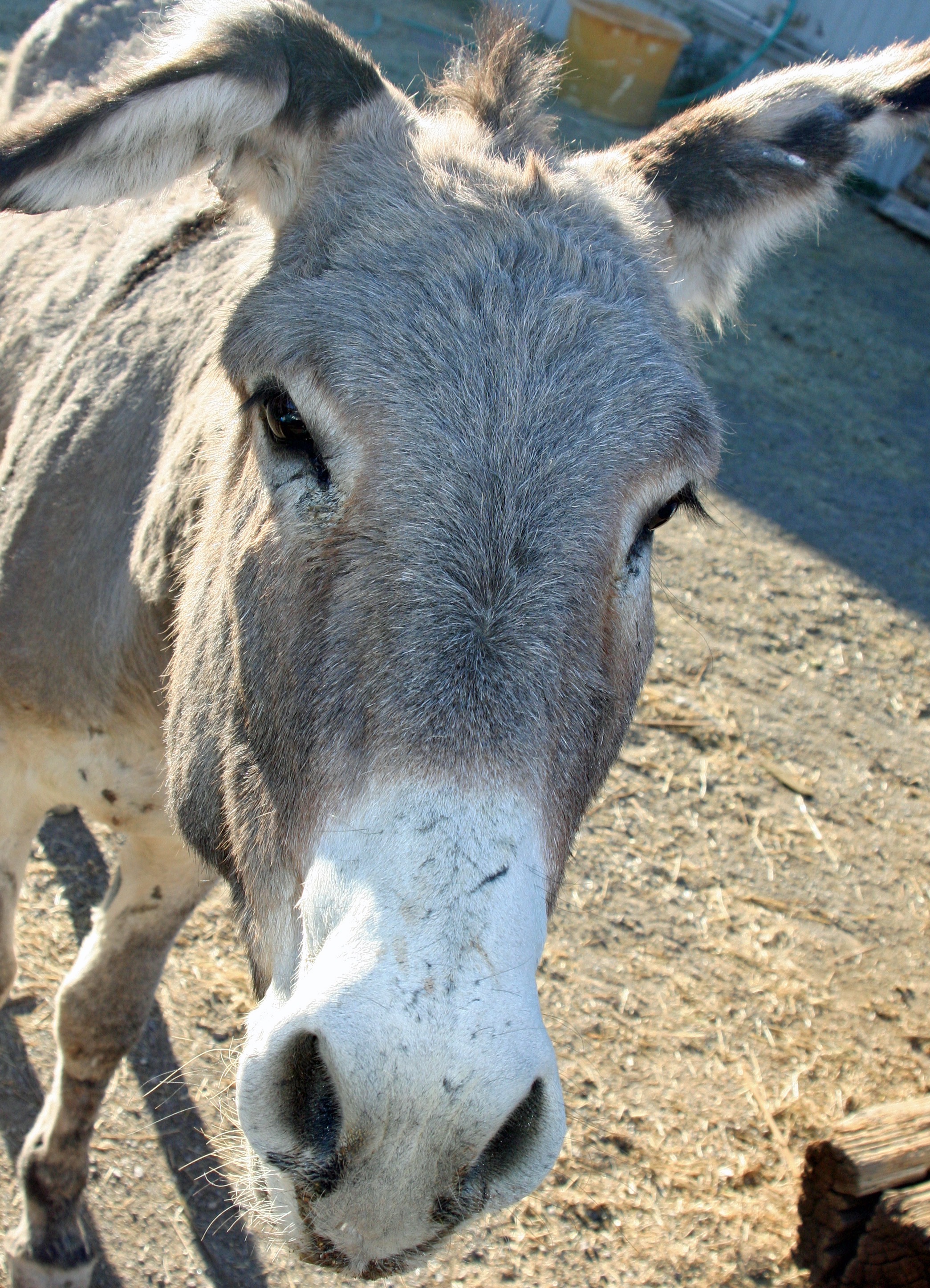
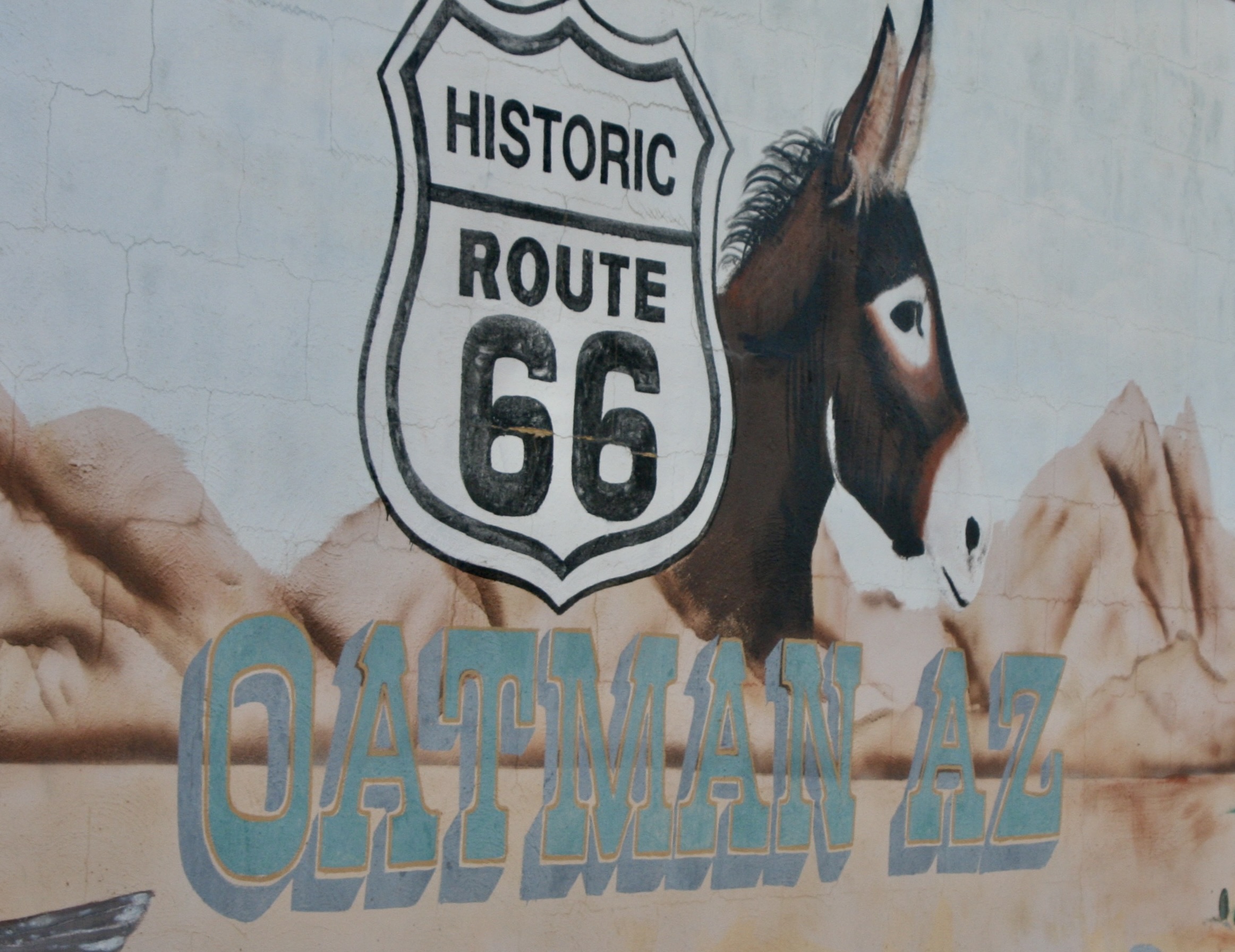
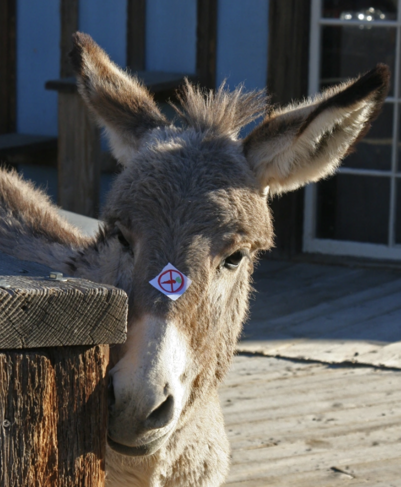
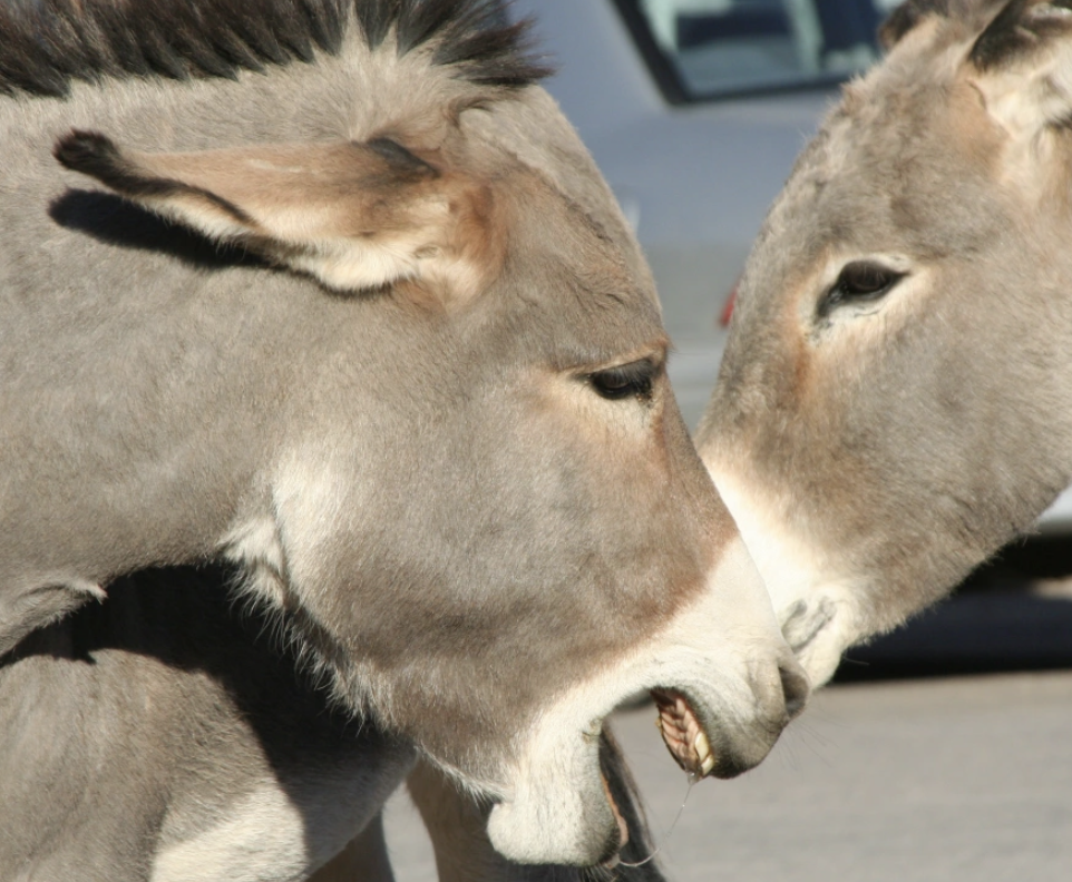
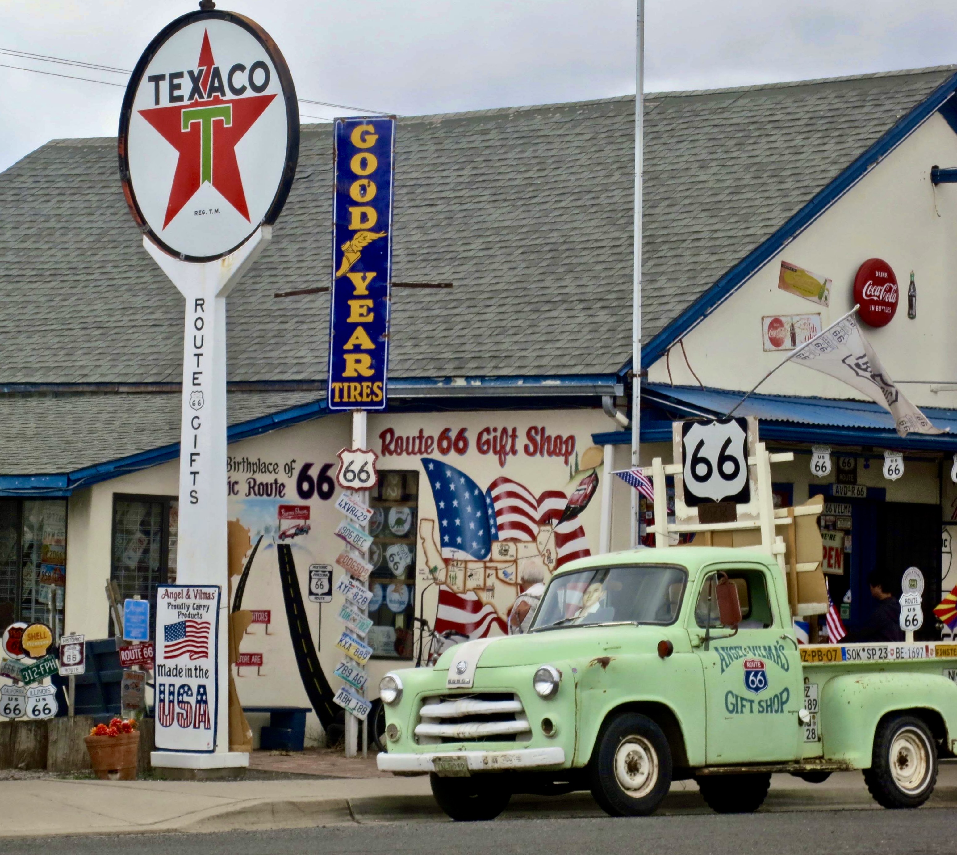
“Get Your Kicks on Route 66” was a song first sung in 1946 by the Nat King Cole Trio. World War II was over, gas rationing a thing of the past, and America was ready to celebrate. And what better way than a scenic road trip from Chicago, Illinois to Santa Monica, California. The song helped to make Route 66 popular in 50s and 60s. There was even a Route 66 television series that ran on CBS from 1960 to 1964. Tourists still flock to “America’s Mother Road” with its close to legendary status, quaint towns and scenic views. Peggy and I met the donkey/burro in Oatman, Arizona, one of the colorful communities along the way. I am featuring it and Seligman, Arizona, in today’s post. The donkey was looking for carrots.
On our recent trip to the Southwest, we camped in six different locations along the historic highway: Kingman, Ash Fork, and Holbrook in Arizona, Grants and Albuquerque in New Mexico, and Adrian in the Panhandle of Texas. I’ll be incorporating some of them in the next two posts plus other visits we have made to the area over the years.
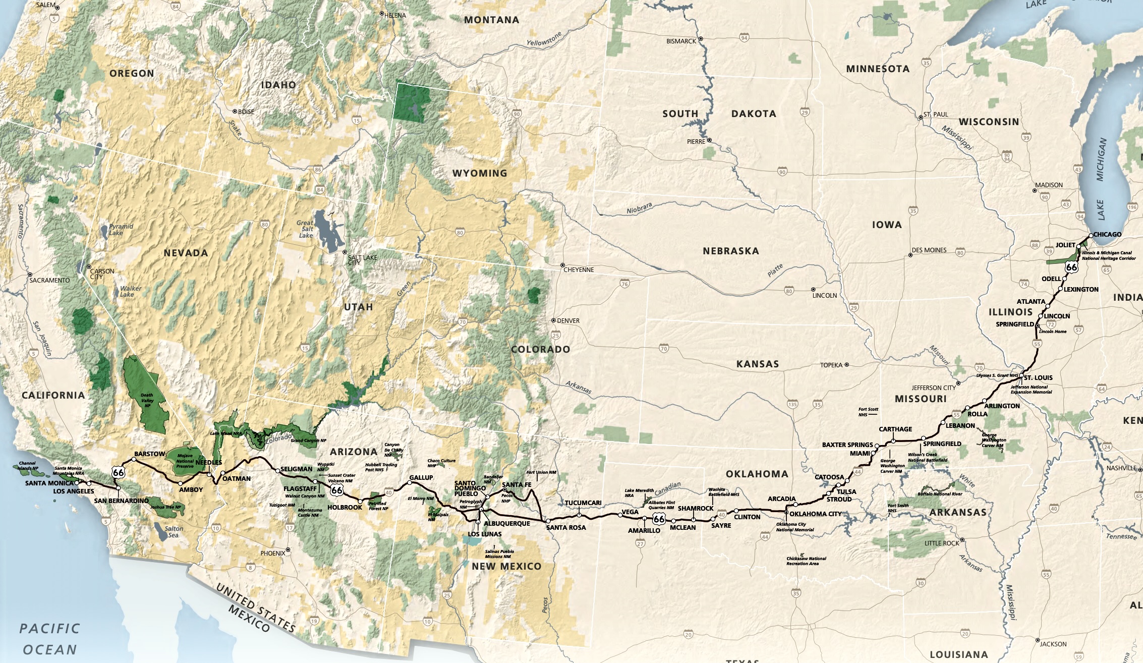
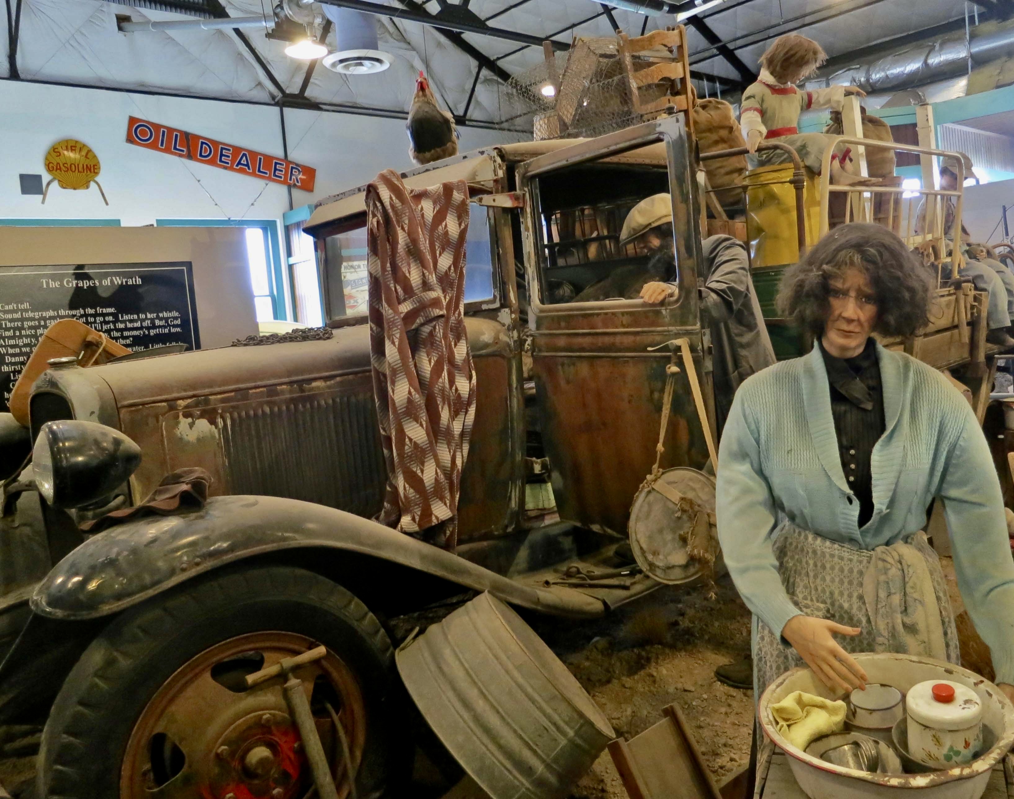
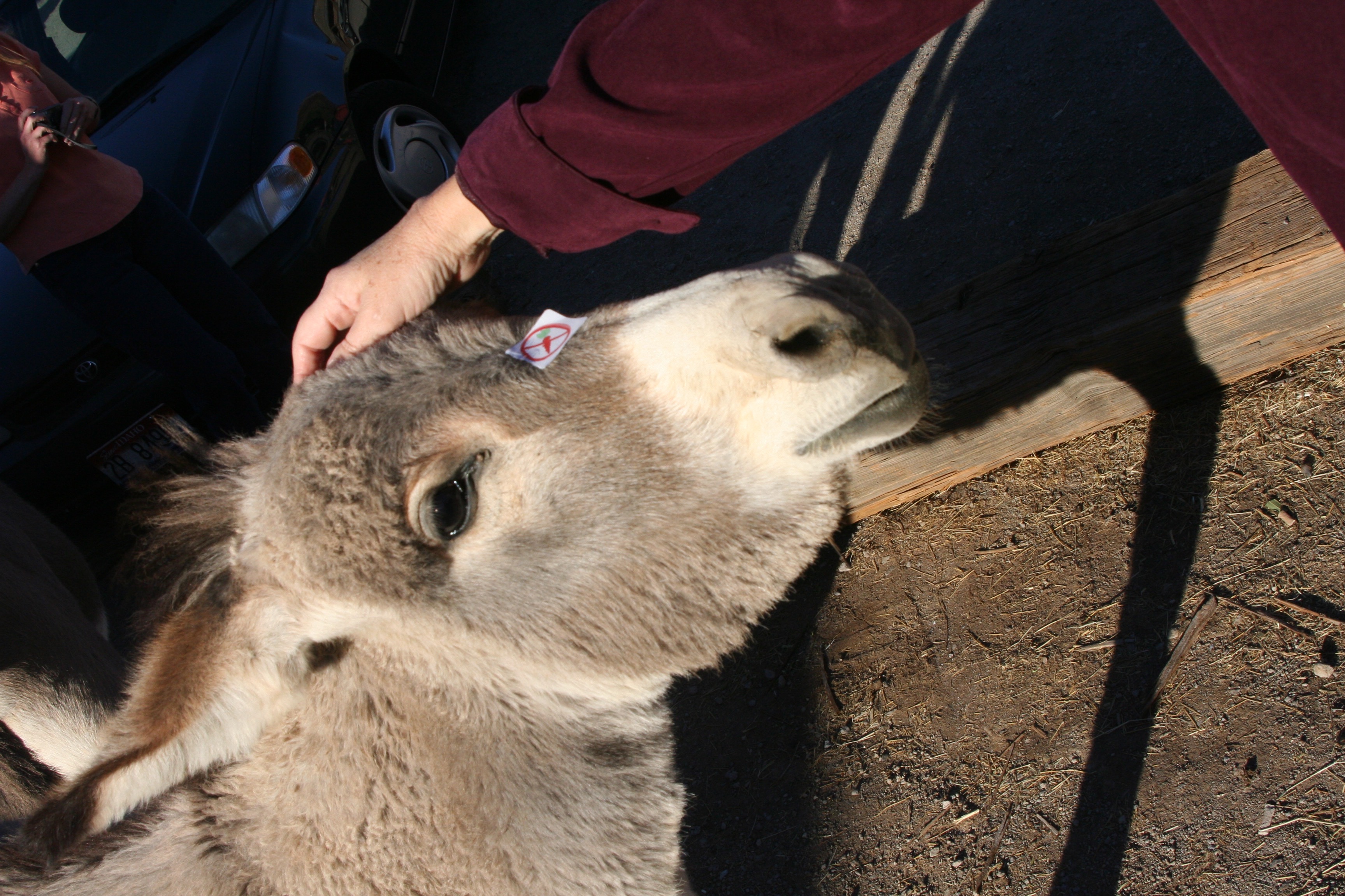
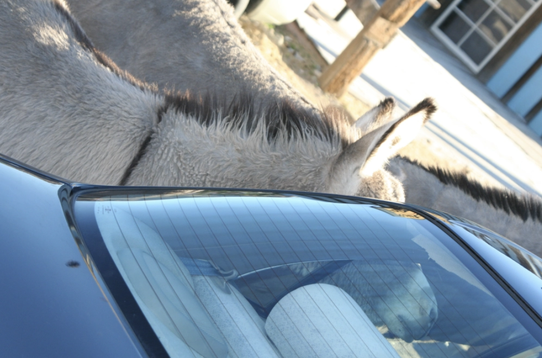
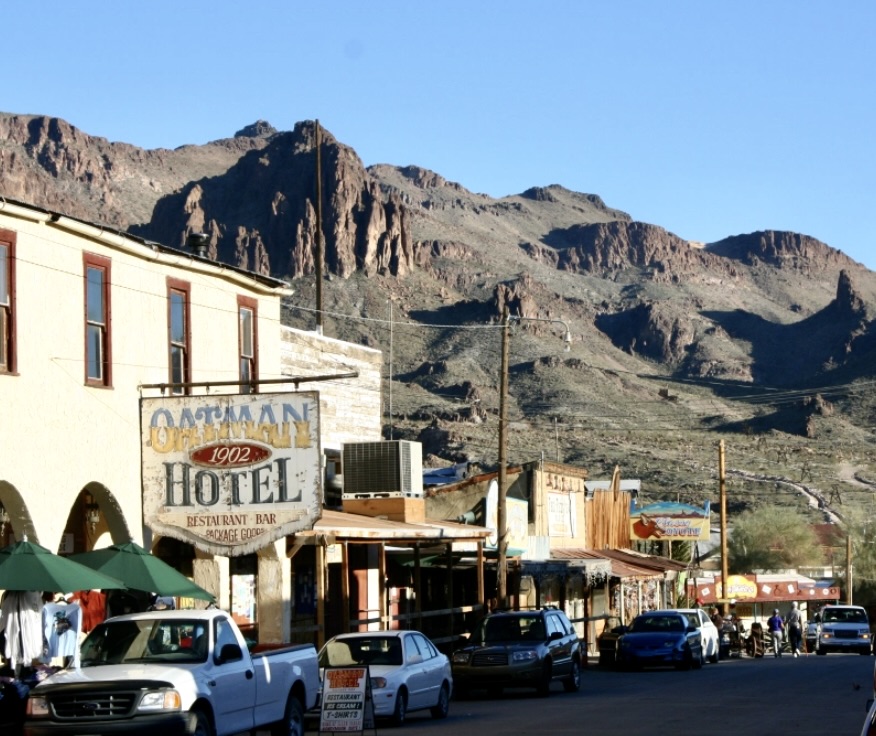
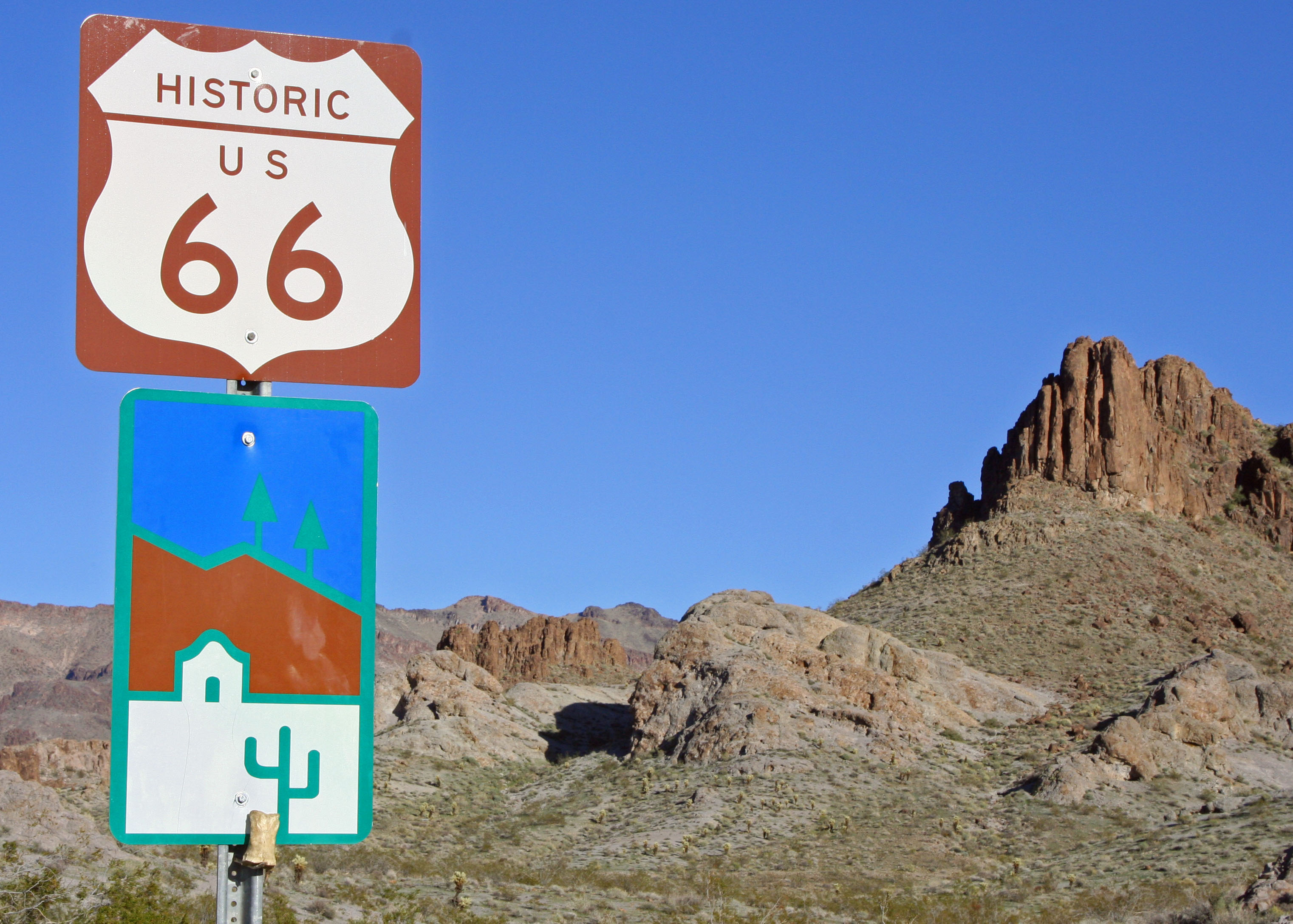
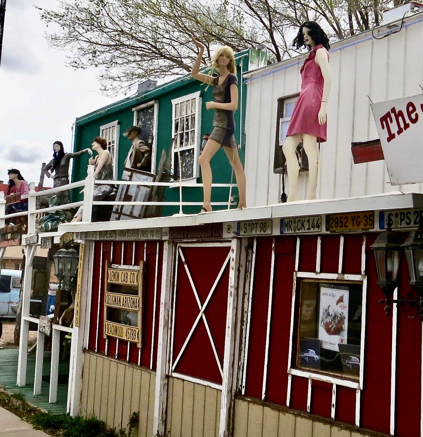
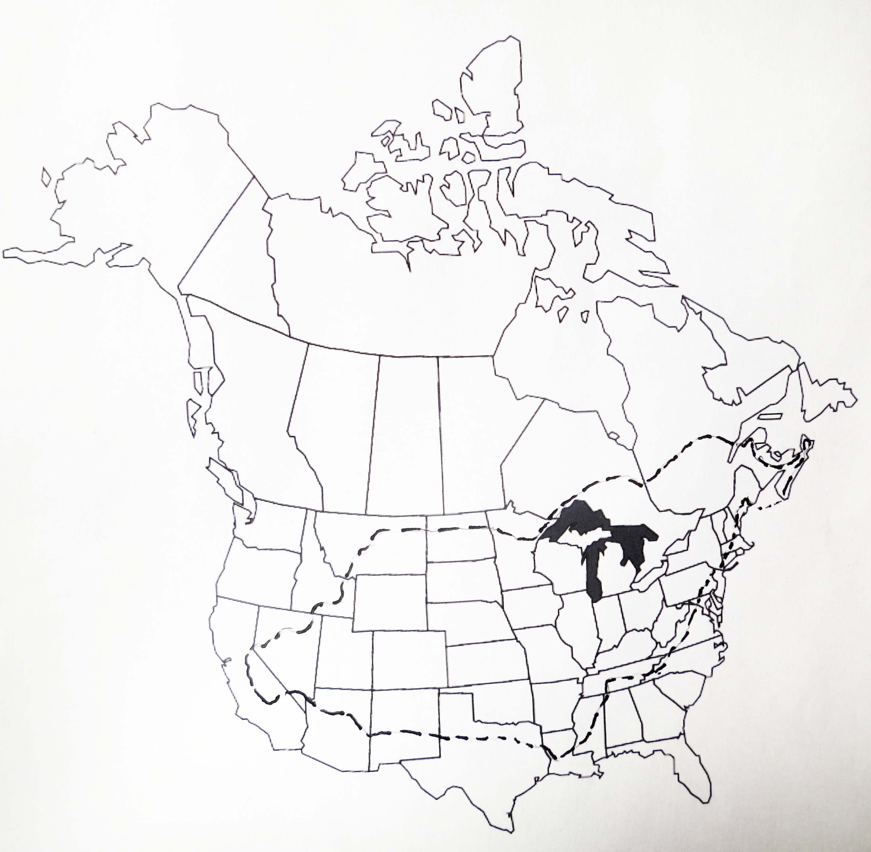
This National Park Service map shows the route that Historic Highway 66 followed between Chicago and Santa Monica, traveling through the states of Illinois, Missouri, Kansas, Oklahoma, Texas, New Mexico, Arizona, and California for a total of 2,448 miles (3,940 km). Established in 1926 the road became the major thoroughfare for migrants escaping the Dust Bowl in the 30s searching for a better life in California. In fact, it was John Steinbeck in his classic novel about the migration, The Grapes of Wrath, who gave Route 66 the name ‘America’s Mother Road.’This diorama in Arizona’s Route 66 Museum in Kingman features migrants from the Dust Bowl traveling on Route 66 in the 30s. During World War II, Route 66 became a major road for military transports from the East heading for the West Coast and the war in the Pacific.Most of our exploration of Historic Route 66 over the years has taken place in the Southwest starting with Oatman and working our way east into Texas. Freeways have replaced Route 66 as the major national transportation corridors for traveling back and forth across the nation, but local town, county and state roads have incorporated parts of Route 66 into their road systems and promote it proudly, from both an historical and economic perspective.Donkeys have become a major attraction in Oatman, as the sign suggests.Like who could resist this cutie. Certainly not Peggy. It’s hard to tell which one was enjoying the head scratch more. The no-carrot sign on its forehead, by the way, is to protect the youngster. The little ones are known to choke on them.Not so with the big ones. In fact you might find yourself with one sticking its head in your window while searching for carrots. As I recall, these folks had left their window open while they explored the town. Their seats were probably covered with donkey drool when they returned.Many of the establishments promote the town’s connection to the donkeys as well as their location along Route 66. Not missing a bet, this sign also featured its location in the desert and local brands from cattle ranches. You knew you were in the ‘Wild West.’ I took Peggy’s photo here several years ago when we were visiting Oatman.While the female featured in the top photo was begging/demanding a carrot from us, a male slipped up behind her for some major sniffing. Ears laid back, she objected strenuously. A photo of Oatman in its desert setting. The 1902 hotel predated Route 66 and was built during Oatman’s days as a mining boomtown. Its remote location today suggests that Oatman would likely be a ghost town now without Route 66 and its donkeys. The donkeys, or burros as they were called at the time, were left behind or escaped to go wild when the boom ended, not only in Oatman but throughout the west. Like wild horses, their descendants can still be seen roaming in areas of the West and Southwest.This sign marks Route 66 just outside of Oatman. Bone considered it a photo op. The Black Mountains are in the background.Historic Route 66, a few miles south of Oatman, still looks like the highway would have been in the 40’s and 50’s. First paved in 1938, the mainly flat road was easy to drive as it made its way through Middle America and the Southwest deserts. A few sections were known as ‘Bloody 66’ because of curves. This was one. Here’s what Wikipedia has to say about it: “One section through the Black Mountains outside Oatman, Arizona was fraught with hairpin turns and was the steepest along the entire route, so much so that some early travelers, too frightened at the prospect of driving such a potentially dangerous road, hired locals to navigate the winding grade.” Obviously they were flatlanders. Grin.Now, on to Seligman. If you go back to the second map where I featured the Southwest, you will find Seligman just above Oatman. Unlike Oatman, however, it is located just off of I-40. I don’t know whether the Roadkill Cafe adopted that name in the glory days of Route 66 or later, but it has to be given credit for its eye catching name.Seligman was one of the first towns along Route 66 to fight back when fast freeways threatened their livelyhood. Old buildings were repurposed to provide a colorful Route 66 experience. Road signs were put along I-40 to encourage people to stop off. Traveler services such as restaurants, bars, motels and RV campgrounds were provided. Almost every town featured old vehicles and license plates, not to mention a ton of Route 66 signs and memorabilia. I counted at least 12 Route 66 signs here.Old police cars also got into the act. And note the washing machine out front. My parents had one like that in the 40s. It has a wringer on top that you would put your clothes through before you hung them out to dry.Have an ancient motel that has long since passed its expiration date? Not a problem. Just point out that people could have a unique Route 66 experience sleeping in it. Maybe there would even be a ghost for entertainment.Speaking of entertainment, I suspect these woman hanging out on the veranda of a Seligman building offered a special type that may have been available in the 40s when soldiers were heading west on their way to war. Their mannequin presence still illicit smiles. I don’t remember if they were up there when I rode my bicycle through in 1989 on my 10,000 solo trip around North America.This is my bike route, starting and returning to Sacramento CA. I followed Route 66 or I-40 from Kingman to Holbrook, Arizona for around 250 mile including detours.I’ll start Part 2 of my Route 66 post next week. You will meet a few dinosaurs along the way. This one was at Grand Canyon Caverns just before Seligman. Peggy took this photo of me when we drove my bicycle route in 2016. Peggy drove so I could take notes and photos.
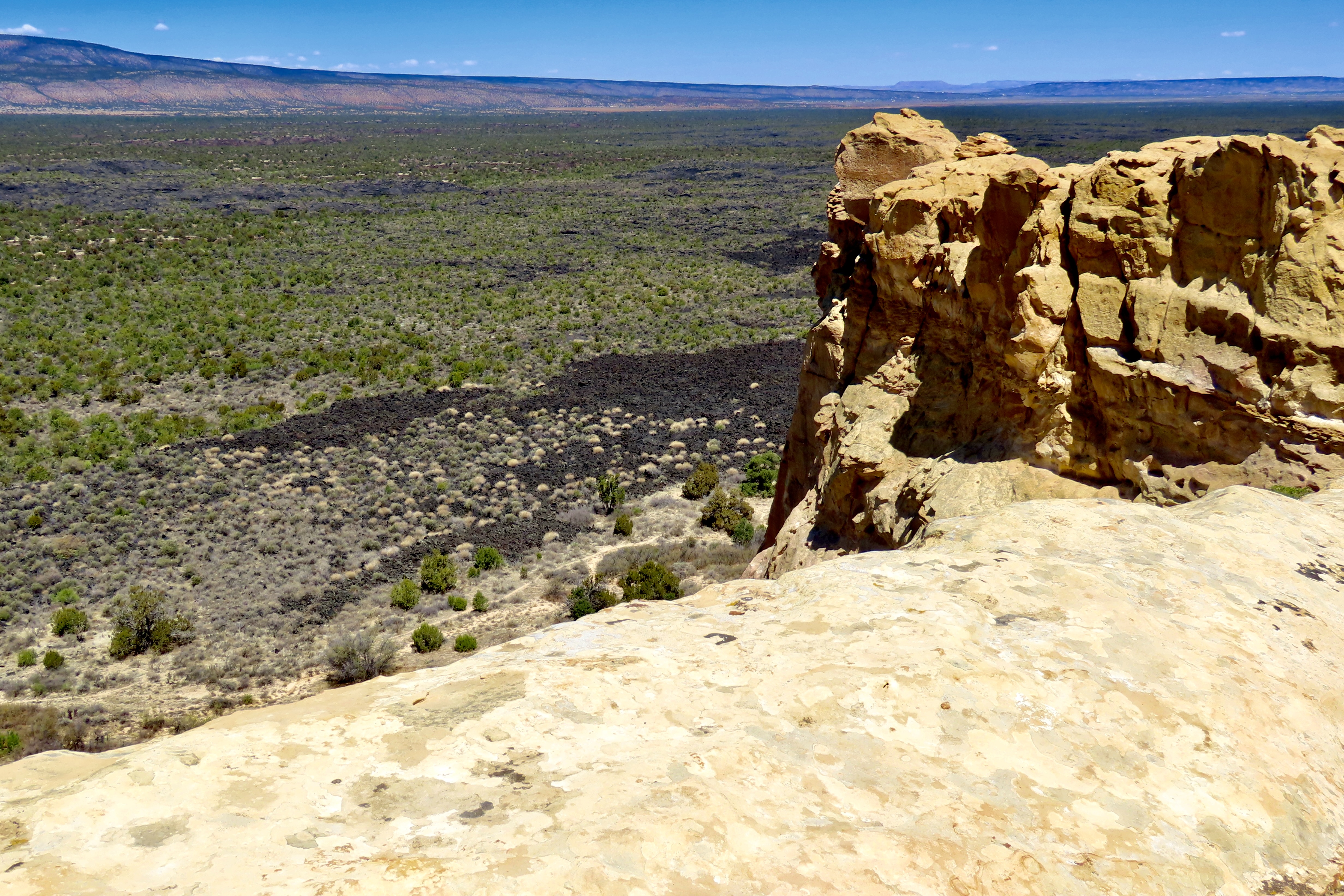
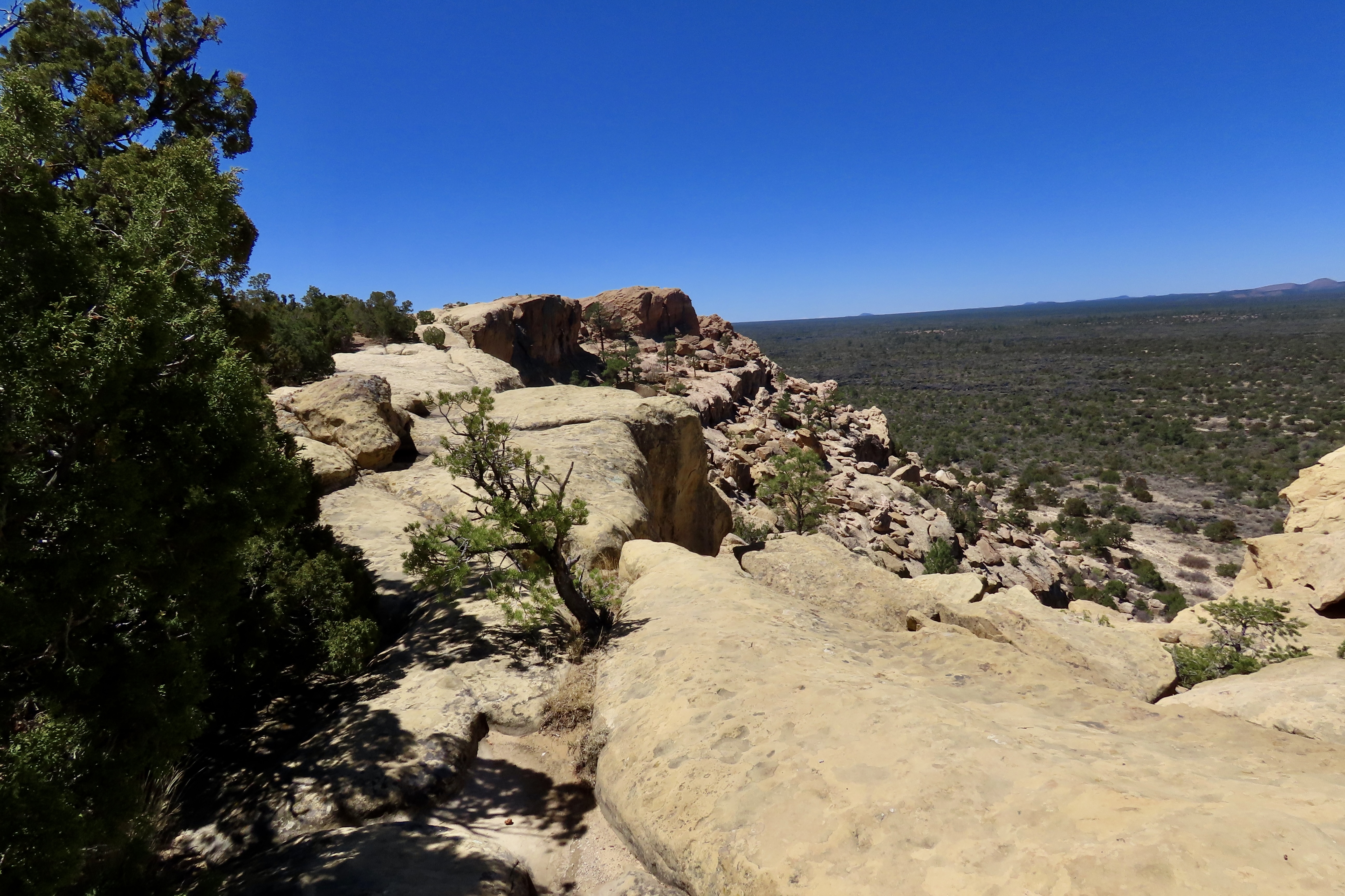
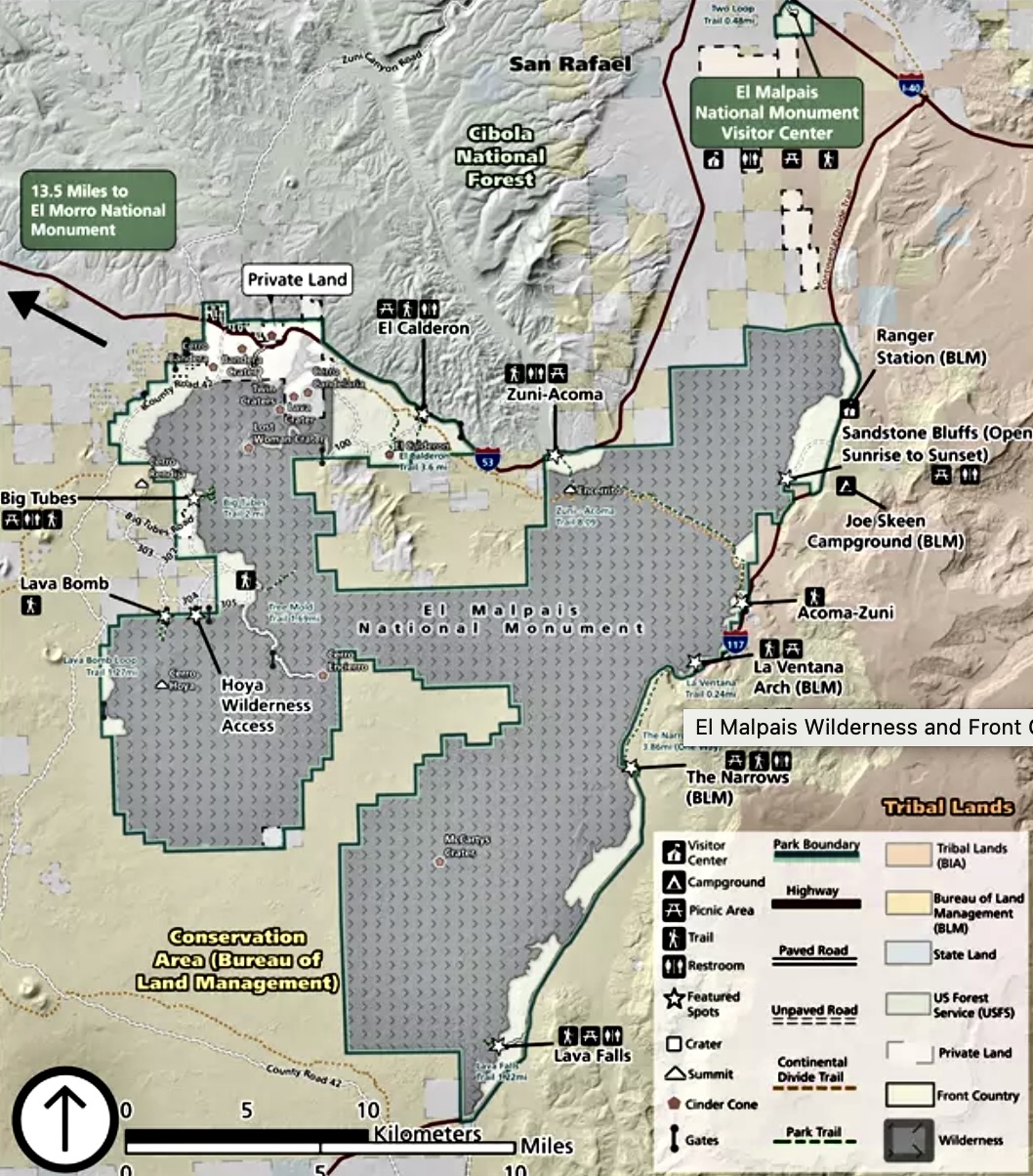
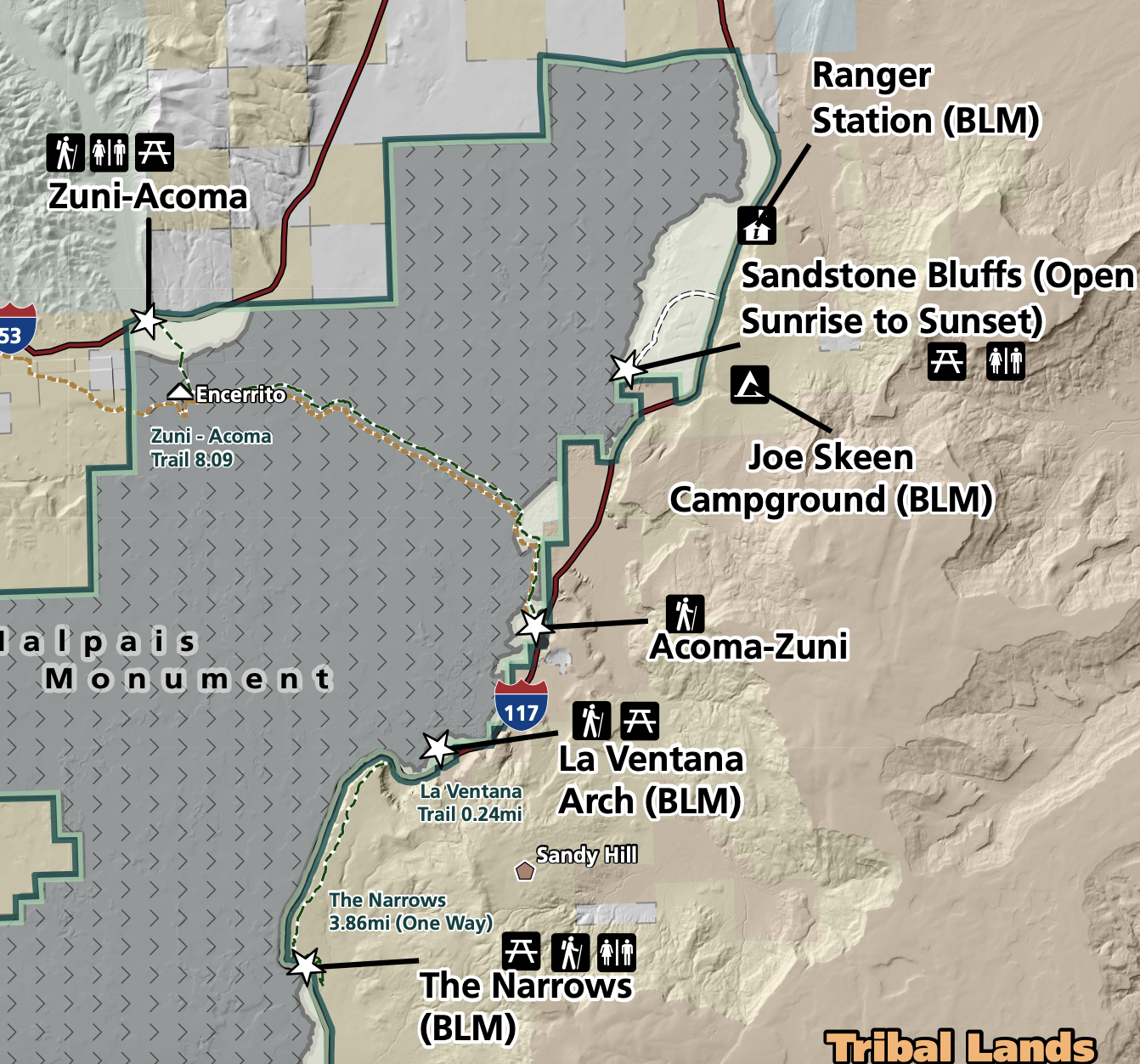
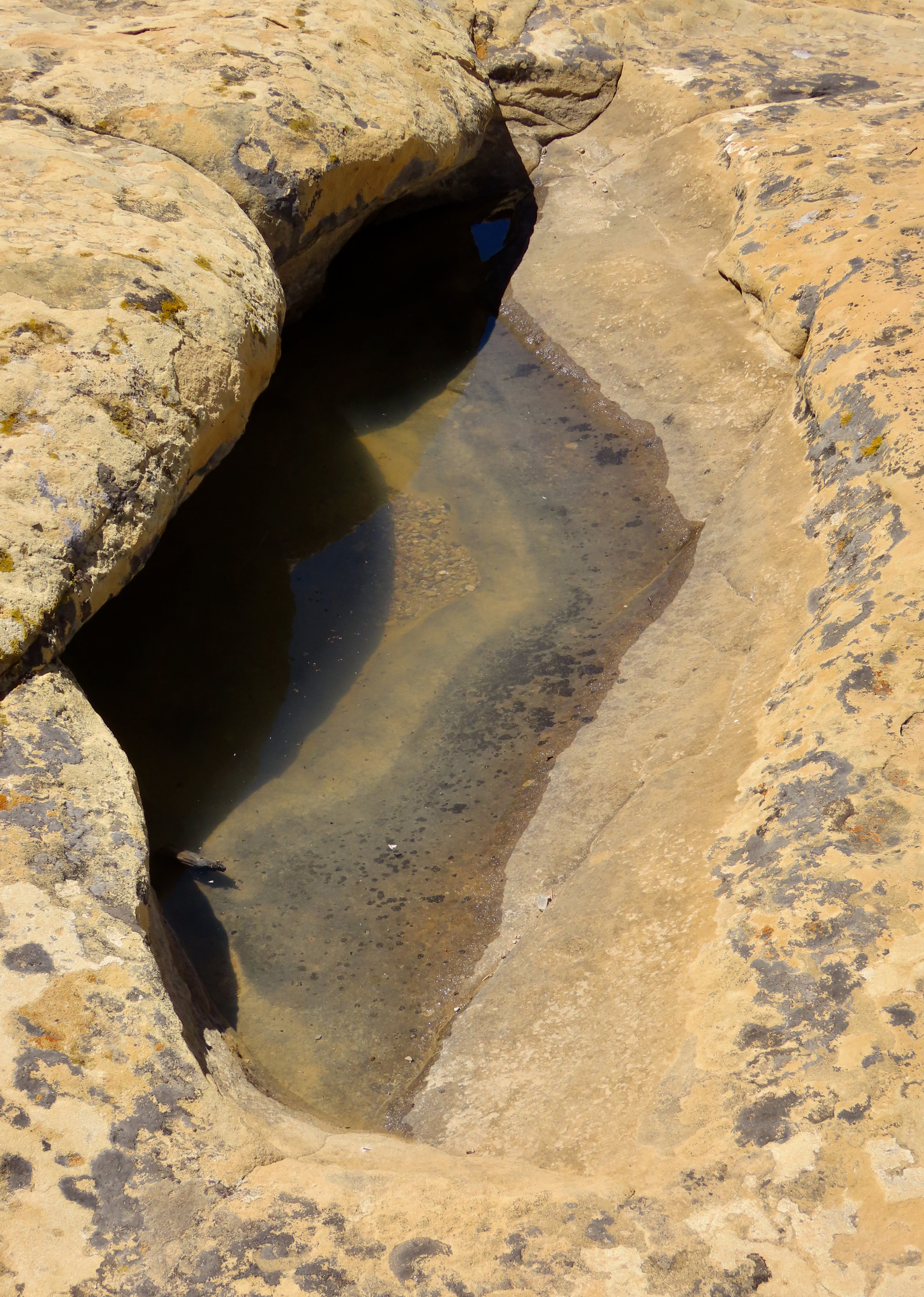
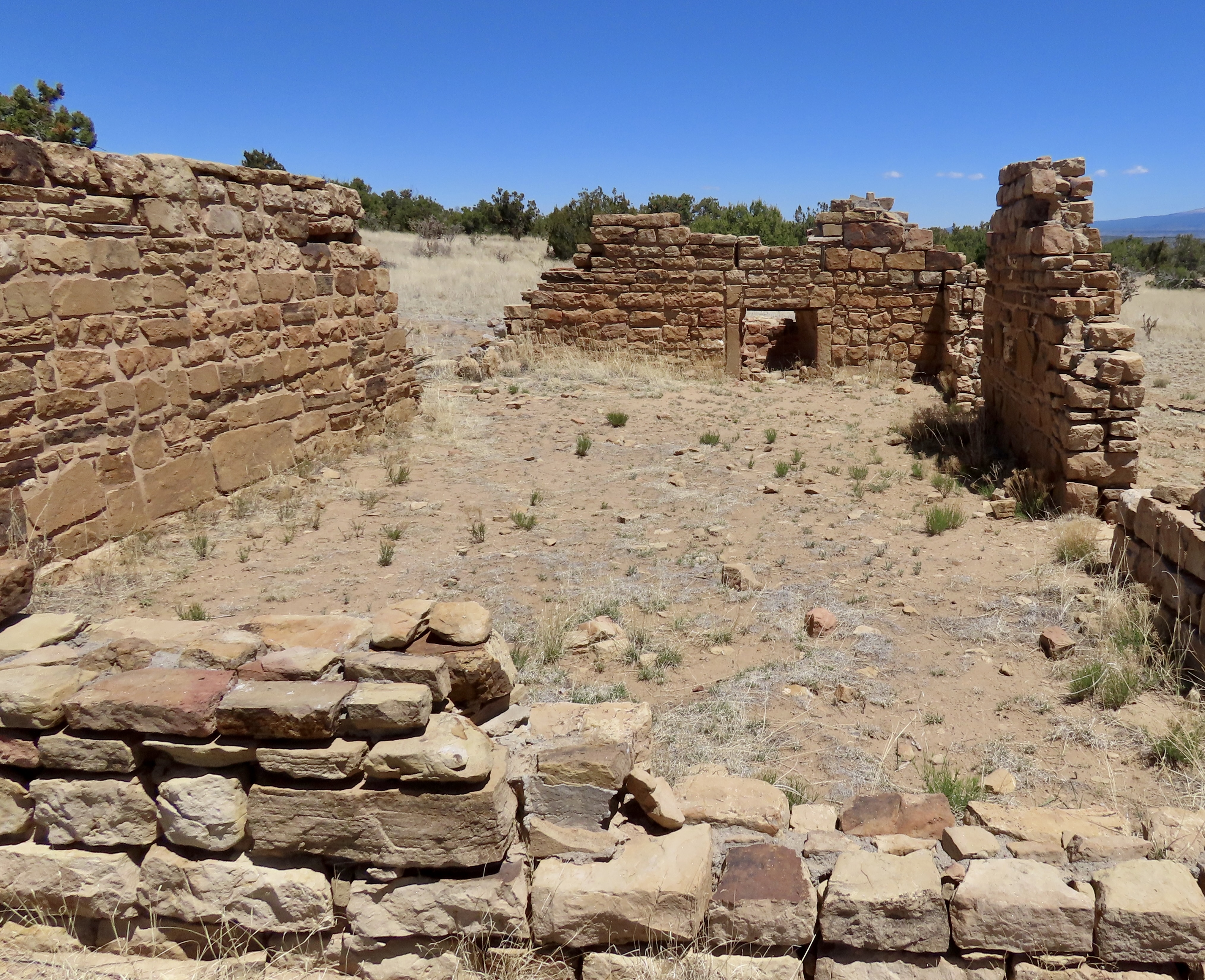
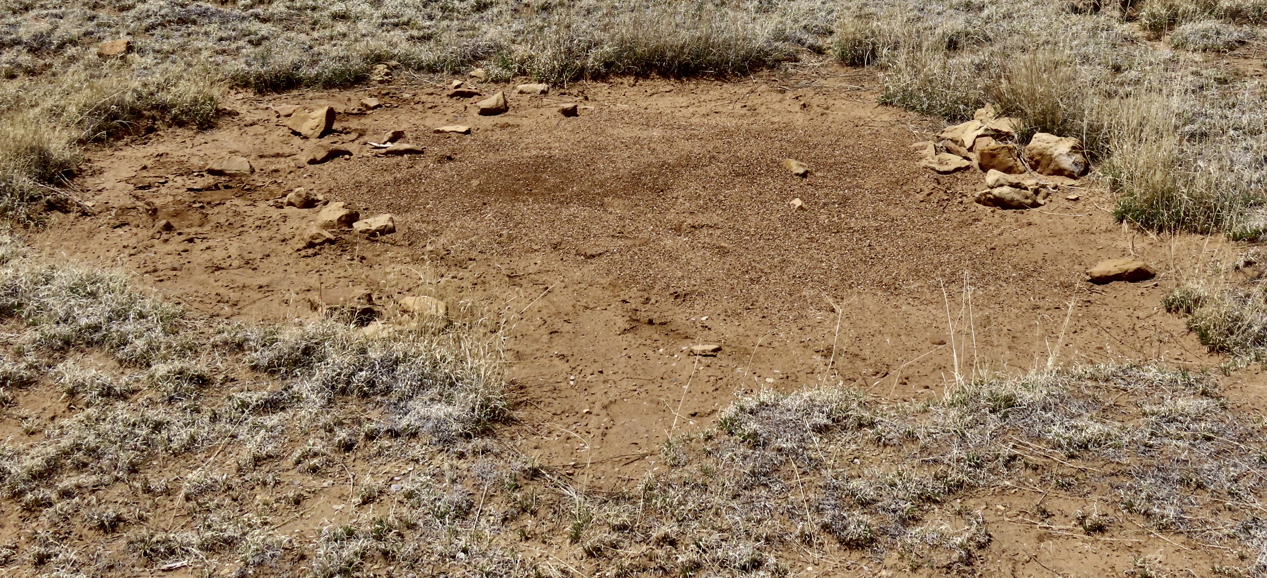
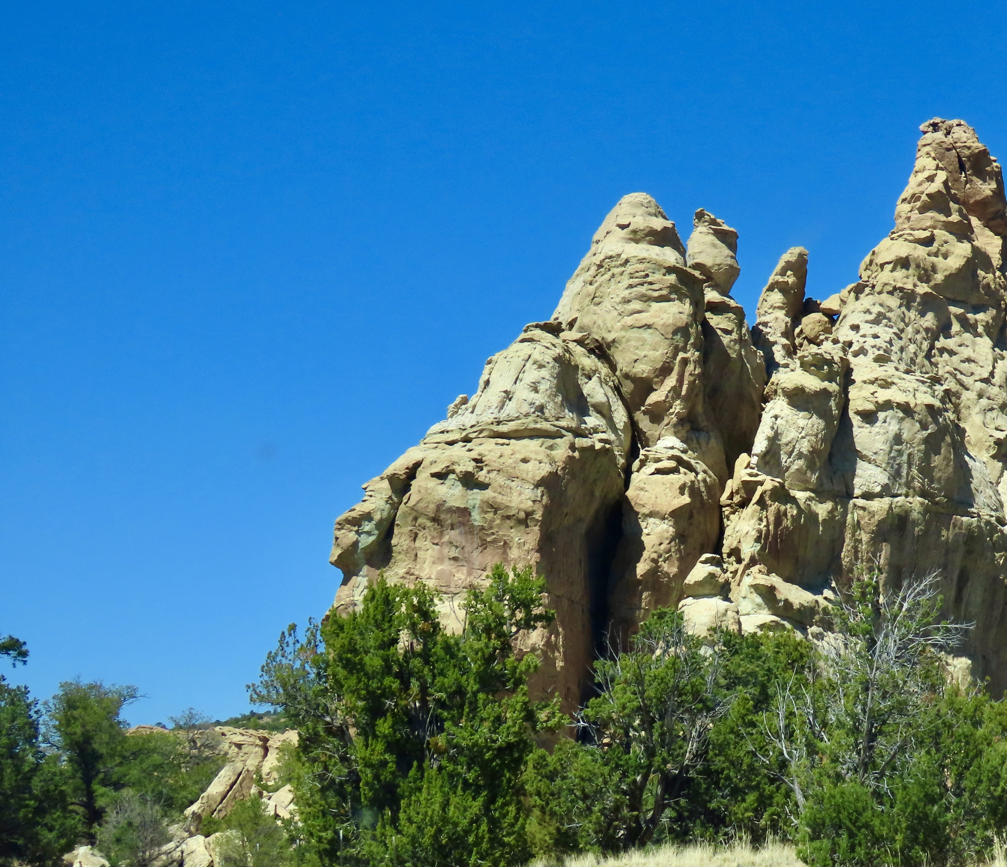
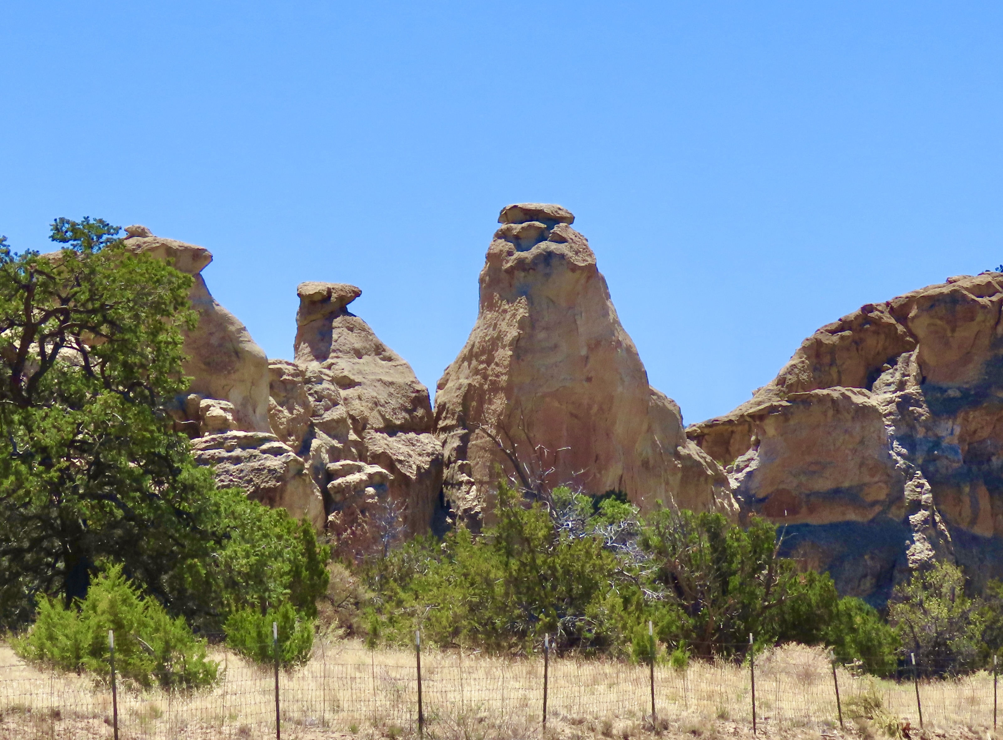
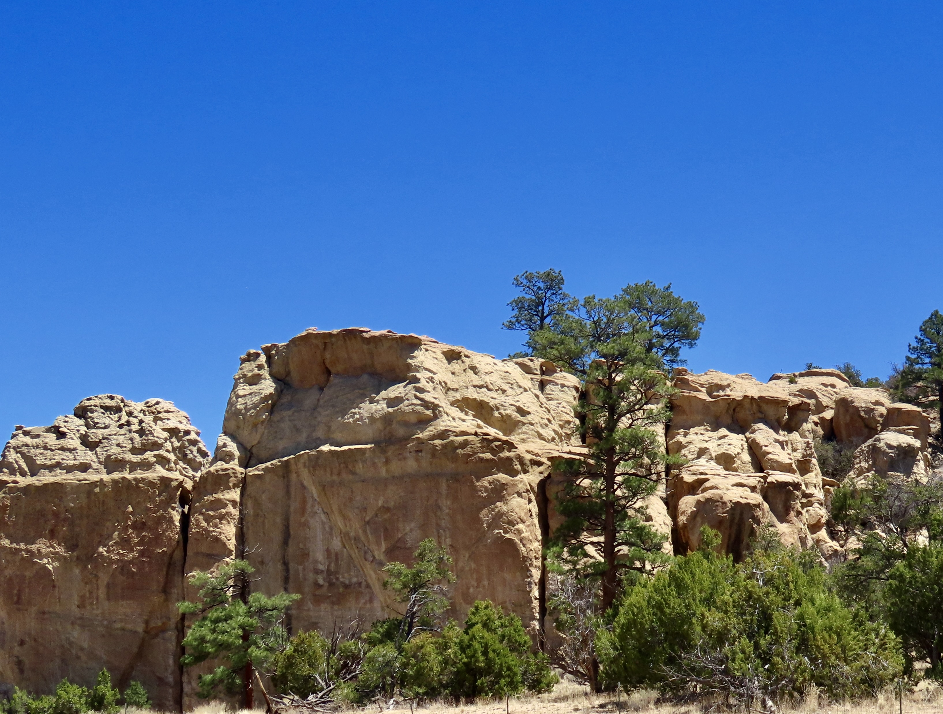
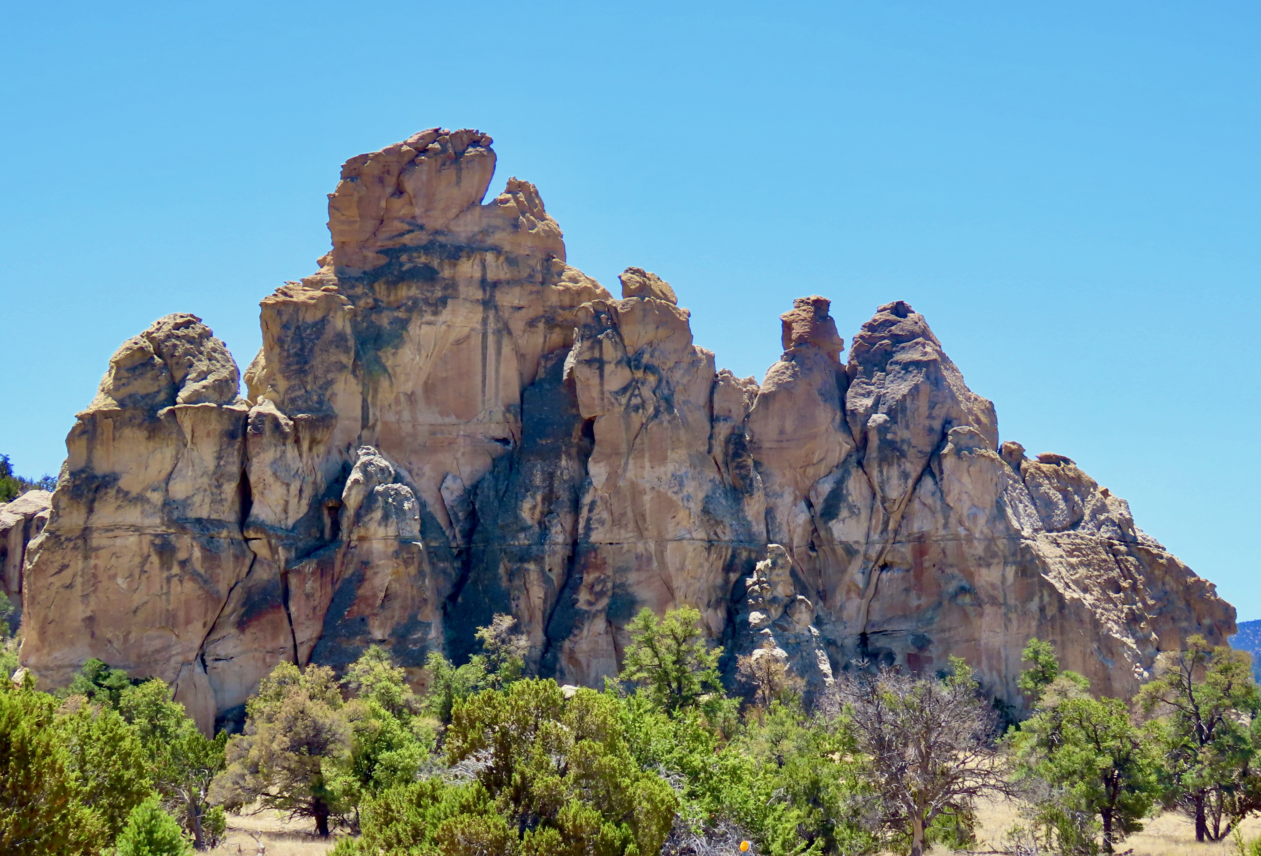
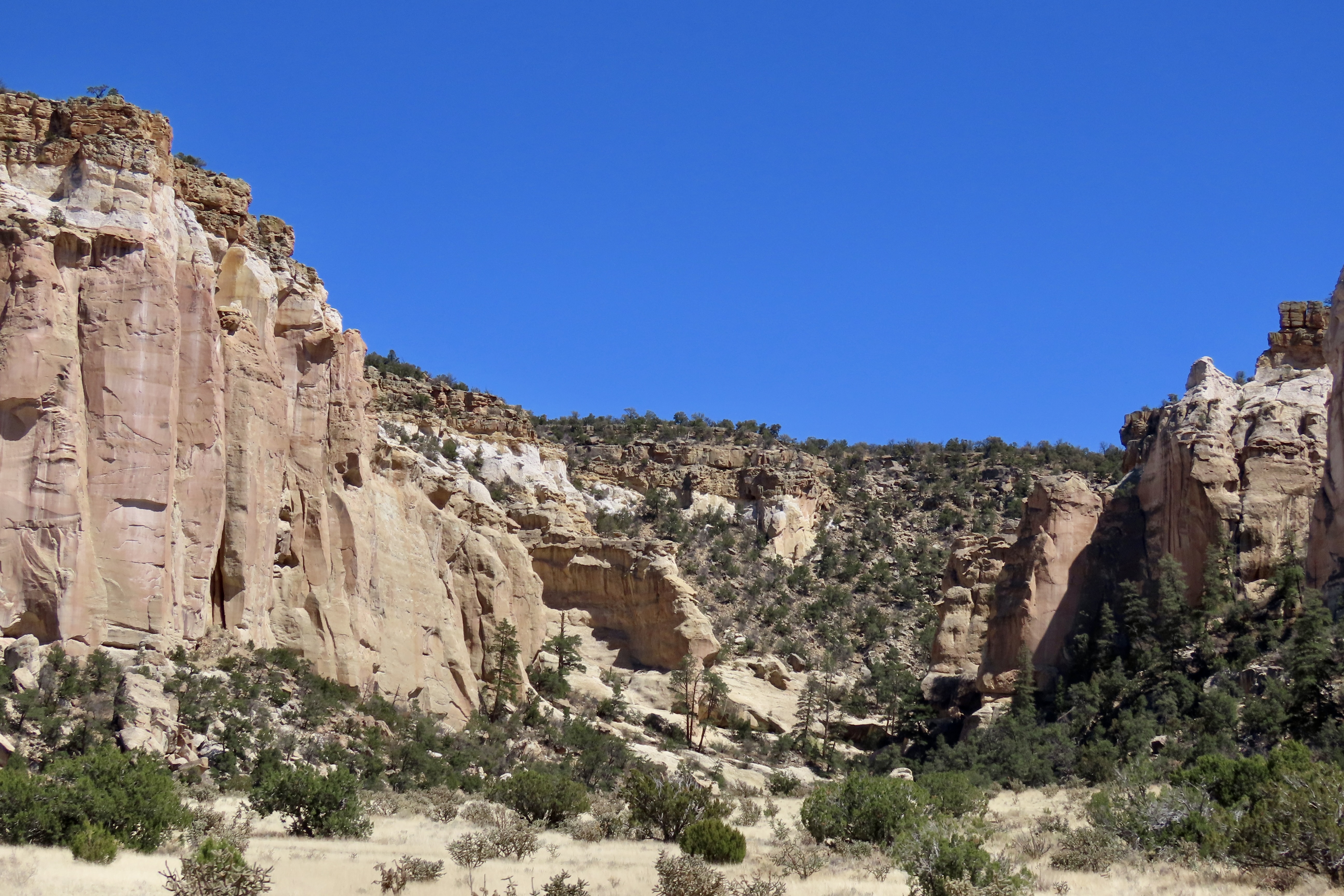
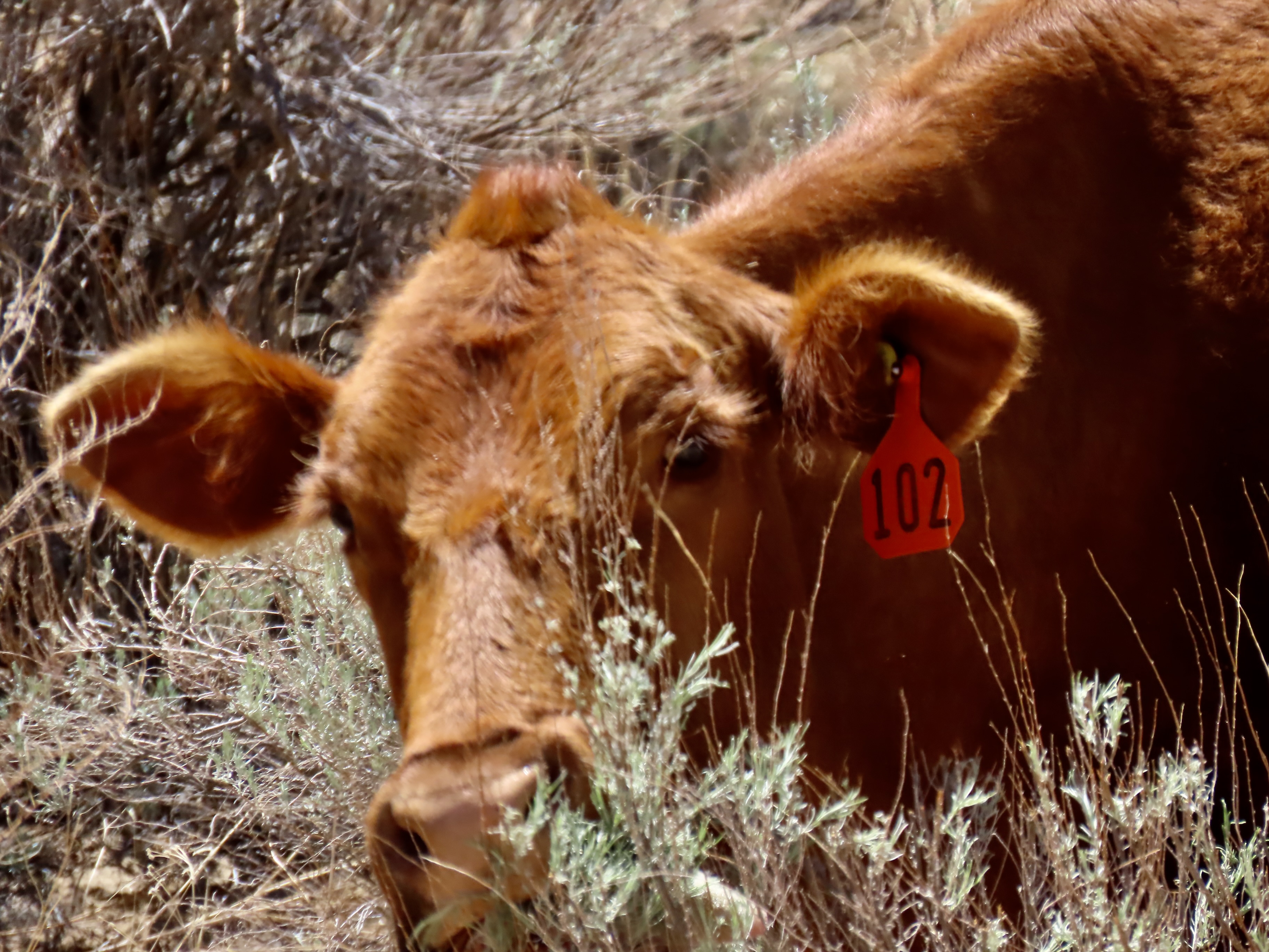
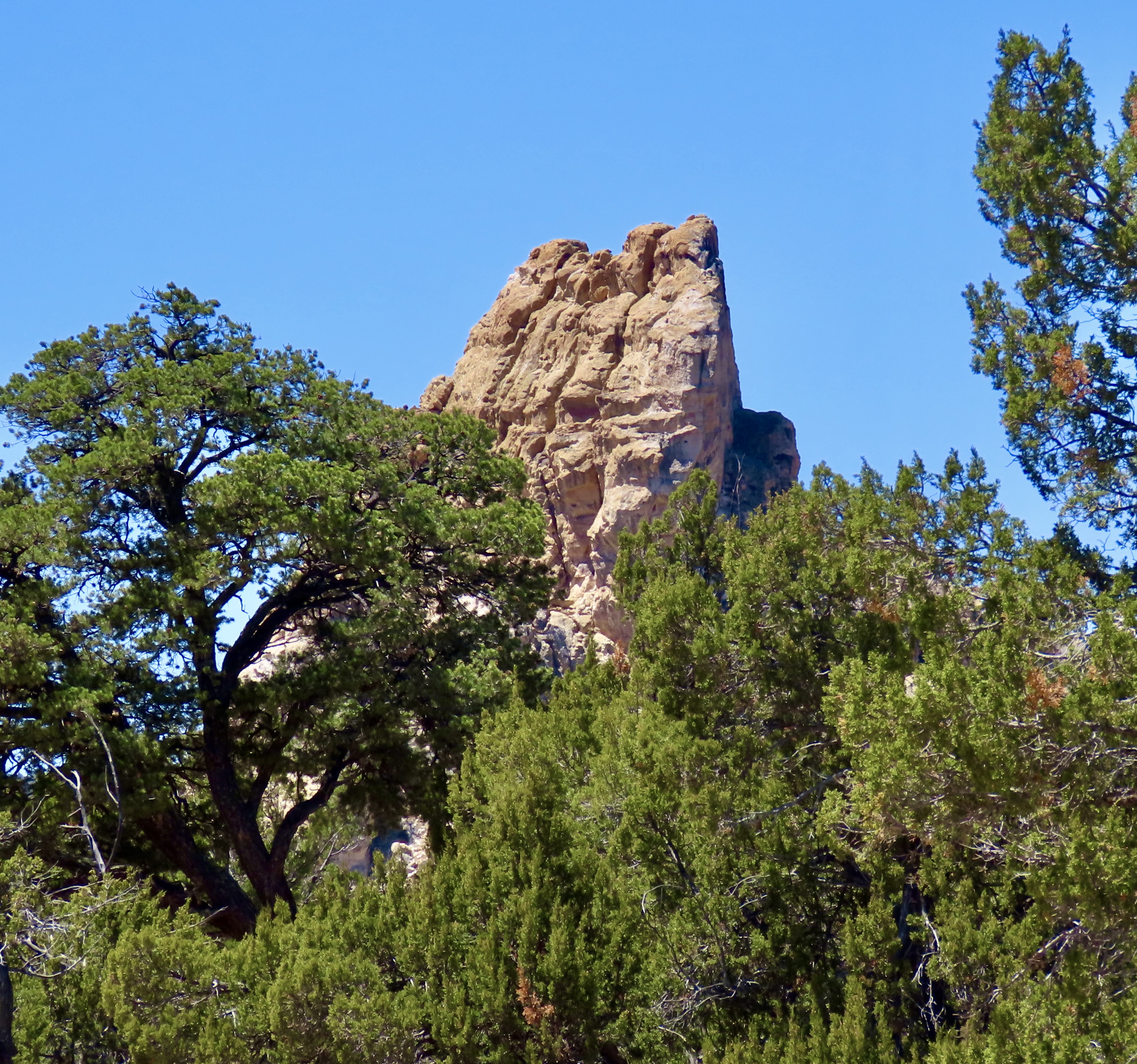
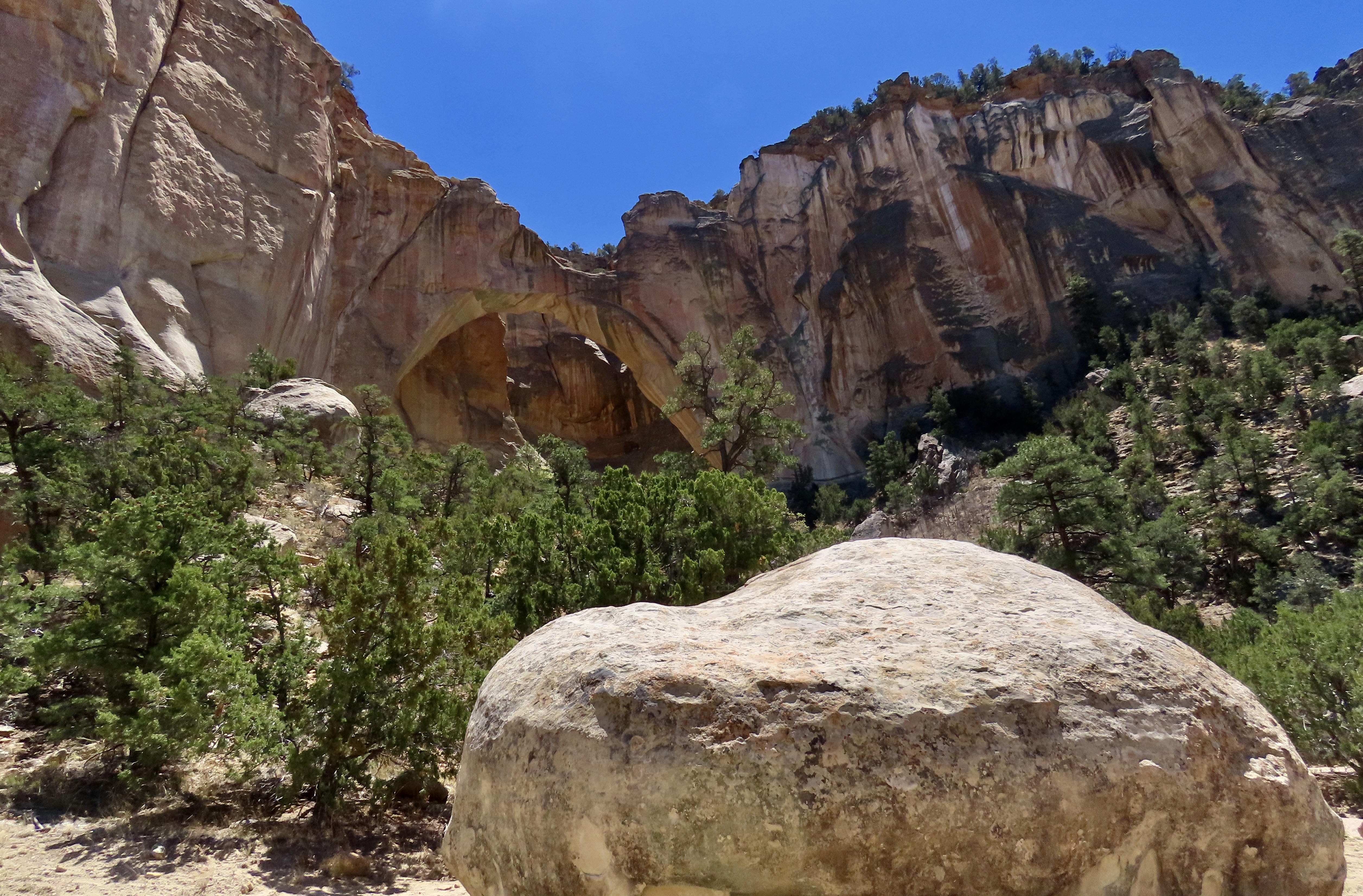
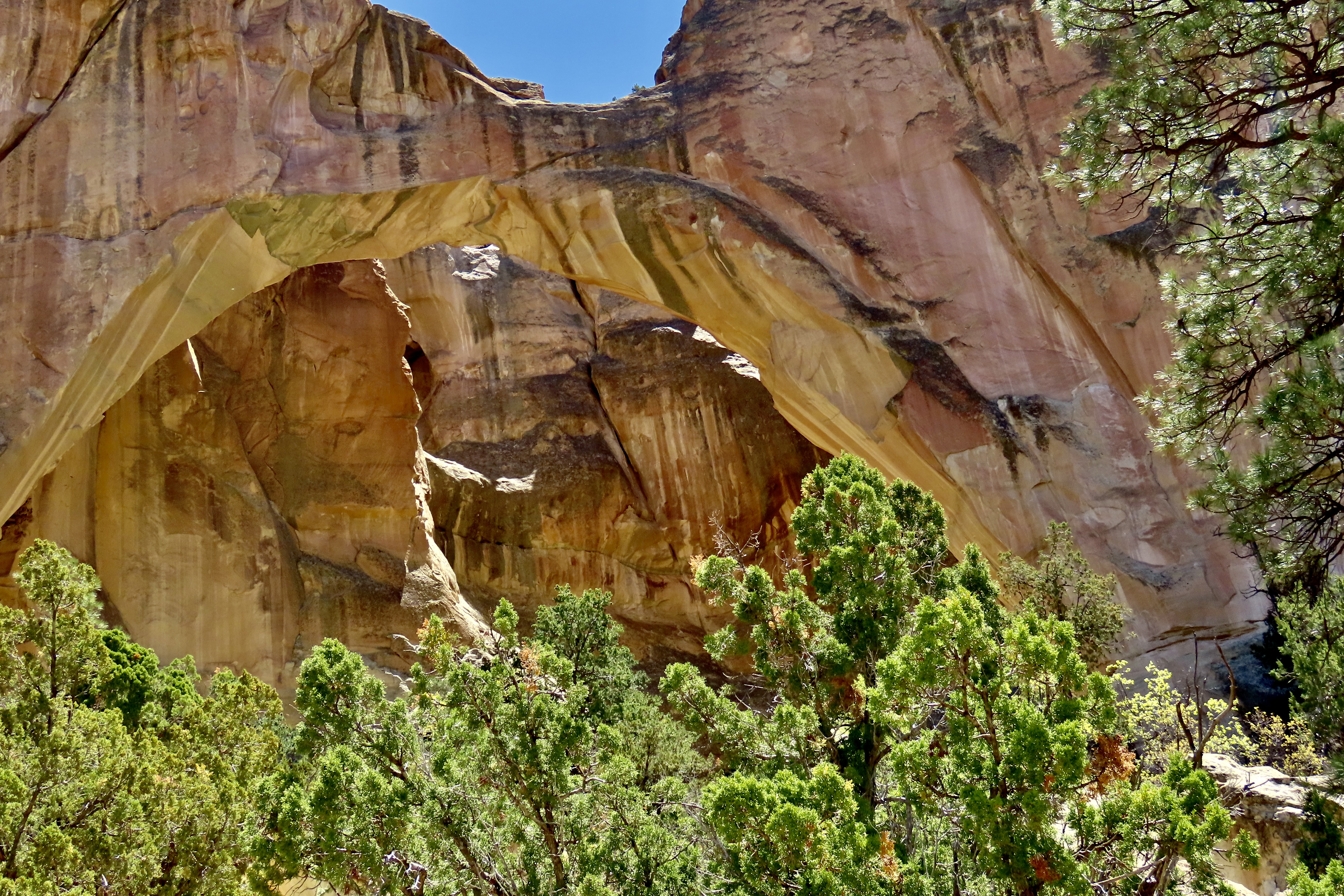
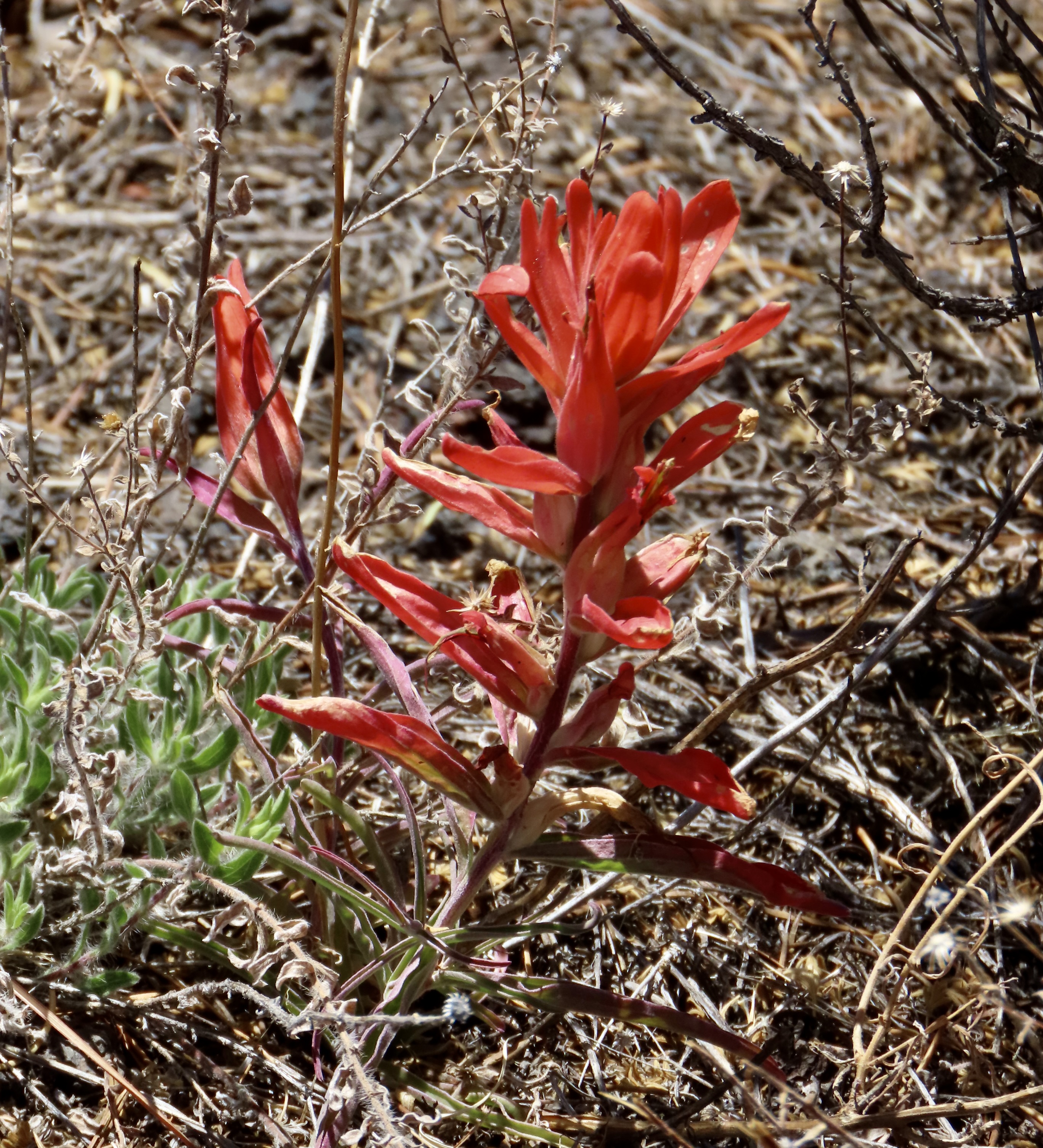
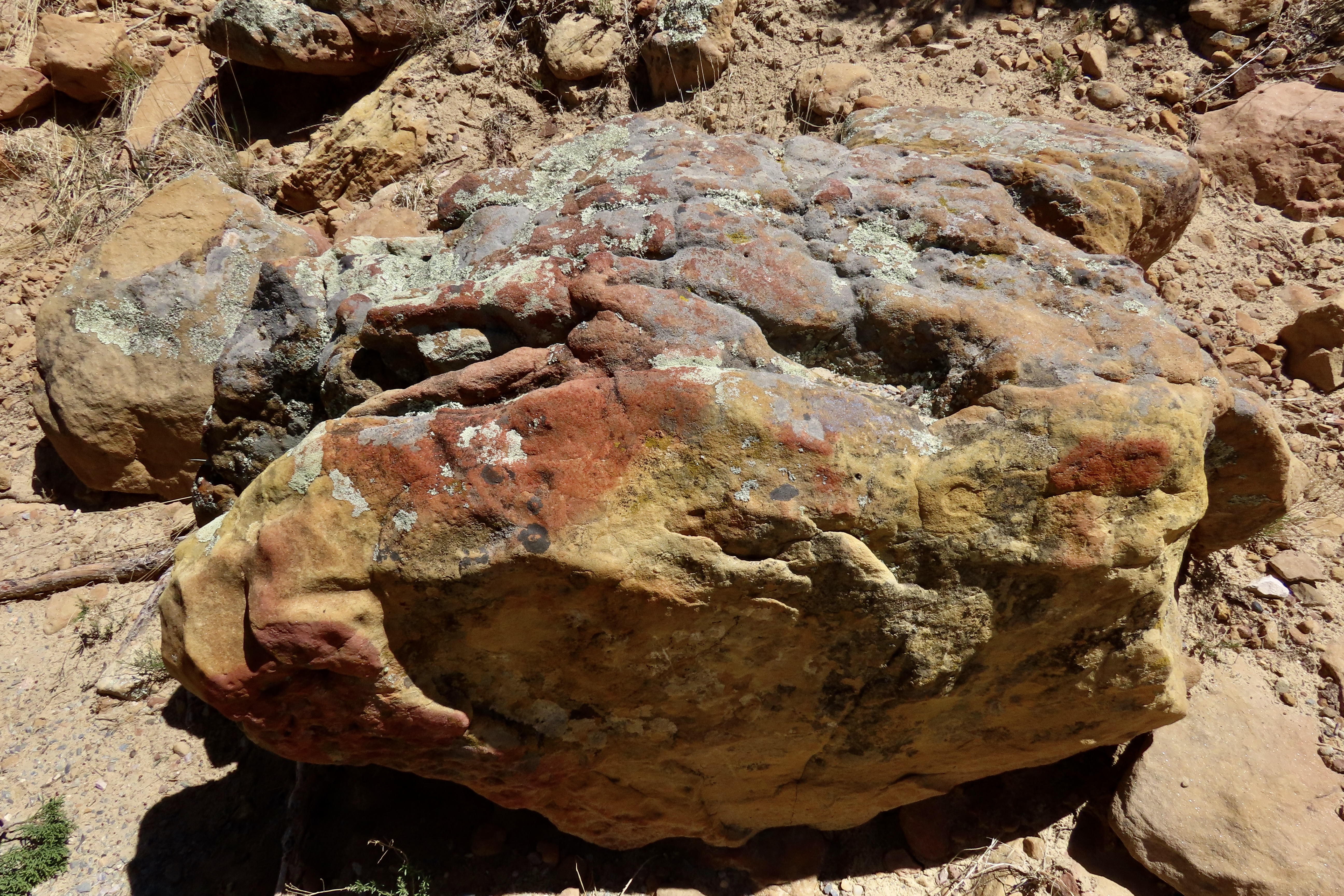
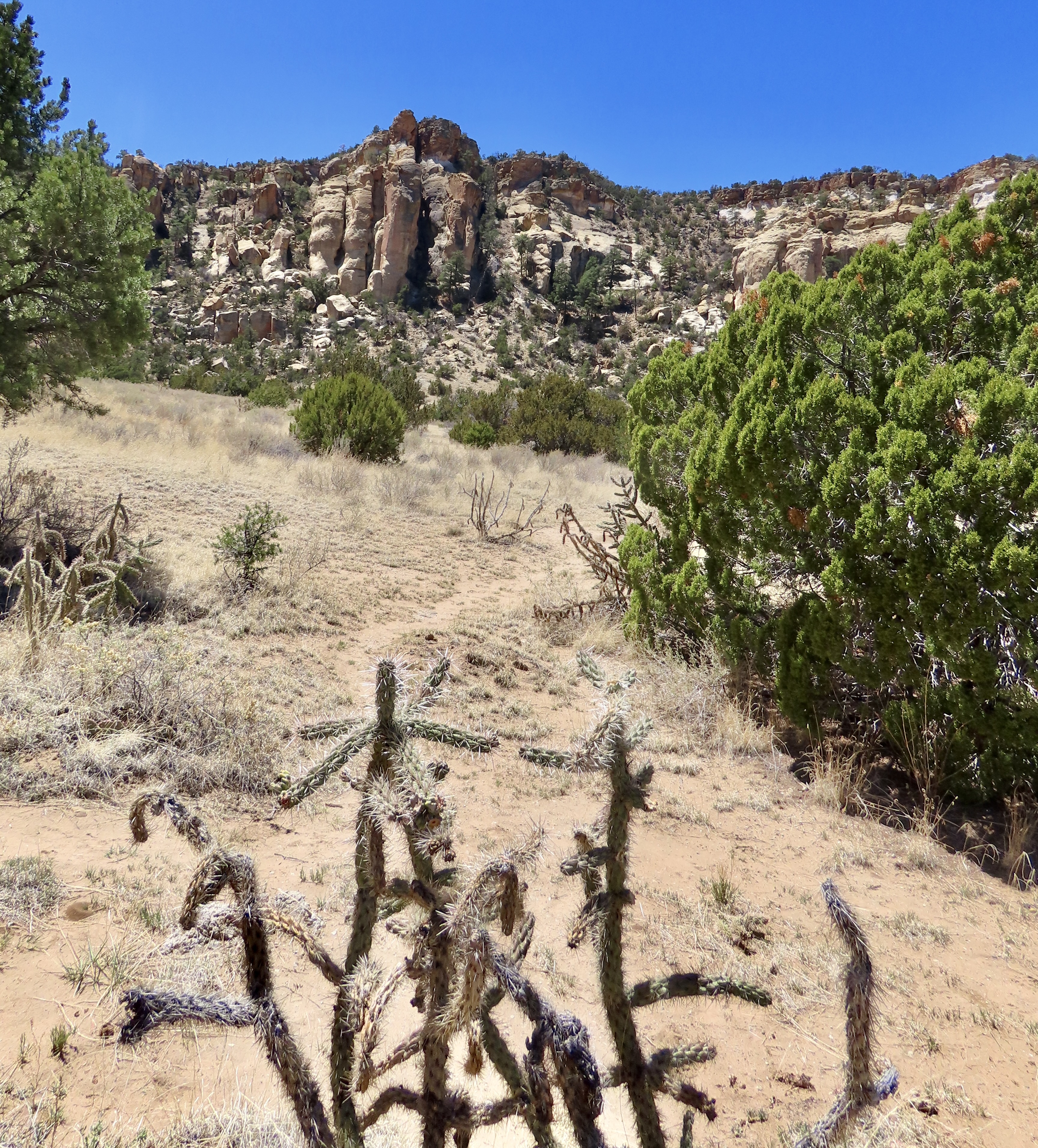
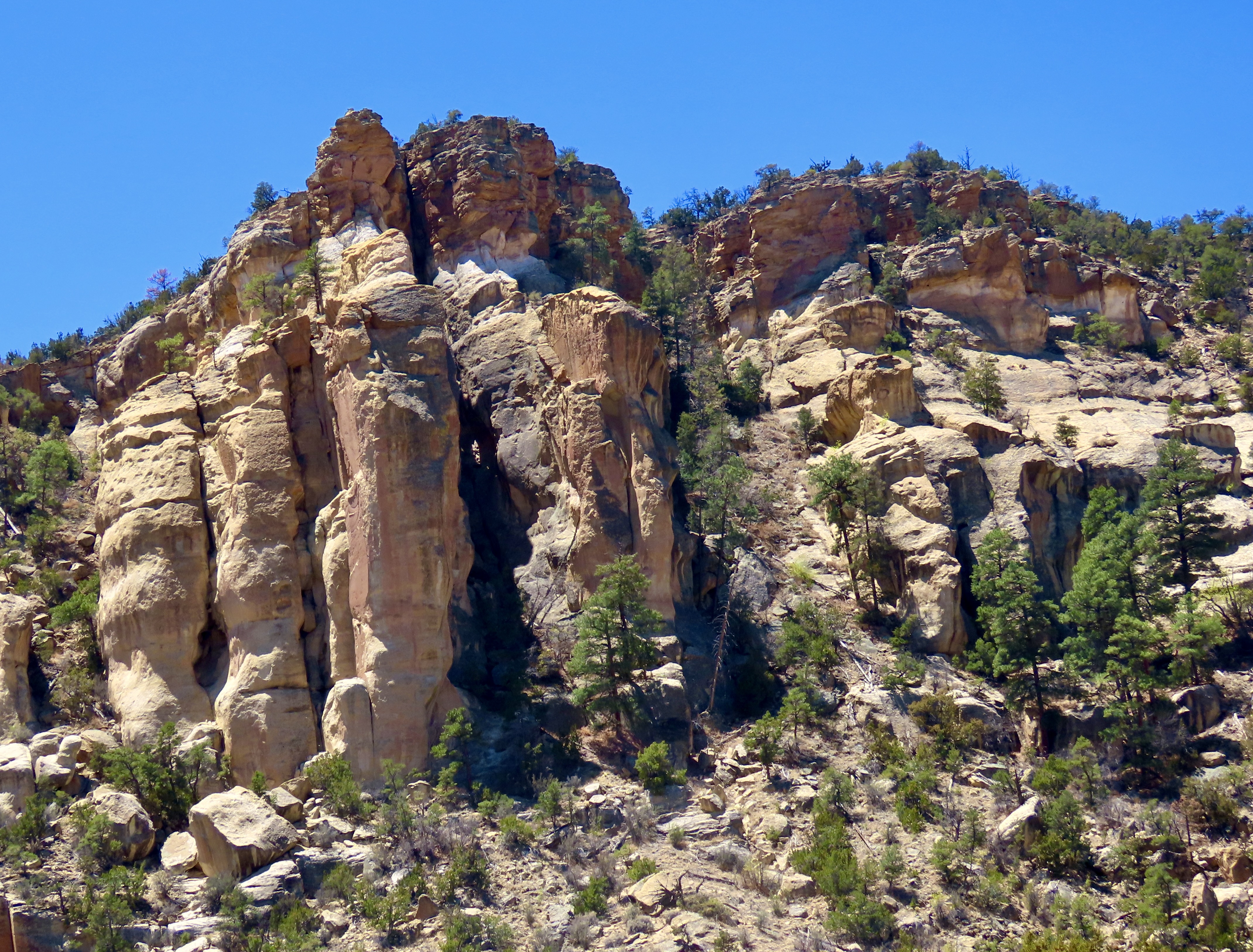
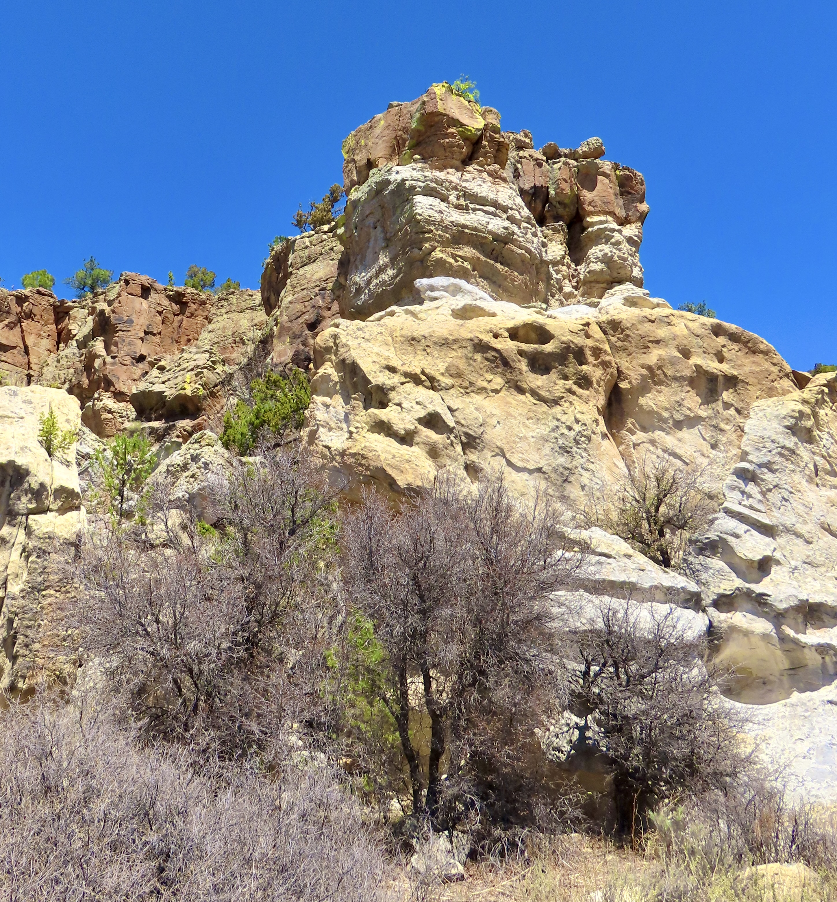
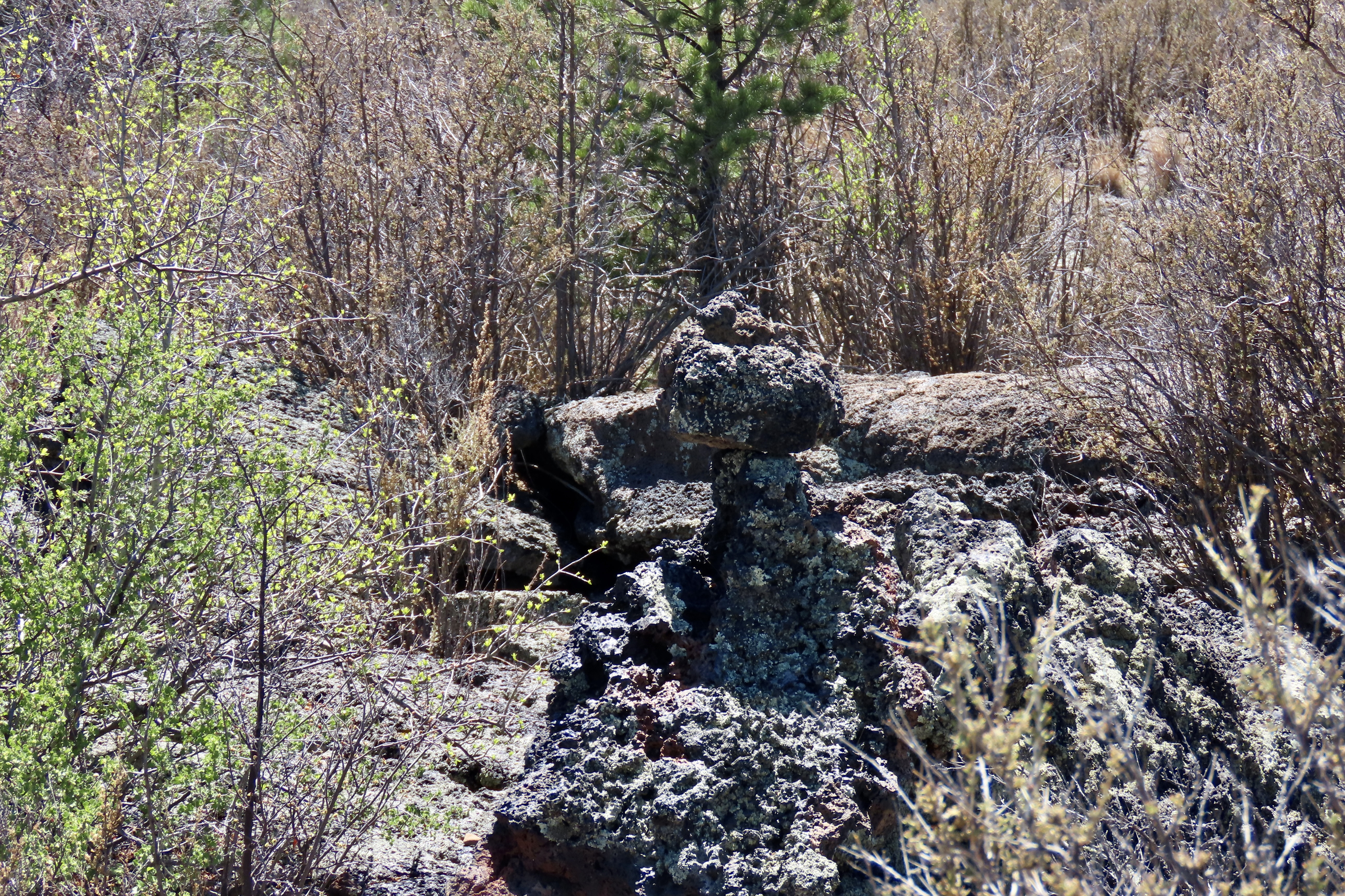
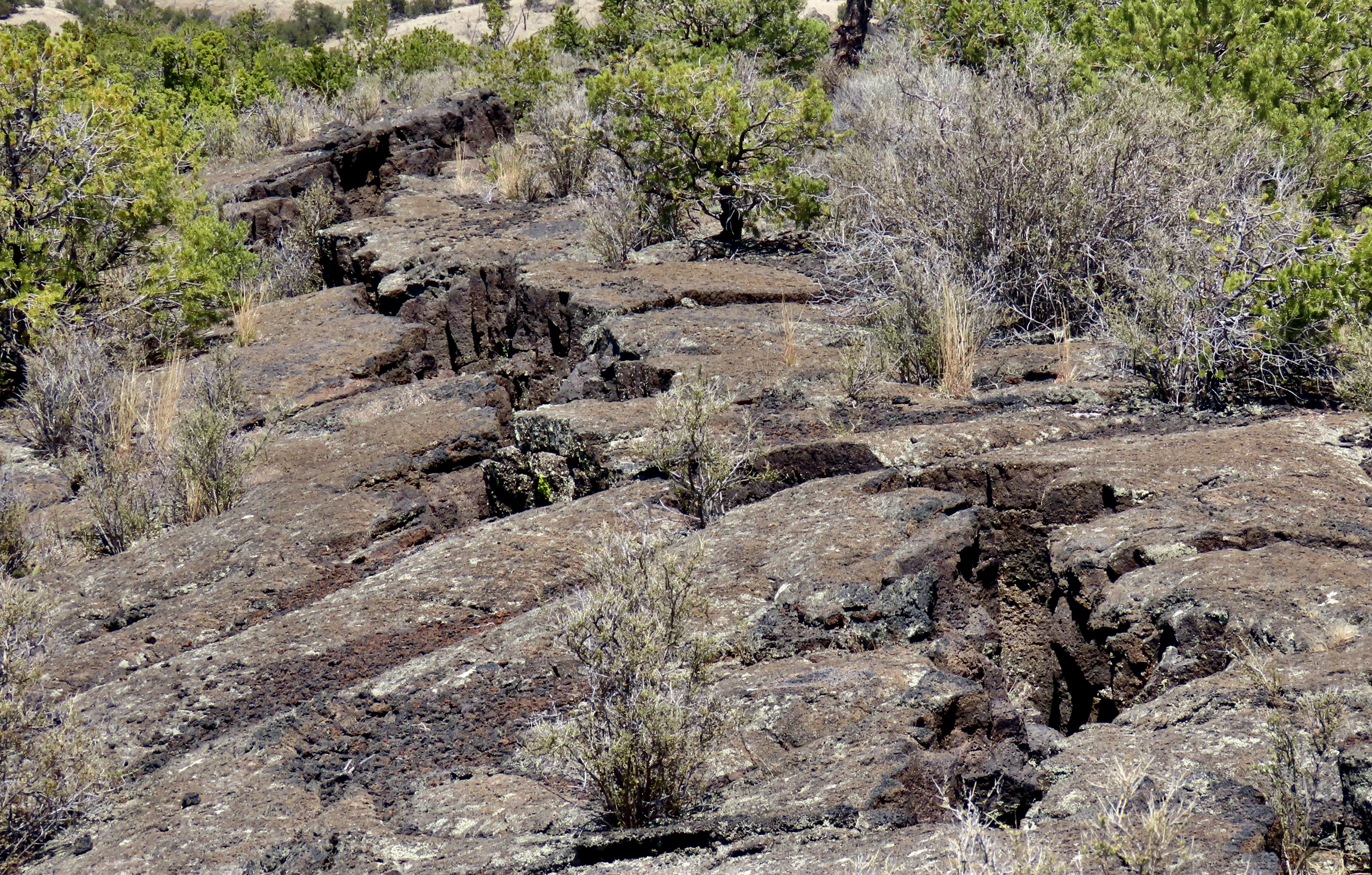
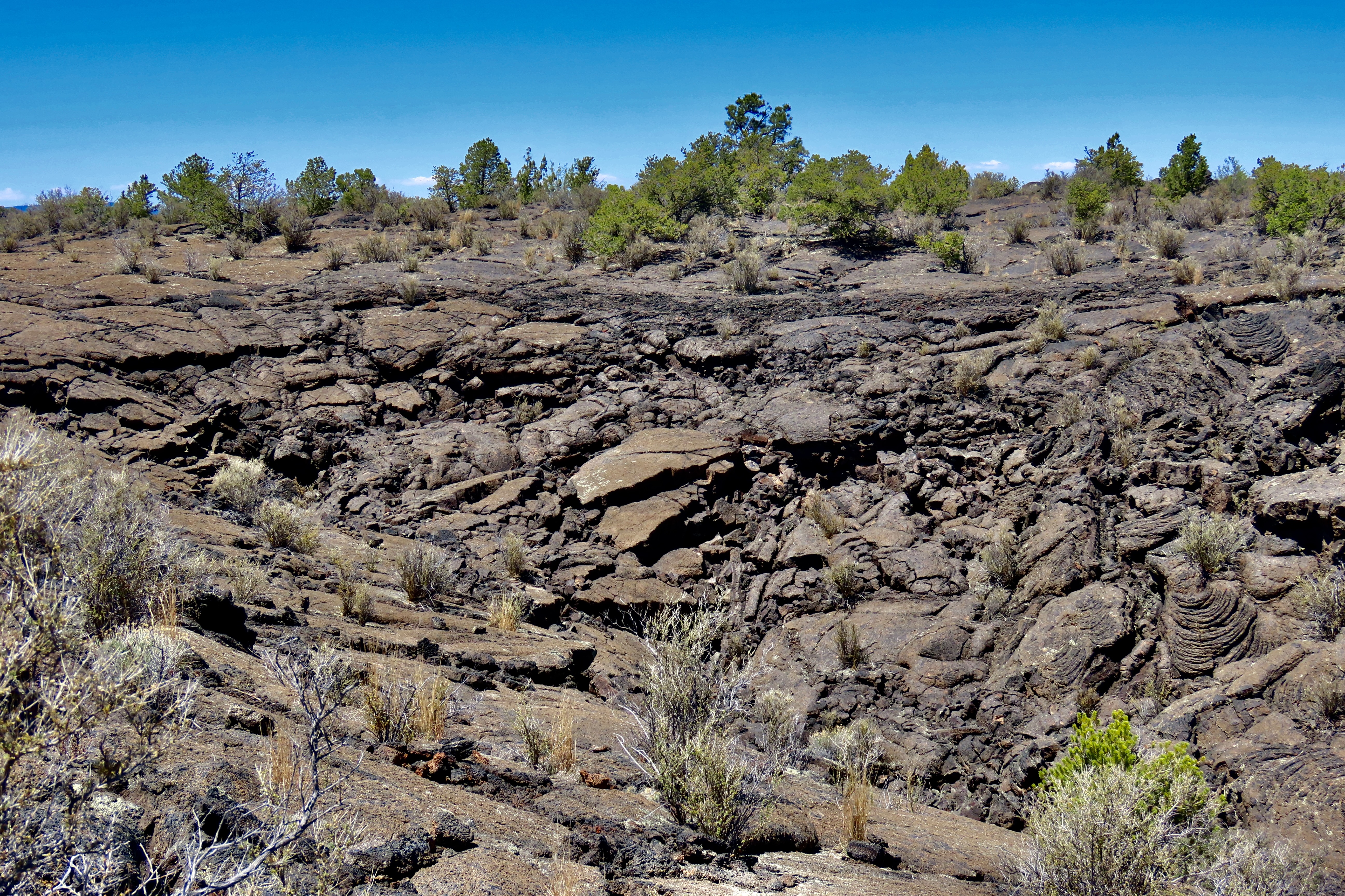
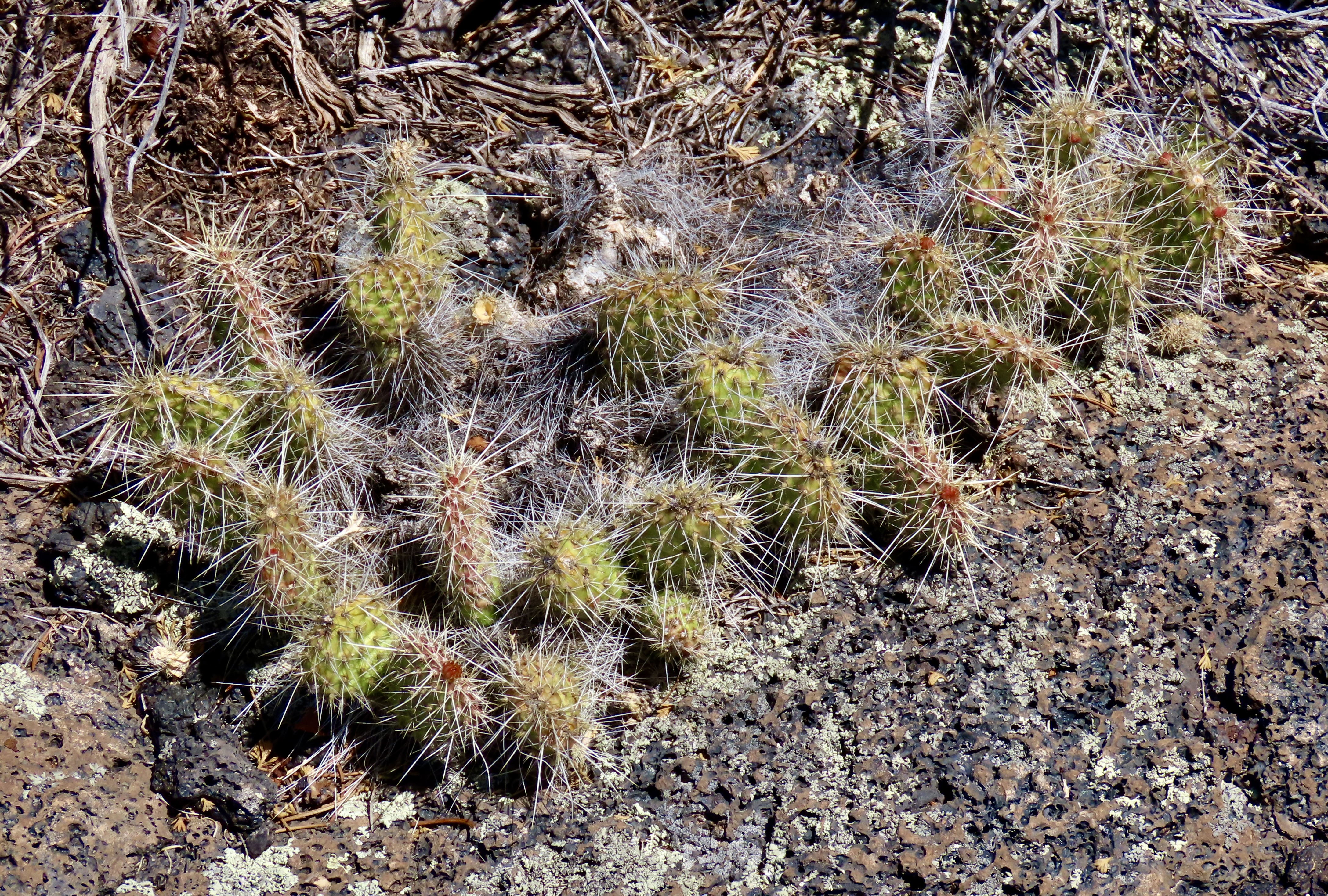
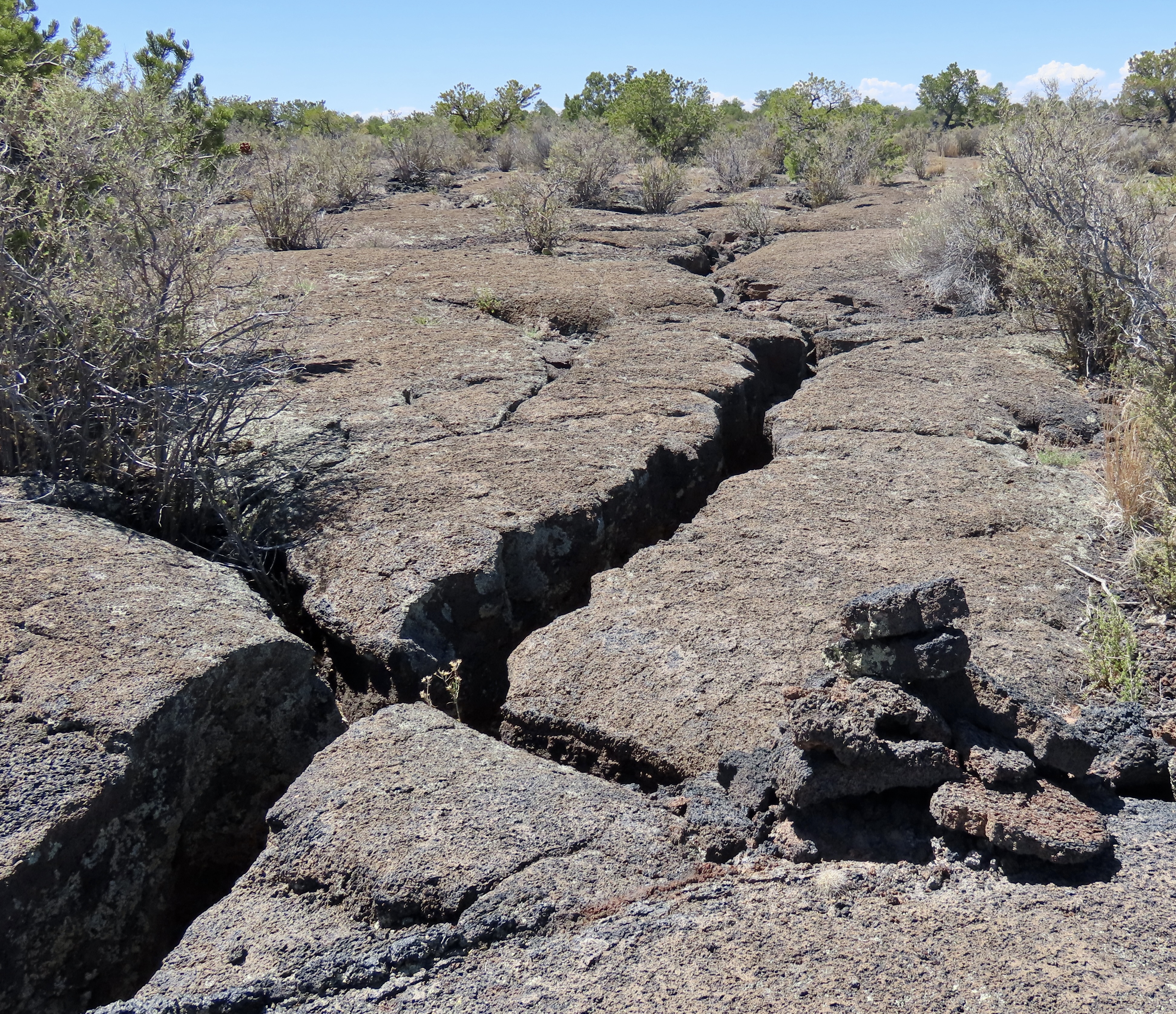
When the Spaniard explorers came through here in the 1500s searching for the Seven Cities of Cibola and untold (unfound) treasure, they looked at the lava covered fields below and declared them El Malpais, the badlands— good for nothing. They would travel around them instead of through them. The Zuni and Acoma, whose ancestors had arrived at least 700 years before the Spaniards, considered them part of their homelands. Food, water, shelter and medicine plants were here for those who knew where to find them. Their trails crisscrossed the ‘not-so badlands.’A road takes visitors out to Sandstone Bluff, shone here and above. Visitors can walk along the bluffs and look down into extensive volcanic flows of basaltic rock. While the sandstone that makes up the bluff dates back some 160 million years, the most recent lava flows are a mere 3000 years old, babies in geological time. If you go back to the first photo, the latest flow is the darkest.This map shows an overview or El Malpais National Monument. I-40 is at the top of the map, as is the Monument’s Visitor Center. El Morro National Monument, that I blogged about earlier, is off to the west. Most of our photos are from the Sandstone Bluffs, the Acoma-Zuni Trail, the La Ventana Arch, the Narrows and Lava Falls.The first four locations are shown above in the close up. The four photos below are from the Sandstone Bluff area.Water catchments such as this on top of Sandstone Bluff, provided a ready source of water after rainstorms for the Ancestral Puebloans, more ancient peoples, and wildlife that lived and wandered through the area. Various little water bugs took advantage of the pool when it was full. As did frogs, who laid eggs that turned into pollywogs. Looking at photo, I’m still trying to turn the stick into a skinny frog. Ruins of the Garret Home are found along the road to Sandstone Bluff. The family built their homestead in 1934 on the edge of El Malpais as a way to scratch out a living and survive the Great Depression.We found this barren space next to the house. It was about 6 feet across and interesting but we carefully avoided walking across. It marks the location/territory of a red ant nest. Had we walked over it, ants would have come boiling out to attack and bite us. And, believe me, their bite hurts! I know from experience. Various reasons are given for the cleared area. Among them: It makes it easier for the ants to leave and return to the nest when they are foraging, enemies, like other ants, have a harder time attacking, and the direct sun makes the nest warmer on cold days.Lunch? These ants seemed to be chowing down on this bug. Or maybe they were working cooperatively to drag it to their nest.Sandstone cliffs along New Mexico 117 on the eastern side of El Malpais National Monument provided us with numerous views of impressive rock monuments.This provides a good look at cap rocks. Being harder than the rocks immediately below them, they resist erosion more and provide for the multitude of interesting shapes one sees when traveling around the Southwest.We liked the contrast between the tall ponderosa pine and the cliffs here.Once again, we liked the contrast. But it was the sheer size of this monument combined with its coloration that insisted this was a photo op.This is a ‘draw’ in Western lingo and quite likely a box canyon. Cowboys liked them because they often provided water, shelter and forage for their cattle. If it’s a box canyon, it could also serve as a makeshift corral.Moo.This rock, peeking out from among the trees marks the beginning of the ancient Acoma-Zuni Trail on the eastern side of El Malpais. We found it amusing that it is named the Zuni-Acoma Trail if one starts from the west. Historically, and today, the Zuni lived/live on the west side of El Malpais and the Acoma on the east. The 7 1/2 mile trail provided the main route for the two groups to travel back and forth between their pueblos. It’s been in use for at least a thousand years. Today, people backpacking the 3100 mile (4989 km) Continental Divide trail are still using it! Some of the cairns (rock markers) used by the hikers to follow the route were set in place hundreds of years ago by the Acoma and Zuni.La Ventana (the window) Arch is found about halfway down New Mexico Highway 117 when driving the length of El Malpais National Monument. It’s the second largest natural arch in New Mexico and definitely worth a stop.A closer view. A short trail leads up to the arch from the parking lot. Picnic tables are available for those who would like to stop for lunch. We found a group of hikers who were doing the Continental Divide Trail, eating lunch at one of the tables.We also found: A single Indian paintbrush…A rather colorful rock…And a Cholla cactus on a trail leading up to another rock monument.A close up.Instead of eating lunch at La Ventana, we chose to drive down to the Narrows and eat lunch at a BLM park, where we treated to views like this. The brilliant white rock two thirds of the way up is sitting on a rock that is 60 million years older. In geological terms, it’s known as an unconformity. The intervening 60 million years of geological history were wiped out by erosion!Peggy and I finished our visit to El Malpais National Monument by driving down to the end of the park and going for a hike along the Lava Falls Trail (noted on the first map above). We quickly learned about the importance of following the route marked out with the rock cairns. One part of the lava flow looks pretty much like every other part. Getting lost is a distinct possibility. There are deep cracks in the ground.Large collapsed sections that would be difficult to cross and possibly dangerous.And prickly cactus to avoid.Fortunately, the cairns are relatively easy to follow. It’s important, however, to locate the next one before you leave the one you found! Its hard to see here but it was across the crack off to the left.Peggy stopped to take a photo of the crack while crossing it. Of course. That’s it for today’s post. We have two left in our Southwest series. The next one will be on the campgrounds we stayed at while following sections of our trip that took us along historic Route 66. Our last post will feature some of the interesting petroglyphs we found at Lyman Lake State Park in Arizona and the Petroglyph National Monument in Albuquerque.We stayed at a KOA campground just outside of Grants, New Mexico off of I-40 when we exploring El Morro and El Malpais National Monuments. Historic Route 66 ran through the town about a mile away. While at the campground, we were treated to this gorgeous rainbow.