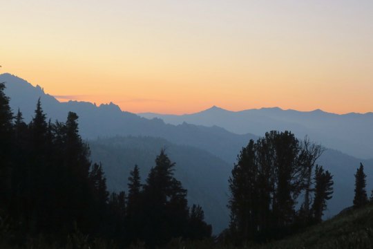
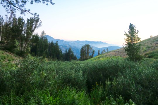
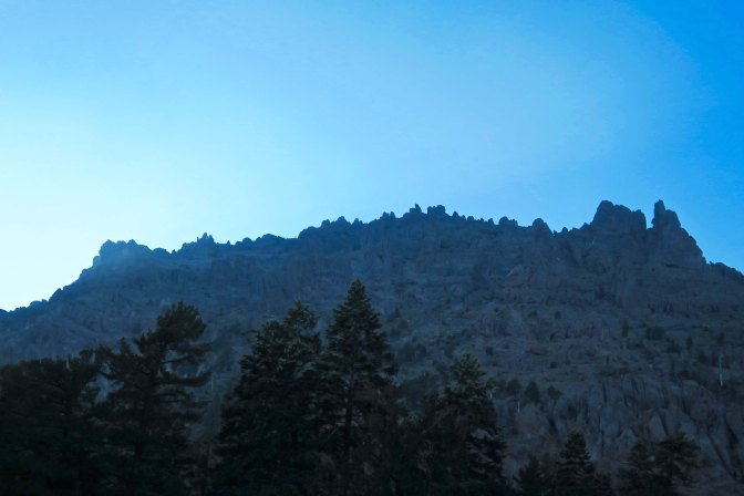
An evening view of the Mokelumne Wilderness from Noble Lake on the PCT.
I remembered Noble Lake from my 2003 trek when I backpacked 360 miles from Lake Tahoe to Mt. Whitney to celebrate my 60th birthday. For some reason, it didn’t seem as ‘noble’ this time. Maybe that’s because of all the other lakes I had passed on my hike down the PCT. But the views looking back toward the Mokelumne Wilderness were spectacular.
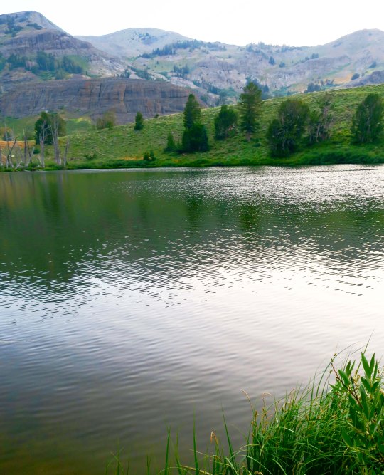
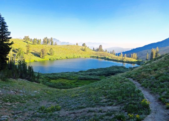
An afternoon view of Noble Lake. The lake is located south of Ebbetts Pass.
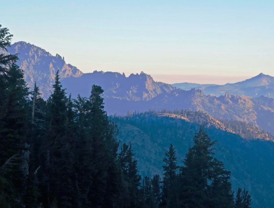
Another evening view of the Mokelumne Wilderness from Noble Lake. This is a situation where the smoke from the fires may have enhanced the photo.
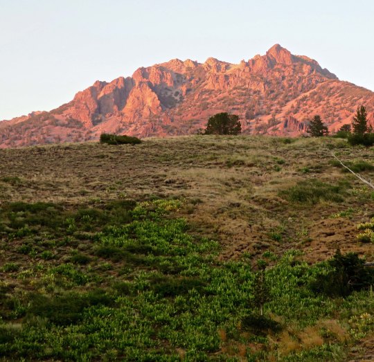
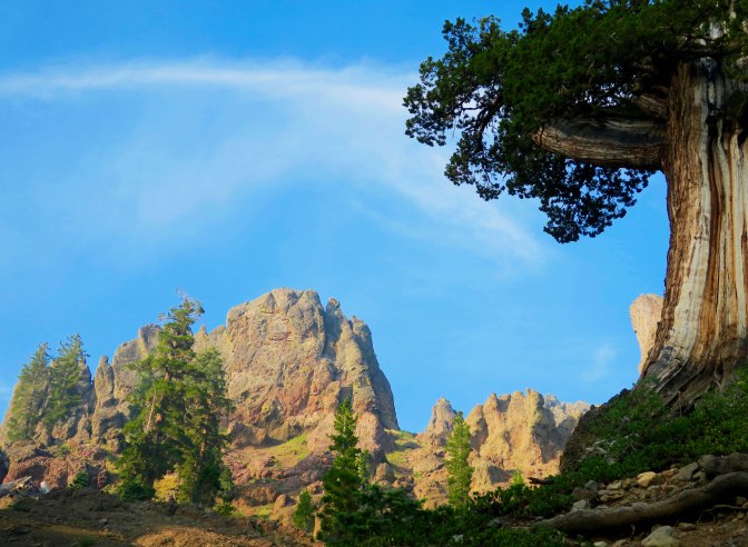
Looking up from the lake, I caught this mountain glowing in the evening sun.
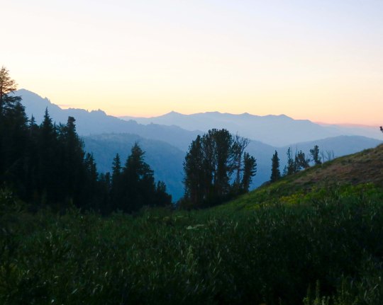
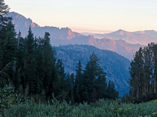
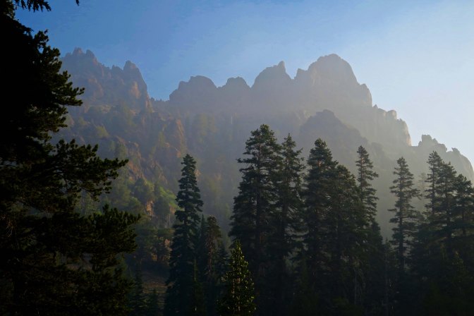
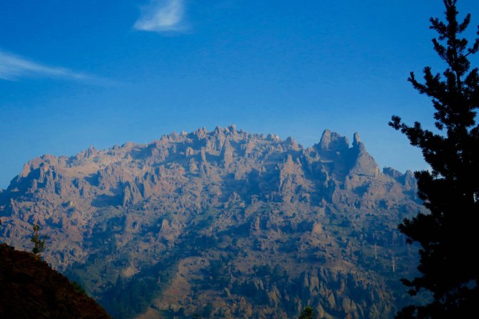
I was treated to more views of the Mokelumne Wilderness the next morning. It’s fun to think that I had been hiking through the area the previous day.
As I watched, the sun continued to rise, bathing the peaks in a soft glow.
I would have lingered, but Peggy expected me to be at Sonora Pass the next day, and I had miles to go. As I hiked up the early morning trail, I said goodbye to Noble Lake. Would I be back for my 80th birthday? (grin)
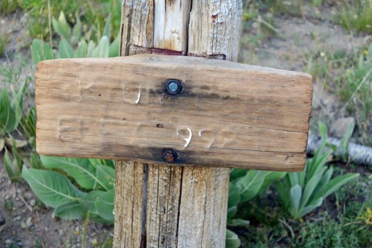
Up toward the pass, I was greeted by an old elevation sign. I think it told me I was at 9,980 something feet.
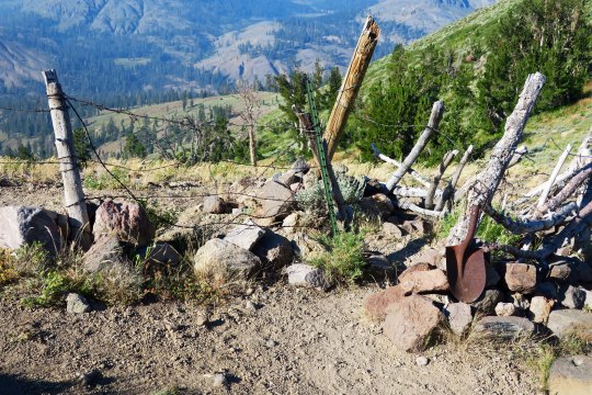
You know you are out West when you come to barbed wire fences. This provided a passage (sort of) that through-hikers could get through, but not cattle. The old shovel head spoke of earlier times.
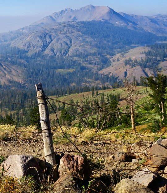
Looking through the wire, I could see my next destination, the Carson Iceberg Wilderness.
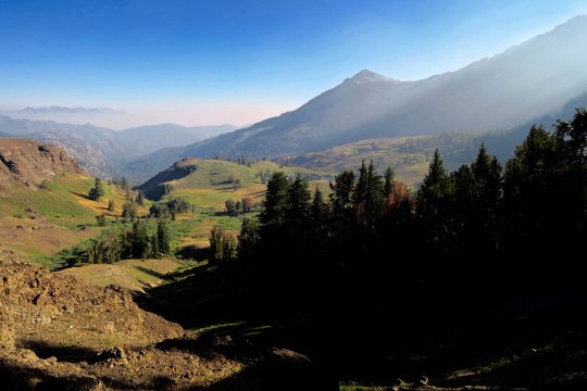
I’ll conclude today’s post with this view. It suggested another smoky day. Within 48 hours, the trail would be closed due to fire.
NEXT POSTS: Time’s limited since I am preparing for the San Francisco Writers’ Conference. I have one more post on this section of the PCT and then Peggy has two posts on her experiences as ‘trail angel.’ I think I will hold on these three posts until after the conference. In the meantime, I will put up some Burning Man eye candy since Peggy and I are hoping to go this year, assuming we can get tickets.
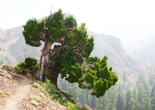
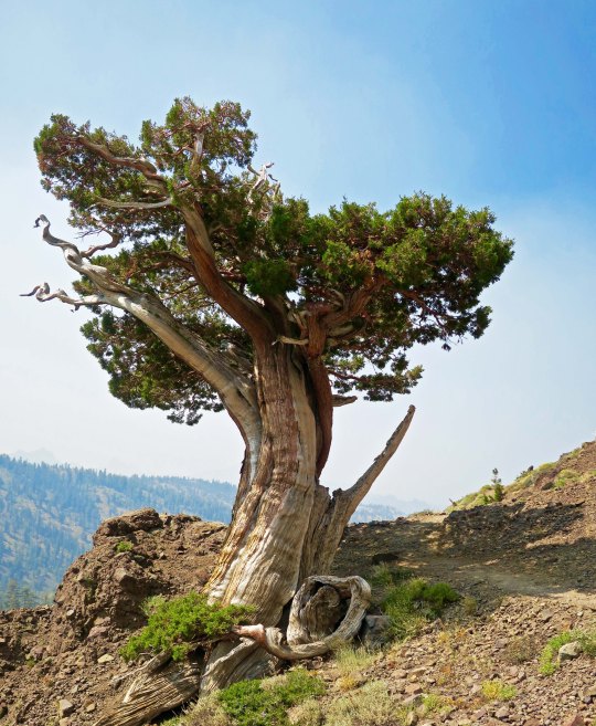
Another beautiful juniper along the PCT, this one just south of Ebbetts Pass. I was climbing up a very steep trail to Noble Lake. Check out the smoke. Excuse me while I go cough.
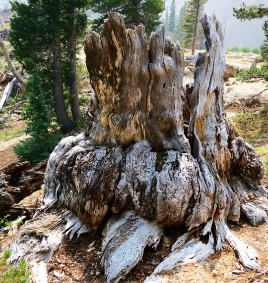
I left you in the last post about my hike down the PCT with photos of spectacular rocks and impressive trees. I say goodbye to the Mokelumne Wilderness in this post, hike across Highway 4 at Ebbetts Pass, and continue my journey southward. Of course there will be more pretty trees, but roots, snags, flowers, a family from Taiwan and through-hikers are the main subject for photos today.
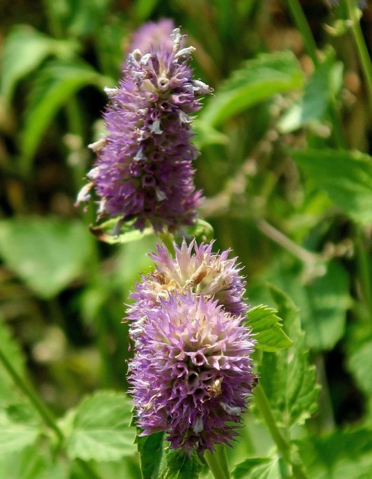
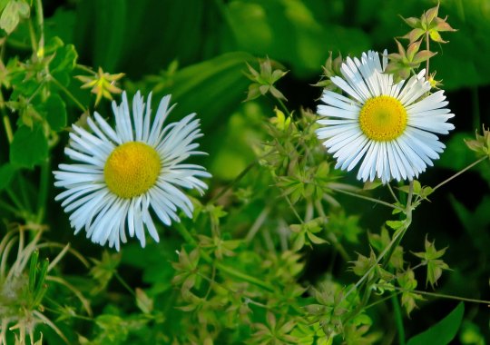
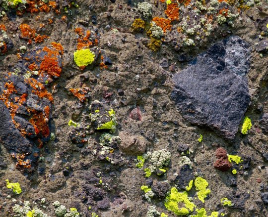
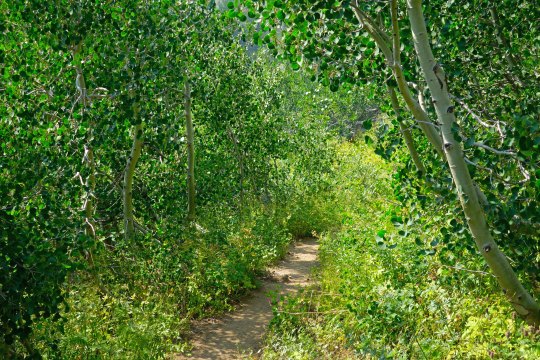
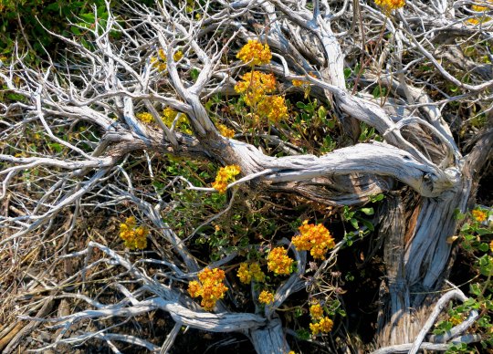
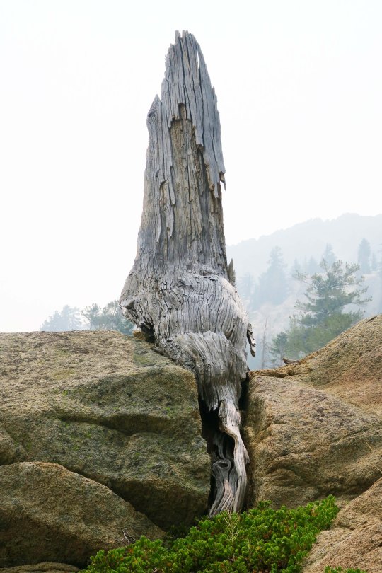
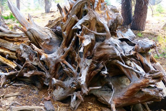
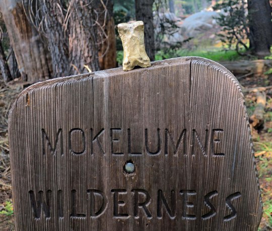
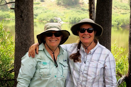
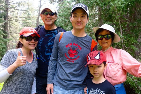
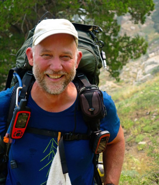
Have any aches and pains? Some people swear by this plant, self-heal, as being good for what ails you. I came across a list claiming it is good for ulcers, wounds, sore throats, hemorrhoids, high blood pressure, burns, insect bites, herpes and cancer. Woohoo. You might want to check with your doctor first. (grin)You’ve already met this fellow, flea bane, with its obvious name. Orange and yellow lichen— where algae and fungi co-habitate in a symbiotic relationship. An inviting green trail through aspen.A snag and dead flowers combine in a floral arrangement.This fellow was fun. I’ve never seen a snag sitting down with its tail hanging out behind. I was worried it might follow me home. How would I explain that to Peggy?Twisted roots!Stump with personality.Bone decided to get into the act when I left the Mokelumne Wilderness.These two sisters, Denise and Deborah were only doing part of the trail. Since we were hiking in the same direction, we kept crossing paths, so to speak. They were both carrying tents and explained to me, “We grew up having to share a room. That was enough.” They wrote me later saying that their hike was interrupted by the Sonora Pass fire. Mine too. I caught up with Wayne Chiang and his family along with their friend, Bass Chong, at Ebbetts Pass. They were out for a day hike. Wayne is a legislator with the Republic of Taiwan and has long term hopes of becoming Mayor of Taipei. Bass works at Ebay. This smiling fellow was from Germany and, I am sorry to say, I’ve misplaced his trail name. He wanted to take a photo of me to show friends and family back home that people of all ages hike the PCT. I was just glad that he didn’t say something like, “Really old people hike the PCT!” A final juniper photo for today.
NEXT POST: Adios, Puerto Vallarta… with a few spectacular sunsets.
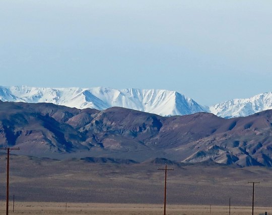
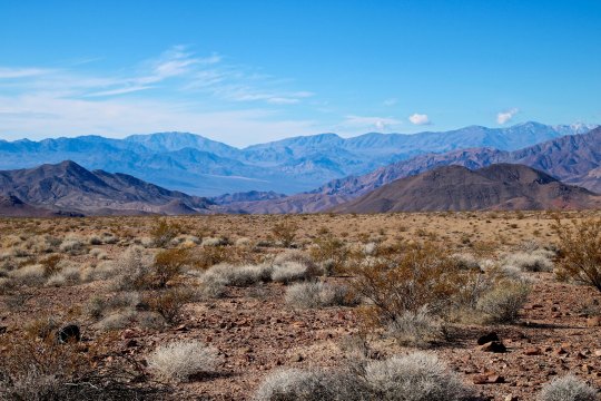
I have always liked the drive from Las Vegas north following Nevada’s Highway 95. One of many reasons is the great views it provides of the Sierra Nevada Mountains.
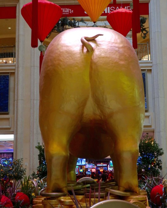
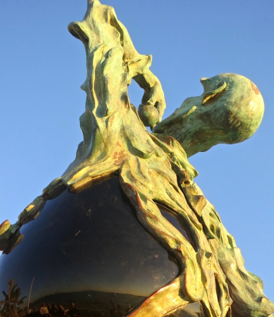
Usually when Peggy and I visit Las Vegas, I do a complete post on the Strip. Not this time. We went downtown to the Venetian Hotel and discovered that it was the Chinese Year of the Pig. The pig shared a room with a Burning Man sculpture that Peggy and I had admired on one of our many trips to the event.
Front of the pig.
Back of the pig.
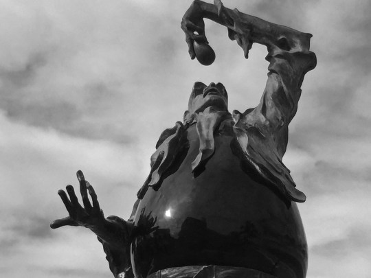
Burning Man sculpture.
Having done the Las Vegas thing, it was time to head home. We decided to travel on Nevada 95, which runs up the west side of the state from Las Vegas to Reno. Most people experience the trip as vacant desert to be driven through as fast as possible. We see it as filled with beauty and quirkiness. It is one of our favorite drives.
Vacant desert, right? Unless you know what to look for. A town was built out here in the 50s. It was populated with fake houses and fake cars and fake people and fake pets and then blown up with a real atomic bomb. People drove out 65 miles from Las Vegas to watch the explosion as entertainment. The government promised it was safe. There was even a Miss Atomic Bomb. On a previous trip, Peggy and I had tried to drive out to take photos, A man in black driving a black SUV and wearing dark glasses stopped us and made us leave. Otherwise, we might still be in jail. Possibly you saw the Indiana Jones movie where Jones survived the “town’s explosion” by hiding out in a refrigerator…
Miss Atomic Bomb 1957.
Not interested in atomic bombs? How about cat houses? Or brothels as you might know them. There are several along lonely Route 95. Prostitution is legal in Nevada. You can tell this is a classy place by the Greek column, right? Peggy and I were amused when we drove by the Shady Lady to discover it had been turned into a bed and breakfast. You know what my thought was: Staying there might make an interesting post. Tempting… (grin)
And then there is the Tonopah Station Hotel. It’s packed to the brim with quirkiness. Peggy and I always stay there. Meet James the bear.
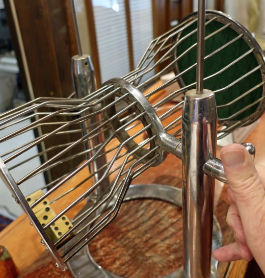
Where else can you roll the dice to get a free room? We have yet to succeed, however. Are the dice loaded? (A selfie of my hand.)
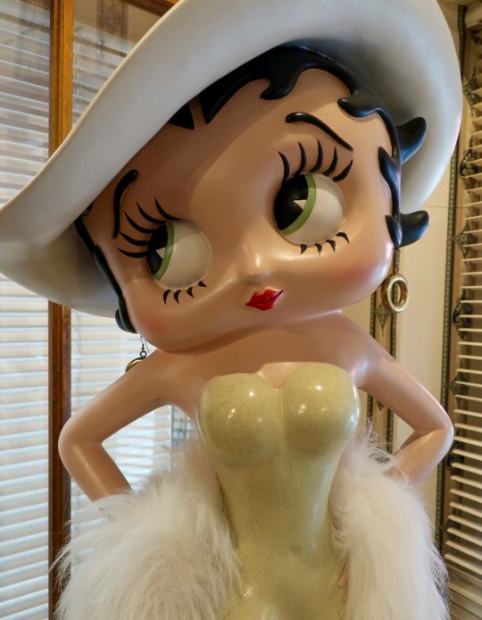
Probably not/ Betty Boop oversees the roll. She is looking away, however. Hmmmm.
A lamp post illuminates a British lion..
How’s this for a welcome sign?
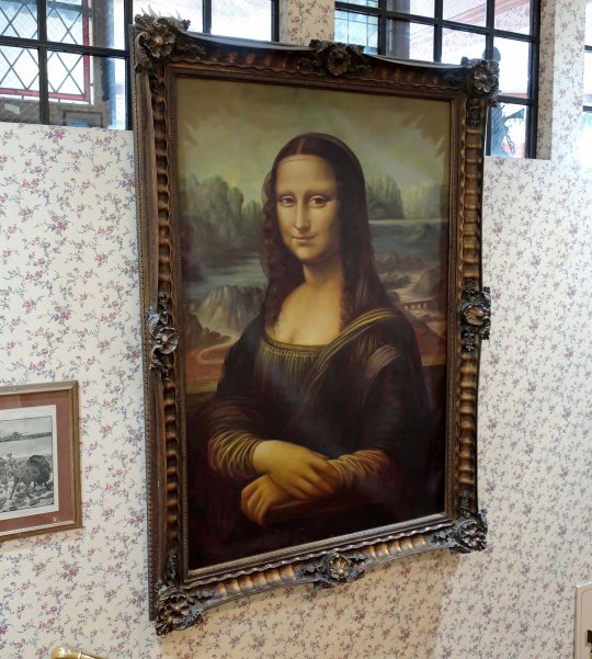
Mona Lisa guards a stairwell!
There is plenty of beauty along the way to augment the history and quirkiness.
Including some superb views of the Sierra Nevada Mountains that I kicked this post off with.
A more distant view.
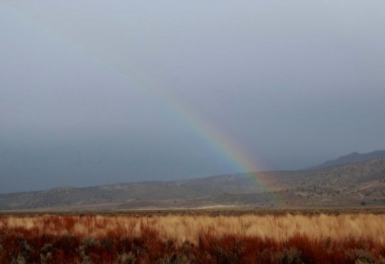
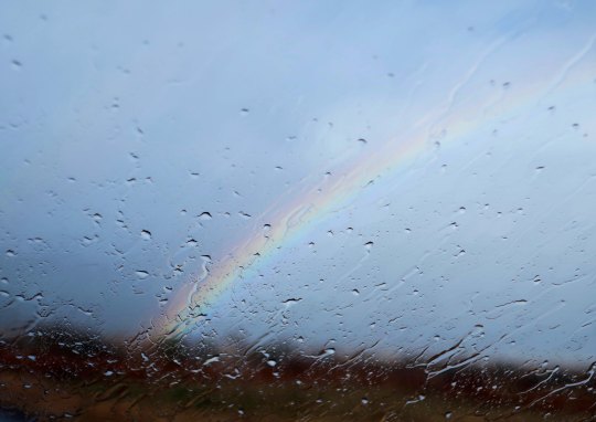
North of Reno on California 395 heading into Susanville, we picked up some weather including rain and high winds plus the sun breaking through and lighting everything up. I was driving and Peggy was in charge of photographs. She loves rainbows. I noticed afterwards that most of the photos contained one. (Photo by Peggy Mekemson.)
Another rainbow… (Photo by Peggy Mekemson.)
And another rainbow… (Photo by Peggy Mekemson.)
And finally, a wet windshield rainbow. (Photo by Peggy Mekemson.)
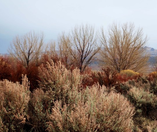
She did, at my urging, capture a shot of sagebrush being lit up by the sun. (Photo by Peggy Mekemson.)
North of Susanville we caught up with the snow, which was mainly rain. The heavier snow had fallen the previous week. It is hard for me to believe that a few months ago I was backpacking down the PCT not far from this location through 100 degree F weather with very little water!
NEXT POST: Speaking of the PCT, we will journey back to it in my next post.
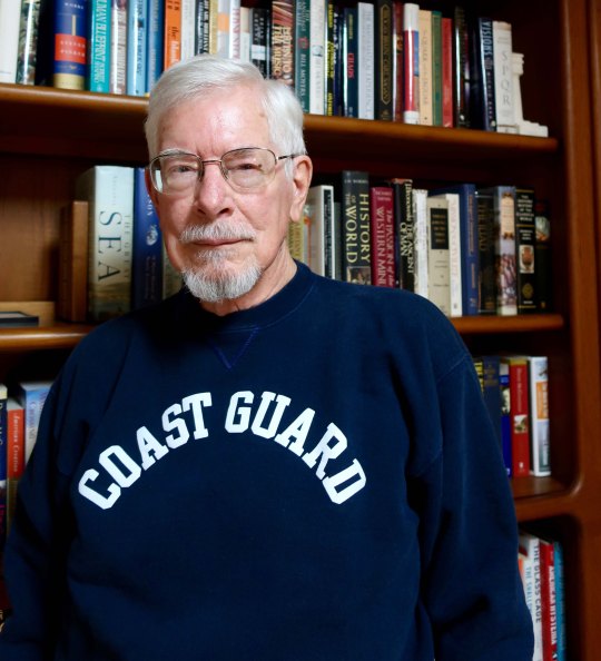
I’ve been wearing my Coast Guard sweatshirt over the past month honoring my son who is now going into another month without pay. This is a man who has risked his life for America both as a Marine helicopter pilot in Iraq and as a Coast Guard helicopter pilot saving lives and keeping dangerous drugs from entering America. Is this how we thank him and the thousands of other men and women who risk their lives daily to keep our shores safe? But there is more: Coast Guard members, FBI agents, and Homeland Security personnel are the backbone of protecting our nation within its borders. They are now effectively being limited in their jobs, seriously endangering America. It’s time to stop holding 800,000 American hostage. It’s time to end the government shutdown and let democracy work.
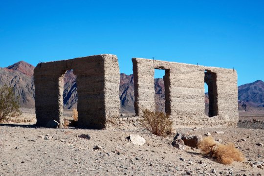
Old, abandoned towns of the West are given the name of ghost towns. While Ashford Mill hardly meets the requirements of being a town, I decided we could at least think of it as a ‘ghost mill.’
Abandoned mines litter Death Valley’s history. In my last post, I featured one of the most successful mines in the area, the Harmony Borax Works. It was so successful that the twenty-mule team responsible for hauling its ore across the desert served as a logo for the long running TV show, Death Valley Days. The show was hosted by none other than Ronald Reagan in the 1964/65 season when I was a student at Berkeley. It’s possible I even watched an episode or two while avoiding the baton-wielding police sent to campus by Edwin Meese, Oakland’s District Attorney at the time— and Reagan’s future Attorney General.
Mercury, talc, gold, silver, sodium chloride, Epson salts, tungsten, and copper were some of the other minerals that miners pursued with visions of wealth dancing in their heads. Few were successful. Some 2000 mine ruins were left behind as their legacy. Ashford Mill is one such ruin. It was built by the Ashford brothers to process ore from their Golden Treasure Mine located 5 miles to the east in the Armargosa Range. The brothers alternated working the mine and leasing it out to various companies for over 30 years until they finally gave up in the early 40s. A lot of money, work and heartache was devoted to the effort, but the ‘golden treasure’ was not to be found. Today, all that remains of the mill are the cement walls of what was the office and a few remnants.
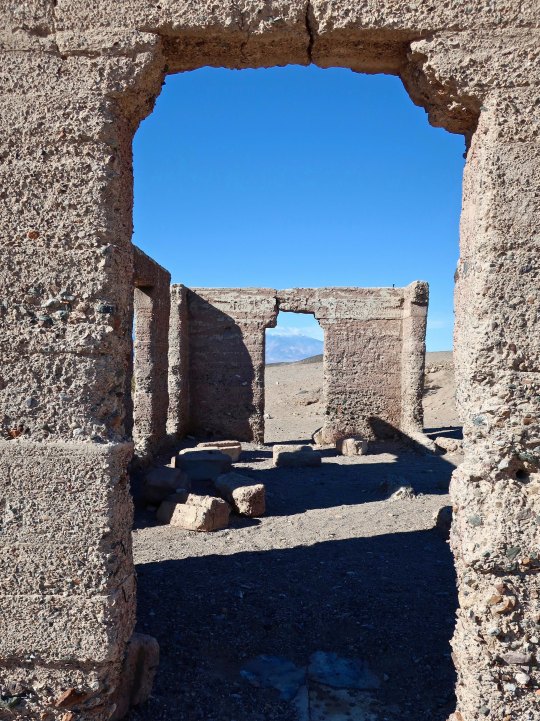
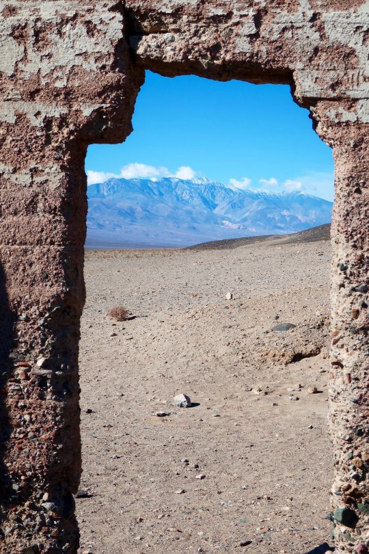
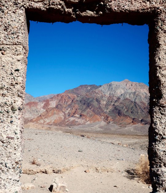
A view of the office as it now looks. I decided in would be fun to photograph the surrounding desert using the various openings as frames.
Looking out toward the Panamint Range.
The Golden Treasure Mine is located up in the mountains.
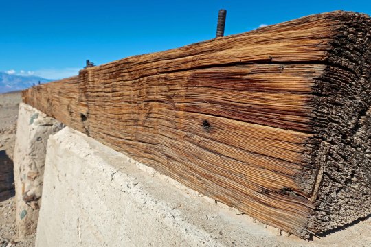
While there was little left of the old mill, I found this timber beam rather impressive.
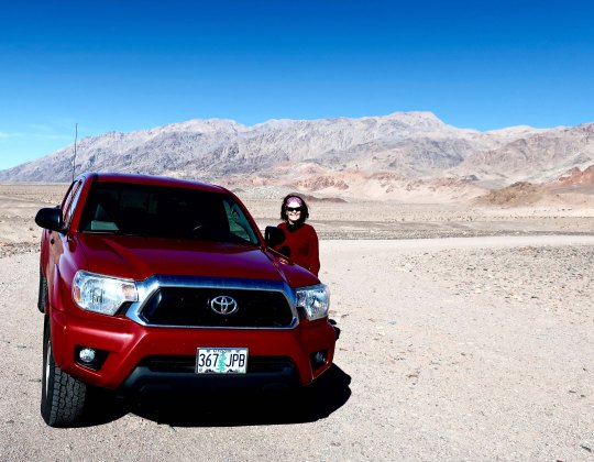
Here’s Peggy looking cool in her shades while standing next to our red Toyota Tacoma. The Amargosa Range is in the background.
For all of our trips into Death Valley over the years, Peggy and I have never entered from the south end of the park. We remedied that this time by heading over to Pahrump from Las Vegas following Highway 160 and then cutting over to the remote town of Shoshone on 178 and on into Death Valley. Following are some of the photos that Peggy and I took illustrating this route.
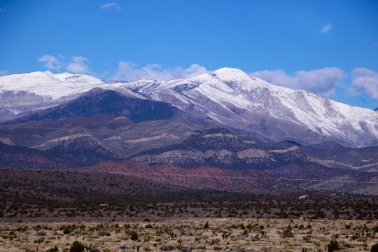
Looking east from the southern entrance to Death Valley, Mt. Charleston dominates the view. A ski area for Las Vegas is located up in the mountains. (Photo by Peggy Mekemson.)
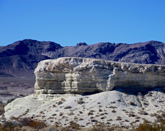
The road worked its way around this rock. (Photo by Peggy Mekemson.)
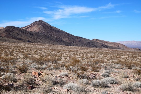
Climbing up toward the pass into Death Valley provided views like this. (Photo by Peggy Mekemson.)
And this.
Once over the top we began to make our way down into Death Valley.
The Panamint Range can be seen stretching across the horizon. (Photo by Peggy Mekemson.)
I liked the contrast here.
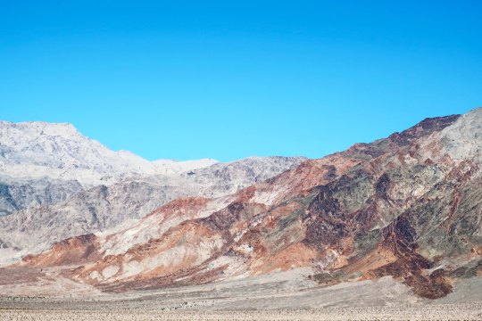
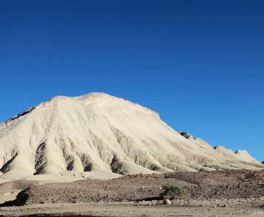
Rocks made up of different minerals and laid down under differing geological conditions provide the color for which Death Valley is famous. (Photo by Peggy Mekemson.)
Check out this mountain as an example.
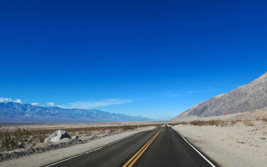
I’ll wrap up our trip into Death Valley with this photo that demonstrates just how flat things can get. I loved the perspective of the road disappearing into the distance. It seems like everything was converging.
NEXT POST: A bit of Las Vegas and the road north to Reno.
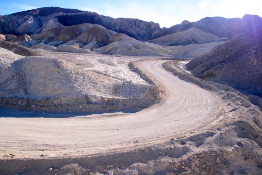
Our Toyota Tacoma pickup makes its way down a road that was once traveled by 20 mule teams hauling borax.
The red hood of our truck reflects a desert scene from the Twenty Mule Team Canyon in Death Valley. The short 2 1/2 mile side trip is one of our favorites in the National Park. Imagine, if you will, driving an 18 mule/2horse team hauling 10 tons of borax over 160 miles of desert. The total weight including wagons was 36 tons and the livestock and wagons stretched for over 180 feet! I asked my 278 horse power truck if it would like to pull such a load through Death Valley. The answer was a resounding no. Having struggled with hauling only myself and gear over the hills and mountains of the Park on my bicycle during my 10,000 mile bike trek, I heartily agreed.
This photo of the road suggests your team would be going right, then left, and then right— all at the same time. (Photo by Peggy Mekemson.)
This early, unattributed photo in the public domain, provides a view of the team with its Death Valley backdrop.
The real treat in driving over the short distance is the almost unreal beauty. Peggy and I stopped the truck several times along the road to get out and take photos. I’ve posted before on the canyon but we took all of these photos on Sunday.
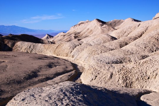
The golden rock working its way up the hill from left to right caught my attention.
Peggy captured this ridge, which is one of the dominant features of the drive. Two people, not shown here, were making their way along the top. (Photo by Peggy Mekemson.)
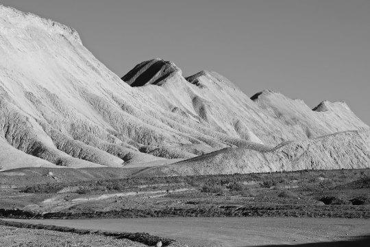
I took a similar photo and rendered it in black and white.
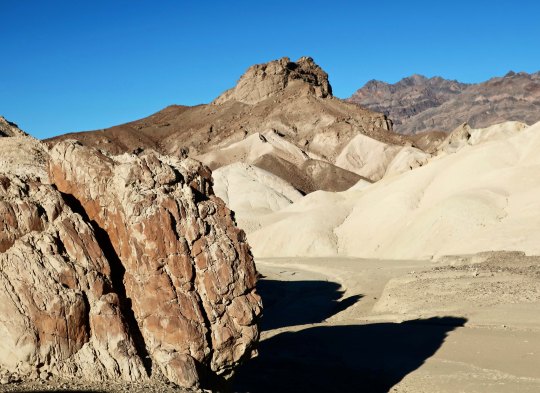
This hill, which seems to stand alone, was actually the start of the ridge.
Erosion creates very interesting rock structures in the canyon and throughout Death Valley.This photo provides another example.Various colors reflect different types of rock laid down over millions of years through times when the area was covered by oceans, lakes, sand dunes and volcanos. (Photo by Peggy Mekemson.)I took a closer look at the sensuous landscape..Three different types of rock are quite clear here. I should note that different rocks have different hardness and erode at different rates, which also adds to the interest of desert landscapes.(Photo by Peggy Mekemson.)A view looking out toward Death Valley.Almost out, I’ll conclude with this rock and a peak rising in the background.
NEXT POST: I’ll conclude our journey through Death Valley National Park.
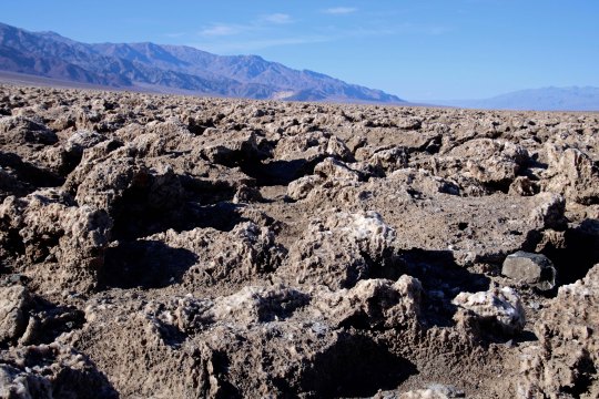
The sun beats down on the Devil’s Golf Course in Death Valley.
“Only the Devil could play golf here.” 1934 National Park guide book.
Peggy and I are playing hooky, extending our seemingly endless time away from home. One would think that backpacking the PCT, visiting Puerto Vallarta, and spending over a month with our kids in Florida and North Carolina would satisfy our wandering needs for a while. But no, here we are in Las Vegas, or Lost Wages, as I like to call it, ensconced in a comfortable suite at the very southern tip of Las Vegas Boulevard, the infamous Strip. Or is that famous?
Few people who visit this city venture outside of its mecca of gambling and entertainment pleasure palaces. Peggy and I always do. There is much to see and do. There is a desert on its doorstep, and it is a desert of rare beauty. Death Valley National Park is a prime example. It is a mere two hours away and Peggy and I drove out there on Sunday. To us, it’s like seeing an old friend; we have been there many times.
It is a geologist’s dream— there are rocks everywhere, and the rocks all have stories to tell. It’s a story of ancient seas and lakes and volcanic activities and clashing, mountain-building plates. Death Valley is a rift valley, or a graben in technical terms, formed along a fault zone between two mountain ranges. As the mountains were thrust up by tectonic forces, the valley dropped between them, several thousand feet. The two mountain ranges have since filled the valley up with eroded debris.
The shallow Lake Manly filled the basin a few thousand years ago. As the climate of the area changed and became more desert like, the lake dried up. Its briny waters left a deep deposit of salt behind, which brings us to today’s post. The Devil’s Golf Course is located a short 10 miles away from Bad Water Basin, which, at 282 feet below sea level, is the lowest point on the North American continent. Water that drains into the Basin melts the salt and becomes undrinkable, thus the name. The Devil’s Golf Course is several feet higher and avoids the melting water. Instead, capillary action pulls salty subsurface water up creating the crystalline structures that the area is famous for.
Peggy and I caught the area at a particularly good time for photography, which surprised me, given the location of the overhead sun. Anyway, here are the results.
This close up provides a view of the crystalline structures developed by the capillary action. BTW, they are composed of 95% table salt. (Photo by Peggy Mekemson.)
I took this photo looking east toward the Amargosa Range.
Looking southwest along the Panamint Range.
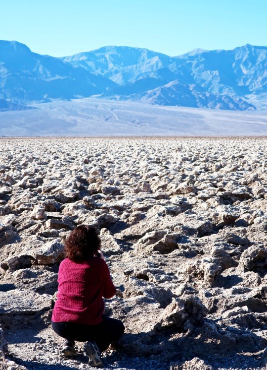
Peggy photographing the Devil’s Golf Course provides a perspective on the size of the crystalline structures.
A final shot of the Devil’s Golf Course backed up by the Panamint Range. (Photo by Peggy Mekemson.)
NEXT POST: A ghostly reminder of Death Valley’s past, and more.
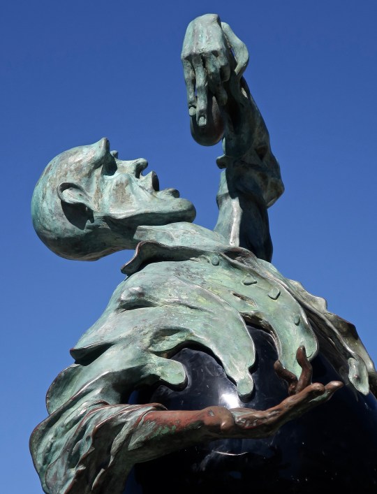
Walking down Puerto Vallarta’s Malecon is always interesting. The Subtle Rock Eater is one of the reasons. I think he might just as well be named The ‘not so’ Subtle Rock Eater or possibly Mr. Eggplant Man.
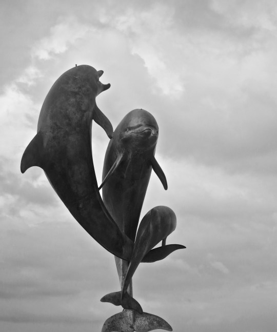
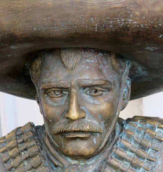
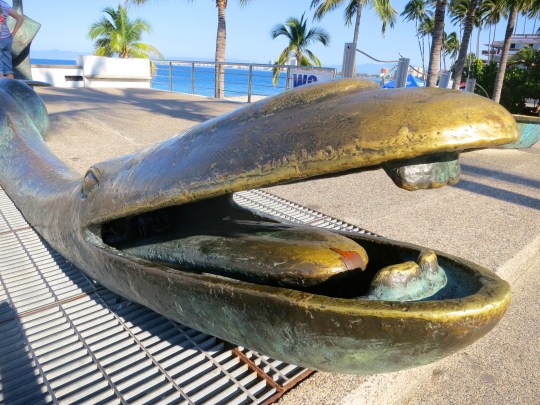
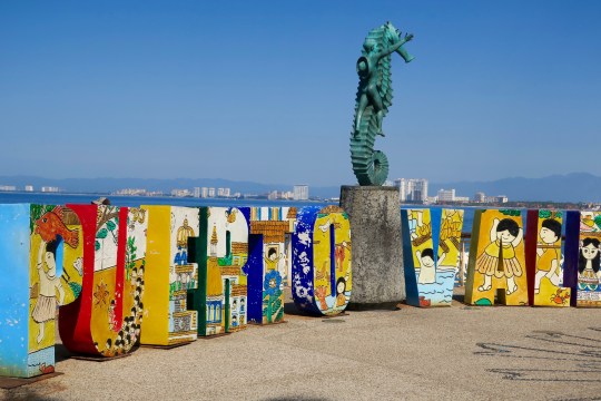
It’s time to return to Puerto Vallarta’s Malecon. In my last post about the seaside walk, I introduced you to some very strange creatures. There are more of the same today plus some graceful dancers, playful porpoises, a ferocious bandido, a unicorn of sorts, and PV’s iconic seahorse.
Looks like an eggplant to me.Chomping on rocks under cloudy skies.And Senor Rock Eater looking just a bit scary.
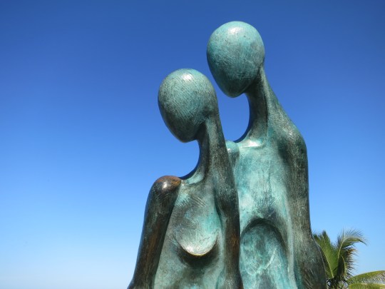
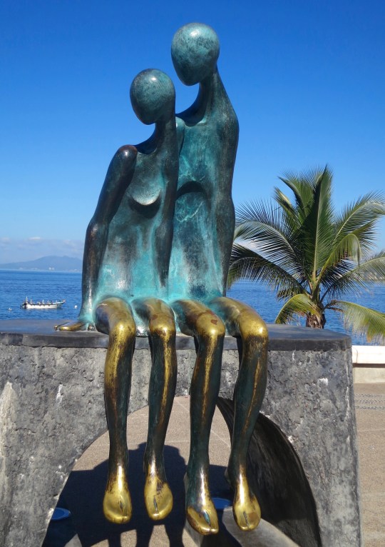
Love was in the air with this couple as they looked out to sea, or at least down the Malecon.
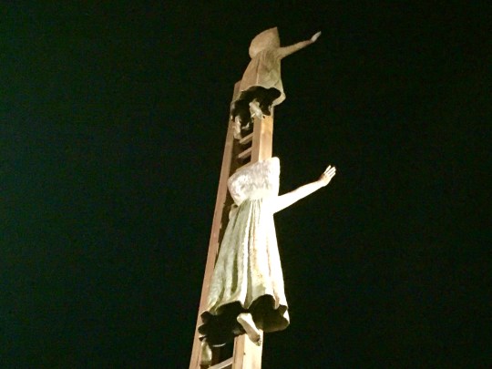
This piece is titled Nostalgia.Another perspective. This one provides a view of the Malecon.And a front view with the Bay of Banderas forming a backdrop.Graceful Vallarta dancers under swirling clouds.And the twirling dancers up close.The Friendship Fountain reflects the relationship between Puerto Vallarta and its sister city, Santa Barbara, California.Another perspective.And in black and white.Pancho VillaThis ‘whale’ included in the Origins and Destination sculpture had a toothy grin. Given its location, I wonder if it is saying “Make Mexico Grate Again.” 🙂Our toothy friend had an interesting look as he swam forward to grate-ness.Its companion had a strange look as well. Is our destination to become some kind of combination of animal and machine? If so, I wouldn’t mind flying.What if you saw your children climbing a ladder and disappearing into the darkness?Would this be your reaction?The Millenia sculpture is located at the top of the Malecon. Reaching toward the future. Evolving.Closer look.Touching a unicorn is supposed to bring you good luck. But I suspect that you already knew that.No trip down the Malecon would be complete without a visit to Puerto Vallarta’s iconic Boy on a Seahorse.Today he is centered in a colorful Puerto Vallarta sign for the many thousands of annual photos taken by tourists.A final view from the Malecon for this post. My next PV post will feature postcard pretty sunsets from the city as we say goodbye to Puerto Vallarta.
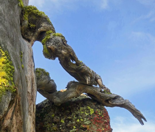
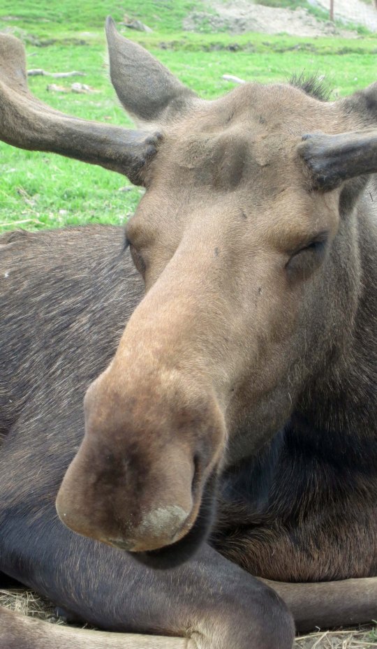
I didn’t spot the tusks on this tree limb until I checked out my photos. There’s no doubt which is the dominant creature here! Or maybe they are just snuggling.
Peggy and I had lunch yesterday with Barbara and Carl, the couple that dropped us off at Mt. Ashland for the beginning of our trek south down the PCT. It was the first time I had seen them since the beginning of the adventure. There was a lot to tell.
Naturally, I talked about both the challenges and the rewards of backpacking for 700 miles over difficult terrain at 75. I also discussed how 50 years of backpacking had prepared me for the trip, and threw in a few of my more humorous adventures from those years. They will be in my book.
“Knowing what you know now, would you do the PCT hike again?” Carl asked.
“Absolutely,” I replied. This doesn’t mean I will forget just how hard it was. It’s an important part of the story. But the beauty and the nature of the adventure are what will stick in my mind. I once had a woman who had been on one of my hundred mile treks tell me it was one of the most difficult tasks she had ever undertaken. But in the end, she said, it was an incredible, life-changing experience. The pain faded; the experience remained. “The only thing I can equate it with, Curt,” she had related, “was having my first baby.” Ouch, and then ‘Oh my!’
For the first 25 years or so of my backpacking, I hadn’t carried a camera. Those were the days before you could expect to obtain quality photos from a small camera, and I didn’t want to add the extra weight to the 60 pounds I was already carrying. I was also reluctant to spend the time that good photography required. And often I was leading groups that demanded my full attention.
I am sorry now. “I can’t believe you go to all of these beautiful places and don’t carry a camera,” my father had told me time and time again. He was right. I wish I had those photos now to remind me of where I had been and what I had seen. But there is more. Photography helps you see the world in different ways. It encourages you to focus in on details you might miss, it helps you notice the differences that light and varying perspectives make, and it forces you to stop and look around.
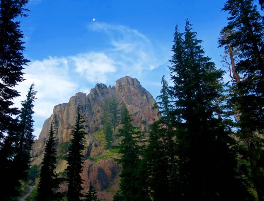
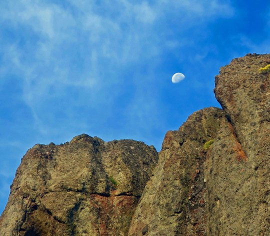
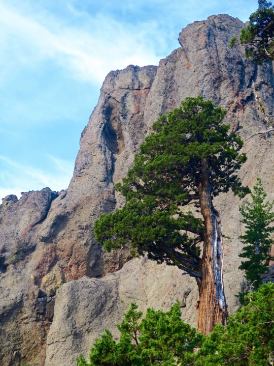
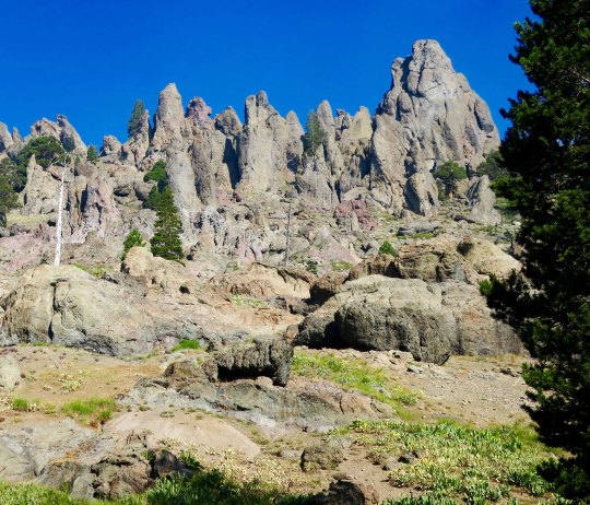
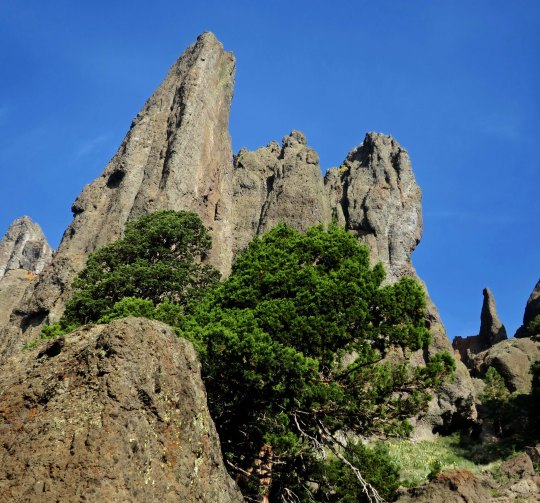
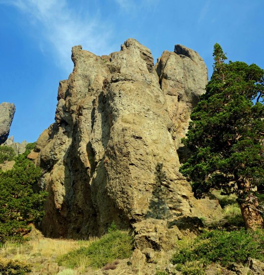
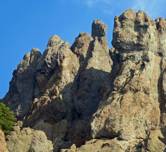
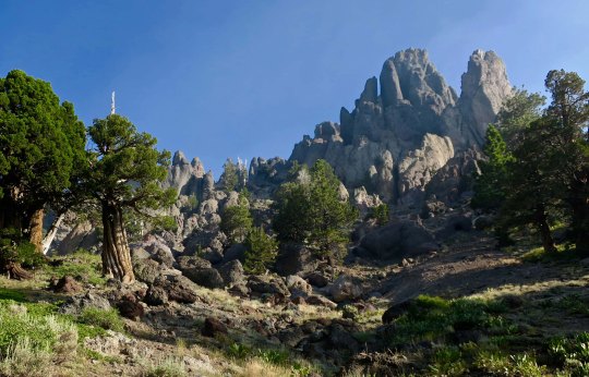
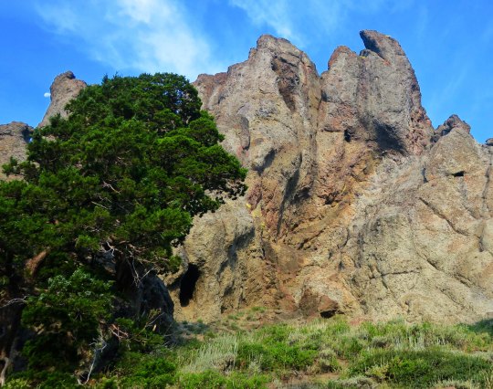
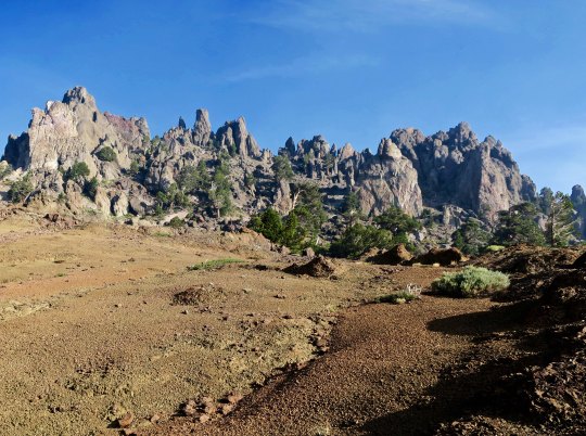
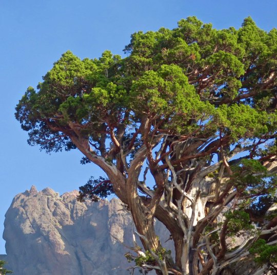
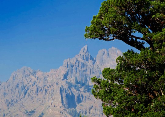
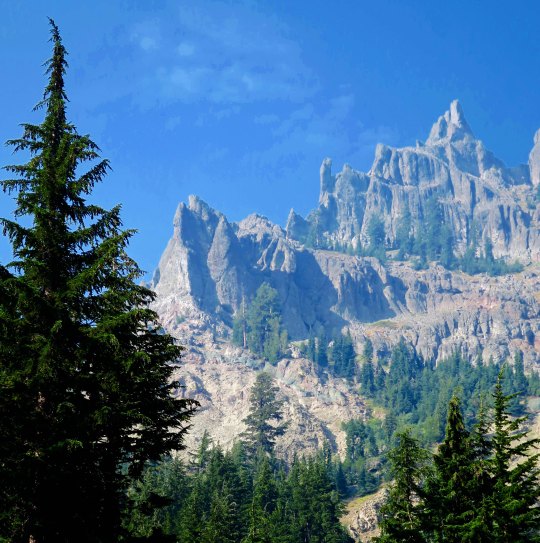
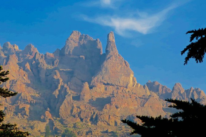
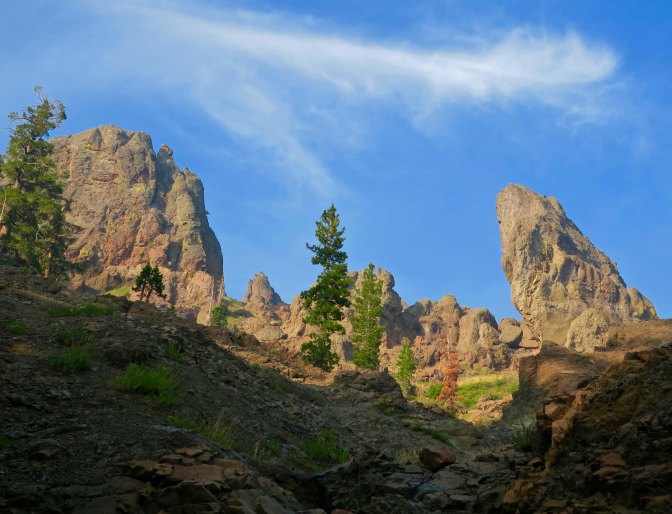
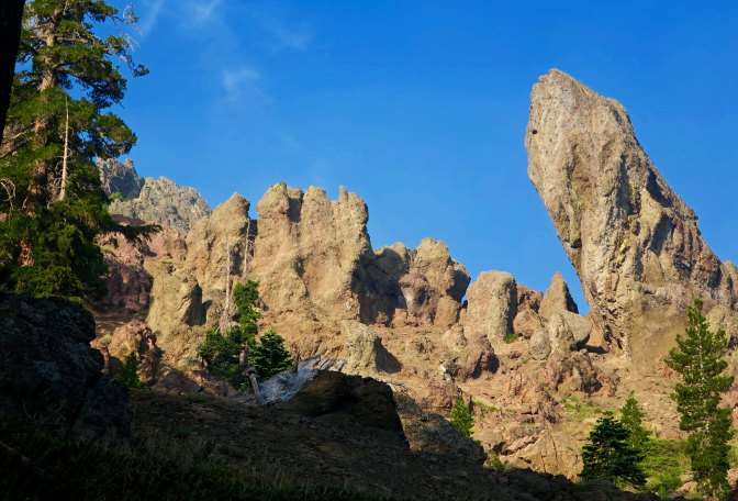
Today’s photos pick up where my last post left off, hiking down the PCT from Carson Pass on Highway 88 to Ebbetts Pass on Highway 4. The first four illustrate the value of stopping and looking around. They are all of the same scene from different perspectives.
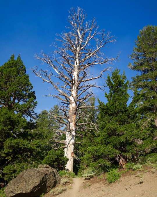
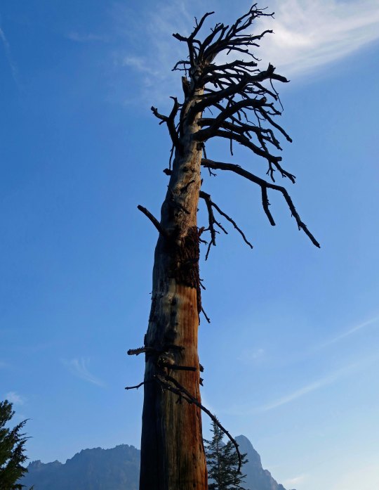
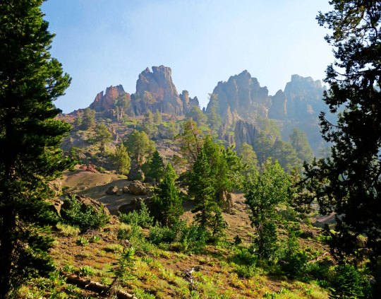
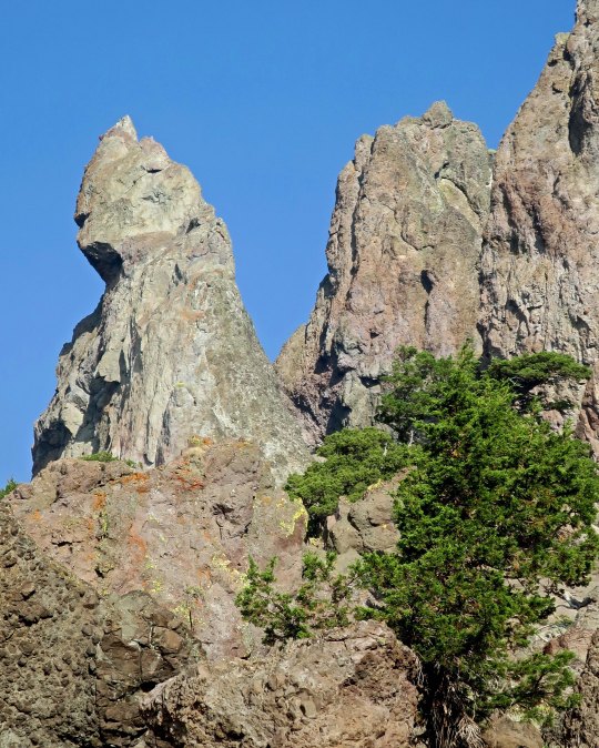
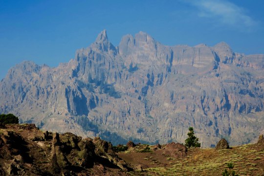
Once again, there were towering cliffs to admire. These were framed by hemlocks.A closer look showed junipers growing beneath the cliffs. A tiny moon appears in the upper left. And my telephoto brought the moon into perspective with the cliffs.While another photo featured one of the junipers standing tall against the cliff.One of the magical things about following a trail is that you never know what you will see next. It’s a thought that forever pulls me on. The PCT made its way around a large snag here and disappeared into the woods. I was assured that the views would just keep coming. The smoke did more than hassle my lungs; it also provided some interesting photos as it filtered the sun. This juniper is an example.And another smoke filtered scene.As might be expected from my last post on the PCT through the Mokelumne Wilderness, there was no end to magnificent rocks.Rounding a bend I came on a new view with a juniper, rock and open area leading to a distant peak.This perspective had the intensity of surrealism. I could see Dali carefully painting the rocks in the foreground and adding a melting clock.The contrast between a juniper and rock guaranteed that my camera came out.And then I was treated to my first view of Mt. Reynolds.Wow!I’ll conclude today with this view. I loved the contrast.
NEXT POST: Variety, being the spice of life, it’s back to Mexico.
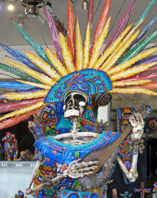
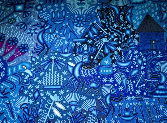
The shaman is a central figure in the Huichol culture. Capable of traveling between worlds with the aid of peyote, he brings important messages back to the members of his tribe.
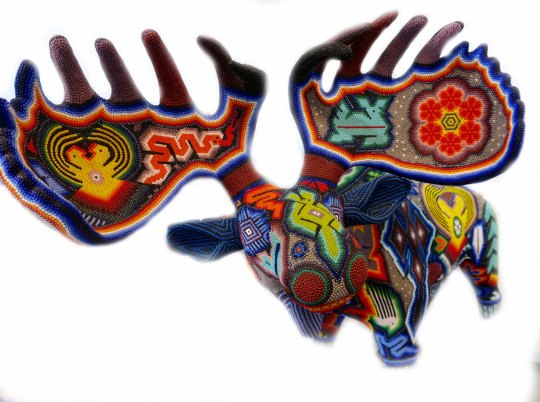
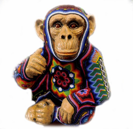
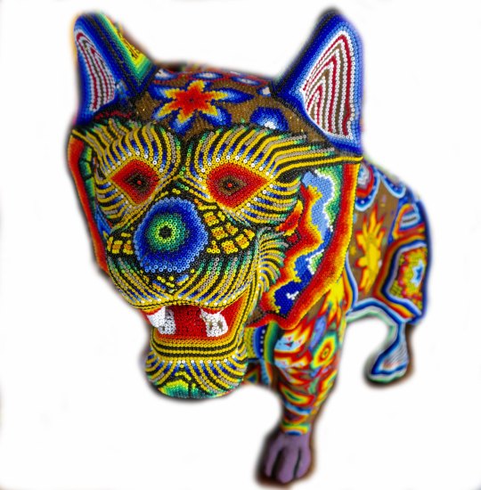
Since Peggy and I first came to Puerto Vallarta years ago I have been fascinated with Huichol art and the Huichol people. Living in the Sierra Madre Mountains of the Occidental range, they have been able to combine their belief in numerous gods with art that is highly popular among tourists. For example, it’s unlikely that many Huichol have ever seen a moose, but when Peggy and I were going through shops along the Malecon, we came across this beauty featured below.
The moose is for the tourists, the designs found on the moose’s antlers and body reflect the Huichol gods. (This artwork was crammed in among hundreds of pieces so I used Photoshop to white out everything except the piece.)A moose that Peggy and I found in Alaska.
The design on the right side of the Huichol antler is peyote, which is central to the Huichol religion. Each year, the members of the tribe undertake a 300 mile journey (usually on foot) to their sacred homeland to gather a year’s supply of the potent drug. The gatherer is expected to take a bite of the first plant he or she encounters. Maybe as a result, one of them saw a moose like the one I featured above. (grin)
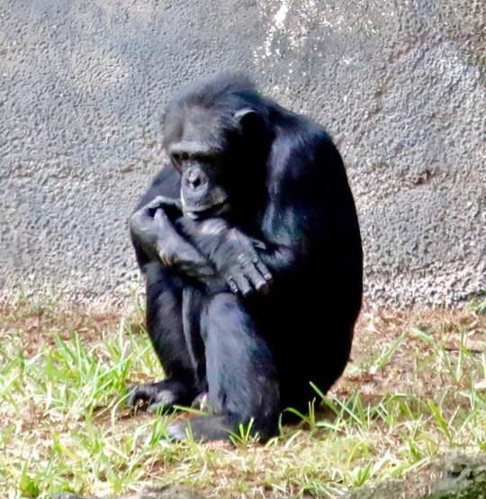
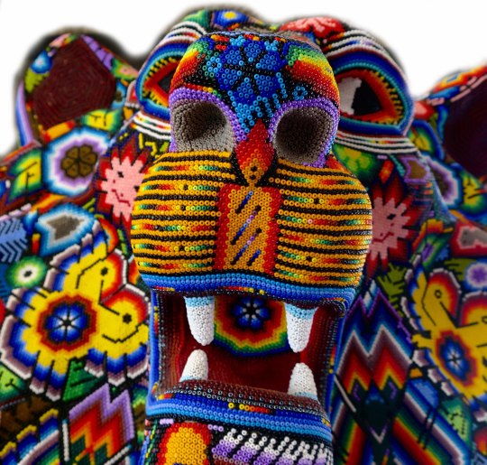
Another example of an animal unlikely to be encountered by the Huichol. It looks a lot like the fellow I encountered at Busch Gardens.
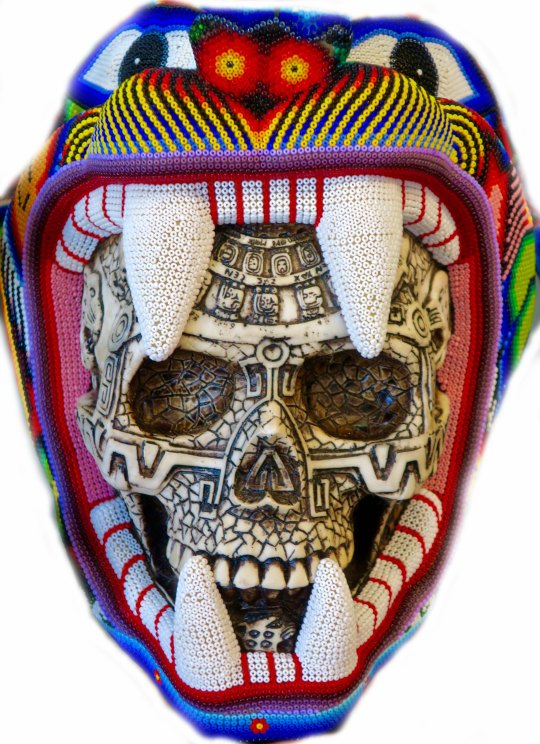
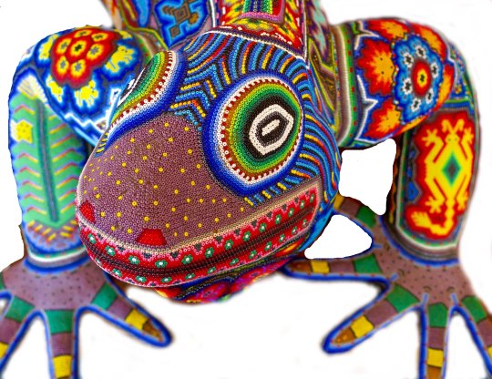
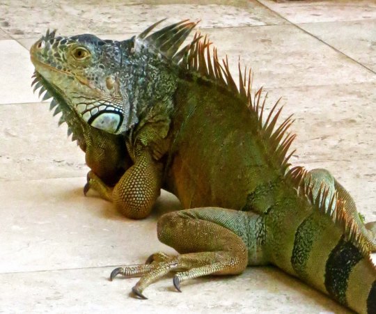
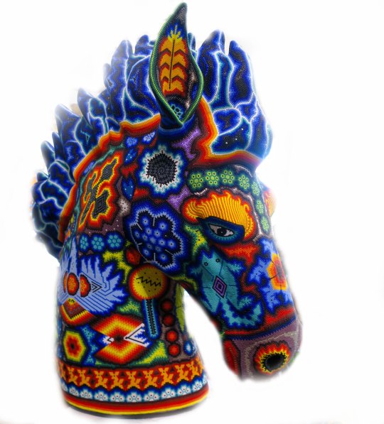
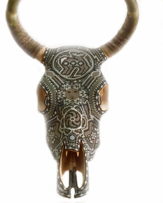
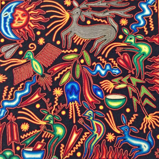
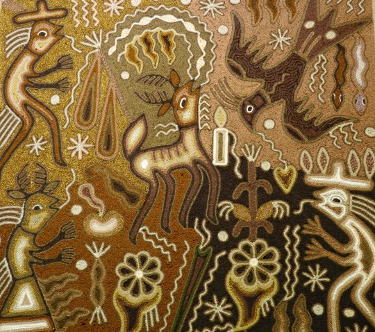
The Huichol are quite familiar with the iguana…One of the iguanas we photographed in Puerto Vallarta..I am just as glad we didn’t encounter a jaguar. They still roam the mountains surrounding Puerto Vallarta.The horse continues to be an important form of transportation for the Huichol, but with the coming of roads, trucks are becoming more common.Cattle are raised by the Huichol. Here they have covered a skull with their beadwork.Not quite sure what this animal is, I thought it was more dog-like than cat-like.I am thinking a bit of acid-rock here, although peyote would probably work. String paintings reflecting the gods are also quite popular among the Huichol.A brown painting…And a blue painting to wrap up today’s post.
NEXT POST: I’ll be back to featuring rock sculptures found on the PCT in Mokelumne Wilderness.
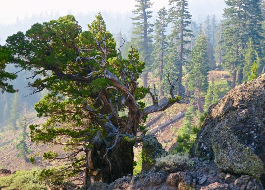
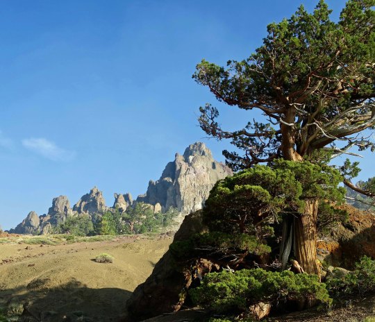
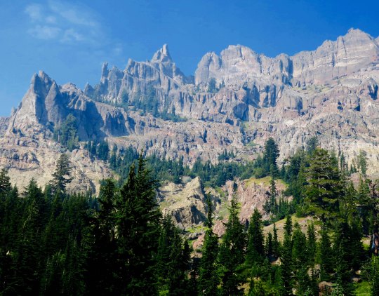
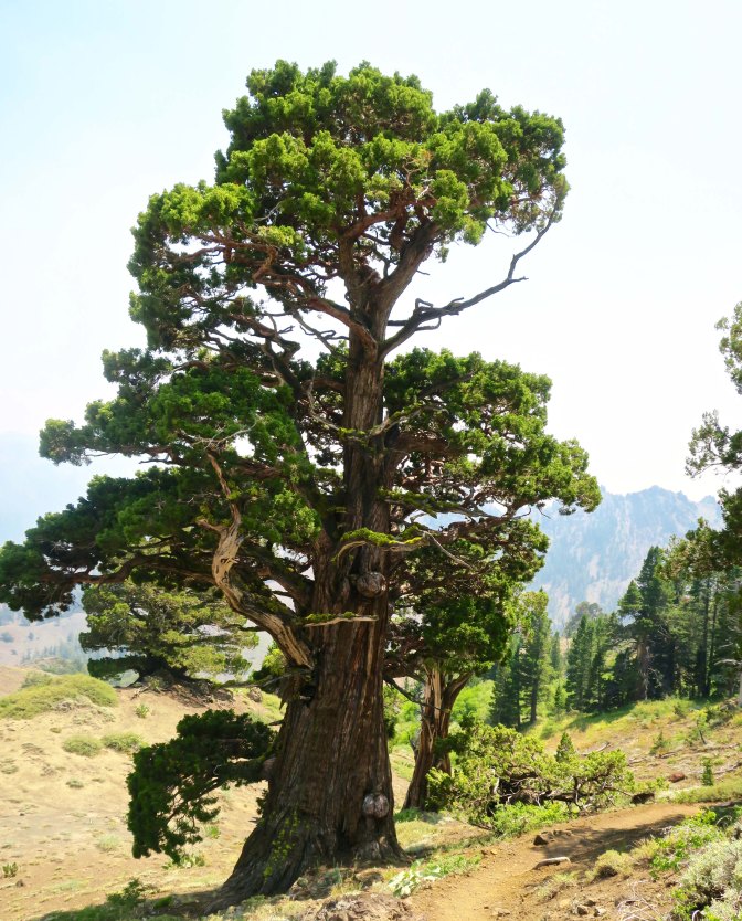
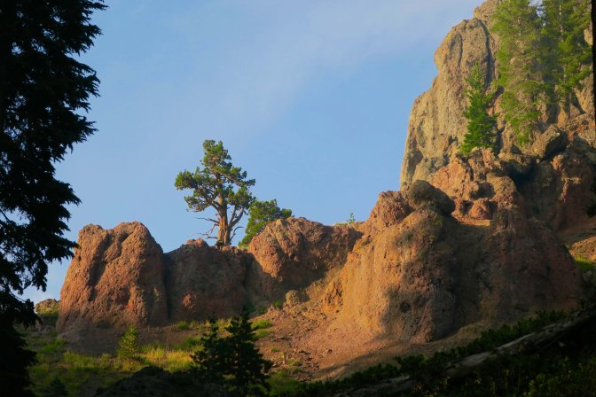
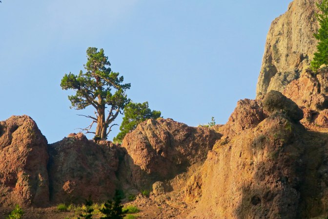
There is no hurrying through land like this. The combination of junipers and rock sculptures called to both me and my camera.
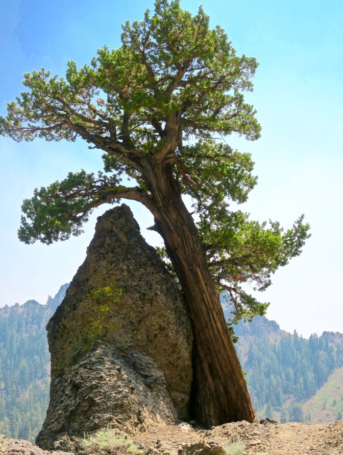
I was surprised by the sheer beauty along the PCT south of Carson Pass. I had hiked through the region several times over the years, but my trail had always been slightly to the west. Somehow I had missed the incredible rock sculptures. That, and the junipers. If you have ever wandered the West, you are familiar with this gnarly, photogenic tree. Most of todays photos were taken near Pennsylvania Creek in the Mokelumne Wilderness, maybe 15 miles north of State Highway 4 and Ebbetts Pass. I’ll let the photos speak for the area.
Hiking down into Pennsylvania Creek, I found this juniper.And then this one, wedded to a rock.That night, I camped on the south side of Pennsylvania Creek. This was the view !Later, at sunset, the whole ridge.The next morning, smoky skies and the sun provided a red cast to the view.Farther along, I was treated to this view.Near the crest of the canyon, I found the juniper tree and rocks I featured at the top pf the post.The view included this leaning rock, which could be seen just behind the juniper.Another perspective.I considered this a real treat. And photographed it several times. This is it for today. But I’ll have several more views of the rock sculptures on my next PCT post.
NEXT POST: Back to Puerto Vallarta. P.S. I will be playing with various themes over the next few weeks, so don’t be surprised by the changing looks of my blog. ALSO: For those of you who haven’t read “The Bush Devil Ate Sam,” I will be posting a chapter once a month on the top ‘pages’ to give you a feel for the book and encourage you to buy it. Many thanks! This chapter reflects our first night in our Gbarnga home, appropriately titled: Armies of the Night!