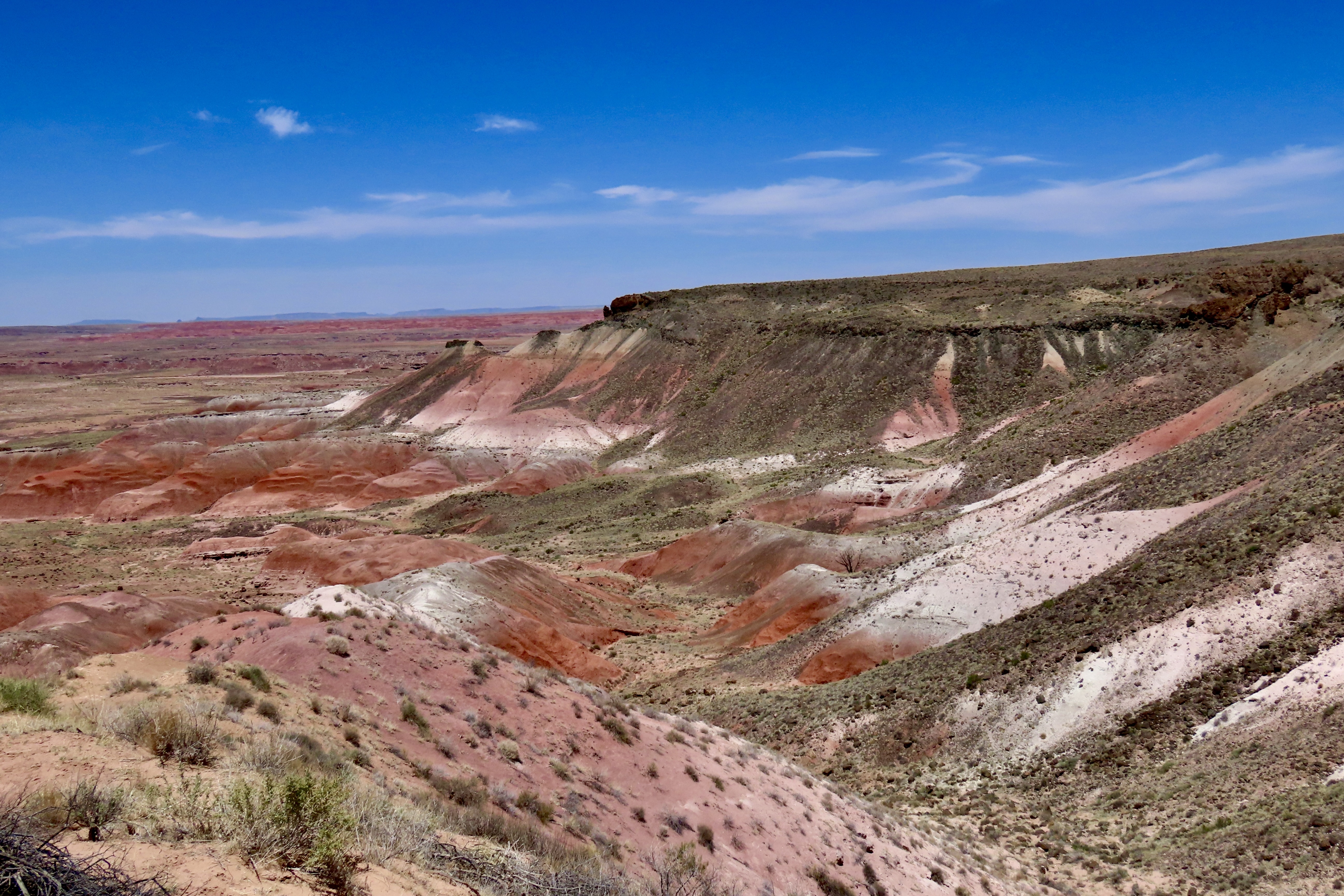
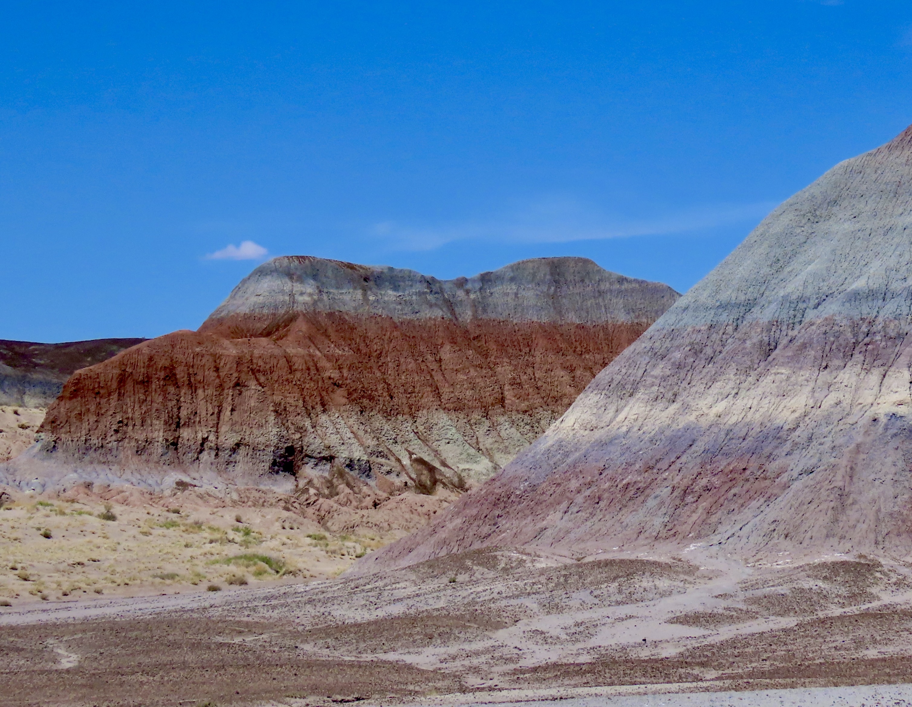
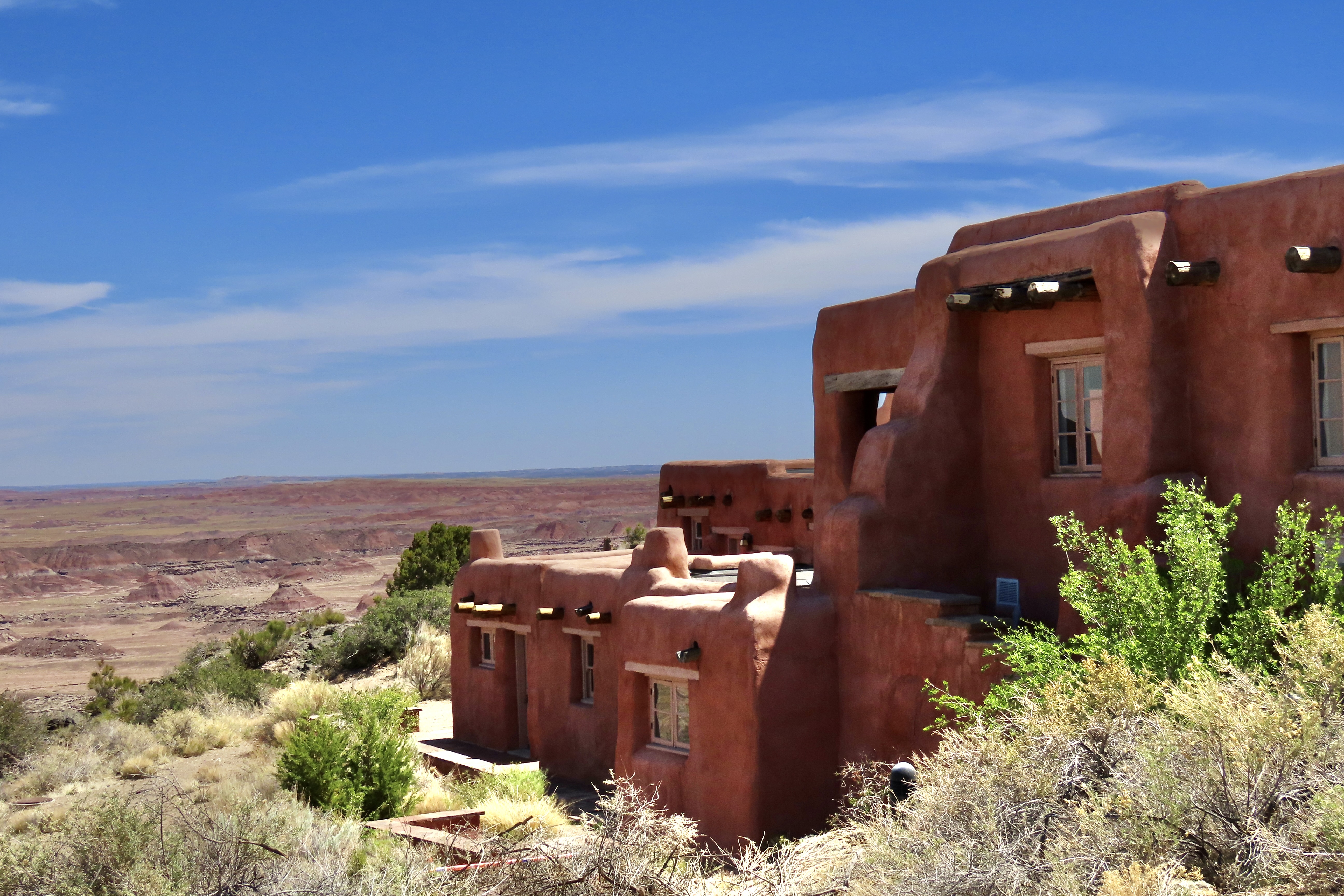
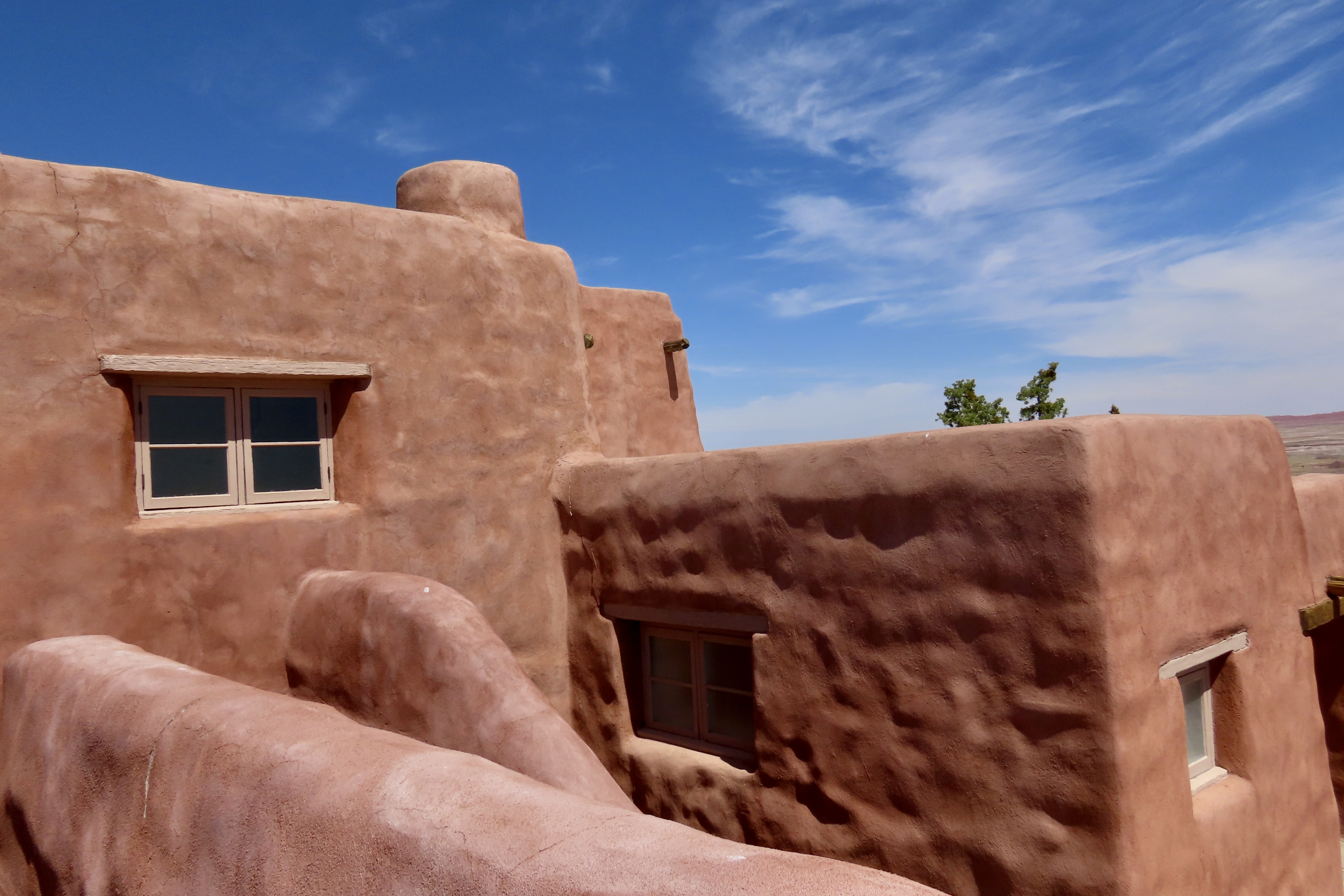
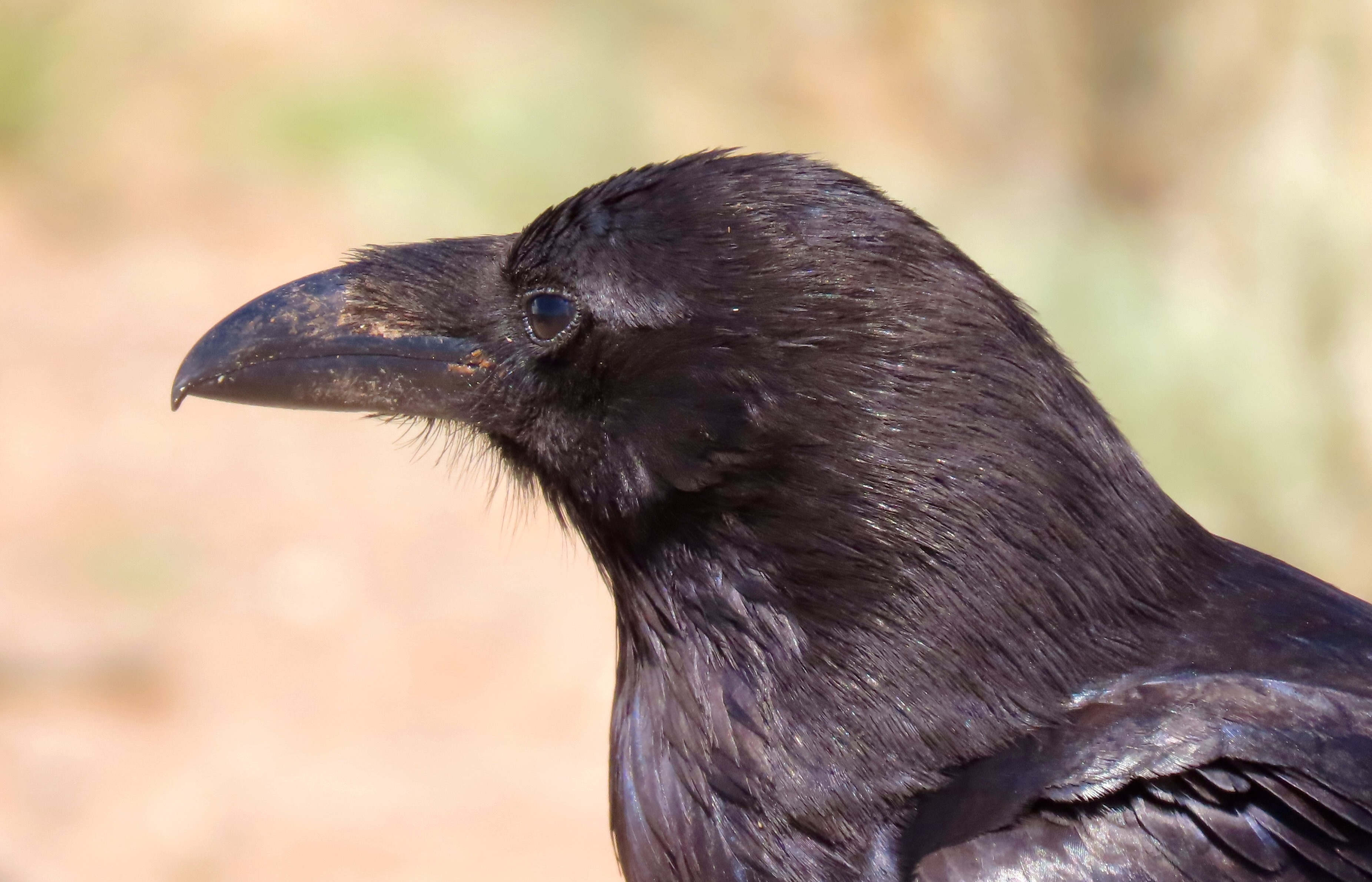
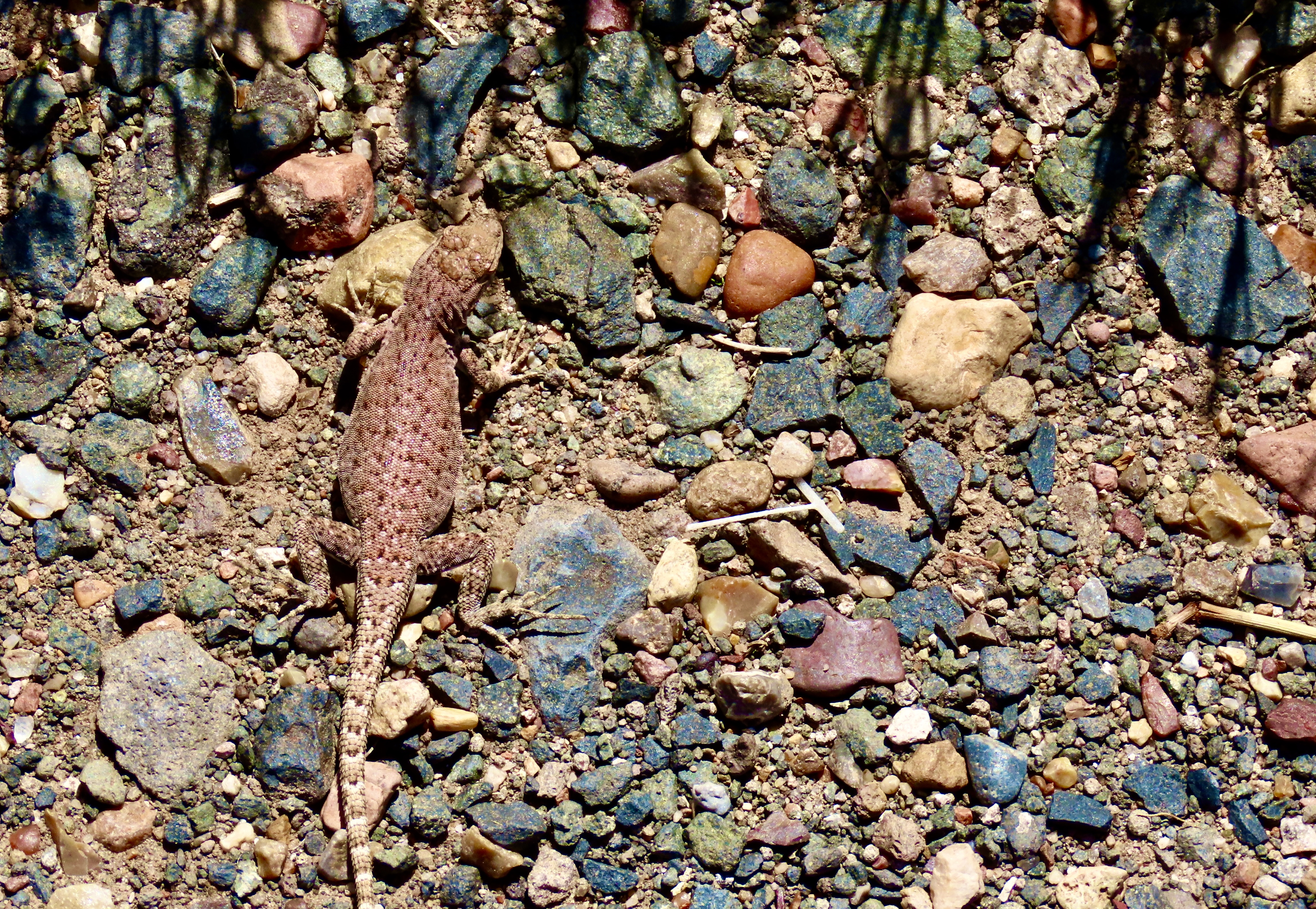
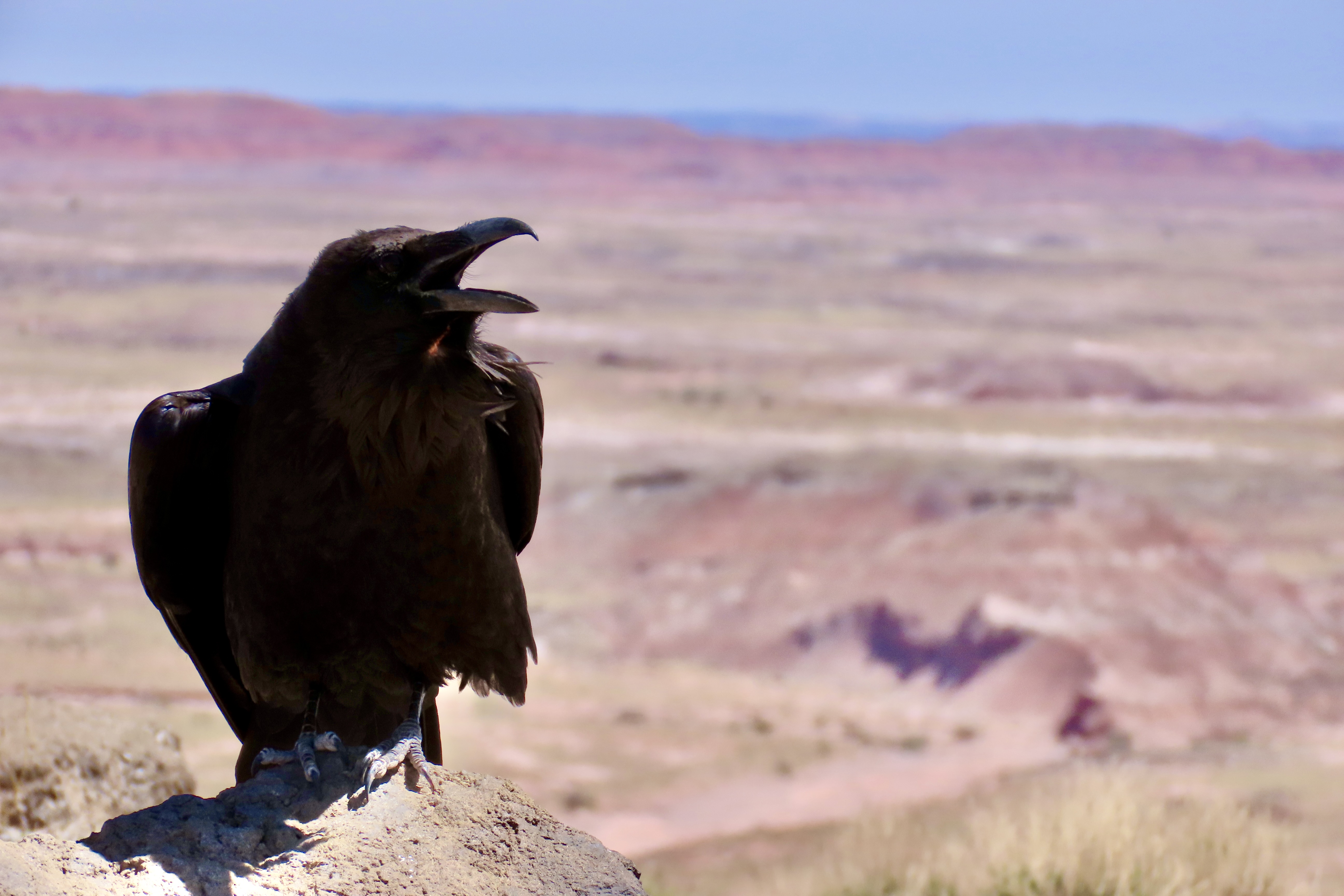
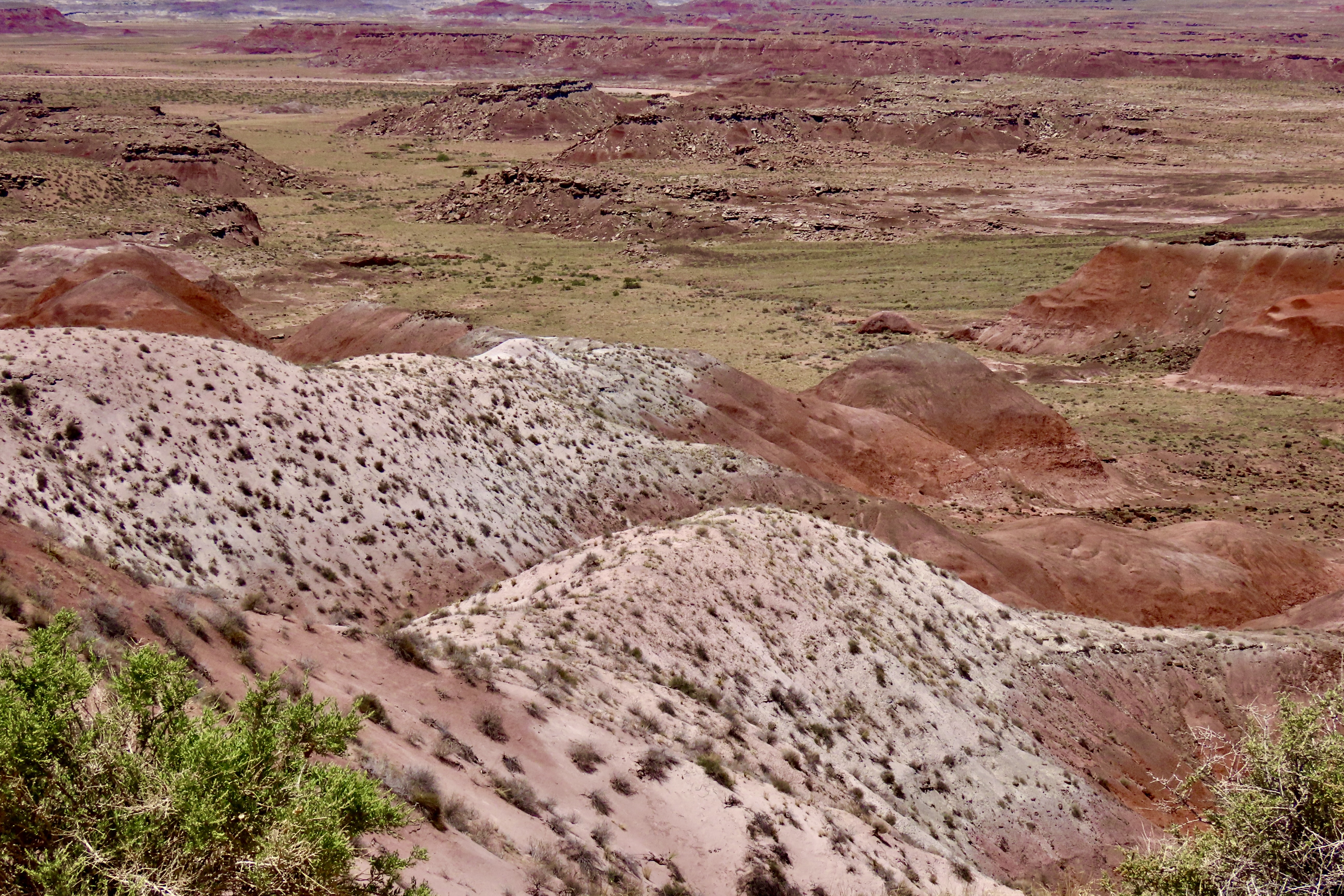
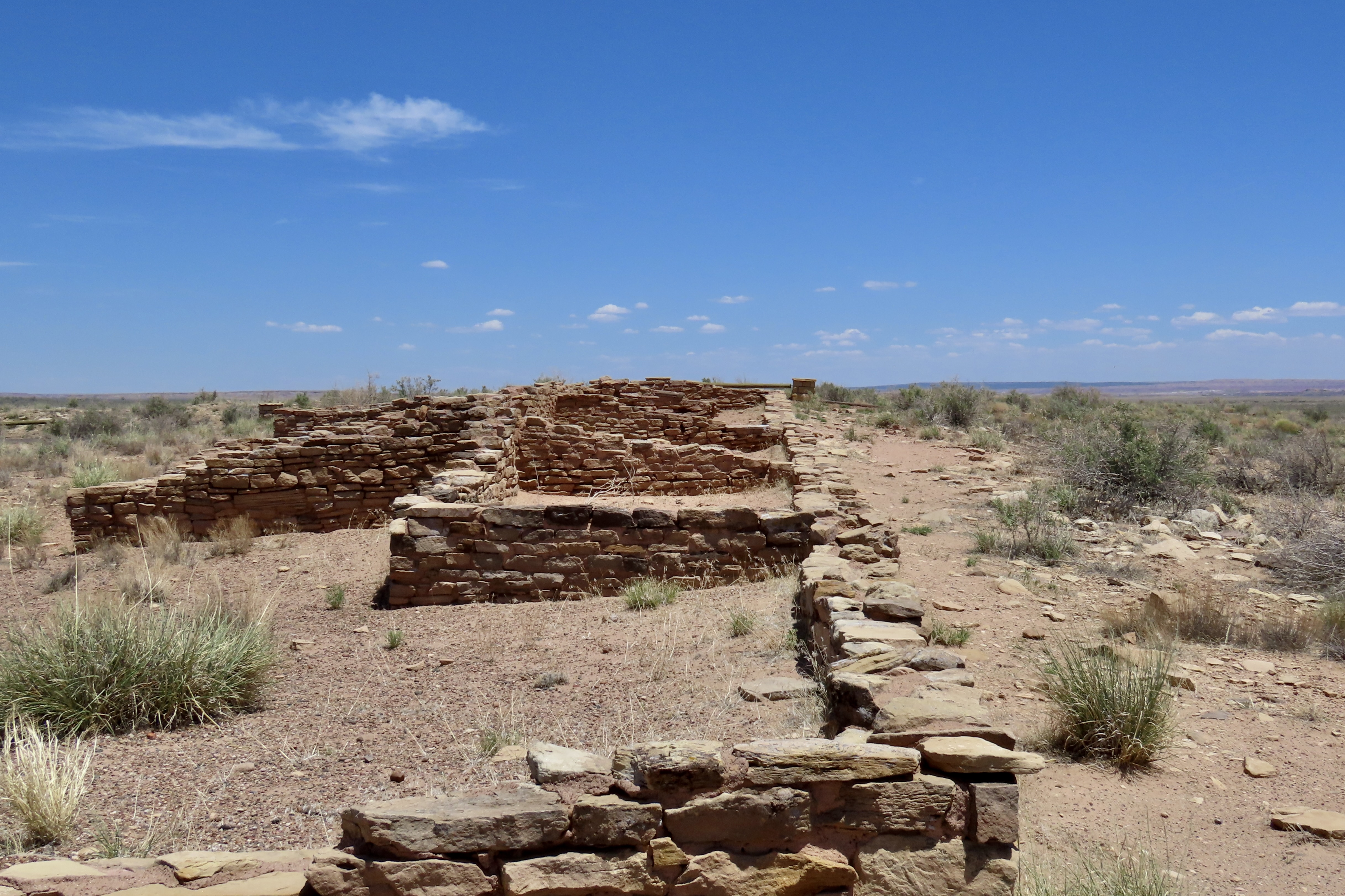
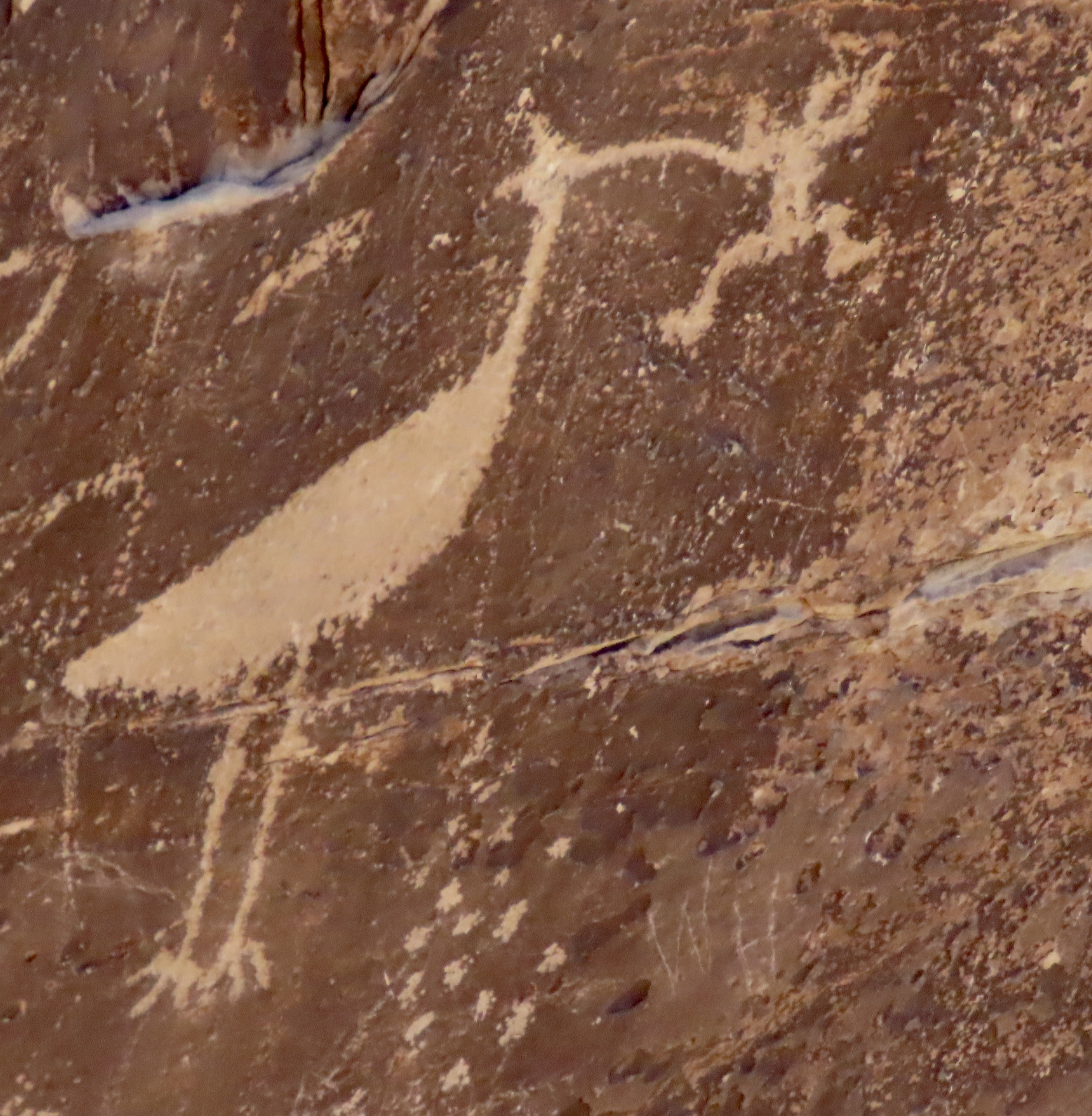
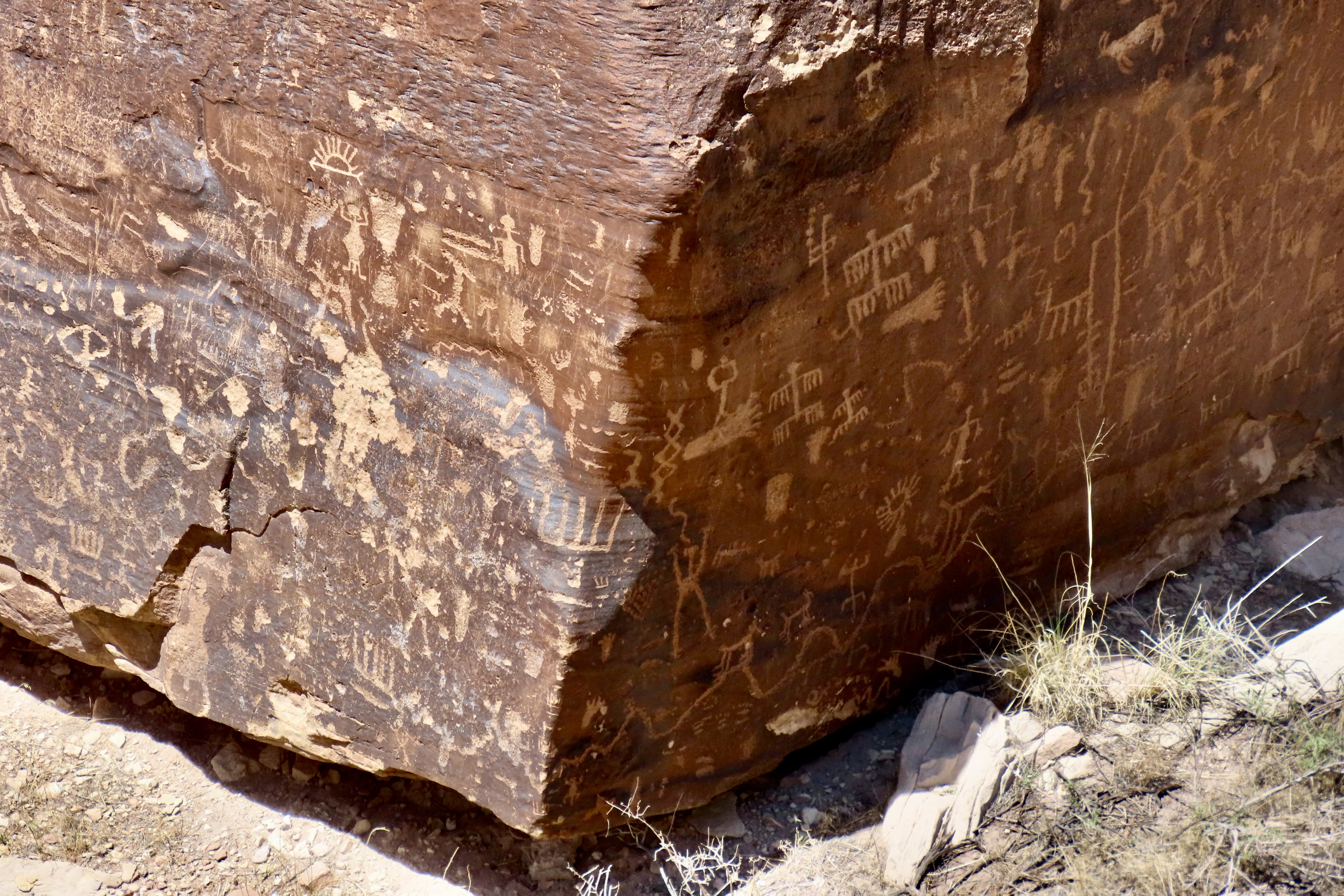
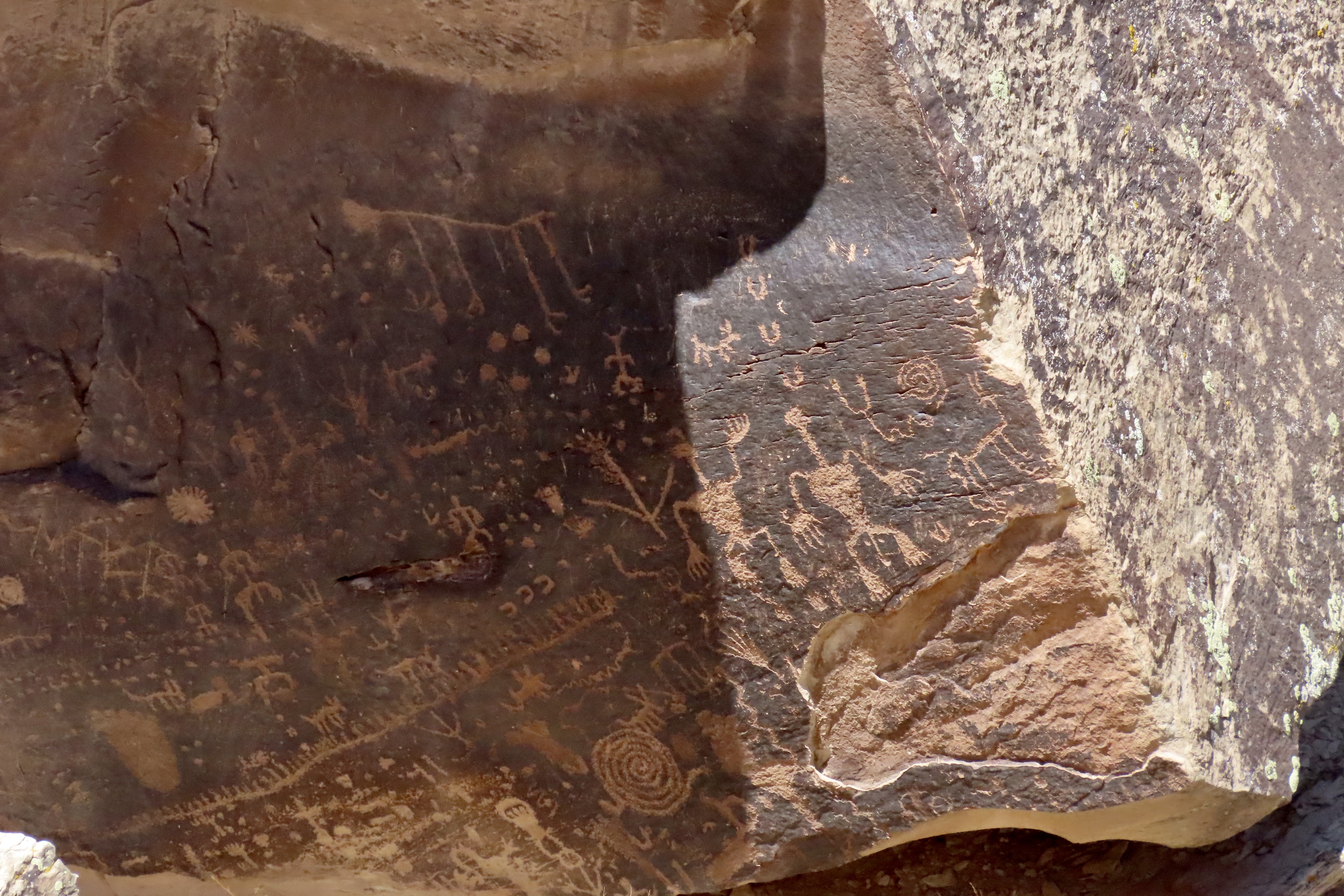
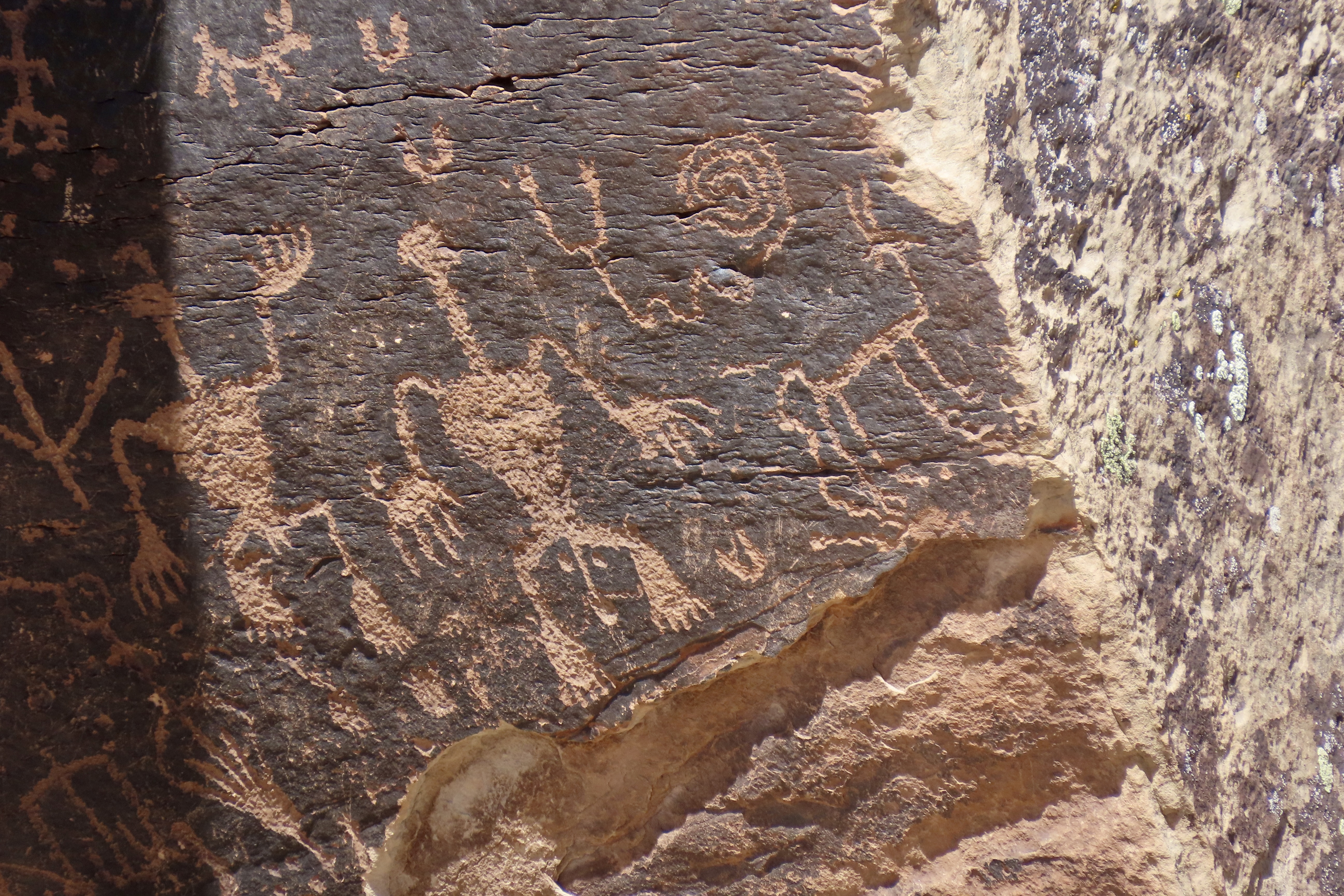
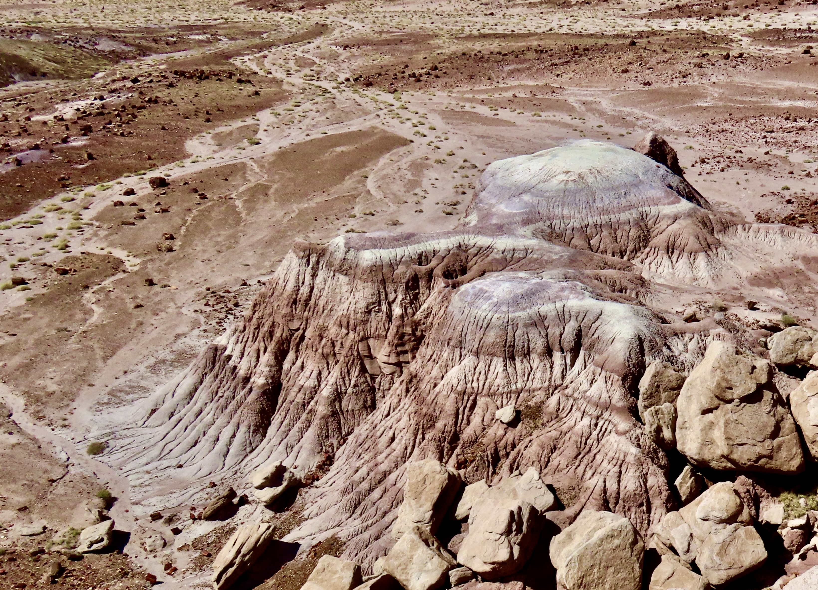
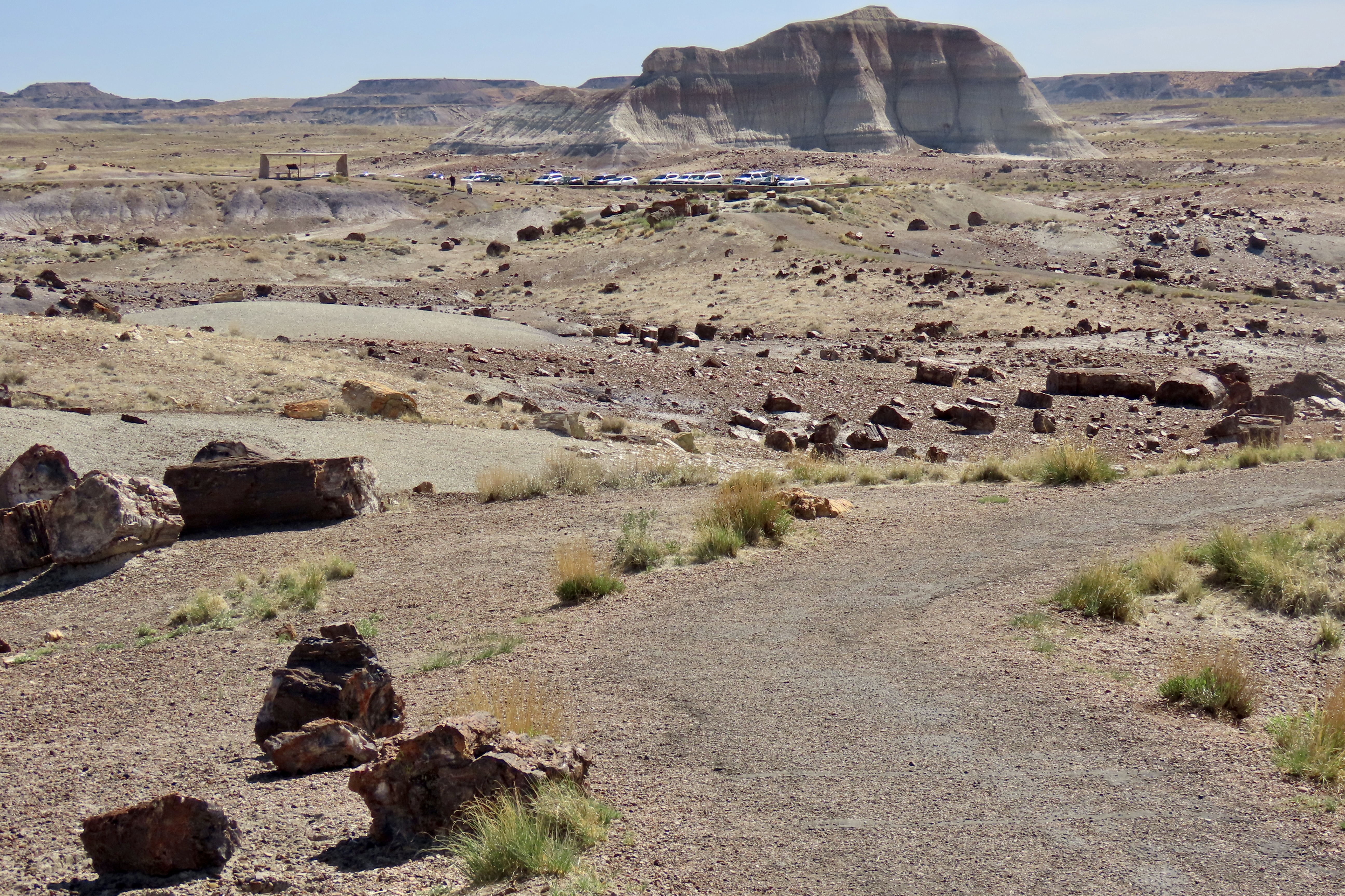
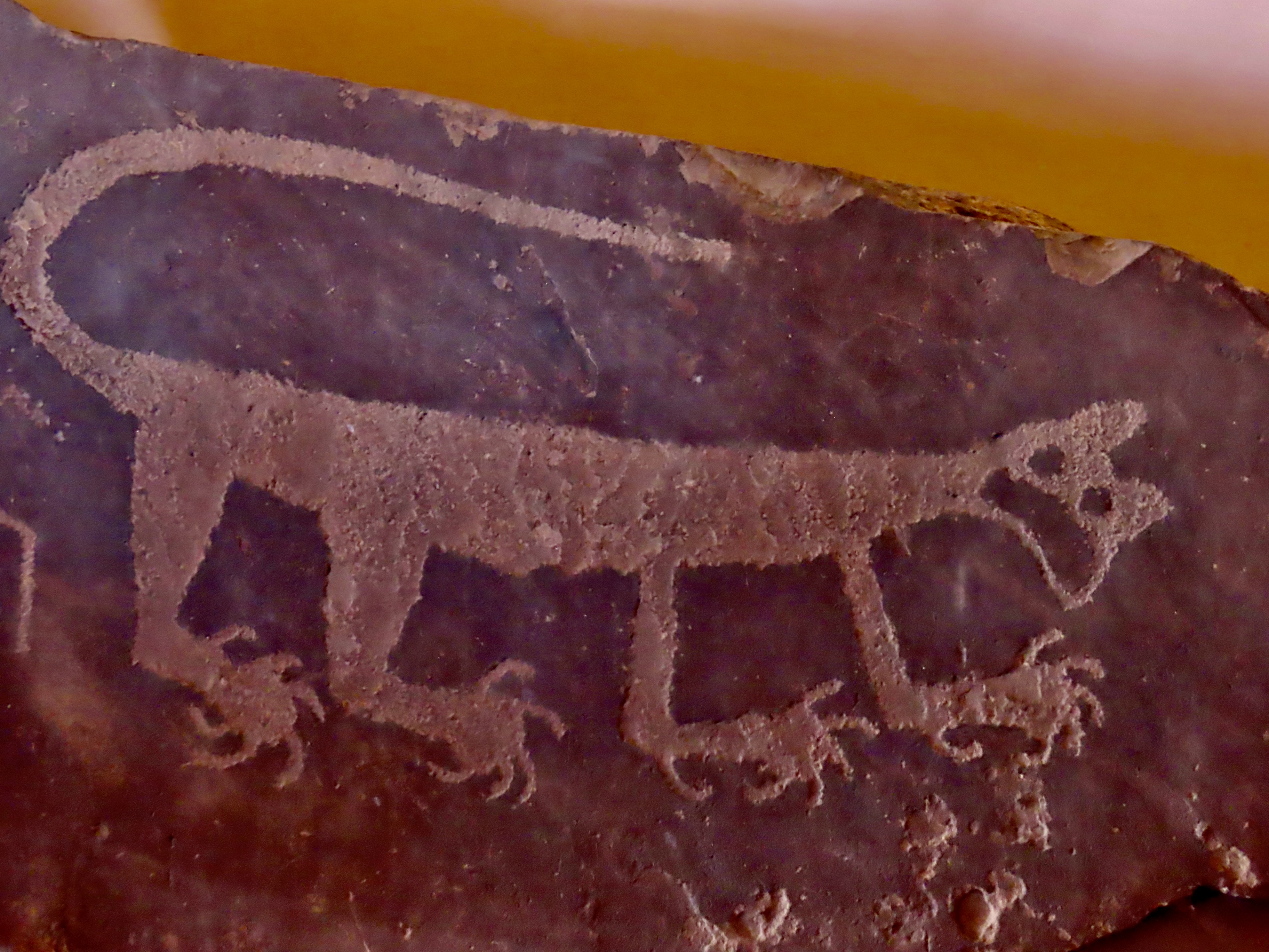
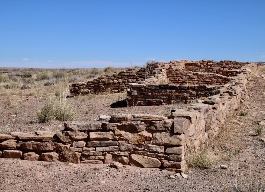
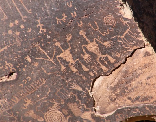
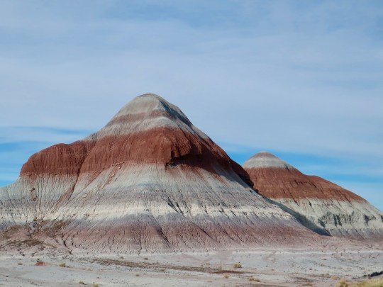
We used to think of Arizona’s Painted Desert and Petrified Forest as two separate units even though they are located next to each other and are part of Petrified National Park: We went to see petrified wood in the Petrified Forest and colorful landscapes in the Painted Desert. In actuality, they are both part of the same geological unit: The Painted Desert. They both display colorful landscapes and they both feature petrified wood. This photo is from one of the overlooks in the Painted Desert section north of I-40. Colorful? Yes. But it also includes chunks and logs of petrified wood. A petrified log can be seen on the lower center left.This is a section of Petrified Forest south of I-40 known as the Teepees. The colors are soft but close to otherworldly. Visitors have the option of entering the National Park from its north or south entrance. Peggy and I chose the north which makes a loop north of I-40 through the Painted Desert following the historic Route 66. One of our first stops was at the Painted Desert Inn. It sits above the Painted Desert providing visitors with a superb view of the surroundings. Originally opened by a private entrepreneur in 1920, the National Park bought it in the mid-30s and rebuilt it in Neo-pueblo style using CCC workers. Fred Harvey took over its management in the 40s utilizing the Harvey Girls to provide service to weary travelers. In 1947, the company’s architect, Mary Jane Colter, was brought on to remodel and renovate the facility. Today, it is a National Historic Site and museum, well worth a visit. The El Tovar Hotel and Desert View Tower of the Grand Canyon are among Colter’s many other notable projects.A local raven was seeking handouts near the Inn.I pointed out a nearby lizard and suggested that if he wanted food, he should hunt for it.He squawked at me. Something about wanting to be paid with in PB&J sandwiches if I was going to use him as a model.One of our favorite views of the Painted Desert.Our good friends from Sacramento, Tom Lovering and Lita Campbell, joined us on our visit to the Petrified Forest National Park. Here, they are perched on a 1932 Studebaker that the Park has placed along the Route 66 segment to symbolize the historic journey travelers followed along the route. The old car now provides a photo op for tourists. BTW, Studebaker got his start in Placerville (aka Hangtown), 3 miles from where I grew up in the Sierra foothills, making wheelbarrows for miners seeking wealth in California’s 1849 Gold Rush.Leaving the north side of I-40, we crossed over to the south side. Our first stop was at the Puerco Pueblo, a village built by Ancestral Puebloans and occupied between 1250 and 1380 CE. The pueblo had over 100 rooms at its peak. Located next to the Rio Puerco (Pig River), it had contacts from throughout the Ancestral Puebloan region and beyond. Artifacts and petroglyphs found at the site and nearby suggest these wide ranging connections.The best known petroglyph next to the pueblo is a water bird, possibly a white faced Ibis, about to chow down on a frog. The round, white petroglyphs may represent water dripping down from the bird.Numerous petroglyphs are found at the Petrified Forest’s Newspaper Rock located about a mile away from Puerco Pueblo.The petroglyphs found at the site Include a wide variety of subjects.The lower right section of the above series featured a naked man and woman. The ancients appear to have had few of the hang ups with nudity our modern society does. I thought of the woman saying, “Hi honey, I’m home.” As for the guy, apparently ‘size matters.’ We really liked the coyote on the right and immediately thought of Wile E Coyote and the Road Runner. The spiral above is thought to represent the journey of Ancestral Puebloans from the underworld in their search of a permanent home.
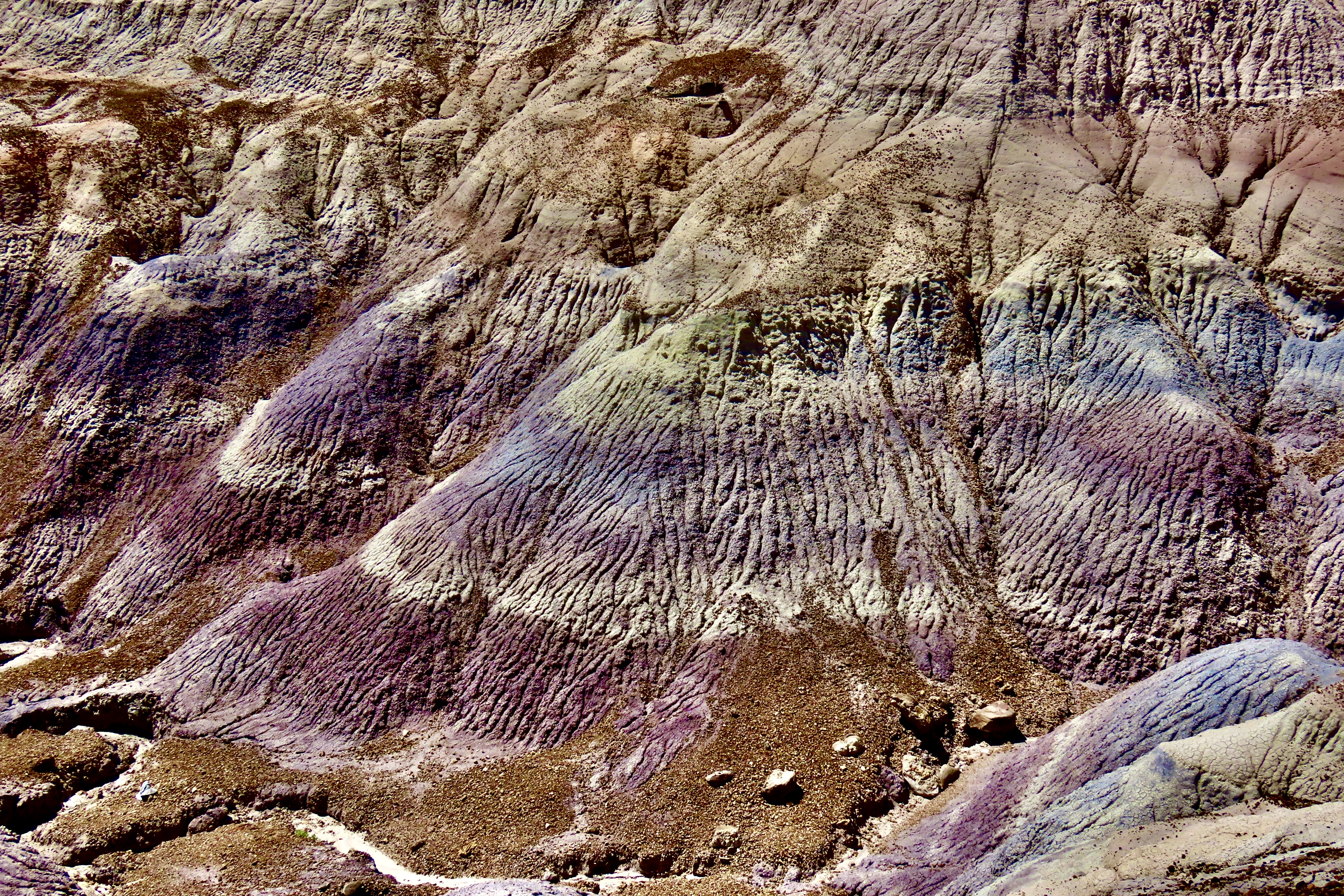
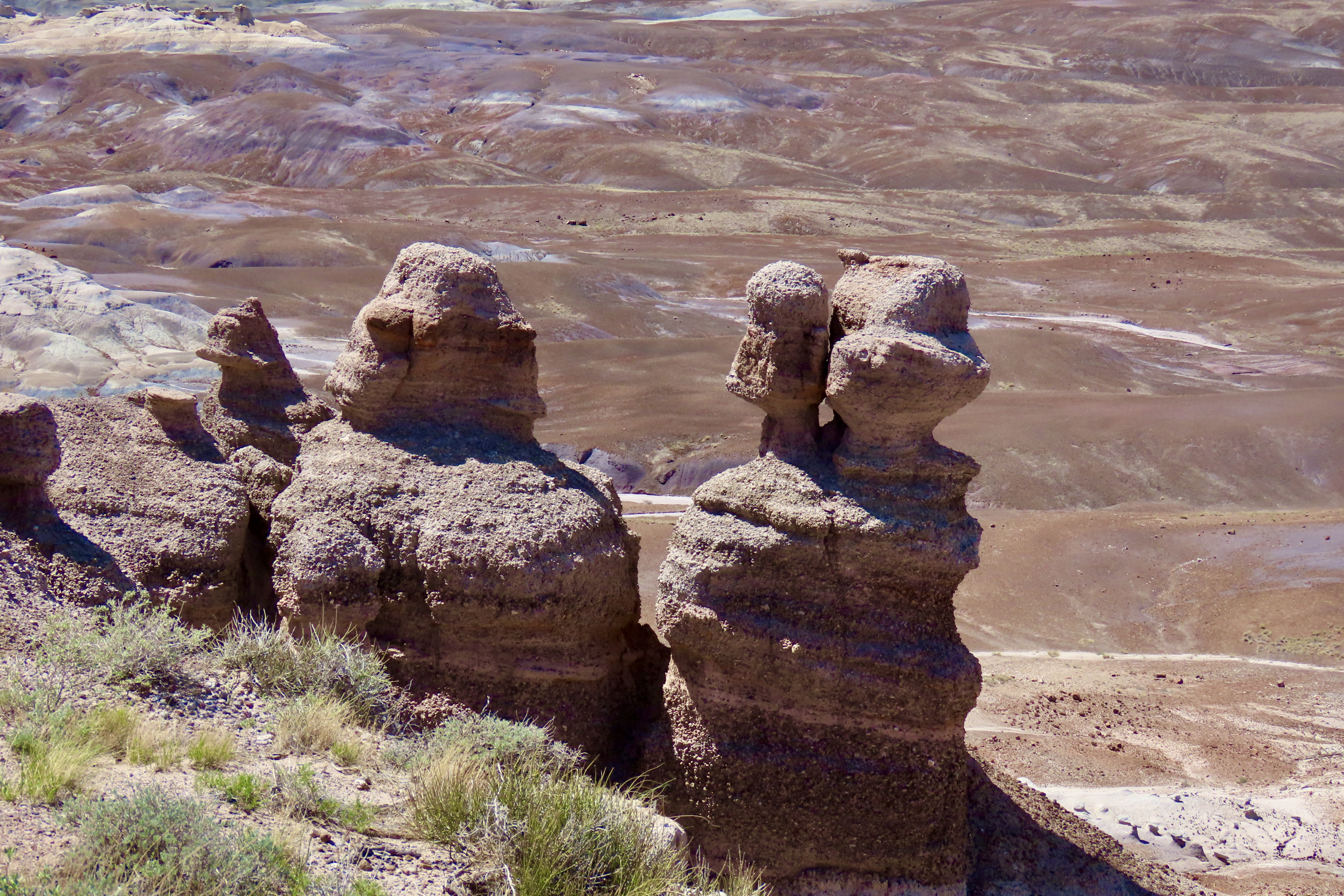
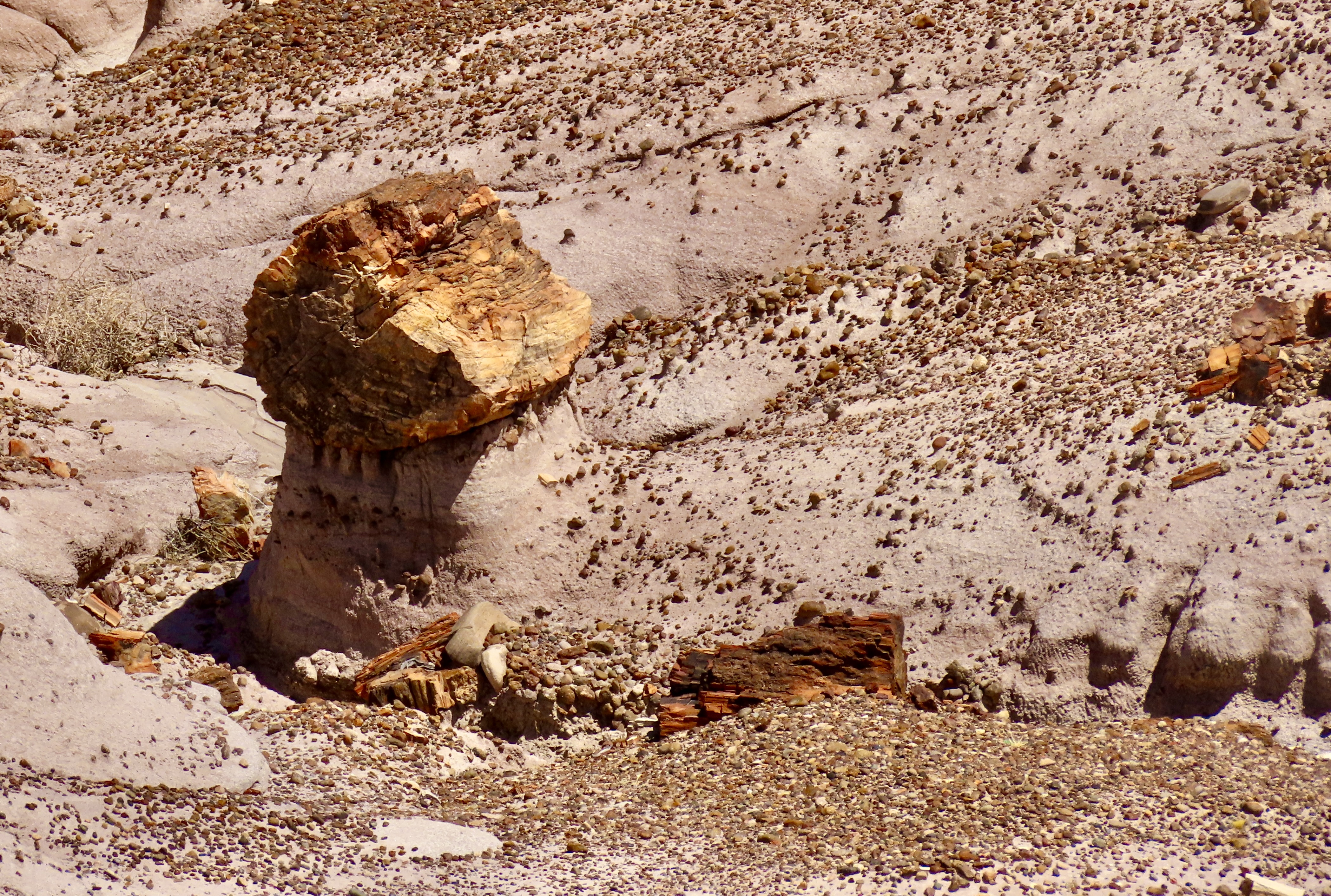
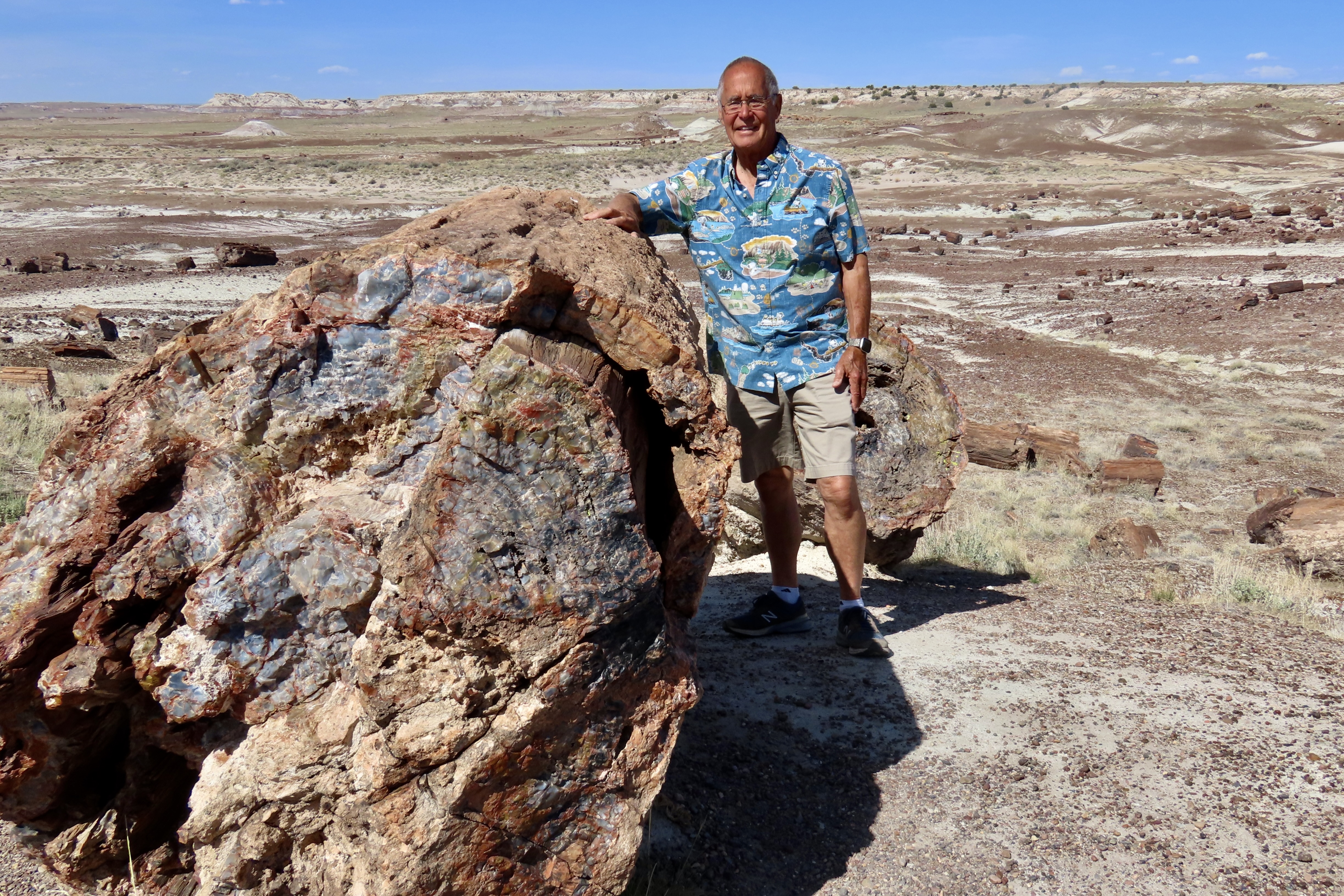
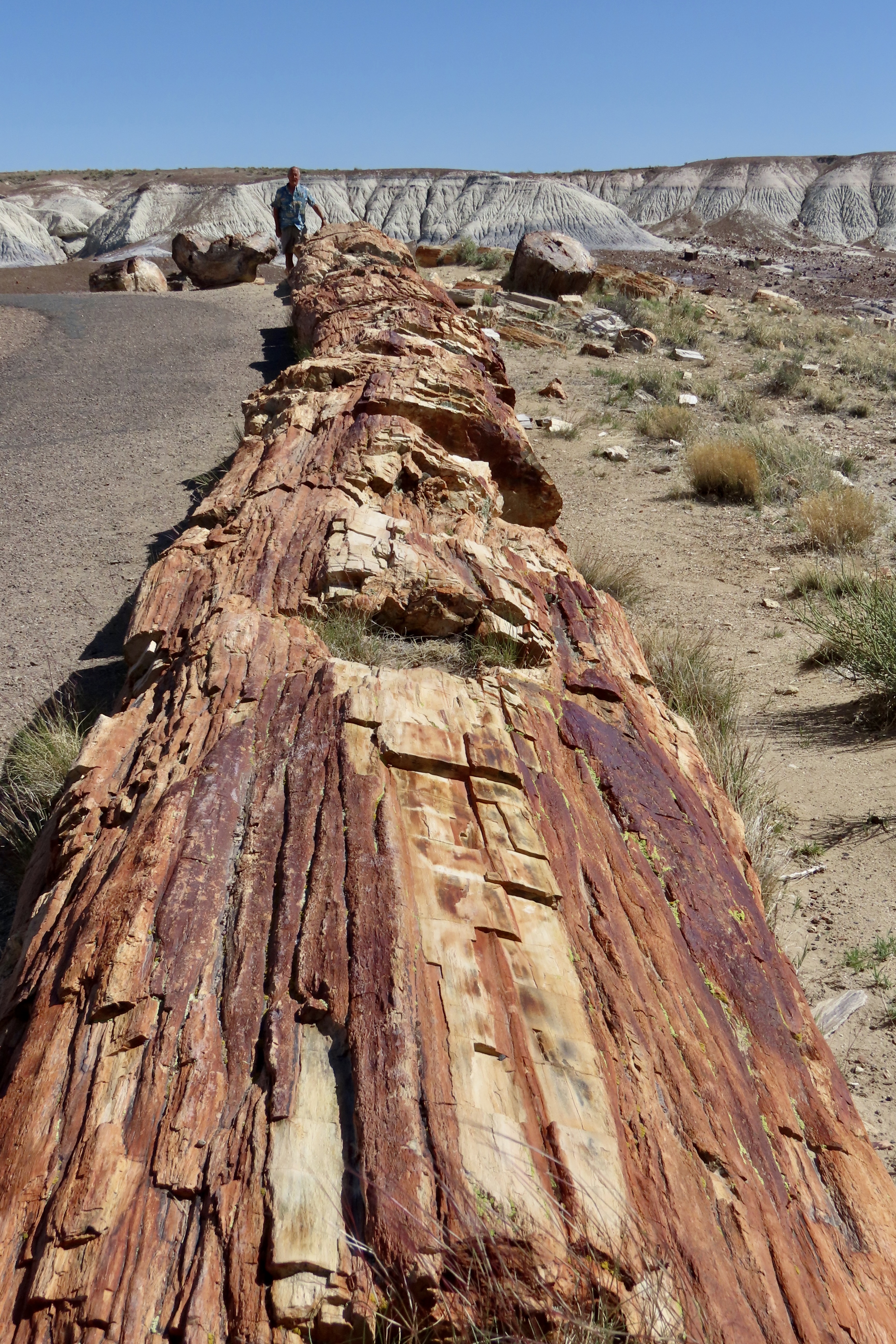
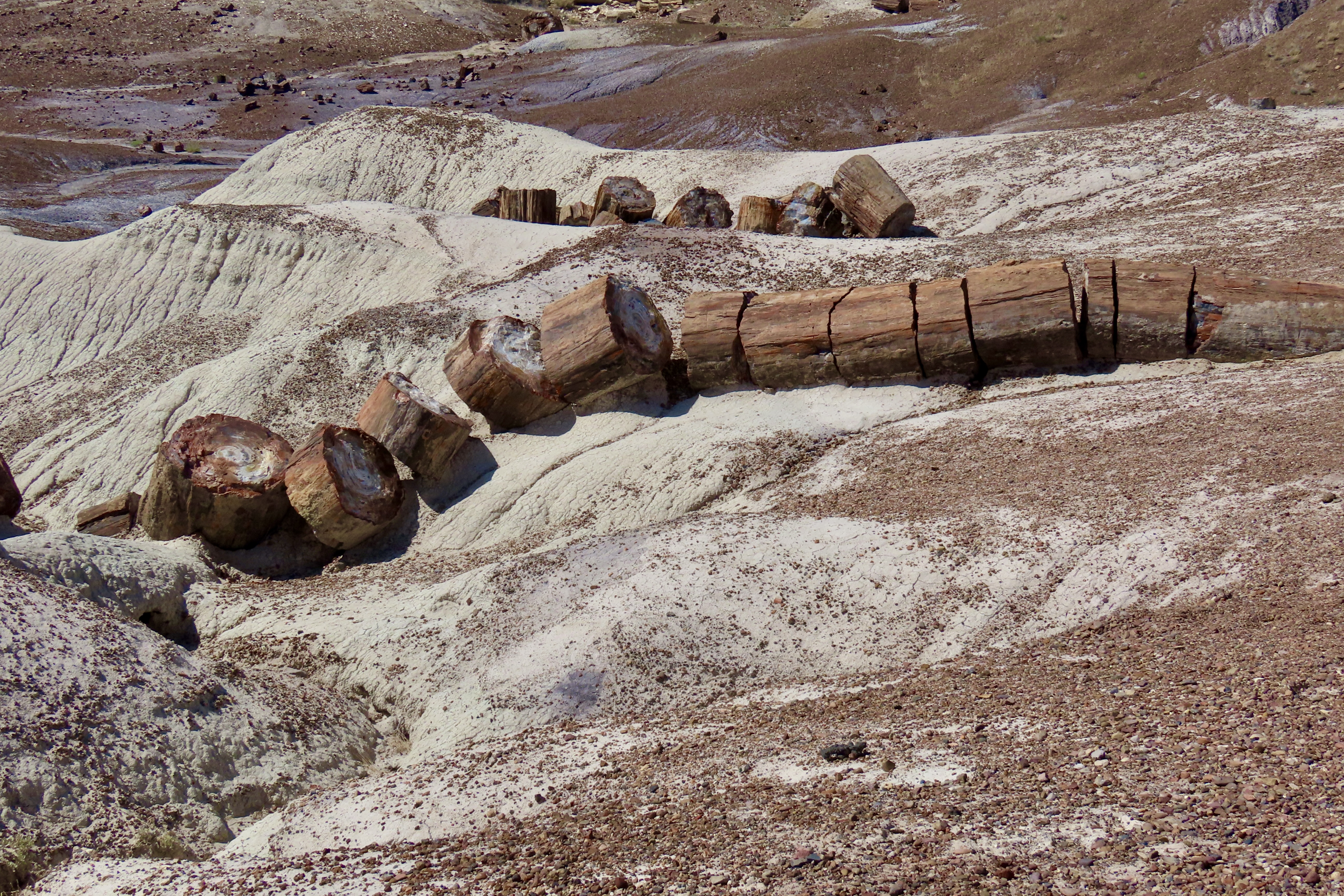
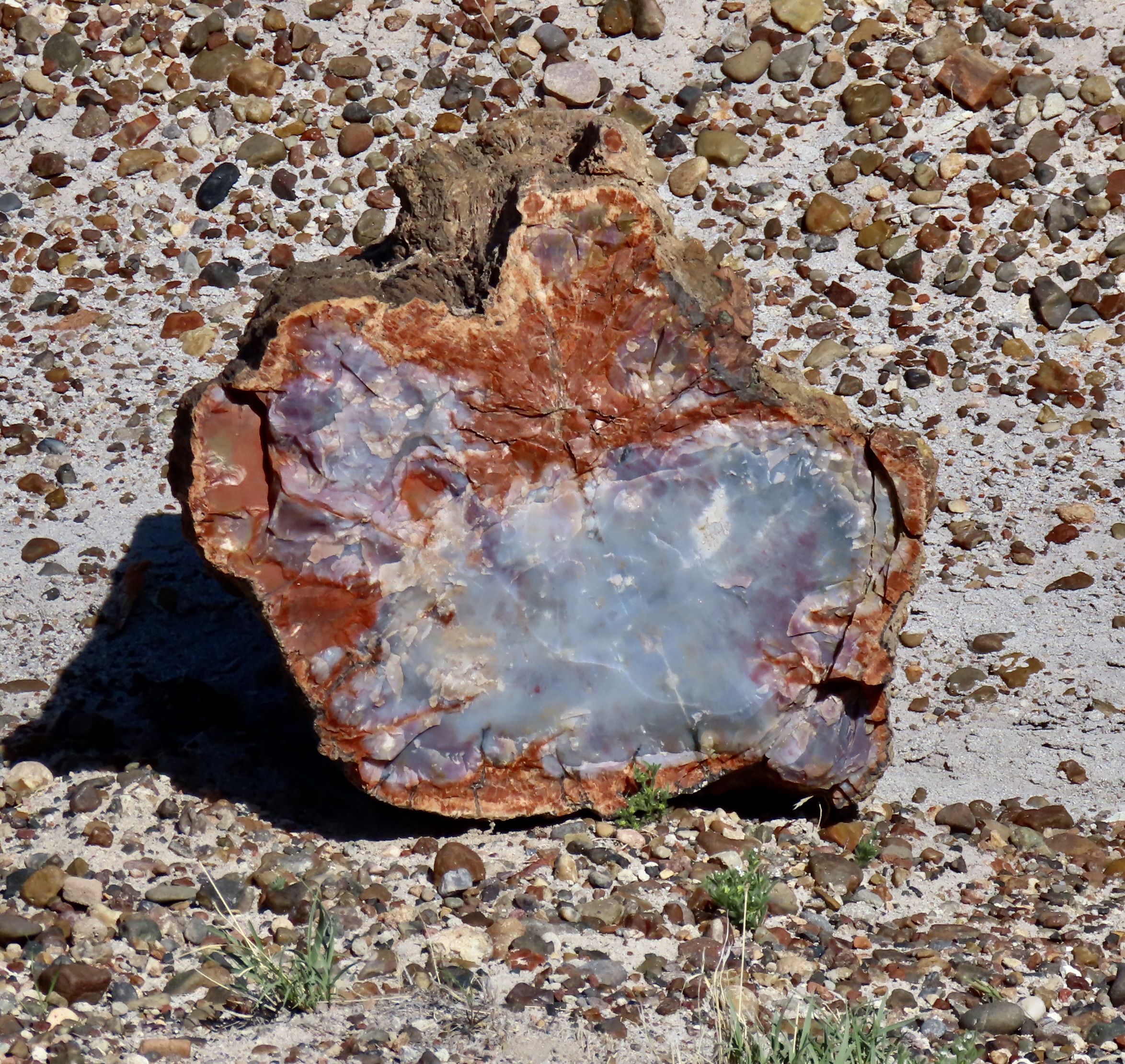
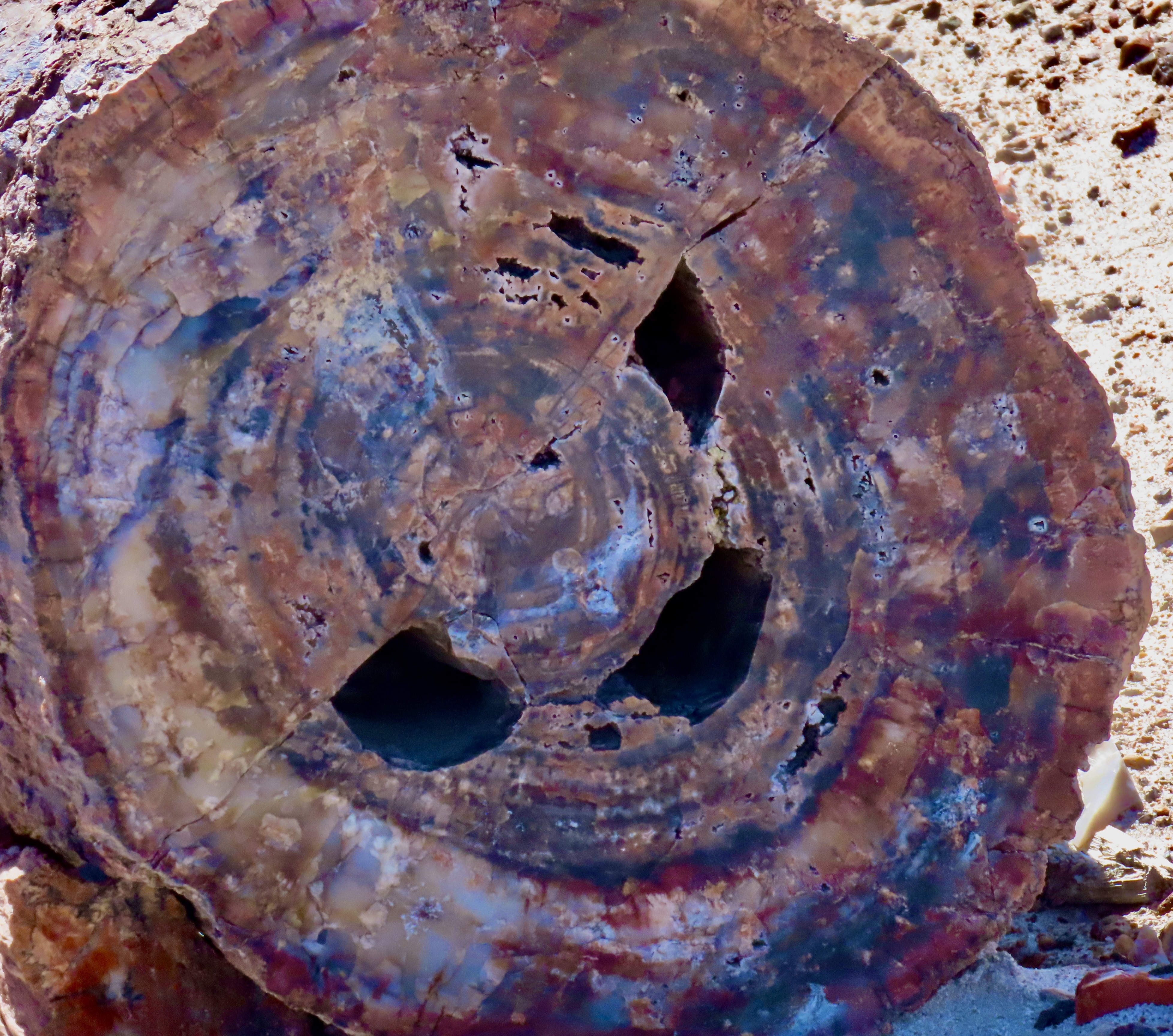
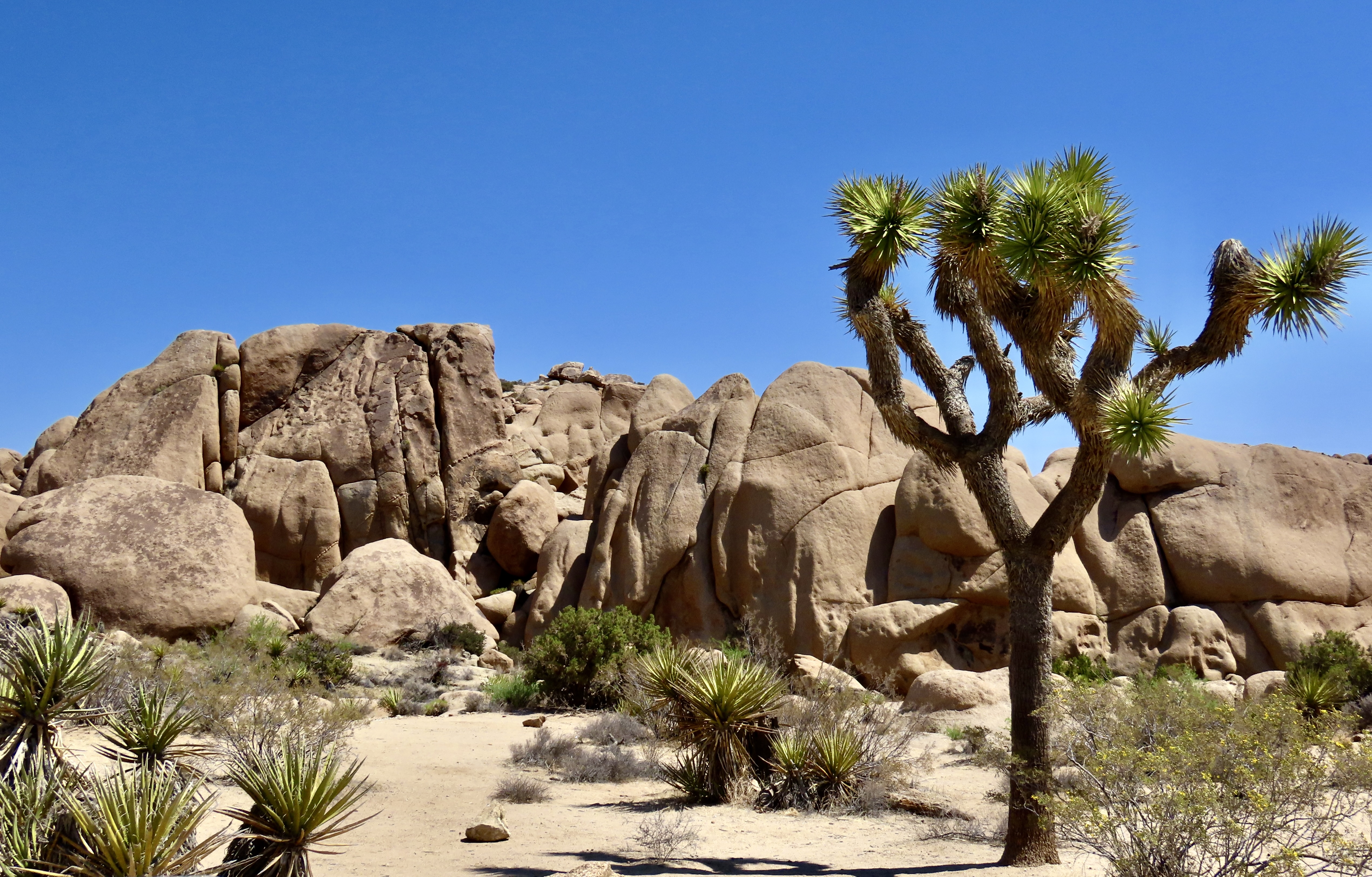
Peggy found several petroglyphs she might include in her next word search book— but don’t expect to find the naked couple.Next we arrived at the Teepee mountains, which I showed in the second photo. The colorful, layered rocks are part of the Chinle Formation deposited during Triassic period between 205-227 million years ago. The colors are determined by minerals in the rocks and the conditions at the time at the time they were deposited. A side road south of the Teepees takes visitors into the Blue Mesa, which provides an up-close perspective on the Chinle Formation. We highly recommend it. The following photos show why.Multiple colors,Including white.And interesting land formations.Another example.And tons of petrified wood. Perspective makes this log on a pedestal seem bigger than it is, but it is big! Broken off pieces surround the pedestal.This brings us to the petrified wood section of our post. I used Tom for perspective in this and my next photo to demonstrate how large some of the logs are.Tom appears tiny down at the end of this long, petrified log. Also, note the petrified bark that is still on the tree.This big fellow was making its way down a hill. Timber!One of the things fascinating about petrified wood is the variety of colors. They are created by different minerals that replace the wood in the petrification process. For example, red, brown and yellow come from iron oxide, white from silicon dioxide, black from carbon, blue and green from cobalt, chrome, and copper, etc.Not sure what made the holes but look how rich the blue is. You can also see the bark here.One can wander around for hours admiring the different logs.There are hundreds of them.A visit to the Rainbow Forest Museum concluded our visit. This large petroglyph of a mountain lion is one of the museum’s prime exhibits and serves as a symbol of the park. I have a T-shirt with it on the back.I persuaded Tom to take his photo with the skeletal remains the museum’s phytosaur, a large crocodile like reptile from 225 million years ago. It’s known as Smiley. That’s a wrap for today. Next up: The crazy trees and fabulous rocks of Joshua Tree National Park.
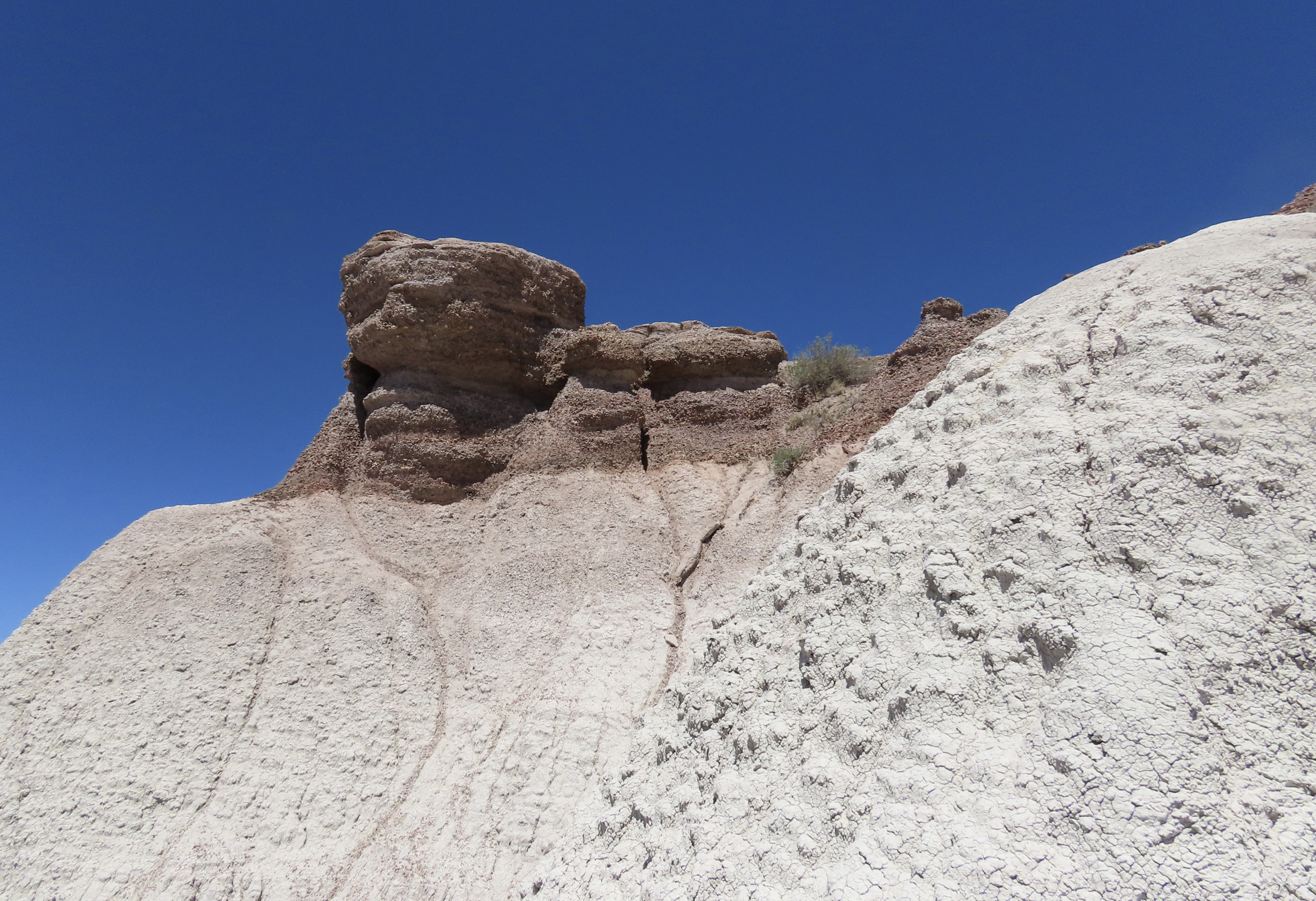
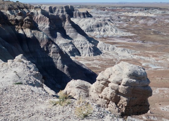
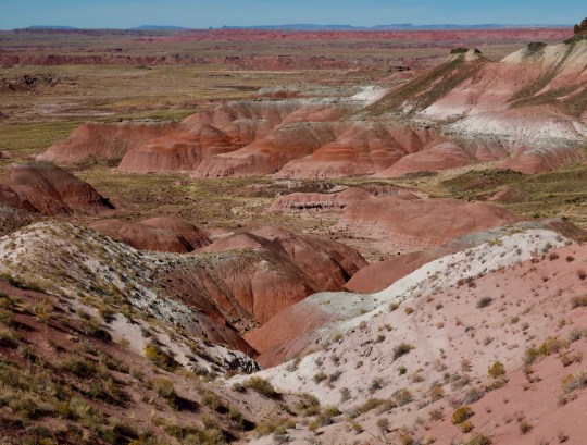
They called them Badlands. Early settlers couldn’t farm or ranch them, so what good were they? In time, however, people would come to see their beauty. This is a photo taken from the Blue Mesa in Petrified Forest National Park. One reason I liked it was because the outcrop on the right resembles an early American. (Or possibly George Washington on a bad day? Maybe he was off to a rocky start.)
Note: I wrote this post over several days as we wander through the Southwest. We are now between Santa Fe and Taos, New Mexico— and the temperatures are still freezing!
It’s snowing outside and icy cold. The windchill factor is pushing the temperature to around O degrees F (17.7 C). Quivera the Van is not happy. I bought chains for her yesterday with the fervent hope that I won’t have to use them. I’ll do almost anything to avoid that nasty chore. Right now, that suggests heading south, even if it means skipping Mesa Verde National Park where we were going today. Getting there involves climbing up steep mountain roads that are now obscured by dark, threatening clouds. We aren’t terribly disappointed. We’ve already been there twice and we’ve seen a number of Anasazi ruins perched on cliffs over the past week (although not as impressive as Mesa Verde).
Even heading south from Colorado into New Mexico won’t avoid the freezing temperatures. A record-breaking blast of arctic air reaches all the way to the Mexican Border.
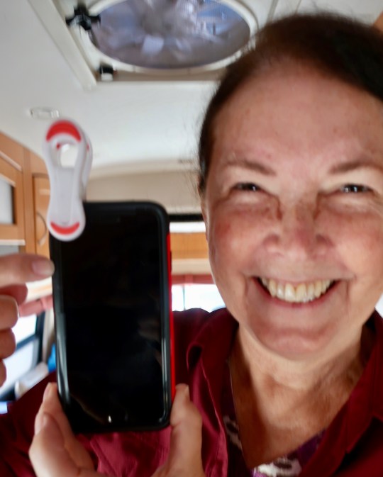
In my last post I shared a few of Peggy’s Grand Canyon photos. From there we went to Flagstaff, Arizona where we bought a new iPhone for Peggy and house battery for Quivera. Peggy was holding her warped, 6-year-old iPhone together with a plastic clip. The house battery was refusing to last longer than a few hours. While Peggy was busy playing with her new toy, I was left out in the cold changing the battery. It wasn’t hard. I just had to make sure that the positive and negative cables were hooked up to the right posts. But I tend to regard fixing things mechanical right up there with putting chains on in a freezing snowstorm. The good news is that I didn’t electrocute myself or burn up Quivera. More to the point, we now have power when we aren’t hooked up to electricity. I was quite proud of myself. Peggy was amazed.
Here’s Peggy with her clipped together iPhone. It really was time to buy a new one.
Flagstaff is a pleasant town with good restaurants and bookstores. It is nestled at the base of the San Francisco Mountains that are regarded as sacred by a number of Native American tribes in the area. Kachinas (Navajo spirits) are said to wander the mountains and do bad things to folks who find themselves lost up there, especially in snowstorms. I once spent a week by myself camping and hiking on the 12,000-foot Humphreys peak which is part of the range. I was quite careful. It isn’t smart to irritate a Kachina.
Our son Tony and his wife Cammie spent some time living in Flagstaff while he was flying tourists by helicopter over the Grand Canyon and into the Havasupai Indian Reservation down inside the Canyon. He flew Peggy and me into the reservation like the former multi-tour Marine pilot he was and put on the theme to Star Wars for inspiration. Imagination runs wild in this family.
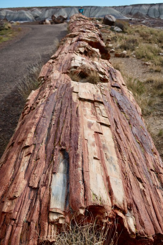
Most of the areas we have visited so far on our Southwest journey deserve blogs on their own and will get them. For now, here is a sample of the photos Peggy and I have taken over the last few days of the incredibly beautiful and often intriguing Southwest. For example, have you ever sat on a hundred foot petrified tree? Think of these pictures as hors d’oeuvres. The main course and dessert will come later. Today I am going to feature Walnut Canyon National Monument, the Painted Desert, and the Petrified Forest National Park.
If you look way down toward the end of this 100 foot petrified tree, you will see a tiny me straddling the log. It wasn’t the softest seat I have ever had. (Photo by Peggy Mekemson.)
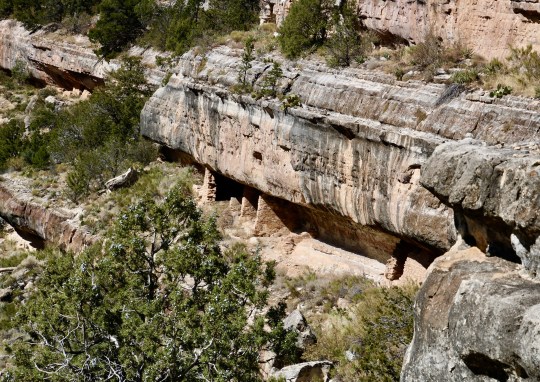
Walnut Canyon National Monument is a few miles east of Flagstaff, Arizona just off of Interstate 40. I’ve passed by it a dozen times over the years on my way somewhere else and never stopped. I was always curious, however. Peggy and I made it a priority, this time.
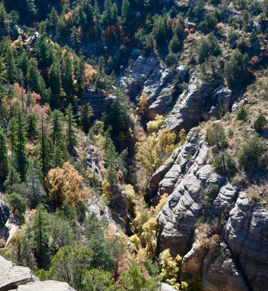
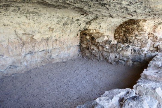
What I didn’t realize was that Walnut Canyon features cliff dwellings of the ancient Anasazi people of the Southwest who made their homes here around 1100-1200 CE. (Photo by Peggy Mekemson.)The varying erosion rates of different limestones provided a convenient shelf for the Anasazi to build their homes complete with ceilings and floors. By following the shelf around the canyon you can see a number of more homes. (Photo by Peggy Mekemson.)Peggy and I climbed down 273 steps to reach the cliff dwellings. This is a view of Walnut Canyon. below where the cliff dwellings were located. Trees added a bit of fall color.We were amused at this sign located at the head of the stairs going into the canyon.Here, I am sitting inside of one of the dwellings. This was more likely a storage room where things like water would be stored in large jars. The Anasazi had to climb down the steep walls of the canyon to fetch water. During the dry season, they had to store enough to last up to 100 days. (Photo by Peggy Mekemson.)This provides a view of a larger room that could accommodate a family. Weather permitting, it is assumed that people were outside a good deal of the time.A number of families might share a section of cliff in Walnut Canyon as this picture demonstrates. (Photo by Peggy Mekemson.)We had a pleasant walk along the trail while we were checking out the cliff dwellings. Then it was time to climb back up the 273 steps! Another visitor slipped into this picture. (Photo by Peggy Mekemson.)
A hundred miles east of Walnut Canyon on I-40 we came to the Petrified Forest National Park. The road takes you through the Painted Desert, which is part of the Park. As we drove in, we were greeted by a raven. They seemed to be following us around. We’d met several up at the Grand Canyon. Actually, they gather where there are tourists, hoping for a hand out.
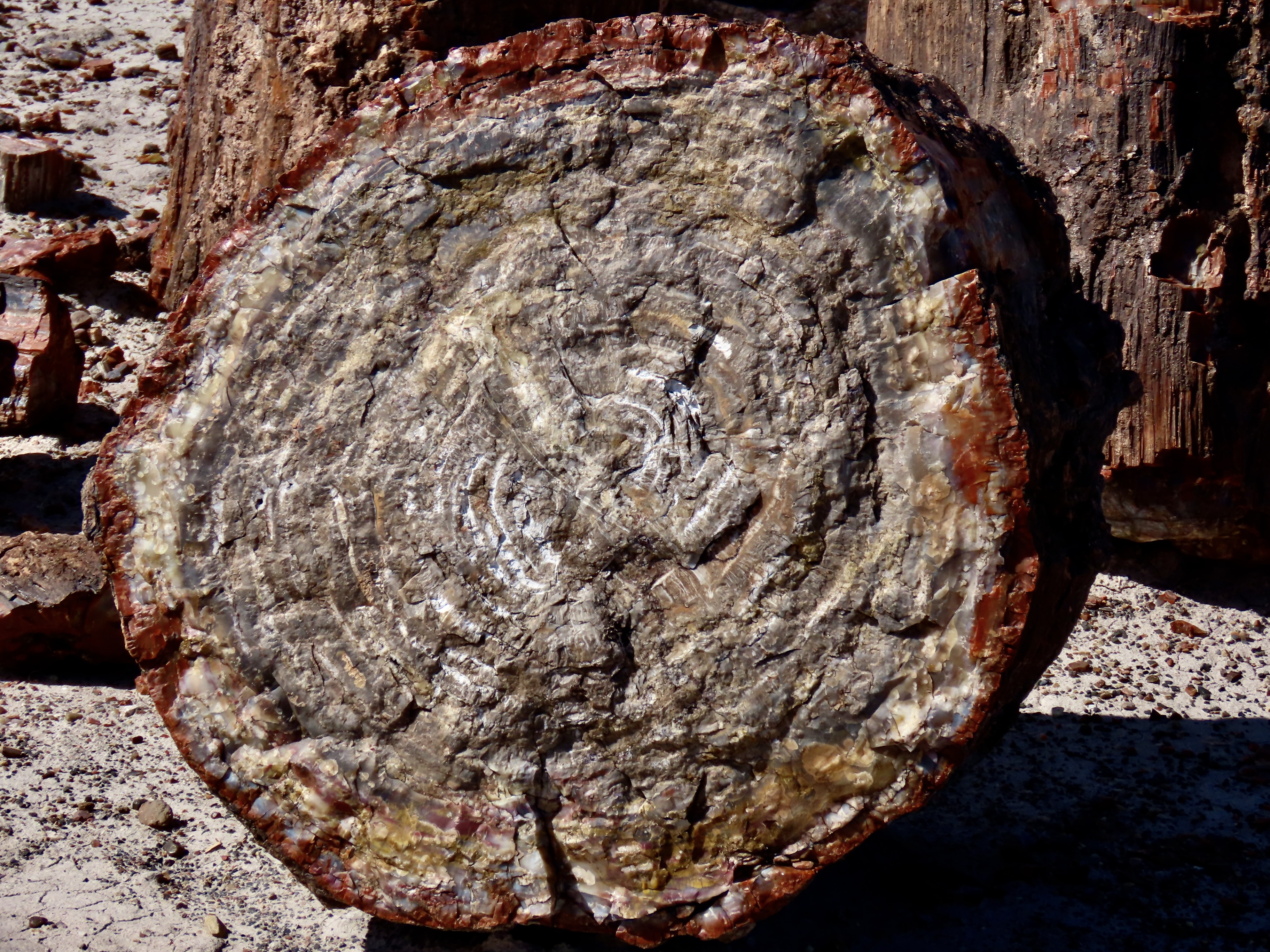
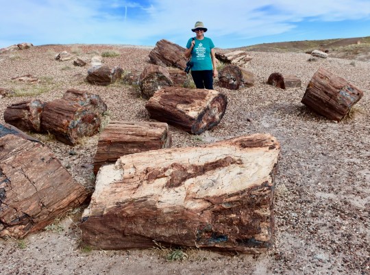
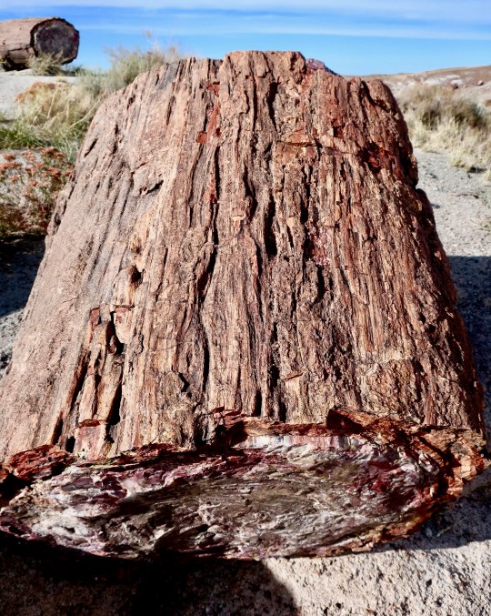
Ravens are clever birds. Had this guy figured out to wait where people had to stop? Plus he was doing what the Grand Canyon ravens do: Provide a photo-op and expect payment in food. I told him “No snacks” and he flew away in disgust, croaking a Poe-like “Never more!”I took this photo of the Painted Desert in the morning about 11:00 as we were driving into the Park.When we came back through in the afternoon, there was more color but still not as rich as it would be at sunset.The Petrified Forest National Park is the only national park that historic Route 66 passed through. This 1932 Studebaker in the park commemorates the highway.Ancient Americans also made their home in the Petrified Forest National Park. This one is known as the Puerco Pueblo since it is located along the Puerco River. (Photo by Peggy Mekemson.)Peggy caught these cottonwoods growing near the Puerco Pueblo, a tell-tale sign of water in desert country.We consider finding and photographing petroglyphs something of a hobby. This one of a large bird with a frog speared on its beak is almost iconic. It was located along with a number of others next to the Puerco Pueblo. (Photo by Peggy Mekemson.)This rather charming couple that caught our attention was found just down the road from the Puerco Pueblo on what is known as Newspaper Rock. (There are other newspaper rocks.) I also liked the skinny coyote off to the right. He reminded me of Wiley Coyote about to take off after Road Runner. Known as the Teepees for their structure, the various colors represent different environments down through the ages from deserts, to seas, to rivers and tropical forests.Driving off of the main road and up onto the Blue Mesa in the Park is a real treat. Seeing massive petrified logs resting on rocks would be reason enough to make the detour. A dry wash works its way off into the desert. (Photo by Peggy Mekemson.)I was captured by the beauty and unusual land formations of the area.Peggy and I followed a trail off of the Blue Mesa and into the canyon where I took a photo of her hiking for perspective. She was hoofing it. Peggy has always hiked fast and I don’t see any sign of her 69 years slowing her down!Peggy found this stump of petrified wood on our hike that provided a shark contrast to the blue grey of the canyon.I always enjoy slipping in a black and white rendition of a photo on my posts. This one was from the rim of the Blue Mesa looking down into the valley that Peggy and I hiked through.People primarily come to Petrified National Forest to see the petrified wood. No surprise there. And they aren’t disappointed. It is everywhere and in large quantities as this photo with Peggy demonstrates.This photo provides another perspective of how much petrified wood there is in the park. We were along a trail that leads through what is called the Crystal Forest. (Photo by Peggy Mekemson.)I was fascinated how faithfully the the bark was preserved on these ancient trees from millions of years ago.I’ll use this final photo by Peggy to wrap up our visit to the Petrified Forest National Park for now. The natural way that petrified wood splits provides beautiful views of the inner wood. And every one is different! We have several photos to prove it.
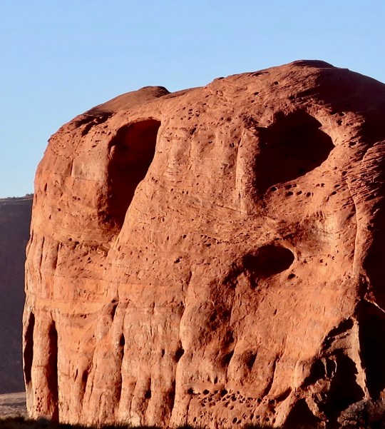
NEXT POST: I will feature photos from our trips into Canyon De Chelly and Monument Valley. And since I am finishing this post on Halloween, I decided to post this photo I took in Monument Valley.
I thought this monument looked skull-like enough to make it into my Halloween collection of rocks. Hope you enjoyed your ghostly encounters.