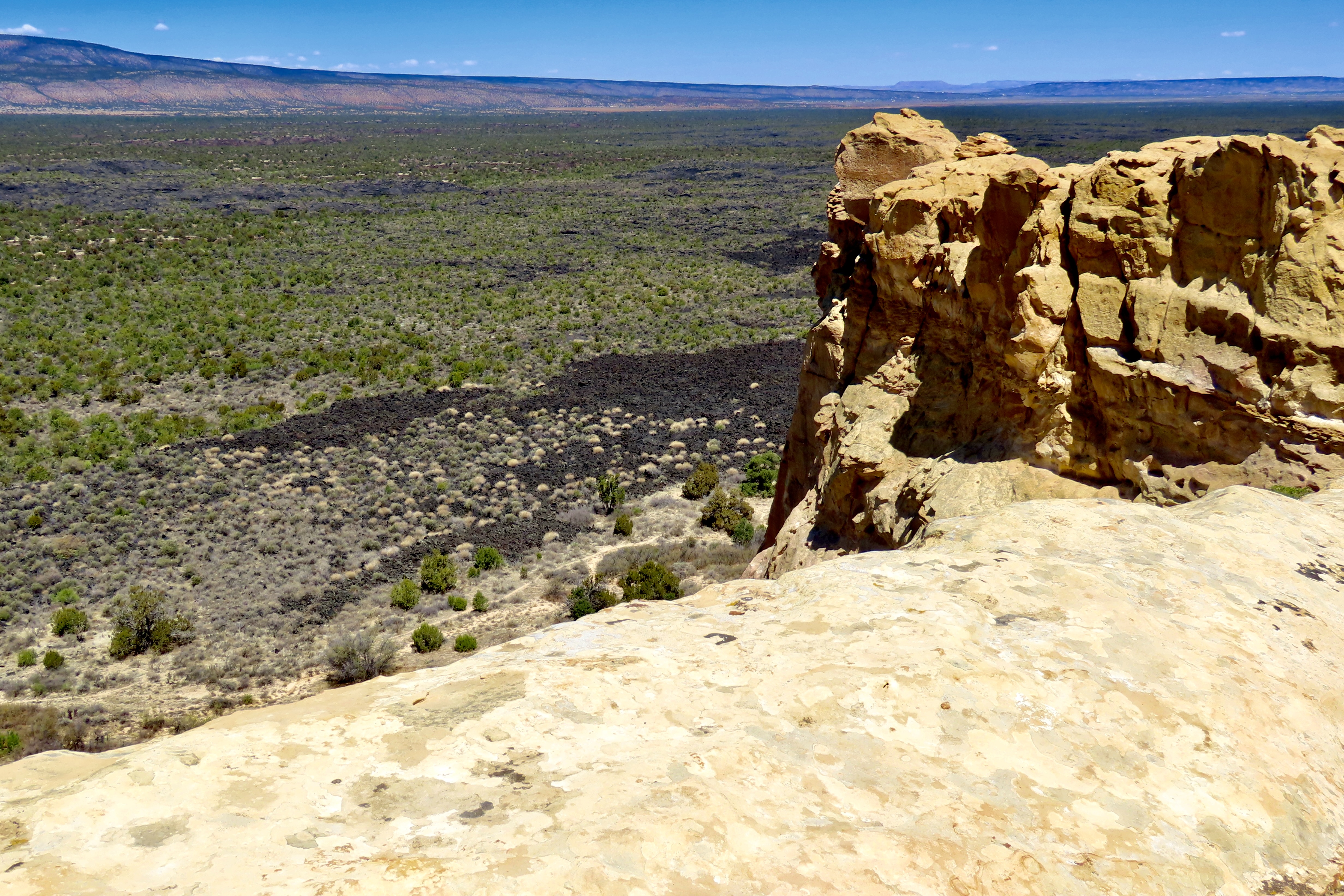
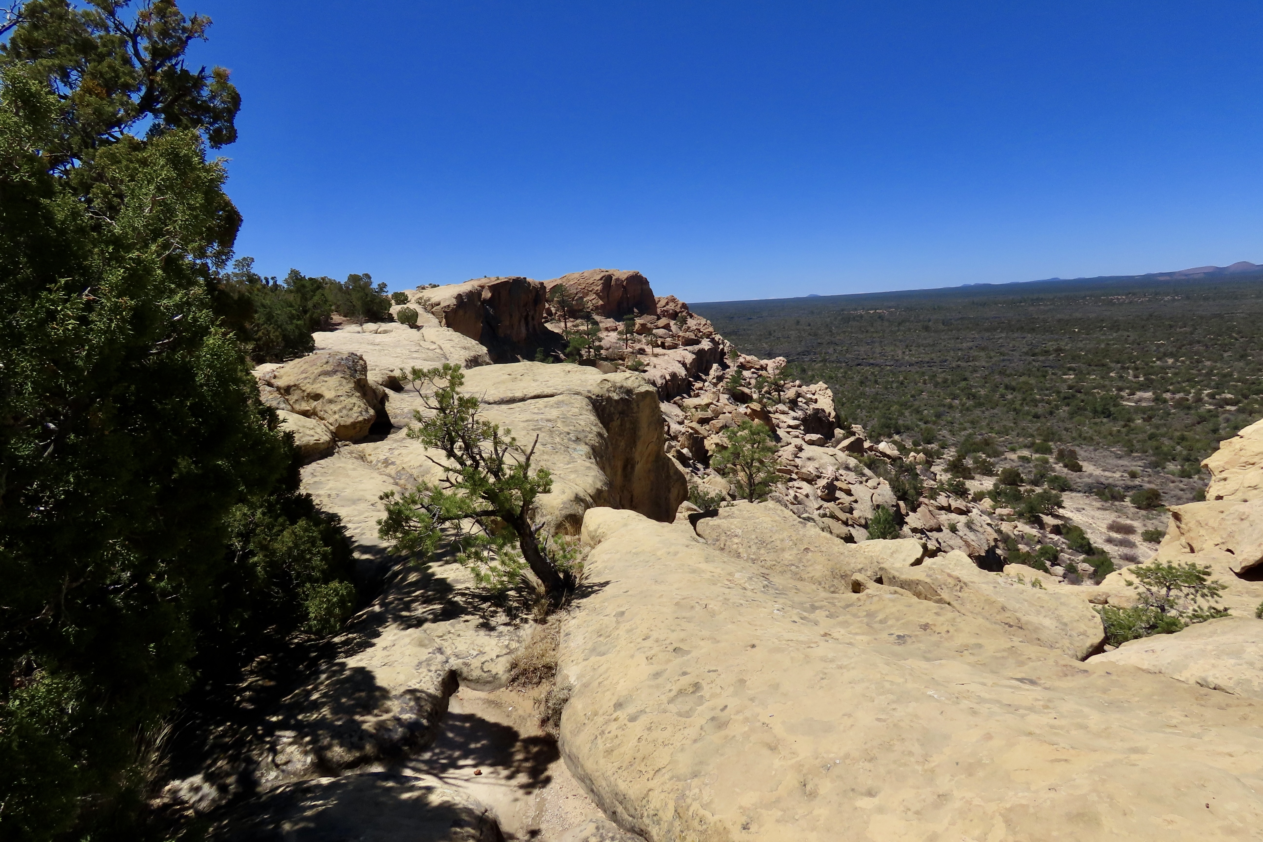
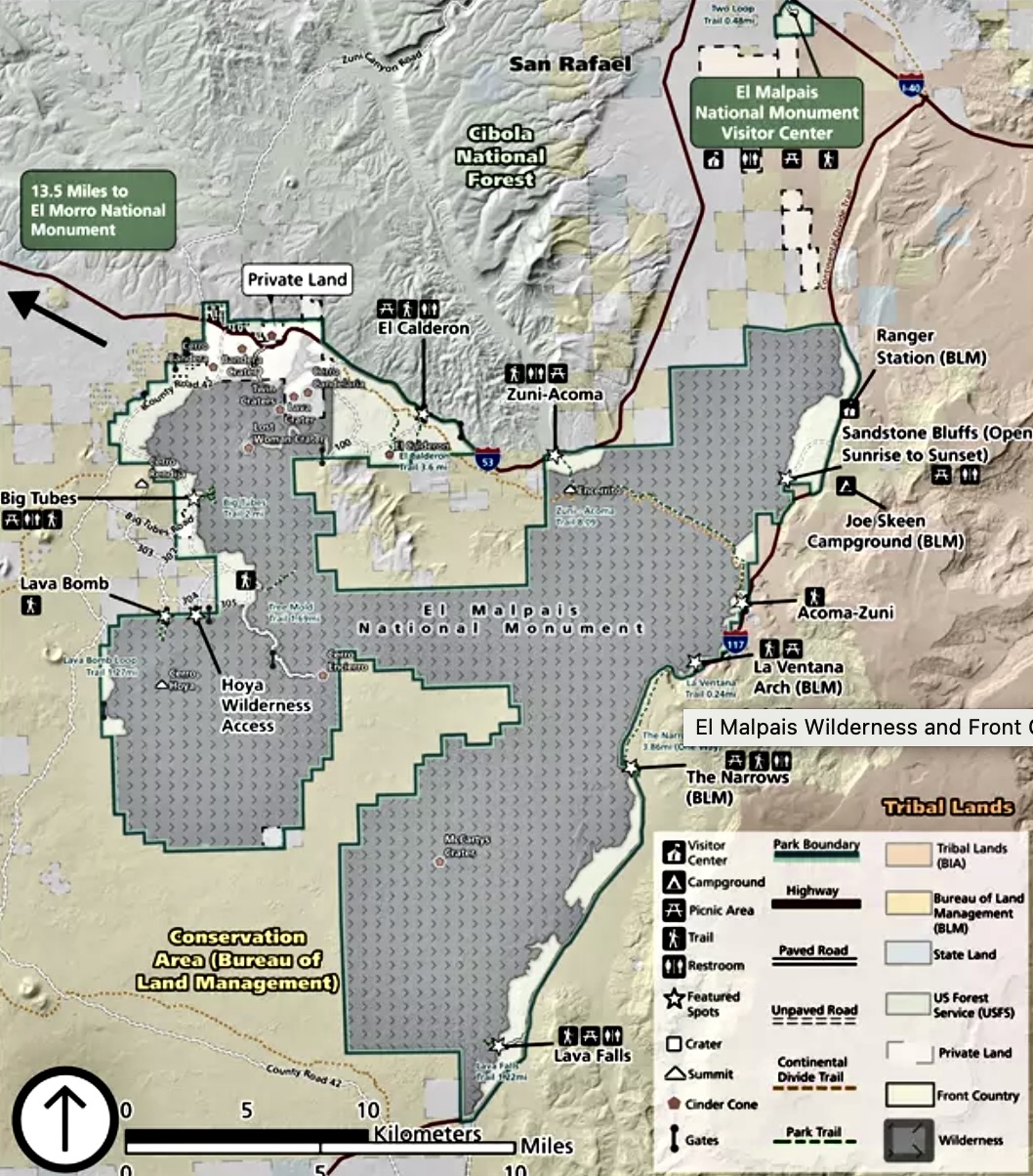
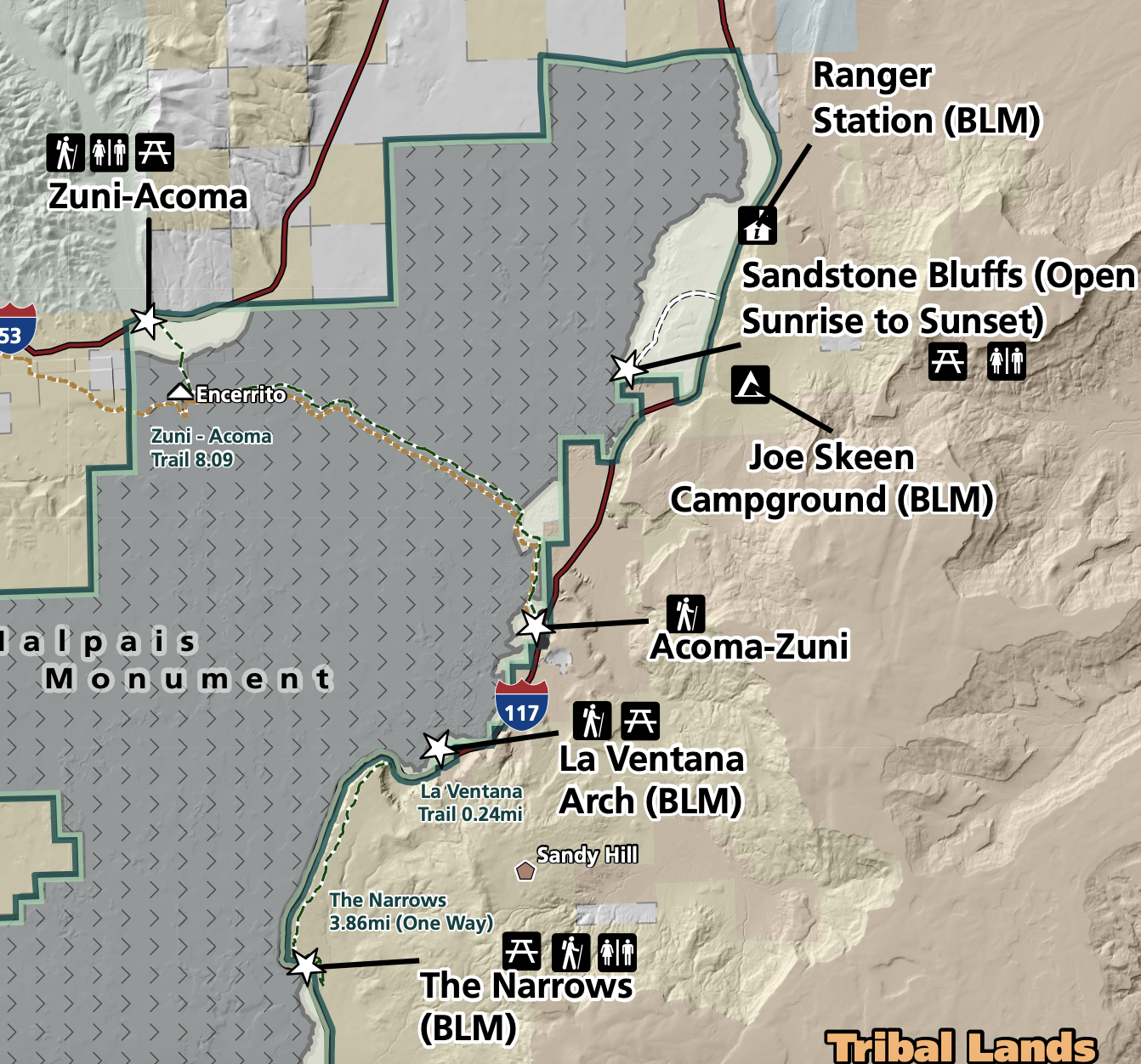
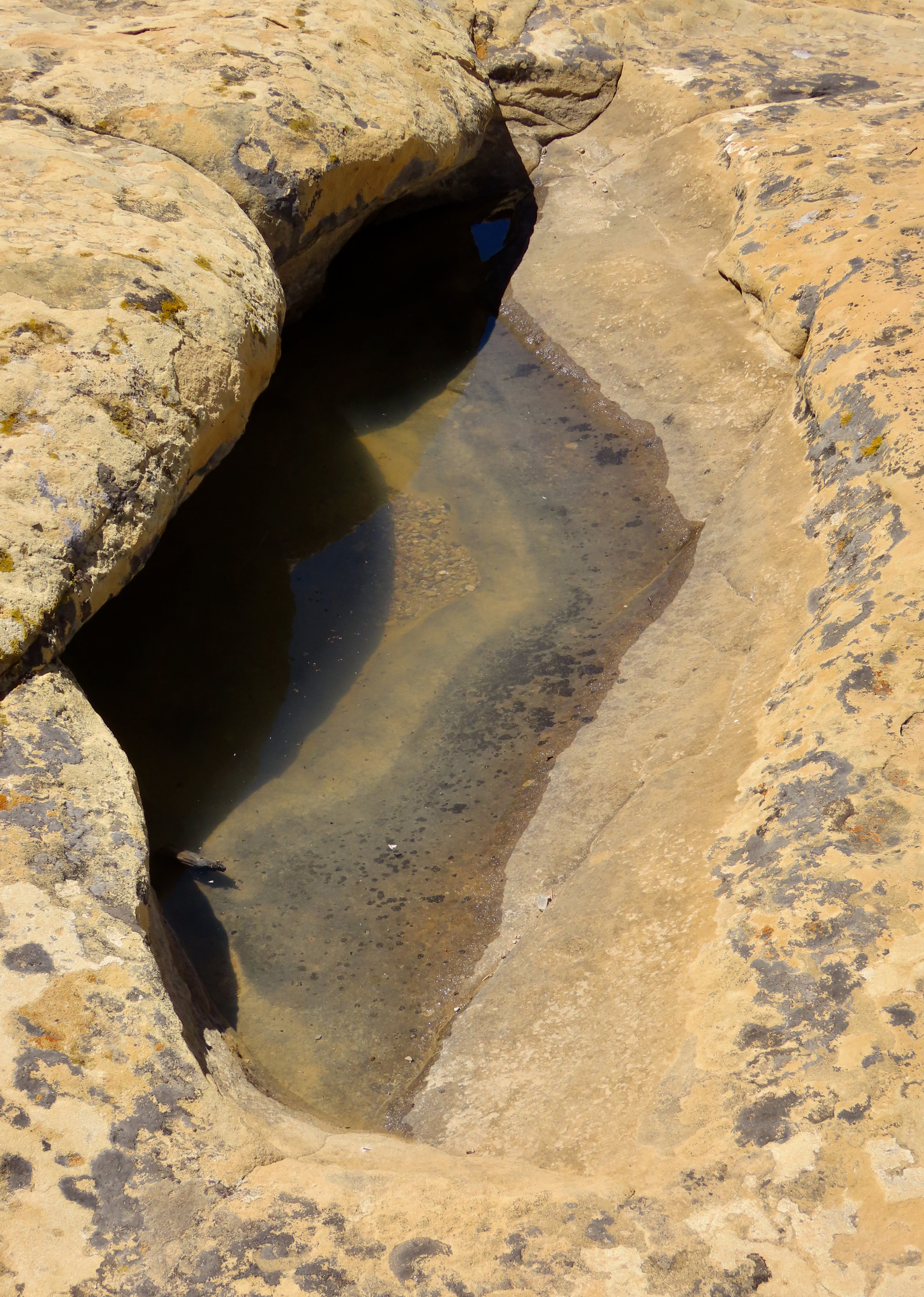
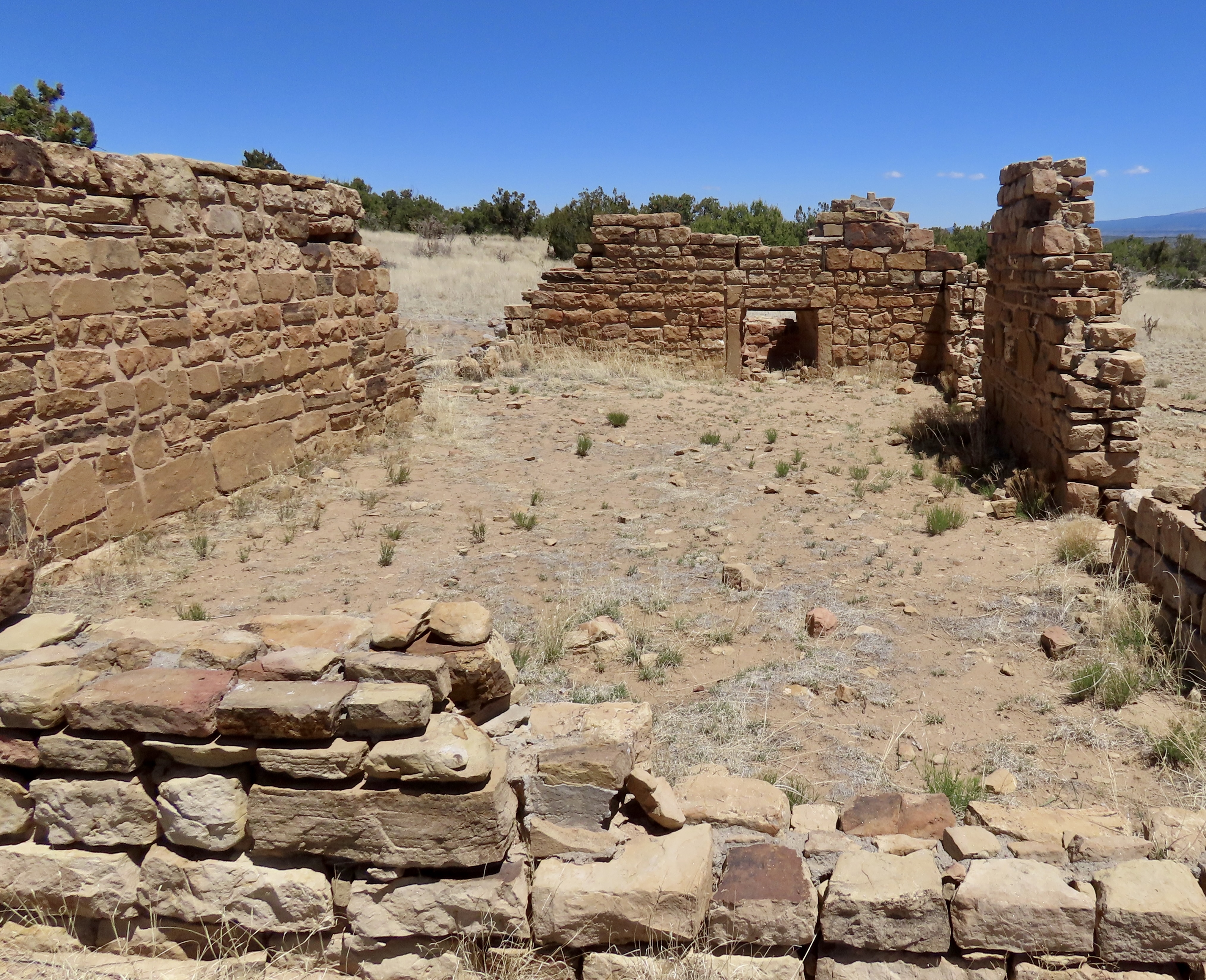
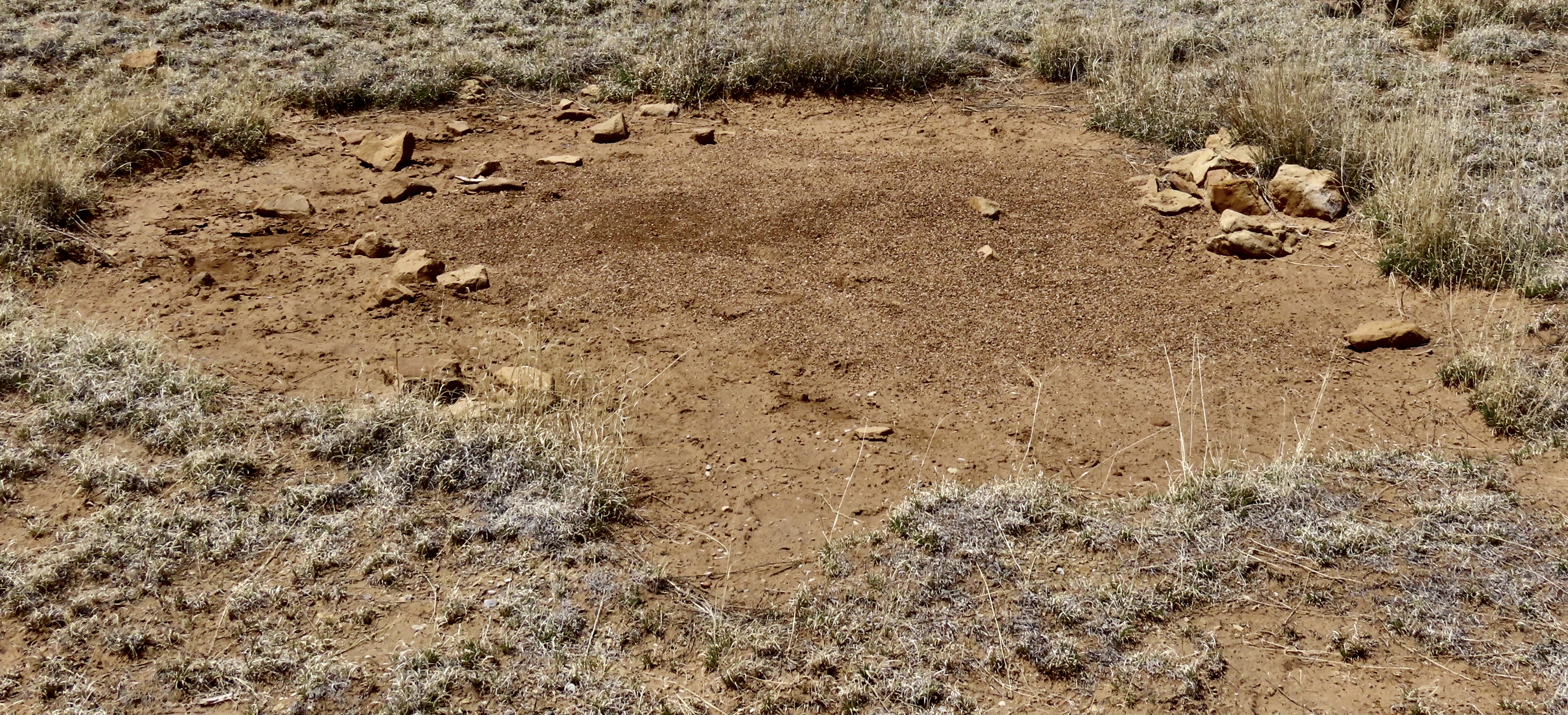
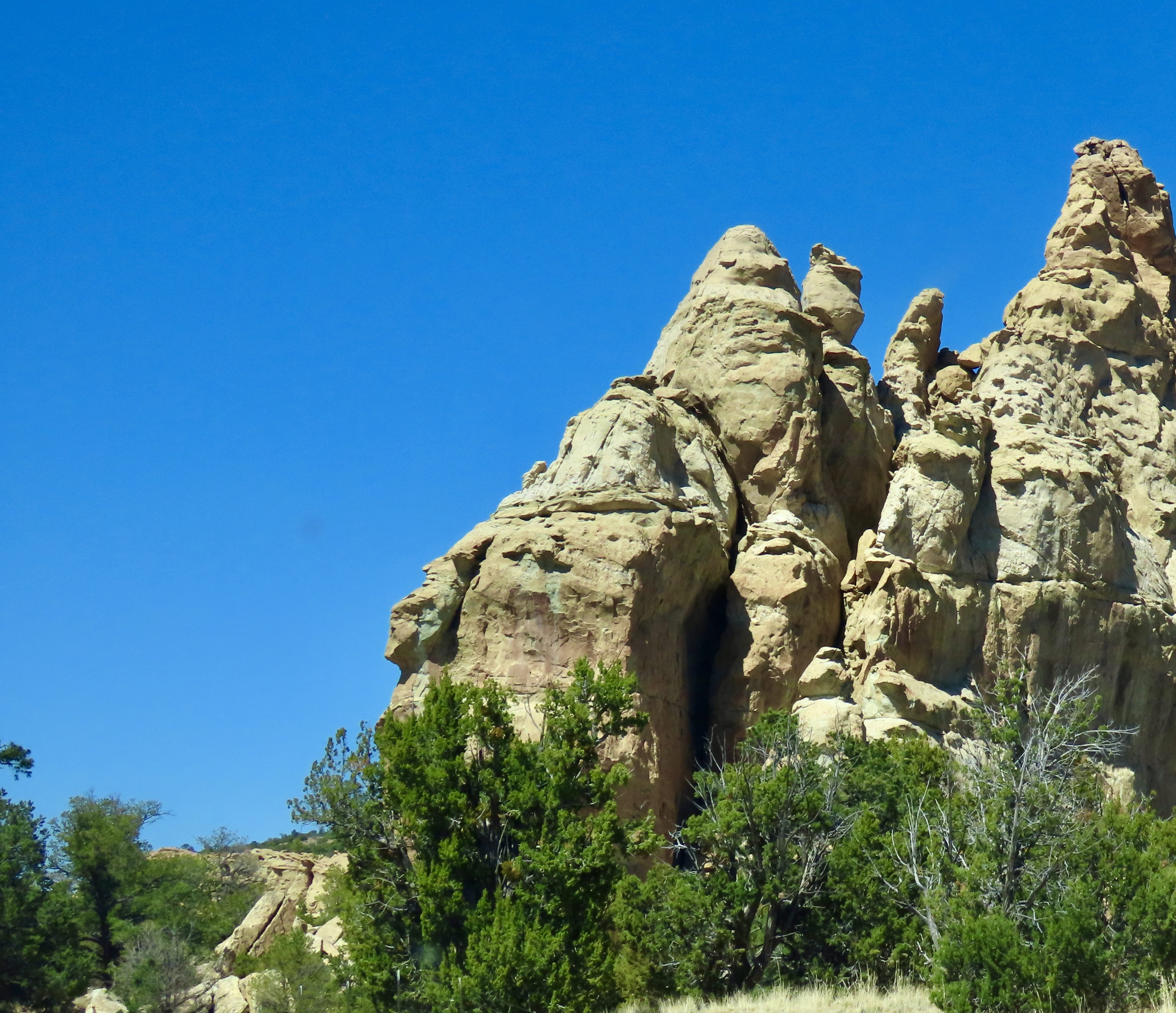
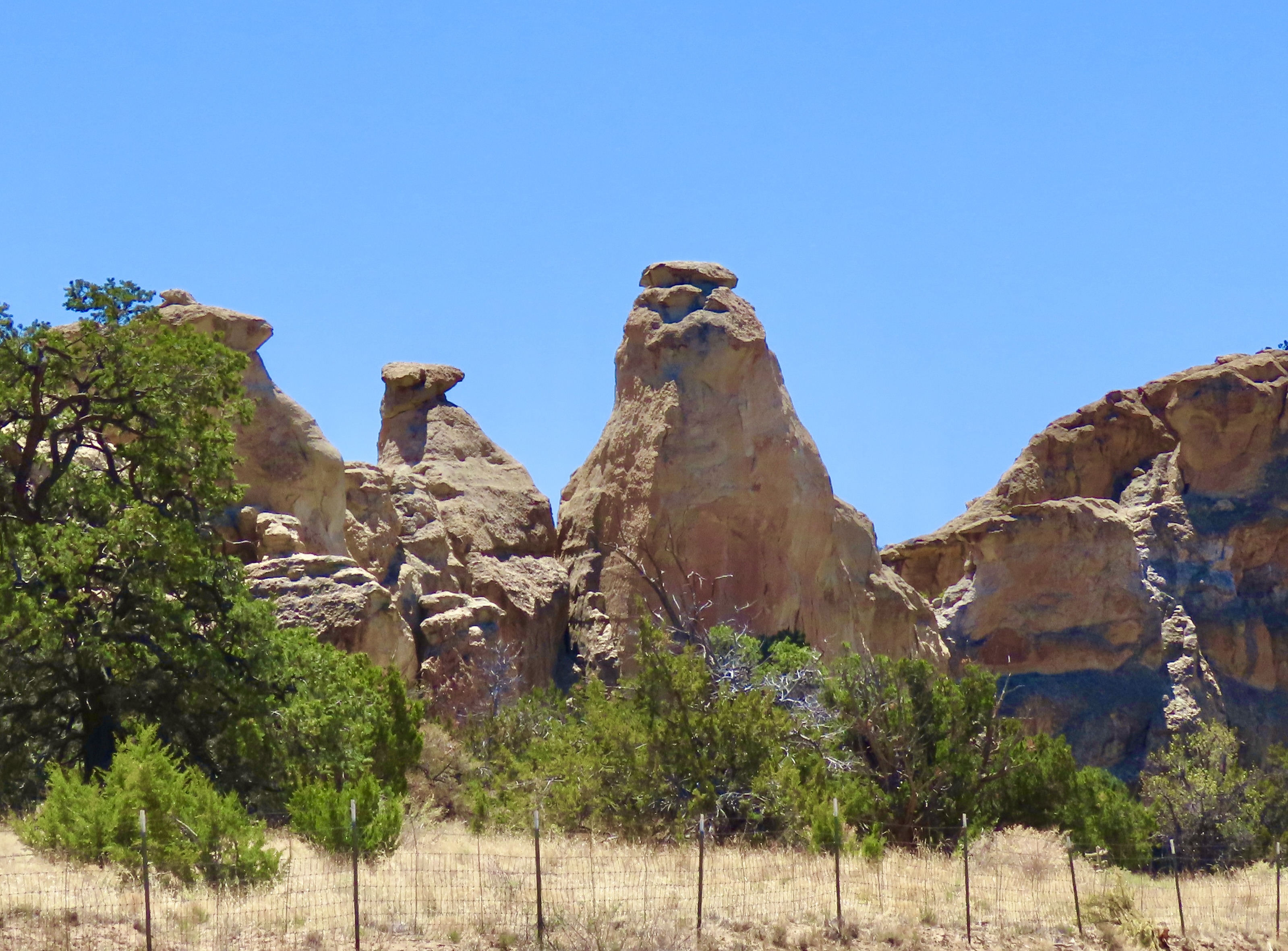
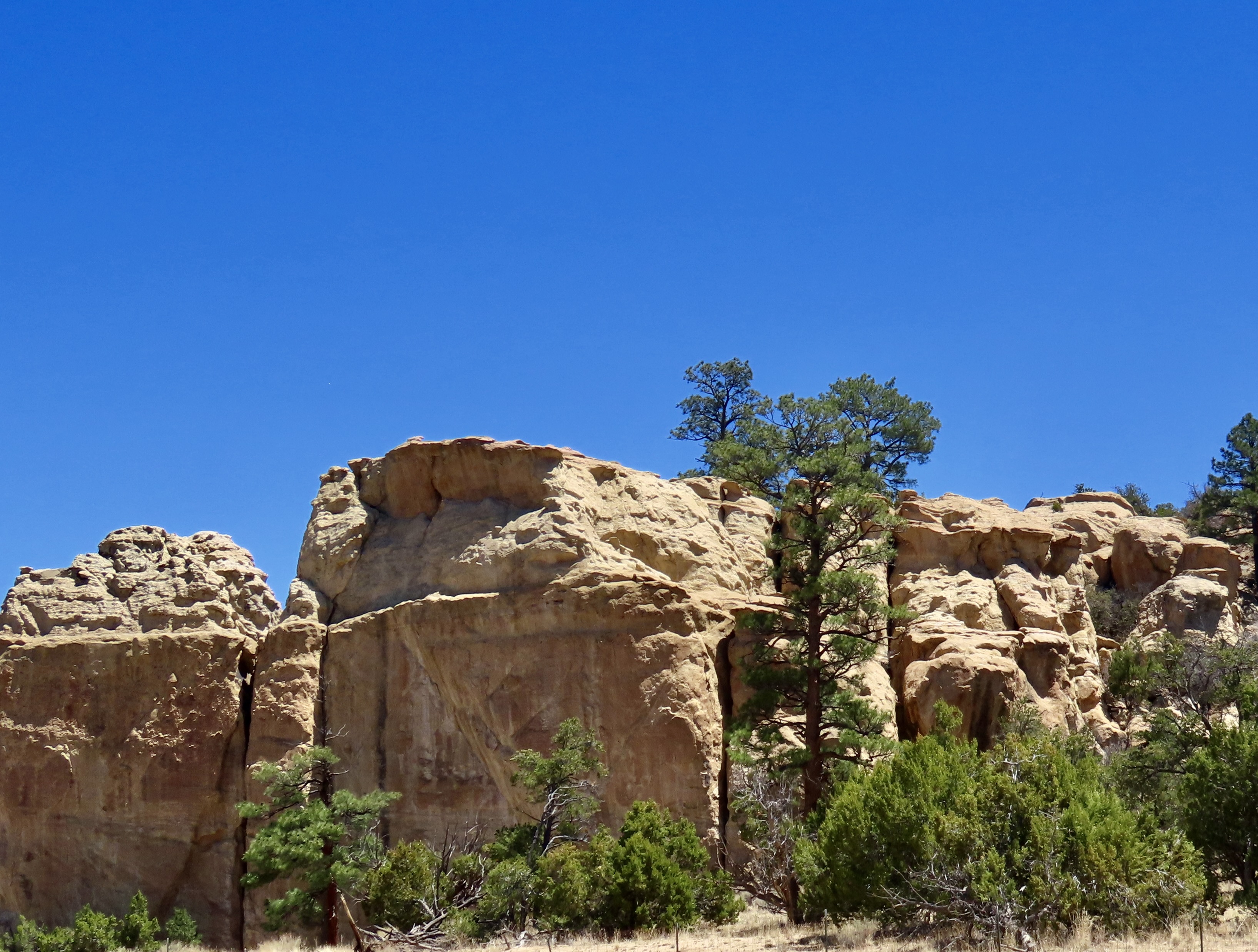
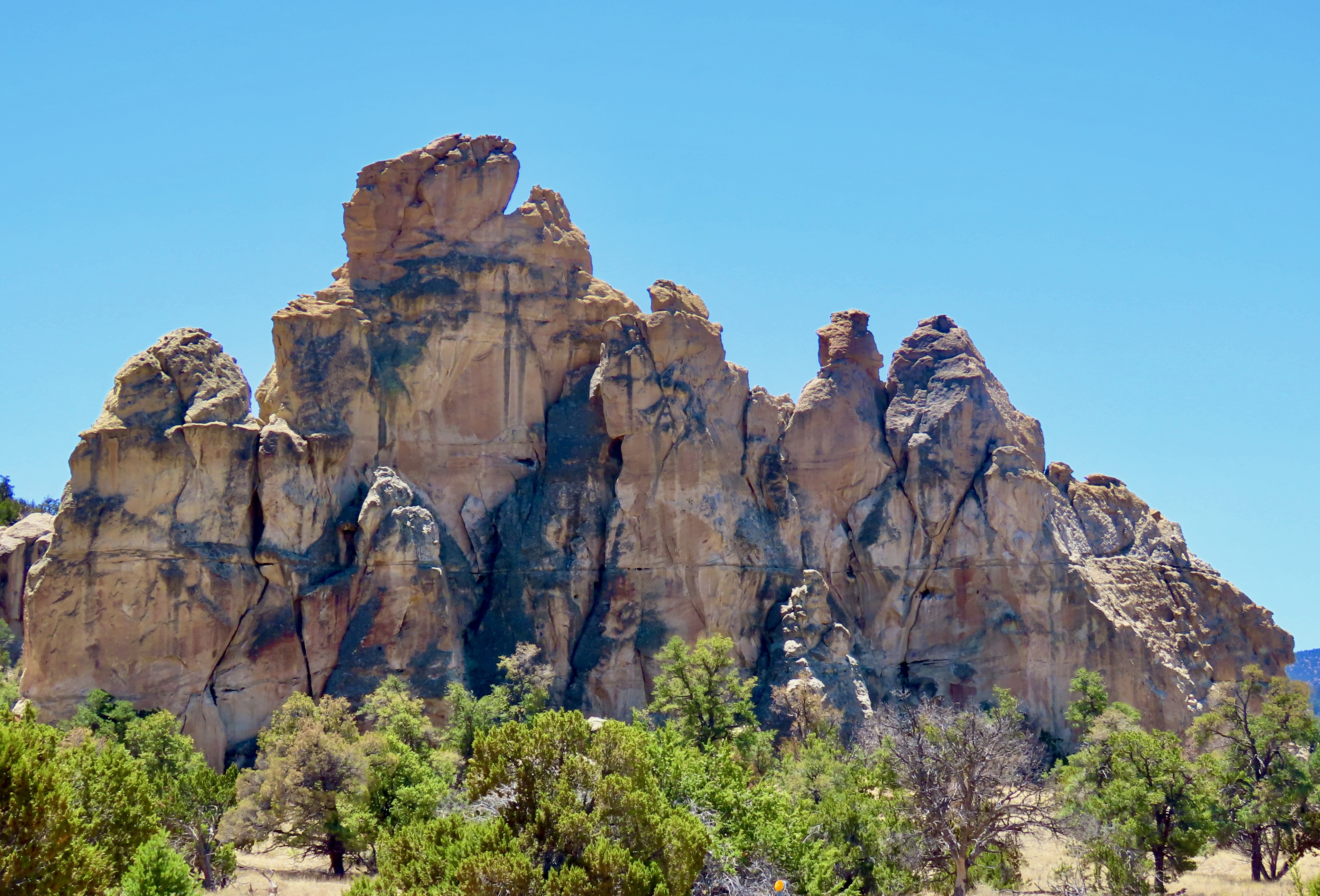
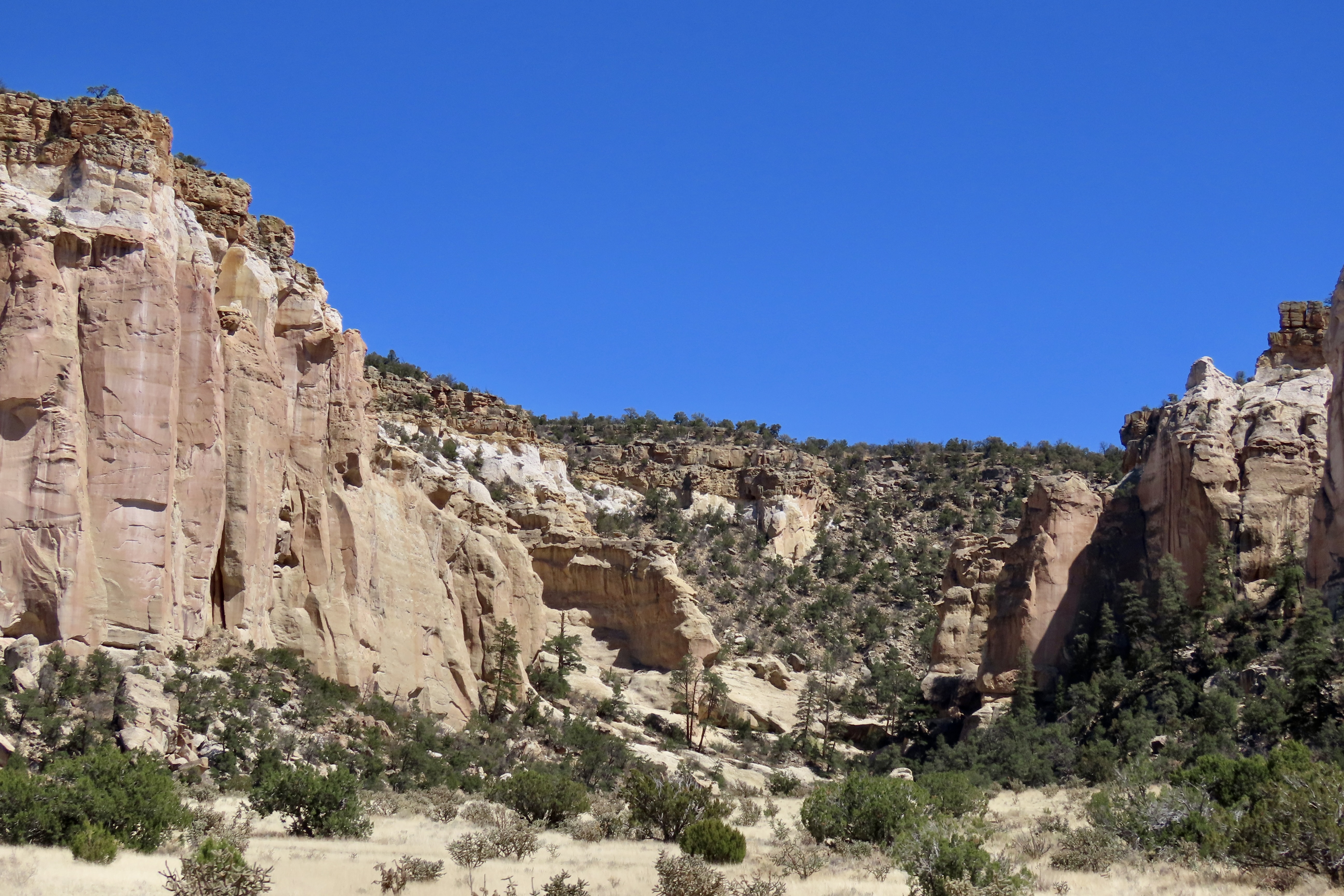
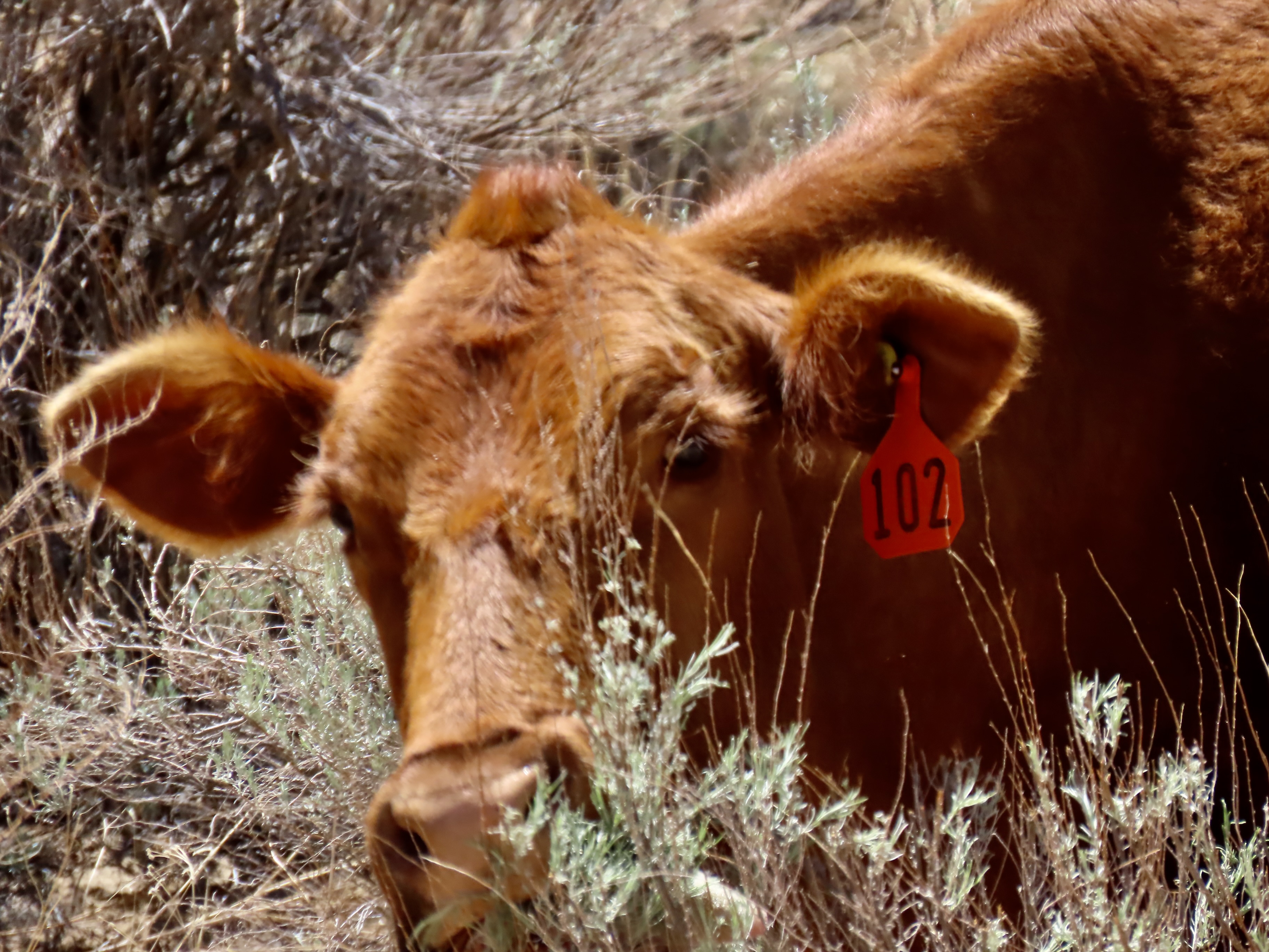
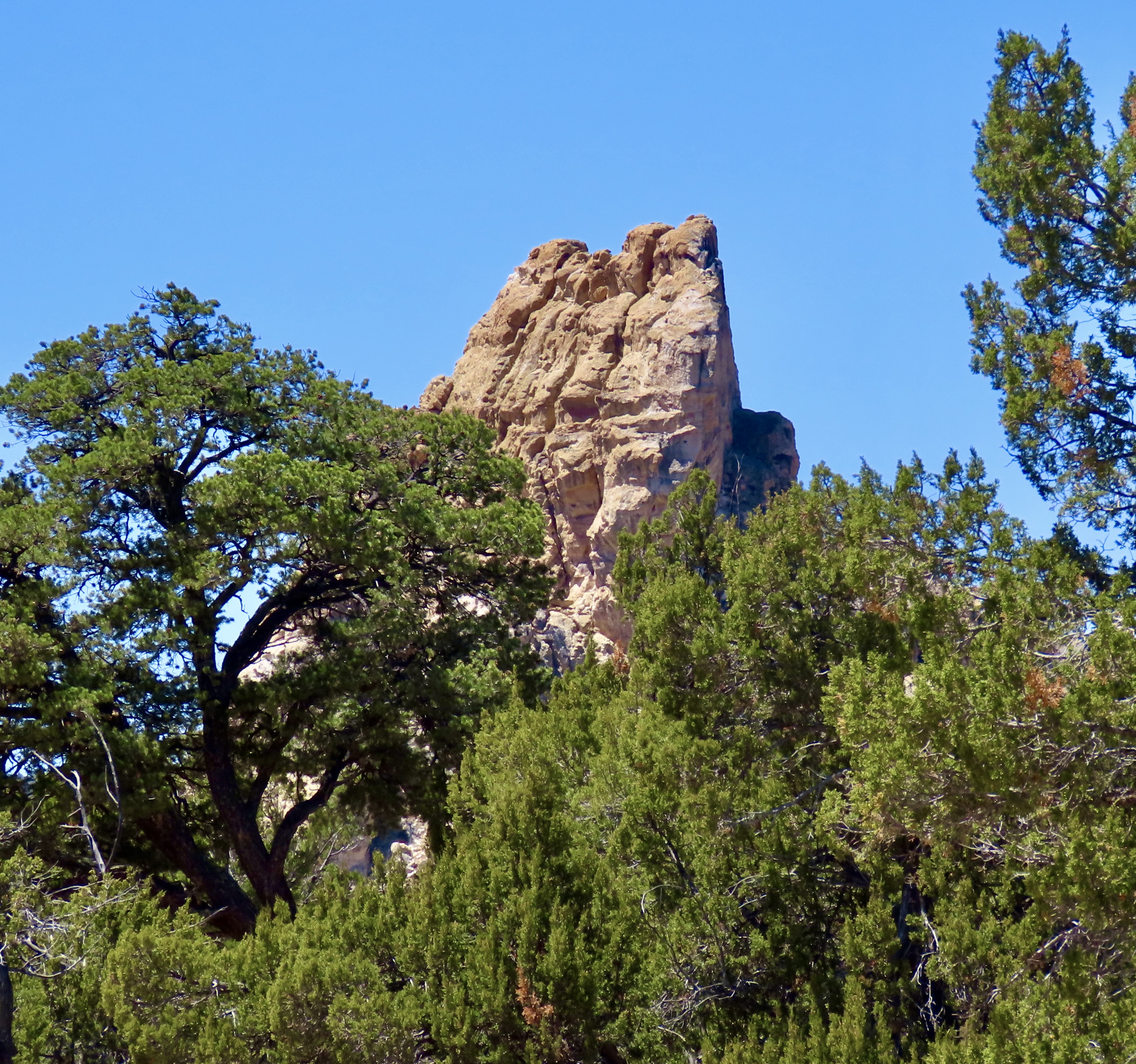
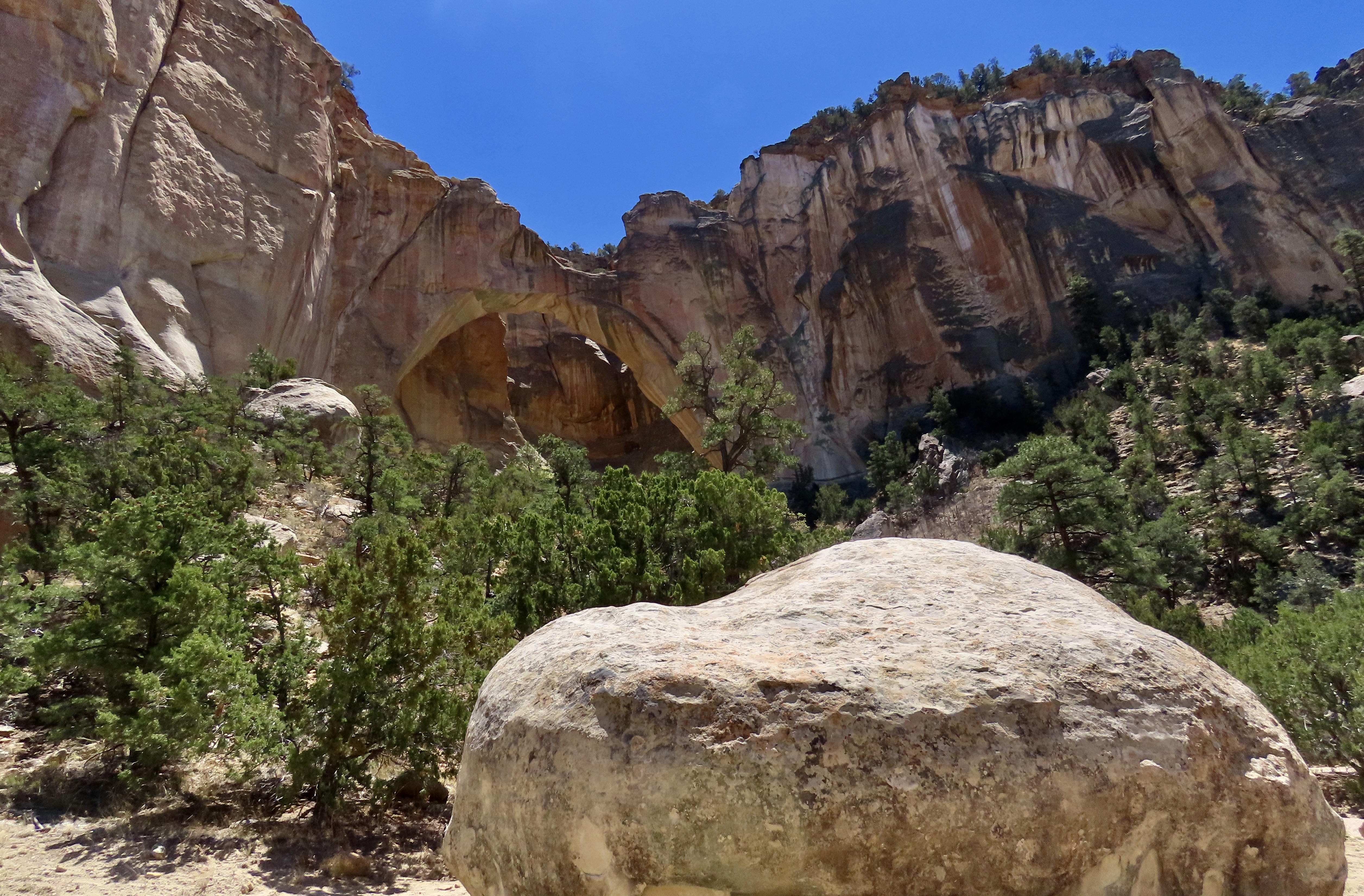
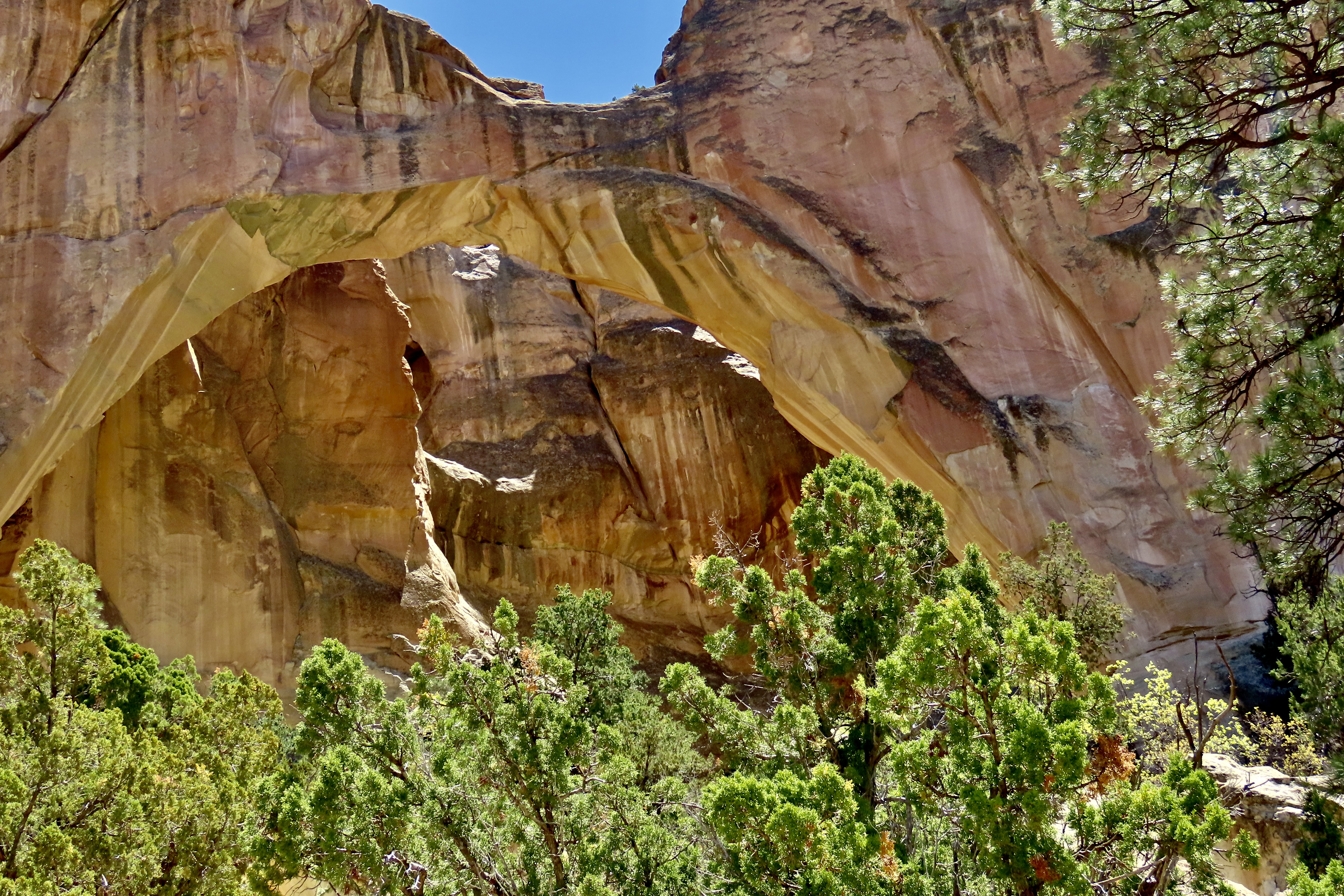
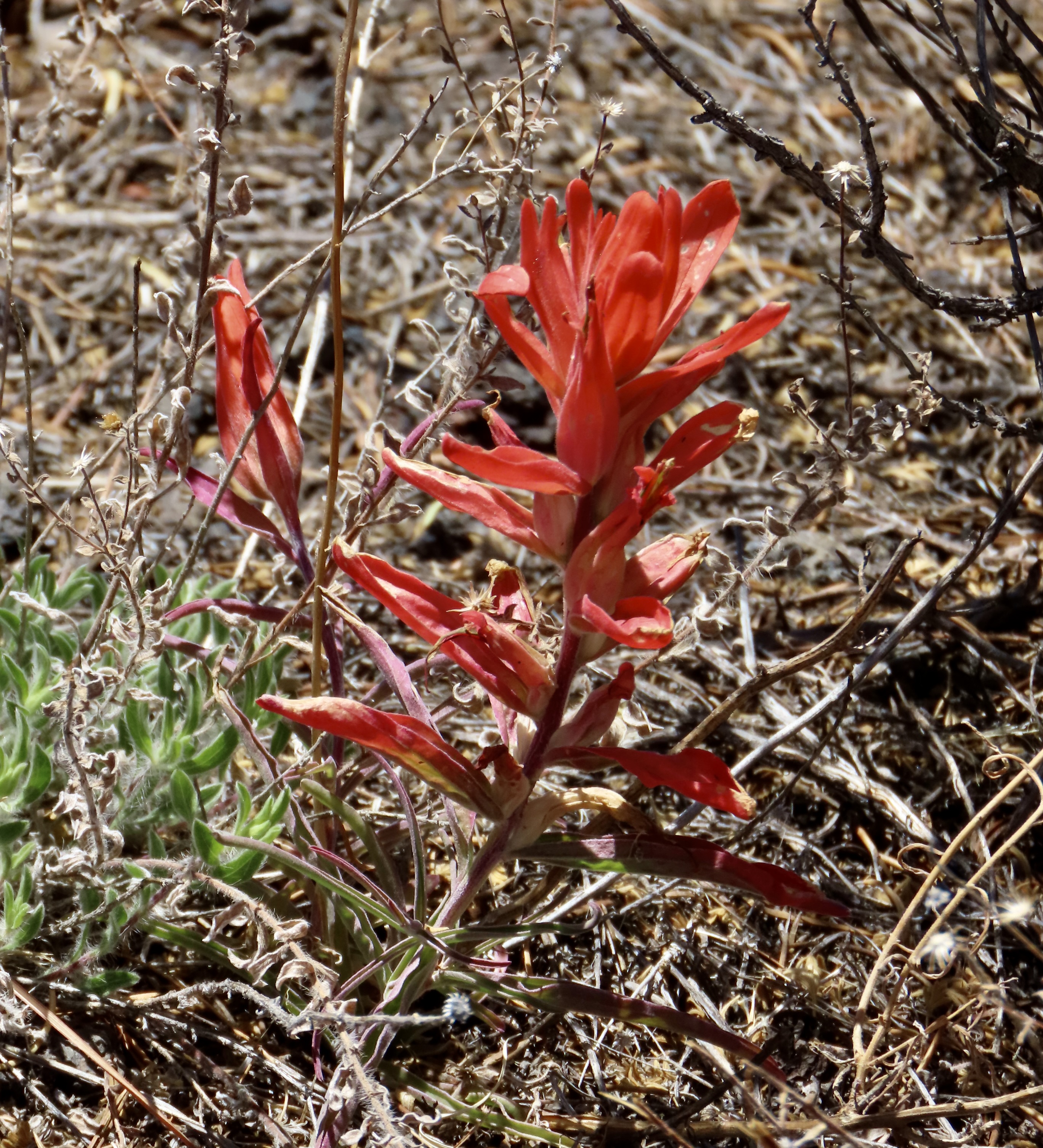
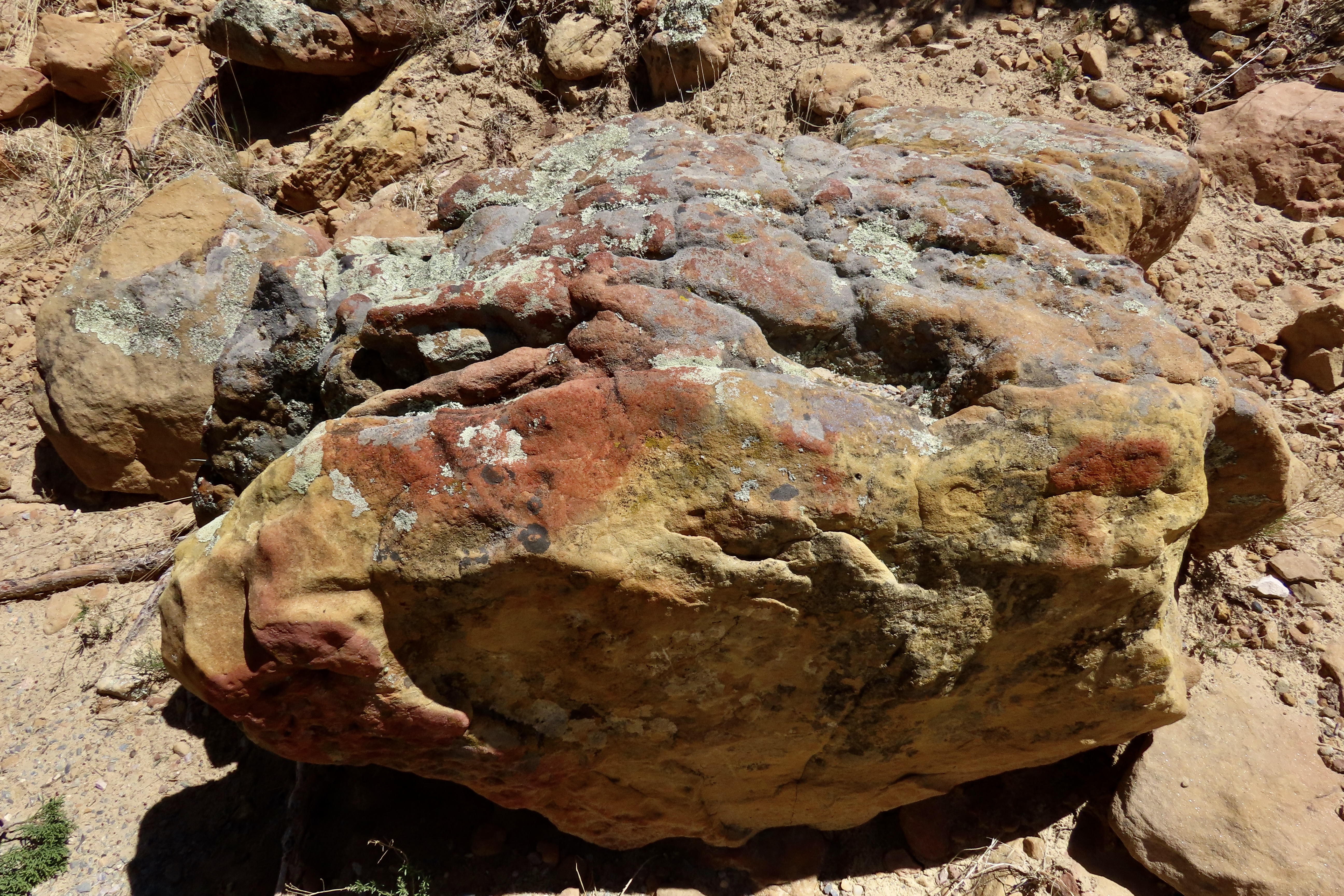
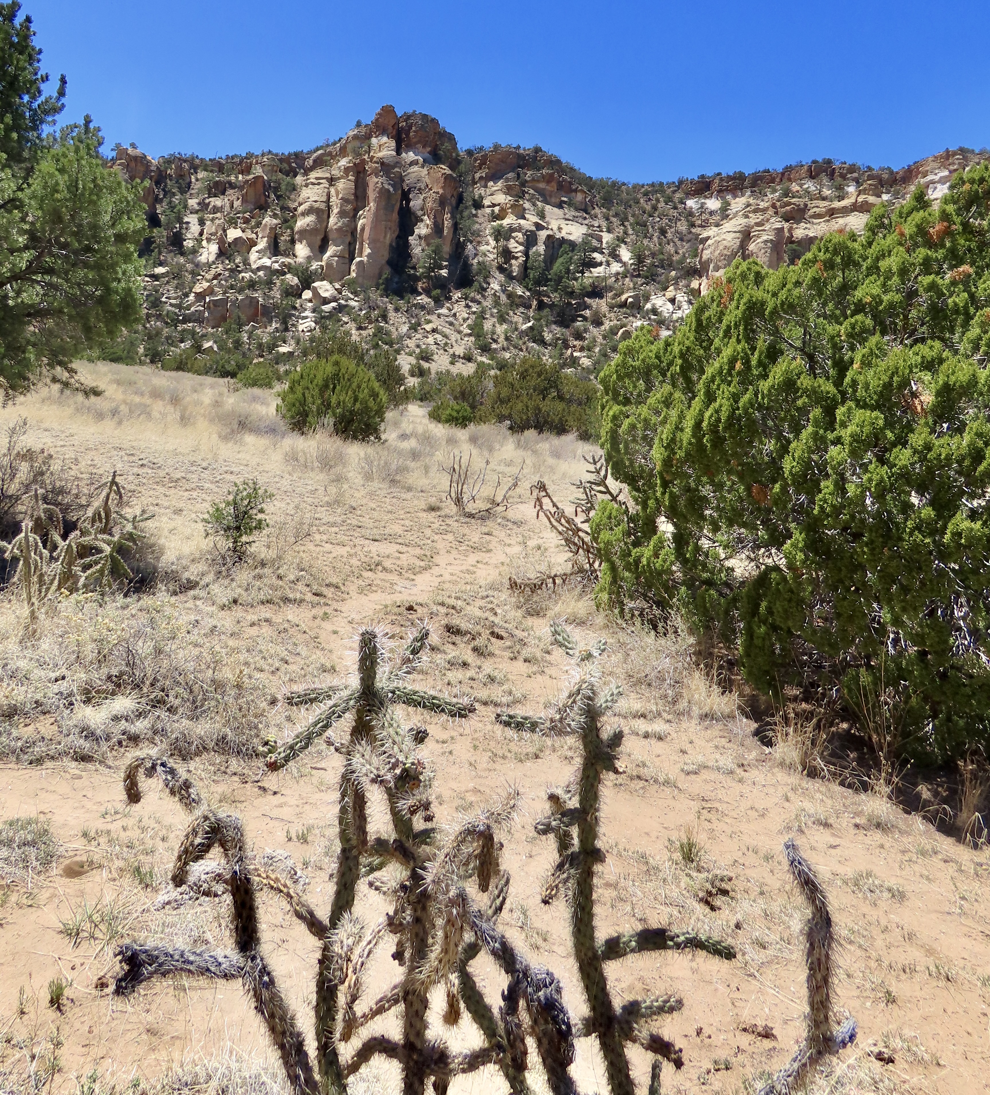
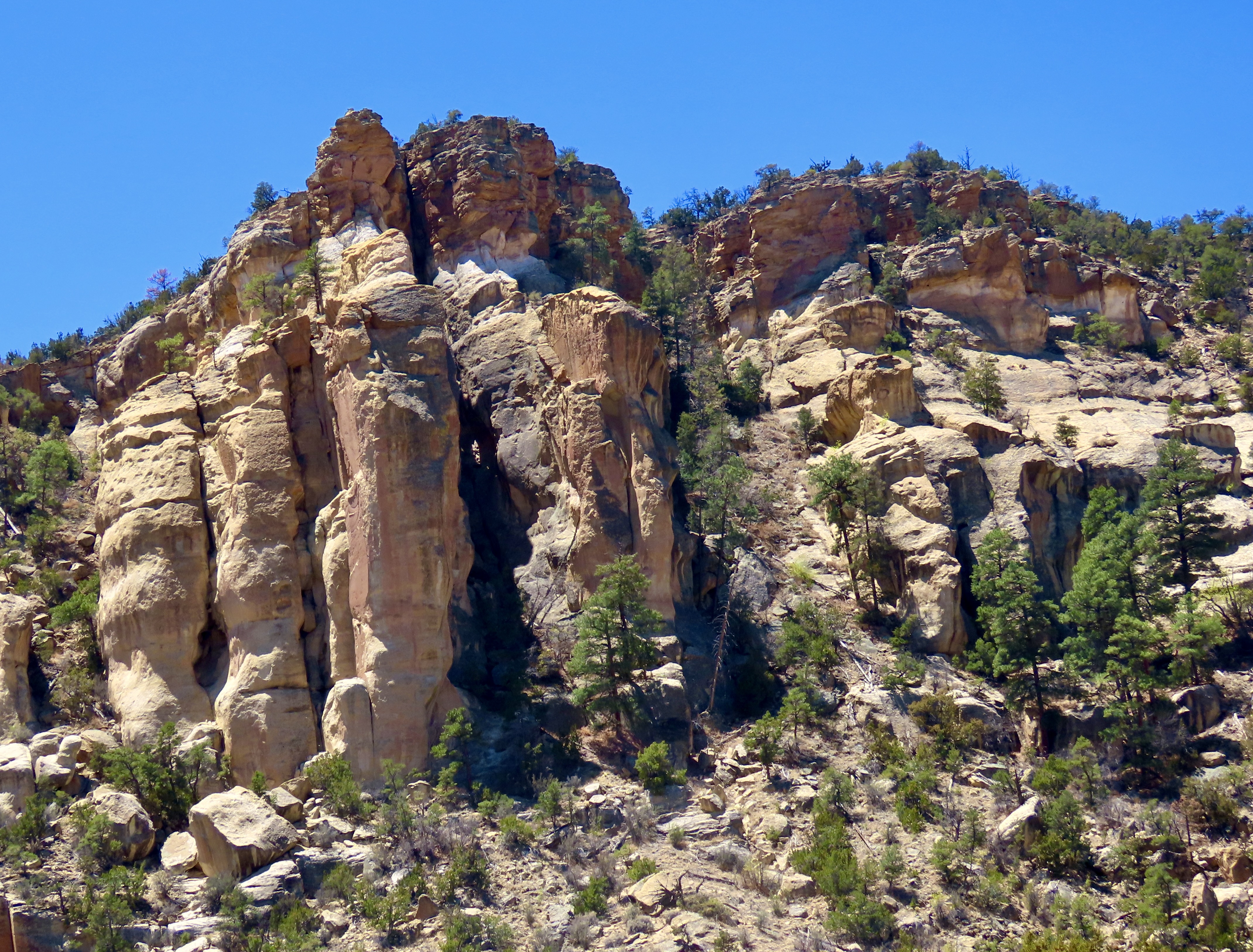
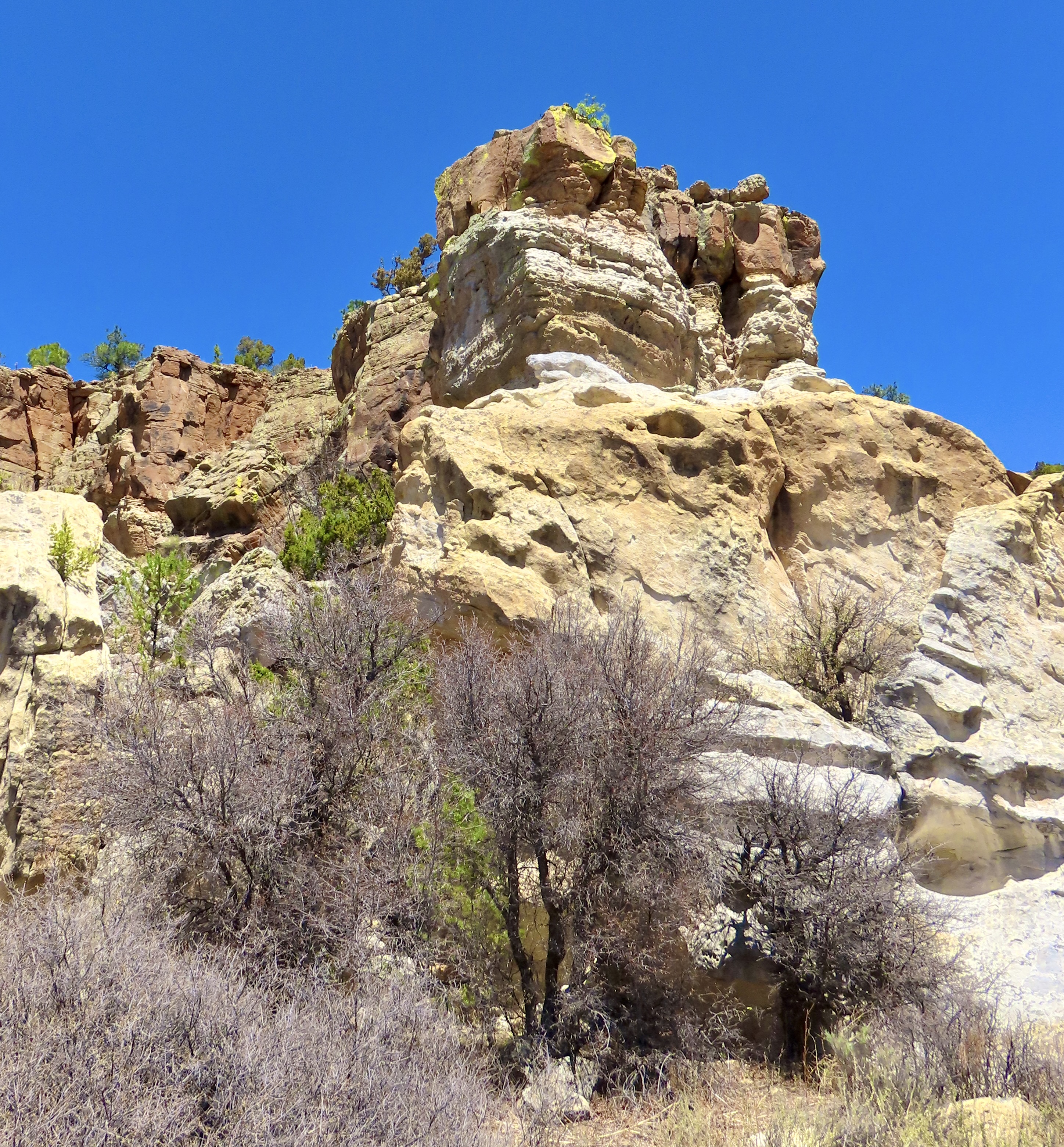
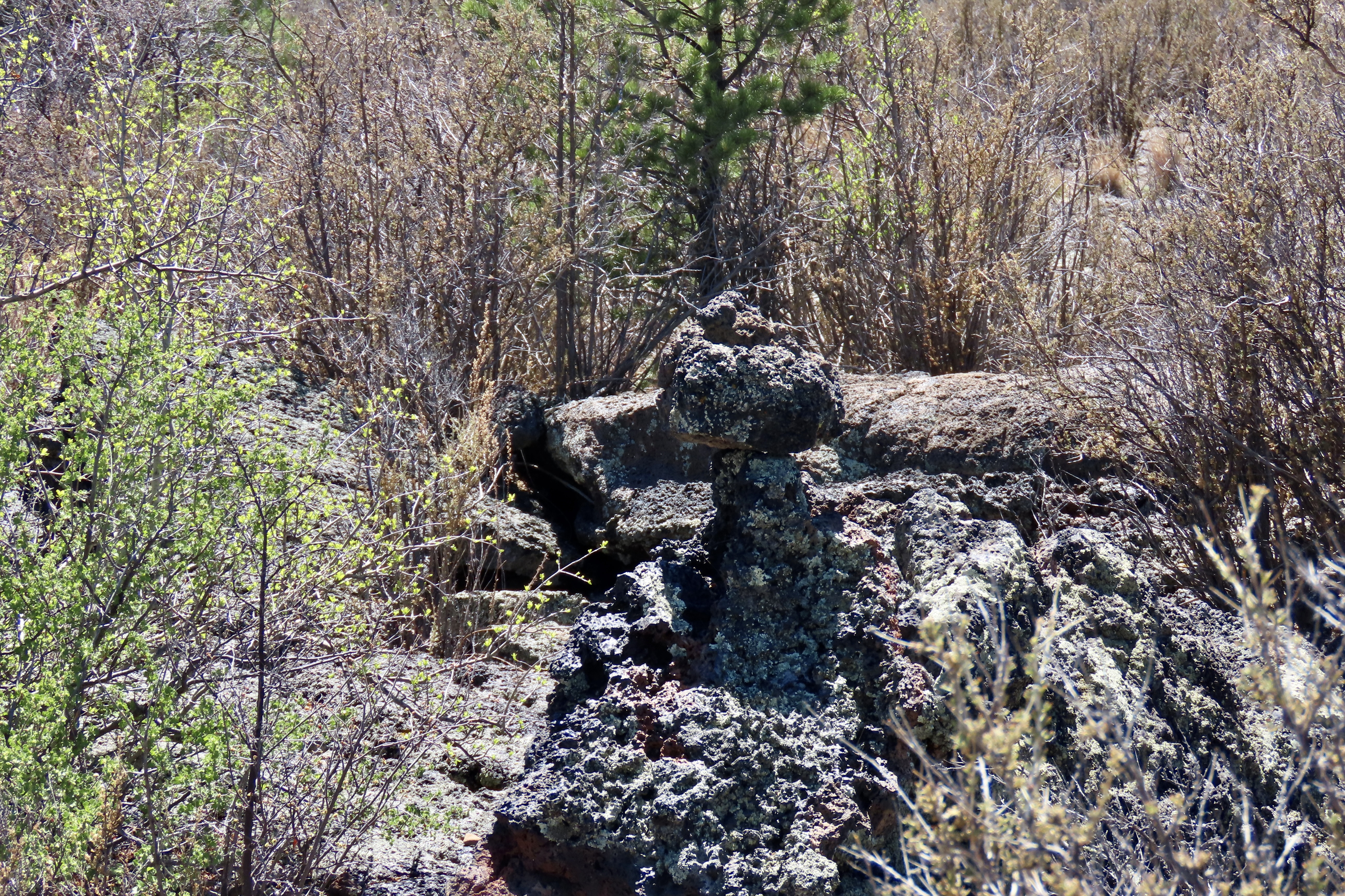
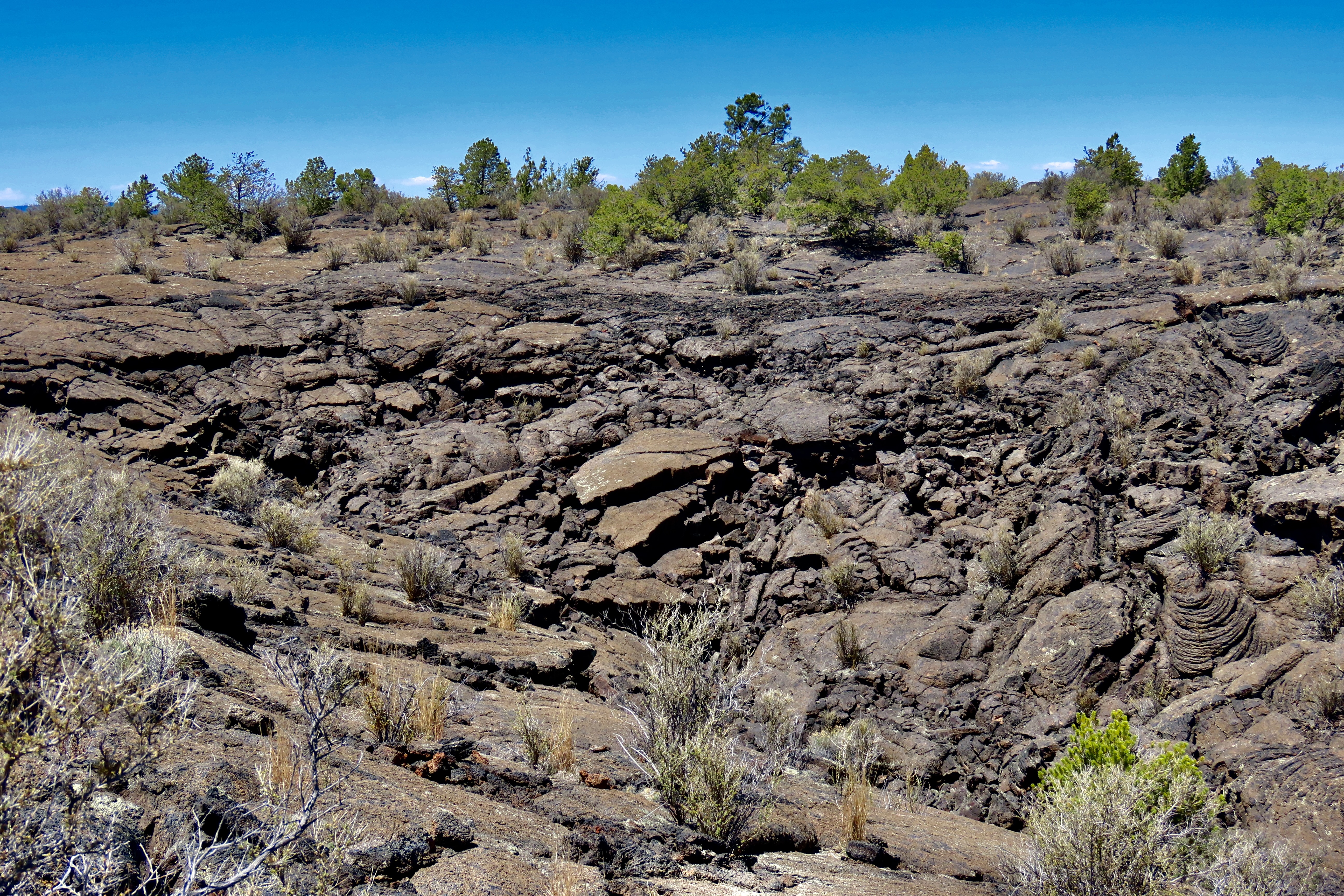
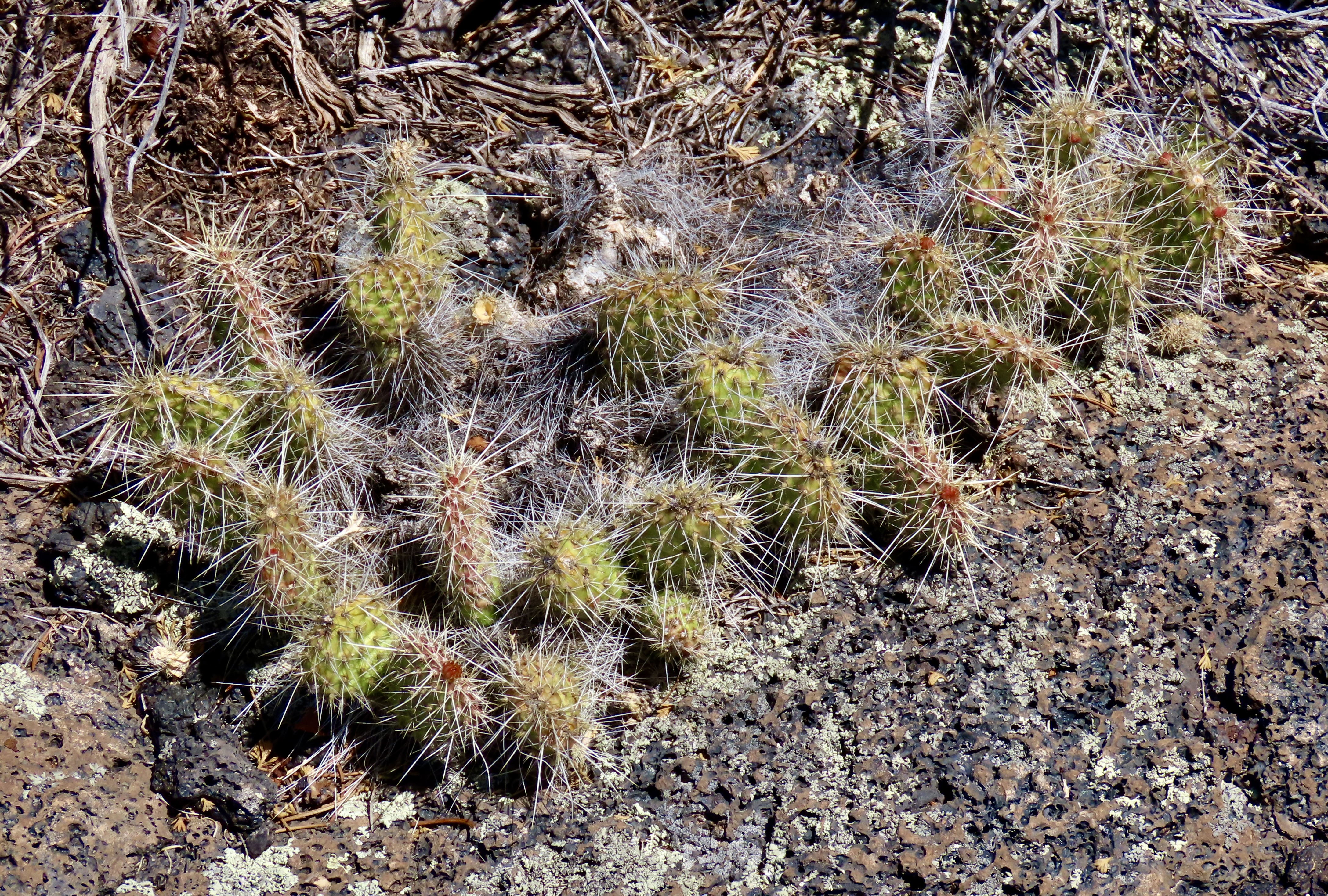
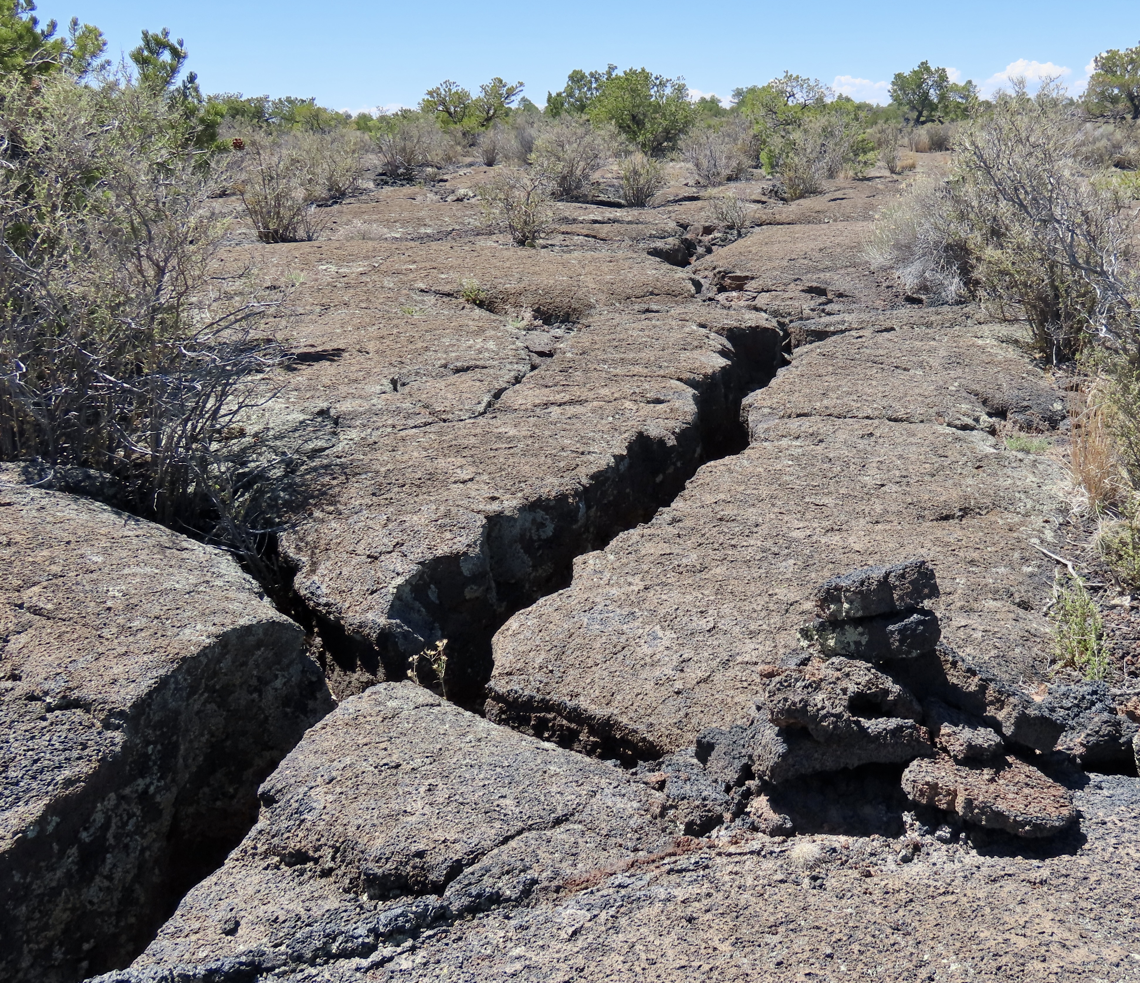
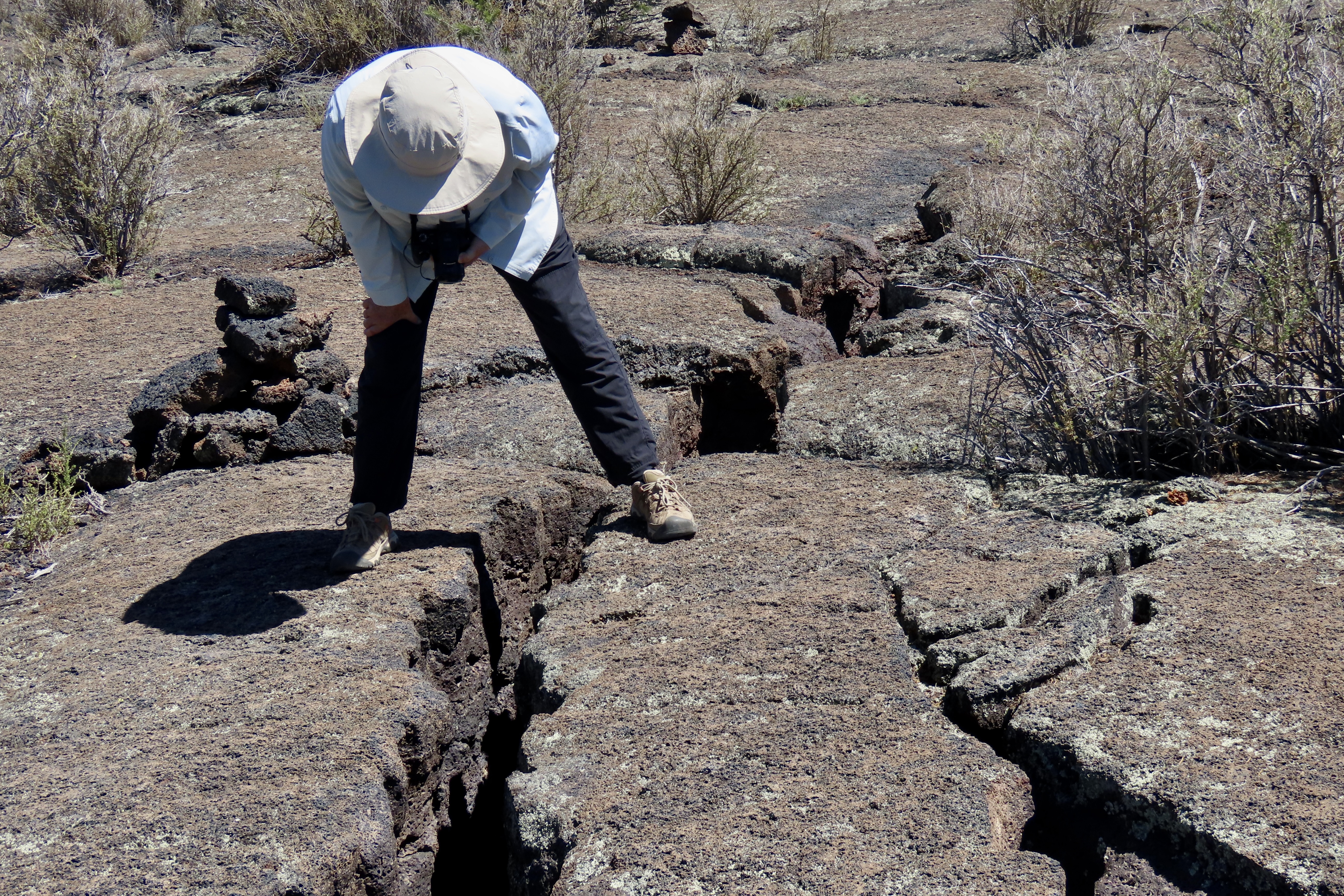
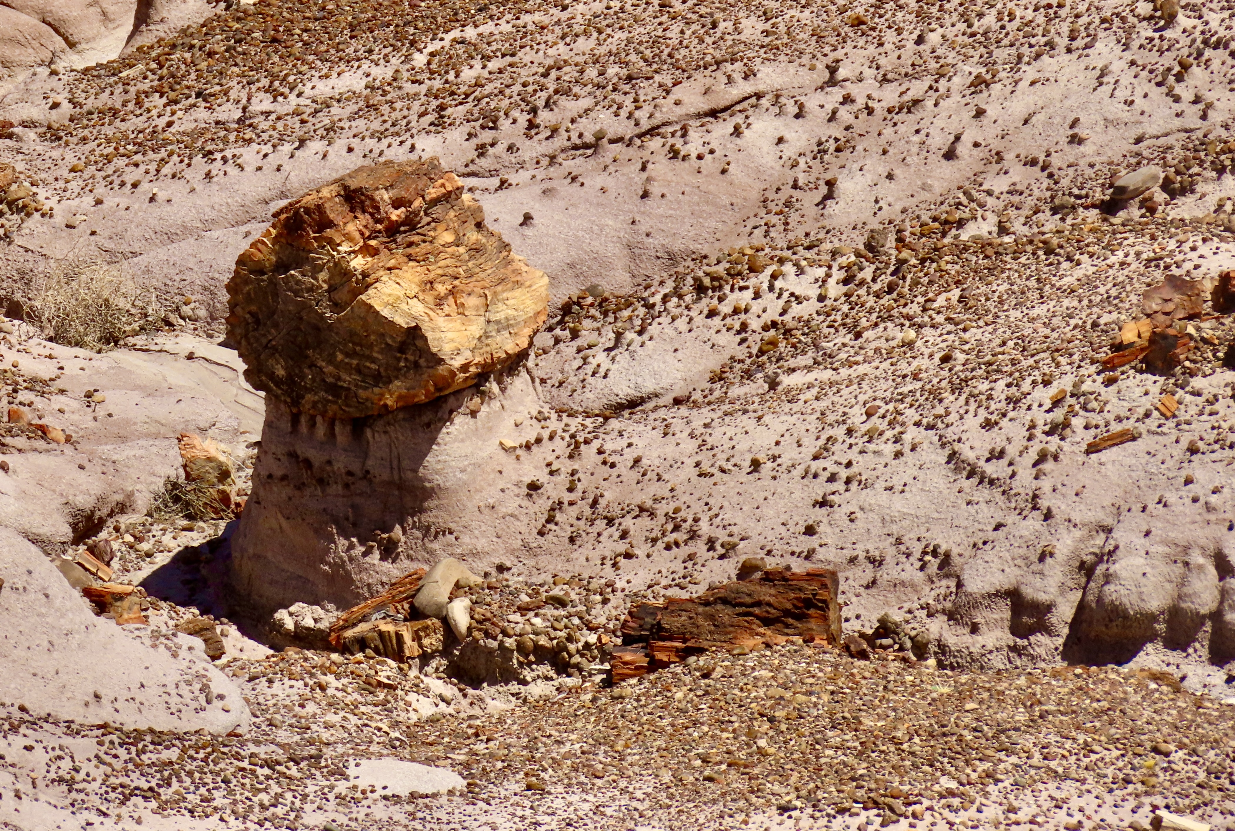
When the Spaniard explorers came through here in the 1500s searching for the Seven Cities of Cibola and untold (unfound) treasure, they looked at the lava covered fields below and declared them El Malpais, the badlands— good for nothing. They would travel around them instead of through them. The Zuni and Acoma, whose ancestors had arrived at least 700 years before the Spaniards, considered them part of their homelands. Food, water, shelter and medicine plants were here for those who knew where to find them. Their trails crisscrossed the ‘not-so badlands.’A road takes visitors out to Sandstone Bluff, shone here and above. Visitors can walk along the bluffs and look down into extensive volcanic flows of basaltic rock. While the sandstone that makes up the bluff dates back some 160 million years, the most recent lava flows are a mere 3000 years old, babies in geological time. If you go back to the first photo, the latest flow is the darkest.This map shows an overview or El Malpais National Monument. I-40 is at the top of the map, as is the Monument’s Visitor Center. El Morro National Monument, that I blogged about earlier, is off to the west. Most of our photos are from the Sandstone Bluffs, the Acoma-Zuni Trail, the La Ventana Arch, the Narrows and Lava Falls.The first four locations are shown above in the close up. The four photos below are from the Sandstone Bluff area.Water catchments such as this on top of Sandstone Bluff, provided a ready source of water after rainstorms for the Ancestral Puebloans, more ancient peoples, and wildlife that lived and wandered through the area. Various little water bugs took advantage of the pool when it was full. As did frogs, who laid eggs that turned into pollywogs. Looking at photo, I’m still trying to turn the stick into a skinny frog. Ruins of the Garret Home are found along the road to Sandstone Bluff. The family built their homestead in 1934 on the edge of El Malpais as a way to scratch out a living and survive the Great Depression.We found this barren space next to the house. It was about 6 feet across and interesting but we carefully avoided walking across. It marks the location/territory of a red ant nest. Had we walked over it, ants would have come boiling out to attack and bite us. And, believe me, their bite hurts! I know from experience. Various reasons are given for the cleared area. Among them: It makes it easier for the ants to leave and return to the nest when they are foraging, enemies, like other ants, have a harder time attacking, and the direct sun makes the nest warmer on cold days.Lunch? These ants seemed to be chowing down on this bug. Or maybe they were working cooperatively to drag it to their nest.Sandstone cliffs along New Mexico 117 on the eastern side of El Malpais National Monument provided us with numerous views of impressive rock monuments.This provides a good look at cap rocks. Being harder than the rocks immediately below them, they resist erosion more and provide for the multitude of interesting shapes one sees when traveling around the Southwest.We liked the contrast between the tall ponderosa pine and the cliffs here.Once again, we liked the contrast. But it was the sheer size of this monument combined with its coloration that insisted this was a photo op.This is a ‘draw’ in Western lingo and quite likely a box canyon. Cowboys liked them because they often provided water, shelter and forage for their cattle. If it’s a box canyon, it could also serve as a makeshift corral.Moo.This rock, peeking out from among the trees marks the beginning of the ancient Acoma-Zuni Trail on the eastern side of El Malpais. We found it amusing that it is named the Zuni-Acoma Trail if one starts from the west. Historically, and today, the Zuni lived/live on the west side of El Malpais and the Acoma on the east. The 7 1/2 mile trail provided the main route for the two groups to travel back and forth between their pueblos. It’s been in use for at least a thousand years. Today, people backpacking the 3100 mile (4989 km) Continental Divide trail are still using it! Some of the cairns (rock markers) used by the hikers to follow the route were set in place hundreds of years ago by the Acoma and Zuni.La Ventana (the window) Arch is found about halfway down New Mexico Highway 117 when driving the length of El Malpais National Monument. It’s the second largest natural arch in New Mexico and definitely worth a stop.A closer view. A short trail leads up to the arch from the parking lot. Picnic tables are available for those who would like to stop for lunch. We found a group of hikers who were doing the Continental Divide Trail, eating lunch at one of the tables.We also found: A single Indian paintbrush…A rather colorful rock…And a Cholla cactus on a trail leading up to another rock monument.A close up.Instead of eating lunch at La Ventana, we chose to drive down to the Narrows and eat lunch at a BLM park, where we treated to views like this. The brilliant white rock two thirds of the way up is sitting on a rock that is 60 million years older. In geological terms, it’s known as an unconformity. The intervening 60 million years of geological history were wiped out by erosion!Peggy and I finished our visit to El Malpais National Monument by driving down to the end of the park and going for a hike along the Lava Falls Trail (noted on the first map above). We quickly learned about the importance of following the route marked out with the rock cairns. One part of the lava flow looks pretty much like every other part. Getting lost is a distinct possibility. There are deep cracks in the ground.Large collapsed sections that would be difficult to cross and possibly dangerous.And prickly cactus to avoid.Fortunately, the cairns are relatively easy to follow. It’s important, however, to locate the next one before you leave the one you found! Its hard to see here but it was across the crack off to the left.Peggy stopped to take a photo of the crack while crossing it. Of course. That’s it for today’s post. We have two left in our Southwest series. The next one will be on the campgrounds we stayed at while following sections of our trip that took us along historic Route 66. Our last post will feature some of the interesting petroglyphs we found at Lyman Lake State Park in Arizona and the Petroglyph National Monument in Albuquerque.We stayed at a KOA campground just outside of Grants, New Mexico off of I-40 when we exploring El Morro and El Malpais National Monuments. Historic Route 66 ran through the town about a mile away. While at the campground, we were treated to this gorgeous rainbow.
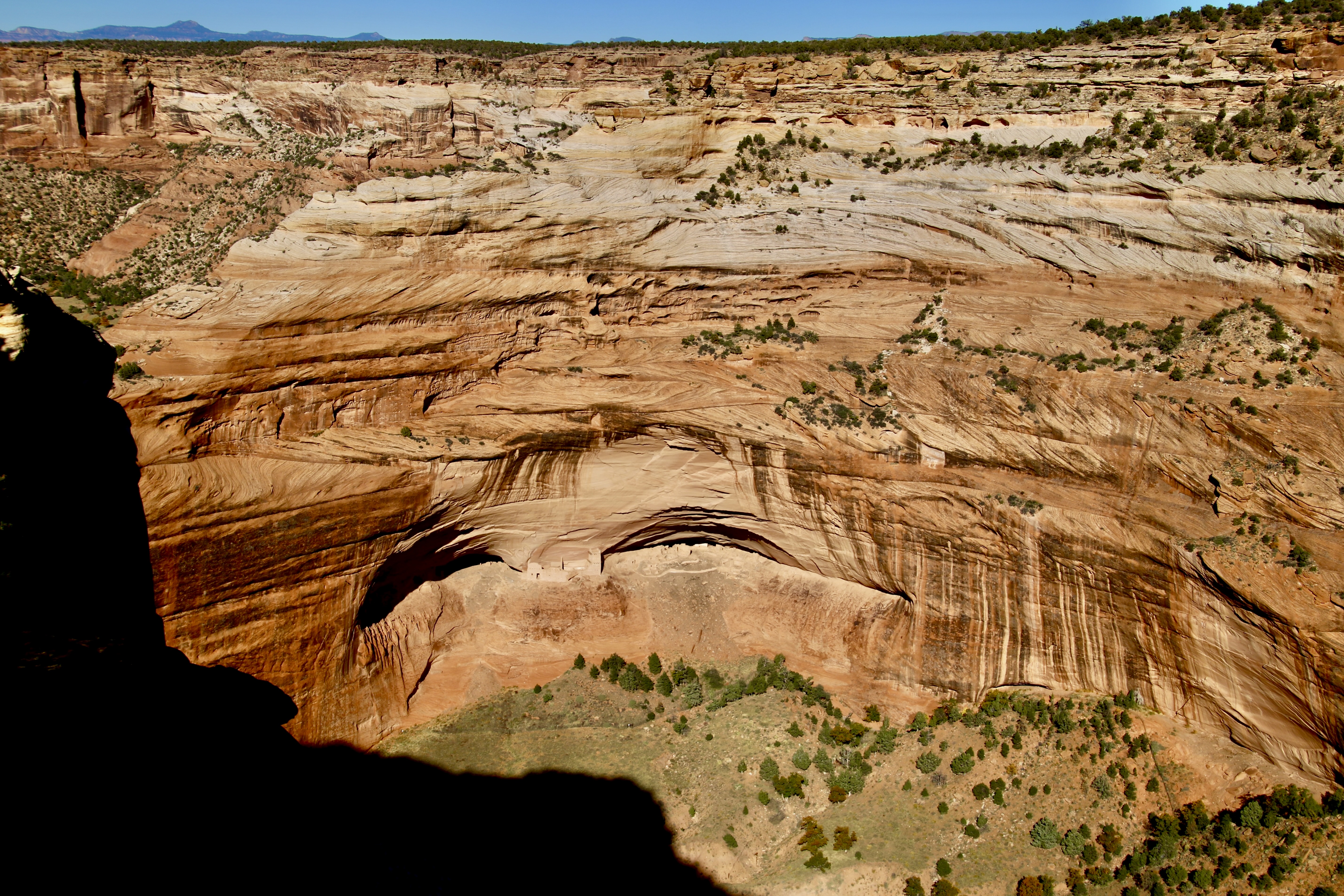
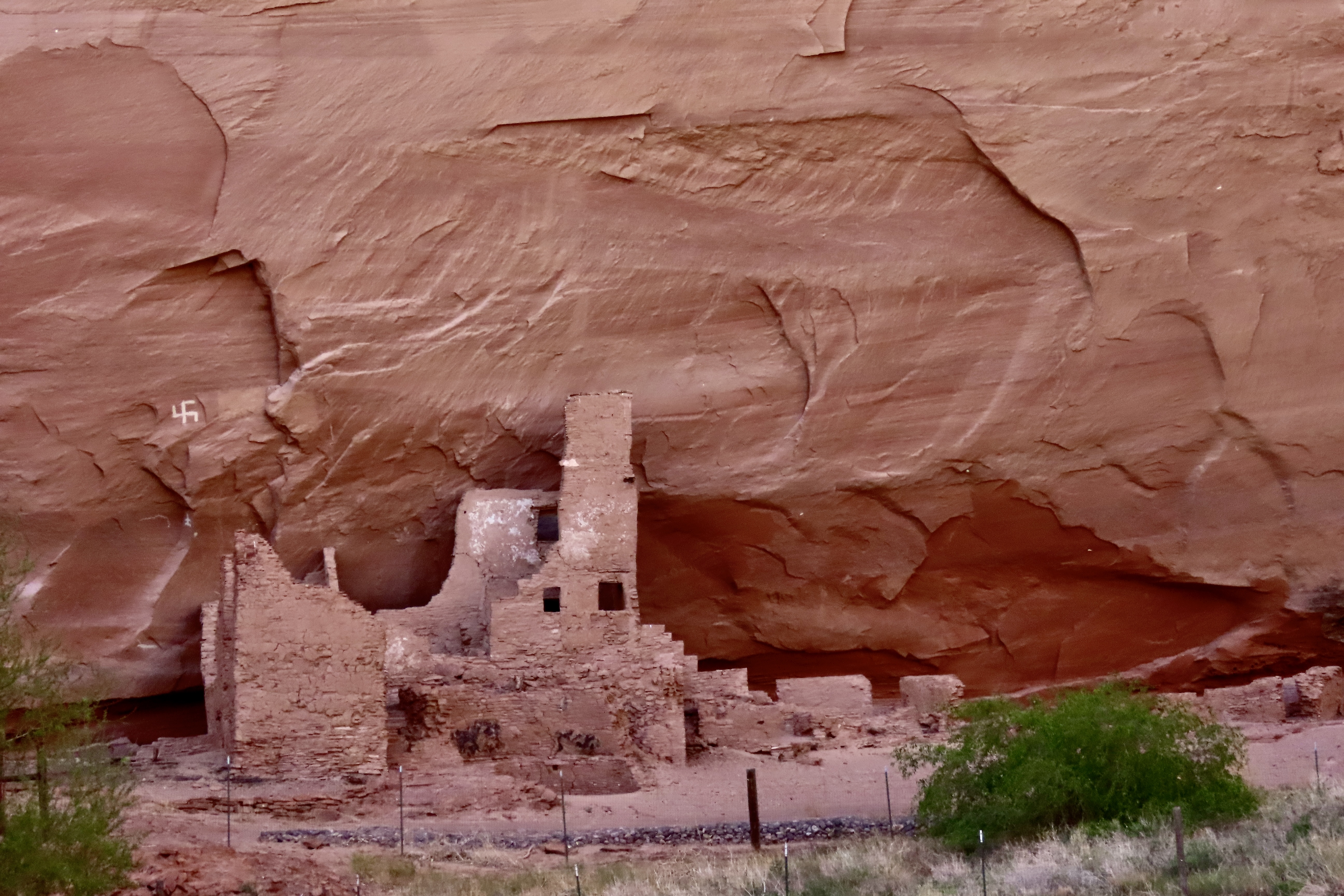
Canyon de Chelly has been occupied for five thousand years starting with various Archaic people. Ancestral Puebloans called it home from approximately 200 BCE to 1300 CE. Hopi lived there after 1300 up until 1700. Navajo people have occupied Canyon de Chelly since. Today, the canyon is owned by the Navajo Tribal Trust and jointly operated as a National Monument with the National Park Service. The photo above shows pueblos left behind by the Ancestral Puebloans (center caves). They are dwarfed by the high cliffs of the canyon. Their position on the cliff shows why they would have been difficult to attack.
The occupation by the Navajo has been interrupted twice. In 1805, Spanish forces under Antonio Narbona, the future governor of Spain’s New Mexico territory, attacked, killed and captured a number of Navajos because they refused to accept Spanish rule.
By the 1860s, the Navajo faced a new threat. American settlers from the eastern US were pouring into the newly acquired territory and the US Government developed a policy to make room for them by ousting the natives. The Navajos would be required to move to reservations, leaving their homelands behind for the newcomers. Not surprising, they refused. So a decision was made to force them out. The US Army under the command of James Henry Carleton ordered Kit Carson to subjugate the Navajo using a scorched earth approach that involved burning their homes, destroying their crops and killing their livestock.
Earlier, in his efforts to subdue the Mescalero Apaches, Carleton had given the following order to his subordinates: “All Indian men of that tribe are to be killed whenever and wherever you can find them. … If the Indians send in a flag of truce say to the bearer … that you have been sent to punish them for their treachery and their crimes. That you have no power to make peace, that you are there to kill them wherever you can find them”.
In 1864, facing starvation, the Navajo capitulated, signed a treaty, and began a forced march during the heart of winter to Fort Sumner’s Bosque Redondo Reservation in New Mexico. The 300 plus mile hike, the Long Walk as it came to be known by the Navajos, left numerous Navajo dead from exposure, starvation, and exhaustion. Bosque Redondo was equally bad if not worse. Food, space, water and sanitation facilities were limited in the extreme for the 8500 Navajo and 500 Mescalero Apache occupants. Furthermore, it was run like an internment camp instead of a reservation. An estimated one quarter of the population died during the four years of the camp’s occupation.
Finally, in 1868, a new treaty was signed with the Navajo that allowed them to return to a portion of their original homelands, including Canyon de Chelly. Today, the Long Walk, like the Cherokee’s Trail of Tears, is remembered by the Navajo an an important part of their history.
it isn’t a history that the Trump Administration wants remembered however. He has ordered the Department of the Interior to take action to ensure “descriptions, depictions, or other content that inappropriately disparage Americans past or living (meaning information like that above), and instead focus on the greatness of the achievements and progress of the American people.
Apparently, Carleton and Carson are not to be disparaged. My bad. History is to be remembered as Trump wants it remembered. George Orwell’s 1984 comes to mind.
If the administration has its way, books and displays like this are to be removed from national parks and monuments. A similar effort is underway at the Smithsonian.
Today, marks the end of my planned series on the Trump Administration’s threat to our national parks, monuments and other public lands. I believe that I have covered his primary focus and actions as they relate to our public lands. Having said that, I’ll still report on major threats as they emerge and, at some point, do a summary of how successful efforts to protect the parks have been.
I also have in mind doing a post on Mt. Rushmore National Monument. The President has repeatedly expressed a desire to have his image added to those of Washington, Jefferson, Lincoln, and Theodore Roosevelt. (At one point, Elon Musk even volunteered to carve it, but I suspect that’s off the table.) My objective is to look at the major accomplishments of each of these men who played such an important role in making the nation what it is today and then comment on how the President goal of Making America Great Again, relates to their accomplishments.
But for now, it’s back to sharing the beautiful and fascinating world we live in while Peggy and I continue to ‘wander through time and place.’
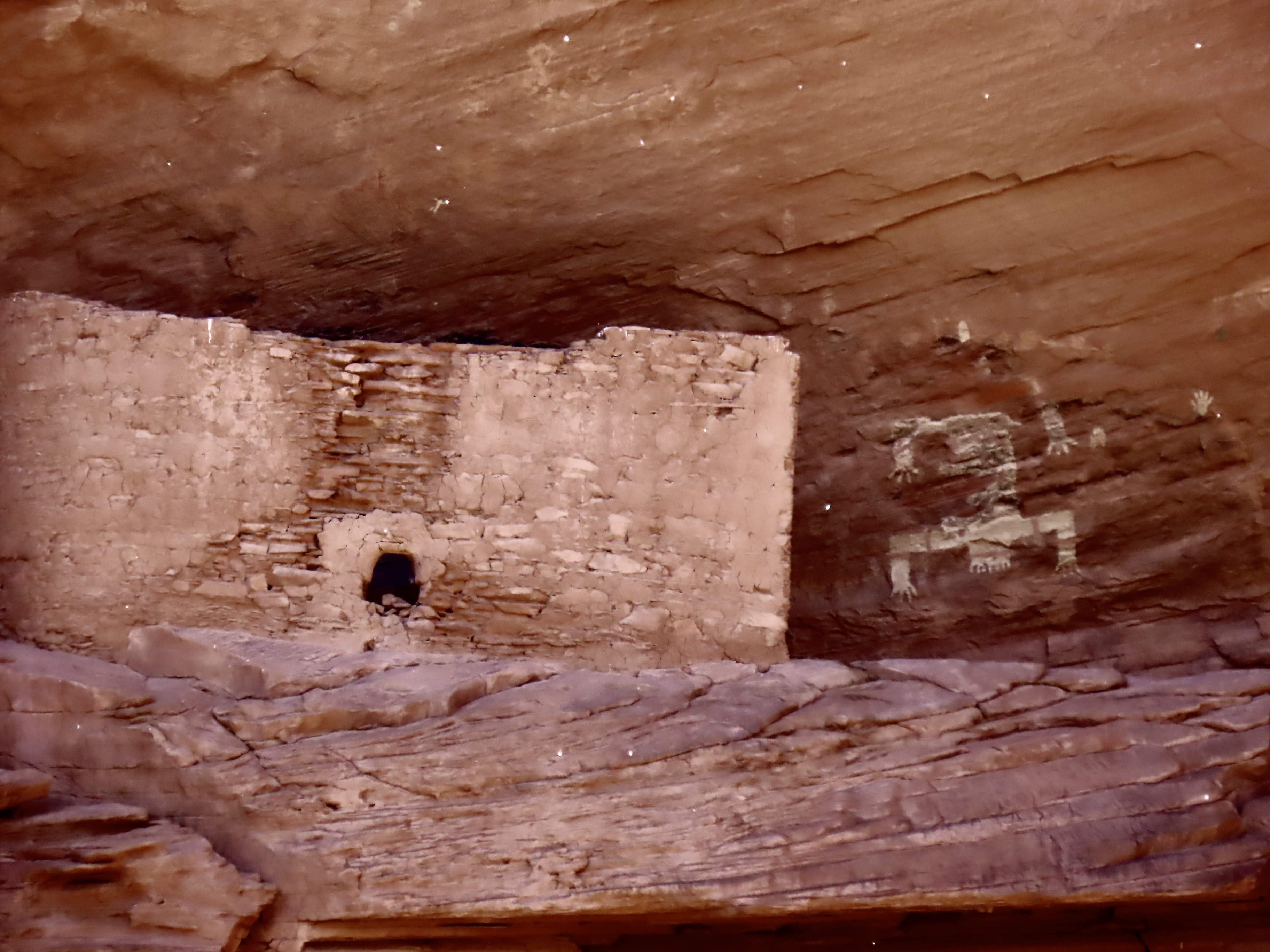
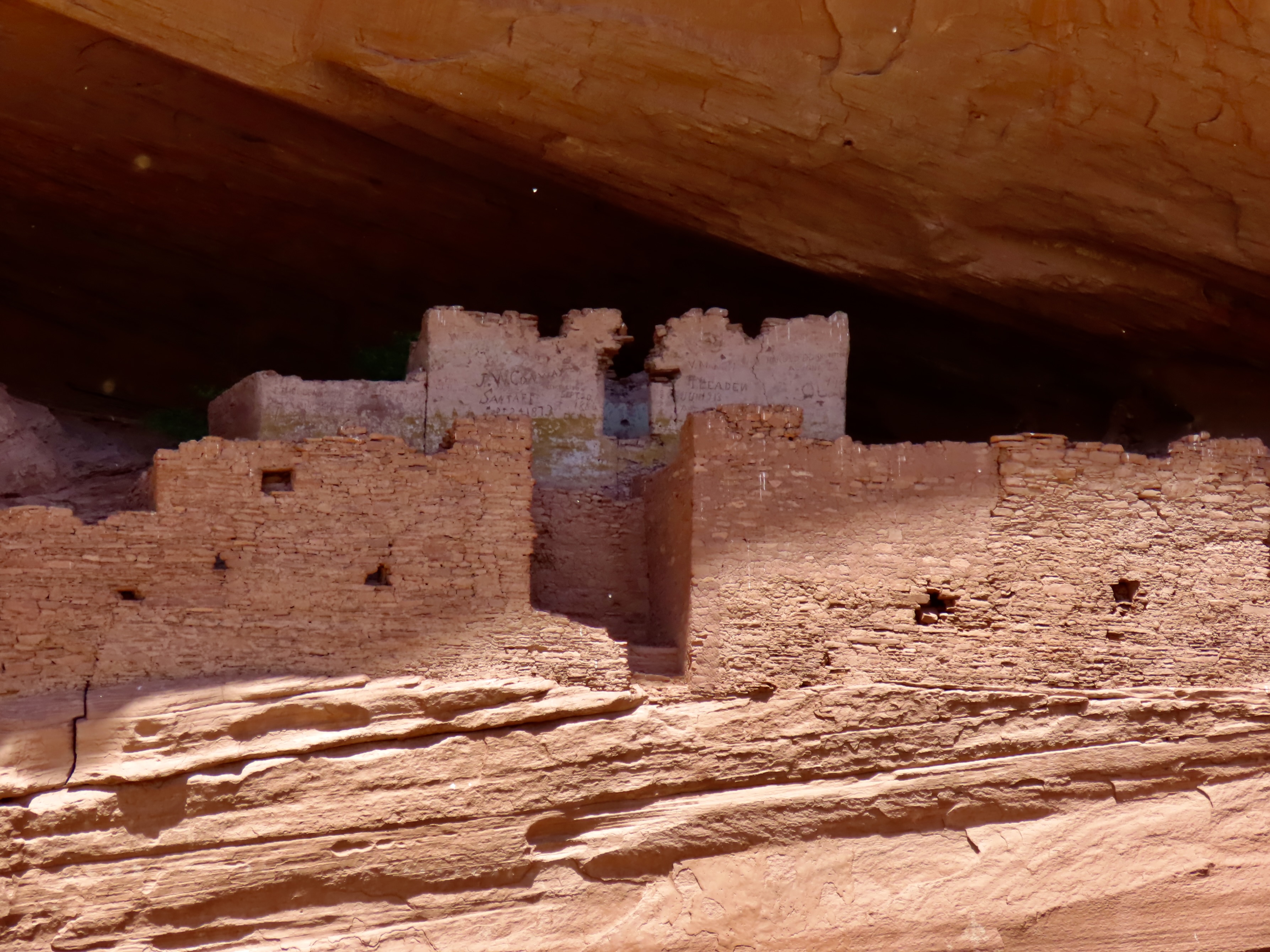
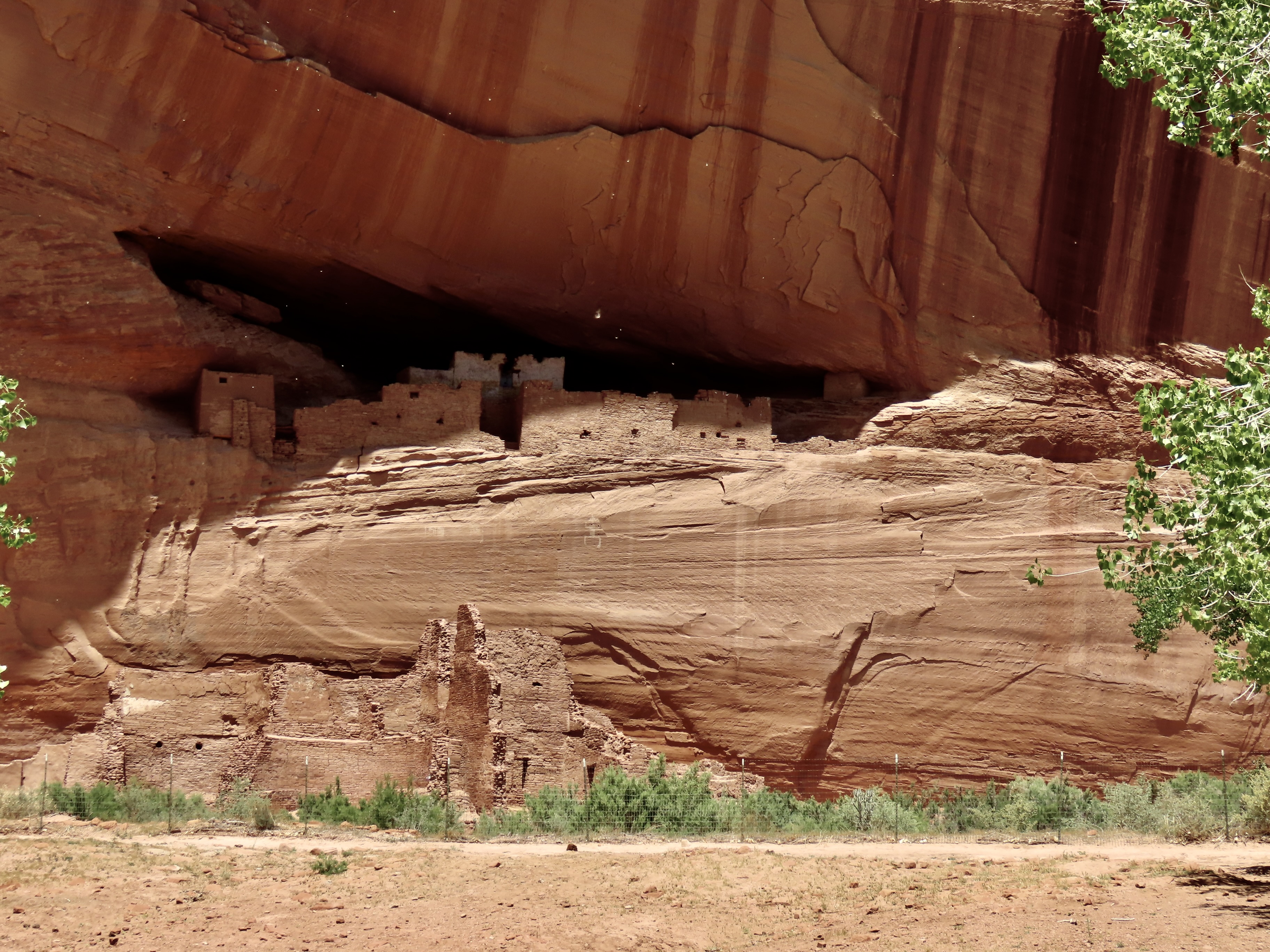
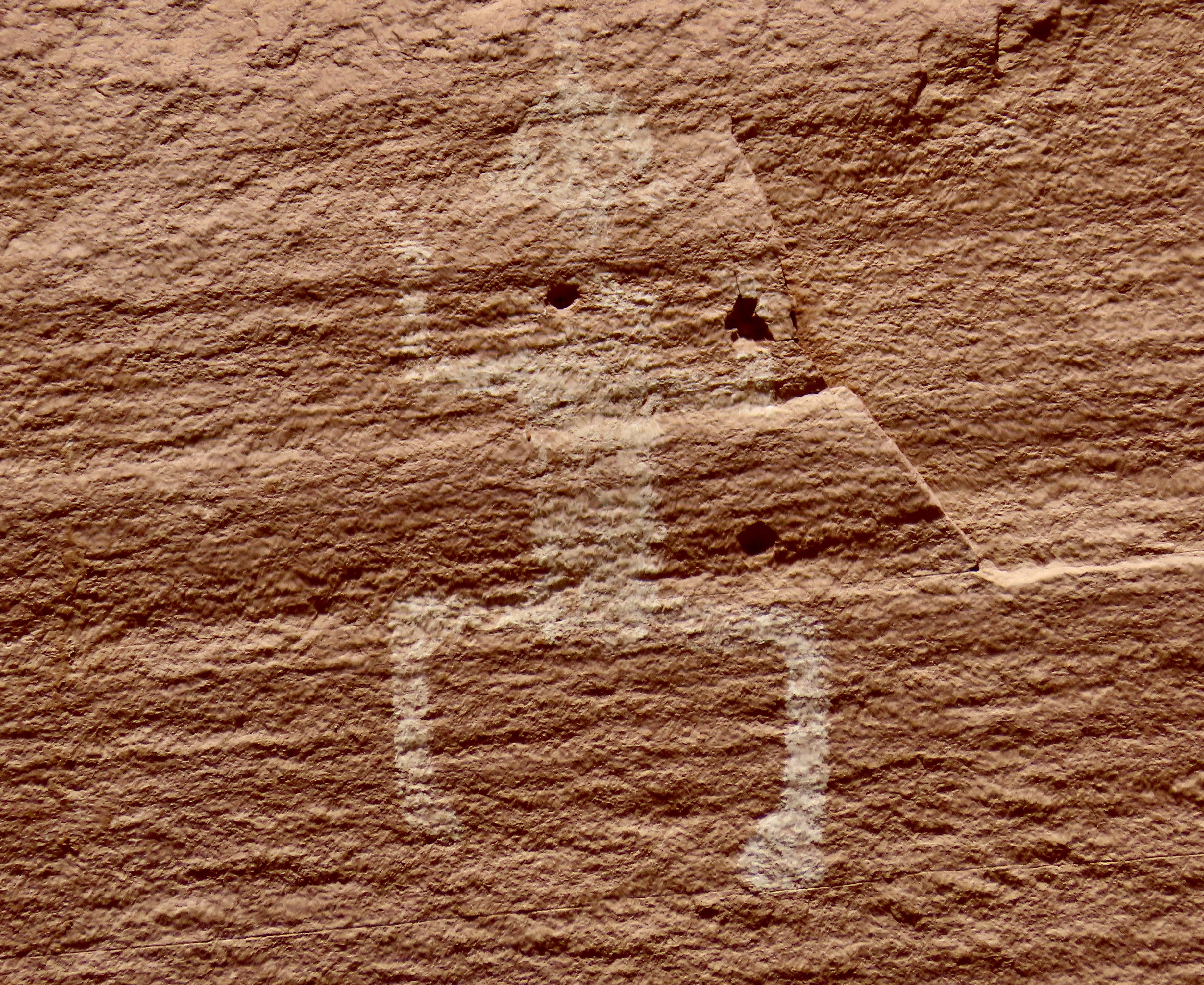
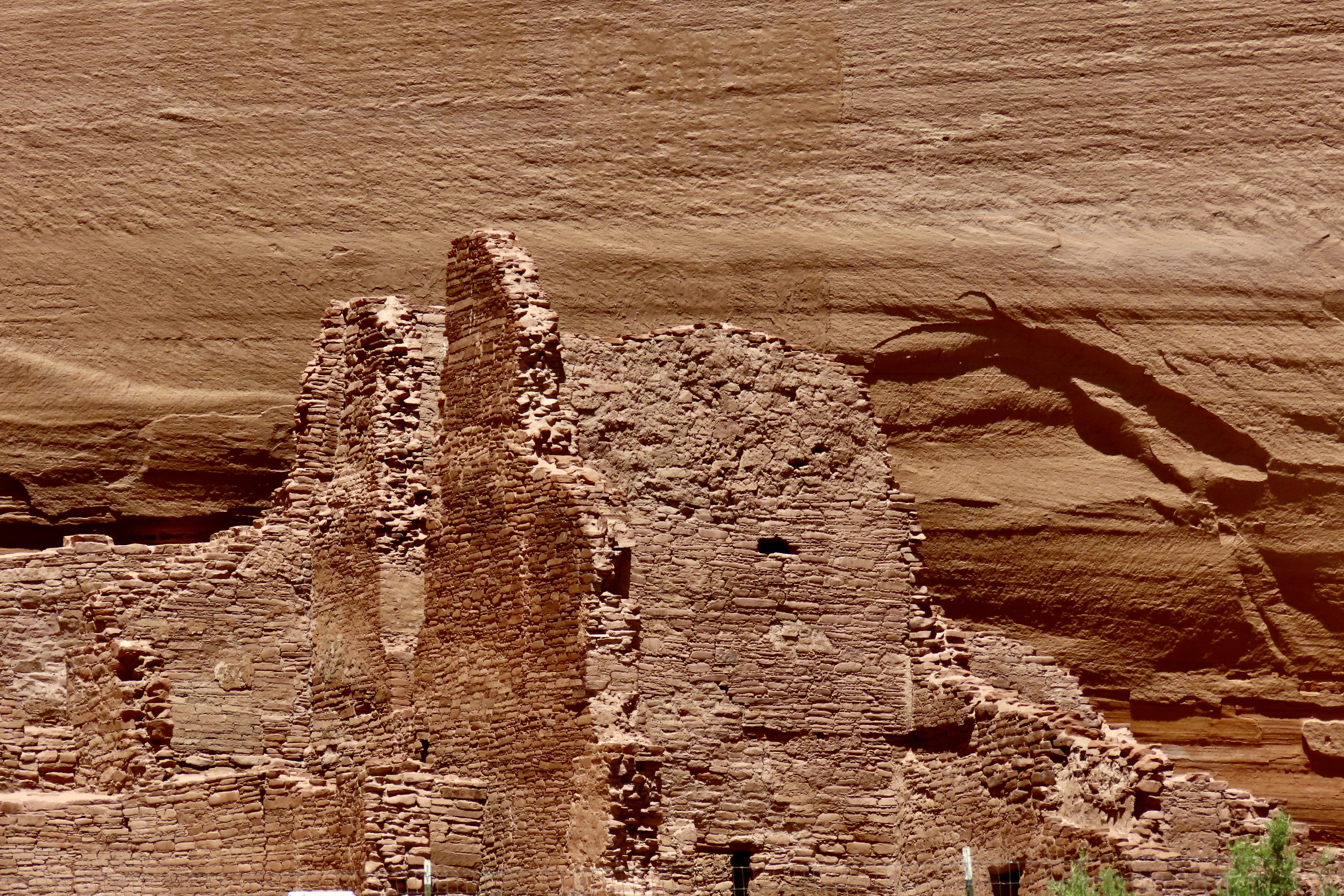
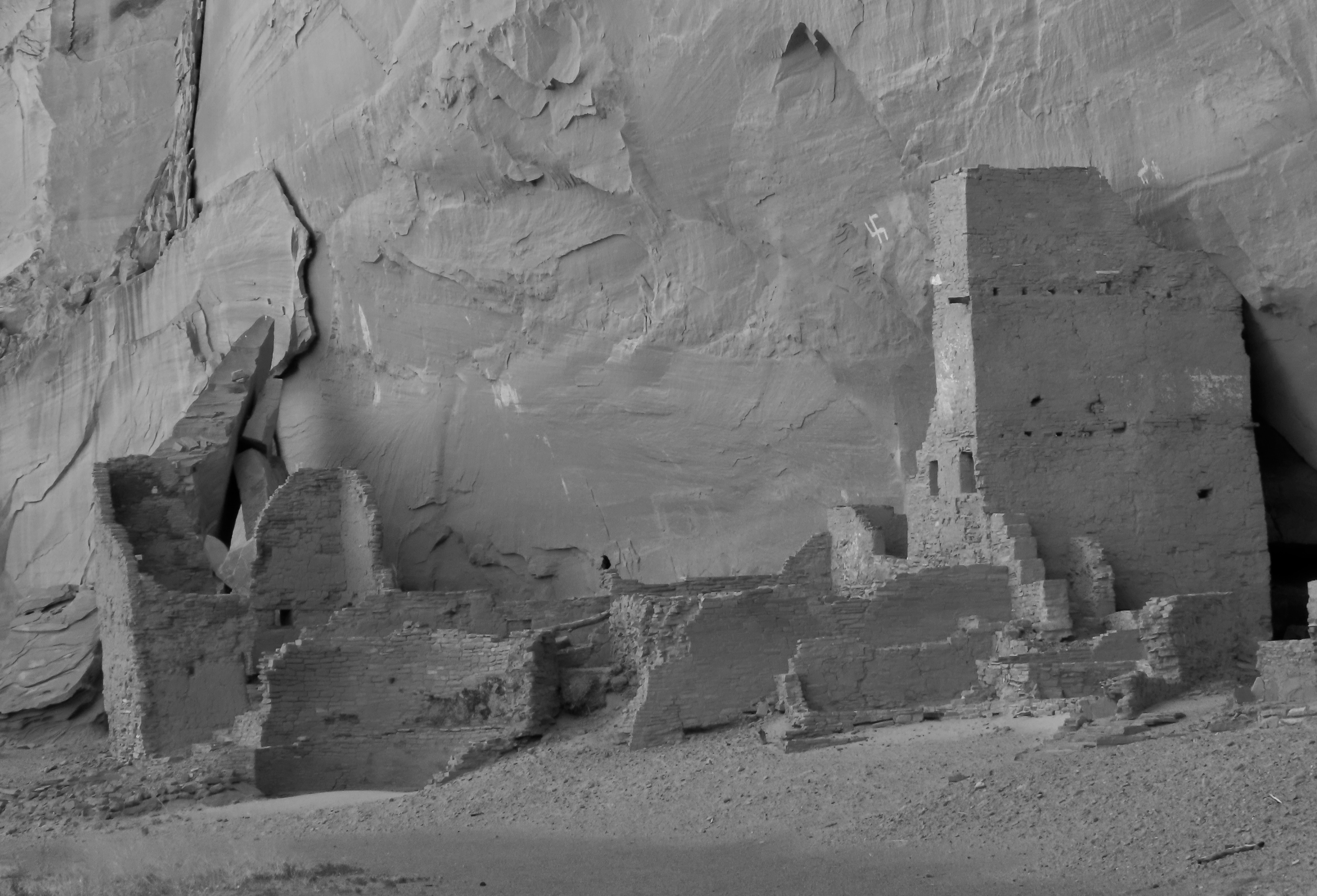
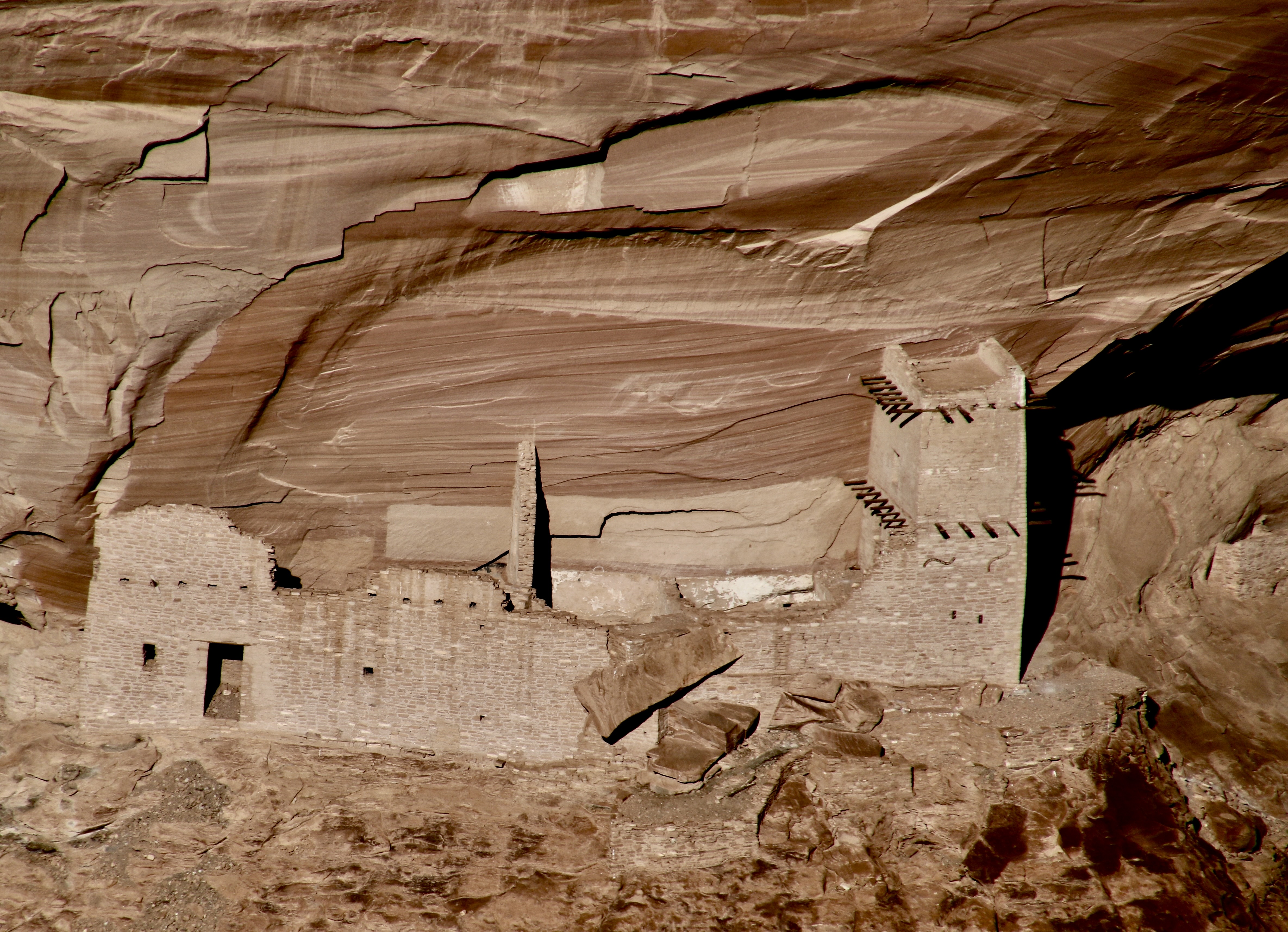
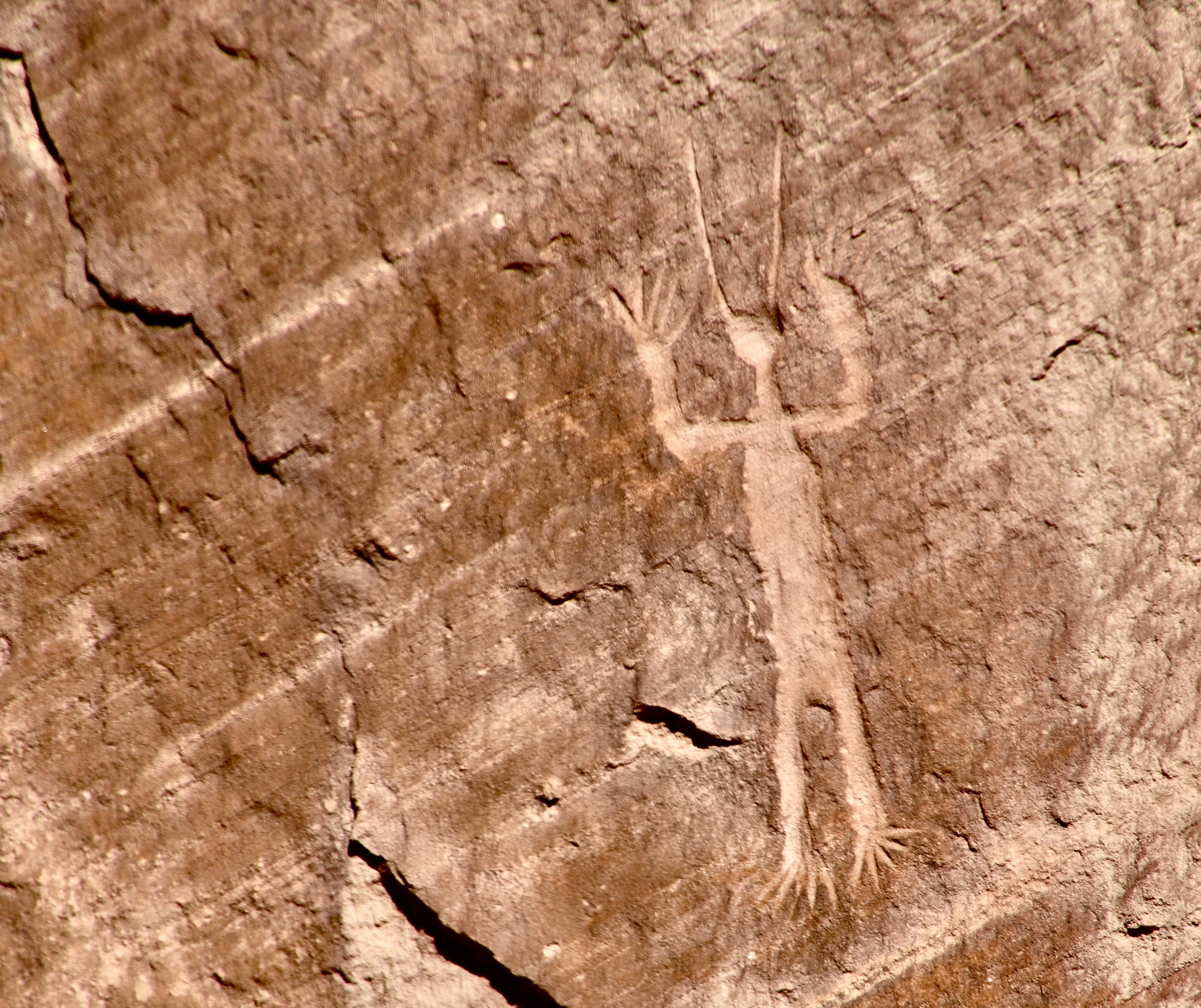
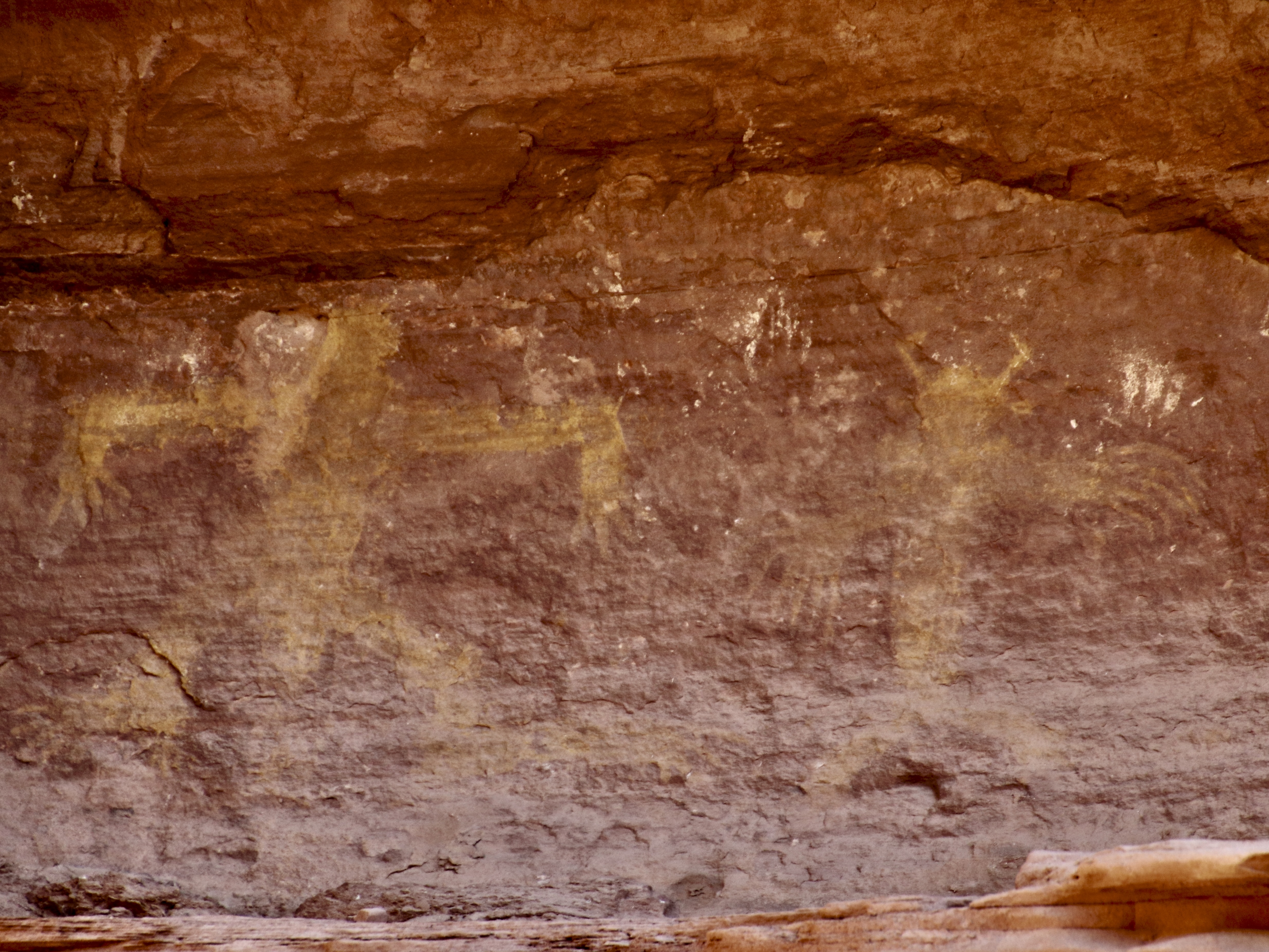
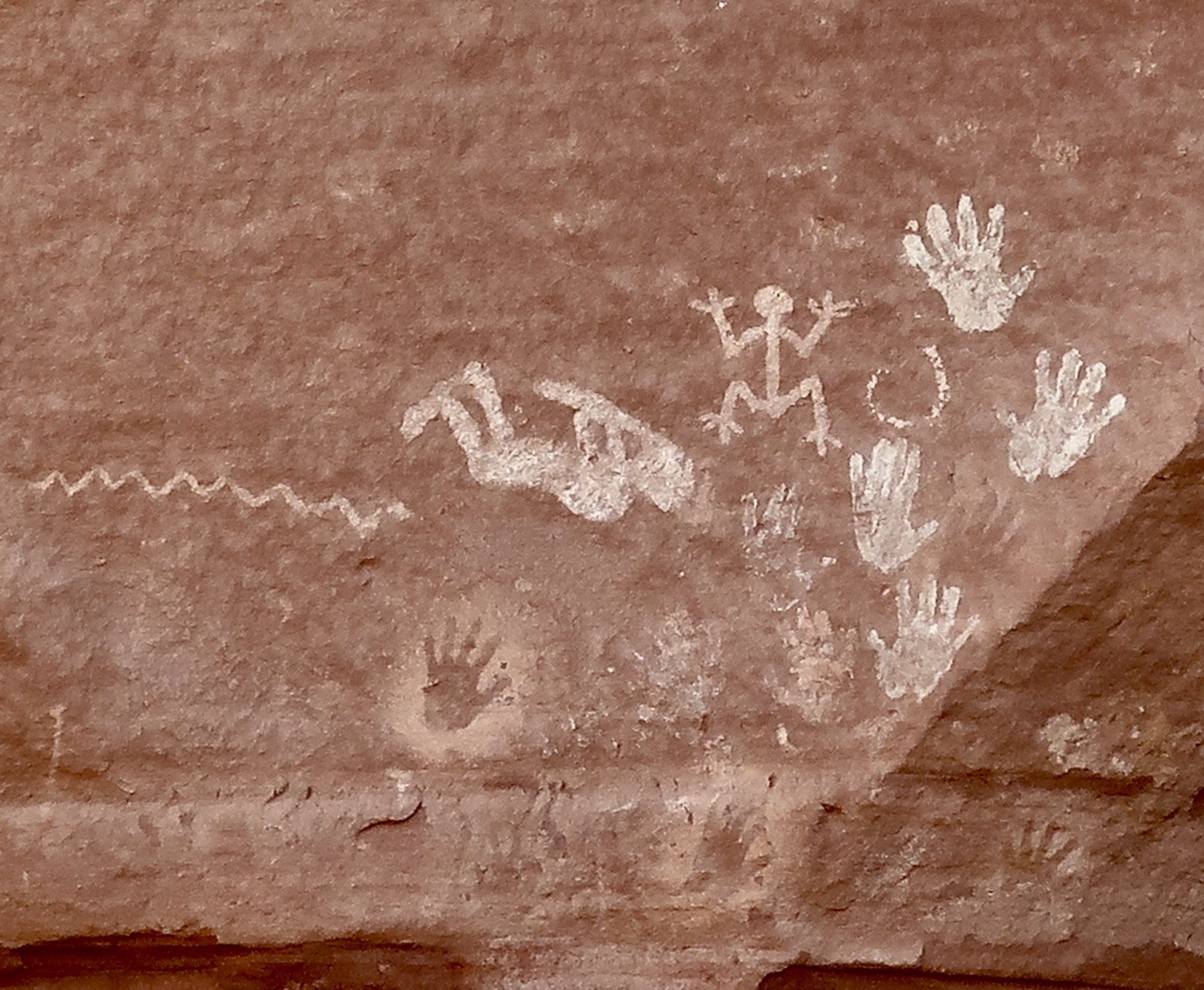
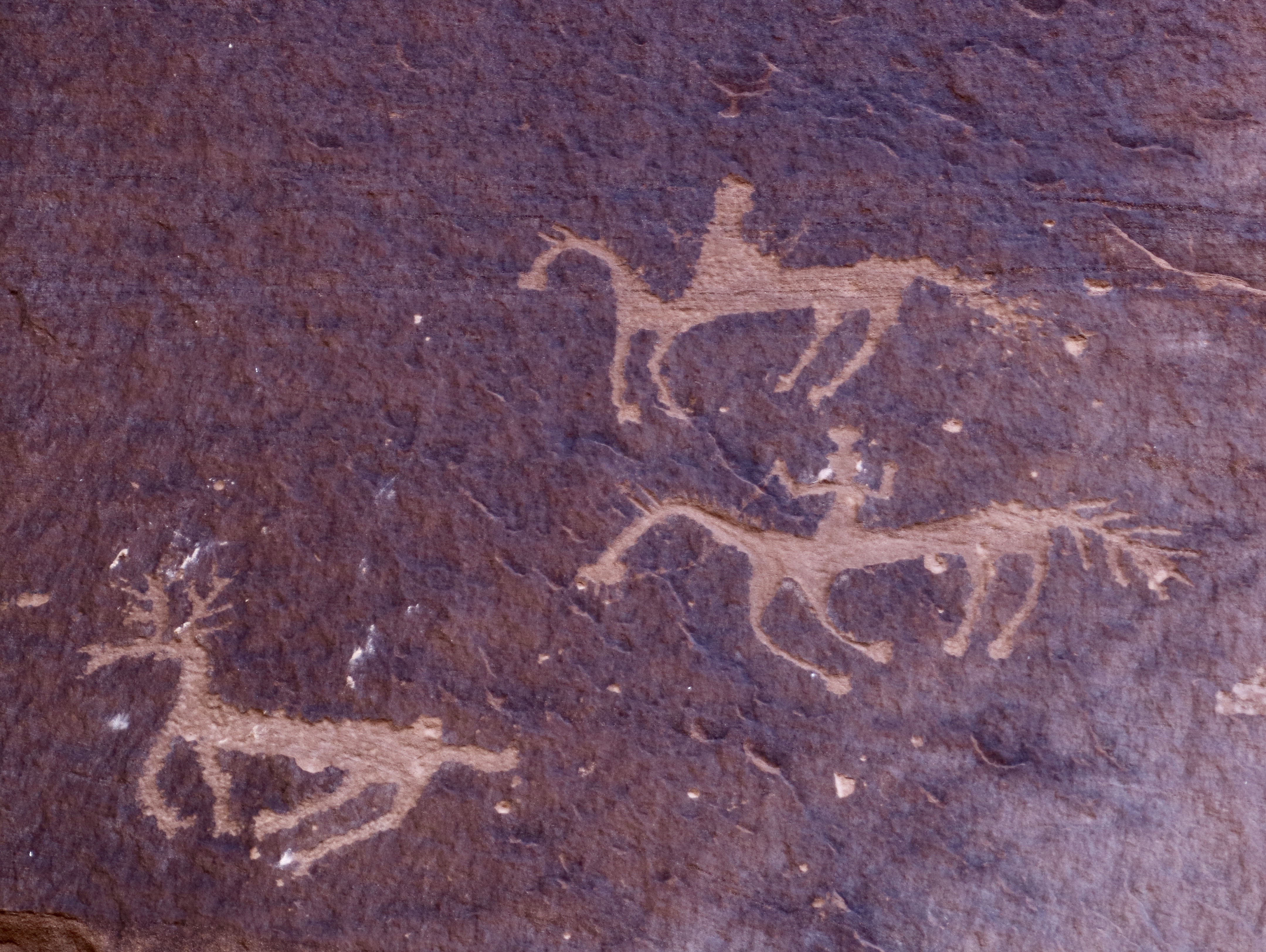
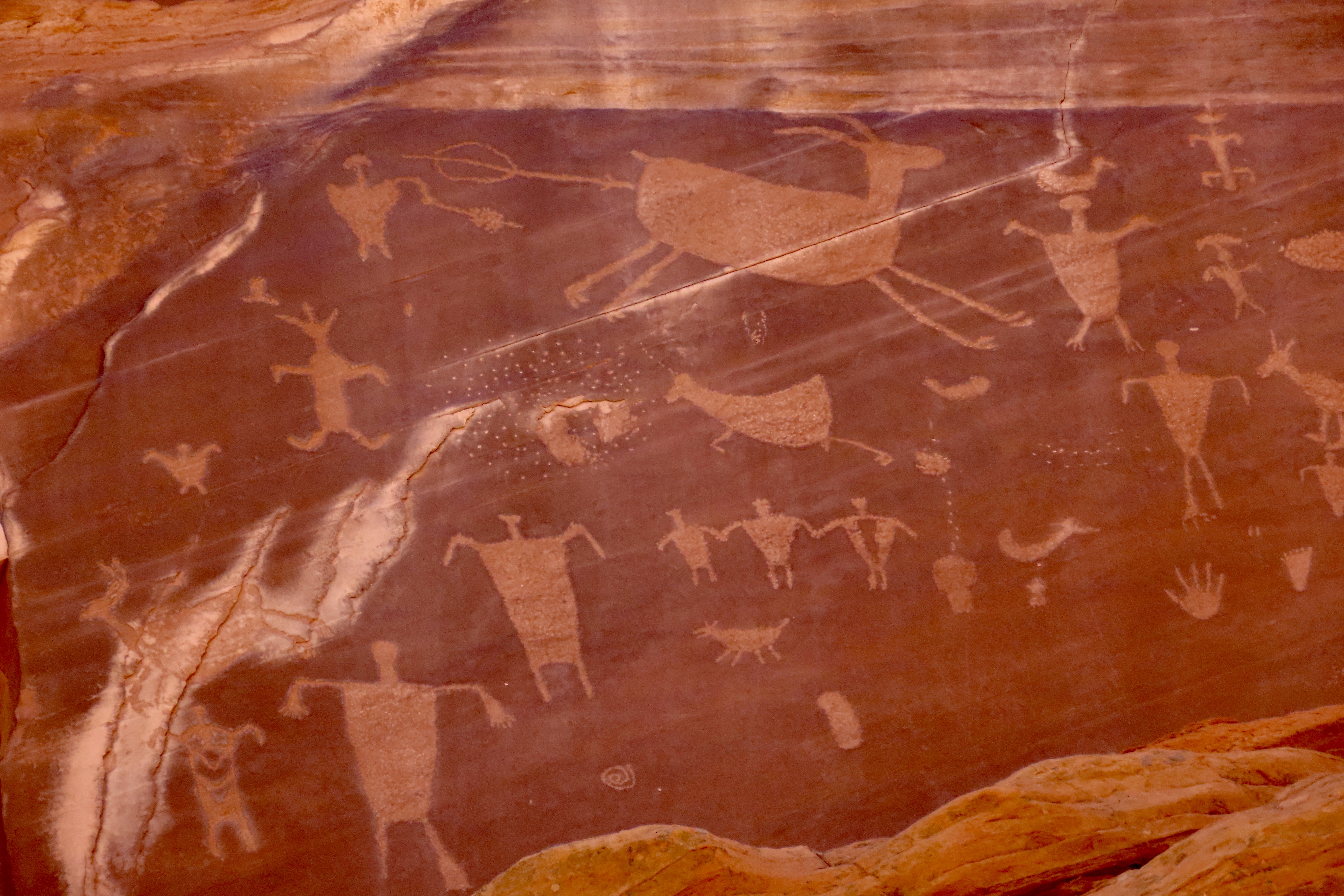
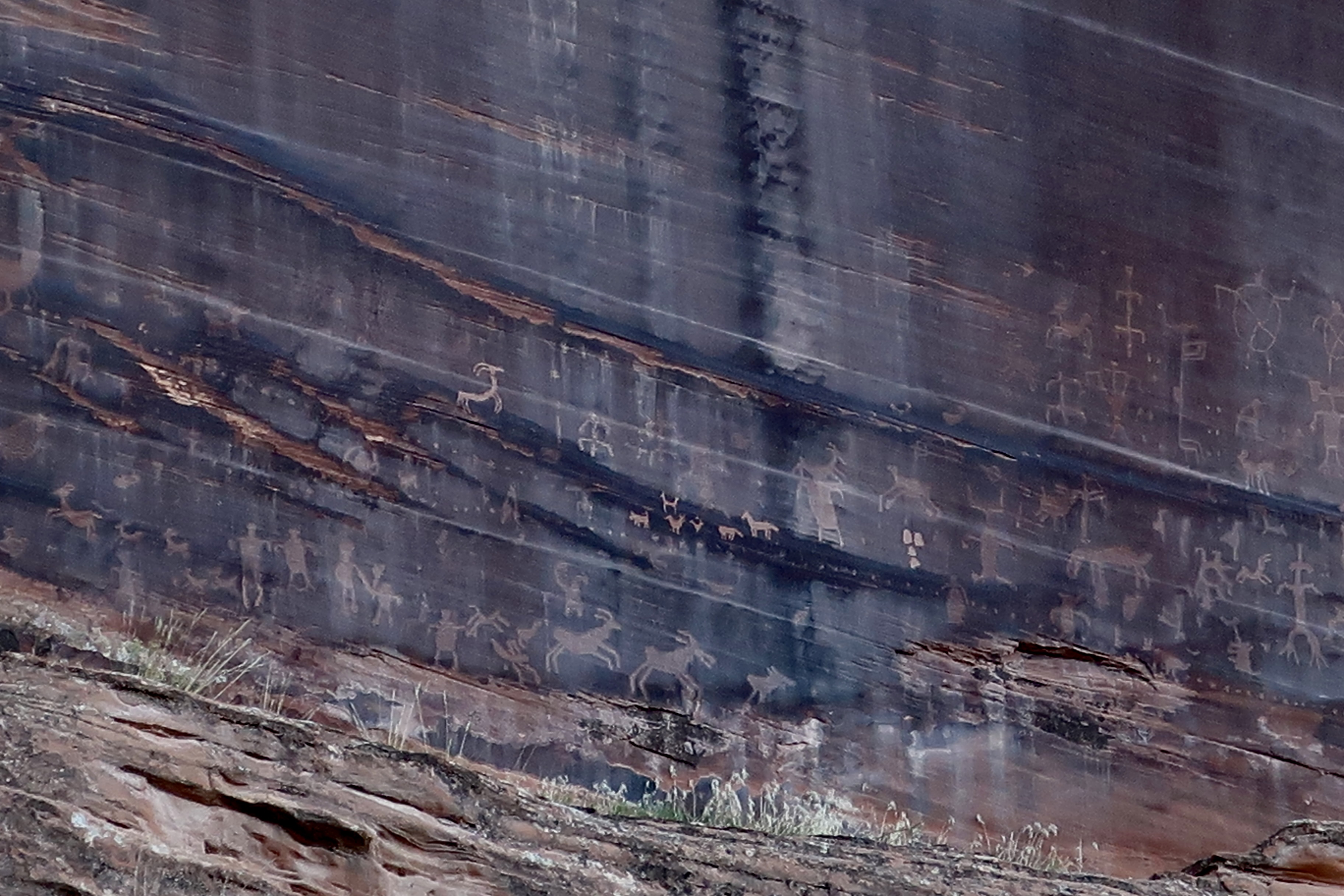
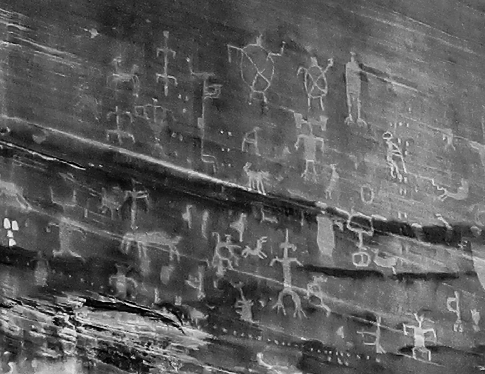
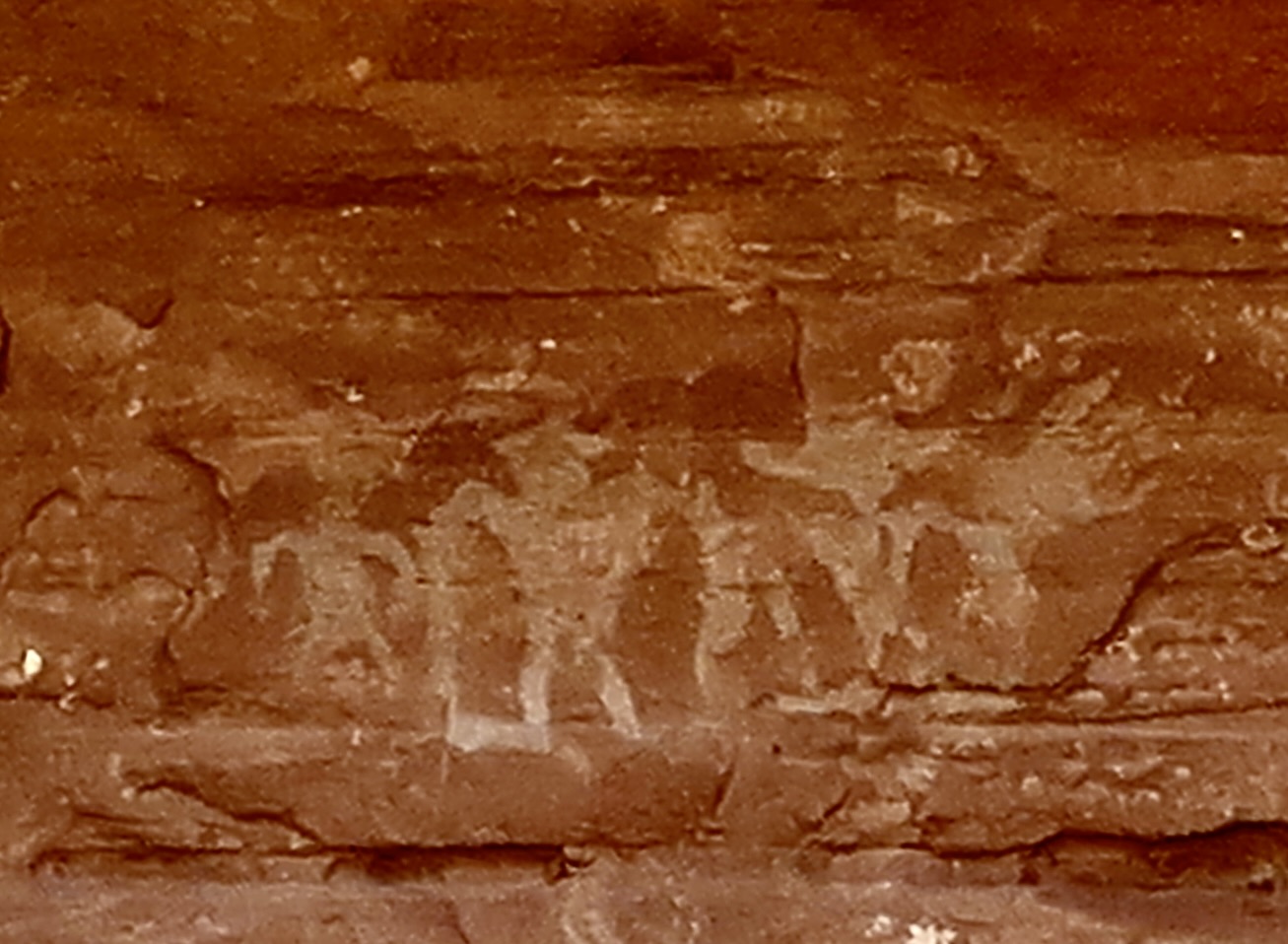
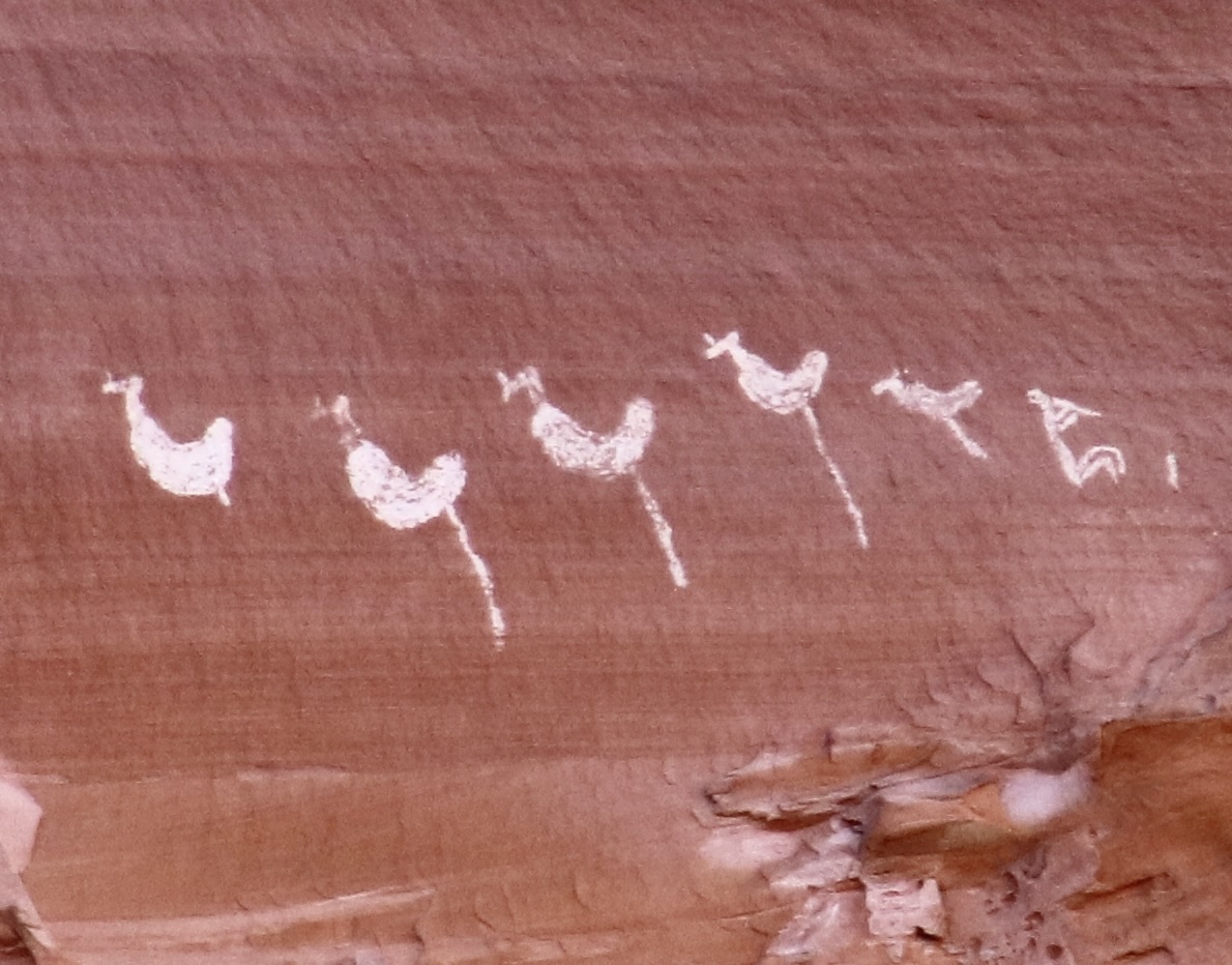
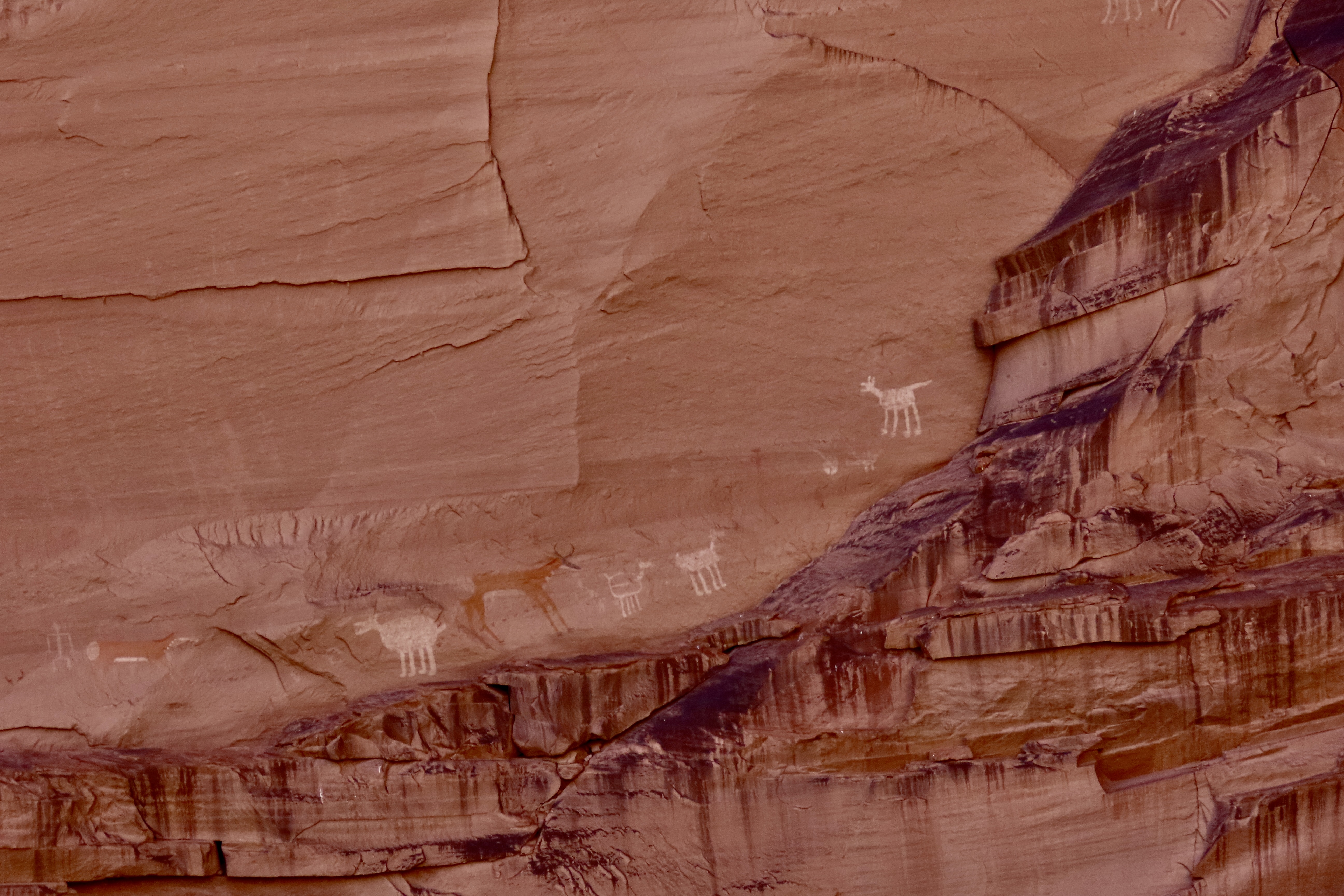
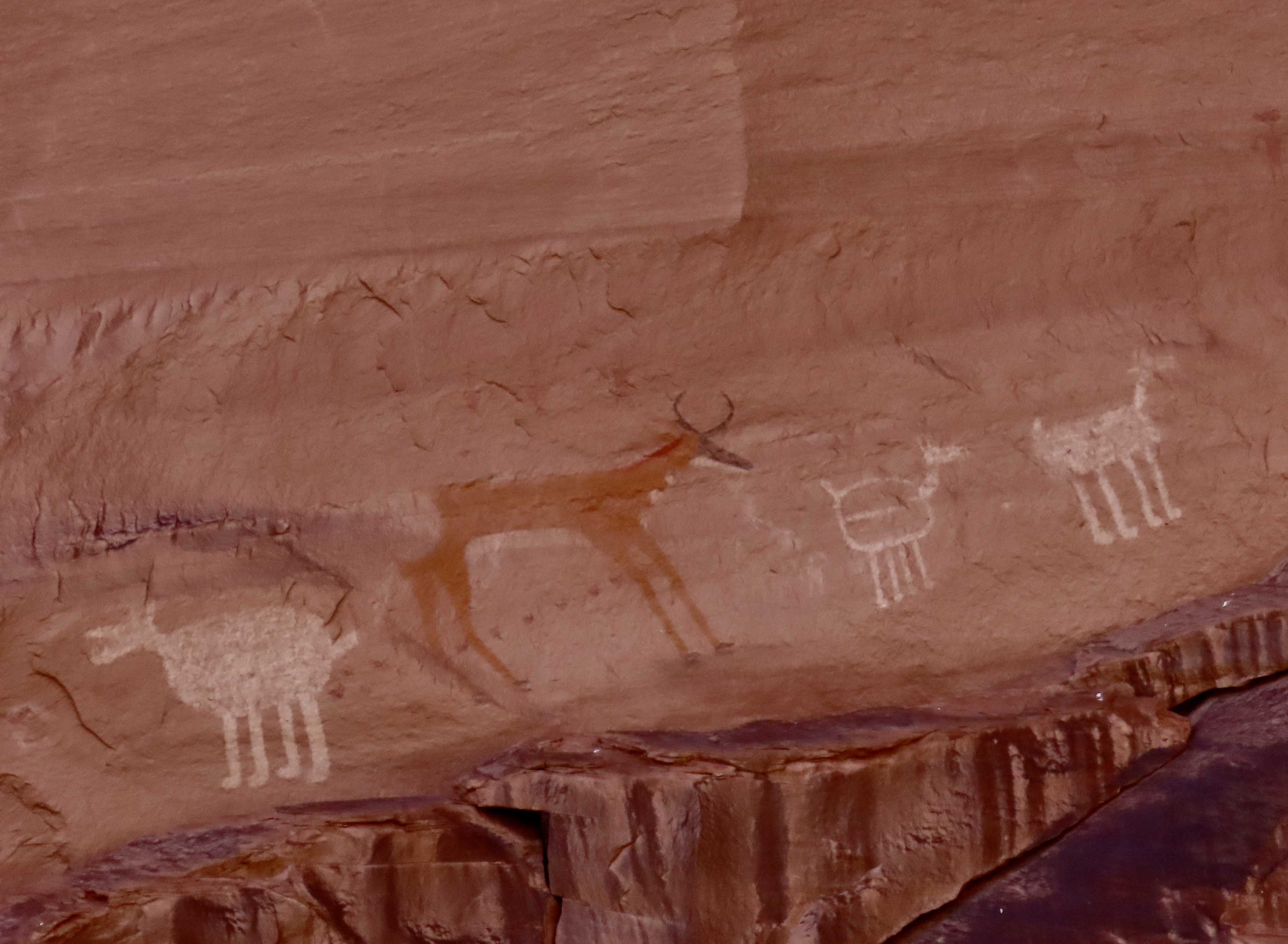
I was reading Baby Blues in the comics this past week and it made me think of this Ancestral Puebloan home and petroglyph in Canyon de Chelly. In the comic, Wanda is tucking her son in and says “Sweet Dreams, Hammie.” He responds, “Can you leave the light on? I had a really scary dream last night.” We can attribute his nightmare to stories his sister Zoe has told him about what hides in his room. Now, imagine you are a young boy or girl and your window opens out on the this creature climbing down the wall. Who needs a monster under the bed or in the closet? We really don’t know the meaning applied to this petroglyph, however. We can only guess. Mine is that the ‘monster’ wasn’t designed to scare children but may have been to discourage enemies from climbing up to the pueblo. If it encouraged children to be good, that was probably okay as well. But again, we can only guess at the meaning. The white dots, BTW, are cottonwood tree seeds. It was ‘snowing’ with them.The best known pueblo in Canyon de Chelly is named the White House Pueblo for the white color of the upper building. Initially built by Ancestral Puebloans in 1060 CE, they continued adding to it for the next 200 years. It is estimated there were more than 80 rooms when it was finished.Built on two levels, archeologists speculate that the botton level may have originally reached the upper level. The White House Pueblo is the only place in Canyon de Chelly that visitors can walk to without a guide. Have you spotted the petroglyph? Center on wall beneath the ’snowflake.’ Up close. There are others on the wall even more faint than this one. A view of the lower level of the White House Pueblo.Numerous other ruins left behind by the Ancestral Puebloans are found throughout the park. I rendered this one in black and white. The round building in front is a kiva.Another example.This ruin featured a prominent swastika. (There is also one on the pueblo I rendered in black and white above.) As I mentioned in a previous post, long before the Nazis adopted the symbol to their cause, it represented an heroic journey, good health, and well being to the Ancestral Puebloans and Navajos.Peggy was delighted to find a treasure chest of petroglyphs in Canyon de Chelly and searched “high and low’ so to speak for ones she might use in her next word search petroglyph book. I’m not sure this will make it, but you have to admit it’s unusual and perhaps a bit scary. You wouldn’t want one living under your bed.Speaking of scary, we almost missed these pictograph creatures. They seemed to be hiding in the rock, ready to pounce on us. Talk about Nightmare City. Check out the claws on the horned fellow.Not as scary but quite interesting. The pictograph figure on the left is the humped back Kokopelli lying on his back and playing his flute. We have numerous depictions of Kokopelli from different petroglyph sites throughout the Southwest but we have never seen him lying down. Given his role in fertility and protecting women in childbirth, it may have something to do with the woman on the right who is in the position that most petroglyphs relate to childbirth. Whatever his role, I would say it’s a hands-on experience. And then there is the snake slithering through the scene…This scene shows horsemen closing in on a deer. Since the use of horses in the Southwest by Native Americans depended on Spaniards bringing them to to America in the 1500s, these petroglyphs would have been created in the 1600s or later and are likely done by Navajos. I really like the sense of action portrayed by the deer and horses. And their ‘look.’The man on the bottom horse is holding onto the the reins in his right hand. Not sure what he is doing with his left. Waving. I’m surprised he wasn’t shown holding a spear.These pictographs by Ancestral Puebloans were at least 100 feet up on a canyon cliff. The top left scene shows how hunting was done prior to when horses, bows and arrows were introduced. A throwing stick, known as an atlatl, is being used to throw a spear with greater force and distance than a person normally could throw one. You can see the stick in the Puebloan’s hand. He has hit his target. Ouch. A number of other subjects are included on the panel. I’m intrigued by what looks like a very happy dog in the lower left hand corner complete with ears, nose, eyes, a smiling face and a wagging tale. Surely it’s my imagination.This large ‘canvas’ was similar to what are know as ‘newspaper rocks’ in Canyonlands and Petrified Forest National Parks. It is filled with petroglyphs showing a variety of animals and people. The lighter figure would have been a more recent addition.A closer look. Take a moment to explore the variety. Following are more pictographs that caught our attention:More anthropomorphic creatures coming forward out of the rock.Birds in a row. Are they doing the one legged turkey hop to Kokopelli’s flute music?We were interested in how these animals were positioned to walk on the edge of the broken off rock and even more interested in the reddish brown deer between them.A closer look at the deer.I’ll close today’s post with another unusual pictograph. Note the man holding up the two posts. Lightning seems to be emanating from the posts, or possibly being attracted to the posts in what may be some type of ceremony. Animals are attracted to the scene while the lighting cuts through a yellow shaman/man. Other men hike up the hill, leaving the area. I guess my comment is: What??? But that’s part of the magic of pictographs and petroglyphs.Next up: The ever attractive beauty and geology of the Painted Desert and Petrified National Park.
For those of you who keep track, Peggy and I are now back at our home/basecamp in Virginia. We still have several blogs from our journey into the Southwest that I will be posting over the next several weeks as we get ready for another adventure: Leaf peeping in New England, along the Blue Ridge Highway, and at Great Smoky National Park.