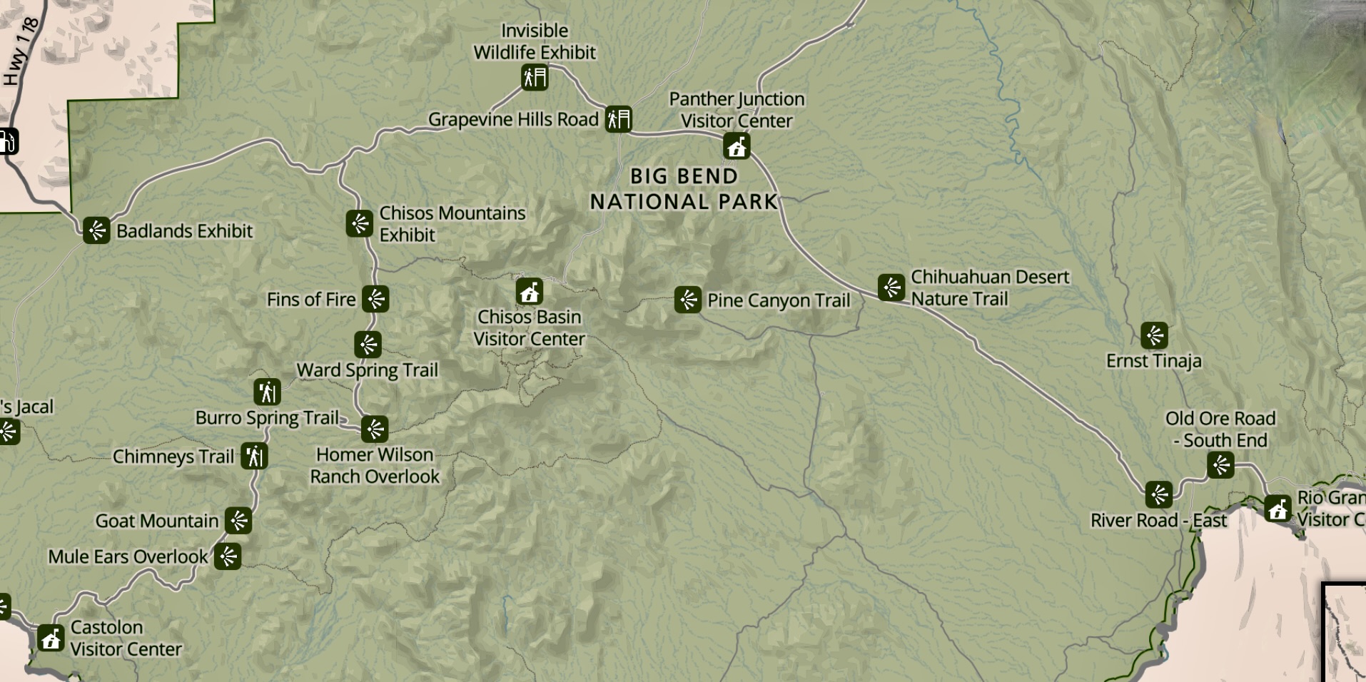
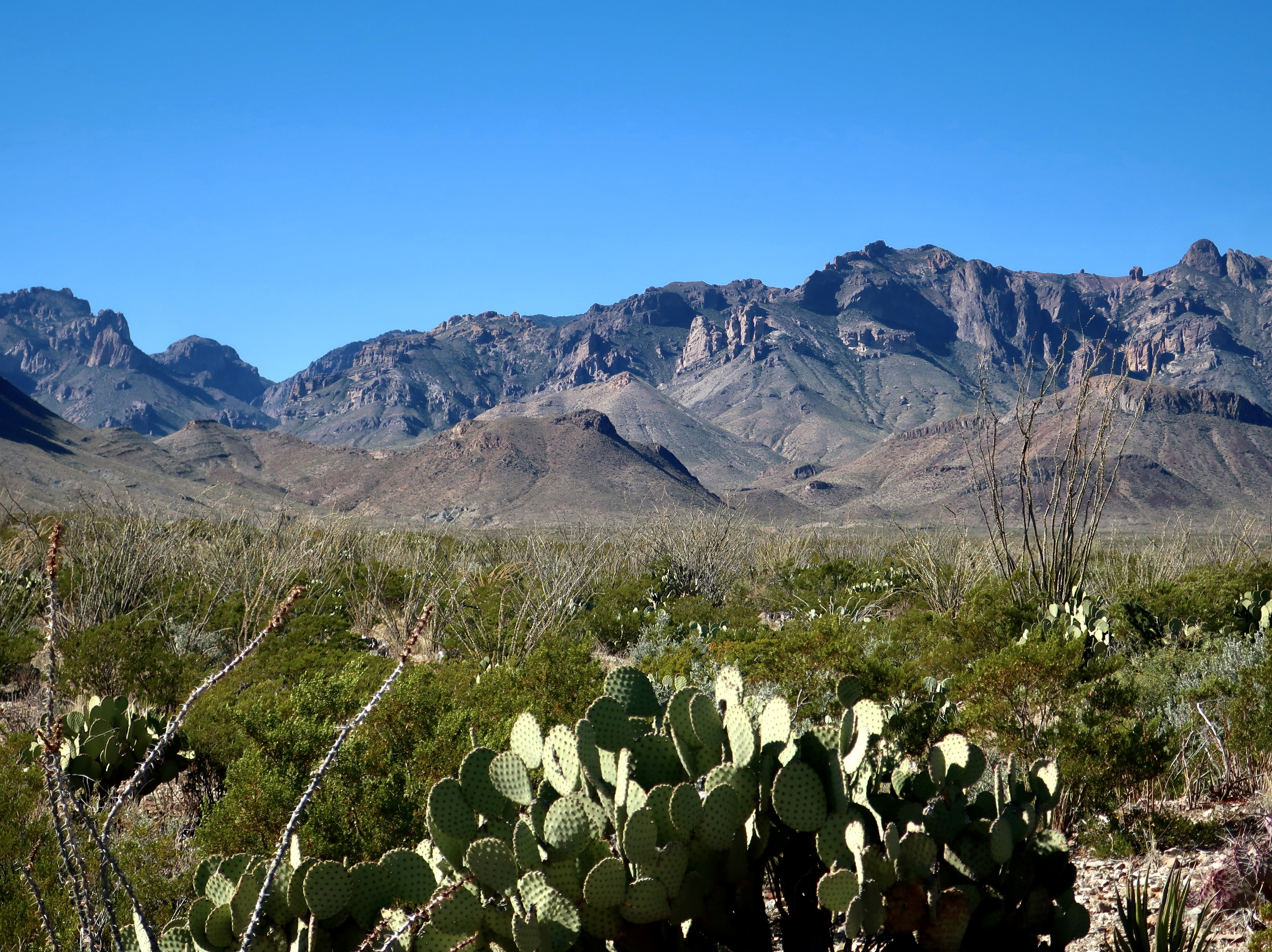
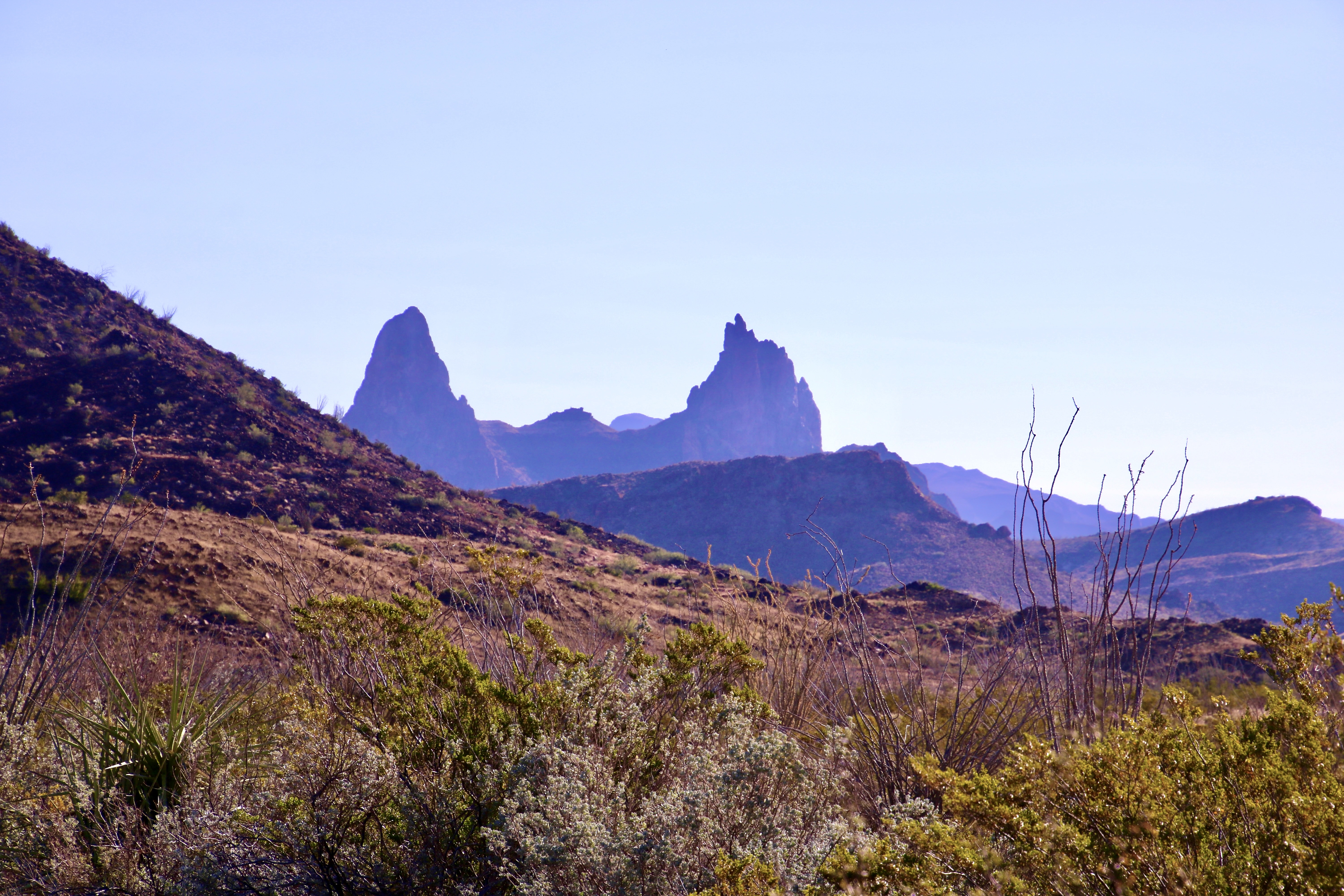
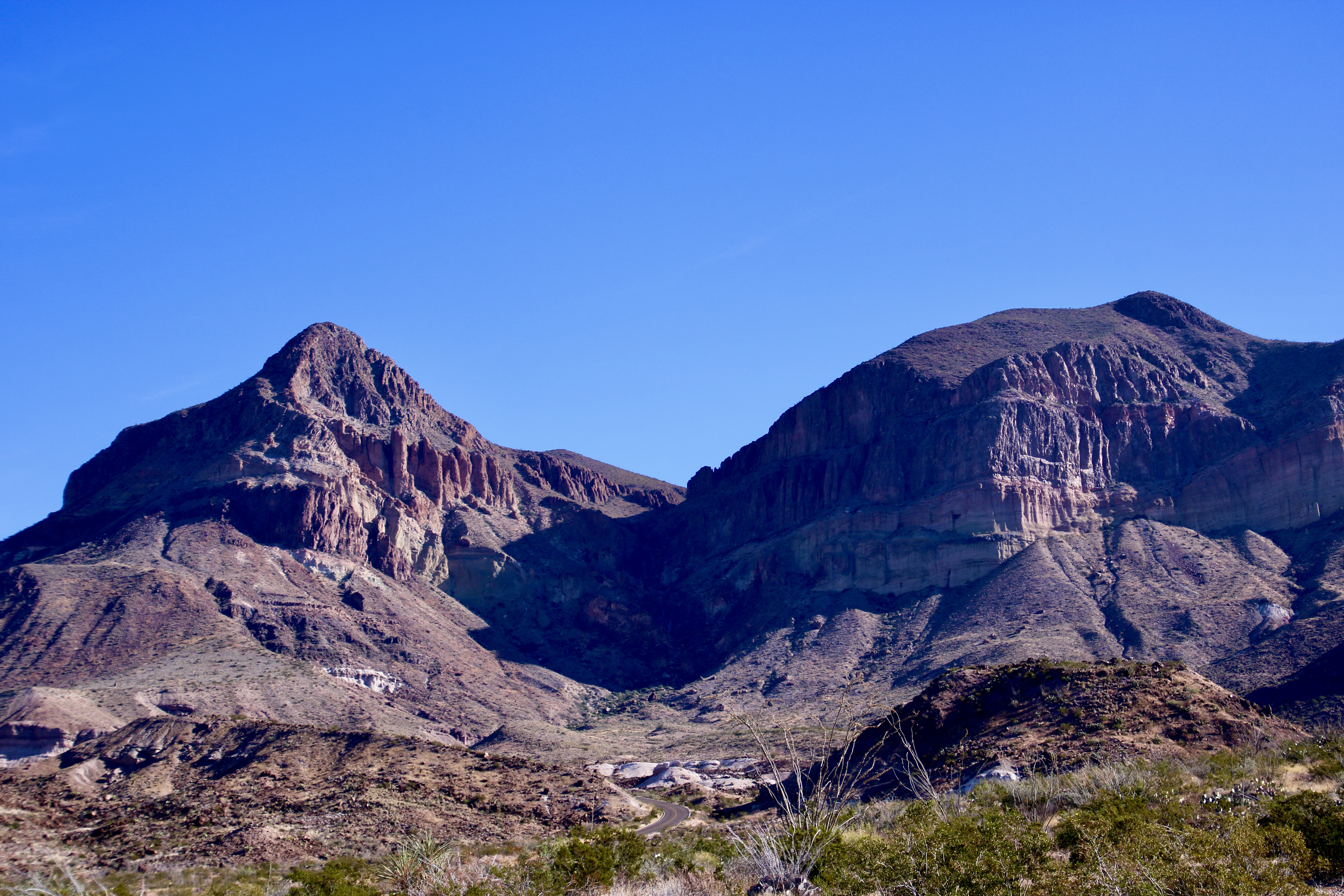
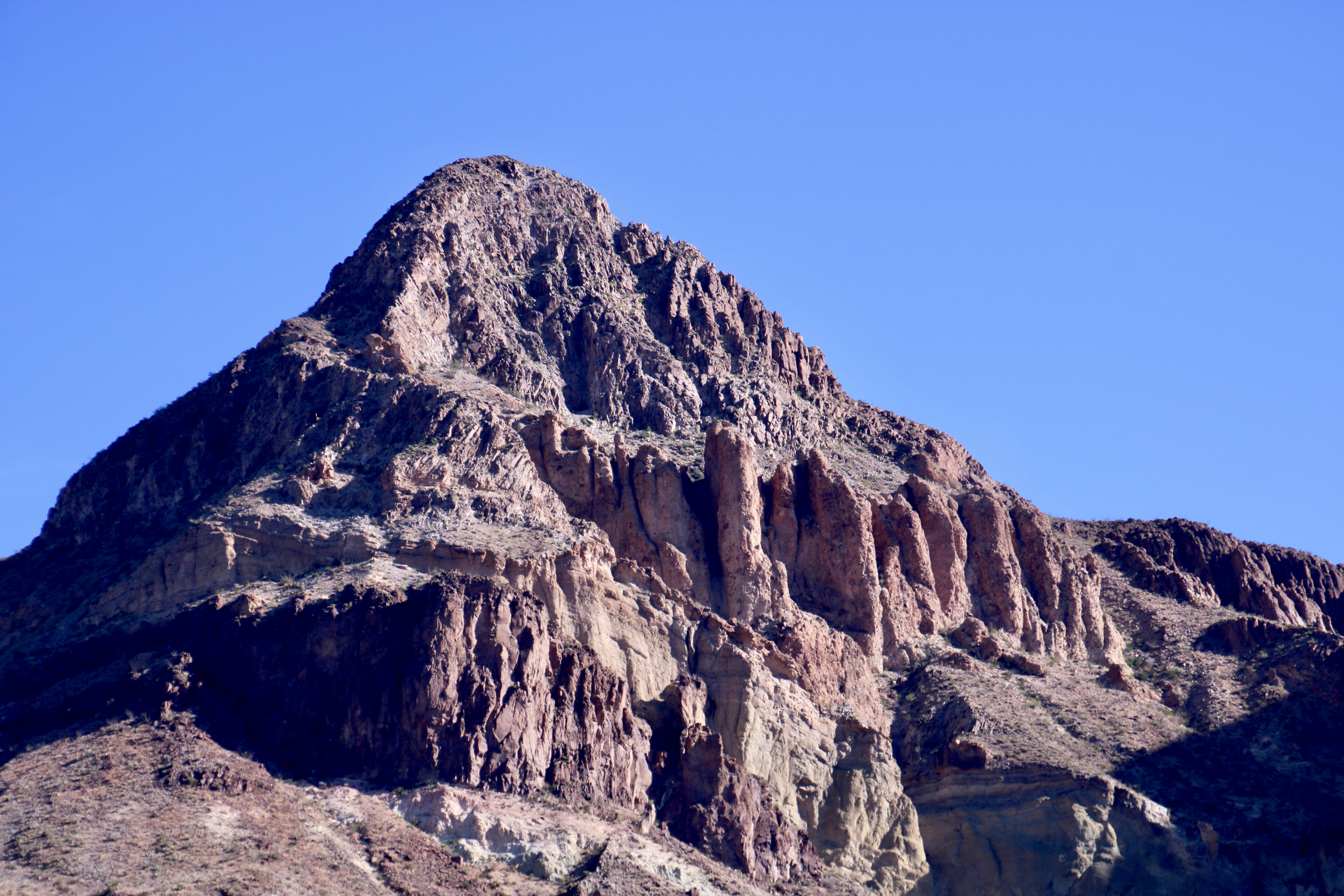
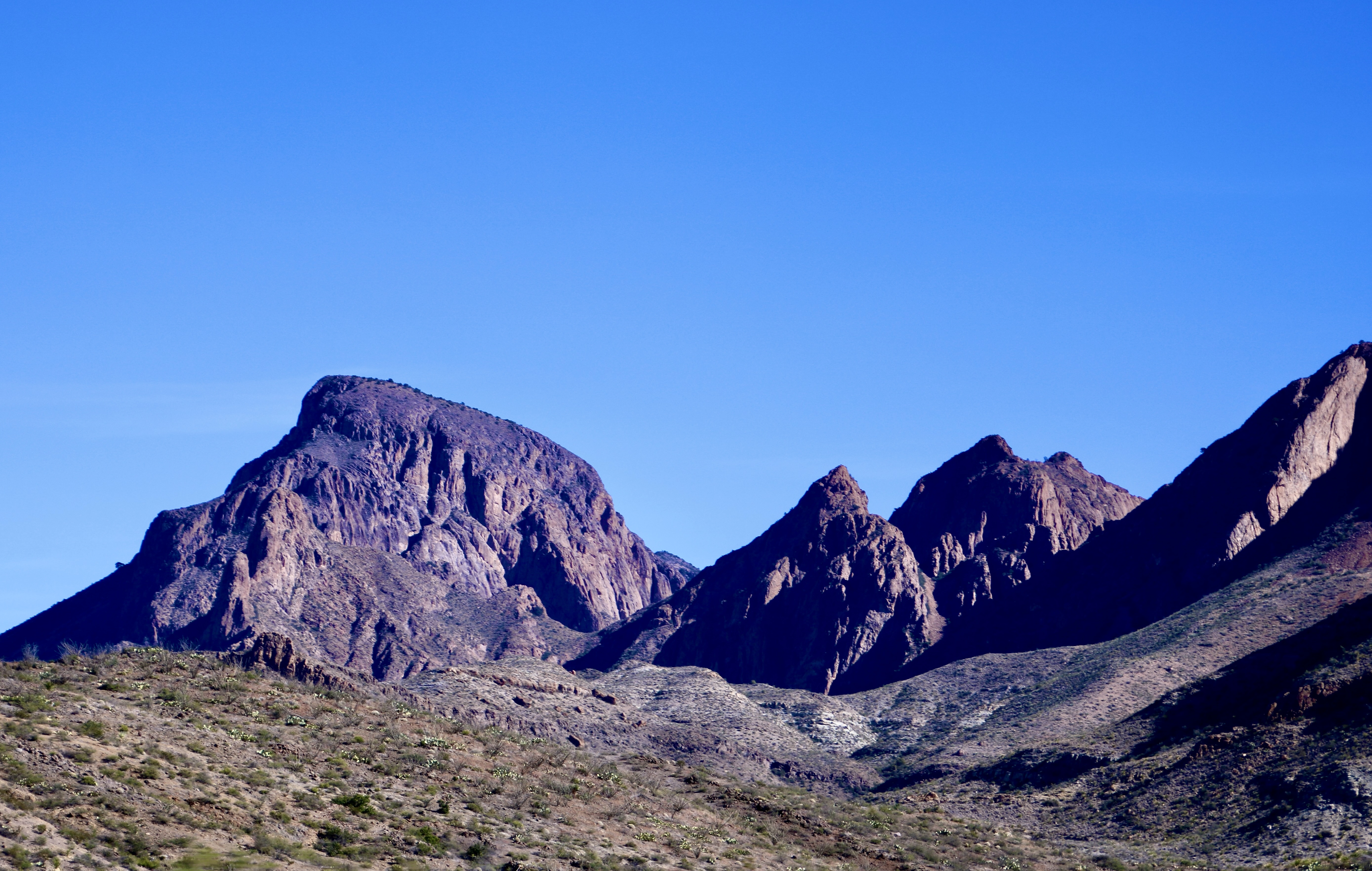
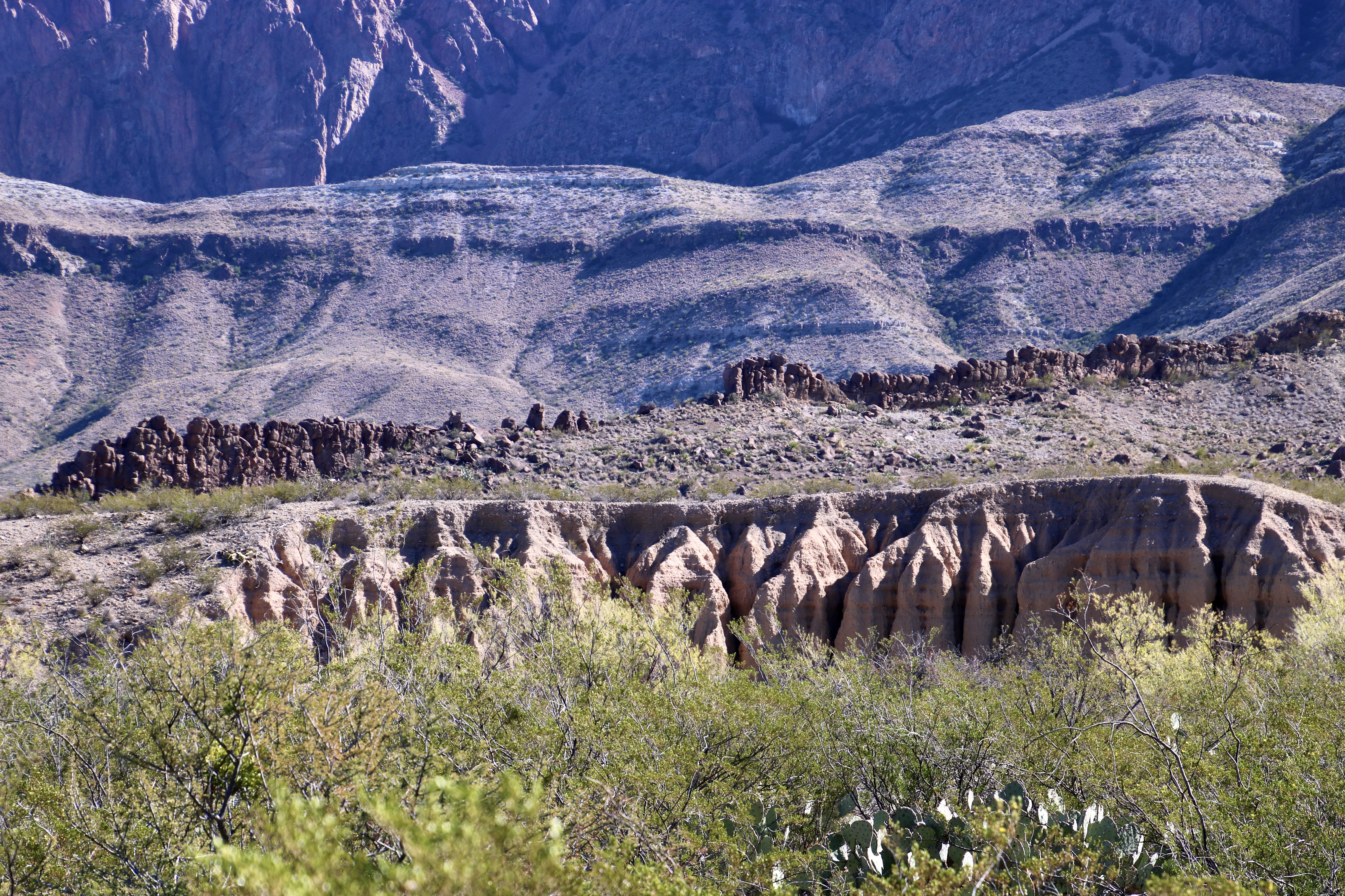
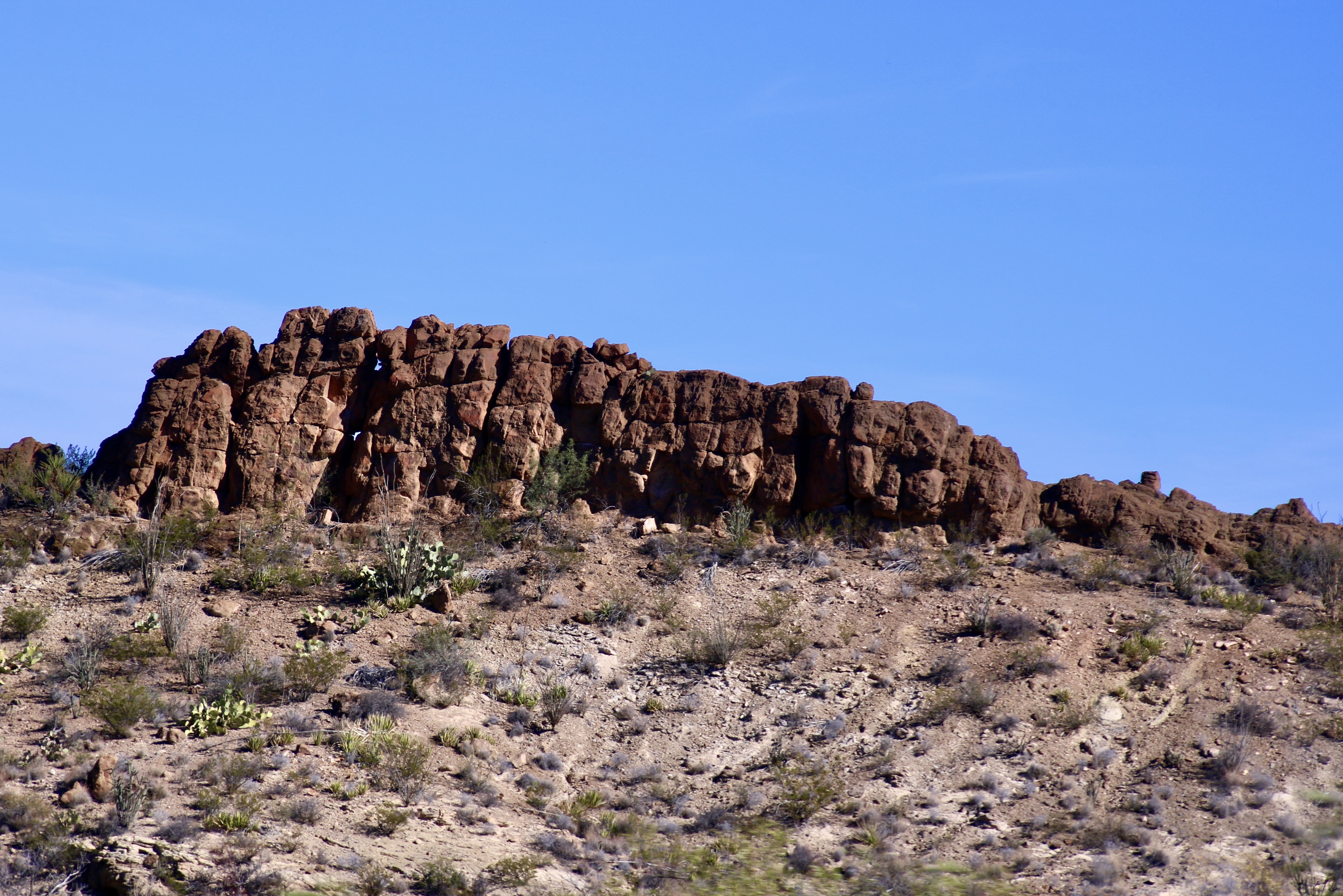
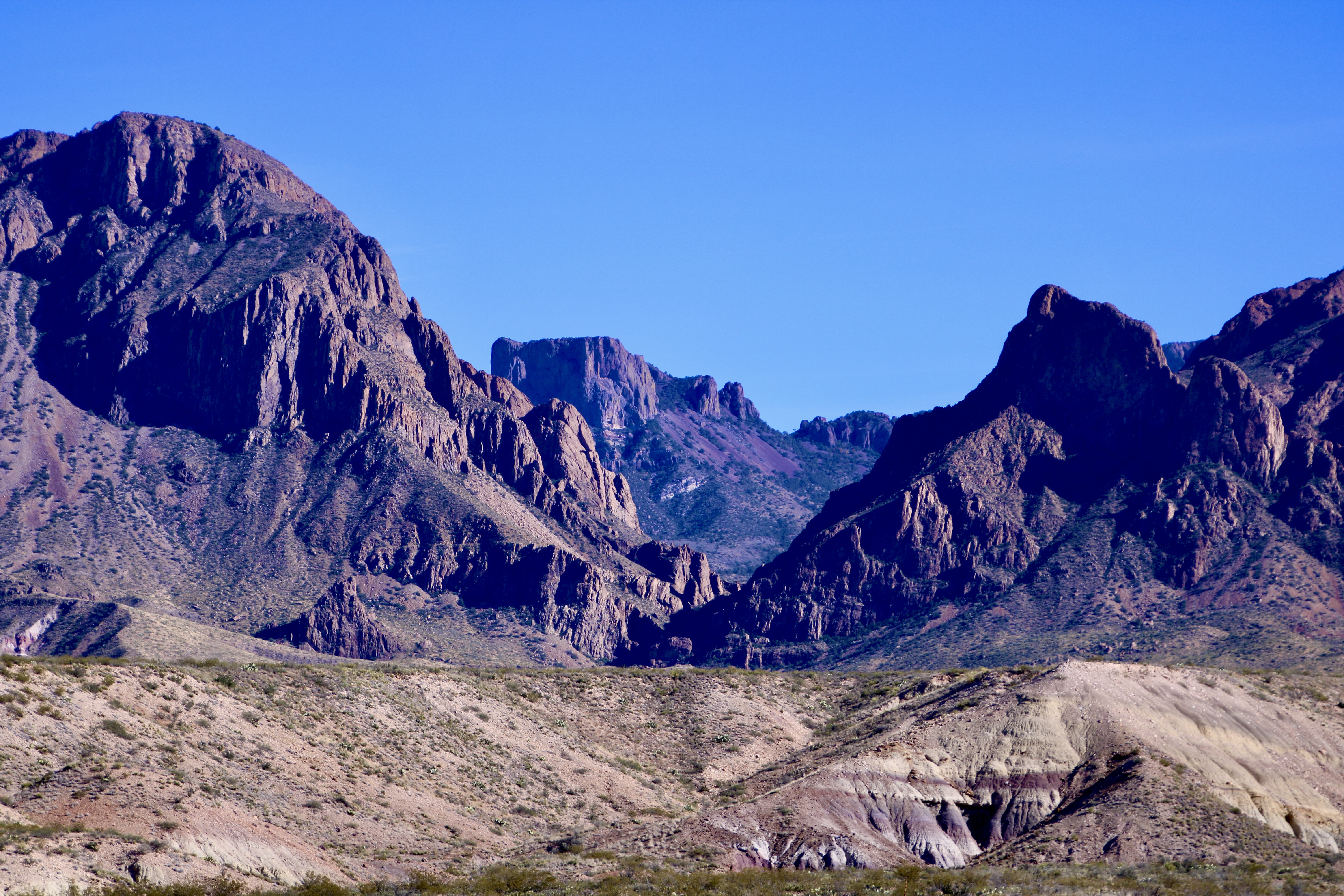
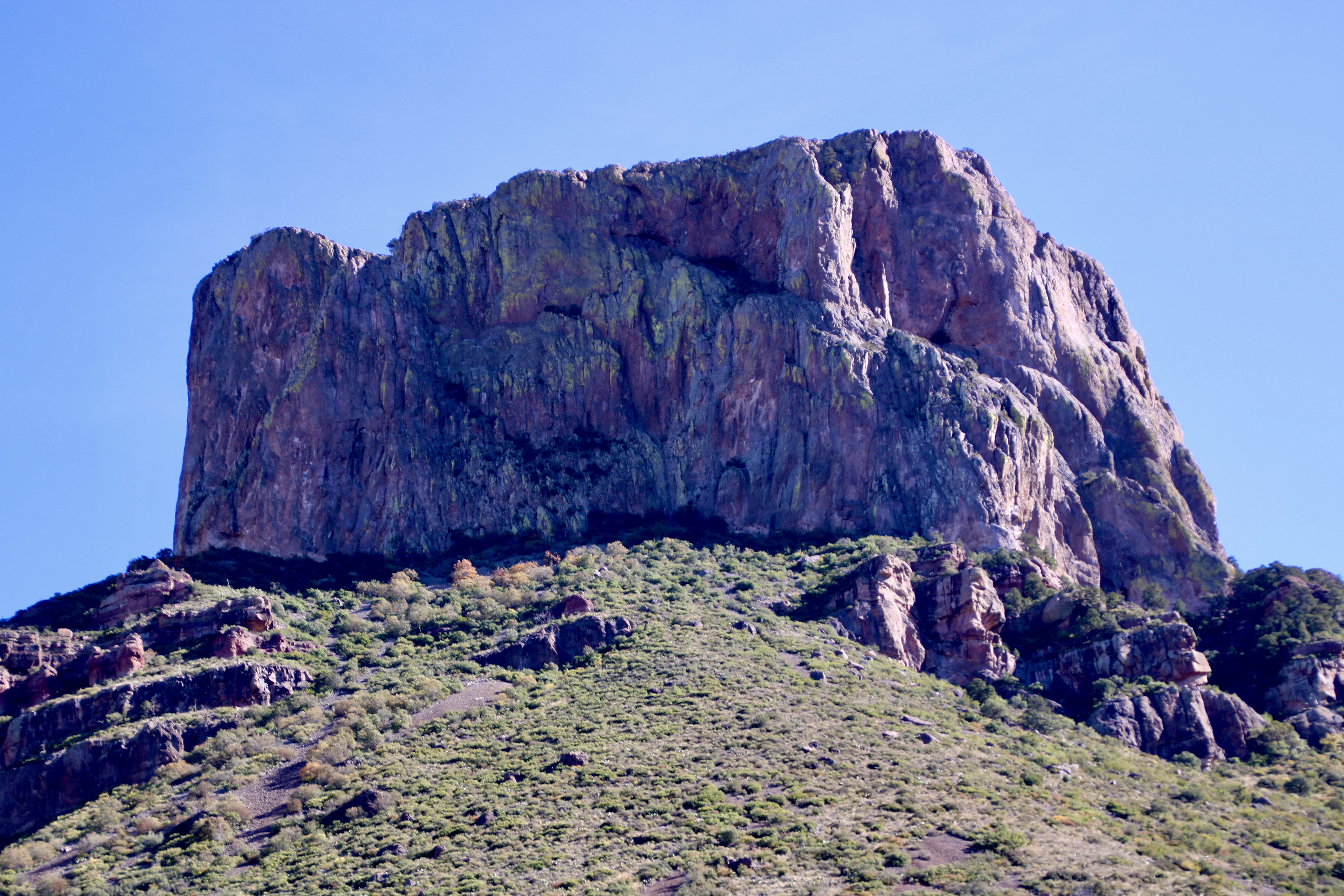
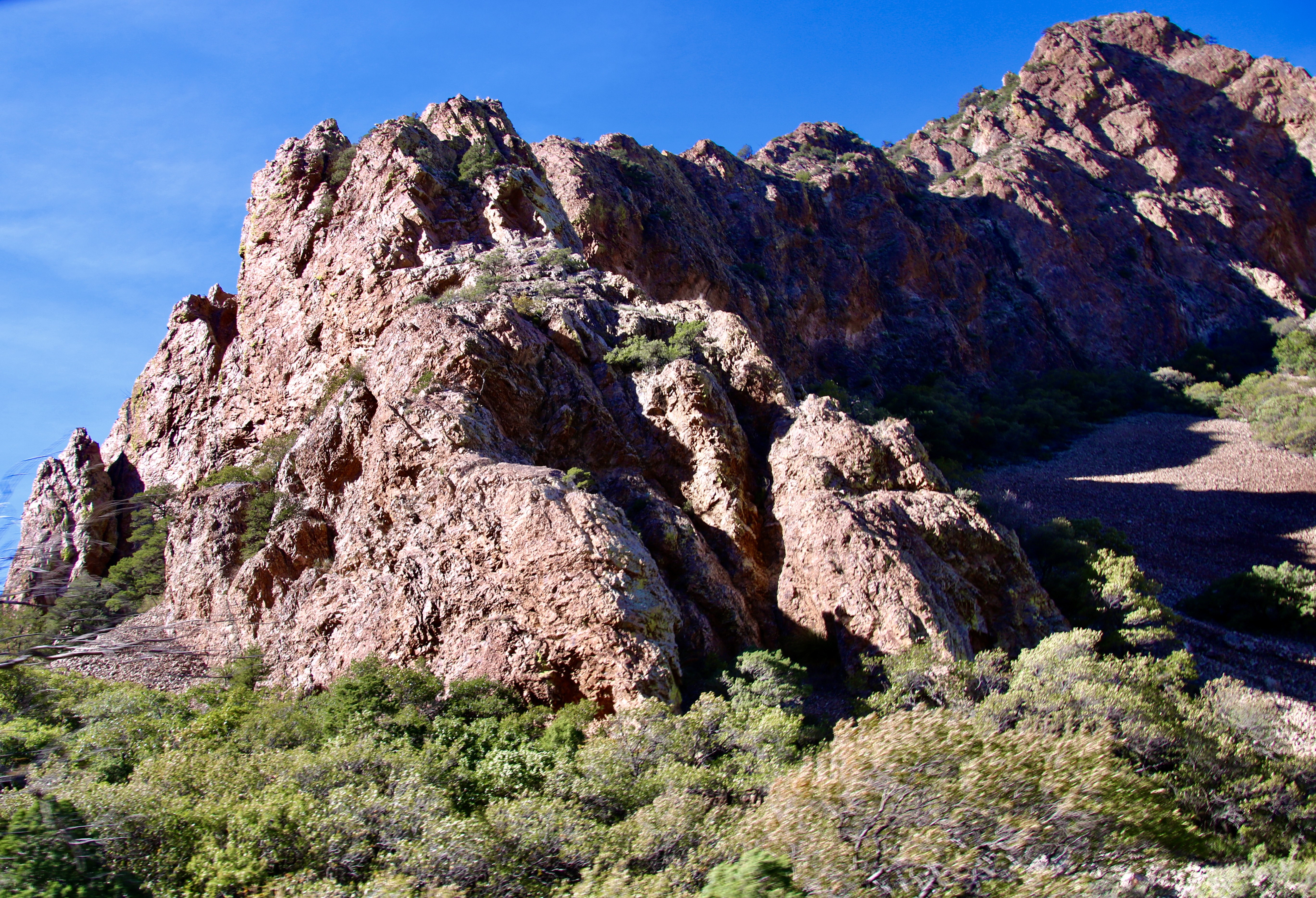
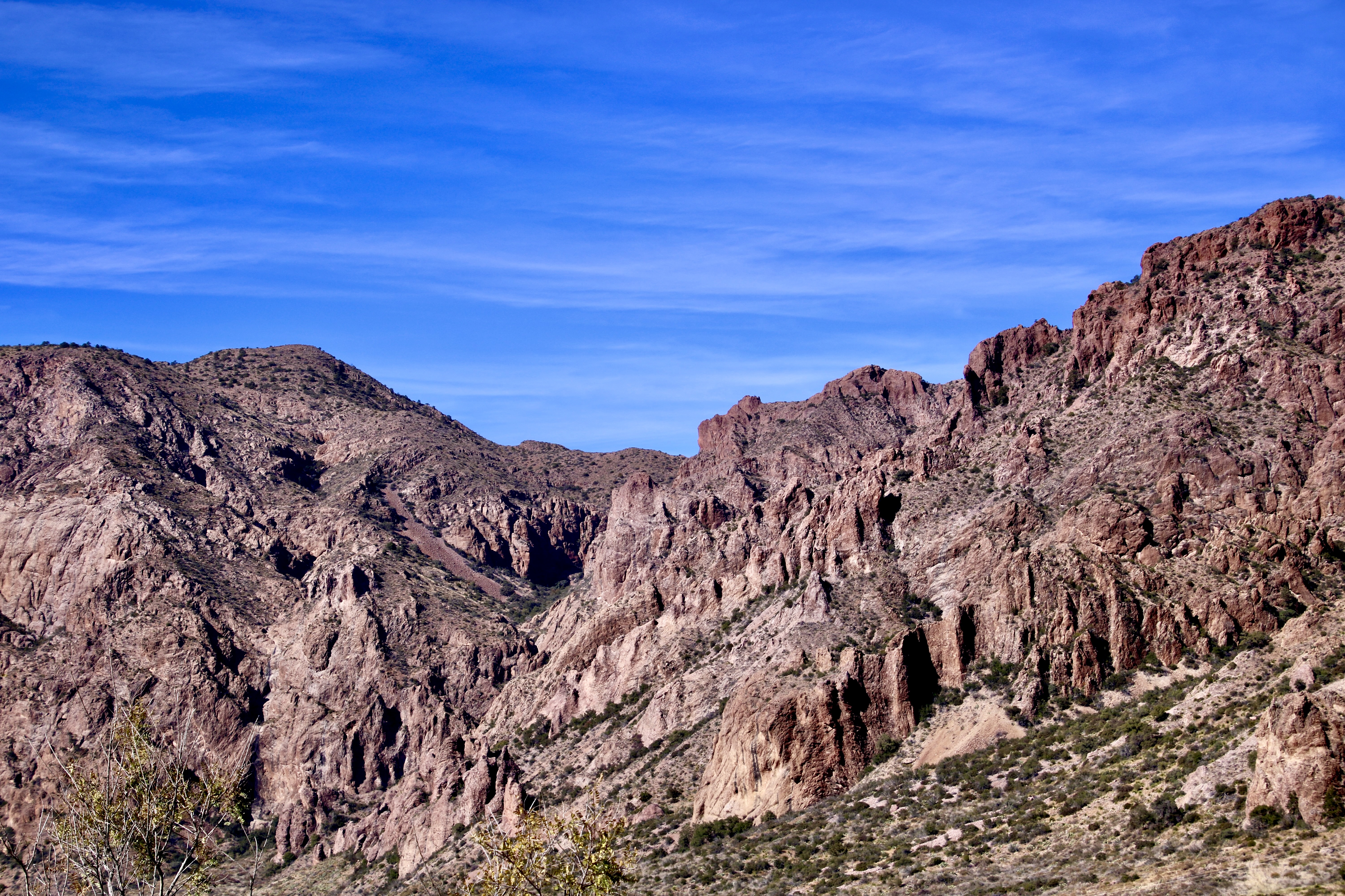
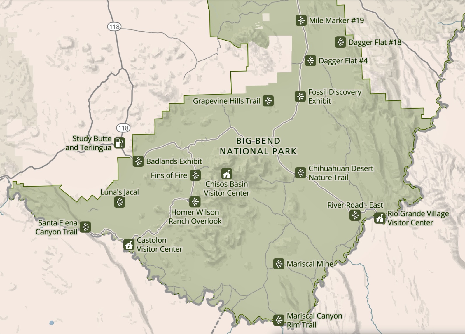
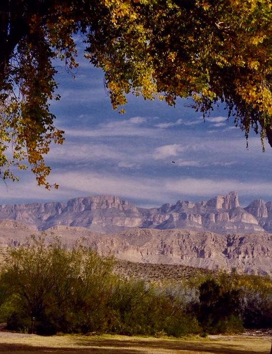
The Chisos Mountains of Big Bend were born 45 to 30 million years ago when the region experienced several episodes of volcanism followed by periods of quiet. We found the mountainous region to be quite beautiful. Our drive from our campsite at Rio Grande Village to our campsite at Castolon took us around much of the mountain range as shown in the National Park map below.Our drive from our campground at Rio Grand Village on the right to our campground in Castolon on the left took us around a significant portion of the Chisos Mountains. Most of our photos of the mountain were taken when we retraced our drive up from Castolon to visit the Chisos Basin. We did, however take photos from the Chihuahuan Desert Nature Trail on our way to Castolon. This is a Big Bend National Park map.The Chihuahuan Desert Nature Trail provided several views of the eastern side of the Chisos Mountains. I believe this is a view into Pine Canyon.Any view of the ‘Old West’ is enhanced by an old-fashioned windmill (not the gigantic modern types). We found this along the nature trail looking out at the mountains.Farther up the road, after we had cut off onto the Ross Maxwell Scenic Drive, the Chisos Mountains Exhibit gave us a northwestern view of the mountains. Emory Peak, the slight knob on the left, is the highest point in the park at 7,825′ (2385 m).Once situated in Castolon, Peggy and I decided to make a more leisurely trip up the Scenic Highway along the Chisos Mountain to the Chisos Basin. Our first view along the way was one of Big Bend’s most photographed sites: The Mule Ears. They look a bit devilish to me.Another perspective. Do they actually look like mule ears? Close…I took this photo at Phantom Ranch in the Grand Canyon.Next up on our list of things to see was Goat Mountain. It’s the peak on the left.Closer…Closest! Actually, Goat Mountain was misnamed. What the early pioneers were actually looking at were big horned sheep.But, hey, an ungulate is an ungulate, right? Can you spot the sheep? Just kidding.Remember the old ditty, ‘the bear went over the mountain to see what he could see,’? I’m like the old bear. Always curious. Goat Mountain is the peak on the end. Getting close to the turn off to the Chisos Basin, this was our view. Note the red ridges in the foreground.The red ridges are the Fins of Fire shown on the map. They are volcanic dikes formed when lava forces its way into crevices in rocks as it works its way to the surface and solidifies. Erosion has exposed the red dikes here.Close up of the dikes.Now it’s time to work our way into the Chisos Basin. A window view of where we are going. The large flat rock is Casa Grande.A grand house indeed! But it’s only one of the many views we found in the basin.They range from rocks with character like these…To rocks I found particularly beautiful. Like this.And this. Note the trees and bushes. We are no longer in the desert!Variety in the basin…Is truly…The spice of life.This is Emory Peak, the highest point in the Chisos Mountains.And this is a view back out into the Chihuahuan Desert, where we will return in our next post. See the slight notch on the horizon…It’s this: The Santa Elena Canyon. Located in the Castolon area, it is one of the places we will be exploring.
The Rio Grande River forms the southern border of Big Bend National Park and also forms the park’s border with Mexico.
Big Bend is a three-for-the-price-of-one National Park. There is desert, lots of it: Big Bend serves as northern end of the Chihuahuan Desert, most of which is in Mexico. The craggy, volcanic formed, Chisos Mountains reach for the sky in the heart of the park. And the Rio Grande runs along its southern border, creating a ribbon of green and carving deep river canyons.
Our journey through Big Bend National Park will start with an exploration of the area around the Rio Grande Village on the right, take you around and up into the Chisos Mountains, and end in the area around the Castolon Visitor Center on the left with its towering Santa Elena Canyon.
We first visited in 1999 when we had taken a year off from work to visit and explore all of America’s national parks. We camped at the Rio Grande Village campground and celebrated Christmas there. A macramé hanging served as our Christmas Tree. Our main present was a long walk along the Rio Grande. We vowed we would come back.
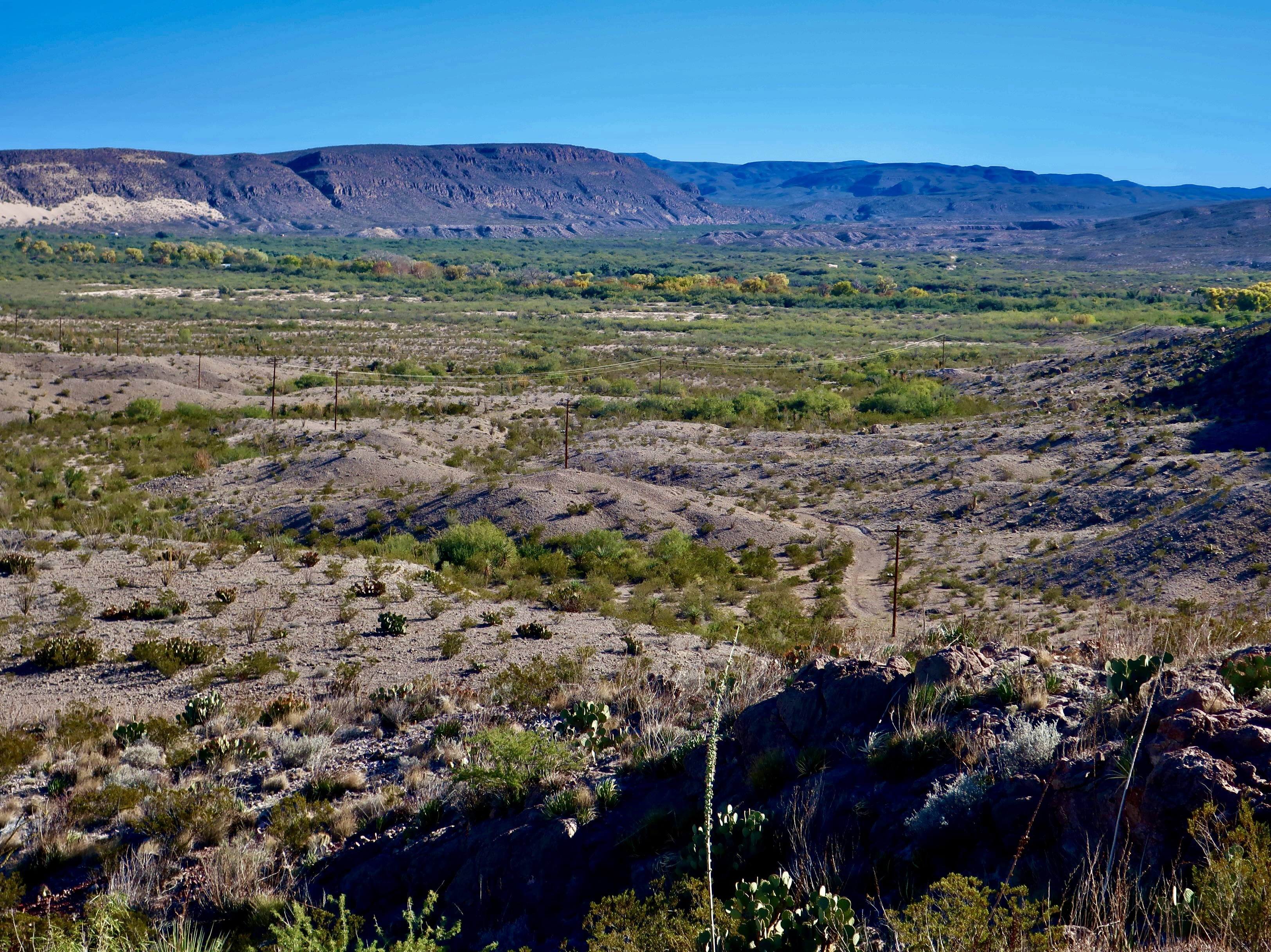
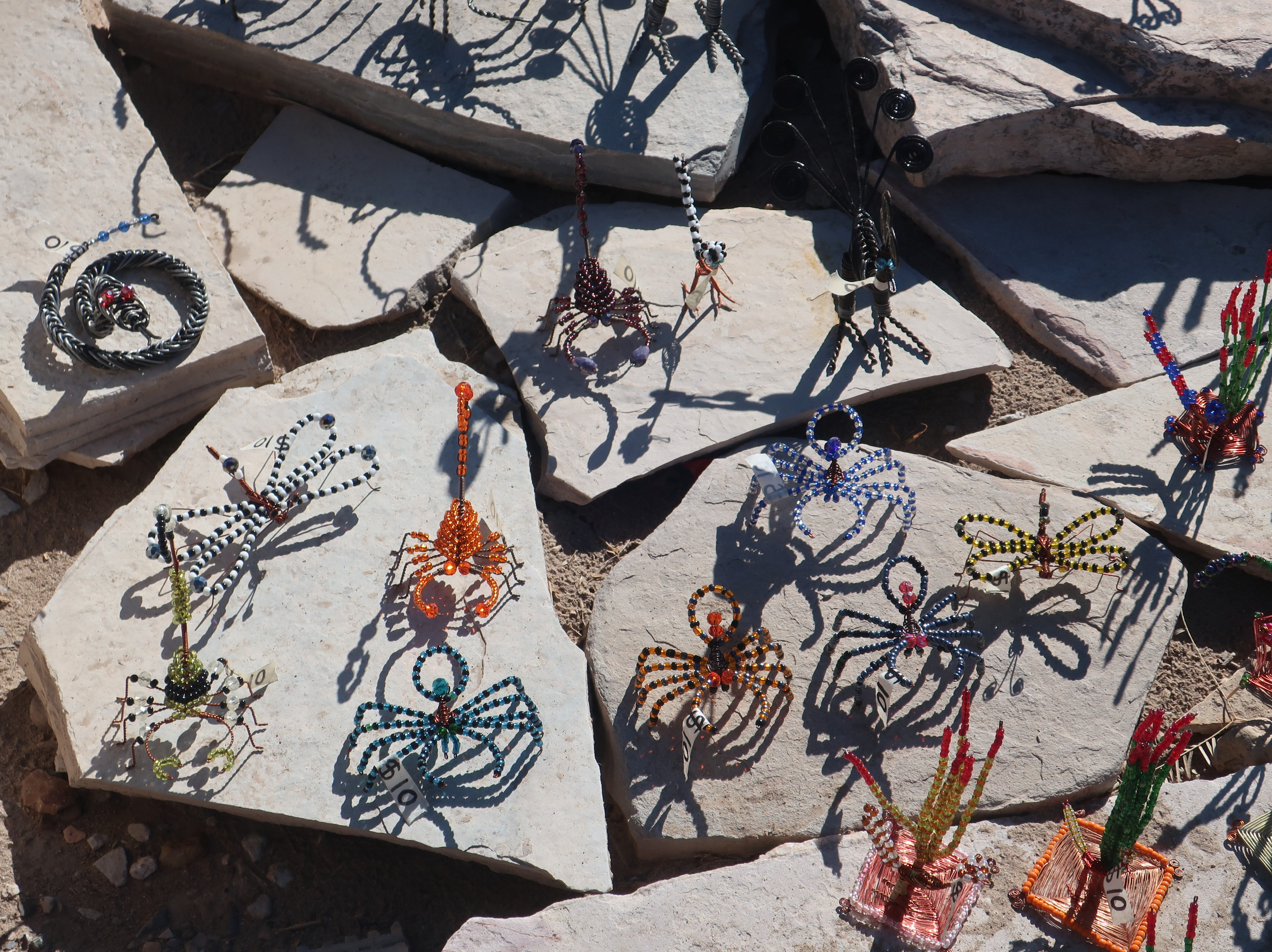
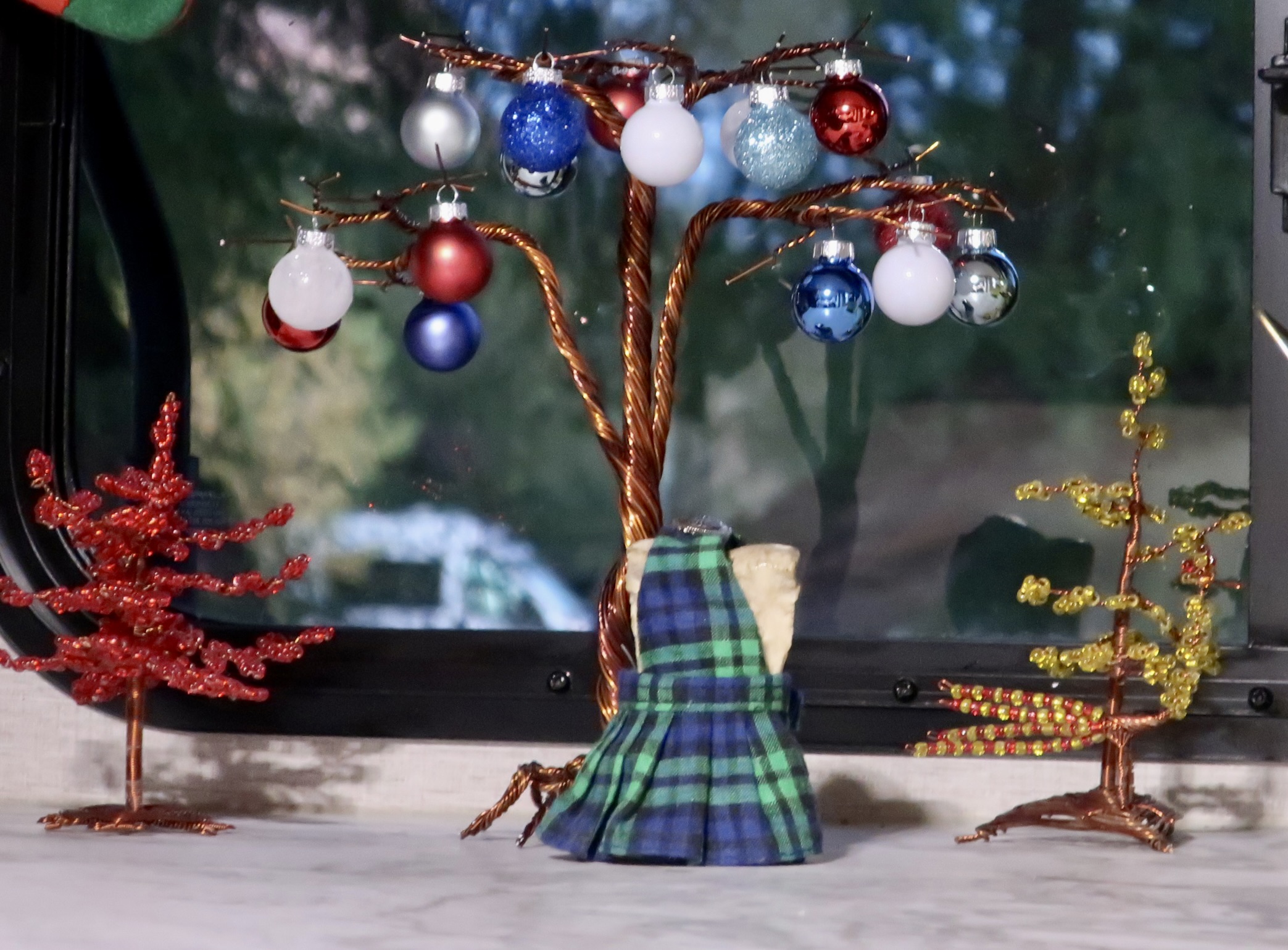
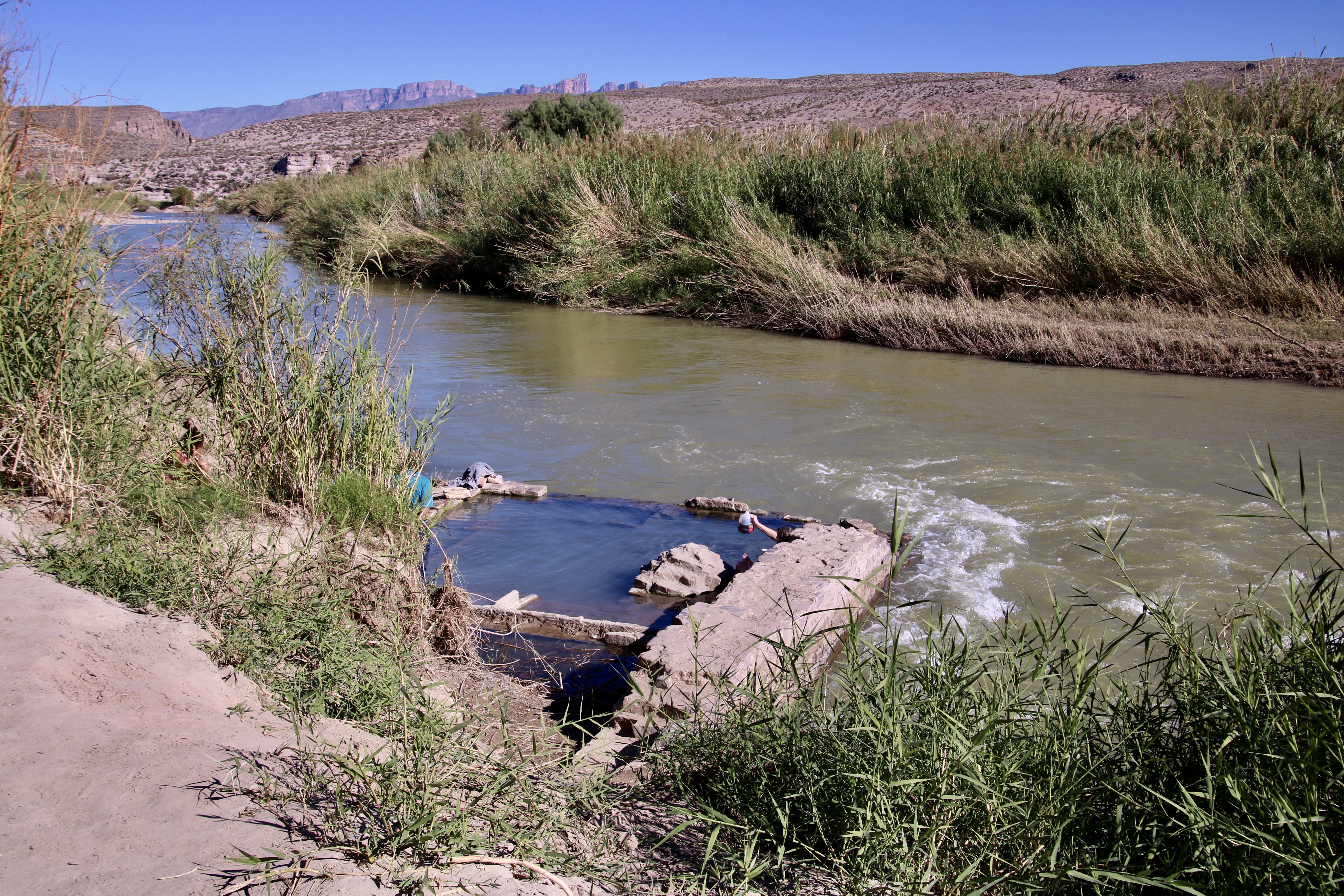
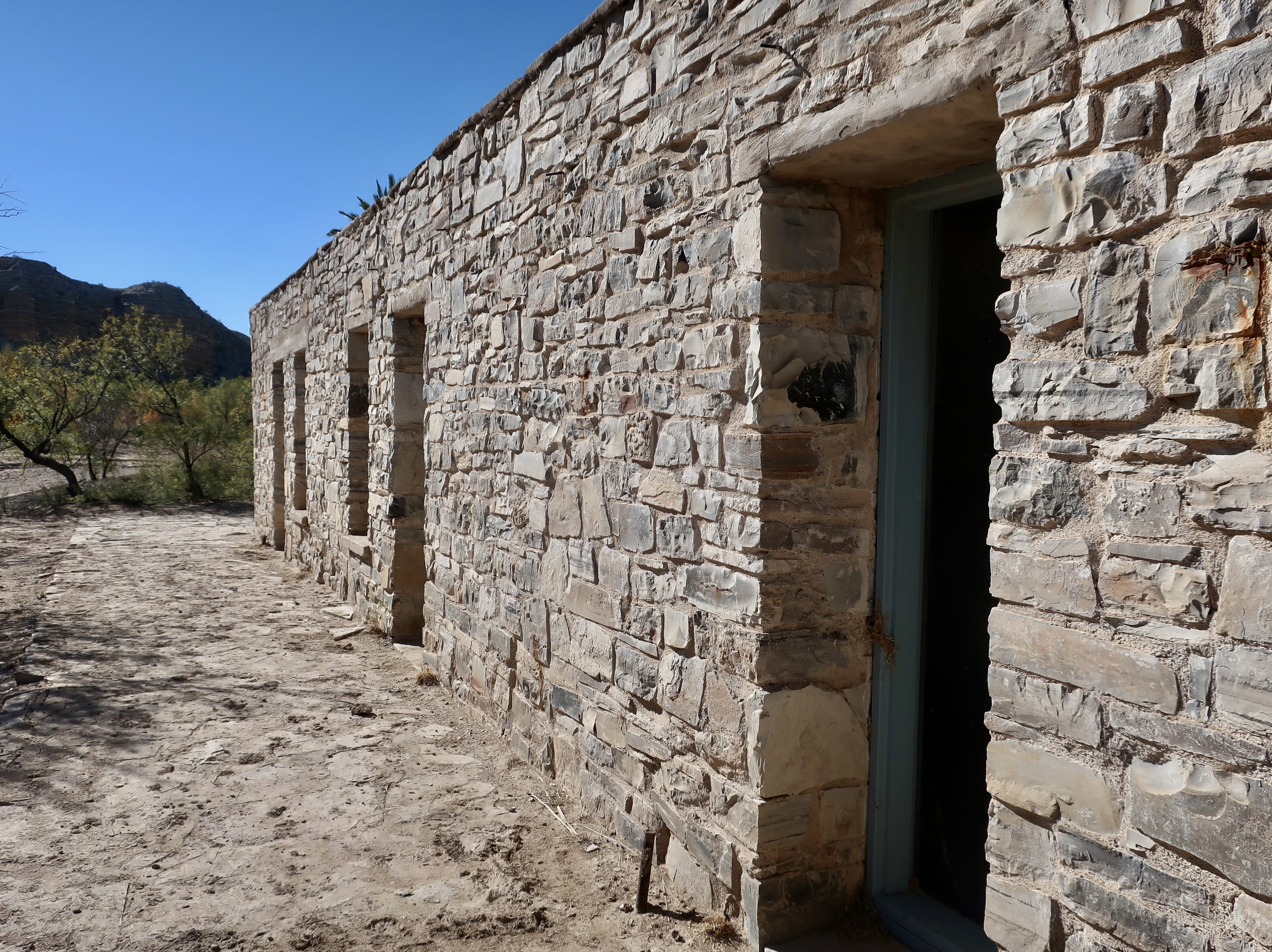
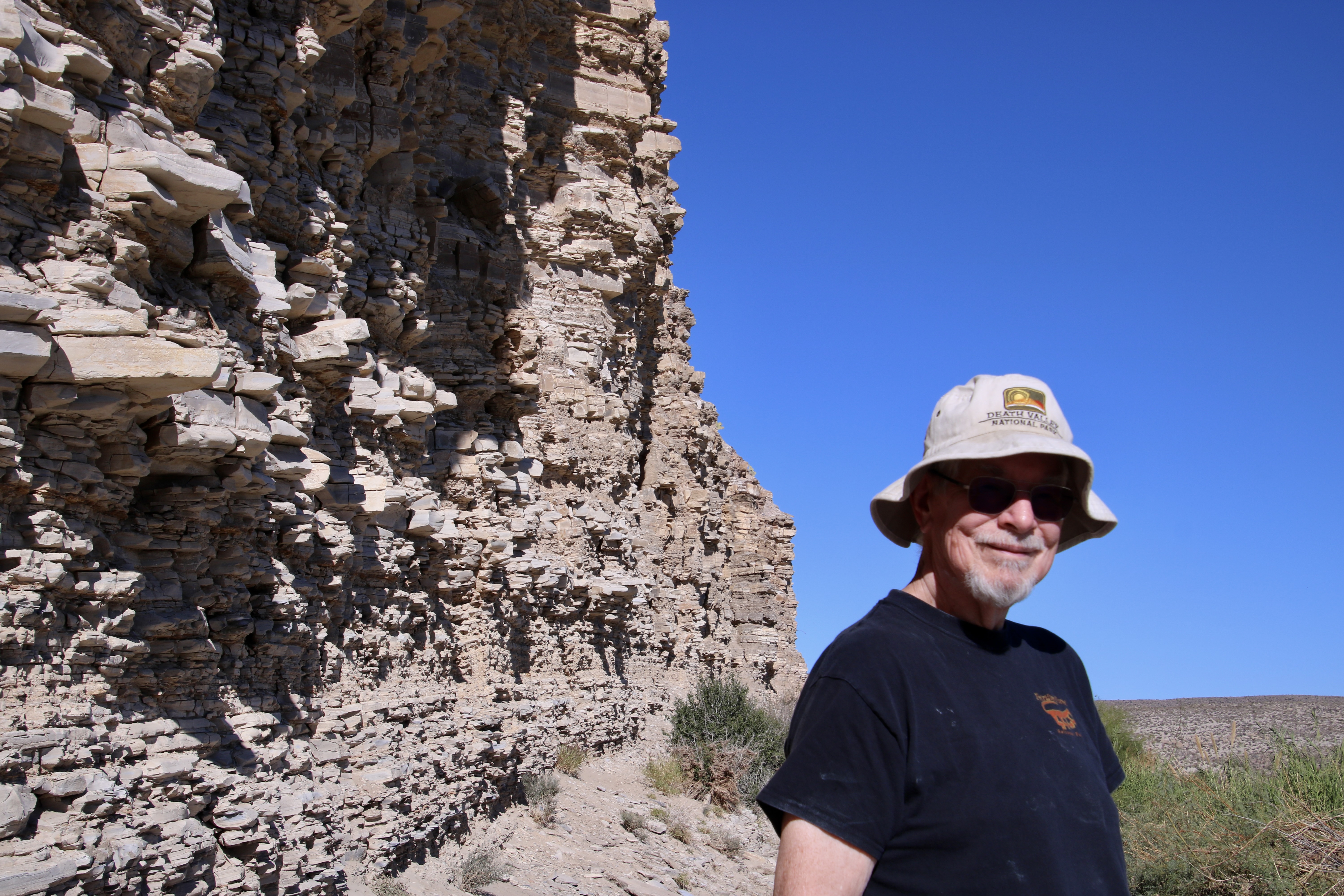
A photo from the Rio Grande Village campground we took on our first visit to the park in 1999.Today’s journey will take us from the area above Boquillas on the right to the Hot Springs on the left.A lookout from above Boquillas, Mexico on the park side provided this view of the Rio Grande Valley. The distant tree line follows the river.It’s a wash! If you have ever spent time in the deserts you will be familiar with dry riverbeds like this one on the right. A thunderstorm can quickly turn it into a raging torrent. You don’t want to get caught in one when hiking, camping or driving! I did once when I was driving across Texas and was very lucky to get out of it. The same series of storms produced softball sized hailstones that night, which I was also lucky to avoid.Great views of the Sierra del Carmen were provided from the Boquillas overlook. Believe it or not, the limestone cliffs you are looking at were formed at the bottom of a vast inland sea between 130 – 83 million years ago. The cliffs were created 20 million years ago when tectonic forces were stretching the continental plate of western North America creating massive, down dropped basins and high, uplifted ranges along fault zones. The highest point you see is appropriately named, El Pico, the peak.A national park sign board provided this view of what the sea would have covered. The small star in the center at the bottom is Big Bend National Park. The sea stretches all the way up to Canada’s Yukon Territory. Another view of the Sierra del Carmen.A fun part of the Boquillas overlook was the Mexican arts and crafts on display there. A wide range of inexpensive, tourist oriented items such as these Mexican bobbleheads were for sale.No one was present. A handmade sign announced that the arts and crafts were from Boquillas. Prices were marked on each item and a container was conveniently located for visitors to put money in. It was totally an honor system.This provides a perspective on the variety of items that were available for sale.Dragonflies, scorpions, and snakes, oh my! I liked the shadows.Since Christmas was only a few weeks away, Peggy bought three Christmasy trees and decorated the biggest one with ornaments she keeps on hand. “Just in case.” Bone, who never misses an opportunity to party, put on a kilt and joined them. Bone, BTW, is wearing the Mekemson family tartan colors according to my 5th cousin who made it for him. Now, if you will look back at the map of the Rio Grande Village area, I’m going to take you over to the left where the Hot Springs are located. (A woman toasted us with her jug.) Originally, these springs were covered and, for a mere quarter, you could take advantage of their healing powers. And what did they heal? There was a flyer advertising them…Rejoice! Apparently, just about anything. Plus you could catch big catfish. (National Park photo)Like this beauty caught out of the Rio Grande on the opposite side of what is now the park near Castolon. (National Park photo)J.O. Langford, who had come to the hot springs from Mississippi in the early 1900s for his own health, built a small resort area including a motel, store and post office in the late 20s to share the health benefits of the springs plus make a profit. Visitors could get a room for a dollar a night or at the bargain price of $6 per week. He operated the resort into the 40s. Some of the old buildings still remain. (National Park photo)The old motel still looks well preserved. Rooms came without water, and, I’m assuming electricity.Since we just posted on Mesa Verde, we couldn’t help but note that the resort also came with cliff dwellings. Grin. They also came without running water or electricity plus required the ability to fly and catch bugs for dinner.A close up.Palm trees provided shade and a resort-like environment. This was the old store at Langford’s resort.A half mile round trip trail along the Rio Grande takes visitors out to the hot springs.Peggy caught a photo of me wearing my Death Valley NP hat along the trail.Mesquite provided us with minimal but welcome shade.Pictographs left behind by Native Americans can be found along the trail. Paleo people were inhabiting the area some 10,000 years before Langford arrived! The original hot springs had flowed into a tub that the Native American’s had carved out of the rock.Another photo of the hot springs.A herd of wild horses was grazing along the trail just above the hot springs…With much swishing of tails.That night we watched the sun set on the Sierra del Carmen Mountains from our campsite at Rio Grande Village. It provides a fitting end for this post. Next up we will explore the picturesque Chisos Mountains in the heart of Big Bend NP.