The Ghostly Town of Bodie: Part 1… The Highway 395 Series

What better way to introduce the ghost town of Bodie than with a ghostly, tattered curtain. The Standard Mining Company mill can be seen in the reflection.

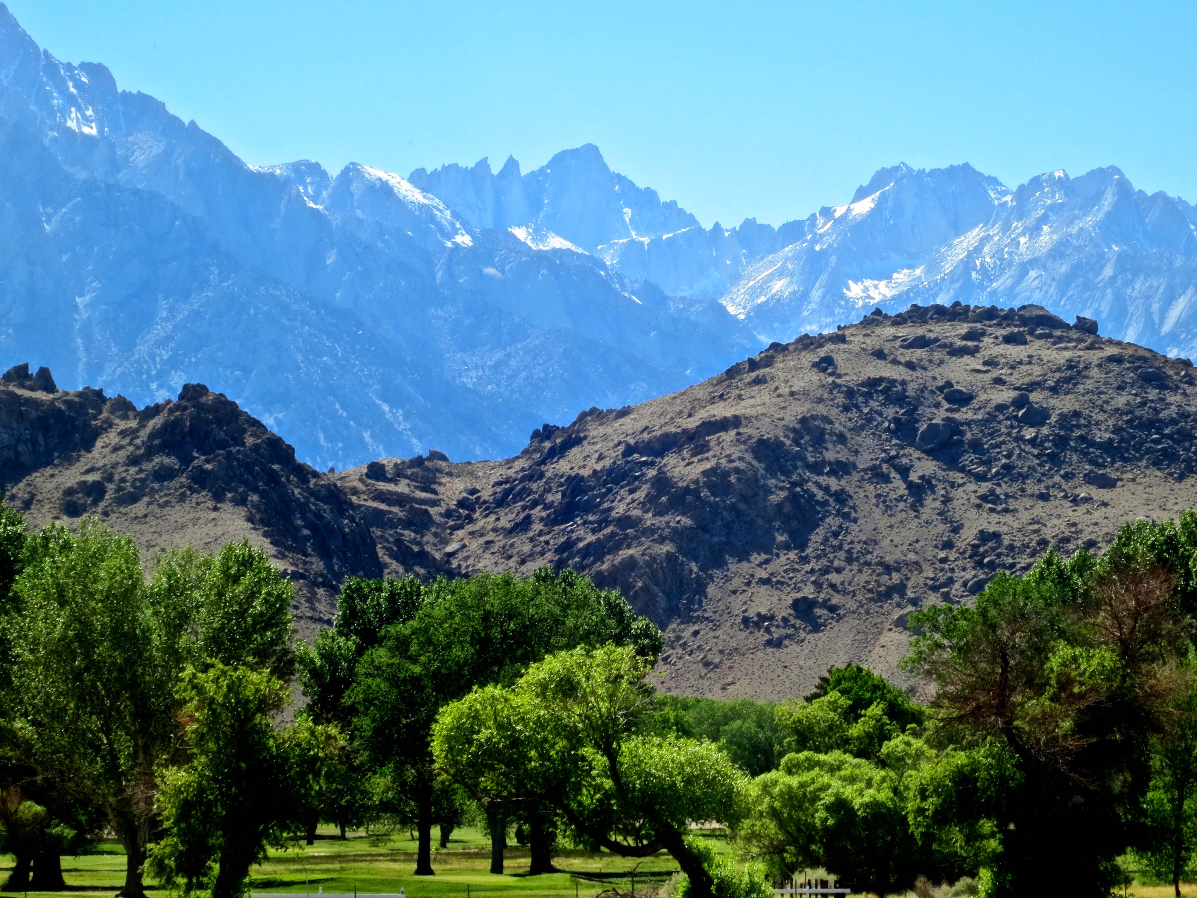
The history of the gold and silver strikes in the Old West of the mid 1800s is one of boom and bust. Large towns of several thousand people would spring up overnight in remote locations and be abandoned almost as fast as veins ran out and other strikes fired the imagination of miners driven by dreams of instant wealth. 

Some of the towns have lingered on into modern times. Diamond Springs, where I grew up in the heart of California’s gold country, is one. A 25-pound gold nugget found nearby in the early 1850s assured Diamond of its boomtown status. It was a sleepy, ‘one-horse-town,’ in my youth. Today, it is more like a sprawling suburb. Virginia City, Nevada, which we will visit next on my Highway 395 series, not only survived but worked to maintain its historical look and has become a successful tourist attraction.  

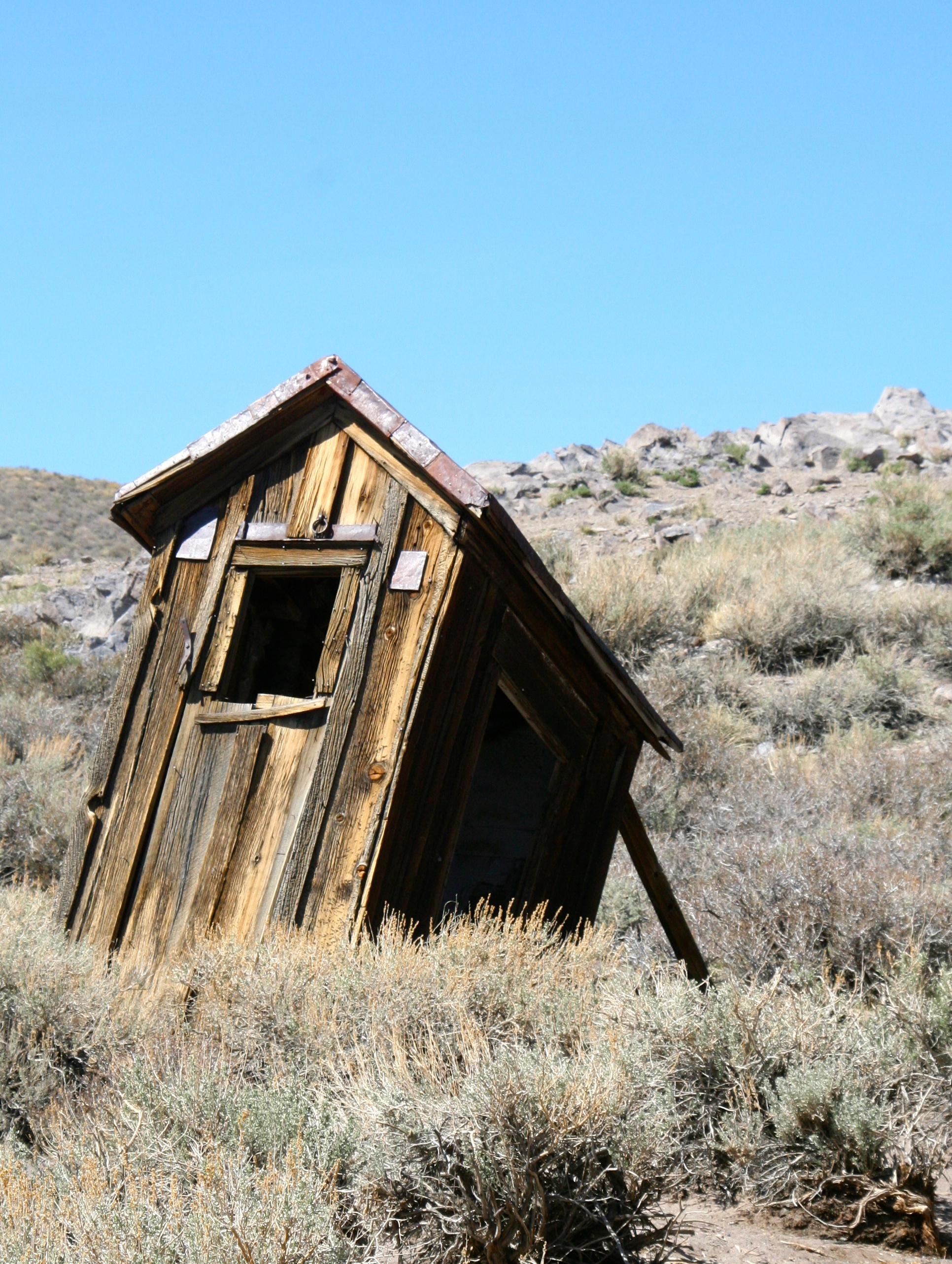
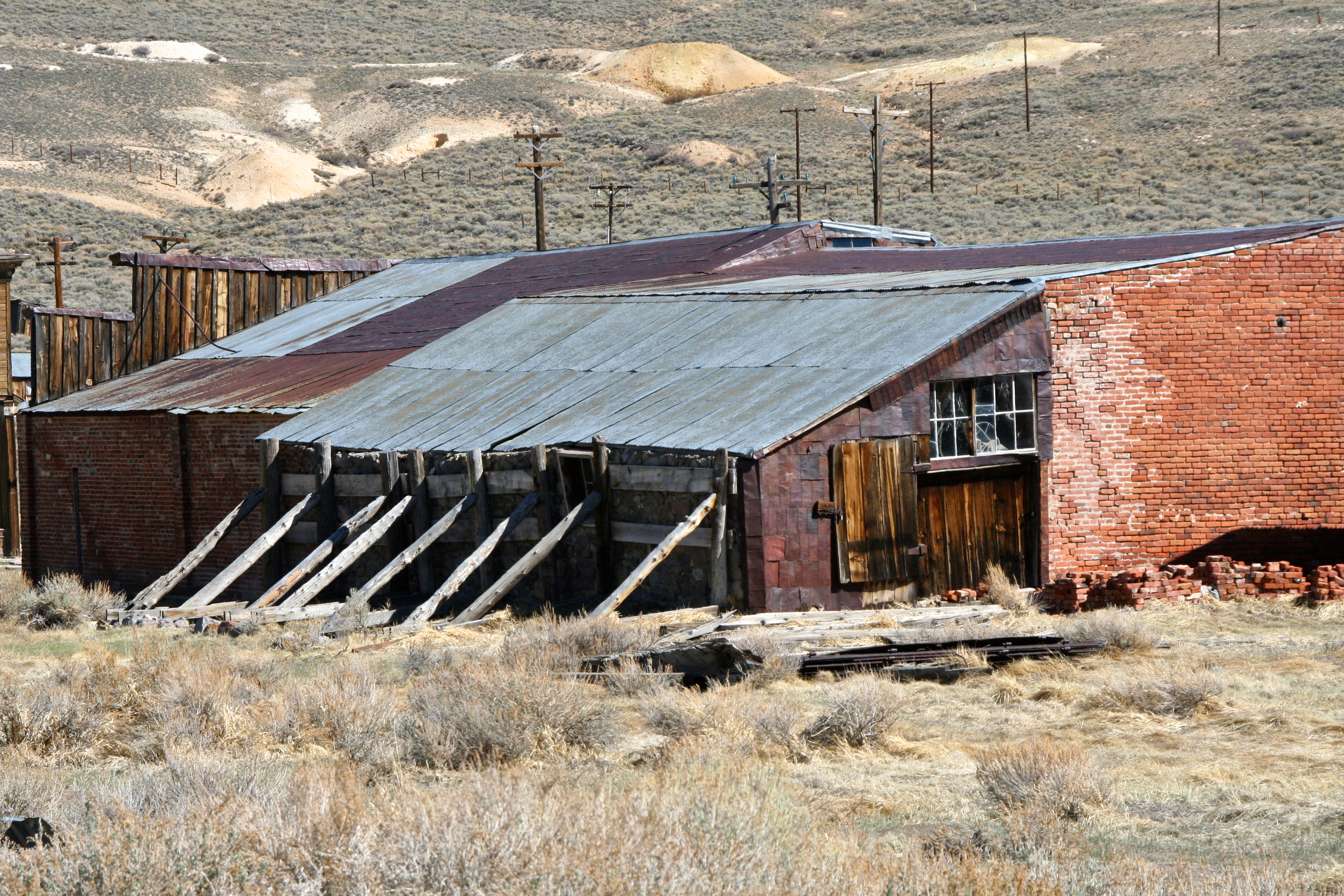
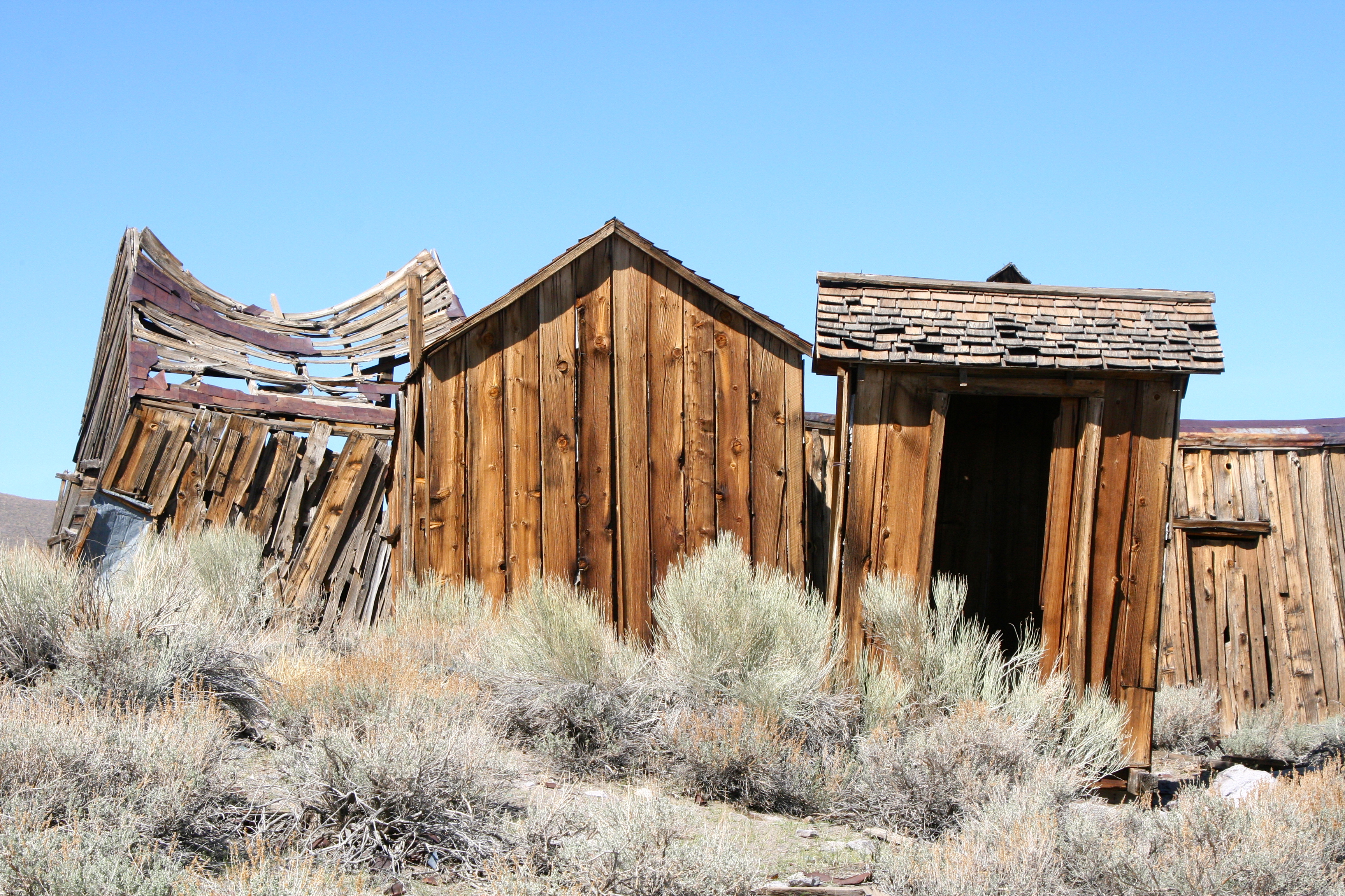
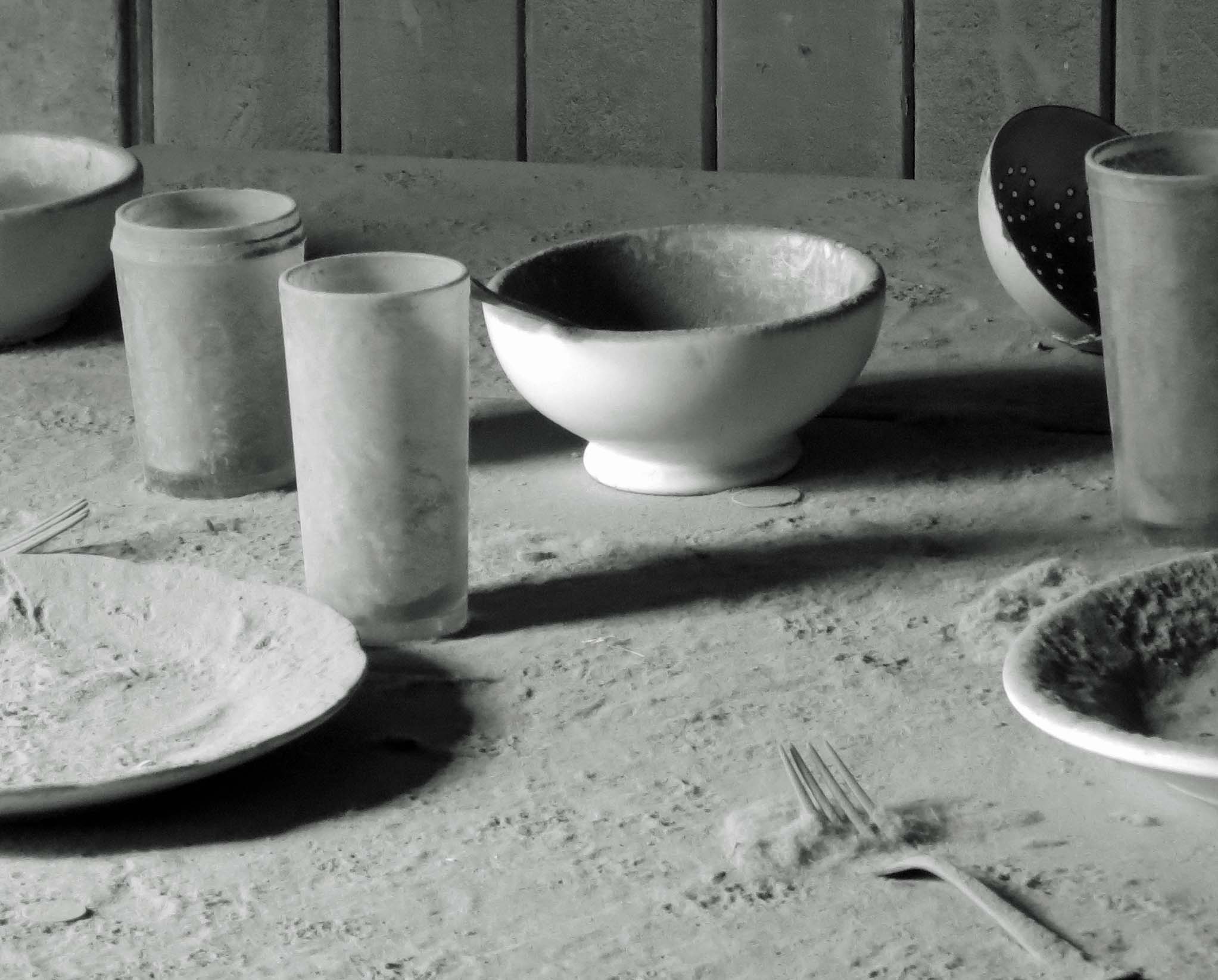
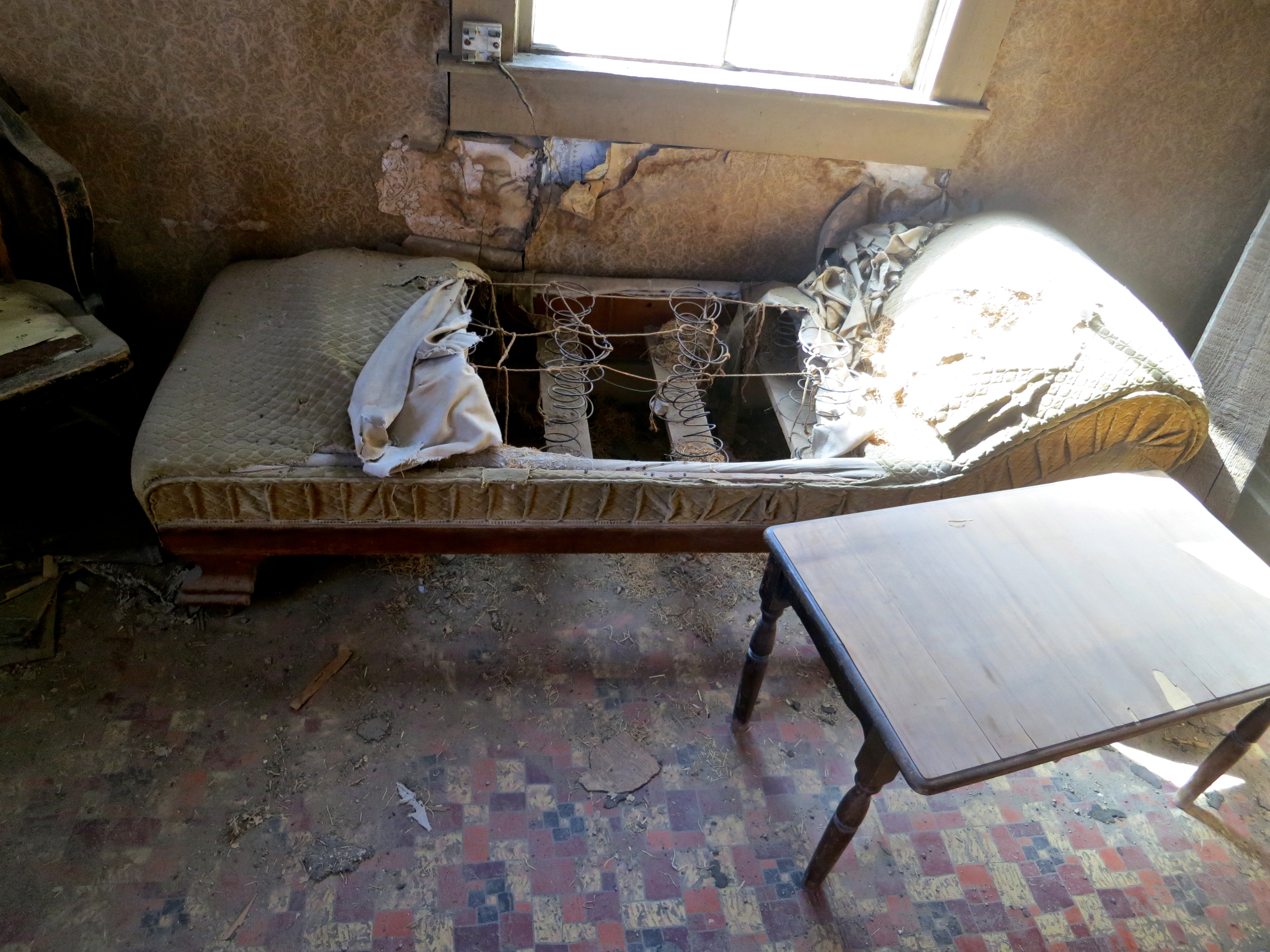
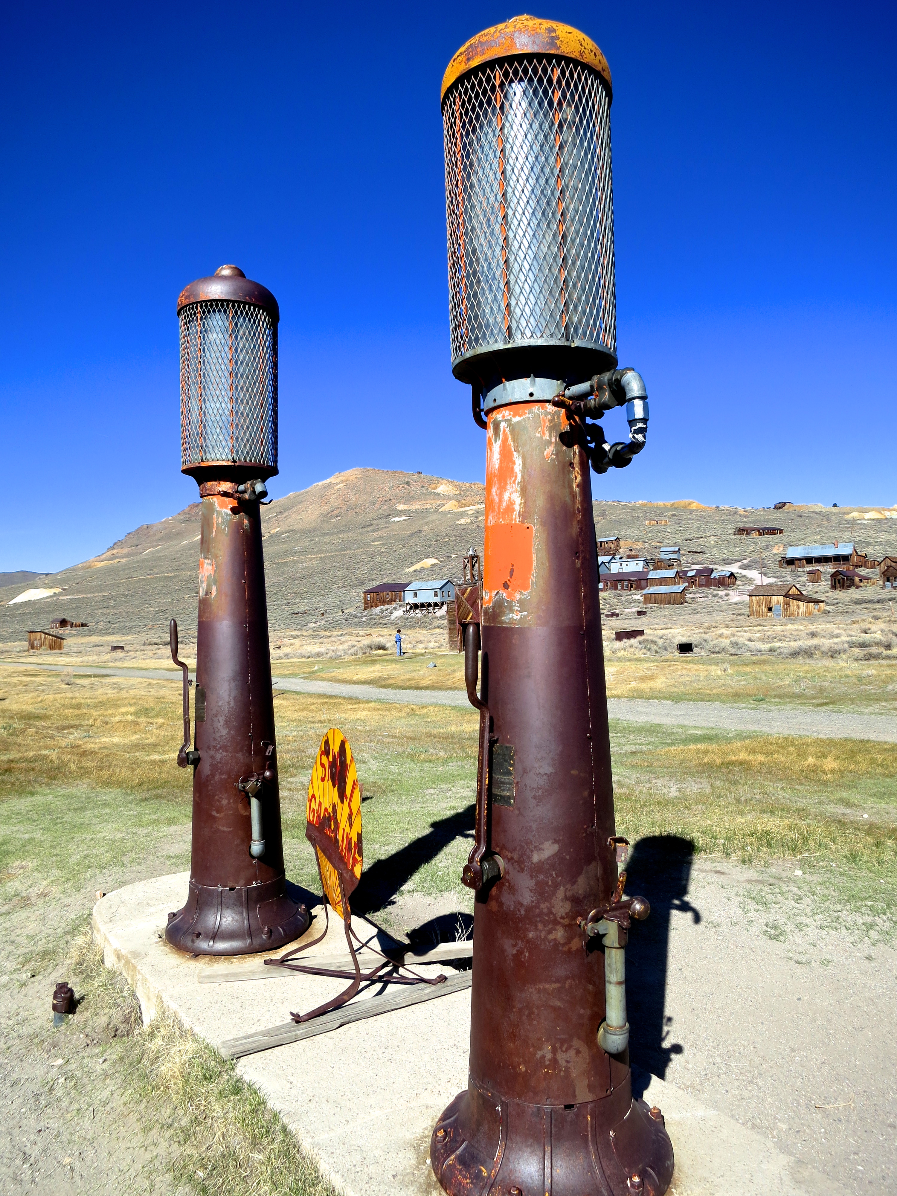
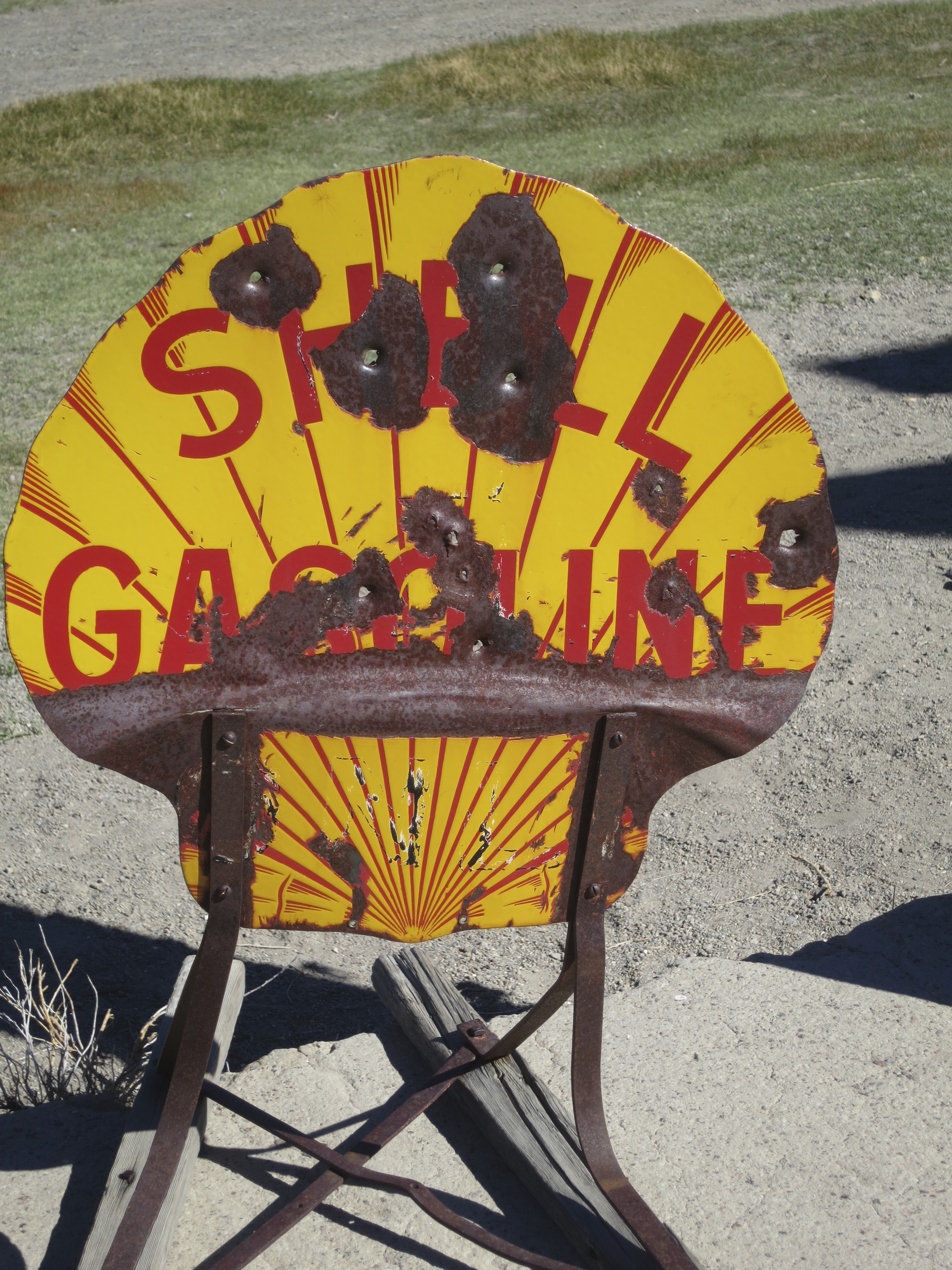
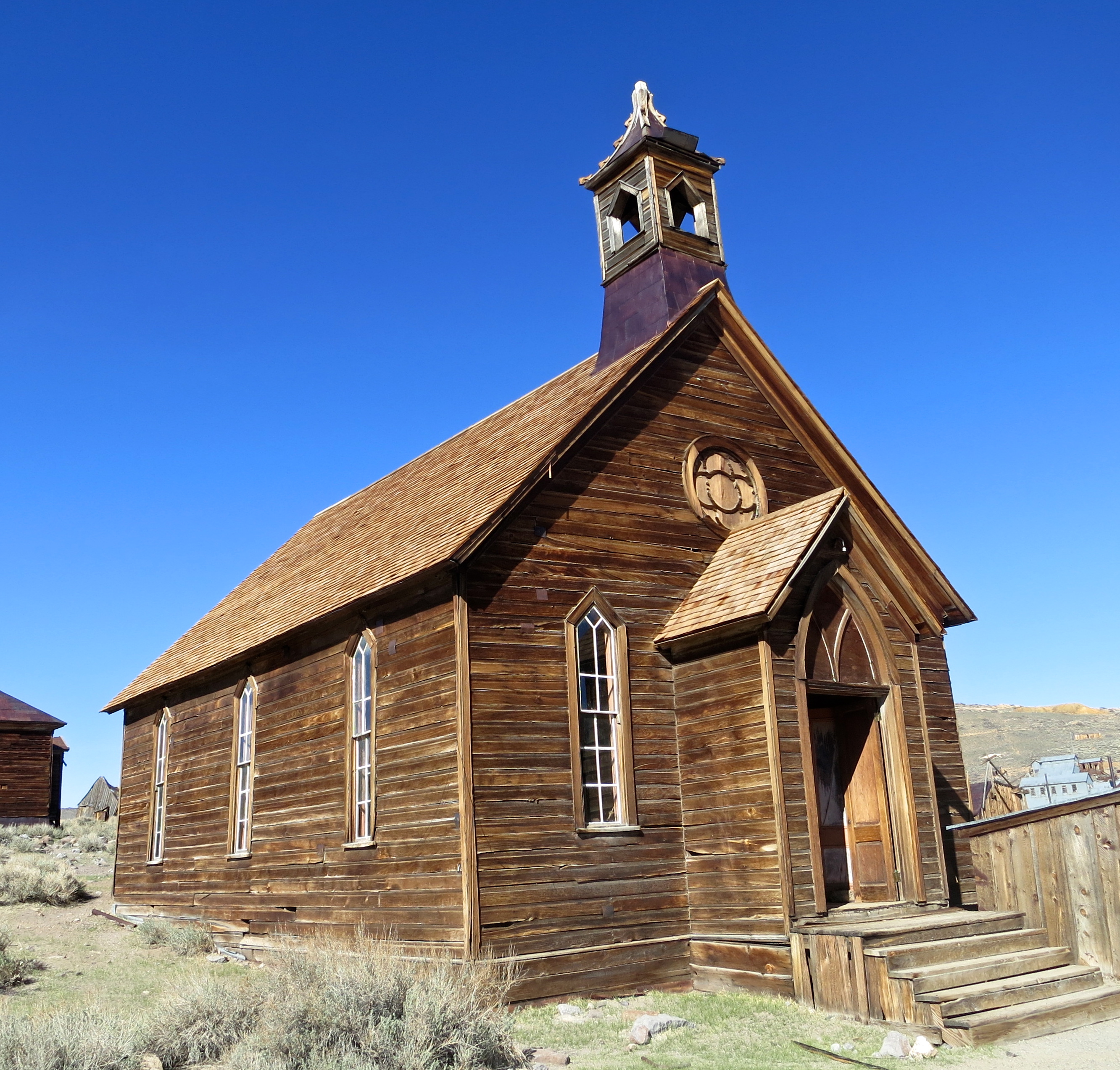
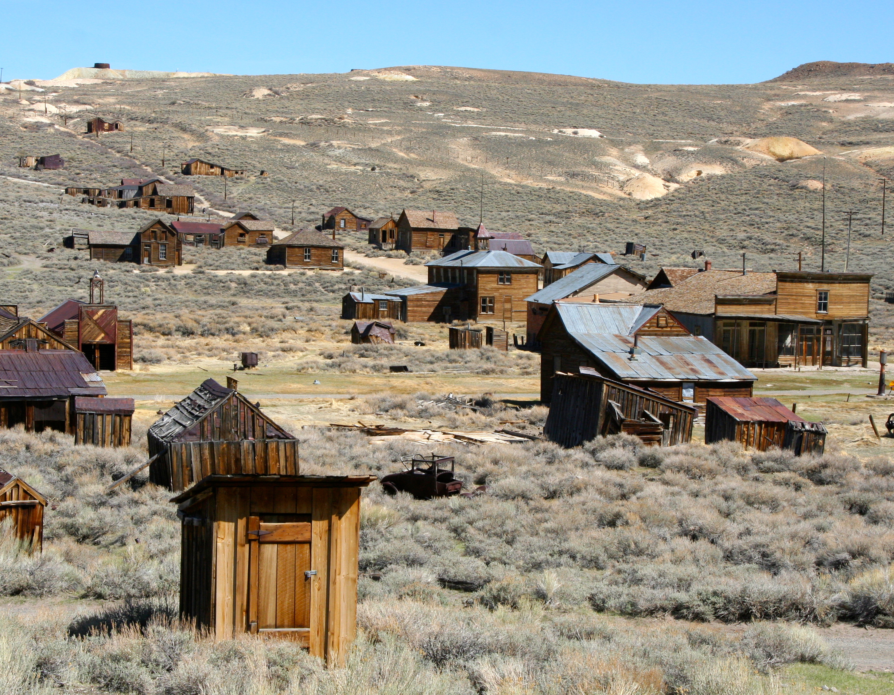
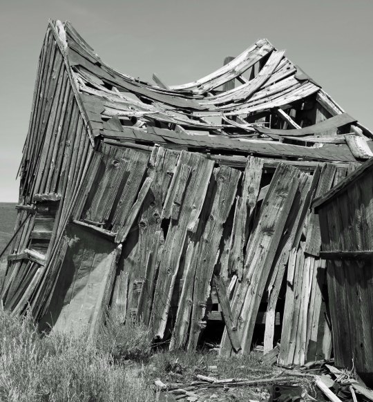
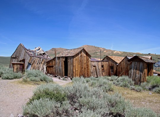
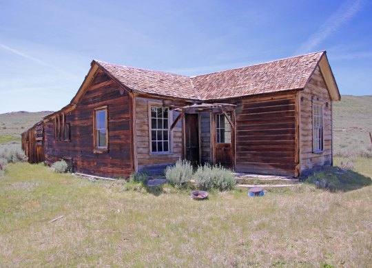
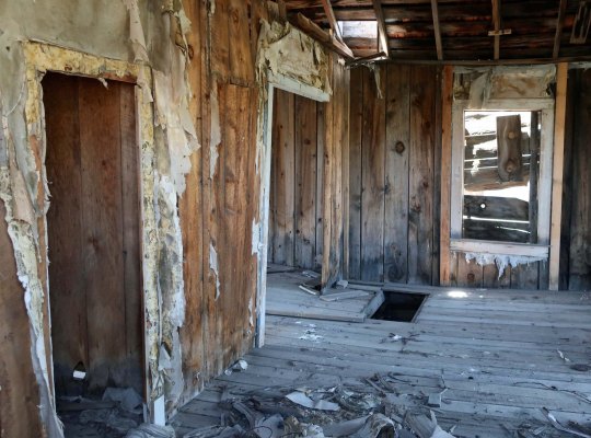
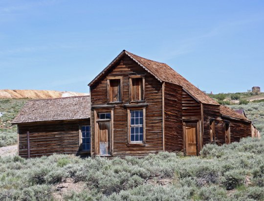
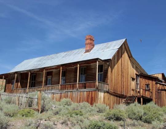
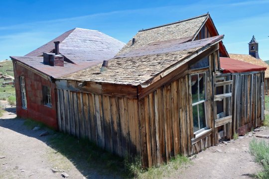
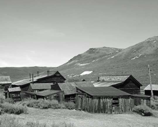
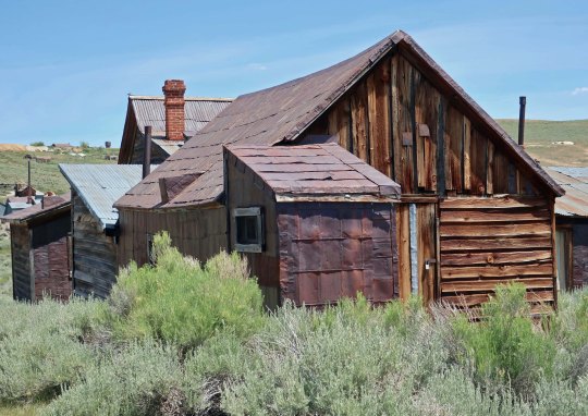
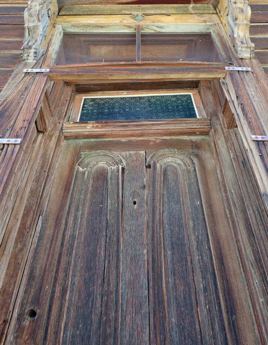
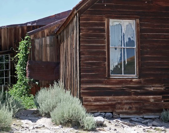
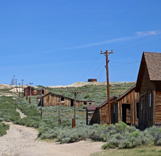
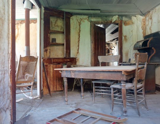
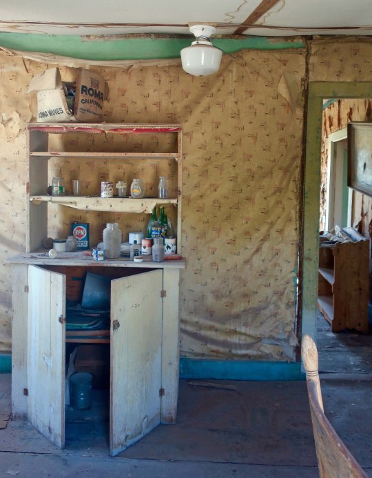
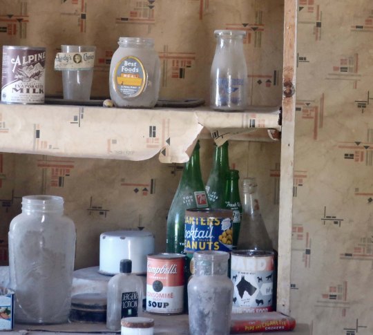
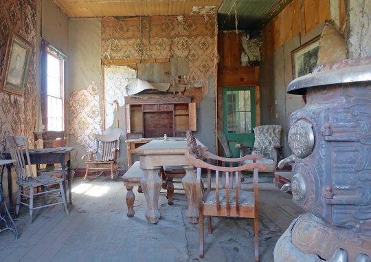
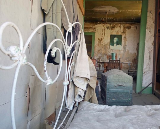
Bodie is another tourist attraction. It has survived as a ghost town, however— in arrested decay as the California State Park staff describes it. Only three people were living there in 1943, the year I was born. That number had plummeted to zero by 1950. (Plummeted being relative, of course.) Gold was first found in 1859 but it was in 1876 when the Standard Company found a profitable gold vein that turned the small camp of a few hard-core miners into a rollicking boomtown of 5-7 thousand people with over 2000 buildings. Sixty-five saloons dominated its mile-long main street. I have learned over the years that the number of saloons is always a mark of pride for Old West towns. (A substantial red-light district is another.)

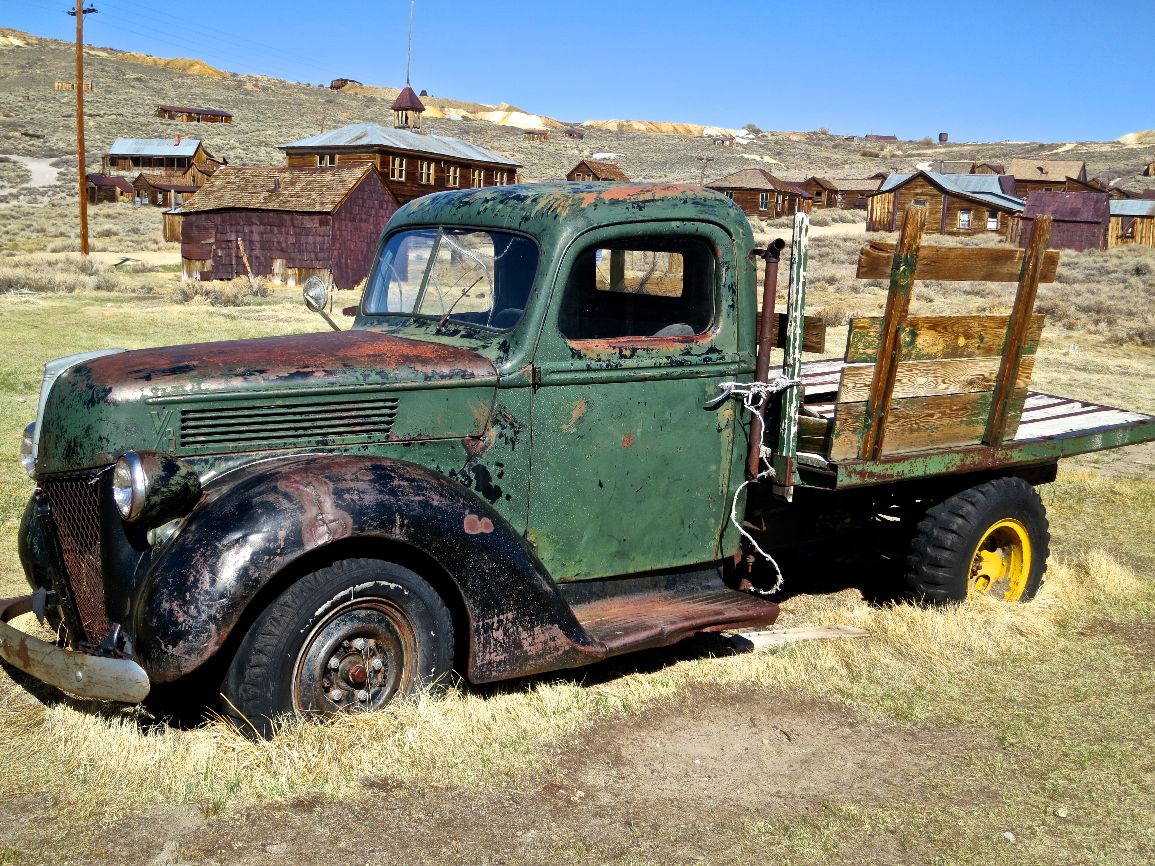
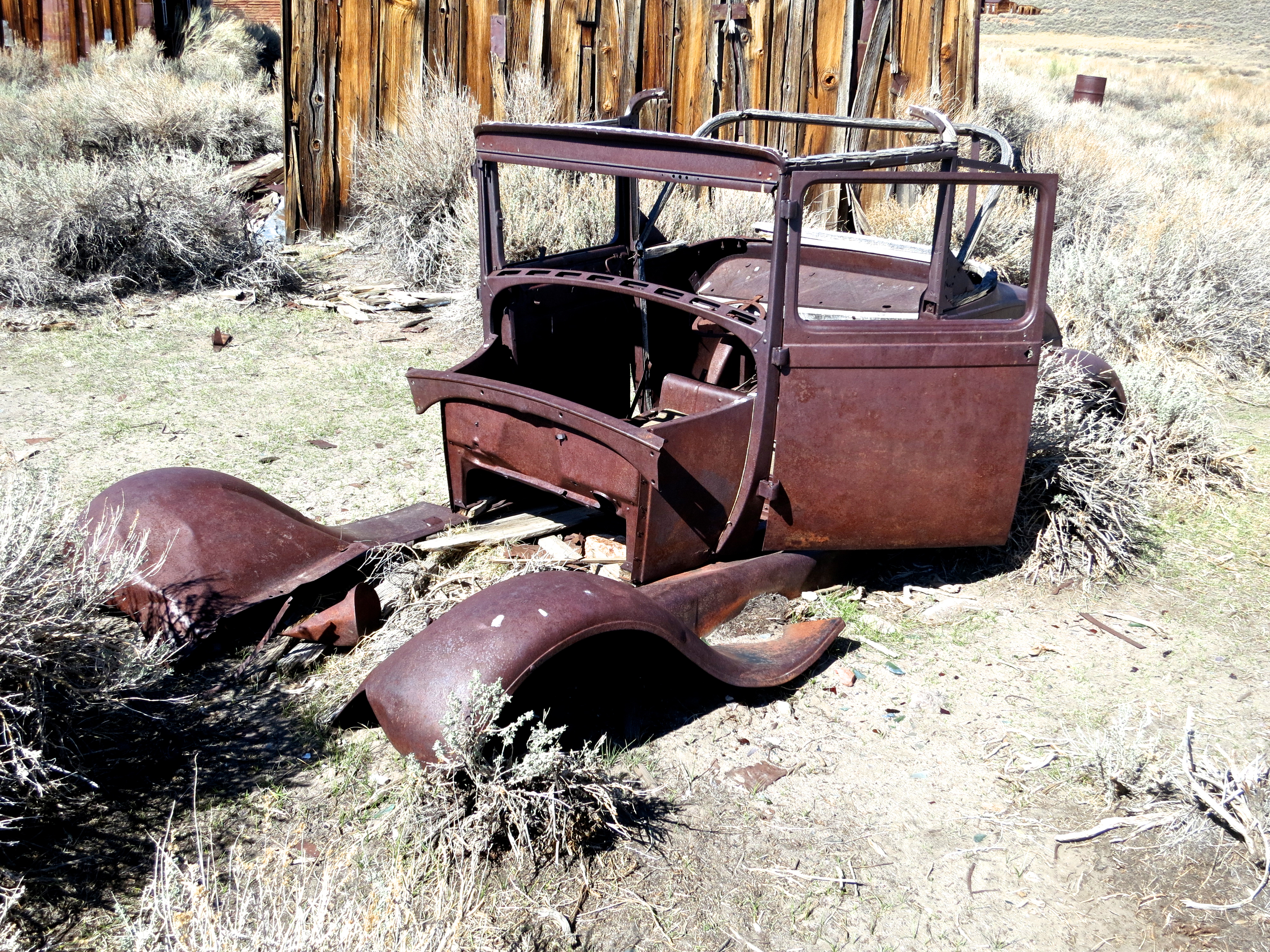
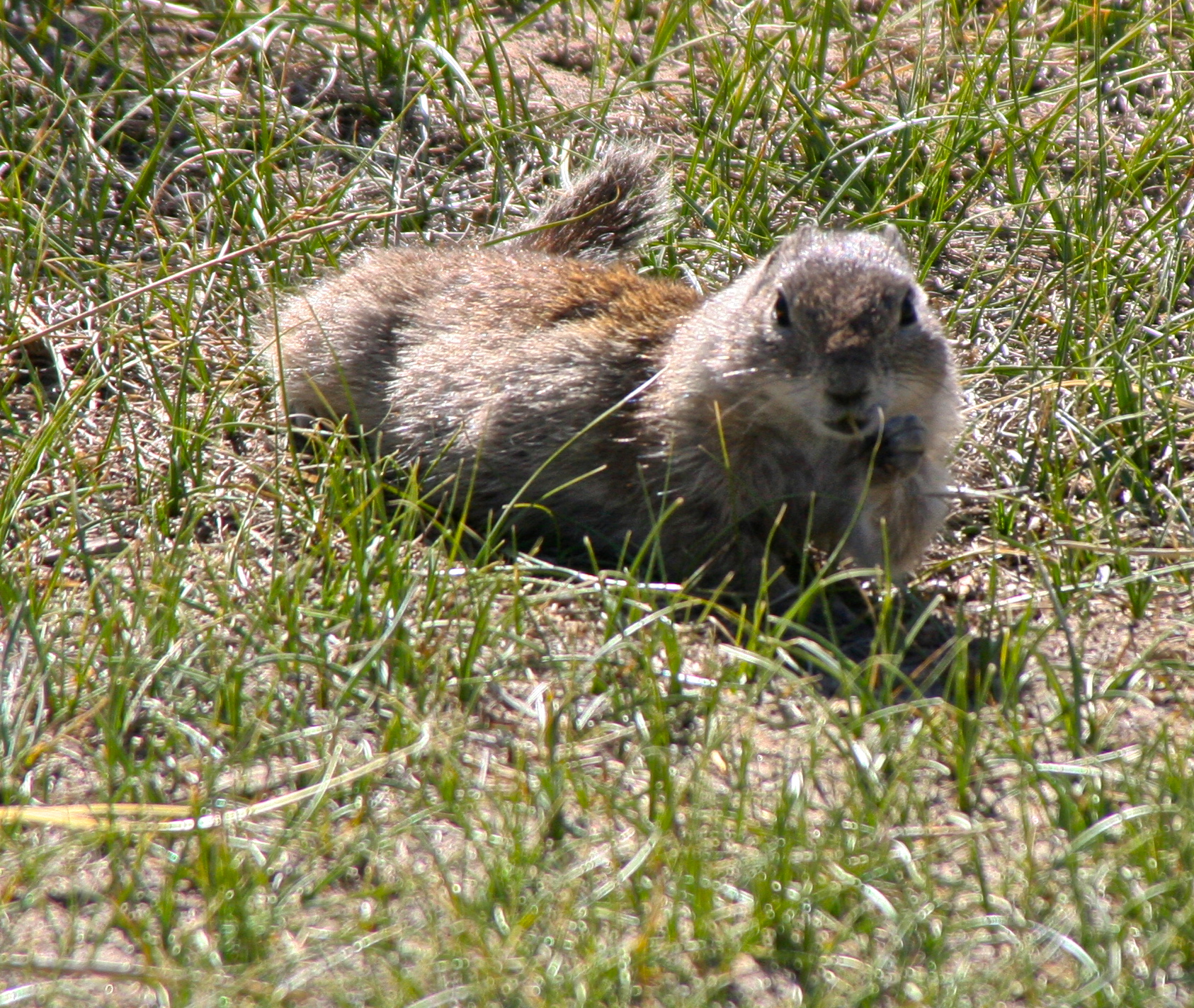
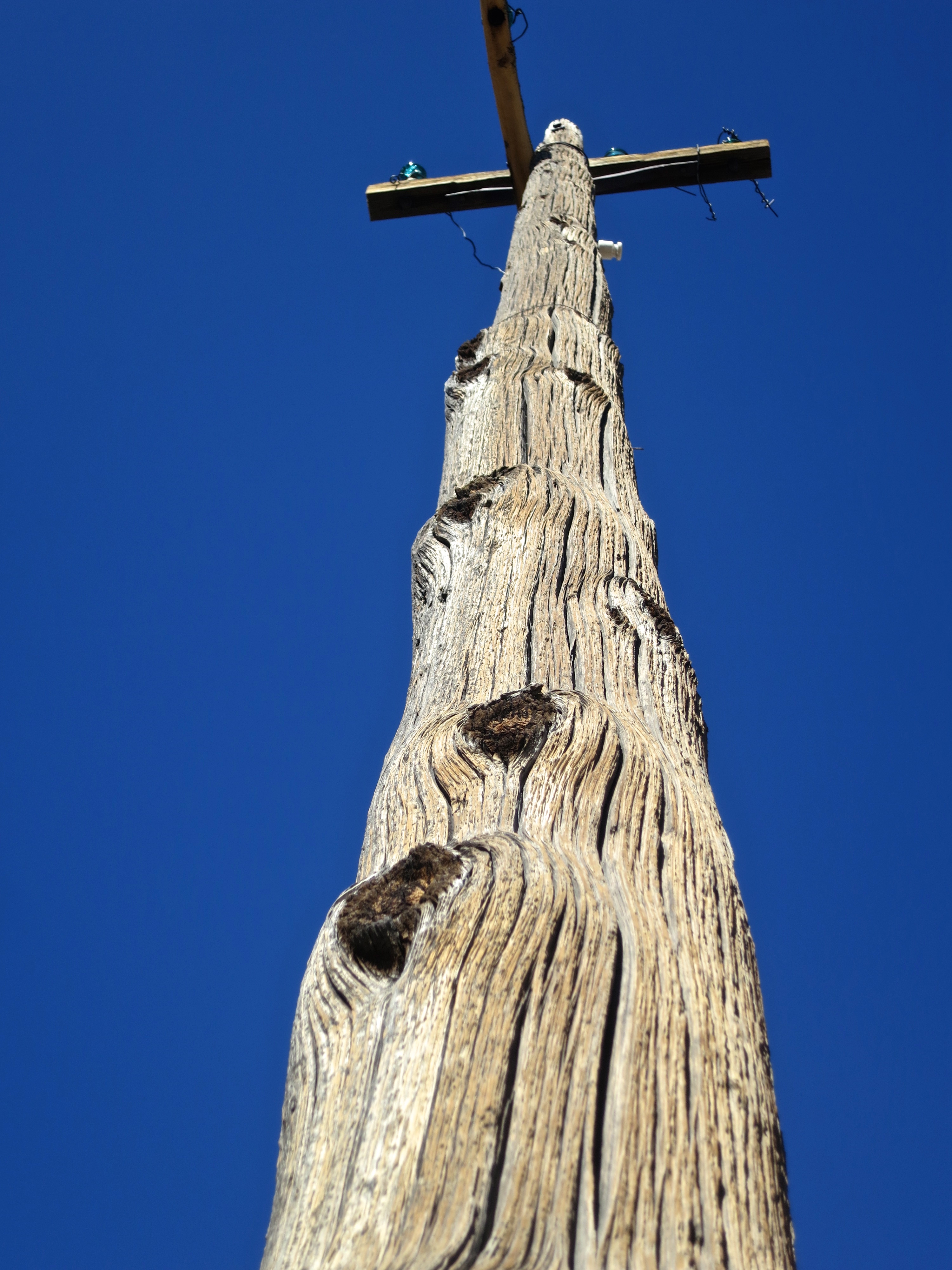
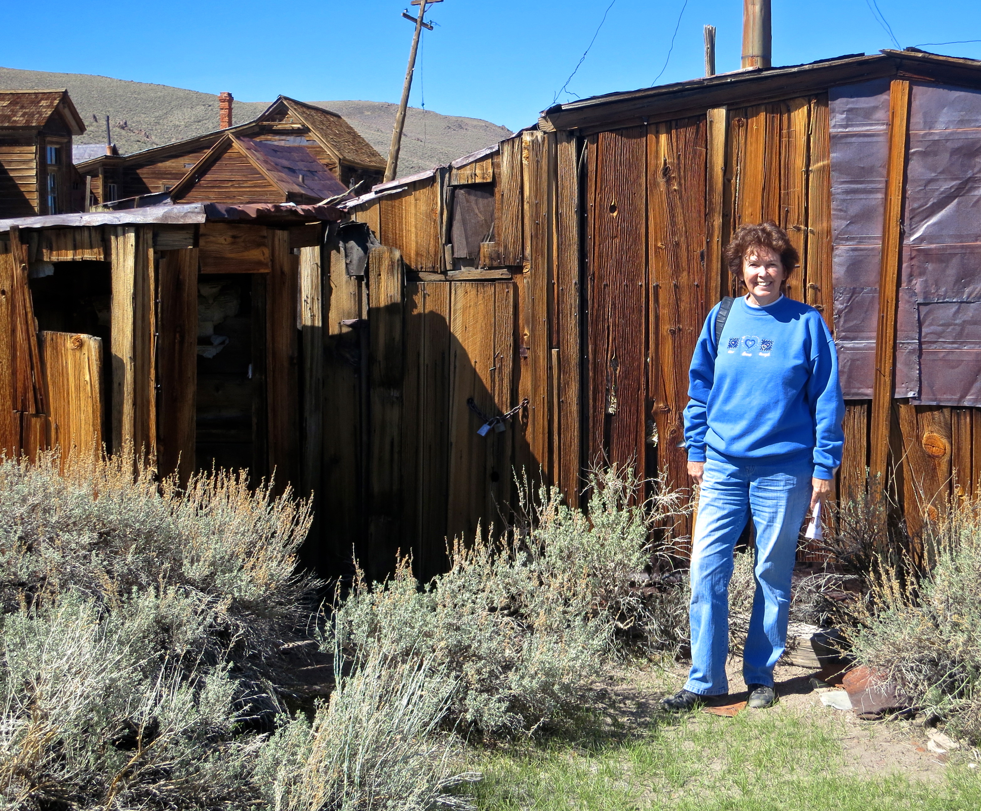
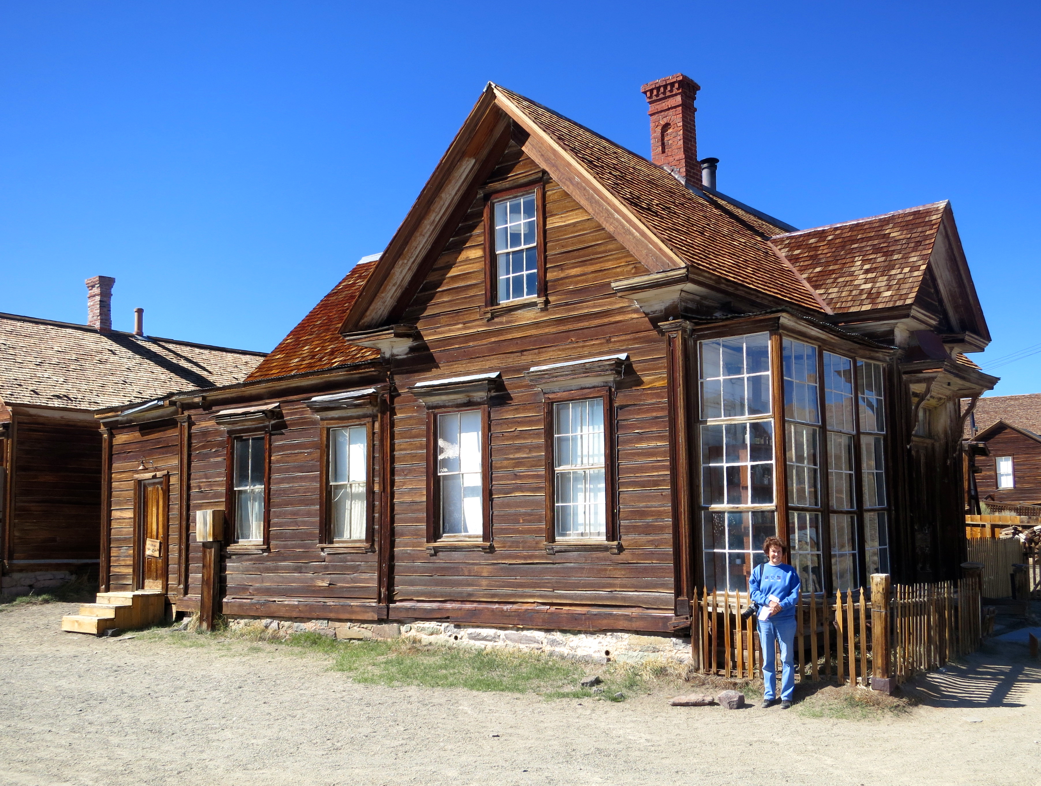
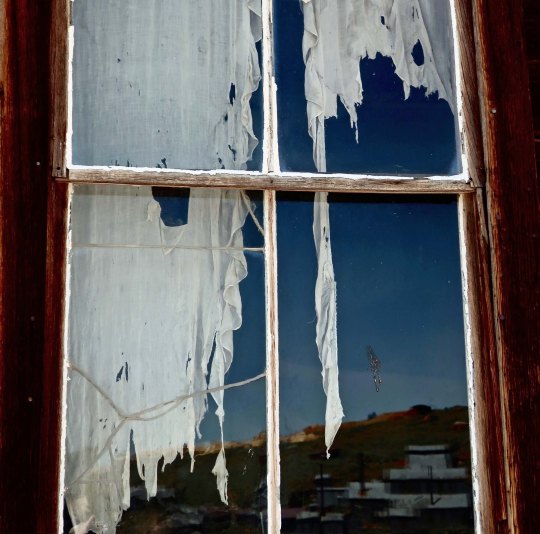
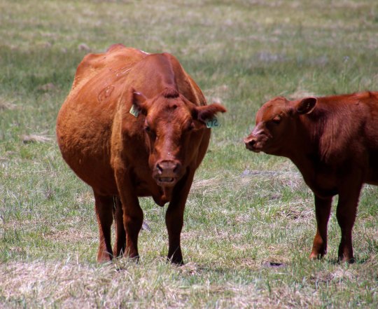
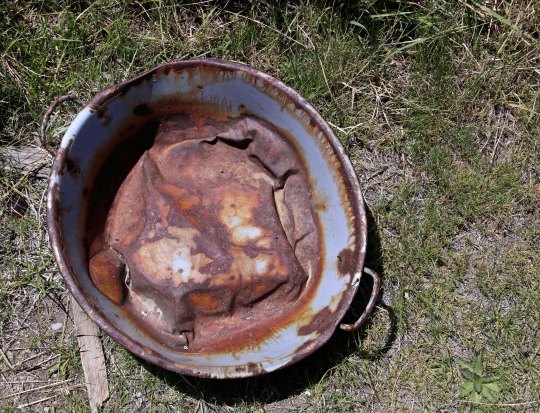
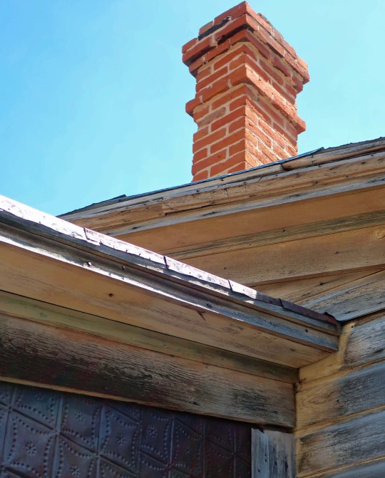
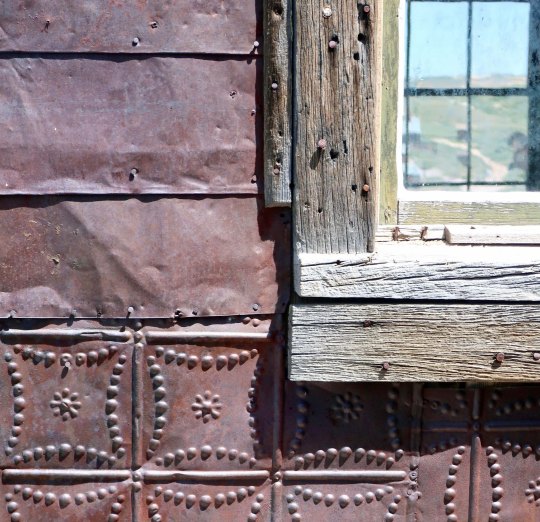
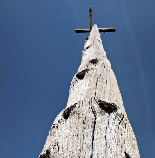
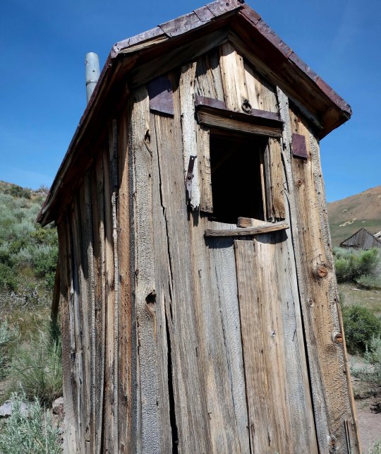
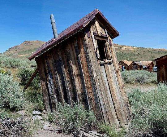
Bodie was named a National Historic Landmark in 1961and a California State Historical Park in 1962. Today, just over a hundred of its original two thousand buildings remain. I arrived around 1:00 p.m. on my drive down Highway 395 and spent three rather warm hours wandering around checking out the buildings and other historical remnants left behind— and dodging fresh cow pies. There were so many tourists it was hard to get photos without them. But who wants photos of tourists in a ghost town?! I did photograph the free-range cattle, however. Now if only a ghost or two had made an appearance…

One big Mama and her calf. Free range cattle wander around Bodie like it belongs to them, leaving presents on the ground for tourists.
It isn’t that the cattle don’t have other country to roam in. Those are the Sierra Nevada Mountains in the distance. You can see a portion of the 13 mile road coming in to Bodie from Highway 395. The last three miles are dirt. Quivera, our small RV, whined about the wash board road the whole way.
My idea of what a ghost town should look like! Not much in the way of ‘arrested decay’ here.
The buildings the shack is attached to are more typical of what you find in Bodie, however. Sagebrush is the dominant plant, which speaks to Bodie’s desert environment. Mine tailings can be seen on the distant hills.
This house looked almost livable from the outside until you got up close.
A blue wash basin was sitting on the ground out front.
And a small garbage dump found nearby.
It’s looking inside houses that gives you the true feeling of being in a ghost town. Visitors are invited to be ‘peeping toms.’ Most houses look better than this.
Here are a few homes to give you an idea of the houses that remain in Bodie.
I was fascinated with the roof lines of the houses.
And check out the red brick chimney!
Weathered wood covers most of the cabins. My camera was attracted to this knot. Once upon a time it would have been a happy limb.
Several of the residents had used metal as well as wood to cover their homes.
One house had a rather fancy door.
Here’s the window with the ghost curtain featured at the top of the post. I think that is a honeysuckle vine on the left.
A street view in Bodie shows houses heading up the hill. The power poles are modern.
Here’s my choice for a ghost town power pole.
Now, let’s take a look inside some of the Bodie homes.
You would call the call the cops if you looked out your window and saw this!
Some even featured groceries left behind. This one had me checking Google to see if they were around in the 30s. They appeared legit!
Best Foods Mayonaise, Planters Peanuts, Campbell Soup and Pard dog food were all around.
A pot bellied stove! It gets cold in Bodie during the winter. And check out the dining table.
A bed, clothing, a trunk and a print of Gilbert Stuart’s famous painting of George Washington. Stuart painted this for Martha Washington but decided he wanted to keep it and use it for marketing purposes, so he left it unfinished. The painting would become the model for Washington on the dollar bill.
Outhouses were common in Bodie. This one came with a view!
It could be a little risky using it now, however… Propping up is part of the ‘arrested decay’ program.

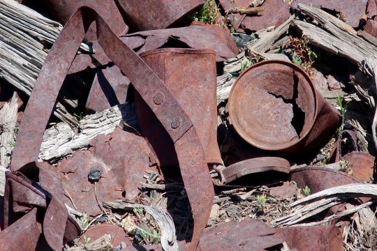
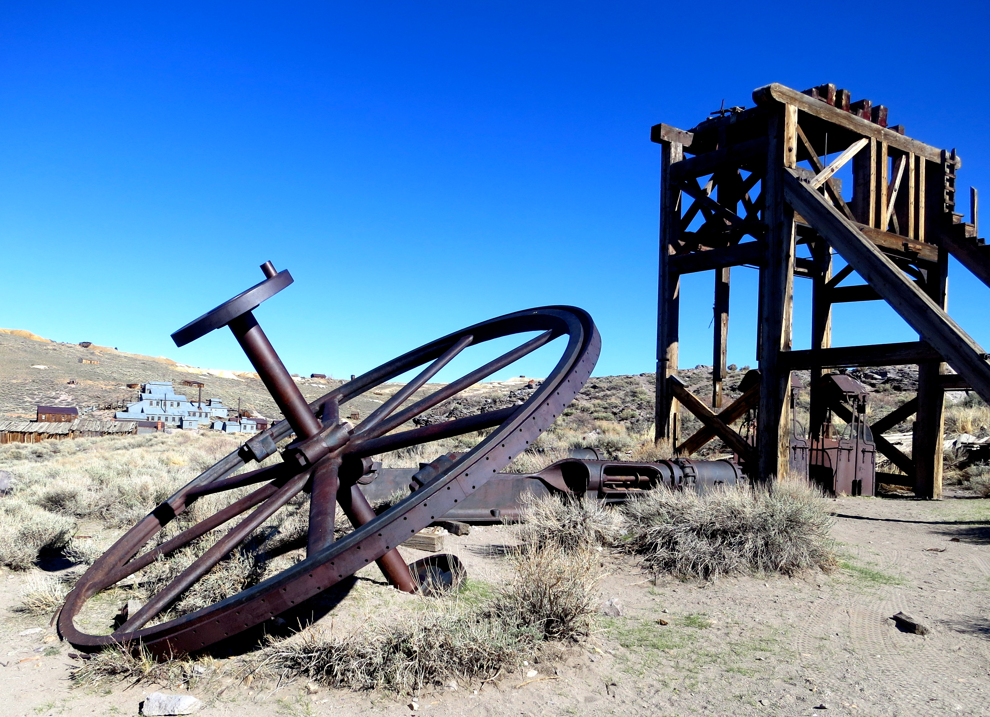
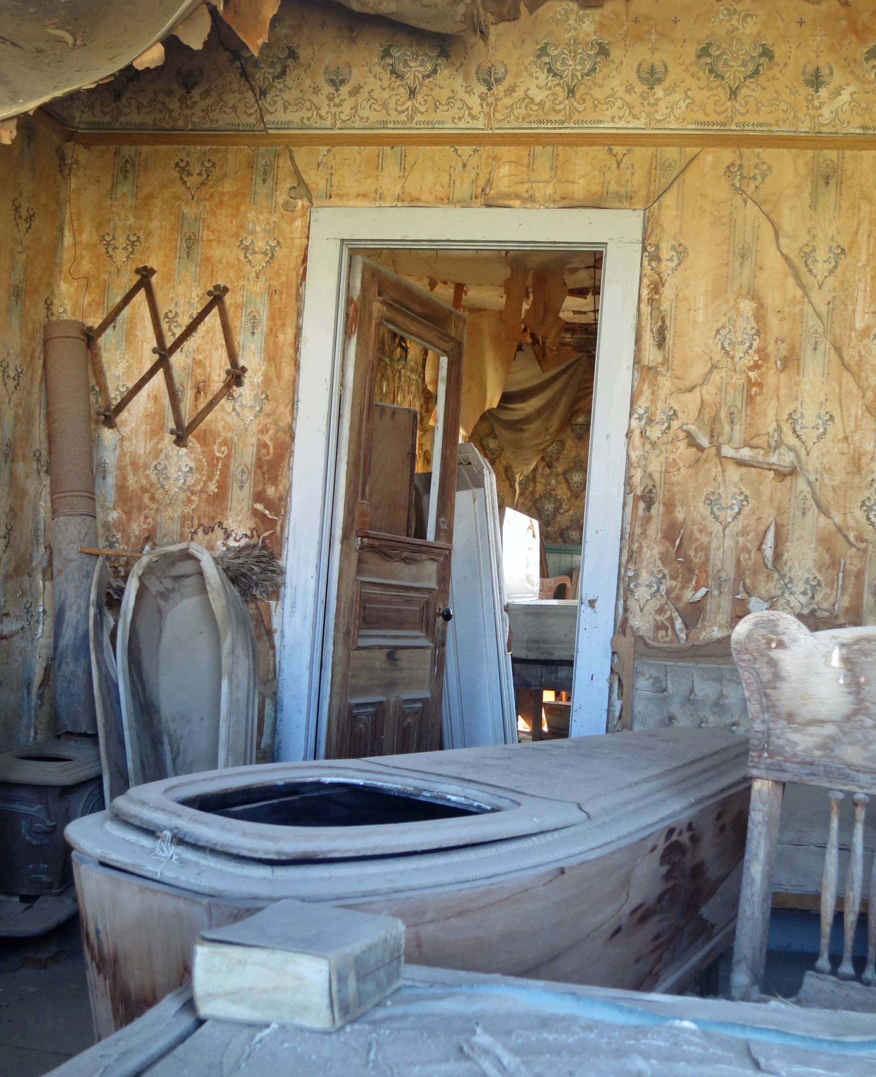
NEXT POST: We will continue our exploration of Bodie by checking out some of the commercial buildings that still stand including a ghostly old mortuary with caskets. There are also several abandoned vehicles in various states of decay and some interesting mining machinery left behind.

Mt. Whitney: 14,505 feet— Or Is that 14,496.811 Feet… But Who’s Counting?

Highway 395 is one of America's most scenic drives. This view looking up at Mt. Whitney, center top, is one of the reasons why.

Highway 395 is one of America’s most scenic drives. This view looking up at Mt. Whitney, center top, is one of the reasons why.

Highway 395, with its panoramic views of the eastern Sierra Nevada Mountains, is one of the most scenic highways in the United States. I will admit to a degree of prejudice, however. John Muir called the High Sierras the Range of Light. I think of them as ‘home.’ I have backpacked up and down the range numerous times. The mountains call to me in a way that no city or town does.

Driving up California's Highway 395 provides and ever changing perspective of the eastern Sierra Nevada Mountains.

Driving up California’s Highway 395 provides an ever-changing perspective of the eastern Sierra Nevada Mountains.

Another view of the Sierra Nevada Mountains along highway 395.

Another view of the Sierra Nevada Mountains along highway 395. This seems to fit Muir’s Range of Light description. (Photo by Peggy Mekemson.)

I celebrated my 60th birthday by backpacking over 300 miles down the spine of the Sierras, I started at Squaw Valley, which is north-west of Lake Tahoe, and ended by climbing up Mt. Whitney. It was my sixth trip up Whitney. I figured it would be a fitting way to kick off my sixth decade.

View of Mt. Whitney from the west including Curtis Mekemson.

Wrapping up five weeks of backpacking, my final climb looms in the distance. The curved mountain just to the right of my head is Whitney. I will be sitting on top the next day. The Sierras are fault block mountains, climbing gradually on their western slope and dropping off rapidly in the east. (Photo by Jay Dallen.)

Curtis Mekemson sitting on top of Mt. Whitney.

And here I am on top, complete with a large grin. The Owens Valley and Highway 395 lie some 10,000 feet below. (Photo by Jay Dallen.)

Looking north form Mt. Whitney up the crest of the Sierra Nevada Mountains that I had just hiked through following the Pacific Crest and John Muir Trails.

Looking north from Mt. Whitney up the crest of the Sierra Nevada Mountains where I had just backpacked following the Pacific Crest and John Muir Trails.

View looking down from the top of Mt. Whitney. Photo by Curtis Mekemson.

Another view from the top of Mt. Whitney.

The mountain’s claim to fame is being the highest mountain in the contiguous United States. It stands at 14,505 feet (4,421 meters). My friends in Alaska are quick to point out that Mt. McKinley/Denali is 20,322 feet. Mt. Shasta, where I began this particular series, is 14, 180 feet. And finally, for comparison, Mt. Everest, the world’s highest mountain, tops out at 29,029 feet (8,848 meters).

Mt. Shasta is one of the world's most beautiful mountains. Driving up I-5 through Northern California on a clear day presents this view.

Mt. Shasta.

Once the snow has melted, climbing Whitney does not require any technical climbing skills. A good trail leads to the top. According to the plaque on top, it is the highest trail in the United States. It was started in 1928 and completed in 1930. The plaque used to (and still may) claim that the mountain is 14, 496.811 feet high, which would seem pretty darn accurate, especially given the .811 feet. Apparently modern measuring techniques have added a few feet. Not that it matters, unless you happen to be the person climbing those last nine feet.

Getting to the top requires stamina, lots of it. The eastern route up the mountain starts at Whitney Portal and climbs 6000 feet. That’s a bunch of up, and the higher you climb, the thinner the air becomes. Most people slow way down near the top as their bodies fight to get enough oxygen.

I’ve always started from the west since I am either ending or in the middle of a backpack trip. There are two advantages. Most important, I’ve already spent several days hiking at higher elevations. My body has both toughened up and adjusted to thinner air. Second, by starting at Guitar Lake, the climb is only 4,000 feet. Still that’s 4000 feet up and 6,000 feet down on a 15-mile day carrying a 40-pound pack— hardly a walk in the park. (Grin)

The reason for climbing the mountain, beyond being able to say you have, is the spectacular scenery. I wouldn’t recommend the trip for anyone with acrophobia (fear of heights), however, given that all of the views involve looking down several thousand feet.

Jay Dallen standing on the edge of Mt. Whitney.

My nephew, Jay Dallen, stands on the edge of a thousand foot precipice and looks down. He obviously does not suffer from acrophobia. Different people joined me on each of my five-week segments. Jay was 16 at the time.

The Alabama Hills, featured in the photo below, are located just outside of Lone Pine at the base of Mt. Whitney. Over 300 movies, mainly Westerns, have been filmed in the area. Almost every major Hollywood cowboy from the 1920s up to the present have made movies there. (Photo by Peggy Mekemson.)

A final view of Mt. Whitney. This one features the Alabama Hills, the site of many early movies featuring the likes of Hop-a-long Cassidy and the Lone Ranger.

A final view of Mt. Whitney. This one features the Alabama Hills, the site of many Western movies featuring everyone from Tom Mix, Hop-along Cassidy and Roy Rogers to John Wayne and Johnny Depp. (Photo by Peggy Mekemson.)

“Goodbye God. I am going to Bodie.” Ghost Towns of the Old West


Tattered curtains, a cracked window, and a reflection of weather warn buildings capture the essence of the Old West ghost town of Bodie, California.

Ghostly curtains, a cracked window, and a reflection of weather worn buildings capture the essence of Bodie, California.

Goodbye God, I am going to Bodie,”  was a statement made by a ten-year old in her journal when her family took her to Bodie during its glory days as a gold rush town.

She was right to be concerned. There was plenty of sin to go around as various bad men of the Old West came together with gold seekers and other adventurers in the 1870s. Killings took place almost daily. The fire station would toll the age of the person killed. Robberies, stagecoach holdups and barroom brawls filled in around the edges. It’s “a sea of sin lashed by the tempests of lust and passion,” Reverend F.M. Warrington noted.

And if that weren’t enough, there was the weather to contend with. Winter could bring snows as deep as 20 feet, winds up to 100 miles per hour, and temperatures that dropped to 30˚ F below zero. Freezing to death was on the list of things that might kill you.

Today Bodie is maintained in a state of “arrested decay” as a California State Historical Park. This makes it substantially different from Rhyolite, where things are more or less allowed to fall apart. Most of Bodie’s buildings are still intact– even though some may need a little help. (Grin)

Propped up outhouse in the ghost town of Bodie, California.

Decay doesn’t get much more ‘arrested’ than this propped up outhouse. (Photo by Peggy Mekemson.)

Leaning building in the Bodie State Park ghost town. Photo by Curtis Mekemson.

This building is a little confused about which direction it wants to lean. The support beam it is ‘leaning into’ is on the left.

Building held up by support beams at Bodie State Park in California.

A building that apparently needed a lot of help. (Photo by Peggy Mekemson.)

Bones of building at Bodie State Park in California.

Almost beyond help, this building relies on its neighbor for support. (Photo by Peggy Mekemson.)

Bodie is located east of the Sierra Nevada Mountains off of Highway 395 near the town of Bridgeport. A paved side road that soon turns to dirt delivers visitors to the ghost town. When we arrived, Mono County was seriously engaged in tearing up the dirt section of the road. Our truck was not happy. (I assume they have put the road back together by now.) Peggy and I got ‘lost’ leaving the town. It is really hard to do. I chalk it up to subconsciously wanting to avoid another personal encounter with the Mono County Highway Department. Anyway, we explored 20 or so miles of dirt road before finding our way back to the highway.

Mining equipment at Bodie State Historical Park in California.

As expected, one place to find old mining equipment is in old mining towns. The cages seen beneath the head frame were used to lift miners into and out of the mines.

Place setting covered in dust at Bodie State Historical Park.

I’ll classify this as a ‘still life’ photo. Apparently it’s been still for decades. It’s what happens when you are late for dinner.

Old bed at Bodie State Historic Park in California.

Why does ‘spring into action’ come to mind?

An old truck at Bodie State Historical Park in California.

This truck had character including the yellow rim on the back wheel. I assume the roped door was to keep kids (both small and big) out of the vehicle.

Old car remains at Bodie State Historical Park in California.

This car was more open for inspection.

Prairie dog at Bodie State Historical Park in California.

Speaking of inspection, a prairie dog stopped his busy rounds of grass chomping to check us out. (Photo by Peggy Mekemson.)

Shell gas station at Bodie State Historical Park in California.

A Shell gas station.

Old Shell gas sign at Bodie Historical Park in California

Apparently someone was upset about the increased cost of gas. Maybe it had jumped from fifteen to sixteen cents a gallon.

Methodist Church is Bodie State Historical Park in California.

The end of the bad old days in the West was often signified by the building of a church. It appears they weren’t quite over in Bodie however. An oil cloth painting of the Ten Commandants in the Methodist Church that hung behind the altar was stolen. So much for “Thou shalt not steal.”

The morgue at Bodie State Historical Park in California.

If there are haunted places in Bodie, the morgue is a prime location. The featured casket provides a window to view the deceased. A Bible rests on the table. Or maybe it is a copy of Mortuary Science for Dummies.

Old power pole in the ghost town of Bodie.

This power pole seemed sufficiently ghostly to reside in a ghost town.

House of mine worker at Bodie ghost town.

Peggy stands in front of one of the shacks where a miner  lived.

The J.S. Caine residence at Bodie State Historical Park in California.

Here she stands in front of the house of the guy who owned the mine.

IOOF Hall in the ghost town of Bodie.

The International Order of Odd Fellows Hall. I’d almost join for the name alone.

View of the ghost town of Bodie.

A wider view of Bodie. (Photo by Peggy Mekemson.)

Getting lost on the way out of Bodie wasn't bad considering the scenery.

Getting lost on the way out of Bodie wasn’t bad considering the scenery.

We did become a little concerned as evening approached and we were still wandering around on our dirt road.

We did become a little concerned as evening approached and we were still wandering around on our dirt road. But eventually we arrived in Bridgeport and could declare our detour another adventure.

NEXT BLOG: We journey up California’s beautiful Highway 395 and stop to admire Mt. Whitney, the highest mountain in the contiguous United States. And, I might add, a mountain I have climbed six times.