The Marble Mountain Wilderness: Magnificent Views Up Close and Far Away… Part 2

This is view of Mt. Shasta from the Marble Mountains Wilderness. My 750 mile trek down the PCT gave me northern views of the mountain, western views and and southern views. This was one of the best. Given its mystical/magical look, it’s hardly surprising that tales of beings like Bigfoot, Lemurians, and Lizard people are associated with it. The local Native American Modoc Tribe, whose legends include Bigfoot sightings around the mountain, refer to him as Matah Kagmi, meaning keepers of the woods.I like it. The Lemurians are a New Age creation connected to highly advanced lost continent of beings that live under the mountain. As for Lizard People, think aliens and UFOs.

As part of our series about protecting national parks, monuments and other public lands, I’ve been reading news releases from the directors appointed by President Trump who oversee these areas. It’s not a task I would wish on anyone. It isn’t surprising that the directors all support the president’s objective of significantly reducing many public lands in size and opening up others for profit making operations. That’s why they were appointed.

The news releases are full of statements designed to hide their real purpose. Here’s an example:

“President Trump promised to break the permitting logjam, and he is delivering,” said Energy Secretary Chris Wright. “America can and will build big things again, but we must cut the red tape that has brought American energy innovation to a standstill and end this era of permitting paralysis. These reforms replace outdated rules with clear deadlines, restore agency authority, and put us back on the path to energy dominance, job creation, and commonsense action. Build, baby, build!”

Let’s did a little deeper. By ‘permitting logjam’ and ‘red tape’ and ‘outdated rules,’ he means rules that have been developed to protect our air and water quality, save rare and endangered species from extinction, and maintain areas of great beauty and/or cultural significance that the majority of Americans support protecting. The Administration’s perspective is that these rules get in the way of progress. Who needs clean air or water. “Build, baby, build!”

And how about American energy innovation and dominance? Obviously, he’s not talking about solar, wind and water power. We’ve been moving ahead quickly in the development of clean energy. The Trump Administration is actively discouraging this progress. Incentives designed to encourage their use have been cut. His passion is for coal, gas and oil, all three of which are nonrenewable resources and have been prime factors in the development of global warming that has been having such devastating impacts on the US and the world. The Texas floods of this past week are but one of a multitude of examples.

Several countries in the world have now reached the point where 80-100% of their energy needs are supplied by renewable clean energy. I’d argue that they are the ones achieving energy dominance, one that will last long beyond our nonrenewable resources and is vital to our battle against global warming.

On another subject, it’s interesting that right-wing Republicans played an important role in blocking the administration’s plans to sell off millions of acres of public lands in the West. Here’s what Christopher Rufo, a culture warrior and leading supporter of Trump in in the state of Washington had to say:

“Pre-2016, you’d have the small government argument against a kind of federal domination over the land, but Trump and MAGA is a nationalist movement,” he said. “I think many conservatives are now reassessing these questions, and many of us in the West understand that part of a great nation is the preservation of its natural beauty.” There is hope.

The Marble Mountain Wilderness, the subject of this post, is an example of this beauty.

On the subject of ‘far away views’ seen from the PCT in the Marble Mountain Wilderness, here are two more. These are the Trinity Alps.
Beautifully green.
When I left off in my last post, I was just coming up to Paradise Lake. I was captured by the reflections, in the lake and…
…this outcrop of lime above the lake.
The sign told me that I had left Paradise Lake and was on my way to Marble Valley. It seemed like an easy walk, but don’t quote me. Some photos from along the way.
One of the names of this Mariposa Lily is cat’s ear. It’s easy to see why.
Always a favorite: Penstemon.
The value of this tree isn’t in its board feet, which is how the Trump administration sees it. It is in its beauty. Old growth forests deserve our protection.
I’m glad I wasn’t around when this gorgeous chunk of limestone came rolling down the mountain.
I came on this patch of snow shortly afterward. I planned my trip to allow time for most of the snow along the trail to melt. Hiking in snow is hard and requires extra caution in the summer when it often melts beneath the surface.
The trail then took me past this limestone outcrop up close.
Looking up, a view of Marble Mountain was one of the treats I found in Marble Valley.
As was looking down. Dozens of butterflies in the mud next to a stream provided a photo op.
Close up!
My hike through the rest of the Marble Mountain Wilderness featured hiking across scree/talus covered slopes…
Past serene mountain lakes…
Through a high mountain meadow with an rock filled stream…
And covered in flowers. Including rosy spiraea.
Red mountain heather.
Siskiyou lewisia.
And Western Pasqueflower also known as Dr. Seuss mop heads.
Past more old growth giants,
More mountains,
And forests.
Until I came to this rock. “We’re all mad here. Be you!” Bone, who’s never been anything but, insisted on having his photo taken with the rock. I found several of these rocks along the way, usually near a trailhead. I was getting excited.
Peggy would be somewhere near with her welcoming smile and cold beer.
She caught a photo of me hoofing it up the mountain!
I got an extra long and tight hug for having finished/survived my first solo section of my 750 mile Trek down the PCT. And a cold beer. Cheers.
Sunset in the Northern Sierra Nevada Mountains.
As you read this post, Peggy and I are on a backpack trip into the Five Lakes Basin north of I-80 in the Sierra Nevada Mountains. It’s where I made my first ever backpack trip in 1969, a while ago. It’s also the first place I ever took Peggy on a backpacking trip. That was in 1990 just after we met. She requested that we hike in to the basin as part of her 75th Birthday Celebration. This is a photo of the Black Buttes that overlook the basin at sunset. The trip will be our next post. Can a 75 year old and an 82 year old still pull it off? Grin. Wish us luck!
Our post after the Five Lakes Basin will take you into the Canyon de Shelly with its towering cliffs and marvelous pictoglyphs and petroglyphs, which brings me to a reminder: If you enjoy word searches or know someone who does, Peggy’s new book on the unique and magical petroglyphs of the Southwest makes an excellent gift, either for yourself or a friend. It’s available on Amazon.

While Dead Men Tell No Tales, Dead Trees Do… The Wednesday Photo Essay

Dead men tell no tales, or so they say. But dead trees talk back to you. At least it seems that way to me. I was backpacking into the Marble Mountains when I came upon this face on a burned tree. Was it saying, “Go back!”? Or maybe it was standing in for Smokey the Bear.

I’ve been hard at work on my next book: It’s 4 AM and a Bear Is Standing on Top of Me. In it I tell stories from 50 years of wilderness adventures ending with my 750 mile backpack trip down the Pacific Crest Trail to celebrate my 75th birthday. I’ve reached the point now where I am about to embark on the last section, my hike down the PCT. In preparation I’ve been going through my photos of the trip for inspiration as well as to jog my memory.

As I reviewed photos, I was struck by the idea that they would make appropriate content for my Wednesday Photo Essays. Rather than follow my days, which I more or less did in the blogs I wrote about the adventure, I’ve decided it would be fun to do a categorical approach and look at flowers, trees (mainly dead trees that have unique personalities), rock formations including mountains, and streams and lakes. There may be other categories as well. Today, I am going to include trees and brush I found particularly interesting. (I have a lot more but will alternate with flowers, etc. to keep things interesting.)

There is something almost heroic about this dead tree my nephew Jay Dallen and I found in the Trinity Alps. We both took numerous photos. I could imagine Michelangelo capturing this tree in marble.
I captured this photo by using rocks as a frame. The rocks shared a similar tortured look.
The tree encouraged close-ups and photos from several different angles. Jay and I must have been there for 30 minutes.
Dead manzanita lends itself to dramatic photos. The rock that the manzanita had grown over creates a close to perfect backdrop.
As you know, I have an active imagination when it comes to seeing faces in rocks and wood.
This was one of the most interesting I have ever seen. I looked through a knot hole and this peered back at me.
Just ducky.
I’ve always liked this statement by Joseph Campbell. If you find yourself falling off a cliff, “Dive!” Why not.
Are you a fan of “Lord of the Rings”? This sculpture that also led my nephew Jay and I to take numerous photos struck me as an Ent in search of Ent wives. Or maybe he was tearing out rocks to bring throw down at Sauron.
A closer look at the sculpture in its dramatic setting.
A black and white of the top of the ‘Ent’ sculpture.
Of course most of the trees along the PCT are happily living. I always like crown shots like this.
High altitudes with cold temperatures and high winds do their own unique job of sculpting trees. My father loved to paint trees like this.
This manzanita bush had plenty of beauty on its own but it didn’t hurt to have distant mountains including Mt. Shasta as a backdrop.
One should never discount the possibility of using a convenient tree as a chair! Peggy said it was quite comfortable.
Moss often adds a bit of color to dead trees.
Moss helped create this peep hole.
And decorated this dead stump.
Dance with me , honey!
Show me what you’ve got!
A tree eats a trail sign.
Nothing tells a story like old trail blazes left behind by explorers and pioneers to mark their trails. It’s a good place to end this post. If you have ever heard the expression, “Where in the blazes are we?,” this is where it came from.

FRIDAY’S POST: I am going to do a wrap on the petroglyphs from the Three Rivers National Petroglyph Recreation Area. (I still have two more petroglyph posts covering other areas we visited on our fall Southwestern tour.)

Towns along the PCT

While I puff my way up and down mountains, Peggy explores the surrounding country and towns, having adventures of her own. A hike over to Burney Falls rewarded her with this view. (Photo by Peggy Mekemson.)


Today’s Post:

Small towns along the PCT are lifelines to through hikers. First and foremost, they are where hikers pick up their supplies for the next section of the trail. But they also provide a break— a chance to eat a good meal, shower, wash clothes, and possibly down a few cold beers. Sometimes the towns serve as meeting points where trekkers catch up with friends they have made along the trail.

Information about the communities passes along the trail quickly. One night I was perched in a dry camp up on a high ridge between Castle Crags and Burney Falls when a hiker came through and asked a person camped across the trail from me if he had heard about the pizza parlor in the town of Mt. Shasta that offered an all you can eat lunch for $7.50— a through-hikers’ Paradise. I felt for the owner as he saw his profits dwindle and disappear down the gullets of gaunt, semi-starved PCTers. It would be like seeing a plague of locusts take on your wheat crop.

Between the time Peggy drops me off and picks me up, she has been exploring these small towns and having adventures of her own. She is going to be doing a ‘guest’ post on her experiences in a couple of weeks but today I want to share some of the photos she has been taking.


Current Location

I was late and Peggy was starting to worry. She was waiting at Sonora Pass on Highway 108 to pick me up. As usual, she was making friends with through-hikers. She had asked a charming French couple from Leon (Camilla and Bastion) to keep an eye out for me on the trail since they were hiking north and I was hiking south. I met them while they were enjoying a snack break as I was slowly making my way up the north side of Sonora Peak to the 10,400-foot (3170 meters) trail pass.

Camilla and Bastion, PCT hikers from Leon, France, on Sonora Pass. (Photo by Peggy Mekemson.)

Let me emphasize “slowly.” The last half-mile had been steep and my short legs had not been happy with the numerous knee-high stone steps built into the trail. They were squeaking unprintable comments whenever I came to one.

“You must be Curtis,” Camilla called out. The PCT Telegraph was at work. “You have a wonderful wife. She’s worried about you.” It sounded like Peggy to me— both wonderful and worried. Peggy had fed Camilla and Bastion blueberry scones from Trader Joes. More to the point, she had fed them scones slathered in peanut butter that Camilla had been lusting after. They were still talking about it. Apparently, they had hung out with Peggy for almost an hour while they waited for their resupply.

Bastion explained that the trailhead parking lot closed at 6:00. Peggy would have to move. And there was no cell phone service. I’d be stuck up on the mountain for the night with my remaining Cliff Bar for dinner and Peggy would probably be frantic. It was now 3:00. I assured them that I would be there before 6:00. Bastion looked a bit skeptical, (he’d seen me coming up the mountain), but Camilla was more optimistic. I hiked in at 5:00.

Later, I told Peggy not to worry about the no-parking after 6:00 rule. What cop or forest service official is going to seriously hassle a 68-year-old woman who is concerned about and waiting for her 75-year-old husband to come off a difficult and occasionally dangerous wilderness trail? “Move on lady. Rules are rules.” I doubt it.

But I had already made use of the PCT telegraph to alleviate Peggy’s worry. I’d been hiking up the East Fork of the Carson River when Bones had come beeping by as if I were standing still. Like me, he was traveling north to south. I assume his long and lanky build had earned him his trail name. I knew that he would be into Sonora Pass a couple of hours before me so I asked him to check for Peggy and tell her I was fine and coming along. Which he did. When I arrived, he had been chatting with her for an hour and a half while he recharged his phone in our van.

I insisted that Bones have his photo taken with Bone when he passed me. Both seemed delighted.

Bones, who comes from Portland, Oregon, had been chatting with Peggy for an hour and a half when I came off the trail. You can tell he is a PCT hiker by how skinny he is. I look equally gaunt. I was surprised that Peggy hadn’t pulled out her guitar so the two of them could have performed a concert. (Photo by Peggy Mekemson.)

We were fortunate to leave Sonora Pass when we did. Peggy had been watching a worrisome cloud of smoke. It had grown from a small, seemingly insignificant plume to covering a third of the sky. The Donnell fire located a few miles farther to the west on Highway 108 was being pushed by winds and had jumped the highway.  Bones and I had experienced the winds up on the trail around Sonora Peak. I estimated that they were gusting close to 50 miles per hour. Bones had put his pack down to take a photo and watched it be blown along the ground. He scurried to retrieve it. So much for the photo-op. I’d had to lean into the wind to keep my footing, not particularly pleasant on a narrow, high-pass trail with steep drops. But it wasn’t boring.

The wind hit me as I came over the trail pass. I could hardly take this photo. Highway 108 can be seen in the distance on the top right (the white speck). I still had a ways to get to Peggy!

Smoke from the Donnell fire was rapidly increasing when we left Sonora Pass.

I was familiar with the area from previous backpack trips and told Bones the fire could easily make its way from Clark’s Fork up to the PCT. An hour later, after Peggy and I had driven down to Highway 395, we were informed that the Sonora Pass Road had been closed. I read this morning (August 6), that the PCT above Clark Fork was in danger of being closed as well. Kennedy Meadows, where Bones was going to spend the night and wait for his parents, had been evacuated. Peggy and I are concerned for Bones, Camilla, Bastion and other trekkers in the area.

Peggy and I stayed at a KOA along Highway 395 that night. Once again, smoke filled the air. It did make for a rather dramatic photo of the cliffs overlooking the KOA, however.

This is a major story of the PCT this year. In my last post, I had reported how I was jumping south to escape the thick smoke from the Carr fire near Redding. I didn’t escape. As I made my way from Carson Pass to Sonora Pass over the past week, I was followed by smoke from the Carr fire and greeted by smoke from the Ferguson/Yosemite fire. Now smoke from the Donnell fire had been added to the equation. The huge new Mendocino fire around Clear Lake is threatening to be the largest in California’s history. Other fires are raging around LA. Air pollution levels in California are now some of the worse in the world because of the smoke.

Peggy told me that all out-door sports events in Sacramento had been cancelled yesterday because of the problem. And yet, here I am hiking up mountains, pushing as hard as I have ever pushed in my life, breathing the same pollution deep into my lungs. I may have to change my objectives. One possibility that several hikers are considering is to head north to Washington where the fire problem (so far) isn’t nearly as extensive. I’m thinking about joining them.

Photos taken by Peggy as she has her own adventures while providing support for me.

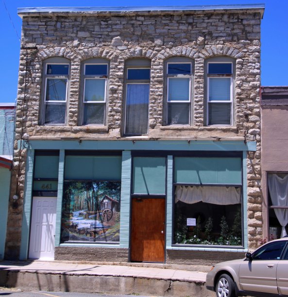
Etna is a favorite town along the PCT, known by hikers for its hospitality. Peggy found the historic buildings in the community of particular interest. This one sported a mural emphasizing its history, as did a number of other buildings. (Photo by Peggy Mekemson.)

The town’s museum was located in what I assume was an old school.

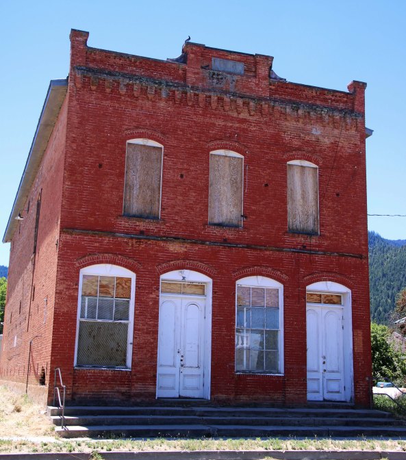
I suspect, or at least hope, that this boarded up historic building will morph into some modern use. (Photo by Peggy Mekemson.)

Speaking of historic, this phone booth certainly fits the bill. And it still functions! Local calls were for free. (Photo by Peggy Mekemson.)

This “Little Library” where folks can pick up, trade, or donate books was near and dear to Peggy’s heart. As President of Friends of the Library in Ruch, Oregon, she has supported a similar program for our community.

This restaurant was ‘near and dear’ to my heart. Our trail friends, Big Foot and Peter Pan, had recommended it and Peggy considers it a sacred duty to stuff me every time I come off the trail. Stuff away we did.

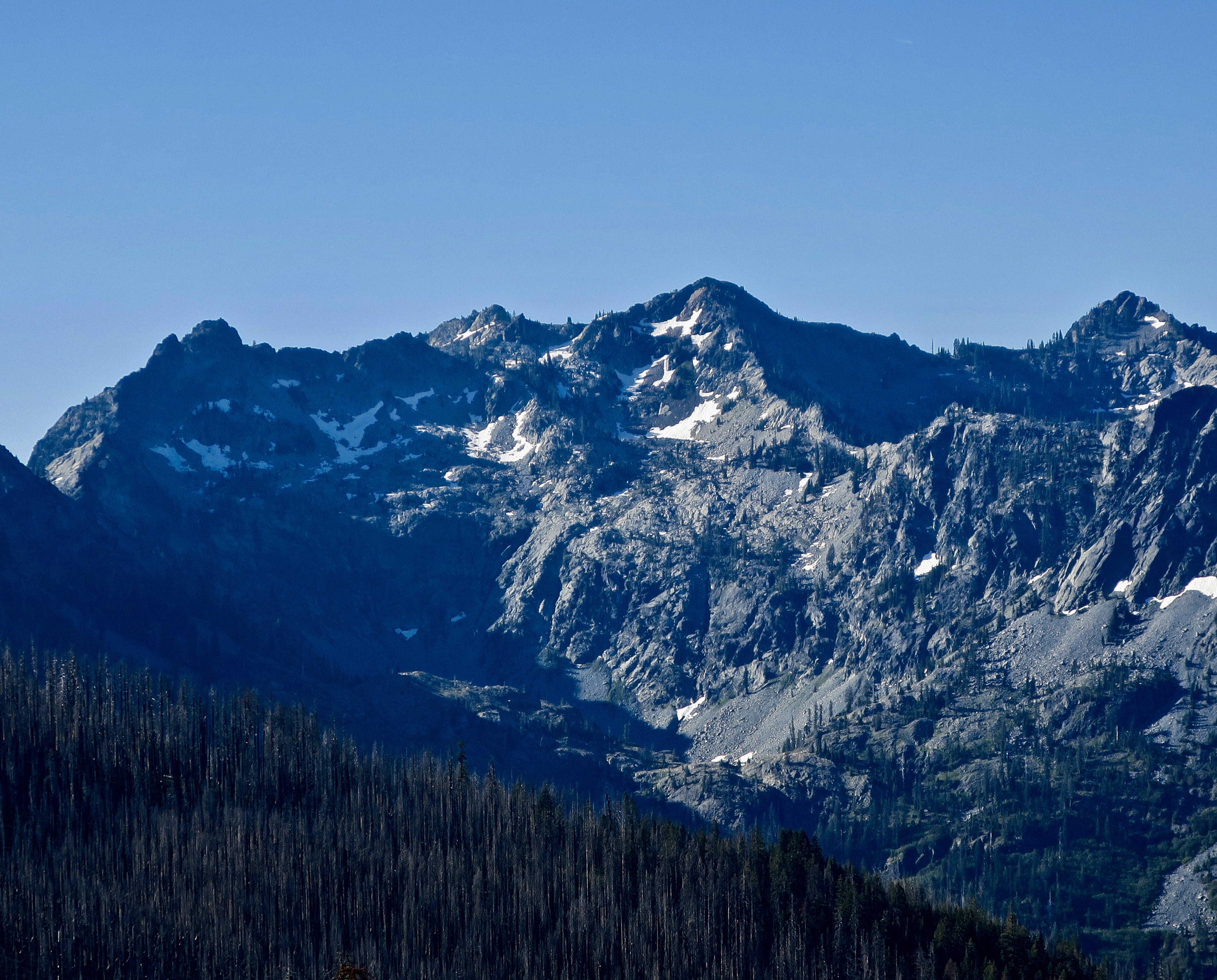
Peggy entertained herself with a long hike at Caste Crags and was rewarded with this view. (Photo by Peggy Mekemson.)

She also found these large Umbrella plants fascinating… (Photo by Peggy Mekemson.)

And used her foot for perspective. (Photo by Peggy Mekemson.)

One place she stayed at Castle Crags while waiting for me was at the RV camp at Railroad Resort Park. People can actually rent these cabooses to stay in. Castle Crags looms in the background. (Photo by Peggy Mekemson.)

This train engine is located at the park. (Photo by Peggy Mekemson.)

As was this dining car— another place that I was stuffed. (Photo by Peggy Mekemson.)

McCloud featured this somewhat scary sculpture of a logger. You wouldn’t want to meet him at night— or get in an argument over logging practices with him! (Photo by Peggy Mekemson.)

In the town of Dunsmuir, we were joined by Sandra and Tim Holt. Longtime friends, they had kept my nephew Jay’s car for him while we hiked from Etna Summit to Castle Crags. Peggy had lunch with Sandra while we were out on the trail.

Tim and I go all the way back to the 70s and 80s in Sacramento when he wrote, edited and published the Sutter Town News that focused on downtown Sacramento where I was a community activist on health and environmental issues. Now days, Tim and Sandra perform folk song concerts at local venues as well as volunteer extensively in Dunsmuir.

Peggy enjoyed numerous views of Mt. Shasta just as I did out on the trail. This photo was also taken at McCloud by Peggy.

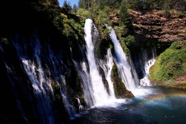
A long hike in Burney took Peggy over to Burney Falls where she even found a rainbow, which she was quite pleased to capture. (Photo by Peggy Mekemson.)

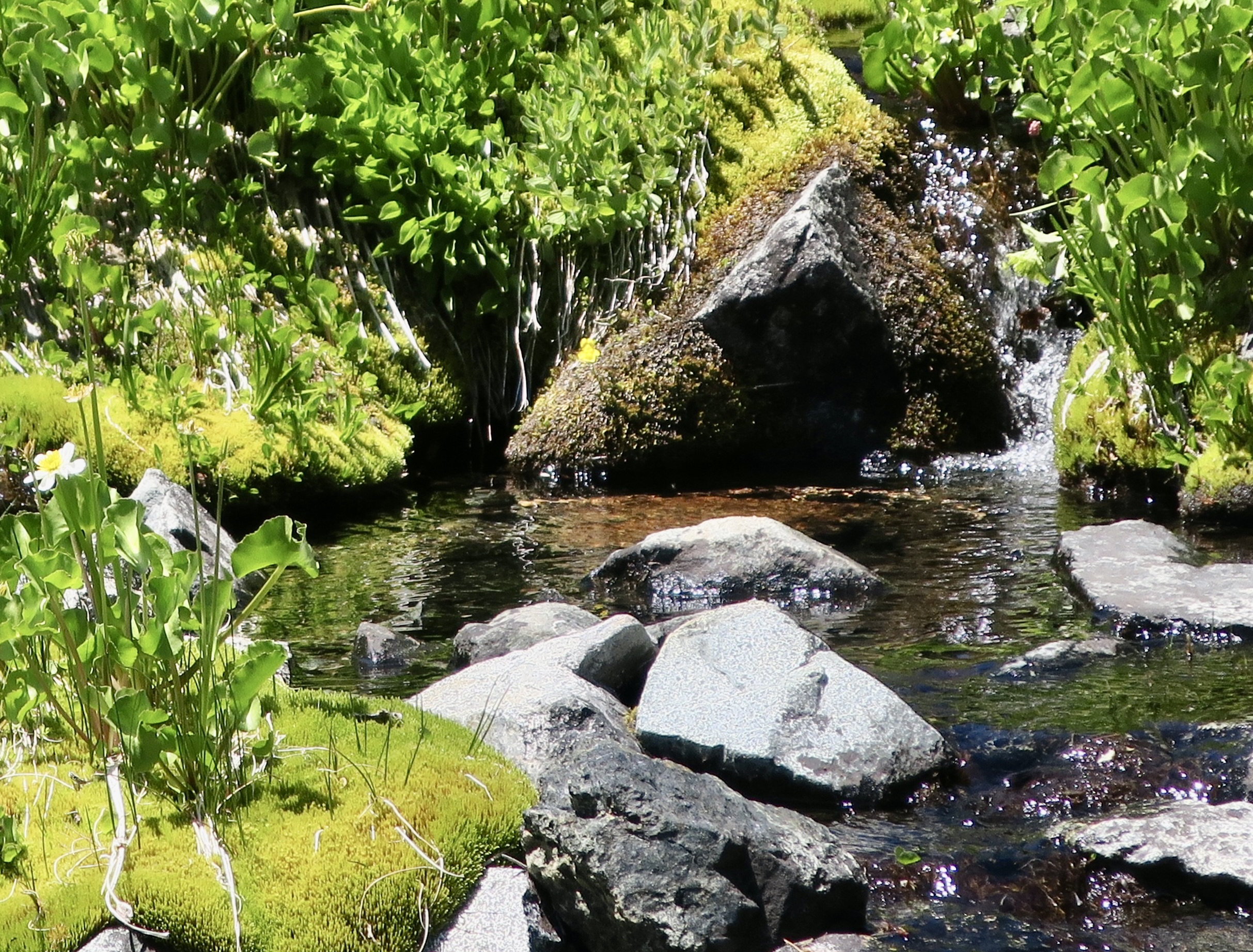
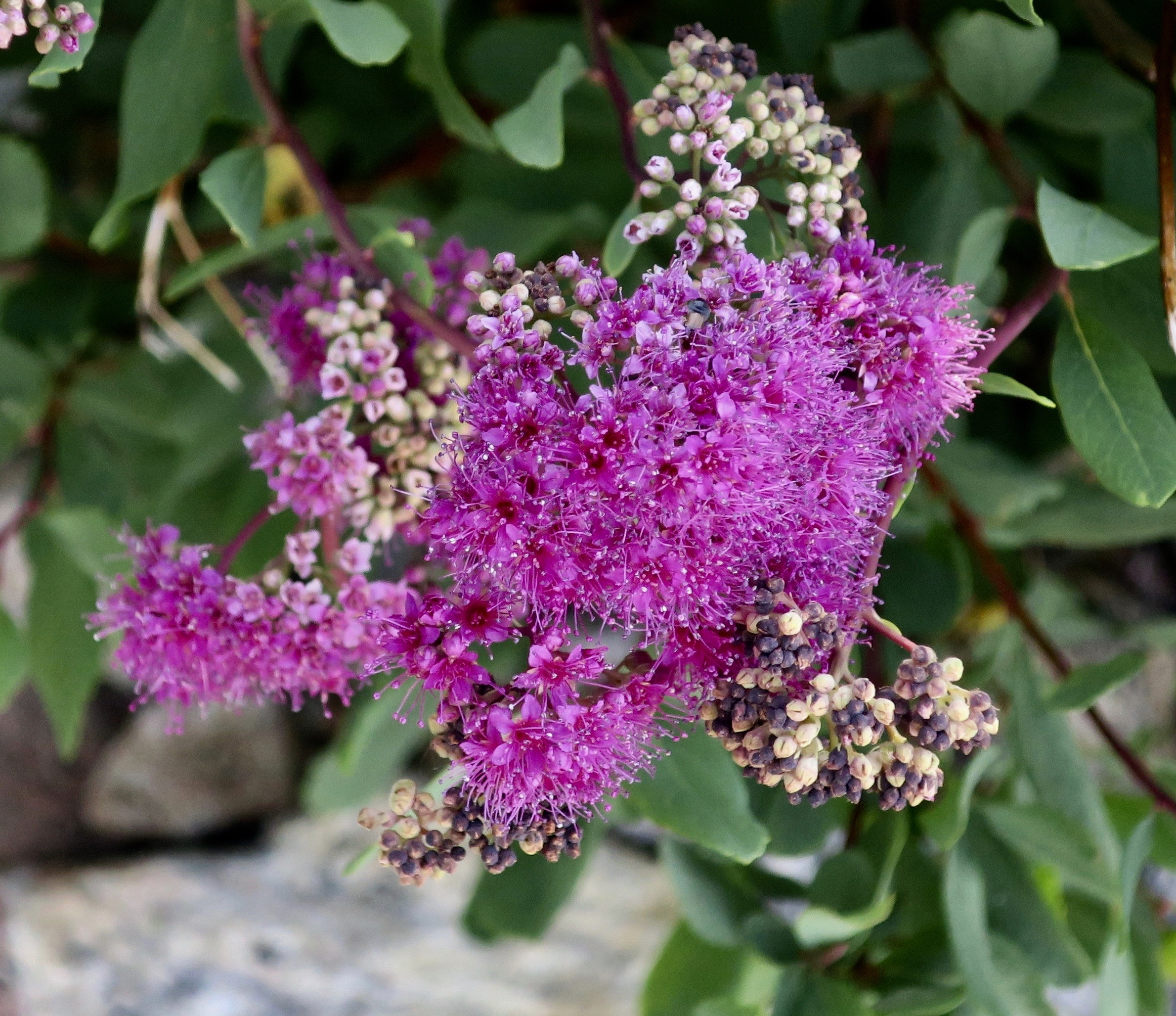
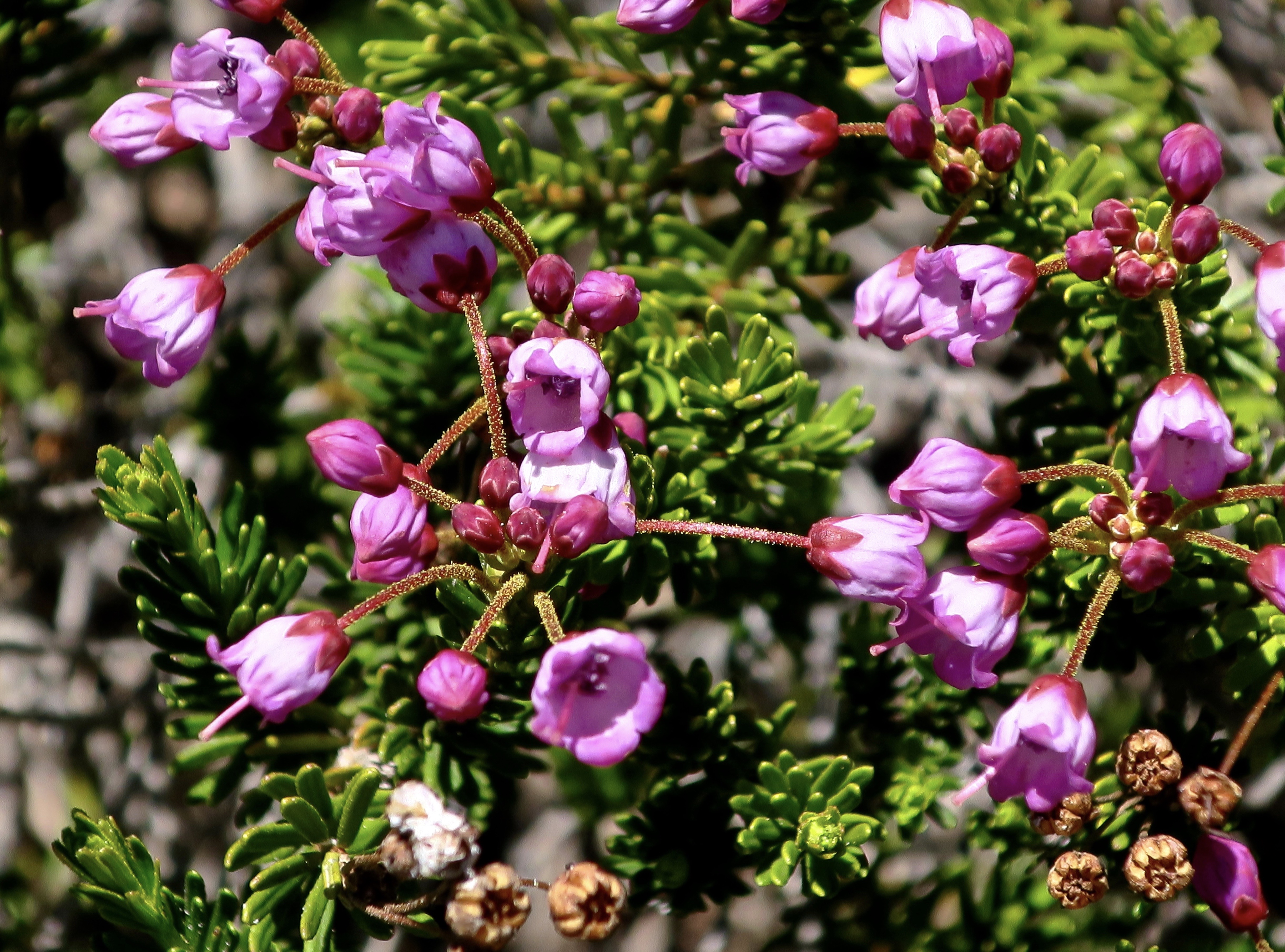
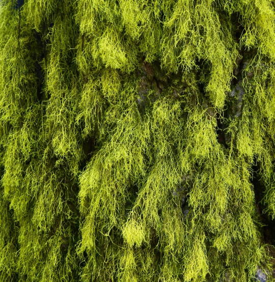
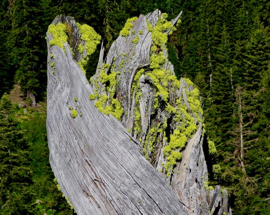
I’ll conclude today with this close-up that I really liked. (Photo by Peggy Mekemson.)

My 13-year old grandson is joining me today. Tomorrow we will start a journey from Donner Summit to Carson Pass. A trip I have been on many times and sections of which I have done with his grandmother, mother, Uncle Tony and Cousin Jay.