Baby Bears and More… Kodiak Island, Alaska

These cubs were delightful little fellows, but photographing them called for a telephoto lens. I didn’t want to irritate their several hundred pound mom. Sow bears are very protective of their kids. One of the rules I always emphasize when hiking people through bear country is never get between a mama bear and her babies.

I visited Kodiak a couple of times when I lived in Alaska. Both times I was on my way to Katmai National Park to go backpacking. So, I missed seeing the Kodiak bears. It wasn’t a problem. The National Park has its own  population of large brown bears. When the floatplane landed at Katmai, a ranger was there to greet us. The area is a renowned fishing area for both people and bears. Fishermen come from all over the world to try their luck.”If you catch a fish and a brown bear comes along, cut your line. Don’t try to land the fish,” he instructed. It seemed like good advice. He went on to say, “If you meet a brown bear when you are out hiking, talk to the bear and slowly back away.” I wasn’t fishing so I wouldn’t need the first bit of advice, but possibly the second suggestion would come in handy.

The opportunity arrived that very evening. I had gone out for a stroll following a trail down to the beach when a thousand pounds of big claws and sharp teeth came strolling along in the opposite direction. Just what the heck was I supposed to say? I improvised. “Uh, Mr. Bear,” I started out tentatively, “You don’t want to eat me. I am an Alaskan just like you.” He stared at me with his small beady eyes and coughed. I wasn’t sure whether the cough meant I was full of BS or that I should go on. I assumed the latter. “There’s some great German food and Japanese food in camp,” I added as I slowly backed away.  It wasn’t that I actually wanted the bear to eat any German or Japanese fisherman. But, as I noted, I was improvising. He growled and left the trail. Maybe he was heading off to sample some ethnic dishes. I let out a huge sigh of relief and continued down to the beach.

The next day I watched an even larger bear fishing in a deep hole along the river. It was obviously a prime location. The bear wasn’t fishing the way you see them in the documentaries where the bears hang out at waterfalls with their mouths open. He was playing submarine where he would disappear under the  water until he caught a fish and then stand up on his hind legs while he consumed it. It was like he was eating corn on the cob except he was consuming the cob as well. I could here him crunching away. Twenty inches of trout disappeared in a couple of minutes. As I watched, a smaller grizzly sized bear came along to share in the catch. Bad decision. The large bear let out a roar and charged while the little guy leapt out of the hole and hightailed it though camp with the big guy hot on his tail. And, I can assure you, every thing they say about the speed of bears is absolutely true. I was ever so glad that I wasn’t on the trail.

The action on Kodiak wasn’t quite as dramatic, but it was equally interesting as the following photos will show.

Mama suggests to a large male that he go elsewhere. He did. You don’t mess with the mama!

Crisis solved, Mom leads her kids in the opposite direction along the fish pass,

And decides to go fishing.

Where she demonstrated her technique. (The salmon got away.)

“Come on in,” she urged the kids. “The waters fine.” But the cubs passed on the opportunity.

So she rejoined them— and provided a tongue bath.

Meanwhile, other bears were fishing the broader Dog Salmon River beneath the weir.

Including another mom with an older cub. The cub watched as mom searched for salmon under the water.

Successfully.

“Come on Mom, share!” the cub urged.

A seagull hovered above the cub, hoping for some table crumbs.

A bit later, a pair Kodiak bears had a standoff in the middle of the river! It seemed they were trying very hard to ignore each other.

Until the bear on the right decided to suggest that the other bear go elsewhere!

Which it did…

Junior stood up so he can see the action…

While Mom took a front row seat…

And then stood up to salute the victor. “I pledge allegiance…”

With the salmon caught and cubs fed, it was time to take a break.

The cool water provided an escape from the bugs…

While the fish pass provided  some warm sun for an afternoon nap. Anyone one up for telling the bear that it isn’t supposed to be on the fish pass? (grin) Next Wednesday I’ll take you along on trips to catch salmon, troll for halibut, and search for sea glass.

FRIDAY’S POST: A wrap up on the Mekemson Kids Did It.

MONDAY’S POST: The next to the last post on the 18-day journey down the Colorado River.

SaveSave

SaveSave

SaveSave

SaveSave

SaveSave

SaveSave

SaveSave

SaveSave

SaveSave

SaveSave

SaveSave

SaveSave

Kodiak Island… Where the Bears Grow BIG… Alaska

A Kodiak bear was on hand to greet us when our float plane landed on Frazier Lake in the remote backcountry of Kodiak Island. Our guide suggested that we stay on the plane. It was a strong suggestion.


We drove up the Alaska Highway for a reason: to visit out son Tony, his wife Cammie and their three sons, Connor, Chris and Cooper on Kodiak Island. Kodiak lies off of the Southwest Coast of Alaska and is the second largest island in the US. Only the island of Hawaii is larger. Our son, Tony, was flying helicopters on rescue missions for Coast Guard at the time. We left our van with friends in Anchorage and flew over to the island. The kids had a number of fun things lined out for us to do.

Google map showing the location of Kodiak Island.

One happened to be a float plane trip across the island to watch the large Kodiak bears living around the remote Frazier Lake. We were excited about the trip. Kodiak bears come close to matching Polar bears in size and the big males can weigh up to 1500 pounds. Watching them fish for salmon would be a treat. The flight over and back would also provide us with an opportunity to see the island. I am going to feature the trip over and back in today’s post— and add in our first encounter with a Kodiak bear. It decided to show up before we got off the plane! Next Monday, I’ll focus in on the bears. The following Monday I’ll throw in a little salmon and halibut fishing. Welcome to Kodiak Island, as beautiful as it is remote.

Float planes are the major way to get into remote locations in Alaska. I had flown on them several times when I lived in the state.

One of the advantages of flying bush planes is how close they fly to the ground. We actually used them for planning out some of the treks I led in Alaska.

Our pilot flew us over the lower elevations on our way to Frazier Lake. There was snow, of course, but mainly the land was an Ireland green.

This peak hanging out above the green hills caught my attention.

Flying over a braided river that is so typical of Alaska.

More rocky terrain. It looks like granite to me. Mountains loom in the distance.

Our first view of Frazier Lake. We would land on the lower end and hike up the river to see the bears. The site was just above the zig-zag in the river.

Flying into the lake.

Our float plane after it landed.

Another view.

Getting off the plane was another issue. This fellow was fishing next to where we landed.

It walked over to our plane and checked out the tether line.

Eventually, it climbed into the water and swam away. Note to ourselves: Don’t try to get away from bear by swimming.

We watched as it climbed out on the opposite shore as we prepared to hike up the river to the main bear watching area. I’ll feature a lot more bears next Monday, lots of them including some really cute cubs, but for today I want to show the more mountainous part of Kodiak that we saw on our return trip to the float plane base.

Our flight back to the float plane base took us across Kodiak’s more mountainous terrain. Glaciers are working their way down the mountains.

There is a lot of Kodiak that I would enjoy backpacking through, but I’ll leave this to the mountain climbers.

I’ll conclude today with this view of the mountains framed by the snow and a glacier.

FRIDAY’S POST: The Mekemson kids are up to more mischief.

MONDAY’S POST: We continue our journey rafting on the Colorado River through the Grand Canyon.

WEDNESDAY’S POST: Bears and more bears on Kodiak Island.


SaveSave

SaveSave

SaveSave

SaveSave

SaveSave

SaveSave

SaveSave

SaveSave

SaveSave

SaveSave

SaveSave

From the Canadian Border to Anchorage… Alaska Highways

Matanuska Glacier is one of the sights along the road from the Canadian/Alaskan Border to Anchorage.

I lived in Alaska for three years between 1983-86. While the organization I was executive director of was in Anchorage, I wandered over much of the state, backpacking in numerous areas including Gates Of the Arctic National Park, kayaking in places like Prince William Sound and cross-country skiing, which included a trek into Denali National Park where we camped out in 30 (34 C) degrees below zero weather. You go to bed with your shoes and a hot water bottle! The beauty and wildness of the state is legendary. Yes, there are insects galore, big bears with sharp teeth, moose, and wolves. But they come with the territory.

Our drive from the Canadian Border to Anchorage was much tamer, but the beauty was there, as you can see from the following photos.

Speaking of wildlife, we spotted this beauty at the King Mountain Lodge. Can wildlife get much wilder?

Bright fields of fireweed contrasted with the darkness of black spruce along the road.

The road continued to wind among almost mystical mountains.

This mountain is part of Wrangle St. Elias National Park, one of the most remote and untamed national parks in the world.

This cache is a bit on the fancy side, more for tourists than keeping out the bears that want to raid your food supplies. But you get the idea.

More mountains…

Glacial rivers are gray from the rock ground off of mountains.

Another view of Matanuska Glacier.

I really liked this view of mountains along the highway.

More mountains. These with a different look.

An appropriately painted house along the route.

The bar at King Mountain Lodge. Road houses were once common along the highway, and necessary to accommodate travelers who couldn’t travel long distances over the rough highways on a given day. Most were quite colorful, and often filled by interesting characters. King Mountain continues to provide an interesting place to stop.

Peggy found this motorcycle inside. The owner, seeing her interest, took her out for a spin.

A photo of Libby Riddles was on the wall. Libby was the first woman to win the Iditarod, the world-famous sled dog race from Anchorage to Nome. And she did it while I was in Anchorage. I called her and asked if she would be spokesperson for my organization. She agreed. I picked her up at the airport where she had just returned from a photo-shoot with Vogue Magazine and we spent a couple of days together as we ran around to all of the local media.

A shot of Libby and me sharing a laugh in the mid-80s.

I found this lovely pond on the edge of the highway.

These are the mountains that backed up to my home in Anchorage. I could be up in them in 30 minutes and would often go on hikes after work. One of my trips was a 25-mile day hike where I came out in this canyon. It included crossing a fairly substantial glacial river where I had to save my hiking companion from being swept away.

I’ll conclude with this sunset. In next Monday’s post I will take you off to the island of Kodiak for  a visit with brown bears!

FRIDAY’S POST: The Mekemson kids are at it again and a railroad detective shows up at out house to accuse my brother of dark deeds, which fortunately, he didn’t do.

MONDAY’S POST: We continue our 18 day trip by raft down the Colorado River through the Grand Canyon.

SaveSave

SaveSave

SaveSave

SaveSave

SaveSave

SaveSave

A Strange Cave Creature… Rafting through the Grand Canyon: Part 10

Peggy Mekemson at Deer Creek Falls in Grand Canyon

Peggy standing next to Deer Creek Falls in the Grand Canyon.


“It is especially cold in the rain tonight. The little canvas we have is rotten and useless; the rubber ponchos have all been lost; we have not a blanket apiece. We build a fire; but the rain, coming down in torrents, extinguishes it, and we sit up all night on the rocks, shivering…” From the diary of the one-armed John Wesley Powell on the night of August 17, 1869 during his epic exploration of the Grand Canyon.


Well, there are ADVENTURES and there are adventures. Today I will focus on our 8th, 9th and 10th days on the Colorado River. There are rapids, but nothing to write home about. In camp, the fabled heat of the Grand Canyon makes an appearance, so we put up a sun shelter and snooze. It’s a bit of a climb up to Christmas Tree Cave, maybe 10 minutes. We do, however find a very strange creature there, something that might give you nightmares. We stop to admire Deer Creek Falls and then climb up the Deer Creek Canyon, which is much more of a climb than it was to the cave, but a natural Jacuzzi greets us at the top. The water is cold. Things are tough, right? As I said, there are ADVENTURES and then there are adventures. (Grin.) I let photos tell today’s story.

We do run into rapids every few miles, but mainly the water is calm and beautiful. (Photo by Don Green.)

Rowing is a given, lots of it, but unless we are rowing against the wind or maneuvering through rapids, the river does much of the work.

Don caught this interesting face along the way. (Photo by Don Green.)

Take a cold beer or two, add in a warm sun, comfy chairs, and shade, it’s time for a snooze.

With the trip half over, it’s time to check in on how we are faring. This is me…

And this is Peggy. I can only wonder how she does it.

Our camp that evening…

And in the early morning light.

Looking up at the entrance to Christmas Tree cave. The name derives from a crystalline structure that looks something like a Christmas tree.

Okay, imagine you are alone and making your way through a large, semi-dark cave when you suddenly come face to face with this cave troll. The Christmas Tree, BTW, is to the right of Tom.

I really like the perspective on the size of the cave in this photo that Peggy took.

Deer Creek Falls was a treat. Hiking up the Deer Creek trail provided more delights.

Like the natural Jacuzzi.

It was a tad cold.

Bone was probably the least bothered by the cold of any of us. Maybe it was his warm vest. Tom and Don make a hand off. Bone wanted to leap off on his own but we were afraid that the creek might carry him away!

Deer Creek had cut its way into the soft sandstone, creating a min-Grand Canyon of its own.

Which led Peggy and me to take numerous photos.

Waterfalls along Deer Creek.

And another opportunity to rest. Check out the shade on the left.

Our final photo of the day. Looking down on the Colorado River from the Deer Creek trail.

WEDNESDAY’S POST: We arrive in Alaska on the Alaska Highway. Now we will be making our way from the Canadian Border to Anchorage. Be prepared for glaciers!

FRIDAY’S POST: The MisAdventure series. The railroad detective comes to visit. Were the Mekemson kids guilty of tearing apart a railroad trestle? Tune in on Friday.

SaveSave

SaveSave

SaveSave

SaveSave

SaveSave

SaveSave

SaveSave

SaveSave

Rowing Against the Wind… The Grand Canyon Series

Peggy captures Dave Stalheim and me as we begin our journey on the Colorado River through the Grand Canyon. Note my clean and shaved look. It’s the last time you will see it.


With thoughts of facing headwind gusts up to 60 MPH, we began our journey down the Colorado River through Grand Canyon National Park.

Peggy and I performed the ritual of asking a boatman if we could ride with him. It seems like a strange practice to me, designed to remind us who’s in charge. But we have entered the world where each boatman/woman is the captain of his or her ship, even if the ship is a 16-foot raft with two or three passengers.

“May I have permission to come aboard, sir?” Although it’s more like “Can we ride with you today?” It is courteous but I would prefer to be assigned and have the assignment changed each day.

The tradition is so old that it fades into history. Democracy is not an option on a raging sea or, for that matter, in the middle of a roaring rapid. When the captain yells jump, you jump.

Most boatmen are mellow people, however; good folks. There are few Captain Blighs. If they are slightly more than equal, it goes with the territory. We are committed to riding with each boatman. First up is David Stalheim. He makes his living as a city and county planner in Washington.

“I’ve been applying for a permit to go on the Colorado River for 15 years,” he tells us. Our ten-minute effort of obtaining a permit seems grossly unfair.

We push-off from shore, excited and nervous. The wind strikes immediately, like it was waiting in ambush. “Are we moving at all?” Dave asks plaintively.

An old rock road makes its way tortuously down from the canyon rim on river left. (Left and right are determined by direction of travel.) They are important for giving directions as in “There is a raft ripping rock on river right!” Since boatmen often row with their backs facing downriver, they appreciate such information.

Up until 1929, this is how travelers made their way to Lees Ferry. It would have been a bumpy ride.

The old road is how people once made their way to Lee’s Ferry, which was one of the few ways to cross the Colorado River between 1858 and 1929. The infamous Mormon, John Doyle Lee, established the Ferry. Brigham Young assigned him the job. Later, Lee was executed by firing squad for his role in the Mountain Meadow Massacre where Mormons and Paiute Indians murdered a wagon train of immigrants near St. George, Utah. For awhile, my brother and I thought some of our ancestors had been involved, had ended up dead. But it wasn’t so.

After fighting the wind for what seems like hours, we finally come to the Navajo Bridge, which replaced Lee’s Ferry in 1929. It towers some 467 feet above the river and reminds us that we are already miles behind our planned itinerary.

Navajo Bridge by Don Green

A view of the Navajo Bridge. The first is the old one and is now used as a walkway. The second is used by cars and other vehicles. (Photo by Don Green.)

Just beyond the bridge we catch our first glimpse of Coconino Sandstone. Its geologic history dates back some 250 million years when a huge desert covered the area and the world’s landmasses were all part of the large continent named Pangaea— before the divorce, before plate tectonics demanded that the continents go their own way.

During our journey down the river we will travel through over a billion years of the earth’s history.

The wind continues to beat against us as we make our way down the Colorado River. Only Dave’s strenuous effort at the oars keeps us from being blown up-stream. “Go that way,” I suggest and point down the river.

The group pulls in at a tiny beach in hopes our mini-hurricane will die down. It doesn’t. Dave develops blisters and I develop guilt. A manly man would offer to take over at the oars.

An option floats by. Dave’s niece, Megan Stalheim, is also one of our boatmen. Don Green, a retired Probate Judge out of Martinez, California, is sitting opposite her and pushing on the oars while she pulls. It inspires me. I join the push-pull brigade. Peggy also takes a turn.

The push-pull approach to rowing where Don Green was helping Megan. Peggy and I have been friends with Don for over two decades. He belongs to the same book club we do and joins us on our annual journey to Burning Man (as does Tom). Don is also quite generous in sharing his photos, which was particularly helpful on our first day since neither Peggy nor I took many.

Word passes back to us that Tom wants to scout Badger Creek Rapids. In boatman terminology this means figuring out the best way to get through without flipping. Badger isn’t a particularly big rapid for the Colorado, but it is our first. We are allowed to be nervous. It’s labeled a 4-6 out of 10 in the method used in the Grand Canyon for determining difficulty. Ten is reserved for only the most dangerous. Badger involves a 15 foot drop from the top to bottom.

Badger Creek Rapids by Don Green

Photo of Badger Creek Rapids by Don Green.

There is good news included in the message. We will stop for the night at Jackass Camp just below the rapids on the left. We’ve only gone 8 miles but are eager to escape the wind.

Dave is a cautious boatman. He takes his time to study Badger Creek Rapids from shore and then stands up in his raft for a second opinion as the river sucks us in. Time runs out. Icy waves splash over the boat and soak us. Our hands grasp the safety lines with a death grip as we are tossed about like leaves in the wind. Mere seconds become an eternity. And then it is over.

Badger Creek Rapids Google photo

The view from above using a Google photo. Our camp would be on the right (river left)  at the bottom of the photo, in the shade here. Our raft came out on the left (river right) side of the river.

“Quick, Curt, I need your help,” Dave shouts. We have come out of the rapids on the opposite side of the river from the camp. The powerful current is pushing us down stream. If we don’t get across we will be camping by ourselves. Adrenaline pumping, I jump up and push the oars with all my strength while Dave pulls. Ever so slowly the boat makes its way to camp.

Jackass campsite on Colorado River by Don Green

Not the world’s most attractive campsite. We scatter out to find places for our tents after emptying the boats. (Photo by Don Green.)

Jackass Camp Area by Don Green

Boats tethered at Jackass Camp. (Photo by Don Green.)

View from Jackass camp on Colorado River by Don Green

View from camp. (Photo by Don Green.)

Grand Canyon evening primrose by Don Green

I liked this primrose captured by Don the next morning…

Grand Canyon floers and tracks by Don Green

And found the tracks under it even more interesting. It’s like the lizard was sidestepping. Its tracks and tail trail can be seen coming down from the right. The hole on the right was made by an ant lion that uses the hole as a trap for insects. They fall in, can’t get out, and become lunch. Next Monday, we will continue our journey down the river.

WEDNESDAY’S Photo Essay POST: I begin my series on the Alaska Highway. We make our way to the start of the highway in Dawson Creek by traveling through British Columbia. Great wood carvings and dog agility trials entertain us along the way.

FRIDAY’S MisAdventures POST: I graduate from playing in the Graveyard to playing on a pond and discover a magical world.

MONDAY’S Grand Canyon Series POST: Beautiful waterfalls, a huge cavern, and ancient Native American ruins are featured.

Jackass campsite on Colorado River by Don GreenJackass campsite on Colorado River by Don GreenSaveSave

SaveSave

SaveSave

SaveSave

SaveSave

SaveSave

SaveSave

SaveSave

I Discover I Am No Longer 30, or 40, or 50, or even 60… Rafting Through the Grand Canyon: Part 4

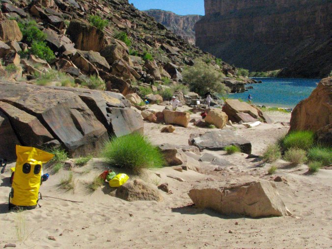
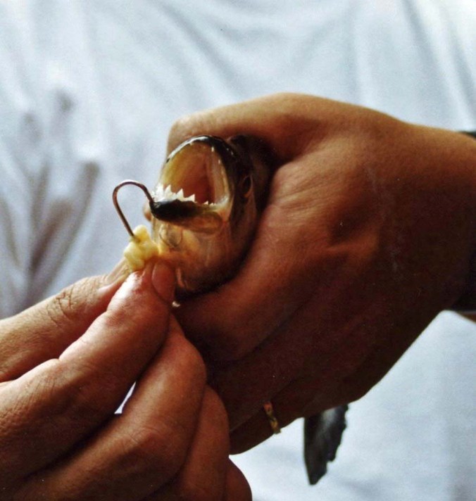
On a private trip down the Colorado through the Grand Canyon National Park, everyone pitches into help. Here we are learning to rig the rafts. Straps and more straps! The  aluminum frame provided stability for the raft and held the heavy food containers. (Photo by Don Green)


It was time to make the leap from life on the road to life on the river. Laptops, cell phones, good clothes and the other accoutrements of modern civilization were stuffed into bags and dumped into our transport van.

Plus I had to paint my toenails. It was a virgin experience. Grand Canyon boatmen are a superstitious bunch. Many believe their boats will flip if a person is on board with naked toes. And it’s true— boats have flipped under such circumstances. It makes no difference if the opposite is also true. Tom lectured me. “I will not let you on my boat unless your toenails are painted.” In addition to being obnoxious, he was serious. Peggy dutifully applied blue polish on four of my toes. Did this mean we would only half flip?

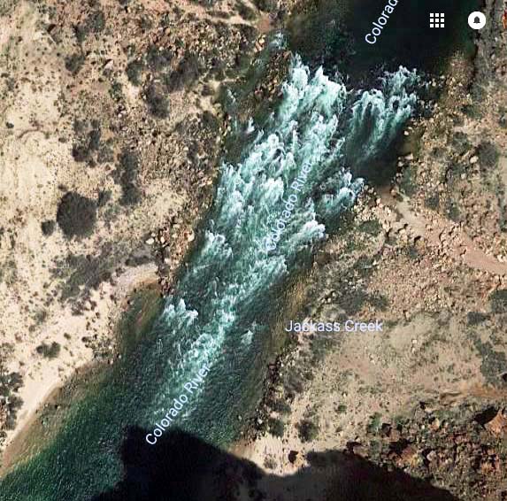
Two acres of paved boat ramp greeted us when we arrived at Lee’s Ferry, some 130 miles from Flagstaff. It is the take off point for trips down the Canyon and the only bridge across the river in some 700 miles. The Mormons originally discovered the potential for the crossing and sent John Lee to set up a ferry, which began operation in 1873. Brigham Young was also hiding Lee. He had been a key player in the Mountain Meadows Massacre where some 120 eastern emigrants had been murdered. A practicing polygamist, Lee and his wives ran the ferry up until his execution in 1877.

The transport van disgorged us as the gear truck made a quick turn around and backed down the ramp. Another private party was busy rigging boats. People, gear and boats were scattered everywhere.

From off to the right, a longhaired, 50-something man had emerged. I had thought 60’s hippie or possibly the model for a Harlequin Romance cover. The pirate flag on his boat suggested otherwise. A ‘roll your own’ cigarette dangled from his lips. It was Steve Van Dore, the last member of our group and a boatman out of Colorado.  No one in our group had met him, but he came highly recommended.

Steve, a week or two into the trip.

“Please let this be the truck driver,” Steve later admitted was his first thought when he met our green and purple haired trip leader. He also confided that Tom hadn’t told him we were a smoke-free group. “On the other hand,” Steve confessed, “I didn’t tell him I was on probation.” Somehow this balanced out in Steve’s mind. There was no time to become acquainted; we had work to do.

There is an unwritten 11th Commandment on private river trips: Thou Shall Do Your Share. No one is paid to pamper you. Not helping will lead to bad things, like banishment from the tribe. The truck we had loaded in Flagstaff demanded unloading. Everybody did everything. There were no assignments. Peggy and I became stevedores. Piles of beer and soda and wine and food and personal gear and ammo cans and hefty ice chests quickly accumulated around the truck. There was no shade and the desert sun beat down ferociously. It was sucked up by the black asphalt and thrown back at us. We slathered on sun block and gulped down water.

The rafts were unloaded last. Rigging them was technical but relatively easy, assuming of course that you knew what you were doing and were mechanically inclined. I made no such claims. Steve’s Cat (catamaran) was already set up and in the water, its pirate flag was flapping in the breeze. Our other four boats were self-bailing Sotar Rafts with aluminum frames. Tom owned his own, a blue 14 footer named Peanut after the Jeff Dunham character. The three we had rented were yellow, 16 feet long and nameless.

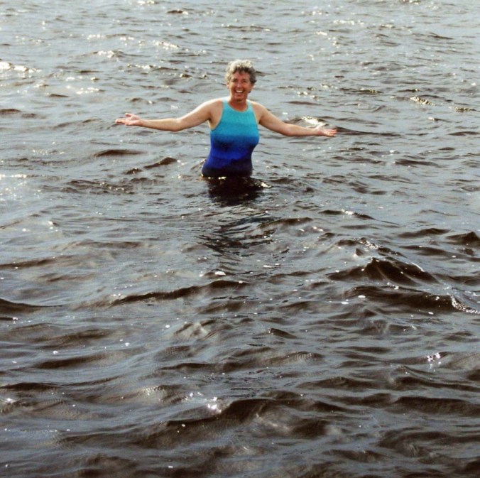
Work also required that we get our feet wet. (Photo by Don Green)

Tom was the last to rig his boat. It was approaching dusk when he finished— the end of a very long day. I hiked down the river to find a campsite for our group while the rest boated down. Peggy and I struggled to set up our new tent in 30 MPH winds. A van was coming to pick us up for dinner at a nearby restaurant and we were late.

The walls of the restaurant were covered with photos of rafts and rafters being trashed by massive rapids. I walked around and admired them with more than a little awe and trepidation. I would have preferred to see photos that emphasized the beauty of the Canyon, but this was a rafters’ hangout.

The wind storm had changed to a dust storm when we arrived back at camp. Finding our tent in the dark proved to be a challenge, and the tent provided little protection when we crawled in. I was reminded of Burning Man as the dust assailed my eyes, ears, nose and mouth. I pulled out a handkerchief to cover my face. Exhausted, I finally fell asleep with the wind ripping at our tent.

I had underestimated the amount of work involved. We were floating down a river, weren’t we? I was out of shape and had a generous belly. Peggy and I had been traveling extensively, mainly helping our kids with their babies. I’d been over-eating and under-exercising. I might have gotten away with it at 30, or 40, or 50— and had. But now I was 67, and my body had some serious words for me. Mainly unprintable. A few years earlier I had undertaken a much more difficult task, backpacking for 360 miles between Lake Tahoe and Mt. Whitney. But I knew how tough that was and had spent a few months hiking 5-10 miles per day before hitting the trail. Now my only excuse was ignorance. And that is not a very good excuse.

We were awakened at five a.m. the next morning, as we would be on every day of our trip. There was personal gear to pack, breakfast to prepare, and boats to load. Any thoughts of a leisurely trip down the river were dashed in the cold reality of the early morning’s light.

We also had a lecture on the Grand Canyon’s numerous rules by Ranger Peggy. Somewhere in the middle of rigging boats the previous day she had stopped by to check our equipment. Life vests had been dutifully piled up; stoves and bar-b-que were unpacked. Even the groovers, which I will describe later, stood at attention. You don’t mess with Ranger Peggy.

She knew Tom from other river trips and was amused by his hair-do. He introduced me as the permit holder. “Tom’s in charge,” I noted. The smile dropped from her face. “You are responsible,” she said icily. “I’ll try to keep Tom under control,” I replied meekly. Yeah, fat chance that.

Bells, whistles and alarms started going off in my head. I would face heavy fines if any of our party misbehaved.

Our second encounter with Ranger Peggy began after the boats were packed for our first day on the river. Tom started off with a discussion on river safety. Naturally we were required to wear our PFD’s (Personal Flotation Devices) any time we were on the boat.

Tom, with his interesting hairdo, and Ranger Peggy check their lists to see which of the many rules they have forgotten to inform us about.

What’s the first rule if you fall overboard: Hang onto the boat. What’s the second rule? “Hang onto the boat,” we chanted in unison. And so it went. Tom saw his wife, Beth, go flying by him the year before as he bounced through a rapid. He caught up with her down river.

If the raft flips, what do you do? Hang onto the boat! “Easier said than done,” I think.

“Your head is the best tool you have in an emergency,” Ranger Peggy lectured. Right. When the river grabs you, sucks you under the water, and beats you against a rock— stay cool.

For all of the concern about safety on the river, the Park Service seemed more concerned about our behavior on shore.

Over 20,000 people float down the river annually. And 20,000 people can do a lot of damage to a sensitive desert environment. Campsites are few and far between and the major ones may have to accommodate several thousand people over the year.

Picture this: 20,000 people pooping and peeing in your back yard without bathroom facilities. It isn’t pretty. So we pack out the poop. And we pee in the river…

Packing out poop makes sense. But peeing in the river, no way! I’d led wilderness trips for 36 years and for 36 years I’ve preached a thousand times you never, never pee in the water. Bathroom chores are carried out at least 100 yards away from water and preferably farther.

The first time I lined up with the guys, I could barely dribble out of dismay.

The rules went on and on. Mainly they had to do with leaving a pristine campsite and washing our hands. Normally, I am not a rules type of guy but most of what Ranger Peggy preached made sense. Sixteen people with diarrhea is, um, shitty.

And few things disturb me more than a trashy campsite in the wilderness. The least we could do was to leave our campsites sparkling clean.

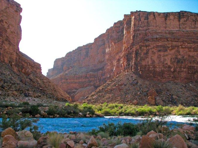
Finally, we were ready to launch. Eighteen days and 279 miles of the Colorado River and Grand Canyon stretched out ahead. Ranger Peggy checked our IDs against her list. We were who we claimed to be. The boatmen strapped down the gear. It was time to climb aboard and Tom was anxious to get going.

The same up-canyon winds that whipped dust into our tent were threatening to create a Herculean task of rowing. Headwinds of up to 60 MPH were predicted.

The group, ready to launch. Wife Peggy, as opposed to Ranger Peggy, is holding her and my purple PFDs. I’m second from the left, looking chunky.


WEDNESDAY’S POST: It’s back to the Amazon and monkey business. While Peggy gets the ‘good’ monkey, I get the ‘bad’ monkey.

FRIDAY’S POST: I learn a bit about cross cultural relations as a second grader— on a queen sized bed.

MONDAY’S POST: Fighting ferocious headwinds, we begin our journey through the Grand Canyon.


SaveSave

SaveSave

SaveSave

SaveSave

SaveSave

SaveSave

SaveSave

Up Close and Personal with Piranhas on the Amazon River… The Wednesday Photo Essay

Fishing for piranhas

How do you take the hook out of a piranha’s mouth. Carefully! When one fell off the hook into the bottom of our boat and started flopping around and snapping its teeth, all feet immediately went up into the air.


It’s photo Wednesday and today I will be featuring a trip that Peggy and I took up the Amazon. It was the pre-digital age and the photos produced by our camera weren’t quite as clear as we produce now, but I felt we did a fair job of capturing our experience. Enjoy.

Whenever I think of the world’s great rivers, associations pop into my mind. The Mississippi immediately throws me back into early American history with Mark Twain and riverboats. The Nile takes me even further back in time to Ancient Egypt and pyramids. I think of Hindus plunging into frigid waters when I picture the Ganges. The Yangtze or Cháng Jiāng carries me off to the heart of China and the ‘mysterious East.’ The Danube makes me want to get up and slow-dance— thank you Strauss. And, I imagine exotic adventures when I think of the Congo or Niger. All of this relates to the fact that I am an incurable romantic fascinated with both history and adventure.

But nothing spells exotic for me like the Amazon. The river with its 1,100 tributaries provides a seemingly infinite number of opportunities to get lost. One could easily spend a lifetime exploring the river and unlocking the secrets of the massive rainforest the river and tropical rains supports. More than 20% of the world’s oxygen and fresh water comes from the region. And it is one of the world’s richest centers of biodiversity.

Amazon parrot

One third of the world’s birds, some 1500 species, can be found in the Amazon. This parrot stopped by for a visit. Every evening large numbers would fly between the trees in the forest canopy.

Curt Mekemson searching for wildlife on Amazon River

I spent a lot of time checking out the shores and canopy for birds and wildlife.

Catpillars on tree in Amazon Rainforest

Our trips ashore introduced us to some of the more exotic insect life such as this parade of caterpillars that somehow reminded me of a dancing Kokopelli from Native American mythology. All that was lacking was his flute.

Kokopelli

Kokopelli playing his flute as he appears on a drink coaster of ours. The girls were said to go crazy over him.

Peggy and my journey into the Amazon was tame as such adventures go. Still, we managed to work in a five-day river boat trip out of Manaus and a stay at a tree house lodge up in the rainforest canopy where we hung out with monkeys and slept in a bed that Jimmy Carter had once occupied. Our riverboat trip introduced us to the rainforest plus gave us a slight flavor of life on the river— including fishing for and eating piranhas. It was the law of the jungle: Eat or be eaten. (Grin)

On today’s photo essay, I will feature our river boat trip. Next week, we will hang out with the monkeys.

Amazon Clipper on tributary of Amazon River

Our boat, the Amazon Clipper, settled in for the night on the Rio Negro. Our crew would tie it off to trees in the rainforest.

View out window of river boat on the Amazon

The view out our port-side window.

The Amazon Clipper river boat

A closer view of the boat. Six cabins provided space for passengers. The top deck served as an excellent viewing platform.

Peggy Mekemson assuming a Titanic pose on an Amazon riverboat

Peggy also used it for a Titanic-type pose. I would add that the deck made an excellent location for evening cocktails.

Map of South America

Our journey into the rainforest took us to the city of Manaus which is located at the confluence of the Amazon River and its tributary, the Rio Negro some 1000 miles above where the Amazon runs into the Atlantic Ocean.

Manaus and Rio Negro River

Our riverboat journey would take us out of Manaus, up the Rio Negro River, through the numerous channels of the the Anavihanas, and to the community of Novo Airao. First, however, we boated down to the confluence of the Rio Negro and the Amazon near the # 319 marker where the dark waters of the Rio Negro meet the lighter waters of the Amazon. (Photo from Google Maps.)

Meeting of Amazon and Rio Negro

They call it the ‘mixing of the water’ where the Rio Negro meets the Amazon.

Tributary to Rio Negro

The braided channels of the Anavihanas brought the rainforest in close to the boat.

Amazon Rainforest

Evening in the Anavihanas on the Rio Negro River

An evening view.

Bone with river boat pilot on Amazon River

Bone took his trick at the helm.

Bone on tributary to Amazon River

And then posed for a photo-op on the rear railing. It almost turned into a disaster as the boat sped up. I leapt up and just caught Bone as he started to fall into the piranha infested waters! I guess if you have to go…

Piranha dinner

Later, as I noted above, we took the boat’s skiff and went fishing for piranhas. These fellows made a tasty treat.

Peggy swimming in Amazon

Peggy gave the piranhas their chance for revenge but no one bit. (The crew assured us that this section of the river was piranha free.)

Covered boat on Rio Negro River in Amazon Rainforest

We saw a number of small boats along the river…

Small boat on Rio Negro River in Brazil

House boat on Amazon

Home along Rio Negro in Bazil

And houses.

Homes along Amazon

We stopped here and went for a walk in the forest.

Brazilian with machete

This fellow split open a Brazil nut with his machete and gave us all a taste.

Tree platform for hunting in the Amazon Rainforest

While another machete wielding man showed off a hunter’s platform.

Rubber tree in Brazil

Rubber trees provided the wealth that drove the development of Manaus in the 1800s. Rubber is made from the sap that comes from the cuts in the tree.

Igreja Santo Angelo - Novo Airao, Amazonas Brazil

The town of Novo Airao gave us a feel for how people lived in Brazil’s rainforest communities. This is the church of Igreja Santo Angelo.

Cartoon building in Novo Airao, Brazil

We were amused by the cartoon characters that decorated what was probably a school.

Open market in Nova, Airao, Brazil

This open market reminded me of the shops in Gbarnga, Liberia where I served as a Peace Corps Volunteer.

Dog in Nova Airao, Brazil

And this handsome dog reminded me of Do-Your-Part, the basenji that adopted me in Liberia.

Business in Nova Airao, Brazil

Another typical town building.

Flower in Novo Airao Brazil

We found this flower on a walk through the town…

Breadfruit in Amazon

And what I assumed was breadfruit.

Boats at Nova Airao, Brazil

The boats were on the waterfront of Nova Airao.

Peggy Mekemson sleeping on Amazon River boat.

While I could never break myself away from watching for birds, snakes and wildlife, Peggy found a comfortable place to snooze on our way back to Manaus.

Apartment complex Manaus, Brazil

Manaus is a bustling city. I liked the unique apartment house on the left, boxes stacked on top of each other and leaning slightly to the right.

Amazon boats in Manaus Brazil

Passenger boats are lined up along the waterfront to begin the thousand mile journey down to the ocean and points in between. Their schedule is that they leave when they are full!

Sunset on the Amazon River

I’ll close today’s post with a couple of photos of the sun setting on the Amazon.

Sunset on the Amazon

FRIDAY’S POST: Reading guarantees that I become a wanderer.

SATURDAY AND SUNDAY: Since Bone is traveling with us on our trip through the Grand Canyon, I introduce him/her to those of you who don’t know the small fellow with a huge personality and ego to match. Sunday’s post includes an interview.

MONDAY’S POST: I kick off our raft trip through the Grand Canyon with a fervent wish that I had spent more time getting in shape!

WEDNESDAY’S POST: Peggy and I continue our Amazon adventure with me ending up with a monkey on my head and Peggy with one in her lap.


SaveSave

SaveSave

SaveSave

Hopi Gods and Squirrelly Squirrels… Rafting the Grand Canyon: Part 1

Rowing on the Colorado through the Grand Canyon

While a veteran crew of boatmen handled the more dangerous parts of our 18 day journey through the Grand Canyon, I was allowed near oars on some of the tamer sections.


Since Peggy and I will actually be hanging out at our home in Southern Oregon for a couple of months and not generating new material for my travel blog, I thought I would dip back in time to the very beginning of my posts.  I had attended a writer’s conference in San Francisco during the winter of 2010 and been told that writers need an Internet presence. I felt doing a series on an 18-day trip we had just completed rafting on the Colorado River through the Grand Canyon would make an excellent start. It was an epic-adventure, one that was burned into my memory banks.  Part of the experience was that Peggy and I would be traversing some of the earth’s most challenging rapids with a true cast of characters. That alone was enough to make it an epic adventure, but even more important, at least for me, was that we would be traveling through the heart of the Grand Canyon, one of the seven natural wonders of the world. Please join us on this adventure. By the end, I think you will see why the Grand Canyon has earned its world-class status. I will start with Peggy and me in Flagstaff, Arizona getting ready for our adventure…


Tom and Bone

One of the ‘cast of characters’ and our group leader, Tom Lovering with Bone in his hair. Tom and I had found Bone when we were backpacking in the Sierra Nevada Mountains in 1977 and he has traveled the world ever since.

Five squirrels with long tufted ears just went charging past our van— in a row. I think it must be love and Peggy agrees. We speculate that a female is leading the boys on a glorious romp. “Catch me if you can!” she giggles. It’s that time of the year when the Albert Squirrels are excited to make babies and perpetuate the species. Lust is in their hearts. Or maybe it’s just the guys working out territorial differences.

Someone they won’t be mating with are their northern cousins, the Kaibab Squirrels. It isn’t that they couldn’t or wouldn’t if they could, it’s just that the giant hole in the ground known as the Grand Canyon is too deep and too wide for them to cross. As a result, a new species has been created. Scientists and natural history folks call this process allopatric speciation— a pair of two-bit words for sure.

We are located at a KOA in Flagstaff, Arizona as we prepare for our raft trip down the Colorado River. It’s a big campground. Everywhere we look men and women wearing yellow shirts are busily preparing for the onslaught of summer tourists. It feels like a beehive, or squirrel’s nest. The camp cook tells us 28 people work here. Jobs are highly specialized. The man who straightens misplaced rocks stopped by to chat with us this morning.

Yesterday we watched two employees struggle for an hour on laying out the base of Teepee. It had all the flavor of an old Laurel and Hardy film. They kept measuring and re-measuring the angles. I expected one to leap up and start chasing the other around camp with a 2×4.

We wonder what the Kachina deities who live in the San Francisco Mountains overlooking our campground think about the squirrelly activity taking place beneath them. There are bunches of them up there, over 300 according to Hopi lore, and each one has a lesson to teach, wisdom to disperse. They come down from their perch in the winter to share their knowledge. I’m sure that they would have made quick work of the Teepee project.

Peggy and I hike up the mountain following Fat Man’s trail. Of course, there is no irony here as we desperately try to beat our bodies into shape for the Canyon trip. We’ve been out travelling in our van for months and the pounds have accumulated. The trail’s name suggests this is a gentle start. Instead it takes us straight up into a snowstorm. The Kachinas are rumored to mislead people under such circumstances. I once spent a week up on the mountain by myself and restricted my wandering to fair weather.

Grand Canyon rock formation

I’ve sometimes wondered what, if any, role that rock formations in the Grand Canyon influenced how the Hopi Indians pictured their Kachina gods.

Once they had the mountain to themselves but now they have competition. Technology has arrived— modern gods. Tower after tower bristling with arrays of tracking, listening and sending devices look out over the sacred lands of the Hopi, Navaho and other Native Americans.

It’s hard not to think Big Brother is watching or not be disturbed by the towers’ visual intrusion. But their presence means we can get cell phone coverage and climb on the Internet. We are addicted to these modern forms of communication so it is hypocritical to whine, at least too much.

But back to the squirrel theme, Peggy and I are a little squirrelly ourselves as we go through our gear and get ready for our grand adventure. I am nervous. This is my first multi-day river trip. What have we gotten ourselves into? Do we have the equipment we need? Will we survive the rapids? What will the people who are joining us be like? What challenges will we face that we are ill prepared for? There are many questions and few answers.

Would people who should not be let near knives suddenly be wielding them?

Would Canyon spirits stalk us?

Would we be required to paint our toenails so our rafts wouldn’t flip.


A note on photos: Peggy and I took most of the pictures that will be included in these posts on the Grand Canyon trip. Our friend Don Green was also along, however, and has generously shared his photos with us. I will note which photos are his.

WEDNESDAY’s Photo Essay POST: It’s back to the featuring the beautiful red rocks of Sedona, Arizona.

FRIDAY’S Blog a Book POST: The next chapter in MisAdventures sees my brother and I in a death-defying race to the top of the 75-foot tall Incense Cedar in the Graveyard.

MONDAY’S Travel Blog POST: It’s all about food, seemingly tons of it, as we make our final preparations for the Colorado River trip. Homeland Security puts a crimp in our efforts as it checks our supply for bombs.

SaveSave

SaveSave

SaveSave

SaveSave

SaveSave

SaveSave

SaveSave

SaveSave

SaveSave

SaveSave

SaveSave

SaveSave

Peggy’s Lake

Peggy’s Lake. The quiet beauty of this small Sierra lake captured me.

Gold prospecting was a lonely occupation for most of the men who came to California as 49ers. Wives and girlfriends had been left behind. Often the only female companionship a miner might have was the type you paid for. Every town of any size had its whorehouse, or possibly several. One way the miners compensated for their loneliness was by naming lakes in the Sierra Foothills and Mountains after their favorite female companions, be it a wife, a girlfriend, or a particularly friendly lady of the evening.

I honored the tradition when I made my solo trip into the Grouse Ridge/Black Buttes/Five Lakes Basin Area. I had hiked out on Saturday from the Basin but Peggy wasn’t coming in to pick me up until Sunday. I didn’t want to hike up the Grouse Ridge Campground and spend the night. It was undoubtedly crawling with people. So, I went looking for a substitute.

A small lake that I had camped on before had been taken over by cattle, lots of them. I hiked on. Another little lake was shallow and also a favorite watering hole for my bovine companions. I hiked on and on, getting father and farther away from the trail. Much to my surprise, I came on a little, unnamed lake that I had never been on before— and I’ve crisscrossed the area extensively. It was shallow, only a few feet deep, and it might very well dry up in another month or two, but it was gorgeous. I decided to name it Peggy’s Lake, after my best friend and wife. It’s nothing official of course. It won’t show up on any maps. But I knew that Peggy would like ‘her’ lake.

Peggy's Lake in the Grouse Ridge Non-Motorized area.

Similar to Five Lakes Basin, Peggy’s Lake is nestled in the granite. Storm clouds hovered over head in this photo. They soon produced rain.

And it rained hard. I hid out under a couple of large pines to stay dry. This Lupine welcomed the rain with open leaves!

Lupine at Peggys Lake near the Black Buttes of the northern Sierra Nevada Mountains.

These pods on the Lupine left no doubt about its connection to the pea family.

After the rain, a convenient rock provided a premier seat for enjoying the lake.

Peggy’s Lake in the evening.

Peggy's Lake in the Grouse Ridge area of the Northern Sierras.

And with the early morning sun.

These two trees, a pine on the right and a juniper on the left, caught my attention.

Here they are early in the morning, backlit by the sun.

The shallowness of the lake encouraged grass to grow. I kept seeing little heads pop up out of this grass and didn’t have a clue what they were. Later I figured out they were baby ducks, catching insects.

Once again, I found a fun monster lurking in the lake’s reflections. I turned it upright for your enjoyment.

This red fir made me think Christmas tree.

As always, I was attracted to the beauty of old wood like this stump.

And these two trees that seemed to continue an embrace that they had shared when they were young and green.

Gnarled wood called to my camera. I liked the patterns here…

And here…

The setting sun lit up the Black Buttes that help define the area.

And I am not going to tell anyone where Peggy’s Lake is! There’s a reason.

The Grouse Ridge Non-Motorized Area is well-loved. Maybe too much so— especially for someone like me who prefers his wilderness rugged, wild and relatively people-free. But I make an exception for this region. It’s an easy place for people to get to and is very backpacking-friendly for families and newcomers to the sport. It serves as a great introduction, as it did for our grandchildren, Ethan and Cody. And as it did for me in the 1970s. There is great value in this— for the people of course— but also for our world. People who experience the wilderness in a positive way are much more likely to appreciate it, and want to protect it. And protecting our wild areas is ever so important, for ourselves, our children, and future generations.

This doesn’t mean that I am beyond selfishly wanting to keep a bit of it to myself, like Peggy’s Lake. So, I’ll share photos, but not location. (grin) If folks who frequent the area are charmed by the photos and go out of their way and find the lake: Welcome.

It was only proper that Peggy, Tasha, Ethan and I ended our backpack trip the following week at Peggy’s Lake.

Tasha points out a white cow that stopped by for a visit, laid down in the grass, and happily chewed her cud while watching us. It was the same cow that had come to visit me up near Glacier Lake the week before. Maybe she was missing her people.

Ethan and Cody explore the shallow lake.

It wasn’t all backpacking. Here Peggy displays her cards in a game with the 9-year-old Cody. This would have been a bad hand for poker. It was even worse for War, which Cody insisted she play with him whenever we camped, including at 6:30 in the morning!

And finally, nestled into the seat of honor, Peggy enjoyed her lake.

I am off to Black Rock City, my friends. And I am excited to return to the desert, the incredible art, and the magic of Burning Man. This year’s theme, Radical Rituals, promises to produce some interesting art. For example, what the heck is the Pagan Bunny Shrine? The creators say it’s all about hoppiness. We’ll see. Anyway, I’ll be away from my blog again for a week. But immediately afterwards, I’ll begin a series of posts on this strange, sometimes wonderful, and occasionally downright weird event. And I’ll respond at that time to any comments you’ve made in the meantime. See you then. –Curt

SaveSave

SaveSave

SaveSaveSaveSave

SaveSave

SaveSave

SaveSave

SaveSave

SaveSave

SaveSave

SaveSave

SaveSave

SaveSave

SaveSave

SaveSave

SaveSave

SaveSave

SaveSave

SaveSave

In the Beginning… A Reflection on the Grouse Ridge-Black Buttes-Five Lakes Basin Area

A waterfall in the Five Lakes Basin provides water from snowbanks to one of my favorite lakes. The Black Buttes tower above. Hemlocks, pines and firs grow on the hillside.


Old Pond

Blue mountain, white snow gleam
Through pine bulk and slender needle-sprays;
little hemlock half in shade,
ragged rocky skyline,

single clear flat nuthatch call:
down from the treetrunks

up through time.

At Five Lakes Basin’s
Biggest little lake
after all day scrambling on the peaks,
a naked bug with a white body and brown hair

dives in the water,

Splash!

A poem by the Nobel Prize winner and the “poet laureate of Deep Ecology, ” Gary Snyder.

I have just returned from my last backpacking trip of the summer, my fifth— one for each decade I’ve shouldered a pack and disappeared into the wilderness. My last two trips included the Grouse Ridge-Black Buttes-Five Lakes Basin area, the same region Gary Snyder refers to above. He lives outside of nearby Nevada City (just above Grass Valley in the map below), and, like me, has wandered and loved the glacier carved country from top to bottom, from the Buttes to the Basin.

The maps below provide information on the location of the area and where I backpacked on my two trips.


Yellow marks the general location of my two trips this summer into the Grouse Ridge area just north of Interstate 80 between Sacramento, California and Reno, Nevada in the Sierra Nevada Mountains. (I was raised in a small town just outside of Placerville.)

The area circled in yellow was where we backpacked. I-80 can be seen at the bottom of the photo. I helped achieve the non-motorized status for the area in the 1970s when I was serving as Executive Director of the Sacramento Ecology/Environmental Center.

A close-up of the area. Today I am featuring Glacier Lake and the trail there from Grouse Ridge marked in yellow, which was the route I followed on my first trip. I went into the Basin on the Sand Ridge Trail when I backpacked in with my family.

The first trip into the Basin I made by myself this summer; the second was with my wife Peggy, my daughter Natasha, and her two sons, Ethan and Cody. It was our grandkids’ first backpacking trip and I wanted them to explore the area where my own backpacking experiences had begun in 1969— where I had first discovered the joys of backpacking, and the beauty of the Sierra Nevada Mountains.

Our daughter Natasha with her two boys, Ethan on the left and Cody on the right. Sierra granite provides the backdrop.

Ethan and Cody contemplate another climb. Both boys, Ethan at 12 and Cody at 9, carried full backpacks. Ethan was like a deer on the trail, bounding ahead. Cody was like a Sierra badger, digging in and not giving up, mastering the trail one step at a time.

In the beginning: It sounds almost biblical. Dan Iles would like it. I met Dan at Glacier Lake on my first trip into the Grouse Ridge area this summer. He introduced himself as the Dean of Graduate Studies at the Shasta Bible College in Redding, California. He’s a serious Christian, and a heck of a nice fellow. I liked him immediately. He had backpacked into Glacier Lake with his 13-year-old grandson and told me that he had been bringing youth groups into the area since the 70s.

The Reverend Dan Iles at Glacier Lake.

I was getting ready to leave the next morning when he came over for a chat. I had told him the night before that I lived in the Applegate Valley near the small town of Ruch in Southern Oregon and he wanted to know if I attended one of the churches there that he was familiar with. I explained that I was a bit more Eastern in my beliefs, a bit more Zen, and something of an Agnostic. I dug into my pack and found Siddhartha, a 1922 novel by Hermann Hesse that a friend had given me in the 70s. The novel describes Siddhartha’s journey to enlightenment at the time of the Buddha. I read it every few years because it reminds me of the importance of living in the present, of the interconnectivity of all things, and the value of a simple life— of not getting lost in our materialistic world.

Reading Siddhartha after dinner beside a quiet Sierra Lake. (Photo by Peggy Mekemson.)

Dan and I must have talked for 45 minutes or so about our lives. He described himself as a Professor of Practical Theology and told me of his efforts to help children and women in Africa who had been left homeless and destitute by the seemingly endless conflicts. He also told me that he believed in freedom of religion, that people should be free to worship according to their own beliefs, which is a concept that I strongly support. Still, I could tell he was concerned about my soul, that he would have considered a day spent trying to convert me as a day well-spent. It went with the territory of who he was and what he believed.

As I hiked past his camp to say goodbye on my way down into the Five Lakes Basin he urged that I read the Book of John in the New Testament. “It does an excellent job of describing the miracles of Christ,” he assured me. I’d read John before. In my youth, I had been considered a prime candidate for becoming an Episcopal priest. But I read it again on Dan’s recommendation. Miracles are what have been pulling people into Christianity for millennia. Jesus changes water to wine, feeds five-thousand people with two fish and five loaves of bread, walks on water, heals the sick, revives the dead, and ascends to Heaven.

I should have said, “Thanks, I’ll do that,” and moved on. But I couldn’t help myself. “I don’t need miracles, Dan” I responded. “I’ve got this.” And I raised my hands to take in the surrounding countryside. The towering Black Buttes climbed above the blue-green Glacier Lake. Giant red firs and pines stood as silent sentinels over the campground. Brightly colored flowers called to insects with an urgency that predated man’s sojourn on earth. Massive cumulus clouds spoke of lightning and thunder and rain and hail— of the incredible power of nature. If I needed awe, if I needed inspiration, if I needed a reason to believe, it was right there in front of me, behind me, surrounding me. I didn’t have to travel back in time 2000 years to events that required a leap of faith to believe. I waved one last time, turned, and hiked down the trail toward the Five Lakes Basin.

Photos of Glacier Lake and my hike into the lake.

The Black Buttes of the northern Sierra Nevada Mountains tower over Glacier Lake.

A close up of the Black Buttes as the sun sets.

The moon hovers above the Black Buttes in the northern Sierra Nevada Mountain Range.

A small pool fed by melting snow provided this reflection shot at Glacier Lake.

Red fir reached for the sky above my campsite.

Glacier Lake in the Grouse Ridge Area of the Northern Sierra Nevada mountains.

I found these two moss colored elders along the trail to Glacier Lake.

What insect could resist this brightly colored Red Mountain Heather that I took a close up of along the Glacier Lake Trail.

Towering cumulus clouds threatened thunder, lightning and hail at Glacier Lake.

I found a small creek along the trail to Glacier Lake and decided to camp next to it, thinking it might provide a short hike for my grandsons. (They didn’t need it.) I removed bear scat from the campsite so they wouldn’t get too nervous.

This boulder next to the campsite reminded me that the area had been carved by glaciers. The granite rock, known as an erratic, had been left behind by one of the glaciers.

I hid out under my tent’s groundcloth as lightning flashed, thunder rolled, and hail pounded down on my campsite. Later, as the sun set, all that was left of the storm was a few puffy clouds.


NEXT POST: It’s down into the Five Lake Basin.


SaveSave

SaveSave

SaveSave

SaveSave

SaveSave

SaveSave

SaveSave

SaveSave

SaveSave

SaveSave

SaveSave

SaveSave

SaveSave

SaveSave

SaveSave

SaveSave