So, You’ve Signed Up for Burning Man 2026: What Can You Expect? The Focus Series

Burning Man’s theme for 2026 is Axis Mundi, Latin for axis of the world. Above, is an artist’s rendition of what the base of the Man of Burning man will look like this year.

Each year, Burning Man (BM) asks artists to submit artistic designs for what the Man might look like based on the theme. The winner for 2026 was submitted by Alexander (Zander) Rose, a Burner from the Bay Area with BM roots that go back all the way to 1996. His design is based on Japan’s national tree, Cryptomeria japanica, a cedar tree that can live to be over 2000 years old. An outer spiral staircase will take Burners 60 feet up to the base of the man. An inner spiral staircase will take them back down, creating the double helix of DNA, representing our past, present and future.

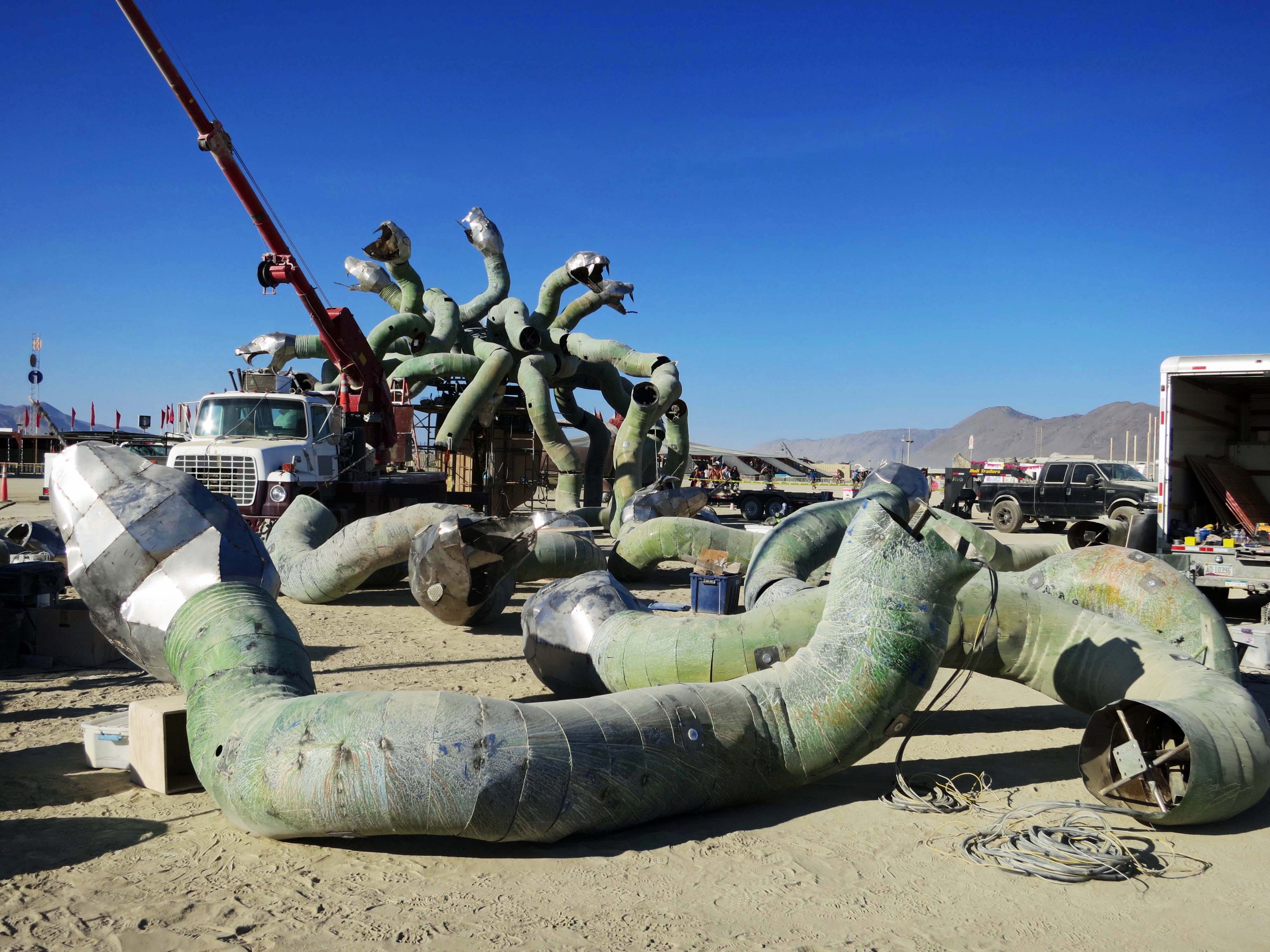
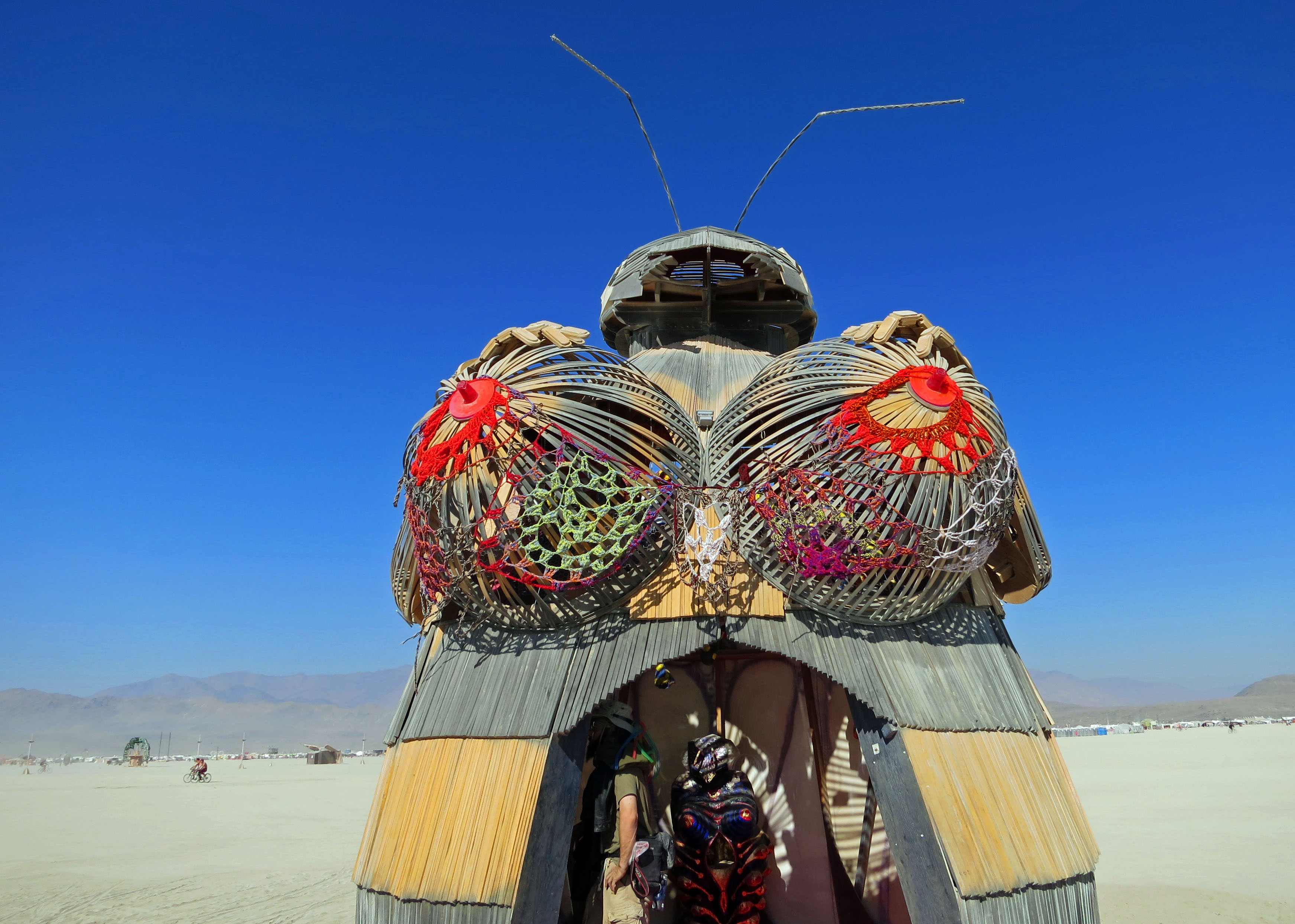
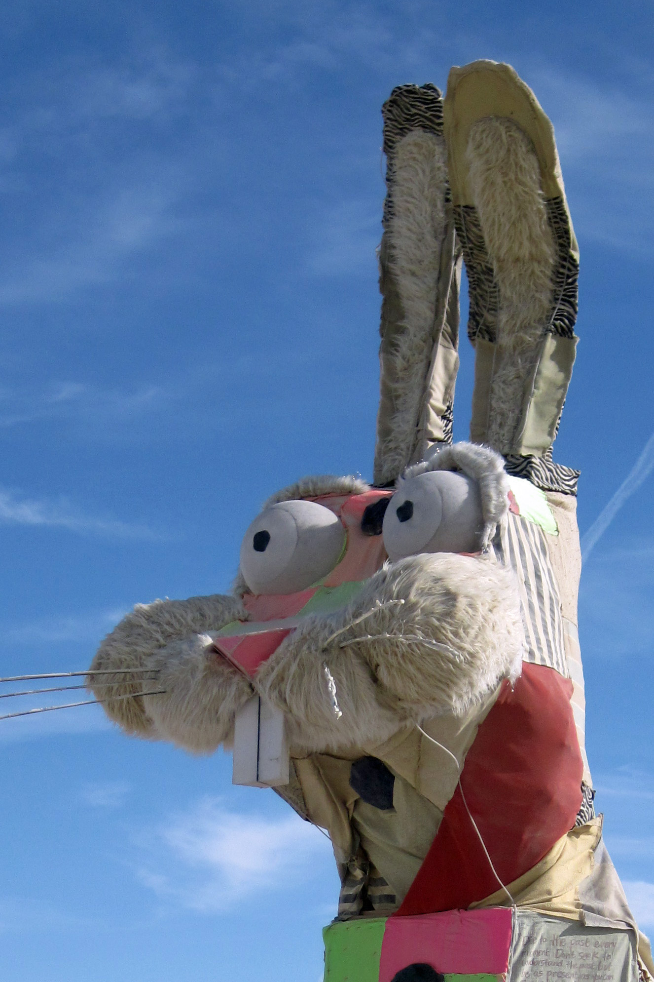
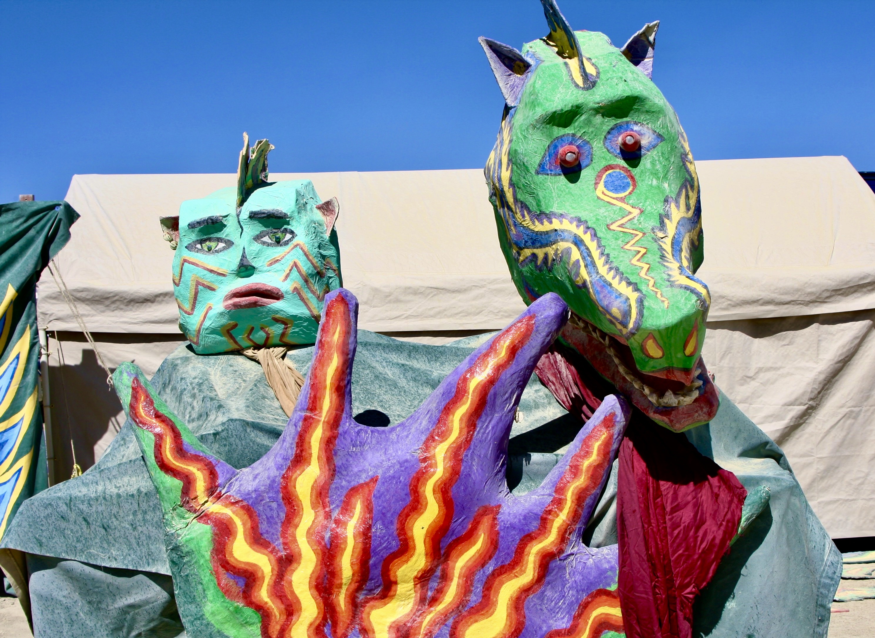
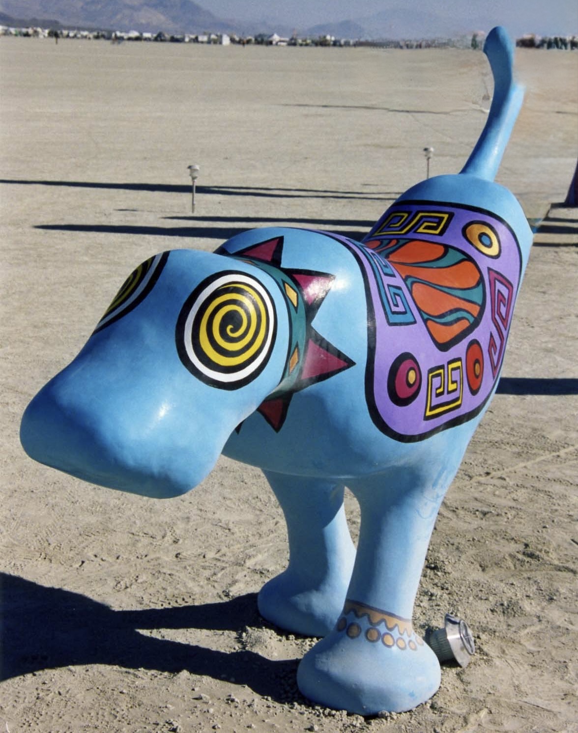
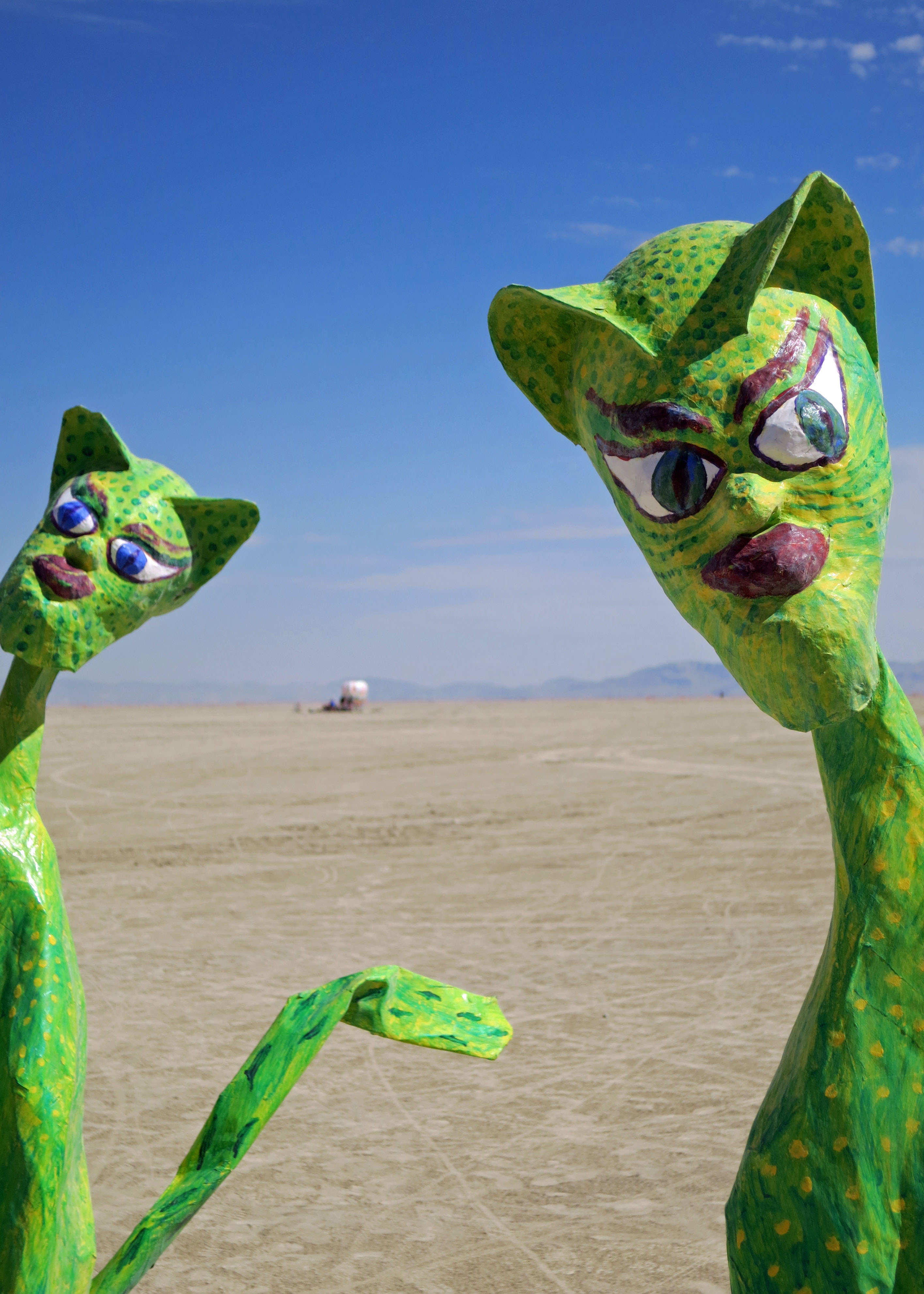
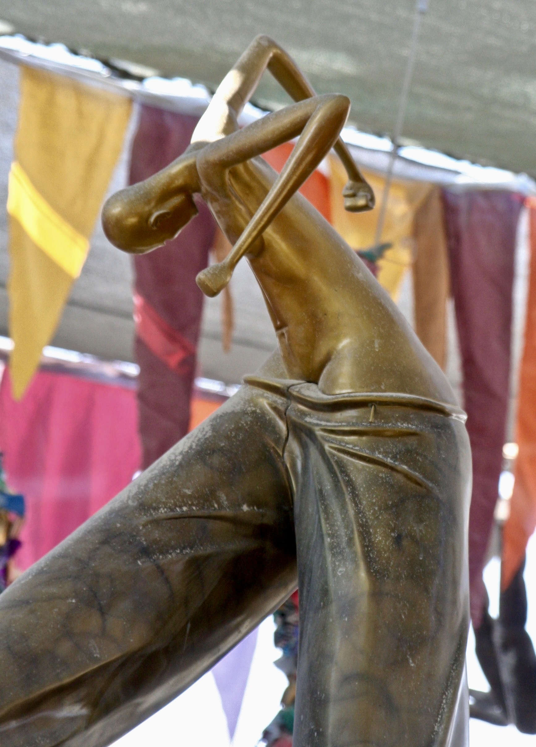
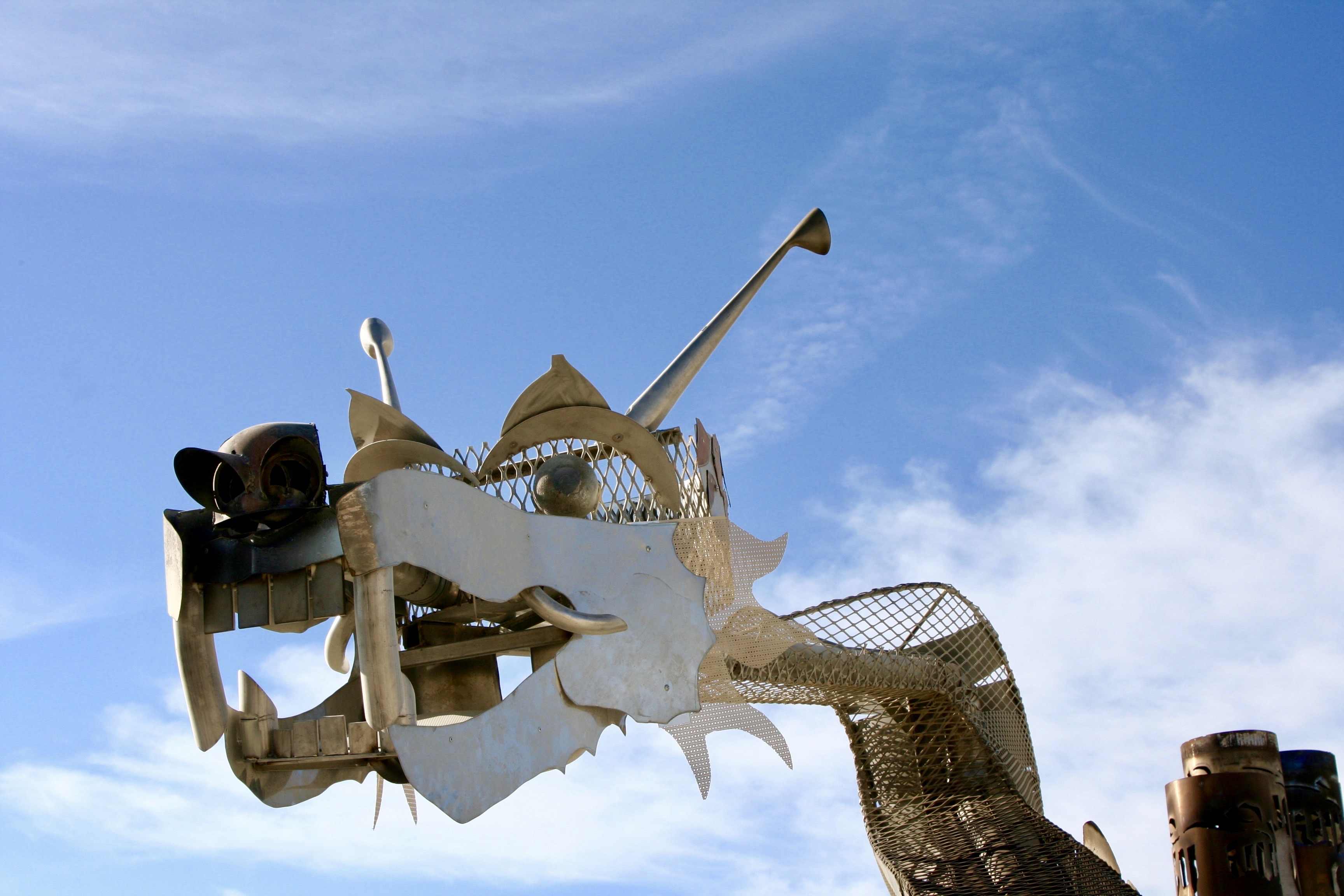
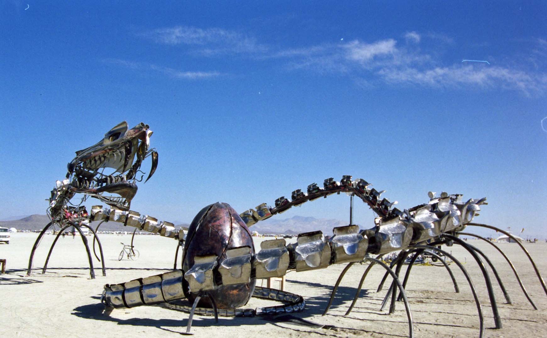
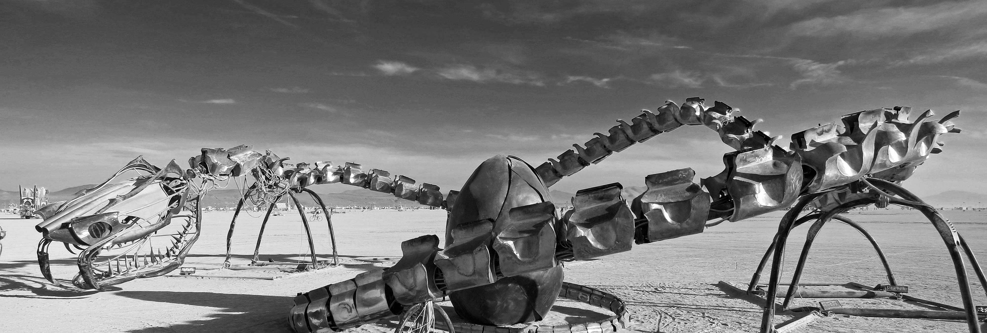
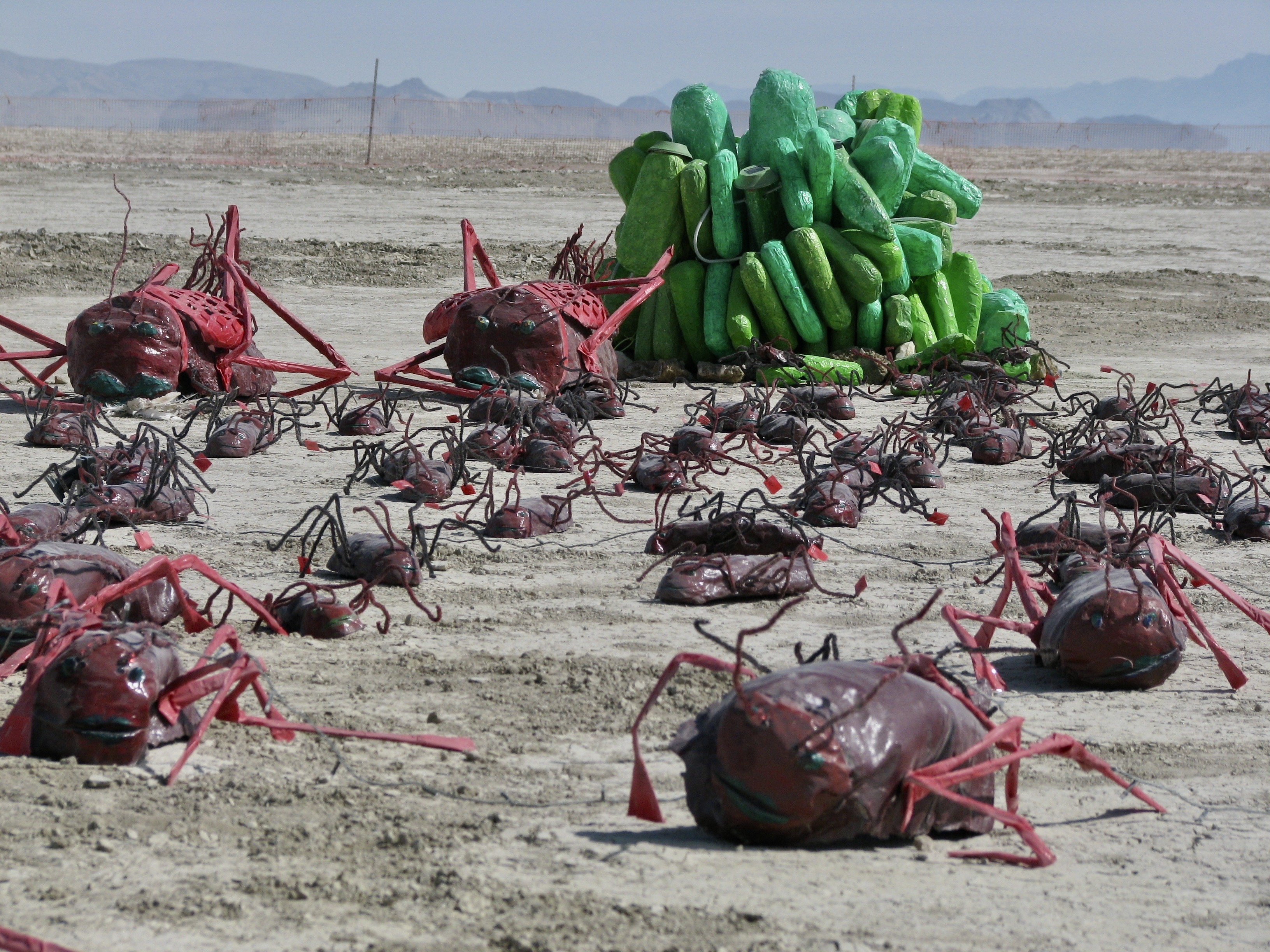
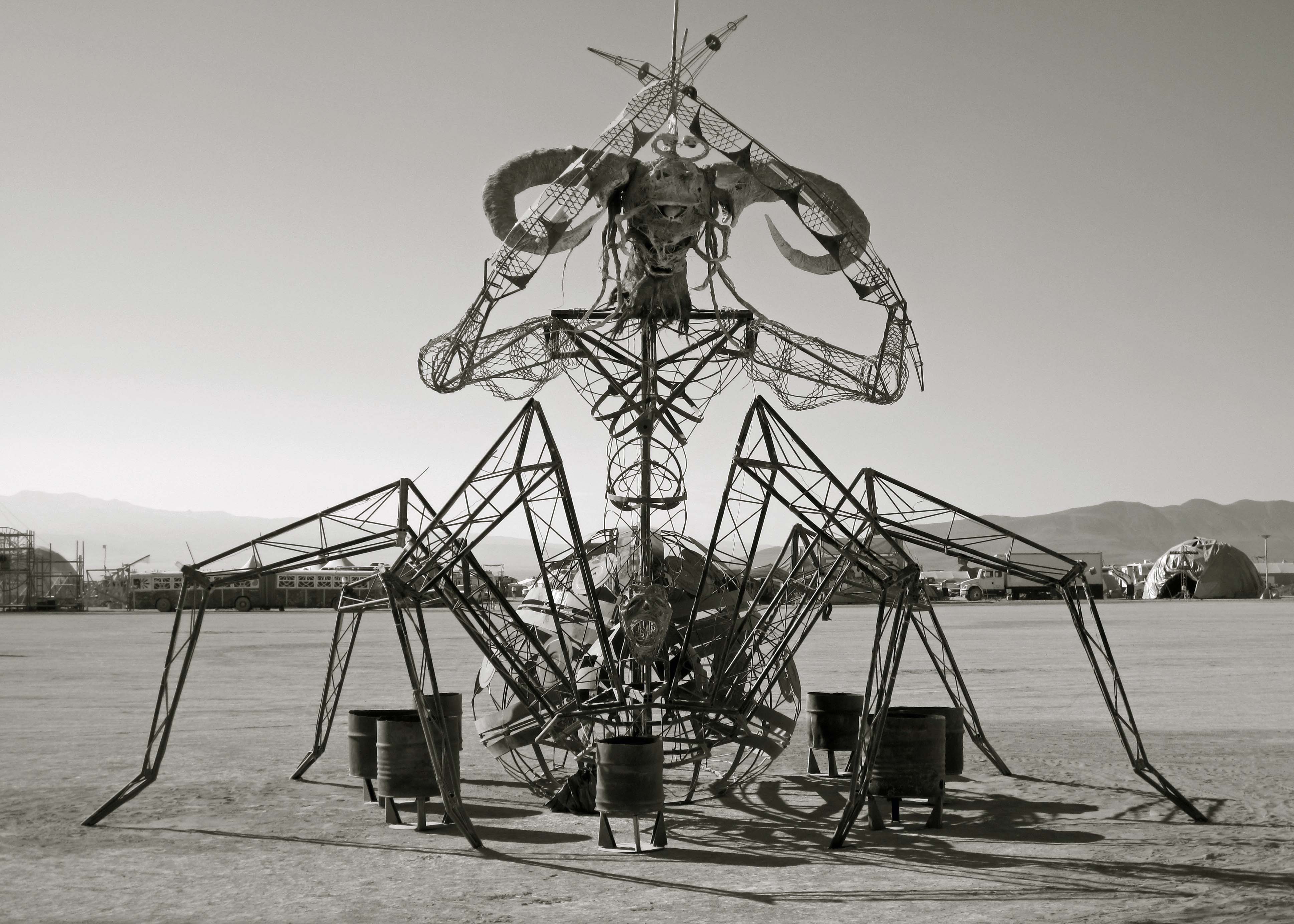
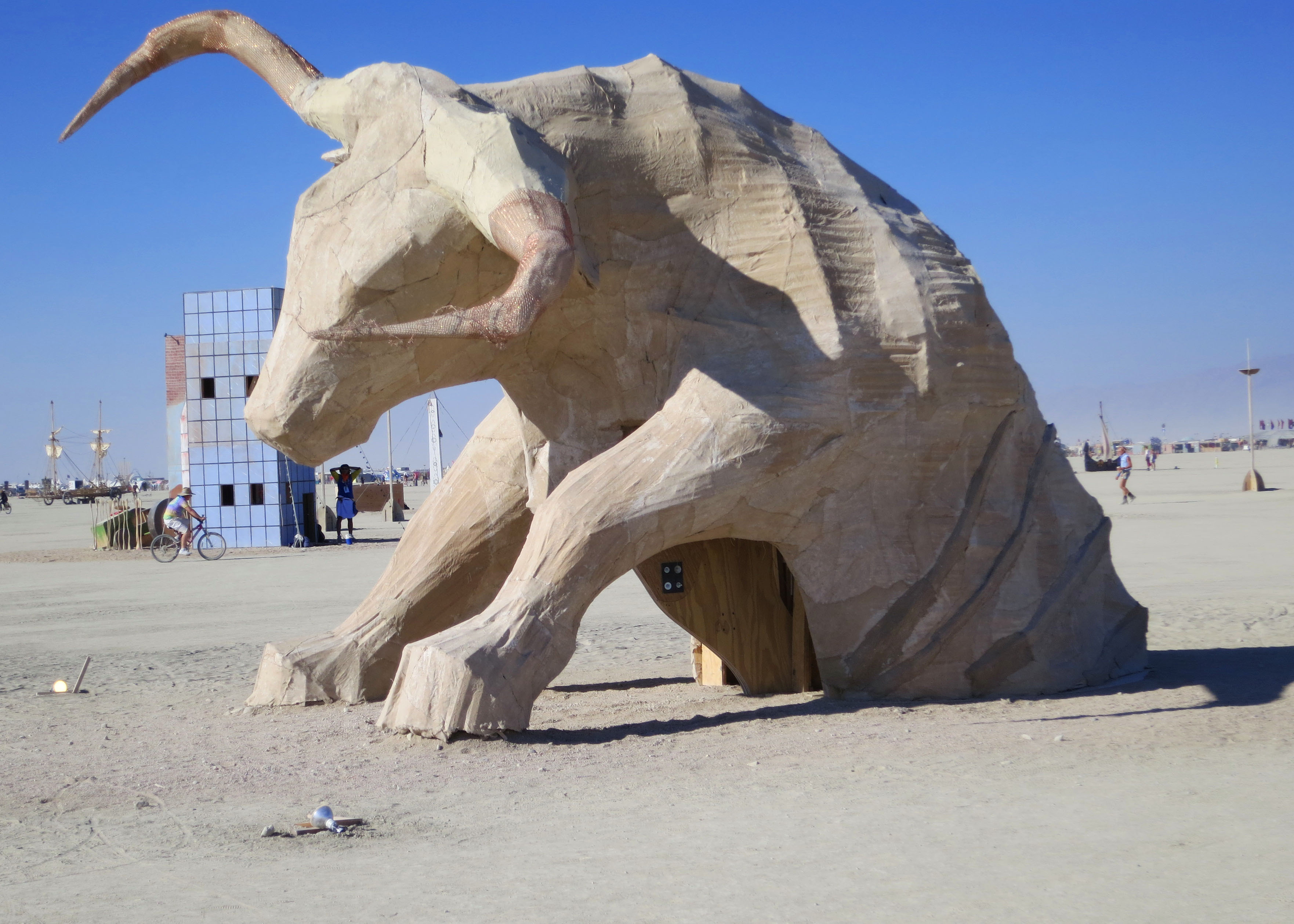
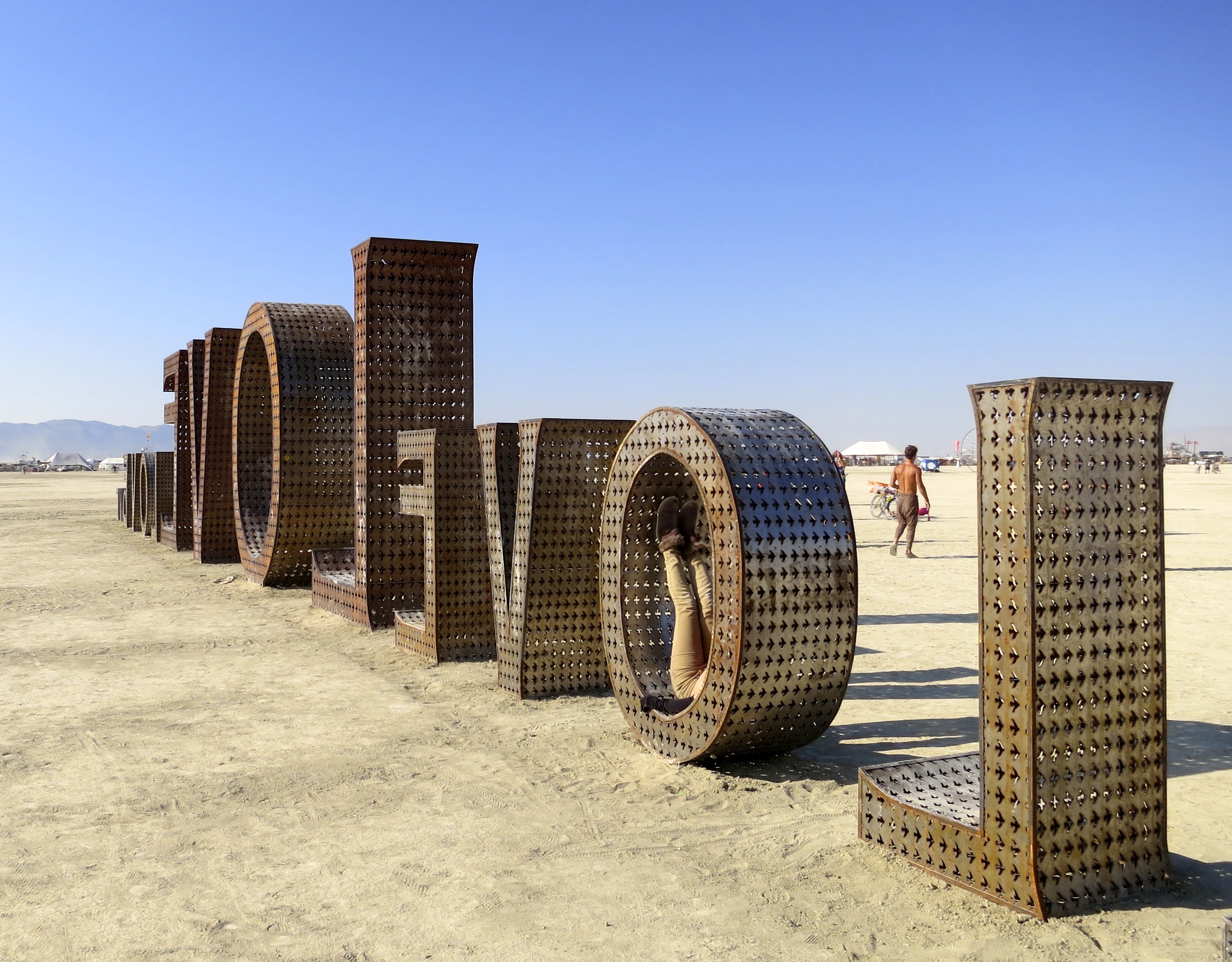
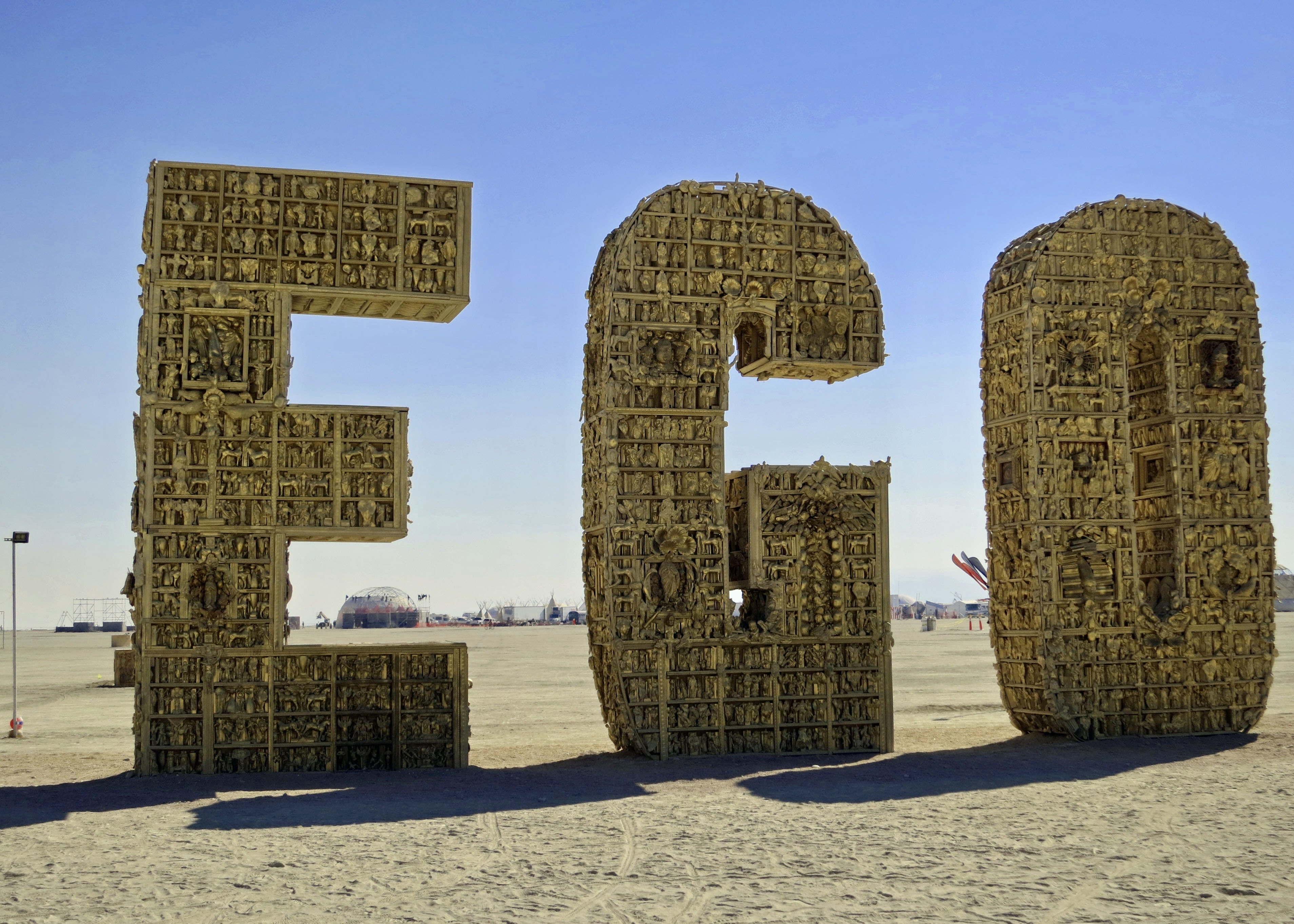
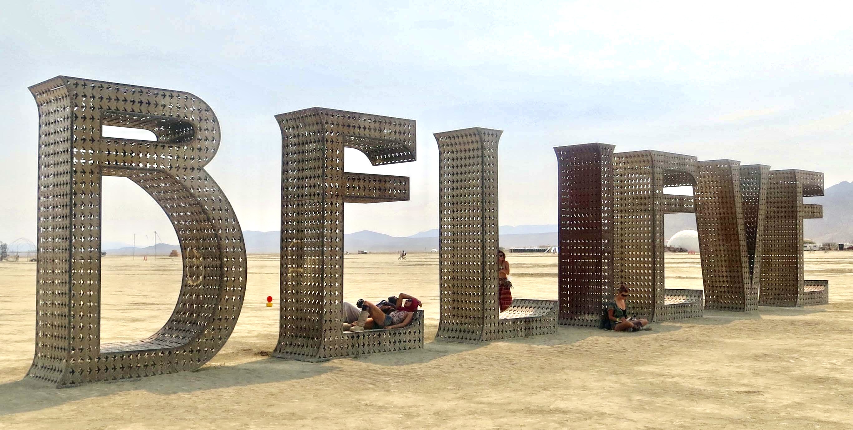
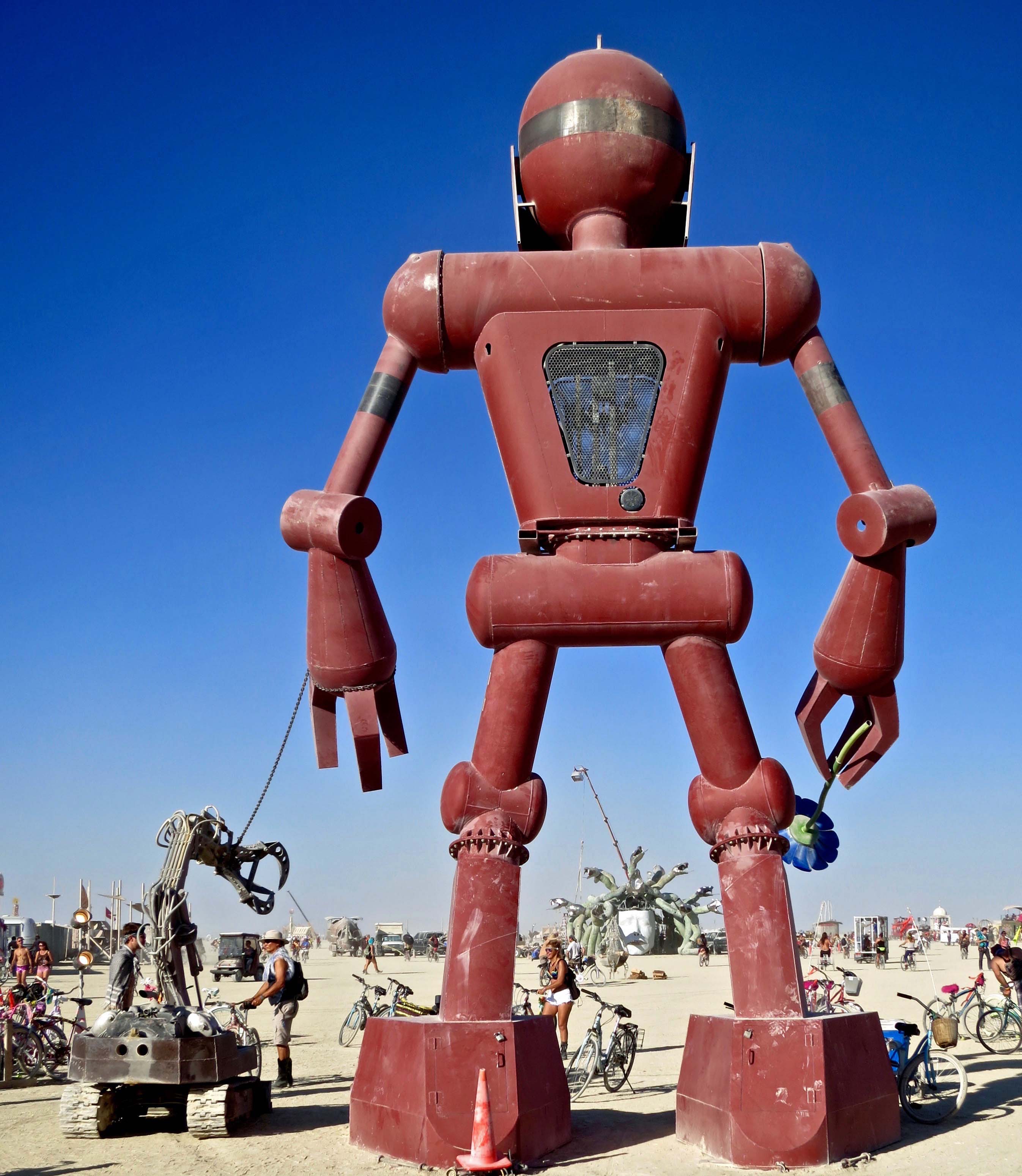
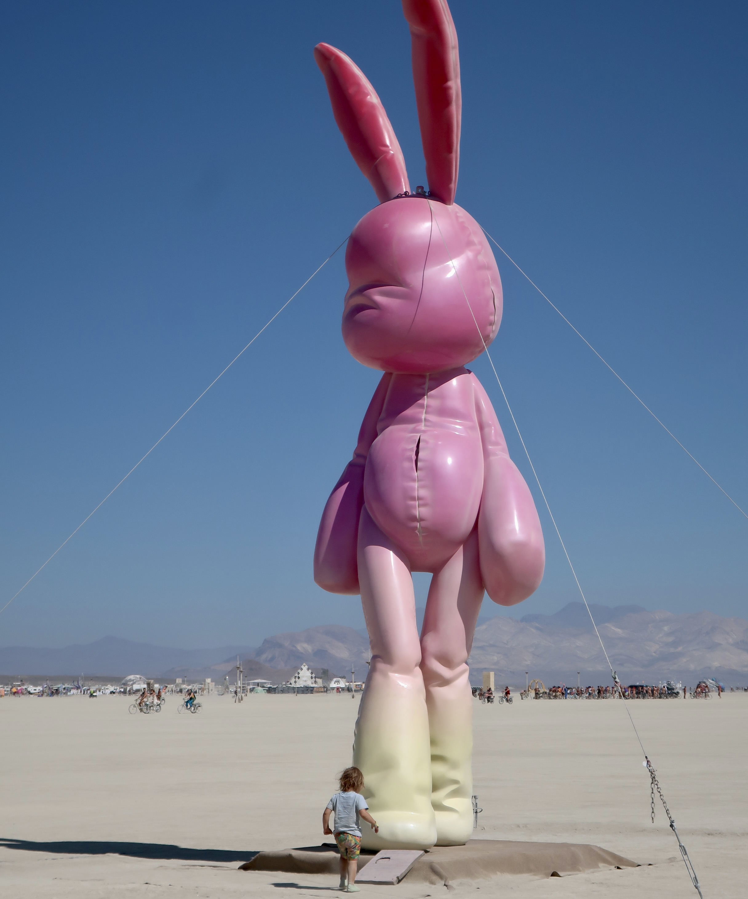
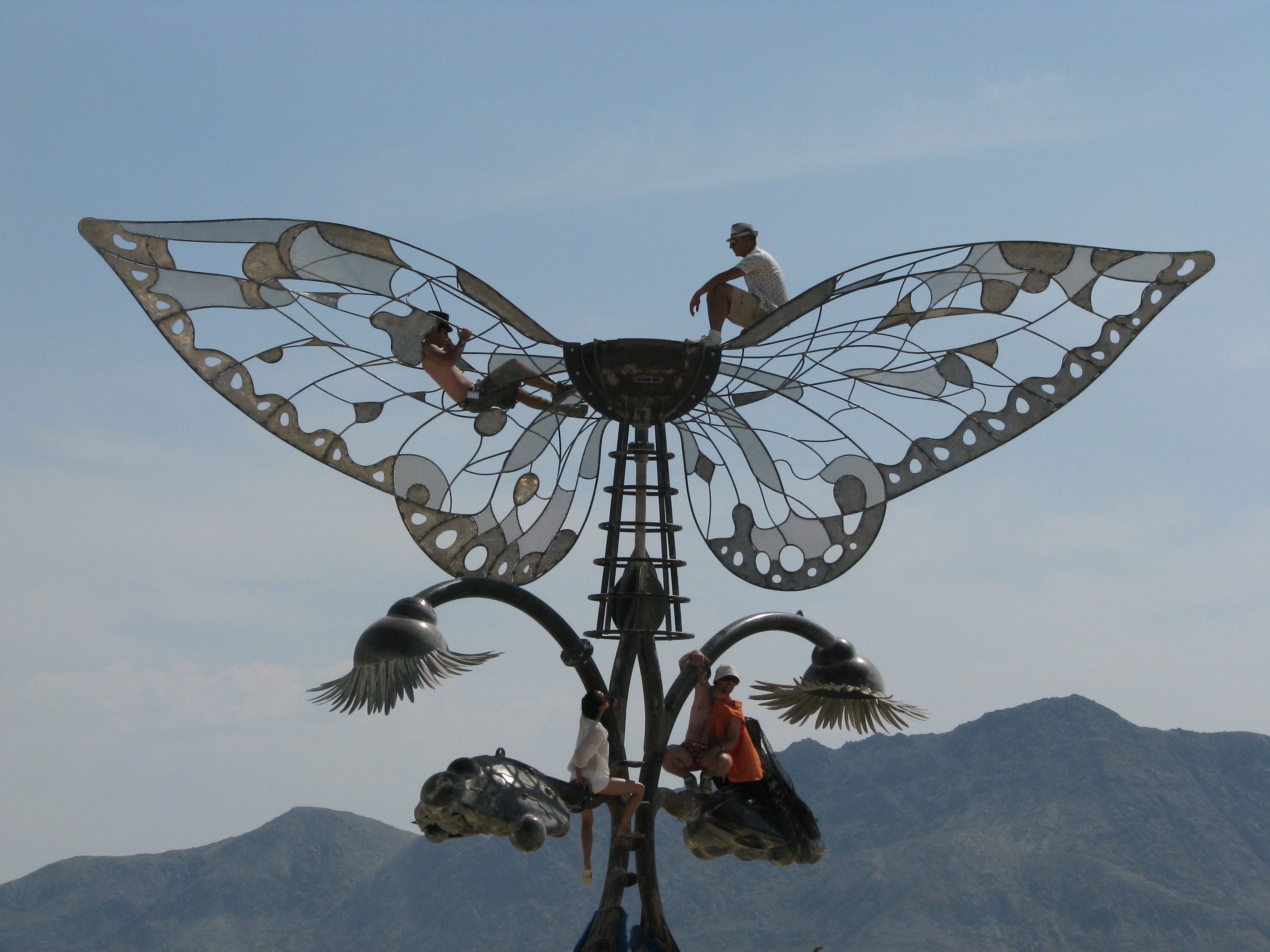
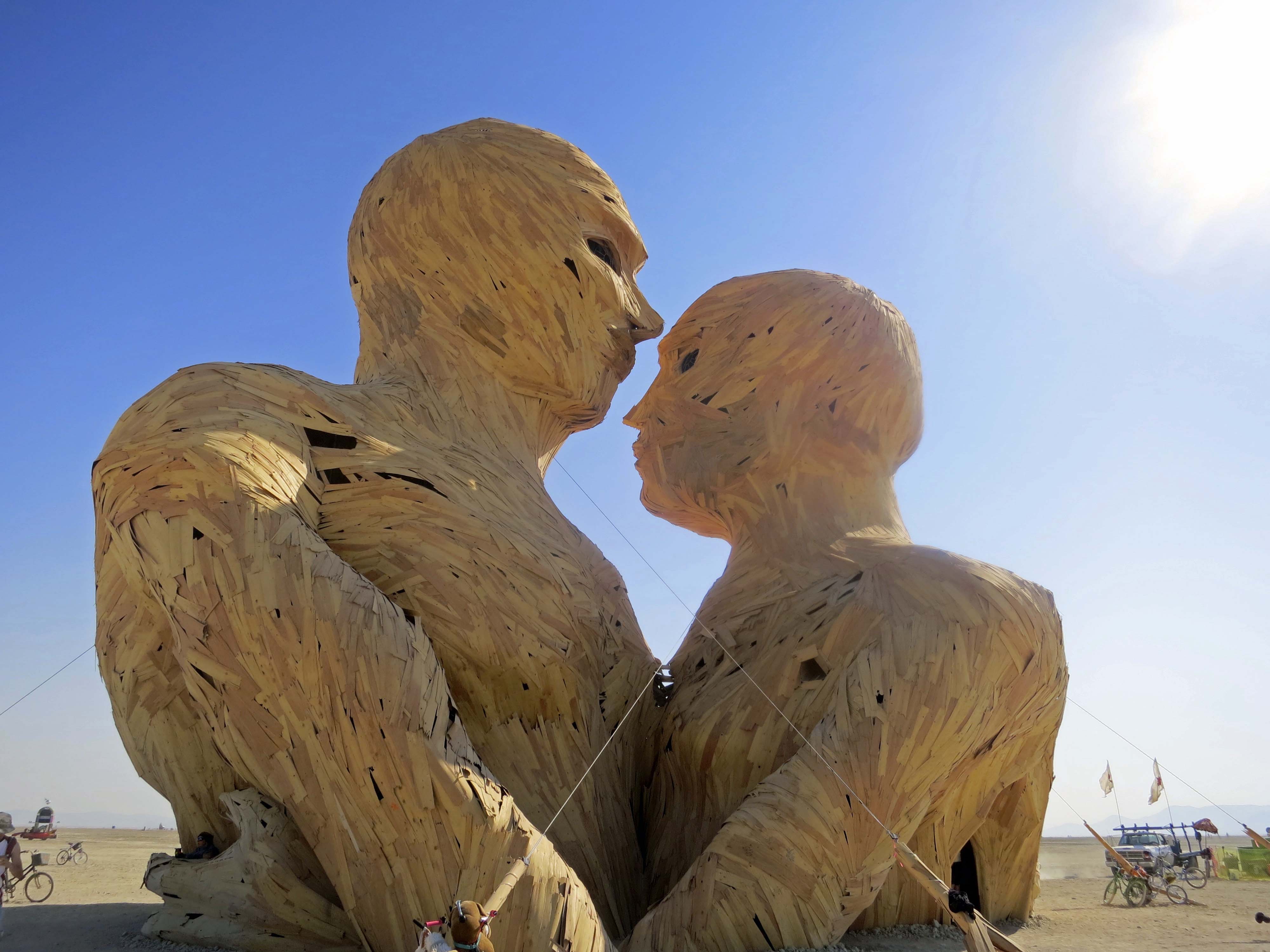
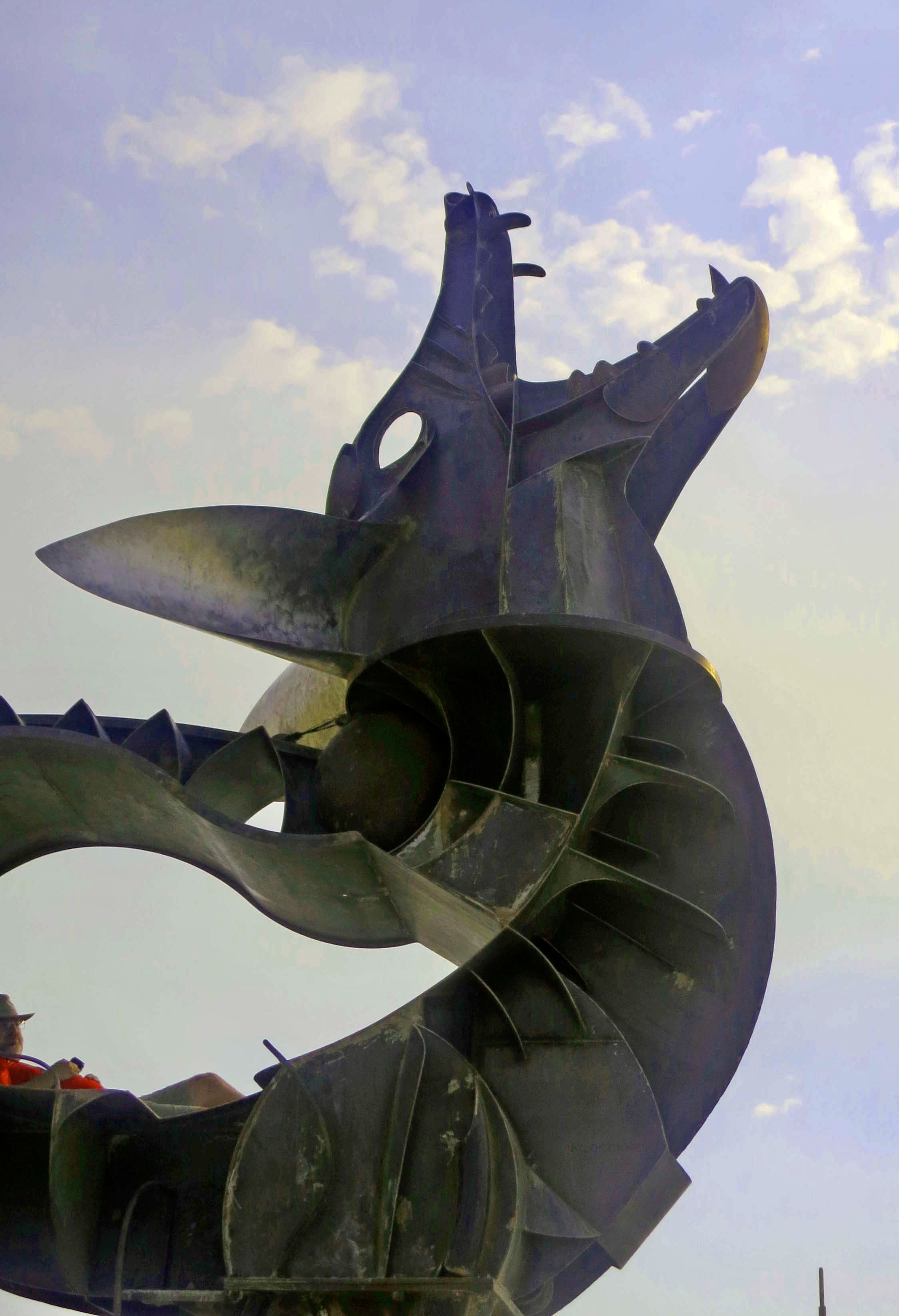
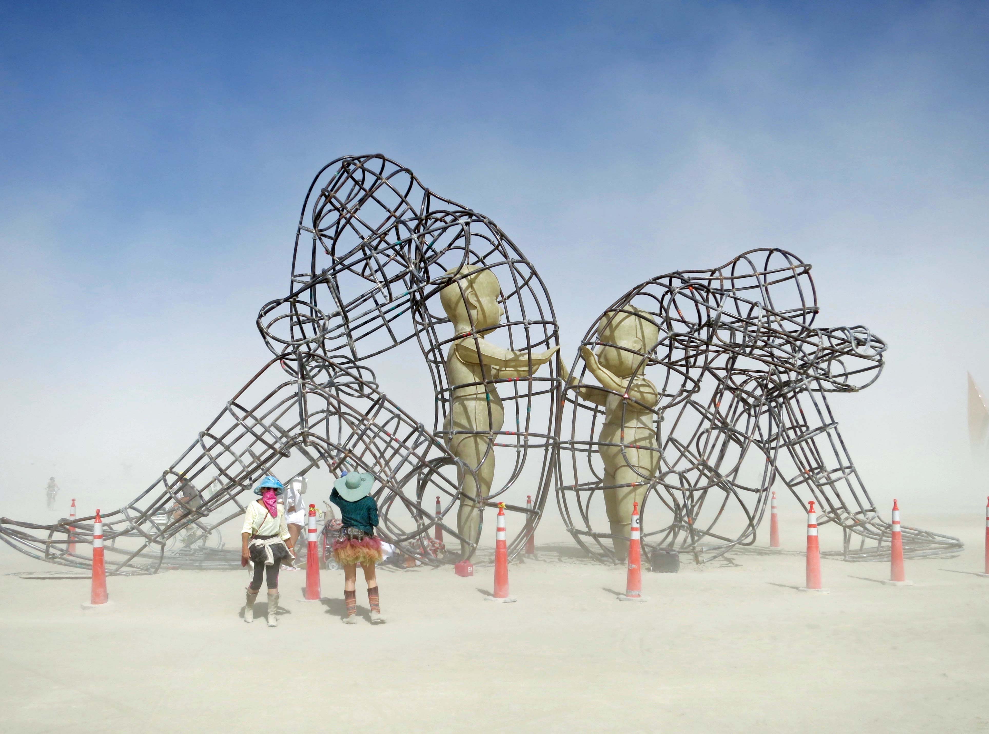
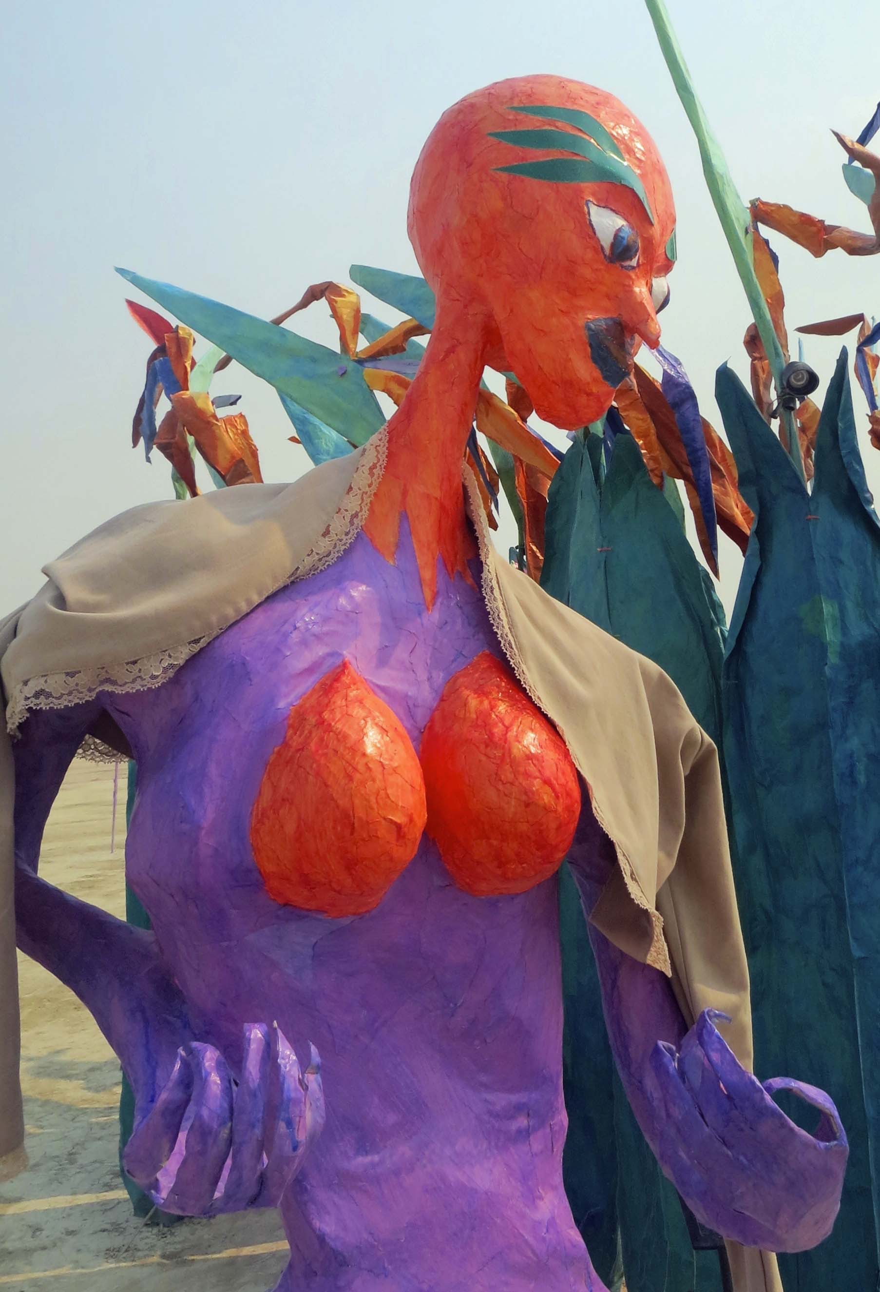
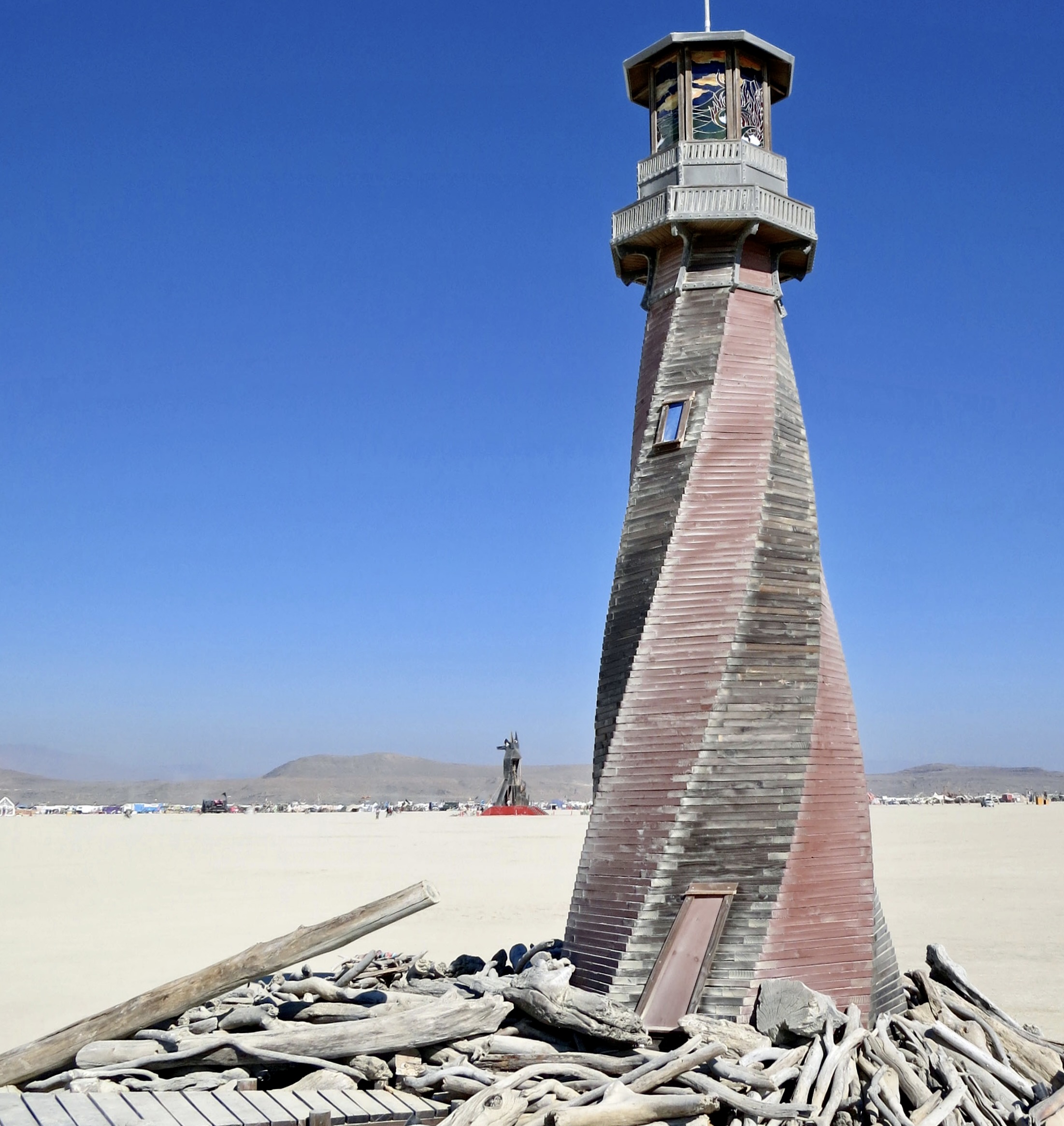
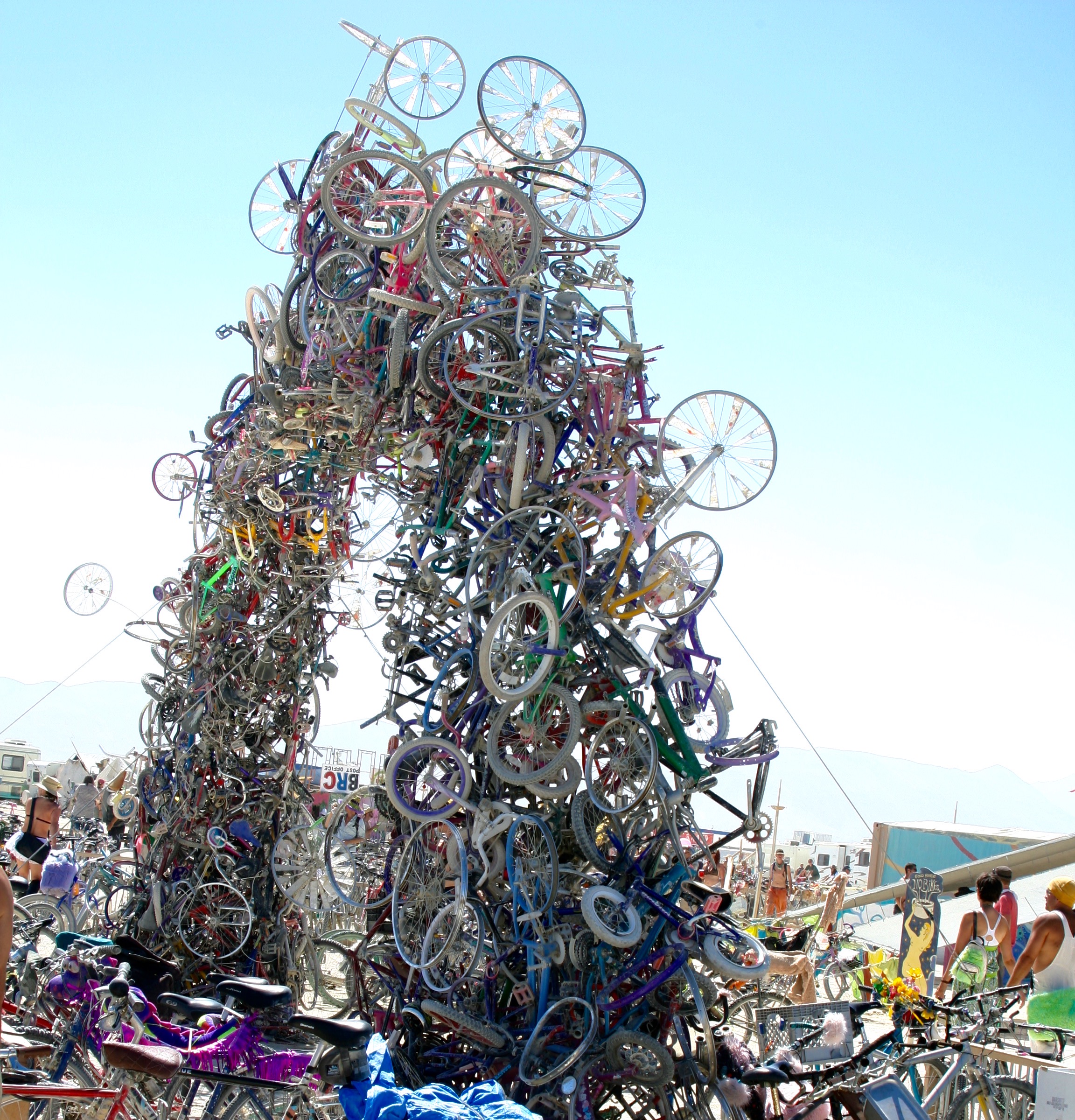
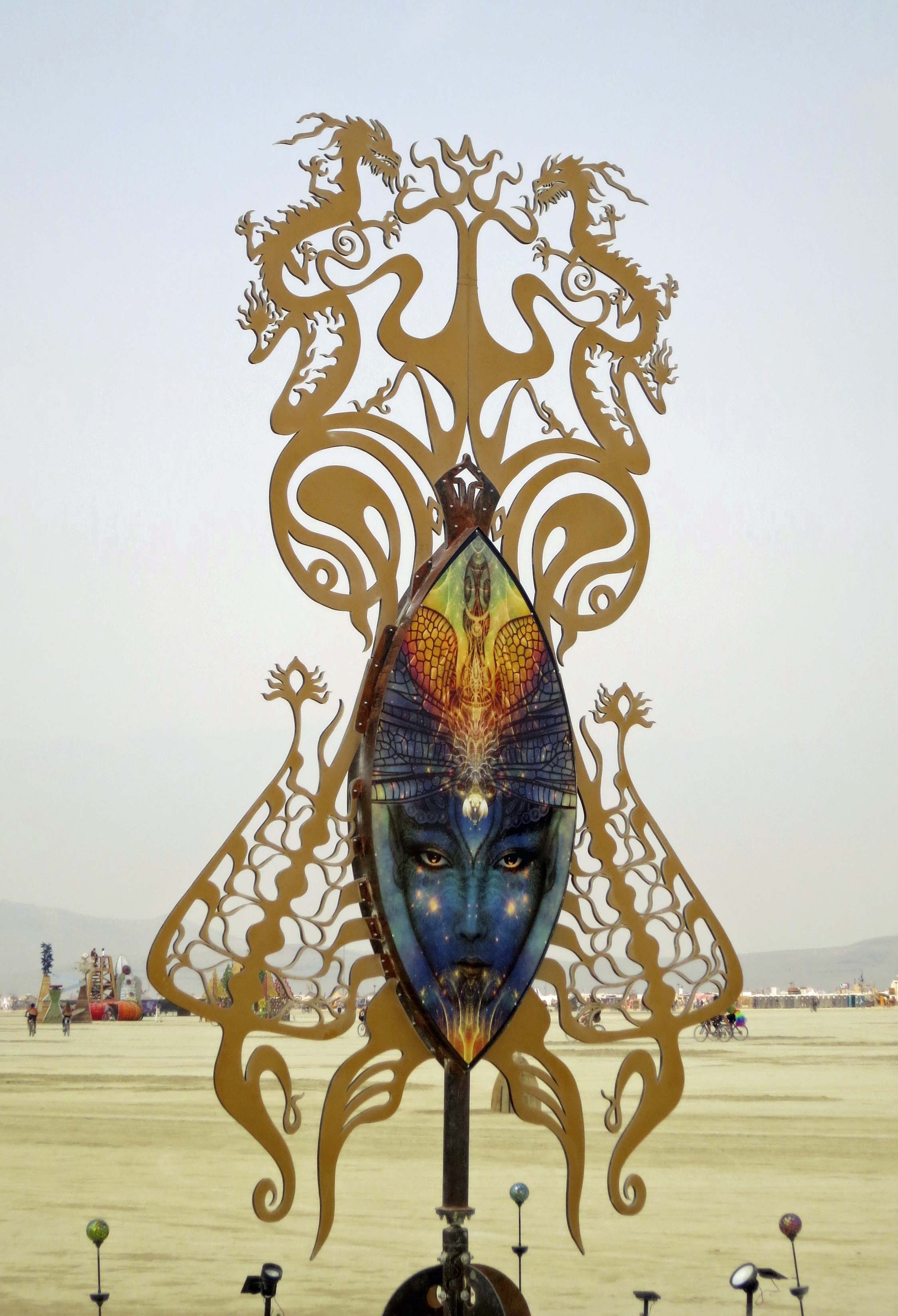
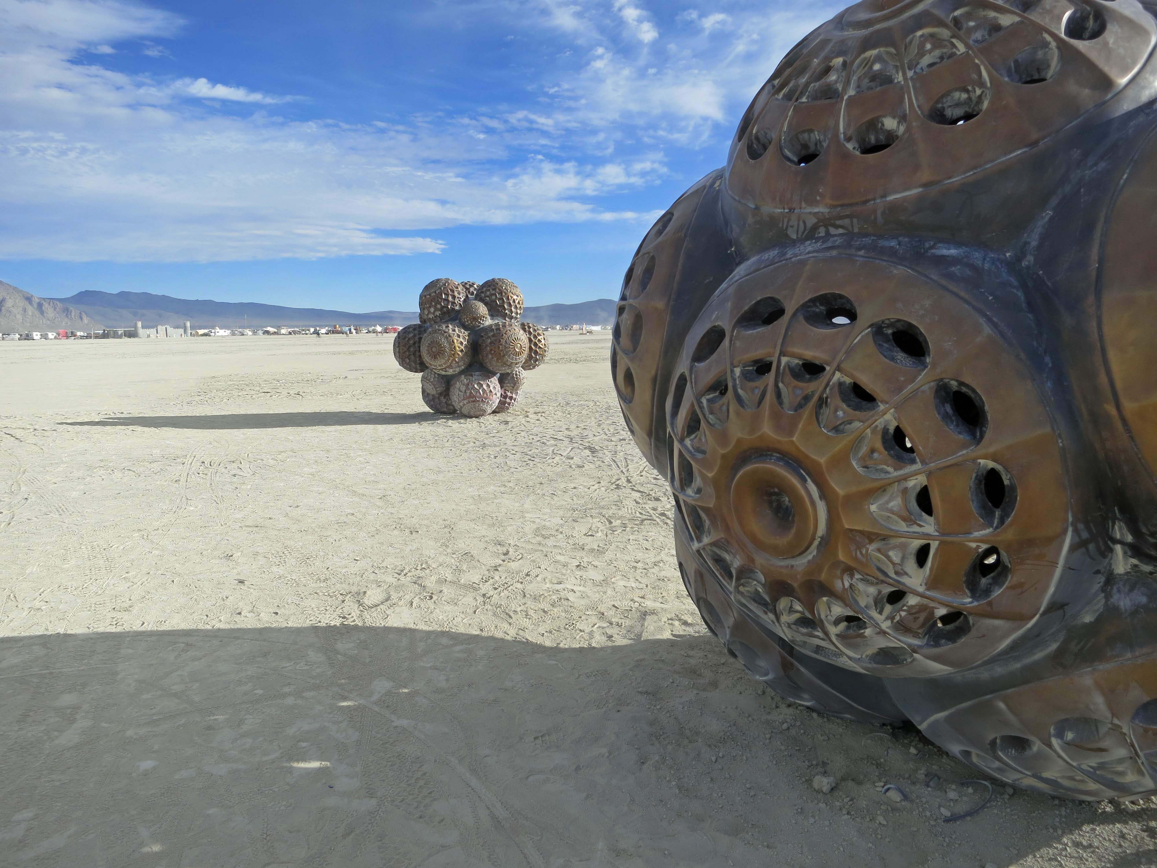
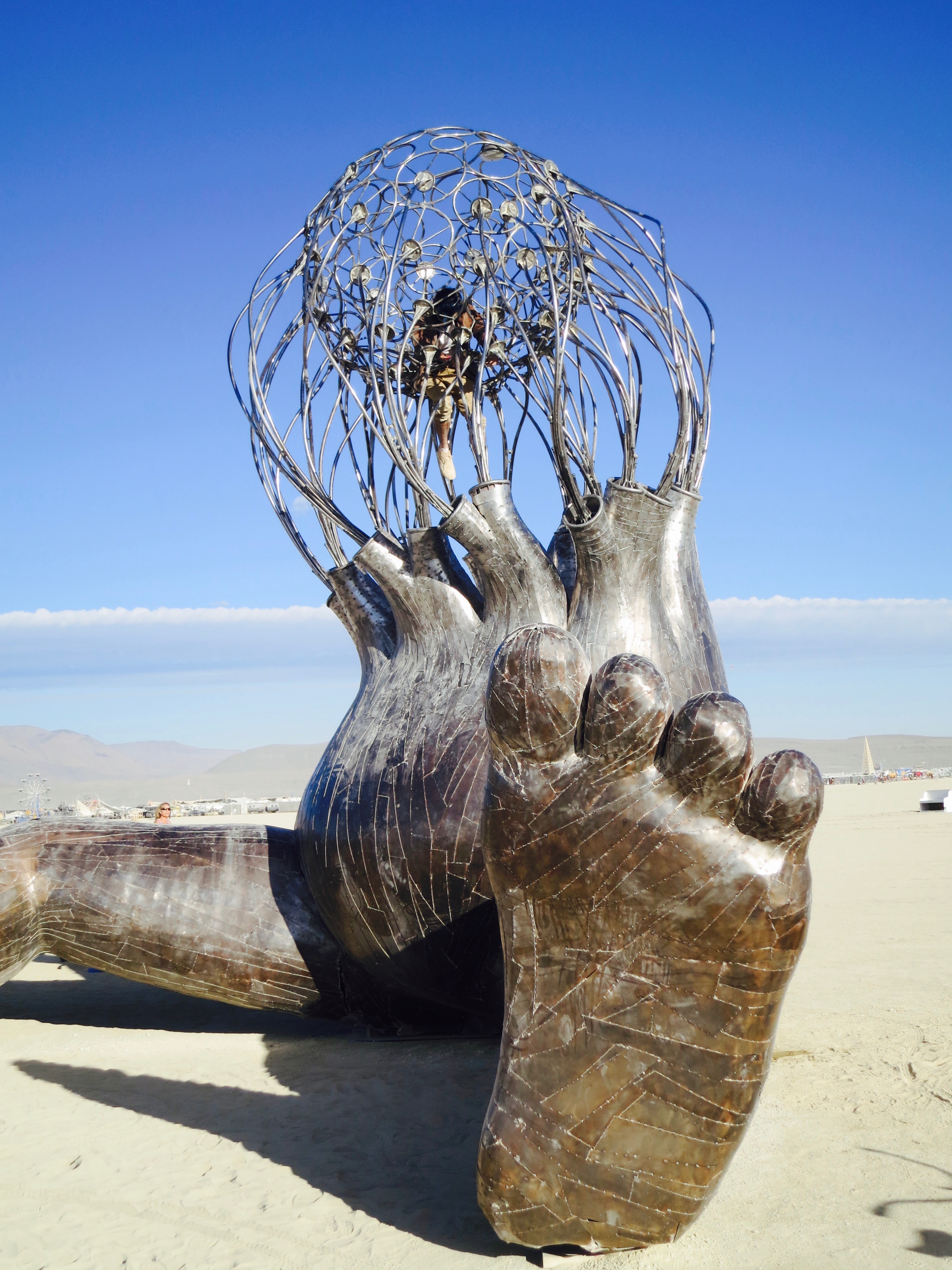
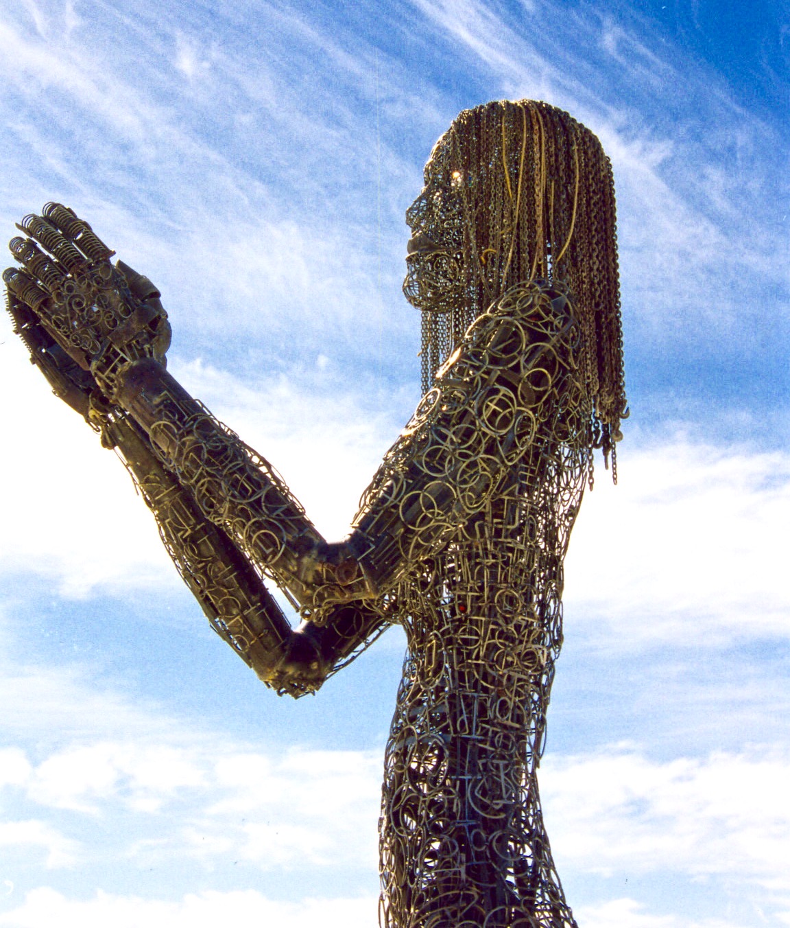
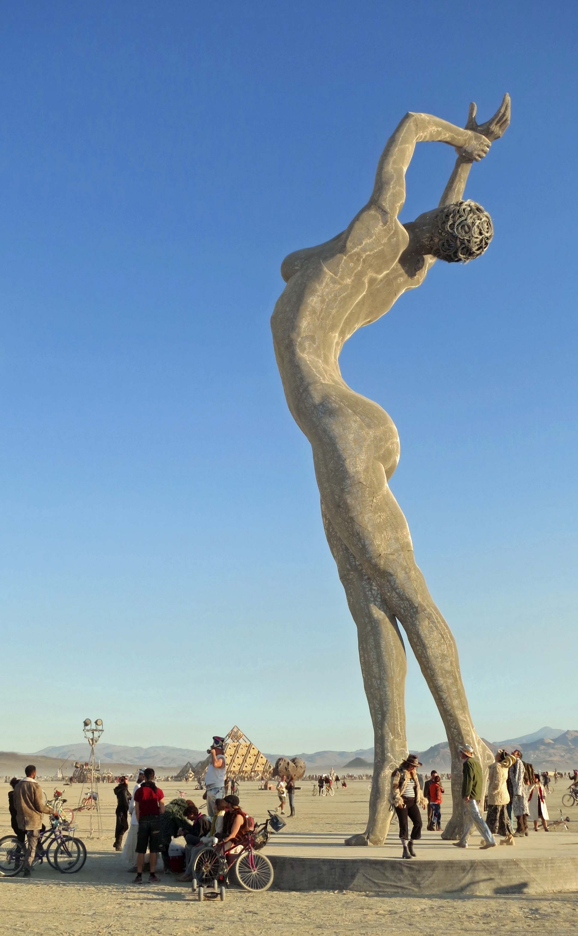
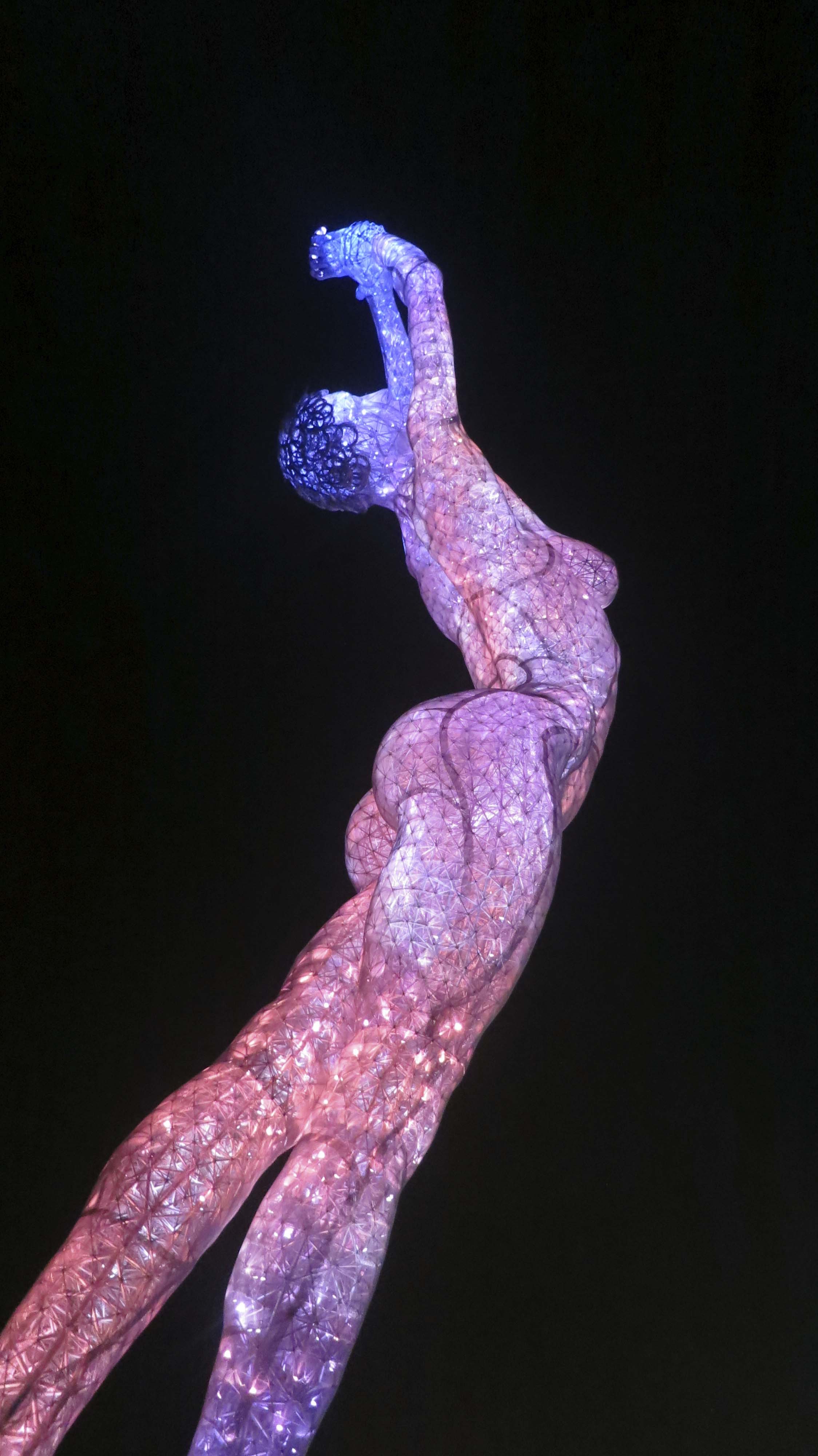
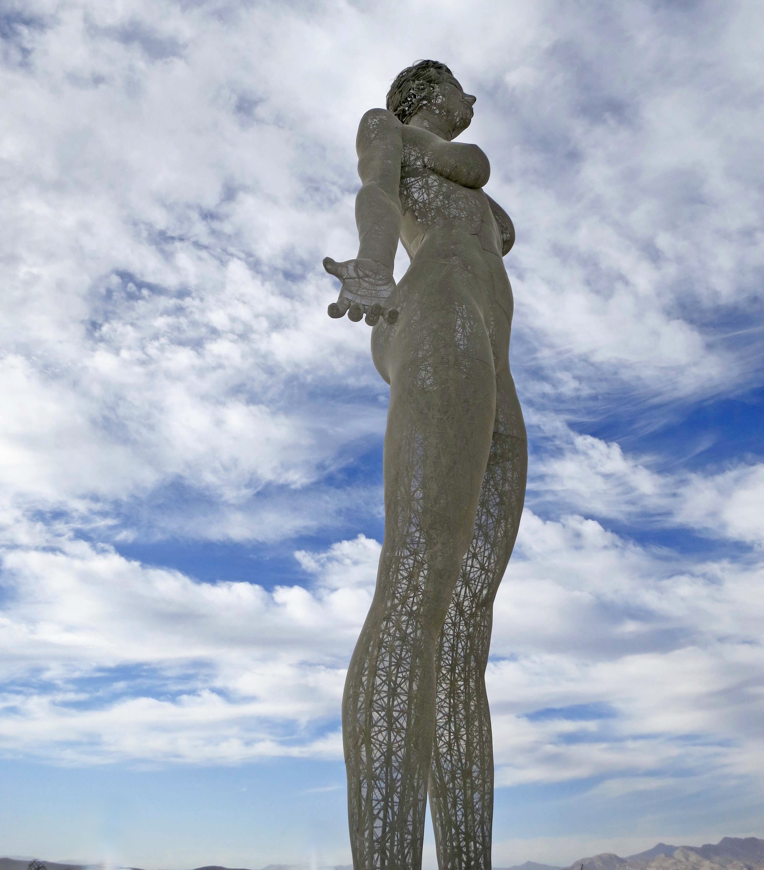
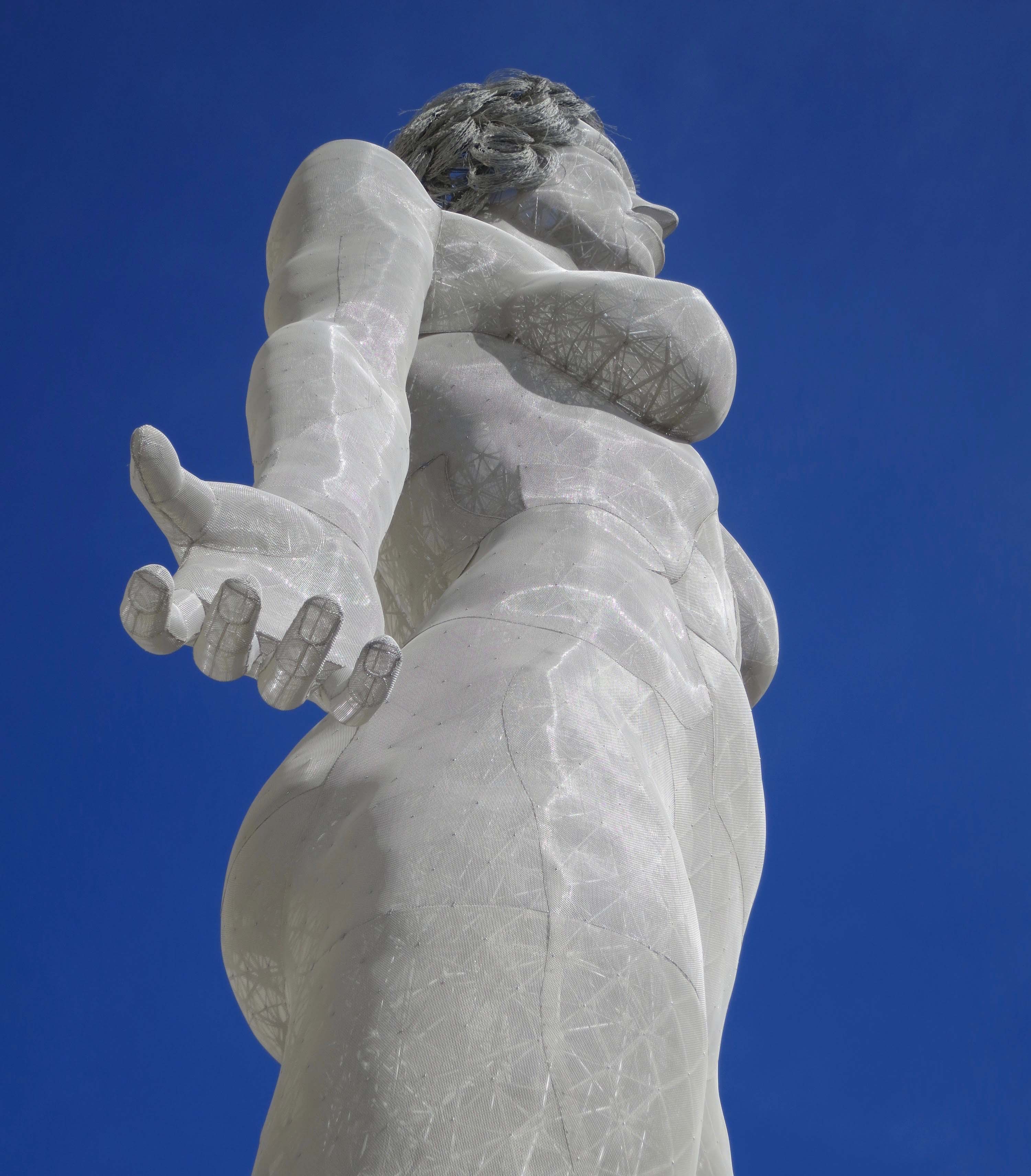
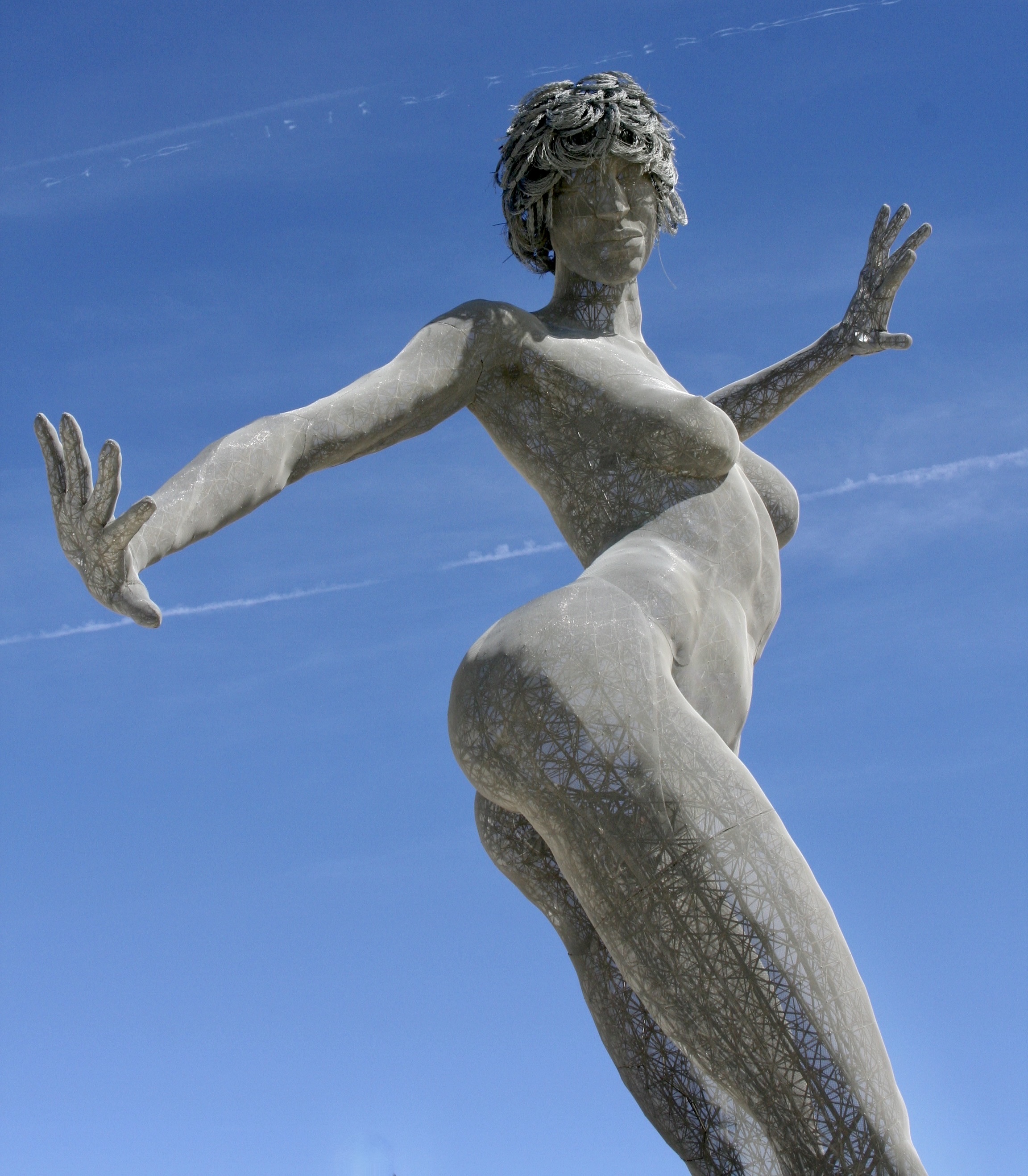
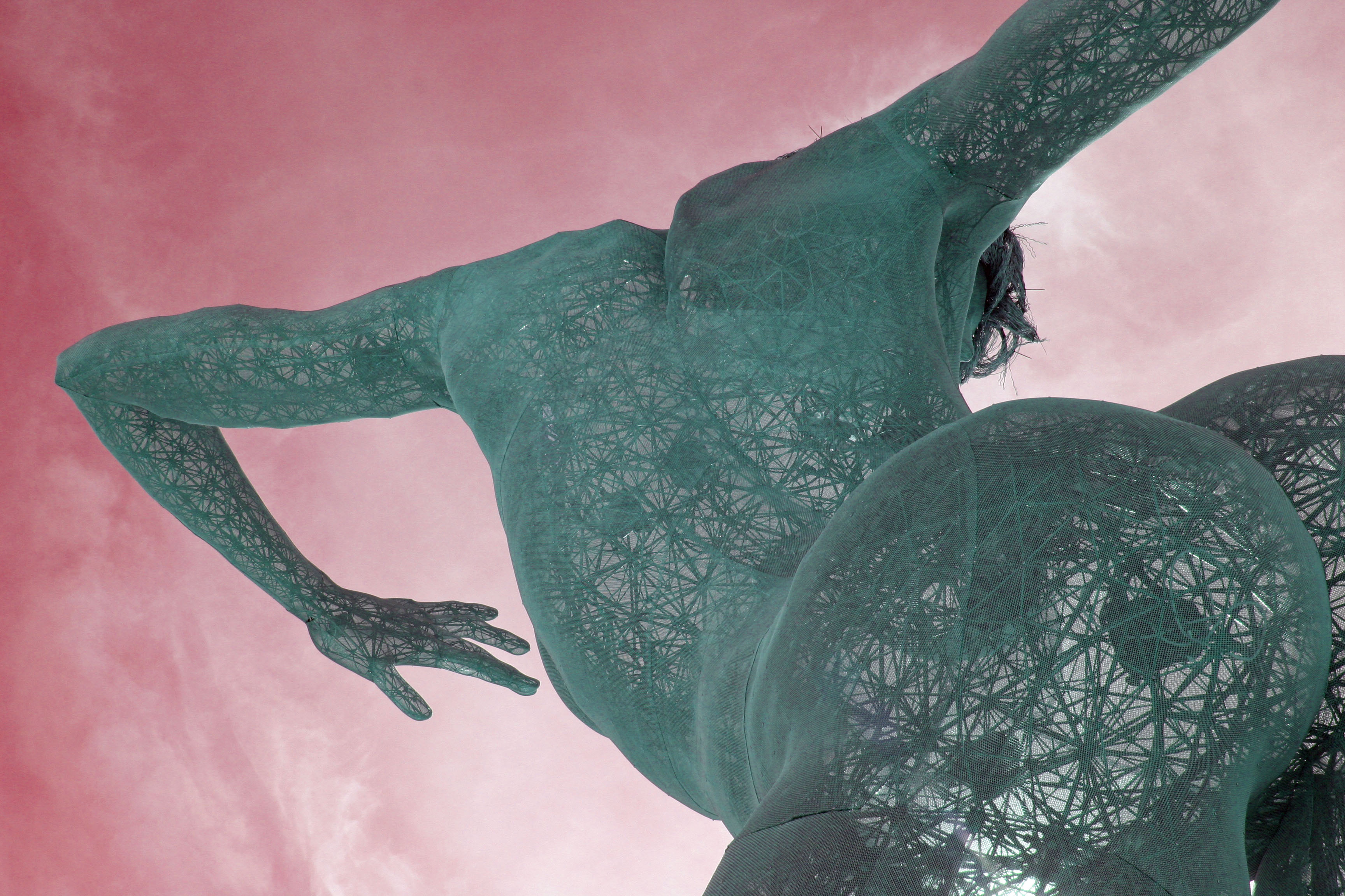
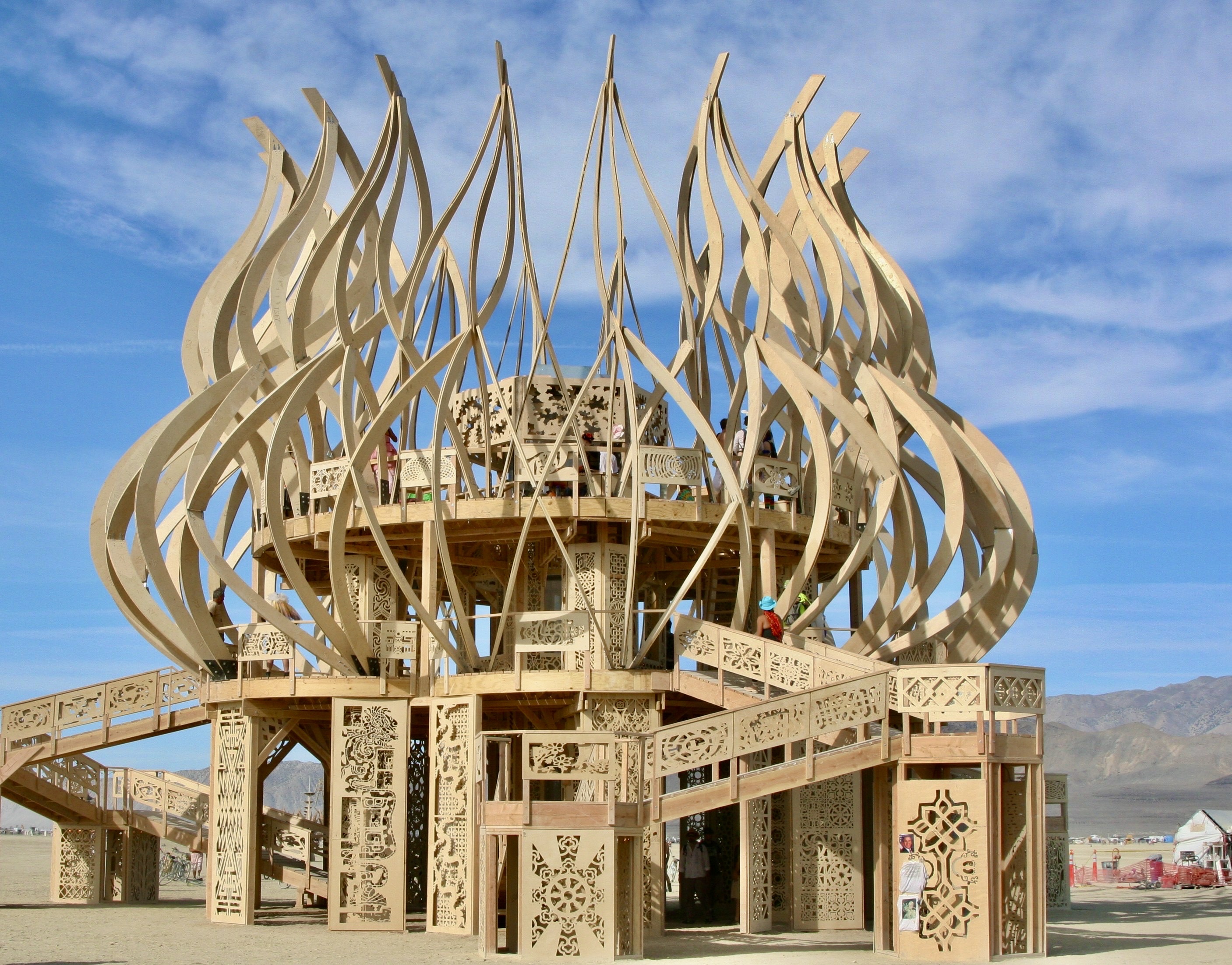
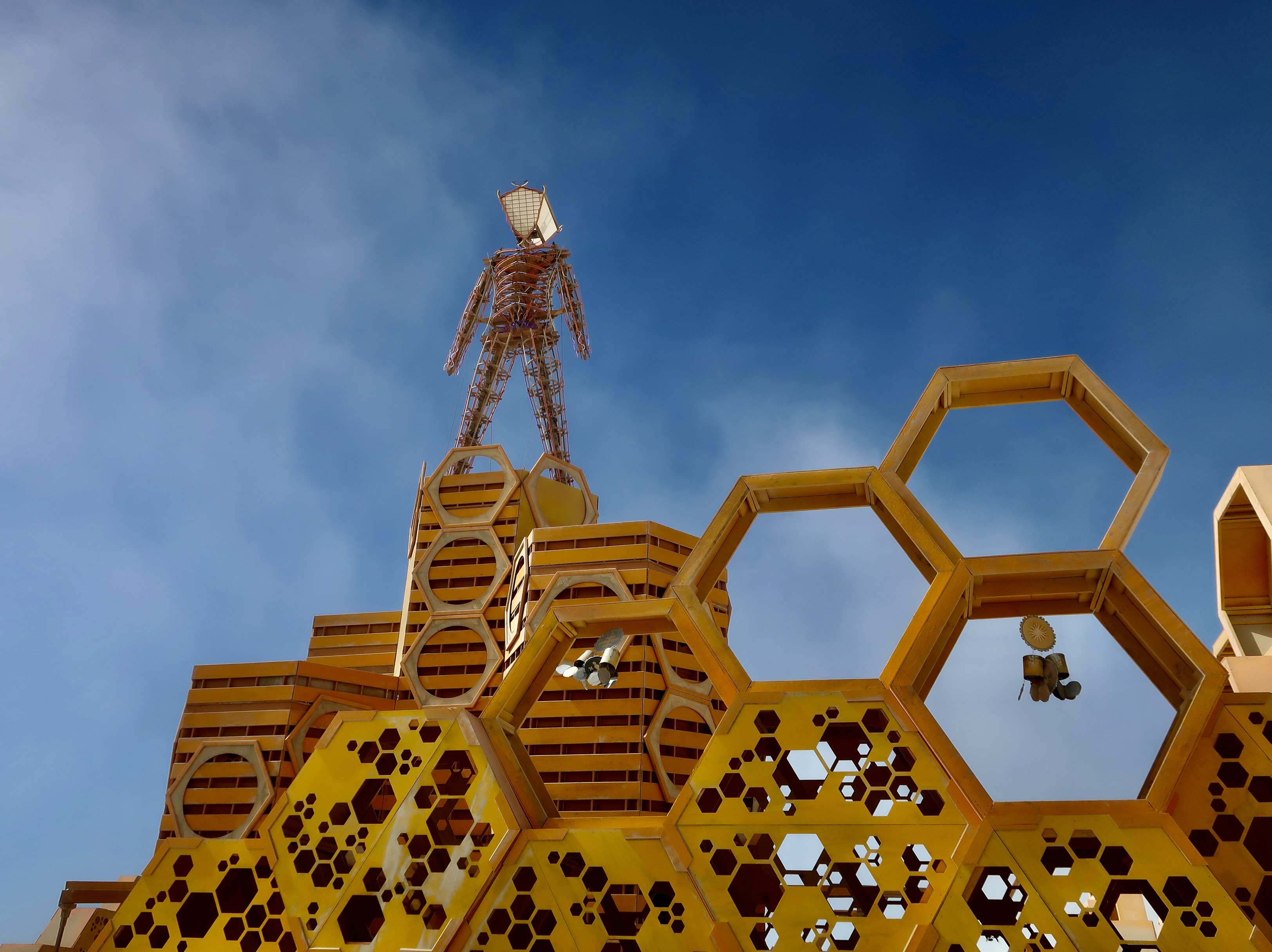
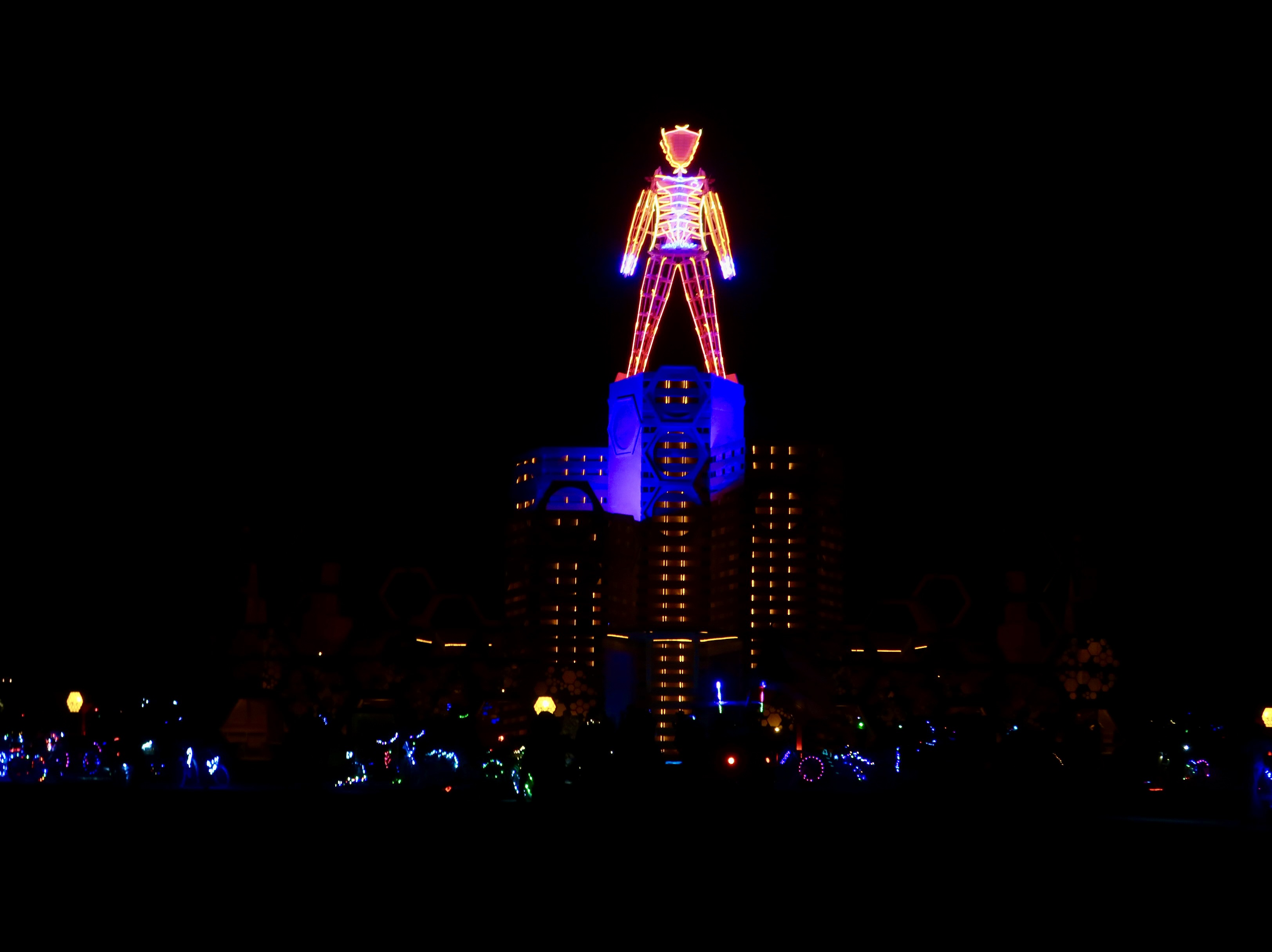
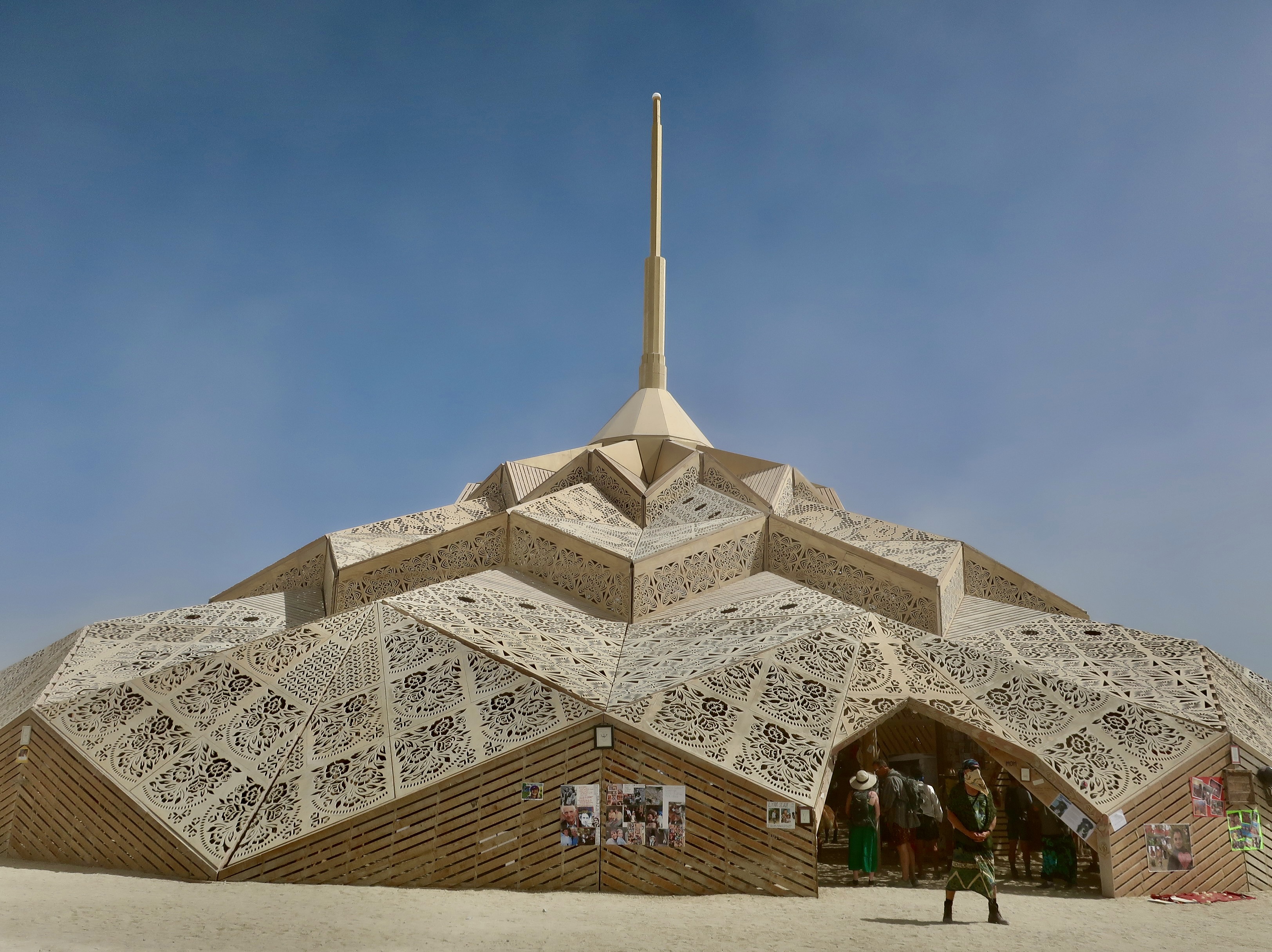
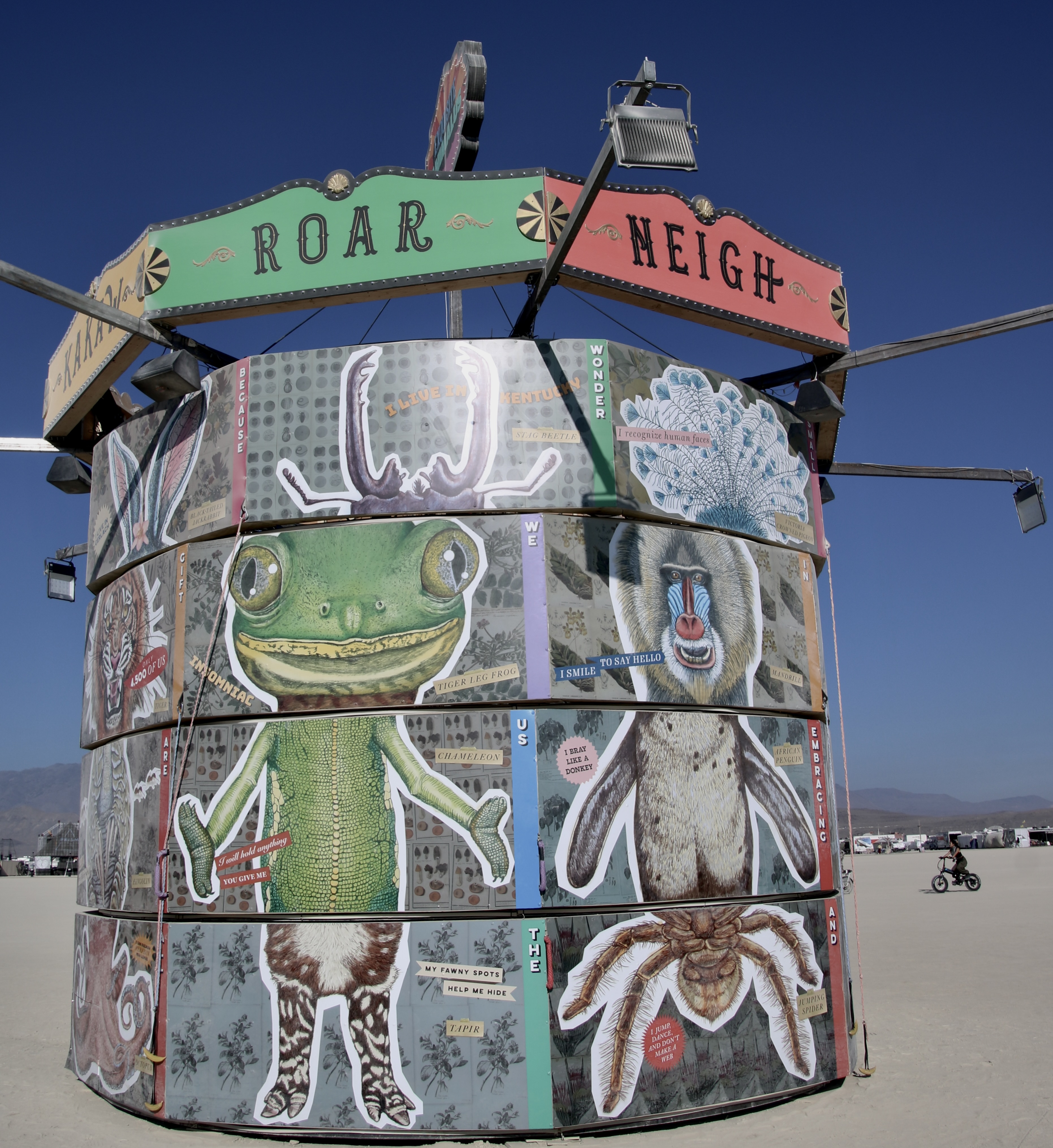
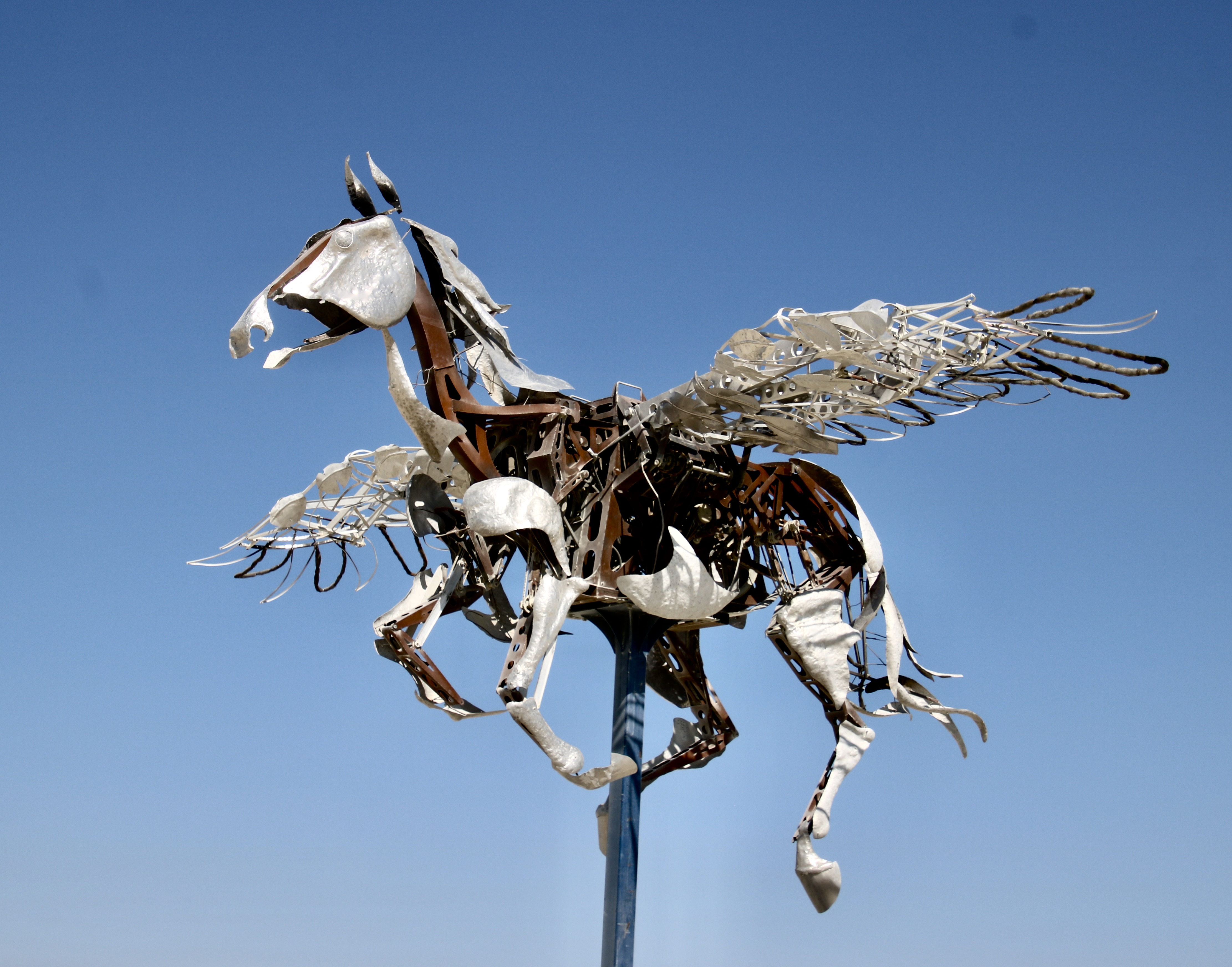
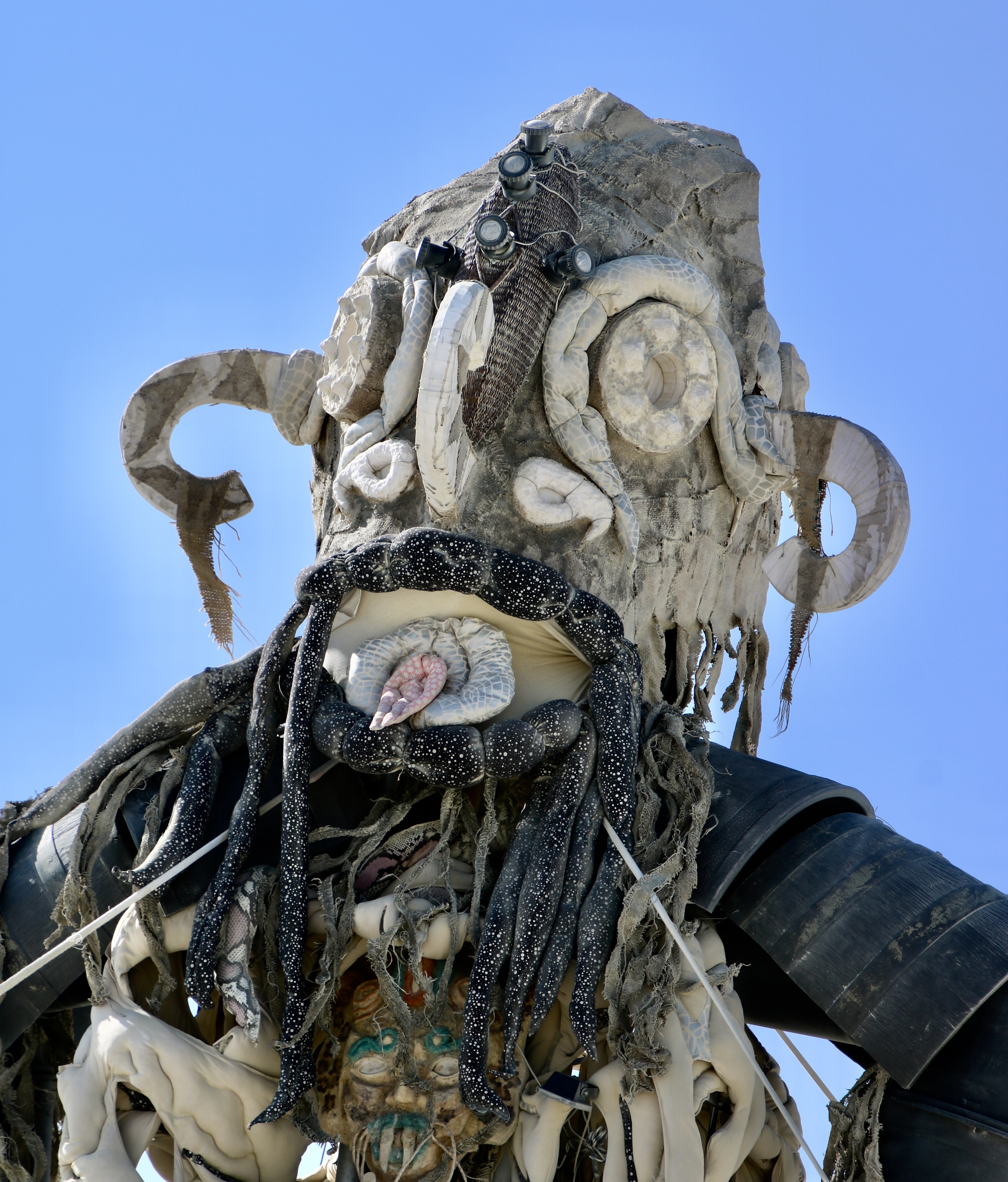
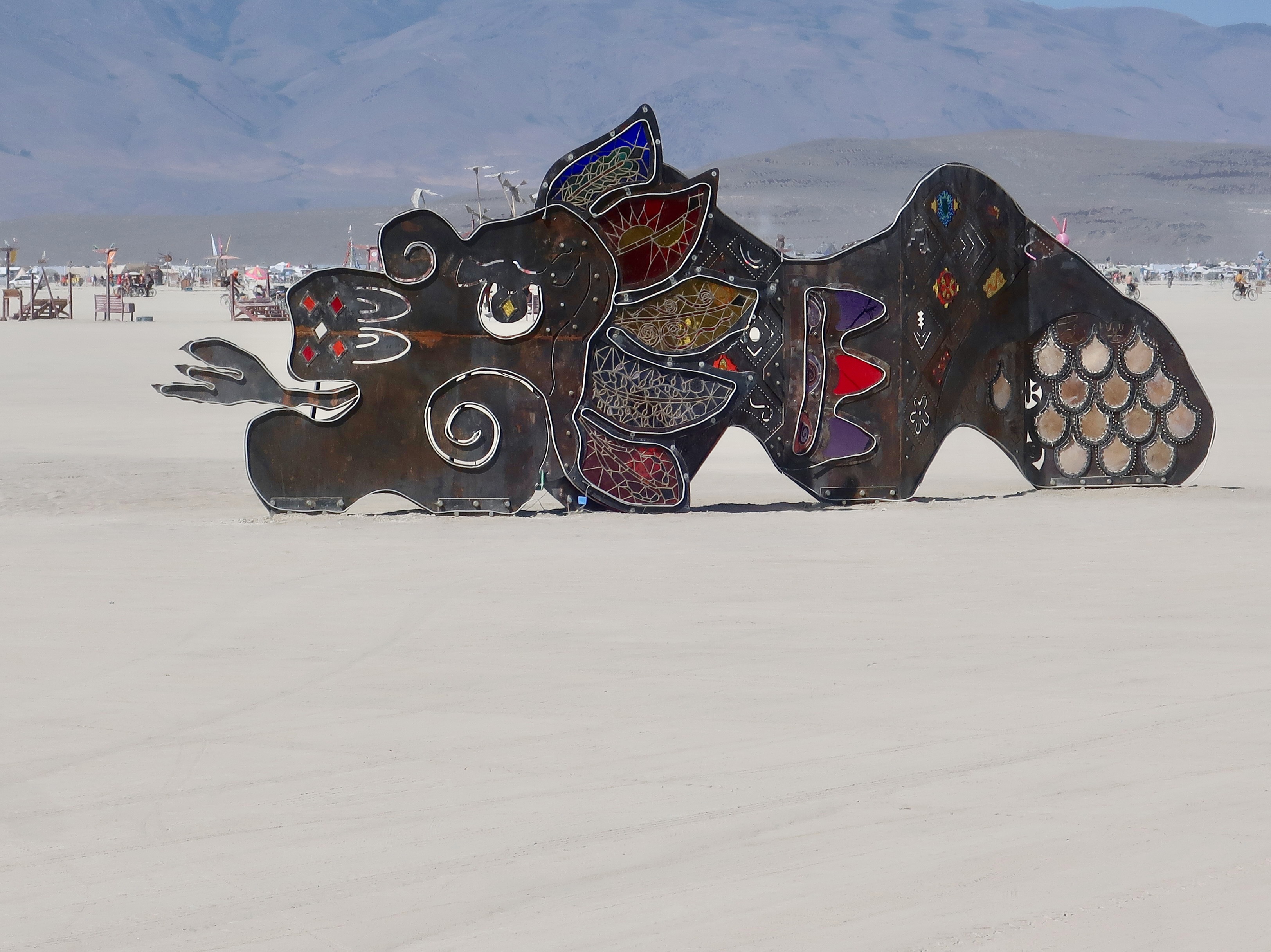
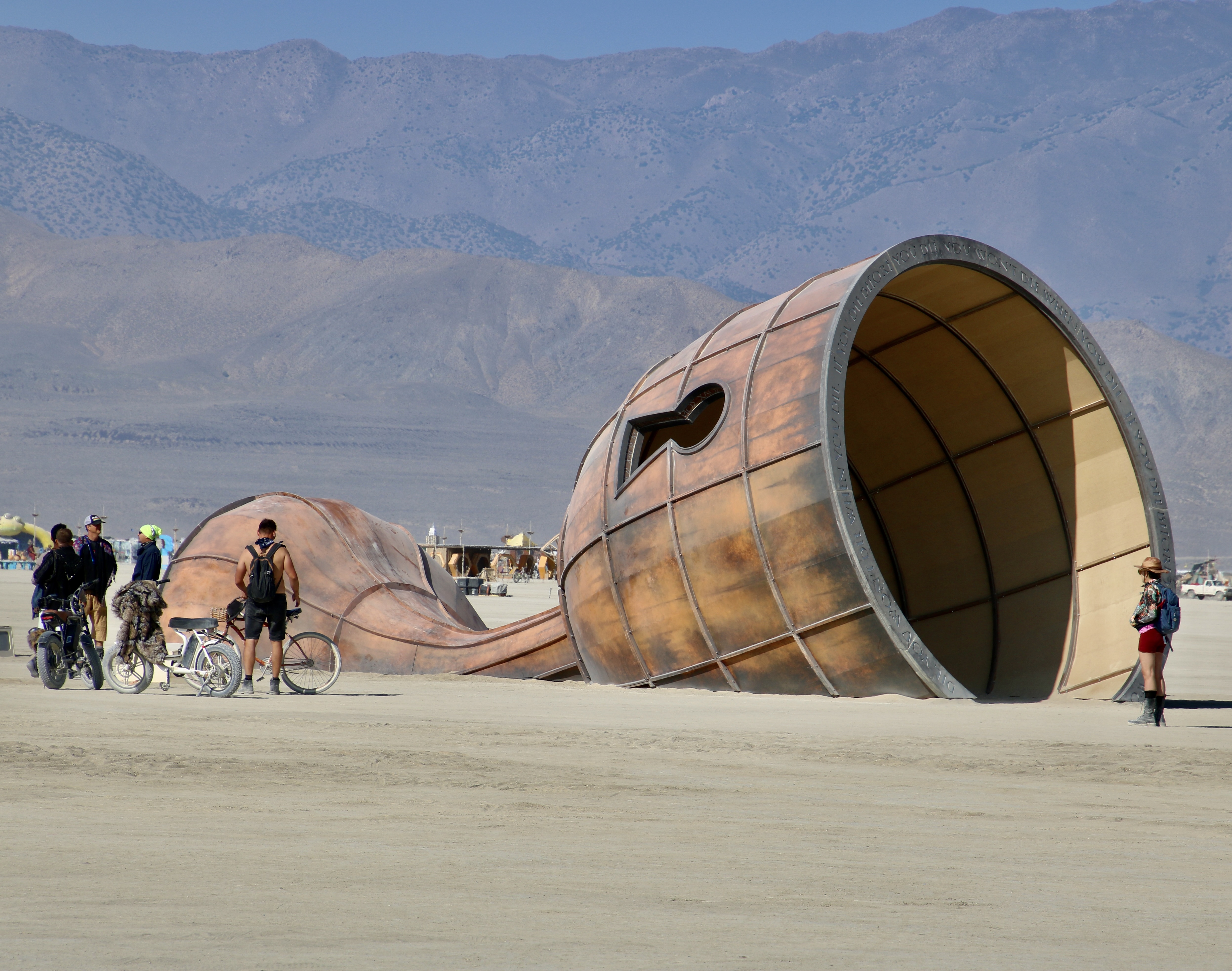
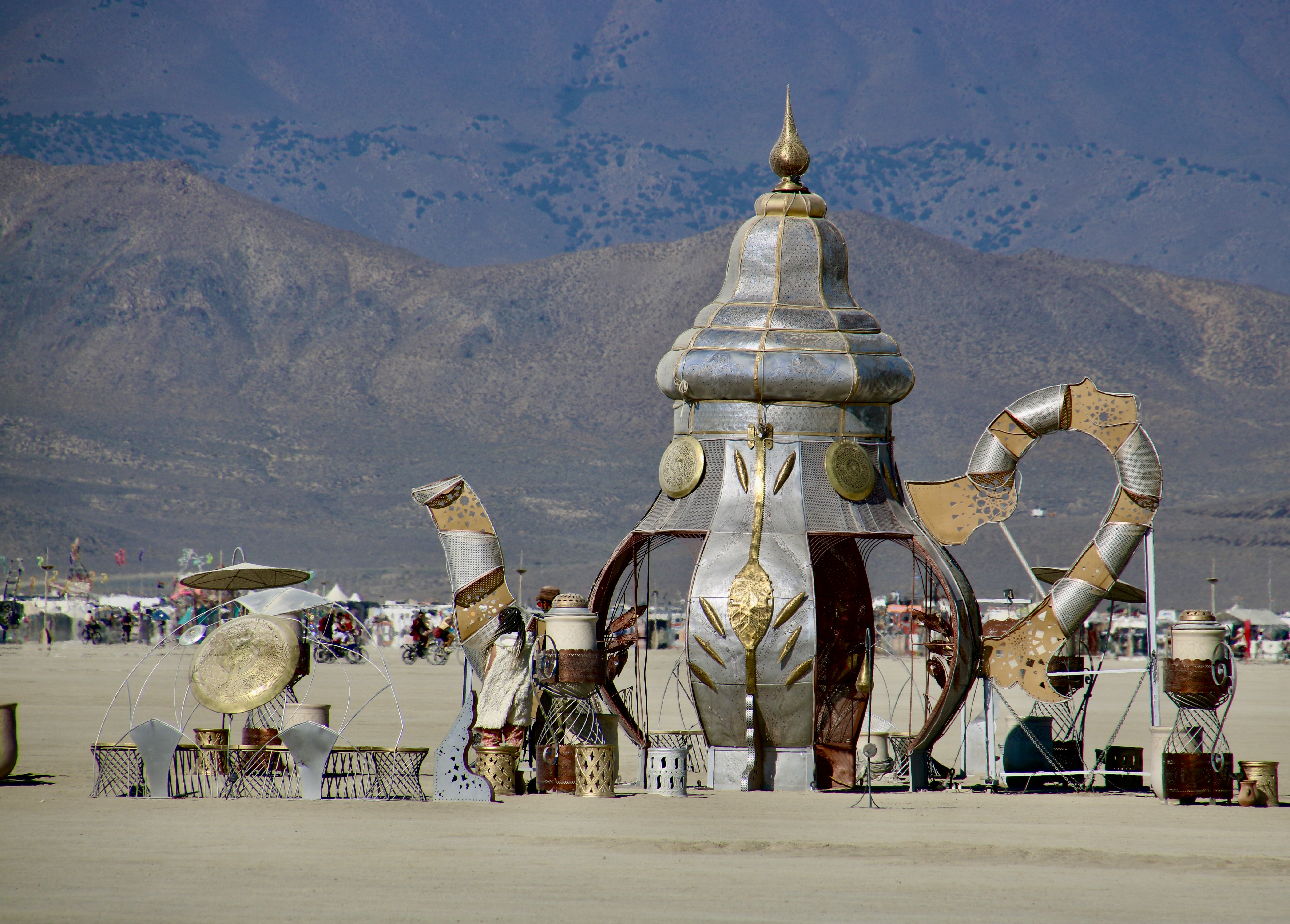
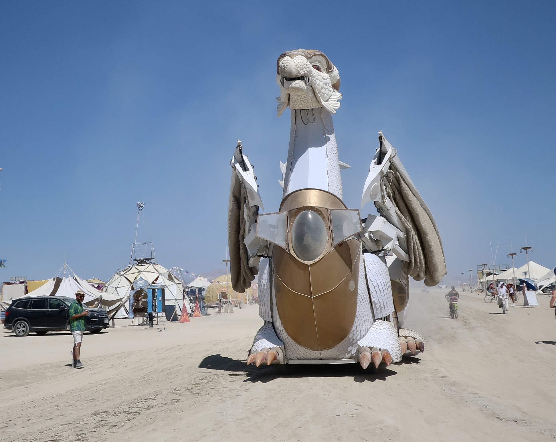
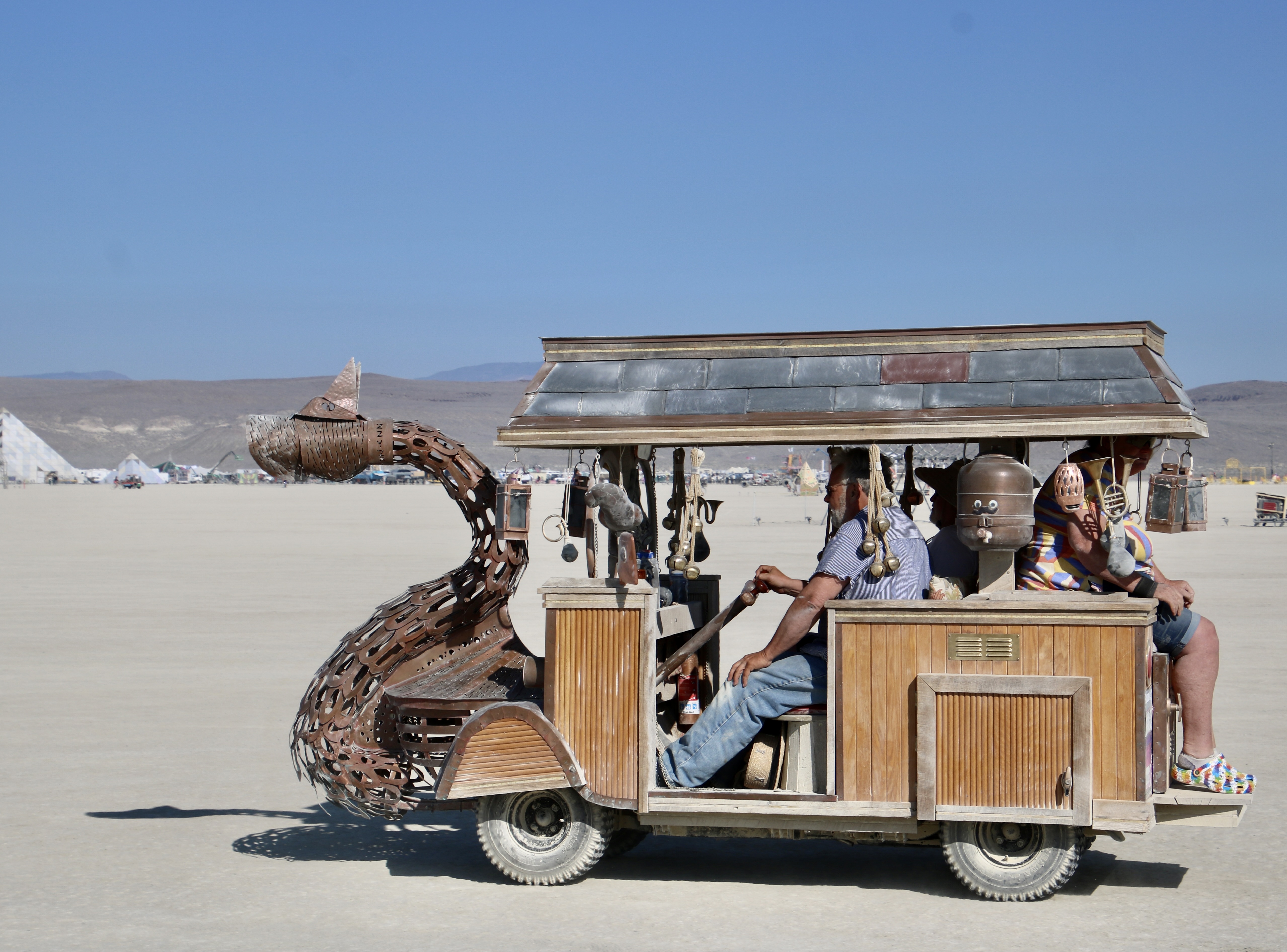
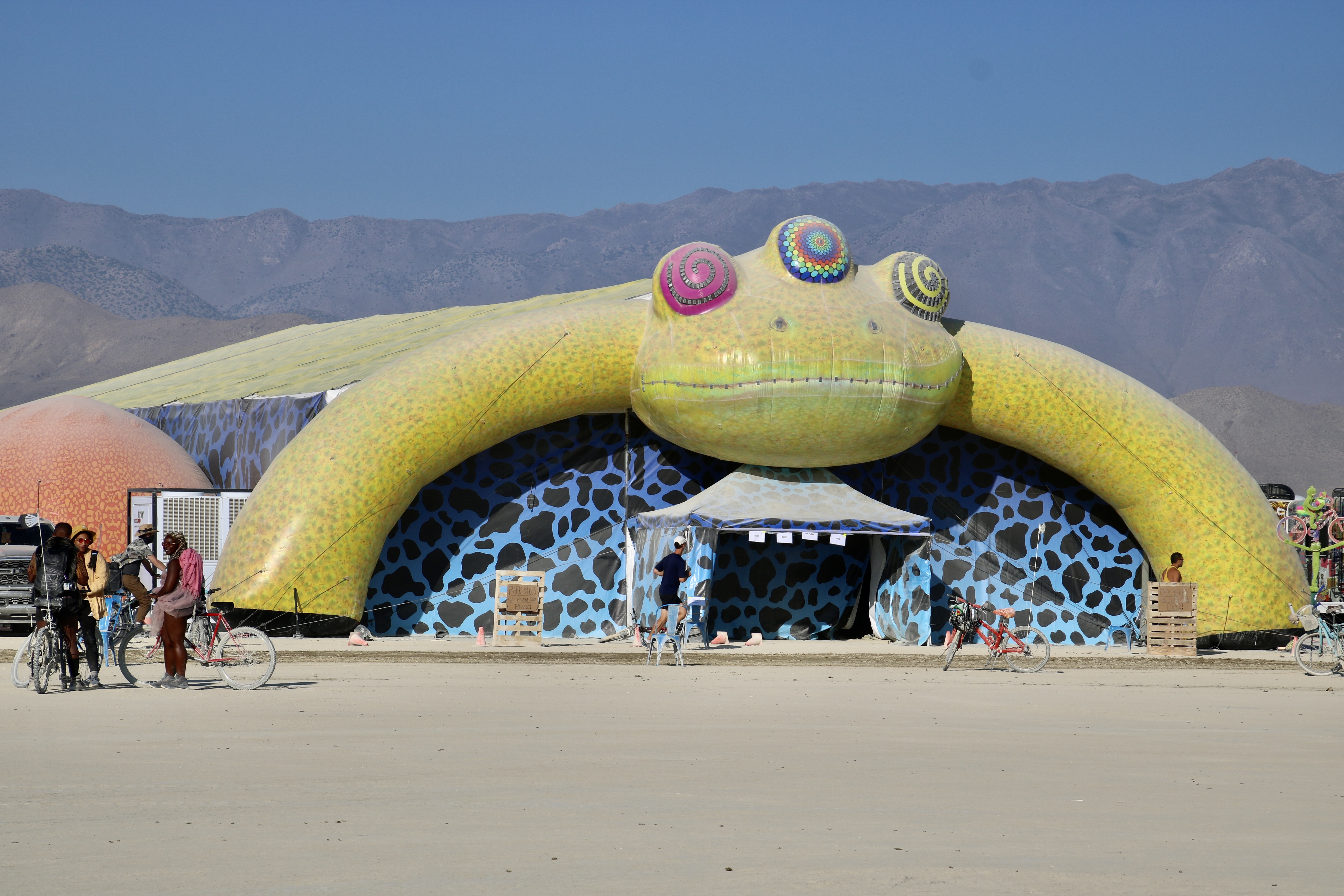
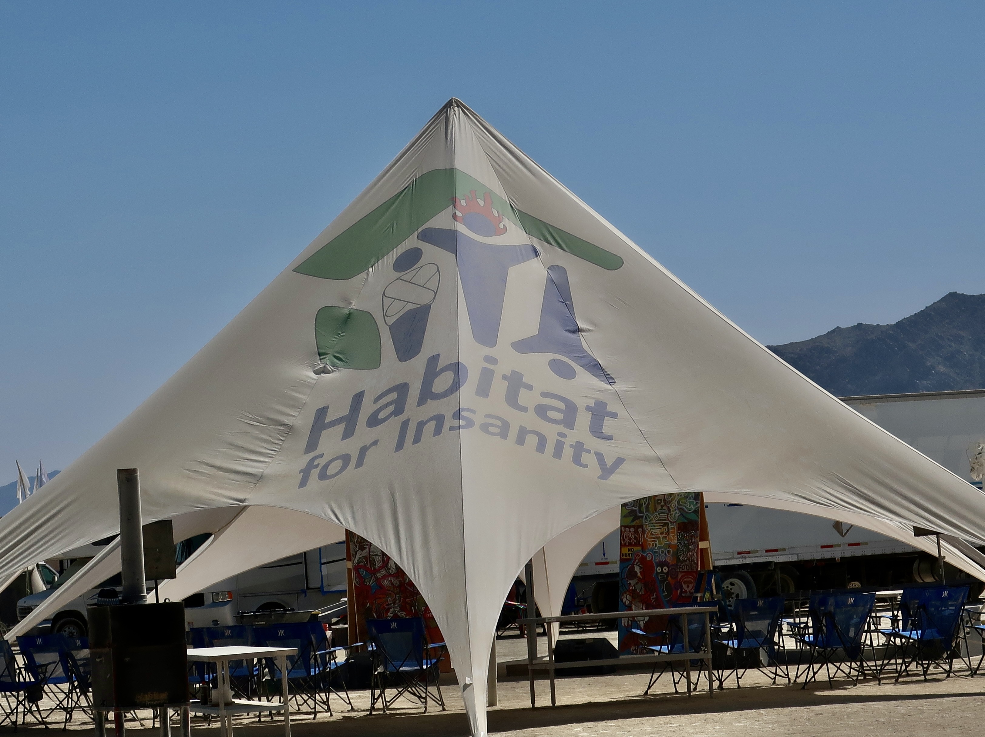
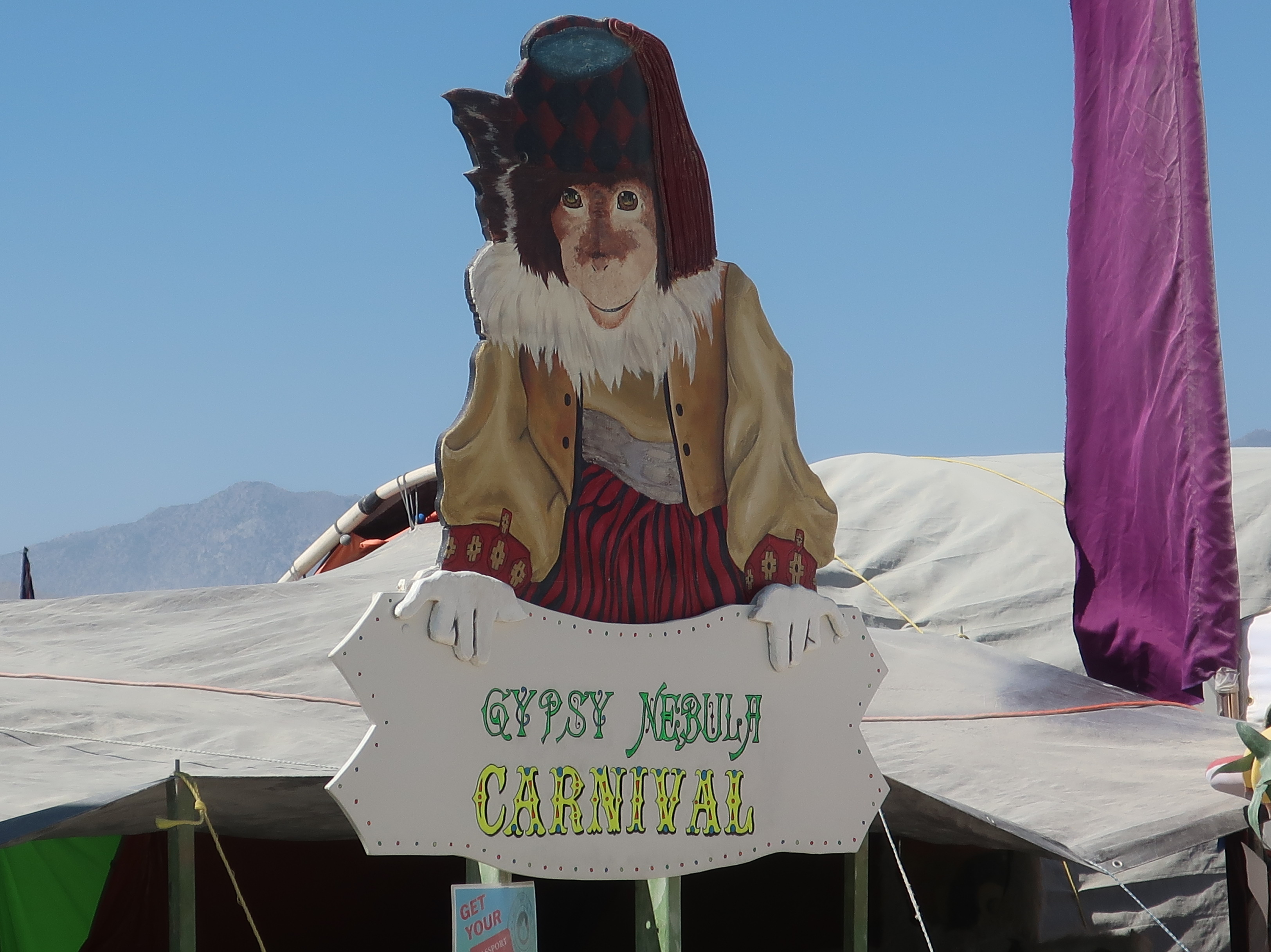
Every year at Burning Man (BM) is different. That’s what creativity is all about— and creativity is an important part of what makes BM special. The theme helps drive the creativity. Artists bringing their work to the event and tribes, people camping together who share a common interest, are asked to consider the theme when creating their works and designing their camps.

A rendition of what the 2026 Man will look like at night. The lights in the distance represent Black Rock City, a community of 50-70,000 people that surrounds the Man in a semi-circle.
Axis Mundi represents a cosmic connection between Heaven, Earth and the Underworld in mythology. In more modern terms we might think of earth, our atmosphere and the universe, or our inner-connectedness with each other, nature, and the universe. For a number of cultures, and BM 2026, it is symbolized by a giant tree. Note the Man peeking out from the lower limbs.

The Burning Man Journal notes that the event will demonstrate the relationship by “celebrating the interconnectedness of our global community, the new social realities we are creating together, and our enduring ties to the natural world.” While the statement relates primarily to the Burner community, a quote from Albert Einstein was added that broadens the concept to all of us:

“A human being is a part of the whole, called by us universe, a part limited in time and space. He experiences himself, his thoughts and feelings as something separated from the rest, a kind of optical delusion of his consciousness. This delusion is a kind of prison for us, restricting us to our personal desires and to affection for a few persons nearest to us. Our task must be to free ourselves from this prison by widening our circle of compassion to embrace all living creatures and the whole of nature in its beauty.”

While Einstein gives us a seemingly impossible task given the world of divisiveness we now face and the powerful people who profit politically and financially from it, Peggy and I believe that the kind of unity implied by Burning Man and Einstein is a goal we must never give up striving for. Darkness lies on the other side.

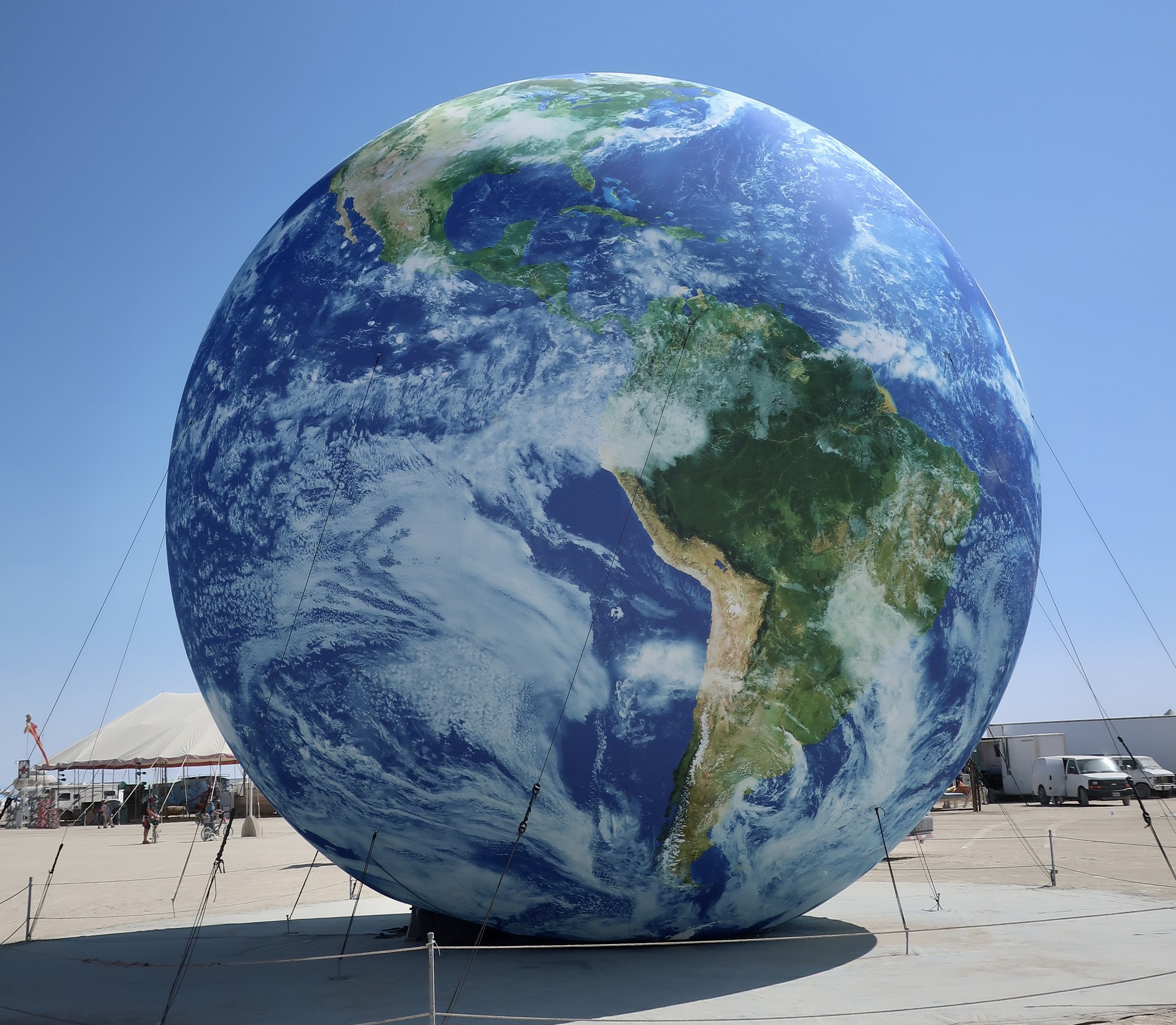
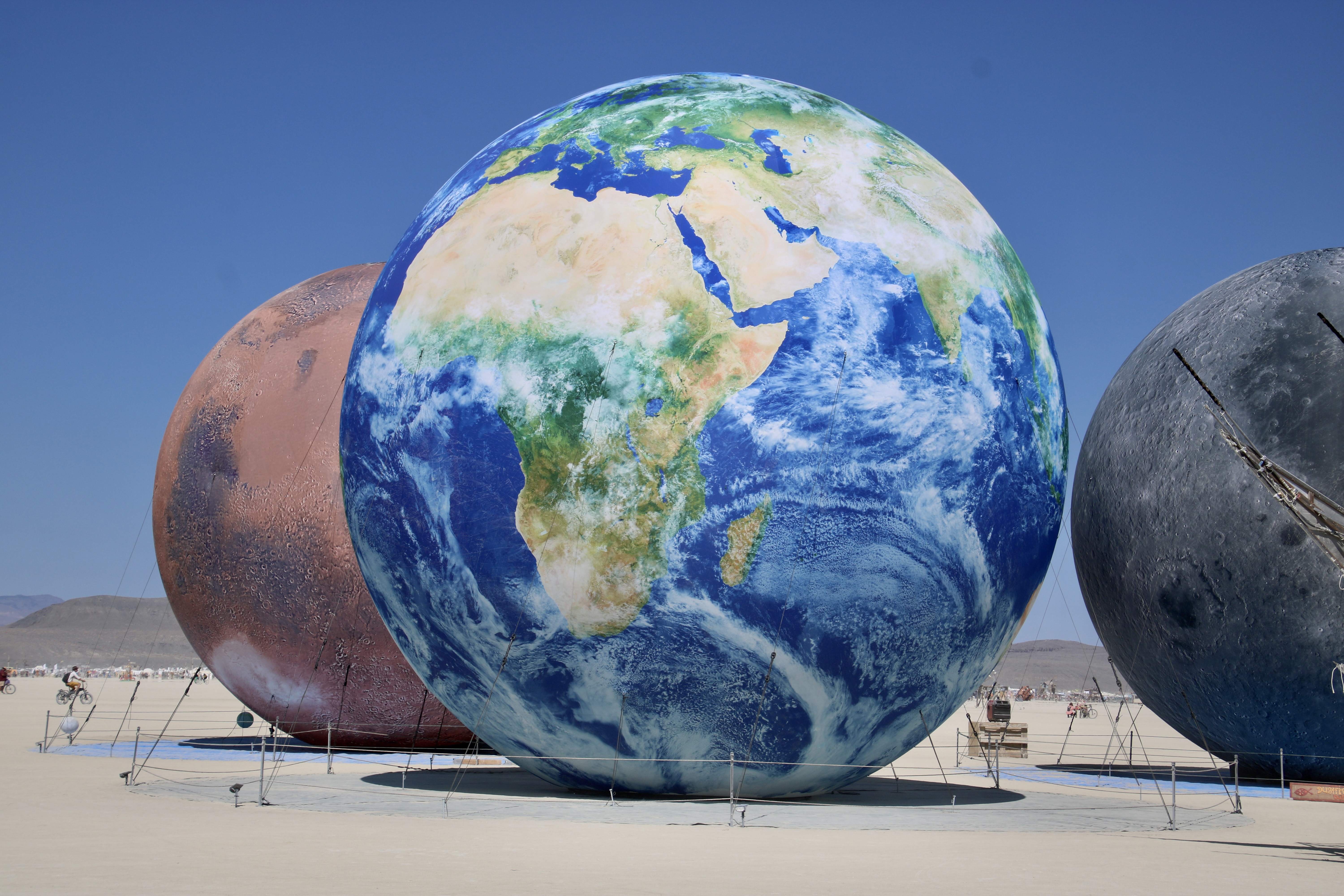
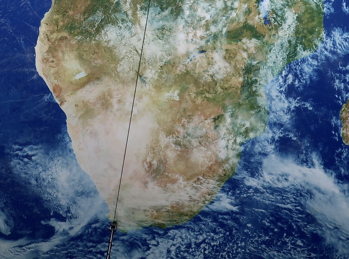
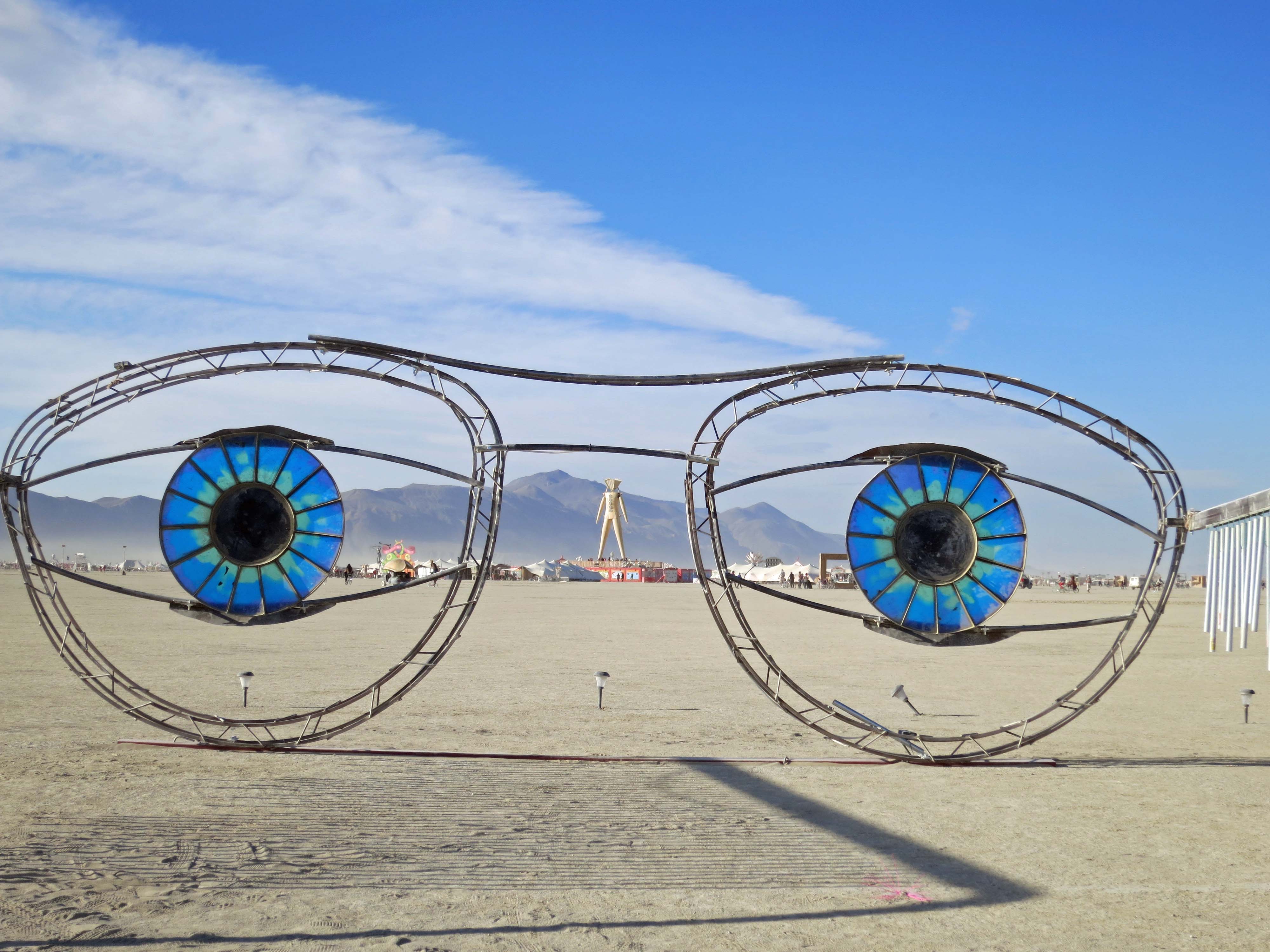
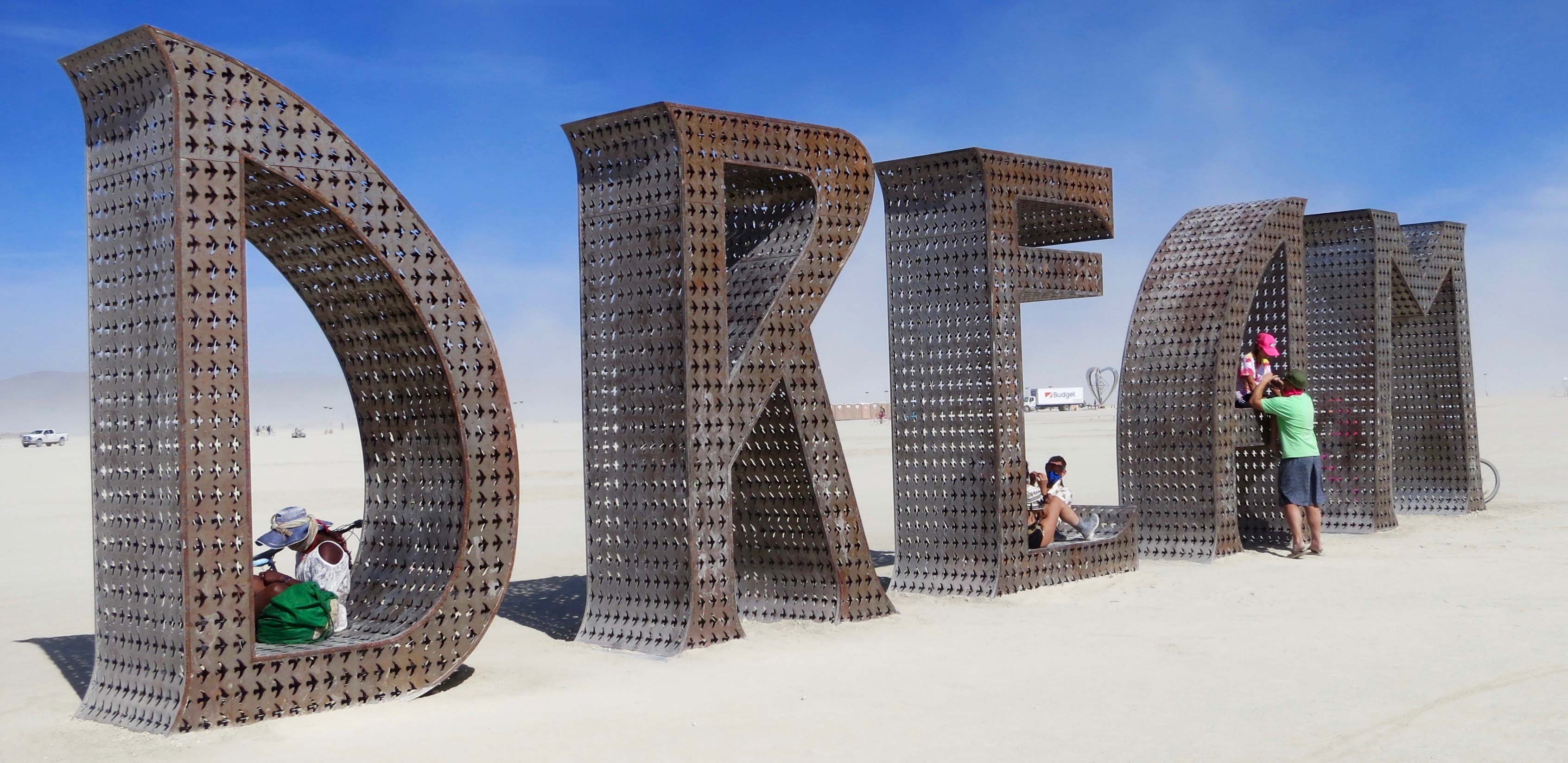
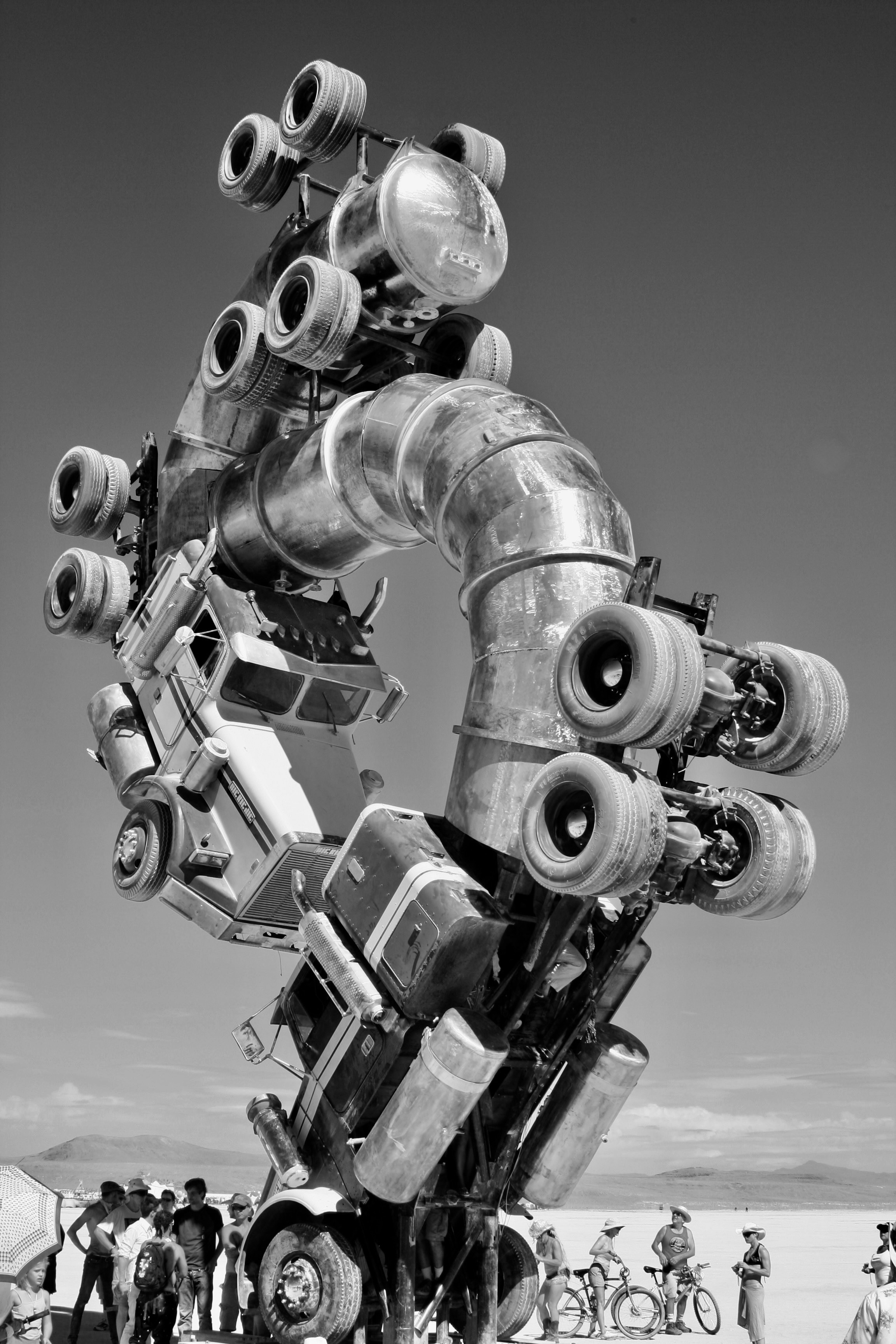
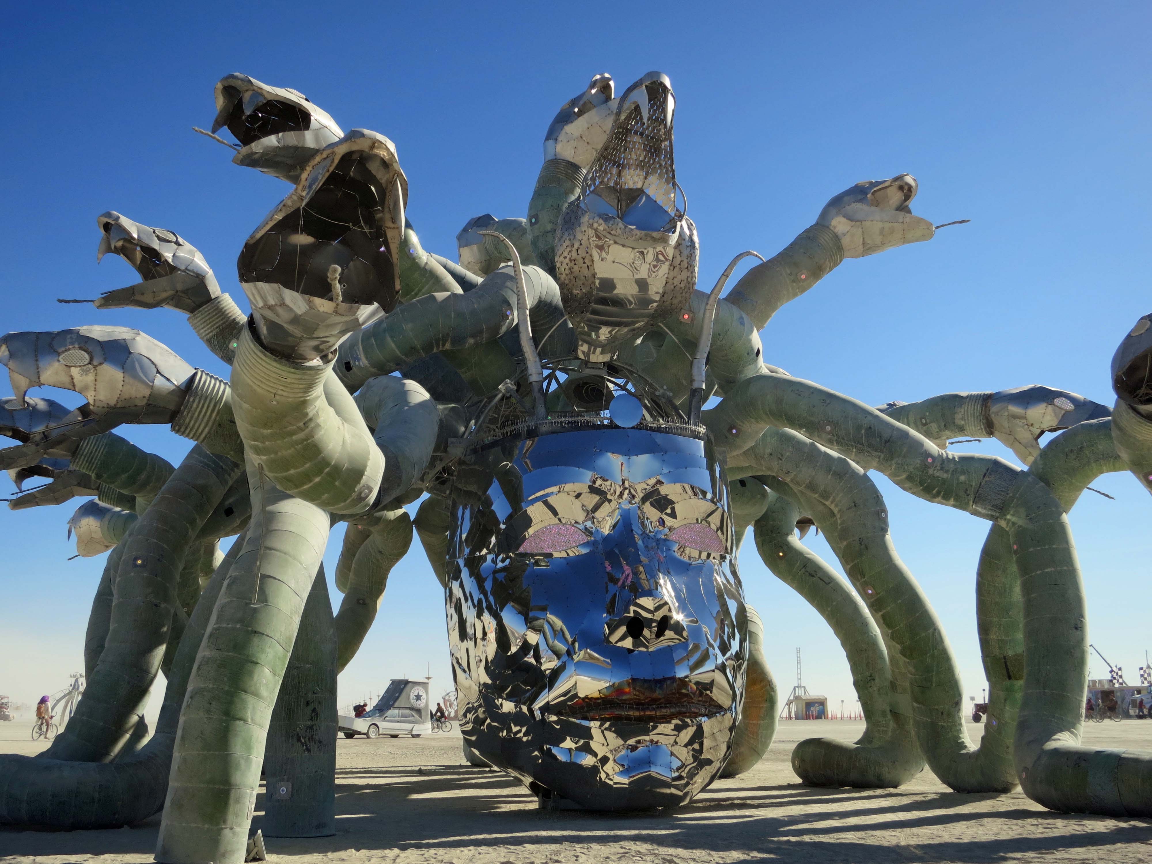
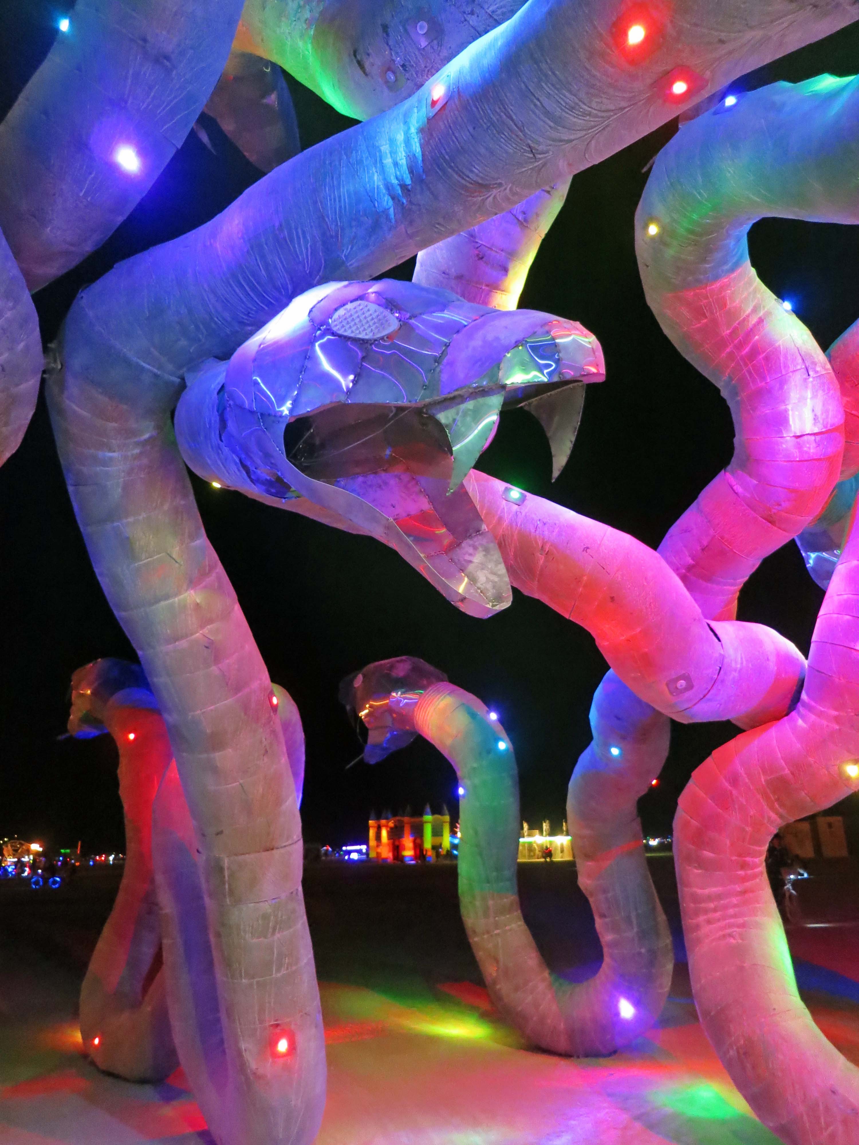
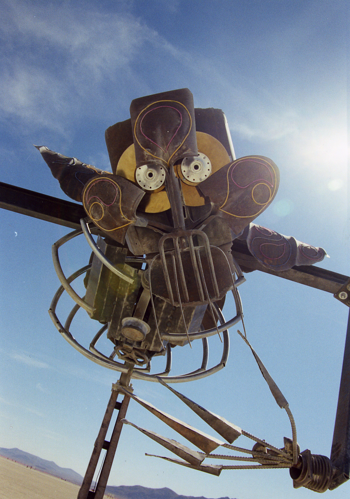
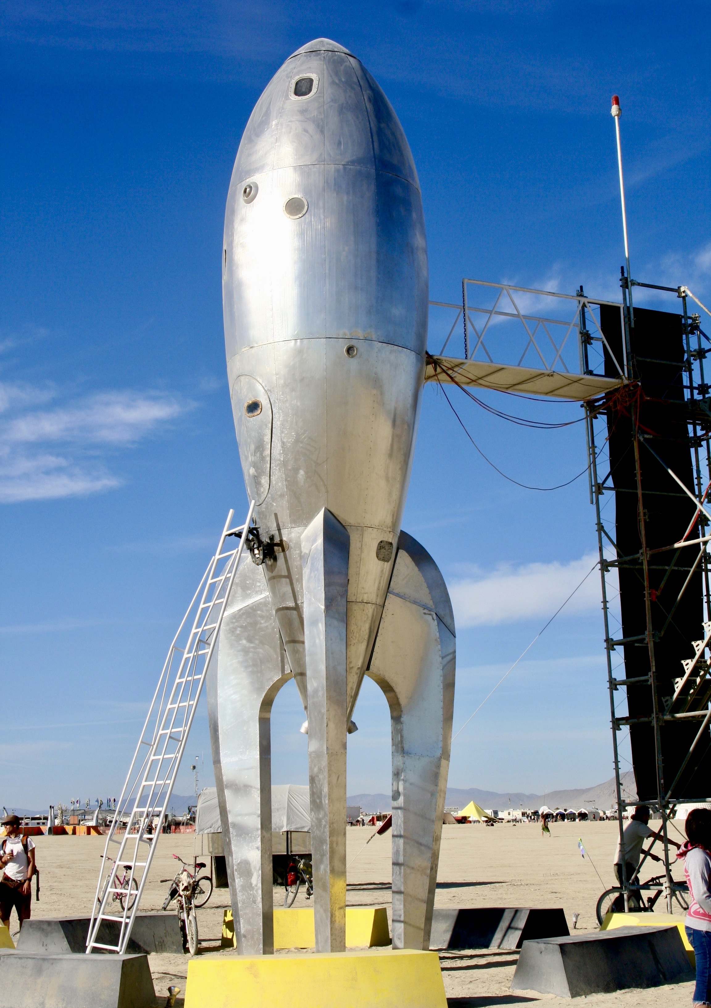
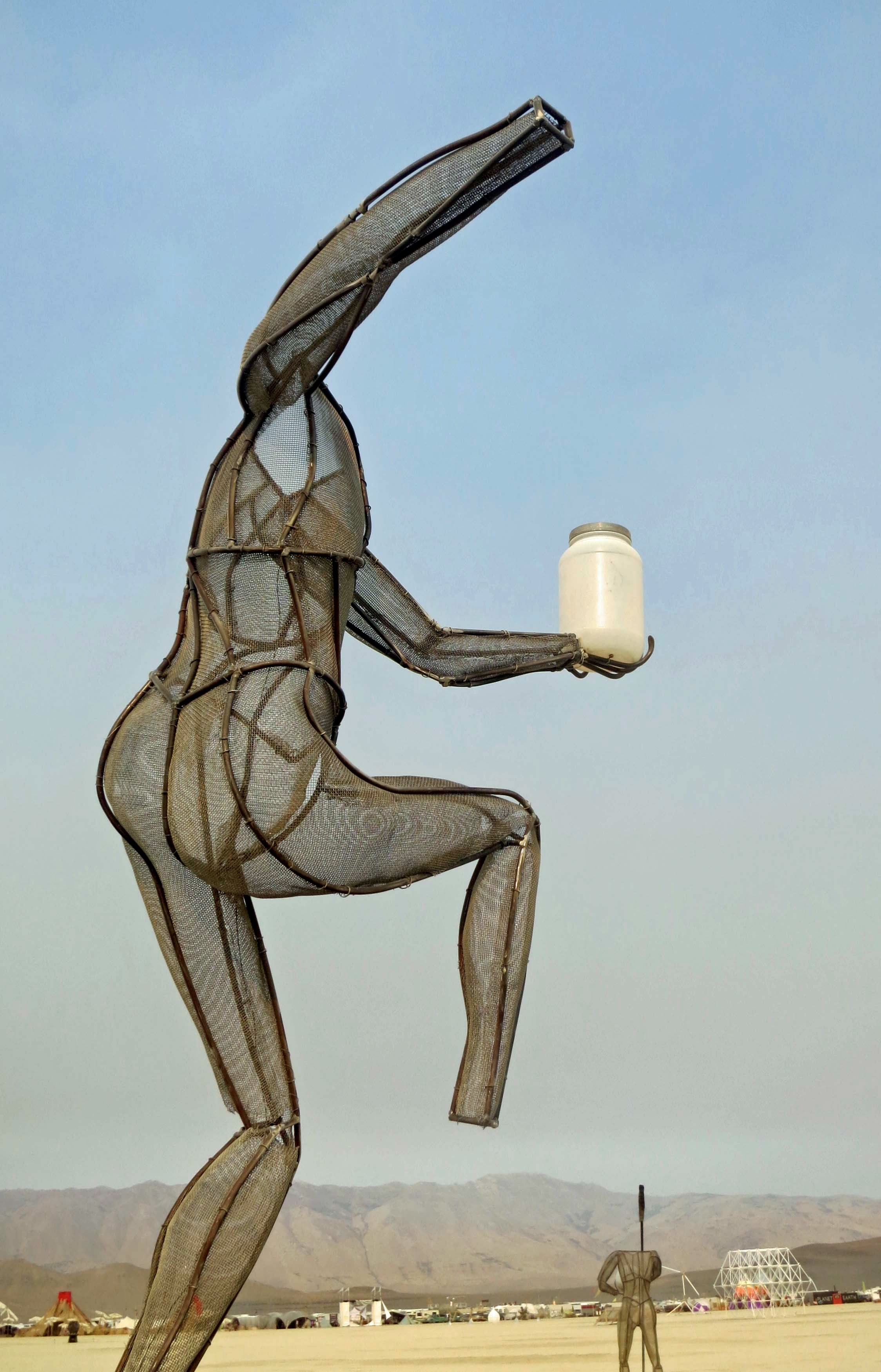
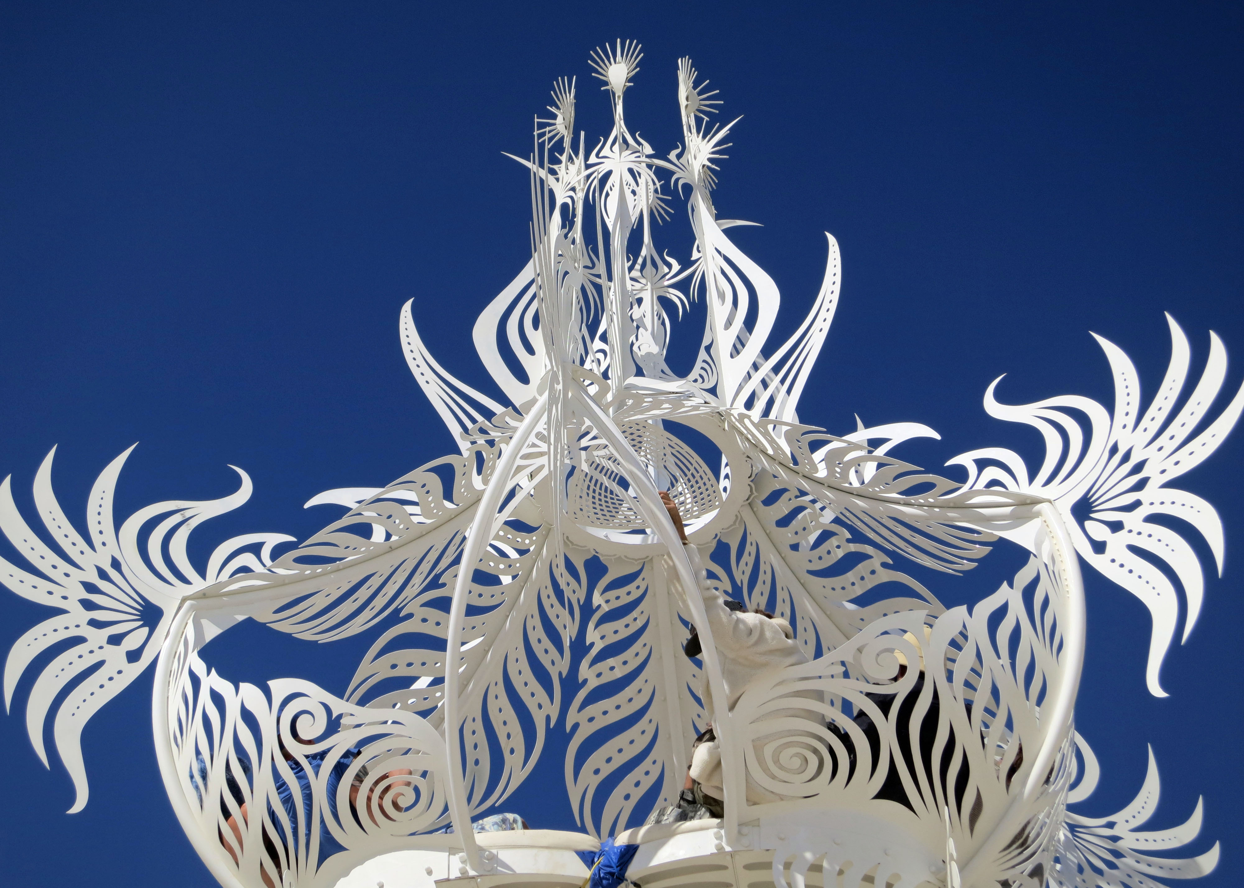
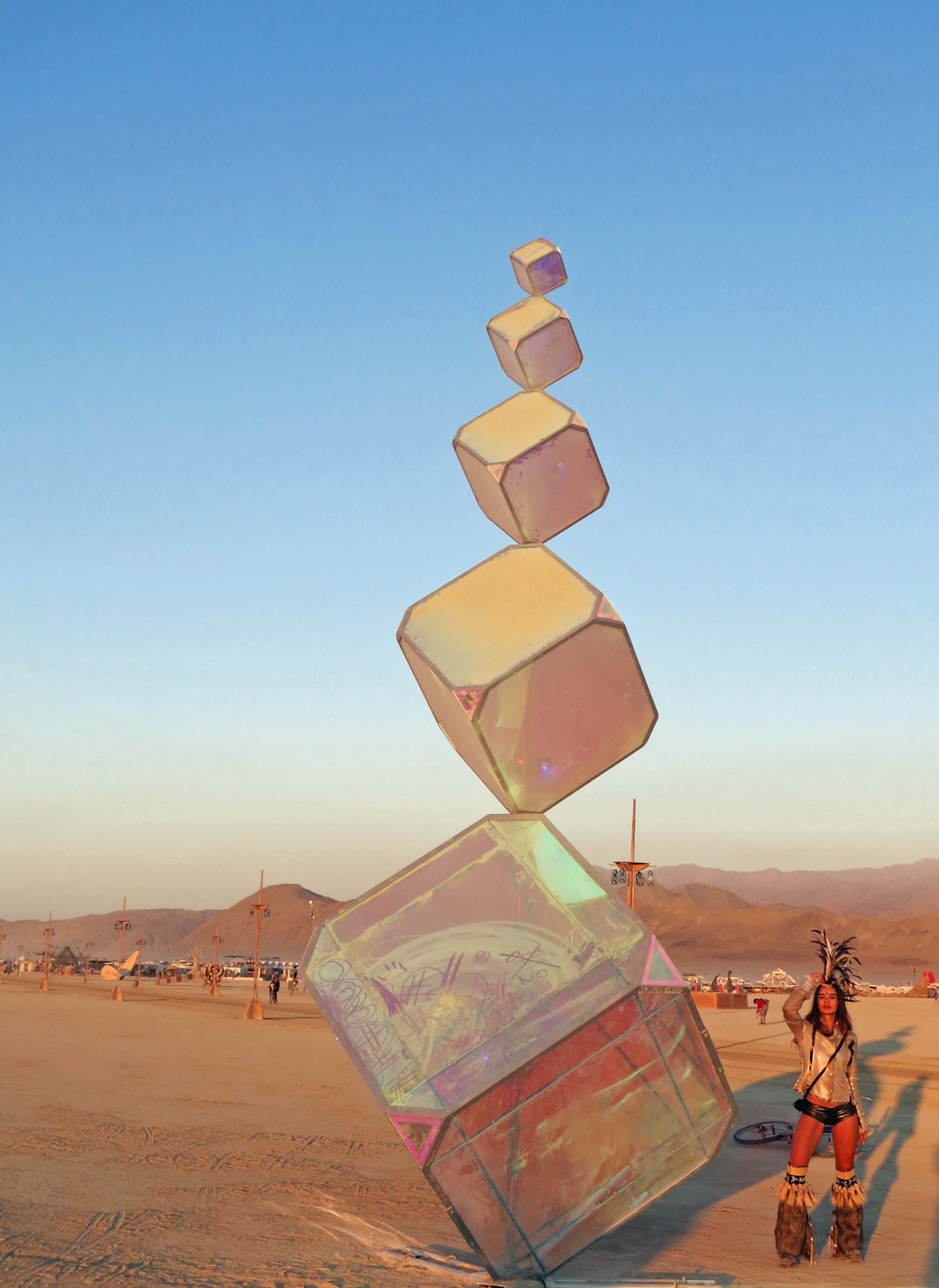
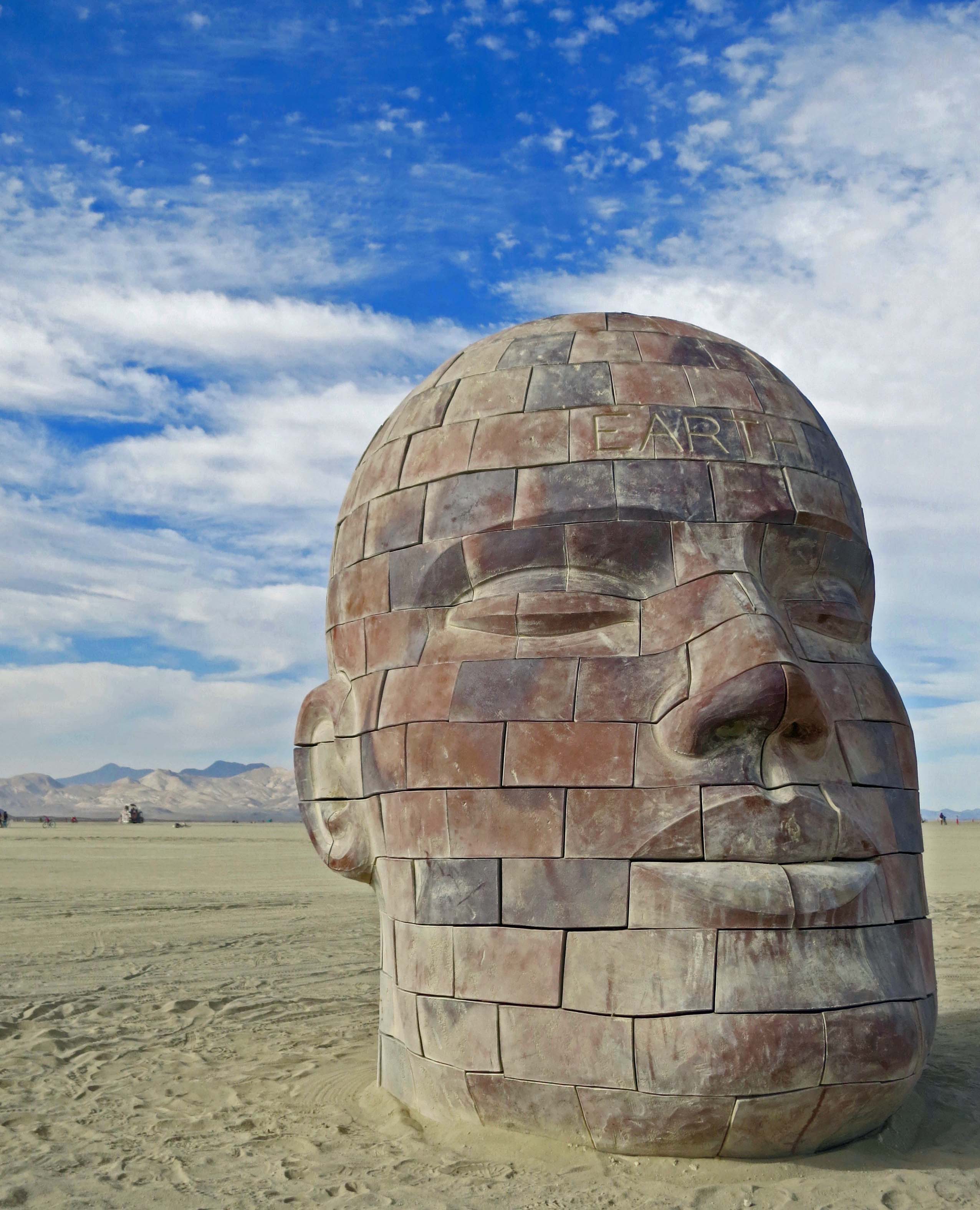
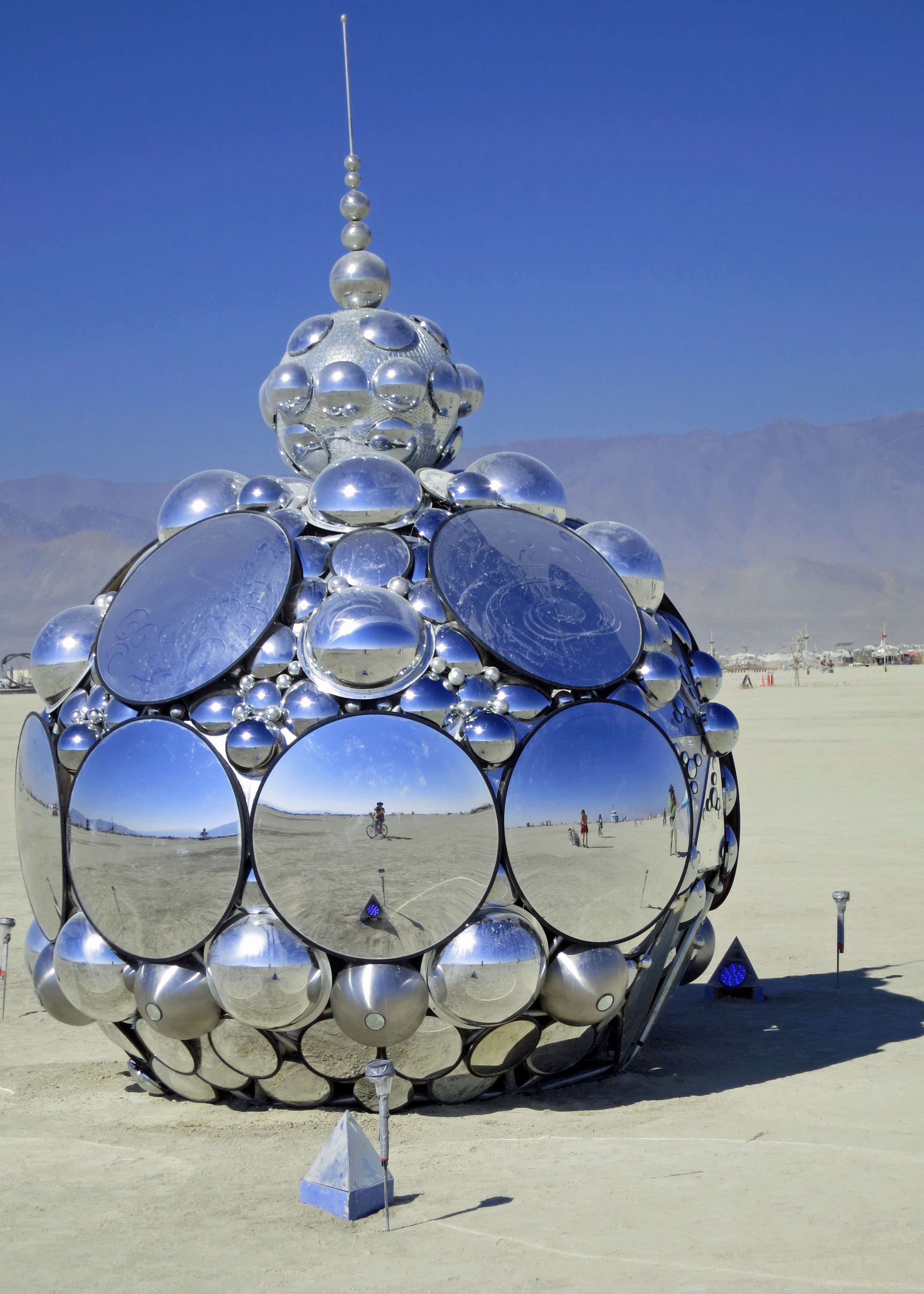
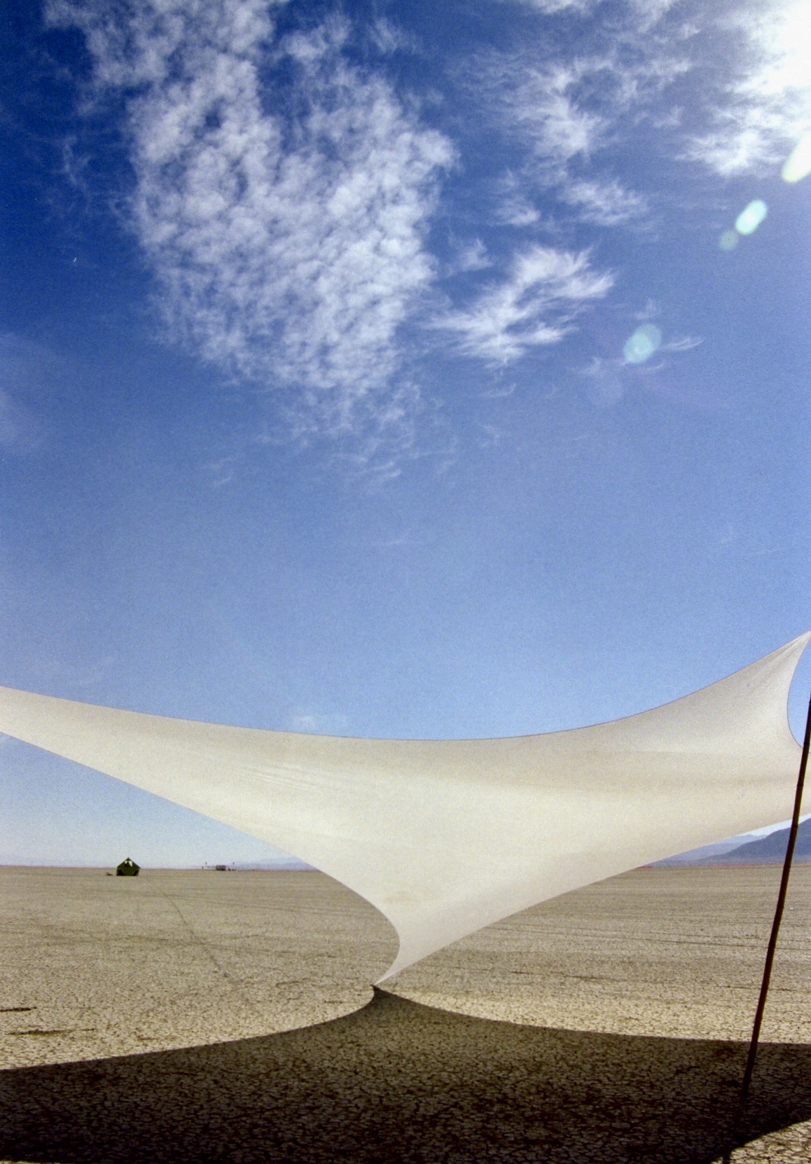
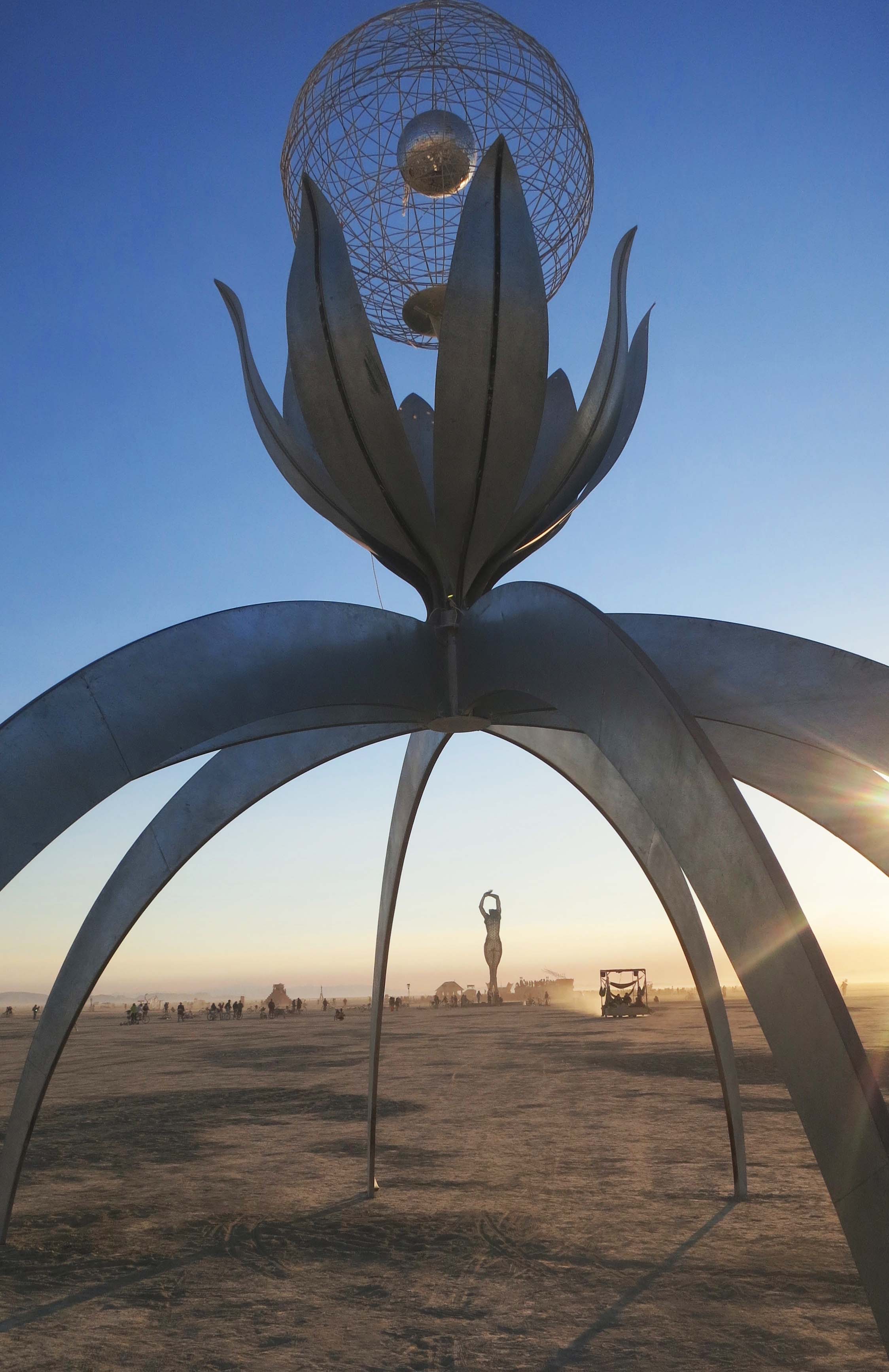
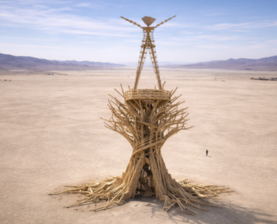
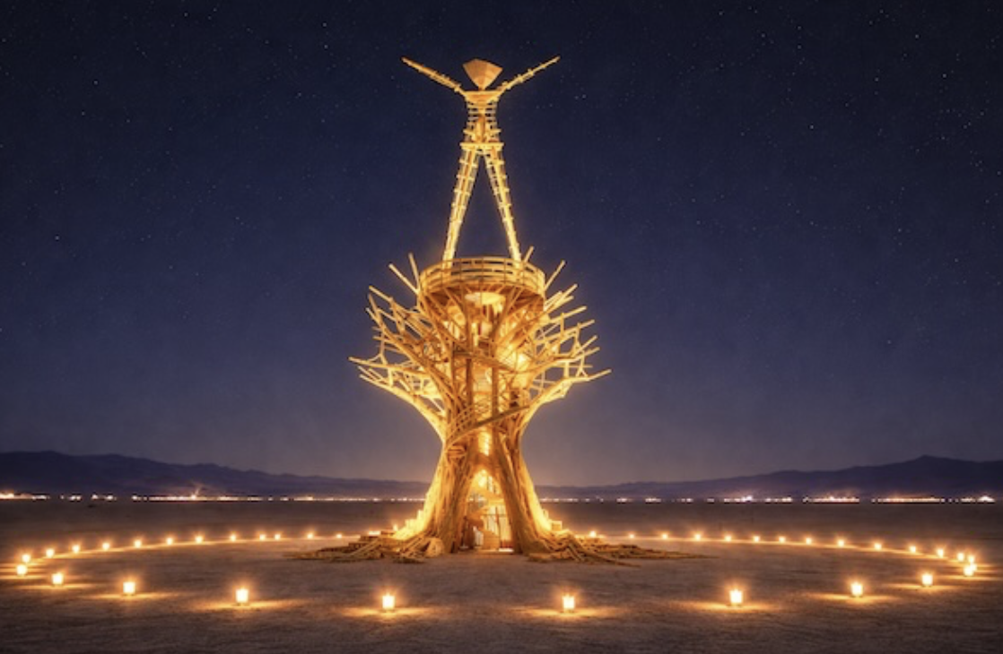
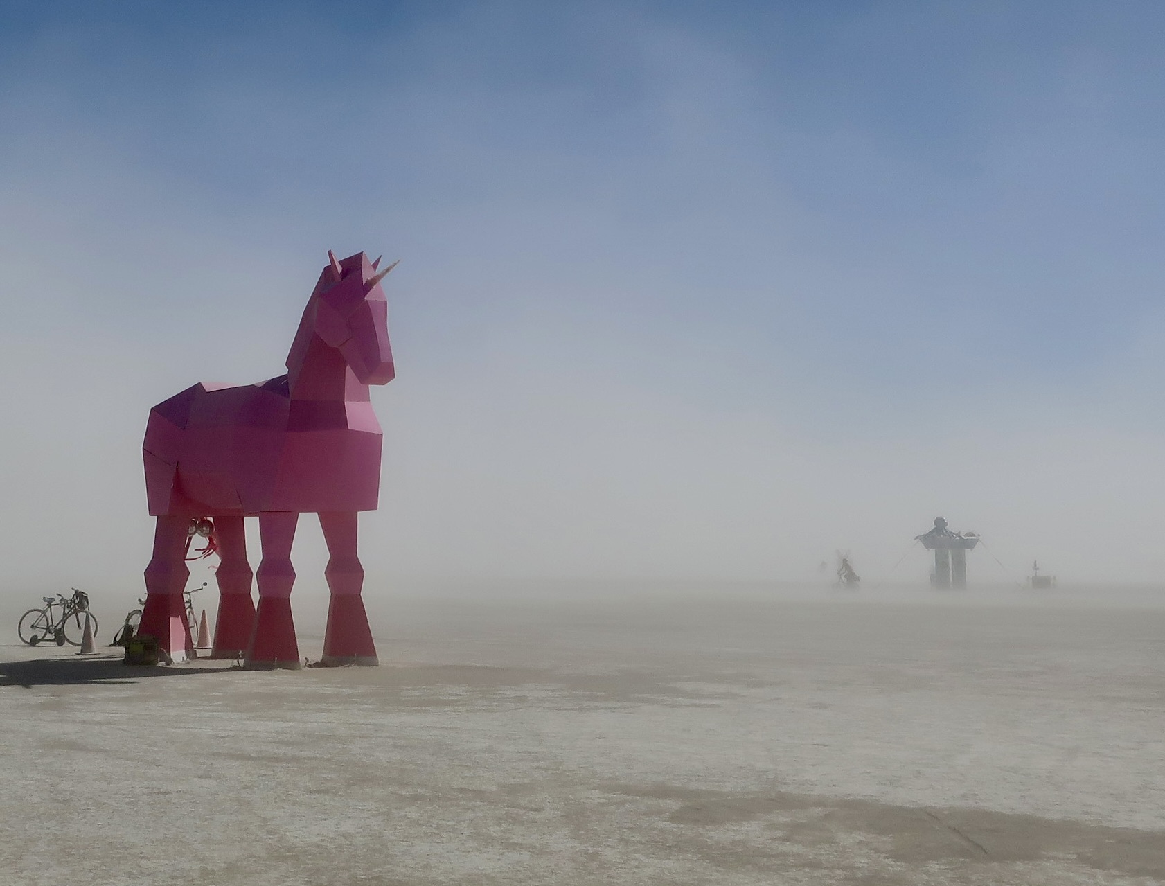
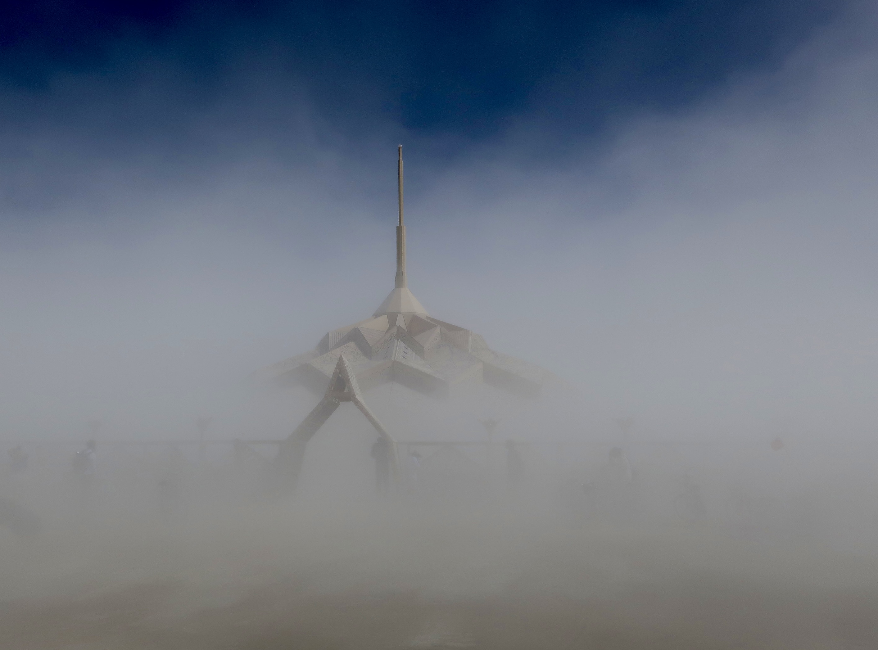
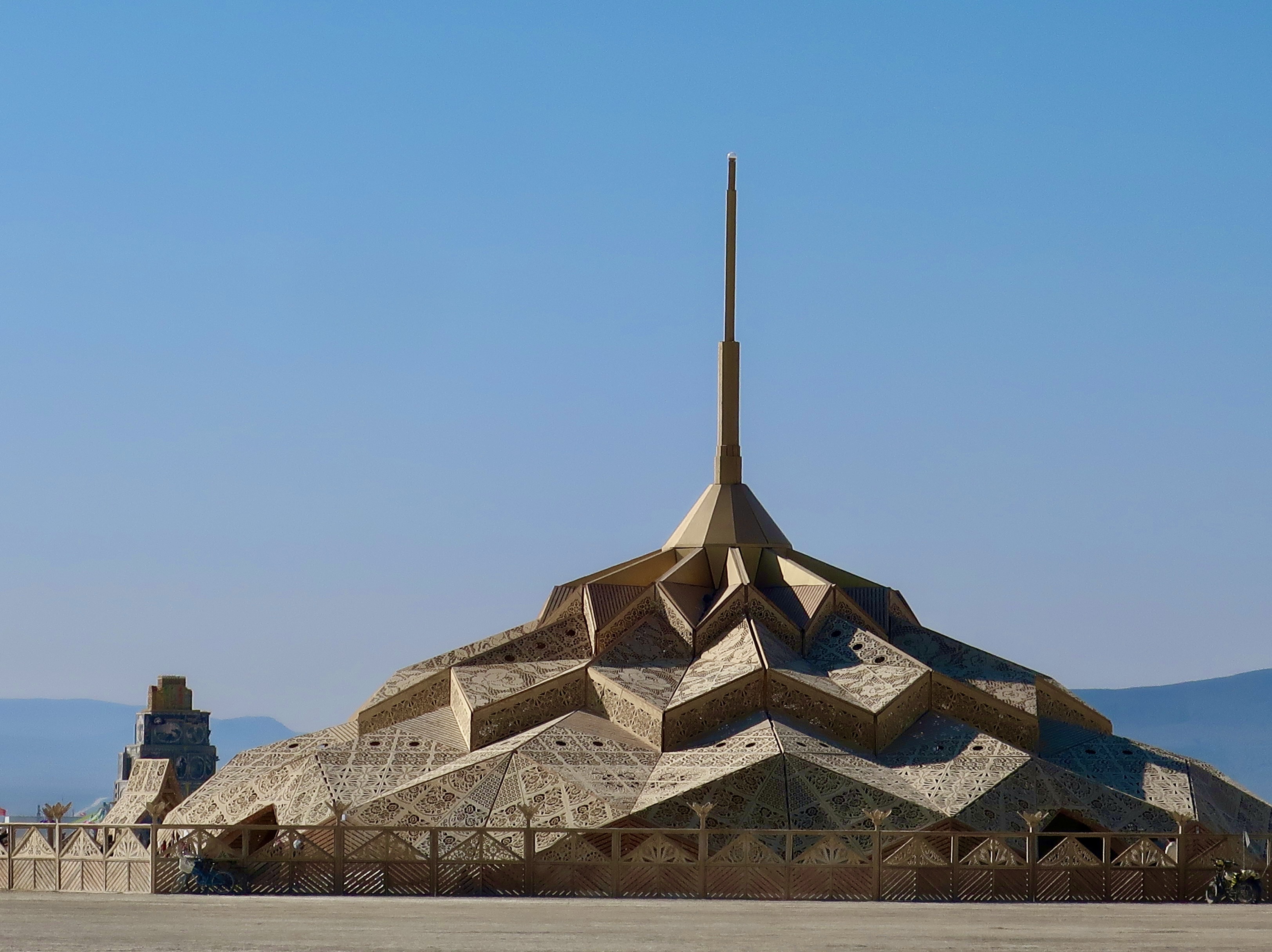
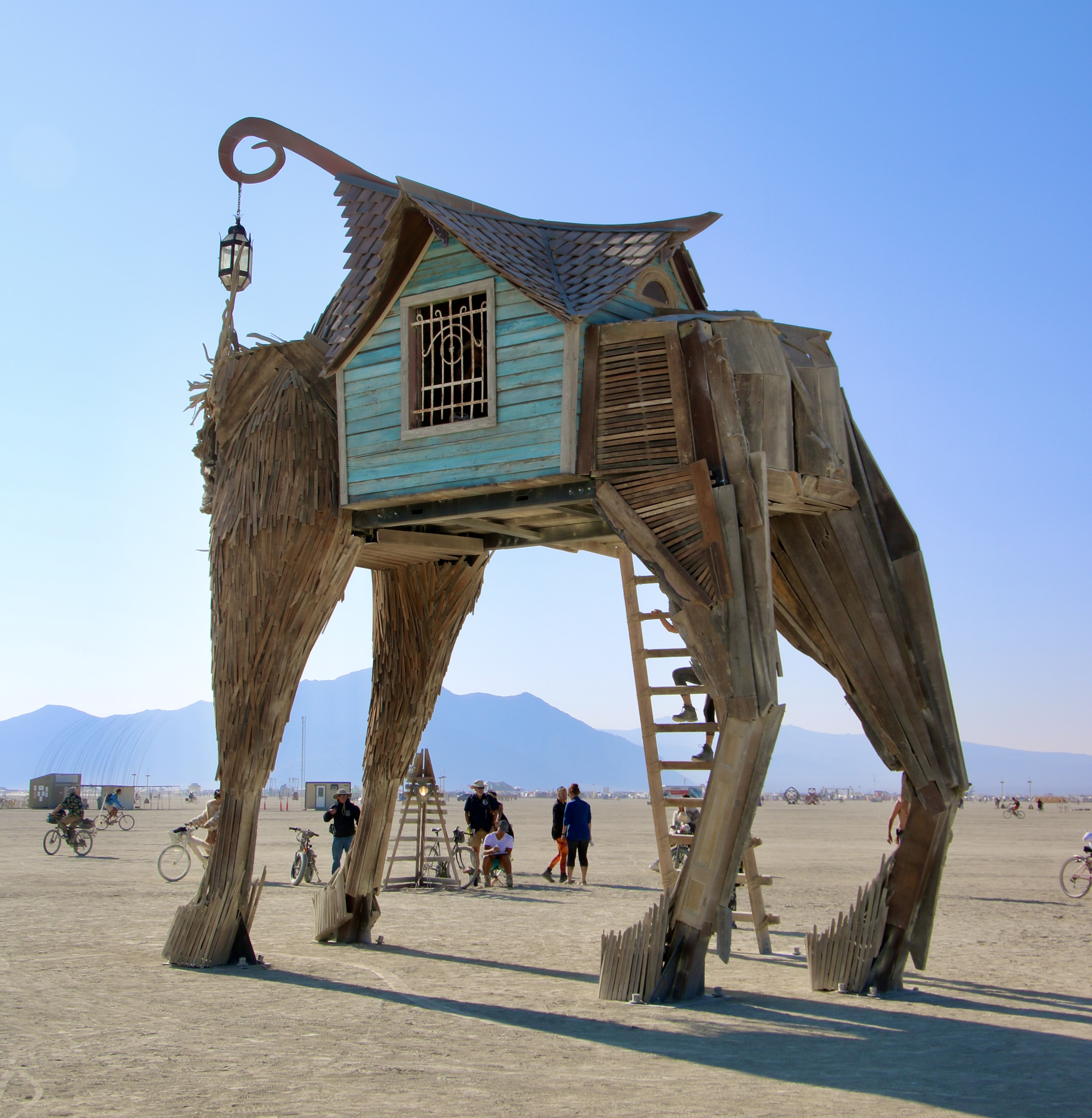
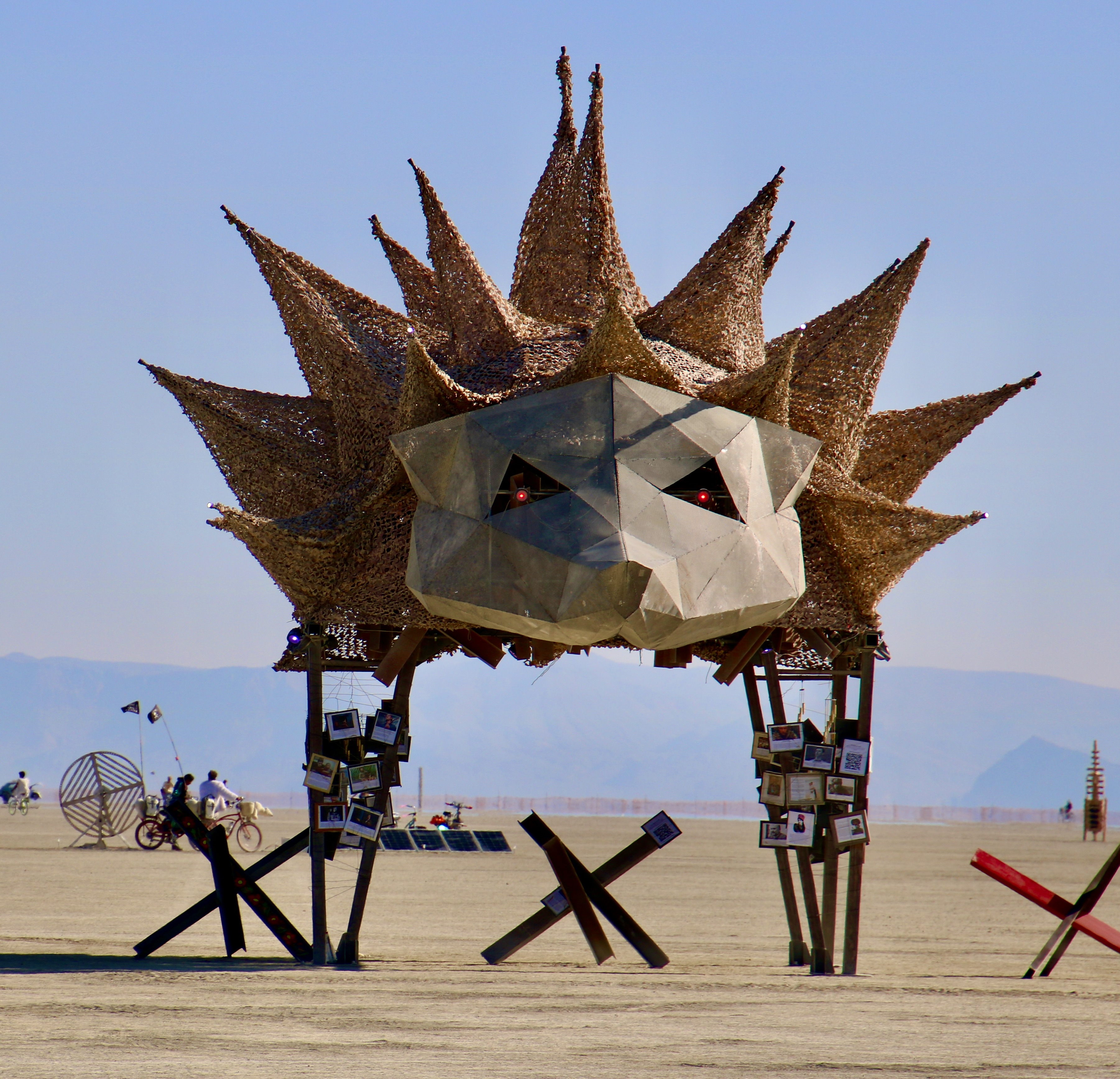
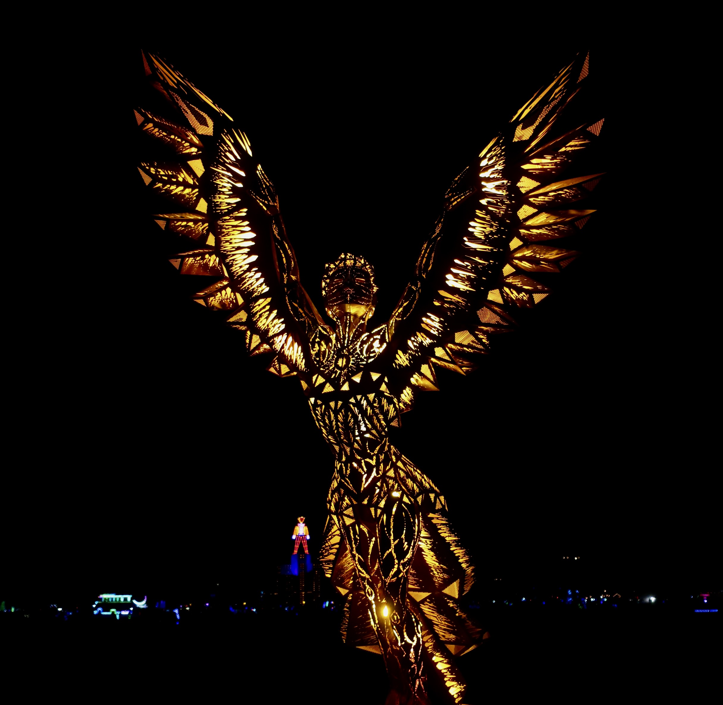
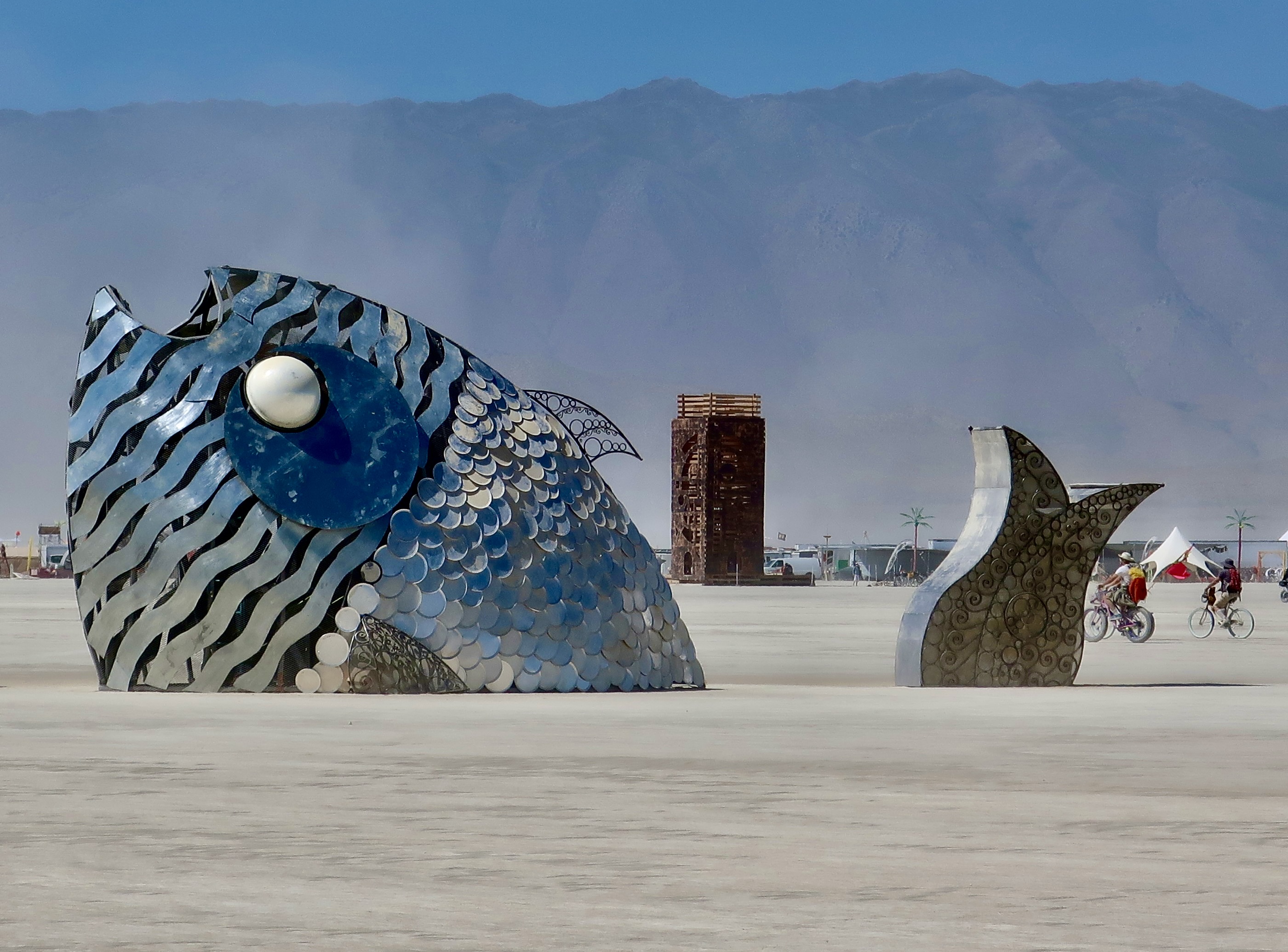
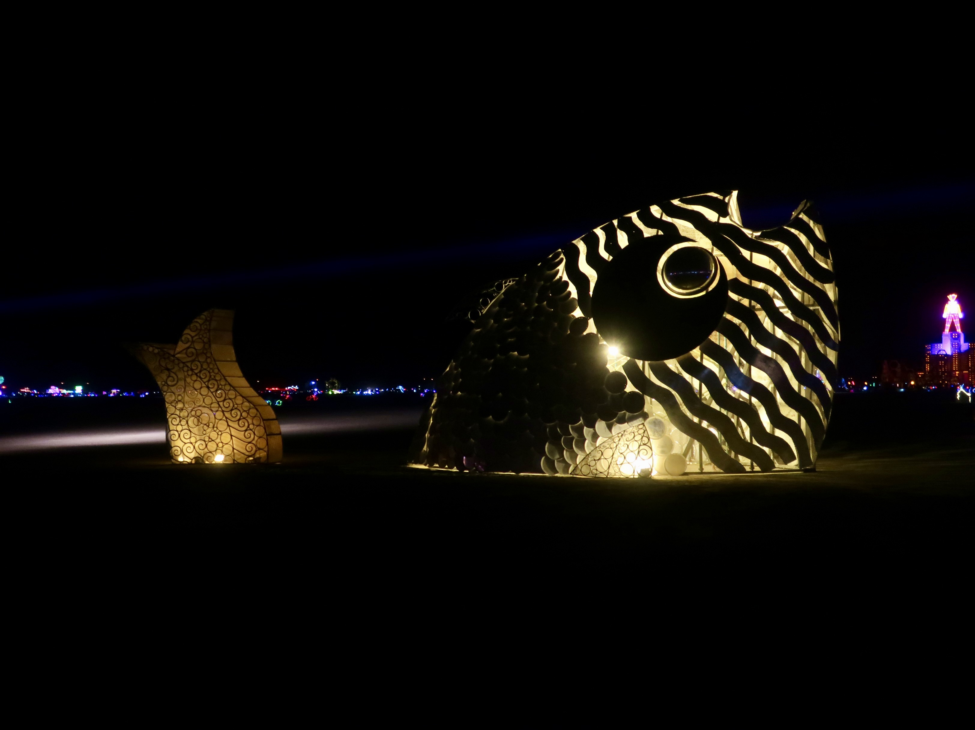
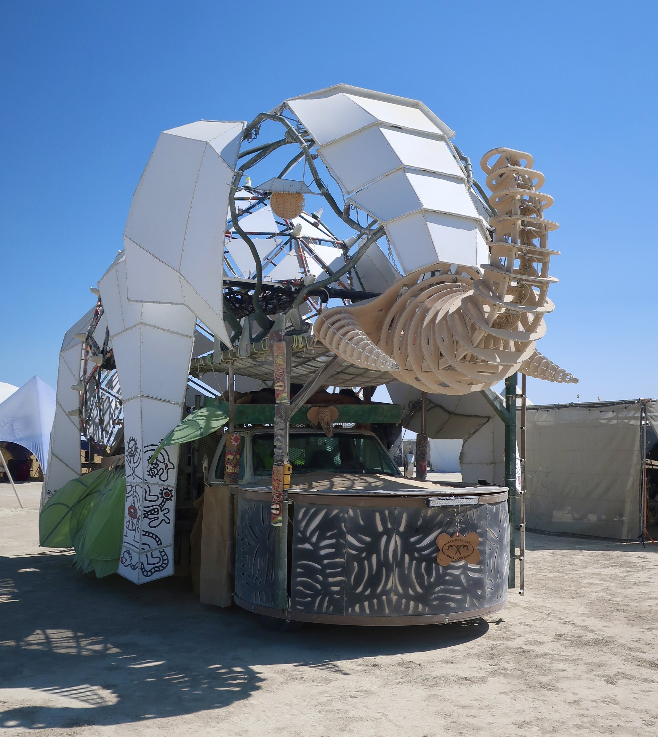
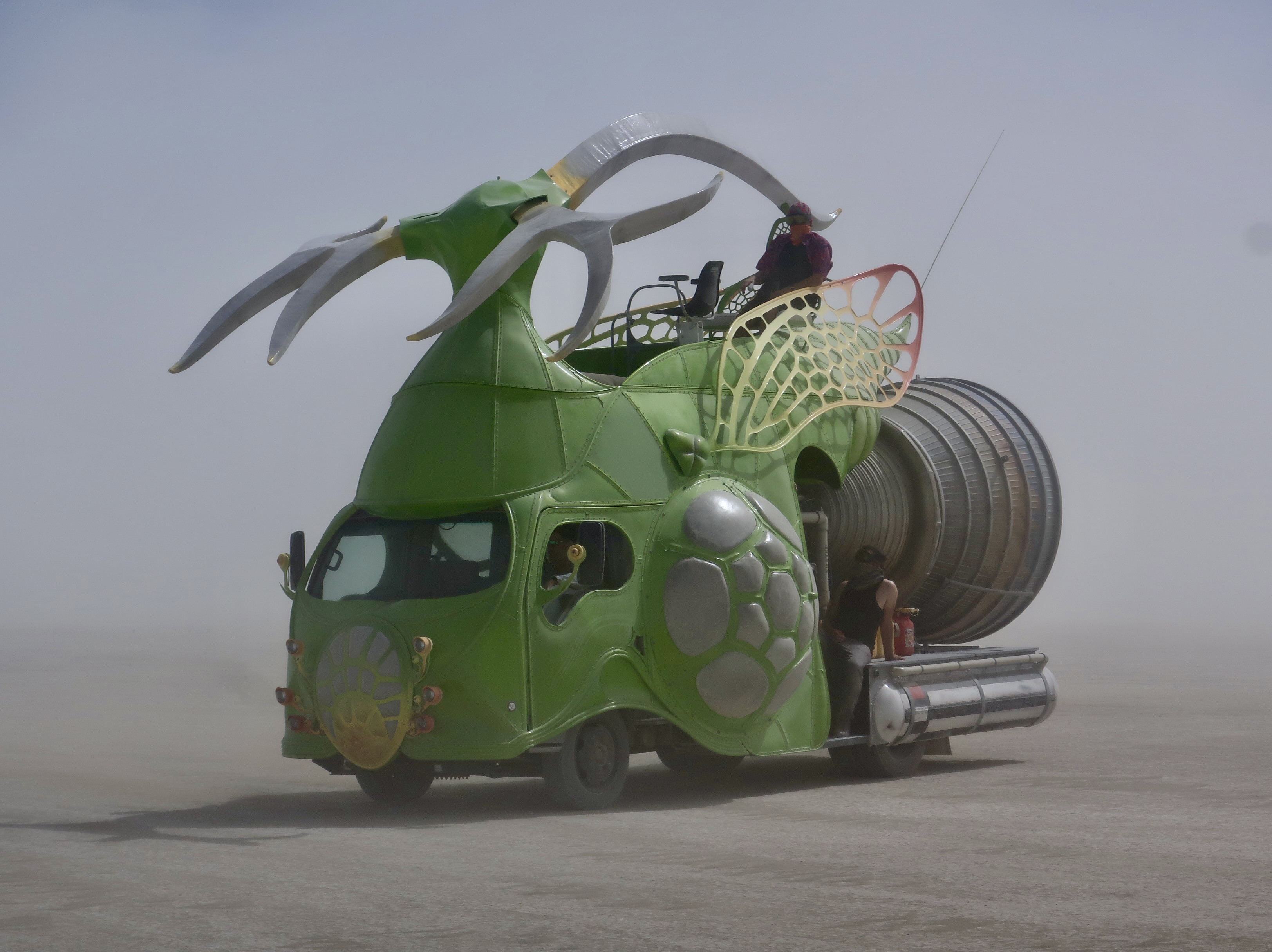
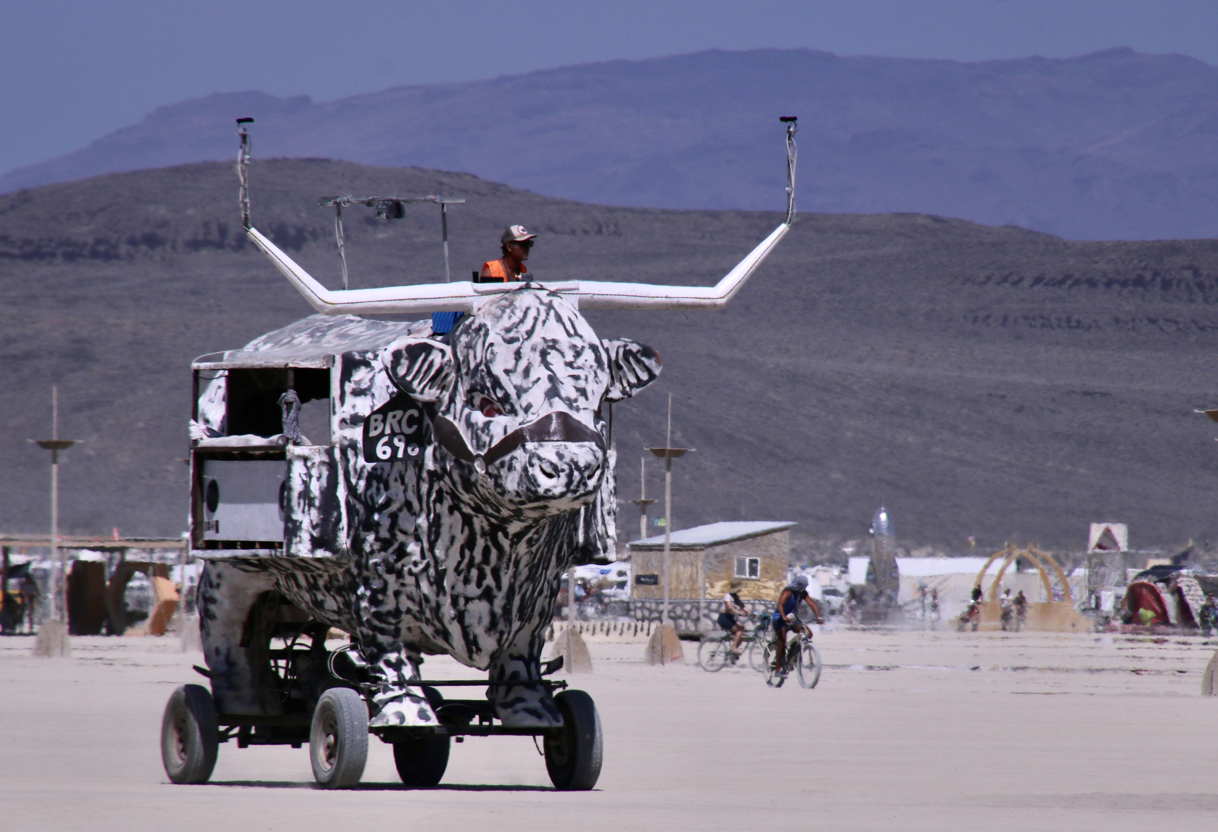
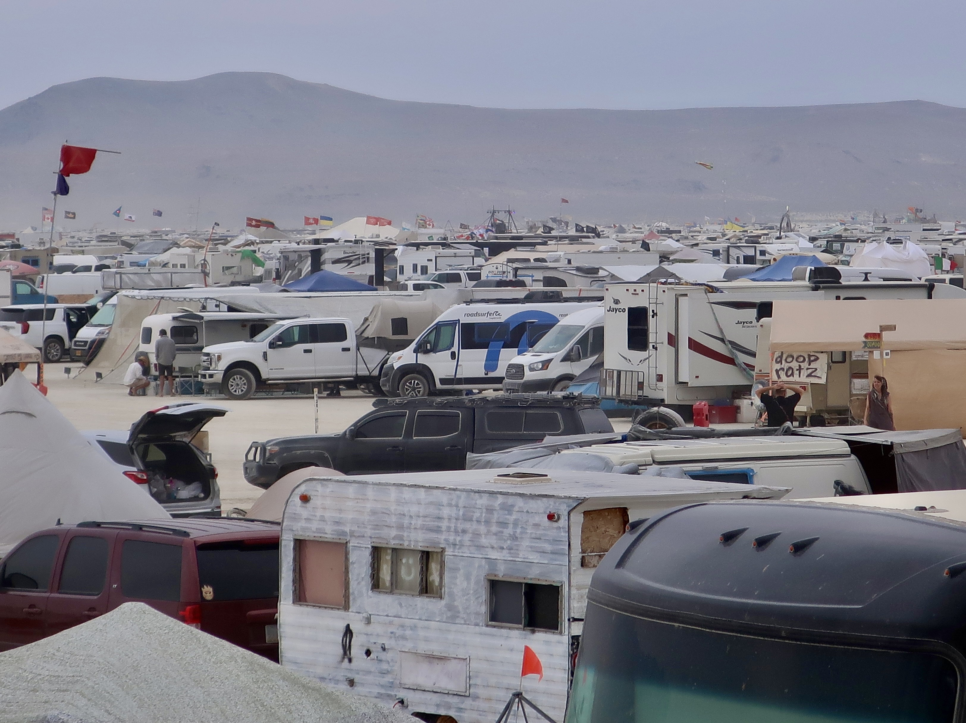
This focus series has several purposes. For newbies, or Virgin Burners as they are known, it will provide an overview of some of the things they will find at Burning Man, for veterans (and some of my followers) a nostalgic look back, for all others who find their way to this series for whatever reason, some insights into the magic that has given the event its world-wide renown. My focus will be on art, mutant vehicles, the Man, the Temple, people and activities, the desert setting, Black Rock City, and Burning Man at night.

Today I will be using 2023, the last year Peggy and I went, to introduce the series. Going forward, each post will include one to two focus areas with photos taken from the different times we have journeyed out to the Black Rock Desert. Starting in 2004, I’ve been 12 times and Peggy 7. Mine have included 2004, 2005, 2006, 2007, 2009, 2010, 2012, 2013, 2014, 2015, 2017 and 2023. I began writing about the experience when I joined WordPress in 2010. Since then, I’ve featured BM in over 200 posts.

Now, a few thoughts for first timers. The Burning Man web site is filled to the brim with good advice on what to bring and what to expect. BM has been located in the Black Rock Desert for 35 years. That represents a ton of experience. You will want to follow its recommendations. The desert can be a harsh environment.

For example: Expect massive dust storms. One minute my view at BM 2023 looked like this.
And five minutes later the view had disappeared altogether. It was a time for staying in place, donning our goggles, and wearing a neckerchief over my nose and mouth. It usually blows over in a few minutes, but I have been at Burning Man when it has lasted much longer. You can get lost wandering around. High winds often accompany the dust storms. Tents and awnings not well secured may take flying lessons.
Just when you think you have mastered everything the desert has to throw at you, something like this comes along: The rainstorm of 2023. Check out their feet. The desert mud acts like Gorilla Glue!
BM veteran advice from Peggy. “The mud doesn’t stick to plastic.” Here’s another use for some of those plastic bags you have brought along to carry out your trash.

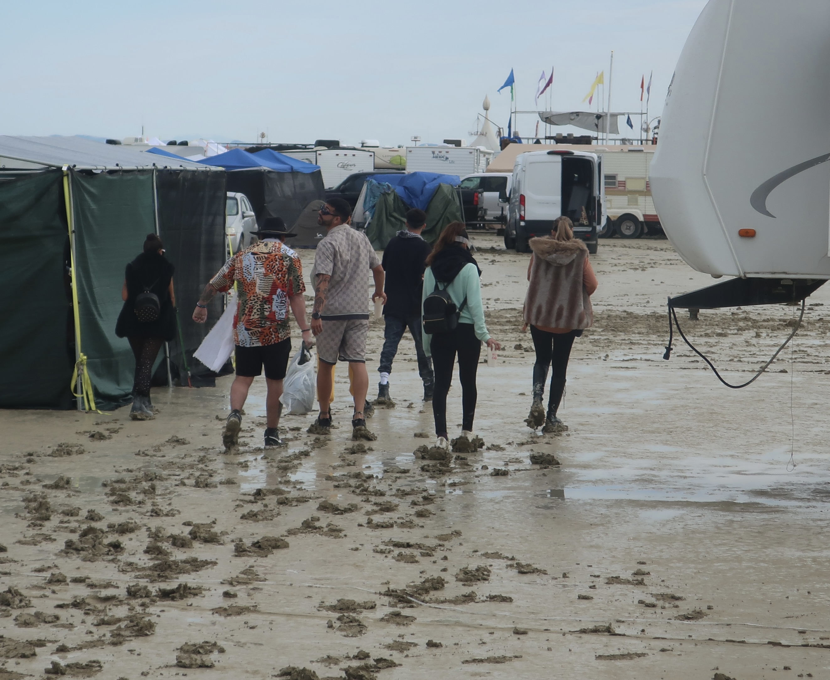
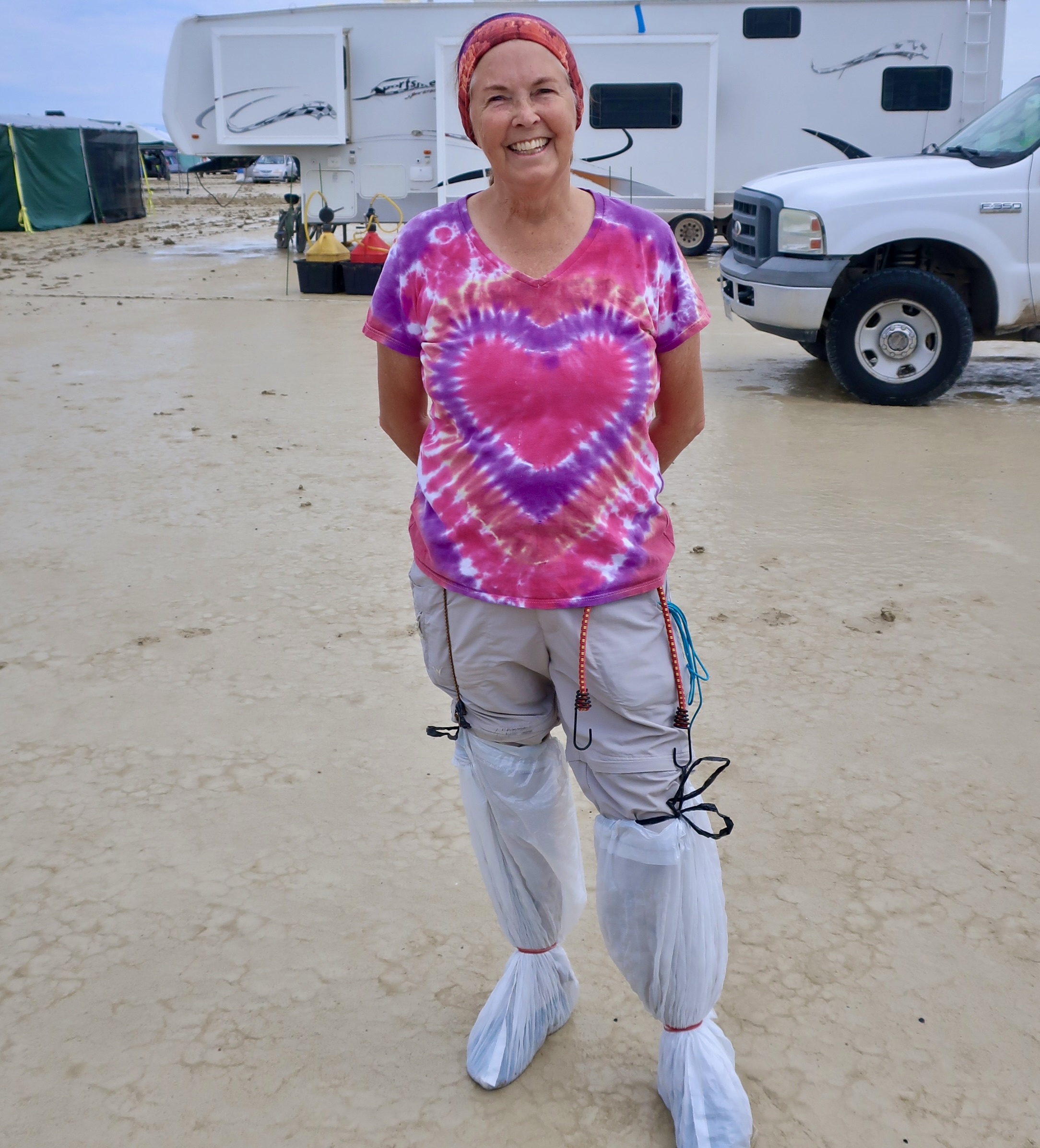
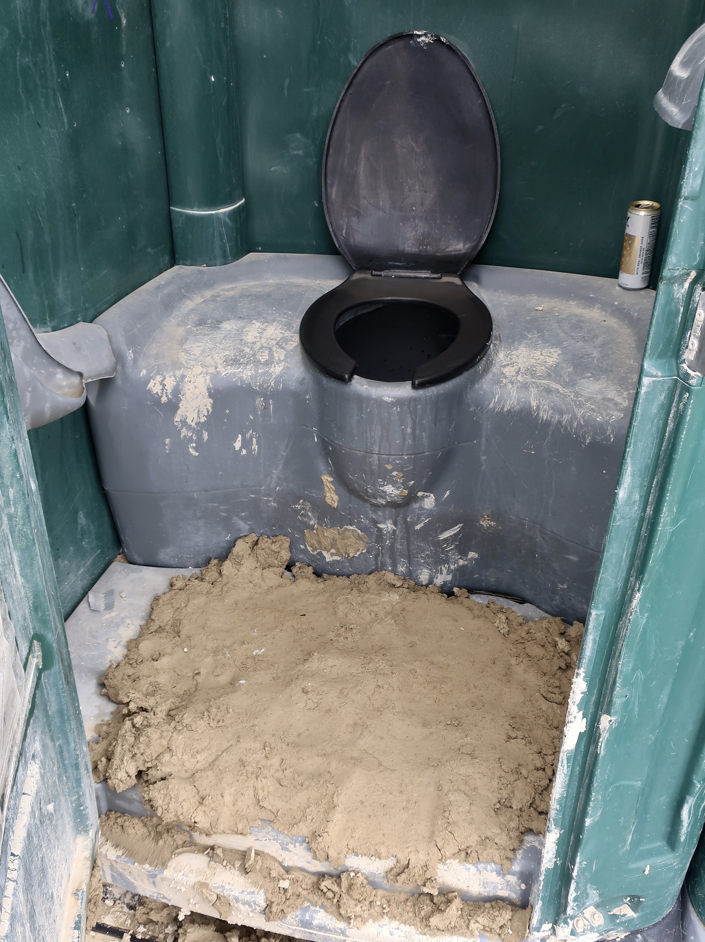
Having introduced some of the challenges, all in all, Burning Man is an incredible experience. In fact, veteran Burners even talk of the challenges they have faced over the years with fondness. One way to help assure a good experience is to follow the Burning Man credo; It is a participatory event, not a spectator event. Come and join the fun. Bring a costume and something to share. Nothing is for sale at the event except ice and something to pump the poop out of your RV, if you bring one. But everywhere you turn, camps and individuals are offering food, drinks, and a multitude of other things— for free. One year a young woman was passing through Center Camp offering to cool down Burners by rubbing ice on their necks. It felt great! You can attend interesting talks and even learn new skills ranging from pole dancing to twirling a hula hoop, or fire. And you can share the skills you have. Volunteer to help with the event. There are dozens of opportunities.

Individual reactions to Burning Man cover a wide spectrum. As a newbie, you may find you absolutely love it. When you arrive home afterwards, you are excited to share the experience with friends and family. You immediately start planning to go the next year. Or you may find yourself saying “Wow, that was an experience. I’m glad I came but I don’t need to come again.” Or, you may be asking, “Why oh why did I decide to come here? I don’t need dust in my nose, eyes, and mouth. I want my toilets to flush. I don’t need the desert heat and desert cold, mud that sticks to my shoes, people everywhere, and drum-heavy metal/rock/industrial music that blasts away to the wee hours of the morning!”

But even if you hate it, think of the stories you will be able to tell your grandkids. For example:

“Great-great grandpa may have walked three miles through deep snow to get to school, but that was nothing compared to walking to the porta potty durning the Burning Man deluge of 2023! Mud was everywhere. It stuck to your shoes like a tick on a dog. The sewage trucks couldn’t make it in to empty the porta potties. They were filling up with poop. Horror of horrors! Luckily, someone had posted cartoons on the walls to take our minds off of the horror and remind us of civilization.”
But enough fun. Let’s move on to some of the things we found special about Burning Man 2023: the kind of things that bring Burners back to the Black Rock Desert again and again.
The Man, after which Burning Man is named, dominates the Playa and Black Rock City. No trip to Burning Man is complete without a journey out to the site. Climbing up inside often provides interesting art and always a great view. While the Man himself remains the same every year, the base and surrounding space is changed to reflect the annual theme.
The 2023 Man at night. The lights in front are from bicycles. It’s critical that you can be seen at night! The only forms of transportation at Burning Man are bikes, your feet, and mutant vehicles. The vehicle you arrived in must be parked for the week. Most burners travel by bicycle. Decorating them is a Burning Man tradition.
Another must see building at Burning Man is the Temple where Burners memorialize loved ones and pets who have passed on, confess everlasting love, and say thank you. When the Temple is burned at the end of the week, the messages go up in flames. While not religious, the Temple definitely has a sacred feel to it and is always, uniquely beautiful.
Being partially hidden by a dust storm increased the mystical feeling of the 2023 Temple.
Different times of the day present the Temple in a different light. Peggy and I like to visit in the early morning and evening as well as during the day. It’s always located on the Playa behind the Man. It was a four mile plus round trip for us in 2023. Thus the need for bicycles.
This is a 2023 map of Burning Man. The Man is at the center above Center Camp and the Temple in the circle above. The grid shows the streets of Black Rock City. The open space is the Playa. As for all the numbers, they represent art installations. As I mentioned above that people come to Burning Man for a variety of reasons. Maybe it is to dance around the clock for 7 days with well-known DJs providing the music through gigantic speakers. We come to enjoy, appreciate, and photograph the art. As you might imagine, it is close to a full time job.
The Playa is the central location for much of the art. Most of the pieces are in sculpture form. The creativity is unending. Burners are climbing up into the house/creature. (I’m not sure I’d want to do that if the beast was hungry.) Much of the art is interactive, designed to be explored in various ways.
The head of the house/beast.
Speaking of interactive, this piece was designed to turn so the creatures could be matched up with the appropriate parts. Roar and Neigh suggest a lion and a horse, neither of which has any of their parts as the sculpture stands now! The Burning Man Theme for 2023 was “Animalia”, celebrating the “animal world and our place in it”. Many of the sculptures, like this one, represented the theme.
They could be striking, like Pegasus, whose wings flapped and legs moved…
Or something else, as this ancient rain god. I may be making up the rain god part, but something had to bring the rain. Nice tongue.
Another rain god, for sure.
Burners could walk into this giant bear where mirrors provided opportunities for them to see themselves from a number of different perspectives.
This interesting sculpture was built by Ukrainian Burners to reflect their country’s reaction to the Russian invasion of their country. A number of soldiers who died fighting to protect their country from tyranny were memorialized in the photos.
Winged victory seen during the day and …
And at night. Most of the sculptures shown during the day are lit up at night, some beautifully so.
Another example: Fish sculpture during the day…
And at night from the other direction. The Man and distant lights of Black Rock City provide the background.
A chalice with a key hole. Made large…
And a tea pot. Peggy and I have dozens of more photos representing the art of Burning Man in 2023 that we were able to catch before the weather went bad. There were dozens more that we never got to. This is simply a small sample of the breadth of what one can find at BM.
Another fascinating example of creativity at Burning Man are mutant vehicles. A special permit is required to bring one to the event. They range in size from large, designed to carry a lot of people to…
Small personal vehicles. The rule is that they can’t resemble the original vehicle from which they are built.
Three more examples from 2023: An elephant…
A VW bus that had morphed into a flying green something with antlers propelled by wings and a giant jet engine…
A Texas Longhorn. Like sculptures, mutant vehicles are often lit up in interesting ways at night. It’s not unusual to find several dragons— or an octopus— wandering the Playa and blasting out fire.
While the Playa may be the place to go to see the majority of the art and mutant vehicles, exploring Black Rock City— a city of that is literally built in the Black Rock Desert prior to the event and taken down afterward— could easily keep you occupied for the whole time. Several large structures like this one, are built by major tribes, to house the tribes along the Esplanade, but also offer a wide range of things all Burners are invited to participate in. This ‘frog-like’ creature with a third eye easily fit into the 2023 Animalia theme.
As you might expect with 70,000 people, things can get a little crowded at Burning Man, but free space is provided for everyone. Tribes have designated areas, assuming you jump through the BM hoops and qualify. For everyone else, it’s find your own spot. The later you arrive in the week the farther out from the Playa you will be! Black Rock City’s resemblance to a huge parking lot is obvious, but it’s a well organized parking lot. The map above that featured the art shows the layout. The roads that follow around the semi-circle are given names that reflect the theme. The roads cutting through are assigned numbers. Assuming you have memorized yours road’s name and number, or written it down, you will be able to find your home. Otherwise….
A close up of the 2023 roads. How would you like to live on Dingbat and 9:30? The street numbers are below.
Walking/biking up and down the roads and streets is an interesting way to wile away a few hours. For example, you might find yourself at the Habitat for Insanity.
Or the Gypsy Nebula Carnival. Come evening there will be loads of places you can stop for a free drink. Bring your own cup.
You can expect to meet interesting creatures along the way as well. Like Falcor, the Goodluck Dragon of “Never Ending Story.”
Or King Kong He’s been to Burning Man many times as his condition suggests. It’s not easy being a giant ape in the desert.
In the end, it’s the people who make Burning Man Special. The veterans, the newbies, the artists, the builders, the planners, and your next door neighbors. Everyone. The dreamers and the desert. Here, two of our neighbors take a photo with the world traveling Bone. Even though he has been to 50 countries, Burning Man is still his all-time favorite place.

Here’s hoping you make it to BM2026. My next several Monday posts will continue my Focus Series look at Burning Man, exploring in detail the various aspects of the event I have introduced today. Next week, I’ll start with mutant vehicles.

On Thursday, I will continue my blog-a-book memoir and describe how I hired the family pets to protect me from the ghosts that wandered into our backyard from the graveyard next door. There were pros and cons.

Poor Pat. Living with me did have its drawbacks, especially when I had a camera in hand. Being a rescue dog, however, she was eternally grateful and willing to pose for me. Reluctantly. She was a bit large for the army cot I slept on outside in the summer. But she was great at scaring away the ghosts. A cocker spaniel and at least one cat joined her.

2025: Focus on Hawaii… The Year in Review

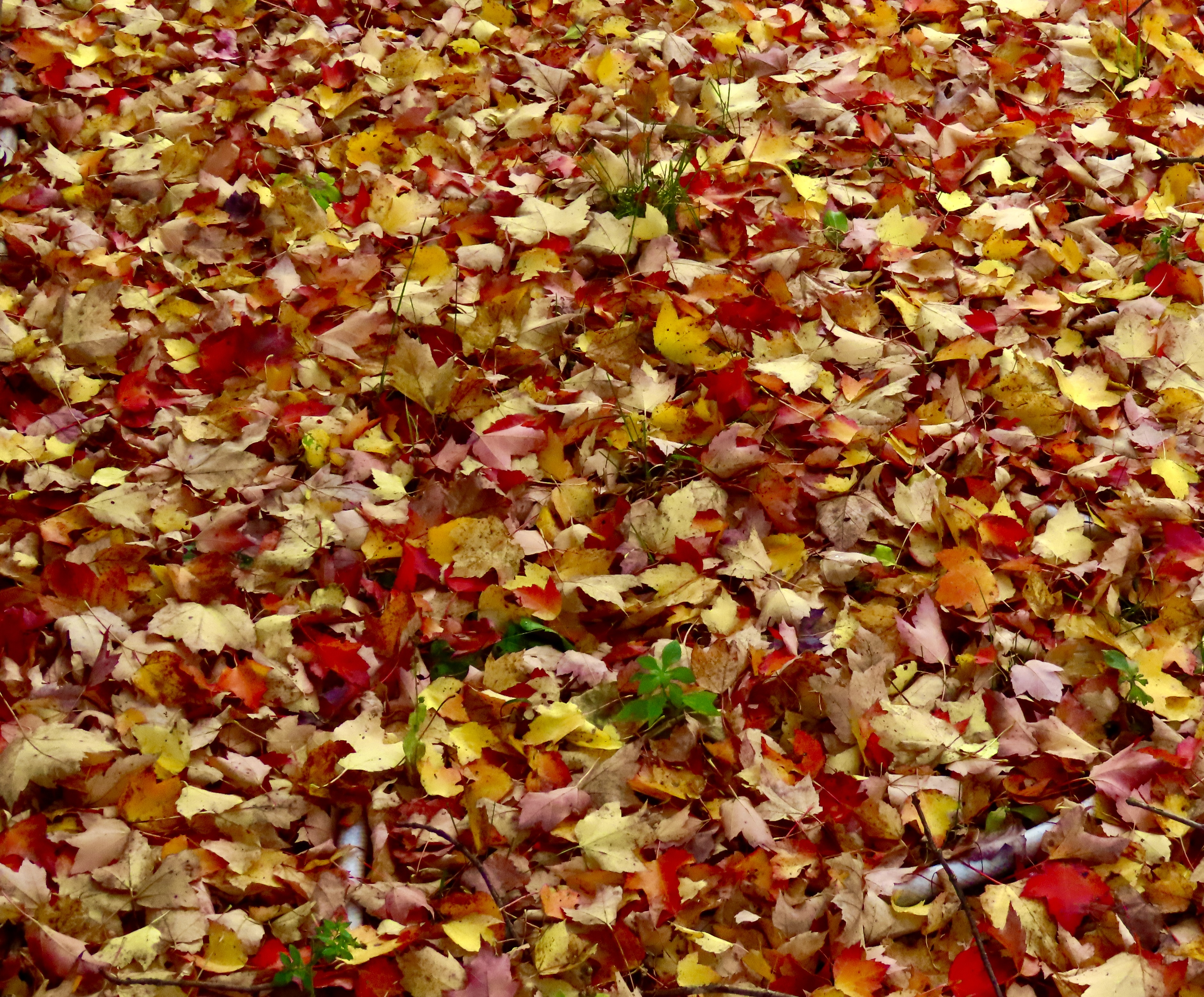
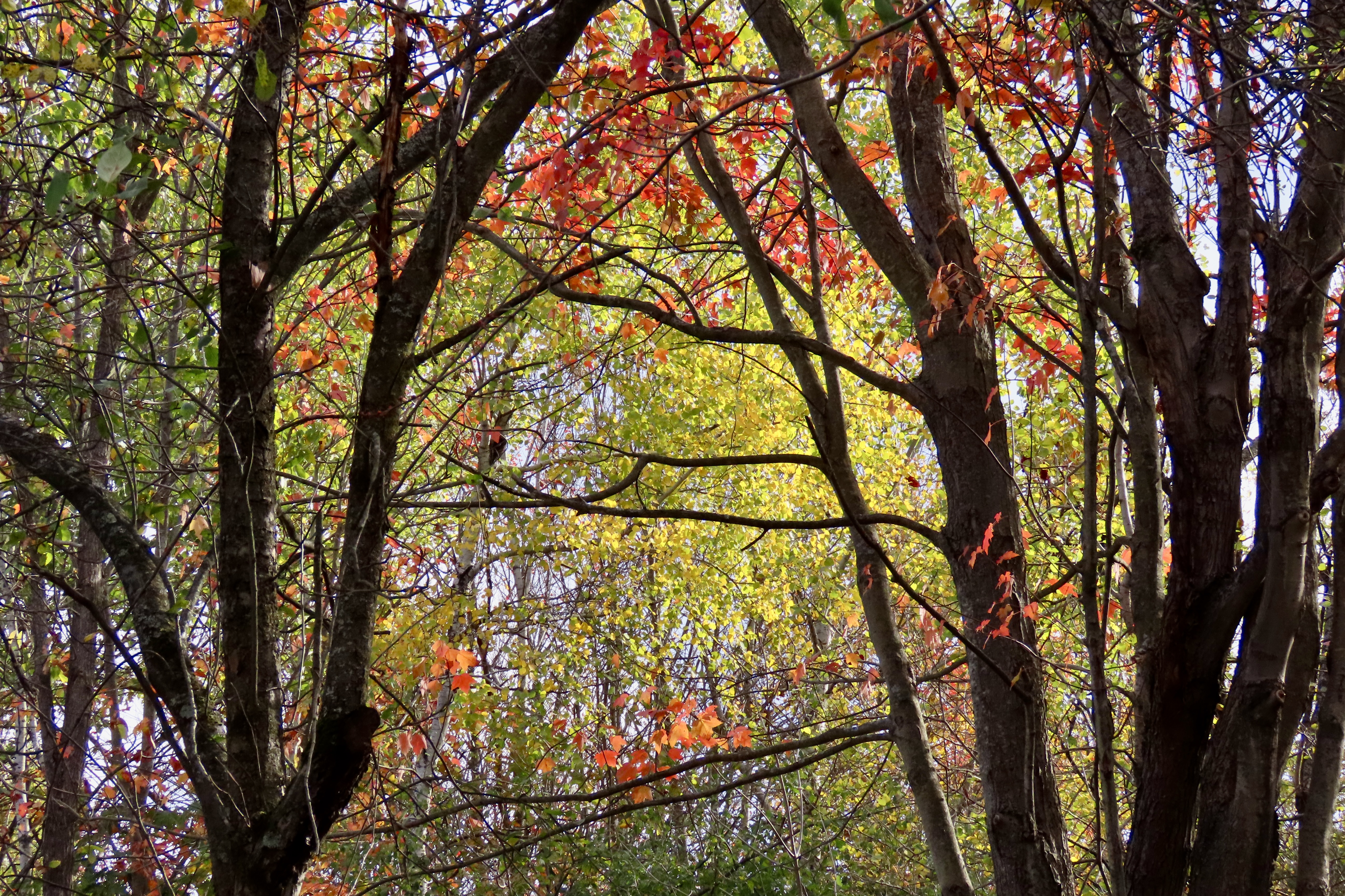
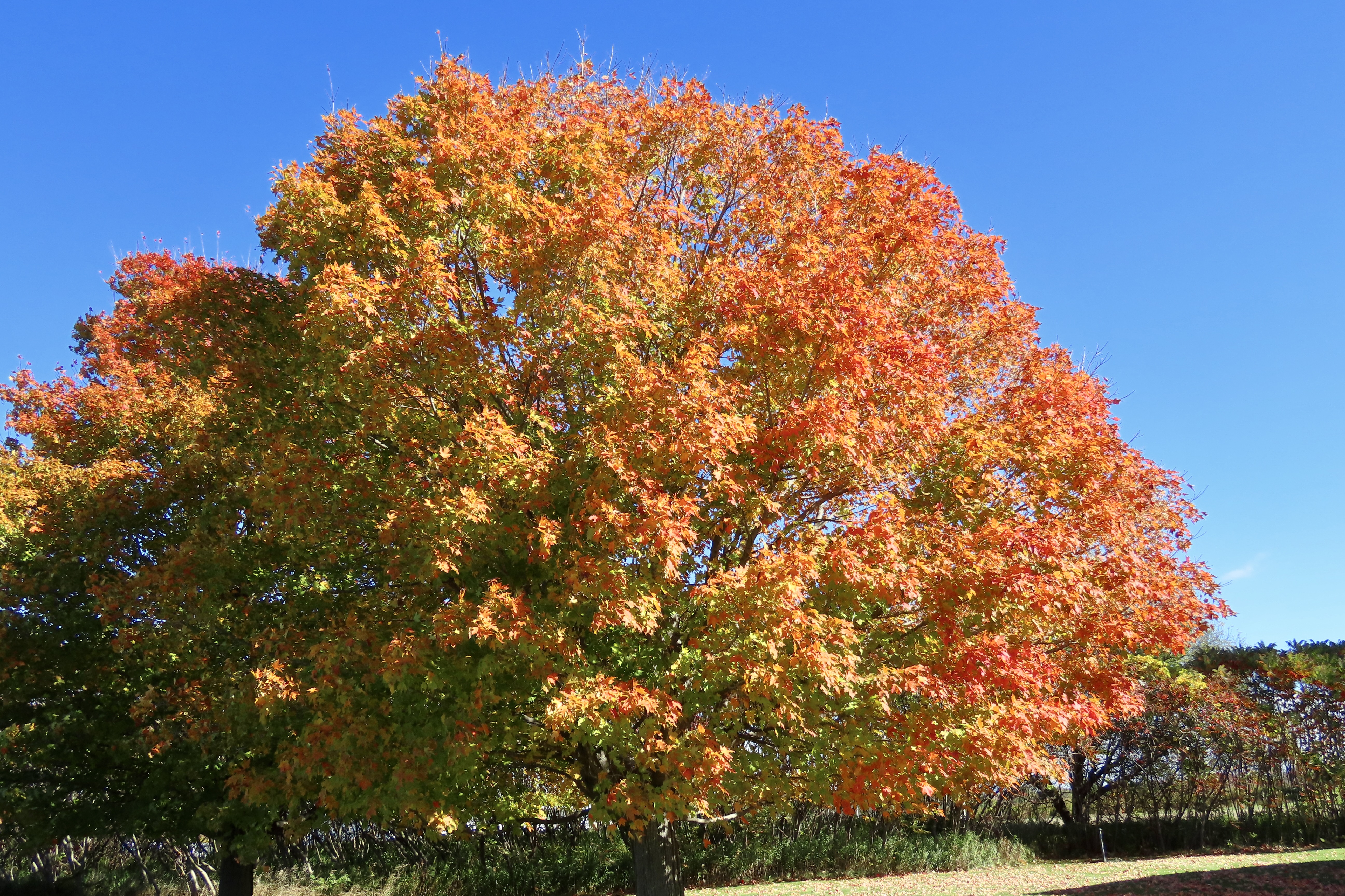
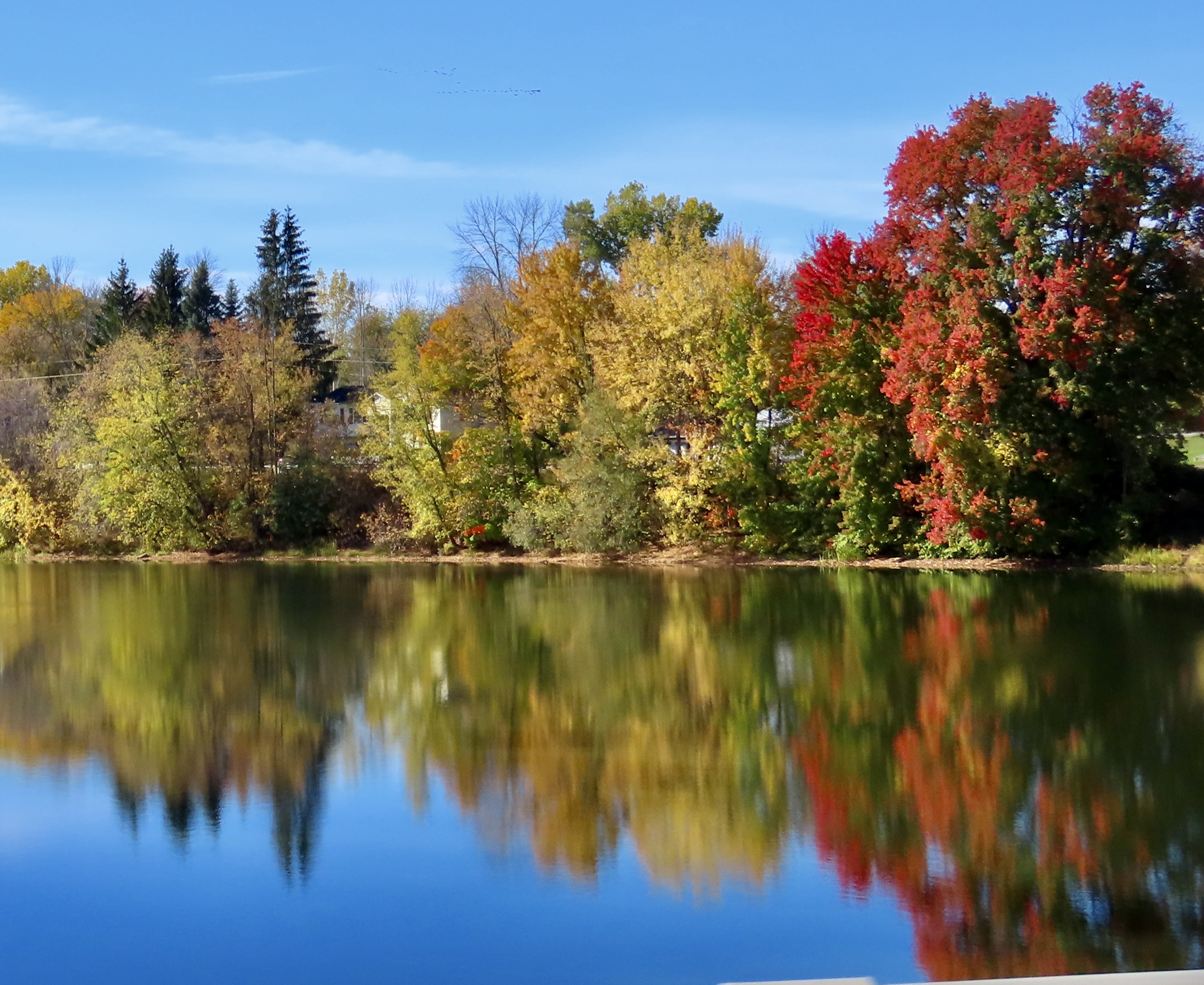
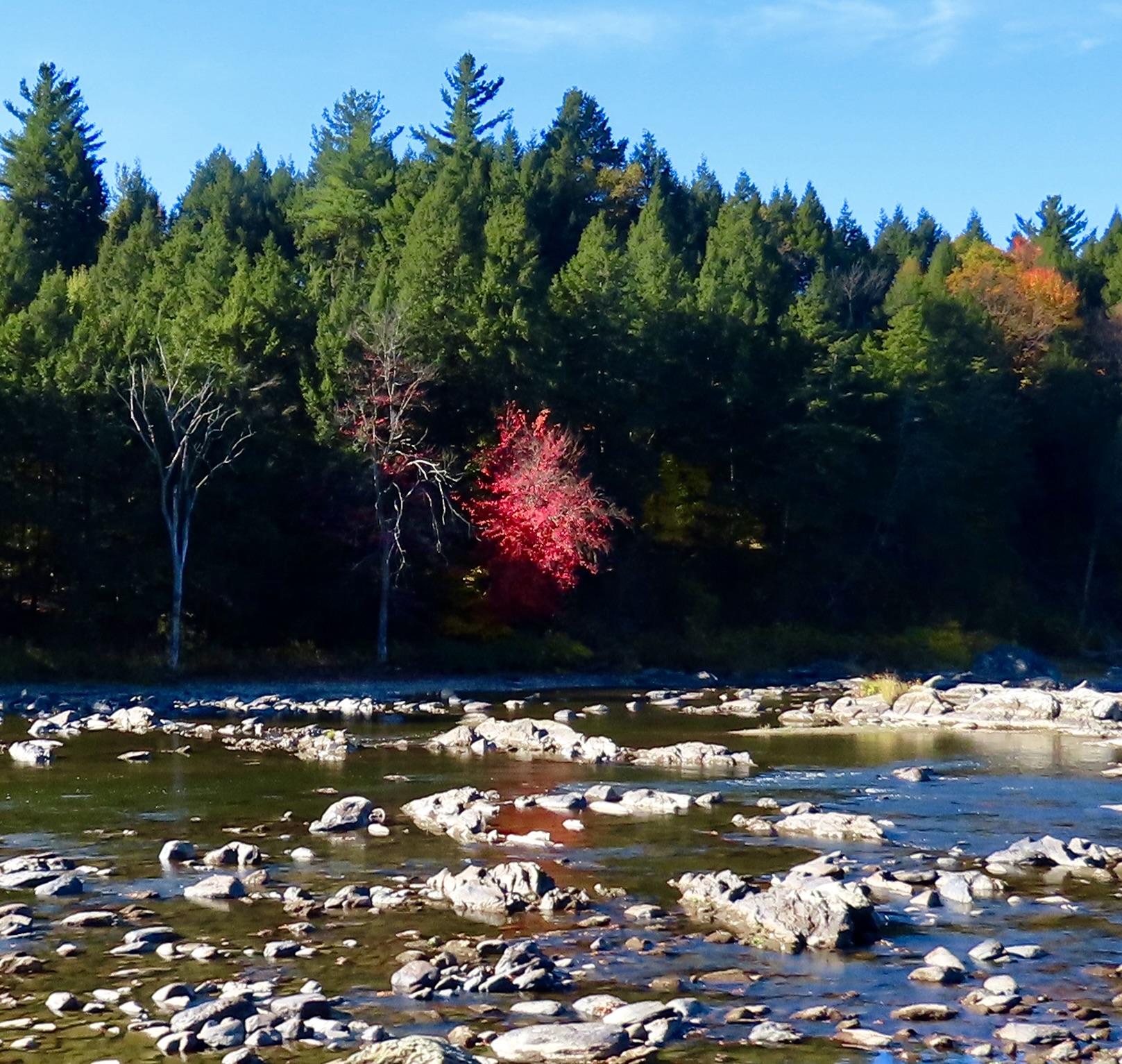
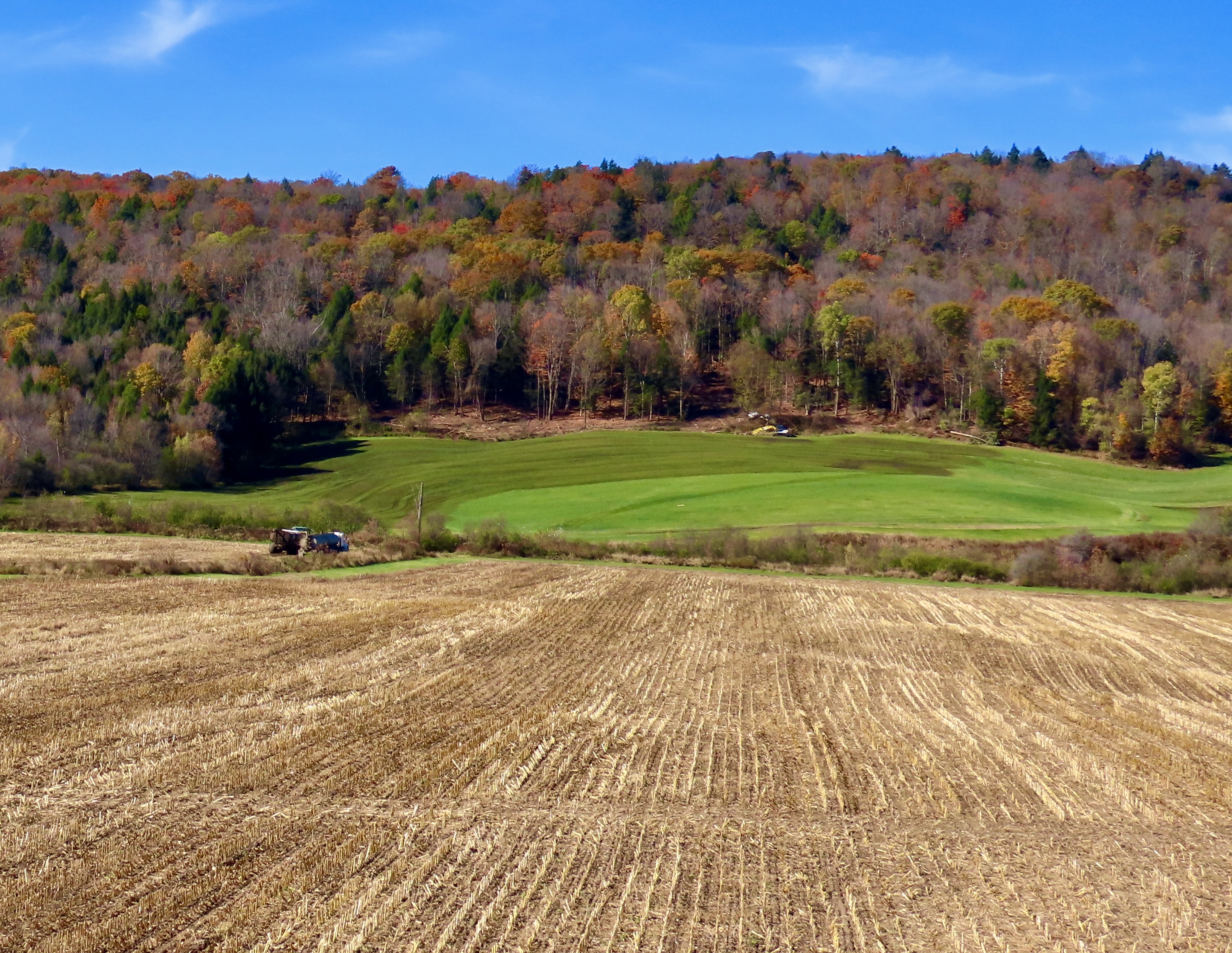
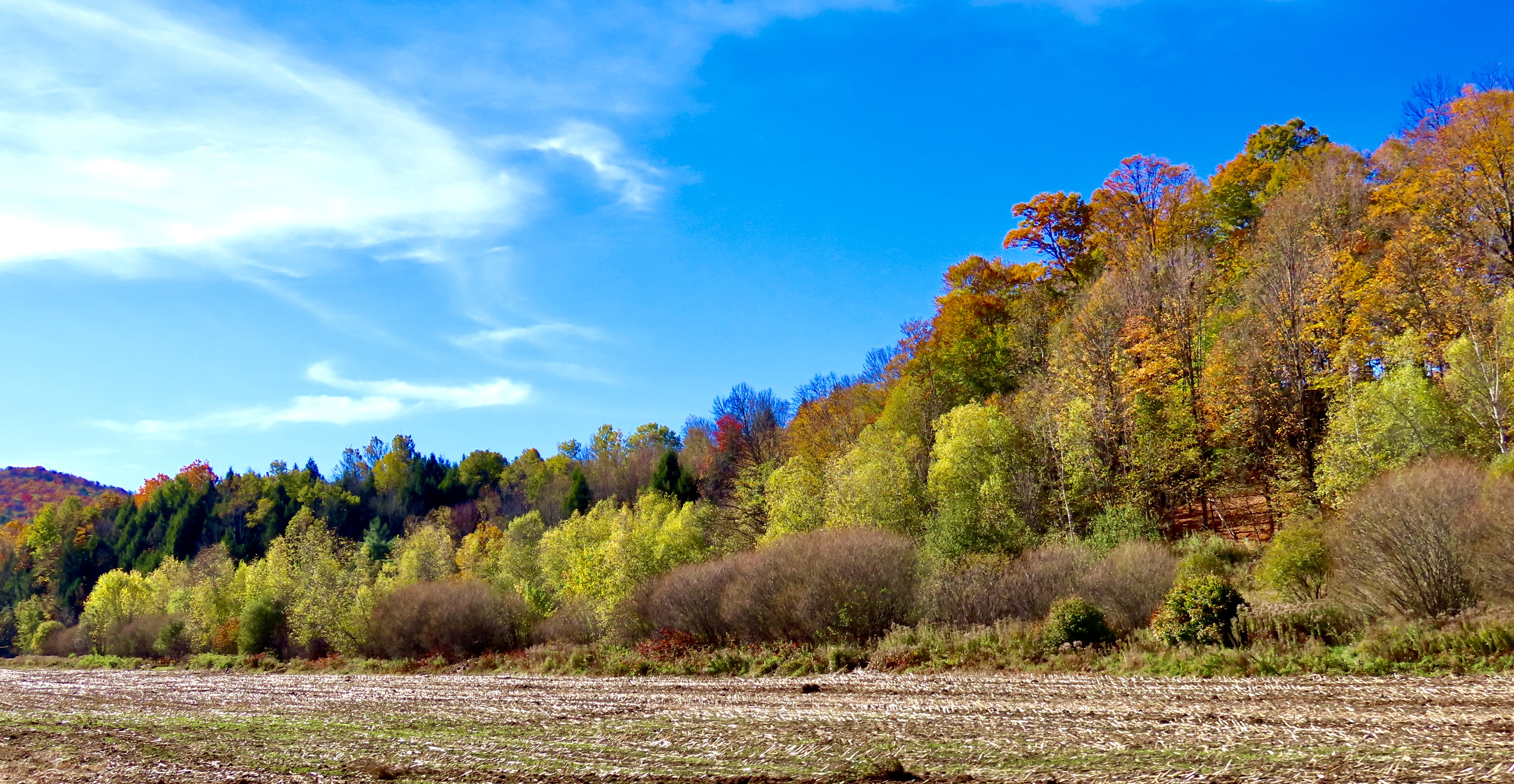
Our blogs each year, for the most part, are based on our wandering ways. We kicked off 2025 with a trip to the Big Island of Hawaii where we stayed in a VRBO 30 miles outside of Hilo for a month, rented a car, and explored the island. Spring and summer found us wandering through the Southwestern US for five months, pulling a small trailer behind our truck, and visiting national parks and monuments. In October/November, we left the trailer behind at our home base in Virginia and traveled for three weeks through New England admiring the beautiful fall colors.

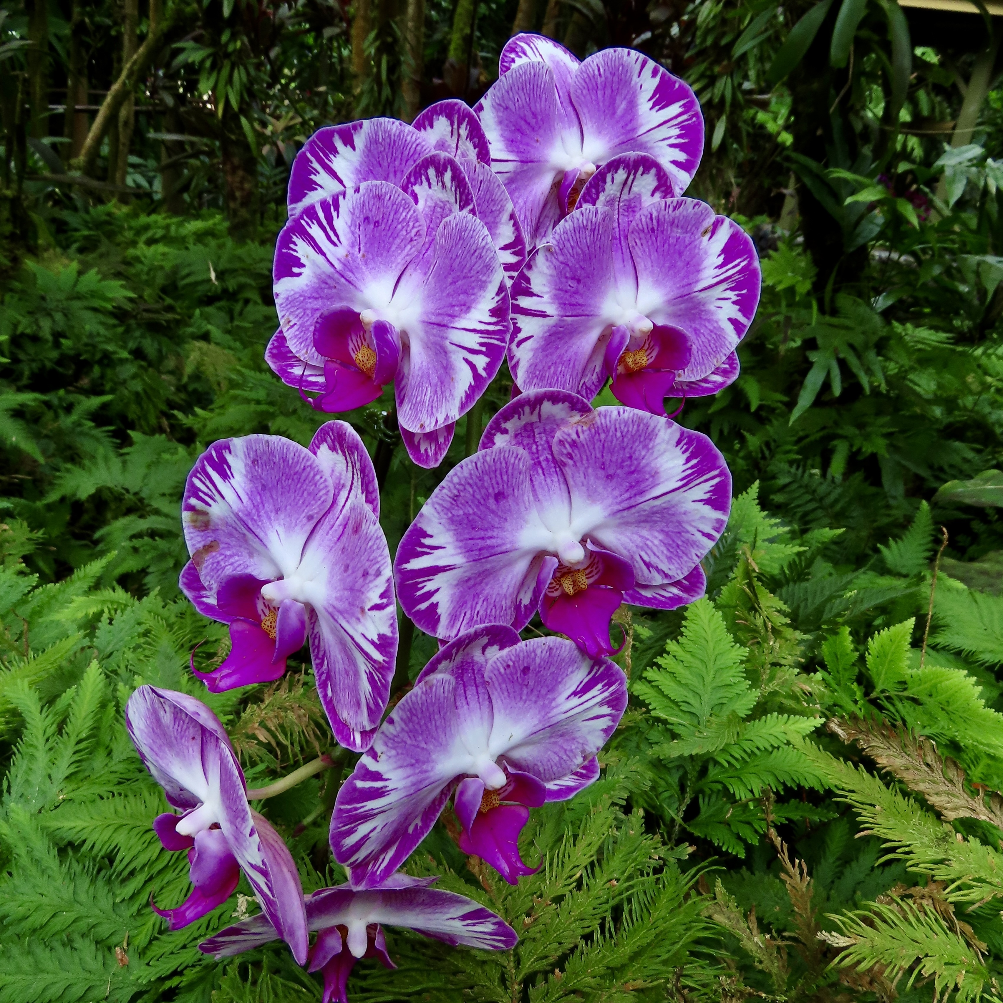
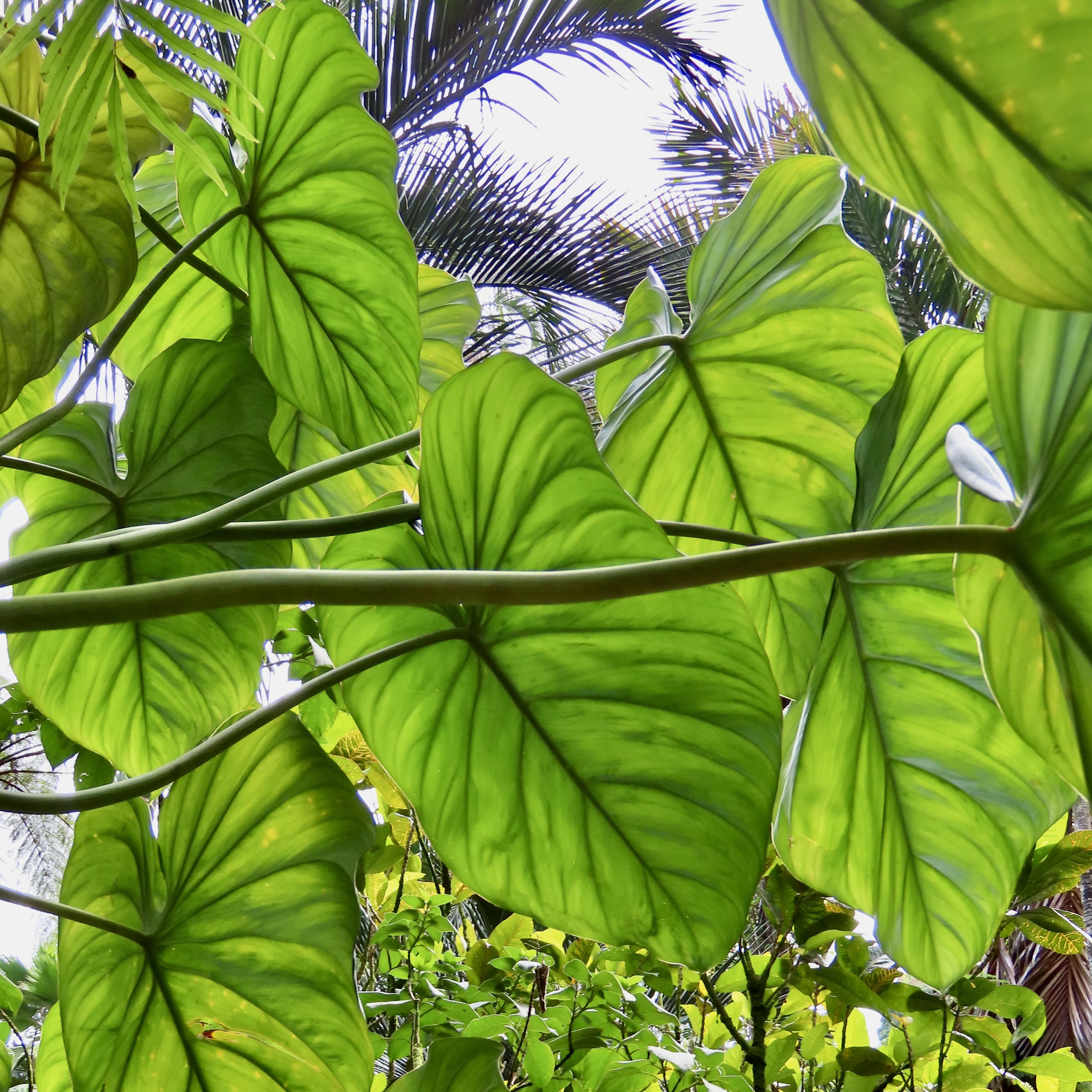
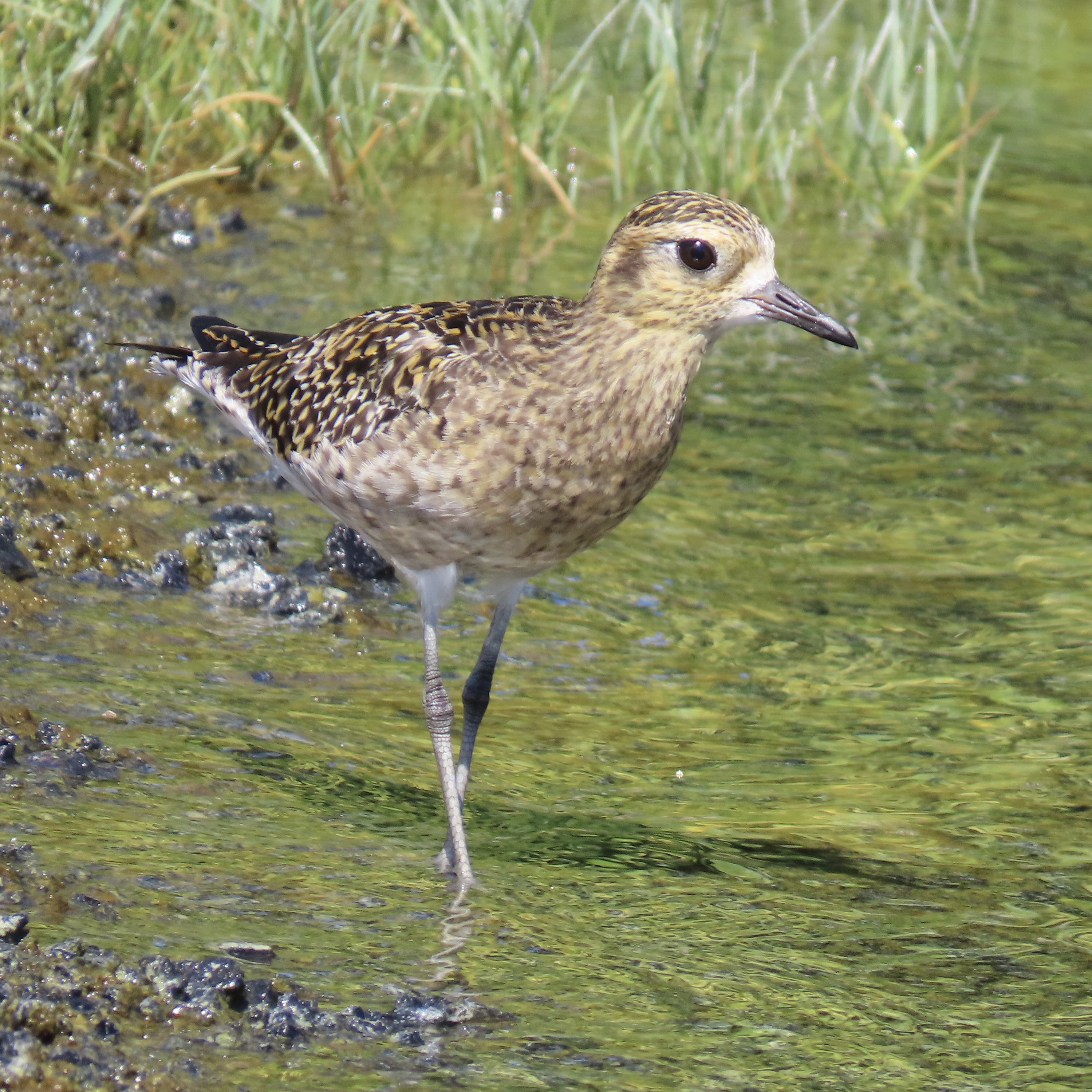
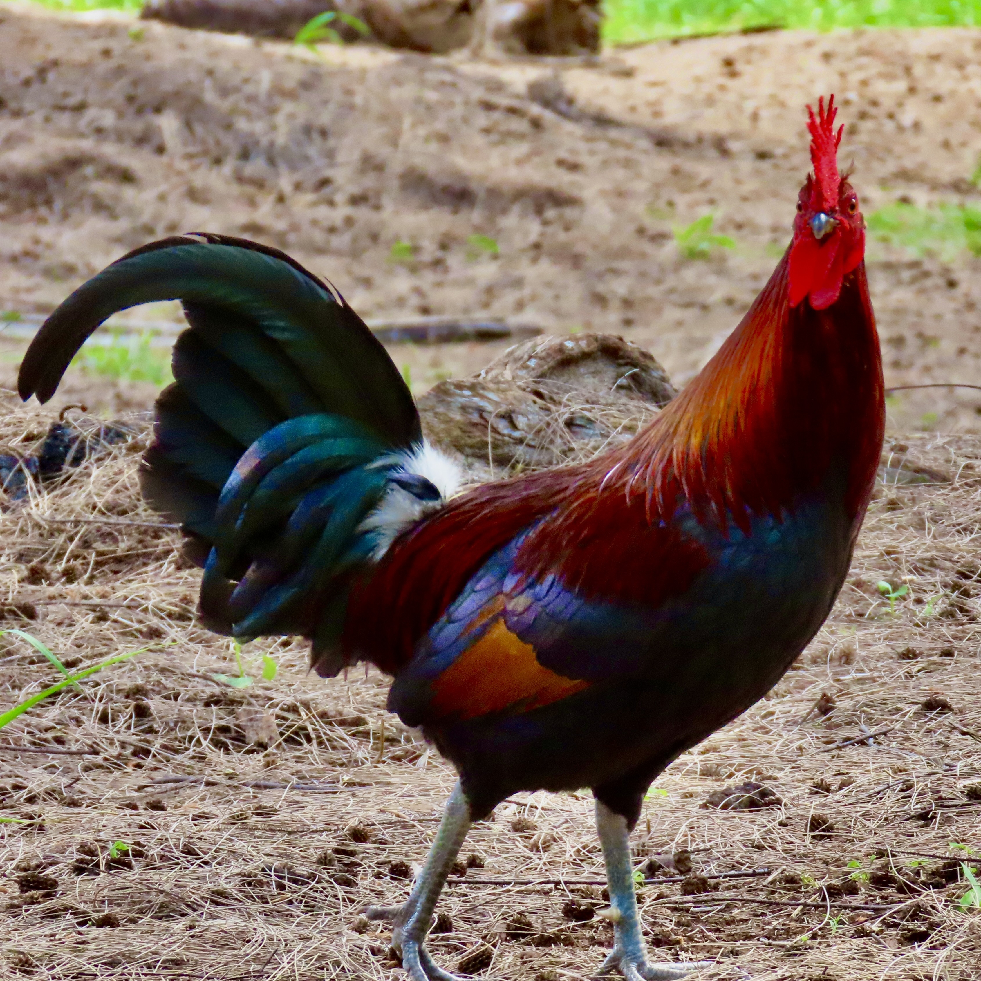
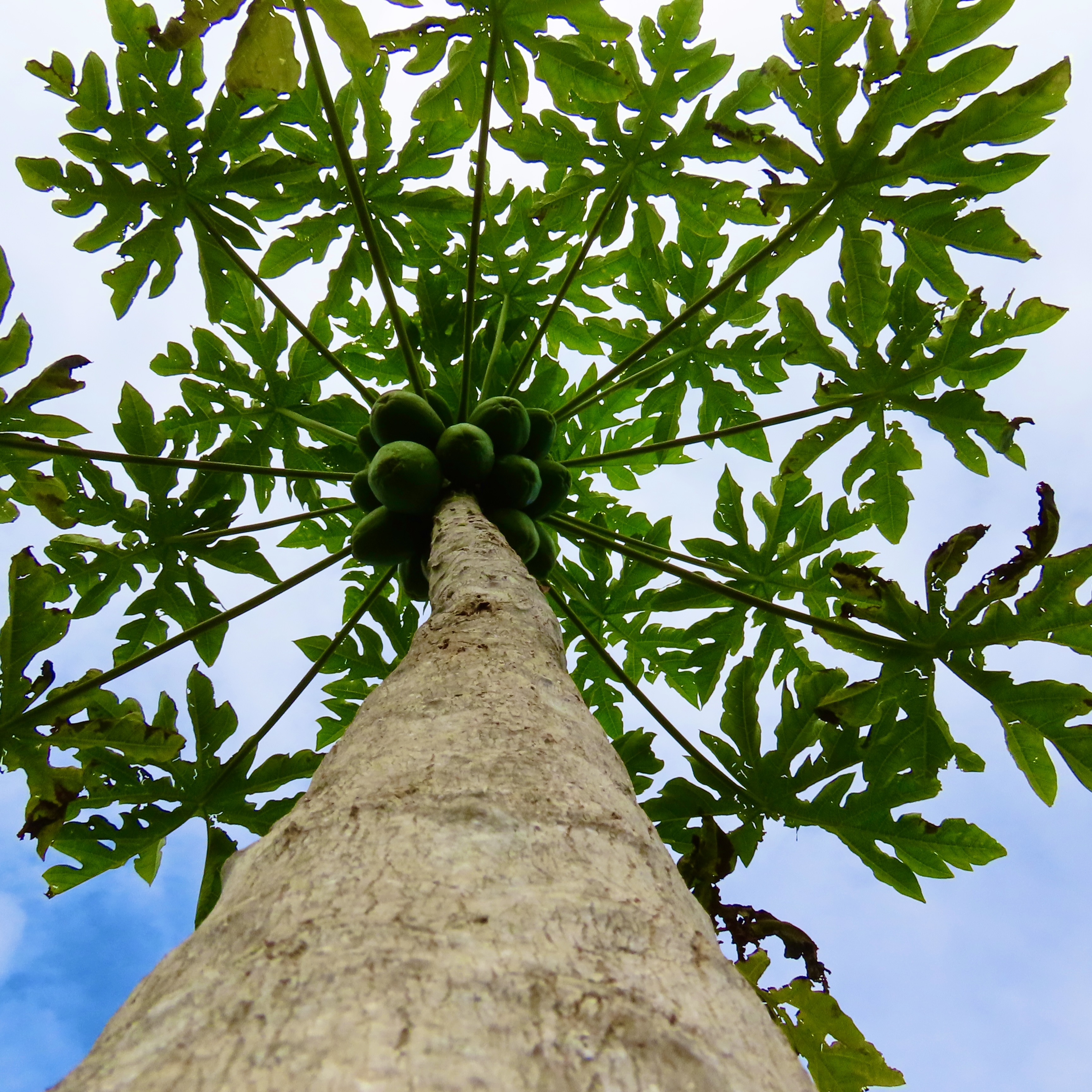
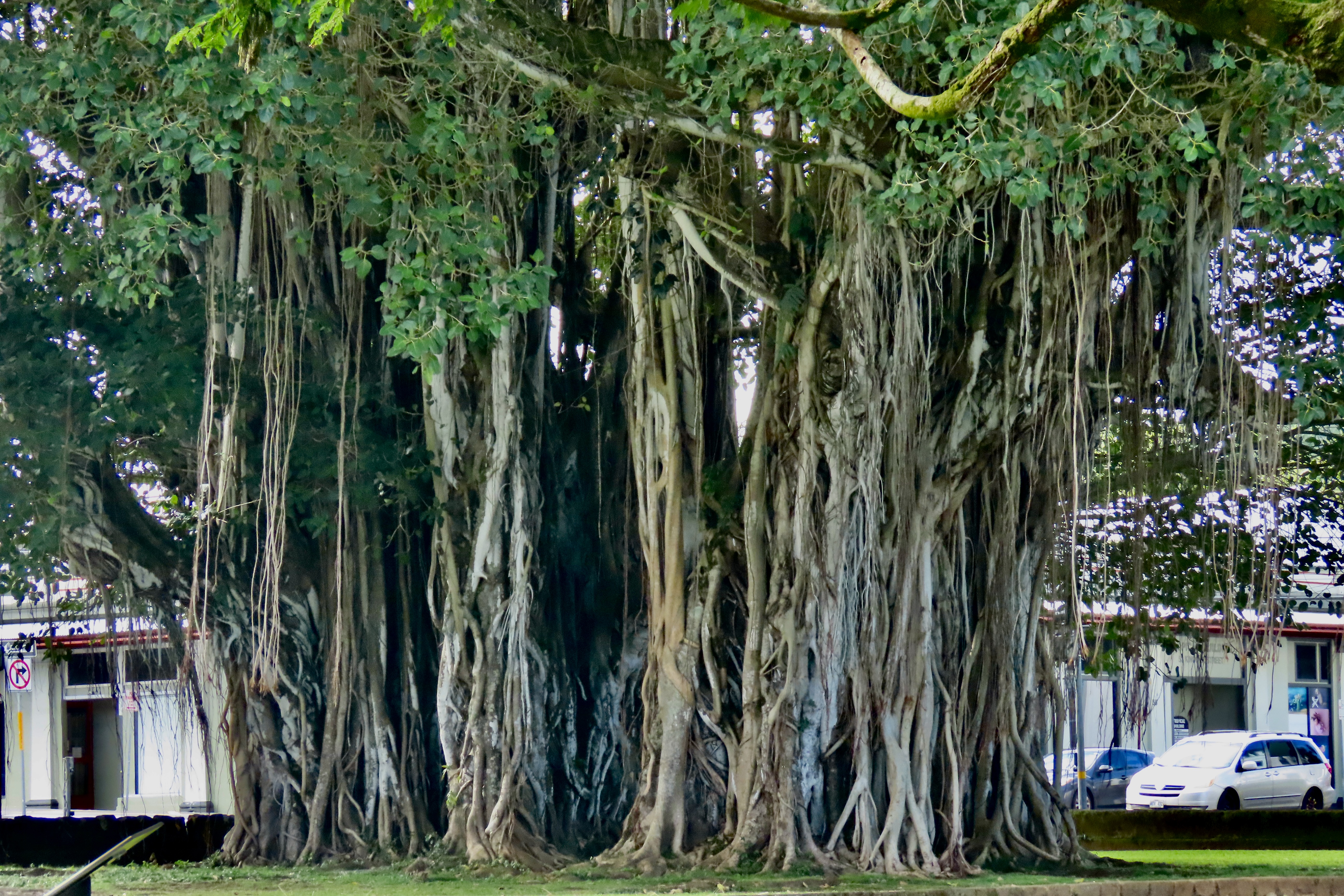
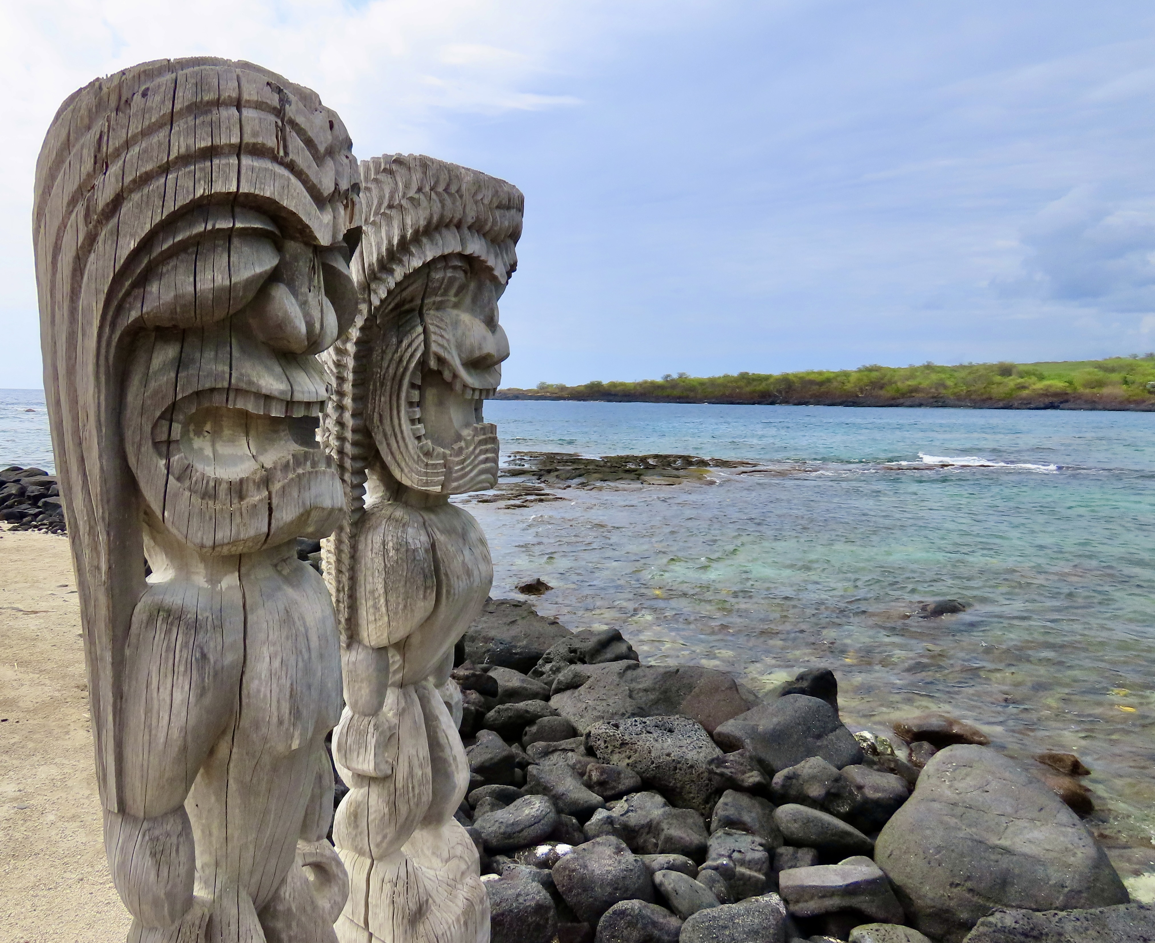
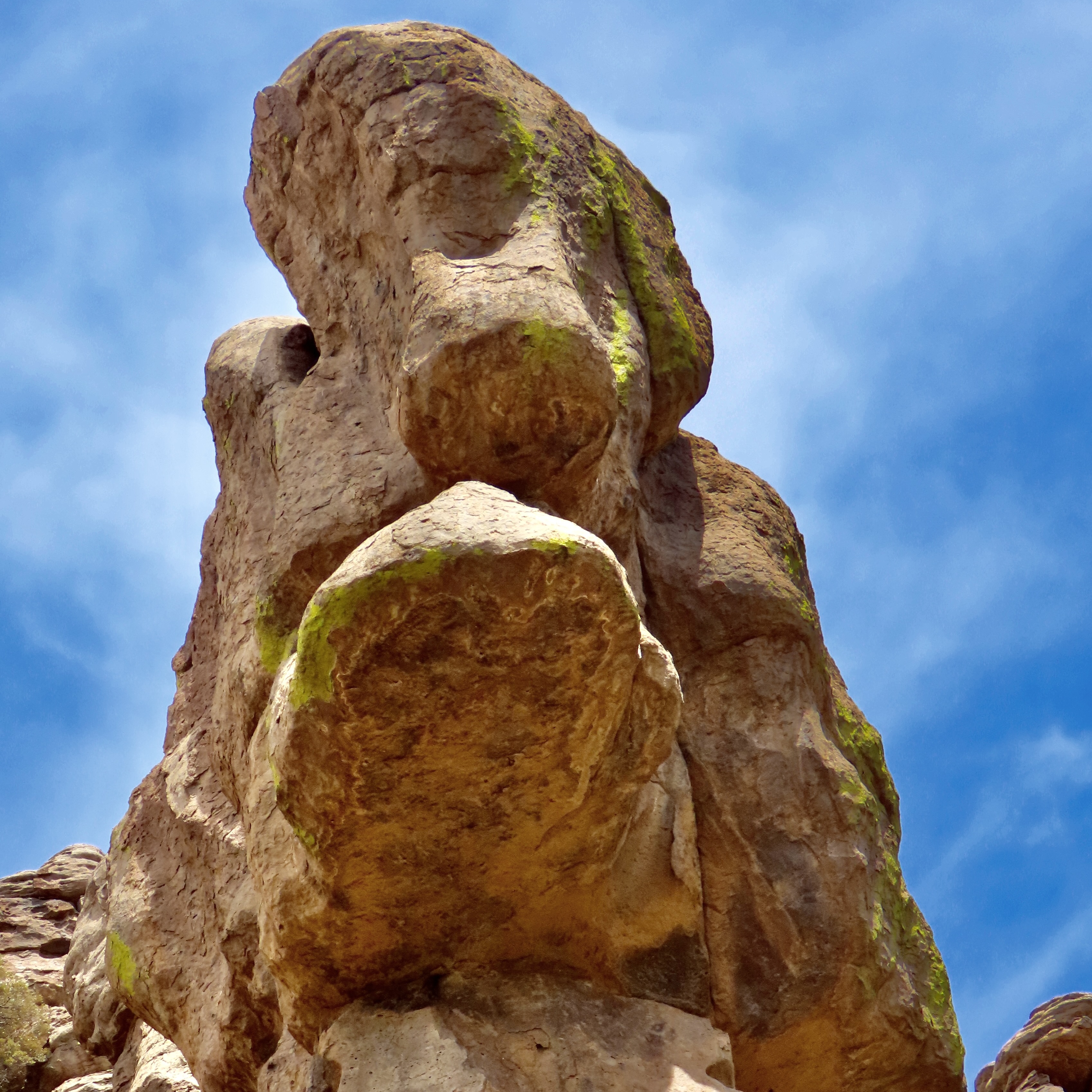
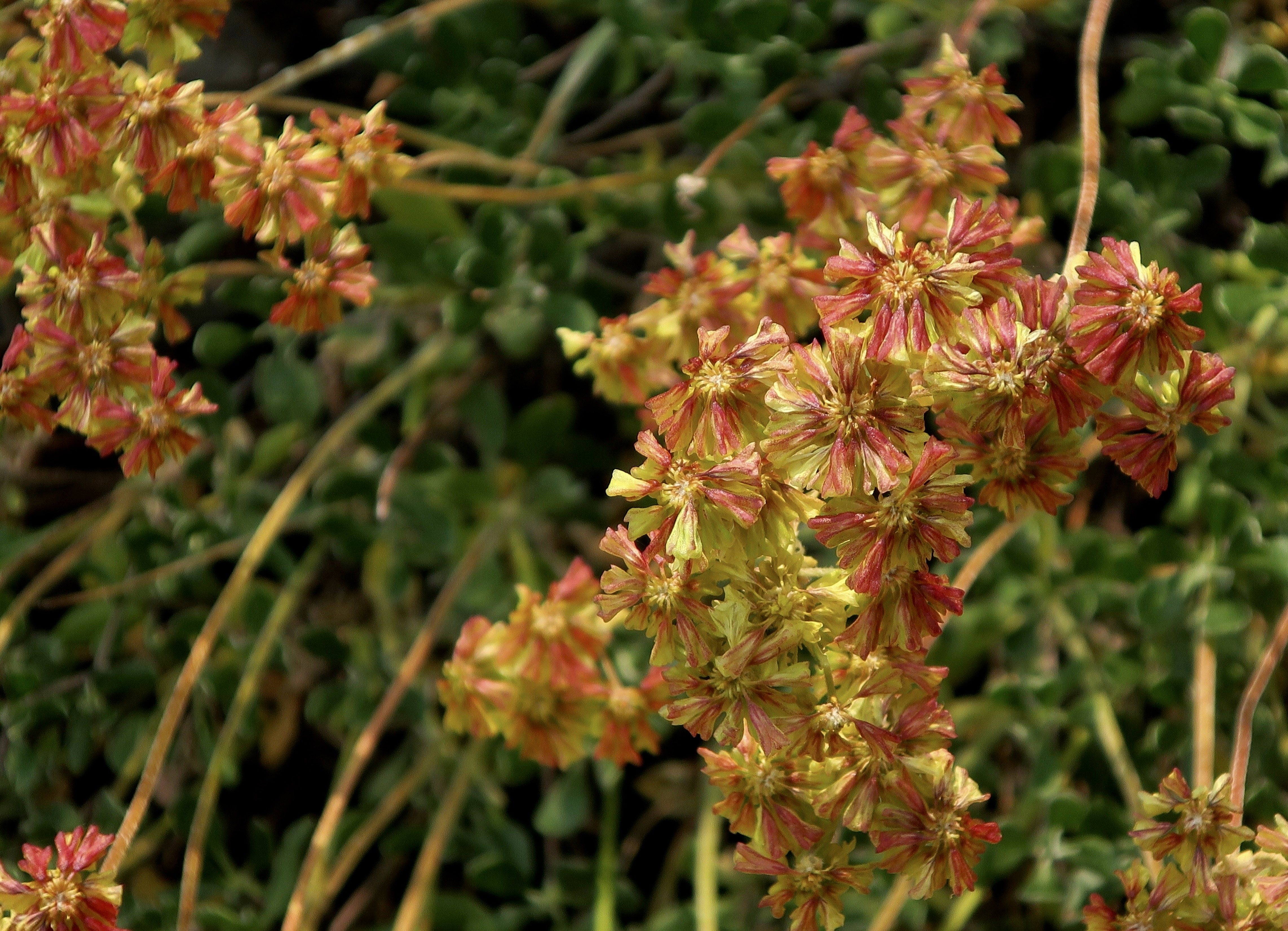
Our next three posts will be devoted to doing our yearly wrap-up of our travels— based on our annual calendar. Each year we select 13 photos from among what we consider our best travel photos for use in a calendar we create for our extended family. This year we created three: one for each of the areas we visited. Family members got to choose which calendar they wanted. The photos for today’s post were selected for our Hawaii Calendar. The orchid above is one of numerous different species found at the Hawaii Tropical Botanical Garden just outside of Hilo. We highly recommend a visit if you travel to the Big Island. Over 2000 tropical plants are found in the garden.

Big leaves are expected whenever one travels in tropical rainforests. Having served as a Peace Corps Volunteer in tropical Africa for two years, I can speak to this personally. Peggy and I were particularly impressed by the beauty, size, and importance of taro leaves to native Hawaiians. Served as a food staple thoughout the islands, Taro is also important in Hawaiian mythology where Taro is regarded as the ‘Elder Brother’ of humankind.
If you are a crossword buff, you will know the name of this bird: Meet nene, the native goose of Hawaii.
While we photographed a number of birds, as always, we found this slender golden plover particularly attractive. It hardly looks like it is up to a 3000 mile journey to get here each year, but it is. Breeding and raising its chicks in the arctic each summer, it makes the 3000 mile journey to Hawaii each August/September where it will live and feed until April/May when it will make its return journey to the far north. A couple of other facts we found interesting: It often flies non-stop and it always returns to the same location. We would likely find this same bird here if we traveled back to the Big Island this year!
Any discussion of the wild birds of Hawaii almost always includes chickens which arrived in the Hawaiian Islands with the Polynesians around 1200 AD, went wild, and have since interbred with modern chickens brought over in the 19th and 20th centuries. We found this gorgeous fellow wandering around in the forest near us.
The anole is another interesting member of the Hawaiian wildlife. We had been shopping at a local supermarket when we came out and found the colorful lizard on the hood of our rental car. I suggested that it might want to relocate but it refused, even when we were driving 50 miles per hour down the road. Turns out that anole lizards have specialized toe pads covered with millions of tiny, microscopic hairs that create molecular attraction with slick surfaces. They are related to the iguanas I featured three weeks ago and even come with dewlaps.
We were fortunate to find the Kīlauea Volcano active during our visit in February. We watched as it spewed lava 300-400 feet into the air. By November, it was shooting lava as high as 1500 feet!
Isaac Hale State Park was located 15 minutes away from where we were staying south of Hilo in the small development of Seaview on the coast. The park was the end of the road for us. No sign was required. An eruption of a side vent on the lower east rift zone of Kīlauea sent lava spreading out over 14 square miles in 2018, destroying 700 homes, blocking several several roads, and covering a portion of the state park before reaching the ocean. Residents of Seaview watched in fear at the time, hoping that the lava flowing a mile away wouldn’t reach their development. They lucked out.
Having destroyed homes and blocked roads, the lava finally plunged into the ocean, sending steam high into the air and adding new land to the island. This is what it looks like today off of Isaac Hale State Park as waves from the Pacific Ocean roll in.
With Hilo, Hawaii receiving over 100 inches of rain a year, it isn’t surprising that there are a number of waterfalls in the surrounding country. Rainbow Falls is actually located in the town.
Coconut trees are a common sight in Hawaii.
As are Banyan trees. This one was located in downtown Hilo.
While we spent the majority of our time on the Hilo side of the Big Island, we did take a day to drive over to the Kona side, which is where most of the tourists hang out. We went to check out a petroglyph site we had been to before and visit the Puʻuhonua o Hōnaunau National Historical Park, or Place of Refuge. Ancient Hawaiians who broke sacred laws could flee to the site and find safety instead of death. A number of wooden carvings like these represent the Hawaiian gods that once protected the sanctuary.

That’s the overview for our trip to Hawaii. Next up is the Southwest.
Our trip though the Southwest took us to three national parks and five national monuments. This photo is from Chiricahua National Monument in southeastern Arizona.

I want to give a special thanks today to Lauren Scott at baydreamerwrites.com who did a great review of my book, The Bush Devil Ate Sam. Lauren is a published poet and author of a children’s book. Her most recent works include King Copper and Cora’s Quest. King Copper is a touching collection of poems about her dog, a chocolate lab, that recently passed away. Cora’s Quest is a children’s book that follows a young fawn as she goes on a delightful journey of exploration through the woods with her parents— until she gets lost.(Don’t worry, the book has a good ending.) You can learn more about both books by visiting Lauren’s site listed above.

What I like most about Lauren is her humanity— her warm sense of caring. Here’s what she says about her writing: So, whatever genre I share with you, whether poetry, personal stories, fiction, or kid-lit, I hope you’ll discover a piece of writing that evokes a special memory or acts as a reminder that you are not alone living with your emotions. Maybe you’ll get a good laugh, after all, we know laughter is the best medicine. Or perhaps you’ll experience an ‘aha’ moment.

A Tale of Two Cabins, Lake Champlain, Smuggler’s Notch, and Stowe… Leaf Peeping in New England

Beautiful leaves, but are any left on the trees?
The answer was yes. These two photos were both taken at our cabin near Chazy, New York. The sunlight here reminded us that we still had a lot of leaf peeping to do.

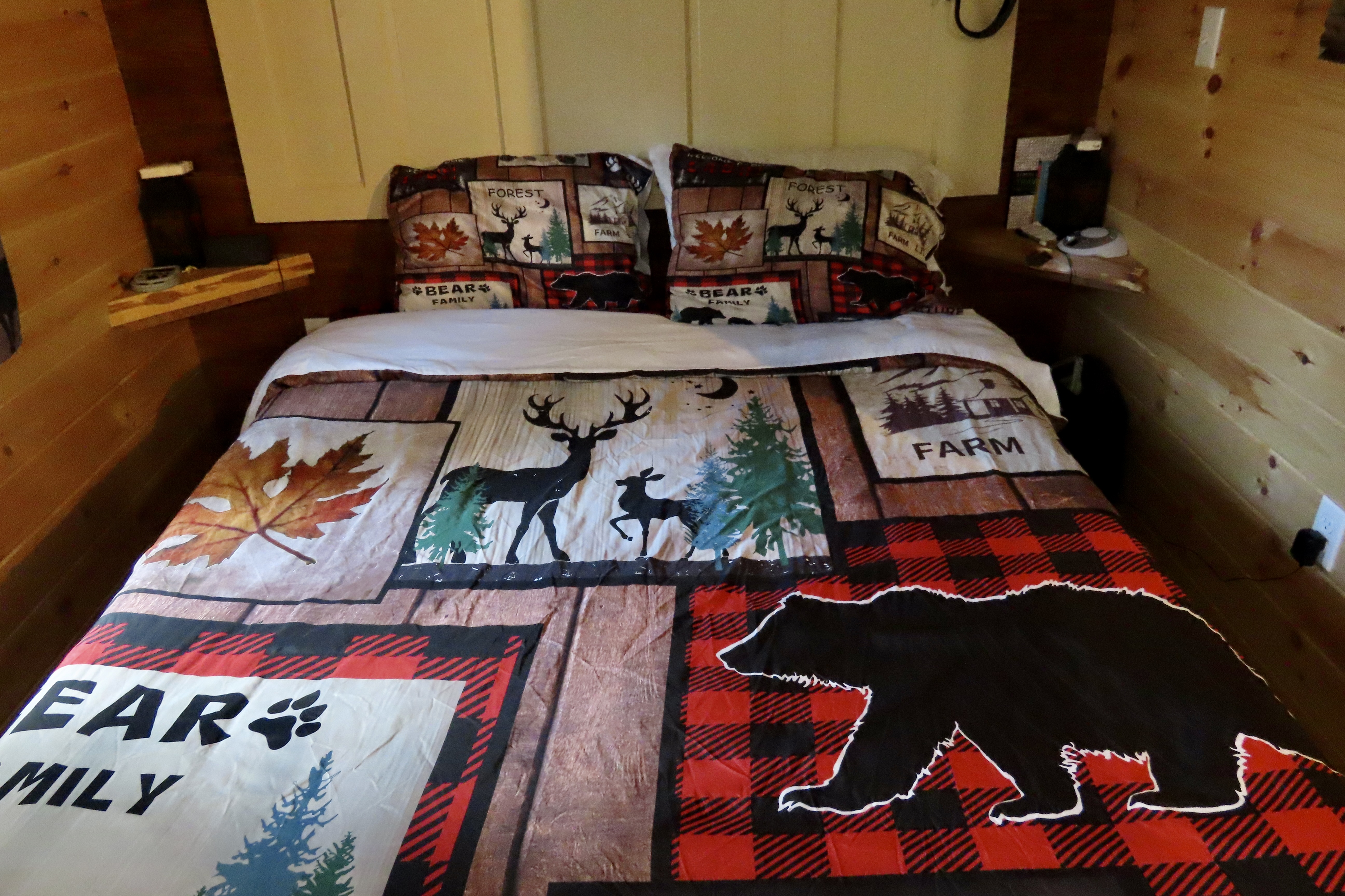
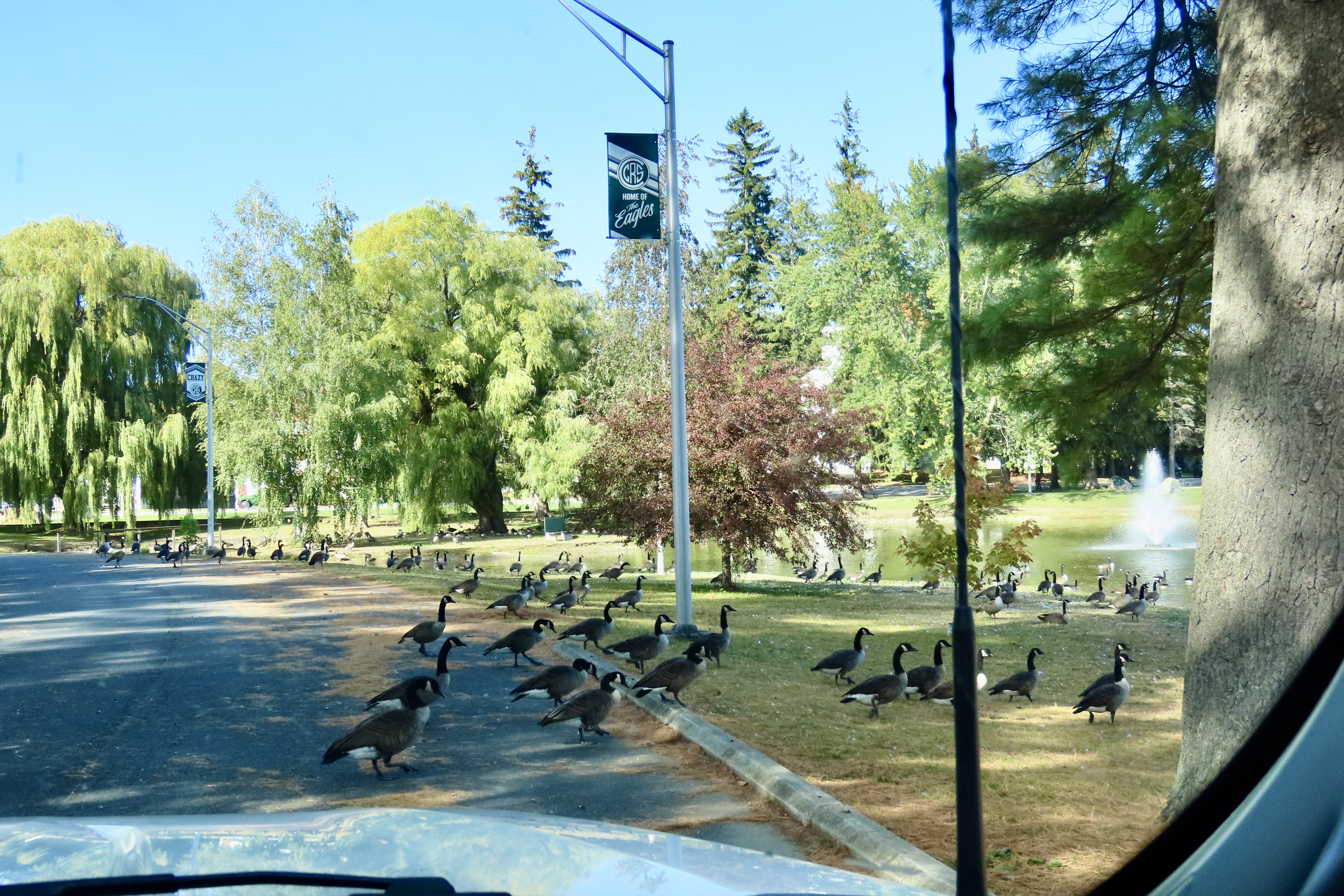
Our West Chazy NY cabin was the second one on our tour. I already blogged about the first: Bare minimum: no electricity, no heat, no insulation, no water and an outhouse— all on the coldest day of our three week trip. The second was the direct opposite: A full kitchen, bathroom, sitting room, streaming TV, fun decorations, heat, and, I might add, excellent insulation. The owner, Shane, greeted us when we arrived and told us that he had put a dozen eggs in the refrigerator! “Our chickens are producing eggs faster than we can eat them,” he told us.” Let me know if you need more.” When we went online to give the cabin a five out of five, we were surprised that Shane had already been there and given us a five out of five as guests! Both cabins cost about the same to rent. It’s a tale of two cabins, a dickens of a story, if you will.

This stove serves as an example of what Shane had done in the cabin. He had taken a beautiful antique wood stove and modified it by putting a modern gas stove on top. It was the best of both worlds.
Bedspread, pillow cases, curtains and rugs all included outdoor scenes packed with wildlife and country themes.
There were also lots of crow decorations. This was due to the fact that Shane calls the cabin, the Crow’s Nest. In fact you can look up the cabin at Crow’s Nest, West Chazy, NY.
We didn’t see any crows outside, but this banty rooster was strutting his stuff. He crowed about how he was inspiring the chickens to lay eggs. There were also goats, a white turkey, and the egg laying hens that guests could visit.
The most common member of the bird family we found in the area were Canada Geese. There were dozens/hundreds of them. Everywhere. In creeks, small ponds, and Lake Champlain. No body of water was too small or too large. We noticed that they seemed a little skittish and headed into the water whenever we got close. We also wondered why they were hanging out near the Canadian border and hadn’t flown south. And then it dawned on us. They didn’t have passports, they didn’t haven’t visas, they didn’t have US citizen papers, and, worse, they were dangerous criminals: They pooped in public parks and on people’s lawns. The geese, frightened that we were ICE agents, prepared to fly back across the border on a moment’s notice.
You are now cleared for flight on runway #1.
Since the Vermont islands on Lake Champlain were a short drive away from Chazy, we made a day trip over to visit them. This gorgeous tree was right next to the Vermont Information Center. Peaceful, huh?
This sign stood next to the tree. I was once exploring an ICBM site north of San Francisco when I heard a loud grinding noise. A large cover drew back and out came the missile with its nose pointed toward the sky. Scary, eh! That would have had me fleeing toward the mountains ( and probably peeing my pants), except I knew that the site was decommissioned and some type of visitor demonstration was scheduled.
The islands are all connected by bridges and a road. The first Island we explored was Isle de Motte. It featured a large statue of Samuel Champlain, who the lake is named after, and a native. Both were holding rolled up documents, which I assume represented treaties between the Hurons, Algonquins and France. The allies were attacked by a large body of Iroquois when Champlain was first exploring the lake in 1609. Champlain saved the day by shooting two of the Iroquois chiefs with his flintlock. Note how the Indian wisely hid behind a rock while Champlain fearlessly faced the enemy. (One of the reasons the Americans were able to defeat the British during the Revolutionary War was that learned from the Indians.)
An actual self-portrait done by Champlain of how he pictured the event. My thoughts are: Duck! But that wouldn’t be nearly as impressive to the folks back home. Champlain became known as the Father of New France while the Iroquois became forever enemies of the French, siding with the English during the French and Indian War.
As Champlain used his muzzle to sight in on the Iroquois, I used a tree near his statue to sight in on the shore of New York State. Our cabin was about five miles away from the shore. The Adirondacks can be seen rising in the distance.
A small attractive chapel that is part of St. Anne’s Shrine, stood just across the road from Champlain’s statue. For services, the large door in front opens up to a covered patio in front of the church where the congregation sits.
We continued to have great water and fall tree views as we drove around the islands. The mountains in the distance are the Green Mountains of Vermont.
Farm lands made up much of the property on the islands. Here, the corn had been harvested and farmers were getting ready for winter.
Iorek, our truck, made a quick left turn into a small, self-service bakery run on the honor system. We picked out an apple pie and stuffed our money into the birdhouse door beneath the large $ sign. We actually made the pie last for three days, which was amazingly disciplined considering how yummy it was.
A final photo from the lake area. It was now time to begin our journey across Vermont. We packed up the truck and sadly left our cabin in the woods, telling Shane we would likely be back, maybe for a month.
Following back roads across northern Vermont toward Stowe, we continued to be treated to gorgeous leaf peeping treats.
As many as we saw, there was no danger of burnout! This was an interesting combination of river, green, and one bright tree peering out of the dark shadows, caught by the sun. Gets your attention, huh.
A fun part of photography is taking photos that can pull viewers into the photo. We felt that the straight lines of the harvested crop heading down to the green field and then the forest did it here.
The tree line starting up close on the right and moving down into the distance also pulls viewers into the photo.
Sheer color splashed across the photo by nature, like paint on a Jackson Pollock painting, works as well. Grin.
Smugglers notch was so intriguing we did it twice. One reason was the beauty. Another was history. As the name suggests, it was used by smugglers. In 1807, when Thomas Jefferson embargoed trade with Canada because of conflict with Britain, Northern Vermont residents smuggled goods into Canada as a way to survive. Later, the gap worked as part of the Underground Railway moving escaped slaves to Canada. Finally, it kept Northern Vermonters in booze during Prohibition.
Finally, as this sign suggests, the road is a challenge to drive. Up on top it turns into a narrow one way road that snakes its way around large boulders in hairpin tight curves that even Iorek had problems with. Sign after sign forbid large trucks from going across and provided convenient turn-around locations.
Finally, everyone is required to drive through low-height barriers called chicanes that mimic the narrow road and tight curves. A sign informs drivers that if they can’t make it though, they won’t make it over the pass. This applies to tourists pulling trailers as well as 18 wheelers. Regardless of the precautions, several tractor trailers end up trying to get over and jackknifing on the curves each year, causing delays that can end up taking hours to clear. There’s a hefty $2500 dollar fine plus whatever it costs to get a tow truck (or tow trucks) up on top to solve the problem.
Coming down off the pass, we got our first views of Stowe. If you don’t mind crowds of tourists and packed highways, a stop is definitely worth it. This photo shows its iconic New England Church that sits on the main street.
A view of the church from downtown.
Town Hall.
What impressed Peggy and me the most, however, were the beautiful homes.
I’ll conclude with Peggy’s favorite. In our next post we will finish our tour across Vermont, take you through New Hampshire and end in western Maine.
Dairy goat farming, we learned along the way, is becoming a big thing in Vermont. This is the Sugar Plum Goat Dairy.

A Journey Back in Time… Backpacking into an All-Time Favorite at 75 and 82: The Five Lakes Basin

One of many lakes found in the Tahoe National Forest’s Grouse Ridge Non-Motorized Area where Peggy and I went backpacking last week. I’d asked Peggy what she wanted to do for her 75th Birthday. Her first answer was to visit our son Tony and his family in Florida, which we did and had a great time. The second thing was go backpacking! “I’ll pass on the 750 miles you did for your 75th, however, Curt,” she informed me. “I think 7.5 sounds more reasonable.” We laughed. At 82, I also gave a sigh of relief. Possibly you heard me.
Since we were visiting friends and family in Sacramento on a break from our five-month exploration of the Southwest, the Five Lakes Basin was a natural for our trip. This is a view from one of the lakes looking up at the Black Buttes. While there are several ways to enter the Grouse Ridge Non-Motorized area, our normal way is to follow I-80 from Sacramento and take the Highway 20 cutoff toward Nevada City for approximately 5 miles.  Turn right on Bowman Lake Road and continue on that road for 5 miles. Turn right on the unimproved, ultra-bouncy, dirt Grouse Ridge Road for 6 miles until you reach the Grouse Ridge Campground. The road has always been a challenge. This time it featured holes that would eat a VW bug! (Slight exaggeration but not much.)
I’ve been backpacking in the Grouse Ridge/Five Lakes Basin since 1969, 56 years ago. It’s an all time favorite of mine. I actually remember the exact day I started to backpack: July 20, 1969. The day Neil Armstrong took his first step on the moon, I took my first step backpacking near Grouse Ridge. I made it into the Five Lake Basin in 1970 and camped just to the right of this little waterfall.
Twenty years later in 1990, a few months after I had met Peggy, I bought her a backpack for her 40th birthday and took her into my favorite lake. Her only requirement was that I carry in a water bottle full of Harvey’s Bristol Cream Sherry. I don’t know whether it was the beauty of the area or the sherry, but Peggy came to love backpacking and the Basin— almost as much as I do.
This map shows the trail system from Grouse Ridge Campground into Five Lakes Basin and Glacier Lake. Peggy and I followed the Glacier Lakes Trail for her 75th birthday, the Sand Ridge trail for her 40th. In the early 70s, off-road enthusiasts could follow the route I outlined here up to the first lake at the end of Sand Ridge. I did that once with my friends. The following year I watched an off-road dirt bike rider tear up a beautiful meadow doing brodies, which led me to join forces with the Nevada County Sierra Club in advocating for the non-motorized status, an effort that was successful.
Having just finished her 75th Birthday backpack trip, Peggy stands with a big smile at the Grouse Ridge Campground with the Black Buttes behind her. We camped just beneath the highest peak at Glacier Lake. The Five Lakes Basin lies just beneath Glacier Lake. (Her T-Shirt features Big Foot, the world’s hide and seek champion.) I’ll include more photos of our trip at the end of this blog.

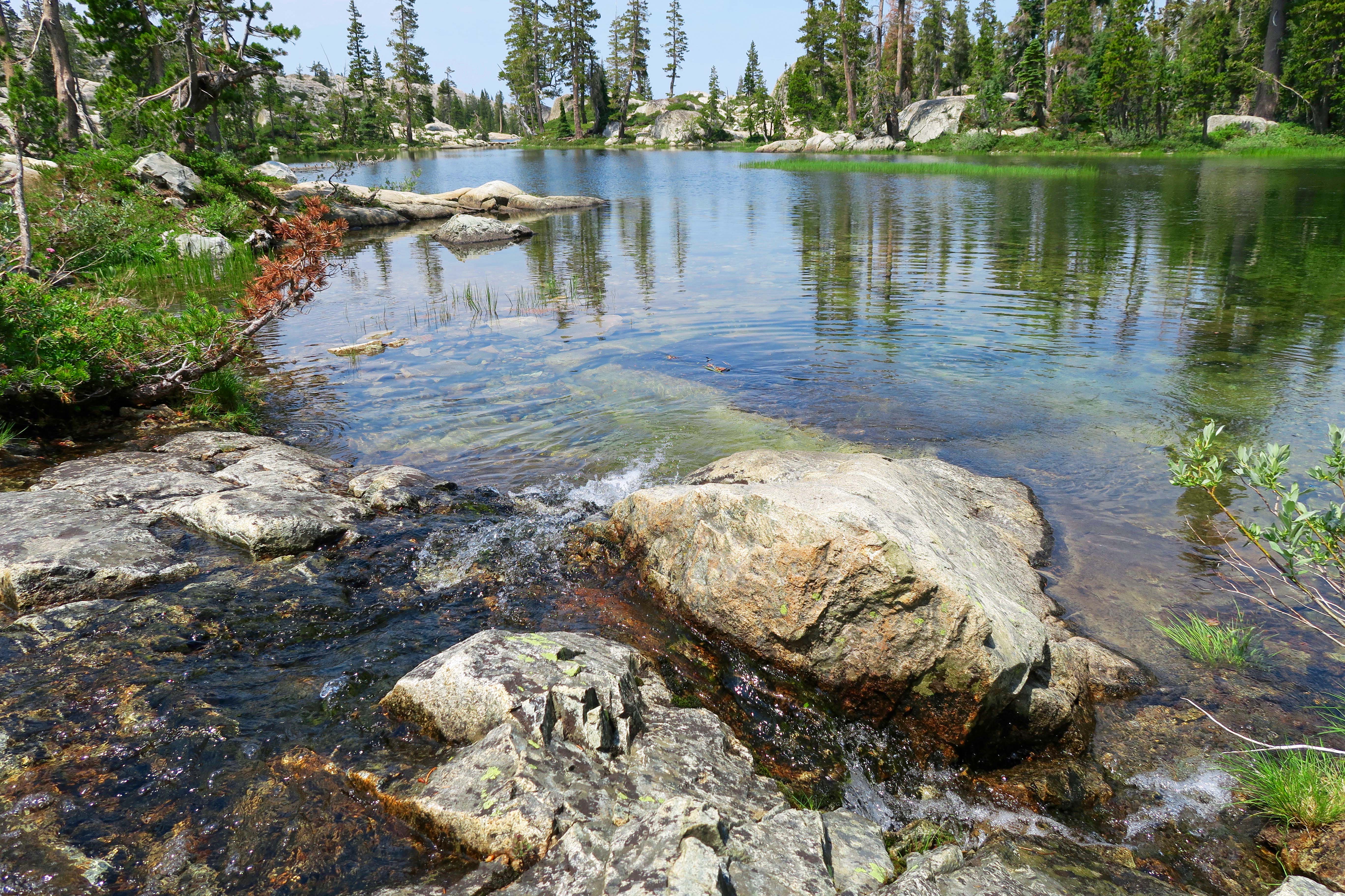
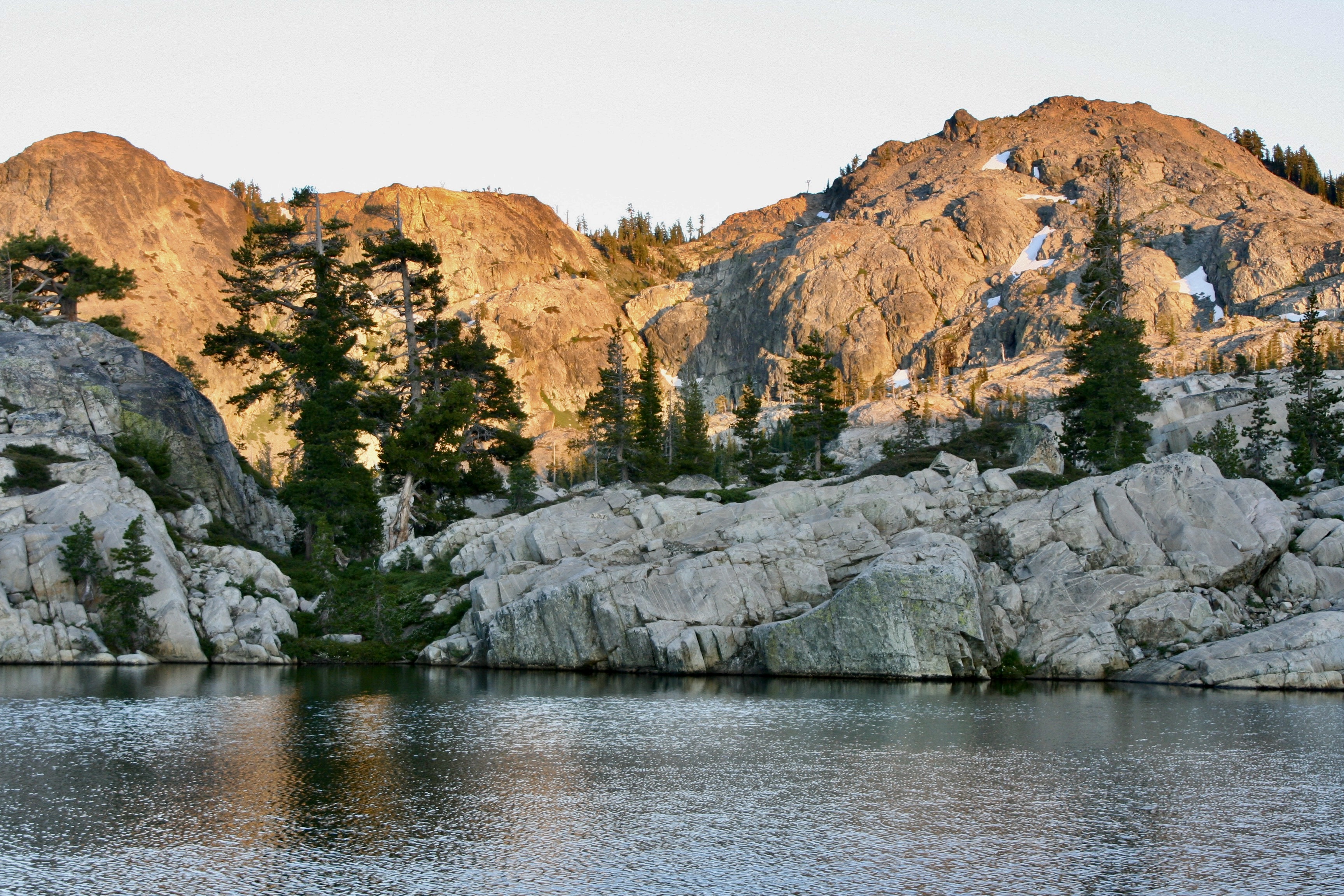
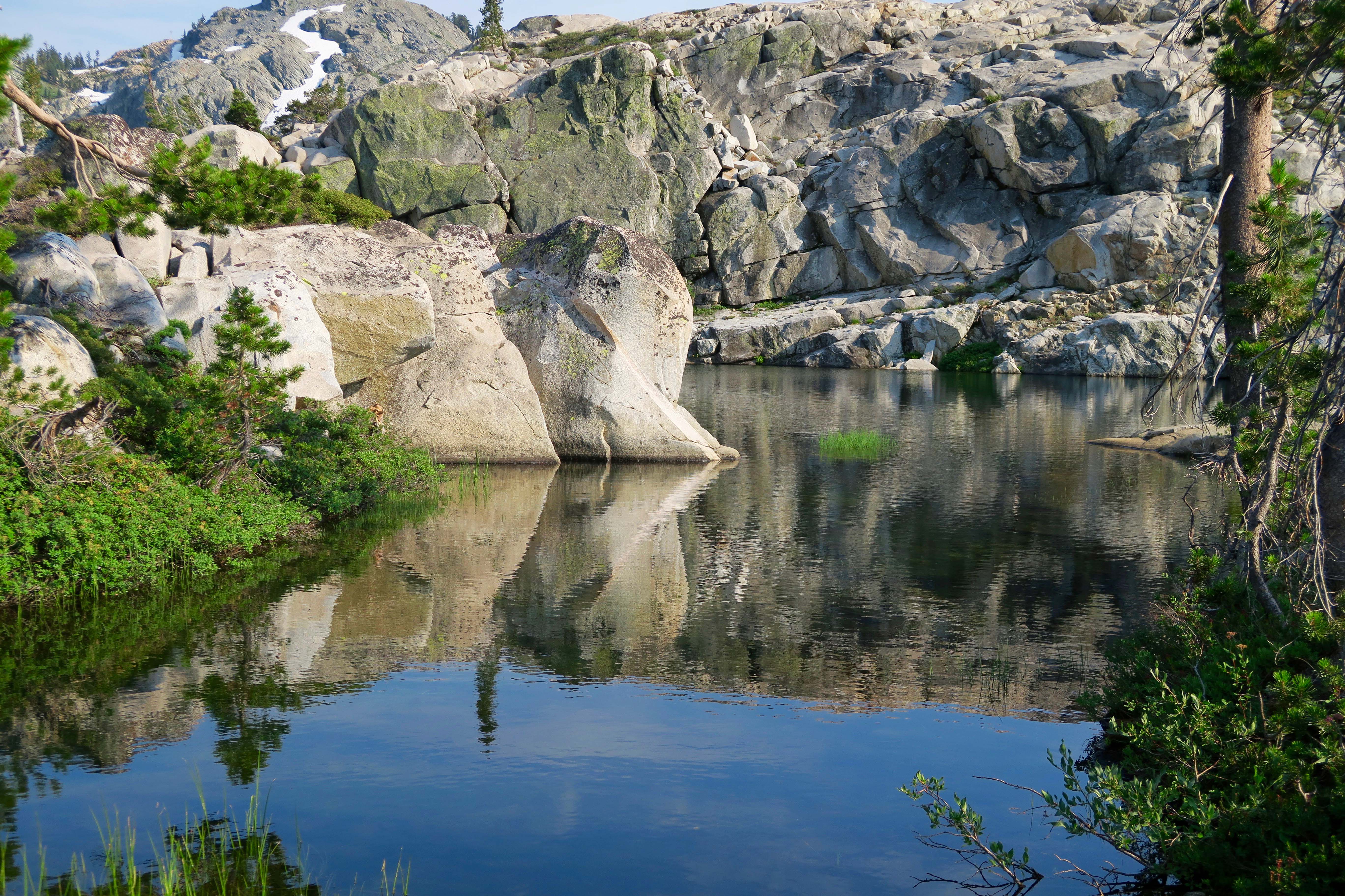
I’ve done a number of posts on the area over the years. People researching the Basin are bound to come across them. In fact, I was amused a couple of days ago when I was trying to remember when glaciers carved the basin with its lakes and googled the question. 20,000 years ago was the AI response. I looked up the source, as I usually do with AI answers. It was Wandering-Through-Time-and-Place. A fairly reliable source, I’d say. Grin.

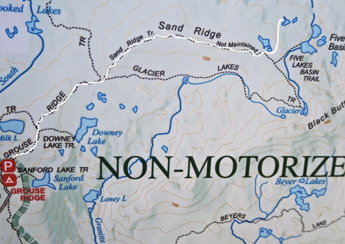
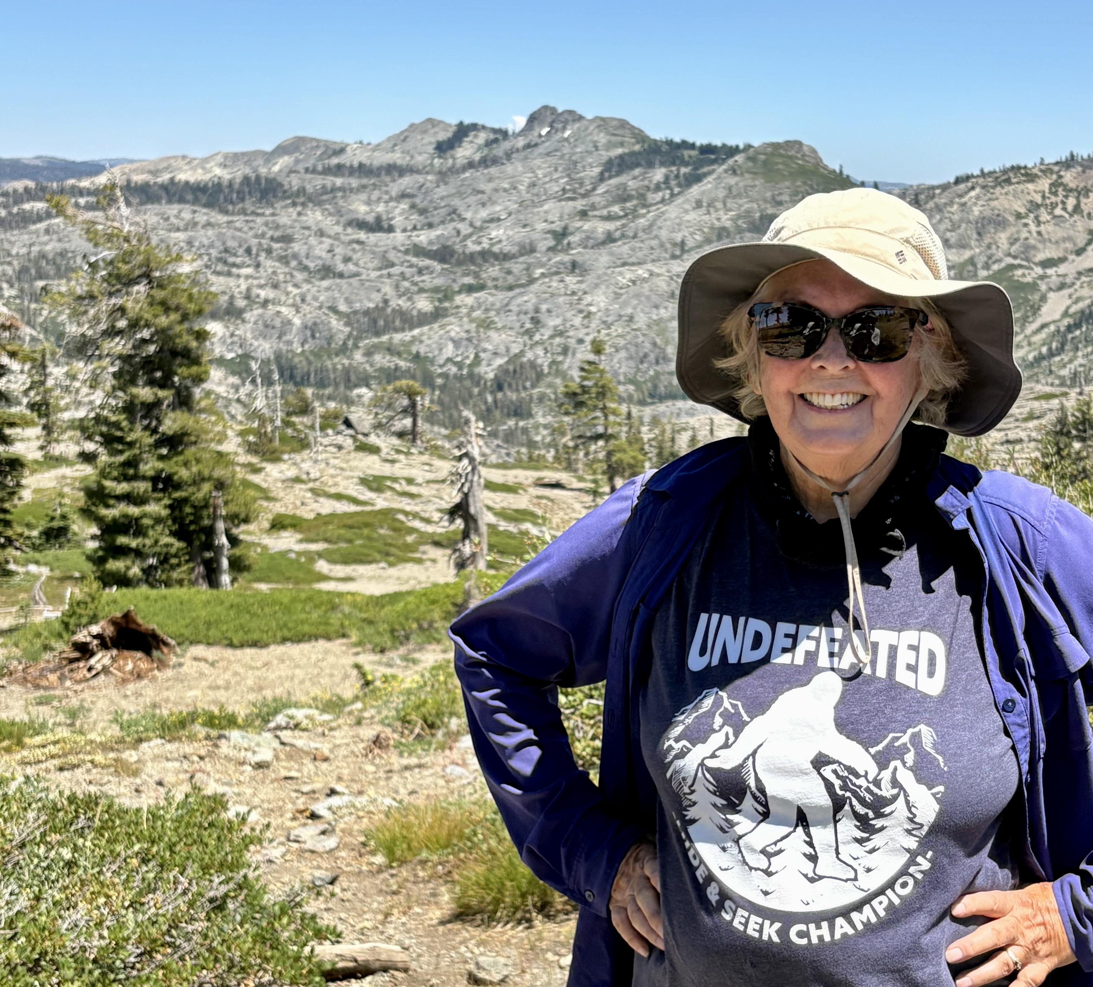
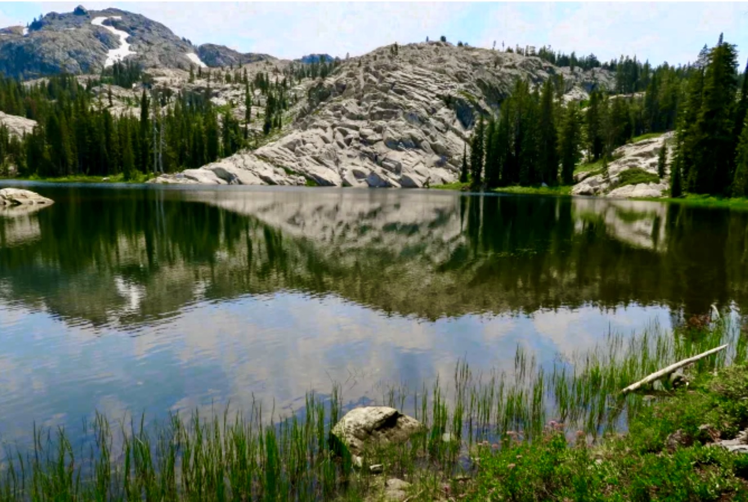
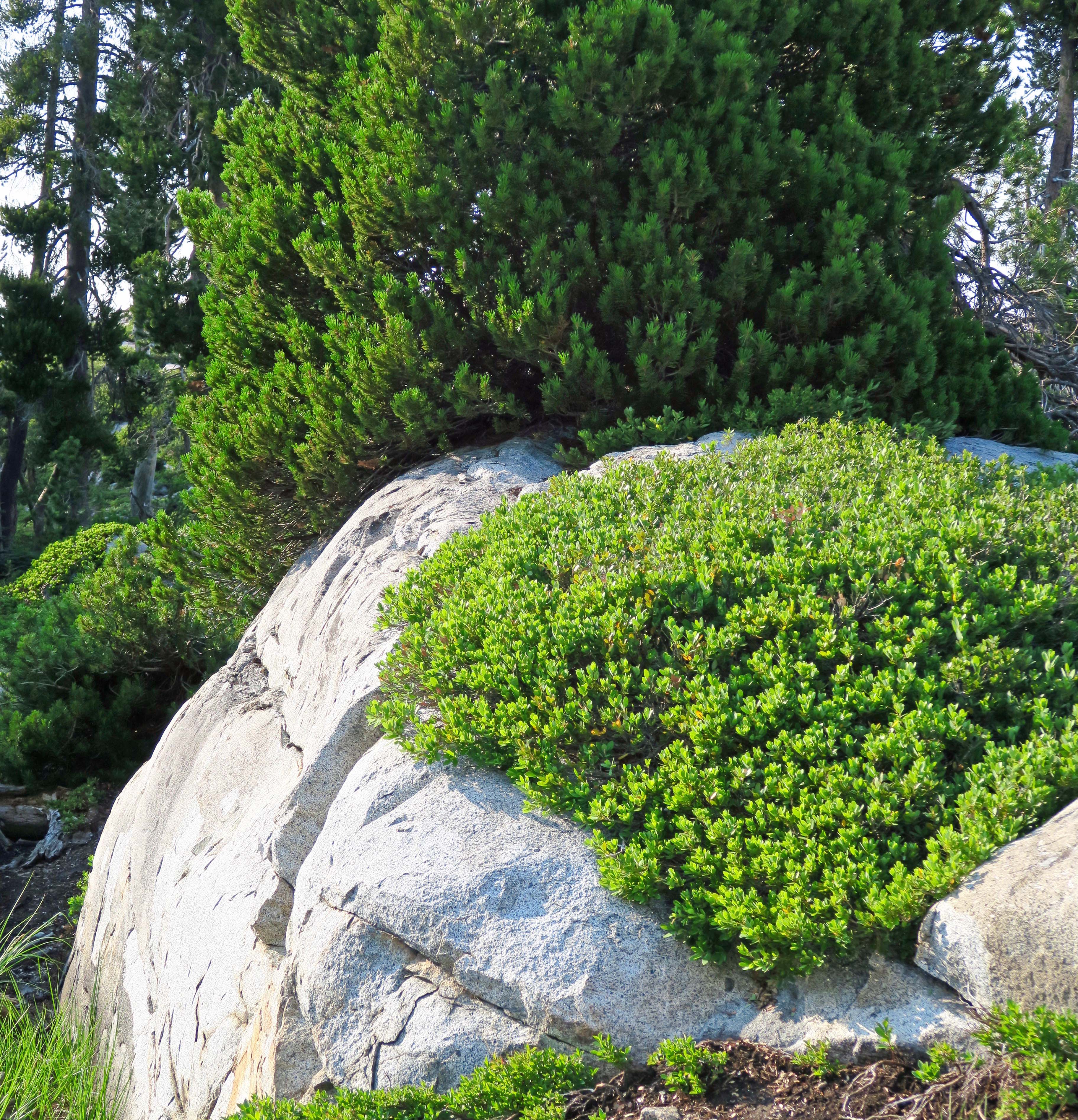
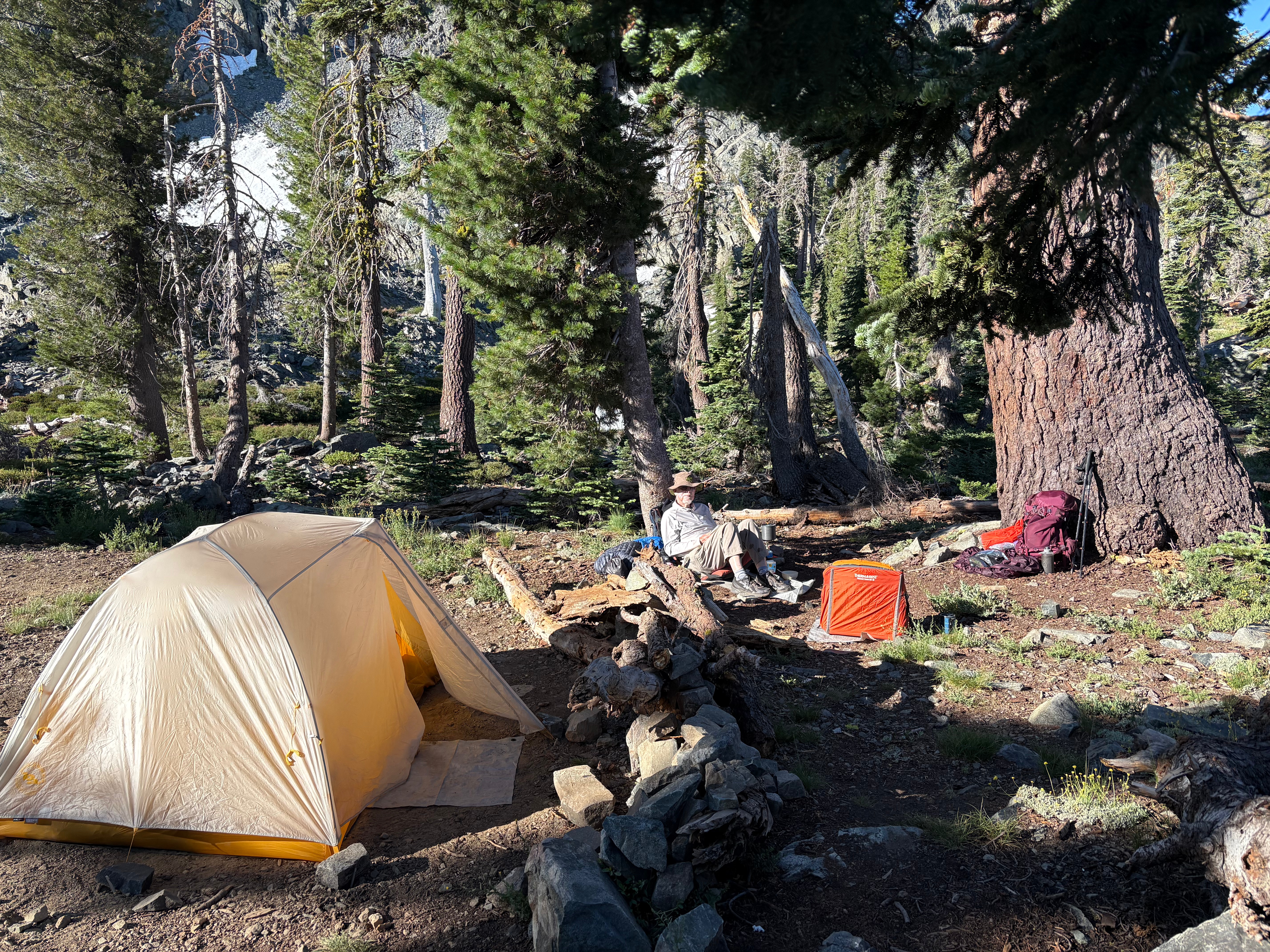
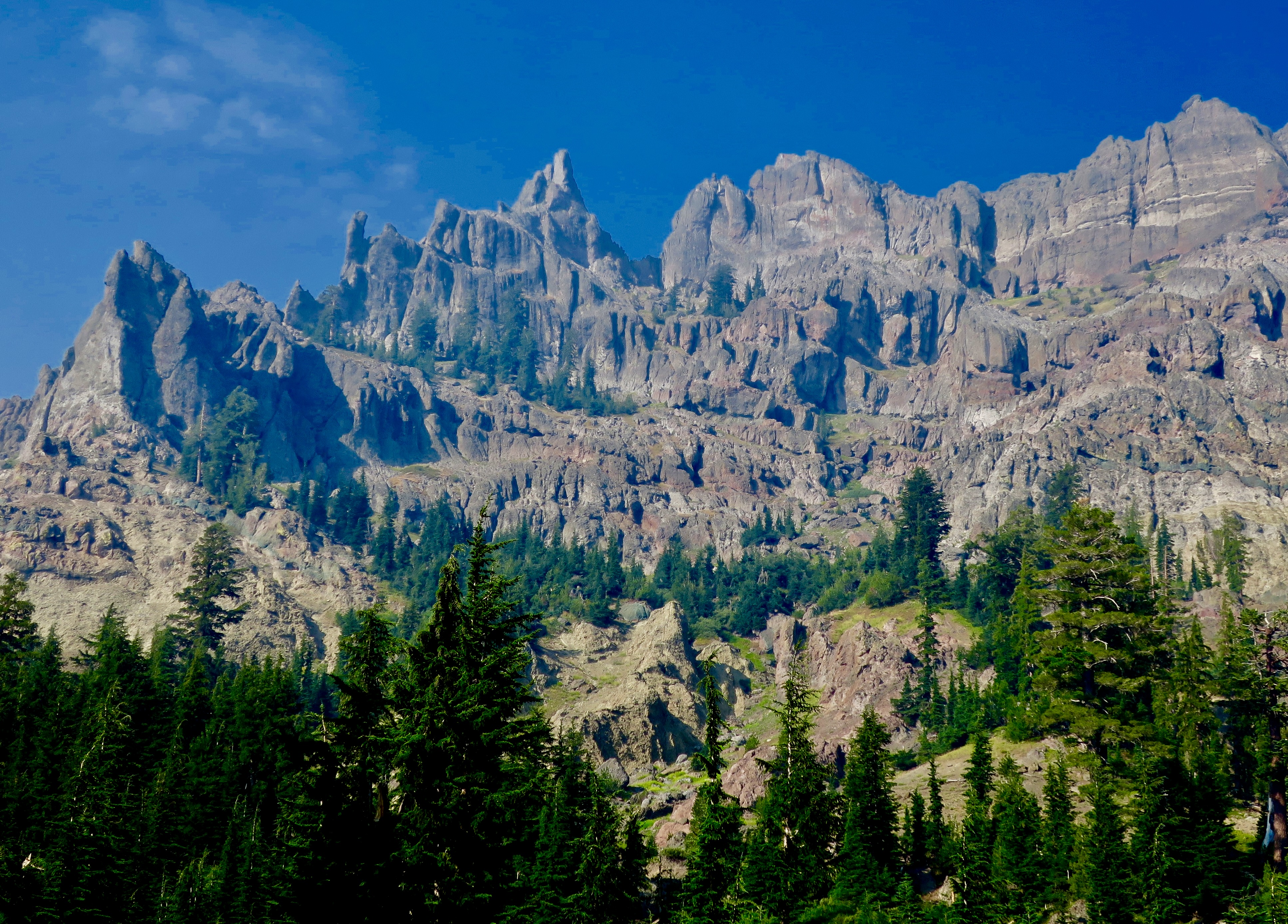
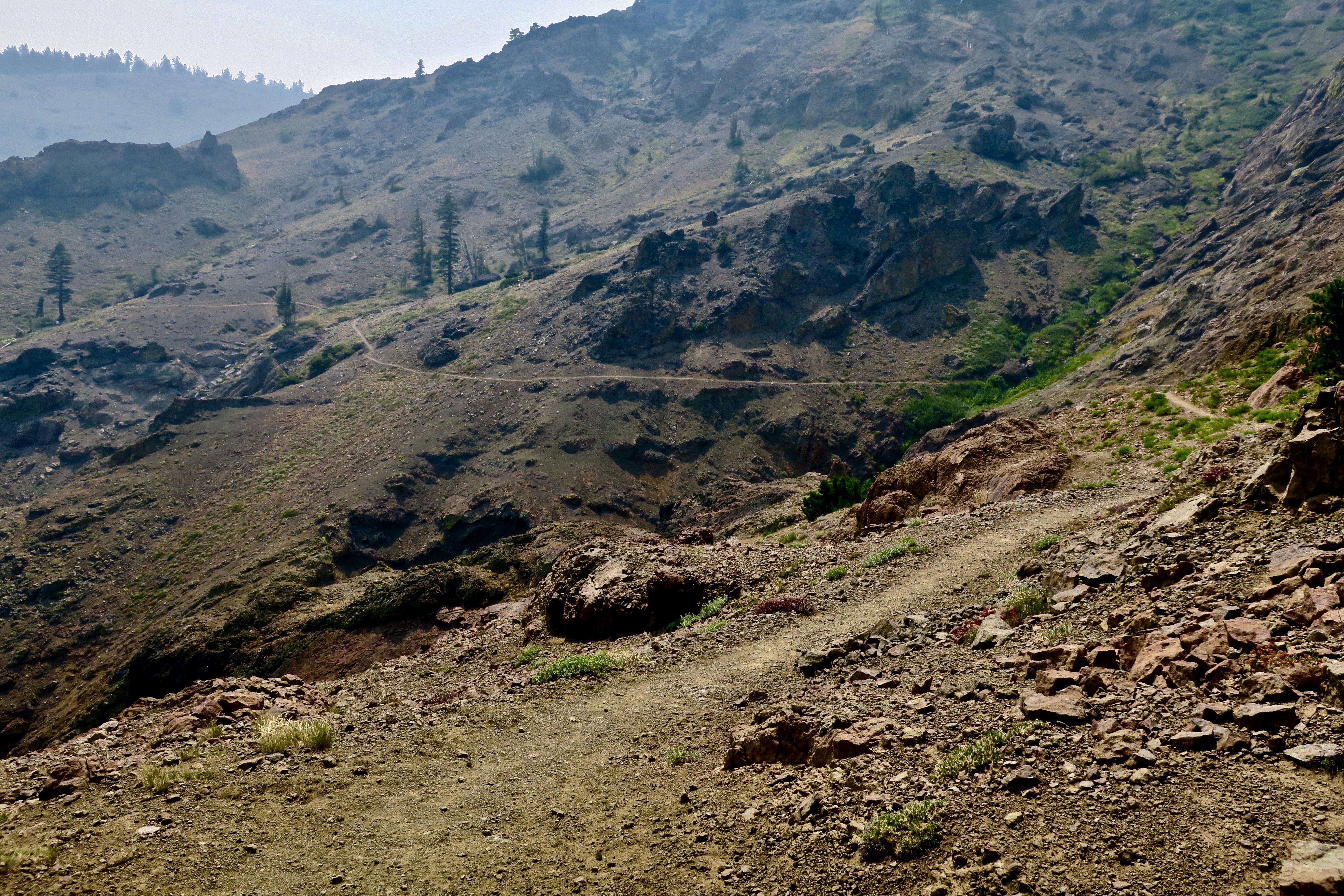
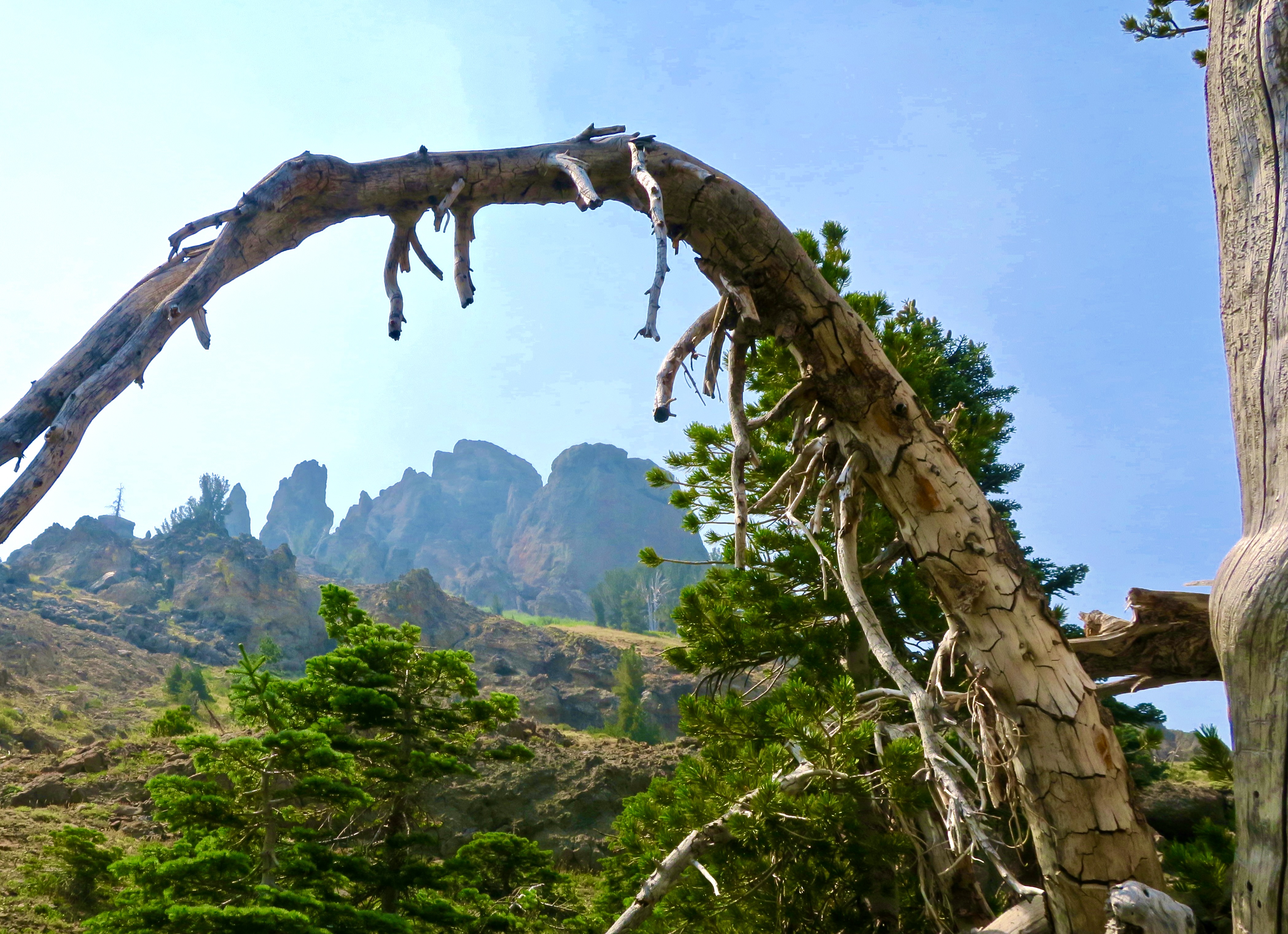
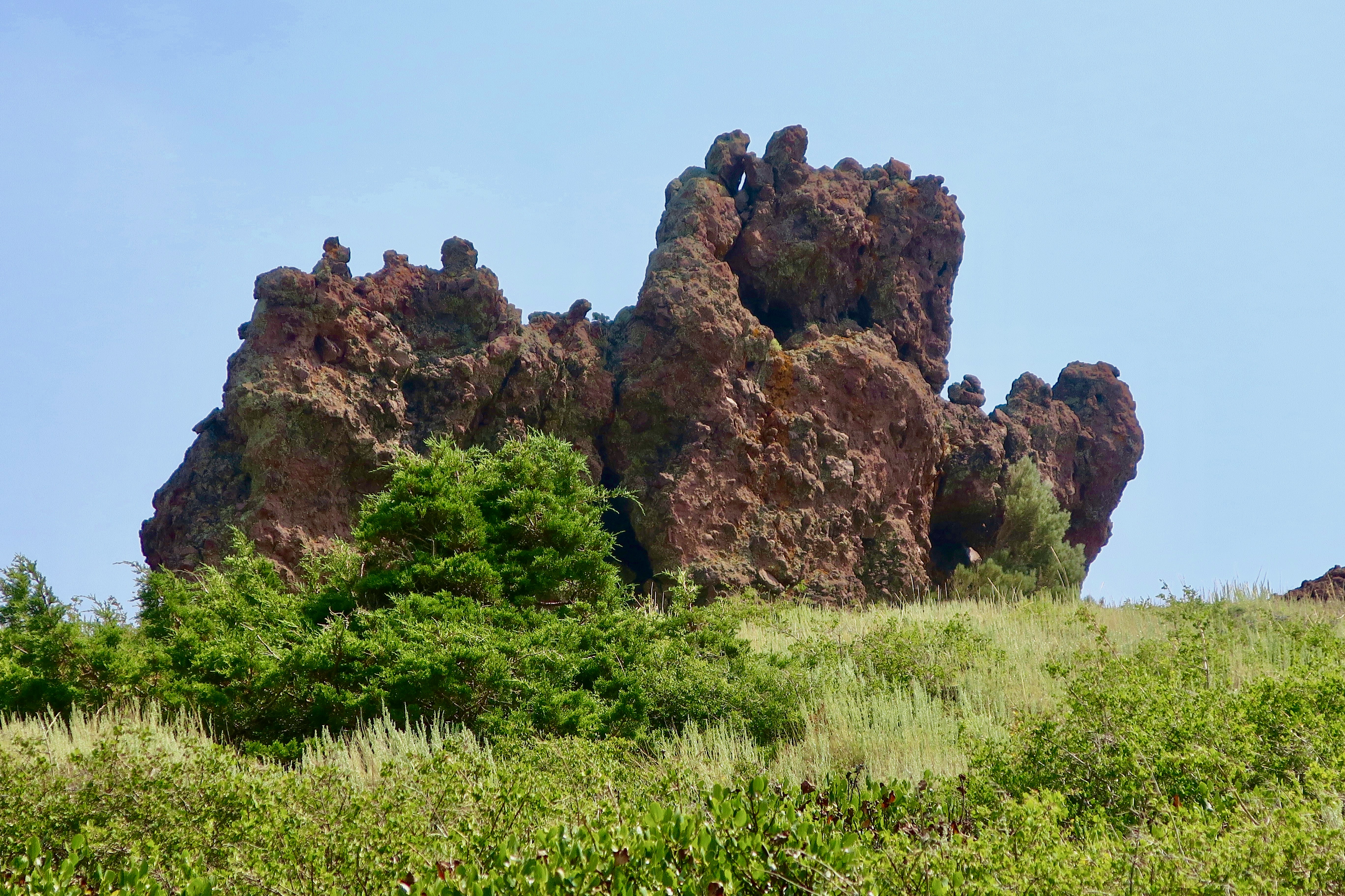
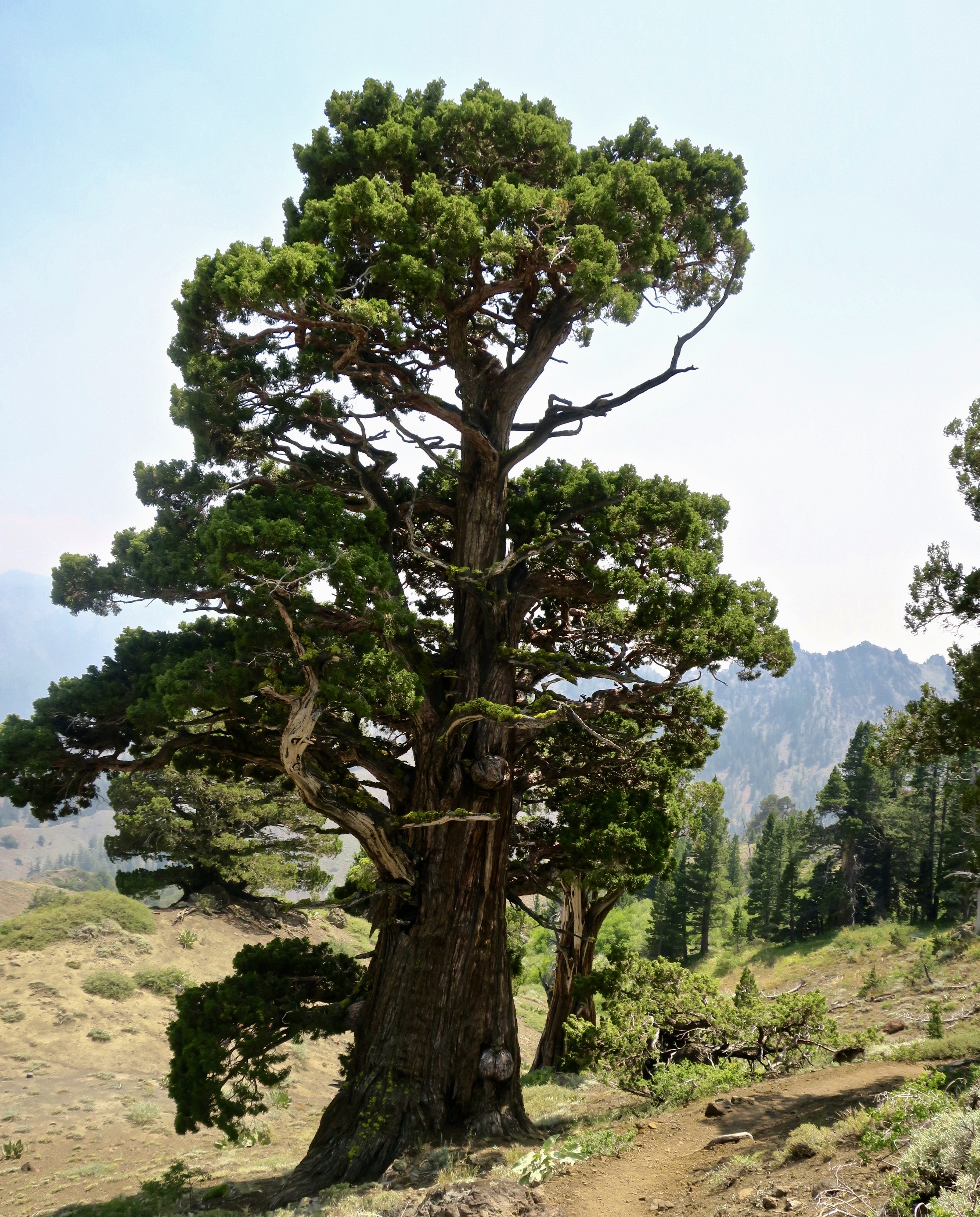
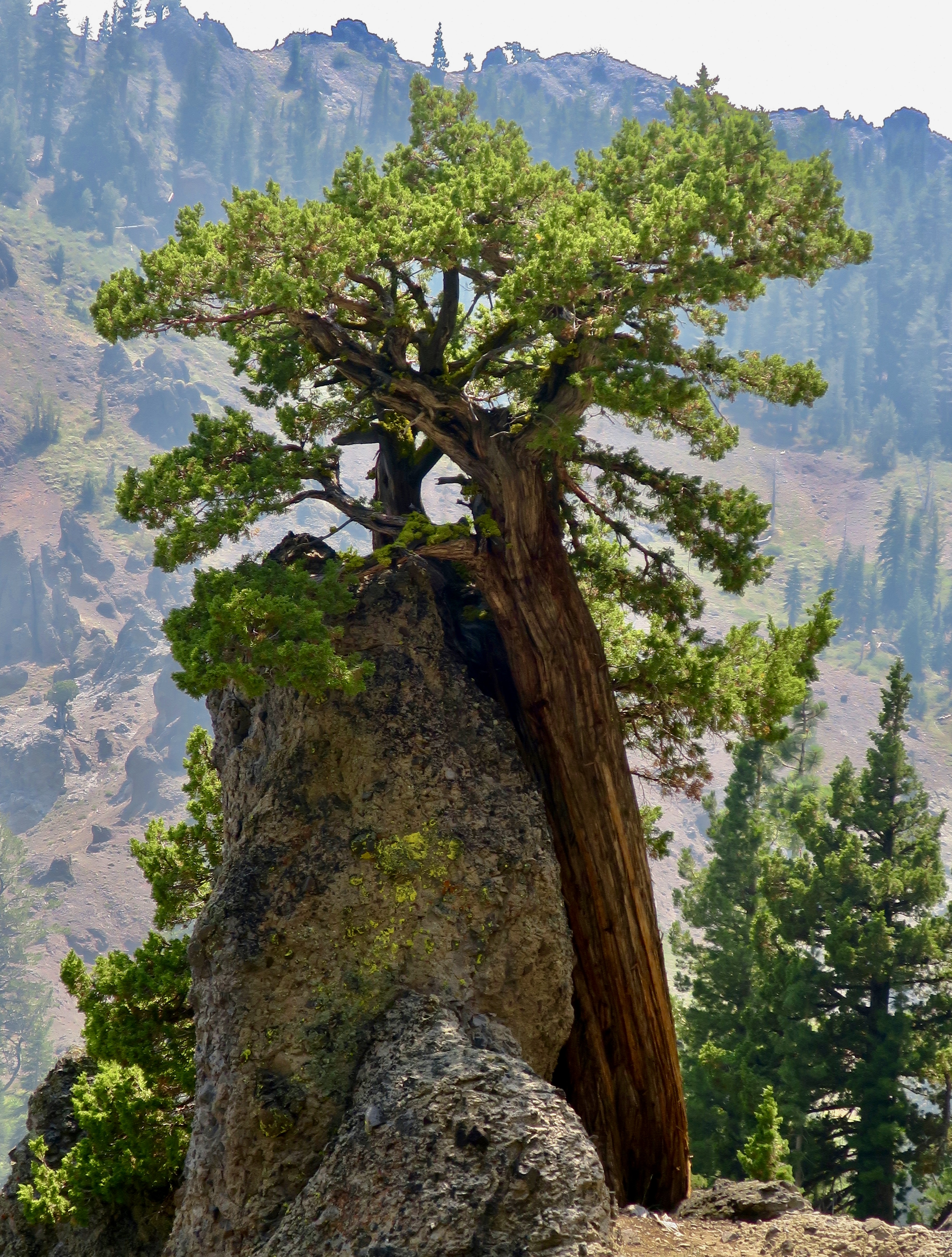
I noted in an earlier post that the Grouse Ridge Non-Motorized Area is well-loved. Maybe too much so, especially for someone like me who prefers his/her wilderness rugged, wild and relatively people-free. But I make an exception for this region. It’s an easy place for people to get to and is very backpacker-friendly for families and newcomers to the sport. It serves as a great introduction. There is considerable value in this— for the people of course— but also for our world. People who experience the wilderness in a positive way are much more likely to appreciate it, and want to protect it, which is critically important for ourselves, our children, and future generations. As I have emphasized over and over in this series.

Especially in this era when the Trump Administration wants to open up national forests, BLM lands, and national monuments for logging, mining and housing developments. His most recent target is roadless areas. Information this month suggests that the administration is moving to repeal the 2001 Roadless Area Conservation Rule, opening up approximately 58 million acres of national forest lands to road building and logging. I doubt it will include the Grouse Ridge area. But it could.

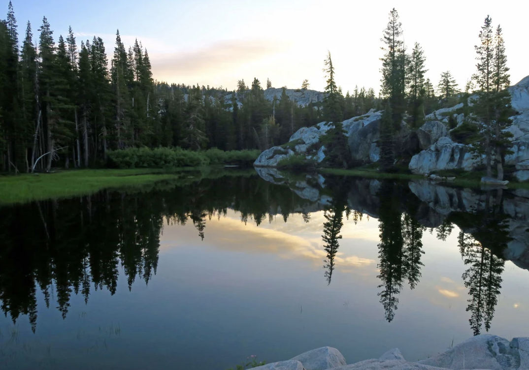
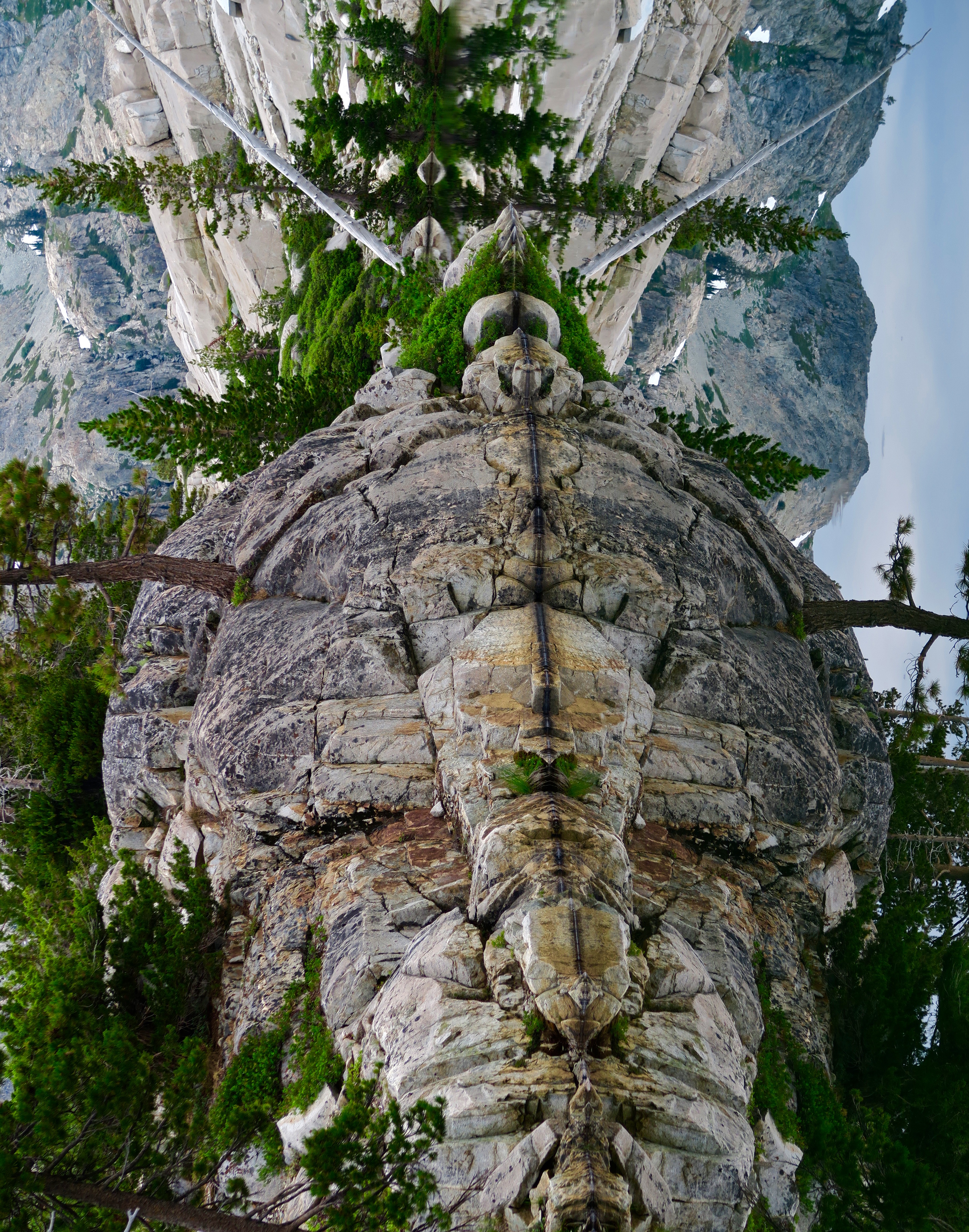
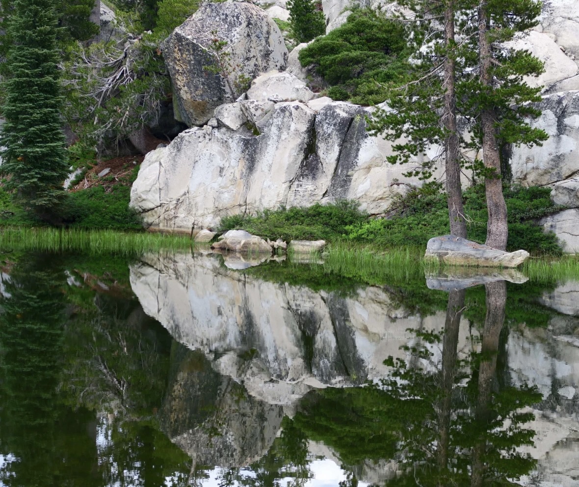
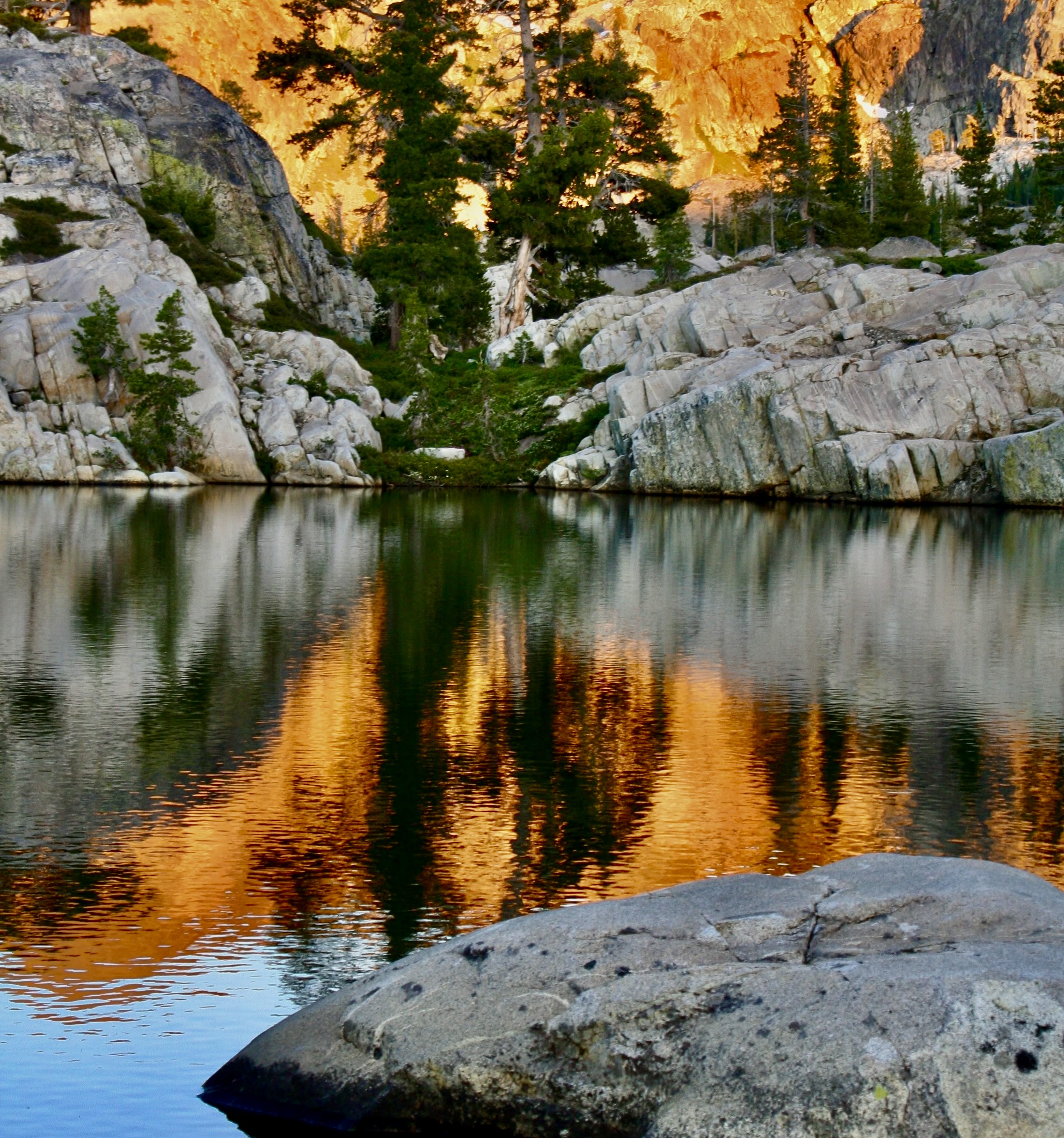
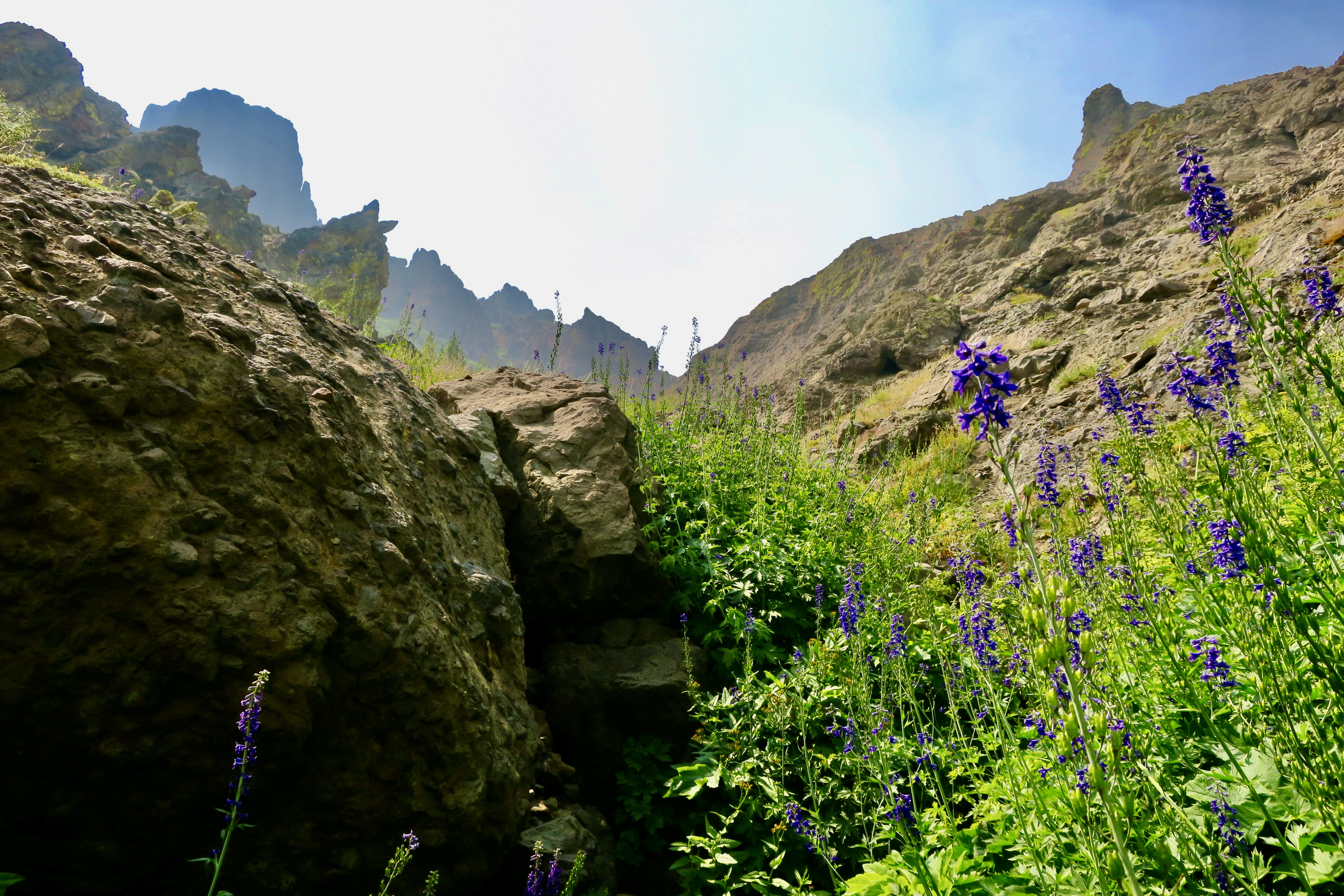
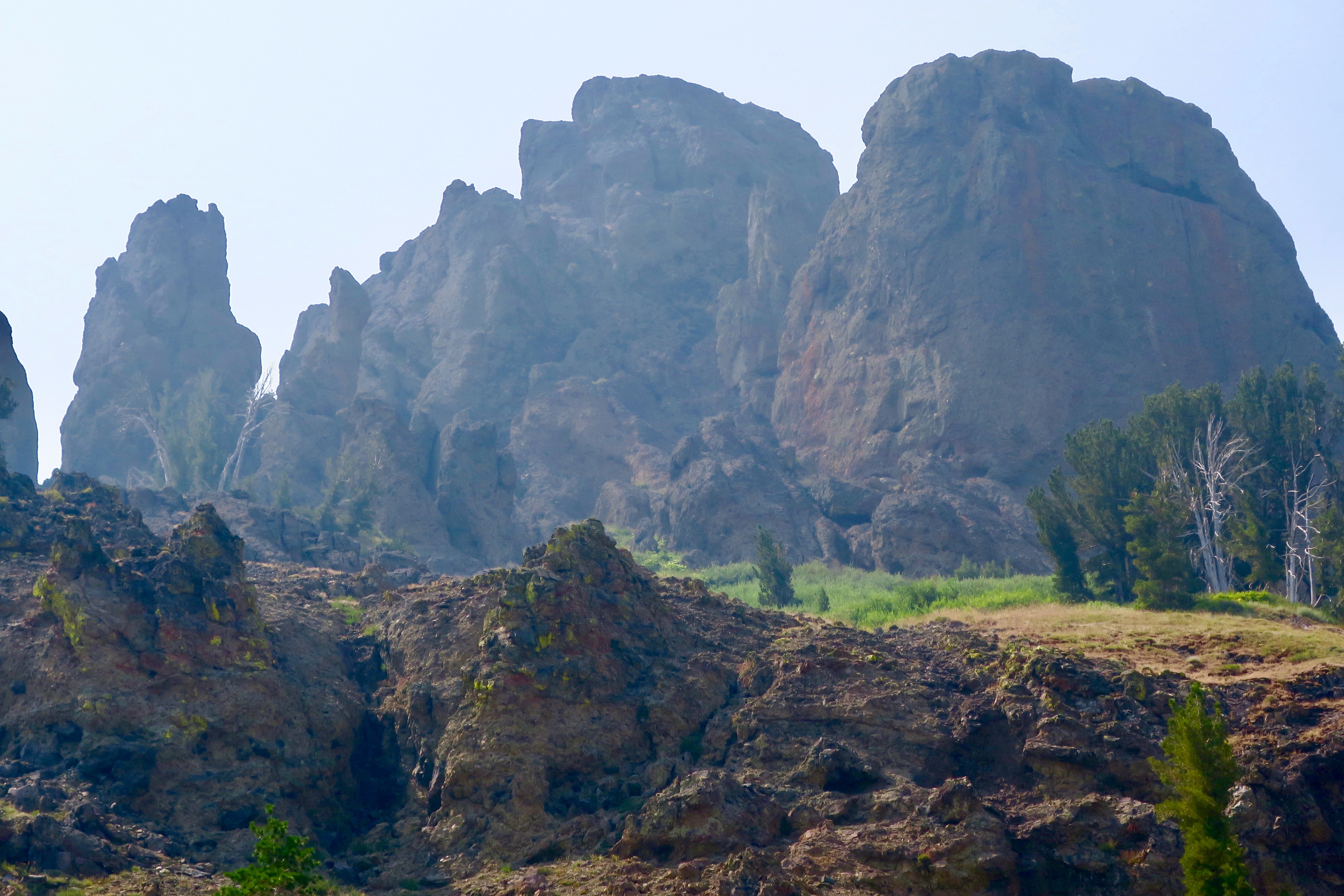
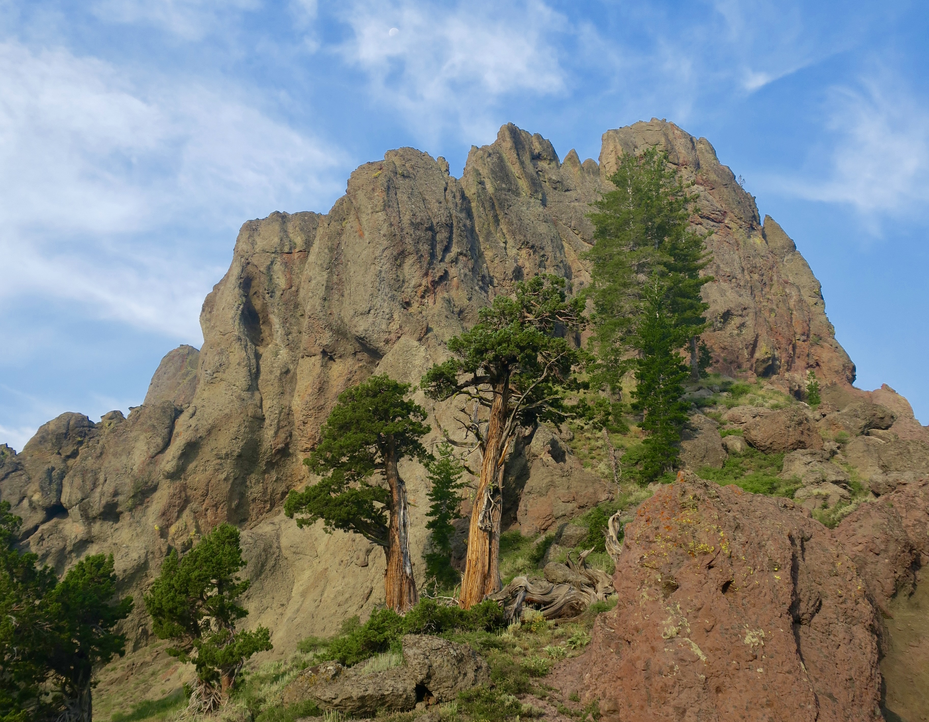
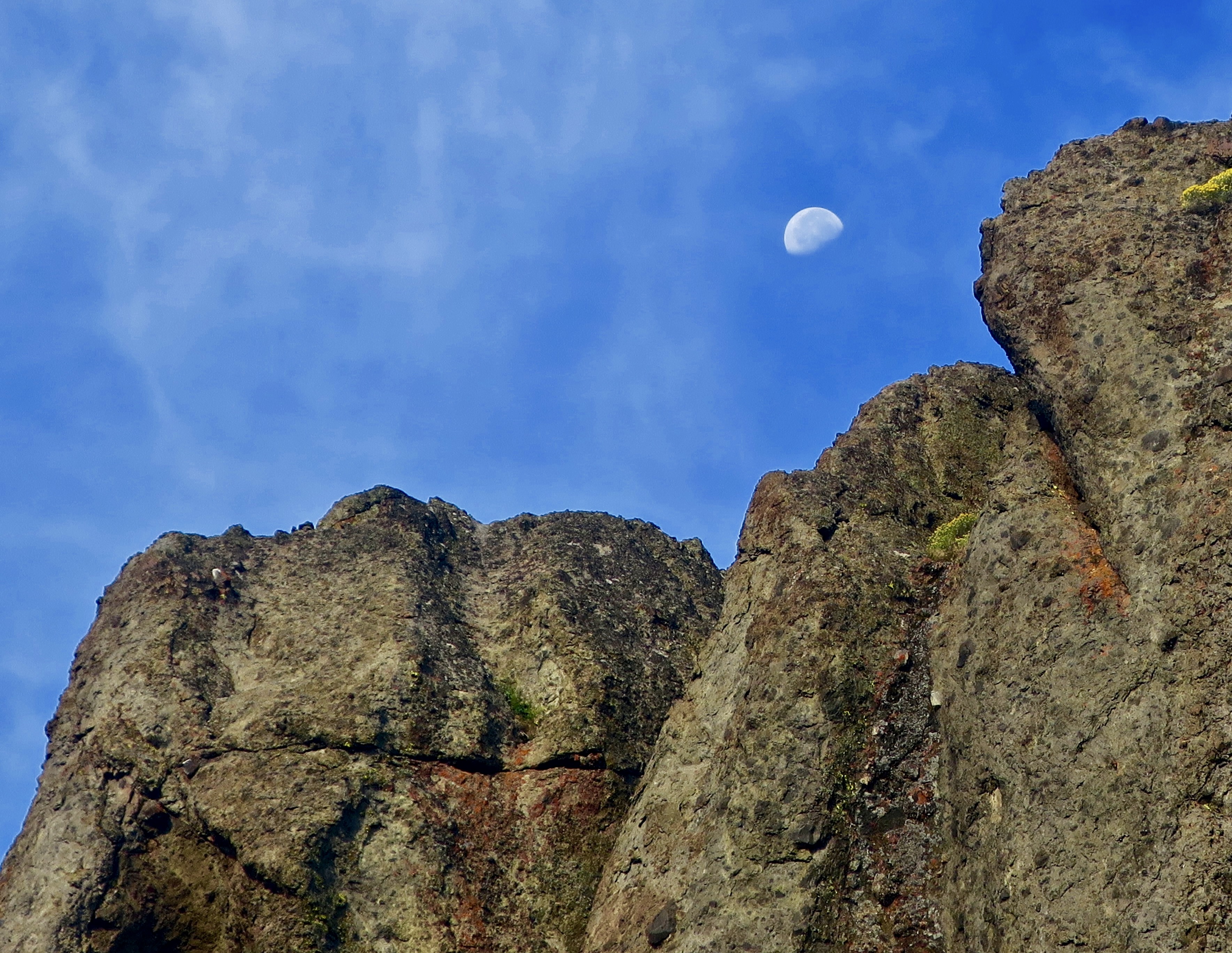
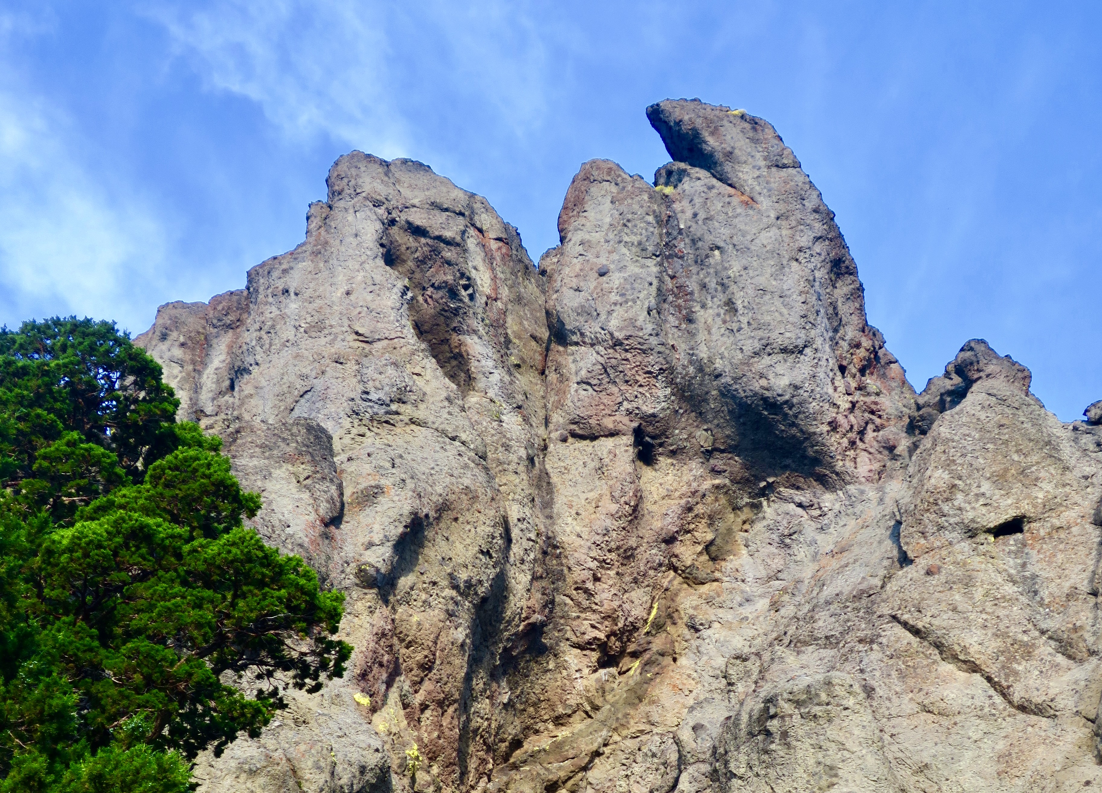
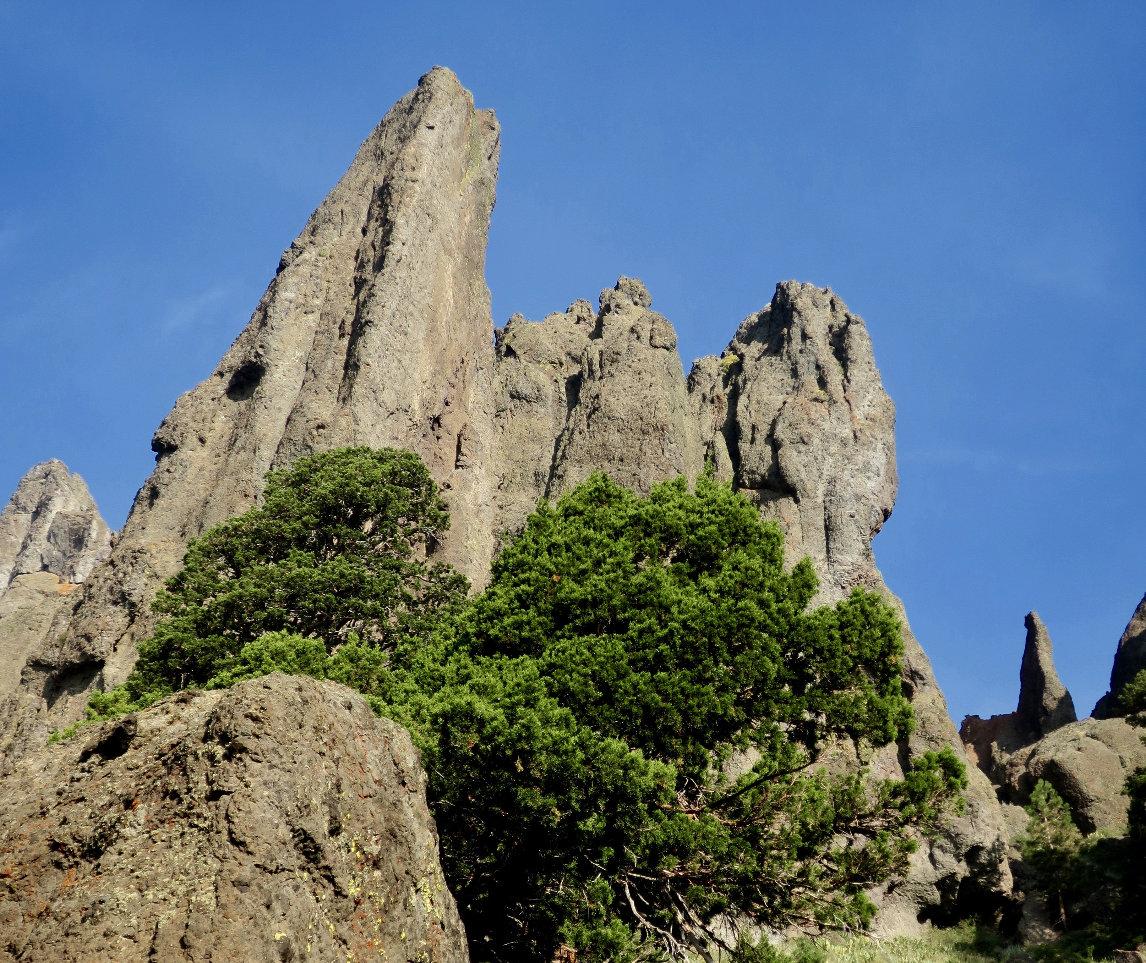
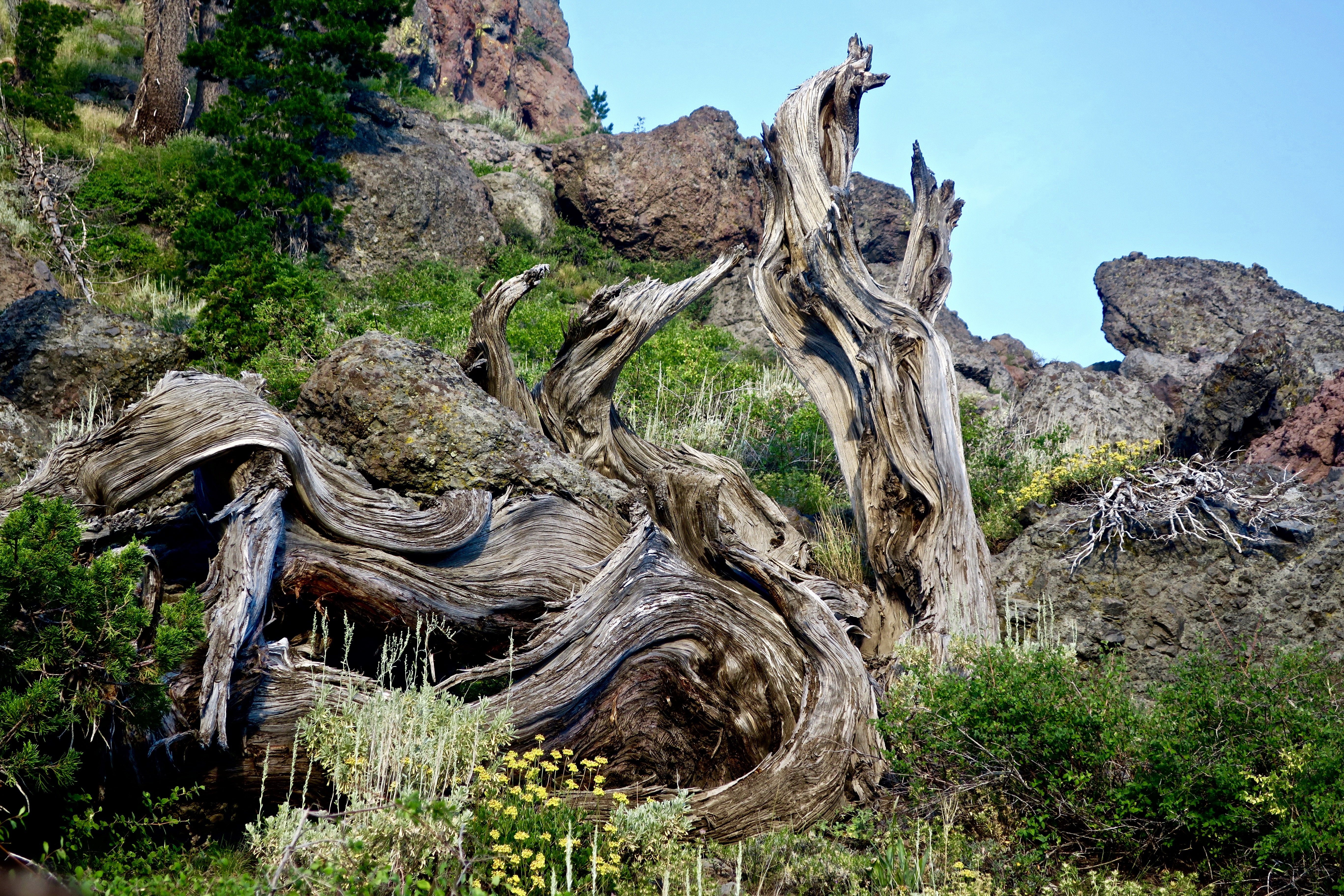
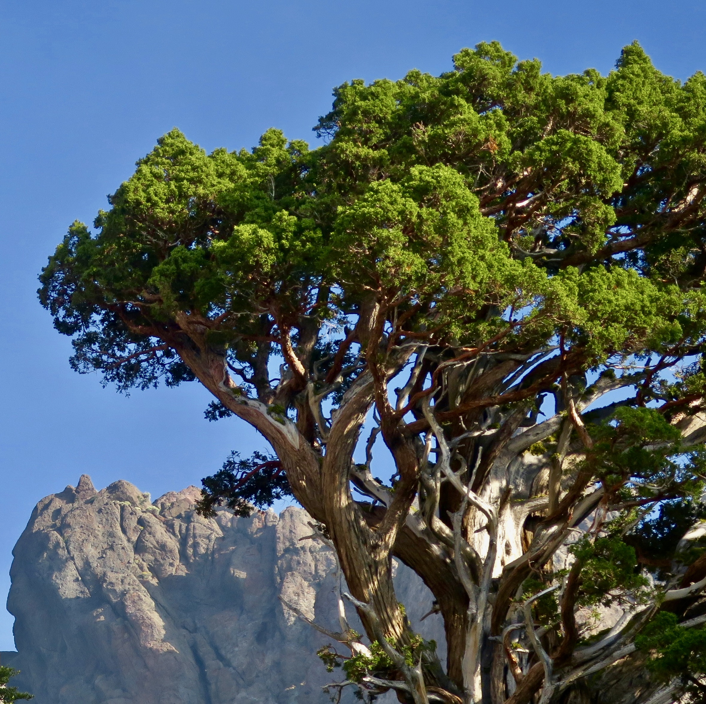
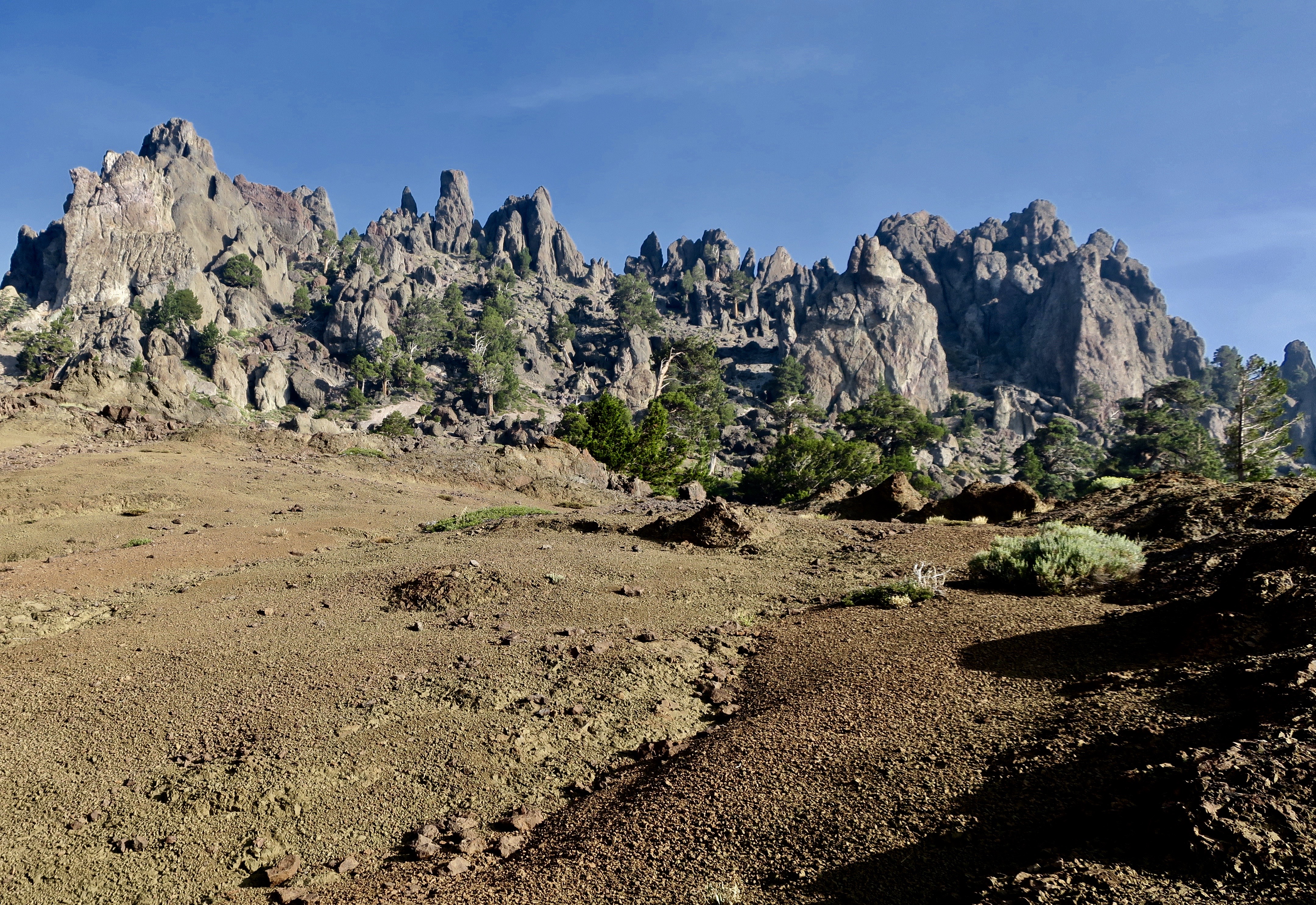
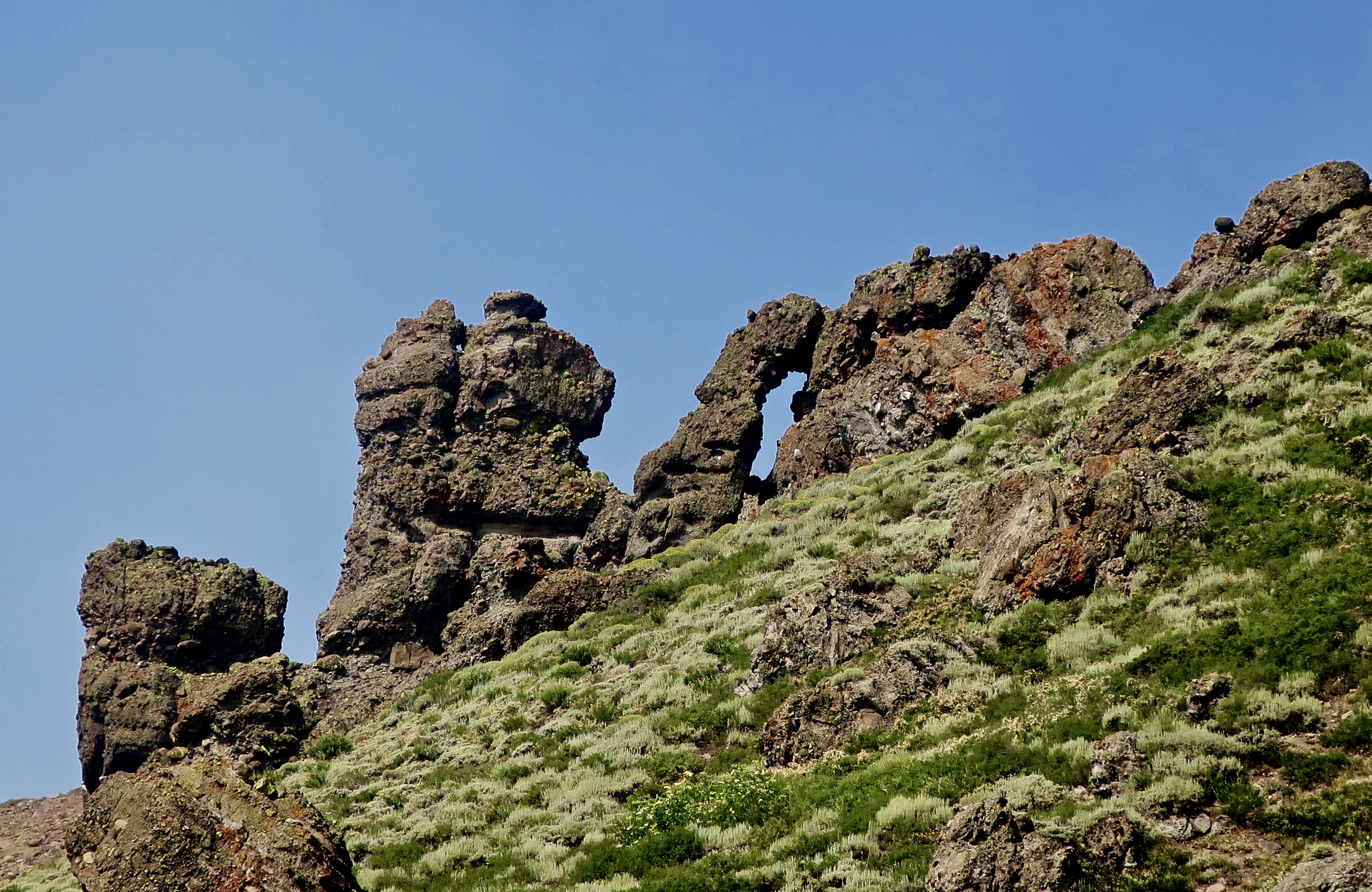
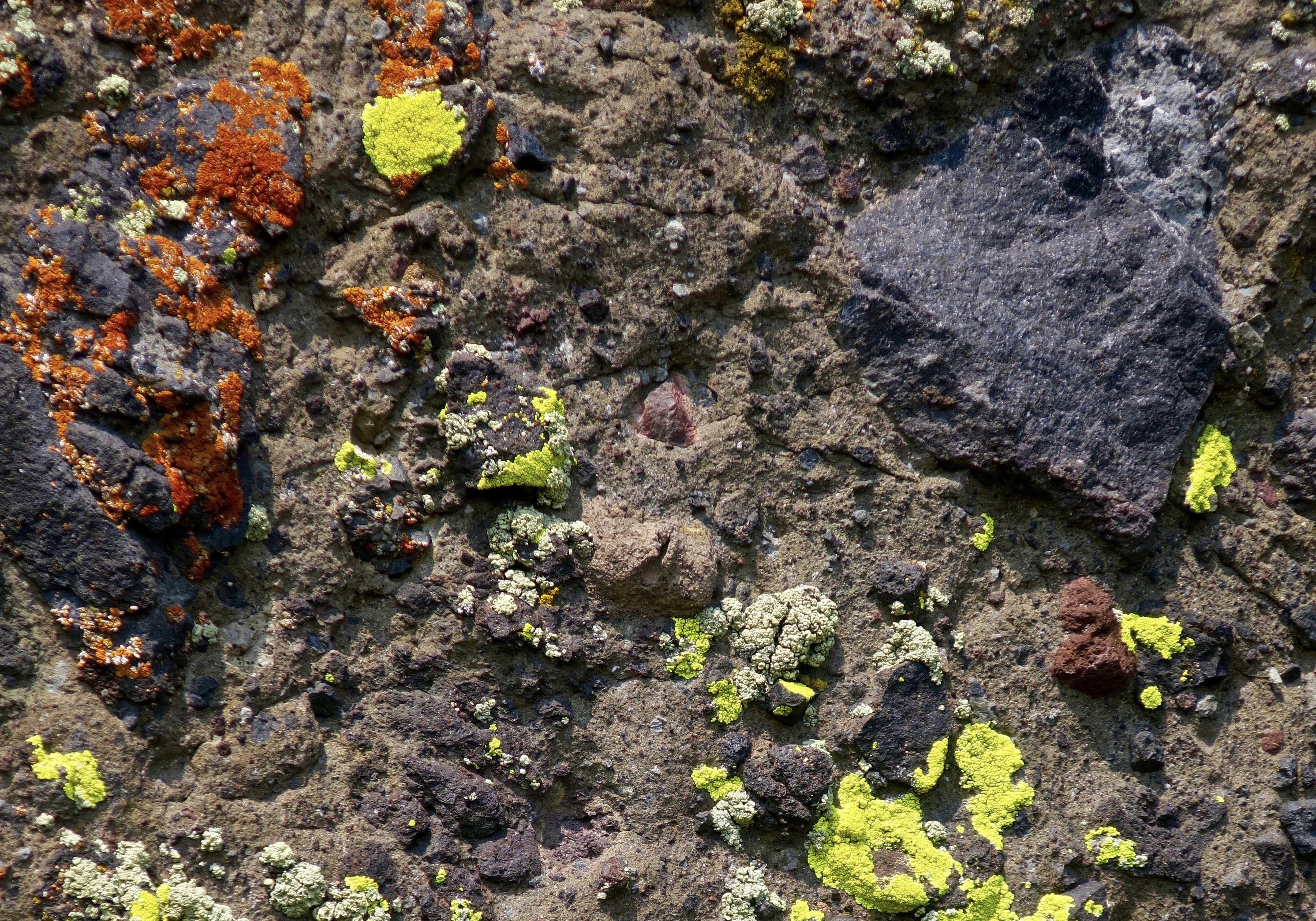
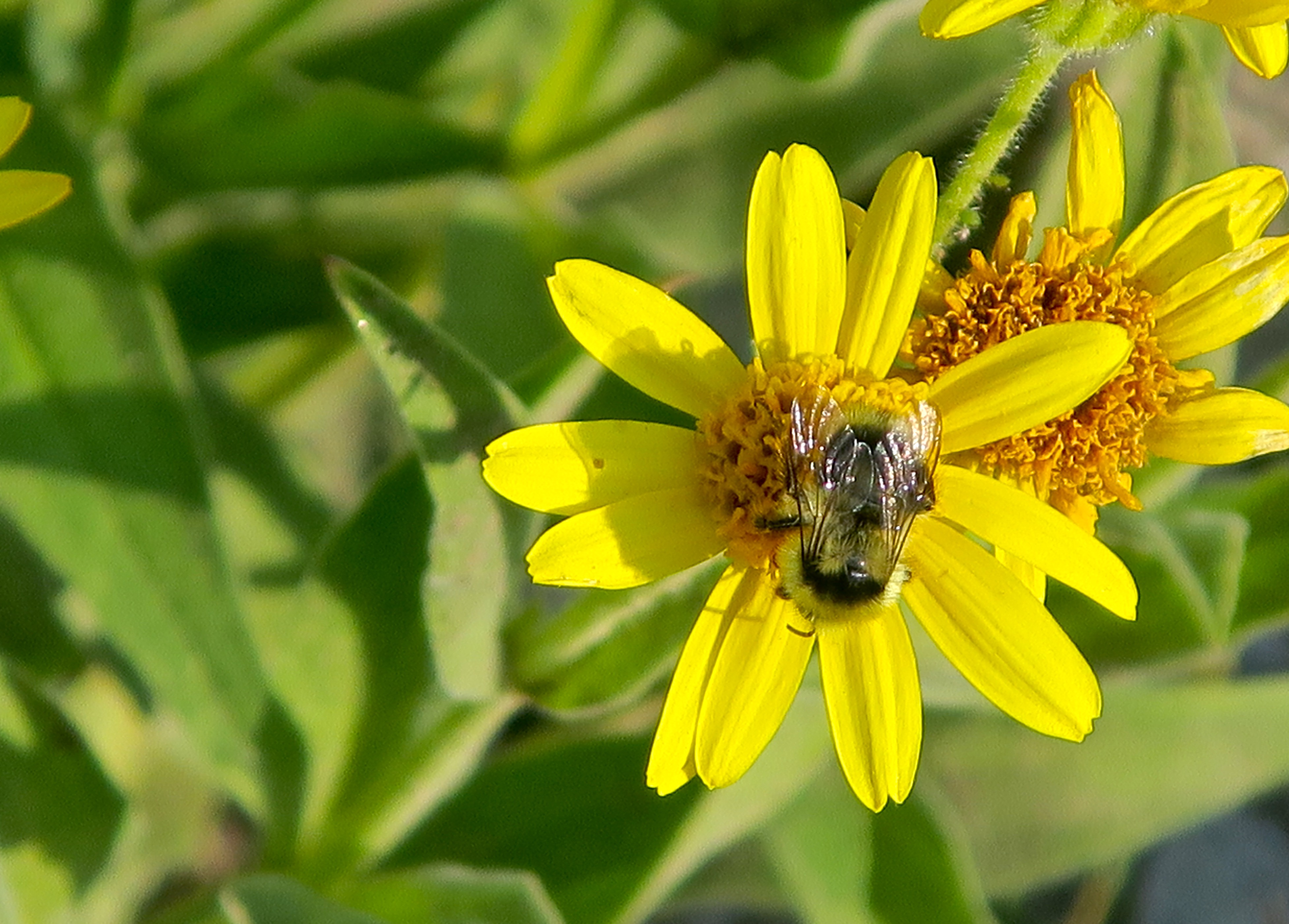
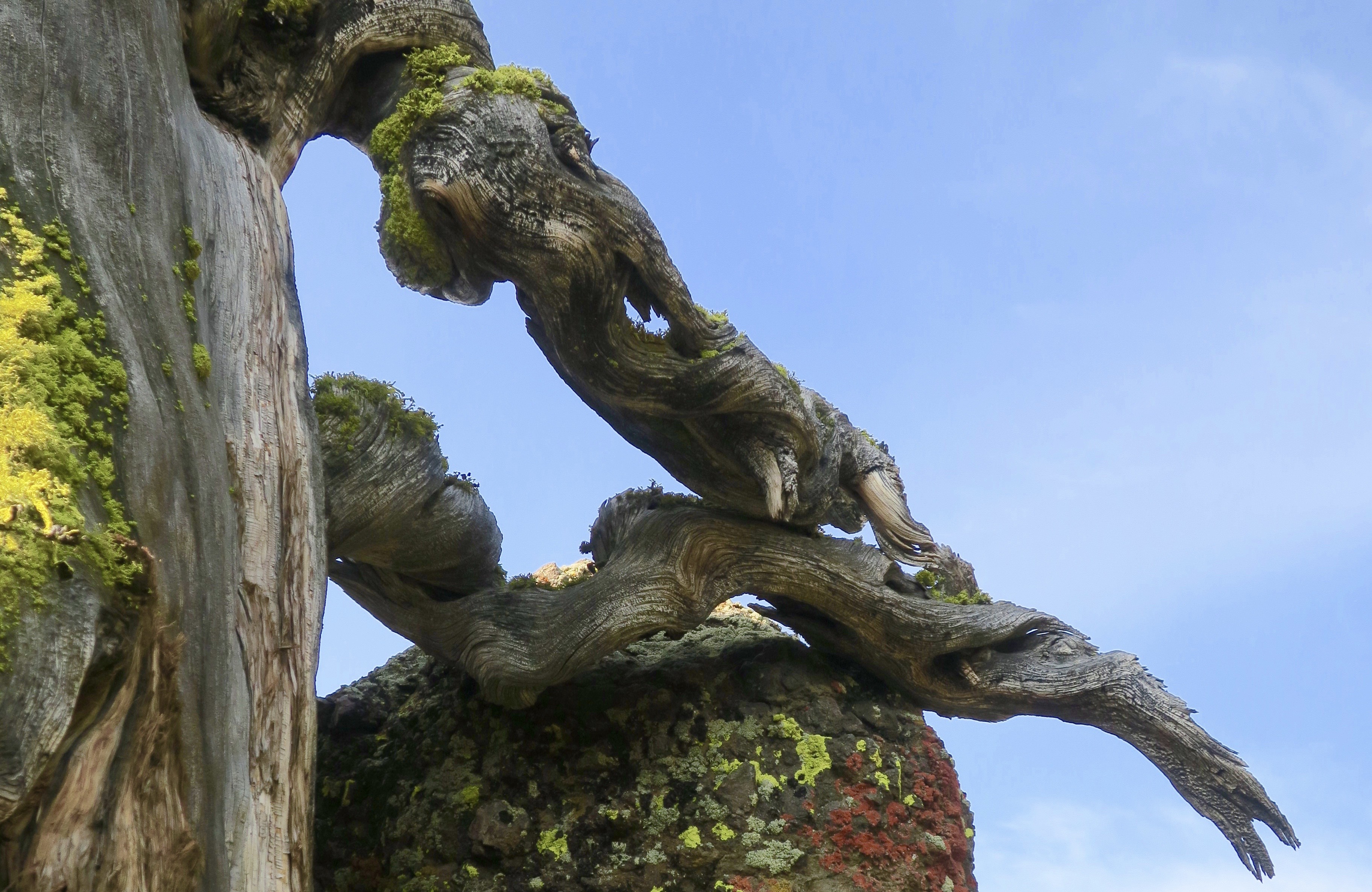
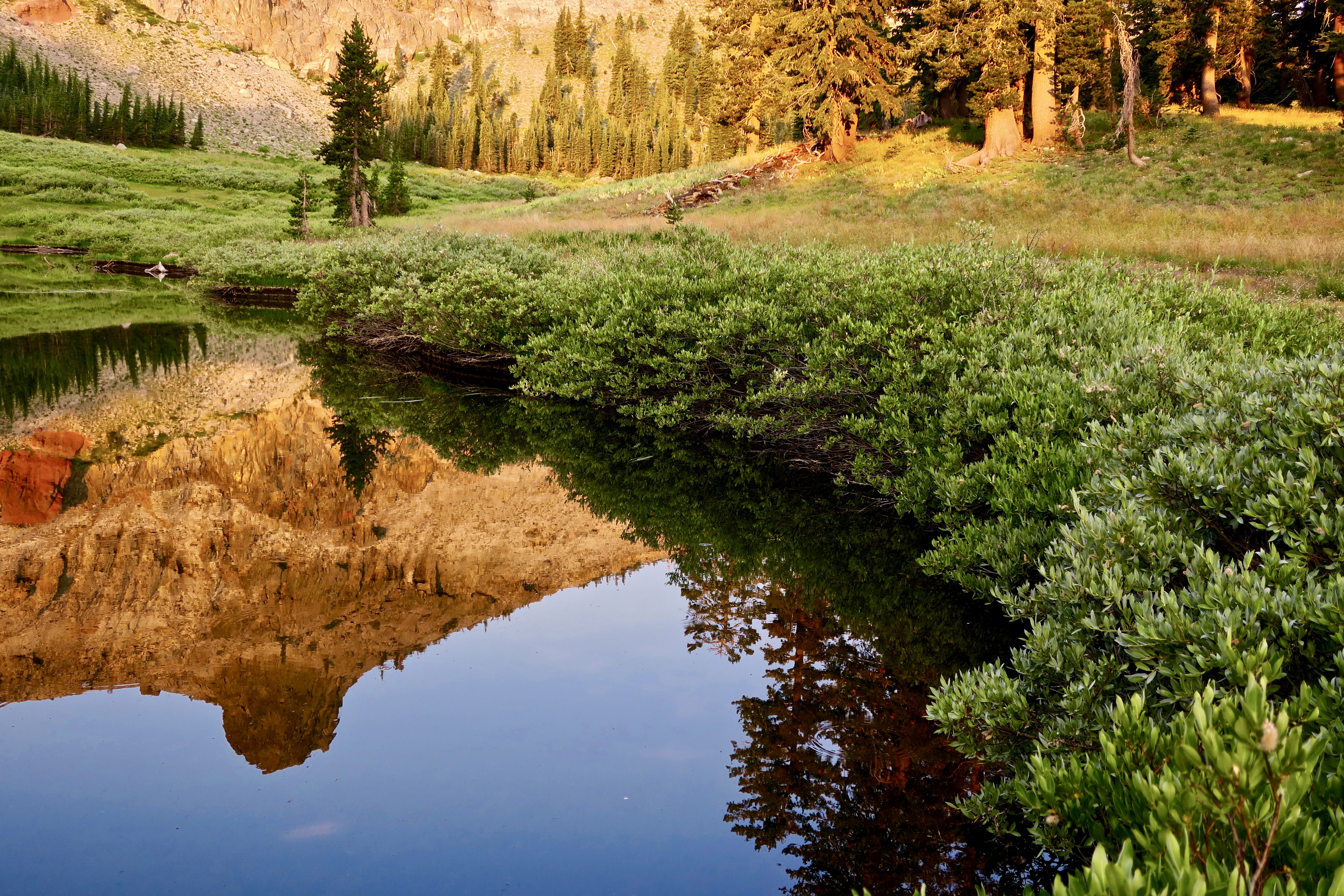
Here are some photos taken from my posts that emphasize what might be lost.
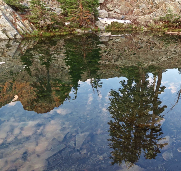
The serenity of the Five Lakes Basin’s ‘biggest little lake’ could be shattered by the sound of chainsaws. When I see this photo, I always think of Gary Snyder, the Nobel Prize winner, “poet laureate of Deep Ecology,” and who— along with his friends Jack Kerouac, Allen Ginsberg and Alan Watts— was prominent in introducing Zen Buddhism to America. Living on San Juan Ridge near Nevada City, he fell in love with the Sierras and the Grouse Ridge area in much the same way I did. He even wrote a poem about the Five Lakes Basin:

Old Pond

Blue mountain, white snow gleam
Through pine bulk and slender needle-sprays;
little hemlock half in shade,
ragged rocky skyline,

single clear flat nuthatch call:
down from the tree trunks

up through time.

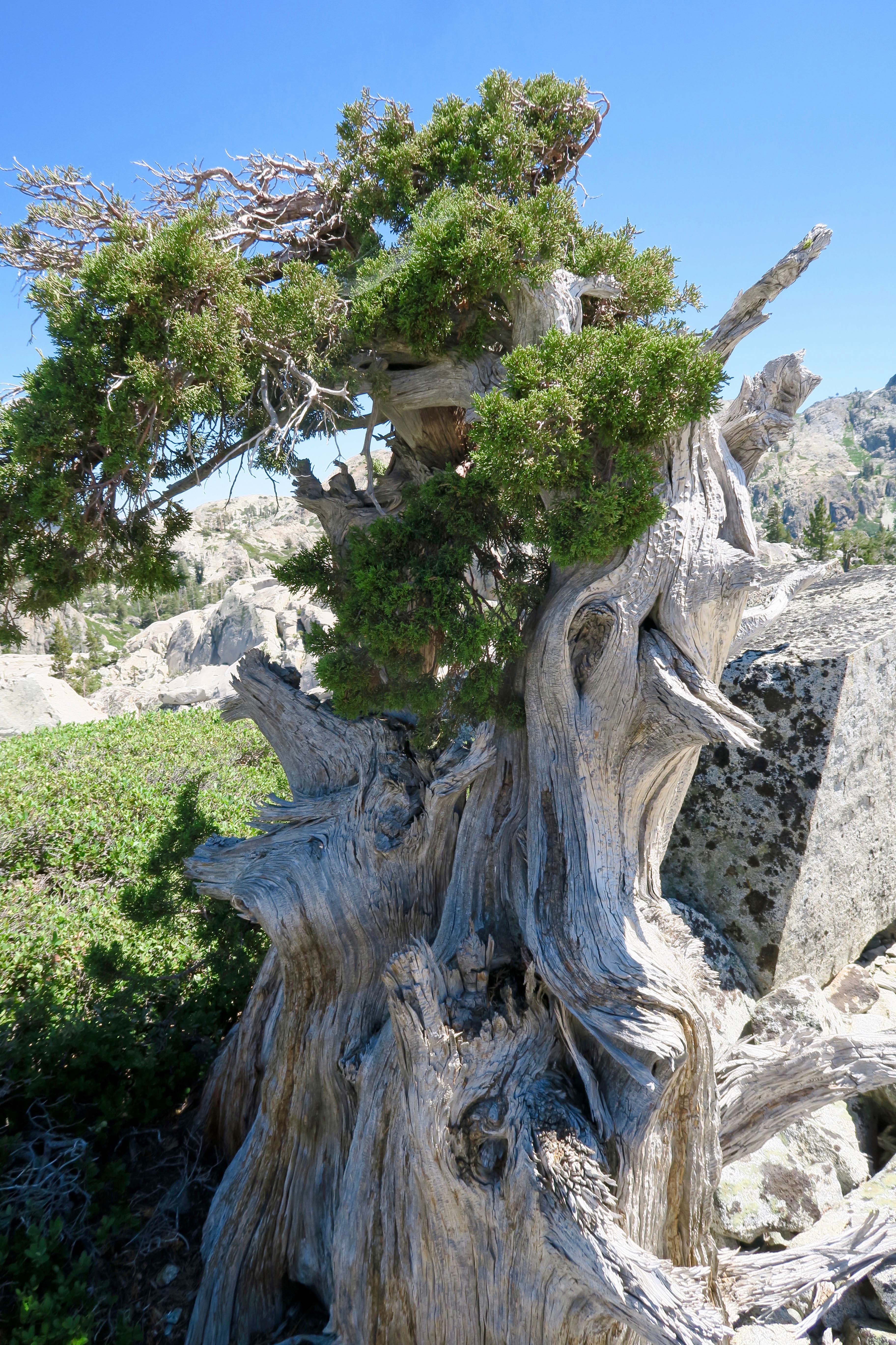
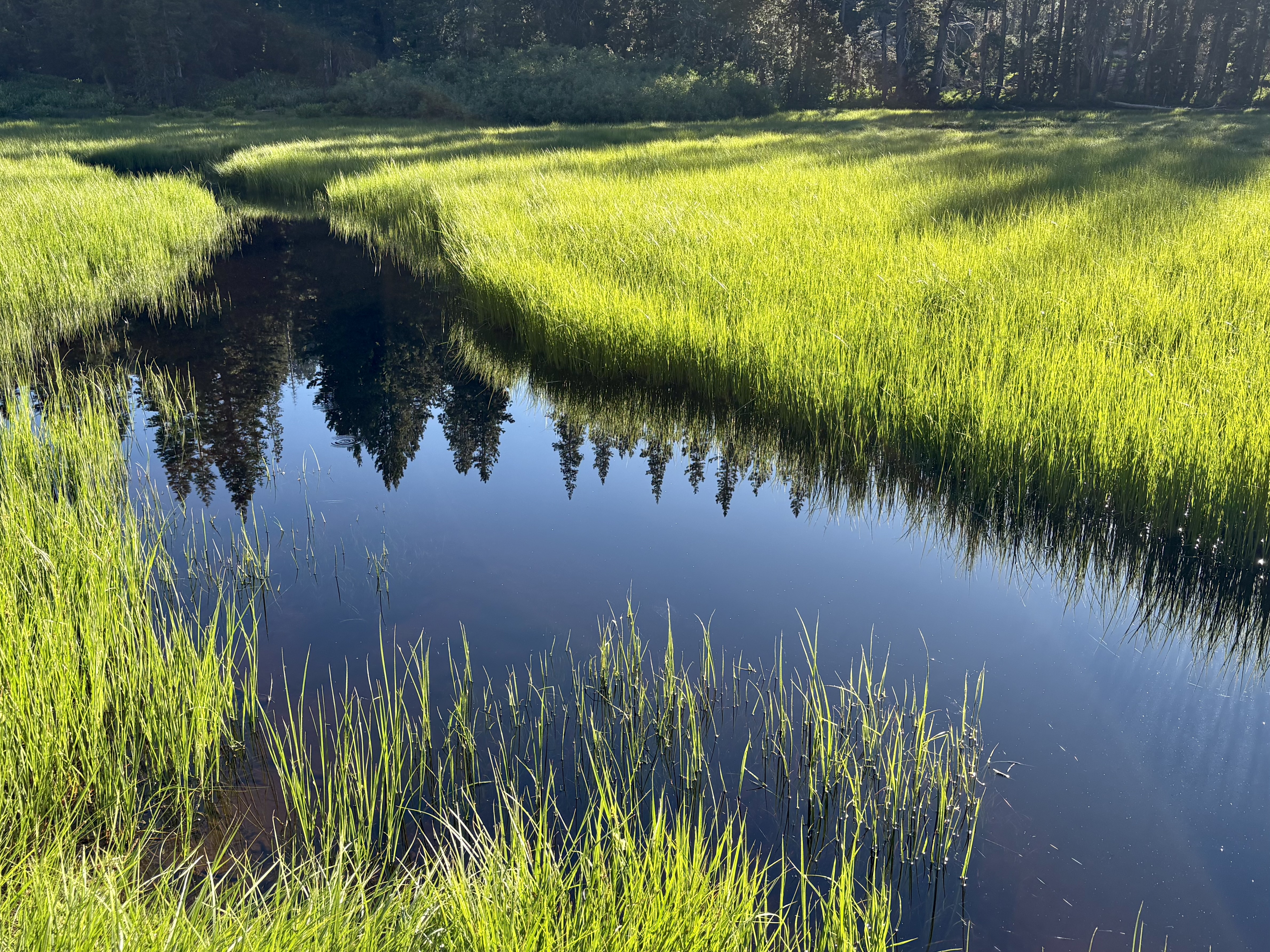
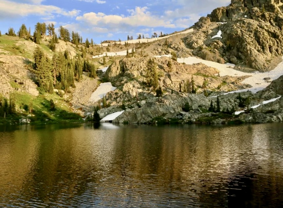
At Five Lakes Basin’s
Biggest little lake
after all day scrambling on the peaks,
a naked bug with a white body and brown hair

dives in the water,

Splash!

Like Snyder, my spiritual views of the world are more Eastern than Western, but it really doesn’t matter what your religious perspective is when it comes to the value gained by connecting with nature. I agree with John Muir’s statement: “The clearest way into the Universe is through a forest wilderness.” Here, in this photo by Peggy, I am reading Hermann Hess’s classic about a young man’s spiritual journey at the time of Buddha, Siddhartha.
I suspect that Snyder would love this twisted manzanita I found near his biggest little lake.
And this ancient juniper.
I’m a fan of reflection shots. Every lake in the Five Lakes Basin provides examples of why. This is morning on a lake I once named Peggy’s since I couldn’t find a name for it.
Evening on the same lake.
Just for fun, I’ve discovered that turning reflection shots on their side can provide interesting results. This one had a wonderfully-fat-monster-insect look. Start with the feelers and work down.
Another example from a normal perspective.
Flipped it on its side. Beyond the monster look, there was the woman in a green dress with the long green hair.
The basin is filled with granite. I liked the green contrast of the manzanita growing on the boulder.
As you might imagine, Peggy and I have taken hundreds of photos of the Basin and Non-Motorized Area over the years, but I’ll conclude our quick tour of the basin with a sunset photo and move on to Peggy’s 75th Birthday trip to Glacier Lake.
Peggy poses for her ‘official’ backpacker photo looking snazzy. Note the hiking sticks (poles). ‘We don’t leave home without them’ when venturing into the woods. They are essential for balance, even more so as we age. My hips and knees were screaming at me as we made our way down Grouse Ridge, like “What the F are you doing.” (Growing older is so much fun.) The sticks assured we stayed upright.
The area was much drier than we had expected from previous trips in July, thus we were grateful when we came across this meadow. One look and we simultaneously thought CAMP!
One tired, but happy, puppy. Or maybe that should be old dog. That’s my food bag draped across my legs. Camp was set up. We’d had a cup of hot soup, cheese, a beef stick, and a celebratory shot of Irish liqueur. I still had to cook Peggy a post-birthday dinner, but that consisted of boiling water, pouring it into a container of freeze-dried backpacking food, letting it sit for five minutes, and eating. Mmmm, beef stroganoff. All was right with the world. Just don’t ask me to get up! Peggy managed to abandon her Therma-rest seat for this photo. Good thing I married a younger woman.
The next morning we found a snow bank on our way up to the lake. I don’t think Peggy has ever found snow without lobbing a snowball at me!
She followed up by carving a heart with P+C in it. Aw….
The trip up to the lake was relatively easy, considering we took two days to do what is normally a one day trip. (I’ll note here that some of these photos here are from earlier trips since we were only carrying our iPhone to save weight.)
An obligatory photo of camp. Looks peaceful, doesn’t it. Shortly afterwards, a group of 35 teenage girls and their adult leaders showed up and camped next to us. Must say they were relatively quiet, polite, and only spent the night. The most noise was their scream as they jumped into the lake’s snow fed water. While the group size was too large, I appreciated the effort their leaders put into introducing them to backpacking and the beautiful area. They left their camp immaculate.
After the girls packed up and left, we had the camp and lake to ourselves for the day.
While the moon was only partial, at 8000 feet it was like someone was shining a flashlight on our tent at night.
Bone, who had joined us on the trip, insisted on having his photo taken before we headed back for Grouse Ridge.
Naturally, we took a selfie when we made it back to our truck— happy to be back but ever so glad we had gone. That’s it for now. Peggy and I are in Albuquerque, New Mexico for a week before we begin our journey back East. Next up…
Canyon de Chelly National Monument

A Backpack Trip through the Mokelumne Wilderness on the Pacific Crest Trail… Part II

Look deep into nature, and then you will understand everything better” – Albert Einstein.

A view from the Pacific Crest Trail as it makes its way through the Mokelumne Wilderness.

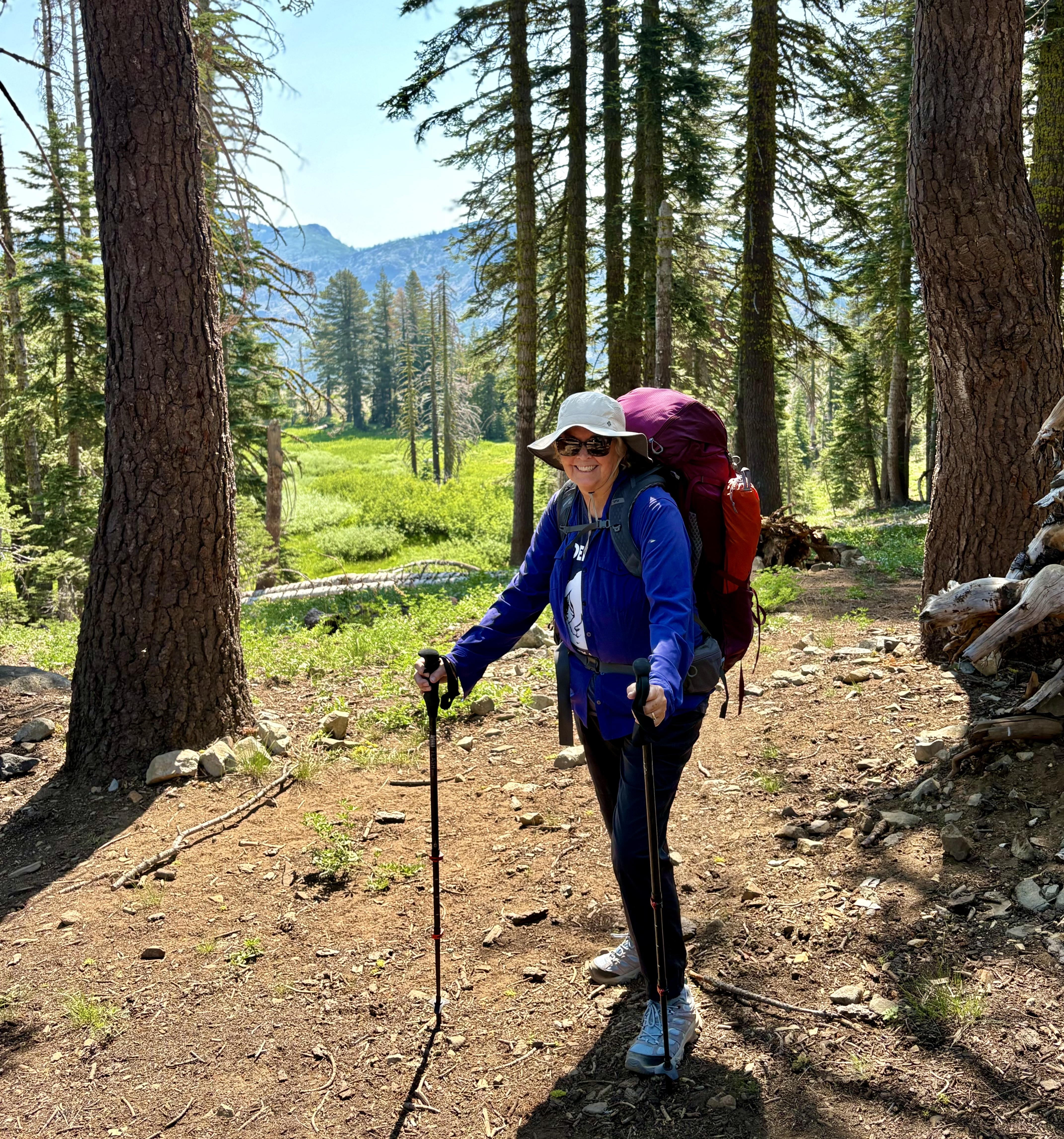
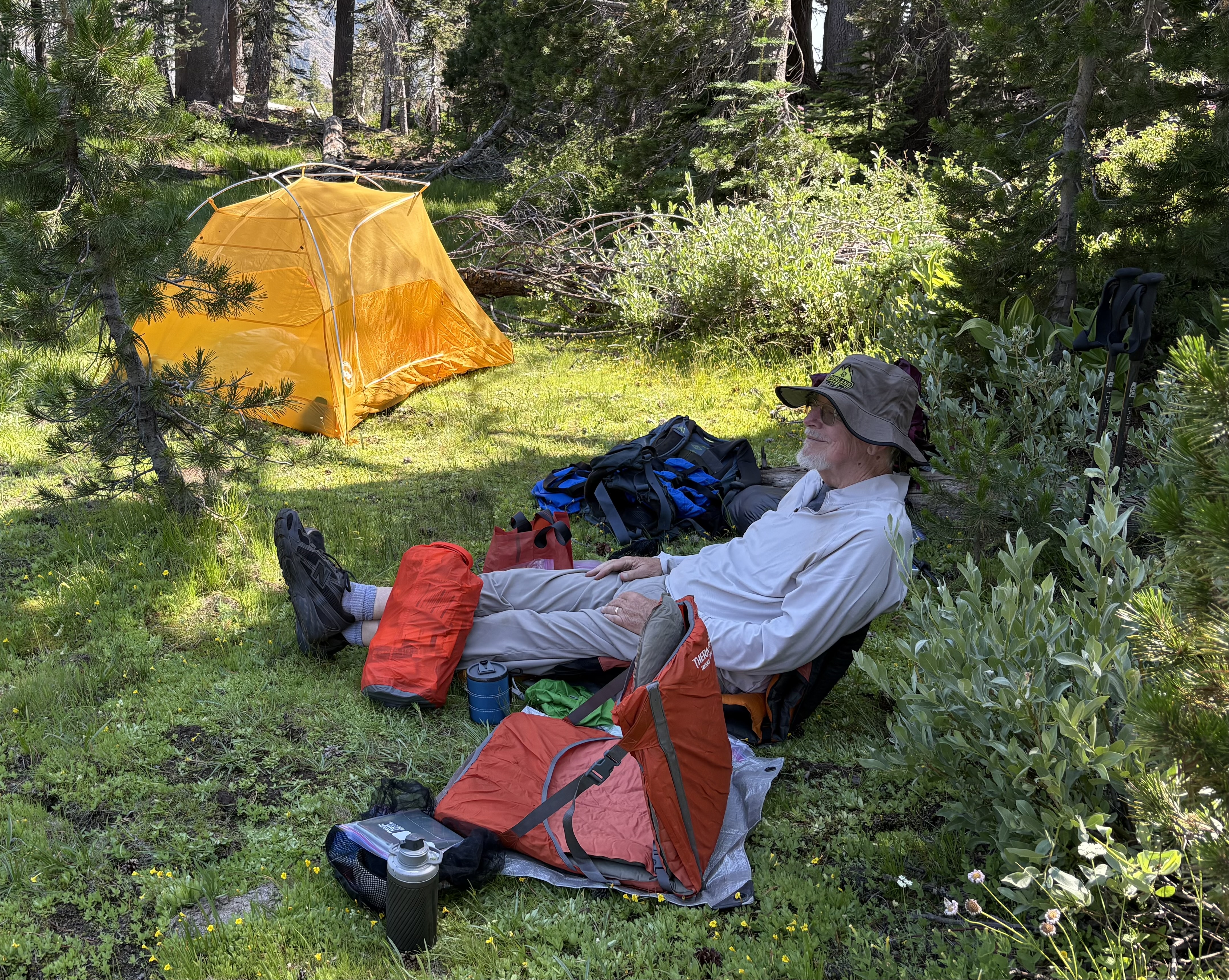
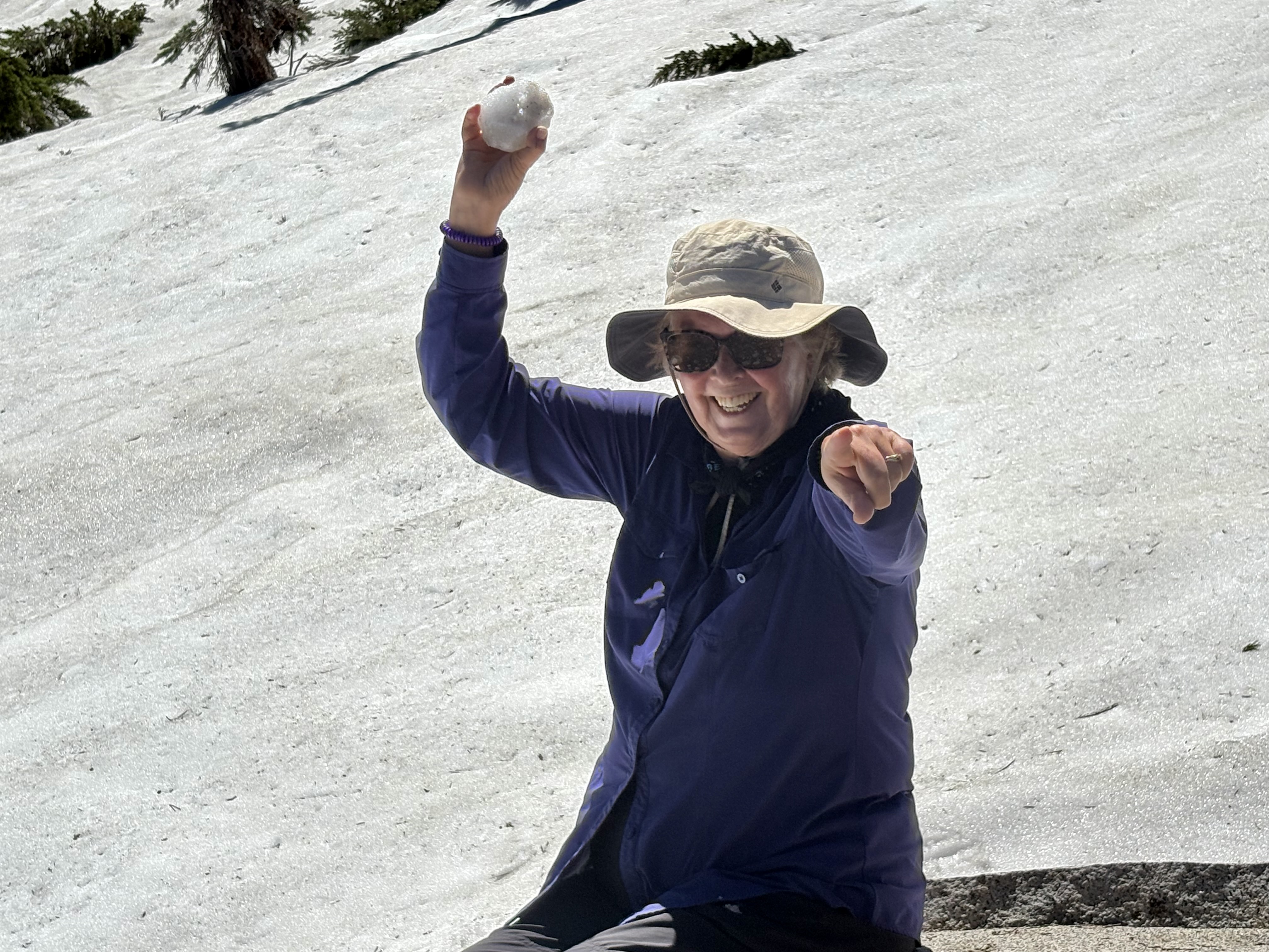
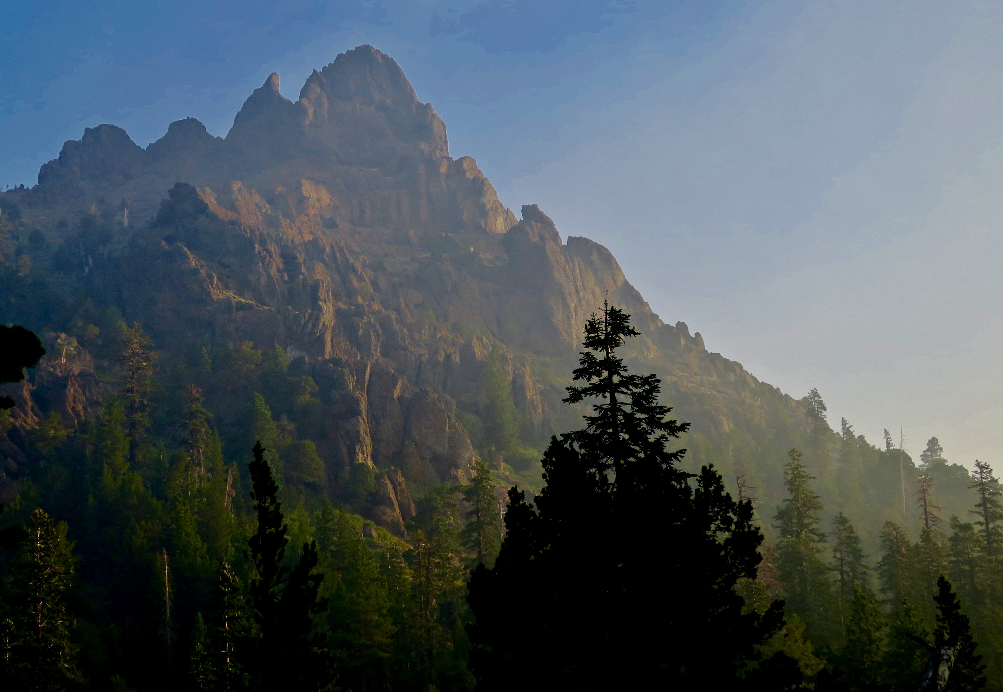
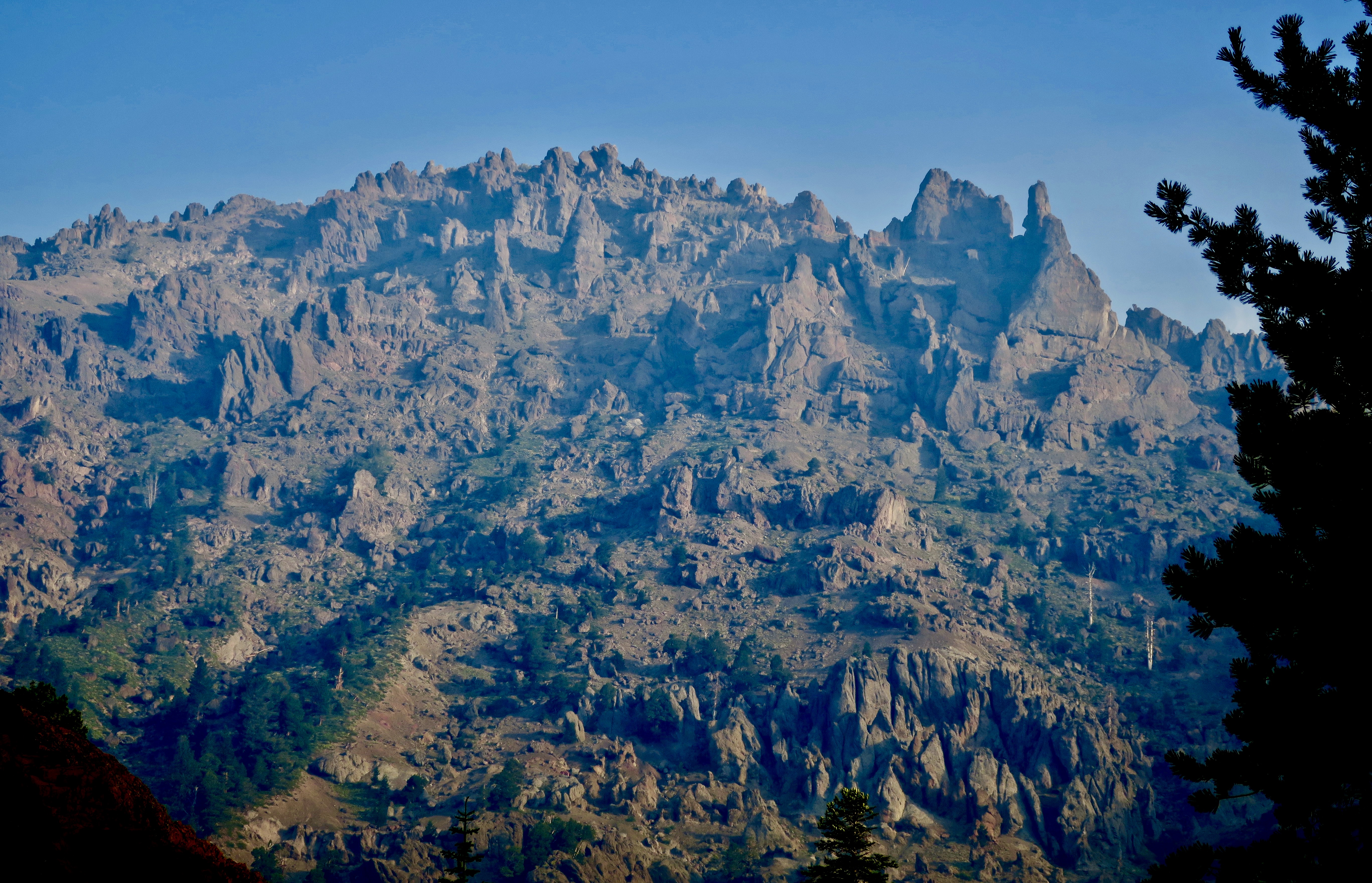
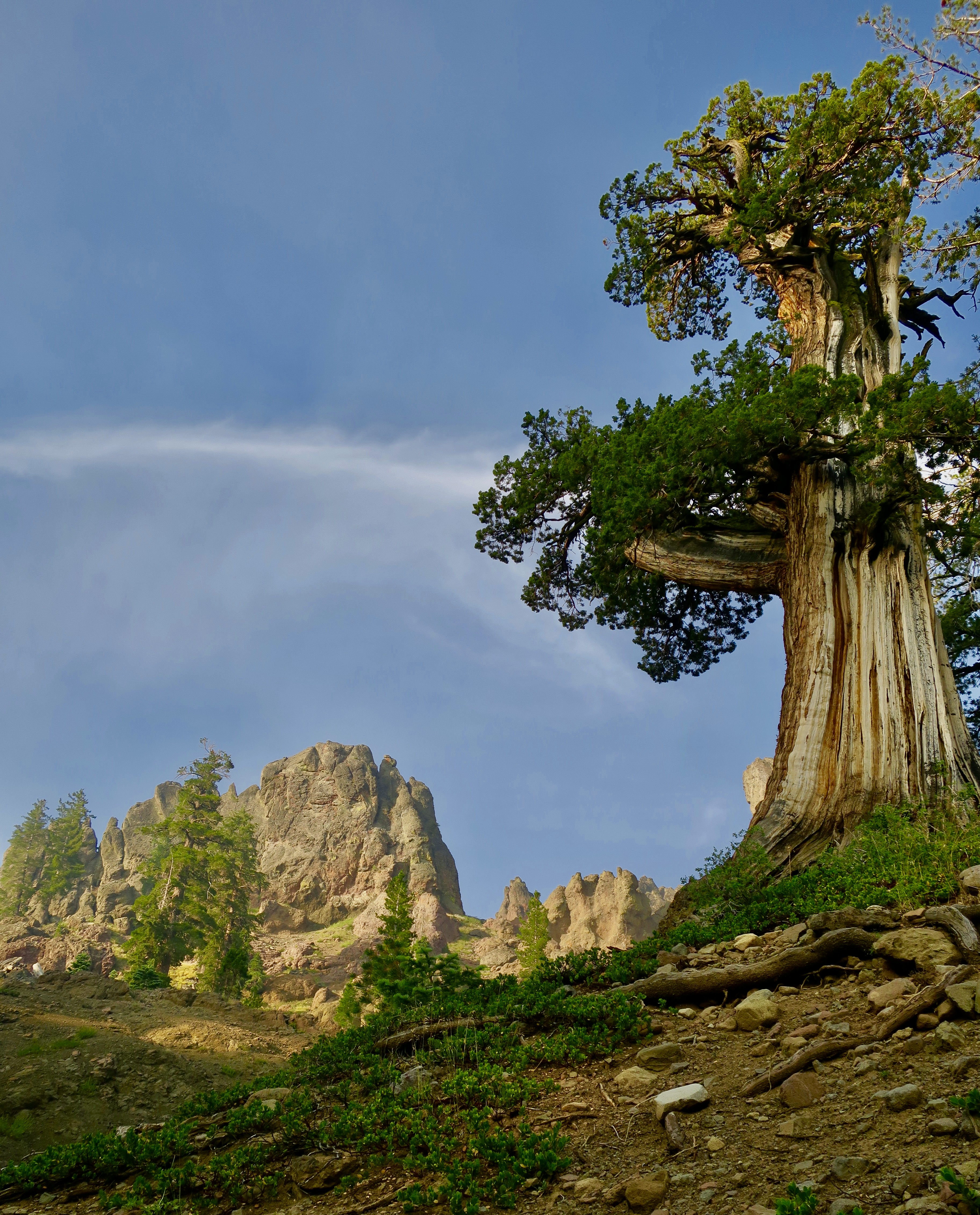
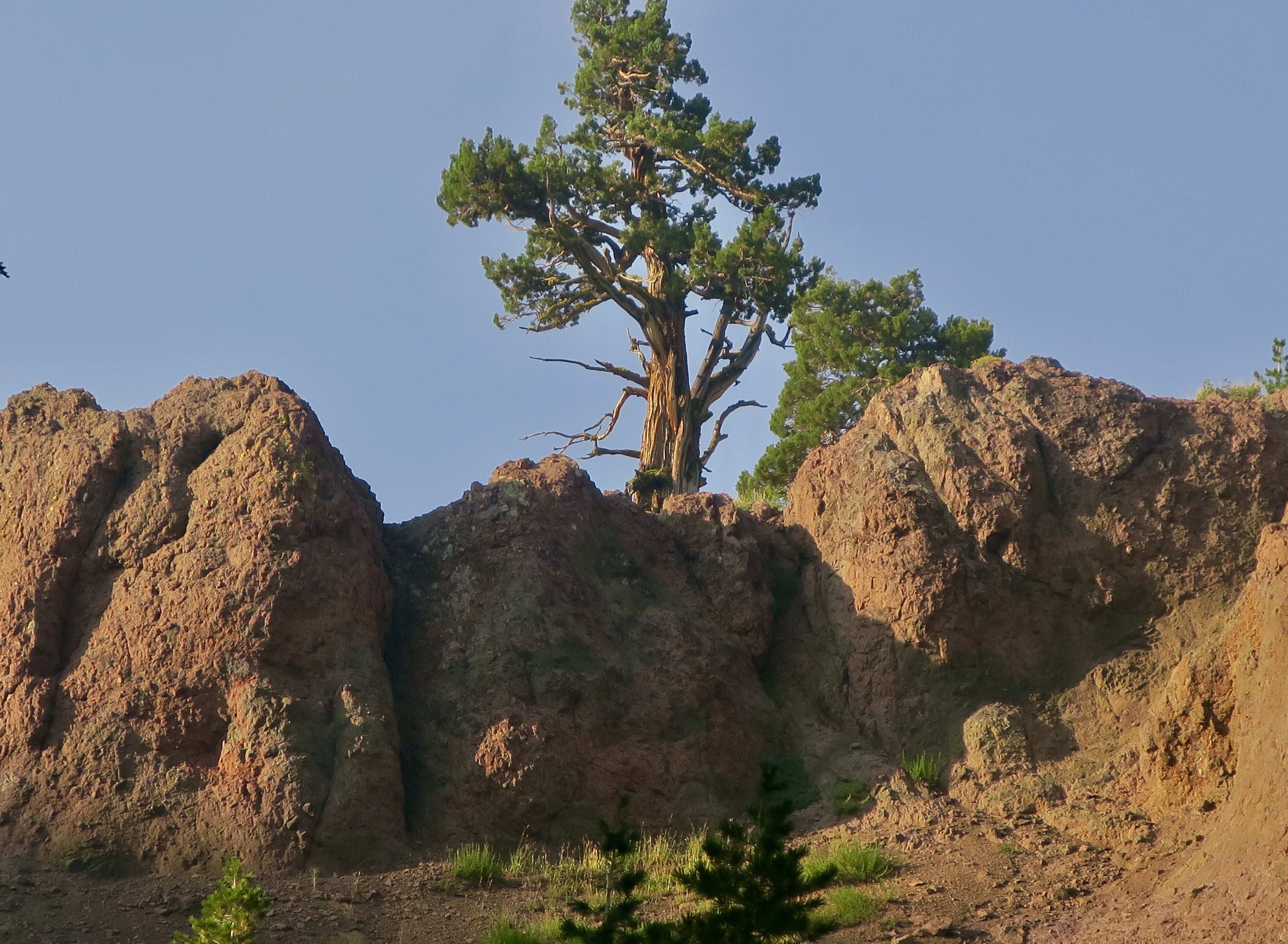
I’m continuing my trip through the Mokelumne Wilderness today, a 30 mile hike along the Pacific Crest Trail between Carson Pass on Highway 88 to Ebbetts Pass on Highway 4 in the Sierra Nevada Mountain Range south of Lake Tahoe. I made the trip in 2018 as part of my 750 mile trip down the PCT to celebrate my 75th Birthday.

This post is part of the series Peggy and I are doing that stresses the great value and need to protect our national parks, monuments, wilderness areas and other public lands in light of efforts by the Trump Administration to reduce them in size and— in some cases, totally eliminate them— to open new areas for economic development and exploitation as part of his Make America Great Again plan.

There have been two instances of administrative and legislative actions since my last post that are particularly worrisome:

One: A decision by Trump’s Department of Justice this past week that the President has the right to abolish National Monuments on his whim without any public input or due process.

Two: A Senate Bill in support of Trump’s efforts was introduced by Republican Senator Mike Lee of Utah to require that not less than 50% or more than 75% of BLM and National Forest Service land be sold off. Lee’s claim is it will provide land for affordable housing. Really? Given that his support for accessible housing in the past has been to introduce legislation to eliminate or defund affordable housing programs, one can only wonder what his actual motivation is.

Now, back to our celebration of the beauty and value of our remaining wild areas with photos I took while backpacking through the Mokelumne Wilderness.

As in the first half of the journey, there were flowers to admire.
Including thistles.
And one of my all time favorites, a monkey flower.
There was even a ‘dried’ floral arrangement.
The trail climbed up and over a ridge and then worked its way off into the distance across a seemingly barren landscape as smoke from forest fires continued to fill the air.
But small streams complete with flowers and cool water provided a welcome respite…
And the smoke could not hide the area’s beauty. In ways, it even enhanced it.
I even found a photo frame.
The trail soon provided other views. This rock formation was the result of an ancient volcanic mud flow.
A juniper tree stood beside the trail, adding its unique brand of beauty.
I remembered this juniper and its boulder from a previous trip 22 years ago. How could I forget?
Rocky crags soon dominated the views along the trail.
Looking south from my campsite above Pennsylvania Creek.
Hiking out of the Mokelumne Wilderness the next morning provided many classic northern Sierra Nevada scenes.
And in conclusion: More volcanic mud flow working its way down the mountain.
Colorful lichens.
A close encounter between a bumble bee and a flower.
And a bit of humor to end the post. Two limb monsters going head to head. My money was on the guy with tusks.
Next up, in our continuing focus on the beauty of wilderness areas, I travel north of Mokelumne Wilderness to the Granite Chief and Desolation Wilderness areas west of Lake Tahoe. This is an evening reflection of Little Needle Peak in Little Needle Lake. I’ve camped there many times over the years.

If Nanny with her painted hooves and micro-mini skirt, and Billy in bellbottom pants, wearing wire rim glasses, and chewing grass…

Show up on your doorstep late Christmas Eve, they may have something important to say. You will have to listen carefully.

They are the Goats of Christmas Past.

Their message may be baaaa’d.

This is the Christmas Card I created for 2024 that Peggy and I have sent out to family and friends and are now sharing with our blogging family. Thanks so much for joining us in our adventures this previous year as we traveled from the Florida Everglades, to the Pacific Coast and National Parks of America, to the Danube River of Europe. We are looking forward to having you along in 2025. May you have a great holiday season and a peaceful and Happy New Year! Curt and Peggy

I Can’t Believe It’s Already Christmas…

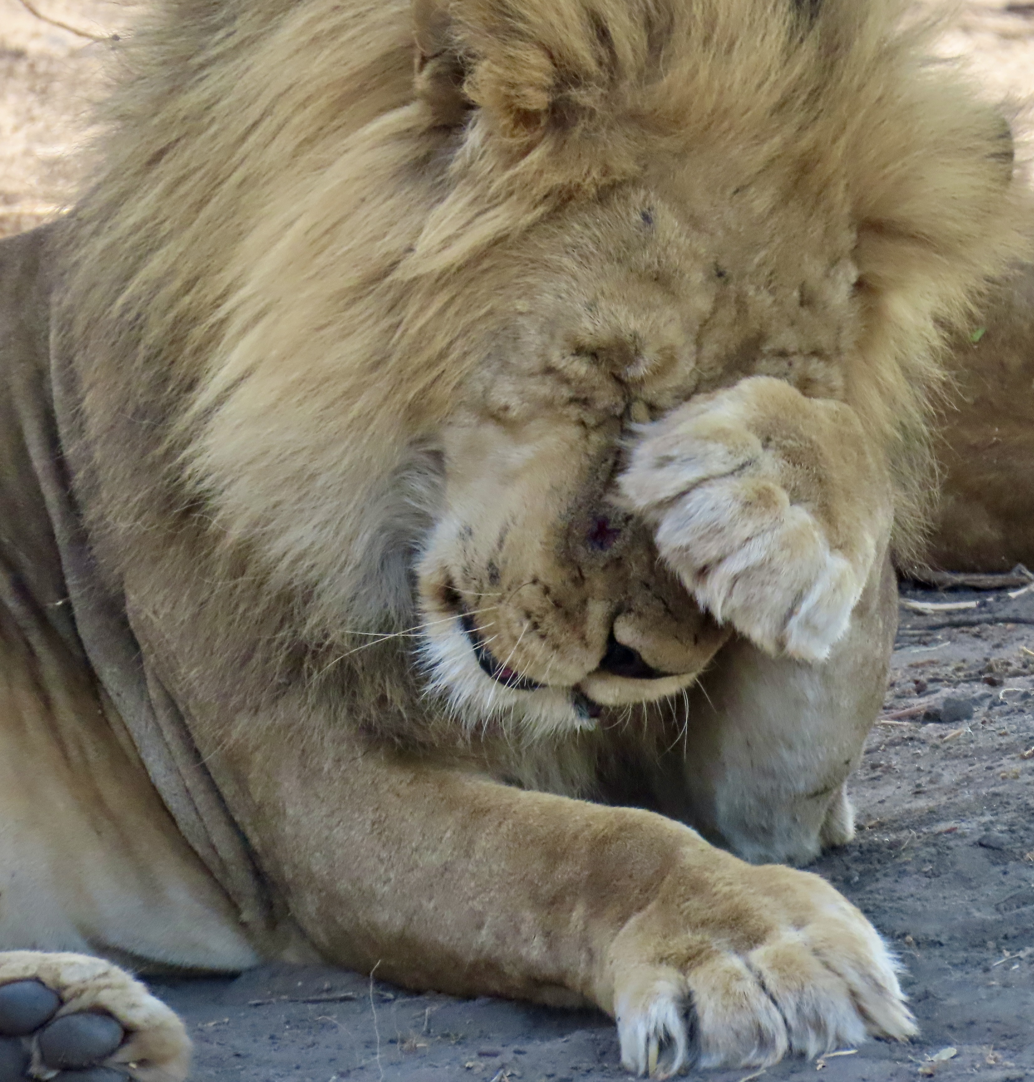
Now I will have to wash my face.

Peggy and I came on this overgrown kitty washing his face in Chobe National Park, Botswana on our African safari in October and couldn’t resist using him in our Christmas Card this year. He could have very well been saying “I can’t believe it’s already Christmas!” or “Yikes! Where did 2023 go?” Anyway, here’s Leo the Lion for your enjoyment. Peggy and I want to wish each of you and your families a great Holiday and a happy and healthy New Year. (Back to elephants next week.)

Have You Ever Petted an Elephant’s Trunk? Peggy Has… On Safari (Part 2)

Elephants are fascinating creatures, no doubt about it, and one of the most fascinating things about an elephant is its trunk— which is the subject of today’s post. This one was waiting for Peggy to toss food into its mouth at the Wild Horizons Elephant Sanctuary and Orphanage just outside of Victoria Falls, Zambia. The elephants weren’t wild exactly, but definitely fun, interesting, and educational.

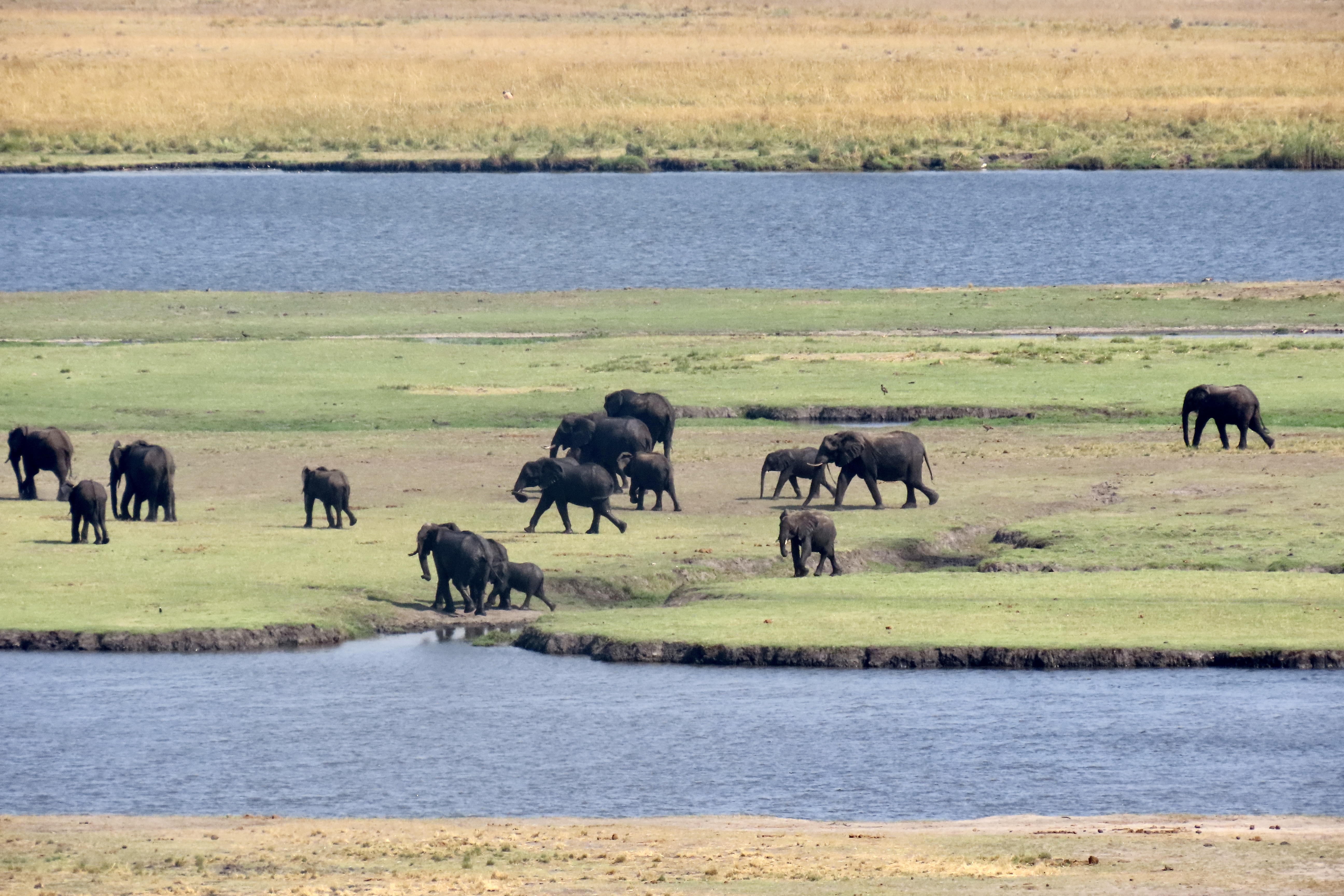
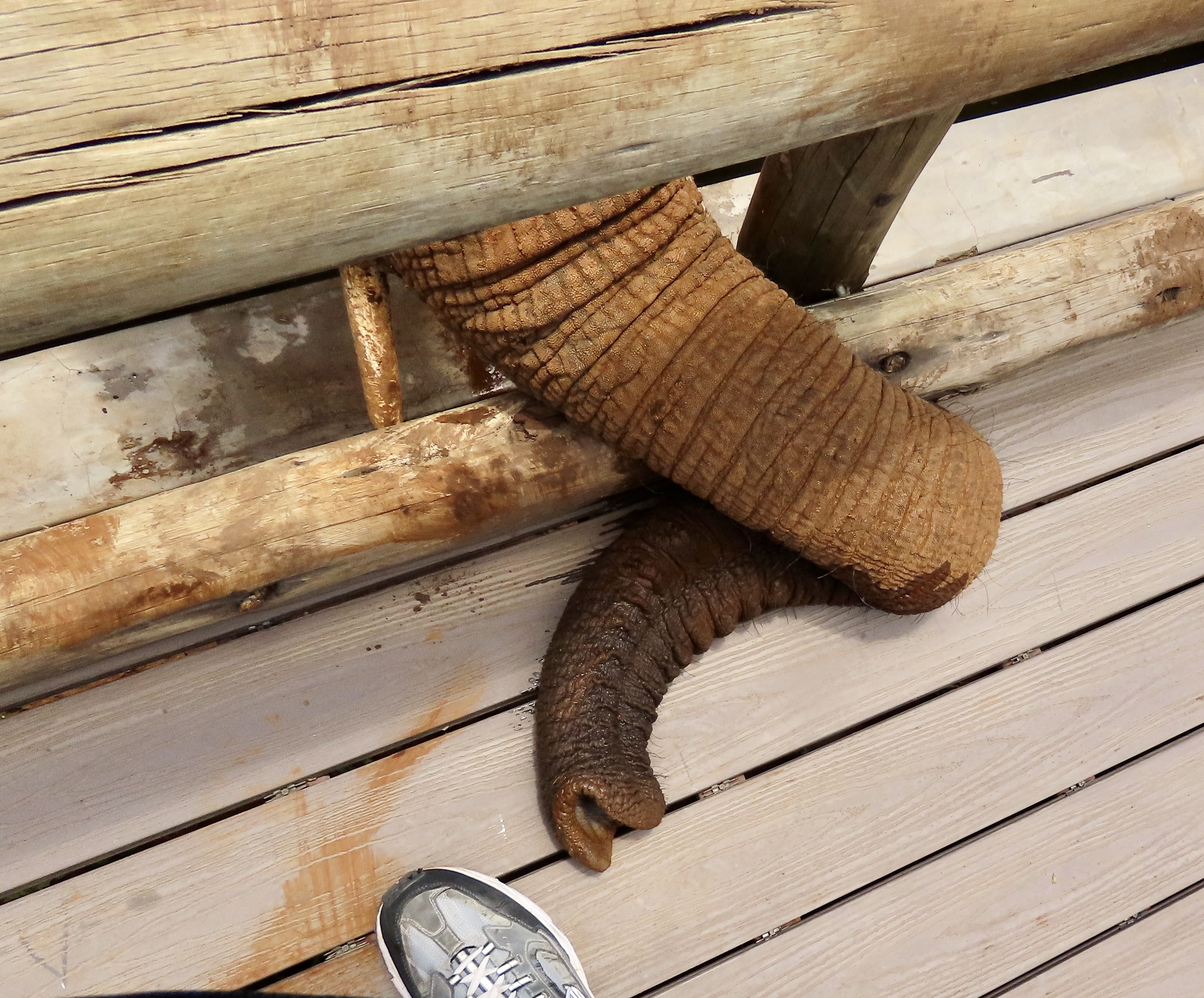
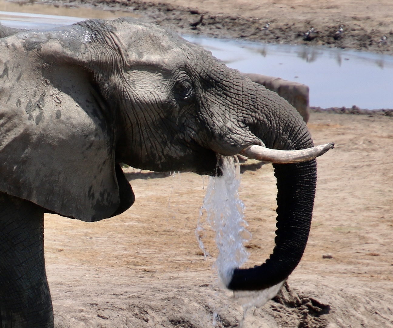
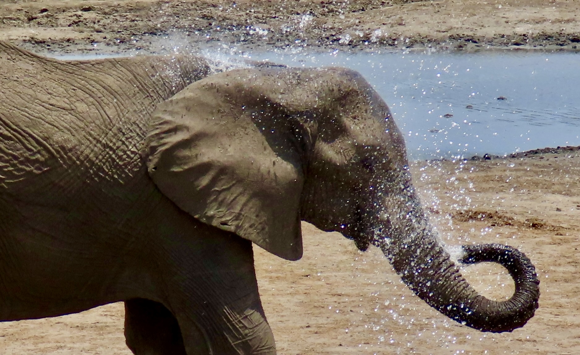
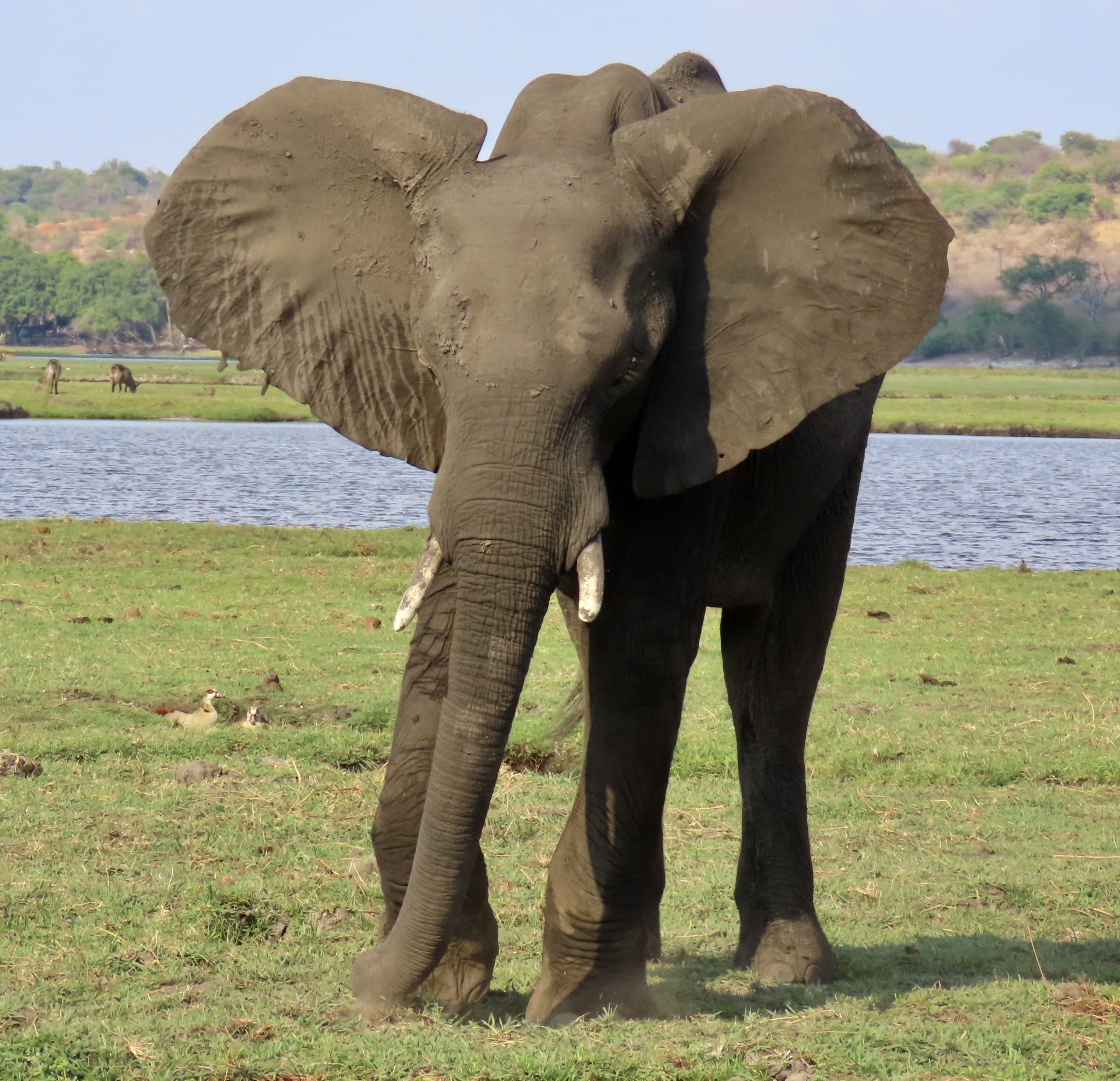
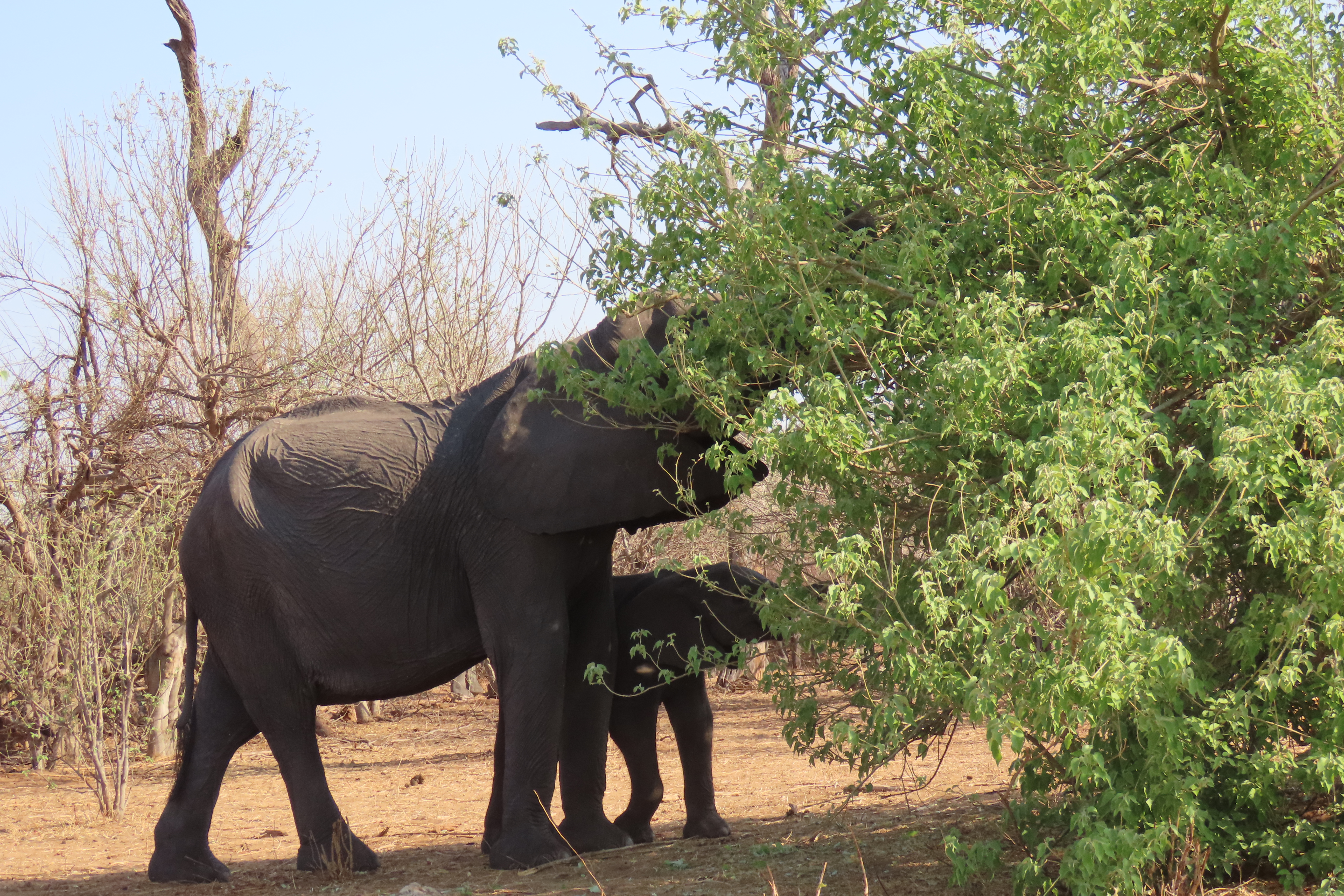
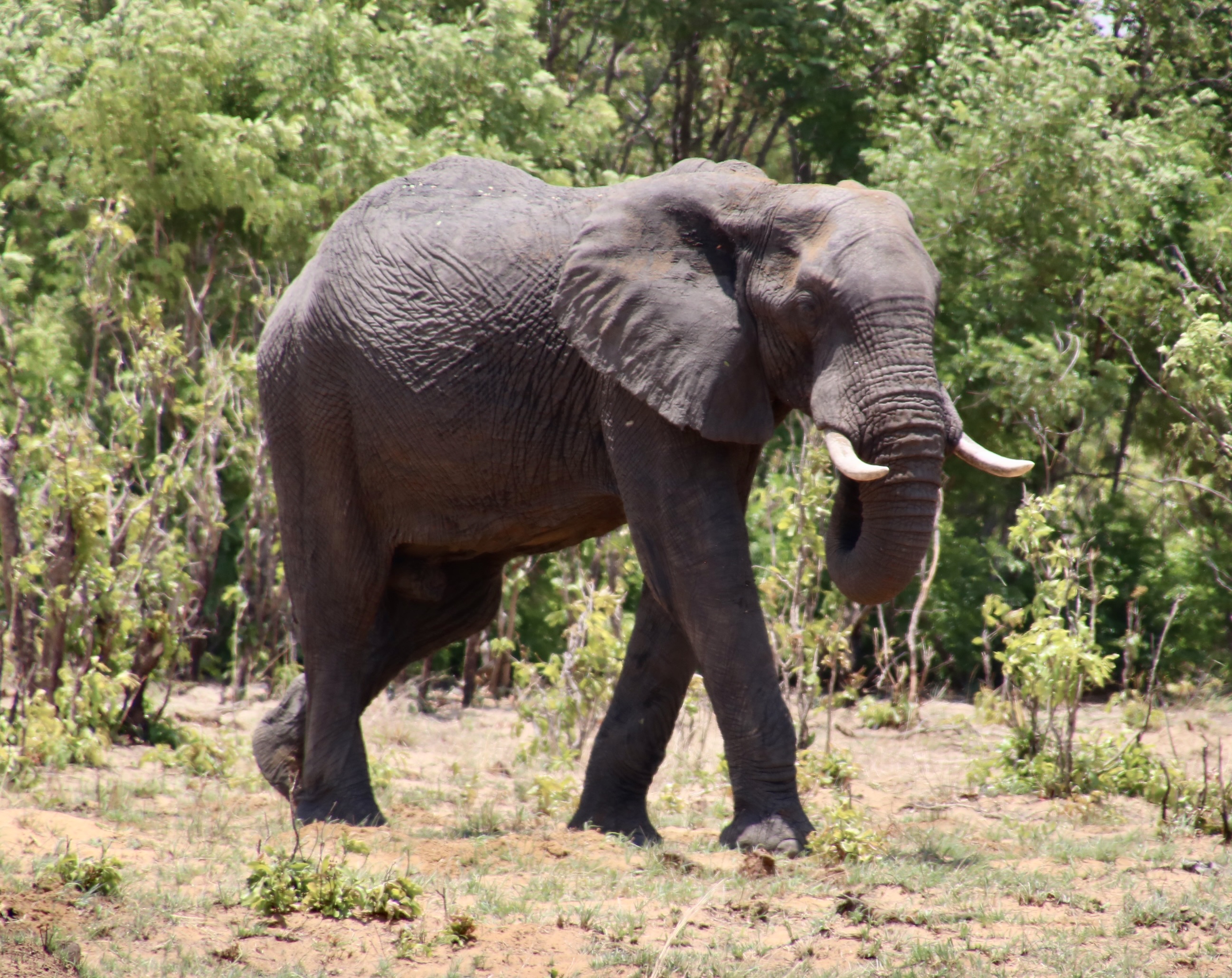
Peggy and I, along with our traveling companions, her brother John and his wife Frances, spent a lot of time watching and photographing elephants on our recent safari to Botswana, Zambia, and South Africa. Most of the time, they were doing something with their trunks. These marvelous appendages are used in breathing, smelling, eating, drinking, bathing and communication. Today’s post will focus on the trunk. My next post will consider other interesting facts about elephants, including their tails.

You know how hard it is to get a wild elephant to pose? Grin. We were more than satisfied to watch and photograph them wandering around doing elephant things. These two were focused on eating next to the Chobe River. But they also provided an excellent illustration for my next two posts that are going to be focused on looking at elephants from trunk to tail. It would have helped had they switched positions, but they didn’t listen to my suggestion. The elephant on the left is using her foot to kick the grass and free it from its roots. The one on the right is about to shake the dirt out of the grass she has gathered.

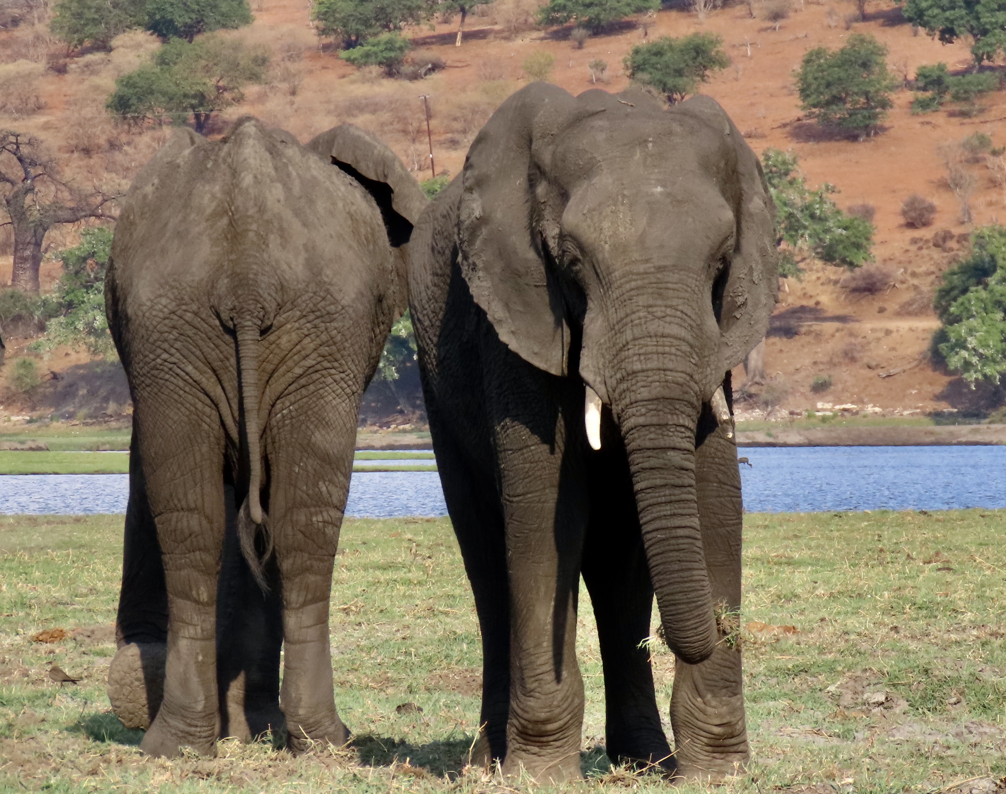
Our opportunity to watch and photograph elephants took place in four different locations. The first was Chobe National Park in Botswana. One of the Park’s claims to fame is that it supports the largest herd of free-ranging elephants in the Africa. Since we were at the end of the dry season, many of these elephants were located next to the Chobe River where they could get water and food. Viewing them was easy, particularly from boats. (Ours was docked at our safari lodge on the edge of the river.) Chobe is an excellent area to see wildlife. The only downside is that this means you will be sharing your experience with lots of other people.

There was no challenge finding elephants along the Chobe River in October at the end of dry season. With the coming rains, they will spread out across the park.

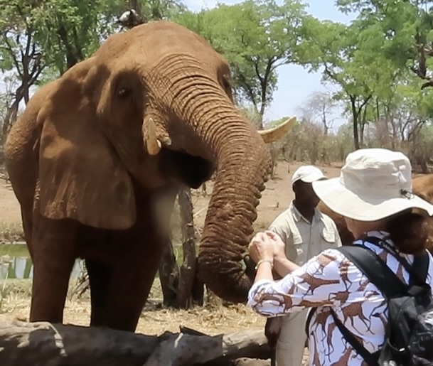
Hwange National Park and Matusadona National Park in Zimbabwe were the other two areas we watched wild elephants in their natural setting. Both parks had far fewer people on safari and were far less crowded. Slightly different, but excellent for meeting elephants up close, the Wild Horizons Sanctuary and Orphanage for Elephants just outside of Victoria Falls allowed us to interact with these giants of southern Africa’s velds. All of the elephant photos in this post and the next one were taken by Peggy and me in these four locations. I’ll start with the Sanctuary since we were able to get close ups of the trunks.

What’s impressive here is the large size of the trunk. The largest can reach up to seven feet. It’s easy to imagine why elephants need a large head and strong neck muscles to carry and use their trunks. While it may not be obvious, the trunk is an extension of the elephant’s upper lip and nose.
While the elephant’s trunk is attached to head bones, there are no bones in the trunk. Instead there are lots of muscles. This arrangement is called a muscular hydrostat. Another example is our tongue. The muscles are impressive. There are 17 major muscle groups, 8 on each side and 1 up the middle. But in turn, these muscles are made up of sheathed groups of fibers known as fascicles. The latest estimate is there are around 90,000. When you see claims of an elephants trunk having 50-100,000 muscles, fascicles are what they are referring to. The major muscles and fascicles are what allow for the great flexibility and strength of an elephant’s trunk. The elephant can move it up, down, left and right, and even twist it in every direction, but it does have a dominant side. (Think left handed/right handed.)They can also lengthen, shorten and stiffen their trunks.
Peggy is petting an elephant’s trunk near the tip at the Sanctuary. She described the skin as “hard and the hairs wire-like and sharp.” One would think that such an arrangement would lack in sensitivity. Quite the opposite. The trunk is packed with sensory cells and the wire-like hairs are particularly sensitive to touch and are known as sensory hairs.
I looked down at the Sanctuary to see this elephant had slipped its trunk through the small fence that separated us and was checking out my shoe. I hope it got a good sniff— in addition to demonstrating the flexibility of its trunk.
The tip of the trunk is particularly sensitive. The protrusions on the upper and lower lip work as fingers, enabling the elephant to pick things up. As one report noted, they can pick up a potato chip without crushing it. (Whether one should feed an elephant a potato chip is a different issue.) Now, it’s time to head back to the National Parks and watch the elephants at work using their trunks.
Elephants don’t drink with their trunks. That would be like us drinking with our noses! But they do suck water into their trunk and squirt it into their mouth, like this thirsty fellow is doing. BTW: the trunk of a large elephant can hold up to two gallons of water.
These guys were also drinking. This time out of a swimming pool at the Iganyana Tent Camp on the edge of Hwange National Park. They made their nocturnal visit while we were eating dinner next to the pool. (These ‘action’ photos were taken with our cell phone in the semi-dark, which accounts for the fuzzy look. I think it only enhances the drama of having 50 or so wild elephants provide dinner entertainment, however.)
I thought the swimming pool watering hole deserved another photo because of the baby elephant in the middle trying to get its trunk into the water. It looked like mom ended up spraying some water into the little guy’s mouth.
Speaking of shooting water into a mouth, this strange photo seems to show an elephant doing just that for itself. Or was it spitting the water out and sucking it in with its trunk? This is the same elephant I featured two photos above drinking in the normal way.
Having finished its drink, the elephant gave itself a shower.
Cooling down may have been the objective instead of bathing…
So, are we talking hygiene or air conditioning?
This is not an angry elephant about to charge. It’s rooting up grass with its foot to eat in Chobe National Park while flapping its ears to keep cool. Once the grass is loose, it will use its trunk to shake out the dirt and transfer the food to its mouth. Elephants eat a lot. Full grown elephants require up to 300 pounds of food a day.
Stripping leaves from trees is another way elephants use their trunks to gather their food as mom and baby are doing here from this shrub.
This elephant has learned it can pull up grass with its trunk on the edge of Lake Kariba In Matusadona National Park, Zimbabwe.
One thing that we noticed in Hwange National Park was that the elephants were also using their trunks to grab grass and eat while they were walking.

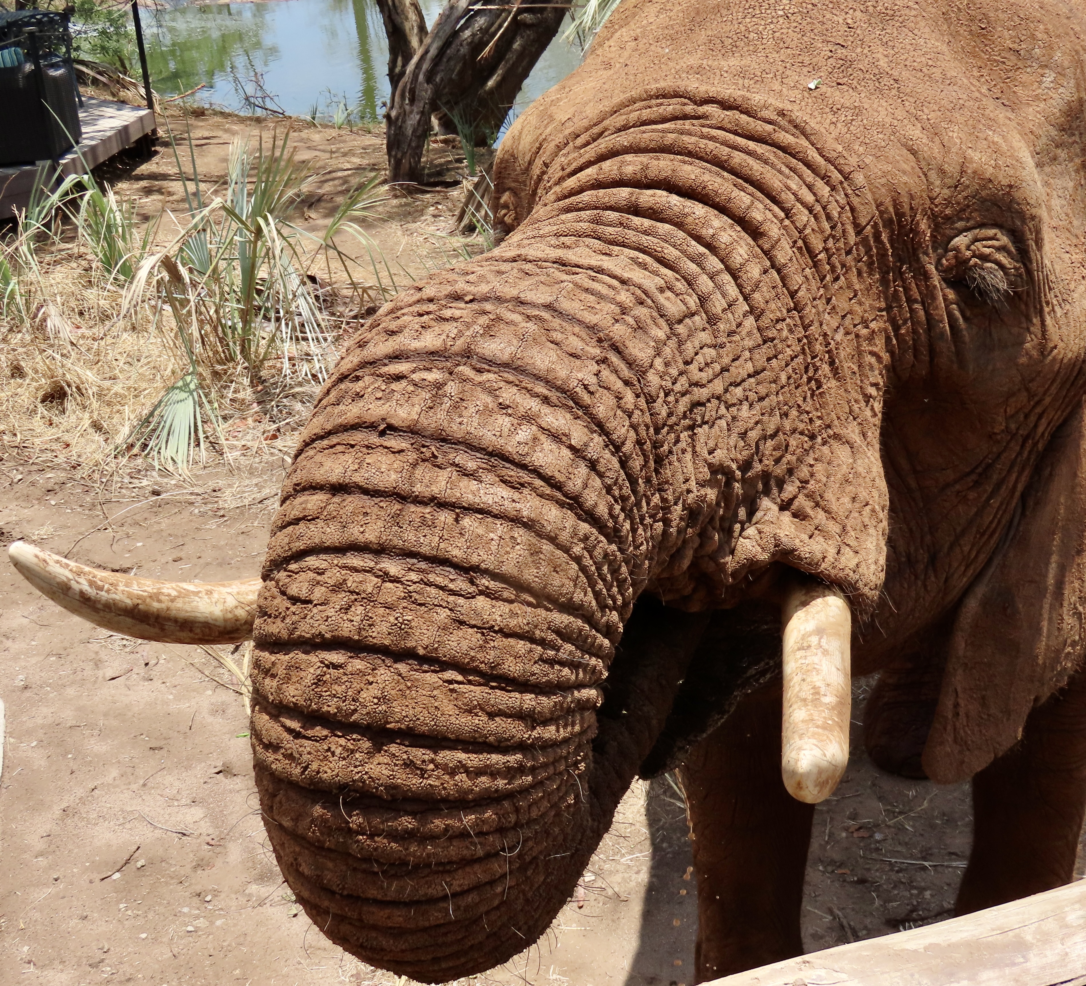
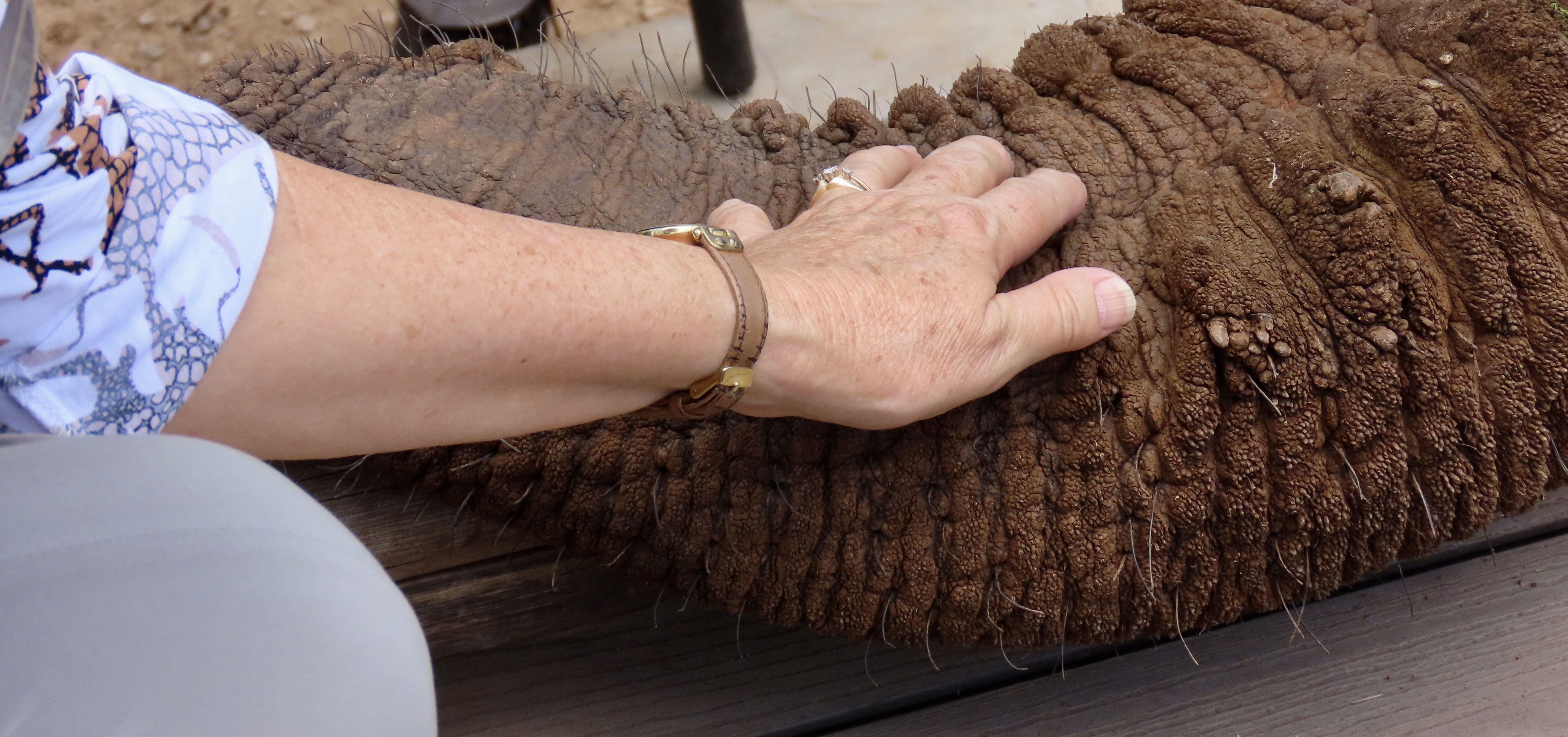
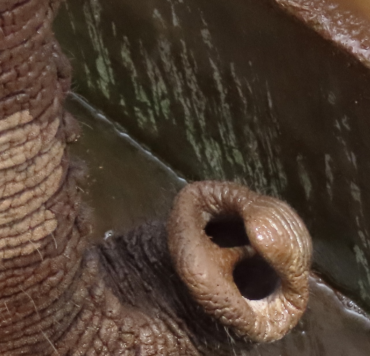
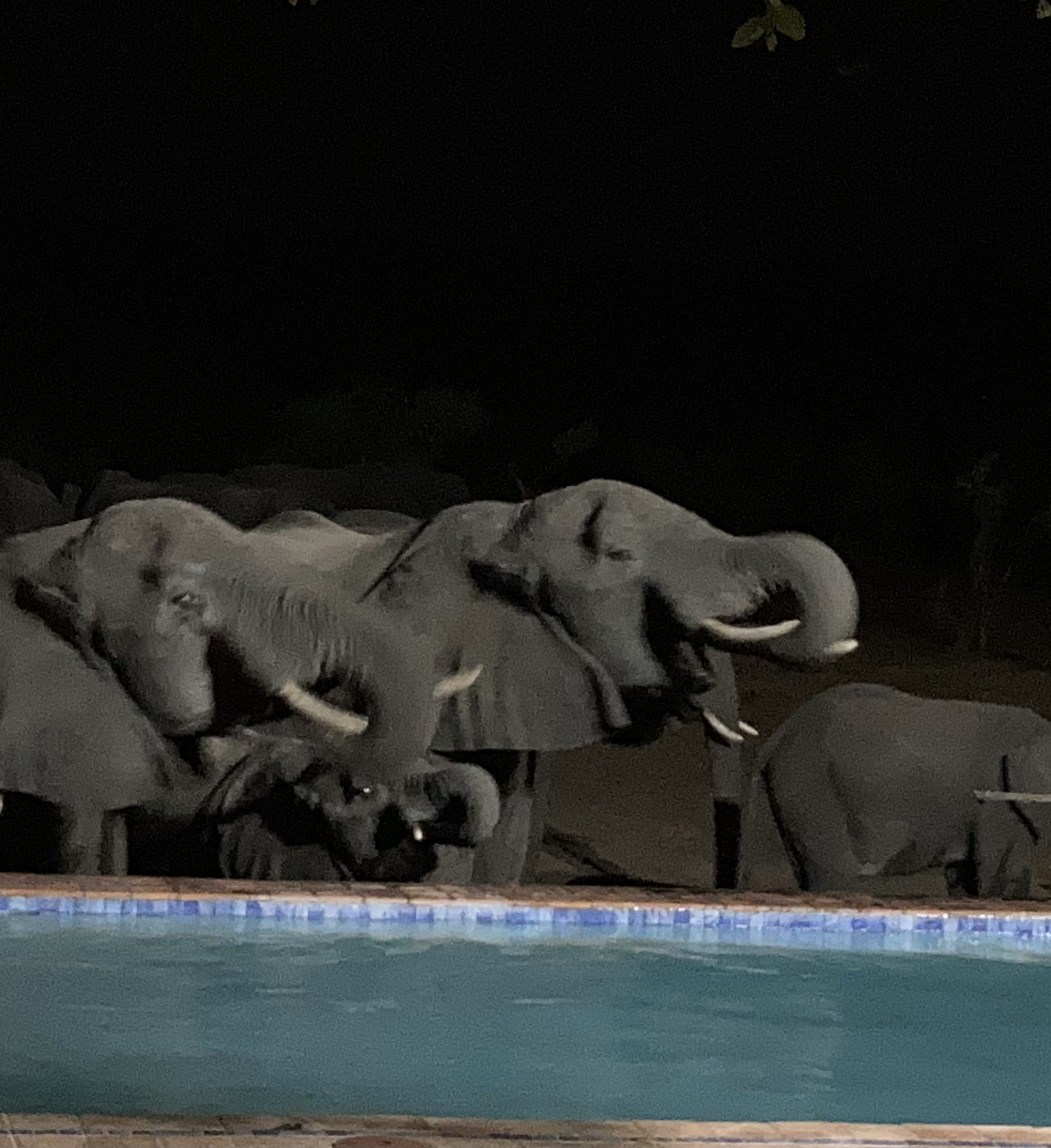
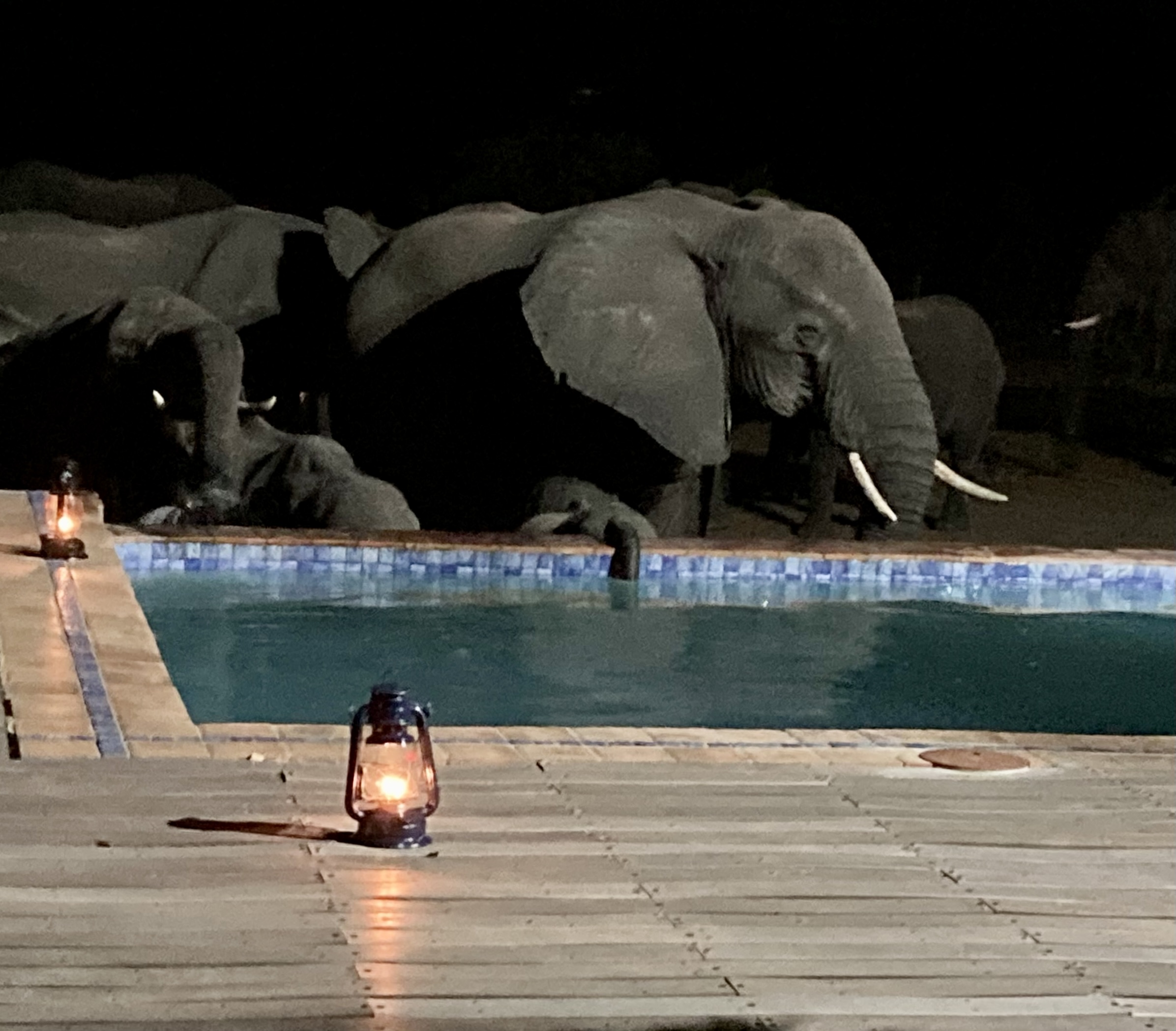
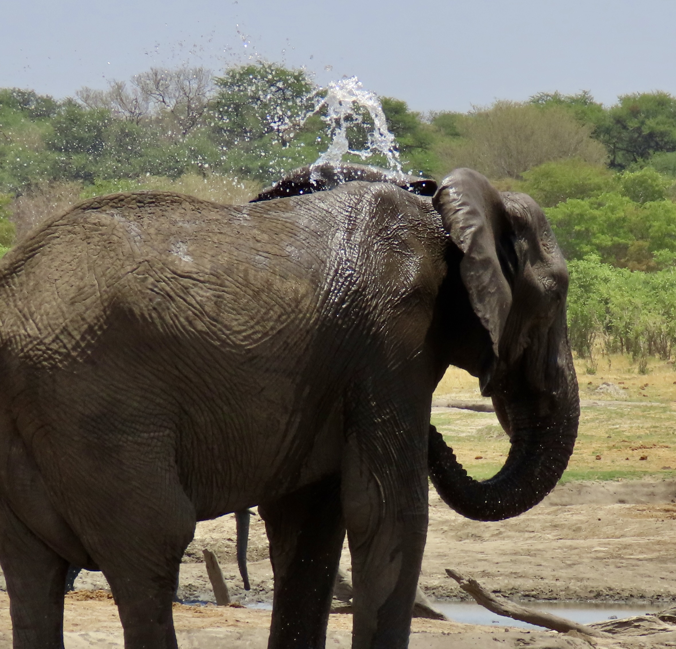
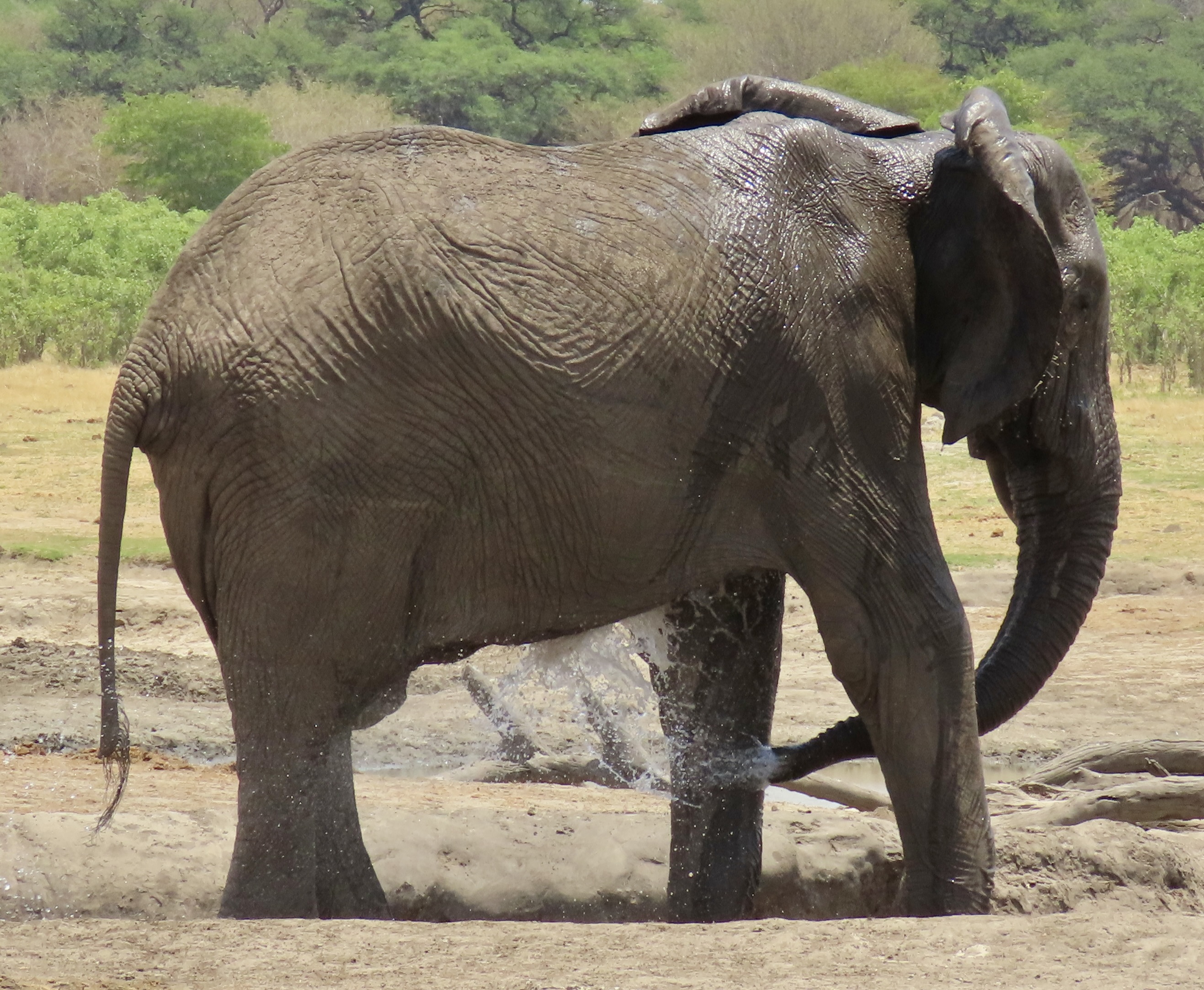
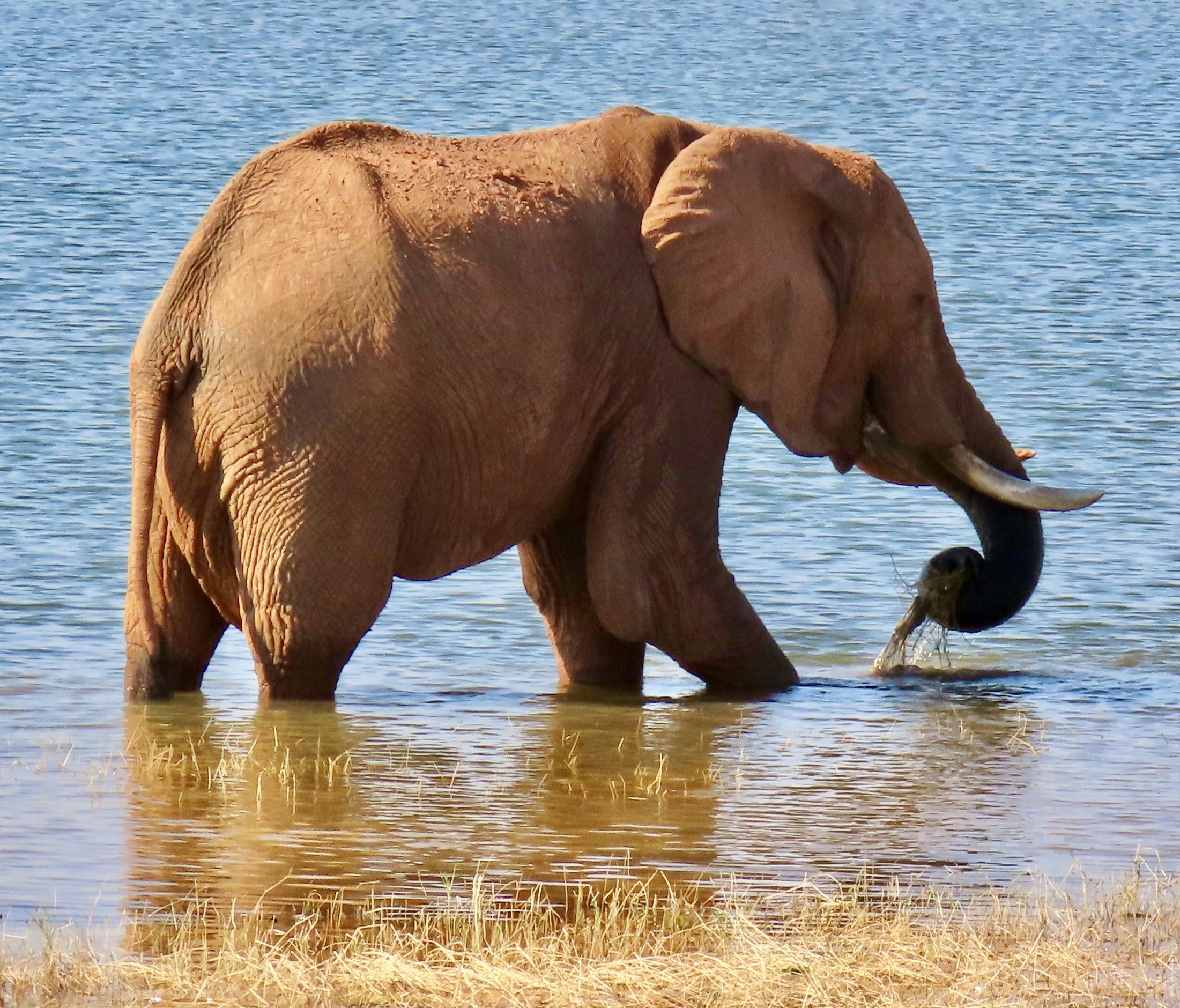
In addition to eating, drinking, bathing and smelling, elephants also use their trunks to communicate in a variety of ways. One is a gentle touch to provide comfort to a fellow elephant or baby. They will even put the tip of their trunk in another elephant’s mouth. They also force air through their trunks to produce a variety of sounds. One is as a loud trumpet to express displeasure. They did that a couple of times when they were crowded together drinking out of the swimming pool. It certainly caught our attention.

I’ll conclude this post with Peggy placing food in an an elephant’s trunk at Wild Horizons Elephant Sanctuary. Next up, a look at an elephant’s family life, head, ears, tusks, feet, skin and tail. Plus a visit to an elephant graveyard.

Planets Visit the Playa at Burning Man 2023… Plus a Preview of Our Upcoming Journey to Africa

The moon, earth, and mars visited Burning Man 2023. They were located along the Esplanade, Burning Man’s main street, which separates Black Rock City from the Playa.
Here’s a close up of the moon. I couldn’t find out who brought the large, inflatable planets to Burning Man, but they were impressive.
I thought it would be fun to render the moon in black and white. BTW, while we were at Burning Man, we had a blue moon, which happens once in 33 months, thus the term, ‘once in a blue moon.’ It was also a supermoon, which occurs when the moon is closest to us in its journey around the earth. Unfortunately, the same clouds that brought the rains hid the moon.
Mars, Red Planet.
The earth as astronauts see it featuring South America, Central America and a portion of the United States.
The earth featuring Africa.
I’m including this close up of the southern part of Africa because it covers where Peggy and I will be in a couple of weeks. Our journey will take us to South Africa, Botswana and Zimbabwe. Highlights will include Victoria Falls, Chobe National Park, Hwange National Park, and Cape Town. In addition to vehicle trips into the national parks, we will explore the Chobe River and Lake Kariba by boat. This will be our second trip to Africa this year, with the first being our journey to Egypt and up the Nile River. Most of you are aware that I was a Peace Corps Volunteer in Liberia West Africa from 1965-67 and while I was there I flew to East Africa and did a 1500 mile tour of National Parks in Kenya, Tanzania and Uganda in a VW bug. I’m looking forward to ‘going on safari’ again!

Stuck in the Mud with 70,000 + People: Burning Man 2023 or Mudopolis

Photo of mud sticking to the shoes of Curt Mekemson at Burning Man 2013.
When it rains at Burning Man, everything comes to a halt! You are looking at the reason why. Thick mud that sticks to your feet makes it extremely difficult to walk. It’s impossible to bike. And driving is an absolute no-no. These are my shoes. It felt like they weighed 20 pounds each!

Peggy and I have been going to Burning Man off and on since 2004. We definitely aren’t virgins, which is what Burners call newbies. In fact it’s hard to be much more veteran than we are although there are old timers around who have been going since its San Francisco beginning in the mid-80s. Over the past 19 years, we’ve seen everything the Black Rock Desert has to throw at people who come to this unique event north of Reno, Nevada. The worst is usually high heat, strong winds, and blinding dust storms where dust rules your universe. The only thing you can do is put on your goggles, wrap your bandana around your face like a bandit, and proceed. If it’s a white out, you hunker down until you can see where you are going. Not doing so is a recipe for disaster.

Rain has been relatively rare compared to dust storm and requires a different response. The Burning Man Organization (BM Org) shuts everything down until the rain stops and the Playa dries out. It’s quite dramatic. There is no driving except for emergency vehicles. Driving tears up the desert floor and getting stuck is almost guaranteed. Since Burners are required to park their vehicles when in camp (except for mutant vehicles), it isn’t much of an issue unless you are driving in or out. That happened to us once when we were coming in and we had to wait for three hours— along with the thousand or so other vehicles entering at the time. It turned into a party. Typical Burning Man.

This time it was different, as you have undoubtedly seen or heard about on the news or through social media. It just kept on raining. What was normally a 2-3 hour wait went on for three days. Burning Man was featured in headlines around the nation and around the world. 70,000 people were literally stuck in the mud. Even the President was briefed on the situation. We managed to escape yesterday. Our story is best told in photos. All of these are taken by either Peggy or me.

We were happily sitting in Serafina, our 22 foot travel trailer, and sipping a glass of wine when the rain started. We had an ‘impressionistic’ view out our window as the rain made its way through the ever-present dust. “Great,” we thought, “it will cool things down and dampen the dust.” But the rain had something else in mind…
We leisurely wrapped up our cocktail hour and checked outside. As expected, Burning Man had shut down all driving. Clouds were threatening more rain! This is Jackalope Road, BTW. We lived at Jackalope and 5:30, out on the edge of Black Rock City. We had come in on Monday and sites closer in were all taken.
An hour or so later, we heard yelling and quickly looked out to see what was happening. An impressive double rainbow was stretched over Black Rock City and Burners were celebrating the beauty. On the bad news side, rain was beginning to cover the playa.
We took lots of photos! This is looking east.
The colors were incredible. But was there a pot of gold at the end of the rainbow?
We turned around and took photos to the west where the sun was busy setting. What would Saturday morning bring?
The extent of the problem became apparent when we got up. It was clear the nobody was going anywhere.
Or, if they were, it was on foot. I walked out on Jackalope Road to take photos.
Peggy took photos of my progress. The photo at the top was from my brief journey!
While I was busy doing something else, I turned around and Peggy was trying to scrape the mud off my crocks. What a woman!
There ia a solution to the mud stuck to your shoes challenge. Wear garbage bags. The mud doesn’t stick to them. Peggy held hers up with Bungee cords. I told her she was a fashion statement, ready for Vogue.
A group walked in back of our camp. It was obvious that they weren’t wearing their garbage bags!
As the day wore on, conditions did not improve. A few people ignored Burning Man’s no-travel restrictions and escaped Black Rock City. Most ended up stuck in the mud. What a surprise. It became apparent that the Man would not burn on its traditional Saturday night. There would be no great party out on the Playa. We resigned ourselves to hanging out at our trailer and reading some of the good books we were carrying. It was also important that we had a more than adequate supply of beer and wine.
This large RV slid off of Jackalope Road, getting stuck and almost hitting cars parked beside the road.
Street conditions had worsened considerably by Sunday morning, the traditional day when about half of the people leave Burning Man. BM Org still had a no-drive rule in effect, however. It was a rule that more and more people were choosing to ignore.
We watched a pickup slide up the road. At first I was irritated. On the other hand, BRC radio was predicting more rain, which would mean more mud, which would mean more delays. Maybe we would get out on Monday, maybe we wouldn’t. We had a slight window of opportunity on Sunday Morning, however. Would we take it?
Should we go or not? Since Animalia was the Burning Man theme for the year, the stress brought out the werewolf in me…
I felt like I was in the middle of a 40s era black and white horror film. It was a hair raising, nail biting situation.
To relieve our stress, Peggy and I decided to walk down to the port-a-potties, 2 1/2 blocks away on 5:30. The path the people followed had been walked over enough times that garbage bag shoes weren’t required. Maybe the road the escapees were taking would be similar.
But 5:30 did not look promising. How would you like to be in the RV coming up the road with thoughts of getting through this mess. The green building on the right are the port-a-pots. Looking down the road, the Man stands out on the Playa, undoubtably laughing.
The port-a-potties were not pretty. I took a photo of the mud covered floor. Actually, it was quite nice compared to the toilet itself. The sewer trucks could not run and the toilet was close to the, um, full. Unfortunately, our trailer’s tank was getting there as well. Hanging around much longer was looking worse and worse.
I distracted myself while doing my thing by reading the comics that some Burner had posted on the door.
And another… which I felt was somewhat appropriate for for the situation.
Walking back, we noticed a skeleton about to grab unsuspecting Burners.” It’s time to get out of here, Peggy.” I exclaimed. A Burning Man official was directing what traffic that was choosing to leave. I stopped to chat. “If you have four wheel drive, you should be able to make it,” he told me. Not only did my F-150 come with 4-wheel drive, it came with special gears to handle deep mud and ruts. When we got back to the trailer, Black Rock radio was reporting there might be severe thunderstorms later in the morning with high winds and heavy showers. We were packed and out of there in 20 minutes. Just as we left, a large RV jack-knifed across the intersection of 5:30 and Jackalope. I took off cross country to the next street over.
This is a different RV that had got stuck in the mud while trying to escape. Imagine the cost of getting a tow truck to haul it out.

I’m sorry we don’t have more photos of our journey back to the paved road but we were a bit otherwise occupied. Slipping and sliding, we crossed over several mud holes and two streams and made it out in just over 30 minutes, which beat my previous record by almost an hour.

As of today, some 64,000 people were still at Black Rock City and I am pleased to report that the weather is behaving itself. At 1:00 PM, Burning Man told everyone that the road was open. I suspect that it is a slow journey out. Many have even chosen to stay. BM has said the Man will burn tonight and I expect the sewer trucks are out in full force.

We truly enjoyed our trip to Burning Man, even the weather. It was an adventure! And the art was great, which will be the subject of our next several posts.