The Story of How Bone Was Found… Reblog

While Peggy and I are at Burning Man, I am reposting the story of how Bone was found. This is the first of the series. I will respond to comments when I return from Burning Man.

Backpacking in the Desolation Wilderness… Or, How to Forget You Are Being Divorced

It was the summer of 1977 and my wife JoAnn was divorcing me. Apparently I lacked in stability or at least in the desire to pursue the Great American Dream. She was right of course. I had absolutely zero desire to tie myself to an eight-hour a day job and a large house in the suburbs. None of this made the divorce easy. I was prepared to spend my life as a happily married man.

To keep my mind occupied, I was working on the route for the Fourth Annual Sierra Trek, a challenging nine-day 100-mile backpack trip in the Sierra Nevada Mountains that I had created as a pledge-based fund-raiser for the American Lung Association in Sacramento.

“So what’s your problem?” my friend Tom Lovering asked over a beer at the Fox and Goose Restaurant. He’d been-there-done-that with divorce and dated a number of women since. Tom owned Alpine West, an outdoor/wilderness store in Sacramento, and sponsored the Sierra Trek.

I had persuaded him to go backpacking with me for six days to preview part of the new route. Our plan was to start near Meek’s Bay, Lake Tahoe and work our way southward 70 miles following the Tahoe-Yosemite Trail.

Tom had invited his girlfriend, Lynn, and Lynn was bringing along her friend Terry. Terry was nice, not my type.

“I have a friend named April who wants to go backpacking,” Tom offered. “Why don’t I invite her to go as well? Maybe you two will hit if off.”

The implication was that this would help me get over my wife.  Actually, I had already met the woman who was going to help me recover but I humored Tom.

A friend drove the five of us up to Meeks Bay. April was gorgeous and Tom was right. I followed her long legs and short shorts up the trail. My gloomy focus on the Soon-to-Be-Ex faded like a teenager’s blue jeans.

Hot feet and screaming fat cells were even more potent in forcing me to live, or at least suffer, in the moment. As usual I’d done nothing to physically prepare for the first backpack trip of the year and I was paying the price.

We climbed a thousand feet and traveled six miles to reach our first night’s destination at Stony Ridge Lake. I crashed while Tom broke out some exotic concoction of potent alcohol.

After consuming enough of his ‘medicine’ to persuade my fat cells they had found Nirvana, I fired up my trusty Svea stove and started cooking our freeze-dried dinner. It wasn’t hard. Boil water, throw in noodles, add a packet of mystery ingredients, stir for ten minutes and pray that whatever you have created is edible. That night it didn’t matter.

Afterwards, we headed for our beds. The next day would be long. I slid into my down filled mummy bag and looked up at what seemed like a million stars. There were no city lights or pollution to block my view and the moon had yet to appear.

I traced an imaginary line from the Big Dipper and found the North Star. It seemed far too faint for its illustrious history. A shooting star briefly captured my attention. Thoughts of divorce, short shorts, the next day’s route, a rock digging into my butt, and sore feet jostled around in my mind for attention.

Sleep finally crept into the bag and captured me.

Next: A pounding heart and a sprained ankle.

From Kayaking the Cool Pacific to Bicycling the Hot Desert of Burning Man

One of our guides leads the way as we make our way between islands off the we make our way off the northwest coast of Vancouver Island, British Columbia.

One of our guides, Julia, leads the way as we make our way between islands off the northwest coast of Vancouver Island, British Columbia. (Photo by Peggy Mekemson.)

Peggy and I just came off our kayaking adventure out of Fort McNeil on northwestern Vancouver Island. It was a great trip, complete with Orca Whales, good folks, and great food. I am sure there will be several blogs on the experience (grin). But now we are madly preparing for Burning Man. We take off today. Imagine jumping from kayaking in the cool waters of the Pacific Ocean to bicycling in the hot desert of Northern Nevada. Woohoo!

The burning of the Man gives Burning Man its name.

The burning of the Man gives Burning Man its name.

The annual event held in the Black Rock Desert of Northern Nevada ranges from wonderfully whacky to….  (Photo by Tom Lovering)

The art at  Burning Man ranges from wonderfully whacky…. (Photo by Tom Lovering)

…to magnificent.

…to magnificent.

To fill in on the missed blogs, I thought I would repost some stories on Bone. He is going with us to Burning Man. I suspect many of you have yet to meet him even though he figured prominently in my early posts.

Bone hitches a ride on a willing horse at Burning Man.

Bone hitches a ride on a willing horse at Burning Man.

Bone is a diminutive character four inches high and two inches across. Once he was part of a horse, just above the hoof. Now he is free and has an attitude.

Tom Lovering and I found him lounging in a mountain meadow above Lake Tahoe when we were backpacking the Tahoe-Yosemite Trail in 1977. He has been wandering the world ever since. He began his travels with Tom on a two-year exploration of Asia, Africa and Europe in the early 80s and then joined me on my six month 10,000 mile solo bicycle trip around North America.

And that’s just the beginning.

In 1990 the International Society of the Bone was created in Mazatlan, Mexico and Bone began wandering with others. He traveled with a women’s group to the top of Mt. Kilimanjaro in Africa and the base of Mt. Everest in Nepal, went deep-sea diving in the Pacific and Caribbean, attended a Presidential Press Conference with Bill Clinton (Is that a bone in your pocket?) and was blessed by the Pope in St. Peter’s Square. He had a close encounter with Piranhas on the Amazon, was kidnapped in Mexico and was seized by a custom agent in New Zealand. He has been to Burning Man 9 times.

Bone looks out on Mt. Everest in Nepal.

Bone looks out on Mt. Everest in Nepal.

And poses perilously on the railing of a boat traveling up the Amazon River. I caught him just as he was about to fall into the Piranhnah infested waters.

And poses perilously on the railing of a boat traveling up the Amazon River. I caught him just as he was about to fall into the Piranha infested waters.

Traveling to Mexico, Bone takes a break by resting on Chacmool, where hearts were once offered up as sacrifices.

Traveling to Mexico, Bone takes a break by resting on Chacmool, where hearts were once offered up as sacrifices.

Checking out the rapids of the Little Colorado River as part of an 18 day trip down the Colorado through the Grand Canyon, Bone wears his life vest for safety.

Checking out the rapids of the Little Colorado River as part of an 18 day trip down the Colorado through the Grand Canyon, Bone wears his life vest for safety.

Tom Lovering goes native and wears Bone in his hair on the Colorado River trip.

Tom Lovering goes native and wears Bone in his hair on the Colorado River trip.

The Bone stories I will blog about this week are about how Tom and I found him. I wasn’t into photography at the time, so sorry, no photos.

Mt. Whitney: 14,505 feet— Or Is that 14,496.811 Feet… But Who’s Counting?

Highway 395 is one of America's most scenic drives. This view looking up at Mt. Whitney, center top, is one of the reasons why.

Highway 395 is one of America’s most scenic drives. This view looking up at Mt. Whitney, center top, is one of the reasons why.

Highway 395, with its panoramic views of the eastern Sierra Nevada Mountains, is one of the most scenic highways in the United States. I will admit to a degree of prejudice, however. John Muir called the High Sierras the Range of Light. I think of them as ‘home.’ I have backpacked up and down the range numerous times. The mountains call to me in a way that no city or town does.

Driving up California's Highway 395 provides and ever changing perspective of the eastern Sierra Nevada Mountains.

Driving up California’s Highway 395 provides an ever-changing perspective of the eastern Sierra Nevada Mountains.

Another view of the Sierra Nevada Mountains along highway 395.

Another view of the Sierra Nevada Mountains along highway 395. This seems to fit Muir’s Range of Light description. (Photo by Peggy Mekemson.)

I celebrated my 60th birthday by backpacking over 300 miles down the spine of the Sierras, I started at Squaw Valley, which is north-west of Lake Tahoe, and ended by climbing up Mt. Whitney. It was my sixth trip up Whitney. I figured it would be a fitting way to kick off my sixth decade.

View of Mt. Whitney from the west including Curtis Mekemson.

Wrapping up five weeks of backpacking, my final climb looms in the distance. The curved mountain just to the right of my head is Whitney. I will be sitting on top the next day. The Sierras are fault block mountains, climbing gradually on their western slope and dropping off rapidly in the east. (Photo by Jay Dallen.)

Curtis Mekemson sitting on top of Mt. Whitney.

And here I am on top, complete with a large grin. The Owens Valley and Highway 395 lie some 10,000 feet below. (Photo by Jay Dallen.)

Looking north form Mt. Whitney up the crest of the Sierra Nevada Mountains that I had just hiked through following the Pacific Crest and John Muir Trails.

Looking north from Mt. Whitney up the crest of the Sierra Nevada Mountains where I had just backpacked following the Pacific Crest and John Muir Trails.

View looking down from the top of Mt. Whitney. Photo by Curtis Mekemson.

Another view from the top of Mt. Whitney.

The mountain’s claim to fame is being the highest mountain in the contiguous United States. It stands at 14,505 feet (4,421 meters). My friends in Alaska are quick to point out that Mt. McKinley/Denali is 20,322 feet. Mt. Shasta, where I began this particular series, is 14, 180 feet. And finally, for comparison, Mt. Everest, the world’s highest mountain, tops out at 29,029 feet (8,848 meters).

Mt. Shasta is one of the world's most beautiful mountains. Driving up I-5 through Northern California on a clear day presents this view.

Mt. Shasta.

Once the snow has melted, climbing Whitney does not require any technical climbing skills. A good trail leads to the top. According to the plaque on top, it is the highest trail in the United States. It was started in 1928 and completed in 1930. The plaque used to (and still may) claim that the mountain is 14, 496.811 feet high, which would seem pretty darn accurate, especially given the .811 feet. Apparently modern measuring techniques have added a few feet. Not that it matters, unless you happen to be the person climbing those last nine feet.

Getting to the top requires stamina, lots of it. The eastern route up the mountain starts at Whitney Portal and climbs 6000 feet. That’s a bunch of up, and the higher you climb, the thinner the air becomes. Most people slow way down near the top as their bodies fight to get enough oxygen.

I’ve always started from the west since I am either ending or in the middle of a backpack trip. There are two advantages. Most important, I’ve already spent several days hiking at higher elevations. My body has both toughened up and adjusted to thinner air. Second, by starting at Guitar Lake, the climb is only 4,000 feet. Still that’s 4000 feet up and 6,000 feet down on a 15-mile day carrying a 40-pound pack— hardly a walk in the park. (Grin)

The reason for climbing the mountain, beyond being able to say you have, is the spectacular scenery. I wouldn’t recommend the trip for anyone with acrophobia (fear of heights), however, given that all of the views involve looking down several thousand feet.

Jay Dallen standing on the edge of Mt. Whitney.

My nephew, Jay Dallen, stands on the edge of a thousand foot precipice and looks down. He obviously does not suffer from acrophobia. Different people joined me on each of my five-week segments. Jay was 16 at the time.

The Alabama Hills, featured in the photo below, are located just outside of Lone Pine at the base of Mt. Whitney. Over 300 movies, mainly Westerns, have been filmed in the area. Almost every major Hollywood cowboy from the 1920s up to the present have made movies there. (Photo by Peggy Mekemson.)

A final view of Mt. Whitney. This one features the Alabama Hills, the site of many early movies featuring the likes of Hop-a-long Cassidy and the Lone Ranger.

A final view of Mt. Whitney. This one features the Alabama Hills, the site of many Western movies featuring everyone from Tom Mix, Hop-along Cassidy and Roy Rogers to John Wayne and Johnny Depp. (Photo by Peggy Mekemson.)

Into the Red Butte Wilderness… Backpacking at 71

Old Growth Cedar in Red Buttes Wilderness of Northern California and Southern Oregon.

There is much to be impressed with in the Red Buttes Wilderness, including magnificent old growth trees such as this cedar.

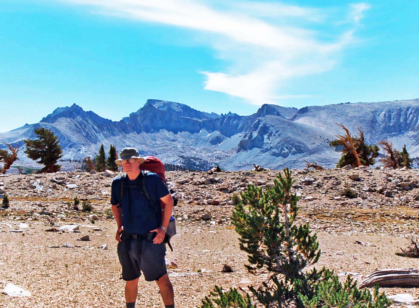
I know a bit about backpacking (mild understatement). A few years back, in 1974 to be exact, I was working as the Executive Director of the American Lung Association in Sacramento. The organization needed a new source of funding; I needed an excuse to play in the woods. So I combined the two. I proposed to my Board of Directors that I lead a nine-day, hundred mile backpack trip across the Sierra Nevada Mountain Range with the participants raising money to fight lung disease.

So what if my longest backpack trip ever had been 30 miles.

“You are crazy,” the board said. “You are crazy,” my friend in the backpacking industry said. It was like I had inherited a parrot.

And they were right. The only point they missed was just how crazy. Sixty-one people aged 11-71 showed up– many who had never worn a backpack in their lives. One immediately claimed she was a witch and would be over to bite me in the middle of the night. And how was I to know that my co-leader had participated in burning down a bank in Santa Barbara, or that my go-to guy in emergencies was a Columbian drug runner, or that the big fellow who got me through the toughest days was an explosive experts on the lam from the IRS. You can’t make these things up, folks! But this is a story for later this summer. It’s one you won’t want to miss.

Lets just say by the time I walked into the foothill town of Auburn, California nine days later on deeply blistered feet in 104-degree weather, I had persuaded myself that the money raised from Christmas Seals was more than adequate to support our organization, forever.

But then a strange thing happened. These people who I had almost killed and who had come close to killing me, started coming up one by one and demanding to know where we were going next year. I heard things ranging from, “This was the greatest experience in my life” to “I have lots of ideas for fundraising.” It took them several months to persuade me…

But persuade me they did. I would go on to add bike treks in Sacramento and eventually take the program nationwide where I became the national trek consultant for the American Lung Association. Millions of dollars were raised to prevent lung disease and thousands of people were introduced to long distant backpacking and bicycling as a result. More importantly, from my perspective, I got to play in the woods. For 30 years, I spent a part of each summer leading wilderness expeditions. And when I wasn’t leading treks, I was off backpacking by myself or with friends.

Founder of the American Lung Association Trek Program, Curtis Mekemson.

A much younger me gracing the front of the American Lung Association’s National Bulletin in my role as founder of ALA’s Trek Program.

Sadly, my last backpacking trip was seven years ago. Life happens, right? Peggy and I bought a small RV and decided to wander North America for three years; our kids started producing grand babies; we bought our property in Oregon and travelled to Europe and Alaska. I took up blogging and decided to write a book.

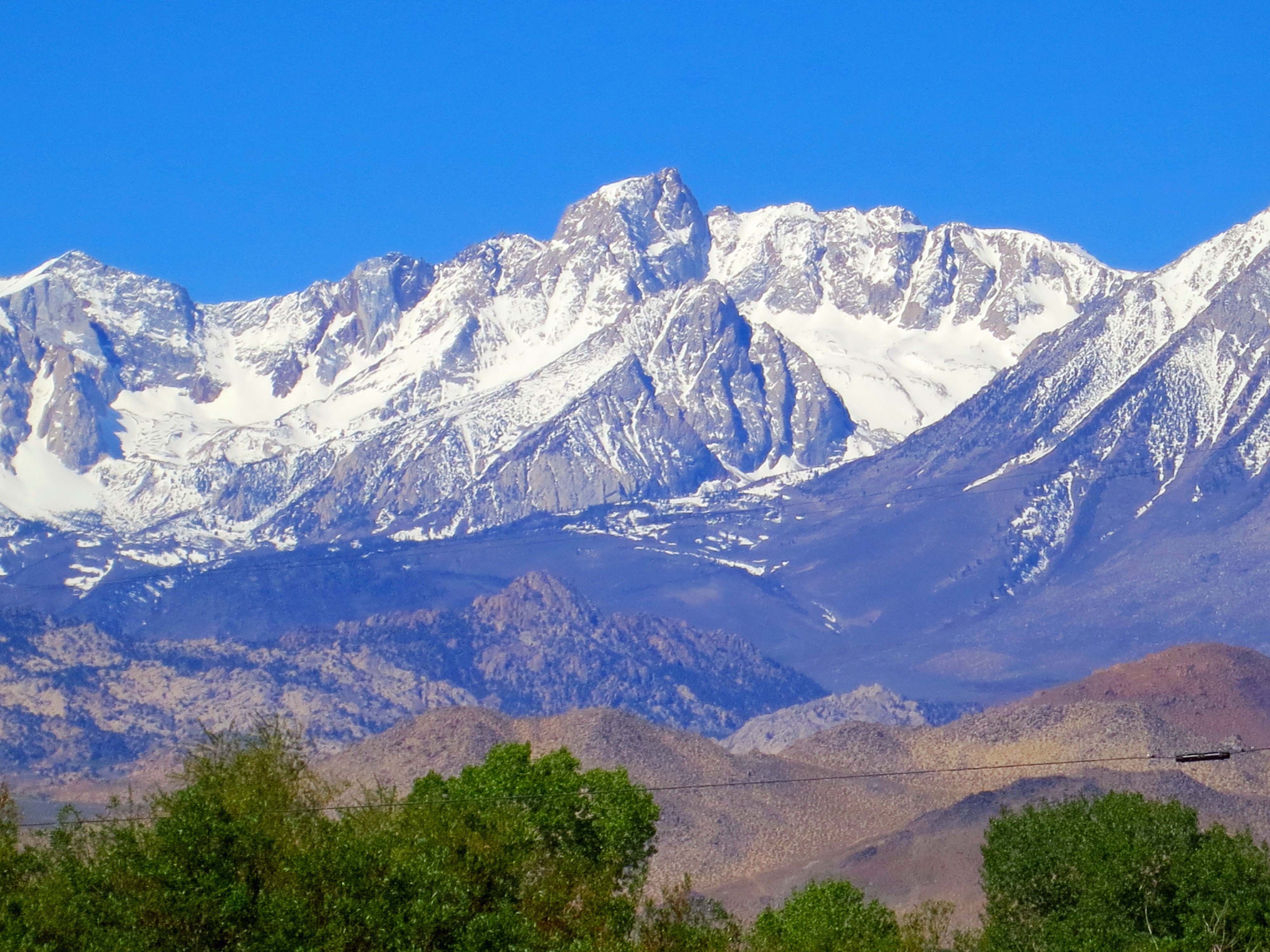
It was all good, but I missed backpacking– a lot. And there’s this thing. Our home looks out on the beautiful Red Buttes of the Siskiyou Mountains of Southern Oregon and Northern California. The mountains spoke to me, over and over and over. Finally I could no longer ignore their call. Peggy and I decided to hit the trail. So last week, we did.

Red Butte mountains of the Siskiyou Range.

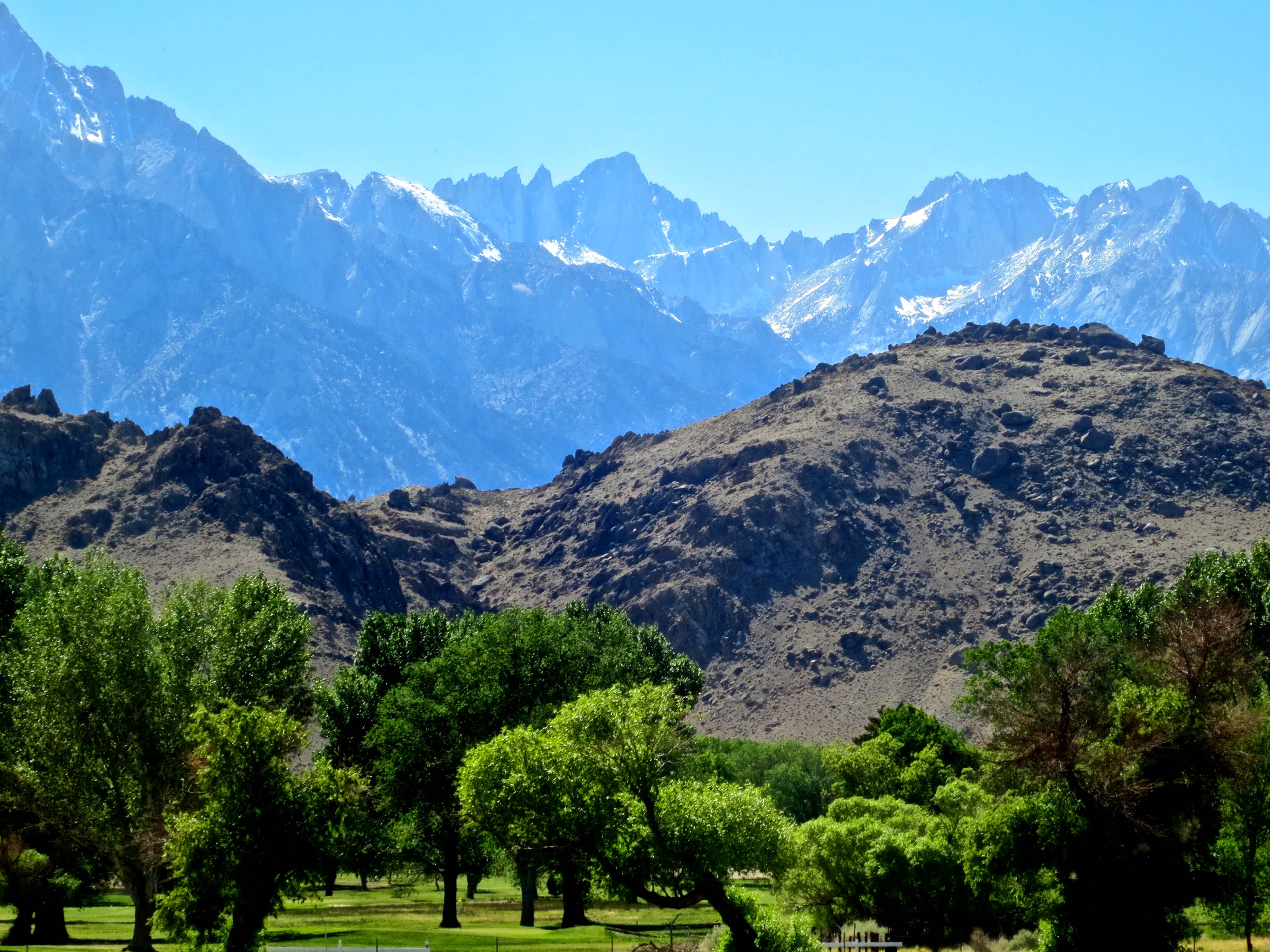
The Red Butte Mountains as they appear from our house in spring through the lens of our camera. How could we not set out to explore them?

We planned a short trip: three days and 14 miles. It was to be something of a test to see how well we would do. After all, we had aged seven years. At 71, I couldn’t expect my body to behave the same way it had at 21, or 31, or 41, or 51, or 61. And even Peggy, a young woman of 64, was nervous.

I immediately pulled out maps and begin planning a route. I was like a little kid on Christmas morning (or Peggy at the chocolate store in Central Point). Had I been a dog, I would have been wagging my tail like my basset hound, Socrates, used to at the sight of a hotdog.

This forest service map shows the location of the Red Buttes Wilderness. The X marks the approximate location of our home.

This forest service map shows the location of the Red Buttes Wilderness. The X marks the approximate location of our home.

I planned out our route on a US Forest Service Topo Map. We followed the Butte Creek Trail to Azalea Lake.

I planned out our route on a US Forest Service Topo Map. We followed the Butte Creek Trail to Azalea Lake. I wrote in the small, circled numbers which I will refer back to.

A close up of the map shows the beginning of our hike. "T" marks the trailhead where we parked the truck. Topo lines reflect the steepness of the trail. The closer together, the steeper!

A close up of the map shows the beginning of our hike. “T” marks the trailhead where we parked the truck. Topo lines reflect the steepness of the trail. The closer together, the steeper! We started by hiking down into the canyon following the well switch backed trail. Down in the beginning, meant up in the ending. (grin)

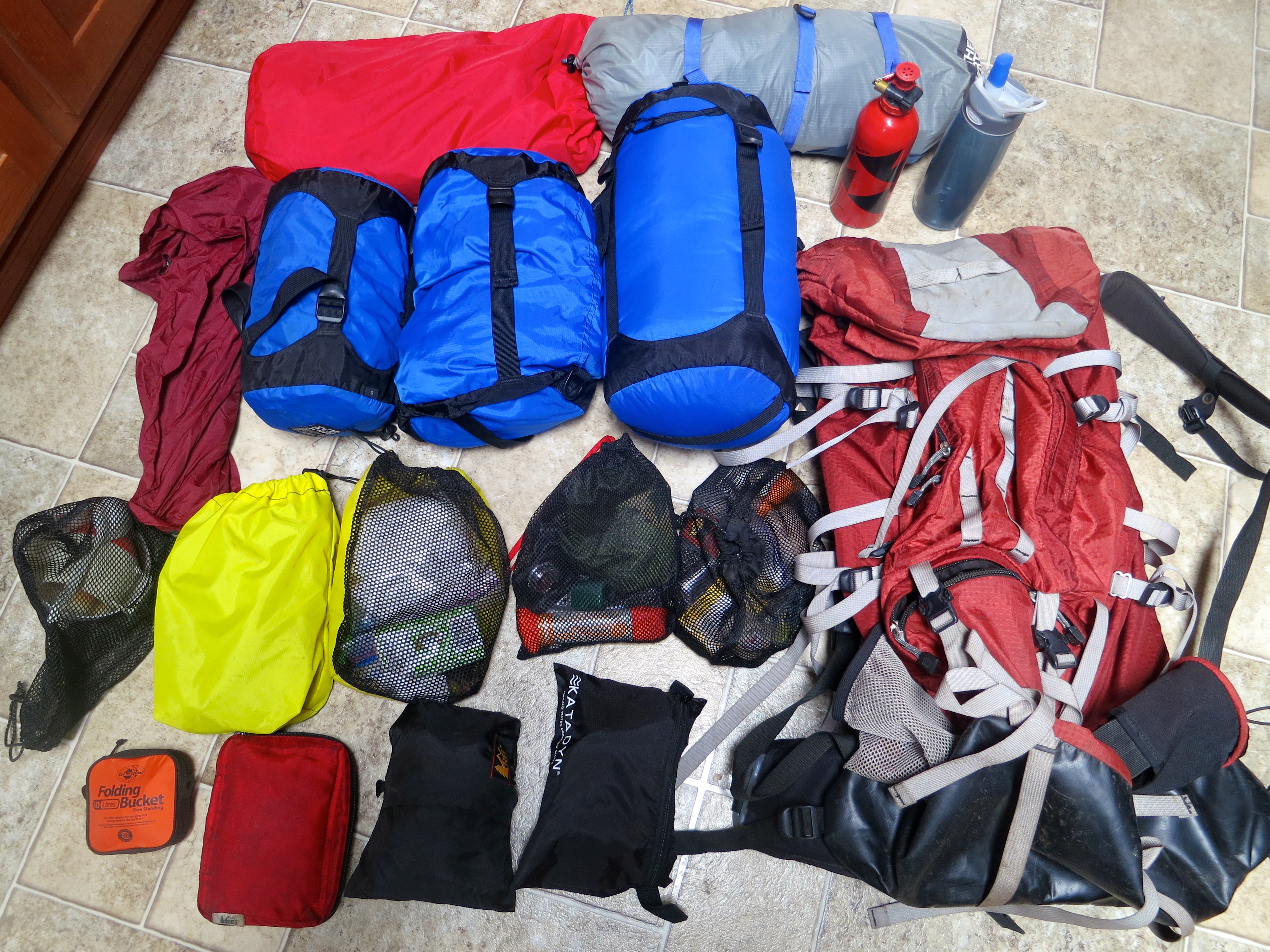
Next came the gear. It was hiding out on shelves, in drawers, and long ago packed boxes. Would my MSR white gas stove still cook? Would the Katadyn Filter still pump safe water? And possibly even more important, would our Therm-A-Rest air mattresses still be filled with air in the morning? When you are disappearing into the backcountry, you can’t be too careful.

Here's my gear and backpack. The larger bags are tent, sleeping bag and pad, food, and clothes. Smaller bags are organized according to function: kitchen, bathroom, first aid, etc.

Here’s my gear and backpack. The larger bags are tent, sleeping bag and pad, food, and clothes. Smaller bags are organized according to function: kitchen, bathroom, first aid, etc. Total weight with food, fuel and water: 35 pounds.

Go light is the mantra of anyone who carries his house on his back. Fortunately, the backpacking industry is constantly developing lighter equipment, such as this fully functional folding bucket.

Go light is the mantra of anyone who carries his house on his back. Fortunately, the backpacking industry is constantly developing lighter equipment, such as this fully functional folding bucket.

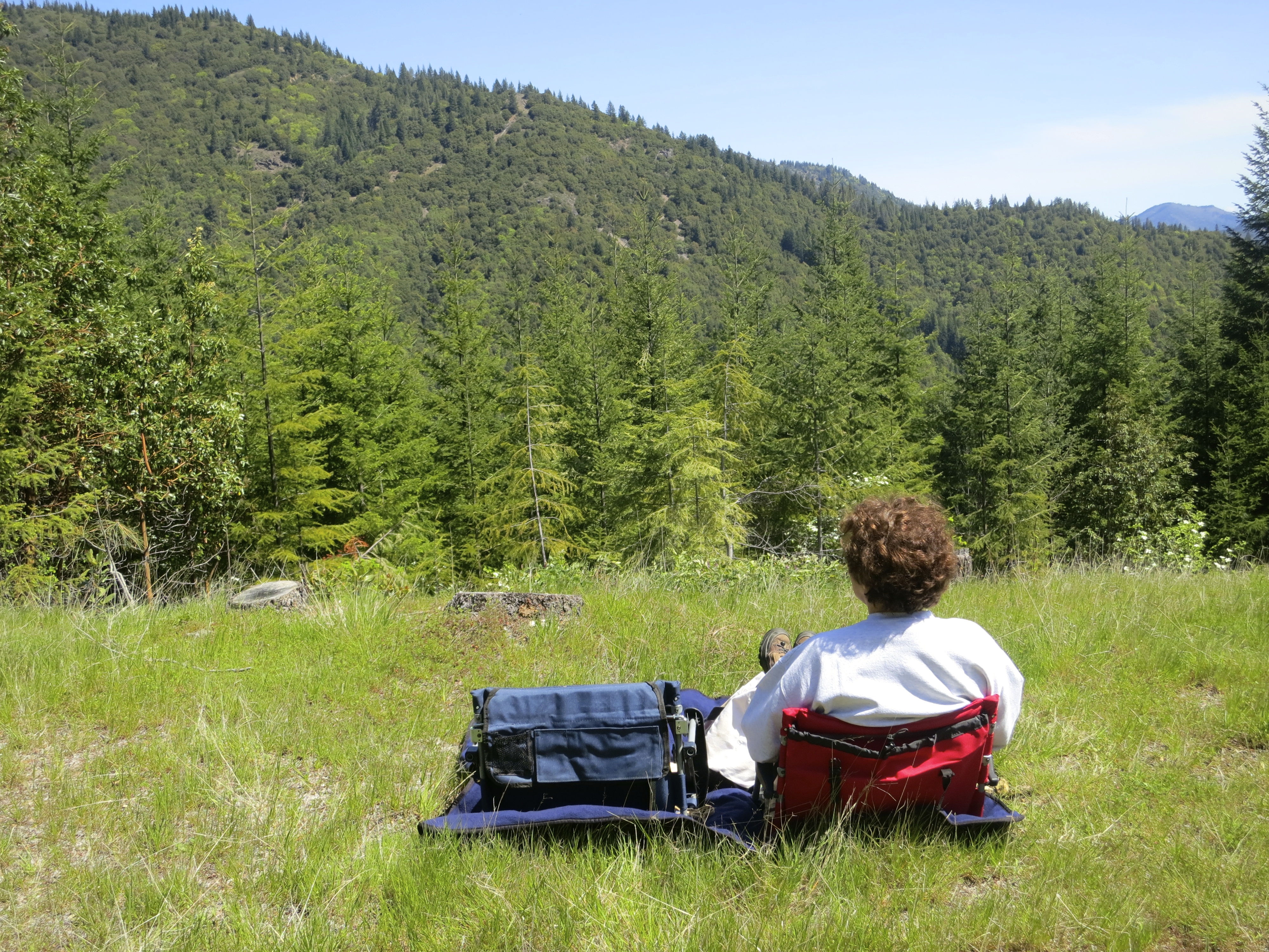
There was the inevitable last-minute trip to REI. And Peggy and I even drove up to check out the trailhead on Mother’s Day. (Now, before all of you moms get excited, she got breakfast in bed first and we took a picnic lunch that we ate on a grassy knoll with a grand view. Peggy even managed to spot a hungry mountain lion disappearing into the forest. Maybe it was coming to join us for lunch. What more could a mom ask for?)

Peggy enjoying her Mother's Day Picnic. We saw the mountain lion a couple of hundred yards down the road on our way out.

Peggy enjoying her Mother’s Day Picnic. We saw the mountain lion a couple of hundred yards down the road on our way out.

And how was the trip? Forget for the moment that it was cold and rained much of the time. Forget that we were dead tired and went to bed at 7:00 PM. Forget that the trail came close to disappearing in the brush and we spent a fair amount of energy crawling over and around downed trees that blocked the trail. And forget about the noise we heard in the middle of the night that sounded like Bigfoot pounding on a tree trunk with a large limb. And why should you forget? I just got out my thesaurus. The trip was wonderful, beautiful, invigorating, marvelous, educational, and stunning. We laughed our way through the whole adventure.

I’ll let our photos tell the story.

Butte Creek trail in the Red Butte Wilderness.

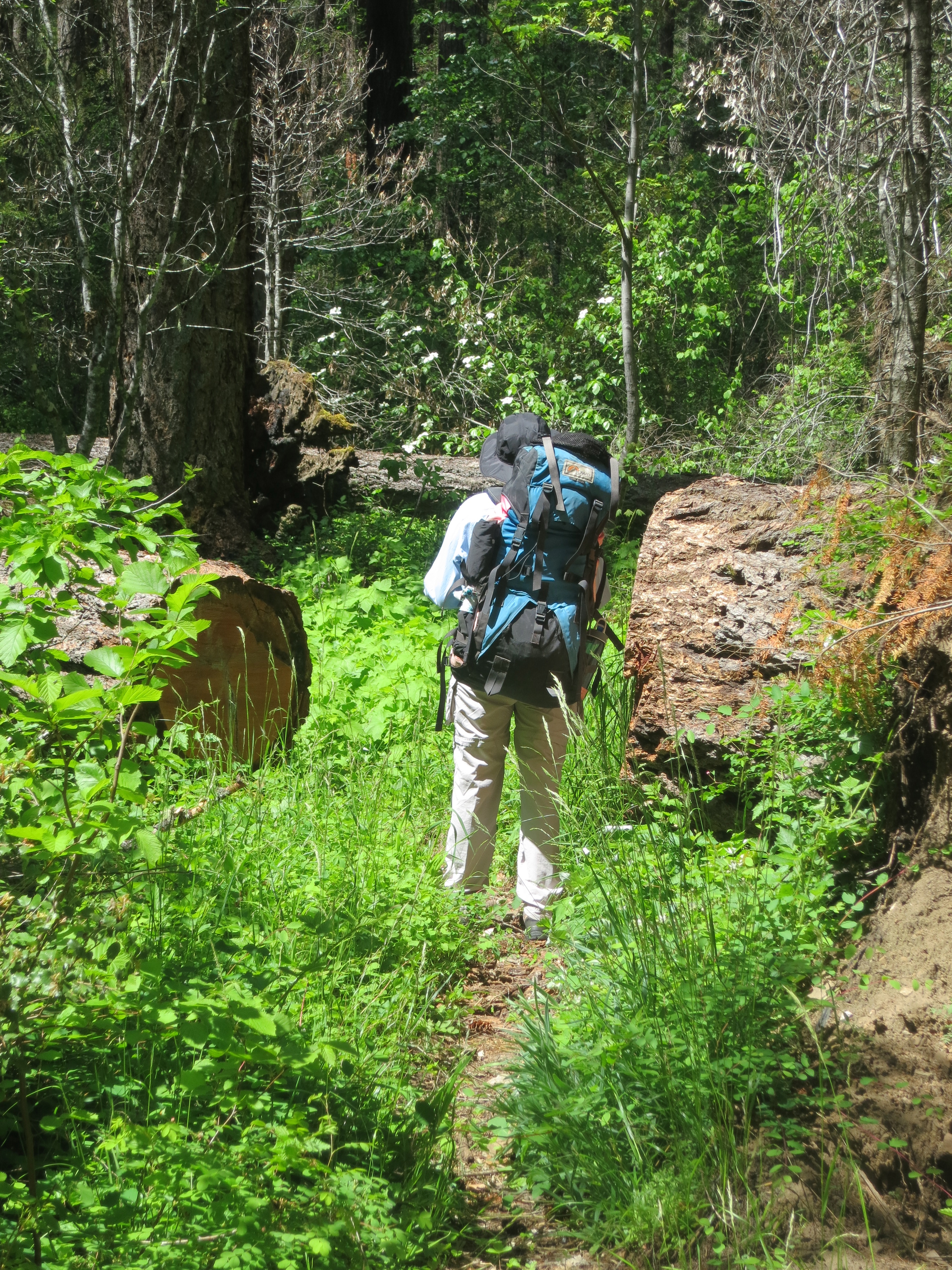
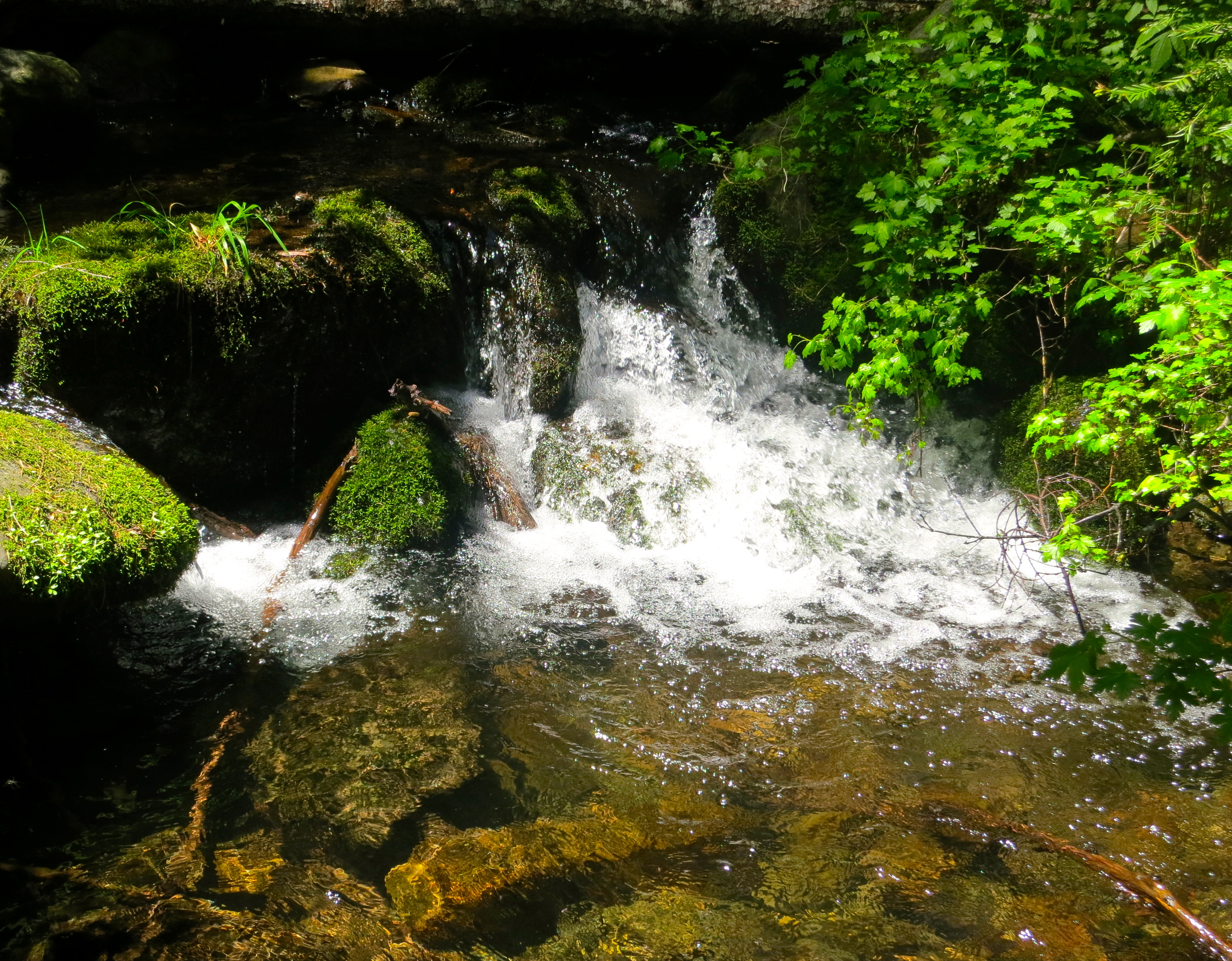
After following switch backs down the dry mountain side, we came upon the verdant canyon of the Butte Fork of the Applegate River with its almost rainforest feel. (This and the following three photos are located near #1 on the map.)

Butte Creek trail in the Red Buttes Wilderness.

In 2012 the Ft. Goff fire had swept through the area. While the forest was relatively unharmed, some large trees had fallen across the trail and since been cleared to make way for hikers.

Smokey the Bear tree in the Red Buttes Wilderness.

We loved this tree poking its limb up in the middle of the fire area. Peggy at first saw a unicorn but I saw Smokey the Bear… reminding people to be careful with fire.

Horsetail fern growing in the Red Butte Wilderness.

We found this horse-tail fern growing in the canyon. Pioneers reputedly used this plant for scrubbing out pans.

CCC Cabin in the Red Buttes Wilderness area of Northern California and Southern Oregon.

An old cabin made out of red cedar shakes was built by the Civilian Conservation Corps in the 30s and then used by the forest service for storing fire fighting tools. (Located at #2 on the map.)

Roof of cedar shake cabin in Red Butte Wilderness area.

The hand-hewn cedar shake roof.

Chinquapin forest in Red Butte Wilderness.

Not far above the cabin, we came across a chinquapin forest. I had seen chinquapin bushes but never trees.

Chinquapin nuts, encased in these spine covered shells, are apparently quite tasty.

Chinquapin nuts, encased in these spine covered outer shells, are apparently quite tasty.

Flowering dogwood in the Red Butte Wilderness.

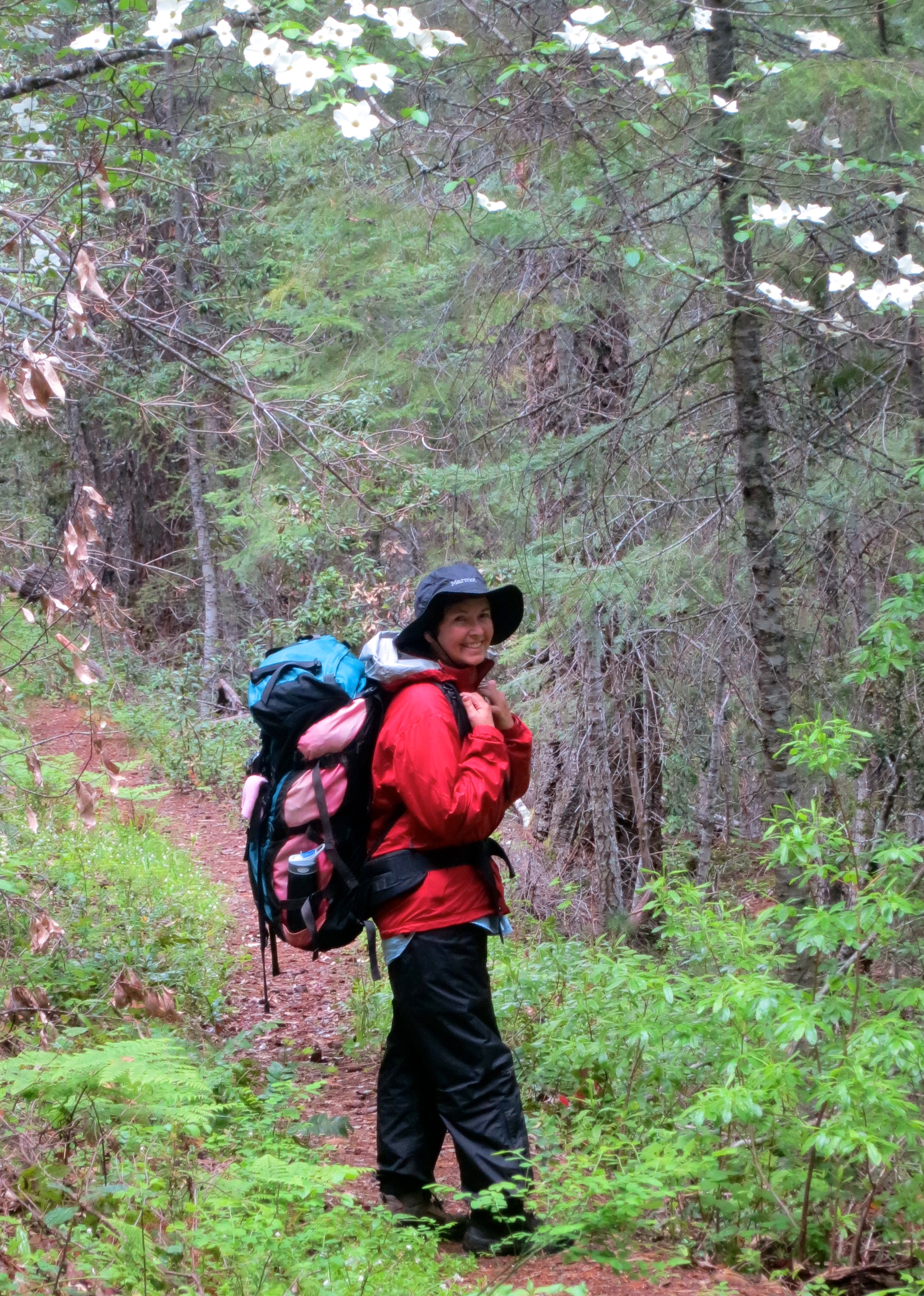
The trail at this elevation also featured beautiful flowering dogwood.

Peggy Mekemson hikes along the Butte Fork Trail through the Red Buttes Wilderness of Northern California.

Here, Peggy poses under a bower of it. I was going to point out that her pack weighed 32.5 pounds. She quickly corrected me. It was 32.8 pounds.

Small creek in Red Butte Wilderness area.

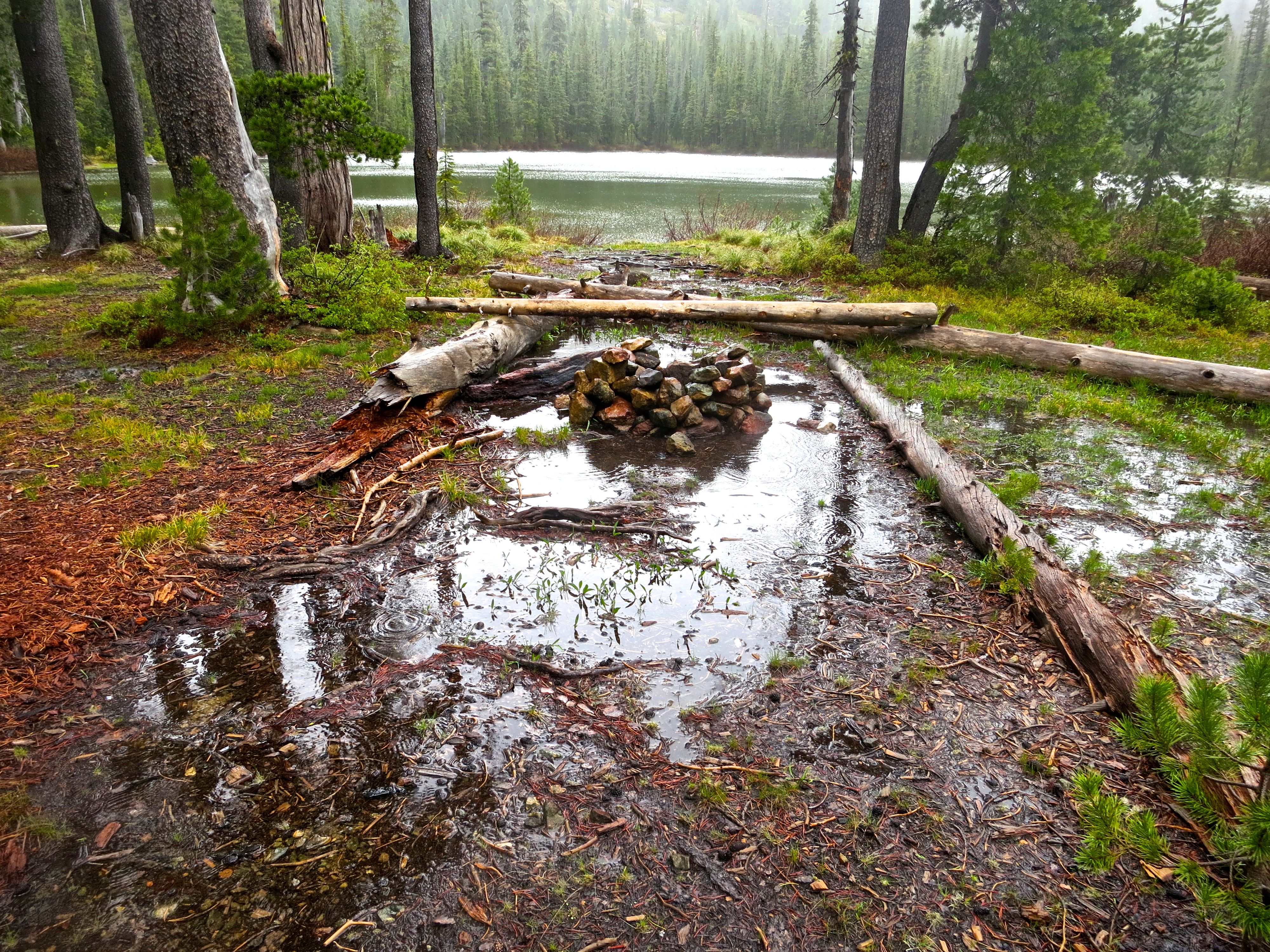
We had been hiking across dry slopes for quite some time. It was getting late, we were tired, and I was beginning to feel a bit of a grump coming on when we heard this creek. “I hear camp,” I told Peggy. (#3 on the map)

Camping out in the Red Buttes Wilderness.

There was barely room for our small North Face tent. But it was home. (Shortly after this photo it started raining.)

Old growth forest in the Red Buttes Wilderness.

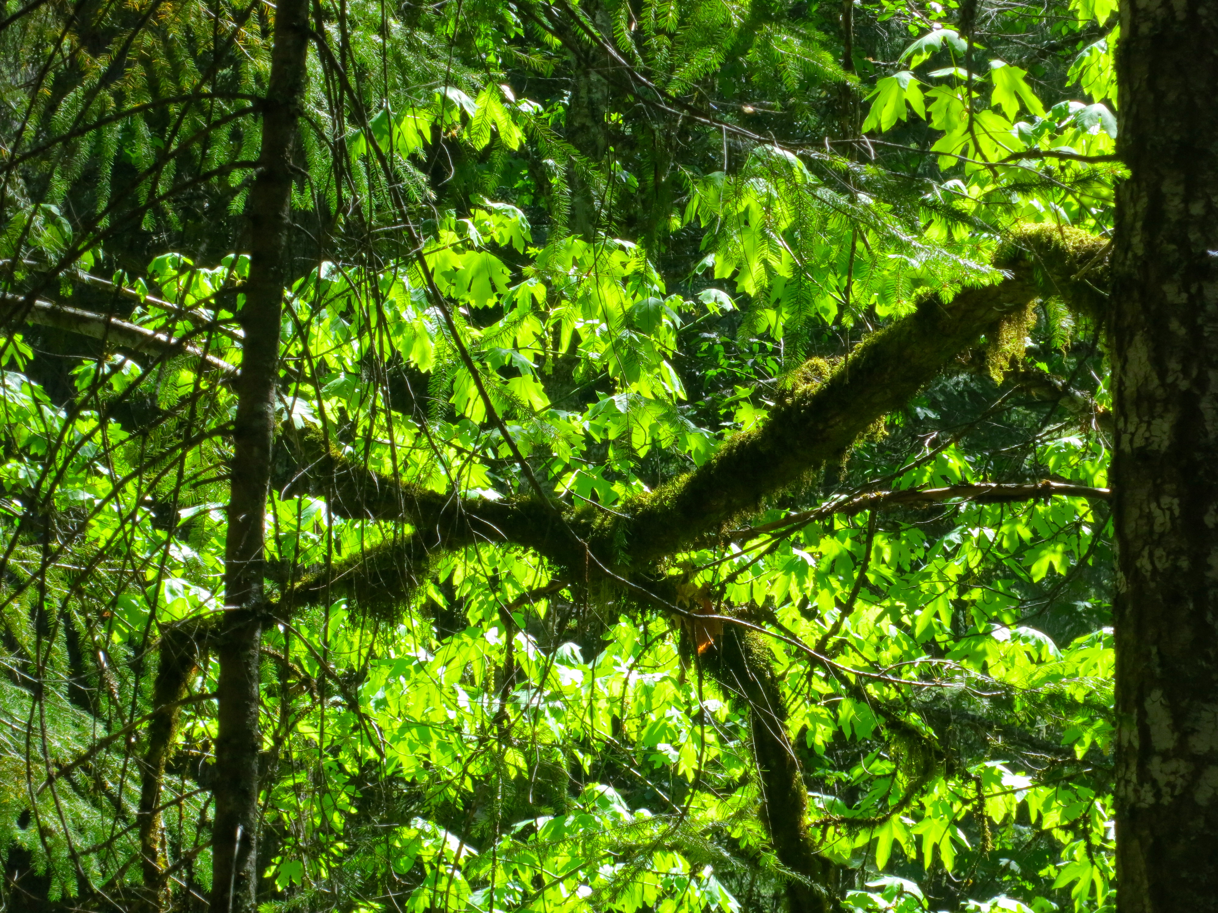
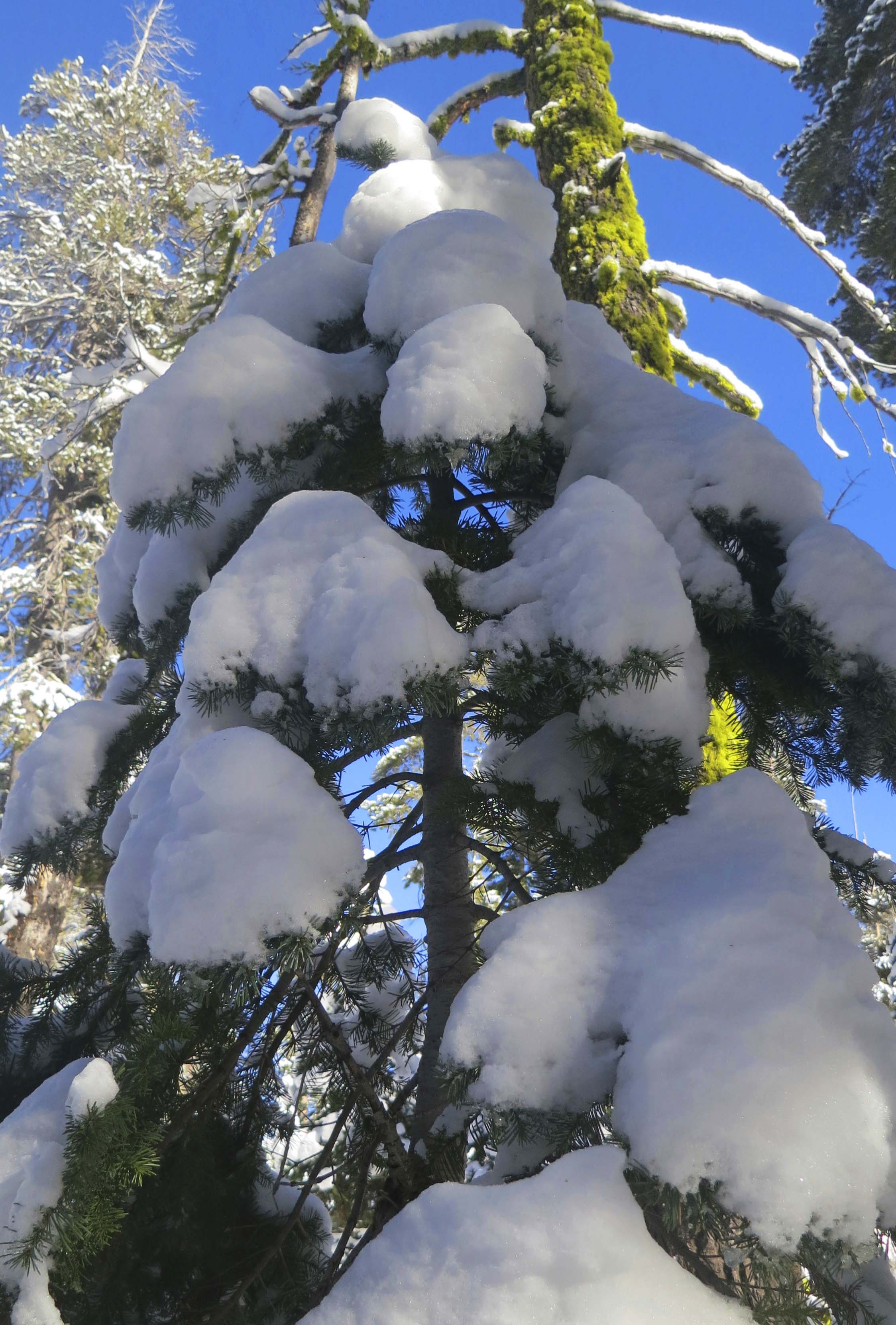
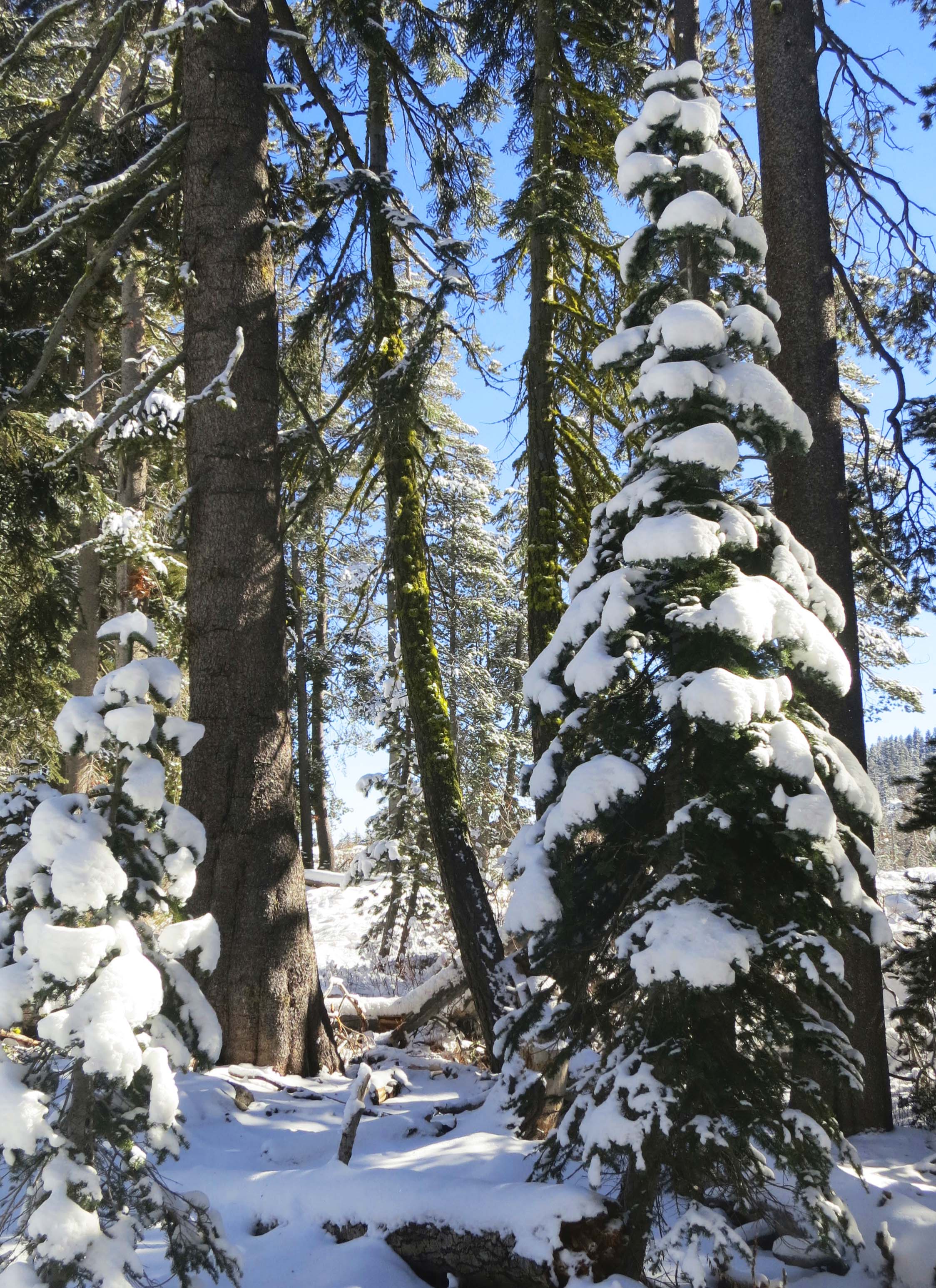
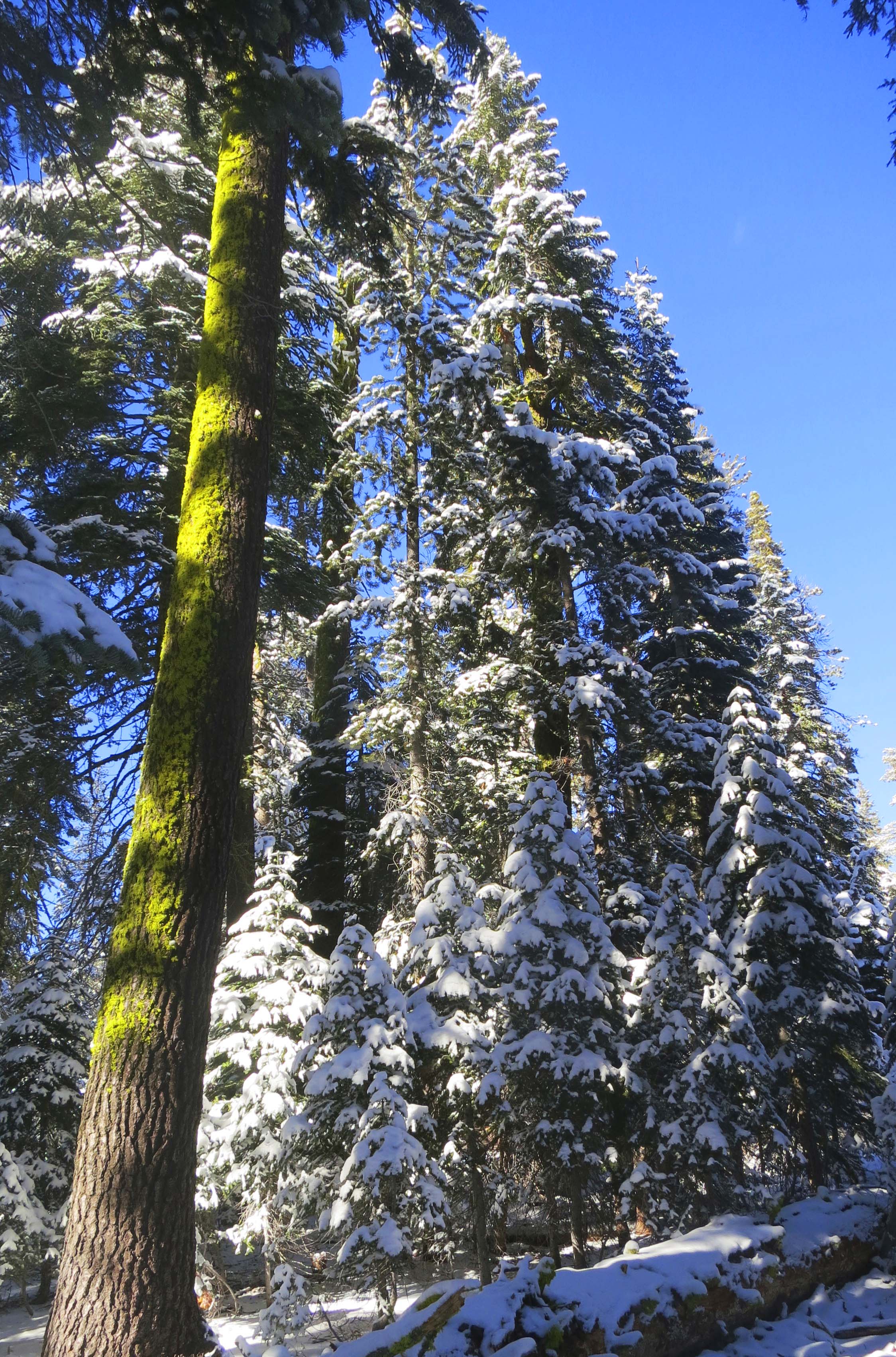
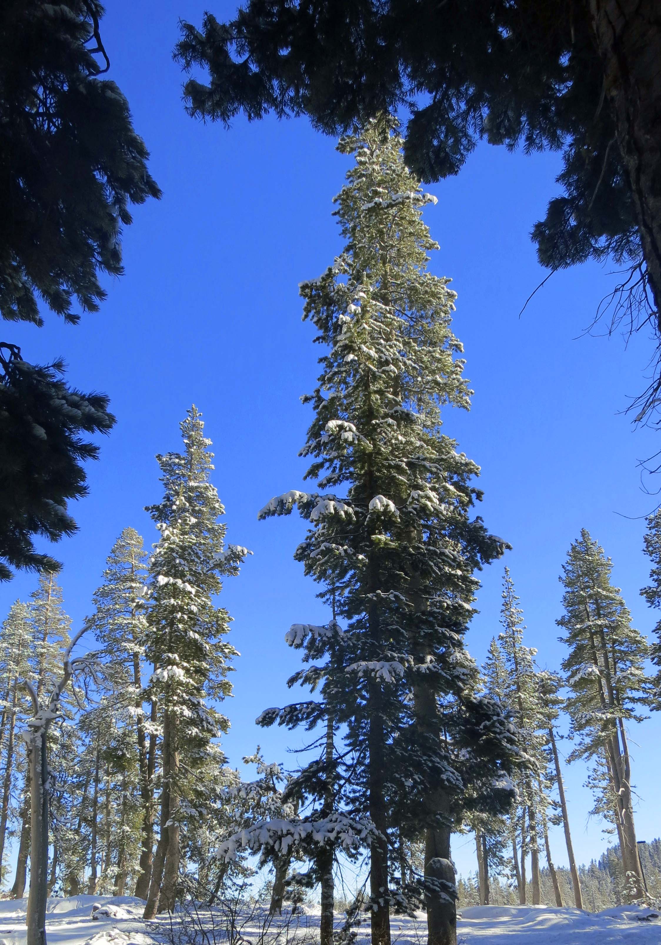
This was our view looking up from our campsite. The Red Butte Wilderness includes some of the most impressive old growth forest I have ever seen including pine, fir and cedar trees.

Massive sugar pine tree in the Red Buttes Wilderness.

Peggy caught me standing next to one of the massive sugar pines. (Photo By Peggy Mekemson.)

Gravesite in Red Butte Wilderness.

This beautiful mound of rocks is found on my map at # 4. It’s a grave for three people buried here by family members after their plane crashed on July 28, 1945.

Burial site of airplane crash victims in Red Butte Wilderness.

The grave marker shows that Sylvan Gosliner, Ruby May Gosliner and Alma Virgie Pratt are buried here. Remnants of the plane can still be found in the canyon below.

Tree torn apart for bugs in Red Butte Wilderness.

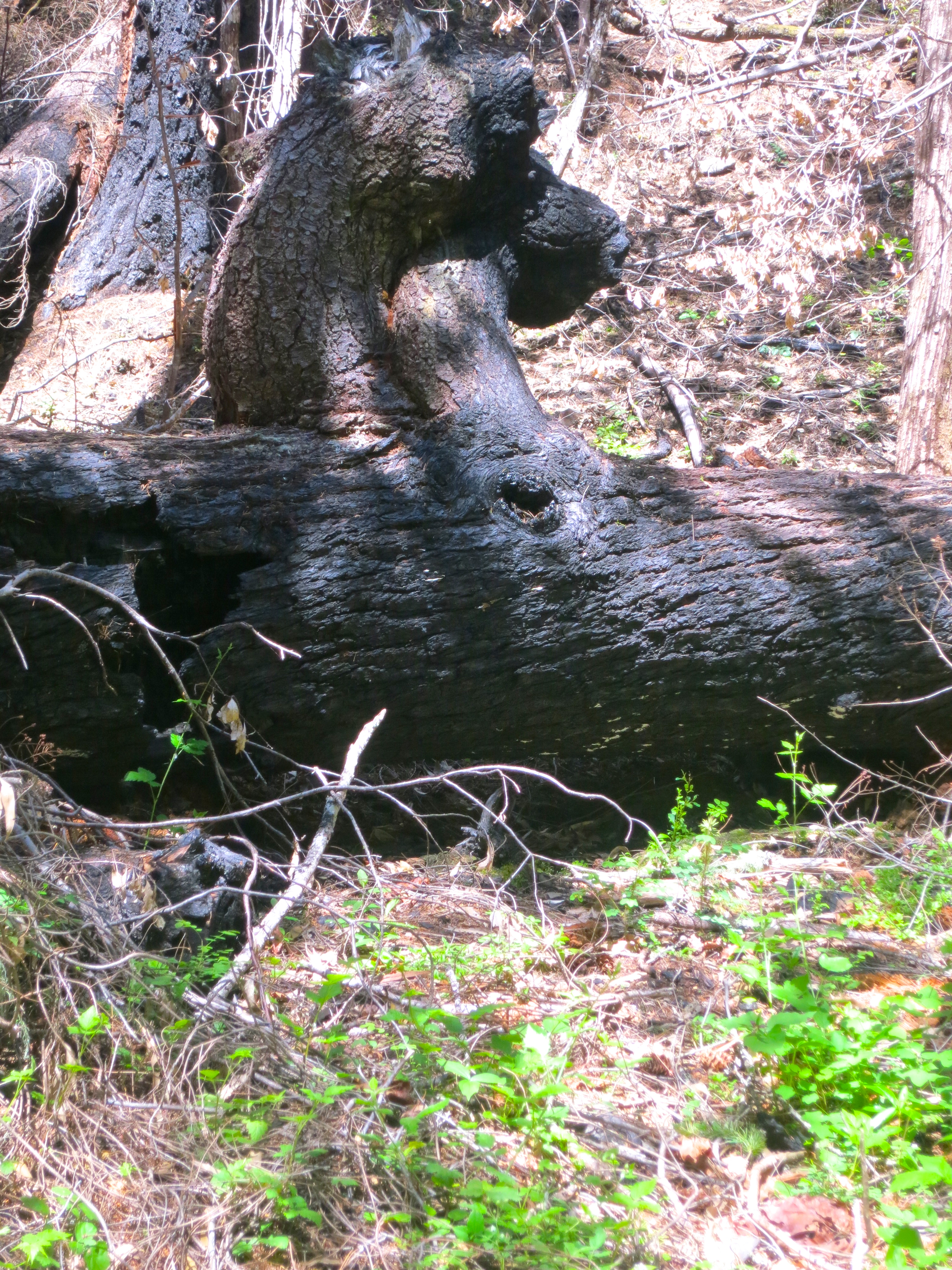
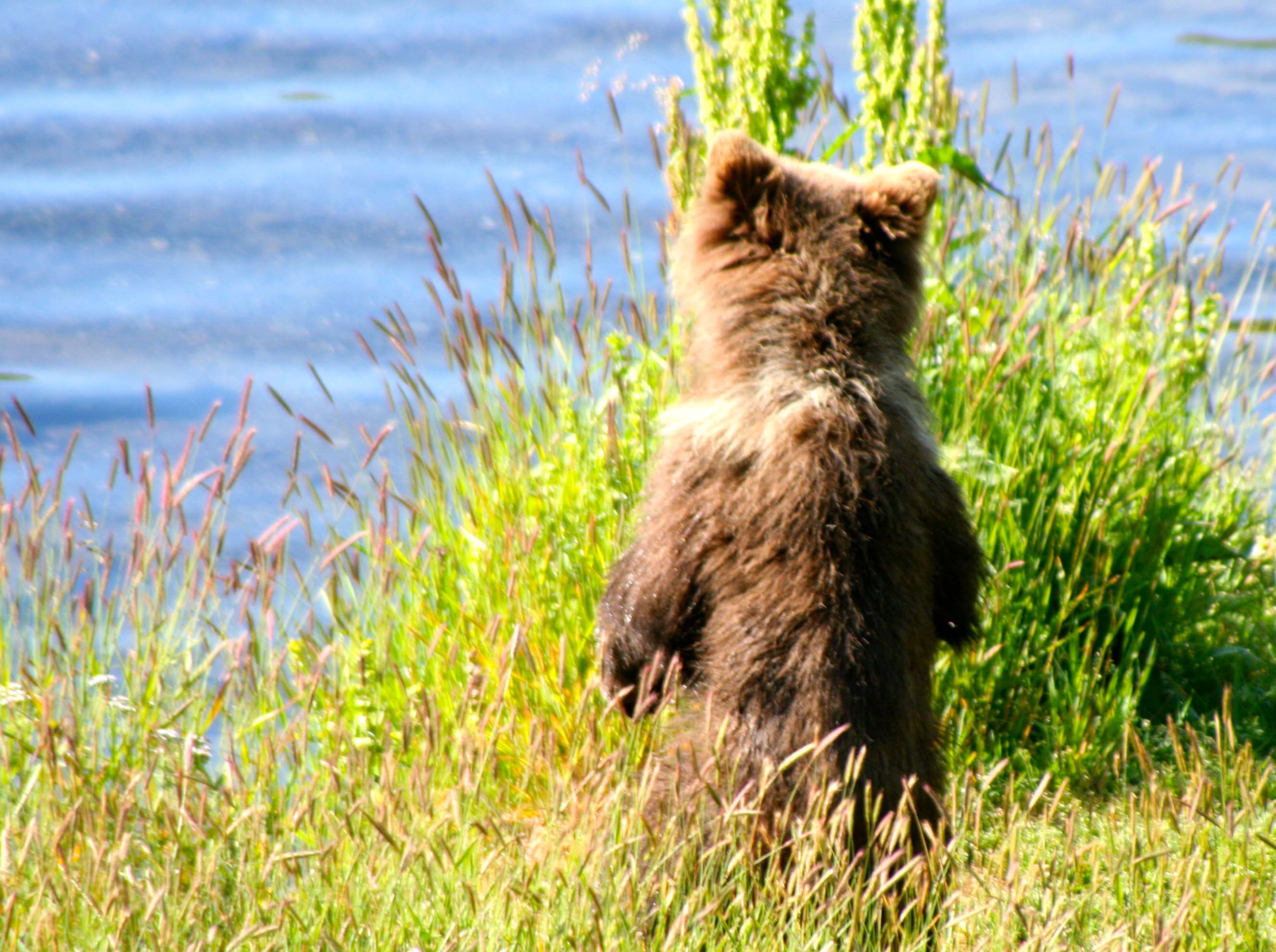
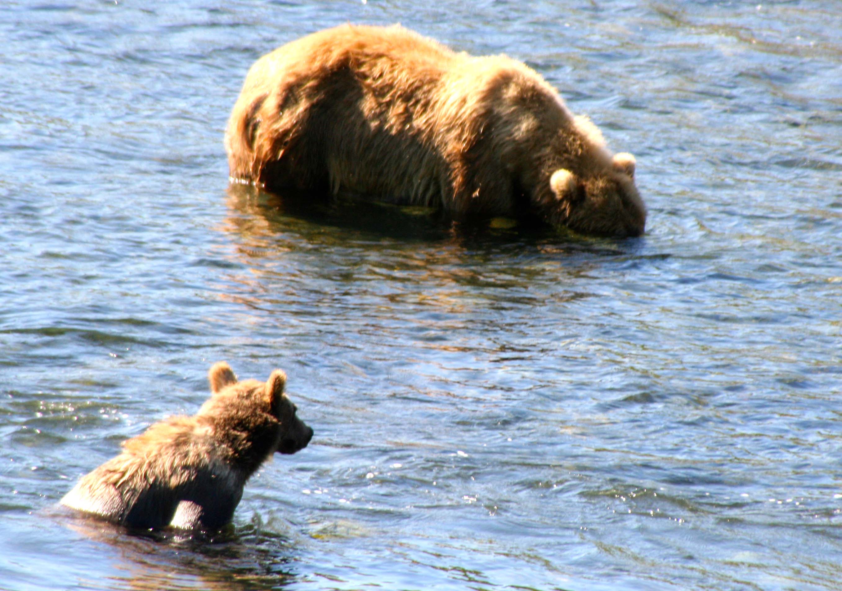
Someone had a grand time ripping this rotting tree apart for it bugs. Was it a bear? Or how about Bigfoot? We found a large pile of scat (poop) nearby.

Cedar Grove in the Red Buttes Wilderness.

Cedar Grove is aptly named for its magnificent cedars. (Found at #5 on the map.)

Corn Lilies in red Butte Wilderness.

We also found corn lilies growing nearby in a meadow where the Goff Trail joins the Butte Fork Trail.

Trillium growing in Red Buttes Wilderness.

As we did this trillium.

Tree blaze carved into a cedar tree in the Red Buttes Wilderness.

Ever hear the phrase, “Where in the blazes are we?” Foresters, cowboys and other outdoors people used to mark their trails by cutting out this symbol in a tree, which is known as a blaze. I’ve followed them through forests from Maine to Alaska, often over trails that have long since grown over.

Curt Mekemson backpacking in the Red Butte Wilderness.

It was a tad wet in the cedars, as this photo by Peggy demonstrates.  The bottle on the left is filled with wine, BTW. It helps assure that Peggy will follow me up the mountain. (grin)

Peggy Mekemson stands on trail in Red Buttes Wilderness.

The trail between the cedars and Lake Azalea almost disappeared on one occasion. Peggy is standing on it.

Azalea Lake in Red Buttes Wilderness.

We finally reached Azalea Lake. Have I mentioned it was wet out?

Curtis Mekemson camping in the Red Buttes Wilderness.

We found a drier, more protected camp farther away from the lake and settled in. I’ve carried the coffee cup backpacking for 45 years. Once it spent the winter buried under 20 feet of snow. (Photo by Peggy Mekemson.)

Azalea Lake in the Red Buttes Wilderness.

The sun rewarded our trip the next morning by providing a lovely view of Lake Azalea. It was time to pack up and head back for civilization.

Curtis and Peggy Mekemson in Red Buttes Wilderness.

Selfie of two happy campers at trails end who have seen some beautiful country and proven to themselves that they can still put on backpacks and disappear into the wilderness.


The Time I was Buried Alive in the Deep Snows of the Sierra Nevada Mountains

Photo of fresh snow on fir tree by Curtis Mekemson.

Fresh snow decorates a tree on Donner Summit, Interstate 80’s pass over the Sierra Nevada Mountain Range of California.

Fresh snow had just fallen and the draught-stricken forests of the Sierra Nevada mountain range were breathing a momentary sigh of relief. A few inches decorated the ground and trees. Peggy and I stopped at Donner Summit on our way between Reno and Sacramento on Interstate 80 last week to enjoy the view. Normally this area is covered in white stuff; the annual snowfall is over 400 inches. It can be dangerous as well as beautiful.

The ill-fated Donner Party learned this the hard way in the winter of 1846-47. They arrived a tad too late in the year on their way to California and were caught in an early snowstorm. Unable to get over the pass, they built cabins at its base to wait out the winter. When their food ran out, they started eating each other. There’s a marker at the site– it is now a state park– that shows how deep the snow was. I used to camp bike treks at the park and would always announce the first evening’s meal as mystery-meat stew. I know, I know, bad taste, so to speak.

Donner Party plaque at Donner Summit, 6 miles from where the Donner Party met their unhappy and tragic fate.

Donner Party plaque at Donner Summit, 6 miles from where the Donner Party met their unhappy and tragic fate.

I am quite familiar with how deep the snow can get. A friend owned a cabin at Serene Lakes near the summit. (Serene Lakes were known as Ice Lakes before a land speculator showed up.) I was there a fair amount of time in the late 70s and early 80s. It was a two-story cabin and the second story door became our entry way during the winter.  One year, the cabin actually disappeared under the snow. I spent my time shoveling a few tons off the roof.

Whenever snow was predicted, we would put bamboo poles at the front, back and side of our car. Vehicles could be buried overnight. The poles were there so the big road-clearing, snow-eating machines would see where the car was before consuming it. Crunch. We saw a car that had met that fate. It wasn’t pretty.

Once, when I was planning a seven-day winter camping trek through the Desolation Wilderness, I decided to do an overnight training out of the cabin. I recruited a pair of winter backcountry experts, Paul and Diana Osterhue, to help. Paul and Diana had us cross-country ski a few miles from the cabin and build emergency shelters to sleep in. Most of my fellow trekkers opted for snow caves, but I went for a trench.

A snow trench looks a bit like a grave. In fact it looks a lot like a grave, but it is quick and easy to build. This is quite important when bad weather and hypothermia are threatening. I dug mine three feet deep by two feet wide and put my closed-cell foam sleeping-pad and sleeping bag on the bottom. Next I covered the trench with my skis and a poncho. My backpack served as the door.

It was quite cozy, assuming you didn’t have claustrophobia or mind sleeping in a grave.  I slept toasty warm all night but was concerned when I woke up in the morning and found my tough cross-country skis sagging in the middle. It had snowed in the night and I was buried under the snow! I pushed at my backpack. It refused to move. Did I panic? Heck no. I kicked the backpack with all of the strength of Arnold Schwarzenegger on steroids topped off with a mega-dose of adrenaline– when he was 20. Grudgingly, the pack gave way.

I wormed my way out from under three feet of the new snow, creating a gopher-like pile of the fluffy stuff. I was met by a white wilderness. No one was to be seen. Curt was alone in a silent world. So I yelled, loudly, and was met by muffled responses. I didn’t move because I wasn’t sure where all the bodies were buried. A few seconds later, the first head popped up out of the snow, and then another and another. Soon, we were all accounted for and okay. It was a grand adventure. The type I love.

The only thing left to report on our trip was that it was tough skiing back to the cabin. If you have ever cross-country skied in mountainous terrain through three feet of fresh powder, you’ll know what I am talking about. We took turns breaking trail. I couldn’t have asked for a better training experience for my fellow trekkers– or me.

Photo of snow covered trees on the crest of the Sierra Nevada Mountains by Curtis Mekemson.

This time, there were only a few inches of snow. They were beautiful, however…

Snow covered trees at Donner Summit Rest Area on Interstate 80. Photo by Curtis Mekemson.

Snow covered trees on the crest of the Sierra Nevada Mountains. Photo by Curtis Mekemson.

Blue skies, sunshine, and bright green moss added to the beauty.

Snow covered log at Donner Summit. Photo by Curtis Mekemson.

I enjoyed this snow-covered log but it didn’t look like an inviting seat. BTW: by this time Peggy was wondering where I had wandered off to. Fortunately, she is used to my wandering ways. Sort of…

Photo of Peggy Mekemson throwing a snowball.

No snow play? Is there a Grinch in the woods? Peggy threatens me with a snowball for my absence. (She didn’t throw it Cal Trans, so you can’t arrest her.)

Snow covered trees in the Sierra Nevada Mountains of California. Photo by Curtis Mekemson.

NEXT BLOG: We return home to be greeted by our next door neighbor and his proud announcement of having baby goats. I am surprised he didn’t offer us a cigar. I’ll close this blog with a final photo of Sierra snow.

Snow covered woods at Donner Summit. Photo by Curtis Mekemson.

Properly attired, I could have wandered for hours (and have) among theses snow-covered woods.

Salmon Fishing with a Kodiak Bear… North to Alaska

Does it really matter whether you catch fish or not when this is your setting? Cape Chiniak, Kodiak.

Does it really matter whether you catch fish or not when this is your setting? Cape Chiniak, Kodiak.

The "old fishing hole" on the Chiniak River. We fished both the river and the ocean for pink salmon.

The “old fishing hole” on the Chiniak River. Not bad, huh?

I’d consumed far too much coffee, so I put down my fishing pole and walked over the hill to find a convenient tree. Instead, I found the neighborhood bear. He was dashing around in a small pool of water on the other side of the road doing what Kodiak Bears do best: chase salmon. He was far too occupied to have seen me so I slipped away. I didn’t want to surprise him. Bears don’t like surprises.

The Chiniak River flows under the road through this culvert. Salmon were plateful on both sides. While we were fishing downstream on this side of the culvert, the bear was fishing upstream.

The Chiniak River flows under the road through this culvert. Salmon were plentiful on both sides. While we were fishing downstream on this side of the culvert, the bear was fishing upstream.

Kodiak Bear prints.

While I didn’t hang around to photograph the bear, I came back to capture his prints.

When I first came to Alaska in the 80s, many backpackers and hikers wore bells to let bears know they were in the area. My thinking was that cows wore bells and bears liked to eat cattle. I talked and sang a lot. “Ninety-nine Bottles of Beer on the Wall” was a favorite. One rendition gets you through a lot of bear country. Peggy and I still sing it when we come on a pile of fresh, steaming bear poop in the woods. The bigger the pile, the louder we sing.

This time I walked backed to where Tony was fishing and quietly gave him the news. I didn’t want to alarm the boys. More to the point, if the boys knew the bear was nearby, they would immediately want to go see him.

Tony came loaded for bear. He carried an air horn and pepper spray as his first line of defense. You are supposed to stand tall and make lots of noise if a bear finds you interesting. Tony is 6’2”. The air horn would supply the noise. When it comes time to use the pepper spray, the situation has deteriorated considerably. If all else fails, you are supposed to play dead… or shoot the bear. Tony is a nationally ranked pistol marksman. If push came to shove, my money would be on him.

Fortunately, the bear headed upstream. We were left on our own to catch salmon.

The natural setting on the end of the Chiniak Peninsula on Kodiak Island is beautiful and this was our second time there. The first time we had been quite successful and we were eager to for a repeat performance. It wasn’t to be.

The results from our first trip out to the Chiniak Peninsula.

The results from our first trip out to the Chiniak Peninsula.

There was an extreme low tide. Pink salmon in the hundreds lay just off the shore, eager for the high tide to send them swimming on their way up the Chiniak River to perform their age-old ritual of laying eggs and then passing on to salmon heaven, where I assume salmon food is plentiful and bears aren’t.

Our challenge was in catching, not snagging the salmon. They were so thick we kept hooking them before they went for our lures. I even brought a couple in by their tails. It was all fun, at least for us. We dutifully released the snagged salmon as required and watched them swim back into the bay. After we had caught and released 16 or so we decided it was time to pack it in and head home.

We’d go out to dinner. Grilled salmon could wait for another night.

Cape Chiniak, Kodiak, Alaska

Another view of Cape Chiniak. This was taken from just above where we were fishing.

Here fish, fishy, fishy. Cammie tries to entice a salmon by dangling a lure in front of its mouth.

Here fishy, fishy, fishy. Cammie tries to entice a salmon by dangling a lure in front of its mouth.

Fishing on the the Chiniak Peninsula.

Our youngest grandson Cooper provides Tony with advice on where to cast his lure.

Fishing on the Buskin River on Kodiak Island, Alaska.

Our luck changed on the Buskin River a couple of days later. Here, Peggy signals the number of fish she caught. Note: In my last blog I reported that Peggy had only been fishing as a child. I forgot she had gone salmon fishing with my brother-in-law, Jim. That explains why she caught five salmon and I only caught four. (grin)

Pink salmon caught on the Buskin River in Kodiak, Alaska.

We hold up our catch of the day on the Buskin. And yes, Tony did grill salmon that night.

NEXT BLOG: The Coast Guard on Kodiak

Just for the Halibut… Gone Fishing in Kodiak

Boat wake in Chiniak Bay, Kodiak.

Leaving worries, Kodiak and a wake behind, we head out into Chiniak Bay for a day of halibut fishing.

Kodiak is about fishing. The Port of Kodiak is one the top three commercial fishing centers in the United States and the largest in Alaska. Sport fishing is also big. People come from around the world to try their luck. The odds are if you are in Kodiak for any amount of time, you’ll get hooked.

Kodiak, Alaska fishing harbor.

Kodiak Harbor is home to one of the largest fishing fleets in the United States.

Peggy poses with out youngest grandson, Cooper in front of the Harbor Masters office in Kodiak. The large fish is a sculpture made from trash collected from the ocean. Hopefully Cooper will grow up in a world with less trash.

Peggy poses with our youngest grandson, Cooper, in front of the Harbor Master’s office in Kodiak. The large fish is a sculpture made from trash collected from the ocean. Hopefully Cooper will grow up in a world with less trash.

Our son Tony caught the fishing bug. He grumbled when he left San Diego that all of his Coast Guard friends in Kodiak had become fishermen. He didn’t like to fish. Now, according to his wife, Cammie, he’s just like all of the other guys on the island. “Gee, honey, would you like to go for a nice romantic walk or go fishing?” Guess what…

But Cammie is right there with him. She can walk out into the water in her hip waders and cast her line for salmon with the best of the guys.

Cammie demonstrates her salmon fishing skills.

Cammie demonstrates her salmon fishing skills.

Peggy and I certainly don’t qualify as fishermen. I had fished in my twenties for several years but that was a while ago. We won’t talk about how long. As for Peggy, she had fished off a dock in Lake Erie with a bobber as a child… twice. But the temptation to go fishing was too great. Off we went to buy our out-of-state fishing licenses. We were about to get our feet wet.

Our first adventure was to try our luck with halibut. Guess who caught the only one? It wasn’t Tony, Cammie or me.

Coast Guard Kodiak has a dock for small fishing boats on base  and makes rental boats available for Coasties. (Members of the Coast Guard)

Coast Guard Kodiak has a dock for small fishing boats on base and makes rental boats available for Coasties (Members of the Coast Guard).

Our brave crew prepares to head out to sea on our Halibut fishing expedition. Connor, Chris and Tony are in the first row. Peggy and Cammie are in the second row.

Our brave crew prepares to head out to sea on our halibut fishing expedition. Connor, Chris and Tony are in the first row. Peggy and Cammie are in the second row.

Fishing in Kodiak, Alaska.

“Um, Dad, is that dock supposed to be there!?” Before we headed out to into the Bay, we tried our luck at catching herring for bait fish near the Kodiak docks. Three-year-old Chris, sitting in Tony’s lap and pretending to steer, apparently has concerns about where the boat is headed. (Photo by Peggy Mekemson)

Fishing in Chiniak Bay, Kodiak, Alaska.

Having no luck with the Herring, we headed out into Chiniak Bay to fish for halibut.

Having tossed out our anchor, Connor found time to play 'now you see me, now you don't' with me. The reflection was a bonus.

Connor found time to play ‘now you see me, now you don’t’ with me. The reflection was a bonus.

Chris enjoyed some kind of healthy snack, but given the expression of bliss on his face, I'm guessing that chocolate was involved.

Chris enjoyed some kind of healthy snack, but given the expression of bliss on his face, I’m guessing that chocolate was involved. (Photo by Cammie Lumpkin.)

Fishing in Chiniak Bay, Kodiak, Alaska.

Cammie caught the first fish on our trip, a colorful rockfish. (Photo by Tony Lumpkin.)

Rockfish caught by Cammie Lumpkin off Kodiak Island.

A close up of the rockfish. “My what big eyes, you have.” Tony unhooked and released Cammie’s catch. (Photo by Tony Lumpkin.)

Peggy and I pose for our "official" halibut fishing photo. (Photo by Tony Lumpkin.)

Peggy and I pose for our “official” halibut fishing photo. (Photo by Tony Lumpkin.)

Fishing in Chiniak Bay off the coast of Kodiak, Alaska.

A second “official” photo.  I was leaning out to be in the picture. Had a large halibut chosen that moment to strike, I may have gone swimming. (Photo by Tony Lumpkin.)

Halibut fishing off the coast of Kodiak, Alaska.

Peggy caught our first, and only halibut, a 15 pounder– and had a smile to prove it.

Fishing for halibut in Chiniak Bay, Alaska.

Here, the boys take a close look at the halibut. Connor appears quite curious about the fish’s strange eye arrangement while Chris keeps his distance.

Tony has become quite expert at filleting fish. Here, he takes on the halibut. Halibut has always been my favorite fish. Nothing can beat one fresh off the boat.

Tony has become quite expert at filleting fish. Here, he takes on the halibut. Halibut has always been my favorite fish for eating and nothing can beat one fresh off the boat.

A note on photo credits: I always try to give credit to the person who took the photo. Where no name is mentioned, I took the picture. Peggy and I were passing our cameras around this time between ourselves, Tony and Cammie. I could have missed something.

NEXT BLOG: Having landed a halibut, we join the Kodiak Bears in fishing for salmon.

And Then the Bear Had Me by the Head… Scary Bear Stories Part II

I took this photo of an Alaska Black Bear last week at the Alaska Wildlife Conservation Center. When I was leading backpack trips in Alaska in the 80s, a black bear bit through a sleeping bag into a forrest service ranger's leg.

I took this photo of an Alaska Black Bear two weeks ago at the Alaska Wildlife Conservation Center.

At the end of my last blog, I had backpacked 18 miles into Yosemite Valley to resupply the food bears had taken from me.

My intention was to stay in the Valley that night but it was a zoo, absolutely crawling with tourists. So one very tired Curt shouldered his pack and hiked five miles back over the 3000-foot cliffs into Little Yosemite Valley. I nodded off that night listening to backpackers yelling as bears methodically worked their campsites, wondering when my turn would come. It came all too soon.

I woke up to a bear emptying my backpack about five feet away from where I was sleeping. This brings me to another piece of Yosemite bear lore: always leave the pockets of your pack open. If you don’t, the bear will open them for you. It tends to be rather hard on backpacks.

Fortunately, my food was safely hanging from a cable and I had left my pack wide open. I watched with clinical interest as the bear shoved his head into the pack, pulled out an item, dropped it on the ground and then stuck his head back in the pack. By then I had enough and suggested rather loudly that the bear go elsewhere. After one more foray, he did. The only damage I suffered was bear slobber, all over everything. My old Basset Hound, Socrates, the world champion of slobberers, would have been jealous.

The next night I was leaving my camp for an evening walk when I met a bear coming to visit. I bent over and picked up a rock and he took off like a dog. And thus my summer went. By the time I had led two back-to-back hundred-mile trips into Yosemite, I had my fill of bears and they had had their fill of Trekker food. Fortunately, no more of it was mine. I considered myself an expert food hanger and bear chaser.

It was almost my demise.

At the end of the second Trek, my friend Jean, her sister Mary and her husband Tim joined me at Tuolumne Meadows to hike the John Muir Trail. We spent the night at the Tuolumne campground. I had eaten backpacking meals for two weeks so it was time for grilled steaks, a little bourbon and several cans of beer before hitting the trail again.

As the night progressed, I was feeling no pain and had lots of liquid bravery. So it wasn’t surprising when a bear came to visit our neighbors from Iowa, I was prepared to do battle. They had left their cooler out on the picnic table as an open invitation and the bear was leisurely opening it. The Iowans were hiding out in their camper, making nary a peep.

“HEY BEAR,” I yelled as I strode across the road, “GET OUT OF HERE!”

Well, Mr. Bear had found himself a cache of fresh food and wasn’t about to leave. He turned around, stood up on his hind legs, raised his front legs over his head and said “GRRRROWL!” He was one big fellow. Stone cold sobriety was instantaneous.

“OK bear, it’s all yours,” I mumbled as I scurried back across the road to my own camp and safety. “Eat all of the Iowan food you want. Heck, eat the Iowans.”

By this time though, 20 flashlights were shining down on the bear. Campers are packed into Tuolumne Meadows like tenement housing in a barrio and all of the neighbors were wondering if they were next. Thus disturbed, Mr. Bear went grumbling off over the hill, more than a little pissed to have his fine feast disturbed. You could almost make out in his growling, “I’ll be back.”

Of course the Iowans left their cooler out on the table. No way were they budging from their camper. I pictured them driving nonstop back to Des Moines the next day.

Finally things settled down. After another bourbon or two, we crawled into our sleeping bags. Tim and Mary disappeared in the security of their truck and Jean and I crashed on the ground.

Not surprising, there came a time when Jean had to visit the restroom. Beer will do that. Equally unsurprising the bourbon helped me sleep right through her getting up. But I did hear her come back. Except it wasn’t Jean I heard through my alcohol-induced grogginess; it was the bear coming back for revenge.

“GET OUT OF HERE!” I screamed with all of the passion I had used when I had awakened with the bear standing on me. Jean not knowing what to do grabbed me by the head and said, “Curt, it’s all right, it’s only me!” This was undoubtedly the right thing for her to do, except now the bear had me by the head. As you might imagine, my yells increased in volume geometrically.

Picture 20 flashlights shining down on this happy little domestic scene. If Mr. Bear had any thoughts of revisiting our area that night, he gave us wide berth afterwards.

NEXT BLOG: Back to Kodiak and our float plane trip over the island.

When Bears Behave like Bears: One Thousand Pounds of Entertainment… Part 3

Kodiak Bear cooling off on the Frazer River.

There is nothing like a cool dip in the water on a hot summer day. This large Kodiak Bear plopped down in the Frazer River, obviously enjoying herself. Soon she had rolled over on her back. See below.

As I have noted before, Kodiak Bears are big animals with large teeth and sharp claws. They can be daunting, even scary. And they always deserve respect. When I found one fishing the same small stream we were fishing on the Chiniak Peninsula last week, I beat a hasty retreat, slowly. Running away would have suggested I was dinner, or at least something to play with. And bears play rough.

Bears attack people but these encounters are rare considering the number of people and bear encounters each year. On Kodiak Island there are some 14,000 people and around 3500 bears. Odds are if you spend any time at all outdoors, you will meet up with one of these magnificent creatures.

Over a thousand people per year make the trek out to the Kodiak Island’s best bear viewing spot, the Frazer River. As far as I know, no one has been eaten. A friend of mine who taught wilderness survival skills to the military used to tell his students if bears wanted to eat people, they would move in to town where there are a lot more people to eat. Mainly bears like to avoid people. We are scarier than they are.

The bears of Frazer River put on a great fish catching demonstration and the moms and cubs had a serious “ah” factor. But they also cooled off in the water, sat and watched the world go by, established who was boss, and enjoyed a good scratch. I found some of their behavior quite humorous.

Kodiak Bear cools off in the Frazer River.

Mom lays down on her back.

Kodiak Bear on the Frazer River Fish Pass.

I wasn’t about to tell this guy he had to stay off the Fish Pass. Check out the claws! 

I also enjoyed this Kodiak Bear sitting in the grass and watching the action in the river.

I also enjoyed this Kodiak Bear sitting in the grass and watching the action in the river.

Kodiak bears tend to be solitary animals but do come together when abundant food is available.

Kodiak bears tend to be solitary animals but do come together when abundant food is available. These two seem to be pretending that the other bear is not present. Out of sight, out of mind.

While the Kodiak Bears are not territorial, arguments may ensue in close conditions. We could here the growling.

It didn’t work. We could hear the growling. We were glad that we weren’t the ones being growled at.

Kodiak Bear shows submission

Kodiak Bears have developed a number of postures and sounds to avoid conflict. The bear on the left has lowered his head in submission.

We also watched the mother bear drive off a large male to protect her cubs.

We also watched the mother bear drive off a large male to protect her cubs. (Photo by Peggy Mekemson)

Kodiak Bear salutes... or possibly scratches an itch.

Is this “I pledge allegiance,” or “Aw that feels good?” I’ll go with scratching an itch.

Lone kodiak Bear standing in the Frazer River on Kodiak Island.

In the last shot of our bear viewing trip, a lone Kodiak Bear fishes in the Frazer River.

NEXT BLOG: Flying over Kodiak Island in a float plane.

A Visit with the World’s Largest Bears… Part 1

Kodiak Bears in the Frazer River on Kodiak Island.

The beautiful Frazer River on Kodiak Island is home to some of the largest bears in the world.

The largest Kodiak Bears can tower up to ten feet when standing on their hind feet and weigh over 1500 pounds. With these stats, the brown bears of Kodiak Island are considered the largest bears in the world.

We were privileged this past week to spend a day watching them on the Frazer River, which flows out of Frazer Lake on the southern, uninhabited part of the island. We flew in by floatplane and then hiked for a quarter of a mile to a section of the river that had dropped several feet during Alaska’s massive 1964 earthquake. A fish ladder had been built to help the salmon over the section. The Kodiak Bears consider the area beneath the falls and ladder to be their personal fishing hole.

A Kodiak Bear prepares to go fishing on the Frazer River.

A Kodiak Bear prepares to go fishing on the Frazer River.

Our son Tony, who flies helicopters for the Coast Guard out of Kodiak, and his wife Cammie had arranged for the trip. We owe them big. It was a gorgeous day in a beautiful area and a number of bears were fishing for salmon. This is the first of three blogs I am going to do about the experience. Today I will feature moms and their cubs. Next I will focus on the bears fishing. I will finish with some fun photos of bears being bears.

Cubs are born in January or February while their mother is still hibernating in her cave. They then nurse for several months before emerging in June. They weigh approximately one pound when born. Cubs live with mom for three plus years before venturing out on their own. Bears have their first cubs around five years of age and continue to produce litters every four years or so into their twenties.

A mother Kodiak Bear checks on the welfare of her three cubs. The cubs were waiting for mom on a fish pass that led the salmon to the fish ladder.

A mother Kodiak Bear checks on the welfare of her three cubs. The cubs are standing on a fish pass that leads  salmon to the fish ladder. (Photo by Peggy Mekemson)

Here the three cubs are waiting patiently while mom fishes. They will lose their white collar in their second year.

Here the three cubs are waiting patiently while mom fishes. They will lose their white-collar in their second year. It is hard to believe that these little tykes will grow up and weigh over 1000 pounds. (Photo by Peggy Mekemson)

I liked this shot of mom and her parade. She had just chased off a male Kodiak Bear.

I liked this shot of mom and her parade. She had just chased off a male Kodiak Bear. (Photo by Peggy Mekemson)

A different Kodiak Bear mom touches noses with her cub. (Photo by Peggy Mekemson.)

A different Kodiak Bear mom touches noses with her cub. (Photo by Peggy Mekemson.)

Kodiak Cub next to  Frazer River  on Kodiak Island.

We watched this cub playing with its mom in high grass where we couldn’t get any photos although she was about ten yards away.

Kodiak cub stands on hind feet searching for mom fishing in the Frazer River on Kodiak Island.

“Where did Mom go?” the little guy seems to be asking as he stands up on his hind feet and looks for her.

Kodiak cub watches its mother fish in the Frazer River on Kodiak Island.

Momma Kodiak has her head buried in water searching for Salmon. Junior joined her for the show. “Catch a big one, Mom.”

Having caught a fish, Mom shares it with her cub.

Having caught a fish, Mom shares it with her cub.

NEXT BLOG: Peggy and I watch the Kodiak Bears on the Frazer River catch enough salmon to make the most skilled fisherman jealous.