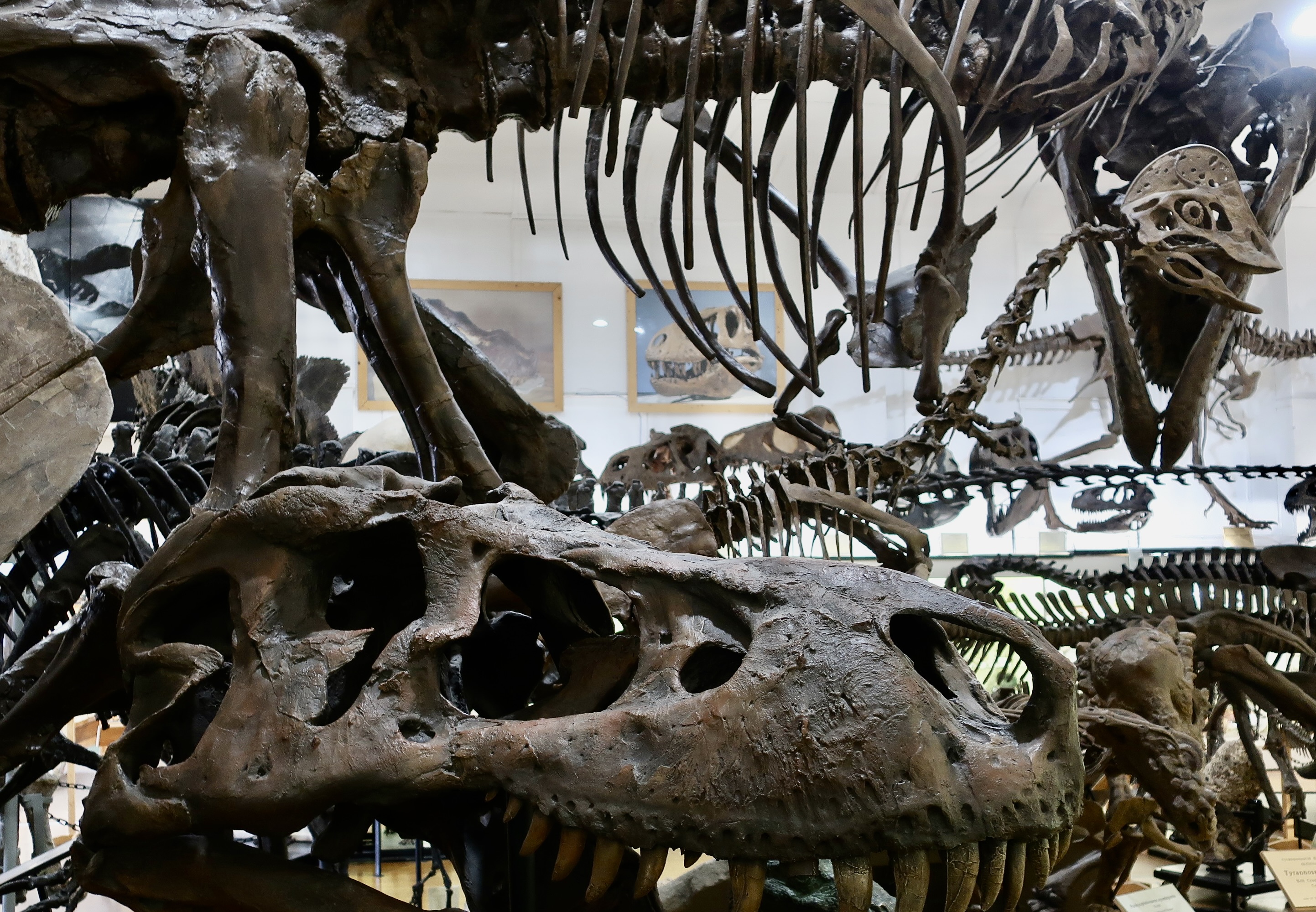
And no, I’m not talking about the two legged type so prominent in today’s world. They’re too scary for this blog. I’m talking about the behemoths that wandered the world between 65 and 245 million years ago. The small display area of Black Hills Institute in Hill City, South Dakota is packed full of them. If you have children, be sure to take them there. They will love it. Heck, if you don’t have kids, take yourself! Peggy and I visited as part of our three month road trip last fall.
Can you imagine any more dinosaurs or replicas being packed into a small display area?
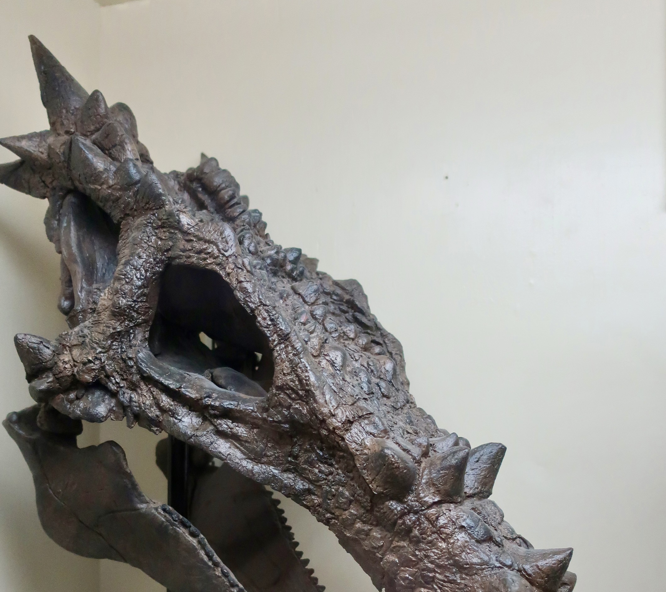
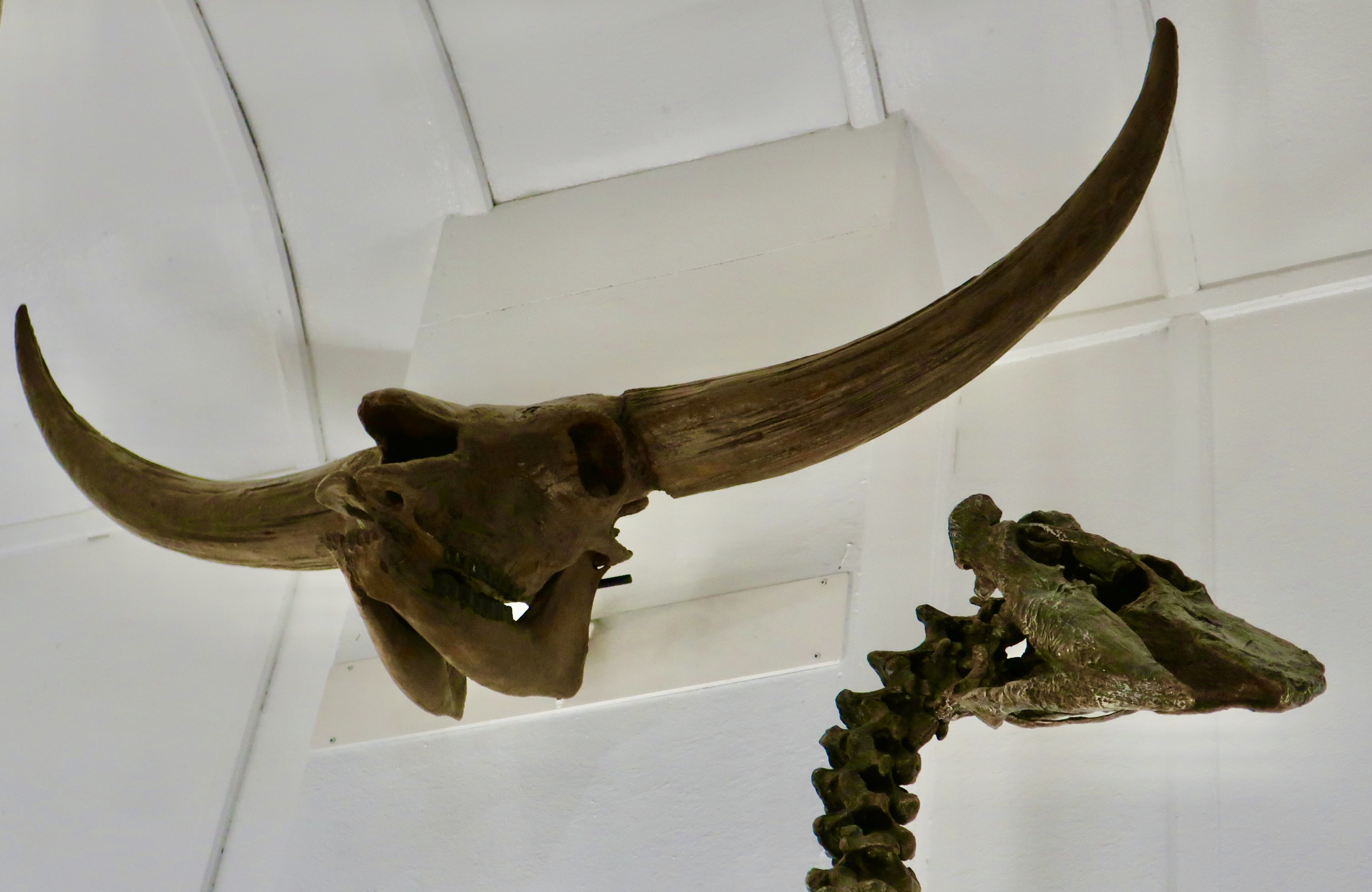
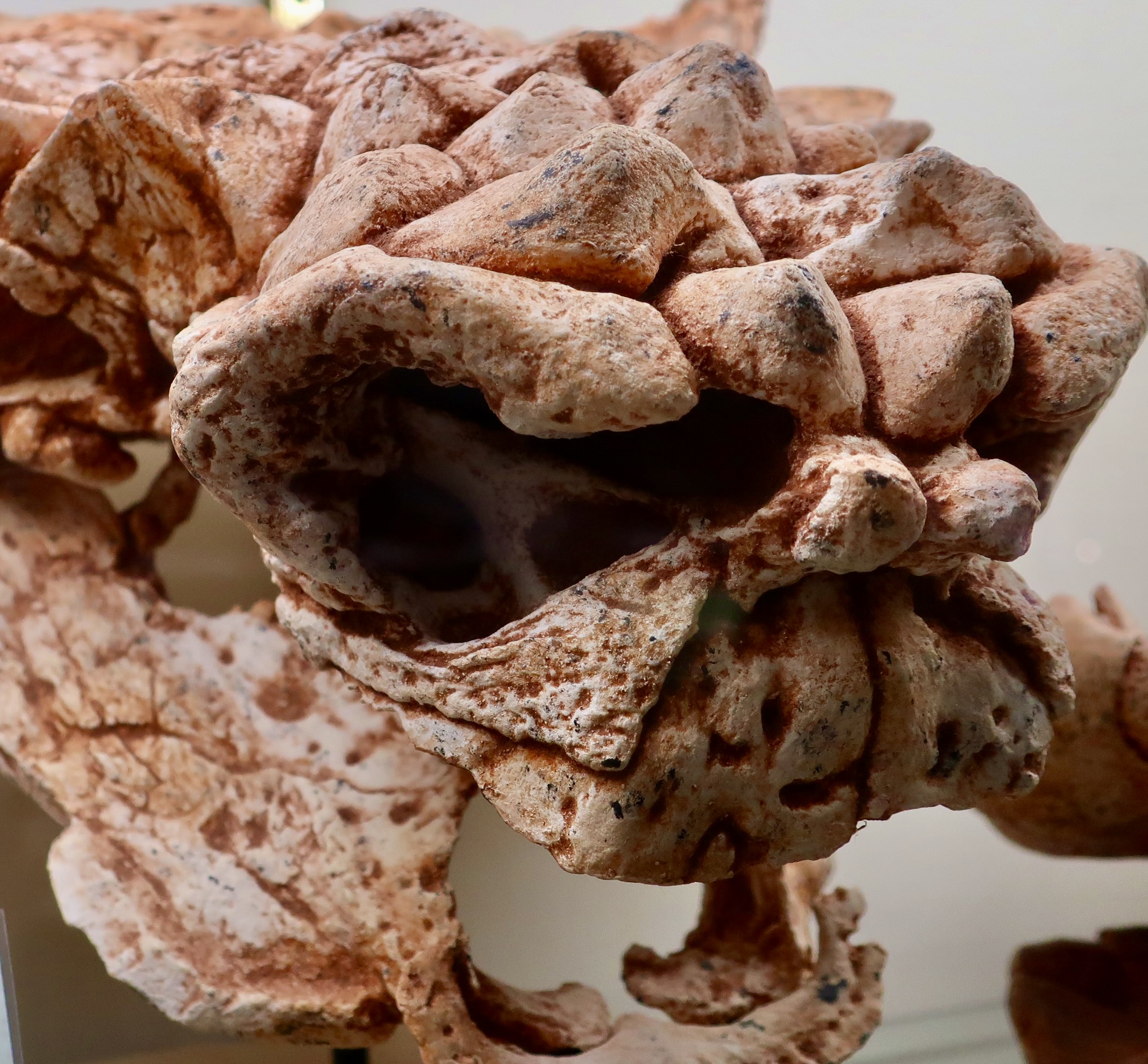
Peggy and I didn’t know what to expect when we visited the small dinosaur museum in Hill City, South Dakota. It’s located maybe 30 minutes away from Mt. Rushmore and not much more from Custer State Park. We had some time to kill, so why not. What we found was an absolute delight. Normally I take museums seriously, carefully noting what I am seeing and photographing. Not this time. While the museum is worthy of such attention, it was so crammed full I wouldn’t have known where to start. So Peggy and I just wandered around admiring big teeth and taking photos. Following are the results. Enjoy.
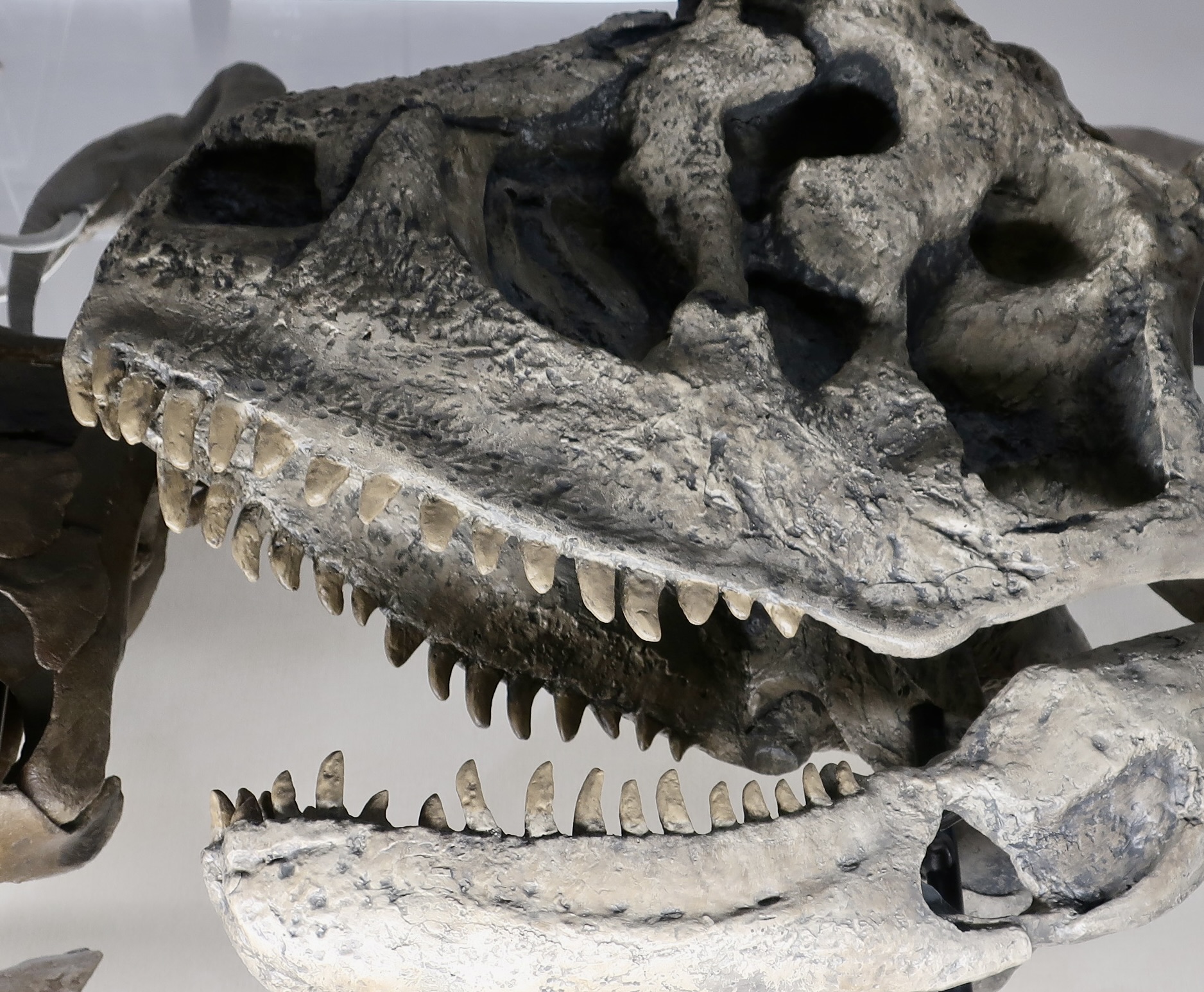
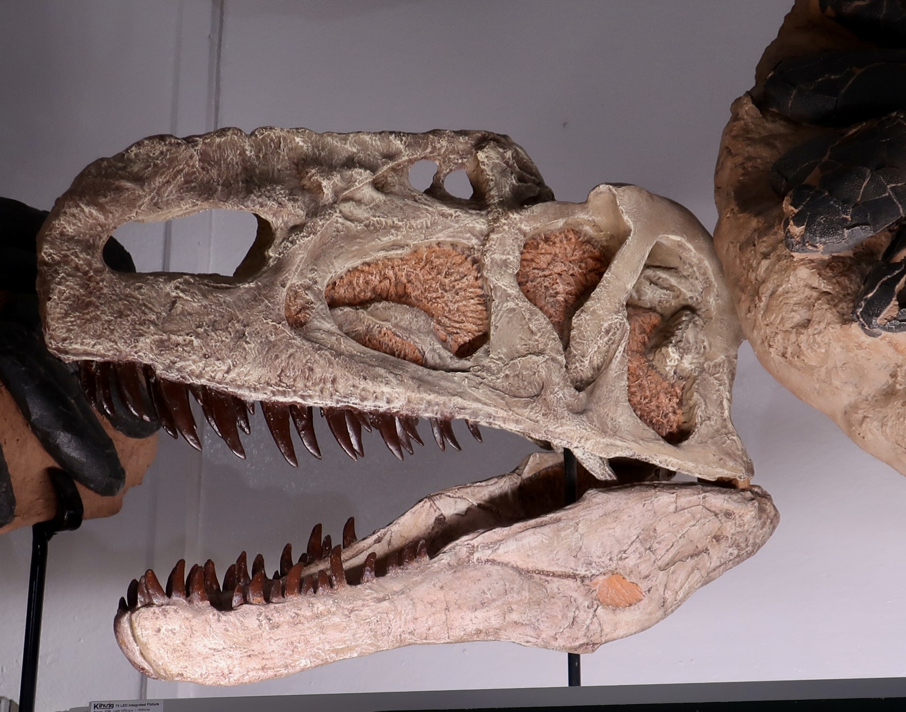
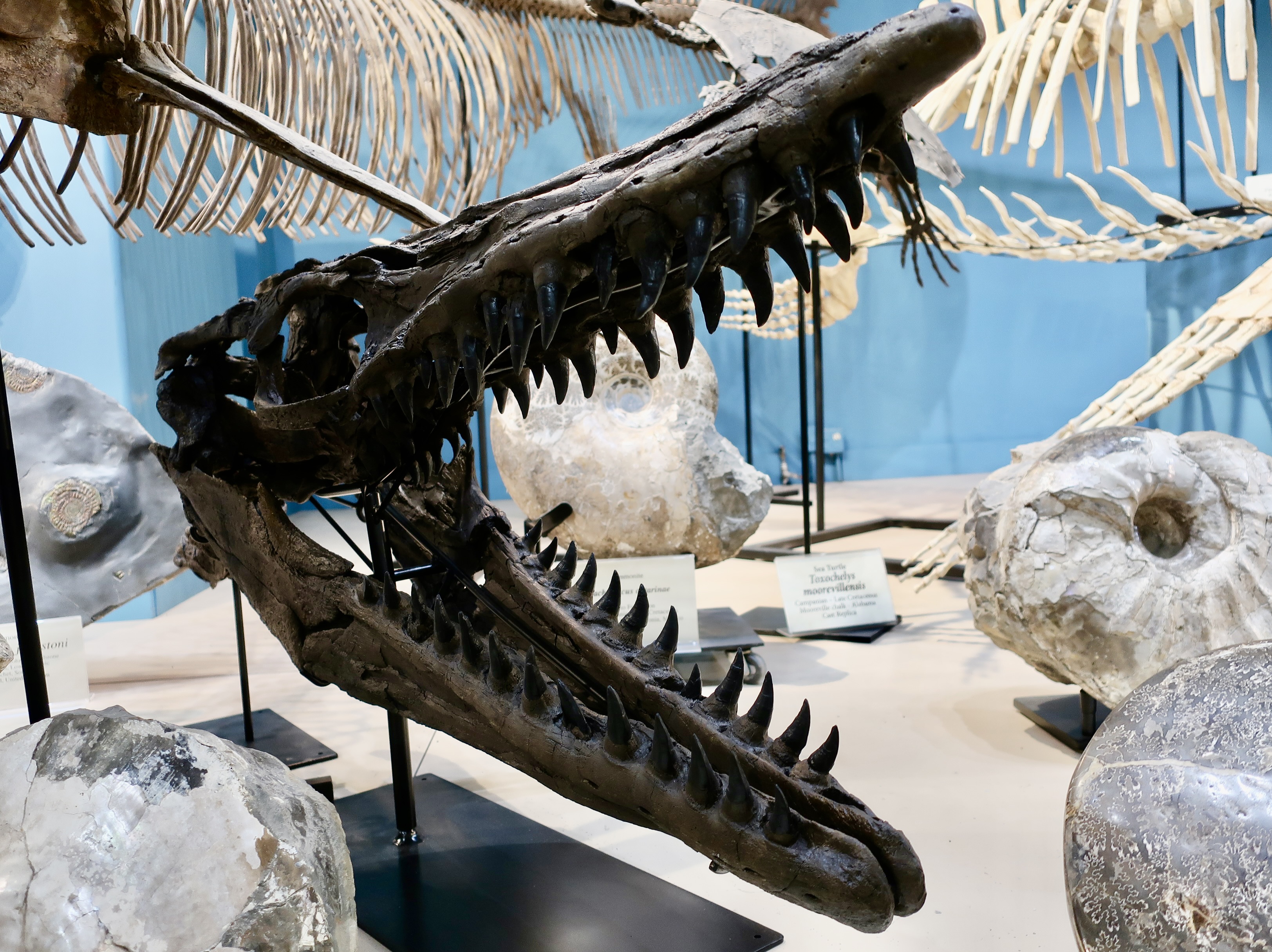
Definitely not taking dinosaurs as seriously as one should. I included this photo of Peggy shoving her head in a T-Rex’s mouth in an earlier post. We made sure no museum personnel were in the room or T-Rexes were hurt, but it’s probably on surveillance tape. This would have been a good scene for the “Night at the Museum” movies. Imagine them all coming alive. It would be great for a nightmare as well. My, what big fangs you have. Okay, I get how these chompers might frighten a potential dinner to death, but how good are they when it comes to eating the meal?These would be better for chewing. The head looks like you could hit it with a baseball bat and not do much damage. Run!And check out how these teeth lean backward. Once you were in this mouth, it was a one way street. There was no way out except through the stomach.And one certainly wouldn’t want to face these teeth! Has me thinking about Sobek, the crocodile god of Egypt.Maybe smaller teeth work if you have lots of them with a serrated edge— and cool armor. But enough on toothy set. Now on to some of the marvelous creations of nature that prefer eating green things.Even if you were a vegetarian, you would want protection from those who weren’t.A good old-fashioned goring might do the trick.Or possibly just looking weird and being hard to digest would suffice.A final shot of flying, leaping and running! It’s no wonder our small precursor mammals were good at hiding and waited for a ‘miracle’ meteor to wipe out the competition.
That does it for today. Next Monday we will be back in Egypt visiting one of Egypt’s first pyramids.
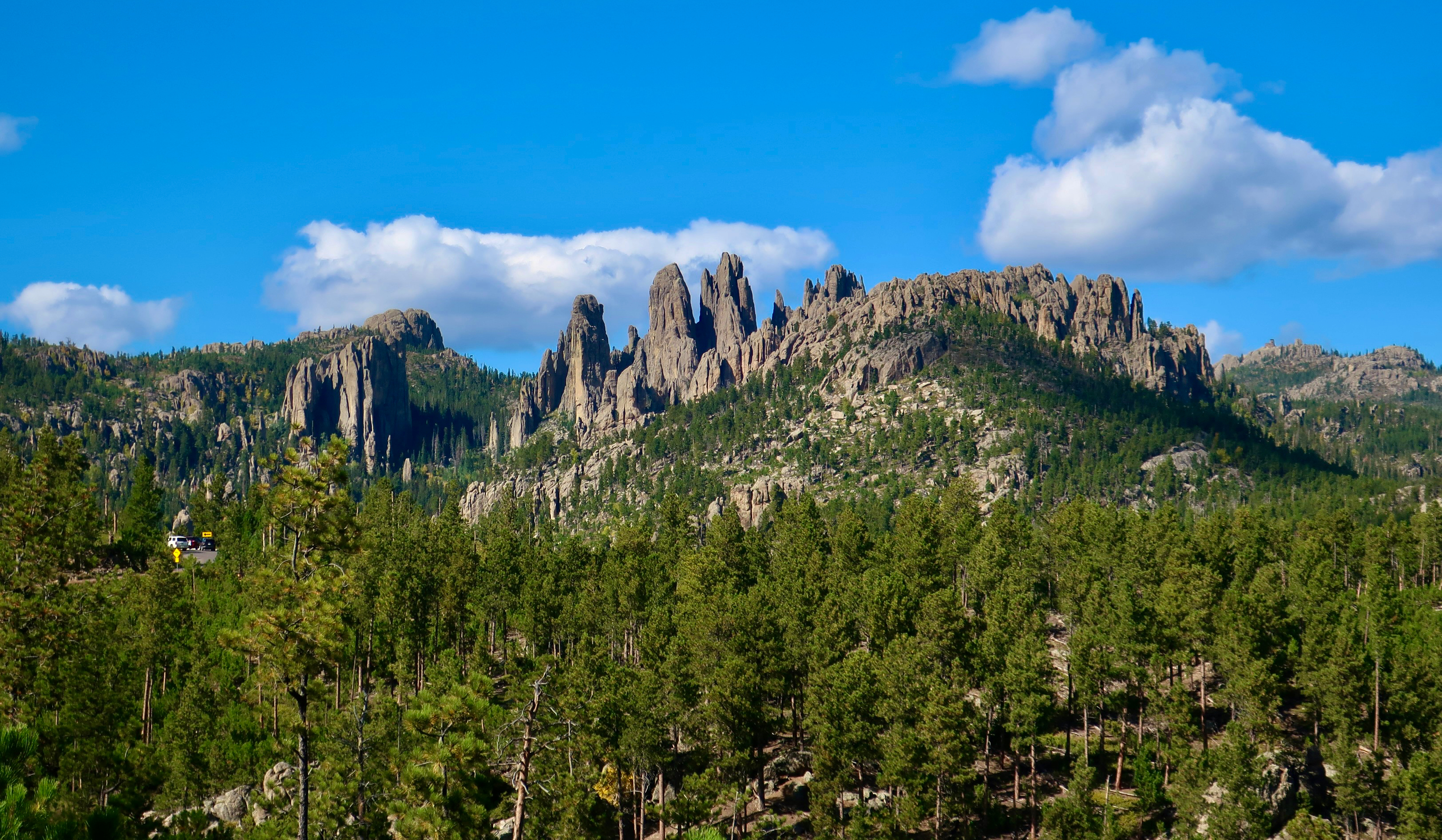
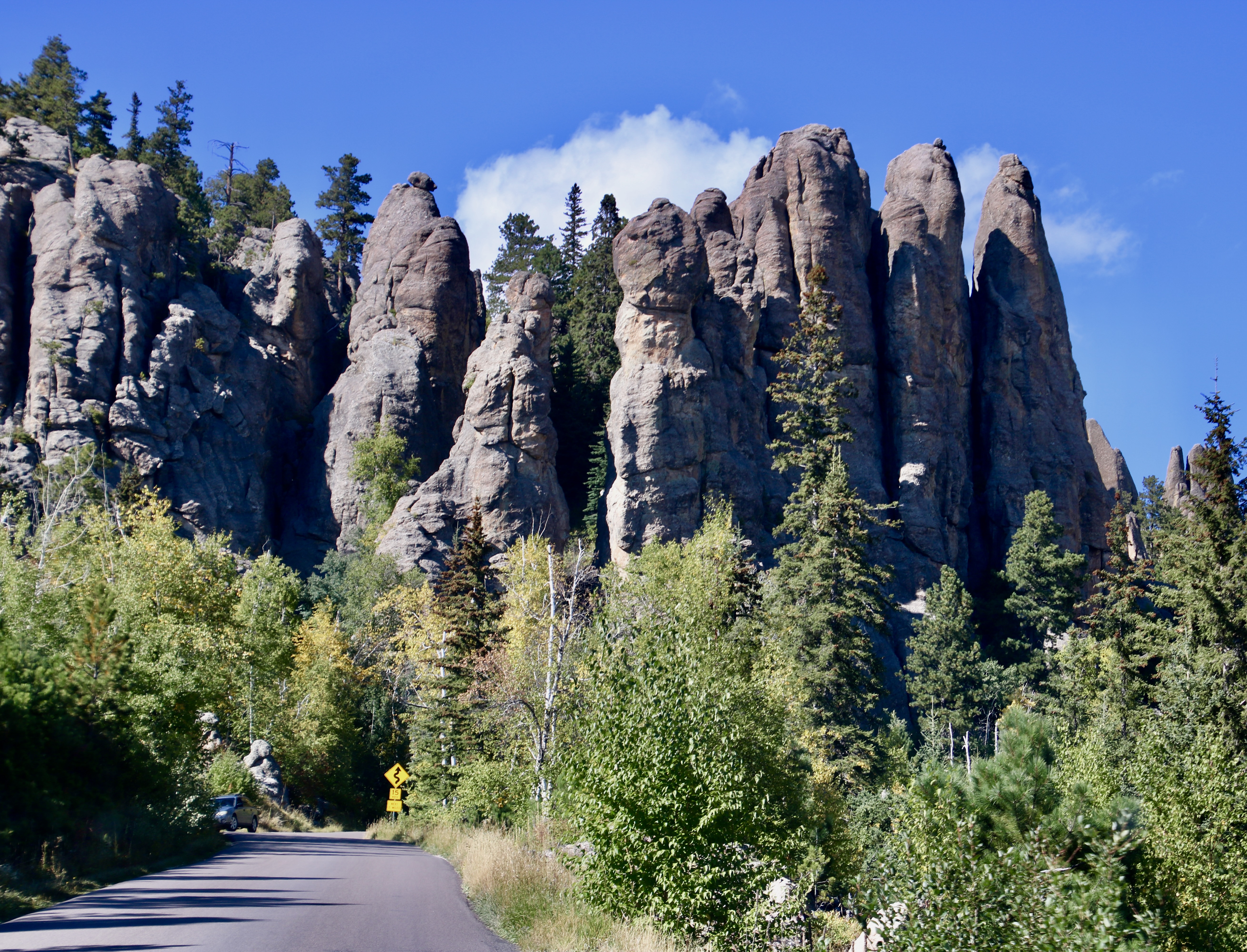
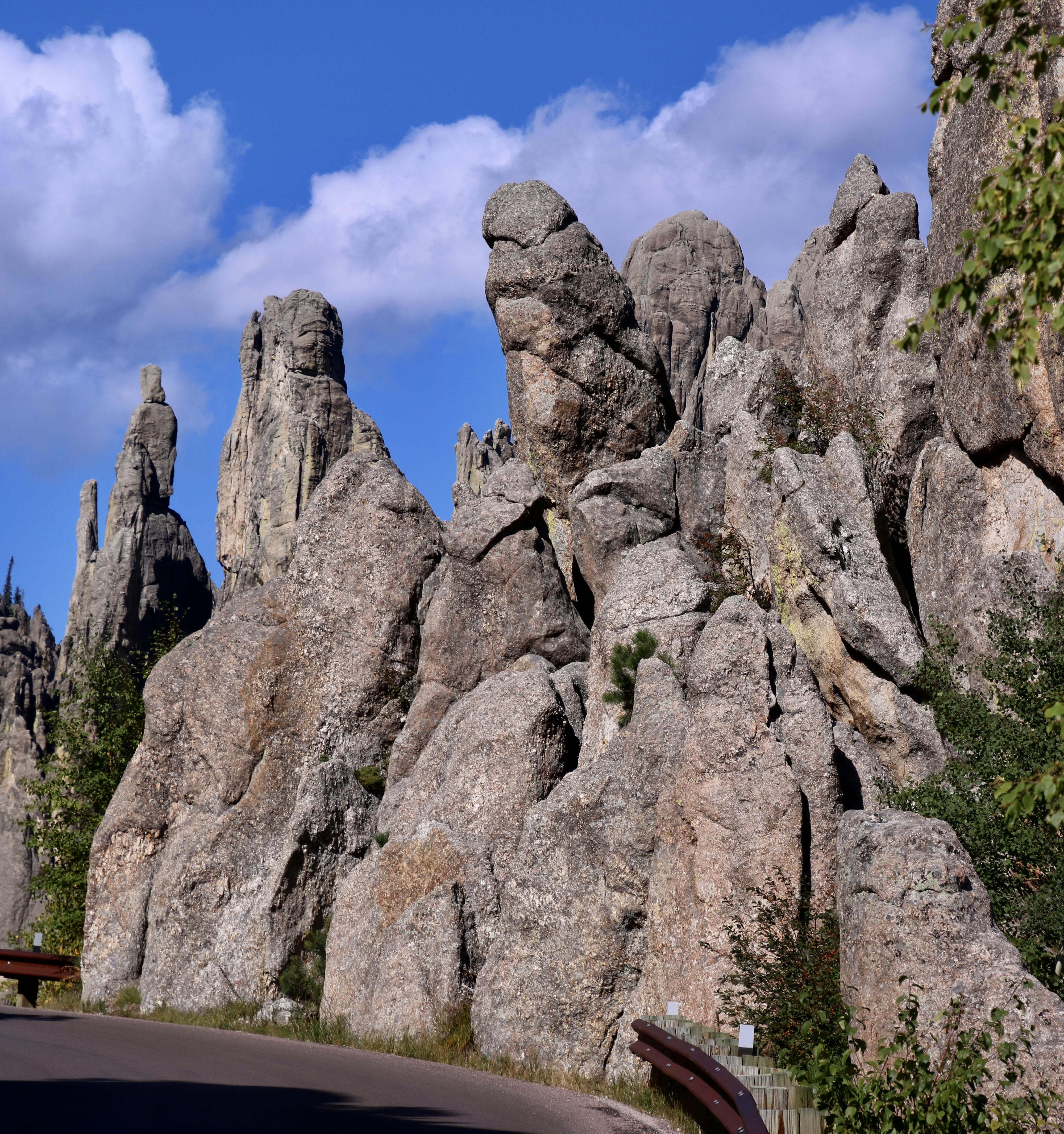
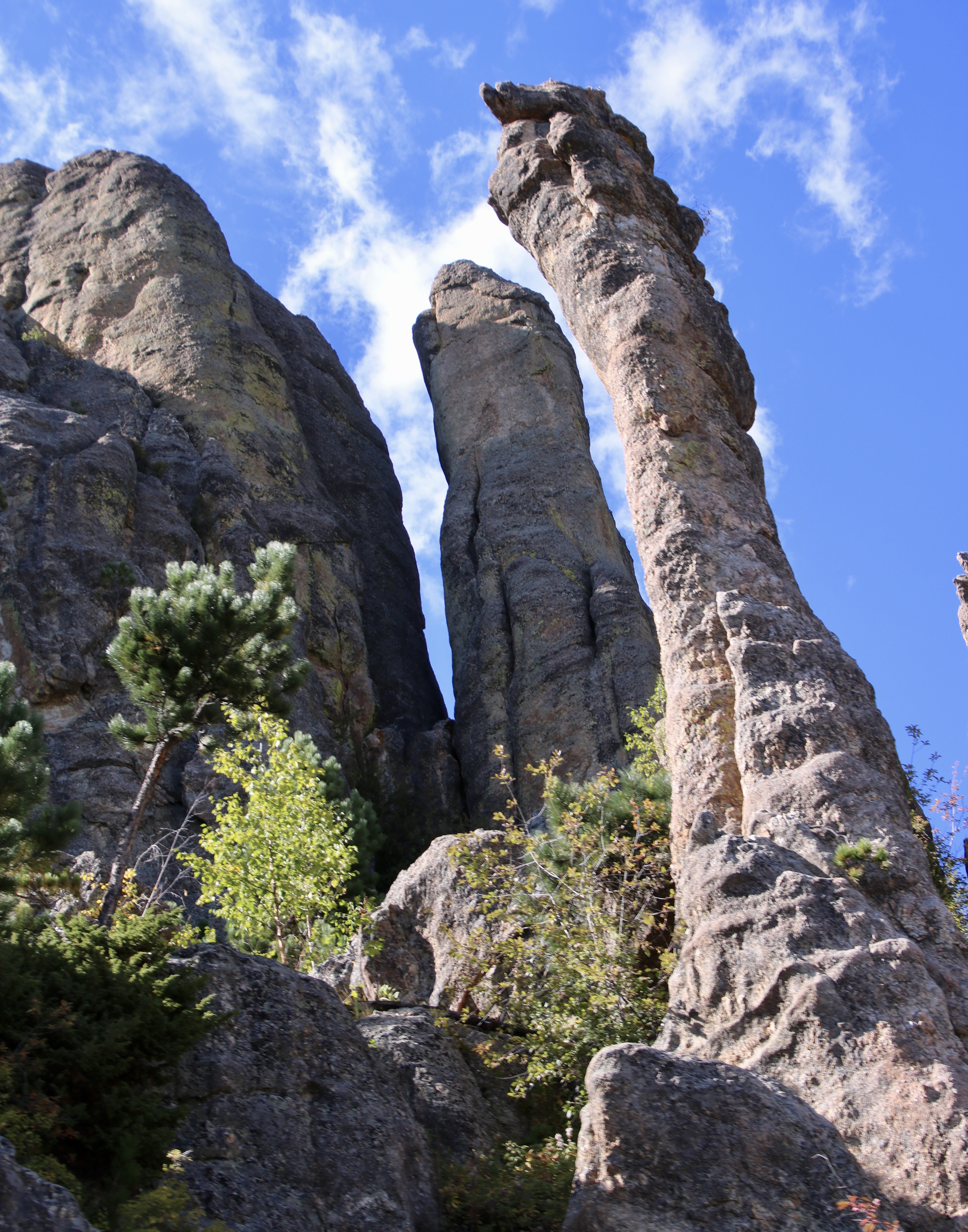
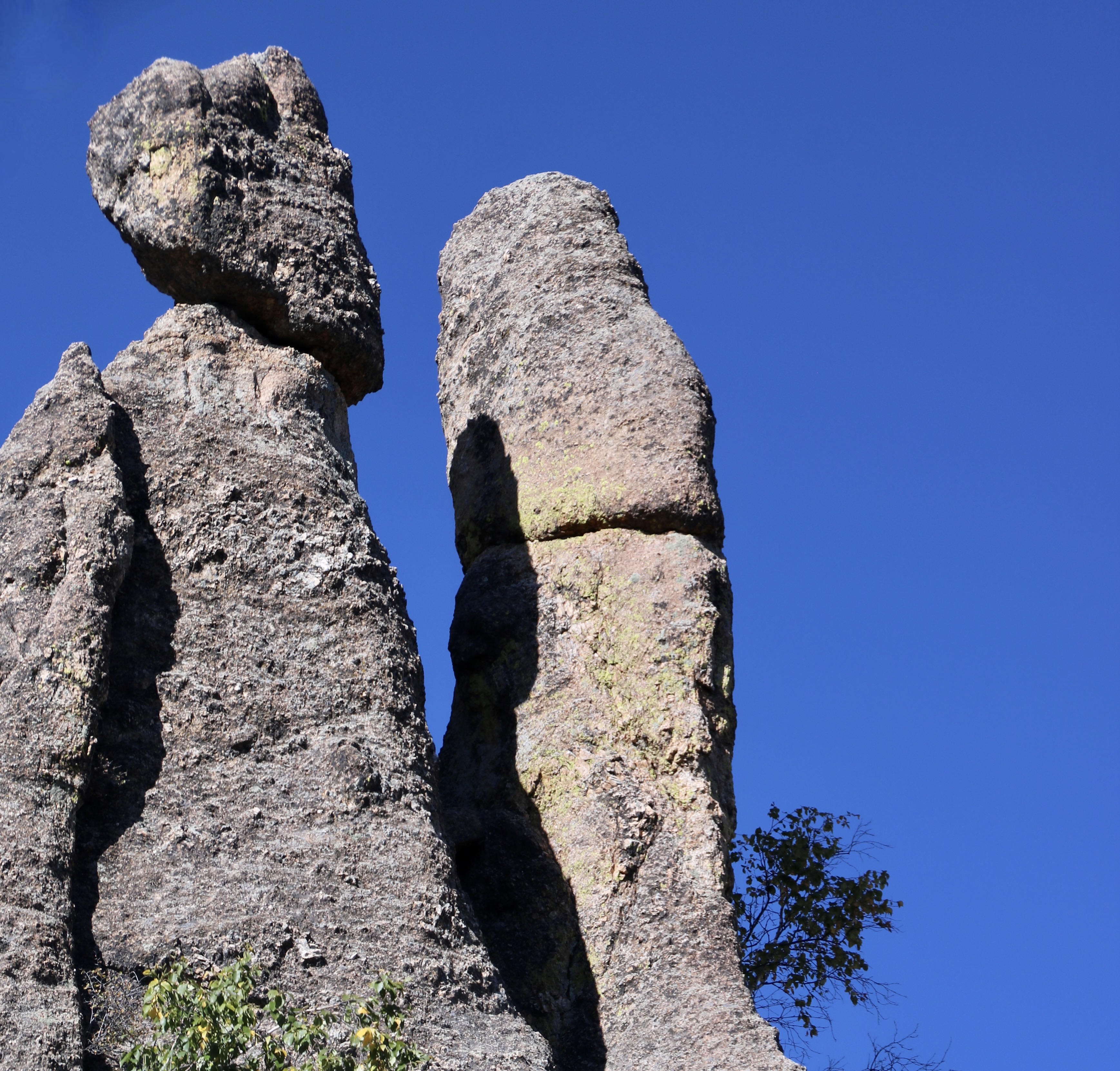
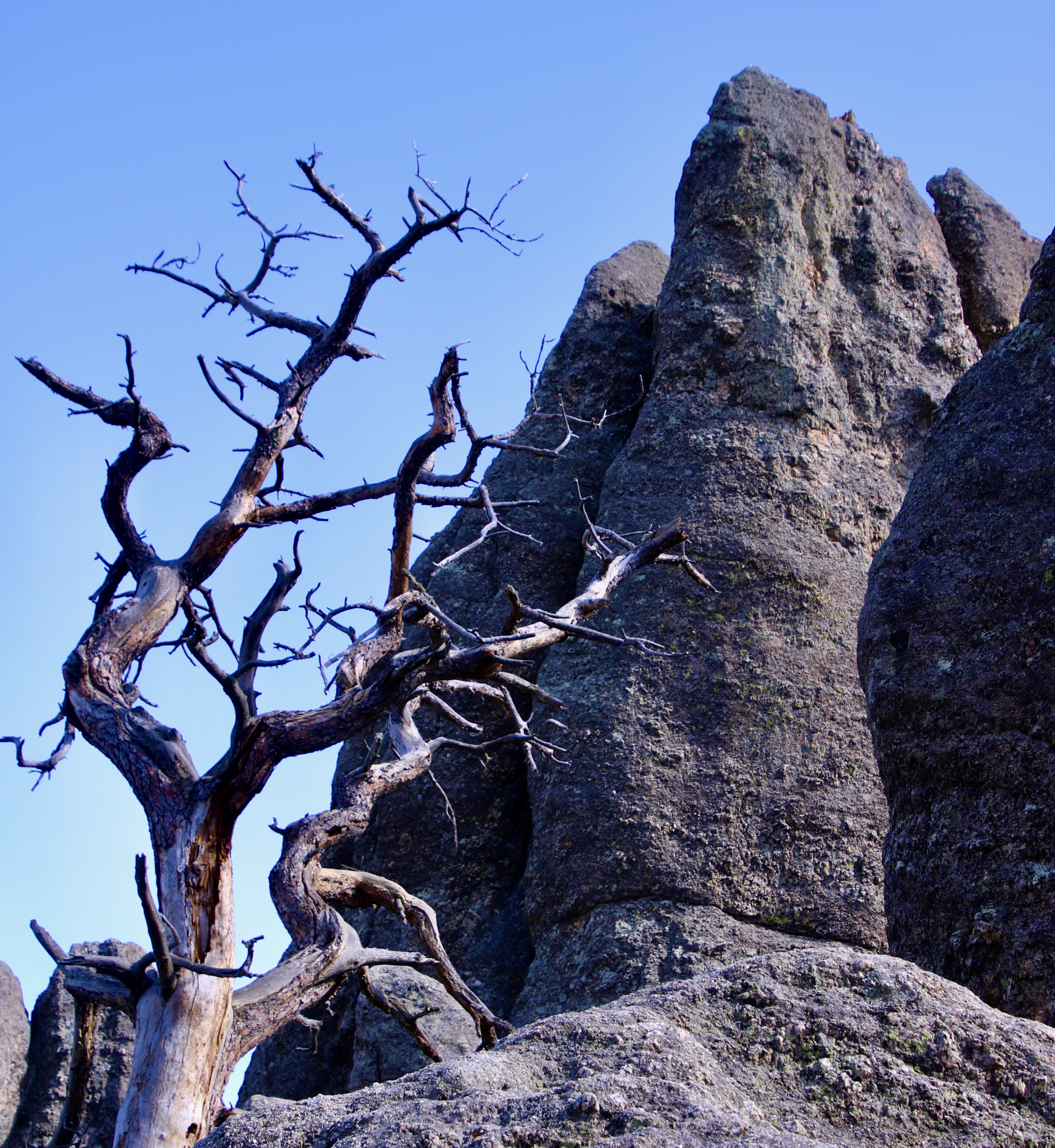
It’s impossible not to feel awe when traveling through the towering Cathedral Spires of South Dakota’s Custer State Park. They so impressed Peter Norbeck, the governor of the state from 1917-21, that he personally scoped out a route on foot and horseback that would feature the best views. Known as the Needles Highway, it’s also famous for its narrow tunnels hewn out from the granite rock. We visited Custer State Park on our RV trip around North America last fall. All photos in the blog are taken by either Peggy or me unless otherwise noted.
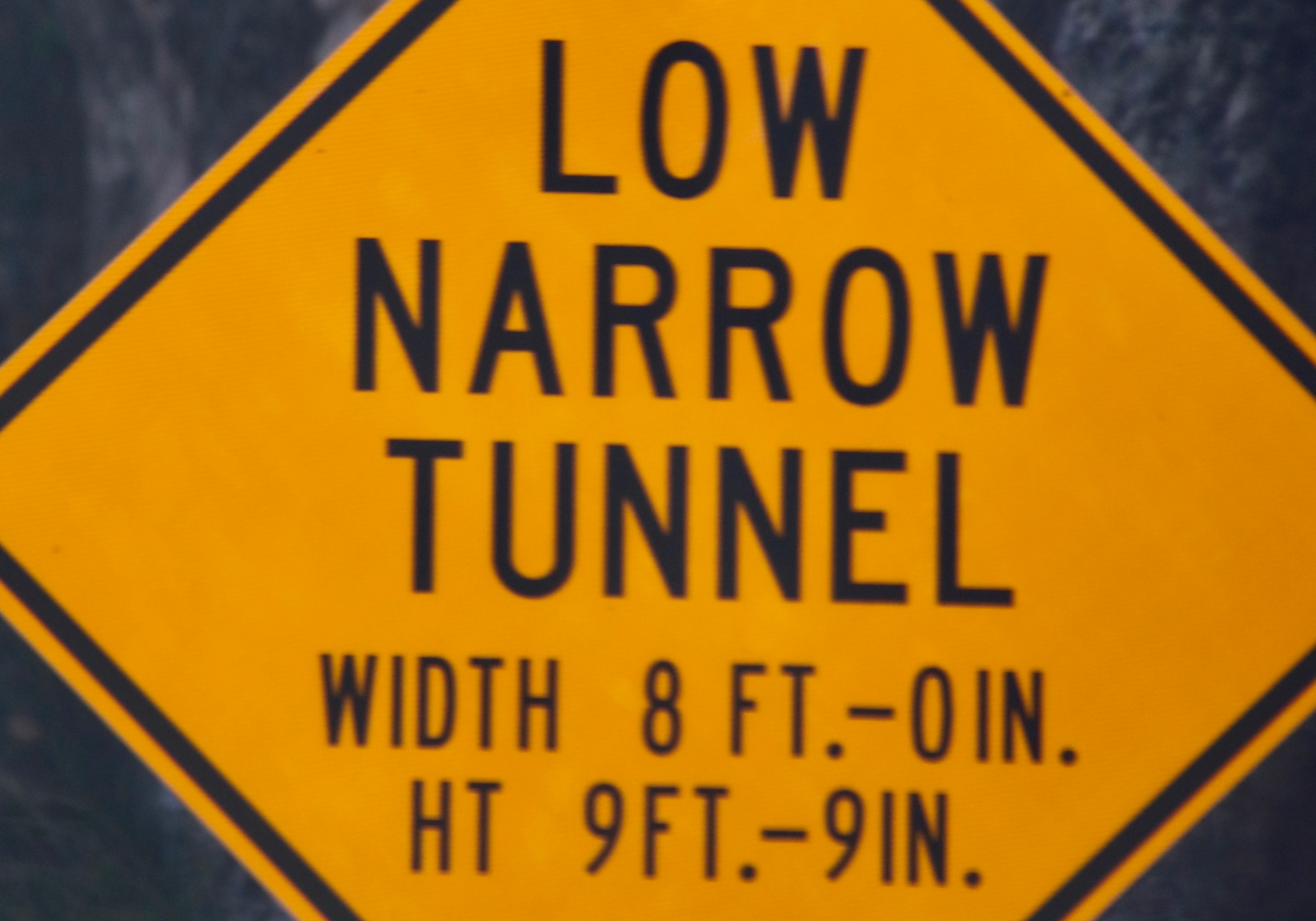
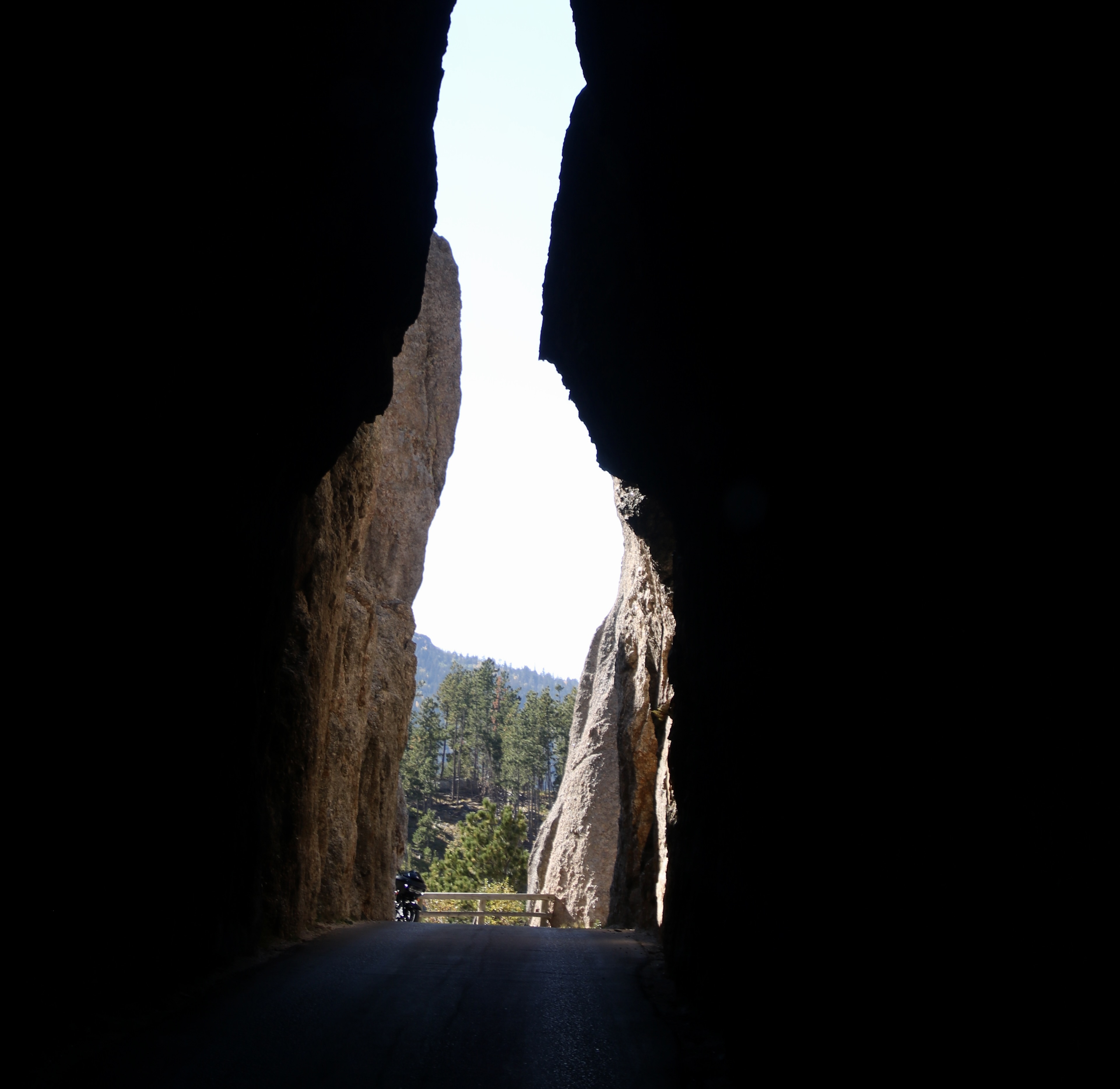
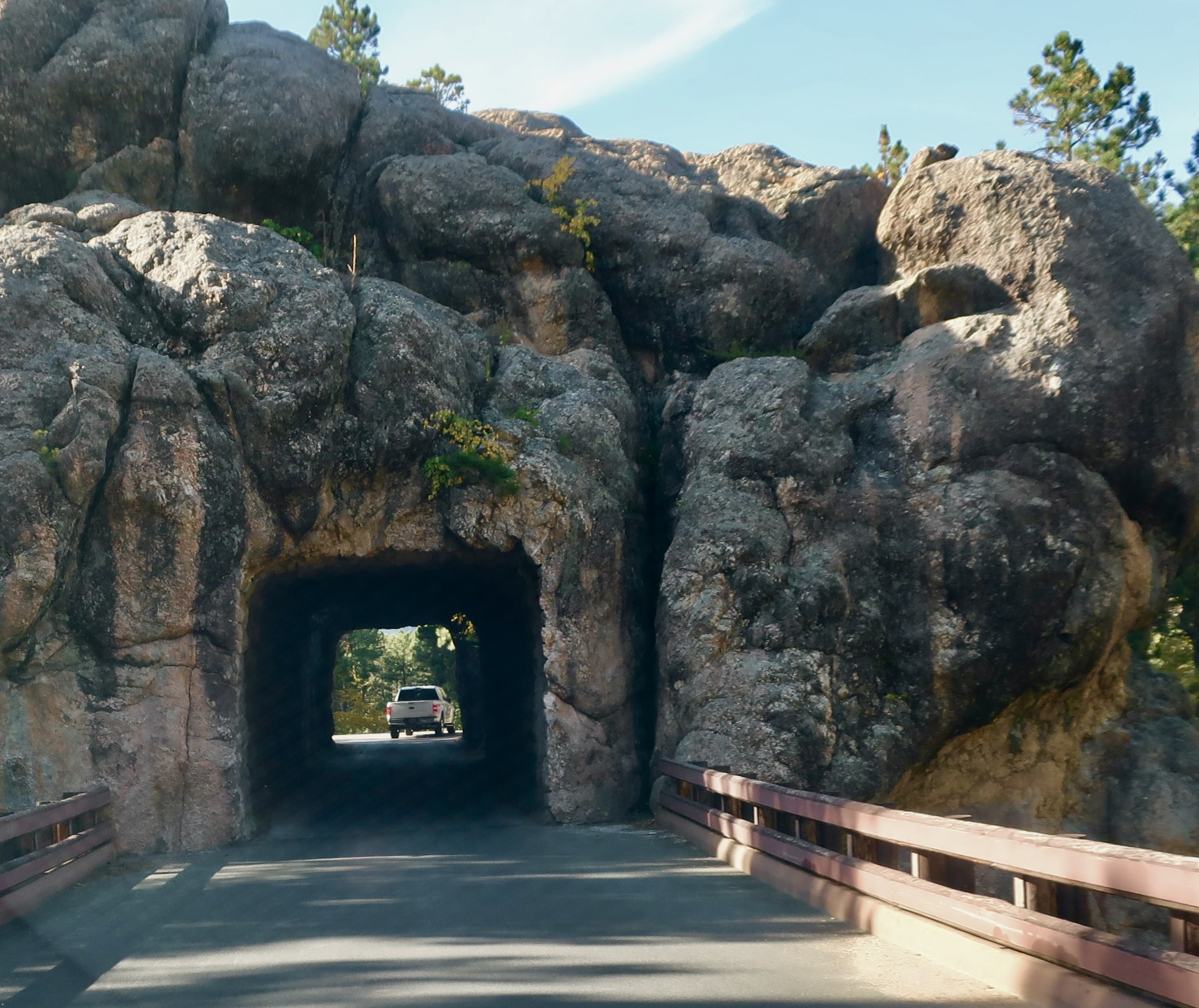
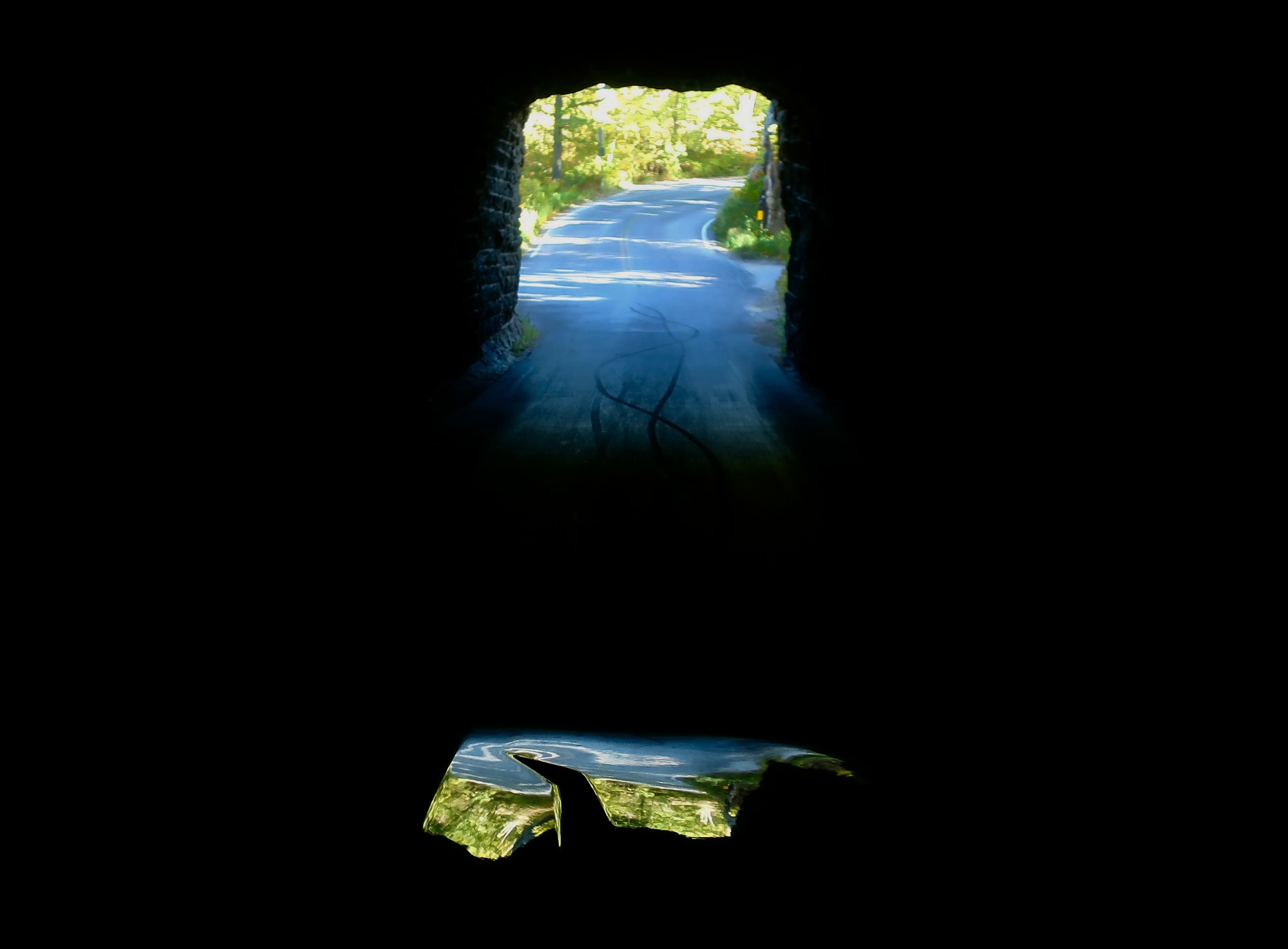
They tower above Custer State Park, silent sentinels made of granite. Once they were chosen as the site for the presidential carvings that dominate the nearby Mt. Rushmore, but the granite lacked the solid mass that was needed. It may have been a gift, given their outstanding beauty. While I like Mt. Rushmore, I prefer these rocks au naturel.Visitors to the Cathedral Spires of Custer State Park wind their way through the granite pillars on a narrow, curvy road that barely accommodates two larger vehicles on sections. The road provides up close and personal views of the granite monuments.Every spire has its own personality.Towering spires like this gave the Needles Highway its name.Rock garden with breaching whale?Rock climbers look for challenging rock faces to scramble up in the Cathedral Spires. Peggy and I just looked for faces.Our active imaginations have no problem finding them… The nose, small mouth below it, eyes above, and baseball cap gave away this fellow. (There’s a chance he had a duck billed platypus on his head instead of a cap.) Part of the fun of the Needles Highway is maneuvering along the narrow, curvy road. The tunnels bordered on scary. This sign announced that one tunnel was 8 feet, zero inches across. Our truck is 8 feet, zero inches across! Fortunately, our mirrors folded in by 7 inches on each side. I had 14 inches to squeeze our large F-150 through. Woohoo! I almost peed my pants. My normally talkative driving advisor was strangely silent. She may have been praying.Beware, all ye who enter here! Once you start, there is no backing out.The ‘light at the end of the tunnel.’ The road snaked off to the left.Even this larger square tunnel seemed skinny.I thought this photo was interesting. I didn’t spot the colorful abstract until I was processing our photos. It’s a reflection off the hood of our truck showing the exit and road of the square tunnel. At least that’s what I assumed it was. Maybe it was a gateway to another world with a monster bird hoping to dine on Curt and Peggy a la carte.I’ll conclude today with two more photos. This one with its gnarly old dead tree…And a closer view of the ‘Cathedral Spires.’
Next Monday, May 15, Peggy and I will be back in Egypt with a trip out to the ancient city of Memphis, near Cairo, where we will visit the colossal statue of Ramses II lying down, and then return to Cairo for a tour of the Museum of Egypt, which was out the back door from our hotel. There will be more of the history of Ancient Egypt, some treasures from the tomb of King Tutankhamen, a cow goddess, and much more. (So much that I may turn it into two posts.)
The Monday after that, May 22, we will take you on a tour of even more colossal monuments than Egypt has, the presidents on Mt. Rushmore in South Dakota. It’s located 10-15 miles north of today’s post on the Needles Highway.
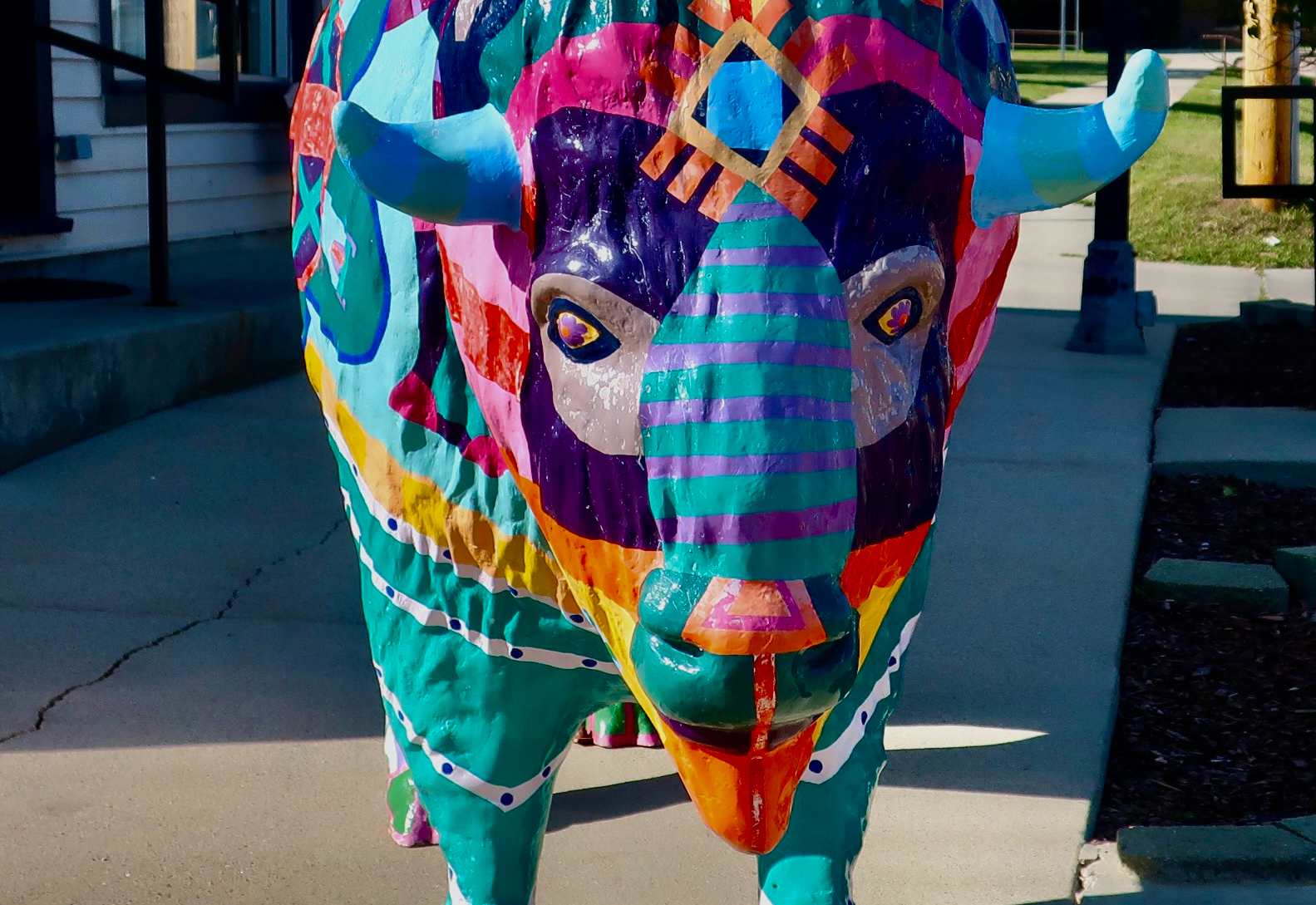
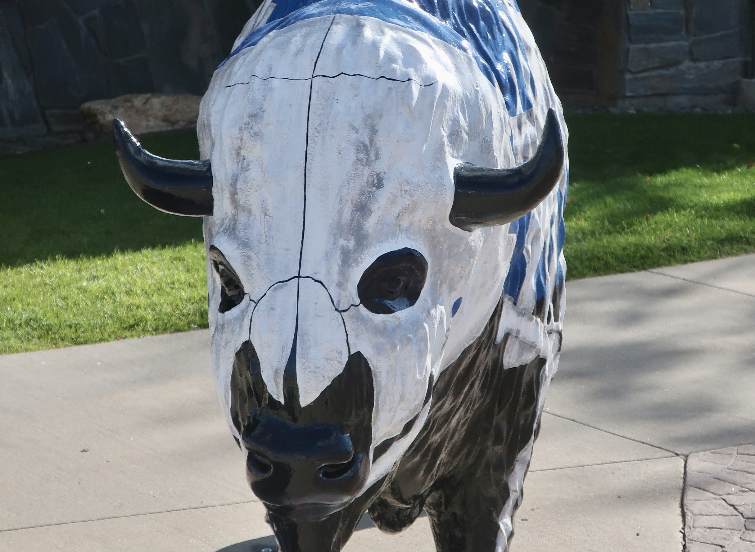
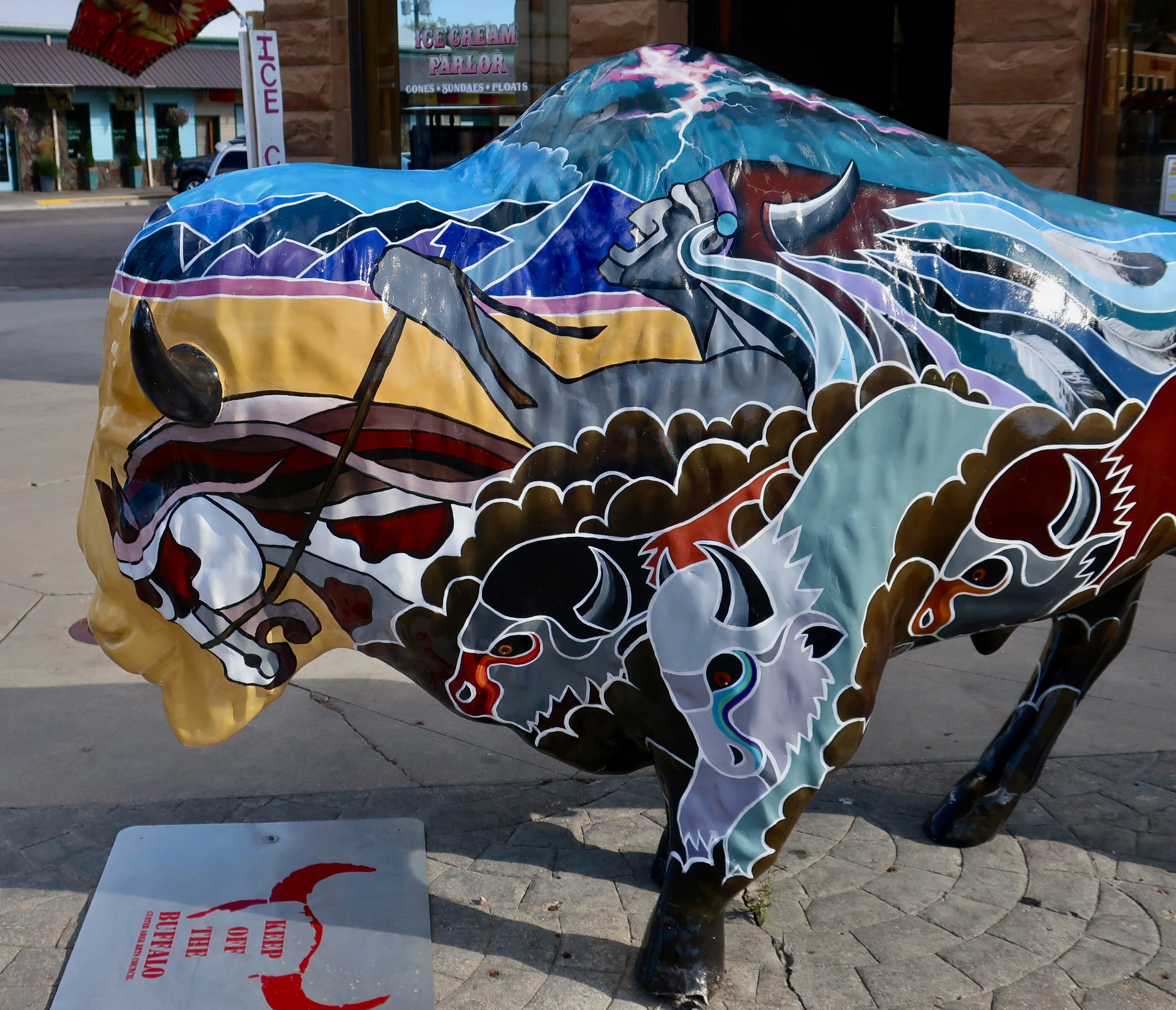
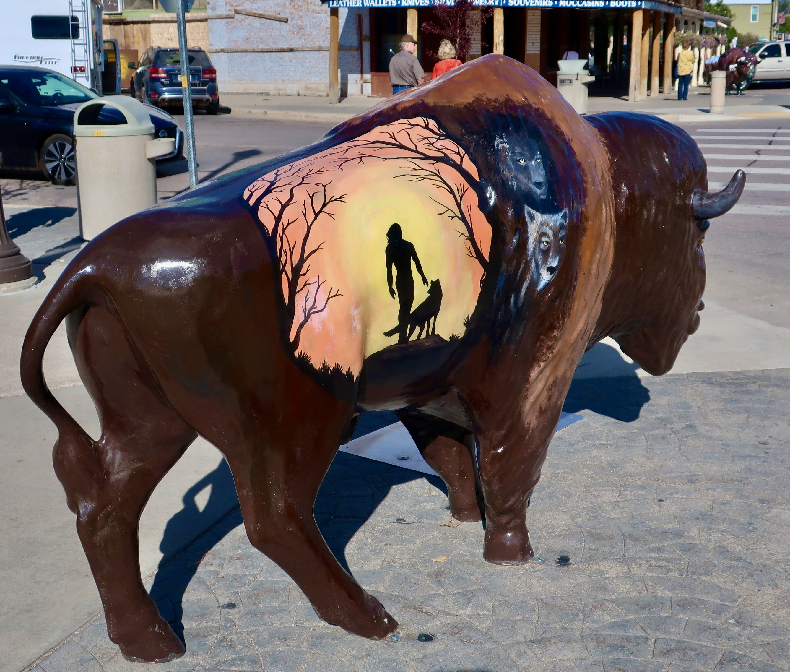
Given that 2,000 buffalo roam on the outskirts of Custer City, South Dakota, it’s not surprising that the town has a buffalo fixation. We found one on every corner!
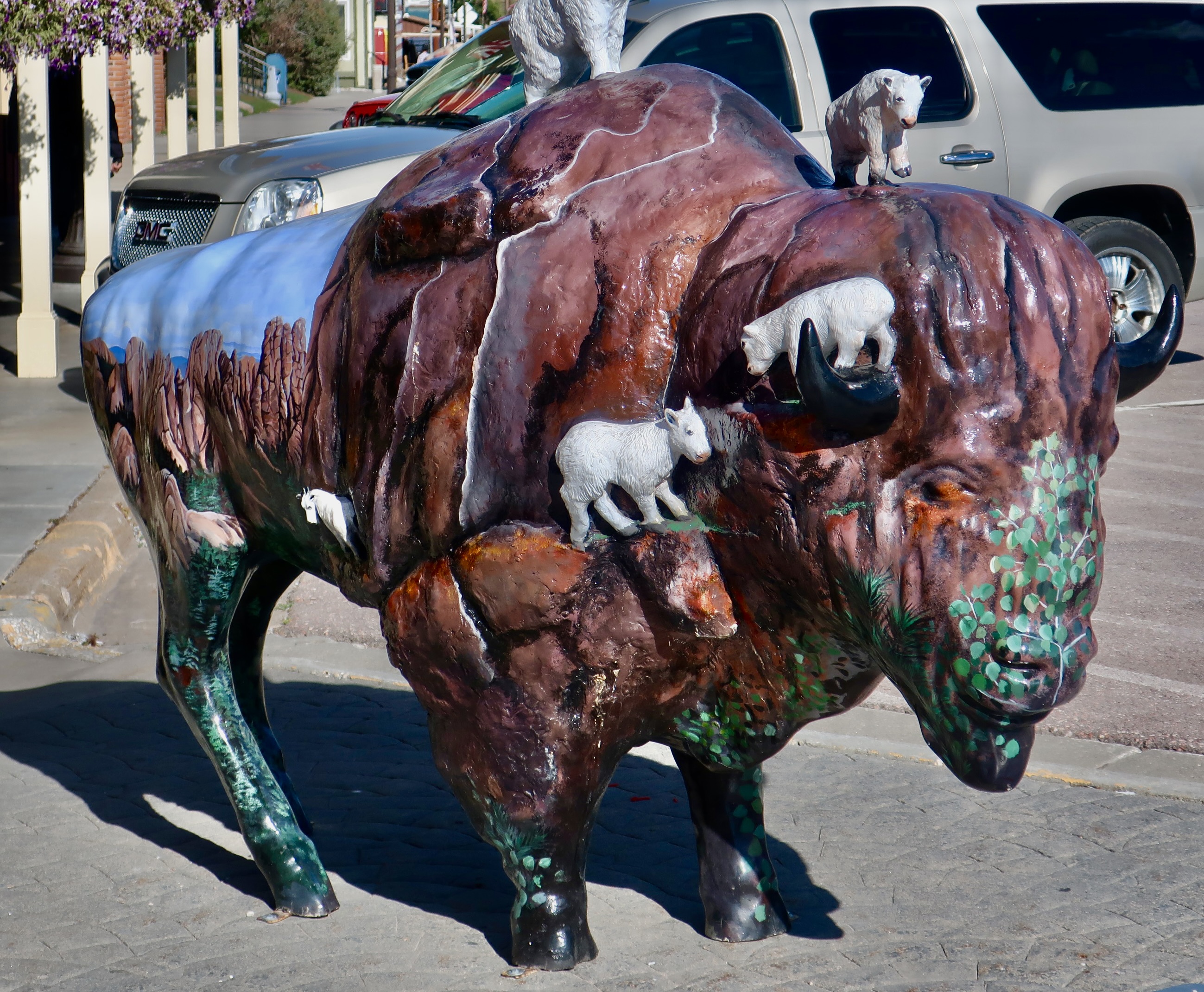
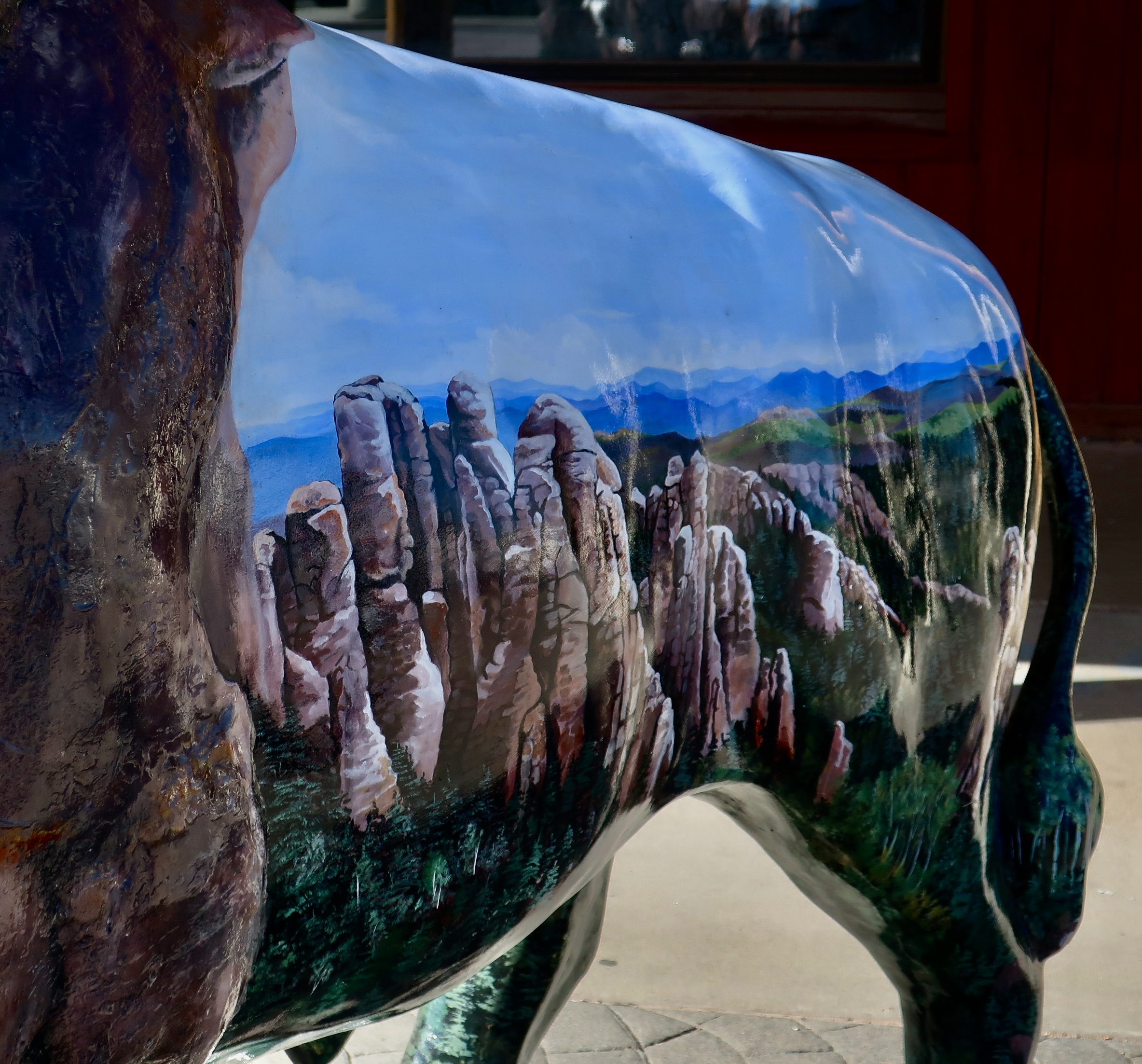
This colorful creature was one of many buffalo sculptures we found in Custer City.
Over the past several years, Peggy and I have been in a number of communities that feature sculptures of animals. Several have been buffalo, but we have also seen bears, cows, horses, elk, and sandhill cranes. I’ve little doubt that other communities feature dogs, cats, pigs and rhinos. Rhinos? Apparently you can find a hundred of them in Cape Town, South Africa. We love the unique, colorful, sculptures. Like murals, they are attractive to locals and visitors alike, and encourage both community pride and tourism.
This ghostly buffalo…Was a lesson in buffalo anatomy, as well as a possible Halloween treat. All of the buffalo featured ‘keep off the buffalo’ signs like the one beneath the buffalo’s chin. I could see tourists climbing on top or plopping their 5-year-old on top for photos. Rare white buffalo were considered sacred by American Indians and played important roles in their legends.One side of the white buffalo sculpture featured horses that were used by the Indians for hunting buffalo.Several buffalo featured local scenery.And buffalos, including a painting of a very colorful buffalo escaping from a forest fire.This large brown fellow featured another large brown buffalo and a buffalo herd. We really liked the way the buffalo’s shoulder provided a three dimensional effect for the painted buffalo.A more abstract painting on another sculpture featured a buffalo, horse, possible medicine man, mountains, desert, and a lightning storm.A dramatic scene that featured a Native American with his dog and two lurking wolves.The artist for this buffalo sculpture in Custer City featured mountain goats, including one romping on top of its head. Note the scene on the back…It’s a scene from along the Needles Highway in Custer State Park, which is named for its dramatic rock formations— a must-see of the park. Mountain goats live there. We will feature the narrow, curvy highway with its gorgeous scenery and tunnels our truck could barely fit through in our next South Dakota post two weeks from now.
Next Monday’s post will feature the Egyptian myth of Osiris and Isis plus the ancient Egyptian city of Memphis near Cairo.
Flying down from Seattle to Sacramento last Monday, Peggy and I were awed by Mt. Shasta and a lenticular cloud that was hanging above it.
On Monday, Peggy and I flew from Seattle, Washington to Sacramento California. It was cloudy through Washington and Northern Oregon, which was hardly a surprise given the weather in the West this year. In mid-Oregon, however, the clouds suddenly parted. We enjoyed great views of the Three Sister volcanoes and the iconic Crater Lake.
As we crossed into California, I told Peggy to hold her breath. Mt. Shasta was coming. We would be flying to the East of it. We didn’t have a clue what the weather would be like. Shasta could be cloud covered, partially covered, or totally clear. What we got was a rare treat, a lenticular cloud was perched on top of the mountain. While Peggy oohed and awed, I grabbed my camera to snap a few photos.
I love Mt. Shasta. It’s one of the most beautiful volcanic mountains in the world. I’ve been driving by it for decades as I made my way from California to Oregon and back. I even climbed the mountain in 1979 with my 75 year old friend, Orvis Agee, who’d been up it so many times that he was known affectionately as ‘The Old Man of the Mountain.’ For my own 75th birthday in 2018, I had spent two weeks of my 750 mile backpack trek down the PCT enjoying spectacular views of the mountain as I made my way south from Mt. Ashland to Burney Falls.
It was my intention to slap up a quick post on our Monday fly-over but we were in Sacramento for a personal and sad reason. Peggy’s sister, Jane Hagedorn, and my friend of 50 years had unexpectedly passed away. We had come in from Virginia to attend a celebration of life memorial and help her children for a couple of weeks as they sort though things and prepare for the memorial. So, I put the post off. I actually forgot it.
Until Saturday. I was reading a blog I follow by Bubba Suess, hikemtshasta.com, and he had photographed the same lenticular cloud and others from the ground. I suggest you jump over to his web site and click on his blog at the top. He had photos from both Sunday and Monday. They are amazing, especially the flying saucer lenticular cloud! They inspired me to put up my photos as well.
Jane drove up to see us several times while Peggy and I were living in Oregon, sometimes with her husband, Jim, and sometimes by herself. She considered our home and property as a retreat. Along the way, she would pass by Mt. Shasta. She shared our awe of the mountain’s beauty. She was a faithful follower of my blog and I know she would love this post on Shasta. This one’s for her.
A distant view.Closer… The squares are mainly cattle ranches.And a final view.
My post on the buffalo sculptures of Custer City, South Dakota that I was going to run today will be posted next Monday. My post on the history and mythology of Egypt will be on the following Monday.
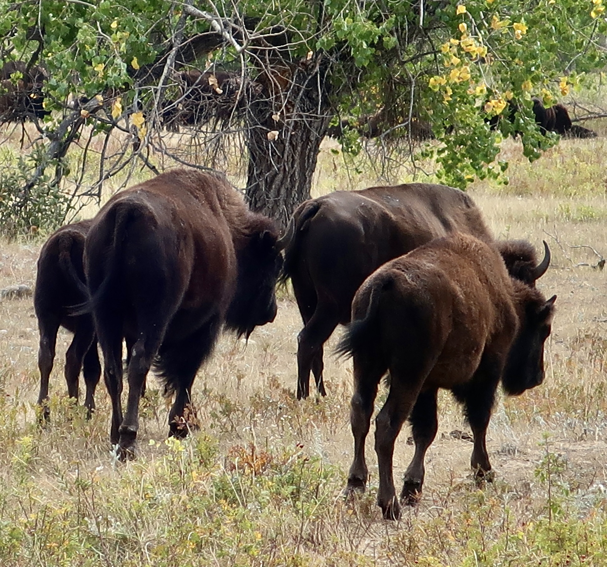
We got to spend a lot of ‘up-close’ time with buffalo and donkeys at Custer State Park in Western South Dakota. We didn’t have a choice. They blocked the road.
I’m sure you have noticed. Peggy and I have been alternating our Monday posts between our US travel and overseas travel. The US posts tend to focus on nature while our overseas posts usually focus on culture and history. These are only guidelines, however, as Captain Jack Sparrow might note, not hard and fast rules. Today’s post is on the buffalo and donkeys of Custer State Park in western South Dakota. Next Monday we will visit the Black Forest of Germany. All photos in today’s post are taken by either Peggy or me.
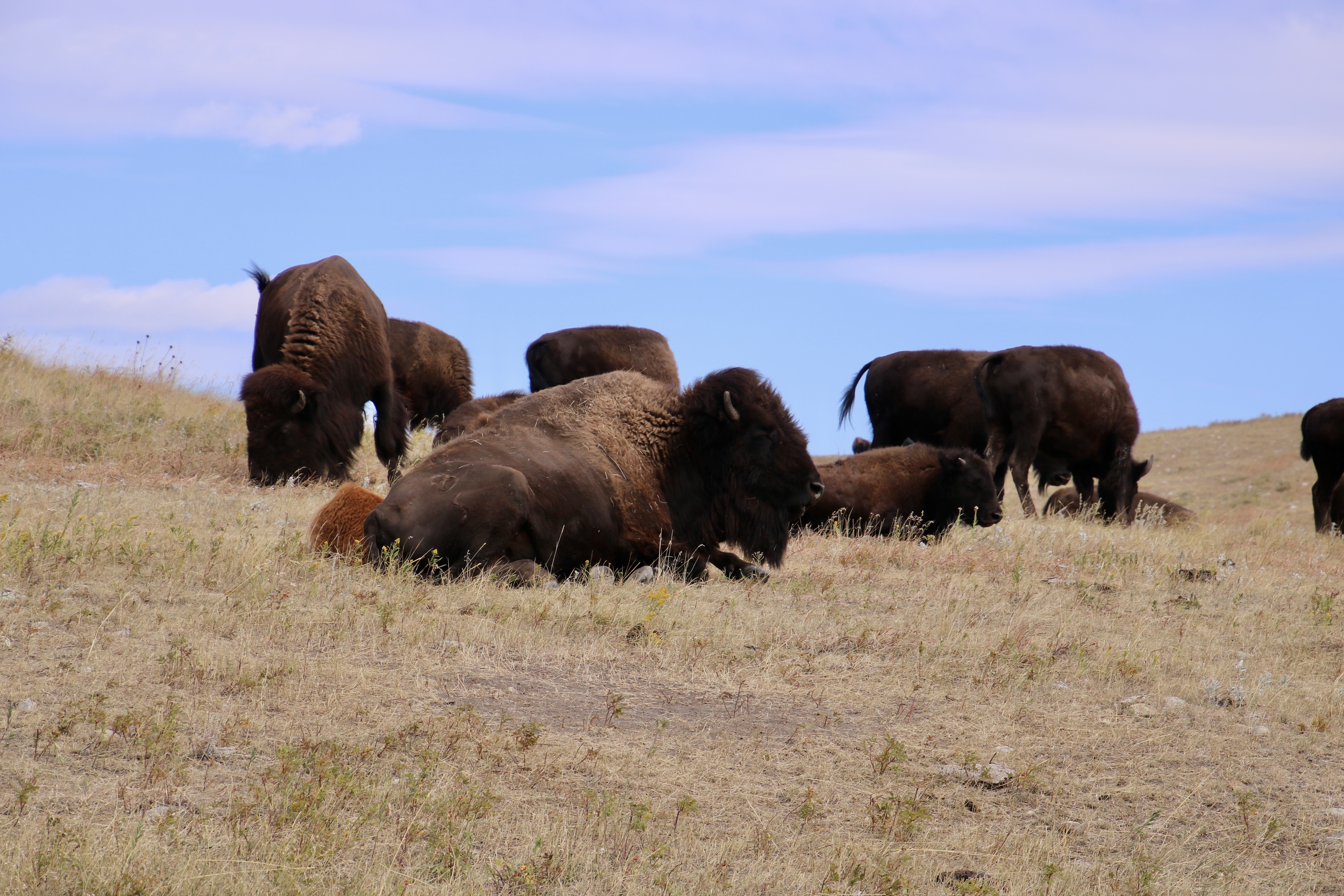
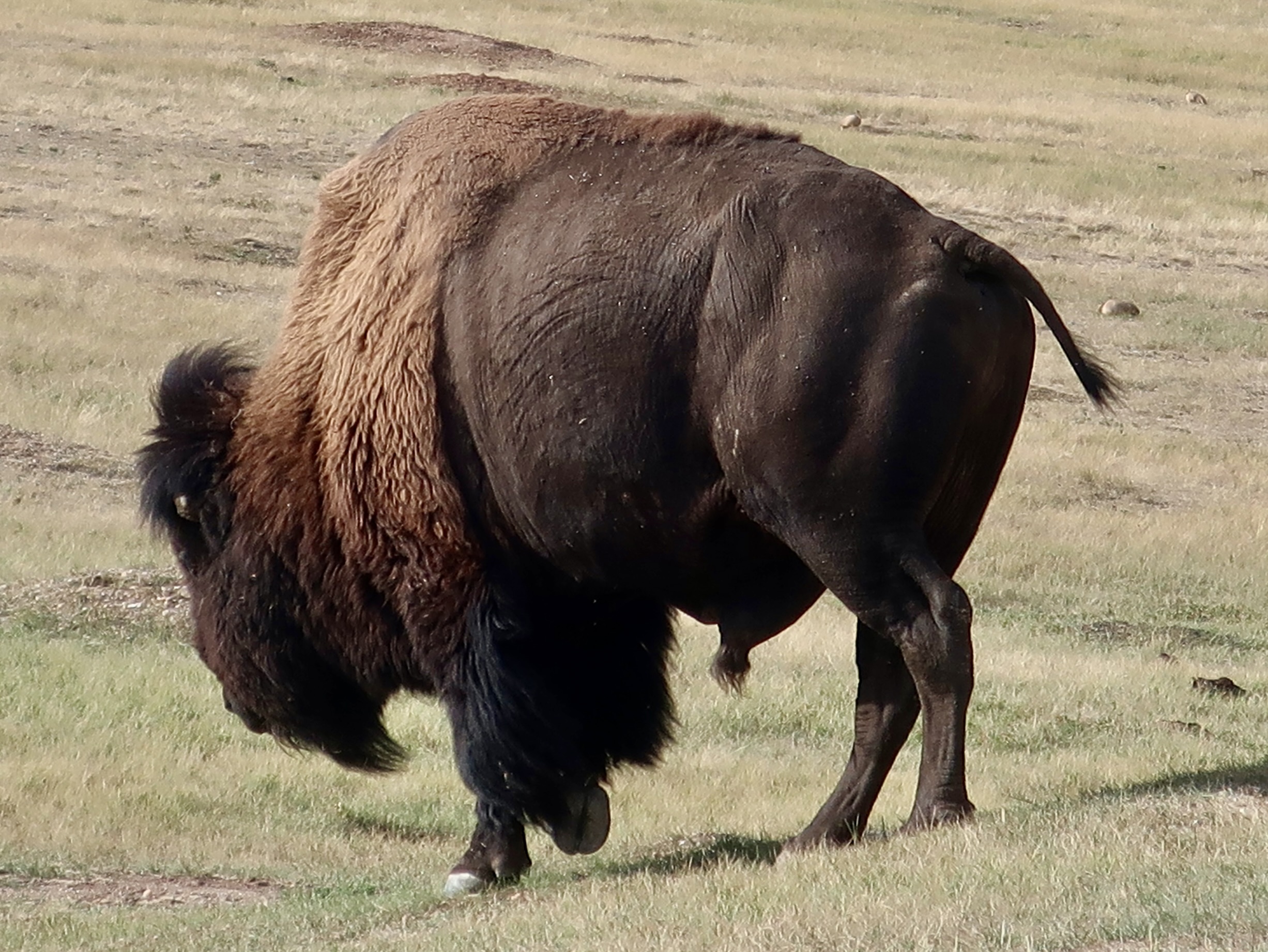
These buffalo, lazing about on a hill in Custer State Park, actually aren’t buffalo. They are bison, or Bison, bison, bison, according to their taxonomic classification. If you want to find true buffalo outside of zoos, you will need to go to Africa or Asia. Actually, these guys could care less what you call them. I’ll stick with buffalo, which is what the first European, a French trapper, thought they were when he came across them in the 1600s.
Western South Dakota is truly worth visiting. Peggy and I checked out Badlands National Park, Custer State Park, Wind Cave National Park, Mt. Rushmore, the Crazy Horse Memorial, and the Black Hills Institute of Geologic Research with its great collection of dinosaur bones on our trip through there last fall. We also slipped a few miles across the border into Wyoming to visit Devil’s Tower. We’ve already done posts on the Badlands and Devil’s Tower. Including today, we have six more posts on the area, which reflects how interesting we found it.
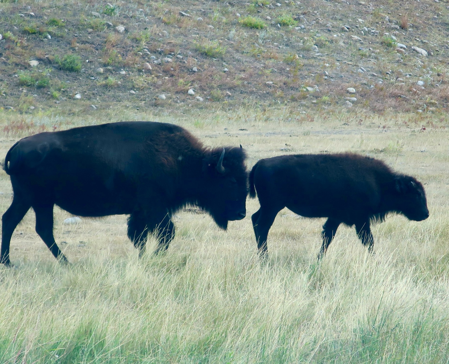
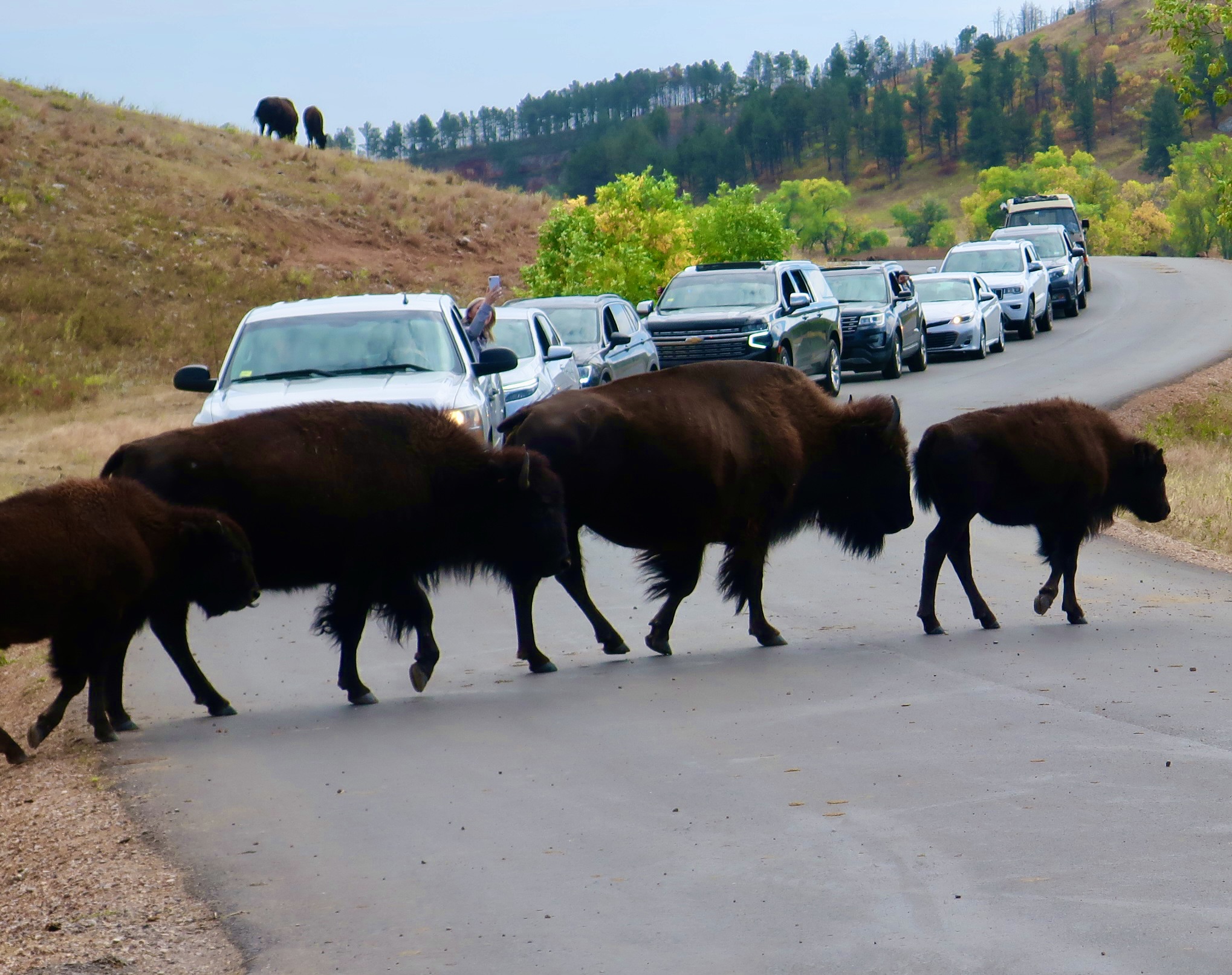
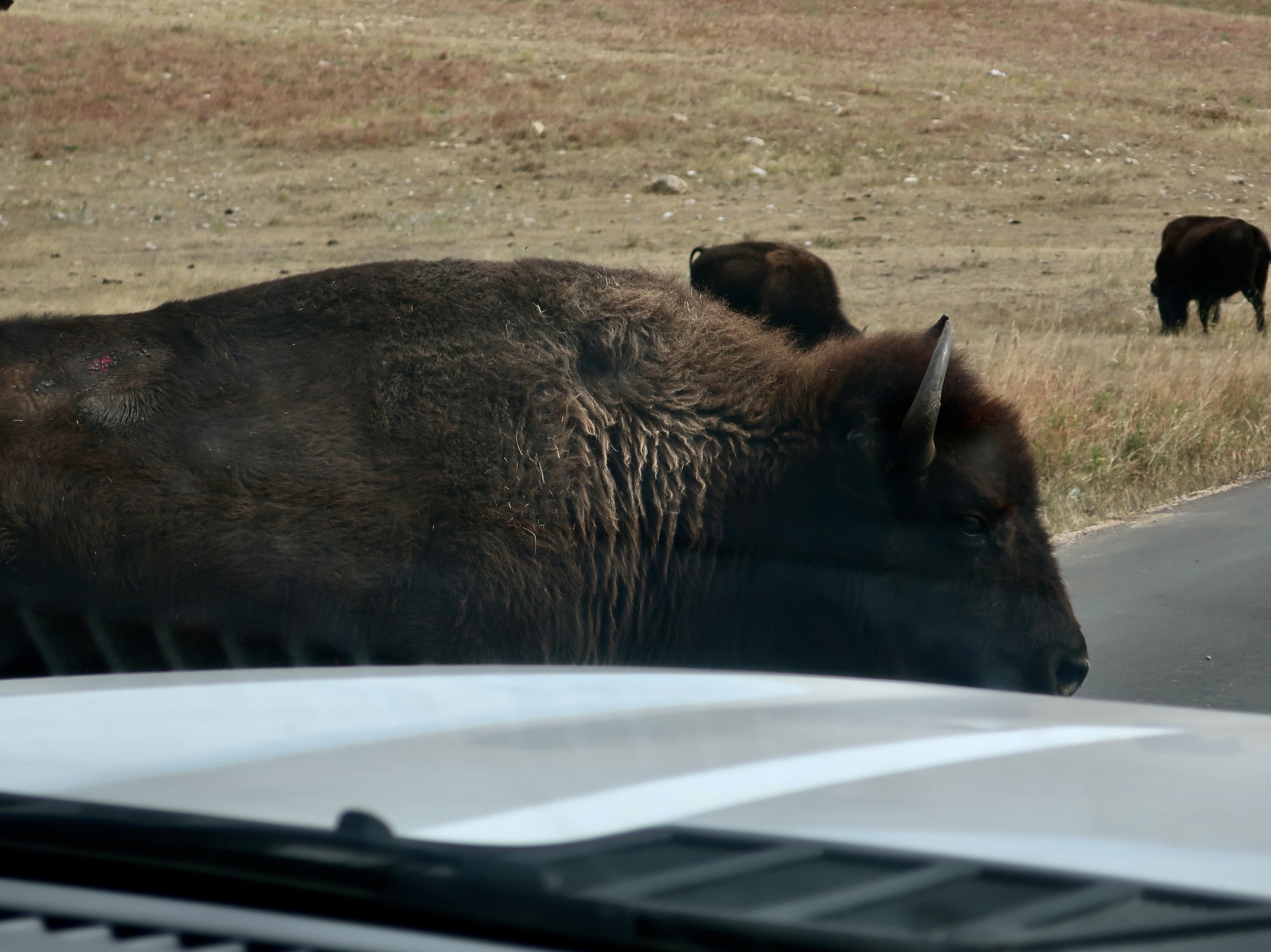
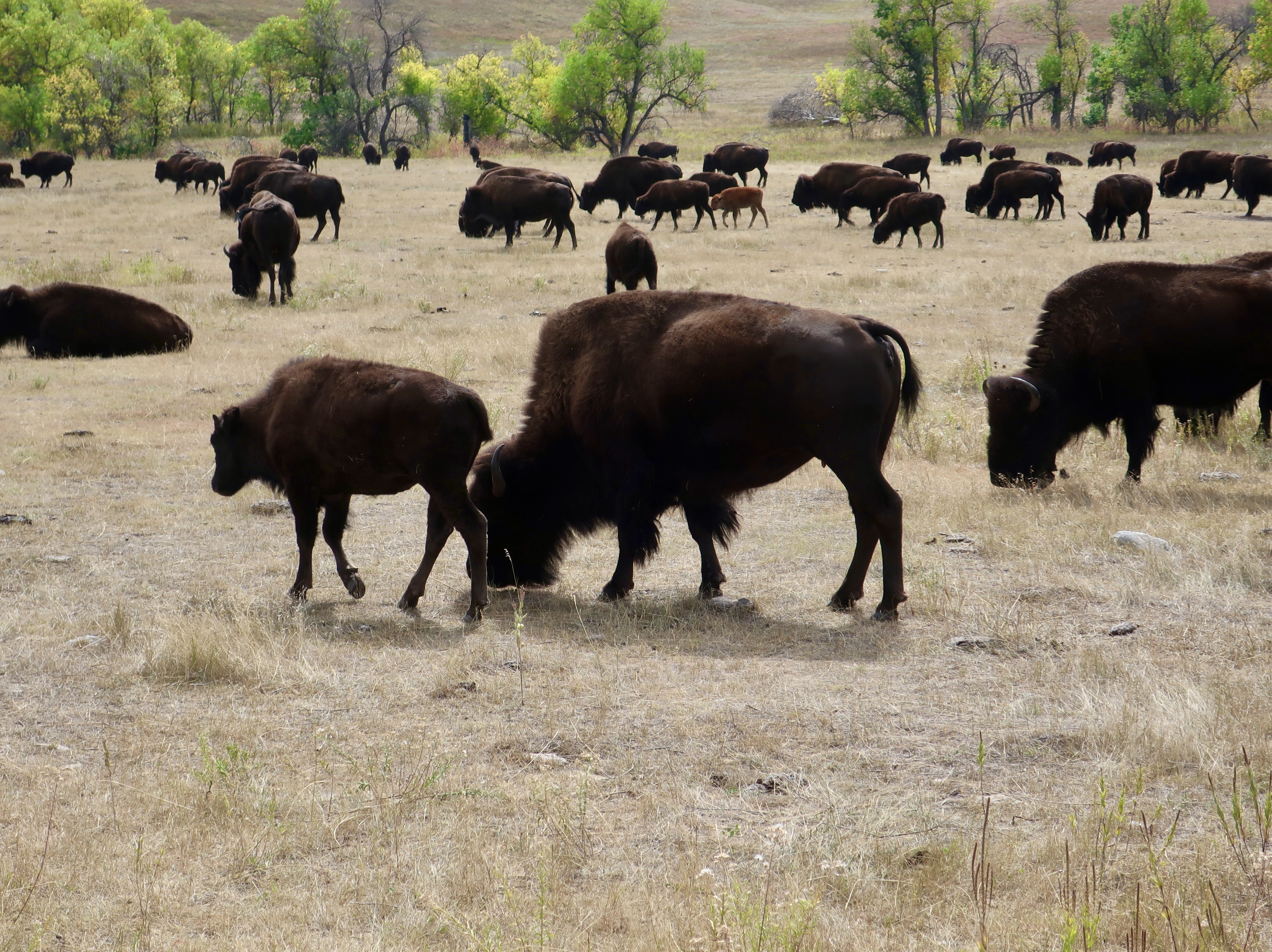
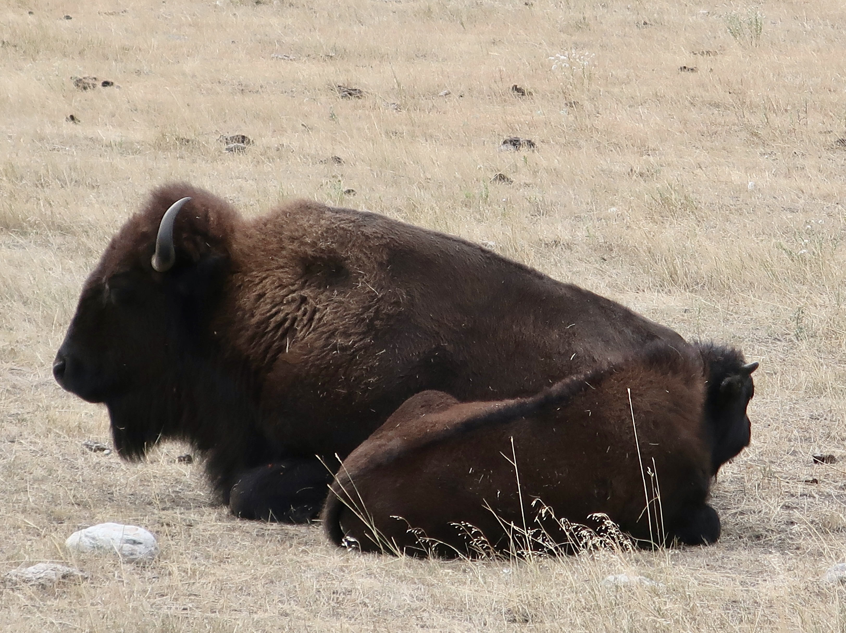
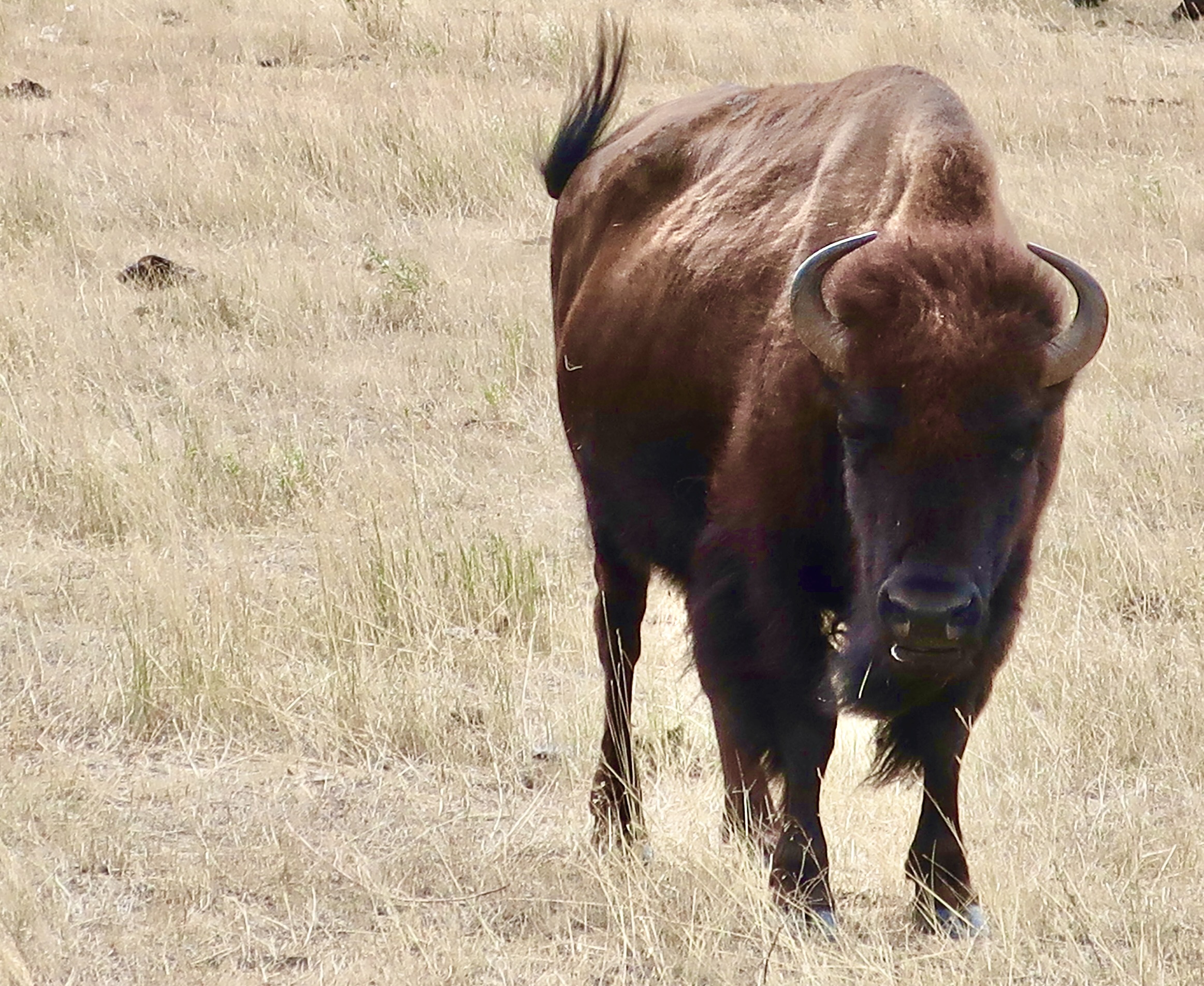
Buffalo on the move. Here we have a mom and calf.They were moving across the road, and blocking traffic, much to the delight of visitors.It was a family affair…Our large F-150 Ford pickup didn’t look so big when one crossed inches in front of us.And why did the buffalo cross the road? To get to the other side, of course. Grin.And join their herd. There were a bunch. But imagine these numbers being in the millions, which is what you might have seen in the early 1800s. By 1900 their numbers had dropped to around 500 and they were close to extinction, wiped out by settlers and hunters from the East for their hides and for fun, and because of a US army policy that wanted them eliminated to destroy the primary food source of American Indians, in one of the darker moments in American history. Massive land grabs followed that led to the elimination of the buffalo’s traditional grazing patterns, which was an equal if not greater factor in their brush with extinction. Fortunately, a few ranchers became deeply concerned about their extinction in the early 1900s and did what they could to save the buffalo. It’s an effort that continues today with a number of interested parties participating— ranging from the government, to Native Americans, to environmentalists, to ranchers, etc. The buffalo now number in the thousands and are no longer seen as an endangered species. The tourist potential of the buffalo has certainly been recognized and exploited. It comes with a caveat, however: Keep your distance. While buffalo aren’t particularly aggressive around people, they are wild animals. If you get too close and a buffalo feels threatened, it may charge. Every year or so, tourists ignore the rule and end up getting gored or otherwise injured. This guy’s stance and swishing tail suggest that you shouldn’t mess with him. In other words…I’ll conclude with this magnificent bull buffalo we found in Wind Cave National Park, which actually abuts Custer State Park on the south. A bull can weigh up to 2800 pounds and run 35 miles an hour. Irritating him is a definite no-no.
Would you like to have your own buffalo? How big is your backyard? I’m serious. The annual buffalo roundup was taking place at Custer State Park while we were there. The maximum number of buffalo the park can hold is limited to around 1500 given how much land the animals need for grazing. All of them, except the large bulls, are rounded up and herded into corrals where they are sorted according to sex, size, age, health, etc. Enough are then sold off to keep the herd healthy. You can buy one. Bring your truck. The whole roundup is a big deal. Cowboys from all over the West (and probably beyond) volunteer to help. But first, they have to apply and prove they have the necessary skills. There’s a long waiting list. We were going to go until I learned that some 20,000 people would be there. We’d have to show up three hours early and could be expected to be stuck in traffic for at least an hour afterward. We watched the video instead.
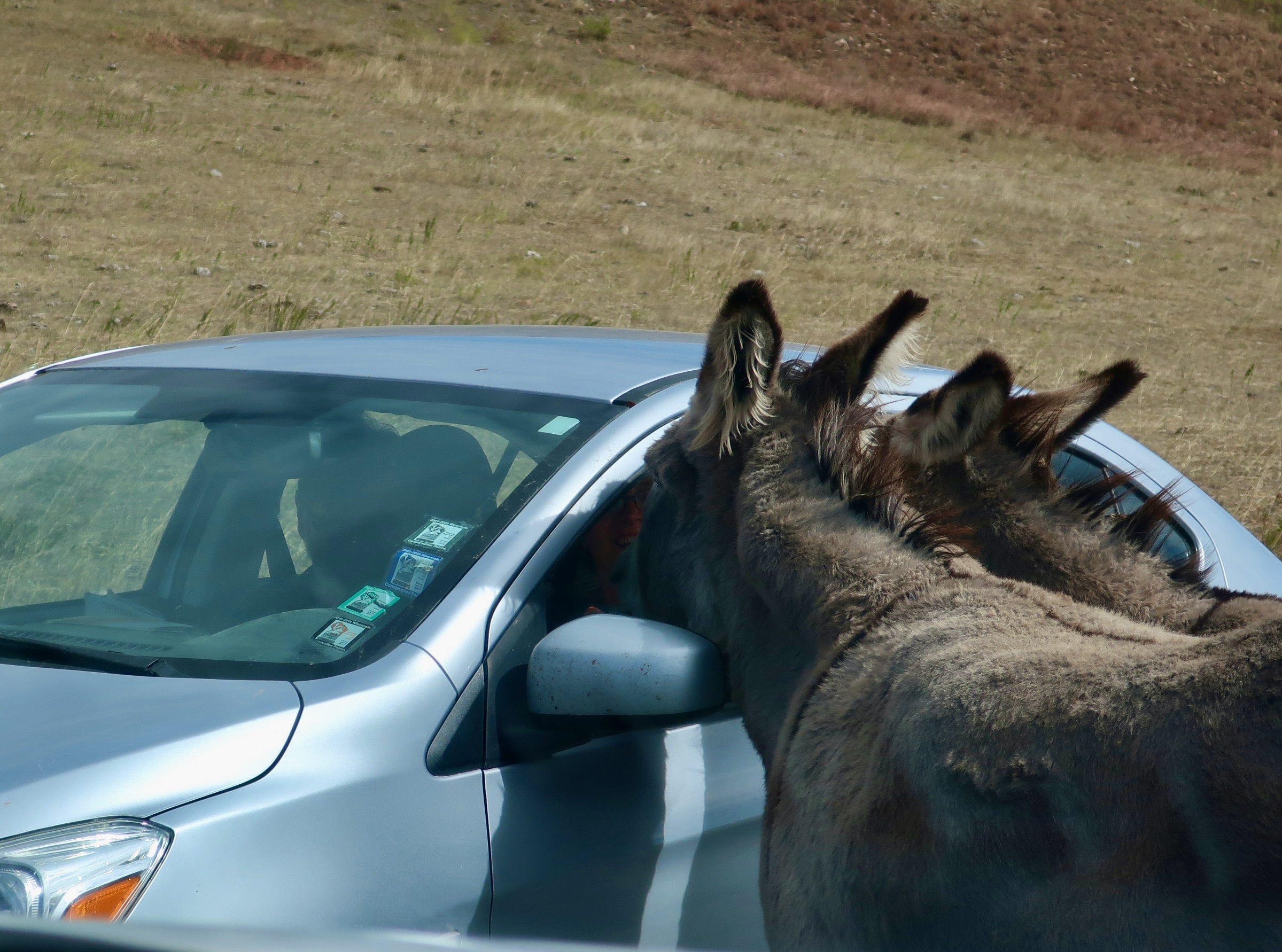
This brings us to the donkeys. I like them. Next to dogs and cats, they are my favorite domesticated animal. We even have one. He travels with us…
Eeyore, looking out the window in awe of the wild donkeys.
The past 12 months of our travel could have been called the Year of the Donkey. They were everywhere it seemed— certainly in the remote lands of the West where they roam wild. Theirs ancestors served as pack animals for hopeful gold miners. We also saw lots of them in Egypt where they have worked for thousands of years pulling carts, serving as pack animals, and even providing transportation. They still do. We even discovered one in Germany’s Black Forest, as you will see in next Monday’s post.
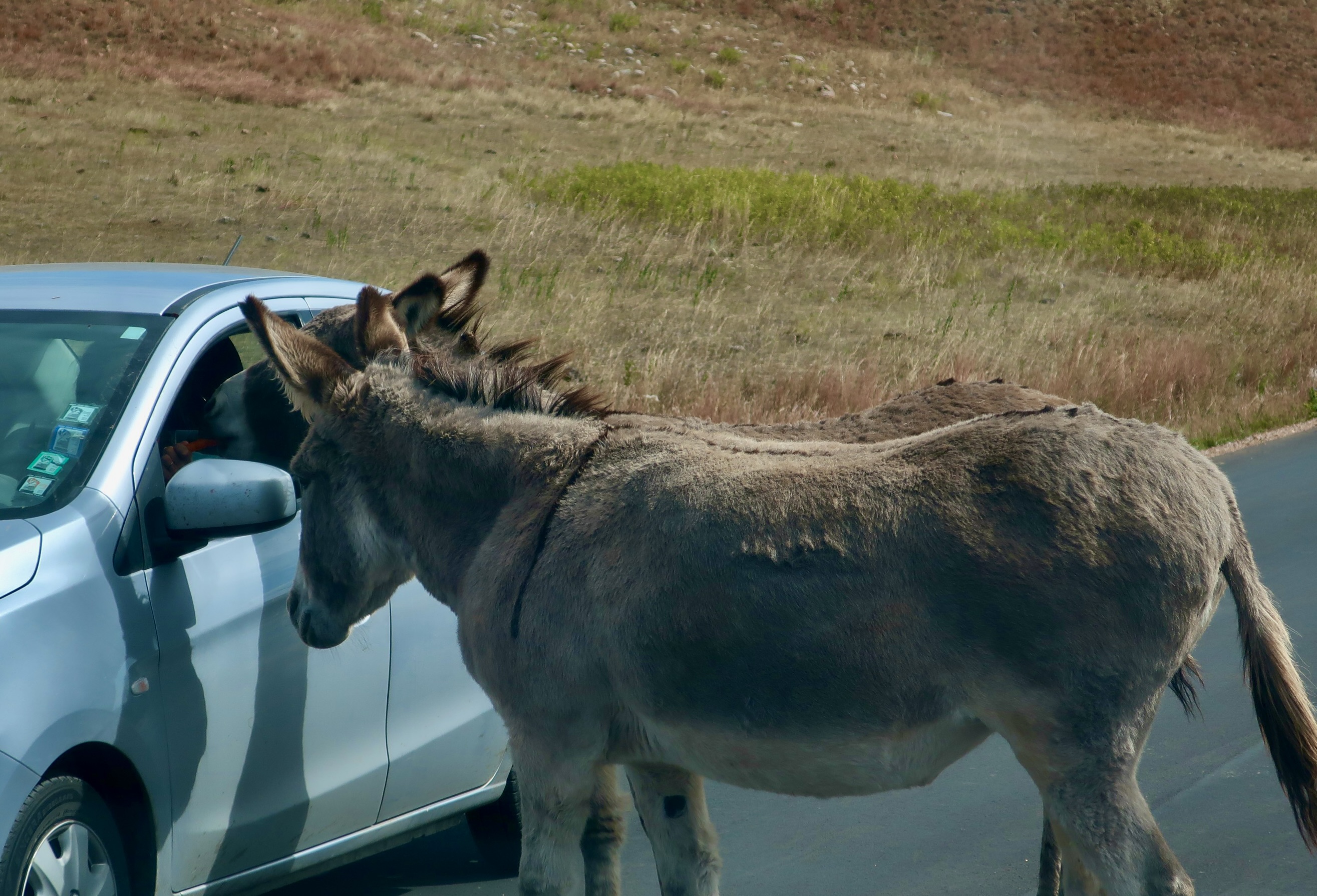
They were waiting for us in Custer State Park, They knew where the tourists would be stopping to let the buffalo pass. But unlike the buffalo, whose intention, I noted, was to get across the road, they held drivers hostage.
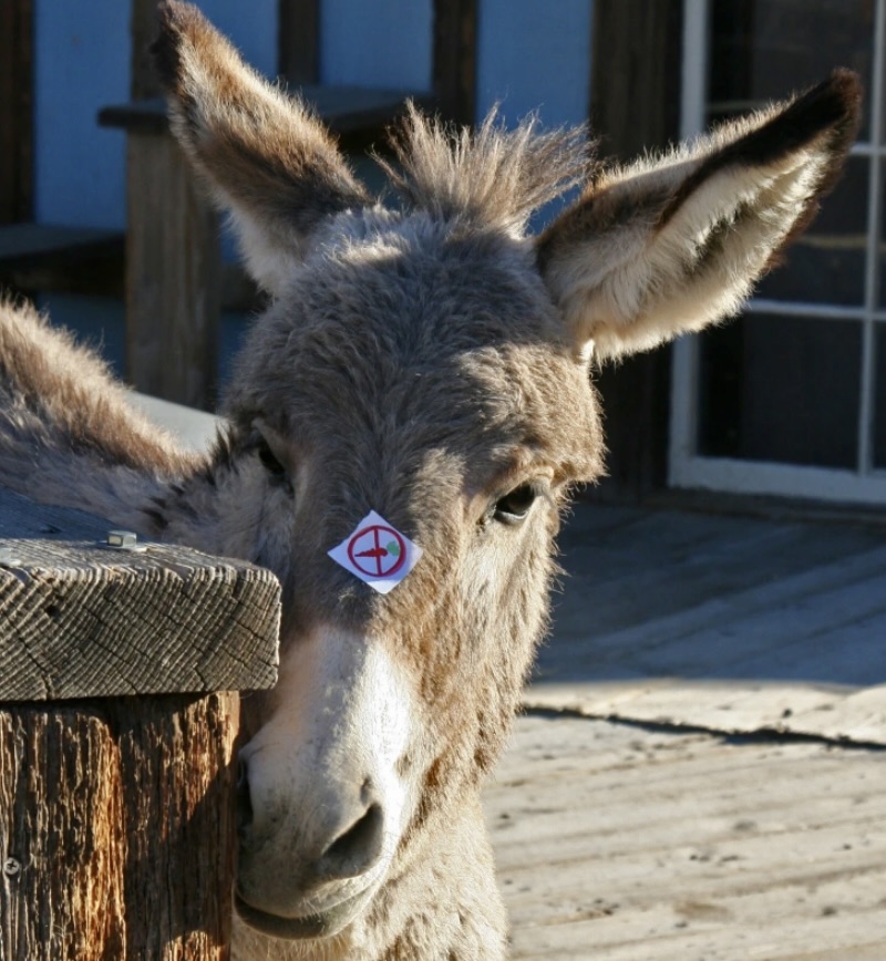
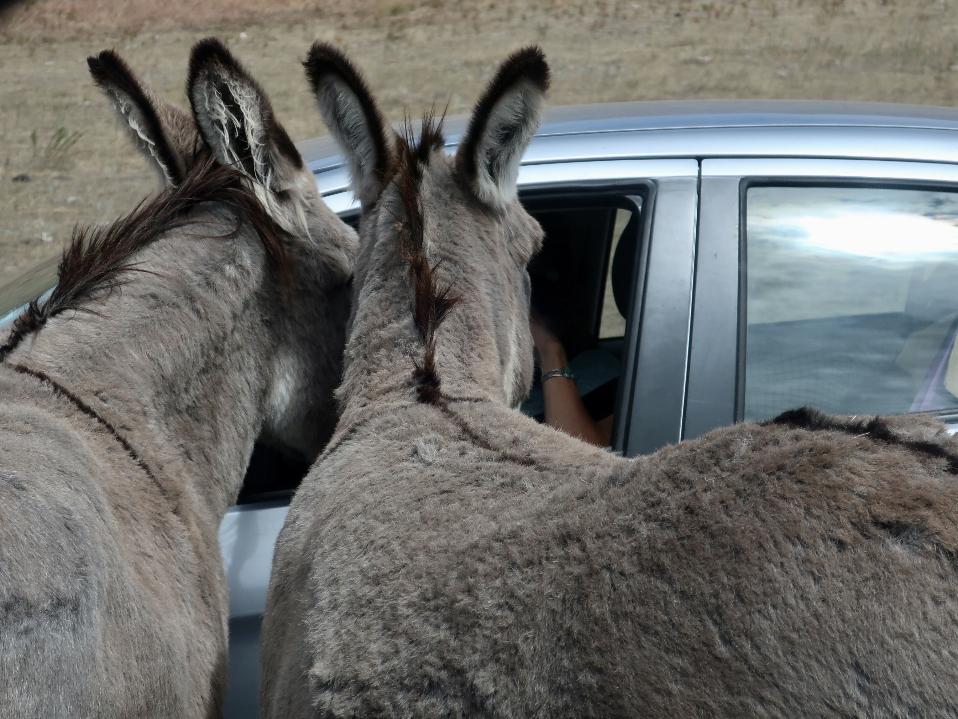
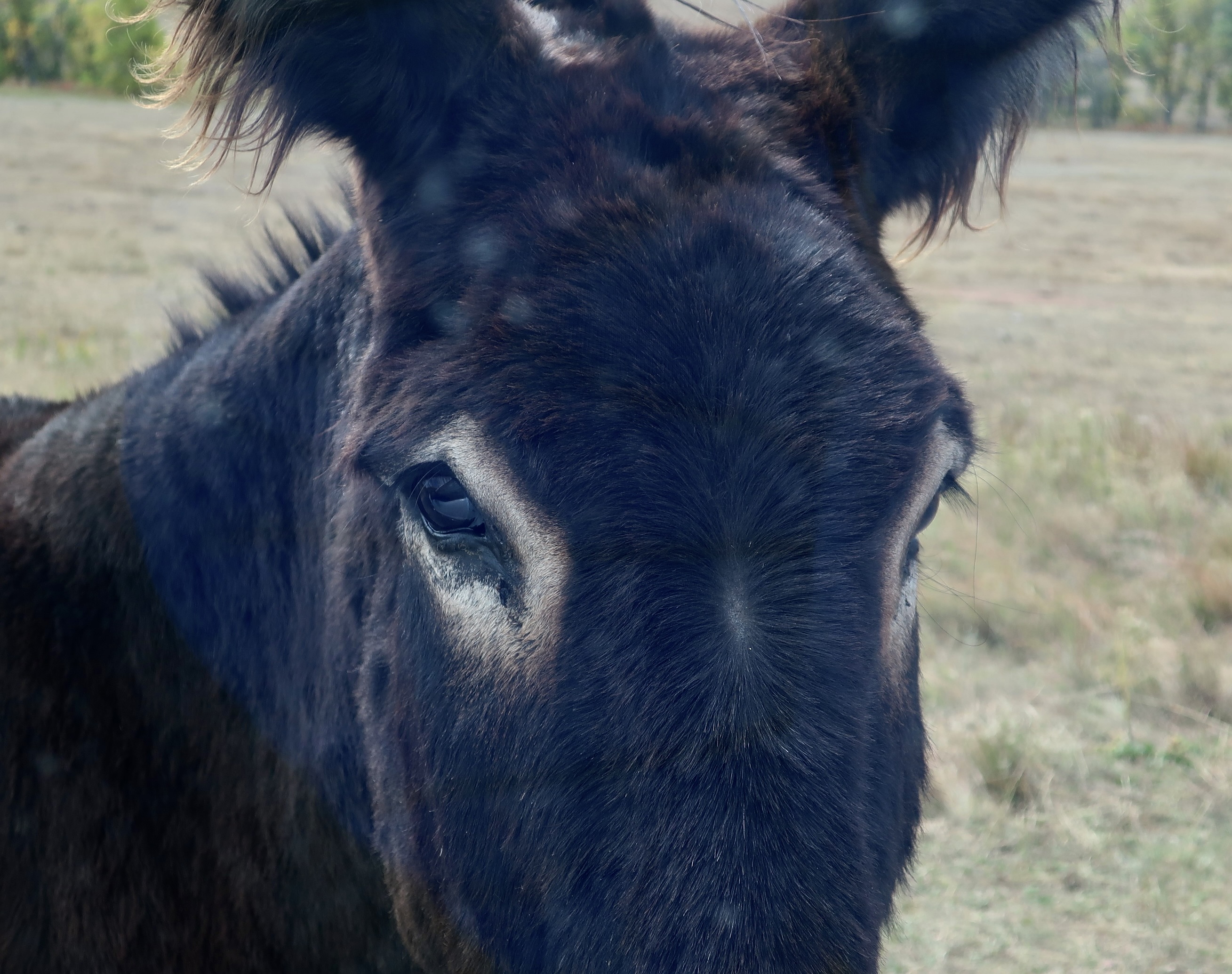
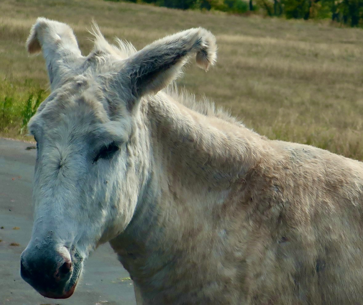
Unlike the buffalo, the donkeys blocked the road purposely— in search of goodies.Having caught the driver’s attention, they moved in for the kill— or at least a carrot. These donkeys were working together and were probably a bonded couple. All they got was their photo taken.Donkeys are known to love carrots, but apparently, young donkeys can choke on them.This cute youngster that Peggy and I found in Oatman, Arizona, had a “no carrot” sticker in its nose, much to its disgust.Our two rogues had better luck with the next vehicle they stopped.And, given the circumstances, decided that two heads were better than one.A different perspective. The age old question of how many donkeys can stick their heads in a driver’s window was answered beyond a doubt. It was carrot time!This fellow stopped by to check us out. “Take your hands off the wheel and hand over your carrots.” We didn’t have any.This one was our favorite, however. What’s not to love about it with its sway back and whacky look…And bent ears. He gave Eeyore the evil eye, thinking he had eaten all of the carrots, which was probably true.
That’s it for today. Next week it’s on to the Black Forest of Germany and the wrap-up for our Rhine cruise.
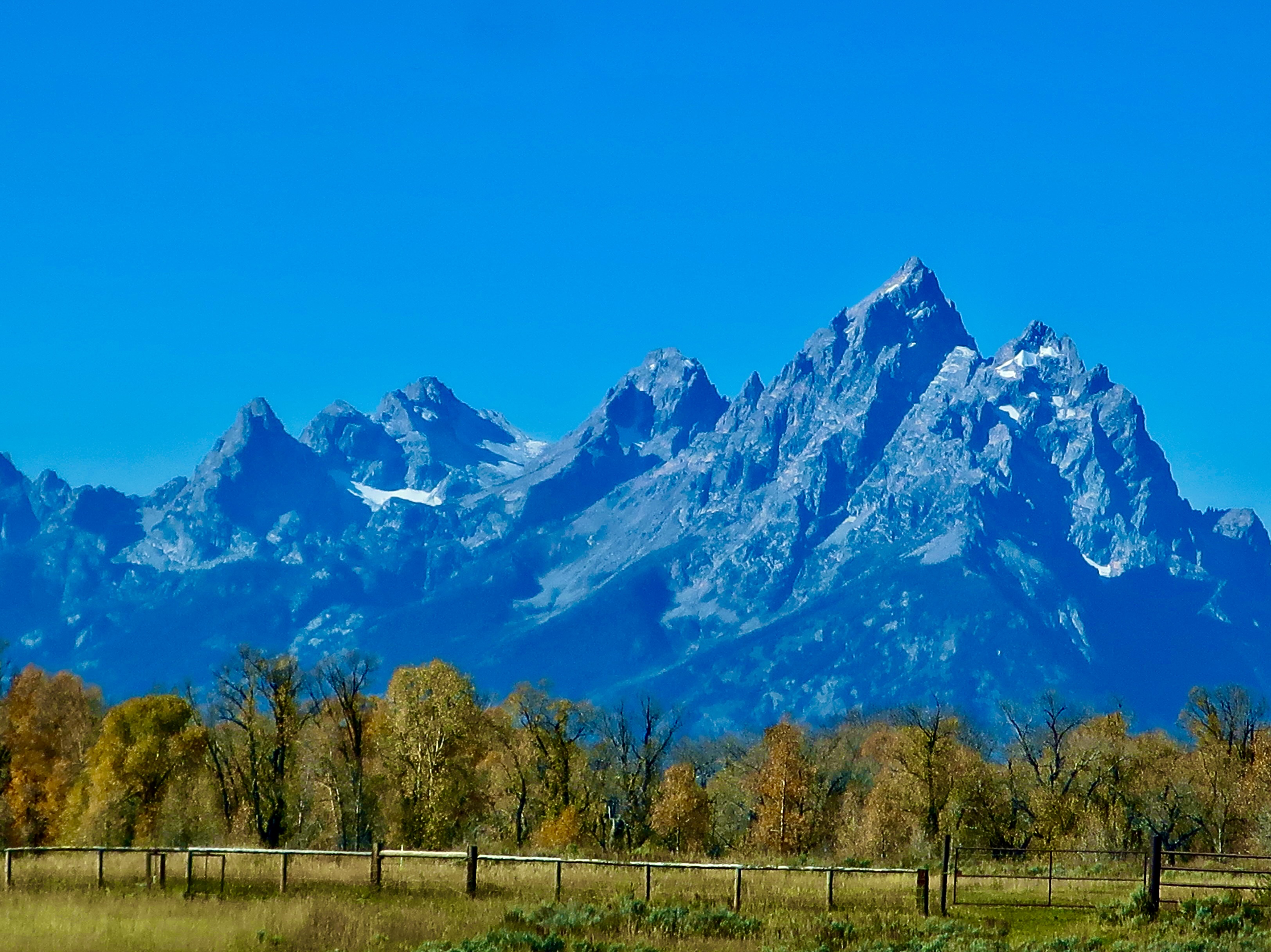
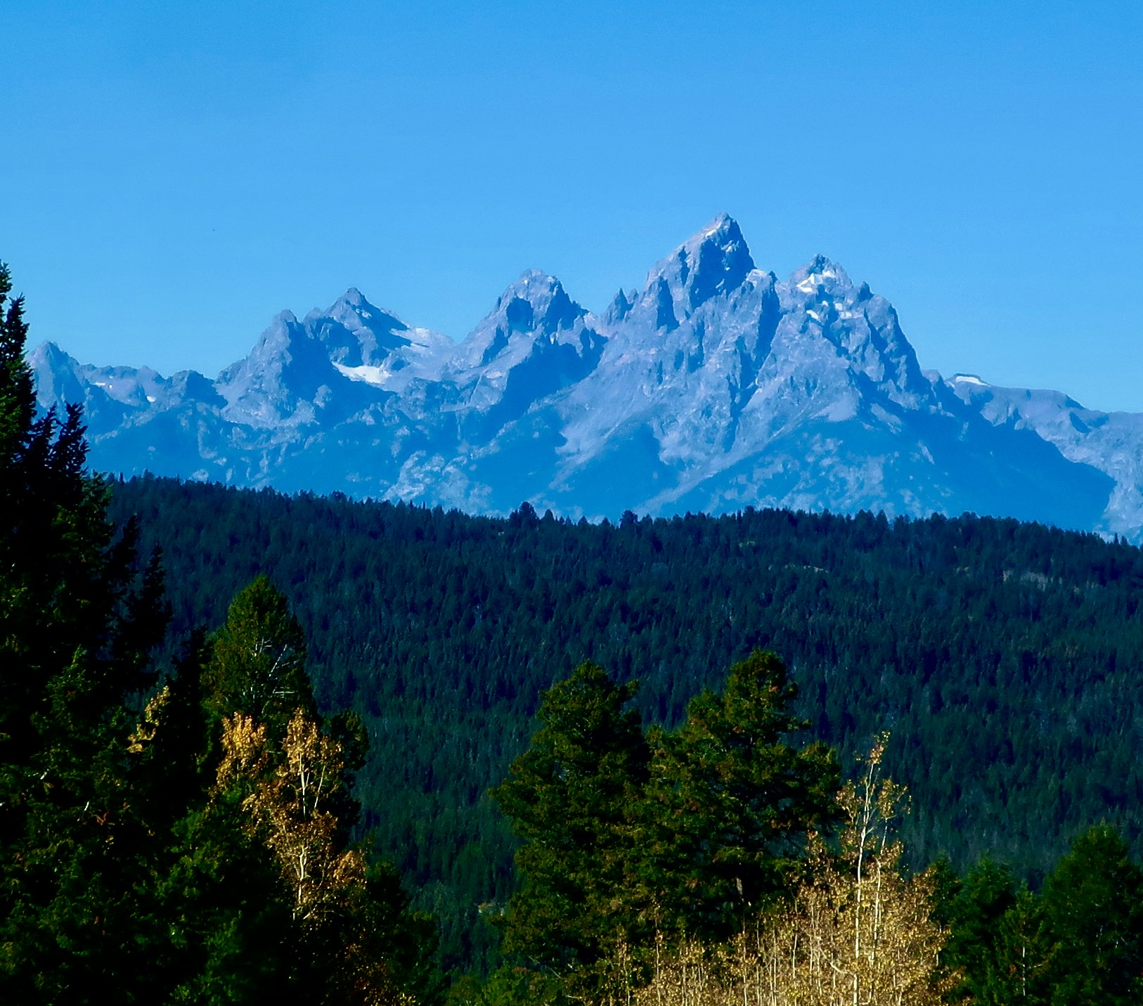
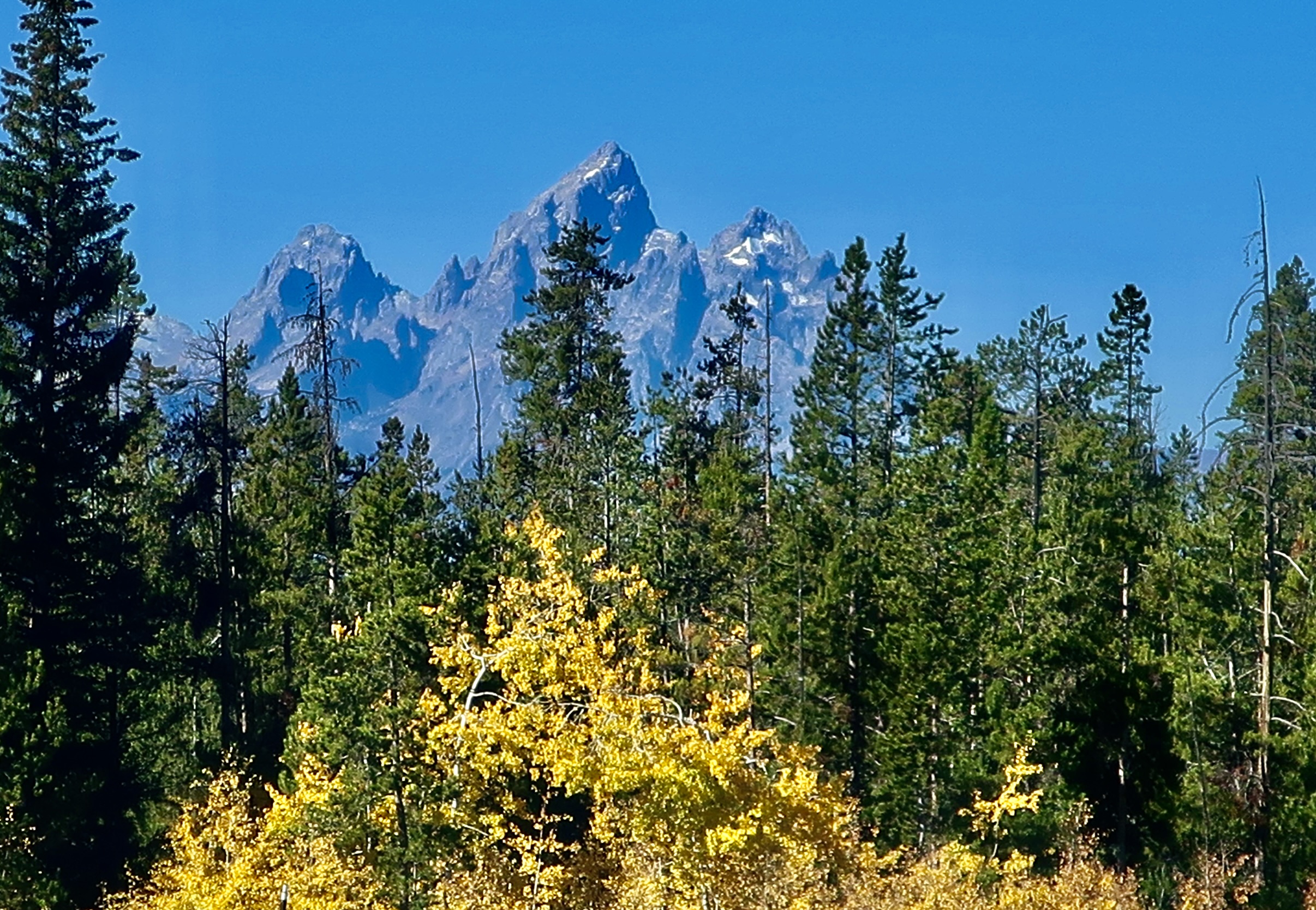
If I were in charge of making mountains, I would use the Grand Tetons as a model. A blogging friend of mine told me that the first time she saw them, she started crying. They inspire that kind of awe.
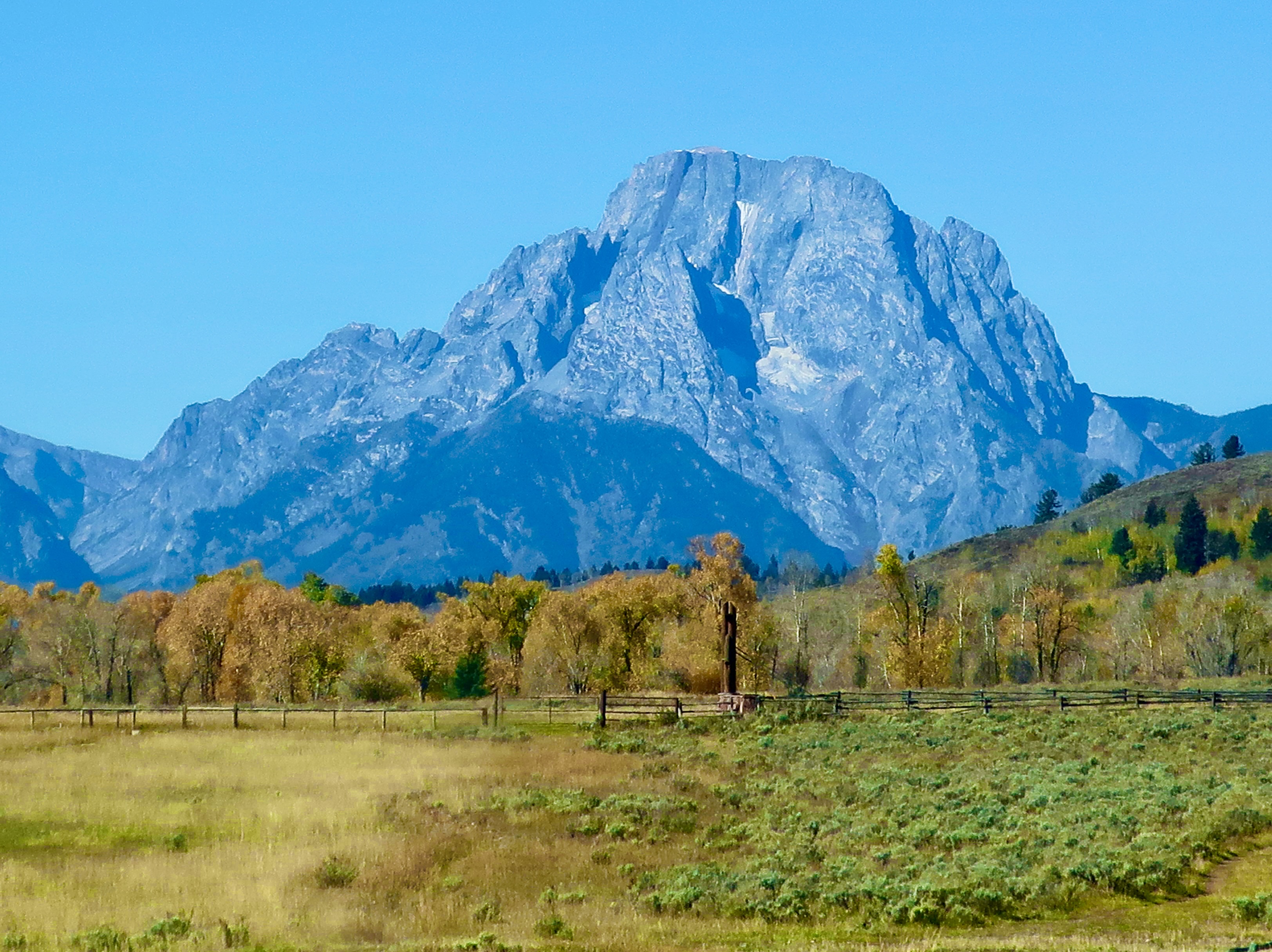
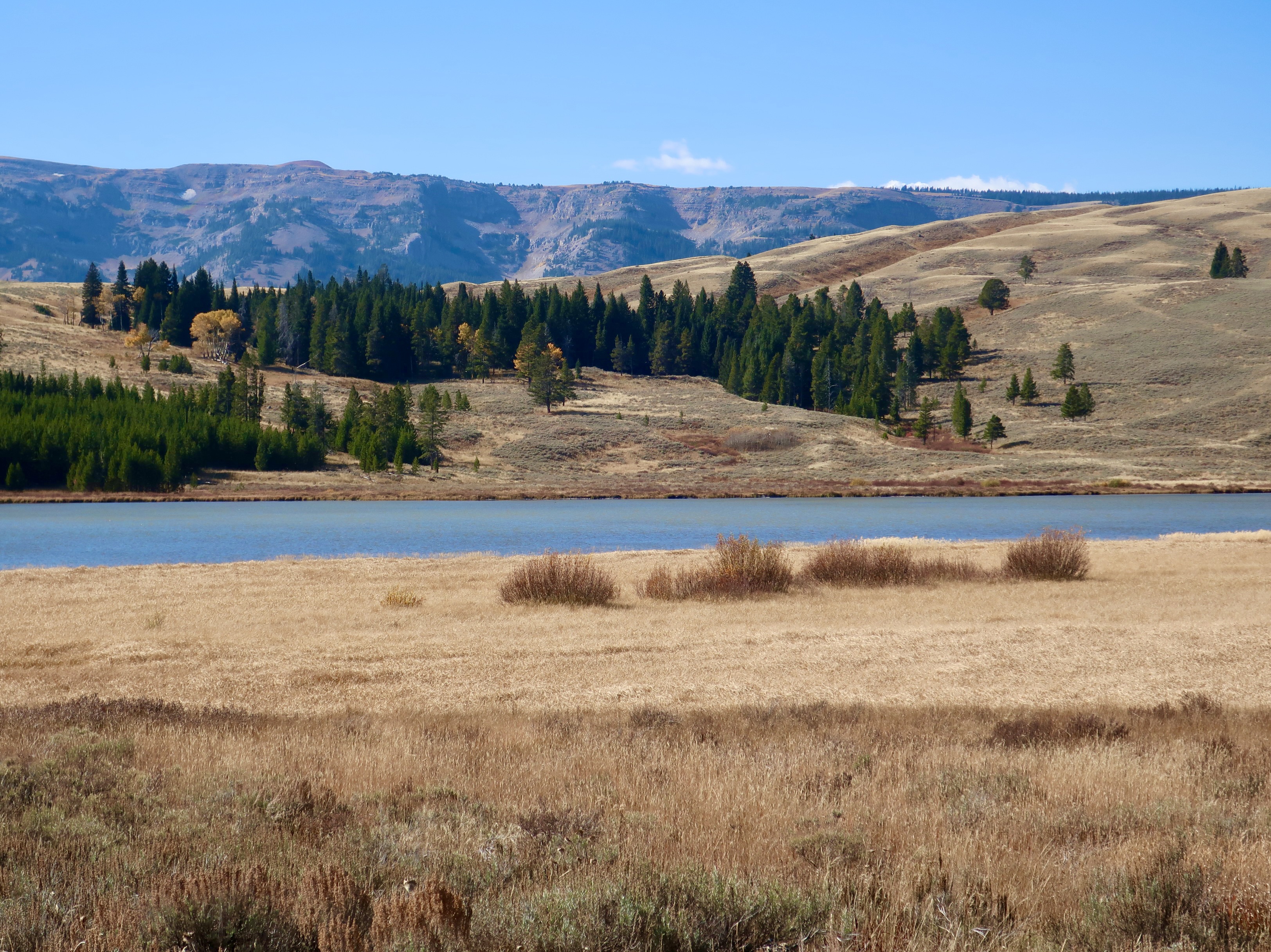
Just before we reached Yellowstone NP on our four month trip around the US last fall, we drove through Grand Tetons National Park. I’ll be featuring photos Peggy and I took of the Grand Tetons and the Absaroka Range today.
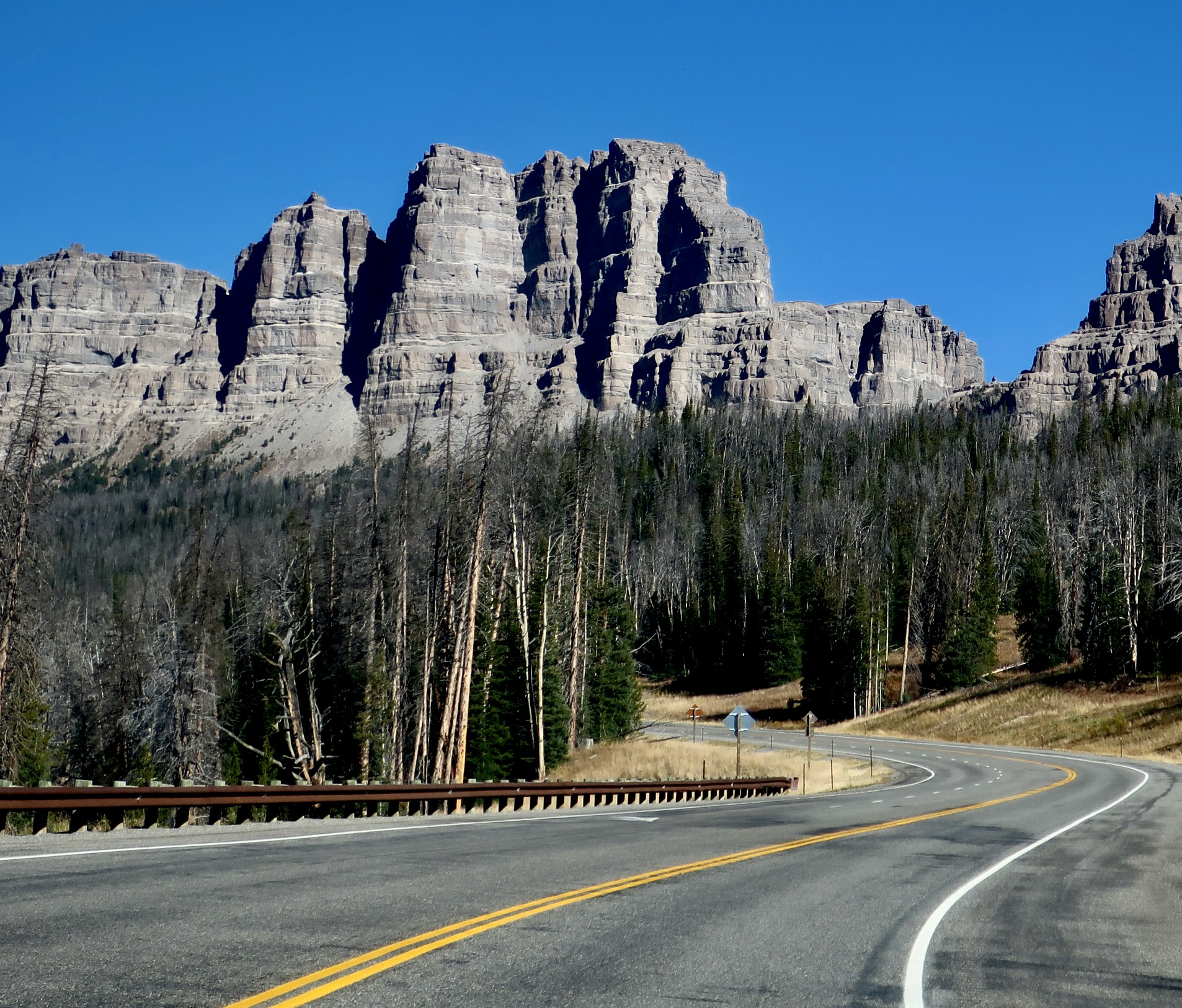
As Peggy and I drove across the 9,658 feet (2,943 m) Togwotee Pass, we were excited. We were in the Rocky Mountains and had just crossed over the Continental Divide. We were back in the West! Rivers would now be flowing into the Pacific Ocean. Soon we would get our first views of the Grand Tetons— not that there was anything shabby about the scenery on pass.
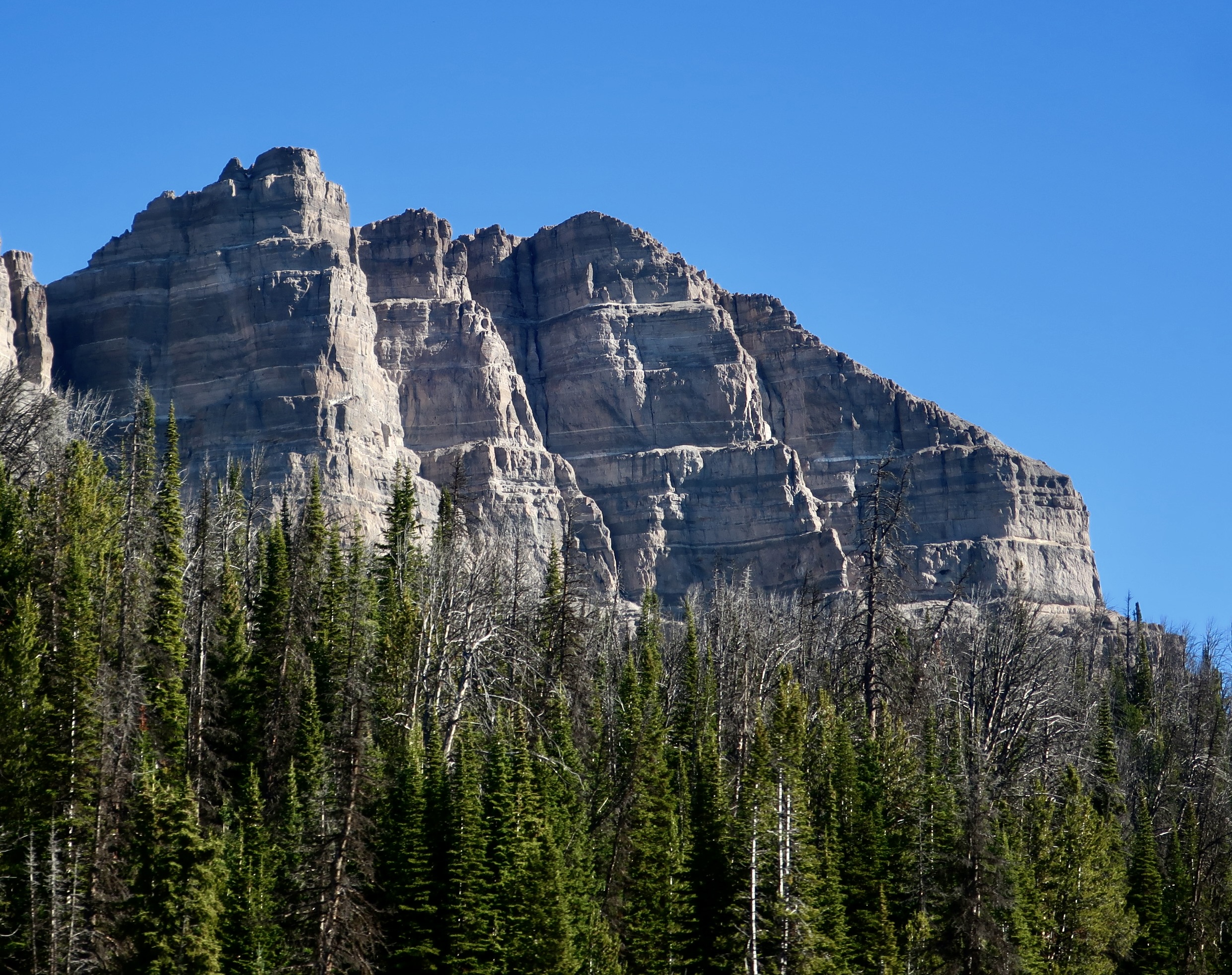
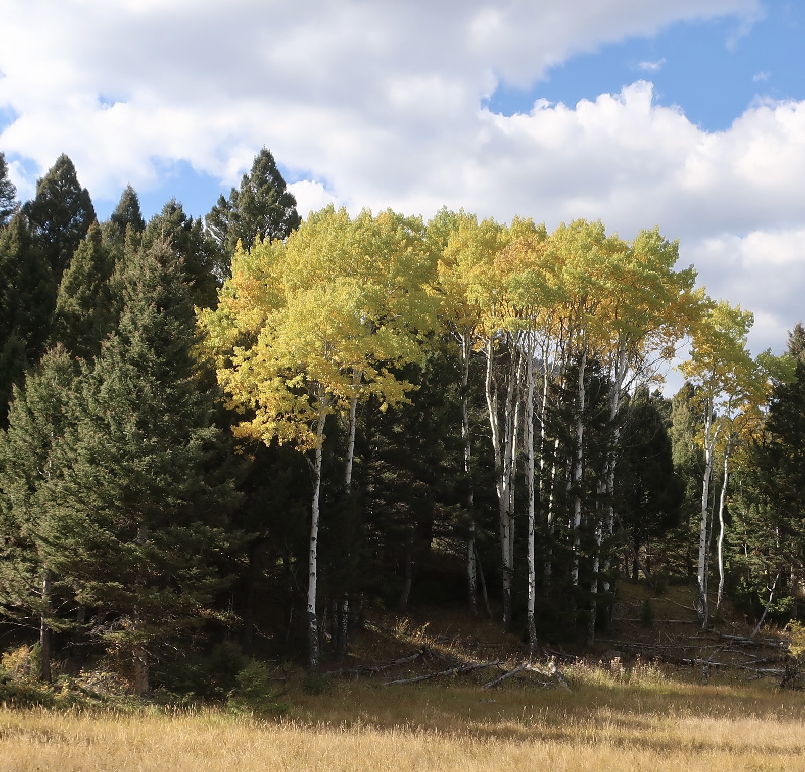
As we passed over the Continental Divide at Togwotee Pass, our excitement grew. This area receives over 25 feet of snow a year, a figure that can climb as high as 50, which I suspect it has this year.It was in October and the aspens near the pass were displaying their fall colors.The Absaroka Range, which can be seen from the pass, provided a backdrop for this grove. The range serves as the eastern boundary to Yellowstone NP.My father once painted a picture of the Absaroka Range.Professional photographer Glen Fishback took this photo of my dad painting the Absaroka Range in the 1980s. Pop, as we knew him, had wandered around the country with his sister, Eleanor, a few years earlier. I took this photo through glass so I couldn’t capture it as well as I would have liked to. Glen used my dad as a model and this photo ended up in a national photography magazine.A final Highway 26 road shot of the Absaroka Range. The Grand Tetons were waiting.
The Grand Tetons are a baby range, relatively speaking, less than 10 million years old. Compare that with the Rockies at 50-80 million years or the Appalachians at over 300 million. That’s what gives them their rugged, good looks. Erosion hasn’t had time to wear away their jagged peaks. Earthquakes along the Teton fault on the east side of the range are responsible for their height. Plate tectonic movement, which is stretching the region in an east west direction, is responsible for the earthquakes. When the tension becomes too great, an earthquake takes place, usually of 7 to 7.5 magnitude, i.e. big. Seesaw-like, the mountains rise and the valley next to it falls along the 40 mile fault, with each earthquake averaging around 10 feet of up and down movement. It is estimated that the mountain range has risen some 26,000 feet with 6,000 feet showing above the floor and 20,000 buried under it. Geologists estimate that the last major quakes were about 5,900, 8,000, and 10,000 years ago.
The Tetons were looming above a dark conifer forest in our first views with a hint of the colors to come.Aspens were soon adding larger splashes of color. The high peak in the center is Grand Teton, after which the range is named. It has an elevation of 13, 775 feet.Mt. Moran dominates the northern section of the Tetons and rises 12,605 feet above sea level. The orange colored leaves are from cottonwoods.Our road ran next to Jenny Lake and provided some great views of the Tetons.Ducks were busily eating on the lake.The only photo we took of the park that didn’t feature the mountains.A final photo of Mt. Moran from Jenny Lake. Next Monday’s post will be on the German town of Breisach along the Rhine River.
Peggy and I are wrapping up our visit to Yellowstone today from our journey around the US last fall with pictures of a few of the many scenic views found in the park. All photos are taken by either Peggy or me unless otherwise noted.
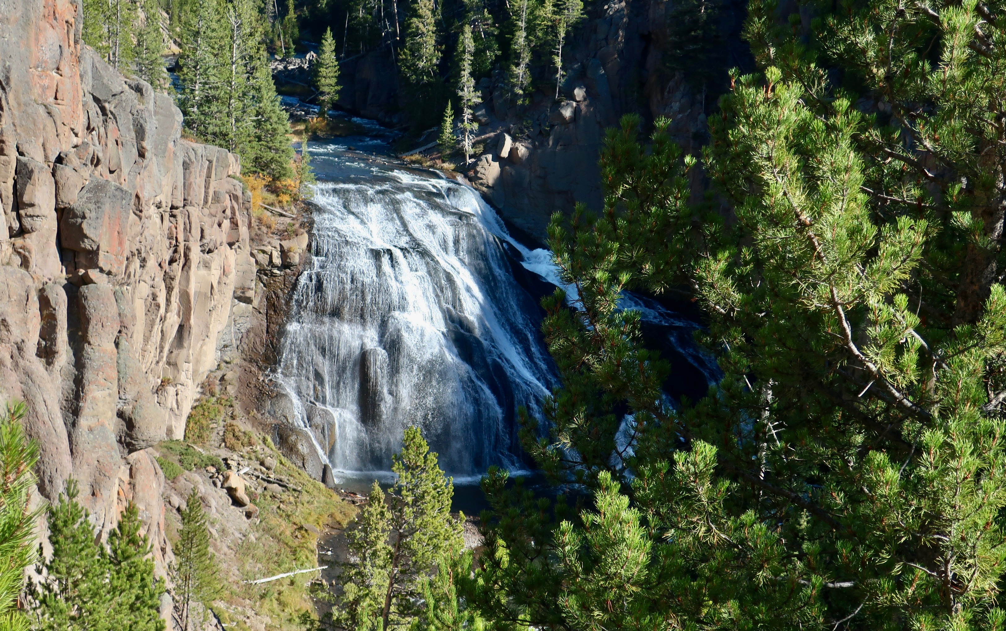
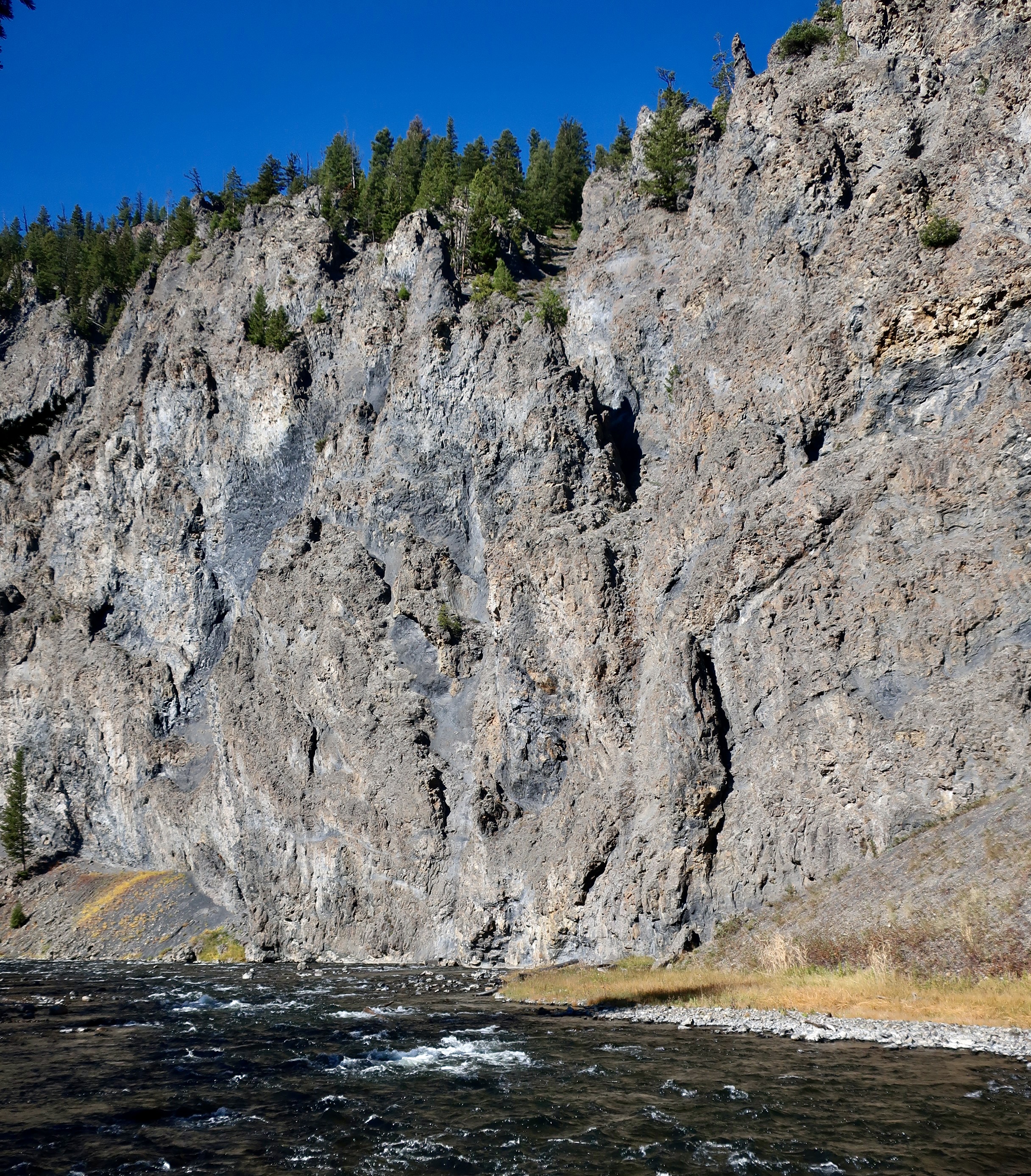
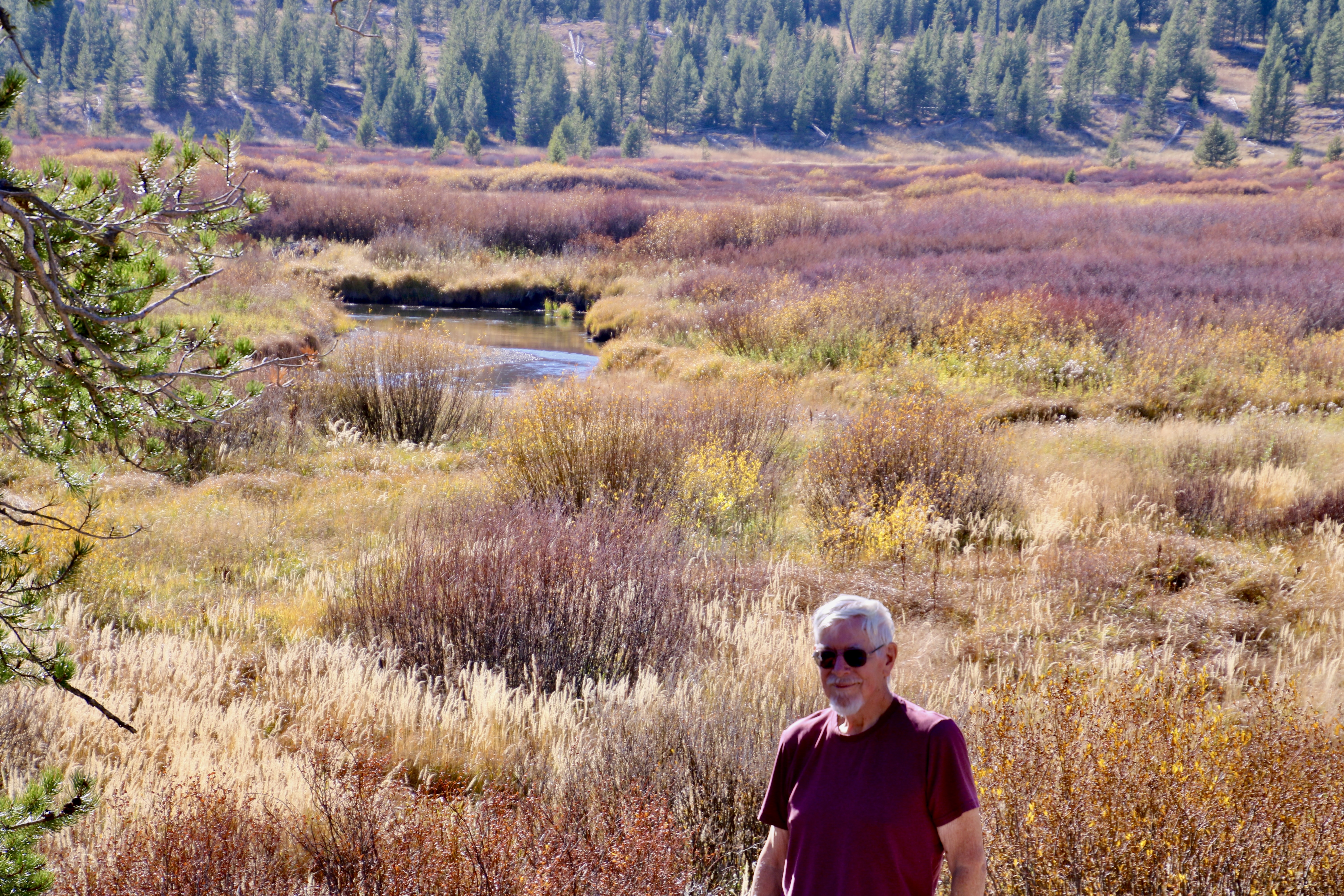
When it comes to scenic beauty, one can find plenty in the rivers that flow through Yellowstone National Park. This photo is Gibbon Falls on the Gibbon River.The river drops some 84 feet and then makes its tumbling way for a quarter of a mile to the Yellowstone Caldera. A paved trail leads along the river providing great views of Gibbon Falls.A close up. Can you hear the roar? Having cut its way back from the Yellowstone Caldera, the rock will continue to erode its base leaving the Caldera farther behind and increasing in height. Looking positively serene in comparison to Gibbon Falls, this is a shot of Firehole River not far from Old Faithful and the main hot springs area of Yellowstone. Appearances are deceiving, however. toward the end of the photo you can see where the river narrows. It is about to go tumbling down…A side road runs along the Firehol River and provides views of the river’s rapid descent. I’d say we were no more than a few hundred yards below where we took the ‘serene’ photo.This would probably make a white water rafter or kayaker drool.If I were in a raft and turned around to spot this monster, I might have a heart attack. Can you spot the eyes, nose and mouth? Not to worry, however. Yellowstone National Park does not allow rafting on its rivers. The monster has to eat fish. There is a small section of the river between rapids where Peggy swam when she was working at Yellowstone in 1969. She apparently avoided the monster. The Firehole calms down when it meets up with the Gibbon River. And check out the wall. Isn’t it magnificent? Climb to the top and you will be out of the Caldera. Some rock climbing skills may be necessary. Grin.This close up of volcanic rock spires above the river provides a perspective on how rugged the cliffs above the river can be.The Gibson/Firehole river then joins the Madison for a more leisurely pace and great fishing, which is what the two people on the left are doing. We also spotted buffalo and elk near the river. We found this little beauty on our way up to Mammoth Hot Springs and its travertine terraces. It was a bonus. Known as the Gardner River, it had carved out Sheep Eaters’ Cliff that we had stopped to see.If this looks familiar, these are the same type of basalt columns that I featured on my earlier post about Devil’s Tower National Monument. The primary difference being that the columns at Devil’s Tower formed far underground and grew to gigantic size. These were part of a lava flow along the surface and are much smaller. I suspect you are curious about the name. I was. The cliff is named after a band of Shoshone Indians who were known as the Tukudika, or Sheep Eaters. They apparently found big horned sheep quite tasty. I get it. I presently have a package of lamb in our refrigerator that I am planning on turning into lamb curry, one of my favorite dishes.As we continued our journey toward Mammoth Hot Springs in the northern section of Yellowstone, we came on a wildly colored meadow painted with fall colors. I liked it so much that Peggy took my photo standing in front of it.This comes close to my idealized view of the Western United States with vast distances topped off by impressive mountains. The soft colors of fall, the dark tree lines and gently rolling hills all added to the beauty. Over on the right, you can also see an aspen grove.Another view of the backcountry on our way to Mammoth Hot Springs that we liked.We even found a buffalo that seemed to fit beautifully into the fall scene.Ever feel like you are living on the edge? The view around the corner was spectacular.It was the sunlight on the peak that caught our attention. But note the avalanche path along side the peak as well. It has to be one of the longest paths I have seen. And finally, there was the splash of brilliant yellow from the aspens.Speaking of aspens, I’ll wrap up today’s post with these beauties. They will also serve to wrap up my series on the Yellowstone National Park. In our next Monday post, Peggy and I will visit two scenic towns along the Rhine River. BTW, as you read this, Peggy and I are on a riverboat traveling up the Nile River in Egypt on my 80th Birthday trip.
Today,Peggy and I are continuing our exploration of Yellowstone National Park, which we visited as part of our four month, 12,000 mile exploration of the US between September and December this past year. All photos in this post were taken by either Peggy or me unless otherwise noted.
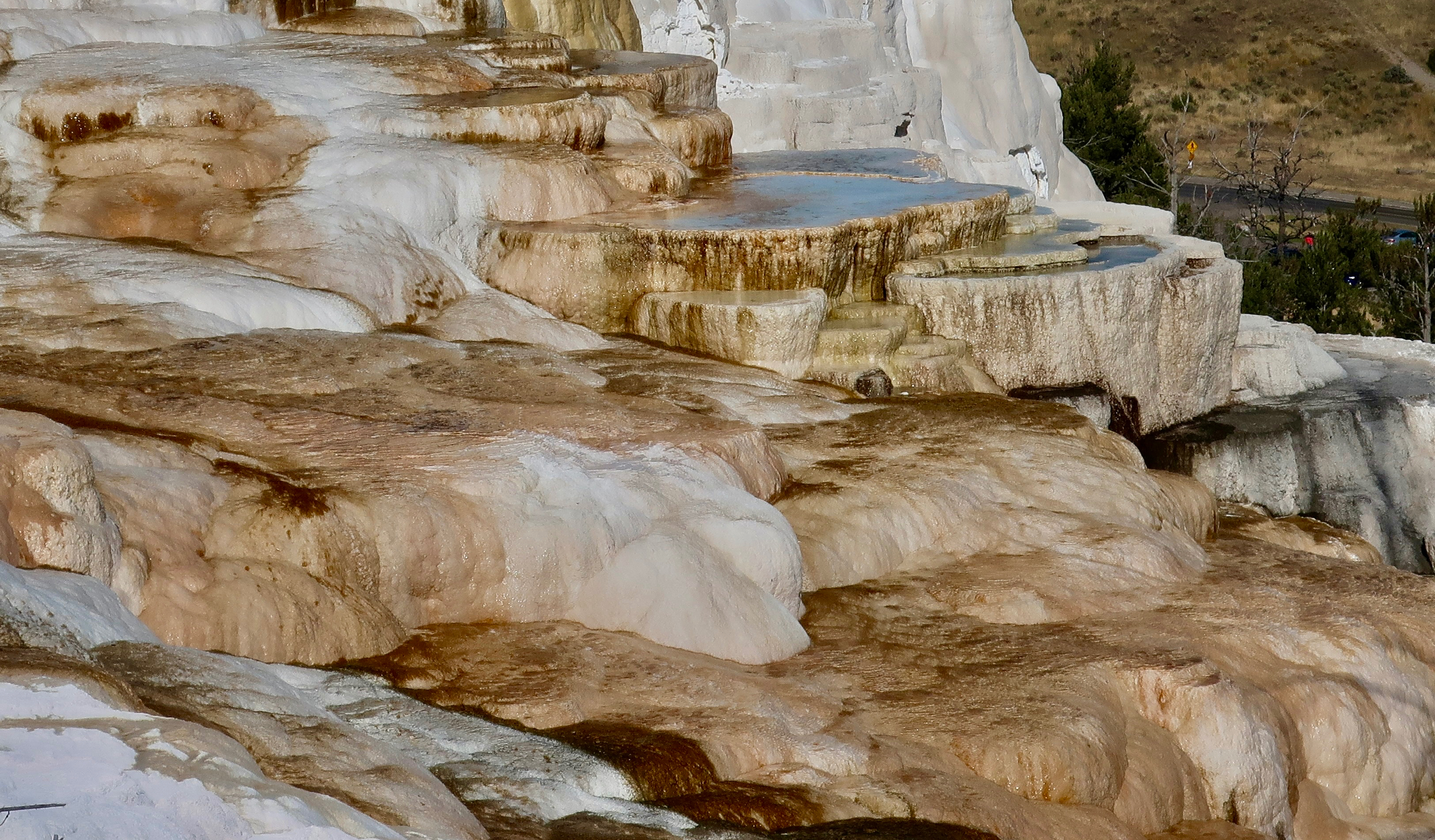
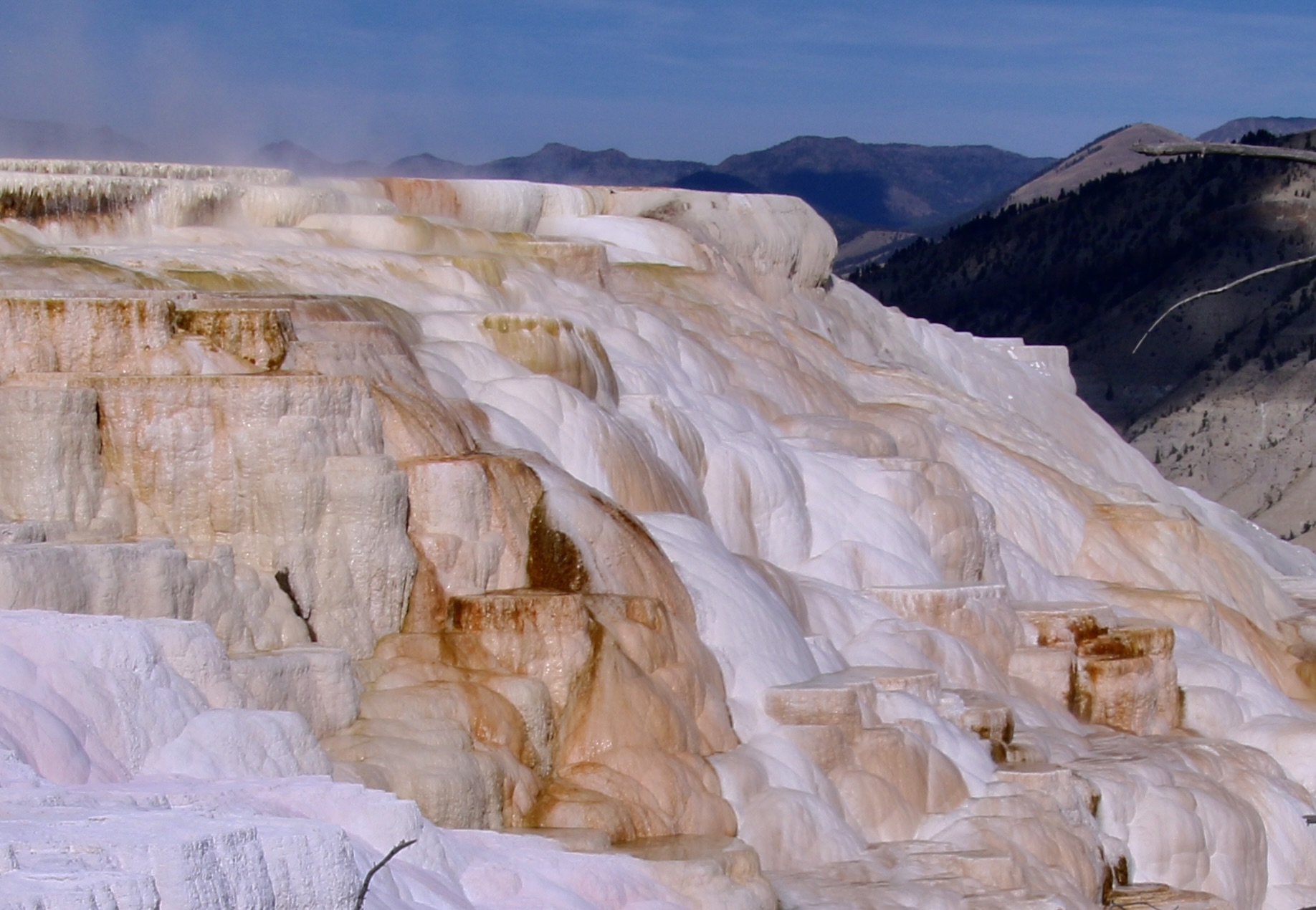
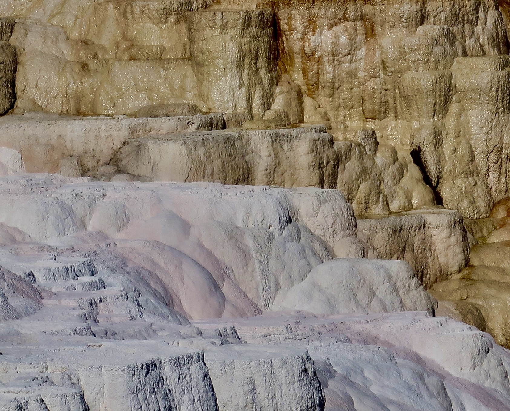
If you are visiting Yellowstone National Park, be sure to visit the colorful travertine terraces of Mammoth Hot Springs.
Located 50 miles north of Old Faithful, the travertine terraces of Mammoth Hot Springs are one of the most unique and beautiful of Yellowstone’s hydrothermal created landscapes. The terracing is a result of underlying limestone. Hot water dissolves the limestone and deposits it on the surface. The bright colors, like the colors of the hot springs in the Yellowstone Caldera to the south, are created by thermophiles, tiny microorganisms that thrive in the hot springs. Different types of thermophiles have different tolerance for the heat and come in different colors based upon their exposure to sunlight. Those that can tolerate the most heat live deep in the pools and tend toward blue and green. The ones living on the cooler outer edges are more in the brown and yellow range.
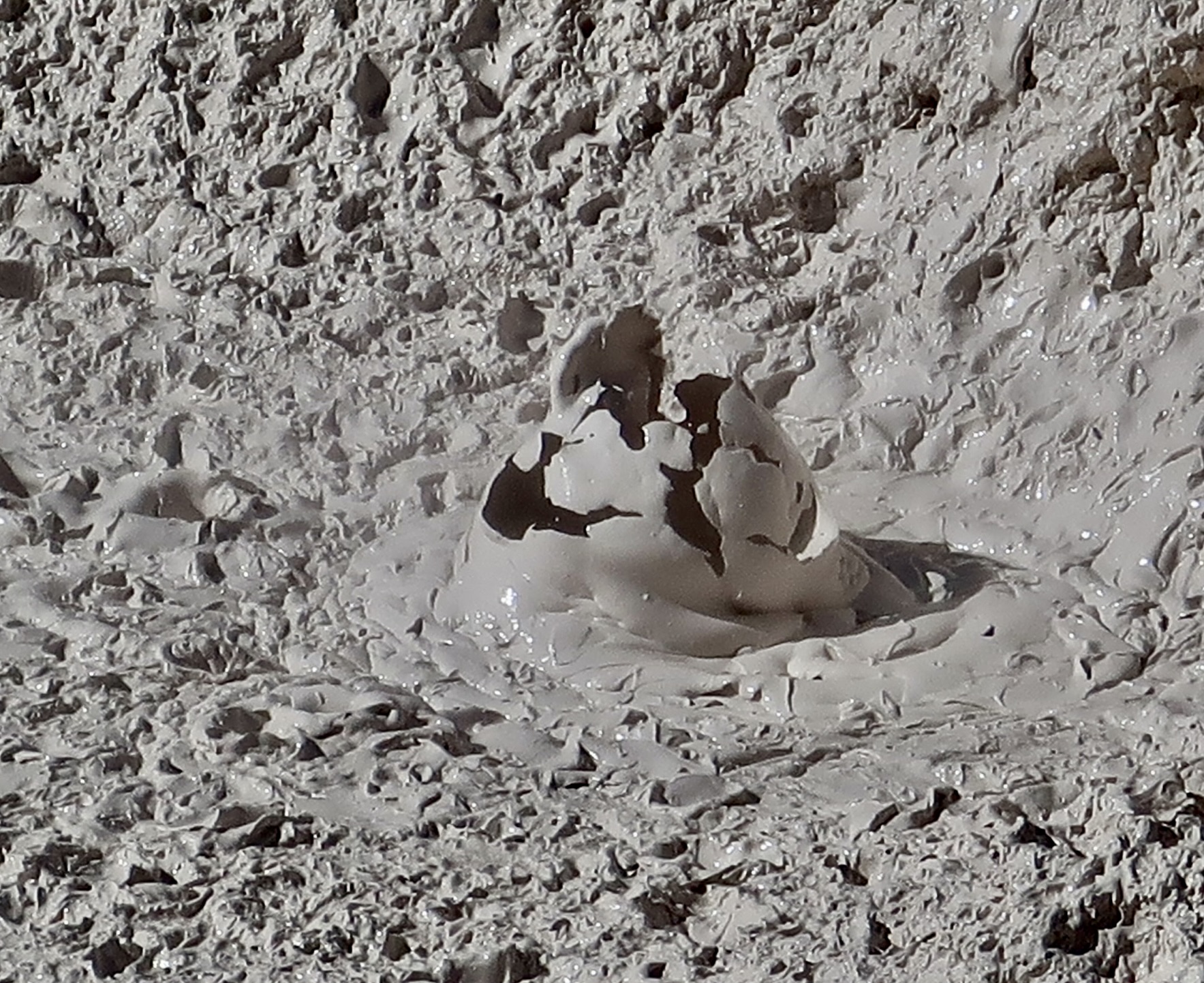
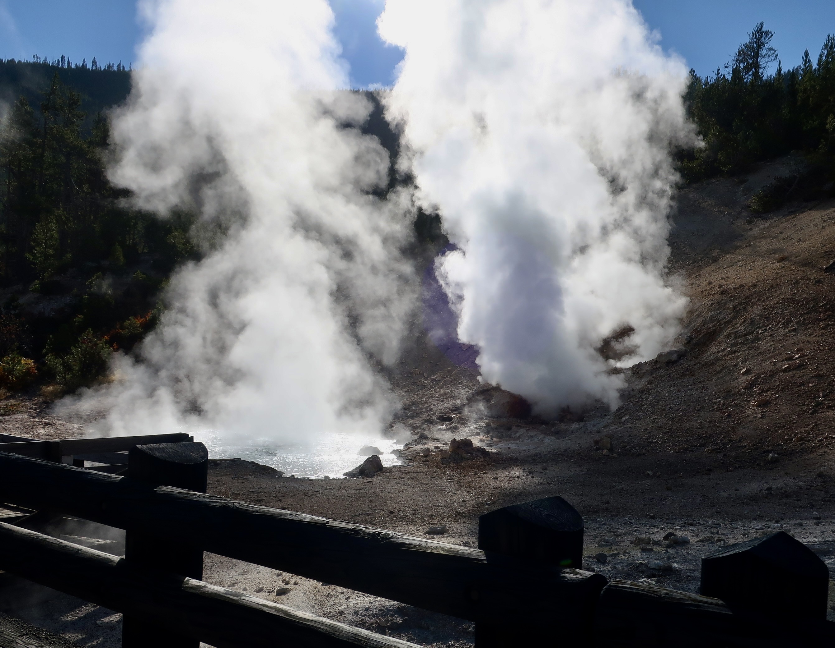
Peggy and I took a day to drive up from where we were camped in the town of West Yellowstone to visit Mammoth Hot Springs. On the way up we saw a lot of great scenery that I will feature in another post and two hydrothermal features I haven’t covered in this series yet: mud pots and fumaroles.
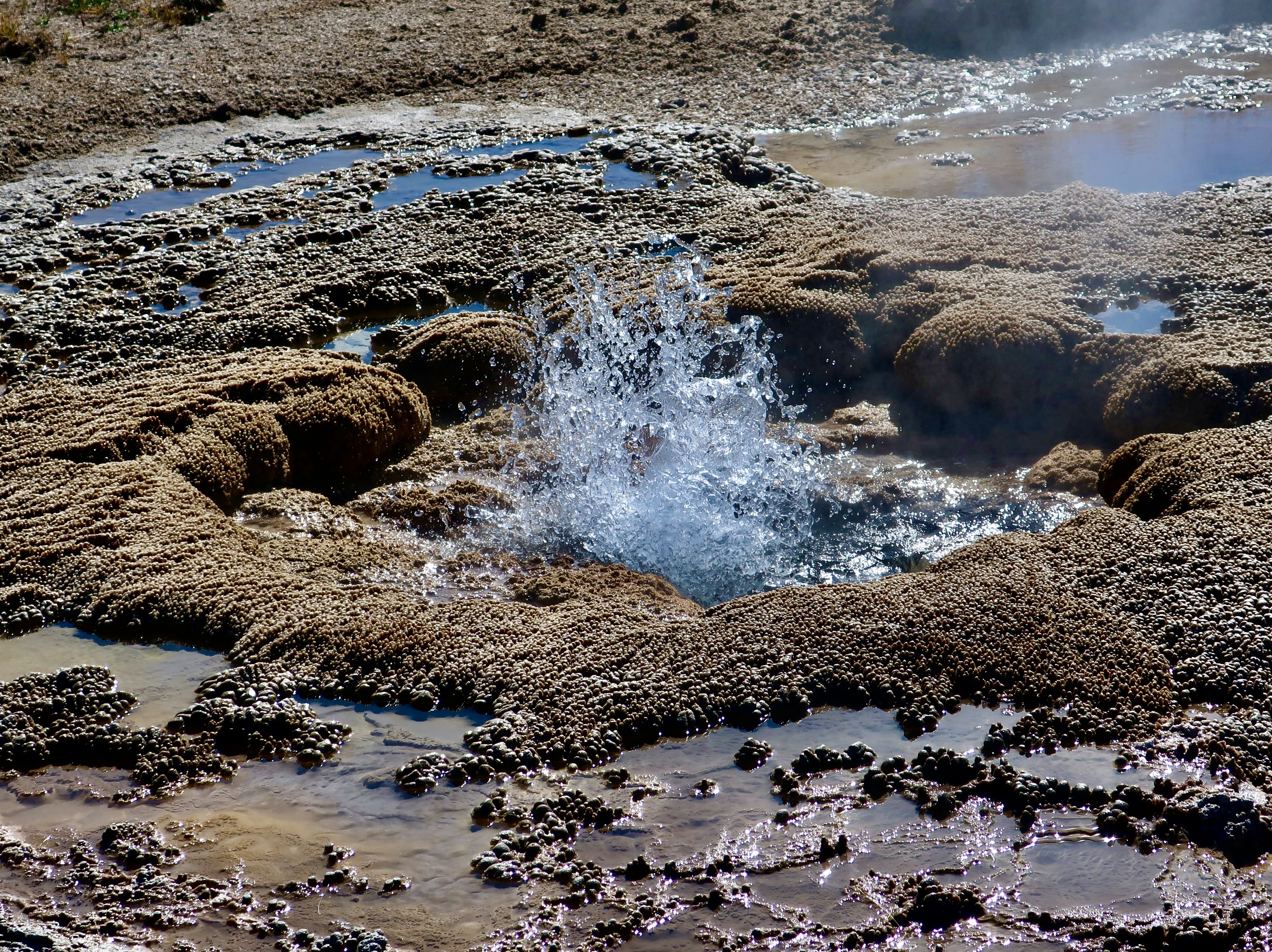
Mud pots occur when hot thermal water is flowing under a layer of clay that blocks the water from escaping to the surface. Steam from the water, however, is able to make its way through the clay. Certain microorganisms convert the sulfur dioxide in the steam to sulfuric acid which turns the clay into a gooey, sticky consistency. Bubbles are created as a result of the steam bubbling up through the goo. It sound like plop, plop, plop. I included this exploding bubble in an earlier post. I liked it so much you get to see it again.A fumarole is similar to a geyser but lacks the water to create eruptions. Instead, the heat from the volcanic rocks turns what water is available into incredibly hot steam that escapes from vents and ranges in temperatures up to 280°F (138°C). It can be noisy. This is a shot of Roaring Mountain that received its name from the noise created by the escaping steam. It could be heard from miles away in the 90s. It’s quieter today.
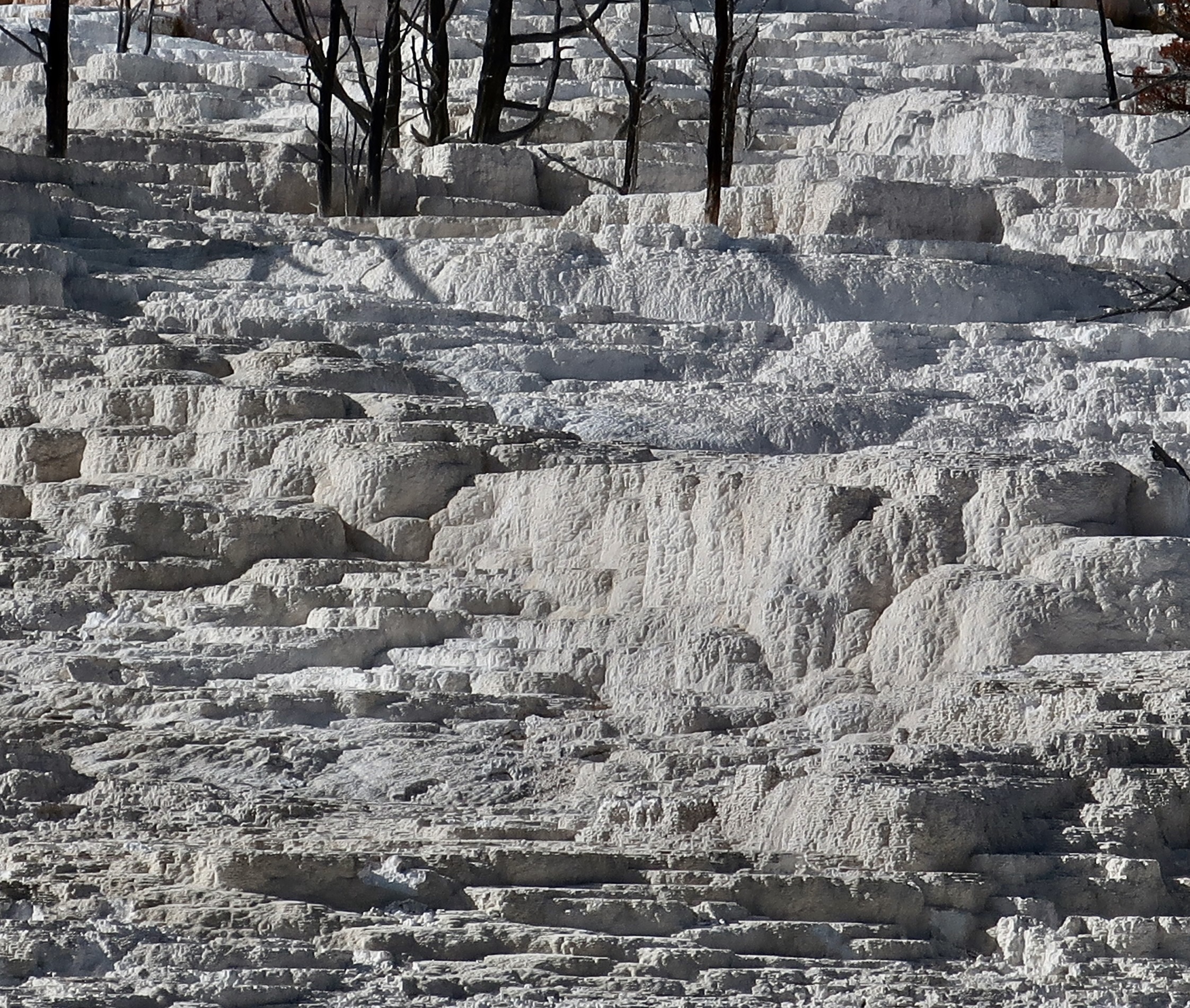
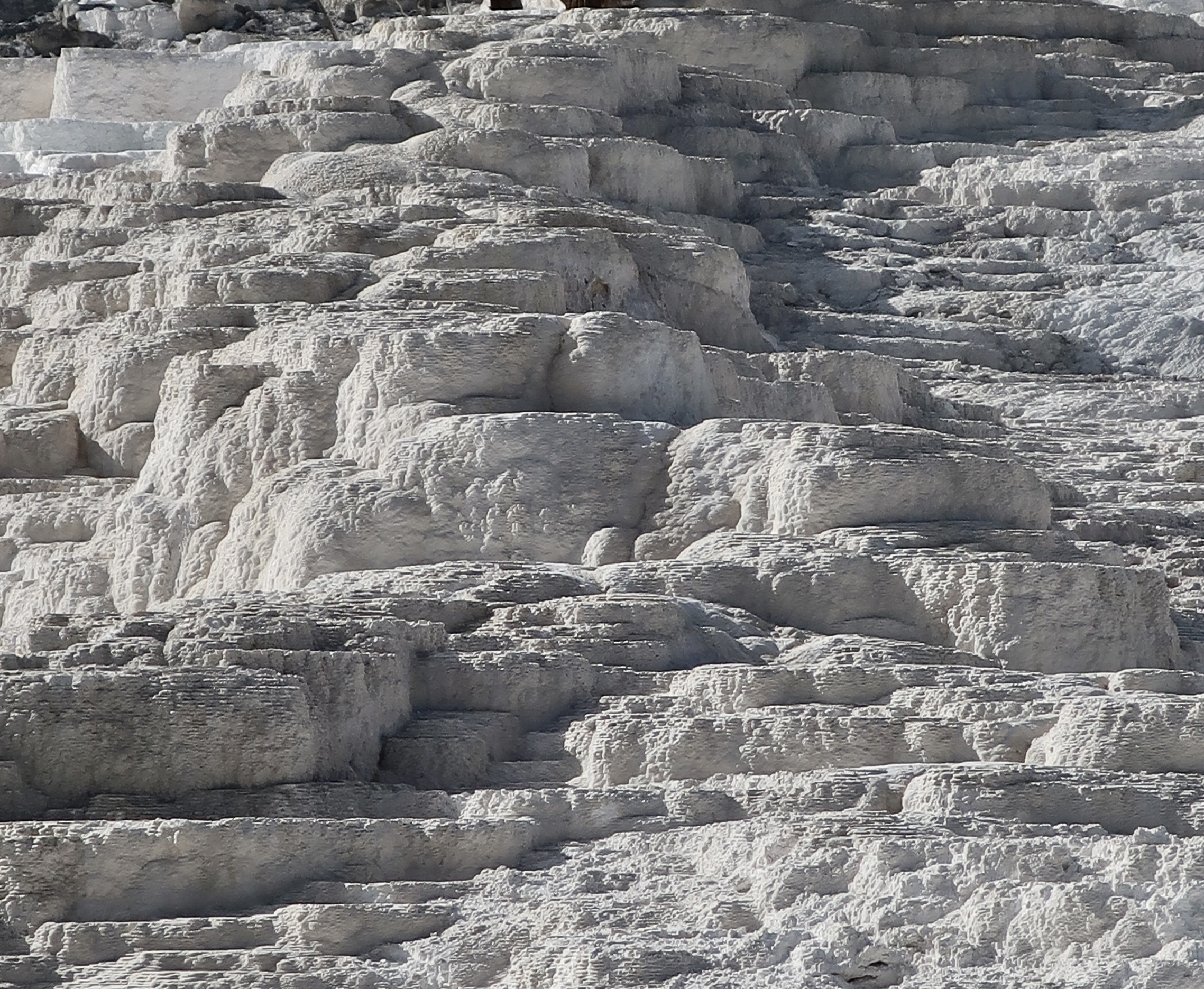
And now it’s time to visit the terraces of Mammoth Hot Springs. A convenient road takes you around the terraces. Walkways off the road take you to the lower terraces. The following photos were taken from the walkways.
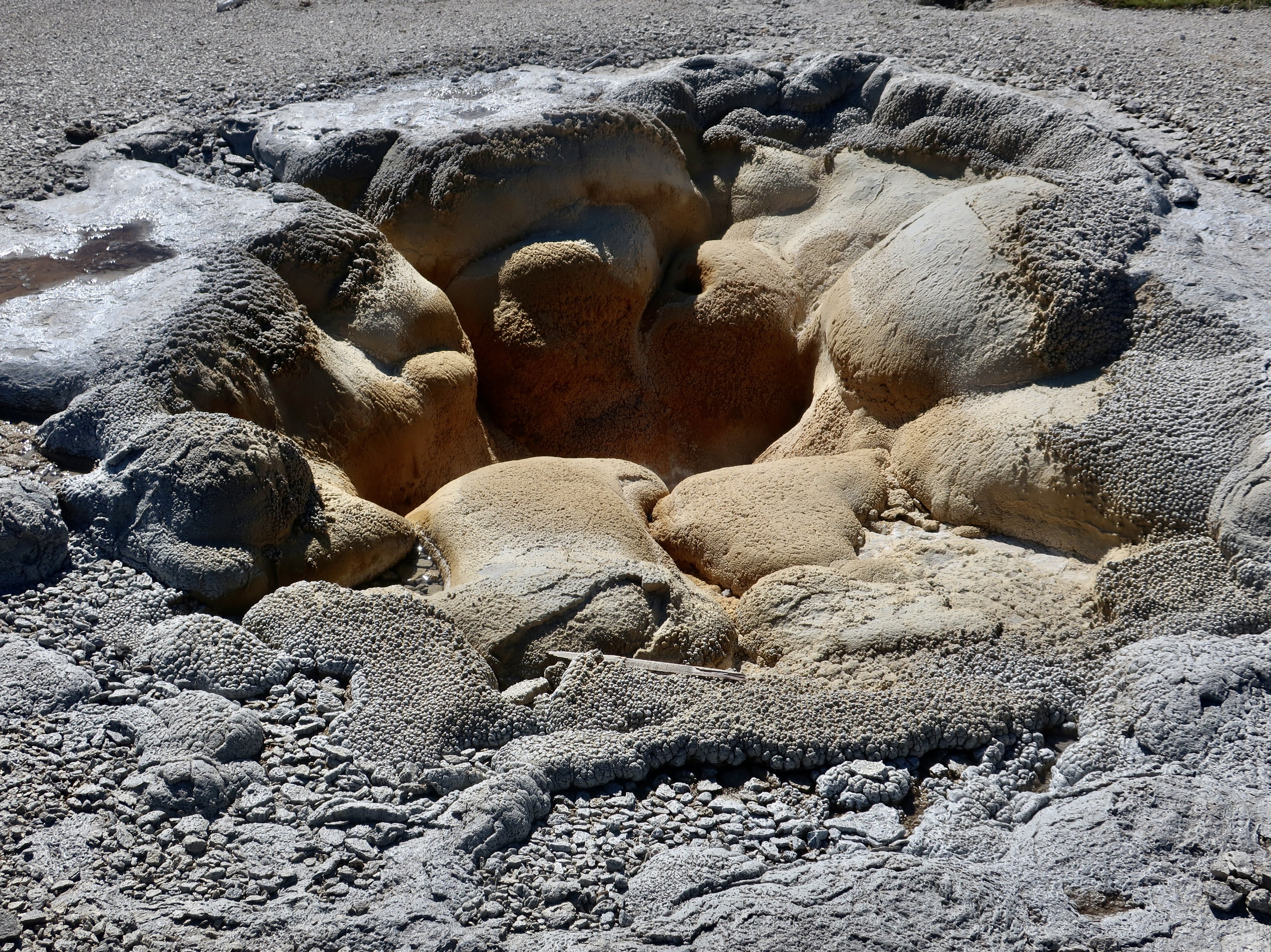
Canary Springs is one of the most popular sites along the lower terrace trail at Mammoth Hot Springs.A broader, softer perspective of Canary Springs.A view of the travertine terrace just above Canary Springs.Another perspective of the terrace just before the water flows over the edge.Cupid Springs. I don’t have a clue on how it got its name.Umpteen shades of grey.
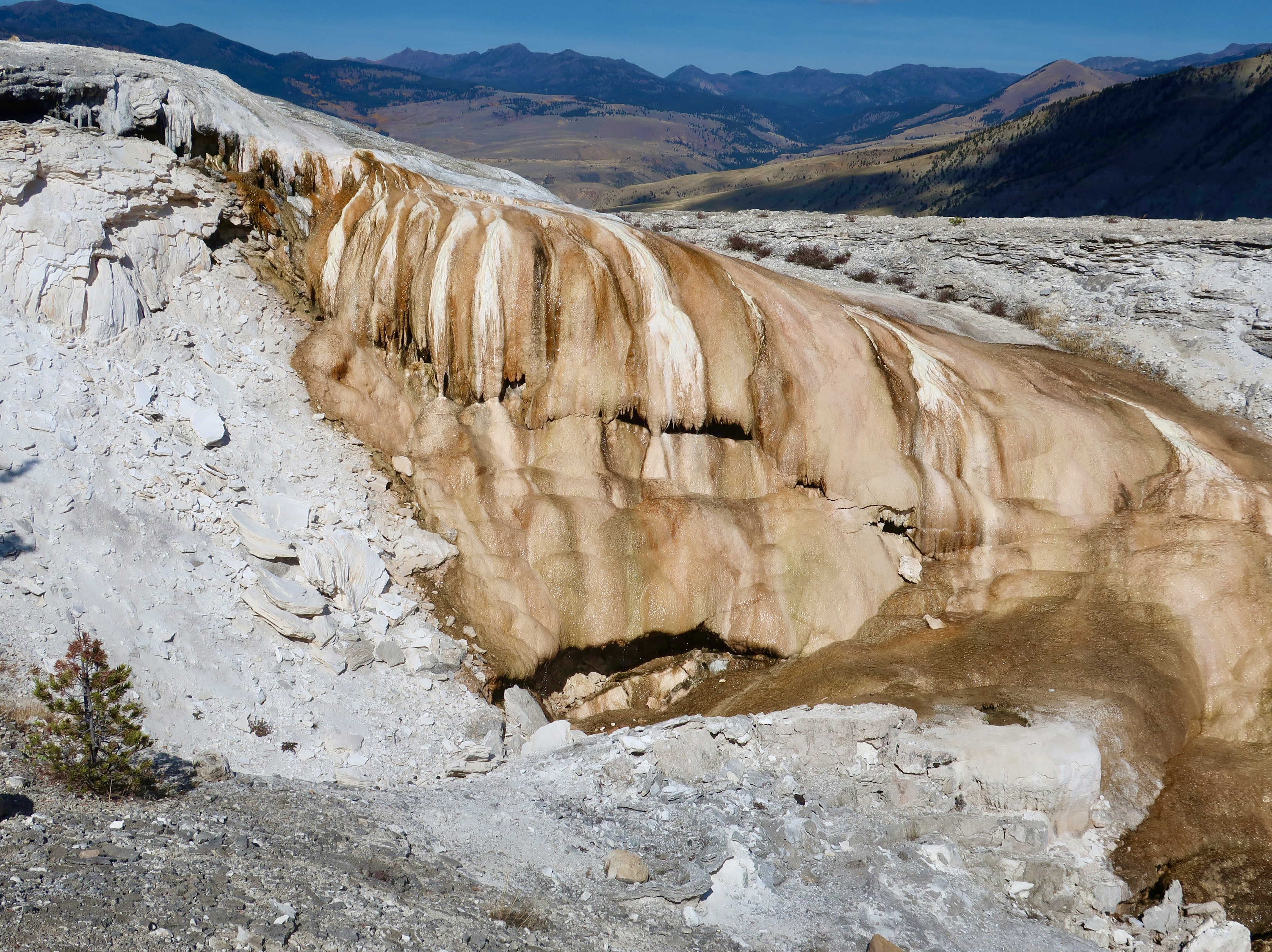
The road snakes around the upper terrace. There are several pullouts that allow close up views of the various formations.
This section is known as Angel’s Terrace. I’m assuming it’s because of the white travertine, which is how the dissolved lime comes out of the ground.Another perspective. Like stair steps.We really liked the contrast of colors here.It was the colors, shape and tree that caught our attention that had us pull out our cameras.This unique dome is known as Elephants Back.We were driving back to West Yellowstone when we came across this very colorful small dome. The steam coming from the back suggests a fumarole. We simply had to stop and photograph it. That does it for today. Our next post will be on Heidelberg Castle. After that, it will be back to Yellowstone and its scenic beauty.
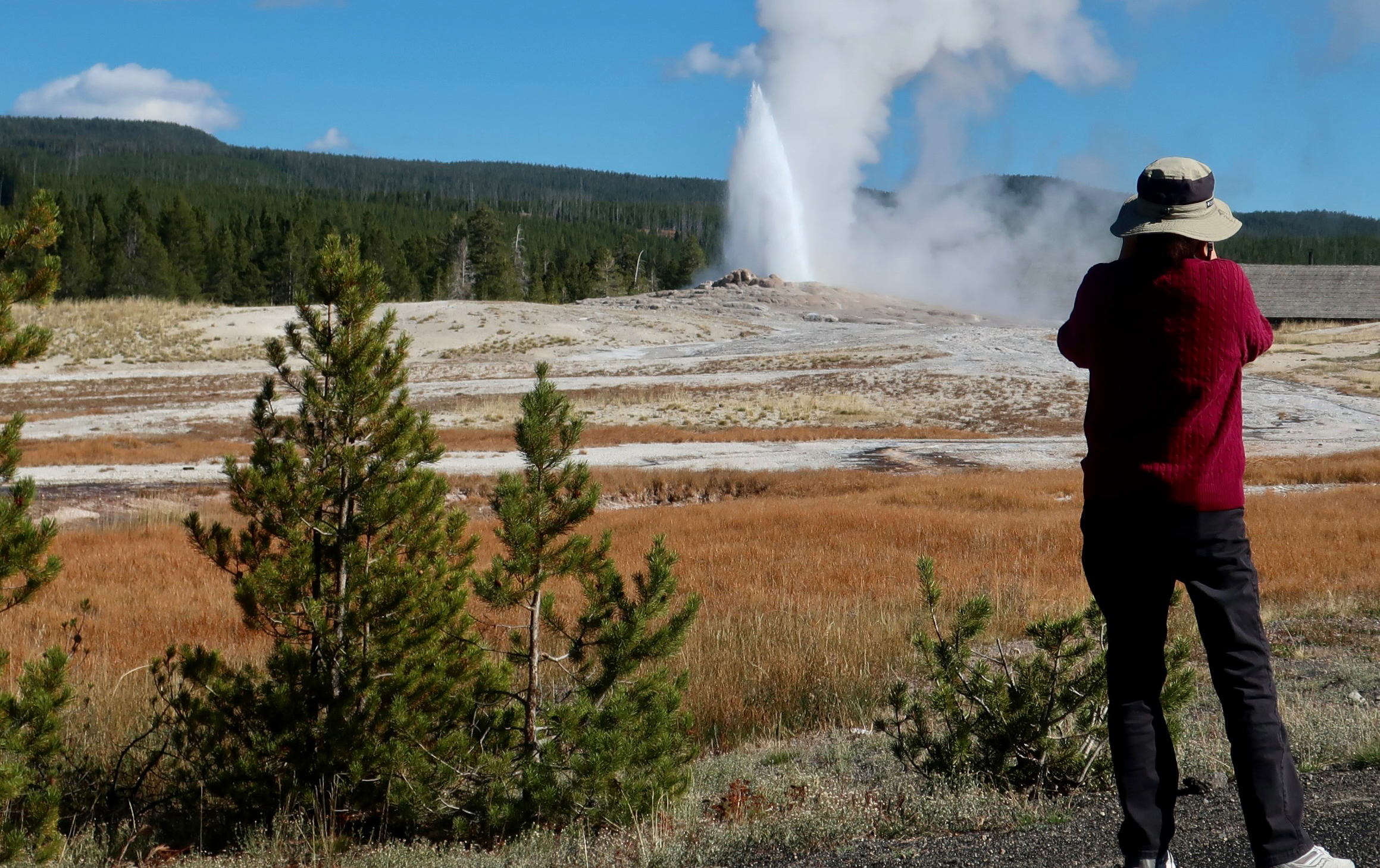
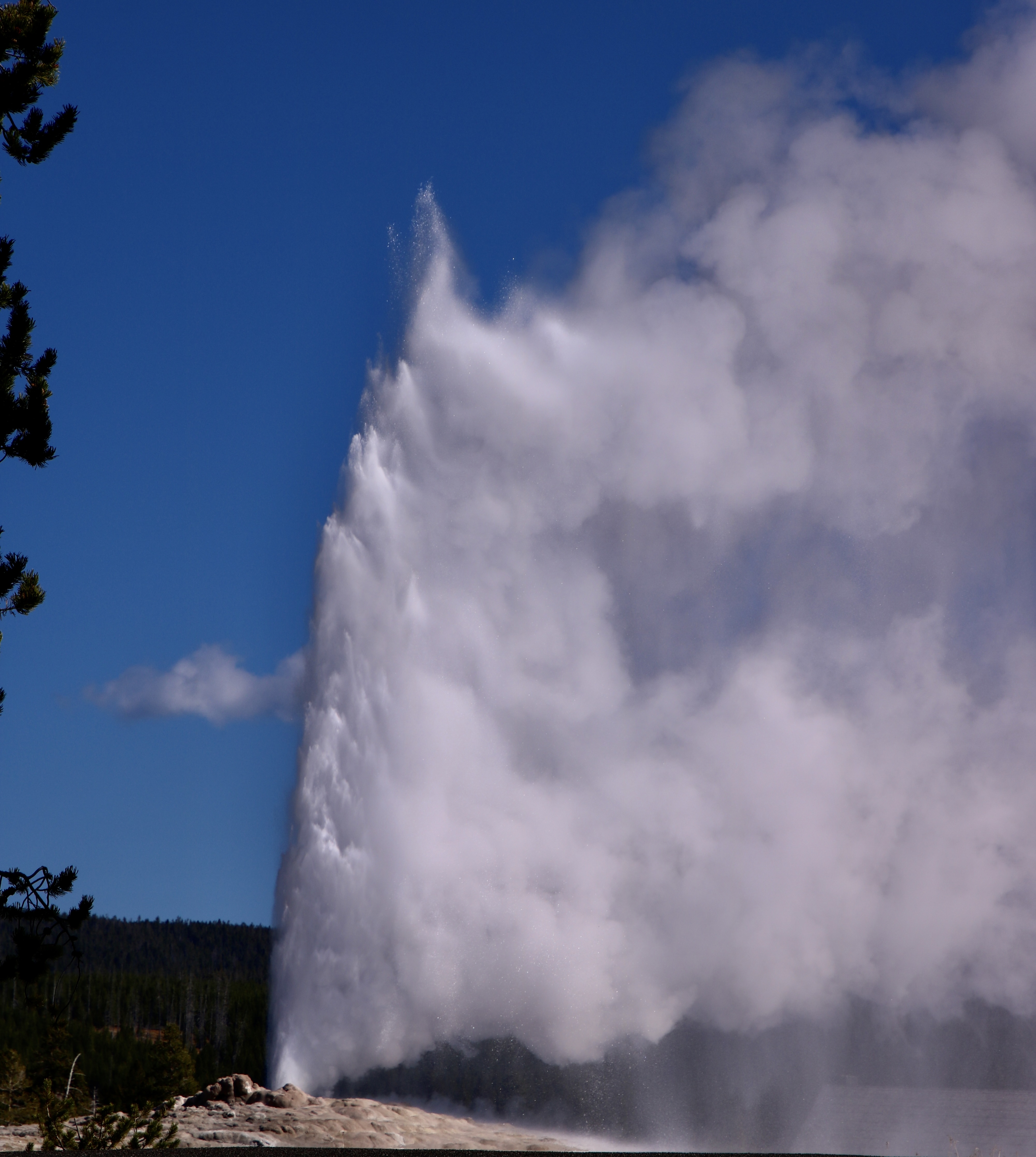
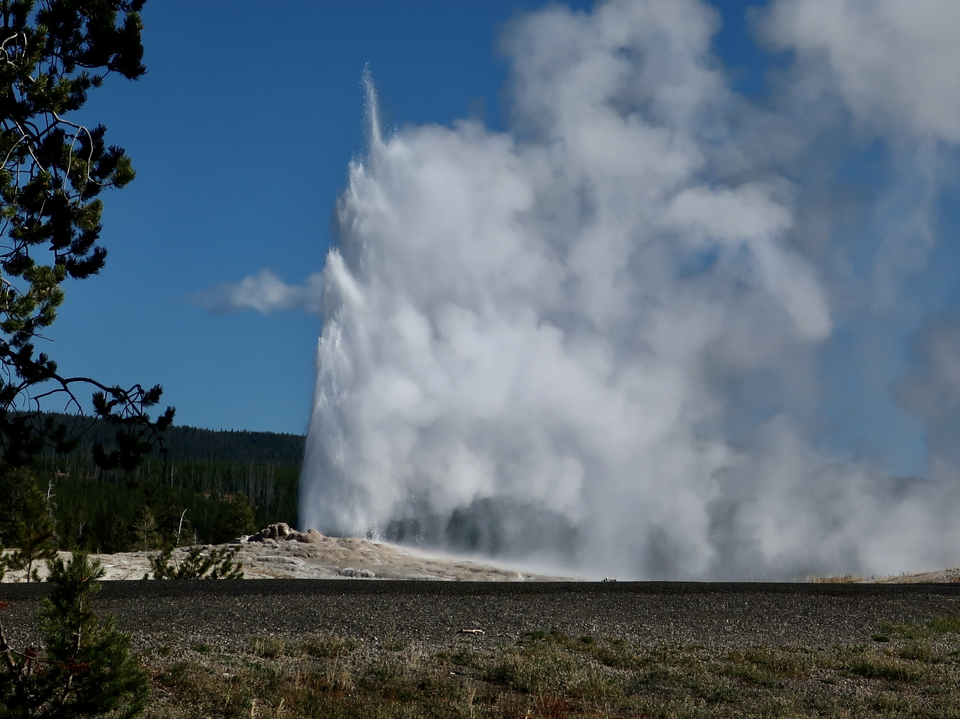
It’s only right that I start this post featuring Peggy photographing Old Faithful. She worked at a restaurant in Yellowstone in the summer of 1969 as a college student. Its large picture windows opened out on Old Faithful, meaning that she got to see it erupt several times a day.The family dining room that Peggy worked at has now become a cafeteria, but it’s large picture windows still give diners a great view of Old Faithful erupting.
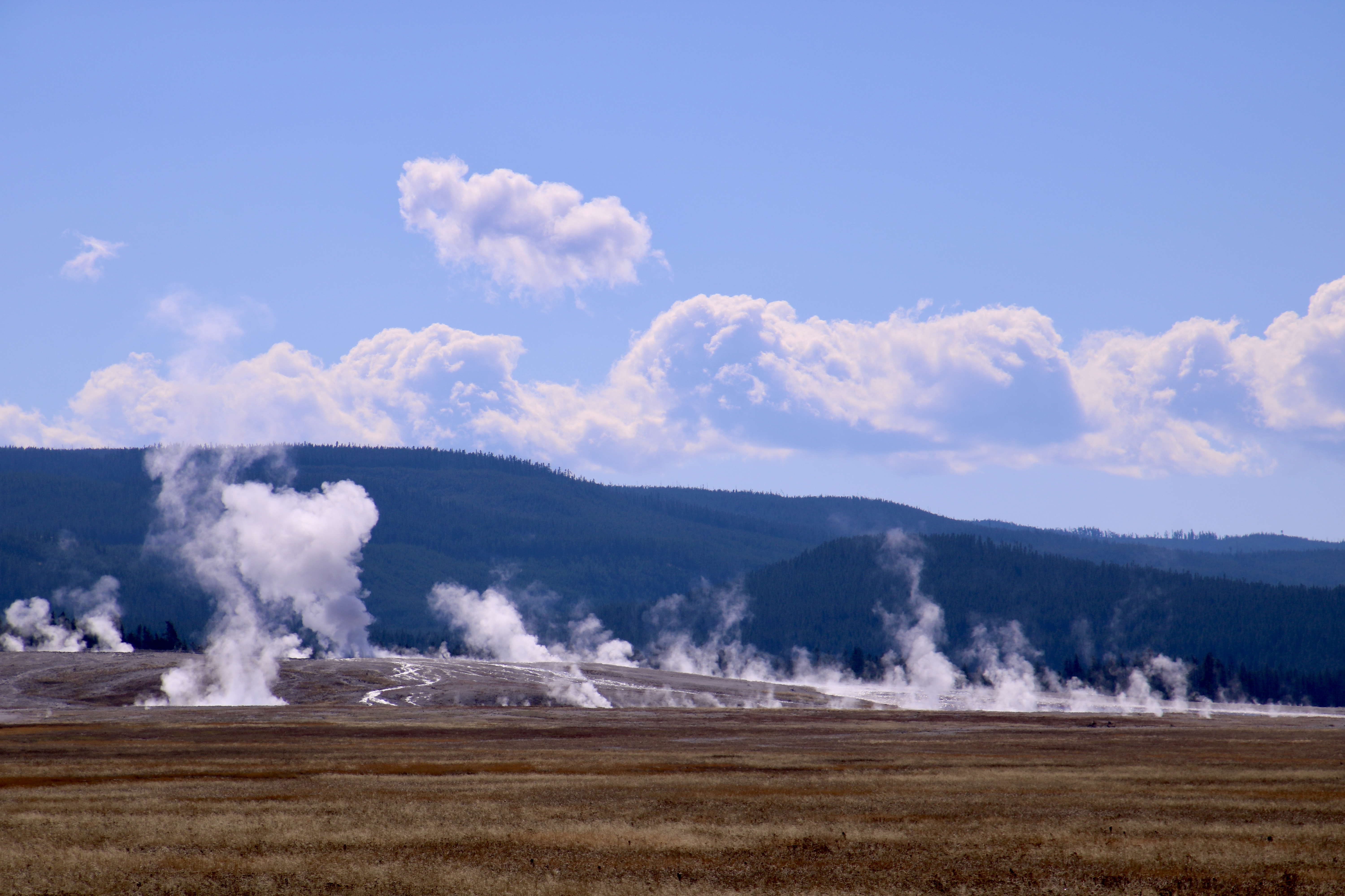
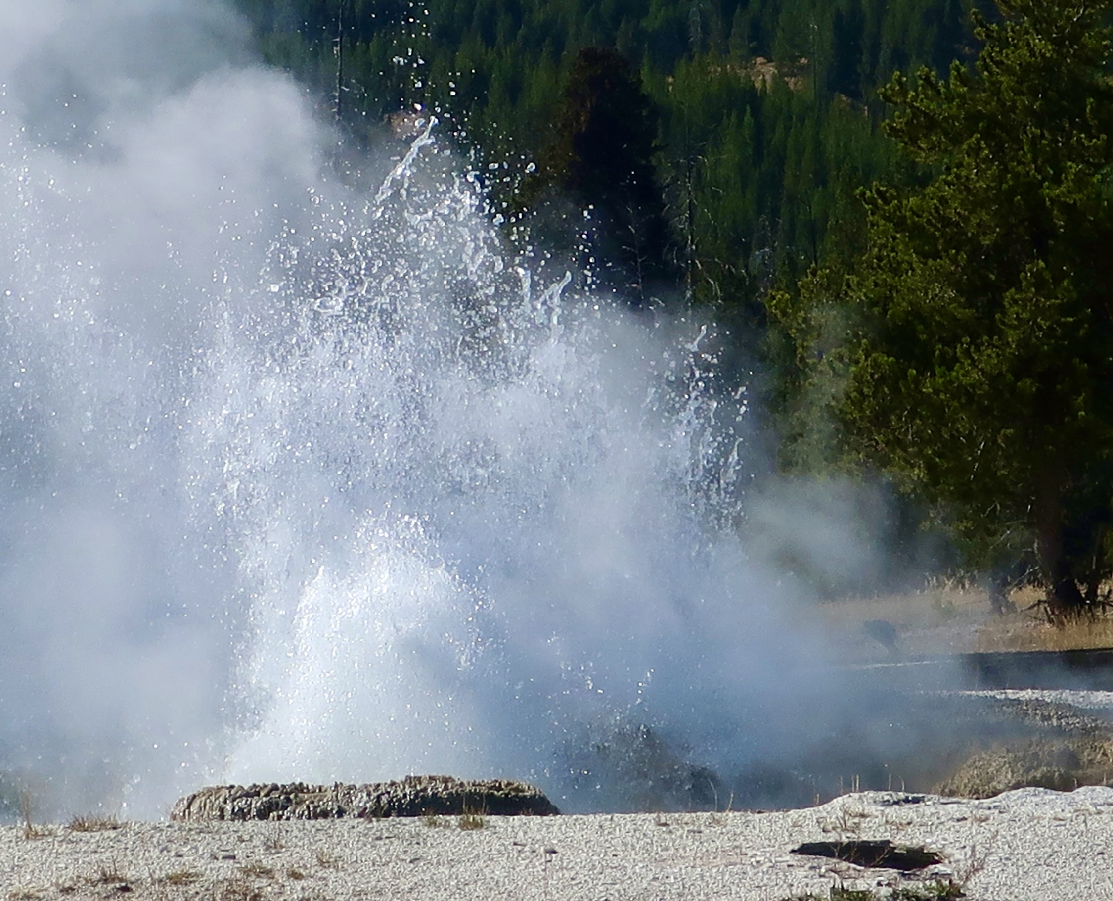
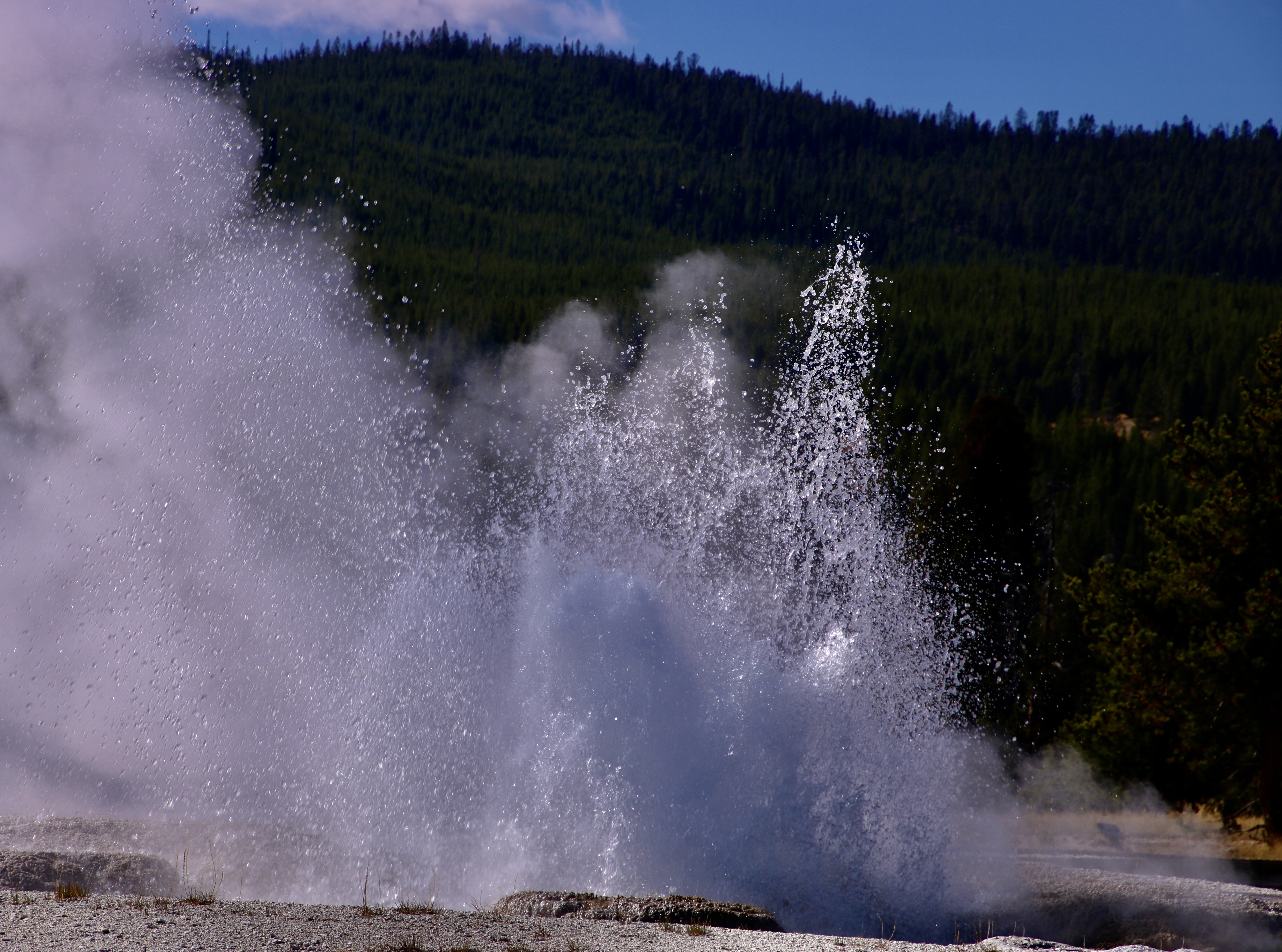
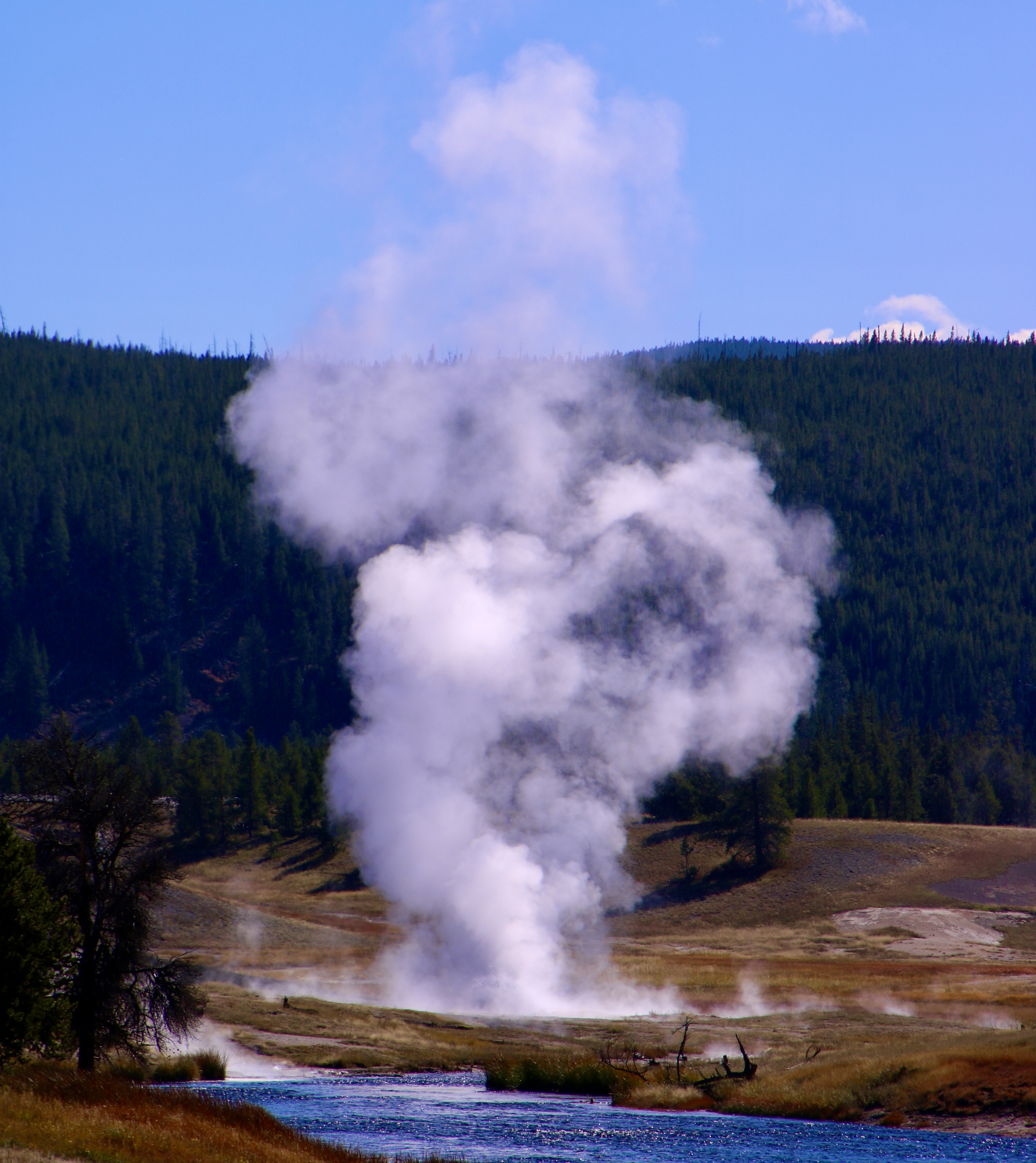
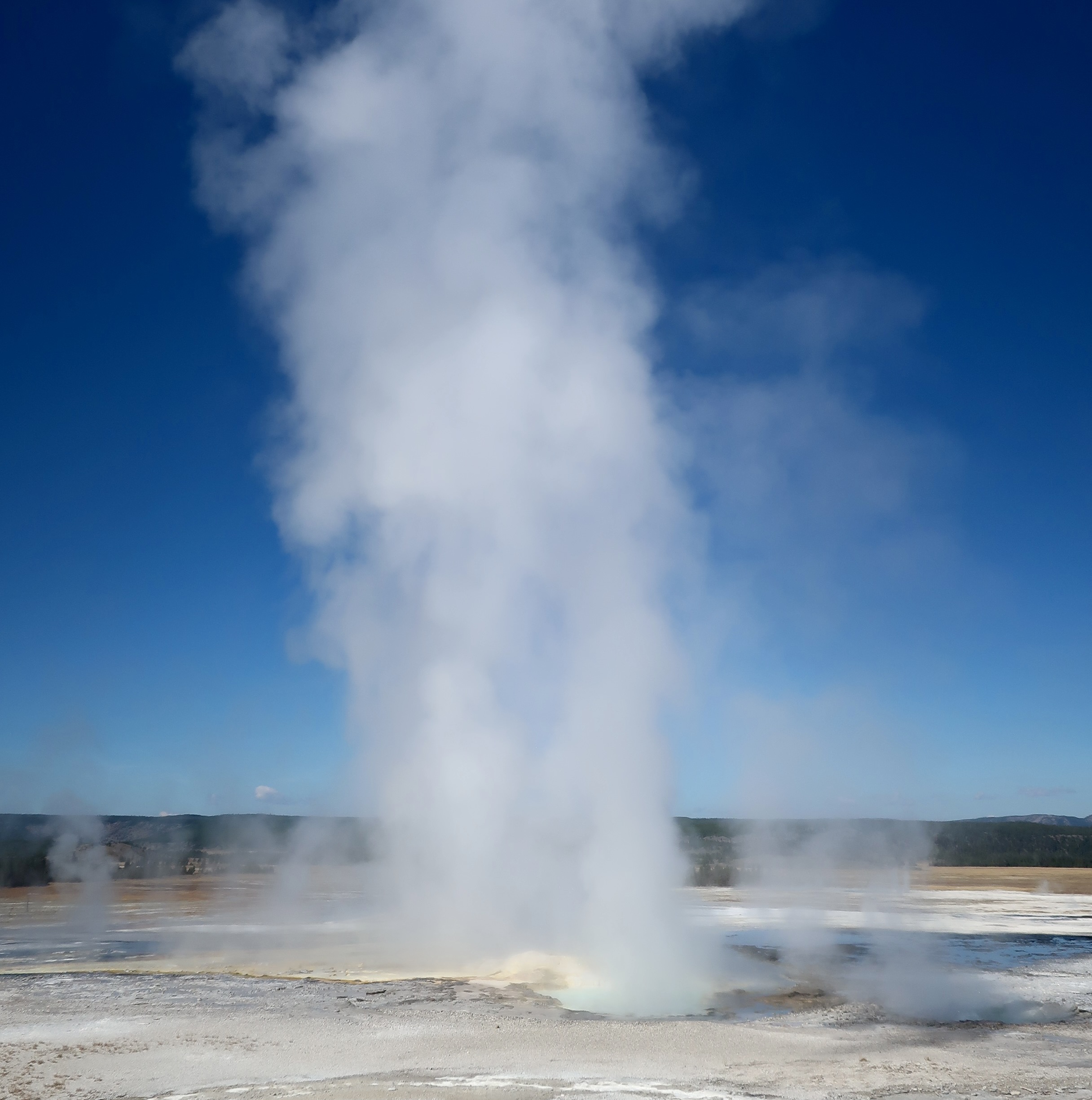
Erupting geysers are one of Yellowstones best known features. In fact, half of the world’s active geysers are located in the National Park. Peggy and I photographed lots of them when we visited last fall on our four month trip around the US.
Have a few geysers and fumaroles! Including the small ones, I counted over 30 in this photo.
The reason behind Yellowstones record breaking number of geysers is that much of the park is located in a giant caldera, a collapsed volcano. Semi-molten rock exists in some areas as close as 2-5 miles below the surface. This extremely hot rock heats ground water flowing near it and creates Yellowstone’s hydro-thermal features including geysers, hot springs, fumaroles and mud pots. We featured hot springs two weeks ago. Today is the geysers’ turn. They erupt when the super hot boiling water creates pressure in channels leading to the surface that erupts as steam out of a vent. As the pressure is released the geyser subsides until the process is repeated. They come in all sizes. The most famous is Old Faithful, given its name due to the regularity of its eruptions.
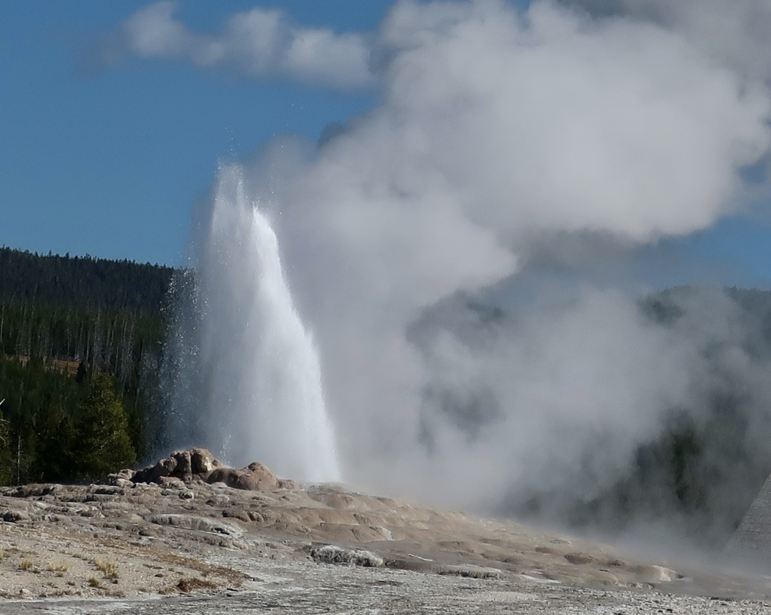
Peggy and I arrived just as Old Faithful was beginning to erupt. She jumped out of our truck and began snapping photos.I was a bit farther away. Can you imagine how many photos of Old Faithful have been taken? They have to be in the hundreds of millions if not billions. In other words, we aren’t the first. Grin.As the pressure inside the vent subsided, Old Faithful lost its steam, so to speak.As I mentioned in the beginning, the geysers come in all sizes. From this little fellow…To larger…We had a sense of ‘dancing water.’Each geyser had its own personality.These geysers combined to be tall and skinny.I conclude today with this pair of more hefty twin geysers. Next up, Peggy and I will return to Heidelberg, variety being the spice of life. 🙂
The Irish would be jealous of the beautiful green hot spring found in Yellowstone National Park— and, the clarity of the water. It almost wants to make you shed your clothes and jump in. Bad idea. The water emerges from its volcano based heater at 198° F (92° C).
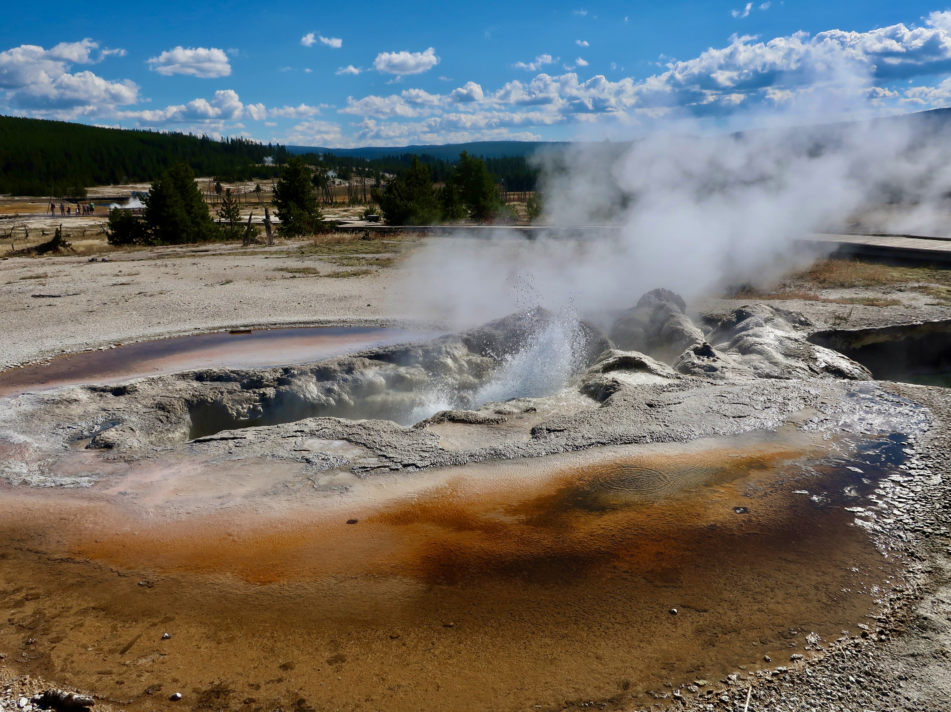
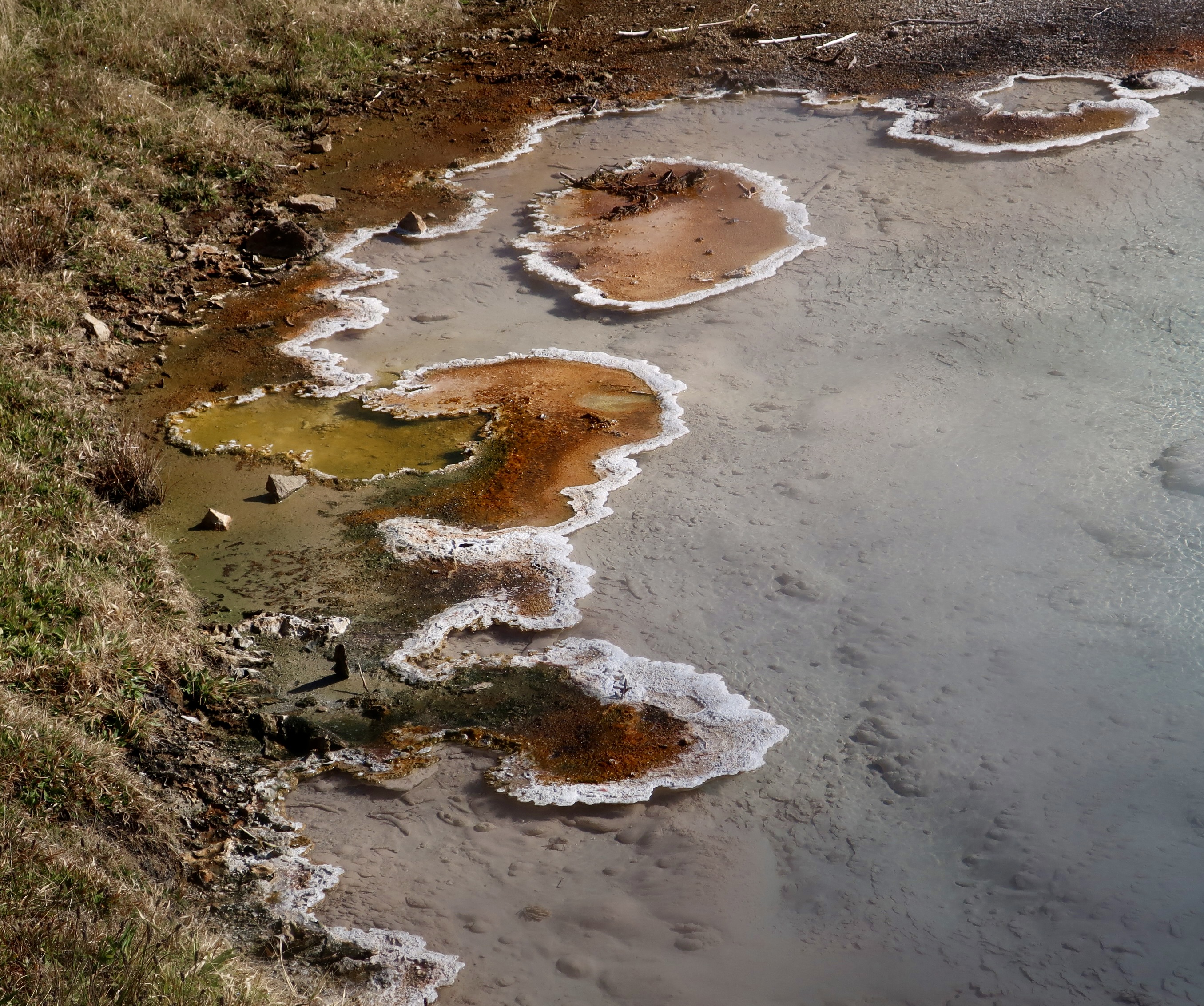
Beautiful scenery, abundant wildlife, and incredible geology. Yellowstone has it all. There is a reason why it became America’s first National Park in 1872. I’ll be focusing on the geology today. Yellowstone sits on top of one of the world’s largest volcanoes. Believe me, when I say, we wouldn’t want to see it blow. The proximity of the lava to the surface is the reason behind all of its hydrothermal features. For one, Yellowstone has more active geysers than the rest of the world combined according to information in the Visitor Center. The geysers are slated for another post; today it is all about hot springs. Peggy and I were captured by their vibrant colors and unique structures. The photos in this post were taken by both of us. We visited this past fall when we were in the middle of our 12,000 mile tour. It was my third visit. Peggy once spent an idyllic summer working there when she was going to college.
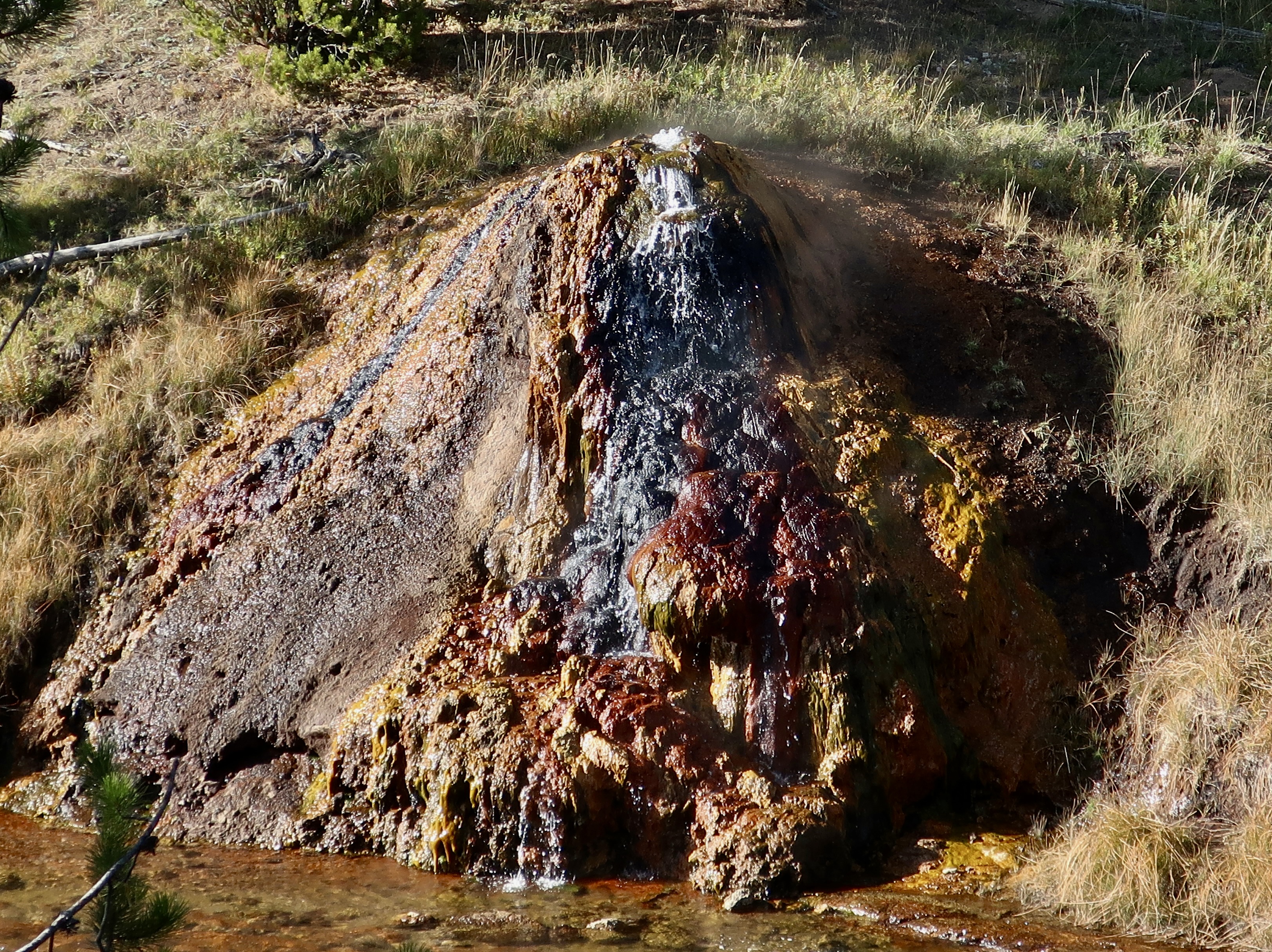
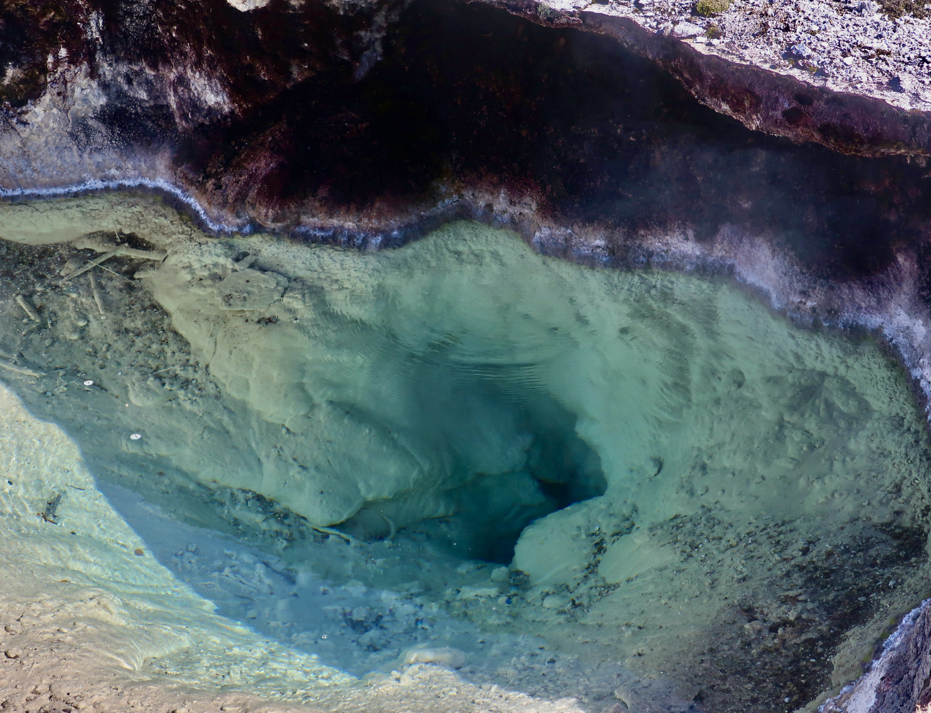
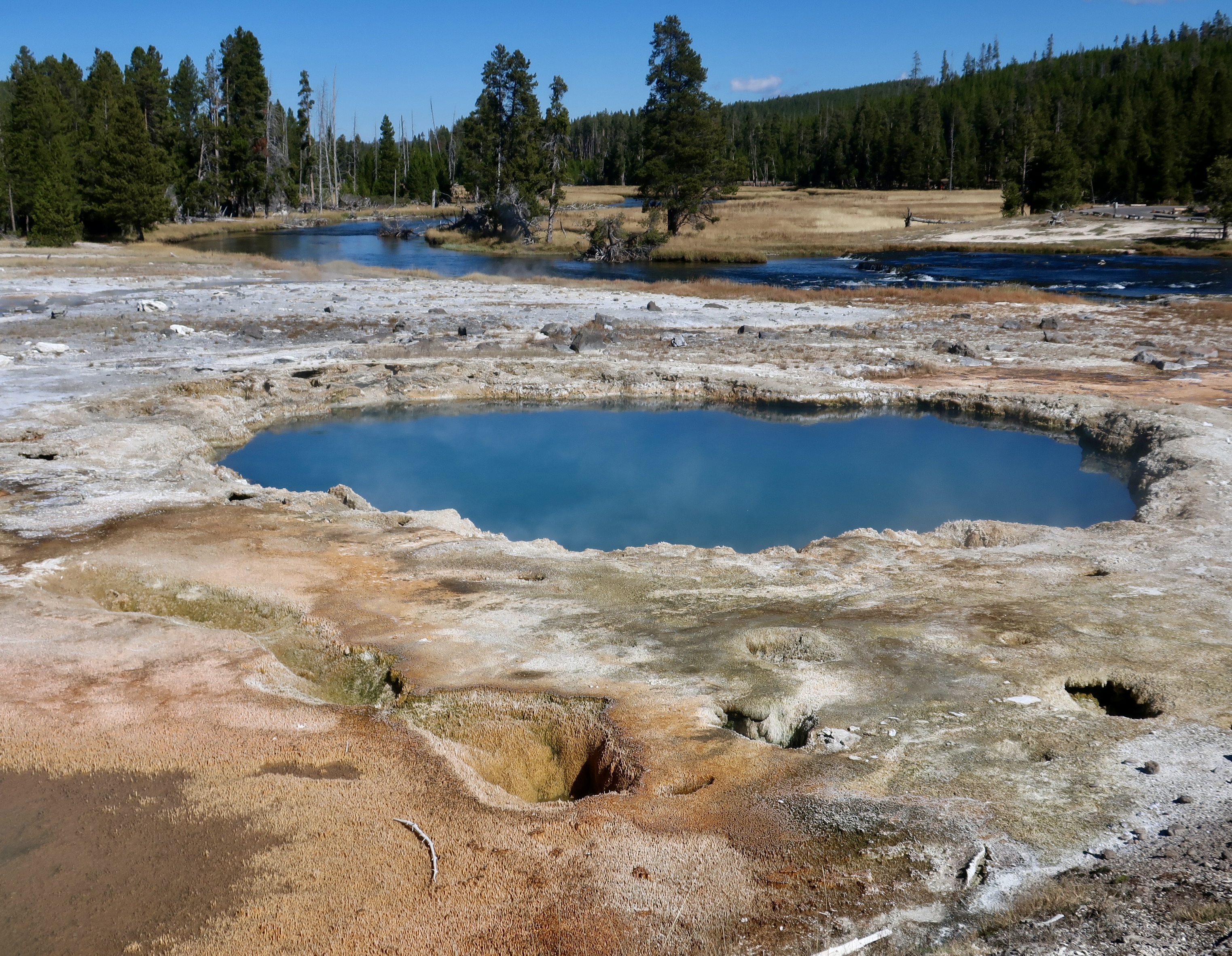
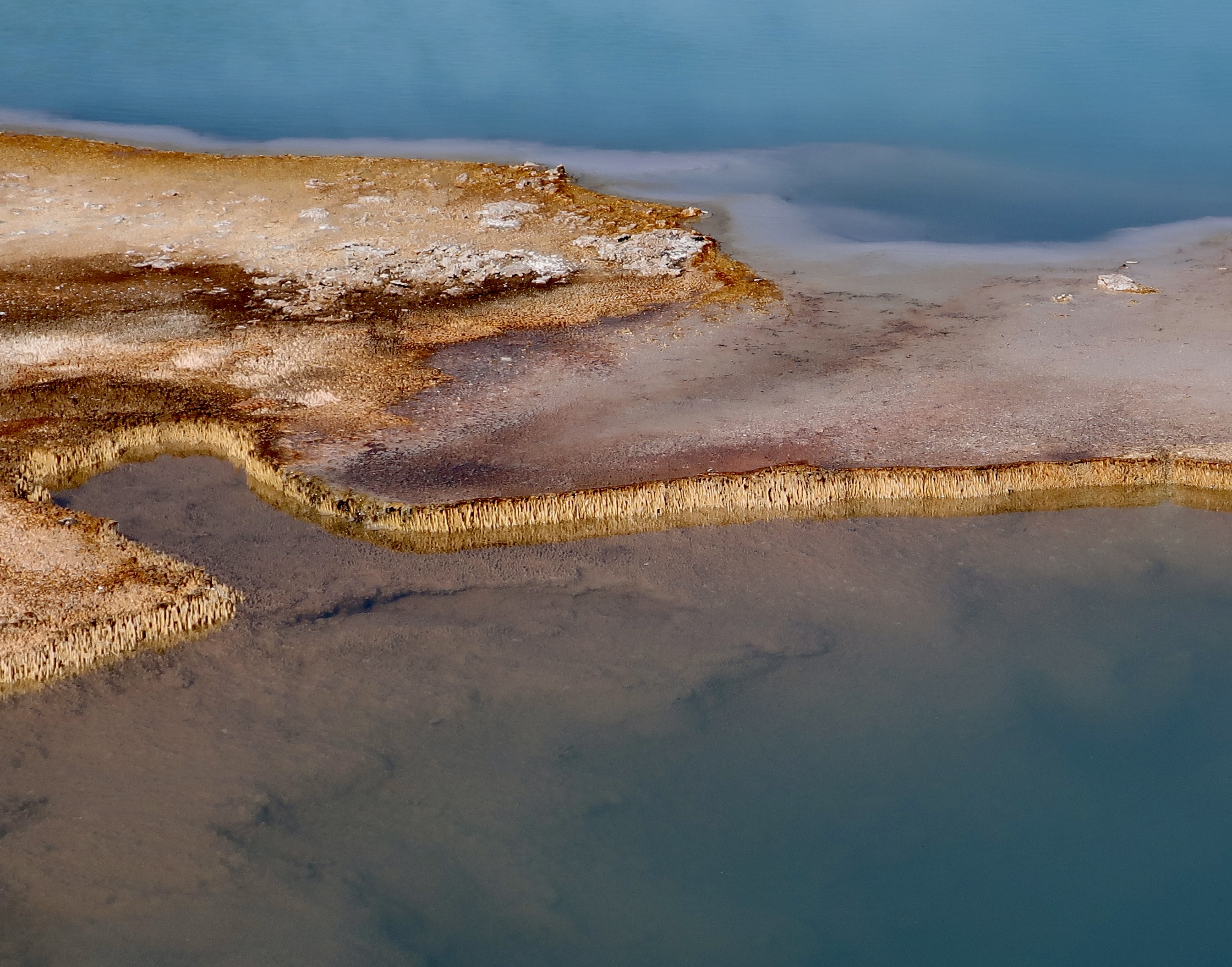
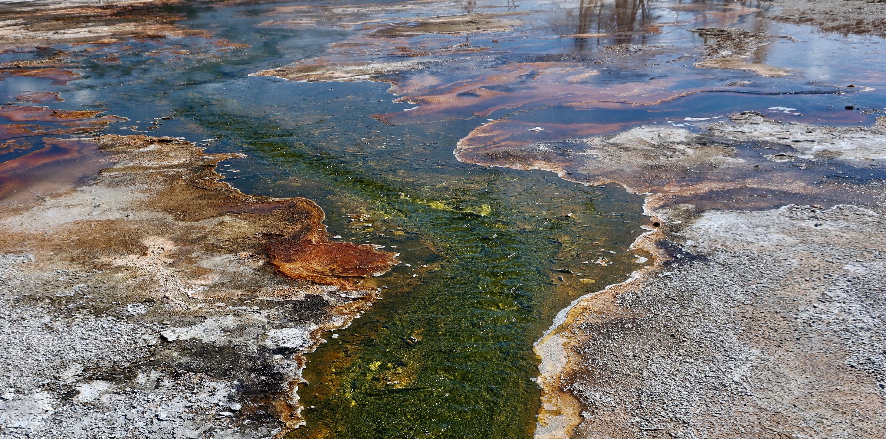
This is one of the hot spring structures that we found both intriguing and fun. This hot spring provided a view into the depths from which the hot water emerges. BTW, the hydrothermal features of Yellowstone provide home for trillions of microbes, some of which may date back to the very beginning of life on earth. Scientist have identified approximately two percent of the different kinds.A small geyser added action to the color and structure of this hot spring.This small, golden brown geyser looked like it was boiling. The steam had the tell-tale smell of sulphur which is typical of the hot springs and geysers.This hot spring was empty for the moment. It would soon change as its geyser erupted. The stream is part of the appropriately named Fire Hole River that water from the hot springs and geysers flows into. The Fire Hole River provides the backdrop for this hot spring. Also, note the indentation in the foreground.It was a wee bit weird.This hot spring showed a similar type of structure along its edges. Note the murky depth.The depths of this large hot spring were much clearer.As the water flows out from the hot springs into the Fire Hole River, it creates its own unique colors and structures.The green stream flowing along. Not surprising, green was only one of the colors flowing out from the hot springs.For example, this golden/yellow/orange stream.A different perspective as the golden trickle empties into a larger stream.Here, the color of the hot springs stream had a rich brownish tinge to it.A brown, braided stream. I admit, my fascination here was with the dead stump.The mineral laden water from the hot springs created this rock waterfall.And these ‘islands’ on the edge of the Fire Hole River.I’ll conclude today with this colorful display created by Yellowstone’s hot spring/geyser magic.